7 minute read
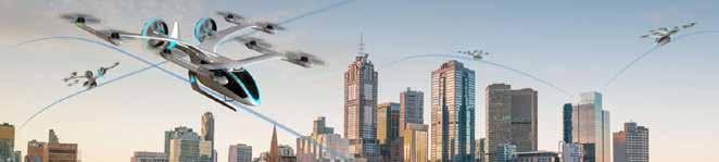
Drones, UTM and spectrum

With the objectives of safety, simplicity and adaptability, the integration of UTM into ATM will be a playoff between the tools of Separation and Integration.
Why separation is important
Advertisement
As it stands, separation covers both the components of flight and environment.
• Flight classes – applies the principles of height, envelope and safe distance. For more information on South African flight classes, see Section 4:
Understanding the Airspace Implications • Environment – is classified in terms of Technical
Capability Levels (TCLs) and, in a nutshell, are distinguished as follows: – TCL1 – scheduling and geo-fencing – TCL2 – BVLOS, integration of crewed aircraft – TCL3 – drone sense and avoid, vehicle-to-vehicle communications, drone control interfacing (managing operations, communication, navigation, surveillance, human factor, data exchange, network solutions) + BVLOS, human and technology interface – TCL4 – drones integrated into urban areas
Technical Capability Levels Required Relative to Population Density Risk
TCL 1
Remote Population
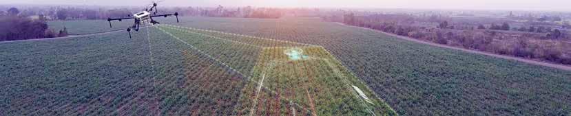
Low Traffic Density Rural applications Agriculture, monitoring Multiple VLOS TCL 2
Sparse Population
Moderate – Low Traffic Density Rural/Industrial Applications Tracking & Operational Process TCL 3
Medium Population
Moderate Traffic Density Sub-Urban Applications Public Safety Operation Manned/Unmanned BVLOS Package Delivery TCL 4
Dense Population
High Traffic Density Urban Applications Large scale management Dense Urban BVLOS Autonomous, connected V2
Increase in Population Density
Source:Rakesh Shrestha, Inseon Oh, and Shiho Kim (2021) ‘A Survey on Operation Concept, Advancements, and Challenging Issues of Urban Air Traffic Management’.
This graphic illustrates that Technical Capability Levels can be combined to devise a Risk Calculation Matrix, thereby opening opportunities for regulatory authorities to earmark future drone hubs, corridors and UTM spaces.
Why integration is important
One of the most critical elements of UTM will be the integration of the different technologies, capabilities, hardware and software. This will be influenced by the adaptability, especially in relation to connectivity and data sharing.
Adaptability
Enabled by technology allowing for connectivity, communication, data sharing, and virtualisation/digital twin, and covers both ground and air operations.
Connectivity
Cockpit evolution
• Multilink management • Broadband satellite comm. (ESA-Iris) • Broadband airport comm. (Aeromacs) • Broadband ground comm. (LDACS) • Cellular link for GA/RC
U-space
• Command & control • Tracking & telemetry • Vehicle-to-vehicle • Vehicle-to-infrastructure Command & control
Tracking & telemetry
Vehicle-to-vehicle
Vehicle-toinfrastructure
Simplicity
Enabled by digitisation allowing for automation will affect all interfaces – self, inter-air and inter-ground.
Automation
Is multi-dimensional, covering man, machine and environment and can be classified accordingly:
• Man vs Machine – no automation, partial automation, conditional automation, high automation, full automation • Machine vs Environment – evolving from simple to more complex scenarios
Vehicle-to-vehicle
Vehicle-to-service
Service-to-service
Detect and Avoid (DAA); Remotely Guided, Real Time Health/Diagnosis, Adapt to Failures & Flight Conditions, Select path, Decide to turn around.
Requiring data quality (e.g. on accuracy, resolution, integrity, timeliness, completeness, traceability, format) of the system which need to be compatible and interoperable.
Forecasting and dissemination of localised weather patterns that may impact low altitude UA operations (e.g. urban canyon phenomenon, windshear, diurnal effects caused by urban structures, etc.).
Group – coordination, mission/tactical re-planning, mission/tactical goals, distributed control, group strategic goals
Swarms – fully autonomous swarms
Aircraft participating in the UTM system must be separated physically, but integrated technically, utilising digital communication technologies dealing with data and information. Regulation will be challenged by technology and many new and diverse opportunities for software and electronic engineering will develop as a result.
Increasingly, regulation will be challenged by increasing numbers of drone flights requiring decreased acceptable risk levels by providing safety guidance, but lacking amnesty through technological means.
The technology ecosystem
The technological disciplines of physics, coding, aerospace, programming, automation and robotics enable and drive drone capabilities such as VTOL, BVLOS and autonomous operations driving the development of UTM to accommodate joint drone and crewed operations. Drone technology is challenging the technology ecosystem. As Ken Treloar, General Manager, Aerobotics, has observed, in the current technology matrix, “hardware is not keeping up with the software” at this point in time.
These technological enablers typically serve critical controlling parameters in the UTM space, and will be classified and discussed as follows:
Collision Avoidance
Mission Scheduling
Remaining “well – clear”
• Abrupt evasive manoeuvre after previous levels fail Air Space, e.g. vehicle-to-service
• Flight plan to flight deconfliction • Geofencing • Airspace design • ATM deconfliction
• Ensures separation • Differs between hazards: persons, animals,
UAVs, structures, crewed aircraft Terrestrial, e.g. service-to-service
Platforms, e.g. vehicle-to-vehicle Traffic
Management
UAS
Platform/UAS/drone inherent technologies
The components comprising the landscape of inherent platform/drone technologies are as follows:
Design
Human-machine systems deal with the allocation of functions and tasks informing automation.
Human performance factors of system design take into consideration the decision-making processes relying on high speed information exchange.
Manufacturing and design considerations are seeking low-cost fabrication, such as reducing vehicle size and modular design and construction and low-cost product realisation, including new approaches to product design and low-cost manufacturing processes involving advanced composite and multifunctional materials and 3D printing. Drones may also be manufactured to fit regulation classes and requirements.
Body/airframe - aerodynamics, airframe materials and structures
Each class of UAVs is driven by aerodynamic considerations that are either unique or very important for the future development of the specific class and will consider the following:
• The design environment in which future UAVs will operate – load definition, reliability requirements, and aero elasticity. • On-board health monitoring, health management, fault detection and isolation (FDI) systems.
Power supply (energy)/fuel system
Without the ability to keep drones in the skies longer, areas such as last mile delivery become challenging. This is enabled by rapidly developing lithium-polymer battery technology, gallium arsenide (GaAs) solar cell, hydrogen fuel cells, hybrid, radioisotope thermoelectric generator and in-flight charging allowing for increased endurance and payload.
Propulsion - propeller, turbine/jet, ramjet, rocket
The focus is on low-cost, high-temperature materials and coatings, cooling schemes to reduce the need for costly air-cooled parts, bearing and lubrication systems and small, low-cost accessories (e.g. fuel pumps, engine controls, and electrical generators).
Actuators
Actuators will open a large range of new services and use cases such as cleaning solar panels, extinguishing fires or dropping seeds in forestry activities.
Software
The drone software comprises of firmware, middleware and an operating system that manages flight control, navigation, and decision-making, dealing with requirements of autopilot, autonomous, improved computer vision, motion planning and algorithms to avoid obstacles and planned network configuration. Cloud processing and AI enable intelligent UAV swarms.
Sensors
There are internal and external sensors. Internal sensors address the appropriate functioning of UAV, navigational capabilities and collision detection. External sensors/remote sensing provide accurate data about the environment, such as RGB, Lidar, multispectral cameras, and gas sensors.
Opportunities for robotics, software and electronic engineering are inherent and widespread.
Air space/traffic ancillary technologies

Air space technology is mostly communication-driven and the key enablers of registration and identification, communications and geo-awareness/geo-fencing, • Interface between UTM and ATM – technology architecture to ensure the real-time sharing of information, the interoperability of the two systems, and to identify roles, responsibilities and limitations. • Data recording – to support accident/incident reporting and investigative requirements. • Communications – with the UTM system, ATC and pilots of crewed aircraft, sharing registration and identification systems. • Alerting systems – securing the safety and integrity of the UTM system. • Contingency management protocols – operating protocols that account for contingencies. • Safety, efficiency and cybersecurity.
Spectrum
The International Telecommunication Union (ITU) plays a decisive role in allocating protected frequency spectrum to UAS operations, which may be necessary for safety-critical functions.
Spectrum is an essential input to and enabler of the drone industry, providing positioning through Galileo, GLONASS, SBAS, GNSS, GPS, wireless/ cellular communications and other satellitebased systems making available licensed and license-exempt spectrum bands. The selection of the frequency spectrum is subject to availability, suitability and security.
The communication bands must allow for detect and avoid capability, vehicle control and traffic management supporting strategic deconfliction services, tactical separation, conflict advisory and alert service, dynamic reroute service and geo-awareness/geofencing-like systems, and on-board diagnostics.
Concerns regarding frequency availability and suitability will need to be addressed and closely coordinated with ITU and the Independent Communications Authority of South Africa (ICASA).
Remote real-time identification and tracking
The ability to identify and track an uncrewed aircraft flying in the airspace is a critical requirement while enabling high-density, complex uncrewed aircraft operations.
Real-time Identification and Tracking (RIT) of the uncrewed aircraft would enable sharing of the identity