7 minute read
ABC in KMC: Rautendelein


One of the best aspects of living in the Kaiserslautern Military Community is that it is located right in the heart of the Palatinate Forest, or Pfälzerwald. The forest is a beautiful, expansive and diverse wooden landscape and is one of the largest contiguous forests in Germany. It is a part of the larger UNESCO Palatinate Forest-North Vosges Biosphere Reserve which extends into France. With an area of roughly 1,771 square kilometers (682 square miles) it stretches from Neustadt/Weinstrasse and Kaiserslautern in the north, to the French border in the south and slowly slopes off in the Vosges. It is also home to a rich variety of flora and fauna and an eldorado for wanderers and hikers. The Palatinate Forest offers a vast network of official hiking routes and there are over 12,000 kilometers of marked trails. They range from easy walks to challenging hikes while exploring landscapes with picturesque villages, rocky formations and dense forests. Some of the most popular routes are the Dahner Felsenpfad with miraculous rocky formations and the Annweiler Castle Trail that leads hikers through history and to the castle where English king Richard the Lionhearted was held captive. Easy hikes might lead nature enthusiasts to Donnersberg with Celtic relics or to Mehlinger Heide, both with panoramic views over the countryside. A walk in “outer space” is another option along the Planetenweg (planet walk) that leads up to a giant sundial at Reiserberg near Otterberg.Two events which offer family fun, dining Palatinate specialties enroute and fantastic vistas along the way annually takes place as the “Kulinarische Pa-no-ra-ma-wan-de-rung” in Oberes Glantal and upcoming “Alte Welt Schlem-mer-wan-der-ung” from Heim-kirchen/Ot-ter-berg on June 15. Further exciting events and routes can be found at: https://www.tourenplaner-rheinland-pfalz.de/en/list/germany-s-most-beautiful-hiking-trails-in-rhineland-palatinateA mysterious hike This week we would like to take you on a special journey full of mystery and tragedy. The Elendsklamm (Gorge of Misery) lies in the forest between Bruchmühlbach and Martinshöhe. Despite its rather uninviting name the ravine with its ancient trees, waterfalls and stone formations is actually a fairly picturesque place for anyone seeking a detox in nature.[caption id="attachment_105816" align="alignright" width="450"] Many discoveries to be made during a stroll!. Photos by Jannik Ehlert[/caption]The various hiking paths are well maintained and guide local travelers to the prettiest – and most instagramable – parts of the ravine. One of the awesome sights is a large boulder with a deep engraving reading “Rautendelein.” Rautendelein is a mystic creature of German folklore. In a famous poem by Gerhart Hauptmann, a noble prize winner in literature, Rautendelein is a fey creature which falls in love with a bell caster named Heinrich. Heinrichs’ best sounding bell is accidentally dropped in the local lake. Full of sorrow about the loss of his prized creation he meets the fairy Rautendelein and falls in love with her. Heinrich, who is rather inconveniently already married with kids, abandons his family to live with the fairy. His wife drowns herself and her children out of despair and her vengeful spirit starts ringing the bell resting at the bottom of the lake. Heinrich, driven mad by the continuous ringing and his guilt then dies in Rautendelein’s arms. No one knows for sure why the name of the fairy is engraved in the boulder. One legend has it that an allied soldier carved the name into the rock during the world war to be used a navigation point. Escaped prisoners of war and downed pilots could use the rock as a landmark to find their way back to the frontline undetected. Others add that the term RAUT END ELEIN was chosen as it reads somewhat similar to “route end ally,” but would not draw unwanted attention as a plain English engraving would have. The less fanciful, but also less interesting, explanation is that the name was simply engraved by a local romantic who believed the gorge resembled a typical fairytale woodland.In any case, the inscription remains a mystery, but it might inspire you to hike the mysterious trail and come to your own conclusion. Happy hiking wherever the path may lead you!
One of the best aspects of living in the Kaiserslautern Military Community is that it is located right in the heart of the Palatinate Forest, or Pfälzerwald. The forest is a beautiful, expansive and diverse wooden landscape and is one of the largest contiguous forests in Germany. It is a part of the larger UNESCO Palatinate Forest-North Vosges Biosphere Reserve which extends into France.

With an area of roughly 1,771 square kilometers (682 square miles) it stretches from Neustadt/Weinstrasse and Kaiserslautern in the north, to the French border in the south and slowly slopes off in the Vosges. It is also home to a rich variety of flora and fauna and an eldorado for wanderers and hikers.
The Palatinate Forest offers a vast network of official hiking routes and there are over 12,000 kilometers of marked trails. They range from easy walks to challenging hikes while exploring landscapes with picturesque villages, rocky formations and dense forests.
Some of the most popular routes are the Dahner Felsenpfad with miraculous rocky formations and the Annweiler Castle Trail that leads hikers through history and to the castle where English king Richard the Lionhearted was held captive.

Easy hikes might lead nature enthusiasts to Donnersberg with Celtic relics or to Mehlinger Heide, both with panoramic views over the countryside. A walk in “outer space” is another option along the Planetenweg (planet walk) that leads up to a giant sundial at Reiserberg near Otterberg.
Two events which offer family fun, dining Palatinate specialties enroute and fantastic vistas along the way annually takes place as the “Kulinarische Pa-no-ra-ma-wan-de-rung” in Oberes Glantal and upcoming “Alte Welt Schlem-mer-wan-der-ung” from Heim-kirchen/Ot-ter-berg on June 15. Further exciting events and routes can be found at: https://www.tourenplaner-rheinland-pfalz.de/en/list/germany-s-most-beautiful-hiking-trails-in-rhineland-palatinate

A mysterious hike
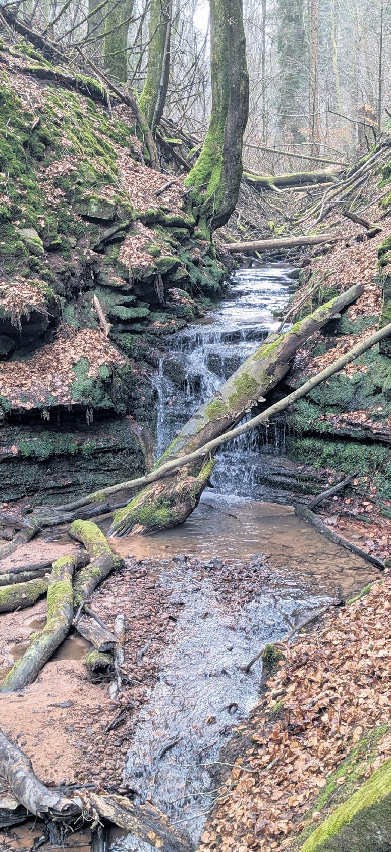
This week we would like to take you on a special journey full of mystery and tragedy. The Elendsklamm (Gorge of Misery) lies in the forest between Bruchmühlbach and Martinshöhe. Despite its rather uninviting name the ravine with its ancient trees, waterfalls and stone formations is actually a fairly picturesque place for anyone seeking a detox in nature.
The various hiking paths are well maintained and guide local travelers to the prettiest – and most instagramable – parts of the ravine. One of the awesome sights is a large boulder with a deep engraving reading “Rautendelein.”

Rautendelein is a mystic creature of German folklore. In a famous poem by Gerhart Hauptmann, a noble prize winner in literature, Rautendelein is a fey creature which falls in love with a bell caster named Heinrich. Heinrichs’ best sounding bell is accidentally dropped in the local lake. Full of sorrow about the loss of his prized creation he meets the fairy Rautendelein and falls in love with her. Heinrich, who is rather inconveniently already married with kids, abandons his family to live with the fairy. His wife drowns herself and her children out of despair and her vengeful spirit starts ringing the bell resting at the bottom of the lake. Heinrich, driven mad by the continuous ringing and his guilt then dies in Rautendelein’s arms.
No one knows for sure why the name of the fairy is engraved in the boulder. One legend has it that an allied soldier carved the name into the rock during the world war to be used a navigation point. Escaped prisoners of war and downed pilots could use the rock as a landmark to find their way back to the frontline undetected.
Others add that the term RAUT END ELEIN was chosen as it reads somewhat similar to “route end ally,” but would not draw unwanted attention as a plain English engraving would have. The less fanciful, but also less interesting, explanation is that the name was simply engraved by a local romantic who believed the gorge resembled a typical fairytale woodland.
In any case, the inscription remains a mystery, but it might inspire you to hike the mysterious trail and come to your own conclusion. Happy hiking wherever the path may lead you!