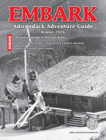
EMBARK Adirondack Adventure Guide
INSIDE
Winter 2026 ¯ Avalanche danger in the High Peaks ¯ Exploring the largest drop of any Eastern ski area ¯ Habitat connections matter
©2026 ADIRONDACK PUBLISHING CO.
Mountain Adventure Center
backcountry ski guide service alpine tour demos yoga fat bike ice fish climb
ADVENTURE telemark snowshoe
hike lodging ice climb
rentals
backpack
shuttles
nordic skimassage
WINTER & SKIING HEADQUARTERS!
Your destination for outdoor gear and information Ice Climbing • XC Skiing • Ski Touring Snowshoeing • Hiking • Fat Biking
BINDINGS
EMBARK • WINTER 2026 - 1
Embarking on winter
There’s plenty to do in the snow...
w w w. N E W C O M B N Y. g o v
Hiking Henry’s Woods.
(Provided photo — LakePlacid.com/ROOST )
T
here is already a pretty decent amount of snow on the ground, so if you’re into the winter weather, it’s a great time to get up and get out! There’s always something to do in the Adirondacks, especially when it comes to outdoor activities. In this edition of EMBARK, we hope to give you some fun ideas or maybe even teach you about some new information you didn’t know. This season, we have stories about some fun places to hike and even some photos from the past. Or if you’re interested in doing some sort of challenge. We also have information to keep you safe, such as what to know about Avalanches and who to contact! We’d love your feedback. Send it to Embark, P.O. Box 318, Saranac Lake, NY 12983 or pobrien@adirondackdaily enterprise.com. Get up and get out!
2 - EMBARK • WINTER 2026
10
Hiking
Cliff Mountain
On the cover: Former first lady Jacqueline Kennedy, right, at Whiteface. Photo by Fitz-Gerald’s Photograph Studio; Courtesy of the Wilmington Historical Society, ORDA collection
12 Challenge
Taking on the Triad
WHAT’S INSIDE:
Avalanche danger in the High Peaks ....................................................3
Habitat connections matter .................................................................4 Trials, tribulations in the High Peaks ...............................................6 Emergency contacts ...............................................................................7 Triad journey filled with majestic sights ..........................................9 Exploring the largest drop of any eastern ski area .......................12 A blast from the past ............................................................................14 Map of the Adirondacks .....................................................................16
Have a great outdoor photo?
Send submissions to pobrien@adirondackdailyenterprise.com
Editor & Designer: Parker O’Brien Call to find out how to advertise in Embark 518-891-2600 PO Box 318, 54 Broadway, Saranac Lake, NY 12983 www.adirondackdailyenterprise.com www.lakeplacidnews.com
Hiking Giant Mountain.
(Provided photo — LakePlacid.com/ROOST )
EMBARK • WINTER 2026 - 3
Avalanche danger in the High Peaks Every winter, the state Department of Environmental Conservation advises backcountry downhill skiers, snowboarders and others who may traverse slides or steep, open terrain in the High Peaks region of the Adirondacks that they should be prepared for avalanche conditions. Avalanche danger increases during and immediately after major snowfalls and during thaws. Due to high winds, snow depths are deeper on leeward slopes or areas of snow deposits, such as gullies. As snow accumulates, over time, it develops distinct layers formed by rain and melt-freeze cycles. When new snow falls onto the previous snowpack, it adds weight and downward pressure. Lower snow layers may be reactive to the added
stresses of recent snows, creating conditions conducive to avalanches. Avalanches can occur in any situation where snow, slope and weather conditions combine to create the proper conditions. While the majority of steep, open terrain is found in the High Peaks region of the Adirondacks, avalanche-prone terrain is found on mountains throughout the Adirondacks, including Snowy Mountain in Hamilton County. DEC offers these tips to stay safe: ¯ Cross-country skiers and snowshoers should stay on trails and away from steep slopes on summits. ¯ Know the terrain, weather and snow conditions. ¯ Dig multiple snow pits to conduct
Thomas A. Mowatt Original Art/Logos Woodland Birchcraft Porcupine Quillwork Workshops & Presentations
NYS Licensed Guide Youth Programs Environmental Ed. Outdoor Skills & Recreation
P.O. Box 36, CatDen Road • Clemons, New York 12819 518-796-6629 • e-mail: breezybluff@yahoo.com
stability tests. Do not rely on other people’s data. ¯ Practice safe route finding and safe travel techniques. ¯ Never ski, board or climb with someone above or below you — only one person on the slope at a time. ¯ Ski and ride near trees, not in the center of slides or other open areas. ¯ Always carry a shovel, probes, and a transceiver with fresh batteries. ¯ Ensure all members of the group know avalanche rescue techniques. ¯ Never travel alone. ¯ Always inform someone about where you are going. Additional information on avalanche danger is available at dec.ny.gov/public/950.html.
4 - EMBARK • WINTER 2026
By JOHN DAVIS Adirondack Council Rewilding Advocate The wide swath of Northern Forest linking and encompassing New York’s Adirondack Park and Ontario’s Algonquin Park has long been recognized as an important regional habitat link, a wildlife corridor, or wildway, popularly known as A2A. It has not yet been fully appreciated as a habitat link of continental importance. Yet a careful look at geologic and geographic and human footprint maps of eastern North America shows this to be among the most promising links between wildlands in the United States and wildlands in Canada. Indeed, eastern North American lands can be roughly divided between areas south of the Great Lakes and their outlet, the St. Lawrence River and areas north. There are very few easy crossings for terrestrial animals of this vast waterway system (one of Earth’s great drainages). The A2A area, which geologists know as the Frontenac Axis or Arch and is essentially an arm of the Canadian Shield reaching southeast to and through the Adirondack uplift, offers a relatively safe crossing of the St Lawrence River through the Thousand Islands (outcrops of Canadian Shield), as well as sparsely peopled, still mostly forested habitat connecting the two great parks. Wildlife corridors, habitat linkages, wildways ... whatever we want to call habitat connections, they are the natural state of things and they are urgently needed by wide-ranging and climate-sensitive wildlife. Reasons for protecting wildways are many, but can be generally lumped into five broad categories: food, cover, genes, sex and change. Food: Many animals need to move seasonally to track their preferred forage plants or prey. For instance, Black Bears may want to be near low-elevation wetlands in early spring, where they can find the first tasty plants greening up, but by autumn, they may want to be in the last berry patches to ripen, at upper elevations. More obviously, songbirds migrate long distances — in some cases thousands of miles — to maximize food availability.
A male wolf. Cover: Most terrestrial animals in our region want forest cover. They evolved under tree canopies and depend on arboreal cover for shelter and hiding places. Cougars, for example, when dispersing through more open country, often follow riparian wooded corridors when dispersing. Some animals won’t even cross the relatively narrow fracture zones created by roads. Genes: Isolated populations slowly succumb to the harmful consequences of genetic inbreeding. At least occasional dispersals between breeding groups are essential to genetic diversity and the greater population resilience that imparts. Looking again at large carnivores, with many species, young males commonly disperse from their natal areas, and that helps keep genes mixing between sub-populations. Sex: Related to genes, obviously, but also this has to do with the longing most animals have to find mates, and the need many feel to travel long distances to find them. Some of us might be embarrassed to admit how far we’ve traveled for this
connectivity criterion! Change: Always, Nature is changing and organisms often must shift ranges as populations or move homes as families to adapt to changes. Of course, anthropogenic global overheating has accelerated rates of change, often in unpredictable ways and heightened this need. Some animals and plants now primarily south of the Great Lakes/St. Lawrence waterway may need habitats north of the great waters after the climate warms substantially. Various wild animals have confirmed the importance of A2A. A carefully studied female Moose, known by her followers as Alice, famously made the traverse from Adirondack Park to Algonquin Park twenty years ago, using the very habitat link that biologists had identified as critical. A decade later, a young male Puma, posthumously dubbed Walker, who journeyed from South Dakota’s Black Hills to the Adirondack Park before being killed — still looking for a mate — by a car in Connecticut in 2011, likely came south from Ontario via A2A. If
(Provided photo — Larry Master/Masterimages.org)
Habitat connections matter
Wolves are to recolonize the northeastern US, likely they will disperse southeast from Algonquin Park via the A2A connection — though many guns and traps around Algonquin Park and roads near the US border stand in their way. A large canid shot in central New York in late 2021 tested as being genetically almost pure Wolf, largely of Great Lakes lineage. This and several other Wolves shot in the Northeast in recent decades may well have used the A2A wildway, or the few cross-border wildways from Quebec to northern New England. A2A is relatively well protected within the two great parks, Algonquin and Adirondack, but most of the land between is unprotected and vulnerable to development. Greater land trust work with landowners to voluntarily protect places between the parks is urgently needed, as are government incentives for good stewardship of private lands. Much of the job of securing A2A within the Adirondack Park itself is completing protecContinued on page 5
EMBARK • WINTER 2026 - 5
tion of the Oswegatchie wildlands complex (Bob Marshall Wilderness), in the northwest quadrant of the park, as outlined by the Adirondack Council in its Vision 2020 reports. This largely road-free complex is perhaps the most promising habitat in the eastern US for recovery of missing top carnivores, particularly Wolf and Puma. Equally critical for A2A viability is getting safe wildlife crossings on busy roads. Ironically, though Canada is generally much less fragmented and populated than is the US, in the St. Lawrence watershed, development tends to be heavier on the Canadian side, since much of Canada’s population is concentrated in its southern, warmer regions. So, the densest network of roads animals must traverse to recolonize lands southward or to move northward with a warming climate is on the Canadian side just north of the Great River. Both Canada and the U.S. should see it as a national priority to install safe underpasses and overpasses and modify existing culverts and bridges to accommodate safe movement of wildlife, aquatic and terrestrial, under or over these roads. Thankfully, A2A scientists and naturalists on both sides of the border are doing road ecology studies to determine where wildlife crossings are most needed. Leadership from departments of transportation will also be needed to make our infrastructure both permeable to wildlife movement and durable through the climate change century. A
The Adirondack Park to Ontario’s Algonquin Park (A2A) corridor is critical for wildlife. bipartisan bill for wildlife crossings was vetoed by Gov. Kathy Hochul in the fall of 2024. Other wildways of critical importance around the Adirondack Park include Split Rock Wildway, linking Lake Champlain with the High Peaks; the Southern Lake Champlain Valley connection between the Adirondacks and Vermont’s Green Mountains; the Mohawk links, tenuously connect-
(Provided photo — Wikimedia Commons)
Continued from page 4
ing the Catskill Park with the Adirondack Park across the badly fragmented Mohawk Valley; the Adirondack to Tug Hill Plateau connection across the Black River Valley; and riparian forests along rivers draining the Adirondack dome. Keeping all these habitat connections as wild and wide as possible is essential to sustaining the natural and human communities of Adirondack Park and the larger Northern Forest region.
6 - EMBARK • WINTER 2026
By CHRIS GAIGE Staff Writer NEWCOMB — I knew it was going to be a cold start to a long day of hiking, but when I glanced down at the car thermometer to see it was 24 below zero, I entertained second thoughts on venturing out. Then again, I had already driven nearly two hours to the trailhead. I pulled my hands away from my car’s heating vents, shut off the engine and stepped into the woods. It was “go time.” Faithful readers may have picked up on a point of pride I have in crafting these articles is that the destinations are accessible and able to be visited, and enjoyed, by the general public. If you’ll indulge me, this column departs from that venerable tradition, something that — as you may gather by the end of this story — I very much look forward to returning to next week. I would not in good faith recommend this destination to anyone who isn’t (a) an avid hiker (b) in strong physical shape (c) extremely familiar with High Peaks trails (d) for this time of year, versed in winter hiking — including having all of necessary gear and unknowing the many pitfalls it carries (e) is comfortable with heights scaling exposed ledges and other somewhat technical terrain and (f) at least a little crazy, in a good way, of course. Am I missing anything? Last winter, we headed south from Lake Placid and into the High Peaks wilderness. The intended, and I say intended, destinations were Cliff Mountain and Mount Redfield, both located in the town of Newcomb. While I am normally at my desk on Monday’s, the day seemed to afford an opportune window of weather to attempt these two peaks as part of a larger pursuit of hiking the 46 High Peaks during the winter season. Yes, it was a bitterly cold start — and it ended up being about 20 degrees colder than was forecasted — as noted above. But, ample sunshine and temperatures rapidly rising into the mid 20s (above zero!) with little to no wind was in order, a true rarity for the High Peaks in
Chris Gaige fakes a smile on Cliff Mountain’s false summit shortly after the decision was made to turn around. Mount Marcy can be seen through the trees on the right in the background. early March. Beyond that, one of my usual hiking partners, Rob Thomas, was available and ready to get after it that day. He’s the brother of my uncle (who is married to my mom’s sister and also an avid hiker, but was unfortunately not available for the day’s hike). I’ve dedicated the better part of 10 minutes of research to this very query, and still cannot find any official genealogy term for what we are to each other. We’ll just go with extended family. At 64 years of age, Rob is 40 years my senior. Don’t let the numbers fool you. I’m not exaggerating this one bit: his pace — especially on the downhill stretches of trail — leaves me in the dust. In addition to being in superior shape, Rob has scaled each of the 46 High Peaks at least four times over. Mount Marcy leads the pack with 12 ascents. Just for good measure, he’s done 39 of the 46 in winter so far. Suffice to say, he satisfies the prerequisites laid out. With a hiking partner and the weather both aligning, I took the day off on Monday, March
3, awoke at 4:45 a.m. and made the trip to the Upper Works Trailhead to meet up with Rob, who lives in the southwestern Adirondacks. While Cliff and Redfield could be climbed starting at the Adirondak Loj, which is only 15 or so minutes from downtown Lake Placid, we opted to start from the south at the Upper Works Trailhead. The drive was shorter for Rob and the trail — while essentially equidistant to the peaks from either the Loj or Upper Works trailhead — the latter of which had less ups and downs walking up to the peaks. As the crow flies, the Upper Works trailhead is less than 14 miles from downtown Lake Placid. However, that cuts through the most rugged terrain of the High Peaks. The most direct highway route from Lake Placid to the trailhead bows around the mountains in a 67-mile circumnavigation through the Keene Valley, down the Northway, along the Blue Ridge Road and back up Tahawus and Upper Works roads. The route in itself could comprise its own column. The final two roads pass through
(Provided photo — Rob Thomas )
Trials, tribulations in the High Peaks
the vicinity of Tahawaus, now a ghost town and formerly a major iron mining hub. Industry is still at work. There is an active stone quarry along the road, and I passed two loaded-up logging trucks exiting Tahawus road on my way in. No mud for the loggers to worry about on a morning like this. My car’s thermometer remained in the single digits below zero for most of the drive, but started to take a nose dive as I drove the final 10 or so miles along Tahawus and Upper Works roads. The trailhead is in a valley and under clear skies that night, the temperatures there had plummeted. It felt like the area was under its own localized and cursed weather pattern. OK; it was cold. I’ve beat that point to death. Fortunately, Rob and I had prepared our gear so we didn’t have to spend much time in the parking lot fiddling around. My snowshoes were already strapped to our boots. I quickly slipped off my driving sneakers, put on the boots and threw on my pack. We signed Continued on page 7
EMBARK • WINTER 2026 - 7
in at the register and pushed at a brisk clip to keep warm. The trail from the Upper Works is a pleasant and straightforward walk through the woodlands. It sees a lot of foot traffic, as the trail is a starting point for numerous other peaks. The trail follows Calamity Brook, which feeds into the Hudson River, and gently gains in elevation. As my colleagues at the Lake Placid News can attest to, I am a big-time coffee drinker. Each morning, I guzzle down, let’s just say, enough coffee to justifiably put me on an FDA watchlist. On hiking days, however, I take a decidedly different approach — I forgo caffeine, and man alive do I feel it. As crazy as it sounds, there is a method to madness. I find that being in a drowsy state for the first couple hours is mentally quite helpful for me personally. The reason, you may ask? Many hikes in the Adirondacks tend to have a rather dastardly reputation — compared to, say. the White Mountains in New Hampshire or the Green Mountains in Vermont — of having to walk great lengths through the backcountry just to get to the base of the actual mountain, where the serious ascension begins. This is exemplified by Cliff and Redfield, where one has to trek roughly 7 miles from either the Loj or Upper Works to get to the base of the trail. With such a long day ahead, being in that “groggy” state at the start actually helps. For some reason, I’ve found that if I’m sleepy out of the gate, my mind tends to forget about and not tally the first few miles, especially if they’re relatively
Staring down a steep ledge on the Cliff Mountain trail. flat and generally monotonous. Conversely, on hikes where I’ve been well awake and/or caffeinated, the first few miles do indeed feel like ... the first few miles. Who needs to feel that on a full day? Not me. With that being said, I don’t have much to report on the first 4.5 miles of the hike, the segment from the trailhead to the Flowed Lands. As promised, the sun rose (phew) and it got warmer, slowly but surely. No bodily aches, pains or any sort of red flags. The trail was well-packed, and the snow-covered woods were a peaceful start to the day. We reached the Flowed Lands in about 2 hours. The area is a formerly dammed segment of the Opalescent River. The dam washed out in the 1980s and was never repaired. The land on which a larger waterbody — from the dam — once sat is still a smaller area of
(Staff photo — chris Gaige )
Continued from page 6
standing water and surrounding marsh in the summer. The clearing provides breathtaking views of several high peaks, with Mount Colden taking the cake for the most prominent peak from that vantage point. The sun was almost blinding, certainly intense enough to rouse me from my recent state of slumber. In the warmer months, the trail skirts around the jagged edges of the lake. In the winter, provided that the ice is thick enough, some people elect to cross the Flowed Lands directly, saving distance. I should note that this decision should be made considering the risks of walking over a waterbody and that the official trail does not cross the lake. Being as cold as it was the night before and seeing a well-defined path blazing across it, Rob and I decided to make a
go of it, and had no issues. Again — this column is purely for informational purposes and not intended to provide advice on what to do when hiking — and those venturing into the backcountry should remain cognizant of the latest weather forecasts and trail conditions. To our right, we could see Cliff Mountain. It seemed so close. But, as it would be, the trail up the mountain begins on the opposite side as the Flowed Lands. For reasons that still boggle my mind, the route up the mountain tracks up the steeper, eastern face rather than the — based on the topographical maps I have observed — the more gradually-sloped north face. Oh well. After crossing the Flowed Lands, we made our way past the Lake Colden lean-tos, and began a steadier but still relatively moderate climb along the Opalescent River. It was another 1.5 miles from the lean-tos to the turnoff for Cliff and Redfield. The trail was still pristine. It was hard-packed and perfect for snowshoeing. The temperature was getting warmer and warmer. Rob and I were exchanging stories, jokes and pressing onward at a fast clip. Everything was going great. I figured we would be up and down both peaks lickety-split, as was the case when we submitted Saddleback Mountain via the Orebed Brook Trail two weekends ago under similar conditions. And then, our fortunes turned on a dime. Cliff and Redfield are two of the least visited High Peaks. They’re remote, technical and offer little in the way of views from their summits compared to most other High Peaks. Continued on page 8
Emergency Contacts General emergencies: Call 911 Backcountry emergencies: 518-891-0235 The New York State Department of Environmental Conservation operates a dispatch center at the DEC Region 5 office in Ray Brook 24 hours a day, 7 days a week. It should only be contacted to report backcountry emergencies (lost or injured people and wildfires). Non-emergencies: The New York State Police Troop B, 518-897-2000, Clinton, Franklin, Essex, St. Lawrence, Hamilton counties; Troop D, 315-366-6000, Lewis, Herkimer, Oneida, counties; Troop G, 518-783-3211, Fulton, Hamilton, Saratoga, Warren, Washington counties.
8 - EMBARK • WINTER 2026
Oh, and one more tangent before we get back on the metaphorical trail: Cliff Mountain is not even above 4,000 feet — the elevational threshold for a mountain to potentially qualify as a High Peak! Its summit stands at 3,960 feet, according to the Adirondack Forty-Sixers’ website. It was originally mismeasured as at or exceeding 4,000 feet but was kept as a High Peak for traditions’ sake after the error was discovered. There are three other High Peaks that are also under 4,000 feet and ironically, despite the shorter height, three of the four sub-4,000-foot peaks are some of the toughest to climb of the 46 High Peaks (with the arguable exception of Nye Mountain, although even there, the trail includes a significant stream crossing). They are either steep, remote or some combination thereof. Three of the four, including Cliff, don’t even have officially-designated trails, just defined herd paths through the woods from previous hikers. That last point gets us back to where we left off. When Rob and I arrived at the turnoff for the two peaks, we discovered that the trail had not been broken out since the last significant snowfall. There was barely a faint semblance of a trench in the snow, indicating a previous path. Even that was fleeting, as the trail was completely indiscernible for the most part. We were flummoxed. We were floored. Use whatever adjective you want, but it was no bueno. Choice words were exclaimed — none of which were particularly family-friendly — although nobody was in earshot, to be fair. We had only passed by one other hiker all morning back at the Lake Colden lean-tos, and he was headed to a different mountain. As much experience as we — mostly Rob — brought to the table, we were not expecting to need to break trail. That requires superhuman strength that we soon found out we didn’t have. I tip my cap to those who inevitably do and will continue to break trail in the High Peaks after big snowfalls. The path up to the turnoff was so well-traversed and packed down that we surmised that surely at least one other person had recently climbed Cliff and Redfield. Nope. It was not to be. We reassessed our options. We contemplated turning around, but it was still early in the day, and figured it was worth a go. We threw Redfield — the longer and taller of the two peaks — out the window. No way in heck would we be able to summit that. But Cliff, while the more technical of the two peaks, gained less elevation and had a shorter trail. We thought we had a chance. The silver lining in all of this was that, being a calm day, it would be straightforward to turn around and follow our tracks back if needed. Rob was able to pick up our location by GPS through an app on his Smartphone. The app had the trail up Cliff superimposed on the map, allowing us to determine if we were
Rob Thomas smiles at the Flowed Lands. Mount Colden can be seen in the background. on the trail or not. We also, of course, carried physical maps given battery limitations in the wilderness. The satellite map, however, provided our moving location relative to the trail and served as our primary source of navigation. Precision became very important. The snow was mightily deep at that elevation, around 5 feet in many spots. Stepping off of whatever faint semblance of a previous path carried the risk of sinking or getting stuck in a spruce trap. A spruce trap occurs when the pine boughs trap air around the tree as the snow falls around it. If you step on it, you collapse down into the ground. For the most part, they are a nuisance and are physically demanding to pull yourself out of. They can be dangerous if deep enough, especially for people hiking alone who don’t have a (presumably, un-trapped) partner to assist them in climbing out. We each fell into several of those on the way up. It felt a boxing match against the trees, each blow wearing you down bit by bit. The trail was incredibly difficult to find and even with a GPS that was as precise as pinning us within 10 feet from the path, we struggled to nail it. On top of that, making our way up the various ledges that Cliff Mountain owes its name to took extensive time. While I love hiking, I am not particularly well-suited to scaling cliffs and ledges. Sometimes, I would pause for 30 seconds between each step just to regain my composure and make sure my hand and foot holds were solid. As we made our way up the cliffs, the trail got even harder to find. The route up Cliff, after passing through the steep sections, arrives at a false summit, before
(Staff photo — chris Gaige )
Continued from page 7
descending a bit and making its way to the true summit. We reached the false summit around 1 p.m. It had taken us three hours to cover a half mile of trail. I couldn’t believe it, looking at my watch. The area between the false and true summits had even more snow, more spruce traps and a more elusive trail. We made the decision to turn around then and there. We still had a half mile or so to the true summit, and that would have surely taken us several more hours to navigate — or get into trouble trying to do so. While it was clearly the logical choice to turn back given the circumstances, it still felt gut-wrenching. Not only because of the long distance to get to where we did, but the subtle undertones of, if not fear, lamentation that I would have to scale those danged cliffs — which made me borderline nauseous getting my way up — once again in order to complete the mountain to become a winter 46er. C’est la vie. The descent flew by. Getting down the ledges was relatively easier, given how much snow there was to cushion any slips. We were back on the packed trail in about 30 minutes, after again having taken three hours on the way up. As disappointing as it was, the sun was shining, birds were chirping and we were still intact. As they say, it could have been much worse. We made it back to the trailhead around 4:30 p.m., the car thermometer reading almost the same digits as when we started, although this time without the “negative” symbol in front of the numbers. I’m not sure when, we’ll return for a second winter attempt of Cliff and Redfield at some point, hopefully with packed trails and better results.
EMBARK • WINTER 2026 - 9
By CHRIS GAIGE Staff Writer While most of this column’s adventures are a bit closer to Lake Placid — many within walking distance of Main Street — this column takes a jaunt to the west and visits the Tupper Lake Triad. Located about 45 minutes from Lake Placid, these peaks are well worth the trek for those getting into hiking, new to winter hiking or looking for relatively easy peaks in general. The triad challenge consists of three peaks: Coney Mountain, Goodman Mountain and Mount Arab. Each offers rewarding views from their summits and are located within close driving distance to each other. The trails are all of a similar distance, between approximately 2 and 3.2 miles total, and elevation gain, between approximately 550 and 750 vertical feet. Many hikers complete all three in a day or over a weekend. Having completed these peaks several years ago and holding on to a vague recollection of their charm and relative ease, I decided to return and give them a try in true winter. While I had technically completed the peaks in winter 2022, the days I had hiked were during warm spells with little snowpack, rampant mud and a drab forest floor. With a solid snowpack on the ground and temperatures not having broken above freezing for weeks leading up to the hike, I at least had the opportunity to experience the peaks in true winter. Even though I hiked on Monday, Jan. 13, an early read on the extended forecast suggests temperatures are going to stay below
(Staff photo — chris Gaige )
Triad journey filled with majestic sights
The summit of Mount Arab, which includes a fire tower and cabin, is seen. freezing. Without any thaws — which can expose mud, create ice and greatly change the characteristic of a hiking trail, especially in the Adirondacks — on the horizon, it is my hope that should you decide to take up the triad, you’ll encounter similar trail conditions to what is described below. An obvious note, however, is that long-range forecasting, especially for this area, is fickle at best and it’s always, in my humble opinion, imperative to check the weather for yourself before heading out and plan accordingly. Temperatures on my Tupper Lake Triad day were — for Adirondack standards in January — forgivingly balmy, with
highs expected in the upper 20s, the warmest forecasted day of the week. I was able to wear a light jacket and sweatpants, although I had a heavier jacket in my backpack in case an emergency struck and I became stuck in place as a result. Thankfully, no such incident happened. While I was hiking alone, I was comfortable doing so in this case. The trails were all relatively short, had no technically perilous segments — where the risk of injury would have been greater — and I had a fully-charged cellphone with service the entire way on all three peaks. To be clear, I am not advising the use of cellphones in this case as an excuse in itself to hike alone. For one thing, other cellphone
carriers’ people may not have the same level of coverage, and a tower issue could lead to a temporary change in service, among a myriad of other things that could go wrong. For footwear, I wore regular old Kamik winter boots. I use them regularly when hiking in the winter. Astonishingly, despite their weight and lack of support, compared to most specialized hiking boots, they never seem to bother my feet. Go figure. Like the cellphone reliance above, I am not necessarily endorsing this practice for others. My advice for winter footwear is to use something that is sufficiently warm — most summer hiking boots do not provide enough insulation — and comfortable. Footwear should be broken in and stress tested in advance so people know it meets those two above conditions before they hit the trails. This avoids the perilous situation of running into foot problems in cold weather conditions far away from the trailhead, making for an, at best, agony-ridden slog back to the car and, in more severe cases, a situation that may require an emergency response. In my case, I knew my clunky boots would do just fine, and my hope is that you have a sound understanding of how your footwear will perform in advance. For added and — in my opinion, necessary on inclined trails such as these — traction, I wore microspikes over my boots. Snowshoes would have worked as well, although I observed the trails to be well-packed from Continued on page 10
The Adirondack Dog Store - Quality Pet Supplies & Gear - Huge Toy Selection - Natural Pet Foods & Treats - Quality Supplements for People & Pets - Gifts for the Pet Lover -
There Is NOTHING like us around! 518-523-0157 -•- manandbeastlp.com
Ou
tdo or
Adventure D
r ea G og
2779 Main Street, Lake Placid, NY
10 - EMBARK • WINTER 2026
at the trailhead. I signed out at the register, switched out my boots for my driving sneakers and made my way over to Goodman Mountain.
Continued from page 9
Coney Mountain 2.0 miles round-trip 550 feet elevation gain 60 to 90 minutes total Coney Mountain is the southernmost of the triad peaks. From Lake Placid, head west from Lake Placid on state Route 86, and continue on to state Route
Goodman Mountain 3.2 miles round-trip 600 feet elevation gain 90 to 120 minutes total
Coney Mountain as seen to the south from Goodman Mountain’s summit. 3 westbound in Saranac Lake toward Tupper Lake. Once in Tupper Lake, follow signs for Long Lake on state Route 30 southbound. The trailhead is about 10 miles south of Tupper Lake. Just before reaching it, you’ll pass by the trailhead for Goodman Mountain, the triad peaks next on my list. The Coney Mountain trailhead is also on the left side of state Route 30 just before the Franklin-Hamilton county line and is marked by a DEC sign. If you enter the town of Long Lake, which is in Hamilton County, as marked by a fairly prominent road sign, you have gone too far. The trail is generally flat for the first few tenths of a mile before beginning a steady moderate climb as it winds its way around the peak. Looking at a map of the trail, one can see how the trail essentially makes a 360-degree loop as it circles its way up the mountain, as opposed to shooting directly up its steep face. The trail goes through a mixed woodland, consisting of deciduous trees that gradually become composed of more evergreens at higher elevations. Many of the trees looked like gumdrops, with a pristine white blanketing of snow covering them. The snow was deep enough to cover any rocks or roots that would normally present themselves along the trail. With the snow packed down enough to have a consistency resembling cement, it felt as if the red carpet had been laid
(Staff photo — chris Gaige )
ample foot traffic and the aforementioned consistent weather conditions. Wearing snowshoes becomes more important when the trail is less compacted, as they prevent hikers from “post-holing,” or creating deep indentations in the snow with their footprints as they sink down. These not only make the trail more annoying to navigate for subsequent hikers but can firm up over time and create rigid depressions that could twist ankles and lead to serious injuries. Not to mention, hiking without snowshoes in loose deep snow can make movement much more laborious, if not next to impossible, for hikers. Conditions can also change drastically by elevation, meaning that even if trail conditions don’t demand snowshoes at the base, they may well be needed at mid-level or upper elevations closer to the summit. Many winter hikers use short ratchet straps or bungee cords to affix snowshoes onto their backpacks at the start of the hike in case they are needed later on. While the Tupper Lake Triad is outside of the High Peaks Wilderness zone, snowshoes are actually legally required to be worn in that popular hiking area when the snow depth alongside the trail exceeds 8 inches, as is the case today. Failure to do so can result in state Department of Environmental Conservation Forest Rangers issuing tickets to the hiker ultimately costing several hundred dollars in fines. While I had a sneaking suspicion, I did not know for sure the Tupper Lake Triad trails were going to be as compact as they were on the day of my hike, so I had a pair of snowshoes in my car at the ready just in case. I first drove to Coney Mountain and, after looking at the beginning of the trail to confirm that the snowshoes would not be needed that day, strapped on my microspikes and set off for my first of the three peaks.
from base to summit. The trail got a bit steeper, but nothing unmanageable, just before the summit. Trees gave away to open rock covered by snow. I triumphantly made my way to the tallest point, and could see glimpses of nearby Goodman Mountain, my next destination. Unfortunately, the clouds were unyielding, limiting much of the view. On a clear day, as is the case on the other two summits, expansive views are to be had. The notoriously cloudy early winter conditions in the Adirondacks had won out. While I expected this much from looking at the forecast, timing the hike around a clear day this time of the year is exceedingly difficult. As I wrote this article on Tuesday, Jan. 14, 2025, every day of the month so far has had at least some precipitation at the nearby Adirondack Regional Airport, where the National Weather Service maintains weather observation equipment. Tough odds for an unimpeded summit view, to say the least. After taking some time to see what I could, I made my way back down the mountain. Feeling rather jubilant and knowing the trail conditions were smooth sailing, I took long footsteps and at times moved at a jogging pace. With deep snow banks whizzing by me on the side as I zoomed down the twisting and turning trail, it felt akin in a way to sliding down Mount Van Hoevenberg. Before I knew it, I was back
Leaving the Coney Mountain trailhead, take a right onto state Route 30 and head north back toward Tupper Lake. After only about 1 mile, the Goodman Mountain trailhead is on the left. The mountain is named in honor of Andrew Goodman, a civil rights activist who was murdered by white supremacists in Mississippi while he was participating in the Freedom Summer of 1964, along with James Chaney and Michael Schwerner. Goodman had ties to Tupper Lake. His family, who were from New York City, would come to the area each summer to vacation. The mountain was renamed in his honor in 2002. A sign at the trailhead offers more details on Goodman’s legacy, as well as other information about the wildlife around the mountain. The trail begins by crossing over a stream on a sturdy and wide — by hiking trail standards — bridge. It continues at a gentle upward slope along a rehabilitated paved road. There were cross-country ski tracks along the route, as the trail is level and clear enough to support the activity. The trail takes a sharp left, marked with a sign, off of the road, which continues ahead, at about 0.75 miles from the trailhead. Pay attention for the sign, as the turn-off may not otherwise be evident. The climb picks up a bit at this point, although is still generally light to moderate. Evidence of wildlife was abundant. Numerous deer tracks crossed the hiking trail, and clearings in the snow were frequent, indicating a deer had been resting in that spot for an extended duration. Woodpeckers and chickadees could be heard calling each other from the trees. Like Coney Mountain, the trail up Goodman winds its way around the peak, rather than making its way directly up the slope. While the trail was gentle most of the way, the incline picked up slightly as the trail Continued on page 11
EMBARK • WINTER 2026 - 11
approached the summit in the quarter mile or so. Partial views of Big Tupper Lake, through barren maple and oak branches could be seen. Like a vein just under the skin, a clearing could be seen in the middle of the lake near where the Bog River flows in. The water’s motion from the inlet was enough to keep the ice from fully forming, a cautious reminder that even as much of the lake has abundantly thick ice to support people’s weights, they should be incredibly familiar with any lake’s characteristics before venturing out onto the ice. Before I knew it, I was atop Goodman Mountain. Coney Mountain, just a couple miles to the south, was prominent, its bald white summit standing out from the omnipresent wooded terrain. While the summit was not as expansive as Coney’s prominent views to the south and west could be seen on a clearer day. Maybe next time. I made my way back down the mountain. My energy had been partially sapped from Coney at this point, and with Mount Arab still ahead of me, I took the descent a bit slower. I admired the wintry landscape around me, feeling profoundly grateful to experience such a blissful scene. Large snowflakes straight out of a Currier & Ives painting began to fall gracefully. Back at the car and feeling a bit haggard from completing the two peaks back-to-back, I enjoyed a quick lunch break. The classic peanut butter and jelly sandwich revived my spirits and I headed off to Mount Arab. Mount Arab 2.1 miles round-trip 750 feet elevation gain 60 to 90 minutes total Leaving the Goodman Mountain trailhead, take a right onto state Route 30 and head toward Tupper Lake. There, pick up state Route 3 west toward Watertown for about 8 miles. Take a left onto Conifer Road. A sign for Mount Arab indicates the turn. Follow Conifer Road and take another left onto Mount Arab Road, about 1.75 miles. Follow Mount Arab Road for about another mile and the trailhead will be on the left, with a parking area on the right. Mount Arab is a bit more of a climb than the other two peaks, with a steady moderate incline
right from the beginning of the trailhead. The mountain has a fire tower at its summit, making it a popular draw. Like the other two mountains, the trail was well packed, with enough snow covering it to hide any roots or rocks. The trail has several sets of stairs to help with the incline in spots, although that day, they were completely buried underneath the path. Thanks to my trusty microspikes, ascending the incline in those areas was no problem. About halfway up the trail, the trail reaches the crest of a ridge. Light peers through the trees, offering a false allure of the summit. The trail takes a sharp left and continues along the ridge line. Fortunately, the grade eases and the upper half of the hike, in contrast to Coney and Goodman, is easier than the beginning. The summit has a cabin — albeit, closed to the public — and a fire tower, which offers spectacular panoramic views from its top. Unfortunately, the windows atop the tower were covered in snow, obscuring any view from the tower itself, which offered a nice respite from the wind. The stairs leading up to the tower, however, had the best views, with nearby Eagle Crag and Mount Arab lakes visible. The clouds and snow showers prevented much else from poking through on the horizon. On a clear day, many of the High Peaks and surrounding mountains can be seen. I gingerly made my way down the fire tower stairs and began the downward trek. As I did on Coney Mountain, I zipped down Arab speedily and was back at the car before I knew it, knees still intact. While a bit of a drive from Lake Placid, the Tupper Lake Triad offers a set of relatively modest hikes, each with spectacular views at their summits. Hopefully, should you decide to take up the challenge, you’ll have smooth trails and clear skies. As a bonus, people who complete the challenge can register to receive a patch and have their name placed on the finisher’s roster. There are unique patches for summer and winter. There is also a paddling version of the triad for people to try their hand at once the ice has melted. For more information on all of this, visit tinyurl.com/mstdkruc.
HIGH MEADOW PRESERVE BY LURA JOHNSON
Continued from page 10
CONSERVING STUNNING VIEWS + WILD PLACES
ADIRONDACKLANDTRUST.ORG
12 - EMBARK • WINTER 2026
Exploring the largest drop of any eastern ski area
To the mountain Whiteface is hard to miss. From Lake Placid, take state Route 86 east toward Wilmington. Briefly temper your excitement to hit the slopes, as the road is quite windy, with several sharp turns that demand caution as the highway twists its way through the Wilmington Notch, paralleling the West Branch AuSable River. Shortly after passing the Wilmington Notch Campground on your left, you will reach the entrance to the ski resort, also on your left. For those without a vehicle, there is a free shuttle service that runs between Lake Placid, Whiteface and Wilmington. For more information, visit tinyurl.com/hrt7u9zt. The parking situation varies based on crowds, with attendants around to point you to the nearest available spot. In the event that you will need to use one of the outer lots on a busy day, there are gear drop-off areas closer to the lodges, which help to minimize lugging bulky gear back and forth. Before dropping gear off, one has to make the decision which lodge they want to start their day off at, as each has different parking areas. There are two to choose from: the Base Lodge and the Bear Den Lodge. The Base Lodge is the mountain’s primary lodge, providing direct access to the Cloudsplitter Gondola, Facelift and the Warhorse chairlifts — the latter of which is named in honor of a two-time alpine skiing Olympic medalist and Lake Placid native Andrew Weibrecht. The Bear Den Lodge houses most of the mountain’s beginner terrain, and is a good spot to go for those with young children or are new to the sport. Importantly for those meeting up with an instructor, all lessons, both private and group, begin and end at the Bear Den Lodge. For more information on lessons and other tips for beginners, visit tinyurl.com/4a4famhr. Riding the Summit Quad over the Lower Skyward trail to the top of the ski area on Friday, Jan. 31. The lift unloads skiers and riders at 4,386 feet, with Whiteface’s true summit at 4,867 feet seen above. The Slides — a set of expert-only natural trails open only during rare stretches when conditions
(Staff photo — chris Gaige )
By CHRIS GAIGE Staff Writer WILMINGTON — This site needs no introduction. Boasting 3,430 vertical feet — the largest of any ski area in the East — 94 trails and 12 lifts spread over three peaks, the Whiteface Mountain ski resort is the pinnacle of many winter trips to the Olympic Region. Located just 10 miles from downtown Lake Placid, the ski resort is not just something to do while you’re visiting — it is the driving factor of many such trips. The mountain, while known by many skiers for its steep vertical drops, has terrain for all skiing and snowboarding abilities. For non-skiers and riders, the mountain offers scenic gondola rides.
Riding The Notch from the Bear Den area to the main mountain area. Whiteface’s summit can be seen in the background on the right. allow — are seen on the right. To head to the Bear Den Lodge, head down the main driveway from state Route 86, cross the bridge over the AuSable River and bear right at the intersection immediately after the bridge. Continue up that driveway for about half of a mile. To the slopes from Bear Den Which run first? The answer to one of the most common questions heard around the mountain when the lifts start spinning obviously should take into account the skier or snowboarders’ ability level, terrain conditions and — in my opinion — crowd size. For true beginners who have never been on skis or a snowboard before, starting off with the Cub Carpet or Coyote Cruiser is a compelling choice. The two short surface lifts — think conveyor belts that you slide up the hill on — bring you to very gentle, almost flat, wide trails that give you a forgiving path to start out on. Once you have mastered the magic carpets, the next level up is the Falcon Flyer, a three-person chairlift to the left of the Coyote Cruiser. The lift will bring you to longer and slightly more pitched but wide, groomed and generally — compared to the rest of the mountain — easier trails than the rest of the mountain. Taking it up one level further, the Notch is a recently-installed high-speed four-person chairlift that loads in between the Coyote Cruiser and Cub Carpet. The lift connects the Bear Den area to the main mountain. Previously, the only way to get to the mountain’s main area was to traverse along a connecting trail that, at times, felt more like Nordic skiing than alpine. Fortunately, this new lift makes for a much more comfortable
commute. The lift has a mid-station, which allows beginners to unload and avoid a — compared to anything else at the Bear Den area — steep hill. Stay right when skiing down to return to Bear Den after unloading at the Notch’s mid-station. Staying left will take you to the main base area. On busy days, the Notch can be a crafty approach for intermediate and advanced skiers to avoid some of the crowds. The Bear Den parking is often less busy than the main area. Parking there and riding the Notch directly to the main mountain can save time and guarantees an easy last run — when sore knees can be at their worst — to round out the day. For those looking to take up the difficulty level one more notch, continue riding the Notch to its upper terminal. There, you have a variety of trails to choose from and can also take a break in the Legacy Lodge, another recent improvement at the mountain. Completed in 2021, the lodge replaced a former mid-mountain lodge that had burned down in 2019. The Legacy Lodge — along with the two lower elevation lodges — offers a variety of food and drinks, along with restroom facilities, an outdoor deck and plenty of seating inside, with decor that pays homage to the mountain’s history. To the slopes from the main base The three lifts from the base offer access to a variety of terrain. Facelift takes skiers to easy and intermediate terrain, as well as lifts that provide access to intermediate, advanced and expert trails. The Cloudsplitter Gondola takes skiers and snowboarders to the summit of Little Continued on page 13
EMBARK • WINTER 2026 - 13 Continued from page 12
Whiteface, with intermediate and advanced trails. Note that there is no beginner terrain directly accessible from the gondola. Warhorse serves most of the mountain’s terrain parks for those looking to hit the jumps, rails and other park features. The lift also takes people to the Andrew Weibrecht Finish Arena, where most of the races held at the mountain finish at, as well as the Freeway double chair, which serves the trails typically used for racing and race training. For intermediate and advanced skiers, Excelsior to Upper Valley to Lower Valley from the Gondola often makes for a breadand-butter first run of the day. Excelsior, an intermediate blue square trail, is also the easiest way down from Little Whiteface. Victoria, while also a blue square, is wide but considerably steeper than Excelsior and Lower Northway. For advanced skiers looking for the steeps, Approach, as the name suggests, provides access to a variety of black diamonds that run down Little Whiteface, as well as fantastic views to the east on a clear day. Upper Northway, Empire, McKenzie Wilderness, Mountain Run, Upper Thruway and Upper Parkway are all iconic black diamonds in this area of the mountain, with each having its own distinct flavor. Pay attention to the day’s conditions report to see which of these trails are groomed. That can be found at tinyurl. com/22uk8vfr. To the top One of Whiteface’s biggest points of pride is the sheer amount of vertical drop the ski area offers — the most in the East. For skiers and riders wanting to make the most out of that, their day would not be complete without a trip to Whiteface’s summit area. The summit is served by one lift, aptly bearing the name “Summit Quad.” There are several ways to get to it. From the base area, the most direct route is to ride Facelift, which unloads right behind where the Summit Quad begins, allowing skiers to hop from lift to lift in under a minute if there is no line. Skiers and riders can also take the Gondola from the base or Little Whiteface Double from the Legacy Lodge area, where The Notch unloads. From the
top of Little Whiteface — where both the Gondola and double chairlift unload — there are several ways to get to the Summit Quad: Excelsior, Essex, Upper to Lower Northway, Victoria and any of the smaller connecting trails in between. The ride up gives skiers and riders a chance to catch their breath, converse and rest up. On a clear day, the views are nothing short of spectacular. As the lift climbs higher, views of the Sentinel Range and High Peaks to the south become increasingly dramatic. To the slight right, the observation tower at the mountain’s true summit, along with the Slides beneath it, can be seen. The Slides carry a legendary status amongst backcountry expert skiers. Comprising several chutes to the right of the Summit Quad, the double-black diamond is only open to rare occasions when deemed safe by the Ski Patrol. The trails are reliant on cooperative natural conditions, as there is no snowmaking on them. With an avalanche risk, sometimes shovels and beacons are a requirement — enforced by the Ski Patrol posted at the entrance to The Slides — while during times of safer snow conditions, only a helmet and being in a group of at least two satisfy admissions criteria. Fortunately, the summit area offers a range of terrain, with more forgiving options than the slides. While there is no beginner terrain, as noted at the base of the Summit Quad, intermediate skiers have two blue squares to choose from: Paron’s Run and The Follies. Paron’s is a wider and straighter trail that takes on a slightly steeper pitch, while The Follies skirts to its right. The trails eventually merge together and rendezvous with Excelsior slightly beneath Little Whiteface’s summit. Advanced terrain from Whiteface’s summit includes Skyward and Cloudspin. Skyward is closest to the lift, and is usually groomed. Its wide and steep pitch exemplifies Whiteface’s vertical reputation and is an iconic delight for advanced skiers and riders. The trail forks with Lower Skyward on skier’s left and Niagara on skier’s right. Lap Skyward to check both options out. For skiers and riders mastering intermediate trails but not yet sure if they are ready for the diamonds, Skyward can offer more forgiving conditions on a mild
spring day — provided that one is comfortable skiing moguls — when the snow is softer. Cloudspin is more reliant on natural snow conditions and, as a result, is not open as often as Skyward. Those considering it should be prepared for the possibility of scraping up against a loose rock or prodding tree sapling. If the snow is abundant, the trail is Heaven on Earth. Skyward and Cloudspin both eventually end up back at the Summit Quad’s base, providing another opportunity to do it all over again. For those looking to change it up, the Lookout Mountain Triple just beneath and to skiers’ left of the Summit Quad offers access to the Whiteface Ski Resort’s newest peak. Lookout Mountain Opened in 2008, Lookout Mountain boasts the longest trail — at 2.1 miles — that Whiteface has to offer: The Wilmington Trail. The run is an intermediate trail that starts off gentle before picking up the pitch in spots as it winds its way down. Hoyts High, accessed from the top of Lookout Mountain, and Lookout Below, accessed off of the Wilmington Trail approxi-
mately halfway down the run, offer steeper terrain for advanced skiers and riders. Of the two black diamond trails on Lookout Mountain, Lookout Below is considerably narrower and is among the more challenging of the diamonds at Whiteface. Lookout Mountain also offers several double-black diamond expert-only glades for skiers and riders who enjoy dancing their way through the woods to consider, provided that the natural snow conditions allow Ski Patrol to drop the ropes. Hoyts High, Lookout Below and Rand’s Last Stand — one of the glades accessible off of Hoyt’s High — all finish at the base of the Lookout Mountain Triple, allowing for another lap. The Wilmington Trail and the glades accessed on skiers’ left off of the Wilmington Trail finish lower on the mountain, with skiers and riders needing to start the journey up again from either the Bear Den or Main Base area or, perhaps, take the opportunity to head inside for a bit and reward themselves with a hot chocolate. For more information on the Whiteface Mountain ski area, visit whiteface.com.
Discover Your Scotts Cobble!
SCOTTS COBBLE NORDIC CENTER COMMUNITY TRAILS
RENTALS • LESSONS • SALES RESTAURANT OPEN! XC Ski • Snowshoe • Fat Bike Sledding Hill • Night Skiing Alpine Touring • Backcountry Ski Groomed Ski Trails • Shuttles
Winter Event Schedule
Full Moon Ski Parties, Wax Clinics, Races
Free for Residents • Donations Appreciated
Route 73, Lake Placid SC (518) 523-9811 HPC (518) 523-3764 scottscobblenordic.com
14 - EMBARK • WINTER 2026
Otto Scheibs and Kirk Douglas at Whiteface in the 1950s.
(Courtesy of Guy Stephenson, Jr. collection)
(Courtesy of Camilla Palumbo collection)
Caroline Kennedy, former First Daughter, at Whiteface in 1965.
(Provided photo — Fitz-Gerald’s Photograph Studio; Courtesy of the WHS, ORDA collection )
A blast from the past
Arthur G. Draper Memorial race poster.
The T- bar entrance at Marble Mountain at Whiteface around 1948.
Skiers approach T-bar lift on Marble Mountain at Whiteface.
(Courtesy of Hellen Warren collection)
(Courtesy of Laurie J. Bepler collection)
Provided photos Wilmington Historical Society
(Courtesy of Carol Latone-Winch collection.)
EMBARK • WINTER 2026 - 15
(Courtesy of Ruth Boyer collection)
Provided photos Wilmington Historical Society
T-bar lift at Marble Mountain at Whiteface.
Arthur Lussi and PK Mader at the base of Whiteface at AuSable River in 1969.
(Photos courtesy of the Olympic Regional Development Authority )
Ice skating on Lake Everest in 1952
Courtesy of the Olympic Regional Development Authority )
The Marble Mountain Bunny Slope in the early days.
Art Draper and his dog Patch on chairlift at Whiteface.
16 - EMBARK • WINTER 2026
THE ADIRONDACK pARK
•
West Chazy
•
Potsdam
•
Plattsburgh
• Glens Falls
© 2024 - Adirondack Publishing Company
New York Adirondack Park encompasses 6 million acres, roughly the size of Vermont. It was created by the Legislature in 1892 and is now the largest publicly protected area in the contiguous United States. There are 2.6 million acres owned by the state and is constitutionally protected as a “forever wild” Forest Preserve. The remaining half is private land that includes communities, farms, timber lands, businesses, homes and camps.