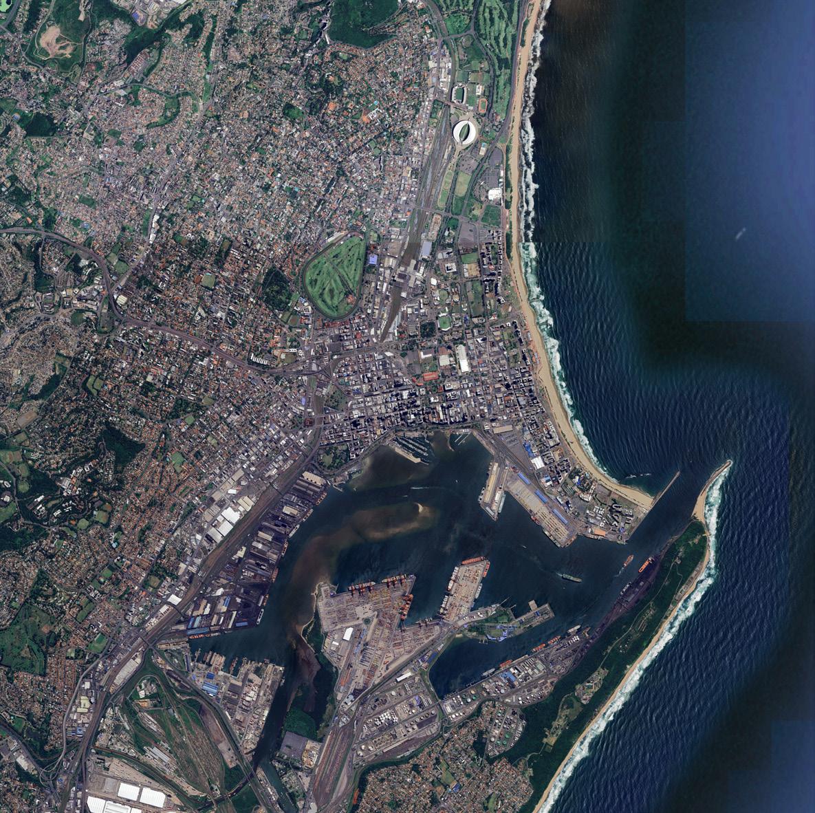
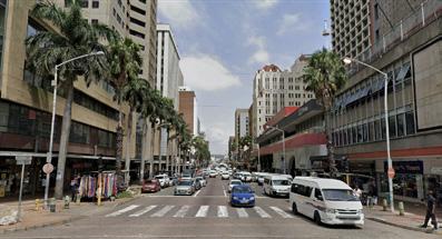
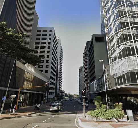
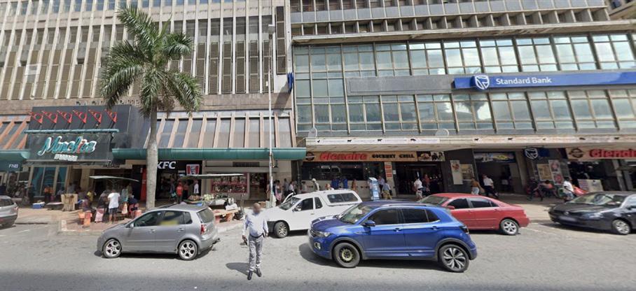
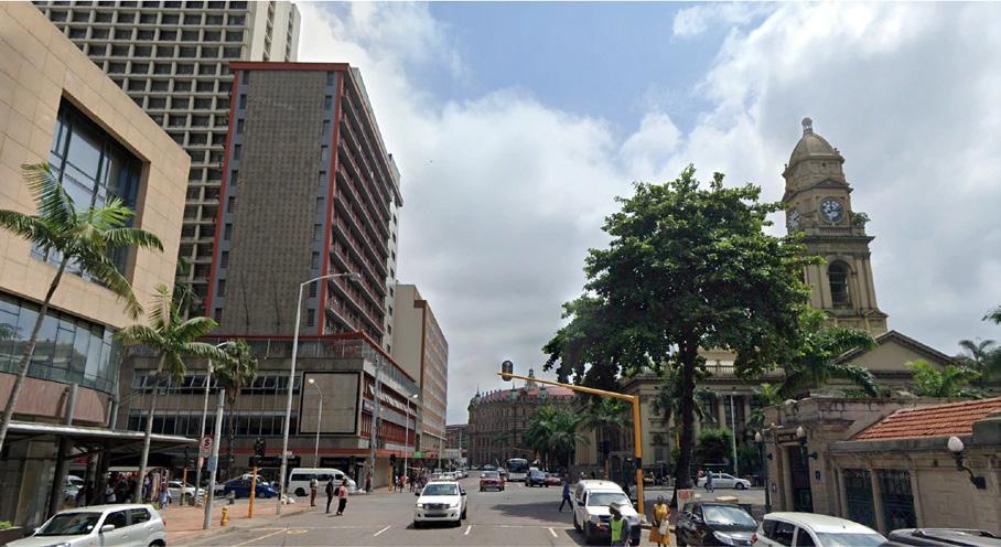
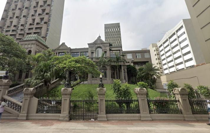
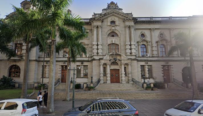
Located in the center of Durban, the selected 25-hectare site boasts a diverse array of uses, including a blend of building heights and a combinaton of historic and modern developments. Situated within a high-density business district, the choosen area also features one of Durban's significant landmarks, the Durban City Hall, and two sizable green open space. The inclusion of major roads offers a valuable opportunity to examine urban street life and traffic flow. Furthermore, the presence of laneways, cul-de-sacs, and arcades within the densely arranged buildings adds layers of complexity to the urban fabric.
MULTI SCALAR COMPARISION
The urban landscapes of the 25-hectare and 1-hectare scales differ significantly in terms of density, mix, and accessibility. The analysis at the 25-hectare scale reveals a high building density characterized by extensive building coverage and height. In contrast, at the 1-hectare scale, the perceived building density is moderated by the presence of large public open spaces and wider roads. This scale also allows for the observaton of spatal variatons in street life intensity. The 25-hectare scale features a diverse mix of functons, building types, and interfaces between private and public spaces, whereas the 1-hectare scale shows a lesser variety due to its larger grain size. Furthermore, the 25-hectare scale displays a fairly connected urban fabric, integratng both vehicular and pedestrian networks in a more semi-latce structure (Alexander,1996). On the other hand, the 1-hectare scale offers a more detailed perspectve on accessibility, considering elements such as crossings, walls, and entrances that directly influence movement at a human scale.
Reference Alexander, C. (1996) "A City is not a Tree", in The City Reader, London: Routledge, pp. 118-131 (orig. 1965) Appleyard, B. (1981). Livable Streets. Elsevier. Dovey, K., Pafa, E., & Ristc, M. (Eds.). (2017). Mapping urbanites: Morphologies, flows, possibilites. Routledge. Genl, J. (2011). Lie between bullongs: Using public space. London: Island Press Hillier, B. (2007). Space is the machine: a configuratonal theory of architecture. Space Syntax.
J. (1996) "The Uses of Sidewalks", in The City Reader, London: Routledge, pp. 103-108 (orig 1961)
K. (1960). The Image of the City. MIT Press. Lynch, K. (1981) Ch.11 "Control", in Good City Form, London: The MIT Press, pp. 205-220 Pafa, E. (2023). Modelling, mapping and measuring urban densites. In The Routledge Handbook of Urban Design
DENSITY
Located within the central business district, the area predominantly features high-rise office buildings indicated as "work". However, the northwest secton presents a more mixed-use environment, with a shopping precinct that includes restaurants and stores occupying the lower floors of office buildings, denoted as “visit + work”. Additonally, the northeast precinct encompasses the city town hall, museum, church, and park, drawing contnuous visitors, both tourists and local residents. Such mixed-use configuraton fosters a diverse social mix, encouraging a variety of people to navigate the commercial buildings, rather than just those who work in certain office building. The integraton of co-functoning morphological mixes has created successful synergies and enhanced street vitality (Dovey et al.,2017; Jacobs,1961).
The figure-ground map reveals a high rato of building coverage to block size. Buildings are typically constructed from boundary to boundary without setbacks, resulting in contnuous building edges along the footpaths. This design makes it difficult to distnguish individual buildings from one another, thereby creatng a uniform street experience. While some blocks feature internal shared or private open spaces, these are not accessible from the public street. However, the northeast block displays a lower density, atributed to two sizable park and low-rise historical buildings.
PRECEIVED DENSITY
Gehl (2011) noted that from buildings taller than 10 stories, people are unable to see what is happening at ground level. The theory highlights the critcal importance of the human experience at street level in urban design, arguing that high-rise buildings can weaken the connecton between residents and street life, thereby diminishing community interacton and engagement with the urban environment. In the examined 25-hectare area, more than half of the buildings exceed 10 stories, with some rising above 30 stories. This contributes to a varied landscape and a high perceived density. Notably, buildings with fewer stories are ofen nestled closely among taller structures, potentally leading to issues such as overshadowing, blocked views and a sense of disconnecton from street actvites despite their spatal proximity.
At the 1-hectare scale, there are higher populaton densites near street components from the map, aliging with the noton that interestng street elements atract people and increase street vibrancy (Whyte,1979; Jacob,1996). For instance, food truck owners ofen positon themselves near shop entrances to capitalize on the highest foot traffic. In contrast, the right side of Dorothy Nyembe Street with no street amenites has lower pedestrian traffic. Additonally, observatons from Google Street View reveal that the area is heavily dependent on vehicles, with higher density on the roads compared to the footpaths. This observaton aligns with the presence of extensive on-street parking, wider roads, and large areas devoted to car parking.
At the 1-hectare scale, all buildings range from 11 to 20 stories, yet the presence of a large public park introduces a significant visual break along the north and east Dorothy Nyembe street and Anton Lembede Street within the 25 hectace scale. Such green open spaces disrupt the contnuous line of high-rise buildings, making the area feel less crowded and more open (Lynch,1960). This visual interrupton helps balance the bulk of the buildings against the openness of the sky, making the high-rises appear less dominatng and thereby reducing the perceived density which is how urban environment appears in our visual field (Pafa,2023). Additonally, the wide roads, which include four lanes, along with the wide footpaths( at least four meters) also contribute to reducing the perceived density at ground level by creatng more open space.
Hundred Square Kilometers 1:100,000
ACCESS
CONNECTIVITY
In the 25-hectare area, the absence of tram or train lines, with only two bus stop available, illustrates a strongly vehicle-oriented transportaton network. The area's rectangular network structure suggests a planned urban morphology rather than a natural landscape. The inclusion of pedestrian pathways along all blocks and crossways connectng different blocks indicates fair accessibility. Additonally, laneways within the blocks provide shortcuts, and footbridges connect one building to another across the road, further enhancing connectvity (Hillier,2007).
The area predominantly features modern commercial buildings that showcase the city’s urban development, while also preserving some historical structures. Prominent landmark the city hall is complemented by a few classic Baroque-style architecture funcatoning as church, hotels and shopping areas. This mix of uses within the 25-hectare area creates synergy between tourist atractons, commercial and hospitality, adding cultural vibrancy to the modern business district, while atracting visitors.
The 25-hectare scales capture a mix of public, private and quasi-public open spaces as categorized by Pafa & Dovey (2024). Most private open spaces are within the office buildings with limited access. In fact, those spaces are usually designed into onsite parking with limited recreaton use. The large open space within the area is predominately contributed by the park area surrounding the church and city hall, with some area with restricted visitor access at certain tmes of day. While accessible to all, part of the open spaces is being used as weekend market which add density to the open space. This examined the potental of insufficient open space accessible for everyone.
FACILITATION AND BLOCKAGE PERMEABILITY AND TRAFFIC FLOW
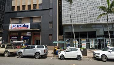
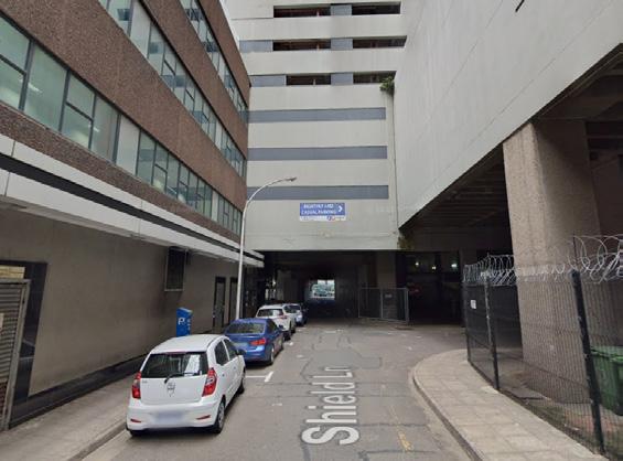
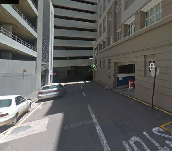
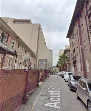
The extensive parking spaces underscores the car-oriented nature of the Transportaton network. The streetview Image 1 and 2 illustrates an example how a carpark is strategically designed to connect two perpendicular streets. This examines that the configuraton and design of urban elements significantly influences the connectvity in the urban environment (Lynch, 1960).
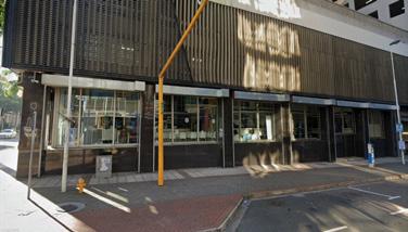
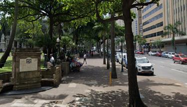
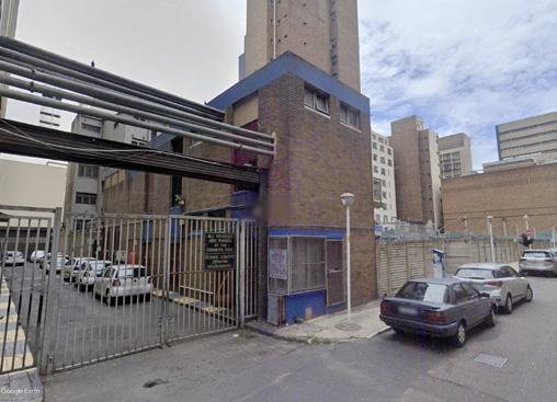
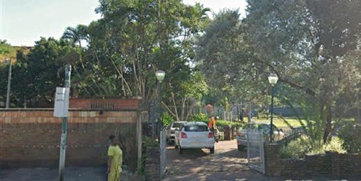
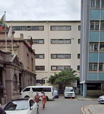
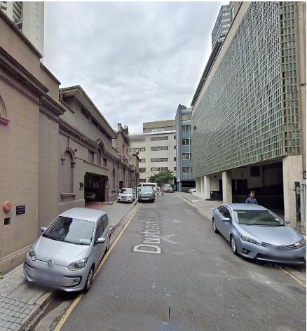
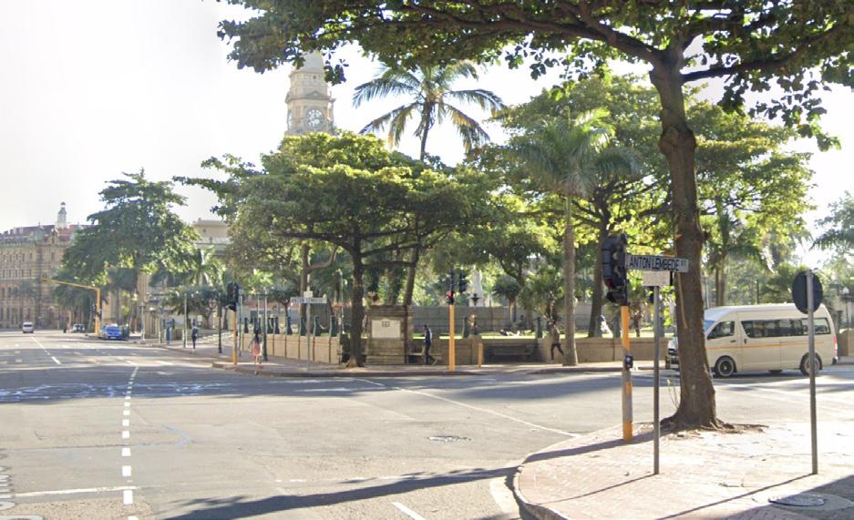
However, upon closer inspecton, several barriers stll hinder accessibility. A dead end (Image 3) obstructs vehicle access because private property cuts off the connecton between one street and another. Some buildings may have extended their frontages (Image 4) for private use, resultng in disconnected footpaths, pedestrians are forced to share the path with vehicles in certain sectons of the street, which can be potentally dangerous. Finally, cars parking above the footpath lead to disconnecton of pedestrian access. Those examine Jacobs’s (1961) critcism of car-centric urban planning that compromises pedestrian safety and community connectvity.
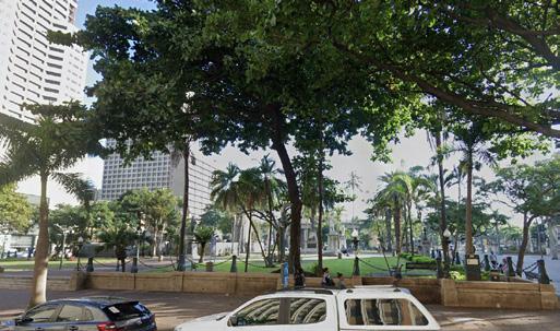
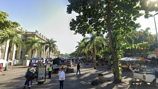
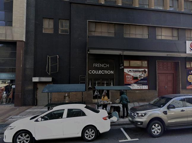
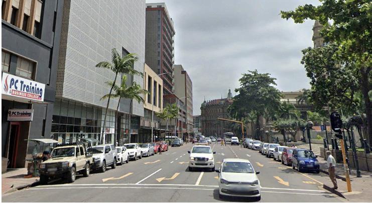
Zooming into the 1-hectare scale, the footpath exhibits good permeability with a wide street width. Notably, the inclusion of greenery and food trucks (image 1) enhances street vitality, promote lively public spaces through actvated edges (Gehl, 2010). However, the area is heavily dominated by vehicle use (image 2), with designated parking on each side of the road and multple vehicle lanes connectng to various directons. Consequently, walking along the footpath might not be very pleasant due to air and noise polluton from heavy vehicle traffic, illustratng the negatve impact of traffic on street usability and social interactons (Appleyard, 1981).
Additonally, despite having a large green open space, it is enclosed by walls and can only be accessed through a few entrances. For instance, afer crossing Anton Lemede Street from the opposite side, people must walk all the way to the right to enter the park. This situaton highlights that accessibility to urban green infrastructure could be improved, echoing the importance of accessible and inviting public spaces to urban livability (Whyte, 1980).
The analysis of center of Durban at two distnct scales reveals crucial variatons in density, mix, and accessibility, highlightng the complexites of urban space dynamics. The prevalence of high-rise buildings and a vehicle-dominant landscape notably hinders connecton to street life. However, effectvely placing amenites, addressing accessibility barriers, and integratng open spaces might counteract these effects. This approach not only makes the urban environment more inclusive and vibrant but also emphasizes the crucial balance between maintaining actve urban experience and development.