Grönland — Glarus Kunst Klima Wissenschaft Greenland — Glarus Climate Science Art
The Glacier’s Essence
Martin Stützle Fridolin Walcher
Scheidegger & Spiess
Kalaallit Nunaat — Glarus Silap pissusaa Ilisimatuussuseq Eqqumiitsuliorneq
2
3
2
3
10
11
10
11
48
49
48
49
52
53
52
53
54
55
54
55
Greenland and the Sea Level
über 60 Meter Meeresspiegel-Äquivalent. Wie sich dieser grosse Eisschild in einem noch wärmeren Klima verhält, ist bislang unbekannt. Wir nehmen jedoch an, dass die Antarktis während der letzten Warmzeit (Eemian) für circa zwei bis sechs Meter Meeresspiegelanstieg verantwortlich war. Dieser bedroht vor allem den asiatischen Raum, wo die grössten Ballungszentren und Bevölkerungsdichten vorliegen. Bei einem Temperaturanstieg von 2°C sind im Jahre 2100 etwa 130 Millionen Menschen vom höheren Meeresspiegel betroffen, eine Klimaerwärmung um 4°C gefährdet weltweit sogar 470 bis 760 Millionen Menschen. Die Mega- Cities Shanghai, Tianjin, Dhaka, Kalkutta, Mumbai, Hongkong, Jakarta und Taizhou liegen dann teilweise unterhalb des Meeresspiegels. Die Aufzeichnungen des Klimas und der Eismassenverluste in Grönland gehen weiter. Wir brauchen solide Grundlagen und Erkenntnisse, um fundierte Aussagen über die heutigen Änderungen sowie Modellvorhersagen für die Zukunft zu machen. Nur so können wir die Folgen der weiteren Erwärmung abschätzen, und nur damit kann die Politik entscheiden, welcher Aufwand für die Einhaltung des 2°C-Erwärmungsziels gesellschaftlich gerechtfertigt ist.
Konrad Steffen (*1952 in Zürich) ist Direktor der Eidgenössischen Forschungsanstalt für Wald, Schnee und Landschaft (WSL), Professor für Klima und Kryospähre am Institut für Atmosphären- und Klimawissenschaften der Eidgenössischen Technischen Hochschule (ETH) Zürich und Professor für Klima und Kryosphäre im Department für Architektur, Bau- und Umweltingenieurwesen der Ecole polytechnique fédérale de Lausanne (EPFL). Seit 2017 ist er wissenschaftlicher Direktor des Swiss Polar Institute, Vertreter der Schweiz am wissenschaftlichen Komitee für Antarktisforschung und Beratungsmitglied für Klimafragen der Europäischen Weltraum Organisation (ESA).
www.wsl.ch
176
Greenland, the largest island in the world, is covered by an ice sheet of immense proportions. It has a surface area of 1.7 million square kilometers, stretches 2400 kilometers from north to south, and is 3300 meters thick. Several hundreds of thousands of years ago, it began to snow in Greenland; the snow stopped melting in the cold summers, and storms brought new snow year after year. The snow accumulated over the centuries and millennia, and an ice sheet developed that gradually became an enormous body of ice. Today, the ice sheet that covers Greenland has a volume of 2.9 million cubic kilometers which, when melted, would correspond to a seven-meter rise in global sea levels. The ice sheet survived the last interglacial period (the Eemian), which occurred 120,000 years ago and during which the temperature in the north of Greenland was 4 to 12°C warmer than it is today. During the last glacial period 22,000 years ago, its length was only marginally greater. We are therefore dealing with a considerably stable, large body of ice that responds only slowly to climate fluctuations, as the past has shown us. But will this continue to be the case? We will return to that question later. Greenland is like a motor driving Europe’s weather patterns. The ice sheet’s north-south spread affects the air masses that flow towards Europe and thus also the temperatures and precipitation here in Switzerland. Norwegian missionary Hans Edege described this in his journal back in the 18th century: Warm, dry summers on the west coast of Greenland mean damp, cold summers in Denmark, and vice versa. Today, this phenomenon is referred to as the North Atlantic Oscillation (NAO). The warming of the earth due to greenhouse gasses in the atmosphere can also be felt in Greenland. Because this warming is being amplified by feedback, it is becoming disproportionately strong: Between 2000 and 2018, air temperatures at the middle latitudes increased by 0.4°C on average, but in Greenland, due to so-called ice-albedo feedback, a 1.6°C warming of the ice sheet was measured — a fourfold increase. Warming in the Alps is also twice as high as the global average. One major reason for this is the loss of snow and ice cover, which alters the reflection of the sun’s rays. When we set up the science station Swiss Camp on the Greenland ice sheet 25 years ago, we did not know that we would end up documenting the increasing melting of the ice sheet with our readings. We positioned the station on the so-called equilibrium line, 1,100 meters above sea level. Below this line, the loss of volume due to melting is greater than the increase in glacial ice (ablation zone), and above this line lies the zone of accumulation (accumulation zone), where more glacial ice is produced than is lost due to melting. Our station — three large, red tents
on a wooden platform on iron posts — should, therefore, have maintained the same elevation above the surface. Unfortunately, this was the case only during the first ten years. Afterwards, summer temperatures grew warmer and warmer, and the ice beneath the platform began to melt away; between 2000 and 2019, we lost twelve meters of ice and had to rebuild the station twice. The Greenland ice sheet reacted very quickly to the rising summer temperatures; the area with wet, melting snow increased by 25 percent over that period of time. Moreover, the body of ice began to move more quickly towards the coast, leading to an increase in ice calving. This dynamic loss of ice, as well as the melting of masses of ice and snow in the peripheral regions has led to a loss in volume of 360 cubic kilometers per year in the last few years, which corresponds to a global increase in sea levels of one millimeter per year, or a yearly loss of ice equivalent to five times the ice volume of all the alpine glaciers. At the UN Climate Change Conference in Paris in December, 2016 (COP21), it was agreed that global warming should be limited to less than 2°C compared to the pre-industrial level — if possible, 1.5°C — by the year 2100. What does this mean for Arctic regions and for the Greenland ice sheet? Due to the albedo feedback, a 1.5°C increase in temperature at the middle latitudes would mean a temperature increase of roughly 6°C for polar regions. During the last interglacial period 120,000 years ago, the temperatures were similar to those predicted for 2100, provided that greenhouse gas emissions are reduced to zero worldwide between 2045 and 2060. The reduction in greenhouse gasses could suffice in preventing Greenland from completely melting away. But should greenhouse gas emissions continue to increase, warming in Greenland will exceed 6°C and the entire ice sheet will be in danger of melting. Whether it will take a few hundred or a few thousand years before the ice ends up in the ocean is an open question. The global sea level is determined by glacial melting, the loss of ice in Antarctica and Greenland, as well as by the warming of the oceans. Today, Greenland contributes 25 percent of the global sea level rise. The world’s glaciers account for 35 percent of the rise and still contain the equivalent of another 0.4 meters of sea level rise stored in ice. If warming continues, this fresh water reserve will be largely exhausted by 2100. The Antarctic ice sheet binds almost 70 percent of the earth’s fresh water, which is equivalent to a 60-meter rise in sea levels. We do not yet know how this large ice sheet will react in an even warmer climate, but we assume that the Antarctic was responsible for a rise in sea levels of approximately two to
177
Greenland and the Sea Level
über 60 Meter Meeresspiegel-Äquivalent. Wie sich dieser grosse Eisschild in einem noch wärmeren Klima verhält, ist bislang unbekannt. Wir nehmen jedoch an, dass die Antarktis während der letzten Warmzeit (Eemian) für circa zwei bis sechs Meter Meeresspiegelanstieg verantwortlich war. Dieser bedroht vor allem den asiatischen Raum, wo die grössten Ballungszentren und Bevölkerungsdichten vorliegen. Bei einem Temperaturanstieg von 2°C sind im Jahre 2100 etwa 130 Millionen Menschen vom höheren Meeresspiegel betroffen, eine Klimaerwärmung um 4°C gefährdet weltweit sogar 470 bis 760 Millionen Menschen. Die Mega- Cities Shanghai, Tianjin, Dhaka, Kalkutta, Mumbai, Hongkong, Jakarta und Taizhou liegen dann teilweise unterhalb des Meeresspiegels. Die Aufzeichnungen des Klimas und der Eismassenverluste in Grönland gehen weiter. Wir brauchen solide Grundlagen und Erkenntnisse, um fundierte Aussagen über die heutigen Änderungen sowie Modellvorhersagen für die Zukunft zu machen. Nur so können wir die Folgen der weiteren Erwärmung abschätzen, und nur damit kann die Politik entscheiden, welcher Aufwand für die Einhaltung des 2°C-Erwärmungsziels gesellschaftlich gerechtfertigt ist.
Konrad Steffen (*1952 in Zürich) ist Direktor der Eidgenössischen Forschungsanstalt für Wald, Schnee und Landschaft (WSL), Professor für Klima und Kryospähre am Institut für Atmosphären- und Klimawissenschaften der Eidgenössischen Technischen Hochschule (ETH) Zürich und Professor für Klima und Kryosphäre im Department für Architektur, Bau- und Umweltingenieurwesen der Ecole polytechnique fédérale de Lausanne (EPFL). Seit 2017 ist er wissenschaftlicher Direktor des Swiss Polar Institute, Vertreter der Schweiz am wissenschaftlichen Komitee für Antarktisforschung und Beratungsmitglied für Klimafragen der Europäischen Weltraum Organisation (ESA).
www.wsl.ch
176
Greenland, the largest island in the world, is covered by an ice sheet of immense proportions. It has a surface area of 1.7 million square kilometers, stretches 2400 kilometers from north to south, and is 3300 meters thick. Several hundreds of thousands of years ago, it began to snow in Greenland; the snow stopped melting in the cold summers, and storms brought new snow year after year. The snow accumulated over the centuries and millennia, and an ice sheet developed that gradually became an enormous body of ice. Today, the ice sheet that covers Greenland has a volume of 2.9 million cubic kilometers which, when melted, would correspond to a seven-meter rise in global sea levels. The ice sheet survived the last interglacial period (the Eemian), which occurred 120,000 years ago and during which the temperature in the north of Greenland was 4 to 12°C warmer than it is today. During the last glacial period 22,000 years ago, its length was only marginally greater. We are therefore dealing with a considerably stable, large body of ice that responds only slowly to climate fluctuations, as the past has shown us. But will this continue to be the case? We will return to that question later. Greenland is like a motor driving Europe’s weather patterns. The ice sheet’s north-south spread affects the air masses that flow towards Europe and thus also the temperatures and precipitation here in Switzerland. Norwegian missionary Hans Edege described this in his journal back in the 18th century: Warm, dry summers on the west coast of Greenland mean damp, cold summers in Denmark, and vice versa. Today, this phenomenon is referred to as the North Atlantic Oscillation (NAO). The warming of the earth due to greenhouse gasses in the atmosphere can also be felt in Greenland. Because this warming is being amplified by feedback, it is becoming disproportionately strong: Between 2000 and 2018, air temperatures at the middle latitudes increased by 0.4°C on average, but in Greenland, due to so-called ice-albedo feedback, a 1.6°C warming of the ice sheet was measured — a fourfold increase. Warming in the Alps is also twice as high as the global average. One major reason for this is the loss of snow and ice cover, which alters the reflection of the sun’s rays. When we set up the science station Swiss Camp on the Greenland ice sheet 25 years ago, we did not know that we would end up documenting the increasing melting of the ice sheet with our readings. We positioned the station on the so-called equilibrium line, 1,100 meters above sea level. Below this line, the loss of volume due to melting is greater than the increase in glacial ice (ablation zone), and above this line lies the zone of accumulation (accumulation zone), where more glacial ice is produced than is lost due to melting. Our station — three large, red tents
on a wooden platform on iron posts — should, therefore, have maintained the same elevation above the surface. Unfortunately, this was the case only during the first ten years. Afterwards, summer temperatures grew warmer and warmer, and the ice beneath the platform began to melt away; between 2000 and 2019, we lost twelve meters of ice and had to rebuild the station twice. The Greenland ice sheet reacted very quickly to the rising summer temperatures; the area with wet, melting snow increased by 25 percent over that period of time. Moreover, the body of ice began to move more quickly towards the coast, leading to an increase in ice calving. This dynamic loss of ice, as well as the melting of masses of ice and snow in the peripheral regions has led to a loss in volume of 360 cubic kilometers per year in the last few years, which corresponds to a global increase in sea levels of one millimeter per year, or a yearly loss of ice equivalent to five times the ice volume of all the alpine glaciers. At the UN Climate Change Conference in Paris in December, 2016 (COP21), it was agreed that global warming should be limited to less than 2°C compared to the pre-industrial level — if possible, 1.5°C — by the year 2100. What does this mean for Arctic regions and for the Greenland ice sheet? Due to the albedo feedback, a 1.5°C increase in temperature at the middle latitudes would mean a temperature increase of roughly 6°C for polar regions. During the last interglacial period 120,000 years ago, the temperatures were similar to those predicted for 2100, provided that greenhouse gas emissions are reduced to zero worldwide between 2045 and 2060. The reduction in greenhouse gasses could suffice in preventing Greenland from completely melting away. But should greenhouse gas emissions continue to increase, warming in Greenland will exceed 6°C and the entire ice sheet will be in danger of melting. Whether it will take a few hundred or a few thousand years before the ice ends up in the ocean is an open question. The global sea level is determined by glacial melting, the loss of ice in Antarctica and Greenland, as well as by the warming of the oceans. Today, Greenland contributes 25 percent of the global sea level rise. The world’s glaciers account for 35 percent of the rise and still contain the equivalent of another 0.4 meters of sea level rise stored in ice. If warming continues, this fresh water reserve will be largely exhausted by 2100. The Antarctic ice sheet binds almost 70 percent of the earth’s fresh water, which is equivalent to a 60-meter rise in sea levels. We do not yet know how this large ice sheet will react in an even warmer climate, but we assume that the Antarctic was responsible for a rise in sea levels of approximately two to
177
188
189
188
189
Glarus G
R
E
E
N
L
A
N
D KANTON S T. G A L L E N
500 km
KANTON SCHWYZ
Glarus
KANTON GLARUS
Linthal
KANTON URI
Clariden Glacier Biferten Glacier
Glarus
Glarus
T
Glarus
H
E
A
L
P
S
KANTON GRAUBÃœNDEN
Glarus G
R
E
E
N
L
A
N
D KANTON S T. G A L L E N
500 km
KANTON SCHWYZ
Glarus
KANTON GLARUS
Linthal
KANTON URI
Clariden Glacier Biferten Glacier
Glarus
Glarus
T
Glarus
H
E
A
L
P
S
KANTON GRAUBÃœNDEN
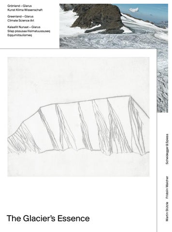
Der Schweizer Geophysiker Alfred de Quervain (1879 – 1927) vermass als Erster den Glarner Claridengletscher und begründete zu Beginn des 20. Jahrhunderts mit Expeditionen nach Grönland die schweizerische Arktisforschung. Heute schmelzen die Gletscher weltweit in alarmierendem Ausmass. Glarus und Grönland – Kunst, Klima und Wissenschaft: Der Künstler Martin Stützle und der Fotograf Fridolin Walcher machten die Glarner Gletscher zum Thema ihrer Werke und begleiteten im Mai 2018 Schweizer Umweltwissenschaftler auf einer neuen Grönlandexpedition. The Glacier’s Essence präsentiert mit Fridolin Walchers Fotografien und Martin Stützles Radierungen sowie mit aktuellen wissenschaftlichen Fakten die Essenz ihrer Kunst und der Gletscherforschung. Die Quintessenz des Buchs besteht darin, Verbindungen aufzuzeigen: zwischen Grönland und Glarus, zwischen Kunst und Wissenschaft, zwischen Fotografie und Radierung. Mit Texten der renommierten Klimaforscher Gabriela Schaepman-Strub, Konrad Steffen und Thomas Stocker sowie zur Kunst von Nadine Olonetzky und einem Nachwort des Schweizer Diplomaten Benedikt Wechsler, der die Forschungsreise 2018 mitinitiierte.
The Swiss geophysicist Alfred de Quervain (1879 – 1927) was the first person to survey the Clariden glacier in Glarus, and established Swiss Arctic research at the beginning of the 20th century with expeditions to Greenland. Today, glaciers are melting worldwide at an alarming rate. Glarus and Greenland — art, climate, and science. Artist Martin Stützle and photographer Fridolin Walcher made the glaciers in Glarus the subject of their work and accompanied Swiss environmental scientists on a new expedition to Greenland in May 2018. The Glacier’s Essence uses Walcher’s photographs and Stützle’s etchings, as well as current scientific facts to present the essence of both their art and glacier research. At its core, the book aims to reveal connections: between Greenland and Glarus, between art and science, between photography and etching. With texts by renowned climate researchers Gabriela Schaepman-Strub, Konrad Steffen, and Thomas Stocker, as well a text about art by Nadine Olonetzky, and an epilogue by Swiss diplomat Benedikt Wechsler, who co-initiated the 2018 expedition.
Geofysikeri schweizimioq Alfred de Quervain (1879 – 1927) siullerpaalluni Glarusimi Claridenimi sermersuaq misissuiffigilernikuuaa kiisalu 1900kkut aallartinneranni Sshweizimiut Issittumi misissuisarnerannut atatillugu Kalaallit Nunaannut ilisimasassarsiortarnikuulluni. Ullumikkut nunarsuatsinni tamani sermersuit aarlerinartumik aakkiartorput. Glarus kiisalu Kalaallit Nunaat – eqqumiitsuliat, silap pissusaa kiisalu ilisimatuussuseq. Eqqumiitsuliortoq Martin Stützle kiisalu assiliisartoq Fridolin Walcher suleqatigiilutik Glarusimi sermersuit sammisarinikuuaat, pinngortitarlu pillugu ilisimatuut 2018imi maajimi ilisimasassarsiorneranni peqatiginikuullugit. The Glacier’s Essence- imi Walcherip assilisai Stützlelillu seernartoq atorlugu assilialiat atorneqarput kiisalu ilisimasassarsiornikkut paasisat kingulliit saqqummiunneranni taakkua suliaat ilanngunneqarlutik. Atuakkami saqqummiunniarneqartut qiterisaata saqqummiunneranni atorneqartut tassaapput: Kalaallit Nunaata Glarusillu sanillersuun-
ISBN 978-3-85881-665-8
neri, eqqumiitsuliat ilisimatuussutsikkullu paasisat kiisalu assilisat seernartumillu kanngus-
Printed in Germany ISBN 978-3-85881-665-8
sanni assilialiat. Ilanngutassiisut tassaapput silap pissusaa pillugu ilisimasassarsiortut Gabriele Schaepman-Strub, Konrad Steffen kiisalu Thomas Stocker, eqqumiitsuliallu pillugit ilanngutassiisoq Nadine Olonetzky kiisalu diplomateq Schweizimeersoq, 2018imi ilisimasassarsiornermik pilersitseqataasoq, Benedikt Wechsler.
9
783858 816658