T
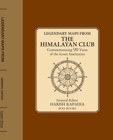
he last 90 years have been a glorious period in Himalayan Exploration. As explorers from across the globe have attempted to discover the Himalaya, the Himalayan Club has played a pioneering role in chronicling their expeditions for posterity. The accompanying maps, from the Himalayan Journal, are a historical treasure capturing various facets of exploration over time. Legendary explorations like Shipton and Tilman’s route into Nanda Devi Sanctuary, Maurice Herzog’s Annapurna ascent – the first to scale an 8,000m peak – and Sir Chris Bonington’s exploring routes to Menluntse continue to arouse fascination to this day. The last decades or two have witnessed fascinating explorations – trail to complete the century-old quest to trace the route of the mighty Brahmaputra river by Harish Kapadia, exploring the unknown Kunzang valley by Group Capt. V.K. Sashindran, ascents and accident on Panch Chuli by A.V. Saunders and an ascent of Nilkanth by the west ridge by Martin Moran and many others. With some of the routes and climbs documented here yet to be repeated, this book is a tribute to the rich history of exploration and a treasure trove for aficionados. ISBN: 978-81-936260-2-3
Himalayan Club Cover 31 1 2018.indd 1
31/01/18 12:57 PM
contents Introduction 9 Dedicated to
Kashmir – East Karakoram 13
J.C. Nanavati
Karakoram 53
Who taught us the importance of maps
Himachal Pradesh 85
President Emeritus of the Himalayan Club
Uttarakhand 107 Nepal – Tibet 167 Sikkim – Arunachal Pradesh – Bhutan 201 Index 238
Anxious glances were cast from time to time at the weather. Huge monsoon clouds had been working up towards the mountain for some time, and all views were now obscured. We made good progress, however, and could rejoin the rib immediately above the impassable vertical section. Shortly afterwards we reached the large steep snow slope below the summit, and, kicking steps in good firm snow, joined the east
HJ 26: YEAR 1965
ridge at exactly the point where it rises to the summit cone. It was now half-past two. We had taken hours for the ascent from the glacier, a
MOUNTAINS OF KAGHAN
fair testimony to steady progress. The only view accorded us was down the terrific north face to the north glacier below and a very limited glimpse along the east ridge through the mists. But it was this east ridge which we favoured for the descent. Our
Trevor Braham
route upwards was singularly deficient in belays for roping down, and having ascended 7,500 feet from our camp in the Armiun Nar, we were in no mood to descend it without using the double rope. We took infinite care on this easy ridge in view of our weariness. At about half its length a subsidiary rib was seen running direct to the glacier down the south face, and by this we descended. We reached the glacier in 3 ½ hours at 5.45 p.m., a reflection not on the difficulties, but on our, and, I fear, particularly my, state of exhaustion. We reached the col soon after 6 o’clock. Here nourishment revived us, all thoughts of a high bivouac were put aside, and we raced down to Armiun, 5,000 feet below, in less than 2 hours, arriving at 8 p.m. Both the climb, which presents no outstanding difficulties, and the route by which we approached the mountain can be recommended. The route by the Armiun Nar is
Trevor Braham, the British explorer and climber, loved to roam unknown valleys and climb smaller peaks. He was based in the Indian subcontinent due to his business commitments and took full advantage of climbing every summer, always breaking new ground. Here, he recounts his visit to the then unknown Kaghan valley, located on the border of Kashmir and Pakistan. This exploration remains unique, especially, as after 1947 this part of Kashmir lies in the restricted area. His account remains a major reference for mountaineering history. Braham edited the Himalayan Journal in 1957 / 58, and is a senior member of the Club. He lives in Switzerland.
we not been in good training after our Karakoram climb, we should not have managed
K
it ourselves.
the north, and flows roughly southwards for 95 miles until it enters the Jhelum River
short and very attractive. I think, however, that most parties intending to climb the peak from this south side will be wise to make a bivouac at or near the col by which we reached the Kolahoi glacier. An ascent of 7,500 feet and a descent of the same amount, with a horizontal distance of five miles each way, is a big undertaking for one day. Had
aghan is a playground and a training-ground to give one a first-rate scramble in 15 or even 10 days. The area, comprising approximately 1,500 sq. miles, is drained by
the Kunhar River which has its source close under the Babusar Pass, 13,684 feet, in
near Muzaffarabad. To the north of the valley, over the Babusar Pass, lies Chilas and the Gilgit Agency; to the south, Abbottabad and the lower Hazara District. The great gorge of the Indus lies to the west, with the mountains of Swat and Indus Kohistan beyond. On the eastern fringe lies the territory of Jammu and Kashmir. The highest mountain
18
19
HJ 36-51: YEAR 1980-1985
Nun–Kun
T
his is the most important massif in the Kashmir Himalaya. Standing at the edge of the Zanskar mountains, it is a group of high summits—Nun (7135 m) and Kun (7135 m). The massif stands on the Great Himalayan Axis in line with
Nanga Parbat. Between Nun and Kun is a high snow-plateau ending in a broken icefall and then descending further to become the eastern branch of the Parachik glacier. In 1898, C.G. Bruce and Maj F.G. Lucas were the first climbers here. Followed by, in 1902 and 1904, Dr. Arthur Neve and Rev C.E. Barton. Dr. H. Sillem, explored the high plateau between Nun and Kun in 1903 and later by the Americans, Dr. and Mrs. Bullock Workman, in 1906, who surveyed further and climbed Pinnacle Peak. Dr. Neve was back again in 1910 with Rev M.E. Wigram and climbed the neighbouring peak D41 on the ridge extending west from Nun. The first ascent of Kun was by the Italian Count Piacenza, in 1913. His party climbed via its northeast ridge, approaching from the snow-plateau in the south. Attempts on Nun continued. J. Waller tried the east ridge in 1934 and eventually climbed ‘White Needle’ (6599 m), immediately to the east of Nun. He was followed by R. Berry in 1946 and by the Swiss, P. Vittoz, in 1952. Finally, P. Vittoz and Mme Claude Kogan, members of a French expedition led by Bernard Pierre climbed Nun by the west ridge in 1953. All the major summits of the area have now been climbed. Today, Nun-Kun and the surrounding area have become perhaps the most visited and popular climbing arenas.
42
43
HJ 51 & 21: YEAR 1995 & 1958
MASHERBRUM
T
he group of Masherbrum peaks lies to south of the Baltoro glacier. The 1856 survey named it as K1, as this was the first surveyed peak in the Karakoram. The adjoining peak of K2 was the next peak. Both these peaks were first located
from Haramukh, a small but vantage peak in Kashmir. In Balti language “Masher” means lady, while “brum” means a mountain. So, this shapely peak is “Queen of Peaks”. This peak is seen from many areas in Kargil, India. In 1911, William Hunter Workman and Fanny Bullock Workman visited the area and attempted its lower reaches. Famous American climbers, Nick Clinch and Willi Unsoeld organised expeditions here in 1955 and 1957. Finally, Americans made the first ascent in 1960. In 1957 a British team had made a serious attempt on the peak. (See map on facing page.) They set up seven camps and made several trips up and down from Base Camp to the last camp. One of the members died at Camp six due to altitude sickness. After ferrying his body down, two members attempted the summit again. They were very close to the summit when both feared frost-bite to their fingers due to a storm and eventually gave up their summit bid. In 1988, the Italians climbed several peaks, including a peak of 7200 m, about 8 kilometres away from main peak. They called it Masherbrum II. In 1993, an Irish team climbed the same peak but suggested that it should be called Cathedral Peak as it is far removed from the Masherbrum group.
Sketch by R.O. Downes
80
81
Anxious glances were cast from time to time at the weather. Huge monsoon clouds had been working up towards the mountain for some time, and all views were now obscured. We made good progress, however, and could rejoin the rib immediately above the impassable vertical section. Shortly afterwards we reached the large steep snow slope below the summit, and, kicking steps in good firm snow, joined the east
HJ 26: YEAR 1965
ridge at exactly the point where it rises to the summit cone. It was now half-past two. We had taken hours for the ascent from the glacier, a
MOUNTAINS OF KAGHAN
fair testimony to steady progress. The only view accorded us was down the terrific north face to the north glacier below and a very limited glimpse along the east ridge through the mists. But it was this east ridge which we favoured for the descent. Our
Trevor Braham
route upwards was singularly deficient in belays for roping down, and having ascended 7,500 feet from our camp in the Armiun Nar, we were in no mood to descend it without using the double rope. We took infinite care on this easy ridge in view of our weariness. At about half its length a subsidiary rib was seen running direct to the glacier down the south face, and by this we descended. We reached the glacier in 3 ½ hours at 5.45 p.m., a reflection not on the difficulties, but on our, and, I fear, particularly my, state of exhaustion. We reached the col soon after 6 o’clock. Here nourishment revived us, all thoughts of a high bivouac were put aside, and we raced down to Armiun, 5,000 feet below, in less than 2 hours, arriving at 8 p.m. Both the climb, which presents no outstanding difficulties, and the route by which we approached the mountain can be recommended. The route by the Armiun Nar is
Trevor Braham, the British explorer and climber, loved to roam unknown valleys and climb smaller peaks. He was based in the Indian subcontinent due to his business commitments and took full advantage of climbing every summer, always breaking new ground. Here, he recounts his visit to the then unknown Kaghan valley, located on the border of Kashmir and Pakistan. This exploration remains unique, especially, as after 1947 this part of Kashmir lies in the restricted area. His account remains a major reference for mountaineering history. Braham edited the Himalayan Journal in 1957 / 58, and is a senior member of the Club. He lives in Switzerland.
we not been in good training after our Karakoram climb, we should not have managed
K
it ourselves.
the north, and flows roughly southwards for 95 miles until it enters the Jhelum River
short and very attractive. I think, however, that most parties intending to climb the peak from this south side will be wise to make a bivouac at or near the col by which we reached the Kolahoi glacier. An ascent of 7,500 feet and a descent of the same amount, with a horizontal distance of five miles each way, is a big undertaking for one day. Had
aghan is a playground and a training-ground to give one a first-rate scramble in 15 or even 10 days. The area, comprising approximately 1,500 sq. miles, is drained by
the Kunhar River which has its source close under the Babusar Pass, 13,684 feet, in
near Muzaffarabad. To the north of the valley, over the Babusar Pass, lies Chilas and the Gilgit Agency; to the south, Abbottabad and the lower Hazara District. The great gorge of the Indus lies to the west, with the mountains of Swat and Indus Kohistan beyond. On the eastern fringe lies the territory of Jammu and Kashmir. The highest mountain
18
19
11
1
2
5
8
6
3
4
12
9
7
10
14 13
1. 1930, Survey team led by Gordon Osmaston (far left). 2. 1930, Surveying K2. 3. J.C. Nanavati, President Emeritus of the Himalayan Club. He managed the club during one of its most challenging periods. 4. Prof Ardito Desio, Italian geologist was an authority on the Karakoram geology. He led the Italian expedition to make the first ascent of K2. 5. 1936, Certificate from Adolf Hitler to Nanga Parbat surviving Sherpas. 6. 1935, The Baltoro glacier during the survey. 7. 1930s, Survey of Karakoram Peaks. 8. 1936, Ang Tharkay Sherpa (centre)
and Eric Shipton (right) in Karakoram. 9. 1983, Crossing Shaksgam river on camels by a French expedition. 10. Younghusband crossing Muztagh Pass with famous guide Turdi Kol. 11. Dr Charles Houston, leader of the American expedition to K2. He researched High Alitude medicine effects on climbers. 12. Mule Caravan in the Shyok valley to Karakoram Pass. 13. Victor Saunders, mountain guide and prolific climber and author. 14. 2002, Charles Houston presenting umbrella he carried on K2 in 1936 to Reinhold Messner at Trento, Italy.
selected as being easy of access, reducing consequently the costs of transport and making organization comparatively simple. Our original scheme envisaged three successive campaigns. The first, before the monsoon, comprised a visit to the Rhamani glacier with the ascent of Dunagiri as main object. During the monsoon we hoped to explore the Kosa glacier, and,
HJ 15: YEAR 1949
DUNAGIRI Andre Roch This giant mountain stands on the rim of the Nanda Devi Sanctuary. It finds a mention in Indian mythology. It is the mountain described in Ramayana that Hanuman comes in search of looking for the life-saving medicinal herb Sanjeevini. It is said that Hanuman carried this mountain to Lanka. Once the purpose was served, the mountain was returned to its original location. Thus, the adjoining smaller peak has been aptly named Hanuman peak. A deep mark on left slopes of this peak resembles a thumb impression. May be this so called thumb impression, led to the coupling of the peak with this legend and gave it its name! The ascent by the Swiss climbing guides was the first successful ascent of this mountain. Later, this peak was climbed by different routes by leading mountaineers, each route more difficult than the previous one. There are some great survival stories that these slopes have been witness to. In 1975, Joe Tasker and Dick Renshaw from England climbed a particularly difficult route on the southeast buttress in a significant milestone for alpine-style climbing, followed later by leading European climbers.
M
whenever weather and conditions allowed, climb any peaks that appeared possible. The third campaign during the fine weather in September comprised ascents in the Bagini glacier cirque. At the beginning of the tour we felt certain misgivings concerning an attempt on Dunagiri, because this mountain had been the objective of several British expeditions. Shipton in particular having reached the watershed ridge, the exploration was accordingly complete, and our possible success was but a kind of crowning of our predecessor’s efforts. Dunagiri was attempted in 1883 by W.W. Graham with Emil Boss. Graham estimates the height attained as 22,700 feet. During 1905–7 the mountain’s approaches were studied by Longstaff ’s parties. In 1933 Oliver and Campbell attempted an ascent from the west. In 1936 came Shipton’s and Angtharkay’s attempt; they estimated the return as having taken place at about 1,000 feet below the summit. The mountain was next tried by Smythe and Oliver in 1937. The route taken by the Swiss party of 1939 coincides with that attempted by Shipton’s and Smythe’s parties. There exists an unwritten law of honour in the Himalaya causing certain mountains to be reserved for certain countries. The reasons are as follows: when a country has sent several expeditions to a certain peak, its exponents have explored the said peak, and also published accounts and photographs for the benefit of others of their experiences, good or bad, and also of the possibilities of the means of access. Once the mountain has been well explored and a route discovered, a strange expedition completing the ascent would benefit in undeserved fashion by the manifold experiences of others. This was the case in our attempt on Dunagiri, and I would add that British parties, who had explored completely this superb mountain and had several times attempted the
aking plans for an Alpine expedition is great fun, but doing the same for
ascent, placed at our disposal with the greatest kindness all possible documents and
a trip to the Himalaya is far greater. For over there, there are so many
information dealing with the matter.
unexplored valleys and passes as well as unclimbed peaks. Garhwal was
12 8
On the 3rd June 1939 we left Ranikhet with six Sherpas and forty-three Dotial
129
About the editor Harish Kapadia has made a unique contribution to our knowledge of the Himalaya: as editor of the Himalayan Journal, one of the most authoritative and comprehensive records of exploratory activity in the Himalaya; through his numerous books and as a leader and organiser of countless expeditions over the last 50 years. Harish has personally climbed more than 30 Himalayan peaks, many of them first ascents. He has also crossed more than 150 Himalayan passes to explore different valleys. Harish has received many awards including the Royal ‘Patron’s Medal’, by the Royal Geographical Society, the first Indian to receive this highest adventure award after 125 years. The President of India honoured him with the prestigious ‘Tensing Norgay National Adventure Award’ (2003) for Life Time achievements, and he also received the ‘King Albert I Mountain Award’ in Switzerland and Piolets D’or Asia 2017, UIAAA, considered as the Oscar award of mountaineering. Harish is frequently invited to lecture on his Himalayan exploits, and is Honorary member of many international organisations, and Editor Emeritus of the Himalayan Club. He is married, and lives in Mumbai.
2 40