CHASING the MOUNTAIN LIGHT A Life Photographing Wild Places
DAVID NEILSON
South West Tasmania, Patagonia, Antarctica, Karakoram & the Alps of Australia, New Zealand, and Europe
ACKNOWLEDGEMENTS
Except for the family photos on pp 8-12 and p 21 all uncredited photos are by David Neilson. Additional photos are by Karen Alexander, Bob Tyson, Jenny Scott, Rod Harris, Colin Monteath Ken Harvey, John Gamlen , David Griffith and the late Ian Ross. Text, design and all photos in this DRAFT publication are copyright © 2022 Snowgum Press PO Box 309, Emerald, Vic 3782, Australia dneilson@snowgumpress.com.au 0409 383 306
CAMERA NOTES Where known and of interest, the camera used to take the photo is indicated by a superscript notation at the end of the caption. (f for film and d for digital) Pf:
Pentax Spotmatic II 35mm
Nf:
Nikkormat FTn 35mm Nikon FM2 35mm Nikon F-801 35mm Nikon F100 35mm
Bf:
Bronica EC 6cm x 6cm
Hf:
Horseman 45FA 6cm x 9cm, 6cm x 12cm
Mf:
Mamiya 7-11 6cm x 7cm
Nd:
Nikon D300 Nikon D50
Sd:
Sony RX100
Pd:
Panasonic GH4
Other cameras used: Agfa Sillette, Leica IIIC, Hasselblad 500 C/M, Bronica GS1, Horseman ER-1.
CONTENTS PREFACE: “When the Contour Lines Sing Together” MOUNTAINS OF MY CHILDHOOD “CLIMBING”
FEDERATION PEAK: South West Tasmania
21
FRENCHMANS CAP: South West Tasmania
33
LAKE PEDDER: South West Tasmania
TO AN UNKNOWN VALLEY: Northern Patagonia
69
FITZ ROY – CERRO TORRE – PAINE: Patagonia
79
53
JOURNEY to TIERRA DEL FUEGO & the SOUTHERN PATAGONIAN ICE-CAP WILSONS PROMONTORY: South-eastern Cornerstone of Australia AUSTRALIAN ALPS EAST ANTARCTICA
161
175 189
209 219
KARAKORAM: West of the Himalaya Notes on my Photographic Journey
231 249
The SOUTH COAST of TASMANIA: Wild Places for Future Generations
End paper back: Partly ice-covered lichen on rock wall in valley next to Lake Henderson, Framnes Mountains, Mawson Coast, Antarctica, 2004. Hf
Bibliography
Back cover: Early morning light on Cerro Fitz Roy massif, Los Glaciares National Park, Patagonia, Argentina, 2002. Hf
Photographing at Sandy Bay on Macquarie Island. Photo by Colin Monteath.
117
125
SOUTH GEORGIA: Sub-antarctic Isle
EUROPEAN ALPS
End paper front: Ice-covered pond, Mt Bogong, Alpine National Park, Victoria, Australia, 2002. Hf
43
SOUTHERN ALPS of NEW ZEALAND: Broader Horizons
ROSS SEA
Half title: Early morning on western side of Southern Patagonian Ice-cap with Mariano Moreno Range beyond, Chile, 1977. Nf
9
15
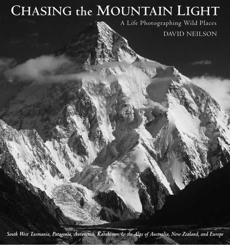
ANTARCTIC PENINSULA Front cover: The southern faces of K2, 8611 metres, the second highest mountain in the world, from Concordia, the junction of the Baltoro and Godwin-Austen Glaciers, Karakoram, Pakistan, 2007. The summit is 3500 metres above the foreground glacier. The right skyline ridge is the Abruzzi Spur, the most common ascent route. Hf
7
252
251
97
PREFACE “When the Contour Lines Sing Together” “Unless you are a mountaineer, an engineer or a surveyor, the odds are that the great illumination will escape you, all your life; you may return to the grave without having ever known what it is like when the contour lines sing together like the biblical stars.” Charles Montague – 1924
P
ERHAPS I WAS PRE-DESTINED to appreciate British climber Charles Montague’s dictum. I have been a mountaineer and engineer and have used a theodolite and compass. In truth an interest in maps and a love of wild places is all one needs. Maps lead us to the edges of the unknown. To that fabled terra incognita. Not all maps have contour lines – as recently as 1968 the map we used to explore South West Tasmania did not have them – but when there are contour lines and when they do sing together they are an irresistible lure to the would-be explorer. In 2012 I published my book Southern Light – Images from Antarctica and I did not expect to produce any further books. There was no new area or subject that I passionately wanted to explore through photography. However, a chance reply to a comment I made that I liked Montague’s phrase ‘when the contour lines sing together’ became the catalyst for this publication. My partner Karen Alexander replied that
it would be a good title for a memoir. I had not given any thought to writing a memoir. However, I liked the idea of using the title and gradually the concept of a photographic memoir came in to focus. Along the way its use as the title dropped by the wayside but my personal shorthand for this work continues to be Contour Lines. In the early chapters I outline my exploring and climbing activities that were the catalyst for my life-long love of mountains. I thought I would climb forever but I stopped in my late thirties. However, I took away from this climbing life a strong and ongoing love of the mountain environment and a desire to celebrate it through photography and to help protect it when it was threatened. Perhaps most importantly I have learnt over the past thirty years that one can go gently and lightly into wild places and still have profoundly moving experiences.
Opposite: View from Dorian Bay of Mount Français, 2825 metres, above waters of Börgen Bay and Neumayer Channel, with Bull Ridge leading towards summit. Highest peak in northern Antarctic Peninsula. First ascent in 1955 via route starting out of view to right. Climbed infrequently; Bull Ridge now most common ascent route. Hf
7
MOUNTAINS of my CHILDHOOD
W
HERE DOES THE LOVE OF WILD PLACES and especially wild mountains come from? This mysterious wellspring that has been a cornerstone of my life.
In 1950 when I was four years old our family moved to a new house in Ashburton, then an outer eastern suburb of Melbourne. We had a large backyard which allowed for all manner of childhood fun, often with neighbouring friends: kick to kick football, cowboys and indians, tippity run cricket and even a backyard version of the Olympic Games complete with opening ceremony to coincide with the 1956 Melbourne Games. As well as these activities there was scope for exploring on my own. There was a medium-sized gum tree in the backyard along with a brick garage. Both of these provided my first serious climbing adventures. At the back of the garage two brick walls formed a right angle. There was a half-inch gap where the two walls met. I placed a three-foot long timber house stump into the corner to use as a foothold. After carefully standing on the stump I jammed the fingers of one hand into the brick gap and just reached the corrugated iron roof with my other hand. A quick pull up with a bit of foot scrabbling and I was on the summit. I must have been about seven years old when I made the first ascent of Mt Garage. I have a later memory of sitting on the roof and hearing on the radio in the distance Rising Fast winning the 1954 Melbourne Cup. I was eight then. Tree climbing, more than climbing buildings, was the real precursor to my rock climbing adventures. Many children climb trees as part of their play activities but I was especially drawn to this pastime. Our gum tree had few lower limbs but I was tall for my age and made an early ascent, almost certainly before the garage. I spent many an hour sitting in the top of this tree surveying the distant plains of the backyard. Not content with ascents of Gum Tree Peak and Mt Garage I decided that a traverse between the two was a worthy challenge. This could only be achieved with the assistance of a long timber plank. With some difficulty I manoeuvred this up the gum tree and then managed to push it out across the intervening gap until it sat on the edge of the garage parapet. As I gingerly started clambering along the plank disaster struck and the end of the plank in the tree gave way and I came crashing to the ground. Miraculously I was not seriously hurt – a sore ankle kept me immobile for a few days. An important factor in my early adventures was that my parents did not discourage me. I am sure they would have kept a weather eye on what I was up to but I have no memory of being told I mustn’t do something because it was too dangerous. On the evening of the 2nd of June 1953 our family were huddled around the radio listening to the BBC commentary of the coronation of Queen Elizabeth II in London. Some time during the broadcast it was announced that two
members of a British mountaineering expedition – Edmund Hillary and Tenzing Norgay – had successfully reached the summit of Mount Everest a few days earlier. I remember being excited to hear this news on the radio, probably helped by explanations from my parents and I learnt more from the subsequent illustrated newspaper articles. Twenty-five years later I would join a Scottish mountaineering expedition that received modest funding from the Mount Everest Foundation set up in the wake of this successful expedition. I had a very happy childhood but my parents were not especially interested in exploring the natural world. We never went camping as a family. We stayed in guest houses on holidays when we were not staying with relatives. However, my parents both had their own adventures when they were younger. In the farmyard photo my bare-foot mother is probably five or six years old. She looks a little serious but very comfortable being out in the dust and dirt of a farmyard full of animals. She is certainly the equal of her brothers. During the Second World War much of the work on the family farm fell to her and she acquired a range of farming skills. (When I was twelve years old I shot my first rabbit and was surprised and delighted when she expertly showed me how to skin it.) My mother went on to become an accomplished artist, having studied commercial art at the School of Mines, Ballarat in the 1930s. However, raising a family meant she never achieved her full artistic potential. I did not inherit an ability to draw from her which was a source of frustration for me as a child – she seemed to do her beautiful drawings so effortlessly. During the war my father was a navigator in RAF Bomber Command. He flew 30 missions over Europe in 1944 and each of these flights would have been a dramatic and scarifying experience far exceeding anything that I experienced with my mountain adventures. For every 100 airmen that started on active flights over Europe only 40 survived. He thus had enough adventure to last many lifetimes and it is no wonder he sought a relatively quiet family life when he returned to Melbourne. Apart from his Air Force service he worked all his life for Australian Paper Manufacturers starting as an office boy at age 14. He studied accountancy at night school, working up to become Finance Manager, then manager of various paper mills and finally Operations Director for the whole company. From 1923 my mother and her family lived on a small farm Mount Bute on the eastern edge of the western plains of Victoria between Ballarat and Skipton. Linton was the closest town. Not long after the end of the war one of her brothers Jim Collins took over Mount Bute. Because of my mother’s close association with this farm we visited regularly and these holidays were some of the most enjoyable times of my childhood. My sister Karen and I were given the free run of the whole farm, about 900 acres, and we would set off on exploring journeys for hours on end to all corners of the property. The eponymous Mount Bute was in reality a tall rounded hill but it provided
“At the back of the garage two brick walls formed a right angle. There was a half-inch gap where the two walls met. I placed a three-foot long timber house stump into the corner to use as a foothold. After carefully standing on the stump I jammed the fingers of one hand into the brick gap and just reached the corrugated iron roof with my other hand. A quick pull up with a bit of foot scrabbling and I was on the summit. I must have been about seven years old .”
8
Opposite: Eating an apple and looking towards Mt Garage and Gum Tree Peak with my sister Karen, Ashburton, early 1950s. Pyramid tent in background foreshadowed future ice-cap travels.
9
FEDERATION PEAK South West Tasmania
M
Y INTRODUCTION TO THE WILD COUNTRY of South West Tasmania was in the summer of 1957. I was on a family holiday to the Apple Isle and it was the most adventurous and exciting holiday our family had had. Our flight from Essendon airport to Launceston was my first flight in an aeroplane and the voyage home from Burnie on the S. S. Taroona my first ocean passage. After spending a week looking around southern Tasmania we took the bus from Hobart to Queenstown along the Lyell Highway. This road, gravel back then, cuts right through the mountains of western Tasmania and along the way you get dramatic views of various peaks including Frenchmans Cap. Fifteen years later this peak was to loom large in my climbing adventures. Unfortunately, I have no memory of seeing this peak nor much else along the way. By mid-afternoon we were a little to the east of Gormanston on a particularly windy stretch of road. As we rounded a sharp corner a large empty tray truck came towards us at full speed. Neither driver had time to avoid a collision and the tray of the truck acted like a can opener and sliced open the side of the bus where our family was sitting. In the split seconds before the impact my father could see what was about to happen and he pulled myself and my sister into the aisle. Perhaps his time surviving inside a Lancaster bomber under attack had sharpened his reflexes. By a miracle no one was seriously hurt although our mother received what was later diagnosed as a fractured collarbone. If the tray had sliced another six inches into the bus there would have been severe injuries. Whilst not avoiding the collision our driver had, with great skill, kept the bus on the gravel road. There was a ten metre drop to a creek bed just a metre or so away. We were considerably shaken by this turn of events and despite the wait for a relief bus, the wild surroundings left little impression on me. Up until now the weather had been fine but as we approached Queenstown it started to rain. By the time we arrived at our hotel it was raining heavily but it turned out this was just a prelude. The rain got heavier and heavier until the streets were awash, some almost turning in to small fast-flowing rivers. We had never experienced a deluge like this. It rained in Ashburton but this was of another order of magnitude all together. I have a strong memory of being on the veranda of the hotel looking through this curtain of rain and feeling like I was in a scene from one of the Western movies we saw at the Civic Cinema on a Saturday afternoon. The stark, completely bare surrounding hills only added to this surreal introduction to western Tasmania.
CLIMBING BLADE RIDGE Eleven years after the bus accident I returned to South West Tasmania on a climbing expedition. It was not to the peaks you could see from the Lyell Highway but to a mountain much further south – Federation Peak. I had returned from my first New Zealand climbing trip in February 1968. Rod Harris had spent the summer working as an Outward Bound instructor. He had been on a bushwalking trip to Federation Peak the previous summer and had seen the soaring quartzite spine of Blade Ridge. This ridge was unclimbed and Rod suggested that we make an attempt on it. We also knew several of the team of Victorian climbers who had made an unsuccessful attempt in 1966. Sitting at one end of the Eastern Arthur Range, Federation Peak is the most spectacular peak in South West Tasmania. Surrounded by glacial lakes, its sheer 20
Lyell Highway bus accident. My mother and sister are behind the bus in white. 1957. walls rise from the valley floor on two sides, while on the other sides it sits above the crest of the range. In a land with so little mountainous country, Federation is one of the few true climbers’ peaks found in Australia. Blade Ridge itself is a slender knife-like ridge that rises from the valley on the northwest side of the peak. The ridge is vertical at first, until it is cut by three horizontal steps, the last of which abuts on to the Northwest Face. From here the rock forms one continuous sweep to the summit, which is over 600 metres above the valley floor. In 1961, a party comprising Bob Jones, Jack O’Halloran, Geoff Shaw and Robin Dunse made the audacious first ascent of the Northwest Face. In 1961 it was probably the most remote climb in Australia. It was certainly among the most difficult climbs of the era and a great achievement. Peter Heddles had been a part of our first discussions about the trip some months previously but he had not made any firm commitment. With only five days until we had to catch the ferry across Bass Strait to Tasmania, Rod and I asked Peter and another climbing friend, Jack Woods, if they were interested in joining us. Despite the short notice, they both agreed to come. The POT – the Princess of Tasmania – was fully booked when we turned up on Monday night. For a while it looked like our adventure might be stopped in its tracks, but Rod’s father – with forceful persuasion – managed to get us a passage
Opposite: Federation Peak with three-stepped Blade Ridge abutting the Northwest Face, 1972. Pf
21
26
Campsite on Béchervaise Plateau, base for our Federation Peak climbs, 1968.
27
26
Campsite on Béchervaise Plateau, base for our Federation Peak climbs, 1968.
27
FITZ ROY - CERRO TORRE - PAINE Patagonia
I
N MID-DECEMBER 1975 I flew to Lima via Miami and caught a bus to Santiago. From there I headed south and then east across the Andes and on into Argentina. I eventually reached the small isolated town of Piedra Buena. This town was situated on the Rio Santa Cruz a little inland from the river’s mouth on the south Atlantic coast. Charles Darwin and Captain Fitz Roy had ventured up this river in a long boat towards the Andes in 1835. I wanted to spend five weeks in the Fitz Roy – Cerro Torre area but it was difficult to get there. Unlike today the town of Chalten did not exist and there were no regular bus services. The previous year with Chris and Bev we had hired a pick-up truck from Calafate to take us there and collect us ten days later. This was expensive and I knew that there was a possibility I could arrange a lift for a modest sum with the cartero de campo, the country postman. Once a week the postman set off from Piedra Buena wending his way westward across the sparsely inhabited Patagonian steppes to finally end up at a small guardaparqué outstation in the Los Glaciares National Park. I located the postman and he was happy to take me but was not scheduled to leave for three days. This suited me as it gave me time to buy my five-weeks food. We set off early on the allotted day and climbed up onto the steppes. Every now and then we stopped at estancias to deliver both mail and provisions, usually with a hospitable round of maté, the ubiquitous southern South American tea, in return. We stayed the first night at the Laguna Grande Hotel. It was not grand but very welcoming and as it was New Year’s eve an asado barbecue was in order. It was only my second asado and I remember the lamb, cooked very slowly over an open fire, as being delicious and the accompanying local green-leafed salad as being very bitter. The further west we went the worse the road became and eventually it was a very rough track. We arrived at the national park outstation on the morning of our third day. There was a rudimentary campground close to the end of the road and a hut nearby where I could store my food. My plan was to do a number of week-long trips: towards Cerro Torre; towards Fitz Roy and Cerro Poincenot; up the Rio Electrico towards the Southern Ice-cap; and to the Rio Tunel to the south. Initially the weather was very bad – I was often hurriedly photographing between storms – but it gradually improved and I worked through my list of destinations. It was earlier in the summer than our visit the previous year and there were a number of climbers in residence. These included two expeditions, one American and one New Zealand, both intent on climbing Cerro Torre’s northern satellite Torre Egger although by different routes. I knew Peter Gough and some of the other New Zealand climbers slightly and I visited their base camp several times. My second visit was in deteriorating weather and when I got there I learned that there had been an accident. With the storm approaching Phil Herron, at
Fit Roy massif from the eastern steppes. Cerro Torre in cloud on left. nineteen, the youngest of the New Zealand climbers and Tim Whethey were descending unroped across the glacier at the foot of the peak. They both fell into a crevasse but Whethey was able get out. Herron however, slid over 50 metres down the crevasse and became tightly wedged. Whethey abseiled into the crevasse and spent four hours trying to extricate his companion but was not successful. He continued on to the base camp and when a larger rescue team returned the following morning Herron’s body was further down the crevasse and there was no hope of a rescue. He had probably died overnight. After this tragedy the New Zealand climbers abandoned their attempt. (Several years later the northern satellite of Torre Egger was named Punta Herron.) The Americans Jim Donini, Jay Wilson and John Bragg were, in spite of almost continuously bad weather, eventually successful on their route. After six weeks it was time to leave, as I still wanted to visit the Torres del Paine area before the end of summer. I was fortunate to get a lift out from Fitz Roy to Calafate which was more convenient than going back with the postman. From Calafate I crossed over the border into Chile and continued to Puerto Natales where I spent a few days buying supplies. Puerto Natales is set on the shores of Seno Ultima Esperanza – the Last Hope Inlet with the Andean Cordillera visible beyond the far shore when the weather permits. I found the people friendly but it felt like a small town very much at the end of the earth. In the not too distant past it may well have been the last hope for some of the people who ended up there. Late one afternoon after I had finished buying supplies I was returning to my hotel. A short sharp rain squall had just passed through leaving clouds still black but with low angled sun breaking through now and then. I heard a soft drum beating and went to investigate. At the far end of the street a small procession – a few dozen people dressed in black – were walking slowly to the beating drum. Those
“We stayed the first night at the Laguna Grande Hotel. It was not grand but very welcoming and as it was New Year’s eve an asado barbecue was in order. It was only my second asado and I remember the lamb, cooked very slowly over an open fire, as being delicious and the accompanying local green-leafed salad as being very bitter.”
78
Opposite: Southern and eastern faces of Cerro Fitz Roy, 1975. First ascent in 1952 by Lionel Terray and Guido Magnone via sunlit slabs and ridge above high snowy col on left. Bf
79
Aguja de L’S
Aguja Saint-Exupéry
Aguja Rafael Juárez
Aguja Poincenot
Sunrise on Fitz Roy massif.
Cerro Fitz Roy
Aguja Mermoz
Aguja de L’S
Aguja Saint-Exupéry
Aguja Rafael Juárez
Aguja Poincenot
Sunrise on Fitz Roy massif.
Cerro Fitz Roy
Aguja Mermoz
AUSTRALIAN ALPS “He hails from Snowy River, up by Kosciusko’s side, Where the hills are twice as steep and twice as rough.”
T
ODAY BANJO PATERSON’S POEM The Man From Snowy River has receded from the significant role it played in Australia’s nation-building mythology. However, in the 1950s it was still a sacred poem. Nearly every school child in Australia would have at least had a teacher recite this poem to them and many students learnt it by heart. The poem tells the tale of the young stripling on a small and weedy horse outriding all the guns of the day to round up a prize racehorse that had escaped with wild horses. The hero riding with daring down a near vertical slope at breakneck speed is the climax. This poem imprinted on my soul two nationally significant geographical features: Kosciusko which was our highest mountain and the Snowy, which by association, was a mighty river. When we lived in Sydney we had a family holiday to Canberra. It was 1960 and the Rome Olympics were on. By coincidence our horse riders were emulating the ‘Man from Snowy River’ and winning Australia’s first equestrian gold medals. After visits to Parliament House and the War Museum there was not a lot more to see in Canberra and we were all looking forward to our long-planned-for day trip to the Snowy Mountains. On the allotted day we were up early and after packing the Holden with lunch and other essentials we were away. I was excited to be heading towards the mountains and the thought of seeing the Snowy River and perhaps even Kosciusko was doubly exciting. We drove south to the town of Cooma and on through the foothills. After an hour or so a white bridge came into view and soon we were crossing a wide river. On the far side was the small settlement of Jindabyne. We had crossed the Snowy – perhaps not quite the mighty torrent that I had presumed but nonetheless an impressive river carrying a large volume of water on its journey which starts high up on the slopes of Kosciusko. From Jindabyne it flows south-easterly then south through rugged mountain country to the sea and Bass Strait near Orbost. My mother was keen to do some sketches of Jindabyne and its surroundings so we continued on to a low hill to the south with a good view. From here the settlement was spread before us: the distinctive white trussed bridge over the river, a church standing alone on a low rise and mountains off in the distance. My mother was hoping to use these sketches for an oil painting. We were unaware of it then but the Snowy only had seven more years of flowing freely to the sea. In 1967 a dam wall was built not far behind the hill we were on. The dam formed Lake Jindabyne, flooded the town, and in essence turned the flow of the river on its head, sending it off to the north-west through several turbines to generate electricity and then on to the ‘parched’ inland. That part of the river to the south never again received adequate flows to keep it healthy. After lunch by the river we continued, the gravel road climbing more steeply up through the forest. Eventually m y father became apprehensive about continuing and after a few more miles we turned around. I was disappointed at this turn of events as so far we had not seen any snow-covered mountains, let alone my longed for Kosciusko. Where was my father’s spirit of adventure? The airman who had navigated a Lancaster bomber on 30 missions over Europe. In hindsight this was a juvenile response – I was thirteen at the time. My father’s decision was quite sensible. He had no doubt survived his bombing missions by being as cautious as the circumstances allowed. It was early September and I now know that the road
My mother’s oil painting of old Jindabyne and the Snowy River, 1960. would have been closed for the winter not that far ahead, quite a few miles from any viewpoint of Kosciusko. In the ‘Mountains of my Childhood’ chapter I have recounted my first two bushwalking trips to the Australian Alps and on the second of these, only four years after our Jindabyne excursion, I saw snow-covered mountains for the first time and climbed to the summit of Kosciusko. My mother eventually produced a beautiful oil painting of what has become known as ‘old Jindabyne’. Capturing the broad sweep of the Snowy River in the foreground with finely rendered mountains in the distance, it evokes the spirit of the mountains and rivers and is a treasured possession.
GEOGRAPHY The Australian Alps are situated in the south-eastern corner of the continent in both Victoria and New South Wales. A series of interlinked ranges and high plateaus stretch 500 kilometres north-east from the Baw Baw Range east of Melbourne to the Brindabella Range just west of Canberra. In the Victorian Alps the highest peaks are Mt Bogong 1986 metres, Mt Feathertop and the peaks of the Bogong High Plains. In New South Wales the Snowy Mountains contain Australia’s highest peaks: Mt Kosciuszko (now spelt with a ‘z’), 2228 metres, Mt Townsend, the Rams Head, Carruthers Peak and Mt Twynam. Further north is Mt Jagungal, The area of land in the Australian Alps that has snow cover for at least one month of the year (above about 1400 metres) is around 5,000 square kilometres. There are eleven national parks which protect this region; the two largest are Kosciuszko National Park in New South Wales and Alpine National Park in Victoria. Recent glaciation has occurred in a fairly restricted area in the vicinity of the highest peaks of the Main Range: from Kosciuszko and Townsend to Carruthers and Twynam. These glaciers disappeared between 10,000 to 15,000 years ago and left behind four glacial lakes: Blue Lake, Club Lake, Lake Albina and Lake Cootapatamba. Today there is no permanent ice or snow in these mountains.
Opposite: From a little way north of Mt Kosciuszko looking north with Watsons Crags middle distance and Grey Mare Range on horizon, 2008. Hf
125
136
Evening light on snow gum south of Cleve Cole hut, Mt Bogong, 2004. Hf
137
136
Evening light on snow gum south of Cleve Cole hut, Mt Bogong, 2004. Hf
137
236
Looking across the Baltoro Glacier (here about 2 kilometres wide) from Urdukas camp. Trango massif in cloud on left, Thunmo Cathedral massif centre and Biale Glacier right. Hf
Following pages: Great Trango Tower, 6286 metres, with summit just visible. Trango Tower in cloud on right.. (See mid-left photo this page.) Hf
237
Above: Early morning light on Cerro Fitz Roy massif, Patagonia, Argentina. Front cover: The southern faces of K2, the second highest mountain in the world, from Concordia, the junction of the Baltoro and Godwin-Austen Glaciers, Karakoram, Pakistan.
Reviews of earlier publications: “Southern Light : Images from Antarctica is a blast of beauty…. David Neilson…. spreads before us myriad majestic peaks and plains in images that seem lit from within. One of several gatefold panoramas shows a colony of 20,000 king penguins, stretching as far as the lens can see…. Neilson’s animal close-ups are latter-day Audubons – exquisitely observed portraits brimming with character…. he revels in the glorious abundance of his subject. His camera celebrates life, unexpected eruptions of it in hues we don’t associate with these latitudes – pinks, lavenders, emeralds, the sage green of Macquarie Island cabbage and the orange glow of certain lichens…. Southern Light is a love letter in the form of a coffee-table book” Rebecca P. Sinkler. The New York Times Book Review
“Australian photographer David Neilson has a particular love for the dramatic Patagonian landscape. In his book Patagonia : Images of a Wild Land, he documents his three visits to the region during the 1970s, one of which included an eight-month journey to cross the Southern Patagonian ice-cap…. his pictures, in colour and black and white, display the majestic stillness that reduces human pettiness to trivia…. His photographs of the mountains, glaciers, volcanoes and waterfalls, with vistas like those over Hyatt Sound, are impossibly beautiful, as though the Valhalla of the gods really existed.” Rosemary Sorensen, The Brisbane Courier-Mail