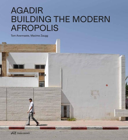
AGADIR BUILDING THE MODERN AFROPOLIS Tom Avermaete, Maxime Zaugg
TABLE OF CONTENTS
01 02
Introduction
Tom Avermaete, Cathelijne Nuijsink
Mapping Agadir
Maxime Zaugg
FOUNDATIONS 00 00 00 00 000
4
The City and the 1960 Earthquake
Lahsen Roussafi
Urbanisme Solidaire: Codes and Conventions as Project for a New City
Tom Avermaete
The Contact Zone of Agadir’s Emergency Aid Operations
Cathelijne Nuijsink
Brutalism: ‘The Gem of Morocco’s Contribution to World Culture’
Laure Augereau, Imad Dahmani, Lahbib Elmoumni
Building Agadir
Maxime Zaugg
TRANSLATIONS 000 000 000 000 000
The Reconstruction
Lahsen Roussafi
On Squares, Stairs, Paths, Plinths, Trees and Shade in Agadir’s Reconstructed Centre
Hans Teerds
Re-organising Agadir, Re-constructing the Neighbourhood
Janina Gosseye
Housing Figures: Social and Spatial A-Synchronicities
Irina Davidovici
Inhabiting Agadir
Maxime Zaugg, Michael Blaser
TRANSFORMATIONS 000 000 000 000 000
5
The Evolution of the City
Lahsen Roussafi
Architecture of Resilience: Privacy and Privatisation in Agadir Housing
Tom Avermaete, Irina Davidovici
Agadir’s Shifted Centralities
Janina Gosseye, Hans Teerds
Coda
Cathelijne Nuijsink, Maxime Zaugg
Regarding Agadir
David Grandorge, Introduction by Irina Davidovici
INTRODUCTION Tom Avermaete, Cathelijne Nuijsink
THE MODERN AFROPOLIS Our understanding of how urban designers and architects can design cities is still largely affected by Western urban conditions and perspectives. The European city in particular, with its steady and controlled growth, has served for a long time as the background against which new urban-design methods and instruments were developed. Recently, scholars have begun to heavily criticise this conception of Western countries and cities as pinnacles of architectural progress, ignoring key developments in other regions and territories.1 Geo grapher Jennifer Robinson, for example, claims that the geographies of urban-design history are characterised by an enduring divide between ‘First World’ cities and regions that are seen as models, generating theory and policy, and ‘Third World’ towns and territories that are seen as problems, requiring diagnosis and reform. Moreover, she holds that these First World biases do not remain without impact and that much of twentieth-century historiography, with its roots lying overwhelmingly in the Global North-West, suffers from intellectual parochialism.2 7
INTRODUCITON
MAP OF MOGADOR AND TAROUDANT, 1906 The topographical map Carte de Reconnaissance du Maroc (Exploration Map of Morocco) was drawn by French military Captain N. Larras between 1898 and 1906, and published by the editor-geographer Henry Barrère in Paris. Showing the Moroccan region of Mogador-Taroudant, it was an integral part of the French national mapping campaign during the pre-protectorate period in the nineteenth century. Situated on the Atlantic Ocean, the city of Agadir is shown within its triangular relationship with the towns of Mogador (today’s Essaouira) and Taroudant – cities situated, at the time, within a day’s travel from each other. Agadir’s location is closely linked to domestic trade routes to the south of the country and defined by the topography of the Atlas Mountains and the ocean. Its harbour, however, was never really used for commercial purposes due to the importance of Mogador’s significantly larger port. Therefore, important trade routes developed to Mogador but also to Agadir’s hinterland. Until the end of the nineteenth century, around the time when this map was drawn, Agadir was considered a small town that served as a supply destination for travels to the south.
18
MAPPING AGADIR
19
MAP OF AGADIR, 1959
The map drawn by the Bureau Technique Bret- Leuzinger in Agadir in 1959 organises the city into square sectors and includes a comprehensive legend. The detailed coloured map, made one year before the devastating earthquake, shows the completed harbour of Agadir and the expansion of the Quartier Industriel Sud to the east. The densely built-up Talborjt, on the slope of the hill, is sepa rated from the horseshoe-shaped Ville Nouvelle by the Plateau Administrative (Administrative Plateau).
30
MAPPING AGADIR
This plain, shaped by the natural topography, accommodates more public and institutional buildings, and is interspersed with green public spaces. The Quartier Industriel Sud was created by the municipality of Agadir to meet the needs of industrialists faced with the development of the city and its industry. As the small industrial district of Anza would no longer suffice, due to lack of space, this new quarter was built at the end of the 1940s outside the city, towards Inezgane. It was contained
within natural boundaries such as the mountains to the north and the river courses to the east, as well as by the Ville Nouvelle to the west. Visible on the plan is a green separation zone south of the Quartier Industriel Sud towards the sea. During the 1950s, Agadir was a prosperous city that started to open up for national and international seaside tourism – as demonstrated by the introduction of a beach and a variety of sporting facilities along the coast.
31
Fig. 1 The exceptionally violent earthquake devastated the city in minutes Fig. 2 Ruins of the luxurious Saada resort hotel in Agadir
68
FOUNDATIONS
THE CONTACT ZONE OF AGADIR’S EMERGENCY AID OPERATIONS Cathelijne Nuijsink
For a mere few seconds during the night of 29 February 1960, the third night of Ramadan, the earth beneath Agadir city trembled – an earthquake measuring a modest 5.7 on the Richter scale had hit the city. However, what followed was nothing short of a tragedy. The exceptionally violent earthquake, followed by a second shock and a fire, devastated the city in minutes figure 1. A total of 15,000 lives were lost, 25,000 citizens were injured, and most survivors lost their homes.1 The old casbah – the citadel strategically situated 230 metres above sea level on a hill overlooking the ocean, which had served to protect the city and its port from possible foreign invasions since 1540 – was razed to the ground despite its metre-thick walls.2 Other areas also largely built from traditional masonry and rammed earth, such as the Founti quarter adjacent to the beach and the poor inland district of Yachech, were instantly wiped out, burying thousands of Moroccans in the rubble.3 The structural weaknesses of the modern-looking 69
buildings in Agadir’s Centre Urbain, normally hidden behind their plastered walls, were exposed after the sudden, violent shocks. Once the commercial heart of Agadir, Talborjt, was now, according to an eyewitness, ‘nothing more than a bloodletting in a sea of stones, where the dead and the living rub shoulders in the midst of an awful inventory of punctured carpets, babouches, onion baskets, cardboard suitcases, children’s carriages’, – at least 60 per cent of the buildings were destroyed.4 Even the newly built Ville Nouvelle, constructed in 1947 by French colonisers between the Centre Urbain and the beach, and the touristic area Front-de-Mer (Seafront), adjacent to the beach, could not withstand the quake. Many of the modern apartment buildings housing the Europeans were half standing but ripped open and terribly damaged. Moreover, the luxurious resort hotels at Front-deMer – the accommodation for tourists arriving to the ‘the Miami of North Africa’ – could not resist the shocks of what was the most
THE CONTACT ZONE OF AGADIR’S EMERGENCY AID OPERATIONS
104
BUILDING AGADIR
105
144
BUILDING AGADIR
145
CITÉ SUISSE Albert U. Froelich 1963–5 LOCATION: Secteur Résidentiel FLOOR AREA: 4361 m2 CONSTRUCTION COST: 1,631,000 DM COMMISSIONER: Société Suisse de Radiodiffusion et Télévision ARCHITECT: YEAR:
198
BUILDING AGADIR
The Cité Suisse (Swiss Neighbourhood) was designed by the Swiss Architect Albert U. Froelich in 1963 and built in 1965. It was financed by aid funds from Switzerland and the Swiss Red Cross. The neighbourhood is located between Rue du Koweit, Rue du Caire, Rue Mokhtar Soussi and Rue d’Alger in the Secteur Résidentiel of Agadir. It consists of 56 three-room houses, 6 central commercial entities and a Maison des Jeunes (Youth Centre) located southwest of the Cité Suisse in combination with a sports field. The individual houses are clustered in small groups of staggered units that are carefully positioned in the landscape and surrounded by gardens. They all have vaulted roofs, which define the characteristic exterior appearance of the neigh-
bourhood. The units are designed to be earthquake-proof, built with a steel frame with walls and roofs made of light materials made of porous concrete. The single-storey residential units are equipped with two bedrooms, a living room, a kitchen, a hall and a bathroom. A corridor connects all the rooms with the garden. Houses, shops and the youth club are connected by a system of roads and pedestrian paths, and form a close-knit urban ensemble within the wider urban fabric of Agadir.
199
HOUSING FIGURES: SOCIAL AND SPATIAL A-SYNCHRONICITIES Irina Davidovici
HOUSING AND URBAN DESIGN The 1960 earthquake provided the apocryphal modernist tabula rasa for reconstruction. In terms of housing, however, the architects of the new Agadir did not operate in a void – either urbanistically or theoretically. Firstly, by then, the city had already been subject to colonial planning experiments. While the old ‘Ville Européenne’ (European City, also known as the Ville Nouvelle) had been erased, its memory remained in the idiosyncratic curvature of new streets in the city’s more prosperous residential district of villas. In contrast, the democratising device of the grid was applied in the more working-class quarters – pointing to a different, subtler form of segregation on socio-economic grounds. Secondly, the architects were contributing to the already rich modern-architectural culture in Morocco, which had proven highly experimental in terms of housing.1 In this context, the common stylistic range generated by the Normes Agadir 1960 was characterised by rectangularity, 313
linear white surfaces and exposed-concrete structures – often revealing the dark underbelly of buildings in the manner of Corbusian pilotis (stilts). These modernist tropes were at the same time mediated by a sense of cultural adaptation, perceptible in the reduced height of multistorey ensembles, the permeable boundaries articulated by perforated concrete screens and the exploration of individual family dwellings loosely reminiscent of indigenous types. In its massing and typological heterogeneity, Agadir’s new housing closely reflected the principles employed in the overall city planning of the reconstruction. The modernist slabs at the heart of the Centre Urbain, the upmarket villas and more modest patio houses in the Secteur Résidentiel, the anonymous flats above the commercial streets of Nouveau Talborjt and the accommodation for working officials hidden behind or above public institutions around the Cité Administrative corre-
HOUSING FIGURES: SOCIAL AND SPATIAL A-SYNCHRONICITIES
336
TRANSLATIONS
337
INHABITING AGADIR
Figures Lorem ipsum dolor sit amet, consectetuer adipiscing elit. Aenean commodo ligula eget dolor. Aenean massa. Cum sociis natoque penatibus et magnis dis parturient montes, nascetur ridiculus mus. Donec quam felis, ultricies nec, pellentesque eu, pretium quis, sem.
378
TRANSFORMATION
Figures Lorem ipsum dolor sit amet, consectetuer adipiscing elit. Aenean commodo ligula eget dolor. Aenean massa. Cum sociis natoque penatibus et magnis dis parturient montes, nascetur ridiculus mus. Donec quam felis, ultricies nec, pellentesque eu, pretium quis, sem.
379
AGADIR’S SHIFTED CENTRALITIES
404
REGARDING AGADIR
405
The tension between the Moroccan ways of living and the notion of progress associated with European modernism comes to a head in the residential slabs in the city centre. Their usage and adaptation indicates a breakdown of the social mobility envisaged by the Agadir planners (all the way up to the King) in 1960. Due to their prominent position in the city, Immeubles A and D have continued to provide a privileged address, which is often used for business rather than residential uses. Despite its guarded relation to the street, many units in Immeuble D are used for small businesses and service companies, accessed through a decidedly residential entrance. On all blocks, the deep loggias, particularly on lower floors, have been filled by residents in by partitions—glass, walls, curtains, even arches.
Printed in Germany ISBN 978-3-85881-820-1