List of contents
Academic proyects
1. Desertification Process and the Right to Water Petorca, Chile
Individual thesis MaULP - KUL
Prof. Viviana d’Auria and Dr. Jeroen Stevens
2. Interweaving of Coastal Landscapes Knokke-Heist, Belgium
Individual thesis MaHS - KUL
Prof. Kelly Shannon and Prof. Bruno De Meulder
3. Housing Complex of Social and Territorial Integration Santiago, Chile
Individual final thesis project - UChile
Prof. Paola Velásquez and Prof. Emanuel Giannotti
4 Residential Quality in Housing Complexes
Valparaíso, Chile
Individual thesis - UChile
Prof. Rubén Sepúlveda
5. Italgas Urban Renewal Rome, Italy
Individual project - Stuttgart University
Prof. Dr.-Ing. Helmut Bott
6. Environmental Education Center Cahuil, Chile
Individual project - UChile
Prof. Jaime Diaz
Professional proyects
7. Modern architectural history projects catalog
FONDECYT research project
8. Ciudad Parque Bicentenario
Housing complex project competition
Uno Proyectos
9. Lastarrias gallery
Commercial heritage project
Uno Proyectos
10. Las Canteras school
FAEP - school infrastructure project
SECPLAN Huechuraba
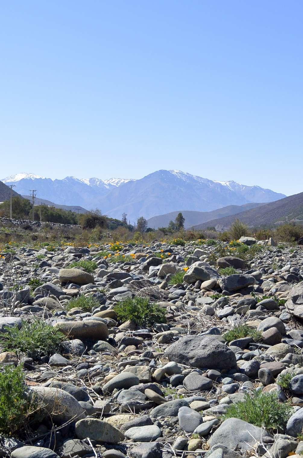
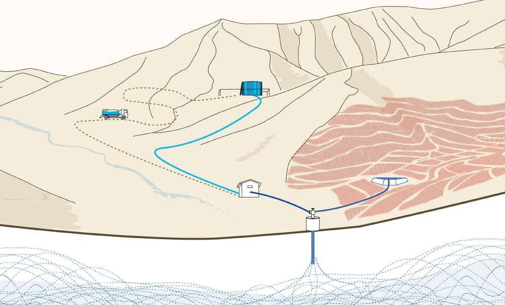
Since 2010, Chile has experienced some of the most severe droughts of the last century. The effect of climate change, combined with intensive extractive activities and water privatization policies, has caused water scarcity problems in the central regions of the country. The commune of Petorca has been the epicenter of territorial disputes over the environmental right to water, led by the social struggle of different local organizations, who have exposed new meanings of water as a common good and a human right. The permanence of rural communities in Petorca is at stake after the depletion of watercourses in the area. Nowadays, their survival depends to a great extent on the collaboration capacity of their inhabitants through the Agua Potable Rural (APR) systems, self-managed collective organizations that fight for their water sovereignty rights. With the collaboration of the communal and regional government, these organizations receive daily drinking water delivered through tanker trucks, a situation that reflects the alteration of the natural cycle and social life of water in Petorca.
The research sought to analyze the representations of water in the commune of Petorca in its spatial dimension, from the lens of the practices carried out by the Agua Potable Rural committees. The thesis took as a case study the water conflict in the commune of Petorca, to critically understand the spatial relations that result from the reproduction of the artificial water cycle in Petorca. To this end, it was intended to document, analyze and map the elements that compose the water practices in Petorca; also to explore, to what extent has water scarcity reshaped the ways of living in the Petorca river basin.
The design project sought to provide long-term solutions to restore the watercourses of the basin, and answer the question: what set of new water practices would allow to achieve water sovereignty in rural settlements of Petorca?
Thesis analysis
Water practices by elements
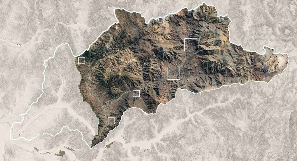
The defined methodology considers only the analysis of the upper part of the Petorca river basin, where environmental conflicts are concentrated and the water crisis is latent. Then 5 case studies were selected, defined after intensive field work, and where each case represents an element. A quadrant was defined for each element and within the quadrant a transect, in order to have a multiscale and multidimensional view of the artificial water cycle.
In color red, avocado plantations are highlighted, which are largely responsible for the desertification of the basin.
2.
3.
4.
5.
Upper part of the Petorca river basin with the 5 quadrants of studies
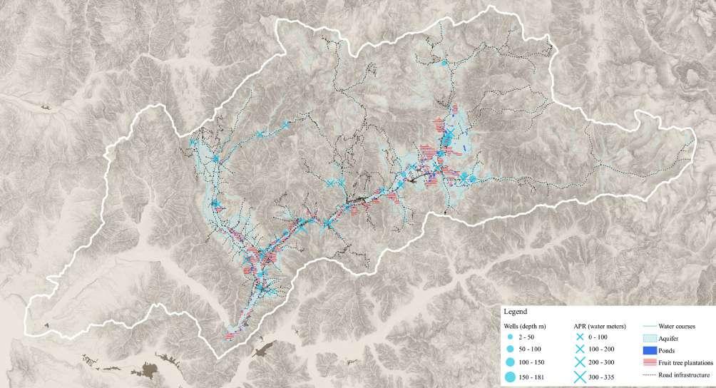
Upper Petorca river basin and mapping of water practices
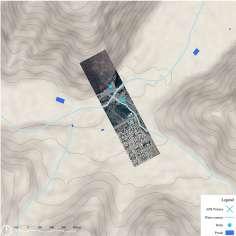
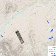
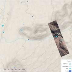
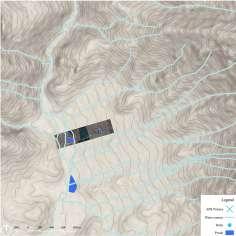
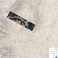
Quadrants per element





Sections of the transects in the localities of La Ñipa, Chincolco, Quebrada Honda, Pedernal, and El Manzano respectively

Design project
For the design of the project, it was decided to intervene in the town of Chincolco, where the analyzed elements converge. The proposal recognizes the different geographic levels, the rural character of the commune and the need to build new houses. In addition, to propose practices in accordance with the environment.
The proposal considers the regeneration of watercourses through the integration of endemic vegetation, and the treatment of wastewater for re-infiltration into the desertified soil.
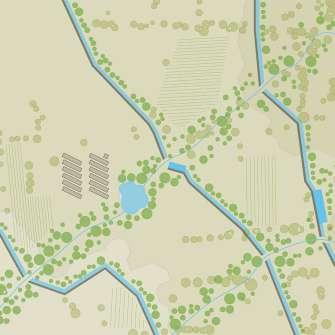
Projected quadrant productive landscape intervention
Section productive landscape intervention
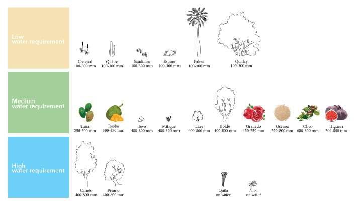
Scheme of endemic species of the scleorophyllous forest and their water requirements
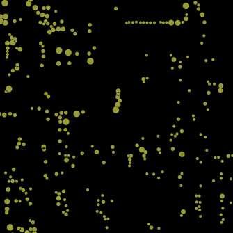
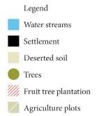
transect, existing situation
Section rural settlement intervention
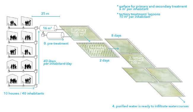
of domestic black and gray water recycling system proposed
Interweaving of Coastal Landscapes
Knokke-Heist, Belgium
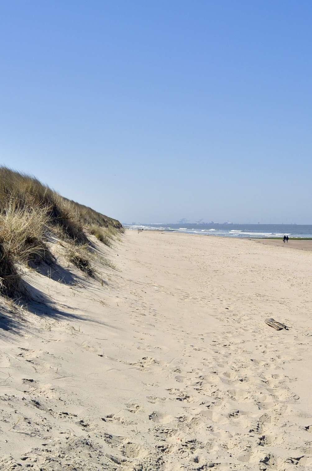
The settlements present in the area are scattered along the beach, evidence of the prominence of the coastline. Looking back in history, the settlement’s success stems from the tourism it achieved in the roundup days of the year, where the romantic dunes and small settlement were an ideal place for painters to paint landscapes, making the town even more popular for day trippers.
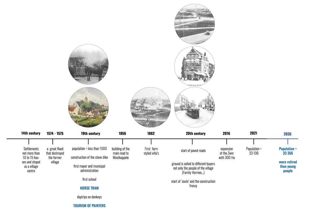
Timeline: From ‘Cnock’ to Knokke
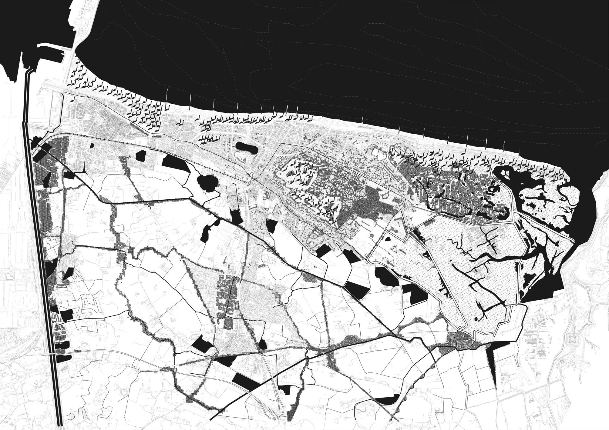
During the field trip, the transition and interweaving of different landscapes and urban structures in the site became evident. The succession begins with the beach and exposed dunes, followed by the Atlantic Wall. On a higher level, the dunes are mostly covered by buildings. And finally, the railroad line over a dyke forms the boundary with the polder landscape.
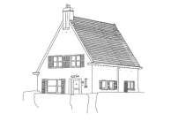
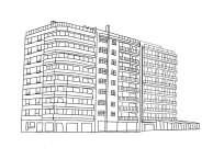
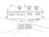
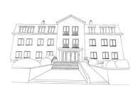
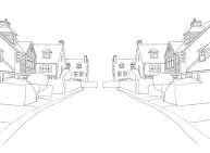
There are multiple typologies in the urban fabric. The most significant for our analysis being the one present on the Atlantic Wall in front of the coastline, followed by single-family houses and villas. While on the border with the polder landscape, we find housing blocks as a form of urban stamp.
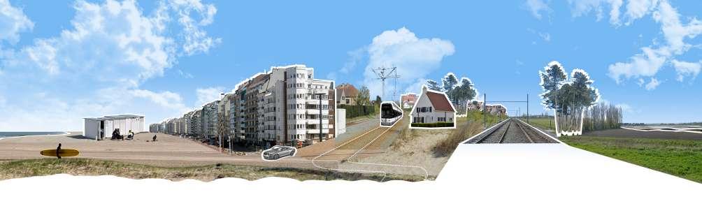
work interpretation and typologies
Thesis landscape project
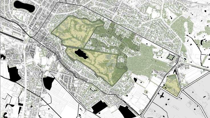
The water, represented in black, shows the latent threat of flooding in the future. And in the inner area, the polders landscape is located, its agricultural structure and the dikes. In terms of the historical landscape, the inland extension of the dune landscape, its growth from east to west reflects the prevailing wind direction of the site and the historical coexistence of 3 landscapes: dunes, polder and tidal.
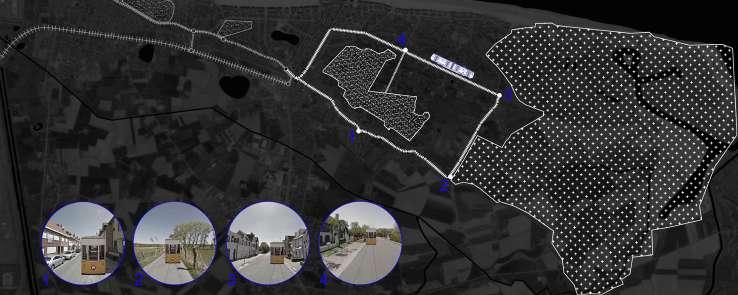
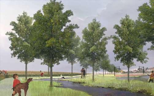
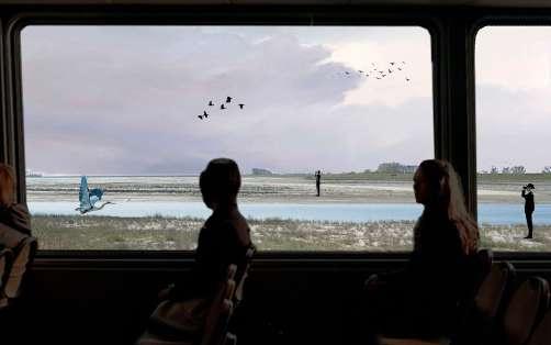
The vision for the end of the century is to restore and link the unique landscapes that exist: dune, polder and tidal. The extension of the dunes is proposed through the return of natural space and the interconnection of the existing dunes. While in the polders, the introduction of a series of ponds is envisioned in order to provide space for flooding, which together with the extension of the tidal landscape seek to respond to rising sea levels. With the ultimate goal of establishing a permanent settlement in the area.
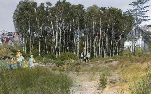
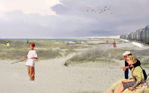
Extension and connection of the existing dune area in Heist
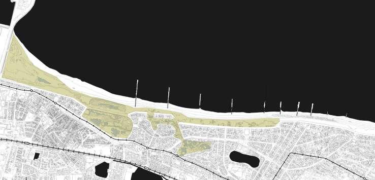
Introduction of the system dunes + forest to the neighborhood, and a new tram extention to make the Zwim Park a destination
2. Accomodate water figures in the polders
3. Expanding the Zwim
Housing Complex of Social and Territorial Integration
Santiago, Chile
Final thesis project “Vive Franklin”
Motivations: Qualitative housing deficit and quality of life in Chile
Theme: Chilean housing policy.
Issue: Residential segregation in Chilean cities.
Goals: Evaluate the effectiveness of the current Chilean regulation against segregation.
Choice of intervention site: Urban center of the main city of the country.
Obsolescence map by type of use
Segregation map in Santiago city
Location of the new housing proyects in Santiago
Mixed land uses in the
Obsolescence map potential intervention sites
Limitations: Costs of quality housing. Analysis area around
New housing projects for the social and territotial integration
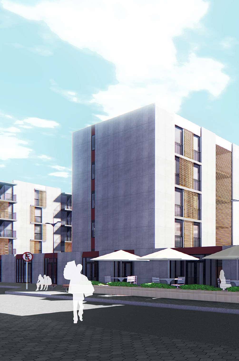
The housing complex named “Vive Franklin“ seeks to regenerate a commercial urban area in obsolescence with proximity to city center, through the integration of low-income families to inhabit this central area of Santiago, which due to the lack of regulation of the urban land market, since a few decades have been displaced to peripheral area, undermining their quality of urban life.
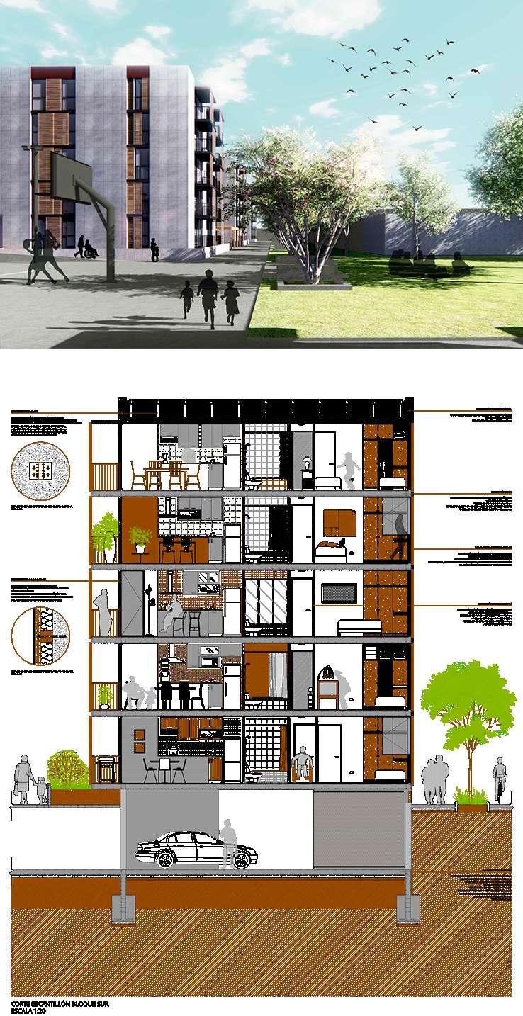
The proposal considers the rescue of the continuous façade of the neighborhood blocks, in addition to the integration of small-scale shops, such as cafes or grosery stores, according to the character of Franklin street. Also, includes accessible departments for people with disabilities and common green areas, necessary given the shortage in the neighborhood.
Section of the housing block type
Focused in the livability of the housing complex

Residential Quality in Housing Complexes
Valparaíso, Chile
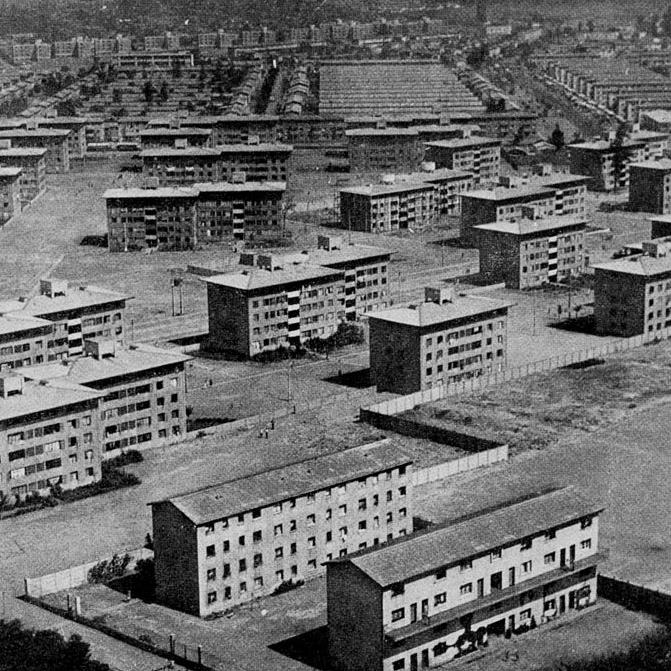
Period of the Corporation of Housing (1953-1976)
Architecture of the state of neighborhood buildings.
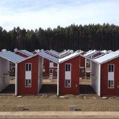
ELEMENTAL
Office
International prize winning architecture 2016 Pritzker Prize.
Methodological frame of the thesis
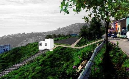
Motivations: The great fire of Valparaíso, April 2014. An opportunity to improve the quality of life of the communities living in the hills of Valparaiso.
Relevance of the research: 110 years of housing policies (1906-2016)
Research opportunities: Residential quality, contingent theme and little explored. Residential area hills of Valparaiso, strong identity and socioculturally active. Selected case studies, architecture examples with quality values.
General objective: Evaluate the residential quality of the housing complexes located in the sector of Quebrada Verde
Specific objectives:
a. Systematize different approaches and the state of knowledge about residential quality in housing complexes.
b. Describe in its historical, architectural and urban dimensions the housing complexes located in the sector of Quebrada Verde.
c. Analyze the attributes in the housing complexes located in the Quebrada Verde sector, which contribute to residential quality.
d. Propose architectural and urban design recommendations, as well as housing policy, in the search to increase residential quality in the hills of Valparaíso.
Hypothesis: The housing complexes of the Quebrada Verde sector have shared attributes of residential quality, which can be enhanced and replicated in other residential sectors of Valparaíso, mainly in the hills of the city.
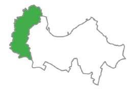
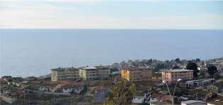
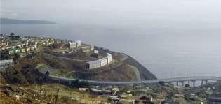
Location of the study cases in Playa Ancha hill
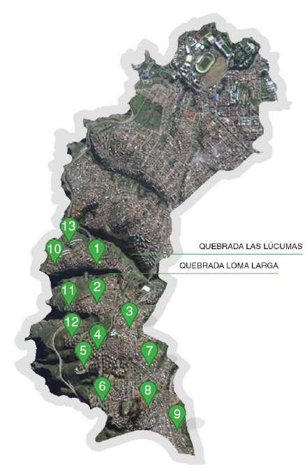
1. Quebrada Verde, first sector.
2. Quebrada Verde, second sector.
3. Quebrada Verde, fourth sector.
4. Quebrada Verde, third sector.
5. Quebrada Verde, quintoisector.
6. Quebrada Verde, sixth sector.
7. Aurora population of Chile
8. Puertas Negras population
9. Valle Verde population
10. The Ventisqueros population
11. Population The Reefs
12. Quebrada Verde population
13. Elemental population
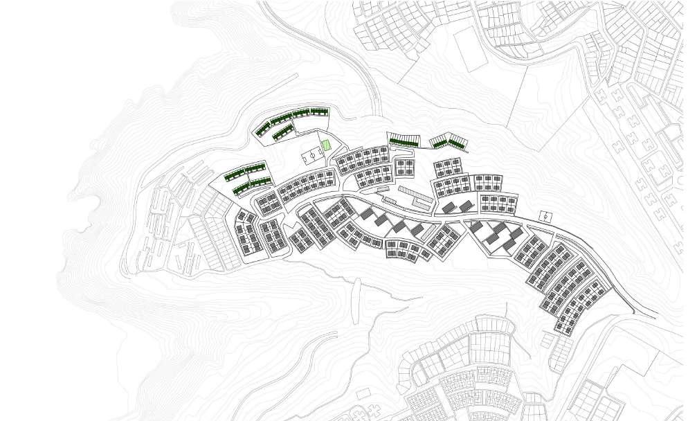
Location plan of the study cases selected
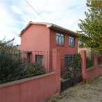
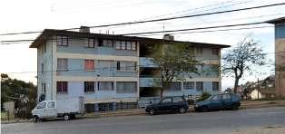
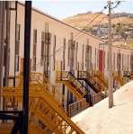
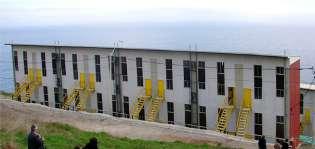
Case 1:
Housing Corporation 1961
Quebrada Verde, first sector: 534 families
3100 inhabitants
Built area 35,601 square meters
Density: 0.22
Construction system: reinforced concrete and confined masonry of concrete blocks
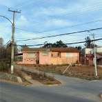
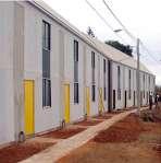
Case 2: ELEMENTAL Office 2008
The Acacios, Los Lirios and We Foliche: 150 families 820 inhabitants
Built area: 9,420 square meters
Density: 0.54
Construction system: brick clay confined masonry and reinforced concrete
Conclusions
It was possible to identify the shared, replicable and potential attributes, according to the analysis proposed.
“The main discovery was attributed to the identity attribute, it was initially thought that due to the continuous location of the selected cases, the location condition would be the shared attribute, however the communities seem to share an identity that increases the residential quality in the city of Valparaíso.”
ATTRIBUTES OF RESIDENTIAL QUALITY Evaluation
Design recommendation
In orden to increase the residential quality, I proposed:
1. Environmental and housing sustainability: To complex problems, integral solutions, no more partial projects and more green areas.
2. Location and mobility: Improvement of pedestrians areas. The main problem that affects the quality of life in Valparaíso is related with the geography of the hills.
3. Public space in co-ownership: integrate communities. Communities must learn to handle common spaces and issues between neighbors.
4. Minimum standards: better quality of contruction. It’s needed to elaborate a official document that content the minimum standards for housing in every region.
Rome, Italy
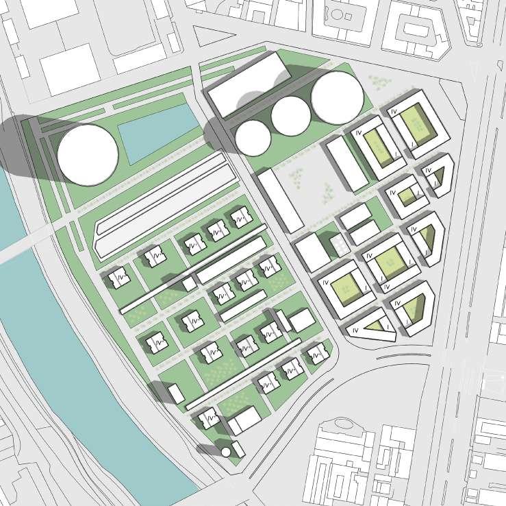
General plan of the proposal
Renewal of the Tiber riverfront , Rome
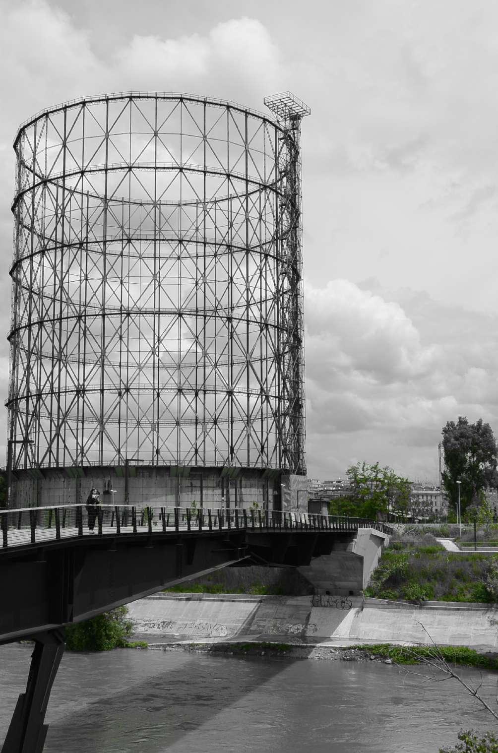
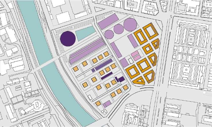
The project was developed during the semester of academic exchange at the Stuttgart University in Germany. The studio commission envisaged a trip to Rome, to visit the dependencies of Italgas, a former electric power factory that produced electricity over coal, which due to the invasive to the environment, the factory closes and the space remain until 2014 as a large urban remnant, facing the Tiber river that crosses the city.
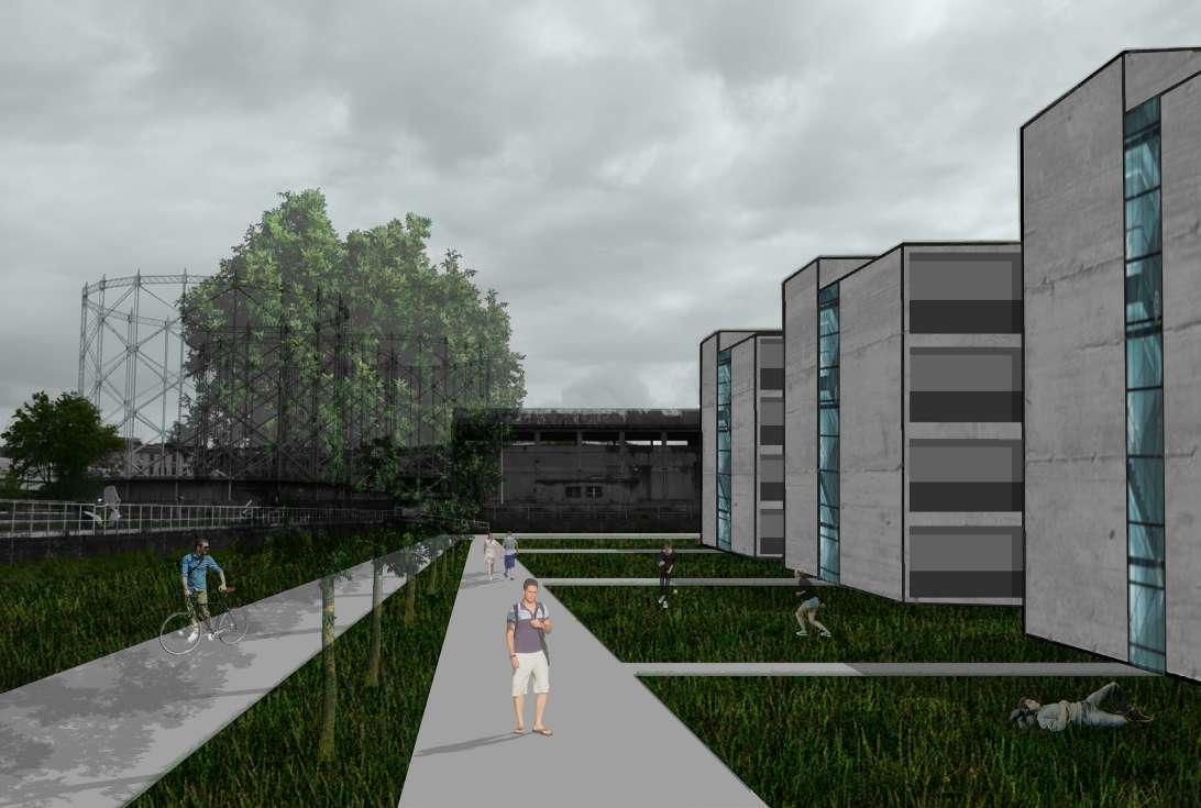
For the renewal, it is proposed to give place to the local university, due to the proximity to one of the main university campuses of Rome, that has not have enough space for its dependencies and has a growing demand for space. The desing plan contemplate the reconversion of the existing buildings into educational facilities, together with new university residences towards the river sector.
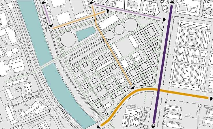
The proposal of university residency contemplates at the same time a park area, which allows the independence of the students, who usually maintain routines outside the habits of those who reside in the city. Also, it is believed that a good way to restore the relationship with the river is by eliminating the perimeter street, granting environmental continuity, between the water and the new park proposal.
1
Scheme 2
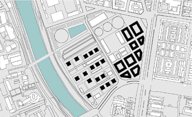
Building to renovate in purple and additional buildings proposed in orange
Scheme 3
Vehicular flows and new interior street
Section plan
Continuity of the river, new park proposal and the city of Rome

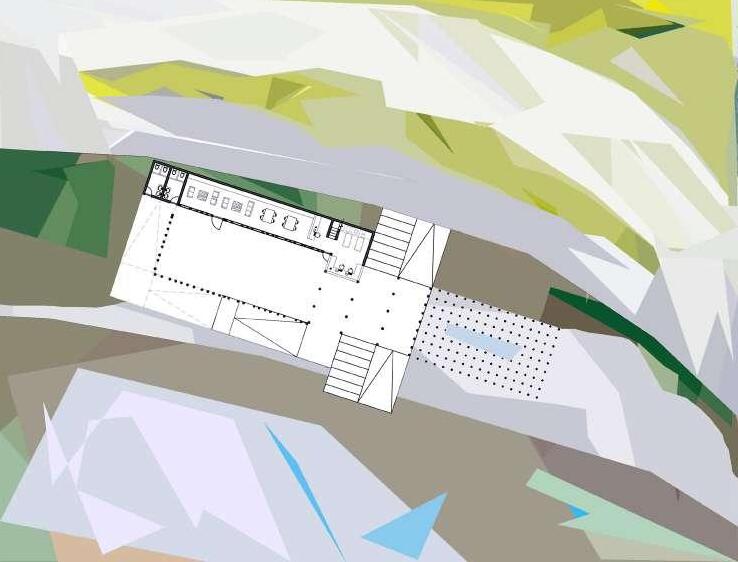
Environmental Education Center
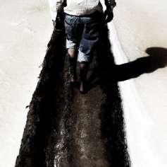
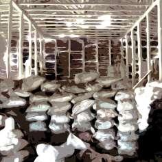

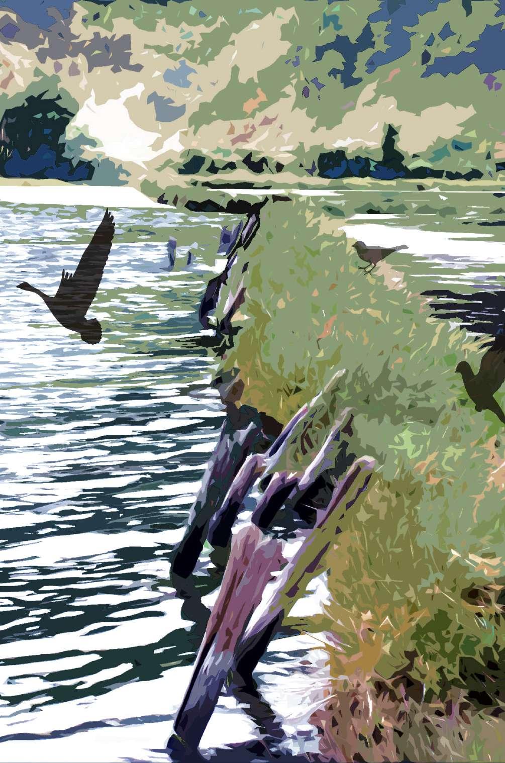
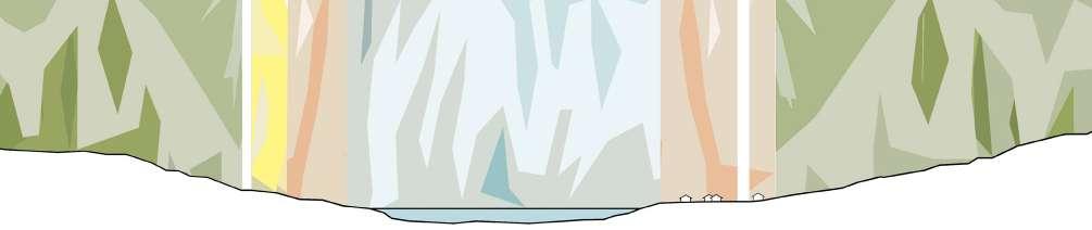
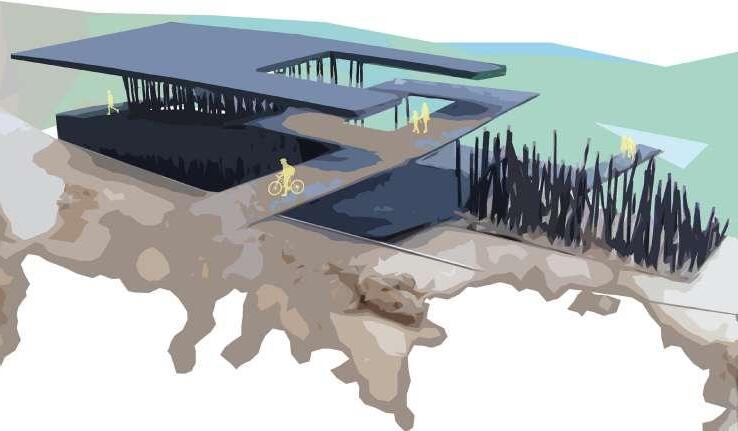
The project is located in the village of Cahuil, surrounded by a landscape that mixes a wetlands, salt flats and the sea, with flora and fauna typical of the central area of Chile. The area is protected by the environmental authority, due the birds that inhabit the wetlands. But, the natural area has been affected by the climate change, making the trade of salt workers declines. The sea salt is a product with multiples properties, and the salt production brings social, environmental and economical balance to the village.
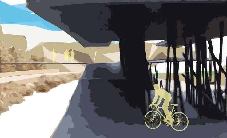
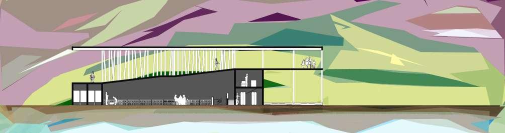
The programmatic proposal contemplates give a educational space to the community, in order to attend the subject inner the balance between the environmental elements of the sector, which make the wetland and the salt flats unique. For this reason, an environmental education center is proposed that give value to the landscape, linking up with the community and visitors. The tourists are more present every year during the high season, due the proximity with Pichilemu, a famous surfer beach. Through the educational program it seeks to generate the link between the naturals and humans elements of the habitat. The building is intended to disseminate the environmental heritage of the wetland and popularize the Nilahue Park in relation to the estuary of the same name. Likewise, the building is strategically located, at the beginning of a circuit of trails that run along the length of the estuary.
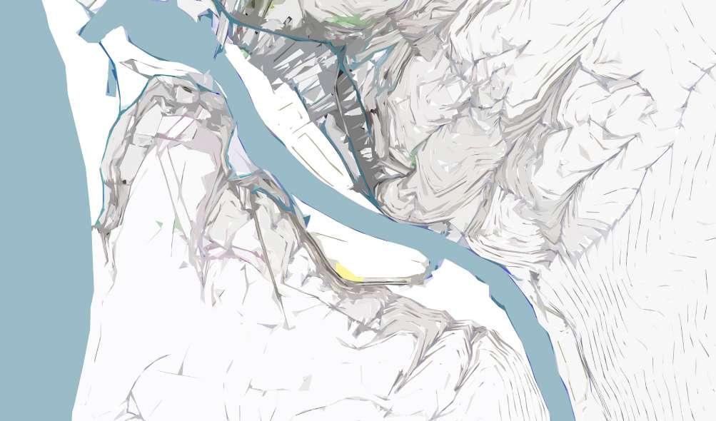
Location of the project
Section view of the conformation of the landscape
Views in collage expressions
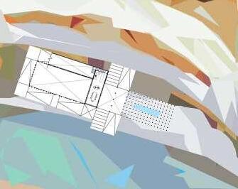
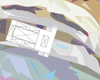

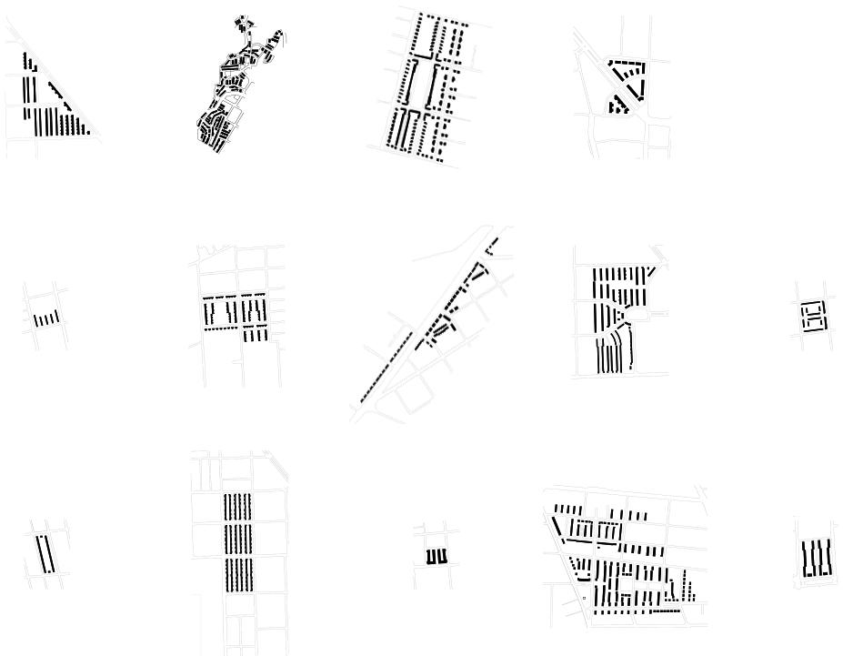
Modern housing complexes and buildings plans built by the “Caja de la Habitación” (former housing planning department)
Modern architectural history projects catalog
FONDECYT research 2015-2017
The National Fund for Scientific and Technological Development (FONDECYT) provides financial support to individual research in all areas of knowledge and in different periods of a researcher’s career. Professor Horacio Torrent, an academician at the Pontificia Universidad Catolica de Chile and President of DoCoMoMo Chile, led 3 projects funded by FONDECYT to study the introduction of modern architecture to Chile. For the project that sought to document the architecture of the great city, a catalog of built projects was elaborated with historical documents and planimetric redrawing.
Housing complexes technical sheets










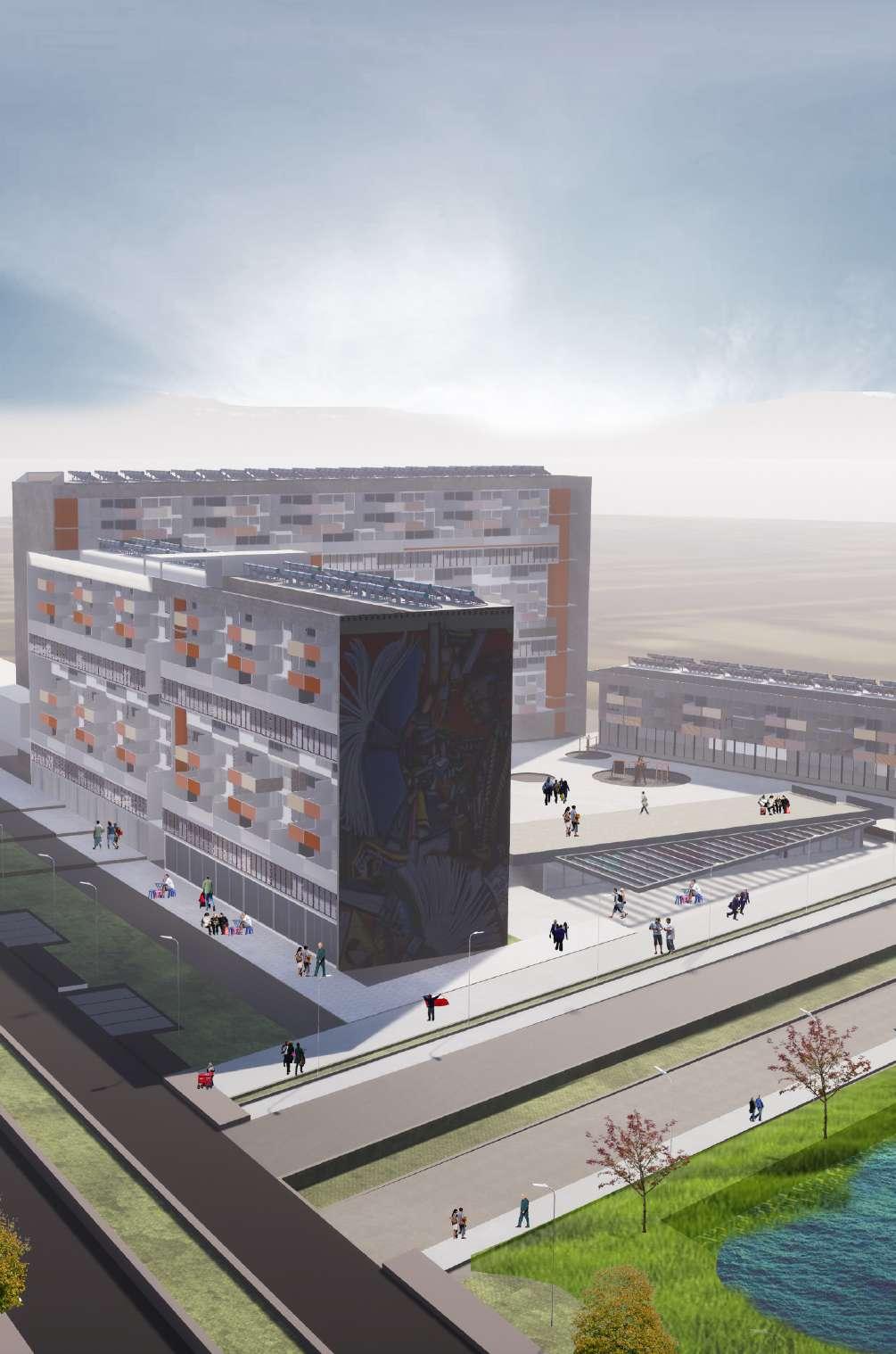
Ciudad Parque Bicentenario was born as a major urban project in the Cerrillos district, in which it was intended to build an environmental model integrated to the city with high population density. This would take the form of the construction of 15,000 housing units, green areas, and facilities and services associated with a neighborhood level, always with a view to sustainability and functionality that would represent a paradigm shift in the way the city is built.
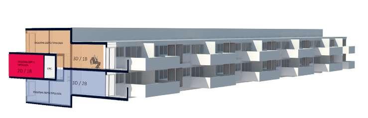
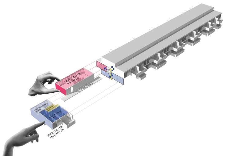
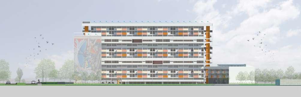
The proposal is submitted to the competition for a residential project for social integration in the Ciudad Parque Bicentenario, carried out by the Ministry of Housing and Urbanism in Chile. The designed proposal considers the construction of 300 housing units in 3 towers of different heights and with different housing typologies, which adapt to the reality of Chilean families. The main factor to consider in the proposal was the opening towards the Bicentennial Park, located in front of the land to be built. The measures regarding the integration of species and the landscape were key in the proposal.
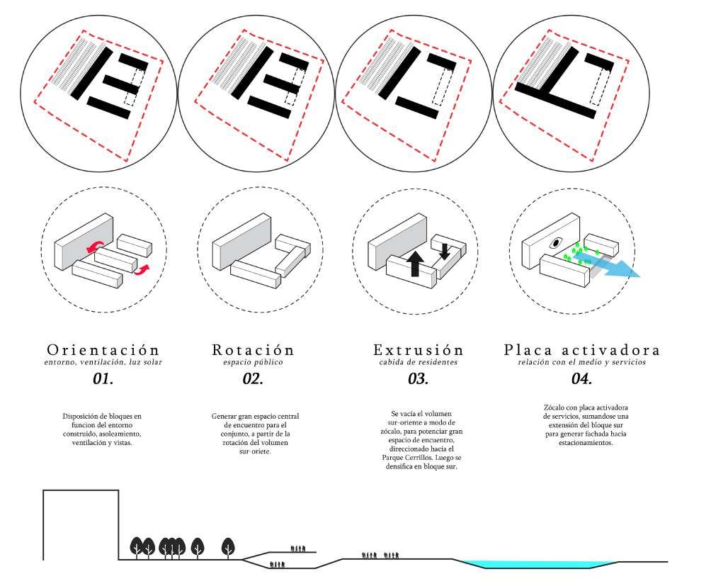
Organization of the different housing units designed for the proposal
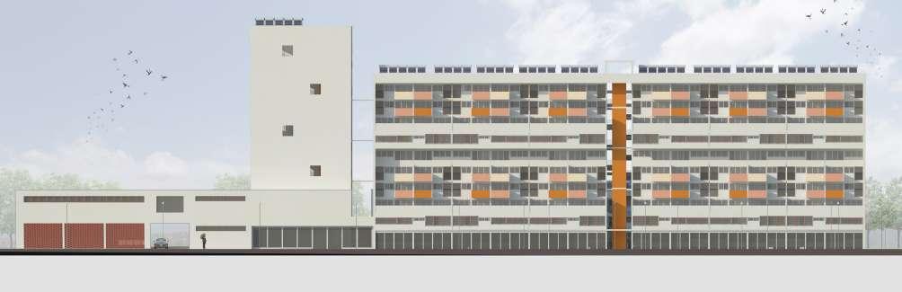
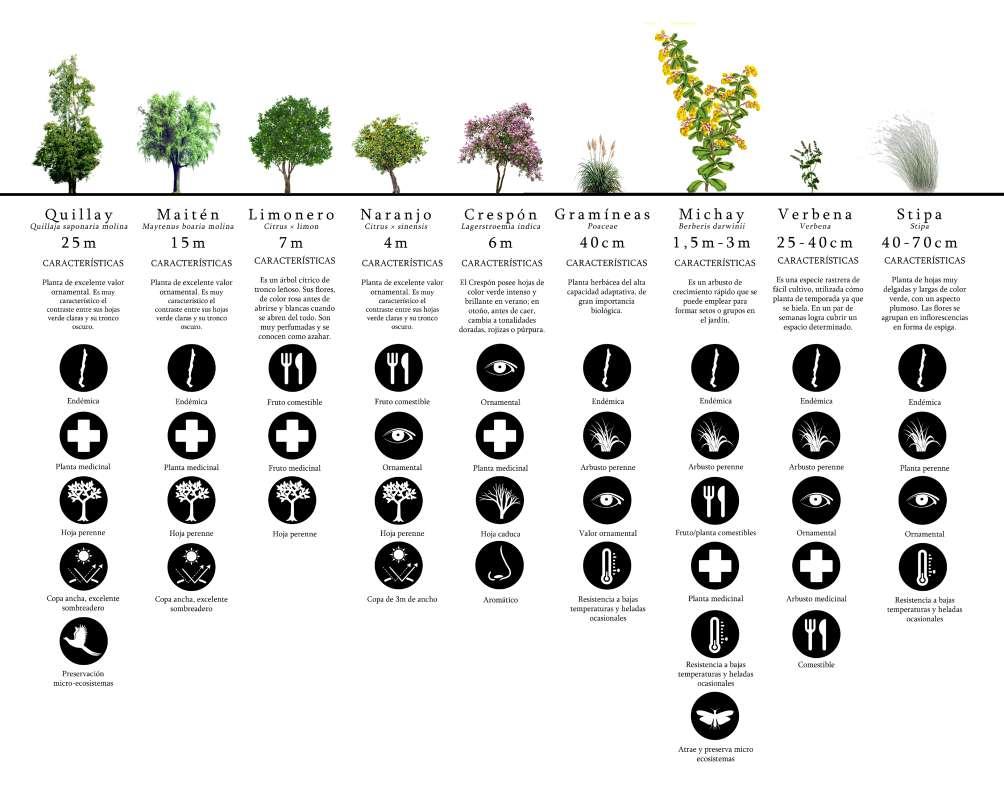
Proposal for the integration of endemic vegetation of the valley according to the design of the Bicentennial Park
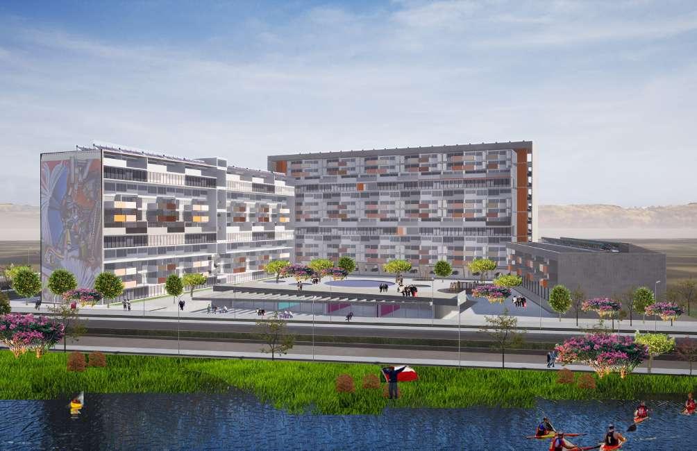

Location and ground floor plan
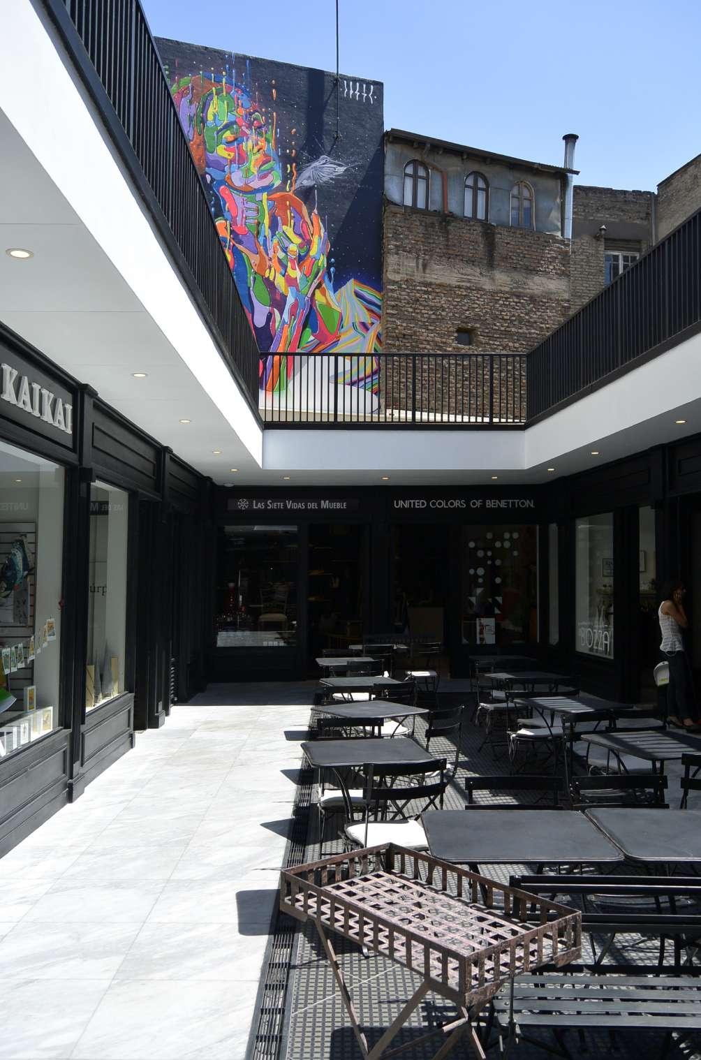
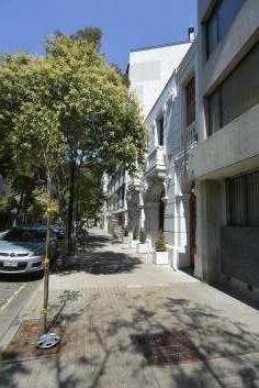
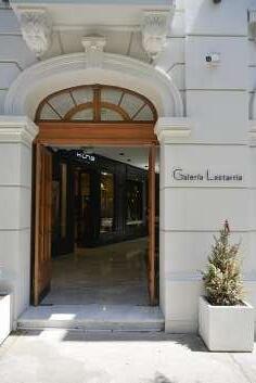
The construction of the building that today houses the Galería Lastarria, located in the emblematic Barrio Lastarria, dates back to 1923. With a French neoclassical façade, the building follows the trend of rich finishes and beautiful façade of other buildings of the time, which made Lastarria a neighborhood full of history and beauty.
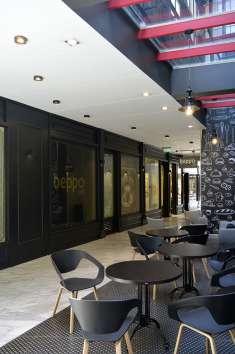
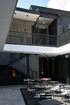
After several years without use, the project seeks to recover the building for the neighborhood as an open commercial gallery of 900 square meters, giving it back its splendor and providing the area with a space for locals with careful aesthetics and finishes, thus joining other similar actions that are giving a second youth to the Lastarria neighborhood, the current epicenter of tourism and gastronomy in the city.






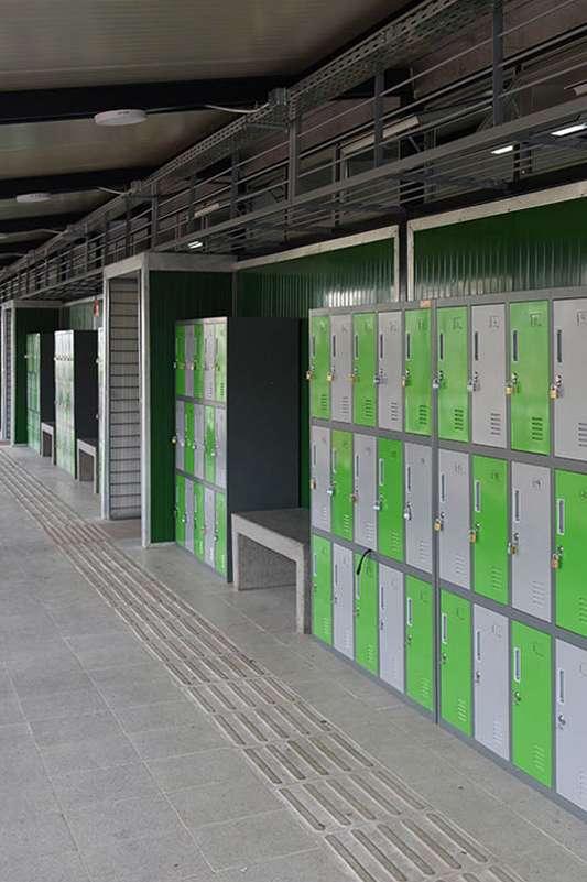
Las Canteras school
SECPLAN
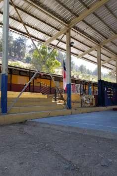
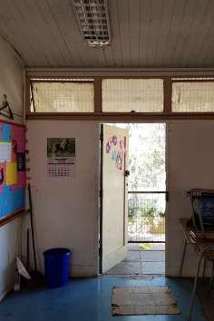
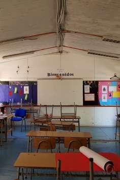
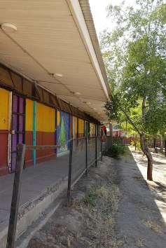
FAEP projects
Las Canteras school in Huechuraba receives children living in poverty. The infrastructure of the school was unmaintained for decades, which led to a significant state of deterioration.
The construction of a two-stage project was proposed. First, to address the deficiencies in the classrooms, and second, to address the design of spaces for play and recreation for the children.
The project was funded by the Ministry of Education through the Public Education Support Fund (FAEP) in 2017 and 2018. The total amount of the investment was 475 thousand euros.


Part 1. Project presentation sheets for the Ministry of Education approval process
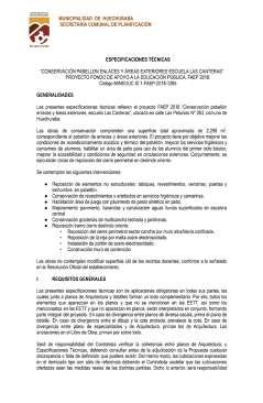
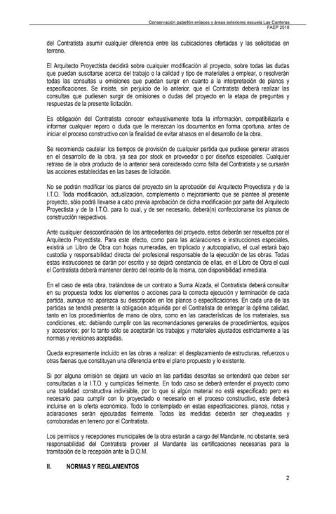
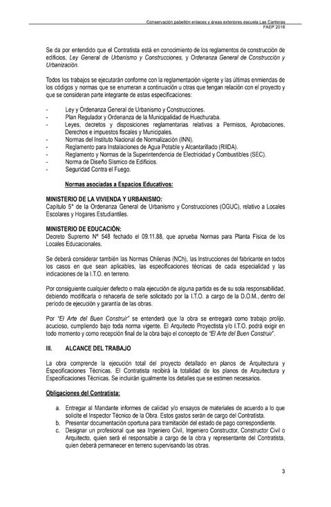
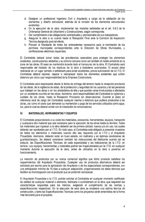
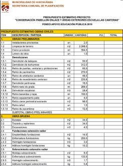
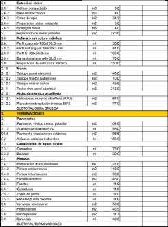
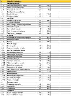
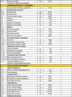
The sheets containing the project planimetry are completed with the delivery of the technical specifications and project budget to the Ministry of Education for final approval.

Part 2. Project presentation sheets for the Ministry of Education approval process
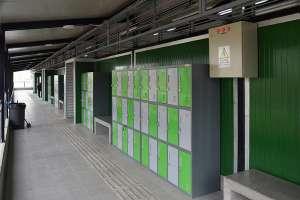
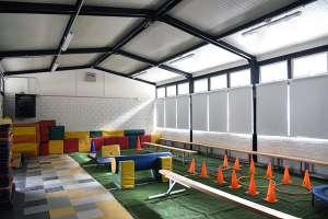
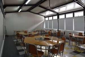
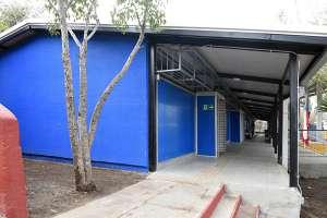
Images of the delivery and inauguration of the first classroom modules, part 1 completed. Resistant materials and attractive colors were used, according to the needs of the school.