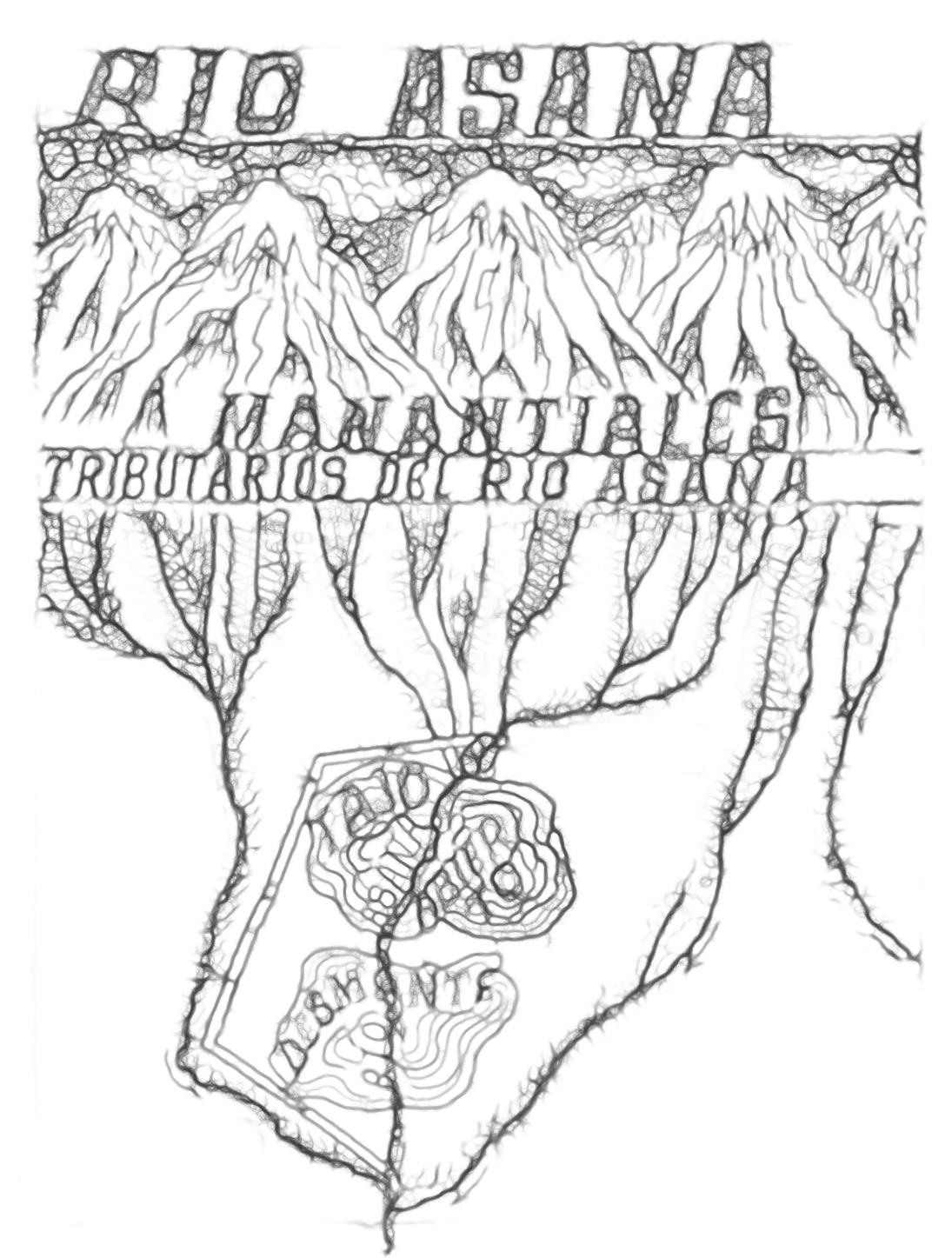
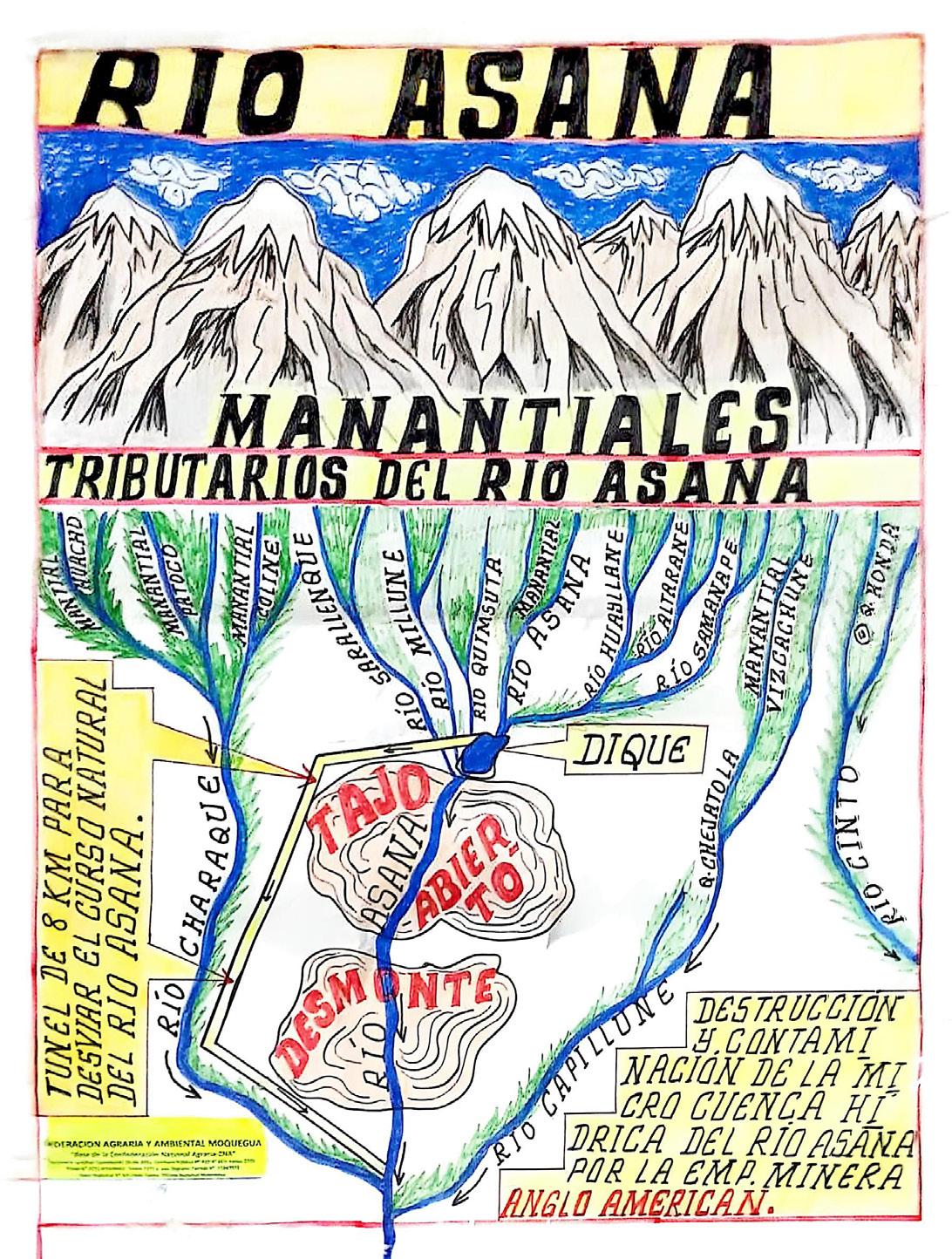
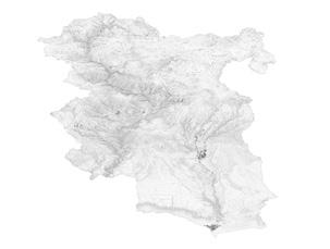
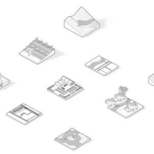
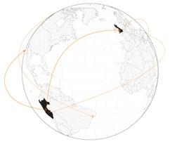
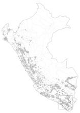
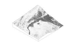
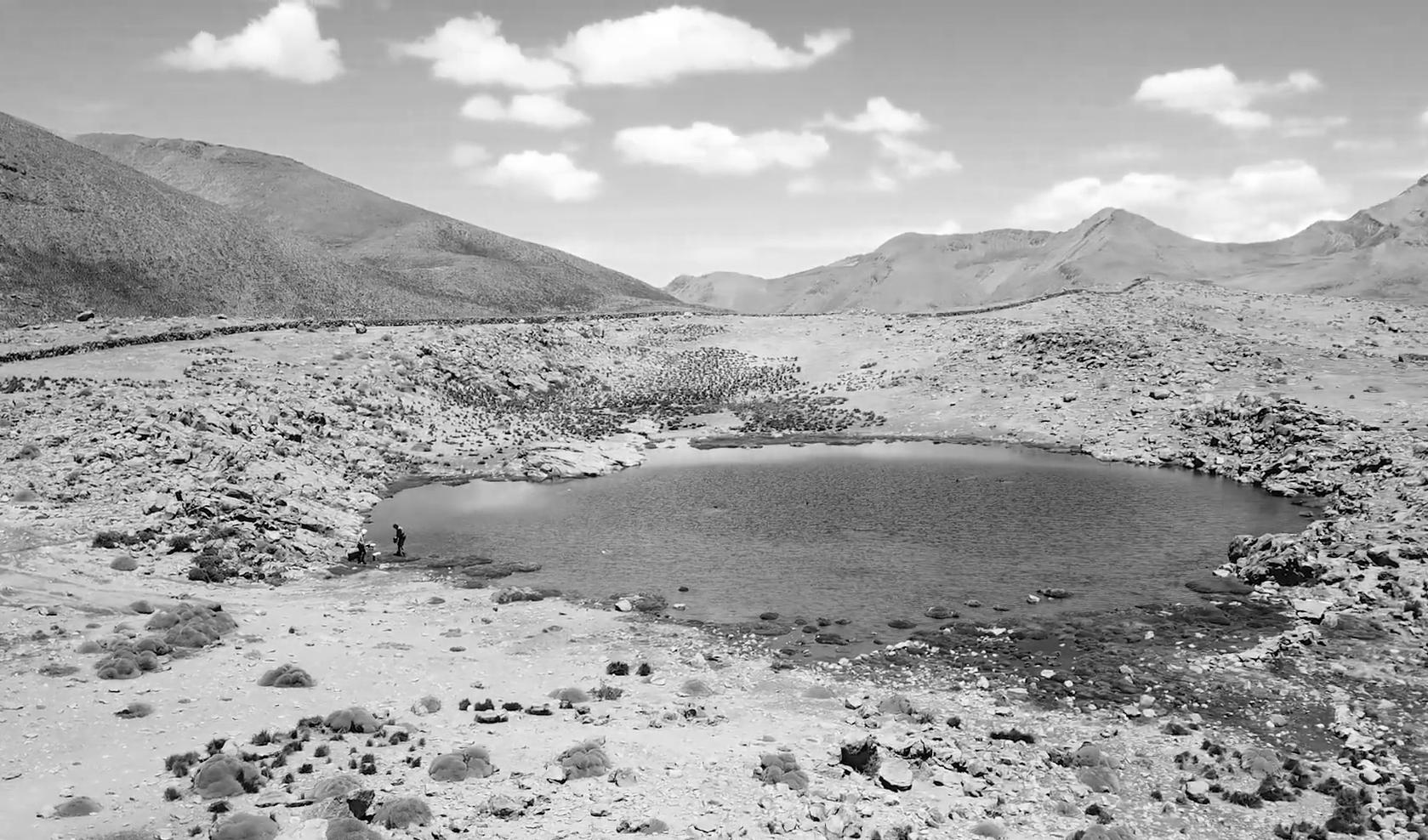
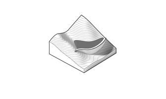
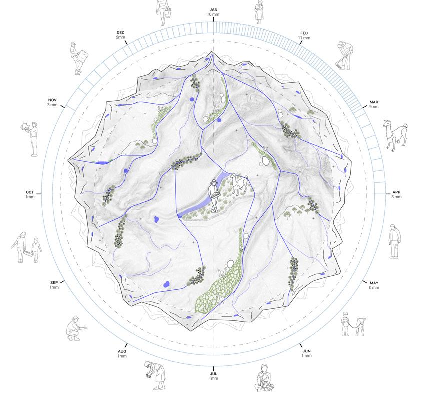
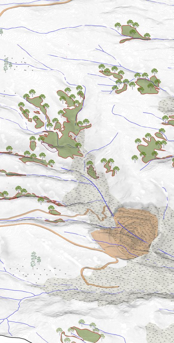
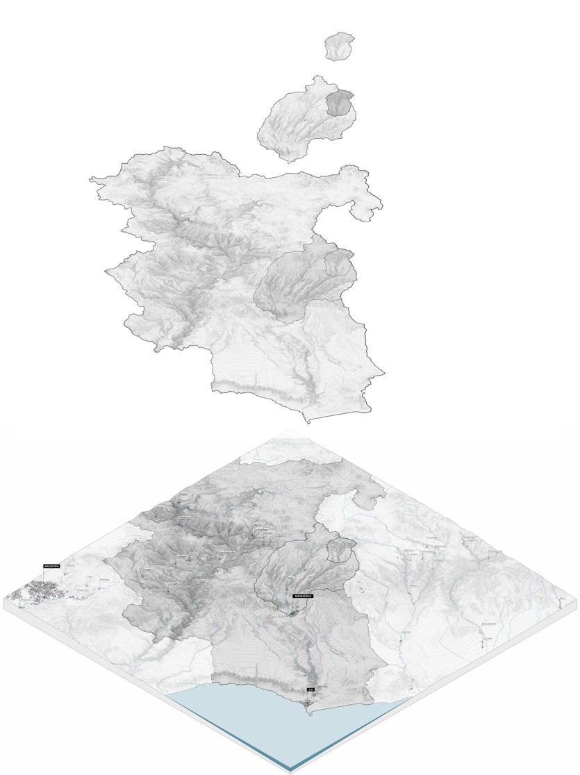
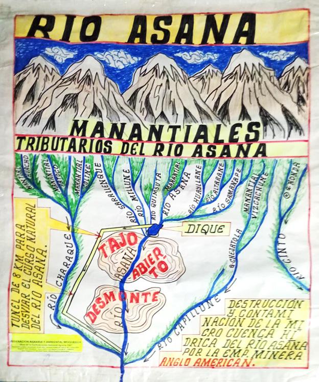
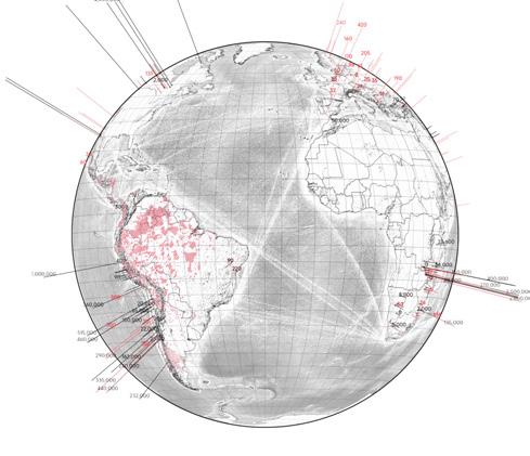
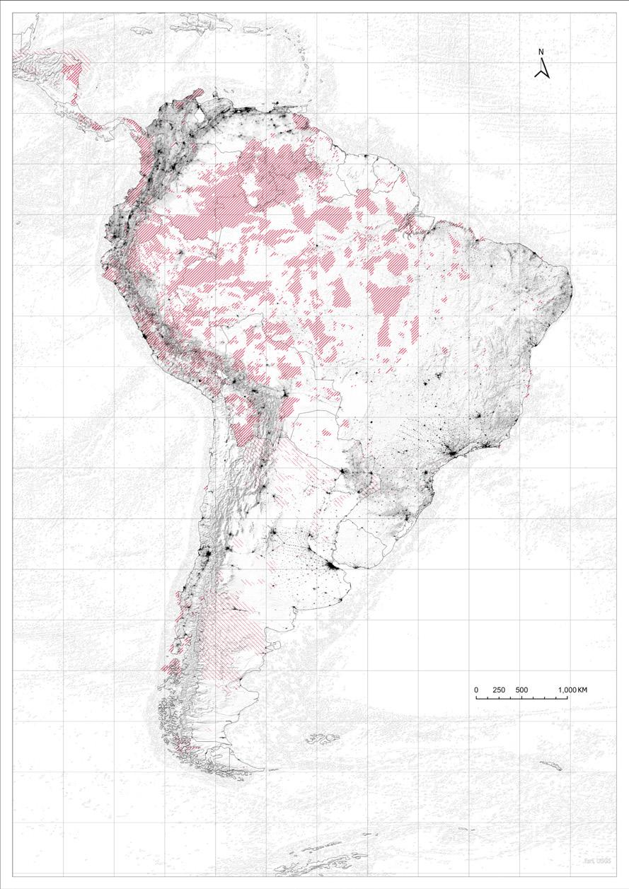
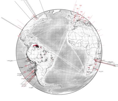
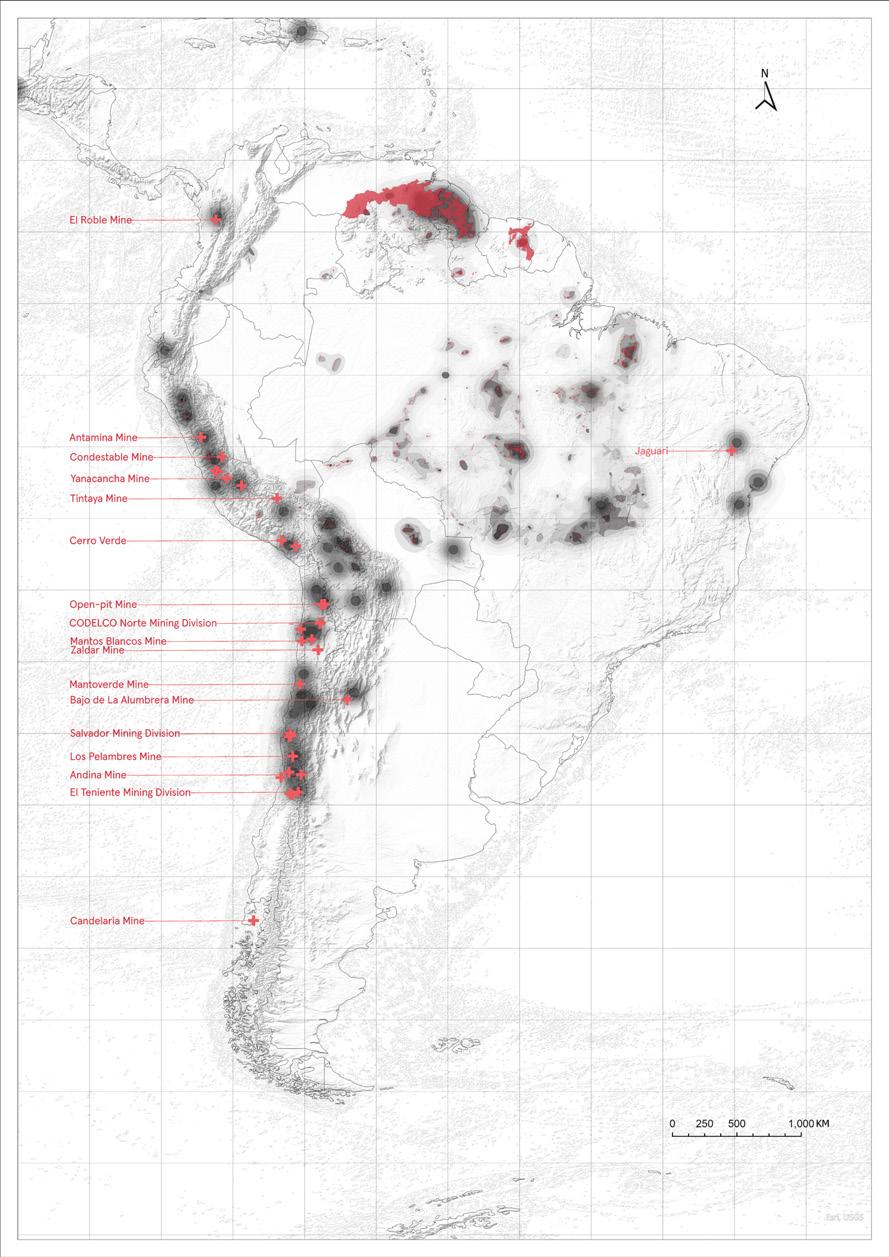
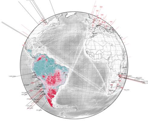
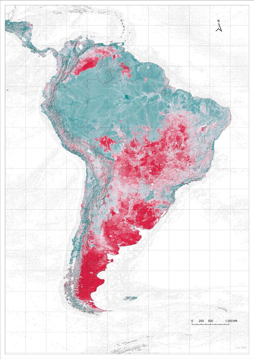
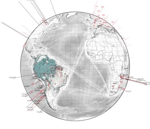
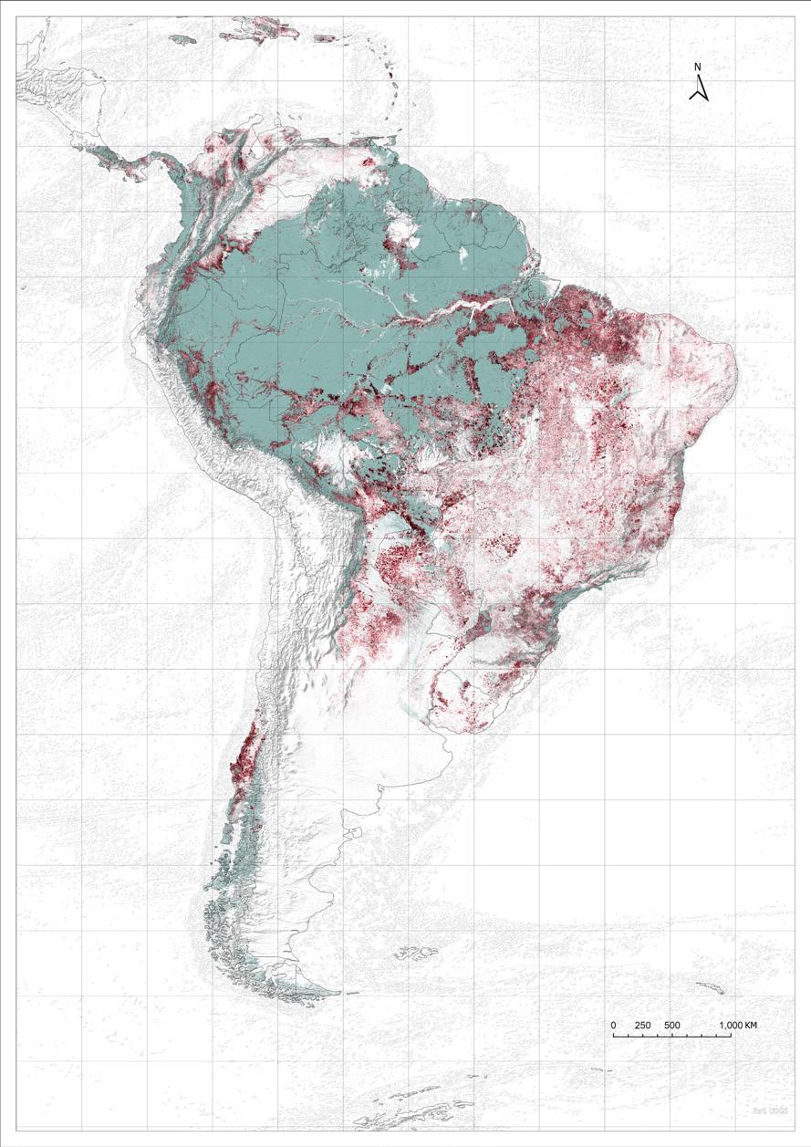
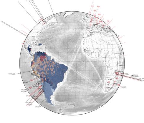
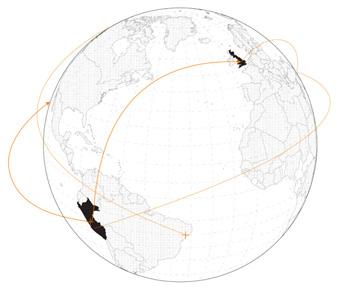
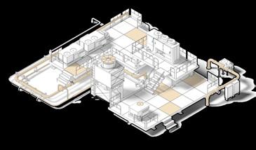
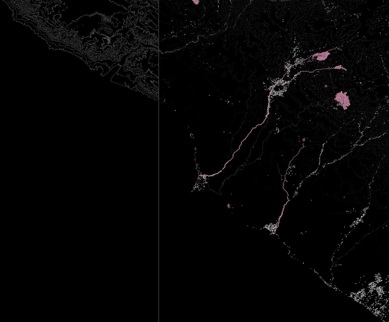
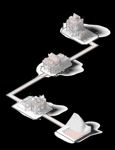
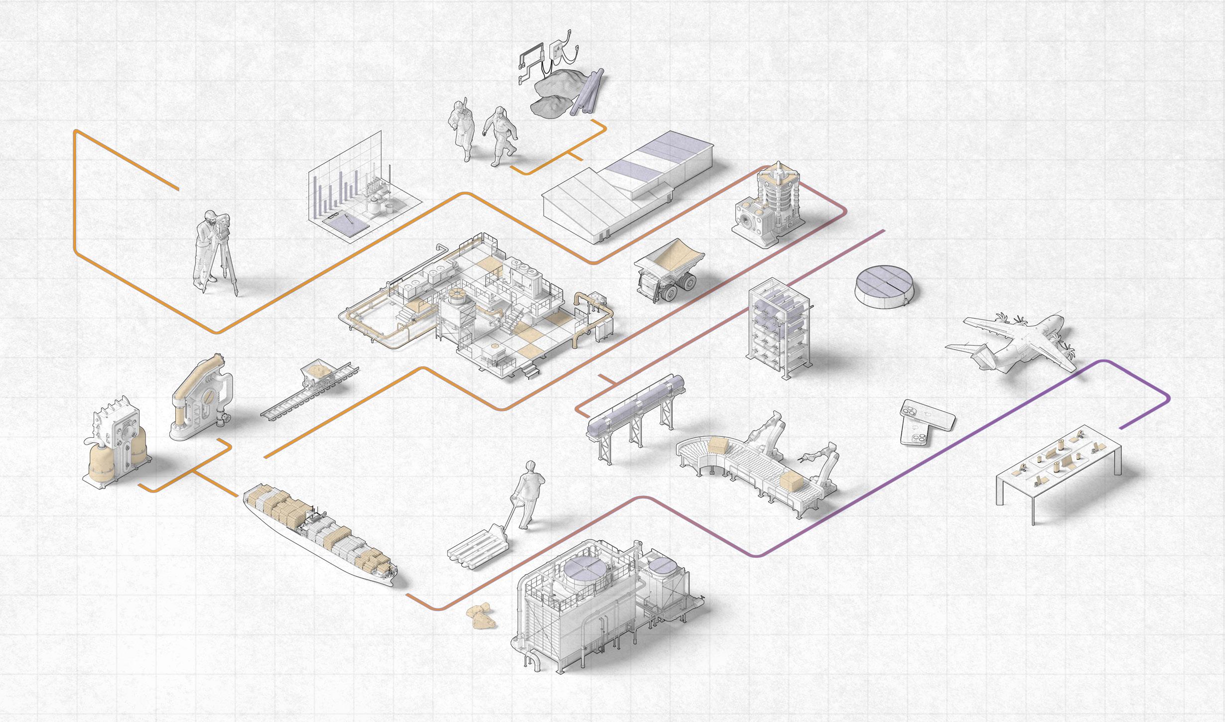
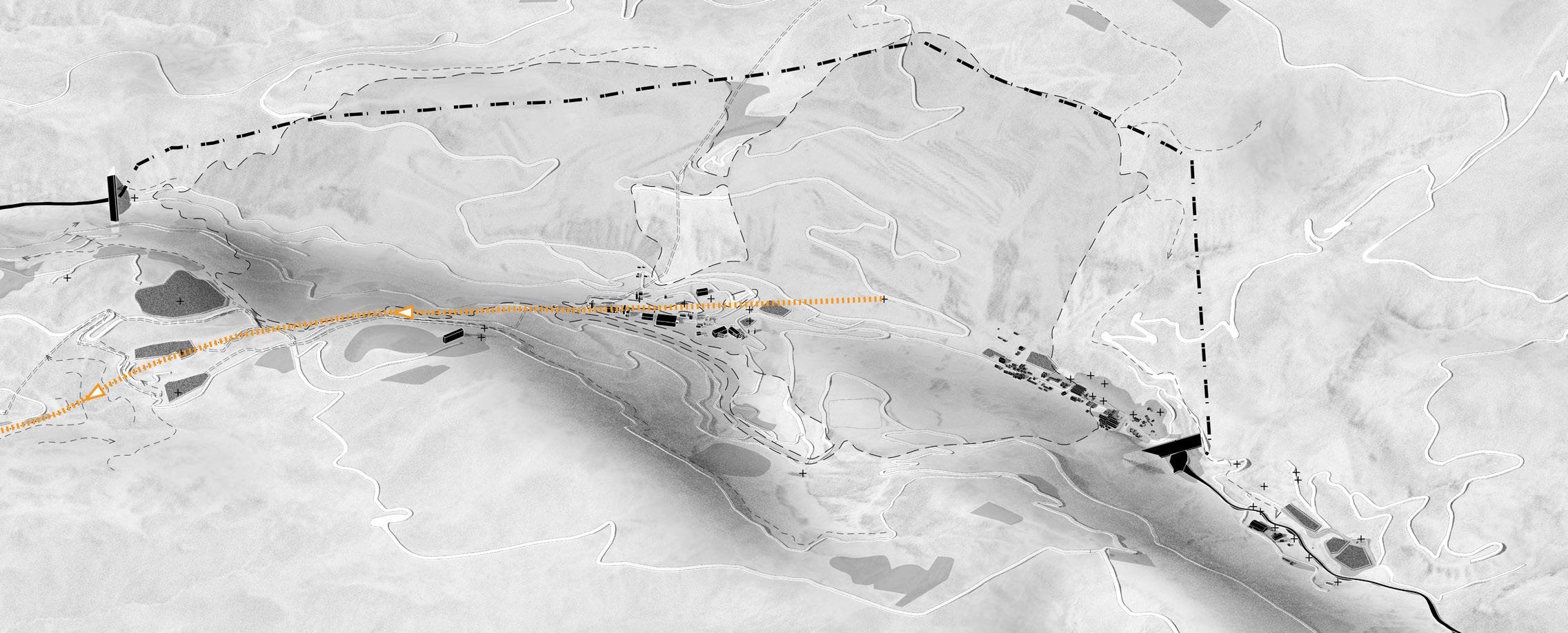
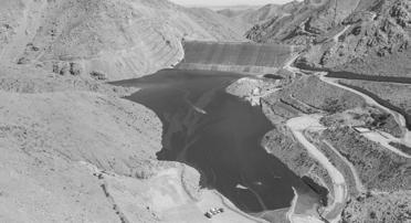
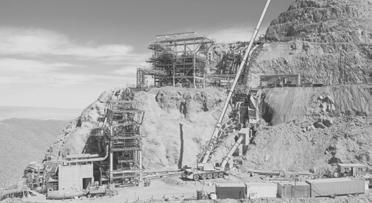
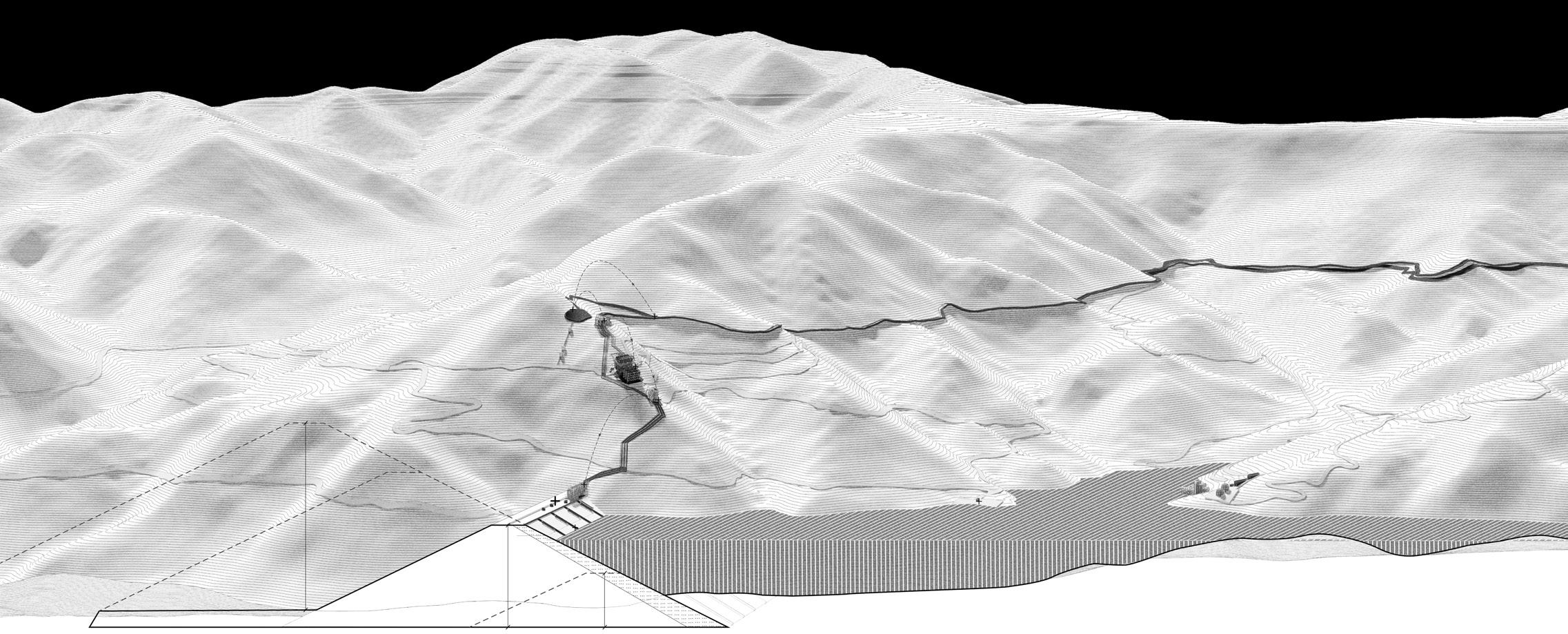
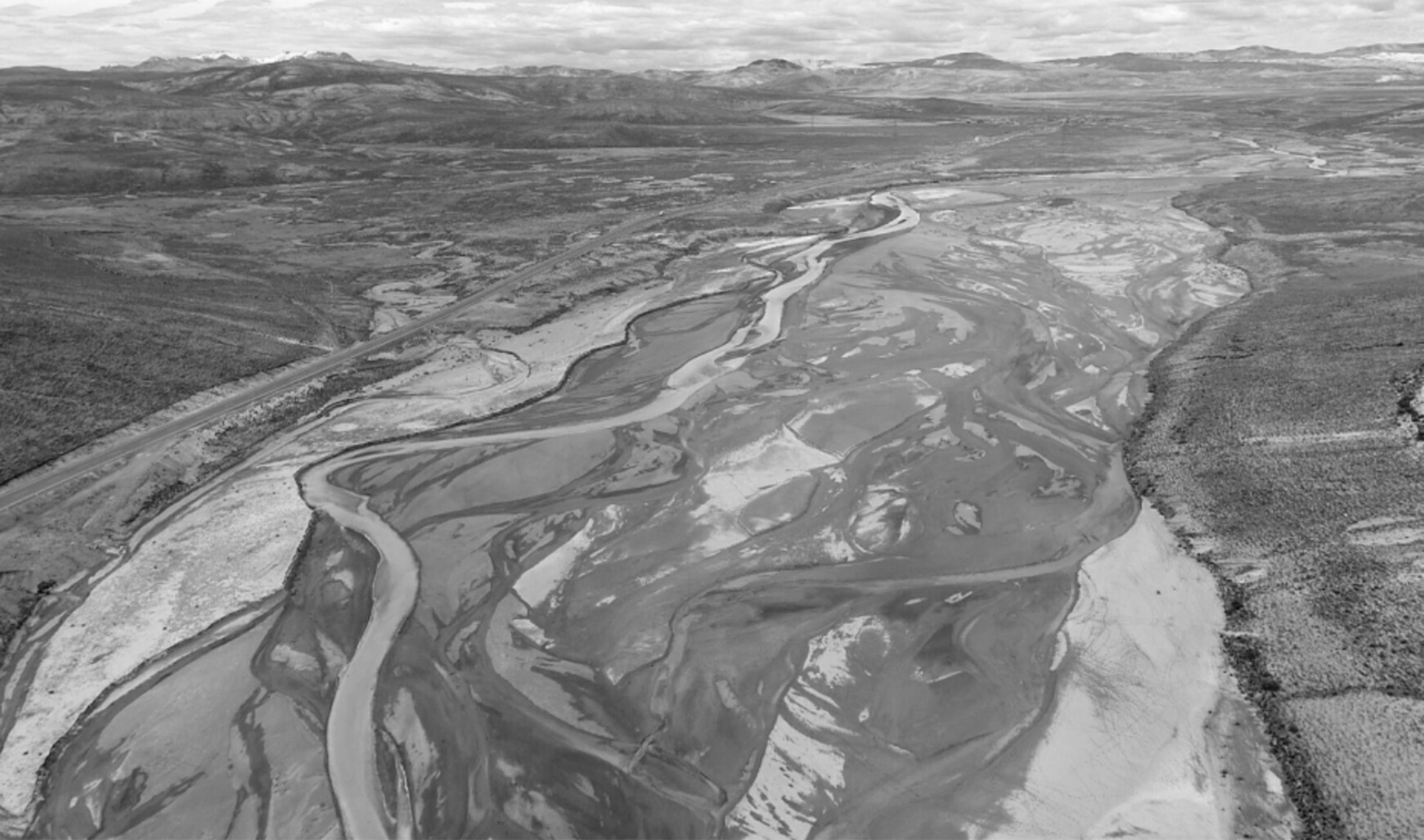
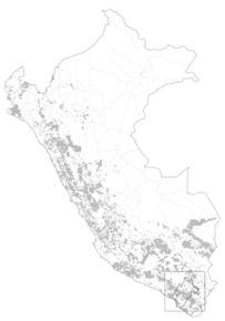
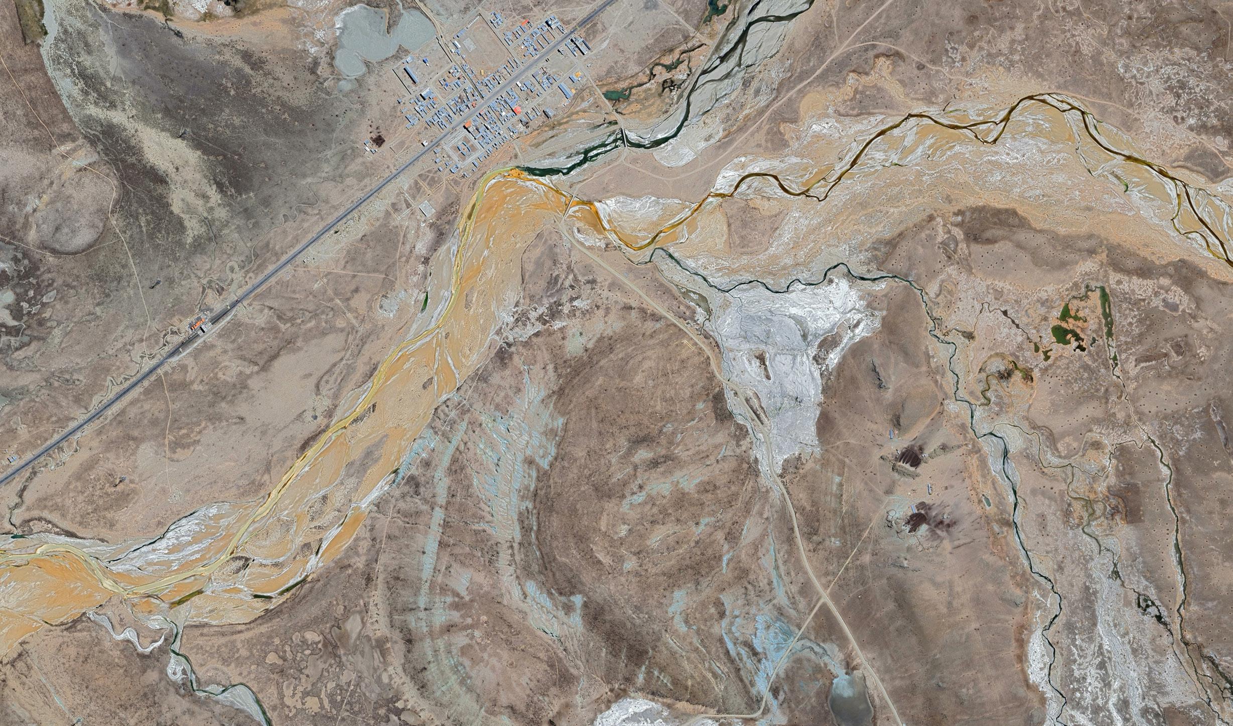
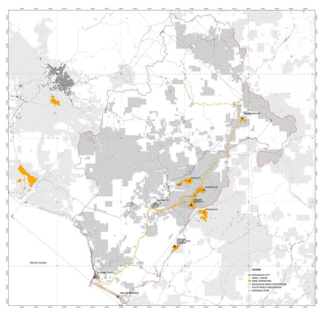
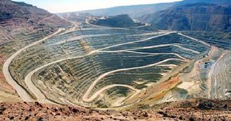
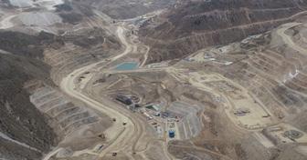
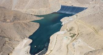
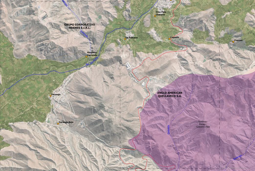
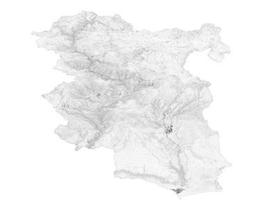
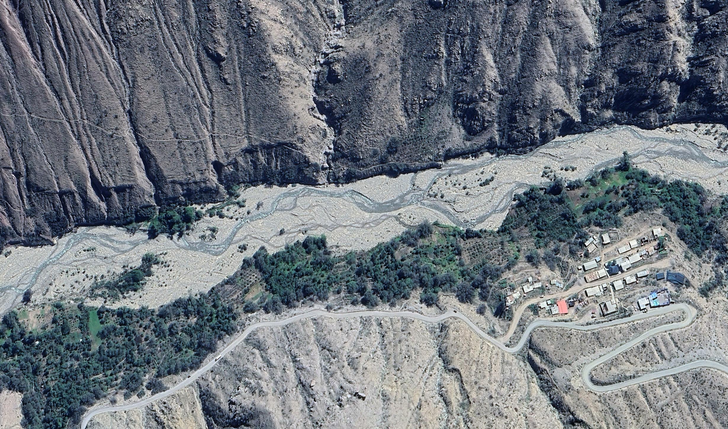
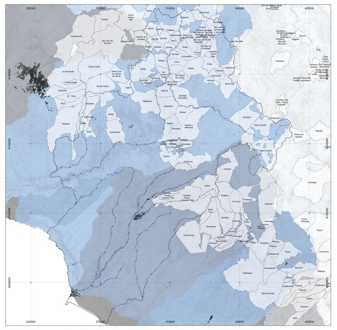
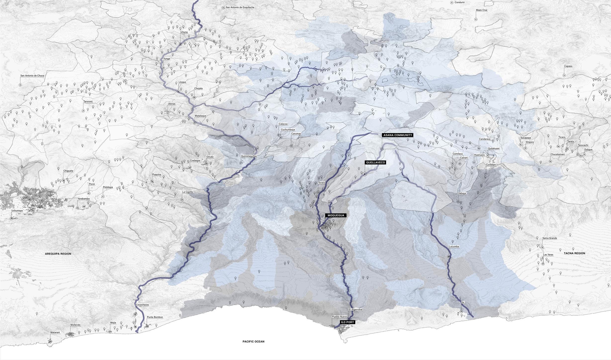
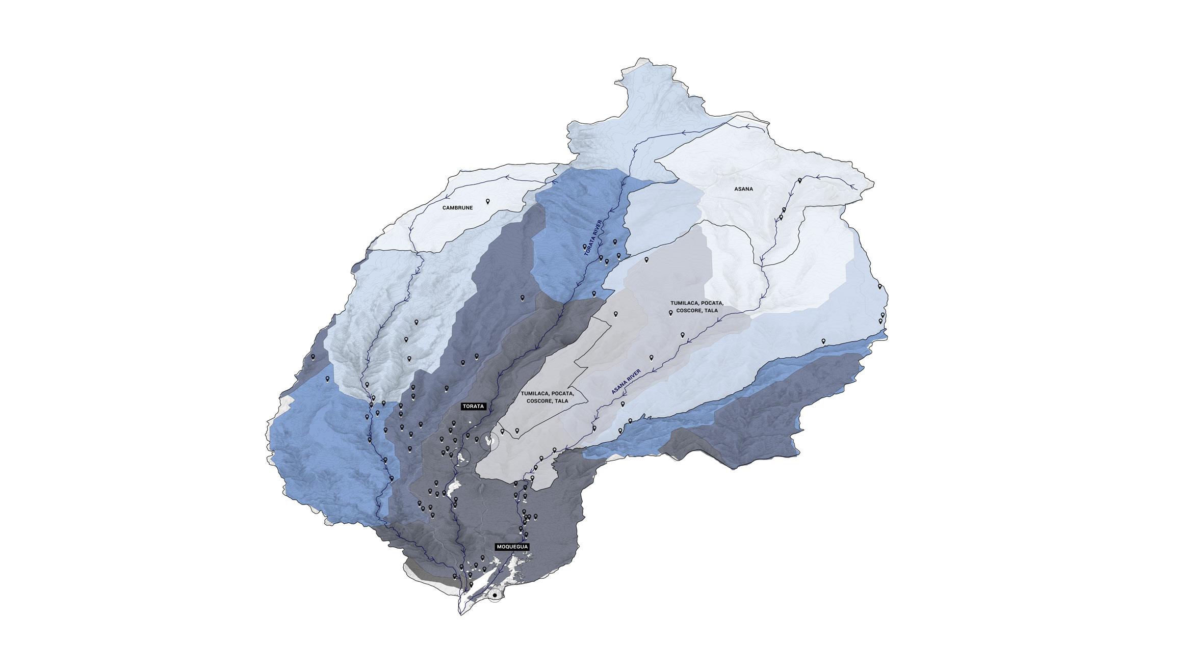
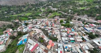
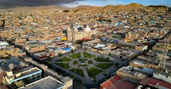
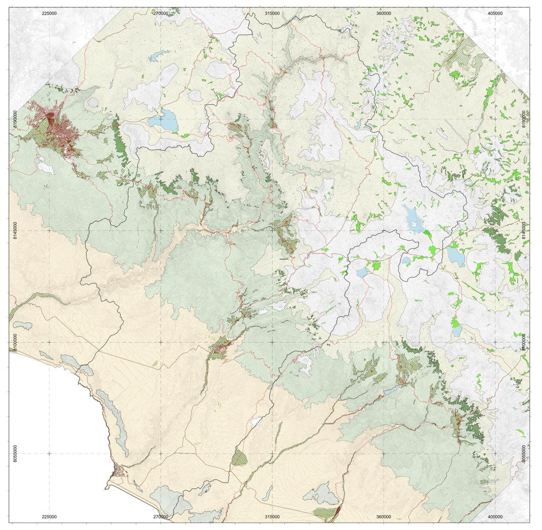
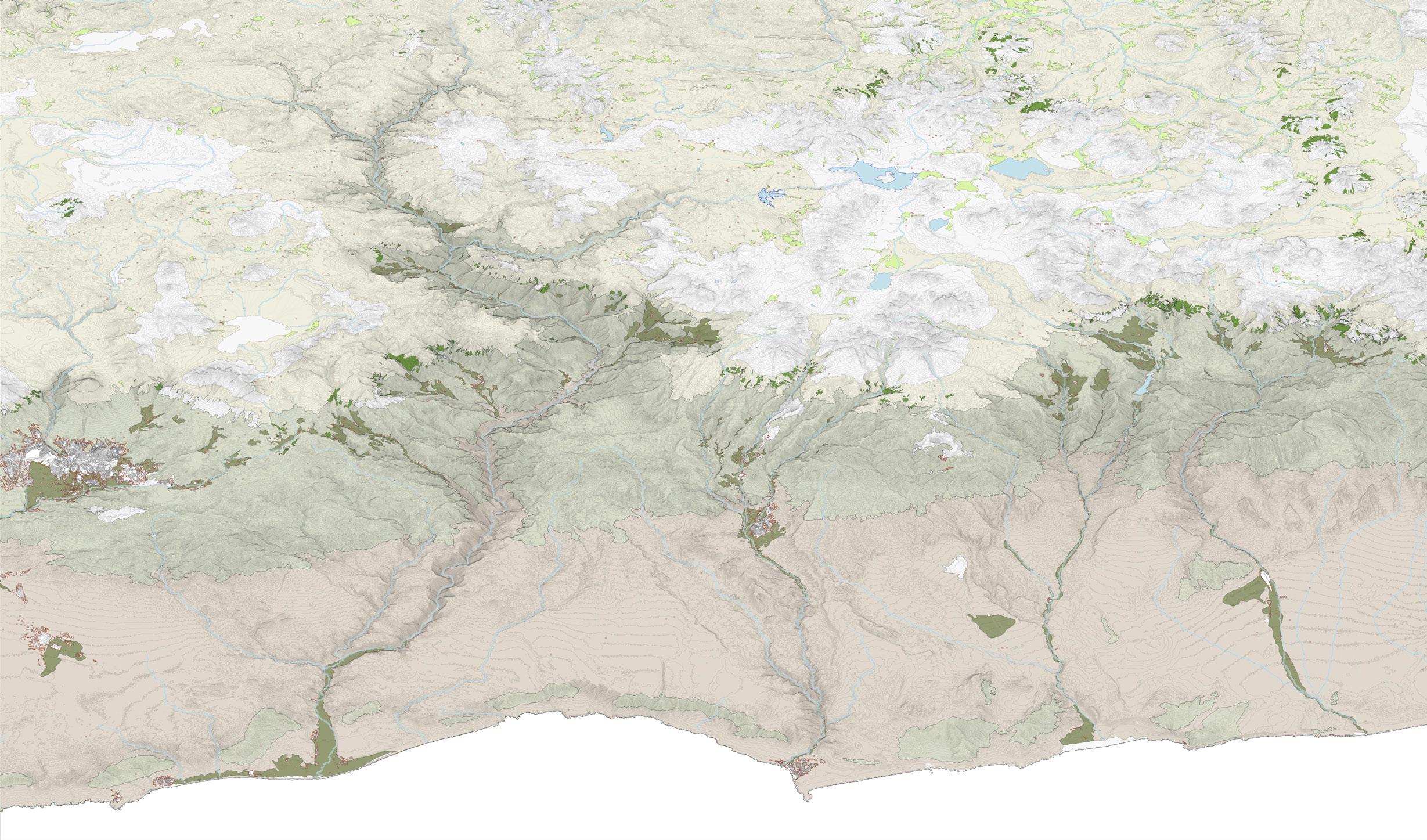
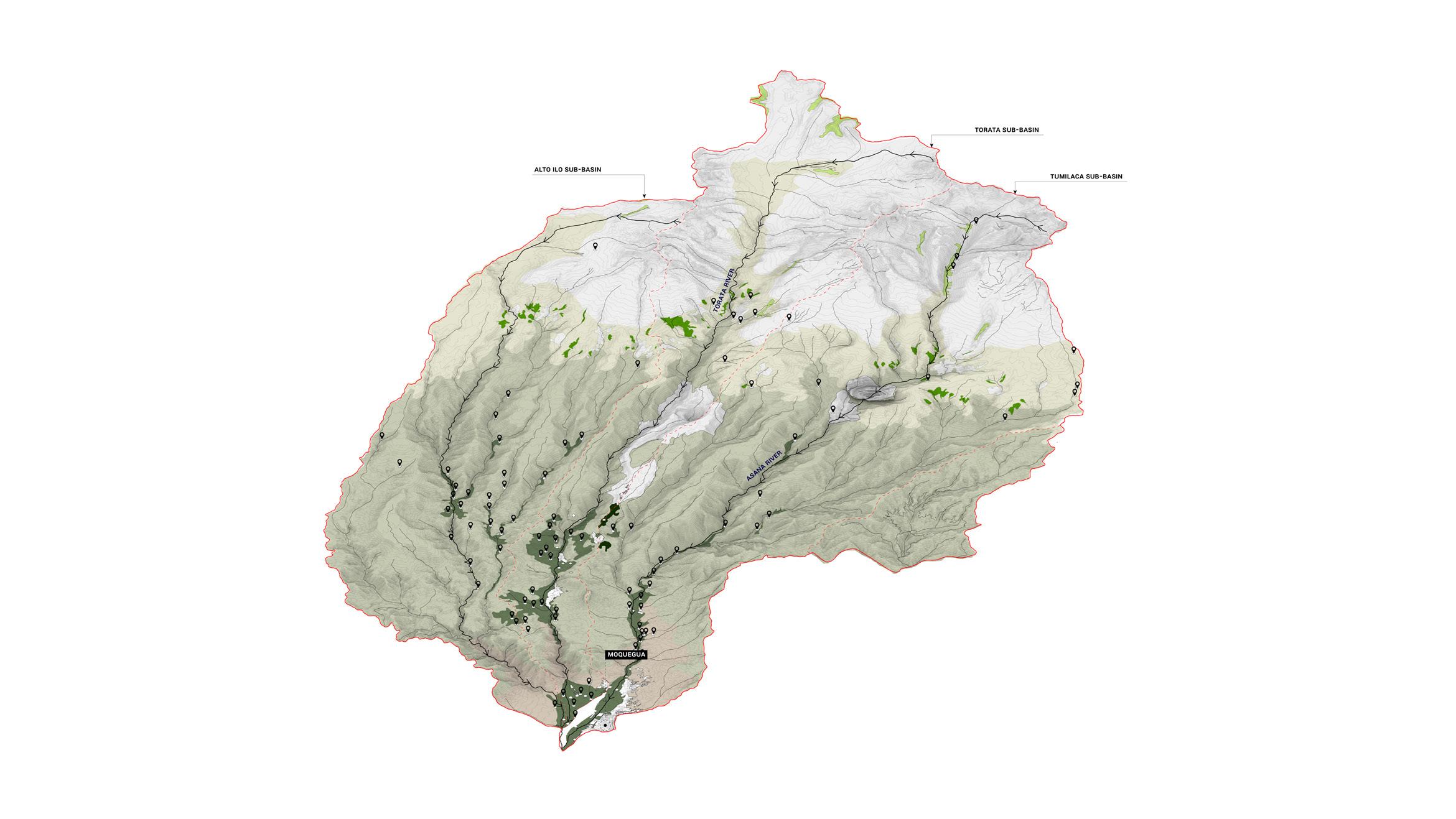
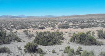
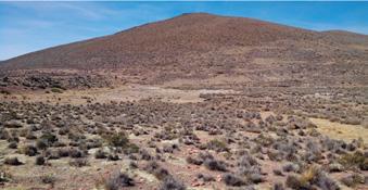
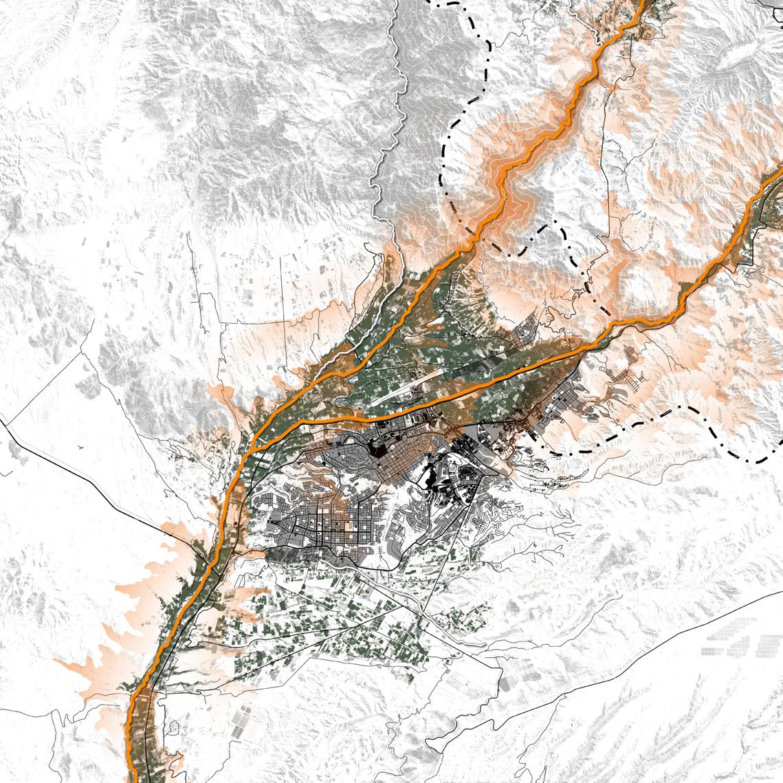
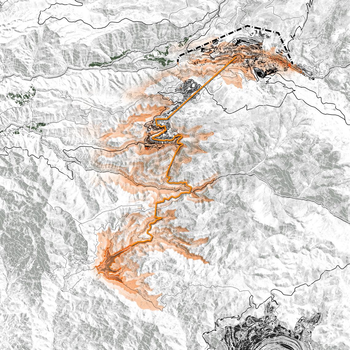
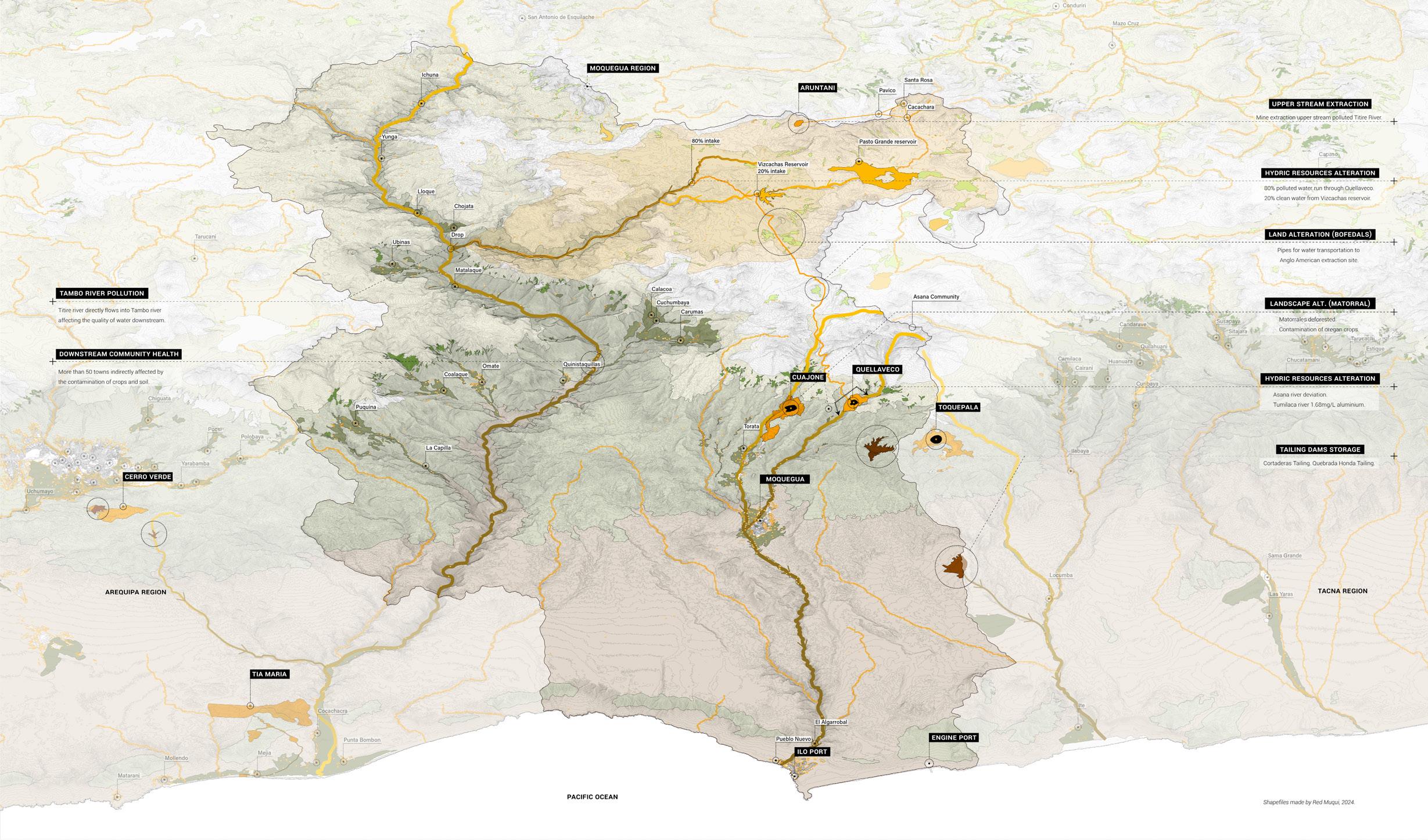
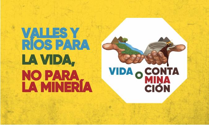
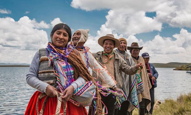
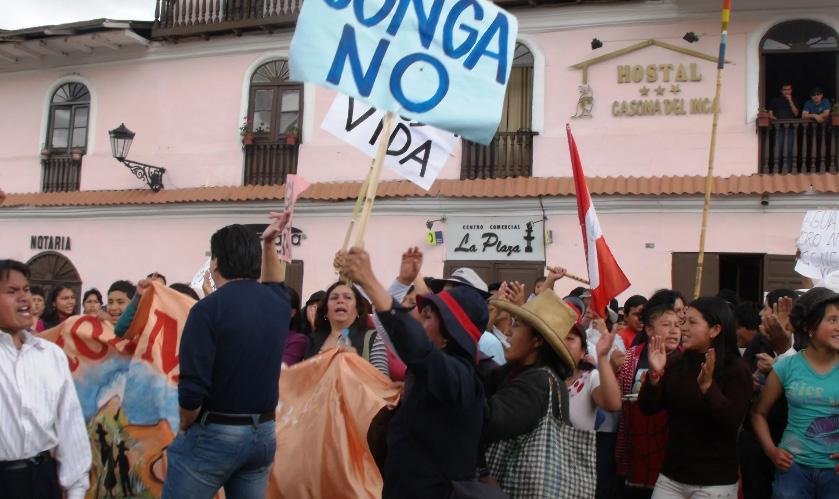
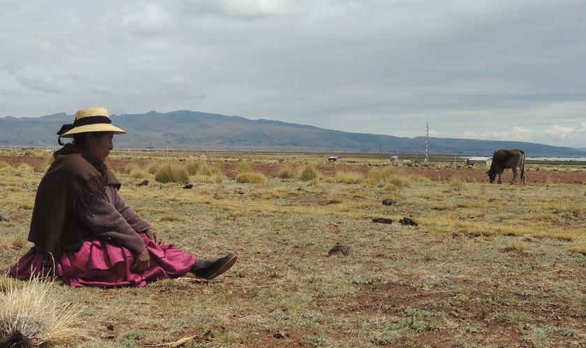
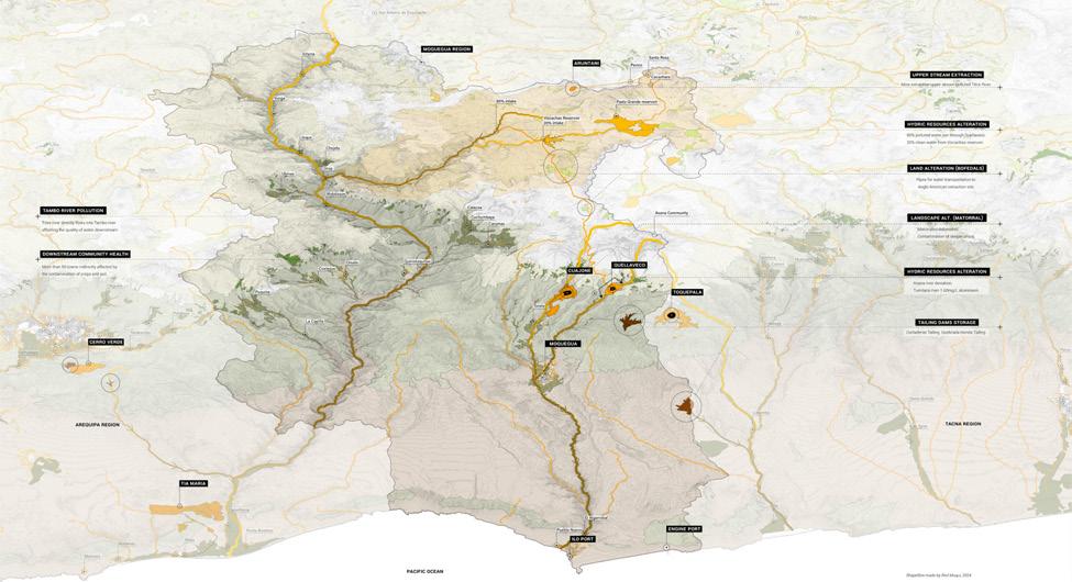
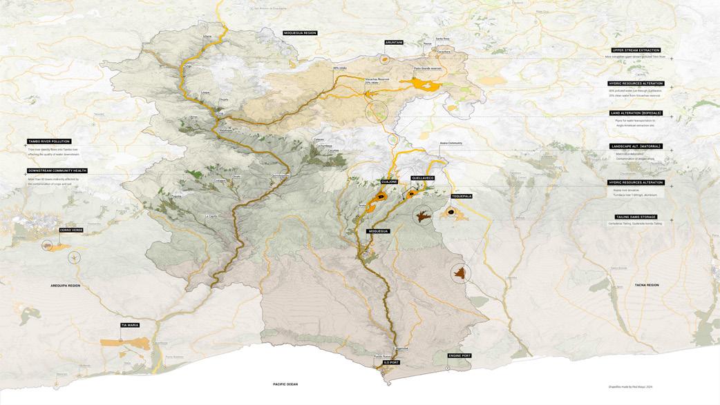
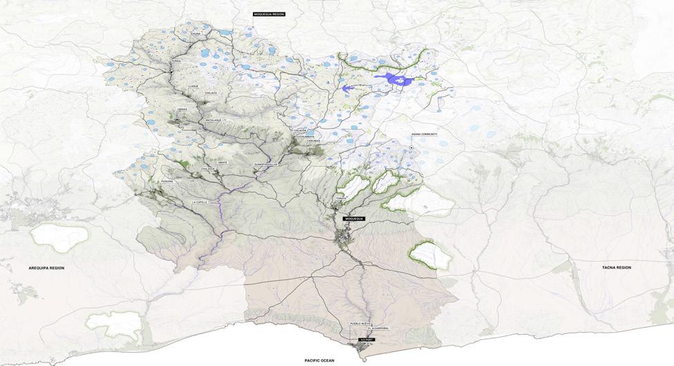
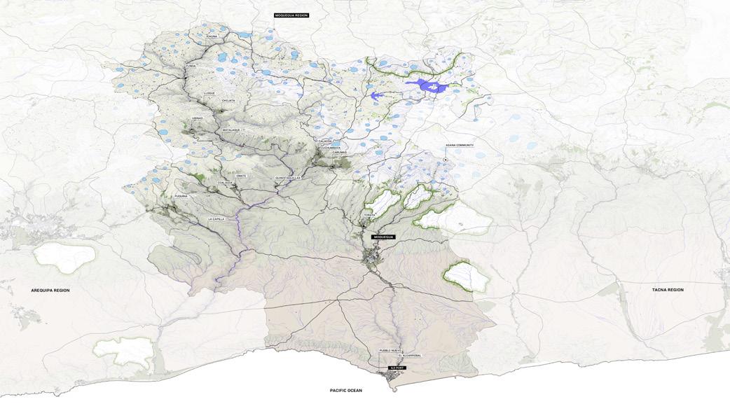
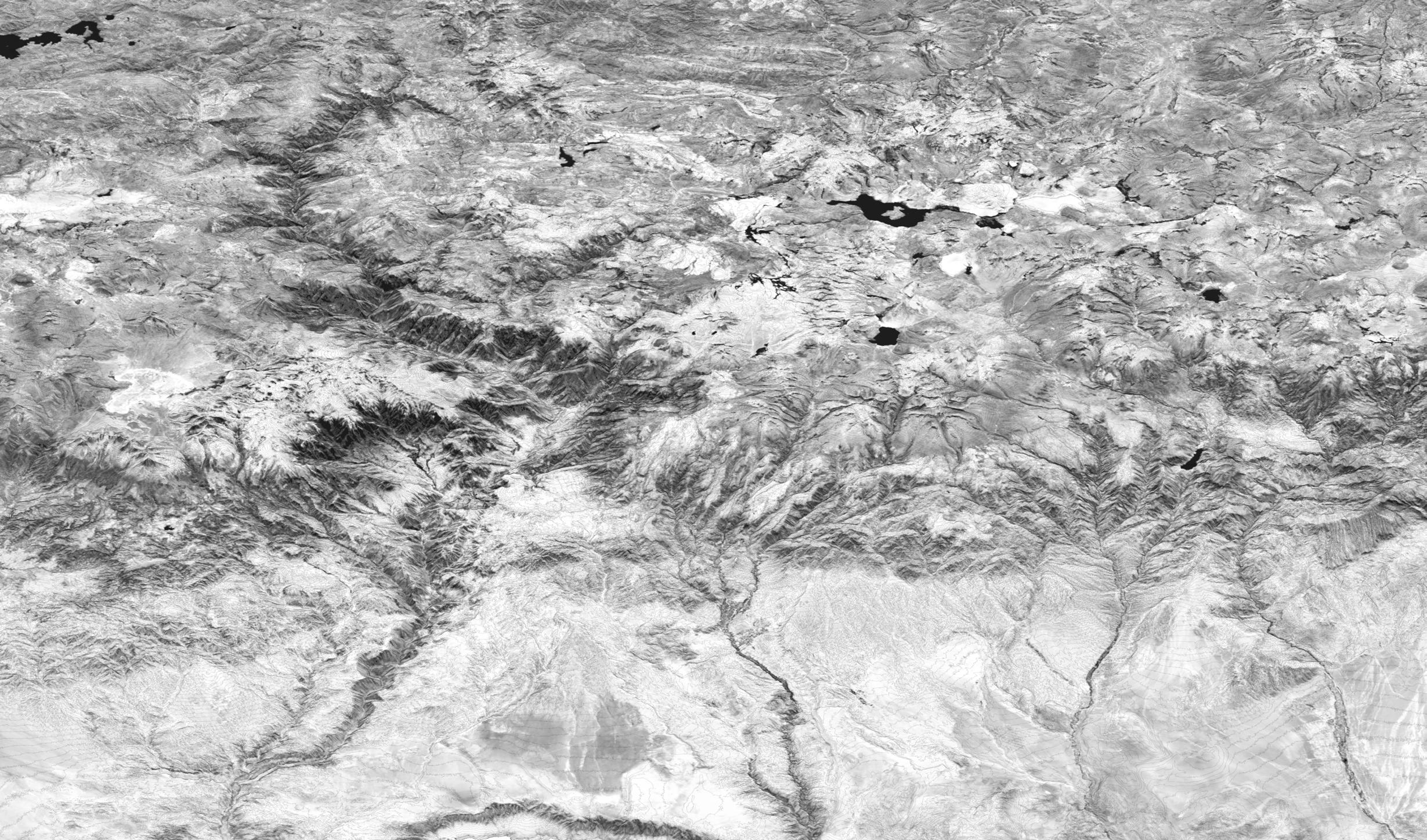
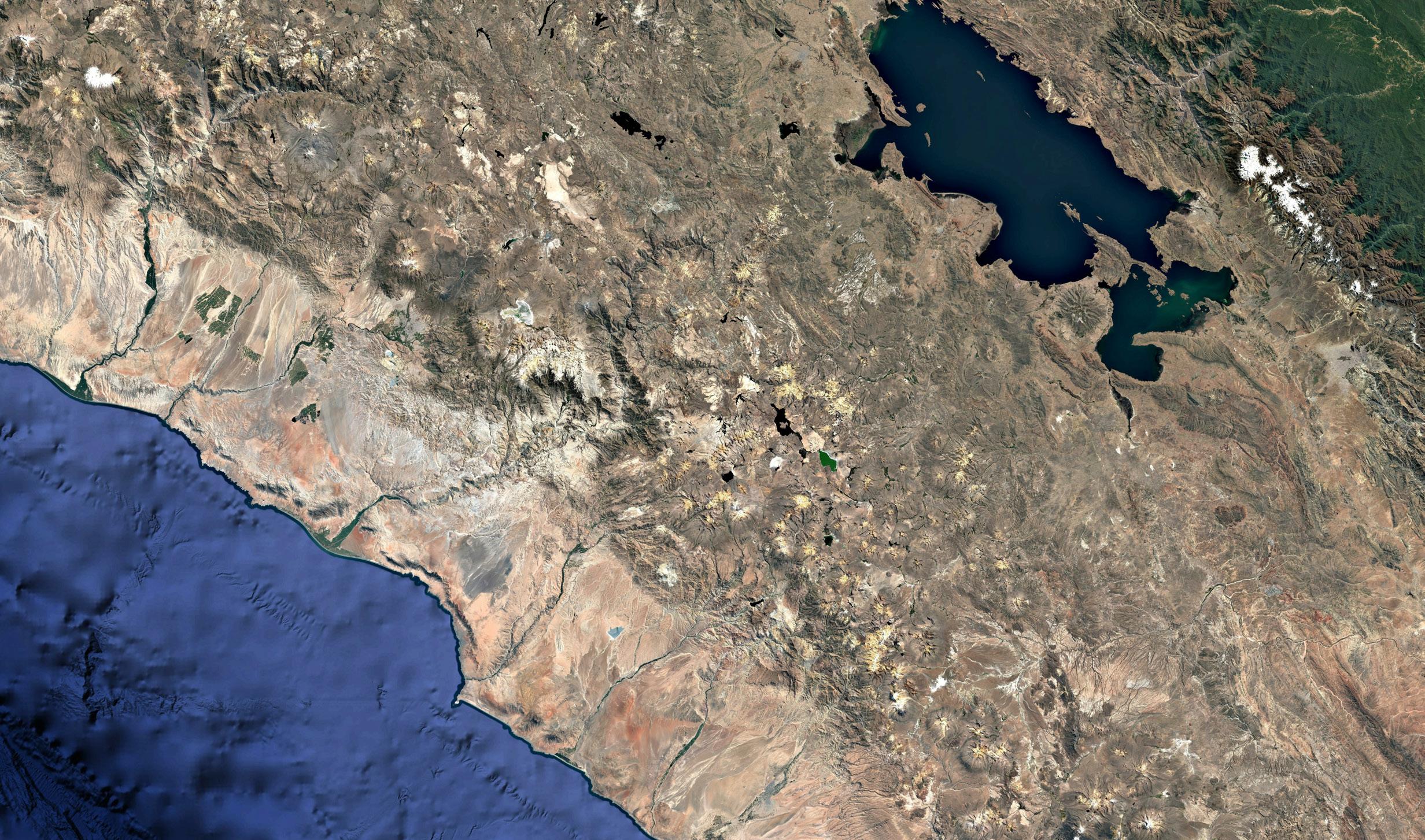
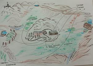
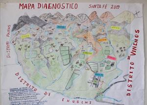
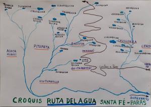
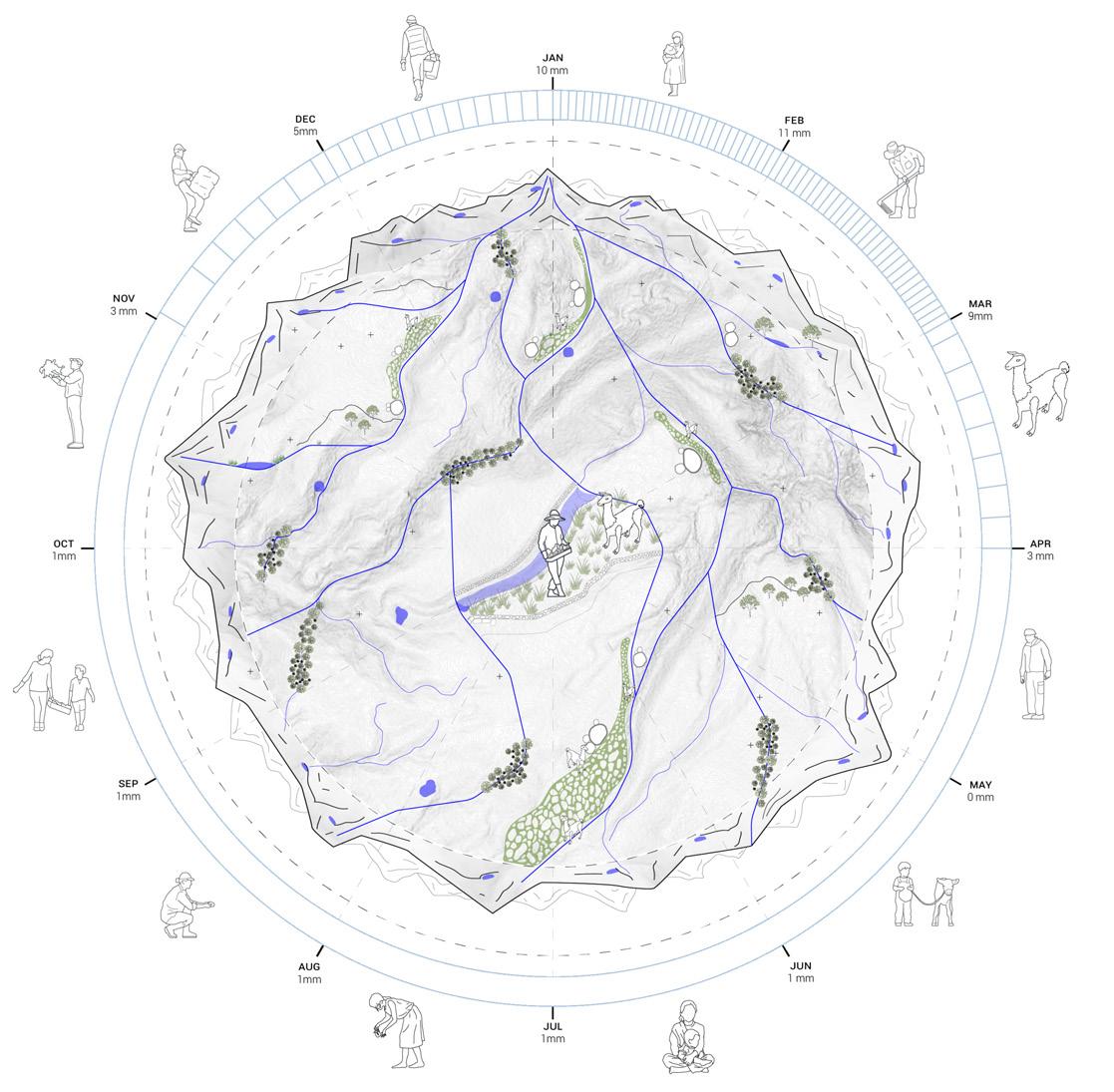
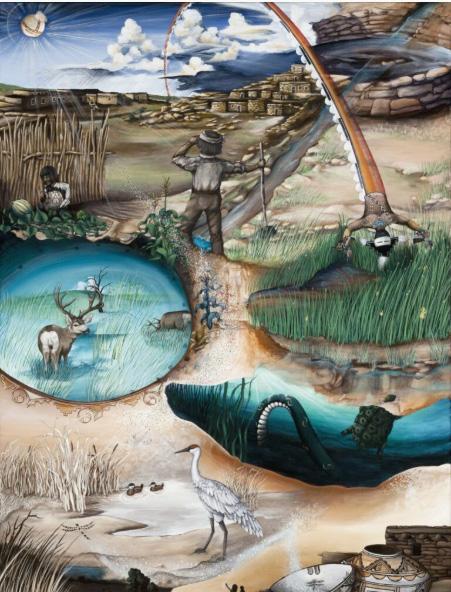
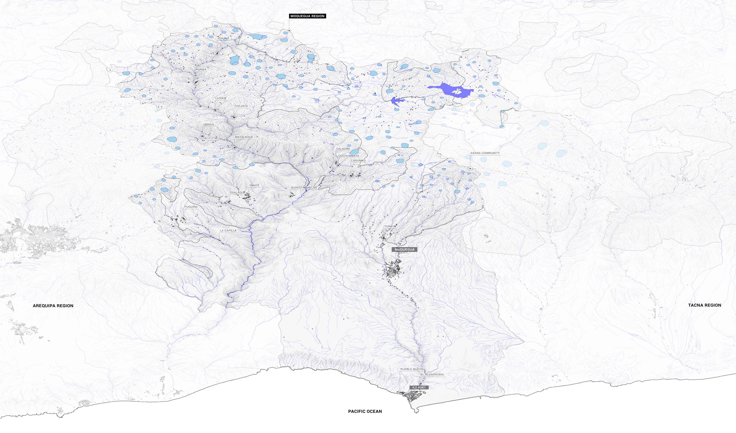
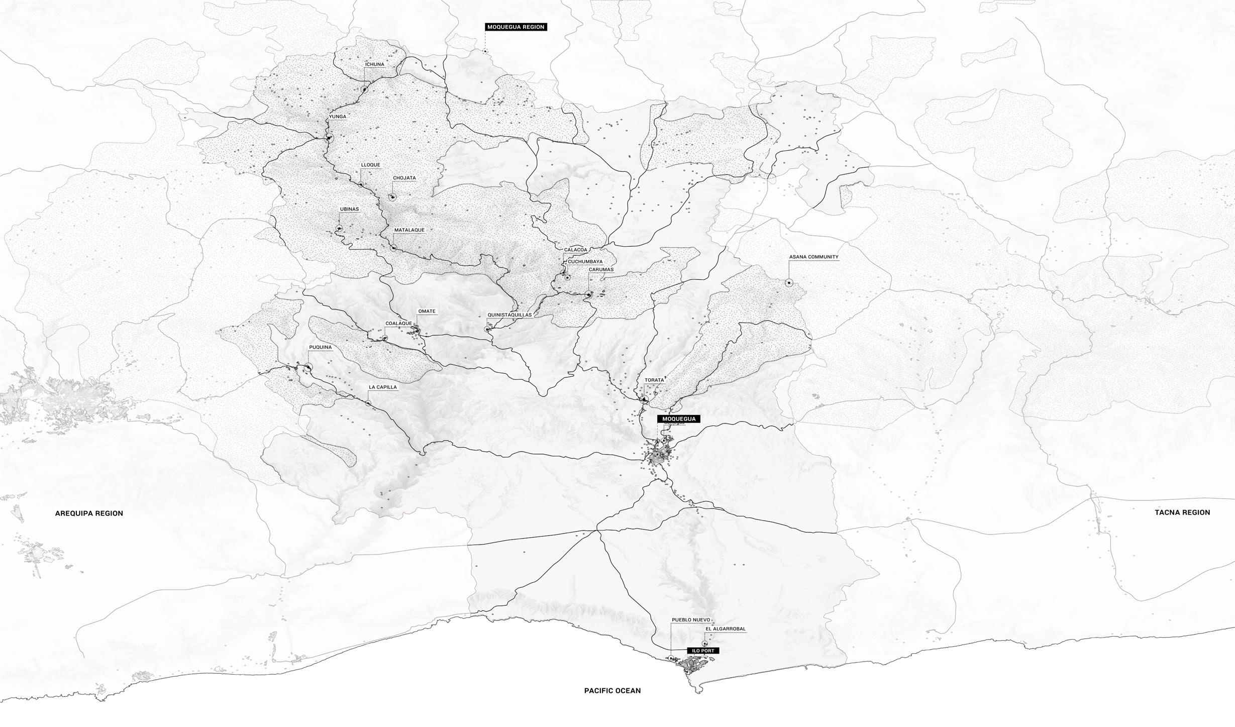
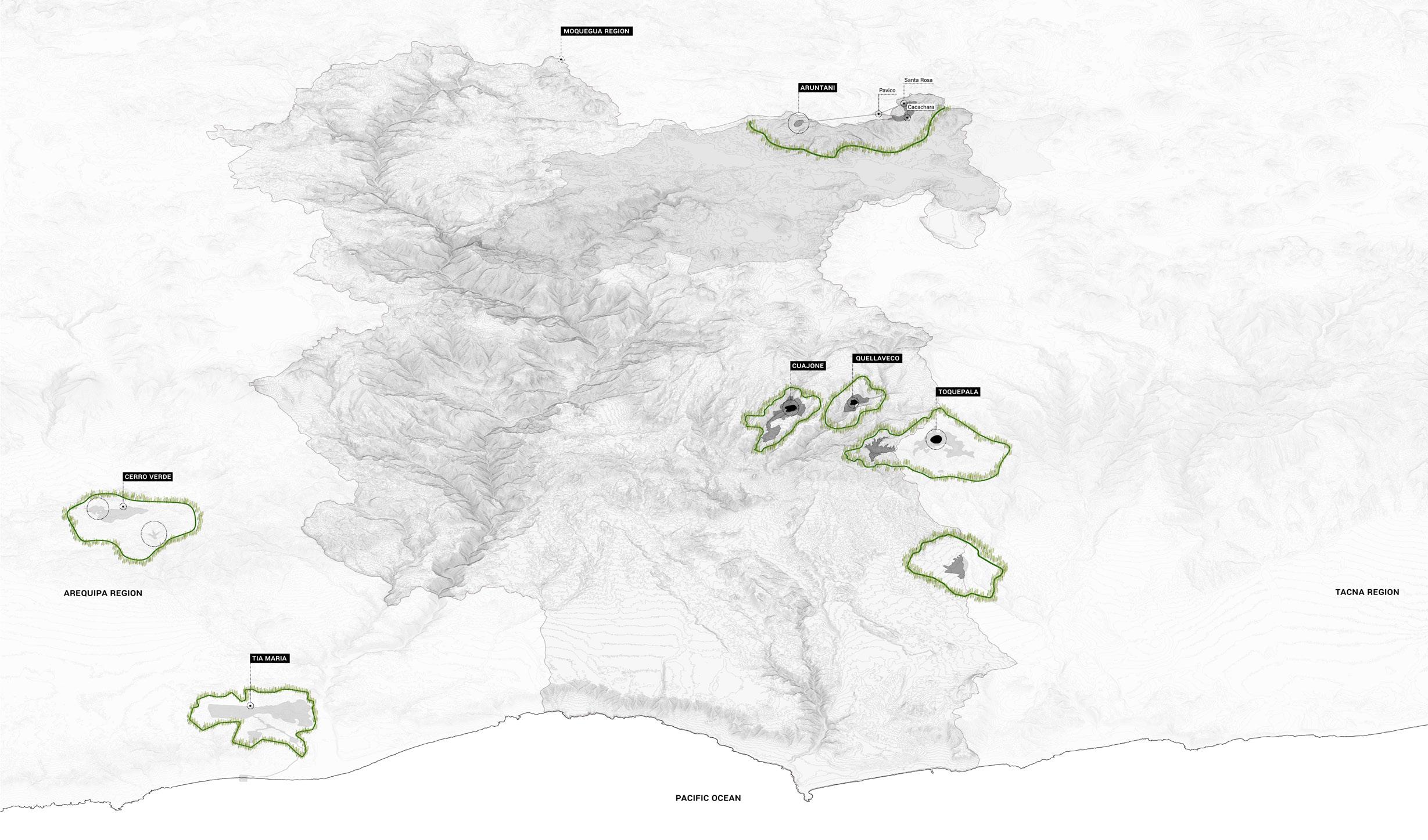
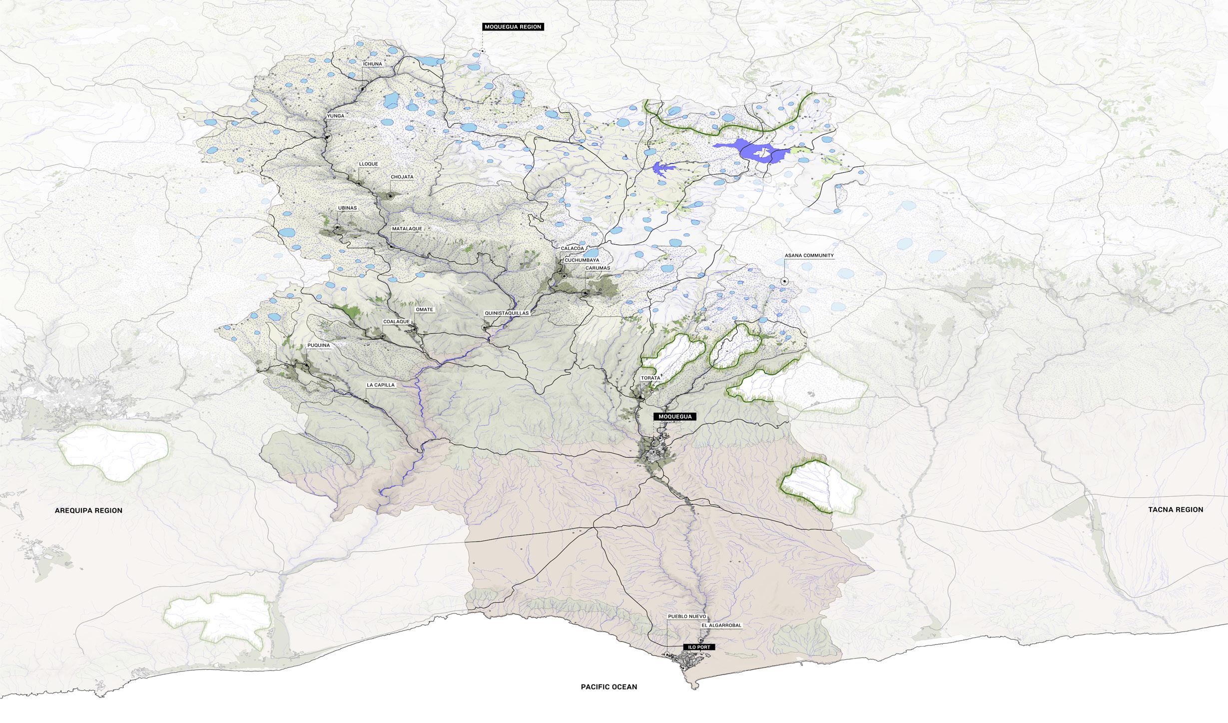
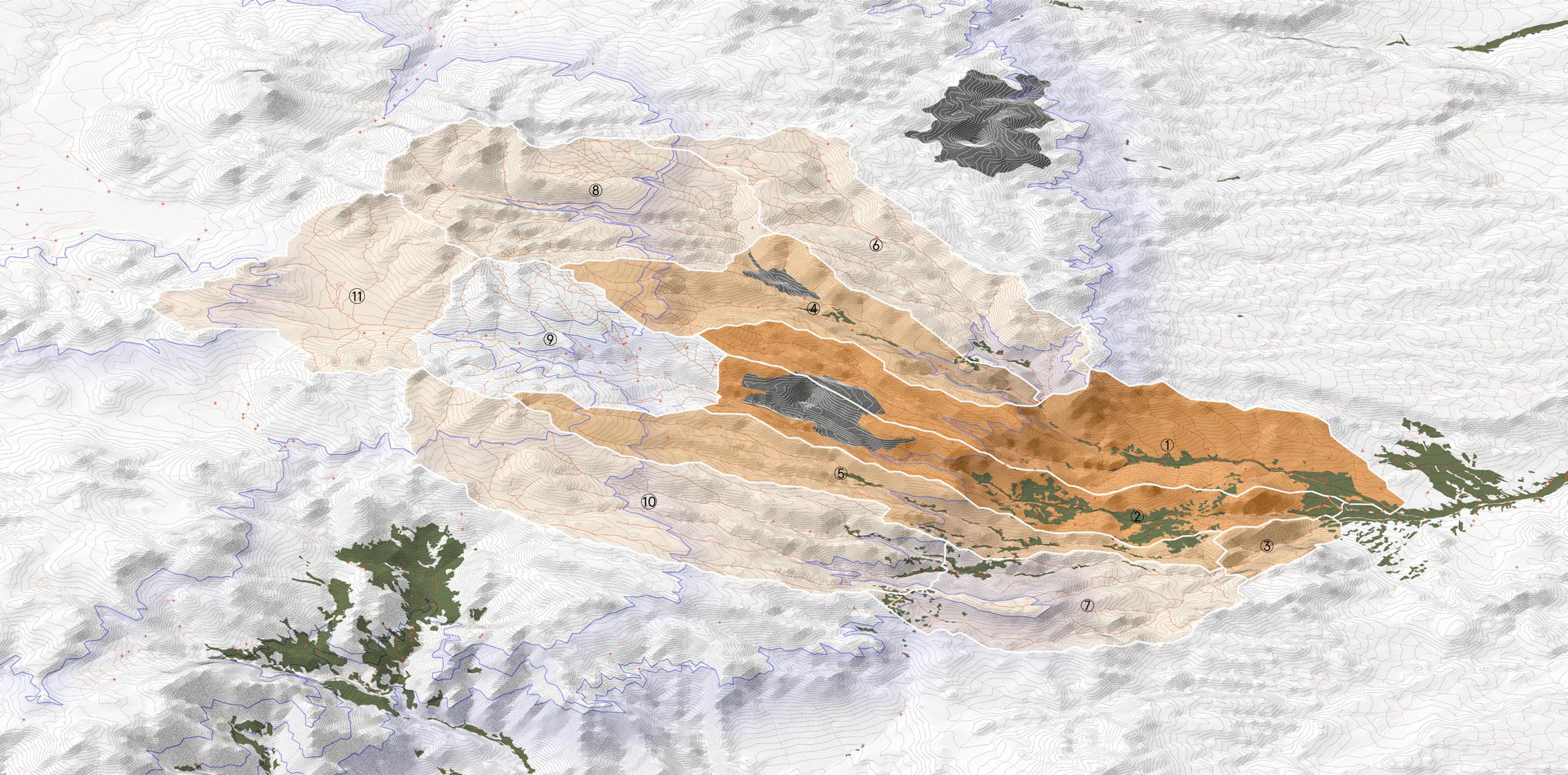
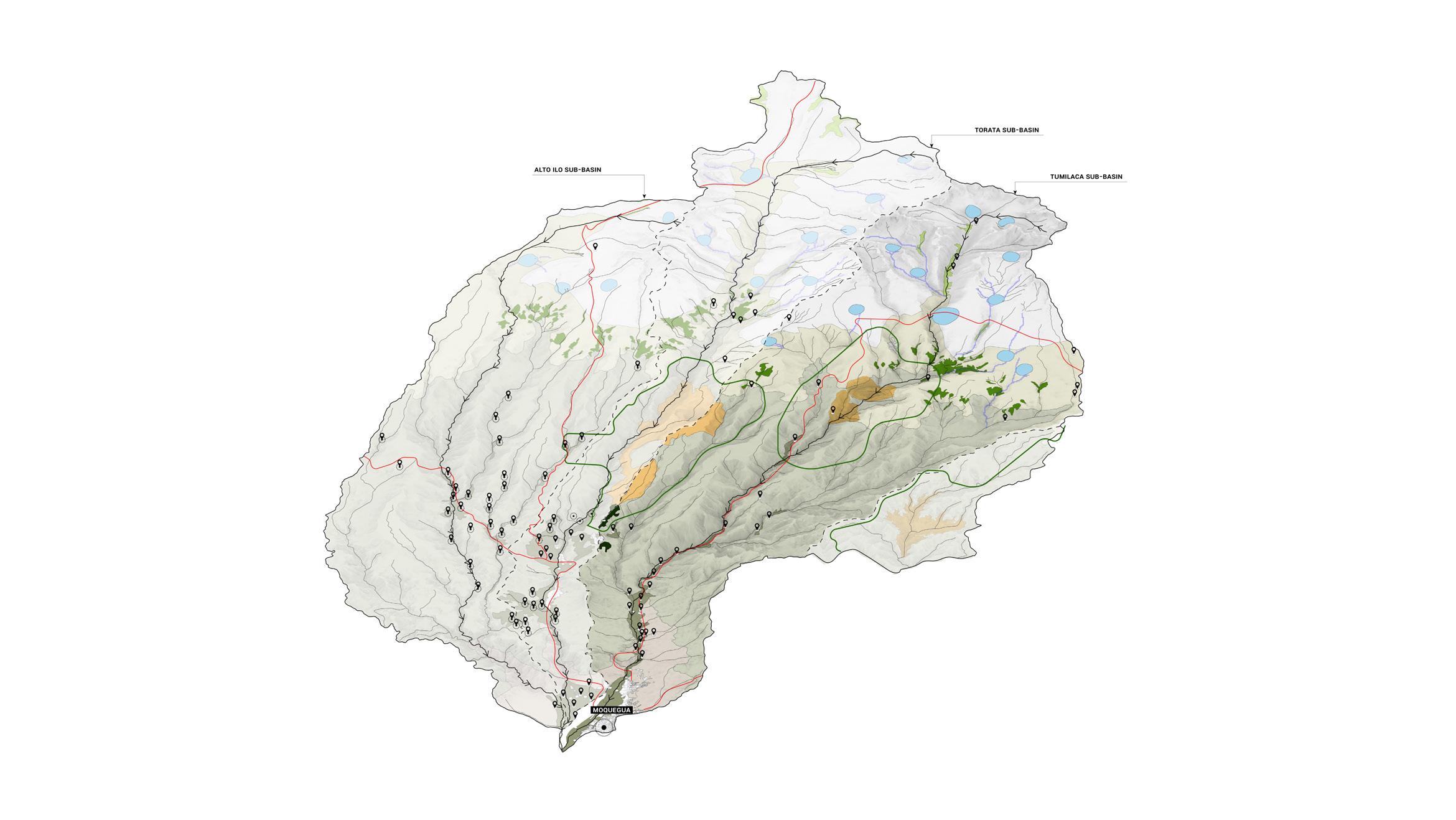
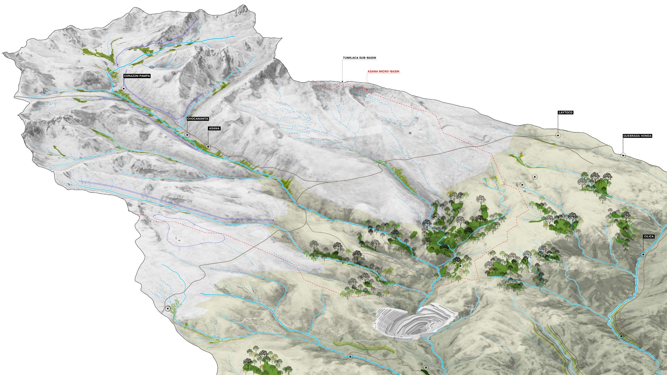
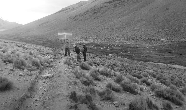
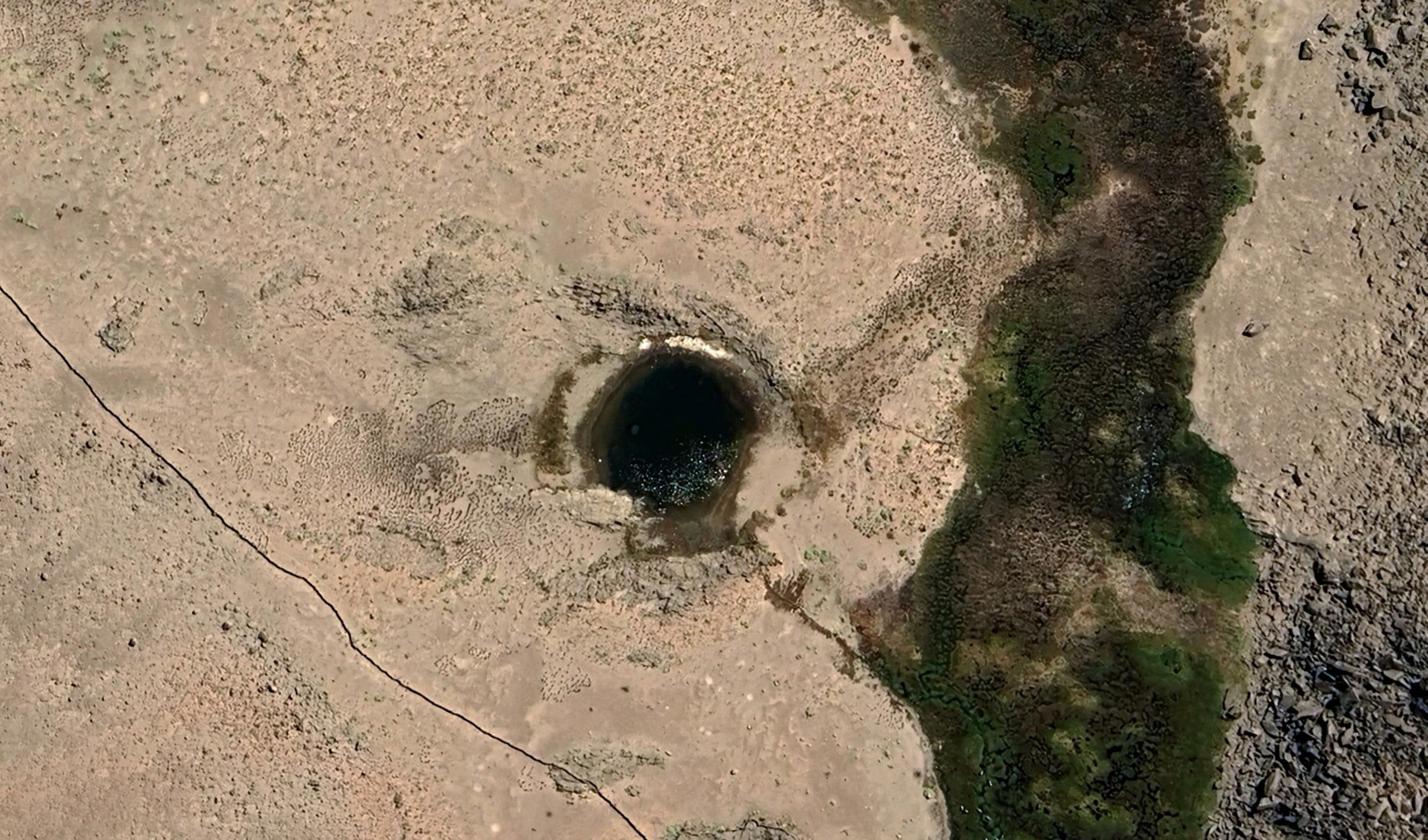
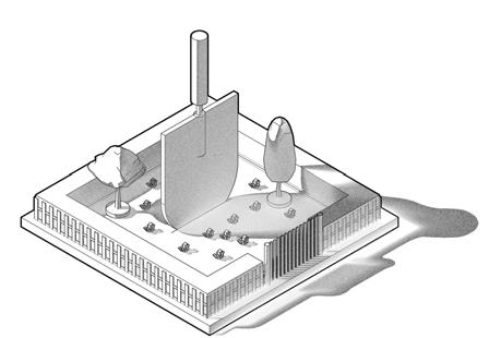
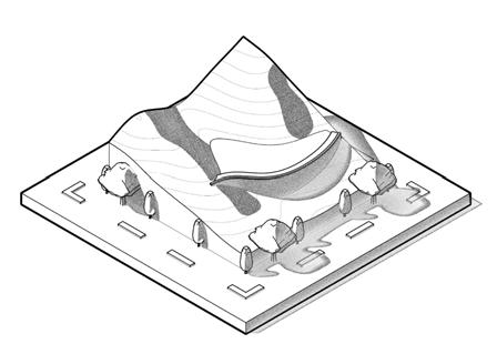
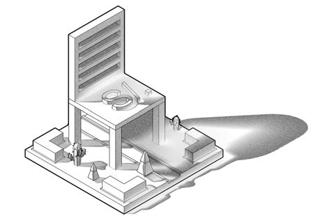
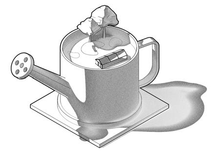
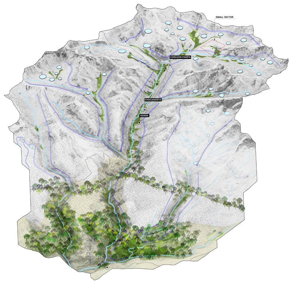
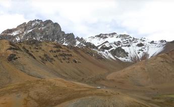
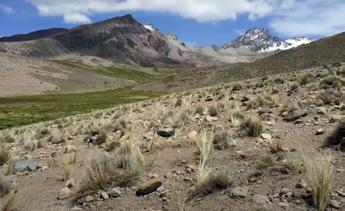
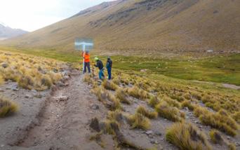
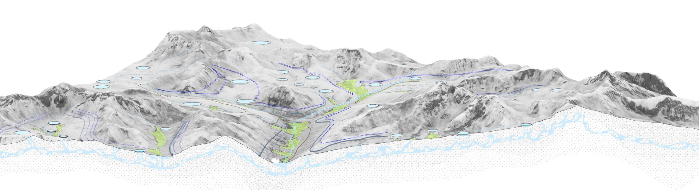
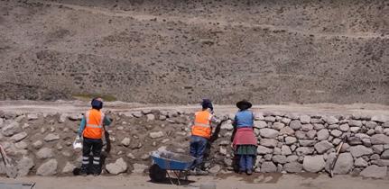
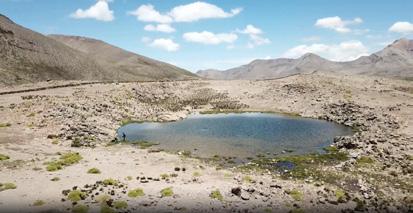
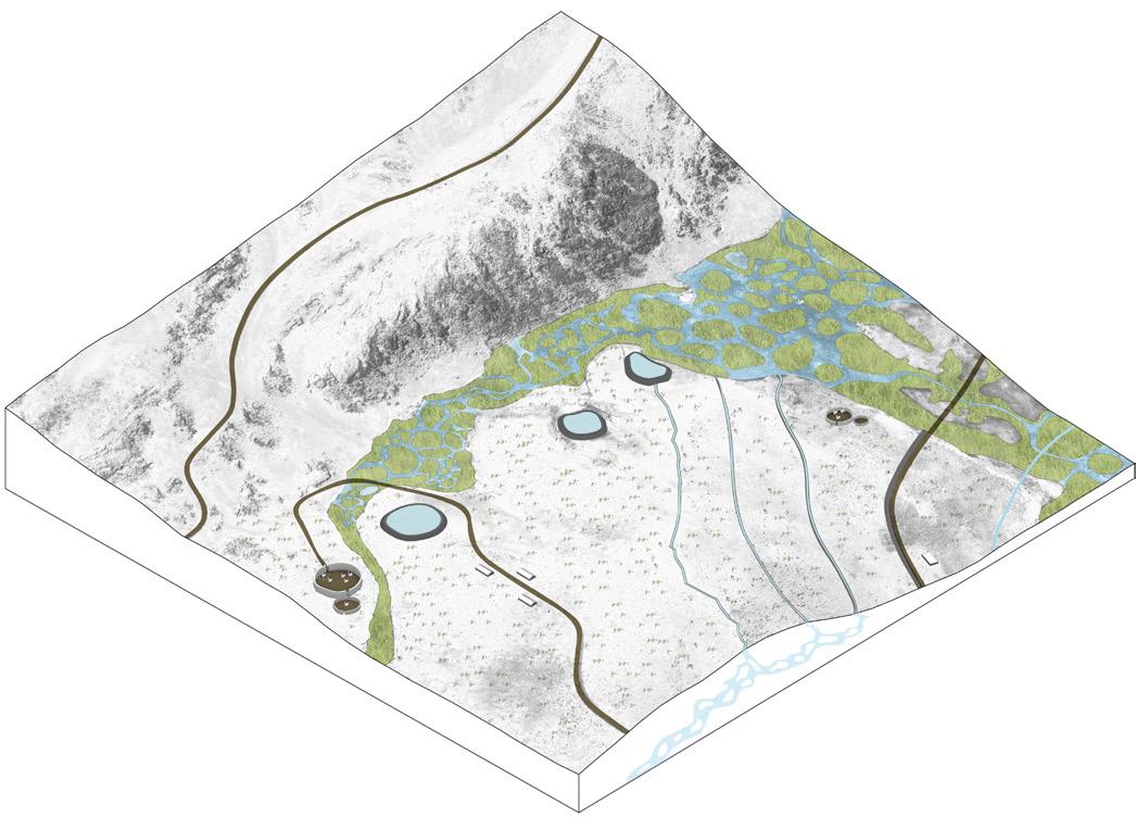
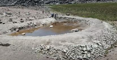
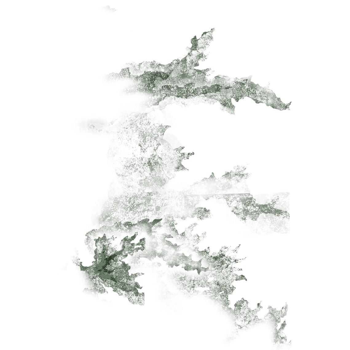
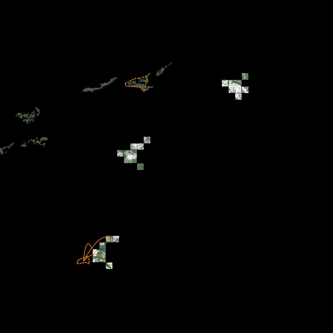
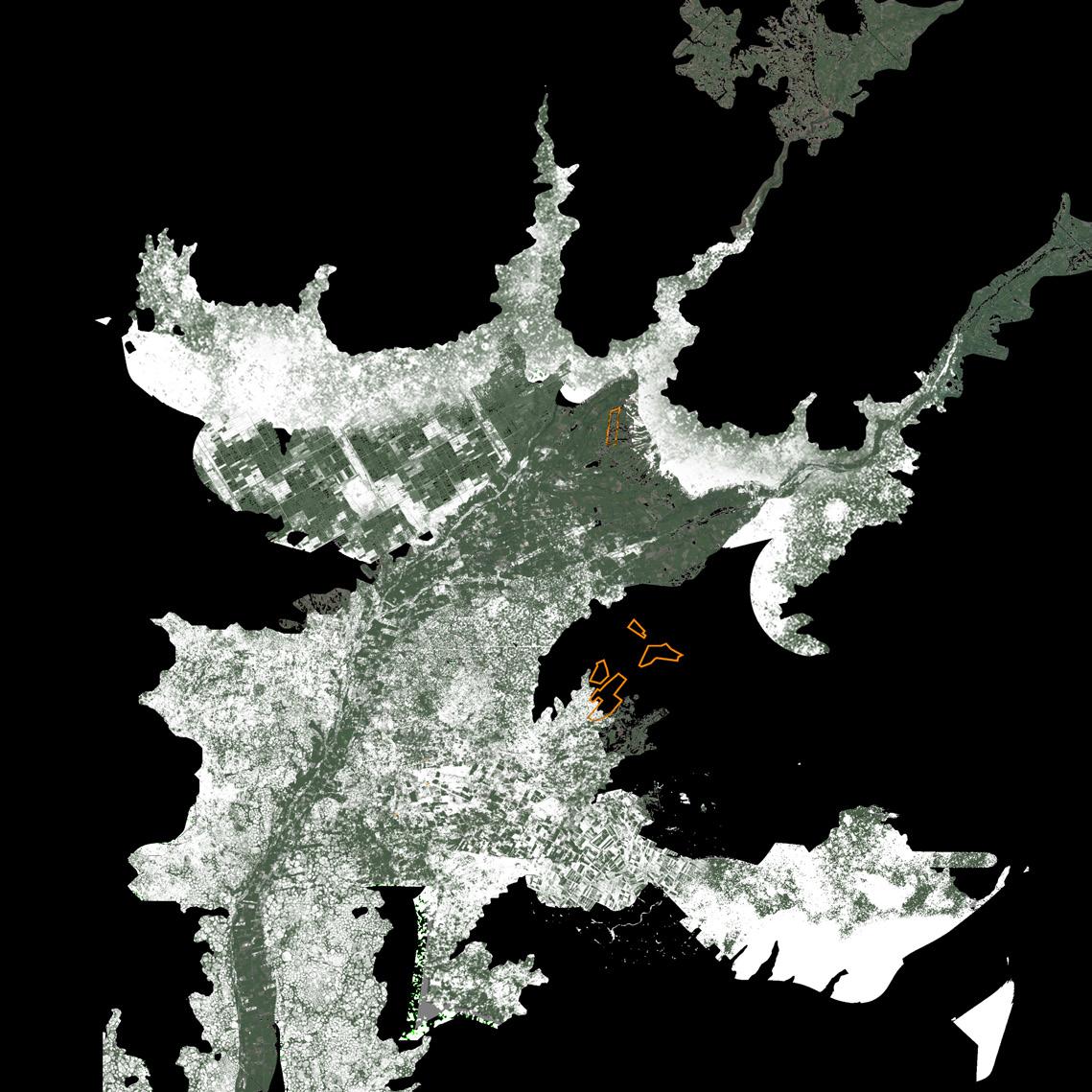
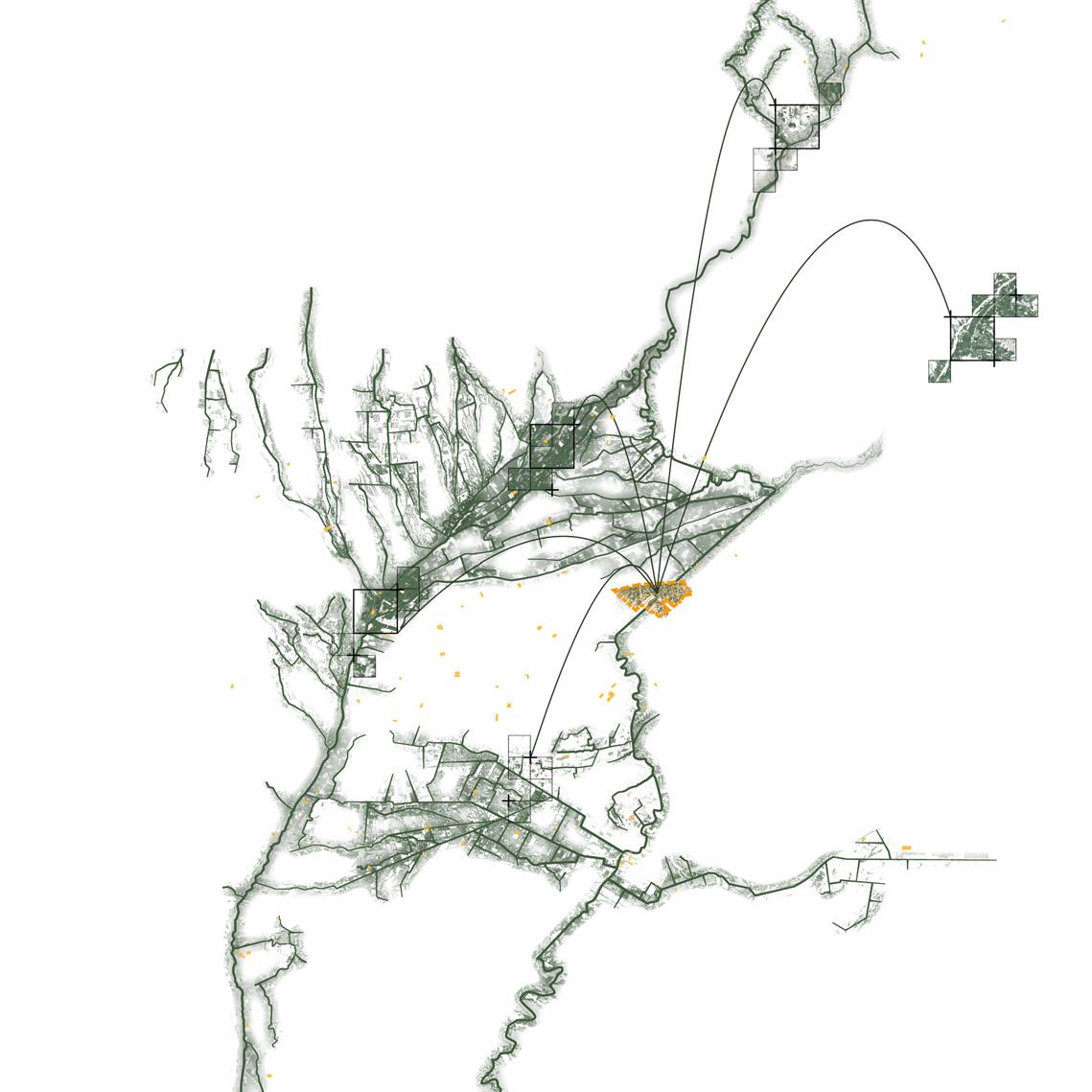
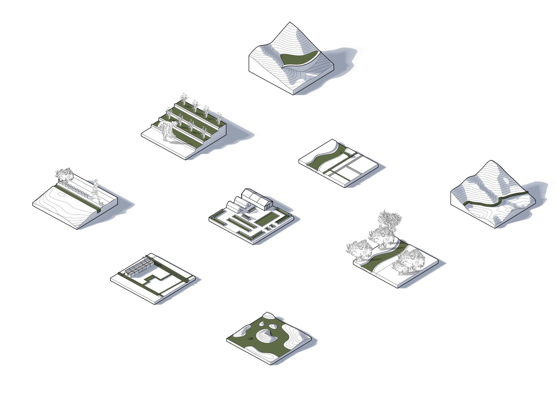
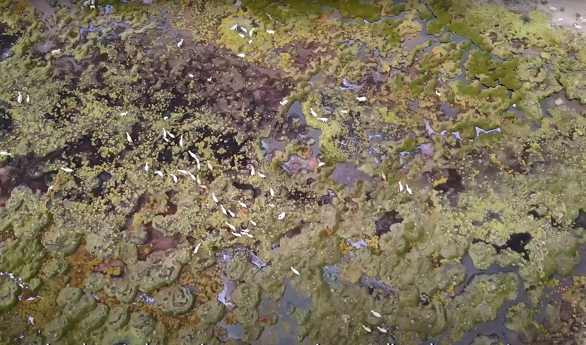
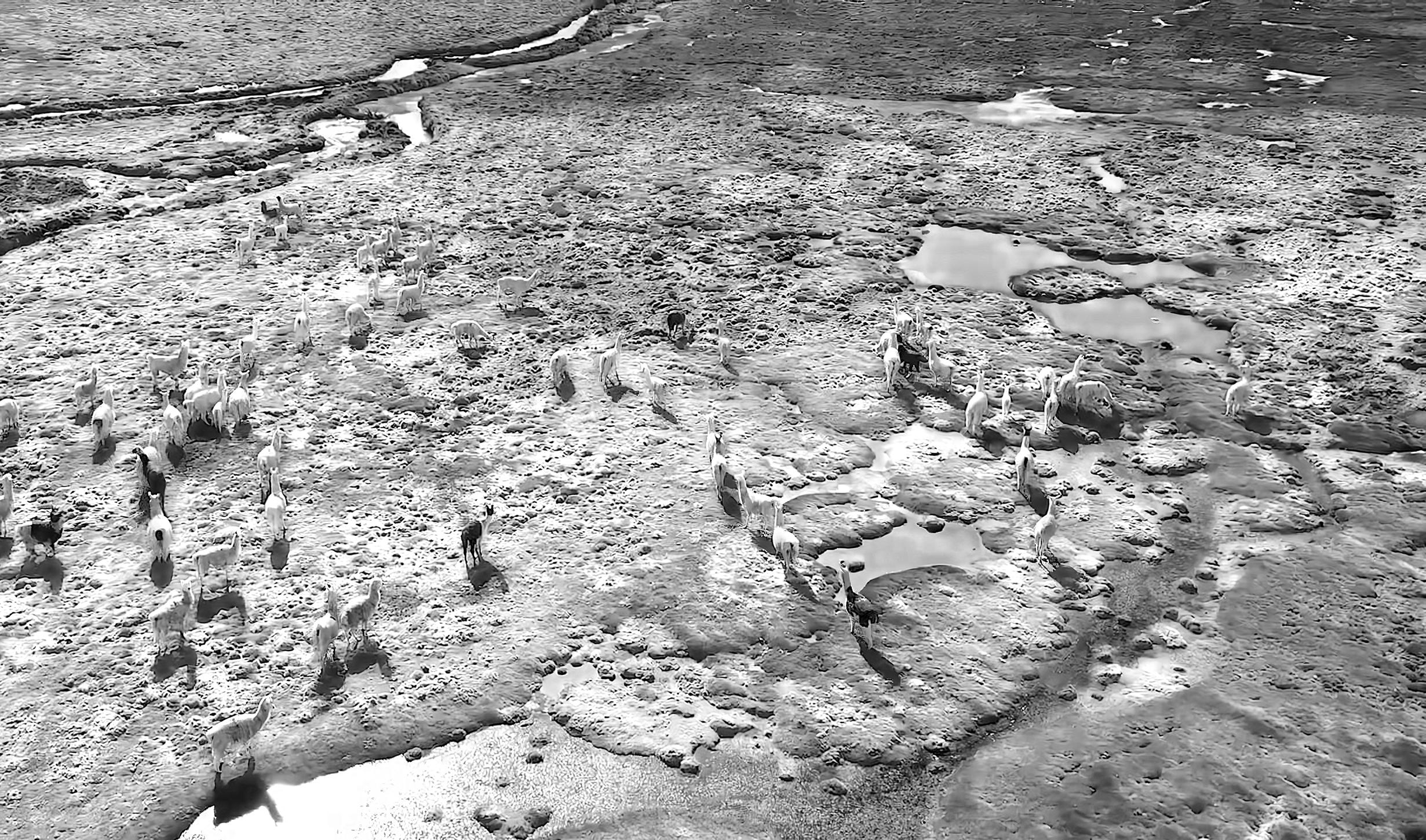
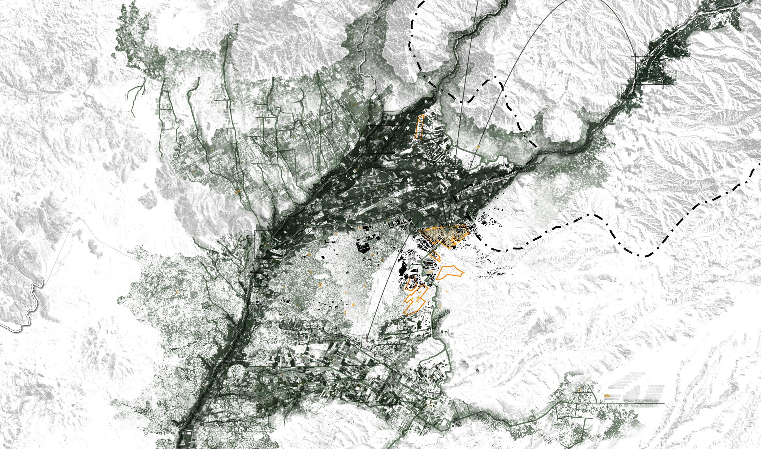
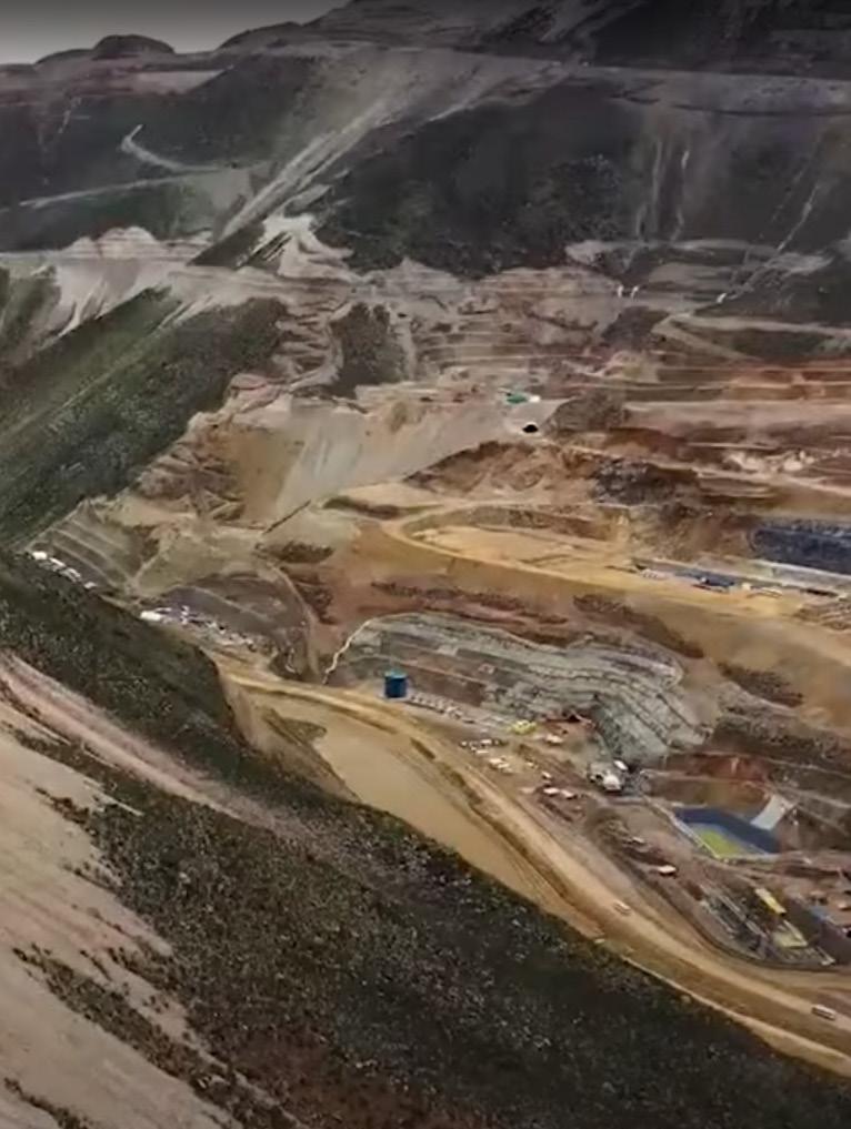
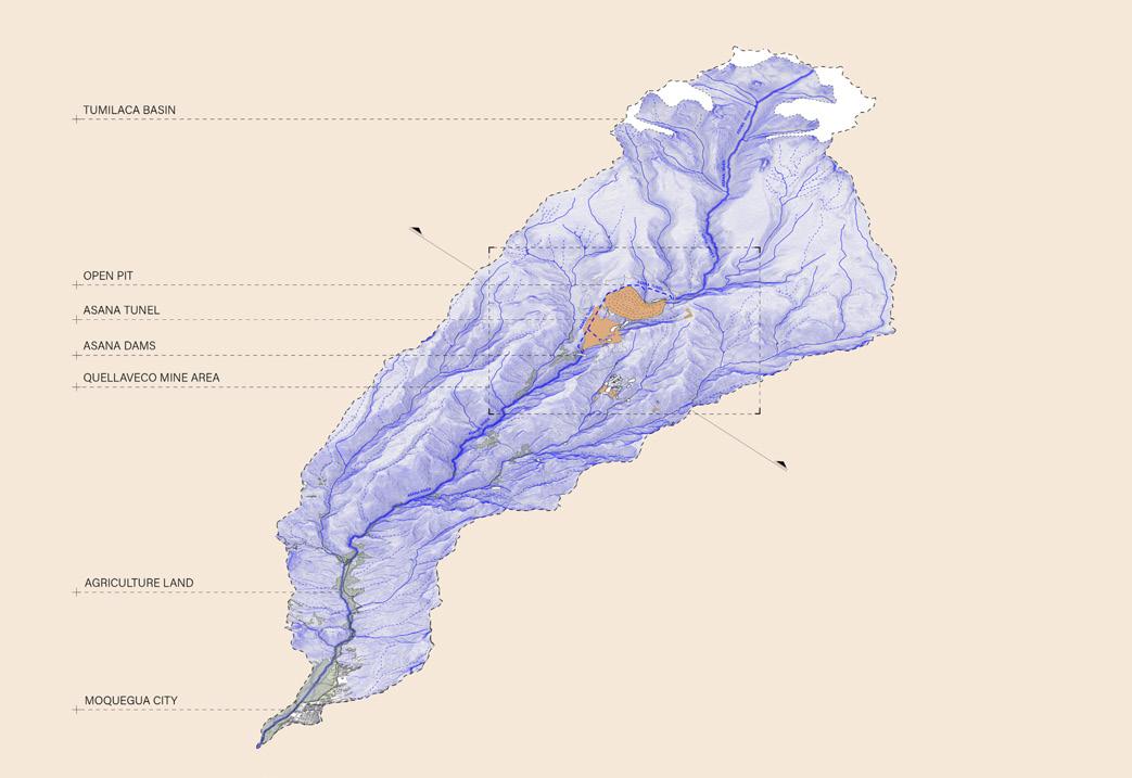
fig. 00.1. Drawing about the extractive territory.
Source: Lucio Flores,President of the Environment and Agrarian Federation of Moquegua.
Water basin community-driven just model For transition toWards Quellaveco mine de-extractivism
José Fabián Jiménez (Msc)
Yuxiang Huang (Msc)
ARCHITECTURAL ASSOCIATION
SCHOOL OF ARCHITECTURE
ACKNOWLEdGmENTS
LANdSCApE URbANISm mSC
2024-2025
José Alfredo Ramirez Eduardo Rico
STUdIO mASTER
José Alfredo Ramirez dIRECTORS
HISTORy ANd THEORy
Clara Olóriz Sanjuán Elena Luciano Suastegui
TECHNICAL TUTOR
Daniel Kiss Sheng-Yang Huang
AUTHORS ANd EmAILS
José Fabián Jiménez Viñas / jimenez-vinas@aaschool.ac.uk Yuxiang Huang / yuxiang.huang@aaschool.ac.uk
EdITION
London, September 12th 2025
We would like to thank our family members who made it possible being here, our couples and our friends outside and inside the master’s. They all made this journey incredibly enjoyable.
Thanks to our main tutor Alfredo, who gave us space for developing our ideas and at the same time for being always critical about the limits for an optimal development of our project. Moreover, thanks to our programme tutors for every lesson, tutorial, and lecture that made us think about the challenges of Landscape Urbanism and the way, as designers, we can shape the territory differently.
As well, we extend our gratitude to organisations such as London Mining Network (UK) and Red Muqui (Peru). Both gave us huge support in the research, making it possible to work and imagine alternative futures for communities sustainability in Peru.
AbSTRACT
In the context of climate change and the Paris Green Deal, European countries and the UK have established an energy transition for their countries. Their plan is to reduce carbon emissions to zero by 2050. However, to achieve this, extraction will continue not within, but outside their territories, which means a major unseen environmental and social impact for the countries affected.
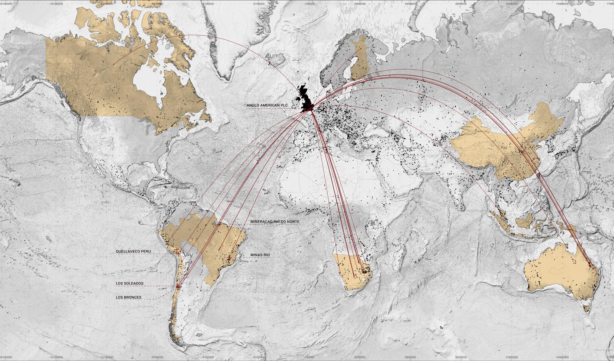
London Mining Network (LMN) is an organisation that seeks to raise awareness of what UK companies are doing in foreign territories and unveil what is usually hidden by the power of their facilities. In this context, London-based Anglo American Plc is currently developing what will be the fifth largest copper mine in the world in Quellaveco, Moquegua, in the south of Peru, a country that contains almost 10% of the world’s copper reserves (USGS, 2019) .
Basins of the Moquegua region are licensed for mining without consideration of whether they are agricultural land, reserves, or community protection areas. In the case of the Tambo basin (32%), the Locumba basin (31%), and the Ilo-Moquegua basin (75%), the last one being in the most worrying situation. This also calls into question the legal processes for mine closures and the plans that must be presented for this, as well as the actions and foundations necessary for a just transition. As well as LMN, Red Muqui is doing the corresponding work in Peru, helping the communities to have a voice in the decisions over their territory.
The research project proposes the possibility of generating physical alternatives for territories that have been mined and damaged by foreign companies such as Anglo American. This can be made possible based on local knowledge of water farming and planting, including bofedales management, quenuales plantations, and phytocovers, for the sustainable development of families and the landscape. Moreover, infrastructures such as ‘qochas’ and ‘amunas’ are the basis of the system needed to be built in order to transitioning towards ecological and just futures in the Andean region. From this perspective, Harvesting Quellaveco converts the ancestral system managed by the communities to empower the decision making and power over the land which they care everyday. It is a way to secure water and food in a place where super-arid conditions make it even harder for them to make life possible.
AUTHORS
José Fabián Jiménez Viñas
Yuxiang Huang
01
HARvESTING FUTURES
1.1. What is Harvesting Futures?...........................p.26
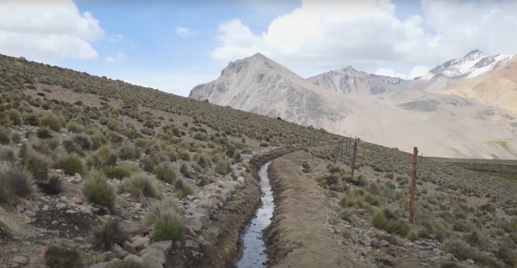
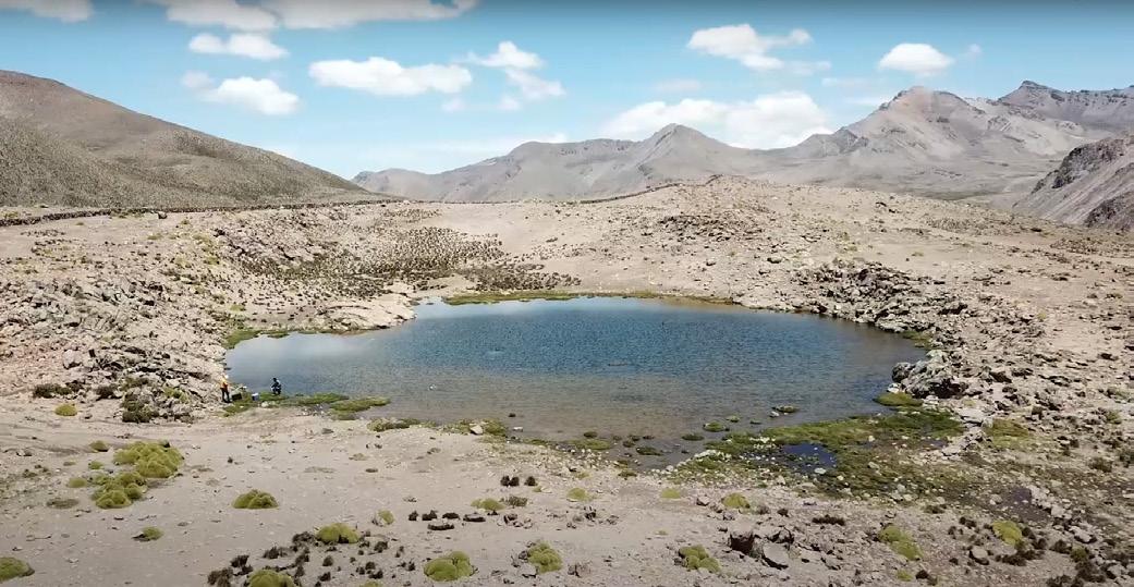
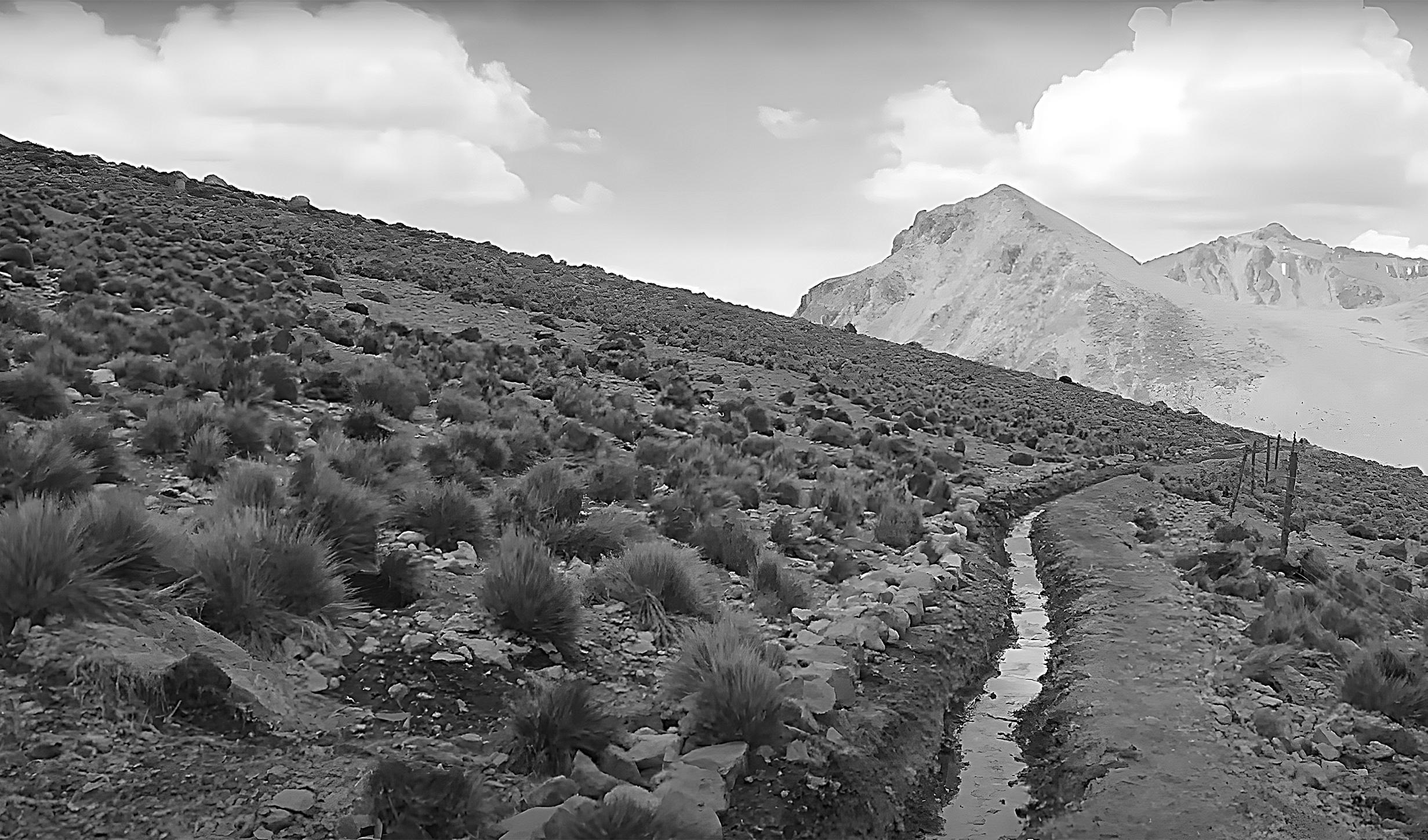
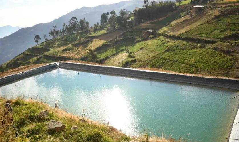
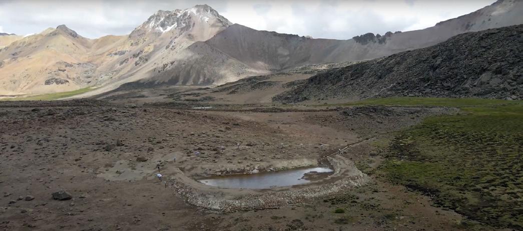
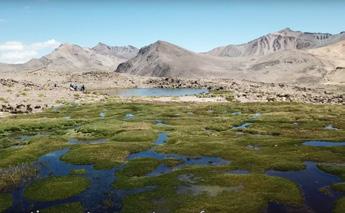
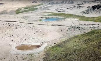
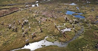
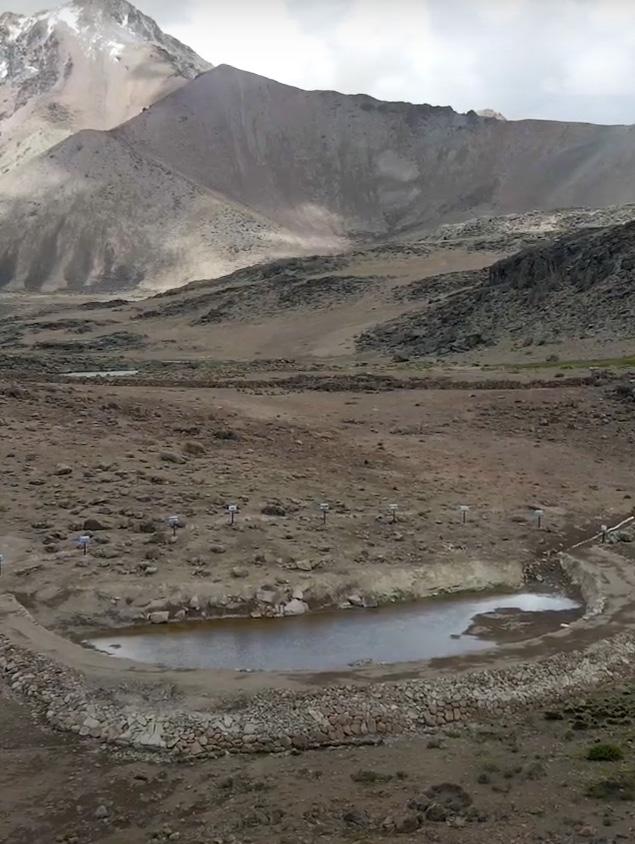
fig. 01.1. Qochas in Asana community in Moquegua upper basins.
Source: MERESE Ilo Moquegua Youtube Channel.
HARvESTING FUTURES
Harvesting Futures is a thesis from the Landscape Urbanism programme 2024-2025 of the Architectural Association School of Architecture in the context of just transition and mining futures for territories exploited by powerful UK companies.
The intention of the investigation is to search for physical and real alternatives to just transition in affected countries such as Peru, taking as a base the work organizations such as London Mining Network (London) and Red Muqui (Peru) are doing for the purpose of making visible the ecosystem impacts, the unseen communities, and the policies that usually shape our territories.
The work was developed with valuable information and data that those organisations produced. There were group interviews between London and Peru for discussing the topics and planimetries. As well, there was communication with people who know about the system of collection and harvest of water in Peru, which might work as an alternative to extractivist mange of the land
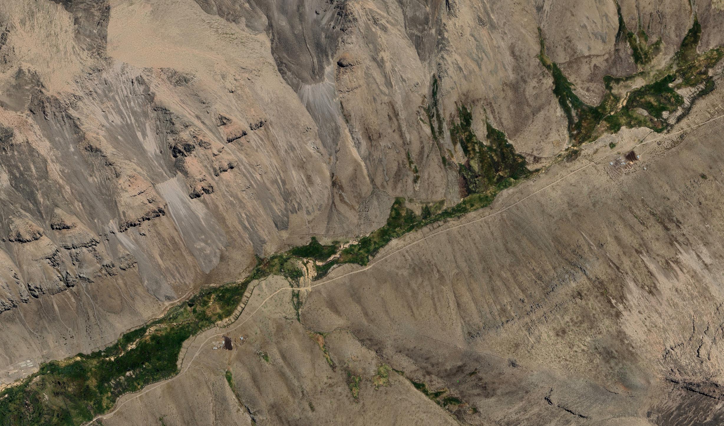
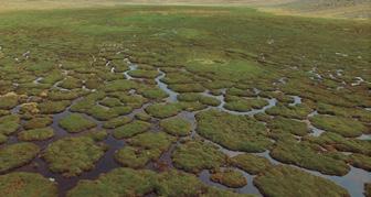
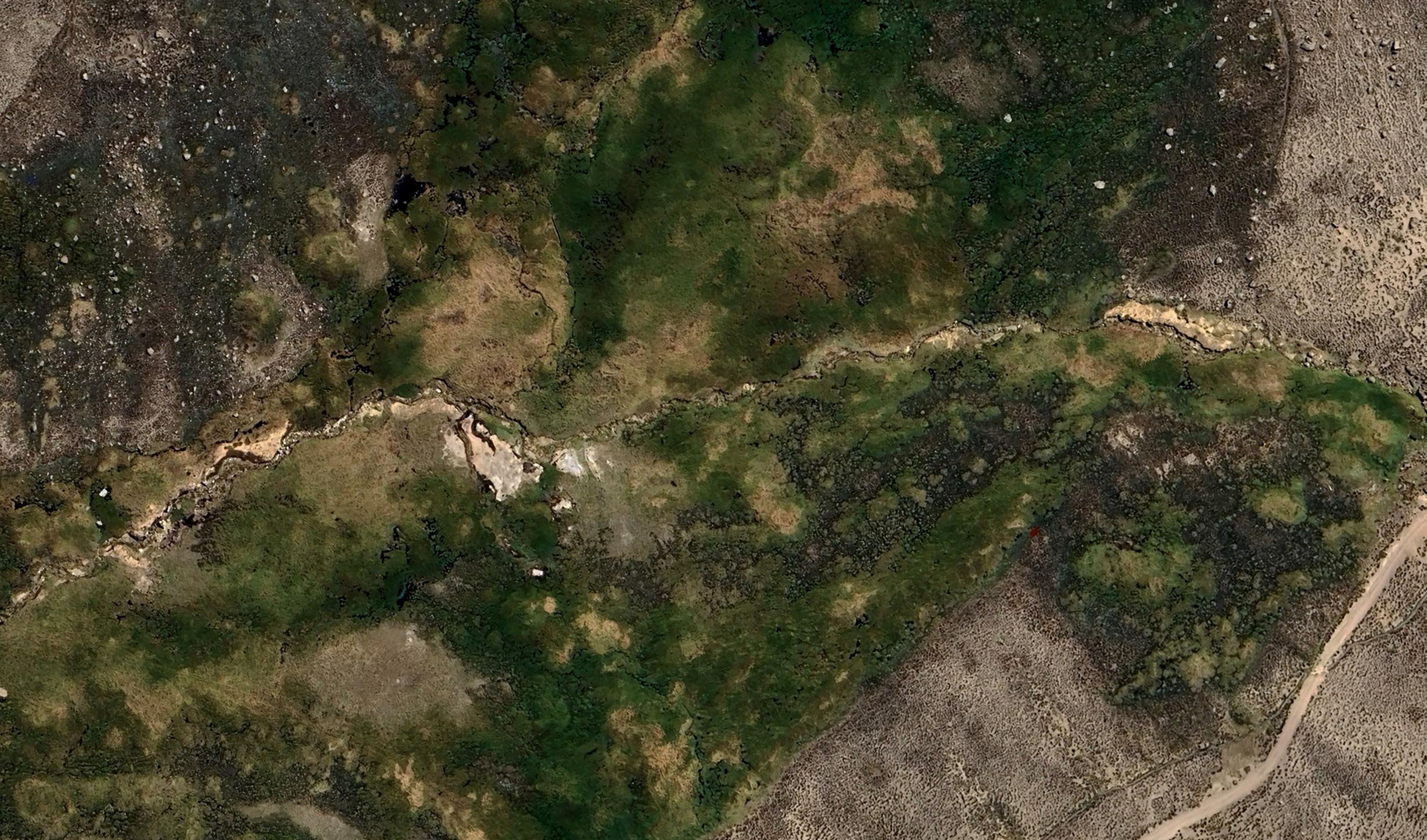
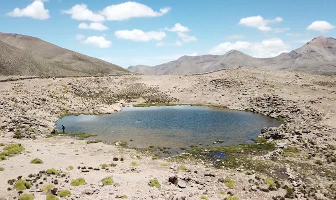
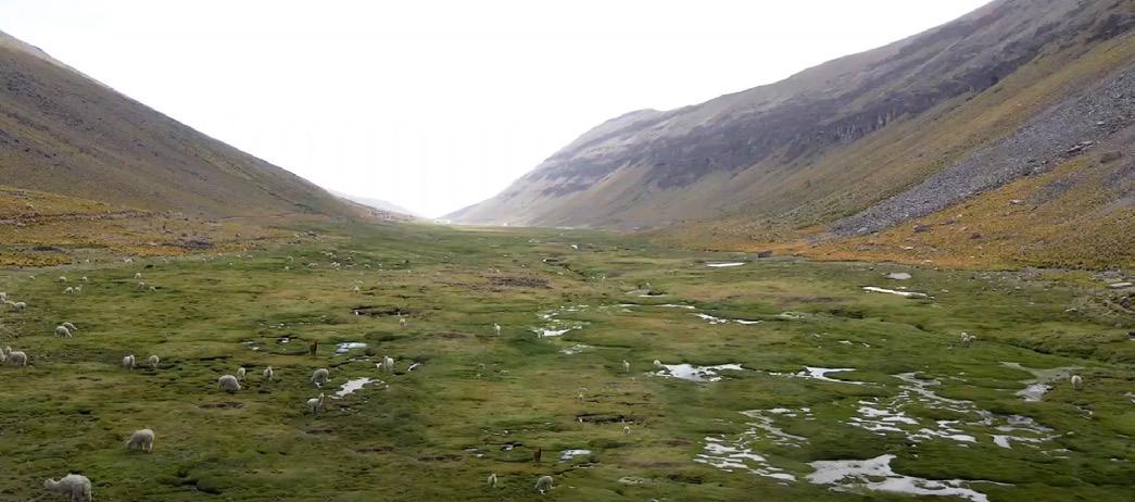
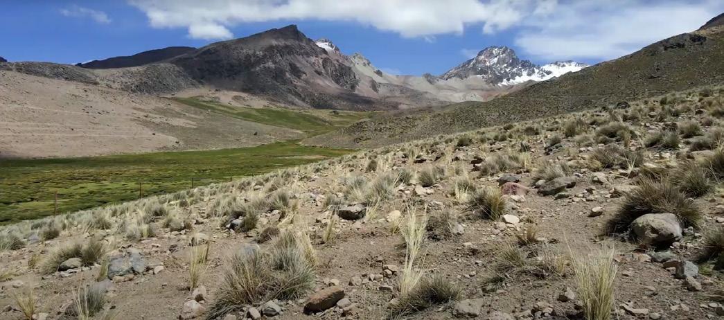
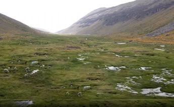
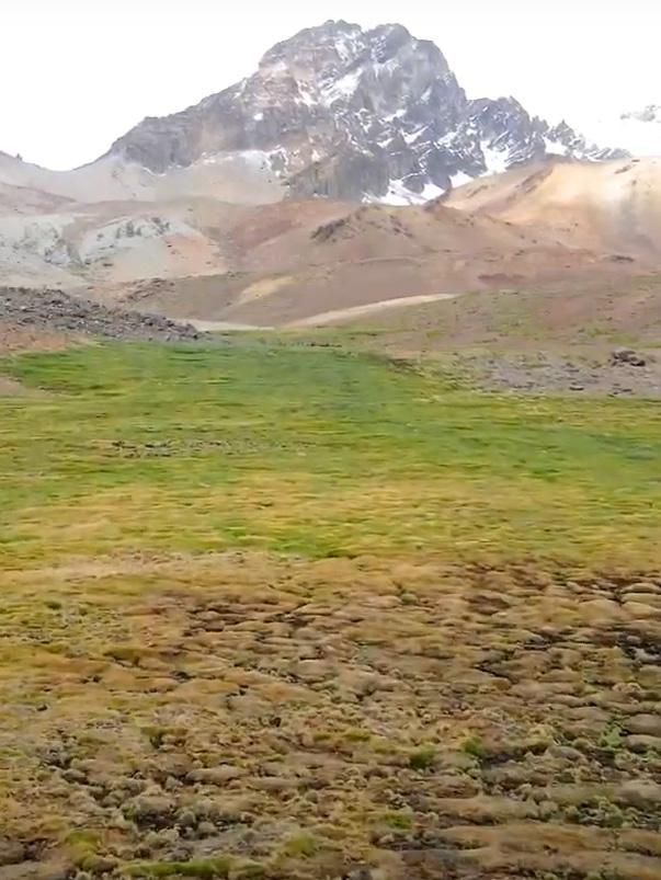
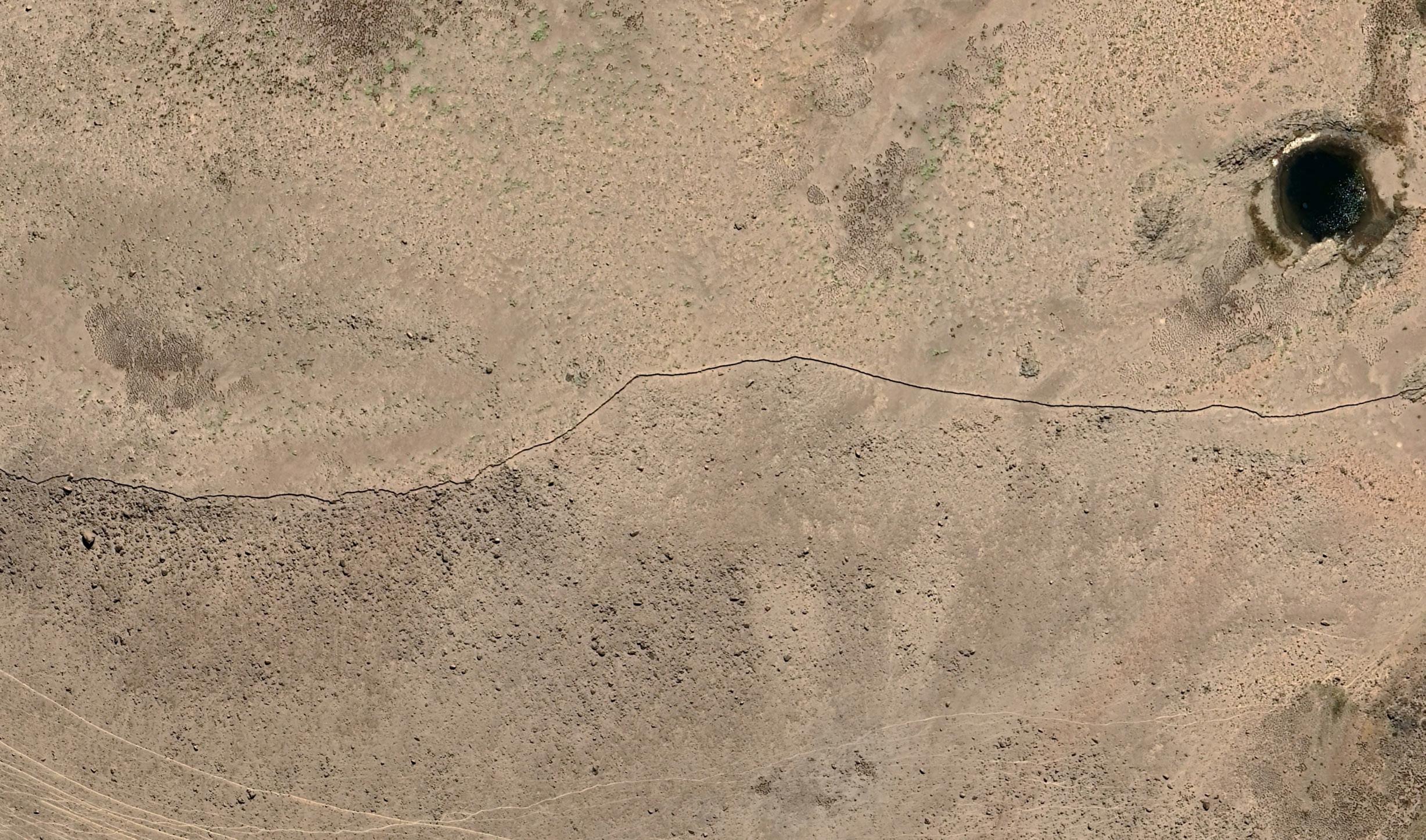
Bofedales are fragile ecosystems situated in the upper regions of the Andes above 3000 m, whose main characteristic is the extensive grassland biomes (‘turba’) that occur between the upper forest line and the permanent snowline (Buytaert, 2011). Although this ecosystem covers just 3% of Earth’s land also stores 30% of all carbon found in the global ground (CONDESAN 2025). Inside the community of Asana in the upper streams of the Moquegua Region exists bofedals that are in danger because of the underground pipes colocated by Anglo American plc company.
1 Extracted from an infography for bofedales made by Consortium for the Sustainable Development of the Andean Ecoregion.
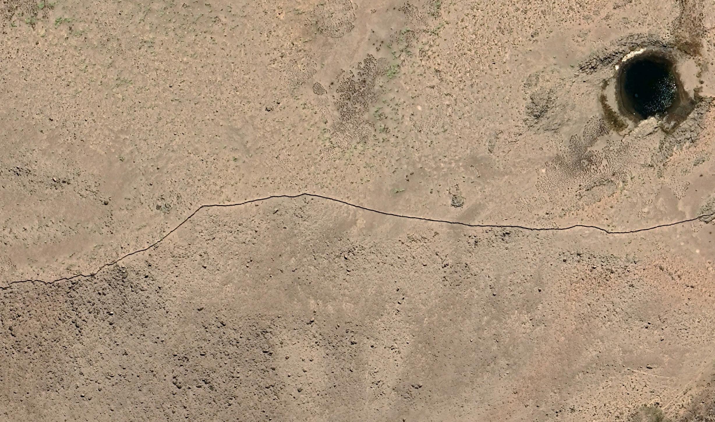
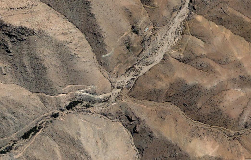
fig. 01.2. Bofedales from Asana community in Moquegua upper basins. Source: Google Earth Pro.
ASANA bOFEdALS
WHAT IS HARvESTING FUTURES?
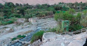
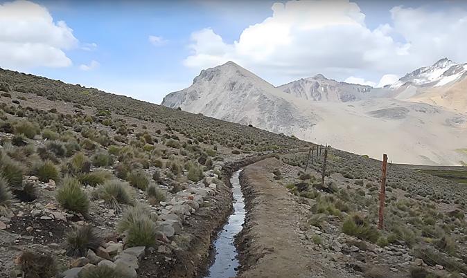
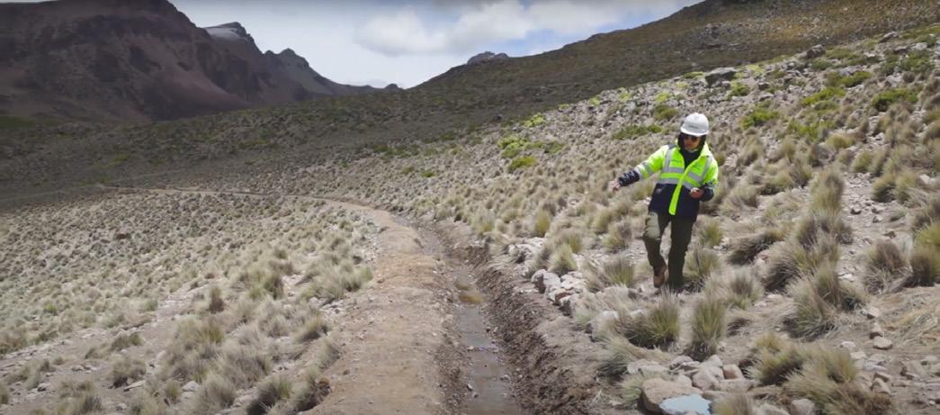
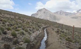
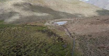
The two figures shown are from the Asana community in the upper basins of the Moquegua region. On the left, an infiltration canal for water to flow over the terrain and crops, making it possible to produce water through difficult slopes and without harming the land with external materials.
In Peru extractives activities represent an important percentage of the economic growth. However, the cost of ecological layers, social distrust, community boundaries, and land management represents a different and much bigger cost of the territory. In this context, we should be looking at different ways of developing the land in the most sustainable way possible. Usually, when talking about extractivism, there is a range for land regeneration after the process, however, a high number of operations that come from abroad hardly ever commit to recovering the land.
On top of that, the community knows that the land that was grabbed will never be the same or if it does, it will take several years ahead to stabilize. Is so much environmental wealth taken away from the ones that care or the ones that live from the natural production from the territory?
Therefore, the concept of alternatives appears as a counterargument for extractive ways of seeing the land. It shows the vision of communities and real sustainability. According to Eduardo Gudynas1 and Red Muqui2 not all countries and territories should be treated in the same way.
Alternatively, to clean energy of decarbonization in European countries, the Latin American ones or specifically in the case of Peru, different processes of transition are better options.
In such a rich culture, alternatives will take into consideration spaces that are selected by the communities that live there as untouchable, which makes their voices have a positive impact on the land. They have a vision of the place where they live, they grew up knowing every valley, river, forest, and mountain.
In the case of Peru, planting and harvesting of water represent a powerful alternative for the sustainability of the region. To avoid being modernized and transformed into an extraction point. Ancestral knowledge fits the alternative concept presented by Gudynas. It represents what a just transition could be according to the London Mining Network, which reports function as a guide towards de-extractive territories. In the case of Peru, guidelines such as community empowerment match with the alternative future of community driven territory development because they are the ones who knows better about harvesting the land.
A biobased and ancestral knowledge that carries the sustainable use of territory in Peru. Throughout many years, this activity has survived, and it was passed down from generation to generation. Since inca times, technologies for producing water as a primary source were developed quickly because there was a strong understanding about water being the basis for every living element in nature.
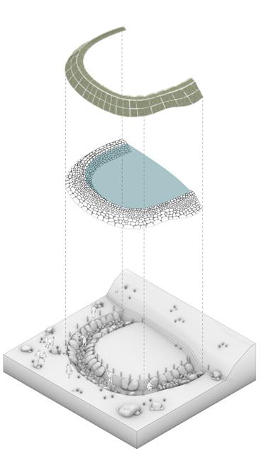
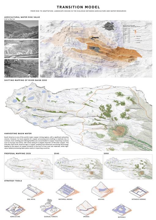
The process of infiltrating into the soil has benefits that reach cities in different regions of the country. That being said, they do this through two mechanisms, such as ‘qochas’ and ‘amunas’. The water is storage in a ground depression passing through the terrain and creating outcrops in two or one kilometers distance enough to enrich the bofedales ecosystem and nutritious soil. Also, materials for the construction of these elements come from the site and represent another reciprocal way to interact with nature.
This helps maintain the cycle or water cycle in the hole region as a system. Water can then be used for domestic, agriculture, and recreational activities that make the communities live in a sustainable environment.
2 Network of Peruvian institutions acting locally, regionally, nationally, and internationally to defend recognition, respect, and exercise of the rights of communities and populations, as well as sustainable development (Red Muqui website, 2025)
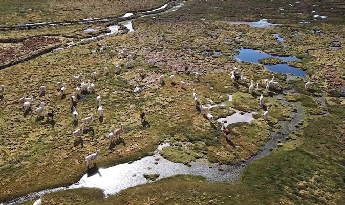
fig. 01.4. Qocha from Asana community in Moquegua upper basins.
Source: MERESE Ilo EPS Youtube Channel.
1 Uruguayan biologist and author specialisingi in environment and alternatives to development, involved with several social movements that seek to promote such alternatives (Red Muqui, 2025).
fig. 01.3. Amunas from Asana community in Moquegua upper basins.
Source: MERESE Ilo EPS Youtube Channel.
ASANA COmmUNITy
TERRITORy ANdEAN vISION
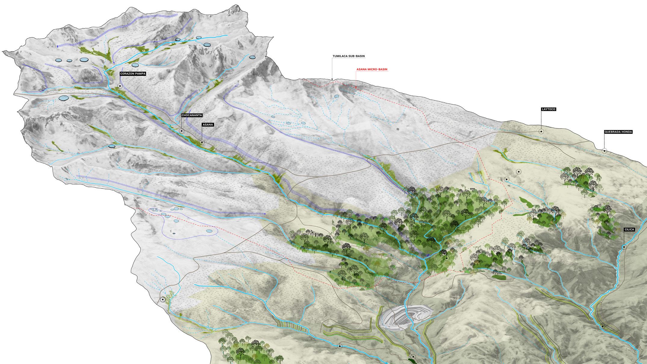
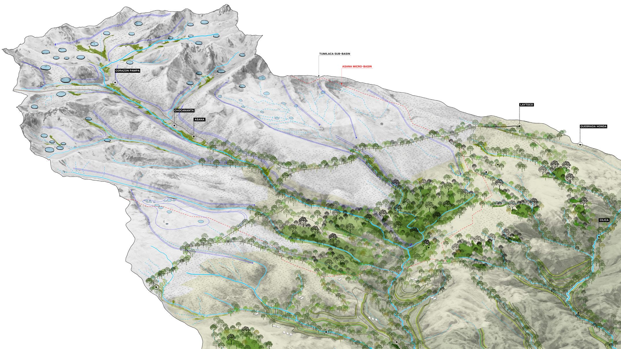
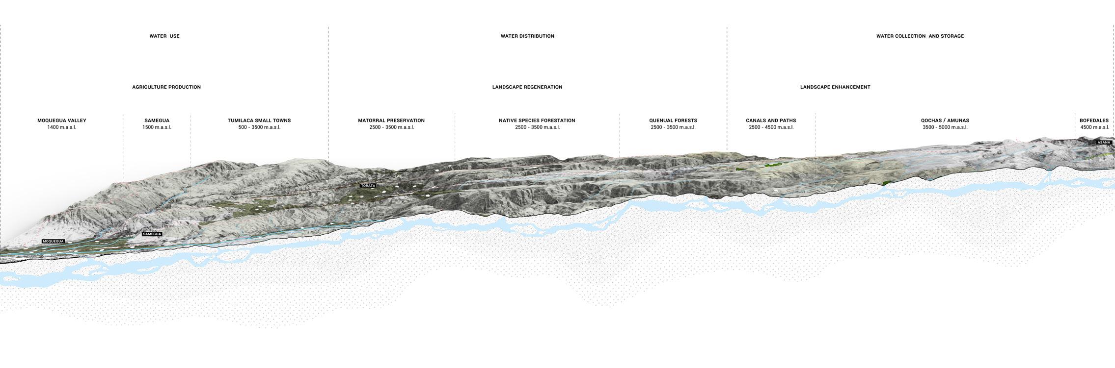
This cartography shows the vision explained in an interview with a Peruvian communal member from CEDAP Ayacucho, Tulia Garcia. The five main pillars for the planting and harvest of water. Infiltrating water through qochas and amunas1 to recharge underground aquifers. Reforestation of quenuales, phyto-roofs for agriculture, paths and bofedales management, including animal grazing. All of this as a single system for sustainable development of the territory and reciprocal action towards Mother Nature (Pachamama2). Tulia Garcia is showing the knowledge of this territorial management system, which represents a culture that cares about the place they live in.
In Andean vision, they are aware of every rainy and dry season, every mountain name, every river and every species that grows with it. The valley where they stay is a house where you know almost every corner of it, walking through it every day, almost by memory.
1 From Quechua meaning ‘to retain’ and ‘body of stagnant water’ provide more than 225,000 m3 of water per year per km recovered (Aquafondo: 2022).
2 From Quechua language meaning ‘Mother Earth’.
ExTRACTIvE vISION
Instead, modernization brought different visions of the land as resources. Territory is represented as a piece of ground that can be monetized, which is mostly the case of extractive industries, and especially copper ones produce large amounts of waste, which can cause damage that lasts for more than 50 years. There is a false belief that the cost of that land could benefit millions of people, but it is just a time bomb. Boundaries look blurry into the eyes of the company’s managers, but on top of that, communities are unseen places where power impose new rules that should work for them without any understanding of the diversity of territory that a country such as Peru have.
It is essential for the purpose of our thesis to put every research piece through a critical cartography view. Mapping has changed the way we depict the unseen elements in a system of abuse and exploitation. They were used as a material object for wider discourses which generate sophisticated meanings beyond simbolism and territorial imperialism (Cosgrove: 1999: 19).
In that way, asking questions on every map will be our starting point in each drawing. As designers, we approached the task of representing a voice that could sound louder, such as the case of peruvian communities
The process started when having in parallel lectures and readings to help as contribute and make a difference when drawing. We learned the importance of create awareness from our perspectives of outsiders cause in some way mapping give us the power of creating a message to multiple people, places or times (Cosgrove2 1999:12).
Maps presented in the following thesis will use reliable data from governments and multiple interviews with organisations in the research of mining, such as London Mining Network and Red Muqui.
All the inspiration and main ideas for our project come from the London Mining Network research. There is a vast documentation about UK based companies extracting minerals in different countries around the world. One of the thesis topics presented by the chair was ‘Mining Futures in Latin America’. For this case, LMN agreed to be in partnership and gave us specific potential places with social and environmental issues where London companies are currently operating.
London Mining Network has as well reports talking about these places, where people were interviewed. Across the master’s period, we had presentations where they were present and gave us feedback. Also, we had conversations with Peruvian locals in person when they came to London, and conversations through Teams for sharing to help them with cartographies for the report.
It was a constant exchange of work together. From the learnings or the organization, we had the amazing opportunity to meet the Red Muqui organization, which is aware and supporting Moquegua communities and along Peru to raise their voices in places affected by mining.
In conclusions we understood affter reading the reports presented by LMN that it is crucial to start thinking about biobased materials, community economies, and changes of policies in landscape management specially for the cases of tailing dams and mine pits. For that, we also think planting and harvesting of water in MoqueguaPeru represents a huge opportunity to show the best alternative to a future of just transition.
The purpose of unveiling is to show what powerful companies do not show about these processes of extraction or what the Capitalocene1 is producing on a bigger scale (Moore: 2017: 6).
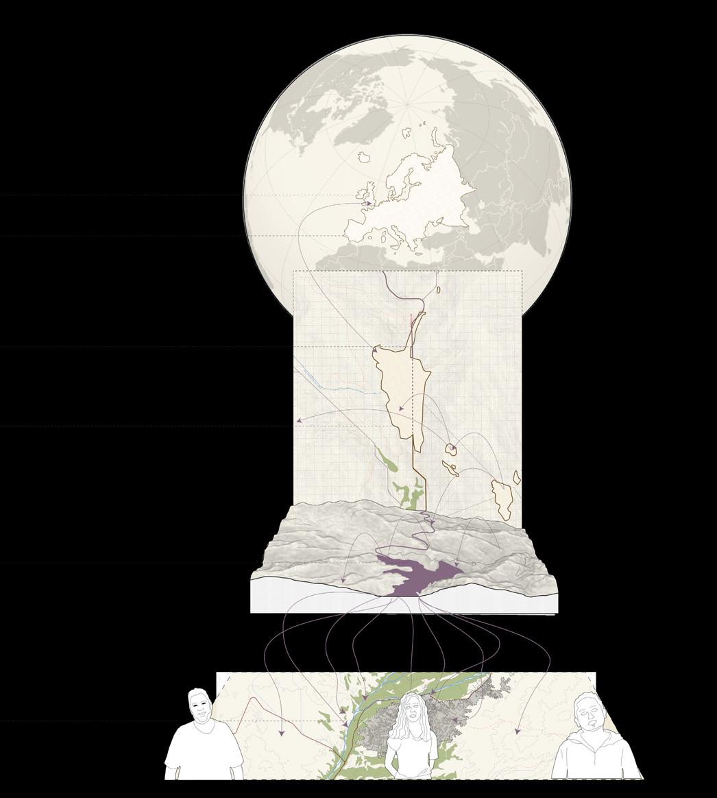
After understanding the research and arguments from the London Mining Network, our main task was to track every Anglo-American operation that was affecting Peru. That included showing the copper journey from the open pit until wind turbine manufacturing in the UK. As well, the risks and damage produced, water scarcity in the place and the different social issues with communities that live close to the extraction point.
There is a close relationship between the concepts of unveiling and the depth of power talked about by Elden Stuart2
Recognizing the vertical dimension of territory shows that territory is a volume rather than an area, and nothing that lines on maps have only limited height when translated into lines on the ground (Stuart: 2013: 36)
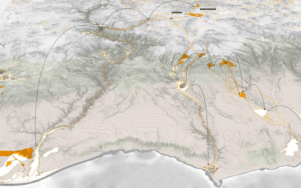
In Peru, lines should be expresed in a third dimension because of the ecological grounds, water systems and terrains which are not fully expressed when doing a plan. That is why we started depicting many views from a 3D perspective from a global scale to local proposals.
2 The concept of the vertical dimension have sense when talking to Peru, especially because of the huge amount of hidden views and objects in a territory of vast topographical territory.
After a process of being critical, studying what important research group in the field does and unveiling the different situations of the Quellaveco mine situation, it corresponds to propose a variety of cartographies and drawings that talk about the power community and water infrastructure knowledge can have in transitioning towards sustainable and harvesting futures.
That will correspond to the ambitious and imaginative alternatives for better futures in Moquegua communities in Peru. It will show how the landscape is capable of regenerating with the support of locals and the opportunities of preserving the ecosystems. This concept of alternatives will be taken from Eduardo Gudynas who is a biologist with specialisation in environment and ways for better development of the territory and who gave a masterclass in Red Muqui organisation which is investingating the same topics.
Although is hard to imagine these new futures, they should be thought of as projects in constant revision with openess to change (Red Muqui Internal Document : 2025). The most important steps for the purpose of our research will be the identification of the problems, risks and damages to then start thinking ways based on ancestral community knowledge to give them the power to decide over the territory.
1 Red Muqui produced a workshop with Eduardo Gudynas and then produced an internal document about all the learning which is the
MOQUEGUA REGION
SOUTH MACRO-REGION
fig. 01.6. Amunas from Asana community in Moquegua upper basins. Source: Google Earth Pro.
bIbLIOGRApHy
REFERENCES
01. Aquafondo. “Amunas - Aquafondo,” January 27, 2025. https://aquafondo.org.pe/amunas/
02. Aquafondo. “Amunas, El Sistema Ancestral De Canales Que Combate El Cambio Climático En Perú (EFE Verde) - Aquafondo.” Aquafondo, February 19, 2024. https://aquafondo.org.pe/amuma-el-sistemaancestral-de-canales-que-combate-el-cambio-climatico-en-peru-efe-verde/ 03. Cosgrove, Denis. “Introduction: Mapping Meaning.” In Mappings, edited by Denis Cosgrove, 10-38. London: Reaktion, 1999.
04. Elden, Stuart. Secure the Volume: Vertical Geopolitics and the Depth of Power. Political Geography 34: 35–51. 2013. https://doi.org/10.1016/j.polgeo.2012.12.009
05. Martinez Ordoñez, Bladimir C. and Red Muqui. “Alternativas Y Transiciones Con Eduardo Gudynas,” 2025.
06. Monge-Salazar, María J., Carolina Tovar, Jose Cuadros-Adriazola, Jan R. Baiker, Daniel B. Montesinos-Tubée, Vivien Bonnesoeur, Javier Antiporta, et al. “Ecohydrology and Ecosystem Services of a Natural and an Artificial Bofedal Wetland in the Central Andes.” The Science of the Total Environment 838 (May 15, 2022): 155968. https://doi.org/10.1016/j.scitotenv.2022.155968
07. Moore Jason. “Planetary Justice CAPITALOCENE”, nd.
08. United States Agency for International Development et al., “TURBA,” n.d.
09. Red Muqui - website, n.d., https://muqui.org/
10. Garcia Tulia. “Zoom interview about planting and harvest of water”, 2025.
LIST OF FIGURES
Figure 01.1. Black and white image. Qochas in Asana community in Moquegua upper basins. Photo by MERESE Ilo Moquegua youtube channel, 2024.
Figure 01.2. Bofedales in Asana community in Moquegua upper basins. Photo from Google Earth Pro, 2025.
Figure 01.3. Amunas in Asana community in Moquegua upper basins. Photo by MERESE Ilo Moquegua youtube channel, 2024.
Figure 01.4. Coloured image. Qochas in Asana community in Moquegua upper basins. Photo by MERESE Ilo Moquegua youtube channel, 2024.
Figure 01.5. Reports and research from LMN. London Mining Network website, 2025. https://londonminingnetwork.org/reports/
Figure 01.6. Amunas in Asana community in Moquegua upper basins. Photo from Google Earth Pro, 2025.
EXTRACTIVISM POWER
EXTRACTIVISM POWER
The modern world continues to depend on extractivism as a priority activity in different parts of the world, but especially in underdeveloped countries. The biggest problem is that developed countries, such as the European Union or the United Kingdom, due to climate change and energy transition, decide to stop extracting minerals from their own territories. However, this has never been enough, and that is why they have also been extracting the majority of the minerals they need from the global south. he so-called ‘green transition’ requires more minerals that are located in the global south, so the extraction is a continuation of their policies, and it is an increase in specific minerals such as copper and lithium.
Communities that are particularly unseen suffer the effects of these extractive processes, such as mining tailings, open pits and sulphur. It is important to show these affected territories at a global level, but in contrast to the different ecosystem layers that exist. Therefore, for this particular study, the focus will be on South American countries following the research of London Mining Network which have found cases related to a UK based company such as Anglo American.
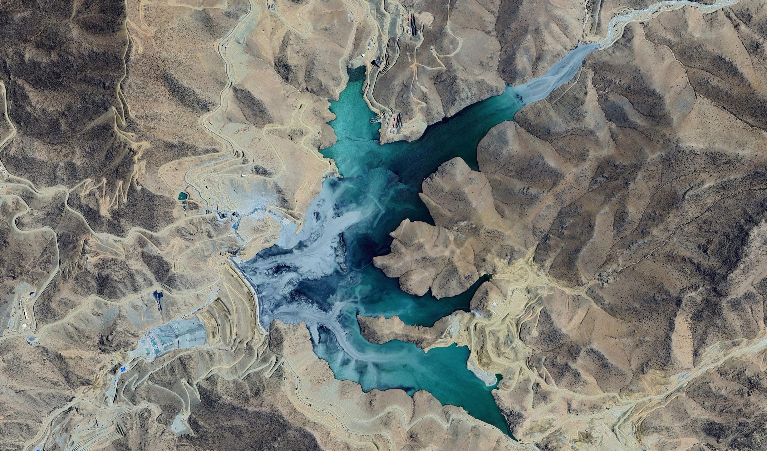
fig. 02.2. Copper tailing dam ‘Cortaderas’ from Quellaveco Mine. Source: Google Earth Pro, 2025.
QUELLAvECO TAILING dAm
One of the most harmful practices in the world is mining. The industry defends its operations, claiming that they support the local and perhaps global economy. Talking about extractive companies is always related to costs and who the world operates in the capitalist system. However, what about the other cost? the cost of life and the cost of many traditional forms of living, forms that are not recognised by modern industries or even that do not appear on the map.
Today, UK businesses are active in every industry worldwide, and especially in mining. Communities may profit from this, but occasionally, both people and the environment may suffer as a result of corporate activities. When this occurs, those who have been affected frequently desire a remedy and accountability from the company (London Mining Network: 2016). In that sense, any transition or alternative policy or proposals should consider the economic support of headquarters companies for the regeneration of landscapes, social boundaries, and new circular economies. In the case of Peru, Quellaveco is a recent opened copper mine lead by Anglo American, which claims being green and digital, but in practice, are they considering having a justice transition, or just cutting the terrain and run?
Mining produces several impacts in land and territories, but one of the most devastating are tailings, producing disasters that last hundred of years. Catastrophic and slower releases from tailings facilities have long-term adverse effects on groundwater, surface water, soils, vegetation, and communities (London Mining Network: 2020).
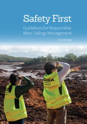
As the Figure 02.3. shows how the Quellaveco tailing dam place was before Anglo American’s arrival. Every ravine and river have a bigger cultural heritage sense for the locals, but he company look at it as a matter of empty land with no big cities close by. That is a huge error, cause it omits the populated small towns that exist all over the territory. What can be done with these toxic grounds? Safety first is a report from Earth Works and LMN organsations that suggests creative solutions in this context.
It is clear by looking at the numbers how Britain companies have a great share of power over the industry. But what would happen if that same amount of power were used to transform landscapes degraded by mining, and new transition policies were proposed, subsidised fairly by the companies?
The few multinational firms that control the mining sector are crucial in supplying inputs for products we use on a daily basis, such as food and cellphones, even though the majority of us probably don’t give it much thought (London Mining Network: 2022). Their involvement in the manufacturing of these products—control over the extraction of minerals at the beginning of the extensive global supply chains that extend from the mining landscapes of Peru to, for smartphones, our pockets, is the source of their profits.
fig. 02.3. Quellaveco tailing dam place before Anglo American.
Source: Google Earth Pro historical images, 2006.
fig. 02.4.
mINES pOWER
TOxIC ECONOmy
In the context of climate change, the transition towards clean energy is the solution most developed countries had taken to achieve the goal of zero carbon emissions by 2050. As a result, there were multiple policies arranged, such as the Paris Agreement and the Clean Energy Power in the UK. However, in this swtiching process, there is a gap, as it requires minerals such as copper, lithium, aluminium, etc., which must be extracted in greater quantities and will increase extractive processes, but paradoxically outside developed countries.
This transition cannot be achieved by expanding the reliance on other materials (London Mining Network: 2021). Additionally, in order to encourage the creation of more decent jobs, the new policies developed for this purpose must offer a just transition framework for everyone. This framework should include, as appropriate, skills development, social dialogue, and the effective exercise of the right to organize and bargain collectively, as well as anticipating the effects on employment and providing adequate and sustainable social protection for job losses and displacement (ILO: 2015).
Integrating provisions for a just transition into regional planning and designing the unseen landscape should be part of the governments’ agendas in order to include agroecological and traditional knowledges in countries such as Peru. Circular societies can be developed as community-based principles, which are the people who care about the ecosystems and resources of the territory.
Biobased materials for construction or even ancestral practices related to nature based solutions can be the starting point for new solutions in the contexts of extractivism and energy transition. Most of the South American countries which are being exploited do not have the necessity of transition into green energy (Gudynas, 2024), instead, the new transition should be looking at agreements between small families and locals in the remote areas where mining is also operating. The International labor organisation already have social protection policies written that can work for the case of Peru if governments adopt a transition plan. Therefore, companies with headquarters in other countries should paid a price for the damages caused until the moment of closely monitoring and recognising that there are places of the land where it should not be for mining economic purposes.
Especially for the case of UK-based organisation, it is a huge responsibility towards the role that London plays in financing and sponsoring the mining industry, which many of them have offices there of are listed on the London Stock Echange (London Mining Network: 2021). For that, it is important that this country take charge of the transitions all over the world as a global political action to improve the life of many communities.
fig. 02.7. Post Extractive Transition.
Source: London Mining Network report, ‘War on Want’, 2021.
fig. 02.6. Circular economies interactions.
Source: Science Direct. Extracted from London Mining Network report, ‘War or Want’, 2021.
LONdON mINING NETWORK (LmN)
HUmAN RIGHTS & ENvIRONmENT
London Mining Network works on writing reports, publications, and articles that make visible all the abuses related to social rights of the communities in the different countries, and also the unseen ecosystems of extraction.
This organisation is our main reference to present a project that talks about regeneration, circular social economies, biobased materials, and policies related to just transition. They attend relevant conferences and are currently working on issues such as mine waste dams and justice transition.
The reports showed examples about environmental damages in communities territories, such as tailing dams, but on top of that, research about guidelines for preventing potential collapses. Additionally, and more importantly, those books present the global and direct relationship that exists between headquarters and territories in the South American continent.
mINING AFFECTEd COmmUNITIES
Monitoring abuses in mining-affected communities, making campaigns and petitions by member groups and others, writing and support open letters, address our concerns with parliamentarians, and asking questions on mining-affected communities’ behalf.
For the purpose of the thesis, we have been in contact with the organisation to gain some knowledge and understand the processes of social recognition in London. Especially, for the case of Peru, through LMN we had the opportunity to connect and have a conversation with peeruvian organisations unveiling and investigating about Quellaveco operations from Anglo American in the Moquegua region.
pUbLICATION
In the contexts of energy transition, copper production is becoming a strategic mineral for in the global north and because of its principal role in the development of clean technologies such as electric vehicles, smart grids, and renewable energies. Anglo American had taken advantage of this narrative to position its projects in Peru, arguing that copper mining in mines such as Quellaveco is essential to reduce dependency on fossil fuels and accelerate global decarbonisation (London Mining Network: 2024).
ANGLO AMERICAN IN PERU EXPANSION AND ENVIRONMENTAL CHALLENGES OF THE QUELLAVECO PROJECT
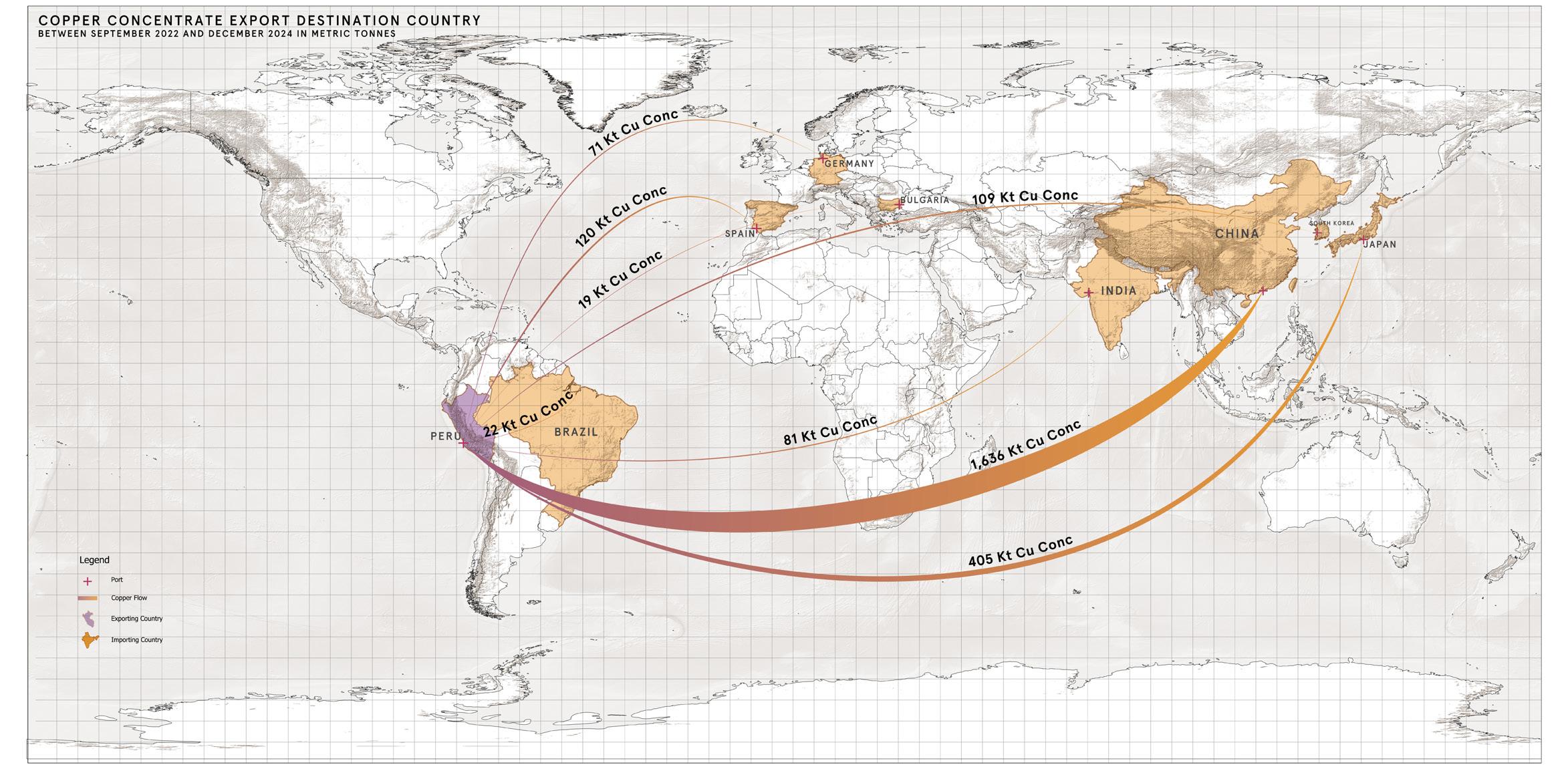
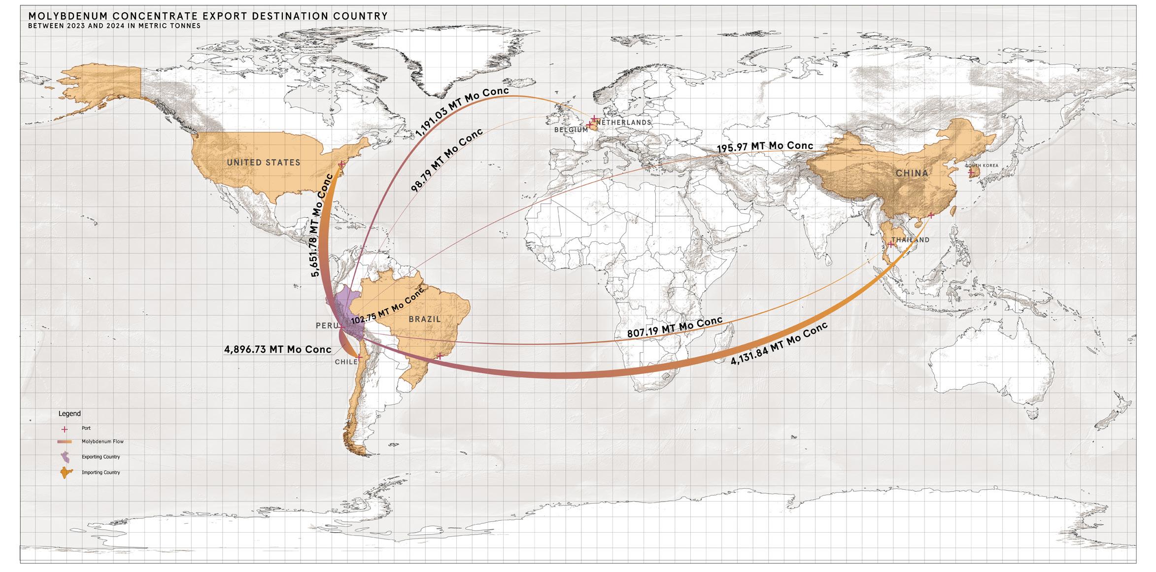
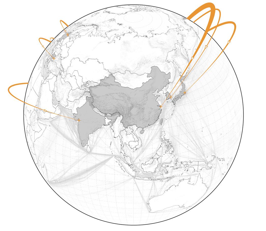
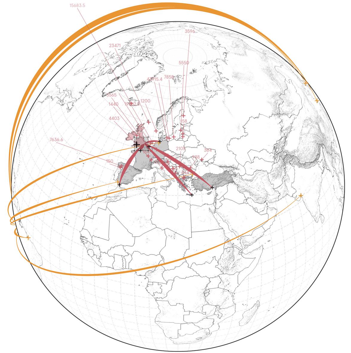
As a team, we had worked together with London Mining Network and Red Muqui to present a report about what is happening at the moment in Quellaveco, Peru, and unveil the problems that the communities are facing because of the Anglo American company. The report shows two different maps that we made for the graphic representation of the data, risks, and flows of material.
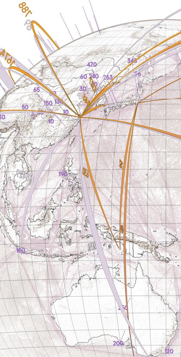
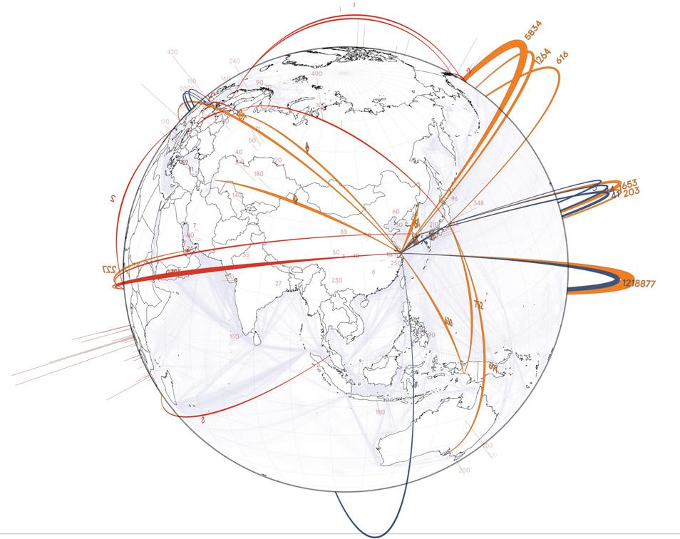
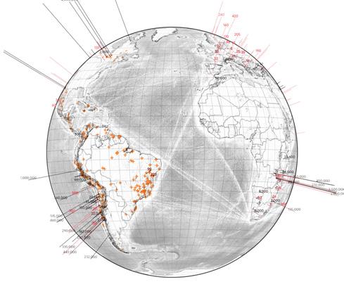
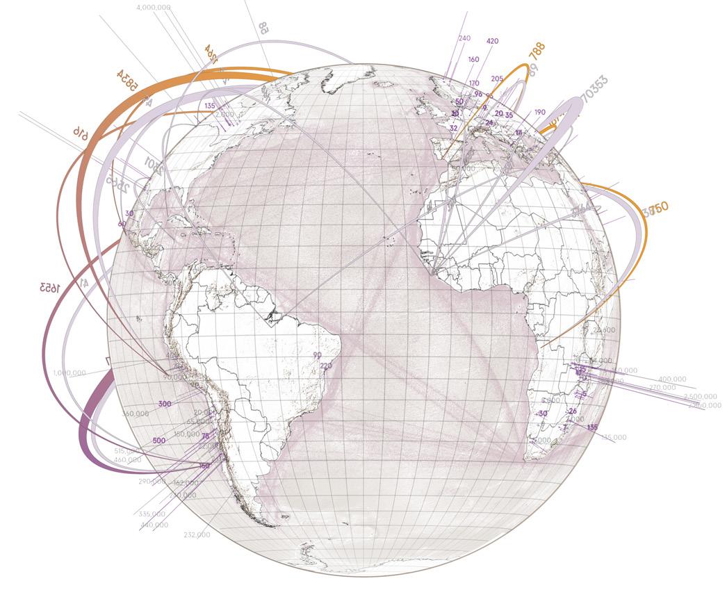
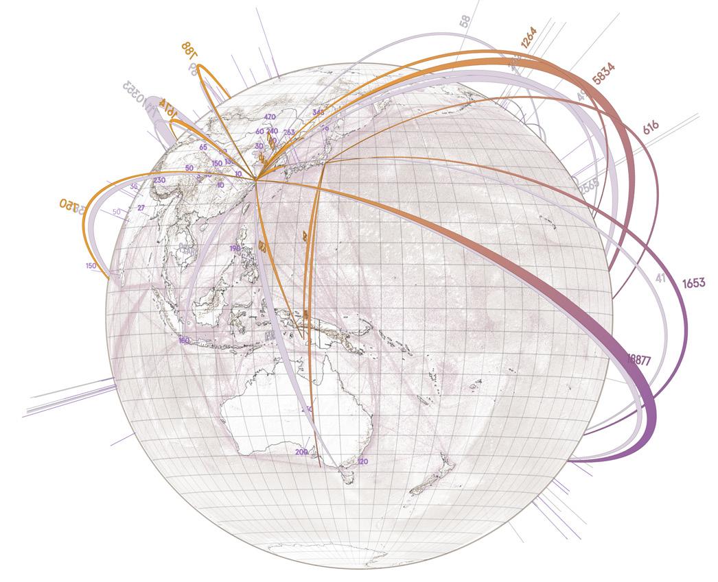
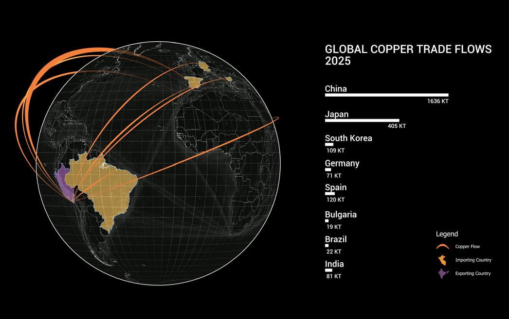
Map of the journey of the mineral to different countries from Quellaveco Mine and their corresponding amounts of material. This information shows just the copper ore.
COppER TRAdE
Map 02.2. Copper Trade.
Source: Done for the Anglo American Report (London Mining Network).
LONdON mINING NETWORK (LmN)
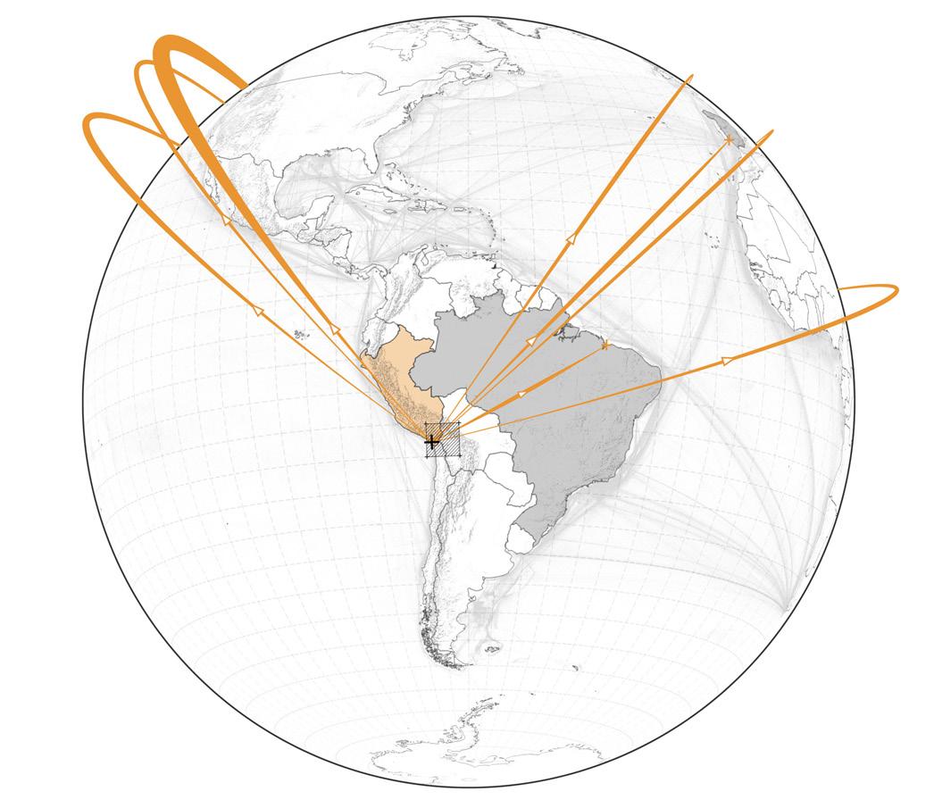
is produced in minor quantities in
but still a significant amount that need to be mapped because of is part of the critical minerals for energy transition in the northern hemisphere.
Molybdenum
Quellaveco,
mOLybdENUm TRAdE
Map 02.3. Molybdenum Trade.
Source: Done for the Anglo American Report (London Mining Network).
First map made for London Mining Network, Red Muqui, and Terra Justa, showing the different problems on the regional scale of Moquegua. This image was part of the report ‘Anglo American in Peru’ previously shown on page 47. Moreover, this was the first approximation to a 3D mapping of risks.1 REGION mAp
bIbLIOGRApHy
REFERENCES
01. Earthworks et al., “Safety First: Guidelines for Responsible Mine Tailings Management,” Earthworks, MiningWatch Canada and London Mining Network, 2022, https://earthworks.org/wp-content/ uploads/2022/05/Safety-First-Safe-Tailings-Management-V2.0-final.pdf
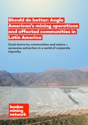
02. London Mining Network, Centro Ecológico Churque, Colectivo de Abogados José Alvear Restrepo (CAJAR), Colombia Solidarity Campaign, Corporación Camino Farellones, Corporación Defensa de la Cuenca del Mapocho, Comunidad El Melón, et al. “Should Do Better Anglo American’s Mining Operations and Affected Communities in Latin America.” London Mining Network, 2022.
03. London Mining Network & Core. ‘Holding UK companies to account in the English courts for harming people in other countries’, 2017.
03. Mads Barbesgaard and Andy Whitmore, “Smoke and Minerals: How the Mining Industry Plans to Profit From the Energy Transition,” by Transnational Institute and London Mining Network, TNI, June 2022, http://www.tni.org/copyright
04. Martinez Ordoñez, Bladimir C. and Red Muqui. “Alternativas Y Transiciones Con Eduardo Gudynas,” 2025.
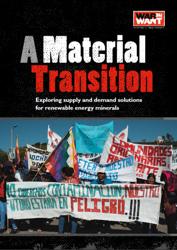
05. War on Want and Asad Rehman, “A Material Transition: Exploring Supply and Demand Solutions for Renewable Energy Minerals,” War on Want, 2021.
LIST OF FIGURES
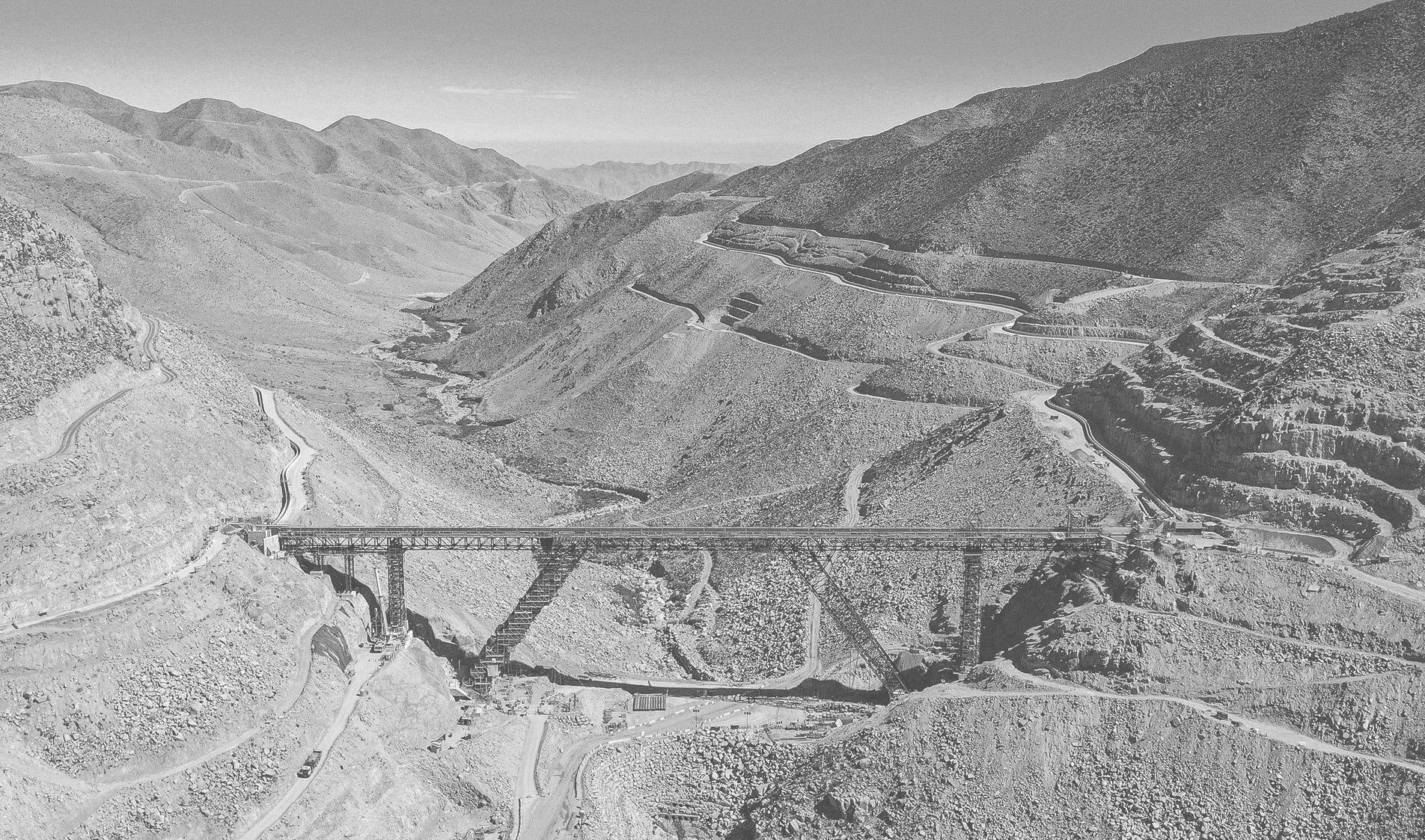
Figure 02.1. Black and white image. Construction of tailing transport pipes. Photo: JJC Tailing Consultants, 2022.
Figure 02.2. Copper tailing dam ‘Cortaderas’ from Quellaveco mine. Photo: Google Earth Pro, 2025.
Figure 02.3. Quellaveco tailing dam place before Anglo Ameircan. Photo: Google Earth Pro historical images, 2006.
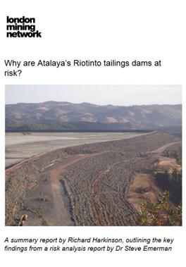
Figure 02.4. Guidelines for tailing dam safety. Photo: London Mining Network and Earth Works report ‘Safety First’, 2022.
Figure 02.5. Shared market and profits by mine companies in the world. Data: Visual Capitalist. Image from London Mining Network report ‘Smoke and Minerals’, 2022.
Figure 02.6. Circular economies interaction. Source: Science Direct. Image extracted from London Mining Network report ‘War on Want’, 2021.
Figure 02.7. Post Extractive Transition. Image from London Mining Network report ‘War on Want’, 2021.
Figure 02.8. London Mining Network reports. Source: LMN website. https://londonminingnetwork.org/reports/
Figure 02.9. Anglo American report made in collaboration with LMN, 2024. Image: London Mining Network, 2025.
Figure 02.10. Email images from collaborative work with London Mining Network, 2025.
LIST OF mApS
Map 02.1. Unfair Energy Transition. Data: Anglo American website, 2025. https://www.angloamerican.com/about-us/where-we-operate
Map 02.2. Copper trade. Data: Red Muqui organisation shared data base.
Map 02.3. Molybdenum trade. Data: Red Muqui organisation shared data base.
Map 02.4. Regional impacts of mines. Data: Red Muqui organisation shared data base.
SOUTHERN GLOBE
SOUTHERN GLOBE
While the northern globe is already preparing for the energy transition, the extractive power is still gaining much more power and land across the world. South America is a case that the London Mining Network is studying for presenting multiple cases of human rights violation and environmental damages that are usually related with communities leaving in those countries. Additionally, the southern globe has significant percentages of the critical transition minerals such as copper, lithium, and aluminium.
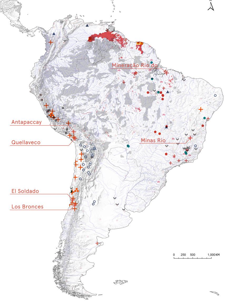
Since we started reviewing the cases in the continent, there where six specific cases that were related to United Kingdom-based companies such as Anglo American Plc and Glencore. These cases, besides being critical, correspond to locals’ intention to connect directly with the headquarters to get more visibility and hopefully get repairs. For that, our main purpose in this chapter will be unveiling all the damages in a continent scale, identifying the environmental risks.
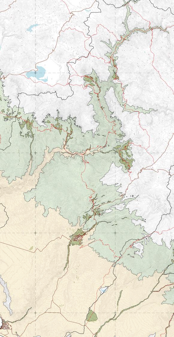
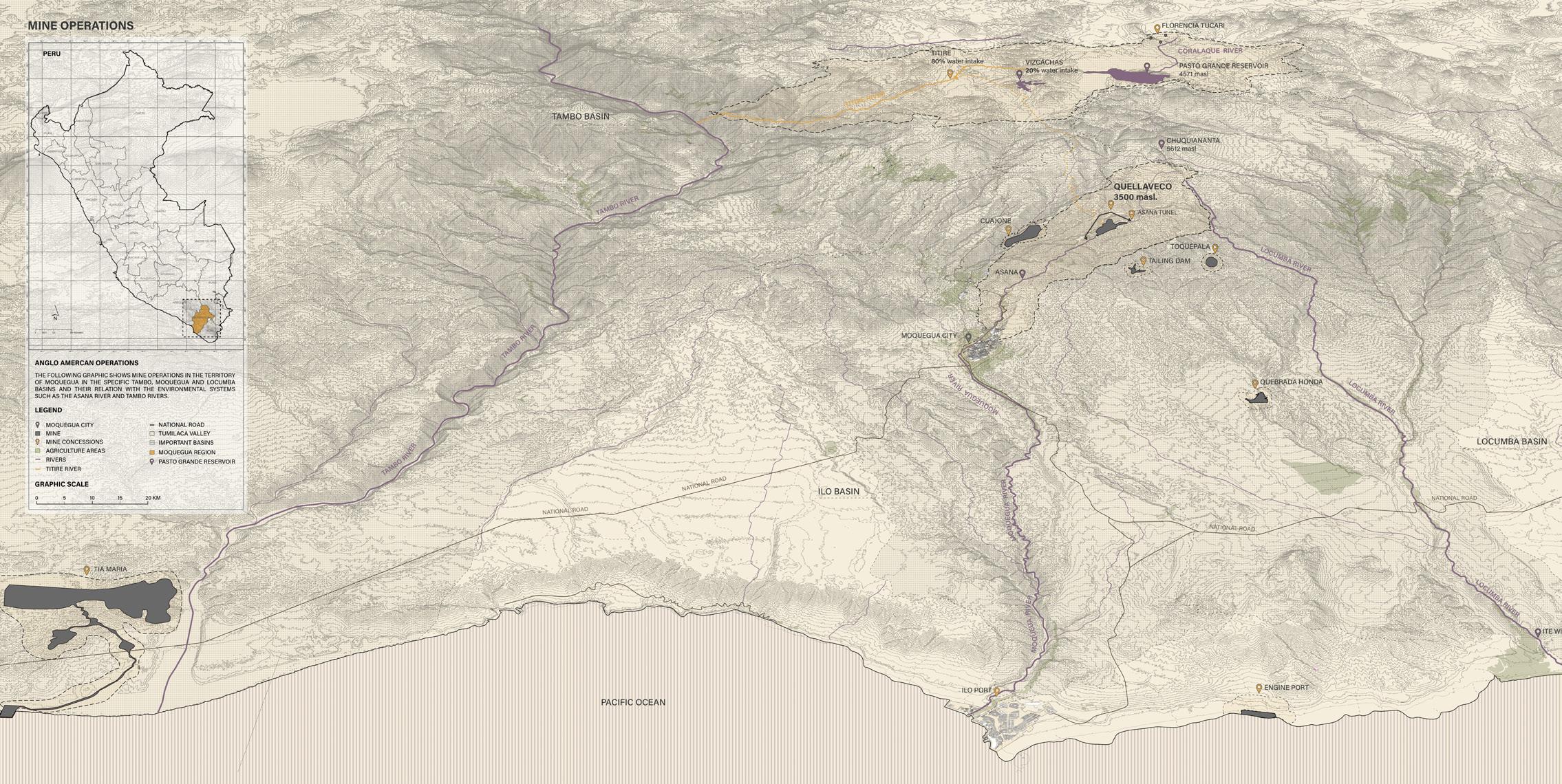
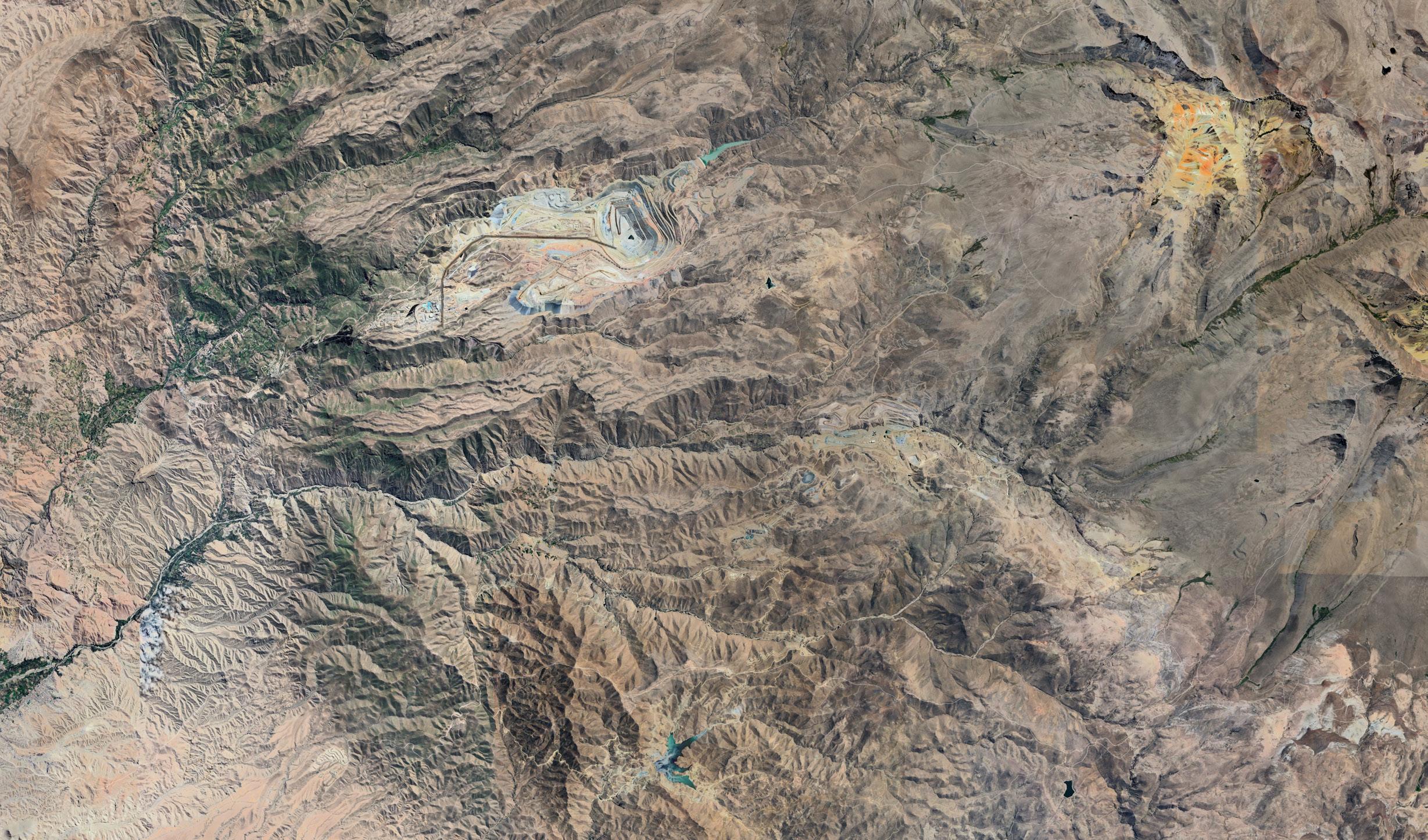
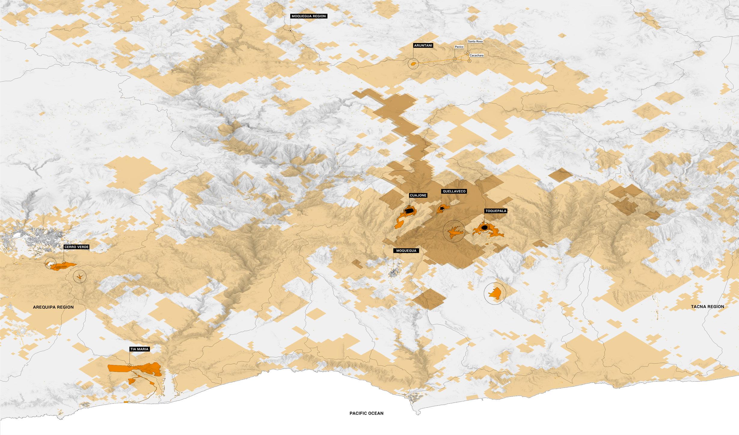
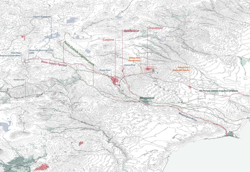
The landscape of Moquegua region in Peru is dominated by two different mine operations, such as Cuajone and Quellaveco. In this map is possible to differentiate the different sizes and scales between copper infrastructures1 and agriculture land in the valleys and basins. Even towards south still another old mine, but signifcant called Toquepala which besides not being part of the political boundary of Moquegua is part of the ecosystem layers and ravines that conformed the macro-region.
fig. 03.2. Mine operations in Moquegua basins.
Source: Google Earth Pro, 2025.
mOQUEGUA COppERSCApES
1 Infrastructures is refering to the open pits, tailing dams, industries such as smelters and manufacture plants, roads and railways.
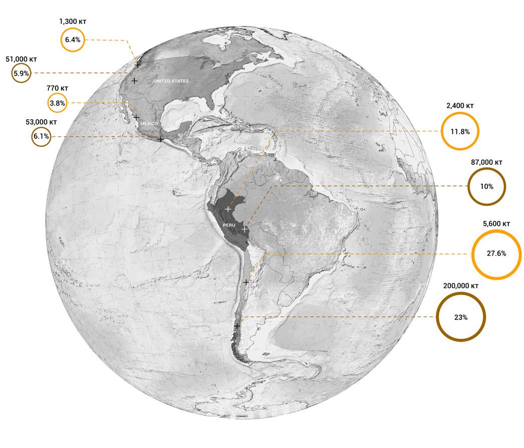
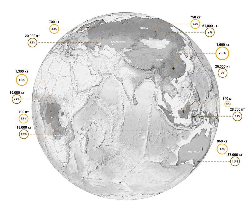
Source: Data from USGS, 2019.
OTHER COppER pROdUCTORS COppER RESERvES
Copper is one of the most required minerals for the energy transition. In that context, peruvian territory is looked at as a vital source of resources because of is the second largest producer of this mineral in the world. Conflicts in the territory showed up in previous years and are why London Mining Network is studying the case of Quellaveco, as it is planned to be the fifth largest copper mine in the world.
Just in South America is concentrated almost half of the copper reserves and production. That is why it is vital to look at the extractive landscape of this mineral, in which communities have been displaced as well as water sources. These maps reveal the difference between the global south and northern earth, where even London do not appear as a producer or even as reserves holder.
Source: Data from USGS, 2019.
This contrast is relevant to put in the spot the South American continent that have to deal with social and environmental conflicts related to the mining industry. By 2050, the necessity of copper in cities will increase almost by double according to the Interational Energy Agency. For that, it is relevant to start thinking how designers, community families, companies and governments start a plan for de-
carbonizing their cities without the cost of others and thinking about creative alternatives to deal wth a just transition of copper
The plan as a greener transition will require a moderate use of copper and proposing biobased community-driven economic activities that for the specific case of Peru might work.
pERUvIAN COppER RESERvES
mINE SELECTION ANd THE LONdON mINING NETWORK
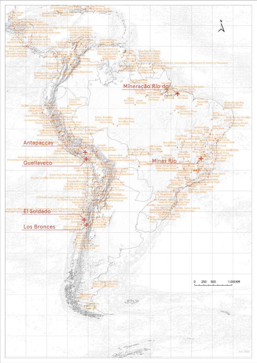
At the beginning of the project, the team aimed to identify a mining site in South America as a case study for in-depth research. To achieve this, the team compiled data on all copper mines across the continent and received support from the London Mining Network, which shared information on six ongoing projects located in Peru, Chile, and Brazil. These mining activities are linked to various social conflicts, including environmental pollution, tailings dam failures, and health risks.
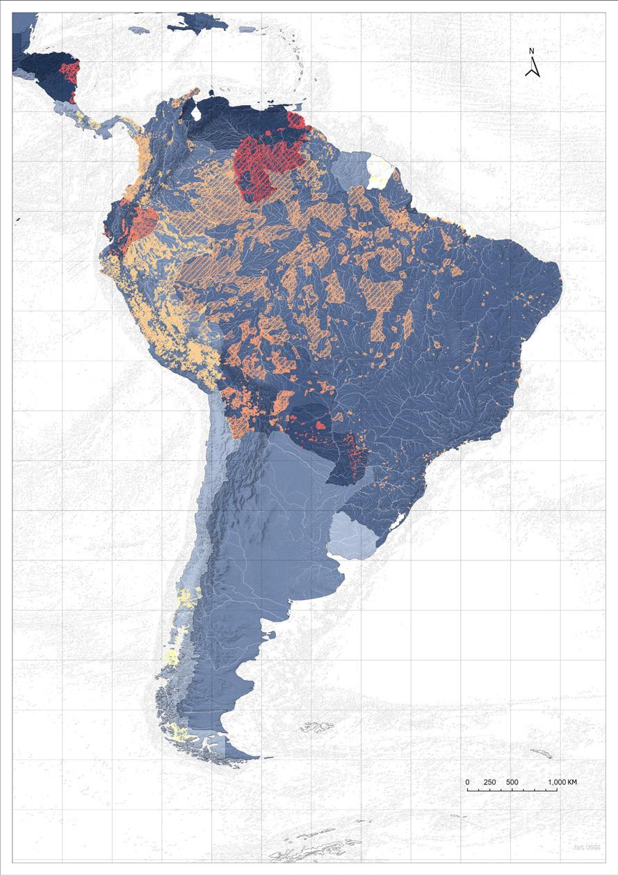
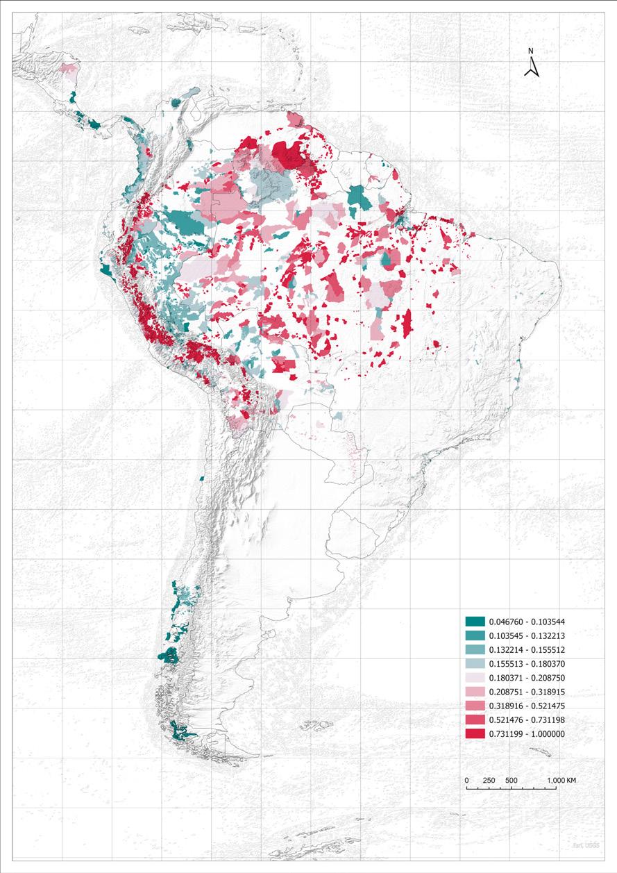
In response, the team sought to create a methodological dataset to evaluate the potential risks that mining operations pose to Indigenous territories. The dataset is designed to systematically present the vulnerability and exposure of Indigenous lands within a single index. Its purpose is to visualize risks, enable targeted interventions, and support informed decisions and policies based on specific conditions. At the same time, analysis of the dataset will allow the team to identify particular mining sites for focused study.
After reviewing the Reporte del Atlas de Campamentos Chile project from AA Ground Lab, which provided a conceptual framework for developing this dataset, the team adopted the idea that risk is the result of the interaction between threats and ecological vulnerability conditions. At the same time, the following formulas and data weights were established based on the Reporte del Atlas de Campamentos Chile and group discussions (AA-Groundlab: 2022)
Based on this, the index was defined to include three dimensions: Mining Threat Intensity, Population Density, and the Ecological Vulnerability Index. In the following sections, each of these components and their integration will be presented, with the aim of visualizing risks and proposing an effective decision-making tool.
INdIGENOUS TERRITORIES RISK
pOpULATION dENSITy ANd INdIGENOUS TERRITORIES
Indigenous territories are an important reference for assessing the impacts of mining areas. Based on the 2020 population density raster data provided by WorldPop, which reflects the concentration of residents per unit area, each Indigenous territory is overlaid with the population data. The population density data accounts for 30% of the weight in the overall risk formula (AA-Groundlab: 2022).
Territories with higher population density are given greater weight, as they are considered more vulnerable to the impacts of mining activities.
Among them, Indigenous territories are divided into existing Indigenous lands and Indicative Area, with the latter expected to become Indigenous territories and likewise included in the assessment of mining risks.
Conclusion:
Existing Indigenous lands and indicative areas occupy a relatively large proportion of South America. At the same time, most population centers are concentrated in coastal regions, particularly on the western side of the Andes. Therefore, compared with other South American countries, Peru Colombia and Brazil will receive special attention.
mINING AREA ANd THREAT ZONE
The impact range of active mining operations will have the most direct effect on Indigenous territories. We use data provided by the USGS to mark copper mining areas in the Americas and set different opacities to represent buffer zones at varying distances, meaning that areas closer to mining sites will receive a higher weight of impact.
After obtaining the mining threat range heatmap, we normalize the data to a scale from 0 to 1 to represent the level of threat.
By overlaying this with Indigenous territories, we assign each Indigenous territory polygon with mining threat data. The mining threat intensity accounts for 50% of the overall risk formula (AA-Groundlab: 2022).
Conclusion:
Most of the copper mines in South America are concentrated in the Andes Mountains along the eastern Pacific coast, with Peru and Chile being the main countries for copper mining development.
This means that local Indigenous territories are closer to mining activities, and people are more directly affected by the threats posed by mining operations.
In this section, we introduce the Ecological Resource Vulnerability Index(ERVI), which consists of water resource risk, biodiversity integrity, and forest vulnerability, with the biodiversity integrity index accounting for 20% of it (AA-Groundlab: 2022).
Biodiversity integrity measures the diversity of species in a region as well as the health of ecosystem functions. The higher the biodiversity integrity, the stronger the stability and adaptability of the ecosystem, and the higher the index of resilience to external impacts. We similarly incorporate ecosystems into the consideration of mining threats by calculating their overlap with Indigenous territories.
Conclusion:
Compared to the relatively fragile ecosystems in southern South America, the Amazon Basin and the coastal areas of the Andes exhibit higher biodiversity integrity and greater resilience to external impacts.
However, in some highland regions, the ecosystems remain relatively vulnerable.
Map 04.5. Biodiversity Vulnerability. Data: Hill, Samantha L. L., Andy Arnell, Calum Maney 2019.
Forest vulnerability is an important indicator of the stability and resilience of forest ecosystems. It reflects the ability of forests to maintain their ecological functions under external environmental pressures or human interventions. Forest vulnerability accounts for 30% of the Ecological Resource Vulnerability Index(AA-Groundlab: 2022).
Forest cover is the proportion of land covered by forests. Higher forest cover means a more stable ecosystem and lower vulnerability.
Forest degradation rate shows how much forests are damaged by natural or human factors. A higher degradation rate means higher forest vulnerability.
Conclusion:
Areas with high forest cover are mainly concentrated in the Amazon Basin, but the eastern regions of Brazil experience higher rates of forest degradation.
It is also important to consider areas with neither forest cover nor forest degradation, as these regions indicate poor natural self-purification capacity and are particularly susceptible to environmental pollution.
Water resource risk assessment reflects the availability of water, the level of pollution, and usage pressure, all of which affect the stability of ecosystems and their ability to maintain biodiversity. Water resource risk assessment accounts for 50% of the Ecological Resource Vulnerability Index (AA-Groundlab: 2022)
Mining operations consume large amounts of water. Using HydroLAKES’ water risk assessment for South American basins, the data are mapped onto Indigenous territories to quantify and visualize water stress. Higher water risk values indicate greater vulnerability to mining impacts.
Conclusion:
Most countries in South America face some level of water stress, with Venezuela experiencing the most severe crisis.
In contrast, Peru and Chile, despite their concentration of copper mines, are relatively less affected.
Total risk index = 0.5 × Mining Threat Intensity × 0.3 × Population Density × 0.2 × Ecological Vulnerability Index.
At this stage, we normalize and calculate a weighted score for the data on Mining Threat Intensity, Ecological Vulnerability Index, and Population Density. The weighting ratios are determined based on the Reporte del Atlas de Campamentos Chile and through group discussions.
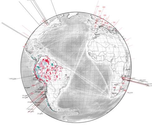
After quantifying the risk, each Indigenous territory is assigned a comprehensive risk index, which is used to assess the potential impact of mineral extraction activities on Indigenous lands in South America. Such data provide a valuable reference for future site selection of mining operations.
Conclusion:
Analysis shows that Indigenous territories in Peru, Venezuela, and the regions surrounding the Amazon Basin face relatively high potential risks.
This suggests that both ongoing and future mining activities in these areas could have substantial and far-reaching consequences, affecting not only the local communities who depend on the land for their livelihoods, but also the surrounding ecosystems and social structures.
INdIGENOUS TERRITORIES ANd mINING pOWER
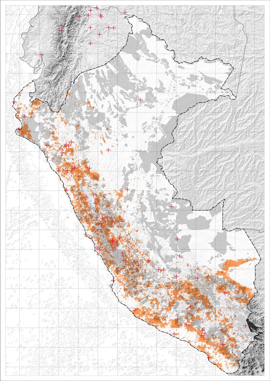
Mining concessions in Peru have transcended purely economic considerations in their spatial distribution, becoming a significant force shaping the country’s territory, landscapes, and environment.
According to the mining concession dataset provided by Red Muqui, mining concessions have already occupied most of Peru’s coastal areas as well as the Andes.
By calculating the overlap with Indigenous territories, we found that nearly 14% of Indigenous lands and 35% of agricultural land are covered by mining concessions. This means that these areas are effectively under the control of mining companies, and Indigenous peoples have lost territorial sovereignty (Red Muqui: 2009).
Likewise, the widespread granting of mining concessions has led to numerous conflicts in mining regions, such as disputes over water resources, environmental pollution, and agricultural conflicts. Among these, the main issue in Quellaveco is water pollution caused by mining activities.
San mateo: Environmental pollution
Morococha: resident relocation
Espinar: Human health
Tia maria: Agricultural conflicts
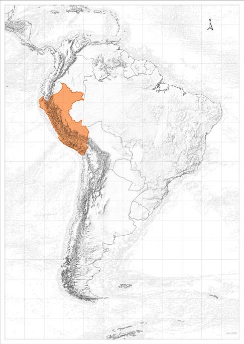
LEGENd Peru Sector Quellaveco LEGENd
pERU mINING OCCUpIEd LANd mAp pERU mAp
bIbLIOGRApHy
01. ‘Aqueduct Tools World Resources Institute’. n.d. Accessed 1 September 2025. https://www.wri.org/aqueduct/tools
02. ‘Aqueduct Water Risk Atlas’. n.d. Accessed 1 September 2025. https://www.wri.org/applications/aqueduct/water-risk-atlas/#/?advanced=false&basemap=hydro&indicator=w_ awr_def_tot_cat&lat=-26.11598592533351&lng=-366.06445312500006&mapMode=view&month=1&opacity=0.5&ponderation=DEF&predefined=false&projection=absolute&scenario=optimistic&scope=baseline&timeScale=annual&year=baseline&zoom=3
03. ‘Atlas de Campamentos de Chile’. n.d. Accessed 1 September 2025. https://groundlab.aaschool.ac.uk/atlas-de-campamentos-de-chile/
04. Data Series. 2000. Data Series. Data Series.
05. ‘Downloads – Terrabrasilis’. n.d. Accessed 1 September 2025. https://terrabrasilis.dpi.inpe.br/downloads/
06. ‘Global Forest Change’. n.d. Accessed 1 September 2025. https://storage.googleapis.com/earthenginepartners-hansen/GFC-2023-v1.11/download.html. 07. Grupo, J. J. C. n.d. ‘Tailings Transportation System – Quellaveco Project’. JJC Grupo. Accessed 1 September 2025. https://grupojjc.com.pe/en/projects/tailings-transportation-system-quellavecoproject/ 08. ‘HydroLAKES’. n.d. Accessed 1 September 2025. https://www.hydrosheds.org/products/hydrolakes.
09. ‘Index of /Potapov/TCC_2010’. n.d. Accessed 1 September 2025. https://glad.umd.edu/Potapov/TCC_2010/
10. London Mining Network. n.d. ‘Home’. Accessed 1 September 2025. https://londonminingnetwork.org/
11. ‘Mineral Operations of Africa and the Middle East (Data Basin Dataset) - overview’. n.d. Accessed 1 September 2025. https://www.arcgis.com/home/item.html?id=a937c3c7faf241fe91155db49623ea2c
12. Mineral Operations of Latin America and Canada (Data Basin Dataset) - overview’. n.d. Accessed 1 September 2025. https://www.arcgis.com/home/item html?id=b7eec6c7d15b45ea833afcb50b723cb5.
13. Mineral Resources Online Spatial Data’. n.d. Accessed 1 September 2025. https://mrdata.usgs.gov/general/map-global.html.
14. Pesaresi, Martino, Marcello Schiavina, Panagiotis Politis, et al. 2024. ‘Advances on the Global Human Settlement Layer by Joint Assessment of Earth Observation and Population Survey Data’. International Journal of Digital Earth 17 (1): 2390454. https://doi.org/10.1080/17538947.2024.2390454
15. ‘Quellaveco el proyecto’. n.d. Accessed 1 September 2025. https://peru.angloamerican.com/es-es/quellaveco/el-proyecto
16. Red Amazonica de Informacion Socioambiental Georreferenciada (RAISG), n.d., https://www.raisg.org/es/
17. Schweitzer, Peter N. 2019. ‘Record Quality Tables for the Mineral Resources Data System’. U.S. Geological Survey. https://doi.org/10.5066/P9DYLWMP
18. South America U.S. Geological Survey’. n.d. Accessed 1 September 2025. https://www.usgs.gov/centers/national-minerals-information-center/south-america
19. ‘USGS Mineral Resources On-Line Spatial Data’. n.d. Accessed 1 September 2025. https://mrdata.usgs.gov/
20. Vizzuality. n.d. ‘Interactive World Forest Map & Tree Cover Change Data GFW’. Accessed 1 September 2025. https://www.globalforestwatch.org/ map/?lang=en&map=eyJjZW50ZXIiOnsibGF0IjotMS40MzI0NTgwMDk4NjM5MywibG5nIjotNTkuNDMyMTcyMjI0MzAyNzI1fSwiem9vbSI6NC4xNjYzMjA3NDI4MzAyNDEsImRhdGFzZXRz IjpbeyJkYXRhc2V0Ijoid2RwYS1wcm90ZWN0ZWQtYXJlYXMiLCJvcGFjaXR5IjoxLCJ2aXNpYmlsaXR5Ijp0cnVlLCJsYXllcnMiOlsid2RwYS1wcm90ZWN0ZWQtYXJlYXMiXX0seyJkYXRhc2V0Ij oibWluaW5nLWNvbmNlc3Npb25zIiwib3BhY2l0eSI6MSwidmlzaWJpbGl0eSI6dHJ1ZSwibGF5ZXJzIjpbIm1pbmluZy1jb25jZXNzaW9ucyJdfSx7ImRhdGFzZXQiOiJwb2xpdGljYWwtYm91bmRh cmllcyIsImxheWVycyI6WyJkaXNwdXRlZC1wb2xpdGljYWwtYm91bmRhcmllcyIsInBvbGl0aWNhbC1ib3VuZGFyaWVzIl0sIm9wYWNpdHkiOjEsInZpc2liaWxpdHkiOnRydWV9XX0%3D&mapMenu =eyJkYXRhc2V0Q2F0ZWdvcnkiOiJsYW5kVXNlIn0%3D.
21. ‘Welcome - Data Portal’. n.d. Accessed 1 September 2025. https://data.nhm.ac.uk/.
22. ‘WorldPop :: Population Density’. n.d. Accessed 1 September 2025. https://hub.worldpop.org/geodata/listing?id=77.
LIST OF FIGURES
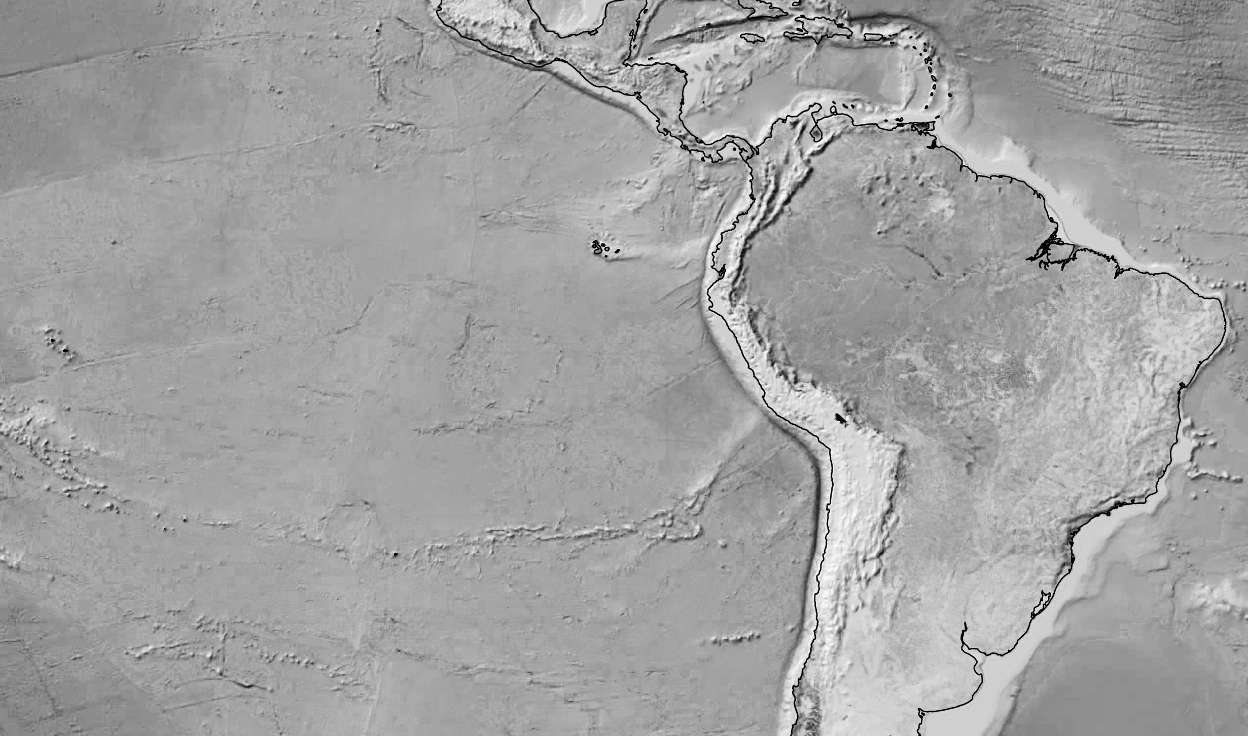
Figure 03.1. South America continent. Source: Google Earth Pro, 2025.
Figure 03.2. Mine operations in Moquegua basins. Source: Google Earth Pro, 2025.
LIST OF mApS REFERENCES
Map 04.1. South American transition minerals. Data: United States Geological Survey (USGS), 2025.
Map 04.2. Mine points. Data: United States Geological Survey (USGS), 2025.
Map 04.3. Indigenous land. Data: Amazon Network of Georeferenced Socio-Environmental Information (RAISG), 2024.
Map 04.4. Mining Threat. Data: Global Critical Mineral Locations, 2025.
Map 04.5. Biodiversity Vulnerability. Data: Hill, Samantha L. L., Andy Arnell, Calum Maney 2019.
Map 04.6. Forest Vulnerability. Data: Global Forest Change, 2025.
Map 04.7. Water Risk. Data: Aqueduct Water Risk Atlas, 2025.
Map 04.8. Total risk. Data: Based on previous index maps.
Map 04.9. Mine concession, Peru. Source: Source: Based on Red Muqui map of mine concessions conflicts 2019.
UNVEILING qUELLAVECO
UNVEILING qUELLAVECO
After unveiling the problems happening in the South American scale, the main conclusion was that Quellaveco mine lead by Anglo American in Peru is one of the most relevant one. This, because of is the most recent one opened in 2023 and is intended to be the fifth largest copper mine in the world (Anglo American: 2024).
Since the majority of copper reserves are in the southern hemisphere (almost 50% between Chile and Peru) and correspond to the transition minerals because of their importance in the manufacture of wind turbines, electric vehicules and electronic artefacts. However, all these ‘necessities’ from the transition world are not just. The green energy comes under the cost of ecosystems and people’s livelihoods, which can be shown through critical cartographies. Moreover, in this chapter will be important to do the tracking of layers, ports, shipping lines, companies, and places where the material usually goes, and that most of the time none knows.
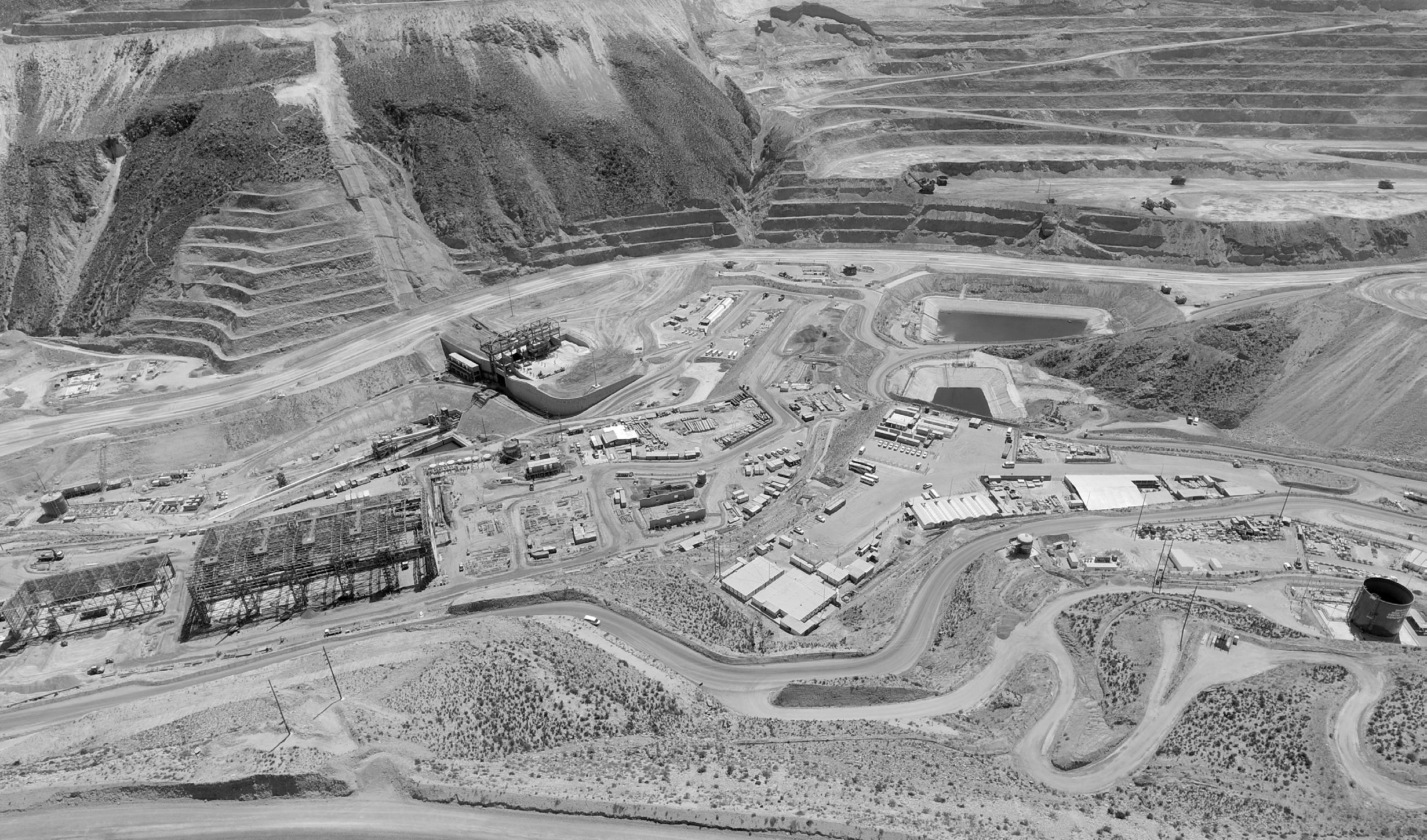
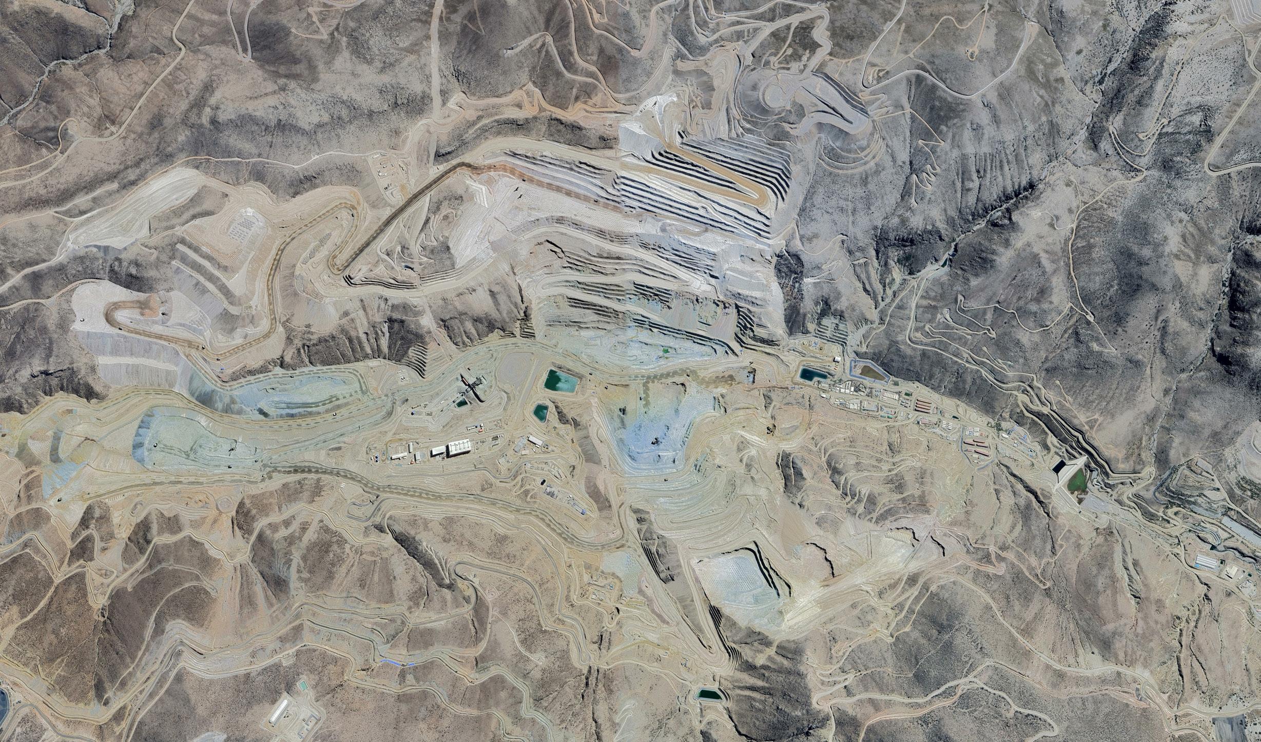
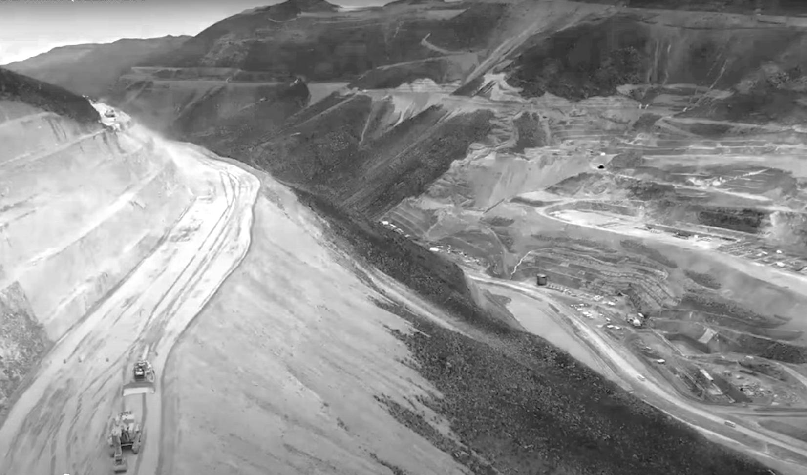
Actual place of Quellaveco open pit and operations, which had changed the flow of the Asana river in the Tumilaca basin. The land is being dominated by the roads, material deposits, ponds and industries of Anglo American which on top of that removed the ecosystem previously established here such as the Andean matorrals.
fig. 04.2. Copper site Quellaveco Mine. Source: Google Earth Pro, 2025.
QUELLAvECO SITE OpERATIONS
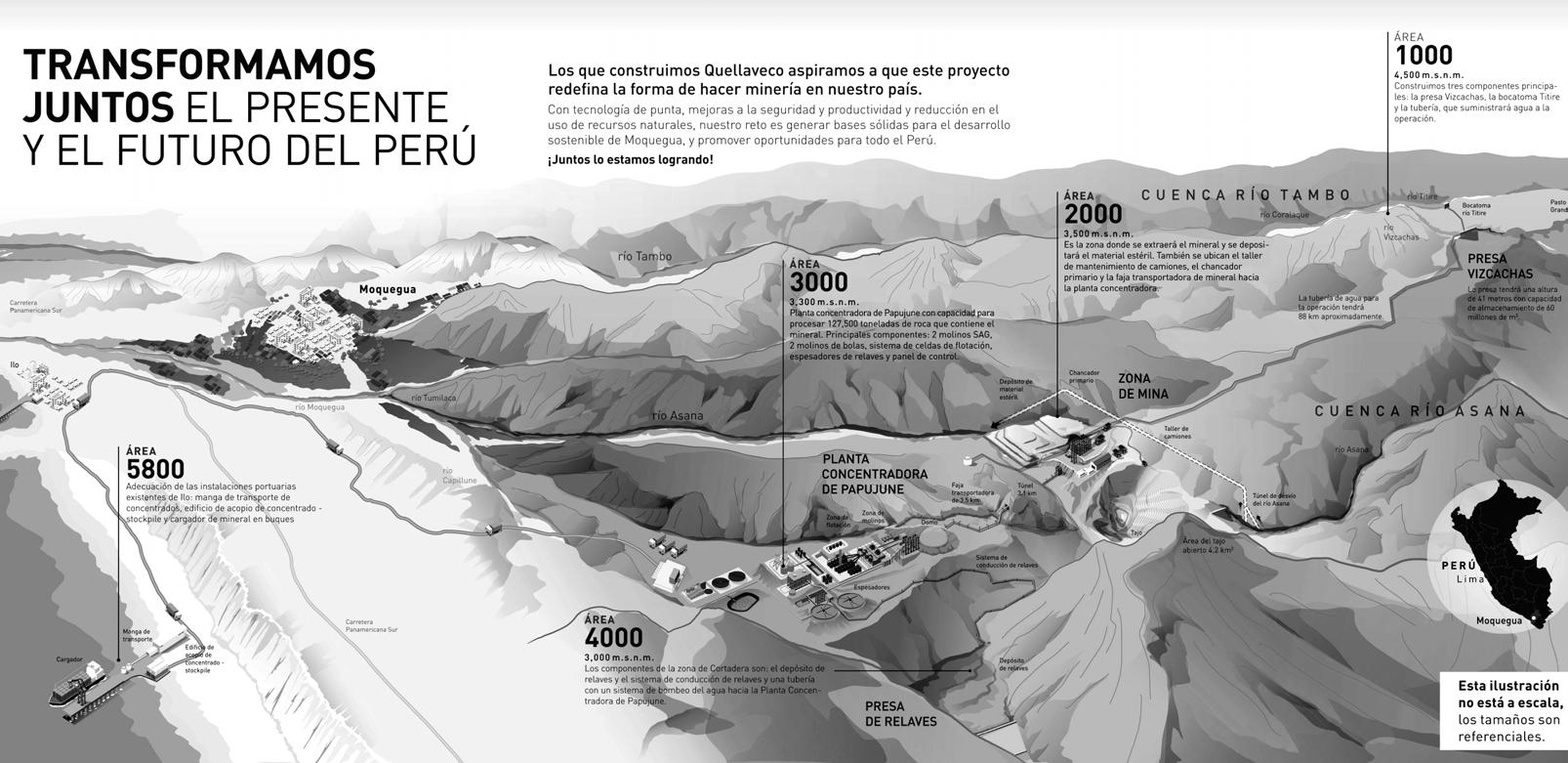
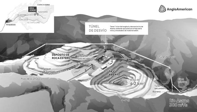
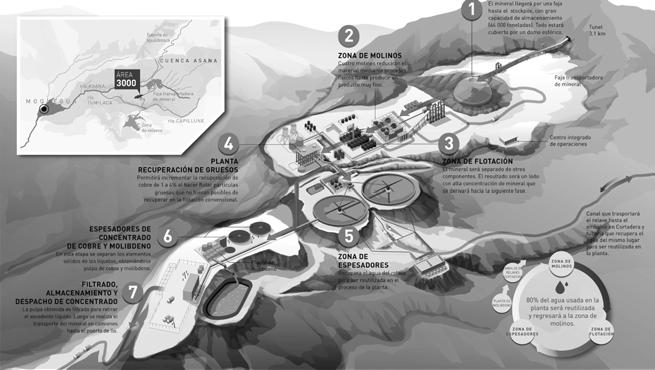
The illustration comes from Anglo American’s official website introduction to Quellaveco. Anglo American presents one of the most polluted mining areas within the territory in a very weak way, using technicalized images to represent their view of the Peruvian territory.
We believe that this mapping is intentionally drawn from a perspective that serves its own interests and benefits its image, hiding and downplaying the ruptures with the Peruvian territory, landscape, and communities behind it. This incomplete perspective on the territory by the dominant sector is, in fact, a form of land control, which also prevents us from clearly tracing the operational processes of capitalism. After our
group’s in-depth research and exploration of the area, we aim to reveal, from a fair perspective, the elements and phenomena hidden in the map.
For example, in the case of Quellaveco’s water extraction from the Titire River and tailings dam discharge, the map does not present quantitative data nor even the names of the affected agricultural areas, but only mentions the construction projects of the mine. Likewise, the wetlands crossed by the water diversion channels are not mentioned in relation to leakage risks. In the most severely polluted core areas, the map simplifies the water system into a single canalized, segmented, diverted form.
This powerful image of a high-tech mining system conceals the crude modification of the natural environment and the disregard for the consequences of pollution. The open-pit mine, reaching a depth of 930 meters, has already reshaped the territorial landscape.
The tailings dam, constructed using the upstream method, continues to rise annually with the accumulated storage of tailings, bringing with it the risks of dam failure and severe groundwater contamination. Yet, the tailings water discharge and treatment system is not mentioned in the map.
Our group’s mapping will highlight the facts ignored in this “vision,” aiming to reveal and challenge the narratives of colonial land ownership, resource control, and geopolitical power.
fig. 04.4. Open pit diagram Quellaveco.
Source: Anglo American website.
fig. 04.5. Industries in Quellaveco. Source: Anglo American website.
fig. 04.3. Territory vision of Moquegua. Source: Anglo American website.
LEGEND
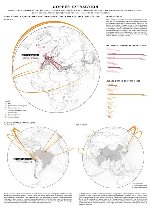
Are all extracted materials equally important? Critical materials play a decisive role in overcoming the challenges of achieving clean energy. Regional strategies that enable participation of often-overlooked local populations will transform how these materials are used. For example, in 2021, the European Union adopted its first Climate Law.
South America’s raw material exports are crucial for the development of renewable energy in the coming decades. Copper, cobalt, and lithium are the core elements driving this transition. Peru, Argentina, and Chile are major exporters of copper and lithium which makes the region a key hub in the clean energy supply chain.
GLObAL mINERAL RESOURCE TRAdE FLOWS 2020-2022
Kt /yr
Smelter
Copper mining in South America is considerable, with Peru’s copper reserves reaching 120 million metric tons. However, its domestic capacity for processing and smelting remains limited. By contrast, most smelting and refining facilities are concentrated in importing countries such as Europe and China, with China the largest importer
TOp5 COppER TRAdE
of Peruvian copper. This highlights a structural gap in South America’s smelting and deep-processing technologies, resulting in exports being realized primarily as low-cost raw materials, while high value-added processing stages are largely carried out in importing countries.
QUELLEVACO MINE
COppER ORE TRAdE 2023
Due to the impacts of climate change, clean energy has become more widespread than ever. UK-based companies are expanding their operations in the Southern Hemisphere to meet this growing demand, as copper is one of the key minerals essential for achieving the 2050 energy decarbonization targets. Peru, as a leading global copper exporter, holds approximately 12% of the world’s copper reserves. In response, Anglo American, one of the world’s top ten profitable mining companies headquartered in London, recently launched the Quellaveco copper mining project in Peru. Once completed, the project will become the world’s fifth-largest
TRACKING THE GLObAL LIFECyCLE OF COppER
ATLAS
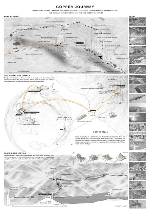
The journey of copper—from raw ore to its integration into nearly every aspect of our daily lives—is long and complex. This transformation involves a series of global processes that are often overlooked, yet deeply embedded in the systems that sustain modern society.
Along the way, copper’s life cycle profoundly impacts the planet and intertwines with broader frameworks of environment, economy, policy, and politics.
The Journey of Copper aims not only to educate the public about the full life cycle of this essential material but also to visually reveal the interconnections between each stage of the process and its broader effects on Earth’s systems. By making these hidden links visible, the project encourages a more informed and critical understanding of the resource behind our wired world.
Using geography as a framework, we divide this journey into three key stages: extraction, transportation, and production. This spatial and procedural breakdown helps us identify specific challenges at each phase, laying the groundwork for clearer analysis and the development of future improvement strategies.
Copper processing for electronics
COppER
In this context, the copper resource supply chain consists of six key stages: plant construction and mining, preliminary screening, transportation, smelting, production, and consumption.
Among these, the mining stage generates and discharges tailings water, making it a significant environmental impact factor within the supply chain. COppER
THE COppER JOURNEy bEGINS AT QUELLAvECO COppER ORIGIN
dAm
TAILINGS dAm SECTION OF QUELLAvECO COppER mINE
The Quellaveco tailings dam project is used to store wastewater and solid waste generated from mining operations. At the Quellaveco mine site, tailings water is transported via the Puente Capillune pipeline project to the tailings dam area for preliminary treatment, which includes Hydrocyclone Cluster distribution, chemical precipitation, and flotation. The treated water is then discharged through a 4.5 km branch pipeline into the tailings dam.
The tailings dam is constructed using the upstream method and currently has a storage capacity of 244 million m³ of tailings water. However, with the growing demand for tailings water storage, the dam height is being increased, which raises the risk of dam failure. In the event of an accident, the downstream Ite agricultural area and the coastal zone would suffer severe heavy metal contamination.
After a deep analysis of the copper supply chain and the Quellaveco mining area, we found that London-based Anglo American has turned copper into a tool for controlling regions in Peru. Copper has become the cornerstone for the global North to achieve “net-zero emissions.” But behind this new form of green colonialism, whose land and lives are actually being sacrificed? Imagine if the land being sacrificed and occupied were London—what would happen?
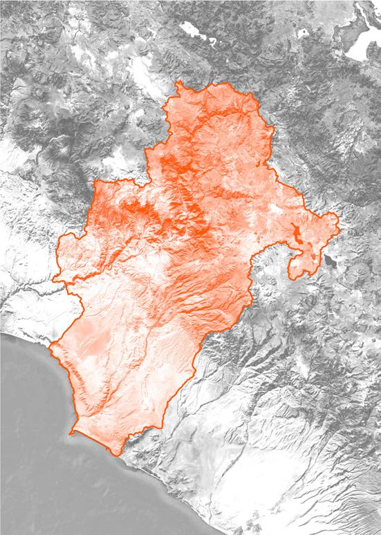
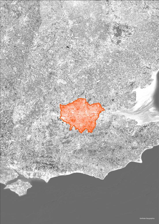
We used the same scale to compare the Moquegua region with London on a map. The area of Moquegua is approximately 15,733 km², about ten times the size of London. Meanwhile, 7,633 km² of land has already been granted mining concessions, accounting for 48% of Moquegua’s total area. The area under mining concessions is roughly equivalent to 4.8 Londons. Imagine applying this 48% ratio of mining concession land to London: it would mean that half of all.
LANd COmpARISON bETWEEN LONdON ANd mOQUEGUA
mOQUEGUA LONdON
Moquegua Region (Peru): approximately 15,733 km²
Greater London (UK): approximately 1,572 km² Moquegua is about 10 times larger than London in area.
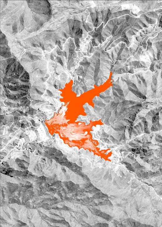
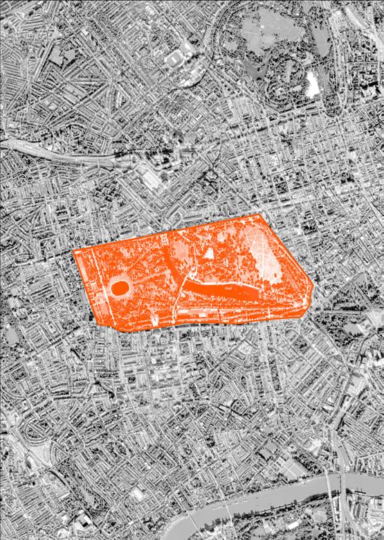
The Quellaveco tailings dam covers slightly less area than Hyde Park, but its capacity is approximately 10 times the volume of Wembley Stadium. green spaces, farmland, and even homes beneath our feet would be taken over by mining companies. Land under mining concessions can be mined at any time, and mining facilities can be built on it. On the other hand, according to geographic data, the Quellaveco tailings dam project currently occupies about 1.1 km², with a ca-
pacity of 244 million m³. The area is roughly comparable to Hyde Park, but the volume of tailings water is about ten times the capacity of Wembley Stadium—and it continues to grow each year. If all of this happened in London, in locations of high tourist value, what serious consequences would it bring? When land appropriation, resource extraction, and territorial takeovers occur on the other side of the globe, this new form of green colonialism is obscured by distance. In fact, no land is worth suffering such destruction.
COmpARISON bETWEEN LONdON ANd mOQUEGUA
TAILING dAm
HydE pARK
Quellaveco Tailings (Peru): approx. 1.1 km², capacity 244 million m³ Hyde Park (London, UK): approx. 1.42 km²
bIbLIOGRApHy
REFERENCES
01. Baker, Michael S., Spencer D. Buteyn, Philip A. Freeman, Michael H. Trippi, and Loyd M. Trimmer Iii. 2017. ‘Compilation of Geospatial Data for the Mineral Industries and Related Infrastructure of Latin America and the Caribbean’. In Open-File Report, Nos 2017–1079. U.S. Geological Survey. https://doi.org/10.3133/ofr20171079
02. BNamericas.Com. n.d. ‘BNamericas - Govt to Earmark US$114mn for Pasto Grande II...’ Accessed 7 September 2025. https://www.bnamericas.com/en/news/govt-to-earmark-us114mn-for-pastogrande-ii-irrigation-project
03. Buschiazzo, Enrique, P Eng, and Jason Reynolds. 2022. ‘Quellaveco Mine Water Supply, a Stewardship Approach’. MINE WATER.
04. ‘CLIMAS XIII BIAU’. n.d. Accessed 7 September 2025. https://bienaliberoamericana.org.
06. DFP - Drone Films Project, dir. 2023. JJC / Besalco: Construcción de Sistema de Relaves En Mina Quellaveco. 03:50. https://www.youtube.com/watch?v=LFp9Fb06zA0
07. ‘Ej Atlas --- Ej Atlas’. n.d. Accessed 7 September 2025. https://ejatlas.org/print/copper-mining-on-the-asana-river-peru
08. Fluor, dir. 2020. Quellaveco Mining Project. 05:45. https://www.youtube.com/watch?v=KlzMLYYvTW4
09. ‘Global Wind Atlas’. n.d. Accessed 7 September 2025. https://globalwindatlas.info
10. GrupoJJC_Oficial, dir. 2022. Sistema de Transporte de Relaves - Proyecto Quellaveco - JJC. 02:29. https://www.youtube.com/watch?v=pqIUvmoOleI
11. Hickel, Jason, Christian Dorninger, Hanspeter Wieland, and Intan Suwandi. 2022. ‘Imperialist Appropriation in the World Economy: Drain from the Global South through Unequal Exchange, 1990–2015’. Global Environmental Change 73 (March): 102467. https://doi.org/10.1016/j.gloenvcha.2022.102467
12. ‘Index of /Potapov/TCC_2010’. n.d. Accessed 7 September 2025. https://glad.umd.edu/Potapov/TCC_2010/
13. London Mining Network. n.d. ‘Home’. Accessed 7 September 2025. https://londonminingnetwork.org/
14. Moran, Robert E, and Hess Ave. n.d. An Environmental Impact Assessment.
15. NASA JPL. 2020. ‘NASADEM Merged DEM Global 1 Arc Second V001’. NASA Land Processes Distributed Active Archive Center. https://doi.org/10.5067/MEASURES/NASADEM/NASADEM_HGT.001
18. Participation, Expert. n.d. ‘Climate Change Act 2008’. Text. Statute Law Database. Accessed 7 September 2025. https://www.legislation.gov.uk/ukpga/2008/27/contents
19. Pearce, Simon Evans and Rosamund. n.d. ‘Interactive: How the UK Transformed Its Electricity Supply in Just a Decade’. Accessed 7 September 2025. https://interactive.carbonbrief.org//how-uktransformed-electricity-supply-decade/
20. ‘Quellaveco el proyecto’. n.d. Accessed 7 September 2025. https://peru.angloamerican.com/es-es/quellaveco/el-proyecto
21. Resource Trade. n.d. ‘Data’. Accessed 7 September 2025. https://resourcetrade.earth/?year=2020&category=163&units=weight&autozoom=0
22. SomosSacyr, dir. 2023. Video Sacyr. ¡Terminamos El Proyecto Minero Quellaveco! 02:37. https://www.youtube.com/watch?v=Og8DG6ftIEU
23. ‘Tailing Dam’. n.d. Accessed 7 September 2025. https://tailing.grida.no/profile
24. ‘USGS Mineral Resources On-Line Spatial Data’. n.d. Accessed 7 September 2025. https://mrdata.usgs.gov/
25. VirtualAcademy, dir. 2024. Quellaveco || Relaves ||. 08:42. https://www.youtube.com/watch?v=nRaH6OEMuQQ
LIST OF FIGURES
Figure 04.1. Open pit operations in Quellaveco mine. Source: JJC Tailing Consultants, 2022.
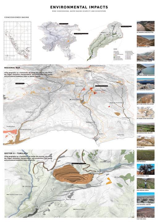
After unveiling the global connections between headquarters companies and extractivism site points, this chapter will examine the multiscale risks and damages produced by the power of mining on ecosystems, communities, and basins for the specific case of Quellaveco, Peru.
Since mining operations usually see the land with a profitable vision, the representation of the landscape tend to seem like there are working in an empty area or far away from where people leve, or even like if they affect an upper stream water source will not affect the downstream supply.
For that, the intention is to show that in Quellaveco, Moquegua, as a place where extractivism is happening, the landscape should reflect the different topographies, ecosystems, and actual harm communities are facing, especially in a place where concessions are all over the territory like rectangular pieces of land given to the mining companies.
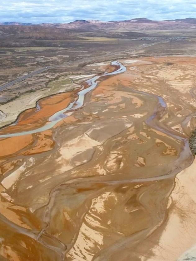
The Titire River represents the beginning of the damage chain. Contaminated by Arunani SAC, this river flows downstream directly into the Tambo river, one of the most important ones for the Arequipa and Moquegua regions. That is why the government had declared a state of emergency due to pollution. From that Anglo American decided to extract 80% of water fron this river for their purposes at Quellaveco, which represent a risk for the Asana river and Tumilaca basin.
fig. 05.2. Titire river plan view and polluted color.
Source: Google Earth Pro, 2025.
pOLLUTEd TITIRE RIvER
In Peru, a mining concession is a state-granted right that permits an individual or organization to investigate and utilize mineral resources in a designated region. This privilege, which is conferred by a mining title, allows the holder to conduct research, projects, and activities in order to find and extract minerals, according to specific rules and guidelines (INGEMET). From that view, there is hgh risk of overlooking aspects such as communities connections, ecological systems, and impacts in long-term periods in the territory.
Such is the power mining have over Peru that the regions most affected by mining concessions are Apurímac, Moquegua La Libertad, Ancash, and Lima, all above 40% of their surface area (Cooperaccion: 2022).
Moquegua concessions Macro-region concessions Urban National Road Moquegua Region Mine Operations Quellaveco Components1
Concessioned by Anglo American Peru Basins boundaries
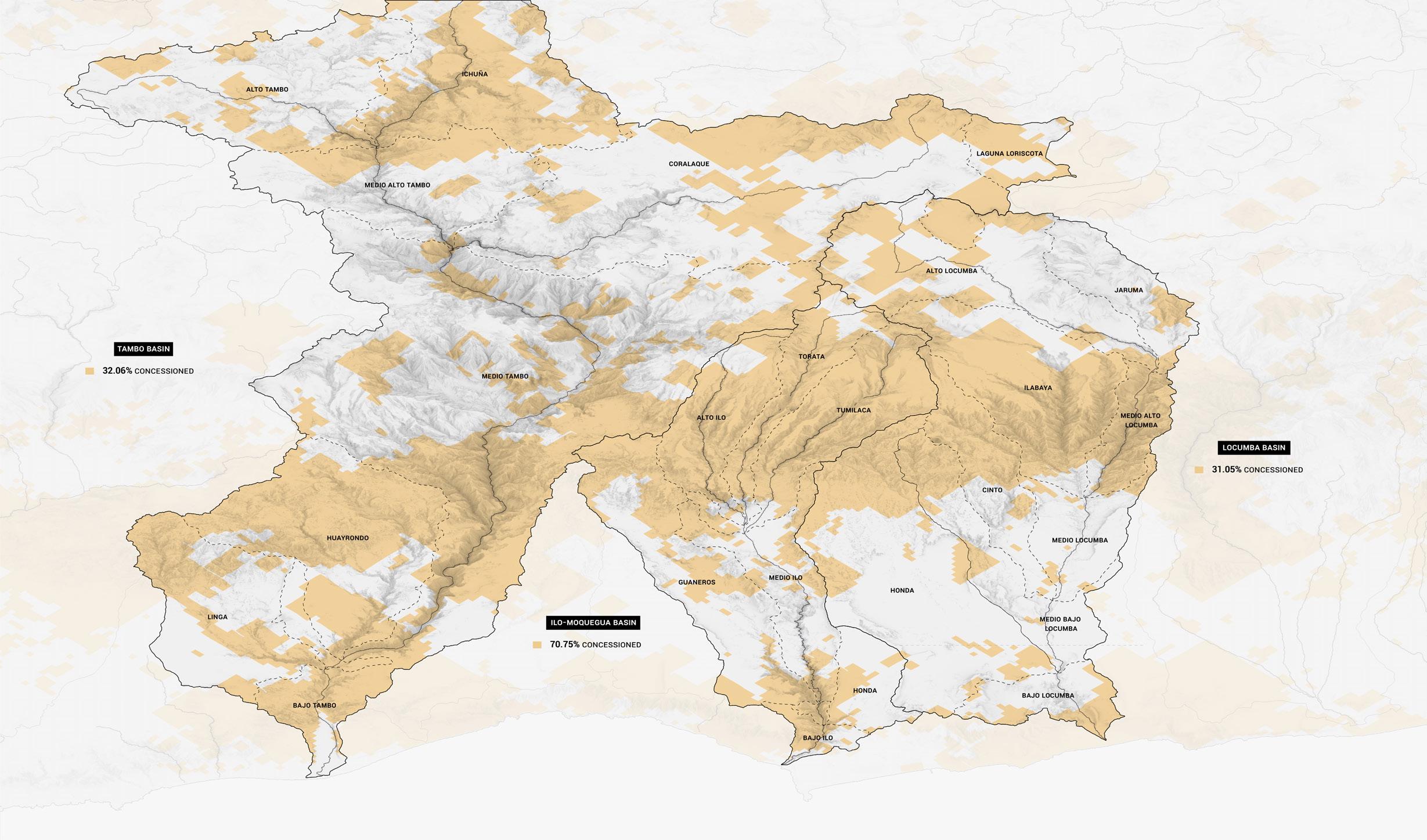
This map shows how the concessioned areas in the territory look like a rectangular piece of land which is legally owned by the government; however, in reality is controlled by powerful mine companies. The way the land was shaped is a reflection of the system based on extractivism. But how can we change that towards an alternative that looks more over the hidden communities and ecosystems?
In this image is also possible to differentiate the percentage concessioned by the whole industry versus just Anglo American. As well, there are several other mine operations happening at the same time, which makes communities have less voice over the land.
Data: Elaborated from INGEMET and Red Muqui GIS database.
% Concessioned by mining industry
Mine operations and tailing dams
3 most affected basins
Sub-basins
Upper basins sector Rivers
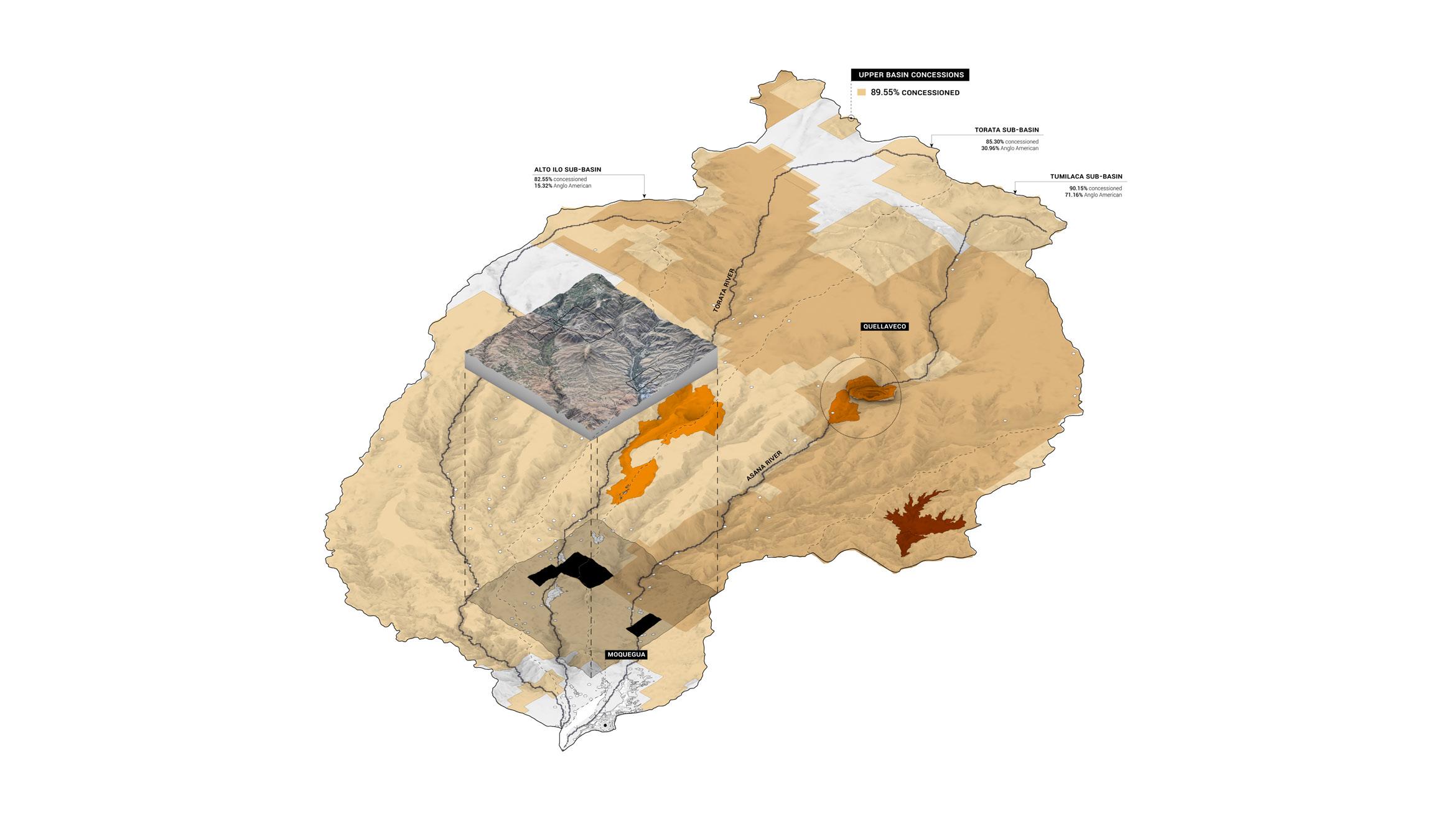
Tambo, Locumba, and Ilo-Moquegua are the most affected and relevant basins that supply the cities and district towns alongside the region. Each whith the correspondant percentage of titles got from mine companies. From the whole perspective, the upper basin sector of the Ilo-Moquegua basin is the most predominant, reaching almost 90%
UppER bASINS
% Concessioned by mining industry
Mine operations and tailing dams
Anglo American concessioned areas
Quellaveco tailing dam
Rivers
Sector
Sub-Basins
Plots 01 and 02 concessioned examples
In the process of our investigation, Red Muqui provided us with 3 different plots that had been concessioned, and there are towns, agricultural land, and ecosystems involved. This is to show how the vision of extractive systems works.
The cost of having that land concessioned could become a potential threat of losing houses, crops, and ways of sustainability for communities if not addressed. We paid close attention to this plots boundaries to recognise that it is a productive landscape and deserves not to be concessioned.
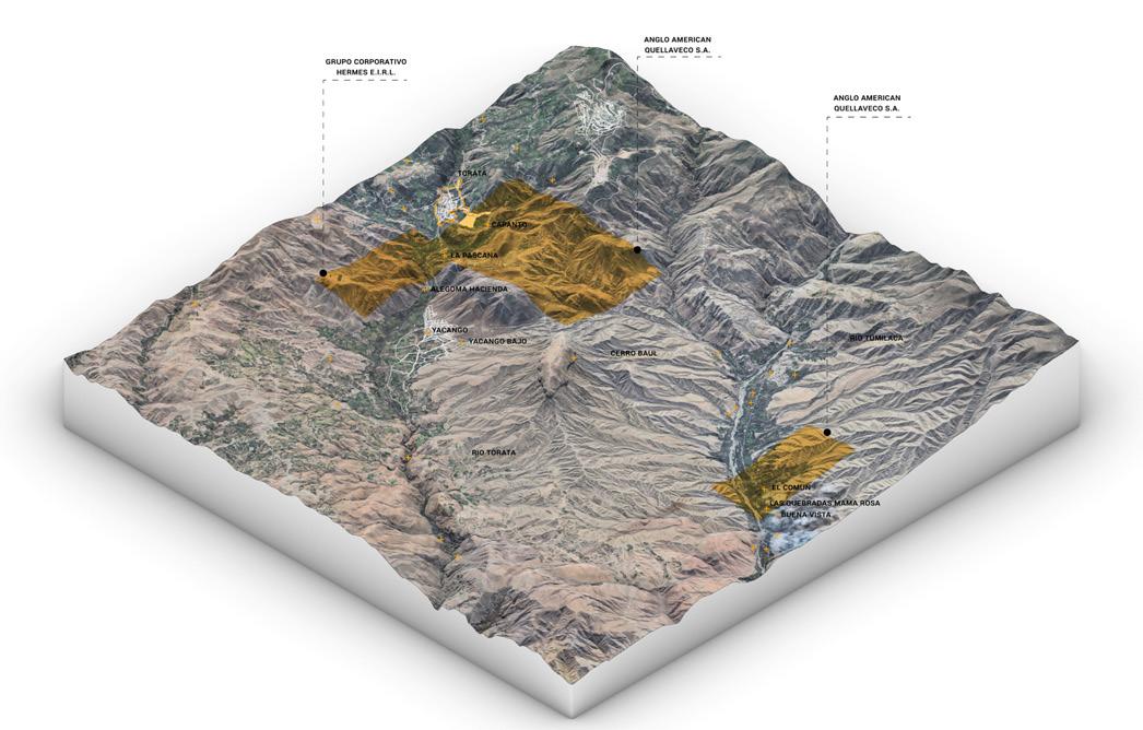
The following graphics explain in major detail what a concession of land can be. In this case, the piece of rectangular boundary belongs to two different companies. In plot 01, there is two concessions, one from Grupo Corporativo Hermes E.I.R.L and the other one from Anglo American, which is the company in the Quellaveco mine. In the image is visible the small towns that are usually not taken in consideration at the moment of doing this type of concession. They are usually the voices not listened by the government. For that, even in the case of ‘La Pascana’ town is divided into 2 by two different plot boundaries.
The same for the community of Tumilaca which is determined by natural elements such as ravines, rivers or mountains but now inside a big square that belongs to Anglo
American and the State. These cartographies could help the community understand what is happening with their productive landscape, because in the process of making the concessions, they just participate in the moment when they have to leave. The unveiled vision that is revealed here also talks about how the territory is understood as a 2D mechanism without taking into consideration that the Peruvian Andes are mountains in the majority, with different climates and altitudes that show a direct relationship of traditions and cosmology with the people that live in them.
How do the new designers design with the community’s natural boundaries instead? It is a matter of promoting and highlighting the virtues and traditions that keep the landscape alive. In that, there is a bigger price that can not be measured.
ImpACTEd 3d mAppING
As mentioned before in previous chapters, the relationship between a 2D flat map versus a 3D version of it will show, for the case of Peru, a huge difference and the necessity of understand the natural systems involved in the mine damages.
Mine concessions
District capitals
Agriculture Valley Plots Concessioned National Road Community Tumilaca Rivers and Ravins Town Points
Map. 05.2. Concessions in Torata basin. Data: Red Muqui, 2025.
LEGENd
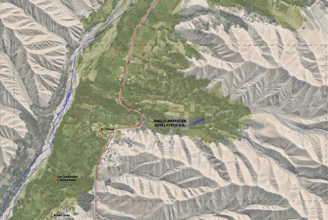
In plot 02, there is a concession by Anglo American in the Tumilaca basin downstream, which, as well as the previous plot, is a productive landscape relevant to Moquegua agriculture. This case is directly related with Quellaveco Mine, which is in the same basin upstream.
Alongside the Tumilaca river is was found already 1.68mg of aluminium when the maximum allowed is 0.2mg. From that, the concessioned towns closer to the mine will have a bigger risk of damaging their crops. Moreover, OEFA have found levels above the permitted limit in oregano crops next to the operations by Quellaveco (OEFA: 2024).
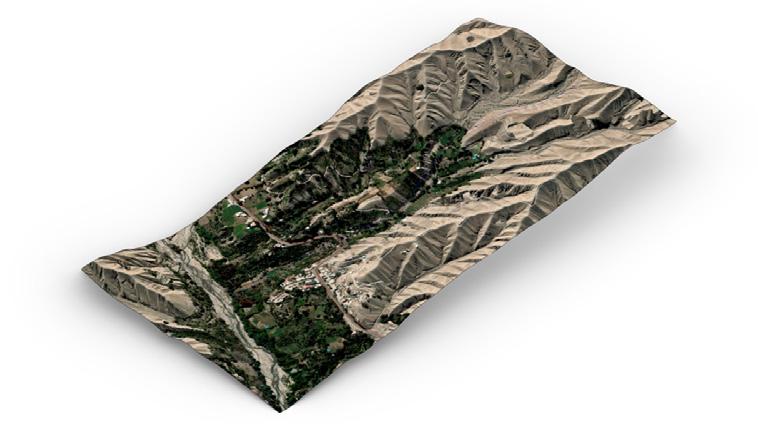
3D mapping is an essential tool for determining the risks that mining poses in Peru. Communities are currently working with social justice organisations, including Red Muqui and London Mining Network, to establish ecosystems identified by local people themselves as ones that should be preserved for the good of the entire region, not just the local area. For the investigation, we will also take into account the concessions granted in different parts of the Tumilaca basin, 90% of which is under concession, and where Quellaveco currently operates. Operations will continue to grow in the future, so it is vital to propose a cartography study to alert the population.
This concession occupies mostly one entire ravine inside the Tumilaca basin. From this perspective, is easier to understand what is in danger as well as the systems connected to water flows.
TUmILACA bASIN CONCESSION
Agriculture Valley Plots Concessioned National Road Rivers and Ravins Town Points
pEASANT LANd 3d mAppING
Map. 05.3. Concessions in Tumilacac basin. Data: Red Muqu, 2025.
District capitals
Mine concessions
LEGENd
bIbLIOGRApHy
REFERENCES
01. Anglo American. “Quellaveco El Proyecto,” n.d.,2024. https://peru.angloamerican.com/quellaveco/el-proyecto.aspx
02. Convoca newspaper. ‘Moquegua: Pobladores de Tumilaca consumen agua contaminada con metales y bacterias’, 2022. https://convoca.pe/agenda-propia/moquegua-pobladores-de-tumilacaconsumen-agua-contaminada-con-metales-y-bacterias
03. Martinez Ordoñez, Bladimir C. and Red Muqui. Shapefile and GIS data for mapping, 2024.
04. OEFA (Peruvian Special Environmental Inspection Agency). ‘Report of Environmental Evaluation and Tracking’. Environmental assessment of surface water and groundwater monitoring in the area of influence of Anglo American Quellaveco S.A.’s Quellaveco taxable unit, districts of Torata and Moquegua, province of Mariscal Nieto, department of Moquegua, in September 2022.
05. OEFA (Peruvian Special Environmental Inspection Agency). ‘Field Report’. Field report on the monitoring of air, sedimentable dust, soil, flora and characterisation of mining components and rock in the area of the Quellaveco mining unit, Torata district, Mariscal Nieto province, Moquegua department, 2023.
06. OEFA (Peruvian Special Environmental Inspection Agency). ‘Details of the environmental causality assessment at the Quellaveco mining unit of Anglo American Quellaveco S.A in 2023. Published: 2024.
LIST OF FIGURES
Figure 05.1. Titire Polluted River. Black and white cover. Source: La Prensa Regional newspaper, 2024. https://prensaregional.pe/el-rio-titire-un-conflicto-entre-la-naturaleza-y-la-mineria/
Map 05.1. Moquegua Concessions. Data: National Institute of Geology Mine and Metals (INGEMET), 2024.
Map 05.2. Concessions in Torata basin. Data: Red Muqui organisation shared data base, 2025.
Map 05.3. Concessions in Tumilaca basin. Data: Red Muqui organisation shared data base, 2025.
RISKS
fig. 06.1. Depredation of Andean matorral in Quellaveco.
Source: ‘Norte Minero’ Youtube channel video.
RISKS
The damages and control checked in the previous chapter is directly related to the concessions control in the territory, however in contrast to that there are two main layers that also need to be added to the legal and political way they see the territory and its the environmental and social layers.
In Peru, both communities and ecosystems play a fundamental role in the ways people leave in the highlands. One more time, is not about the mordern way of leaving in cities close to several buildings where for obvious reasons mine can not reach. Usually what happens is that the empty land or not recognised places by the State start to be valued by their rich resources and as in previous pages even peasant communities, towns and productive land have been concessioned. From this chapter, the idea is to present the ecological layers and the amount of towns leaving in conditons of water scarcity where the mine operates. Then is possible to select strategic points of action for the proposal.
After the mine operations in Tumilaca basin started in 2018 there were reports and media talking about the contamination in the main river where the last environmental study releases 1.68 milligrams of aluminium per litre into the drinking water of the town of El Común when the maximum permissible limit is 0.2 milligrams (Prensa Regional, 2022). More than 401 populated towns can be affected.
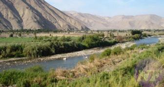
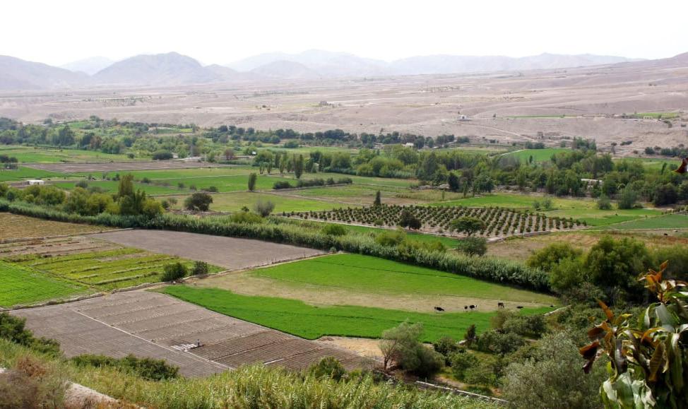
fig. 06.2. Tumilaca river and green valley. Source: Google Earth Pro, 2025.
TUmILACA RIvER
WHAT A pEASANT COmmUNITy mEANS?
Peasant communities are public interest organisations, descended from the indigenous peoples of Peru. They are legal entities and have representative powers governed by state regulations and their own customary rules in accordance with their customs and ancestral traditions (Supreme Decree Law Article No. 37-70-A). They represent cultural inheritage in the country that must be recognised and preserved as well as the ways or economies they use tu survive. Usually these places are the most affected by mining operations because of the way they are seeing as empty land or unknowned land. Additionally, water sources in Moquegua specially are especially scarce, which makes rain catch very important for them to produce more crops, grassland, and keep alive the livestock such as llamas, alpacas, and vicuñas. The super-arid zone faces a number of risks that could render it unlivable. However, the paradox is that it is the communities that sustain the resources of the different regions of the country.
Water Stress (0.0-1.0) Communities Cities Rivers Moquegua region
Map. 06.1. Moquegua peasant communities and water risk. Data: Red Muqui, 2025.
These 3D map shows the multiple populated centres, capitals of districts, and peasant communities along the south macro-region in contrast with the water stress of the correspondant basins in each location. In conclusion, the upper stream in Tumilaca basin poses a very high level of risk for the locals of Asana and Tumilaca, compounded by the mining conflict.
Data: Elaborated from Red Muqui GIS shapefiles database.
Alto Ilo, Torata, and Tumilaca sub-basins represent the upperstream of Ilo-Moquegua basin. These also have the major risk of water stress because of the location of the main city in the region, Moquegua.
The community of Asana, located in the highest part of the Tumilaca sub-basin, has a lower risk but at the same time a greater opportunity to supply and create a new system that meets the productive needs of the others in the lower part.
TUmILACA RIvER
TORATA TOWN
mOQUEGUA CITy 3 ASANA COmmUNITy
fig. 06.3. Torata river.
Source: Prensa Regional, 2019.
fig. 06.4. Tumilaca river.
Source: Red de Comunicacion Regional (RCR), 2019.
fig. 06.5. Asana community.
Source: MERESE Ilo, 2024.
fig. 06.6. Torata town.
Source: Prensa Regional, 2025.
fig. 06.7. Moquegua city.
Source: La Republica newspaper, 2023.
Moquegua
Moquegua upper basins
WHICH ARE THE HIddEN ECOSySTEmS?
The third layer, after social (communities) and legal (concessions), is the ecological. Peru is the second multidiverse country in the world, home to a vast array of ecosystems that, on top of every ecosystemic service they provide to the land, are handled and managed by communities along the territory, which recognise those landscapes as part of their daily lives. They become the most important source of livelihood not only for highlands regions, but also for the coastal cities from which they received the water from. That is why it is also important to preserve them and regenerate ancestral practices that promote biobased systems for economic and cultural purposes. In the case of Quellaveco, the hidden environment correspond to the name of bofedales (andean wetlands), puna seca highlands, andean matorral, coastal desert, lomas, basins, sub-basins, rivers, and ravines.
mOQUEGUA ECOLOGICAL LAyERS
Desert Andean Matorral Agriculture Puna Seca Quenual Forest Bofedales Periglaciar Cities National Road Region Lomas
Map. 06.2. Moquegua ecosystems. Data: National Map of Ecosystems (MINAM), 2024.
mOQUEGUA ECOSySTEmS
LEGENd
Bofedales (andean wetland)
Quenual forests
Puna seca highlands
Agriculture
Andean matorral
Coastal desert
Lomas
Water systems
bOFEdALES (ANdEAN WETLANd)
Andean hydromorphic ecosystem with hydrophilic herbaceous vegetation, found in the Andes on flat, depressed or slightly sloping soils; permanently flooded or saturated with running water (poor drainage), with dense, compact, evergreen vegetation, cushion-like or cushionshaped. Vegetation ranging from 0.1 to 0.5 metres in height. The organic soils can be deep (peat).
pUNA SECA HIGHLANdS
High Andean ecosystem with herbaceous vegetation, which can occupy flat or undulating terrain; the soil has a sandyloamy texture with low organic content; ground cover is less than 35%, and maximum height generally does not exceed 1.5 m. It is grasslands dominated by low-growing grasses and scrublands dominated by xeromorphic tufted grasses on rocky outcrops and slopes.
Forest ecosystem consisting of high Andean relict forest dominated by associations of ‘queñua’, extending over more than 0.5 hectares, with trees taller than 2 metres and ground cover greater than 10%; commonly restricted to rocky slopes or ravines; currently distributed in patches or islands of vegetation.
AGRICULTURE CROpS
This includes areas dedicated to crops. These can be temporary crops, that must be replanted after harvest in order to continue producing (short growing cycle, from a few months to two years); or permanent crops, those whose growing cycle is longer than two years, producing several harvests without the need to replant.
COASTAL dESERT
Arid to hyperarid ecosystem with areas largely devoid of vegetation, consisting of sandy soils or rocky outcrops occupying flat, undulating and dissected areas subject to wind erosion. It extends from beaches and sea cliffs to the foothills of the western slopes, and can occupy significant areas. Some notable plant formations include tillandsia, cacti, scrubland, low thorny scrubland, and dry ravines, among others.
Coastal desert ecosystem, known as a ‘fog vegetation oasis,’ consisting of ephemeral xerophytic plant formations that include herbaceous plants, with scattered trees in some cases, and is rich in endemic plant species. Seasonally cover extensive desert areas on hills and medium-sized ridges exposed to high relative humidity above 80% and the collection of water droplets by shrub and tree vegetation, from 100 m asl to about 1000 m asl.
Andean ecosystem with an altitude range of 1,500 to 4,500 metres above sea level. It is characterised by the presence of woody and shrubby vegetation of variable composition and structure, with ground cover of more than 10% extending over more than 0.5 hectares, and whose height above the ground does not exceed 4 m. In the dry puna scrubland, extensive areas of ‘tola’ can be seen, as well as Lepidophyllum quadrangulare, Baccharis, and other species. Data: Elaborated from National
of Ecosystems GIS
QUENUAL FOREST
LOmAS
ANdEAN mATORRAL
Mining operations are completely involved in the ecosystemic of the upper basins in the Moquegua region. The graphic shows the different amounts of populated centres around the most important rivers and sub-basins. With the new operations of Quellaveco, the most affected cities will be around the Tumilaca sub-basin and the capital of the region, which is Moquegua city.
Surface water: 70% from the Osmore River Groundwater: 30% from 150 urban wells (ANA reports 12% are over-extracted).
mOQUEGUA AGRICULTURE
3,670 ha (1966) -- 5,254 ha (2025)
CONTAmINATEd mOQUEGUA AREA
The region is extremely arid, with 70% of its water resources relying on rivers and 30% on urban groundwater. According to the ANA (Autoridad Nacional del Agua, 2023), groundwater extraction has already exceeded the sustainable safe yield by 12%, making Moquegua’s water resources extremely scarce. Since 1966, the irrigated area has expanded from 3,600 hectares to 5,200 hectares. The Torata River and the Asana River converge here to form the Moquegua River. All three rivers are affected by different mining activities: tailings from the Cuajone mine have leaked and contaminated the Torata River; mining at Quellaveco has caused the Asana River to be diverted; and aluminum levels in Moquegua’s urban drinking water have been detected at eight times above the safe standard.
Downstream Tumilaca basin
Basins, sub-basins and microbasin
Moquegua boundary Rivers
District capitals
Pacific Ocean
Moquegua is located downstream of the Quellaveco mining area, with a current population of approximately 50,000, projected to reach 200,000 within the next 50 years.
Moquegua’s annual water demand reaches 106 million cubic meters, with the Moquegua River supplying 77 Mm³/year and irrigation channel projects supplying 27 Mm³/year, while the safe supply capacity is only 167 million cubic meters (Proyecto de irrigación de Moquegua, 1966).
Solid waste accumulation from the Cuajone Mine has contaminated the Torata River.
RIvER FLOW
Asana River
0.53 m3/s (dry season) 2.34 m /s (rainy season) Torata River
0.54 m3/s (dry season) 0.85 m3/s (rainy season)
Osmore River
0.80 m3/s (dry season) 5.90 m3/s (rainy season)
To meet the agricultural irrigation needs of Moquegua City, the required water resource demand is 104.17 Million m³/year.
Artificial diversion from the Quellaveco Mine has disrupted the flow of the Asana River
Aluminium levels in drinking water in ‘El Comun’ town reached 1.68 mg/L exceeding the maximum allowed limit of 0.2 mg/L
QUELLAvECO
Started (Construction): 2018
First Production: 2022
At the same time, mining activities require a large amount of water, with an annual consumption of 22 million cubic meters, delivered to the mine through a 90 km pipeline built by Anglo American. About 80% of the water comes from upstream rivers, and 20% comes from constructed reservoirs (Grupojjc, 2022).
The diversion dam on the upper Asana River has redirected the river, and Anglo American now controls its flow and volume.
The peak annual copper production capacity is 330,000 tonnes per year. Copper ore is extracted from an open-pit mine 900 meters deep, transported via conveyor belts to a screening plant, and finally shipped to ports for export by rail and highway (Anglo American, 2019). pOLLUTION & TAILING dAm RISK
CONTAINEd COppER
Quellaveco began construction in 2018 and started operations and copper production in 2022. The mine has 1.3 billion tons of mineral reserves and 7.5 million tons of copper, which is enough to build 90 million electric vehicles or wire 80 million households.
AROUND 900 m OpEN pIT dEpTH 1300 million tonnes
RESERvES
7.5 million tonnes ...which is enough for 90 million electric vehicles Or wiring 80 million homes
pEAK pROdUCTION
330,000 tonnes per year
Tumilaca basin
sub-basins and microbasin
A 38 km pipeline transports waste water from mining operations to the tailing dam, crossing rivers and posing a risk of leakage.
22 million cubic metres per year
95 km pipeline to bring water to mine site 80% from Titire river 20% from new Vizcachas reservoir WATER USE
TAILING
dAm
Site area: 1.1 million m2 - roughly the size of London’s Hyde Park
Storage: 244 million m3 - ten times the volume of Wembley Stadium
Transportation system (Pipe: 38km)
The tailing dams have currently 150 m heght, is expected to reach 309.6 m, posing a serious risk of a tailing dam breach.
bIbLIOGRApHy REFERENCES
01.Aqueduct Water Risk Atlas’. n.d. Accessed 8 September 2025. https://www.wri.org/applications/aqueduct/water-risk-atlas/#/?advanced=false&basemap=hydro&indicator=w_ awr_def_tot_cat&lat=-26.11598592533351&lng=-366.06445312500006&mapMode=view&month=1&opacity=0.5&ponderation=DEF&predefined=false&projection=absolute&scenario=optimistic&scope=baseline&timeScale=annual&year=baseline&zoom=3
02. BNamericas.Com. n.d. ‘BNamericas - Govt to Earmark US$114mn for Pasto Grande II...’ Accessed 8 September 2025. https://www.bnamericas.com/en/news/govt-to-earmark-us114mn-for-pastogrande-ii-irrigation-project
03. Bohorquez P., Luis M., D. Kenzo Sumikawa, and Rubén E. Mogrovejo G. 2024. ‘Analysis of Potable Water Supply Scenarios Using WEAP Software and Applied to the Cities of Moquegua and Ilo’. In Trends in Environmental Sustainability and Green Energy, edited by Jinkeun Kim and Zhe Chen. Springer Nature Switzerland. https://doi.org/10.1007/978-3-031-52330-4_2
04. ‘CLIMAS XIII BIAU’. n.d. Accessed 8 September 2025. https://bienaliberoamericana.org
05. Convoca.pe. “Moquegua: Pobladores De Tumilaca Consumen Agua Contaminada Con Metales Y Bacterias,” - Agenda Propia, n.d., https://convoca.pe/agenda-propia/moquegua-pobladores-de-tumilacaconsumen-agua-contaminada-con-metales-y-bacterias
08. DESCARGAS GRATIS. n.d. Accessed 8 September 2025. https://www.geogpsperu.com/p/descargas.html
09. DFP - Drone Films Project, dir. 2023. JJC / Besalco: Construcción de Sistema de Relaves En Mina Quellaveco. 03:50. https://www.youtube.com/watch?v=LFp9Fb06zA0
10. Environment Ministry of Peru, ‘NATIONAL MAP OF ECOSYSTEMS OF PERU: Descriptive Report’, ed. Ministry of the Environment, First Edition (Ministry of the Environment, 2019), https://sinia.minam.gob. pe/sites/default/files/sinia/archivos/public/docs/memoria_mapa_ecosistemas.pdf
11. Fluor, dir. 2020. Quellaveco Mining Project. 05:45. https://www.youtube.com/watch?v=KlzMLYYvTW4.
12. ‘GADM’. n.d. Accessed 8 September 2025. https://gadm.org/download_country.html#google_vignette.
13. GrupoJJC_Oficial, dir. 2022. Sistema de Transporte de Relaves - Proyecto Quellaveco - JJC. 02:29. https://www.youtube.com/watch?v=pqIUvmoOleI
14. ‘HydroLAKES’. n.d. Accessed 8 September 2025. https://www.hydrosheds.org/products/hydrolakes
15. Ingeniería y Construcción, dir. 2023. Construcción de Presas de Relaves, Lavado de Relaves y Estación de Ciclones - Quellaveco 2023. 10:00. https://www.youtube.com/watch?v=ZUuVGwzJ0qo
16. ‘Index of /Potapov/TCC_2010’. n.d. Accessed 8 September 2025. https://glad.umd.edu/Potapov/TCC_2010/.
17. Isamar, Aguilar Cercado Celia. “Estatuto De Las Comunidades Campesinas.” Scribd, n.d. https://es.scribd.com/doc/274868000/Estatuto-de-Las-Comunidades-Campesinas
18. London Mining Network, Red Muqui, Terra Justa. ‘Anglo American in Peru. Expansion and Environmental Challenges of the Quellaveco Project’ 2024. 19. London Mining Network. n.d. ‘Home’. Accessed 8 September 2025. https://londonminingnetwork.org/ 20. Moquegua, el oasis - La Prensa Regional. 2022. June 6. https://prensaregional.pe/moquegua-el-oasis/ 21. Martinez Ordoñez, Bladimir C. and Red Muqui. Shapefile and GIS data for mapping, 2024.
22. ‘NASADEM Merged DEM Global 1 Arc Second V001 Earthdata Search’. n.d. Accessed 8 September 2025. https://search.earthdata.nasa.gov/search/granules?p=C2763264762LPCLOUD&pg[0][v]=f&pg[0][gsk]=-start_date&q=NASADEM%20Merged%20DEM%20Global%201%20arc%20second&sb[0]=-70.62775%2C-17.16616%2C-70.43674%2C22.98129&hdr=1%2Bto%2B30%2Bmeters&tl=950702399.5!2!!&lat=-17.055761156446806&long=-70.3501491977912&zoom=11.663379313744638.
23. Norte Minero, “HISTORIA DE LA MINA QUELLAVECO,” April 15, 2025, https://www.youtube.com/watch?v=o0XhzlKUMBc
24. OEFA (Peruvian Special Environmental Inspection Agency). ‘Field Report’. Field report on the monitoring of air, sedimentable dust, soil, flora and characterisation of mining components and rock in the area of the Quellaveco mining unit, Torata district, Mariscal Nieto province, Moquegua department, 2023.
25. OEFA (Peruvian Special Environmental Inspection Agency). ‘Details of the environmental causality assessment at the Quellaveco mining unit of Anglo American Quellaveco S.A in 2023. Published: 2024.
Figure 06.11. Andean matorral. Source: National Map of Ecosystems (MINAM), 2019.
Figure 06.12. Puna seca highlands. Source: National Map of Ecosystems (MINAM), 2019.
Map 06.2. Concessions in Torata basin. Data: Red Muqui organisation shared data base, 2025. Map 06.3. Moquegua risks. Data: Google Earth Pro, 2025. Map 06.4. Quellaveco site risks. Data: Google Earth Pro, 2025. LIST OF mApS
Map 06.1. Moquegua Concessions. Data: National Institute of Geology Mine and Metals (INGEMET), 2024.
WATER INFRASTRUCTURES
WATER INFRASTRUCTURES
During our investigation, we found the Red Muqui organisation as part of the landscape defenders in Peru, but at the same time, they are in constant communication with the London Mining Network, which is working to preserve the rights of the communities in Quellaveco. As part of this research, we contribute together to achieve a graphic understanding for the locals of what is happening there.
From this experience, we could understand that there are alternatives to mining futures. Alternatives that are biobased, collective, and productive. This is the planting and harvesting of the water system in Andean territories, which involve actions such as infiltrating and storaging water, recharge underground water for bofedales, grazing, and agriculture. All of them are connected y water and can supply an entire city with the qualities of Moquegua. The opportunity exists already in the Asana community, which has started construction of water infrastructure such as qochas and amunas since 2022, with the support of MERESE Ilo.
fig. 07.2. Constructed Qocha by MERESE Ilo in Asana community.
Source: Google Earth Pro, 2025.
ECOSySTEmIC LOCAL SUppORT
endemic from Peru are llamas,
CONFLICTOSCONFLICTOS ALTERNATIVASALTERNATIVAS
Red Mqui launches a campaign on alternative ways of life that challenge the narrative of increased mining expansion. Communities not only defend their land, the environent and water, but also develop joint actions and experiences that generate added value in agricultural work and the protection of common goods (water, land and agriculture), which have unmesurable value compared to economies generated by the exploitation of copper and other metals.
However, these realities are threatened by the imposition of mining activities that pollute water sources, destroy ecosystems, displace agricultural work, and land previously used for food production because the coexistence of agriculture and mining is only a discourse and a convenient plan for the promotion of mining in the face of resistance from indigenous people in the Peruvian territory (Red Muqui: 2025).
conflictos mineros 14% del territorio nacional tiene concesiones mineros
26.5% del territorio nacional esta ocupado por comunidades campesinas
35% de tierras de comunidades campesinas están concesionadas
The Muqui Network and its members provide support in cases of mining conflicts within their area of work.
As part of this support, the affected population requests the creation of maps, which are developed based on participatory workshops that allow for a better understanding of mining issues, socio-environmental impacts, and proposed alternatives. This section displays some maps of the areas supported by the Muqui Network (Red Muqui: 2025).
WEAKENEd TERRITORy
fig. 07.3. Red Muqui proposals towards mining expansion narratives. Source: Red Muqui website.
The Peruvian government does have particular laws for closing mining operations, but this does not ensure complete compliance or a technically sound closure, thus there may be more environmental liabilities associated with mining in the future.
Every mine in Peru need to have a Mine Closure Plan (MCP), however, this document is based on every mine’s economic budget and not according to the States bases1 The closure plan includes: demolition and removal of infrastructure, refurbishment of remaining mining land, supervision and measurement of closure activities performance in relation to approved standards and criteria, confinement or treatment of tailings and waste, effluent treatment, environmental monitoring and, communication of closure to authorities and communities (Rodriguez & Julca: 2020).
The following diagram is explained the procedure for approval of mining closure, in which there is no mention about the ecological and social aspect. Its participation remains at ‘citizen participation’ which usually refers to people looking at the news beib published in newspapers close to the principal cities such as Moquegua. They give 5 days of announcements in that media for people to see it. There is a gap in how authorities address this issue.
Diagrama 4 Procedimiento para la aprobación del plan de cierre de minas
y Minas (MINEM).
The document does not rely on a real just transition. Closure plans are made from the mining companies points of view which are based on economic needs to make possible the closure. There are not written basis from the State to make a just plan. Despite is mandatory to perform physical restauration of the landsacape in Peru, there is no mine yet which has successffully close a mine and received a certificate. The document recently update bigger economic guarantees for mine closure plan, a new concept of progressive closure and penalties for noncompliance. There is no talk about new alternatives reinforcing communities voice or implementing ecosystemic values in the same law which is crucial at this point.
from media.
Fuente: Ministerio de Energía
CLOSURE pOLICy
fig. 07.7. Mines Closure Law, 2025.
Source: Mines and Energy Peruvian Ministry (MINEM).
Through the production of organic food. Supported by entities promoting this production in areas where part of the population is submitted to mining operations, demonstrating the viability of this sustainable form of life cicle and preserving soil areas that give ecological services to the landscape.
Empowering locals and promoting the sustainable use of biobased resources, adding value to this area, while organising them as agents of change and transition. Organisations such as Red Muqui, Terra Justa and London Mining Network can lead this path through the new link between communities.
Water harvesting and storage at the headwaters of the basin. Supported by organisations specialising in water management and conservation through this system, reservoir construction, soil conservation, pasture and livestock management, community health management, and education.
With an agroecological focus, formulating communal land use plans and implementing horticulture and business plans for their sustainable development over time. Empower locals to make decisions on the land and the management of native traditions. As well, use of native vegetation such as quenuales and experimental phyto roof crops to introduce new food.
FAmILy AGRICULTURE STRENGHTENEd SOCIAL ORGANISATIONS
pLATING ANd HARvESTING OF WATER
COmmUNITy TERRITORIAL pLANNING
fig. 07.8. Family agriculture cover.
Source: Red Muqui website.
fig. 07.9. Planting and harvest of water cover.
Source: Red Muqui website.
fig. 07.10. Strenghtened social organisations cover.
Source: Red Muqui website.
fig. 07.11. Community territorial planning cover.
Source: Red Muqui website.
The Qochas are ancient aquifer storage and recharge systems found in high Andean micro-basins.
The Puna ecosystem’s water supply and ecosystem services are improved by using rustic micro-dams, or ‘qochas’ in conjunction with other techniques (such as managing grasslands, reseeding natural pastures, and reforesting with native species, among others) to encourage the collection, storage, and infiltration of rainfall (Environmental Ministry of Peru: 2025).
Andean wetland with hydromorphic vegetation that generally accumulates peat. Seasonally or permanently waterlogged (Environmental Ministry of Peru: 2025).
This type of ecosystem have a key participation in the harvest of water due to their ability to catch water and infiltrate in the soil causing grasslands for feeding the animals that will eventually make the survival of local communities. In that sense is crucial to preserve them and connect it to the regional planning process.
Peruvian ancestral infrastructures are known for their hydraulic properties, which make them a creative way to deal with water stress. These were passed down from ancient societies and help local crops and cattle by collecting and storing rainfall during the wet season and releasing it during the dry season.
This ancestor’s legacy shows how nature-based solutions may help with today’s pressing issues like water security and climate change. One kilometer of amuna typically yields between 118,000 and 225,000 m³ of water annually (Aquafondo: 2025).
Moquegua represent an important percetange of the agricultural valleys inside the coastal desert ecosystem of Peru. This is an opportunity to value the different crops cultivated from family agriculture or community plantations for productivity.
This activity is linked with the management of water, especially alonside Tumilaca and Torata basins, which are the most productive. People living in the upper part of those areas need implementation of phytoroofs or greenhouses to increase production and variety, while downstream need new land uses and canals distribution because of the mine river pollution.
QOCHAS
bOFEdALS
AmUNAS
pLANTING ANd AGRICULTURE
fig. 07.12. Qochas in Asana community.
Source: MERESE Ilo EPS Youtube Channel.
fig. 07.14. Bofedales and animal grazing in Asana community.
Source: MERESE Ilo EPS Youtube Channel.
fig. 07.13. Amunas constructed in Asana community.
Source: MERESE Ilo EPS Youtube Channel.
fig. 07.15. Moquegua agricultural valley.
Source: ‘Prensa Regional’ newspaper website.
EPS Ilo, Forest Trends, and the Asana community in Moquegua establish alliances for protecting ecosystems such as bofedales and water infiltration infrastructures, demonstrating the importancce of environmental sustainability in upper stream regions.
EPS Ilo S.A. conducted the first assessment of the conservation status of bofedales in this place in collaboration with ‘Forest Trends’ Natural Infrastructure for
Water Security (NIWS) initiative, with the Asana community’s active involvement which is the most important action in unseen landscpes. These collaborative processes show the relevant potential that may emerge when local communities, non-profit organisations, and government agencies unite behind a single objective: caring and preserving the environment for coming generations (Prensa Regional: 2024).
Bofedales are essential for community survival. Infrastructures such as qochas, infiltration ditches, rustic canals, among others, play a vital role in this process of preserving them. They not only act as regulators of water flow, but also store and improve its quality, which is vital for domestic use. To achieve this objective, it is key to work in close collaboration with the rural communities settled in the upperside
of the basins. With the MRSE-H, this is achieved through voluntary agreements between the community and EPS Ilo, ensuring a participatory approach with all relevant entities (MERESE Ilo: 2024). In a difficult mining environment, these steps are essential to the preservation and conservation of water supplies, which in the long term action can contribute to decrease the risks caused by the extractive companies.
fig. 07.19. Chilligua new plantations in Asana community. Source: MERESE Ilo EPS Youtube Channel.
QOCHAS ANd AmUNAS CONSTRUCTION
bOFEdALS ANd FORESTATION OF CHILLIGUA
WHAT CAN WE ImAGINE?
fig. 07.20. Steps towards extractive sites analysis.
Source: Document UNPUBLISHED, Internal Document made by Red Muqui, 2025.
Red Mqui had the opportuniy to make a workshop with Eduardo Gudynas specialist in the topic of developing alternatives to extractive futures and the environment. He presented a methodology to address the case of mine operation, which was written and noted by the organisation, and they kindly shared it with us. This consists of three key steps: diagnosis (D), transitions (T), and alternatives (A). For the thesis, it is crucial identifying first the main risks and damages as we did in the previous chapter, the actors involved, knowing the sites of intervention and what the main events are. All the previous pages showed the unveiled landscape to then understand what to do or propose for an alternative instead of a common green transition.
From the perspective of Gudynas, ‘the cake’ configurates what scales of work should be taken in consideration when thinking alternatives and transitions. For the case of Peru, cause this methodology works according to every specific context, ecosystem and ecological layer go first as the most bigger impact and which is directly related to people. Then is crucial to talk about the policy decisions that can guarantee the a ctions in order to get justice for damages.
Technology is going to enter the capacity of production, infrastructure that can be created to accelerate certain transition processes from the construction of water dams or reservoirs to greenhouses
fig. 07.21. The cake methodology.
Source: Document UNPUBLISHED, Internal Document made by Red Muqui, 2025.
Transitions look from the perspective of current clean energy or renewable energy. Is what is happening in the north globe, however, alternatives look to different scenarios for countries that do not follow the modern parameters.
fig. 07.22. Transition in mining contexts.
Source: Document UNPUBLISHED, Internal Document made by Red Muqui, 2025.
Evaluation is needed for those in the transition process, taking into consideration ecological entities that delineate the boundaries of what is environmentally acceptable, as well as social and territorial aspects.
Considers different layers or variables that must be analysed and integrated in a structurd manner or priorities. Political, environmental, social technological, economic and legal among others. Each insitution or actor can add new dimensions according to their context and approach (Red Muqui, 2025).
and agroecological towns. For the context of mined territories, Gudynas mention that it is important to check in which areas is necessary the operation. There must be a constant revision and it should be approved by the social groups leaving in those contexts. In that way, the result can be industrialized, just what is essential.
Following these conditions as designers is possible to imagine and graphically show the different futures. In the case of mine areas, there is no just one possible scenario to think about, however, what is most important is to visualise the alternatives. First, it identifies plausible futures as those scenarios that, although they may represent a ‘ideal-
dream,’ are not necessarily realistic; their function is to open up the imaginative overview without immediate restrictions (Red Muqui: 2025). Then, even if they are still utopic, the next potential futures are thought to be more feasible than probable futures. These ones are situations that could really happen given existing patterns.
Finally, preferred futures, the most ideal routes within the bounds of what is feasible, are represented by preferred futures, which are a blend of likely and possible futures and what, as a team, we are looking to represent in Harvesting Futures.
fig. 07.23. Alternative Futures.
Source: Document UNPUBLISHED, Internal Document made by
2025.
Not necessarily completely utopic, cause there is probable and possible futures combined to achieve a bigger goal of alternatives. Is the own path of the context and territory in question. In Quellaveco, Asana, and Tumilaca, harvesting water and circular economies could be the preferred future.
Red Muqui,
Harvesting Futures
Policy memo proposal September, 2025
WATER BASIN COMMUNITY-DRIVEN JUST MODEL FOR TRANSITION TOWARDS QUELLAVECO MINE DE-EXTRACTIVISM
EXECUTIVE SUMMARY
Quellaveco mine, located in Moquegua (Peru) and operated by London-based Anglo American, represents a paradigmatic case within the current global extractive model. Mainly dedicated to the extraction of copper - a key mineral in the global energy transition - this operation puts the narrative of ‘modern and responsible mining’ in tension with territorial, social and environmental conflicts in the Global South. UK and european governments have specific policies about making their cities ‘greener’ by 2050 such as the European Green Deal1 and the UK Power Action Plan2 This energy transition will require double amounts of copper and the Global South concentrates most of the planet reserves of this material. The unseeing is the sacrificed territories through mining infrastructures that will require new land use planning strategies to mitigate their impacts and build regenerative landscapes in real time.
This policy plans to do a territorial plan involving the different institutions involved in plating and harvest of water as a biobased alternative to mining. In that sense, there is going to be new rules that allow local people recover their land and make a real just transition towards less mining dependency.
HARVESTED FUTURES FOR ANDEAN EXTRACTIVE TERRITORIES
This policy functions as a territorial plan to establishing new rules in on-process mining territories. The main goal is to insert landscape practice in the treatment of the mined copperscapes in the Andean territory that involve environmental impacts, economic disbalances and community distrust. Therefore, this study also pretends to relink the actors from local organisations and make them to be involved in regional interventions including Anglo American Headquarters office which has part of the responsibility of Quellaveco mine and which is linked to the UK market The study proposes a progressive territory restauration from the onset Quellaveco mining activity and a just transtion model prioritizing Asana community ancestral knowledge in planting and harvest of water which can counter attack and revert the extractive condition of the region.
STRATEGIES AND ACTIONS
REGIONAL ImpACTS
Peruvian universities/ London Mining Network / Red Muqui / Community Leaders
+ Implement an independent monitoring of the agreements signed by Anglo American, especially on recognized universities,
Peruvian National Government
+ Mandates community people representation in key decisions about territory management ensuring that and informed consent.
UK Government / London Mining Network
+ Establish commitments from
London Mining Network / Red Muqui
+ Demand that companies like Anglo American meet their sustainability commitments throughout the value chain in
BALANCED BENEFIT SHARING AND JUST MINING TRANSITION
1. Distrust of Anglo American commitments
A social development fund was created and commitments on water, employment and compensation were negotiated. However, communities question that key decisions were made between the state and the company with limited participation of peripheral or indirectly affected communities. Additionally, there were no consultation processes with veto capacity3 making participation more pro-occupational rather than effective in the management of long-term impacts.
2. Obscure share of economic benefits and no London co-responsibility
It is not clear how profits are distributed to regional governments. Countries exporting raw materials usually receive a minimal share of the final value. Based in London, the company is subject to British regulations on human rights and the environment. However, there are no clear legal mechanisms linking the parent company to the impacts generated in Peru. Its discourse in Europe does not translate into strict standards in Moquegua and this highlights the disconnection between European climate rhetoric (green transition) and the ecological and social costs in the Global South.
3. Territorial and ecological impacts
Water pollution: although promised to use only water from the Titire River (non-potable), indirect impacts on shared watersheds have been documented, creating tensions with local farmers. Fragmentation of the territory: Anglo American activity altered productive circuits4, ecosystems, communal roads and cultural patterns. Long-term implications: there are no clear mine closure plans or commitments to landscape-scale ecological restoration. Risks of tailing dams collapses.
CHALLENGES
3. Different mindset and system ISSUES
1. No response by Anglo American headquarters
Taking responsibility for a situation outside the UK is a big challenge as Anglo American can ignore it. Visibility is therefore needed for them to take this step of acknowledging the economic and environmental debt to the communities.
2. High levels of corruption
In Peru exists high levels of distrust of the authorities because of the inefficiency in approving laws and also in continuing large scale projects. Additionally there is a common fear of political instability.
Working all the actors together as a group is a huge challenge. This may produce some resistance to understand community knowledge and for communities to trust the people in charge of the country and the mine company. Also this includes the new transition to depend less on mining.
Peruvian National Government / Anglo American plc
+ Perform a system of conditional taxation system: purposes.
UK Government / Peruvian National Government
+ Push for Anglo American
Regional Government of Moquegua / MERESE Ilo EPS Moquegua
+ Investment in alternative sectors infrastructure:
+Allocate funds for jobs training
ENVIRONMENTAL INSTITUTION STRENGHTENING AND TERRITORIAL LANDSCAPE PLANNING
Peruvian National Government
+Separate from state international support.
+Territorial planning
+ Provide public access to cumulative impact assessments and
Regional Government of Moquegua / MERESE Ilo EPS Moquegua
+ Instruct citizens in territorial planning as part of new just transition process and make them be part of the decisions.
REFERENCES
1. European green deal. https://commission.europa.eu/strategy-and-policy/priorities-2019-2024/european-green-deal/delivering-european-green-deal_en
2. UK Power Clean Energy. https://www.gov.uk/government/publications/clean-power-2030-action-plan/clean-power-2030-action-plan-a-new-era-of-clean-electricity-main-report#why-cleanpower-by-2030.
3. As required by ILO Convention 169 for indigenous peoples.
4.Environmental assessment by OEFA 2024.
REBUILD THE LINK BETWEEN STATE, LOCAL COMMUNITY AND TERRITORY
To Anglo American plc, Peruvian Ministry of Energy and Mines, Ministry of Environment, Regional Government of Moquegua
This policy functions as a territorial plan to establishing new rules in on-process mining territories. The main goal is to insert landscape practice in the treatment of the mined copperscapes in the Andean territory that involve environmental impacts, economic disbalances and community distrust. Therefore, this study also pretends to relink the actors from local organisations and make them to be involved in regional interventions including Anglo American Headquarters office which has part of the responsibility of Quellaveco mine and which is linked to the UK market The study proposes a progressive territory restauration from the onset Quellaveco mining activity and a just transtion model prioritizing Asana community ancestral knowledge in planting and harvest of water which can counter attack and revert the extractive condition of the region.
REBUILD THE LINK BETWEEN STATE, LOCAL COMMUNITY AND TERRITORY
Peruvian universities/ London Mining Network / Red Muqui / Community Leaders / MERESE Ilo EPS Moquegua / Terra Justa
+ Implement an independent monitoring of the agreements signed by Anglo American, especially on water, employment and compensations. This can be composed of recognized universities, international NGOs and community leaders.
Peruvian National Government
+ Mandates community people representation in key decisions about territory management ensuring that all communities with territorial links have the right to free, prior and informed consent. Giving them a voice in decisions on water use, environmental restoration or benefit sharing.
UK Government / London Mining Network
+ Establish commitments from London to transnational lawsuits to hold Anglo American UK legally accountable for community impacts in Peru.
London Mining Network / Red Muqui / MERESE Ilo EPS Moquegua / Aquafondo / Sierra Azul Program
+ Demand that companies like Anglo American meet their sustainability commitments throughout the value chain in extracted countries like Peru.
Peruvian National Government / Anglo American plc
+ Perform a system of conditional taxation system: territorial development funds Part of the mining profits stay in the affected regions for social and environmental purposes.
UK Government / Peruvian National Government / London Mining Network
+ Push for Anglo American economic recognition of the impacts in Peru.
Regional Government of Moquegua / MERESE Ilo EPS Moquegua / Aquafondo / Sierra Azul Program
+ Investment in alternative sectors infrastructure: renewable energies agroforestry responsible tourism to avoid dependence on mining.
+Allocate funds for jobs training and productive reconversion for mining territories.
Peruvian National Government / National Authority of Water Agency / Aquafondo / Sierra Azul Program
+Separate from state OEFA (Environmental Assessment and Monitoring Agency) inspection functions. Convert it into an autonomous environmental agency with international support.
+Territorial planning to reduce economic dependence on mining. Establish areas where mining is not allowed due to ecological or cultural value
+ Provide public access to cumulative impact assessments and hydrological risk studies.
Regional Government of Moquegua / MERESE Ilo EPS Moquegua / Aquafondo / Sierra Azul Program
+ Instruct citizens in territorial planning as part of new just transition process and make them be part of the decisions. REFERENCES
1. European green deal. https://commission.europa.eu/strategy-and-policy/priorities-2019-2024/european-green-deal/delivering-european-green-deal_en
2. UK Power Clean Energy. https://www.gov.uk/government/publications/clean-power-2030-action-plan/clean-power-2030-action-plan-a-new-era-of-clean-electricity-main-report#why-cleanpower-by-2030.
3. As required by ILO Convention 169 for indigenous peoples.
4.Environmental assessment by OEFA 2024.
REGIONAL pROpOSAL
bIbLIOGRApHy
REFERENCES
01. Martinez Ordoñez, Bladimir C. and Red Muqui. “Alternativas Y Transiciones Con Eduardo Gudynas,” 2025.
02. Mines and Energy Ministry of Peru. ‘Ley y Reglamento que regula el Cierre de Minas’, 2025.
03. MRSE Hidrico EPS ILO S.A., “MRSE Hidrico De La EPS ILO S.A. En La Comunidad Campesina De Asana,” April 9, 2024, https://www.youtube.com/watch?v=dPtul-u6LZM.
04. Prensa Regional Newspaper. ‘EPS Ilo, Forest Trends Y Comunidad De Asana Unen Esfuerzos Para La Conservación De Los Bofedales’, La Prensa Regional, n.d., https://prensaregional.pe/eps-ilo-foresttrends-y-comunidad-de-asana-unen-esfuerzos-para-la-conservacion-de-los-bofedales/.
05. Program of Small Donations (PPD) of Global Environment Facility website, n.d., https://www.undp.org/es/peru/noticias/peru-en-camino-la-erradicacion-de-la-pobreza-multidimensional. 06. Red Muqui - website, n.d., https://muqui.org/.
07. Rodríguez, Carla, Dolfer Julca, and Comisión Económica para América Latina y el Caribe (CEPAL). “Gestión Del Cierre De Minas En El Perú: Estudio Técnico-legal Sobre El Alcance De La Legislación Peruana En El Cierre De Operaciones Mineras.” Report. Documentos De Proyectos. 2020. Reprint, Comisión Económica para América Latina y el Caribe (CEPAL), 2020. https://repositorio.cepal.org/server/api/core/ bitstreams/512df32b-0653-4cc7-a5db-4cb49bc459af/content.
LIST OF FIGURES
Figure 07.1. Infiltration of water in Asana community. Source: MERESE Ilo EPS Youtube channel.
Figure 07.2. Constructed ‘qocha’ by MERESE Ilo in Asana community. Source: Google Earth Pro, 2025.
Figure 07.3. Red Muqui proposals towards mining expansion narratives. Source: Red Muqui website.
Figure 07.4. Community enforcement and articulation. Source: Program of Small Donations (PPD) of Global Environment Facility and MINAM.
Figure 07.5. Red Muqui map of mine conflicts in Peru. Source: Red Muqui website.
Figure 07.6. Procedure for approval of mine closure plan. Source: Rodriguez & Junca, Mines and Energy Peruvian Ministry (MINEM), 2020.
Figure 07.7. Mines Closure law, 2025. Source: Mines and Energy Peruvian Ministry (MINEM).
Figure 07.8. Family agriculture. Source: Red Muqui website.
Figure 07.9. Planting and harvest of water. Source: Red Muqui website.
Figure 07.10. Strenghtened social organisations. Source: Red Muqui website.
Figure 07.11. Community territorial planning. Source: Red Muqui website.
Figure 07.19. Chilligua new plantations in Asana. Source: MERESE Ilo EPS Youtube Channel.
Figure 07.20. Step towards extractive sites analysis. Source: Internal Document made by Red Muqui, 2025.
Figure 07.21. The cake methodology. Source: Internal Document made by Red Muqui, 2025.
Figure 07.22. Transition in mining contexts. Source: Internal Document made by Red Muqui, 2025.
Figure 07.23. Alternative Futures. Source: Internal Document made by Red Muqui, 2025.
08 REGIONAL PROPOSAL
REGIONAL PROPOSAL
The regional proposal will focuse on strategic axis in the bigger scales such as the region of Moquegua, the Ilo-Moquegua basin and the Tumilaca sub-basin. All the principles related to the planting and harvest of water discuss in the interview with communities related to this ancestral activity have shaped our vision of the future alternative for Quellaveco and Asana locals.
The alternative at this scale will show a regional plan for the copperscapes in Moquegua as part of the just transition process based on water community based economy. The purpose is also to establish the parameters that then will be followed in the different sub-basins and communal scales which will depend in each tradition related to water care. However, for the case of Moquegua, EPS Ilo already had worked on water infrastructures construction which can be the base and starting point of the proposal.
The southern region of Peru is characterised by its rather superarid1 landscape. Agricultural valleys such as Moquegua, Tacna and Arequipa are few and far between. However, they are among the driest in the country. Even so, there is great ecosystem diversity at the regional level and a traditional water harvesting system that makes life possible in these places, where, in addition to these climatic conditions, there is a natural copper reserve that in turn attracts mining by large companies. Maximising these water resources is key in the face of scarcity and as a bio-based alternative.
fig. 08.2. South macro-region, Peru.
Source: Google Earth Pro, 2025.
mOQUEGUA REGION
1 In ecosystems clasification made by the Environment Ministry of Peru in 2019, superarid condition is the second most dry zone.
Counter mapping1 can be presented as a tool that helps not only to counter dominant narratives, but also to show the ones that gave meaning to territory as a process. Those who once made that territory, without leaving out any layers. As designers, the alternative cartography should aim to show the non-superficial knowledge of the landscape and use it to the advantage of the affected communities. Tulia Garcia kindly shared with us maps that were developed by locals to increase harvesting of water in Ayacucho Region, Peru.
The precision and artistry that both require are part of the skills as visionaries of a better future. Designers can use counter-mapping as a critical tool, but its effectiveness will depend on how
ASANA LOCALS WORLd
of
LEGENd
Bofedales (andean wetland)
Quenual forests
Agriculture
Corrals for grazing
Water infiltration
Rivers
Amunas
Towns
COSmOLOGy REpRESENTATION
Cosmology is crucial because it reflects a different perspective of the territory that is more caring and that expresses more depth through the actions. The case of the Zuni indigenous culture1 in New Mexico is another case of how the knowledge behind the representations relies on history and memory.
1 In order to challenge
of
fig. 07.3. Community design and ecosystems drawing. Source: Tulia Garcia, (CEDAP), 2025.
fig. 07.4. Community regional planning. Source: Tulia Garcia, (CEDAP), 2025.
fig. 07.5. Community basins and water sources cartography. Source: Tulia Garcia, (CEDAP), 2025.
Connections inside the Andean region are usually by an ancestral network called ‘Qapaqnam’ which allowed the exhange of goods, animals, and resources. The objective of this strategy is to make a stronger link between communities and towns in the region. These paths will go across the ecosystems and important productive areas to reinforce the connection with locals.
Green corridors of 5 km long around mine operations and tailing dams. This is for the future regeneration through the years and the testing of different methods, vegetation, research, and soil for the regenerative process of land, ecosystems, and water.
REGENERATIvE STRATEGy
mOQUEGUA HARvESTING FUTURE
In the regional scale, the vision for Moquegua is to potentiate water planting and harvest to ensure a future without scarcity and to regenerate underground water alongside the territory. It will be the starter point to connect other biobased solutions to the site, such as the regeneration of bofedales and quenuales, grazing of animals and agriculture production.
As well, connecting towns and communities, as shown in previous chapters, is relevant since they receive unbalanced economic support from Anglo American. This regional strenghtening will permit the locals to be empower in the decisions over the landscape and communicate over the concessions established lately. This also includes the different policies, actors, and agencies that will be involved from the unveil process to the just transition.
Finally, the territory needs a regenerative process to achieve a complete, sustainable future. For that, the previous two steps are first in order for this regeneration to happen. There should be a land reclamation from the locals, and that can be through the harvest of water, which will also allow the plantation of native species, new species, and new water lagoons to phytodepurate the affected and impacted zones.
Grassland: Semi-arid / Dry in winter / Subarctic Grassland: Semi-arid / Dry in winter / Cold
Grassland: Semi-arid / Dry in winter and spring / Cold Desert: Extremely arid / Insufficient humidity in all seasons / Mild
AGRICULTURAL WATER RISKS IN QUELLAvECO bASIN
We used sub-watersheds as the analytical framework to subdivide the river basins of the Moquegua region, while also taking into account Quellaveco, Cuajone, and Toquepala. In the end, we identified 11 priority sub-watersheds.
Based on the agricultural water resource risk scores provided by HydroLAKES, weighted by the number of population settlements, we found that the two sub-basins located downstream of Quellaveco—Sub-basin 1 and Sub-basin 2, as shown in the figure, contain river valley agricultural areas with both high agricultural water resource use risk and a relatively dense distribution of population settlements.
At the same time, Quellaveco and Cuajone are located in the upstream sections of these two sub-watersheds, which greatly increases the risk of water source pollution from mining activities.
QUELLAv ECO
CUAJONE
TOQUE p A LA
CENTRAL STREAm TUmILACA
UppER STREAm TUmILACA
TUmILACA SUb-bASIN
2025
In the first stage, construction of ‘qochas’ will be the base for the next years. The purpose of that is to ensure the amount of water the population living in the Tumilaca sub-basin needs. At the same time, ‘amunas’ are necessary to transport the water stored and infiltrated in the highlands to send it downstream. Communities around the Quellaveco mine can construct the new buffer corridor of Quenual trees to start the open-pit regeneration in the future years.
Quenuales are trees native to Peru, but especially trees that grow above 2500 meters above sea level. They infiltrate water in the territory’s aquifer, preserving its rich conditions. Since Quellaveco mine started degrading andean matorrals for their site operations, this strategy of reforesting will ensure a limit for treating the landscape.
In the first years, this will be possible with the support of agencies and organisations such as London Mining Network, Red Muqui and MERESE Ilo EPS (Mechanisms of Restructuration of Ecosystemic Services in Moquegua).
After making a base of the first water infrastructures and restoring some of the landscape ecosystems that exist close to Quellaveco, the expansion of bofedales in the upper stream will grow, and with that, the production of grassland that animals such as llamas, alpacas, and vicunas can eat and as well as allows a sustainable way of living for the Asana community.
After 20 years of setting the bases and comunicating with the agencies mentioned previously, an agreement between Anglo American, the Peruvian Government, and the UK headquarters should proportionate the percentages the mining company should pay for transforming the Tumilaca basin landscape. That will include enhance and making sure the Mine begins to close operations such as the open pit, industries, smelters, and tailing dams. The main purpose will be to ensure community power over the territory for preserving the productive areas of the Moquegua Andes.
Bofedales (3500-5000 masl)
Quenual forests (2500-3500 masl)
Puna seca (3500-4500 masl)
Agriculture (500-2500 masl)
Andean matorral (2500 masl)
Coastal desert (0-500 masl)
Periglacial (5000 masl)
Finally, after developing 20 years of bases construction for water infiltration and 20 years of mining payment and cooperation, the reclaimed landscape is a future harvested by the Asana community with strong links internationally, regionally, and locally. This is a future where boundaries are defined by the rivers, canals, paths, forests, and communities involved in the agroecological plan of the Tumilaca basin. Types of species such as ‘chilligua’ were introduced to preserve the pajonal of puna seca from erosion and water loss. Quenual, as a native species, started to grow as a native and provide proportionate vital nutrients for soil enhancement.
This 2065 vision represents an alternative that is possible from the long-term perspective and with consideration of the aspects discussed in the policy memo. Moreover, South American countries and regions should start creating the new just transition model for extractive landscapes as a way of respecting their own clean and sustainable transition for the next years without being under the shadow of big profitable companies. Every context should aim for the biobased industry, cultural landscapes, and ancestral local knowledge, such as the new Quellaveco model future with the planting and harvest of water.
The Tumilaca basin is the base for the proposal since it is the most affected by the operations from Quellaveco. In the regional scale of the year 2065, upper, central, and downstream basins work together from the harvested water system to enhance infiltration, production, and use. This could be the alternative since Peruvian territory is understood through the sections and levels above sea level. Its different ecological floors and biodiversity allow us to think in an ideal Andean future dominated by collectivity, biobased design solutions, and community ancestral knowledge.
bIbLIOGRApHy
REFERENCES
01. Aquafondo. “Amunas - Aquafondo,” January 27, 2025. https://aquafondo.org.pe/amunas/
02. Aquafondo. “Amunas, El Sistema Ancestral De Canales Que Combate El Cambio Climático En Perú (EFE Verde) - Aquafondo.” Aquafondo, February 19, 2024. https://aquafondo.org.pe/amuma-el-sistemaancestral-de-canales-que-combate-el-cambio-climatico-en-peru-efe-verde/
03. Chelsea Steinauer-Scudder, “Counter Mapping,” Emergence Magazine, February 29, 2024, https://emergencemagazine.org/feature/counter-mapping/
04. Common Good Collective. ‘Counter Mapping’, December 24, 2021, https://commongood.cc/reader/counter-mapping/
05. Garcia Tulia. “Zoom interview about planting and harvest of water”, 2025.
06. Jimenez, Jose Fabian. “Volumetricnarrativesofpower,” n.d., 2025. https://volumetricnarratives.cargo.site/
07. Martinez Ordoñez, Bladimir C. and Red Muqui. “Alternativas Y Transiciones Con Eduardo Gudynas,” 2025.
08. Monge-Salazar, María J., Carolina Tovar, Jose Cuadros-Adriazola, Jan R. Baiker, Daniel B. Montesinos-Tubée, Vivien Bonnesoeur, Javier Antiporta, et al. “Ecohydrology and Ecosystem Services of a Natural and an Artificial Bofedal Wetland in the Central Andes.” The Science of the Total Environment 838 (May 15, 2022): 155968. https://doi.org/10.1016/j.scitotenv.2022.155968
09. Red Muqui - website, n.d., https://muqui.org/
10. United States Agency for International Development et al., “TURBA,” n.d.
LIST OF FIGURES
Figure 08.1. Parallel projection south macro-region. Source: Google Earth Pro, 2025.
Figure 08.2. Plan view. South macro-region, Peru. Source: Google Earth Pro, 2025.
Figure 08.3. Community design and ecosystems drawing. Source: Tulia Garia, (CEDAP) Ayacucho, 2025.
For the local scale, we will be focusing on a specific community, which is Asana. This community has the same name as the river that is being affected by Quellaveco downstream in the Tumilaca subbasin. This will follow the efforts these people made to construct wter infrastructures in their territories to survived in the crisis Moquegua is having in terms of climate, water stress, and mining concessions.
It is a great opportunity to take into consideration that Asana locals are in the highest part of the sub-basin (5000 msl), even higher than Quellaveco operations, which are around 3500 meters above sea level. That will allow us to design and control the water management from there and distribute it along the terrain. In these particular frames, the strategy is to show in more detail the ecosystems and ancestral actions, vegetation, green houses, animals, and cosmology that make the life there sustainable. The scenarios will show a potential harvesting future for one community and how this can be replicated along the regional scale as well.
Qocha built with the help of EPS MERESE Ilo a programme responsible for providing and strengthening ecosystem services in the highest areas of the Andean basins in the Moquegua region. This has benefited the community of Asana, which is responsible for keeping the water alive and ensuring the survival of livestock and the people who live there in a completely different context in the middle zone of the Tumilaca basin, with Quellaveco operating and transforming natural resources such as the Asana River. For this reason, this locality represents an opportunity for future alternatives for the just transition of Quellaveco and Moquegua.
fig. 09.2. Recent qocha construction in Asana community.
Source: Google Earth Pro, 2025.
QOCHAS SySTEm ASANA
1 Data extracted from ME-RE-SE (Mechanisms of Retribution by Ecosystemic Services) Ilo Youtube video channel, 2025.
AGENCy OF JUSTICE FOR mINE CLOSURE
AGRICULTURE ECONOmy ORGANZATION
Function:
-Green Valleys Region Plan
-Train farmers as agro-tech workers to produce economic crops (research which crops) and control unemployment.
-Construction of an industry for high-value crops.
-Construction of greenhouses in the Asana and Torata valleys in relation to the new water infrastructures constructed by the Water Council.
TAILING dAm REGENERATION AGENCy
Function:
-Research about techniques for phytodepuration of tailings.
-Plant different cleaning crops, specific plants for depuration of the tailing water (Phragmites australis)
-Plant the green buffers over the first 5 years to put an area or limits in the regeneration process.
mINE CLOSURE COmmITTEE
Function:
-Supervise the follow of the laws and the just way of closing Quellaveco mine.
-Offering jobs and educating in closing tailings and mine operations.
-Control the money from Anglo American (10% of the profits over 20 years - resilience found) and give money to the agency 01, 02, 03, 04.
Function:
-Distribution, Storage, and Cooperation. Involving local communities, miners, and scientists to prioritize water allocation.
-Construction of amunas and canals for water distribution.
-Construction of new qochas for water storage.
-Setting amounts necessary per community.
-Monitoring water from rivers.
mOQUEGUA WATER ANd FUTURE COUNCIL
The Asana basin is the priority for the harvested future. They are the ones who care about the resources, land, mountains, food, animals, and ecological cycles that happen in the upper basins of Moquegua. This is an opportunity to think about an alternative just transition scenario if those people would have the power and decisions for the landscapes. It is probable and possible that Qochas and Amunas support the Andean region with enough care from the government and organisations. All the parts in this graphic, such as bofedales, grazing, chillgua planting, connected paths to towns, and regenerative areas, belong to the principal system of the new harvested Quellaveco.
MERESE are the Mechanism of Retribuiion from Ecosystemic Services that are implemented by Ilo EPS company in Moquegua, Peru. It is important to think through the Asana scale basin how them can exponentially make a long-term difference in the territory through water infrastructures.
Water planting and harvest start from the snow-capped mountains, from the rain, and from the elements constructed in the highland communities such as Asana. This is the first step of the physical change in the territory. In the 2065 vision, this community become the harvester of the territory of Moquegua, transforming the land into a just place for living and with sustainable policies defending Asana’s ancestral knowledge.
The qochas use local materials such as clay, different types of rock and natural fat. The process consists of making a 2 meter wide strip, digging down at least 50 cm and placing large stones as foundations. Smaller stones are then added and compacted with earth until covered. Next, the wall of stones is placed, packed with earth and finally covered with ‘champas’, which are simply pieces of earth with grass on the outside of the qocha as a form of protection.
FROm ASANA TO ALL ANdEAN SECTORS
MERESE Ilo, in conjunction with the Asana community, has done extraordinary work in constructing various elements that retain and infiltrate water, such as amunas and qochas. This has a direct impact on high-altitude ecosystems such as bofedales (Andean wetlands), which in turn feed livestock and the population. It is a sustainable cycle that, if promoted as proposed, would be an alternative not only for this community but for all those affected by mining in watershed headwaters or even in fragile ecosystems.
The main strategy of Quellaveco will focus on the just closure of the mining site and landscape restoration. Its goal is to promote the proper and legal closure of the mine, as well as the remediation of contaminated land and landscapes.
The construction of the strategy mainly refers to a series of documents on Peruvian mine closure laws and ecological restoration, while also considering collaboration and connection with the city of Moquegua in the region. It aims to make Quellaveco a reference case for mine closure to be applied in other areas (Gestión del cierre de minas en el Perú, 2020).
Before initiating the preliminary steps for mine closure, we will establish the Mine Closure Committee, which will ensure that areas such as the Quellaveo mine site, industrial zones, and tailings dam areas are closed fairly according to established procedures.
The Mine Closure Committee will make sure the Quellaveco mine follows the law and closes in a fair way, while helping improve environmental monitoring and cleanup
The committee will also oversee the proper management of the land in the mining areas and ecological restoration, while coordinating overall affairs for regions affected by the mine.
Mine Closure Workflow
Remove buildings and structures
Prepare land for future use
Check if closure work meets standards
Manage and treat mining waste water
Monitor the environment
Inform communities about the closure
The Tailing Dam Regeneration Agency will be responsible for supervising Anglo American’s just closure of the tailings dam and the dismantling of related facilities.
Provide training on tailings treatment and plant 5km green buffers over 10 years to define the boundaries and limits of the ecological regeneration process.
The Tailing Dam Regeneration Agency will create pilot area to study wetland methods for cleaning tailings, such as phytoremediation. It will also plant reeds and other species to help treat tailings water.
Over the next ten years, this agency will collaborate with educational institutions and relevant organizations to jointly develop methods for cleaning tailings water, conduct safety inspections and pilot restoration projects at different elevations of the tailings dam, and oversee the creation of a 5 km green landscape buffer zone around the tailings dam area.
TAILING dAm
In the first five years of implementing the strategy, we established a research center and an agricultural economy organization, responsible for crop experiments and the construction of irrigation channels, respectively.
The “Green Valleys Project” has begun, expanding farmland along irrigation canals. Farmers are growing high-value crops supported by greenhouses.
The main strategy for the city of Moquegua will focus on three areas: agricultural development, water resource restoration, and the construction of irrigation systems. The goal is to guide Moquegua toward a sustainable development path following the closures of Quellaveco and Cuajone mines.
We have considered Moquegua’s economic, social, and policy aspects, and established a series of institutional organizations that work together to ensure the implementation of the strategy.
The Agriculture Economy Organization is responsible for the excavation and construction planning of irrigation channels indicating its coverage areas and the communities it connects.
Water resources are restored through urban groundwater replenishment from upstream Qochas and Amunas, as well as the purified Moquegua River.
Soil samples were collected from 5 typical cultivation areas in the pilot region of Moquegua for crop cultivation experiments. Planting data were recorded throughout the process.
Provide training for farmers to become agro-technicians focused on highvalue crop production to reduce unemployment.
During harvest, produce will be gathered by the community and sent to a processing center in Moquegua to increase its value.
Subsequently, the Green Valleys project was launched to expand farmland along the irrigation channels.
During harvest season, produce will be collected by the community and sent to processing facilities to increase its added value.
WATER INFRASTRUCTURES
WHAT ARE THE SCOpES?
Working with communities is not just talking about purchasing a good or providing a service for them, instead is something more futuristic. It is more about thinking about the society of the future. It is about guaranteeing and improving the quality of life of community members, with a view to ensuring the sustainability of water resources for future generations. This is the investment for the alternative future (MERESE: 2025).
TERRACES AGRICULTURE
1 QOCHA = 6000 m3
GREEN HOUSES
QOCHAS
bOFEdALES
QUENUALES
CANALS
bIO INdUSTRy
INFILTRATION pASS
AmUNAS
fig. 09.17. Bofedales and grazing.
MERESE Ilo EPS, 2025.
01. Convoca.pe. “Moquegua: Pobladores De Tumilaca Consumen Agua Contaminada Con Metales Y Bacterias,” - Agenda Propia, n.d., https://convoca.pe/agenda-propia/moquegua-pobladores-de-tumilacaconsumen-agua-contaminada-con-metales-y-bacterias
02. Environment Ministry of Peru, ‘NATIONAL MAP OF ECOSYSTEMS OF PERU: Descriptive Report’, ed. Ministry of the Environment, First Edition (Ministry of the Environment, 2019), https://sinia.minam.gob. pe/sites/default/files/sinia/archivos/public/docs/memoria_mapa_ecosistemas.pdf
03. Isamar, Aguilar Cercado Celia. “Estatuto De Las Comunidades Campesinas.” Scribd, n.d. https://es.scribd.com/doc/274868000/Estatuto-de-Las-Comunidades-Campesinas
04. London Mining Network, Red Muqui, Terra Justa. ‘Anglo American in Peru. Expansion and Environmental Challenges of the Quellaveco Project’ 2024.
05. Martinez Ordoñez, Bladimir C. and Red Muqui. Shapefile and GIS data for mapping, 2024.
06. Norte Minero, “HISTORIA DE LA MINA QUELLAVECO,” April 15, 2025, https://www.youtube.com/watch?v=o0XhzlKUMBc
07. OEFA (Peruvian Special Environmental Inspection Agency). ‘Field Report’. Field report on the monitoring of air, sedimentable dust, soil, flora and characterisation of mining components and rock in the area of the Quellaveco mining unit, Torata district, Mariscal Nieto province, Moquegua department, 2023.
08. OEFA (Peruvian Special Environmental Inspection Agency). ‘Details of the environmental causality assessment at the Quellaveco mining unit of Anglo American Quellaveco S.A in 2023. Published: 2024.
09. Peruvian National Government. Supreme Decree Law Article 37-70-A. ‘General Law on Peasant Communities’.
Map 09.1. Central stream proposal. Data: Google Earth Pro, 2025. Map 09.2. Downstream proposal. Data: Google Earth Pro, 2025.
CONCLUSIONS
This chapter is to put all the reflections after the process of the thesis at the master’s in Landscape Urbanism at the Architectural Association. The development of each term contribute to the discourse of the project in Quellaveco, where we understood the global relationship between north globe power and south globe extraction.
It was a challenge and a totally new vision to see a project through the different scales, but especially unveiling what is hidden behind all the existing systems in our society. The programme pushed students to be more critical and create new systems that can work for certain communities. It is bold to think and propose alternatives, from the academic perspective, that can give ideas to designers and policy makers to think beyond a pollitical territorial boundary and instead focus in the bigger picture. Finally and a key part of this journey was the partnership with different organisations such as London Mining Network and Red Muqui, which allowed us to think more as a collective society to produce important changes in the future landscapes.
FINAL THOUGHTS
Through the process of this investigation, we navigate the different risks that mining produces in southern countries, such as tailing dams and contamination of natural resources.
For the case of Peru, environmental and social layers of the territory are the most important in times where climate change is transforming nature, and on the other side, mining, as an additional force, is negatively impacting on those. How should the process of managing this be?
From the thesis is crucial to start developing policies that allow local people decide. They are the ones living in the territory and landscape, which they know even more than any other individual. In contrast, modern technologies such as mining impose a way of living that contradicts the Andean cosmology that still survives in Peru. For that, making policies that collaborate with the ancestral cultural knowledge should be a priority since they are the ones protecting the ecosystems.
As well as encouraging authorities to make a reliable diagnosis to the places in danger and direct communication between organisations to unveil the damages, especially globally, for stronger decisions and agreements.
fig. 10.3. Depredation of Andean matorral in Quellaveco.
Source: ‘Norte Minero’ Youtube channel video.
fig. 10.4. Polluted titire river.
Source: La Prensa Regional newspaper, 2024.
As designers, we took the challenge of investigating the case of Mining Futures in South America proposed by the chair. From this journey, we understood that the mine industry is normalised in every context (at least in the extracted countries) without considering more important layers or even communities. It is totally different from what is happening in developed countries, which are avoiding extraction inside their own territories, but still extracting abroad.
In the process of policy making, designers require collective and multidisciplinary support. Organisations such as London Mining Network and Red Muqui represent groups where designers can investigate and collaborate on these topics. However, from the mere profession of design, it is possible to imagine different futures for specific communities. As designers, we are in a position to learn the ancestral knowledge and construction methods that enable communities to survive, especially in the Andes of Peru. Therefore, recognising water harvesting and planting is also an opportunity for professionals in these fields to think creatively about how to increase water and agriculture production, and even with conceptual graphics such as the cosmology ones that reflect the main idea to have a protected and biobased world as a circular landscape economy. Finally, they are capable of representing the world in a way that probably no other profession can do, and that is helpful to engage with the ones that care for a better future world.
This was the first version of the region mapping. Understanding its scale and dimensions was a challenge that the thesis had to face at the moment of representing the actual state of the mining operations. From the beginning, polygons and key points of GIS data were represented in a 3D version in order to express the limits of the territory from its topography, natural systems, and most impacted areas. Additionally, having an overview made visible the other different operations that were related to Quellaveco and the Moquegua region. This particular scale allows us to erase the political boundaries that people are used to see when talking about maps.
The basins scale was, as well, important, especially in the Peruvian Territory, which configurates the main natural resource for the harvest of water and the agricultural production, but at the same time, the upper zones are usually concessioned for mining operations which use the water resource. This was the first representation of the Tumilaca sub-basin in Moquegua, where Quellaveco mines are located. This gave us information on the multiple ravines related to the mine and its proximity. Moreover, the position upwards in relation to the most important city, Moquegua, which in future years will be directly affected.
For the final presentation in term 03, we presented the work done through 4 panels explaining the process from global unveiled operations to the environmental impacts and proposal. From these, one panel was created to summarize the main ideas for the AA projects review in June. This was a way to prepare for explaning the project without a presentation and with the key points to a jury, which were copper extraction, copper journey, environmental impacts, and transition proposal. At this stage, not all the graphics were fully developed, but contribute to our own process to start setting the adecuated scales and discourse for the next term.
In this starge, the team decided to use videos and animations to make the reader understand in an easier way the scales approach of the project, impacts in different parts of the territory, and decisions taken over the transition model.
Global mapping was one of the most challenging graphics to do. In this case was necessary to track copper trade from Peru to the main producers in the world. Because of the distant position between copper exporters and importers, it was difficult to show its total outreach in a 3D earth view, but through the animated version workflow, we achieved the best result, including amounts in the same framework.
In the risk and damages mapping was also a matter of checking the best projection and also understanding the differences between each mine operation lines. As well, the ecosystems were key back layers to use for the purpose of showing the large number of ecological layers that Peru has.
Putting all together was a challenge since there was multiple layers to be explained. We use a workflow starting from GIS to Rhino geo coordinated layers and 3D, and finally to post-production in Adobe Suite. This methodology finally allowed the team to change frames, layers, and data easily.
AmUNAS
The amunas capture water from streams during the rainy season and channel it through them to permeable terrain, allowing the water to infiltrate the subsoil, recharging aquifers and then emerging downstream in the form of water springs. This is precisely what is known as water sowing. Scientific studies show that the water infiltrated by the amunas benefits communities, ecosystems and cities (Aquafondo1 2022) 1 Peruvian organisation
fig. 10.7. Amunas from Asana community in Moquegua upper basins. Source: Google Earth Pro, 2025.
bIbLIOGRApHy
REFERENCES
01. Aquafondo. “Amunas - Aquafondo”, January 27, 2025, https://aquafondo.org.pe/amunas/.
02. MRSE Hídrico De EPS Ilo “Sembrando Agua Para El Futuro,” February 4, 2025. https://www.youtube.com/watch?v=BfbCy-WIc_g.
03. MRSE Hidrico EPS ILO S.A., “MRSE En Asana: Conservando El Agua – Reportaje En TV PERÚ,” February 6, 2025, https://www.youtube.com/watch?v=ytRZkQg-_sw.
04. MRSE Hidrico EPS ILO S.A., “MRSE Hidrico De La EPS ILO S.A. En La Comunidad Campesina De Asana,” April 9, 2024, https://www.youtube.com/watch?v=dPtul-u6LZM.
LIST OF FIGURES
Figure 10.1. Grazing of animals in bofedales ecosystem. Source: MERESE Ilo EPS Youtube Channel, 2025.
Figure 10.2. Moquegua proposal. Source: Google Earth Pro, 2025.
Figure 10.3. Depredation of Andean matorral in Quellaveco. Source: ‘Norte Minero’ youtube channel video, 2025.