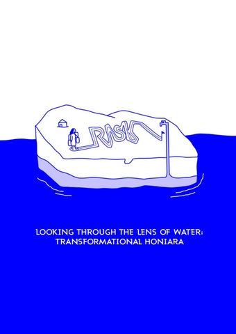
LOOKING THROUGH THE LENS OF WATER: TRANSFORMATIONAL HONIARA
SUBMITTED BY Yunqian Zhan s3715790 RMIT UNIVERSITY School of Architecture and Design Master of Landscape Architecture Design Research Project 2020 COURSE COORDINATOR Alice Lewis Jen lynch TUTORS Alban Mannisi Nov. 2020
ABSTRACT Pacific Island cities are at the front line of climate change and are facing the highest rate of urban population increase from the past century. Groundwater is the primary freshwater resource for islanders is threatened from seawater intrusion due to the sea level rise. The hydrological changes imply significant risks for society as inevitable consequences of future change require landscape architecture to stay abreast of consideration from social and ecological factors. The marginalized communities of Honiara in the Solomon Islands have complained about low water quality and inadequate water supplies for sixty years. However, there is a little solution in sight except for over-exploiting groundwater which accelerates freshwater contaminated as Honiara continues to grow. This project investigates the role of landscape architects as leaders and communicators. In the short term, provide alternative water resource and reconstruction of the site by introducing traditional cultural. In the long term, while improving the ecological environment and rebuild the existing tourism ecological assets. Relink the disconnection between Malaita settlers and Guadalcanal locals. Through combining asset-based community development, design activism, and ecological design to alleviate freshwater-related problems and raise awareness of people’s water use difficulties in marginal areas. Following a comprehensive analysis, voice identity and culture background of the population should be taken into consideration to build the relationship between the environment and the inhabitant. Beyond tangible and technical proposal, by acknowledging the construction of the environmental crisis through community sustainability. An adequate response to resolve the water supply and improve the quality of life for the community of Honiara.
Source: Jessica Douglas Koah Hill Village Viewpoint Honiara, Solomon Island
Contents 00 BACKGROUND ��������������������������������������������������������������������������������������������� 01 0.1 Introduction 0.3 Position 0.2 Client and stakeholders 0.4 Coastal hinterland
01 LANDING ���������������������������������������������������������������������������������������������������� 09 1.1 The tensions 1.2 Scoping resource 1.3 Quality of life 1.4 Research question 1.5 Theoretical framework
02 FINDING HONIARA ��������������������������������������������������������������������������������������� 33 2.1 Social capital 2.2 Physical capital 2.3 Transformational opportunities
03 SCHEMATIC DESIGN �������������������������������������������������������������������������������������� 47 3.1 Reuse 3.2 Mitigation 3.3 Cooperation
04 GROUNDING ����������������������������������������������������������������������������������������������� 73 4.1 Material 4.2 Establishment 4.3 Experience 4.4 Vision
05 CONCLUSION �������������������������������������������������������������������������������������������� 105 5.1 Reflection 5.2 Appendix 5.3 Bibliography 5.4 Acknowledgment
00 BACKGROUND 0.1 Introduction 0.2 Client and stakeholders 0.3 Position 0.4 Coastal hinterland
01
0.1 INTRODUCTION Small remote islands are the front line of climate change impact, urban expansion and finite resource crisis(Wong et al. 2014). In the Pacific Ocean, Solomon Island comprises six major islands and nearly 1,000 smaller islands that are environmentally and economically vulnerable, because of water resources limited due to social and environmental constraints (SOPAC, 2007). The insufficient cover of sanitation and waste service contaminate the surface water resource. Sea level rise makes the community more susceptible to freshwater contamination, seawater intrusion and flooding. The marginalized community who live in informal settlements zones are facing water shortage problem and have constrained access to sanitation infrastructure. The case study area is Honiara, the capital city of Solomon Islands. It located on the northwestern coast of Guadalcanal with 84,520 people are living in here. Honiara also has a large Peri-urban region where most immigrants settle in ISZ (informal settlement zone) which are minimally serviced. In the long term confrontation between water shortage and urbanism in Honiara, overexploitation groundwater will increase saltwater intrusion rate, which can cause groundwater contamination, ecological damage and people’s health problems. Water and sanitation deprivation linked to violence against women. Women and girls are vulnerable to rape and sexual harassment when they have no option but to walk considerable distances unaccompanied. Therefore, the city urgently needs an ecological sustainable ethic strategy
for resilient water use. Intervention strategy will carry out in cooperation with Honiara city council, Solomon Water, NGO Vois Blong Mere Solomon and the local community. The goal of the project is to control the surface water pollution source, water use efficiency and improve human well-being and ecological health. During the process, three UN sustainable development goals will be gradually achieved, which is clear water and sanitation, reduce inequalities, and sustainable city and community. In this project, multiple design techniques will be applied across different scales. In recognizing the agency of residents in shaping their environments of habitation and engaging in the project, residents are presented with options for levels of labour investment. Low investment for the household collects water and waste. Medium investment for the community sanitation facility. High investment for the coastline ecosystem urban space. Promote traditional cultural-educational board, cooperate with local NGOs and develop local tourist assets. Those interventions are relinking methods to repair the historical ethic tension between migrants settlers and Guadalcanal local people. By promoting the acknowledgment and respect of physical assets and social assets with the community, the ecological system plays a crucial role in the network function.
02
CLIENT
Honiara City Council states the city of resilience vision and identifies areas that are subject to environmental risks and to ensure developments within these areas respond to the environmental risks. In the Honiara local planning scheme, identify opportunities for future public projects that would improve the quality of life of the residents and developing economic activities in Honiara.
HCC Honiara City Council
03
STAKEHOLDERS
Solomon Water is a StateOwned Enterprise and provides municipal water and wastewater services in Honiara. Enhance communityintegrated water efficiency and maintenance regimes for water infrastructure. Explore feasibility of and interest in community-level investment in shared septic tank systems, co-funded by government.
SIWA Solomon Islands Water Authority
The National Disaster Management Office(NDMO) is the Secretariat of the National Disaster Council(NDC). Engaged with NGO’s and civil society ensure their involvement in the community awareness program.
UN-Habitat has been providing access to reliable data and information on urban conditions and trends. To help to identify Honiara community priorities and key vulnerabilities.
UN-Habitat
NDMO National Disaster Management Office MWCY Ministry of Women, Children and Youth MID Ministry of Infrastructure and Development VBMS is an autonomous NGO so that it can effectively represent Solomon Islands women and organization activities include lobby & advocacy, networking and capacity building/training.
VBMS Vois Blong Mere Solomon
MECCDM Ministry for the Environment, Climate Change and Disaster Management MHMS Ministry of Health and Medical Services MLHS Ministry of Lands, Housing and Survey
04
00 BACKGROUND
‘‘Every year, we are told that it is the hottest since the first weather recording stations were set up; sea levels keep on rising; the coastline is increasingly threatened by spring storms; as for the ocean, every new study finds it more acidic than before. This is what the press calls living in the era of an ‘ecological crisis.’’’ - Bruno Latour
05
0.3 Position
Human influence on the climate system and the role of anthropogenic emissions of greenhouse gases (GHGs) in global warming (IPCC, 2014a; 2018a). The rate of GHG emissions is at an all-time high (WMO, 2019).
40 35 30 25
(GtCO2)
(GtCO2/yr)
2000
Forestry and other land use Fossil fuels, cement and flaring
20 15 10
1500 1000 500
5 0
1850
1900
1950
2000
Global anthropogenic CO2 emissions Source: IPCC (2014a, fig. 1.5, p. 45).
0
1750– 1750– 1970 2011 Cumulative CO2 emissions
The coastal area is more vulnerable from the sea level rise, as shown through the map. More than 600 million people (around 10% of the world’s population) live in coastal areas that are less than ten meters above sea level (McGranahan et al., 2007) and these areas are increasingly urban expansion.
AREA IN THE WORLD VULNERABLE TO A RISE IN SEA LEVEL Major river deltas of the world (JM. Colman, 1981)
06
00 BACKGROUND
Sustainable Development Goal 6.4 By 2030, substantially increase water-use efficiency across all sectors and ensure sustainable withdrawals and supply of freshwater to address water scarcity and substantially reduce the number of people suffering from water scarcity, which is challenge particularly in Small pacific island countries.
S oc
nomic sec io-eco tor
s
Ecosystem
Human settlements
Sanitation Water
Energy
Agriculture
Sea level rise(SLR) is a major concern for many low-lying islands. It will affect the availability and distribution of water resources. Seawater/freshwater interface will move inland and decrease the investments of groundwater available (UNESCO-IHP/UNEP, 2016). Moreover, the impact of water shortage also directly through risks for socioeconomic aspect on the ecosystem, energy, food security and economic. Water management is crucial for climate-change sustainable development.
07
0.4 Coastal hinterland
Hinterland AS CO L TA C EN LU
F IN ON EZ E
Water Well
Wetland L TA
AS CO E
N ZO
Agriculture Area
SE A
AS CO L TA UE FL
IN E
ON EZ
NC
BEFORE SLR
E
Too much salt within the drinking water can lead to salt toxicity and cause high blood pressure to humans.
ON LZ TA AS CO
Plants die when the salinity is above the tolerance threshold.
SLR accelerate saltwater intrusion, which in some degree responsible for wetland deterioration as well (DeLaune & Pezeshki, 1994). A
SE
Besides animals and human beings, the decreases in agricultural production also show the impacts of the high concentration of salt in irrigation water.
AFTER SLR
08
01 LANDING 1.1 The tensions 1.2 Scoping resource 1.3 Quality of life 1.4 Research question 1.5 Theoretical framework
09
CHAPTER STATEMENT This chapter is a process to state how climate change hit the vulnerable community in Honiara. Through these questions, the leading project from the outside world to the more exact boundaries of a specific location. How does the pattern of tensions occur in Solomon Island at the forefront of climate change and large-scale migration? How does the pattern of tension occur in between migrants and inequity situation? How does the pattern of causes occur in Honiara of freshwater pressure due to climate change and urbanism? How the freshwater pressure hit the vulnerable community in Honiara?
10
01 LANDING
1.1.1 South pacific range Korea 2%
Japan 3% Indonesia 1% Philippines 0.2% Papua New Guinea 0.01%
China 28%
India 6%
Sinapore 1.5% Australia 1% Thailand 0.7% Malaysia 0.6% New Zeland 0.08%
Solomon Island 0.0005% 0
750
1500
3000KM
Âą
Co2 Emission (%total) Sea Level Change Since 1993(Cm)
0
4
8
12
16
Pacific Island Human Migration - Internation 11
Pacific Island Human Migration - Internal
20
1.1 The tensions The Solomon Islands are suffering from environmental injustice. The whole country’s carbon emissions account for a small proportion of the world, but it has suffered the worst consequences of climate change. Sea level rise causes the shoreline recession in the Solomon Islands. Five islands had vanished, and its effect the inner movement of migrant communities into urban and peri-urban areas from neighbouring islands. As a result, capital cities Honiara, face threats of environmental hazards as they grapple with the lack of adequate infrastructural services (ESCAP 2019).
Rapita Kale
Kakatina Hetaheta
Nuatambu
Sasahura Ite Sasahura Fa Sogomou Ite Sogomou
Choiseul
Zollies Rehana
Isabel Western
+1097
+1923 +2522
Malaita
Central
+13841
+3994
Honiara Guasalcanal
+1447
Makira-Ulawa
Solomon Island Province Population
Central 32,170
Isabel Choiseul Makira-Ulawa Western 34,550 35,870 54,000 97,200
Malaita 159,330
Guadalcanal 238,570
0
50
100
200KM
Âą
Island Experience Shoreline Recession Island Vanished Migration into Honiara/Guadalcanal (Line Thinckness = Scale of Migration) (1pt=1000pp/yr)
Data source: Co2 Data: Worldbank.org. 2020 Island information: Albert, Simon. 2016 Migration: Report on Migration and Urbanisation. 2009 12
01 LANDING
1.1.2 ISZs - Informal settlement zones
Informal settlement zones Road serves network
CRUZ NGGOSI
KUKUM
ROVE - LENGAKIKI
NAHA PANATINA
VUHOKESA MBUMBURU
Urban population growth pattern
VAVAEA
MATANIKO
VURA KOLA'A
Mataniko River
Overview
Vegatation Commercial area Healthland Local gov facility Healthy facility Storm 13
0
500
1000
2000M
±
1.1 The tensions Why people move into Honiara? Mostly migrants are indigenous from the other islands. Malaitans are the largest group of inward migrants (Report on Migration and Urbanisation. 2009). As the effects of climate change intensify, several islands have already been submerged. These islanders are climate refugee, have no options but to seek another place to live. City as Honiara as their destination. Another purpose of interprovincial migration is to obtain employment, receive higher education and receive better medical treatment and enabling political participate.
What the impact of inter-provincial migrants to Honiara? Population growth and increasing rural-urban migration have resulted in housing pressure and growth of these informal settlements in urban edges. Low and middle-income earners are lack of usable land to drive these trends. Another challenge is limited or no access to infrastructural services. Just over two-thirds of households have piped drink water in the Honiara urban area, but very few have this in the urban edges. These issues have increased inter-ethnic tensions. The ethnic tension escalated in December 1998 when the Guadalcanal Revolutionary Army, also known as Istambu Freedom Fighters, started an offensive of active intimidation against the Malaita settlers, resulting in a mass dislocation of people (Beest, D. van., 1999).
Main area
Live in ISZs
Step 1 Relief
Step 2 Improve
Vicious circle Poor quality of life
Resource shortage
14
01 LANDING
1.1.3 Honiara Existing Water Supply Condition Four boreholes as the main water supply for Honiara urban context. The service area for water supply extended outside the town boundary. However, the service area for sewerage is limited inside the town boundary. Due to the topography, 25% of residents in Honiara are suffering low water pressure problem. Some of the residents can not get any water during the peak demand hours in the daytime. With increasing pumping the groundwater policy, the speed of saltwater entry into Honiara aquifer will be increased and make groundwater contaminated.
Panatina bore field 3,664 m3/day
Rover Spring 1,759 m3/day
Mataniko Bore field 4,614 m3/day
Kombito Bore-field 1,931 m3/day
20M Contour Line
Water Distribution Pipelines
Saltwater Intrusion Sensitive Area Level 1 = Most sensitive Level 2 = Second sensitive
0 15
300
600
1200M
Âą
1.1 The tensions Next 5-10years
50
1000
40
800
<42%
61%
30
600
20
400
10
200
0
Population (thousands)
Now
Annual Urban Growth Rate (%)
0
1976
1985
1999
Solomon Island Annual Urban Growth Rate
2009
2020
2030
Honiara Population
2040
2050
Solomon Island Population
Alternative water sources By adding more water resource facility for the community. For example, rainwater catchment reclaimed wastewater and stormwater. In order to reduce the existing well water supply pressure.
Connection non-reticulated water supplies Non-reticulated water supply is any supply that is not piped to a business by a water utility or local government. For those area does not have access to a reticulated or town water supply. Increase the accessibility to the nearest safe water source.
Protect water source from contaminating Water contaminated include seawater intrusion, solid waste in the river or sea shore, waste outfall or water pull into the water resource.
16
01 LANDING
1.2.1 Critic add more boreholes
Proposed boreholes location Negative effect 0 Jan
Feb
Mar
Apr
May
Jun
Jul
Aug
Sep
Oct
Nov
Dec
50
100
150
200 Skyline boreholes 250
300 Naha borehole
Precipitation mm
350
Mataniko boreholes Depth of land subsidence
Flood zone
Flood zone broaden
Potential land subsidence area Geology alluvium
0 17
150
300
600M
Âą
1.2 Scoping resource The government in Solomon island proposed adding more boreholes which are standard water-resource management (JICA 2006). This strategy helps relief water shortage by expanding the service area in the short term. However, these are not sustainable management, especially for the coastal island. Accelerate saltwater intrusion into aquifer layer contaminated groundwater. Reduce water in the recharge area such as reservoir and stream. Lead land subsidence in alluvium geology layer (Usgs.gov). Expansion of the flooding influence area. The existing service area still limited to reach the ISZs (informal settlement zones) thoroughly, where the people in there are still far from the piped water and boreholes. Moreover, the alternative water resource for ISZs is necessary.
Limited scope of water service
Skyline boreholes
Naha borehole Water reservoir Water reservoir
Mataniko boreholes Groundwater movement
Proposed alternative water supply for ISZs
Saltwater movement
Water service ratio
Piped water
Informal settlement zone Perspective water service ratio
18
01 LANDING
1.2.2 Alternative water resource There are four primary water resources in Honiara. Include piped water, boreholes, river and rain tank (JICA 2006). Extreme rainfall in Honiara during November to March has a huge potential resource for water reuse (Nicholas et al. 2016). Harvesting and retaining stormwater on the riparian for public water reuse. Collect the surface runoff water for household water reuse. Make great use of rainwater as an alternative resource.
Potential water resource
1
2
3
Rain water catchment project by NGO Flood water division
Surface runoff
Informal settlement zone
Potential water collection range
0 19
150
300
600M
Âą
1.2 Scoping resource
Flooding
1
Flooding along the riparian can be collected. Heavy rainfall cause flooding
2 The volume of rainfall is enough to collect and reuse.
Source: Solomon Island Development Trust Rain water catchment project
Cooperate and engaged with local NGOs to deliver more rainwater tank.
3
ISZs in high terrain
Surface runoff can be collected especially for the ISZs in the slope area.
20
01 LANDING
1.2.3 Conservation crisis - riparian Security of water sources is essential to protect water sources from people contaminating the water sources in Honiara as well as in the water supply to their residences. Being a major river system in Honiara, the Mataniko River contributes significantly to river-derived ecosystem services in Honiara. The river plays a key role in the provision of aquatic food and domestic water use. Site along the Mataniko river has been polluted from excessive disposal and solid waste by residents. Use GIS weight overlay function between population density and stream density to speculate the waste density along the Mataniko river area. The main reason causes the waste problem is the lack of sanitation infrastructure and waste collection.
Waste density along water catchment areas
1 2
3
1= Low polluted stream area
Septic tank
2
Informal settlement zone
3 = High polluted stream area
Sewer line
0 21
150
300
600M
Âą
1.2 Scoping resource
1
Solid waste Human behaviours and waste collect infrastructure.
Raise awareness of sanitation including education.
2
Fecal pollution Most households in ISZs with no sanitary or toilet facility
Space for more public sanitation installation
3
Logging activity turbidity river
More vegetation to stabilize and purify the riparian sediment
22
01 LANDING
1.2.4 Conservation crisis - coastal In addition to the conservation crisis of water resources caused by human-made reasons, natural disasters will also pose a threat to water resources and ecological environment. Hurricanes will destroy vulnerable informal settlement zones. Therefore, the early warning system is needed to enable people to take refuge early. Sea level rise and coastal flood will also aggravate groundwater pollution. It is essential to reduce seawater intrusion and protect groundwater. The sea level rises to a certain level will submerge some buildings. During the long term evacuation process, some artificial or natural barriers are needed to block the seawater, and protect and provide ecological habitats which will be affected in the future.
3
1
2
3
4
Sea level rise in 2100
Informal settlement zone
Healthy facility
Groundwater movement
Storm
Saltwater movement New shoreline in 2100
0 23
150
300
600M
Âą
1.2 Scoping resource
1
Groundwater contaminated by saltwater intrusion
ter hwa s e r F
ater Seaw
Reduce saltwater intrusion speed
ter hwa Fres
ater Seaw
2
Building near the shoreline hit by storm and cyclones
Natural or artificial defence
3
The coastal ecosystem will degenerate due to sea-level rise
Protect and provided habitat by vegetation buffer
4
Strong wind to ISZs household
Warning system
24
01 LANDING
1.3.1Resource shortage impact daily life We have to go far to look for water. We just look for people have tanks and ask them if they will allow us to use some of it.
Alison Female Settlement in Urban Outskirts Women and children healthy Need near and clean water resource
There are days when the tap is dry and there is no water. We store water in plastic containers and try and manage the supply
Muliava Male Local pastor Community healthy and safety Need density water and sanitation
We cannot use the toilet during the day. It is an open toilet and the other families sit around, so there is no privacy
Ruth and her husband Female Resident of Henderson Settlement Women and girl’s safety and dignity Need improve social awareness 25
1.3 Quality of life
I was admitted recently to hospital after I suffered a miscarriage I didn’t use proper water and developed an infection and became ill. The doctor said I need access to clean water.
My little child has skin rashes all over her body from the water
The community has access to one communal tap for every three to four families which provides town supplied water during certain hours of the day
There are about three houses here which have proper sanitation, but most people use the nearby beach, even though it is not safe to use at night
Women and girls are vulnerable to rape and sexual harassment when they walk consider unaccompanied to get water
If there is no water available, men harass women because it is the role of the woman to go and find water
26
01 LANDING
1.3.2 How to improve quality of life for ISZs? The arc of the landing analysis indicates the disconnection of the marginalized community and urban centre. This disconnection not only depleted the nature resource but also of human well-being and quality of life. To achieve sustainable planning and reactivated the ISZs, it is necessary to understand the whole bioregional system and thinking. Local, regional, cultural, political, ecological and economic are woven into together and interconnected.
LANDING Disconnection environment Depleted nature resource and human well being and quality of life of marginalized community 1.3.1
LANDING Sustainable planning need to consider connection to natural resource, transport and social resource
Proposed walkable path
Proposed Water resource 1.2.2
Connected social resource
Sewage 1.2.3 LANDING Unsustainable planning for ISZs political neglect sewage/ sanitation/ pipeline/ transport
Pipeline service area 1.2.1
Cut off transport
12 11
13
3 National Hospital
2
Ministry Of Healthy Administration
3
Solomon Islands Red Cross Society
4
Solomon Water
5
Ministry Of Infrastructure And Development
6
Honiara City Council
7
National Disaster Management Office
8
National Parliament
27
4
9 2
1
0
250
500
1000M
Âą
1
5
N
1.3 Quality of life FINDING In order to reconnected,reactivate ISZs to core center. It need to understand the whole bioregional system which interconnected with local and regional cultural, political, ecological and economic landscape 2.1.1
FINDING Bioregional thinking respect stewardship place, local knowledge, the need for the active voice of ISZs community.
Urban Regional Local
Social link 2.1.2
Cultural link 2.1.3
Ecosystem link 2.2.1
7 8
FINDING Ecological sensitive design Urban provide economic opportunity to promote local economic
Economic link 2.2.2
6
5
10 9
Vois blong mere
10
World vision international
11
Development service exchange
12
Solomon island development trust
13
Honiara conference center 28
01 LANDING
RESEARCH QUESTION How to mitigate water-related health crises with consideration of ecological functions and sustainable design in Honiara? How to promote greater sensitivity toward the specific cultural values and well-being of those marginalized in Honiara?
Source: Ata Tara 2019 Honiara, Solomon Island
29 Source: Ata Tara 2019 Honiara, Solomon Island
1.4 Research question
Source: Ata Tara 2019 Honiara, Solomon Island
After literature review, design activism will be the powerful motivation to cope with social environment issue. The theoretical framework of this project will be established on this concepts: - Design activism -Sense of place -Asset- based philosophy - Ecological design
30 Source: Ata Tara 2019 Honiara, Solomon Island
01 LANDING
DESIGN ACTIVISM
ASSET-BASED COMMUNITY DEVELOPMENT
Recognizes and honors a community’s assets
Social resource
Physical resource hydrology geology land history
Skill, knowledge, strengths, value Hierarchy XL
Biological diversity, natural processes
L M S XS Bioregion
Branch
Connection DESIGN ACTIVISM: These designers and planners use design as a tool of social action and transformation. And is a method that promotes a vigilance that is required to transform participation of the voiceless and faceless (Dean, Andrea Oppenheimer, 2001) 31
Along with Design Activism, there is a need to understand a key concept in the field of Community Planning and Development, and that is Asset- Based Community Development, also known as ABCD. (Kretzman & McKnight, 1993)
ASSET-BASED COMMUNITY DEVELOPMENT is to exchange the typical focus on needs and deficits of a community, and replace it with a list of all the assets present in the community and vital to its development. The outcome of this more positive approach is that the community then becomes aware of its capacities, skills, strengths and empowerment. (Kretzman and McKnight. 1993)
1.5 Theoretical framework
SENSE OF PLACE
Explore people’s fundamental connection to place
Environment’s ecological heath
Human health
Healthy and enjoyable places
Shifting grounds What is depleted? What is misused? What is not recognized?
Quality of life
Enable to form a powerful voice, economic sustainability, physical and emotional health
Improve ecological condition
Reuse
Mitigation
ECOLOGICAL DESIGN practice is strengthened by our goals and objectives, as planners and designers to learn from ecological systems, to mimic, and attempt to replicate the processes and forms that heal and enhance life for all human and non-human networks. (Rottle, Yocom. 2010)
Enhancement
Basic human right
ECOLOGICAL DESIGN
Cooperation
People’s SENSE OF PLACE along with its correlation to an improved sense of well being, to a sense of mental and physical restoration, to enhanced quality of life, and an improved sense of stewardship—are all part of understanding of sense of place. These ideas are all part of the multi-dimensional meanings of sense of place. (Steele, 1981)
SENSE OF PLACE can be defined in relationship to a built environment considering the greater natural environment of place. (Stedman, 2003) 32
02 FINDING HONIARA 2.1 Social capital 2.2 Physical capital 2.3 Transformational opportunities
33
CHAPTER STATEMENT In this chapter, Asset-based Design approach will be used to analysis of the space. The bioregional thinking is essential called to address the missed opportunities of the land and reactivate non- integrated community of obvious and concealed character. The history of land reveals the cultural heritage, skills for problem solving and women networks of mutual support. Indigenous knowledge to forecast the climate to let community prepare for the disaster. Land-use change from colonial directly impacts the vegetation degraded, especially coastal vegetation. This area is an opportunity for environment builder to reinforce economic landscape.
34
02 FINDING HONIARA
2.1.1 Historical reasons of marginal communities isolation
WW2
1942 American
1946 British
1960
1998 Ethic tension
Yx5
NGGOSI
ROVE - LENGAKIKI
MBUMBURU
CRUZ NAHA
VAVAEA
KUKUM
VUHOKESA
PANATINA
MATANIKO VURA KOLA'A
Now 35
Datum
2.1 Social capital Based on the location of existing boreholes and rivers in Honiara, three sections lines cut through the main features in the landscape. The section lines are exaggeration five times in vertical which is y-axis to show the features and topography more clear. Offset the section line to represent its forms at a key moment in the past from world war two to ethic tension. The Mataniko river area from no man land gradually become the city centre. The ethic tension reveals the indigenous community from Malaita settlers encounter discrimination and injustice. Women as a new power to ease the conflict and provide important vehicles for social organization and action.
2,000 Malaita labors
Guadalcanal Revolutionary Army deeply embedded resentment to Malaita settlers
Guadalcanal local
Labors from Fuji, China, and India
ISZs
One talk one tribe People united by their own particular language 25% Malaita of whole 124,000 population Women are busy to do heavy duty. Man just did easy job. Aggressive Young people
Not enough schools and no jobs for young people
Need an inclusive space for connectivity different ward As labor to manage and construct this place
Women Peace group meeting Women as new found power by standing the parliament
Japanese camp
Rainwater tanks
No man’s land
Boreholes
Crop production
Violent of ethic tension
Supply and transit base New house Business Chinatown bridge
Use cultural, ecosystem, economic potential linkage to establish the connection.
Immigrants Road expansion Cut line 36
02 FINDING HONIARA
2.1.2 Social link - Women voluntarism network Young Women’s Christian Association
Solomon Islands Christian Association Federation of Women
Government facility WDD
Vois Blong Mere
Education
Floral Art Association
al idu Indiv
ra co Honia
se
rv
it y un mm rv se
ice
s
37
io n zat ani Org
The modern women’s groupings in the Solomon Islands can be traced back to the first settlers on the island shores. In several areas, women organized themselves into groups for work, recreation, and ritual activity long before traders, missionaries, and colonizers arrived (Pollard, A.A. 2003). As neglected potential social assets, women’s grouping can provide important vehicles for social organization and action. They contributed to the education of their children. They know more about soil and forest their garden increase home income. They also know the knowledge related to health and about indigenous methods in local treatments for disease.
Health
Media
National NGOs Women’s programs and projects Women’s associations Local facility
Medium
Individual concern
Issues and aims
ice
2.1 Social capital Solomon Islands National Council of Women
Women For Peace Group
Community leader Local pastor Rural Women’s Skills Development Program
Voice out
Home economic
Honiara City council
Supsup Garden
Family Support Centre
Solomon Islands Women’s Information Network
Women’s Initiative Program
38
02 FINDING HONIARA
2.1.3 Cultural link - Indigenous knowledge of weather and climate
The Blue Water tree loses its leaves before dry season begins (Plotz et al. 2013).
Restore coastal ecosystem provide habitat for marine plants and animals
Turtles lay eggs amongst trees before cyclone season (Chambers et al. 2013).
If the Anakwae is flying and return to the sea that tells us that the sea is fine and that it will be a fine nice day for sea travel and fishing (NDMO,2017).
If the sea birds called Anakwae is stand at the sea shore, that tell us the outside of the sea is not good and conditions are not favourable to do fishing (NDMO,2017).
39
2.1 Social capital Indigenous knowledge from Malaita settlers passed orally from generation to generation. They are sing behaviours of plants and animals to predict the weather. This knowledge remains useful for the disaster preparedness for today.
when a group of Frigate birds are flying onto the sky it means there is a storm coming after 2 - 3 days or after 1 week (Fanega 2018).
There is a tree called the Rara tree, during the months of April to May, the tree flowers and when its flowers fall completely to the ground, rain and wind will come two weeks after. The Rara tree is remind us that rainy season is near (NDMO,2017). Vines (betel nut) If the leaf dies , from all the sun it indicates rain will come soon (Fanega 2018).
Blue water tree and Rara tree can be plant along the river to let people know when the dry and rain season are coming. And provide habitat for Frigate birds. Education board
Seagull birds flying at the coastline of the island facing the ocean it tells people strong wind is coming (SPREP 2019).
40
02 FINDING HONIARA
2.2.1 Ecosystem link - Forest life and deforestation Solomon Islands are one of the most biologically rich archipelagos on earth. Larges number of animals and plants found there are endemic, meaning they are found nowhere else on earth. These species are close link to the cultural, livelihood and people well-being. However, the deforestation caused by human activity, logging and land-use change harm the environment. We should provide valuating ecosystem service in the coastal area, urban green space and river to input value for economical purpose.
Resident and commercial areas in 1966
Degraded lowland rain forest
Migration speed low species
Land use change and degraded time lines
Resident and commercial areas in 2020
Migration speed high species
1
1
0 41
150
300
600M
Âą
2.2 Physical capital
The American invasion of Aerial photo of Point Cruz, Honiara, Guadalcanal began on 7 Aug. 1942. 1950s Source: United States National Source: Patrick Barrett Archives and Records Administration
Aerial photo of Point Cruz, Honiara, 2020 Source: Google earth
Point Cruz and the business center of Honiara, 2007. Source: Clive Moore Collection
Habitat
Ultra basic Forest
Grassland
Riverine forest
Beach forest
Section 1-1 in 1950s
Habitat
Degraded rain forest on hills
Degraded lowland rain forest
Habitat provision Section 1-1 in 2020
42
02 FINDING HONIARA
2.2.2 Economic link - Tourism assets Unique natural view and diverse flora and fauna attract many foreign visitors to Honiara to enjoy the natural beach beauty and go diving. Expect that, there are lots of opportunities to peek at Solomon Island’s cultural heritage. Melanesian cultural festival and Spear Dancing Festival displays variously experienced throughout the year. As well as local experience life, vendor market at the park can provide local tourism food and opportunity to communicate with local people. Sustainable economic activity can provide employment and income in both urban and rural areas. The strategy is focus on a limited number of areas that have high tourism potential and existing tourism products.
Street market
Existing market
Informal stall
Spear Dancing
Traditional dance Tamate
Propose tourist line 0
43
150
300
600M
Âą
2.2 Physical capital
Short term priority - Decentralized market options across the city. Increase space and accessibility through the site for informal stall and street market. - Reinforcement of the country’s unique cultural and handicraft, which is the tourism asset in their own right. - Reforest habitat and promote traditional knowledge and bird watching market value by improved signage.
Medium term priority - Improve the construction of coastal landscape belt and increase the interaction between the tourist and coastal activity. - Support local cultural development, especially traditional dance show.
44
02 FINDING HONIARA Socialenvironmental History
Analysis
Traditional knowledge
Volunteer network
Hydro geological
Vegetated terrestrial areas
Assets
Community and women network
Actions
Alternative drinking water
Visions
Improve health and enhance quality of life
45
River and stream
Forecast weather knowledge
Control pollution
Resilience city
Reduce risk
Natural ecosystem
Corporate education
Support social interactions
2.3 Transformational opportunities
46
03 SCHEMATIC DESIGN 3.1 Reuse 3.2 Mitigation 3.3 Cooperation
47
CHAPTER STATEMENT This chapter shows the iteration of the design techniques to achieve three goals. Firstly, Harvesting and reusing rainwater, greywater and wastewater through rain gardens, phytoremediation, roof tank and permeable alleys. Secondly, rebuild resilient public parks at the riverside abandon area and coastal zone to mitigate the impact of natural disasters. The function of the resilient parks has rainwater collector and infiltration, create new habitat areas, provide sanitation area, education area and play area. Finally, the social link for the neighborhood help and warning climate disaster. Center speaking area as the place for the NGOs to hold voluntary meeting. Planting program help restore coastal ecosystem and boost local economic.
48
03 SCHEMATIC DESIGN
0 49
150
300
600M
±
5.1 Reuse
5.2 Mitigation
5.3 Cooperation
Water harvesting Water purification
Riparian enhancement Coastal enhancement
Planting program Water care activity
Low
Medium
High
Scale
Now
Near future
Future
Time
6.4 By 2030, substantially increase wateruse efficiency across all sectors and ensure sustainable withdrawals and supply of freshwater to address water scarcity and substantially reduce the number of people suffering from water scarcity
11.5 By 2030, significantly reduce the number of deaths and the number of people affected and substantially decrease the direct economic losses relative to global gross domestic product caused by disasters, including water-related disasters, with a focus on protecting the poor and people in vulnerable situations
10.2 By 2030, empower and promote the social, economic and political inclusion of all, irrespective of age, sex, disability, race, ethnicity, origin, religion or economic or other status
50
03 SCHEMATIC DESIGN
3.1 Reuse Water harvesting + Water purification What the source of water can be collect and reuse? 1.Stormwater, precipitation and run-off. Honiara rainfall is driven mostly by the West Pacific Monsoon during the wet season from November to April. The monthly average rainfall is about 250mm in the monsoon. 2. Treatment of greywater – typically combined with wastewater, but this can sometimes be separated and reused.
What is low, medium and high investment? In acknowledging the agency of residents forming their environments of habitation as well as the existing living systems, residents are provided with options for levels of investment within the pooled water and reuse process.
Where to carry out water collect and reuse process? From two different scale, low investment means the household scale which needs the family member as an actor and labour for recycling and reuses water process. The medium investment represents the community scale.
Low investment Actors: Family/Household
51
Medium investment Actors: Village/sub-ward/ neighborhoods
3.1 Reuse ISZs
Meshing
Prototype
52
03 SCHEMATIC DESIGN
3.1.1 Low investment Technique for water harvesting Collect and reuse of rainwater on-site by passive and active approaches. Active approaches include the capture and retention of runoff generated by roofs and tank. Residents can store water and used to supplement water supply during drier periods. Passive approaches include prepare of organic soil that collects precipitation and runoff in planting bed. These water can be collected, bio-filtered and absorbed by plant root cleansing off residue and other toxic. These gardens retain and infiltrate rainwater during wet periods, but dry out after the monsoon ended.
53
Type 1: Linear buffer
Type 2: Rain garden
Source: Stormwater/road surface
Source: Rainwater/run-off
Function: Passive
Function: Passive
Cost/maintain level: High
Cost/maintain level: Medium
Type 3: Biofiltration tank
Type 4: Cistern
Source: Rainwater/greywater
Source: Rainwater
Function: Active
Function: Active
Cost/maintain level: Medium
Cost/maintain level: Low
3.1 Reuse Prototype Type 1 to reduce runoff in monsoon and plants tunnel help purify the water to get ride-off the extra sand and impurities. Type 2 help collect the water from the uneven road in the ISZs and also provide areas where develop family farming. Type 3 and 4 in the middle of ISZs, it is necessary to take advantage of the abundant rainfall in monsoon in Honiara, collect rainwater and reuse it. Type 2
Type 2
Type 1
Type 1
Type 3/4
A
A
Section A-A
54
03 SCHEMATIC DESIGN
3.1.1 Low investment Indigenous methods water purification For Indigenous peoples, especially women, respond to protect and nurture water. Water is not only for drinking but also has traditionally been used in agriculture, to grow medicines, and for cleansing. The result of colonization has led to a disconnect in the intergenerational transfer of knowledge surrounding water (Kate C. Shianne M., 2016). Improving drinking water quality at the household level is essential to draw attention to water issued faced in a marginalized community. Moreover, exposing the inequities in the involvement of women in water governance. Many technologies have been developed to treat wastewater. High-cost maintenance makes it unable to implement in developing countries in the short term. However, nature has an astonishing way to rejuvenating itself. Indigenous knowledge indicates that several plant species can be used as a coagulant and disinfectant for water treatment (Megersa et al. 2014).
Greywater
Clean water
Low investment strategy
Linear buffer
55
Biofiltration tank
Rain garden
3.1 Reuse Local plants that filter water Six Solomon Island local plants play a part in cleaning water by absorb nutrition, bacterial, metal and chemicals.
Juncus effusus
Scirpus atrovirens
Absorb: Bacteria, oil, zinc, copper, cobalt
Absorb: E.coli, Salmonella, nutrient, oil
Habit: Herbaceous ca. 60~80 cm tall; fruits brown
Habit: Herb, ca. 1 m tall, fruit blue
Habitat: Open places, roadside, wet place
Habitat: Under forest
Maintenance: Low
Maintenance: Low
Soil: Sandy, loamy or clay
Soil: Sandy, Loamy
Centella asiatica
Typha latifolia
Absorb: Zinc, copper and lead
Absorb: Zinc, cadmium, lead, nitrate
Habit: Herbaceous, procumbent
Habit: Shrubs, 3 m high
Habitat: Pathside, edge of forests, coast
Habitat: Wet lands
Maintenance: Low
Maintenance: Medium
Soil: Sandy, loamy or clay
Soil: Light (sandy), medium (loamy) and heavy (clay)
Nymphaea sp.
Ceratophyllum demersum
Absorb: Heavy mentals, algea
Absorb: waste residue and toxic substances
Habit: Aquatic herbaceous; flowers pink Habitat: Roadside, edge of forests and in pond Maintenance: Low Soil: Pure clay or mixture of clay topsoil
Habit: Herbs Habitat: Wet lands Maintenance: Medium Soil: light (sandy), medium (loamy) and heavy (clay)
56
03 SCHEMATIC DESIGN
3.1.2 Medium investment Test for water harvesting Type 1 Linear gathering
Low
Medium High
Water collection ---------------------------------Construction cost ---------------------------------Planting number ---------------------------------Site requirement ----------------------------------
Type 2 Node gathering
Low
Medium High
Water collection ---------------------------------Construction cost ---------------------------------Planting number ---------------------------------Site requirement ----------------------------------
Type 3 Slope gathering
Low
Medium High
Water collection ---------------------------------Construction cost ---------------------------------Planting number ---------------------------------Site requirement ----------------------------------
57
3.1 Reuse Mataniko Ward
58
03 SCHEMATIC DESIGN
3.1.2 Medium investment - Mataniko ward
5 1
5
1
4
4
3 2
1 5 1 4 2
4 3
2
59
3.1 Reuse
3
3 1
4 2
5
4 2
5
3
1
3
5 4
2
Water pollutant level Significantly Moderate Slightly
1 2 3 4 5
Wetland absorb surface runoff Purification plants Water kiosk Inclusive and recreation activity area New toilet place
60
03 SCHEMATIC DESIGN
Reuse precedent study - Waitangi Park Name: Waitangi park Location: Wellington, New Zealand Designer: Wraight Athfield Landscape + Architecture Ltd
New Zealand
Wellington
Wellington Harbour
Local plants Cistern
Pump station
Park lane
Wetland channel
Wetland surface
Key features of this project: Cyclical approach
+
Related largest hydrological system
Critic and improvement: More focus on the clean the water but lack of water harvesting process. Instead of using the pump to transfer the polluted water, use typography to gather polluted water may be more sustainable.
Sustainable water harvest 61
+
Use local plants
Water need more filtration process, not only the wetland. It has potential to expand the water use range. Otherwise, the filtrated water only can be used for irrigation.
Expand water use range by more rigorous filtration for waste water and sewage water.
3.1 Reuse
Reuse precedent study - Yarkon River Rehabilitation Name: Yarkon River Rehabilitation Location: Tel Afek, Israel Designer: Ayala Water & Ecology Ltd
Israel
Tel Afek
NBS biological treatment pools
Yarkon River
Key features of this project: NBS=Natural Biological System
+
Low maintenance costs
Water harvesting
+
On-site water resources are all included
Water - Bio Swale
Phytoremediation
NBS approach for sustainable water treatment and management
62
03 SCHEMATIC DESIGN
3.2 Mitigation Riparian enhancement + Coastal enhancement Why need riparian and coastal enhancement? It is a disaster management technique that will be adopted by people, in order to reduce the flooding, storm, sea-level rise impact on the environment and human life.
What methods will be used in enhancement process? Indigenous knowledge as a technique to prepare for the arrival of monsoon days from November to March. Vegetation buffer to prevent major damages.
How this impact to human and environment? Same cultural background help links Guadalcanal local and migrants from Malaitans. Reforest process will provide habitat for flora and fauna, which improve ecosystem service and input value for economical purpose.
Medium investment Actors: Village/sub-ward/ neighborhoods
63
High investment Actors: City dwelling
3.2 Mitigation Kola’a Ward and Vuhokesa Ward Park
64
03 SCHEMATIC DESIGN
3.2.1 Mitigation in medium investment - riparian
Flooding
Levees to alternating inundation by flooding
Flooding
Plants community diversity to improve capacity for soil water storage and preservation
Flooding Accessible pedestrian transportation connects ISZs and urban centre. Center speaking area at the pedestrian cross for social activities.
65
3.2 Mitigation
A
4
5
3
1
Traditional knowledge education area
2
Habitat buffer
1
2 A
3
Parking area
4
Centre speaking area
5
Child activity place
Hydrophilic platform
Centre speaking area
Habitat for birds watch Weather Water tolerant and street market forecast trees species
Mataniko river
Section A - A 0
40
80
160M
Âą
66
03 SCHEMATIC DESIGN
3.2.2 Mitigation in high investment - coastal
Low
Medium High
Prevention of inundation ------------------------------Construction cost ------------------------------Valuable habitat ------------------------------Maintenance cost -------------------------------
Traditional seawall
Low
Medium High
Prevention of inundation ------------------------------Construction cost ------------------------------Valuable habitat ------------------------------Maintenance cost -------------------------------
Dune fences
Low
Medium High
Prevention of inundation ------------------------------Construction cost ------------------------------Valuable habitat ------------------------------Maintenance cost ------------------------------Rock wall
Low
Medium High
Prevention of inundation ------------------------------Construction cost ------------------------------Valuable habitat ------------------------------Maintenance cost ------------------------------Mangroves forest 67
3.2 Mitigation
1 3
2 4
1
Front rock protection
2
Mangrove forest
3
4
Coastal habitat
Foot path
Native vegetation seeding Mangrove seeding Temporary fence protect establishing dune Front rock protection to protect mangrove seeding Initial state
Native vegetation planting Mangrove planting
Foot path
2050
Planting program Mangrove forest as natural defense
2100 0
40
80
160M
Âą
68
03 SCHEMATIC DESIGN
3.3 Cooperation Planting program + Water care activity What the principle for cooperation? Develop a bottom-up engagement approach. Promote of non-written communication to reach all member of the community. Bring the benefit for the local economy.
What methods will be used in cooperation? Delivery mechanism: post, radio, dance show, newsletter, social media. Direct intervention: Government, NGOs and women groups provided the platform and organized a system to attract tourist to plant mangroves along the coastal.
Who will be involved? Local government, Ward councillor, Community representatives/ leader, Youth workshop, NGOs and community.
69
Tourism asset - Planting mangrove
Outdoor forum - Water care activity
Social cohesion - Melanesian cultural festival
Home-based economic activities - Free Market Zone
3.3 Cooperation
Planting program
Adapted mangroves seedings
Sowing in wet top soil
Keeping soil muddy by brackish water
Setting reforestation shop
Mangrove selling volunteer agency
Move into container and fill seawater
Volunteers and visitors
Purchase and donation
Planting mangrove in the coastal
70
03 SCHEMATIC DESIGN
Outdoor forum - Water care activity
Gathering and talk
More sitting area
Accessible
Outdoor forum
71
3.3 Cooperation
Festival
Sand dance space
Local wooden carving
Audience viewing area
Market Local trees to create nature buffer and shade
Grass material
Street stall space
72
04 GROUNDING 4.1 Material 4.2 Establishment 4.3 Experience 4.4 Vision
73
CHAPTER STATEMENT With the further developing the four different real scale site in Honiara, to consider the schematic design will better integrate with the existing vegetation, building, road material, contour, and other natural condition. During the establishment process, it was shown how the local community engaged with the facility. It gradually achieves the ambition of water reuse, space for cultural meeting, appreciate traditional knowledge, and increase potential economic opportunities for women.
74
04 GROUNDING
4 3
1
2
0 75
150
300
600M
±
4.1 Material
1 Koah Hill Village
Loose gravel, grassland Ferns, shrubs, local timber
2 Mataniko Ward
Loamy soil, low land forest, canopy, palms, vines, epiphytes, gingers
3 Vuhokesa Ward Park
Alluvium, concrete, riverine forest
4 Kola’a Ward
Sandy soil, palms
76
04 GROUNDING
1 Koah Hill Village
Existing tree
Bluewater tree
Rain garden
New foot path
Biofiltration tank
Linear buffer
Rare tree Existing brush
Existing building
Vinesc Betal
Grassland restoration
New toilet
Existing road
Juncus Effusu
Rainwater tank
Waste bin
5m contour 77
Canarium Indicum
0
15
30
60M
Âą
4.2 Establishment
Dry season
Rainy season
Rainy water
Centella asiatica Nymphaea sp.
Ceratophyllum demersum
Block in
Centella asiatica Nymphaea sp.
Ceratophyllum demersum Daily grey water
Draw out
Purified water
Biofiltration tank working system
0
5
10
20M 78
04 GROUNDING
2 Mataniko Ward
Existing tree
Bluewater tree
Grassland restoration
New foot path
Rare tree Existing brush
Existing building Existing road 5m contour 79
Canarium Indicum
Linear buffer Purification plants
New toilet Waste bin
Vinesc Betal Water kiosk
Sand playground
Juncus Effusu 0
15
30
60M
Âą
4.2 Establishment
1 year
Bluewater tree Sapling
Local labor
Construction facilities
5 years Bluewater tree Wetland adventure Young
10 years Bluewater tree Ecological habitat Mature for indigenous species
0
5
10
Sand playground
People can fetch water in water kiosk
Open space for festival events
Purification plants grow
Use local plants as cyclical approach for water reuse was established
20M 80
04 GROUNDING
3 Vuhokesa Ward Park
Existing building
Bluewater tree
New foot path
Existing road
Rare tree
Parking
Canarium Indicum
Centre speaking area
Vinesc Betal
Waste bin
Grassland restoration 5m contour
0 81
15
30
60M
Âą
4.2 Establishment
1 year
0
Local labor
5 years
Center speaking area
10 years
Center speaking area
5
10
Construction facilities and plants
Water tolerant Hydrophilic platform species
Habitat for birds watch Water tolerant Mataniko river and street market species water level rise
20M 82
04 GROUNDING
4 Kola’a Ward
1 year
2050
2100
Front rock protection
Sea level rise front line
Grassland restoration
Existing road
Mangrove forest planting grid 83
New foot path Temporary fence
Mangroves
Seedling selling shop
Vinesc Betal
Sand ground
Bluewater tree
5m contour 0
70
140
280M
Âą
4.2 Establishment
Rock fence Bruguiera gymnorhiza Sapling
1 year
2050
New foot path
2100
0
15
Malatain cultural festival
30
Seeding selling shop
Dune
Bruguiera gymnorhiza Young
Bruguiera gymnorhiza Mature
60M 84
04 GROUNDING
1 Koah Hill Village
Linear buffer
85
Accessible foot path
4.3 Experience
Traditional knowledge education board
86
04 GROUNDING
1 Koah Hill Village
Linear buffer collect runoff
87
Rara tree’s flowers fall indicate strong ra
4.3 Experience
ain will come
88
04 GROUNDING
1 Koah Hill Village
Planting mangroves in backyard
89
Rain water tank increasing household water sources
4.3 Experience
Biofiltration tank collect water from roof and greywater
90
04 GROUNDING
2 Mataniko Ward
Biofiltration tank collect water from roof and greywater
91
New toilets and waste bins
4.3 Experience
A large amount of water for community use
92
04 GROUNDING
2 Mataniko Ward
Accessible foot path for women selling mangroves seeding
93
4.3 Experience
Increasing community water sources
Open space for diversity cultural festival
94
04 GROUNDING
3 Vuhokesa Ward Park
Local people selling nuts
95
Create shade for informal stall
4.3 Experience
Weather forecast trees promote traditional cultural heritage
Enjoy the scenery along the Mataniko river on the hydrophilic platform
96
04 GROUNDING
3 Vuhokesa Ward Park
Tourist ask for directions
97
4.3 Experience
Central speaking area discuss weekly events
Family take a walk
98
04 GROUNDING
4 Kola’a Ward
Mangrove’s planting grid
99
Tourist enjoy the planting program
4.3 Experience
Melanesian cultural festival
100
04 GROUNDING
4 Kola’a Ward
Mangrove seeding
101
Tourist enjoy the coastal landscape
4.3 Experience
Mangrove seeding shop’s balcony
Tourists plant mangroves
102
04 GROUNDING
Mataniko W
K
Vuhokesa Ward Park
103
Ward
4.4 Vision
Koah Hill Village
Kola’a Ward
Flood zone Sea level rise in 2100
104
05 CONCLUSION 5.1 Reflection 5.2 Appendix 5.3 Bibliography 5.4 Acknowledgment
105
REFLECTION THE GAP IN RESEARCH The age range of interviewees is limited. Therefore, we cannot hear the attitudes and voices of all ages on social injustice. Transformational Honiara: looking through the lens of water takes landscape architecture as a leading potential to explore how landscape design can integrate with the complex socioecological condition with a new transforming design framework. The project framework is based on the sense of place, focusing on the value of asset-based design and the experiment of design activism. However, in the construction process, the project relies mostly on the cooperation of local sponsor groups and the government. Therefore, Transformational Honiara: looking through the lens of water lacks a level of specificity necessary to claim that the proposal would succeed confidently. The assumption has been made in the degree of public participation for better articulate the ambition. For the cooperation and coordination of city stakeholders and NGO, more specific strategies and follow-up cooperation are needed. For example, the investment in water recycling in ISZs and whether the residents are willing to participate in it will determine the success of the project. In this regard, there is also a lack of project introduction to the local people. In the preliminary analysis, according to the previous JICA data, the residents’ enthusiasm for water reuse and optimization projects is very high. At the same time, the measures are taken by the Environmental Health Department also need to be followed up in the later stage, such as building water-friendly toilets and optimizing the garbage collection system. In the implementation phase, other disciplines
cooperate to re-examine the possibility of reusing local materials. Thus, Transformational Honiara: looking through the lens of water for landscape architecture as leadership potential, as a research framework for water resources issues and ecological health in marginal communities. SCOPE AND LEARNING Through the Transformational Honiara: looking through the lens of water, my opinion towards Landscape Architecture has shifted. During my project A, I think the advantage of Landscape Architecture is to bring a series of intellectual approach. There is no doubt that functional and engineer design can solve a real-life problem. Over the past years, I have become genuinely convinced that there an urgent need for the creators of built environments to act responsively and justly. Landscape architecture inherently responds to human conditions and ecological systems. In the process of exploration, projects for the most disenfranchised communities need to value the knowledge of cultural and social. Water and sanitation pose the greatest obstacle to a sense of ownership by the communities and sustainable interventions. Lack of prior knowledge about indigenous peoples’ beliefs and values related to water, sanitation, health and hygiene helps explain a large part of the failures of many interventions. Through this project, it informs me as a future practitioner, instead of solve and fixes the problems, Landscape architecture, at is core, always needs to respond to nature within ecological and social parameters.
106
05 CONCLUSION
IAP2 International Association of Public Participation This diagram is shown of specific actions that were identified through local stakeholders engagement process. Use the IAP2 spectrum to identify the most important local action as well as serious of community workshops and NGO. The potential action are grouped to the investment scale, which relates to urban planning, water, sanitation and governance process.
Inform
We will keep you informed.
Consult
We will keep you informed, listen to and acknowledge concerns and aspirations, and provide feedback on how public input influenced the decision.
Involve
We will work with you to ensure that your concerns and aspirations are directly reflected in the alternatives developed and provide feedback on how public input influenced the decision.
Collaborate
We will look to you for advice and innovation in formulating solutions and incorporate your advice and recommendations into the decisions to the maximum extent possible.
Empower
We will implement what you decide.
107
5.2 Appendix Low investment - Water reuse project and clean drinking water access for all residents in ISZs. - Accessible foot path. - Improve climate-related health awareness. HCC – Honiara City Council MID – Ministry of Infrastructure and Development SIWA – Solomon Islands Water Authority SIDT – Solomon Island Development Trust MWCY – Ministry of Women, Children and Youth Community leader Medium investment - Climate-resilient and functional public and critical infrastructure. - Access to essential services with development of efficient road network. - Reduction in coastal/river pollution. - Revegetation & protection of existing urban forest, vegetation and ecosystem assets. HCC – Honiara City Council MLHS – Ministry of Lands, Housing and Survey MID – Ministry of Infrastructure and Development SIWA – Solomon Islands Water Authority MECCDM – Ministry for the Environment, Climate Change and Disaster Management Community leader
High investment - Promotion of non-written climate communications to reach all members of the community. - Reduce community violence. - Improve health awareness. - Empowerment of women, youth and other disadvantaged groups. HCC – Honiara City Council MECCDM – Ministry for the Environment, Climate Change and Disaster Management MID – Ministry of Infrastructure and Development VBMS – Vois Blong Mere Solomon NDMO – National Disaster Management Office Community leader UN-Habitat
108
05 CONCLUSION
Water reuse project brochure
150-200mm RIVER ROCK MINIMUM DEPTH100mm SHRUB PLANTING MANGROVE SEED 200mm-300mm SANDY LOAM TOPSOIL CONCRETE TUBE
BRICK PAVING
600x1000mm TRENCH FILLED WITH CRUSHED STONE MIXED WITH LEAF COMPOST WELL DRAINED SUBSOIL MATERIAL 300mm DIA PERFORATED PIPE
HOW TO BUIL
D A RAIN GAR
DEN
DIA PVE PIPE
BIORETENTION PLANTS
WATERPROOFING PLANTERS WALL OVERFLOW DRAIN DIA PVE PIPE BIORETENTION SOIL SOILED PIPE TO OUTLET
COMPACTED SUBGRADE
HOW TO BUILD
109
A BIOFILTRATIO
N TANK
5.2 Appendix
STEP 1 INSTALL COLLECTION AREA GUTTER THAT DELIVER RAINWATER FALLING ON THE ROOFTOP
STEP 2 CONVEYANCE SYSTEM
STEP 3 STORAGE FACILITIES
JOINT GUTTER AND DOWN PIPE
PLASTIC CISTERN
HOW TO BUIL
D A RAINWAT
ER CATCHMEN
T
110
05 CONCLUSION
Save water poster
WAY TO SAVE WATER
Conserve water, conserve life
Wetland can absorb runoff and flood. Plant channels help purify the pollutant. Water cistern contains the clean water and supply water for the community
Location of Mataniko Ward for public water resource
Water your garden before 10am and after 3pm
Pour into your tank for second purify
Collect water in wetland channel in dry season
Install a rainwater tank. Save you water and money
Dispose your garbage properly
Follow all water laws and regulations
VISIT US: LENS OF WATER HONIARA.COM
111
5.2 Appendix
Economic activity poster
VUHOKESA WARD PARK MARKET
THE
TIMELINE DAY1-3 Daily fresh market Sell your extra food or cooked food. Market fee $17 Time: 8am-2pm
WHAT YOU CAN SELL
DAY4-5 Flea market Sell your second hand stuff.
Fruit, vegetable, etc
Betel nut
Fish, seafood, etc
Coconut
Market fee $10 Time: 7am-2pm
DAY6-7 Weekend market Market fee $8 Time: 7am-5pm
Handicraft
Clothing
VISIT US: LENS OF WATER HONIARA.COM
112
05 CONCLUSION
Sea level rise and waste range calculate by GIS
Stream Density Low Stream Density
Reclassified - Stream Density Value 1 2
High Stream Density
3 4
Domestic Waste Low Domestic Waste Area
Overlay_Stream Density & Domestic waste Level 1 = Low Polluted Stream Level 2 = Less Polluted Stream
High Domestic Waste Area
Level 3 = Polluted Stream Level 4 = High Polluted Stream Stream buffer 100m
113
5.2 Appendix
SLR Project Sea Level Rise Impact Area
Alluvium_Geology Vulnerable Area Geology Vulnerable Area
Flooding Flooding Impact Area
Overlay_Vulnerable Area by Saltwater Intrusion Saltwater Intrusion Impact Area
GIS Data Dem from Lidar 2m cell size, 2m Cell hillshade Lidar extent projected Vegetation tif Honiara Pop density 100 r.tif 114
05 CONCLUSION
Albert, J.A., Schwarz, A.M. (2013) CGIAR Research Program on Aquatic Agricultural Systems. Penang, Malaysia. Policy Brief: AAS-2013-14 Alejandro Jiménez, Moa Cortobius & Marianne Kjellén (2014) Water, sanitation and hygiene and indigenous peoples: a review of the literature, Water International, 39:3, 277-293, DOI: 10.1080/02508060.2014.903453 Alaghmand, S., Beecham, S. & Hassanli, A., 2014. Impacts of Vegetation Cover on Surface-Groundwater Flows and Solute Interactions in a Semi-Arid Saline Floodplain: A Case Study of the Lower Murray River, Australia. Environmental Processes, 1(1), pp.59–71. American Museum of Natural History. 2019. What’s a Mangrove? And How Does It Work? view 20 Sep 2019, <https://www.amnh. org/explore/videos/biodiversity/mangroves-the-roots-of-thesea/what-s-a-mangrove-and-how-does-it-work>. asla, nd, Improving water efficiency: residential water recycling, <https://www.asla.org/waterrecycling.aspx>. Barlow, Paul M., 2003. “Ground Water in Freshwater-Saltwater Environments of the Atlantic Coast”. USGS. Barlow, Paul & Reichard, Eric. 2010. Saltwater intrusion in coastal regions of North America. Hydrogeology Journal. 18. 247-260. 10.1007/s10040-009-0514-3. Bear, Jacob. et al., 1999. Seawater Intrusion in Coastal Aquifers — Concepts, Methods and Practices, Dordrecht: Springer Netherlands : Imprint: Springer. Blogger, G., 2019, “Busted claim: data shows that climate induced sea level rise didn’t wipe out five Solomon Islands”, Watts Up With That?, view 16 August 2019, <https://wattsupwiththat. com/2016/05/10/busted-claim-data-shows-that-climate-induced-sea-level-rise-didnt-wipe-out-five-solomon-islands/>. Beest, D. van., 1999. Ethnic Tension in the Solomon Islands: An Integrated United Nations Response. UN Chronicle, 36(3), 47. Coleman, J. M., 1981. Deltas: Processes of Deposition and Models for Exploration, 124 pp., Int. Human Resour. Dev. Corp., Boston, Mass. Chambers, Lynda & Plotz, Roan & Martin, David & Bennett, Karen., 2013. Seasonal Forecasting in the Pacific: The Role for Traditional Knowledge. Clive Moore., 2015, Honiara: Arrival City and Pacific Hybrid Living Space, TheJournal of Pacific History, 50:4, 419-436, DOI: 10.1080/00223344.2015.1110869 Dean, Andrea Oppenheimer, Hursley, Timothy, & Auburn University. School of Architecture., 2002. Rural Studio : Samuel Mockbee and an architecture of decency (1st ed.). Princeton Architectural Press. DeLaune, R.D. & Pezeshki, S.R., 1994. The Inuence of Subsidence and Saltwater Intrusion on Coastal Marsh Stability: Louisiana Gulf Coast, U.S.A. Coastal Research, (12), pp.77-89. Endang Hilmi, et al. “CORRELATION ANALYSIS BETWEEN SEAWATER INTRUSION AND MANGROVE GREENBELT.” Indonesian Journal of Forestry Research, vol. 4, no. 2, 2017, pp. 151–168. Fanega, K., 2018, AHP DISASTER READY REPORT: TRADITIONAL KNOWLEDGE, Solomon Islands Meteorological Services, retrieved 25 July 2020, <https://www.preventionweb.net/ files/globalplatform/ cda527145da3TK_REPORT__Makira_2018__updated_20032019.pdf>.
115
Fetter, C. W.,1994. Applied Hydrogeology. New York: Macmillan College Publishing Company. Forestandrange.org. n.d., streams & watersheds, <http://forestandrange.org/modules/streamriparianarea/strm-wtrshds/ pg5-strmclass.htm> viewed 24 Oct. 2019. Herndon, R. and Markus, M., 2014. Large-scale aquifer replenishment and seawater intrusion control using recycled water in Southern California. Boletín Geológico y Minero, 125(2), pp.143-155. International Edition. 2019, Runoff Processes:Stream Density, view 11 September 2019, <https://is.muni.cz/www/burianova/ comet/hydro/basic_int/runoff/navmenu.php_tab_1_ page_3.7.0.htm>. IPCC (Intergovernmental Panel on Climate Change)., 2014a. Climate Change 2014: Impacts, Adaptation, and Vulnerability. Part A: Global and Sectoral Aspects. Contribution of Working Group II to the Fifth Assessment Report of the Intergovernmental Panel on Climate Change. Cambridge/New York, United Kingdom/USA, Cambridge University Press. www.ipcc.ch/ site/assets/uploads/2018/02/WGIIAR5-PartA_FINAL.pdf. JICA 2006, The Study for Rehabilitation and Improvement of Solomon Islands, Water Authority’s Water Supply and Sewerage Systems, viewed 06 Sep 2019. Journeyman Pictures., 2019, “Defusing Ethnic Tension in the Solomon Islands (2001)”, Youtube, retrieved 25 July 2020, <https:// www.youtube.com/watch?v=xWGu47wAQGk>. Khomine, A., Sz János, K. Balázs, Nicolaos Lambrakis, George Stournaras, and Konstantina Katsanou. 2011 “Potential Solutions in Prevention of Saltwater Intrusion: A Modelling Approach.” Advances in the Research of Aquatic Environment: Volume 1. 1st ed. Berlin, Heidelberg: Springer Berlin Heidelberg. 251-57. Environmental Earth Sciences. Kretzmann, John P, McKnight, John L., & Northwestern University . Center for Urban Affairs Policy Research., 1993. Building communities from the inside out : a path toward finding and mobilizing a community’s assets. Center for Urban Affairs and Policy Research, Northwestern University. Kate C. Shianne M., 2016. Water Song: Indigenous Women and Water, The Solutions Journal, Volume 7, Issue 6, November 2016, Pages 64-73 (https://www.thesolutionsjournal.com/article/ water-song-indigenous-women-water/) Leichman, A, 2015, How to purify wastewater using just plants, <https://www.israel21c.org/how-to-purify-wastewater-usingjust-plants/>. Moseley, W. 2019, Wetlands provide ecological and economic benefits, Noble Research Institute, <https://www.noble.org/news/ publications/ag-news-and-views/2015/may/wetlands-provide-ecological-and-economic-benefits/>, viewed 24 Oct. 2019. McGranahan, G., Balk, D. and Anderson, B. 2007. The rising tide: Assessing the risks of climate change and human settlements in low elevation coastal zones. Environment and Urbanization, Vol. 19, No. 1. doi.org/10.1177/0956247807076960. Megersa, Moa & Beyene, Abebe & Ambelu, Argaw & Woldeab, Bizuneh., 2014. The use of indigenous plant species for drinking water treatment in developing countries: a review. Journal of Biodiversity and Environmental Sciences (JBES). 5. 269-281. 10.12692/ijb/5.3.269-281.
5.3 Bibliography
minorityrights, Solomon Islands, Minorities and indigenous peoples, minorityrights.org, <https://minorityrights.org/country/ solomon-islands/#:~:text=The%20Solomon%20Islands%20 are%20an,and%20Polynesian%20groups%20also%20resident>. Narayan, K.A., C. Schleeberge, P.B. Charleswood, and K.L. Bristow. 2003. Effects of groundwater pumping on saltwater intrusion in the lower Burdekin Delta, North Queensland. Nalau, J., S. Becken, J. Schliephack, M. Parsons, C. Brown, and B. Mackey, 2018: The Role of Indigenous and Traditional Knowledge in Ecosystem-Based Adaptation: A Review of the Literature and Case Studies from the Pacific Islands. Wea. Climate Soc., 10, 851–865, https://doi.org/10.1175/ WCAS-D-18-0032.1. NDMO 2017, “Continuing Tradition Today - Solomon Islands National Disaster Management Office”, Ndmo.gov.sb, retrieved 25 July 2020, <http://www.ndmo.gov.sb/index.php/continuing-custom-today>. NDMO 2016, Traditional Knowledge: Climate, Disaster and Weather, < http://www.ndmo.gov.sb/index.php/local-knowledge>. Nicholas Quigley, Sara G. Beavis & Ian White., 2016. Rainwater harvesting augmentation of domestic water supply in Honiara, Solomon Islands, Australian Journal of Water Resources, 20:1, 65-77, DOI: 10.1080/13241583.2016.1173314 Pacific Islands Applied Geoscience Commission (SOPAC)., 2007. National Integrated Water Resource Management Diagnostic Report Solomon Islands. SOPAC Miscellaneous Report 645. Petchiappan, A.,2019. Managing the invisible: Groundwater salinity in coastal areas | IHE Delft Institute for Water Education. [online] Un-ihe.org. Available at: https://www.un-ihe.org/stories/ managing-invisible-groundwater-salinity-coastal-areas. Pollard, A.A., 2003. Women’s Organizations, Voluntarism, and Self‐ Financing in Solomon Islands: a Participant Perspective. Oceania, 74: 44-60. doi:10.1002/j.1834-4461.2003.tb02835.x Plotz, Roan & Waiwai, Mike & Chambers, Lynda & Malsale, Philip & Martin, David & Bennett, Karen. (2013). Using local networks to monitor Traditional Ecological Knowledge for improved seasonal forecasting in the Pacific: lessons from the Rainfall Monitoring Network in Vanuatu. Raine R., 2018, Aquatic Plants That Purify Water, <https://homeguides. sfgate.com/aquatic-plants-purify-water-43531.html>. Reichenauer TG, Germida JJ. 2008. “Phytoremediation of organic contaminants in soil and groundwater”. ChemSusChem. 1 (8–9): 708–17. Rottle, Nancy, & Yocom, Kenneth., 2010. Ecological design. Richard Stedman. “Is It Really Just A Social Construction? The Contribution Of The Physical Environment To Sense Of Place”. Society &Natural Resources: An International Journal 16:8, (2003) 671-685. Web Richts A., Struckmeier W.F., Zaepke M. (2011) WHYMAP and the Groundwater Resources Map of the World 1:25,000,000. In: Jones J. (eds) Sustaining Groundwater Resources. International Year of Planet Earth. Springer, Dordrecht
SPREP 2019, “Traditional Knowledge of Weather & Climate in the Pacific”, retrieved 25 July 2020, <https://www.sprep.org/>. Solomon Islands Historical Encyclopaedia 2016, “Honiara - Place - Solomon Islands Encyclopaedia, 1893-1978”, Solomonencyclopaedia.net, retrieved 25 July 2020, <http://www.solomonencyclopaedia.net/biogs/E000133b.htm>. solomonislandsculture, nd, The Cultural Experience of the Solomon Islands, <http://solomonislandsculture.weebly.com/culture--traditions.html>. Solinst Canada Ltd. 2019, Pump/Recharge Rate Affects Saltwater Intrusion, view 20 Sep 2019, <https://www.solinst.com/resources/papers/101c4salt.php>. Trundle, A., McEvoy, D, RMIT University Climate Change Adaptation Program, Melbourne. 2016. Honiara Urban Resilience & Climate Action Plan. pp. 19-34. UNESCO Office Apia, 2013, Traditional knowledge for adapting to climate change: safeguarding intangible cultural heritage in the Pacific. UNESCO-IHP/UNEP (United Nations Educational, Scientific and Cultural Organization-International Hydrological Programme/United Nations Environment Programme)., 2016. Transboundary Aquifers and Groundwater Systems of Small Island Developing States: Status and Trends. Nairobi, UNEP. www.un-igrac.org/sites/default/files/resources/ files/TWAP%20Investment%201%20Transboundary%20 Aquifers%20and%20 Groundwater%20Systems%20of%20 Small%20Island%20Developing%20States.pdf. United Nations Economic and Social Commission for Asia and the Pacific (ESCAP) Usgs.gov. Groundwater Decline And Depletion. [online] Available at: <https://www.usgs.gov/special-topic/water-science-school/ science/groundwater-decline-and-depletion?qt-science_center_objects=0#qt-science_center_objects>. visitsolomons, nd, Untold Stories of the Solomons, <https://www. visitsolomons.com.sb/about-the-solomon/untold-stories-of-the-solomons/> World Bank., 2013. Turn Down the Heat: Climate Extreme Regional Impacts Case for Resilience. World Resources Institute 2015, Aqueduct Global Maps 2.1 Data, view 20 Sep 2019, <https://www.wri.org/resources/data-sets/aqueduct-global-maps-21-data>. Wong P P, Losada I J, Gattuso J-P, Hinkel J, Khattabi A, McInnesKL, Saito Y and Sallenger A 2014 Coastal systems and low-lying areas Climate Change 2014: Impacts, Adaptation, and Vulnerability Part A: Assessment Report of the Intergovernmental Panel on Climate Change edCB Field et al (Cambridge: Cambridge University Press) Wilson, C., n.d. Water Shortage Hits Pacific Women | Inter Press Service. [online] Ipsnews.net. Available at: <http://www.ipsnews. net/2013/04/water-shortage-hits-pacific-women/>. Water and Sanitation - United Nations Sustainable Development, view 25 August 2019, <https://www.un.org/sustainabledevelopment/water-and-sanitation/#tab-a92f0eb1628b36792d5>.
siflora, Flora of Solomon Islands, <http://siflora.nmns.edu.tw/specimen/SITW04276-TNM-001/>. Steele, F.,1981. The sense of place
116
05 CONCLUSION
Data source Albert, Simon, et al., 2016. “Interactions between Sea-Level Rise and Wave Exposure on Reef Island Dynamics in the Solomon Islands.” Environmental Research Letters, vol. 11, no. 5, p. 054011. Data.worldbank.org. 2020. CO2 Emissions (Kt) - World, Pacific Island Small States, United States, Switzerland, European Union, China, Fiji | Data. [online] Available at: <https://data. worldbank.org/indicator/EN.ATM.CO2E.KT?locations=1WS2-US-CH-EU-CN-FJ&type=points&view=map> [Accessed 16 July 2020]. Hipkin, S 2018, Ecosystem-based adaptation options assessment and masterplan for Honiara, Solomon Islands. Apia, Samoa : SPREP, 2018., sprep. Report On Migration And Urbanisation., 2009, Honiara: Solomon Islands National Statistical Office Ministry of Finance and Treasury, p.8. J.L.O. Tedder,‘Honiara (capital of the British Solomon Islands Protectorate)’,South Pacific Bul-letin, 16:1 (1966), 36–41, 43. Toki, B, Leger, L & Richards, S 2018, Solomon Islands Ecosystem and Socio-Economic Resilience Analysis and Mapping (ESRAM), Investment 3: Honiara, sprep.
117
5.3 Bibliography
Images source
Guadalcanal patrol during WW2
Guadalcanal Henderson
Distribution of key ecosystems and land-use types identified for Honiara
Vegetation classification for Honiara
Aerial photo of Point Cruz, Honiara, 1950s Source: Patrick Barrett
The American invasion of Guadalcanal began on 7 Aug. 1942. Source: United States National Archives and Records Administration
118
05 CONCLUSION
119
5.4 Acknowledgment
Throughout the completion of project, I have received a lot of help and assistance that allowed me to arrive at this outcome. I’d firstly like to thank my family and all my friends for their unrelenting support that help me grounded even in the most stressful years. I’d also like to thank Ata Tara for his support and share the valuable information, which helps me start my project by familiar Honiara as the site. And I would like to thank Kyle Bush for giving me clear and specific advice after project A, that help me re-established the theory and transform the research direction for this project. Finally, I’d like to thank my supervisors Alban Mannisi always give me constructive advice, and for pushing me to think differently about my work and shaping the way I approach design, helping my project to take shape throughout the semester.
120
121