
Active Recreation for People Plan 2023

1
Yarra Ranges Council respectfully acknowledges the traditional owners, the Wurundjeri people, as the custodians of this land. We pay respect to all Aboriginal community Elders, past and present, who have resided in the area and have been an integral part of the history of the region.

2 3 Contents Introduction 5 What is active recreation? 5 Active recreation variables 6 Factors influencing participation in active recreation 7 Plan scope and focus 8 Active recreation objectives 8 Strategic context 9 How we engaged with the community 10 The study area 15 Study area extents 15 Existing active recreation opportunities 16 The people 19 Age 20 Gender 22 Culture 25 Disadvantage 27 Disability 28 Active recreation framework 31 Vision 31 Key principles 31 Active recreation opportunities 33 Activation of existing facilities 34 Increasing provision 38 New provision 46 Design considerations 50 Action, Implementation & Evaluation Plan 51
Introduction
What is active recreation?
Physical activity is good for everyone, in a multitude of ways. It makes you healthier, it can be a mood lifter and it can be a social connector. There is a spectrum of physical activity that people undertake ranging from ‘active living’ (walking places, gardening, etc) through to organised and elite sport. Active recreation (the focus of this Plan) sits between these two, as seen in figure 1.
Active recreation can be defined as ‘leisure time physical activity undertaken outside of structured, competition sport’ (https://sport.vic. gov.au/our-work/participation/activerecreation). It provides participants a wide range of benefits related to physical health, mental health and social interaction. While all activity types can provide these benefits, active recreation plays an important role because it allows people to participate in a way of their choosing at a time that suits them. This flexibility can help to overcome barriers to participation that exist for more structured activity types.
The importance of active recreation is underscored by research that has shown that active recreation makes up at least half of all physical activity undertaken for all age groups, and up to 85% of physical activity undertaken for some female cohorts (Active impacts: The economic impacts of active recreation in Victoria, Sport & Recreation Victoria, 2018).

5
Source: Adapted from Physical Activity Spectrum
the Vichealth ‘Doing Sport Differently’ resource accessed via www.vichealth.vic.gov.au/-/media/ResourceCentre Most flexible, least structured Least flexible, most structured Active Living
Physical activity integrated into everyday life Non-competitive physical activity Social sport, traditional sport and elite sport
Figure 1: Physical activity spectrum
adapted from
Active Recreation Sport
Photo: Kylie Gromadovski
Active recreation variables
There are three key variables relating to active recreation. The type of activity being undertaken, the location/facilities where the activity occurs, and the people/participants.
Yarra Ranges Council has a range of plans and strategies that deal with two of these key variables. There are high level municipality-wide strategies dealing with specific activity types (eg. play spaces) as well as more detailed strategies and plans dealing with specific locations (eg. reserve master plans).
This Plan approaches active recreation with a focus upon the third variable; people. The main goal of the Plan is to encourage people (including men, women, boys, girls, and gender diverse people) in Yarra Ranges to be more active, regardless of the activity type or location.
Factors influencing active recreation participation
There are a range of factors that influence active recreation participation, including age, gender, ability, disability, cultural factors, socio-economic factors and personal preferences. While there is research and participation data relating to the impacts of age and gender, it is acknowledged that these interact with all of the other factors that shape people’s identities and experiences. All of the factors noted above may play a role in the amount and type of recreation activities that people in the Yarra Ranges undertake.
Yarra Ranges has a commitment (clearly stated in the Council Plan 2021-25 and other strategic documents) to providing equitable access to opportunities and resources. This Plan addresses the factors noted above that influence active recreation participation with the goal that active recreation opportunities can be available, safe and enticing to all members of the community.

6
Location Active recreation variables Factors influencing active recreation participation Activity type People Gender Age Recreation preferences Disability Ability/ fitness Cultural factors Socio- economic factors
Figure 2: Active recreation variables and factors influencing active recreation participation
Plan scope and focus
Yarra Ranges Council has a range of strategies and plans in various stages of development that aim to support social recreation from an infrastructure renewal perspective. Rather than replicate this, this plan aims to identify:
• Opportunities for the activation of existing assets;
• Design features that can be used in new asset design and retrofitted to existing assets to help make active recreation easy and enjoyable;
• Equity in providing opportunities for people to be active in Yarra Ranges.
While some additional assets have been recommended, a full audit and program for delivery of each recreational asset class has not been undertaken. Nor does this plan guide requirements for structured sport.
People who are currently ‘less active’ or ‘inactive’, but who would engage in active recreation if there were facilities and programs in place that catered to their preferences and abilities are a key focus of this Plan. ‘Less active’ adults are defined as those who don’t meet Australian physical activity and sedentary behaviour guidelines, being 30 minutes of physical activity at least 5 days a week for adults (https://www.vichealth.vic. gov.au/media-and- resources/publications/dsd-principles-research). Less active people make up around 70% of the Victorian population. Being too busy with other things (such as work or parenting) and the impacts of age are two of the common factors found to contribute to inactivity (https://www.vichealth.vic.gov.au/-/ media/ResourceCentre/ PublicationsandResources/Life-Stages/VH_Life-stages_Info-sheet.pdf)
Active recreation objectives
The Active Recreation for People Plan will guide Council’s effort to encourage people to be healthy and active through the design of active recreation infrastructure and programs that remove barriers and respond to people’s participation preferences over the next ten years.
Strategic context
Two of the five strategic objectives identified in the Yarra Ranges Council Plan 2021-25 are ‘Connected and Healthy Communities’ and ‘Quality Infrastructure and Livable Places’. Council’s Recreation and Open Space Strategy (ROSS) responds to both of these objectives and provides a guiding policy and framework that helps create healthy and active environments for the community. The Active Recreation for People Plan is one of a suite of strategic documents that will assist Council in acting upon these objectives. The Plan will also be influenced by a wide range of other strategies.
Health and Wellbeing Plan
Council Plan 2021–2025
Strategic Objectives:
Quality Infrastructure & Liveable Places Connected & Healthy Communities
Recreation and Open Space Strategy
Active Recreation for People Plan
Other key strategies
Equity, Access & Inclusion Strategy Child and Youth Strategy
Playspace Plan
Healthy Ageing Plan Integrated Transport Strategy
DRAFT Skate and BMX Strategy
8 9
Figure 3: Strategic context summary diagram
How we engaged with the community
Council has consulted the community a number of times over the last couple of years regarding how they currently engage in active recreation and what their barriers to participation are. When combined, this consultation provided community focus used for this plan.
What we heard
In 2020, overall satisfaction with Council's parks and recreation trails was high with 98.3% of respondents being satisfied or very satisfied.
The most important amenity or service in green spaces was cleanliness, followed by security, shade, gardens/trees and toilets.
Consults with relevant and varied Industry Leaders and Health Organisations (including DELWP and the DHHS), various advisory committees and close engagement with Council’s elected representatives.
Engagement from Community Recreation and Sport providers (Belgravia Yarra Centre, Lilydale E-Jays Softball, sporting and recreation clubs, Tennis for Life, The Running Company, Paul Sadler Swimland, Lilydale Community Sailing Club).
“We need to strip back the traditional thinking about profit versus nonprofit activities and look at the overall community benefit the activity provides. We need to work with clubs and educate them about what they aren’t doing that private providers are.”
Top 5 Sport/ Recreation Participation Barriers
Footpaths and cycling/walking trails are missing/ unsafe
Not enough lighting Work commitments
Lack of drinking fountains and public amenities (e.g. change rooms, public toilets, etc)
I feel unsafe
Top 5 Sport/ Recreation Participation Activities Walking Bushwalking and Trail Running Swimming Fitness/ Gym Jogging and Running 96% 55% 73% 47% 49% 25% 48% 26% 39% 32% 66% 61% 60% 43% 58% 60% 49% 38% 48% 19% Female Male
“The water playspace (in Seville) has been a huge success. The community are really proud of it”
10 11
2,436 Online Surveys; 15 Listening Posts and 367 Intercept Surveys Female Male
Key online survey findings
“If you activate places of cultural and environmental significance, you build a connection and pride, and instila sense of conservation and protectionism in the next generation.”
Check in with community
During the development of this plan, we checked in with 50 young people and their parents or guardians at skate clinics in YRC. What they would like to see in YRC (Graph. Ball play (10), Wheeled Play (16), Parkor/ climbing wall/ninja 20, trampolines (8) Activation and programs (9) Playgrounds for older kids (2) Exercise equipment (1)
Different people choose to participate in different active recreation activities based upon personal preferences. In the preparation of this Plan, a variety of groups and individuals were engaged (with an intentional focus upon those who may experience barriers to recreation participation). This included meetings with:
• Positive Aging Reference Group (PARG)
• Disability Advisory Committee (DAC)
• Yarra Ranges Council’s Youth Ambassadors
• 50 participants of skate clinics (for 5-19 years olds, held in Lilydale, Healesville, Yarra Junction, Mount Evelyn, Monbulk and Upwey
• And information gained from reviewing related engagement previously undertaken by Yarra Ranges Council for other purposes.
The opportunities for connections to nature while undertaking active recreation came up in most of the engagement activities undertaken. Yarra Ranges is fortunate to have access to a range of natural landscapes that provide these kinds of opportunities.
It was also noted in the Positive Aging Reference Group that quieter spaces where people can connect with nature are also valuable within urban parks. These spaces are more easily accessed for people with limited mobility or transport options, and can also provide a respite from more boisterous park activities.
A number of examples of positive co-location of active recreation facilities arose during the engagement activities.
• Locations used for University of the Third Age (U3A) activities attract older people and might be a logical place to provide active recreation opportunities targeting this age cohort.
• It was also noted that having a wide variety of activities in one location provides an easy opportunity to try things that you may not otherwise do. ie. you might come to a park to do one thing, but end up trying a few other activities because they’re there.
The following recreation preferences were identified; People want social active recreation opportunities.
People want a diversity of active recreation opportunities
Key examples include:
• a strong interest in using events or programming to encourage the use of active recreation facilities (eg. running festivals or workshops).
• an interest in play spaces as places to hang-out for youth.
• older people saying that they feel safer and less vulnerable undertaking activities in groups.
• older people appreciating opportunities for active recreation spaces to be inter-generational (noting the need for safety to be considered).
People want safe and accessible active recreation opportunities, designed to maximise their usability
Potential active recreation activities that have arisen as a part of engagement undertaken for this project that are not currently catered for within Yarra Ranges include the following (in alphabetical order):
• All-ages play spaces
• Beach volleyball
• Bocce/boules/ petanque
• Disc golf
• Exercise equipment for seniors
• Parkour/’ninja’ park
• Rock climbing/ bouldering
• Roller skating
Key examples include:
• Accessibility to people of all abilities. Accessibility was the major item discussed in the Disability Advisory Committee. While new facilities are generally designed with accessibility in mind, there may be a need to undertake works at older facilities to improve accessibility.
• People feeling safe when using facilities. This includes locating and designing facilities to have good levels of surveillance and the provision of lighting where appropriate.
• Intergenerational design focusing upon safety. While older people like to be around activity, there are also safety concerns regarding things like stray balls and scooters. Design can help to resolve these safety concerns.
12 13
People want active recreation opportunities that provide connections to nature
People want active recreation opportunities in locations that are convenient and co-located with compatible facilities
The study area
Study area extents








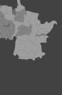
The Yarra Ranges Local Government Area covers an area of 2,477 square kilometres with an estimated 2021 population of 157,419 (growing an average of 1.4% per annum between 2016 and 2021). The populated parts of Yarra Ranges can be divided into three key districts for planning purposes, defined by their geographical locations and characteristics (as shown in figure 3).


One of the key characteristics of the study area is the very uneven population distribution (as can be seen in figure 4). There is a high concentration of people living in the urban western part of the municipality, and very low population densities for most of the eastern part (which is dominated by National Parks and State Forests).
People





Valley district including the rural land and associated townships along the Yarra Valley, including towns beyond the urban area such as Healesville, Yarra Glen, Warburton and Yarra Junction.
Belgrave
Hills district centred around the Dandenong Ranges, including towns such as Upwey, Belgrave, Monbulk and Olinda.






15
Figure 4:Yarra Ranges districts and population density map
Healesville
Lilydale
Warburton
Urban district located along the western edge of the municipality, including the areas of the municipality with the highest population densities including Lilydale, Mooroolbark, Kilsyth and Chirnside Park. per square km (rounded) 0-450 450-1130 1130-1850 1850-2550 2550-3620
Existing active recreation opportunities
There are many and varied active recreation opportunities currently existing within Yarra Ranges that can be broadly grouped into the six categories identified in the table below.
Open space
Existing opportunity types:
• Recreation reserves (47)
• Parks, nature reserves, bushland, creeks (100+)
Examples:
• Birdsland Reserve, Belgrave South
• Don Road Sporting Complex, Healesville
• Halley Supple Reserve, Coldstream
• Pinks Reserve, Kilsyth
• Melba Park, Lilydale.
Existing Qty: 100+
Exercise facilities
Existing opportunity types:
• Outdoor exercise equipment
Examples:
• Belgrave Lake, Belgrave
• Don Road Sporting Complex, Healesville
• Lillydale Lake, Lilydale
Existing Qty: 1-10
Aquatic facilities

Existing opportunity types:
• Swimming pools
• Splash parks
Examples:
• Belgrave pool
• Lilydale pool
• Lillydale Lake Splash Pad
• Seville water play park
• Warburton Water World (splash park)
Existing Qty: 1-10
Wheeled play facilities
Existing opportunity types:
• Skate/scooter parks (8)
• BMX tracks/Pump tracks (5)

Examples:
• Lilydale Skate Park
• Mount Evelyn Pump Track
• Upwey Skate Park
• Yarra Glen Skate Park
Existing Qty: 10-20
Play spaces
Examples:
• Belgrave Lake Park play space
• Castle Hill Reserve, Mooroolbark
• Lillydale Lake play space

• Olinda play space
• Yarra Glen Adventure Playground


Existing Qty: 100+
Ball play facilities
Existing opportunity types:
• Basketball/netball courts/half courts
Examples:
• Gateway Reserve, Lilydale (outdoor halfcourt)
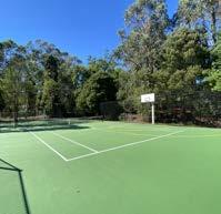
• Pinks Reserve, Kilsyth (outdoor halfcourt)
• Kimberley Reserve, Chirnside Park
Existing Qty: 20-40
Dog off-lead facilities
Note: dog walking also occurs on trails (covered under ‘Paths & Trails’ above)
Examples:
• Don Road Recreation Reserve Healesville
• Summerhill Park Drive Reserve, Mooroolbark
Existing Qty: 20-40
Paths & trails
Existing opportunity types:
• Footpaths
• Shared paths
• Trails
Examples:
• Urban footpaths
• Lilydale-Warburton Rail Trail

• Brushy Creek Trail
• Green Spine Shared Path, Chirnside Park
Existing Qty: 100+

16 17
The people
Six key personal factors that influence people’s active recreation participation have been identified (refer to Figure 5). Each will be examined separately in this section.

People
Factors influencing active recreation participation
Gender Age Recreation preferences Disability
Ability/ fitness Cultural factors Socio- economic factors
19
Figure 5: Personal factors influencing people’s active recreation participation
Age
Active recreation activities are strongly influenced by age. In some cases the influence is obvious (eg. play spaces). The following table identifies key active recreation opportunity types currently existing in Yarra Ranges, and identifies the predominant user age group/s (acknowledging that all of these facilities will be used by some people outside the identified age brackets).
Implications
Open space, paths and trails provide active recreation opportunities for a broad range of age groups, and should continue to be a focus for Council.
Specialist active recreation facilities (such as play spaces, and facilities for ball play and wheeled play) are focused at a younger demographic. There is an opportunity to provide more specialist facilities targeted at other age groups, particularly those aged over 70. eg. outdoor exercise equipment designed with use by older people in mind.
Open space
Parks and reserves cater well to most age groups, for activities including walking and informal sport (eg. kicking a ball).
Paths & trails
Footpaths, shared paths and trails cater well to a wide range of users, including kids on scooters, long walks and rides, or a gentle walk around the block.
Play spaces
Specifically designed for younger age groups. Opportunity for play spaces to include elements or areas designed for more mature users.
Ball play facilities
Ball play, including facilities such as half-court basketball courts cater well for most age groups except the youngest and oldest categories.
Dog off-lead facilities
Dog off-lead areas are targeted at adult dog owners.
Wheeled play facilities
Facilities such as skate ramps and pump tracks are largely targeted at children and young adults.
Aquatic facilities
Swimming pools are used by a very wide age range (including for exercise, socialising and rehabilitation), while splash parks and water play are targeted at younger users.
Exercise facilities
Outdoor exercise facilities are targeted mostly at adult users. The use by older people depends upon the kinds of facilities provided.
Yarra Ranges has a higher-than-average number of residents in the 5 to 20 and 40 to 70 age groups. Population forecasts show a relatively stable population over the next decade (growth of approximately 1% per year, https://forecast.id.com.au/yarra-ranges). Facilities provided should therefore prioritise targeting these age groups over the life span of this Plan.
Yarra Ranges has comparatively high proportions of people in the 5-20 and 40-70 age categories.
Yarra Ranges Council median age 40

Victoria median age 37
Australia median age 38
20 21
Existing active recreation opportunity types User age group 0-8 8-14 12-24 25-50 50-70 70+
8 7 6 5 4 3 2 1 0 0-4 5-9 10-14 15-19 20-24 25-29 30-34 35-39 40-44 45-49 50-54 55-59 60-64 65-69 70-74 75-79 80-84 85+ Age Percentage of population
Figure 6: Population by age group (Data source: Australian Bureau of Statistics)
Gender
Traditionally, gender has been a strong determinant in the kinds of sporting and recreation activities that people have undertaken. Particularly in organised sports, there has been a focus upon gender equality and encouraging participation of women and girls. The kinds of active recreation people undertake is less obviously gendered than organised sports, but research shows that active recreation is a very important part of women’s health and wellbeing. Women undertake more active recreation than men across most age groups and it forms a greater proportion of the total physical activity they undertake than other forms of exercise (refer to figures 7 & 8). There are many things influencing these findings, including a lack of organised sport opportunities for women and girls, the convenience of active recreation for women who have greater responsibilities for child rearing than males, and personal preference.
However, there are barriers to participation in active recreation for women with the key one being safety. People mostly undertake active recreation in public spaces, often in areas without high levels of passive surveillance (eg. a walking path along a creek). A popular time to undertake active recreation is at the start or end of the day to fit in around other commitments. These are times that may involve low light and low levels of passive surveillance. The result is that participating in active recreation can feel unsafe, particularly for women. The design and maintenance of all active recreation facilities should have a strong focus upon the application of Crime Prevention Through Environmental Design (CPTED) principles (including passive surveillance). Examples of the kinds of design & maintenance items that should be considered to achieve better surveillance include consideration of sight lines when locating facilities, vegetation trimming to maintain sight lines, and the incorporation of lighting where appropriate.
Figure 7: Victorian average active recreation hours per capita, by age and gender* (Data source: Active impacts: The economic impacts of active recreation in Victoria (Sport & Recreation Victoria, 2018) *No data currently available for gender diverse people.
Studies also show that teenage girls are not well served by most active recreation facilities (eg. www.sport.nsw.gov.au/sites/default/ files/2021-04/sprinter-women_and_girls_ participation_review_final.pdf), and this was reflected in engagement undertaken for this Plan. To address this, consideration should be given to providing active recreation spaces that specifically target teenage girls. Examples include:
• intentionally incorporating social spaces into recreation infrastructure (eg. a cluster of seats at a basketball/netball half-court)
• providing opportunities within social/recreation spaces for performance
• making active recreation spaces inviting and welcoming,
• providing specific design elements that reflect known trends/preferences associated with this cohort to provide a signal to teenage girls that they belong in the space.
There is currently no accurate demographic data available within Australia regarding people who don’t identify as either female or male. The range of different identities that fall within this category also makes projections regarding their active recreation participation or preferences difficult.
Research has shown that ‘trans and gender-diverse young people have elevated rates of psychological distress, mental ill-health, and suicide risk when compared with their cis-gender counterparts’ (https://www.orygen. org.au/About/News-And-Events/2022/ Mental-health-and-suicide-risk-in- trans-and-gender). The known benefits to mental health provided by active recreation therefore have a particular potential benefit to this cohort. As for women and girls, physical safety when using active recreation facilities in public places is a key potential barrier.
Figure
(Data source: Active impacts: The economic impacts of active recreation in Victoria (Sport & Recreation Victoria, 2018)
*No data currently available for gender diverse people.
22 23
Hours of active recreation per annum 160 140 120 100 80 60 40 20 0 15-17 18-19 20-24 25-29 30-34 35-39 40-44 45-49 50-54 55-59 60-64 65-69 70+ Age Females Males
Women undertake more active recreation than men across most age groups8: Active recreation as a proportion of total physical activity hours per capita, by age and gender*
Active recreation as a proportion of total physical activity (%) 80 70 60 50 40 30 20 10 0 15-17 18-19 20-24 25-29 30-34 35-39 40-44 45-49 50-54 55-59 60-64 65-69 70+ Age Females Males
Implications
Facilitating womens and girls participation in recreation activities is a focus for Yarra Ranges Council. The data available shows that investing in active recreation is a good way to achieve these goals, due to existing high levels of use by women and girls. Active recreation facilities and programs within Yarra Ranges must be designed to encourage use by women and girls, and so that they feel that they belong in these spaces.

The design of all active recreation facilities should have a strong focus upon the application of Crime Prevention Through Environmental Design (CPTED) principles (including passive surveillance), to increase the sense of safety for all users.
Spaces should be provided that specifically target the recreation preferences of teenage girls (including social and performative spaces), due to this cohort not being well served by most other active recreation facilities provided.
Culture
People’s cultural backgrounds has some impact upon the kinds of active recreation activities they choose to undertake. But a person’s cultural background can also be a barrier to participation, particularly with regard to cultural safety (ie. people feeling threatened, uncomfortable or challenged due to aspects of their cultural identity, customs and beliefs). This can apply to people from a wide range of cultural backgrounds, including indigenous Australians.
People who identify as Aboriginal and/or Torres Strait Islander make up 0.9% of the overall population of Yarra Ranges, but there are areas including around Healesville where this percentage is as high as 3.4% (see figure 9).
Overall, Yarra Ranges is less culturally diverse than the Victorian and Australian populations, as measured by the proportion of residents born overseas (refer to figure 10). For Yarra Ranges residents not born in Australia, most were born in English-languagespeaking or European countries, including England (5.4%), New Zealand (1.2%), Netherlands (1.1%), Germany (0.7%) and Italy (0.6%). However there are also prominent and emerging cultural groups, the fastest-growing of these over the past decade being the Chin people from Burma/Myanmar (refer to figure 10a) known to be concentrated around Mooroolbark.
24 25
3.5 % of population identifying as Aboriginal or TorresStrait Islander 3 2.5 2 1.5 1 0.5 0 Greater
Figure 9: Proportion of population identifying as Aboriginal or Torres Strait Islander (Data source: Australian Bureau of Statistics)
Melbourne Yarra Ranges Healesville and surrounds
There are concentrations of cultural groups in different parts of Yarra Ranges, including a high Aboriginal population around Healesville.
Above: Figure 10
Left: Figure 10a
Yarra Ranges has relatively low levels of cultural diversity, but the diversity differs across the districts (with the Urban District having higher proportions of overseas-born residents than the Valley District).
Implications
Barriers to use associated with cost should be considered in the provision of active recreation opportunities, particularly in areas of known disadvantage.
The eastern parts of Yarra Ranges should be a focus for increasing the provision of low cost and free active recreation opportunities.
Disadvantage
Socio-economic disadvantage is linked to poor health outcomes. There are things that prevent people experiencing disadvantage from undertaking active recreation that can contribute to poor health, including:
• costs associated with accessing active recreation activities. This includes things as simple as appropriate footwear and clothing, as well as specialist equipment, entry/ service fees, and transport costs.
• a lack of convenient access to active recreation opportunities. The Australian Bureau of Statistics gathers data relating to relative socio- economic conditions, and in Yarra Ranges the areas of highest disadvantage are located away from major population centres where facilities, services and programs are more prevalent.
For the purposes of active recreation assets and program provision, areas of recognised social disadvantage should be seen as priority communities to assist in addressing the issues noted above.
Implications
Cultural safety should be considered in the design of active recreation facilities especially given the relatively low levels of cultural diversity in Yarra Ranges.
Active recreation facility provision should seek to respond to cultural factors in areas of known cultural concentrations (eg. the Aboriginal and Torres Strait Islander population in Healesville and surrounds, and the Chin Burmese community around Mooroolbark).
Figure 10: Proportion of population born overseas
(Data source: Australian Bureau of Statistics)
Figure 10a: Fastest-growing ethnic groups (measured by growth between 2011 & 2021 of numbers of people born outside Australia by birthplace)
(Data source: Australian Bureau of Statistics)
26 27
% of population born overseas 35 30 25 20 15 10 5 0
Urban district Hills district Valley district Growth between 2011 & 2021 (people) 1000 800 600 400 200 0 Burma (Myanmar) India China Iran Malaysia Philippines Thailand Sri Lanka Birthplace
Chirnside Park Mooroolbark Kilsyth Lilydale Mount Dandenong/ Olinda Upwey/ Tecoma Belgrave/ Selby Warburton Healesville & surrounds Yarra Glen & surrounds Yarra Junction, Wesburn, Milgrove Yarra Ranges Greater Melbourne
Disability
Disability influences the way people participate in active recreation in many different ways. Some examples include:
• Mobility-related access issues, including people in wheelchairs.

• Psychological or mental barrier for people experiencing mental health conditions.
• Access and communication issues associated with hearing and vision impairment.
• Access and logistical barriers for unpaid carers of people with disabilities, Disability impacts a significant percentage of the population. The Australian Bureau of Statistics Disability, Aging & Carers, Australia 2018 report found that 17.7% of the Australian population (and 17.0% of the Victorian population) reported having a disability (with disability defined as ‘any limitation, restriction or impairment which restricts everyday activities and has lasted, or is likely to last, for at least six months’). 5.7% of Australians reported having either a profound or severe disability, requiring assistance or having difficulty with core day to day tasks. It also found that the prevalence of disability increases with age - almost half (49.6%) of people aged over 65 years old experienced disability.
Almost one-quarter (23.2%) of all people with a disability reported a mental or behavioural disorder as their main condition. Physical activity has been shown to benefit mental health.
Implications
• People with a disability make up more than 1 in 6 people within the community, and should be provided active recreation opportunities.
• Consideration needs to be given to active recreation opportunities for unpaid carers of people with disabilities. eg. opportunities for people of different abilities to undertake active recreation together.
• Active recreation opportunities provided should seek to reflect the diversity of abilities within the community.
28
People with a disability make up a significant part of the population of Yarra Ranges, especially in the older age groups. It is important that active recreation opportunities are provided that are accessible and attractive to them.
of Australians over the age of 65 have a disability
(approx.) of those with a disability have a severe disability
of Australians have a disability
49.6% 17.7% 1/3rd
Active recreation framework
Based upon the outcomes of the research and engagement undertaken, the following vision and principles have been developed.
Vision
Yarra Ranges is a place where everyone has the opportunity to participate in a diverse range of active recreation facilities programs and events that contribute to a healthy life.
Key principles
Access
Target:
Diversity
Active recreation opportunities that encourage participation and have a positive influence on physical health are provided in accessible and convenient places for residents within Yarra Ranges.

A diversity of active recreation opportunities are provided reflecting the diversity of our community and places across the municipality, the diversity of needs and preferences of the community, and different financial capacities.
Activation
Inclusion
Social Connection
Programming and events are delivered through internal and external partnerships to optimise utilisation of recreational assets, maximise health and wellbeing outcomes for the community, and contribute to sustainable tourism and economic prosperity across the municipality.
Facilities are designed with inclusion, accessibility, and safety of all people in mind, enabling individuals to make choices based on their needs and interests. There is a particular focus on women and girls, gender diverse people, disability, and Indigenous ways of knowing, being and doing.
Where possible, active recreation facilities are provided in proximity to other compatible uses where they facilitate social interaction and encourage intergenerational use of reserves and spaces.
31
We’re aiming to increase Physical Activity by 15% over ten years
Action Areas
There are four action areas that will help us increase the number of people meeting their physical activity guidelines in Yarra Ranges. These are:
Improving safety and accessibility
providing active recreation infrastructure and programs that are appealing and accessible to all community members, where participation is encouraged and people feel safe.
Activating existing facilities
identifying ways to increase the use of existing active recreation facilities (eg. through events, programming or marketing).
Increasing existing facility provision
relating to active recreation opportunities that currently exist within Yarra Ranges but are few in number, and where providing additional facilities would increase the opportunity for participation.

New facility provision
identifying new active recreation opportunities that do not currently exist within Yarra Ranges.
33
Photo: Kylie Gromadovski
Activating existing facilities
Key existing active recreation facility types were identified earlier in this document. Because the majority of active recreation activities undertaken are not organised, it is difficult to accurately determine the levels of use that these existing facilities receive. However, observation suggests that most of these facilities are not being used at capacity. Therefore there is an opportunity to increase the level of active recreation being undertaken in Yarra Ranges by finding ways to get people to use existing facilities. A range of options have been identified and assessed in the table below.
Activation type Notes/examples Opportunities
Facility awareness (marketing/ media)
Marketing of existing facilities (eg. via print & social media) to ensure people know what opportunities exist.
Introduce a ‘find active recreation opportunities near me’ function on the Yarra Ranges Council web site.

Facility awareness (signs)
On-site signs highlighting active recreation opportunities (including a range of opportunities that may not be obvious). Potentially including ‘QR codes’ linking to further information.
Events and activities (site based)
An event that encourages active recreation at a particular site or facility. eg. learn to skate clinic at a skate park.
• Existing processes in place (eg. Council has a communications team).
• A useful asset, particularly for new residents.
• Has the potential to encourage people to engage in a wider variety of activities.
Constraints
• Difficultly for Council communications to effectively target the least active people.
• Need for ongoing resourcing to ensure it is kept up to date.
• Has the potential to highlight a lack of quantity or variety of infrastructure in some areas.
• On-site signs will primarily target those who are already active.
• Risks associated with signs, including vandalism and visual cluttering open spaces.
Recommendation
High priority (relatively low cost, low-moderate impact)
Medium priority (moderate cost, low-moderate impact)
Medium priority (moderate cost, low-moderate impact)
Events and activities (activity based)
An event that encourages active recreation that is based around an activity, rather than a specific site. eg. ‘Ride to Work Day’
• Introduces people to new activities.
• Provides a social aspect.
• Opportunity to partner with others (eg. health promotion & youth teams
• within Council)
• Introduces people to new activities.
• Opportunity to partner with others (eg. health promotion & youth teams within Council,
• and service providers)
• Event organisation can be resource- intensive. High priority (moderate cost, moderate-high impact)
• Event organisation can be resource- intensive
High priority (moderate cost, moderate-high impact)
34 35
Activation type Notes/examples
Events & activities (digital)
Geocaching, digital puzzle trails, and augmented reality games (such as Pokemon Go) provide opportunities for the active use of public spaces. These activities can appeal to people who may not be attracted to sport-based activity types.
Partnering with existing clubs/ groups
Partnering with existing clubs/ groups that assist and encourage people to participate in non-sport active recreation. eg. social walking groups. (Note that organised sport activities fall outside the definition of active recreation).
Establishing new clubs/groups
Establishing support networks that assist and encourage people to participate in non-sport active recreation. eg. social walking groups.
Equipment provision Making equipment available that facilitates active recreation. eg. Having table tennis paddles and balls available for loan from a business located near an outdoor table.
Incentives Providing a reward for undertaking an activity. eg. a free coffee at a park for people who arrive via active transport collecting stamps in an ‘activity passport’
Facility improvement (accessibility/ safety)
Changes to a facility to make it more attractive to certain user groups, particularly related to accessibility and safety.
(Significant functional additions to a facility are dealt with under the increasing/new facility provision categories).
Facility improvement (social)
Interventions to improve the social opportunities of a facility (eg. seating edges at a basketball half court).
Opportunities
• These activities can appeal to people who may not be attracted to sport-based activity types.
Constraints Recommendation
• Event organisation can be resource- intensive Medium priority (low-moderate cost, low-moderate impact)
• Support/ encouragement of activity, with relatively low inputs from Council.
• Relatively few suitable clubs/ organisations exist High priority (low cost, moderate impact)
• Support/ encouragement of activity.
• Provides a social aspect.
• Establishing groups is resource- intensive.
• Likely need for ongoing involvement & support
Low priority (moderate cost, moderate impact)
• Encourages the use of facilities.
• Ongoing Council management, repair & replacement required. Medium priority (moderate cost, moderate impact)
• Creates a motivation, and has the potential to be very targeted based upon the incentive offered.
• A reduction in barriers to facility use.
• Cost (dependent upon the type of incentive offered) Low priority (moderate cost, moderate impact)
• Many barriers to use will not be easily resolved (eg. poor siting)
• Changes need to be considered against the cost of facility replacement.
High priority (moderate cost, high impact)
• Encouraging a broader group of users (particularly teenage girls who highly value social aspects of active recreation)
• Changes need to be considered against the cost of facility replacement. High priority (moderate cost, high impact)
36 37
Increasing existing facility provision
One way to provide more active recreation opportunities is to provide more of those opportunities that already exist. As noted previously, most existing facilities are not being used at capacity, therefore finding gaps in existing provision rather than expanding existing facilities is likely to be the best approach in most cases. The approaches to each of the existing facility types identified earlier are explored below. Where there has been found to be gaps in provision, additional assets have been factored into the implementation plan.
Ball play facilities
Opportunities for increasing provision:
There is an opportunity for more quantity and variety of ball play facilities. These opportunities are explored over the following pages.
Existing Qty: 20-40
Open space
Opportunities for increasing provision: New open space can be developed for new communities as a part of new residential subdivision. For established areas the focus instead should be upon improving the quality of the spaces.
Existing Qty: 100+
Aquatic facilities
Opportunities for increasing provision:
Yarra Ranges has a separate strategy relating to aquatic facility provision.
Existing Qty: 1-10
Paths & trails
Opportunities for increasing provision: Opportunity to improve the extent, connectivity, quality and safety of the shared path and trail network. New footpaths should be developed as a part of new residential subdivision.
Existing Qty: 100+
Play spaces
Opportunities for increasing provision:
Opportunity to improve the extent, connectivity, quality and safety of the shared path and trail network. New footpaths should be developed as a part of new residential subdivision.
Existing Qty: 100+
Exercise facilities
Opportunities for increasing provision:
There is an opportunity for more variety of outdoor exercise facilities. These opportunities are explored over the following pages.
Existing Qty: 1-10
Dog off-lead facilities

Opportunities for increasing provision:
There is an opportunity for more quantity and variety of dog off-lead facilities. It is recommended that these opportunities are addressed as a part of a separate strategy.

Existing Qty: 20-40
Wheeled play facilities
Opportunities for increasing provision: Yarra Ranges has an existing draft strategy relating to skate and BMX facility provision. Opportunity for strategy review and asset renewal.
Existing Qty: 10-20
38 39
Existing facility locations Open space
The open space mapped here includes spaces designated for recreation purposes as well nature reserves. Yarra Ranges is fortunate to have very large areas of natural open space (particularly in the Hills and Valley districts) as well as spaces for recreation around key population centres.
A more detailed analysis of the provision of open space will be undertaken as part of the ROSS.


Existing facility locations

Routes (walking/cycling)


The routes mapped here include trails, shared paths and footpaths. Yarra Ranges is in the process of further developing links between population centres and districts, including projects such as the Yarra Valley Trail and Ridgewalk. More detailed information regarding priority trails and walking routes will be provided in the paths and trails plan.
Existing facility locations Play spaces


The mapping of existing play spaces within Yarra Ranges shows a good correlation between population centres and play space provision. These facilities are covered by a separate plan. There are opportunities to consider designing areas within these spaces for different age cohorts and including elements that facilitate use by older members of the community.

40 41
Proposed Yarra Valley Trail
Proposed (ngurrak barring) RidgeWalk project
Healesville
Lilydale
Warburton
Belgrave
Photo: Kylie Gromadovski
Existing facility locations Ball play facilities
The ball play facilities existing in Yarra Ranges providing active recreation opportunities currently primarily comprise basketball courts and half-courts. While designed for basketball usage, these facilities often also cater for other ball play, including netball (where netball rings are provided), and a wide variety of other ball play that requires hard paved surfaces. There is the potential to encourage these alternative uses by including additional line marking (eg. for four-square or ‘pickleball’, a form of paddle tennis). Beach volleyball is an example of a ball sport that doesn’t requre hard surafcing that should also be considered.
Key opportunities/considerations regarding the provision of outdoor ball play facilities include:
• These facilities are most-used by older children and young adults. Therefore, consideration should be given to locating them near places where these age groups congregate (such as education facilities).

• There are standard sizes for basketball hoops and ground line marking, and the surface needs to be flat. This impacts upon suitable locations for these facilities to be installed.
• Balls being bounced on hard pavement can be quite noisy, so care needs to be taken when locating these facilities in residential or noise-sensitive areas.
Existing facility locations Dog off-lead facilities
The mapping of dog off-lead facilities shows a spread of facilities across the municipality, with a focus upon more urban areas where space for dog exercise is generally more needed. It is noted that dog walking and exercise also occurs at many other locations (including those covered under ‘Paths & Trails’).


Recommendations relating to the provision of dog off-lead facilities should be addressed by a separate plan.
Key


A Mooroolbark Urban
B Wandin North/ Seville Valley
C Launching Place/ Yarra Junction Valley
D Monbulk Hills


Existing facility locations
Wheeled play
Wheeled play facilities mapped here include facilities designed for skating (eg. skate parks), scooters and bikes (eg. pump tracks). The mapping of these facilities shows a good spread throughout the populated parts of Yarra Ranges, with just a few gaps in provision identified. Many of the existing facilities are well used, indicating that more of these sorts of facilities could be required within Yarra Ranges. An action of this strategy will be to develop a skate and scooter park plan and a bike infrastructure plan. Key
42 43
Healesville Lilydale Warburton Belgrave D A B C
gaps: Code Area District
Code Area District A Mooroolbark Urban B Warburton Highway (west) Valley Healesville Lilydale
Belgrave B A
gaps:
Warburton Belgrave Healesville Lilydale Warburton
Existing facility locations Aquatic facilities
Aquatic facilities mapped here include swimming pools and splash parks. The mapping of these facilities shows a good spread throughout the populated parts of Yarra Ranges. Swimming is an important recreational pursuit for the community within Yarra Ranges. The provision and mix of aquatic services provided in Yarra Ranges in the future will be guided by the Aquatics Strategy which is currently in development.
Exercise facilities
There are a wide range of outdoor exercise equipment options available that can be broadly grouped according to the following categories:
• Equipment complexity - the simplest (and therefore usually the lowest cost and most robust) equipment has no moving parts, such as sit-up benches and chin-up bars. More complex equipment involves multiple moving parts and provide the range of exercise options that can be found in a commercial gym (including exercise bikes, and weight training machines for arms and legs).
• Age focus - In addition to exercise equipment focused upon fitness and strength, there are also a range of suppliers offering outdoor exercise equipment focused upon older adults (with a focus upon things like dexterity and balance rather than strength and aerobic fitness). Seniors exercise parks also have the benefit of creating meeting places for social interaction among seniors.

Existing facility locations Exercise equipment
The mapping of outdoor exercise equipment shows that they are spread throughout the populated parts of Yarra Ranges, with a number of gaps as identified. The range of facility types available that fall under this category are covered on the following page.


Key gaps:
A Warburton Highway towns Valley
B Mount Evelyn Urban
C Upwey Hills
An example of simple equipment with few or no moving parts.
An example of more complex equipment replicating the range of exercise options that can be found in a commercial gym.
An example of seniorsspecific exercise equipment, with a focus upon things like dexterity and balance rather than strength and aerobic fitness.
Key opportunities/considerations regarding the provision of outdoor exercise equipment include:


• Equipment installation is very scalable. Installations can be small and simple, or large and complex, to suit a variety of spaces and settings (including sites constrained by size or topography).
• Usage can be increased by locating them along paths or trails already used for walking or jogging.

• Exercise equipment for seniors can be located in areas known to be frequented by older residents (including senior citizens centres and University of the Third Age venues).
• The design of ground surfacing beneath equipment should consider accessibility impacts. Rubber surfacing will make equipment easier to access for people with mobility issues.
44 45
Code Area District
Healesville Lilydale Warburton Belgrave Healesville Lilydale Warburton Belgrave A B C
New provision
Providing new types of active recreation facilities, particularly those that are unique or interesting, creates variety and draws attention to the opportunities on offer. There are many potential active recreation opportunities that could be provided within Yarra Ranges. The following table identifies some key options, reflected in the implementation plan where appropriate.
Facility category Facility type Opportunities Constraints
Ball play Outdoor table tennis
• Many examples of successful robust public installations.
• Relatively low installation cost.
• Potential for tables to be painted to assist in place-making.
Bocce/petanque
• Many examples of successful robust public installations.

• Relatively low installation cost.
Recommendation
• Need for users to bring their equipment. Medium priority. Most suited to urban settings.
Disc golf
(Disc golf is a golf-like game played using flying discs or ‘frisbees’. Rather than holes, the discs are thrown into basket nets. Open spaces can be converted to accommodate the game with relatively few modifications).
Beach volleyball
• Relatively low installation cost.
• Council has received a submission requesting a facility, indicating some demand.
• Need for users to bring their equipment. Medium priority. Most suited to urban settings.
• Need for users to bring their equipment.
• Large space required, limiting available options.
Medium priority. Suited to underutilised existing parkland.
• Relatively low installation cost.
• Need for users to bring their equipment (ie. ball and net)
Medium priority. Suited to some existing locations (eg. Lillydale Lake ‘beach’).
46 47
Facility example (above): ‘Swing Time’ (Boston, USA), Howeler & Yoon Architecture (image www.howeleryoon.com)
Facility category Facility type
Climbing/obstacles/ play
Rock climbing/bouldering walls
Opportunities
• Able to be installed in otherwise underutilised areas such as bridge abutments. eg. Hopkins Bridge Bouldering Wall, Footscray (City of Maribyrnong)
• Walls can also be installed as standalone elements, usually at a smaller scale.
Constraints
• These facilities require a level of fitness and expertise to use, and are therefore likely to be most used by people who already have high levels of activity.
Recommendation
Medium priority
Obstacle courses (parkour/’ninja parks’)
• Playground-like spaces that appeal to a wider audience.
• These facilities require a level of fitness and expertise to use, and are therefore likely to be most used by people who already have high levels of activity.
Medium priority. Consider addressing within play space development/ upgrade program.
‘All-aged’ play spaces
• Playgrounds that appeal to a wider audience. eg. ‘Swing time’temporary installation of illuminated hoop swings (Howeler & Yoon Architecture), Boston, providing a social/performative and social-media friendly experience
Activation type Notes/examples
Youth spaces (Outdoor spaces targeting youth that encourage outdoor activity and socialisation without sporting activities such as skating or basketball being the focus).
Opportunities
• A space dedicated to youth who can fall into the gap between facilities for children and adults. eg. Geelong Youth Activities Areadesigned as a flexible, multi-purpose outdoor youth-focused area catering for events, markets, live music, art exhibitions, catwalk, dance, street theatre, interactive media, wireless internet and seating (as well as sport activities).
Constraints
High cost
Medium priority. Consider addressing within play space development/ upgrade program.
Recommendation
High priority
Water-based activities (excluding swimming pools/ water play)
Water access (Jetties, ramps, etc to allow access to the water of human-powered water craft)
• Opportunity to increase the opportunities for human-powered water craft in the municipality.
• These activities require specialised equipment (kayaks, canoes, etc) making it a niche user target group.
• Careful siting of facilities required to avoid environmental damage.
• Often the jurisdiction of multiple agencies.
Low priority. Resource intensive.
48 49
Design considerations
There are a number of key design considerations that should be taken into account for all active recreation facilities to maximise their use by the community. Wherever possible, a diversity of recreation opportunities should be provided in one location. In addition we should;
Maximise passive surveillance of active recreation facilities from passers-by and surrounding roads and buildings. Avoid elements that block view lines or create hiding places.
Lighting should be considered for active recreation facilities likely to be used outside daylight hours (eg. walking circuits).
Make facilities accessible. This includes careful consideration of ground surfacing. Loose surfaces (eg. mulch surfaces under play or exercise equipment) can make facilities difficult to access for people with mobility issues.

Provide carefully considered signs and other information to notify people of active recreation opportunities, without creating unnecessary visual clutter.
Create social opportunities at active recreation facilities by providing seating. Consider seating types that are suitable for groups (rather than standard park benches) especially for youth-focused spaces.
Provide shade and shelter from the wind. Action,
Project delivery will be subject to suitable grant opportunities or allocation of capital budget
50 51
evaluation plan
implementation &
1.1 CPTED: The design of all active recreation facilities should have a strong focus upon the application of Crime Prevention Through Environmental Design principles.
CPTED to be incorporated onto the design of all new active recreation facilities. Where possible, improvements are undertaken to existing active recreation facilities to improve safety.
1.2 Universal access: The design of all active recreation facilities should have a strong focus upon universal access.
Accessibility is to be incorporated into the design of all new active recreation facilities.
Where possible improvements to existing recreations facilities should be undertaken to improve accessibility
Increase perception of safety for females and vulnerable groups using active recreation facilities.
Increased use of active recreation facilities by females and vulnerable groups within the community.
Increased percentage of females and vulnerable groups feeling safe when using the active recreation facility. As measured by engagement with DAG, YAG and community members asking about how interventions have impacted their sense of safety.
Observation data at active recreation facilities
Community engagement data on facility usage barriers
Capture required baseline data for all site assessment sites operational
All new active recreation facilities designed in accordance with CPTED principles. Short term KPI (output) operational CPTED site assessment of existing active recreation facilities undertaken operational
20 improvement projects undertaken as identified by site assessments. eg. lighting, improved surveillance sightlines).
200,000
Improved accessibility of active recreation facilities.
Increased use of active recreation facilities by groups who benefit most from accessibility (including people with mobility issues and people with prams).
Increased use of active recreation facilities by target groups as evidenced by increased bookings for groups catering to all abilities, mothers groups etc.
As above Capture required baseline data for all site assessment sites operational
Universal design site assessments of existing recreation facilities undertaken and specific improvement projects identified.
operational
All new active recreation facilities designed to achieve universal access to at least 1 component. operational
Site assessment of existing active recreation facilities to identify barriers to accessability operational
20 improvement projects to be undertaken over the life of the plan. 200000
52 53 Recommendation Key principle Outcomes Measures of success Baseline Data Action/s Priority Est. cost
Key principal Access Activation Social Connection Diversity Inclusion
Priority High Medium Low
Improving safety and accessibility
Improving safety and accessibility
1.3 Cultural safety: All facilities and events/programs related to active recreation consider cultural safety (ie. avoiding people feeling threatened, uncomfortable or challenged due to aspects of their cultural identity, customs and beliefs).
1.4 Facility improvement (social): All active recreation facilities will consider opportunities for social interaction (eg. seating suitable for groups close to recreation infrastructure).
Opportunities for social interaction should be incorporated into the design of all new active recreation facilities. Large projects should provide a safe ‘edge’ for people to approach and engage in the activity slowly over time.
All new active recreation facilities, events and programs informed by cultural safety considerations. Increased use of active recreation facilities by diverse cultural groups.
Recreation facilities are used by a broader range of users (particularly teenage girls who highly value social aspects of active recreation).
Increased perception of cultural safety by target groups as evidenced by ‘secret shopper’ experiencing facilities.
As above Engage with representatives from Cultural Groups and document design elements that can be incorporated into active recreation facilities and programs to encourage cultural safety. Establish a process to respectfully engage representatives from different cultures throughout the design process.
More diverse groups using the facility as evidenced by observational data at facilities
Diverse groups of people feeling comfortable to engage in the space and try the activity
As above Capture required baseline data for all site assessment sites operational
Specific consultation with diverse cultural groups during the design of recreation facilities and recommendations incorporated into the design.
All new active recreation facilities are designed to provide social opportunities.
Site assessments of existing active recreation facilities and opportunities to improve social interaction identified as specific projects.
Identification and implementation of 10 social interaction improvement projects relating to existing active recreation facilities as recommended by the audit.
Identification of 3 opportunities for larger nodes to provide opportunities for social interaction at existing active recreation facilities. These projects should provide a safe ‘edge’ for people to approach and engage in the activity slowly over time.
3 large nodes constructed to provide opportunities for large groups to socialise and for people to slowly approach and engage in the activity.
100,000
600,000
54 55 Recommendation Key principle Outcomes Measures of success Baseline Data Action/s Priority Est. cost
operational
operational
operational
operational
operational
Priority High Medium Low Key principal Access Activation Social Connection Diversity Inclusion
Activating existing facilities
2.1 Facility awareness: marketing of existing facilities by Council (via print & social media) to ensure people know what opportunities exist.
Residents and visitors to Yarra Ranges are aware of opportunities for active recreation within the municipality.
Increased knowledge about and use of active recreation facilities within the community.
Increase in the number of people engaging with social media
Assessment of current internal social media analytics
Work with the Communications Team to develop marketing and promotion or active recreation opportunities
2.2 Facility awareness: introduce a ‘find active recreation opportunities near me’ function on the Yarra Ranges web site.
2.3 Facility awareness: onsite signs highlighting active recreation opportunities.
Residents and Visitors to Yarra Ranges can easily find opportunities to participate in active recreation
Increased knowledge about the presence of, and how to use active recreation facilities within the community.
Increase in the number of people engaging with social media
As above Create a ‘find active recreation opportunities near me’ function on the Yarra Ranges web site
Presence of useful signs associated with active recreation facilities (and the avoidance of unnecessary visual clutter).
The community has a greater awareness of active recreation facilities and how to use them as evidenced by a decrease in public requests for guidance on how to use them?.
Community suevey/ recreation activity observations
Identify sites, design signage and install signs to assist the community to engage with active recreation facilities.
56 57 Recommendation Key principle Outcomes Measures of success Baseline Data Action/s Priority Est. cost
operational
operational
$50,000 (sign design & installation) Priority High Medium Low Key principal Access Activation Social Connection Diversity Inclusion
Activating existing facilities
2.4 Sitebased events and activities: run events at sites that draw attention to active recreation opportunities, and potentially provide assistance for beginners to get started (eg. a learn to skate class at a skate park).
Events also provide an opportunity to engage with attendees/ participants more broadly about active recreation.
2.5 Activitybased events and activities: run an event based around an active recreation activity (ie. an event in the style of ‘ride to work day’, which is based around the activity not the location).
A minimum of five wellattended site- based events and activities per year.
Increased knowledge about and use of active recreation facilities within the community.
Participants have an increased knowledge of how to use, and, are more likely to use active recreation facilities
Recrreation activity observations
Partner with internal and external partners to run five site based events at existing active recreation facilities.
100,000
2.6 Digital activities/events: eg. geocaching, digital puzzle trails, and augmented reality games providing opportunities for the active use of public spaces.
Development of at least one activity- based event/activity of interest/ relevance to the Yarra Ranges community.
Increased participation in active recreation related to the selected activity.
Increased participation in active recreation by people/groups not motivated by existing opportunities.
Community participation rates in activity/events and events has increased as evidenced by registration data. Five successful events are held.
Partner with internal and external partners to promote and participate in an annual active recreation activity.
20,000
Increase in the number of people engaging with digital technologies within open space.
Digital analytics data
Development and implementation of a pilot digital activity/event of interest/relevance to the Yarra Ranges community.
100,000
operational
58 59 Recommendation Key principle Outcomes Measures of success Baseline Data Action/s Priority Est. cost
Learnings from the pilot activity/event to be used to determine viability/desirability of additional activities/ events. Priority High Medium Low Key principal Access Activation Social Connection Diversity Inclusion
Activating existing facilities
2.7 Partnering with existing clubs/ groups: provide support to existing clubs/groups who facilitate active recreation participation.
2.8 Establishing new clubs/ groups: Council to help to establish new clubs/groups that facilitate active recreation participation where such groups don’t already exist.
Increased participation in active recreation through sporting clubs
Number of people engaged in recreation programs
Participation in recreation programs
Identification of existing clubs/groups providing active recreation opportunities, liaising with these groups about the potential support Council could provide to increase participation, and provision of identified support.
20,000
Increased participation in active recreation through newly established clubs or groups
Two new clubs established that support participation in active recreation
Understanding of existing number of clubs and participation rates
Identification of any gaps (relating to either activity or location) where clubs/groups related to providing active recreation opportunities could be formed. eg. social walking groups, or groups associated with potential new facilites proposed elsewhere within the implementation plan (such as bocce/ petanque, rock climbing/ bouldering, etc).
Liaison with interested parties and provision of appropriate support to help establish clubs/ groups.
2.9 Equipment provision: identify locations where Council can supply active recreation equipment for loan
Increased use of active recreation assets Community using active recreation equipment on loan as evidenced by bookings.
Identification of opportunities to provide active recreation related equipment to the public in a safe and convenient way, and acting upon these.
This may need to include liaison with non-Council entities (eg. a cafe next to an outdoor table tennis table who can assist in distributing balls and paddles).
Three locations established where community members can loan active recreation equipment. 10,000
2.10 Incentives: develop and deliver incentives associated with active recreation participation (eg. collecting stamps in an ‘activity passport’)
Increased participation in active recreation
Increased participation in active recreation by people/ groups not motivated by existing opportunities.
observation data at active recreation facilities
10,000
60 61 Recommendation Key principle Outcomes Measures of success Baseline Data Action/s Priority Est. cost
operational
operational
operational
Identification and implementation of at least one incentive scheme of interest/relevance to the Yarra Ranges community. Priority High Medium Low Key principal Access Activation Social Connection Diversity Inclusion
Increasing existing facility provision
3.1 Ball play facilities: Provision of active recreation opportunities relating to ball play to increase provision/ variety and in areas where there are identified gaps.
Increase in community use of facilities evidenced through observational data
Recreation Infrastructure constructed at up to 2 locations per year over 5 years.
Develop new multi-purpose court facilities as itemised below:
Lillydale Lake Exercise and Youth Activity Hub - multiuse court/half court development (combined with other activities including outdoor exercise and parkour).
Refer to allowance under ‘Youth Space’
McDermott Avenue Reserve, Mooroolbark - develop multi-purpose courts (including volley ball) 70,000
Eyrefield Park, Lilydale - develop multi-purpose courts (including pickleball) 70,000
Belgrave (site to be determined) - develop multipurpose courts (including pickleball)
Wandin North/Seville (site to be determined) - develop multi-purpose courts
Launching Place/Yarra Junction (site to be determined)develop multipurpose courts
Monbulk (site to be determined) - develop multipurpose courts
62 63 Recommendation Key principle Outcomes Measures of success Baseline Data Action/s Priority Est. cost
70,000
70,000
70,000
70,000 Priority High Medium Low Key principal Access Activation Social Connection Diversity
Inclusion
Increasing existing facility provision
3.2 Outdoor exercise facilities: Provision of active recreation opportunities in areas where there is high demand and/ or identified gaps to increase participation in active recreation.
Community use of facilities (observations)
Recreation Infrastructure constructed at up to 2 locations per year over 5 years.
Develop new outdoor exercise facilities as itemised below:
Lillydale Lake Exercise and Youth Activity Hub – develop outdoor exercise node (combined with other activities including multi-use court and parkour).
Refer to allowance under ‘Youth Space’
Warburton Highway (sites to be determined) – develop two outdoor exercise nodes. 140000
Mount Evelyn (site to be determined) – develop an outdoor exercise node. 70000
Upwey (site to be determined) – develop an outdoor exercise node. 70000
3.3 Wheeled play facilities: Provision of active recreation opportunities in areas where there is high demand and/or identified gaps.
Community use of facilities (observations)
Recreation Infrastructure constructed at up to 2 locations per year over 5 years.
Develop new wheeled play facilities (including skate parks and pump tracks) as itemised below.
Belgrave South Recreation Reserve, Belgrave Southdevelop skate facilities.
Montrose – site to be determined
550000
550000
Seville - develop skate park and pump track facilities (in central location behind shops) 750000
150 Cambridge Road Reserve, Kilsyth - develop bike/ skate park, including a bike skills course and jumps 450000
Jadodade Community Park, Launching Place – develop pump track and skate park.
Eyrefield Park, Lilydale - skate park extension and upgrade.
Queens Park Healesville –renewal upgrade of existing bike track and minor improvements to the skate park
64 65 Recommendation Key principle Outcomes Measures of success Baseline Data Action/s Priority Est. cost
750000
750000
550000 Priority High Medium Low Key principal Access Activation Social Connection Diversity Inclusion
4.1 Outdoor table tennis: Increased diversity of active recreation opportunities.
Provision of active recreation facilities that appeal to a cohort not well catered to by existing facilities.
4.2 Bocce/petanque: Increased diversity of active recreation opportunities.
Provision of active recreation facilities that appeal to a cohort (older age groups) not well catered to by existing facilities.
4.3 Disc golf: Increased diversity of active recreation opportunities.
Installation of table tennis tables at up to 4 sites
Increased community satisfaction with diversity of recreation opportunities.
Satisfaction with diversity of recreation opportunities
Identify suitable locations in urban areas and larger towns for table tennis table installation.
Installation of Boccee/ petangue at up to 5 sites
Increased community satisfaction with diversity of recreation opportunities.
Satisfaction with diversity of recreation opportunities
Identify suitable locations in urban areas and larger towns for bocce/petanque installation. Boccee trialed at Melba Park
Increased community satisfaction with diversity of recreation opportunities.
Satisfaction with diversity of recreation opportunities
Work with interested parties to identify a suitable location for installation of disc golf facilities in existing parkland.
4.4 Climbing/obstacles/play: Increased diversity of active recreation opportunities.
Increased community satisfaction with diversity of recreation
Satisfaction with diversity of recreation opportunities
Investigate the possibility and construction of a rock wall at McDermott Avenue Reserve 200,000
Identify suitable locations for obstacle course spaces (parkour/’ninja park’). Up to 3 sites.
Lillydale Lake Exercise and Youth Activity Hub - develop parkour facility (combined with other activities including outdoor exercise and multi-use court).
Refer to allowance under ‘Youth Space'
Identify suitable locations for social/performative play spaces (targeted at teenage girls). Up to 3 sites.
66 67 Recommendation Key principle Outcomes Measures of success Baseline Data Action/s Priority Est. cost
40,000
30,000
20,000
600,000
300,000 Priority High Medium Low Key principal Access Activation Social Connection Diversity Inclusion
New facility provision
4.5 Youth Space: Increased diversity of active recreation opportunities.
Provision of active recreation facilities that appeal to a cohort not well catered to by existing facilities.
Increased community satisfaction with diversity of recreation opportunities.
Satisfaction with diversity of recreation opportunities
Develop a flexible multi-purpose youth focused area as detailed below
• Lillydale Lake Exercise and Youth Activity Hubdevelop activity hub including multi-use courts, parkour and outdoor exercise equipment.
4.6 Develop appropriate water access for human-powered water craft (eg. jetties & ramps).
Increased diversity of active recreation opportunities.
Water craft access infrastructure has been created.
Satisfaction with diversity of recreation opportunities
Lillydale Lake - develop appropriate water craft access infrastructure 900,000
Total cost over 10 years: $8,975,000
68 69 Recommendation Key principle Outcomes Measures of success Baseline Data Action/s Priority Est. cost
425,000
Priority High Medium Low
Key principal Access Activation Social Connection Diversity Inclusion New facility provision

70 Yarra Ranges Council PO Box 105 Lilydale VIC 3140 1300 368 333 | mail@yarraranges.vic.gov.au yarraranges.vic.gov.au