VISION People’s Voice I Boston Today Goals and Targets
ACTION PLAN People’s Voice II Boston in 2030 Projects and Policies
Local
Project Score
Better Bike Corridors Rebuild streets with protected and low-stress bicycling facilities
Access 1 Access 2 Safety 1 Safety 2 Reliability Affordability Sustainability/Resiliency 1 Sustainability/Resiliency 2 Governance Identified on the ballot as an Early Action commitment
Project Description New projects will aspire to make bicycling a safe, comfortable, and convenient choice for more of Boston’s residents and visitors. Better bike lanes go beyond traditional bike lanes, which are painted on the street between moving and parked cars. The city will pursue more priority routes with bike lanes that are separated from moving vehicles and on neighborhood streets that are retrofitted to slow traffic. Similar approaches are part of Boston’s Complete Streets Guidelines and Neighborhood Slow Streets efforts. Today, Boston residents can experience protected bike lanes on parts of Western Avenue in Allston; Commercial Street, Staniford Street, and Atlantic Ave in the North End and West End; and parts of Beacon Street and Massachusetts Avenue in the Bay Bay. Future better bike lanes are planned for additional corridors, including: Columbia Road Greenway (p172) SW Corridor Extension to Back Bay and MGH (p174) Melnea Cass Blvd, where protected bike lanes will connect the SW Corridor to Boston Medical Center
Benefits and Issues Addressed Building better bike corridors has increased cycling rates across the nation and in the Boston region. A connected network of more comfortable routes makes bicycling a more realistic option for people who would otherwise choose to drive or rely on transit. Through the Go Boston 2030 process, the call for building better bike corridors (and facilities that provide “low-stress” connections for cyclists) has been heard from across all neighborhoods and from current and potential cyclists alike.
Go Boston 2030
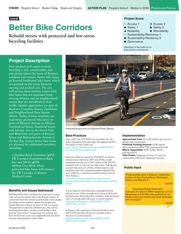
Protected bicycle lane on Staniford Sreet, Boston
Best Practices
Implementation
Since 2007, the NYCDOT has installed over 30 miles of protected bicycle lanes throughout the five boroughs of New York City. www.nyc.gov/html/dot/downloads/pdf/2014-11bicycle-path-data-analysis.pdf
Approximate Cost: $1 to $2 million per year for design and construction Potential Funding Sources: COB capital plan and Boston MPO TIP construction funds Who’s responsible: BTD, Public Works, and MassDOT Time Frame: Ongoing and over 15 years in conjunction with local community process
Based on what was spent by NYCDOT on bicycle infrastructure between 2007 and 2014, a study estimated that the city’s 2015 outlay of $8,109,511 resulted in 45.5 miles of new bike lanes. Taking into account the past cost of bike-related injuries and fatalities, they also estimated quality-adjusted life years (QALYs, a common economic metric) for all New Yorkers. journalistsresource.org/studies/environment/ transportation/bike-lanes-cost-effectiveness-publichealth A new study of cities that have expanded bicycle infrastructure with an emphasis on protected bicycle infrastructure shows that this correlates with increased rates of cycling and a decrease in cyclist injuries. ajph.aphapublications.org/doi/pdf/10.2105/ AJPH.2016.303507 In Boston, the expansion of bicycle facilities from 2007-2012 has been shown to correlate with a decrease in cyclist injuries. ajph.aphapublications.org/doi/pdf/10.2105/ AJPH.2016.303454 152
Public Input “Protected bike lanes in Roxbury!: Install them on Blue Hill Ave, Dudley Street, Washington, Warren, and Malcolm X.” –02125 “Cambridge Street: Particularly outbound, the street is VERY dangerous, yet it is the gateway to City Hall, state government, etc. Please remove the median and install dedicated bike route/path.” —02139