Submarine Telecoms Forum is published bi-monthly by WFN Strategies, L.L.C. The publication may not be reproduced or transmitted in any form, in whole or in part, without the permission of the publishers.
Submarine Telecoms Forum is an independent commercial publication, serving as a freely accessible forum for professionals in industries connected with submarine optical fibre technologies and techniques.
Liability: while every care is taken in preparation of this publication, the publishers cannot be held responsible for the accuracy of the information herein, or any errors which may occur in advertising or editorial content, or any consequence arising from any errors or omissions.
The publisher cannot be held responsible for any views expressed by contributors, and the editor reserves the right to edit any advertising or editorial material submitted for publication.
Contributions are welcomed. Please forward to the Managing Editor:
Wayne Nielsen
WFN Strategies 21495 Ridgetop Circle, Suite 201 Sterling, Virginia 20166 USA
Tel: +[1] 703 444 2527
Email: wnielsen@wfnstrategies.com
General Advertising
Email: sales@wfnstrategies.com
Tel: +[1] 703 444 0845
ReadeRship
Welcome
to the 40th issue of Submarine Telecoms Forum magazine, our Offshore Oil & Gas Telecoms edition.
Hurricane season is well upon us here in the Americas and the vital offshore and near shore hydrocarbon industry has already endured one monster storm, namely Ike. Lessons learned and re-learned will no doubt be considered in the weeks ahead, and the resiliency of telecoms may again be tested anew. Initial scuttlebutt suggests the industry faired pretty well, and fiber telecoms were resilient – Time will tell all.
It is also an occasion to celebrate. Last month marked the first cable crossing of the Atlantic in 1858, linking two great nations inexorably in good times and bad. But like all trend setters, our industry is not simply resting on its laurels, and as the following articles show, we continue to move in a positive, effective, life enhancing direction.
In this issue, we reprint an excellent article from DEJ as to why oil & gas doesn’t automate easily. Paula Dobbyn describes ACS’s latest submarine cable, as Charles Foreman analyzes mitigation interference strategies in the ISM Band. Per Ingeberg and Sverre Torben reveal innovative cable handling for oil and gas projects, while we reprise Gunnar Berthelsen’s vision of highly reliable, low cost cable deployment. Stewart Ash opines the relationship between the price of oil and submarine cables, while ENTELEC shows why it is a leading conference in the niche market of SCADA and telecommunications for the oil, gas, energy and power industries. We celebrate the 150th anniversary of the first trans-Atlantic telegraph cable in Kristian Nielsen’s article. Jean Devos returns with his ever insightful observations, and of course, our ever popular, “where in the world are all those pesky cableships” is
included as well.
Lastly, our quarterly website statistics showed a 68% growth in total monthly visits since SubTel Forum’s re-release earlier this summer, from 3500 in May to 11,000 readers in August; we sincerely appreciate your continued support and confidence in our publication.
Good reading,
A synopsis of current news items from NewsNow, the weekly news feed available on the Submarine Telecoms Forum website.
Alcatel-Lucent delivers new push mobile and fax server on collaborative platform to SMBs in Africa, Middle East, India (September 16th, 2008)
Alcatel-Lucent (Euronext Paris and NYSE: ALU) has introduced the newest release of its collaboration platform for small and medium businesses in Africa, Middle East and India, providing new features such as push mobile and fax server solutions. The Extended Communication Server (ECS) is a solution that transforms [Read more]
The Alcatel-Lucent (Euronext Paris and NYSE: ALU) cable ship ‘Ile de Sein’* landed today in Nuuk, the 2,100 km section (or trunk cable) of Tele Greenland’s submarine cable network. After completing the cable loading in Calais (France) in July, the ‘Ile de Sein’ [Read more]
Alcatel-Lucent and Penn State University to collaborate on video social networking system prototype (September 11th, 2008)
At the CTIA Wireless IT & Entertainment tradeshow and exhibition today, Alcatel-Lucent (Euronext Paris and NYSE: ALU) and Penn State University announced an agreement to jointly develop an innovative mobile video social networking application. As part of the collaborative research project, Alcatel-Lucent and [Read more]
Alcatel-Lucent names Philippe Camus as Chairman of the Board of Directors and Ben Verwaayen as CEO (September 3rd, 2008)
Alcatel-Lucent’s Board of Directors (Euronext Paris and NYSE: ALU) yesterday approved the appointment of Philippe Camus as the company’s non-executive Chairman as of October 1st, 2008. Ben Verwaayen is appointed as the company’s chief executive officer. Ben will also join the company’s Board [Read more]
Understanding that the telecommunications industry can play a unique and significant role in protecting the environment, Alcatel-Lucent joins forces with the Telecommunications Journal of Australia (TJA) in the Broadband Environment Challenge, offering $10,000 in prize money for the best papers on broadband applications and solutions with potential to deliver benefits to environmental [Read more]
Alcatel-Lucent launches new channel recruitment drive in UK and Ireland and announces security partnership with Abraxas (August 28th, 2008)
Alcatel-Lucent (Euronext Paris and NYSE: ALU) today announced a new UK and Ireland channel recruitment drive designed to encourage specialist data and security resellers to become Alcatel-Lucent business partners.
The company will recruit direct partners to sell its recently launched OmniAccess 3500 Nonstop Laptop Guardian and OmniAccess 8550 [Read more]
Alcatel-Lucent targets SMEs and service providers with family of cost-effective Gigabit Ethernet LAN switches (August 27th, 2008)
Alcatel-Lucent (Euronext Paris and NYSE: ALU) today introduced the OmniSwitch 6400 family of stackable, layer 2+ Gigabit Ethernet LAN switches that are tailored for small and medium-sized enterprises, branch offices or for carrier Ethernet access applications. These low-power, economical switches are compact, yet offer high performance, [Read more]
Alcatel-Lucent extends tender offer for Motive (August 13th, 2008)
Alcatel-Lucent (Euronext Paris and NYSE: ALU) today announced that its wholly owned subsidiary, Lucent Technologies Inc., has extended its previously announced tender offer for all of the issued and outstanding shares of common stock of Motive, Inc. until 12:00 midnight, New York City time, at [Read more]
Alcatel-Lucent’s convergent payment solution selected by Dialog Telecom for the delivery of MVNO services (August 13th, 2008)
Alcatel-Lucent (Euronext Paris and NYSE: ALU) today announced that Dialog Telecom, one of the leading alternative telecommunication
operators in Poland, has selected AlcatelLucent’s convergent payment solution for its Mobile Virtual Network Operator (MVNO) services. The Alcatel-Lucent 8610 Instant Convergent Charging Suite (ICC), based on the Open Services Platform, will give [Read more]
Alcatel-Lucent
Signs EIG Supply Contract (August 1st, 2008)
Alcatel-Lucent has signed a contract to deploy the Atlantic-Mediterranean segment of the 15,000-kilometer (9,000-mile) Europe India Gateway (EIG) submarine cable system. EIG is the first direct, high-bandwidth opticalfiber submarine cable system from the United Kingdom to India, and will significantly enhance capacity and diversity between the countries and territories of three [Read more]
Australia Japan Cable has appointed Chris Kessikidis as Commercial Director (September 8th, 2008)
Chris has a background in telecommunications spanning 15 years, including senior roles with Optus and Vodafone. Most recently Chris worked in the AAPT Wholesale and Central Marketing Divisions, with 8 years in both marketing and commercial roles. His appointment aligns with AJC’s strategy to maintain market leadership in its target segments. Chris Kessikidis, Commercial [Read more]
Bezeq selects Alcatel-Lucent solution for metro Ethernet and IP-VPN network in Israel (August 26th, 2008)
Alcatel-Lucent (Euronext Paris and NYSE: ALU) today announced it has been selected by Bezeq, Israel’s largest telecommunications provider, as the foundation for its new metro Ethernet network. Alcatel-Lucent will provide its industry-leading Ethernet & IP routing solution to help Bezeq deliver premium Ethernet L2 services, such as Virtual [Read more]
Delta Telecom picks Alcatel-Lucent for endto-end deployment of the first commercial WiMAX Rev-e network in Azerbaijan (September 16th, 2008)
Alcatel-Lucent (Euronext Paris and NYSE: ALU) today announced that it has been awarded a contract by Delta Telecom, a fast growing service provider in the Caucasus region, to deploy Azerbaijan’s first commercial WiMAX 802.16e-2005 (Rev-e) network. This new network will provide Delta Telecom’s customers with high-speed Internet [Read more]
E-Marine
Presents at Submarine Networks World Asia (September 12th, 2008)
E-Marine PJSC, a unit of the UAE’s Etisalat and a leader in submarine cable installation, maintenance and repair in the Middle East, has concluded its participation at Submarine Networks World Asia as Cyber Sponsor. During
the conference, E-Marine’s team presented its expertise in the field of undersea cabling and its portfolio [Read more]
E-Marine Upgrades Cable Ship for Oil & Gas Work (August 1st,
2008)
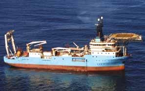
E-Marine PJSC, the leader in submarine cable installation, maintenance and repair in the Middle East, today announced the successful attainment of CS NIWA after its upgrade to DP II, which will allow it to perform surgical operations in very close proximity to oil and gas platforms. DP II is a requirement [Read more]
France’s RTE selects Alcatel-Lucent for mission-critical communications (September 3rd, 2008)
Alcatel-Lucent (Euronext Paris and NYSE: ALU) has signed three new multi-million Euro contracts with RTE, a subsidiary of French utility EDF Group, to deliver, install and assist RTE to operate and maintain an integrated fiberoptic network. The 1,300 kilometers network expansion will enable RTE to [Read more]
Global Crossing Expands London Data Center, Plans One in Amsterdam (September
8th, 2008)
Global Crossing has announced that it has broadened the scope of services offered in its London data center at Docklands by making available hosting managed services, such as monitoring, backup, security, server
management and storage solutions, specifically Hitachi Data Systems data storage capabilities. The company also announced [Read more]
Global Crossing Joins MEF (August 28th, 2008)
Global Crossing (NASDAQ:GLBC) , a leading global IP solutions provider, today announced it has become a member of the Metro Ethernet Forum (MEF). The MEF is a global industry alliance comprising more than 150 organizations including telecommunications service providers, cable operators, multi-service operators (MSOs), network [Read more]
Global Marine Systems Ltd. Targets Energy Sector with New Business Unit (September 8th, 2008)
Global Marine Systems has confirmed its commitment to the rapidly expanding energy market with the creation of a new business unit, Global Marine Energy. Ian Gaitch, a long time Global Marine staff member, has been appointed the director of the new unit and will be responsible for building on the [Read more]
Global Marine Systems Ltd. Targets Energy Sector With New Business Unit (September 2nd, 2008)
Global Marine Systems today confirmed its commitment to the rapidly expanding energy market with the creation of a new business unit, Global Marine Energy. Ian Gaitch, a long
time Global Marine staff member, has been appointed the director of the new unit and will be responsible [Read more]
Global Marine Offers Career Advancement to
Armed Forces Personnel (August 18th, 2008)
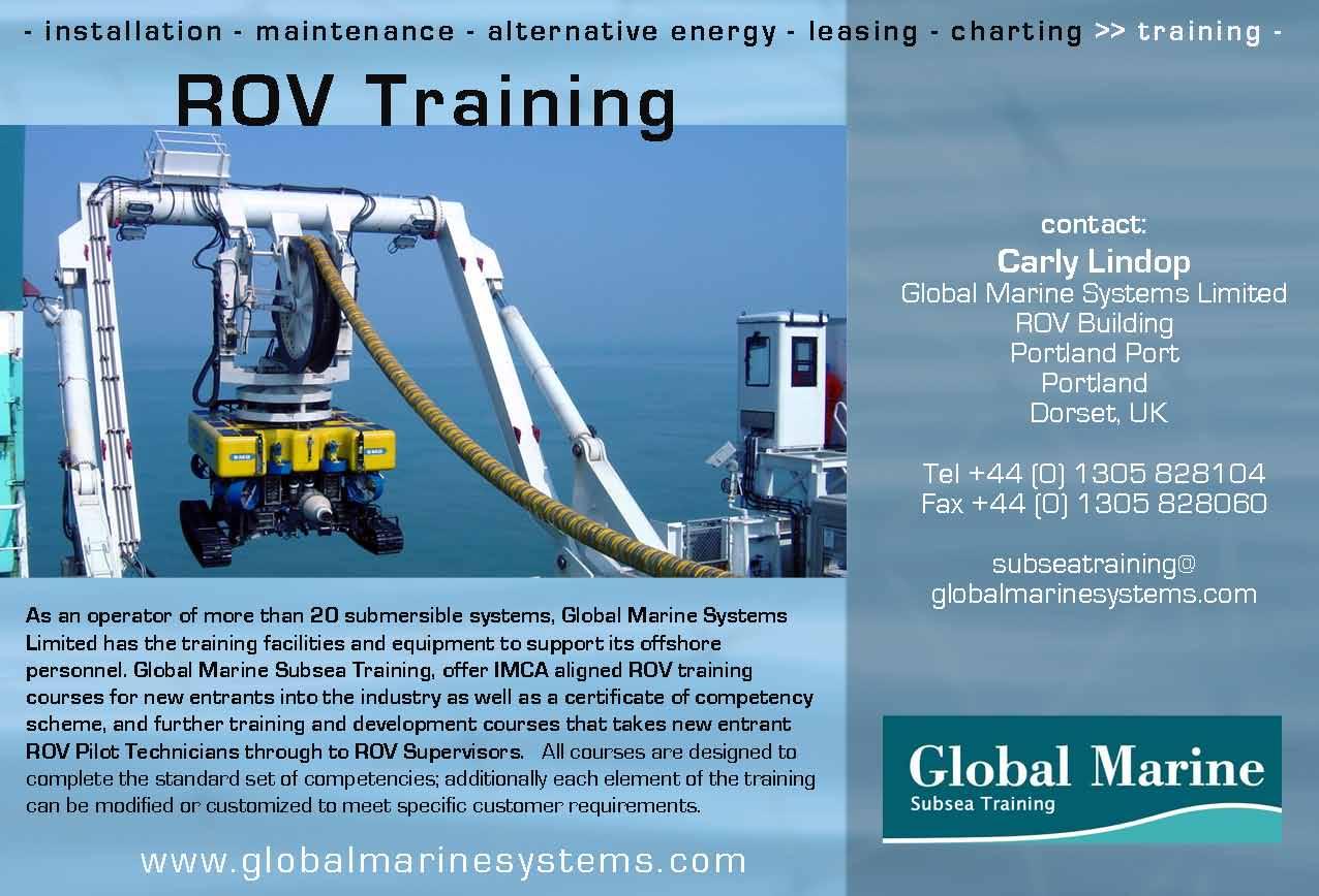
Global Marine Systems Limited’s Remotely Operated Vehicle (ROV) training facility has received approval from the U.K. Ministry of Defense to provide current and former Armed Services personnel with training at their Portland facility. ROV pilots and technicians are in high demand in the civilian oil, gas, and subsea cable industries. This program [Read more]
LGS wins USD 6.45 million IMOD contract award for network upgrades at Fort Polk (August 12th, 2008)
LGS, a subsidiary of Alcatel-Lucent (Euronext Paris and NYSE: ALU) dedicated to serving the U.S. government community, announced today it was awarded a USD 6.45 million task order with the United States Department of the Army. The award is under the Infrastructure Modernization or IMOD contract [Read more]
Malta Government Responds to Recent Cable Outage (August 25th, 2008)
The Maltese Ministry for Infrastructure, Transport and Communications has expressed its concern at the consequences of the recent fault experienced in GO plc’s international
connectivity link. In a statement, the Ministry noted that in an economy which is becoming increasingly service oriented and dependent on IT services, there can be no doubt [Read more]
Matrix Cable System Construction Completed (August 18th, 2008)
Matrix Networks Pte Ltd and P.T. NAP Info
Lintas Nusa, together with the supplier, Tyco Telecommunications, a business unit of Tyco Electronics, has announced they have achieved the status of “Ready for Provisional Acceptance” (RFPA) under the terms of a multi-million dollar turnkey contract for the Matrix Cable System. The 1,000 [Read more]
Matrix Networks and TYCO
Telecommunications Complete Matrix Cable System Construction (August 14th, 2008)
Matrix Networks Pte Ltd and P.T. NAP Info
Lintas Nusa, together with the supplier, Tyco Telecommunications, a business unit of Tyco Electronics and an industry pioneer in undersea communications technology and marine services, today announced they have achieved the status of [Read more]
Nexans Displays Cable Solutions for Wind Turbines (September
12th, 2008)
Nexans has launched its WINDLINK® range of comprehensive cable solutions specifically designed for wind turbines of all sizes, including power and control cables as well as special
cables and accessories at HUSUM WindEnergy. The new range features copper, aluminum and fiber optic cables and components that have been fully tested under [Read more]
NYC Event Marks 150th Anniversary of First Transatlantic Telegraph Cable (September 11th, 2008)
THE LAYING of the first transatlantic cable to Valentia Island, Co Kerry, is an example to all those trying to solve global warming and the US energy crisis, a ceremony to mark the 150th anniversary of the event has heard. Cyrus Field IV, whose great- great grandfather, Cyrus West Field, set up the [Read more]
Oman to License New Carrier, Allow It to Build Submarine Cables (August 18th, 2008)
The Telecommunications Regulatory Authority (TRA), Oman’s telecom regulator, has invited companies to bid for a new fixed telecommunications license. The license is for local and international phone lines, broadband services, a submarine cable and a landing station for cables. Engineer Nashiah Al Kharousiyah, member of TRA, said, “Oman has a population of approximately [Read more]
Pacnet, the major subsea capacity provider to the Beijing 2008 Olympic Games, has provisioned over 20 Gbps of dedicated
bandwidth through two cable landing points in China, to support the broadcast of the event that is expected to draw a record audience of four billion viewers. “This is truly the ‘Bandwidth Olympics’ [Read more]
Prysmian Wins Doha City Project (September 12th, 2008)
Qatar General Electricity and Water Corporation (Kahramaa) has awarded a strategic contract worth 140 million euros to Prysmian for the development of the first ever submarine cable turnkey project serving Doha city. The installation will start in 2009 and is slated for completion at the end of 2010. “The company’s know-how and [Read more]
Reliance, VTEL Announce Agreement for Landing in Jordan (September 8th, 2008)
VTEL Holdings, a leading regional telecom operator, its local subsidiary and individual license holder VTEL Jordan and Reliance Globalcom have announced the signing of an agreement to set up Jordan’s second submarine cable landing station. This will be the first Terabit cable landing in Jordan, addressing the fast-accelerating demand for broadband connectivity [Read more]
Rostelecom Launches Commercial Operation of Russia-Japan Cable Network
(September 12th, 2008)
OJSC Rostelecom, Russia’s national telecom
operator and a company of Svyazinvest group, has announced the launch of a submarine cable system, the Russia-Japan Cable Network (RJCN). The new system links Russia and Japan by a direct high-speed path along two geographically diverse routes. The RJCN employs digital Dense Wave Division Multiplexing (DWDM) [Read more]
The construction of SEACOM’s 15,000 km fiber optic undersea cable, linking southern and east Africa, Europe and south Asia, is on schedule and set to go live as planned in June 2009, the company has announced. Some 10,000 km of cable has been manufactured to date at locations in the USA and [Read more]
SMD wins China Offshore Oil Engineering contract for two WROV’s (September 16th, 2008)
SMD have been awarded a contract to supply two 1000m rated work class ROVs to Offshore Oil Engineering Co. Ltd. of China (COOEC). Two 150HP Quantum units will be supplied, each complete with launch & recovery system, control cabin and workshop cabin all designed and built by SMD. This contract [Read more]
Submarine Telecoms Forum released their quarterly web site statistics today, showing a 68% growth in total monthly visits since its rerelease earlier this summer. Due to the growing need for a faster and more reliable news source, STF revealed a brand-new web [Read more]
THUS, FARICE Announce Capacity Deal
(August 1st, 2008)
THUS plc has announced that it has signed a £12 million agreement with FARICE, the operator of the underwater cabling network which links Iceland to the rest of the world, to provide it with high bandwidth network connectivity in the UK. THUS is providing 200 Gbps of capacity to support [Read more]
Tikiphone
to launch Pacific Island’s first 3G+ network with Alcatel-Lucent and API (August 29th, 2008)
Alcatel-Lucent (Euronext Paris and NYSE: ALU) today announced that Tikiphone, French Polynesia’s leading mobile service provider, will soon launch the region’s first 3G+ network by upgrading its network to High Speed Packet Access (HSPA) technology to support a full range of high-speed mobile Internet and data services. Tikiphone will [Read more]
WFN Strategies Enhances Telecoms Team with Waddell Addition (September
16th, 2008)
WFN Strategies recently enhanced its telecoms engineering and implementation team with the
addition of Bruce Waddell as Field Engineering Manager. With more than 25 years experience, Bruce Waddell has been working with telecoms technology and developing innovative solutions for government, manufacturing and oil & gas [Read more]
WFN Strategies to Participate in US Government Enterprise Event
(September 4th, 2008)
WFN Strategies announced today that it will participate in the upcoming US Government Enterprise Development Event in Washington, DC, called MED Week. The Minority Business Development Agency established the 2008 Minority Enterprise Development (MED) Week Conference which was held at the Omni Shoreham Hotel in Washington, D.C. from September 3rd to September 5th, 2008. The theme for [Read more]
WFN Strategies Selected by Shell Oil as Supplier of Telecoms Engineering
(September 2nd, 2008)
WFN Strategies was recently selected by Shell to participate in its Supplier Diversity Management System. The Shell Supplier Diversity Management System is a database sourcing tool which identifies diverse companies that are capable of providing products and services necessary to meet its growing supply chain [Read more]
Why We don’t automate drilling
reprinted With permission from digital energy Journal
We don’t have as much drilling automation as we should because our industry is uncomfortable with change in a highly risky environment. Rather than address these risks through the novel approaches of automation, it prefers to live with the risks it knows - delegates to a session on drilling automation at ATCE heard
In today’s world we have cars where you turn the key and it goes.
We have pacemakers which automatically adapt to the person around them.
We have drilling on Mars supervised from land.
We have Formula 1 cars which send information to remote engineers halfway around the world and get instructions back.
We have dynamic positioning systems on ships which keep it automatically on the same precise position.
Yet we still drill our wells with a geologist at the well site, giving instructions manually to the well site leader, who gives instructions manually to the driller, and have people manually screwing the drill pipe together.
We could have fully automated drilling systems, where the geologist chooses exactly where to drill and drills there, with no risks of miscommunication, or arguments
with the driller because he wants to break for lunch.
We could have drilling systems which automatically sense where people are and make sure they are out of harms way. All drilling jobs could be supervised by staff with many years’ drilling experience, located in their living rooms.
It would all be safer, more environmentally friendly, and faster.
So at the suggestion of SPE’s 2007 president AbdulJaleel Al-Khalifa, a special panel session was held to discuss this subject at SPE’s recent Annual Technical Conference and Exhibition in Anaheim (session on November 14th at 9am, ‘Drilling Automation - Where are the Game Changers).
Chaired by Michael Sheppard, Fellow, Schlumberger, the panel members were David Reid, global account vice president for E&P company Technology and Business, National Oilwell Varco; Keith K. Millheim, Principal, Strategic Worldwide (who previously held the highest technical position in Anadarko Petroleum, of distinguished advisor); John Thorogood of Drilling Global Consultant LLP (and previously chief drilling engineer at Rosneft and Sakhalin for BP); and Fionn Iversen, research advisor, drilling and well modelling, with the International Research Institute of Stavanger.
Chairman Mike Sheppard, Schlumberger Fellow, said that more use of drilling automation could lead to improved safety, the ability to operate drill rigs remotely, the ability to make more efficient use of existing expertise (because experts could monitor several drilling jobs at once from their living rooms) and better use of new expertise.
“We would be foolish to underestimate the improvement in drilling efficiency – it’s a fundamental driver for automation,” he said. “We want to discuss the hurdles to automation and what are the game changers.”
Moving it forward
Some companies are already taking a strong lead with implementing drilling automation.
One example is Danish shipping and oil company Maersk. “Every time they come to us, they ask for complete automation,” said National Oilwell Varco’s David Reid.
They ask for automation because they have gained experience with it in their shipping business, and know how much it can help. “They are one of the biggest shipping companies because of automation,” he said.
Perhaps national oil companies will move faster to implement complete drilling automation, where control over the entire process is more concentrated in one organisation.
It will appeal to them if they can avoid working with expensive foreign companies and staff well sites with people from their country, Dr Millheim said.
“If the Saudis can do with 10 rigs what they could previously do with 40 rigs, think what that will mean to them,” he said.
“The game changer will be in Saudi Arabia [Saudi Aramco] or Brazil [Petrobras]; they put $150m into it [and make it happen].”
Industry hates risk
Meanwhile we have an international oil and gas industry perhaps not so beloved of risk taking as it once was.
Our industry was founded by people who loved the
It would all be safer, more environmentally friendly, and faster.
adrenalin rush they got from extreme risk taking, but you couldn’t say the same about today’s oil and gas environment.
Dr Millheim noted that today’s oil and gas employees are perhaps more reluctant to take on risk than their predecessors, and few people willing to champion new technologies for the sake of it.
“We have to have champions. Champions are people who are crazy. There’s no reward for being a champion,” he said.
“There has been the culture 10 years ago where people were able to take risks,” said Mr Reid. “But there’s a lot less belief in it [today].”
Mr Reid noted that “People keep going back to their company to apologise for an idea that didn’t go as well. Global implementation of new ideas is something we’re struggling with in our industry.”
“There’s a declining desire to take risk, and less people with a desire to make a difference,” he said. “We need people who understand – we need to change the game and be willing to take risks. We have technologies which are so close.”
Comfort
Dr Millheim also noted that the industry was a bit too comfortable with the status quo. It takes some aggressive competition to bring out innovation, as we have seen in the automobile industry.
“Contractors have no reason to drill faster. They get paid by the day,” he noted.
“And when there’s $90 oil the head of the drilling company doesn’t care how efficient the drilling is.”
“I believe the problem is the structure for drilling, with contractors, operators, subcontractors and manufacturers,” he said. “Who is going to lead the band for drilling automation? Operators, contractors, subcontractors or manufacturers?”
“Show me the innovators here,” he said. “There are no real innovators. We have a system set up where the existing solution is fine.”
“We have an industry that can get away with what it perceives the need to do, with what it has available”, noted Mr Thorogood, “and there is a lot of growth potential.”
“Companies have to recognise, we are way too safe in some places,” agreed Mr Reid.
Crisis?
There was a small difference in opinion about if we need a crisis to get automation systems rolled out.
Mr Thorogood believes that systems will only be implemented if there is a crisis, “as with all great changes.”
However Dr Millheim thinks “– if something is going to change – it can change gradually over time.”
An audience delegate, from an oil major, said “I think we’re in a crisis today. We’re in a number of geographies with a finite number of rigs.”
Mario Zamora, manager of applied engineering with M-I SWACO, said that the industry is “always in crisis,” but not a big enough crisis yet to force change. “A crisis that can make a difference is when we can no longer do what we need without a change,” he said.
The ‘crisis’ in the drilling industry may be the point where deepwater wells are so complex they are impossible to control manually, Mr Zamora said. “That may be the crisis that pushes us over the other side.”
Bigger is better?
Dr Millheim expressed the interesting view that the industry is too focussed on grand billion dollar projects, such as deepwater offshore rigs, when most of the oil drilling around the world needs smaller, less complex equipment.
“I’m a big sceptic about more complexity,” he said. “We tend to want to get bigger – people think that big is better. I’m worried we’re getting too clever for our own good.
“[People should be focussing on] how do you make rigs smaller, lighter, easier to maintain, make bits self sharpening.”
“I understand what you’re doing in the North Sea – but many wells are not in the North Sea, they are in much more impoverished places. 80 per cent of our rigs are on land,” he said.
This complexity is also a barrier to more automation. “We have to simplify before we can automate,” he said.
Mr Thorogood agreed with this view. “Why do we always think that bigger is better?” he asked.
As an example, the industry is perhaps not giving seabed drilling as much consideration as it should be.
Seabed drilling would require equipment which is perhaps simpler than a deepwater drillship or drilling platform above the water.
The equipment required would be much lighter, and would not need toughening up to cope with extreme weather conditions.
Companies have to recognise, we are way too safe in some places.
“But the forces of reaction are massive, represented by the drilling contractors,” he said.
Like a car
Dr Keith K. Millheim, principal of Global Drilling Ltd, said that we need a drilling rig which is as easy to drive as an automobile; you just turn the key and drive it. “You don’t need all these tool pushers,” he said.
“No-one has developed a system for well control that says ‘keep your hands off the choke’,” he said. “We could have automated well control today. Why don’t we have it?”
“Right now we could have a drilling machine like an
automobile – if we could overcome hurdles of who does what.”
However, “we don’t have enough R+D capacity [to build it],” he said. “There are not enough innovators.”
We are almost there. “Directional drilling has made drilling like driving a car,” he said. “Anyone with reasonable skills with 90 days training can be a directional driller.”
Mario Zamora, manager of applied engineering with M-I SWACO, noted that Formula 1 cars send data to a remote control centre halfway around the world, and engineers send back information to the driver about what buttons to push. “The car is programmed to slow down
automatically for a pit stop at exactly the right speed,” he said.
However one audience delegate from BP said that the car analogy was perhaps not appropriate, because in this scenario, the oil company is sitting in the back of the car asking the taxi driver to put in a new engine. “We need to create a new [business] environment,” he said.
Another audience member said, “There’s a horrifying idea when a geologist knows what to do and runs the drilling tools. But there’s no reason why he can’t do it.”
“We can have a budget rig, which can connect the people who want to go somewhere, with the desire to take them there.”
Many people’s bad experience with automation in the past, with things which didn’t work as well as they should have done, serves as a barrier to implementing automated tools, said David Reid, vice president of products, National Oilwell Varco, a manufacturer of drilling tools.
“There’s a lot of burnt fingers – so there’s a lack of enthusiasm, that’s for sure,” he said.
“Experience should make us go forward.”
Mr Reid told a story of National Oilwell Varco’s experience selling iron roughnecks, tools to automatically screw drill pipe together.
The systems were first made available in 1975, he said, and a few people bought them, but not a great deal.
The systems could be computer controlled in 1991, but that didn’t change the sales.
The tipping point didn’t arrive until 2003 when Varco launched its ST-80 roughneck, which could screw drillpipe together more safely, with higher quality, and most importantly, faster. “It reduced the connection time from 2 minutes to 19 seconds,” he said.
David Reid, National Oilwell Varco
Experience should make us go forward.
“It was more reliable and affordable,” he said.
The company sold the most iron roughnecks in 2007, a staggering 32 years after the technology was originally launched.
Mr Reid was sceptical about the idea of making drilling autonomous (ie the drill runs by itself) rather than just automated.
“Autonomous drilling could be safer, better quality and faster, but I think reliability is the area we would need to focus on developing,” he said.
Autonomous drilling may also be very expensive. “I don’t know if it’s affordable. You reach a point where it’s not giving you the value,” he said.
John Thorogood
John Thorogood, a drilling consultant who previously served as chief drilling engineer at Rosneft and Sakhalin for BP, said that one of the sticky points is the imperfect communication between geologist, well site leader and driller, which should probably be automated by now.
There has been a lot of research into drilling, but perhaps too much of it has been on the technical aspect and not enough on the human aspects, he said.
“Investigating the social side of drilling operations is some where we’ve really fallen short,” he said. “We don’t teach how to command our operation.”
“Until we can articulate what sort of decisions we make, we are going to face an uncertain future.”
“How are we going to automate something where we don’t understand how we command and control.”
Mr Thorogood told an interesting story of BP’s development in Wytch Farm, where oil was found beneath a popular British beach.
“We were going to do it in a traditional way and build an artificial island off one of Britain’s best loved resorts,” he said.
“John Browne said he wasn’t going to take the political flack, that’s the wrong answer, go and find another way of doing this.”
BP’s solution was to drill the wells from three miles inland, which would reach out under the water to get to the oil.
Keith K Millheim
drilling rig and a completely automated rig, to see which could drill down to 10,000 feet the fastest.
Some companies have drawn direct comparisons between conventional rigs, and the most efficient and safe rigs available. Once they have learned how to do it, they find that they can drill three times faster with just three people working on the job.
“If I could drill twice as many wells for the same budget, the existing solution would not look as attractive,” he said.
Meanwhile the focus should be on determining what humans can’t do very well, and letting computers do it.
Technology is also available for managing mud which is not used, he said. “We’ve had a mud [automation] system forever,” he said. “You can have a trouble free well.”
There is a shortage of experts in mud, and more automation of mud systems would enable their expertise to be spread across more wells. “This system is dying to be made, then people can keep their hands off,” he said.
Dr Millheim said that perhaps one of the best ways to move drilling automation forward is for more articles on the subject to be published in magazines.
“I would say, there needs to be some publications done to bring the full case of applications of automation for offshore and deep wells,” he said.
“As the articles improve, you move towards closure on this issue.”
“I encourage publishers to encourage articles to be done.”
“We need at least a dozen articles in the next year and a half. People in management scan these articles.”
Dr Keith K Millheim, ex distinguished advisor with Anardarko Petroleum, the highest technical position in the company, suggested that a competition could be held between a normal
“Take it out of the hands of the technocrats. Write articles that management can understand,” he said.
At submarine depths, Nexans goes deeper
Because so much of your performance runs through cables Erik Rynning Sales & Project Manager Offshore: “We produced the so far world’s deepest umbilical which was installed at 2350 metre in the Gulf of Mexico.”
Nexans was the first to manufacture and install a 384 fibre submarine cable. Nexans has qualified and installed their URC-1 cable family for fibre counts up to 384 fibres. For further information please contact: Nexans Norway AS P.O. Box 6450 Etterstad N-0605 Oslo Norway
Phone: +47 22 88 61 00
Fax: +47 22 88 61 01
Rolf Bøe Phone: +47 22 88 62 23
E-mail: rolf.boe@nexans.com
22 88 62 22
E-mail: jon.seip@nexans.com
Global expert in cables and cabling systems
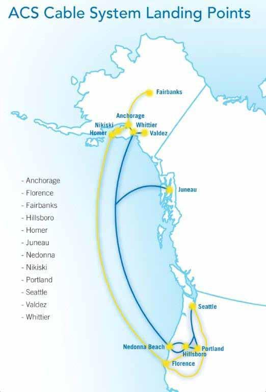
Alaska Communications Systems (ACS,) Alaska’s leading telecom provider, is significantly expanding its capabilities to serve the state’s growing $200+ million Enterprise market. Among other critical projects, ACS is expanding its network through a $175 million build-and-buy strategy in submarine fiber optics.
The Anchorage-based company, which already offers Internet, wireline and wireless solutions to Enterprise and mass market customers in Alaska, is extending its best-in-class in-state data networks through the construction of the Alaska Oregon Network (AKORN) and the acquisition of Crest Communications Corporation, owner of the Northstar cable system. Key market drivers for this strategic investment include growing demand for fast, secure and reliable bandwidth, the state’s robust economy, Alaska’s remote geography and its high dependency on fiber optics, and the business opportunities ACS’ cable landing stations in Oregon provide.
The Case for Investment
More than most places in the United States, Alaska is heavily dependent on undersea fiber to stay connected with the rest of the world and to avoid being sidelined as technology rapidly advances. Terrestrial telecommunications circuits to Alaska are virtually non-existent, with a just a few, low-bandwidth microwave towers strung across Canada. Demand for bandwidth is growing in Alaska at
average rates of 40 percent a year – and likely escalating. The hunger for broadband comes from virtually every sector – from natural resource extraction industries to high school kids streaming video in their rooms late at night. Oil companies, for example, with exploration and production activities on the North Slope need to transmit 3D seismic images; hospitals in Alaska regularly send high-resolution MRI and other diagnostic test results to the Lower 48 for analysis by specialists; banks must share detailed and confidential financial records quickly and reliably; government officials require video conferencing to stay in touch with constituents. The list is virtually endless.
To understand Alaska’s emerging data requirements, consider the oil industry. Petroleum dominates the state economy, contributing some 80 percent of revenues to the state treasury. This industry also provides a snapshot of Alaska businesses’ data transfer needs. The companies that produce North Slope crude oil use a concept called the “digital oilfield,” which integrates real-time production and drilling systems with modeling and simulation. As with most computer models, this electronic process generates a plethora of data that needs to be securely transferred and shared. A typical oil company might have 350 terabytes of data generated by 50 3D seismic projects. On a daily basis they may amass 10 terabytes in simulation models, 10 gigabytes from oil field telemetry and 4 terabytes of data tied up in
30,000 sub-networks at the refinery. Alaska hosts numerous companies working on multiple oil and gas fields, all of which require massive connectivity and the highest level of reliability.
The need for bandwidth will likely expand more rapidly in the coming months as planning gets under way toward the construction of a $30 billion natural gas pipeline from the North Slope to the Lower 48. Alaska sits on some 35 trillion cubic feet of natural gas that it has long sought to bring to market. In August, Alaska lawmakers approved a proposal by state Governor. and Republican Vice Presidential nominee Sarah Palin’s to issue a license and a $500 million state subsidy to Calgarybased TransCanada Corp. to pursue a 1,715-mile gas pipeline. The pipeline would move Alaska’s gas from the North Slope onto existing infrastructure in Canada and down to the Lower 48.
The gas pipeline is touted as one of the largest construction projects in U.S. history and interest in building it is not limited to TransCanada. Earlier
in 2008, BP and Conoco Phillips announced a partnership to also pursue a natural gas pipeline. The two multinational petroleum giants, with offices in Anchorage and operations in the oil patch, promised to spend an estimated $600 million over the next three years to plan for pipeline construction.
The massive gas line project is expected to result in a major boost to Alaska’s already robust economy, which is largely counter-cyclical to that of the rest of the United States. When energy prices soar, the state’s economy prospers. Alaska currently has a multi-billion dollar budget surplus, the highest of any state in the nation. These circumstances bode well for the business climate and the opportunities ACS has to serve the telecom needs of the Enterprise market.
For these and other strategic reasons, ACS determined that an expansion of its Enterprise capabilities was a critical growth engine and that investing in fiber optic facilities to the Lower 48 was a must.
The Projects
ACS already owns and operates what is arguably Alaska’s most advanced in-state data systems which integrate technologies such as MPLS and Metro Ethernet into complex Enterprise solutions. However, the needs of existing and future Enterprise customers extend beyond the borders of Alaska – to the contiguous United States and often internationally. To fully serve these customers and to capitalize on the market, ACS concluded that adding best-in-class connectivity out of Alaska was essential.
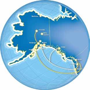
The company announced its investment decision in undersea fiber in 2007. Construction on AKORN ensued that year with the cable slated for service in the first quarter of 2009. AKORN is among the most advanced communications infrastructure projects in the United States this decade. When complete, AKORN will traverse south from Anchorage and land in Florence Ore. In addition, AKORN’s four fiber pairs have a design capacity capable of transmitting 2.6 terabits per second. The state-of-the-art cable will triple Alaska’s existing bandwidth capabilities, offer customers more resilience and capacity at
the highest data transfer speed, provide the latest in error-correction technology available and utilize the latest in cable manufacturing and installation technologies. From the landing station in Florence, AKORN will extend over redundant facilities to both Seattle, Washington and Portland, Oregon – hubs for U.S. and international Enterprise customers and telecommunications carriers.
The company carefully designed AKORN’s nearly 3,000-kilometer submarine route with physical/geographic diversity, recognizing that the route similarity of the existing fiber placed Alaska’s telecommunications security and Enterprise customers’ business continuity at risk. Currently, the three existing undersea fiber cables depart Anchorage and travel the same terrestrial corridor within feet of each other along Turnagain Arm, creating a single point of potential failure. Against a backdrop of steep mountains that are prone to avalanches, Turnagain Arm is a notoriously hazardous channel known for its extreme tidal fluctuations and ferocious currents. Even on land where the cables are buried, the area frequently encounters disruptive terrestrial activities, such as bulldozers clearing soil for railroad maintenance. Any disaster along this route, natural or man-made, could wipe out connectivity. In earthquake-prone Alaska, this is a significant risk.
AKORN is designed for total traffic security. Io minimize the likelihood of a telecom catastrophe, the cable avoids Turnagain Arm entirely. The cable travels underwater from Anchorage to Nikiski, overland to Homer, and beneath the ocean to Oregon. The Anchorage to Nikiski leg avoids significant fishing and shipping lanes, minimizing risk in this difficult and hazardous waterway. AKORN’s Nikiski to Homer terrestrial portion allows ACS to provide fiber connectivity to subscribers on the Kenai Peninsula, where the company is the primary local exchange provider in the major communities.
The AKORN landing station in Florence, Oregon, is also a key ACS asset. As the Trans-Pacific submarine cable industry expands, landing sites along the U.S. West Coast are becoming evermore scarce. At the same time, the ability to secure landing licenses, easements, permits, and rights of way is getting difficult r. ACS did extensive research to determine the best location to land AKORN. The company closely consulted with industry experts to find the most advantageous landing site. Florence became attractive due to its favorable underwater and shore-based geographic conditions. ACS worked closely with the Oregon Fishermen’s Cable Committee and others to select a site that would minimize external opposition from fishermen, community groups, and environmentalists, while maximizing the likelihood of government regulatory approval.
ACS’ new Florence landing station will not only house AKORN but will link to backhaul connections to points in the Portland and Seattle metropolitan areas. The station is also well suited to house additional submarine cables, an option ACS is pursuing. Existing permits and easements will allow ACS to provide cable landing infrastructure which is nearly turn-key.
In addition to the AKORN build, ACS is acquiring Crest Communications and its Northstar cable, a transaction that is expected to close towards the end of 2008. The Northstar cable system and its landing station, operational since 1999 and already hosting several Trans-Pacific cables, is also strategically located to avoid physical and operational issues. The cable stretches approximately 3,000 kilometers from Nedonna Beach, Oregon, to Alaska, with landing stops in Whittier and Juneau. The cable has a current
capacity of six 2.5 Gbps bi-directional switched rings (BLSR) and can be upgraded to 10 Gbps. This network provides backhaul from the coast to interconnection points in Portland and Seattle, where ACS will operate additional collocation facilities and interconnects with the U.S. national telecommunications grid. Northstar complements AKORN with Southeast Alaska connectivity and a redundant path to the Lower 48. When the Crest transaction is complete - expected in the second half of 2008 - ACS will own two of Alaska’s four cables joining Alaska and the contiguous United States.
Both Northstar and AKORN will be supported by a Network Operations Control Center (NOCC) in Hillsboro, Oregon, with managed services support by dual NOCCs in Anchorage and Raleigh, N.C. These facilities and their teams will provide proactive network management to the entire system. ACS is the only Alaska carrier providing this level of reliability for network control.
The Future
The investments in the AKORN and Northstar fiber networks mark a major milestone for ACS. It’s an exciting time for the company as it rapidly transforming itself into a 21st century integrated communications solutions provider. The track record of ACS has been best in class since a company make-over that began in 2004. The credentials,
backgrounds and strategic focus of the company’s executive team have delivered phenomenal growth for ACS in recent years. The new investments in fiber optics, combined with its statewide 3G CDMA wireless network, define ACS as Alaska’s best telecom provider and an industry trendsetter.
Paula Dobbyn is a former print and broadcast journalist who directs corporate communications for Alaska Communications Systems. She lives in Anchorage, Alaska, and had contributions from Rob Doucette, Sarah Gilbertson and Laura Dana.
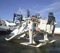
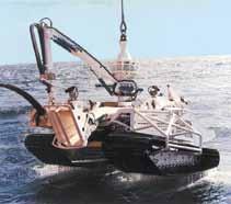
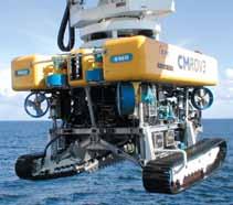
Ploughs
Trenchers
ROVs
mitigation strategies for interference in the ism Band
By charles foreman
More and more, the ISM bands are being used for wide area, wireless networks in the oil patch. Because the ISM bands are unlicensed, anyone can use them so long as they comply with the FCC regulations. This can lead to potential RF interference between operators in the same geographical area, on the same frequency band, using different modulation techniques. Fortunately there are techniques and strategies to minimize the effects of the interference.
In the past, gathering a few data points from an oil or gas well once an hour was adequate to operate the field. “Good oil field practices” did not require
large amounts of data to manage the reservoir. This has not been true for some time. As the oil and gas become more valuable, even small percentages in extraction efficiencies contribute significantly to hydrocarbon recovery from the reservoir and hence to the company’s bottom line. In order to improve extraction, more data, more often is required so that the operator can model the reservoir with higher resolution.
Personal safety and environmental protection have always been important. The negative impact of an accident can take years to rectify. By recognizing that an “event” has occurred at the well head in a
matter of minutes, instead of hours, the operator can take corrective action in a timelier manner and, hopefully, minimize the impact.
The challenge becomes one of: how do you collect the data from thousands of wells spread over hundreds of square miles with no connectivity back to the central operations location? Plus the connectivity must be highly reliable. Typically, the wells are located in remote areas without any commercial infrastructure to support mission critical, high throughput data.
One solution is to use radios to provide the connectivity. In the past, low speed (9600 baud), FCC licensed radios were adequate to meet the operator’s needs. While this solution did not always guarantee interference-free transmission of data, it allow for remediation through the FCC. Low speed data is no longer adequate to operate the field. The operators need more data, and it has to be closer to realtime. This requires higher bandwidth and higher polling rates. At the present time, the commercially available radios that economically fill this need are in the unlicensed ISM bands. While this unlicensed operation makes for one less step in the deployment process, it leaves operators in congested areas nervous about the ability to control potential interference from neighboring operators.
Depending upon the terrain, frequency, power availability, and RF interference, commercially available, point-to-multipoint radio systems can support from 512kbps to ≈12Mbps connectivity. Choosing the right frequency band, antenna height, polarity, and hardware can satisfy most of the system requirements for data throughput. RF interference can be much trickier.
RF interference is a fact of life. It cannot be completely eliminated nor avoided. Any unwanted signals or background noise may introduce errors into the transmission path. These errors will decrease the system’s throughput due to the need for retransmissions, or in the worst case, block all throughput because the receiving radio
cannot discriminate the data. Fortunately there are techniques incorporated in the radio equipment to mitigate the effects of RF interference.
There are two basic transmission techniques used in the ISM band, and they use different approaches to handle interference:
1. Direct-sequence spread spectrum (DSSS) is a spread spectrum wireless coding method that spreads the modulated information signal over a fixed frequency carrier signal. It uses suppression to mitigate interference. It’s C/I (carrier-tointerference) ratio is higher than that of a frequency hopping system. This means that a DSSS system can tolerate a higher noise floor and still maintain throughput. The throughput can be as high as 12MBps.
2. Frequency-hopping spread spectrum (FHSS) is a spread spectrum technique that directly modulates a carrier that randomly hops between discrete frequencies within the band. It uses avoidance to mitigate interference. If it lands on a frequency that is in use, it retries on the next random frequency. As the noise floor rises, FHSS will hop more frequently to maintain connectivity. Excessive hopping decreases the data throughput and adds latency to the system. The throughput is in the range of 512kpbs to 1Mbps.
There is a third technique that is a hybrid of the other two, i.e. it acts like a frequency-hopping, direct-sequence system. It has the potential of more throughput than a FHSS, e.g. 4 to 6Mbps. However, if another frequency-hopper “steps” on this radio during transmission, re-tries (retransmissions) may actually decrease the effective throughput. This is a good solution where high bandwidth is needed, and there aren’t very many other ISM radios operating.
All of these techniques use adaptive modulation schemes that increase the probability of a robust and highly available link. Forward Error Correction (FEC) also improves performance. These systems are capable of recognizing persistent interferers and avoiding those channels.
In spite of the inherent capabilities of the ISM radio systems, RF interference will still occur. There are some system design techniques that are used to minimize the interference. Also there are some operational practices that might be used to share the band.
Before implementing any radio system, a RF study should be done to identify the existing radio systems operating in the local geographic area. Based upon the study, the advantages of a DSSS system vs. a FHSS system can be evaluated. If all the existing systems are frequency-hoppers, a new direct-sequence system will cause interference. If you install a DSSS system, care must be taken to use frequencies in different zones than those the FHSS systems are using. The drawback is that you cannot tell what other operators may be planning. Picking a robust system now does not guarantee that it will be “future proof.” Because the ISM band is unlicensed, any operator can add to the RF noise at any time in the future.
“Good” RF engineering will help mitigate interference. Designing a frequency plan without overlapping frequencies will minimize selfinterference. Directional antennas (antennas with narrow beam widths) will help reject unwanted signals. The system can be configured to avoid interfering frequencies. For example, if a DSSS system is operating in a particular ISM zone, a FHSS system can be set up to skip that zone.
Before installing a new system, initiating a local users’ forum will go a long way towards being “a good neighbor” and sharing the ISM band. It is in everyone’s interest to share the band and not be knocked off the air by other operators. Even if you can’t identify every ISM operator, shortly after you
up turn up a new system that interferes with their system, they will come looking for you. Moving both operations to other parts of the band will reduce mutual RF interference. This may result in increased retransmissions (decreased throughput), but you both will still have connectivity. Sometimes you may be accused of causing interference when in fact it isn’t your system. The users’ forum gives you a vehicle to work together to identify and resolve the interference -- thereby minimizing the animosity that can arise from operators interfering with each other.
The ISM band offers a good solution for wide area, point-to-multipoint connectivity in the oil patch. However, because it is unlicensed, the system must be designed to alleviate the inevitable RF interference. Choosing the appropriate spread spectrum technology will help mitigate the interference. Contact and sincere interaction with other operators in the local area will help share the band between all interested parties.
Charlie Foreman has been involved in telecom systems for over 30 years, including serving abroad as Engineer responsible for the development of a strategic telecoms plan for Saudi ARAMCO, Manager of Systems Engineering for Fujitsu, Systems Engineer for NEC America, and Project Engineer for Arabian American Oil Company. He has supported WFN Strategies in the engineering, provision and installation of a fiber optic, RF, microwave and cellular telecom system in Prudhoe Bay, Alaska, as well as the development of microwave-based network in Wyoming. He possesses a Bachelor of Science degree in Electrical Engineering, and Masters of Business Administration, and is a Member of IEEE. He joined WFN Strategies in 2003 as Project Manager.
innovative technology for handling of fiBre-optic caBles, found its Way to the o & g sector
In the late 1990s, the Norwegian technology company ODIM, developed an innovative traction winch system (CTCU - Cable Traction Control Unit), aiming to handle & lay fibre optic cables in a gentle and fast way. Their experience and strength were particularly on areas of handling all types of submarine cables and ropes in a way which prevented premature failure and uncontrolled wear and tear. Encouraged by the great prospects within the cable laying business, ODIM regarded this technology as the future state-of-the-art solution, and made commitments to invest in technology development and prototype testing. The company invested more than 10 million USD into this development including building and demonstration of a full size prototype.
The first ODIM CTCU™ installed onboard Western Geco` vessels, to be used for ocean bottom cable laying operations.
the new version for automatic handling systems including the latest developed AC frequency controlled drive systems, and received contracts for complete deck handling gears for the last 8 cable ships to be built for this industry from 2000 – 2003.
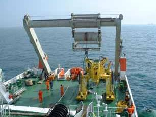
Six vessels for Tycom and Two for Dockwise, was the preliminary end of this story. Twenty-wheelpair linear machines, 40Te drum engines, traction winches and large A-Frames for plough towing were the major part of the packages, turning ODIM into the #1 supplier of deck handling gear for this industry.
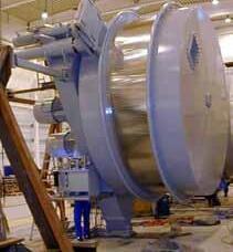
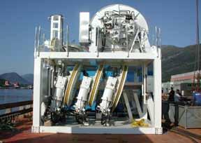
Linear Cable Engine for fast laying of fibre optic cable, following the slopes of the seabed of up to 4 – 8 knots speed. Speed control interface with the vessels cable lay software from e.g. Makai
by per ingeberg and sverre torben
However, ODIM realized somewhat later, that their entrance into this conservative market, would require more standard and field proven solutions. They acted accordingly, took lessons from common practice in the cable laying industry and studied standard solutions. Based upon this, they designed
However, when the promising cable laying market, came to a somewhat early decline, ODIM had to find new opportunities. Nevertheless benefits have come from this 3 – 4 years exercise in that a unique technology platform had been developed, which could be used for other applications.
The prospects within Oil & Gas deepwater installation of subsea hardware, had been a focus amongst a group of people within ODIM for some time. Their skills and experience with handling sensitive cables for the seismic and naval industry since 1980s, merged with their advanced skills on automatic handling systems for laying fibre optic cables, should prove to be a unique basis for making history.
Cleaning the dust off the ODIM CTCU™ technology, seemed to be the perfect match for handling another kind of sensitive material; Synthetic fibre rope, with the target to substitute steel wire for installation of subsea hardware in deep and ultra deep waters.
Fibre rope with its low weight provides higher efficiency on lifting capacity and reduced energy consumption, compared with the steel wire based solutions.
Further development and demonstration of the ODIM CTCU™ technology for this application is done by support from some of the major oil companies, marine contractors and Norwegian Governmental funding programs; Demo 2000 and Innovation Norway through various JIPs.
The Oil and gas industry have great challenges in exploiting the reservoirs in deep and ultra deep waters in Brazil, Gulf of Mexico, West of Africa and Southeast Asia.
The ODIM CTCU™ system makes deepwater installation work possible at a much more efficient and fast manner than traditional steel wire systems. Fibre rope is as strong as steel wire of equal size, but has only 15% weight in air compared to steel wire. In water, fibre rope is practically weightless, which means that it can handle much higher loads at deep and ultra-deep waters, and has the potential to revolutionize installation work especially at extreme water depths of 3000 meters and beyond. Now, it has also been proven to be much more efficient than steel wire for all water depths, and it will last longer.
Fibre rope is more elastic than steel wire and will elongate by 1 – 3% under loads, which will lead to heat generation caused by friction, resulting in premature failure and uncontrolled wear & tear, when used in combination with traditional winches. The ODIM CTCU™ solves these problems by compensation of the rope elongation such that slippage is avoided, and by storing the rope at a low and constant tension well below the limits for creep and compression allowed for the fibre materials used in the rope.
The ODIM CTCU™ technology was patented in 1998 and a 50T prototype for deep water installation was developed by substantial support from the industry. In 2005, a successful field pilot was done in 860 meters water at the Ormen Lange gas field, installing 3 gravity anchors under full active heave compensation. This was the trigger and reference Subsea 7 needed to take the system onboard Toisa Perseus September 2006, for a large installation campaign in the Independence HUB
project (Gulf of Mexico) up to 2750 meters water depth. Since then, the system has been in use for installation work on the Agbami field west of Africa. The number of lifts counts today about 400, and the very same fibre rope is still in use!!
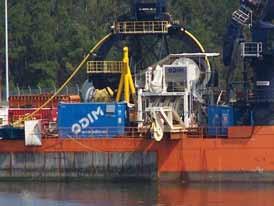
The ODIM CTCU™ installed onboard Toisa Perseus, ready for ultra deep water work in Gulf Of Mexico
If wire had been used for the same number of lifts, ODIM have reason to believe, that Subsea 7 would have changed the wire up to 6 times by now. One can only imaging the cost impact from vessel out of operation, caused by exchange of wires.
Fibre ropes can be repaired onboard the vessel by cutting and splicing, and only worn segments, typically exposed from accumulated bending over sheaves in long period of active heave compensation, is needed to be removed or replaced. Additional rope length can be added to the operational length, so that cut out of worn segments does not hinder continuous operation. Splicing of ropes offshore, can be done by trained crew and takes about 3 hrs.
Since 2006, the ODIM CTCU™ system has been further developed up to 125T and 250T capacities, again with substantial support from Demo 2000/Innovation Norway, major oil companies and marine contractors.
As of today, ODIM has two contracts under production. The first one is a 125T unit for Aker Oilfield Services as
part of a complete module handling system from ODIM on their SESV/OSCV steaming for Brazil in 2009, for a 5 + 5 years contract with Petrobras, installing X-mas trees. The other unit is a 250T ODIM CTCU™ for Havila Shipping, to be installed on one of their new large construction vessels.
ODIM expects several contracts within the promising construction market in the future.
ODIM CTCU™ – Fibre Rope Deployment System
Per Ingeberg is Senior Vice President - Research & Development at ODIM
ASA. He is a Construction Engineer, and joined ODIM in 1998 where he was responsible for market and technology developments. He became R&D Manager in 2003.
Sverre Torben is Technical Manager Research & Development at ODIM
ASA. He holds a Master of Science in control technics from Supéléc in Paris in 1994, and worked in the R&D department in ABB Kraft on high voltage switchgears and control systems from 1994 to 1998. He joined ODIM as technical manager in 1998.
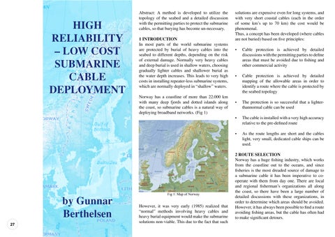
HIGH RELIABILITY – LOW COST SUBMARINE CABLE DEPLOYMENT
gunnar.berthelsen@nexans.com
Abstract: A method is developed to utilize the topology of the seabed and a detailed discussion with the permitting parties to protect the submarine cables, so that burying has become un-necessary.
solutions are expensive even for long systems, and with very short coastal cables (each in the order of some km’s up to 70 km) the cost would be phenomenal.
Thus, a concept has been developed (where cables are not buried) based on five principles:
A method is developed to utilize the topology of the seabed and a detailed discussion with the permitting parties that burying has become un-necessary.
In most parts of the world submarine systems are y cables into the seabed to different depths, depending on the risk of external damage. Normally very heavy cables and deep burial is used in shallow waters, choosing gradually lighter cables and shallower burial as the water depth increases. This leads to very high costs in installing repeater-less submarine systems, which are normally
In most parts of the world submarine systems are protected by burial of heavy cables into the seabed to different depths, depending on the risk of external damage. Normally very heavy cables and deep burial is used in shallow waters, choosing gradually lighter cables and shallower burial as the water depth increases. This leads to very high costs in installing repeater-less submarine systems, which are normally deployed in “shallow” waters.
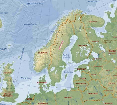
Norway has a coastline of more than 22.000 km with many deep fjords and dotted islands along the coast, so submarine cables is a natural way of deploying
Norway has a coastline of more than 22.000 km with many deep fjords and dotted islands along the coast, so submarine cables is a natural way of
• Cable protection is achieved by detailed discussions with the permitting parties to define areas that must be avoided due to fishing and other commercial activity
However, it was very early (1985) realized that g heavy cables and heavy burial equipment would make the submarine solutions non-viable. This due to the fact that such solutions are expensive even for long systems, and with very short in the order of some km’s up to 70
However, it was very early (1985) realized that “normal” methods involving heavy cables and heavy burial equipment would make the submarine solutions non-viable. This due to the fact that such
• Cable protection is achieved by detailed mapping of the allowable areas in order to identify a route where the cable is protected by the seabed topology
• Cable protection is achieved by detailed mapping of the allowable areas in order to identify a route where the cable is protected by the seabed topology
• The protection is so successful that a lighter-thannormal cable can be used
• The cable is installed with a very high accuracy relative to the pre-defined route
2 ROUTE SELECTION
• The protection is so successful that a lighterthannormal cable can be used
• The cable is installed with a very high accuracy relative to the pre-defined route
the coastline out most dreaded source has been imperative one. There organizations all large number organizations, be avoided. However, find a route avoiding often had to make
• As the route lengths are short and the cables light, very small, dedicated cable ships can be used.
2 ROUTE SELECTION
• As the route lengths are short and the cables light, very small, dedicated cable ships can be used.
Norway has a huge fishing industry, which works from the coastline out to the oceans, and since fisheries is the most dreaded source of damage to a submarine cable it has been imperative to co-operate with them from day one. There are local and regional fisherman’s organizations all along the coast, so there have been a large number of detailed discussions with these organizations, in order to determine which areas should be avoided. However, it has always been possible to find a route avoiding fishing areas, but the cable has often had to make significant detours.
Norway has a huge fishing industry, which works from the coastline out to the oceans, and since fisheries is the most dreaded source of damage to a submarine cable it has been imperative to cooperate with them from day one. There are local and regional fisherman’s organizations all along the coast, so there have been a large number of detailed discussions with these organizations, in order to determine which areas should be avoided. However, it has always been possible to find a route avoiding fishing areas, but the cable has often had to make significant detours.
When it has been determined which areas can be used to deploy the cable the route selection is based on modern charts generated from multi-beam echo-sounder data. The national cartographic organization has recently mapped a large portion of the coast by such means, and charts are therefore available with a very high resolution (objects <1m can be identified). Where data are not yet available, new data has to be generated specifically for the project using the same technology.
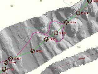
Using these high resolution charts the cable route is selected, placing the cable in the “valleys” of the seabed, avoiding deployment along steep slopes, avoiding ship wrecks, etc. (Fig 2)
Thus, a concept has been developed (where cables are be avoided due to fishing and other commercial activity
When it has been to deploy the modern charts data. The national recently mapped means, and charts high resolution
When it has been determined which areas can be used to deploy the cable the route selection is based on modern charts generated from multibeam echo-sounder data. The national cartographic organization has recently mapped a large portion of the coast by such means, and charts are therefore available with a very high resolution (objects <1m can be identified). Where data are not yet available, new data has to be generated specifically for the project using the same technology.
Using these high resolution charts the cable route is selected, placing the cable in the “valleys” of the seabed, avoiding deployment along steep slopes, avoiding ship wrecks, etc. (Fig 2)
with a central steel tube containing the fibres, an inner sheath, one or two layers of steel wires and an outer polyethylene sheath. (Fig 3).
shown that a strong cable is not necessary using the protection philosophy described above.
From these charts it is possible to define the accurate length of cable along the seabed to be installed, and an accurate route position list.
3 CABLE DESIGN
The cable used is Nexans’ well known URC-1 design, with a central steel tube containing the fibres, an inner sheath, one or two layers of steel wires and an outer polyethylene sheath. (Fig 3).
3 CABLE DESIGN
From these charts it is possible to define the accurate length of cable along the seabed to be installed, and an accurate route position list.
3 CABLE DESIGN
The cable used is Nexans’ well known URC1 design, with a central steel tube containing the fibres, an inner sheath, one or two layers of steel wires and an outer polyethylene sheath. (Fig 3).
The cable used is Nexans’ well known URC-1 design, with a central steel tube containing the fibres, an inner sheath, one or two layers of steel wires and an outer polyethylene sheath. (Fig 3).
4 CABLE INSTALLATION
The URC-1 is qualified for a number of armor designs, but for the Norwegian projects two lighter versions have been used because experience has shown that a strong cable is not necessary using the protection philosophy described above.
4 CABLE INSTALLATION
With the protection philosophy employed, it is imperative to lay the cable in the allocated corridor to a high degree of accuracy and wherever possible to follow the contours of the seabed in order not to generate free spans or coils. The aim is to install the cable with close to zero bottom tension, but on the positive side (ie no slack). This is achieved through the use of two different “underwater navigation” methods.
With the protection philosophy employed, it is imperative to lay the cable in the allocated corridor to a high degree of accuracy and wherever possible to follow the contours of the seabed in order not to generate free spans or coils. The aim is to install the cable with close to zero bottom tension, but on the positive side (ie no slack). This is achieved through the use of two different “underwater navigation” methods. 4).
The computer is then able to automatically control the position of the cable ship (sternways and sideways) and the feeding-out of cable, such that at any given point along the route the correct amount of cable is fed out at the right position in order that the cable ends up in the pre-defined corridor on the seabed.
The computer calculates the ships’ exaggerated turn in order to pay out enough cable to follow the pre-defined route on the seabed at a way-point. In principle, this laying process can be managed from an onshore office, because the system takes full control of the ship.
The computer calculates the ships’ exaggerated turn in order to pay out enough cable to follow the pre-defined route on the seabed at a way-point. In principle, this laying process can be managed from an onshore office, because the system takes full control of the ship.
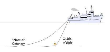
Fig 4: Installation with “Guide Weight”
The second (patented) method employs a “guide weight” which is a unit riding on the cable very close to the seabed. The unit carries an underwater navigation system which gives the position of the cable touchdown on the seabed. The unit is also given sufficient weight so that the cable touchdown is kept much closer to the cable ship than with a normal catenary lay. (Fig 4).
The second (patented) method employs a “guide weight” which is a unit riding on the cable very close to the seabed. The unit carries an underwater navigation system which gives the position of the cable touchdown on the seabed. The unit is also given sufficient weight so that the cable touch-down is kept much closer to the cable ship than with a normal catenary lay. (Fig 4).
The first method is employing an advanced computer model which combines the data from the high resolution charts with data on sub-surface currents and accurate data on the cables’ behavior in water, the latter being developed through comprehensive towing tests. The computer is then able to automatically control the position of the cable ship (sternways and sideways) and the feeding-out of cable, such that at any given point along the route the correct amount of cable is fed out at the right position in order that the cable ends up in the pre-defined corridor on the seabed.
The computer calculates the ships’ exaggerated turn in order to pay out enough cable to follow the pre-defined route on the seabed at a way-point. In principle, this laying process can be managed from an onshore office, because the system takes full control of the ship.
The first method is employing an advanced computer model which combines the data from the high resolution charts with data on sub-surface currents and accurate data on the cables’ behavior in water, the latter being developed through comprehensive towing tests.
The URC-1 is qualified for a number of armor designs, but for the Norwegian projects two lighter versions have been used because experience has shown that a strong cable is not necessary using the protection philosophy described above.
4 CABLE INSTALLATION
The URC-1 is qualified for a number of armor designs, but for the Norwegian projects two lighter versions have been used because experience has
The computer is then able to automatically control the position of the cable ship (sternways and sideways) and the feeding-out of cable, such that at any given point along the route the correct amount of cable is fed out at the right position in order that the cable ends up in the pre-defined corridor on the seabed.
The second (patented) method employs a “guide weight” which is a unit riding on the cable very close to the seabed. The unit carries an underwater navigation system which gives the position of the cable touchdown on the seabed. The unit is also given sufficient weight so that the cable touch-down is kept much closer to the cable ship than with a normal catenary lay. (Fig 4).
With the protection philosophy employed, it is imperative to lay the cable in the allocated corridor to a high degree of accuracy and wherever possible to follow the contours of the seabed in order not to generate free spans or coils. The aim is to install the cable with close to zero bottom tension, but on the
The guide weight is controlled in the horizontal direction by moving the ship by its’ DP (Dynamic Positioning) system, and in the vertical direction through a winch wire to follow the seabed contour. In this way the ship will, in most cases, be well off the cable’s seabed position in order that the cable shall end up in the correct corridor. (Fig 5)
4: Installation with “Guide Weight”
The guide weight is controlled in the horizontal direction by moving the ship by its’ DP (Dynamic Positioning) system, and in the vertical direction through a winch wire to follow the seabed contour. In this way the ship will, in most cases, be well off the cable’s seabed position in order that the cable shall end up in the correct corridor. (Fig 5)
Page 2 of 3
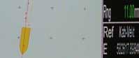
Fig 5: Logging of cable and ship position. Solid red line shows pre-defined route. Red squares show guide-weight position and yellow line show ship’s position. Top left shows that cable position is 1.1 m off route.
The guide weight is controlled in the horizontal direction by moving the ship by its’ DP (Dynamic Positioning) system, and in the vertical direction through a winch wire to follow the seabed contour. In this way the ship will, in most cases, be well off the cable’s seabed position in order that the cable shall end up in the correct corridor. (Fig 5)
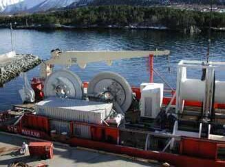
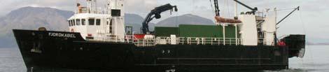
Because the cable is light and the routes are short (<70 km), it is possible to use very small cable ships. Fig 6 shows the cable ship which is used for both methods, and in the picture the guide-weight wire can be seen.
Fig 2: High resolution chart. Green line was initial route. Red lines show alternative routes defined after charting
Fig 2: High resolution chart. Gr lines show alternative routes defined after charting
Fig 3: URC-1 cable
Fig
Fig 5: Logging of cable and ship position. Solid red line shows pre-defined route. Red squares
guide-weight
Fig 3: URC-1 cable
cable number of armor designs, two lighter versions experience has shown that a using the protection employed, it is allocated corridor to a wherever possible to seabed in order not to aim is to install the tension, but on the achieved through the navigation” methods.
ship’s position. Top left shows that cable position is 1.1 m off route.
5 RESULTS
More than 3000 km of cable split between more than 340 individual lengths has been installed using the described concept. The installations are all along the Norwegian coast, from the Oslo Fjord in the south to the arctic waters of the Barents Sea in the north.
The cable is shown (by post-lay ROV survey) to be installed to an accuracy of down to + a few meters in relation to the pre-defined route.
During all these installations there has not been a single cable damage during installation.
It is the shore ends that normally cause problems and this experience thus includes almost 690 shore ends, and on these 690 shore ends there has been an average repair rate of 0.4 repairs per year!!
In Norway submarine installations are used as part of the total national network(s) and as such must compete with terrestrial solutions. However, the cost of submarine systems using the described concept is far less expensive than a terrestrial aerial installation and only a fraction of the cost of an underground solution.
In addition the execution time is far less than that of an aerial installation and again only a fraction of the execution time of an underground solution.
Because the cable is light and the routes are short (<70 km), it is possible to use very small cable ships. Fig 6 shows the cable ship which is used for both methods, and in the picture the guide-weight wire can be seen.
5 RESULTS
6 CONCLUSION
During all these installations there has not been a single cable damage during installation. It is the shore ends that normally cause problems and this experience thus includes almost 690 shore ends, and on these 690 shore ends there has been an average repair rate of 0.4 repairs per year!!
In Norway submarine installations are used as part of the total national network(s) and as such must compete with terrestrial solutions. However, the cost of submarine systems using the described concept is far less expensive than a terrestrial aerial installation and only a fraction of the cost of an underground solution. In addition the execution time is far less than that of an aerial installation and again only a fraction of the execution time of an underground solution.
6 CONCLUSION
More than 3000 km of cable split between more than 340 individual lengths has been installed using the described concept. The installations are all along the Norwegian coast, from the Oslo Fjord in the south to the arctic waters of the Barents Sea in the north.
Through comprehensive experience it has been shown that submarine cable solutions can be very reliable even if the cable is not buried, and by choosing the right tools and equipment it can be very much less costly than “normal” submarine solutions.
The cable is shown (by post-lay ROV survey) to be installed to an accuracy of down to + a few meters in relation to the pre-defined route.
7 ACKNOWLEDGEMENTS
The author wants to thank Svend Hopland (Telenor), Stian Hokland (Seaworks) and Rolf Ueland (Blom Maritime) for valuable contributions to this paper.
Gunnar Berthelsen received a Bsc Hon from Heriott-Watt University in 1971. Started as cable design engineer at Standard Telefon og Kabelfabrikk in 1971 and has worked in many roles in the company since then. The company has worked under the names of ITT, Alcatel Cable and now Nexans. Gunnar started work with optical fibres in 1976 and has been involved in many pioneering projects. He has been technical Manager of telecom cables in Norway and technical manager of the telecom product line on a corporate level in Alcatel . For the last 8 years he has been responsible for business development on the telecom side and worked with projects ranging from FTTH via seabed seismic to repeatered submarine systems.
Through comprehensive experience it has been shown that submarine cable solutions can be very reliable even if the cable is not buried, and by choosing the right tools and equipment it can be very much less costly than “normal” submarine solutions.
7 ACKNOWLEDGEMENTS
The author wants to thank Svend Hopland (Telenor), Stian Hokland (Seaworks) and Rolf Ueland (Blom Maritime) for valuable contributions to this paper.
Page 2 of 3
Fig 5: Logging of cable and ship position. Solid red line shows pre-defined route. Red squares show guide-weight position and yellow line show
Fig 6: Small cable ship
Latest By Telegraph
by Kristian Nielsen
Tuesday, August 5th marked the 150th anniversary of the first transatlantic communications cable being laid. I had the distinctive opportunity to attend Hibernia Atlantic’s celebration of the event, held at the New York City Historical Society on September 8th. It was an evening full of history, dignitaries from Hibernia, and key-note speakers, most memorable of which was a direct descendant of Cyrus West Field, Cyrus Field IV. He gave an insightful address, one that only could have been inspired by stories passed down through the years.
Standing in the hall, surrounded by an assortment of old stereopictures, scribbled on maps, faded letters, and ancient cable cuttings, we listened to the old family stories. I wandered around the hall, literally soaking up the palpable history there. Looking at the original maps where the cable was plotted, pictures taken during the celebration when the cable first carried human thought, and old correspondences between engineers on how to deal issues that may arise during the laying of the cable, I realized that I knew very little about where this industry actually started. Like so many conveniences that you’ve grown up with, you rarely think
of where it came from, how it was originally made, and the people who sacrificed to make it happen.
Standing amidst the antique cable cross-sections and yellowed parchments, I decided to discover for myself what led up to this historic event.
As with any good story, you must begin at the beginning. With telecommunications, the beginning is pretty far in the past, so, with respect to the reader, I will skip past throwing, shouting, messages in bottles, and twin laden African or European swallows. Let’s, instead, skip straight ahead to the mid-1820s where the groundwork for the telegraph is being laid by a man named Baron Powel Lwowitsch Schilling von Constatt. Already an accomplished innovator in the electrical field, Schilling took advantage of Schweigger’s Multiplier to move a needle that was attached to a paper disk, black on one side and white on the other. With multiples of this instrument, Schilling was able to create a series of paper disks which could be representative of the alphabet, the first of its kind.
Blast ahead to 1837, where Edward Davey has conceptually come the closest to a modern, working telegraph system for
communications. His concept embodied a coated, or insulated, submarine cable that would be protected from the hardships that come with underwater conditions. He also realized the concern with deteriorating signal strength and proposed an “air-tight and water-tight renewing apparatus at a requisite interval”, in essence, a repeater to boost signal strength. However, due to marital problems, Davey will never fully accomplish his design.
One year earlier, in 1836, a physics lecture is attended by an Englishman by the name of William Fothergill Cooke. In the lecture, he witnessed a replica of Schilling’s telegraph in action and immediately became entranced by the possibility of long distance communications faster than a courier. Cooke had no experience in the field of telegraphs; however, as a businessman, he was able to spot an opportunity when he saw one. Cooke created numerous attempts at a working telegraph machine, all unsuccessful. With very few working models, Cooke was still able to convince the Directors of the Liverpool and Manchester Railway to let him perform experiments along a mile long stretch of track. With his research site attained, Cooke turned to the scientific community for the technical expertise he lacked.
In 1837, Cooke met Charles Wheatstone, Professor of Experimental Philosophy at King’s College in London. This was the very man Cooke was looking for; he had the technical understanding and was already highly respected for his work in the field of electric telegraphy. In March that year, Wheatstone and Cooke filed for a joint patent, in June it was granted. Over the next five years, Cooke marketed his new product hard, creating large scale demonstrations for
prospective buyers, all railway companies. This was all an effort to extend the viable range of the telegraphy cable, to see how far he could stretch its limits. Finally, in 1843, Cooke was able to meet an agreement with the directors; he opened his own telegraph service to the public. The service would cost a single schilling per message.
The uses and convenience of this telegraph line system became increasingly integrated into the railway system, so much so that by the mid 1840s, the telegraph system became the major means of carrying orders and controls to the train cars. The system was even able to help apprehend the murderer John Towell in 1845.
While Cooke was off managing the business end of the relationship, Wheatstone was still diligently perfecting and innovating on his design for the telegraph system. The success of the Wheatstone-Cooke Telegraph System was such a success that by 1845 a business had to be formed. The Electric Telegraph Company was created when Cooke brought two industrious businessmen on board, John Lewis Ricardo and
George Parker Bidder helped get the fledgling company off the ground. The Electric Company became incorporated in 1846 and grew to become the largest telegraph company before becoming part of the United Kingdom’s Post Office 1870 when all of the country’s telegraph companies became nationalized.
After the business partnership of Cooke and Wheatstone came to a close, Wheatstone continued to develop new and different forms of telegraph lines, one of which was the submarine telegraph cable.
Wheatstone’s design was impressive to say the very least. It called for seven conductors, wrapped and insulated with yarn soaked in boiling tar, and then armored with iron wire. He also designed the machine to create the cable and a means to actually lay it. Wheatstone and other thinkers in the same age, like Samuel Morse and Charles West, had, in their own way, developed telegraph cables that could exist and function underwater.
This critical innovation allows us to step a little further ahead, into 1852, where a chance meeting brings an English engineer/entrepreneur into contact with a wealthy paper merchant. Fredrick Gibsorne, our entrepreneur on the ropes after his funding has been pulled, is seeking new sources of financial support to complete his 400 mile telegraph system linking Prince Edward Island to New Brunswick. Cyrus Field, our wealthy and retired paper merchant, is looking for a new project to occupy his time. Gibsorne proposed his concept to Field, with little initial response. Field, reflecting on the bigger picture of this new technology, realized its enormous potential in linking not just New England, but the two great continents and spanning the Atlantic Ocean.
After seeking opinions from two highly regarded minds on the matter of telegraphy at the time, Field decided to take stock in Gibsorne’s failing business. With a team of friends and capitalists, Field created the New York, Newfoundland and London Telegraph Company and quickly bought Gibsorne’s bankrupted company. Completing Gisborne’s original project quickly became nightmarish, with discouragingly difficult terrain and unlikely engineering obstacles. However, two years and two million dollars later, the two thousand mile telegraph cable linking St John’s and New York was open for use.
Two years later, in 1856, Cyrus Field, along with numerous other shareholders, created the Atlantic Telegraph Company. With shareholders and funding secured, the ATC began construction in February 1857. It was decided that the easiest and most financially sound way to lay the cable was to set out two ships from either shore, meeting and splicing the cable in the middle of the Atlantic. The materials required were 119.5 tons of copper to be drawn out into 17,500 miles of thin wiring. Seven strands of the subsequent wire would be bundled to create the heart of the cable, roughly 2,500 miles long. 300 tons of Gutta Percha sap from the Isonandra Gutta tree would be used as the insulation. As an armoring, the cable would be fitted with a staggering 315,000 miles of steel wire.
On August 7th, 1857 the first attempt to lay the transatlantic cable began. After 45 minutes in the water, the first break happened. The ship returned to port and began laying again. They set out again, and this time the cable broke after 334 nautical miles of the cable had been laid. The ships returned to port and another 900 miles of cable were ordered, to be laid in the following
year. On June 19th, 1858 the two ships set out again, each on either side of the Atlantic Ocean. They met, mid-ocean, and spliced the two cables together. After joining the cables, the two ships set off. After three breaks, they returned to port, discovered that there was enough spare cable left over, and began making preparations for the next attempt. On July 29, 1858 both ships met midocean and began laying again. Finally, on August 5th, 1858, both ships reached their respective destinations with little trouble. The cable had finally been laid; communications between the continents would no longer be through voyaging ships.
On August 13th, 1858 Queen Victoria sends her regards and congratulations to the President of The United States of America:
“To the Hon. the President of the United States: Her Majesty desires to congratulate the President upon the successful completion of this great International Work, in which the Queen has taken the deepest interest”
On that same day, President James Buchanan responded with his own wishes of good will:
“To Her Majesty Victoria, Queen of Great Britain:
The President cordially reciprocates the congratulations of Her Majesty the Queen, on the success of the great International Enterprise, accomplished by the science, skill and indomitable energy of the two countries. It is a triumph
more glorious, because far more useful to mankind, than was ever won by conquerors on the field of battle.
May the Atlantic Telegraph, under the blessing of Heaven, prove to be a bond of perpetual peace and friendship between the kindred nations, and an instrument destined by Divine Providence to diffuse Religion, Civilization, Liberty and Law throughout the land.
In this view, will not all the nations of Christendom spontaneously unite in the declaration that it shall be forever neutral, and that its communications be held sacred in passing their places of destination, even in the midst of hostilities.”
For certainly not the first time in human history, man transcended his own physical limitations with the power of science and ingenuity.
And the rest, as they say, is history.
I would like to place a special thank you to the publication From Elektron to ‘e’ Commerce, and various others, for providing me with the information used in this article.
The Energy Telecommunications and Electrical Association (ENTELEC) has elected its 2008-2009 Board of Directors who are actively preparing for the 81st Annual Conference & Expo and the newly approved 2009 Fall Conference.
Members of the ENTELEC Executive Committee were elected at the annual Business Meeting held April 9, 2008. Greg Vaughn, Kinder Morgan, was elected President. Mr. Vaughn has served on the ENTELEC Board of Directors since 2005 and previously held the positions of Director, Second Vice-President and First Vice-President.
In addition to the President, the Executive Committee includes: First Vice-President, Kenny Brazzale, Anadarko Petroleum Corporation; Second VicePresident, Joel Prochaska, Enbridge; and SecretaryTreasurer, Richard Nation, Copano Energy
“We are grateful for the dedication of these industry leaders and for the support of our member companies,” said Blaine Siske, Executive Manager of ENTELEC. “The 2007-2008 Board of Directors played an integral role in moving the Association forward. We anticipate that the new Board will build on those successes as we expand the ENTELEC membership to include more international companies.”
“The ENTELEC Board of Directors plays a pivotal
role in shaping the communications and information technology industries in the pipeline, oil, gas and electric utility segments, and it continues to influence the direction of the Association,” said Amanda Prudden, Association Manager of ENTELEC. “In recent years ENTELEC has experienced a positive growth in membership, which can be attributed to the new benefits and services that the Board of Directors has made available each year.”
ENTELEC added four new Directors to the 20082009 Board: Becky Holland, NEC America, Brian Gore, Boardwalk Pipeline, Michael Burt, Chevron, and Jim Coulter, El Paso Corporation. In addition to the new Board members, returning Directors include: Dan Mueller, Enterprise Products Partners, Al Rivero, Telvent, and Robert Bliss, Shell Pipeline Co. and Jack Richards of Keller and Heckman LLP will continue to serve as General Counsel.
The 2008-2009 Board of Directors have worked diligently over the last six months to finalize the details of both the 2009 Annual Conference & Exposition and the newly developed 2009 Fall Conference. The 81st Annual Conference & Expo will be held April 29-May 1, 2009 at the George R. Brown Convention Center in Houston, Texas.
The 2009 conference theme “Today’s Technology Launching Tomorrow’s Solutions” will be kickedoff with the keynote speaker, Colonal Mike Mullane. Using real-life experiences from his Air Force and NASA careers, Colonel Mullane will motivate the ENTELEC audience on the practice of responsibility and accountability, on leadership and trust building, on setting lofty goals and overcoming obstacles to achieve those goals.
“We are excited to have Colonal Mullane as this year’s Keynote speaker,” said Greg Vaughn, ENTELEC President. “Our attendees have come
to expect a Keynote speaker who can educate, inspire and provide humor at the start of the event. Attendees will not be disappointed with this year’s Keynote speaker.”
Based on the number of companies that have already reserved booth space for the 2009 Conference & Exposition, as well as a number of new show enhancements, the 2009 event promises to be one of the biggest and best.
Exhibitor inquiries and space reservations have continued to be brisk, with many leading industry companies have committed to the show. Over 225 manufactures, dealers, and distributors will showcase their products and services at the 2009 event. The expanding exhibit hall will host companies such as Telvent, Motorola, GE MDS, ABB Total flow and many, many more.
By show time, Show Management projects booths will be at 225 surpassing the 2008 number of booths.
“The ENTELEC Conference & Exposition
continues to be the leading show in the niche market of SCADA and telecommunications for the oil, gas, energy and power industries,” said Blaine Siske, Executive Director of ENTELEC.
“Our exhibitors and educational programs are top-notch, which should draw in a high number of quality attendees for the 2009 event.”
Education will be a main focus for the 2009 event. Over 40 hours of technical training and seminars are on the agenda. Seminar tracks have been developed to assist attendees in determining which sessions will be beneficial to their learning objects. The 2009 tracks include: SCADA, Telecommunications and Power. The final educational schedule will be available on the ENTELEC website, www.entelec.org, starting October 1st.
While time in the classroom and walking the exhibit hall will keep most attendee’s schedules packed, the ENTELEC Conference & Expo also offers many opportunities for attendees and exhibitors to socialize.
On Tuesday, April 28, attendees can network with fellow industry professionals at the opening Welcome Reception, being held at the Hilton Americas Hotel. The free event, which includes cocktails and light hors d’oeuvres, is designed to provide all show-goers with a relaxed way to share their ideas and insights with one another.
Continental breakfast and networking lunches will be held on Wednesday and Thursday at the George
R. Brown Convention Center. Wednesday’s continental breakfast will allow attendees and exhibitors to mingle prior to the Opening Keynote address by Colonal Mullane. On Thursday morning, Keller and Heckman host the attendee breakfast prior to the annual Washington Report. Both Continental breakfasts begin at 8:00am.
A networking reception will be held from 4:00pm – 5:00pm in the Exhibit Hall for exhibitors and attendees. The free event features cocktails and appetizers for all participants in the hall. It’s a great opportunity for guests to discuss the day’s events and topics of upcoming sessions as well as areas of professional interest.
At the April Board of Director’s Meeting, the newly elected board members approved the launch of the first annual ENTELEC Fall Conference. The two day event will be held October 21-22, 2009 in Denver, Colorado.
The Fall Conference will primarily focus on one educational track for attendees. Featuring a keynote speaker and eight sessions, attendees will be able to gain educational learning opportunities on a more intimate level with speakers and fellow industry professionals. The conference will also feature an exhibit hall with over 50 exhibiting companies featuring new products and services for the industry.
The Inverness Hotel will play host to the educational conference. Located just minutes from the Denver International Airport, the Inverness Hotel will allow attendees to enjoy the breath taking views of their PGA golf course while networking with fellow attendees and vendors. ENTELEC Fall Conference attendees will enjoy two days of networking, education, exhibits and golf.
The ENTELEC website has recently been updated and revamped. Visitors to the website, www. entelec.org, can easily navigate the site to locate information on membership, education, online courses and the newly released message board.
Submarine Telecoms Forum is seeking like-minded sponsors to contribute their corporate images to the 2009 Submarine Cable Industry Calendar.
Submarine Cable Industry Calendar 2009
The 2009 Submarine Cable Industry calendar will be provided free of charge to Submarine Telecoms Forum’s subscriber list, encompassing some 3000+ readers from 85 countries, including senior government and international organization officials, telecom company executives and team, support and supply company management, and technical, sales and
purchasing staff, field and shipboard personnel, academicians, consultants, financiers, and legal specialists.
The Submarine Telecoms Forum industry calendar will be printed in full colour on high quality 200gsm silk art paper, approx 600 x 300mm, giving sponsors an area of approx 300 x 300mm to display their corporate image.
Sponsorship Cost: $7,500 per monthly membership.
For further information, reservations and information contact:
Tel: +1 (703) 444 2527
Fax: +1 (703) 349 5562
Email: 2009calendar@subtelforum.com
suBmarine caBles and the price of oil
By steWart ash
Whenever global macro economics is discussed there are two subjects that generate more column inches than any other. These are 1) the price of oil and 2) the benefits of reliable broadband telecommunications to business development. As this issue of SubTel Forum is dedicated to the oil & gas industry it seemed worth considering whether there is any link between these two major economic drivers and whether telecommunications in general, and submarine fibre optic cables in particular, can have any effect on the price of oil.
The ITU mission statement is “bringing the benefits of ICT to all the world’s inhabitants;” and the more detailed language suggests a strong link between access to telecommunications and economic development. Certainly more and more national and international businesses are organised around cost effective broadband connectivity to the Internet, and as we know the Internet, in turn, is supported by the global network of submarine fibre optic cables. The loss of this connectivity through major outages, such as that caused by the seismic activity off Taiwan and the more recent damage to cables in the Middle-East, has demonstrated that many businesses are almost totally reliant on broadband access to operate effectively. These major failures of the existing cable network have led, inevitably, to demands from the end users for greater reliability. The solution, of course, is alternative restoration paths on more diverse routes. In other words, new cables; good news for the system suppliers! Another relevant aspect worth considering is the lack of infrastructure in several areas of the world, most notably Africa. Many of the countries affected consider that their economic development is being held back by lack of any international connectivity or, where it does exist, development is limited by the high cost of such connectivity compared to countries elsewhere in the world. Again, new cable systems appear to be the answer if they can be funded, which is once again good news for the system suppliers! These two factors do seem to support the argument that good telecommunications has a direct effect on economic growth, as well as being the main drivers in the current resurgence of the submarine cable supply market.
If reliable broadband telecommunications is a prerequisite for effective operation of international businesses this principle should be applicable to the oil & gas industry as well as any other. Based on this assumption it might be reasonable to further postulate that there should be a link between broadband connectivity and the price of oil. However, I believe this is a step too far. In my view the price of oil is almost entirely dependent upon market confidence in continued supply and available reserves. If we look at recent price movements in the oil market it will make the point. The price of a barrel of crude reached an all time high of US$147.27 in July. However, since then the price has been falling. The main reasons for this fall were concern among traders that the high price and the deepening global slowdown would impact future demand, combined with the recent rally in the value of US currency making oil less attractive as a dollar hedge. This downward trend in price has been halted recently; prices are again rising, this time based on fears of interruption to supply as hurricane Gustav moved into the Gulf of Mexico and was up-rated to a category 3 storm. The Gulf of Mexico provides 26% of the USA’s crude oil and 14% of its natural gas and, because of the threat of Gustav, production was ‘shut in’ on a number of offshore facilities and pipelines were emptied of oil & gas. Market fears, which drove the price up, were exacerbated by what had happened in 2005 when Katrina and Rita (both Category 5 storms) hit the Gulf of Mexico. These storms destroyed 113 offshore platforms and damaged 457 pipelines, disrupting oil & gas supplies for significant periods. It took the operators a long time to get offshore facilities back to full production and fear of a repeat performance was a major factor in the recent price increases. Hurricane Ike, a category 4 storm, is now moving into the Gulf of Mexico, delaying the restart of oil & gas production. At the time of writing, the price of oil was US$108.95 in after hours trading. This increase in price is likely to ease pressure from hard line members of the OPEC oil produces’ group who want to maintain the price above US$100 a barrel. However, Saudi Arabia are still likely to come under pressure to reverse the decision, made earlier this year, to increase output after heavy lobbying from the USA. Clearly, broadband telecommunications is not a consideration in these price variations.
Where telecommunications can potentially have an impact on the economics of the oil & gas industry is in the cost of production, through improved operating performance. However, to quote Malcolm H B Macdonald “cost is the lower limit of pricing discretion not the basis on which it is set.” Even if costs can be reduced by improved telecommunications, there is definitely no link between the price of oil and a reliable telecommunications infrastructure.
If telecommunications can have no impact on the price of oil then, perhaps the more pertinent question to ask is: Can broadband telecommunications, through submarine fibre optic cable, offer sufficient cost saving to offshore oil & gas producers to justify the investment in such infra-structure?
Although these benefits have been well documented in previous articles and papers on the subject, they are listed here for completeness:
1. Greater capacity and reach offshore compared to microwave
2. Greater capacity and lower latency compared to satellites
3. Secure from interception and or overhearing
4. Allows systems automation, potentially reducing staffing levels
5. Remote, automatic, real time monitoring of production functions
6. Remote support and intervention from shore side teams of experts
7. Real time video (a picture is worth 1,000 words)
8. Centralised expertise for multi-platform support
9. Intranet access improving documentation management for standard operating procedures
10. Internet access, video on demand, etc. provides improved quality of life for offshore personnel.
Although the above might be well known and the benefits understood to those of us who work in the telecommunications industry it is not always as clear to oil & gas companies. Telecommunications
is not normally part of the oil & gas industry’s core business; in most companies it is mainly an outsourced service. This situation makes it more difficult to present a successful business case for capital investment in a submarine cable because telecommunications systems are not seen to produce oil. In my experience, these difficulties generally can be translated into three major impediments to a fibre optic project.
• Firstly, oil & gas executives drive their business on the cost of a barrel of oil, if it cannot be demonstrated that an investment will directly reduce the cost of a barrel of oil it is unlikely to get the decision maker’s attention or approval. Although many oil & gas companies are turning more toward telecommunications as a strategic asset, telecommunications is not an integral part of the company culture and the companies do not intuitively understand the benefits that broadband connectivity can offer, especially when the potential savings are based on theoretical models which have yet to be proven.
• Secondly, most offshore facilities are joint ventures between several companies with the largest investor taking the role of operator. This means that each platform is set up as an individual profit centre. Because of this, the accounting practices of the companies are not readily adaptable to capital projects that involve several of these profit centres, let alone ongoing operations and maintenance funding. When a network is proposed to connect more than one platform, special accounting structures would need to be set up to provide the initial capital investment and the ongoing operational funding. This is a hard case to make when the level of confidence in the benefits of the project are not fully developed with high confidence in the first place.
• Finally, the type of project costs for these networks are “small beer” when compared to the multi-billion dollar investment decisions that these executives are regularly making; again this limits the profile of a submarine cable project within the company.
Given the above, it is not surprising that there have been very few projects that have come to tender. A notable exception to this, of course, was the Gulf of Mexico (GoM) fibre optic network which was the first major submarine optical fibre network to be built to service seven offshore oil production platforms.
Since the construction of the GoM network, work with oil & gas companies developing possible projects in other parts of the world has begun, most notably, West Africa and the North West shelf of Australia where similar network designs have been specified. However, no further networks have come to contract to date. It is fair to say that over the last three years interest in fibre optic submarine cables, from oil & gas companies has increased, but they are not yet seen as business imperatives. One reason for this may be that last year’s hurricane season in the Gulf of Mexico was relatively benign; there were no major storms to provide a similar catalyst to GoM. Perhaps the events of this hurricane season will make a difference.
As oil exploration moves further offshore, and the high price of oil makes these deep-water fields economically viable to put into production, fibre optic cables will inevitably become the only viable method of communication and I am certain that they will become part of the development of future deepwater production fields. However, the costs and the engineering challenges involved in establishing these fields will far outweigh those of any fibre system. Any submarine cable will inevitably be a small work package in a much bigger project. It should also be noted that these big offshore engineering projects have much longer implementation schedules than a typical submarine cable project. This means that engineering specifications will be drawn up as much as 3-4 years before platforms are constructed and installed.
If a fibre cable is to provide the communications to offshore facilities, it is important when specifying the engineering requirements that fibre optic connectivity is taken into consideration. It is much easier to build the fibre optic requirements into the specification for construction of a production facility
rather than to retro-fit connections to an existing platform. Because of the necessary control on ‘hot work’ when a platform is in production, fibre splicing, in particular, is problematical. Where turret type FPSO (Floating Production Storage and Offload) facilities are concerned, retro-fitting an FORJ to the stack for crossing the rotating interface can also be particularly challenging.
In working with these oil & gas companies, we have been able to apply lessons learned from other projects. This includes increased understanding of the challenges involved in retro-fitting to existing facilities and building in design requirements to new builds. Also, in conjunction with the major suppliers, a number of the technical problems related to the last mile fibre connection from seabed to static/ floating platforms and moored or turret FPSOs have been overcome. While there will always be specific problems to solve in the design and installation procedures of the last mile connection of a fibre optic cable to a particular offshore production platform, solutions have already been found for the design and installation of the major components such as: underwater terminating assembles, static and dynamic risers, and the optical path across the rotating interface on turret FPSOs. In addition, generic installation techniques have already been developed and tested. Beyond the last mile, the marine installation of a single cable or a backbone and spur network can be carried out using operational procedures already well proven in the telecommunications market of the submarine cable industry. In other words, the submarine cable industry already has all of the major building blocks available to oil & gas companies, if and when they are ready to implement broadband connectivity to offshore production facilities.
Can fibre optic submarine cables improve the efficiency, and therefore reduce the cost of operating offshore production facilities? I believe they can, but only a few companies are in a position to know this for certain. Is the entire oil & gas industry well advanced in its planning for fibre optics? Probably not, but interest is steadily growing. Will the success of the GoM network lead to a surge in the building of similar networks? I don’t think so; telecommunications is not core business for oil &
gas companies and, although their understanding and commitment to fibre optics will grow steadily, unless a major event like the devastation of Rita and Katrina comes into play, there will not be a boom in the demand for and supply of these networks. The operating companies’ response to Gustav and Ike will be interesting. Even if demand is stimulated for cable projects for offshore facilities, they will always be sub-projects of far larger engineering projects. However, if a method can be found of including the cost of deploying the cable system into the construction phase of the main project and share the capital investment between the JV partners, then this could simplify the accounting issues and only operations and maintenance costs would become part of lifting costs. Programs for implementation will always be driven by the project timescales for the build of new production facilities
and not by those of the cable project. Where retrofit projects occur they will have to be fitted around the primary objectives of the production facilities. The production of oil and/or gas will always come first.
I started this article with the hypothesis that submarine cables may have an affect on the price of oil. However, my conclusion is exactly the reverse - the price of oil will have an affect on the use of submarine cables in the oil & gas market. High oil prices will make the development of oil & gas production platforms in deep-water more viable. These facilities will almost certainly use submarine fibre optic cables as their preferred medium for communications.
Stewart Ash has worked in the submarine cable industry for 35 years. After graduating from Kings College London, he joined STC Submarine Systems as a development engineer, designing terminal equipment. By 1980, he was their senior field installation manager responsible for all major loading and laying operations. With the advent of optical technology he headed up the Installation division responsible for all turn key installation, delivering 12 major international systems. In 1993, he joined C&W Marine focusing on the development of cost effective installation solutions for the repeaterless systems market. In 1999, he was appointed General Manager of Global Marine’s Cable Services division, running their engineering and training facility at Boreham and becoming their senior representative in the Universal Jointing Consortium. He joined WFN Strategies in 2005 as Marine Design & Installation Manager, and has supported submarine telecom projects in the Gulf of Mexico. North Sea and West Africa.
advertise with the experts: advertising
Since 2001, Submarine Telecoms Forum has been the platform for discourse on submarine telecom cable and network operations. Industry professionals provide editorial content from their own niche and focus.
Each bi-monthly edition includes commentary and information on system and service provision, and issues critical to the industry.
Website Banners
$500/month
Post your web linked banner to the Submarine Telecoms Forum website, where 5000+ readers come to view the latest news feed and our bimonthly magazine.
Feature Section Sponsorship
Available at full-page advertisement rate, section sponsors are identified with a banner (link) at the beginning and end of the featured section. All advertising rates effective as of January 2008.
a global guide to the latest known locations of the world’s cableships*, as of May 2008. information provided by Lloyds List.
Letter to a friend from Jean Devos
My dear Friend
My Dear Friend
The summer is almost over here in Europe; the light is less bright; the temperature is slowly coming down; fall is approaching. Leaves have begin to get coloured and the hunters are cleaning their guns!
“Botany Bay”
It looks the same for our submarine cables activities! We seem to walk slowly down to winter. Recently the installed capacity on most of the routes has grown far more than the traffic thanks to new cables but also upgrades. Time to prepare the stock of logs for the winter! I mean that it is time to carefully get ready for a reduced activity. Time for wisdom. The only question is how cold will be the winter?
I published recently a modest novel, whose title is Botany Bay. It is the place in Australia where Alcatel established a submarine cable factory in 1989 as part of its contract for the Tasman 2 link. In this same bay, where two centuries before the French expedition
“La Pérouse” made of two ships, La Boussole
I remember a story Jean Grenier, then the head of FT International, used to tell about forecasting levels of activity or traffic. The story was about a “white man” having decided to live in the far north. Reaching September he decided to cut trees , and build a stock of logs for the winter, but he
was not sure how many needed to be on the safe side. He walked around and found out that his neighbour a few miles away, a local, had prepared a bigger stock. So he decided to cut more based on the idea that this local guy must be experienced and most likely had good reason to believe that the winter would be very cold. He passed by again his closest neighbour and to its surprise his amount of logs have grown even higher. So he decided to ask him, “Why are you preparing such an amont of logs,” and the answer was, “We have a saying here which says, When the white man prepare logs it means that the winter is going to be really tough”! And Jean Grenier was known to comment, “My local guy is BT. When BT buys more circuits, I buy more circuits.”
Warrior event was still in everyone’s memory. It is for these reasons among others that STC (UK) rejected the Alcatel‘s suggestion to come with a joint bid, to offer a “European” solution.
A cold winter ?
One of the winning factors has been the Port-Botany cable factory. Such a factory was a strong requirement from OTC (now Telstra) and the Australian Government.
Alcatel was the most motivated. Such a factory could expand its influence in the Pacific where the three other players were historically well established in this region, which represents a large part of their market. They saw this factory as a risk for their existing facilities!
and l’Astrolabe, landed in 1788 to discover that Captain Cook was already around bearing the British flag. So Botany Bay is now for me the symbol of a dream which becomes a reality!
Tasman 2 has been yet another chapter in this long Anglo-French competition! The award to Alcatel came out as a big surprise to many, including inside Alcatel. Everybody was naturally expecting the British to win that battle, and such an expectation was at that time very logical.
There were so many difficulties and misunderstanding between Australia and France, the main one being the French presence in the Pacific area, the worse being the nuclear bomb experiment in Tahiti! The sad Rainbow
I sincerely hope everyone uses more sophisticated tools for their forecast than looking over each other’s shoulder! I hope that by now despite the fact their factories are fully loaded with the current contracts,
they have a good view of the coming low tide and get prepared for it. They must have a pretty good idea on how cold and long will the coming winter be. Good managers are the ones who do not look only to the bottom line of the current year, but drive their activity with the eyes turned to the horizon. Long term view! It is a matter of culture, a philosophy by which one amortises the shocks of life, shaves the sharp angles, and protects the assets and capabilities for the future.
SubOptic ‘87 in Versailles came at the right time. It is where the Australian teams discovered the French model, a close cooperation between Alcatel and FT, exactly what they wanted to establish in their country.
My friend, things are changed since, but one thing stays true: When you offer something, the reader can see between the lines if you are or not genuinely motivated and sincere. Then your offer becomes really attractive and this opens the route to “Botany Bay.”