Submarine Telecoms Forum is published bi-monthly by WFN Strategies, L.L.C. The publication may not be reproduced or transmitted in any form, in whole or in part, without the permission of the publishers.
Submarine Telecoms Forum is an independent commercial publication, serving as a freely accessible forum for professionals in industries connected with submarine optical fibre technologies and techniques.
Liability: while every care is taken in preparation of this publication, the publishers cannot be held responsible for the accuracy of the information herein, or any errors which may occur in advertising or editorial content, or any consequence arising from any errors or omissions.
The publisher cannot be held responsible for any views expressed by contributors, and the editor reserves the right to edit any advertising or editorial material submitted for publication.
Contributions are welcomed. Please forward to the Managing Editor: Wayne F. Nielsen, WFN Strategies, 21495 Ridgetop Circle, Suite 201, Sterling, Virginia 20166 USA
Tel: +[1] 703 444 2527
Email: wnielsen@wfnstrategies.com
General Advertising
Email: sales@wfnstrategies.com
Designed and produced by Unity Marketing
Welcome to the 36th issue of Submarine Telecoms Forum magazine, our Pacific Outlook edition.
By all the prose we have been reviewing, 2008 looks to be another significantly interesting year. Whether a 3 year blip as some have suggested, or the return of good times to come, the number of funded and potential systems is dramatically improved from years’ past, offering a welcome sight for all.
With this in mind, we have some excellent articles to start this new year.
Executive Forum returns with David Lassner, President and Board of Governors Chair of Pacific Telecommunications Council and CIO of the University of Hawaii, in the hot seat describing his unique view of the industry. Peter Evans outlines exciting developments in the Pacific region, while Bruce Neilson-Watts discusses a new system market entrant. Chris Barnes, Steve Lentz and Peter Phibbs update the NEPTUNE Canada underwater observatory, as Ken du Vall and Jeffrey Snider illustrate the pressure for time series and real-time studies of the world’s oceans. John Hibbard discusses submarine cables for smaller communities, and Dr. Mark Hukill describes the upcoming PTC conference and related activities; April’s ENTELEC Conference is also highlighted. Jean Devos returns with his ever insightful observations, and of course, our ever popular, “where in the world are all those pesky cableships” is included as well.
To the new year, with all its new possibilities, and as always, save me a seat at the Mai Tai Bar.
A synopsis of current news items from NewsNow, the weekly news feed available on the Submarine Telecoms Forum website.
Alcatel-Lucent Announces Appointment in India
Alcatel-Lucent has announced that Vivek Mohan has been appointed as President of the company’s business in India. Vivek has been part of Lucent Technologies since 2001 and after the merger he has been heading Services business for Alcatel – Lucent in South Asia.
www.subtelforum.com/NewsNow/6_january_2008.htm
Asia Netcom, Telekom Malaysia Collaborate to Expand Coverage
Asia Netcom and Telekom Malaysia Berhad (TM) recently signed a partnership agreement for Network-toNetwork Interconnection (NNI), which will further expand both companies’ coverage into key growth markets in Southeast Asia and the Middle East, whilst improving communication efficiencies for their customers.
www.subtelforum.com/NewsNow/6_january_2008.htm
Asian Carriers Team Up for Disaster Recovery Preparations
Fourteen members of the Pacific Partners, an alliance of major carriers in the Asia-Pacific region, have signed a memorandum of agreement (MOU) to ensure quick restoration of services in their networks during major cable system failures.
www.subtelforum.com/NewsNow/6_january_2008.htm
Bermuda Awards License for New Submarine Cable
The Minister of the Environment, Telecommunications and E-Commerce, the Hon. D. Neletha Butterfield, J.P., M.P., is pleased to announce the completion of the evaluation of the application received from Cable Co.
Limited for an International Public Telecommunications License and Foreshore License.
www.subtelforum.com/NewsNow/2_december_2007.htm
Columbus Networks Completes Submarine Network to Trinidad Columbus Networks, the premier wholesale provider of Internet and bandwidth in the Pan Caribbean region, and a subsidiary of Columbus Communications Inc., announced that it has completed installation and placed into service a US$32 million undersea fiber-optic network.
www.subtelforum.com/NewsNow/2_december_2007.htm
E-marine Announces New Cable Depot
E-marine PJSC, UAE, the leading in the submarine cable solution provider in the region, today announced that their new state of the art cable depot in Port of Salalah, Sultanate of Oman is getting completion and will be ready soon for operation.
www.subtelforum.com/NewsNow/6_january_2008.htm
Ericsson Supplying Submarine Network for Angola
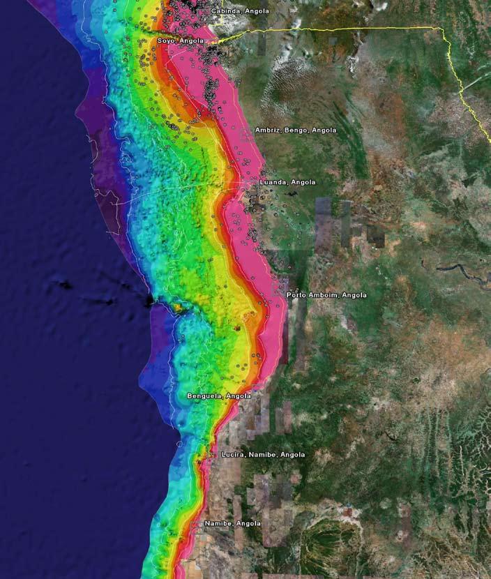
Ericsson is supplying 1,500 kilometers of fiber-optic submarine cable to Angola Telecom, providing a backbone network for mobile traffic as well as broadband services covering the majority of Angola’s population.
www.subtelforum.com/NewsNow/9_december_2007.htm
FCC Awards GCI License for Alaska Cable
The U.S. Federal Communications Commission (FCC) has awarded GCI Communication Corp. a Submarine Cable Landing License to operate as a non-common carrier a fiber optic submarine cable network for its Southeast Alaska Fiber-Optic System (SEAK).
www.subtelforum.com/NewsNow/6_january_2008.htm
Gateway Purchases Circuit on SEACOM
Gateway Communications has announced that it has purchased a 155 Mbps (STM-1) circuit from SEACOM.
www.subtelforum.com/NewsNow/6_january_2008.htm
HWG Partner Kent Bressie to Speak on US Market Entry Barriers
Harris, Wiltshire & Grannis (HWG) LLP partner Kent Bressie will speak at the Pacific Telecommunications Council’s PTC ’08 — the premier forum for Pacific-region development and use of telecommunications and ICT — on January 13, 2008, in Honolulu, Hawaii.
www.subtelforum.com/NewsNow/2_december_2007.htm
New Zealand Government Wants New Cable
New Zealand’s Minister of Communications, David Cunliffe, said that the government would support a new submarine cable to provide redundancy and to stimulate competition.
www.subtelforum.com/NewsNow/9_december_2007.htm
Newfoundland Announces Next Phase of Government’s Broadband Initiative
As part of Newfoundland Government’s Broadband Initiative (GBI), the province has released a Request for Proposals (RFP) seeking a telecommunications carrier to build and manage an advanced broadband network for its operations across the province.
www.subtelforum.com/NewsNow/6_january_2008.htm
PIPE Networks’ Board Gives Approval for Project Runway Structure
PIPE Networks’ Board has provided its formal approval for the legal and financial structure of Project Runway.
PIPE Networks is now in a position to execute a number of outstanding sales agreements.
Reliance Completes Acquisition of Yipes Holdings Reliance Communications (RCOM) has received the Federal Communications Commission (FCC) approval for the merger of US-based Yipes.
www.subtelforum.com/NewsNow/6_january_2008.htm
Russia-Japan Cable Completed
TransTeleCom Ltd. (TTC) and NTT Communications have successfully completed construction of the Hokkaido-Sakhalin Cable System (HSCS) submarine cable.
www.subtelforum.com/NewsNow/6_january_2008.htm
The State of the Submarine Cable Industry - TSA Monthly Review
At the start of the year, TSA forecast that about two-dozen submarine cable supply contracts totaling 100,000 route-kilometers would be awarded in 2007.
www.subtelforum.com/NewsNow/6_january_2008.htm
www.subtelforum.com/NewsNow/6_january_2008.htm
Tunisie Telecom Selects Telecom Italia Sparkle for Further IP Growth
Tunisie Telecom recently announced an upgrade of its international IP transit connectivity with Seabone, Telecom Italia Sparkle Internet backbone, through the activation of a new 622 Mbps port in Palermo.
www.subtelforum.com/NewsNow/6_january_2008.htm
Vietnam’s Prime Minister to Push for Cable Protection
Vietnam Prime Minister Nguyen Tan Dung, in an instruction issued on December 13, said Vietnam’s submarine cable systems, which were seriously violated last year, need to be protected.
www.subtelforum.com/NewsNow/6_january_2008.htm
Xtera Communications Acquires Azea Networks
Xtera Communications has announced that it has acquired Azea Networks, a privately held company based in the UK and supplier of world-class optical networking solutions.
www.subtelforum.com/NewsNow/9_december_2007.htm
Tyco Telecom Begins Construction of Matrix Cable System
Matrix Networks Pte Ltd and PT NAP Info Lintas Nusa, together with their supplier, Tyco Telecommunications, have announced the completion of construction on the Batam shore-end cable lay portion of the Matrix Cable System and the beginning of construction on the Jakarta shore-end cable lay.
www.subtelforum.com/NewsNow/6_january_2008.htm
VSNL Announces Construction of TGN Eurasia Cable System
VSNL has announced that the company is constructing a new TGN Eurasia Cable System linking Mumbai directly to Paris, London and Madrid via Egypt.
www.subtelforum.com/NewsNow/6_january_2008.htm
WFN Strategies Celebrates Seventh Anniversary with New Digs
Verizon Increases Network Speeds
Verizon Business reinforced its commitment to customer demand in 2007 by bolstering the capacity, speed, resiliency and efficiency of its worldwide network.
www.subtelforum.com/NewsNow/6_january_2008.htm
With ongoing telecoms engineering projects in Colorado, West Africa, North Sea, Asia Pacific and Antarctica, WFN Strategies enters its seventh year of operations with its strongest backlog ever, as well as newly acquired headquarters.
www.subtelforum.com/NewsNow/6_january_2008.htm
Executive Forum: A View of the Industry
David Lassner President and Board of Governors Chair, Pacific Telecommunications Council Vice President and CIO, University of Hawaii
Are business conditions improving or getting worse, and are you optimistic or pessimistic about the future?
The global telecommunications industry has come through a period of tremendous tumult in the early 2000’s and is emerging as the primary driver in broader ICT development worldwide. The health of the industry seems strong in this current wave of economic and development cycles. In the Asia-Pacific region, where the Pacific Telecommunications Council is the preeminent membership organization for the sector, strong growth is being experienced in many countries and especially in China and India, where an extraordinary boom in mobile phone use is underway.
What do you see as the short term and long term health of the international telecoms industry?
It seems that what was forecast for the industry at large is now becoming real: full convergence in practice. We are moving well into triple play services. In most markets we have moved beyond robust, widespread and competitive mobile voice and text. We are in the midst of enormously significant changes in music, news and media/entertainment distribution across a host of telecommunications, broadcasting and ICT networks. And now, the extensive use of video in all forms and across all networks, as well as the demand for high levels of seamless mobility, are defining the new core of telecommunications and services.
From your perspective, what is the state of the market, and how will we cope with the change? Who do you see as customers, and how do their past requirements compare to those in the future?
From YouTube to enterprise telepresence, from iPhones and iTunes to HDTV-over-IP, the shape
of telecommunications networks and services are being radically altered. The integration of previously distinct services is driving a new interrelationships across entire industries including telecoms, broadcasting and information, Internet, spectrum licensees, undersea cable and satellites. Users are doing what they want, the way they want it, mostly using the power and flexibility of IP.
Mergers and alliances continue apace. Acquisitions and expansions are global in nature. Besides the usual push from Western countries, Asian telcos are now investing heavily abroad including in Africa. New partnerships and multi-player projects abound. Market opportunities in rapidly expanding new economies are plentiful. A mix of private investment and public funding is reaching lesserserved regions with more appropriate technologies tuned to local conditions. Regulation may not be keeping pace and it probably cannot. But in occasional rare fits of inspiration, it may provide a reasonable guide to promote further development, investment and a clear explication of market frameworks.
The result? Far more users are actually getting what they want at a price they can afford. Advanced integrated service offerings across mature markets, with innovative delivery of personalized information and entertainment, are quickly becoming the order of the day. Even more dramatically, there are now a half billion more mobile subscribers worldwide, largely in lesser developed countries, where there was hardly any telecom access at all just a few years ago.
Is this the dawn of a true transformation in telecommunications? John Hibbard, a member of PTC’s Board of Governors and CEO of Hibbard Consulting, Australia, points out, “The boom-bust
cycle raises the question of what’s in store over the next few years given we seem to be on the crest of a wave. Will it crash or will we all be able to surf it for another 5 years at least?”
What are your views of the future of the market?
Despite the usual overly-optimistic hype that surrounds many trends, we now have a clearer understanding of the foundation for the future of the industry. That foundation is being built on high-bandwidth end-to-end IP networks, both fixed and mobile, with the robust capability to securely integrate a broad range of current and emerging digital services and applications, including capacity-hungry video in both directions. Whether for location-based services, personal and social networks, gaming, entertainment, or business support, the proliferation of interactive video in telecommunications will bring us to a new scale of bandwidth consumption far beyond current capabilities.
Business models abound for new services and applications using various combinations of transaction fees, subscriptions and advertising. Mobile communications as a social and business platform are rapidly expanding in depth and breadth.. Mobile devices are not only becoming full scale centers for interactive information, entertainment and communications, but they may soon become our wallets, with the evolution of consumer payment and banking systems via mobile networks. No one provider has all the solutions, and no one entity can accommodate all the users and the multiple forms of applications demanded, indeed even being created by users on open end-to-end IP networks. Cooperation is as much a necessity as competition is a driver.
In your opinion, what does the industry most need?
The resurgence of the industry has created new momentum for understanding the important role of telecommunications and ICTs to enhance knowledge-sharing and promote social, educational and economic development. Such knowledge development is a key part of building civil societies. Practical partnership efforts at the local level have been particularly effective at providing appropriate systems and services, including building both human and technical capacity, heretofore unavailable in rural, remote and lesser developed areas.
Today, there is unprecedented opportunity in telecommunications, and as ever, plenty of challenges. Our annual conference, PTC’08, will bring thousands of members of our community together around the theme “Telecom with Vision.” This theme highlights the real significance of video to everyone in telecommunications today, and the need for all of us to keep our eyes wide open in the days ahead.
As telecommunications and ICTs increasingly underlie and empower the global fabric of human endeavor and improvement of the human condition, we must each craft our own visions for the future.
David Lassner serves as the first Chief Information Officer for the University of Hawaii system, comprised of 10 campuses and 5 education centers on 6 islands. He is responsible for voice, data and video services, global network connectivity, management information systems, academic computing support and distributed learning technologies. David is also a member of the University´s Graduate Faculty. In addition to his service to PTC, David serves on the Board of Directors of Internet2 and is an active leader in the Asia-Pacific high-speed networking research & education networking community. He chairs Hawaii’s new Broadband Task Force and serves on the Board of Hawaii’s High Technology Development Corporation. David earned his A.B. summa cum laude in Economics and M.S. in Computer Science at the University of Illinois at Urbana-Champaign and a Ph.D. in Communication and Information Sciences, University of Hawaii. Pacific Telecommunications Council
NEPTUNE Canada Update
The purpose and design of the NEPTUNE Canada underwater observatory has been previously described in NEPTUNE Canada: Deploying New Cable Observatory Technologies in the Deep Ocean, SubTelForum, Issue 33, pp 24-27. A full description and more news can be found at: http://neptune.uvic.ca/.
By Chris Barnes, Steve Lentz, and Peter Phibbs
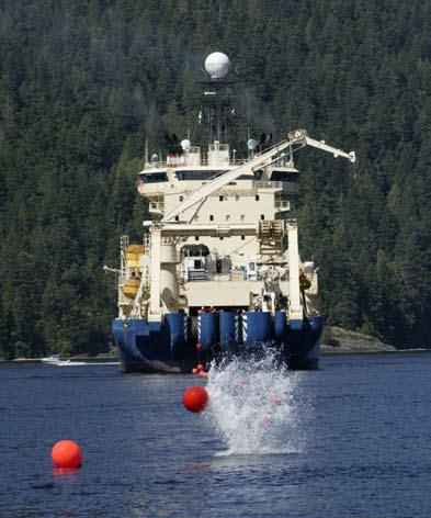
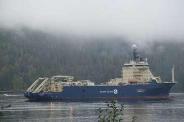
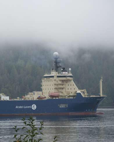
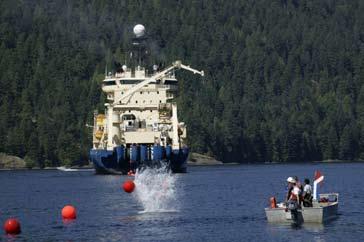
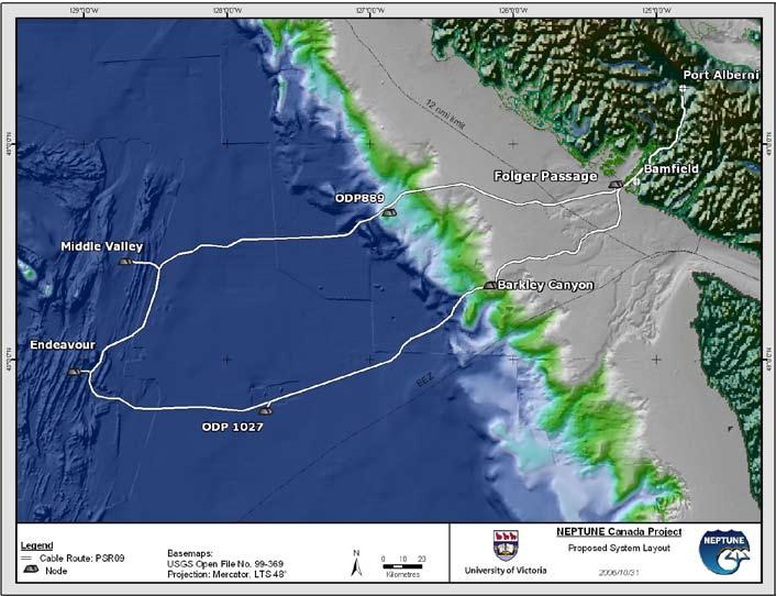
As of this writing, NEPTUNE Canada has completed the completion of the first phase of the infrastructure installation. The 800km backbone cable, repeaters, branching units and spur cables to the node locations were deployed by Alcatel- Lucent using CS Ile de Sein. The installation began on 23 August and was completed on 7 November, taking a few weeks longer than anticipated due to several spells of bad weather. Three ships were used, with M/V Frosti out of Vancouver helping with route clearance and Tyco’s CS Global Sentinel based in Portland, Oregon, to undertake post-lay inspection burial (PLIB) across the shelf to 1500m water depth using an ROV to jet-bury the cable in areas where incomplete burial had been achieved by the Ile de Sein with its plough. Completion of the installation of the ring was a major achievement given that the offshore weather closed earlier than forecast with nearhurricane force wind conditions experienced at one point; consequently NEPTUNE Canada is
indebted to the skill and patience of the crew of the Ile de Sein.
Phase two, deployment of the five nodes, is planned for August-September 2008 to be followed by phase three, the installation of the secondary cables, junction boxes and instruments. The nodes, which step down the 10kV backbone power to usable levels,
distribute Gigabit Ethernet data channels, and provide a connection point between the backbone cable and extension cables, are presently being manufactured by AlcatelLucent in conjunction with their primary subcontractors L3 Maripro and Texcel. With the installation of the backbone cable
system and the development of a sophisticated Data Management and Archiving System, NEPTUNE Canada enters a transition from the installation into the operational phase. NEPTUNE Canada has submitted an application to the Natural Sciences and Engineering Research Council of Canada
(NSERC) for two years of interim operational funding. This application involved a substantial application process through the summer and fall, with an appearance before an external review committee in Ottawa in early November. A decision should be announced shortly.
Currently the NEPTUNE Canada engineering team is focused on the junction box design and manufacture, which are being produced by OceanWorks of North Vancouver, BC. The preliminary design review is underway, and the details of the junction box largely finalized. Closely tied to this effort is the coordination of the junction box output characteristics to the science instrument input requirements, in particular noise and other characteristics of the power delivery.
NEPTUNE Canada is exciting on several fronts; it’s a demonstration of how our commercial submarine telecom technologies can be adapted for other uses; the science data it makes possible is going to allow us to see and hopefully understand better how the oceans systems work, and how they affect both marine and land-based life; and NEPTUNE Canada offers a platform for testing future technologies in real life situations in the deep ocean –and lets developers watch and operate their new technology from their desks in Houston,
Aberdeen, Perth or anywhere with an internet connection. Next year promises to be even more eventful as the nodes, junction boxes and instruments are installed and NEPTUNE Canada looks forward to sharing our news and seeking your participation in the program as it evolves.
University of Ottawa (1964), he received an academic appointment at the University of Waterloo in 1965. He served as Chair of Earth Sciences at Waterloo from 1975 to 1981. In a similar position at Memorial University (1981-87), he established the Centre of Earth Resources Research. From 1987-1989, as Director General, Sedimentary and Marine Branch, Geological Survey of Canada, he was responsible for the offshore Frontier Geoscience Program. At the University of Victoria, Chris was Director of both the Centre of Earth and Ocean Research (1989-2000) and the School of Earth and Ocean Sciences (1991-2002, then becoming the NEPTUNE Canada Project Director in 2002.
Chris Barnes is Project Director for NEPTUNE Canada. After being awarded his Bachelor of Science from the University of Birmingham (1961) and his Ph.D. from the
Steve Lentz has over fifteen years experience in the construction and operation of optical communications networks including metropolitan area networks, national networks, and international submarine cable networks. He has served as VP Network Engineering and Deployment for 360networks’ submarine division where he developed the network architecture, functional requirements, and performance specifications for international submarine cable networks and supervised testing, commissioning, and verification of
compliance with contractual requirements. He was Manager of Transmission Engineering for Time Telekom, Sdn. Bhd. located in Kuala Lumpur Malaysia, and Director of Systems Engineering for Lightwave Spectrum, Inc. He joined WFN Strategies in 2005 as Project Manager, and has supported telecom projects in Oklahoma, Antarctica, West Africa and the Gulf of Mexico.
Peter Phibbs is Associate Director, Engineering and Operations for NEPTUNE Canada. An engineer with construction in the marine environment, Peter has a wide range of experience in managing the implementation of complex deepwater projects. After completing his B.Sc. in Engineering Science from the University of Durham, UK, he practiced engineering as a designer of marine structures in the UK, the Middle East and then in Vancouver, British Columbia. He became a member of the Institution of Civil Engineers in 1978, and a member of the Professional Engineers of British Columbia in 1981. In 1986 he began specializing in underwater construction, managing construction and maintenance projects at variety of sites in North America and around the world.
e Desk Top Study (eDTS)
WFN Strategies’ proprietary e Desk Top Study (eDTS) is a web-based, comprehensive submarine cable investigation tool, providing customers critical system analysis in an accelerated manner. eDTS presents a detailed analysis of the environment in which the cable system can be placed, both on-shore and undersea, and is:
• Extensive - Gathers data quickly from a network of worldwide public and private data sources for cable design, routing and maintenance;
• Efficient - Focuses solely on cable system components requiring detailed study (system data costings, RPLs, SLDs, charts, data sources, etc.), saving both time and expense;
• Enhanced - Performs automated routing and associated charting, internet web mapping, 3-D cable lay analysis (seafloor slopes, hazards, etc.) using an advanced GIS system;
• Essential - Analyzes cable design, routing and maintenance in the route’s metadata and associated maps, then estimates system component budget based on current industry practices and costs;
• Electronic – Houses in a secure data warehouse and project website for easy team retrieval and collaboration.
wfnstrategies.com/eDTS.htm
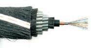
At submarine depths, Nexans goes deeper
Nexans was the first to manufacture and install a 384 fibre submarine cable. Nexans has qualified and installed their URC-1 cable family for fibre counts up to 384 fibres.
For further information please contact:
Nexans Norway AS P.O. Box 6450 Etterstad
N-0605 Oslo Norway
Phone: +47 22 88 61 00
Fax: +47 22 88 61 01
Erik Rynning Sales & Project Manager Offshore:
“We produced the so far world’s deepest umbilical which was installed at 2350 metre in the Gulf of Mexico.”
Telecom: Rolf Bøe
Phone: +47 22 88 62 23
E-mail: rolf.boe@nexans.com
Oil & Gas: Jon Seip
Phone: +47 22 88 62 22
E-mail: jon.seip@nexans.com
Asia-Pacific Submarine Cable Market Moves Into New Phase
AsiA-PAcific submArine cAble mArket moves into new PhAse
In January last year, BuddeComm’s Paul Budde presented a view of the Asia Pacific submarine cable market as he saw it coming into 2007. He wrote then: ‘After the collapse of the previous submarine cable boom, I predicted a new boom starting in 2008 with a ramping up period of 12 to 18 months. All the signs point to the Asia Pacific submarine cable market now moving into this new phase.’ Twelve months later, he takes another look at the market and notes that
By Peter A. Evans
we have in fact moved into this new phase. In this article, Peter Evans, BuddeComm’s Senior Analyst, Asia, reviews the considerable level of fresh activity in the sector.
introduction
New boom or new bubble?
The last submarine cable boom (1998-2001) and crash (2002) is, I would suggest, still fresh in our collective memory. Following the collapse of that boom, BuddeComm predicted a new boom
starting in 2008 with a ramping up period of 12 to 18 months. All the evidence says that the Asia Pacific submarine cable market has now moved into this new phase. For some time now, the unknown had been the amount of unlit fibre ‘sitting doing nothing.’ Whilst there is certainly still fibre lying idle, market activity indicates a much more complex situation. Demand across the region is not even; some cable routes are coming under considerably more pressure than others. At the same time, in the wake of the chaos in Asia’s submarine networks caused by the December 2006 Taiwan earthquake, there is increased demand for workable network diversity. And, of course, there is the continually rising demand for bandwidth within and into Asia, largely driven by China and India. Whilst other rapidly growing Asian markets are definitely part of the equation, it is the big two that the operators are trying to satisfy by building bigger and faster pipes for the surging volumes of Internet and telephone traffic produced by multinational corporations doing business with these countries. At the same time, we should not overlook the significance of the traffic generated by regional and local customers.
A survey by Telegeography in Sept 2007 noted that international backbone capacity was growing faster than Internet traffic volumes. The research company reported that average peak international Internet backbone traffic grew 60% between 2006 and 2007, while bandwidth grew 68%. As a result, it noted that peak utilisation declined from 47% in 2006 to 44% in 2007. In other words, despite predictions that video, user-generated content and P2P traffic would overwhelm network backbones, 2006/2007 had seen the available bandwidth outpace traffic
volumes, according to the survey. In reporting on Asia, it noted that intra-Asian Internet traffic grew 55% in 2007, following on from 59% traffic growth in 2006; the growth in traffic on the transPacific route was running at 41% in 2007. The Telegeography report also noted that, barring an unforeseeable price collapse, the outlook for the international Internet backbone market was better than it has been in years. It stated that in the past the rapid downward spiral of IP transit prices had been the biggest challenge. However, now that IP transit prices in many markets have reached a level of market equilibrium, it suggested that carriers may increasingly seek to differentiate their services on the basis of non-price factors, such as network redundancy, reliability, diversity and quality of service.
With companies like Verizon, Asia Netcom and a Telekom Malaysia-led consortium all moving forward with or planning new trans-Pacific installations, even though there are literally terabits of unlit capacity on existing systems, it is not surprising that there are fresh concerns emerging of a new bubble. Whilst not all of the proposed cables are certain to go ahead, there are at least six such projects in the pipeline; one of these is already being installed. Of course, these cables are aimed at meeting a predicted shortfall in capacity as Asia’s broadband usage increases and at the same time providing the much needed route diversity. However, Asia Netcom CEO Bill Barney has warned that, whilst current stocks may well be exhausted by as early as 2013, should all six proposed cables come to market, competition will consign them all to failure.
Response to the Taiwan earthquake
The system outages caused by the earthquake in Taiwan at end-2006 proved a powerful wakeup call to operators as it highlighted the serious vulnerability of the existing cable networks in the Asia Pacific region to natural disasters. So much of the region was quickly reduced to zero or limited connectivity as a result of the earthquake. Service restoration took days as it was heavily dependent on actually repairing the cables, rather than switching traffic to alternative systems. The reality was there were very few options available for alternative routing of traffic. Interestingly, by end-2007, there were still reports of traffic routing problems that were a hangover from the original outages.
In the weeks and months following the earthquake, many observers were speculating that the cable outage had been exacerbated by a lack of investment in Asian cable infrastructure, or by Asian network capacity constraints. This argument proved hard to support, however, given the diverse array of submarine cables connecting the various markets of Asia to one another and to the world. During 2006, three significant cable systems - Asia Netcom’s EAC, FLAG and Reach’s North Asia Loop and the APCN-2 cable - upgraded network capacity to cater for increased traffic volumes. Despite these upgrades, most intra-Asian cable systems were reported to be operating at less than 15% of their potential capacity, leaving plenty of room for future traffic growth.
So the challenge remains: how can telecom operators, ISPs and corporate enterprises throughout Asia expect to manage network outages into the future? The answer lies in
providing a more diverse array of capacity on the cable systems. The deployment of a number of proposed new cables, such as the Trans Pacific Express and Asia American Gateway, should add new routing options and generally help improve network resiliency. While capacity is already purchased on multiple cable systems to provide redundancy, network operators need to be able to procure capacity on an even more diverse array of cable systems in earthquake prone regions, and deploy fault-tolerant mesh networking technologies over these cables.
whAt is hAPPening in the mArketPlAce?
We have been witnessing a spate of proposed cable projects that will provide high speed connectivity across the Pacific between Asia and the US. Whilst the exact shape of the emerging market remains unclear, Verizon is leading the race with its TPE project to be the first to launch. Will the spoils go to the consortium that gets in first and subsequently floods the market with capacity and successfully signs up an Asian customer base? Certainly there are other players who will be thinking differently. Asia Netcom, if market reports are accurate, will be a serious contender. Then the Telekom Malaysia-backed Asia America Gateway cable is also looking certain to proceed. What follows is an overview of the various projects being mooted and the environment in which it is happening.
Trans-Pacific Express (TPE)
Having signed an agreement with five major Asian telecom carriers at the end of 2006 to build what it described as the first high-speed transPacific undersea cable system directly linking the
US and China, Verizon has been energetically moving forward with the project. By late 2007, the consortium reported that cable laying for the TPE had begun off the coasts of China and South Korea, and work was also set to begin off the US coast. Whilst several new cables connecting North Asia to the US have been proposed, TPE is the only system to have got up and running. The proposed 18,000km cable, named the Trans-Pacific Express (TPE), is due to launch in August 2008.
Verizon originally managed to line up China Telecom, China Network, China Unicom, South Korea’s KT Corp and Taiwan’s Chunghwa Telecom as partners; all these operators committed to putting traffic on the initial 1.28Tb/s cable (upgradeable to 5Tb/s). In November 2007, Verizon and partners indicated that they were considering opening their proposed TPE network up to additional partners.
The planned US$500 million project was designed to offer an alternative to the single low-capacity cable that has been providing the only direct link between mainland China and the US. There is considerable pressure on the Chinese operators involved in the project. The 2008 Olympic Games in Beijing, as well as the anticipated growth in IPTV and VoIP telephony, have been pushing these operators to organise increased capacity for themselves.
During 2007, with project plans moving along, Verizon has been shrugging off warnings about a potential new glut of capacity across the Pacific. The company noted that the investment in the project was directly underpinned by the business it does with its multinational customers; it has
been avoiding playing in the riskier wholesale capacity market.
Asia-America Gateway (AAG)
Telecom Malaysia (TM) and Reach, together with a number of other telcos, announced in June 2006 that they were planning a major new cable connecting Asia with the US. In April 2007, TM announced that the 20,000km cable system was expected to be operating in the fourth quarter of 2008.
The cable, called Asia-America Gateway (AAG), was to run from Malaysia to Hong Kong, the Philippines, Guam, Hawaii and on to the US. Branches were to connect Singapore, Thailand, Brunei and Vietnam. The other telcos initially involved were AiTi of Brunei, CAT Telecom (Thailand), PLDT (Philippines), StarHub (Singapore) and VNPT (Vietnam). The cable will provide up to 1.92Tb/s of data bandwidth, with an initial capacity of 480Gb/s.
The AAG cable raises questions about strategy. The need for this cable system is not totally clear. TM said the project was targeting ‘the existing cable capacity shortfall to the US and was responding to the demand for higher bandwidth requirements from Internet users in the region’. Whilst it is true that much of the trans-Pacific capacity presently lands directly in north Asia and very little capacity directly supports the South East Asian markets, there remains a substantial amount of unlit capacity across the Pacific; at the same time, we have the paradox of the struggling C2C cable which is significantly under-utilised. Furthermore, South East Asia’s bandwidth demand, whilst certainly growing,
remains relatively modest, being considerably less than the hundreds of Gb/s consumed by Japan, China and South Korea.
In an interesting move, Australia’s Telstra joined the AAG consortium in April 2007. By mid-2007, Telekom Malaysia was reporting that the cable consortium had signed up many of the biggest users of bandwidth in South East Asia. As well as the initial partners, those involved included AT&T (USA), Bharti AirTel (India), British Telecom (UK), Eastern Telecom (Philippines), PT Indosat (Indonesia), Pacific Communications (Cambodia), PT Telkom (Indonesia), Saigon Postal Corporation (Vietnam), Telstra (Australia), Telecom New Zealand International (New Zealand), Viettel (Vietnam).
Australia-Hawaii cable
In March 2007, Telstra confirmed that it was proceeding with plans to build a 1.2Tb/s submarine cable connecting Sydney to Hawaii; it has retained Alcatel-Lucent to supply and install the system. It is not clear whether Telstra sees this exclusively as an opportunity to provide itself with significant capacity or as a wholesale opportunity where it will sell capacity to others. In any event, Telstra could be expected to continue to buy capacity from SCCN, AJC and the proposed Pipe cable, even if only for diversity reasons.
It is noted that, once in place, this cable could connect with the proposed Asia America Gateway (in which Telstra’s wholesale carrier Reach is a partner.) Telstra’s US bandwidth requirement have been soaring. To meet this demand, it has been sourcing much of its capacity from the
Southern Cross Cable Network (SCCN), owned by competitors SingTel, Telecom NZ and Verizon. Telstra is also one of five owners of the AustraliaJapan Cable (AJC), the other major cable serving the Pacific route. Telstra’s challenge has been to decide whether it is cheaper to build its own cable to the US or to lease capacity from other operators, although cost is certainly not the only consideration. Control of the asset and system redundancy are also important, as major cable outages have highlighted.
Australia-Japan cable (AJC) upgrade
In May 2007, facing an increasingly competitive market, the Australia Japan Cable (AJC) was upgraded to 240Gb/s. The company said that work was scheduled to be completed by early 2008, with some of the additional capacity available in late 2007, at a cost of US$20-US$30 million. AJC said the upgrade was driven by increased broadband connections, with the operator noting statistics that showed a 400% increase in subscribers in the 30 months to September 2006. It said that this trend, along with the associated demand for faster speed of broadband services to homes and businesses, was the result of more data intensive applications such as video and was expected to continue to drive international bandwidth demand at these levels beyond 2010.
AJC’s US$500 million cable was commissioned in at the end of 2001 with an original lit capacity of 80Gb/s, upgradeable to 640Gb/s. Total capacity can be doubled to 1.2Tb/s.
Pipe’s Australia-Guam cable
Pipe Networks confirmed in September 2007 that its so-called Project Runway providing a cable between Sydney and Guam was still on track. The company was reported to be finalising the ‘vehicle structure’ for its planned cable, which was designed to support two fibre pairs for a total capacity of 1.92Tb/s. The planned service launch date had been set for March 2009. Pipe said it would call the cable PPC-1.
Pipe Networks originally announced in late 2006 that it had set up a partnership with India’s VSNL to build the US$240 million Sydney-Guam cable. The cable was expected to initially provide 640Gb/s of lit capacity, with a total maximum capacity of between 4Tb/s and 8Tb/s. Possible future landing stations in Asia en route to the US were to be considered. Pipe Networks said customers had been expressing frustration at the lack of international network provisioning and acceptable pricing. Pipe reported that it had been in active discussions with at least six major carriers regarding bandwidth requirements. Inevitably, such the PPC-1 cable will compete directly with the AJC and SCCN cables.
Pipe Networks reiterated in May 2007 that it intended to compete on price in the Asia-Pacific submarine cable market. It was particularly keen to address the high cost of Internet capacity in Australia (over 1000% more than in the US, according to Pipe Networks).
In October 2007, Pipe Networks lodged regulatory applications for its proposed Sydney-Guam cable, thereby effectively confirming its intention to proceed with the project. At the same time, the company hinted that it might expand the cable to new destinations.
Asia Netcom’s Japan-US cable Asia Netcom was reported to have raised US$800 million to build a cable system that would link the Philippines, Guam, Hawaii, the mainland US and Japan. An unnamed Indian telecom carrier was expected to be part of the consortium. Asia Netcom was acquired by a group of privateequity firms in mid-2006. In November 2007, Asia Netcom confirmed arrangements to build its planned Japan-US link, possibly in partnership with Google, KDDI, NTT and Singapore Telecom; a further announcement by the company on the structure of the project was expected by early 2008.
Southern Cross cable
In early 2007, Southern Cross Cable Network (SCCN) announced plans for a major upgrade to meet increasing demands for bandwidth between Australia and the US. At the time, it was operating with 240Gb/s lit capacity. SCCN had been recording booming sales as strong broadband adoption in Australia and New Zealand rapidly increased demand for capacity on trans-Pacific links. The company said it had recorded over US$320 million in sales in the second half of 2006.
In March 2007, Telstra announced that it planned to withdraw from future use of the Southern Cross Cable Network once it has its own transPacific cable on line in 2008. The loss of Telstra’s business will clearly be a major loss of revenue for SCCN. As its sales boomed over the last few years, Telstra has been far and away SCCN’s biggest customer.
Possible Perth-Indonesia cable
In February 2007, Indonesian Internet exchange provider NAP Info Lintas Nusa said it was considering investing in a new submarine cable link connecting Indonesia and Australia. In fact, NAP was planning a submarine network linking Singapore and three major Indonesian centres and a further expansion to Perth on Australia’s south west coast had been suggested. The timing of the proposal coincided with increasing concerns over the cost of international bandwidth into Australia and as other carriers considered new submarine cable investments from its east coast. NAP’s plan involves a 1,350km loop connecting Singapore with Jakarta, and with branches to Batam in the Riau Islands Province, and Pontianak in Kalimantan. Plans allowed for a further undersea branch to Perth to be added later. NAP and its Singaporean subsidiary Matrix Networks were working with Tyco to design and construct the initial system. It will provide a total bandwidth of 2.6Tb/s.
Google’s Pacific Unity cable
In September 2007, it was emerging that Google was planning a multi-terabit submarine cable across the Pacific Ocean for launch in 2009. Whilst Google had not confirmed the existence of the plan, the company had told Communications Day that ‘Additional infrastructure for the Internet is good for users and there are a number of proposals to add a Pacific submarine cable. We’re not commenting on any of these plans.’ It was also understood from reports that the so-called Unity project would see Google join with other carriers to build the new system. Google would get access to a fibre pair at build cost, handing it a tremendous cost advantage over rivals
such as MSN and Yahoo, and also potentially enabling it to peer with Asian ISPs behind their international gateways - considerably improving the affordability of Internet services across Asia Pacific. Whilst the exact route for the cable had not been finalised at the time, the plans included a configuration using two separate routes to provide network diversity. It would potentially also be able to service Australia via interconnect to new and existing cables in Guam and Hawaii.
Ochre’s proposed Australia-Asia cable
In December 2007, Ochre Services revealed details of a revived project modelled on an earlier project mooted by Nava Networks that was abandoned following the 2002 market collapse. The proposed multi-terabit network would link Perth to Jakarta and Singapore, with initial branches to oil and gas facilities at Geraldton and Dampier. While only 10% of Australia’s international traffic originates on the west coast, service providers have become increasingly concerned about the lack of diversity and the high prices available on the current SEA-ME-WE-3 link. Ochre Services has confirmed the backing of equity investors in the US$150 million project and that discussions were underway to establish capacity commitments with telcos, as well as oil and gas customers. It was also confirmed that Asia Netcom had agreed to provide landing stations in Singapore. While the majority of Australia’s international content demand continues to be focused on the US, the company says it expects an increasing amount to be sourced from Asia and Europe in the future.
After more than thirty years of corporate and international experience in telecommunications and IT, including as an executive manager with the Australian incumbent telco, Telstra, Peter Evans is now applying his extensive background to conducting market analysis and research work for the BuddeComm organisation. Having joined this telecom market research company in 1998, his responsibilities quickly expanded until he was looking after the entire Asian market. The extensive portfolio of research reports that has been built up over time provides a comprehensive insight into the telecom markets of Asia; whilst inevitably there is a major focus on the burgeoning mobile and broadband market segments, the key regional undersea cable market is an area of particular research interest. As part of his work for BuddeComm, Peter has an office in South East Asia and continues to spend a significant amount of his time in and around the Asia region.
Prior to joining BuddeComm, Peter was involved in business development work for Telstra as that company sought new markets in Asia. He also spent six years working in Saudi Arabia as the Senior Advisor to the General Manager, Strategic Planning in Saudi Telecom. In what provides an interesting background to his present role, a significant period in Peter’s career has been devoted to change management and productivity improvement in the area of telecom operations. He has a strong personal interest in the application of Internet and telecommunications in the developing economies of Asia.
Peter A. Evans
CALL FOR PAPERS
The ICPC is holding its next Plenary meeting in Reykjavík, Iceland during the period 22 - 24 April 2008 inclusive.
The theme of this Plenary will be:
Submarine Cables: Enabling a Global Economy
Presentations that address the following topics are invited:
• Impact on Global & Regional Economies
• Legal / Regulatory Challenges & Solutions
• Ensuring Cable Resilience & Reliability
• Submarine Cables and the Environment
Abstracts must be submitted via email to plenary@iscpc.org no later than 31 January 2008. For more information about this Call for Papers and opportunities for exhibitors please visit the ICPC’s website at www.iscpc.org
PTC Eye on Trends: Video and Mobility Take Center Stage
By Mark Hukill, Ph.D.
“The PTC conference in January could not be better timed. Asia is where the major growth is and the Pacific has taken over from the Atlantic as the centre of telecom action. New innovations, explosion of video, rollout of broadband Internet have all combined to create an explosive demand for domestic and international communications. The industry leaders from operators, suppliers, academia, the Internet and content world will come together to meet, hear and discuss how each can carve a role for themselves in the current bonanza. So whether it is submarine cables, satellites, global connectivity, regional and island Internet development, the impact of video or other facets of the industry, the PTC conference in Hawaii will be the place to be in January.”
-- John Hibbard, Member, PTC Board of Governors and CEO, Hibbard Consulting, Australia
It was bound to happen: full convergence in practice. We are moving well beyond the initial service and market testing triple play features. Beyond robust, widespread and competitive mobile voice and text. Beyond the very significant changes in music, news and other media/entertainment distribution across a host of telecommunications, broadcasting and ICT networks. Now, the extensive use of video in all forms and across all networks of communication, as well as the demand for high levels of enterprise and user mobility are defining the new core of telecommunications.
From YouTube to enterprise video communications on-demand, the shape of telecommunications networks and their interconnection are being radically altered. The integration of previously separate services and the staggeringly massive inter-combination of entire industries including telecoms, broadcasting and information are coalescing around the Internet and digital airwaves, across undersea cable and satellites, from carriers
to network peering to homes and offices, and indeed onto all IP platforms. And users are doing what they want, it their own way.
Mergers and alliances continue apace. Acquisitions and expansions are global in nature. Besides the usual push from Western countries, Asian telcos are now investing heavily elsewhere including Africa. New partnerships and multiple partner projects abound. Market opportunities in rapidly expanding economies are plentiful. A mix of private investment and public funding is reaching lesserserved regions with more appropriate technologies tuned to local conditions. Regulation may not be keeping pace and it probably cannot, but it may at least not get in the way. It may even, in a rare fit of inspiration, provide a reasonable guide to promote further development, investment and a clear explication of market frameworks.
The result? Far more users are actually getting what they want at a price they can afford. Advanced integrated service offerings across mature markets, with innovative delivery of personalized information and entertainment, are quickly becoming the order of the day. Even more dramatically, there are now a half billion more mobile subscribers worldwide, largely in lesser developed countries, where there was hardly any telecom access at all just a few years ago.
Is this the dawn of a true transformation in telecommunications? It is now five years since the greatest down-turn ever experienced in the industry.
“The boom-bust cycle raises the question of what’s in store over the next few years given we seem to be on the crest of a wave. Will it crash or will we all be able to surf it for another 5 years at least?” -- John Hibbard, Member, PTC Board of Governors and CEO, Hibbard Consulting, Australia
Despite the usual overly-optimistic hype that surrounds many trends, there indeed appears to be a new foundation for future of the industry. That foundation is being built on broadband, intelligent end-to-end IP networks, both fixed and mobile, with the robust capability to securely integrate all digital services and applications including capacity-hungry video. Whether for location-based services, personal and social networks, gaming, entertainment, or business needs, the proliferation of interactive video in telecommunications will bring us to a new scale of operation several orders of magnitude greater than previously provided.
Business models abound to take advantage of services and applications using various combinations of transaction fees, subscriptions and advertising. Mobile communications as a social and business platform will expand rapidly. Mobile devices are not only becoming full scale interactive information, entertainment and communications centers, but they may soon become our wallets too, as consumer payment and banking systems via mobile networks evolve. No one provider has all the solutions. No one entity can provide the necessary flexibility to accommodate all users and the multiple forms of applications demanded, indeed even created by users. Cooperation is as much a necessity as competition is a driver.
There is also new momentum for understanding the important role of telecommunications and ICTs to enhance knowledge-sharing that promotes social and economic development. Such knowledge development is a key part of building civil societies. Practical partnership efforts at the local level have been particularly effective at providing appropriate systems and services, including building both human and technical capacity, heretofore unavailable in rural, remote and lesser developed areas.
Today, there is unprecedented opportunity in telecommunications, and as ever, plenty of challenges. PTC’08 trumpets the theme “Telecom with Vision”, taking advantage of its dual meaning of the significant development of interactive video and a view toward the future.
On all this, John Hibbard, quoted above, has responded by raising a number of questions that lead us to Honolulu for PTC’08:
Will the demographics of what has • restored our industry and driven growth in all sectors change, and if so where, and with what impact?
• boom to position itself for the future?
How can the Pacific leverage the current
Where is the money currently being • made? Will video be the new cash generator or will it still be voice?
As telecommunications and ICTs weave ever deeper into the global fabric of human endeavor, what indeed is our vision?
See you in January at PTC08!
Dr. Mark Hukill currently serves as SeniorAdvisor to the Pacific Telecommunications Council (PTC). He is a private consultant in a number of areas ranging from telecommunication policy development to broadcast systems, film & TV production. His previous 22-year academic career included senior administrative and faculty positions at the Nanyang Technological University, National University of Singapore and Ngee Ann Polytechnic in Singapore as well as the University of Hawaii at Manoa. He also served for 5 years as a film and television producer/ trainer at the Ministry of Information and the Office of Radio and Television Broadcasting, Niamey, Republic of Niger. He is the author of numerous articles on telecommunications policy in Southeast Asia and was the principle author of the book Electronic Communications Convergence: Policy Challenges in Asia, (SAGE, 2000). He earned a Ph.D. (Communication and Information Sciences, 1990) and M.A. (Communication, 1984) from the University of Hawaii at Manoa and B.A. (Communication Arts, 1978) from the University of Wisconsin- Madison.
This year at the PTC conference in Hawaii, the theme of the Submarine Cable Workshop will be the development of submarine cable solutions for smaller communities. The following paper is intended to give an overview of this topic as a prelude to the detailed presentations at the conference.
Submarine cables are one measure of the global standing of a country. For other than land-locked countries, they represent the Rolls-Royce form of international connectivity. Having a cable suggests that this country has made it and has joined or will shortly join the developed world. As a consequence, smaller and less developed countries aspire to acquire a cable as a pathway to their development primarily through the superior access to the internet and e-commerce. Hitherto it has been very difficult for smaller communities to justify the expense of a submarine cable. The Caribbean countries have been fortunate, because of the large number and
their close proximity, to be able to share the high costs and gain reasonably cost effective capacity. Countries like Papua New Guinea have been able to take advantage of nearby retired cables and to re-use them resulting in a lower cost. But for smaller communities, there are the issues of isolation and hence distance, and the obligation to acquire new cables with basic capacities far beyond the long term needs of the country. The industry has seen this emerging need of these communities and solutions are being developed to address them.
Technical Solutions
Historically submarine cables have been designed to maximise their circuit capacity. Consequently we have seen capacity of optical fibre cable rise from less than one Gigabit per sec to many Terabits per sec. While this is attractive for large streams, it has major disadvantages for smaller streams. The principal determinant of the cost of a
cable has been its length and hence the unit cost of capacity falls dramatically with increased traffic volumes. But if you only have a small demand, then cables designed for large capacities produce a prohibitively expensive solution. Thus there has been a move designed to produce less expensive cables suited to smaller demands (or so-called “thin routes”).
The capacity of the cable is determined by the dispersion degradation and the signal to noise ratio, which dictate the spacing of repeaters in long-haul cables (over 500 kms or so). Typically on large capacity repeatered cables, the spacing is around 75 kms. However if we are looking for capacities less than 100 Gigabits, spacings can go beyond 100kms, and for those smaller communities looking at a few tens of Gbps, then 150kms may be possible. With repeaters costing around $500K this can produce a significant saving. Repeaters take power, and the number of repeaters determines the voltage that must be fed to the cable. The higher the voltage, the greater the amount of dielectric needed to provide the insulation between the high voltage and the outer casing. With fewer repeaters, and hence lower voltage, less dielectric is needed allowing thinner cables. Thus instead of typically 23 or 17 mm cables, we might see 14 mm cables. This represents a significant saving in manufacturing costs.
Other developments involve direct Ethernet access avoiding some SDH multiplex costs and reduced cost of PFE due the lower voltages.
There are other techniques being developed which in combination might see the capital cost of a repeatered submarine cable reduce by 30 to 40%, and with fewer repeaters, the operating cost reduces due to lower power bills.
Submarine Cables for Smaller Communities by John Hibbard
The other area of technical development is in un-repeatered cables. Adoption of techniques such as All-Raman amplification has seen the length of a segment being pushed out beyond the previous 300 km limit. Now if you are only looking for a capacity of several 10 Gbps waves, the system can tolerate higher signal to noise and dispersion metrics enabling distances of 500kms to be achieved with standard quality performance. With no repeaters, the cost of such links can be substantially reduced.
Commercial Solutions
The typical cost of a bothway satellite link for a small community is $3000 per Mbps per month. This approximately equates to a capital cost of $100K per Mbps which suggests $100M for a 1 Gbps. Hence a submarine cable costing say $70M for capacity even as small as 10Gbps sounds extraordinarily attractive. But unfortunately the magnitude of the capital cost of a submarine cable has been prohibitive for smaller communities who cannot raise that quantum of funds even though the business case is very persuasive.
Several approaches are being taken to reduce the cost to a smaller community. One is the recovery and re-use of cable which has been retired on economic grounds with many of design life years left. Retirement has usually occurred because the cable is too small for its original route but ideal for a smaller community. Another approach is to employ some island hopping or festoon arrangement to enable to use of unrepeatered cables. One other initiative involves the use of OADM Branching Units where one or a few wavelengths can be dropped and fed onto spurs to passing islands or communities, without having to divert the fibres in the main cable to the intermediate location. With the right design, and favourable geography, it is possible for the spur to be unrepeatered. However,
even if repeatered, the PFE would likely be simple, serving just the spur. The OADM Branching Unit removes the past disincentive of using BUs because mainstream fibres were diverted into smaller communities with the consequent risk of a spur failure causing mainline disruption, and assigning responsibility for the operation of mainstream traffic to staff at the intermediate station. With an OADM BU costing less than $2m, and a spur of maybe a 100kms costing less than $10M, then the scope exists to obtain a submarine cable for a much lower capital cost. Of course using it requires purchase of capacity to one or both the end-points of the main cable, but such capacity is effectively acquired on an incremental basis, taking advantage of the economies of scale from the high traffic volumes on the main cable.
The other approach to funding the cost of submarine cables for smaller communities might be through favourable loans from one of the aid agencies. It is clear that entities like the World Bank now see the importance of submarine cables in the development of countries and so are more disposed to assigning funds for infrastructure development to the submarine space.
Operational Developments
A major issue for smaller communities is the operation and maintenance cost of submarine cables. In addition to the cost of power, there is the ongoing cost of staff and their training to ensure that the appropriate level of competence is at hand at all times. However the most significant cost will likely be that of marine maintenance. The cost of securing timely access to a repair vessel usually involves contracting such a vessel for a period, often in conjunction with owners of other cables in the region. The cost of such an insurance policy is based on the length of a cable and so for a cable of say 3000kms the cost could exceed $1M per
annum, a major expense for a smaller community. The scarcity of suitable ships coupled with the increasing cost of fuel is not likely to reduce this cost. One approach is to look for solutions which involve shorter cables but geography does not always permit this. Another possibility that some parties are looking at is in areas with a record of few cable breaks. Here the scope may exist to buy the services of a ship on an ad-hoc basis. While it may cost $1M to $2M to do a repair, if there is only one repair per 5 years, you can be ahead, provided of course there is a ship available at the time of need.
Another cost is the Network Operating Centre (NOC) and some operators have chosen to share a common NOC to save costs.
Additional Challenges for Smaller Communities
One of the early tasks in constructing a new cable is to get the requisite permits. Whether they are environmental, cable crossing, local or international, they basically cost the same in time, management resource and legal fees irrespective of the size of the cable. Hence this can be a very punitive cost for a smaller country owner. This task, with its associated cost is not diminishing as more permits are required than in the past. It adds time which is another cost. The most significant time and cost impact in recent times has been the new approval process of the USA where not only do the traditional requirements need to be met, the demands of the security organisations under the banner of Team Telecom (comprising entities such as FBI, CIA and Dept of Homeland Security) has to be addressed. This is for cables involving a US territory but other jurisdictions have their own local permitting requirements. These all become yet another major challenge and a major cost for a smaller community in getting a submarine cable.
Summary
Smaller communities such as island states have an increasing need for submarine cables to develop their economies. Historical cables have been prohibitively expensive but new technical developments, clever commercial arrangements and alternative O&M approaches are making cable ownership increasingly possible. So if you want to know about this topic, including the new permitting requirements, why not join us at the PTC Conference in Hawaii from the 13th January.
John Hibbard is a leading consultant in international telecommunications. As CEO of his own consulting business Hibbard Consulting Pty Ltd, he has leveraged his over 40 years in the telecommunications industry across the functional areas of engineering, technical and business operations, technical and network planning, business planning and development, sales and marketing and senior management to establish a successful business. Recently he has been very active in assisting the provision of submarine cables. Prior to becoming a consultant, John was Managing Director Global Wholesale at Telstra Australia, where he managed Telstra’s international business, and founding Chairman of the Australia Japan Cable. He is now a member of the Board of Governors for the Pacific Telecommunications Council.
A Closer look at Huawei Submarine Networks
New Repeater and SLTE technology lead the way for JV
There is a new entrant in the submarine telecommunications market as Huawei Technologies Co., Ltd. (“Huawei”) and Global Marine Systems have announced the formation of a new joint venture, Huawei Submarine Networks, LTD (“Huawei Submarine”.) A signing ceremony commemorating the event was held recently in London and was the culmination of the Memorandum of Understanding signed by both parties in March 2007.
Beginning in 2008, the new company plans to deliver submarine network equipment and
By Bruce Neilson-Watts
related services for network providers seeking highly-advanced communications capabilities on a global scale.
“Huawei is a trusted industry partner to many of the world’s leading telecommunication carriers and providers,” commented Mr. Ping Guo, CSO of Huawei. “There is enormous scope to improve the competitiveness of this market and with Huawei’s impressive global R&D and manufacturing capabilities and Global Marine’s broad submarine engineering expertise, we intend to improve value for customers by
offering unique solutions for all our customers future network plans.”
Leading the charge for Huawei Submarine are a highly advanced SLTE offering and a new small form-factor subsea repeater which leverage each of the companies technological strengths and fit nicely into the JV’s vision of a turnkey end-to-end solution.
New SLTE Offering
The new OptiX BWS 1600S from Huawei Submarine Networks will provide huge transmission capacity, ultra long haul transmission distance and a highly reliable submarine cable station solution. It is designed to target submarine cable applications where network reliability, system capacity and a
manageable total cost of ownership (TCO) are the paramount concerns.
“The continuing growth of the regional and long haul market has persuaded us that a credible, innovative new company is needed by telecoms providers,” Gabriel Ruhan, CEO of Global Marine Systems.
OptiX BWS 1600S adopts Huawei’s patented SuperDRZ technologies, improving the dispersion and nonlinear effect tolerance, achieving 10,000km transmission distance. The increased spectrum efficiency reduces transmission channel spacing to ITU-T defined 25GHz channel space, increasing overall system capacity more than 25% when compared to 33GHz technologies. It also uses advanced ROPA (Remote Optical Preamplifier), and using a high power boosting Raman amplifier extends long hop transmission capacity to achieve up to 450km in transmission distance without repeater.
The BWS1600S is not just smart, but also tough. It features multiple protection mechanisms, which address both equipment and network protection issues including pump redundancy for the optical amplifier , redundant power module protection , 1+1 and 1:8 protections for the transponder, a pluggable laser which can be replaced online and ZONE4 earthquake tolerance.
Its compact design reduces the footprint when compared with traditional equipment, allowing for 64 wavelengths to be installed in 2 ETSI racks. The power consumption is less than 1700W per rack. In some applications, the SLTE can be installed in a POP, eliminating the need for a cable landing station and further reducing both installation and maintenance costs.
1:8 protection for transponder; 1+1 protection for transponder;
EDFA/RAMAN/ROPA/HBA/Auto gain control, Auto power control
Standard ETSI 300mm depth rack
Sub-rack 625mm×495mm×291mm
Weight 18kg maximum per sub-rack
Operation Voltage -48V DC/-60V DC
Power consumption 650W per sub-rack; 1700W per rack maximum
New Small Form Factor Repeater
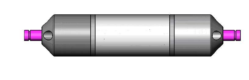
Huawei Submarine also plans to leverage a smaller form factor repeater to improve its customer’s network performance reliability. Using proven “Erbium Doped Fibre Amplification,” it will boost low level optical data within the optical domain. The unit’s amplifiers are singlestage, forward pumped with shared pump lasers and the symmetric 4x4 coupler allows all 4 coils of erbium-doped fiber in the module to be pumped simultaneously by all the pump lasers.
Should one of the pump lasers fail, all four amplifiers can still function at virtually the same level of performance. An additional optical path allows coupling of a portion of the Rayleigh backscattered light from the transmit fiber of a fiber pair back onto the receive fiber of the same fiber pair allowing for in-service line monitoring and out of service fault location.
Like the OptiX BWS 1600S, the repeaters smaller size doesn’t mean its not tough. It can be buried in the sea floor with conventional burial technology, providing a greater level of protection and security from external aggression. The unit’s OAM is capable of withstanding a radially applied hydrostatic pressure of 83 MPa (12.0 kpsi) or a water depth of 8000m and shocks of at least 50G applied on any axis..
Figure 1 – Optical amplifier module RS003G01
Figure 2... Mechanical Construction of the repeater
experience in submarine engineering, we look forward to serving their needs.”
Finally, the new repeater will feature Global Marine’s industry proven UJ coupling technology, making it compatible with any UJ qualified submarine cable which in turn means a wide range of possible cable combinations that can be configured to the customer specifications.
Speaking to the market’s reaction to Huawei Submarine’s vision, Ruhan continued, “Since announcing the MOU earlier this year we
have received very positive feedback from customers. With a company that combines Huawei’s expertise as the fastest growing vendor in optical networks in 2006, and Global Marine’s 150 years of enviable market-leading
About the Author
Bruce Neilson-Watts has been involved in the submarine telecommunications industry for almost 20 years and currently works as Chief Planning Office for Huawei Submarine Networks.
Formally with Global Marine Systems as the Development Director for the Asia Pacific region, Bruce specifically managed business development on a partner level with Huawei Technologies.
Bruce joined BT Marine (now called Global Marine Systems) in 1989 and has been involved in the installation of many of the large subsea systems now in service. Bruce has significant experience at sea having held a number of key roles throughout his career at Global Marine Systems. He as served as a marine apprentice in both marine engineering and navigation culminating in the successful certification as a dual qualified marine engineering and navigating officer. This distinction is rare in the ranks of British officers and was the first in the history of BT Marine. Bruce later went on to become the youngest officer in the history of the company to earn the rank of Captain (Master Mariner).
After many years at sea Bruce transferred ashore and has worked in various roles including operations, commercial and business development role in Asia.
IF It’S APRIL, It MuSt BE ENtELEC
The Energy Telecommunications and Electrical Association will celebrate their 80th Anniversary at the ENTELEC 2008 Conference & Expo being held April 9-11 at the George R. Brown Convention Center in Houston, Texas.
“The 80th Annual event will feature topnotch speakers and trainers,” said Blaine Siske, Executive Director of ENTELEC. “We’ve worked hard to secure speakers covering a wide-range of topics include SCADA security, IT issues, wireless communications, leak detection and so much more. We know attendees ranging from novice to experienced will find this year’s conference beneficial and educational.”
Terry Spalding, tire changer for NASCAR Nextel Cup #19 Dodge driven by Elliott Sadler, will open the ENTELEC 2008 Conference & Expo on Wednesday, April 9,2008. Terry will wow attendees with his ability to change a tire in record speed while motivating the audience with his experience in team building and communications.
The trade show will feature over 200 exhibitors and suppliers and will be held from 10 a.m. to 5 p.m. Wednesday, April 9 and from 10:30 a.m. to 2:30 p.m. Thursday, April 10 Hall B-3 at the George R. Brown Convention Center.
The three-day event will feature over 50 hours of technical training sessions from the industries leading companies including Shell, Sprint/Nextel, El Paso Corporation, Keller and Heckman, The Department of Homeland Security and many more. The event also features a variety of networking opportunities with major suppliers and experts.
“The show is really a who’s who in the energy communication and information technology industries and attracts a lot of national buyers and sellers,” said Siske.
More information on the ENTELEC Association, membership, or the 80th Annual Conference & Expo can be obtained online at www.entelec.org
• A unique Conference & Exposition designed specifically for energy communications and IT professionals from petroleum, pipeline, utility, municipalities, environmental and related energy industries
• Networking with peers and colleagues throughout the event
• Exhibits featuring the latest products and services
• Original papers focusing on three core areas of the industry: SCADA, Telecommunications and Power Infrastructures. Papers are delivered by key personnel including representatives from Shell, El Paso Corp., the Department of Homeland Security, Keller and Heckman, Freewave Technologies, Sprint/Nextel, and Microwave Data Systems.
Answering the Scientific Call for Oceanographic Research
by Ken du Vall & Jeffrey M. Snider
Marine scientists are routinely frustrated by the lack of comprehensive and readily available data needed to characterize marine regions. All too often, the only information available for these regional characterizations include isolated studies or sparse data points scattered across many years or even decades. The pressure for time series, real-time studies of the world’s oceans has increased greatly in light of the recent global warming and climate change debates. Lighthouse Research and Development Enterprises Inc. of Houston Texas continues to bring advanced technology and marine monitoring
solutions to governments, the commercial sector and academia for immediate exploitation.
In 1995, Lighthouse R & D fielded its first cabled-seabed environmental monitoring system designed to provide scientists with real-time, time series data on the dynamic marine environment in the Gulf of Oman. Initial development of the Lighthouse Oceans Research Initiative (LORI) was to support identification of deep ocean currents and to provide the oil and gas industry with an understanding of the impact the ocean environment, has on deepwater field development projects. The data collected by LORI is initially supporting the construct of two numeric models. The first model is current phenomenon that supports a prediction capability and the second model will support the creation of oil spill migration programs. Current oil spill migration models identify surface conditions such as the direction and speed of both current and winds, whereas LORI provides information on the entire water column. Sub sea blowouts, pipeline ruptures and tanker accidents in 3000 meters of water highlight the importance of understanding fluid migration throughout the water column. Oil containment assets utilizing the new models can be more accurately deployed during mishap incidents to minimize the impact on our coastal marine environment.
Lighthouse R & D selected the Gulf of Oman for installation of its prototype cabled seabed observatory in support of its global research initiative due to the
dynamic marine environment and the challenging location. Previous research in the region provided only a snapshot of environmental information and the data indicated there were some significant current phenomena occurring that was poorly understood, or studied. Many scientists agreed that a multi-year dedicated time series research project would be needed to fully characterize this environment. In addition to environmental perturbations, the pristine Al Batinah coast is under heavy development and is at constant risk of oil spills, vessel discharges and other effluents that are associated with the marine traffic transiting the Gulf of Oman.
A fiber-optic cable utilizing standard telecommunications technology was the best solution for collecting longterm real-time physical oceanographic data from multiple sensors demanding high bandwidth and uninterrupted power. The main cable trunk line travels out from an unmanned shore facility approximately 65 kilometers to a water depth of 1100 meters. The system has four Remotely Operated Vehicle (ROV) compatible nodes, each supporting an individual sensor mooring placed in 50, 200, 500 and 1100 meters of water. The system incorporates eight Doppler acoustic current meters configured for full physical oceanographic data collection. Measured parameters include oxygen content, turbidity, conductivity, temperature, pressure, salinity, current speed and current direction. This comprehensive snapshot of coastal marine conditions is downloaded every 60 minutes, 24 hours a day and transmitted real-time to the corporate office in Houston for reformatting, archival and immediate re-transmission back to Oman. The system also provides operators with a full duplex capability for sensor management and supports the monitoring of system health. Operators have the ability to reconfigure the sample rate of sensors if there is an annual or seasonal event that scientists wish to focus on.
Data from the LORI system is allowing scientists to identify trends throughout the annual cycle. By identifying what is normal in the marine environment,
abnormalities can be quickly identified and potentially provide local officials the opportunity to intervene if the cause is manmade. The environmental monitoring system has the capability to provide real-time data that directly correlates the mass mortality of fish with natural upwelling events thereby allowing the export of fish to continue unabated. LORI system sensors instantaneously report decreases in water temperature and oxygen content, which are both indicators of cooler oxygen-poor water from depth moving into shallow water. In the past, the export of fish was stopped until the cause for the mass mortality was identified. These delays in fish export created a costly impact across much of Oman’s fishing industry.
The plug and play technology designed into the LORI system allows for not only the rapid replacement of sensors for routine maintenance or repair, but for the incorporation of future technology in the form of new sensors or systems as they become available. In February 2007, the expansion capability was proven by the addition of a Seismic/Tsunami Early Warning System (STEWS) onto the end of the environmental monitoring system. The new combined system now extends 85 kilometers to a water depth of 1300 meters. STEWS incorporates a variety of sensors that send a very reliable uninterrupted stream of information, which is only possible through the utilization of telecommunications technology. Comparable buoy systems are limited in both bandwidth and power which reduces the amount of information provided by buoy systems to a mere fraction of the information generated by STEWS.
Lighthouse R&D collaborated closely with Woods Hole Oceanographic Institution in the design of STEWS to provide the scientific community with information not previously available from seismic monitoring stations. The STEWS broadband seismometer can instantaneously detect and report seismic events nearly halfway around the world, providing operators advanced warning to potential tsunamigenic activity. Due to the sensitivity of the broadband seismometer, the sensor tends to flat-line when in close proximity to seismic events. To prevent the loss of crucial data during high magnitude or close
proximity events, an accelerometer was included in the STEWS sensor package. The accelerometer continues recording seismic data even after the seismometer flatlines. Lighthouse R & D seeks to install STEWS in close proximity to other areas known for large seismic activity with the potential for generation of tsunamis like the Makran Trench (off the coast of Pakistan and Iran in the Gulf of Oman) and the Java Trench (off the Western coast of Indonesia).
STEWS also has the ability to sense the propagation of a tsunami through the area of installation. STEWS utilizes a pressure sensor that can detect millimeter-level changes in the water column in water depths of 7000 meters or less. This highly accurate pressure sensor is the same sensor utilized within the Pacific Tsunami Warning system. A differential pressure gauge and a clinometer complete the remaining sensors within the system. Powering all of these sensors and transferring the vast amounts of data generated is only possible through the fiber-optic backbone of telecommunications cable. STEWS is engineered to remain maintenance free for the life of the system once christened as operational. Reduced maintenance costs are a key benefit of the system, which make STEWS an effective alternative to reduced capability buoy systems when comparing costs over system lifetimes.
Lighthouse R&D integrated systems have been deployed for nearly three years with documented results that highlight superior system reliability and the continuous availability of time series data. Confidence in design architecture and a growing need for worldwide oceanographic study are prompting deeper system deployments in other regions of the world. The designed longevity of STEWS and LORI are linked directly to the high reliability of telecommunications cable, which will conservatively last 25 years or more. Telecommunications cable is making possible the cost effective approach to long-term, time series studies of coastal marine environments. Fiber-optic cable is not only connecting people with people, but also connecting people with their marine environments.
Mr. Du Vall has served as President and Chief Operating Officer since January 2005. He initially came over from Cal Dive International to assist in the development of international operations. Cal Dive International is an advanced oil and gas service and production company.
From 1991 – 2002 Mr. Du Vall was operations manager for Oceaneering International (OI), an applied technology company that provides engineered services and hardware to customers who operate in marine, space, and other harsh environments. His background at OI concentrated on international vessel and project management with an emphasis on international project development and business relations. From 1989 – 1991 he was a marine scientist / engineer at Texas A & M University in support of the Ocean Drilling Program, an international consortium of universities for ocean research. Prior to 1989 Mr. Du Vall worked for the National Marine Fisheries Service, NMFS, in Alaska and a participant in the Tropical Oceans Global Atmospheres (TOGA) project. Mr. Du Vall graduated from the University of Washington, with a degree in Oceanography.
Jeff Snider recently transitioned from a 24-year career in the United States Navy as a Master Chief Electronics Technician serving in submarines and has been with Lighthouse R&D Enterprises, Inc. since July 2007. Mr. Snider has degrees from the University of Oklahoma (Master of Human Relations) and Excelsior College (Bachelor of Science
Since 2001, Submarine Telecoms
Forum has been the platform for discourse on submarine telecom cable and network operations. Industry professionals provide editorial content from their own niche and focus.
Each bi-monthly edition includes commentary and information on system and service provision, and issues critical to the industry.
Advertising Rates
Website Banners
Post your web linked banner to the home page, as well as News-Now sections of the Submarine Telecoms Forum website, where some 5000+ readers can come as often as every week to view the latest news feed, or our bi-monthly magazine.
Feature Section Sponsorship
Available at full-page advertisement rate, section sponsors are identified with a banner (link) at the beginning and end of the featured section. All advertising rates effective as of January 2008.
Advertising enquiries Tel:
Letter to a friend from Jean Devos
My friend,
The next industry collapse!
My Dear Friend
“Botany Bay”
I published recently a modest novel, whose title is Botany Bay. It is the place in Australia where Alcatel established a submarine cable factory in 1989 as part of its contract for the Tasman 2 link. In this same bay, where two centuries before the French expedition
“La Pérouse” made of two ships, La Boussole
The submarine cable activity is booming. The suppliers have bagged, in 2007 contracts amounting to $3.5B! The pacific waters are presently boiling! So many cables are being built or planned, each being theoretically sufficient to carry the full traffic for years. I fully understand the fact that there are others strategic factors to be taken into account by the carriers when planning their network. We may be in a slightly different scenario than the one we have seen in the Atlantic 10 years ago: Most of the players this time are established carriers who need capacity and connectivity for their own use and their own strategy. But overbuilding will automatically impact the business.
Between 1960 and 1990, one single transatlantic cable was built in average every 2 years. In the period 1990-2000, 2 single crossings were built every year. The net impact is 0 cables for the 2000-2010 period. And this is only one way to look at it. The amount of money lost in the Atlantic waters has been huge and this was done by great, smart, clever managers!
and l’Astrolabe, landed in 1788 to discover that Captain Cook was already around bearing the British flag. So Botany Bay is now for me the symbol of a dream which becomes a reality!
Tasman 2 has been yet another chapter in this long Anglo-French competition! The award to Alcatel came out as a big surprise to many, including inside Alcatel. Everybody was naturally expecting the British to win that battle, and such an expectation was at that time very logical.
Same situation prevails on the India to Europe route. At least 4 cables are either being built or planned and there seems to be no way by which a more sensible plan could be put in place! On the East Africa coast one cable was much needed but 4 will be built in the same timeframe!
There were so many difficulties and misunderstanding between Australia and France, the main one being the French presence in the Pacific area, the worse being the nuclear bomb experiment in Tahiti! The sad Rainbow
I guess, my friend, there is nothing we can do about it. Going too far, exceeding the limits, is a somewhat natural result of competition.
And we have not invented anything which works better than competition! On roads we have the police to keep us a bit wise by not breaking the speed limit too often. My wife, my relatives, my friends do help me at moderating my overindulgence at table or my intemperance! And for many people, not enough though, God is there, watching their behavior! But we do not have a Submarine cable God, something which would force some kind of regulation, some element of wisdom. Something which would guarantee a smooth and steady business!
Warrior event was still in everyone’s memory. It is for these reasons among others that STC (UK) rejected the Alcatel‘s suggestion to come with a joint bid, to offer a “European” solution.
One of the winning factors has been the Port-Botany cable factory. Such a factory was a strong requirement from OTC (now Telstra) and the Australian Government.
No, there is nothing else we can do than to expect the next industry collapse!
I am prepared to bet that 2010 will repeat 2000! Same words will come back in everyone’s mouth: Chapter 11, distressed assets, consolidation, merger, acquisition, downsizing …
Alcatel was the most motivated. Such a factory could expand its influence in the Pacific where the three other players were historically well established in this region, which represents a large part of their market. They saw this factory as a risk for their existing facilities! SubOptic ‘87 in Versailles came at the right time. It is where the Australian teams discovered the French model, a close cooperation between Alcatel and FT, exactly what they wanted to establish in their country.
A cyclic industry!
Nothing new on earth!
My friend, things are changed since, but one thing stays true: When you offer something, the reader can see between the lines if you are or not genuinely motivated and sincere. Then your offer becomes really attractive and this opens the route to “Botany Bay.”