
Last month, I ran my 33rd marathon. My running partner and I had trained for months through the thickest Virginia humidity, grinding through endless pre-dawn miles. When race day came, we both crushed our previous times and even outpaced several younger, faster friends tackling their first. They learned, as I have over the years, that success in a marathon is not just about speed. It is about endurance, patience, and knowing when to push. SubTel Forum has taken that same approach for nearly a quarter century. Twenty-four years of steady progress, of adapting and refining, of outlasting trends and short sprints. Like the seasoned marathoner, we have learned that staying power and the discipline to keep moving forward, mile after mile, are what truly define longevity in this industry.
This month, SubTel Forum introduces a new department, Fault Lines, by Kristian Nielsen, CRO of WFN Strategies. As submarine cables move to the forefront of geopolitics, from contested waters to questions of sovereignty and security, Fault Lines examines how power, policy, and connectivity now meet beneath the sea. Read Kristian’s first column in this issue to see why geopolitics and subsea infrastructure are now inseparable.
We are hard at work on the 2026 Submarine Cables of

the World wall map, scheduled for release early next year. The map will be distributed at major industry conferences including PTC 2026, Submarine Networks EMEA, and Submarine Networks World, keeping your brand visible on walls across the globe. Click here to secure your spot!
I had the pleasure of first meeting Charlie Bussmann, the original publisher of Sea Technology, in the 1980s, and later his son, Amos. I was saddened to learn that the magazine has recently ceased publication. For decades, Sea Technology delivered thoughtful, insightful content and stood as a respected voice across the marine and subsea industries. Thank you, Sea Technology, for your many years of contribution, education, and inspiration.
When Ted Breeze and I launched SubTel Forum in 2001, the industry was in a dark period. With little more than a severance package, some borrowed software, and a lot of determination, we took a leap of faith. Our first issue
featured eight articles and seven complimentary ads, a humble beginning during uncertain times.
Now, 24 years later, we have grown beyond anything we could have imagined. We have embraced new approaches, redefined our mission, and reaffirmed our commitment to the principles that started it all:
1. To provide a wide range of ideas and issues.
2. To incite, entertain, and provoke in a positive manner.
As we celebrate this milestone, our purpose remains clear. Education and communication are the foundation of our industry, and they continue to drive everything we do at SubTel Forum
To our more than 750 authors and sponsors, thank you for helping us reach this milestone. A special thanks to this issue’s advertisers: APTelecom, Fígoli Consulting, PTC 2026, Southern Cross, Telcables Europe, Undersea Fiber Communication Systems, and WFN Strategies. And of course, do not miss our fan favorite feature, Where in the World Are All Those Pesky Cableships? We hope SubTel Forum continues to be your trusted source for submarine cable industry news and analysis. As always, our mission remains to illuminate, educate, and inspire.

Good reading, Slava Ukraini , and save me a seat at the Mai Tai Bar. STF

Wayne Nielsen, Publisher
A Publication of Submarine Telecoms Forum, Inc. www.subtelforum.com | ISSN No. 1948-3031
PRESIDENT & PUBLISHER: Wayne Nielsen | wnielsen@subtelforum.com | [+1] (703) 444-2527
VICE PRESIDENT: Kristian Nielsen | knielsen@subtelforum.com | [+1] (703) 444-0845
ANALYTICS: Kieran Clark | kclark@subtelforum.com | [+1] (540) 533-6965
SALES: Nicola Tate | ntate@associationmediagroup.com | [+1] (804) 469-0324 subtelforum.com/advertise-with-us
DESIGN & PRODUCTION: Weswen Design | wendy@weswendesign.com
DEPARTMENT WRITERS:
Andrés Fígoli, Brian Moon, Camila de Moraes, Iago Bojczuk, John Maguire, Kieran Clark, Nicola Tate, Nicole Starosielski, Phillip Pilgrim, and Wayne Nielsen
FEATURE WRITERS: Alex Vaxmonsky, Derek Cassidy, Doug Recker, Giorgio Grasso, Herve Fevrier, Joel Ogren, José Amaro, Kristian Nielsen, Olivier Côté, Richard Dobbie, Samia Bahsoun, Samuel Carvalho, Jayne Stowell and Omer Wilson
NEXT ISSUE: January 2026 – Global Outlook featuring Submarine Networks EMEA ’26 Preview
AUTHORS INDEX: https://subtelforum.com/authors-index
MAGAZINE ARCHIVE: subtelforum.com/magazine-archive
INDUSTRY DIRECTORY: directory.subtelforum.com
ONLINE CABLE MAP: subtelforum.com/submarine-cable-map
Submarine Telecoms Forum, Inc. www.subtelforum.com/corporate-information
BOARD OF DIRECTORS: Margaret Nielsen, Wayne Nielsen, Kristian Nielsen and Kacy Nielsen
Submarine Telecoms Forum magazine is published bimonthly by Submarine Telecoms Forum, Inc., and is an independent commercial publication, serving as a freely accessible forum for professionals in industries connected with submarine optical fiber technologies and techniques. Submarine Telecoms Forum may not be reproduced or transmitted in any form, in whole or in part, without the permission of the publishers.
Liability: While every care is taken in preparation of this publication, the publishers cannot be held responsible for the accuracy of the information
herein, or any errors which may occur in advertising or editorial content, or any consequence arising from any errors or omissions, and the editor reserves the right to edit any advertising or editorial material submitted for publication.
New Subscriptions, Enquiries and Changes of Address 19471 Youngs Cliff Road, Suite 100, Sterling, Virginia 20165, USA, or call [+1] (703) 861-3647, or visit www.subtelforum.com.
Copyright © 2025 Submarine Telecoms Forum, Inc.


Samuel Carvalho

Alex Vaxmonsky
Joel Ogren

Derek Cassidy
By Fernando Borges Azevedo and Jayne Stowell


By José Amaro

Richard Dobbie
By Olivier Côté
Doug Recker


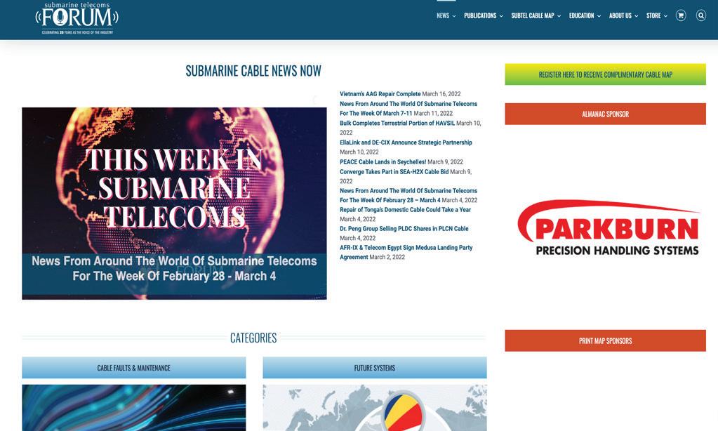
The most popular articles, Q&As of 2019. Find out what you missed!
Welcome to an exclusive feature in our magazine, where we explore the captivating world of SubTelForum.com, a pivotal player in the submarine cable industry. This expedition takes us on a detailed journey through the myriad of resources and innovations that are key to understanding and connecting our world beneath the oceans.
mapping efforts by the analysts at SubTel Forum Analytics, a division of Submarine Telecoms Forum. This reference tool gives details on cable systems including a system map, landing points, system capacity, length, RFS year and other valuable data.
CONNECTING THE DEPTHS: YOUR ESSENTIAL GUIDE TO THE SUBTEL FORUM DIRECTORY
Keep on top of our world of coverage with our free News Now daily industry update. News Now is a daily RSS feed of news applicable to the submarine cable industry, highlighting Cable Faults & Maintenance, Conferences & Associations, Current Systems, Data Centers, Future Systems, Offshore Energy, State of the Industry and Technology & Upgrades.
Submarine Cable Almanac is a free quarterly publication made available through diligent data gathering and
Submarine Telecoms Industry Report is an annual free publication with analysis of data collected by the analysts of SubTel Forum Analytics, including system capacity analy sis, as well as the actual productivity and outlook of current and planned systems and the companies that service them.
In our guide to submarine cable resources, the SubTel Forum Directory shines as an essential tool, providing SubTel Forum.com readers with comprehensive access to an array of vetted industry contacts, services, and information. Designed for intuitive navigation, this expansive directory facilitates quick connections with leading vendors, offering detailed profiles and the latest in submarine cable innovations. As a dynamic hub for industry professionals, it fosters community engagement, ensuring our readers stay at the forefront of industry developments, free of charge.
2024 marks a groundbreaking era for SubTel Forum with the launch of its innovative app. This cutting-edge tool is revolutionizing access to submarine telecommunications insights, blending real-time updates, AI-driven analytics,
The online SubTel Cable Map is built with the industry standard Esri ArcGIS platform and linked to the SubTel Forum Submarine Cable Database. It tracks the progress of
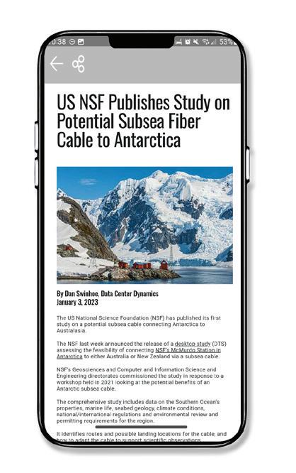
and a user-centric interface into an indispensable resource for industry professionals. More than just a technological advancement, this app is a platform fostering community, learning, and industry progression. We encourage you to download the SubTel Forum App and join a community at the forefront of undersea communications innovation.
Our journey begins with the News Now updates, providing daily insights into the submarine cable sector. Covering everything from the latest technical developments to significant industry milestones, this feed ensures you’re always informed about the latest trends and happenings. It’s an essential tool for professionals who need to stay on top of industry news.
Dive deeper into the world of submarine communications with our curated collection of articles and Q&As. These insightful pieces offer a comprehensive look at both the history and current state of the industry, enriching your understanding and providing a broader perspective on the challenges and triumphs faced by submarine cable professionals.
• Submarine Cable Almanac: This quarterly treasure trove provides detailed information on global cable systems. You can expect rich content including maps, data on system capacity, length, and other critical details that sketch a vivid picture of the global network.
• Submarine Telecoms Industry Report: Our annual report takes an analytical approach to the industry, covering everything from current trends to capacity analysis and future predictions. It’s an invaluable resource for anyone seeking to understand the market’s trajectory.
• Online SubTel Cable Map: An interactive tool mapping over 550 cable systems, perfect for digital natives who prefer an online method to explore global connections.
• Printed Cable Map: Our annual printed map caters to those who appreciate a tangible representation of the world’s submarine fiber systems, detailed in a visually appealing and informative format.
Explore the Submarine Telecoms Forum Magazine Archive, a comprehensive collection of past issues spanning 23+ years of submarine telecommunications. This essential resource offers insights into project updates, market trends, technological advancements, and regulatory changes. Whether researching industry developments or seeking

expert analysis, the archive provides valuable perspectives on the technologies and trends shaping global connectivity.
Our Authors Index is a valuable tool for locating specific articles and authors. It simplifies the process of finding the information you need or following the work of your favorite contributors in the field.
• Data Center & OTT Providers Report: This report delves into the evolving relationship between cable landing stations and data centers, highlighting trends in efficiency and integration.
• Global Outlook Report: Offering a comprehensive analysis of the submarine telecoms market, this report includes regional overviews and market forecasts, providing a global perspective on the industry.
• Offshore Energy Report: Focusing on the submarine fiber industry’s oil & gas sector, this report examines market trends and technological advancements, offering insights into this specialized area.
• Regional Systems Report: This analysis of regional submarine cable markets discusses capacity demands, development strategies, and market dynamics, providing a detailed look at different global regions.
• Unrepeatered Systems Report: A thorough examination of unrepeatered cable systems, this report covers project timelines, costs, and operational aspects, essential for understanding this segment of the industry.
• Submarine Cable Dataset: An exhaustive resource detailing over 550 fiber optic cable systems, this dataset covers a wide range of operational data, making it a go-to reference for industry specifics.
SubTelForum.com stands as a comprehensive portal to the dynamic and intricate world of submarine cable communications. It brings together a diverse range of tools, insights, and resources, each designed to enhance understanding and engagement within this crucial industry. From the cutting-edge SubTel Forum App to in-depth reports and interactive maps, the platform caters to a wide audience, offering unique perspectives and valuable knowledge. Whether you’re a seasoned professional or new to the field, SubTelForum.com is an indispensable resource for anyone looking to deepen their understanding or stay updated in the field of submarine telecommunications.
BY KIERAN CLARK
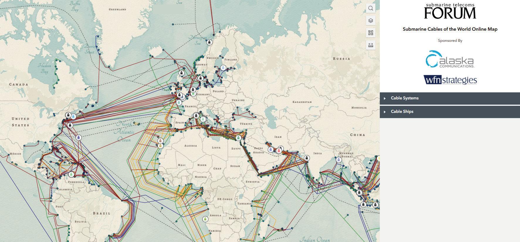
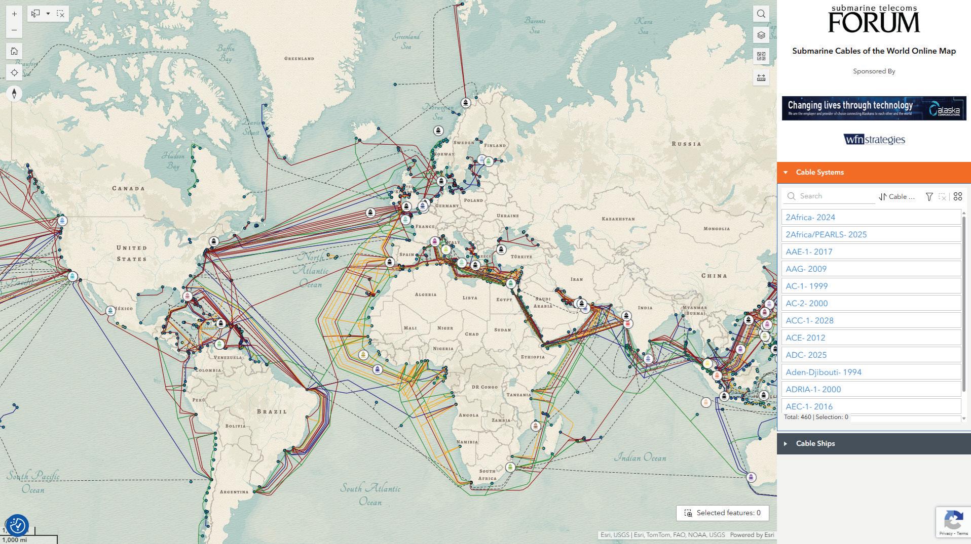
The SubTel Cable Map— powered by Esri’s ArcGIS platform—offers an interactive and detailed way to explore the global network of submarine cables. This indispensable resource provides information on over 440 existing and planned systems, more than 50 cable ships, and upwards of 1,000 landing points. Connected directly to the SubTel Forum Submarine Cable Database and integrated with our News Now Feed, the map enables real-time tracking of industry activity and cable-specific news coverage.
Submarine cables serve as the foundation of global digital infrastructure, carrying more than 99% of international data traffic. These systems enable the seamless connectivity the world depends on—from personal communication to enterprise operations. Without them, modern, high-speed global communication simply wouldn’t be feasible. Our analysts continually update the map using verified data from the Submarine Cable Almanac and valuable input from industry contributors. This ensures a timely and accurate picture of the subsea cable landscape, spotlighting the latest deployments and developments. As we approach the end of the year, map updates may slow during the holiday season, but our commitment to delivering reliable insights remains unchanged.
Submarine cables serve as the foundation of global digital infrastructure, carrying more than 99% of international data traffic. These systems enable the seamless connectivity the world depends on—from personal communication to enterprise operations.
We’re proud to feature Alaska Communications Systems and WFN Strategies as the current sponsors of the SubTel Cable Map. Additional sponsorship opportunities are available—offering high-visibility placement for your logo and
a direct link to your organization. It’s a great way to align your brand with global connectivity and the future of the submarine cable industry.
We invite you to explore the SubTel Cable Map and gain a deeper understanding of the vital role submarine cable systems play in our interconnected world. As always, if you are a point of contact for a system or company that requires updates, please email kclark@subtelforum.com.
We hope the SubTel Cable Map proves to be a valuable
Here’s the list of systems updated since our last issue:
NOVEMBER 17, 2025
resource for you, offering insight into the continually evolving submarine cable industry. Dive into the intricate network that powers our global communications today. Happy exploring! STF
KIERAN CLARK is the Lead Analyst for SubTel Forum. He originally joined SubTel Forum in 2013 as a Broadcast Technician to provide support for live event video streaming. He has 6+ years of live production experience and has worked alongside some of the premier organizations in video web streaming. In 2014, Kieran was promoted to Analyst and is currently responsible for the research and maintenance that supports the Submarine Cable Database. In 2016, he was promoted to Lead Analyst and his analysis is featured in almost the entire array of Subtel Forum Publications.
Do you have further questions on this topic?
NEWLY ADDED SYSTEMS:
• Asia United Gateway East (AUG East)
• Sol
• Sweden-Finland
• Updated Systems:
• BlueMed
• Bulikula
• Carnival Submarine Network-1 (CSN-1)
• Medusa
• Oman Emirates Gateway (OEG)
• Sydney-Melbourne-Adelaide-Perth (SMAP)
• Tabua
• Tikal-AMX-3
[Reprinted
Excerpts from SubTel Forum’s 2025/26
Submarine Industry Report]
Since 2016, the ownership and development of submarine cable systems have steadily shifted toward Hyperscalers such as Google, Amazon, Microsoft, and Meta. These companies have increasingly prioritized building or co-owning infrastructure to support the global distribution of cloud services, content delivery, and interconnection of massive data center campuses. Where telecom operators once dominated as primary builders and owners, Hyperscalers now represent one of the most consistent sources of demand for new cable projects.
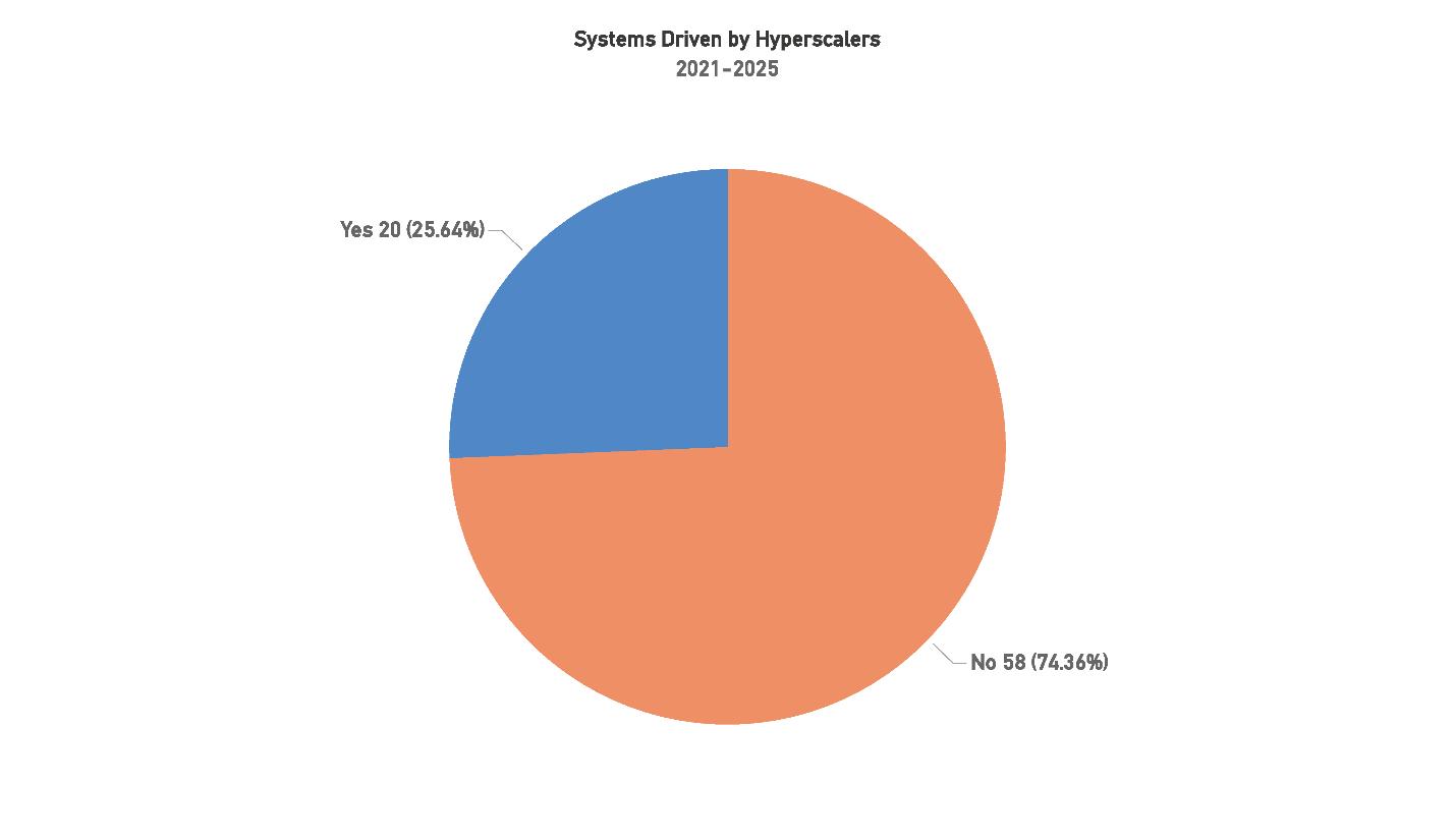
Figure 52: Systems Driven by Hyperscalers, 2021-2025
Between 2020 and 2024, Hyperscalers were responsible for driving 20 submarine cable systems, accounting for 25.64% of the 78 total systems during this period. While traditional telecom operators still account for the majority of builds, this share demonstrates the steady and growing influence of large-scale cloud and content companies in shaping global connectivity. In the 2019–2023 period, Hyperscalers ac-
counted for 24 out of 102 systems, or 23.5%. Although the absolute number is slightly lower in the most recent period, their proportional influence is higher, underscoring that Hyperscalers remain consistent participants even as overall project volumes fluctuate.
When examining year-by-year trends, the growth in Hyperscaler-driven systems is more pronounced. In 2021, only 3 such systems entered service, compared to 16 projects led by other actors. By 2022, the number of Hyperscaler-driven systems more than doubled to 7, increasing again to 11 in 2023, and reaching 13 in 2024. This reflects not just a rising number of projects, but also a growing consistency of participation: Hyperscalers are now involved every year, whereas in earlier periods their investments appeared more episodic.
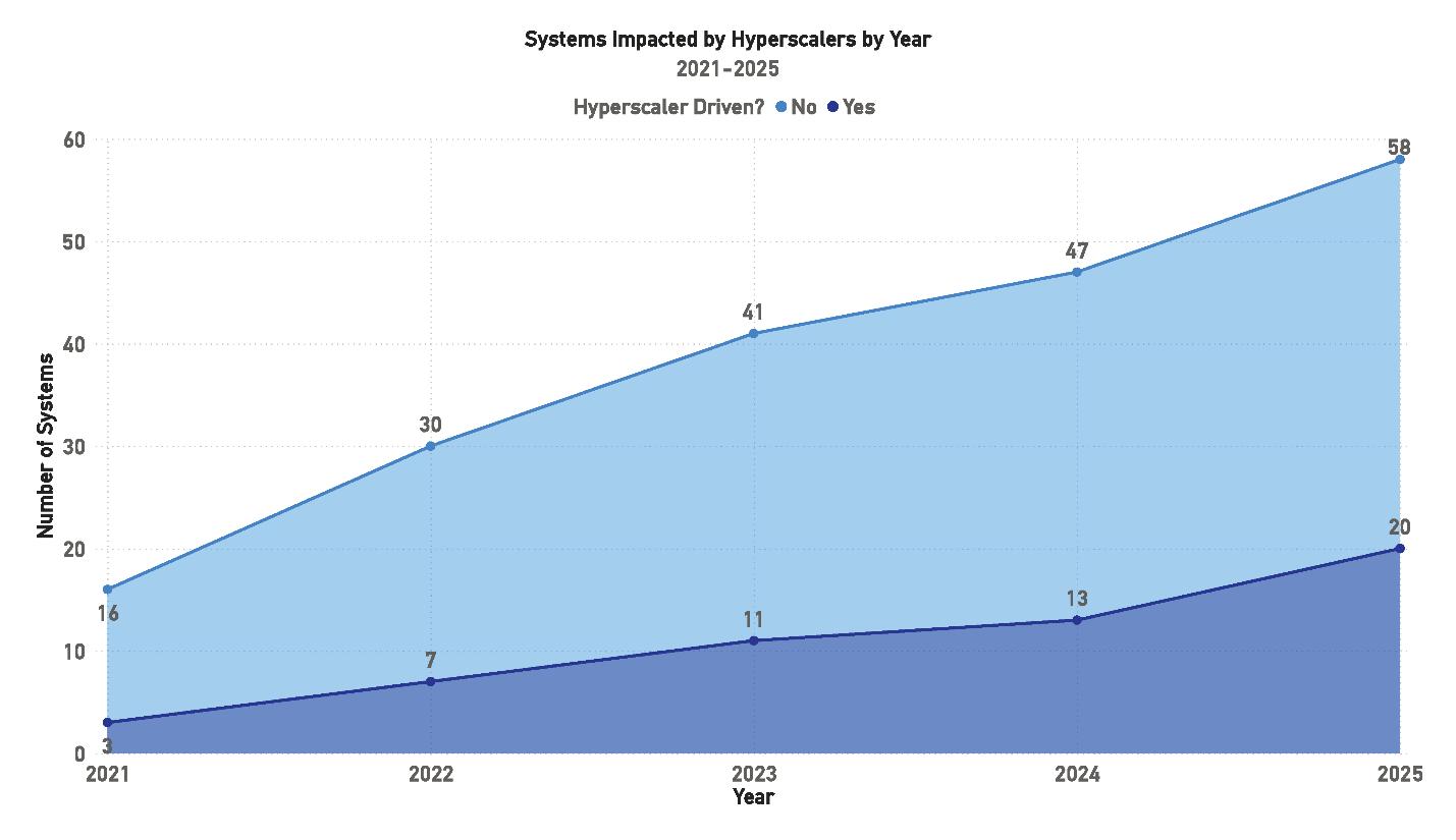
This trend illustrates how Hyperscalers have become long-term strategic players rather than opportunistic participants. The increasing number of systems they sponsor, or co-sponsor is tied directly to demand for interconnection across global cloud regions, streaming platforms, and enterprise data ecosystems. Control over infrastructure offers several advantages: (1) the ability to design routes and landing points aligned with their data center footprints; (2) the capacity to allocate bandwidth flexibly without competing for limited leased circuits; and (3) resilience against supply constraints or geopolitical restrictions affecting vendor choice and route design.
The financial implications are also notable. Although constructing transoceanic cables typically requires investments exceeding $100 million per system, Hyperscalers view these expenditures as cost-saving over time. By internalizing connectivity rather than relying on leased capacity, they reduce long-term operational costs and gain scalability to match exponential growth in cloud usage. This shift also alters industry dynamics: traditional carriers increasingly act as partners or minority consortium members, while Hyperscalers assume the lead role in funding and technical design.
While Hyperscalers’ share of total systems remains around one-quarter, their influence on pricing, route development, and technical specifications far outweighs this percentage. For example, decisions made by Hyperscalers often dictate whether a project is viable, which suppliers are selected, and how capacity is marketed. This growing strategic role highlights the extent to which submarine cables are no longer simply
telecom infrastructure, but critical digital arteries tailored to the needs of the world’s largest data-centric enterprises.
Looking forward, Hyperscalers are expected to account for a significantly larger share of upcoming submarine cable systems compared to earlier projections. Out of 48 systems currently planned, 17 are identified as Hyperscaler-driven, representing 35.42% of the total. This marks a clear increase over last year’s forecast, which anticipated Hyperscalers would drive only 26.47% of planned builds, and a more than doubling compared to the 14% projection made two years ago.
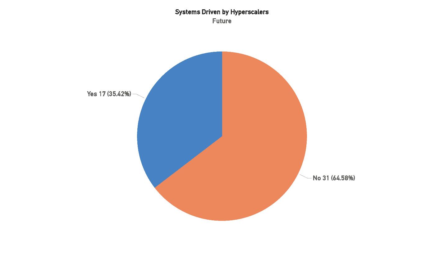
This upward trend underscores the sustained commitment of companies such as Google, Amazon, Microsoft, and Meta to investing directly in critical connectivity infrastructure. While overall market conditions have become more complex — with pressures from inflation, supply chain challenges, and shifts in global regulatory frameworks — Hyperscalers continue to deploy capital strategically to secure the global bandwidth required by their core businesses. Importantly, Hyperscaler-backed projects are more likely to move from planning into service than projects led by traditional carriers, due to the financial stability, large-scale demand, and internal financing structures these companies bring.
In terms of investment volume, Hyperscalers are projected to contribute approximately $14.59 billion to future cable systems, equating to 57.31% of the total projected $25.45 billion. This marks a major shift in the balance of industry financing: while Hyperscalers are responsible for just over a third of systems in number, their funding accounts for the majority of global investment. By contrast, non-Hyperscaler systems, though more numerous, represent only $10.86 billion or 42.69% of the total spend.
Hyperscalers are not only increasing system counts but reshaping the financial base of the global cable industry. Their funding minimizes project risk by securing financing early and speeds deployment by avoiding the long sales cycles traditional carriers face.
Historically, only about half of announced cable systems reach readiness for service. Hyperscaler-backed
projects, by contrast, typically move forward once the Contract in Force (CIF) milestone is met, resulting in far higher completion rates and reinforcing their position as the industry’s most reliable project drivers.
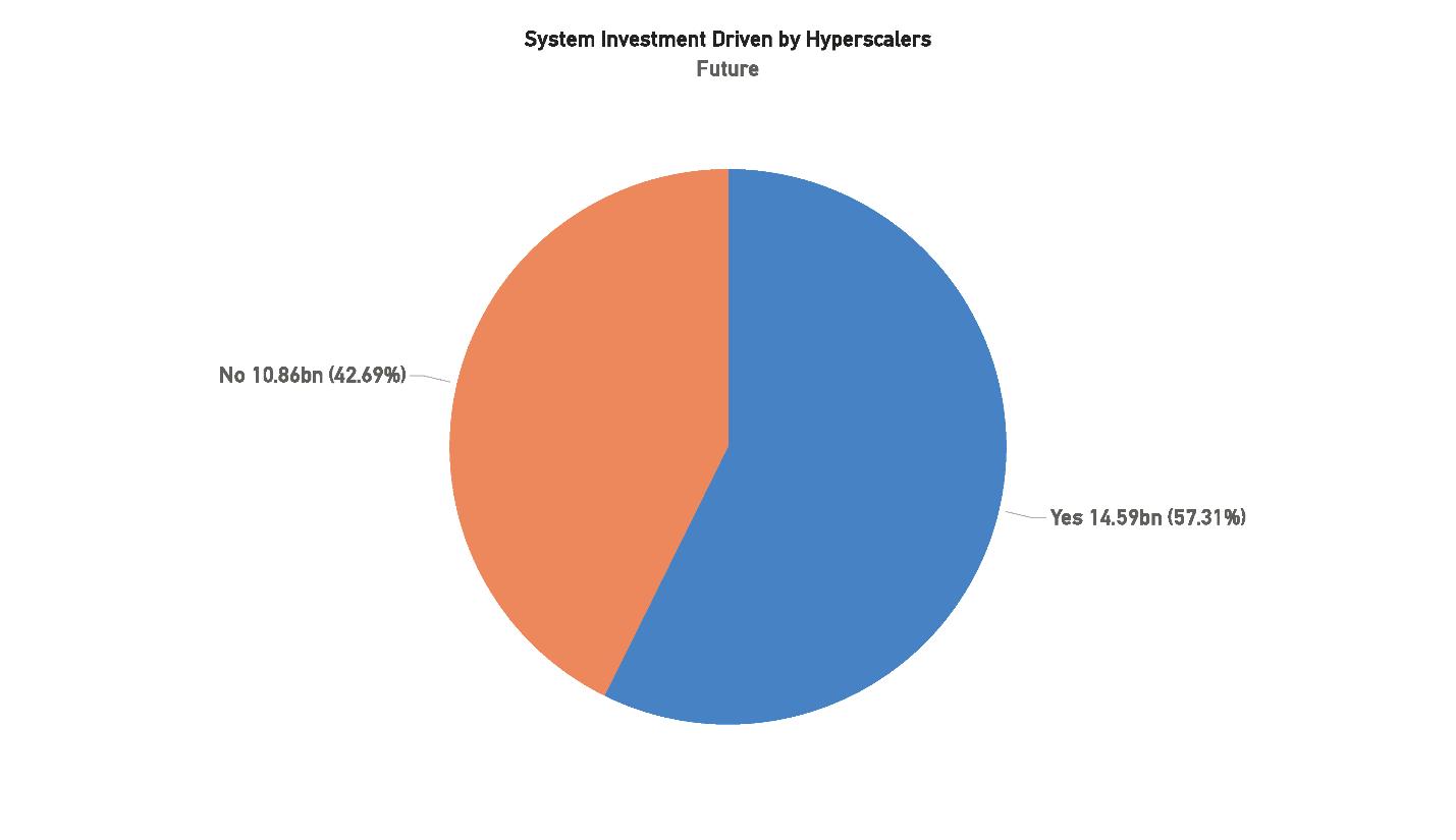
Their growing investment ensures that key cloud and content routes — especially transoceanic and inter–data center links — continue to expand. Meanwhile, carrier-led systems may increasingly require Hyperscaler or government backing as funding gaps widen. This marks a structural shift: Hyperscalers have evolved from major customers to central architects of global connectivity.
Google, Amazon, and Microsoft remain the leading investors, with Meta maintaining selective but strategic involvement. While no new entrants are expected soon, their ongoing capital commitments ensure that Hyperscalers will define future priorities — focusing on route diversity, redundancy, and avoidance of geopolitical chokepoints.
In short, Hyperscalers will shape the next era of submarine networks more than ever before. Though they represent just over one-third of planned systems, their nearly 60% share of total investment highlights their dominance — accelerating timelines, setting new reliability standards, and consolidating influence over global network infrastructure.
“More than 400 submarine cables manage 99% of global internet traffic, with private investors and major technology companies controlling over 40% of the market; Lower Earth Orbit satellites provide fast services in underserved regions and can complement cables to reduce infrastructure risks.”
John
Hibbard & Paul McCann Hibbard Consulting and McCann Consulting (STF Issue 143)
[Reprinted
Excerpts from SubTel Forum’s 2025/26
Submarine Industry Report]
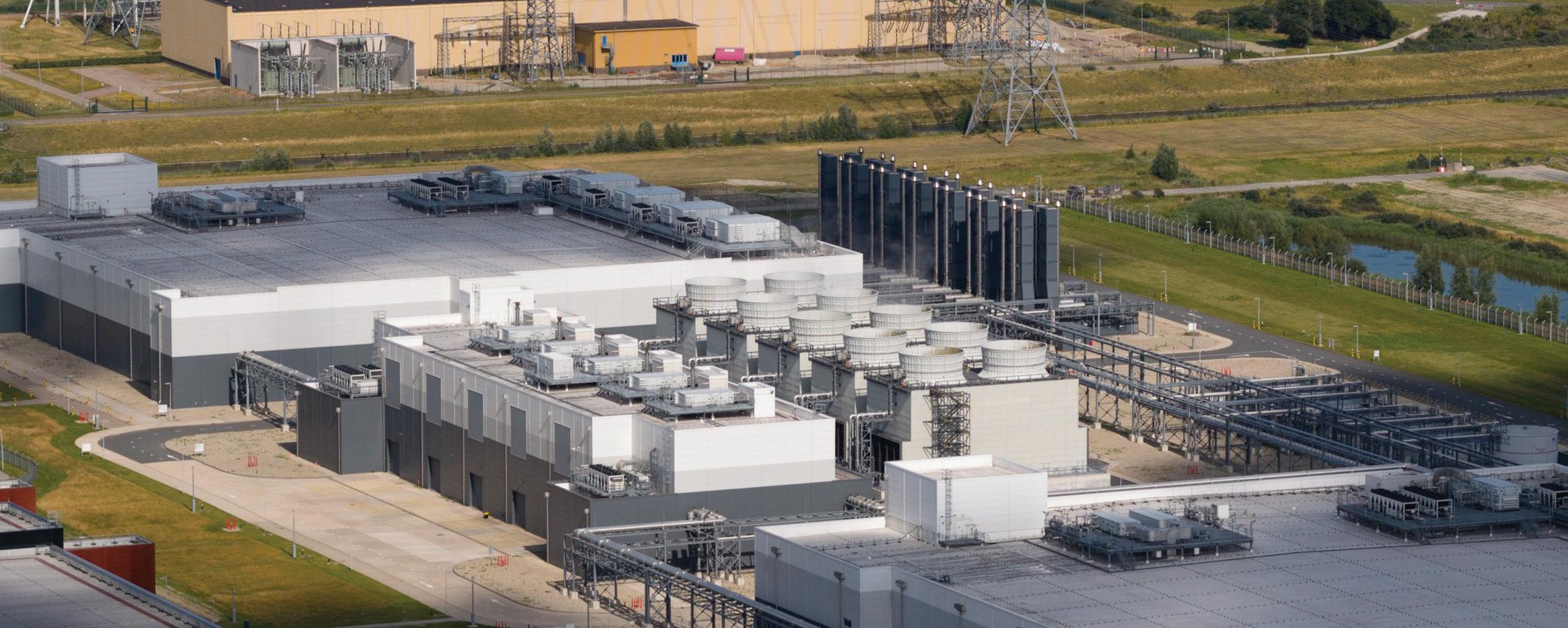
Data center providers have become increasingly integral to the submarine telecommunications ecosystem in recent years. A major trend has been the strategic positioning of data centers and colocation facilities directly adjacent to submarine cable landing stations to enhance interconnection and optimize network performance. Placing data centers at cable landings is driven by the need for ultra-low latency and highspeed data transmission – closer proximity to where subsea cables come ashore can dramatically reduce network hops and latency. In practice, modern subsea cables are now often terminated inside carrier-neutral data centers at these hubs (rather than at remote beach manholes), effectively drawing cables “from data center to data center” across oceans. This configuration simplifies network architecture and improves reliability by aggregating international bandwidth in one place. It is especially advantageous at landing sites where multiple submarine cables converge, as a co-located data center can tap into all of them and provide customers with extensive interconnection options across many networks.
One prominent example is Marseille, France, which has solidified its role as a key global interconnection hub due to its strategic cable landing facilities. Marseille’s proximity to three continents has made it a gateway city for high-speed connectivity spanning Europe, Africa, the Middle East, and Asia. As of 2024, Marseille hosts around 16 international submarine cables (including the 45,000 km 2Africa cable that landed in late 2022), up from 13 cables just a few years prior. Data centers in Marseille – such as those operated by Digital Realty (Interxion) – directly house the termination equipment for these cables, giving them immediate access to enormous international capacity. This has attracted a large community of carriers, content providers, and cloud services to cluster in Marseille’s facilities. By one account, over 120 international and regional network operators and several Internet Exchanges are present at Interxion’s campus there, leveraging the city’s status as Europe’s telecommunications gateway to Asia, Africa and the Middle East. Customers benefit because from these landing-station data centers they can “land and expand” their traffic – receiving incoming intercontinental data and then instantly relaying it via low-latency backhaul to inland digital hubs like Paris, Frankfurt or London. In essence, locating data centers at cable landings creates a one-stop interconnection point, reducing transit costs and latency for international data flows.
This trend of pairing data centers with submarine cables is not limited to Marseille. Around the world, data center investment is clustering in coastal “gateway” markets. In North America, for instance, hubs like Virginia Beach (U.S.) and Hillsboro, Oregon (U.S.) have grown as they receive new Pacific and Transatlantic cables, and similar dynamics are seen in Asia (e.g., Singapore and Mumbai) and Africa (e.g., Mombasa). Data center developers and carriers are proactively expanding near these strategic landing points. Industry leaders Equinix and Digital Realty have continued to grow their portfolios in such locations, providing high-density interconnection platforms at the subsea edge of the network. Equinix in particular has opened new International Business Exchange (IBX) centers in Mediterranean markets like Lisbon, Genoa, and Barcelona to complement Marseille and offer alternative landing hubs. By establishing facilities at multiple cable endpoints, they can attract a broader customer base seeking resilient, low-latency connec-
tivity to global networks. The business case justifies the heavy capital outlay: despite the substantial cost of building and powering data centers (typically around $7–12 million per megawatt of capacity for new construction), proximity to undersea cables unlocks access to massive bandwidth and customers willing to pay for fast, direct connections. These factors have incentivized carriers and colocation providers – including smaller non-hyperscalers – to invest in markets close to cable landing stations, enhancing their competitiveness by becoming essential interconnection hubs in the international data chain.
Globally, data center capacity continues to expand at a record pace, underscoring the interdependence of the data center and submarine cable industries. 2024 saw an unprecedented boom in data center construction, and 2025 is on track to set new highs. Real estate firm JLL estimates that 10 GW of new data center capacity will break ground worldwide in 2025, with another 7 GW of capacity reaching completion during the year. This represents roughly a 15–20% annual growth rate in total installed capacity – a rate that is straining power grids and outpacing many earlier projections. Such growth is fueled by surging demand for cloud services, streaming, and AI applications, which in turn drives new submarine cable deployments to carry the traffic. The symbiosis between cables and data centers is tighter than ever: new cables require robust data centers at the landing points, and conversely, data centers flourish when fed by multiple high-capacity cables. This virtuous cycle is expected to continue, with each side spurring further investment in the other. By the end of 2025, analysts anticipate over 500 additional hyperscale and large colocation data center projects in the global pipeline (up from 440 a year earlier), many of them positioned in key landing station markets. In short, the submarine cable and data center industries are set to grow even more interdependent, jointly underpinning the next generation of global connectivity.
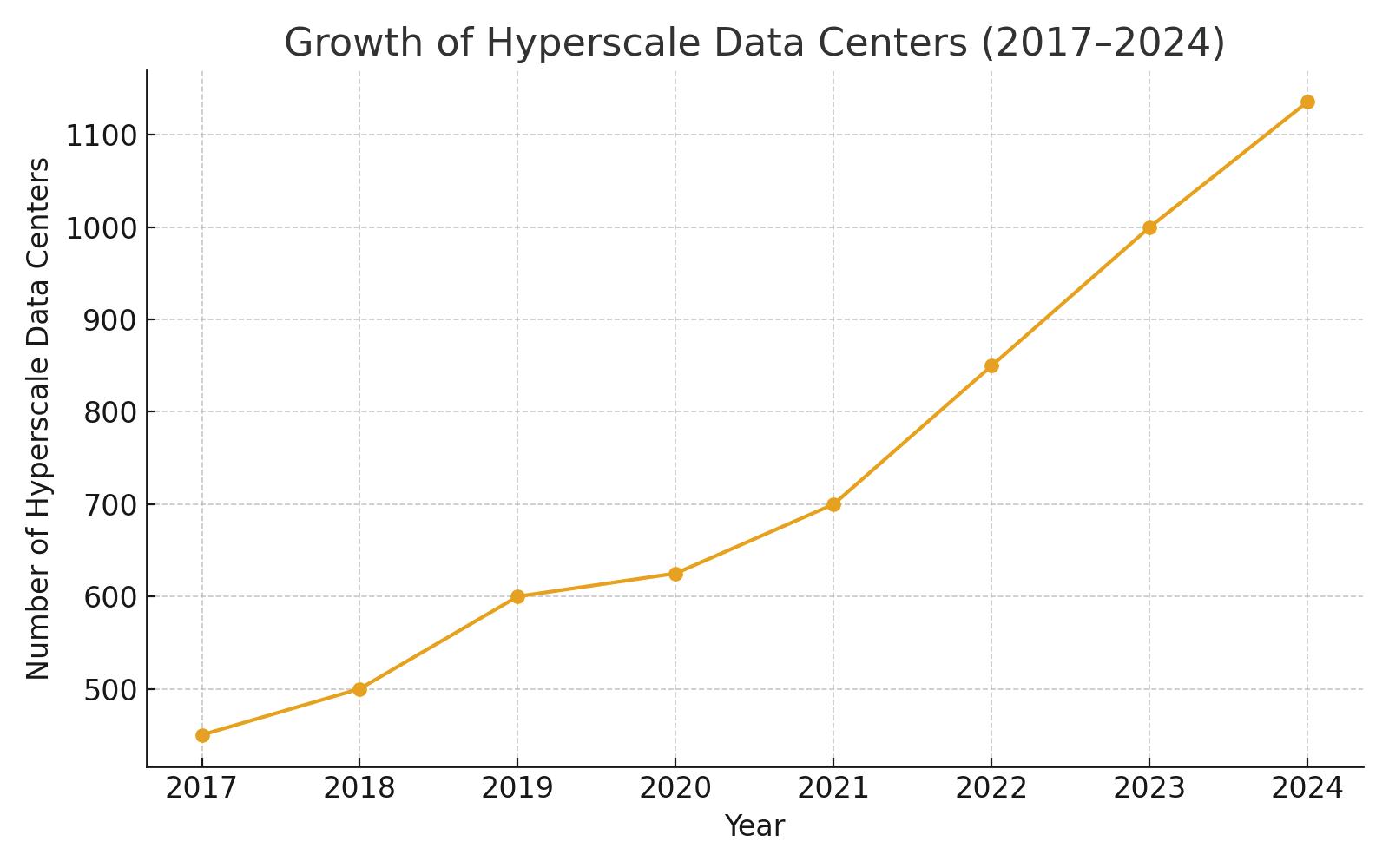
The global data center market is indeed experiencing remarkable growth, with hyperscale data centers driving much of the expansion. Hyperscale facilities – massive cloud and internet data centers owned by the likes of Amazon (AWS), Microsoft, Google, Meta, and Alibaba – crossed an important threshold in early 2024, surpassing 1,000 total sites in operation worldwide. By the end of 2024, the count of large hyperscale data centers had reached 1,136, and it continues to rise rapidly in 2025. This is more than double
the number of hyperscale sites just five years ago. Correspondingly, the aggregate capacity of hyperscale data centers (measured in megawatts of critical IT load) has doubled in under four years and is on track to double again in roughly the next four years according to Synergy Research. Each year is seeing on the order of 130–140 new hyperscale data centers come online – in 2024 alone, 137 new hyperscale facilities were activated. Crucially, not only are there more sites, but the average size of each new data center is increasing. The build-out of energy-hungry AI infrastructure is a prime reason: companies are deploying much larger server clusters (with thousands of GPUs) for training generative AI models, which require greater power and space. This has “supercharged” the scale of hyperscale campuses coming online in the past year.
The increasing reliance on AI is reshaping data center design and investment. Hyperscale operators are now routinely planning facilities exceeding 100 MW each to accommodate AI supercomputing needs – a stark jump from typical facilities a few years ago. These AI-focused builds feature higher rack densities and novel cooling systems to handle the heat output. NVIDIA’s latest AI chips, for example, consume up to 300% more power than their predecessors, driving the adoption of liquid cooling and other advanced thermal management in data centers. Many cloud providers have begun segmenting their infrastructure into AI-specific “training” data centers (sited near abundant power sources) versus more conventional “inference” or general-purpose data centers closer to end-users. Still, as core hyperscale campuses grow ever bigger, operators are also deploying an increasing number of smaller, distributed data centers to push services closer to customers at the edge. This bifurcation – mega-scale central facilities paired with satellite edge nodes – has become more pronounced in the last few years. The smaller facilities, often located in secondary cities or emerging markets, cache content and handle local traffic to further reduce latency for users, complementing the giant regional hubs.
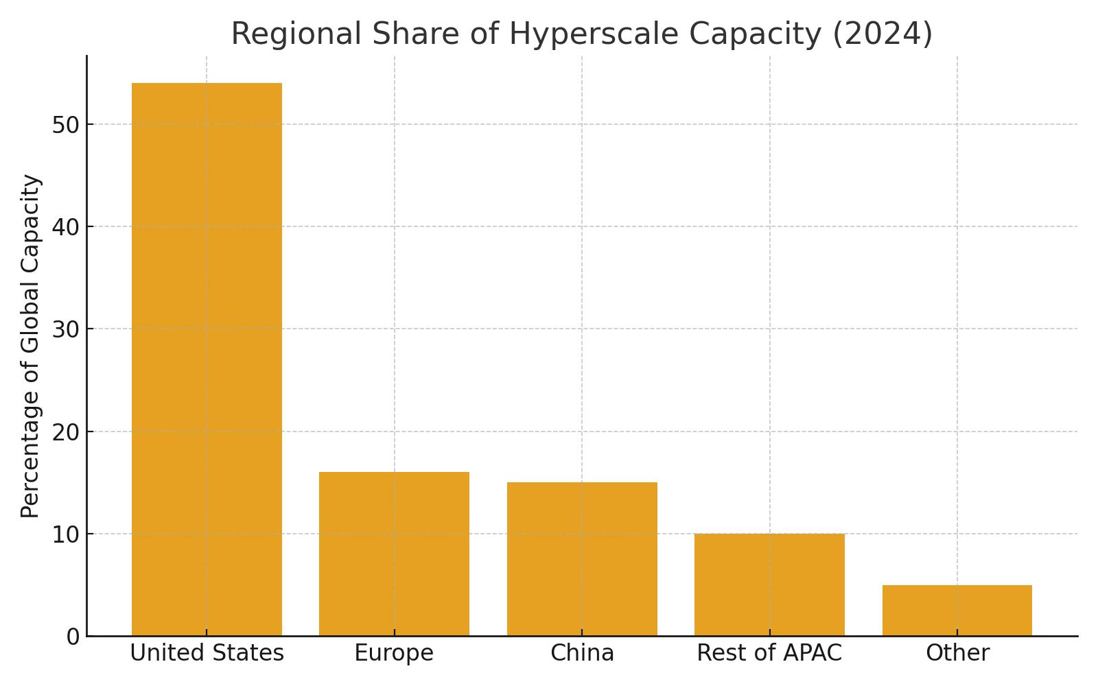
Geographically, the distribution of hyperscale capacity remains uneven and highly concentrated in a few countries. The United States is by far the dominant home of hyperscale infrastructure – as of late 2024, the U.S. alone accounts for roughly 54% of the world’s total hyperscale data center capacity. This is more capacity than Europe, China, and the rest of Asia-Pacific combined. China and Europe each account for only about 15–16% of global hyperscale capacity (with the remainder in other regions). Within the U.S., Northern Virginia (specifically Loudoun County’s “Data Center Alley” and adjacent areas) remains the single largest hyperscale cluster on the planet – so much so that Northern Virginia along with the Greater Beijing area in China together make up around 20% of all global hyperscale capacity. According to Synergy’s latest rankings, just 20 metropolitan areas or states host 62% of the world’s hyperscale capacity, and 14 of those top 20 locations are in the U.S. Besides Northern Virginia, other leading hyperscale markets include Oregon and Iowa (ranked #3 and #4 globally, thanks to huge cloud campuses with access to cheap power), the Dallas/Fort Worth metro in Texas, and Ohio – as well as Dublin, Ireland (the one European market in the top ten), and Shanghai, China. In fact, Dublin is currently the only market in all of Europe to crack the top 20 list for hyperscale capacity – Frankfurt and Amsterdam, historically big colocation hubs, have slipped just outside the top 20 as their growth has been outpaced by faster-expanding U.S. and APAC markets.
“Content and cloud providers now account for more than 70% of international bandwidth usage…global demand has nearly tripled since 2019.”
Martin Reilly - MOFN feature (STF Issue 144)
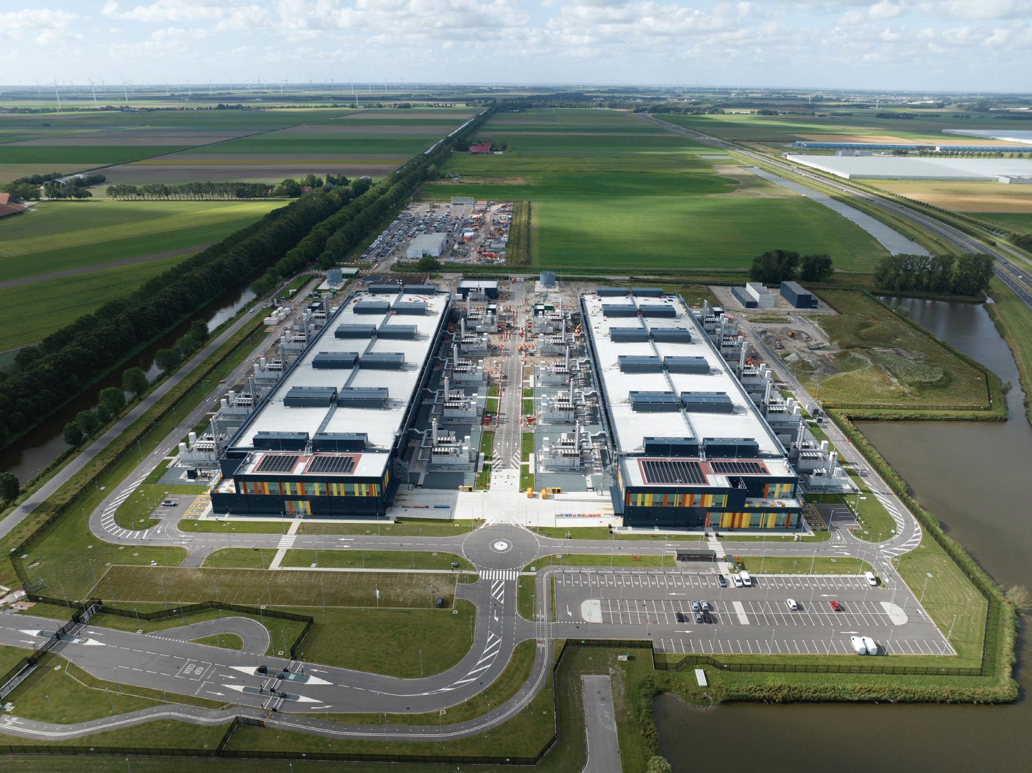
Looking ahead, new hyperscale growth markets are beginning to emerge, which could gradually shift the global landscape. Within the U.S., the “center of gravity” for hyperscale development is expected to broaden beyond Northern Virginia to include more sites in southern and midwestern states that offer abundant land and power. Industry analysts note that factors like power availability, cost of energy, land prices, and tax incentives have become pivotal in site selection – sometimes outweighing proximity to traditional tech hubs. This favors certain less densely populated areas: for example, states such as Oregon, Iowa, Nebraska, and Georgia (each of which appears in the top 20 list) have attracted massive projects due to lower costs or utility incentives.
By contrast, some major world cities face constraints: London, Frankfurt, Tokyo, and others are grappling with grid congestion, scarce real estate, and permitting challenges, which temper their hyperscale growth. Outside the U.S. and China, countries poised for greater hyperscale investment include India, which has a booming cloud user base; Malaysia and other Southeast Asian nations; Spain (leveraging new cables and strategic location for Europe/Africa connectivity); and Saudi Arabia in the Middle East. These up-and-coming markets are expected to claim a bigger share of hyperscale deployments over the next 3–5 years, as the global cloud giants extend their footprint to reach new users. In 2024, hyperscalers already ramped up their capital expenditures to accelerate expansion into new regions – collectively spending over $200 billion on data center builds (a jump from roughly $150 billion per year in 2022–2023). Colocation providers are following suit by investing in those geographies, often in partnership with hyperscalers or to provide regional capacity for enterprises. This robust investment pipeline (with 535 future hyperscale sites reportedly in planning or construction worldwide as of mid-2025) suggests that double-digit annual growth in capacity will continue in the near term. In fact, Synergy Research projects that all regions will see at least 10%+ yearly growth in total data center capacity through 2030, with hyperscale cloud infrastructure growing on the order of 20% YoY globally.
Notably, hyperscale operators are capturing an ever-larger share of the overall data center market. As cloud adoption accelerates, the industry is witnessing a shift away from traditional enterprise-owned data centers toward concentration in big cloud and colocation facilities. As of early 2025, hyperscale data cen-
ters (cloud and internet giants) account for about 44% of all installed data center capacity worldwide, up from roughly one-third just a few years ago. Correspondingly, the share of on-premises enterprise data centers has fallen to around 34% of total capacity and continues to decline. By 2030, current projections suggest hyperscalers will command nearly 60% of global data center capacity, while the enterprise onprem share may shrink to only 22%. (The remaining balance is capacity in multi-tenant colocation facilities, which is growing in absolute terms but will likely form a smaller percentage of the total pie.) In short, cloud giants and their hyperscale campuses are becoming the predominant form of data center infrastructure worldwide. Even enterprise IT workloads are increasingly being shifted to either cloud or edge colocation sites, except for certain niches requiring on-premises due to latency or data governance. One interesting nuance: after years of decline, enterprise-owned capacity saw a slight uptick in 2023–24 driven by AI and high-performance computing labs (some companies built private GPU clusters), but this does not alter the overall trend – hyperscale and cloud providers are expected to dominate new capacity additions through the end of the decade.
The breakneck expansion of data centers has heightened the industry’s focus on energy efficiency and sustainability. Power consumption by data centers is soaring as larger facilities and AI hardware come online – global data center power demand is forecast to double by the end of the decade if current trends continue. The need to balance this growth with environmental responsibility is driving a wave of innovation in how data centers are powered and cooled. Operators are investing heavily in renewable energy: hyperscale cloud firms have become some of the world’s largest corporate buyers of wind and solar power purchase agreements (PPAs), aiming to run their servers on carbon-free energy. For example, Nordic countries have become prime locations for new data center projects in part due to their abundant cheap renewable electricity (hydropower, wind) and naturally cold climate. The Nordics are “gearing up for a data centre gold rush” over the next five years, thanks to advantages like low-cost green power and investor-friendly regulations. Major operators such as Microsoft, Google, and Amazon have announced or opened large facilities in Sweden, Finland, and Denmark, leveraging those nations’ cooler temperatures for free cooling and their robust grids for clean energy. Regions like Scandinavia and the Pacific Northwest in the U.S. (e.g., Oregon) not only offer renewable-rich power grids (hydroelectric, wind, etc.) but also benefit from climate conditions that reduce cooling costs – making them attractive for sustainable expansion.
At the same time, data center engineering is increasingly oriented toward high efficiency. Almost all new hyperscale builds feature state-of-the-art cooling designs – including widespread adoption of liquid cooling for racks hosting AI chips – and advanced energy management systems. In many new facilities, liquid coolant circulation has become the default instead of traditional air cooling, because modern AI servers dissipate heat at levels that air cooling cannot handle efficiently. This allows operators to maintain higher densities with less energy overhead for cooling, thereby improving PUE (Power Usage Effectiveness) even as compute loads intensify. Operators are also exploring innovative power solutions to meet growing demand. There is rising interest in nuclear energy, for instance – both conventional nuclear and small modular reactors (SMRs) – as a potential long-term clean power source for energy-hungry data center campuses. In 2024 several hyperscale companies signed agreements tied to nuclear power supply, and more such deals are expected in 2025 as companies look to lock in reliable, carbon-free power for future facilities. (Notably, some U.S. data center operators even inquired about placing SMRs directly next to their data centers, though utilities note that practical deployment of on-site mini-reactors is still many years away.) Finally, governments and industry coalitions in places like the European Union are putting pressure on data centers to improve energy reuse – for example, by capturing waste heat from servers to warm nearby buildings – and to minimize water use in cooling.
In summary, the data center sector’s growth is showing no signs of slowing – if anything, it is entering an even more ambitious phase driven by cloud, AI, and ever-increasing digitalization. Analysts forecast a continued double-digit annual increase in global data center capacity for the next several years, along with a massive pipeline of projects across all regions. Hyperscale data centers will remain at the forefront of this build-out, enabling new technologies and services but also concentrating much of the world’s compute power in their facilities. This will further entwine the fate of submarine cables and data centers: as
hyperscale platforms expand to every corner of the globe, they will rely on high-bandwidth submarine links between regions, and those cables will in turn land in proximity to large data centers.
The next generation of digital infrastructure will thus be defined by strategic convergence – cables, cloud data centers, and terrestrial networks all coming together to deliver seamless global connectivity. The challenge ahead lies in managing this growth sustainably, through smart site selection (favoring low-impact locations), renewable energy, and innovation in cooling and power technology, so that the digital ecosystem can scale responsibly over the coming decade.
“A few key insights emerged: coastal redundancy was overserved; inland diversity undersupplied; competitors had superior scale but lacked route resilience; and new data centers under development in two interior cities presented emerging demand hotspots”
Nielsen – WFN Strategies (STF Issue 142)



• Global system coverage—active, planned, future
• Capacity forecasts and regional build trends
• Supply chain, investment, and geopolitical insights
• Verified datasets based on real industry research
• Essential for strategic planning
BY CAMILA DE MORAES, IAGO BOJCZUK, AND NICOLE STAROSIELSKI
Cable landing stations (CLSs) and data centers share very similar energy and operational requirements. Both facilities require continuous cooling, electrical redundancy, highly sensitive equipment, and very high availability targets. Both are mission-critical infrastructures on which most digital services depend today. A failure can cause outages with significant financial implications for clients and, ultimately, negative impacts on end-users.
However, while there has been research and the development of sustainable standards and regulations for data centers over the past decade, very little is known about the CLS. Prior to the SubOptic Foundation’s Report on Best Practices in CLS Sustainability, there have been no industry-wide publications specifically on CLS sustainability.
This is in part due to the general lack of information circulated about the CLS, as well as the significant variation between CLSs around the world. According to John Tibbles of the SubOptic Foundation, CLSs have been conceived in ways that fit “their local environment and onward domestic links, or with future subsea developments in mind.” He notes the difference between examples of facilities he knew: stations in New Jersey and Bermuda built in the 1960s that could withstand a nuclear attack were substantially different from a CLS in the United Kingdom that resembled
a typical farmhouse. CLSs are less standardized than many contemporary data centers, and vary depending on coastal conditions, permitting frameworks, and commercial drivers.
In recent years, data traffic, workloads, and the number of internet users continue to rise. As a result, sustainability has become a much more significant issue. According to the European Commission, since 2010, the number of internet users has more than doubled, and global traffic has increased 25-fold. Although rapid advances in energy efficiency have moderated growth in consumption, data centres and transmission networks each account for about 1–1.5% of global electricity use (IEA, 2024). This raises questions about the sus-
tainable future of CLS architecture and global distribution.
In this column, we extend last month’s piece on the launch of the Report on Best Practices in CLS Sustainability and assess how sustainability considerations might be applied to CLS, especially as higher-capacity cable systems are deployed, new regions are connected, and new forms of convergence emerge.
We suggest that relevant sets of standards, metrics, and best practices—already mature and widely tested across the data center sector—can be adapted and applied to CLSs. In particular, we explore how the EU Code of Conduct for Energy Efficiency in Data Centres (EUCoC) and the European Technical Standard
EN 50600-5-1 can serve as tools to enhance the sustainability of CLSs.
We explain how these frameworks can help operators to assess their current position, set priorities for improvement, and demonstrate progress internally and externally. As the findings of the report on Best Practices in CLS Sustainability highlighted, the monitoring of performance data remains a key element of potential improvement, which is a necessary precursor to implementing sustainability improvement programs. Since metrics are essential for measurement and monitoring, these tools offer a clear view of the present state of the art.
The EU Code of Conduct for Energy Efficiency in Data Centres (EUCoC)—launched in 2007, developed by the European Commission’s Joint Research Centre, and last updated in 2025—emerged in response to concerns about the rapid growth in energy use in data centres. It is a voluntary, industry-collaborative scheme that provides a standardised method of assessment and reporting, built around Power Usage Effectiveness (PUE) and an evolving set of more than 100 best-practice actions that are reviewed annually.
In several countries, public procurement now requires alignment with the EUCoC, which has helped drive participation. To date, around 600 data
centers have reported under the programme (UNEP Copenhagen Climate Centre, 2024). In a context where clients and partners demand tangible sustainability metrics, the EUCoC has become the go-to reference for operators seeking to benchmark and improve energy performance, align operations and procurement with best
A core feature of the EUCoC is its voluntary nature; that is, it does not replace regional or local legislation. In legal terms, it is a non-binding document. Therefore, adherence to the Code and compliance with its recommendations are not
facilities. While the EUCoC outlines what to do (practices and processes), EN 50600-5-1 specifies how to measure (criteria and indicators). Together, they enable organisations to assess their baseline and develop a roadmap for continuous improvement, prioritising investments according to each site’s maturity level.
Table 1 summarises the best practices and standards applicable to CLS facilities—whether integrated into a data centre or operating independently—with a focus on universally relevant actions, such as asset auditing and decommissioning unused services and equipment.
Because some CLSs are single-system sites while others are planned as multi-system hubs—with distinct marine-access and room configuration needs—metrics and practices should be right-sized to the site’s role and future expansion path.
practice, and demonstrate credible, transparent compliance with recognised efficiency targets.
Operationally, the EUCoC complements the European standard EN 50600-5-1, which establishes maturity levels for data centers and related
A core feature of the EUCoC is its voluntary nature; that is, it does not replace regional or local legislation. In legal terms, it is a non-binding document. Therefore, adherence to the Code and compliance with its recommendations are not mandated by law. For many years, the Code has functioned as an instrument of industry self-regulation without binding force.
In many instances, operators joined on their own initiative, motivated by reducing energy costs, strengthening environmental reputation, and anticipating future sustainability requirements. This voluntary nature has encouraged flexibility and open collaboration, although results have depended on each participant’s level of commitment. The list of “best practices” provides a common terminology and a reference framework for describing energy-efficiency measures, helping Participants and Endorsers avoid ambiguities and align their expectations.
For operators—whether companies with their own data centers, colocation providers, or cloud service providers—adherence to the EUCoC
Physical building
Mechanical and electrical plant
Data floor
Cabinets
IT equipment
Operating System / Virtualisation
Software
Business Practices
In many instances, operators joined on their own initiative, motivated by reducing energy costs, strengthening environmental reputation, and anticipating future sustainability requirements.
offers a structured pathway to improve efficiency and reduce costs (Table 2 outlines the operator’s responsibilities). By adopting best practices, it is possible to optimize energy consumption through more efficient cooling, eliminating inefficiencies, and fine-tuning infrastructure, leading to significant medium-term financial savings. Continuous monitoring of metrics, such as PUE, enables operators to identify and correct energy
The building, including security, location and maintenance.
waste quickly. In addition, operators benefit from access to specialized knowledge and the exchange of experiences within the EUCoC community, which fosters the discussion of innovative solutions and the dissemination of successful practices.
Following the Code also strengthens a company’s environmental credibility, signaling to clients and the public that the organization takes climate responsibility seriously. Data
The selection, installation, configuration, maintenance and management of the mechanical and electrical plant.
The installation, configuration, maintenance and management of the main data floor where IT equipment is installed. This includes the floor (raised in some cases), positioning of CRAC / CRAH units and basic layout of cabling systems (under floor or overhead).
The installation, configuration, maintenance and management of the cabinets into which rack-mount IT equipment is installed.
The selection, installation, configuration, maintenance and management of the physical IT equipment.
The selection, installation, configuration, maintenance and management of the Operating System and virtualisation (both client and hypervisor) software installed on the IT equipment. This includes monitoring clients, hardware management agents etc.
The selection, installation, configuration, maintenance and management of the application software installed on the IT equipment.
The determination and communication of the business requirements for the data centre including the importance of systems, reliability availability and maintainability specifications and data management processes.
Table 2. Operators’ areas of responsibility. They refer to the entire data centre from the physical building through to the consumption of the IT services delivered. Source: European Commission, 2025.
centers that excel at applying best practices and reducing consumption may receive awards or be mentioned in JRC reports, gaining public recognition at the European level. In summary, operators use the Code both as an energy management tool, to guide investments and operations, and as a benchmarking reference, comparing their performance against European standards and driving continuous improvement.
The development of EN 50600-5-1 marked a decisive step in consolidating sustainability as a measurable and operational discipline within the European data center and digital infrastructure industries. Based on the broader EN 50600 framework, this
part introduces a Maturity Model for Energy Management and Environmental Sustainability to assess the degree to which sustainable practices are integrated throughout the lifecycle
of an ICT site —from design and construction to operation and end-of-life.
From an industry perspective, EN 506005-1 shifts the focus from generic “green” ambitions to engineeringdriven sustainability, a transition that could also be deployed across the subsea cable industry.
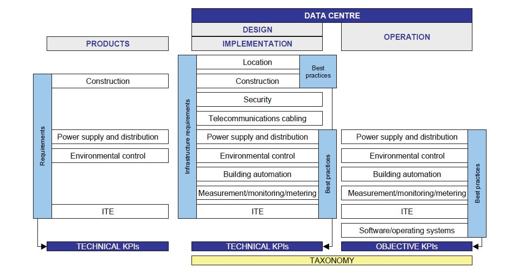
More than a simple compliance checklist, EN 50600-5-1 functions as a technical governance architecture: it connects layers of infrastructure (electrical distribution, environmental control, telecommunications cabling, and building automation) to measurable indicators such as PUE, ERF (Energy Reuse Factor), REF (Renewable Energy Factor), and CER (Cooling Efficiency Ratio). These metrics enable operators to quantify efficiency gains, resilience levels, and resource circularity according to unified European KPI definitions.
From an industry perspective, EN 50600-5-1 shifts the focus from generic “green” ambitions to engineering-driven sustainability, a transition that could also be deployed across
the subsea cable industry. It requires systematic measurement and verification infrastructures, precise metering points, telemetry integration, and management systems aligned with ISO 50001 and ISO 14001 standards, ensuring data quality in energy management reporting.
The model explicitly links operational efficiency to resilience optimi-
zation, recognizing that sustainability cannot compromise service availability. Thus, redundancy (N+1, 2N) is now assessed not only for reliability but also for its energy overhead and carbon intensity. The adoption of the standard drives designers to implement modular UPS topologies, variable-speed cooling circuits, and pathways for renewable energy inte-

gration; meanwhile, facility managers must institutionalize continuous improvement cycles based on objective, comparable KPIs. This dual responsibility between design and operation produces traceable, auditable evidence of sustainability performance across colocation, enterprise, and hyperscale environments.
In practice, applying EN 506005-1 to data centers and cable landing stations enables maturity progression based on benchmarks. Operators can position each facility across defined levels—from basic compliance to proactive innovation —quantifying energy reuse, the integration of renewable sources, and water and carbon efficiencies against European benchmarks. The standard is harmonized with ETSI EN 305 174 and ISO/IEC 30134, ensuring interoperability with international frameworks while maintaining the European emphasis on environmental viability and lifecycle accountability. Thus, EN 50600-5-1 serves simultaneously as a technical backbone and a market instrument: it standardizes sustainability assessment across the sector, supports ESG disclosure and alignment with the EU Taxonomy, and steers investment toward low-carbon, high-resilience infrastructures that meet future regulatory and commercial expectations.
The combined application of the EU Code of Conduct (EUCoC) and the EN 50600-5-1 standard establishes a comprehensive sustainability framework for the design, operation, and continuous improvement of digital infrastructures, guiding both energy efficiency and the reduction
of climate impacts throughout their lifecycles.
At the operational level, the EUCoC provides a set of best-practice references covering energy management (ISO 50001), environmental management (ISO 14001), and asset management (ISO 55000), ensuring that efficiency is integrated not only into equipment procurement but also into long-term governance. EN 50600-5-1, in turn, operationalizes these principles through quantifiable KPIs such as PUE, WUE (Water Usage Effectiveness), CUE (Carbon Usage Effectiveness), and REF. Together, these metrics enable data-driven verification of sustainability claims and compliance with the reporting obligations of the EU Energy Efficiency Directive (EED). From a technical perspective, both frameworks encourage modular provisioning, the integration of free cooling, and the adoption of renewable energy sources, aligning infrastructure design with principles of climate resilience and cost efficiency.
EN 50600-5-1 explicitly links environmental sustainability to the traceability of energy sources, through guarantees of origin, and to life cycle assessments (LCA) in accordance with ISO 14040/44. The EUCoC reinforces these objectives by encouraging holistic site management, periodic and real-time monitoring of energy flows, and the creation of multifunctional roles, such as environmental or energy managers, responsible for strategic oversight.
For CLS operators, these two frameworks could serve as valuable tools as companies look for rigorous and tested approaches to sustainability improvements. If these frameworks were adopted across the subsea cable
industry, this could prompt a similar shift as in the data center sector toward a performance-oriented sustainability paradigm (see Figure 2).
As such frameworks have done for the data center industry, they might also serve for the subsea industry as a technical backbone and a market instrument, standardizing sustainability assessment across the sector and potentially steering investment toward low-carbon, high-resilience infrastructures that anticipate the future regulatory and economic environment. In addition, applying these frameworks to CLSs can also help inform design choices and strengthen approval processes that have historically been handled on an ad-hoc basis.
We encourage CLS operators who are interested in exploring this opportunity to consult SubOptic’s Report on Best Practices in CLS Sustainability as well as the ENCoC and EN 50600-5-1. STF
This article is an output from a SubOptic Foundation project, Sustainable Subsea Networks, funded by the Internet Society Foundation.

CAMILA PAULINO is a Master’s student at NOVA University Lisbon. Her research focuses on health and development, particularly in the context of climate resilience and adaptation.

IAGO BOJCZUK is a Ph.D. candidate in the Department of Sociology at the University of Cambridge, UK, and the Student and Young Professional Coordinator for the SubOptic 2025 conference. His research focuses on the sustainability and governance of digital infrastructures, including subsea cables, data centers, and satellites.

NICOLE STAROSIELSKI is Professor of Film and Media at the University of California, Berkeley. Dr. Starosielski’s research focuses on the history of the cable industry and the social aspects of submarine cable construction and maintenance. She is author of The Undersea Network (2015), which examines the cultural and environmental dimensions of transoceanic cable systems, beginning with the telegraph cables that formed the first global communications network and extending to the fiber-optic infrastructure. Starosielski has published over forty essays and is author or editor of five books on media, communications technology, and the environment. She is co-convener of SubOptic’s Global Citizen Working Group and a principal investigator on the SubOptic Foundation’s Sustainable Subsea Networks research initiative.
Works Cited
CEN/CENELEC/ETSI Coordination Group on Green Data Centres. 2024. Review of Standardisation Activities: Energy Management and Environmental Viability of Data Centres—Based on the Edition 11 Report of the CEN/CENELEC/ETSI Coordination Group on Green Data Centres. Brussels: CEN and CENELEC. Available at: https://www.cencenelec.eu/media/CEN-CENELEC/ AreasOfWork/CEN%20sectors/Digital%20Society/ Green%20Data%20Centres/2024/brochuredatacentre-_ standardizationedition11_2024.pdf.
European Commission. 2025. ‘European Code of Conduct for Energy Efficiency in Data Centres’, The Joint Research Centre: EU Science Hub. [Online]. Available at: https://publications.jrc.ec.europa.eu/repository/handle/ JRC141521?utm_source=chatgpt.com
International Energy Agency. 2024. Data Centres and Data Transmission Networks. IEA. Available at: https:// www.iea.org/energy-system/buildings/data-centres-anddata-transmission-networks
Joint Research Centre (European Commission). 2023. The EU Code of Conduct for Data Centres – Towards More Innovative, Sustainable and Secure Data Centre Facilities. European Commission. Available at: https://joint-researchcentre.ec.europa.eu/jrc-news-and-updates/eu-codeconduct-data-centres-towards-more-innovative-sustainableand-secure-data-centre-facilities-2023-09-05_en
SubOptic Foundation (2025) Report on best practices in cable landing station sustainability. London: SubOptic. [Online]. Available at: https://www.suboptic.org/paperspresentations/report-on-best-practices-in-cable-landingstation-sustainability
UNEP Copenhagen Climate Centre. 2024. “Enhancing Energy Efficiency in Data Centres: Key Strategies and Innovations.” YouTube, November 18, 2024. https://www. youtube.com/watch?v=-SEoBtVtP1Y
BY KIERAN CLARK
The global subsea cable network depends on a small, highly specialized fleet of installation and repair vessels whose work typically remains out of public view. AIS (Automatic Identification System) signals provide the only globally consistent window into this fleet’s behavior—but AIS reveals position, not purpose. Inferring mission profiles requires combining AIS tracks with known infrastructure locations, observed clustering patterns, and a model that interprets idle behavior in context.
This updated analysis presents the latest geospatial results for November 2025, incorporating more than 9,200 AIS-derived idle points logged at sixhour intervals throughout the month.
Compared to the September dataset, the November results show clear shifts: stronger clustering around East and Southeast Asia, noticeable increases in depot-linked maintenance signatures, and a continued surge in unclassified idle behavior. These shifts align with both seasonal repair cycles and the ongoing expansion of new-build activity across Asia.
As in previous reporting, idle points—instances where vessels remained slow-moving or stationary long enough to indicate operations—were classified using a proximity-based model:
• Installation when idling occurred near a cable factory
• Maintenance when id ling occurred near a cable depot
• Unc lassified when no facility proximity or vessel movement patterns provided sufficient context
A 50 km threshold was used to associate vessels with facilities, with installation prioritized when both factory and
depot fell within range. This mirrors behaviors observed in factory-adjacent staging zones, where vessels routinely load cable before deployment.
This methodology continues to parallel approaches used in other mobility-driven industries—logistics, offshore energy, and fisheries—where positional dwell time and clustering are used to infer mission purpose. The goal remains the same: turning raw geographic data into operational insight when direct reporting is unavailable.
Figure 1 presents an updated geospatial view of cable-ship idling for November 2025, incorporating several thousand AIS-derived idle points across all major cable-serving
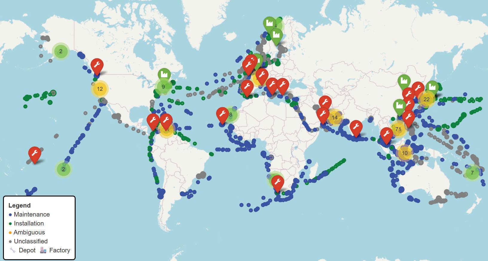
regions. Each point on the map is color-coded according to the model’s projected activity classification:
• Blue: Maintenance
• Green: Installation
• Orange: Ambiguous (newly introduced transitional category)
• Gray: Unclassified
Infrastructure locations are marked with standard symbols:
• Wrench: Cable Depot
• Factory: Cable Manufacturing Facility
The November dataset reinforces long-standing geographic patterns while revealing several notable shifts. East Asia and Southeast Asia continue to dominate global vessel presence, with particularly dense clusters around Shanghai, Busan, Kitakyushu, Hong Kong, Singapore, and Manila. These regions host multiple depots and factories, explaining the heavy mix of maintenance, installation, and ambiguous staging events.
The North Atlantic and North Sea corridors again display intense concentrations, especially around Calais, Brest, Lowestoft, and the Norwegian/UK coast, highlighting Europe’s role as the world’s most mature repair and logistics hub. High volumes of unclassified and maintenance signals appear along trans-Atlantic trunk routes, matching seasonal fault-response patterns.
In the Indian Ocean, the Bay of Bengal and Arabian Sea show increasingly prominent clusters, combining
depot-linked maintenance with large pockets of unclassified idling. This reflects both active regional buildouts and sparse reporting around fault activity.
Across the Pacific, vessel presence remains thinner but persistent. Tracks are visible throughout Papua New Guinea, Eastern Australia, Hawaii, and Polynesia, where sparse infrastructure leads to higher proportions of unclassified behavior.
A new feature visible in this dataset is the clearer separation of installation corridors, with green installation points forming identifiable chains along long-haul deployment routes—particularly between East Asia, Southeast Asia, and the central Pacific.
Overall, the November map highlights the strong correlation between vessel clustering and the global distribution of depots and factories, while also underscoring the scale of operations occurring far from infrastructure— where classification remains opaque. These spatial patterns provide the foundation for the deeper activity-type, regional, and facility-influence analysis that follows.
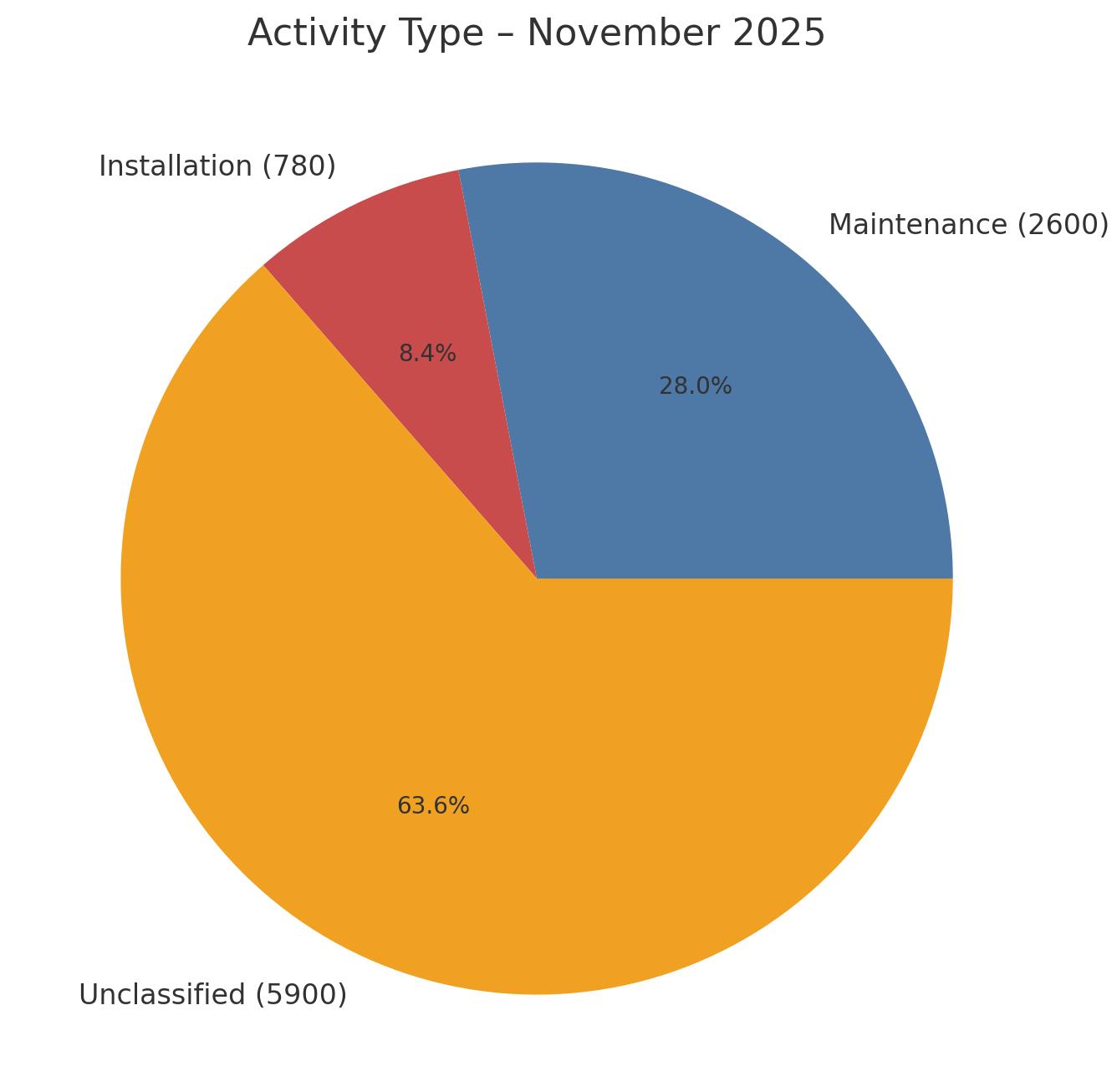
With the global footprint established, the next step is to interpret the underlying purpose of cable-ship idle behavior. Each AIS-derived idle point was again assigned to one of three categories—Maintenance, Installation, or Unclassified—based on proximity to known cable depots and factories, as well as post-idle movement patterns. Figure 2 shows the resulting classification breakdown for November 2025.
Classification results:
• Maintenance: 2,600 data points (28.0%)
• Installation: 780 data points (8.4%)
• Unclassified: 5,900 data points (63.6%)
Maintenance-linked idling continues to form the backbone of identifiable activity. Vessels associated with these points typically remained near depots or in established repair corridors, reflecting patterns tied to fault response readiness, short-range repositioning, and routine staging behavior. As seen in prior datasets, these signatures cluster most strongly in regions with dense depot coverage—East Asia, Southeast Asia, and the North Atlantic.
Installation activity, while smaller in volume, remains operationally significant. The 780 points attributed to factory-adjacent or deployment-linked behavior align with long-haul system builds underway in Asia and the Pacific. These events remain episodic rather than continuous, occurring in discrete bursts when new systems enter their deployment phase.
The most striking element of the November dataset is the continued growth of unclassified behavior, which now accounts for nearly two-thirds of all idle points. This increase mirrors the expanding geographic range of cable-ship operations and the limited visibility offered by AIS alone. Many of these unclassified events occur far from infrastructure or along transit routes where vessel intentions cannot be confidently inferred.
Taken together, the November classification picture shows a fleet whose identifiable behavior is still dominated by depot-linked maintenance, supplemented by a smaller but critical layer of installation activity. The persistently large share of unclassified points highlights both the operational complexity of global cable deployment and the industry’s ongoing lack of transparent activity reporting.
After establishing a global classification framework, the analysis turns to how activity varies across geographic regions. Grouping idle points by AIS Zone highlights how maintenance, installation, and unclassified behaviors distribute across the world’s primary cable-serving basins. Figure 3 presents the November 2025 breakdown.
The November dataset again shows pronounced regional contrasts, with clear dominance from East Asia and Southeast Asia. These two regions remain the largest global centers of cable-ship activity, each registering substantial volumes of maintenance, installation, and unclassified idle points. Their scale reflects the concentration of both cable depots and cable factories across Japan, Korea, and China—along with heavy fault-response demand and ongoing
long-haul system builds. The extremely high unclassified shares in both regions also underscore how dense vessel traffic complicates AIS-based inference.
The North East Atlantic and North Sea zones continue to stand out as Europe’s repair backbone. Dense clusters around Calais, Brest, Lowestoft, and the Norwegian–UK corridor confirm Europe’s role as the most mature depot-supported repair environment globally. Both zones show high maintenance volumes and substantial unclassified activity, consistent with intense year-round operations on transatlantic and pan-European systems.
On the US East Coast and in the Caribbean Sea, activity levels remain moderate but strategically important. These regions balance legacy-system maintenance with staging for emerging deployments in South America and the mid-Atlantic. Their maintenance signatures remain strong relative to their installation footprint, matching the known distribution of regional depots.
Elsewhere, patterns vary more widely. The Indian Ocean shows a notable mix of maintenance and unclassified behavior, reflecting both new capacity projects in the Bay of Bengal and sporadic regional repair mobilizations. The South Pacific and East Australia zones exhibit modest but steady activity dominated by unclassified points—unsurprising for a region with sparse depot and factory coverage and long transit distances between operational hubs. West Africa also remains heavily unclassified, highlighting the ongoing data and infrastructure gaps that make behavioral interpretation difficult.
Two key takeaways emerge from the zonal analysis:
1. Maintenance activity continues to cluster around depot-rich regions, particularly East Asia, the North East Atlantic, and the North Sea—areas where dense infrastructure enables rapid repair mobilization and short vessel repositioning cycles.
2. Installation activity remains geographically selective and episodic, concentrated in zones with active factory staging, most prominently East Asia and Southeast Asia.
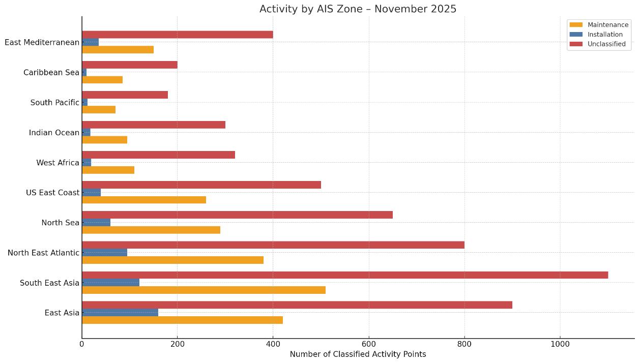
Overall, the November zonal distribution reinforces how regional infrastructure, cable age, and route density combine to shape global vessel behavior—while also highlighting where AIS-only inference remains most constrained by unclassified activity.
Beyond geographic distribution, cable-ship behavior is strongly shaped by proximity to infrastructure—specifically depots and cable factories. Depots serve as operational anchors for fault response, maintenance preparation, and resupply cycles, while factories support cable loading and the initiation of system deployments. Figure 4 presents the facility-linked breakdown for November 2025.
The November dataset records 2,100 depot-associated idle points compared to 620 factory-associated idle points, indicating that vessels were more than three times as likely to idle near depots as factories. This ratio closely mirrors the activity-type distribution: maintenance continues to dominate identifiable vessel behavior, while installation— though operationally significant—remains episodic and tied to specific project windows.
The operational rhythms of the two facility types remain distinct:
• Depot-linked presence is continuous and cyclical. Vessels repeatedly return to depots between repair operations for resupply, crew changes, certification work, or to
await tasking. This produces a steady baseline of maintenance-associated dwell time, especially in depot-dense regions such as the North Atlantic and East Asia.
• Factory-linked presence spikes around deployment campaigns. Ships cluster at factories for cable loading prior to long-haul installations, then rapidly disperse once deployment begins. This explains the smaller but sharply defined factory-associated footprint in November’s dataset.
The contrast between depot- and factory-linked behavior emphasizes the structural importance of global depot coverage. Regions with strong depot networks—Europe, Japan, Korea, and parts of China—benefit from faster repair mobilization and lower transit downtime. In underserved regions such as the South Pacific, West Africa, and the central Indian Ocean, vessels frequently idle in unclassified fallback zones, reflecting both long transit distances and the absence of nearby support infrastructure.
In summary, the November facility analysis reinforces depot availability as a primary driver of identifiable vessel behavior, while highlighting the episodic but strategically important role of factory adjacency in supporting system deployments.
The November 2025 dataset provides the clearest illustration yet of how global cable-ship behavior is evolving—and where visibility continues to erode. With more than 9,200 idle points analyzed across all major basins, several themes emerge with increasing clarity.
The model attributes 2,600 idle points (28%) to de-
pot-linked maintenance behavior, reinforcing the dominant role of repair readiness across East Asia, Southeast Asia, and the North Atlantic. These regions continue to function as the operational core of the global repair network, benefiting from dense depot infrastructure and short repositioning cycles.
Only 780 idle points (8.4%) were installation-linked—lower in both share and volume than earlier 2025 datasets. The identifiable events that do appear cluster tightly around factory hubs in Japan, Korea, and China, aligning with new-build launches and ongoing long-haul deployments.
At 5,900 idle points (63.6%), unclassified activity has expanded significantly. Much of this growth stems from dense AIS activity in East and Southeast Asia, where overlapping transit, staging, and operational patterns obscure vessel intent. Sparse infrastructure in the South Pacific, West Africa, and the central Indian Ocean further amplifies classification uncertainty. This rising opacity underscores the core challenge of AIS-only analysis: high data volume does not translate to operational transparency.
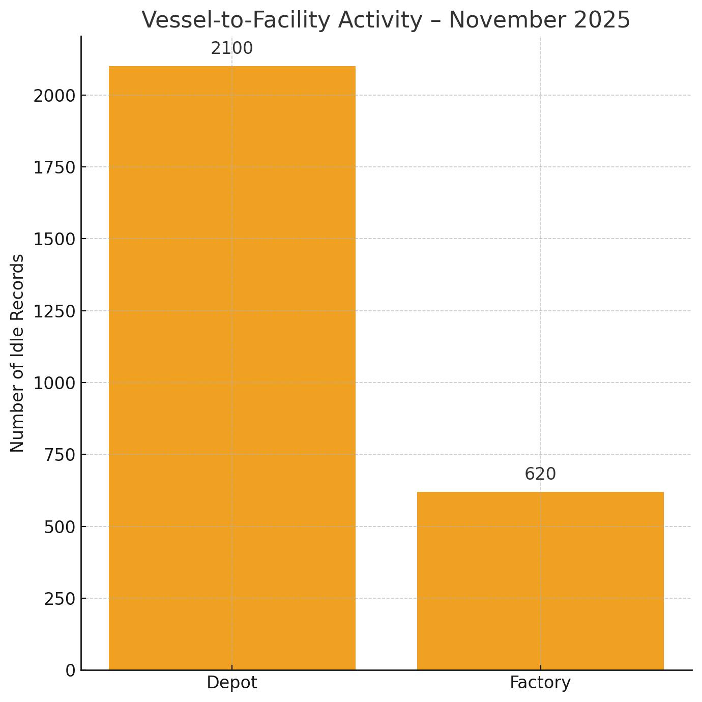
With 2,100 depot-associated and 620 factory-associated idle points, the November dataset mirrors long-standing fleet behavior: vessels are consistently more likely to cycle through depots than factories. Depots remain the backbone of fault response logistics, while factories serve as short-duration staging points for discrete deployment campaigns.
Comparing the September results (July–August data) with November’s dataset highlights several shifts:
• Maintenance volume increased, but its proportional share held steady (≈28%), signaling sustained repair demand.
• Installation activity declined in both absolute and relative terms, reflecting a pause or slowdown in new-build launches.
• Unclassified activity climbed sharply, from ~63% to nearly 64%, continuing a multi-month trend of decreasing interpretability.
• Depot vs. factory ratios remain stable, reaffirming the structural dominance of the maintenance cycle.
These patterns collectively point to a fleet that is increasingly active, increasingly dispersed, and increasingly difficult to classify without additional operational context.
LOOKING FORWARD

The November analysis reinforces a consistent message: the global fleet’s operational heartbeat is maintenance, while installation appears in narrow, project-specific bursts. Yet the accelerating rise in unclassified activity suggests that AIS—while invaluable—is no longer sufficient to capture the full complexity of cable-ship operations.
More structured transparency from vessel operators and system owners—whether through enhanced AIS metadata, voluntary port-call reporting, or anonymized mission declarations—would dramatically improve situational awareness. Better data would support faster fault coordination, more accurate capacity forecasting, and a clearer understanding of where the global fleet is truly deployed.
In an era of growing geopolitical tension, rising data-traffic dependency, and expanding subsea infrastructure, understanding cable-ship behavior is not merely analytical—it is strategic. STF
KIERAN CLARK is the Lead Analyst for SubTel Forum. He originally joined SubTel Forum in 2013 as a Broadcast Technician to provide support for live event video streaming. He has 6+ years of live production experience and has worked alongside some of the premier organizations in video web streaming. In 2014, Kieran was promoted to Analyst and is currently responsible for the research and maintenance that supports the Submarine Cable Database. In 2016, he was promoted to Lead Analyst and his analysis is featured in almost the entire array of Subtel Forum Publications.

Your Premier Portal to Locate Companies for Submarine Telecoms Collaboration
Content Highlights:
• All-Encompassing Listings: Dive into a world-class directory of submarine telecom product and service providers.
• Intuitive Search: Effortlessly navigate to the services and solutions tailored to your mission.
• Spotlight on Innovation: Engage with the leaders driving the industry forward through technological advancements.
BOOKMARK THE SUBTEL FORUM INDUSTRY DIRECTORY TODAY!
BY JOHN MAGUIRE
The world’s data centers are running out of runway. Across every major market—from Dublin to Dallas, from Singapore to Stockholm—the buildings that house the cloud are reaching physical and political limits. Artificial intelligence (AI) has turned data centers into industrial-scale powerhouses, gobbling up land, electricity, and water faster than governments and utilities can keep up. The result is a perfect storm: record demand colliding with heretofore unseen constraint.
Few sectors have grown as rapidly in the last decade as data centers. In Europe, the Middle East, and Africa (EMEA) region, leasing activity hit historic highs in 2024—yet capacity growth slowed because of the non-availability of sufficient power—not because demand softened in any sense1.
This imbalance is global. The International Energy Agency (IEA) forecasts that data centers could consume 945 terawatt-hours of energy by 2030, more than double 2022’s total, and roughly equal to Japan’s annual use.2 The rise of AI is a key driver: the IEA says machine-learning workloads could quadruple global data-center energy demand over the next five years. That demand is concentrated for the moment in a few hotspots: the
1 https://www.reuters.com/business/energy/powersupply-constraints-slowing-emea-data-centre-rolloutreport-says-2025-11-06/
2 https://www.iea.org/reports/electricity-2025
U.S.A., northern Europe, and parts of East Asia, magnifying regional stress. The IEA warns that AI computing clusters may soon rival small cities in their energy footprint.
Until recently, a typical server rack drew in the region of 1015 kW. But racks filled with Nvidia’s latest GPUs now require 40100 kW—and some configurations are apparently trending toward 150 kW per rack3. This represents an order-of-magnitude increase heat output and cooling needs. Britain’s National Grid operator, NESO, says racks as dense as 120 kW are becoming standard for AI4, while
3 https://www.sunbirddcim.com/blog/how-muchpower-does-nvidia-gb300-nvl72-need
4 https://dso.nationalgrid.co.uk/downloads/15083/ data-centre-impact-study2.pdf
Schneider Electric’s 2025 “AI-ready” design—developed with Nvidia—tops out at 132 kW per rack, relying on liquid cooling to survive the heat5. According to the Uptime Institute’s 2024 survey, about 22% of data centers already use some form of liquid cooling, and nearly half plan to adopt it by 2027. The shift is as significant as the jump from on-premise IT to the cloud itself: it changes building layouts, maintenance practices, and even the workforce skill set6.
If cooling is the most visible
5 https://www.se.com/ww/en/about-us/newsroom/news/ press-releases/schneider-electric-launches-new-data-centersolutions-to-meet-challenges-of-high-density-ai-andaccelerated-compute-applications-68432e8baaaf82b041044f06
6 https://uptimeinstitute.com/uptime_ assets/7425ec68d479c5d78a743df94a79b114ed9f9c73f13b 6460949d2b8e73373209-GA-2024-07-uptime-instituteglobal-data-center-survey-results-2024.pdf
change to how data centers today operate from how they previously did, the massive growth in power requirements is probably the most paralyzing.
In Ireland, where your correspondent resides, hyperscalers Amazon, Google, and Microsoft have turned Dublin into Europe’s cloud capital, new data-center connections are practically frozen. Data centers’ consumption grew from 5% in 2015 to 21% of total national capacity in 2023. The national grid operator EirGrid says no large new connections are likely before 2028, citing reliability concerns. The utilities regulator, CRU, has proposed staged or conditional approvals tied to on-site generation and demand-response participation: i.e., using back-up power generation to feed back to the grid7. It is a real ‘man bites dog’ moment.
Similar stories are unfolding elsewhere. In the U.S., the Berkeley Lab’s interconnection study found that clean-energy projects, critical to data centers’ renewable commitments, wait an average of five years for grid connection. That lag not only slows new capacity but jeopardizes hyperscalers’ pledges to operate on 24/7 carbon-free power8.
Companies, however, are responding with ingenuity. Google’s partnership with AES9 in Virginia matches renewable generation to its hourly consumption. Microsoft10 has gone further, striking a deal with Helion Energy to buy electricity from a future fusion plant, years before the reactor even exists. There is delightful symmetry in Microsoft’s efforts to use AI to advance the cause of fusion!11
7 https://www.cru.ie/about-us/news/new-electricityconnection-policy-for-data-centre/
8 https://emp.lbl.gov/queues
9 https://www.aes.com/energy-insights/googles-datacenters-drive-247-renewable-energy-adoption-worldwide 10 https://www.helionenergy.com/articles/announcinghelion-fusion-ppa-with-microsoft-constellation/ 11 https://www.microsoft.com/en-us/research/blog/ microsoft-fusion-summit-explores-how-ai-can-acceleratefusion-research/
The bottom line here would seem to be that the old model of fronting up to the local electricity utility is dead. Developers either going to have to come to the party, bringing power to share, as in the case of Ireland, wait for years, as Berkley suggests—or take a leap outside the box as Microsoft and Google are doing, and find a completely new source of renewable power.
Data centers have long drawn scrutiny for their energy use, but water is quickly becoming the next flashpoint, especially in drought-prone regions.
In Arizona, a proposal earlier this year for a large new data center facility, prompted the City of Tucson to pass its Large Water User ordinance12, requiring big industrial users (including data centers) to disclose consumption and submit conservation plans. The policy followed reports of massive increases, up to tenfold, in water requirements for cooling data centres in coming years13
Globally, the optics for the data center sector around water use and conservation are worsening. Investigations by Bloomberg14 and others have spotlighted massive water withdrawals for AI infrastructure. Hyperscalers like Microsoft15 and Google16 now promise to be “water positive” by 2030, returning more water to the environment than they consume. Liquid-cooling systems, once reserved
12 https://apnews.com/article/tucson-data-managementand-storage-arizona-general-news-environmentalconservation-42c1e554b02b4293685a08a4574db9f0
13 https://www.phoenixnewtimes.com/news/ phoenix-data-center-water-use-surge-nearly-tenfoldstudy-22762054/
14 https://www.bloomberg.com/graphics/2025-aiimpacts-data-centers-water-data/
15 https://www.microsoft.com/en-us/microsoft-cloud/ blog/2024/07/25/sustainable-by-design-transformingdatacenter-water-efficiency/?msockid=3ccf34965d9c63a40a b820c65cd16291
16 https://datacenters.google/water/
for supercomputers, are now standard for GPU racks. Schneider Electric’s latest product, released earlier this year, uses warm-water loops and coolant distribution units (CDUs) to manage racks drawing more than 130 kW17
That last point, heat reuse, is becoming policy in parts of Europe. Germany’s Energy Efficiency Act18 mandates that new data centers must repurpose at least 10% of their waste heat by 2026, rising to 20% by 2028. The European Union’s Energy Efficiency Directive (EED)19 requires large facilities (over 500 kW) to publicly report metrics like PUE and WUE, annually. Denmark’s data centers are already exporting heat to homes: Meta’s Odense facility now supplies 11,000 households with recycled thermal energy20. In Sweden and Finland, municipal utilities are designing new neighborhoods around data-center heat loops.
As data centers scale into multi-gigawatt campuses, land itself has become something of a choke point. According to CBRE’s 2025 global report21, only 1520% of zoned industrial land in the U.S.A. qualifies as “data-center ready”, meaning it has power, water and sufficient fiber proximity. Land prices in Virginia’s Loudoun County, the world’s largest data-center market, have doubled since 2021.
Meanwhile, the AI revolution has upended network design. Clusters of
17 https://www.se.com/ww/en/insights/ai-andtechnology/artificial-intelligence/optimizing-aiinfrastructure-the-critical-role-of-liquid-cooling/ 18 https://www.reuters.com/sustainability/climateenergy/germany-passes-law-make-energy-savingscompulsory-2023-09-21/
19 https://eur-lex.europa.eu/legal-content/EN/TXT/ PDF/?uri=CELEX:32023L1791
20 https://datacenters.atmeta.com/wp-content/ uploads/2025/02/Metas-Odense-Data-Center.pdf
21 https://www.cbre.com/insights/reports/global-datacenter-trends-2025
GPU servers require enormous eastwest bandwidth to share model parameters in real time, straining existing fiber. Industry analysts at TeleGeography say long-haul dark-fiber prices have surged, and lead times for new metro routes now exceed 18 months22.
In the U.S.A., this shortage has pushed developers into secondary markets, places like Columbus, Ohio, or Reno, Nevada, where power is cheaper and land abundant, but where infrastructure must be built from scratch. Internationally, the growing requirement from governments for cloud and AI providers to respect data sovereignty is a different impetus producing a similar effect: the development of more data centers in markets not previously so attractive.
Even with land, water and power secured, the industry faces yet another challenge: a human resources bottleneck. A Turner & Townsend study found the U.S. short 50,000 skilled electricians, welders, and HVAC technicians needed for data-center construction23. Similar shortages are reported in Europe, where Brexit and aging tradesmen have drained labor pools.
One response to this is prefabrication. Instead of building electrical rooms on-site, developers can assemble components in factories, then ship them ready to plug in. Prefabrication can significantly reduce construction cost and lead time—but lack of scale means it is not a panacea.
Big Tech’s decarbonization pledges are
22 https://blog.telegeography.com/the-key-trendsshaping-long-haul-capacity-demand
23 https://www.turnerandtownsend.com/news/constructionpipelines-set-to-grow-but-skills-shortages-a-concern/
now reshaping the energy map. Google, Microsoft, and Amazon are racing toward 24/7 carbon-free energy (CFE), meaning every kilowatt consumed must be matched by clean generation in the same hour, not averaged annually.
Google’s Virginia pilot with AES set the standard; Microsoft’s geothermal project in Nevada and fusion deal with Helion pushed the envelope. Amazon, meanwhile, is exploring small modular reactors24 and long-duration battery storage.
At the same time, heat reuse is becoming mainstream, not just in Scandinavia. A study by Aarhus University found that integrated heat networks can reclaim up to 40% of waste energy, improving local sustainability metrics and offsetting costs.
Despite booming demand, investors are turning selective. Banks and private-equity funds now demand pre-leased tenants and confirmed grid connections before financing projects. Builders with proven designs and power agreements—leaders like Equinix, Digital Realty, and Vantage—are winning most new capital.
So where does this all lead?
Experts rarely agree on too much, but several several likely outcomes between now and 2030 would seem to be:
Rack densities will double again. Nvidia’s GB200 systems and similar platforms could push beyond 200 kW/rack, making liquid cooling mandatory for AI workloads. Transparency will go global. The EU’s reporting rules will spread, forcing all major operators to disclose
24 https://www.aboutamazon.com/news/sustainability/ amazon-nuclear-small-modular-reactor-net-carbon-zero
energy, water, and reuse metrics.
Utilities will become partners, not providers. Expect more joint power projects: solar farms, microgrids, even nuclear units, dedicated to data campuses. Expect also to see an increase in recycling heat along the lines earlier shared for Denmark.
Water use will be closely scrutinized. Cities enforce water caps, pushing designs toward zero-water cooling.
The global data-center buildout has entered a new phase, less about how big you can build, and more about how sustainably, responsibly, efficiently—and legally—you can do it. Power and water are the new zoning laws. And every developer, from Dublin to Dallas, has become an energy and water strategist, by necessity. STF
Currently Director, EMEA, with APTelecom, JOHN MAGUIRE has experience gained across a broad spectrum of telecommunications roles and businesses over the past 30 years. He has sold security and network control software to mobile networks worldwide; established a regional federation fibre network across a family of affiliated telcos and, several times, established interconnect networks and wholesale structures for leading telco brands in new entry and emerging markets. He’s done this in roles across the business: using satellite and cable technology, for OEM and service provider companies and in fixed and mobile domains—including for start-ups and mature companies. His roles have encompassed general management, sales management, direct and indirect sales, business development, market development and operations. A native of Dublin, Ireland, he’s also lived and worked in Australia, UK, Singapore, Hong Kong, Thailand, Qatar, UAE and Malaysia. John holds a B.Tech. degree from University of Limerick in Ireland and an M.A. from Macquarie University Graduate School of Management in Sydney, Australia.
• Defined Processes
• Template Driven
• PMP Based Project Management Approach
• Rigorous Documentation Controls
• Quality Assurance Focused
• Secure Records Storage
• Accessible and User Friendly
INTRODUCING THE VIRTUAL REP
• In-Field Analysis Without In-Field Risk
• Remote real-time analysis and reporting without the added cost of today’s in-field representation liabilities.

Join the premier event for digital infrastructure, telecommunications, and ICT this January in Honolulu!
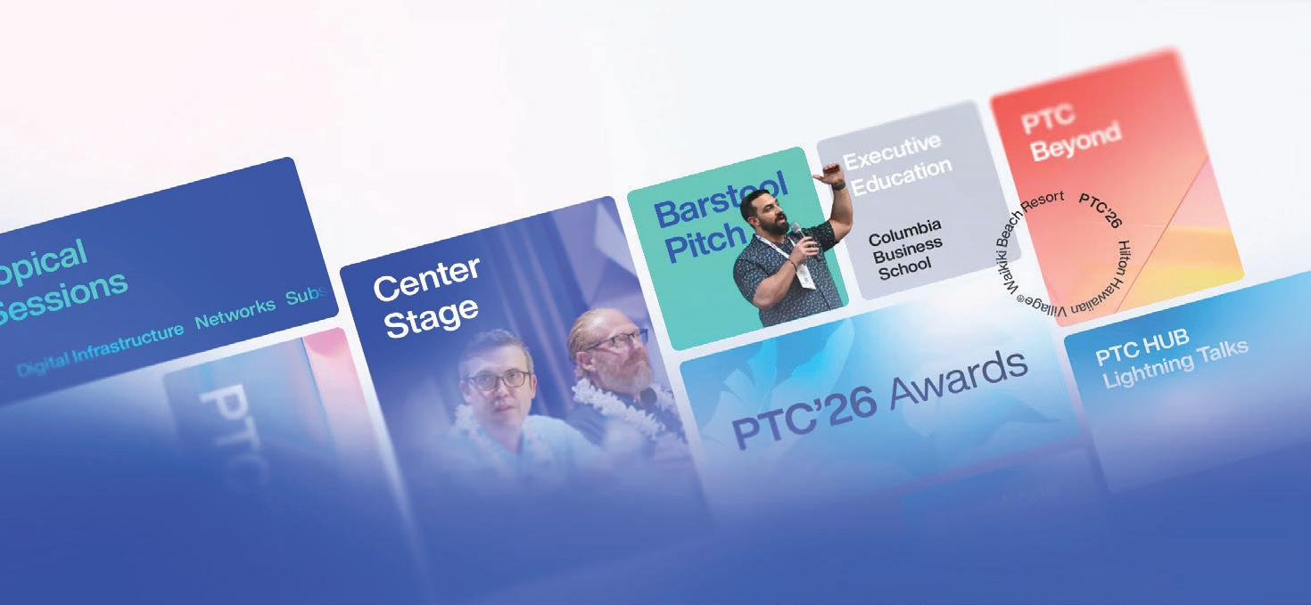

PTC’s Annual Conference, the industry’s premier digital infrastructure, telecommunications, and ICT event, will be held in Honolulu, Hawaiʻi, from 18-21 January 2026. C-level executives, technologists, thought leaders, investors, researchers, and academicians from over 60 nations will convene to share knowledge, cultivate valuable relationships, and catalyze new business.
Register now and be at the forefront of digital infrastructure innovation.
→ ptc.org/ptc26


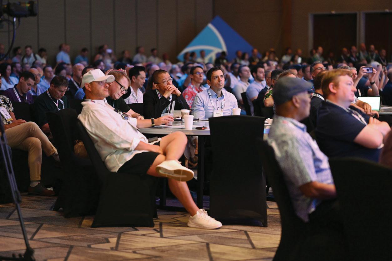
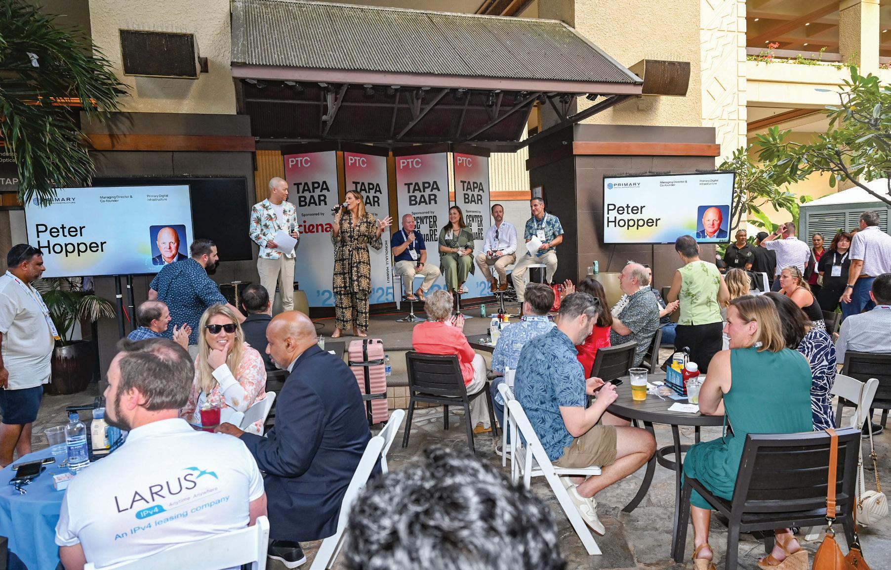

At PTC’26, speakers across Center Stage, Alakaʻi Stage, Topical Sessions, and Lightning Talks will explore emerging technologies, industry trends, and key challenges shaping the global digital infrastructure and ICT landscape. Secure your spot to connect with these impactful leaders moving the industry forward.
→ ptc.org/ptc26
↘ Breakthroughs in Compute
↘ Data Centers
↘ Financing and Powering the AI Revolution
↘ New Realities of Digital Infrastructure
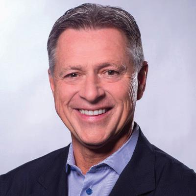
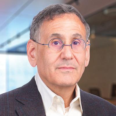
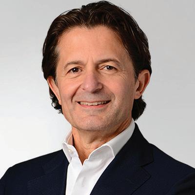
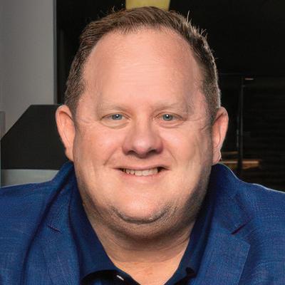
↘ The Future of Fiber and Telecom
↘ Transforming Supply Chains





As the global submarine cable sector continues to evolve at an unprecedented pace, few events serve as a clearer signal of what’s ahead than PTC’s Annual Conference, bringing together top decision-makers, innovators, and infrastructure builders who are shaping the future of global connectivity.
With PTC’26 on the horizon, we connected with Brian Moon, CEO of PTC, to discuss the event’s focus, industry trends, and what lies ahead for the conference—and the ecosystem it supports.
1.
CAN YOU INTRODUCE PTC’26 AND EXPLAIN THE CORE MISSION BEHIND THE EVENT? WHAT MAKES PTC MORE THAN JUST A CONFERENCE? TELL US HOW THE EVENT ALIGNS WITH BROADER INDUSTRY NEEDS AND PRIORITIES.
PTC’26 is the premier event for professionals shaping the future of digital infrastructure, telecommunications, and ICT, bringing together thousands of industry leaders to connect and address the most pressing challenges and opportunities in the industry. Guided by PTC’s mission to advance the ethical development and use of ICT to improve lives and foster global connections, the conference goes beyond tradi-
tional sessions, offering a platform where attendees can exchange ideas, build partnerships, explore emerging technologies, and gain actionable insights that inspire strategic decision-making.
What distinguishes PTC is not only the quality of its content, speakers, and networking opportunities, but also its unique setting. Hosted in the world-class destination of Honolulu, Hawai‘i, the conference offers an unparalleled environment for collaboration and industry exploration. Attendees can engage with global leaders and accomplish months’ worth of business in just a few days. PTC offers a vibrant and dynamic networking experience, featuring numerous special activities designed to cultivate meaningful connections. PTC further stands out by providing a platform for researchers, innovators, and investors to uncover promising opportunities, making it a global hub for insight, partnership, and growth.
2.
HOW WILL PTC’26 DIRECTLY ENGAGE WITH AND IMPACT THE GLOBAL SUBMARINE CABLE MARKET? FROM INVESTOR NETWORKING TO POLICY ALIGNMENT, WHERE DOES PTC MOVE THE NEEDLE?
PTC’26 will play a pivotal role in the global submarine cable market by bringing together key stakeholders, from
service providers to policymakers and technology innovators. This is the reason the Annual Conference kicks off on Sunday with the Submarine Cable Workshop, which convenes global executives delivering presentations and an annual industry update by TeleGeography. By facilitating these connections and conversations, PTC helps drive progress in advancing and strengthening submarine cable infrastructure worldwide.
3.
WHAT KEY INNOVATIONS IN SUBMARINE CABLE SYSTEMS OR EMERGING APPLICATIONS WILL TAKE THE SPOTLIGHT AT PTC’26? ARE WE TALKING CABLE LANDING STATIONS, EDGE INTEGRATIONS, AI-LAYERED SYSTEMS, OR SOMETHING UNEXPECTED?
In the Submarine Cable Workshop on Sunday, 18 January, industry experts will be discussing topics such as the future of the cable world; the role of governments in developing global connectivity; and an industry update by TeleGeography.
4.
WHAT ARE THE PRIMARY REASONS BEHIND PTC’S CONTINUED RELEVANCE AND GROWTH IN THE TELECOMMUNICATIONS SPACE?
WHAT KEEPS PTC’S ANNUAL CONFERENCE AT THE CENTER OF THE CONVERSATION?
PTC’s continued relevance and growth in the telecommunications space is driven by the rapid evolution of emerging technologies and the increasing importance of global connectivity. As AI and communication technologies accelerate at unprecedented speeds, the need for robust digital infrastructure—including power, sustainability, data centers, and other critical components—has never been greater. PTC’s Annual Conference taps into all facets of this ecosystem, helping industry leaders anticipate change, drive innovation, and position for future growth.
PTC has made its way into the center of the conversation by providing a platform to exchange ideas, explore trends, and collaborate on industry challenges. By bringing together leaders, innovators, researchers, and investors in one place, PTC fosters connections and partnerships that strengthen the global digital infrastructure industry.
5. AS PTC’26 APPROACHES, HOW IS PTC SETTING ITSELF APART OR COMPLEMENTING THE BROADER CONFERENCE CALENDAR?
WHAT’S NEW, DIFFERENT, OR MORE URGENT ABOUT PTC THIS YEAR?
Join the premier event for digital telecommunications, and ICT this
PTC’s Annual Conference, the industry’s premier digital infrastructure, telecommunications, and ICT event, will be held in Honolulu, Hawaiʻi, from 18-21 January 2026. C-level executives, technologists, thought leaders, investors, researchers, and academicians from over 60 nations will convene to share knowledge, cultivate valuable relationships, and catalyze new business.
Register now and be at the forefront of digital infrastructure innovation.
→ ptc.org/ptc26
PTC’26 promises to be the most engaging and connected Events (IAEE) and is Certified in Exhibition Management (CEM).
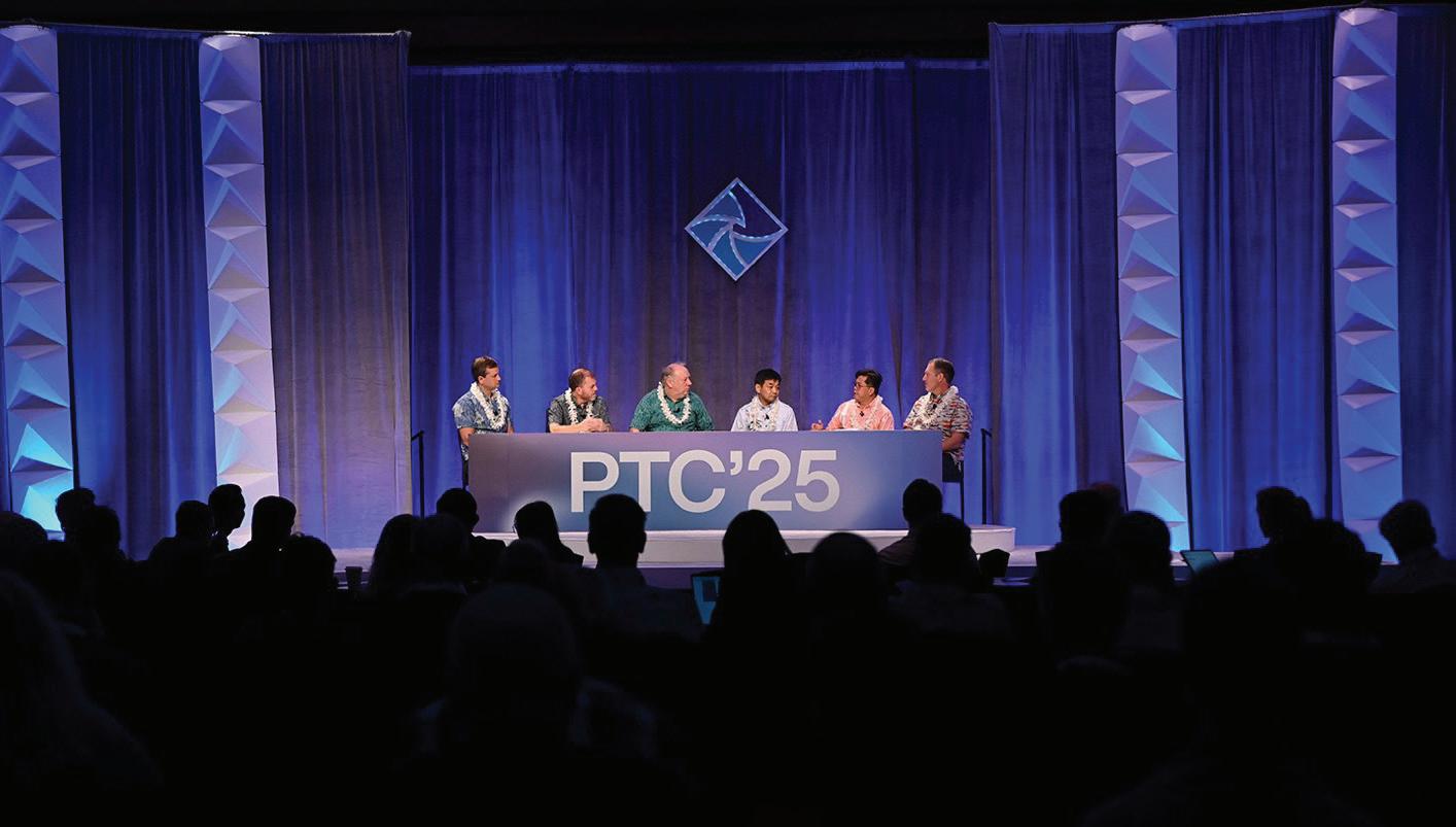
In January 2026, the world’s top digital infrastructure, telecom, and ICT leaders will gather in Honolulu, Hawai‘i to address the biggest challenges and opportunities shaping our connected world. From the rapid rise of AI to breakthroughs in fiber, satellites, and sustainable tech, PTC’26 is where the future of global connectivity will take shape. This isn’t just a conference — it’s the global event that sets the agenda for the year ahead!
Hosted by the Pacific Telecommunications Council, the PTC Annual Conference is the premier global platform for industry leaders to exchange insights, build partnerships, and shape the future of connectivity.
From 18–21 January 2026, PTC’26 will unite thousands of participants from around the world. This year’s program offers an unbeatable mix of thought leadership, networking, and innovation, making it a must-attend event for anyone in the industry. At PTC’26, Center Stage panels, Topical Sessions, and Lightning Talks will explore emerging technologies, industry trends, and key challenges shaping the global digital infrastructure and ICT landscape. These sessions are designed to give attendees the insights they need to position their organizations for success in an increasingly competitive and fast-paced world.
Digital infrastructure and technology are evolving at an unprecedented pace, transforming the way we connect, compute, and power our lives. At PTC’26, industry leaders will explore the most important questions of the moment:
• What does the future of digital infrastructure look like?
• How can we finance and power the AI revolution?
• What are the most transformative advancements in supply chains, compute, and fiber?
The conference will also explore critical topics in telecom, hyperscale and edge data centers, submarine networks,

satellite, sustainability, recruitment, policy, and innovative solutions like liquid cooling. Whether you’re a senior executive or a rising professional, PTC’26 will provide the critical insights needed to anticipate change and drive success in this rapidly shifting landscape.
Join the premier event for digital infrastructure, telecommunications, and ICT this January
“PTC is an incredible place to connect, to network,and really you can have months’ worth of business meetings in one location— and what a location—in a couple of days.”
—Giordano (Gio) Albertazzi, CEO of Vertiv (PTC’25 attendee)
PTC’s Annual Conference is known as a place where conversations lead to action, and PTC’26 is raising the bar with an expanded lineup of special events designed to build meaningful connections, collaboration, and even a little fun!

PTC’26 SPECIAL EVENTS INCLUDE:
• PTC’26 First Look: First-Time Attendees’ Workshop *new
• PTC’26 Executive Networking Breakfast *new
• PTC’26 5K Charity Run/Walk
• PTC Members’ Soirée
• PTC’26 Opening Reception
• PTC Beyond Zellennials Welcome Cocktail
• Power Women Breakfast Series
• PTC’26 Women’s Reception
• PTC Barstool Pitch
• Pau Hana: Happy Hour Lip Sync Competition *new
• PTC’26 Awards Ceremony & Breakfast
• PTC’26 Football Match
• PTC’26 Yoga *new
In addition to these events, PTC’26 will continue to offer two exclusive programs to help attendees sharpen their leadership skills and deepen their industry expertise:
• Top Talent Leadership Development Program in partnership with Columbia Business School Executive Education: For senior leaders ready to refine their strategy and impact.
• PTC Beyond - The Academy Master Class: For rising professionals building their industry expertise and networks.
PTC’s Annual Conference, the industry’s premier digital infrastructure, telecommunications, and ICT event, will be held in Honolulu, Hawaiʻi, from 18-21 January 2026. C-level executives, technologists, thought leaders, investors, researchers, and academicians from over 60 nations will convene to share knowledge, cultivate valuable relationships, and catalyze new business.
Register now and be at the forefront of digital infrastructure innovation.
→ ptc.org/ptc26
These programs and events go beyond networking — they’re designed to build meaningful relationships, actionable insights, and opportunities that attendees can bring back to their organizations.
What sets PTC apart isn’t just the caliber of its content, speakers, and networking opportunities—it’s the destination! Held in the stunning setting of Hawai‘i, the PTC Annual Conference offers an unmatched environment where global business leaders can exchange ideas, explore the latest innovations, and collaborate on solutions that drive the industry forward. For investors, it’s also an unmatched opportunity to meet innovators and explore high-potential ventures.
The PTC Annual Conference also celebrates excellence within the industry, and the PTC’26 Awards will once again honor the standout achievements and innovations driving global connectivity forward.
PTC’26 is shaping up to be the most dynamic, engaging, and impactful conference in the organization’s history. With expanded programming, high-level discussions, and fresh opportunities to collaborate, it is the event where the future of digital infrastructure will be shaped. Join us in Honolulu, 18–21 January 2026, for PTC’26—the most dynamic and connected PTC conference yet. STF



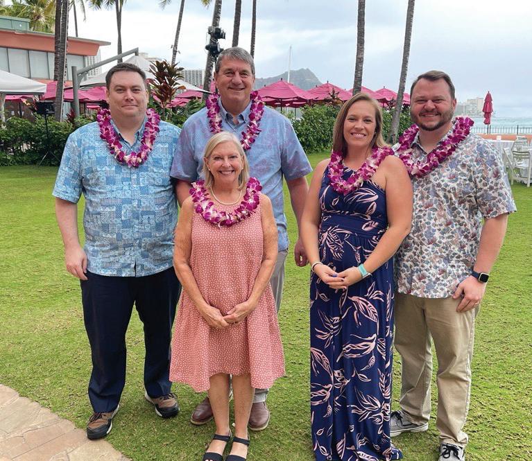
We’re a family business and we take great pride in our people, services and publications.

When Wayne Nielsen and Ted Breeze launched Submarine Telecoms Forum in November 2001, the industry was in a dark period. The dot-com bubble had burst, venture funding was scarce, and entire projects had been shelved. With little more than a severance package, some borrowed software, and a lot of determination, they took a leap of faith. The first issue featured just eight articles and seven complimentary ads — a humble beginning at a time when confidence in submarine telecoms was near its lowest ebb.
Those early months were sustained by little more than passion and persistence. Nielsen and Breeze knew the industry needed a space where professionals could share ideas, challenge assumptions, and exchange knowledge. The timing could hardly have been more difficult. Many thought the market had collapsed for good. Yet they believed submarine cables would remain essential, and that the people who built and maintained them needed a voice.
From the outset, Nielsen committed the Forum to two simple but ambitious principles. First, to provide a wide range of ideas and issues — a platform where differing perspectives could be aired, from the technical to the commercial to the regulatory. Second, to incite, entertain, and provoke in a positive manner — to ensure the Forum was never bland, never predictable, and always stimulating.
That ethos defined the Forum’s early editorial choices. Articles were chosen not only for their technical accuracy, but also for their ability to spark conversation. Nielsen wanted the pages to reflect the diversity of the industry: engineers and financiers, project developers and academics, regulators and ship captains. SubTel Forum was never meant to be a corporate mouthpiece. It was a forum in the truest sense — a place for voices, not just headlines.
What began as a modest bi-monthly magazine has

grown over 24 years into a comprehensive publishing and data platform. The magazine remains the flagship, publishing six issues each year on themes ranging from global capacity and finance to offshore energy, data centers, and new technology. With 151 issues scheduled by the end of 2025, the magazine has become the longest-running and most widely read record of the submarine cable sector.
But the Forum is no longer only a magazine. Over the years, Nielsen expanded its reach by adding products in response to industry demand. The Cable Almanac, first published in February 2002, quickly became a staple reference for the community. Released four times a year, each edition provides a fresh lens — whether by system age, region, supplier, or ownership. With sixty editions by late 2025, the Almanac has become a fixture on desks and in boardrooms worldwide.
In 2004, the Industry Report joined the portfolio. Published each October, it provides an authoritative annual deep dive into the state of the industry. What began as a few dozen pages of analysis has grown into hundreds, with data, forecasts, and commentary that decision-makers rely on to plan projects and allocate capital. The 2025 edition will mark the fifteenth in this enduring series.
Event coverage became another vital part of the Forum’s work. Starting with PTC in January 2014, SubTel began producing special cable maps aligned with major global conferences. From Hawaii to Singapore, from London to Pittsburgh, these maps showcase the scale and scope of the industry, serving as both a visual centerpiece and a practical tool for thousands of conference attendees each year.
And in December 2025, Nielsen introduced one of the Forum’s most exciting new ventures: the Cableship Codex For too long, the ships and crews that keep the world connected had operated in the shadows. The Codex was designed to change that. Published quarterly, it profiles the global fleet, analyzing owners, operators, ship ages, capacities, and missions. Its first issue offered a “Year in Review” of the fleet — a benchmark publication for a segment of the industry that had never before been given such dedicated attention. By shining a light on the vessels that lay, repair, and maintain cables, the Codex completes the picture of the subsea ecosystem.
The numbers are impressive: over 150 magazine issues, sixty Almanacs, fifteen Industry Reports, countless maps, and now the Codex. But what matters more than output is impact. SubTel Forum has become a touchstone for an industry that is global in scope but surprisingly close-knit in culture.
For industry veterans, the Forum has provided continuity — a familiar voice through cycles of boom and bust. For new entrants, it has been a classroom — a place to learn the fundamentals, to encounter thought leaders, and to see their first articles published. Readers in remote markets, from island nations to inland universities, often share how the Forum was their first introduction to the world of submarine cables.
The Forum’s publications have been cited by mainstream outlets such as The Economist, Financial Times, and CNBC whenever submarine cables make headlines. Policymakers and regulators have drawn on its data when assessing resilience and sovereignty. And for countless engineers and project managers, the Almanac and maps have been trusted desk references — dog-eared, highlighted, and well-used.
It has not always been smooth sailing. The early 2000s downturn meant lean budgets and uncertain prospects. The 2008 financial crisis tested every part of the telecoms sector. The COVID-19 pandemic upended how conferences were held, how interviews were conducted, and how the community stayed connected. Through each crisis, Nielsen adapted the Forum to survive and thrive.
Consistency mattered more than flash. Publishing on schedule built trust. Quality mattered more than speed. In a world of instant news, thoughtful analysis endured. And above all, community was everything. The Forum survived because readers, contributors, and sponsors saw it as their platform, not just Nielsen’s.
The industry SubTel Forum wrote about in 2001 is unrecognizable today. At that time, most systems were carrier-driven, focused on trunk routes across the Atlantic and Pacific. Content providers were not yet a force. Technology was more limited, with fewer fibers, smaller design capacities, and more rigid architectures.
Today, hyperscale content providers dominate investment cycles. Systems are bigger, more diverse, and more geographically distributed. Advances such as spatial division multiplexing and open cable architectures have multiplied
capacity while lowering cost per bit. Entire new regions have entered the map, from the Arctic to the South Pacific, as demand for connectivity has reached every corner of the globe.
Geopolitics, too, has shifted. Submarine cables are now seen as strategic assets, raising questions of sovereignty, resilience, and national security. Headlines about sabotage, espionage, and resilience planning have made the public aware of what was once invisible infrastructure.
Through it all, SubTel Forum has been there, chronicling each phase and providing context. Its archives form a living history of how technology, business, and politics have intertwined beneath the seas.
The year ahead promises to be one of the Forum’s most ambitious. In January 2026, Issue #146 of the magazine will be published alongside the PTC ’26 Cable Map. February will bring Cable Almanac #57, focused on system age. March will see Issue #147, previewing ICPC ’26, along with the second Codex, profiling cable ship owners and operators.
In May, Issue #148 will explore global capacity, paired with Almanac #58 by region. July will bring Issue #149, offering a preview of Submarine Networks World ’26. September will feature Issue #150, focused on offshore energy and IWCS ’26, together with the third Codex on fleet capacity and capability, plus the SNW ’26 Cable Map. October will deliver the sixteenth Industry Report and the IWCS ’26 Cable Map. November will close the magazine cycle with Issue #151, examining data centers, new technology, and a preview of PTC ’27, while Almanac #60, by ownership, provides the year’s final reference. December will feature the fourth Codex — a year-end review of the fleet’s missions and metrics.
In total, 2026 will deliver six magazine issues, four Almanacs, four Codex editions, one Industry Report, and four Event Maps — nineteen distinct publications in a single year. That level of output is not just a measure of scale, but a reflection of Nielsen’s ongoing commitment to provide tools, insight, and perspective for an industry that never stops moving.
As SubTel Forum prepares to celebrate its silver anniversary in 2026, it does so with both pride and humility. Pride, because few could have imagined that what started with eight articles and seven ads would grow into a global platform with nearly twenty publications a year. Humility,
because the Forum exists only through the support of its readers, contributors, and sponsors. Without that community, there would be no Forum.
The challenges ahead are significant. The industry must balance insatiable demand for capacity with environmental stewardship. Repair and maintenance risks are increasing, from climate change to geopolitical flashpoints. Integration with data centers and the cloud is reshaping where cables land and how they interconnect. And generational change is underway, as many industry veterans retire and a new cohort takes the helm.
For Nielsen, these challenges are also opportunities. He intends to expand SubTel Forum’s data-driven insights, deepen its educational partnerships, and explore new formats for storytelling and analysis. Above all, the Forum will
Twenty-four years is a milestone worth marking. It demonstrates that independent, specialized media can endure when built on trust, quality, and relevance. The submarine cable industry may operate beneath the sea, but it depends on visibility, dialogue, and shared knowledge to move forward.
SubTel Forum is proud to provide that space. What began as a leap of faith in 2001 has become the industry’s trusted voice. And as it enters its twenty-fifth year, it does so with gratitude for the journey so far, and with determination to keep chronicling, connecting, and challenging this remarkable industry.
Here’s to the next twenty-four years. STF

BY SUBTEL FORUM STAFF
Since our first issue in November 2001, SubTel Forum has been honored to showcase the insights of more than 680 contributing authors from across the global submarine telecoms community. Over nearly a quarter century, these experts have brought to our pages an extraordinary range of technical depth, strategic foresight, and creative energy. Their voices — representing every discipline of this vital industry — have illuminated the challenges, opportunities, and innovations that continue to define subsea connectivity. As we move through our 24th year in publication, we celebrate not only their expertise but also their enduring commitment to advancing understanding and collaboration within the submarine cable ecosystem. To every author, past and present: your work embodies the spirit of our mission — to be the Voice of the Industry — and ensures that SubTel Forum remains a trusted source of knowledge, thought leadership, and inspiration for the years ahead.
OUR AUTHORS:
Abhijit Chitambar • Abiodun Jagun Ph.D. • Adam Ball • Adam Hotchkiss • Adam Kelly • Adam Sharp • Adebayo Felix Adekoya • Adrian Jelffs • Aidé Cabrera • Aislinn Klos • Alain Peuch • Alan Mauldin • Alan McCurdy • Alan Robinson • Alasdair Wilkie • Alex Vaxmonsky • Alexandra Middleton • Alexis DiGabriele • Alexis Pilipetskii • Alfred Richardson • Alice Amiri • Alice Leonard de Juvigny • Alice Shelton • Allan Green • Amanda Prudden • Amber Case • Amina Ibrahim • Amy Marks • Anders Ljung • Anders Tysdal • Andrea Rodriguez • Andrés Contreras • Andrés Fígoli • Andrew Desforges • Andrew Evans • Andrew Lipman • Andrew Ljung • Andrew Lloyd • Andrew Oon • Andrew Ray • Andrew Rush • Andrew Woollven • Andrzej Borowiec • Andy Bax • Andy Cole • Andy Lumsden • Andy Palmer-Felgate • Andy Riga • Andy Shaw • Ângelo (Angelo) Gama • Anisha Singh • Anjali Sugadev • Anne LeBoutillier • Anne Pasek • Antoine Lécroart • António Nunes • Anup Changaroth • Anup Gupta • Arnaud Leroy • Arunachalam Kandasamy • Ashutosh Bhargava • Asubam Weyori • Barbara Dean Ph.D. • Basil Demeroutis • Ben Basson • Benoit Kowalski • Bernard Logan • Bertrand Clesca • Bill Barney • Bill Burns • Bill Carter • Bill Glover • Bill Kolb • Bill Redpath • Bjørn Rønning • Bob Fredrickson • Bran Herlihy • Brendan Press • Brett Ferenchak • Brett O’Riley • Brett Worrall • Brian Crawford • Brian Lavallée • Brian Moon • Brittany E. Buhler • Bruce Neilson-Watts • Bruce Rein • Byron Clatterbuck • Camila Paulino • Captain Nick Parker • Caroline Elliott • Carolyn Pohl • Cate Stubbings • Catherine Creese • Catherine Dixon • Catherine Kuersten • Cato Lammenes • Cengiz Oztelcan • Charles Foreman • Charles Laperle • Charlotte Winter • Chris Barnes • Chris Bayly • Chris Benjamin • Chris Butler • Chris de Josselin • Chris Ellis • Chris van Zinnicq Bergmann • Chris Wood • Christian Annoque • Christian Keogh • Christian von der Ropp • Christine Cabau Woehrel • Christopher Noyes • Christopher Wood • Chuck Kaplan • Cliff Scapellati • Clifford Holliday • Clive McNamara • Colin
Anderson • Coran Darling • Craig Donovan • Dag Aanensen • Dag Roar Hjelme • Daishi Masuda • Dallas Meggitt • Dan Parsons • Daniel Carragher • Daniel Hughes • Daniel Perera • Daniel Wiser • Darwin Evans • Daryl Chaires • Dave Crowley • David Cassidy • David Coughlan • David Eurin • David Kiddoo • David Korede • David Lassner • David Latin • David Lipp • David Liu Jianmin • David Martin • David Mazzarese • David Miller • David Robles • David Tappin • David Walters • David Warnes • Dean Veverka • Debra Brask • Delphine Rouvillain • Denise Toombs • Denise Wood • Dennis Chan • Derek Cassidy • Derek Greenham • Derek Webster • Devin Sappington • Devon A. Johnson • Diego Matas • Dixit Shah • Dmitri Foursa • Domingos Coelho • Don Klikna • Donald Hussong • Doreen Bogdan-Martin • Doug Madory • Doug Ranahan • Doug Stroud • Douglas Burnett • Dr. Y. Niiro • Eduardo Cezar Grizendi • Edward Pope • Edward Saade • Edwin Danson • Edwin Muth • Elaine Stafford • Eling Philip • Ella Herbert • Emma Stevens • Emmanuel Delanoque • Emmanuel Desurvire • Eric Gutshall • Eric Handa • Erick Contag • Erlend Anderson • Eugene Park • Eve Griliches • Evelyn Namara • Eyal Lichtman • Fan Xiaoyan • Federica Tortorella • Fernando Borges Azevedo • Fiona Beck • Francis Audet • Francis Charpentier • Frank Cuccio • Frank DiMaria • Frank Donaghy Ph.D. • Fredrik
Hane • Funke Opeke • Gabriel Ruhan • Gareth Parry • Gary Gibbs • Gary Kennedy • Gavin Rea • Gavin Tully • Genius Wong • Geoff Ball • Geoff Bennett • Geoffrey Thornton • Georg Mohs • George Baker • George Foote • George Krebs • George Miller • George Ramírez • George Samisoni • George Tronsrue • Georges Krebs • Gerald Soloway • Gil Santaliz • Gilberto Guitarte • Gisle M. Eckhoff • Glenn Gerstell • Glenn Hovermale • Glenn Maule • Glenn Wellbrock • Global Maritime Initiative • Gordon Duzevich • Graham Cooper • Graham Evans • Graham White • Greg Berlocher • Greg Kunkle • Greg Otto • Greg Rocheleau • Greg Stoner • Greg Twitt • Greg Varisco • Gregor McPherson • Guillaume Huchet • Gunnar Berthelsen • Guy Arnos • Hans Christian Nilsen • Hardeep Sidhu • Harold Bock • Harry Baldock • Hector Hernandez • Heiner Ottersberg • Helen Veverka • Henry el Bahnasawy • Henry Lancaster • Hermann Kugeler • Herve Fevrier Ph.D. • Hesham Youssef • Hicham Maalouf • Himmat Singh Sandhu • Horst Etzkorn • Houlin Zhao • Howard Kidorf • Hubert Souise • Hugh Thomson • Hunter Newby • Hunter Vaughan • Iago Bojczuk • Ian Davis • Ian Douglas • Ian Fletcher • Ian Gaitch • Ian Mathews • Ian Thomas • Ian Watson • Igor Czajkowski • Ilissa Miller • Inge Vintermyr • Inger Gloersen Folkeson • International SOS • Ioannia Konstantinidis • Iris Hong • Isaac Kofi Nti • Isabel Jijon • Isabelle Cherry • Isobel Yeo • Italo Godoy • Jack Richards • Jack Runfola • James Barton • James Case • James Cowie • James Halliday • James Herron • James Hunt • James Neville • James Panuve • Jan Kristoffer Brenne • Jan Petter Morten • Jas Dhooper • Jason O’Rourke • Javier Izaguirre • Javier Valdez • Jaynie Cutaia • Jean Devos • Jean-François Baget • Jean-François Bilodeau • Jean-Marie Fontaine • Jean-Marie Vilain • Jed Duvall • Jeff Gardner Ph.D. • Jeffrey Hill • Jeffrey Hoel • Jeffrey Snider • Jeffrey Wilson • Jennifer Gibbons • Jennifer Ruch • Jeremiah Mendez • Jerry Brown Ph.D. • Jessica Halim • Jim Baumann • Jim Bishop • Jim Byous • Jim Fagan • Jim Lemberg • Jing Ning • Jiping Wen • Joanna El Khoury • Joe Capasso • Joel Ogren • Joel Whitman • Joerg Schwartz Ph.D. • John Golding • John Hedgpeth • John Hibbard • John Hill • John Horne • John Kasden • John Maguire • John Manock • John Murray • John Pockett • John Schulz • John Tibbles • John Walker • John Weisbruch • Jon Seip • Jonathan Boes • Jonathan Liss • Jordan Kearns • Jorge Orlando Garcia Lozano • Jorn Jespersen • Jorn Wardeburg • Jose Amaro • José Chesnoy • Jose Duarte • Jose Sousa Barros • Joshua Henson • Judi Clark • Jukka-Pekka Joensuu • Jules BenBenek • Julian Rawle • Kaori Shikinaka • Karen Boman • Karl Jeffery • Kate Panayotou • Katherine Edwards • Kathy Kirchner • Katsuyoshi Kawaguchi • Kaushik Sengupta • Keith Russel Shaw • Keith Schofield • Keith Shaw • Ken du Vall • Ken Weiner • Kent Bressie • Kerry Merritt • Kevin Mackay • Kevin Summers • Kieran Clark • Kitch Kennedy • Kjetil Korslund • Kristian Nielsen • Kristian Ohleth • Kristin Berdan • Kristina Shizuka Yamase Skarvang • Kurosh Bozorgebrahimi • Kurt Ruderman • Kylie Wansink • Laila Moyou • Landry Moyou • Lara Garrett • Larry Schwartz • Laura Curwen • Laura O’Reilly • Laure Duvernay • Laurent Campagne • Laurie Miller • Leetal Weiss • Leigh Frame • Leo Foulger • Lewis Baxter • Liam Talbot • Lidia Galdino • Linda Evans • Lindsay McDonald • Ling Zhao • Lionel Carter • Luca Possidente • Lucia Bibolini • Lucy Bricheno • Lynsey Thomas • Madeleine Findley • Magda Abdelkader • Magnus Angermund • Mai Abou-Shaban • Manuel Costa Cabral • Marc Fullenbaum • Marc Kebbel • Marc-Richard Fortin • Maria Garcia Alvarez • Maria Mato • Marianne Murfett • Mark Davidson • Mark Englund • Mark Enright • Mark Hukill • Mark Wickham • Marsha Spalding • Marta Lahuerta Escolano • Marta Ribó • Martin Connelly • Martin Foster • Martin Reilly • Mathias Balling • Matt Reber • Matthew Milstead • Matthew Mitchell • Matthew Richwine • Mattias Fridström • Maui Sanford • Maurizio Pizzi • Maxim Bolshitysnsky • Melina Tisopulos • Mencía Martínez • Meredith Cleveland • Merete Caubet
• Merrion Edwards Ph.D. • Michael Brand • Michael Clare • Michael Craigs • Michael J. Sanchez • Michael Jones • Michaël Marie • Michael Nedbal Ph.D. • Michael Reimer • Michael Ruddy • Michael S. Carter • Michael Schneider • Michael Stanton • Michael Williams • Michel Chbat Ph.D. • Michel Martin • Mick Greenham • Mike Conradi • Mike Daniel • Mike Hynes • Mike Last • Mike Pan • Mikinori Niino • Miro Napoleão • Mohamed Ahmed • Mohamed Eldahshory • Mojeed Aluko • Molilaauifogaa Seanoa-Lamua • Morgan Heim • Motoyoshi Tokioka • Muhammad Rashid Shafi • Murray Eldridge • Nancy Cai • Nancy Poirier • Natalia López • Natasha Kahn • Neal Bergano • Neil Lambert • Neil Tagare • Nguyen Vu • Nick Silcox • Nicola Tate • Nicole Starosielski • Nigel Bayliff • Nigel Parnell • Nigel Shaw • Nikos Nikolopoulos • Ning Jing • Norma Spruce • Ola Khaled • Olav Harald Nordgard • Olivier Courtois • Olivier Plomteux • Olivier Tremblay-Lavoie • Omar Jassim Bin Kalban • Owusu Nyarko-Boateng • Pamela Barnett • Panagiota Bosdogianni • Pascal Pecci • Patricio Boric • Patricio Rey • Patrick Faidherbe • Patrick Parsons • Paul Abfalter • Paul Budde • Paul Davidson Ph.D. • Paul Deslandes • Paul Eastaugh • Paul Gabla • Paul Gagnier • Paul Grant • Paul Hibbard • Paul Kravis • Paul McCann • Paul Polishuk Ph.D. • Paul Rudde • Paul Savill • Paul St. Clair • Paul Szajowski • Paul Treglia • Paula Dobbyn • Per Handsen • Per Ingeberg • Pernilla Eriksson • Pete LeHardy • Peter Bannister • Peter Bekker • Peter Evans • Peter Ford • Peter Lange • Peter Liu • Peter Phibbs • Peter Talling • Peter Worthington • Phil Anderson • Phil Footman-Williams • Philip DeGuzman • Philip Roche • Philippe Dumont • Phillip Pilgrim • Pierre Tremblay • Priyanth Mehta • Puja Borries • Quynh Nguyen • Rachel Justis • Rafiah Ayandipo • Ragnhild Katteland • Raj Jayawardena • Raj Mishra • Ralph Manchester • Rannveig Bergerød Aase • Rannveig Li • Raul Magallenes • Ray Chrisner • Ray Drabble • Rebecca Dippel • Reese Jones • Remi Galasso • Rendong Xu • Réné d’Avezac de Moran • Renzo Ravaglia • Rex Ramsden • Rich Potter • Richard Blann • Richard Buchanan • Richard Elliott • Richard Faint • Richard Kram • Richard Nickelson • Richard Norris • Richard Romagnino • Richard Wysoczanski • Riley Kooh • Rita Melo • Rita Rukosueva • Rob Cash • Rob Chambers • Rob Eastwood • Rob Hudome • Rob Munier • Robert Bannon • Robert Brumley • Robert Haylock • Robert Lingle Jr. • Robert Mazer • Robert McCabe • Robert Mecarini • Robert Stuart • Robert Thomas • Robert van de Poll • Robin André Rørstadbotnen • Robin Russell • Rogan Hollis • Roger Carver • Roland Lim • Rolf Boe • Ron Larsen • Ron Totton • Ronald Rapp • Ross Buntrock • Ross Pfeffer • Ross Slutsky • Rubayet Choudhury • Rune Jensen • Russ Doig • Rusty O’Connor • Ryan Wopschall • Sally Sheedy • Sally Watson • Salon Ma • Samir Seth • Samiuela Fonua • Sammy Thomas • Sandeep Narayan Kundu • Sandra Feldman • Sanjai Parthasarathi • Sarah Hudak • Sarah Lockett • Sarah Seabrook • Saurabh Maral • Scott Foster • Scott Griffith • Scott Mabin • Scott McMullen • Sean Bergin • Serena Seng • Sergei Makovejs • Sergey Ten • Seth Davis • Shaheen Qamar • Shane Cronin • Shashank Krishna • Shawn Xu • Sherry Sontag • Shreya Gautam • Shu Zhuang • Siddhartha Raja • Siew Ying Oak • Simon Brodie • Simon Frater • Simon Webster • Sir Christopher Bland • Sonia Jorge • Sorcha Ffrench • Søren Arentsen • Stacia Canaday • Stan Kramer • Steinar Bjørnstad • Stephane Delorme • Stephanie Gay • Stephanie Ingle • Stephanie Schaupp • Stephany Fan • Stephen Dawe • Stephen Dres • Stephen Grubb Ph.D. • Stephen Jarvis • Stephen Lentz • Stephen Nielsen • Stephen Scott • Stephen Wright • Steve Arsenault • Steve Briggs • Steve Duthie • Steve Grubb Ph.D. • Steve Lentz • Steve McLaughlin • Steve Misencik • Steven Gringeri • Steven Shamburek • Steven Wells • Stewart Ash • Stuart Barnes Ph.D. • Sushin Adackaconam • Svante Jurnell • Sverre Myren • Syeda Humera • Taaniela Kula • Tahani Iqbal • Tayo Adelaja • Ted Clem Ph.D. • Teijiro Kitamura • Theresa Hyatte • Thomas Popik • Thomas Soja • Tiejun Xia • Tim Doiron • Tim Janaitis • Tim Pugh • Toby Bailey • Todd Borkey • Tom Davis • Tom McMahon • Tom Stronge • Tong Liu • Tony Frisch • Travis Kassay • Troy Tanner • Trygve Hagevik • TSA Newsfeed • Tsunekazu Matsudaira • Ulises Pin • Ulrik Stridbæk • Uriel A. Mendieta • Valey Kamalov • Vegard Briggar Larsen • Venkata Jasti Ph.D. • Vicky Liang • Vinay Nagpal • Vinay Rathore • Vince Nacewski • Vincent Gatineau • Vineet Verma • Virginia Hoffman • Vivian Hua • Wahab Jumrah • Wang Jingwei • Wang Ke • Wang Yanpu • Wayne Nielsen • Wayne Pelouch • Wendy Wang • Wesley Wright • Wildred Kwan • William Barattino Ph.D. • William Harrington • William Harris • William Marra Ph.D. • William Wall • Winston Qiu • Xiaoyan Fan • Xu Yewei • Yali Liu • Yiannis Koulias • Yoani Sanchez • Yoshio Utsumi • Yuzhu Hou • Yves Baribeau • Yves Ruggeri • Yvonne Lin • Zatri Arbi • Zhang Kai • Zhao Ling • Zhu Hongda
BY SUBTEL FORUM STAFF
Since our very first issue in November 2001, Submarine Telecoms Forum has been privileged to work alongside more than 90 companies and organizations that form the backbone of the global subsea cable community. For nearly twenty-four years, these advertisers and sponsors have stood with us—supporting our mission to inform, connect, and celebrate the industry that keeps the world communicating. Their investment and partnership have enabled SubTel Forum to grow from a small independent publication into the most trusted source for news, analysis, and insight across the global submarine cable sector. Together, we’ve chronicled the story of a connected world — and with your continued support, we look forward to many more years of partnership and progress.
OUR SPONSORS: 1024 Connect • A2Sea • ACS • AIS Live • Alcatel-Lucent • Angola Cables • Anritsu • APAC • APTelecom • APTProcure
• AquaComms • atlantic-cable.com • Australia Japan Cable • Axiom • AZEA • BDA • BJ Marketing Communications • Boss Portal • Cable & Wireless • Caldwell Marine • Ciena • Columbus Networks • Concept Experts • Corning Cable Systems • CTC Marine Projects • CYTA Global • Deltaic Systems • Digital Energy Journal • Digital Oilfields • EGS • Ellalink • e-Marine • Entelec • Ericsson • Esri • euNetworks • Exfo Inc. • Fígoli Consulting • FLAG • Fugro • General Offshore • Global Marine Systems Ltd • Global Netwave • Globalinx Subsea Colocation • GlobeNet • Great Eastern Group • Hengtong Marine Cable Systems • Hexatronic • Huawei Marine Networks • ICPC • IEEE Workshop • IHC EB • Inchcape Shipping Services • Indigo • Infinera • Information Gatekeepers International Subsea & Telecoms Services • ISTS • IT International Telecom • IT&E Guam Exchange • KDDI • Kokusai Cable Ship Co. Ltd. • KT Submarine • LL Flex • Lloyds Register - Fairplay • Makai Ocean Engineering • MENA Submarine Cable System • Mertech Marine • Mobius Group • NavaTel • NEC • Nexans • Nortel Networks • NSW • NTT-WEM • OCC • Ocean Networks • Offshore Communications Conference • Offshore Site Investigation Conference • OFS • OilComm • OMS Group • Optical Fiber Communications • Optical Transmission Vision • Pacific Telecommunications Council • Parkburn Precision Handling • Pearce Services • Point One • Prima Navalink • Promet • Prysmian Group • PTC Academy • S.B. Submarine Services • Sifam Tinsley • Smit-Oceaneering Cable Systems • Southern Cross Cable Network • Spellman High Voltage • Starboard Marine Intelligence • STC • STF Analytics • STF Events • Submarine Cable Forum • Submarine Cable Society • Submarine Communications • Submarine Networks World • SubOptic Association • Subsea Communications Conference • T Soja and Associates • TE SubCom • Telecom Egypt • TeleGeography • Terabit Consulting • Thales • TMS International • TPG Telecom • Trans Americas Fiber System • Tyco Telecommunications • Undersea Fiber Communication Systems • Virginia Beach Economic Development • WFN Strategies • Xtera
BY SAMUEL CARVALHO

Europe’s digital transformation is accelerating at a pace that is reshaping industries, economies and societies.
The continent is quietly being rewired. No longer limited to traditional data hubs and monolithic data centres, Europe is building a diversified and resilient digital ecosystem stretching across borders, sectors and markets.
What we are seeing is a strategic redistribution of digital capability: edge nodes in secondary cities, AI ready data-centres sited next to renewable power, neutral IXPs that stitch markets together, and new subsea cables routings that shrink cross-continental latency.
This evolution is redefining Europe’s digital future -a future built on distributed infrastructure, sovereign data policies, next-generation connectivity, and resilient networks. This distributed digital network is no longer just about efficiency it’s about having diversity as a strategic advantage.And It is also not just an expansion of capacity, it’s a reimagining of how data and content is being distributed between Europe and the world.
For decades Europe’s digital economy was anchored around a few dominant hubs - the so- called ‘FLAP+D’ (Frankfurt, London, Amsterdam, Paris + Dublin ). Today the landscape is undergoing a profound shift. Secondary cities are emerging as vibrant digital hubs, thanks to edge nodes, neutral internet exchange points (IXPs), and renewable-powered data centres. These hubs are decentralising connectivity and enabling businesses and citizens to benefit from faster, more efficient, and more secure services.
Countries like Portugal and Spain are at the forefront of this transformation. Their investments in subsea cables and neutral infrastructure has integrated them into Europe’s layered digital topology and they have become strategic digital gateways bringing enormous opportunities for collaborative product design and innovation, international partnerships and cooperation and trade.
Rather than concentrating economic power in a single city, value is spreadacross a layered topology composed of submarine cables, fibr, metropolitan exchanges and neutral data centres and edge nodes that allow businesses to compute locally across continents countries and industries
faster and with greater efficiency. For businesses, a distributed infrastructure offers diversified options. It enables ultra-low-latency routes, sovereign cloud adoption, and real-time automation for manufacturing and AI-driven industries that carriers, content networks and industry traffic and content traders can leverage now, more than ever.This translates into faster public services, smarter transport systems, and stronger privacy protections by ensuring data is processed locally and securely. Of course, for governments this is also a means to ensure resilience and sovereignty. Regulated industries can deploy sovereign data policies inside jurisdictional boundaries when data is routed and stored safely and secured locally.
This structural shift is creating a Europe where connectivity is not just a commodity product, making operators work their margins and drop operational costs and prices, but it becomes a critical enabler of economic growth and innovation.
International data traffic patterns show that more European operators, service providers and companies are looking to expand their operations, content and services to the USA, South America and Africa.
Over the past few decades European operators choice of subsea cables were limited. The same applied to their African counterparts who had to transit Europe and the UK to access nearly 80% of their content. For Africa, the situation is now very different with businesses being able to access cached content locally or via hubs in South Africa, Angola, Nigeria and Kenya.
In turn, European businesses can now reach the US and South America via the Monet, EllaLink cables and SACS from Africa to Brazil - and pick and choose from cables such as Equiano 2Africa West, WACS and SACS to access Africa backbone networks with direct, optimized connections to multiple international routings - with less latency reduction and packet loss.
Digital neutrality has become the catalyst for growth. The neutral platform offered by TelCables Europe provides open access to multiple carriers, cloud providers and content networks. By using optimised routings across their own and partnered networks, the company is not looking to replace existing connectivity operations but rather offer premium IPT services that can enhance and bring additional value to continental players wanting to expand to other continents.
For OTTs, Cloud Service and streaming providers,
e-commerce and business enterprisesthis is a compelling proposition that levels the playing fields and offers an incentive where networks, clouds and enterprises can meet on fair terms.
Europe’s regulatory leadership has shaped global standards through GDPR, the Digital Markets Act, and the Digital Networks Act. These frameworks drive the demand for sovereign clouds and local data processing hubs ensuring that citizens’ rights and privacy are prioritised.
However, Europe also faces a challenge: fragmentation.
Divergent compliance rules, certifications and data-transfer mechanisms risk slowing cross-border deployments. To fully realise its digital ambitions, Europe must strive for regulatory harmonisation across all member states. To secure its position as a global digital powerhouse, Europe should capitalise on the changing policies and digital infrastructure developments. It must confront three policy imperatives simultaneously: harmonisation; strategic connectivity and embed neutrality.
First, harmonise technical compliance. Align certifications, security standards and data-transfer mechanisms across borders so that companies can scale without reinventing compliance for every market.
Second, treat connectivity as strategic infrastructure and fund this where markets underdeliver. Public investment should fill market gaps that prioritise cross-border fibre, neutral IXPs and subsea links.
Third, embed neutrality into deployments. Incentivise data centre neutrality acrossAI factories and multi-cloud platforms, while ensuring job creation and skills development in local communities.
New hubs in Western Europe, like newcomer Portugal and fast paced Spain are leading by example by stimulating fast gigabit coverage, adopting modern cybersecurity frameworks and integrating green tech into their policies and practices.
However, the continent can achieve more by utilising the many new multiple subsea cable routings and by diversifying into foreign markets.
Finally, Europe must embrace a common vision that goes beyond infrastructure.
The choices for Europe are clear, but it must act decisively today if it is to command the digital economy of tomorrow. STF

SAMUEL CARVALHO is the newly appointed CEO of TelCables Europe
BY ALEX VAXMONSKY
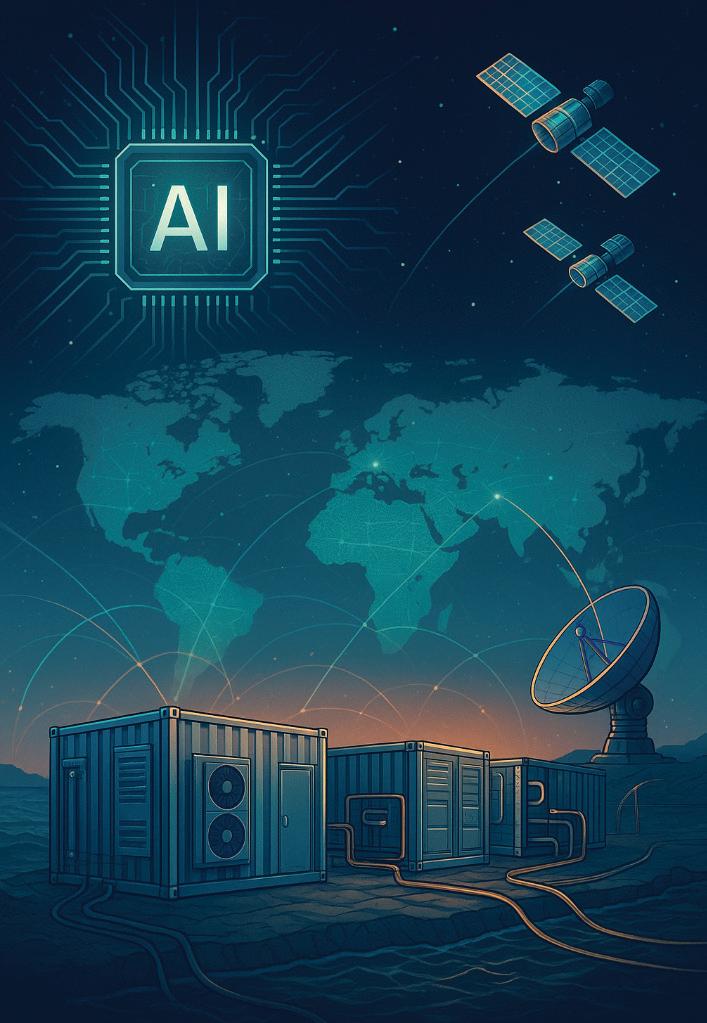
Datacenters are no longer monolithic warehouses of servers in remote industrial parks. Over the past few years they’ve fragmented, specialized, and spread outward from hyperscale campus facilities to compact modular units at the edge driven by three converging megatrends:
• Explosion of AI and high-density compute
• Need to reduce latency for real-time services
• Tighter energy, space and sustainability constraints
This article walks through the newest technical trends, how modular datacenters are addressing latency/ storage/ compute tradeoffs, the emerging edge use cases unlocked by distributed facilities, and why these sites matter to subsea, terrestrial and satellite architectures.
THE BIGGEST PLATFORM TRENDS SHAPING DATACENTERS TODAY
Generative AI and large model training have permanently changed the calculus for datacenter design. GPU/ accelerator clusters demand vastly higher power density, specialized cooling, and ultra-low latency interconnects between nodes and memory fabrics. Providers and enterprise customers are designing “AI first” facilities not just adding racks to old designs. NVIDIA, vendors like Supermicro and deployments from specialist cloud players show the shift: liquid cooling and custom racks have become standard engineering choices to support multi-MW pods of accelerators.
Air cooling can no longer economically evacuate heat at the densities modern accelerators generate. Direct and immersion liquid cooling approaches reclaim cooling effi-
ciency while enabling much tighter rack packing and lower PUE (power usage effectiveness). Liquid systems also open pathways to heat reuse (district heating) and better energy recovery. Recent large AI clusters and market commentary show rapid adoption of direct liquid cooling at scale.
To maximize utilization and reduce the unit cost of volatile workloads, datacenter hardware is moving toward disaggregated and composable topologies: CPU, GPU, memory and storage that can be pooled and reallocated by software. That trend stretches across chassis-level composability and longer-reach disaggregation using blazing optical links. Silicon photonics and advanced RDMA-over-converged fabrics reduce the latency penalty of disaggregation, making pooled memory and storage viable for latency-sensitive applications.
Datacenters are major energy consumers and are increasingly designed to either sit where renewable supply is abundant or to integrate on-site generation and storage. This includes co-located battery systems, direct connection to wind/solar, and advanced demand-response to grid signals. Efficient cooling and hardware choices (e.g., liquid cooling) are part of the carbon and cost strategy. Market reports show energy and sustainability driving siting decisions and design choices.
Operational complexity at cloud and edge scale demands automation. AI/ML is being applied to workload placement, thermals, predictive maintenance and power optimization. Observability stacks grow more granular (per-pod telemetry, IR thermal maps), enabling software to rebalance heat, power and network in near real time.
Modular datacenter is an umbrella for prefabricated, pre-integrated compute modules from containerized racks (ISO containers) to prefabricated micro-rooms and purpose-built plug-and-play cabinets. They ship built and tested and can be deployed in days or weeks instead of months or years.
Why the sudden interest? Three reasons:
1. Speed to market — enterprises and telcos need capacity close to users quickly (for 5G, MEC, or branch modernization).
2. Scale flexibility — modular units enable incremental capacity growth without oversized up-front buildouts.
3. Support for high-density pockets — modular units can be purpose-built with liquid cooling, custom power, and networking for accelerator clusters. Market forecasts show double-digit CAGR for the modular segment as these drivers converge.
Latency-sensitive applications create a three-way tension: compute (where processing happens), storage (where persistent data lives) and network transit (the time it takes to move bits). Modular datacenters are uniquely positioned to shift that balance:
By deploying modular compute pods at locations closer to end users in metro aggregation points, cable landing stations, or cell-tower aggregation sites round-trip network delay drops. For many real-time applications a drop of just a few milliseconds matters (cloud gaming, tele-robotics, AR/VR, high-frequency trading). Modular units make it practical to deploy small, high-performance clusters in places where building a whole brick-and-mortar facility would be infeasible. This is the essence of edge compute and MEC.
Edge or modular datacenters typically combine fast local NVMe tiers with lightweight object stores synchronized back to core datacenters. This hybrid allows read-heavy, hot data to be served locally (milliseconds), while colder data remains centralized. Advances in distributed filesystems, near-edge caches, and change-data-capture replication reduce consistency and coherence pain points for widely distributed caches. The net result: applications get the low latency of local storage with the durability of centralized storage.
Not every edge workload needs the full might of a hyperscale cluster; many need a handful of GPUs, FPGAs, or a mix of CPU + accelerator that’s optimized for low latency inference rather than throughput training. Modular designs allow operators to provision exactly the right compute mix for that location (e.g., a pod with 4–8 inference GPUs + local NVMe + SmartNIC), which minimizes unnecessary power, cooling and network cost while delivering required latency SLAs.
Modern modular sites come pre-equipped with programmable networking: segment routing, SRv6, IP-overDWDM, or optical interconnects that can stitch to metro and subsea backbones. Such fabrics support low-latency interpod communication and enable application-aware routing (e.g., prioritizing real-time telemetry). When combined with disaggregated fabrics and silicon photonics, distance penalties for remote memory/storage shrink, making near-edge disaggregation plausible.
As edge capacity proliferates through modular deployments, a set of use cases that were previously theoretical or too expensive become practical:
Cloud rendering for high-fidelity VR or low-latency interactive streaming requires sub-20ms round trips in many scenarios. Local modular datacenters serving metro pockets make true shared, persistent AR environments and competitive cloud gaming at mobile latencies viable. MEC deployments paired with edge GPUs are already being trialed by telcos and cloud providers.
Autonomous systems and robotics
Autonomous vehicles, drones, and industrial robots need local model inference, rapid map updates, and cooperative perception. Edge pods collocated with base stations or industrial sites can host map update services, model inference endpoints and data fusion systems that meet strict latency and reliability constraints.
Factories and critical infrastructure increasingly rely on deterministic compute for control loops. Edge datacenters reduce jitter and provide compute islands for digital twins and real-time analytics, enabling predictive maintenance and adaptive control without sending every telemetry point to a distant cloud.
Microseconds matter in some trading strategies. Modular datacenters at strategic exchange points and subsea landing stations give financial players better proximity and lower jitter. Similarly, CDN providers place cache-heavy edge pods near users to accelerate content delivery and reduce backbone transit costs.
Remote surgery assistance, live diagnostic imaging, and real-time patient monitoring require both privacy (keeping data local) and low latency. Edge facilities can process and filter sensitive streams locally, forwarding only required metadata to central archives and ML pipelines.
As Low Earth Orbit (LEO) satellite constellations proliferate, gateways need local processing to handle bursts, steer traffic, and perform initial data reduction (e.g., preprocess Earth observation imagery). Edge datacenters near satellite ground stations provide this compute while keeping latency low between satellites, ground radios and terrestrial networks.
These are not hypothetical market research and operator roadmaps show MEC and edge rollouts tied to 5G and AI are accelerating.
Subsea cables terminate at cable landing stations, which increasingly become nodal hubs for regional internet traffic. Placing modular datacenters at or near CLS has three main benefits:
• Lower latency for intercontinental paths: CLS-adjacent compute reduces the number of network hops for traffic that would otherwise traverse inland exchange points. For some regional traffic patterns this materially reduces RTT.
• Improved interconnection density: A local exchange populated with cloud, CDN, ISP and carrier racks fosters peering and direct interconnection, minimizing the need to traverse longer peering routes.
• Resilience and routing flexibility: Edge compute at CLS can act as regional caching or failover compute if terrestrial links are cut. This is particularly relevant as subsea networks and geopolitical risk landscapes evolve. Recent research highlights both the strategic importance and security concerns around subsea infrastructure reinforcing why colocated compute and careful site hardening matter.
On land, modular sites at fiber aggregation points, towers, and metro colos offer:
• Shorter tail latency for metro services (e.g., smart cities, interactive applications).
• Cost-effective scale since an operator can incrementally add pods as demand grows.
• Localized regulatory and data sovereignty control, enabling operators to process sensitive data within local jurisdictions. Market analysis shows telecoms favor MEC-capable modular units alongside 5G rollouts.
For satellite systems especially LEO constellations with frequent passes ground stations need buffer compute to reduce downlink jitter, perform edge inference (e.g., compress, classify, or fuse sensor data), and feed results into terrestrial networks with minimum delay. Modular datacenters installed at satellite gateway sites can process massive telemetry bursts, run AI pipelines for imagery, and orchestrate network steering between ground and fiber backbones. This hybridization (satellite + edge + subsea/ terrestrial backbone) creates a resilient, low-latency global fabric suitable for premium services.
HETEROGENEOUS MICRO-PODS
Pods combining CPU, GPU/accelerator, FPGA, storage and SmartNIC in a tightly integrated chassis often with liquid cooling are the dominant modular unit. They’re optimized for inference and edge training bursts.
MULTI-TIER STORAGE
A local tier (NVMe, persistent memory) for hot data; a regional tier (fast object stores) for warm data; and a central cloud or hyperscaler cold tier for archival. As networks improve, intelligent data placement and consistency protocols keep user-visible latency low.
Software stacks must orchestrate compute, storage, and network policies across thousands of distributed nodes: balancing data locality, cost, and SLA. Kubernetes plus specialized edge orchestrators (and telco-grade orchestrators for MEC) are standard, with policy engines for geo-fencing and compliance.
SECURE, RESILIENT INTERCONNECTS
Edge and modular sites require secure tunnels, zero-trust networking, and hardened physical security. For subsea/CLS deployments, operators also apply strict operational controls against supply-chain and tampering risks.
Research into subsea cable security calls out these concerns and the need to secure landing stations and associated infrastructure.
CAPEX AND OPEX SHIFTING SHAPE
Modular datacenters reduce upfront construction time and cost, converting some CapEx into more modular purchases and enabling faster revenue realization. However, smaller sites can have higher per-unit operational expenses (crew visits, local power premiums) unless carefully automated and optimized.
Operators can sell locality (latency zones), specialized GPU access, compliance-certified enclaves, and interconnection at cable landing stations as differentiated products. Content providers, financial firms, telcos, and defense entities are natural customers.
Expect more partnerships: cloud providers, network operators, subsea cable consortia, and local real estate/utility players will cooperate. The modular approach lowers the bar for new entrants to deploy specialized capacity without owning full hyperscale facilities.
Operating thousands of small sites is fundamentally different from operating a few hyperscale campuses. Automation, remote diagnostics, and robust orchestration are table stakes, but the software and processes are still maturing.
Distributed deployment increases attack surface physically and logistically. Subsea and CLS-adjacent deployments require especially strict controls due to geopolitical sensitivity around undersea infrastructure.
Edge locations may lack abundant, cheap power. Liquid cooling partially solves thermal constraints but requires water / chilled loop logistics and careful waste heat handling.
Not every application needs extreme edge proximity. Many workloads will remain centralized due to cost or data gravity. Operators must carefully choose which sites and workloads justify edge hosting.
• Near term (1–3 years): Rapid expansion of modular and MEC sites by telcos and cloud providers near metro centers, CLS, and ground stations. Wider adoption of liquid cooling for high-density AI inference pods. Increased pilot projects integrating satellite gateways and edge pods for telemetry and imagery preprocessing. Market reports forecast double-digit growth for modular data centers and MEC expansion.
• Medium term (3–7 years): More composable/disaggregated edge architectures linked by optical fabric; silicon photonics will start to blur distance penalties, enabling pooled resources across metro rings. Subsea landing stations with colocated compute become commercial for certain regional providers seeking low RTT and interconnection density. The increasing ubiquity of edge capacity will spawn new applications in AR/VR, teleoperation, and hybrid satellite-terrestrial services.
• Beyond (7+ years): If trends continue, we may see an increasingly layered global compute fabric: hyperscale cores, regional modular hubs, and micro-edge cells all orchestrated as a single continuum where workloads flow automatically to optimize latency, cost and carbon. Novel deployments such as subsea containerized modules for latency-sensitive intercontinental compute will be explored further, though they face technical, regulatory and resilience hurdles.
Classify workloads by latency and locality needs don’t
reflexively place everything at the edge. Use modular capacity where it changes user experience or lowers cost meaningfully.
• Design for liquid cooling now for high-density AI pod retrofits are expensive and disruptive. Plan rack and pod cooling early.
• Invest in orchestration, telemetry, and remote ops automation is the only scalable way to operate widely distributed modular fleets.
• Protect subsea and CLS deployments harden both physical and software supply chains and coordinate with cable operators and national authorities where required.
• Plan data placement & consistency carefully for hybrid storage designs (local NVMe cache + regional object store + central archive) will serve most edge needs; choose your replication and consistency models for each data class.
• Partner wisely in ecosystem partnerships (carriers, regional colo, satellite providers) can make or break edge economics.
Datacenters are becoming more modular, liquid-cooled, distributed and orchestrated. The industry is moving from a model where compute lived in a few massive campuses to a layered compute fabric spanning hyperscale cores to micro-edge pods. That shift is being driven by AI’s demand for density, by the low-latency requirements of modern applications, and by the economic promise of modular deployment.
For subsea, terrestrial and satellite architectures, modular edge facilities play a strategic role: lowering latency, increasing interconnection density, and processing bursts closer to where data is generated or received. The architectural challenge is not only technological but operational: the ability to automate, secure and economically operate a widely distributed compute footprint will separate winners from laggards. STF
As the Founder at EdgeComms and Co-Founder at Aetherion Infra Partners, ALEX VAXMONSKY is uniquely positioned to provide insight into datacenters and the ecosystems of service providers, web content and applications. He has significant expertise in driving strategic partnerships and managing large scale infrastructure installations for modular datacenters, subsea projects and satellite deployments.

BY SAMIA BAHSOUN, HERVE FEVRIER, AND GIORGIO GRASSO
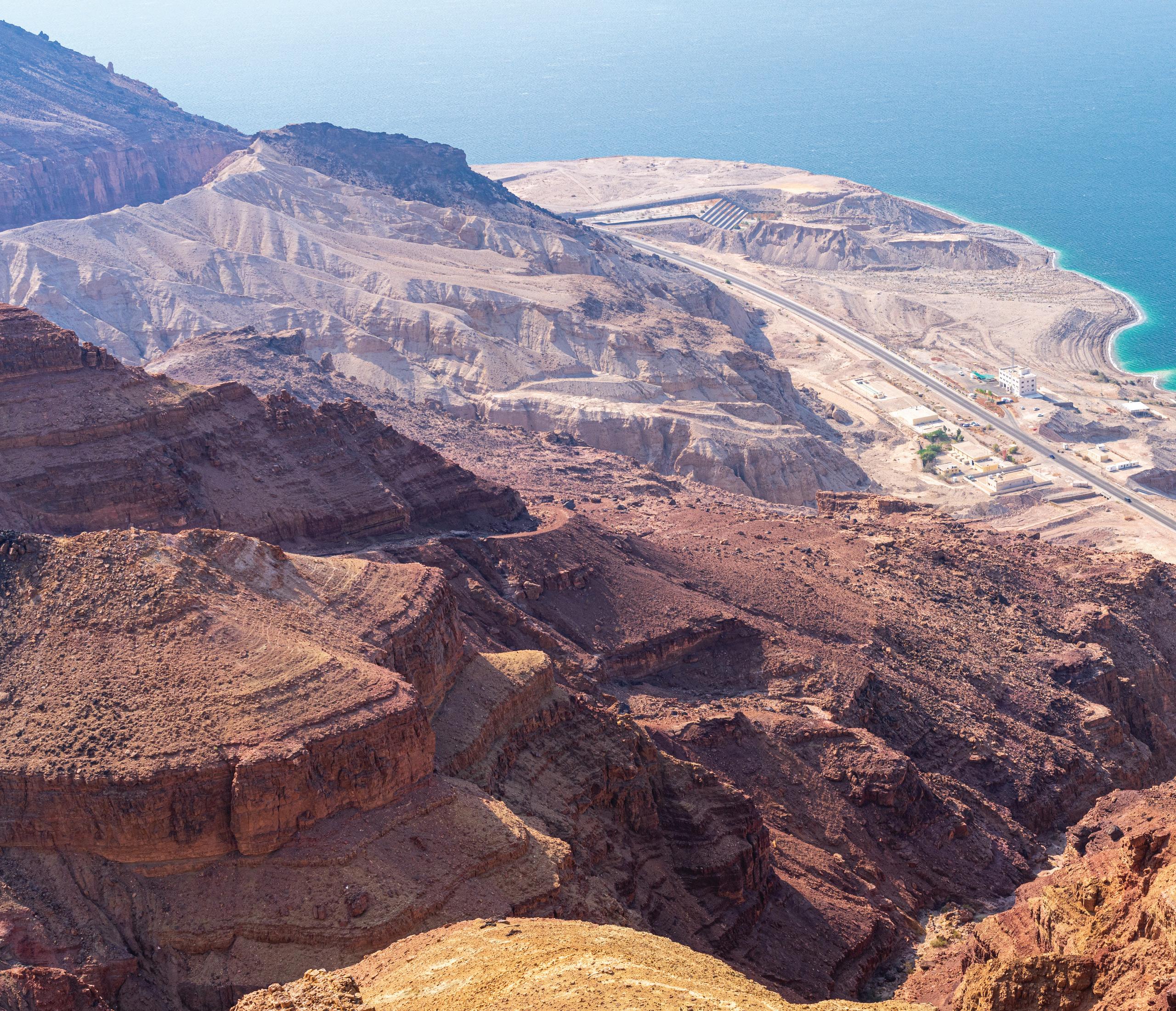
In the race to power the AI era, infrastructure is destiny. Generative AI, hyperscale data centers, and machine learning models are not just hungry for data —they are voracious. The exponential growth of AI workloads—projected to exceed 40% CAGR through 2030—demands high-capacity, low-latency, and ultra-reliable fiber backbones connecting clusters, clouds, and continents. Yet, today’s terrestrial infrastructure is faltering under the weight of that demand. The bottleneck lies not in the cable, but in how we power, amplify, and scale it across vast distances.
The Aqua2Terra (A2T) initiative proposes an innovative and radical approach to terrestrial optical line systems — one that borrows its DNA from the most reliable systems on Earth: subsea cables. By repurposing the advances
of subsea repeaters for a land-based future and adapting subsea repeater design for buried, sealed manhole deployment, A2T offers an end-to-end powered, maintenance and regulation-light alternative to the conventional InLine Amplifier (ILA) model—purpose-built for the AI and hyperscale era as an agile, secure, and scalable alternative for high-capacity fiber deployments.
Traditional terrestrial fiber networks were designed as national mesh systems, interlacing cities and towns through dense grids of fiber routes and In-Line Amplifier (ILA) huts approximately every 80 kilometers. These networks were optimized for population proximity and national backbones, ensuring access and redundancy close

to where people and enterprises operate. While this topology serves domestic and national connectivity well, it is ill-suited to the long, protected corridors demanded by today’s international hyperscale and AI ecosystems. For large-scale, cross-border infrastructure, the same design that connects communities now constrains intercontinental continuity.
Each ILA site requires grid power, real estate, permitting, and maintenance —creating a costly, delay-ridden patchwork of vulnerabilities. As power grids in many regions strain under demand, and as municipalities tighten permitting for above-ground installations, this model is becoming untenable. These limitations are not only technical but systemic:
• Power Fragility: Local power dependencies create single points of failure; diesel generators and batteries add cost and carbon.
• Permitting Gridlock: Each ILA site demands municipal approval, zoning, and often months of bureaucratic delay.
• Environmental Exposure: Above-ground huts face floods, temperature swings, and vandalism.
• Security Gaps: Physical exposure makes ILA sites easy targets for intrusion or theft.
In short, the very architecture that once made longhaul terrestrial fiber possible has become its bottleneck. Traditional In-Line Amplifier (ILA) huts—bulky, power-hungry, land-intensive installations—are increasingly incompatible with the terrain, regulation, and economics of tomorrow’s digital corridors. An example of such corridors (see Figure 1) is introduced and presented in a report of the European Commission on “Corridors and Urban Systems in Africa” [1].
Subsea networks—spanning the planet’s oceans for more than 150 years—operate in environments that make deserts and mountains look tame. These systems, sealed against pressure, corrosion, and time, routinely deliver uninterrupted service for 25 years or more.
Aqua2Terra’s vision is simple: take what works in the ocean and make it work on land.
At the core of Aqua2Terra’s innovation is its proprietary, end-to-end powered repeatered open line system—drawing from subsea cable architecture but tailored for terrestrial deployment and environment. Instead of dozens of power-hungry huts, A2T places low-power optical repeaters inside sealed, buried manholes spaced along a cable route. These repeaters are powered end-toend by a single medium-voltage cable, eliminating the need for local electrical connections. Once buried, the repeaters operate autonomously — monitored remotely through subsea-style network management and distributed sensing systems.
A2T’s technology lies in the adaptation of SubPhoton’s 48 fiber pair (48FP) qualified subsea repeater (see Figure 2), co-developed under a patent-protected collaboration between Aqua2Terra LLC and SubPhoton.
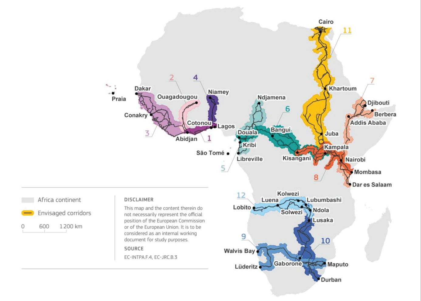
KEY TECHNICAL CHARACTERISTICS INCLUDE:
• Ultra-Low Power: Each repeater consumes < 500 W— roughly 1/50th the power of a traditional ILA amplifier site. This includes both the optical repeater and the thermal management functionalities.
• End-to-End Power Feeding: Both ends of the network feed the repeater chain, removing dependence on local utilities and enabling full remote control. Like for subsea links, Single End Feeding is possible for A2T links.
• High Density: One repeater supports up to 48 fiber pairs, adequate for hyperscale inter-data-center links.
• Thermal Management: Unlike subsea environments, where deep-ocean temperatures remain remarkably stable at around 2–4 °C, terrestrial fiber routes experience wide thermal fluctuations that would directly impact optical performance and equipment longevity. Conventional In-Line Amplifier (ILA) sites therefore rely on active thermal management systems—typically fan-based or HVAC-assisted cooling—to maintain equipment within the ETSI EN 300 019-1-3 “Class 3.1” operating range for controlled environments (usually between +5 °C and +40 °C), or Class 3.2 for partially controlled sites (ranging from –5 °C to +45 °C).
In field deployments, ILAs can be exposed to Class 4.1 outdoor temperature extremes, spanning –33 °C to +55 °C, often exceeding design tolerances and stressing fan reliability. Aqua2Terra’s repeater is architected so that part of the electric power drawn by the repeater is devoted to the thermal management / heat dissipation through thermo-electric temperature control which combined with passive thermal management borrowed from high voltage terrestrial power cable techniques ensure consistent internal temperatures regardless of surface conditions with no fans, no air-conditioning, no moving parts.
• Environmental Sensing and Distributed Acoustic Sensing (DAS): Beyond maintaining its own temperature, Aqua2Terra continuously senses its surroundings. Integrated DAS technology transforms the optical fiber itself into a linear sensor array capable of detecting vibration, strain, and temperature variations in real time. Originally perfected for subsea networks, DAS enables operators to monitor the physical integrity of buried routes—identifying digging activity, seismic movement, or thermal anomalies long before they become faults. The Aqua2Terra repeater is designed so that DAS operation does not require dedicated fiber pair but only one wavelength
in a single fiber without any interference with the data channels on the other wavelengths.
This distributed intelligence gives Aqua2Terra an adaptive awareness layer: a self-monitoring terrestrial backbone that can hear and feel its environment while operating silently underground. Coupled with its passive thermal system, the result is a network that is both self-regulating and self-aware — bringing the ocean’s stability and foresight to the surface world.
• Secure Manhole Installation: Modern composite enclosures include anti-tamper locks, intrusion sensors, and smart access system
The result (see Figure 3) is a terrestrial network with subsea-grade reliability, subsea-grade longevity, and a drastically smaller surface and power footprint — a system engineered not just to perform, but to endure.
What begins as an engineering breakthrough inevitably reshapes the world above ground. By applying subsea-grade design to terrestrial infrastructure, Aqua2Terra not only redefines how networks are built—it transforms how they are permitted, powered, financed, and sustained.
The same attributes that make subsea systems resilient under pressure—sealed environments, centralized power, minimal maintenance—yield profound civil and economic
efficiencies when adapted to land.
What follows are the tangible payoffs of bringing subsea discipline to terrestrial deployment: faster approvals, lower costs, and a cleaner environmental footprint
One of Aqua2Terra’s most elegant features lies not underground, but in the bureaucratic layer above it. Traditional ILAs require land acquisition, fencing, power grid extensions, and environmental permits. Each structure is treated as a building, with corresponding taxation and inspection obligations. A2T’s buried manhole repeaters, by contrast, are classified as standard utility infrastructure. This brings enormous regulatory relief:
• Minimal Land Use: No buildings, fencing, or land leases.
• Fast Permitting: Falls under existing trenching norms for power or telecom conduits.
• Reduced Compliance Burden: Fewer assets to inspect or insure.
• Municipal Acceptance: No visible structures, no generator fuel, and no noise pollution.
The approach is already validated by established norms in submarine cable landings, where 10 km power-fed fronthauls connect beach manholes to cable landing stations in dense urban environments. By eliminating visible infrastructure, A2T turns what was once a zoning nightmare into a routine utility operation.
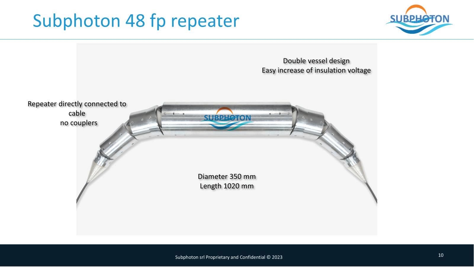
When comparing like-for-like, the Aqua2Terra system dramatically alters the economics of long-haul terrestrial connectivity:
• Power Efficiency: Traditional 48 fiber pair (48FP) ILA sites consume approximately 25 kW per location, requiring constant cooling and local grid power. Aqua2Terra repeaters operate at less than 0.5 kW each, representing a fiftyfold reduction in energy use.
• Energy Savings: Over a 2,000 km / 48FP system, A2T’s low-power design yields annual energy savings exceeding $750,000.
• Capital Expenditure: At the component level, a conventional ILA hut equipped for 48 fiber pairs—including the building, amplifiers, and supporting systems but excluding land—costs approximately 2.6 times more than a 48FP Aqua2Terra repeater manhole. When scaled to a full 2,000-kilometer, 48FP network, those efficiencies compound: the Aqua2Terra architecture delivers a 20% reduction in total CapEx compared to the traditional ILA-based approach. When combined with its lower operating costs, the overall CapEx + OpEx savings reach approximately 38%, establishing Aqua2Terra as the new economic baseline for long-haul terrestrial builds.
• Operational Expenditure: Legacy ILA huts incur about 60% higher annual operating costs, driven by maintenance, local utilities, and cooling. A2T’s sealed, remotely powered repeaters drastically reduce these recurring expenses.
• Permitting and Deployment Speed: Traditional ILA projects can require 6 to 18 months for permitting and zoning. A2T’s buried utility-class infrastructure typically secures approvals in under 3 months, accelerating time to service.
proved financial efficiency per bit transported.
Aqua2Terra’s applicability extends across multiple domains of global infrastructure:
• AI and Hyperscale Data Centers: A2T enables multiGW campus interconnects between clusters without the constraints of local grid capacity. End-to-end power delivery ensures consistent performance even in regions with weak utility infrastructure.
• Backhaul of Subsea Landings: From Cable Landing Stations (CLS) to inland data centers, A2T provides a secure, cost-effective replacement for traditional backhaul routes — critical as coastal hubs become congested.
• Sovereign and Defense Corridors: Terrestrial, buried repeater systems can form secure inland alternatives to vulnerable subsea chokepoints such as the Red Sea or the Suez corridor, supporting national data-sovereignty objectives.
By removing ILA huts and their dependencies, operators can reduce total cost of ownership by more than half while increasing system uptime and reliability. For hyperscalers and carrier-neutral data-center operators, these savings translate directly into faster route deployment and improved financial efficiency per bit transported.
By removing ILA huts and their dependencies, operators can reduce total cost of ownership by more than half while increasing system uptime and reliability. For hyperscalers and carrier-neutral data-center operators, these savings translate directly into faster route deployment and im-
• Emerging Market Connectivity: In regions where power grids are unreliable or non-existent, end-fed A2T systems deliver carrier-class performance without the logistical burden of powering dozens of huts.
• Resilience and Redundancy: A terrestrial A2T corridor paralleling subsea routes can offload traffic during subsea outages—creating true landsea network diversity for hyperscalers and carriers alike
Sustainability is no longer a corporate talking point—it’s an engineering mandate. Aqua2Terra’s architecture advances environmental goals across several dimensions:
• Carbon Efficiency: By consuming 50× less power and eliminating diesel generators, A2T substantially reduces CO₂ emissions.
• Material Longevity: Subsea-grade components with 25year design life minimize waste and replacement cycles.
• Minimal Disturbance: Buried installations preserve landscapes and urban aesthetics.
• Noise-Free Operations: No fans, no generators, no hum—just silent efficiency underground.
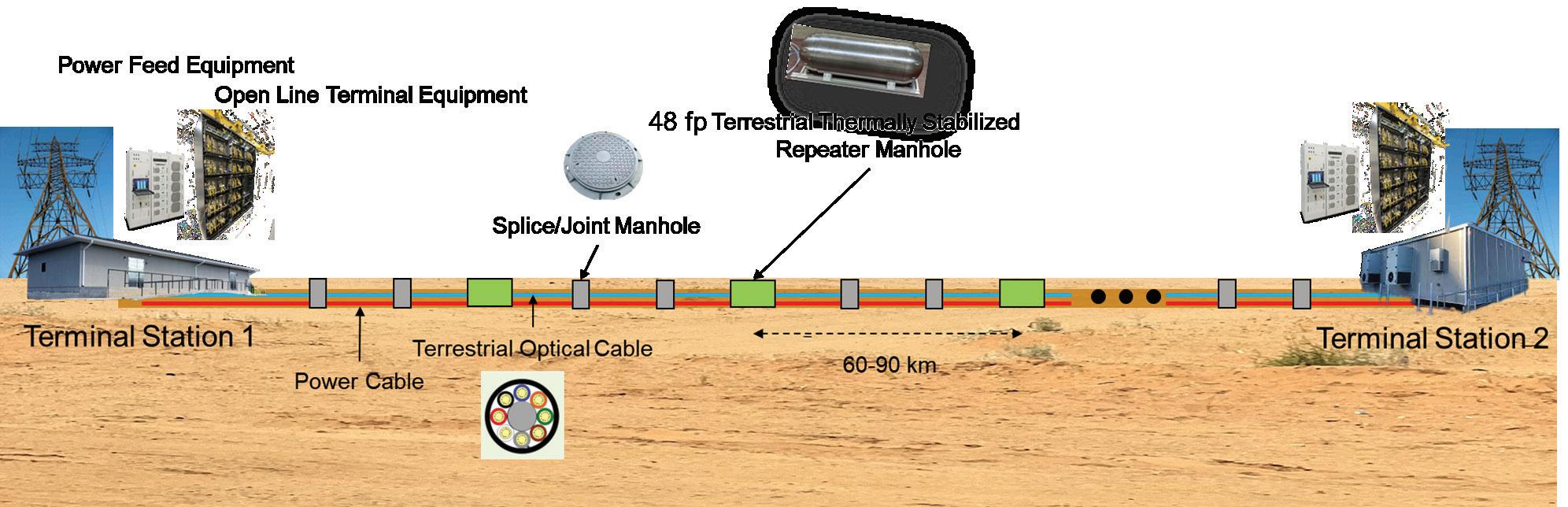
In a world where digital infrastructure increasingly intersects with public policy and sustainability commitments, A2T offers a blueprint for reconciling growth with responsibility
The evolution of connectivity has come full circle. What began with telegraph cables crossing the Atlantic now resurfaces in terrestrial form, hardened by oceanic heritage yet tailored for AI-driven data exchange. Aqua2Terra is not merely a technical upgrade —it’s a paradigm shift:
• From surface exposure to buried resilience,
• From power dependency to autonomous endurance,
• From regulatory inertia to deployment agility.
By eliminating traditional repeater huts and their legacy constraints, Aqua2Terra redefines how fiber backbones are built—quieter, cleaner, faster, and stronger. As data centers multiply and AI continues its ascent, the industry faces a defining question: Will we continue patching the past, or will we engineer the next backbone?
With AI, cloud, and edge computing driving explosive fiber demand, terrestrial repeater innovation is not a niche—it’s a necessity. Aqua2Terra’s answer is already buried beneath our feet—linking the deep sea to the desert dunes, forging the resilient arteries of our digital future. STF

SAMIA BAHSOUN, co-founder of Aqua2Terra and a principal of the management consulting firm S2 Associates International, is a telecom infrastructure innovator and strategic advisor with four decades of experience spanning R&D roles at Bell Labs through executive leadership positions. She has designed, developed, and planned subsea, national backbone, metro, and access networks, advising governments, service providers, and hyperscalers on landing agreements, backhaul
strategy, and feasibility studies across Africa, the Middle East, and the Americas.

HERVÉ FEVRIER, co-founder of Aqua2Terra and a principal of Landelles Consulting, is a senior telecom executive with 40 years of leadership experience in global optical network development spanning terrestrial backbones across Europe and the United States, more than 70 unrepeatered subsea links, and over 100,000 km of repeatered submarine systems. He has directed programs resulting in 10 commercial optical transport products and holds more than 50 patent families with over 200 technical publications. Hervé previously held executive roles at Alcatel, Xtera Communications, and Meta, where he lead the 2Africa cable system technical team.

GIORGIO GRASSO, co-founder of Aqua2Terra, has 45 years of experience in photonics. From 1972 to 2011, he conducted research in optical fibers and optical amplifiers, and in 1990 became Director of R&D for terrestrial and submarine photonics systems. From 2011 to 2020, he served as General Manager of Fondazione CIFE, active in photovoltaic technology, tunable lasers, and submarine systems. Giorgio currently leads photonics research and product development at SubPhoton and holds 60 patent families.
References
[1] Kavalov, B., Kucas, A., Kompil, M., Proietti, P., Sulis, P. et al., Global Gateway Support to Transport Corridors in Africa –Consolidated report, Oliete Josa, S. and Georgelin, L. (editors), Publications Office of the European Union, Luxembourg, 2025, https://data. europa.eu/doi/10.2760/0495136, JRC142789.
Building
BY JOEL OGREN
The advent of artificial intelligence (AI) has ignited a digital revolution, propelling workloads into realms of unprecedented density and computational intensity. As of October 2025, AI models like large language models and generative systems demand not just more processing
power but sustained, high-throughput environments that traditional data centers were never designed to handle. High-density workloads—characterized by racks pulling 50-100 kilowatts (kW) or more, compared to the 5-10 kW norm of a decade ago—are straining every facet of infrastructure. This surge is reshaping how data centers are
planned and built, shifting from siloed computing hubs to integrated ecosystems that prioritize scalability, low latency, and resilience.
At the heart of this transformation lies the evolution of cable landing stations (CLS). Once mere endpoints for subsea fiber-optic cables, these facilities are morphing into hybrid powerhouses. They now fuse subsea connectivity with terrestrial backhaul networks and AI-ready capacity, enabling seamless data flows for distributed AI training and inference. This integration addresses the voracious data appetites of AI, where petabytes must traverse oceans and continents with minimal delay. Recent projections from JLL’s 2025 Global Data Center Outlook underscore this: AI-driven demand will add over 100 gigawatts (GW) of capacity globally by 2030, with hyperscalers like Microsoft and Google leading investments exceeding $200 billion annually.
Consider the stakes. AI workloads aren’t just bigger; they’re distributed. Training a model like GPT-5 requires orchestrating GPUs across continents, demanding sub-millisecond latencies and redundant paths to avert outages. Power constraints exacerbate this: U.S. data centers alone could consume 8% of national electricity by 2030, up from 3% today, per Deloitte’s 2025 AI Infrastructure Survey. Yet, opportunities abound. Hybrid CLS facilities promise resilience through diversified routing—subsea for bulk transfer, terrestrial for edge processing—and economic ripple effects, from job creation to community empowerment.
Cable landing stations have long been the unsung heroes of global connectivity, where transoceanic cables first kiss solid ground before fanning out to terrestrial networks. But AI’s insatiable hunger for data—projected to generate 181 zettabytes annually by 2025, per IDC—has upended this role. Traditional CLS were passive: cables landed, signals amplified, and traffic routed inland via basic fiber. Today, they’re evolving into hybrid facilities that orchestrate subsea ingress, terrestrial backhaul, and on-site AI-ready compute, forming the backbone for high-density workloads.
This shift stems from AI’s dual demands: massive bandwidth for model training and ultra-low latency for real-time inference. Subsea cables, carrying 99% of international data, now integrate with terrestrial dark fiber and edge nodes to create “intelligent hubs.” As outlined in a 2025 Data Center Dynamics analysis, CLS are adopting open, neutral architectures where multiple carriers colocate, slashing costs by 20-30% through shared infrastructure. AI-driven automation takes it further: predictive analytics monitor cable faults in real-time, dynamically rerouting traffic to avert disruptions that could cost millions in AI downtime.
AI-driven demand will add over 100 gigawatts (GW) of capacity globally by 2030, with hyperscalers like Microsoft and Google leading investments exceeding $200 billion annually.
This discussion draws on recent projects, including the groundbreaking tribally led CLS in Washington State by Toptana Technologies, and innovative models like Meta’s Project Waterworth. It highlights how strategic location, robust community engagement, and fused power-fiber strategies can mitigate risks while amplifying impact. Ultimately, the intent is practical: equipping planners and builders with insights to craft next-generation facilities that tame power bottlenecks, slash latencies, honor stakeholders, and sustain distributed AI into a greener future. By blending connectivity hubs with compute capacity, these builds aren’t just reactive—they’re visionary, turning coastal shores into gateways for the AI era.
Integration is key. Subsea systems like multi-core fibers boost capacity to 100+ terabits per second (Tbps) per pair, but they need robust terrestrial backhaul to feed data centers. Hybrid models embed switching gear and even modular racks at the CLS, enabling direct handoff to AI clusters. This reduces latency from 100ms (cross-continental hops) to under 10ms, critical for distributed AI where models train across Pacific-spanning nodes. Power redundancy follows suit: facilities now incorporate microgrids with renewables, ensuring 99.999% uptime amid grid strains.
Recent advancements amplify this. Lumen Technologies’ support for the JUNO trans-Pacific cable in 2025 exemplifies seamless backhaul: high-capacity DWDM links connect the Oregon landing directly to cloud regions and edge sites, bypassing congested inland routes. Similarly, multi-core tech in new cables like Southeast Asia-Japan Cable 2 (SJC2) demands enhanced CLS cooling—liquid immersion systems to handle 50kW densities—paving the way for on-site AI acceleration.
Challenges persist. Geopolitical tensions, like U.S.-China decoupling, spur route diversification: new paths via the Arctic or Africa reduce single-point failures. Yet, environmental scrutiny mounts; CLS must navigate permitting for beachfront builds while minimizing ecosystem disruption. Economically, hybrids unlock value: by merging connectivity with compute, they capture 15-20% higher margins, per TeleGeography estimates.
In essence, CLS are no longer endpoints—they’re neural nodes in the global AI fabric, blending subsea speed with terrestrial smarts for resilient, scalable ecosystems.
In the misty coastal expanse of Washington’s Olympic Peninsula, Toptana Technologies is etching a new chapter in CLS evolution. Launched in 2022 by the Quinault Indian Nation, this tribally owned venture is constructing the state’s first new CLS in over 25 years, a hybrid beacon for transpacific connectivity and AI empowerment. Named after the Quinault word for “beach,” Toptana’s facility in Taholah integrates subsea cable landings with a 200+ mile fiber backhaul to Seattle and Hillsboro, Oregon, along the I-5 corridor—bypassing California and Oregon’s congested routes for faster, diverse paths.
fiber splicing and network ops. Economic impact? Projected at $500 million over a decade, including broadband for 10,000 underserved residents—significantly addressing the digital divide in rural Washington, where pre-project speeds languished at 10Mbps.
Sustainability weaves through every fiber. Toptana’s ESG framework mandates low-impact builds: buried cables minimize visual blight, and backhaul routes avoid wetlands. For AI resilience, the design includes redundant subsea paths to Asia-Pacific, mitigating outages like the 2024 Tonga eruption that severed 80% of regional traffic. Stakeholder buy-in was pivotal: early consultations with fisheries and environmental NGOs de-risked permitting, cutting timelines by an estimated 18 months.
Toptana exemplifies hybrid potential. It is in discussions to host pilot AI inference nodes, processing real-time ocean data for climate models—blending tribal knowledge with tech. Challenges? Funding tribal ventures amid inflation, but customer acquisition strategies bridge gaps. This project isn’t just infrastructure; it’s reclamation—tribes leading the AI charge, proving hybrid CLS can drive inclusive growth.
Success hinges on fusion: subsea volume + terrestrial agility = AI resilience.
At its core, the project fuses subsea and terrestrial realms. Four open-access cable systems will land here, offering neutral colocation for carriers and hyperscalers. This isn’t passive infrastructure; it’s AI-ready, with provisions for high-density racks and edge compute to support distributed workloads. Backhaul fibers, engineered for 400G+ speeds, ensure low-latency feeds to Northwest data hubs, where AI firms like NVIDIA cluster GPUs for model training. Power strategies shine: the site leverages tribal sovereignty for streamlined permitting, evaluating incorporating solar microgrids and battery storage to offset grid demands, targeting 50% renewable integration by 2027.
Community engagement defines Toptana’s ethos. As the first indigenous-led CLS, it prioritizes sovereignty and equity. The Quinault Nation, stewards of 27 miles of pristine shoreline, conducted exhaustive environmental and cultural studies, protecting sacred sites and salmon habitats. This isn’t lip service: partnerships with local tribes ensure 30% of construction jobs go to Native workers, fostering skills in
Beyond Toptana, 2024-2025 has birthed CLS hybrids that boldly merge landing points with full-fledged data capacity, turbocharging AI ecosystems. Meta’s Project Waterworth, announced in February 2025, stands out: a $5 billion multi-year push for subsea cables linking U.S. East Coast to Europe and Asia, with embedded CLS compute. Unlike siloed designs, Waterworth’s stations feature integrated GPU pods—up to 10MW per site—for on-site AI preprocessing, slashing transatlantic latency by 40%. Terrestrial backhaul via Lumen’s dark fiber feeds hyperscale clouds, while AI optimizes routing, predicting surges from generative queries.
In the Middle East, Mobily’s Hybrid Digital solution in Saudi Arabia redefines the model. Launched September 2025, it colossuses subsea landings in Jeddah with 50MW data halls, supporting NEOM’s AI city ambitions. Subsea ties to Africa and India blend with terrestrial 5G backhaul, enabling distributed AI for oil analytics. Power? Desalination plant co-location provides excess heat for cooling, hitting 60% efficiency gains.
Subsea data centers push boundaries further. Highlander’s 2025 deployment off China’s Hainan coast—100
modular pods at 1MW each—dunks servers underwater for natural cooling to reduce energy consumption and operational costs, integrating with CLS for seamless backhaul. This hybrid cuts energy use by an estimated 30% versus land-based, ideal for AI’s heat-intensive training.
These models highlight trends: modularity for scalability, AI orchestration for efficiency. Yet, they grapple with geopolitics—U.S. bans on Huawei cables spur domestic builds—and supply chains, where copper shortages hike costs 15%. Success hinges on fusion: subsea volume + terrestrial agility = AI resilience.
Site selection for hybrid CLS-data centers is a highstakes calculus, balancing coastal access, power proximity, and socio-economic fit. AI demands locations with subsea proximity (e.g., Pacific Northwest for Asia links) and low seismic risk, yet 70% of optimal U.S. sites face grid bottlenecks, per Deloitte. Emerging spots like Maryland’s coast or Washington’s coast offer untapped fiber diversity, reducing latency by 25% versus inland hubs.
Community engagement elevates this from transaction to transformation. Toptana’s tribal model shows how: co-designing with locals yields 90% approval rates, versus 60% for top-down projects. In Myrtle Beach expansions, operators hosted town halls, pledging $10M in broadband grants—boosting buy-in and averting lawsuits that delay builds by years.
Resilience follows: engaged communities provide early warnings on environmental shifts, like erosion threatening cables. Economically, a 100MW facility generates $50M in annual taxes and 500 jobs, per CBRE’s 2025 report. For AI, this means stable ops; for locals, equity in the digital boom.
Power and fiber aren’t add-ons—they’re the lifeblood of AI hybrids. Flexential’s 2025 report reveals 72% of IT leaders cite grid access as the top hurdle, with lead times stretching 3-5 years. Strategies fuse them: co-locating CLS with renewables, like Toptana’s planned solar arrays, offsets 40% of 20MW needs. Fiber? Buried dark fiber loops ensure redundancy, with AI-monitored taps for dynamic allocation.
Sustainability demands innovation: liquid cooling recycles heat for district warming, cutting emissions 25%. Deloitte advocates “behind-the-meter” microgrids, bypassing queues—e.g., Pennsylvania’s $10B nuclear reconversion for
AI. This integration builds resilience: fiber for data agility, power for uptime, yielding economic multipliers like 2:1 job leverage.
Crafting AI-ready hybrids requires a blueprint attuned to power, latency, stakeholders, distributed workloads, and green longevity. Start with power: forecast 50kW/rack densities using Flexential’s 2-3 year horizons; integrate geothermal or immersion cooling early to cap PUE at 1.2. For latency, embed edge AI at CLS—e.g., Waterworth’s pods process 70% of traffic locally.
Stakeholder alignment: Form triads of operators, communities, and regulators from day one, as in Toptana, to navigate FERC queues. Distributed AI? Design for orchestration: subsea for bulk sync, terrestrial for federated learning across 10ms hops.
Sustainability: Mandate 50% renewables via PPAs; use AI for predictive maintenance, slashing waste 15%. Execution tip: Modular prefabs cut timelines 30%, per JLL. These insights turn constraints into catalysts, building facilities that endure.
AI’s ascent is rearchitecting data centers from the seafloor up, with hybrid CLS as the nexus. From Toptana’s tribal triumph to global hybrids like Waterworth, these facilities weave subsea, terrestrial, and compute into resilient tapestries. By prioritizing location savvy, community bonds, and fused strategies, builders can conquer power woes, tame latencies, and amplify impacts—fueling distributed AI while stewarding sustainability. The future? Coastal fortresses powering tomorrow’s intelligence, inclusively and indefinitely. STF
JOEL OGREN is the CEO and founder of Assured Communications (ASSURED). A retired U.S. Marine, Joel has over 38 years of experience working within the Information and Communications Technology industry in both public and private entities. Joel has spent much of his career working with and for various 3-letter agencies assisting in the development of the backbone of U.S. communication systems. Joel has managed the center for national and nuclear communications under the Bush Administration and advised on disaster planning and continuity communications. Joel was a Telecom SME at the Johns Hopkins University Applied Physics Laboratory, as well as a founding member of the leadership for the University of Hawaii Applied Research Laboratory. Transitioning to the commercial market, Joel has served as the COO for Ocean Networks managing the development of subsea fiber optic cable systems within the Pacific region, and has also served as a Managing Partner of GoTo Networks, focused on developing new submarine cable systems into underserved markets.
BY FERNANDO BORGES AZEVEDO AND JAYNE STOWELL
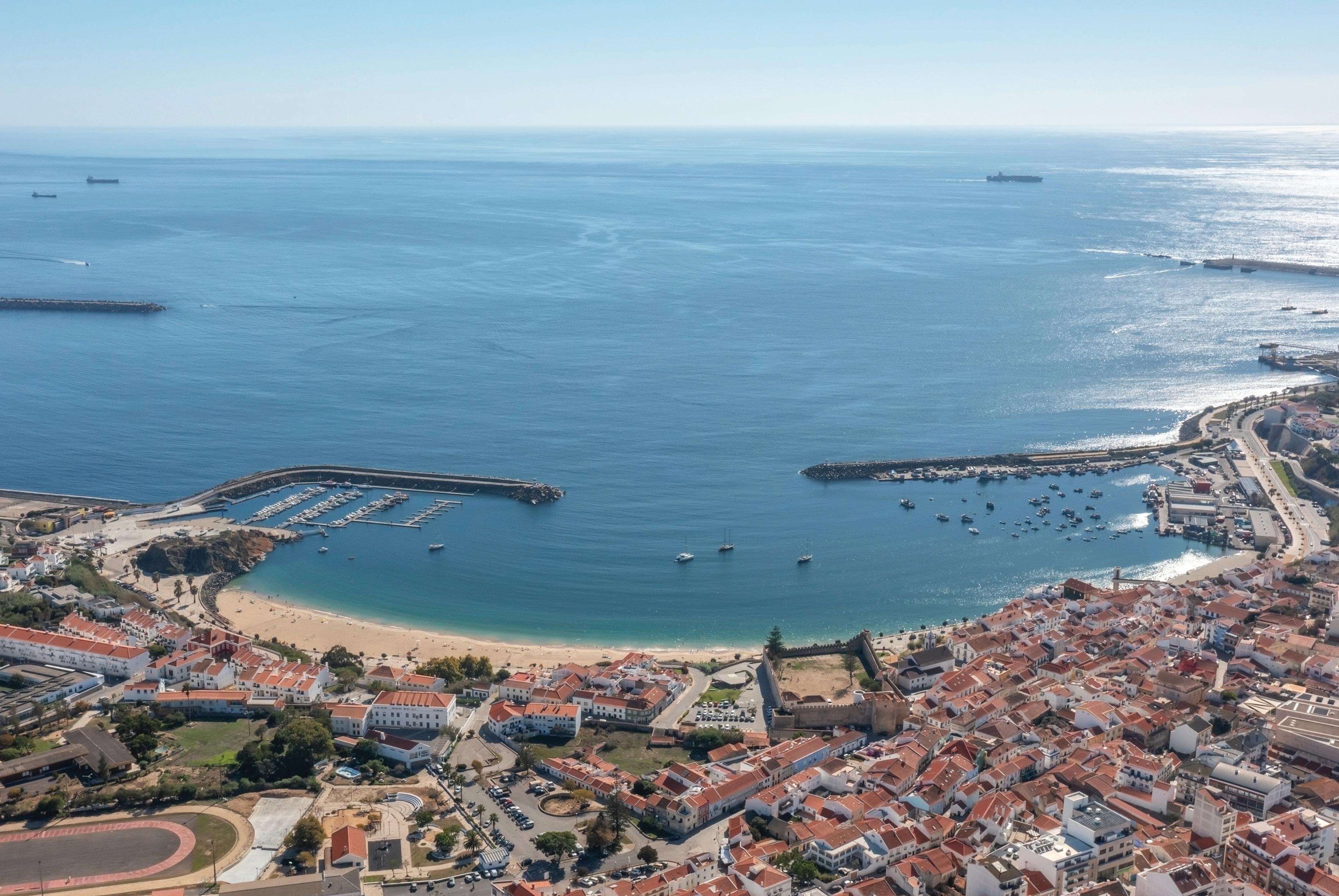
How Portugal’s Atlantic edge is becoming a low-latency, sovereign and sustainable gateway for global AI infrastructure.
The shift from internet to intelligence is happening now. AI workloads are redrawing the map of global connectivity and pushing infrastructure closer to renewable power, dense subsea gateways and sovereign jurisdictions.
Sines, Portugal, is positioned to become one of the defining hubs of this new map - a European Atlantic edge zone where low-latency routes, green energy and an open ecosystem converge.
The next phase will be written through collaboration. Cable owners, carriers, hyperscalers, IX operators and research networks all have a role in shaping the South Atlantic corridor and in proving that sustainable, sovereign and scalable AI infrastructure is not just desirable - it is achievable today.
From Sines to the South Atlantic, a new chapter of global connectivity is beginning - one where geography, energy and connectivity finally align with the demands of intelligence at scale.
For most of the internet era, Europe’s main digital cross-
roads sat in a familiar arc running from London through Amsterdam, Frankfurt and Paris. Traffic from across the world typically converged there before being redistributed across the continent.
Today that picture is changing. The Iberian Peninsula, and particularly Portugal’s Atlantic coast together with Spain’s major metros, is emerging as a new exchange zone where global subsea systems, regional terrestrial backbones and large-scale compute intersect.
Sines, on Portugal’s Atlantic coast, illustrates this shift. Measured in milliseconds, geography becomes strategy, and Sines delivers consistently low and ultra-low latency into Europe’s main “eyeball” markets. It does not just deliver good latency: it routinely outperforms other locations where large amounts of power are available. When you compare end-to-end performance into the main European consumption hubs, Sines comes out ahead, turning Portugal’s Atlantic edge into a genuine latency advantage for cloud and AI operators.
From a wider South Atlantic perspective, Sines also offers highly competitive paths into Latin America, North America and West Africa. Direct connectivity into north-eastern Brazil creates a low-latency bridge to the main South American hubs, while new systems toward the
US East Coast and diverse routes toward West Africa turn Sines into a natural aggregation point for AI and cloud traffic moving between these three continents.
In this context, Iberia is no longer a peripheral region at the edge of Europe. It is becoming the place where multiple continental systems meet - a natural location to exchange traffic, place data and, increasingly, host the compute that powers AI.
At the same time that traffic patterns are evolving, Europe is rethinking where to place power-hungry compute. Access to large volumes of renewable energy, suitable land and efficient cooling is now as important as proximity to historic carrier hotels.
Portugal’s west coast brings together a combination that is hard to replicate elsewhere:
• Atlantic-facing geography with direct reach to the Americas and the Global South
• A growing cluster of subsea cable landings that shorten paths between continents
• Access to renewable energy and large parcels of suitable land
• EU stability, regulatory clarity and data protection frameworks
Several strategic systems already anchor this route. EllaLink directly connects Sines to Fortaleza in Brazil. SACS links the South American and African coasts. Google’s NUVEM cable is adding a new path toward the US East Coast, landing in Portugal and extending the corridor further north.
From Sines to Fortaleza, round-trip latency is low enough to enable real-time applications between Latin America and Europe, creating a fast bridge that acts as the backbone of a new intercontinental mesh. When these subsea advantages are combined with renewable-rich power systems and purpose-built hyperscale campuses, Europe’s digital center of gravity naturally starts to shift southward toward Iberia.
Global networks used to be built mainly to connect people to content. In the earliest days of dial-up bulletin board systems, you literally had to know which number to call and where the content lived. With the rise of the web and the first search and index platforms like AltaVista and, later, early Google, networks shifted to helping people discover and reach information more easily.
Today a new phase is underway and networks are being redesigned to connect compute to compute at planetary scale. AI training and inference are driving this shift. Large
language models, recommendation engines and real-time analytics all depend on tightly coupled clusters of GPUs that must exchange huge data sets in milliseconds. In this world, latency and bandwidth are not nice-to-have metrics - they are fundamental inputs to the economics of AI.
There is also a geographical reality that is easy to overlook. AI does not really “live in the cloud”. It happens where three things intersect in the physical world: abundant power, dense connectivity and massive volumes of data. Locations that can combine these elements at scale, such as Sines, become the strategic edge zones of the AI era.
This reality is reshaping how subsea-linked data centers are planned and built. It is no longer enough to place a modest facility somewhere near a landing station and backhaul traffic inland. AI workloads demand large, scalable and highly connected campuses that can sit close to cable landings while still offering long-term power, cooling and expansion headroom.
Within this context, Start Campus’ SINES 1.2GW Data Campus is being developed not simply as a hyperscale data centre site, but as a carrier-neutral platform for AI infrastructure. The goal is to move from a single campus to a telecoms and AI ecosystem with connectivity woven into its design.
The model is intentionally open:
• Neutral meet-me rooms - where carriers, subsea systems and tenants can interconnect without bias, and where carriers are not only allowed but actively encouraged to connect and expand their networks
• Dark-fibre ring - designed as a carrier-hotel style fabric around the campus
• Scale from day one - more than 12,000 fibres engineered to connect any two buildings across the site as the campus grows, with plenty of room in the duct and fibre design for further expansion as new facilities come online
This fabric already attracts a mix of ecosystem partners - from prominent submarine cable systems to world-renowned internet exchanges, together with all the major Portuguese carriers and dark-fibre providers and hyperscale cloud tenants - who bring subsea, terrestrial and peering capabilities together on the same neutral platform.
From an AI perspective, the network design targets intra and inter data centre connectivity for GPU clusters. East-west traffic is expected to dominate, so the campus is engineered for very high-capacity optical paths with ultra-low latency between halls, buildings and external landing points. Training, fine-tuning and inference can then be distributed across the campus and extended to partner regions with minimal performance penalty.
The coastal location is not just about proximity to cables. It also enables the use of highly efficient, sustainable cooling architectures, including seawater-assisted solutions that reduce the energy overhead associated with high-density racks. Combined with the potential for 100 percent renewable power over time, this creates an AI-ready ecosystem where subsea, compute and sustainability reinforce each other.
Historically, cable landing stations (CLS) were built as specialised, tightly controlled facilities whose primary job was to bring systems ashore and hand traffic off to longhaul backbones. Compute, peering and cloud services were typically located hundreds of kilometres away.
That model is now evolving. Around Sines, the longer-term vision is not limited to a single campus or landing station. What is taking shape is an integrated South Atlantic digital ecosystem linking subsea infrastructure, neutral interconnects and regional internet exchanges into a multi-continent mesh.
At the physical layer, this means combining:
• The Sines landing station and subsea cable systems
• Local and regional IX platforms such as DE-CIX and GigaPIX
• Start Campus as the neutral interconnection point where carriers, cloud platforms and enterprises meet
At the ecosystem level, it creates collaboration opportunities for:
• Communication service providers that need resilient, diverse routes into and out of Europe
• Hyperscalers that require large-scale, green sites for AI clusters close to subsea gateways
• Research and education networks that operate transatlantic science and data projects
As more systems land and more tenants deploy, the result is a mesh that connects Europe, Africa and the Americas through a series of intelligent, sustainable nodes. Traffic can follow the optimal path for each application - whether that is the lowest latency route for real-time AI inference or a high-capacity path for bulk data movement.
Bringing subsea landings, IXPs and large-scale compute together in one place is not just technically attractive and architecturally elegant. It is economically and environmentally compelling.
From an economic perspective, clustering infrastructure reduces the need for long, duplicated backhaul routes and repeated regeneration of signals. Operators can intercon-
nect locally, shorten critical paths and share common facilities such as power, cooling, security and operations. This lowers both capex and opex over the life of a system. For AI players, every avoided optical hop and every millisecond saved translates into more efficient use of GPU time and better performance for training and inference.
At the same time, concentrating exchange points, landing stations and compute inside a neutral, carrier-rich campus creates a flywheel effect. Each new cable, cloud region or large tenant increases the overall value of the hub, attracting further investment and making it more compelling for additional subsea systems to land there.
From a sustainability perspective, co-location allows operators to take full advantage of local renewable resources and advanced cooling designs. Europe is entering a phase where environmental constraints and regulatory expectations weigh as heavily as pure performance. In this context, the South Atlantic corridor through Sines offers more than just low latency: it offers a sovereign and sustainable platform for AI connectivity.
Localised and compliant infrastructure in Portugal allows European and international operators to keep sensitive data within trusted jurisdictions while still reaching global markets efficiently. Over time, the SINES Project is designed to operate on 100 percent renewable power, leveraging Portugal’s strong potential for wind and solar generation together with efficient seawater-assisted cooling solutions.
By shortening paths between continents and aggregating traffic through an Atlantic hub rather than forcing detours via more congested northern routes, operators can reduce both latency and energy per bit delivered. Economics, sovereignty and sustainability all point in the same direction - toward clustered digital ecosystems at key Atlantic gateways such as Sines. STF
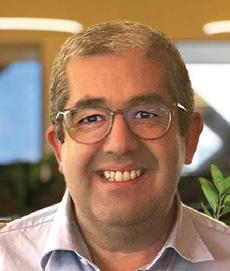

FERNANDO AZEVEDO is Head of Connectivity at Start Campus. He previously worked at Amazon Web Services in Dublin as Network Development Manager for the AWS global backbone and earlier held roles with Angola Cables and other connectivity companies.
JAYNE STOWELL is the Managing Director of Jayne Stowell Advisory Limited, which provides non-executive director and consulting services to the digital and subsea cable industries. Jayne previously spent fifteen years as the Senior Strategic Negotiator in Google’s Global Subsea Network Acquisition Group, where her focus was development, deployment and management of new subsea cable systems. Jayne was also founder of SubOptic Foundation, where she continues to serve as a trustee and director, and was a long-term board member of International Cable Protection Committee (ICPC), a global submarine cable education and industry consultative association.

Independent submarine cable consultancy providing endto-end support for telecom, power, and hybrid systems worldwide.
• 20+ years dedicated to subsea cable systems
• 130+ projects for 70+ clients across every ocean
• Vendor-neutral advice from feasibility through operations
• ISO 9001, 14001, 27001 & 45001 certified
Let’s build what’s next, together.
• Trusted by commercial, government, and offshore energy clients www.wfnstrategies.com IDEPENDENT.

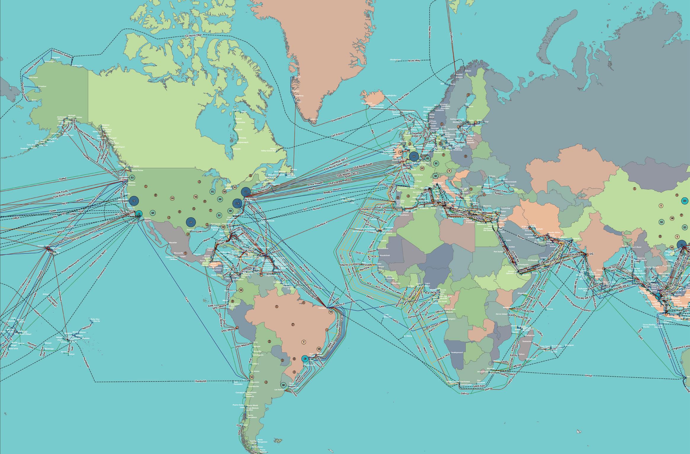
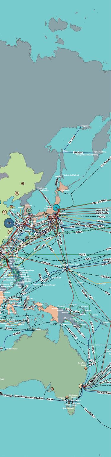

• Trusted by thousands across the subsea ecosystem
• Year-round visibility with operators, cloud & finance
• Align your brand with global connectivity leadership
• Highlights 2025/2026 trends including Pacific growth
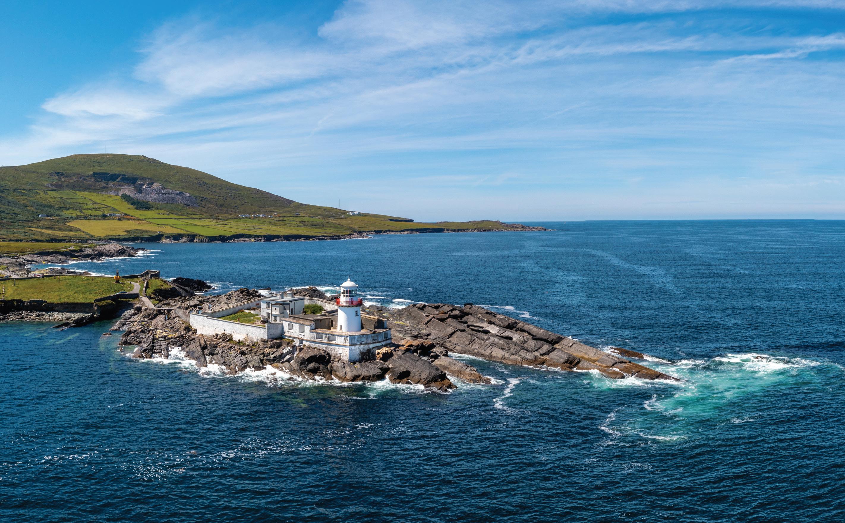
BY DEREK CASSIDY
The Valentia Island Cable Station was opened in 1868 under the auspices of the Anglo-American Telegraph Company, which took over the interests of the Atlantic Telegraph Company in 1865 after the cable installation failed about 600 miles from Newfoundland. The Anglo-American Telegraph Company also took over the interests of the New York, Newfoundland, and London Telegraph Company, thereby giving them exclusive rights for all telegraph traffic from Valentia to New York, once a new cable was laid. The successful completion of the 1866 trans-Atlantic telegraph submarine cable and the subsequent recovery of the 1865 cable was the precursor to many years of telegraphy, innovation and research that helped push Valentia Island Cable Station to the forefront of telegraph technology, Many telegraphists went onto to open and develop new telegraph stations across the globe including Porthcurno1. There were eleven cables that left Valentia for far flung places such as Heart’s Content, Newfoundland; Sennen Cove, Cornwall; Le Harve, France and Emden, Germany.
1865 Valentia - Heart’s Content, Newfoundland
1866 Valentia - Heart’s Content, Newfoundland
1870 Valentia - Cahersiveen
1873 Valentia - Heart’s Content, Newfoundland
1874 Valentia - Heart’s Content, Newfoundland
1880 Valentia - Heart’s Content, Newfoundland
1882 Valentia - Emden, Germany
1894
Valentia - Heart’s Content, Newfoundland
1918 Valentia - Sennen Cove, Cornwall
1920 Valentia - Le Havre/Sennen Cove, Cornwall
1923 Valentia - Sennen Cove, Cornwall
The Valentia Island Cable Station was the focal point for all telegraph traffic from Kerry until the Direct United States Telegraph Cable [DUST] was laid by the Siemens Brothers for the newly established Direct United States Cable Company in 1873/74. This cable was landed in Ballinskelligs and was the only cable connection from Ballinskelligs to the Americas however it did not actually connect directly to the US but landed in Tor Bay, Nova Scotia first. In 1877 the Anglo-American Telegraph Company took over the DUST cable and a telegraph line was built between the two stations. In 1920 the GPO bought the DUST cable and leased it to Western Union, it was re-diverted to Mousehole, in Cornwall in 1923. The Ballinskelligs Cable Station was in operation from 1874 to its closure in 1923 when the cable station was given to the state and used as an Irish School until the 1940s when it was demolished.
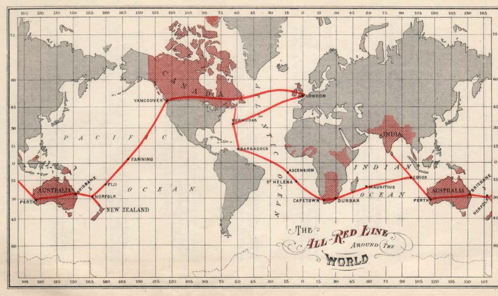
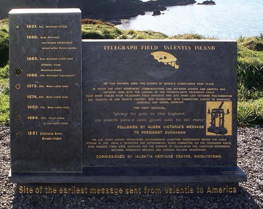
The Valentia Island Cable Station was central to the telegraph connectivity between Europe and the Americas and was also the empirical to submarine cable research that was initially carried out by James Graves from the original Cable Hut at the Slate Yard in Knightstown from 1865 to the establishment of the now cable station from 1868 onwards. As we established that there were eleven cables that left Valentia Island Cable Station. These cables, especially the 1865 and 1866 and onwards to the 1882 Emden telegraph submarine cables all connected to Valentia Island Cable Station via the cable hut at Foilhummerun Bay and an underground armoured telegraph cable. The cables from 1894 onwards were all directly connected to the cable station.
Valentia also became an important part of the All-Red Line which was a telegraph system that was wholly owned by British interests and helping to keep all of the British telegraph traffic in the hands of the British, without being compromised by other telegraph companies that had loyalties to the United States, Russia or France.
In 1884 the Waterville Cable Station opened under the ownership of the Commercial Cable Company, and it started direct competition with the Anglo-American Telegraph Company in Valentia. From Waterville fourteen cables went to Nova Scotia, Canada; Le Harve, France; and Westen Super Mare, England and the Azores. The cable station operated under the same owner, the Commercial Cable Company from 1884 up to 1962 when the cable station closed.
1884
1884
1884
1894
1894
1894
Waterville - Dover Bay, Nova Scotia
Waterville - Weston super Mare, England
Waterville - Le Havre, France
Waterville - Le Havre France
Waterville - Dover Bay, Nova Scotia
Waterville - Weston super Mare, England
1900 Waterville - Western super Mare, England
1901 Waterville - Azores
1901 Waterville - Weston super Mare, England
1905 Waterville - Dover Bay, Nova Scotia
1905 Waterville - Weston super Mare, England
1910
1923
1923
Waterville - Weston super Mare, England
Waterville - Azores
Waterville - Le Harve, France
As the era of telegraphy ended in 1966, Valentia Cable Station was the last to close and soon the era of telegraphic communications from Kerry ceased.
In 2000 the three cable stations at Ballinskelligs, Valentia Island and Waterville all received the IEEE Milestone of making Kerry the launch pad for trans-Atlantic telegraphy and especially for Valentia in being instrumental in the delivery of the 1866 trans-Atlantic Telegraph Submarine Cable.
But that’s not the full of story of Valentia Island Cable Station. During its long 98 years in existence, it was the centre of submarine cable research. James Graves, the first superintendent2, was also deeply involved in research and on numerous occasions he could identify seismic movements in the
earth’s crust due to changes in the magnetic field of the various submarine cables on the seafloor3. Graves also researched the electromagnetism of the cable4, but his great endeavours was on fault location and repair techniques5. As the cable station evolved into the leading telegraphic cable station in the Northern Hemisphere it continued to control the sole right of access and ownership of all telegraphic traffic from Newfoundland to New York. With the exception to the Commercial Cable Company operating out of Waterville, it had no competition. Even though Graves eventually becoming the longest serving superintendent of Valentia, retiring in 1909, a long forty-four years in the post6
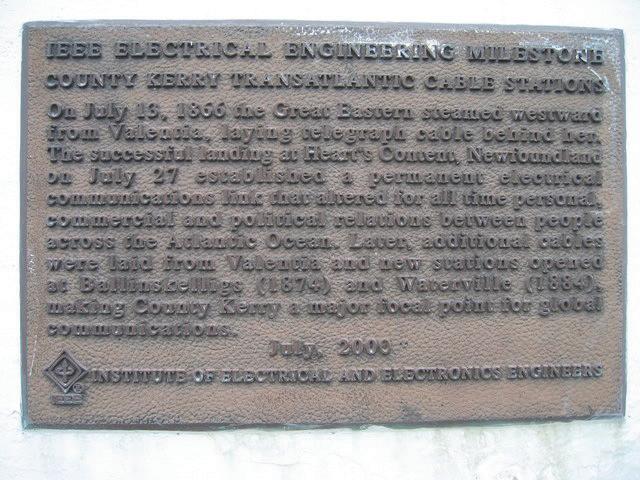
anniversary of the rising, Tom might have been operated on successfully, but the rising was not successful, but its legacy did lead to Irish independence five years later.
The cable station continued its telegraphic communication links until the closure of the station in 1966.
The last telegraph cable to leave Valentia was the 1923 Valentia to Sennon Cove, Cornwall. All the cables, except for the 1865, 1866 and the 1882 Emden telegraph submarine cables were still operational until the stations closure.
In 1916 a feat was carried out, which would be normal today, but unseen in the era of telegraphy at the time. In April of that year two brothers, Tim and Eugene Ring from Valentia Island Cable Station and Rosalie Rice of Kenmare sent the historic message and it was also the first all-cable broadcast of a code word that would indicate that the 1916 rising in Dublin had started7. The code was “Tom operated on today successfully-Margaret O’Sullivan”. This full broadcast required that all telegraphists on all cables transmit the same message simultaneously, a feat never tried before. Sound simple but you need the full control of all the telegraphic team employed in the station to carry this out. A slate monument was erected in 2016 to celebrate the 100th
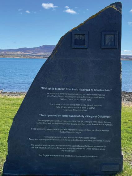
The station was bought by the Heinz Pollmeier and took ownership on the 29th of December 1974 and built a plastics and polymer industry from the cable station building, and another site in Waterford, which is still in existence. PPI Adhesive Products ltd is the name of the company which celebrated its 50th anniversary in 20218
In 2011 under the auspices of the Late Anthony O’Connell and Michael Lyne along with the assistance Valentia Island Industries, a project was initiated to investigate the possibility of Valentia Island Cable Station gaining world heritage status. This started a long process where there needed to be a requirement to meet the initial investigation stage of the proposition and producing this evidence into written format to be presented to the Department of Heritage in accordance with the rules associated with acceptance onto the tentative list for world heritage status. In 2016 a festival was held on Valentia
Island to celebrate the 150th anniversary of the 1866 trans-Atlantic telegraph submarine cable, which is generally accepted as the first successful trans-Atlantic cable. The festival celebrated the start of the 1866 expedition on the 13th of July and culminated on the 27th of July with a live telegraphic communication link between Heart’s Content, Valentia Island and Swansea University which replicated the transmission link from Heart’s Content to London via Valentia Island. Every year since 2016 a live telegraphic communication link between Heart’s Content Cable Station and Valentia Island Cable Station takes place using old telegraphic keys and sounders etc. It is celebrated on the same date every year, the 27th of July, as this celebrates the successful connection of the old and new worlds and first successful trans-Atlantic cable, completing many years of trail, failure, success, failure and finally success that Cyrus Field had dreamt of sine 1856.

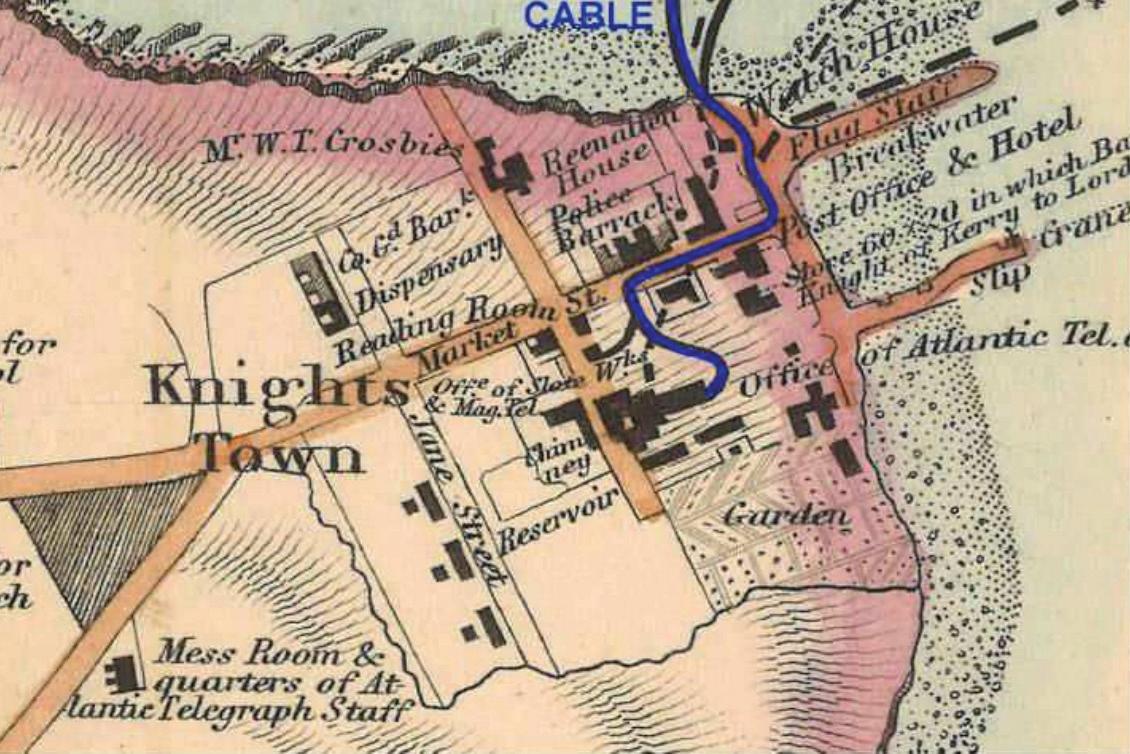
In 2016 a new foundation was established, the Valentia Trans-Atlantic Cable Foundation9, with its sole purpose of developing the two special areas of historic importance associated with the original 1866 telegraph submarine cable, the original telegraph hut within the slate yard, the Valentia Island Cable Station. A possible review and inclusion of the cable field at Foilhummerun Bay. Still needs to be investigated. They also had responsibility of raising monies and applying them to specific projects that would help with the advancement of the world heritage bid, scientific research and arming the community to establish and build communications on the island but most importantly in establishing a community focus that would help drive the world heritage bid. Promotion of Valentia Island as a technological hot bed of innovation was also to be included in the aims and goals of the Valentia trans-Atlantic Cable Foundation. To further this goal, every year a set of lectures is held in the cable station, around the middle of July, that attracts many academics, industrialists and leading figures in the fields of communication and historic research and industry along with politicians and gov-
ernment bodies. These lectures have gained so much support that this year they needed three days to carry out business and to conclude the lectures and presentations etc. Also, a new submarine cable conference10, that was instigated and held last year and will have a second outing in April 2026. This submarine cable symposium is being supported by the Internation Cable Protection Committee [ICPC] Valentia Trans-Atlantic Cable Foundation, Kerry County Council, Irish Communication Research Group [ICRG] and many other bodies. This symposium helps to bring leading figures in the world of submarine cable technology together in one
historic place so that by doing so they can also research and promote the world heritage bid.
These two areas of historic importance as listed as the original message building, and the cable station, are detailed below for geographical reference. The reference to the cable field is to identify its importance.
The original message telegraphic hut was established in 1857 in the slate yard, [a site in Knightstown used to store slate from the slate quarry before export], this hut was used for the first message that was sent in 1858 between Valentia Island and Bull Arm, Trinity Bay, Newfoundland. It stayed in operation connecting the island to the mainland between 1858 and 1866 when the successful trans-Atlantic telegraph cable was connected. It was the main telegraphic transmission point from Europe to the Americas until the new Valentia Island Cable Station was opened in1868 when cables were laid from Foilhummerun Bay directly to the new cable station.
The cable field is the original cable building that connected the telegraph cables that connected Heart’s Content and Emden Germany to Valentia. However, not all Heart’s Content telegraph submarine cables were landed at Foilhummerun, the later ones were directly connected to the Valentia Island Cable Station. This cable hut had two cross island telegraph cables that were laid underground, one being a seven-core cable while the other was an eight-core cable that connected the telegraph hut directly with Valentia cable station.
The third site is the Valentia Island Cable Station which is the being discussed in this paper.
In 2018 Ranka Pollmeier handed the Valentia Island Cable Station back to the Valentia Island community, under

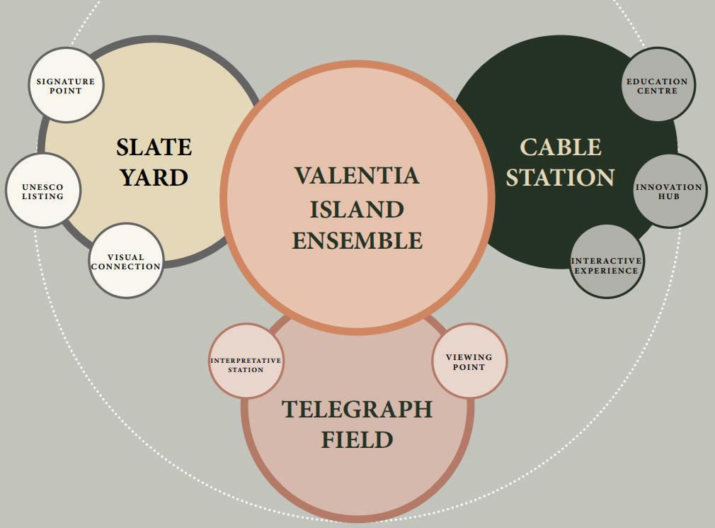
the supervision of Kerry County Council11. This was the first very important act to have taken place as it allowed the community, the Valentia Foundation and Kerry County Council to start developing plans to research the three sites, now called the Valentia Cable Ensemble.
Soon progress was being made to start the first process of creating a museum of historical artifacts that are originated from the world of telegraphy and communications in general with specific interest being given to the trans-Atlantic cables. This process saw the collections and artifacts being authenticated, collated and recorded by the ICRG. Designs were brought to fruition that would see the first phase of the museum being brought together with funding assistance from Kerry Co. Co and local Government and Failte Eireann-Irish Tourist Board.
With funding in places, designs were produced and soon a museum was established in the biggest room within the cable station. This was called the Billiard Room as it was the
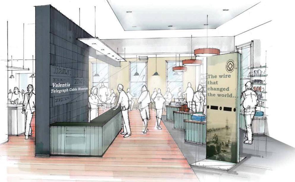
original rest and recreation room for the telegraph employees of the Anglo-American Telegraphic Company.
With the cable museum now installed and all artifacts and collections authenticated and on presentation, the next step was to look at how to create the next stage that would see the first message building being restored.
This part of the project, which is still ongoing is concentrating on developing the vacant site in from of the slate yard and creating a visual experience that will enable visitors to see the “first message building” directly from the harbour or across the strand at Reenard Point.

These works entailed purchasing the vacant plot and then starting to develop it into a garden and walkway that will provide a place for people to meet and relax. This would lead to the entrance to the “first message building” in the slate yard and have a visual corridor that can be seen from across the strand. Making the entrance space an outdoor exhibition and community space is a must as it helps to develop a community awareness and ownership. These works are ongoing and are set to be complete as soon as 2026. Then the development of the original telegraphic hut or “first message building” will begin where it will be rebuilt and transformed into a visitor and interactive centre celebrating the 1858, 1865 and 1866 trans-Atlantic telegraph submarine cables.
The next stage of the project will entail creating a new visitor, interpretive and interactive centre where the history of Valentia Island Cable Station and its role in the history of telecommunication is explored and presented along with an invite into the world of communication technology. An innovation hub and centre of excellence within the Valentia Cable Station will also be established. The project design idea seen below gives a good pictorial representation.
Even though work has begun on the “first message building” there is still progress being made in the background with regards to the cable station. Historic architects have been employed to investigate and draw up plans for the new reinvigorated cable station that will include the new interactive museum, visitor centre, shop/café and community interactive space and innovation/community hub.
But the cable station will not just be a museum,
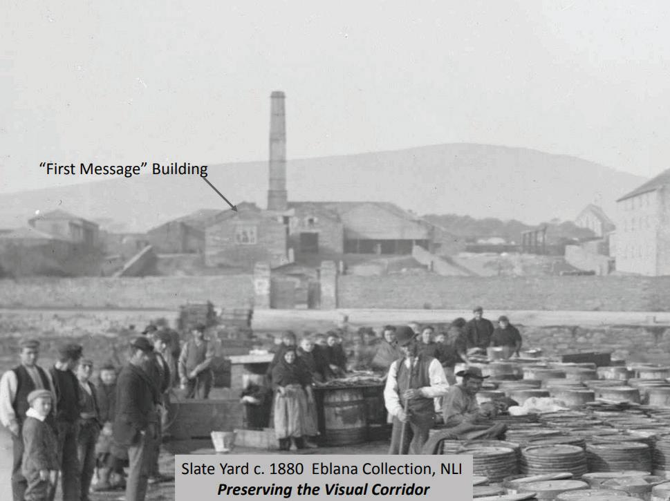
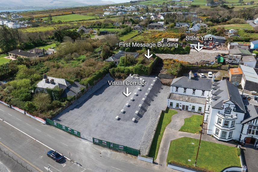
it will also be a place where the community can gather, a broadband hub allowing for people to do business within the safety of a neutral office space catering for high-speed broadband connection, security and interaction. The development of an innovation hub has also been investigated where entrepreneurs being local, national and international, can use the cable station innovation hub as the birthplace and development of their ideas.
Being a community space, it will also need to cater for meetings, conferences and symposiums etc that would use the cable station as the technological back drop for their project, whatever it is. The details of the first floor are also being investigated as it needs to be part of the historic story yet also help with the self-sustainability of the building. The cable station needs to be a self-funded on-going concern that is also being provided for the community to use. Therefore, as must attention to detail in solving this and creating a self-sustainable solution is under investigation that is required to bring the cable station into the 21st century.
But the primary purpose of the project to help invigorate the Valentia Island cable station is three fold, and its to design and install a new interpretative and interactive museum; a community space which would cater for meetings, conferences and symposiums etc; and finally a technological innovation hub where entrepreneurs, designers and developers can interact, expand ideas and develop solutions for our technological age.
The overall experience of the cable station can be captured in the idea below. Its all about bring the community together into a space where they can celebrate the history of the telegraphic era, develop new ideas and invite national and international conferences so that the cable station becomes part of the whole experience.
Buts that’s not the end of the story, as the focus of the Valentia Cable Ensemble the final part is a possible investigation of the cable field. This is the location, at Foilhummerun Bay, where the trans-Atlantic cables came ashore and the telegraphic messages were initially received and then transmitted to the cable station. This site, now derelict, needs to be rebuilt and turned into a smaller scale interpretative centre where people can tale in the beauty of the environment, but that’s another story but one that needs to be told as its central to the historic telegraph landscape.
With the view from the telegraph field and see above, visitors can take in the enormous complexity of the project to finally deliver the 1866 trans-Atlantic cable and all that was involved. The people, engineers, ships and technology that were critical to the project. It would be great to see this part of the ensemble come to fruition. The site and its historical
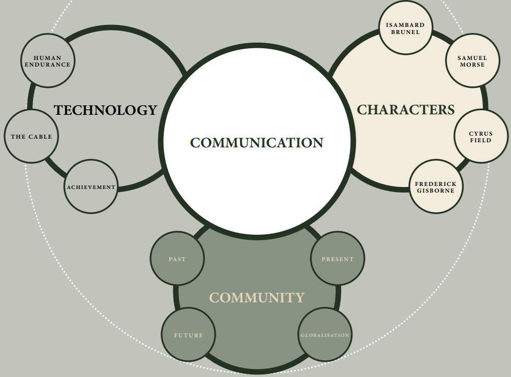
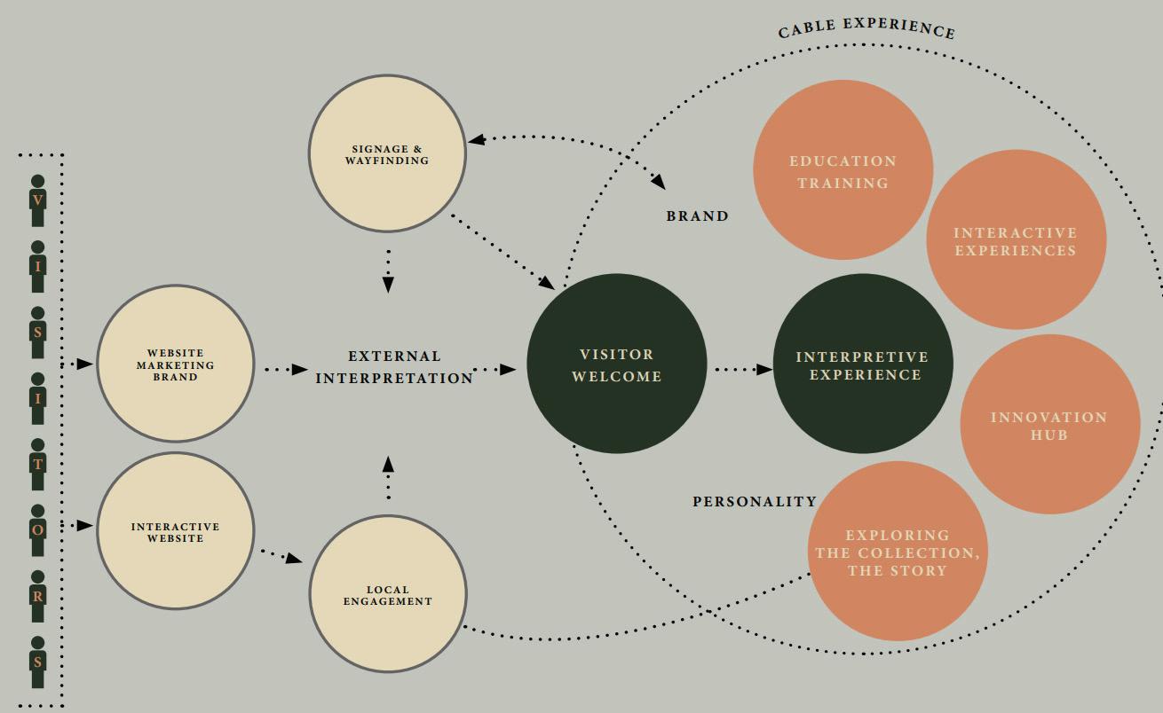
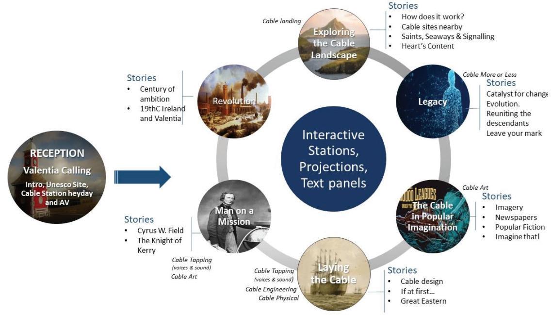
connection could be told via a short video presentation that would lead to the cable station experience.
The two sites that encompass the Valentia Cable Ensemble are part of the world heritage bid, but by developing these two sites into the next generation visitor, interpretative and community spaces will bring them well into the 21st century and help develop a focal point of innovation activity and make Valentia Island into “the Digital Island”. Valentia Island and the Beara Peninsula that it s located in undergoing a tourism transformation as the old rail line from Killorglin to Reenard Point is being transformed into a greenway where people can use the old rail line as an extension of the exercise routine, as a way to enjoy the beautiful vistas that Dingle Bay offers and to explore the old rail line and its numerous tunnels, bridges and the famous viaduct. This will lead to Reenard Point where Knightstown is in full view and the visual corridor that leads the viewer’s attention towards the “first message building” and the start of a new cable station, historical and technological experience. STF
15: Foilhummerun Bay with the Skellig’s in the background
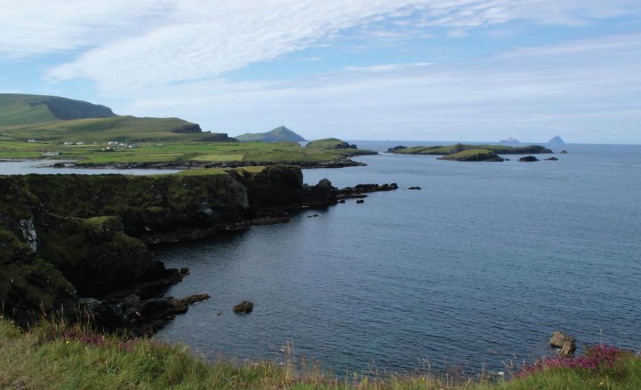
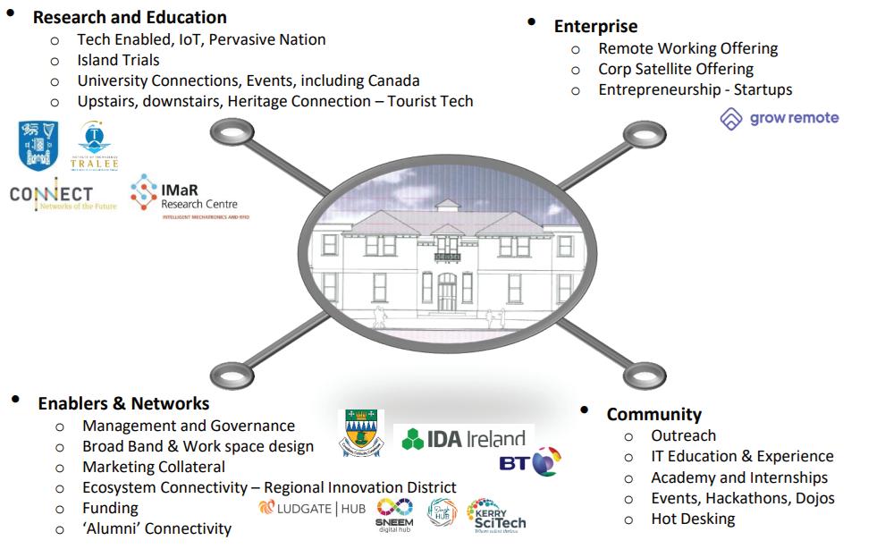
DEREK CASSIDY is doing a part-time PhD in the field of Optical Engineering which covers Photopolymers, Self-Written Waveguides, and Wavelength manipulation/Opto-Electronics with UCD under Prof. John Healy and Prof. John Sheridan. He is a Chartered Engineer with the IET/UK Engineering Council-Engineers Ireland and Past-Chair and Committee Member of IET Ireland. He is Chair of the Irish Communications Research Group, Advisory Board Member of Submarine Networks EMEA/World and member of numerous standards committees on Optical Engineering under the umbrella of the IEEE and Future Networks. He is also currently researching the Communication History of Ireland. He is a member of SPIE, OPTICA, IET, IEEE, Engineers Ireland, ACMA, ICPC and ESCA. He holds patents in Mechanical and Design Engineering and author of over 30+ papers on Photonics, Submarine Cable Technology, Communications and Optical Engineering. He has been working in the telecommunications industry for over 30 years managing submarine networks and technical lead on optical projects, both nationally and internationally with BT. He is technical Lead for Valentia Transatlantic Cable Foundation and the Valentia Island World Heritage Bid. Derek holds the following Degrees: BSc (Physics/Optical Engineering), BSc (Engineering Design), BEng (Structural/Mechanical Engineering), MEng (Technology & Policy Development and Forensic Engineering), MSc (Optical Engineering) and Higher Diploma in Cybersecurity.
References
1 History of the Atlantic Cable and Submarine Telegraphy-James Graves. https:// atlantic-cable.com/Article/1865CableFailure/graves.htm. Accessed 19 August 2025.
2 Edited by Derek Cassidy from original list produced by Bill Glover www.atlantic-cable.com
3 The All-Red Line. https://blog.bham.ac.uk/globalcommuications/the-all-red-line/, Accessed 18 August 2025.
4 Edited by Derek Cassidy from original list produced by Bill Glover www.atlantic-cable.com
5 Fox, D., “James Graves [1833-1911], his descendants, the electric telegraph and
Valentia”, Don Fox Family and Social History, 2018.
6 Graves, J., Earth currents and earthquakes, Journal of the Society of Telegraph Engineers, vol. 2, no. 6, pp. 432-, doi: 10.1049/jste-1.1873.0064, 1873.
7 Graves, J., Resistance of wires, Journal of the Society of Telegraph Engineers, vol. 1, no. 3, pp. 418-419, doi: 10.1049/jste-1.1873.0013, 1873.
8 Graves, J., The causes of failure of deep-sea cables ,Journal of the Society of TelegraphEngineers and Electricians, vol. 13, no. 51, pp. 119-126, doi: 10.1049/jste-3.1884.0020, 1884.
9 DeCogan, D., DeCogan, D., “Thirty six years in the telegraphic service 1852-1888, being a brief autobiography of James Graves MSTE”, Dandedec-wordpress, 2008.
10 O’Mahony, J. “Message still heard 100 years on” KillarneyToday.com, 17 April 2016. https://killarneytoday.com/message-still-heard-100-years-on/. Accessed 3rd August 2025.
11 “50 Years in Business”. PPI Adhesive Products, 29th April 2021. https://www. ppiadhesiveproducts.com/news/50-years-business. Accessed 10-August 2025.
12 https://www.valentiacablke.com. Accessed 1st August 2025.
13 https://valentiacable.com. Accessed 12th August 2025.
14 Valencia Cable Station handed over to Kerry Council. https://amp.rte.ie/amp/979063/. Accessed 9th August 2025.

An authoritative guide exploring the comprehensive aspects of optical communication over submarine cables.
Covering design, technology, installation, and maintenance of Repeatered and Unrepeatered cables

now available
José Chesnoy and Jean-Christophe Antona Editors
Contributors being recognized experts in the field: Meta, Orange Marine, NTT, NEC, Subcom, ASN, Sumitomo, Axiom Cilandak Consulting, Kamalov LLC, Ocean Specialists, Telecom Paris A&G Fouchard, MIMOPT Technologies, Nokia Bell -Labs.
- The absolute reference book for optical submarine Networks
- Awesome : This book is a definitive source on undersea cable (from reviews in Amazon)
All chapters being updated:
❖ Revisions include all recent developments
With new content in this Edition:
❖ Open Cables: design, acceptance, and capacity Upgrades
❖ SDM: evolution of equipment and network
❖ Fiber Sensing: new environment and security innovations
❖ New technologies: fiber, transponders,…

Available to purchase link: Elsevier With 50% discount on the bundle (paper + e-book) or ScienceDirect or Amazon

Supported by:

BY JOSÉ AMARO
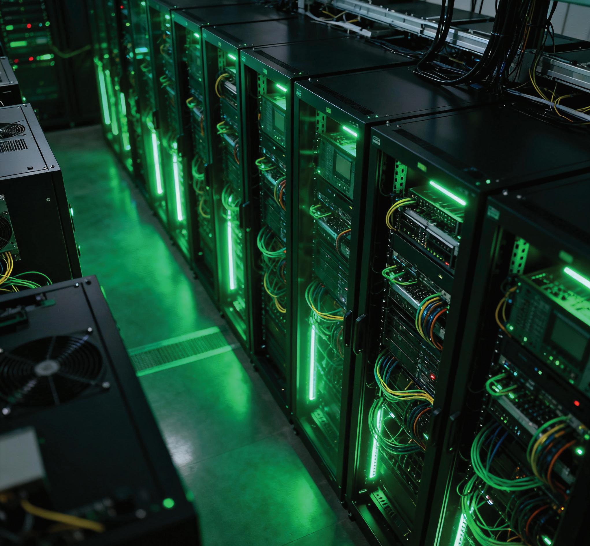
We live in an era in which sovereignty is no longer merely territorial but, above all, a matter of data. The borders of the 21st century are no longer drawn on maps — they stretch beneath the oceans, run through submarine cables, accumulate in servers, and are expressed in lines of code. Information has become the new strategic territory — invisible, yet decisive — and those who control it hold the power to shape economies, influence politics, and define individual freedoms.
In this context, Europe finds itself at a turning point. Either it moves decisively toward the creation of sovereign digital
critical infrastructures capable of guaranteeing the continent’s technological and legal autonomy, or it resigns itself to the role of a digital colony, dependent on systems, platforms, and regulations that neither reflect its values nor serve its interests.
Data Centers are the physical heart of this new sovereignty. They store and process the data that power artificial intelligence, 5G networks, e-commerce, public administration, healthcare, and defense. They are the invisible temples of the digital world, where the knowledge economy materializes. Yet, paradoxically, the European continent — cradle of the most advanced principles of data protection and fundamen-
tal rights — does not exercise effective control over most of the infrastructure that sustains its own digital society.
The original ideal of a “borderless cloud” has turned into a silent trap — a structural dependence on providers that answer to other jurisdictions and to other logics of power. The U.S. Cloud Act, for instance, allows American authorities to access data held by U.S. companies, regardless of where those data are stored¹. Thus, a European hospital database hosted on an American cloud service may be lawfully requested by a foreign authority. The problem, therefore, is not merely technical — it is legal and political.
Technological dependence repeats, in digital form, the mechanisms of subordination seen in earlier eras. The continent that invented the rule of law now risks seeing its data, information, and essential infrastructures governed by foreign norms. The General Data Protection Regulation (GDPR) — a symbol of Europe’s leadership in digital ethics — can only fulfill its purpose if supported by a European material infrastructure. Without European servers, European clouds, and European jurisdiction, the GDPR becomes a constitution without territory.
The rapid evolution of emerging technologies — artificial intelligence, quantum computing, edge computing, blockchain, 5G and 6G — has multiplied the need for processing and storage capacity. Every line of code, every trained AI algorithm, requires colossal volumes of energy and data; every surveillance system or mobility application depends on servers running non-stop. The digital economy is as material as the industrial revolution once was — only now, steel has been replaced by silicon, and factories by data infrastructures. One need only recall the struggle over rare earth elements in Ukraine and the economic tug-of-war between the United States and China to grasp what is at stake.
The explosive growth of Data Centers has brought with it challenges of energy sustainability, market concentration, and geopolitical vulnerability. Countries like Ireland and the Netherlands are already facing pressure on their electrical grids due to the density of these facilities. At the same time, global control of cloud computing remains concentrated in three U.S. giants — Amazon, Microsoft, and Google — alongside emerging Chinese players such as Huawei and Alibaba. In this scenario, Europe appears more as a user than as a protagonist.
Digital sovereignty is not won through rhetoric but through public policy, clear regulations, and coordinated
investment. In this sense, the European Union has built a remarkable legislative framework aimed at balancing innovation, security, and democratic values.
The NIS2 Directive (Network and Information Security Directive), in force since 2023, is the backbone of this policy. It extends the scope of network and information system security to include sectors such as energy, transport, health, public administration, and digital infrastructure. Data Centers and cloud providers are now recognized as critical operators, required to implement strict risk management, prevention, and incident-reporting measures².
Complementing this, the CER Directive (Critical Entities Resilience) introduces operational resilience as a pillar of European security, requiring each Member State to identify its critical entities and to develop prevention and cross-border response plans³.
Other regulations complete this framework: the Digital Operational Resilience Act (DORA), which protects the financial sector against technological failures and subjects critical ICT providers to direct European supervision; the Cyber Resilience Act (CRA), which enforces “security by design” for hardware and software products; and the AI Act, the world’s first legislation regulating artificial intelligence, ensuring transparency, explainability, and human oversight⁴. Together, these instruments form the backbone of Europe’s technological trust. Yet laws without infrastructures remain abstractions. Digital sovereignty requires — and demands — a physical body: European Data Centers, frameworks and software built and managed by Europeans, European submarine cables, and European energy.
Digital sovereignty has a map — and that map is, above all, physical. More than 95% of global data traffic flows through submarine cables that snake across the oceans, many of them controlled by private companies headquartered outside Europe. These cables form the invisible arteries of the global economy, carrying the vital information that sustains markets, governments, and entire societies. Their disruption — whether by accident, sabotage, or conflict — can paralyze communications, compromise essential public services, and threaten the economic and political stability of the continent.
Faced with this reality, the European Union must treat these infrastructures with the same strategic importance it attributes to energy or defense — investing in their protection, diversification, and continuous monitoring, while also creating a European coordination and interoperability structure dedicated to their security and resilience. Only an
integrated approach — technical, political, and operational — can ensure that Europe’s digital pulse does not depend on infrastructures it does not control.
Energy is the other silent pillar. The digital transition and the energy transition are inseparable. Without clean, stable, and affordable energy, no digital sovereignty is possible. Green Data Centers — integrating wind and solar power, efficient cooling systems, and thermal reuse — are emerging as the model for a new generation of sustainable infrastructures. Energy autonomy, in this context, is also a form of informational autonomy.
Digital sovereignty is not only a technical or economic goal; it is an ethical and cultural project. Europe does not compete for global technological supremacy in terms of scale but in terms of values. Its model rests on the conviction that fundamental rights are inalienable — even in the digital realm.
While other powers favor mass surveillance or unrestricted data exploitation, the European Union embraces regulation as an expression of political identity. The GDPR, the AI Act, and the CRA embody a single principle: technology must serve humanity, not the other way around.
Data protection, far from being a bureaucratic obstacle, is an act of civilizational resistance. In a world where information is continuously extracted, analyzed, and monetized, Europe proposes a path that places the citizen at the center, subordinating innovation to responsibility and transparency.
To affirm that “European data must be processed in Europe, under European rules, with technology that reflects European values” is to affirm that democracy is incompatible with algorithmic opacity and legal subordination to external powers.
European sovereignty is not built only in Brussels. It begins in the territories — in national policies, in concrete investments that give shape to digital autonomy. The technological cohesion of the Union depends on the capacity of each country to ensure the local processing and protection of its citizens’ data.
Projects such as Gaia-X5, which seeks to create a federated European cloud infrastructure, point in this direction, attempting to unify what is currently fragmented. France, Germany, Finland, and Portugal6 have been investing in strategic Data Centers, the installation and maintenance of proprietary submarine cables, and cybersecurity hubs. Yet these isolated efforts lack a continental strategy, capable of uniting national autonomy with European integration.
The “digital Europe” must be conceived as an intercon-
nected mosaic, not a patchwork of dispersed initiatives. The solidity of European sovereignty will depend on the balance between its digital and energy geographies. This requires strategic coordination, genuine interoperability, and integrated planning in the location and construction of new critical infrastructures — not according to local or national logics, but within a shared European vision capable of aligning territory, technology, and security within a common architecture.
The 21st century will be remembered as the century in which data became power. Europe — which once defined the ethical and legal standards of modernity — cannot relinquish its role in this new paradigm. Digital sovereignty does not mean isolation, but the capacity to decide, autonomously and responsibly, how to shape its own informational space.
If it fails, the Union risks being governed by infrastructures it does not control, by code and algorithms it cannot audit, and by laws it does not write. If it succeeds, it will prove that innovation can coexist with ethics, progress with responsibility, and technology with values.
The choice is urgent. European data must be processed in Europe, under European rules, with technology that reflects European values. This is not merely a technical issue — it is a question of sovereignty, of democracy, and ultimately, of civilization.
The time for indecision has ended. Europe must act, because technology — like history — does not wait. STF

JOSÉ AMARO is a leading expert in cybersecurity and maritime security, with extensive experience advising international initiatives across Europe, Africa, and the Indo-Pacific. A trained jurist and certified privacy law consultant, he also serves as a lead auditor in compliance and regulatory frameworks.
With a background in law from the University of Lisbon and postgraduate qualifications in EU data protection and capital markets regulation, he brings a rare blend of legal insight and strategic field experience. He has led complex, cross-border projects in cybersecurity, maritime operations, and governance.
Currently, he acts as a senior international consultant and legal advisor on EU-funded maritime security and interoperability programs, applying his multidisciplinary expertise to some of today’s most urgent global security challenges.
Notes
U.S. CLOUD Act, 2018, Public Law 115-141, Division V.
Directive (EU) 2022/2555 of the European Parliament and of the Council of 14 December 2022 (NIS2 Directive).
Directive (EU) 2022/2557 of the European Parliament and of the Council of 14 December 2022 (CER Directive).
Regulation (EU) 2024/… (AI Act); Regulation (EU) 2023/1114 (DORA); Regulation (EU) 2024/… (Cyber Resilience Act).
https://gaia-x.eu/
https://www.gleeds.com/en/projects/sines-dc-building-02-sin02/; https://atlasedge.com/ lisbon-becoming-strategic-data-center-hub/ ; https://www.startcampus.pt/



BY OLIVIER CÔTÉ
Hyperscalers and data center operators globally are faced with exponential growth in data traffic and increased demand for high-speed, high reliability connectivity being driven by AI applications. Globally, the volume of digital data being generated and transmitted is staggering—generally estimated in the order of hundreds of millions of terabytes every day.
Exponential growth in scale of data transmitted puts pressure on data centers, especially at cable landing stations where subsea networks connect with terrestrial systems.
Reliable data center interconnect (DCI) is critical to enable fast and reliable transmission of data pouring in from those submarine cables. And with higher speeds and feeds on traditional fiber optic cables that interconnect with neighboring data centers come loss and latency challenges that can compromise the stability of network performance. Enter hollow-core fiber (HCF), a new technology that is gaining traction as a viable alternative to traditional fiber optic cable. The ultimate benefit of HCF is acceleration in the propagation of light via an air or gas core versus
through traditional fiber optic cable’s glass core, providing unprecedented reduction in latency.
In this article I’ll discuss: the technology behind hollow-core fiber and benefits to deployment; what considerations should come into play before hyperscalers, enterprises, network operators, and equipment vendors adopt HCF in subsea-related DCI; and the importance of lab and field testing to evaluate HCF’s real-world performance.
The underlying technology for hollow-core fiber is nested antiresonant nodeless fiber (NANF), and latest advancements in NANF have overcome the attenuation challenges of traditional photonic bandgap.
about 0.16 dB/ km in the ultra-low loss SMF variants. Hollow-core fiber is now being trialed in both field and lab settings, achieving record-low attenuation levels below 0.1 dB/km—marking a critical step toward real-world adoption.
Some researchers anticipate that HCF could reach attenuation levels as low as 0.05 dB/ km, making it a strong choice for long-distance communications.
Some researchers anticipate that HCF could reach attenuation levels as low as 0.05 dB/km, making it a strong choice for longdistance communications.
NANF maintains the key latency advantage of photonic bandgap fibers, since light travels through a medium with a refractive index close to 1.00 which is significantly lower than the 1.5 index of conventional ultra-low loss SMF-28 single-mode fiber.
In addition, NANF achieves a lower attenuation coefficient than SMF-28, which typically exhibits attenuation
Additional benefits of hollow-core fiber include minimal nonlinear effects, which allows the use of higher power transceivers, along with inherently low chromatic and polarization mode dispersion (CD/PMD) that help extend the transmission range. What this means overall is that network engineers can now consider a new approach to data center interconnect where DCI and subsea networks converge.
In DCI environments where massive volumes of data move between data centers—most certainly the case in subsea network terrestrial landing centers— HCF provides
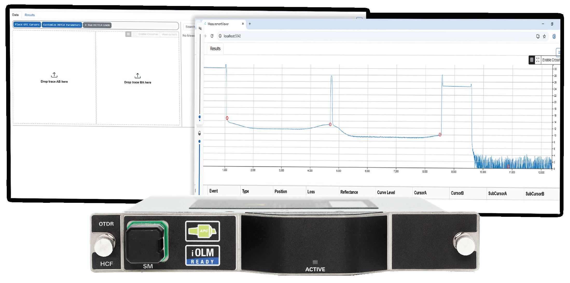
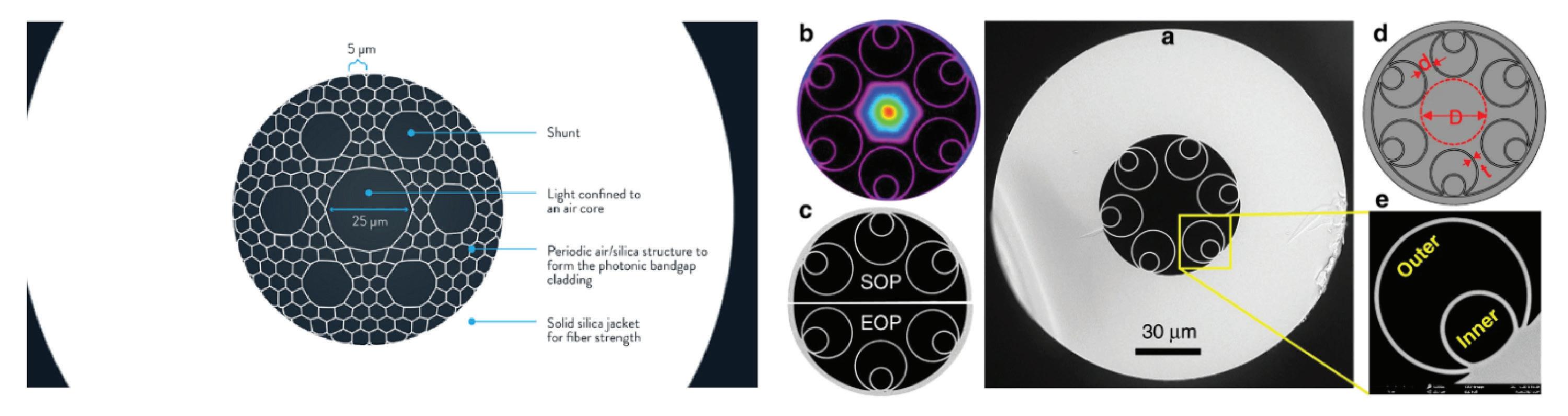
a competitive edge by lowering propagation delay and reducing the need for power-hungry amplification over extended distances.
Hyperscalers have been among the first to adopt hollow-core fiber to enhance interconnections between their data centers. This technology allows them to do two key things:
• reduce latency between sites over 80 km apart which is crucial for real-time data sync and AI/ML model training, thus enabling distant sites to operate as one and overcome energy limits on data center builds. That means there is reduced latency on the short but essential hops between a cable landing station and nearby data centers, as well as on lengthy DCI links.
• increase strategic flexibility by selecting infrastructure locations based on economic criteria such as energy or real estate costs, while maintaining optimal performance between sites, given reduced need for amplification/repeaters.
Let’s look at how HCF provides needed speed and stability in demanding environments, including DCI.
• Increased speed: Light travels at about 200,000 km/s through glass. In hollow-core fiber, where light travels in a vacuum, speeds approach 300,000 km/s. That’s a 40 percent increase—an essential advantage in environments where every microsecond counts.
• Reduced signal attenuation: Recent advances drop signal losses to as low as 0.05 dB/km, outperforming traditional single-mode fiber and allowing for longer-distance transmissions.
• Tolerance to nonlinear effects: With its wider, non-solid core, hollow-core fiber is less sensitive to optical distortions, resulting in higher signal quality. This means operators can launch higher power or add more WDM channels without transmission impairment, which can be
beneficial when deploying landing station to data center connections.
• Broader usable bandwidth with lower dispersion: With lower dispersion (CD/PMD noted above) cable landing station data centers can link to large AI clusters without compromising quality.
While all the benefits described are impressive, HCF technology comes with some inherent challenges that should be considered by subsea operators before adoption. These include:
• Mechanical sensitivity
HCF cabling remains more delicate than with conventional fiber.
• Compatibility with existing networks
Hybrid deployments (traditional + hollow-core) will need to coexist, requiring precise measurements and reliable diagnostics.
• Standardization and certification
The current lack of established standards complicates large-scale integration. As with data center certification, rigor is essential to ensure consistent performance.
What we have seen to date is that progress in HCF is rapid, and each development cycle introduces advancements that make hollow-core fiber increasingly viable and less experimental.
As with all aspects of telecommunications network deployment, end-to-end testing from the lab to deployment, to ongoing operation and troubleshooting, is always the key to success.
Traditional approaches sometimes fall short when
applied to the disruptive technology behind HCF. This revolutionary cable requires new methods for measuring loss, return loss, and overall transmission quality.
For field deployment, the most important test device for HCF is a hollow-core capable OTDR (optical time domain reflectometer) to provide accurate fault location and loss measurements. EXFO recently introduced the industry’s first hollow-core fiber OTDR with uni- and bi-directional test capability and dynamic range ideal for HCF characterization.
In addition, EXFO has developed dedicated uni- and bi-directional analysis external PC software to extract key fiber parameters such as loss, optical return loss (ORL), and length. The adapted analysis also enables splice loss and reflectivity measurements that make this a unique and essential device for hollow-core fiber testing.
At the lab and R&D level, spectral loss measurements can ensure precise analysis of effects such as CO₂ absorption over long distances of more than 100km. In EXFO’s case, that ultra-high resolution spectral loss measurement down to 0.02 pm across the 1240 nm to 1680 nm range, is delivered by the CTP10 test system—which is typically used for photonic integrated circuit component testing.
Hollow-core fiber is not just an innovative technology but in fact heralds an evolution that could redefine how networks meet vastly escalating demands in a digital world.
Adoption of HCF in subsea connected data centers can reduce per-km latency and achieve microsecond time savings on long-haul plus interconnect ‘hop’ routes.
The combination of lower latency, favorable loss and reduced nonlinearities, makes hollow-core fiber an appealing choice to deliver critical services.
Hollow-core fiber is not just an innovative technology but in fact heralds an evolution that could redefine how networks meet vastly escalating demands in a digital world.
Hyperscalers and data center operators should also consider the following test solutions to ensure top network performance when deploying HCF:
• CD/PMD analyzer to ensure reliable characterization of dispersion parameters that directly impact high-speed performance.
• Optical Loss Test Set (OLTS) to streamline validation of fiber length, insertion loss and return loss.
• Fiber inspection scope to safeguard network integrity with fast, automated end-face analysis.
• 1G-800G testing which, along with an EtherBERT test application, enables precise latency measurements essential to valide the ultra-low delay performance of HCF, supporting next-generation high-speed, time-sensitive networks.
Clearly deployment, testing, and monitoring teams will need to become familiar with HCF technology and anticipate how it will be integrated into their future best practices.
Worldwide finance and nano-trading can be enhanced by the deployment of HCF. In financial markets, speed equals profit. Being able to execute buy or sell orders microseconds ahead of competitors can represent millions. Hollow-core fiber becomes a strategic asset by reducing latency between trading venues and giving high-frequency traders a decisive competitive edge—delivered around the corner or around the world via subsea networks and interconnected data centers. AI workloads—driven by machine learning algorithms, neural networks, and large language models (LLM)— require the rapid processing of massive datasets. Hollow-core fiber was developed to meet these heavy demands, offering superior network quality, improved latency, and secure data transmission. By transporting more data with lower latency, HCF enables AI models to process information faster and perform more accurately in mission-critical environments.
Going forward, as hollow-core fiber capabilities increase and cost decreases, it will likely be increasingly feasible for hyperscalers and data center operators to adopt HCF for cable landing station data center interconnect and reap the benefits of faster, more reliable connectivity with lower latency. STF

OLIVIER CÔTÉ has contributed to fiber optic innovation projects at EXFO for seven years. His most recent focus is on hollow-core fiber testing, at the forefront of telecom network transformation. He holds a Master’s degree in physics and is dedicated to advancing technology in the telecom sector.
BY DOUG RECKER

Submarine cables carry nearly all intercontinental data traffic, forming the foundation of today’s global internet. Analysts estimate that more than 99 percent of the world’s international data moves through these subsea systems, with more than $13 billion in new investment planned for 2025 through 2027 (1) (2). Major content providers including Amazon, Google, Meta, and Microsoft now manage nearly half of this total capacity, driving unprecedented global bandwidth growth (1). Yet even with this progress, many networks face a distribution challenge: the vast throughput delivered at cable landing stations often stalls before they reach local markets and end users (3).
The result is a last-mile problem for global connectivity. While undersea infrastructure continues to expand, terrestrial systems frequently remain centralized, concentrating traffic at a limited number of major exchange points. Bridging that gap requires distributed infrastructure capable of transforming global capacity into localized computing power. Edge data centers have emerged as a key piece of that continuum, extending the reach of subsea investment into local economies (4). Duos Edge AI’s modular edge architecture represents one example of how distributed computing can strengthen this connection between seafloor and service delivery (11).
Cable landing stations (CLS) have evolved from simple termination points into hybrid campuses that integrate colocation, interconnection, and edge computing (3). These modern facilities form the junction between subsea cables and terrestrial networks, yet their success increasingly depends on what happens beyond the landing site. To distribute capacity efficiently, CLS operators require a network of nearby edge nodes that bring compute and storage closer to users (3) (4).
Data from Uptime Institute shows that average rack power densities continue to rise across the industry, prompting new edge designs to prioritize efficient power distribution and modular scalability (6). Typical Performance Optimized Datacenter (POD)-scale systems, such as those around 300 kilowatts of total capacity, emphasize balanced loads across multiple cabinets while maintaining redundancy and secure interconnection standards, which are now considered baseline requirements rather than competitive differentiators.
Geographic diversity also matters. Traditional landing points such as Miami or Los Angeles remain critical, but new routes are emerging in secondary markets to improve
resiliency and regional access (1) (3). Jacksonville, Florida, for example, hosts two submarine cable systems, PCCS and AMX-1, which provide direct fiber access to Central and South America. These systems reduce congestion in major hubs and demonstrate how distributed landing infrastructure can optimize network performance (1).
Edge facilities function as local distribution layers, effectively serving as “mini landing stations” that extend the subsea network’s reach (4). By processing data closer to the point of use, they significantly reduce latency. According to European Telecommunications Standards Institute (ETSI) and Global System for Mobile Communications Association (GSMA), edge deployments can lower response times from more than 100 miles of transport distance to less than 12 miles, which is critical for emerging applications in AI, telemedicine, and industrial automation (5) (8).
Localized compute also improves bandwidth economics by minimizing long-haul backhaul costs and balancing workloads across regional nodes (9). A distributed design strengthens overall network resilience, reducing single points of failure and improving disaster recovery (6) (9). These deployments are modular and scalable, supporting phased capacity additions while maintaining compliance with recognized standards such as SOC 2 Type II (6).
Sustainability has become another major driver in Duos Edge AI’s modular data center strategy. The Company’s patented Entryway for a Modular Data Center (Patent No.: US12,404,690B1) introduces cleanroom-level environmental protection that minimizes dust, dirt, and moisture intrusion—critical for maintaining reliability and uptime in rural or harsh environments. Unlike traditional facilities, Duos Edge AI modular data centers operate entirely on-grid and require no water for cooling, reducing environmental impact while improving operational efficiency. This design not only lowers energy consumption per workload by shortening data transport distances but also supports a greener, more resilient digital infrastructure for local communities (12).
The value of distributed infrastructure is increasingly demonstrated through diverse deployments. In Amarillo, Texas, Region 16 Education Service Center hosts a modular edge environment that connects more than 60 school districts. Designed by Duos Edge AI, the system has since expanded to support hospitals, municipal agencies, and a local university—showing how a single regional build can evolve into a broader community resource (11). Similar frameworks in Region 12 (Waco) and Region 3 (Victoria) illustrate how shared infrastructure models can advance digital equity and local access (13).
Healthcare networks and telemedicine platforms depend on low-latency edge resources to support real-time diagnostics, maintain data residency, and secure electronic health records (5) (8) (10). Municipal governments and enterprises use edge computing for public safety coordination, smart traffic systems, logistics, and financial services compliance (4) (9) (10). On a larger scale, hyperscale and neocloud providers are deploying distributed inference nodes to process AI workloads nearer to data sources, reducing backhaul to centralized facilities (9).
The same firms that fund new subsea routes are increasingly investing in terrestrial and edge systems to ensure that global capacity translates into usable performance at the local level, with Google serving as a prime example as the company has both invested in subsea infrastructure and built edge nodes and points-ofpresence across the country.
Together, these trends define a connected continuum that links subsea cables, landing stations, terrestrial fiber, and edge computing (3) (4). Industry discussions leading up to PTC’26 are expected to focus on how these layers integrate, emphasizing the relationship between CLS modernization, edge deployments, and AI workload distribution (3) (9).
Hyperscaler investment strategies reinforce this convergence. The same firms that fund new subsea routes are increasingly investing in terrestrial and edge systems to ensure that global capacity translates into usable performance at the local level, with Google serving as a prime example as the company has both invested in subsea infrastructure and built edge nodes and points-of-presence across the country (1) (9) (14). Policy and market factors, ranging from data sovereignty mandates to sustainability goals, are pushing operators toward more distributed net-
work architectures (9) (10). In this model, edge providers are strategic partners to subsea operators, extending the value of global connectivity.
Technological progress and policy development will shape the next stage of this evolution. Advances in liquid cooling, high-density computing, and AI-driven optimization are enabling smaller, more efficient deployments (6) (9). Meanwhile, international bodies such as the International Telecommunication Union (ITU) and Organization for Economic Co-operation and Development (OECD) are emphasizing submarine-cable resilience, data localization, and infrastructure sustainability (7) (10).
Emerging markets are also expanding participation. The IFC notes that undersea infrastructure can play a pivotal role in bringing more people online across developing regions, with distributed terrestrial networks ensuring that new capacity translates into meaningful connectivity (2). As subsea, terrestrial, and edge layers continue to converge, the global infrastructure ecosystem is becoming both broader and more balanced (3) (4).
The submarine cable industry’s success depends not only on new routes beneath the ocean but also on effective last-mile distribution on land (1) (3). Edge infrastructure transforms raw bandwidth into local computing power, closing the gap between global transport and real-world application (4).
As we look toward PTC’26, collaboration across subsea and terrestrial domains will be essential to unlock the full potential of these investments (9). Projects such as the Region 16 deployment demonstrate how modular edge architecture can extend the value of subsea systems into communities, creating a seamless “seafloor-to-user” ecosystem (11) (12). STF
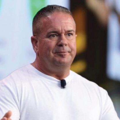
DOUG RECKER is the President and Founder of Duos Edge AI and Corporate Officer and President of Duos Technologies Group, Inc., where he spearheads the rapid deployment of modular edge data centers across the United States, with a core mission to expand high-performance, low-latency computing infrastructure into underserved and emerging markets. With more than 25 years of leadership in the telecommunications and data center industries, Doug brings deep expertise in designing, managing, and executing complex edge infrastructure projects that meet the growing demand for localized digital services.
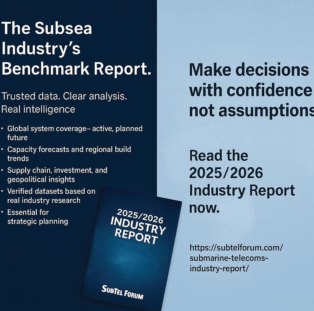
References
(1) TeleGeography – Submarine Cable Map & Bandwidth Report 2025
(2) International Finance Corporation – Undersea Infrastructure Bringing More People Online in Emerging Markets (2025)
(3) SubTel Forum – The Evolution of Cable Landing Stations: From Passive Endpoints to Integrated Hubs (2024)
(4) Uptime Institute & 451 Research – Data Centers at the Edge: Use Cases and Business Drivers (2024)
(5) ETSI – MEC Industry Standards and Use Cases for Ultra-Low-Latency Applications (2024)
(6) Uptime Institute – 2024 Global Data Center Survey (Power Density & Cooling Trends)
(7) ITU – Submarine Cable Resilience and Global Connectivity Advisory Report (2024)
(8) GSMA – Edge for AI and 5G Latency Performance Report (2024)
(9) S&P Global / 451 Research – Edge Infrastructure Spending and AI Workload Placement (2025)
(10) OECD – Digital public infrastructure for digital governments (2024)
(11) Duos Technologies Group / Duos Edge AI – Region 16 ESC Edge Deployment Overview & Education Case Study (Amarillo, TX) (2024)
(12) Duos Technologies Group – U.S. Patent No. US 12,404,690 B1 – ENTRYWAY FOR A MODULAR DATA CENTER (2025)(13) Duos Technologies Group / Duos Edge AI – Internal Project Summary: Region 12 and Region 3 ESC Deployments (2024)
(14) Submarine Cable Networks – Complete List of Google’s Subsea Cable Investments (2019)
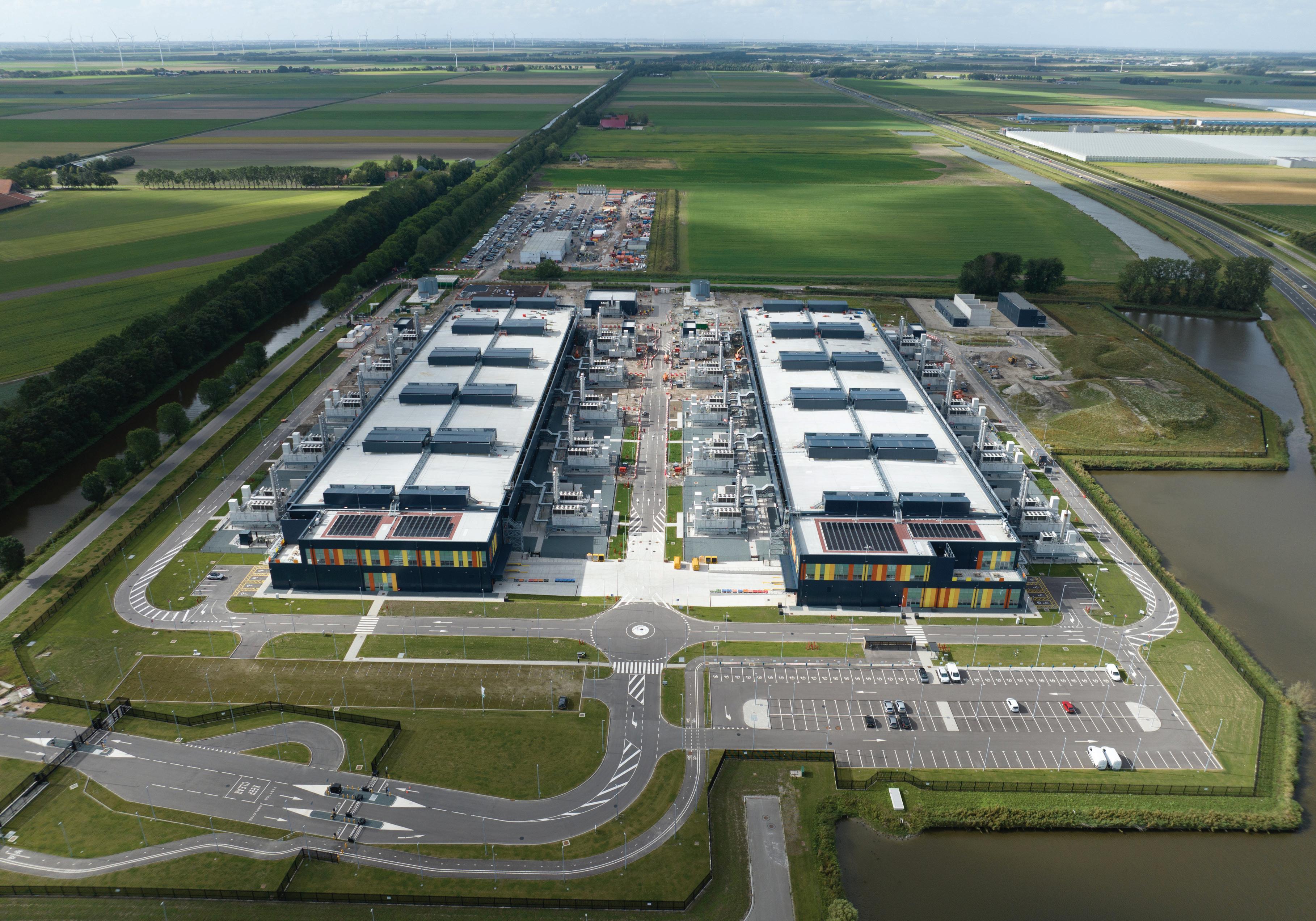
BY RICHARD DOBBIE
In my role working for a global data centre infrastructure provider with operations spanning major submarine cable hubs, I’ve witnessed firsthand a fundamental shift in how the industry conceptualises connectivity infrastructure. The traditional model, where submarine cables land at coastal facilities and data traverses lengthy terrestrial backhaul networks to reach inland data centres, is rapidly giving way to a more integrated architecture. Today’s digital infrastructure demands that we think holistically about the subsea-to-server pathway.
The numbers underlying this transformation are staggering. According to TeleGeography, a record 161,100 kilometres of submarine cables are planned to become ready for service in 2025, surpassing the previous high of 121,000 kilometres in 2001. This represents over $13 billion in new submarine cable investment between 2025 and 2027 alone. Simultaneously, global data centre capital expenditure
reached $430 billion in 2024, with projections estimating growth to $598 billion in 2025, or a 25.8% increase that could surpass $1.1 trillion by 2029.
These parallel investment trajectories are not coincidental. They reflect a fundamental interdependence: submarine cables require proximate, high-capacity data centres to process and distribute the traffic they carry, while AI-driven data centres increasingly require direct access to international submarine connectivity to support distributed training workloads, disaster recovery requirements, and low-latency global services.
From a financial perspective, the convergence of submarine cable and data centre infrastructure creates several compelling value propositions that are reshaping capital allocation decisions across both sectors.
Integrated CLS-data centre campuses eliminate redundant infrastructure investments. Traditional models require separate land acquisition, power infrastructure, cooling systems, and security frameworks for CLS facilities and data centres. By consolidating these elements, operators can achieve significant capital expenditure efficiencies. During construction phases, data centres typically employ nearly 1,700 construction workers according to research by global investment firm Nuveen, creating immediate economic stimulus. However, the operational employment model for integrated facilities can be optimised, with total staff typically numbering only a few dozen while serving both submarine cable operations and data centre tenants.
Carrier-neutral CLS facilities integrated within data centre campuses create multiple revenue streams. Cable operators can monetise their capacity directly to data centre tenants through cross-connects, eliminating intermediary costs. Data centre operators benefit from premium pricing for “lit” cabinets with direct submarine connectivity access, a critical differentiator for hyperscale cloud providers, content delivery networks, and enterprises requiring international reach with minimal latency.
This commercial model is particularly valuable in emerging submarine cable hubs. As regions like the Middle East, Southeast Asia, and Africa attract new cable investment, the data centre operators that position themselves at strategic landing points gain first-mover advantages in capturing hyperscale demand.
Geographic and route diversity represent critical risk management considerations for both submarine cable operators and data centre tenants. The disruption of three submarine communications cables in the Red Sea in February 2024, caused by a cargo ship anchor during Houthi militant attacks, highlighted the vulnerability of concentrated cable routes. Once cut, submarine cable repairs can take anywhere from six weeks to six months, depending on permit acquisition and repair vessel availability.
Integrated infrastructure strategies that position data centre capacity at multiple, diverse cable landing points enable operators to offer enhanced resilience. For data centre operators, this translates to stronger service level agreements and reduced risk of business continuity failures. For submarine cable operators, it provides additional landing point options that can enhance route diversity and
reduce dependency on congested or geopolitically sensitive chokepoints.
The rapid adoption of artificial intelligence applications is creating unprecedented demands on both submarine cable networks and data centre infrastructure. These demands are qualitatively different from traditional internet traffic patterns and require fundamental rethinking of how we architect connectivity infrastructure.
Large language models and other AI applications require vast datasets for training, often pulling information from global sources. Training a single large language model can require processing terabytes of data across distributed computing clusters. When these clusters span multiple continents, as they increasingly do for redundancy and performance, the quality and capacity of submarine connectivity becomes paramount.
This creates demand for what the industry terms “AI-specific data centres” with ultra-high density power requirements often exceeding 100 kW per rack compared to traditional density of 5-10 kW per rack. These facilities require not only massive power infrastructure but also direct access to submarine cables capable of handling the immense data flows associated with distributed AI training workloads.
While training workloads prioritise raw computing power and can tolerate some latency, inference workloads, where trained models generate real-time outputs in response to user queries, demand ultra-low latency. This drives demand for geographically distributed data centres positioned close to end users and connected via high-capacity submarine cables.
The rise of “neocloud” providers, specialised GPU-asa-Service platforms like CoreWeave, Nebius, and Crusoe, exemplifies this trend. These operators can deploy high-density GPU infrastructure within months compared to multi-year builds for traditional hyperscale data centres. However, their business models depend on fast, reliable global connectivity to serve distributed customer bases. Strategic positioning near submarine cable landing points becomes a competitive differentiator.
Ciena research indicates that between 2024 and 2029, demand for 400G circuits will accelerate sharply as AI
workloads drive wavelength services growth. Network operators providing these services can seize market opportunities by proactively routing new submarine cables to emerging data centres and innovating to address infrastructure challenges through greater route diversity, low-latency connectivity, and compelling managed services.
AI governance frameworks increasingly emphasise data sovereignty, the principle that data should remain subject to the laws and governance structures of the nation where it’s collected. This creates demand for in-country or in-region data centre capacity with controlled access to international submarine connectivity.
In the Asia Pacific region, where data centre capacity is projected to double within the next five years according to Bank of America, countries including Japan, South Korea, Indonesia, Malaysia, Thailand, and the Philippines are implementing policies to encourage local data centre development while maintaining international connectivity options. The UAE’s data centre market, valued at approximately $1.26 billion in 2024 and projected to surpass $3.3 billion by 2030 according to Research and Markets, exemplifies how government digital transformation agendas combined with data sovereignty concerns are driving simultaneous investment in both submarine cables and local data centre infrastructure.
For data centre operators, this regulatory landscape creates opportunities to partner with submarine cable operators in developing integrated infrastructure that addresses both connectivity and compliance requirements.
The scale of investment flowing into submarine cable and data centre infrastructure raises important questions about environmental sustainability and resource allocation. From a financial perspective, sustainability is no longer merely a corporate social responsibility consideration, it’s increasingly a determinant of long-term
project viability and profitability.
Data centres’ energy requirements are substantial and growing. AI workloads in particular generate high heat loads that require sophisticated cooling infrastructure. The industry is rapidly transitioning to liquid cooling systems, including rear-door heat exchangers, direct-to-chip cooling, and immersion cooling, to accommodate the thermal challenges of high-density GPU deployments.
At Datalec Precision Installations, our operational efficiency improvements focus on waste reduction through pre-termination facilities and sustainable packaging solutions. These initiatives not only reduce operational costs but also align with client expectations and increasingly stringent regulatory requirements. Our modular, AI-ready infrastructure approach enables rapid deployment of critical infrastructure while maintaining flexibility to integrate emerging cooling technologies as they mature.
The strategic location of submarine cable landing points increasingly considers proximity to renewable energy re-

sources. Countries with abundant solar, wind, or hydroelectric potential, including Morocco, Ethiopia, Laos, Indonesia, and those in the Gulf region, can leverage their energy advantages to attract both submarine cable investment and data centre development. This creates a virtuous cycle where renewable energy infrastructure supports digital infrastructure, which in turn drives economic development that can fund further renewable energy investment.
Limited power availability remains the prime inhibitor of global data centre growth in certain core hub markets. This constraint is driving opportunities in new hotspots including Richmond in North America, Santiago in Latin America, and Mumbai in Asia-Pacific. Operators race to lock in power capacity early, with preleasing extending new construction timelines to 2027 and beyond.
For submarine cable operators, this power dynamic creates strategic considerations around landing point selection. Traditional cable landing locations in congested markets like Northern Virginia, London, and Singapore face power constraints that may limit the co-development of data centre infrastructure. Emerging markets with available power capacity offer opportunities to develop integrated CLS-data centre facilities that can differentiate on energy availability and cost.
Our UAE operations benefit from strategic government initiatives and substantial infrastructure investments that include both power infrastructure development and submarine cable projects. The region’s investment in renewable energy, particularly solar in Abu Dhabi and Dubai, positions it to support sustainable growth of energy-intensive digital infrastructure.
While our community initiatives at DPI remain modest in scale, we recognise the importance of local engagement in ensuring sustainable growth. Leading data centre operators like Meta have demonstrated how community action grants can support local STEAM education and economic development, creating positive feedback loops that strengthen the business environment.
Similarly, successful regional examples like Loudoun County, Virginia, where data centres are expected to generate nearly half of property tax revenues by fiscal year 2026, illustrate how strategic community partnerships can create mutual benefits. For submarine cable projects, which often require permits for beach access, marine surveys, and coastal construction, positive community relationships prove
essential to project execution.
The convergence of submarine cable and data centre infrastructure creates differentiated opportunities across global markets, each with unique characteristics, regulatory environments, and growth trajectories.
The UK represents a mature data centre market with strong submarine cable connectivity. Recent announcements from Microsoft (£22 billion through 2028) and Google (£5 billion over two years) demonstrate sustained confidence in the market’s potential. These investments are expected to support the UK’s ambition to add £40 billion to the economy through AI by 2030.
Beyond traditional hubs like London, emerging cable landing points along the UK coast offer opportunities for integrated infrastructure development. The strategic positioning of facilities near new cable landings can provide geographic diversity from concentrated London infrastructure while accessing abundant renewable power resources in regions like Scotland.
The Middle East presents perhaps the most dynamic opportunity for integrated submarine cable and data centre development. Saudi Arabia’s coastline along the Red Sea and Arabian Gulf provides ideal landing points for cables connecting Europe, Asia, and Africa. The stc Group’s “Saudi Vision Cable,” the first high-capacity submarine cable in the Red Sea region, stretching 1,160 kilometres with 18 Tbps capacity per fibre pair and landing at four stations in Jeddah, Yanbu, Duba, and Haql, exemplifies regional ambition.
The UAE similarly benefits from strategic location and government support for digital infrastructure. With data centre market growth projected to reach $3.3 billion by 2030, the region offers opportunities to develop purpose-built integrated facilities serving as regional hubs for submarine connectivity and cloud services.
Iraq’s recent agreements to land its fifth and sixth submarine cables at Al-Faw, including connections to the SeaMeWe-6 system through the Khaleej North extension, demonstrate how emerging markets are positioning themselves as data traffic hubs. The integration of data centre infrastructure at these landing points will prove critical to realising this ambition.
The Asia Pacific region combines massive scale with extreme diversity. India’s data centre capacity is projected to double from 950 MW in 2024 to approximately 1,800 MW by 2026, driven by government digital initiatives and growing demand from international hyperscalers. The region’s positioning between the Middle East, Southeast Asia, and Europe makes it a natural hub for new cable builds, with operators including Reliance Jio, Bharti Airtel, Google, and Amazon investing in higher-capacity submarine systems.
The Philippines, Indonesia, Malaysia, and Thailand represent emerging opportunities where strategic deployment of integrated CLS-data centre infrastructure could unlock regional competitiveness. However, success requires overcoming infrastructure fragmentation challenges, particularly the gap between coastal cable landing points and inland data centre concentrations.
Singapore maintains its position as a premier regional hub, with DPI’s APAC operations headquartered there to serve the region’s growth. The city-state’s carrier-neutral ecosystem, stable regulatory environment, and strategic location on major submarine cable routes make it an ideal model for integrated infrastructure development.
The United States continues to see substantial submarine cable investment, particularly on the East Coast where facilities in Northern Virginia, New York/New Jersey, and Miami serve as major international gateways. The West Coast, particularly Oregon (Hillsboro) and California, provides critical links to Asia Pacific.
Emerging cable landing points including Myrtle Beach, South Carolina, where DC BLOX is developing a hyperscale cable landing station capable of hosting up to five subsea cables with colocation space for operators, exemplify the trend toward purpose-built integrated facilities. These developments provide geographic diversity from traditional landing points while accessing markets with available power capacity and supportive local governments.
As the submarine cable and data centre industries converge at events like PTC’26 in Honolulu (January 18-21, 2026), several themes will dominate strategic conversations:
Traditional financing models for submarine cables and
data centres have operated largely independently. Cable projects typically involve consortium financing with capacity commitments from multiple carriers, while data centres attract real estate investment trusts (REITs), private equity, and infrastructure funds focused on recurring revenue from colocation leases.
Integrated CLS-data centre projects require hybrid financing structures that accommodate the different risk profiles and revenue characteristics of each component. Development finance for facilities combining both elements is projected to reach significant scale in 2025-2026, creating opportunities for lenders and investors with expertise spanning both sectors.
As the industry moves toward more integrated infrastructure, technical standards ensuring interoperability between submarine cable systems and data centre facilities become increasingly important. This includes power feed equipment specifications, submarine line terminal equipment standards, cooling infrastructure requirements for CLS equipment within data centre environments, and security protocols that address the unique needs of submarine cable operations within multi-tenant facilities.
Industry forums including PTC provide essential venues for stakeholders to collaborate on developing and refining these standards, ensuring that integrated infrastructure can be deployed efficiently and reliably across diverse markets and regulatory environments.
The emergence of specialised GPU cloud providers, the “neocloud” segment experiencing 82% CAGR in revenue growth between 2021-2025, creates new demand patterns for submarine cable connectivity. These operators prioritise speed-to-market and cost efficiency over traditional factors like proximity to major metro areas, creating opportunities for data centre development at submarine cable landing points in secondary markets with available power and competitive operating costs.
For submarine cable operators, partnerships with neocloud providers can create new revenue opportunities and justify investment in routes serving emerging data centre markets. The key is ensuring that landing point selection considers not only traditional factors but also the evolving requirements of AI-focused computing workloads.
Geopolitical tensions and recent submarine cable disrup-
tions have elevated security and resilience considerations in infrastructure planning. Integrated CLS-data centre facilities must address both physical security (protecting submarine cable beach access points and landing infrastructure) and cybersecurity (protecting data in transit and at rest).
This creates opportunities for infrastructure providers that can offer enhanced security frameworks, diverse routing options, and rapid failover capabilities. It also underscores the value of geographic diversity in submarine cable landing points, reducing dependency on any single corridor or chokepoint.
The financial case for integrated submarine cable and data centre infrastructure has never been stronger. The submarine cable market is projected to grow from $30.9 billion in 2025 to $56.9 billion by 2035 at a 6.3% CAGR, while data centre infrastructure investment could reach $7 trillion globally by 2030. However, realising this growth potential requires moving beyond siloed thinking about submarine cables and data centres as separate infrastructure categories.
The
deliver reliable services, and the strategic vision to anticipate how evolving technologies and market dynamics will reshape connectivity requirements.
For those of us who will gather at PTC’26, the opportunity is clear: by fostering collaboration between submarine cable operators, data centre providers, equipment manufacturers, financial institutions, and government stakeholders, we can build an integrated infrastructure foundation that will support sustainable digital growth for decades to come.
The subsea-to-server pathway represents not merely a technical challenge but an opportunity to fundamentally reshape how the world connects, computes, and collaborates. STF
financial case for integrated submarine cable and data centre infrastructure has never been stronger. The submarine cable market is projected to grow from $30.9 billion in 2025 to $56.9 billion by 2035 at a 6.3% CAGR, while data centre infrastructure investment could reach $7 trillion globally by 2030.
At Datalec Precision Installations, we view infrastructure deployment as fundamentally about enabling connectivity, not merely in the technical sense of linking networks, but in the broader sense of connecting businesses to global markets, communities to digital services, and nations to the opportunities of the digital economy. Our integrated approach, combining technical excellence with financial discipline and community engagement, positions us to support clients’ growth objectives while contributing to the broader economic transformation taking place across our key markets.
The submarine cable industry’s next chapter will be written by organisations that understand infrastructure investment as inherently cross-disciplinary, requiring expertise spanning undersea engineering, data centre operations, power infrastructure, real estate development, regulatory navigation, and sustainable design. Success requires not only technical capability but also financial sophistication to structure complex projects, the operational excellence to

RICHARD DOBBIE is a seasoned data centre and AI network specialist with extensive experience in designing and delivering cutting-edge network solutions. His career began at Thomson Reuters, where he worked on low-latency exchange data centres, gaining critical insights into high-performance environments. He then joined CommScope, a globally recognised leader in fibre and networking solutions, where he spent 7.5 years driving success in the data centre space. At CommScope, Richard led key initiatives for business units across EMEA, UK&I, and Global Accounts, solidifying his reputation as a trusted leader and innovator.
References
TeleGeography, Submarine Cable Map 2025. https:// technologymagazine.com/cloud-and-cybersecurity/cienafinds-hyperscalers-are-raising-wave-services-demand
TeleGeography, “Building Tomorrow’s Internet: A 2025 Update on Cable Investment”. https://blog.telegeography. com/building-tomorrows-internet-an-update-on-new-cableinvestment
Brightlio, Data Center Market Statistics, drawing on Network World and synthesis of sector analyst reports. https:// brightlio.com/data-center-stats/
Nuveen, Investment in CleanArc Data Centers. https://www. connectmoney.com/stories/nuveen-invests-in-data-center-developer-cleanarc/
CBS News, “Ship sunk by Houthis likely responsible for damaging 3 Red Sea telecommunications cables”. https://www.cbsnews.com/news/houthis-ship-cutting-red-seatelecommunications-cables/
LinkedIn, “UAE’s Data-Centre Market to Hit $3.3B by 2030 — Powering the Region’s Digital Future”. https://www.linkedin.com/posts/iwanaspexxbuild_datacenters-middleeastaiinfrastructure-activity-7387018176896716800-9d4T
Fierce Network, “Ciena: 400G bandwidth growth will soar by 2029”. https://www.fiercenetwork.com/broadband/ciena-400g-bandwidth-growth-will-soar-2029
Data Center Dynamics/JLL, “Neocloud segment sees five-year revenue CAGR hit 82%”. https://www.datacenterdynamics.com/en/news/neocloud-segment-sees-five-year-revenuecagr-hit-82-jll/
Future Market Insights, Submarine Cable Market Size & Demand 2025-2035. https://www.futuremarketinsights.com/reports/submarine-cables-market
Brightlio, DCD, Global Market Insights as covered in Brightlio’s data aggregation. Primary reference: https://brightlio.com/data-center-stats/
Every Author. Every Article. Instantly Searchable.

A New Era of Discoverability Has Arrived

Total Unique Authors: 770
Total Tags: 276
TOP 5 TAGS BY ARTICLE COUNT:
Network Operations & Management –943 articles
Technology – 820 articles
Risk & Safety Management – 720 articles
Project Management – 670 articles
Regions & Countries – 508 articles
BY KRISTIAN NIELSEN
Since September 2025, a series of geopolitical developments have significantly impacted the global submarine cable industry.
New national security regulations, consortium shake-ups, and even conflict-related incidents are redefining how undersea connectivity is built and protected. Below we provide a region-by-region overview of the latest changes – from Washington’s security-driven rules to Pacific partnership cables and Arctic ambitions – that are reshaping this critical infrastructure.
In the United States, regulators have moved decisively to address both security and deployment bottlenecks in subsea cables. In August 2025, the Federal Communications Commission (FCC) adopted new rules to modernize submarine cable licensing with a sharp focus on national security[1][2]. The FCC now presumptively disqualifies any cable license application if the applicant is owned or controlled by a “foreign adversary” nation (currently China, Hong Kong, Cuba, Iran, North Korea, Russia, and Venezuela)[3]. It likewise bars arrangements that would give such adversaries control over U.S. cable landing equipment[2]. For existing and future cables, operators must file new cybersecurity certifications and annual reports detailing ownership and any use of adversary-linked suppliers[4][5]. These measures aim
to prevent espionage or sabotage via Chinese or other high-risk equipment in U.S. cable networks.
Equally important, the FCC’s reforms streamline what had been a slow, cumbersome permit process. By
New national security regulations, consortium shake-ups, and even conflict-related incidents are redefining how undersea connectivity is built and protected. Below we provide a region-byregion overview of the latest changes – from Washington’s securitydriven rules to Pacific partnership cables and Arctic ambitions
clearly spelling out application requirements – including mandatory risk management plans – the FCC hopes to cut red tape and speed up cable deployments[6][7]. It is even considering exemptions to reduce referrals to the multi-agency “Team Telecom” review that often delayed cable proj-
ects by months or years[8][9]. Faster approvals are seen as vital for U.S. competitiveness: Washington realized it was “hamstringing” American firms with permitting delays while Beijing aggressively backed its own cable companies[10][11]. As one analysis noted, accelerating U.S.-backed cables will both improve network resiliency and “unleash advantages in competition with China”[12][13]. Indeed, in October 2025 the new Bifrost trans-Pacific cable (a Meta–Indonesia–Singapore consortium project) went live after receiving its U.S. license earlier in the year[14]. Washington’s policy shift –pairing security restrictions with probuild incentives – reflects a broader strategic intent: to expand the U.S.-led undersea cable footprint and counterbalance China’s influence in global data routes[15][16].
Across the Atlantic, Europe has likewise sharpened its focus on submarine cable security and resilience. The European Union in early 2025 rolled out a comprehensive EU Action Plan on Cable Security, and by Autumn 2025 it completed a first-ever mapping of all submarine infrastructure and risks[17][18]. EU experts catalogued cable routes, landing stations, ownership, and incident history as a baseline to assess vulnerabilities[19]. The coordinated risk assessment flagged threats ranging from physical
sabotage to cyber intrusions, as well as Europe’s dependencies on foreign players[20][18]. Notably, EU officials acknowledge concerns that Europe relies increasingly on a few big U.S. tech firms for new cables[21]. In fact, hyperscalers like Meta and Google now drive many cable investments –raising “strategic reliance” questions if critical infrastructure is owned by overseas companies[21]. The EU’s action plan aims to address this with a “Cable Security Toolbox” of measures and a list of Projects of European Interest, likely to include diversifying cable routes and fostering European or allied ownership[18][22].
Security incidents close to home have added urgency. A spate of mysterious undersea cable cuts in the Nordic-Baltic region (seven incidents in late 2024–early 2025 alone) and the sabotage of the Nord Stream pipelines have prompted Europe to harden its undersea infrastructure defenses[23][24]. NATO and EU members are expanding monitoring of critical seabed cables, conducting military exercises to protect repair ships, and even debating tougher legal penalties for cable tampering[25]. In the UK, a parliamentary inquiry in 2025 recommended treating hostile cable interference akin to piracy under international law, and improving rapid repair capabilities through reserve fleets[25][26]. These steps underscore Europe’s recognition that undersea cables are strategic assets. From the North Sea to the Mediterranean, EU governments are now actively coordinating to ensure that a severed fiber optic line – whether by accident or adversary – does not cripple economies or communications. Europe’s message is clear: resilience and sovereignty in digital infrastructure have become core security priorities.
China’s role in the submarine cable arena is evolving in response to growing Western restrictions. In the past two years, Chinese telecom giants have been squeezed out of several international cable consortia due to U.S. pressure – and Beijing is now pursuing its own parallel networks. A prime example is the proposed “EMA” cable (Europe-Middle East-Asia), a $500 million project Chinese state carriers began planning after they withdrew from a U.S.-backed consortium[27][28]. The EMA cable would run from Hong Kong and Hainan, through Southeast Asia and the Indian Ocean, to Saudi Arabia, Egypt and France[29]. It is explicitly designed to rival the Sea-Me-We 6 cable – a consortium route on the same corridor that switched to an American vendor (SubCom) after a successful U.S. lobbying campaign in 2022[27]. According to Reuters, China’s big three state carriers (China Telecom, Mobile, and Unicom) are mapping out this far-reaching EMA system and plan to have it built by HMN Tech, the successor to Huawei Marine, with Chinese state subsidies[30][31]. The project highlights how the intensifying tech war “risks tearing the fabric of the internet” into separate spheres[32]. Having been labeled a security risk, Chinese firms are now laying cable infrastructure that pointedly excludes U.S. interests – and vice versa. Western sanctions have accelerated this decoupling. The U.S. Commerce Department added HMN Tech to its Entity List in 2021, effectively barring it from U.S.-linked projects[33]. Since then, HMN’s international market has narrowed sharply. Industry analysis shows that in 2024 and 2025, only one new HMN-built cable is entering service each year – and each connects
China exclusively with friendly neighboring countries[34]. One such system is the SEA-H2X cable (South East Asia–Hainan–Hong Kong Express) slated for 2025, linking mainland China to Malaysia, the Philippines and other Southeast Asian markets[35]. By contrast, Chinese bids have been blocked or outmaneuvered in more sensitive regions. For instance, in the Pacific, a Chinese company’s lowcost bid to build the East Micronesia cable was halted after U.S. officials warned of security threats and rallied allies to fund an alternative[36][37]. Similarly, direct cable links from the U.S. to Hong Kong have been denied clearance over espionage concerns[38]. Facing these obstacles, China is doubling down on its Digital Silk Road strategy: financing cable projects in developing regions and connecting its own periphery. From Pakistan to Africa, Chinese firms continue to supply undersea cables (for example, the PEACE cable from Asia to East Africa) – but increasingly along routes that avoid Western oversight. This bifurcation of the global cable network, with Chinese and U.S.-aligned systems largely separate, is a striking geopolitical reality as 2025 draws to a close.
India has emerged as a proactive player in undersea cable security, spurred by both regional rivalry and its digital economy’s stakes. In mid-2025, India’s National Security Council and telecom department began crafting plans to develop indigenous cable repair and patrol capabilities[39][40]. Unlike many Western countries that rely on private cable maintenance agreements, India currently lacks its own cable repair ships and depends on foreign-led consortia for fixes[39].
BY KRISTIAN NIELSEN
With China’s navy and vessels operating in the Indian Ocean, this reliance is seen as a strategic vulnerability. The government’s solution under discussion is to retrofit Indian Navy vessels as makeshift cable-laying and repair ships[41][40]. A committee with the Navy, shipping ministry, and telecom officials is studying the feasibility of converting two new naval diving support ships for this role[42]. While acquiring purpose-built cable ships could take 3–4 years and significant investment, the retrofit plan offers a quicker stopgap to respond to cable breaks in India’s waters[43].
Driving these preparations is the recognition of undersea cables as critical national infrastructure. Over 95% of India’s international data – from IT services exports (worth $341 billion) to financial transactions – rides on subsea fibers[44]. Military strategists warn that in a conflict, adversaries could target these fibers to cripple communications. Notably, China’s reported development of deep-sea cable-cutting ships has raised alarms in New Delhi[41]. Indian strategists cite incidents like the mysterious cutting of multiple cables around Taiwan by suspected Chinese vessels as proof that this threat is no longer theoretical[13] [16]. India’s allies are encouraging a stronger role as well. The Quad partnership (US, Japan, Australia, India) has urged India to help secure Indo-Pacific cables and invest in shared resiliency measures[45]. In response,
India is considering not just domestic measures but also participation in regional cable projects. For example, Indian firms are weighing new cable routes to the Middle East and Southeast Asia to diversify away from chokepoints like the Red Sea and Malacca Strait. By hardening its undersea cable infrastructure – through policy, technology, and possibly naval assets – India aims to safeguard its digital lifelines amid the great-power jostling beneath the waves.
Notably, China’s reported development of deep-sea cable-cutting ships has raised alarms in New Delhi
The Middle East and Africa have experienced both the perils of undersea cable disruption and the promise of new connectivity in recent months. In early September 2025, a major incident in the Red Sea vividly illustrated the geopolitical risk of cable chokepoints. Multiple cables were severed near the Suez-Jeddah route – specifically the critical SEA-ME-WE 4 and IMEWE systems – causing wide-
spread internet outages from South Asia to the Gulf[46][47]. This area is a notorious single point of failure: a narrow corridor where dozens of Europe–Asia cables run close together. The September cut slowed networks in India, Pakistan, Egypt, and the UAE, and even forced Microsoft’s Azure traffic onto backup paths to maintain cloud services[46][48]. While the immediate cause was initially reported as a ship’s dropped anchor, it occurred amid regional conflicts that fueled suspicions of sabotage[49] [50]. Analysts note that Houthi rebel activity in Yemen has created a volatile environment in the Red Sea – in one 2024 incident, a drifting vessel struck by a missile damaged three cables at once[51]. The recent cuts underscore how a “localized damage can ripple across multiple systems” due to geographic concentration[52]. They have prompted renewed calls to diversify routes and bolster cable protection in the region. For example, Telecom Egypt is expediting alternative paths that bypass the Suez bottleneck (such as new terrestrial links from the Red Sea to Mediterranean), and Middle Eastern states are tightening coordination on cable repairs. The Red Sea episode proved a sobering reminder that, whether by accident or hybrid warfare, the digital connectivity of whole continents can hinge on a few vulnerable seabed lines[53][54].
Africa, meanwhile, is seeing transformative new cables that could reduce
reliance on those very choke points. The massive 2Africa cable – funded by a consortium led by Meta (Facebook) alongside African and Middle Eastern partners – is nearing completion and coming online in stages through late 2025[55][56]. Stretching 45,000 km to encircle the entire African continent, 2Africa is the longest undersea cable in the world. When fully lit, it will dramatically boost bandwidth to 33 countries in Africa, plus provide additional Europe-Middle East connectivity via routes around the Cape of Good Hope[55][56]. Notably, by looping around Africa, this system offers an alternate path for data between Asia and Europe that avoids the highrisk Red Sea/Suez corridor. African connectivity is rapidly expanding: by early 2025, 77 undersea cables were operational or under construction in African waters[57][58]. This includes new links like Umojah (planned to connect Africa directly to Australia) and extensions of Asian cables to East Africa[56]. The geopolitical subtext is that Western and allied companies are investing heavily in African networks, competing with earlier Chinese-led cables. For instance, China’s stateowned China Mobile is actually one of the minority partners in 2Africa, even as China’s separate “PEACE” cable (Pakistan East Africa Connecting Europe) completed its routes to East Africa and the Mediterranean[59] [60]. African nations have welcomed this diversification of partners. More cables – and more players – mean greater resilience and less dependency on any single foreign power. Still, the spate of recent cable outages off West and East Africa due to accidental cuts (WACS, SAT3, EASSy, etc. in 2024) shows that the continent’s challenge is not just capacity but security and maintenance[61][62]. To tackle this, African governments and the African
Union are beginning to treat internet cables as strategic infrastructure, coordinating on redundancy and rapid repairs[63][64]. In short, the Middle East and Africa region in late 2025 is at a crossroads – working to mitigate longstanding vulnerabilities at chokepoints while benefiting from an influx of new cable routes driven by global strategic competition.
More cables – and more players – mean greater resilience and less dependency on any single foreign power. Still, the spate of recent cable outages off West and East Africa due to accidental cuts (WACS, SAT3, EASSy, etc. in 2024) shows that the continent’s challenge is not just capacity but security and maintenance
Map of the new East Micronesia Cable connecting Pacific Island nations to Guam (funded by the US, Australia, and Japan).
Small Pacific Island nations have become frontlines in the undersea cable tug-of-war, with recent developments emphasizing partnership over rivalry. In November 2025, the long-delayed East Micronesia Cable System (EMCS) is set to go live,
bringing high-speed internet for the first time to Nauru, Kiribati, and the Federated States of Micronesia[65] [37]. This 2,250-km cable, which lands on four remote islands, is a case study in geopolitics shaping infrastructure. Initially, in 2021, these Pacific nations had picked a Chinese company (HMN Tech) as the low bidder to build EMCS. But amid warnings from the U.S. about security risks of Chinese equipment, the island states put the project on hold[36][37]. Western allies then stepped forward: the United States, Australia, and Japan collectively offered $95 million to fund the cable and use trusted vendors[66][37]. By early 2023 the plan was back on track under this trilateral sponsorship, effectively shutting out the Chinese bid[36][37]. The EMCS landing was completed by mid-2025 – a literal signal of the US and its partners “connecting” with Pacific states in place of Beijing[67][68].
The strategic stakes are high: reliable internet via subsea cable is vital for these islands’ development and also for allied military communications in the Pacific. Similar dynamics are playing out elsewhere in the region. The U.S. and Australia earlier funded a spur cable to Palau (completed in 2022) when Chinese firms vied for influence there. Japan and Australia have coordinated with the U.S. on a broader Pacific strategy to prevent any single adversary from monopolizing regional connectivity[37]. These efforts align with the Partners in the Blue Pacific initiative, through which like-minded democracies are assisting Pacific Islands with digital infrastructure. On the other side, China hasn’t given up; it continues outreach to nations like the Solomon Islands and Papua New Guinea with offers to build cables or data centers as part of its Belt and Road Initiative. However, recent ex-
BY KRISTIAN NIELSEN
perience suggests Pacific governments are increasingly cautious. Nations such as Samoa and Fiji have welcomed financing from development banks and Japan to upgrade cables, calculating that keeping the network neutral and secure outweighs any short-term cost savings a Chinese contractor might offer. As a result, the Pacific is seeing a realignment where consortium cables built by coalitions of democracies are ensuring connectivity for island nations. While great-power competition underpins this trend, for the islands it brings tangible benefits: the EMCS and similar projects promise to “unlock new opportunities in education, healthcare, business and governance” for about 100,000 people across Micronesia[68]. In the coming years, expect more such partnerships to fill gaps in the Pacific – an ongoing reminder that for even the tiniest dots on the map, geopolitics can reach under the ocean.
Planned route of the Far North Fiber cable linking Japan to Europe via the Arctic (bypassing traditional Eurasian routes).
The Arctic is fast emerging as a new frontier in the submarine cable domain, driven by both climatic change and geopolitical calculus. Melting sea ice is opening navigable routes across the far north, enticing cable planners with the lure of ultra-short pathways linking Asia, North America, and
Europe. In 2025, an international consortium made up of Finnish, Japanese, and U.S. stakeholders is pushing forward on Far North Fiber, an ambitious project to run a 15,000 km cable through the Arctic Ocean. The proposed route goes from Japan to Alaska, then through the Northwest Passage to Northern Europe, with planned landings in Alaska, Canada, Greenland, and Scandinavia[69][70].
The EMCS and similar projects promise to “unlock new opportunities in education, healthcare, business and governance” for about 100,000 people across Micronesia
Crucially, Far North Fiber’s route is being designed entirely through allied waters and international seas, deliberately avoiding Russian territory[71]. The EU has even provided funding for preliminary surveys, viewing the cable as strategically important connectivity that bypasses the volatile Middle East and contested South China Sea[72] [73]. If completed by the target date of 2026, this system would create the first truly trans-Arctic data highway, slashing latency between Tokyo and London and diversifying global traffic
away from existing choke points. The geopolitical subtext is clear: trusted partners are securing a polar route before others can, staking a claim to the Arctic’s digital future.
On the other side of the Arctic, Russia – long isolated from Western cable ventures – has been working on its own polar lifeline. The Polar Express project, led by Russia’s state-owned telecom, is laying a submarine fiber cable along Russia’s Arctic coastline from Murmansk to Vladivostok[74][75]. The first segment went live in late 2022, and the second segment is due by the end of 2025[74]. Once finished, Polar Express will connect Russian Arctic bases and towns, ensuring Moscow has an independent domestic internet loop beyond the reach of international sanctions[75]. Unsurprisingly, it will not interconnect with Western networks – it’s a closed system for Russian use[74]. Meanwhile, other Arctic nations like Canada and Norway have shown interest in greater connectivity for their northern communities (e.g. satellite-serviced Svalbard has one of the few existing Arctic cables today[76]). However, the challenges of laying cables in extreme cold, ice, and deep waters remain formidable. Efforts like Quintillion’s Alaska-to-London cable stumbled in the past due to technical and financial hurdles[77][78]. What’s different now is a stronger strategic impetus combined with climate feasibility. As one expert noted, the Arctic shortcut could
“relieve pressure on oversubscribed routes” and avoid hotspots like the Suez corridor[79][80]. Both NATO and Russia also view Arctic communications as a national security matter, given increased military activity and resource exploration up north[81][82].
In sum, the race to wire the Arctic mirrors the broader geopolitical divide: a U.S.-Europe-Japan consortium carving a secure new route, and Russia (potentially with Chinese interest) fortifying its own. Should Far North Fiber and similar projects succeed, by late this decade we may see internet traffic flowing across the polar caps – a testament to how even the top of the world is not beyond the reach of undersea cable politics.
shifts are shaping everything beneath the waves. The coming years will determine if the global internet remains an interwoven mesh or splits into rival networks. For now, the industry is adapting to a reality where undersea cables are no longer just business infrastructure – they are geostrategic assets. Governments, operators, and consortiums are responding accordingly, realigning plans and partnerships to navigate the new geopolitical currents in the world’s oceans. STF
From the shallow waters of the Red Sea to the icy depths of the Arctic, undersea cables have become entwined with geopolitics like never before. Recent developments since September 2025 highlight a few key trends. National security is now a prime driver of cable policy in the U.S., Europe, and India, resulting in new rules, restrictions on adversary involvement, and emergency readiness to guard against sabotage. We also see a fragmentation of cable consortia along geopolitical lines: Western-aligned projects and Chinese-led projects increasingly proceed on separate tracks, whether in the Pacific or across Eurasia. At the same time, partnerships among allies are yielding new connectivity to regions that need it – from Pacific islands to African coasts – showing geopolitics can spur investment in positive ways. Yet, as cables multiply, so do the soft underbelly issues of how to protect them. Attacks (or accidents) cutting critical cables have rung alarm bells and prompted serious strategizing on resilience, redundancy, and international law.
In the submarine cable market of late 2025, power plays and policy
KRISTIAN NIELSEN is based in the main WFN Strategies office in Sterling, Virginia USA. He has more than 17 years’ experience and knowledge in submarine cable systems, including Arctic and offshore Oil & Gas submarine fiber systems. As Chief Revenue Officer, he supports the Projects and Technical Directors, and reviews subcontracts and monitors the prime contractor, suppliers, and is astute with Change Order process and management. He is responsible for contract administration, as well as supports financial monitoring. He possesses Client Representative experience in submarine cable load-out, installation and landing stations, extensive project logistics and engineering support, extensive background in administrative and commercial support and is an expert in due diligence.
Sources: Recent public-domain reports and press releases on submarine cable developments, including FCC announcements[3][4], analysis by The Diplomat[6][12], EU policy releases[19][18], Reuters investigations[29] [27], and specialized industry outlets (SubTel Forum, Light Reading, etc.) reporting on cable projects and security incidents[46][66].
[1] [2] [3] [4] [5] FCC issues submarine cable rules, seeks comment on additional proposals
https://www.hoganlovells.com/en/publications/fcc-issuessubmarine-cable-rules-seeks-comment-on-additionalproposals
[6] [7] [8] [9] [10] [11] [12] [13] [15] [16] FCC Gives the US a Boost in Subsea Cable Competition With China –The Diplomat
https://thediplomat.com/2025/09/fcc-gives-the-us-aboost-in-subsea-cable-competition-with-china/ [14] Trans-Pacific - Submarine Networks
https://www.submarinenetworks.com/en/component/tags/ tag/trans-pacific
[17] [18] [19] [20] [22] EU Action Plan on Cable Security: mapping and risk assessment approach agreed by Group of Member States and Commission experts | Shaping Europe’s digital future
https://digital-strategy.ec.europa.eu/en/news/eu-action-
plan-cable-security-mapping-and-risk-assessmentapproach-agreed-group-member-states-and
[21] [25] [26] Subsea telecommunications cables: resilience and crisis preparedness
https://publications.parliament.uk/pa/jt5901/jtselect/ jtnatsec/723/report.html
[23] Baltic Sea Undersea Cable Security
https://jsis.washington.edu/news/baltic-sea-underseacable-security/
[24] [34] Subsea cables: how the US is pushing China out of the internet’s ...
https://ig.ft.com/subsea-cables/
[27] [28] [29] [30] [31] [32] [33] [38] Exclusive: China plans $500 million subsea internet cable to rival US-backed project | Reuters
https://www.reuters.com/world/china/china-plans500-mln-subsea-internet-cable-rival-us-backedproject-2023-04-06/
[35] U.S. and China wage war beneath the waves - over internet cables
https://www.reuters.com/investigates/special-report/uschina-tech-cables/
[36] [37] [65] [66] [67] [68] New $95M undersea cable project will link the Micronesian islands | Hawai’i Public Radio
https://www.hawaiipublicradio.org/pacific-newsminute/2025-09-03/new-95m-undersea-cable-projectwill-link-the-micronesian-islands
[39] [40] [41] [42] [43] [44] [45] As conflicts threaten undersea cables, India looks to retrofit naval vessels to protect assets
https://the-captable.com/2025/07/internet-india-navyvessels-repairing-undersea-optic-fibre-cables/?paymentMe thod=international
[46] [47] [48] [49] [50] [51] [52] [53] [54] Red Sea Cable Cuts Disrupt Connectivity and Expose Global Infrastructure Risks
https://complexdiscovery.com/red-sea-cable-cuts-disruptconnectivity-and-expose-global-infrastructure-risks/ [55] 2Africa Submarine Cable Project Set To Transform African ...
https://news.broadcastmediaafrica.
com/2025/09/22/2africa-submarine-cable-project-set-totransform-african-infrastructure-by-2025/
[56] [58] [59] [60] [61] [62] [63] [64] Beneath the Waves: Addressing Vulnerabilities in Africa’s Undersea Digital Infrastructure | Carnegie Endowment for International Peace
https://carnegieendowment.org/research/2025/03/beneaththe-waves-addressing-vulnerabilities-in-africas-underseadigital-infrastructure?lang=en
[57] Fiber optics: despite its connection to 77 submarine cables, Africa ...
https://extensia.tech/fiber-optics-despite-its-connectionto-77-submarine-cables-africa-remains-underconnected/ [69] [70] [71] [72] [73] Far North Fiber One Step Closer to Pan-Arctic Connectivity
https://www.highnorthnews.com/en/far-north-fiber-onestep-closer-pan-arctic-connectivity
[74] [75] [76] [77] [78] [79] [80] [81] [82] Poles apart: Building the Arctic’s first subsea cable - DCD
https://www.datacenterdynamics.com/en/analysis/polesapart-building-the-arctics-first-subsea-cable/
BY PHILIP PILGRIM
Since this issue begins on November 1st, it lands amongst the Day of the Dead, All Saints Day and All Souls Day. In the spirit of this time, this Back Reflections will focus on the morbid and macabre.
I recall stumbling across an old newspaper article years ago. It was about a death aboard a cable ship back in the early days. Here is that item (Fig. 1)
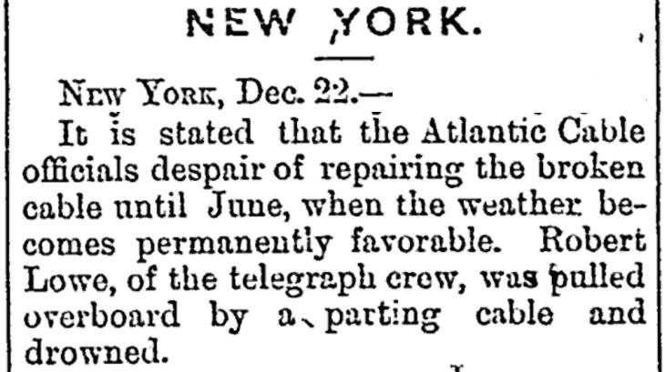
Last year, I came across another death that occurred less than 300 km from where I live. This led to doing a bit of research and I pieced together many separate cable ship tragedies that were tied to the 1870 cable ship, the Robert Lowe. In its short life, of less than four years, at least twenty one on board this early cable ship were lost. After reading along, you may agree with me that this vessel can truly be considered a cursed cable ship.
CS ROBERT LOWE SPECIFICATIONS:
• Launched: 1870, Feb. 19
• Owner: Anglo-American Telegraph Company, London
• Reg Number: 63590
• Construction: Iron
• Engines: 2 Cylinder, 100hp (Steam)
• Propulsion: 1 x Screw
• Tonnage: 883 GRT, 492 NRT
• Dimensions: 201.7’ x 29.3’ x 16.8’
• Builder: Palmer’s Ship Building &
Iron Co Ltd
• Yard: Jarrow
• Yard Number: 252
I was hoping to find at least one painting or drawing of the vessel; even one where it was in the background of
the Great Eastern. Unfortunately, I have had no luck. I did find a drawings and photos of CS Edinburgh, Hibernia, and Kangaroo.
The following events occurred during the very early days of the Atlantic cables. Unlike today, back then, the cable owners, not the cable manufacturers, purchased and hired ships to look after their interests. The CS Robert Lowe was owned by the cable owners of the 1865 & 1866 transatlantic cables. This was Cyrus Field’s Anglo-American Telegraph Company (AATC).
Digression: the path to this company was from Frederic Newton Gisborne’s Newfoundland Electric Tele-
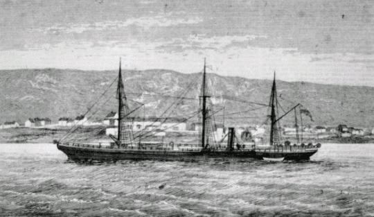
graph Company (1852) to Field’s New York, Newfoundland & London Telegraph Company (1854), to the Atlantic Telegraph Company (1856), to the Anglo-American Telegraph Company (~ 1866).
The Robert Lowe was perhaps the first purpose-built ship for the laying and maintaining of the AATC’s submarine telegraph cables. It was intended to work the northwestern Atlantic and was first stationed in Halifax, Nova Scotia (now home to IT Telecom’s ships and marine depot). (Fig. 1b)
The owners of the 1869 Atlantic Cable (3rd working cable), French Atlantic Telegraph Company (FATC), purchased an interest in the Robert Lowe in 1869 during its construction. Strangely their portion of owner ship is recorded as 34/64ths . Note: The FATC was short lived and was eventually bought out by the Anglo-American Telegraph Company in 1873.
Before detailing the tragedies and ghost story associated with the Robert Lowe, here is a “mostly complete” timeline of the Robert Lowe’s cable installation and repair activities:
• 1870-07 Repair of the 1866 Atlantic Cable. This was the first successful Atlantic cable, and it was damaged and repaired before. It was damaged again in Sept. 1869 by an iceberg off Heart’s Content, Newfoundland. This fault occurred near its third anniversary of operations. Following this repair, two more faults were found at 69
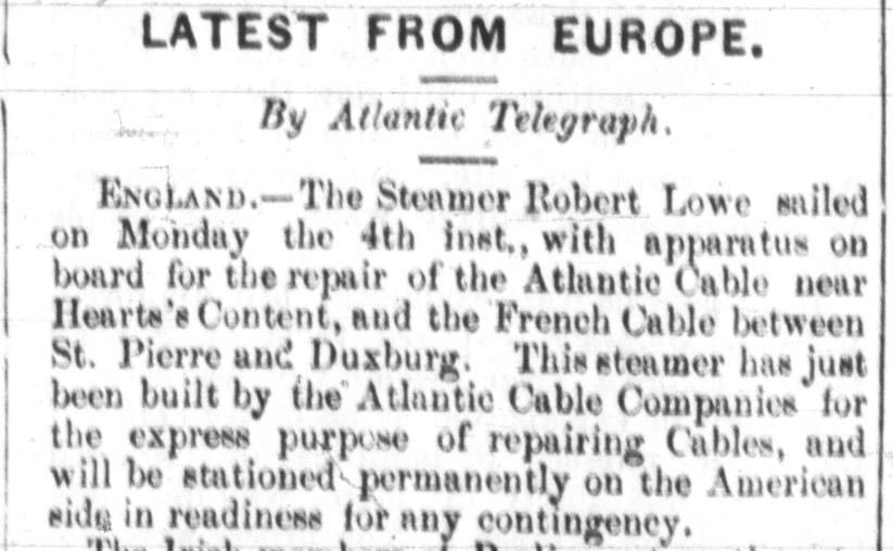
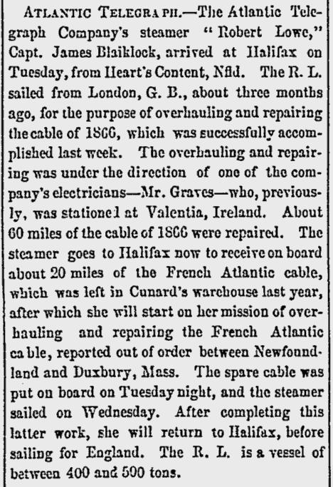
and 74 miles from Heart’s Content.
The Robert Lowe repaired these and also rerouted (lifted, moved and relaid) this faulty patch of the cable, to a more favourable path. The Robert Lowe also conducted soundings in
the area to find the more favourable location. (Fig. 2 first part)
• 1870-09 Repair of French Atlantic Cable between St. Pierre & Duxbury, USA (note the fault occurred in May 1870 off Cable Sable, Nova Scotia, but with a restoration agreement with the AATC, the traffic was flowing on the 1865 cable). A hurricane, on September 3&4th interrupted this repair and made it very dangerous (Fig. 2 Second Part and Fig. 3).
• 1870-10 The Robert Lowe returned to London, but a new fault was detected on the 1866 Atlantic Cable near Heart’s Content on Oct. 11. Due to the sea state and weather this late in the year, the captain (James Blacklock) refused to undertake the repair, so a relief captain (Anderson) was called up. They steamed back across the Atlantic.
• 1870-11 While attempting to grapple the 1866 cable, the Robert Lowe accidentally cut the 1865 cable (Nov. 30th). Now both 1865 and 1866 cables were out-of-service and the 1869 cable was working poorly and unidirectionally. (Fig.4 & 5)
• 1870-12 Two more attempts (unsuccessful) to repair the 1865 and 1866 cables were conducted in December. Some crewmen seem to have taken to drinking while at port during these repairs. Dangerous work can
do this. (Fig. 5a &5 b)
• 1870-12-23 Digression on Tariffs (due to the loss in transatlantic capacity)
The Atlantic cable companies’ directors publish the following:— All efforts to repair either of the cables thus far have been unsuccessful. Such efforts will be continued whenever and so long as the state of the weather will permit. The probability of success is, however, much less at this season of the year than in summer. There is now an accumulation of business at each end of the remaining cable equal to capacity during the entire day of 24 hours, making 48 hours in all. This accumulation is the result of only four days’ business. It is plain, therefore, that measures must be promptly taken to diminish the volume of business, or the usefulness of the cable will be seriously impaired— if not wholly destroyed. In the decision to which we have arrived in this emergency, we have not been influenced merely by a desire to increase our revenues. We have no right to discriminate between our customers, and to decide whose messages are important and whose are not. The offerings being in excess of our capacity to transmit, there seems to be no other course open except to increase a tariff. Therefore on and after Monday next the tariff between New York and Great Britain and France will be for a message not exceeding 10 words $15 in gold, and for each additional word, $1.50. Messages for the press, in plain language, conveying general and political
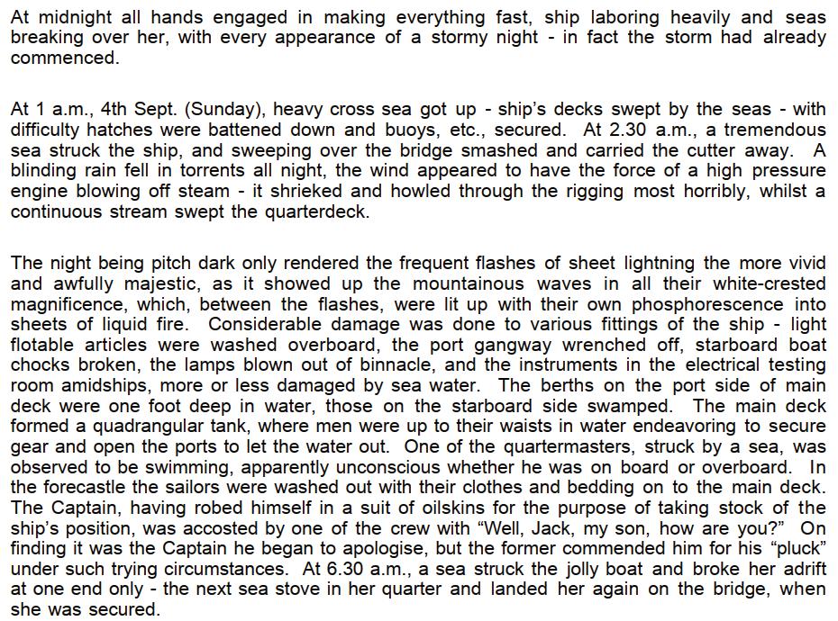


news for publication, will be forwarded at one-half of the above rates. All messages will be limited in length fifty words on all messages.
• 1871-01 Two more attempts (unsuccessful) to repair the 1865 and 1866 cables in January. The bow of the Robert Lowe was heavily damaged by ice on January 30th.
• 1871-02 The Robert Lowe was repaired in St. John’s in early February, and then steamed back to London, leaving the two Atlantic Cables out of service. Clearly, repair activities in the North Atlantic in the winter were hazardous and difficult. An engineer provided an assessment of the Robert Lowe’s fitness, and it is literally shocking.
The test room was exposed to the sea and weather! He also suggested that cable machinery be optimized to include repairs and cable recovery, not just for laying. (Fig.6)
• 1871-06 The Telegraph Construction & Maintenance’s ship, the Scanderia, repaired the 1866 Atlantic Cable on June 3rd. The Robert Lowe was unable to repair this earlier in the year and it was out-ofservice for over six months.
• 1871-06 The Telegraph Construction & Maintenance ship repaired the 1865 Atlantic Cable on June 23rd . The Robert Lowe was unable to repair this earlier in the year and in fact, had cut it. It was out-of-service for over six months.
• 1871-07 The Robert Lowe laid two short cables between Islay, Mull, and Oban in Northern Scotland. (Fig. 7). Note, the second transatlantic telephone cable CANTAT-1 landed in Oban ninety years later in 1961.
• 1871-09 The Robert Lowe repaired the 1869 Atlantic Cable, off Cape Sable, where it repaired the same cable one year earlier. It then returned to England. (Fig. 8). Again, it was stormy so this time they “cut-andrun”.
• 1871-10 Upon arrival


in England, the crew abandon’s the Robert Lowe due to bad provisions. (Fig. 9)
• 1871-10 The Robert Lowe engages in re-route work on the short 1869 Brest-Devon 101-mile cable’s shore end in the UK. This cable connected England to the 1869 Atlantic Cable that landed in Brest, France. The cable landing in England was temporary, and the Robert Lowe assisted the relocation of the shore end to its new permanent location.
• 1872-09 The Robert Lowe supports two repairs of the 1869 Atlantic Cable. The first was 300 miles off Brest and the second near the shore end at Brest.
• 1872-08 The Robert Lowe, under command of Captain Welch steams across the Atlantic and arrives in St. John’s on the 2nd. It then heads to St. Pierre for repair work on the 1869 French Atlantic Cable then returns to Halifax on the 15th. It then departs for repairs on the same cable near Duxbury, USA.
• 1872-09 The Robert Lowe, completes the repairs then returns to Halifax on 5th.
In 1873, The Robert Lowe, under command of Captain Tidmarsh, supported the laying of the 1873 Atlantic Cable. This cable was actually as system comprised of five cables. The lay had a fleet of ships, (Great
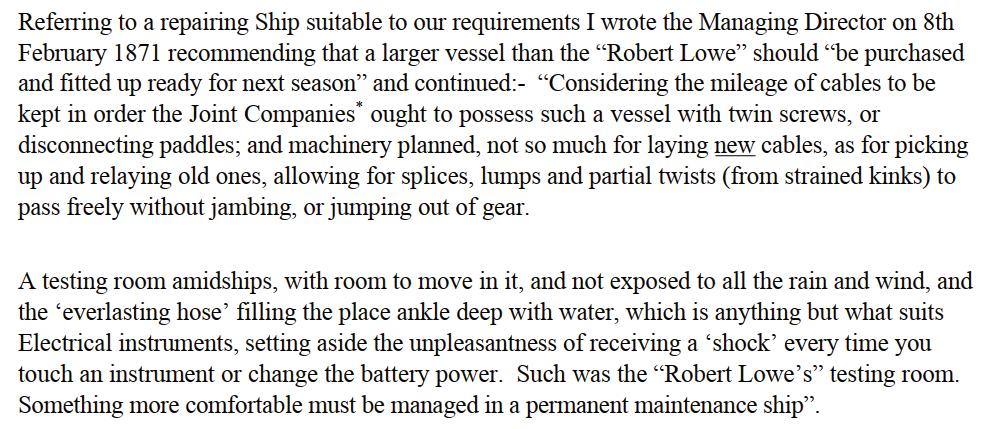
Eastern, Edinburgh, Hibernia, Robert Lowe and Kangaroo) each assigned different sections to lay. As the project continued, circumstances caused the plan to change. The plan also included the repairs of other cables after the lay: the 1865 cable fault by the Great Eastern with the Hibernia (depth of fault 3.4km) and the 1869 cable fault, near Duxbury, by the Robert Lowe. An interesting aspect of this new Atlantic Cable System was a short terrestrial bypass in Newfoundland. The short pole line (~100km) from Heart’s Content to Placentia was problematic in the winter. The new plan was to lay a short cable (~50km) from Heart’s Content to Rantem, lay a lighter submarine cable in a trench across the land from Rantem to La Manche (~10km). Another short submarine cable (~60km) from La Manche to Placentia, then continue with a subsea cable from Placentia to Sydney Mines. Note two cables were planned for the Placentia to Sydney Mines (Lloyd’s Cove) route (~500km each).
Another interesting fact seemingly lost in history is that the 1873 Atlantic Cable was first planned to land in Halifax, Nova Scotia. Cyrus Field’s AATC still had the 50 years exclusivity for landing all cables in Newfoundland. This was Gisborne’s 1852 charter that was given to Field in 1854. This is why the French consortium could not land in Newfoundland when they first landed their 1869 Atlantic Cable on the French Island of St. Pierre (off the south coast of Newfoundland) and planned the second to land in Halifax. In fact, the work started in early 1873

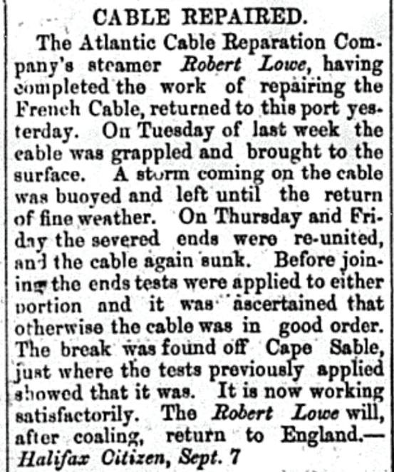


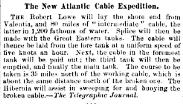
with two shore ends being laid in Halifax in April. One cable was for connection to Long Island and the other to the 1873 Atlantic Cable (Fig 9b).
The AATC, who’s 1865 and 1866 cables were now in poor shape certainly needed to work with the new company, with newer cables (1869 and 1873), to stay in business.
Digression: This submarine telegraph cable landing in Newfoundland exclusivity of the AATC was enforced for 50 years and even drove Marconi, with his wireless telegraph, out of Newfoundland and to Nova Scotia for a short period in the early 1900’s until 1904. This exclusivity was challenged in the Newfoundland government, in the summer of 1873, by the Direct US cable group who were planning a new Atlantic Cable.
The Robert Lowe laid the very first cable of the 1873 Atlantic Cable system: the Valentia Shore End, then returned to the cable factory in London to pick up four shore ends for the La Manche-Placentia cable and the Placentia-Sydney Mines cable.
• 1873-06-15 The Robert Lowe, completes the Valentia shore end lay (93 miles)
• 1873-06-27 The Great Eastern completes the main trunk with the Hibernia and Edinburgh. It buoys off the end of the cable. There is no mention of the Robert Lowe.
• 1873-07-07 The Hibernia lays the
shore end from Heart’s Content to the buoyed-off end. This lay includes some intermediate cable to complete the main segment to Ireland.
• 1873-07 The Kangaroo arrives in Heart’s Content from England with four shore ends for the two Placentia-Sydney cables. The Hibernia, Edinburgh, and Kangaroo, lay the two 500km cables from Placentia to Sydney Mines. We see Gisborne involved in this work as he is running the Sydney coal mines and records show that he refuels the Kangaroo and Hibernia in late July and early August. The Edinburgh hit an iceberg and damages its bow when transiting from Heart’s Content to Placentia. The two cables are completed around August first.
• 1873-09-12 The Kangaroo deposits 400 miles of cable in Halifax.
• 1873-10-02 The Robert Lowe arrives in Halifax from London (with a stop in Sydney). It is reported to have loaded the PEI-NB cable in London. It takes on coal in Halifax.
• 1873-10-11 The Robert Lowe, completes the Northumberland Strait Cable Lay (Cape Traverse, Prince Edward Island to Cape Tormentine, New Brunswick) lay (11 miles). On October 21st, it has taken on cable in Halifax and departed for Hearts Content to lay the cable to Rantem.
• 1873-11-08 The Robert Lowe arrives at Heart’s Content from

Halifax with Alexander MacKay on board and cable (Fig. 10). It then lays the short cable from Heart’s Content to Rantem.
• 1873-11-19 The Robert Lowe, completes the Placentia to La Manche Cable and returns towards St. John’s for the winter. This completes the 1873 “system” of five cables, and the Robert Lowe has had the privilege to lay the first cable and to lay the last cable.
Here is a story recorded in books that details the death of a sailor on the Robert Lowe’s first repair excursion.
Towards the close of 1870, Mr. James Greaves, superintendent of the Anglo-American Telegraph Company’s office at Valencia, informed Mr. Varley, the electrician, that some excitement had been caused amongst the crew of the cable repairing ship Robert Lowe, by the alleged appearance of several apparitions to one of the crew, when the ship was in the middle of the Atlantic, which was confirmed by the commander of the vessel, Captain James Blacklock; and subsequently the following statement was drawn up and signed, in order to authenticate fully the whole narrative, which reads as follows:
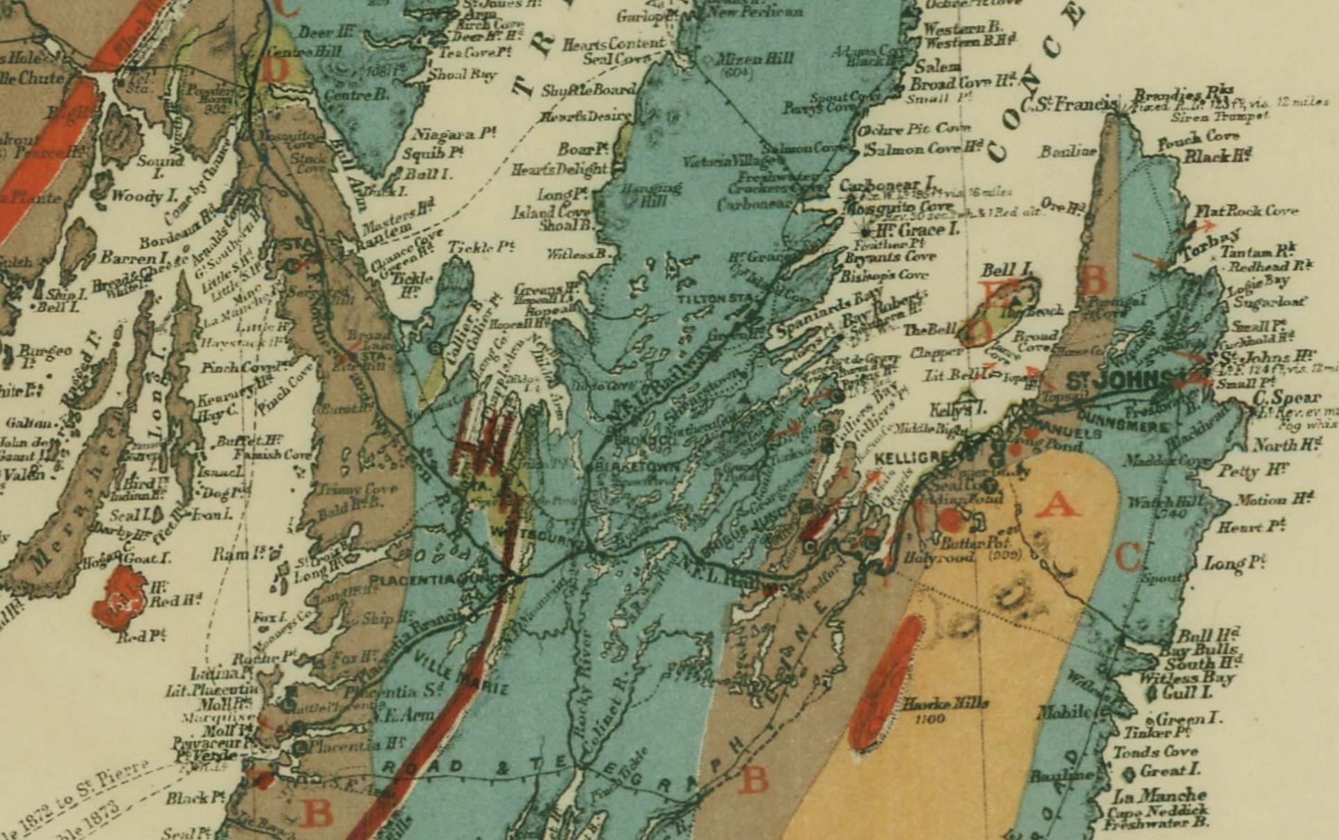
STATEMENT OF THE CAPTAIN AND OFFICERS.
The steamship Robert Lowe returned to the Thames on Tuesday, October 11th, 1870, from St. Pierre, Newfoundland, where she had been repairing one of the French Atlantic Telegraph Company’s cables. An engineer on board, Mr. W. H. Pierce, of 37, Augusta-street, East India road, Poplar, was taken ill with the typhus fever, and on the 4th October last he died. One of his mates--Mr. D. Brown, of 1, Edward-street, Hudson’s road, Canning town, Plaistow, a strong, healthy man, a stoker, not likely to be led astray by imagination-attended him till the day before he died. On the afternoon before his death, at three P.M., in broad daylight, Brown was attending the sick man, who wanted to get out of bed, but his companion prevented him. And this is what the witness says he saw:
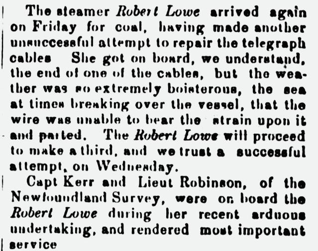
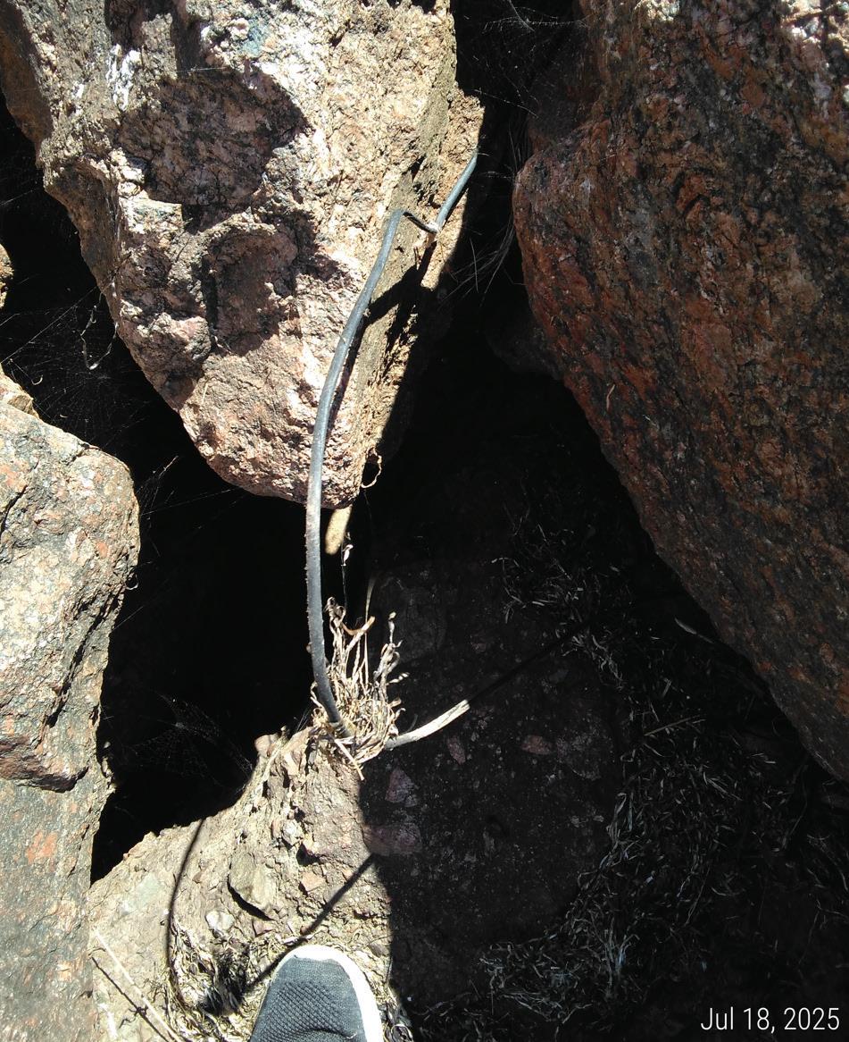
“I was standing on one side of the bunk, and while trying to prevent Pierce from rising, I saw on the other side of the bunk the wife, two children, and the mother of the dying man, all of whom I knew very well, and they are all still living. They appeared to be very sorrowful, but in all other respects were the same as other ordinary human beings. I could not see through them: they were not at all transparent. They had on their ordinary clothes and perhaps looked rather paler than usual.
The mother said to me, in a clearly audible voice, ‘He will be buried on Thurs- day, at twelve o’clock, in about 1400 fathoms of water.’
“They all then vanished instanta-
neously, and I saw them no more. Pierce did not see them, as he was delirious and had been so for two days previously. I ran out of the berth in a state of great excitement and did not enter it again while he was alive. He died on Tuesday, not Thursday, and was buried at four o’clock, and not twelve. It was a sudden surprise to me to see the apparitions. I expected nothing of the kind, and when I first saw them, I was perfectly cool and collected. I had never before seen anything of the kind in my life, and my health is and always has been good. About five minutes afterwards I told Captain Blacklock I would stop with the sick man no longer, but would not tell him why, thinking that if I did nobody else would take my place. About an hour later, I told Captain Blacklock and Mr. Dunbar, the chief engineer, whose address is, ‘Old Mill, near Port William, Wigtownshire, Scotland.’”
The other sailors on board say they saw that Mr. Brown was greatly agitated, and they gradually drew the above narrative from him.
Captain Blacklock adds: “Brown came down into the cabin, looking very pale and frightened, and declared in a strong and decided way that he would not attend the sick man anymore—not for £1000. I told him that he ought to attend a sick and dying comrade,
especially as a storm was raging, and he needed kind and considerate help as much as any of us might need one day. I pressed him the more, as I wanted a strong, steady man to attend the delirious invalid; besides, it being bad weather, the other men were fagged and over-worked. Brown would not go back, and he left the cabin, as I think, crying; so, I sent him out a glass of brandy. Shortly after that, I heard he was very ill, and that his mates had some trouble in calming him.”
We, the undersigned officials on board the Robert Lowe, declare the above statements to be true, so far as each of the circumstances came under our personal notice, but we none of us commit ourselves to any opinion as to the cause of the phenomenon. We give this statement simply because we have been requested so to do, rumours having gone abroad and caused inquiries to be made.
(Signed)
JOHN BLACKLOCK, Commander.
DAVID BROWN, Stoker.
ANDREW DUNBAR, First Engineer.
REUBEN RICHARDSON, Stoker.
ROBERT KNOX, Trimmer.
HENRY HAMMOND, Stoker.
JOHN WOODCOCK, Stoker. HENRY PUGH, Cook.
Witness, W. H. HARRISON, 27, Queen Street, Horselydown, Bermondsey,
October 20th, 1870.
Mr. D. Brown, who saw the apparition, bears an excellent charac-
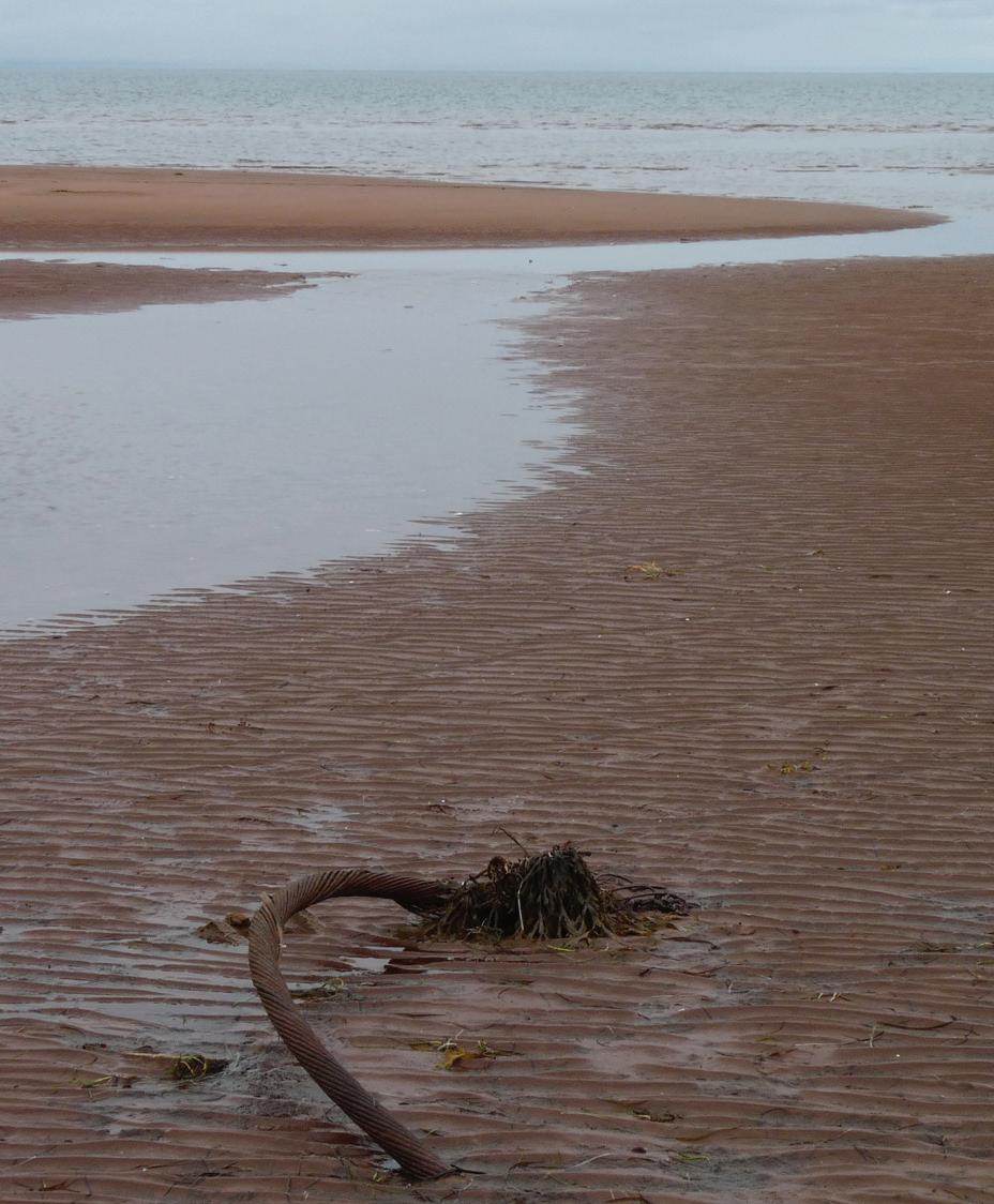
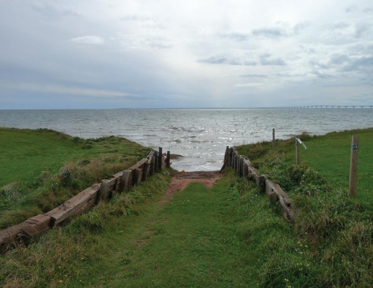
ter, being thoroughly trusted by his captain, and had a warm friendship for the deceased. Mrs. Pierce, the widow, shortly before her husband’s death, experienced, when in London, a strange sensation, which caused her to anticipate the melancholy event. For, being at the house of her mother-in-law, in Camden-town, on the 28th of September, a few days before her husband’s death, she was awakened in the night by a loud knocking, apparently at the street door, but on looking out could not see any one there. A dreadful presentiment came into her mind that she would soon receive some bad news. Afterwards she dreamed that she was a widow, and that her children were dressed in deep mourning; the household, consisting of Mrs. Pierce, her two children, and mother-in-law,
formed the very same group of individuals who appeared as apparitions to Mr. D. Brown, when watching beside his dying companion in the middle of the Atlantic Ocean.
ROBERT LOWE LOSS #2 (UNNAMED)
At the start of this Back Reflections article, a poor crewman working on the deck of the Robert Lowe, lost his life in December of 1870 (Fig. 1).

Although there is little information, we see that he was pulled overboard by a parting cable. We know they were repairing the 1865 and 1866 cables at the time and that these cables were rather weak due their strange design using less steel and more jute. The sea off Newfoundland is treacherous in the winter. High waves and cold temperatures cause
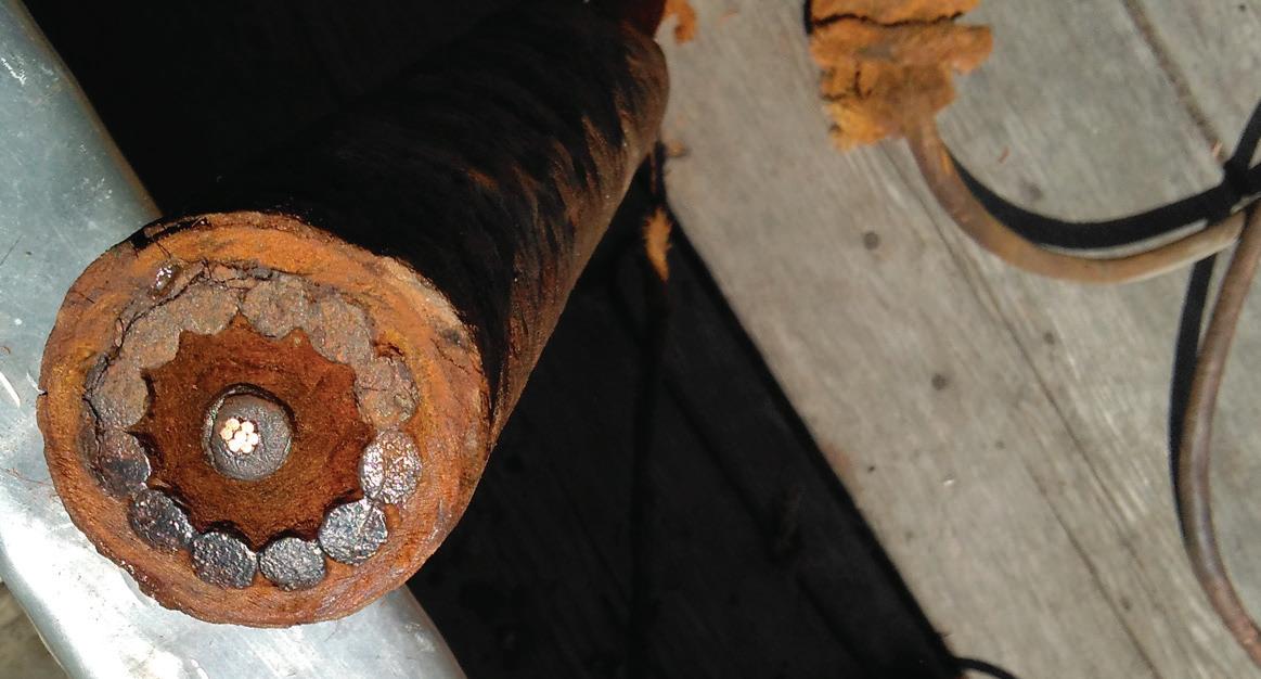
ice to buildup on the decks and machinery. Reports show the Robert Lowe to return to St. John’s for coal on Sunday, Dec. 10th. She departed the later to continue the work. This death is reported in a NY news office on Dec. 22 so perhaps it occurred before Dec 10th. A report on Jan 4, 1871 says the Robert Lowe returned to St. John’s on the 31st for coal so this would be after the death. It also states the cable was on board but it parted before it
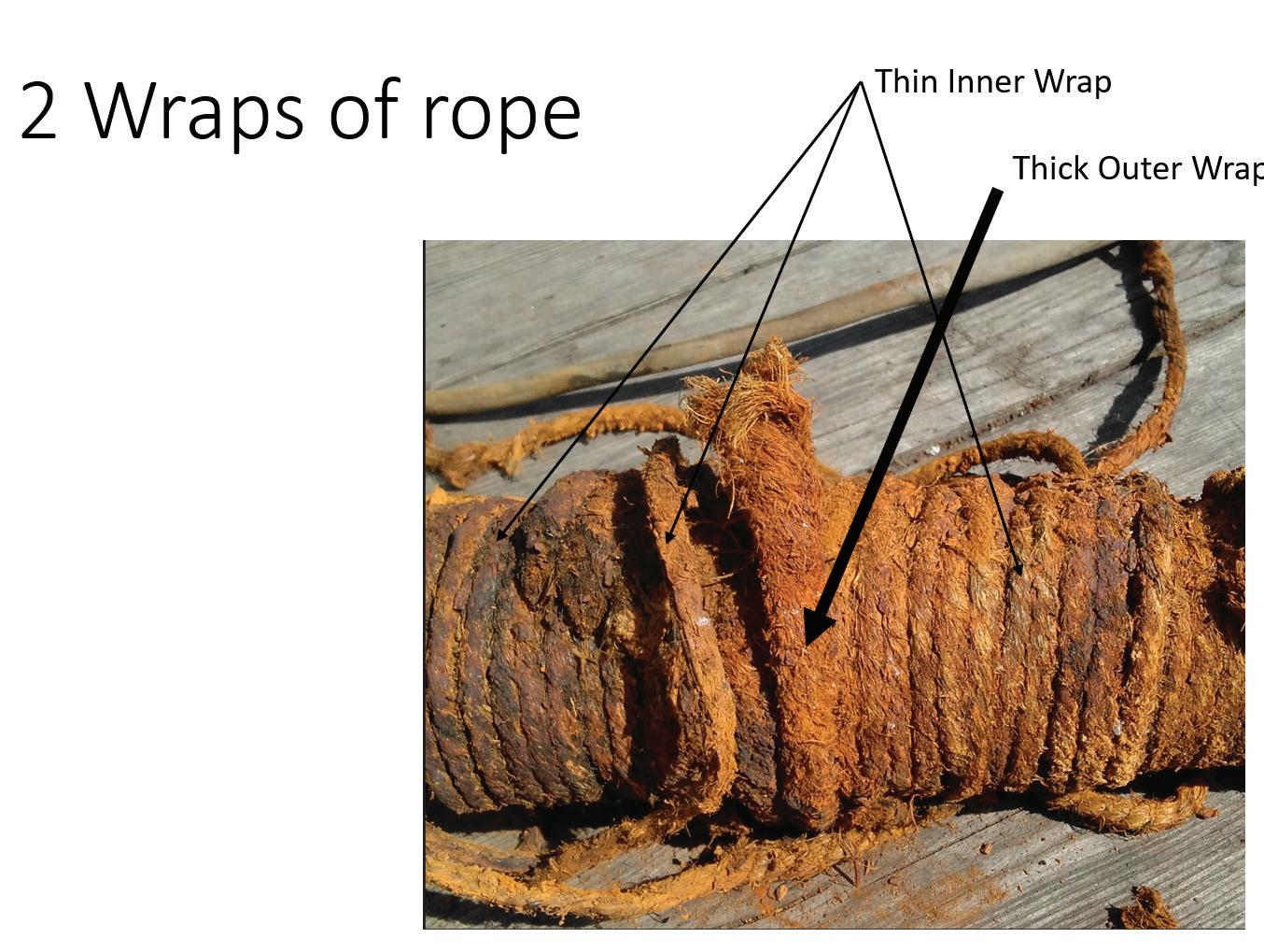
returned on the 31st. (Fig. 13)
This tragedy occurred where Janet and I hunt for cables at Cape Tormentine, New Brunswick. We have recovered a section of this 1873 cable and only recently, through working with Derek Cassidy, a cable historian and expert based in Ireland, were we able to identify it as an 1873 Atlantic Cable shore end.
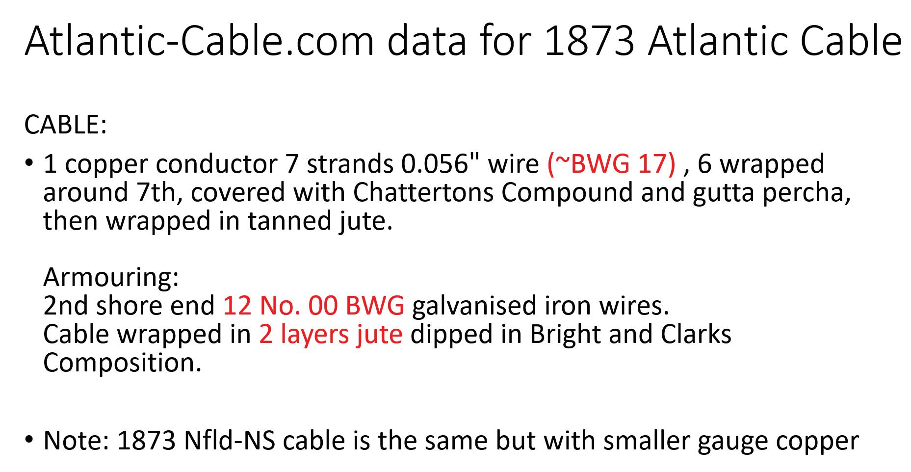
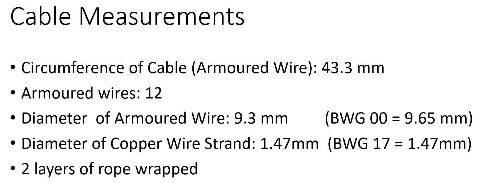
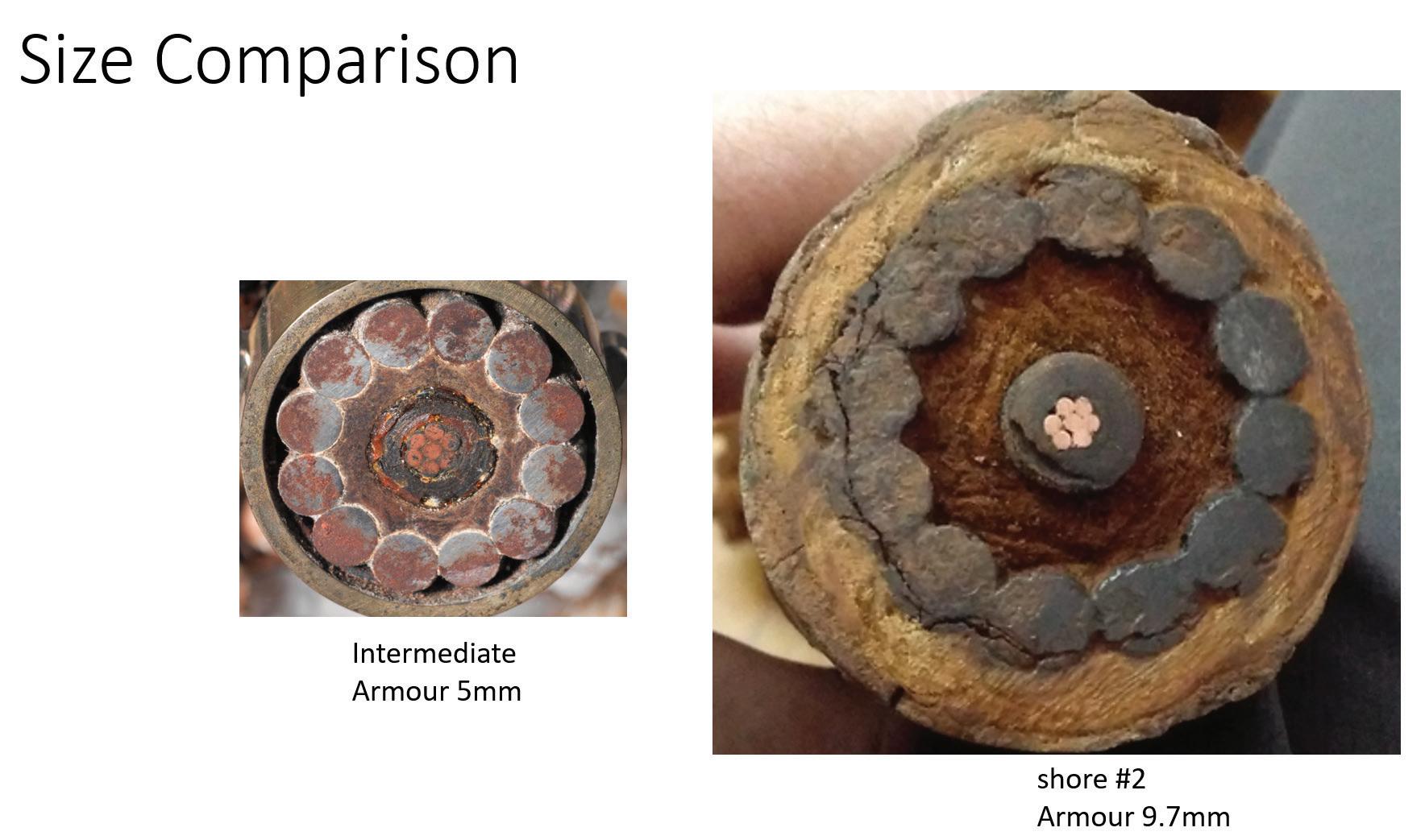

THE NEW P. E. ISLAND CABLE. THE ROBERT LOWE’S QUARTER MASTER DROWNED.
The cable steamer “Robert Lowe,” Capt. Tidmarsh, arrived here at 1 a.m., yesterday, after laying the cable between Cape Traverse, P. E. I., and Cape Tormentine, N. B.
We take the following report of the laying of the cable from the Charlottetown “Argus” of the 14th inst:
The S. S. “Robert Lowe,” belonging to the Anglo-American Telegraph Co., with new cable on board, arrived at Cape Tormentine on the evening of the 6th inst. After surveying the landing place there she crossed to Cape Traverse Cove in the afternoon in order to begin paying out from the Island side. In consequence of shoal water, the ship was obliged to anchor three quarters of a mile from the shore, the shore end being landed in boats. As the cable is a very heavy one, weighing 15 tons per mile, some idea of the difficulty of landing the end may be formed. The boats started at 10 a.m. and by 3 p.m. the landing had been effected safely, every obstacle being successfully surmounted by the indefatigable energy of the commander, Capt. James Tidmarsh. As the tide was now running very strongly it was decided not to attempt laying the cable till the following day. At 7 a.m. anchor was weighed; in doing so the old cable between P. E. I. and the mainland was hooked and seriously injured. By the exertions of the officers of the ship the cable was cleared and buoyed, and the steamer commenced paying out the new cable. The accident to the old cable
is attributable to the fact that it has shifted half a mile from its original position. At 10 a.m. the steamer arrived at her anchorage on the New Brunswick side, and at 3 p.m. commenced laying the shore end. This was a much more difficult job than at Cape Traverse, the ship being a mile and a third from the shore and a heavy sea running at the time. The men worked hard, but through the night the cold was so intense that they were forced to give it up, being drenched with salt water, the boats being almost filled several times. On Friday, at 3 a. m., work was again commenced, and by 5.30 p. m., the new bond of Union between the “Tight Little Island” and her sister Provinces of the Dominion was completed. While the “Robert Lowe” was lying on the Island shore on Tuesday, in a thick mist, the Gulf Ports Steamer “Secret” bore down on them, thinking they had secured a valuable prize. Their disgust was intense when the” Lowe” displayed her ensign and courteously acknowledged their hail.
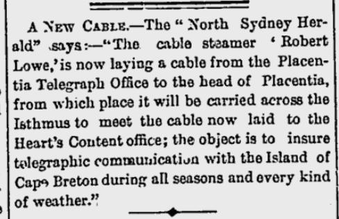

ROBERT LOWE LOSSES #4, 5, 6, 7, 8, 9, 10, 11, 12, 13, 14, 15, 16, 17, 18, 19, 20 & 21
The CS Robert Lowe, under the command of James Tidmarsh, picked up cable in Halifax on October 21st. We then see a record of the vessel in St. John’s on November 8th. This states that it went from Halifax to Heart’s Content CLS, then to St. John’s. The Robert Lowe lays the Heart’s content to Rantem cable during this time. A lucky passenger was Alexander MacKay, who was the superintendent of the lines in Newfoundland and Nova Scotia for the AATC. Me must have departed at St, John’s where he was based. He replaced Gisborne in 1856.
The new cable is in splendid order, the tests taken by W. Dickinson, Electrician of the Anglo-American Staff, at Heart’s Content, Nfld, were perfect, and the great size and strength of the cable should render communication between P. E. Island and the mainland quite secure.
Capt. Tidmarsh makes the following report of the loss of one of the crew:
11th, 12 a. m. The second. officer
went round to each boat again, giving orders that if any danger occurred, they were to slip the bight of the cable. 2:30 a.m. The officer in charge of deck heard someone singing out; sent a boat off immediately, and found No. 3 boat under water, except three feet of her bow, and John White, the Quartermaster, missing. Made every possible search for him, but could not get any trace of him. He belonged to London. At daylight sent another boat along the shore to search, but to no purpose. Reported the same to a Justice of the Peace at Tormentine. At 4:20 p.m. landed end of cable at Tormentine. 5:10 p.m. Slipped bight of cable. Distance across, 9 miles; cable payed out, 9 ¾ miles.”
The Robert Lowe is next reported on November 19th as heading to St. John’s from Placentia. It just completed the cable lay from La Manche to Placentia to complete the cable system. It was to winter in St. John’s. The crew must have been delighted to have completed the work and were perhaps exuberant. Unfortunately, in their haste to return home, they grounded the Robert Lowe in a remote and rocky location. Here are reports of the mishap.
We noticed in a very short paragraph last week, the melancholy fact of loss of the Anglo-American-Cable Com-
pany’s steamship “Robert Lowe” not anticipating at the time that we should have to record to-day the sad loss of so many valuable lives as the result of the calamity.
It appears that the “Robert Lowe” had been employed in the service of laying that portion of the Company’s submarine cable between Island Cove, near La Manche, and Placentia, which work was successfully performed on the 18th inst. On the 19th she left Placentia, on her return to St. John’s where she was to be laid up for the winter.
For some time before and after the steamer left Placentia the weather was thick and boisterous; and shortly after her departure a heavy south-west gale sprung up, bringing with it a heavy sea, thick fog, and a much stronger easterly set of the tide than was calculated upon.
It was owing to this latter circumstance no doubt, the ship made such very considerable leeway, that, although Capt. Tidmarsh gave her a course which would, under ordinary circumstances have put her considerably to the westward, that she struck, when at full speed, upon a place called Sculpin Cove Point, about a quarter past four o’clock on the morning of the 20th, about twelve hours after leaving Placentia, The sea was making very heavy when the vessel struck, and the after part of the ship was immediately submerged by the


heavy seas. The lifeboats, together with the ship’s boats, were at once attempted to be launched, it was found, however, impracticable to get the lifeboat into the water, from their great cumbersomeness, as well as from the fact of their being already almost if not quite submerged with the ship. The smaller boats, however, were quickly got out, and in them such of the crew and officers as were eventually saved, reached the shore. It is believed that the captain, and those who remained by the wreck with him, in the hope of eventual succour from the shore, preferred that course rather than risk what appeared to be a quicker and more inevitable death, by trusting themselves to the boats in such a sea and amongst the dangers that surrounded them. The first intimation of the accident reached Holyrood by one of the boats, which succeeded, not without great danger and difficulty, in reaching that place, and assistance was immediately despatched to the relief of the survivors. Sometime necessarily elapsed before the people reached the scene of the disaster, but when they arrived there they found they were too late to do anything, if indeed anything was possible to be done under the circumstances. The ship’s pinnace was directed by the people to a safe place for effecting a landing, which was done; and the men got ashore at the foot of a cliff, up which they had to climb hand

over hand, a distance of some three or four hundred feet by ropes which were let down to them from above. Several of them who were too much exhausted to accomplish this feat were hoisted up by ropes fastened about their person. In the meantime, the remains of the “Robert Lowe,” with her noble captain, with Mr. Wickenden, a gentleman belonging to the company’s staff, young, amiable and much esteemed by all who knew him, together with sixteen other valuable lives, were swept away by the cruel and remorseless waves.
The survivors arrived here from St. Mary’s on Sunday morning last, in the steam-tug “Cabot,” which was dispatched to the scene of the disaster immediately the tidings of it was received by A. M. McKay, Esq., the Company’s General Superintendent.
Many of the survivors reached shore in a nearly, naked condition, but were of course treated with every attention and kindness by the people living in the neighbourhood of the disaster, by whom they were clothed and fed. Since their arrival here, Mr McKay has done all that was possible and necessary for their
comfort and relief. Captain Tidmarsh, whose deplorable loss we have recorded above, is represented by those who are best acquainted with him as an excellent and amiable mas and a seaman of great experience and ability, active and indefatigable in the discharge of his duties. This latter fact we have conformation of in the knowledge that he took the bridge on board the “Robert Lowe” at 4 o’clock in the afternoon when she left Placentia only leaving it at 1 a.m. the next morning, for the
purpose of making a change of his wet clothing and getting a little rest. He was on the bridge again at three o’clock, and that without being called up. It will be a consolation, at least, to his bereaved friends to know that he died at his post with the unflinching determination to fulfil his duty to the last, a sentiment that has ever been the characteristic of ‘true-hearted British Seamen the world over.
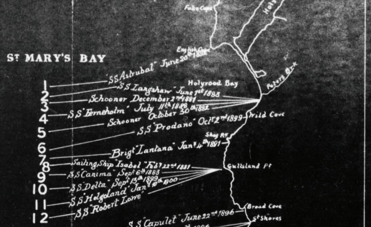
(SPECIAL DESPATCH TO MORNING CHRONICLE.)
ST. JOHN’S, NFLD., NOV 24.
News has been received here of the wreck of the Telegraph Company’s steamer “Robert Lowe,” at St. Schott’s, and the loss of the captain and 17 others. The “Robert Lowe,” after successfully connecting by cable Heart’s Content with Rantem in Trinity Bay and La Manche with Placentia in Placentia Bay, left the latter place on Wednesday last, at 1 o’clock in the afternoon, bound to St. John’s. At 4 o’clock on Thursday morning, the weather being thick and stormy, with South-West gale and high sea, the ship struck heavily and immediately filled. The captain (Tidmarsh), whose vigilance during the night was unceasing, stood on the bridge at the time of the disaster. He was perfectly cool and collected, and ordered the lifeboats to be cleared, &c., but owing to the poop being under water, five minutes after the ship struck, this order could not be carried out. Three other boats with the greatest difficulty wore cleared, and twenty-three people placed in them, in charge of the first officer, Mr. Wilkins, who remained by the wreck till daylight. Mr. Wickenden, of the Heart’s Content telegraph staff, was drowned in the cabin so suddenly did the ship fill, and a boy, Wagstaf, perished in his bunk. Captain Tidmarsh with those remaining on deck were swept off by the heavy seas, which following in quick succession reduced the wreck to atoms in a few hours.
The following are the names of the lost:

James Tidmarsh, Commander.
G.E. Wickenden, Electrician.
P. Pullen, Chief Engineer.
E. Sargent, Third Engineer.
F. Pugh, Fourth Engineer.
J. Bullock, Engineer Storekeeper.
J. McIntyre, Carpenter.
H. Young, Quartermaster.
C. Slack, Quartermaster.
J. Woods, able seaman.
G. Warner, able seaman.
J. Anderson, able seaman. Wagstaff, boy.
William Day, second steward.
P. Bonarius, third steward
R. Gates, chief cook.
J. Dooling, fireman.
T. Gallagher, fireman (killed in landing.)
The following were saved:
B. P. Wilkins, chief officer.
S. Denton, second officer.
H. P. Harrison, second engineer.
R. Stafford, boatswain.
W. Collins, storekeeper.
F. Richardson, quartermaster.
J. Robinson, quartermaster.
C. Payne, able seamen.
J. Clancey, able seamen.
C. Williams, able seamen.
H. Burton, able seamen.
Halston, able seamen.
O. Sullivan, firemen.
W. Reid, firemen.
J. Cunningham, firemen.
D. Dickenson, firemen.
M. Welsh, firemen.
N. Higgins, firemen.
F. London, chief steward
G. London, mess room boy
W. Jacklin, butcher
W. Miller, a passenger.
The newspapers, throughout North America, printed the disaster details as well as details of the morbid follow up items. One can also find a report of an inquiry, and the usual business aspects in very crude and poor taste. STF

PHILIP PILGRIM is the Subsea Business Development Leader for Nokia's North American Region. 2021 marks his is 30th year working in the subse a sector. His hobbies include "Subsea Archaeology" and locating the long lost subsea cable and telegraph routes (and infrastructure). Philip is based in Nova Scotia, Canada.
BY ANDRÉS FÍGOLI
The presence or absence of a Non-Disclosure Agreement (NDA) among submarine cable owners or with suppliers does not guarantee a problem-free operation — but it can significantly reduce risks. Think of it like owning a luxury home: installing a security system will not prevent every break-in but publicly announcing that you do not have one is an open invitation, even to the most amateur thief.
In submarine cable governance, the same logic applies. Transparency and confidentiality must be balanced. Failing to establish clear frameworks around sensitive data — especially regarding infrastructure technology, pricing, outages, or routing — not only invites legal and regulatory uncertainty but can also provoke opportunistic behaviour by other market players or actors with competing interests.
Some critics would argue that such agreements stifle business efficiency and create unnecessary bureaucratic hurdles. However, in industries like subsea cables, where the long term investments are high, the advantages of having a well-structured NDA cannot be overstated. An NDA not only protects the company but also its partners, customers, and its proprietary technologies, all of which are vital in a landscape where information leakage can put a carrier in a very difficult position.
In this article, we will briefly describe three real-life scenarios in which companies found themselves exposed to avoidable risks — all of which could have been mitigated or minimized by a properly structured NDA policy.
Two international carriers began exploratory discussions to potentially co-develop a new submarine cable system under a future consortium model. At that stage, no NDA had been signed between the parties, as conversations were still considered preliminary. However, a mid-level employee mistakenly sent an email to the other party explicitly stating that his company had firm intentions
“The execution of any exchange of information or other action taken to give effect to, the Agreement, shall not constitute or imply any promise or intention or commitment by either party to purchase any product or service, to market (now or in the future); to distribute or supply any product or service; or to engage in or commit to any other kind of transaction or agreement with the other party.”
Such language explicitly protects both sides from claims of premature com-
Some critics would argue that such agreements stifle business efficiency and create unnecessary bureaucratic hurdles. However, in industries like subsea cables, where the long term investments are high, the advantages of having a well-structured NDA cannot be overstated.
to proceed with the project and was actively working to bring in additional consortium members.
The email, while not formally authorized, was interpreted as a commitment. When the project did not move forward and no new members materialized, the other party filed a lawsuit claiming breach of promise and financial loss due to reliance on that assurance.
Had an NDA been signed, it would likely have included a “No promise” clause, which serves as a critical safeguard in these preliminary discussions. A standard version of this clause reads:
mitment, clarifying that the exchange of ideas or technical evaluations does not constitute a commercial obligation.
Lesson learned: Always ensure that employees or representatives involved in these exploratory discussions do so with an NDA in place. Protect your own staff from their own involuntary mistakes.
The NDA not only protects the confidentiality of the information exchanged but it also manages expectations and prevents casual or informal language from being misconstrued as binding intent — a risk that can lead to significant legal and financial consequences.
In another real-world case, a telecom carrier began informal discussions with external technical consultants to explore the feasibility of a new submarine cable system. The scope included designing and surveying a new, strategically advantageous route. However, no Non-Disclosure Agreement (NDA) was signed between the carrier and the consultants.
Some of the consulting firm’s employees, acting disloyally, leaked details of the proposed route to a competing carrier. That competitor quickly adjusted the design of its own future cable system to incorporate the leaked route, expediting its deployment. The competitor then marketed the new system to potential customers and successfully captured significant client commitments — clients that had previously been in discussions with the original carrier.
With no NDA in place, the original carrier found itself with limited legal tools to challenge the actions of either the consultants or the competitor. In court, the absence of a contractual confidentiality obligation made it far more difficult to demonstrate wrongdoing or to claim damages.
Had there been a properly worded NDA in force, the carrier could have relied on clauses such as:
“The Receiving Party shall take all reasonable measures to avoid disclosure, dissemination, or unauthorized use of Confidential Information, including, at a minimum, those measures it takes to protect its own confiden-
tial information of a similar nature, which shall not be less than the care a reasonable person would use under similar circumstances.”
This would have enabled the carrier not only to pursue legal recourse more effectively but also to establish clear security standards for handling sensitive data.
Critics may argue that startups and smaller companies are less inclined to deal with “paperwork” like NDAs in
Critics may argue that startups and smaller companies are less inclined to deal with “paperwork” like NDAs in early stages. That might be true. But over time, corporate governance practices must mature...
early stages. That might be true. But over time, corporate governance practices must mature — especially when aiming for long-term partnerships like consortiums, securing investor trust, or passing a due diligence process required for credit access or equity financing.
It is equally problematic when service providers attempt to bypass this dialogue altogether — embedding
sweeping legal commitments into Service Order Forms through obscure references to a Master Service Agreement that was never transparently disclosed or negotiated. This practice undermines the very principle of good faith and erodes trust.
Lesson learned: Even in the exploratory phases, never underestimate the power of confidentiality tools. An NDA can be the difference between a protected strategic idea and an opportunity stolen.
Some industry voices argue that requiring NDAs for commercial discussions is outdated or unnecessarily bureaucratic, suggesting that carriers should adopt the “pragmatic” approach of skipping NDAs for pricing discussions, and even avoiding formal negotiations of Master Service Agreements (MSAs) by embedding boilerplate acceptance language directly in their Service Order Forms (SOFs).
But convenience is not the same as prudence. Especially in the context of submarine cables and wholesale capacity, pricing information is often not generic: it reflects not just the price per unit (e.g. STM-1), but also capacity availability and SLA. These terms, if disclosed to competitors or customers prematurely or without context, can create commercial distortions or result in strategic disadvantage.
Consider the following scenario: a small carrier exploring a long-term capacity IRU purchase begins con-
BY ANDRÉS FÍGOLI
versations with a provider. No NDA is signed, because — as the vendor claims — “everyone shares pricing anyway.” However, the small carrier’s internal request-for-approval process delays a decision. In the meantime, the pricing quote leaks — not through bad intent, but via internal email forwarding to partner consultants. Weeks later, a competing operator uses that same pricing matrix to undercut the vendor in a parallel negotiation. The original vendor loses strategic positioning and the buyer now faces reputational concerns with both parties.
In this scenario, both the first provider and the client could have been protected if a basic NDA had been signed — even one limited in scope and duration. Most importantly, the NDA would have allowed the disclosing party to set expectations about confidentiality, trace how the information was handled and potentially enforce consequences if a breach occurred.
Furthermore, many NDAs include a clause that defines the concept of Confidential Information, such as: “…the information disclosed to each other, whether verbally, electronically, visually or in a written or other tangible form, which is either identified as confidential or proprietary at the time of disclosure or should be reasonably understood to be confidential or proprietary in nature.”
This means that even if a document or email is not explicitly marked “Confidential,” it is still protected if the context reasonably implies it. This is critical, especially in informal exchanges or early-stage drafts, where marking every-
thing as confidential may not be practical — but protection is still necessary. NDAs also support the development of institutional discipline. Startups or fast-moving companies may initially avoid them, citing speed or informality, but even large entities have their salespersons that want to earn their bonus if they sell as fast as possible. But all those same companies will likely struggle during due dili-
While it is tempting to view legal documents like NDAs as bureaucratic hurdles that slow down business, in the submarine cable industry the benefits of having a well-drafted NDA far outweigh the perceived downsides.
gence processes if they ever seek credit lines, strategic partnerships, or M&A processes. Good corporate governance starts with basic tools and an NDA is one of its pillars.
Lesson learned: Even in commercial exchanges like quoting, information has value. A short, well-written NDA does not delay business — it enables trust and gives legal ground to address misconduct or carelessness later. What may seem “pragmatic” in the short term can become expensive in the long run.
While it is tempting to view legal documents like NDAs as bureaucratic hurdles that slow down business, in the submarine cable industry the benefits of having a well-drafted NDA far outweigh the perceived downsides. NDAs are not just legal formalities — they are essential instruments for preserving competitive advantages, safeguarding confidential strategies, ensuring compliance with regulatory obligations and building long-term trust between partners.
However, this does not give lawyers carte blanche to impose rigid or excessive templates under the banner of “corporate governance” or “professionalism.” Legal advisors should be fluent in current submarine cable industry practices and reflect them accurately in the drafting process. NDAs must strike a fair balance — protective, but not oppressive; clear, but not overly rigid. Otherwise, no email would be allowed to be sent without the often forgotten ´´Confidential Information´´ label. STF
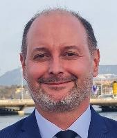
ANDRÉS FÍGOLI is the author of the book “Legal and Regulatory Aspects of Telecommunication Submarine Cables” and is the director of Fígoli Consulting, where he provides legal and regulatory advice on all aspects of subsea cable work. Mr. Fígoli graduated in 2002 from the Law School of the University of the Republic (Uruguay), holds a Master of Laws (LLM) from Northwestern University, and has worked on submarine cable cases for more than 20 years in a major wholesale telecommunication company. He also served as Director and Member of the Executive Committee of the International Cable Protection Committee (2015-2023).

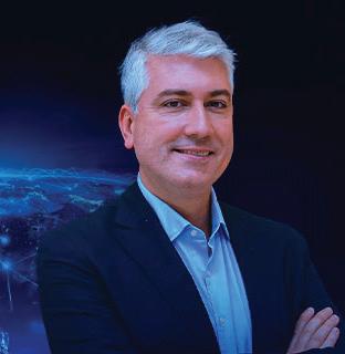
SAMUEL CARVALHO
pointed CEO of TelCables Eu rope, based in Lisbon, Portugal. He previously served as Chief Marketing Officer of Angola Cables, a role he will continue to hold alongside his new respon sibilities. Carvalho will focus on strengthening TelCables Eu rope’s position as a key Atlantic connectivity hub, leveraging Angola Cables’ subsea network systems to enhance global interconnection and digital infrastructure across Europe, Africa, the Americas, and the Middle East.

TONY MOSLEY has taken on a new role as Independent Contrac tor with Ocean Specialists, Inc. (OSI), continuing his long-standing work with the company. Based in the United States, Mosley remains active in the subsea and telecommunications sectors, supporting OSI and other industry projects. He previously served as Director of Business Development at OSI, leading business initiatives across the Asia-Pacific region.

has stepped down as Managing Director and CEO of Telecom Egypt, concluding a five-year tenure with the company. Based in Cairo, Egypt, Nasr joined Telecom Egypt’s board in 2020 and was appointed CEO in April 2023. During his leadership, he oversaw the launch of advanced 5G networks, digital platforms, and the expansion of Egypt’s subsea cable infrastructure, strengthening the nation’s role as a global
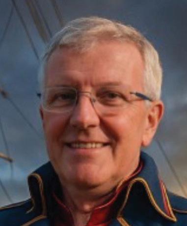
is seeking new opportunities within the submarine cable industry, following his tenure as CTO Marine at Digicel Group. Based in the United Kingdom, Wilkie brings extensive experience in subsea system design, development, and maintenance, and continues to serve as Chairman of the Atlantic Cable Maintenance & Repair Agreement (ACMA). He remains active as Director of Telchines Limited, providing consultancy across global submarine telecommunications projects.
These transitions underscore the vibrant and ever-evolving nature of the industry, as seasoned professionals continue to explore new challenges and avenues for impactful contributions.
Pakistan Internet Fully Restored Nationwide by Monday
Internet Services Restored After Repair of Submarine Cable: PTCL
ASEAN Restorer to Repair CANI Cable Near Nicobar
Internet Outage in Pakistan to Last 4–5 Weeks
Kamchatka Faces 5-Day Internet Outage for Cable Repairs
Internet Speed in Pakistan Remains Slow
Submarine Cable Cuts Disrupt Internet Services in Pakistan
Microsoft Azure Faces Delays After Red Sea Undersea Cables Cut
China Mobile Activates 2Africa East Cable
Unitirreno Launches Domestic Subsea Cable in Italy
MMO OKs Second Cable Removal Off Yorkshire
Google to Build AI Data Center on Christmas Island, Australia
TELUS Begins Deployment of North Shore Subsea Cable
Medusa Subsea Cable Lands in Tunisia
AWS Unveils Fastnet: A High-Speed Transatlantic Cable
Sparkle Lands BlueMed Submarine Cable in Cyprus
Telconet’s CSN-1 Cable Lands in Colombia
Google’s Tabua Cable Gets Sydney Protection Zone Extension
Safaricom to Operate Meta’s New Cable in Kenya
Medusa Subsea Cable to Land in Syria
Pakistan to Get Two New Submarine Cable Systems Soon
Ciena’s Optic Tech Will Power New Caribbean Subsea Cable
Portugal’s Meo Plans Cable Landing Station in Porto
New Submarine Cable Rules Take Effect Nov. 26
Orange Marine to Modernise Cable Ship Fleet for Europe, MEA
New Edition Of Undersea Fiber Communication Systems
WFN Strategies Achieves Four ISO Recertifications
TelCables Europe and euNetworks Expand European Connectivity
DC BLOX Set To Expand Myrtle Beach Cable Landing Station
Angola Cables Announces New CEO of TelCables Europe
Taiwan Proposes Tougher Laws to Protect Undersea Cables
Google to Build 4 Hubs in Africa to Link Submarine Cables
SubTel Forum Marks 24 Years as Subsea Industry Voice
Submarine Telecoms Industry Report 2025–2026 – OUT NOW!
ASN and ELWAVE Partner to Advance Subsea Cable Monitoring
BY NICOLA TATE
Welcome to this issue’s advertising and marketing tip! We have covered building strong campaigns, consistent branding, and effective calls to action but how do you know if your advertising is truly working? It’s easy to get caught up in surface-level numbers, but understanding which metrics matter can help refine your campaigns and improve your return on investment. I have included a few tips on metrics I feel are the most critical.
• Focus on meaningful engagement, not just clicks. Click-through rate (CTR) is helpful, but it’s only part of the story. A low CTR doesn’t always mean poor performance if your ad is driving brand awareness or recall within a small, focused industry (like subsea cable/telecoms).
• Track conversion actions. Whether it’s a form submission, an event registration, or a download, make sure your landing page can measure actual actions taken after an ad is viewed or clicked.
• Use consistent tracking methods. Utilize UTM parameters or tagged URLs so you can follow visitors through Google Analytics or similar tools. Consistent tracking ensures apples-to-apples comparisons over time.
• Evaluate performance over time. Campaigns can perform differently by season, event proximity, or budget shifts. Compare performance trends, not just one campaign snapshot.
I hope these tips help you better understand your ad performance and how to make adjustments for future success.
If you’re seeking ways to track, measure, and optimize campaigns effectively, there’s simply no better place to do it than SubTel Forum properties. Contact me to find out the latest ways to measure and improve your marketing connections. STF

Originally hailing from the UK, NICOLA TATE moved to the US when she was just four years old. Aside from helping companies create effective advertising campaigns Nicola enjoys running (completed the Chicago marathon in 2023 and will be running in the Berlin marathon in 2024), hiking with her husband, watching her boys play soccer, cooking, and spending time with family.

SubTel Forum continues to be the most trusted voice in the global submarine cable industry, with unparalleled reach, deep market engagement, and a proven platform for thought leadership and brand visibility.
We continue to provide industry suppliers with a wide range of connection options and for 2026 we are excited to introduce a new product, the Cableship Codex! The Cableship Codex is a quarterly industry reference dedicated to the world of cableships and their operators, vendors, and innovations. Like all SubTel Forum offerings, the Codex is built to inform, connect, and elevate the industry.



United States (30.1%)
France (13.22%)
United Kingdom (11.23%)
South Africa (10.47%)
Singapore (7.11%)
India (6.78%)

Japan (6.1%)
Australia (5.48%)
Germany (5.46%)
Philippines (4.05%)
THE DECISION MAKERS: 64.28% of the SubTel Forum audience are either the final decision maker or have a high influence on the final purchase. 35.72% are involved in making purchasing recommendations.
DEEP INDUSTRY EXPERIENCE: 85.72% of the SubTel Forum audience have greater than ten years of industry experience.
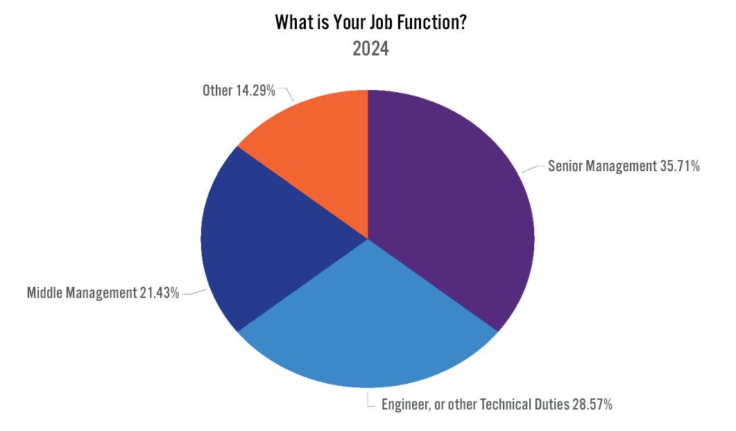
SubTel Forum, the premier publication in the submarine telecoms industry, offers focused issues that delve into specific market aspects. Each issue stands out with:
• An average of more than 1,000 unique reads per issue and an average read time of more than 8 minutes
• Two Months Exposure & Endless Archiving: Extended visibility and perpetual access for your ads
SPONSO R SHIP BENEFITS W ITH SUBTEL FO R UM :
• Video Embedding: Optional 30-second slot for Full and Two-Page ads.
• Social Media Shoutouts: For Full and Two-Page spreads on LinkedIn, Facebook, and Twitter.
• Print Ads: 300 dpi in PDF or JPG with crop marks.
• Video Ads: 30-second clips in 1280x720 or 1920x1080 resolution, mp4 format.
• Optional Video - 30 seconds
▪ 1280x720 or 1920x1080 resolution - mp4 Video File
EDITORIAL CALENDAR:
January 2026: Global Outlook, SNW EMEA '26 Preview
March 2026: Finance & Legal, ICPC '26 Preview
May 2026: Global Capacity
July 2026: Regional Systems, SNW '26 Preview
September 2026: Offshore Energy, IWCS '26 Preview November 2026: Data Centers & New Tech, PTC '27 Preview, STF @25
Learn more, customize your campaign, or place an order by contacting Nicola Tate at [+1] 804-469-0324 or ntate@associationmediagroup.com
The SubTel Form Almanac, released quarterly, is a key reference for the submarine cable industry. Each issue showcases major international systems with detailed pages featuring system maps, landing points, capacity, length, and RFS year, among other data.
QUA R TE R LY DO W NLOADS & EXPOSURE :
• Each issue averages about 850 unique reads, 215 clicks, and a greater than 24 minute read time.
• Three months of exposure plus permanent archiving.
• Banner Ad on the Quarterly Almanac web page for the issue duration.
• Prominent Two-Page Spread Ad near the front.
• Logo/Link on cover and webpage acknowledgement.
• Web Banner on News Now feed.
• Social media acknowledgement.
• Press release and mailer mention.
SPONSO R SHIP BENEFITS : A R T & V IDEO R EQ U I R EMENTS :
• Size: 17” W x 11” H for Two-Page Spread. Resolution: 300 dpi, in PDF or JPG
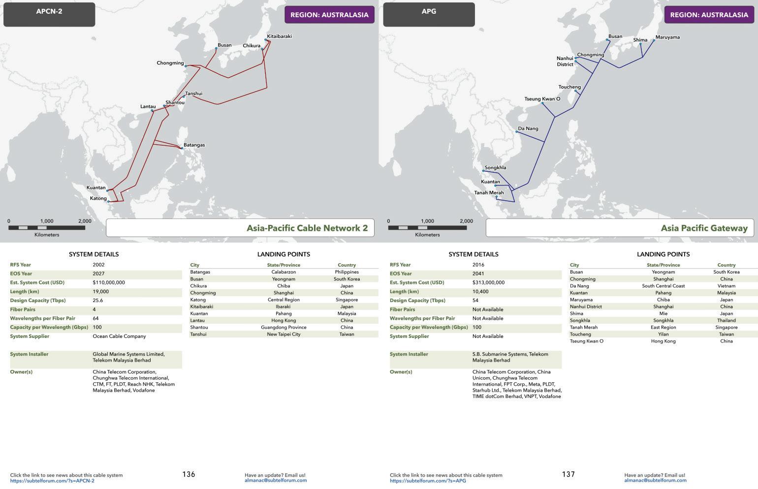
EDITORIAL CALENDAR:
February 2026: By System Age
May 2026: By Region
August 2026: By System Supplier
November 2026: By System Owner
The SubTel Forum Cableship Codex is a brand new publication delivering expert analysis, fleet intelligence, and operational insights on the global fleet of cable installation and maintenance vessels. An essential reference for marine coordinators, project managers, operators, and decision-makers in subsea cable deployments, each issue includes featured profiles of cable ships, regional fleet coverage and deployment maps, quarterly insights and trends, and much more.
QUA R TE R LY DO W NLOADS & EXPOSURE :
• Each issue averages about 850 unique reads, 215 clicks, and a greater than 24 minute read time.
• Three months of exposure plus permanent archiving.
SPONSO R SHIP BENEFITS :
• Banner Ad on the Cableship Codex web page for the issue duration.
• Prominent two-page spread in the first third of the publication (or location as requested).
A R T & V IDEO R EQ U I R EMENTS :
• Size: 17” W x 11” H for Two-Page Spread. Resolution: 300 dpi, in PDF or JPG
EDITORIAL CALENDAR:
December 2025: Year in Review - Missions, Metrics & Standouts
March 2026: The Global Fleet - Capacity, Age & Coverage
June 2026: Cable Ship Operators - Who Runs the Fleet?
September 2026: Tools of the Trade - Systems, Deck Gear & Innovation
The SubTel Forum Annual Report offers the latest, comprehensive data on the submarine fiber market, analyzing system capacity, productivity, and industry outlook. The yearly Industry report typically generates more than 2700 unique reads with an average read time of more than 11 minutes.
ANNUAL PRICE: $3,350
SPONSO R SHIP BENEFITS :
• Two-page Spread Ad.
• Social media acknowledgement.
• Press release and mailer acknowledgement.
A R T & V IDEO R EQ U I R EMENTS :
• Two-page Spread: 17” W x 11” H, 300 dpi in PDF or JPG.
• Optional video: include a blank box for overlay; no size restrictions.
LOCK IN NO W FO R 20 2 6 !
Sponsors can secure a spot in one of the various categories below. First come-first served!
• Global Overview
• Capacity
• Ownership Financing Analysis
• Supplier Analysis
• System Maintenance
• Cable Ships
• Hyperscalers and The Evolution of Submarine Cable Ownership
• Special Markets
• Regulatory Outlook
• Regional Analysis and Capacity Outlook
Note: Subtel Forum reserves the right to change categories
THE SUBMARINE TELECOMS FORUM DIRECTORY
This new directory is designed for industry professionals to locate companies that provide products or services to the submarine telecom cable and network operations sector. In the last twelve months more than 5,600 users viewed more than 10,000 pages. Make sure your company is featured prominently!
• Starting at $625/year
Feature your logo on our beautiful, large format print map, which proudly showcases every major international submarine cable system. This map is a fixture in many offices across the industry.
Limited Availability:
Wide Distribution:
Only 22 spaces for logos.
Over 4,500 copies shared at key industry events including Pacific Telecommunications Council (January 2026), Submarine Networks EMEA (May 2026), Submarine Networks World (September 2026), and IWCS Cable & Connectivity Industry Forum (November 2026).
ANNUAL PRICE: $4,500
SPONSO R SHIP PERKS :
• Comlimentary Web Banner on News Now feed
• Social Media shoutouts
• Acknowledgement in press releases and mailers
• In addition to the print copies that you may pick up during key industry events you can secure a print-ready PDF to print copies for staff and customers. Updated quarterly!
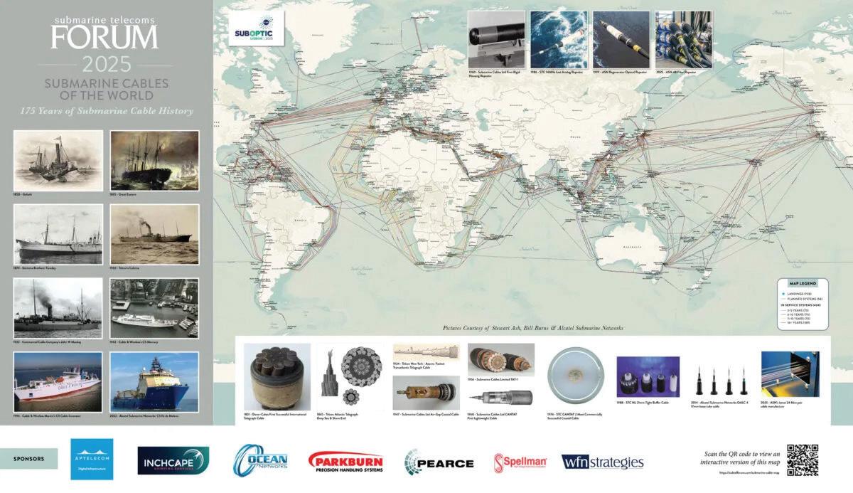
New for 2026, the SubTel Forum Online Cable Map will feature quarterly themes that spotlight the biggest conversations in our industry.
• Q1: System Age & Lifecycle – Maintenance, repair & replacement
• Q2: Regional Connectivity – Africa, APAC, Americas, Europe, Polar
• Q3: Technology & Suppliers – Innovation, ESG, installation & supply chain
• Q4: Owners & Investors – Hyperscalers, carriers, consortia & finance
QUARTERLY PRICE: $3,150
This map is a valuable tool for anyone interested in the submarine cable industry, allowing detailed exploration of global cable infrastructure.
SPONSORSHIP BENEFITS FO R THE SUBTEL FO R UM ONLINE C A BLE M A P :
• Duration: 3-month exposure.
• Visibility: Your logo and link featured on every page.
These benefits offer sponsors significant exposure and opportunities to highlight their company within e-submarine telecoms community.