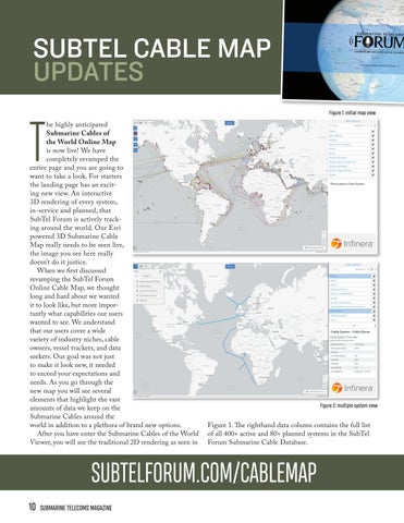
SUBTEL CABLE MAP UPDATES Figure 1: initial map view
T
he highly anticipated Submarine Cables of the World Online Map is now live! We have completely revamped the entire page and you are going to want to take a look. For starters the landing page has an exciting new view. An interactive 3D rendering of every system, in-service and planned, that SubTel Forum is actively tracking around the world. Our Esri powered 3D Submarine Cable Map really needs to be seen live, the image you see here really doesn’t do it justice. When we first discussed revamping the SubTel Forum Online Cable Map, we thought long and hard about we wanted it to look like, but more importantly what capabilities our users wanted to see. We understand that our users cover a wide variety of industry niches, cable owners, vessel trackers, and data seekers. Our goal was not just to make it look new, it needed to exceed your expectations and needs. As you go through the new map you will see several elements that highlight the vast amounts of data we keep on the Submarine Cables around the world in addition to a plethora of brand new options. After you have enter the Submarine Cables of the World Viewer, you will see the traditional 2D rendering as seen in
Figure 2: multiple system view
Figure 1. The righthand data column contains the full list of all 400+ active and 80+ planned systems in the SubTel Forum Submarine Cable Database.
SUBTELFORUM.COM/CABLEMAP 10
SUBMARINE TELECOMS MAGAZINE