PENINSULA KIDS

The seven people you need around you for success

Boosting

FREE
LOVING FAMILY LIFE ON THE PENINSULA SPRING 2021
WaLk
WaLk
Fertility
in Men


2 Peninsula Kids – Spring 2021 Australia's Biggest Indoor Playground Funtopia Carrum Downs funtopiaworld.com.au/carrumdowns 586 Frankston Dandenong Rd, Carrum Downs Great food, even better coffee Climbing, slides, parties & fun!


www.peninsulakids.com.au 3
Cover Photo

Cover Model: Harry
Location: Angus and Rose Coffee and Creativity, Mount Martha
Photographer: Danielle B Photography daniellebphotography.com.au
Editor and Publisher
Melissa McCullough melissa@mpnews.com.au
Design Sam Loverso sam@mpnews.com.au
Advertising
Miriam Doe 0421 085 974 miriam@mpnews.com.au
General Enquiries info@peninsulakids.com.au

All material is copyright, and may not be reproduced without the express permission of Mornington Peninsula News Group, or the original copyright holder in the case of contributions. Copyright of contributed material rests with the contributor.


Disclaimer: The authors and publisher do not assume any liability to any party for any loss, damage, or disruption caused by errors or omissions, whether such errors or omissions result from negligence, accident, or any other cause.
This publication is not intended as a substitute for the medical advice of physicians. The reader should regularly consult a physician in matters relating to health and particularly with respect to any symptoms that may require diagnosis or medical attention.
Peninsula Kids is produced quarterly. 15,000 copies distributed between Mordialloc and Portsea.

Registered address: 63 Watt Road, Mornington 3931
Editor Melissa McCullough
Best wishes from the spring edition of Peninsula Kids magazine.
I truly hope you and yours are staying safe and happy. I know it had been another difficult winter, especially, I think, because we had a taste of normalcy in the middle of it all. School, sport, movies, dinners at restaurants – all the things I used to take for granted, but never will again. My kids are missing all of it, and as a family, we are pressing forward and continue to look for the rainbows after the storms.
Spring comes just when you need it to. When you’ve had enough of the cold. The damp. The dark. It’s time to come out of hiding and get out to enjoy your surroundings, (even though those surroundings may have conditions on them).
Don’t forget your friends, family, and neighbours. Everyone is battling with something different, whether it’s living alone, loved ones overseas, missing celebrations, births, marriages and even proper mourning. Lend a hand or an ear where you can, (safely), and we will work through this as a community.

“Alone, we can do so little; together, we can do so much.”
– Helen Keller
Congrats to our latest colouring competition major prize winner, Koby, who did some most excellent colouring in hopes that he would win the prize for his sister celebrating another birthday while in lockdown. Awwwwwwwwww…..(I’m not crying, you’re crying..)
And to our runner up, Sophie, who added a bit of sunshine to her picture and our day. ��
Advertising
Miriam Doe


Try your creative hand with our colouring competition in this edition of the mag on page 75 where you can win a fantastic prize from www.kidzshed.com.au


Don’t forget to get those clocks moving forward at 2:00 am on Sunday, 3 October!
Take care out there!
Design Sam Loverso
Our winner, Koby! Runner up, Sophie 4 Peninsula Kids – Spring 2021
Proudly published by www.facebook.com/MorningtonPeninsulaKids www.instagram.com/mornpenkids
peninsulaph.com.au

Maternity care your way
Pregnancy and birth are exciting and challenging events for a family. At Peninsula Private Hospital, we understand this and deliver the ultimate boutique private maternity experience. Combining kindness, care, and expertise, we support you from pregnancy, birth and beyond.

Want to learn more about having your baby at Peninsula Private Hospital?
Scan the QR code to download a free Maternity Information Pack.

Preparing for pregnancy?
Sign up to our free information event 7pm Wednesday 27th October 2021 via: https://ramsayhc.com/pregnancyinfoevent
www.peninsulakids.com.au 5


6 Peninsula Kids – Spring 2021 ST MACARTAN’S PARISH PRIMARY SCHOOL ENROLMENTS 2022 NOW OPEN Please call 5979 9200 or email office@smmornington.catholic.edu.au to receive an enrolment pack and discuss available tour times. www.smmornington.catholic.edu.au
10 The Seven People You Need Around You For Success
Successful people know how important it is to surround themselves with other successful people.
12 Raising Empowered Tweens
Tips for raising strong, connected, empowered and self-aware Tween daughters.

16 Mum...I'm Bored!
With school holidays fast approaching here in Victoria, our families are faced with the somewhat overwhelming task of keeping our kids entertained.
18 Seven Family Friendly Money Saving Tips

While we want our family to have the best and not want for anything, most of us don’t have an endless supply of cash to throw around either.
20 Helicopter Parenting
Is this style of parenting a constrictor of life rather than a conduit of life for our kids?

22 Let's Roll
Another rough and tumble play option for you to try at home brought to you by David Hawkins.
24 Million Dollar Micro Business
If you’re ambitious and feel unfulfilled at work and find your mind wandering off to dreams of what could be, it may be time to give those dreams a go.
26 Foolproof Ways to Keep Plants Alive
You, too, can have a green thumb with these simple tips.

Contents
10 26
12 www.peninsulakids.com.au 7
18
10
Spotlight


8 Peninsula Kids – Spring 2021 Contents JO & CARL VIOLETA www.violetafinance.com.au Pg18 REGULAR CONTRIBUTORS Special thanks go to the gorgeous and talented group of contributors who breathe life into every issue by sharing their best with us. LINDA MARTINUCCI www.simplyswapfoods.com.au Pg54 Cover DANIELLE BUSUTTIL daniellebphotography.com.au YVETTE O’DOWD Pg70 In Every Issue 35 Party Planning 39 Days To Celebrate 40 Things We Love 52 Book Reviews 75 Colouring Competition 58 STEFANIE POOLE www.stefaniepoole.com Pg68 68 36 KIM NORTON www.rainbowlighttherapies.com.au Pg16 DAVID HAWKINS Pg22 54 Local 28 Let's Go for a Walk Celebrate 30 Halloween Party 32 Bake it Happen Education 44 Turn Your Kitchen Into a Science Laboratory 47 Focus on Education 51 Reading. The Foundation for Learning Success Recipes 54 'Simply Swap' Recipes with Linda Martinucci Health 58 Boosting Fertility in Men 60 How Parents Can Survive Allergy Season 62 The World Needs all Types of Minds 66 Ask the Experts Pregnancy & Baby 68 Welcome to the Hive 70 Breast Feeding Toddlers Creative 74 Mandala Art 40


www.peninsulakids.com.au 9
The seven people you need


The truth teller The visionary genius
The director of reality
 By Lisa Stephenson
As a global success coach, I am yet to meet anyone who has achieved success without the support of others. It’s a rare person who steps up to the podium to receive a reward and only thanks themselves. Even if, by chance, they did most of the hard work alone, they no doubt benefitted from the input of good role models, who either set an example or propelled them towards their goals.
Mark Zuckerberg had Steve Jobs. Bill Gates had Warren Buffett. Oprah Winfrey had Maya Angelou. Successful people know how important it is to surround themselves with other successful people; individuals who are smarter and/or more experienced than them, who have accomplished their goals and can share the knowledge they gained along the way. As author and entrepreneur Jim Rohn famously said: “You’re the average of the five people you spend most of your time with.” The company you keep has the potential to energise and challenge you – which is why it pays to surround yourself with positive, successful people.
People often talk about having an inner circle, personal cheer squad or support crew, comprised of teachers, coaches, mentors and peers who push them to be better. We need these people in our lives; people who want us to be the very best version of ourselves, who believe we have potential beyond all measure. I’m not talking about your family and friends, but other people who have agreed to support you and advocate for your success. You’ve shown them your plan and vision. You have had a meaningful conversation with them about the specific role they play and together you have agreed outcomes and timeframes. They are people who will challenge you and celebrate you.
around you for success
The cheerleader The promoter
Each of them serves a different function and brings a unique skillset, personality and range of experiences to the table. If you want to become your best self, it’s time to identify and build your own circle of influence. Here are the seven people it should include.

1. The truth teller – This person will say out loud what others may not be prepared to say. They will tell you the good, the bad and the ugly about how you are doing, the impact you are having on others and what they are observing.
2. The visionary genius – This is where you get to dream. Your visionary genius will prod you to plan, play and think bigger than you are now. They will encourage your ambition and innovative thoughts. They will be ridiculously optimistic about what is possible for you.
3. The director of reality – This is your voice of reason: someone who will raise all the things you know you should think about and consider, but don’t want to.

4. The cheerleader – Celebrating progress and everything you are doing well must be recognised. This is where you get your energy and momentum. Our natural inclination is to focus on what we aren’t doing well. This person will always remind you about your strengths.
5. The promoter – We often find it hard to promote ourselves and/or our ideas. Your promoter is your ‘out loud’ advocate. They are your living and breathing testimonial. They will tell everyone how awesome you are and seek out other people who can experience you and sell you.
The expert
The accountability partner
6. The expert – They’ve been there and done that. They have a world of wisdom, experience and stories to share. They know the stuff you don’t but should. Their mistakes are learning lessons in your pocket.
7. The accountability partner– It was so easy to be motivated when you started out, but now you are tired, or finding it hard. Here is where you are reminded of your commitment and timeframes. Your accountability partner will review your progress and support you in working through next steps that are aligned with your goals. They will ensure you keep going.
If you’re worried that it’s overly indulgent to expect such people to heed your call to arms, then stop right there. Investing in you is the most important investment you will ever make. And when in doubt, remember: you can always nominate yourself to join someone else’s inner circle, so you can share your own wisdom, experiences and encouragement, and continue the mutually beneficial cycle of reciprocal support.
Lisa Stephenson, founder of The Coach Place Global, is a globally recognised highimpact coach, consultant, keynote speaker and author. You will find her behind the scenes with C-Suite executives, entrepreneurs and high profile individuals in fastpaced environments, where absolute trust is non-negotiable and the stakes are high. Become a Coach Place Member to gain instant access to insightful articles, thought provoking masterclasses, inspiring interviews and more to accelerate your personal growth at: www.thecoachplace.com
www.peninsulakids.com.au 11
By Amanda Stokes
Top 5 Tips for
Raising Empowered Tweens

The Tween years can be a challenging time as a parent, as your once compliant daughter rolls her eyes at the idea of being told to hang up her towel, let alone helping empty the dishwasher. As challenging as this new-found attitude is, the Tweenage years are an incredibly important time because it’s an opportunity to set up clear expectations as a family and on an individual level too. It would be wonderful if our daughters became resilient and self-aware by osmosis, but unfortunately life doesn’t work that way.
continued next page...
5
Five Reasons To
Spring Clean YOUR HOME
It's that time of the year again to start thinking about spring cleaning, which means some serious decluttering, reorganisation, scrubbing and polishing. Whether you love it or hate it, there's no denying that a good spring clean is a worthwhile exercise. But did you know that it can also benefit your health and wellbeing? Here are five reasons why clearing out those closets and grabbing the polish are actually good for you. Let the cleaning commence!
1. INCREASES PRODUCTIVITY
Making the effort to declutter and organise your home or office can save you tons of time.
2. IMPROVES YOUR HEALTH
Removing allergens from the home can make you feel healthier, especially at a time when allergies are rife.
3. MAKES YOU HAPPY
The act of cleaning provides a sense of satisfaction, which in turn can put you in a good mood.


4. REDUCES STRESS
Cleaning and organising your personal spaces lets you enjoy a more organised environment and this can relieve stress.
5. HELPS YOU FOCUS
A thorough clean helps to clear your mind and makes it easier to focus on other more important things.
ww w e s s e nti a lh o m e se r vi c e s c o m.au | c on t ac t @ e ss e ntialh o m e s e r vi c e s c o m a u BOOK Y O U R CLE A N TO DA Y 13 0 0 910 97 1 or co n t act us t o kno w m o re ab o u t o ur disin fe cti o n s e r vice s
empowered and self-aware Tween daughters:
Encourage reflection and responsibility:
We all play a role, so it’s important that we help our daughters to understand theirs. I’m a big believer that there are three sides to every story- one side, the other side and the truth. The story we tell ourselves is the one that leads to our view of the world. I think it’s incredibly important we help our daughters develop their perspective. We want them to become participants in their lives, not victims of circumstance.
Lead with self-compassion:
This is an important one. As humans we are innately flawed. It’s just part of life, we all make mistakes and we’re meant to. We need to empower our daughters to understand that it’s not our challenges that define us, but rather the way we rise up after a fall.
1 2 3
Find better ways to communicate:
The Tween years are the beginning of our daughters becoming less open with us. As parents, it’s a really great time to get creative! Start a journal that’s just between the two of you, leave her notes to find, plan a date, think outside the box.
Be a supporter of other women:
So often our girls start comparing themselves to others. They feel envious of other’s achievements; they feel like if someone else is good at something then that makes them less so. We need to teach our girls that there is not a finite amount of goodness out there. We can encourage our daughters to celebrate others by role modelling first and becoming supporters of other women.
4 5
Understanding you control your inner voice: Our thoughts lead to our feelings which lead to our actions. We need to help our daughters understand this and provide supportive opportunities for them to reflect and challenge their thinking. It’s incredible to think that often our girls aren’t connected to their inner voice. There is so much power in understanding that we are in control of thoughts, and through practice, we can help our daughters create a kinder, more optimistic self talk.
Amanda is an educator, presenter and mother to three and the Founder of Raising Strong Daughters. Her second book ‘The Tween Mother’s Tool Book: Raising Strong Daughters’, is a practical, easy to use activity based guide that covers moods, friendship, body image, self acceptance and so much more. If you are the parent of a tween girl, then this tool book is one you’ll want in your parenting tool kit! You can also follow her on Instagram at www. instagram.com/raisingstrongdaughters_
14 Peninsula Kids – Spring 2021
Here are my top 5 tips for raising strong, connected,


www.peninsulakids.com.au 15
OUTDOOR SEATING & PLAY AREA! GLUTEN FREE FOOD OPTIONS! BOOK YOUR NEXT PARTY WITH US! GIFT VOUCHERS AVAILABLE!
Sat
A TABLE,
222
KIDZSHED.COM.AU Rustic Farm Setting
and Horse Rides
Animals for “Hands on” Experiences Playground, Picnic Areas (BYO Food) Free Cuppas & Gas BBQs Special School Holiday Activities 490 Stumpy Gully Rd Balnarring www.rhsfarm.com.au
5983 1691 Open 10am - 4pm* *Closed on Thursdays and Fridays outside of school holidays Check our website for Covid updates
HOLIDAYS.
GRAND PARADE @ 11AM. PIG OBSTACLE RACE @ 2PM. SHOWBAGS FOR PRE PURCHASE (see website for details)
HOLIDAYS 18th SEPT
to
OCT
OPEN DAILY 10am-4pm*
Mon- closed Tues - Fri 9am-3.30pm
& Sun 9am-4pm SERVING GREAT LAVAZZA COFFEE, LOTS OF FOOD OPTIONS (Inc. healthy!!) CALL US AND RESERVE
BOOTH OR PARTY ROOM.
MARINE PDE HASTINGS P:5906 5900
Pony
Many
Ph
SCHOOL
SHOWTIMES
SCHOOL
through
3rd
2021
By Kim Norton

fast approaching here in Victoria, our families are faced with the somewhat overwhelming task of keeping our kids entertained.


Whilst it is great to be able to take the kids out to the movies, the city, a show, or a family day out, this can prove to be expensive and out of reach for many. For our working parents this simply may not be a viable option at all as the kids are left with carers/extended family. For others, it might be something that can only be done a couple of times over the school holiday period. So, taking into account COVID-19 lockdowns/restrictions, time, money, weather (and the need for all of you to get some much needed rest) how do you please each member of the family and curb the inevitable cries of “Mum, I’m bored” when you want to spend some time at home? You sit down with your child/children, and you make a list of activities that they can do either by themselves, with each other, as a family or with minimal supervision.


16 Peninsula Kids – Spring 2021
yTparTea erTaW alloonsB origaMi Book aeTCrea ookBCiMoC ripTs in a BnerFgUn aTTle Change B r oMakean BsTaCleCoUrse pUTonaConCerT BakeaCake kCsoMake sTppeUp MakeaBlanke orT TakeavirTUal yTrainride oUTUBe) MonopolylikeMgaBoard eTaTMedi sTarTaJoUrnal playdressUps gardening draWing ColoUringin pUTona MagiC shoW WriTeasTory skaTeBoard hTiWlaypoxBhTCMaarsC aeTWri song FFoe ” avengeraono p Miniaaveho Mly do noT proCrasTinaTe Find soMeThing FUn To do & go, go...
Makevideos
W ith school holidays
Makevideos yTparTea erTaW alloonsB origaMi ook aeTCrea ripTs in a BnerFgUn aTTle Change r oMakean BsTaCleCoUrse pUTonaConCerT BakeaCake kCsoMake sTppeUp MakeaBlanke orT TakeavirTUal Trainride oUTUBe) MonopolylikeMgaBoard eTaTMedi sTarTaJoUrnal playdressUps gardening draWing ColoUringin pUTona MagiC shoW WriTeasTory hTiWlaypoxBhTCMaarsC aeTWri song FFoe avengeraono p Miniaaveho Mly do Find soMeThing FUn To & go, go...
Because your little cherubs have helped to compile this list, they will feel empowered, more likely to take ownership and at least have a go at some of the listed suggestions. Mix up the list with some indoor and outdoor activities; activities they can do independently, together and activities that do not involve an iPad or computer screen.
Some ideas for your list could include:
1. Lego/Magnetix/Duplo

2. Bake a cake
3. Drawing
4. Colouring in
5. Play hopscotch
6. Card games like Uno
7. Board games like Monopoly

8. Make a blanket fort
9. Trampoline
30. Play with LOL’s/dolls/ Barbies
31. Chalk drawing on the concrete
32. Start a journal
33. Have a wrestling match
34. Go on a scavenger hunt
35. Write a story
36. Face time with friends
37. Face time games like charades

38. Watch a movie
39. Watch a documentary
10. Have a “dance off”
11. Cosmic Kids Yoga
12. Put on a concert
13. Put on a magic show
14. Make videos
15. Play on the swing
16. Change bedroom around
17. Playdoh/Slime
18. Read a book
19. Take a virtual train ride (YouTube)
40. Paint a picture
41. Create a comic book strip
42. Skateboard
43. Have a Mini Olympics
44. Make an obstacle course
45. Make sock puppets
46. Origami
47. Jigsaw puzzle
48. Learn to knit/crochet/sew
49. Paper airplane races
50. Visit the zoo, museum or even space, via their interactive websites.
20. Tea party
21. Play dress ups
22. Make an affirmations Jar
23. Nerf gun battle


24. Write a song
25. Gardening
26. Meditate
27. Ride a bike
28. Play with match box cars
29. Blow bubbles
Pop your list up somewhere that can easily be seen by all and when you hear those inevitable cries of boredom, you simply point at it. No raised voices, no moaning of “I don’t know what to do” and no having to think on your feet allowing you to sit down and enjoy that whole cup of hot coffee ��
Kim is the founder of Rainbow Light Therapies and is a Holistic Counsellor specialising in stress and anxiety management for kids, teens, and adults. Kim provides a unique, intuitive, and individualised therapy approach through individual, small group, and family counselling sessions both online and at her studio in Langwarrin. Also working with special needs kids, Kim runs sessions and workshops for people of all abilities on various topics throughout the year.
Please see www.rainbowlighttherapies.com.au
in a C ovid J ail oard
in a C ovid J ail oard
www.peninsulakids.com.au 17
Seven familyfriendly money saving tips
By Carl & Jo Violetta
Saving money while raising a family can be a tricky business. While we want our family to have the best and not want for anything, most of us don’t have an endless supply of cash to throw around either.
Fortunately, there are plenty of ways busy families can save money, including the 7 money saving tips we’ve outlined below.
CHECK APPS & RECURRING SUBSCRIPTIONS
Recurring subscriptions can add up if not watched carefully. It's worthwhile reviewing any recurring payments and subscriptions to see if you can save money.

Set aside 20 minutes each month to go through your bank statements line-by-line, to see if there are any subscriptions you can cancel or unusual activity you need to follow up on.
It can be very easy for older kids who have access to devices to sign up to recurring subscriptions via in-app offers without knowing what they’re signing up for. A quick check of the bank accounts and your app store account every month can nip these purchases in the bud and save you paying for subscriptions you don’t want.
MEAL PLAN TO BUY & COOK IN BULK
Feeding a family can be an expensive exercise. But with planning and forward-thinking it’s possible to reduce your weekly food bills. By planning meals ahead of time and cooking some meals in bulk, we were able to reduce our weekly food spend by approximately 40%.
Following a meal plan every week makes it easy to know what to cook for each meal ahead of time.
Our best tips for meal planning on a budget are:
• Shop your pantry and fridge first. If you create a meal plan around what you already have available you can save money at the supermarket and make sure no food goes to waste.
• Include breakfast, lunch and snacks in your plan. Taking lunches to school and work instead of buying lunch can save you some serious cash over a year.
• Cooking in bulk or freezing meals not only reduces your costs but saves you time. Plus, you’ll have meals ready to defrost and eat on the days you don’t feel like cooking.
• Find family-friendly slow cooked recipes so you can buy cheaper cuts of meat while still delivering a delicious meal.
• Incorporate a few meat free meals into your meal plan each week to see a further saving to your budget.
PLAN EARLY FOR CHRISTMAS
Planning early for Christmas is a great way for families to save money. Create a budget and list of gift ideas, so you can keep an eye out for sale items and start squirrelling gifts away early for Christmas. Half Yearly and Black Friday sales are a great time to Christmas shop. Early Christmas planning means you can avoid crowds and avoid last-minute impulse buys. Make sure you stick to a plan though to avoid overbuying and overspending.
CARPOOL & SHARE RESOURCES WITH LOCAL FAMILIES
Imagine only having to navigate school drop-offs and pick-ups once or twice a week instead of every single day. It’s possible by getting together with families from the same school and organising a carpooling schedule.
Not only does carpooling save you time and petrol money, but it also saves wear and tear on your car and it reduces carbon emissions by having fewer cars in use.
Why not take it one step further and organise carpooling for sporting and after school activities as well?
REVIEW YOUR HOME LOAN & THE INTEREST YOU PAY
Reviewing your home loan every 6 - 12 months is another great way to save money. And this could actually save hundreds of dollars each month.
Speak to your broker to see what home loan deals and options are available and decide if you want to negotiate with your current lender to get a better deal or refinance into a completely new loan.
Be mindful of any loan features, exit fees or penalties before deciding. Simply calling and asking your current lender for a better rate or having the option to make extra repayments can really make a difference to your finances. Setting up an offset account can also make a big difference. Any money sitting in an offset account will reduce the amount of interest that’s being charged to your home loan.
18 Peninsula Kids – Spring 2021 2 4
1 5
3
NEGOTIATE WITH YOUR SERVICE PROVIDERS
When was the last time you called your service providers and asked for a better deal? This process may take time but it can be well worth the exercise to save you serious money in the long term.
All you need to do is:

• Gather your current information so you know exactly what plan and payments you are currently paying.
• Jump on comparison websites and see what deals and offers are available for the same service.


• Call your current provider and let them know you’re shopping around and have found better deals available and you're thinking of switching.
If they don’t offer to match or better the deal, consider switching providers. Companies typically prefer to keep your business rather than lose it so will often match competitor deals. In some cases, this simple exercise can save you hundreds of dollars each year and ensures you’re always getting the best deals available for your services.
TEACH YOUR KIDS HEALTHY MONEY HABITS

One of the best gifts we can give our kids is the gift of getting into good healthy money habits early.
We’ve made it super easy to teach your kids healthy money habits by compiling an easy-to-read guide about how to teach your kids about money. Simply head over to Violeta Finance and download the FREE guide today.
Jo and Carl Violeta are self-confessed numbers nerds, parents of two, and cofounders of the award-winning business, Violeta Finance. They’re a husband and wife team who are passionate about empowering their community with financial education, love the odd glass of wine, and get a kick out of helping families achieve their homeownership and financial dreams. www.violetafinance.com.au

www.peninsulakids.com.au 19 BOOK NOW WE’VE BEEN TEACHING KIDS TO SWIM SINCE ’72
lessons
Paul Sadler Swimland Carrum Downs 149 Hall Rd Carrum Downs (03) 9782 9444 carrumdowns@paulsadlerswimland.com paulsadlerswimland.com.au LEARN FROM THE SURVIVAL SPECIALISTS
When you live
on
the worlds largest island, swimming
shouldn’t be a consideration. They’re a necessity!
6 7
Everyoneknowsatleastonehelicopter parent(the parent who wraps their child in cotton wool to protect them from the dangers ofsocietyandoneveryaspect ofthe child'slife.)However, more and more we are seeing the negative consequences ofthisstyleofparentingand yettheincidence ofhelicopter parenting only seems to be increasing.
20 Peninsula Kids – Spring 2021
By Angela Karanja
Monica
Rosenfeld, mother of three, who has grown up on the Eastern suburbs of Sydney, is all too familiar with helicopter parents.
“From my observations, parents mollycoddle their children far too much; they don’t give them a sense of responsibility. They transfer their own anxiety to their kids and essentially have them on a leash. My husband and I have encouraged our children to catch buses from a young age, make their own lunches and taught them to be proactive when it comes to communicating with teachers and other students.”
According to adolescent psychologist and parenting teenagers expert, Angela Karanja, helicopter parenting can cross a boundary. “Parents protecting their kids is a natural thing; in fact it is healthy for child development when a parent deeply cares, is interested in the lives of their kids and protects them. However, some parents often cross a boundary, encroach, and enmesh themselves with their kids so much that instead of their presence being a conduit of life, it can become a constrictor of life.” Angela has provided her top 5 tips for parents to help them be less of a helicopter parent.
Find your own identity
The first and healthiest antidote to being a helicopter parent is to find your identity separate from your child. Ask yourself: 'Who am I without this child' because most helicopter parents hinge a big chunk of their worth in being parents. What is my sense of purpose without the successes and achievements of the child?
Understand their struggles
A major reason why parents result in helicoptering is so that they can protect their kids from experiencing struggles and disappointments. Understanding that struggles are part of life and that they create resilient kids can help parents realise that helicoptering is actually denying their kids from developing the ability to figure out solutions and navigate challenging situations.
Release your fear
Helicopter parents can release the fear that their children’s success is wholly dependent on them. Daily sit for a moment and remind yourself of the many processes that happen in your kid’s life in every moment, and you have no influence and control over them. E.g., their heart beating, the blood flowing in their veins, their digestion. When parents take this perspective and scope, they can then begin to trust that indeed their children are a product of life expressing itself, and they do not need that thread combing.
Recognise why
Recognise the tendencies that you may be attempting to heal through your kid and compensate for your own feelings of abandonment you experienced as a child. Whilst this may prevent generational neglect, it can start the cycle of disabling independence, create dependency and co-dependency.
Adopt the right parenting qualities
Adopt the qualities of a transformational parent; a parent who empowers healthy boundaries, independence, and interdependence. To empower independence, parents can proactively take advantage of technology that facilitates independence while at the same time ensuring the safety of the child. An example of this type of technology is the use of Moochies smartwatches. Moochies is a fully functioning mobile phone in the form of a smart watch with an inbuilt GPS tracking device. Rather than worrying about the location and safety of your child, Moochies allows parents to track their children and contact them through their watch whilst allowing the children to gain independence.
www.peninsulakids.com.au 21
www.raisingremarkableteenagers.com
5 1 3 4 2
One of the easiest ways to give your kids a head start in life is simply to play with them. Luckily, that’s what do dads do best! Rough & tumble play has been shown to help children manage their emotions, display fewer negative behaviours, and to become more popular with their friends.
Let’s take a look at another simple and super fun game that you might like to try out with your kids at home.
Let'sRolL!
By David Hawkins
Our last rough and tumble adventure (back in the autumn issue) was a free-for-all wrestling tournament, that had dads and kids letting loose and working with each other to come up with cool but safe moves. With the arrival of spring, warmer weather and plush green lawns, let’s try a rough and tumble game that you can play in the soft grass and which requires your child to put in a little more strategic thought.
Steam Roller is a game of strength and ingenuity! Dad and the child lie down, flat on the ground, on their backs. To win Steam Roller, the child has to roll their body like a rolling pin and flip Dad over onto his tummy. Meanwhile, Dad wins if he can end up on the other side of the child. The great thing about Steam Roller is that it forces children to think about what they are trying to achieve and how to approach it. If they just roll toward Dad, they will either find that his body creates a dead-end barrier or they end up rolling right over the top of him!
The child will need to explore what happens when their body moves in each rotational direction and how this affects Dad. Which way will Dad roll? Will he move at all? Can the child stop him rolling over the top and winning? There needs to be a balance between attacking and being defensive.
Step 1: Don’t squish your child (too much)
We all know that Dads weigh a lot more than kids, so it is really important to take extra care when rolling over the top of children. Roll with your arms stretched above your head so that you can lift up onto your elbows and knees as you go over them. Kids LOVE to be squished but only a little bit.
Step 2: Take turns at winning

There is no way that a little kid can win against their father in this wildly imbalanced weight and size contest. But a critical part of rough and tumble play is ensuring that children get to win about half of the time. Losing helps them to learn about ‘good sportsmanship’ and managing their emotions. Winning lets them feel like they have defeated a giant!
Step 3: Be supportive
Children need to feel like they have earned their win. Give them hints and tips as they try to figure out how to flip you over. Help them to understand some basics about leverage, weight and tactics.
22 Peninsula Kids – Spring 2021
Here are the top tips for making the most out of the
Step 4: Remember to smile and laugh
Don’t forget that this is supposed to be lots of fun for you as well. Show your child how much you love playing with them by smiling, laughing and cuddling.
Tell them that you love paying with them.

Rough and tumble play doesn’t have to be a BIG event all of the time. In fact, research shows that children benefit from little bits of play, on a regular basis. Try to fit in a few minutes of Steam Roller every couple of days.
David Hawkins is a Peninsula-based stayat-home-dad who realised that he needed to improve his Dadding. So he set himself the simple task of being an Awesome Dad. He now challenges all dads to be awesome dads, by doing something out-ofthe ordinary with their kids.

www.peninsulakids.com.au 23
5 Steps to package your expertise into a digital online course
By Tina Tower
You’re sitting in the grind 9 - 5 and you have a dream.
You know that you were meant for more. If you’re ambitious and feel unfulfilled at work and find your mind wandering off to dreams of what could be, it may be time to give those dreams a go. Online courses are having a BIG moment thanks to the pandemic and our increased ability and desire to learn online. The industry’s revenue is expected to hit $240 billion this year. If there’s one thing that the pandemic has shown us, it’s that a lot can be done online. The online education market has exploded as people are looking to learn new things.
You can create an online course by packaging what you know, to help other people. Thriving online courses can be anything as traditional as business marketing, or the obscure like how to be a clown that specialises in juggling. Professionals and hobbyists alike are using the internet to help teach their skills to learners across the globe.
You have so much expertise locked away in your own head. The knowledge that you’ve gained through your life can help to shortcut someone’s success and learn from your experience. Packaging what you know into a digital online course product allows you to create an income stream from what you know, while helping other people. Whether you’re looking to ditch your job for good or to make some money on the side, an online course is a simple way to make a saleable product from what you know.
These five steps have been used with thousands of people to package what you know into a saleable product.
1. Define your idea
The simplest way to begin is to start with something simple like a 30 day or six week course that there may be people asking you for already. So, you’re a florist who can make those gorgeous flower arches that everyone wants to know how to create - start there.
It doesn’t have to be complicated; start with something simple and clear.
2. Define your audience
Before you actually start creating your course, you want to be crystal clear on who it’s for and who it’s not for. Being a generalist doesn’t generally work (see what I did there ;)) Being a specialist and an expert will win every time. Instead of being ok for everyone, be perfect for your perfect customer. Always focus on your customer and make service a priority. The way you’re successful is by making others successful.
3. Create the course
I’m a big fan of starting simply. You can begin with a full blown professional website and recorded course, but unless you have bucket loads of start up cash then there are easier ways. That phone you have in your pocket has everything you need to film your first course. Then, when you get more cash coming in, you can continually improve the quality. Online education is very different to what we’re used to from our classroom experience. There’s zero room for waffle. Teach what you’ve promised and get your customer the result in the quickest and easiest way.

24 Peninsula Kids – Spring 2021
4. Start your marketing
There’s no use being the world’s best kept secret. Once you’ve created your first course, you then have to talk about it, to everyone! Spread the word and do some valuable content marketing to show people that you know what you’re talking about.
5. Launch it into the world
If you really want to take online courses seriously, invest in yourself and get expert support. You’ll need a basic website to get started (I recommend something user friendly like Kajabi), a sales page, a way to take payments and somewhere for people to view your courses. The thing that often holds people back the most is that they feel like they need more confidence or to be more qualified. If you’ve read this far, I know you have that desire within you and I know that you have enough knowledge to share with the world. We only have one life; go do it.


Tina Tower, author of Million Dollar Micro Business (Wiley ($29.95), is an awardwinning serial entrepreneur who has founded, grown, and sold several businesses and franchises. Tina has helped hundreds of people package their expertise into an online course and launch it to the world. Through her program, Her Empire Builder, she is on a mission to help 100 women build a $1 million a year business by 2025 and her new book shows show you how to package your expertise into an online course. Find out more at milliondollarmicrobusiness.com

If there’s one thing that the pandemic has shown us, it’s that a lot can be done online
foolproof ways to keep plants alive
 By Miranda Mueller & Stacey Demarco
When we teach workshops there are always people who declare they ‘kill everything’ and they ‘don’t have a green thumb’. We get it. You’ve had plants in the past and they’ve died. Died miserable deaths, slowly but surely wasting away. Or maybe they’ve had spectacular deaths – covered by insects, rotting, ejecting foul substances ... And sometimes you felt they had spiteful deaths – they died despite your efforts to do everything right. So now you have a strong belief you can’t keep a plant alive. Well, we’re going to change that – or at least convince you to have another crack at it. For you don’t just have a green thumb – you have a wild flowing green energy! Trust the plant. Trust yourself to grow them. Trust that by dipping your toes (and hands) into growing, good things will flow from it.
Here’s 6 ways to keep your plants alive:
Know the plant: While we love the idea of eventually developing a ‘personal’ relationship with a plant, the best place to start is to look at what the plant is and its basic needs. For example, knowing that some plants likes lots of water whereas others like their roots fairly dry can make a big difference to successfully growing them.
Don’t use pesticides to remedy an issue: There’s rarely a quick fix in nature. A spray to kill aphids may create an imbalance of other insects. Instead, understand that each time you plant, you’re creating an ecosystem that needs other working parts for balance. Each insect is a food source for another and with your guiding hands planting the habitat, you will call in what you need to support you in organic growth.
Keep a journal of your growing adventures: Observation is key when learning your way around a garden space. A seasonal journal is a great ally.
Love your green friends: You will come to see that you’re more connected to them than you may think. The web of connection expands as you see how others depend on your plants for survival, be that for fodder, shelter or medicine.
Understanding sunlight: Before planting anything in the ground, take time to understand the sun path across your land. That of the full heat of summer will be very different from that of the cooler months. Develop this idea further by watching how the wind moves and how water travels when it rains.
Consider the effect of frost and other weather.
Never let the death of a plant stop you from trying again: Death is an important part of life; plants that don’t survive will compost well, helping to create the growing medium for the next plant that comes along. Embrace the cycle.

Edited extract from
of
Cultivate your
and transform your life
www.rockpoolpublishing.com.au
Plants
Power:
garden apothecary
by Stacey Demarco & Miranda Mueller (Rockpool Publishing, $39.99) visit
Let's Go for a WaLk Let's Go for a WaLk
Source: www.visitmorningtonpeninsula.org


Balcombe Creek Estuary Boardwalk
16A Mirang Avenue, Mount Martha, 5kms
A wooden boardwalk and walking tracks run through the Mount Martha bushland along the south bank of the estuary from the Esplanade to the Nepean Highway. The Estuary is home to numerous species of flora and fauna.


Walk east through a vehicle gate following the main pedestrian trail which starts as a wide gravelled surface before becoming better defined and eventually turns into a boardwalk. The track divides at a number of points but you should follow the marker posts to ‘The Briars’ (or once or twice ‘The Boardwalk’). There are minor diversions to decks and viewing points on the Creek and the occasional person fishing. After two kilometres, you will emerge briefly into a small informal car park and then turn left immediately to rejoin the foot track and then cross over a bridge over the creek. You then emerge onto a rough vehicle track and turn right for 150m before veering off back onto the foot track and back across the river. You will pass an off-leash dog area on your right before arriving at the Nepean Highway.
Here you can return to the start, or follow the trail under the Nepean Highway Bridge and into The Briars Park for additional walking tracks. The Boonwurrung/Bunurong members of the Kulin Nation, the Mornington Peninsula’s traditional owners, called the Balcombe Creek area Tji’tjin’garook – the voice of frogs.
Devilbend Reservoir Walking Tracks
170 Graydens Road, Moorooduc, 3kms
A haven for waterbirds and walkers, Devilbend Reserve comprises 422 hectares of native vegetation along with almost 250 hectares of water surface area. Devilbend can be explored by selected walking tracks. The trail system includes all‐ability access to the shoreline, viewing/fishing platforms and boardwalk. Dogs and other pets are not permitted.
The main walks are Western Shoreline Track - 1.2km - Descend from the Devilbend Picnic Area along the 2.5m wide shoreline trail on a compacted surface that takes in views across the expansive reservoir whilst making your way down to the fishing platforms and boardwalks. Daangean Point Track - 1.5km return - This bushwalk runs through lowland forest from Daangean Point to the southern shoreline. The walk provides expansive views across the reservoir where waterbirds can be viewed.
For the more adventurous walker, the Devilbend Circuit Track – 11.5km, circumnavigates Devilbend Reservoir. The trail meanders through lowland forest and grassy woodland with multiple access points to the tranquil waterbody providing birdwatching and passive recreation. A further 2.5km extension to include Bittern Reservoir Circuit is available. Parking and facilities available at the Devilbend carpark off Graydens Road.
Rye Ocean Beach to Number 16 Beach
Rye Ocean Beach Access Road, Saint Andrews Beach, 4kms
From the Rye Ocean Beach car park at the end of Dundas Street walk westward along the beach. You will pass access tracks leading inland to Gunida Court and Alison Avenue, and make your way around two small headlands. After approximately 2.5km you will see a red-capped post in the dunes that indicates the start of the track leading off the beach. Follow this track and the red-capped posts as it meanders along the cliff tops and rugged coastline past the intersection of the inland track to Brewster Road before descending onto the western end of Number 16 Beach. Continue along the beach past Avon Road and Heyfield Road exits until you come to the sandstone outcrop of Lizard Head. Further along at the eastern end of the beach, a set of stairs access the track to the No. 16 car park. The path surface is gravel track and beach sand. Dangerous currents. Swimming not advised.
This walk can be completed in either direction and joins Gunnamatta Ocean Beach in the east to Bridgewater Bay in the west as part of the 30km Coastal Walk.
Local
28 Peninsula Kids – Spring 2021
Langwarrin Reserve Walking Tracks

McClelland Break, Langwarrin, 6kms
Langwarrin Flora and Fauna Reserve is one of the few remaining areas on the South Eastern fringe of Melbourne recognised as an important area for conservation of indigenous flora and fauna. The reserve which covers 214ha has an important place in military history with almost a 100 year history of military use spanning from 1886 to 1979. The park's track network transects a variety of vegetation communities and also provides access to the reserves historical sites.
The Reserve is an ideal setting for quiet recreational activities including walking, jogging, photography, nature study and also cycling and horse riding in defined areas.
The Reserve comprises vegetation of state significance with 300 indigenous flora species, equating to 45 percent of the species indigenous to the Mornington Peninsula at present. The Reserve also provides important habitat for native fauna, particularly small mammals. Half of the mammal species known to exist on the Peninsula were once present within this reserve, including two endangered species, the Southern Brown Bandicoot and the New Holland Mouse. A total of 98 bird species including the rare Southern Emu-wren have been recorded in this reserve.
Mornington Foreshore Walk

1 Schnapper Point Drive, Mornington, 6kms
This 5-6km return walk takes you along the best of Mornington’s seafront. You will see the Mornington Harbour – probably the best in Port Phillip –bathing boxes, the Tanti Creek estuary, and the lovely Beleura Cliff Path that winds up from the beach to finish near the Mornington Golf Club. Be sure to walk out to the end of the Pier before you start and see what the fishermen are catching. Follow the path next to the harbour past the boat ramp. Follow the seawall to the end of the car park and then veer right up the footpath that cuts up to the top of the cliffs. (Don’t go onto the sand). Follow the path along the top of the cliffs on Schnapper Point Drive for 100m, before taking the track off to the left along the top of the cliffs and past a car park. Stay at the top of the cliffs until you reach a picnic ground/BBQ, then go down some steps and past the public toilets to a track that disappears up into the tea tree, away from both the beach and The Esplanade. This track continues through the coastal scrub, past one or two lookouts, to some steps to a small car park at the mouth of the Tanti Creek.
Go through the car park, cross the footbridge, follow the sea wall and through another car park onto the beach at the Life Saving Club. Walk along Mills Beach past the colourful bathing boxes for 700m. Immediately after the last bathing box, turn right up the wooden steps that lead to the Beleura Cliff Path. This track sidles up the cliffs for 600m and offers brilliant views across the Bay to the city skyline and along the coast. The path here is nicely graded so relatively easy to climb if you go slowly. It finally emerges at Caraar Creek Lane.
At this point, you retrace your steps back along the coast to the Harbour, or you can explore this pleasant tree-lined residential area and work your way back to the beach and the Harbour.

Sweetwater Creek Lower Nature Reserve Boardwalk
1A Liddesdale Avenue, Frankston South, 3.2kms
Sweetwater Creek extends from the foothills of Frankston Reservoir to Port Philip Bay at the base of Olivers Hill. Thirteen hectares of remnant bushland surrounding the lower section of the creek is protected for its flora, fauna, geological and cultural heritage values. Walking tracks wind their way along the creek from swamps to steep gullies and floodplains to foothills. The Reserve corridor remains a unique ribbon of forest, heath, swamp and grassland interlocked by walking trails and resting places.
After 200 metres or so after the Liddesdale entrance, the walking track winds through the bush habitat by a series of steps and inclines to areas of heath and grasses. The main track takes walkers beside rock pools, across bridges, through an enclosure of native shrubbery and eventually onto a boardwalk. “The Granites” is a particularly beautiful spot where the creek has carved out its path around large rocky outcrops and boulders. The boardwalk now winds through a corridor of melaleuca and swampland.
Narringalling, meaning ‘sweet water’, is the name given to the creek by the local Boon Wurrung people who used it as a source of freshwater. Around the 1850s European settlers built huts near the creek mouth. In the late 1800s logging by woodcutters operating out of Canadian Bay resulted in the clearing of most of the eucalypts and wattles. The timber was used for the Melbourne fuel, furniture and tanning markets. The denuded areas were then invaded by Coast Tea-tree. The reserve has been rehabilitated and the creek has again become an excellent habitat for indigenous plants and animals.

www.peninsulakids.com.au 29
Day of the Dead face painting...

1. Use a face-painting sponge to cover your face with white face paint. Apply the paint evenly to create a foundation and let it dry.
2. Dip the sponge in the black face paint and apply black paint around your eyes to create eye sockets. Make them square with rounded edges rather than circular.
3. Apply a small amount of black paint to a face-painting brush. Paint a triangle with soft edges on your nose to create the skull's nose hole.
4. Use a skinny brush to draw a design like petals around the eye sockets. Also draw a line from each corner of your mouth across your cheeks, and vertical lines across your mouth.
5. Use colored face paint of your choice to fill in the petals around your eyes and if you choose, add any other embellishments such as flowers or spider webbing.
Roasted pumpkin seeds ...

Step 1
Scrape seeds from inside pumpkin, wash and dry well.
Step 2

Toss seeds in a bowl with olive oil and salt. Step 3
Spread the seeds in a single layer on a baking sheet and bake at 150C for about 45 minutes or until golden brown; stir occasionally.
How to Carve a Jack 'o Lantern
1. Make a ‘lid’.
Cut out a circle ‘lid’ on an angle so that it won't drop inside the pumpkin when you put it back on top, like it would with a straight up-and-down cut.


2. Scoop out all the pulp (and then some). With an ice cream scoop or tablespoon thin the inner wall of the "face" area so it will be easier to pierce the shell.
3. Sketch out your design on paper. If you draw your jack-o'-lantern face to size you can use it as a pattern: Just tape it to the front of your pumpkin and use a fork or pencil to poke holes along the lines you want to carve.
4. Start by making simple rough cuts. If you get the big pieces of pumpkin out of the way first, you can go back and clean up the edges of your design later by ‘shaving’ along the holes you’ve cut.
Celebrate
Ghoulie treats...
PEANUT BUTTER EYEBALLS
Recipe by Susie Burrell - Serves 12-15 eyeballs
Ingredients
2 cups oats, blended
1/2 cup honey
½ cup Mayver’s Extra Crunchy Peanut Butter
100g milk chocolate, for melting
100g dark chocolate, for melting
15 white chocolate buttons
15 milk or dark chocolate drops
Method
1) Combine oats, honey and peanut butter and roll into balls. Refrigerate until firm.
2) Dip each ball into melted dark or white chocolate.
3) Top with one white chocolate disc button and chocolate drop to complete eyeballs.
www.mayvers.com.au


5. Keep your pumpkin fresh.

Spreading petroleum jelly on the cut edges to seal in moisture. If your pumpkin still shrivels a few days later, you can revive it with a face down soak in cold water for up to eight hours.
6. Create the glow.
Pop a lit candle inside, or for a safer option, go with battery-operated instead.
TIP: Sprinkle cinnamon inside the lid. When you light the candle, your jack-o'-lantern will smell delicious!


APPLE MONSTERS

Ingredients
1 green apple
Mayver’s Extra Crunchy Peanut Butter
6 cashew nuts

Candy eyes (for decoration)
Method
1. Slice apple into 12 wedges (6 pairs), and split cashew nuts in half, lengthways.
2. Spread Mayver’s peanut butter on bottom wedges of each pair and arrange split cashew nuts on top to look like fangs. Spread peanut butter on top wedge and place onto bottom wedge to look like a mouth.
3. Use a very small amount of peanut butter to stick candy eyes onto top wedge.
This recipe was provided by @nataliemewing www.instagram.com/nataliemewing/ www.mayvers.com.au
Bride of Frankenstein:
To achieve this look, grab a couple of hair donuts, pins and lots of hair spray!

www.peninsulakids.com.au 31
Bake t Bake t
Making your child’s birthday cake can be a stressful task, especially if you take a page out of the Hamish Blake handbook and opt for extravagant baking done the night before with a little Dutch courage.

The truth is, if Hamish Blake can conquer the ultimate sweet creation, you can too. But to master the baking art, there are few things you can do in the lead-up to the big day so that you’re not left taking whisks (or sipping too much Whiskey)
The French culinary masters at Le Cordon Bleu have put together their top 10 tips so you can just roll with it and make a cake that your child will love and set tongues wagging.

Win a piece of your child’s heart with their next birthday cake
1 3 4
1. Know the date of your child’s birthday – yes we’re stating the obvious.


2. Consult with your child about what they’d like and manage their expectations – there’s nothing worse than a request for an Elmo cake that turns out looking like a red-hot mess that will give any child nightmares.
3. Theme confirmed, check; ingredients purchased check. Now think beyond just the cake – what equipment will you need? Eg Lego, hand torch, hair dryer, dental tools (tweezers), Campari bottle which doubles as a rolling pin or a drill.….you get the gist.


4. Plan ahead – sponge cakes can be made 2-3 days in advance, which means no need to cool them down before icing and less stress the night before. Freeze each sponge layer for an hour before stacking.
2 5 6 7 8 9 10


5. Sift the flour three times to aerate it as this will enhance the lift, crumb, and mouth feel. The bottom sponge layer should be twice as thick as the others as this will help stabilise the cake and make it easy to handle and cut.

6. Make the icing ahead of time and store in the fridge. Be sure to take it out of the fridge and bring to room temperature before icing the cake; too cold and it will damage the cake as you spread it.
7. Brush each layer of sponge cake with a simple sugar syrup. This will add additional moisture, help stick the cake layers together and assist in giving the cake that melt-in-the-mouth quality that makes the cake special.
8. If using a buttercream icing apply a ‘crumb coat’ first and chill the cake in the fridge. This will lock in the crumbs and make the final layer look more professional. Have some cake camouflage on standby. Think sprinkles, smarties, mini flakes, berries, chocolate covered malt sticks – things that will cover up any bloopers but will add to the theme
Your child will love whatever you create for their special day.

Tom Milligan, Technical Director, Le Cordon Bleu says, “The key to creating an amazing birthday cake for your child all comes down to the planning and not over complicating things. Be prepared, shop early and give yourself plenty of time in the lead-up to the big day.“Keeping a picture of the ‘desired creation’ front and centre will also help you to stay on track and the inspiration going.
“Finally, don’t forget the candles and sparklers!”
www.peninsulakids.com.au 33
Our Occasional Care & Creche sessions give parents the choice and flexibility of short or long sessions during the week!


At Optima Kids our qualified staff provide high- quality child care to assist the needs of busy Peninsula parents.
Government accredited, quality childcare available to everyone. Children from 6 weeks to 12 years.

CONTACT
E: ambsoptima@gmail.com

P: 5911 7147

PAY or BOOK ONLINE
ADDRESS 36 Milgate Dr, Mornington
www.optimakids.com
@optimakids Optima Kids
AWESOME CHILDCARE AT
partyPLANNING
BEATBALL BEATBALL
kids teens parties kids teens parties
OUTDOOR SEATING & PLAY AREA!
GLUTEN FREE FOOD OPTIONS!
BOOK YOUR NEXT PARTY WITH US! GIFT VOUCHERS AVAILABLE! kidzshed.com.au

Kidzshed
Kidzshed
The Science Shed
Beatball Australia
Book your next kids themed party with us!
Book your next kids themed party with us!
Amazing packages including use of the party room, hot & cold food, host, invites & more.
Venue also available for private hire.
Amazing packages including use of the party room, hot & cold food, host, invites & more. Venue also available for private hire.
A: 222 Marine pde Hastings
A: 222 Marine pde Hastings P: 5906 5900
The Science Shed comes to your home for your next birthday party! Children can dress up in real lab coats and safety glasses and experience their own hands on experiments. Science, slime and much more.

UnBEATable Beatball Parties for kids and teens!! UnBEATable FUN - UnBEATable EXCITEMENT. A party experience not to be missed. World Class Facility - Designated Party





E: kidzshed@gmail.com
E: info@thescienceshed.com.au
M: 0409 875 944 E: kidzshed@gmail.com

P: 5906 5900
M: 0409 875 944
M: 0419 882 765

W: thescienceshed.com.au
Zones - BYO Food Allowed -100% Action100% Fun - 100% Unforgettable for all ages. Book Now!
P: 9039 5071
W: beatball.com.au/birthday-parties
Ceramic Painting Parties
Unique & creative party experience!
Fully facilitated by Arty Pants in the comfort of your own home. Every party guest creates their own masterpiece to keep! Call Kirsty on;

M: 0417 155 929 facebook.com/artypantsau
W. artypants.com.au/parties
Kidztown
The biggest and most exciting themed kids party venue to hit the Mornington Peninsula. www.facebook.com/kidztownmornington

P: 8759 1431

M: 0403 795 562
Robyn’s
Room

Seeking something different?
A quality art and craft pARTy takes birthday fun to a whole new level.
It's just not a pARTy without ART! Book today!
M: 0404 848 226
W: robynsroom.com.au/creative-parties

35
Pa Experiments 01 R Explosions 02 Ty Explore 03 Fu Slime 04 N! Surprise 05
VS
100%
FUN un un BEAT BEAT ABLE fun ABLE fun
beatball
www.beatball.com.au
100%
www
com au
KIDZTOWN
VENUES
& Seaford
PARTY
Mornington
A children’s wear store located in the heart of Sorrento main street on the idyllic Mornington Peninsula. The store specialises in local and international kids brands with an emphasis on current collections, quality and style. A beautiful selection of clothing and gifts to spoil the kids with this Christmas!


58 Beach Rd Sorrento
P: 59843495
Give someone a taste of BOUNCE Freestyle this Christmas from $20! Give the gift of fun, freedom and freestyle this Christmas. With a single, triple, 5 or 10 visit pass and the only socks that make you fly, it’s the perfect gift experience that everyone is guaranteed to love. It's an awesome active experience that you can’t go wrong with these holidays!
1 Fiveways Boulevard, Keysboroug bounceinc.com.au
Enjoy the magic of music with your child! The I’m Toy Melody Mix is a musical activity toy that comes with 10 instruments : xylophone, drum, tubular chimes, triangle, cymbal, bells, maracas, castanet, double guiro, pair of rhythm sticks plus 2 strikers and 1 scraper. There are many options and features on the Melody Mix it will keep your child entertained for hours! babyvegas.com.au

Make treasured memories outside your own lounge room in 2022.
Discover unforgettable tales, inspire creativity and enjoy favourite book characters on stage at Frankston Arts Centre!

Gift cards available in any amount & valid for three years. Buy online at or call


P: 9784 1060 thefac.com.au
'HeyDoodle silicone doodling mats are endlessly reusable as you can easily erase the colours with a damp cloth and start over. Available in 20 designs to suit 2-7 yr olds, ranging from $18.50 to $42.95. Use code: PENINSULA 10 for 10% off heydoodle.com.au


Looking for Christmas gift ideas or something to do in the New Year?! Purchase a voucher to get outdoors and enjoy some fresh air. Mountainboarding, horse riding or a weekend away, plenty of fun for all. Vouchers are valid for 3 years so there is plenty of time to enjoy it.


P: 5988 6262 theranchmp.com.au

Kickbrick Toys is a small family business on the Mornington Peninsula making fun creative construction toys to help "build" lasting family memories without the need for any technology. We guarantee these toys will be played with for years & can be used inside, outside or in water. nick@kickbrick.com.au


P: 0420 424766 kickbrick.com.au
With Australia’s BIGGEST indoor playground, state-of-the-art indoor rock climbing arena and fully-enclosed toddler area, Funtopia is the place to come for hours of entertainment. Parents can join in, or just sit back and enjoy quality food and coffee from Mr Spriggins, our fully-licensed café


With something for everyone, it really is the ultimate destination for fun and food!
Book your tickets online.
P: 8726 9053 funtopiaworld.com.au


36 Peninsula Kids – Spring 2021
36 Kids – Spring 2021
25% Off Admission to the Famous Kryal Castle! Fairy Tales have come to Kryal Castle these Christmas Holidays! From Giants to Wizards and Princesses there is something for everyone to enjoy – simply present this voucher at admission for 25% off entry! kryalcastle.com.au


Looking for the perfect gift to give this Christmas? Smallprint captures special moments in time and preserves your memories in Sterling Silver. Choose from a range of fingerprints, hand/footprints, drawings, writings in either a necklace, bracelet, keyring, earrings or cufflinks all handmade.
Don’t give another perfume or aftershave, give a gift that they will treasure forever.
M: 0420 971 324
E: fabiola.curavic@smallprint.com
www.smallprint.com


We are here to inspire hearts, share the joy of fairy gardening and make life more magical. Find the perfect fairy gift with our designer fairy garden kits, houses and miniature accessories for your own magical fairy village. Shipping Australia-wide and internationally. gardensparkle.com.au

THE OFFICIAL SECRET SANTA CLUB.
The perfect way to guide your child when they start asking the curly questions. A helpful transitioning tool for that tricky next step in their Christmas journey!
The O.S.S.C divulges everything about Santa & his Christmas journey to our newest recruits including the next magical stage to sharing in the joy of Christmas. gardenbabiesfairyart.com
Quality styles at affordable prices for newborns to size 16. Click and collect welcome. Subscribe to mailing list for ongoing online discount Shop in store or online.
Store locations: Mornington (upstairs near Aldi) & Lynbrook Follow on social media for markets & specials
littlerascalskidsclothing.com.au


Mornington’s newest family owned & operated Toy Store!
The team at Colourful Learning are excited to offer a new range of quality toys & resources to help develop a love of learning through play. A wide range of toys, including games, puzzles, fidgets & beautifully crafted wooden toys.


Gift Wrapping available
Shop 2B Empire St Mornington colourfullearning.com.au
Independently owned & operated. A fun place for kids to play & explore!

operated. A fun place for kids to play & explore!
Extensive menu of homemade food, catering for gluten & dairy intolerances.
Extensive menu of homemade food, catering for gluten & dairy intolerances.
The perfect gift voucher experience this Xmas!
Don’t forget to book your xmas get together at Kidz Shed –bookings open now.
The perfect gift voucher experience this Xmas!
A. 222 Marine Pde Hastings P. 5906 5900 or 0409 875 944 W. kidzshed.com.au
Don’t forget to book your xmas get together at Kidz Shed –bookings open now.


222 Marine Pde Hastings P. 5906 5900 or 0409 875 944 kidzshed.com.au
Give the gift of adventure this Christmas! Surprise & delight your loved ones with a funfilled day out to remember. With an array of activities and experiences across our 25-acre park, there’s something for everyone. Visit our website to purchase today or call our adventure experts!
P: 5981 8449 enchantedadventure.com.au

www.peninsulakids.com.au 37
Here are some gift ideas we're sure you will love giving...and receiving! For more inspiration head to peninsulakids.com.au
/ossc
www.peninsulakids.com.au 37



38 Peninsula Kids – Spring 2021 ⁕ Exhibitions ⁕ School holiday workshops ⁕ Free children’s activities ⁕ Young at Art sessions for pre-schoolers mprg.mornpen.vic.gov.au FREE ENTRY Civic Reserve, Dunns Rd, Mornington, Victoria
Sept 4 Eat an Extra Dessert Day

Desserts are also known as sweets in many parts of the world.It is unclear who created this ‘sweet’ but unofficial holiday, but we think that whoever it was, deserves a big slice of cake after a huge bowl of ice cream!
Did You Know...
…that the word dessert comes from the French word desservir, which means to clear the table?
Sept 26 Love Note Day
With the fast pace of our modern day lives, the art of writing love notes and exchanging them with one's sweetheart is slowly dying. Love Note Day aims to change this.

Did You Know...
...the oldest surviving Valentine's Day love letter in the English language dates back to 1477?
Written by Margery Brews to her fiancé John Pasto.
nordie café is guaranteed to set you up for a day of winery or adventure tours with its all day brunch and casual lunch menus. highly regarded allpress coffee available from 7am. there are also plenty of kids options on the menu, as well as cubby house in the back yard

Oct 10
Handbag Day
Created in 2013 by Purseblog, a blog that follows the fashion and handbag industry, Handbag Day recognizes the importance of handbags in daily life and in fashion, and acknowledges that a handbag is not only an essential item, but is also a simple way to make a style statement.
Did You Know…
…that in the early 1900s, handbag was a term used to refer to men's hand baggage?.

best bites award winner

Nov 4
Men Make Dinner Day
Men and women become more equal partners in a family – they are sharing more and more house-related tasks like cooking, cleaning and parenting. Men Make Dinner Day is an attempt to spread the message that men can cook and can take on the responsibilities that were previously thought to be women's tasks.

Did You Know…
…that the oldest cookbook on record, the 'De re conquinaria' penned in Latin, is believed to have been written around the 1st century ?
Be inspired to discover your creativity
Our studio is a fun and friendly space for people who would like to explore their creativity, no matter their age or skill level! We will guide you to discover your unique creative self.

Pre-Primary and Primary Kids classes
A comprehensive timetable of School Holiday Classes
Adult Art and Creative classes

Family Workshops
Group classes and Private lessons (NDIS compliant)

Online and in-store Art and craft supplies


Custom workshops

www.peninsulakids.com.au 39 Source: www.timeanddate.com to
SPRING DAYS 1008 MORNINGTON-FLINDERS ROAD RED HILL PH 5989 2171
celebrate
website:
email: melscreativemakes@gmail.com | phone: 0425 867 919 facebook/melscreativemakes
instagram/
location: 6 High Street Hastings VIC 3915
www.creativemakes.com.au
|
_creativemakes_
Tings we
Windy Knickers
Don’t let Granny get her knickers in a twist!

Roll the dice…if it's a sunny day, you can hang your washing on the line. Roll a cloud and you miss a go. Roll a rain cloud and you have to take your Windy Knickers in. If it’s stormy, the washing line spins in the tornado and Granny loses her clothes! Can you be the first to pop hang out all your washing and win?
Ages: 4+, Players: 2-4, SRP: $25.00 Available at all leading retailers.
Pop the Pig

Who's going to Pop The Pig? Roll the dice to see which coloured hamburger to select, choose a burger and turn it over to reveal the number. Then, put the burger into Pig's mouth and pump Pig's head the number of times as shown on the burger. Then it's the next players turn. The more you pump, the more his belly grows until . . . POP! Children will love the suspense as they watch his belly grow; the player who makes his belly burst loses the game. Children can quickly reset this pig game with one pump of the pig’s head and experience consistent belly busting game-play each and every time! Pop the Pig provides hours of fun and is completely kid powered (no batteries needed). For added convenience, all pieces can be stored inside the pig.
Ages: 4+, Players: 2, SRP: $39.99, Available at all leading retailers.

Sequence For Kids

Even if they can't read yet, younger children can enjoy playing this great strategy-building game. The Sequence Game for Kids is easy to play yet challenging and exciting. Just play a card from your hand, place a chip on a corresponding game board space and when you have 4 in a row, it's a "sequence" and you win. But there's more. Use a unicorn card to place your chip anywhere or a dragon card to remove your opponent's chip. The game comes with 4 colours of playing chips, playing cards and a folding game board. 2 to 4 players, Aged 3+.
RRP: $25.00 Available at Big W.


Burping Bobby

Bobby loves stinky food! Feed him, but watch out – you never know when he’s going to BUUUURRRRP! Real lights and steam will burst from his mouth when he burps! The player with the most points after Bobby burps wins.
Requires 3 AAA batteries, not included. Ages 4+, Players: 2-4, SRP: $39.99, Available at all leading retailers.
Rattlesnake Jake
Rattlesnake Jake has stolen your gold! Watch out for his rattle, and carefully sneak the gold back. One wrong move… and he strikes! His ominous rattle builds the suspense for the ultimate jump! If Rattlesnake Jake strikes on your turn, you must return half of your nuggets to him. The player with the most gold when the last nugget has been taken wins the game. Requires 3 AAA batteries, not included. Ages 4+, Players: 2-6, SRP: $39.99, Available at all leading retailers.

Gator Golf
A hole-in-one is a lot more fun with Gator Golf! Grab your golf club, and aim to feed this hungry little Gator. Sink your putt to score, but watch out – he’ll flick your ball with his tail for more putting action. The first player to score 3 points wins! Active game helps develop large motor skills and gets kids moving. Keep score with the birds on the Gator’s back! For 2-4 players, ages 3 and up. Batteries not required.

RRP: $39.99 Available at all leading retailers.

Built by Kidz Activity Boxes
The Artist Activity Box project is perfect for a fun few hours at home with the kids. Your activity pack will come with two canvases and an array of art supplies so the fun can be shared with two kids. These projects are suitable for ages 5 and up. Each box will also come with artwork inspiration cards to get the kids inspired! Or they can let their imaginations run wild and create their own masterpiece! They also offer woodworking, STEM, clay and planting boxes to do at home for one or two children, or a party of 12!
Artist Activity Box For 2

Kids RRP: $45.00 AUD www. builtbykidzparties.com.au
2 NIGHT STAY TO GIVE AWAY!


Headstart’s Resoftables / Replayables / Rebuildables
An entire toy range made from recycled plastic bottles and bottle caps and, to make choosing eco-friendly toys even easier, they are available at BIG W, Kmart, Coles, Target, Woolworths, Australia Post (and more stores) nationally. Through the production of Resoftables, Headstart will have repurposed more than 6 million plastic bottles by the end of 2021!
RRP: $15.00 www.headstartint.com
FAMILY PASS TO GIVE AWAY!
Brass Monkeys at the FAC
'Brass Monkeys' celebrates kids who march to the beat of their own drum. Bursting with high calibre acrobatics, a ton of comedy, live music and high flying tricks, this show is perfect for little kids and grown ups who like a big brass belly laugh!

Performed by powerhouse duo Kyle Raftery and April Dawson (Lunar Circus, Circus Oz) and directed by Malia Walsh (Circus Trick Tease). This trio of artists are famous for combining circus skills of epic proportion and comedy for all ages.
Recommended for children aged 3-10 and grown ups who like a laugh.
Two shows: Wednesday, 29 September 11:00 AM and 2:00 PM
RRP: Family (4 tickets) $95.00 www.artscentre.frankston.vic.gov.au


Choice Hotels stay


Choice Hotels is giving you the chance to win a twonight accommodation voucher for two adults and two children. With properties across Australia and New Zealand, from Melbourne to Mackay and Albany to Auckland, you'll be sure to enjoy a friendly, affordable, comfortable night's stay with Choice Hotels Asia-Pacific.

Tetris Dual
Tetris Dual is a fast head-to-head, tabletop strategy game based upon Tetris – one of the most popular electronic games of all time. The object of the game is to create the Tetrimino shapes displayed on the LCD screen, by dropping them into the play grid. Score points by placing a piece next to one of your own colour, but you can complete more points by completing a full row. Don’t leave any holes or you will lose points! Use some strategy to block your opponent, making it easier to play your remaining Tetriminos and complete the most rows. Two gmes available: GAME 1. Speed – Only 60 seconds to complete each turn! Lose points if the timer runs out. Game 2. COUNTDOWN – With a running countdown, score bonus points if you complete the game with the most time remaining. For 2 Players, Aged 6+.

RRP: $49.99 Available at all leading retailers.

Ok Boomer

Shuffle both decks separately. Give each team one score sheet from the score pad and one pencil. Old School goes first as Guessers, because let’s face it — that’s how the world works. The Reader, draws a card from the appropriate deck and reads it aloud to the Guessers. If the card contains a picture, then the Reader must be sure to cover the answer with their hand and then show it to the Guessers. Guessers have 30 seconds to discuss amongst themselves before giving an answer. If they guess correctly, the Guessers earn one point. If they guess incorrectly, nothing happens. The card is discarded and play then passes to the opposite team. The first team to reach ten points wins! 2 – 8 Players, Aged 14+
RRP: $19.99 Available at all leading retailers.
Edu Chameleon

In the new book, Edu-Chameleon, educator and consultant LiliAnn Kriegler draws upon decades of experience working across early education to provide a practical guide on how to engage young minds in the present, whilst paving the way for future learning. Kriegler says concept formation is vital to be developed from an early age and outlines seven distinctive learning zones that operate in early education to help enhance their conceptual understanding. Ultimate World Publishing. RRP: $32.95 www.kriegler-education.com
Dexter the Dahu
In Million Dollar Micro Business
How To Turn Your Expertise Into A Digital Online Course awardwinning serial entrepreneur and author Tina Tower shows you everything you need to know to create a profitable online course based on expertise you’ve gained through your life, business, academic work, and career. Published by Wiley. RRP: $29.95 www.tinatower.com
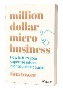
Mornington Peninsula Regional Gallery kids booklet

Pick up a free ‘MY MPRG’ kids activity booklet designed by Melbourne artist, designer and illustrator Beci Orpin. Children are invited to browse through artworks in the current exhibition and use the activity booklet to enhance their gallery experience.
The activity book encourages creativity, drawing from the curriculum to harness a range of skills including mindfulness, visualisation, comprehension and comparison. Included within the booklet is a fold-out poster, which invites children to seek inspiration from artworks in the MPRG collection and curate their own gallery exhibition.
Children are also invited to extend their gallery visit through a range of at home children’s activities and workshops accessible via the MPRG website and YouTube Channel. Check out the MPRG website for more info about their preschooler program Young at Art and school holiday workshops for the Spring Festival of Drawing. www.mprg.mornpen.vic.gov.au
Howie Blend
‘Howie Blend Playdate Adventures with Family and Friends’ by Jenny Guay is a ‘six stories in one’ children’s book that is filling a much need gap for blended and diverse families. Unlike other children’s books which tackle just the hetero-normative or LGBTQ+ family dynamic, Howie Blend incorporates six children from a multitude of diverse backgrounds and family dynamics into one book providing readers with a visualisation of each character’s family tree, so that children can get a deeper understanding of the connectivity of different family dynamics and see just ‘how we blend. Available from Booktopia and Amazon and also available for download on Kindle and Kobo.

Dexter the Dahu is the story of a young, mythical European mountain goat who must make his way to a prestigious boarding school, experiencing adventures and life lessons along the way. Dexter was inspired by Andrew Piccoli’s Swiss family heritage; his three months living in Zurich in 2019; and lifelong interest in European history. It was in Switzerland Piccoli first learnt about mythical mountain goats called Dahu, who are unique because, “they are born with two legs shorter on one side. Male Dahu have shorter legs on the right side and female Dahu have shorter legs on the left … Boy and girl Dahu meet each other when walking the same trail, travelling in opposite directions.”
Dahu never left Piccoli’s mind and heart and so, he wrote the modernday fairy tale/fable and enlisted illustrator, Alan Hawkins, to bring Dexter and his friends to life.
RRP: $12.95 Dexter the Dahu is published by Grisons Books and is available nationally from all good bookshops or online at Booktopia.

Awesome Australian Animals
Did you know that Koalas poo more than 200 times per day? – that’s more than once every 10 minutes! This is just one of the hundreds of fascinating animal facts that are packed into this brilliant new book by TV zoologist Chris Humfrey. Covering 15 amazing Australian animals, from koalas and kookaburras to pythons and dragons, each species gets two spreads in the book which are peppered with incredible facts and stunning photos. RRP: $19.99 www.newhollandpublishers.com

42 Peninsula Kids – Spring 2021
Moochies
Moochies smartwatches are a parents’ best friend. They were designed for kids aged 5-12 whose parents deem them too young for a mobile phone but still want to keep in contact with their children to make sure they’re safe. While on holidays parents are able to track and chat to their children while they are out exploring. Moochies are comfortable to wear, with a quality silicone strap and LED screen that displays the date, time, signal strength and caller ID.

RRP: $199.95 www.moochies.com
Bobux
Iconic children’s footwear brand Bobux is putting its party shoes on and celebrating thirty incredible years with a dedicated birthday edit!
The curated drop features seasonal favourites made with luxurious leathers, unique textures, and metallic colourways for babies finding their feet to active kids and confident walkers.
The collection features the beloved Bobux Bear along with other styles that are soon to become your children’s favourite shoes.

RRP: Starting at $45.00 Check them out at bobux.com.au

Tingswe
Nourished Life – ModiBodi
Nourished Life started back in 2011 when natural products were difficult to find. Nourished Life became the source for all things natural and is now the go to for those who care about what they put on and in their bodies.
Included in the Nourished Life 2021 Wellness People's Choice Awards, the Modibodi Maternity Brief sits just under the hips and offers a V-shaped dip in the waistband that provides comfort for growing bellies. This is an ultra-absorbent and comfortable style for pre and post bump - perfect for expecting Mums with pregnancy leaks. Removing the need for disposable liners, they are reusable and made from beautifully soft Bamboo Viscose.

RRP: $27.50 www.nourishedlife.com.au




Thanks To Nature
Say hello to good hair days everyday, with the launch of brand new haircare range, Thanks To Nature. These game-changing Australiandesigned and developed, vegan-friendly hair products are made from premium ingredients, derived naturally. Enjoy salon performance haircare without the huge price tag. Thanks To Nature is quite simply, really good hair care for real people. All products in the Thanks To Nature collection are delicately fragranced and come in a luxurious matte finish bottle with copper detailing. These are hair care products that you can be proud to display in your bathroom. The 500ml Shampoo and Conditioner retail for $16 each and the 350ml Hair Masques are $20, and are available exclusively in Woolworths stores nationally and online. www.thanks2nature.com
2 x MOOCHIES TO GIVE AWAY!
VOUCHER TO GIVE AWAY!
$250
4 with these kid friendly experiments...
When someone mentions science, do you automatically think of distant laboratories or complicated experiments?
Most people do! But science is literally around us all the time. When we wake up each day, the sun has gone around the earth, the days are getting longer or shorter and the weather turns up in its infinite variety. Science is simply the study of what we observe around us every day. So why not engage in some fun and accessible science activities with your kids right in your kitchen!
Water, weight, temperature, transformation, texture, touch, taste, light and sound are all waiting to be discovered. All we need is to be aware of the opportunities we could activate. Cooking and baking offer multiple ways to observe science in action. The simplest thing, like making jelly, can alert children to how temperature can assist processes. Boiled water is used to dissolve the crystals, the cold water is added for volume and the fridge temperature makes the jelly set. Always bearing safety in mind, children can be encouraged to watch steam rising as food is prepared, how cakes rise in the oven and how eggs change when they are boiled.
Besides all these incidental observations, you can help them set up simple experiments to engage, entertain and teach.
Four easy experiments to do with young children

Grow beans
Start by soaking 5-6 dried white haricot beans overnight in a bowl of water. Next day, place two squares of folded, dampened paper towel into a large sandwich zip lock bag. Put the haricot beans into the bag on one side of the towel. Zip the bag and tape it in a warm place against a window so that the children can see the beans. Within a few days the bean germinates and roots will start to appear. With more days’ patience the first leaves will be visible. When the beans reach this stage, they can be planted out in small pots of soil to become mature plants. The excitement of germination never ceases to amaze me. Growing anything can encourage the gardener in your child.
Turn yo r kitchen into a science laboratory 1 2
Explore sound
For an investigation into sound, make a water xylophone. Arrange 5-6 glass jars of the same size and fill them with water to different levels. For fun, add a little food colouring to each jar to create a rainbow effect. When kids tap on the jars with a metal spoon they will hear the different pitch related to the proportion of air to water in the jar. Ask them to explain what they think is happening.

Education
3
Grow crystals
Besides growing beans, why not grow crystals? Kids will need adult assistance, three cups of table salt, one litre of water, a pencil, a paperclip a strong plastic or pyrex bowl and a piece of string. Boil the water with your child and fill the bowl. Add the salt a tablespoon at a time and stir, until no more salt can dissolve. You will see a fine layer of salt collecting at the bottom of the jar when this supersaturation is reached. Tie one end of the string to the pencil and the other to the paper clip. Place the pencil across the jar so the string dangles down. The paperclip weighs the string down and shouldn’t touch the bottom or sides of the jar. Allow the jar to sit for a week in a sunny spot without disturbing it. You should see the salt crystals forming at the top of the string within a week. Children will love looking at the crystals through a magnifying glass. (They’ll want to examine everything else in reach including the cat’s whiskers if it sits still for long enough!) If your child wants to know why the crystals form it has to do with supersaturation. The boiling water encourages more salt to dissolve than would normally occur and the salt it drawn up the string with the water. When the water evaporates, the salt crystals are left behind and accumulate in the characteristic tiny cube shapes. If your child falls in love with crystals, go online and investigate the huge variety they can grow. It can become an advanced hobby.
4

Colour and walking water
Staying with water, try the ‘walking water’ experiment. Arrange six small plastic containers filled with water in a circle. Add red food colouring to the first one. Skip a container and add blue food colouring to the third one and finally add yellow food colouring to the fifth one. Cut thick paper towel into strips, just long enough to dip from the middle of one container to the next. Lay six strips across the jars so that the clear water is linked to a coloured water container on either side. Then see what happens! The cellulose in the paper acts like tiny tubules starting off a capillary effect. Primary colours from the jars will ‘walk’ through the strips to the clear water and create the secondary colours! It’s like magic!
Emphasise scientific thinking
What you want to do through these and many other experiments is to get your child thinking using the scientific method. Scientists ask good questions. They experiment with a variety of materials and substances; they hypothesise about what might happen and they are keen observers. Besides this, they use specific vocabulary, measure precisely to recreate their outcomes and they record what they see with drawings, graphs and photography. Children learn about more than what happens in a one-off experimentthey learn how to think.
Good luck to you and your young scientists as you explore the world in your kitchen!
Lili-Ann
is an education consultant and author of EduChameleon. Lili-Ann’s primary specialisations are in early childhood education (birth-9 years), leadership and optimising human thinking and cognition. Her current part-time role is as an education consultant at Independent Schools Victoria and she runs her own consultancy, Kriegler-Education. Find out more at www.kriegler-education.com

 Kriegler (B. A Hons, H. Dip. Ed, M.Ed.)
Nurturing young learners so they can develop their sense of self and connection to others while exploring the world around them.

NOW FOR 2022 EARLY LEARNING PREP EXCELLENCE AWARD AUSTRALIAN EDUCATION AWARDS 2020
toorakcollege.vic.edu.au/visit ENROL
SPRING 2021 EDUCATION FEATURE





www.peninsulakids.com.au 47
FEATURED IN THIS ISSUE
Striving for excellence
At Balcombe Grammar we are continually reflecting and evaluating our learning programs. Over the past 18 months we have been reimagining our Year 9 program to ensure the curriculum prepares students to meet the challenges of life beyond the school gates, in what is a rapidly changing world.


Year 9 is an important developmental year for students as they enter a stage where they typically look to ask questions, take action, and work closely with their peers. At Balcombe we continue to focus on literacy and numeracy, through our English and Mathematics programs, Science, the study of French or Japanese and Health & Wellbeing, while recognising the changing needs of students at this age.
Welcome to STRIVE!
STRIVE is our Year 9 experience program, which works in parallel with our core subjects. Our knowledge of Year 9 learners has led to the development of a program that prioritises opportunities for students to master skills and knowledge. Throughout Year 9 each student will participate in all four STRIVE units. Each unit provides students with the opportunity to participate in a program where they will experience a broad range of learning pursuits to achieve their personal best. The STRIVE units place students outside their comfort zone and challenges them to develop key transferable skills, such as Problem Solving; Creativity; Financial Literacy; Digital Literacy; Critical Thinking; Presentation Skills; Communication and Teamwork.
Our STRIVE units are:
• Pop-up
• Show and Tell
• Our Place
• STEM
From 2022 we are also excited to introduce the opportunity for Year 9 students to earn digital credentials using the Credly platform.

Digital credentials are a graphical representation of a student’s abilities and skills, combined with a verifiable description of the knowledge and activities it took each individual to earn that credential. These credentials will allow us to formally recognise students for demonstrating competencies and skills. Importantly, the credentials belong to each individual student and are accessible to them even after they complete their education at Balcombe.
This exciting journey commences with our Year 9 Experience Week, involving a Year 9 Conference Day, where Year 9 students work with renowned neuroscientist and educator, Dr Jared CooneyHorvath in exploring, ‘Your Brain, Your Life. The remainder of the week is spent participating in a tailored Melbourne City Experience linked to the STRIVE units.
Celia Mara Head of Teaching & Learning (F-12)

To discover more visit... balcombegrammar.vic.edu.au/ year9program


BALCOMBE GRAMMAR www.balcombegrammar.vic.edu.au 389 Nepean Hwy, Mount Martha VIC 3934 5970 1100
At Toorak College, the aim of our Early Learning Centre is to develop a community of curious, compassionate and connected learners who are courageous and innovative thinkers.


Each day, our 3 and 4 year old children are filled with excitement as they explore environments that are rich and engaging, with an emphasis on learning through play. Purposeful learning experiences are thoughtfully prepared with our educators closely monitoring and developing the curious nature of our individual children. They seek to make meaning from the questions that our children pose and the discoveries and connections that they are constantly making. Integrated into our Kindergarten and Pre-Prep programs, is the intentional teaching of literacy and numeracy concepts alongside the exposure to
a broad range of specialist subjects including Health and Wellbeing, Creative Arts, STEM-X, Language and Cultural Appreciation and Performing Arts. These subjects, taught by specialist teachers, enable our children to explore new and complementary curriculum areas while developing their teamwork, communication skills and confidence.


Our model is inspired by the principles and practices of Reggio Emilia, in which children are recognised as capable and resourceful. In 2021 we launched ‘Project Enlighten’, a dedicated time each week where children in Pre-Prep, Prep and Year 1 work in small mixed year level groups on projects that help consolidate their literacy, numeracy and STEM skills. Alongside learning outcomes, it is through ‘Project Enlighten’ that we have seen our Early Learning children develop their ability to find an
even deeper appreciation for, and connection to, those around them. For our older children, ‘Project Enlighten’ has provided students the opportunity to reconnect with their Early Learning educators and be a leader and role model for their younger ‘buddies’.
A leading Early Learning Centre on the Mornington Peninsula, we invite you to see us in action by booking a tour or attending one of our Discover Toorak events:


www.toorakcollege.vic.edu au/ visit

TOORAK COLLEGE
toorakcollege.vic.edu.au 73-93 Old Mornington Road, Mount Eliza, VIC 3930 9788 7200
Curious, compassionate and connected.
ADVENTUROUS MINDS
are expressive and imaginative. Original, passionate and persistent.

Adventurous Minds create and innovate, They are ready to find a different path, an original vision.

BOOK YOUR PLACE AT ONE OF OUR REGULAR INFORMATION SESSIONS OR CAMPUS TOURS www.woodleigh.school/enrol MORNINGTON PENINSULA • EARLY CHILDHOOD TO YEAR 12 5971 6100 woodleigh.vic.edu.au
Reading. The Foundation for Learning Success
By Melissa Schoorman
The milestone of becoming an independent reader is a significant one that those who have attained may not recognise nor remember the struggle that led to this point. The process and reliability of sequential teaching cannot be underestimated as a key factor in determining one’s reading ability. Humans require reading for just about every task they undertake in daily life. Whether you are reading for pleasure, understanding a list of directions on a map or following a recipe, the art and science of reading assists the degree of success you will have in completing a myriad of day to day tasks with ease.
As children begin learning to read, the enormity of the skill is evident. Children need to learn the names of letters, learn the 44 phonemes (sounds) in the English language as well as associated graphemes (letter choices), commit to memorising a bank of high frequency words whilst concurrently comprehending the pictures and the meaning that the author is attempting to convey. It is for this very reason that being immersed in rich language experiences at an early age is of benefit to children, as they begin to derive pleasure from and make connections with some of this information from as young as two years old.
In recent years, Early Learning Centres and preschools have shifted to ensure a greater focus on intentional teaching. The more able a child is to recognise and recall the various sounds that combinations of letter/s make, the easier the process of decoding or learning to read will be achieved. It is also through purposeful shared literature experiences and questioning techniques where children develop their comprehension skills to think beyond the literal meaning communicated in a text. It provides them an outlet to delve into the inferential details of a text and consider the perspectives of others. These skills transcend reading and assist with a child’s overall wellbeing, including their social and emotional development.
From birth, children are already developing the skills they need to read. So with this in mind, it is naive to think that children do not already possess the tools needed for reading prior to entering Prep. In fact, many children have already begun demonstrating the ability to read and respond to texts in their various environments well before entering formal schooling.
It is therefore crucial that Early Years’ teachers have an awareness and an acute understanding of the intricacies in how to teach reading so that they can accelerate and scaffold the children in their class through the stages of reading. The collective goal is to enhance the skills needed to ensure that we have independent readers that decode, comprehend and critically think, synthesise and analyse a text’s themes simultaneously. This process should also be supported by families in the home as a child’s motivation and desire to read can be nurtured from this shared, text-rich reading daily practice.
As children develop curiosity about the words around them, families are encouraged to stop and unpack their meaning; what the word looks and sounds like and how readers may respond to this. Adults must also be reminded that shared literacy experiences such as an audio book, modelled reading and reciprocal reading, are all vital components in building up vocabulary and a stamina for reading. This provides another opportunity for students to consolidate and evolve their skills. In short, there is no magic amount of time that families can spend reading to and with their child, however, it is the immersion in language and the suite of reading opportunities that will assist in developing an independent and fluent reader that relates and interacts with the world around them.

www.peninsulakids.com.au 51
Melissa is the Head of Wardle House, Deputy Principal at Toorak College
MACCA THE BACKPACKER
BY MATT COSGROVE
3+yrs, Scholastic, h/b, $17.99
Macca the Alpaca dreams of exploring, so he packs his backpack and sets off on a mountain adventure. But when things get tough, how will Macca make it to the top?

THE WORRIED ELEPHANT BY
 PHILLIP GWYNNE
3+yrs, Scholastic, h/b, $15.99

There is so much bad news in the world. Elephant is worried. So worried that he can't do any of the activities he loves anymore. Can Elephant learn to manage his worry?
THERE’S A BULL ANT IN THE BEDROOM
BY ADAM WALLACE
3+yrs, Scholastic, h/b, $17.99
"There's a bull ant in the bedroom, and it bit me on the bum. I screamed and flicked it out of there, and then it bit my mum!" It's not just a bull ant that's causing chaos in this house. All kinds of wild animals are making a huge mess! Luckily there's a brave hero ready to round the creatures up and put them in their place.

WINNER WINNER
BIN CHICKEN DINNER
BY KATE & JOL TEMPLE
3+yrs, Scholastic, h/b, $17.99
Ibis is on the lookout for food, but she's not welcome anywhere! Until she spies the most amazing dinner of all.
GRUMPY MONKEY PARTY TIME!
 BY SUZANNE LANG
3+yrs, Scholastic, h/b, $17.99
Have you ever been a little anxious about going to a party? Jim Panzee feels that. Porcupine is having a big party, and according to Jim's best friend Norman, there will be gulp dancing. Jim can DEFINITELY not dance. When he tells his friends, they all try to teach him cool moves surely that's the only reason Jim isn't excited about this party!
I REALLY WANT A PET
BY JACKIE HOSKING
3+yrs, Scholastic, h/b, $17.99
Can I have a polar bear? I really want a pet. I'd love a laughing polar bear, I haven't had one yet. Can I have a polar bear? They're not that hard to get. A polar bear? A crocodile? A dinosaur?! What kind of pet will this little girl get?
THE NERD HERD #2 RAGING WOOL
 BY NATHAN LUFF
DREISE
BY NATHAN LUFF
DREISE
COMMON WEALTH BY GREGG

6+yrs, Scholastic, h/b, $24.99


All that I'm wishing, Is that you take a moment to listen...
A slam poetry persuasive and powerful vision of unity from award-winning First Nations creator Gregg Dreise. Passionate, yet peaceful, Common Wealth is a compelling plea for a future of truth, togetherness and respect for our nation's deep history.
PARIS TAKES OVER THE WORLD
BY KYLA MAY AND ZANNI LOUISE
7+yrs, Scholastic, p/b, $14.99
Paris is 10 years old and is off to visit her favourite city, PARIS! While she is there, she meets a girl named Amelie who has lost her dog, Eclair. Can Paris help Amelie trace her steps through the landmarks of the city to find the lost pup?

SKIN DEEP
 BY HAYLEY LAWRENCE
11+yrs, Scholastic, p/b, $15.99
Scarlett was gifted with beauty. But beauty can be taken in a day, in a single moment, by one car fire. Now permanently disfigured, Scarlett has become a smudge in her perfect world. She can see only one acceptable solution: to escape the modern world for Matilda Mountain, which is desolate, isolated, forlorn. Perfect. But mountains are not always as lonely as they appear. And unexpected friendships can be found in the wilderness.
7+yrs, Scholastic, p/b, $14.99
Individually they're meek, mild and soft. But together, with their combined talents, they're a herd. The Nerd Herd.
Barny the Lamb and his friends may have scared off the fox. But now they have a new problem. A gigantic bull (with behavioural issues) is on the loose. Can Barny and his gang get the bull back in his pen and earn the respect of the petting-zoo farm? Or will this be another big mis-steak?

THE UNDERDOGS: #1 RUFF AND READY BY
 TRACEY WEST
8+yrs, Scholastic, p/b, $14.99
Welcome to the town of Barksdale, where the canine residents strive for perfection. Nova, Duke, Harley, and Peanut have never won Best in Show...which is okay with them! But they have to work together to pass their Agility Exam, because either the whole pack passes or the whole pack fails.
HAM HELSING #1: VAMPIRE HUNTER BY
 RICH MOYER
8+yrs, Scholastic, p/b, $17.99
Ham Helsing is the descendant of a long line of adventurers and monster hunters—who don’t often live to rest on their laurels. Ham has always been the odd pig out, preferring to paint or write poetry instead of inventing dangerous (dumb) new ways to catch dangerous creatures. Ham soon learns that people aren’t always what they seem and that you need a good team around you to help save your bacon!
Prize pack of the reviewed books, go to; www.peninsulakids.com.au/giveaways
Book Reviews
Win! School Age Pre - School
FiRST. ..
Be FiRST
Be FiRST...
“I’m really good at sport, fast and kick big balls”
HASTINGS | 5979 2831
FRANKSTON SOUTH | 9783 3390





“I’m really good at sport, fast and kick big balls”
Bianca and we read books, do spinning and dancing
“Dance and make music with the instruments”
“I know how to
environment, everyone is welcomed, loved and free
Kinder teacher
CHILDCARE | KINDERGARTEN EARLY EDUCATION

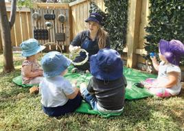





Free incursions and excursions at no extra cost!

Words from our little learners...
“Children are encouraged to play, explore and benefit from using only what nature provides.
CHILDCARE ERGARTE EDUCATION


“Dance and make music with the instruments”
“I run around on the water, and look for shells at the beach” "I sing and dance and make music with stuff"
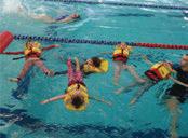
DCARE | ERGARTEN | EAR TION |
Educator “Our incursions are fun and engaging, all the children are involved. The incursions always have an educa�onal purpose”


“I know how to
“I’m really good at sport, fast and kick big balls”
“I run around on the water, and look for shells at
“I build big houses and cities with magnets and play with my friends andddd I’m 4”
“Dance and make music with the instruments”
“I run around on the water, and look for shells at the beach”
“Dinosaur song and big bad wolf song like in daddy’s car" (starts singing)
“I like playing with James, makes me happy”
BILLY
Kinder teacher
Words from our teachers...
Words from our kinder teacher – Bernita: "
"I sing and dance and make music with stuff"

“I know how to
“Every day family, constantly supporting and valuing us as educators and the centre always put the children first”
“Dinosaur song and big bad wolf song car" (starts singing)
‘About children being children’


from our kinder teacher – Bernita: "
“Dinosaur song and big bad wolf song like in daddy’s car" (starts singing)
“ First is such a supportive community. I love watching the children grow and explore as little learners”


Educator “A magical opportunity for the children to see the outside world” ‘About children being children’
“There’s so many people here and Laura. I build big tower”
“Children are encouraged to play, explore and benefit from using only what nature provides.


At FiRST Early Learning we know every child is a capable learner, active in their own discovery and journey to foster and enhance their education and development.

We create environments for every child that promotes and encourages a love of learning, sense of security, well being and diversity. Educators at FiRST Early Learning thrive on the empowerment of children and early education and create a safe haven for every child. FiRST early learning educators are offered personal growth working alongside our management team to achieve their goals.
We take pride and have respectful understanding that families entrust our educators with their child on a daily basis. It is with this acknowledgment that we provide a home away from home and nurturing environment that fulfills every child’s safety, security and well being

Words from our kinder teacher – Bernita: "


| HASTINGS | FRANKSTON SOUTH | ENDEAVOUR HILLS
“Why fit in when you were born to stand out” – Dr Seuss
HILLS
9700 1922 5922 2040
ENDEAVOUR
|
About children being children’
FRANKSTON
ENDEAVOUR
| HASTINGS | FRANKSTON SOUTH | ENDEAVOUR HILLS | | firstearlylearning vic.edu.au
HASTINGS 5979 2831
SOUTH 3390
HILLS 9700 1922 PAKENHAM 5922 2040 ‘About
children being children’
| HASTINGS | FRANKSTON SOUTH | ENDEAVOUR HILLS | | firstearlylearning
vic.edu.au | CHILDCARE
KINDERGARTEN | EARLY
|
.
|
EDUCATION
Key features of Simply Swap Foods:
* Low carb
* Keto friendly
* Diabetic friendly
* Premium ingredients to support our health
* Nothing artificial
Linda is very proud to introduce two new products to the range of Simply Swap Foods premix products – Chocolate and Vanilla Mug Cakes. These beautifully delicious cakes are of course low-carb/keto and sugar free to help on your journey to a healthier eating style. They were born from the desire to want to help others during our frequent lockdowns and offer something small – “a hug in a mug” – to treat yourself or send to a friend or family member to brighten their day.
HUG IN A MUG – VANILLA MUG CAKE MIX

Containing premium ground vanilla beans, and Australian almond meal, these are simple to prepare and ready in 60 seconds. The perfect indulgence on their own or delicious topped with berries, cream or ice cream. Each pack makes two large mug cakes and there are instructions on the pack for how to make this into a delicious lemon/berry version.
HUG IN A MUG – CHOCOLATE MUG CAKE MIX


Containing pure organic cacao full of antioxidants, these are a decadent dessert treat that satisfy all chocolate cravings. Delicious alongside fresh berries and whipped cream, each pack makes two large mug cakes and the optional addition of nut butter and choc chips makes this even more indulgent.
* No GM ingredients
* Plant based sweeteners used
* Pet friendly (no xylitol used)
* Super easy to prepare at home
* Great tasting
* Made with love on the Mornington Peninsula

Check out the full product range at www.simplyswapfoods.com.au and follow Linda on her Facebook and Instagram pages for regular recipes and information. And don’t forget to download your free recipe eBook containing 16 favourite sugar-free/low-carb recipes.
After experiencing health problems three years ago, Linda changed to a low-sugar real food diet and was amazed at the results. Over a six month period, she easily lost 15kg of stubborn weight that she’d struggled with for decades, her energy levels improved to an all-time high and her mental clarity returned in abundance. Her husband joined her on this mission and also lost 20kg easily in 6 months and felt fantastic. One of the keys to their success was not feeling deprived of their favourite foods, especially cupcakes and porridge. Linda launched her business “Simply Swap Foods” in November 2020 to help others on their journey to a healthier way of life. She loves sharing her recipes, story and knowledge about the benefits of reducing sugar and just eating real food. All Linda has done – with time and research – is ‘simply swapped’ some foods in her diet and she hopes to show others just how easy it can be and how fantastic you can feel. You really can indulge yourself and feel great too!

54 Peninsula Kids – Spring 2021 Recipes COM.AU
indulge yourself and feel great too!
Choc Peanut Fudge
This two ingredient low-carb/low-sugar treat is super quick and easy, the perfect answer to an afternoon chocolate craving and only 2g carbs per serve.

Ratios of ingredients are half the amount of nut butter to chocolate so you can make as much or as little as desired.
Method
Line a small slice tray with non-stick baking paper.
1. Place both ingredients in a heatproof bowl and microwave for 60 seconds.
100g dark chocolate (70% dark or more)
Ingredients

50g crunchy peanut butter (or other favourite nut butter)

2. Stir and put back for bursts of 30 seconds until melted and combined together.
3. Pour into a slice tray lined with greaseproof paper and cool in fridge or freezer.

4. Remove from fridge and rest on bench for a few minutes before slicing into squares. Enjoy!

PREP COOK TOTAL SERVES PREP COOK TOTAL SERVES 5
8
These are beautiful topped with fillings for lunch or add them to an antipasto plate for a perfectly healthy low-carb cracker indulgence.

Ingredients
¼ cup sunflower seeds
¼ cup pumpkin seeds (pepitas)
¼ cup almond meal flour

¼ cup flaxseed meal
2 tblsp chia seeds
1 tblsp psyllium husk powder
1 tsp salt
2 tlbsp melted butter (or coconut oil/ghee)
½ cup boiling water
Seedy Crackers
Preheat oven to 150°C f/forced and line large baking tray with greaseproof paper.

1. Roughly chop sunflower seeds and pumpkin seeds then place in bowl with all other dry ingredients.
2. Add wet ingredients and mix until well combined into a dough.
3. Place the dough on lined baking tray, put another sheet of greaseproof paper on top and use a rolling pin to roll dough out thinly and evenly.
4. Remove the top sheet of greaseproof paper and bake in oven 35 - 40 minutes.

5. Remove from oven and cut into desired shapes. A pizza cutter works really well here to cut into rectangles or a sharp knife works also.
6. Separate shapes and place back on lined tray to bake further 10 minutes to crisp (or until lightly golden brown). Crackers can brown very quickly towards the end of cooking time so ensure you keep an eye on the oven.
7. Remove and cool before storing in airtight container. Crackers will become firm as they cool.
PREP COOK TOTAL SERVES PREP COOK TOTAL SERVES 10 40
Lemon Blueberry Cupcakes

This popular tangy combination is delicious and so easy using my low-carb, low-sugar vanilla cake mix. This recipe will work with any citrus and any berry so feel free to use your favourites!
Method
Preheat oven to 170°C f/forced and line 12-hole muffin tray with paper cases.
1. Pour entire cupcake dry mix contents into a large bowl and stir to mix well.
2. Add lemon rind to dry ingredients and stir to combine.
1 x pack Simply Swap Foods Vanilla Cupcake Mix
Ingredients
1 tblsp lemon rind, finely grated (tightly packed)
¾ cup blueberries (fresh or frozen)
½ cup salted butter, melted (125g)


¼ cup lemon juice
4 large eggs
½ cup preferred milk
3. Add blueberries to dry mix and mix through until berries are coated with dry ingredients.
4. In a separate bowl, whisk together melted butter, lemon juice, eggs and milk.
5. Pour wet ingredients into dry ingredients and fold together gently.
6. Pour mixture into lined muffin tray and bake for approx 35-40 mins or until cakes are golden brown on top and spring back when lightly touched in centre (or a skewer inserted into centre of cake comes out clean).
7. Leave cakes in pan for 5 minutes before removing to cool on wire rack.
PREP COOK TOTAL SERVES PREP COOK TOTAL SERVES 10 20
Fer tilityin Men Boosting
By Nikki Warren
There have been a number of news reports in recent months reporting concerns regarding low sperm counts and infertility in many countries around the world. Low sperm count has been attributed to lifestyle factors such as smoking, excessive drinking, insufficient exercise, obesity and a poor diet. Dr Shanna Swan, a Professor in Environmental Medicine and Public Health, says the sperm count of Western men has plunged by over 50 per cent in less than 40 years. She said in her new book Countdown, “at this rate sperm count is set to reach zero in 2045 – meaning that most couples may have to use assisted reproduction”.
Preconception Plan
It is essential that both partners follow a preconception care plan for four months prior to conception. The first month is spent detoxing; the next three months are when the sperm and egg are developing. They are vulnerable to nutrient deficiencies, toxicity and radiation during this time so it is vital to boost nutrient stores during these three months.
Eat Organic Food
Toxins are stored in fat in humans and in animals therefore it is prudent to switch to organic meat, eggs and dairy products. It is also important to avoid pesticides as they are known to affect hormone balance and sperm quality. You could grow your own vegetables to avoid these sprays or purchase organic fruit and veg.
Get A Water Filter
An under-bench water filter is available from Bunnings. Avoid buying water in plastic bottles and opt for glass bottled water instead. Tap water can contain metals such as copper and plastic contains xenoestrogens which can affect your sperm quality.
Avoid Plastic
Choose food contained in glass bottles and jars rather than plastic (e.g. sauces, mayonnaise, beetroot). Plastic can leach xenoestrogens (foreign oestrogens) into the food and can affect hormone balance and sperm quality.
Avoid Caffeine
Too much caffeine can affect your fertility and sperm quality. Try switching from coffee to tea and drink up to two cups only per day.
Avoid Alcohol
Excessive alcohol intake lowers sperm count and quality and impairs your fertility. Your partner is going to have to give up during pregnancy so giving up with her is the biggest support you can provide to ensure a healthy conception and pregnancy. If you are currently a heavy drinker, you might find it helpful to reduce the amount you drink to no more than two drinks, no more than twice a week. Then keep reducing the amount every couple of weeks until you’re only having an occasional drink.
Exercise
Exercise is linked to sperm quality and it also helps you to reduce stress. Plus the fitter you are, the more stamina you will have when it comes to making babies!
Don’t wear tight underwear and avoid hot spas and showers
Heat kills sperm so wear boxer shorts instead of snug fitting briefs and avoid hot baths, spas and saunas.
58 Peninsula Kids – Spring 2021 Health
Pre-conception Multi
Taking a multivitamin tailored for preconception can help boost nutrient stores and may also improve your chance of a successful conception. Certain nutrients assist sperm count, motility and quality including lycopene, CoQ10, vitamins A, C, E and B12, zinc and selenium.

Hormone Imbalances
If you have low testosterone, a low libido or any other health issues, it may be worth visiting a qualified medical herbalist.
Herbal medicine is fantastic at getting to the root cause of your issue and may boost fertility by boosting testosterone and improving sperm morphology.
NaturoBest, a prenatal and preconception vitamin range created by fertility naturopath Nikki Warren, releases a new vegan friendly Preconception Multi for Men. Preconception Multi for Men is a comprehensive multivitamin, multimineral and antioxidant, designed to support sperm motility and sperm count. This premium formulation includes lycopene, CoQ10, zinc, selenium, vitamins A, C, E and B12 to help support sperm health and testosterone levels while promoting a healthy conception.
the sperm count of Western men has plunged by over 50% in less than 40 years
How parents can survive ALLERGY SEASON
By Trung Nguyen, Pharmacist
If you’re a parent to an allergy-prone child, then you know all too well that spring is not all park plays, sunshine and rainbows. Instead, for parents with kids who suffer from allergies, spring brings with it runny noses, itchy eyes, and puffy faces –all of which can make for an uncomfortable few months for both the child suffering, and the parent looking after them.
Seasonal allergies, sometimes referred to as ‘hayfever’ or seasonal allergic rhinitis, are allergy symptoms that happen during certain times of the year – commonly in spring. Outdoor mould spores are released from trees, grasses, and weeds, resulting in tiny pollen particles. These pollen particles enter the air which can get into the nose and eyes, causing inflammation and irritation.
Seasonal allergies are extremely common – so parents, you’re not alone. In fact, hayfever affects one in 10 children aged 6-7, and every one in six children aged 13-14. Whilst relatively harmless, hayfever can still cause a great deal of physical discomfort, and often leaves children feeling tired due to poor sleep quality. More than that, untreated allergies can lead to other health issues such as sinus and ear infections, may trigger asthma, and skin disorders like eczema and hives.
The good news is that there are some simple things that you can do to alleviate the discomfort your child may be suffering due to allergies, and in turn enjoy a more pleasant spring overall.
BE THOUGHTFUL ABOUT TIME OUTSIDE.
As parents, we want our children to spend lots of time outdoors and be as active as possible. But if you have an allergy sufferer, there are a few things to consider before sending your child to play outside. Dry and windy days are terrible for allergy sufferers because of circulating dust particles, and places with lots of plants and flowers can also be tricky. There are a number of pollen apps, like Pollen Forecast for example, that can show you the local pollen count, which is helpful to check before going outside.
TRY AN ANTIHISTAMINE.

The most common relief treatment for hayfever are antihistamines, which help to relieve the sneezes, itching and runny noses. Consider a corticosteroid nasal spray which is another effective treatment and may be used to help prevent and treat the nasal symptoms caused by hayfever. All different types of hayfever relief are available over the counter in pharmacies. Look for products designed for children – for example you can speak to your pharmacist about the Chemists’ Own Children’s Allergy Range which can be used to suit a range of hayfever symptoms. Make sure you consult your pharmacist or doctor about which medication is right for your child.
KEEP INSIDE CLEAN.
You should try to keep indoor spaces free of dust mites by regularly washing bedlinen and choosing bedding materials that are less likely to harbour dust mites — such as polyester-filled quilts instead of feather and down. If you have pets at home, you may try to keep them away from your child’s bedroom and regularly vacuum and dispose of any fur that they shed.
STAY HYDRATED.
It might come as a surprise to learn that dehydration can play a big role in how your body responds to allergy triggers. Your immune system produces histamines to help guard your body against dangerous pollutants – mould, dust and pollen for example. But once your body is dehydrated, the histamine production increases, which causes the body to have the same trigger symptoms as seasonal allergies. Drinking more water can help to improve histamine production and alleviate allergy symptoms.
Allergy season can be tough for parents – no one wants to see their child suffering. By limiting your child’s exposure to the things that trigger their allergy symptoms and by having appropriate relief at hand, hayfever needn’t stop them from enjoying a playful spring.
Always read the label. Follow the directions for use. If symptoms persist, talk to your health professional.
60 Peninsula Kids – Spring 2021


www.peninsulakids.com.au 61
Dr Peter A. Scott is a specialist orthodontist offering orthodontic care for children, teens and adults alike in both the Mornington Peninsula and inner Melbourne areas. He is also a consultant orthodontist at the Royal Childrens Hospital.


TheWorld types of minds needs all

Born with Asperger’s syndrome, Queensland brothers Haydn and Damien Crespan have endured significant challenges. Haydn has written stories all of his life and, despite the added challenge of being colour blind, Damien has always loved to draw. Together, the writer and illustrator have overcome adversity to release their debut children’s book, The Adventures of Triz the Babysitter.
continued next page...


62 Peninsula Kids – Spring 2021
Orthodontists
Specialist
Creating Beautiful Smiles On The Peninsula For 30 Years Expertise In Child And Adult Orthodontics Early Assessment Of Dental Development And Facial Growth Ideal Age Of Initial Assessment 7-9 Years Early Intervention Where Appropriate For Best Outcome No Referral Necessary 13 Beach St Frankston Ph: 9783 4511 www.drpeterscottorthodontist.com.au www.facebook.com/drpeterscottorthodontist
•Autism is a neurological difference, a different way of thinking. The word ‘spectrum’ reflects the diversity of people with autism, including those with high-functioning autism, or Asperger’s syndrome

•An estimated 1 in 70 Australians is on the autism spectrum


•Up to 20% of autistic people have exceptional skills in one or more areas, such as reading, maths, art, mechanics or music

www.peninsulakids.com.au 63 134 TANTI AVENUE, MORNINGTON 3931 Dr James Lucas Dr Caroline Howarth Dr Giselle D’Mello and introducing Dr Sara Shayegan 597 5 9334 lucas dental care proudly sponsors polyglot theatre LUCAS DENTAL CARE S PECIALISTPAEDIATRIC DENTISTS
Mixed and Girls only
8 WEEKS OF FUN Program includes kit bag, Spinneroos shirt with your name, bat and balls. FUN, FRIENDSHIPS, MOTOR SKILL DEVELOPMENT. To register and more information Spinneroos.com.au
Table Tennis, the Non- Contact and indoor Olympics and Commonwealth Games sport the whole family can play


FRIDAY NIGHT IS JUNIORS NIGHT
6.00pm-7.30pm school terms. FUN ACTIVITIES, GAMES, COACHING, COMPETITION.
Set in prehistoric times, the story features Triz, a small flying lizard who represents the Crespan brothers’ perseverance. Triz is entrusted by his good friend Marjorie to babysit her unhatched egg for the day. Things don't quite go to plan. The chick hatches and, time after time, the little runaway ventures into danger, causing Triz to stare death in the face. Does Triz give up? Not a chance! Triz teaches children that no matter what life throws at you, if you focus on your goal, you will succeed.
“I see myself in Triz,” author Haydn says. “Like me, he is faced with many challenges, but even when things go wrong, we have a choice. We can choose to give up or we can keep going. If we stop, that is where we will remain, but if we keep going, who knows where we will end up and what surprises might lie around the corner? Persistence is the key to happiness.”
Book illustrator Damien’s autism has always made it difficult for him to interact with people, and he suffers panic attacks. As a way to cope, he started drawing when he was two years old. “My parents didn’t know I was any different to other kids at kindy until a teacher told them I was a gifted artist,” Damien said. “Our differences turned out to be the gifts that set us apart.” But when it comes to colour, Damien admits, “My eyes suck. The program I use now has a section with coloured squares; if I hold the cursor over one, it will say red, blue… and I trust it. You have no idea how many times I’ve drawn a purple sky!”
Encouraging females of any age and ability in a non judgemental and friendly environment. Includes 3 free lessons, all equipment supplied

Throughout their childhoods, Haydn and Damien’s devoted mother Debra managed their emotional meltdowns, poor social skills, sensory issues and anxiety, while also working fulltime, and attending endless appointments with speech pathologists, occupational therapists, and psychologists. Haydn’s passion was always writing, while Damien sat in the background, drawing. Damien started studying animation at Griffith University where, aged thirty-two, he was also diagnosed with bipolar and Tourette’s syndrome and was unfortunately unable to finish his studies due to his mental health. Debra has always encouraged her sons by saying, “Don’t look at what you can’t do, look at what you can do and go for it.”
MORNINGTON PENINSULA
TABLE TENNIS ASSOCIATION

Mornington Sports Complex 350 Dunns Rd Mornington
M: 0498 003 788 E: mptta88@gmail.com
W: mptta.org.au
Haydn and Damien Crespan are not only creative and talented, they are resilient, determined and inspiring, just like their adorable character Triz, the flying lizard. This fun story is full of cheeky, laugh out loud moments, and the lively artwork is sure to fuel young imaginations. Published and printed in Australia by Boolarong Press, a small, family-owned publishing house based in Brisbane, Queensland.You can purchase the book at all good bookstores and online at boolarongpress.com.au
64 Peninsula Kids – Spring 2021
Our differences turned out to be the gifts that set us apart





Frankston House Sanctuary of Early Learning 1-3 Vera Street Frankston E info@frankstonhouse.com.au P 9783 1117 W frankstonhouse.com.au Mt Eliza House Sanctuary of Early Learning 41 Baden Powell Place Mt Eliza E info@mtelizahouse.com.au P 9787 0788 W mtelizahouse.com.au Seaford House Sanctuary of Early Learning 6-10 Govan Street, Seaford E info@seafordhouse.com.au P 8796 3000 W seafordhouse.com.au
over 20 years experience, we are committed to continuous quality care and to ensure a full balanced development for each child in our expansive natural learning environment. Now offering 3 and 4 year old Kindergarten for 2022
most precious people are our priority Curiosity and wonder lead to a natural desire to learn Sanctuary of Early Learning Brand new Seaford centre NOW OPEN and taking enrolment.
With
Your
• Providing Specialist Orthodontic Services to the Mornington Peninsula with three locations in Rosebud, Mount Eliza and Hastings.
• The very best in Orthodontic care and technology
- clear braces, Invisalign, lingual (hidden) braces.

• Treatment provided in a relaxed environment.
• Highest quality care provided by our Orthodontist.
NO REFERRAL NEEDED. CONTACT US TO FIND OUT HOW WE CAN HELP YOU ACHIEVE THE SMILE YOU ALWAYS WANTED.
CALL US ON
9787 3849
“Lighten up, just enjoy life, smile more, laugh more, and don’t get so worked up about things”
-Kenneth Branagh
My child is wetting the bed. What can I do?

Bedwetting is common in children 6 years and under, and can also continue in children older than this. You should encourage your child to not feel embarrassed or ashamed. It is caused by making a large amount of urine through the night; having a bladder that can only store a small amount of urine at night; or not being able to fully wake up from sleep to go to the toilet.
It’s a good idea to seek professional help for bedwetting after about age 6. Start by seeing your doctor. Treatment can involve encouraging the child to empty their bladder when they need to during the day; using a night alarm that wakes the child up when moisture touches the bed; or medicines or sprays prescribed by a doctor to help the bladder work better at night. Some medicines can treat bedwetting in older children. However, wetting often returns when these medicines are stopped. Bedwetting alarms are often helpful in older children. A bedwetting alarm sounds when it detects moisture in the bed.

Most children who wet the bed overcome the problem between the ages of 6 and 10.
pregnancybirthbaby.org.au
CALL NOW FOR MT ELIZA, ROSEBUD & HASTINGS BOOKINGS
mteliza@hanksorthodontics.com.au

66 Peninsula Kids – Spring 2021
Mt Eliza Way, Mt Eliza & 1533 Point Nepean Rd, Rosebud West
Salmon St, Hastings
Ask The Experts! 122
140
My son is eight years old. After visiting our dentist recently, he recommended we seek the advice of a specialist orthodontist. I feel it is too soon. Isn’t he too young to commence orthodontic treatment? What is the optimum age to have a consultation and commence treatment?
This is a great question that is asked often by many parents. Timing is a very important factor in early orthodontic treatment. Orthodontic problems your child may be facing is usually evident by the age of seven–this is the age when most children’s first adult molars have already erupted and their upper adult incisors have started to erupt. The Australian Society of Orthodontists recommends that children be seen at this age so that an evaluation can be made as to whether they will need orthodontic treatment in the future; and, if not, the orthodontist can monitor the eruption of the child’s permanent teeth as they grow.
There are many benefits to seeking an assessment for early orthodontic treatment and these include:
1. Addressing thumbsucking or finger sucking habits

2. Maintaining space for erupting permanent teeth if a baby tooth has been lost early
3. Addressing protrusive upper teeth which may reduce the risk of trauma and even helping with self esteem and confidence
4. Guiding the growth of your child’s jaw
5. Guiding the eruption of permanent teeth if they appear impacted
6. Reducing a traumatic bite when lower teeth bite into the upper gum
At your child’s initial orthodontic consultation, an assessment will be made based on how your child is biting; how many adult and baby teeth are present and if they are crowded or impacted. A discussion with you and your child will then be made recommending whether your child requires orthodontic treatment now or later. Another important factor that is taken to consideration is whether your child is mature enough to cooperate with treatment.
Apart from the above benefits, early treatment can also make further orthodontic treatment less complicated and of a shorter duration, if required. And in some cases, later treatment may not even be needed.
 Dr Andrea Phatouros
BDSc (WA), FRACDS, MDSc (Ortho) Specialist Orthodontist Peninsula Orthodontics 134 Tanti Avenue Mornington
Dr Andrea Phatouros
BDSc (WA), FRACDS, MDSc (Ortho) Specialist Orthodontist Peninsula Orthodontics 134 Tanti Avenue Mornington
www.peninsulakids.com.au 67 5975 5166 134 Tanti Ave Mornington smile@peninsulaortho.com.au www.peninsulaortho.com.au Specialist Orthodontists Dr Andrew Pepicelli Dr Andrea Phatouros Dr Daniel Sable Peninsula Orthodontics loves working with families. Our experienced team will provide you with an individual treatment plan to deliver only exceptional results Capture that perfect smile you will always treasure. No referral required
A new, innovative peer support service for birthing families.
By Stefanie Poole
Built on the values of community, camaraderie and connection, Mumma Bees ™ aim is to provide every birthing person access to a Mumma Bees Peer Ambassador who has walked a similar mental health journey and can provide guidance, empathy, support and hope to other birthing people.
Vision
Mumma Bees ™ is revolutionising peer support by creating and sustaining a well-trained and well supported international Mumma Bees workforce that is accessible for birthing families and their communities.
Our mission
• Use our collective wisdom, knowledge, and experience of mental health challenges in motherhood/parenthood to support other birthing families on their journey.
• Create an innovative program that fills a gap in maternal mental health care by forming a peer-based hive for birthing people and their families to thrive.
• Provide access to peer ambassadors who offer guidance, empathy, support and hope while delivering mental health education and resources to health professionals and the local community.
What is Peer Support and How Can It Help?
Peer support involves people drawing on lived experience or shared characteristics to provide knowledge, experience, emotional assistance, practical help and social interactions to help each other. It’s different from other types of support because the source of support is a person with lived experience. Peer support is one way that individuals, families and communities can manage their own health and wellbeing. (NESTA, 2016).
Peer support is an evidence based practice which has proven positive results for individuals and communities.
Peer support can help people to:
• Feel accepted and validated
• Better understand their experiences
• Find coping strategies and tools to manage their mental and emotional health
• Increase their knowledge and awareness of their experiences
• Improve social skills
• Increase their self-esteem
• Find a sense of connection and belonging
• Access resources and support
• Feel a sense of hope and optimism
• Find, and use, their voice
• Create mutual understanding, shared identity and experiences
Why Mumma Bees are needed in our community.
• Suicide: suicide is the second leading cause of death for birthing people with 1 in 5 women having thoughts to harm themselves. (Seleni.org)
• Birth Trauma : research shows that 1 in 3 Australian women have experienced birth trauma and 1 in 10 women emerge with posttraumatic stress disorder (PTSD).
• Isolation and Loneliness: Loneliness and isolation are reported as a major factor in new motherhood. This can lead to other problems such as; anxiety and depression.
• Gaps in the System: Many birthing people are falling through the gaps with inadequate follow up, screening and assessment from care providers. More awareness, support and timely identification and treatment is needed to improve the mental health of birthing families.
68 Peninsula Kids – Spring 2021
Common Questions About the Mumma Bees ™ program:
What is a Peer Ambassador?
A Mumma Bees Peer Ambassador uses their personal lived experience of parenting with mental and emotional health challenges to support other birthing families travelling a similar journey.
Are Mumma Bees trained to offer support?
Yes. All Mumma Bees Ambassadors are certified and have completed the comprehensive Mumma Bees Peer Training which prepares us with the knowledge, confidence and skills to support you on your parenting journey.
What are some reasons someone would reach out to a Mumma Bees Ambassador?
• Feeling overwhelmed, stressed or depleted.
• Struggling mentally and emotionally.
• Experiencing mental health issues.
• Infertility or pregnancy loss.
• Feeling isolated and alone in their parenting journey.
• Searching for a safe non-judgemental space to feel held, validated and supported.
• Looking to expand their community and social supports.
• To proactively create and maintain mental wellness and a positive mindset for pregnancy, birth and postpartum.
I have support from family and friends, why would I need a Mumma Bees Ambassador?
Support from family and friends is important but may not always be enough. Mumma Bees are there to provide a non-judgemental, safe space for you to share. Our lived experience of mental and emotional health challenges, puts us in the unique position to understand and support you where you’re at.
What type of support can a Mumma Bees Ambassador provide me?
• One on one support via phone, zoom or online.
• Face to face emotional and practical support (if convenient for both people).
• Group support and education.
• Resources and referral pathways.
Is there a fee to access a Mumma Bees Ambassador?
Many of our Ambassadors offer their support for free, however this is at the discretion of each Mumma Bee. We offer a variety of workshops and events such as our free virtual monthly Bee-Connected meet up. To stay updated, please sign up to our mailing list www.stefaniepoole.com
I would like to become a Mumma Bees Ambassador. How do I get involved?
The next Mumma Bees Training will be Saturday, October 23rd and Sunday, October 24th. If you’d like more information, or to register, please email stefanie@stefaniepoole.com
Can a Mumma Bees Peer Ambassador speak at my organisation or event?
Yes! Part of the Mumma Bees mission is to raise mental health awareness and education in the community. Please contact us to discuss your needs.
If you’re interested in support from one of our Mumma Bees, would like to become a Mumma Bees Peer Ambassador or would like more information, we’d love to hear from you.
Join The Hive - Mumma Bees™ - Your Hive To Thrive Peer Support For Birthing Families


E: stefanie@stefaniepoole.com
Insta: @mumma_bees
W: www.stefaniepoole.com
www.peninsulakids.com.au 69
A Mumma Bee can reach in when you find it hard to reach out
Breast feeding toddlers
By Yvette O’Dowd
Breastfeeding is so much more than a source of milk. Human milk is a living fluid, custom-made on site for the babies. It contains what they need when they need it, from nutrition and emotional needs to specific immune support produced in response to viruses and other threats picked up and acted upon by the maternal immune system.

From the very first feed to the very last, from breakfast to bedtime and all through the night, breastmilk changes. It is flavoured by the mother's meals, contains hormones to support sleep and evolves as the infant gets older. Every drop is beneficial, whatever the age of the child.
Breastmilk is undervalued. Lactation is undervalued. The contribution to public health from breastfeeding is undervalued.
Milk In the Second Year of Life – What You Need To Know
Australian Dietary Guidelines recommend babies are breastfed for at least 12 months – but what happens next?
Just 28% of Australian babies are still breastfeeding when they turn one and that figure falls to 9% at 18 months.
Only 5% of Australian toddlers reach the World Health Organization recommendation of breastfeeding for two years and beyond.
So, for most one-year-olds, who no longer have breastmilk in their diet, what should be replacing it?
Fact: Toddlers Don’t Need Formula
Despite the heavy marketing by manufacturers and retailers, there are no benefits in continuing formula use into the second year.
Toddler formula, special milk drinks or other milk products targeting children aged 1 – 3 years have flooded the market in recent years, yet there is no evidence they are necessary or helpful in meeting dietary requirements. Indeed, they can reduce appetite and lead to further disinterest in food.
Children who are at risk of nutritional deficit can be given supplements in better forms than these drinks.
continued next page...

70 Peninsula Kids – Spring 2021
Granny’s Guide
For enquiries call
Email: talk@talkinghens.com.au
Visit: TalkingHens.com.au
Talking Hens
Opening Hours:
Manypeople either own backyard hens or know of someone who does. The growing popularity has largely been due to families wanting to become more self-sustainable. So why is keeping backyard hens so good for your family?
Opening Hours:
Talking Hens
For enquiries
Thursday to Monday 10am to 4pm
Closed: Tuesday and Wednesday
3590 Frankston-Flinders Rd Merricks, Vic 3916
Well, hens make for fantastic pets! Our breed of hens are Hy-line Browns which are extremely friendly and placid. They love company and like nothing more than to spend time interacting with their owners. We hear lots of entertaining stories from our customers such as their hens going on school runs, on swings with the kids, and happily jumping up onto their laps.
Good egg-laying breeds like our Hy-Line’s also quickly pay for themselves by providing your family with highly nutritious and delicious eggs throughout the year. Their eggs are high in protein and minerals but low in calories. You also have peace of mind knowing exactly how your hens are treated and what food they have eaten.
Of course, you can’t get more “local” food than what you get from your own backyard! When combined with a vegetable garden, your family becomes far more self-sufficient and able to live more sustainably. If you really had to avoid social contact, your hens and vegetables could keep your household well fed over the long-term. Hen ownership also teaches children some important, practical lessons about life. Not only do they need to be responsible for feeding and providing water for their hens but they must collect eggs daily and
keep the coop clean and safe. Excess eggs can also be sold or given away to friends and neighbours which is a great way of benefiting others in your local community.


Thursday to Monday 10am to 4pm
Closed: Tuesday and Wednesday
3590 Frankston-Flinders Rd Merricks, Vic 3916
Email: talk@talkinghens.com.au
Visit: TalkingHens.com.au
Visit our farm: 3590 Frankston-Flinders Road,Merricks
Call Jason: 0406 691 231
OPEN Thu to Mon 10am - 4pm ( Closed Tue & Wed)
www.TalkingHens.com.au


Looking for backyard hens but unsure where to start?
Talking Hens is a family business that enjoys backyard hens. We specialise in friendly, egg laying hens with quality products to keep them happy and healthy.


There’s nothing like the friendship and entertainment that you receive from our laying hens - a pleasure to be shared!
Talking Hens
3590 Frankston-Flinders Rd Merricks, Vic 3916
Opening Hours: Thursday to Monday 10am to 4pm
Closed: Tuesday and Wednesday
For enquiries call Jason 0406 691 231
Email: talk@talkinghens.com.au
Visit: TalkingHens.com.au
www.peninsulakids.com.au 71
BACKYARD HENS KEY TO INCREASING
Fact: Toddlers Don’t Need To Drink Milk
Many parents of one-year-olds moving on from breast or bottle feeds wonder how much cow’s milk – or replacement – their child needs to drink each day.
However, the Australian Dietary Guidelines for toddlers recommend only 1 – 1.5 serves of dairy each day (a standard serving size is 250ml of milk, 40gm of cheese, 200gm of yoghurt). Most toddlers easily meet this requirement from food and don’t need to drink large quantities of milk.
Children who can’t or won’t eat or drink dairy foods can meet their calcium requirements from foods such as almond butter, canned fish with soft bones like sardines and salmon, or firm tofu etc.
Fact: Toddlers Don’t Need Bottles
Continuing the use of bottles once upper incisors and other teeth erupt is associated with higher risk of dental decay.
Paediatric dentists like to see children give up bottles as soon as possible –before or around the first birthday is a good plan.
Australian Dietary Guidelines also recommend infant formula be used only until 12 months, so working toward weaning from both also reduces the risk of dependence on bedtime bottles of milk to sleep. Ideally, begin the transition around nine months.
Fact: Toddlers Don’t Need Milk Alternatives
While many families turn to milk-like drinks made from nuts or cereals, such as almond milk, oat milk etc, these aren’t essential in our diet and children don’t need to be routinely drinking them.
If you choose to include these drinks in your family diet, it is important to check the label for added calcium (at least 100gm per 100mls) and how much sugar that has been added to make it more palatable.
Fact: Toddlers Don’t Need to Stop Breastfeeding
If this all seems a bit overwhelming and you’re still breastfeeding, it’s good to know the easiest option of all is to keep a good thing going!
The value of breastfeeding in the second year and beyond is more than nutritional. Unlike alternatives, breastmilk continues to support the individual immune system; provide comfort and connection to an increasingly independent child; and offers a range of factors not available in nonhuman milks.

A breastfed toddler gets a surprising amount of their daily nutrition without fuss, so you can focus on exploring the experience of eating family foods without stressing about what they do – or don’t
–
eat!
The World Health Organization recommends breastfeeding into the third year and beyond – so if it’s working for your family, then it’s good to know you can continue.
Formula is not the same as breastfeeding in the second year
It can be confronting for parents to be told the differences between breastfeeding and bottle feeding. Because of the emotional impact of not overcoming challenges to establish or maintain breastfeeding, parents are reassured that fed Is best and formula feeding is pretty much the same anyway.

Formula feeds babies who do not have access to human milk. Cow or goat milk or soy milk can be modified to make it safer for babies, but we do need to acknowledge it cannot make it the same.
The differences really become apparent as babies reach the end of the first year. And sometimes the facts around this can trigger the emotions of the months before all over again. However, information is not judgement and parents can only make informed choices when they have all the facts.
72 Peninsula Kids – Spring 2021
Breastmilk becomes the secondary food source in the second year. As babies incorporate family foods into their diet, the basic nutritional components can be provided by a varied diet. For formula fed children, there are only nutritional components in their milk feeds. That means formula is also a secondary food source.
However, for breastfed toddlers, the immune support and developmental support in factors unique to their mother’s milk are not replicated in formula. While breastmilk continues to adapt to the changing needs of the toddler, formula does not. And despite the marketing, toddler formula is not much different to infant formula ... except for the added sugar in some brands. Effectively, parents are tricked into buying sweetened, flavoured powdered cow's milk drinks.
Bottle caries
The term "nursing caries" was coined by dentists in the 20th century to describe the type of tooth decay they were seeing in toddlers. Unfortunately, their terminology was flawed as nursing has long been used to describe breastfeeding and the percentage of toddlers still at the breast was negligible in most western societies where the condition was being observed.
Older babies and toddlers who have developed their upper front teeth are at particular risk of decay, caused by milk pooling behind the teeth while sleeping. This is a functional problem created by children falling asleep with a bottle and continuing to hold it in the mouth while sleeping. The design of teats allows a steady drip to be released because of gravity, even when the child is not actively sucking.
The condition is also - and more accurately - known as "bottle caries".
Breasts are not bottles and nipples are not teats. When a child falls into deep sleep, the breast relaxes and the milk ceases to flow. There is no dripping. There is no pooling.

Breastfeeding toddlers, like other children, can develop tooth decay. They get it because of genetics, diet, and dental hygiene factors. They do not get it because they are breastfed. Correlation is not causation. Research continues and it is important for dentists and parents to keep up to date with the results; but also, to understand that breastfeeding itself has a positive impact on oral development and is the biological normal for human children in the early years of life. Breastfeeding and bedsharingbreastsleeping - is culturally and physiologically typical beyond infancy. Rinsing the mouth with water is impractical and unnecessary.
It is normal and natural for breastfeeding to continue until the child is developmentally ready to wean. Mothers who are breastfeeding their toddler should be supported in doing so without pressure from others to stop. The benefits of breastmilk do not vanish overnight when babies celebrate their first or second birthdays … or even beyond!
Yvette O’Dowd is not your typical grandmother! This mother of three and 'Granny' of three has been a breastfeeding counsellor since 1992. In 2014, Yvette established the Southern Natural Parenting Network, incorporating South Eastern Babywearing Group. With 11,000 members world-wide, the group supports parents interested in breastfeeding, babywearing, co-sleeping, baby-led weaning and modern cloth nappies and other aspects of gentle, natural parenting. www. facebook.com/SouthernNaturalParentingNetwork

www.peninsulakids.com.au 73
Fabiola
m: 0420 971 324 e: fabiola.curavic@smallprint.com Order Now! The perfect gift this Christmas. Sterling silver, Hand made to order. www.smallprint.com
Yvette O’Dowd is not your typical grandmother! This mother of three and 'Granny' of three has been a breastfeeding counsellor since 1992. In 2014, Yvette established the Southern Natural Parenting Network, incorporating South Eastern
and modern cloth
Curavic Smallprint Mornington Peninsula
Mandala Art
Children love colour and pattern, and this project delivers plenty of both! Mandalas are a great way to teach children about repeating patterns and symmetry. A mandala is a geometric design that holds a great deal of symbolism in many cultures. Mandala, which is Sanskrit for “circle”, are circles arranged into sections that are all organized around a single, central point. They are just perfect for learning about radial symmetry!
You’ll need:
Large cardboard circle
Materials to build your mandala such as wooden cutlery, beads or pegs, paddle pop sticks, pasta, pom poms





Nature finds such as gumnuts, seeds or pods
Today colourful mandalas can be found in mindful colouring books, printed onto fashion, wall art, tattoos and so much more.
For a crafty-noon of arty fun you can create your own mandala design using simple craft supplies and recycled materials. As the weather warms up and the flowers start to bloom; you could also take a garden walk and collect nature finds for a beautiful natural mandala design.
Recycled materials from the kitchen such as bottle tops, bread bag tags
Hot glue gun or quick dry craft glue
Liquid paint
Paint brush
How to do it:
Cut out a large cardboard
circle My mandala was 25cm diameter, but the bigger the better!
Divide your mandala into at least 5-8 sections by placing the long craft materials on the cardboard. You also might like to draw these sections with a pencil.
Begin arranging an interesting selection of materials in one section at a time. Remind your child that mandala patterns repeat to create radial symmetry. Arrange the same placement of materials in each section of your mandala.
Now it’s time to add colour with liquid paint! Select a colour to paint the background first, then have some fun painting the different materials.
Once you are happy with your design begin gluing your materials in place. Leave to dry.
Your colourful mandala is complete! A great alternative to using household items and craft supplies for your mandala are nature finds. Leave, seed pods, flowers and gum nuts would make a beautiful nature mandala perfect for spring!
Georgie Doherty is a qualified art teacher, educator and mum based on the Mornington Peninsula. She is the founder of Art With Georgie, an Online Art Club helping families foster creativity in their home through fun, engaging online art lessons for kids. Art With Georgie also offers children’s school holiday art camps, term art classes and creative activities for birthday parties. Georgie is also mum to Eve, a one in a million baby who was born with a rare genetic condition called Interstitial Lung Disease and severe Pulmonary Hypertension. She is an advocate for lung research and awareness, hoping to inspire others with her story and journey into motherhood.
For the full Mandala Art video tutorial for your children to follo along visit www.artwithgeorgie.com/mandalaart
artwithgeorgie.com
instagram.com/art_with_georgie facebook.com/artwithgeorgie
74 Peninsula Kids – Spring 2021
Creative
COLOUR ME IN FOR YOUR CHANCE TO WIN
1ST PRIZE – 6 month family pass (up to 4 children)
2ND & 3RD PRIZES – Family pass for 1 entry into KidzShed (up to 4 children)
Email entries to info@peninsulakids.com.au or PM your artwork to facebook.com/MorningtonPeninsulaKids Winner chosen 15/11/2021.
Prizes must be collected from Peninsula Kids offices, 63 Watt Road Mornington (during office hours, 9am-5pm)
KIDZSHED FAMILY PASSES.

www.peninsulakids.com.au Name ....................................................................................... Email ........................................................................................ Age...............................


76 Peninsula Kids – Spring 2021
