

RESILIENCE IN THE REGIONS BUILDING ASSET RESILIENCE 2024 GSI AWARDS EVENING SURVEY SAFELY
RESILIENCE IN THE REGIONS BUILDING ASSET RESILIENCE 2024 GSI AWARDS EVENING SURVEY SAFELY
New Zealand’s regional heartland is experiencing a noticeable surge in resilient infrastructure and regional development projects at the moment.
Partnering with local authorities, central government and communities, a number of essential developments are taking shape around the country, ensuring greater resilience and better protection for communities.
Following several challenging natural disasters across the country, including Cyclone Gabrielle and its immense impact, investment in resilient infrastructure has become critical for our region’s economic security and future growth.
Investment from the Government’s $1.2 billion Regional Infrastructure Fund is helping many regions realise vital infrastructure projects including flood protection, land restoration and weather recovery support in conjunction with Kānoa, the Regional Economic Development & Investment Unit. With greater investment in the regions, our provincial heartland can be more confident of future growth and development.
This edition we’re taking inspiration from this year’s Survey + Spatial NZ conference theme, Looking Ahead in the Heartland, examining some of the challenges, analysis and resilience projects that are taking place in New Zealand’s
provincial regions at the moment.
Patrick McVeigh of Beca makes the case for a new approach in spatial planning, aligning with economic development for a systems-led delivery of social, environmental and cultural outcomes in New Zealand.
Fulton Hogan’s Chris Walker gives a personal account of working on the Waimea Dam, New Zealand’s largest dam project for over 30 years, which has secured a significant regional water storage supply for the Tasman district.
With lessons learnt from Cyclone Gabrielle, Beca’s Darren de Klerk discusses asset resilience for New Zealand’s changing climate future.
Direct from this year’s S+S NZ Conference in Napier, we feature this year’s winners at the GSI Awards Evening, recognising our members’ outstanding service to the industry in New Zealand.
And finally, Charlie Firth, Taine Hallberg, Amira Jain, and Emily Tidey report on the 2024 World Hydrography Day Seminar hosted this year by the Royal New Zealand Navy at its Devonport base in Auckland.•




SURVEYING+SPATIAL
ISSUE 117 SPRING 2024
A publication of Survey and Spatial New Zealand, Tātai Whenua. ISSN 2382-1604
www.surveyspatialnz.org
EDITOR
Rachel Harris surveyingspatial@gmail.com
All rights reserved. Abstracts and brief quotations may be made, providing reference is credited to Surveying +Spatial. Complete papers or large extracts of text may not be printed or reproduced without the permission of the editor.
Correspondence relating to literary items in Surveying+Spatial may be addressed to the editor. Papers, articles and letters to the editor, suitable for publication, are welcome. Papers published in Surveying+Spatial are not refereed. All correspondence relating to business aspects, including subscriptions, should be addressed to:
The Chief Executive
Survey and Spatial New Zealand PO Box 5304
Lambton Quay Wellington 6140
New Zealand
Phone: 04 471 1774
Fax: 04 471 1907
Web address: www.surveyspatialnz.org
Email: admin@surveyspatialnz.org
Distributed free to members of S+SNZ. Published in March, June, September and December by S+SNZ.
DESIGN & PRINT MANAGEMENT
GOODHERE – www.goodhere.nz hello@goodhere.nz TO ADVERTISE
Email: admin@surveyspatialnz.org or contact Tara Ranchhod
+64 4 471 1774



By Patrick McVeigh, Technical Director, Beca
Patrick McVeigh, Technical Director – Economic Development Advisory with Beca, makes the case for greater integration of spatial planning, economic development, and infrastructure delivery. (Article originally published in InfraRead, the Infrastructure New Zealand publication).
As Councils prepare Long-Term Plans, they are making hard decisions on prioritising and funding infrastructure. This is part of the reason why there has been such interest in city and regional deals, and the promise of new funding tools
However, it seems clear that deals will be more focused on reshaping how local and central government work together, rather than providing any new money. Consequently, we can’t afford to assume that these deals will solve established infrastructure challenges. While there are some good examples of how places
are seeking to address the implementation challenge, more needs to be done to move from strategy to delivery.
The funding challenge is compounded by a lack of business confidence, stalled growth, and high inflation, as highlighted in the OECD’s recent New Zealand Economic Snapshot. At the same time, our infrastructure deficit continues to constrain growth, and the planned $1.2 billion Regional Infrastructure Fund is unlikely to make
a difference to an estimated $200 billion gap.
Our productivity continues to lag peers and over the last 10 years has declined further. Without productivity growth, we will not be earning enough to pay for the infrastructure we need, let alone respond to significant global challenges such as climate change.
We need to think differently about sustainable economic and productivity growth, not simply to do more with less, but seriously rethinking our approach to economic development and aligning this with spatial planning and infrastructure delivery. There is a need for a ‘systems-led’ approach that integrates efforts to enhance the four well-beings, and spatial planning should be the tool we use to set direction and plan future growth, with a far greater focus on implementation.
Considering how spatial planning can be a tool for enabling economic development and how infrastructure investment can redefine economic geography and unlock new opportunities across our regions, is critical. Enabling towns and regions to move away from population-led economic growth to a focus on
creating diversified and resilient local economies, with more businesses and jobs in industries that are competitive, trade-oriented, and innovation-focused.
Economic development is an active process, and on its own, zoning land is not enough to attract new businesses, support existing businesses to grow or encourage startups. There is a need to align economic development, spatial planning, and infrastructure investment to support the growth, productivity, and competitiveness of key industries. We also need to consider the policy and regulatory settings that support local economic growth, prioritising those industries where there are ‘place’ advantages. This is starting to happen. For example the Wellington Regional Leadership Committee are undertaking an industrial land study, going beyond a standard HBA to better understand not just land requirements but how to best support job creation and a healthy regional economy, aligning objectives of the Regional Economic Development Plan and the Future Development Strategy. Similarly, Tātaki Auckland Unlimited’s Southern Auckland Economic Masterplan process, considered both the spatial and industry development opportunities arising from the development of the Drury-Opāheke future urban zone.
Spatial plans should also reflect on wider global trends, such as those related to the ongoing impact of industry 4.0 and consider how these might impact existing industries or create opportunities for new sectors to develop. A good illustration of this can be seen in ChristchurchNZ’s focus on the strategic opportunity to develop the city and surrounding region as a hub for aerospace and future-focused transport innovation.
Economic development should also be focused on delivering good jobs. For this reason, many places have focused on growing their technology sector and encouraging innovation-based entrepreneurship, but opportunity sectors are broader than this. There are other ‘advanced industries’ including those in health, manufacturing and transport and logistics that provide good jobs for a wide range of workers in most regions.
Spatial planning can be a tool for further developing these sectors, ensuring that land and infrastructure requirements are supported by economic development plans that enable more and better jobs. For example, in Queenstown Lakes as part of the district’s spatial planning approach the Council has developed an Economic Diversification Plan promoting economic opportunities that are less reliant on tourism.
The starting point for integrating spatial and economic planning must be to build on what is already known about local economies, supplemented with further assessment of emerging areas of specialisation, levels of economic diversification, and niche sectors.
There are also opportunities to leverage ‘frontier firms’ and ‘anchor institutions’, including universities, hospitals, major employers, iwi, hapū and local businesses that have significant place impacts. These impacts could relate to their role as large employers, or as purchasers of good and services, or they may own and occupy significant areas of land or key economic assets.
We need an integrated approach,
New Zealand's $200 billion infrastructure gap requires a systemsled approach, aligning spatial planning with economic growth and private investment.
with interventions such as targeted business attraction, focused on leveraging areas of specialisation and promoting cluster development, coupled with employment and skills development programmes. Where these can be tied to the delivery of economic enabling infrastructure, such Te Utanganui, the multi-modal distribution hub in the Manawatū, there are opportunities to accelerate economic growth outcomes, enabled through spatial planning.
While there will still be the need for resources to support implementation, in many cases the closer connection to the market will create opportunities for private sector investment. This includes the use of Public Private Partnerships, and taking advantage of new tools such as user pays approaches and land value capture. In addition, there will also be opportunities to redirect other local and national spending to align outcomes.
Fundamentally, for New Zealand to move from strategy to delivery, a new approach is needed, one that is systems-led, builds on what has come before, and aligns efforts to enhance social, economic, environmental, and cultural wellbeing. •
By Christina Robertson and Rob Young, WSP
WSP Technical Director for Transport (Cities and Places) Christina Robertson and Transport Planning Service Line Leader Rob Young draw on their knowledge of spatial planning policies in Aotearoa and their experience with City Deals in the UK - exploring whether these deals have the potential to improve Aotearoa’s infrastructure and spatial planning decisions.
Recent discussions in Aotearoa on City Deals have brought into sharp focus a debate had in many countries previously - how do we localise policy decision-making processes, particularly those concerning transport infrastructure and spatial planning, to promote economic growth.
City Deals give local governing bodies greater powers to direct or control the outcome of infrastructure and
spatial planning decisions to support economic growth. Agreements set up by Central Governments are based on a set of commitments to give local authorities greater responsibilities and funding control to attain a specific set of objectives. Many are related to infrastructure – such as road improvement schemes, Metro Rapid Transit projects (MRT) and Bus Rapid Transit (BRT) networks.
City Deals promote a more collaborative approach to governance. They’re based on a fundamental premise that local authorities can better understand the barriers to infrastructure improvement in their own locations and are, therefore, in a better position to develop plans for their own community.
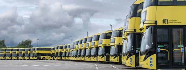
City Deals in the UK have empowered local governments, boosting efficiency and delivering faster results. With successful examples like Greater Manchester, Aotearoa can explore adopting this model to drive sustainable, locally-led development. Could City Deals be the future of governance here?
What types of deals have been agreed previously in the UK?
‘Wave 1’ of City Deals in the UK was initiated in 2011 and focused on the eight larger cities and city regions outside of the capital, such as The West Midlands and Greater Manchester. This allowed these cities more powers to improve public transport networks, such as the Bee Network in Greater Manchester and tackle more place-specific transport improvements such as the tram extension between Birmingham and Wolverhampton in the West Midlands. A second tranche of deals began in 2014 and were aimed at the smaller cities in England, such as Leicester, Brighton and Preston. More recently, devolution agreements have been considered for some of the more rural regions of the UK, such as the County of Lincolnshire.
What are the main lessons that have been learnt in the UK that Aotearoa can use to its advantage?
In the early 2010’s the UK coalition Government used the political support for more devolved powers in the country to replace the large number of single-purpose joint boards aimed at cities with formal City Deals. The Local Democracy, Economic Development and Construction Act helped to simplify the legislative process and devolved powers, while stipulating the need for the

authority in question to strengthen their democratic arrangements with the local populous.
Aotearoa’s governing bodies are in a prime position to learn from the agreements set up in other countries, such as the UK, to decide whether City Deals would be effective here and, if so, what type could be considered by the Government.
There are many encouraging examples, including Greater Manchester where a City Deal was set up in 2011 which devolved powers to a new Combined Authority. The
deal provided Greater Manchester Combined Authority with guaranteed long-term funding stream, a £30 million per annum rolling infrastructure fund, from Central Government. It also allowed the creation of the successful Greater Manchester Housing Investment Board and The Greater Manchester Investment Framework, which resulted in a more cohesive approach to infrastructure and spatial planning decision making. These examples demonstrate that City Deals have the potential to keep the decision-making process to a
more manageable size than those controlled by Central Governments, both in terms of the administration required and the number of decision-makers involved. The more successful deals have maximised these benefits and, consequently, produced more cost-effective results with more efficient monitoring systems, leading to quicker outcomes.
What made all the difference in the more successful agreements in the UK?
City Deals in places such as Greater Manchester and The West Midlands benefited from two factors that had a significant influence on their success:
Leadership: One characteristic that is critical success factor is the type and style of leadership each city-region established from the outset. Those that have a well-defined, visible, leadership group, with the comfort of strong, local political support, gained more success in the long term.
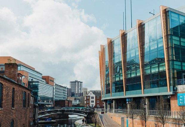
The West Midlands Combined Authority (WMCA) in the UK is a good example of an authority that, under the leadership of Andy Street, has formed an effective leadership group with the members representing the other seven West Midlands County local authorities.
The quality of leadership was paramount when negotiating deals with the UK Government, arranging borrowing processes, setting out strategies that integrated well with national policy, and promoting their City Deal to unlock potential funding opportunities with the private sector. Strong leadership groups like these are also able to focus attention on the clear objectives they initially set out, such as their Clean Growth objectives. They needed to demonstrate that they had the personnel, drive, and organisation capability to get results,

especially when some commentators argued these cities were comparatively fortunate to be given such an opportunity.
Area of consideration: When initially set up, all the successful agreements we have seen in the UK were formed taking particular care to agree the area to be covered. Importantly, the agreements considered the relationship between spatial planning and transport policy and how the cities were connected to their surrounding suburban and rural areas. They were formed as city-regions to strengthen these links and to take into consideration the economic influence of their respective cities to these surroundings.
This made it easier to make integrated transport and planning decisions in parallel - including fundamental efficiencies when improving transport links. Better informed decisions could then be made when considering projects such as major highway improvements and Bus Rapid Transit schemes.
From evidence we have seen in the UK, we see an opportunity to use City Deals in Aotearoa, but it will be important to aim for a consistent framework approach that works for the whole country.
Deals are now in place in the UK that cover city-regions, towns and rural areas. After 12 years of introducing City Deals, they have learnt that different deals are needed for different areas, not just cities and city-regions.
One size does not fit all. We have an opportunity to aim for this approach from the outset in Aotearoa and tailor deals for places of differing sizes and composition throughout the country. •
As a born Kiwi and a Mancunian now residing in Auckland, we both feel there is an opportunity for Aotearoa to learn lessons from the UK, especially when developing their City Deals approach. What do you think? Can City Deals improve integrated transport and planning decision-making in Aotearoa? Contact us and let us know!
By Chris Walker, Survey Manager Fulton Hogan /Taylors Contracting Joint Venture
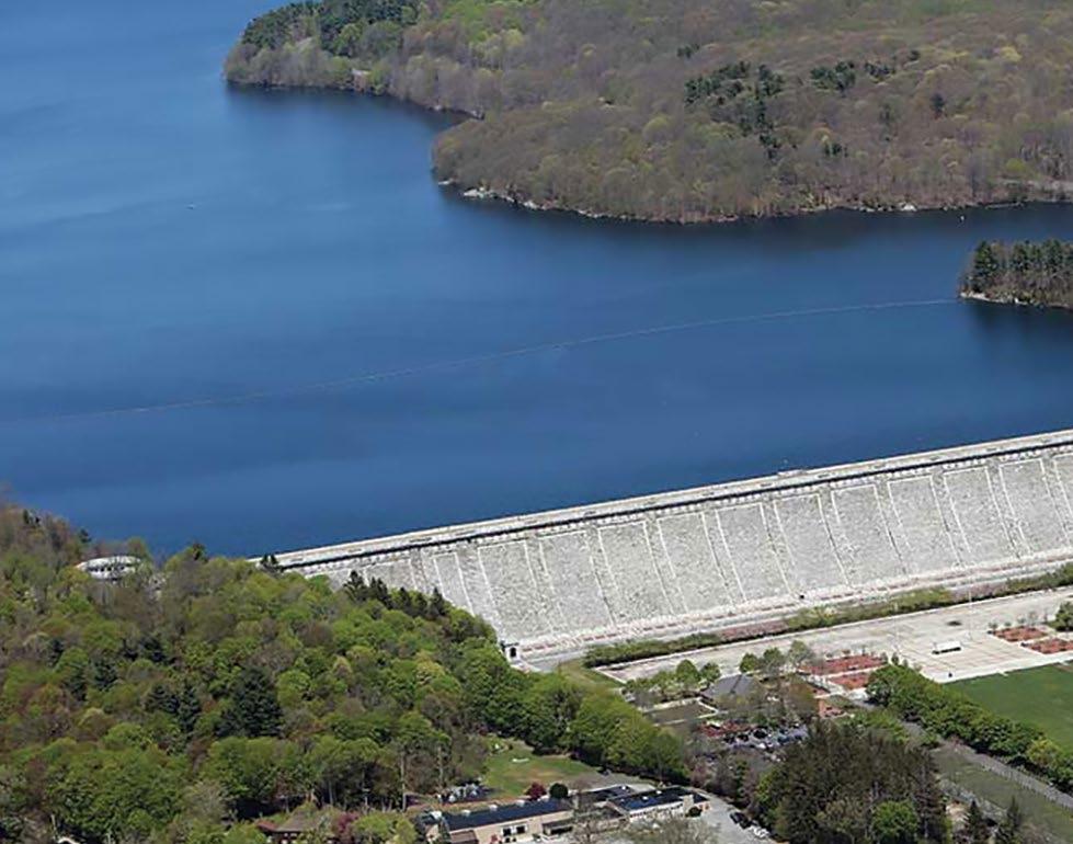
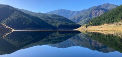
With the increasing pressure of climate change in the Tasman region and the growing needs of irrigators and the local community across the Waimea Plains, water security has become paramount in recent years. A water storage dam was considered for more than 20 years before being given the green light and a public-private partnership was formed between the local authority, Tasman District Council, and the Waimea irrigators to begin construction on the Waimea dam.
The opportunity to work on New Zealand’s largest dam project in over 30 years – the Clyde Dam was built in 1993 – was too much to pass up. The site is located in the Lee Valley, approximately 14km east of Brightwater, Tasman, and in the Richmond Ranges.
At completion, the dam crest is 53m above the original riverbed, 220m long, and 6m wide at the crest. It also comprises a 165m long curved spillway, and a 170m long double box culvert extending from the upstream to the downstream end, under the reinforced rock embankment. The reservoir behind the dam holds approximately 12.5 million cm3 of water. The purpose of the dam is to maintain minimum flows in the Lee River for downstream users.
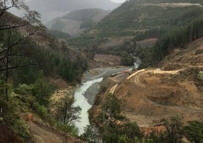
In July 2019, I made my way up the access road to the narrow part of the valley above Pig Flat to see clearing of the production forest and early earthworks under way.
A temporary GNSS base station had been established on a close hilltop for earthworks, and a site calibration using the few local cadastral marks provided the corrections in order to begin the work.
Early view of the valley above the dam, forestry clearing and the first earthworks (July 2019).
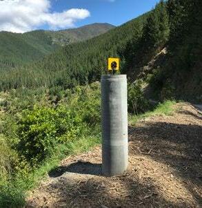
Considerations were then made as to where the best locations for permanent concrete control pillars could be established. They needed to be on stable ground, preferably intervisible,
with minimal risk of construction disturbance. Further connection to the few geodetic and cadastral marks that existed in this part of the Lee Valley confirmed the calibration. The primary network was observed and adjusted, and secondary marks placed closer to the work face areas. Trig heighting methodology was used to transfer and close a loop from the site’s primary benchmark, a bridge bolt on the old Waterfall Creek bridge deck. This height was established some years before during preliminary site surveys and is used as the basis for the design reduced levels.
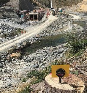
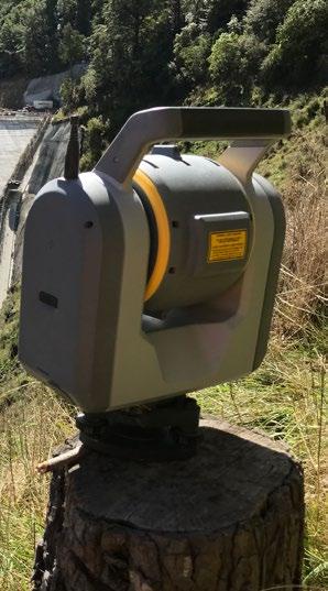
An early decision by JV partner Taylors Contracting to utilise the Trimble SX10 Scanning Total Station has proven to be the ‘right tool’ for the job. From a survey perspective, the earthworks
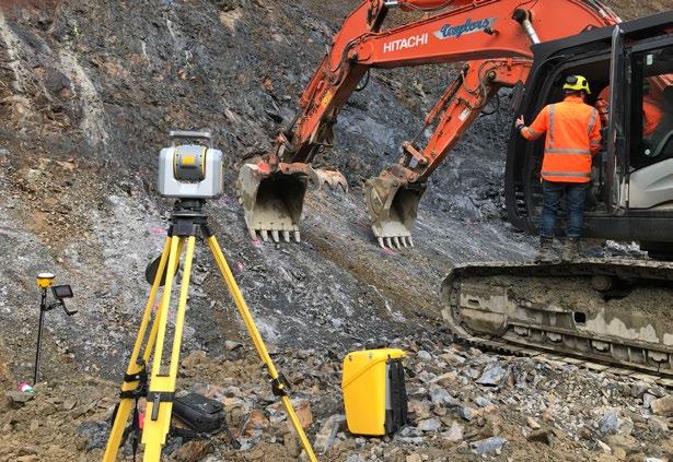
phase involved 3d model surface preparations, uploaded to machine control on any one of Taylors’ excavators, and then verification that cut surfaces were to design, firstly using GNSS rovers, and then by detailed terrestrial scanning of the surfaces. Using Trimble software, volume calculations were carried out to track monthly progress and final quantities. Using the scanner enabled safe and remote data capture of excavated surfaces without impeding the progress of the many machines onsite.
Taylors Contracting had experience with machine control from earlier large-scale projects in Canterbury and this proved to be the most efficient way to implement the design.
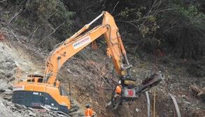
Terrestrial scanning of the cleaned rock surface provided not just evidence that excavation had been completed to the 3d model, but also a detailed picture of the rock structure. It was used in conjunction with the Geotech engineers to map the footprint of the dam and surrounding cut faces. This enabled the engineers to make decisions around the position type and configuration of the anchors, that were to be drilled and anchored
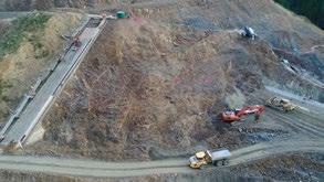
for stability and to support the construction of dam itself.
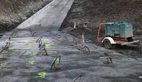
Drill plans were then either calculated for machine-controlled drilling or marked onsite manually. Another scan was carried out once the anchors were placed and matched with the drill logs. Managing the data was critical.
With the earthworks rock cleaning and anchoring well under way, construction started on the left-hand plinth and the box culvert. Other concrete structures to be completed were the starter dam, the right-hand plinth, the embankment concrete
face, face slab(FS) 10 and the intake pedestals and spillway itself.
During the high activity period of construction, there were often multiple work fronts open at any time. This meant an increase of demand on the survey team. Priority, resources and communication were key to ensuring the project carried on smoothly. While the spillway, its approaches and
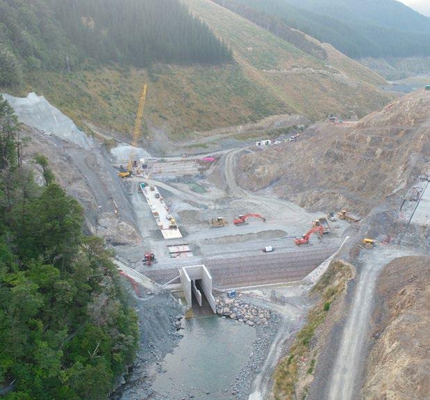
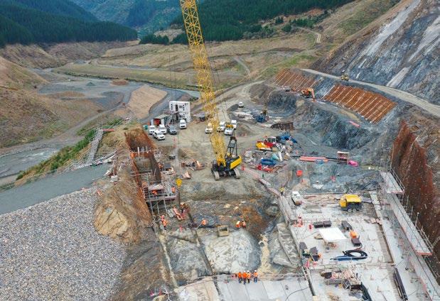
plunge pool structures were being constructed on the downstream side of the main embankment, the upstream side of the rock embankment was being covered by an 18.5km kerb underlying a concrete face, and an extra thick face slab for the intake pipes.
Periodically (every five layers of kerb), we would scan the kerb face

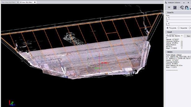
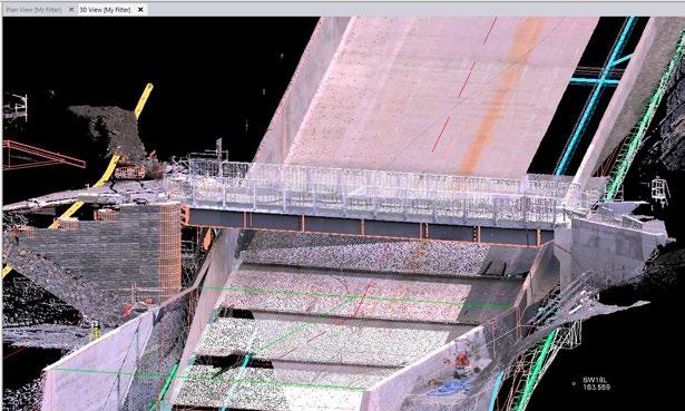
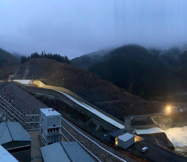
as construction proceeded to ensure the newly built sections met the contract specification. The scans were also used to monitor settlement and deformation of the embankment shape and compared against a deformation model.
Making use of a 3d design model was key to the success of the project. This was used in combination with the priority pdf drawing set. From office to site, and back to office, using linework and surfaces to implement the design and provide real-time verification on the Trimble controller, and back in the office to demonstrate design and specification compliance.
The completion of the stage 1 structures was heralded by the completion of the spillway and then the closing of the temporary culvert, thus enabling the dam reservoir to fill to the level of the Ogee Weir, and flow down the spillway.
As-builts still needed to be completed and electronic files transferred to ensure quality compliance. This is very much an abridged account of the project from my perspective. The mechanical (culvert pipe installation) and electrical (dam controls) phases of the project were still to be completed and were in themselves huge challenges. These were finally completed in September 2024. Thanks must go to the entire construction team that I worked with, and in particular, John Heaphy, Reece Moon and Alex Smith, for making this project a career highlight. Acknowledgment must also go to Fulton Hogan Major Projects NZ, Taylors Contracting Ltd (and the client for the use of the photography). The expressions and views in this article are solely those of the writer. •
By Darren de Klerk, Beca
Business Director - Water and Āpōpō Board Member Darren de Klerk reflects on his experience leading significant work programmes post Cyclone Gabrielle and the role of asset managers in building asset resilience into our infrastructure future.
Asset resilience in Aotearoa requires our infrastructure assets to withstand, adapt, and recover from unexpected but probable events like cyclones. Our decision making needs to enable resilient assets that are physically durable, financially sustainable, offer operational continuity and serve our communities in the long term. At the
Āpōpō congress, the term ‘mokopuna decision-making’ really resonated that generational thinking needs to be at the forefront of an asset managers’ decision making.
Mokopuna decision-making reminds and grounds me that it’s about the people. Infrastructure is a valuable tangible lifeline, but without the people, the asset serves no purpose.
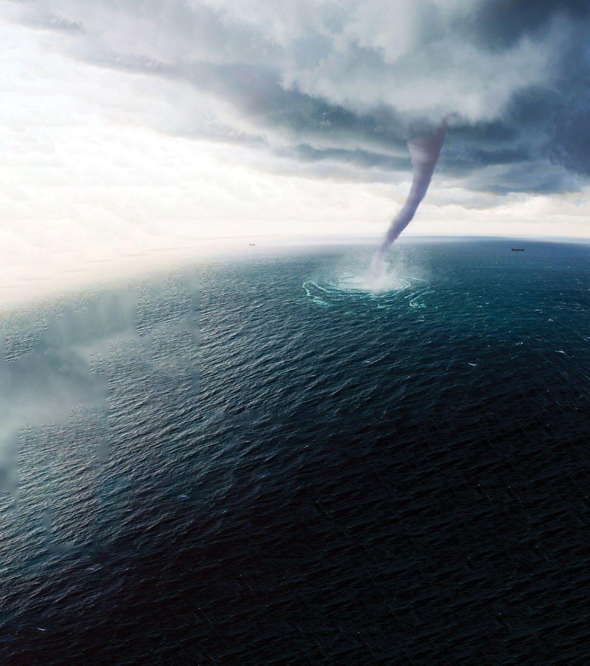
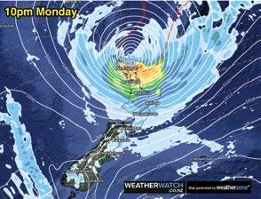
Cyclone Gabrielle caused significant unprecedented damage to many communities across the North Island of New Zealand, impacting our lifelines - infrastructure, housing, the primary sector, and businesses. Vital infrastructure we might have taken for granted was tested, and found wanting – our roads, water, wastewater, stormwater, waste, communications, and power supplies all impacted, creating rippling effects that will be felt for decades.
Post-disaster recovery requires a multifaceted, multi-agency approach to respond, recover, plan and mitigate future risks as best we can. As infrastructure leaders, we need to be addressing both

immediate solutions following any event, and then taking the lessons and creating long-term strategies.
Cyclone Gabrielle’s devastating impact on Aotearoa calls for robust asset management strategies to navigate the increasing frequency and intensity of extreme weather events.
Five key areas worth considering for an asset resilient infrastructure future
1. Learning, Risk Assessment and Mitigation Planning
Learning: Each event unfortunately offers us an opportunity to learn and reflect. From how our assets performed, to how we supported our communities, and to how our communities supported each other. We can reflect on what worked and what didn’t at an asset and social level to benefit future generations.
Localised climate risk analysis: It’s important to understand the specific vulnerabilities of our assets and our regions to disasters. Comprehensive risk assessments should consider historical
data, local conditions, and future climate projections. Working closely with others by taking a multi-agency approach can offer valuable insight.
Scenario planning: Developing multiple dynamic climate scenarios can help anticipate and encourage flexible and adaptive management strategies. Typically, we don’t do this well, and while we have plans, these aren’t well known and easily implementable.
Insurance and financial protection: Ensuring adequate insurance coverage for our assets is crucial. Asset managers should be working across their organisations to review and update cover and valuations to consider a wide range of climate-related risks. Additionally, asset owners need to think globally for local solutions. For example, where appropriate, innovative financial instruments like catastrophe bonds could provide financial protection against major losses from extreme weather events.
2. Investing in Resilient Infrastructure and Building Back Better
Resilient fit-for-future construction: It’s essential to adopt construction practices that enhance a structures ability to withstand nature’s forces. While this could include using stronger materials or upgrading existing structures, it’s also important to consider whether existing levels of services are even achievable, and whether safe failing infrastructure could be installed that could be recovered and repaired quicker. By supporting communities in understanding the expected performance of their community assets, we can better equip them to respond at a local level.
Nature-based solutions: By leveraging, restoring and preserving Aotearoa’s natural landscapes, such as wetlands and mangroves, we can enhance our taiao, and integrate Mātauranga Māori while building effective buffers against flooding, enhance resilience and offer additional ecological benefits. For example, wetlands can absorb excess rainfall, reducing the risk of flooding and improving water quality. Why not consider these in ‘build back better’ plans?

Building back at all: Through robust engagement with communities and asset users, consider whether the solution to ‘build back better’ is to rebuild at all. Consider evaluating if a simpler, more manageable service level might better suit the community’s recovery. While much is talked about where we build and the decisions made in a planning context, we really need to look hard at the impact of providing this sprawling infrastructure, considering the cost to install and maintain, followed by the cost to insure and recover these assets.
3. Embracing sustainable solutions and empowering communities
Empowering communities: When considering the role of asset managers in enabling and empowering communities to look after themselves during more frequent climate events, could success be measured by lessening reliance on traditional infrastructure? For example, enabling properties to install on-property water storage or back up power supplies would help in prolonging
the longevity of our assets and slow the need for upgrades.
At a community level, we can work to equip and empower our communities to become more sustainable, while again, lessening their reliance on a centralised infrastructure. For example, across the East Coast following Cyclone Gabrielle, there were examples of equipping community hubs to support their communities. Fit-for-purpose climate policy: Our evolving climate-related policy is crucial to supporting sound decision making and capturing the learnings from our experiences. Asset managers are key enablers in operationalising these policies, for instance, employing stricter building codes for hazard/ risk-prone areas can enhance overall resilience for the future.
Real-time monitoring: Technologies such as IoT (Internet of Things) sensors, machine learning and AI (Artificial Intelligence) can play a crucial role in building resilience into our assets and communities. Enabling real-time monitoring that allows
for learning, anticipation, proactive maintenance, and rapid response to emerging events could positively impact the way we respond to climate events. For example, while sensors are common, they are not consistently applied or understood and have the potential to provide asset managers with key information to make decisions for future investment, or more critically, in a disaster.
Big data and analytics: By analysing vast amounts of data, asset managers can identify patterns and trends, predict potential impacts, and optimise resources. This data-driven approach provides for more accurate risk assessments, more effective mitigation strategies and informs better decision-making.
Smart infrastructure: Investing in smart infrastructure that incorporates advanced technologies can contribute to more resilient and efficient asset management. For example, smart grids for electricity distribution that can automatically detect and respond to faults and smart water management systems that optimise water usage and reduce flood risks.

Stakeholder engagement: Engaging with local communities, landowners, tangata whenua, contractors, engineers, designers, politicians, and government agencies, are essential to making sound and informed asset management decisions. Collaborative efforts through diverse perspectives and needs lead to more effective resilience strategies, for example, involving local communities in flood mitigation projects can enhance the effectiveness and acceptance of the solutions.
Fit for purpose management and investment: Managing our existing assets is as important as investing in new assets - we can’t always afford to continue to build new structures or build back damaged ones. We have to get more out of our existing resources, be that people, systems or the physical assets.
It’s vital as asset managers that we are being as efficient as possible, considering this as part of any


discussions and assessment before we opt to build new.
The ‘leaky bucket’ analogy has been referred to a fair lately in the industry, and this analogy reflects whether we are simply pouring more time, resource, effort, and money into something that’s fundamentally littered with issues, rather than fixing the issue.
The very public and literal water loss through our pipes are a great example, and the need get these under control and this could reduce some of the need for investment.
Continuous education and sharing: Providing ongoing education on climate risks and resilience strategies for communities, leaders and asset managers will help equip those who may be impacted in future to make informed decisions and stay ahead of emerging trends and challenges.
As infrastructure professionals, we need to be having realistic conversations on the risks involved, what resilience means, and raising awareness.
It’s real, we cannot bury our heads in the sand, and as leaders of our community assets we can make a difference. The decisions we make everyday influence how prepared the communities and people we serve are for the future. Cyclone Gabrielle has made climate change real for many, and 2023 is an unmistakable turning point in our climate history and future, etched in history for all the wrong reasons, and providing us a stark reminder of the critical importance of infrastructure as a lifeline in our daily lives.
Asset managers have a vital role in our infrastructure future, planning and managing existing assets, building new, building back, or creating policies to guide future decision making. By understanding our risks, enabling resilient and sustainable infrastructure, and leveraging technological advancements, asset managers can learn, lead, enable, engage and contribute to a more resilient, prepared and sustainable Aotearoa. •


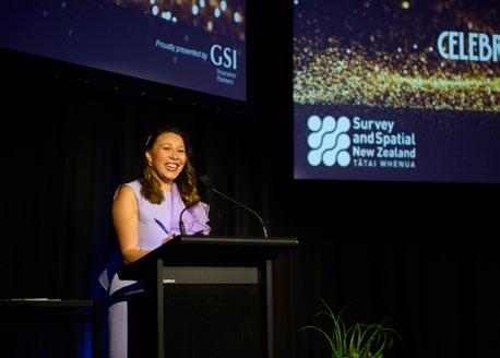
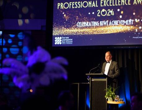
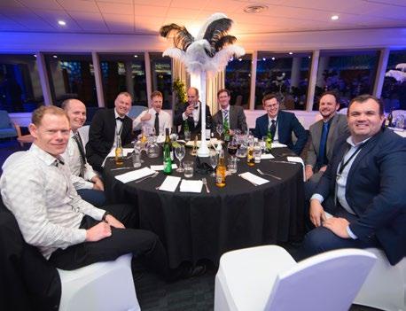
Hardworking S+SNZ members and members of streams/divisions were recognised for their contributions at the 2024 GSI Awards evening held at the end of August at the Annual S+SNZ Conference. More than 300 people gathered in the ballroom at the stunning National War Memorial Centre dressed to impress in their finest black-tie attire to acknowledge the finalists and congratulate the many winners, all of whom are making significant positive impacts in the sector.


This year’s event was more than just an awards ceremony – it was a night of celebration, recognition and inspiration. The crowd cheered as finalists were announced, and winners stepped up to the stage, each a shining example of innovation, dedication and excellence. Their contributions are reshaping the sector and driving


positive change across New Zealand.
“The S+SNZ Awards are all about celebrating those who stare in the face of obstacles, and unleash the true genius of Kiwi innovation, as well as those who demonstrate the highest ideals of professionalism and service,” S+SNZ CEO Ashley Church said.

The evening's energy was elevated



by the charismatic Melissa ChanGreen, who added her own touch of humour as MC, and Kiwi comedy legend Raybon Kan kept the crowd laughing as the entertainment for the evening. The 2024 GSI Awards evening was made possible by key sponsor GSI Insurance Partners, led by Glenn Stone.




The McRae Supreme Award for 2024 and Professional Excellence in Cadastral Surveying award were awarded to Richard Hemi.
Richard graduated from the University of Otago with a BSurv in 1988 and went on to obtain his cadastral licence in 1991. Next, he worked in private practice in Nelson, the UK and Auckland before joining the National School of Surveying, University of Otago, in 2008, where he is now a Senior Professional Teaching Fellow.
Alongside his educational achievements, Richard has also been an active Coastal Otago branch member, a member of the Cadastral Stream Executive Committee since its formation, a member of the Survey and Title Enhancement Programme working group and is
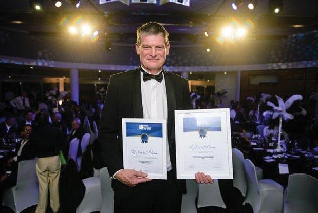
a current Survey and Spatial New Zealand councillor representing the tertiary sector.
Richard’s work to promote education in surveying along with his
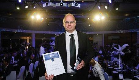
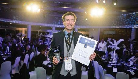

ongoing dedication to the profession, in the cadastral area and the survey and spatial profession as a whole, make him an extremely worthy candidate for both of these awards.

For outstanding service to the Land Development industry, Carl Salmons was recognised for his determination, empathy and his extensive experience as a leader in the surveying and land development space. He embodies a culture of excellence and ambition and takes great pride in supporting his employees and other land development professionals to grow and thrive in their careers.
He works tirelessly advocating for the survey profession with local council and the wider development community ensuring that we, as surveyors, maintain our foothold in the land development space
For professional excellence in the positioning and measurement industry, Rodney Pilbrow was recognised for his extraordinary innovation and leadership throughout his career.
His contributions to the surveying industry are profound and far-reaching. His relentless pursuit of innovation, commitment to his team and dedication to client satisfaction make him an outstanding winner for this award.


Fax McKernan was this year’s very deserving recipient of the Engineering Surveying Award for outstanding service to the industry. Fax was commended for his exceptional dedication and invaluable contributions to the Central Interceptor Project and engineering surveying profession.


The final stream award was awarded to Andrew Price for outstanding service to the hydrography industry. Andrew delivered a complex project using an unfamiliar vessel and uncrewed, autonomous vessel technology, which had not been used previously on this scale in New Zealand. Despite being new to his leadership role and facing numerous challenges, Andrew demonstrated calmness, determination and adaptability. He was the linchpin between the survey and vessel teams, ensuring safe and harmonious operations.


Our extremely well-deserved winner of the Young Professional of the Year Award, Nicky Shaw, has made a significant contribution to the profession, has shown outstanding leadership and has proven herself to be a fantastic role model to other young professionals. In 2019 she was awarded the Maurice Crompton-Smith prize for the best set of projects presented for cadastral licensing, and also gained the best result in the cadastral law exam. She is an inspirational and hard-working member of her profession and is a very deserving recipient of this year’s Bogle Award.
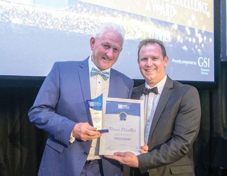
This year the Technicians Professional Excellence Award was presented to Bruce Walker.
Alongside acting as an assessor for the Survey and Spatial Engineering Certification Qualification, in recent years Bruce has tirelessly given his time and expertise to the development and launching of the new certifications developed for Survey and Spatial New Zealand. This has involved countless hours working with and supporting the developer of these credentials. What has been achieved with these qualifications will be looked back on as a major achievement for those who instigated, developed and implemented them, as well as one of the most significant advancements in the professional standing of many members, particularly technician surveyors.
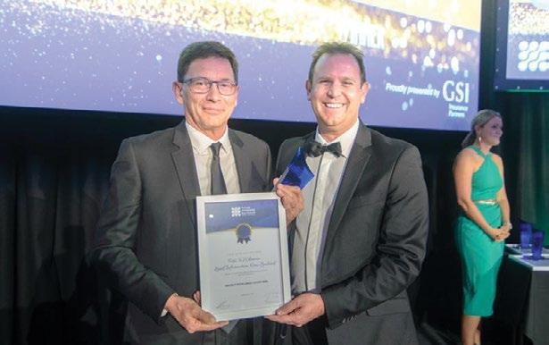
The S+SNZ Project Excellence Award celebrates the achievements of our top surveying and spatial organisations and showcases the finest projects we have to offer.
The worthy winner of the Project Excellence Award for 2024 is Toitū Te Whenua Land Information New Zealand, which had the complex task of reconfiguring the land in the Ōtākaro Avon River Corridor into around 200 lots that aligned with the land-use categories provided for in the Ōtākaro Avon River Corridor Development Plan.
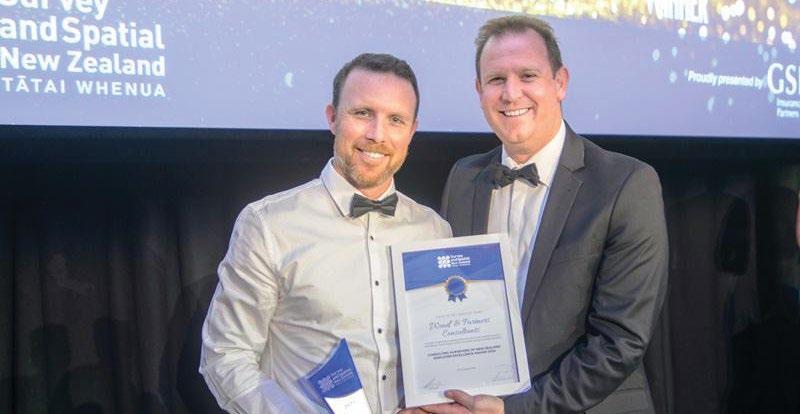
The Consulting Surveyors NZ Employer Excellence Award celebrates businesses that are leaders in the profession and demonstrates exceptional people practices that puts people at the heart of their businesses and culture. These businesses create a workplace that focuses on employee wellbeing, supportive environments, employee development and implemented employee-focused initiatives
creating high levels of employee satisfaction which have contributed to their outstanding success.
This year’s award goes to Woods Consultants Ltd, an employee-owned company which was established in 1970 and prides itself on investing in its people who are at the core of everything the company does.
Woods Consultants has a long-standing tradition of fostering
a positive culture, providing industry-leading people development programmes and creating healthy work environments through a strong focus of wellbeing and safety.
This year the quality of entries was high and two finalists received highly commended awards. These were awarded to Eliot Sinclair and Landlink.
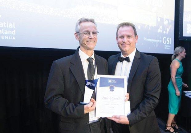
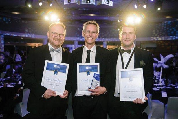
The Cadastral Survey of the Year Award recognises the outstanding cadastral surveys which have been carried out by cadastral surveyors over the past 12 months. The winner of this award was Mark Geddes for SO 571293
In second place, receiving the Silver Award, was Craig McInnes for DP 592340
In third place, receiving the Bronze Award, was Sean Railton for SO 579550
By Charlie Firth, Taine Hallberg, Amira Jain, Emily Tidey
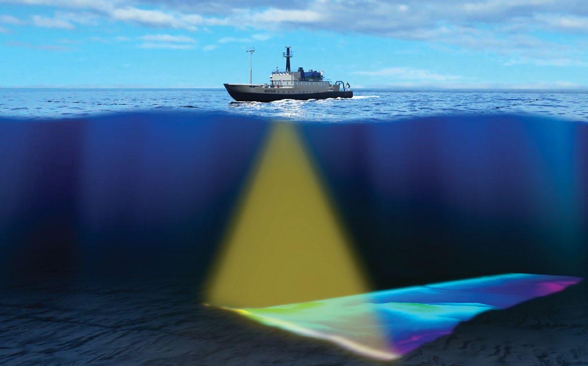
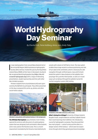
In July, hydrographers from around New Zealand met at the annual NZ Region (NZR) Australasian Hydrographic Society (AHS) seminar, hosted this year by the Royal New Zealand Navy (RNZN) at their base in Devonport, Auckland. We recognised World Hydrography Day (https://iho.int/ en/world-hydrography-day) with a range of interesting presentations, student sponsorship and time with other like-minded surveyors.
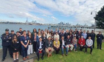
Thirteen students from around Aotearoa NZ were sponsored by the NZR AHS to participate. They either presented on the day or prepared this write-up, photos and other social media outputs.
The MPS566 Pilot System: Gary Chisholm, from Trimble, opened the seminar with discussion of a pilot guidance system that was designed, built and tested in New Zealand, and is now used on the Panama Canal. This is a recent requirement mandated by the Panama Canal Authority for
vessels with a beam of 109 feet or more. The new system enables these large vessels to achieve positioning and rate of turn data to the centimetre, which is necessary for safe navigation through confined spaces. Gary and his team tested the system in New Zealand on the Lyttelton Port passenger ferry and the Interislander, as well as in novel ways such as taking it through the Lyttelton tunnel for inertial navigation system (INS) testing.
What’s Going On at Otago? University of Otago students Brayden Foote, Joseph Anderson and Amy Cadwell shared their recent learnings from SURV322, the introductory course for hydrographic surveying. They discussed their two main projects – a wharf survey and the other in a deeper section of the harbour – which were fun experiences through which they gained great base knowledge
to the industry. One sidenote was that it was a lot trickier to drive a vessel in straight lines when conducting a survey than it may seem.
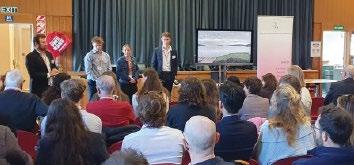
Surveying: Renee Stoddart and Meg Catley delivered a powerful presentation highlighting the crucial role of women in hydrography and the unique challenges they face in a male-dominated field. Their talk was especially timely, given the ongoing discussions about improving gender diversity in the industry. One major point they addressed was the lack of awareness among young women about hydrography as a career option. They noted that girls' schools often miss out on having speakers discuss traditionally male-dominated professions, creating a gap in education and opportunities. Their presentation emphasised the need to introduce surveying and hydrography to students at a younger age, aiming to inspire and build confidence in future generations of women. The audience engagement and questioning afterwards showed wholehearted agreement that such initiatives are essential for fostering a more diverse and informed workforce in the years ahead.

Knowledge into Industry: Riley Neal shared his university journey, particularly his experiences studying advanced 300-level and 400-level courses. He highlighted how these studies, although packed into a tight schedule, provided him with crucial, real-world concepts that proved invaluable in his professional growth. Riley addressed the challenges associated with the hydrography field, noting that its late introduction in many degree programmes might
contribute to its under-representation among students, who are often unaware of the diverse career opportunities it offers. Drawing from his recent work experiences, Riley painted a vivid picture of the hydrography work culture, describing it as both welcoming and energising.

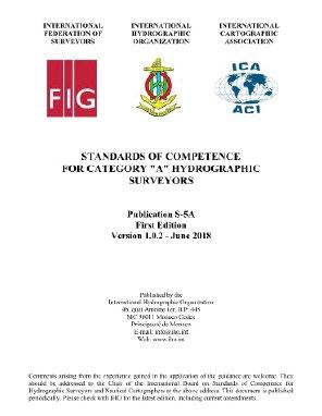
Updating the FIG/IHO/ICA Standards of Competence for Hydrographic Surveyors and Nautical Cartographers: National Hydrographer Adam Greenland discussed upcoming work by the International Board on Standards of Competence for Hydrographic Surveyors and Nautical Cartographers (IBSC). The standards, first introduced in 1978, are being reorganised to keep pace with new technologies in surveying. One of the main challenges is determining which aspects of the old standards to retain and which to revise. Adam encouraged public input on this process. Additionally, LINZ is focusing on outreach to universities and high schools to integrate relevant subjects earlier in the education system. This initiative aims to inspire young minds and shape future generations with innovative ideas and perspectives in the field of hydrography and nautical cartography. Front cover of the current (2018) S-5A Standards of Competence
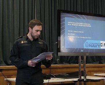
Dual-frequency,
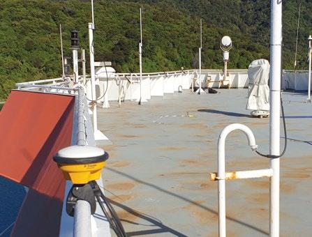
Ryan Slattery took us through his honours research. He shared some interesting insights about using polycarbonate domes for protecting multiGNSS receivers. Ryan had initially thought that a worn-out dome might degrade the signal, but his tests showed that without the dome, there was more signal noise. He speculates that the dome could help filter out lower-elevation satellites, which might improve the overall signal geometry. Ryan also discussed the challenges of using the budget-friendly receivers over long baselines, where atmospheric errors may not be the same at the receiver and base station, adding complexities in data reductions. Despite this, Ryan aims to chase centimetre-level accuracy and could drastically cut costs for buoy systems by thousands of dollars. His work is poised to make a big difference in making high-precision measurements more affordable and accessible.
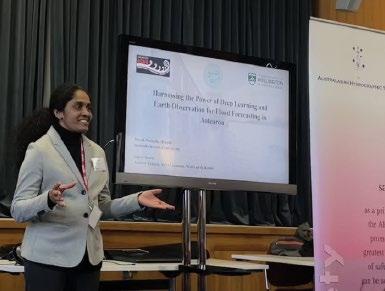
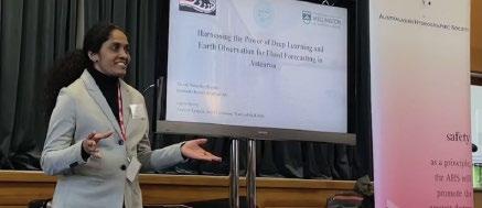
Herath, from Victoria University of Wellington, presented her research on flood forecasting using machine and deep learning techniques. Nimasha has recently started her PhD, after completing an MSc where she developed a model for flood extends and depth prediction in rivers. Now she is using earth observation techniques for past flood detection then using these to develop geospatial visualisations with interpretable and explainable models through machine and deep learning. These earth observation techniques allowed her to build a training model for the software to then predict the extents, depths and impact on future floods. The research aims to provide forecasted flood maps, reports, model explanations and interpretability that will not only be helpful in natural disaster rescue response but also weather predictions.
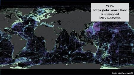
Jimenez Baron, of NIWA, passionately presented on the continued efforts of Seabed2030 to map the entire sea floor. Seabed2030 is pushing for hydrographic companies to map their transit to and from jobs, as well as providing a low-cost solution for private vessels to also contribute to the data set. The main issue is the size of the area that needs to be covered, and with a goal of 100m square pixel sizes, it needs everybody to contribute to the data set. Belen also showcased the Seabed2030 device which allows any vessel to collect and export data to add to the cause. This system is able to be plugged into most private vessels, which typically have a sonar and GNSS sensor onboard.
An internship at NIWA – Contribution to mapping the seabed of the Cook Islands: Juliette Dael is an exchange student from France who is working with NIWA on a project to map the sea floor of the Cook Islands for the Cook Islands Government. Her exchange through the University of Victoria has allowed her to use multibeam echosounders and data to expand the data set for the area. Juliette has greatly appreciated the autonomy given to her by NIWA throughout the project allowing her to work and learn valuable skills towards her hydrographic career.
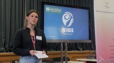
Kiribati Surveys: David Crossman has worked in many areas around the world, yet the recent IIC Kiribati island surveys were a standout for him. The combined mapping project using bathymetry and airborne topography allowed detailed, accurate surveys of four target islands, beginning a project that aims to help to protect the people and islands of Kiribati and allow appropriate decisions to be made regarding sea level rise and future tourism opportunities in the area. The isolated nature of the job presented many difficulties, but the experience of meeting the local people and embracing their culture maintained ongoing buy-in to the project.
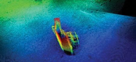
Augmenting SDB for Hydrodynamic Modelling: Andrew Price showcased Ocean Infinity’s new method to augment satellite derived bathymetry (SDB) into hydrodynamic modelling. The project was looking at the currents surrounding Port Bonython in Australia where a new wharf will be constructed. By mapping the sea floor in the surrounding areas, a model of the currents prominent at the site can be drawn up and assist in the design to make sure it meets the necessary standards and safety. In this project, Andrew and OI combined the multibeam echosounder bathymetry with SDB with novel mathematical processing.
Hydrography @ Otago: Emily Tidey, lecturer at the School of Surveying at the University of Otago gave a recap on recent updates including the recent curriculum adjustments which matched earlier conversations regarding updates of international standards of competence presented by Adam Greenland and many meaningful discussions regarding the importance of keeping the curriculums and certifications relevant to an industry with the ever-increasing technological advancements. Emily gave us a look into the current research projects happening at the school and asked that if companies or individuals had some exciting prospects or ideas, the school is often open to connecting these ideas with passionate students. Emily is regarded very highly among the students at the School of Surveying and her continued efforts in hydrography were clear with nine 3rdyear students and two 4th-year students attending the day.
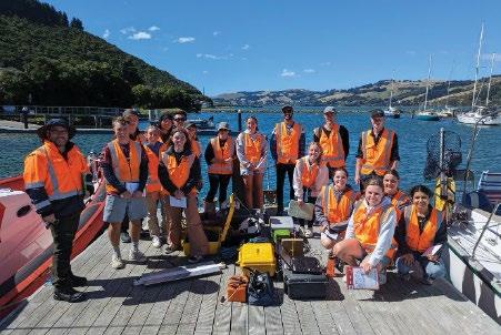
It was a great trip for us university students as we all gained great insight to the hydrography industry and what there is on offer, as well as meeting the awesome people involved. The variety of presentations was a testament to the potential of hydrography as technology advances and practices develop. The ferry ride back to town was a very fitting way to finish off the seminar. All students pass on thanks for the NZR AHS’s continued encouragement of us through sponsorship, and the RNZN for hosting us in Devonport. •

We look forward to meeting with you next year!

After Toitū Te Whenua Land Information New Zealand successfully launched several new features over the past month, further Legacy Landonline functionality for surveyors is being switched off.
From early October the following functionality will only be available in New Landonline – Survey:
Sign and Submit
My Messages
Notices
Requests
A majority of commonly used search functions are now available in Web Search. Please give it a go and let us know what you think.
The last major survey feature remaining in Legacy Landonline is Plan Generation, which is planned to be available in new Landonline early next year. Legacy Landonline will be switched off for all Landonline users by the end of March 2025.
On 8 August LINZ launched a request for feedback on its proposal to modernise the way you view and use survey plans. We’re inviting feedback from all Landonline users on the proposal to replace the current plans with a digitally visualised version.
We encourage you to give it a go, share it with your clients, legal professionals, territorial authorities, etc, and get their thoughts. People tell us it’s much easier to understand the proposal once you’ve tested it yourself.
Nick Stillwell, Senior Relationship Partner – Consulting Surveyor
Toitū Te Whenua Land Information New Zealand
The LINZ website has all the details about the proposal and the digitally visualised survey plan prototype which demonstrates how the proposal could work.
The proposed changes to survey/title plans will impact the way you work, so it is important for all users to take the time to review the proposal.
Your feedback is welcome either through your professional organisation or by email to engagement@linz.govt.nz
Thanks to all those who provided submissions on the survey and title fees review consultation earlier this year. We have provided advice to the Minister on the feedback received from industry. Current expectations are that Cabinet will decide on new fees by the end of this calendar year.
Once we have Cabinet approval we will communicate the final new fees. In the meantime, you can find the originally proposed fee changes in the discussion document.
As mentioned in the discussion document, should Cabinet agree to the proposed new fees, you can expect them to be implemented early in 2025. •
To get started visit: www.linz.govt.nz/getting-started-survey
The next phase of work – to replace plan generation and submit and sign – has started. We’ll keep you in the loop with what’s happening as this work progresses.

James Irwin, Dylan Revell and Charlie Latchford, 12d

The New Zealand Transport Agency Waka Kotahi (NZTA) has been compiling and implementing the Asset Management Data Standard (AMDS) over the past few years. This standard provides an agreed set of definitions, asset categories, lookup attribute values and data requirements for the land transport industry across New Zealand, with a focus on digital engineering infrastructure.
Future updates and releases of AMDS will be managed, controlled and published by NZTA. AMDS will replace the existing requirements of compiling RAMM spreadsheets as part of project completion sign-off or for new subdivision projects that require 224c from the road controlling authority (RCA).
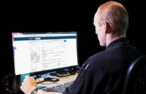
One significant proposed change to AMDS is that the information is provided to the RCAs is spatial and is no longer linked to the road centre-line chainage and offset values. These changes will need to be incorporated into the company’s workflows and verification processes to ensure the delivered asset information is compliant with AMDS.
These standards are to become the base requirements for not only state highways assets but also nationwide road controlling authorities such as territorial authorities or councils. Each of these authorities have a schedule for beginning the process of implementing and converting their existing databases to the AMDS standard.
• For more details, see: https://www.nzta.govt.nz/ roads-and-rail/asset-management-data-standard/about.
• AMDS has been released publicly and is now in Release Version 1.3, which is available for download and review: https://www.nzta.govt.nz/ roads-and-rail/asset-management-data-standard/development/data-standard-releases.
• For more information about the implementation timelines, see: https://www. nzta.govt.nz/roads-and-rail/ asset-management-data-standard/implementation/ implementation-timeframes-and-activities.
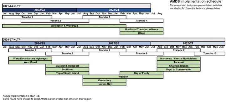
This diagram from this website reference details the regions and dates for implementation, which will then translate to data requirements from survey and spatial professionals.
Currently, the RCAs and NZTA have been concentrating on converting the existing RAMM asset information to the new AMDS format, with limited engagement with the wider spatial community which provides the vast majority of information for new assets entering the RCAs’ roading database.
Quite simply, it means that all capture, attribute input, data validation, and delivery of land transport assets are required to comply with AMDS. AMDS contains a vast amount of mandatory metadata attribute values, most of which are contained with predefined lists that are specified within the standard. Think of these as digital as-built standards. If part of your current work practices is to populate RAMM information spreadsheets, then you will be required to provide the same asset information in compliance with the higher level of detail required by AMDS.
Whether you are working on a state highway major infrastructure project or a local land development
project that includes vested roads, having a clear data workflow (including data validation against the AMDS rules) before submitting metadata, which needs to be AMDS compliant, to the RCA is vital. AMDS requires an incredible amount of attribute information not only of each asset class but individual assets in a typical infrastructure project. The final asset attribute information will need to be sourced from all stages of the construction life cycle:
• Attribute information from existing databases.
• Attribute information from design models (pavement detail and depths).
• Attribute information during construction (pole numbers for street lights).
• Attribute information during post-construction verification (testing results).
All this required information will need to be compiled and verified on the asset before delivery to the RCA or territorial authority. A workflow planned out to ensure the correct information is captured at the right time will save a tremendous amount of time at the end of a project.
The standards themselves contain many different asset classes as shown in the diagram. Each overarching asset class is split into its own subclass of assets. Sub-classes for the Drainage Asset Class are as follows:
• Chamber
• Channel
• Headwall
• Pipe
• Valve
• Water Area
• Water Structure.
The snapshot of the Drainage-Pipe Asset class from AMDS shows the granular level of detail of metadata attributes required before delivery to the RCA.
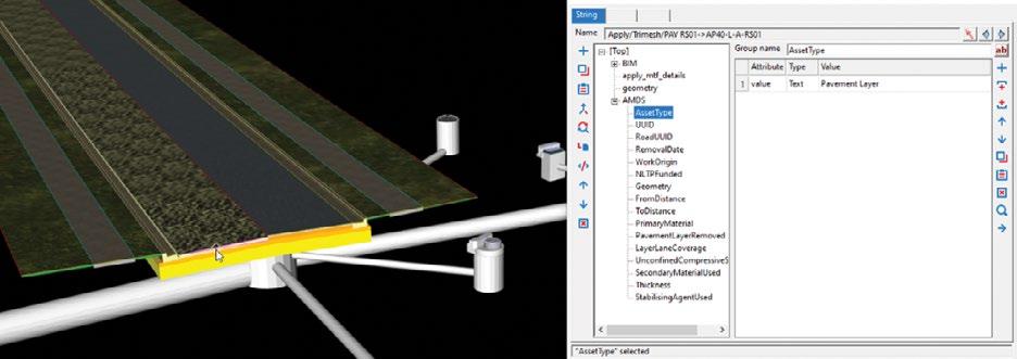
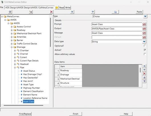
The structure is easier to visualise from the 12d Model MetaConnex Editor.
Each pipe asset in an infrastructure project, requires about 63 attributes to be captured – equating to 63 attributes for every section of pipe!
Needless to say, you do not want to be chasing down these attribute values right at the completion of a project just before hand-over.
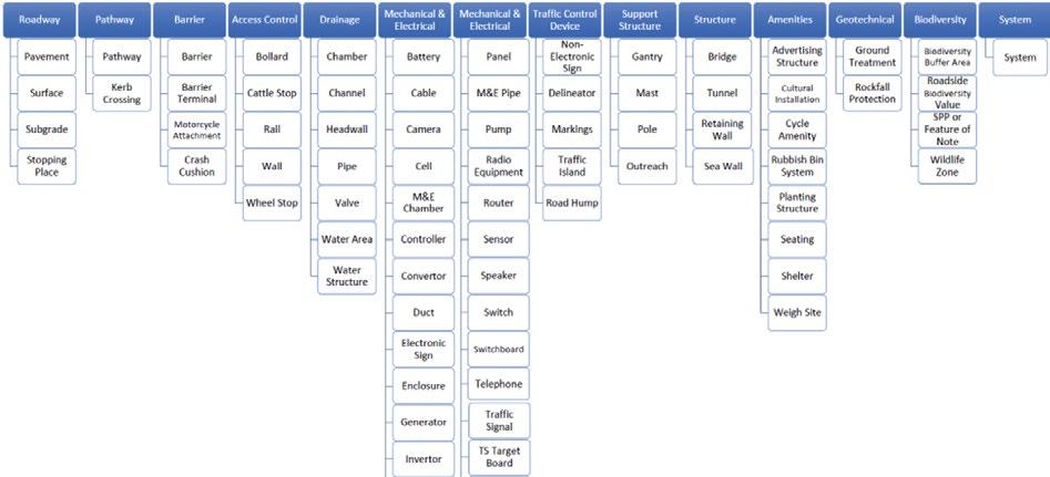
The standards themselves contain many different asset classes
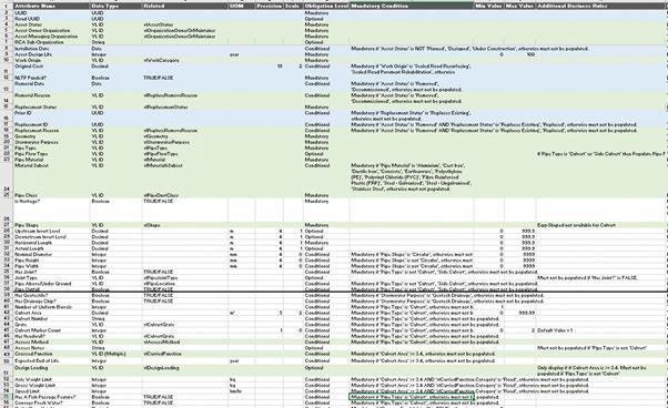
The snapshot of the Drainage-Pipe Asset class from AMDS shows the granular level of detail of metadata attributes required before delivery to the RCA.
“The RCAs and NZTA's switch to AMDS mandates capturing up to 63 attributes per asset, ensuring detailed metadata compliance for land transport projects. Early planning, data collection, and validation throughout the project lifecycle are crucial to meet AMDS requirements and prevent delays during asset handover.”
As it usually falls to the surveyor to complete the population of any as-built assets attribution within a project, starting to plan for the requirements of AMDS within your local region needs to be undertaken before delivery.
Additionally, consider that you may be required to deliver the same asset information in compliance with more than one standard. For example, the pipe asset information may be required in both AMDS and Three Waters Code of Practice standards.
Liaise with your survey instrument manufacturer to see if many of the required asset class attributes can be either populated at the time of pickup and, most importantly, be restricted to the approved values as specified in the AMDS.
For example, the attribute for Pipe Class has 26 approved values for this asset type. For those using 12d Field, the AMDS MetaConnex file can also
be used for your field survey code list and to prompt for required AMDS attributes at the time of pick-up.
To avoid manual entry of AMDS attributes into a spreadsheet, we recommend ensuring that your survey reduction software has AMDS-compliant workflows to automate the population and verification of each asset.
As shown in the screenshot above, 12d Model has the MetaConnex system available to assist in the automation of as-built standard such as AMDS, Three Waters, Asset Design As Constructed (ADAC), among others.
Once you have your workflow planning under way, it is highly recommended you engage with your RCA or territorial authority and discuss the format in which they are expecting metadata delivery to comply with AMDS.
In our experience, the authorities that are currently implementing the AMDS in their internal systems have
The structure is easier to visualise from the 12d Model MetaConnex Editor.
not considered how to receive the metadata in terms for file formats and geometry definitions (such as points, lines or BIM objects) from the data providers. In fact, these authorities are most likely unaware of current survey practices that will be used in the pick-up of these assets.
If you have compiled a fully attributed asset model that can be delivered as a BIM model, having to populate a spreadsheet for delivery of the model will just lead to unnecessary work for your team.
Many authorities can consume the digital model but just do not know the correct format to ask for, so engaging in these discussions early will save a good deal of time and effort. •
12d NZ will be undertaking a workshop talk about the AMDS workflows at the 2024 S+SNZ Conference in Napier.
For more information
Please email support@12d.co.nzw

It’s no secret that New Zealand’s three water infrastructures –drinking water, wastewater and stormwater – are ageing and have suffered from insufficient investment in maintenance, asset refurbishment and renewals. Our old and often hard-to-reach assets require accurate surveys and inspections to ensure their continued and safe use.
Asset owners need accurate information on the condition of their assets to make the best use of ratepayer funds. However, surveyors entering deteriorating assets face significant health and safety risks, especially in underground infrastructure that’s in slow collapse mode. Often these spaces cannot be safely accessed even with confined space protocols due to risks of structural failure, debris or damage. With tight budgets in the current economic climate, how can we effectively survey our assets while keeping our surveyors safe?
Aerial drones have transformed surveying practices in recent years, allowing surveyors to work safely while drones map hard-to-reach
areas. However, when drones are unsuitable for confined or hazardous environments, what alternatives do we have? Traditional survey methods have evolved over the past decade to include 3D laser scanning and other reality capture tools but remain unable to provide highly accurate measurement data and high-quality imagery without endangering human lives.
Recently, when a highway structure inspector undertook a routine inspection of a 40-metre long, 2-metre diameter culvert which had significant fractures and shape distortion, it was difficult to determine the extent of the damage and detect active deformation. Situated under a highway, this culvert provided the only access to a remote part of the coast.
The inspector took a few photos and quickly exited the culvert due to concerns about his safety. However, because of the extent and location of the damage, someone needed to go back inside and collect more information but had no means of gathering this data safely.


To make informed and calculated engineering decisions on next steps, actual data was needed to understand the size of the problem, the shape of the pipe, and baseline measurements to use against future measurements to understand movement over time.
We explored the development of a robotic vehicle to enter underground culverts and complete large pipe inspections. Designed for all-terrain 3D scanning and 360-degree photo capture, the 6-wheeled robot, named PIPE-I, enhances data collection capabilities, gives consistent and repeatable results in a digital format at a very low cost and with almost zero human risk.
With a range exceeding 1 kilometre and a battery life of 6 hours with all the spatial tools on board for the modern era, the choice to delegate survey tasks to a robot becomes straightforward.
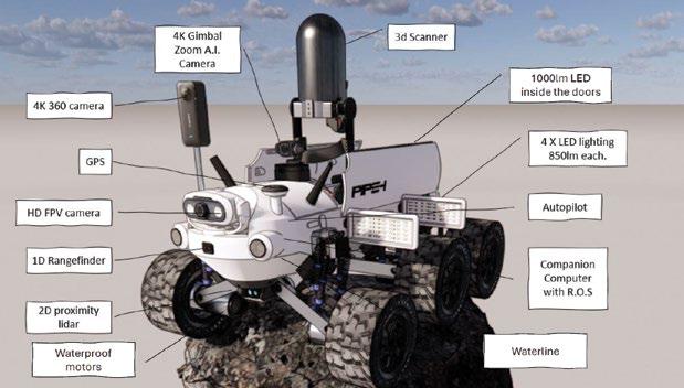
“New Zealand's ageing water infrastructure requires safer inspections. The PIPE-i robot provides accurate 3D data, reducing risks and improving asset management.”
With the help of 3D printing technology, prototype designs were rapidly iterated to enhance the functionality of the robot over time. It was designed from the bottom up – with a sole focus to support the integration of the smallest 3D scanner on the market, the Leica BLK360 Generation 2. The scanner is carried in a protected cargo area, deploys the scanner when ready, and it measures 680,000 points per second, accumulating millions of accurate measurable points over a full survey.
The robot has an onboard autopilot module, enabling navigation and autonomous capabilities. A raspberry Pi companion computer running Robot Operating System (ROS) acts as a mini brain for the robot, helping it understand, communicate and interact with the world around it.
The adjustable height between 300mm to 500mm allows the robot to maintain elevation and navigate through moderately flowing culverts and minimise its profile when operating in environments where this isn’t much head room, such as
underfloor spaces. The information collected can be presented in such a way as to provide a virtual digital twin of the structure.
Robotic technology can change how at-risk assets are inspected, how data is accessed, visualised and analysed, aiding in the improvement of infrastructure resilience.
The impact of using a robot has highlighted several benefits:
• Eliminating confined space entry – engineers and surveyors can altogether avoid entering high-risk environments.
• Monitoring and predictive maintenance – the ability to compare point cloud data sets over time allows for the monitoring of assets for deformation, preventing catastrophic failures, and ensuring the safety of the infrastructure, the people responsible for its maintenance, and the public that use it.
• Resilient design – with enhanced data capture, a robot allows for smarter decision making in


asset designs, management and maintenance.
The development of a robot and systems like PIPE-i have the potential to revolutionise confined space surveying, offering safer, more economical, and accurate solutions for gathering data in critical assets.
The future of this robot lies in creating end-to-end automated workflow for asset inspections, incorporating artificial intelligence (AI) and machine learning. It has become clear that autonomous operation integrated with AI is the future for these robotic systems.
Autonomous systems promise to enhance productivity, allowing surveyors and engineers to assign mundane or hazardous tasks to robots. The integration of such technologies is promising for AI and asset management, with automated data collection and analysis systems likely to revolutionise asset management.
This technology offers a much safer method of inspection and measurement, providing more accurate and highly visual data, giving asset managers a reliable foundation to assess asset conditions and make informed decisions on repairs or replacements. •
Want to see PIPE-i in action?
Watch the full video here.
This month’s GeoMessage spoke with the three newly-elected AHSCP Panel members on the internationally recognised Australasian Hydrographic Surveyors Certification Panel (AHSCP) for 2024-2026 to learn more about them and why they chose to nominate for this rigorous role. They join existing Panel members GCA members Barry Smith (Hydrography for Coastal Zone Management) and Neil Hewitt (Private Practice), and Chair Commodore Robyn Phillips (Hydrographer of Australia).
AHSCP Education representative, 2024-2026

What are your qualifications and current role?
I hold a Bachelor of Surveying from Curtin University, and became an AHSCP Certified Level 1
Hydrographic Surveyor in 2020. I am the General Manager at BlueSpatial Australia.
Why is Professional Hydrographic Surveying Certification important?
We are at a crucial point where the number of surveyors can’t keep up with the demand for our expertise, and whilst the demand is great for growth of our industry, we need to ensure that going forward we continue to hold a high standard to the professionals getting certified. These standards are critical in continuing to provide confidence to the clients who use hydrographic survey services for a multitude of reasons, from safety of navigation down to quality of data for engineering design and environmental purposes.
Why did you choose to nominate for the AHSCP Panel?
I wanted to give back to the industry and be involved in helping the next generation achieve their goals, and allow them greater opportunities which come with certification.
My volunteer role with Curtin University (Western Australia) allows me to get a perspective of the students of today and a better understanding of the issues faced with regards to the education in surveying here in Australia.
I’m looking forward to working alongside well regarded industry figures and promoting the importance of hydrographic certification to continue the great work done by the Panel over the last 30 years.
Re-elected AHSCP Industrial Offshore Surveying Representative, 2022-2026
What are your qualifications and current role?
I hold a Category A (PG Diploma Hydrographic Surveying from the University of Plymouth, UK) and a BSc Double Honours (Physical Geography and Geology) from the University of Durham, UK. In 2021, I gained Level 1 AHSCP Certification as a Hydrographic Surveyor, and am a freelance Survey Consultant and Acoustic Imaging QPS Sales and Marketing.
AHSCP Nautical Charting Hydrography representative, 2024-2026

What are your qualifications and current role?
I hold a Post Graduate Diploma (Distinction) from the University of Plymouth, UK and a
Why is hydrographic certification important?
The requirement for surveys to be certified by a Level 1 Surveyor is increasing in the region, and we also see it starting to extend out of the traditional nearshore/ports and harbours environments.
What are you looking forward to by being on the Panel again?
It was a complete pleasure to serve with [outgoing Panel members] Ian Phillips and Dean Battilana over the past few years and I am sad that they are unable to continue, but I do look forward to Rhys and Neville coming on board. I think it is great that the Panel comprises people with diverse survey backgrounds and a variety of years’ experience, both in the
Category B Hydrographic Surveying, which I obtained during my service with the Royal New Zealand Navy. I became an AHSCP Level 1 Certified Hydrographic Surveyor in 2020. My current role is Technology and Transition Manager for Ocean Infinity (Australia).
Why is hydrographic certification important?
Certification is significant to me since it combines education and experience in our sector to achieve a globally recognized level of competence. On another level, it creates a sense of obligation to continually reach or surpass high standards, which I believe is the reason we now have such a rich pool of talent.
Why did you choose to nominate for the AHSCP Panel?
To gain a better understanding the complete process to be more

industry and on the Panel. I am also looking forward to the completion of the current IBSC review of the S5 suite of Competency Standards for Hydrographic Surveyors. Once the AHSCP Guidelines have been updated, including the definition of Recognition of Prior Learning and how it can be applied, this should ultimately bring improved clarity to those applying for certification. able to provide help to industry professionals seeking certification in the future, especially to those in NZ. On a personal level, it’s also a great way of giving back to the profession, especially to those who have taken the time to mentor me through my career. I am excited to be a part of the process, learn new things, and meet new people (even if it is through their portfolios rather than in person). Being a part of the process, I am also excited to watch and engage with the larger hydro community about the certification process.
Anyone considering representing the highly varied and technologically advanced realm of hydrographic surveying on the AHSCP Panel in the future - and would like to find out more of what it entails - is encouraged to get in touch with the Panel (ahs.cp@defence.gov.au).
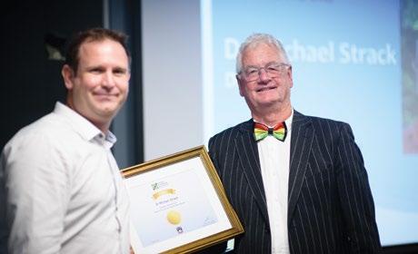
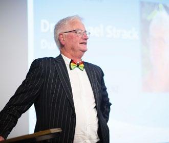
Aheartfelt Congratulations to Dr. Michael (Mick) Strack on being awarded Fellowship of Survey and Spatial NZ (S+SNZ) at the recent AGM held during the 2024 Conference in Napier. Mick has dedicated over 30 years of exceptional service to S+SNZ and the surveying profession in Aotearoa New Zealand. Based at Te Kura Kairūri | the National School of Surveying at Ōtākou Whakaihu Waka | the University of Otago, he has been a vital resource on Aotearoa New Zealand Land Law, guiding both students and practitioners throughout his career.
An active member of S+SNZ, Mick has served on the executive committee of the Coastal Otago Branch, most recently as Communications Officer, and has played a key role on the organising committee for the S+SNZ conferences in Ōtepoti | Dunedin in 2013 and 2023. His contributions have been recognised with two Fulton Bequests: Class A.1 for outstanding service to S+SNZ and the surveying profession, and Class A2 for a paper of exceptional merit on a relevant professional topic.
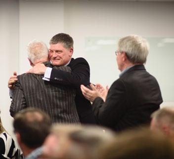
Mick’s impact on the profession is profound. He has taught, mentored, and supported over 1400 graduates in land law, land tenure, resource management, and research supervision. His curriculum addresses critical issues such as mātaranga Māori, te reo, Māori land issues, sustainable land use, and rights related to water, rivers, and the sea. Many of today’s practicing consultants in S+SNZ credit their foundational knowledge of land tenure to Mick’s insightful teaching.
Once again, congratulations to Dr. Mick Strack on this well-deserved honour!
Stephanie Harris
Glaister Ennor
Hope Horrocks
Title defects in property ownership are akin to the dormant volcanoes scattered across New Zealand's landscapes – silent, unassuming and often unnoticed until they unexpectedly disrupt carefully laid plans. For property owners in New Zealand, these hidden issues can become significant obstacles when it comes to re-mortgaging, selling or developing property. As surveyors and as lawyers we each need to understand these defects and how to address them, as it is crucial for ensuring that our clients can proceed smoothly with their property transactions and developments.
We at Glaister Ennor have detailed in this article four significant title defects we encounter and provide our legal perspective on their resolution. These are Limited as to Parcels, paper roads, redundant interests and occasionally Deeds Land. Each of these issues poses unique challenges that can impede property owners’ plans, but with the right knowledge and expertise, they can be effectively managed and resolved.
The term ‘Limited as to Parcels’ refers to a situation where a property’s boundaries are not guaranteed by the title. This issue typically arises in
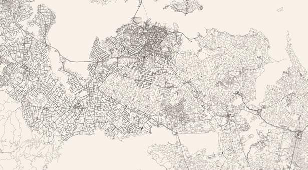
properties that were subdivided in the early 1900s when precise surveying methods were less common. The result is a title that does not accurately define the property’s boundaries, leaving room for potential disputes and complications.
Limited as to Parcels presents several challenges for lawyers. If a structure has already been built close to the boundary, it may encroach on a neighbouring property. This can lead to legal disputes, particularly if the encroachment was not previously identified. Additionally, when planning new construction near the boundary, local councils may require a new survey to clearly define the property lines before granting building consent. This can impact on what is permitted to be constructed and where, given boundary set-back requirements and other planning issues. This can be a time-consuming and costly process, meaning it is essential to have boundaries accurately established by surveyors.
Moreover, if a property owner wishes to subdivide their land and/ or create unit titles or cross-lease titles, the removal of the Limited as to Parcels limitation is mandatory. This requires a detailed survey and legal processes to remove the limitation from the title. As a surveyor, your role in this process is critical, as you will need to provide the precise measure-
ments and documentation required to define the property’s boundaries. This is because once those boundaries are defined, consent for the new boundaries is required from all adjoining property owners. If any adjoining owner objects, they have 21 working days to do so, but they can only object on limited grounds. It is only at that point we can start the process of obtaining the Land Transfer (LT) Plan from the surveyor for certification by the relevant authority. After that point there remains the key survey lodgement process, to regularise the surveyed boundaries and achieve the removal of the limitation. This assumes no adverse possession claims arise and no other objections are made to the Registrar-General of Lands pursuant to the Land Transfer Act 2017.
Another common issue (particularly in rural New Zealand) is the presence of paper roads. These are unformed but legal roads that were designated by local authorities to ensure public access during the early stages of land development. These roads are often remnants from historical planning, where pathways were allocated on paper for future development but never actually built. Although they are marked on survey plans, they were
“Paper roads, though never constructed, have the same legal status as public roads, often disrupting property development. These unmarked paths can complicate building plans, requiring a legal process called 'road stopping' to resolve. Surveyors are essential in identifying paper roads and guiding property owners through this complex process to ensure smooth development.”
never actually constructed (hence the name paper road’), and can raise significant legal problems in undertaking further development.
Further, despite their lack of physical formation, paper roads have the same legal status as any other road, meaning the public has the right to pass without obstruction. Unfortunately, they may be difficult to identify on the ground as they often blend with private land and are not always marked on maps. It is also not uncommon to find that some paper roads may not be suitable for use due to topography or other conditions.
The existence of a paper road on a property can be a significant impediment to development. Even if the property owner holds a title that completely surrounds the paper road, they cannot build on it without addressing the legal status of the road. Local authorities retain ownership of the land on which the paper road sits, treating it as an asset. This can be particularly frustrating for property owners who have no intention of using the road or who may not have even known it existed.
To overcome this issue, property owners must apply for a process known as ‘road stopping’. This involves changing the status of the paper road so that it is no longer considered a public road. The process typically requires a valuation of the land, for which the property owner is responsible. Once the valuation
is completed and the road stopping process is approved, the land can be transferred to the property owner, allowing development to proceed.
Equally developers who wish to rely on paper roads frequently require a surveyor’s expertise and guidance as to the location and dimensions of such paper roads so as to ensure it aligns with their development plans and meets all current roading and other planning obligations. This is because, while they are legal roads, paper roads’ unformed nature means they may not be suitable for all types of use. Care must be taken when considering the rights of the property owner, adjoining landowners, as well as local council or territorial authority, to understand any particular conditions or restrictions that may apply to the use of the relevant paper roads.
As a surveyor, your expertise is invaluable in identifying the presence of paper roads on a property and guiding clients through the road-stopping process or the potential use of the road as a physical access. Your knowledge of local authority regulations and your ability to provide accurate land surveys ensure that your clients can navigate this complex process.
The most common defect we see on a title are redundant interests. These
are interests that are outdated or irrelevant encumbrances, easements or other registered interests that no longer serve a purpose but remain recorded on the title. These interests can cause a title to be defective, as they may complicate ownership, hinder property transactions or create uncertainty for buyers and lenders. Examples include expired easements, obsolete covenants, or unresolved mortgage entries. To maintain a clean and accurate title, which can be further developed without being circumscribed by registered controls, it is essential to identify and remove these redundant interests through appropriate legal processes, ensuring the property is free from unnecessary encumbrances and is fully able to be utilised to its current potential. In some cases, to remove these interests, a new survey plan may need to be undertaken.
In New Zealand, removing redundant interests in dispute on a title can be approached through several legal avenues. The Land Transfer Act 2017 provides a mechanism for the removal of such interests, which allows the Registrar-General of Land to remove a redundant or expired easement from the Land Register under specific circumstances, such as the expiration of time or an event that extinguishes the easement.
Additionally, the Property Law Act 2007 empowers the court to modify or extinguish easements or land cove-
nants if it is justified by changes in the use or character of the land, or other relevant circumstances. It's important to note that the process involves notifying all affected parties and may take some time. In cases where a consensus among affected parties is not feasible, court intervention may be necessary, and the court has the discretion to require reasonable compensation to be paid to affected owners if the covenant is modified or extinguished.
However recent court decisions (including Supreme Court decisions) have highlighted the complexities involved in such cases, particularly where the issue is around what is deemed to be outdated title interests (rather than extinguished), usually due to zoning changes or changes in the surrounding land use, such as industrial activities.
However, this success often comes after a lengthy and costly legal process, emphasising the court's cautious approach towards altering established interests on land titles. The High Court's judgments reflect a balance between the protection of existing rights and the recognition of evolving land use, ensuring that any modifications to land covenants are carefully considered and justified.
Given that title interests are essential for understanding the legal rights and restrictions associated with a property, the specific interests detailed and identified on a land transfer plan
are critical to clients and frequently require comprehensive guidance from surveyors.
‘Deeds Land’ refers to land that has not been brought under the Torrens system, New Zealand’s system of land registration. As a result, there is no guaranteed title available, and the property is not officially registered on the Land Registry. As with the above defects, this defect most commonly occurs with undeveloped rural land and is increasingly rare.
This lack of registration presents a significant problem for property owners, particularly when it comes to securing financing. To resolve this issue, property owners must apply to bring the Deeds Land onto the Land Registry. This complex legal process is dictated by the Land Transfer Act 2017 and involves providing a comprehensive land survey that clearly defines the property’s boundaries. The survey must meet the standards set by the Land Registry to ensure that the property is accurately represented and can be properly registered. This is usually very complex and involves surveyors having to search the land for any useful control marks and boundary monumentation on existing survey positions so as to be able to establish new traverse layouts for reference and derive correct
boundary adjustments.
In addition, our experience with Deeds Land is that it often involves other legal complexities such as adverse possession issues, which has its own specific guidelines and process in tandem with the Deeds Land process and defunct registered proprietors, meaning it can be very difficult to perfect transfers and the like. For surveyors, working with Deeds Land requires a high level of precision and attention to detail to conduct thorough surveys to establish clear boundaries and work closely with legal professionals to ensure that the property is successfully brought under the Torrens system.
Title defects can be a significant roadblock for property owners, but with yours and our expertise, these issues can be resolved. By identifying and understanding title defects that can affect a title you can provide the appropriate advice and support to your clients.
If you encounter any of these issues or have questions about how to address them, don't hesitate to reach out to our experts who can provide the necessary legal assistance. Your proactive approach will help your clients avoid costly delays and ensure that their property transactions and developments proceed smoothly. •
Aportrait of Archie Bogle, first commissioned in the early 1960s, has found its final resting place back with his family. The portrait now takes pride of place in his great granddaughter’s home in Mt Albert, Auckland, and is revered by his family.
The painting spent many years at the School of Surveying in Dunedin and was returned to S+SNZ offices in Wellington when the school ran out of wall space. With no space available for the painting in Wellington, the painting was put into secure storage until Archie’s family contacted S+SNZ in 2015.
This initial contact fell through, however subsequent contact five years later by another family member led to the painting being returned to the family where it is now on display and will continue to be admired and treasured by the family in the future and for many generations.
The painting is available to S+SNZ National Office if required and an art-quality digital scan was done to ensure availability to all members.
Interest in Archie Bogle has been riding high with the launch of a new book – one of many – about his surveying career. What is not so well known is that Archie and his brothers were honoured by having a street named after the family in his home town of Waipukurau.
Three of Archie’s younger brothers, George, Gilbert and Gordon, served in World War I in the New Zealand, Canada and Australia armies and all three were killed in successive autumns from 1915 to 1917. Archie also served during WWI as a lieutenant in the New Zealand Expeditionary Force and was a captain of the New Zealand

Engineers in the Pacific (mainly Tonga) during WWII.
Their father, James Bogle, was the stationmaster at Waipukurau for 36 years, helping build the railway line between Waipukurau and Napier. To honour the brothers, the street named Railway Esplanade was renamed Bogle Brothers Esplanade on Armistice Day in 2017. •
By Richard Hemi
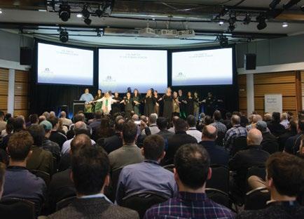
The recent S+SNZ Conference adopted the theme of ‘Looking Ahead in the Heartland’. As the website states, this refers, not just to the optimism and resilience of provincial New Zealand, but also provides an opportunity to discuss approaches to the challenges of climate change and disaster recovery around the country.
In light of this theme, it is worth reflecting on how our National School of Surveying serves our ‘heartland’ areas of Aotearoa New Zealand, and how students from these areas influence the make-up of the School.
The School, university and profession are very conscious of student numbers and the need to maintain, or better still, increase the number of graduates. The funding of tertiary education has put pressure on a number of universities, and the budget deficits of Otago and others has been in the spotlight over the last year.
It is particularly important for the School to keep its numbers positive not only to address industry demand, but also to maintain a positive financial position. In light of this, it is worthwhile reflecting on the number of students who come into surveying and spatial studies from what we might classify as ‘heartland’ areas.
Is this rural New Zealand, provincial New Zealand, or something different? The competition between tertiary institutions for school leavers can be intense so, from the School of Surveying’s perspective, we may look at it from the point of view of those areas, towns or cities that do not have another university.
If a student in these locations intends to take a university course they will have to travel. From these areas, we do very well. Very broadly over the past 10 years we have enrolled approximately 60% of our intake from these places, i.e. not the main university cities of Aotearoa. According to my calculations, these cities represent about 51% of the NZ population.
I doubt this is much of a surprise given that the practical, and land-focused, nature of surveying will likely attract more rural-based students than urban ones. But for a well-balanced industry, and with the need for practitioners to be able to plan well designed, higher density urban environments, we also need surveyors who have grown up in these kind of neighbourhoods.
Equally interesting might be a measure of enrolments against population numbers across different parts of the motu. Auckland represents approximately 33% of the country’s population, but, on average, we attract only 20% of our students from the city. Ideally this would be higher and may reflect the competition for like-minded students with Auckland University’s engineering school, or a reluctance that some students and their families may have to study so far away from home. This is entirely offset by the skew of local Dunedin, Otago and Southland students that enrol in surveying courses at Otago – almost 25% of students on average compared with the 7% population figure for those areas.
In terms of teaching concepts around the challenges of climate change and disaster recovery this has and will continue to affect all parts of this country, as has been seen in recent times from the East Coast to inner city Auckland.
These topics are considered in teaching across a range of subjects within the courses here at the School, and this also reflects the university’s graduate competency framework.
As an example, the first year paper SURV130 – People, Place and the Built Environment includes as one of its learning objectives an ability “to identify the main elements of sustainability and the science of climate change.”
On a different note, the School of Surveying is very happy to introduce two new members of staff who have recently taken up some vacant teaching roles. With the recent retirement of Dr Mick Strack, and also the loss of Dr James Berghan to Victoria University, two important roles in planning and urban design needed to be filled.
Brae Ihaka Wingate (Ngai Te Rangi) has joined the School from the University of Auckland where she obtained a Master’s Degree in Architecture and Urban Planning. She has taught within the School of Architecture and Planning there, as well as had professional work experience across the public and private sector in Auckland. She is a doctoral candidate in urban design and expects to complete her thesis in the near future.
Riki Cambridge is a licensed cadastral surveyor and has taken up a role as a Professional Practice Fellow. He has worked in private practice for over 12 years in Christchurch and comes with a wide range of experience across survey measurement, cadastral and urban development. The School is very pleased to welcome these two lecturers into the teaching whānau. Nau mai, haere mai e hoa ma. •
1953 -2023


1953
Born and Raised in Ōpōtiki: Matt Oakes was born and raised in Ōpōtiki.
1971
Started a maths degree at the University of Waikato, where he met Mary Jane.
1976
Joined the Department of Lands and Survey after his wife attended the interview on his behalf.
Completed a survey technician course in Wellington, then moved to Wisconsin, USA, to work as a chainman.
Returned to New Zealand, worked for the Department of Lands and Survey (DOSLI) in Auckland.
1985-1987
Studied Measurement Science at the University of Otago, completing both his Bachelor of Surveying and his unfinished maths degree.
1997
Moved to Arkles Bay and joined A.I. Bates & Associates.
2002
Founded Arkles Bay Surveying Ltd, allowing for flexible travel to the US.
2023
Passed away in June, remembered for his kindness and dedication to family, friends, and surveying.
Family, friends and survey colleagues were deeply saddened by the passing of Matthew Oakes in June last year. Matt is remembered by all as a warm and fun-loving survey colleague and friend.
Matt was born, raised and schooled in Ōpōtiki. In 1971, he started a maths degree at the University of Waikato, where he met his future wife, Mary Jane.
Early in 1976 he saw an advert for a chainman with the Department of Lands and Survey and he applied as he had always wanted to be a surveyor. As he couldn’t get time off work to attend the interview, his wife, Mary Jane, attended instead. Despite this unusual strategy, the interview went well and Don Swift not only gave Matt the job, but also took him under his wing.
The young couple moved to a little old bach-house in Beach Haven on Auckland's North Shore and while at Lands and Survey, Matt completed a survey technician course in Wellington. Two years later they returned to Mary Jane's home town in Wisconsin, where Matt worked as a chainman for Sarko & Associates, a local survey firm.
After three years in the US, a decision was made to return to New Zealand and they moved to West Harbour, in Auckland. Matt returned to work at Lands and Survey, which had been renamed the Department of Survey and Land Information (DOSLI).
In 1985, DOSLI encouraged Matt to do a two-year course in Measurement Science at the University of Otago, Dunedin. Mary Jane and their sons initially remained in West Harbour, but then spent the second year in the US. While at Otago, Matt changed his surveying course to a full Bachelor of Surveying degree, and also during this time, completed his unfinished maths degree.
After graduating, the family returned to West Harbour and Matt
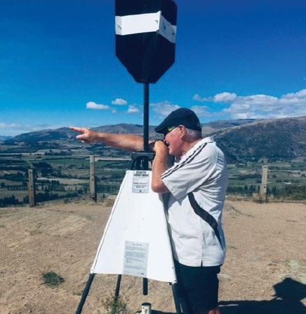
resumed his work with DOSLI. In 1997 they moved to Arkles Bay on the Whangaparaoa Peninsula and Matt started work at A.I. Bates & Associates, on the North Shore. In 2002, he started his own business, Arkles Bay Surveying Ltd, which gave Matt and Mary Jane the flexibility to continue to travel regularly to the US to work and visit family and friends.
Matt loved all sports, but he showed a real commitment to rugby and tennis, and later in life to golf. He played rugby for the Massey Rugby Club Maulers and coached junior rugby for the club, as well as coaching and playing tennis for Massey and Belvedere for many years. His first visit to the US saw him playing rugby for the Wisconsin Rugby Club, where he created lifelong friendships, which ensured that Wisconsin became a "must visit and play rugby" destination throughout the years to come.
Starting his own business gave him more control of his time and he began playing golf at the nearby Whangaparaoa Golf Club. As well as playing, Matt was also a passionate sports fan and he could often be found watching the tennis at Stanley Street in Auckland over the Christmas holidays.
At Survey School, Matt was an older student. Having spent most of his 20s working in surveying and having previously studied maths, he was initially well ahead of many in his class. He viewed this advantage as an opportunity to help his classmates and for many he was an informal tutor. Matt continued to study hard and remained one of the top students in the class. His dissertation on the analysis of different resection methods was highly regarded and received a deserving A grade.
He balanced this hard work with an active social life and he continued a proud surveying student history at his final year flat – 61 Clyde Street – well known by all as the location of surveying student events. Matt ensured those traditions continued.
Matt was a real family man. He and Mary Jane were married for 49 years and they had three sons and two grandsons, who he was very proud of. He was the friendliest, nicest guy who went out of his way to help others. These qualities certainly endeared him to all that knew him. He was loved by all and will be greatly missed. •