
Innovations IN DESIGN
AHMEDABAD BUS RAPID TRANSIT SYSTEM
I. P. Gautam | H. M. Shivanand Swamy | Abhijit Lokre | Vijay Arya
URBAN TRANSPORT INDIA SERIES
INNOVATIONS IN DESIGN
AHMEDABAD BUS RAPID TRANSIT SYSTEM
Over the last decade in a rapidly urbanising India, many cities have undertaken path-breaking initiatives in resolving issues associated with urban transport, and, specifically, mass transit system. The Bus Rapid Transit System (BRTS) is now acknowledged as a key mode to help large-scale mobility of people.
Today, eighteen cities in the country are at different stages of planning, design, execution and operation in their BRTS journey. These cities have faced various issues during this progress. Since the BRTS concept was new to India a decade ago, cities experimented in various ways with varying degrees of success.
The Janmarg, as the BRTS is known in Ahmedabad, also explored many options before choosing its design approach. It was flexible in changing design elements even during the implementation stage. It was and still is seen as a long-term infrastructure provision. Every element was discussed, debated, and experimented with before a final decision. Many of these experiments led to innovations and best practices. Since its inauguration in October 2009, Janmarg has been accepted as the first ‘complete’ BRTS in India. It has influenced planning and design choices in other cities in India and abroad.
This book traces the design journey of Janmarg, the alternatives that were considered, the rationale underlying the choices made, the innovations it fostered and lessons for the future—for Ahmedabad and for other cities. The volume will be valuable resource for researches as well as students.
With 105 photographs, 166 drawings and 24 maps
INNOVATIONS IN DESIGN
AHMEDABAD BUS RAPID TRANSIT SYSTEM
URBAN TRANSPORT INDIA SERIES
INNOVATIONS IN DESIGN
AHMEDABAD BUS RAPID TRANSIT SYSTEM
I. P. Gautam
H. M. Shivanand Swamy
Abhijit Lokre
Vijay Arya
with contributions by Shefali Borikar-Shurpali and Sandeep Paul
Centre of Excellence in Urban Transport | CEPT University
MAPIN PUBLISHING
First published in India in 2014 by Mapin Publishing Pvt. Ltd
in association with
Centre of Excellence in Urban Transport, CEPT University
Kasturbhai Lalbhai Campus, University Road, Navarangpura, Ahmedabad 380 009 • www.cept.ac.in
Simultaneously published in the United States of America in 2014 by Grantha Corporation
E: mapin@mapinpub.com
Distributed in North America by Antique Collectors’ Club
T: 1 800 252 5231 • F: 413 529 0862
E: info@antiquecc.com www.antiquecollectorsclub.com
Distributed in United Kingdom and Europe by Gazelle Book Services Ltd.
T: 44 1524-68765 • F: 44 1524-63232
E: sales@gazellebooks.co.uk www.gazellebookservices.co.uk
Distributed in Southeast Asia by Paragon Asia Co. Ltd, Bangkok
T: 66 2877 7755 • F: 66 2468 9636
E: info@paragonasia.com
Areca Books
Penang, Malaysia
T: 604 2610307 • F: 604 2633970
E: arecabooks@gmail.com
Distributed in the Rest of the World by Mapin Publishing Pvt. Ltd
706 Kaivanna, Panchvati, Ellisbridge Ahmedabad 380006 INDIA
T: +91 79 40 228228 • F: +91 79 40 228201 E: mapin@mapinpub.com | www.mapinpub.com
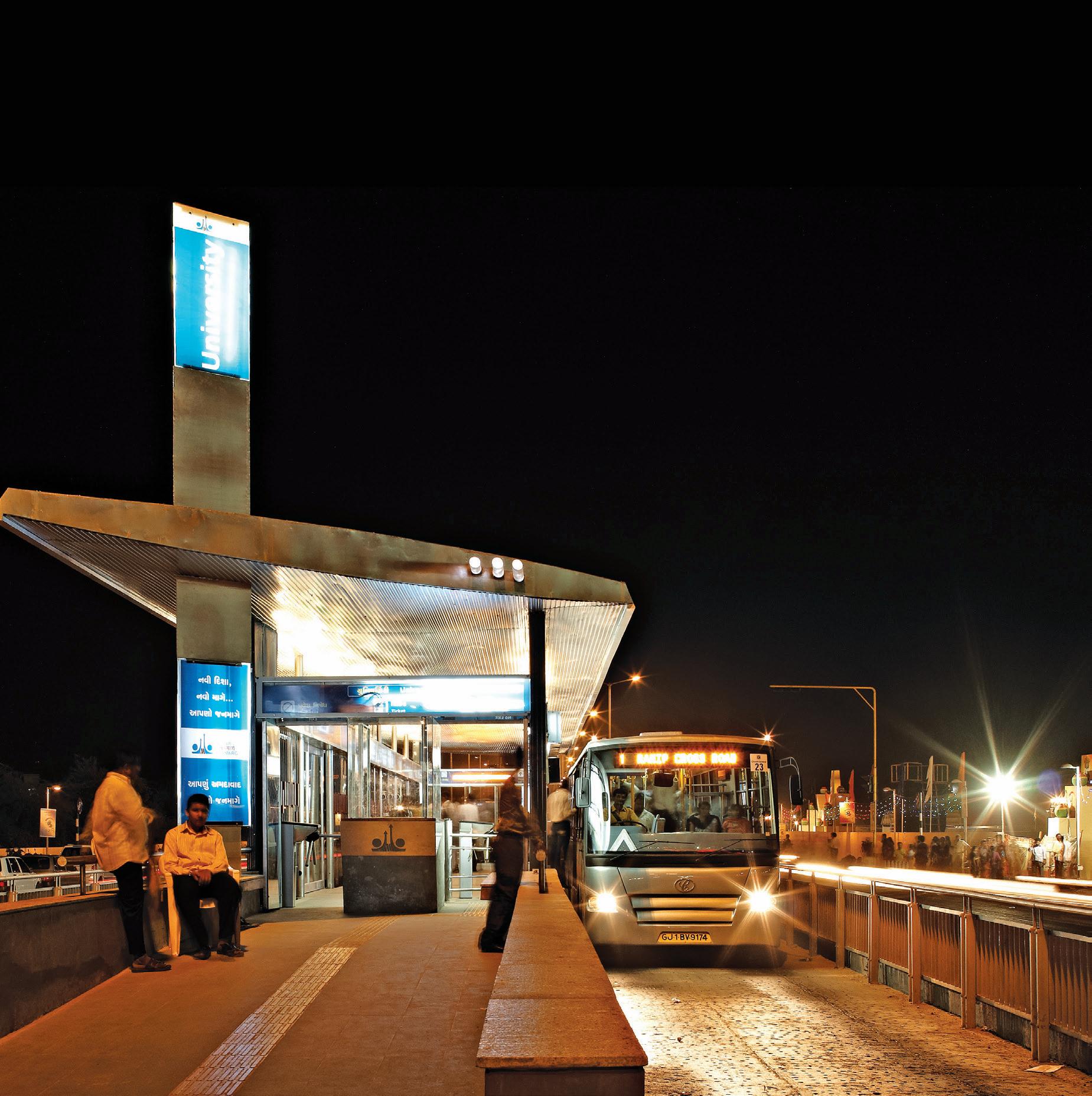
Front Cover: The BRTS bus station near Gujarat University campus
Text © Centre of Excellence in Urban Transport, CEPT University Architectural Drawings, Graphics, and Photographs © Centre of Excellence in Urban Transport, CEPT University
Research and Text
I. P. Gautam, H. M. Shivanand Swamy, Abhijit Lokre and Vijay Arya with contributions by Shefali Borikar-Shurpali and Sandeep Paul
Photograph credits
Centre of Excellence in Urban Transport, CEPT University, except those listed below:
Cyrus Mobedji: Front cover, pp. 22, 143, 144 (top), 150 (top), 152–153, Nicolas Charier: pp. 43, 68–69, 72, 112 (top-right), 147 (top), 155, 160–161, 175 (below), 179 (top), 180, 187, 188–189, 190
All rights reserved under international copyright conventions. No part of this book may be reproduced or transmitted in any form or by any means, electronic or mechanical, including photocopy, recording or any other information storage and retrieval system, without prior permission in writing from the publisher.
This document has been prepared by BRTS design team, Centre of Excellence in Urban Transport (CoE–UT), CEPT University. It documents the design process of Ahmedabad BRTS project. The views and opinions expressed in this document are the authors’ own experiences throughout the journey of the project from conceptualization till implementation. The research, analysis and conclusions drawn by the authors have been verified to the extent possible. Any lapse may be brought to our attention for incorporation in future printings. The images, drawings, diagrams are creations of BRTS Design Cell, CoE–UT, CEPT University, unless otherwise credited. Reproduction permissions for graphics in this document have been given exclusively to CoE–UT and will require their permission prior to any sort of reproduction.
ISBN: 978-81-89995-93-5 (Mapin)
ISBN: 978-1-935677-48-2 (Grantha)
LCCN: 2014949291
Copyediting: Vivek Khadpekar
Proofreading: Neha Manke and Ankona Das / Mapin Editorial
Design: Gopal Limbad / Mapin Design Studio
Printed and bound by Parksons Graphics, India
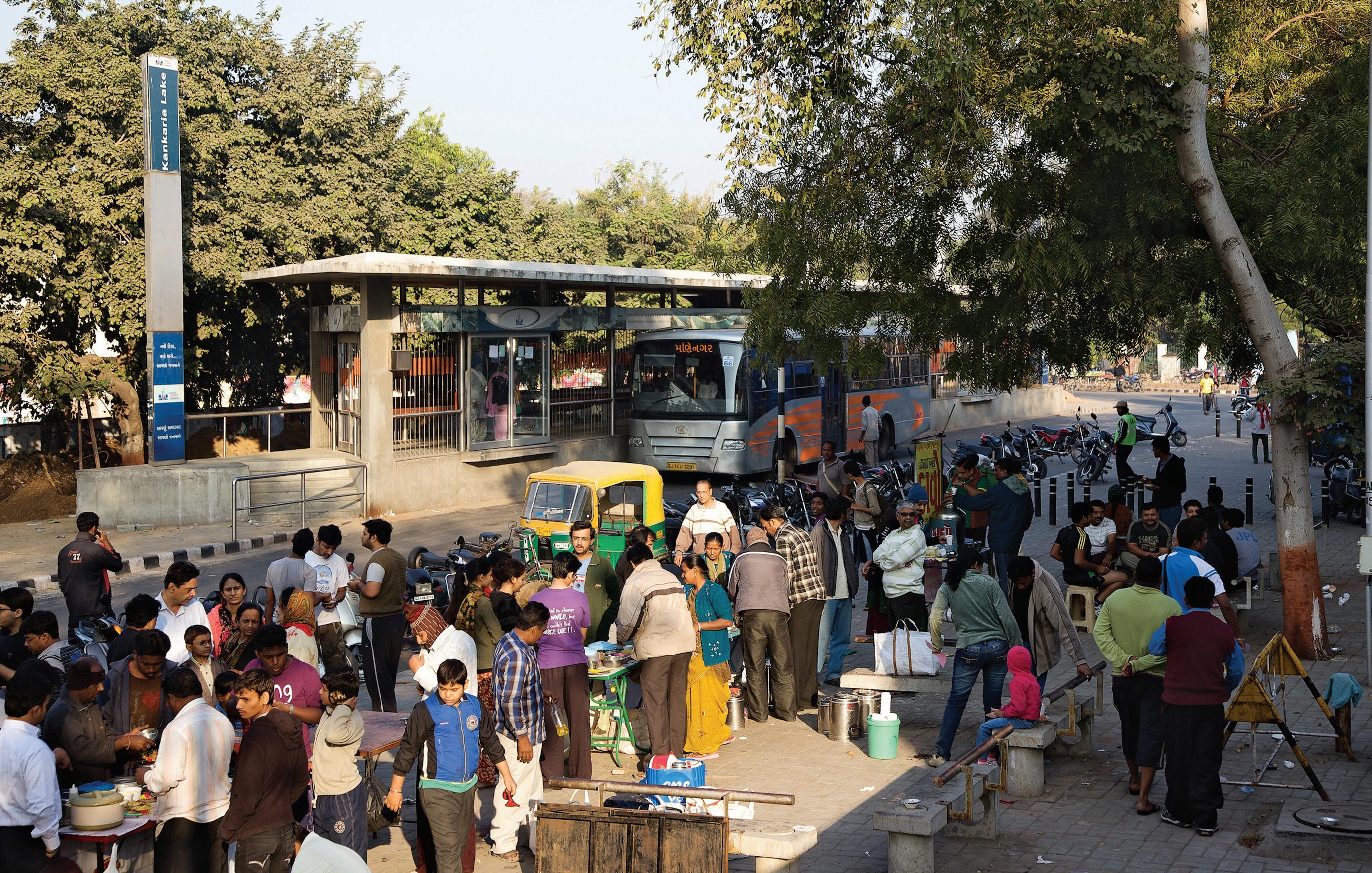
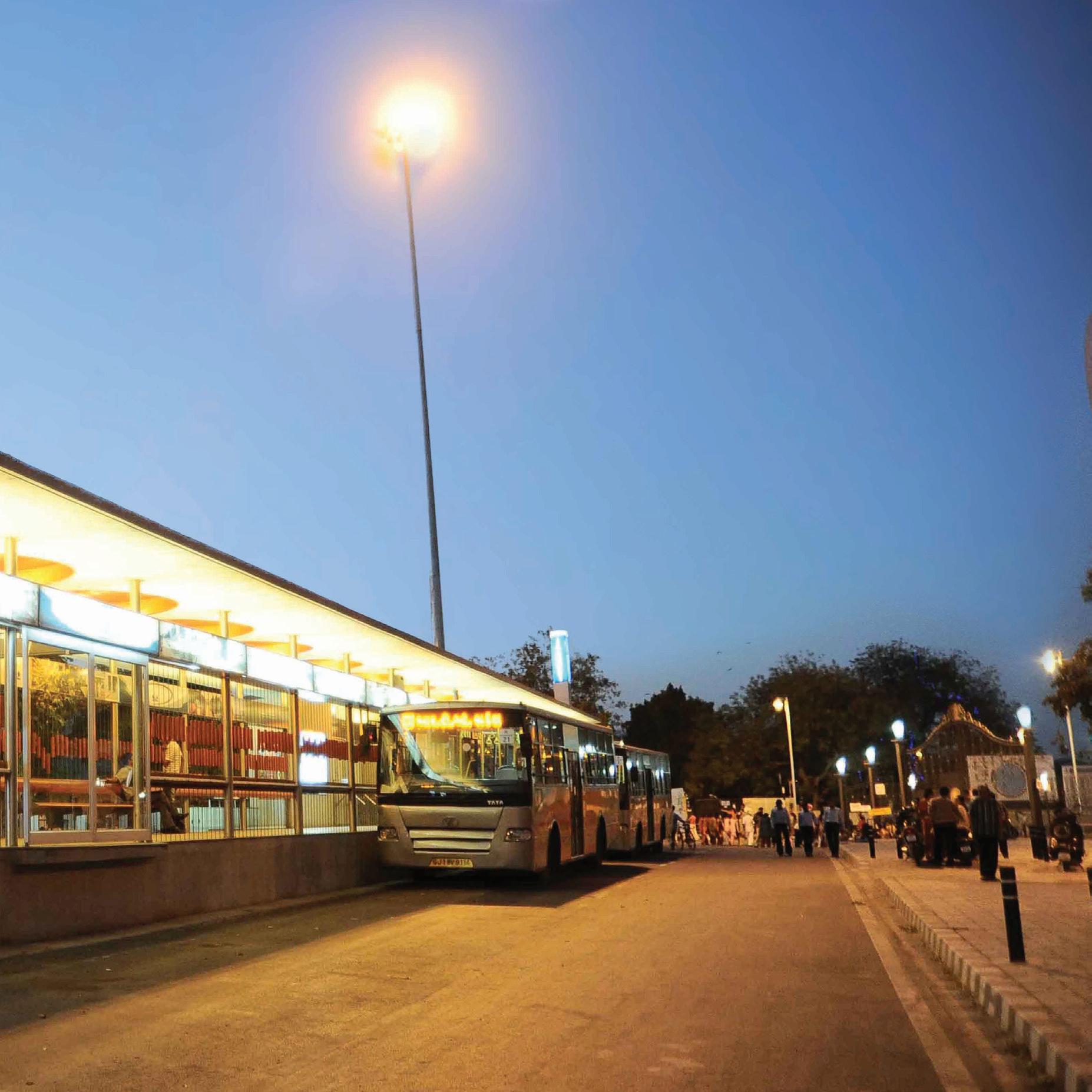
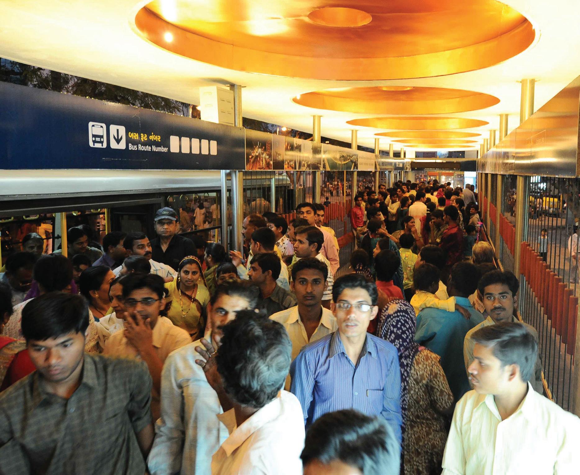
Pages 2–3: An evening at Kankaria Lake BRT station. This is a bus and pedestrian-only zone.
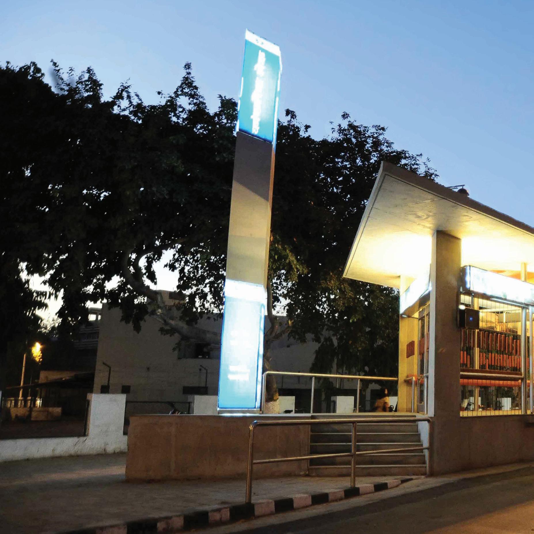
Page 5: A barrier-free design
Pages 10–11: BRTS corridors attract diverse activities that make attractive destinations.
Back cover: The Kankaria carnival sees extensive use of the BRTS.
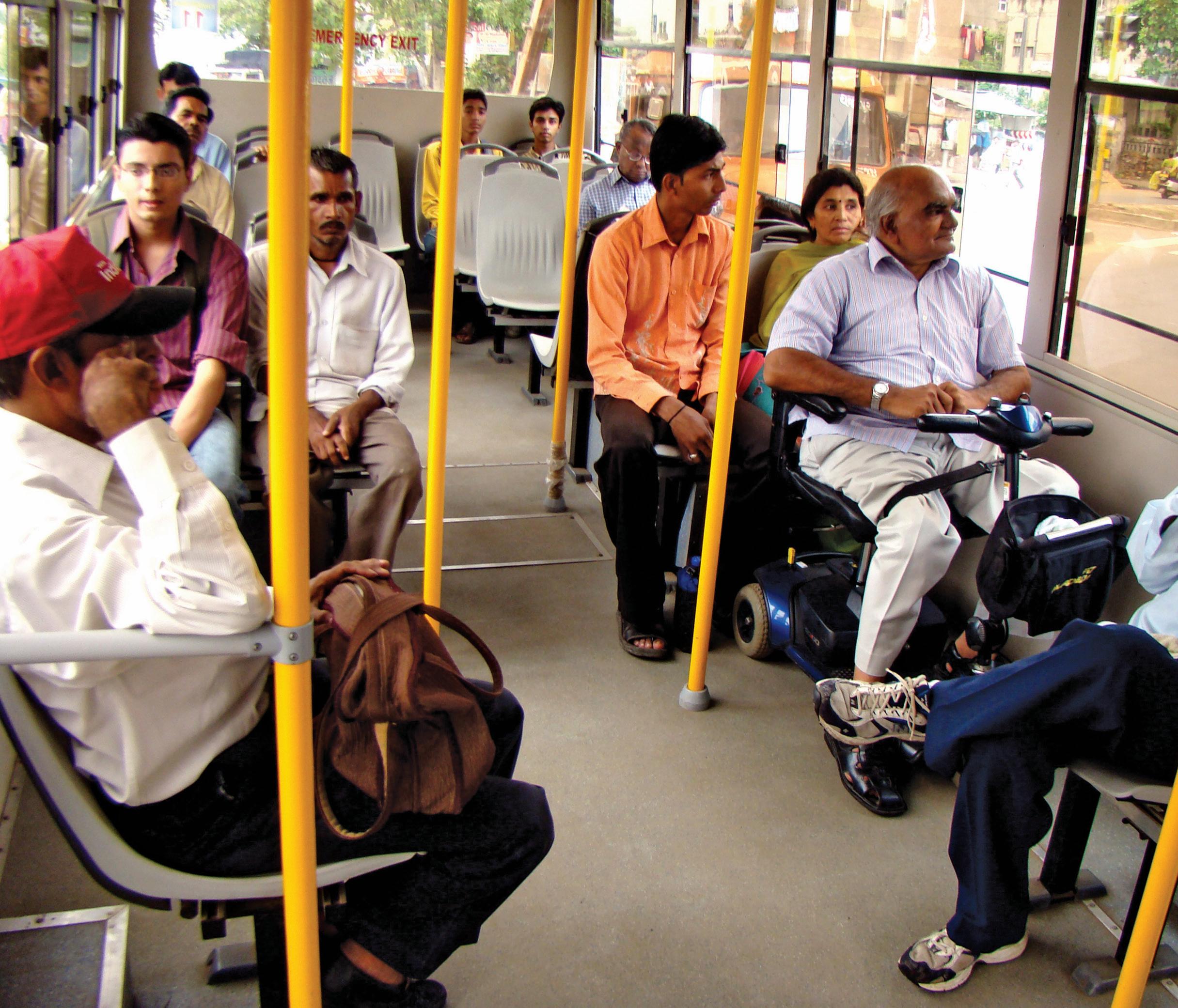
India is urbanising rapidly. Over the last decade, with strong government support, many of our cities have undertaken path-breaking initiatives in resolving issues associated with urban transport, and specifically mass transit systems. The Bus Rapid Transit System (BRTS) is now acknowledged as a key mode to help large-scale mobility of people. It is also recognised for its ability to allocate road space equitably. This is in consonance with our National Urban Transport Policy.
I am happy to say that India now has eighteen cities at various stages of progress in their BRTS journey. The Ministry of Urban Development (MoUD) is extending sustained support to these cities, not only through capital funding for infrastructure and rolling stock but also through capacity building. The four Centres of Excellence in Urban Transport that were established in 2009 four years ago at IIT Delhi, CEPT University Ahmedabad, IIT Chennai and NIT Warangal, are doing excellent work.
MoUD has seen and supported the evolution of Ahmedabad’s BRT system since its inception in 2005. We have seen how the Ahmedabad Municipal Corporation and CEPT University have worked in partnership at all stages of the project and continue to do so even today. In fact, one of the many things that make this a success story has been the partnership between these two organisations.
The present book on the Design Evolution of Ahmedabad’s BRTS will prove very useful to all cities in India that are engaged in developing BRT systems. The name Janmarg itself is interesting—a marg or street meant for people. This book shares the Janmarg experience. It does not seek to prescribe a particular design or method, but to trace the evolution of the rationale underlying some critical decisions, the necessity to go beyond conventional design and to adapt to local situations. I am sure other cities will benefit from this book, and that it will be a valuable resource for researchers and academics as well as students.
Lastly, about the authors: the excellent contribution of Prof. Shivanand Swamy and his team at the Centre of Excellence in Urban Transport at CEPT University, and their passion for and dedication to their work is exemplary. I have had the opportunity of observing the contribution of Shri I. P. Gautam who, as the Municipal Commissioner of Ahmedabad, guided the BRTS project and worked closely with CEPT University. I wish them all the very best and look forward to their sharing many more stories about Janmarg.
Dr. Sudhir Krishna, IAS
Secretary, Ministry of Urban Development, Government of India 10th May 2014
The story of the design evolution of Ahmedabad’s BRT system is still an ongoing one. As the system evolves, not only in Ahmedabad but in other Indian cities, people have many questions. Does this kind of system really work? Are our roads wide enough to accommodate BRTS? Is all the investment made by government really worthwhile? Planners and designers also grapple with crucial questions. Is it a good idea to segregate lanes in the centre than at the sides? Where should the bus stations be located? How do I deal with narrow roads?
Janmarg in Ahmedabad also explored many options before finalizing its design. It was flexible in changing design elements even during implementation stage. It was and still is seen as a long term infrastructure provision. Every element was discussed, debated, and experimented with before a final decision. Many of these experiments led to innovations and best practices.
Since its inauguration in 2009, Janmarg has been accepted as the first ‘complete’ BRTS in India. It has influenced planning and design choices in other cities in India and abroad. This book traces the design journey of Janmarg, the alternatives that were considered, the rationale underlying the choices made, the innovations it fostered and the lessons for the future—for Ahmedabad and for other cities. With more and more cities looking at BRT systems as mass transit options, Ahmedabad attempts to demonstrate what is possible in the existing paradigm of increased congestion, narrow streets and increasing focus on technical and engineering solutions to urban transport.
I. P. Gautam | H. M. Shivanand Swamy | Abhijit Lokre | Vijay Arya 14th May 2014
Acknowledgement
The birth of Janmarg as an idea was conceived and given shape in the year 2005 by the Government of Gujarat as part of an integrated transit strategy for Ahmedabad. Shri Narendra Modi, Honourable Chief Minister of the state and as Chairman of Gujarat Infrastructure Development Board, approved the project and oversaw all the developments throughout the project development phase. The interventions of Gujarat Government at appropriate time not only made Janmarg come into being but also made it a world-class system. The authors of this publication, who also worked on the project in various capacities, would like to express gratitude for the opportunity and the guidance received from him.
Smt. Anandiben Patel is another champion for this project. In her role as Urban Development Minister, she ensured that contentious issues were resolved in time and the project moved forward. We would also like to acknowledge the support the project received from Shri Nitinbhai Patel during his tenure as the Urban Development Minister of the state.
Former Mayor of Ahmedabad, Shri Asit Vora, both as standing Committee Chairman and subsequently as the Mayor, gave wholehearted support to the project and ensured smooth interface with citizens. The present Mayor Smt. Meenaxiben Patel and standing committee Chairman Shri Bhupendra Patel have continued their support to the project.
We would particularly like to acknowledge the support received from Dr. Anil Baijal, Dr. O.P. Agarwal, Dr. M. Ramachandran, Shri S.K. Lohia, Ms. Manjula Subramanium, Shri Kailashnathan, Shri S.R. Rao, Shri Paneervel, Shri Anil Mukim, Shri K. Srinivas, Ms. D. Thara, Shri G.R. Aloria, IAS, Shri Jayant Parimal, and Dr. R.N. Vakil, who have contributed significantly to the project at various times in the project cycle.
Dr. G.P. Mohapatra, who took over as the Municipal Commissioner, Ahmedabad, and Chairman, Janmarg, ensured that the momentum did not subside. His tenure has seen a doubling of the network and clear action plans for sustaining the gains made so far.
We also acknowledge the support from international organisations such as Embarq, ITDP, GIZ and CAI Asia. Their inputs at critical stages of the project have benefited it.
And at the end, we thank the citizens of Ahmedabad, who have wholeheartedly accepted Janmarg as a way of life. Their acceptance has made the project what it is today.
I. P. Gautam | H. M. Shivanand Swamy
| Abhijit Lokre | Vijay Arya 14th May 2014
Acronyms
AEC Ahmedabad Electricity Company
AJL Ahmedabad Janmarg Limited
AMC Ahmedabad Municipal Corporation
AMTS Ahmedabad Municipal Transport Service
BRTS Bus Rapid Transit System
BSNL Bharat Sanchar Nigam Limited
CBD Central Business District
CEPT Centre for Environmental Planning and Technology
CNG Compressed Natural Gas
CoE–UT Centre of Excellence in Urban Transport
CS Cross Section
FRL Finished Road Level
GPS Global Positioning System
GSRTC Gujarat State Road Transport Corporation
HT High Tension
IIM Indian Institute of Management
IPTS Integrated Public Transit System
ITS Intelligent Transportation Systems
km Kilometre
m Metre
Min Minimum
MS Mild Steel
NH National Highway
NHAI National Highways Authority of India
O-D Origin-Destination
ONGC Oil and Natural Gas Company
PRL Physical Research laboratory
RFID Radio Frequency Identification Device
RoW Right of Way
ROB Rail Overbridge
RTO Regional Transport Office
SS Stainless Steel
ST State Transport
sq. Square
TAZ
Traffic Analysis Zone
Background
What is BRTS?
One of the biggest questions that cities face today is how to deal with the immense movement of people and goods. Of these, the movement of goods is beyond the scope of the present document. For people, bus systems were generally thought to be the most optimal solution. However, with the increasing number of private vehicles, bus-based systems face the problems of competition, congestion and an overall image of degradation.
The BRTS is a concept that promotes segregation of buses from other traffic. It is a bus-based, high quality and high capacity system that delivers fast, comfortable, accessible, convenient, and cost-effective urban mobility. In this arrangement, lanes provided exclusively for buses serve to prevent congestion on the road. At the same time, other motorised traffic benefits from the shifting of buses to dedicated lanes.
However, BRTS is more than just segregated bus lanes. It also includes high quality transit infrastructure, advanced ITS technology and excellent customer service of an enhanced quality. The objectives of BRTS thus include more than just a good bus service. It is evolving as one of the most popular systems across the cities of the world, particularly where congestion on the roads is high.

View of typical median BRTS bus station and lanes
System Types
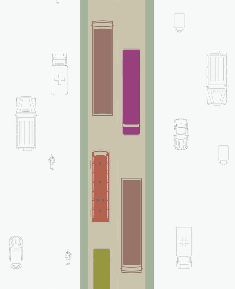
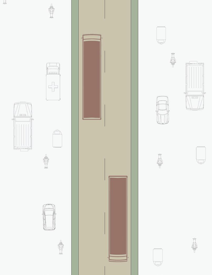
Two kinds of BRT system are possible—open and closed. In an open system, the BRT lane is kept open for all bus operators, to whom the benefits of dedicated infrastructure become available. They largely continue to run the same routes they did previously, thereby utilising the bus-way infrastructure wherever it coincides with their previous routes, while they may also operate on parts of their existing routes, without busway infrastructure, outside the segregated corridor. The open system is quicker to implement as it does not include bus sector reform. The focus is on creating segregated bus lanes and allowing the existing operator/s to run the same buses on existing routes.
However, the open system has significant limitations. If the buses lack uniform configurations (length, position of doors, floor height), docking at bus stations becomes an issue. Higher dwell time at bus stations may lead to lower average speed. If buses exit the corridor at the same junction, signal phasing becomes a problem. For example, if a bus needs to turn left at a junction and the other needs to go straight or right, a separate signal phase will have to be provided, adding to the overall signal cycle time. The reliability of the system is compromised. This can affect the BRTS ‘brand’ and invite criticism from users. Predictability of service cannot be assured as the buses move in both controlled (bus-way) and uncontrolled (outside bus lane) environments. Hence, the reliability of features such as advance information on their arrival, departure and next stop details will be reduced.
In a closed system, the BRT lane is exclusively for BRTS buses. BRTS operators are its only beneficiaries and can be made accountable for efficiency and maintenance. In this system, the corridor is generally segregated. However, in cases where local conditions demand, short stretches may be non-segregated.
The closed structure is more conducive to efficient operations. Since the number of operators and vehicles are rationally selected and carefully controlled, such a system can be designed around the optimal conditions for user movement. A closed system brings along with it bus operators’ reforms. Ticketing is generally off-board. Bus configuration is standardised, with same width and position of door and floor height. Junctions are easier to manage with fewer signal phases. Average speed in a closed system is invariably higher than in an open system. Janmarg uses the closed system.
Open System
Closed System
4119 km
3707 km
1025 km
Total length Before 1990 1991–2000 2001–2010 Since 2011
507 km
BRTS cities worldwide
(Recreated from the source: http//brtdata.org, October 2013)
Amritsar
Ludhiana
New Delhi
Ahmedabad Rajkot Indore Pune Vadodara
Bhopal
Surat
Pimpri-Chinchwad
Bangalore Chennai Jaipur
Hubli-Dharwad
Naya Raipur
Kolkata
Bhubaneswar
Visakhapatnam
Vijayawada
Status of BRTS in India
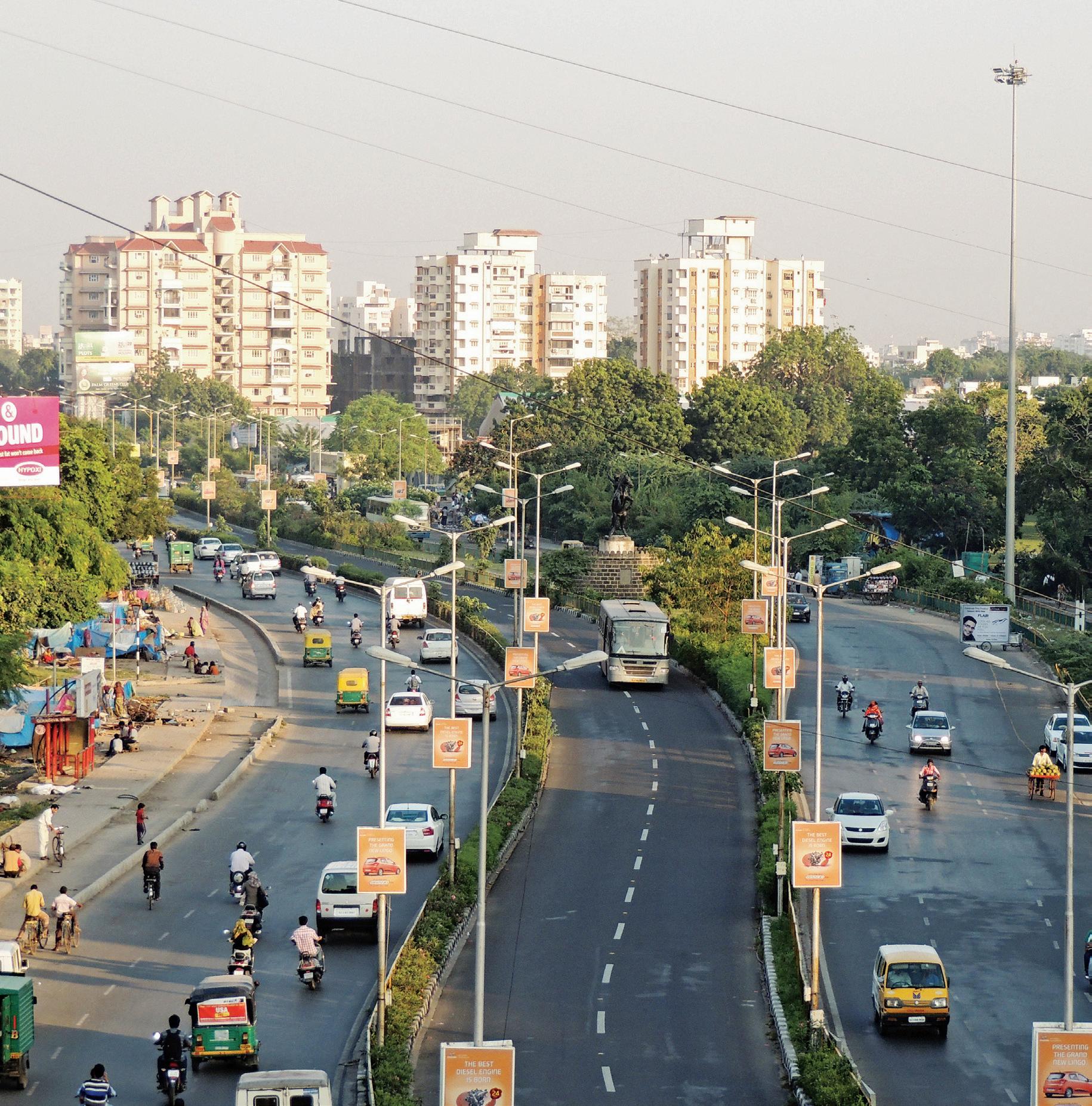
Janmarg at Jhansi ki Rani: A closed system with segregated lanes only for specially designed buses
About Janmarg
Janmarg was designed as a strategic intervention to ease existing traffic congestion, to attract latent transit demand, to improve air quality, and help the city remain compact. The guiding principle for the selection of the network corridors was to reach the largest possible segment of people. Also considered was the ability of the corridors to accommodate BRTS treatment, to integrate with the existing infrastructure, to contribute to significantly ease traffic problems, to create opportunities for improvement in land use, to allow for quick and inexpensive implementation, and to yield potential for cost-recovery.
The system is managed by Ahmedabad Janmarg Ltd (AJL), a special purpose vehicle (SPV) formed under the Companies Act. However, AJL does not own most of the infrastructure. For example, its buses are owned by a private operator, who operates them as per schedules set by AJL. The drivers or system operators are also provided by the private operator, who is paid as per a ‘gross cost contract’ model which guarantees a certain number of kilometres per day. The contract between AJL and the operator lays down the bus specifications and quality. Fare collection is also outsourced to a private operator. In effect, AJL plays the role of regulator and manager.
The system operators are trained for reliability, safety and ideal speed. Staff at the bus stations is trained for issuing tickets, smart cards and providing any other assistance that is needed. All people involved in Janmarg operations have special uniforms to assert its distinct brand identity.
The Board of Directors for AJL includes the Municipal Commissioner (Chairman), Mayor, Standing Committee Chairman, Leader of the Ruling Party in the Ahmedabad Municipal Corporation (AMC), Leader of the Opposition, Traffic Police Commissioner, a representative of the State Government, a Deputy Municipal Commissioner (Executive Director) and two subject experts.
Today, Janmarg operates over a route network of 88 km and has a daily ridership of 1.6 lakh people. One hundred and fifty buses operate every day, with headway of 2 minutes in the peak hours. Almost 20 per cent of the commuters on Janmarg today have changed over from motorised two-wheelers. By December 2014, it would be operating seven routes and carrying an estimated three lakh passengers daily. Plans have been finalised to extend the network by another 21 km, taking the corridor length to 110 km by the end of 2016.
Planning for Janmarg
Until the year 2008, the only options for public transport in Ahmedabad were AMTS buses or auto rickshaws. These options were very few for a mega-city. It required an affordable public transport network that would enable people to reach their destinations in the shortest possible time, in the easiest possible manner. The system also had to be affordable. The city therefore chose to move towards an integrated transit system with judiciously planned interchanges between metro, regional rail, BRTS and regular bus services, all planned to be progressively improved. The aim is to increase the public transport system’s share of passenger trips from 7 per cent in 2000 to 40 per cent by 2020. The BRTS component is the first major step in this strategy, in keeping with which the trans-vision of Ahmedabad is captioned as ‘Accessible Ahmedabad’.
Janmarg is based on several considerations. The most crucial of these is its focus on equitable sharing of road space and an inclusiveness that encourages people from all socio-economic segments and groups to board the bus. In 2004, more than half the city’s population did not own any personalised motor vehicle and was captive to public transport. Data revealed that almost 37 per cent of the people walked while 17 per cent used bicycles. Hence, the Janmarg design includes giving priority to cycle tracks and adequate footpaths.
In today’s world of advanced technologies, Janmarg employs an Intelligent Transport System (ITS) to improve customer convenience, speed, reliability and safety. This system continuously monitors buses from the control centre through GPS devices fitted in all the buses. It gives passengers real-time information on bus arrivals at the stations. On-board announcements identify the station being approached or reached. Regular reports are prepared to enable study of mobility patterns and to structure future scheduling. Phase I Corridors (58.3 km)
BRTS network showing Phase I, Phase II and Phase III corridors
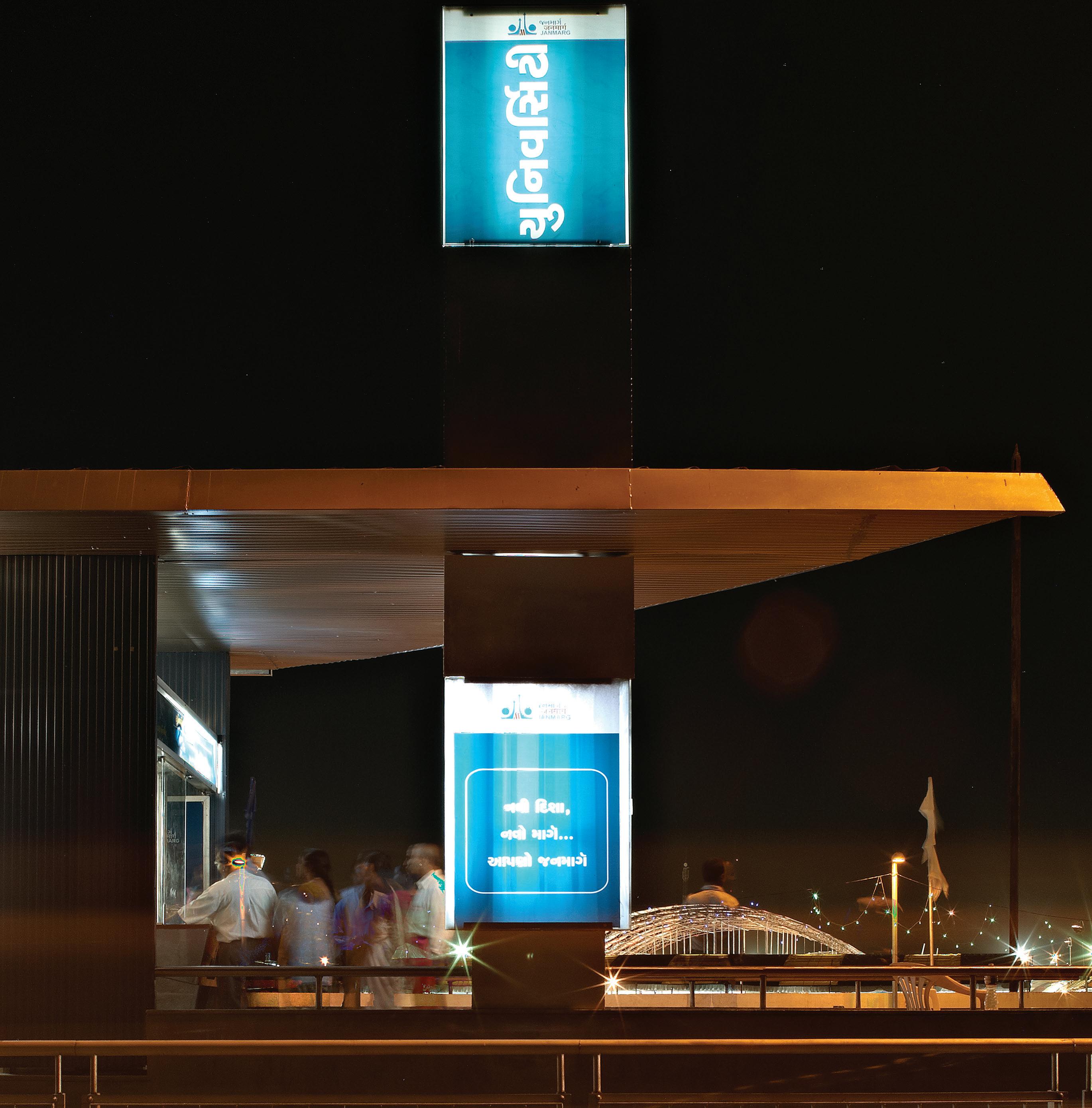
BRTS bus station near Gujarat University campus
The location of the bus lanes is the first step towards finalising the design. Conventional wisdom would suggest locating them on the side, since that is where buses traditionally operate. The stations can be accommodated on the footpath. In Ahmedabad, the planners considered both options. A median bus lane was a major departure from the norm. There were apprehensions about user acceptance.
The advantages and disadvantages of both designs were debated.
Comparison between side and median BRT lanes:
Side lane
Junction management is an issue. Buses interfere with left turning traffic.
Bus stations are perceived to provide easier access from the pedestrian way.
Abutting property access will be affected in case of side lanes.
Overall system speed is lower owing to frequent slowdown for left-turning or parked vehicles and pedestrians accessing properties.
Median lane
Junction management is easier. Bus flows can be integrated with other flows.
It appears that commuters would have to cross the road to access bus stations.
There is no issue with access to abutting properties.
Overall system speed is higher, since the bus lanes are not subject to interruptions from other traffic.
Experience from around the world showed that median lanes were widely used and appeared to be successful. Other than the perceived issue of tradition and accessing stations in the centre, the overall traffic movement appeared to be much better organised with median bus lanes. The station access too could be resolved with appropriate design. Janmarg chose to go with the median bus lane option, with a focussed campaign to build consensus on this among stakeholders.
Median BRT lanes with kerb-side bus stops
Bus Station: Kerb or Median?
Location of bus stations on bus lanes is a much-debated issue. Two options exist. In the first, bus stations may be located on the left hand side (LHS) of the lane with access to buses through conventional LHS doors. This design demands two station structures—one for each direction of travel. The second option is a single median bus station, with access to buses through doors specially provided on the right hand side. In this option, a single station structure serves traffic in both directions. Both options have their advantages and disadvantages.
Comparison between kerb-side and median bus stations:
Kerb-side Bus station Median Bus station
Two station structures at each location
Higher construction costs
Higher operation and maintenance cost
Commuters must exit one station and cross the carriageway to transfer to another route
Normal buses with LHS doors can be used
Single structure at each location
Lower construction costs
Lower operation and maintenance cost
Transfers are easy within the station
Special buses with RHS doors have to be used
Janmarg decided on median stations, primarily for passenger convenience, enabling easy transfers, and to reduce construction and operation costs.
Bus Station: Location
Locating bus stations near junctions
Near junctions
Bus stations located near road junctions offer easy access to commuters approaching them from crossroads. However, they should not be too close to the junctions, which would create queuing of buses when, after off-loading and taking on new passengers, they are held up by a red signal at the junction, blocking access to the station for buses that are immediately following. Some distance between the station and the junction will allow buses that have completed their halt to move ahead and wait at the junction.
Janmarg keeps a distance of 24-36 m (two standard buses or one articulated bus) between the station and the stop line. If a bus station cannot be provided near a junction, it is located at mid-block.
Spacing between bus stations
Spacing
The spacing between two bus stations is critical. It determines how much commuters would have to travel/ walk to reach the nearest station. A 500 m distance between two bus stations is considered ideal in an urban area. It may be 300-350 m in the Central Business District (CBD) and 600-800 m in suburban areas. This is considered the optimal distance in which a bus may reach cruising speed before decelerating for the next halt. For a commuter, walking time to the station is a major part of the total trip time. With increase in distance between stations, walking time and overall journey time also increase. Therefore, an optimum distance of 500 m is recommended.
Janmarg has adopted an average spacing of 500 m between bus stations.
BRTS Design
Cross Sections
In urban areas, it is difficult to increase the Right of Way (RoW) of roads. The BRT corridor has been designed as a strategic intervention keeping in mind constraints with respect to available road widths, encroachments and traffic.
The design team explored various possibilities to arrive at a functional and appropriate design for varying road widths and local situations. The cross section includes street elements such as dedicated BRT lane, carriageway, service lane, parking spaces, bicycle track, pedestrian pathway, street furniture and landscaping.
The overall infrastructure design is a process of development of different stages. The planning and design team explored design elements on the basis of emerging operations plan and made conceptual designs for each element.
The closed system adopted by Janmarg reserves the bus lane exclusively for the BRT operator and buses. The segregated corridor acts as the trunk route of BRTS network. Other buses feed this corridor.
Various alternative cross-sections were initially analysed—with and without cycle track and varying widths of mixed lane and footpaths for each RoW category. The recommended cross sections not only consider the requirements of BRT buses but also accommodate the needs of other users of the corridor, such as non-BRT motorised traffic, bicycles and pedestrians. Emphasis is given to the proposed improvement over full roadway width that ensures better mobility level on the corridor as a whole.
This section elaborates on the physical design of street cross section for all categories of available RoWs. It also discusses the special designs evolved in response to local constraints.
Right of Ways (RoWs) along the BRTS network (Phase I & II)
Phase I: Right of Way
m
Key Map showing 60 m RoW corridors
Narol to Naroda—13.5 km (Phase I Eastern Corridor)
Shivranjini to Nehrunagar—1.4 km (Phase I Western Corridor)
The Narol–Naroda corridor was under the jurisdiction of the National Highways Authority of India (NHAI) during the period of implementation of BRTS. Although it is a National Highway, it has become an urban arterial over the years as the city expanded around it. Along or just off the corridor are three major industrial estates (Narol, Vatva and Naroda). It is also surrounded by dense residential settlements. The traffic mainly consists of trucks and heavy vehicles, and shared auto-rickshaws. Parking of heavy vehicles is a major issue on this corridor, considered the most accident-prone in Ahmedabad before BRTS implementation.
Plan for 60 m RoW corridor
The initial designs considered options to develop activity areas along the road, which would offer opportunities for landscaping, street shopping and rest areas. Separate service roads would cater to local traffic, while a two-lane carriageway in each direction would carry through traffic. Segregated cycle tracks were also proposed.
To meet NHAI standards, the final design was modified to include an extra lane for through traffic at the cost of the activity area. The service road and cycle track were retained. However, this meant that many activities envisaged in the activity area could not be accommodated.
Earlier situation near Ramrajyanagar on Narol–Naroda stretch
Existing typical cross section on Narol–Naroda stretch
Existing cross section at bus station location
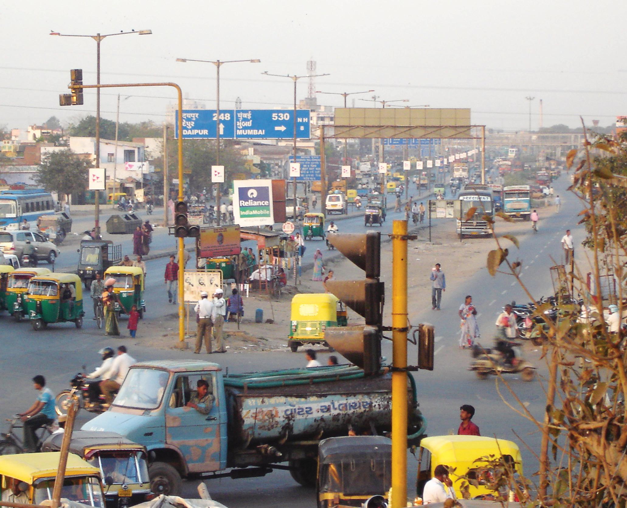
Traffic situation near the Expressway junction before BRTS
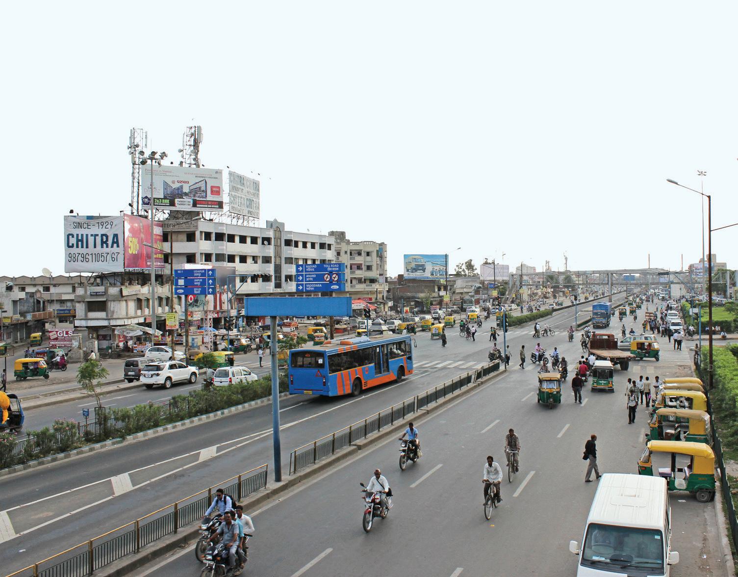
The BRTS track near Expressway junction. The Right of Way is redesigned, traffic flow is streamlined and buses get priority.
This Right of Way is over a very short stretch in the entire network. However, the distinct nature of land use abutting it is important to understand. The corridor passes through an area of predominantly mixed use, with small-scale industries and workshops along the road’s edge, where heavy vehicles tend to park, and loading and unloading activities happen.
On both sides of the corridor, alongside the mixed traffic lanes conveying traffic in either direction, and separated from them by 1 m wide medians, run 6.25 m wide service lanes. These cater to truck movement to industries along the corridor. Some parking is also permitted on the service lanes to keep the main carriageway free of stopping or standing vehicles.
Plan for 45 m RoW corridor
Key map showing 45 m RoW corridor
Chandola lake to Narol—0.6 km (Phase I Eastern Corridor)
ARCHITECTURE
Innovations in Design
Ahmedabad Bus Rapid Transit System
I. P. Gautam, H. M. Shivanand Swamy,
Abhijit Lokre and Vijay Arya
200 pages, 105 colour photographs, 166 drawings and 24 maps
9 x 9” (229 x 229 mm), pb
ISBN: 978-81-89995-93-5 (Mapin)
ISBN: 978-1-935677-48-2 (Grantha)
₹1200 | $35 | £22
2014 • World rights
I. P. Gautam is a 1986 batch officer of the Indian Administrative Service. As Municipal Commissioner of Ahmedabad, he led key projects such as the BRTS programme, Sabarmati Riverfront Development and Lakefront Development. Prof. H. M. Shivanand Swamy is an educator, researcher, policy advisor and a consultant on development planning. As team leader, he has been instrumental in planning and operationalizing the bus rapid transport systems (BRTS) in Ahmedabad and Surat, and is currently involved with BRTS development in Bhubaneswar, Hubli-Dharwad and Vadodara. Abhijit Lokre, an urban planner, leads the design team for BRTS projects in Ahmedabad, Surat, Indore, Vadodara and Hubli-Dharwad. Vijay Arya, a graduate of the School of Architecture, Ahmedabad, with post-graduation from Helsinki University of Technology, specialises in architecture for transit.
Urban Transport India Series
The Urban Transport India Series are shared knowledge resources about innovative practices in urban transport planning in India. The series is based on research and practices of the Centre of Excellence in Urban Transport, CEPT University, Ahmedabad. The Centre, established in 2009, is an initiative of the Ministry of Urban Development (MoUD), Government of India. It is supported by Ahmedabad Municipal Corporation. The overall objective of this nationally-recognised centre is to become a think tank and resource centre for research, education and training in planning and management of urban transport. Forthcoming titles in the series include:
Choosing Networks for Bus Rapid Transit System
Planning for Mobility: Case Study of Ahmedabad and Vadodara
Branding and Communicating Public Transport
Centre of Excellence in Urban Transport | CEPT University www.cept.ac.in/184/center-for-excellence-in-urban-transport-coe-
Printed in India