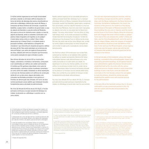
O núcleo central organizava-se em função da atividade portuária, estando os principais edifícios dispostos em torno do terreiro de descarga dos navios, encontrando-se entre eles a alfândega, a feitoria dos navios de Macau, a tranqueira de Nossa Senhora da Conceição, o quartel do batalhão, a igreja matriz, a residência do governador, a casa do adjunto da fazenda e a casa da rainha de Manatuto, dos quais os únicos em alvenaria eram a igreja e a casa do adjunto da fazenda, sendo os restantes construídos com pedras chatas irregulares sem ligantes ou em palapa 4. A leste deste núcleo, entre os coilões 5 Ahai e Cebo, desenvolvia-se o Campo China6, e a ocidente deste a povoação de Bidau, onde habitava a companhia de moradores 7 que intervinha em situações de guerra e defesa da praça de Díli. Para oeste estendiam-se os terrenos do reino de Motael, cujo centro de regência ficava próximo da praça, ladeado pelo forte do Carqueto que funcionava como posto avançado de vigia à entrada no porto. Nas últimas décadas do século XIX as construções frágeis, vulneráveis a incêndios e terramotos, começaram a ser substituídas por edifícios de caráter permanente. À medida que Díli ganhava maturidade como sede da administração, o primitivo núcleo muralhado consolidouse como centro da cidade, instalando as várias repartições e serviços de interesse público em edifícios de construção sólida de um ou dois pisos, alguns decorados com colunatas nas fachadas principais e com pórticos e frontões de demarcação das entradas. Em torno da área central gravitavam zonas satélite que instalavam funções fundamentais para a atividade da administração.
Nukleu sentrál organiza-an tuir atividade portuária no edifísiu prinsipál besik fatin deskarga husi ró, hanesan alfandega, feitoria ró Macau, tranqueira Nossa Senhora da Conceição, kuartel husi batalhão, igreja matrís, rezidénsia husi governadór, uma husi adjuntu fazenda no uma husi liurai feto husi Manatutu. Husi ne’e uma mutin mak igreja no adjuntu nian uma, no sira seluk halo ho fatuk ka ai palapa 4. Iha leste, entre koilaun 5 sira husi Ahai no Cebo, mak Kampu Xina6, no ba oeste povoasaun husi Bidau, ne’ebé hela fatin ba kompañia moradores 7 ne’ebé iha intervensaun iha situasaun funu no defeza ba iha prasa Dili nian. Ba oeste mak rai husi reinu Motael nian, ne’ebé nia sentru regência besik prasa, ho fórte Carqueto iha sorin ne’ebé nu’udar postu avansadu ba vijia ba dalan tama ba portu. Iha finál husi sékulu XIX konstrusaun sira ne’ebé frájil, vulneravel ba inséndiu no rai-nakdoko hahú substitui ho edifísiu ho karater permanente. Bainhira Dili hetan maturidade hanesan sede administrasaun ne’e, ninia nukleu konsolida-an nu’udar sentru ba sidade, ho repartisaun no servisu ba interese públiku oin-oin iha edifísiu ho konstrusaun ne’ebé metin ho andar ida ka rua, ho dekorasaun balun ho koluna iha faxada prinsipál no ho pórticos no frontaun sira atu hatudu dalan tama. Haleu área sentrál iha zona satelite ho funsaun ne’ebé fundamentál ba atividade administrasaun. Iha inísiu husi dékada 40 husi sékulu XX (fig. 2), funsaun portuária kontinua kaer pozisaun importante liu iha sidade, no alfándega no ponte-kais mak iha zona sentrál.
No início da década de 40 do século XX (fig.2), a função portuária continuava a ocupar posição de destaque na cidade, localizando-se a alfândega e a ponte-cais na zona central.
4. Construções com folhas de Gabueira (pelepah em malaio), um tipo de palmeira (corypha utan) comum em Timor, cujos pecíolos eram justapostos para construir as paredes e os limbos dispostos em sucessivas camadas para formar a cobertura. 5. designação dos cursos de água de fraco caudal que derivam das ribeiras, tanto no seu estado natural, como depois de canalizados por valas de cimento a céu aberto, para escoamento e drenagem. 6. área de residência da comunidade chinesa. A numerosa comunidade chinesa, que em meados do século XIX se dispersava tanto por Díli e restantes portos no litoral, como pelo interior, dedicava-se ao comércio. Apesar de já frequentarem no século XV os portos de Timor em busca do sândalo, só no século XVIII surgem referências à existência de chineses radicados na ilha (em Lifau). No entanto, o aparecimento de numerosas colónias de chineses em Timor, deu-se no contexto da vaga de emigração chinesa para o Sueste Asiático no início do século XIX. 7. Tropas de segunda linha.
26
4. Konstrusaun ho Gabueira nia tahan (pelepah iha malaio), pameira (corypha utan) ne’ebé barak Timor, ne’ebé uza nia ain kesi hamutuk hodi halo parede no nia tahan hodi halo telladu. 5. naran husi bee dalan ho bee oituan ne’ebé mai husi mota, naturál ka nudar kanalizadu husi dalan simentu hodi halo eskoamentu no drenajen. 6. Hela fatin husi komunidade xina. Komunidade Xina iha metade sékulu XIX hela iha Dili no portu seluk husi litorál no interiór iha atividade prinsipál komérsiu. Maski sira tama mai Timor desde sékulu XV hodi buka sandalu, iha sékulu XVIII deit mak ita hetan referénsia ba ema xina ne’ebé hela iha illa (iha Lifau). Maski nune’e, aparesimentu husi kolónia boot husi ema xina iha Timor hahú tuir emigrasaun xina ba Sueste Aziátiku iha Sékulu XIX. 7. Tropa segunda liña.
The core was organized around port activities, with the main buildings arranged around the yard for unloading ships, with the Macau trading post, the Nossa Senhora da Conceição, the battalion headquarters, the church, the residence of the governor, the residence of the deputy and the house of the queen of Manatuto around it; from those buildings the only ones in masonry were the church and the house of the Finance Deputy, being the remaining built with irregular flat stones without binders or palapa 4. To the east of this core, between the coilões 5 of Ahai and Cebo, was the China Neighbourhood6, and to the west of this the village of Bidau, where the company of residents8 who intervened in situations of war and defence of Dili, lived. To the west was the Motael kingdom, whose regency centre was near the square, side by side with the fort of Carqueto that worked as advanced guard post at the entrance to the harbour. In the last decades of the nineteenth century the fragile buildings, vulnerable to fires and earthquakes, began to be replaced by permanent buildings. As Dili gained maturity as an administrative capital, the previous fenced nucleus established itself as the city centre with the various offices and services of public interest in solid construction buildings of one or two floors, some decorated with colonnades in the main facades and porches and gables to mark the entrance. Around the central area were established the satellite zones with essential services for the administration. In the early 40s of the twentieth century (fig. 2), the port continued to occupy a prominent position in the city, with the customs and the jetty being located in the central area.
4. Constructions with leaves of Gabueira (pelepah in malay), a type of palm tree (corypha utan) common in Timor, where the stems were justaposed to build the walls and leaves were put in layers to build the roof coverage. 5. Name given to weak water flows deriving from the streams, both in its natural state, and after channeled through open concrete ditches for drainage. 6. Area of residence of the Chinese community. The large Chinese community, which in the mid-nineteenth century lived both Dili and other ports on the coast, and in the interior, was devoted to trade. Although they were already a presence in the fifteenth century in the Timor ports in search of sandalwood, only in the eighteenth century appear references to the existence of Chinese settled in the island (in Lifau). However, the emergence of numerous Chinese colonies in Timor, took place in the context of the Chinese emigration wave to Southeast Asia in the early nineteenth century. 7. Second line troops.