EXECUTIVE SUMMARY
This initial hyperlink is a high level summary of our relevant portfolio and project examples. Each project summary has its own hyper link to the project deliverable or in the case where the client would not grant permission to release the deliverable we have a more detailed write up of the project and its associated relevancy to Cumberland County.
Note: All information herein is confidential and not for public disclosure. These materials are for the use and review of the Cumberland County Facilities Master Plan Selection Committee.
REPRESENTATIVE PROJECTS
– Defense Health Agency (DHA) BUILDER Assessments, Data Re-Alignment & Facility Master Plan: GoldenWolf and EwingCole (via GoldenWolf-EwingCole JV)
– Clark Hall Space Utilization Study: EwingCole with Crawford Consulting (via Jacobs-EwingCole JV)
– Defense Health Agency Market Vision Study: GoldenWolf and EwingCole (via GoldenWolf - EwingCole JV)
– Rider 2030 Master Plan: EwingCole
– Defense Health Agency Strategic Planning Support: GoldenWolf
– Share Food Program: Watchdog
– Line 204: Watchdog
– Project 7 Iron: Watchdog
– Installation Master Planning Support Services: mcfa
– Land Preservation, Parks, and Recreation Plan: Pennoni
– Shippensburg University Campus Facilities Master Plan: Pennoni
BUILDER ASSESSMENTS, DATA RE-ALIGNMENT & FACILITY MASTER PLAN, WORLDWIDE
CLIENT Defense Health Agency
SIZE 32.2M SF
COST/DATE $15.7M / 2023
FIRM/ROLE GoldenWolf and EwingCole via GoldenWolf - EwingCole JV - Prime Consultant
SERVICES Facility Sustainment Master Plan Technical Engineering Database Management
Deliverable Link
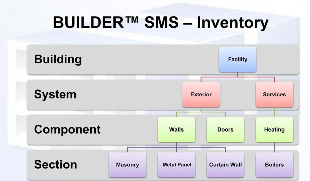
The GoldenWolf-EwingCole JV provided a comprehensive facility condition assessment, facility sustainment requirements and facility management data update via the BUILDER Sustainment Management System (SMS). Servcies included included program management, inventory and assessment, database management, engineering, training, and reporting services. Facilities included Medical Clinics, and Medical Facilities with Trauma Level I, II, II, and IV care with active and ongoing healthcare operations, including Central Utility Plants and Central Energy Plants, often operating on a 24/7 basis. Services within these facilities include Administrative, Health, Dental, Veterinary, Warehouse, and Medical Research.
GoldenWolf developed its own mobile BUILDER application - Condition Assessment and Requirements Validation Engine (CARVE) - to help increase efficiency and consistency in the field collection process. CARVE ensures efficient on-site data collection using a tablet and guides the field team to accurately collect data and upload the information to a secure Cloud location.
CLARK HALL SPACE UTILIZATION STUDY, FT. DRUM, NY
CLIENT USACE, New York District
SIZE 150,007 SF
COST/DATE $63.3M / 2023
FIRM/ROLE EwingCole via Jacobs - EwingCole JVPrime A/E
SERVICES Facility Master Plan
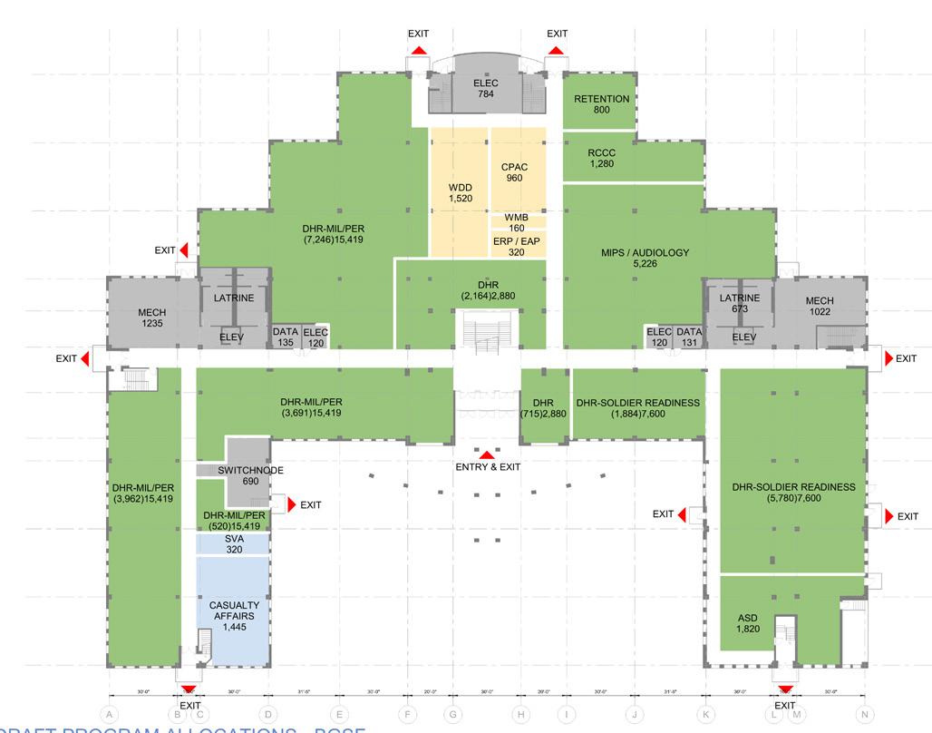
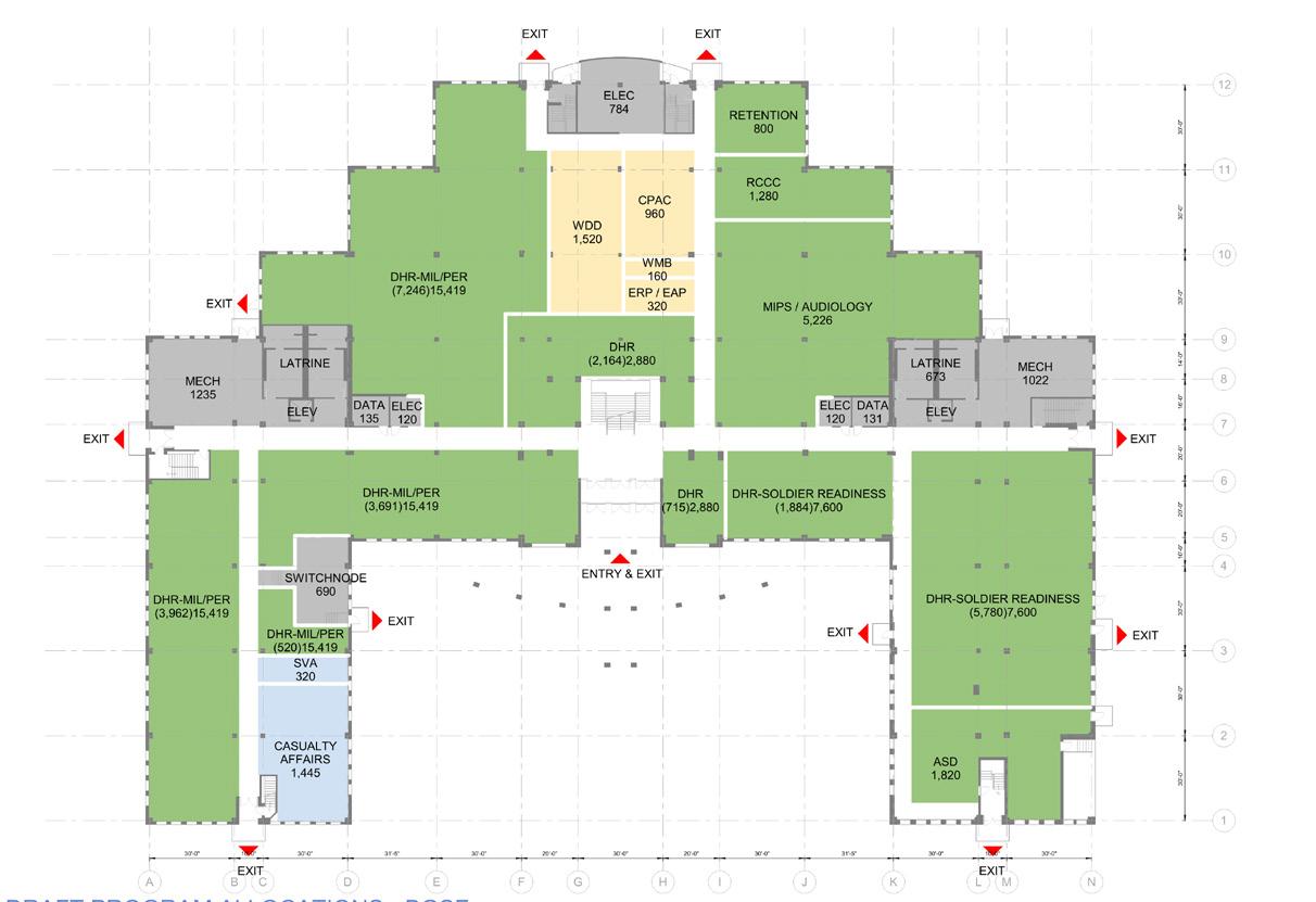
Facility Condition Assessment, Programming, and Planning Study for the purpose of optimizing and aligning twelve different departments within fourteen existing buildings for the next 25 years. EwingCole’s scope of services (with the assistance of Crawford Consulting for Cost and Schedule) included validating the existing floor plans, executing a condition assessment, and interviews with building occupants, managers, and staff. The final deliverable was a detailed and comprehensive space utilization study with recommended Facility Master Plan Courses of Action (COA), consisting of floor plans, movement diagrams, narratives, and supporting technical, quantitative, and qualitative documentation, which clearly defined the phasing, cost, and schedule. The selected solution enabled the relocation of all functions into a single, existing building on post. This included a 38% reduction in useable square footage for training and briefing spaces against the installation’s current allocations.
Cumberland County Facilities Master Plan Appendix Page 2 EwingCole
Deliverable Link
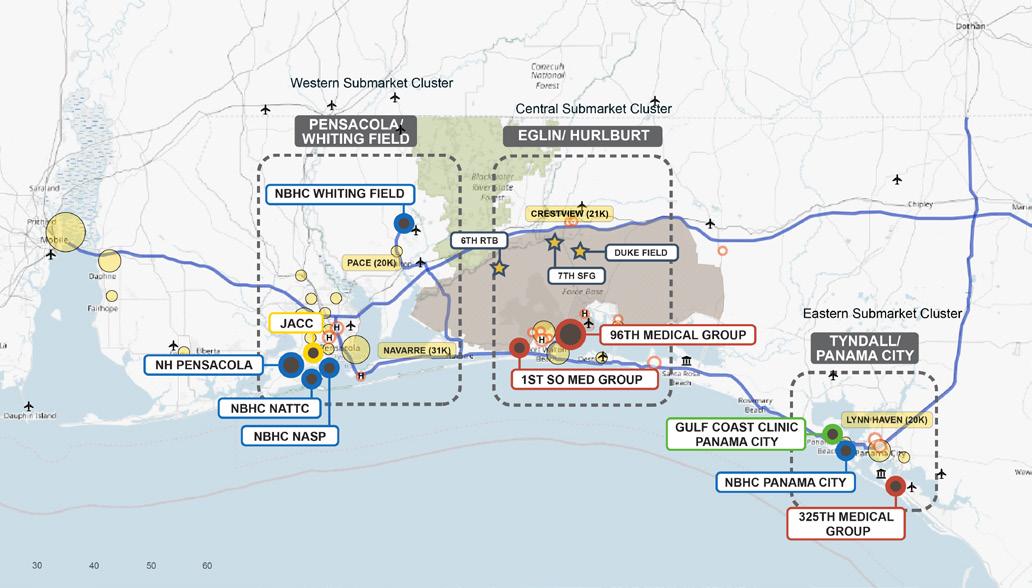
DEFENSE HEALTH AGENCY MARKET VISION STUDY, FLORIDA PANDHANDLE
CLIENT Defense Health Agency

SIZE 1.47M SF
COST/DATE $796,585 (Fee) / 2021
FIRM/ROLE GoldenWolf and EwingCole via GoldenWolf - EwingCole JV- Prime A/E SERVICES Facilities Master Plan
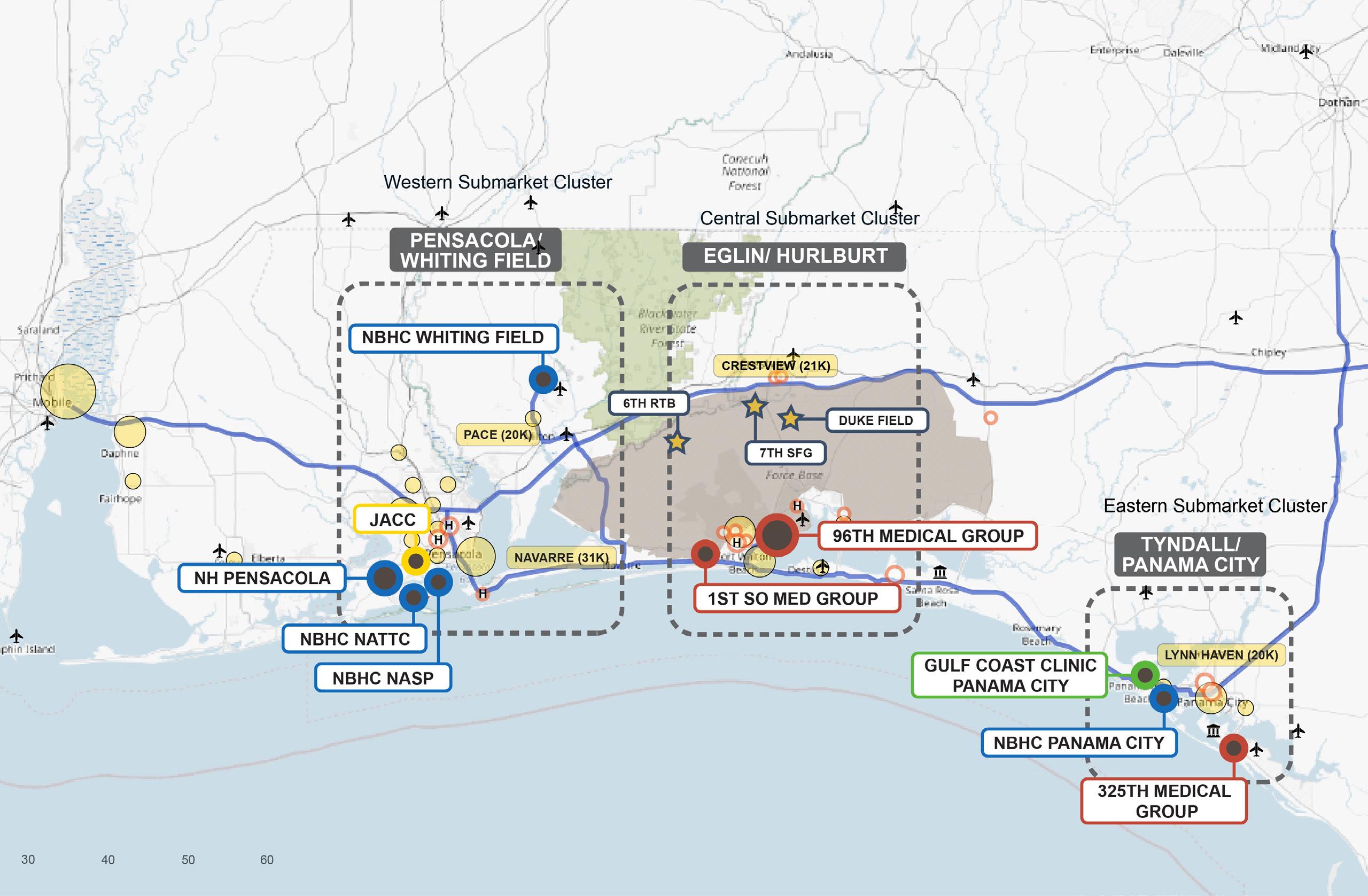
The GoldenWolf-EwingCole Joint Venture provided an updated 10-year Master Plan, aligned with the Defense Health Agency’s (DHA) strategic plan and forecasted clinical demands within the Florida Panhandle Market. The planning study provides a comprehensive federal market healthcare requirements analysis, federal facility capacity analysis, and strategic operational recommendations for the DHA defined sub-markets. The final output is an integrated facility master plan, linked with a market-based Strategic Operational Plan that provides guidance for future space needs in a quantitative and qualitative fashion.
RIDER 2030 MASTER PLAN LAWRENCEVILLE, NJ
CLIENT Rider University
SIZE 303 acres
COST/DATE $333,000 (Fee) / 2018
FIRM/ROLE EwingCole - Prime A/E SERVICES Facility Master Plan
Deliverable Link
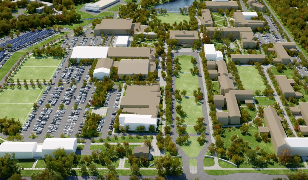
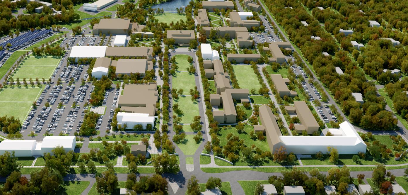
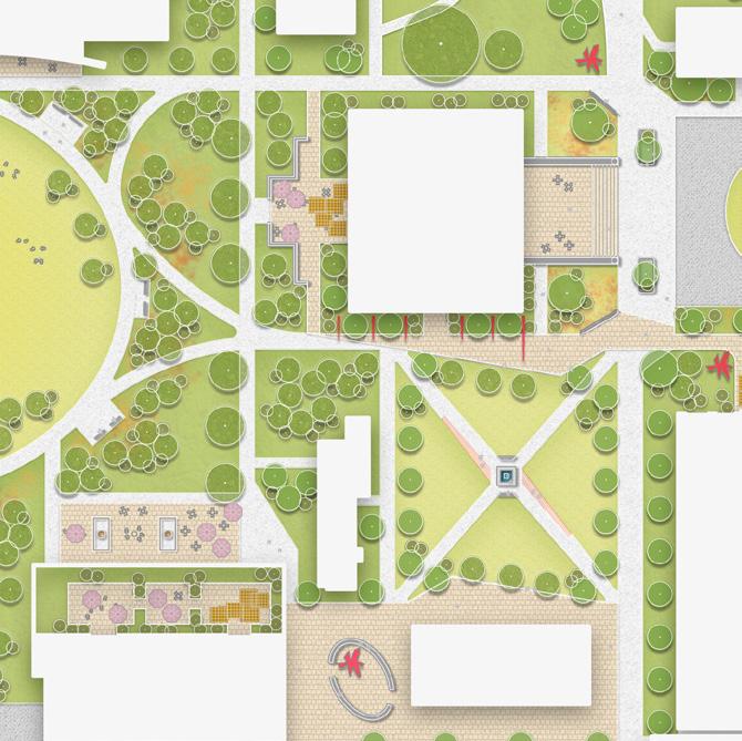
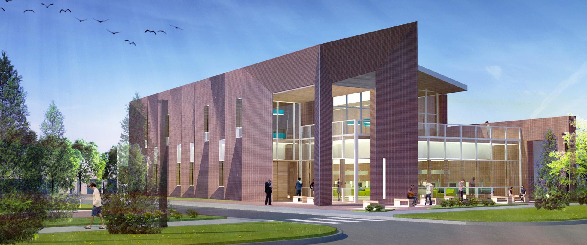
Rider 2030 is a strategic vision for growth by creating a vibrant living learning environment. The report outlines phased recommendations to improvements needed to support Rider University’s commitment to campus quality, sustainability and a consistent campus image with a focus on landscape and circulations, academic programs, student life, residential life, and athletic programs. The EwingCole master planning team established priorities through a series of meetings between the institution’s Steering Committee and Working Committee, which included student representatives. Our final report identified key renovations and expansions for the campus that are aligned with Rider’s strategic goals and fundamental needs for the university.
DEFENSE
HEALTH AGENCY STRATEGIC PLANNING SUPPORT, WORLDWIDE
CLIENT USACE, Huntsville District
SIZE 80M SF
COST/DATE $12M / 2023
FIRM/ROLE GoldenWolf - Prime Consultant SERVICES Policy Development
Business Process Re-engineering
Capital Investment Decision Model
Facilities Data Business Intelligence
Asset Management
Deliverable Link
As the Defense Health Agency underwent a major organizational transformation, they required a comprehensive review of its Facilities and Asset Management capabilities to enhance their enterprise management, which included cross-functional coordination and facility sustainment and capitalization program decision-making analytics. For stakeholders to optimize the asset portfolio’s utilization, GoldenWolf integrated data systems of inventory and mission operations information with regard to asset optimization and asset visibility support. Our team also provided budget and programming support, as well as assistance with capital strategy management for capital investments made for real property construction and improvements. The GoldenWolf Team designed and constructed the facilities standardization support policy and implemented an investment management strategy. We provided operations and maintenance (O&M) and portfolio planning integration as well as leased assets support.
Cumberland County Facilities Master Plan Appendix Page 3 EwingCole
Deliverable Link
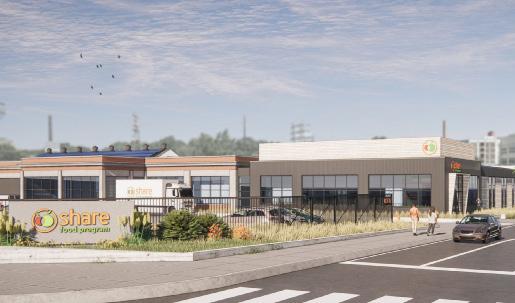
SHARE FOOD PROGRAM
PHILADELPHIA, PA
CLIENT Share Food Program
SIZE Multiple Projects
COST/DATE Estimated $59M / 2023
FIRM/ROLE Watchdog - Owner’s Representative SERVICES Financial Analysis
Grant & Funding Feasibility
Full Project Management Services
Watchdog is actively supporting Share Food Program during the organization’s Philadelphia HQ Master Plan and other facilities projects tangentially tied to the Master Plan. These initiatives rely heavily on funding and available cash flow. The majority of the organization’s funding sources are private, philanthropic donations or grant awarded. Our team has provided financial feasibility and funding analysis as it applies to the prioritization and planning of the projects identified in the Master Plan and tracks all funding sources. Watchdog developed a project timeline based on cash flow in order for Share to progress forward with the Master Plan and supporting projects while understanding and monitoring any restrictions to the sources in how the funds can be applied to the projects.
LINE 204 PECOIMA, CA
CLIENT Line 204
SIZE 225,000 SF
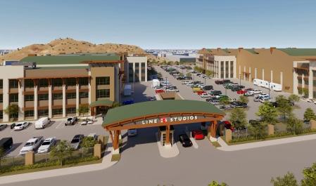
COST/DATE $80M / 2019
FIRM/ROLE Watchdog - Owner’s Representative SERVICES Financial Analysis
Owner’s Representation
Watchdog supported Line 204 as the organization was preparing for a new sound stage and post production facility project. Initially, the client required funding in order to start the project but had limited funding capacity. Watchdog created a financial analysis to develop alternatives in funding that were best suited to the client’s needs based on the asset but found that it was not in the client’s best interest to carry forward with the project. Instead, Watchdog supported the sale of the asset to a publicly traded REIT which ultimately bolstered the client’s longerterm portfolio growth through the profits of the sale.
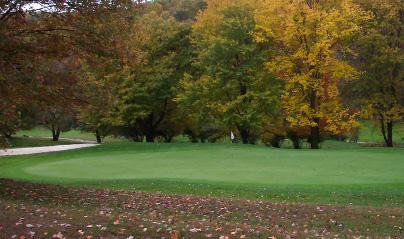
“PROJECT 7 IRON” EDGMONT, PA
CLIENT Confidential Client
SIZE 237,000 SF
COST/DATE $30M / 2013
FIRM/ROLE Watchdog - Owner’s Representative SERVICES Financial Feasibility Study
Owner’s Representation
Watchdog was engaged by a confidential corporate client who was deliberating the purchase of a then closing golf course to repurpose for the organization’s corporate use. Watchdog supported the client in developing a financial feasibility study to determine if the investment would make sense for the organization based on the debt that this client would take on as a result of the transaction. Cost estimating for the project played largely into the analysis on this client’s behalf. Based on the financial feasibility study Watchdog determined, alongside the client, that the purchase of this course would not support the organization’s financial capacity or prove as a value add to the client’s portfolio.
Cumberland County Facilities Master Plan Appendix Page 4 EwingCole
INSTALLATION MASTER PLANNING SUPPORT SERVICES - MARYLAND
CLIENT Aberdeen Proving Ground
SIZE N/A
COST/DATE $525,000 (Fee) / 2023
FIRM/ROLE mcfa - Prime A/E
SERVICES Project Management, Master Planning, Real Property Planning, GIS/CAD
mcfa established and maintained the Real Property Inventory and Building Information Schedule using RPLANS. We conducted studies of facilities to determine availability of buildings, structure training ranges, and airfields, to accommodate organizational requirements. We maintained real estate records to use data on land status use to include cost, capacity, condition, present use, maintenance, and management, and/or manpower studies.
LAND PRESERVATION, PARKS, AND RECREATION PLAN, ANNE ARUNDEL COUNTY, MD
CLIENT Anne Arundel County, MD
FIRM/ROLE Pennoni - Prime A/E
SERVICES Master Land Planning
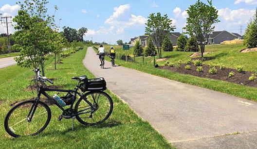
Pennoni assisted the County update their 2022 Land Preseration, Parks, and Recreation Plan. The initial stage of the project was updating the County-wide existing conditions and demographics. While doing this analysis, the team developed an online survey for engagement. The custom survey collected over 2,800 responses. In addition to the online survey, the team held virtual Town Hall meetings in every Council District in the County.
The next stage of the project consisted of a GIS Proximity and Equity Analysis of many different recreation facilities throughout the County. This analysis and the public engagement data was used to inform the Demand and Needs Analysis section of the plan. All of the analyses helped inform the set of County Priorities, which will guide the next five years of development and actions for the Parks and Recreation Department.
SHIPPENSBURG UNIVERSITY CAMPUS FACILITIES MASTER PLANNING, CUMBERLAND COUNTY, PA
CLIENT Shippensburg University
SIZE 200 acres
COST $17.2M
FIRM/ROLE Pennoni - Prime A/E
SERVICES Master Planning
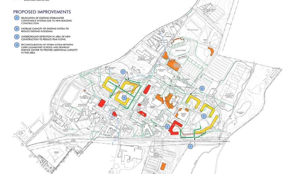
As part of a Campus Facilities Master Plan Pennoni provided campus planning services to inventory and analyze existing conditions related to green space, outdoor athletics, vehicular circulation, parking, pedestrian circulation, water, sanitary and storm utilities for the 200 acre campus. Short, medium and long term goals were developed and recommended to improve the physical campus in conjunction with the University’s academic growth plan.
Cumberland County Facilities Master Plan Appendix Page 5 EwingCole
Deliverable Link
DETAILED SUMMARIES AND DELIVERABLES
– Defense Health Agency (DHA) BUILDER Assessments, Data Re-Alignment & Facility Master Plan: GoldenWolf and EwingCole (via GoldenWolf-EwingCole JV)
– Clark Hall Space Utilization Study: EwingCole with Crawford Consulting (via Jacobs-EwingCole JV)
– Defense Health Agency Market Vision Study: GoldenWolf and EwingCole (via GoldenWolf-EwingCole JV)
– Rider 2030 Master Plan: EwingCole
– Defense Health Agency Strategic Planning Support: GoldenWolf
– Installation Master Planning Support Services: mcfa
Cumberland County Facilities Master Plan Appendix Page 6 EwingCole
COST
$15,716,163 (Fee)
SCHEDULE
September 2021December 2023
PROGRAM
Facility Condition Assessments
Course of Action Options
Cost Estimating Medical Administration
Central Utility Plant
Education
Research
DEFENSE HEALTH AGENCY - DELIVERABLE SUMMARY
BUILDER ASSESSMENTS, DATA RE-ALIGNMENT & FACILITY MASTER PLAN Installations Worldwide
Data Gathering / Process
Engineers and technicians gather existing documents on facilities, build datasets of systems, and these teams perform on-site visual inspections of all systems within the facilities and record the conditions using an established rating system.
Number & Type of Reports / Deliverables
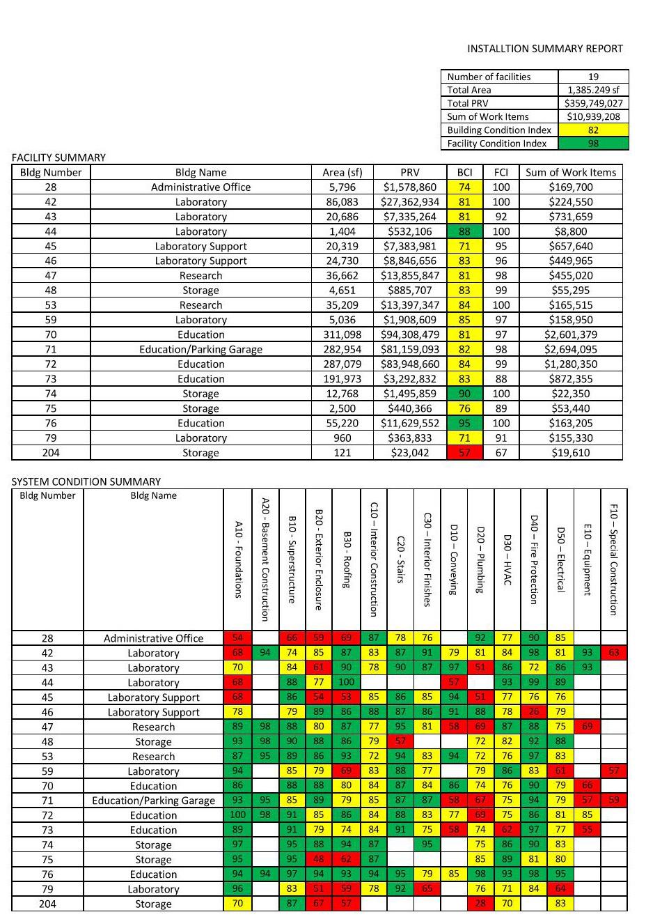
A summary report is generated for each installation and facility. Detailed component level condition reports with estimated costs for repairs or replacements are created.
Briefings
Site team leads hold pre and post site visit briefings with the clients to introduce the
process and summarize encountered onsite conditions. Once the data has been processed by the Quality Control (QC) team, summary reports of conditions and prioritized lists of recommended repairs and replacement projects are presented to facility management.
Conclusions
The detailed reports generated and prioritized project lists provide the client a roadmap for optimally sustaining their facilities at the lowest cost with the highest return on investment, assuring consistent delivery of critical services.
Cumberland County Facilities Master Plan Appendix Page 7 EwingCole
PROJECT SIZE 32.3M SF
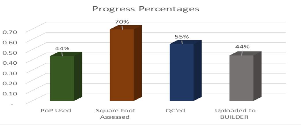
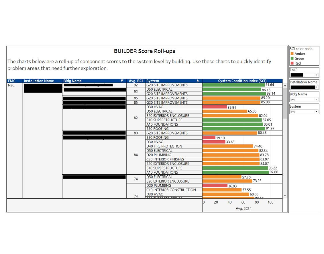
BUILDER Score Roll-Up Quarterly Briefing Slide on Performance to Date Facility Condition Assessment Score Sumamry
USACE NEW YORK - DELIVERABLE SUMMARY
Data Gathering / Process
We gathered data thru a combination of efforts that included an on site field investigation, validating existing floor / space plans, utilization of user questionnaires and a series of facilitated workshops.
Number & Type of Reports / Deliverables
1. Request for Information
2. Space / Data Validation Report
3. Draft and Final Report, topics included: Executive Summary, Space Analysis, Existing Conditions, Course of Actions, Facility Condition Assessment, Cost Estimate & Schedules
Briefings
We gave a mixture of in-person, hybrid and virtual briefings. These included inbriefs and outbriefs as part of the field investigations, workshops and overviews of our deliverables to assist the client and user groups in the fulfillment of their obligations as users, decision makers and project sponsors.
Conclusions
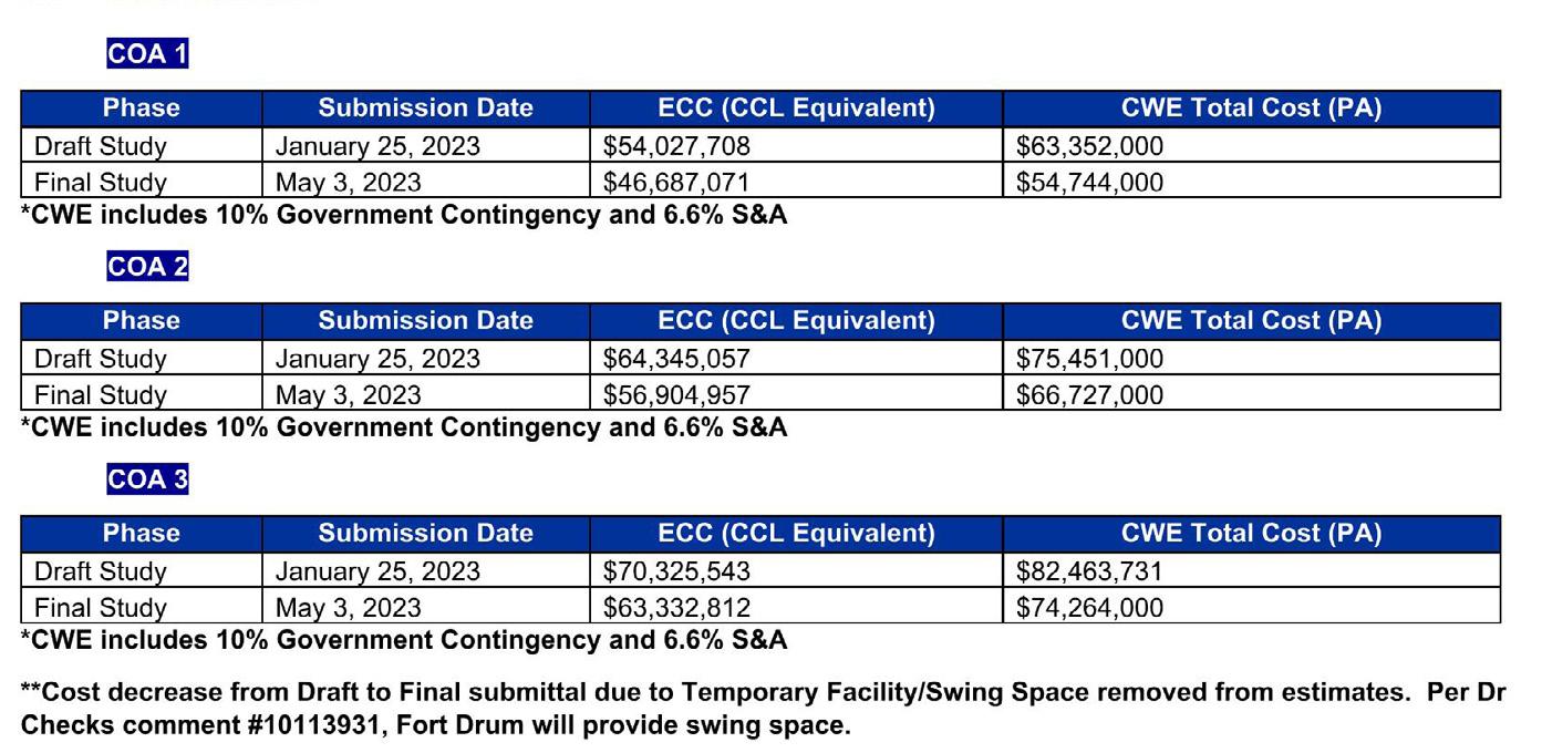
After reviewing the proposed Courses of Action (COA), the client selected COA 1 which created a “One Stop Shop” solution, consolidating, re-locating and rightsizing the 12 existing departments into a single building.
Cumberland County Facilities Master Plan Appendix Page 8 EwingCole
PROJECT SIZE 150,007 SF COST $63.3M SCHEDULE October 2022 to May 2023 PROGRAM Master Plan Facility Condition Assessment Course of Action Options Cost Estimating & Funding Requirements Governmental Facilities Training Office / Administrative Central Utility Plant
CLARK HALL SPACE UTILIZATION STUDY, Ft. Drum, NY Comparision of COA Cost Estimates
Typical COA Space Plan
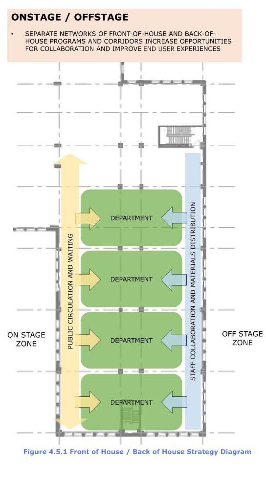
Organizational Strategy Diagram from the Report
PROJECT SIZE
1,470,000 SF
COST
$796,585 (Fee)
SCHEDULE
September 2019 - March 2021
PROGRAM
Master Plan
Facility Condition Assessments
Course of Action Options
Medical
Administration Training
Central Utility Plant
Education
Research
DEFENSE HEALTH AGENCY - DELIVERABLE SUMMARY
MARKET VISION STUDY
Florida Panhandle
Data Gathering / Process
Our Data Gathering Process included demand, workload, and capacity analysis, identification of geographic imperatives and growth trends, facility condition assessments, and sub-area development planning.
Our user interview process focused on operational efficiencies, with facilitated stakeholder discussions led by EwingCole eliciting visioning input and we developed consensus on market goals, constraints, and opportunities.
Our team utilized location allocation and population analysis in the development of the future state and course of action development.
We measured workload and staffing which became the basis of defined facility space requirements. These space requirements were run through a gap analysis against the existing facilities, generating multiple Courses of Action for evaluation and consideration by the users, leadership and sponsors.
Cumberland County Facilities Master Plan Appendix Page 9 EwingCole
Market and Site Location Map
WORKSHOP 1
Review strategic context with JDIRs
SITE VISIT 1 & MEETINGS
Conduct market strategic assessment
SITE VISIT 2 & MEETINGS
Describe current market CONOPS
Conduct submarket strategic assessment Describe desired future market CONOPS to achieve mission and vision
Evaluate the existing facilities
DISCOVER
WORKSHOP 2
Assess facility implications of goals and objectives
SITE VISIT 3 & MEETINGS
SITE VISIT 4 & MEETINGS
Review the facility COAs with the JDIRs for alignment
Data Gathering and Master Plan Process Workflow.
Develop facility courses of action to achieve the goals and objectives
Define strategic goals & tactical objectives to achieve the future state CONOPS
DESCRIBE the goals and objectives
ASSESS the facility implications
Brief the final list of facility initiatives to the market stakeholder
Envision the facilities future state
DEVELOP facility courses of action
PUBLISH AND APPROVE the recommendations
deliverables to assist the client and user groups in the fulfillment of their obligations as users, decision makers and project sponsors.
Conclusions
Our market-based Strategic Facility Master Plan provides a pathway for distributing real property assets and service lines throughout the market. This approach considers all aspects of the provision of care through innetwork, direct care out of network, direct care leasing, external resource sharing agreements and outsourcing / purchased care.
At the conclusion of our services, we had completed the Master Plan which defined the salient characteristics and future facility requirements aligned with DHA’s strategic plan and the forecasted needs of the market.
We gave a mixture of in-person, hybrid and virtual briefings. These included inbriefs and outbriefs as part of field investigations, workshops and overviews of our
Cumberland County Facilities Master Plan Appendix Page 10 EwingCole Number & Type of Reports / Deliverables 1. Quality Assurance / Quality Control Plan 2. Project Management Plan 3. Pre-Site Visit Documents & Trip Book 4. Trip Reports 5. Draft Market Analysis 6. Draft Strategic Facility Operational Plan 7. Draft Strategic Market Vision 8. Draft Location Analysis / GIS 9. 90% Location Analysis / GIS 10. 100% Location Analysis / GIS
90% Draft and Final Report - topics included Executive Summary, Market Data Analysis, Functional Area Requirements, Functional Operations Requirements, Facility Assessment, Course of Actions, Recommendations & Decisions Briefings
11.
December 2016-
February 2018
Master Plan
Course of Action Options
Landscape and circulations
Academic programs
Student life
Residential life
Athletic programs
RIDER UNIVERSITY - DELIVERABLE SUMMARY
RIDER 2030 MASTER PLAN
Lawrenceville, NJ
Data Gathering / Process
The master planning team established priorities through a series of meetings between the institution’s Steering Committee and Working Committee, which included student representatives.
Number & Type of Reports / Deliverables
1. Programming Report outlined overall consensus on functional requirements, program opportunities and constraints, energy criteria, landscape, infrastructure and stormwater considerations as well as specific priorities.
2. Planning & Concept Report integrated data from Planning & Concept sessions and the Programming Report.
3. Draft Master Plan Report presented planning options and conceptual cost models.
4. Final PowerPoint and Master Plan Update Report communicated accepted master plan approach in narrative and illustrations with implementation schedules and cost models.
Briefings
Multiple briefings as part of a series of workshops were scheduled with groups of stakeholders to generate ideas and consensus. Each deliverable was accompanied with a briefing to the Steering Committee.
Conclusions
The Master Plan is a flexible road map for the next generation of campus development that addresses the fundamental needs to sustain enrollment growth.
Cumberland County Facilities Master Plan Appendix Page 11 EwingCole
PROJECT SIZE 303 acres COST
$333,000 (Fee) SCHEDULE
PROGRAM
Drawings and Renderings from Report
SCHEDULE
September 2021-
September 2022
PROGRAM
Portfolio Planning & Decision
Making Support
Strategic Planning
Medical Administration Education Research
STRATEGIC PLANNING - DELIVERABLE SUMMARY
DEFENSE HEALTH AGENCY – STRATEGIC PLANNING Installations Worldwide
Data Gathering / Process
Our team of experts worked closely with the client executives and employees to gather the necessary intelligence for offering optimized solutions. We conducted extensive interviews, reviewed all relevant documentation, and researched industry best practices.
Number & Type of Reports / Deliverables
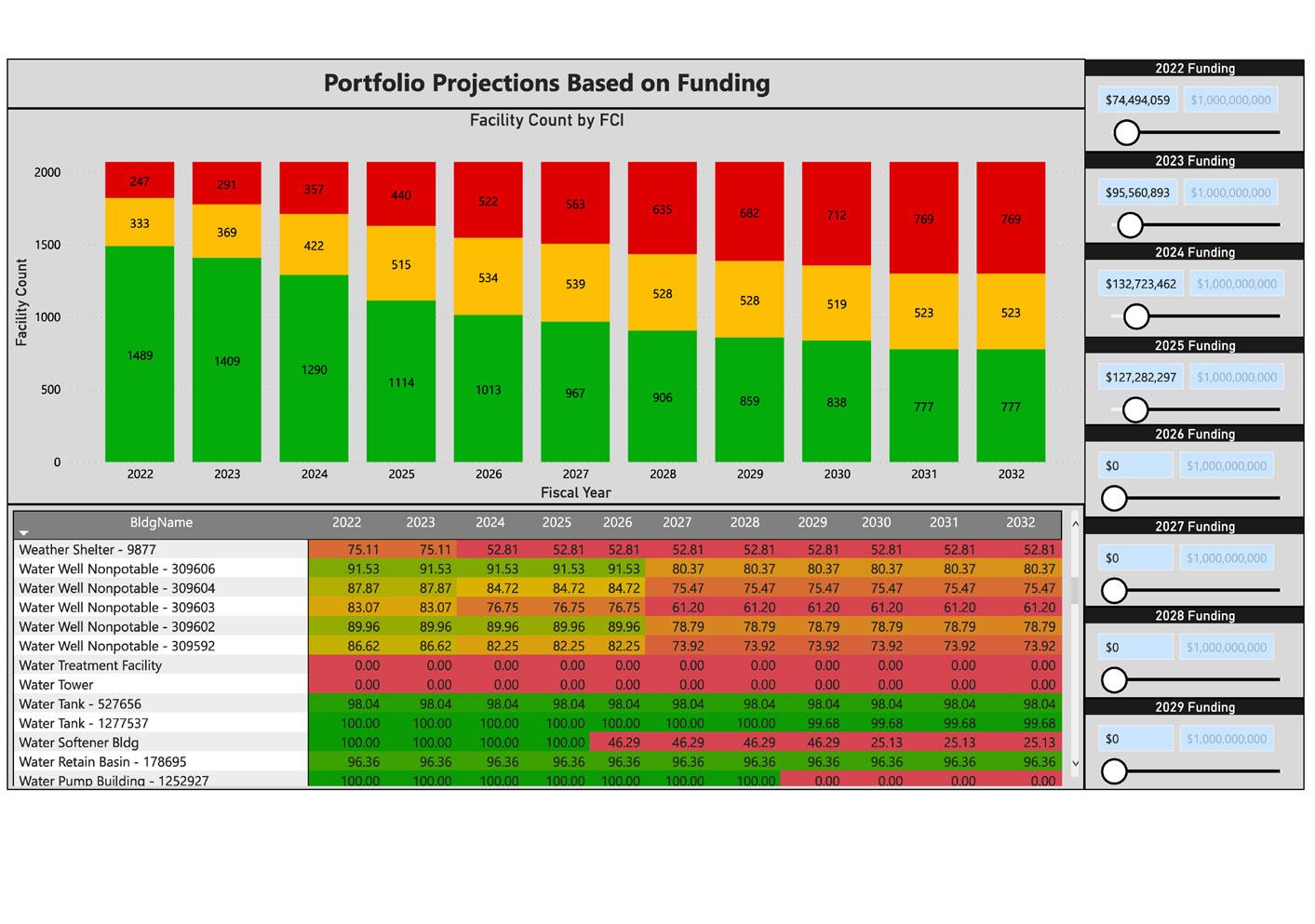
Our deliverables included policy documents, draft maintenance contract scopes of work, facilities data dashboards, standard operating procedures, executive summaries, budget documents, client presentations,
and web-based deliverables.
Briefings
Our team presents frequently to the client and other executive stakeholders within DHA.
Conclusions
These deliverables have been incorporated into the agency’s daily operations, optimizing their staff and decreasing their O&M costs.
Portfolio Funding Dashboard
Cumberland County Facilities Master Plan Appendix Page 12 EwingCole
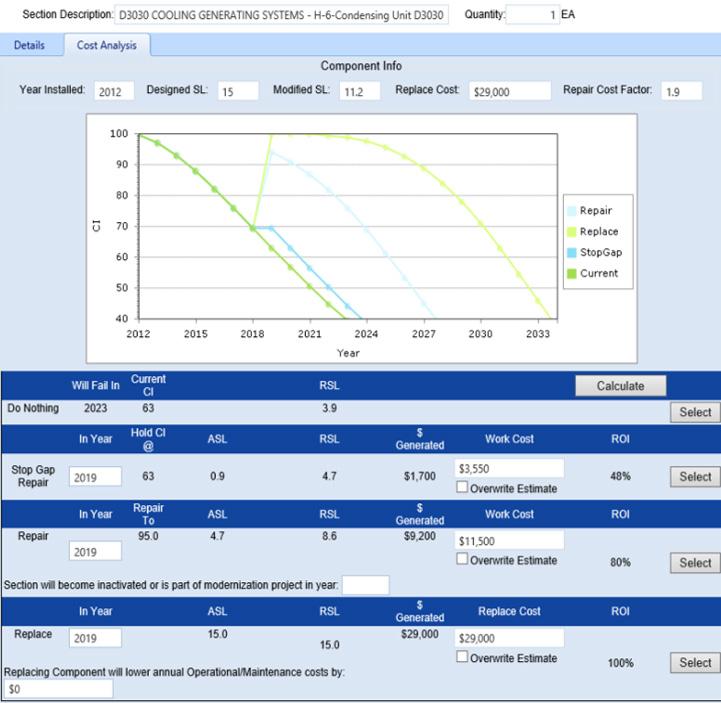
Weibull Distribution Plot
PROJECT SIZE 80M SF COST $6M (Fee)
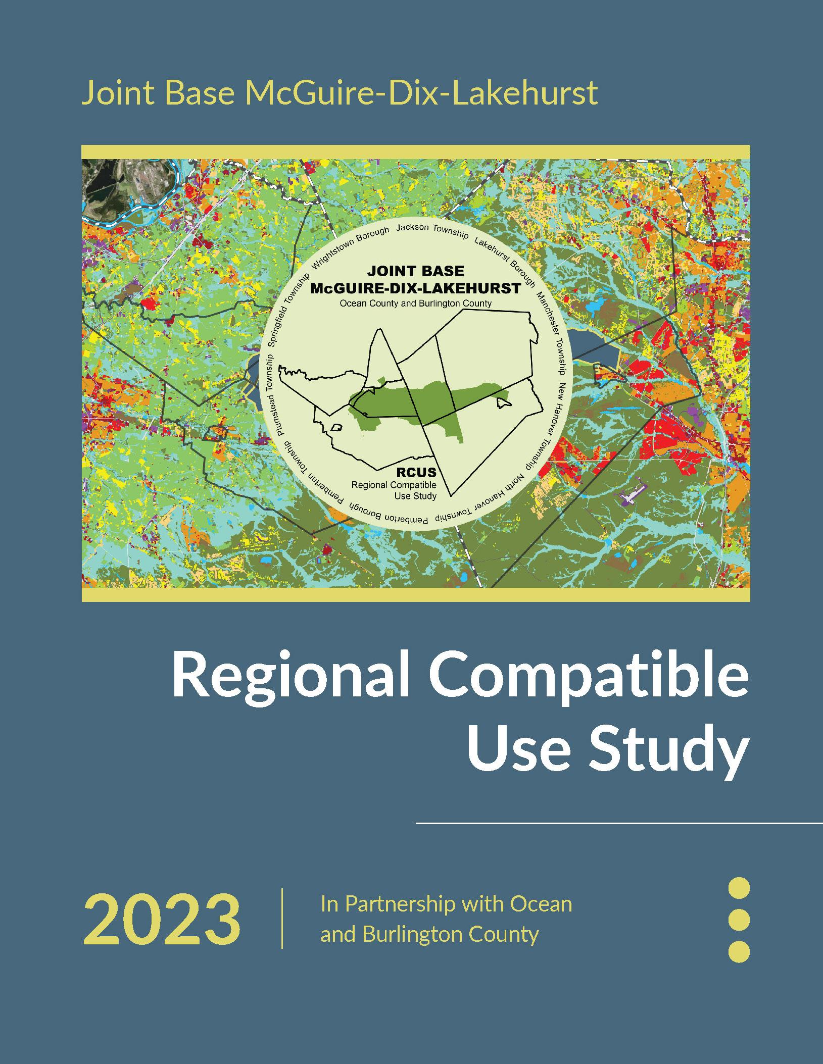
Regional Compatible Use Study For
Joint Base McGuire-Dix-Lakehurst
Ocean County and Burlington County, New Jersey
April 2023
Prepared for:
Ocean County Department of Planning
129 Hooper Avenue
Toms River, NJ 08754
And
Burlington County Bridge Commission
Economic Development and Regional Planning
1900 Briggs Road
Mount Laurel, NJ 08054
Prepared by:
Paulus, Sokolowski and Sartor LLC
3 Mountainview Road
Warren, NJ 07059
With JG Planning LLC
114 Hacklebarney Road
Long Valley, NJ 07853
And MCFA
70 Tanner Street
Haddonfield, NJ 08033
This study was prepared under contract with the County of Ocean with financial support from the Office of Local Defense Community Cooperation, Department of Defense. The content reflects the views of the County of Ocean and does not necessarily reflect the views of the Office of Local Defense Community Cooperation.
i P:\03143\0008 Reports\N-Envir\Regional Compatible Use Study\2023 Final TOC_Acronyms_List of Figures-Tables-Appendices.docx
EXECUTIVE SUMMARY ES-1 ES.1 INTRODUCTION ES-1 ES.2 WHY IS IT IMPORTANT TO PLAN FOR COMPATIBLE LAND USES AROUND JB MDL? ES-2 ES.3 HOW CAN PLANNING HELP? ES-3 ES.4 WHAT ARE THE ISSUES FOR LOCAL COMMUNITIES? ES-4 ES.5 KEY RECOMMENDATIONS ES-5 ES.6 IMPLEMENTATION OF THE RCUS RECOMMENDATIONS ES-7 1.0 INTRODUCTION 1-1 1.1 BACKGROUND AND PURPOSE OF STUDY 1-1 1.2 STUDY AREA........................................................................................................... 1-6 1.2.1 Ocean County 1-6 1.2.2 Burlington County .............................................................................................. 1-7 1.2.3 RCUS Municipalities 1-11 1.3 ADMINISTRATION AND MANAGEMENT............................................................... 1-31 2.0 RCUS PROCESS............................................................................................................ 2-1 2.1 BACKGROUND........................................................................................................ 2-1 2.2 OBJECTIVES ........................................................................................................... 2-2 2.3 RCUS COMMUNICATIONS AND PUBLIC OUTREACH PROGRAM ....................... 2-2 2.4 MUNICIPAL AND AGENCY STAKEHOLDER INTERVIEWS.................................... 2-7 2.5 DATA COLLECTION AND REVIEW......................................................................... 2-8 2.5.1 Review codes, ordinances, regulations for potential conflict control/reduction.... 2-8 2.5.2 Identify public infrastructure/community facility improvements ........................... 2-9 2.5.3 Identify potential natural and man-made hazards............................................. 2-10 2.5.4 Data Mapping 2-15 2.6 CURRENT AND POTENTIAL JB MDL OPERATIONS 2-16 2.7 ANALYSIS OF FUTURE DEVELOPMENT POTENTIAL AND ASSESSMENT OF FUTURE LU CONFLICTS 2-18 2.8 LAND USE COMPATIBILITY RECOMMENDATIONS 2-19 3.0 JOINT BASE MCGUIRE-DIX-LAKEHURST MISSIONS AND OPERATIONS 3-1 3.1 AREA HISTORY AND MISSIONS 3-1 3.1.1 McGuire Area 3-1 3.1.2 Dix Area 3-2 3.1.3 Lakehurst Area 3-4 3.2 JB MDL HISTORY AND MISSIONS 3-5 3.2.1 JB MDL Economic Impact to New Jersey 3-6 3.3 FUTURE MISSIONS 3-7 4.0 JOINT BASE MCGUIRE-DIX-LAKEHURST NOISE AND SAFETY CONCERNS 4-1 4.1 ISSUE OVERVIEW 4-1 4.2 SUMMARY FINDINGS 4-1 4.3 MORE INFORMATION 4-3 5.0 EXISTING LAND USES AND GROWTH POTENTIAL IN RCUS MUNICIPALITIES 5-1 5.1 BUILD OUT ANALYSIS METHODOLOGY OVERVIEW 5-1
TABLE OF CONTENTS
ii P:\03143\0008 Reports\N-Envir\Regional Compatible Use Study\2023 Final TOC_Acronyms_List of Figures-Tables-Appendices.docx 5.2 BUILD OUT ANALYSIS RESULTS SUMMARY 5-2 6.0 COMPATIBLE LAND USE PLANNING CONSIDERATIONS 6-1 6.1 STATE PLAN 6-1 6.2 ENVIRONMENTAL JUSTICE 6-7 6.3 PINELANDS COMPREHENSIVE MANAGEMENT PLAN 6-12 6.3.1 Summary of Pinelands Land Use Management Areas within the RCUS Municipalities 6-14 6.3.2 Pinelands Discussion 6-28 6.4 PRESERVED LAND 6-29 6.4.1 Readiness and Environmental Protection Integration (REPI) Program 6-30 6.4.2 Farmland Preservation Programs 6-41 6.4.3 County Parks 6-42 6.4.4 Green Acres Program Recreation and Open Space Inventory 6-42 6.4.5 Pinelands Commission Permanent Land Protection 6-43 6.5 ENVIRONMENTAL RESOURCE REGULATIONS IN THE RCUS AREA 6-43 7.0 INFRASTRUCTURE CAPACITY 7-1 7.1 TRANSPORTATION 7-1 7.1.1 Roads and Highways 7-1 7.1.2 Visitor Centers 7-1 7.1.3 Entry Control Facilities 7-2 7.1.4 Air Travel........................................................................................................... 7-5 7.1.5 Mass Transit...................................................................................................... 7-5 7.1.6 RCUS Traffic and Transportation Topics............................................................ 7-5 7.2 WATER SUPPLY.................................................................................................... 7-20 7.2.1 Public Water Purveyors ................................................................................... 7-20 7.2.2 Water Supply Issues by Municipality................................................................ 7-28 7.3 WASTEWATER MANAGEMENT............................................................................ 7-32 7.3.1 New Jersey Sewer Service Area...................................................................... 7-33 7.3.2 Wastewater Issues........................................................................................... 7-40 7.4 INFRASTRUCTURE RESILIENCY......................................................................... 7-41 7.4.1 Energy............................................................................................................. 7-41 7.4.2 State Energy Master Plan 7-43 7.4.3 Implementation Strategy for Minimizing Energy Interruptions........................... 7-44 7.4.4 Enduring Reactive Mobilization Center 7-44 8.0 ANALYSIS OF EXISTING LAND USE AND PLANNED DEVELOPMENT 8-1 8.1 ISSUE OVERVIEW 8-1 8.2 EXISTING LAND USE FINDINGS AND RECOMMENDATIONS 8-2 8.3 MORE INFORMATION 8-4 9.0 ECONOMIC CONSIDERATIONS 9-1 9.1 ISSUES OVERVIEW 9-1 9.2 DEMOGRAPHIC TRENDS IN BURLINGTON AND OCEAN COUNTIES 9-2 9.2.1 Population Growth 9-2 9.2.2 Total Employment 9-3 9.2.3 Number of Households 9-4 9.3 JOINT BASE AS AN ECONOMIC DRIVER 9-4 9.4 Economic Growth Opportunities 9-6 9.4.1 Housing 9-7 9.5 Economic Opportunities for RCUS Community Businesses 9-9
iii P:\03143\0008 Reports\N-Envir\Regional Compatible Use Study\2023 Final TOC_Acronyms_List of Figures-Tables-Appendices.docx 10.0 FUTURE DEVELOPMENT POTENTIAL AND LAND USE CONFLICTS 10-1 10.1 EXISTING ZONING/FUTURE DEVELOPMENT FINDINGS AND RECOMMENDATIONS 10-1 11.0 THE REGIONAL COMPATIBLE USE PLAN (RCUP) 11-1 11.1 INTRODUCTION 11-1 11.2 OCEAN COUNTY LAND USE AND ZONING RECOMMENDATIONS 11-2 11.2.1 Jackson Township 11-2 11.2.2 Lakehurst Borough 11-7 11.2.3 Manchester Township 11-11 11.2.4 Plumsted Township 11-15 11.3 BURLINGTON COUNTY LAND USE AND ZONING RECOMMENDATIONS 11-19 11.3.1 New Hanover Township 11-19 11.3.2 North Hanover Township 11-23 11.3.3 Pemberton Borough 11-27 11.3.4 Pemberton Township 11-27 11.3.5 Springfield Township 11-32 11.3.6 Wrightstown Borough 11-32 11.4 GENERAL STUDY AREA RECOMMENDATIONS 11-36 11.4.1 Mitigation Strategies for Incompatible Land Use 11-38 11.5 COORDINATION AND COMMUNICATION (CC) 11-40 11.5.1 Compatibility Concerns and Opportunities..................................................... 11-40 11.5.2 Recommendations......................................................................................... 11-41 11.6 INFRASTRUCTURE AND UTILITIES (I)............................................................... 11-41 11.6.1 Compatibility Concerns and Opportunities..................................................... 11-41 11.6.2 Recommendations......................................................................................... 11-42 11.7 SAFETY (S).......................................................................................................... 11-42 11.7.1 Compatibility Concerns and Opportunities..................................................... 11-42 11.7.2 Recommendations......................................................................................... 11-43 11.8 NATURAL RESOURCES (NR)............................................................................. 11-43 11.8.1 Compatibility Concerns and Opportunities..................................................... 11-43 11.8.2 Recommendations......................................................................................... 11-44 11.9 COMMUNITY DEVELOPMENT (CD) 11-44 11.9.1 Compatibility Concerns and Opportunities..................................................... 11-44 11.9.2 Recommendations 11-45 11.10 RECOMMENDED IMPLEMENTATION ACTIONS ............................................ 11-48 12.0 LIST OF REFERENCES 12-1
iv P:\03143\0008 Reports\N-Envir\Regional Compatible Use Study\2023 Final TOC_Acronyms_List of Figures-Tables-Appendices.docx
APPENDIX A JOINT BASE MCGUIRE-DIX-LAKEHURST NOISE AND SAFETY CONCERNS ....................................................................................A-1 A.1 NOISE ......................................................................................................................A-1 A.1.1 Noise Sources ...................................................................................................A-2 A.1.1.1 Major McGuire Area Noise Sources ..........................................................A-3 A.1.1.2 Major Dix Area Noise Sources....................................................................A-3 A.1.1.3 Major Lakehurst Area Noise Sources ........................................................ A-4 A.1.2 Day-Night Average Noise Level.........................................................................A-4 A.1.3 Peak Sound Pressure Level...............................................................................A-5 A.1.4 Noise Contours and Zones A-5 A.1.4.1 Land Use Planning Zone ............................................................................A-6 A.1.4.2 Noise Zone I ...............................................................................................A-6 A.1.4.3 Noise Zone II ..............................................................................................A-7 A.1.4.4 Noise Zone III A-7 A.2 SAFETY..................................................................................................................A-13 A.2.1 Accident Potential Zone A-13 A.2.1.1 Clear Zone A-13 A.2.1.2 Accident Potential Zone A-14 A.2.1.3 Accident Potential Zone II A-14 A.2.2 Imaginary Surface A-16 A.2.2.1 Primary Surface A-16 A.2.2.2 Clear Zone Surface A-16 A.2.2.3 Approach-Departure Clearance Surface A-16 A.2.2.4 Inner Horizontal Surface A-17 A.2.2.5 Conical Surface A-17 A.2.2.6 Outer Horizontal Surface A-17 A.2.2.7 Transitional Surface A-17 A.2.3 Other Vertical Obstructions A-18 A.2.4 Hazard to Aircraft Flight Zone A-20 A.2.4.1 Height of Structures/Features A-20 A.2.4.2 Debris A-21 A.2.4.3 Light Emissions A-21 A.2.4.4 Bird/Wildlife Aircraft Strike Hazard and Biological Resources A-21 A.2.4.5 Frequency Spectrum Impedance/Interference ...........................................A-22 A.2.4.6 Drones/Unmanned Aircraft Systems A-22 A.2.5 Unexploded Ordnance Areas...........................................................................A-24 A.2.6 Munition Storage A-24 A.2.7 Surface Danger Zones.....................................................................................A-24 A.3 Noise Contours and Safety Zones Off-Base Areas .................................................A-24 APPENDIX B EXISTING LAND USES AND GROWTH POTENTIAL IN RCUS MUNICIPALITIES ................................................................................B-1 B.1 OCEAN COUNTY.....................................................................................................B-6 B.1.1 Jackson Township .............................................................................................B-6 B.1.2 Lakehurst Borough ..........................................................................................B-18 B.1.3 Manchester Township......................................................................................B-26 B.1.4 Plumsted Township..........................................................................................B-37 B.2 BURLINGTON COUNTY ........................................................................................B-46 B.2.1 New Hanover Township B-46
APPENDICES
v P:\03143\0008 Reports\N-Envir\Regional Compatible Use Study\2023 Final TOC_Acronyms_List of Figures-Tables-Appendices.docx B.2.2 North Hanover Township B-56 B.2.3 Pemberton Borough B-65 B.2.4 Pemberton Township B-73 B.2.5 Springfield Township B-83 B.2.6 Wrightstown Borough B-92 APPENDIX C ANALYSIS OF EXISTING LAND USE AND PLANNED DEVELOPMENT C-1 C.1 IMPACT OF PAST AND PRESENT JB MDL MISSIONS C-1 C.2 Land Use Compatibility Overview C-1 C.2.1 Guidelines and Methodology C-1 C.2.2 Sensitive Receptors C-3 C.2.3 Study Area Existing Land Use Compatibility C-4 C.3 NOISE CONCERNS C-5 C.3.1 Aircraft Noise C-5 C.3.1.1 Location C-5 C.3.1.2 Existing Land Use and Land Use Compatibility C-10 C.3.1.3Planned Development C-12 C.3.2 Large-Caliber Weapons Noise C-16 C.3.2.1 Location C-16 C.3.2.2 Existing Land Use and Land Use Compatibility C-16 C.3.2.3 Planned Development C-20 C.3.3 Small Arms Noise C-22 C.3.3.1 Location ...................................................................................................C-22 C.3.3.2 Existing Land Use and Land Use Compatibility ........................................C-22 C.3.3.3 Planned Development ..............................................................................C-28 C.4 AIR OPERATIONS SAFETY CONCERNS..............................................................C-34 C.4.1 Aircraft Accident Potential Zones.....................................................................C-34 C.4.1.1 Location ...................................................................................................C-34 C.4.1.2 Existing Land Use and Land Use Compatibility ........................................C-34 C.4.2 Vertical Obstructions........................................................................................C-46 C.4.3 Visibility Concerns ...........................................................................................C-46 C.4.4 Bird Aircraft Strike Hazard................................................................................C-46 C.4.5 Unexploded Ordnance Areas...........................................................................C-46 C.4.6 Munition Storage C-47 C.4.7 Surface Danger Zones.....................................................................................C-47 C.5 JB MDL MANAGEMENT AND MITIGATION STRATEGIES C-47 C.5.1 Noise Management and Mitigation...................................................................C-47 C.5.1.1 Noise Abatement Program C -47 C.5.1.2 Noise Complaints and Information C-48 C.5.2 Management and Mitigation Methods C-48 C.5.2.1 Input through Public Meetings and Hearings C-48 C.5.2.2 Federal Review Processes C-48 C.5.2.3 Preservation C-49 C.5.2.4 Hazard to Aircraft Flight Zone C-49 C.5.2.5 Natural Resources Management C-49 APPENDIX D FUTURE DEVELOPMENT POTENTIAL AND LAND USE CONFLICTS D-1 D.1 JB MDL FUTURE GROWTH D-1 D.2 JB MDL CAPACITY FOR FUTURE DEVELOPMENT AND MISSIONS D-1 D.3 FUTURE COMMUNITY GROWTH D-1 D.3.1 Zoning/Future Land Use Compatibility Guidelines D-2 D.3.2 Sensitive Receptors D-5
vi P:\03143\0008 Reports\N-Envir\Regional Compatible Use Study\2023 Final TOC_Acronyms_List of Figures-Tables-Appendices.docx D.4 FUTURE POTENTIAL LAND USE CONFLICTS D-5 D.4.1 Aircraft Noise D-6 D.4.1.1 Location D-6 D.4.1.2 Zoning and Zoning Compatibility D-7 D.4.2 Large-Caliber Weapons Noise D-16 D.4.2.1 Location D-16 D.4.2.2 Zoning and Zoning Compatibility D-16 D.4.3 Small Arms Noise D-22 D.4.3.1 Location D-22 D.4.3.2 Zoning and Zoning Compatibility D-22 D.4.4 Aircraft Accident Potential Zones D-33 D.4.4.1 Location D-33 D.4.4.2 Zoning and Zoning Compatibility D-33 D.4.5 Vertical Obstructions D-44 D.4.6 Visibility Concerns D-44 D.4.7 Unexploded Ordnance Areas D-44 D.5 PREFERRED FUTURE COMPATIBLE USE SCENARIO D-44
LIST OF FIGURES
vii P:\03143\0008 Reports\N-Envir\Regional Compatible Use Study\2023 Final TOC_Acronyms_List of Figures-Tables-Appendices.docx
Figure 1.1: Overall Study Area 1-3 Figure 1.2: Population Density by Census Block Group (2020) 1-9 Figure 1.3: Median Household Income by Census Tract (2021) 1-10 Figure 1.4: Jackson Township Overview Map 1-12 Figure 1.5: Lakehurst Borough Overview Map 1-14 Figure 1.6: Manchester Township Overview Map 1-16 Figure 1.7: Plumsted Township Overview Map 1-18 Figure 1.8: New Hanover Township Overview Map 1-20 Figure 1.9: North Hanover Township Overview Map 1-22 Figure 1.10: Pemberton Borough Overview Map 1-24 Figure 1.11: Pemberton Township Overview Map 1-26 Figure 1.12: Springfield Township Overview Map 1-28 Figure 1.13: Wrightstown Borough Overview Map 1-30 Figure 2.1: Open House Flyer 2-4 Figure 2.2: RCUS Communications and Public Outreach Program – Noise Incidents 2-5 Figure 2.3: RCUS Communications and Public Outreach Program – Survey Responses 2-6 Figure 3.1: Installation Area Overview 3-1 Figure 3.2: JB MDL Mission Partners and Activities 3-6 Figure 6.1: State Plan Policy Map – 2021 6-6 Figure 6.2: Overburdened Communities................................................................................ 6-11 Figure 6.3: Jackson Township Pinelands Map ...................................................................... 6-17 Figure 6.4: Lakehurst Borough Pinelands Map...................................................................... 6-18 Figure 6.5: Manchester Township Pinelands Map................................................................. 6-19 Figure 6.6: Plumsted Township Pinelands Map..................................................................... 6-20 Figure 6.7: New Hanover Township Pinelands Map.............................................................. 6-22 Figure 6.8: North Hanover Township Pinelands Map ............................................................ 6-23 Figure 6.9: Pemberton Borough Pinelands Map.................................................................... 6-24 Figure 6.10: Pemberton Township Pinelands Map................................................................ 6-25 Figure 6.11: Springfield Township Pinelands Map................................................................. 6-26 Figure 6.12: Wrightstown Borough Pinelands Map................................................................ 6-27 Figure 6.13: Jackson Township Preserved Lands Map......................................................... 6-31 Figure 6.14: Lakehurst Borough Preserved Lands Map ........................................................ 6-32 Figure 6.15: Manchester Township Preserved Lands Map 6-33 Figure 6.16: Plumsted Township Preserved Lands Map ....................................................... 6-34 Figure 6.17: New Hanover Township Preserved Lands Map 6-35 Figure 6.18: North Hanover Township Preserved Lands Map 6-36 Figure 6.19: Pemberton Borough Preserved Lands Map 6-37 Figure 6.20: Pemberton Township Preserved Lands Map 6-38 Figure 6.21: Springfield Township Preserved Lands Map 6-39 Figure 6.22: Wrightstown Borough Preserved Lands Map 6-40 Figure 6.23: Environmentally Sensitive Areas 6-46 Figure 7.1: Regional Transportation Map 7-8 Figure 7.2: Local Road Map 7-9 Figure 7.3: Transportation Map – Jackson Township, Ocean County 7-10 Figure 7.4: Transportation Map – Lakehurst Borough, Ocean County 7-11 Figure 7.5: Transportation Map – Manchester Township, Ocean County 7-12 Figure 7.6: Transportation Map – Plumsted Township, Ocean County 7-13 Figure 7.7: Transportation Map – New Hanover Township, Burlington County 7-14 Figure 7.8: Transportation Map – North Hanover Township, Burlington County 7-15 Figure 7.9: Transportation Map – Pemberton Borough, Burlington County 7-16
viii P:\03143\0008 Reports\N-Envir\Regional Compatible Use Study\2023 Final TOC_Acronyms_List of Figures-Tables-Appendices.docx Figure 7.10: Transportation Map – Pemberton Township, Burlington County 7-17 Figure 7.11: Transportation Map – Springfield Township, Burlington County 7-18 Figure 7.12: Transportation Map – Wrightstown Borough, Burlington County 7-19 Figure 7.13: Watershed Management Areas and Public Water Purveyor Service Area Map 7-27 Figure 7.14: NJDEP Planned Method of Wastewater Disposal Map 7-32 Figure 9.1: Ocean and Burlington County Share of NJ Military and Federal Civilian Employment 9-4 Figure 11.1: Land Use within Noise Zones and APZs in Jackson Township 11-4 Figure 11.2: Zoning within Noise Zones and APZs in Jackson Township 11-6 Figure 11.3: Land Use within Noise Zones and APZs in Lakehurst Borough 11-8 Figure 11.4: Zoning within Noise Zones and APZs in Lakehurst Borough 11-10 Figure 11.5: Land Use within Noise Zones and APZs in Manchester Township 11-12 Figure 11.6: Zoning within Noise Zones and APZs in Manchester Township 11-14 Figure 11.7: Land Use within Noise Zones and APZs in Plumsted Township 11-16 Figure 11.8: Zoning within Noise Zones and APZs in Plumsted Township 11-18 Figure 11.9: Land Use within Noise Zones and APZs in New Hanover Township 11-20 Figure 11.10: Zoning within Noise Zones and APZs in New Hanover Township 11-22 Figure 11.11: Land Use within Noise Zones and APZs in North Hanover Township 11-24 Figure 11.12: Zoning within Noise Zones and APZs in New Hanover Township 11-26 Figure 11.13: Land Use within Noise Zones and APZs in Pemberton Township 11-29 Figure 11.14: Zoning within Noise Zones and APZs in Pemberton Township 11-31 Figure 11.15: Land Use within Noise Zones and APZs in Wrightstown Borough................. 11-33 Figure 11.16: Zoning within Noise Zones and APZs in Wrightstown Borough ..................... 11-35 Figure 11.17: Low-Moderate Income Summary Within RCUS Municipalities....................... 11-47 Figure A.1: Noise Level and Experience Scale........................................................................A-1 Figure A.2: JB MDL Major Noise Sources...............................................................................A-3 Figure A.3: A-Weighted Average Day-Night Noise Level (ADNL) Noise Zone Overview .........A-9 Figure A.4: C-Weighted Average Day-Night Noise Level (CDNL) Noise Zone Overview.......A-10 Figure A.5: Large-Caliber Weapons Peak Sound Pressure Level (PK15) Noise Zone Overview...................................................................................................A-11 Figure A.6: Small Arms Peak Sound Pressure Level (PK15) Noise Zone Overview..............A-12 Figure A.7: Accident Potential Zone (APZ) Overview............................................................A-15 Figure A.8: Imaginary Surface and Hazard to Aircraft Flight Zone (HAFZ) Overview A-19 Figure A.9: Imaginary Surface Three-Dimensional Cross Section........................................A-20 Figure A.10: Federal Aviation Administration (FAA) Unmanned Aircraft System (UAS) Guidance ..................................................................................A-23 Figure B.1: Jackson Township Land Use Map B-13 Figure B.2: Jackson Township Zoning Map B-14 Figure B.3: Jackson Township Environmental Constraints Map B-15 Figure B.4: Jackson Township Vacant and Farmland Assessed Lands Map B-16 Figure B.5: Jackson Township Build Out Analysis for Vacant and Farmland Assessed Lands B-17 Figure B.6: Lakehurst Borough Land Use Map B-21 Figure B.7: Lakehurst Borough Zoning Map B-22 Figure B.8: Lakehurst Borough Environmental Constraints Map B-23 Figure B.9: Lakehurst Borough Vacant and Farmland Assessed Lands Map B-24 Figure B.10: Lakehurst Borough Build Out Analysis for Vacant and Farmland Assessed Lands B-25 Figure B.11: Manchester Township Land Use Map B-32 Figure B.12: Manchester Township Zoning Map B-33 Figure B.13: Manchester Township Environmental Constraints Map B-34
ix P:\03143\0008 Reports\N-Envir\Regional Compatible Use Study\2023 Final TOC_Acronyms_List of Figures-Tables-Appendices.docx Figure B.14: Manchester Township Vacant and Farmland Assessed Lands Map B-35 Figure B.15: Manchester Township Build Out Analysis for Vacant and Farmland Assessed Lands B-36 Figure B.16: Plumsted Township Land Use Map B-41 Figure B.17: Plumsted Township Zoning Map B-42 Figure B.18: Plumsted Township Environmental Constraints Map B-43 Figure B.19: Plumsted Township Vacant and Farmland Assessed Lands Map B-44 Figure B.20: Plumsted Township Build Out Analysis for Vacant and Farmland Assessed Lands B-45 Figure B.21: New Hanover Township Land Use Map B-51 Figure B.22: New Hanover Township Zoning Map B-52 Figure B.23: New Hanover Township Environmental Constraints Map B-53 Figure B.24: New Hanover Township Vacant and Farmland Assessed Lands Map B-54 Figure B.25: New Hanover Township Build Out Analysis for Vacant and Farmland Assessed Lands B-55 Figure B.26: North Hanover Township Land Use Map B-60 Figure B.27: North Hanover Township Zoning Map B-61 Figure B.28: North Hanover Township Environmental Constraints Map B-62 Figure B.29: North Hanover Township Vacant and Farmland Assessed Lands Map B-63 Figure B.30: North Hanover Township Build Out Analysis for Vacant and Farmland Assessed Lands B-64 Figure B.31: Pemberton Borough Land Use Map B-68 Figure B.32: Pemberton Borough Zoning Map......................................................................B-69 Figure B.33: Pemberton Borough Environmental Constraints Map........................................B-70 Figure B.34: Pemberton Borough Vacant and Farmland Assessed Lands Map ....................B-71 Figure B.35: Pemberton Borough Build Out Analysis for Vacant and Farmland Assessed Lands...............................................................................B-72 Figure B.36: Pemberton Township Land Use Map................................................................B-78 Figure B.37: Pemberton Township Zoning Map ....................................................................B-79 Figure B.38: Pemberton Township Environmental Constraints Map......................................B-80 Figure B.39: Pemberton Township Vacant and Farmland Assessed Lands Map...................B-81 Figure B.40: Pemberton Township Build Out Analysis for Vacant and Farmland Assessed Lands...............................................................................B-82 Figure B.41: Springfield Township Land Use Map B-87 Figure B.42: Springfield Township Zoning Map.....................................................................B-88 Figure B.43: Springfield Township Environmental Constraints Map B-89 Figure B.44: Springfield Township Vacant and Farmland Assessed Lands Map...................B-90 Figure B.45: Springfield Township Build Out Analysis for Vacant and Farmland Assessed Lands B-91 Figure B.46: Wrightstown Borough Land Use Map B-96 Figure B.47: Wrightstown Borough Zoning Map B-97 Figure B.48: Wrightstown Borough Environmental Constraints Map B-98 Figure B.49: Wrightstown Borough Vacant and Farmland Assessed Lands Map B-99 Figure B.50: Wrightstown Borough Build Out Analysis for Vacant and Farmland Assessed Lands B-100 Figure C.1: A-Weighted Average Day-Night Noise Level (ADNL) Land Use C-7 Figure C.2: A-Weighted Average Day-Night Noise Level (ADNL) Land Use Compatibility C-13 Figure C.3: C-Weighted Average Day-Night Noise Level (CDNL) Land Use C-18 Figure C.4: Large Caliber Weapons Peak Sound Pressure Level (PK15) Land Use C-19 Figure C.5: C-Weighted Average Day-Night Noise Level (CDNL) Land Use Compatibility C-21 Figure C.6: Small Arms Peak Sound Pressure Level (PK15) Land Use C-23 Figure C.7: Small Arms Peak Sound Pressure Level (PK15) Land Use Compatibility C-29
x P:\03143\0008 Reports\N-Envir\Regional Compatible Use Study\2023 Final TOC_Acronyms_List of Figures-Tables-Appendices.docx Figure C.8: Bird Aircraft Strike Hazard (BASH) Preferred Location C-35 Figure C.9: Accident Potential Zone (APZ) Land Use C-36 Figure C.10: Accident Potential Zone (APZ) Land Use Compatibility C-42 Figure D.1: A-Weighted Average Day-Night Noise Level (ADNL) Zoning D-8 Figure D.2: A-Weighted Average Day-Night Noise Level (ADNL) Zoning Compatibility D-13 Figure D.3: C-Weighted Average Day-Night Noise Level (CDNL) Zoning D-18 Figure D.4: Large Caliber Weapons Peak Sound Pressure Level (PK15) Zoning D-16 Figure D.5: C-Weighted Average Day-Night Noise Level (CDNL) Zoning Compatibility D-21 Figure D.6: Small Arms Peak Sound Pressure Level (PK15) Zoning D-24 Figure D.7: Small Arms Peak Sound Pressure Level (PK15) Zoning Compatibility D-29 Figure D.8: Accident Potential Zone (APZ) Zoning D-35 Figure D.9: Accident Potential Zone (APZ) Zoning Compatibility D-40
LIST OF TABLES
xi P:\03143\0008 Reports\N-Envir\Regional Compatible Use Study\2023 Final TOC_Acronyms_List of Figures-Tables-Appendices.docx
Table ES.1: Key Recommendations 5 Table 1.1: JB MDL Compatible Use Study - Technical Advisory Committee 1-31 Table 1.2: JB MDL Compatible Use Study - Policy Committee 1-32 Table 2.1: Municipal Meeting Dates and Participants 2-7 Table 2.2: Military Meeting Dates and Participants 2-8 Table 2.3: Policy Meeting Dates and Topics 2-8 Table 2.4: Composite Table: Hazard Concerns for Burlington County and Ocean County 2-11 Table 3.1 JB MDL Host Municipalities 3-5 Table 3.2: JB MDL Demographics by Area 3-7 Table 5.1: Study Area Residential Build Out Summary 5-3 Table 5.2: Study Area Non-Residential Build Out Summary 5-3 Table 6.1: State Plan Planning Areas and Designated Centers in the Study Area 6-3 Table 6.2: Preserved Land in the Study Area 6-29 Table 6.3: Preserved Farmland in the Study Area 6-41 Table 7.1: JB MDL Entry Control Facilities 7-3 Table 7.2: JB MDL Entry Control Facility Study 7-4 Table 7.3: Regional Transportation Mobility Study Improvements 7-6 Table 7.4: WMA Water Statistics 7-21 Table 7.5: WMA 13 Public Water Purveyor Capacity within RCUS Municipalities 7-21 Table 7.6: WMA 19 Public Water Purveyor Capacity within RCUS Municipalities 7-23 Table 7.7: WMA 20 Public Water Purveyor Capacity within RCUS Municipalities ................. 7-25 Table 7.8: Wastewater Disposal Facilities with A NJPDES Permitted Wastewater Discharge > 2,000 GPD.................................................................... 7-35 Table 8.1: Existing Development Compatibility Review........................................................... 8-3 Table 9.1: Population Projections 2020-2060.......................................................................... 9-3 Table 9.2: Employment Projections 2020-2060....................................................................... 9-4 Table 9.3: Number of Households 2020-2060......................................................................... 9-4 Table 9.4: Military Pay and Housing Allowances for Unaccompanied Enlisted Personnel....... 9-8 Table 9.5: Federal Economic Assistance Programs Available to Support JB MDL Counties and Communities .................................................................................... 9-8 Table 11.1: Jackson Township Compatible Land Use Recommendations............................. 11-3 Table 11.2: Jackson Township Compatible Zoning Recommendations 11-5 Table 11.3: Lakehurst Borough Compatible Land Use Recommendations............................ 11-7 Table 11.4: Lakehurst Borough Compatible Zoning Recommendations 11-9 Table 11.5: Manchester Township Compatible Use Recommendations.............................. 11-11 Table 11.6: Manchester Township Compatible Zoning Recommendations 11-13 Table 11.7: Plumsted Township Compatible Land Use Recommendations 11-15 Table 11.8: Plumsted Township Compatible Zoning Recommendations 11-17 Table 11.9: New Hanover Township Compatible Land Use Recommendations 11-19 Table 11.10: New Hanover Township Compatible Zoning Recommendations 11-21 Table 11.11: North Hanover Township Compatible Land Use Recommendations 11-23 Table 11.12: North Hanover Township Compatible Zoning Recommendations 11-25 Table 11.13: Pemberton Township Compatible Land Use Recommendations 11-27 Table 11.14: Pemberton Township Compatible Zoning Recommendations 11-30 Table 11.15: Wrightstown Borough Compatible Land Use Recommendations 11-32 Table 11.16: Wrightstown Borough Compatible Land Use Recommendations 11-34 Table 11.17 General Study Area Recommendations 11-36 Table 11.18: Recommended Implementation Action Summary 11-49 Table A.1: Peak Sound Pressure Level (PK15) Impacts A-5 Table A.2: Land Use Planning Zone (LUPZ) Noise Levels A-6
xii P:\03143\0008 Reports\N-Envir\Regional Compatible Use Study\2023 Final TOC_Acronyms_List of Figures-Tables-Appendices.docx Table A.3: Noise Zone I (NZ I) Noise Levels A-7 Table A.4: Noise Zone II (NZ II) Noise Levels A-7 Table A.5: Noise Zone III (NZ III) Noise Levels A-7 Table A.6: Noise Zone Noise Levels A-7 Table A.7: Airfield Imaginary Surface Height Restrictions A-7 Table A.8: Additional Height Restrictions for Natural Growth, Terrain, and Structures A-18 Table A.9: Area by Noise/Safety Zone A-25 Table A.10: Area of A-Weighted Average Day-Night Noise Level (ADNL) by Municipality A-25 Table A.11: Area of C-Weighted Average Day-Night Noise Level (CDNL) by Municipality A-26 Table A.12: Area of Large-Caliber Weapons Peak Sound Pressure Level (PK15) by Municipality A-26 Table A.13: Area of Small Arms Peak Sound Pressure Level (PK15) by Municipality A-27 Table A.14: Area of Accident Potential Zone (APZ) by Municipality A-28 Table B.1: Land Use in Jackson Township B-7 Table B.2: Composite Zoning in Jackson Township B-7 Table B.3: Jackson Township Vacant Lands Build Out Scenario: Residential B-8 Table B.4: Jackson Township Farmlands Build Out Scenario: Residential B-10 Table B.5: Jackson Township Vacant Lands Build Out Scenario: Non-Residential B-11 Table B.6: Land Use in Lakehurst Borough B-18 Table B.7: Composite Zoning in Lakehurst Borough B-19 Table B.8: Lakehurst Borough Vacant Lands Build Out Scenario: Residential ......................B-19 Table B.9: Lakehurst Borough Vacant Lands Build Out Scenario: Non-Residential...............B-20 Table B.10: Land Use in Manchester Township....................................................................B-26 Table B.11: Composite Zoning in Manchester Township.......................................................B-27 Table B.12: Manchester Township Vacant Lands Build Out Scenario: Residential................B-28 Table B.13: Manchester Township Vacant Lands Build Out Scenario: Non-Residential........B-29 Table B.14: Land Use in Plumsted Township........................................................................B-37 Table B.15: Composite Zoning in Plumsted Township ..........................................................B-38 Table B.16: Plumsted Township Vacant Lands Build Out Scenario: Residential ...................B-39 Table B.17: Plumsted Township Vacant Lands Build Out Scenario: Non-Residential............B-39 Table B.18: Land Use in New Hanover Township.................................................................B-47 Table B.19: Composite Zoning in New Hanover Township B-48 Table B.20: New Hanover Township Vacant Lands Build Out Scenario: Residential.............B-48 Table B.21: New Hanover Township Farmlands Build Out Scenario: Residential B-49 Table B.22: New Hanover Township Vacant Lands Build Out Scenario: Non-Residential.....B-49 Table B.23: New Hanover Township Farmlands Build Out Scenario: Non-Residential B-50 Table B.24: Land Use in North Hanover Township B-56 Table B.25: Composite Zoning in North Hanover Township B-57 Table B.26: North Hanover Township Vacant Lands Build Out Scenario: Residential B-58 Table B.27: North Hanover Township Farmlands Build Out Scenario: Residential B-58 Table B.28: North Hanover Township Vacant Lands Build Out Scenario: Non-Residential B-59 Table B.29: Land Use in Pemberton Borough B-65 Table B.30: Composite Zoning in Pemberton Borough B-66 Table B.31: Pemberton Borough Vacant Lands Build Out Scenario: Residential B-66 Table B.32: Pemberton Borough Farmlands Build Out Scenario: Residential B-67 Table B.33: Land Use in Pemberton Township B-73 Table B.34: Composite Zoning in Pemberton Township B-74 Table B.35: Pemberton Township Vacant Lands Build Out Scenario: Residential B-75 Table B.36: Pemberton Township Farmlands Build Out Scenario: Residential B-76 Table B.37: Pemberton Township Vacant Lands Build Out Scenario: Non-Residential B-76
xiii P:\03143\0008 Reports\N-Envir\Regional Compatible Use Study\2023 Final TOC_Acronyms_List of Figures-Tables-Appendices.docx Table B.38: Pemberton Township Farmlands Build Out Scenario: Non-Residential B-77 Table B.39: Land Use in Springfield Township B-83 Table B.40: Composite Zoning in Springfield Township B-84 Table B.41: Springfield Township Vacant Lands Build Out Scenario: Residential B-85 Table B.42: Springfield Township Farmlands Build Out Scenario: Residential B-85 Table B.43: Springfield Township Vacant Lands Build Out Scenario: Non-Residential B-86 Table B.44: Land Use in Wrightstown Borough B-92 Table B.45: Composite Zoning in Wrightstown Borough B-93 Table B.46: Wrightstown Borough Vacant Lands Build Out Scenario: Residential B-94 Table B.47: Wrightstown Borough Vacant Lands Build Out Scenario: Non-Residential B-94 Table C.1: Standardized Land Use for Land Use Compatibility Analysis C-2 Table C.2: Land Use Compatibility Guidelines Overview C-3 Table C.3: Study Area Existing Land Use Compatibility C-5 Table C.4: A-Weighted Average Day-Night Noise Level (ADNL) Land Use Compatibility Guidelines C-10 Table C.5: A-Weighted Average Day-Night Noise Level (ADNL) Land Use Compatibility by Municipality C-11 Table C.6: C-Weighted Average Day-Night Noise Level (CDNL) Land Use Compatibility Guidelines C-16 Table C.7: C-Weighted Average Day-Night Noise Level (CDNL) Land Use Compatibility by Municipality C-20 Table C.8: Small Arms Peak Sound Pressure Level (PK15) Land Use Compatibility Guidelines.......................................................................................C-22 Table C.9: Small Arms Peak Sound Pressure Level (PK15) Land Use Compatibility by Municipality................................................................................C-27 Table C.10: Accident Potential Zone (APZ) Land Use Compatibility Guidelines....................C-35 Table C.11: Accident Potential Zone (APZ) Land Use Compatibility by Municipality in Burlington County..........................................................................................C-40 Table C.12: Accident Potential Zone (APZ) Land Use Compatibility by Municipality in Ocean County................................................................................................C-41 Table D.1: Standardized Zoning for Zoning Compatibility in Ocean County ............................D-2 Table D.2: Standardized Zoning for Zoning Compatibility Analysis in Burlington County.........D-3 Table D.3: Zoning Compatibility Guidelines Overview.............................................................D-5 Table D.4: Study Area Zoning Compatibility D-6 Table D.5: A-Weighted Average Day-Night Noise Level (ADNL) Zoning Compatibility Guidelines D-11 Table D.6: A-Weighted Average Day-Night Noise Level (ADNL) Zoning Compatibility by Municipality D-12 Table D.7: C-Weighted Average Day-Night Noise Level (CDNL) Zoning Compatibility Guidelines D-17 Table D.8: C-Weighted Average Day-Night Noise Level (CDNL) Zoning Compatibility by Municipality D-20 Table D.9: Small Arms Peak Sound Pressure Level (PK15) Zoning Compatibility Guidelines D-22 Table D.10: Small Arms Peak Sound Pressure Level (PK15) Zoning Compatibility by Municipality D-28 Table D.11: Accident Potential Zone (APZ) Zoning Compatibility Guidelines D-33 Table D.12: Accident Potential Zone (APZ) Zoning Compatibility by Municipality in Ocean County D-39 Table D.13: Accident Potential Zone (APZ) Zoning Compatibility by Municipality in Burlington County D-39
LIST OF APPENDICES
Appendix A Joint Base McGuire-Dix-Lakehurst Noise and Safety Concerns
Appendix B
Appendix C
Appendix D
Existing Land Uses and Growth Potential in RCUS Municipalities
Analysis of Existing Land Use and Planned Development
Future Development Potential and Land Use Conflicts
Appendix E Key Federal Grants Available to Support Defense Communities
xiv P:\03143\0008 Reports\N-Envir\Regional Compatible Use Study\2023 Final TOC_Acronyms_List of Figures-Tables-Appendices.docx
LIST OF ACRONYMS AND DEFINITIONS
21 EMTF 21st Expeditionary Mobility Task Force
87 ABW 87th Air Base Wing
108 ARW 108th Air Refueling Wing
305 AMW 305th Air Mobility Wing
514 AMW 514th Air Mobility Wing
621 CRW 621st Contingency Response Wing
ADNL A-Weighted Day-Night Average Noise Level
AFEC Air Force Expeditionary Center
AFFF aqueous film-forming foams
AFH Airplane Flying Handbook
AFRC Air Force Reserve Command
AGL Above ground level
AICUZ Air Installation Compatible Use Zones
AL Action Level
ALRE Aircraft Launch and Recover
AMC Air Mobility Command
AO Administrative Order
APZ Accident Potential Zone
APZ I Accident Potential Zone I
APZ II Accident Potential Zone II
ASA Army Support Activity
BAH Basic Housing Allowance
BAS Basic Allowance for Subsistence
BASH Bird Aircraft Strike Hazard
BRAC Base Realignment and Closure
BRACC 2005 Base Realignment and Closure Commission
C5ISR Command, Control, Communications, Computers, Cyber, Intelligence, Surveillance and Reconnaissance
CADB County Agriculture Development Board
CAGE Contractor and Government Entity
CDNL C-Weighted Day-Night Average Noise Level
CEQ Council on Environmental Quality
CERDEC Communications-Electronics Research, Development and Engineering Center
CFR Code of Federal Regulations
CMP Comprehensive Management Plan
CUP Compatible Use Plan
CZ Clear Zone
dB Decibel
DCIP Defense Community Infrastructure Pilot
DMA 2000 Disaster Mitigation Act 2000
DNL Day-Night Average Noise Level
DOD Department of Defense
DODI Department of Defense Instruction
DOI Department of the Interior
DTW Domestic Treatment Works
DUNS Data Universal Numbering System
EA Environmental Assessment
ECF Entry Control Facilities
EIAP Environmental Impact Analysis Process
EIS Environmental Impact Statement
EJ Environmental Justice
EJIS Environmental Justice Impact Statement
ERMC Enduring Reactive Mobilization Center
P:\03143\0008 Reports\N-Envir\Regional Compatible Use Study\2023 Final TOC_Acronyms_List of Figures-Tables-Appendices.docx
xv
ESPC Energy Savings Performance Contract
ESQD Explosion Safety Quantity Distance
EUL Enhanced Use Lease
FAA Federal Aviation Administration
FBI Federal Bureau of Investigations
FEMA Federal Emergency Management Agency
FHACA New Jersey Flood Hazard Area Control Act
FICUN Federal Interagency Committee on Urban Noise
FONSI Finding of No Significant Impact
FORSCOM United States Army Forces Command
FSC Federal Supply Class
FSI Frequency Spectrum Impedance/Interference
FWPA New Jersey Freshwater Wetlands Protection Act
FY Fiscal Year
GIS Geographic Information Systems
GW Groundwater
HAFZ Hazard to Aircraft Flight Zone
HCPNJ Healthy Community Planning New Jersey
HMP Hazard Mitigation Plan
HUC11 Watersheds
ICRMP Integrated Cultural Resources Management Plan
IDP Installation Development Plan
IEP Installation Energy Plan
INRMP Integrated Natural Resources Management Plan
JB MDL Joint Base McGuire-Dix-Lakehurst
JLUS Joint Land Use Study
LED Light-emitting diode
LUPZ Land Use Planning Zone
McGuire AFB McGuire Air Force Base
MCL Maximum Contaminant Level
mg/L milligrams per liter
MGD million gallons per day
MGY million gallons per year
MIS Military Installation Sustainability
MOB Main Operating Base
MPHI Military Housing Privatization Initiative
MSL Mean Sea Level
NAES Naval Air Engineering System
NAICS North American Industry Classification System
NAS Naval Air System
NAVAIR Naval Air Systems Command
NAWCAD Naval Air Warfare Center Aircraft Division
NEPA National Environmental Policy Act
New Jersey Turnpike U.S. Interstate 95
NIST National Institute of Standards and Technology
ng/g nanograms per gram
ng/L nanograms per liter
NGB National Guard Bureau
NJ ANG New Jersey Air National Guard
NJARNG New Jersey Army National Guard
NJDEP New Jersey Department of Environmental Protection
NJPDES New Jersey Pollution Discharge Elimination System
NJDOH NJ Department of Health
NJ SWSP NJ Statewide Water Supply Plan
NOSC Navy Operational Support Center
NVG Night Vision Goggles
NZ Noise Zone
xvi P:\03143\0008 Reports\N-Envir\Regional Compatible Use Study\2023 Final TOC_Acronyms_List of Figures-Tables-Appendices.docx
NZ I Noise Zone I
NZ II Noise Zone II
NZ III Noise Zone III
OEF Operation Enduring Freedom
OLDCC Office of Local Defense Community Cooperation
PA2 Suburban Planning Area
PA3
Fringe Planning Area
PA4 Rural Planning Area
PA4B
PA5
Rural/Environmentally Sensitive Planning Area
Environmentally Sensitive Planning Area
PAO Public Affairs Office
PDC Pinelands Development Credit
PFAS per- and polyfluoroalkyl substances
PFOS Perfluorooctane sulfonate
PK Peak Sound Pressure Level
PK15 Peak sound pressure level exceeded 15 percent of the time
PPA Power Purchase Agreement
PS&S Paulus, Sokolowski & Sartor
PTAC Procurement Technical Assistance Center
PWTA New Jersey Private Well Testing Act
R&D Research and Development
RCUP Regional Compatible Use Plan
RCUS Regional Compatible Use Study
RDT&E Research Development Test and Evaluation
REPI Readiness and Environmental Protection Integration
ROSI Recreation and Open Space Inventory
SADC State Agriculture Development Committee
SBA Small Business Administration
SBDC Small Business Development Center
SBR Small Business Roundtable
SDZ Surface Danger Zone
SLUCM Standard Land Use Code Manual
SNO Senior Non-Commissioned Officer
SSA Sewer service area
State Plan New Jersey State Development and Redevelopment Plan
STEM Science, Technology, Engineering, and Mathematics Study Area Joint Base McGuire-Dix-Lakehurst RCUS Study Area
Study Team RCUS Team comprised of PS&S and MCFA personnel
SW Surface Water
TDR Transfer of Development Rights
The Clearinghouse Military Aviation and Installation Assurance Siting Clearinghouse Traffic Study Comprehensive Traffic Engineering Study (2011) Trust New Jersey Natural Lands Trust
TT Treatment Technique
TWA Treatment Works Approval
UAS Unmanned Aircraft Systems
UFC Uniform Facilities Criteria
UP Utilities Privatization
USAF EC United States Air Force Expeditionary Center
USC United States Code
USCG United States Coast Guard
USDA United States Department of Agriculture
USFWS US Fish and Wildlife Service
USN United States Navy
UXO Unexploded Ordnance
VFR Visual Flight Rules
VOC Volatile Organic Compound
xvii
P:\03143\0008 Reports\N-Envir\Regional Compatible Use Study\2023 Final TOC_Acronyms_List of Figures-Tables-Appendices.docx
WFMP Wildland Fire Management Plan
WMA Watershed Management Area
WMP Wastewater Management Plan
WQMP Wastewater Quality Management Plan
WWTP Wastewater Treatment Plant
xviii P:\03143\0008 Reports\N-Envir\Regional Compatible Use Study\2023 Final TOC_Acronyms_List of Figures-Tables-Appendices.docx
EXECUTIVE SUMMARY
ES.1 INTRODUCTION
The purpose of this JB MDL (Joint Base McGuire-Dix-Lakehurst) Regional Compatible Use Study (RCUS) is to identify needs and recommend actions that support collaborative planning processes between JB MDL, the State of New Jersey, Ocean and Burlington Counties, and the ten JB MDL host communities. The RCUS contains a Regional Compatible Use Plan (RCUP) representing a result of investigations and findings developed through the course of the RCUS. The RCUS was commissioned in 2022 by Ocean County through a grant from the DOD (Department of Defense) Office of Local Defense Community Cooperation (OLDCC).
The RCUS continues the processes and successful programs initiated in the JB MDL Joint Land Use Study (JLUS) adopted in 2009, while providing greater detail for identifying specific land uses and levels of potential conflict, along with recommendations for reduction of potential conflict. The RCUS includes additional tools and resources to support compatible uses and lists funding sources for beneficial programs.
The goal of the RCUS and RCUP is three-fold:
1) create opportunities for local communities to benefit economically from proximity to the JB DML employment base, 2) to develop a cooperative plan for limiting development of potentially incompatible land uses, such as residences, in areas where military operations may have an impact on the quality of life of residents, and 3) utilize tools and funding sources to mitigate existing impacted areas and avoid developing sensitive land uses in areas where existing or future military operations could create future impacts and nuisances which become concerns for local government officials and JB MDL.
JB MDL is a 42,000-acre military installation that has been active for more than 100 years located in Ocean and Burlington Counties, New Jersey. The 87th Air Base Wing has been the host unit, assuming all installation management and support functions and reporting to the Air Mobility Command (AMC) through the Air Force Expeditionary Center (AFEC) since 2005. It is the nation’s only tri-service installation and is home to major Air Force, Army and Navy components. More than 80 mission partners are located at JB MDL including those supporting the DOD and other federal, state, and local agencies. Protecting the short- and long-term viability of operations at
ES-1
P:\03143\0008 Reports\N-Envir\Regional Compatible Use Study\2023 Final Executive Summary.docx
EXECUTIVE SUMMARY
JB MDL is critical to the interests of the DOD, State of New Jersey, and the economies of host counties and municipalities.
The RCUS and resulting RCUP recommendations were developed collaboratively between JB MDL, Ocean and Burlington Counties, the State of New Jersey, and the 10 local communities in the study area. This Executive Summary presents key findings and recommendations of the RCUS that form the basis of the RCUP.
ES.2 WHY IS IT IMPORTANT TO PLAN FOR COMPATIBLE LAND USES AROUND JB MDL?
Protecting the ongoing viability and ability to conduct a wide variety of military, homeland security, and state and local law enforcement training and disaster response activities and capabilities at JB MDL is important to the flexibility and availability of JB MDL to support current and future operations. Failure to promote development of compatible land uses in sensitive noise and/or safety zones could create future challenges and limitation to military operations. Implementation of the RCUS recommendations that form the foundation of the RCUP will support JB MDL’s four primary operational and economic benefits:
• Unique Military and Joint Services Mission Capabilities – JB MDL is the DOD’s only tri-services base and is home to significant operations and capabilities in support to the Air Force, Army, Navy, Marine Corps, National Guard and Reserve Components, the U.S. Coast Guard, other Department of Homeland Security Agencies, Federal Emergency Management Agency (FEMA), and the NJ State Police.
• Largest DOD Employment Center in New Jersey – JB MDL is the largest DOD employer and second largest employer overall in the State of New Jersey, second only to state government. Over 44,000 individuals, including military personnel, civilians, and their families, live and work on or near JB MDL.
• Disaster Response and Recovery Center – JB MDL serves as the primary disaster response and recovery operations center for the State of New Jersey communities and supports major metropolitan areas of New York City, Philadelphia, and Wilmington.
• Significant Economic Engine for Local Communities – The 44,000+ military personnel, civilians, and their families, who live and work on or near JB MDL generate an estimated annual economic impact of $6.9+ billion in the region. JB MDL is a major purchaser ($3 billion in Fiscal Year 2021) of goods and services of benefit to businesses in Burlington and Ocean Counties. The combined annual payroll of military and civilian personnel at JB MDL in 2021 was more than $1 billion.
P:\03143\0008 Reports\N-Envir\Regional Compatible Use Study\2023 Final Executive Summary.docx
ES-2
ES.3 HOW CAN PLANNING HELP?
The RCUS presents an opportunity to advance and grow upon the positive results of the previously completed JLUS and continue the long tradition of good relations between the JB MDL and host communities. A focus on planning for compatible land use around JB MDL ensures that local communities can continue to grow and develop while mitigating or avoiding potential problems from development of sensitive land uses in areas impacted by military operations.
The 2009 JLUS led to the adoption and successful application of compatible use strategies and land conservation actions that have helped reduce conflicts between JB MDL operations and impacts to land uses surround the base. Since the JLUS was adopted in 2009, more than 85,000 acres of land in the vicinity of JB MDL has been preserved from urban development through leveraging a wide variety of conservation programs and tools. Preserved and open space lands in the vicinity of JB MDL supports the mitigation of mission impacts, such as noise and safety, and prevention of community development encroaching on military activities. Existing preservation programs include the DOD’s Readiness and Environmental Protection Integration (REPI) program, Natural Lands Trust, Farmlands Preservation Program, County Parks, Green Acres Program, and Pinelands Commission Permanent Land Protection.
JB MDL has used REPI in partnership with the State of New Jersey, New Jersey Pinelands Commission, Burlington and Ocean Counties, and municipalities to preserve 9,192 acres of critical land areas in sensitive military operations zones impacted by noise and/or safety concerns. Conservation and preservation efforts focused on lands within a 2-mile buffer of the installation boundaries. Of particular concern were lands within and around the Accident Potential Zones (APZ), particularly Clear Zones (CZ) associated with Joint Base runways. Limiting development in these zones allows for improved military operational benefits including improved night flying capabilities, operational safety, and mission protection. Local communities enjoy the preservation of natural resources, open space, wildlife habitats, and advancement of regional planning.
For the 2009 JLUS, a two-mile buffer zone around the perimeter of JB MDL was the focus of compatible land use investigations and planning recommendations. For the 2022 RCUS and RCUP, compatible land use investigations and planning recommendations are focused on further protection of key noise and/or safety zones as established by the Air Force. These are the primary areas of interest for promoting land use compatibility with military operations from JB MDL. These
ES-3
P:\03143\0008 Reports\N-Envir\Regional Compatible Use Study\2023 Final Executive Summary.docx
are also the areas where proactive land use management policies by local communities will have the greatest impact on quality of life for existing and future residents.
ES.4 WHAT ARE THE ISSUES FOR LOCAL COMMUNITIES?
JB MDL aircraft and artillery ranges operations are crucial functions that support the military as well as state and local disaster response, recovery and law enforcement training missions located there. These operations, however, do present noise and safety considerations to some areas outside of the JB MDL boundaries. Concerns result from the frequency, type and schedule of aircraft operations. Concerns also include the schedule and intensity of noise resulting from the firing of small and large caliber munitions at training ranges. Potential impacts and desirability of future development potential in high noise or aircraft safety zones do present an impact on development potential in local communities. Conversely, unmanaged encroachment of incompatible land uses into key JB MDL noise and safety zones can present a challenge to the long-term viability and flexibility of JB MDL. A preponderance of incompatible land uses located in key noise and/or safety zones could threaten the Base’s future operating status. The reduction of investment, downsizing, or closure of JB MDL could result if encroachment of incompatible land uses is not managed pro-actively.
Local communities also want to maximize economic benefits and opportunities from their proximity to JB MDL, the second largest employer in the State of New Jersey. Local communities want to know how they can better capitalize on the significant investments and spending made by JB MDL in capital projects and goods and services. Local businesses want to better benefit and serve the significant daily population of JB MDL. At the same time, local communities want minimizing negative economic and traffic impacts resulting from operational factors such as gate closures and the routing of delivery vehicles through communities.
Local communities and JB MDL can continue to manage these concerns and avoid future problems by collaborative and proactive planning and development policies. These policies should support the common interests of community quality of life and a viable major military base and regional employment center of statewide importance Collaborative planning policies should encourage the location of compatible land uses in areas where noise or safety concerns may impact sensitive land uses, such as residential dwellings JB MDL and local communities should also collaborate on opportunities to increase physical and economic access to the large daily
ES-4
P:\03143\0008 Reports\N-Envir\Regional Compatible Use Study\2023 Final Executive Summary.docx
civilian and military employment population by local community businesses. Federal, state and local funding sources can be used to support workforce training and development to support key Science, Technology, Engineering and Mathematics (STEM) and specialized requirements of the key Research and Development (R&D) testing and evaluation missions who operate at JB MDL. Federal, state and local funding sources can also be leveraged to support key energy resiliency, transportation infrastructure, and environmental remediation projects of benefit to both JB MDL and local communities.
ES.5 KEY RECOMMENDATIONS
The table on the following pages presents a summary overview of concerns and opportunities by specific issues for local communities and JB MDL. The table offers prescriptive options, actions and funding sources to pursue goals and opportunities identified in the RCUS.
Table ES.1: Key Recommendations
• JB MDL – Identify opportunities and land area for additional gridconnected public/private financed renewable energy generation projects
• Counties – Apply for OLDCC Defense Community Infrastructure Pilot (DCIP) grants to support electric power supply, distribution or storage infrastructure of benefit to JB MDL and communities
Improve energy supply and distribution infrastructure redundancy to JB MDL and local communities
• Host Municipalities – Identify opportunities for improvement to energy and utility infrastructure
• Local Utilities – Explore public/private funding and investor partnerships with JB MDL and the Air Force for new major power generation projects on JB MDL lands
• State Authorities – Explore opportunities for inter-connection of utility supply infrastructure between the two JB MDL providers, JB MDL and local communities as feasible
• Air Force – Support and facilitate the execution of key energy supply and distribution public/private partnership projects promoted by industry
Local Employment Growth and Workforce Development
Increase local employment opportunities through skilled workforce development training to support key RDT&E JB MDL mission jobs
• Counties – Apply for OLDCC Defense Manufacturing Community Support Program grant to help fund start up program for an advanced STEM and applied science workforce development program/center in collaboration with STEM educator partners
• Host Municipalities – Support establishment of local training centers and programs
• STEM Educators – Establish a collaboration consortium between industry, academia and JB MDL missions to provide advanced STEM and applied sciences workforce development training for High School and Community College students in electronics, machine learning and other critical skills of benefit to JB MDL missions and to provide a pipeline of key talent needed by those missions
• JB MDL – Work with key RDT&E missions to identify skills training needed to supply a pipeline of intern, research associate and full time employment candidates needed to support key mission requirements
ES-5
P:\03143\0008 Reports\N-Envir\Regional Compatible Use Study\2023 Final Executive Summary.docx
Issue Opportunity/Need Recommended Implementation Action Energy Supply Resiliency and Distribution Redundancy
Table ES.1: Key Recommendations
Issue Opportunity/Need Recommended Implementation Action
Manage Wildlife Area Impacts
Wetlands and water bodies attract waterfowl which is considered incompatible in CZ, APZ I and II zones due to bird air strike hazards
• JB MDL/Counties – Continue to pursue funding tools such as REPI, Sentinel Landscape, Nature Conservancy, and other state and federal conservation easement tools to acquire or conserve key CZ and APZ I areas from expansion or encroachment of incompatible land uses
• Host Municipalities – Reinforce use of wildlife management measures on water bodies and lawn areas used by migratory waterfowl
• NJ DEP and USACE – Limit expansion of existing water bodies and wetland areas in critical APZ I, II and III zones and avoid the permitting or introduction of new water bodies and wetlands in these zone
TransportationAccess Transportation access routes to JB MDL can have a negative impact on local communities
• Counties and Communities – Explore opportunities for local funding to improve transportation routes and signing for commercial vehicles serving JB MDL to avoid impacts on residential areas and/or harden local roadways to better support truck traffic
• Counties and NJ DOT – Pursue OLDCC project funding under Defense Community Infrastructure Pilot (DCIP) grants and/or Federal Highway Administration Defense Access Road funding programs for design and construction of new commercial delivery access routes to JB MDL
• JB MDL – Improve directional signage and publicize instructions for contractor and delivery vehicles
Local Business Development Support opportunities for local businesses to grow or create new opportunities to sale goods and services to JB MDL
Uses
Work to reduce existing land use compatibility concerns in CZ and APZ I areas
• Counties and Communities - Apply for OLDCC Defense Manufacturing Community Support Program grant and other state funding grants to help existing businesses and establish new local small and medium size companies enter the defense supply sector. Needs could include enhancement of cybersecurity requirements needed to support defense contracting and expansion of products, services and technologies offerings of interest to and purchase from JB MDL missions
• JB MDL – Expand “Doing business with JB MDL” information and Point of Contact, review gate staffing hours and personnel to facilitate trips on and off base
• JB MDL, Communities and Counties – Consider use of tools such as:
1. Outright purchase and expansion of base boundary (Air Force guidelines for CZ), 2. Purchase of conservations easement (use REPI or other applicable funding tools) to support relocation of residences in incompatible zones
• Communities and Counties – Explore tools such as transfer of development rights to reduce the likelihood of developing or expanding incompatible land uses such as certain residential uses in APZ I and/or support relocation of incompatible residential uses to areas where such use is compatible
Regulatory Plans for Land Use Compatibility
Avoid the expansion of land uses that are incompatible in NZ and APZ zones and reduce future instances of negative impacts to residential areas from JB MDL operations
• Communities and Counties - Avoid designation, approval or expansion of land uses that are sensitive to noise and/or safety concerns in noise and/or safety areas where such uses would be considered incompatible
• Communities and Counties – Consider changing zoning and planning documents to support RCUS recommendations for areas where currently allowable uses would be considered incompatible uses with JB MDL operations
• Communities and Counties - Adopt planning policy framework and guidelines that consider land use compatibility with JB MDL operations in their future land use planning, zoning and development review processes
• NJ Planning Office – Adopt RCUS recommendations and RCUP planning collaboration framework as an overlay planning guideline for APZ and NZ areas.
• NJ DOT - Consider prioritizing state infrastructure investment support to communities and counties who enshrine RCUS and RCUP recommendations in their planning documents
P:\03143\0008 Reports\N-Envir\Regional Compatible Use Study\2023 Final Executive Summary.docx
ES-6
Reduce Current Incompatible
Table ES.1: Key Recommendations Issue Opportunity/Need Recommended Implementation Action
Costs for Beneficial Land use
Development
Support
Access to JB MDL
Communic ations
Support the reduction in costs for the development of infrastructure to encourage development of housing and employment development beneficial to JB MDL
Opening of more JB MDL gates is desired by communities but limited due to resource constraints
Good communication between JB MDL and Communities will help support collaborative planning goals
• State, Counties and Communities – Leverage infrastructure funding tools, grants and tax relief, benefit district or abatement tools to support development of quality housing and employment uses of benefit to JB MDL and local communities, a particular focus should be on exploring opportunities to write down risk and development costs to provide multifamily housing that can meet unaccompanied military personnel’s housing assistance allowances
• Counties – Consider applying for OLDCC Defense Community Infrastructure Pilot (DCIP) grants to assist with land acquisition and the development of infrastructure to support quality multi-family housing development near JB MDL and to include agreements with developers to set aside the majority of units to be available to unaccompanied military personnel’s housing at rent levels consistent with their housing assistance allowances
• Communities – Explore opportunities to enter into inter-governmental agreements with JB MDL to allow for cost-sharing strategies and to fund security personnel during desired morning, noon and evening hours of operation to increase access to and from JB MDL and local communities at gates that are currently closed
• JB MDL – Support collaborative planning and development review and provide guidance with regard to compatibility of proposed projects with mission requirements
• Communities and Counties – Sign on to a collaborative planning compact that helps implement RCUS recommendations through the RCUP implementation
ES.6 IMPLEMENTATION OF THE RCUS RECOMMENDATIONS
As part of the RCUS, planners propose recommended actions and strategies to support compatible land use in the noise and safety zones identified for each local community. The RCUS recommends establishment of a RCUP Charter, to be created by a newly organized RCUP Committee consisting of stakeholders from JB MDL and the host communities. The intent of the RCUP Charter is to outline strategic objectives, meeting and communication plans, and procedures for amending the approved RCUP in response to new mission objectives and community needs overtime. The intent of the RCUP Committee is to maintain the utility and viability of the RCUP and to guide efforts supporting compatibility of land use decisions in key JB MDL noise and/or safety zones for years to come.
ES-7 P:\03143\0008 Reports\N-Envir\Regional Compatible Use Study\2023 Final Executive Summary.docx

1.0 INTRODUCTION
1.1 BACKGROUND AND PURPOSE OF STUDY
The County of Ocean, New Jersey was awarded a Military Installation Sustainability (MIS) Program Grant from the U.S. Department of Defense Office of Local Defense Community Cooperation (OLDCC) for a Regional Compatible Use Study (RCUS). The Military Installation Sustainability Program provides technical and financial assistance to states and local governments to analyze and implement actions necessary to foster, protect, and enhance military installation sustainability. This program encompasses the previous Compatible Use/Joint Land Use Study program as well as the recently authorized Installation Resiliency Authority. This study was prepared under contract with the County of Ocean with financial support from the Office of Local Defense Community Cooperation, Department of Defense. The content reflects the views of the County of Ocean and does not necessarily reflect the views of the Office of Local Defense Community Cooperation.
As described by the OLDCC, the purpose of program is to prevent incompatible development and/or other man-made or natural installation resiliency activities likely to impair the continued operational utility of a Department of Defense installation, in this case Joint Base McGuire-Dix-Lakehurst (JB MDL). The program enables states and local governments to assist installations to optimize their mission and sustain their installation and enhances the long-term readiness and military value of the power projection platform. The OLDCC encourages communities to keep current with Compatible Use Studies, including conduct of new studies or updating studies that are greater than five years old. This RCUS includes review of the previous JLUS information and recommendations, and new information obtained through mapping analyses and interviews with base and municipal representatives and involved agencies.
Ocean County is the local sponsor of the MIS grant and led the study with support from its partner Burlington County.
1-1 P:\03143\0008 Reports\N-Envir\Regional Compatible Use Study\2023 Final Section 1.docx 1.0 INTRODUCTION
The objectives of the RCUS include:
• Analysis of current and future development patterns and land use compatibility around the base,
• Analysis of current air and ground noise, including Compatible Zones, Accident Potential Zones for fixed and rotary wing operations,
• Recommendations on continuing and improving intergovernmental communication,
• Recommendations on local ordinance changes following an analysis of military and community needs,
• Analysis of natural and man-made hazard mitigation around the Joint Base, especially regarding wildfires and drought,
• Recommendations on energy compatibility and resilience, including renewable energy planning,
• Analysis of resiliency opportunities to minimize the potential for energy interruptions and mitigate their impact.
The RCUS process brings together residents, local decision-makers and installation representatives to study issues of compatibility in an open forum, to advance wherever possible both military and civilian interests. The resulting recommendations are intended to guide the local government in the implementation of appropriate land use controls around military installations.
JB MDL spans nearly 20 miles from east to west and 8 miles north to south, contained entirely within Ocean and Burlington counties. JB MDL was formed as a result of 2005 Base Realignment and Closure Commission (BRACC) actions; on October 1, 2009 the former Fort Dix, Naval Air Station Lakehurst and McGuire Air Force Base were combined to create JB MDL. Prior to the formation of JB MDL, interactions between the three military bases and the surrounding communities were managed separately. The consolidation of the three bases into one provided numerous administrative advantages, including opportunities for managing communications and community engagement.
1-2 P:\03143\0008 Reports\N-Envir\Regional Compatible Use Study\2023 Final Section 1.docx
Figure 1.1 - Overall Study Area

Shamong Township Medford Lakes Borough Tabernacle Township Woodland Township Ocean Gate Borough Lacey Township Pine Beach Borough Beachwood Borough South Toms River Borough Island Heights Borough Pemberton Borough Southampton Township Berkeley Township Lumberton Township Hainesport Township Mount Laurel Township Pemberton Township Mount Holly Township Moorestown Township Lakehurst Borough Eastampton Township Wrightstown Borough Wrightstown Borough Delran Township Westampton Township Manchester Township Willingboro Township Toms River Township Beverly City Edgewater Park Township Springfield Township Lakewood Township Burlington Township Mansfield Township Florence Township Plumsted Township Brick Township North Hanover Township Fieldsboro Borough Bordentown City Chesterfield Township Jackson Township Bordentown Township Allentown Borough Upper Freehold Township Trenton City Howell Township Robbinsville Township Millstone Township Freehold Township Wall Township Evesham Township New Hanover Township Medford Township 9 206 130 413 72 166 156 29 38 88 68 37 70 549 662 524 691 3 88 688 685 626 682 643 624 77 657 683 609 44 693 63 66 690 56 72 58 109 659 96 681 24 64 38 27 43 12 83 46 625 94 36 16 59 537 30 70 84 40 31 544 28 677 22 661 23 632 86 6 687 78 50 32 629 10 672 665 20 563 680 621 639 684 663 637 622 85 666 664 648 627 603 615 631 26 42 619 638 678 634 633 635 21 39 2 668 54 52 14 646 8 545 526 617 18 641 612 34 4 686 547 636 645 667 674 642 644 628 620 532 660 656 640 669 670 623 541 543 618 614 630 530 571 616 539 528 527 700 295 444 195 CountyofBurlington CountyofMercer County of Burlington County of Monmouth County of Burlington County of Ocean CountyofBurlington Countyof Mercer County of Monmouth County of Monmouth County of Ocean Lakehurst NAES McGuire Air Force Fort Dix I 0 25,000 Feet Joint Base Boundary County Boundary Municipal Boundary Study Area County Route Major Highway State Route US Route Source: Municipal and County Boundaries from NJGIN, 2021. Esri Transportation Data, 2020 New Jersey Aerial Imagery, 2020. Map created by PS&S, 2022.
2009 Joint Land Use Study (JLUS)
In 1985, the Department of Defense (DOD) initiated the Joint Land Use Study (JLUS) program to create a participatory, community-based framework for land use planning around military installations. The objectives of the JLUS program were two-fold:
• To encourage cooperative land use planning between military installations and the surrounding community and
• To seek ways to reduce the operational impacts of military bases on adjacent land.
In April 2009, a JLUS that closely preceded the formation of JB MDL was completed by Ocean County in cooperation with Burlington County. The nearly concurrent processes for base consolidation and the JLUS provided an opportunity for planning of communication and outreach programs, and other initiatives that spanned the JB MDL fence line.
The 2009 JLUS developed a framework for implementation ofrecommendations beneficial to the host communities and counties. The JLUS was guided by Policy and Strategic Advisory Committees, formed from representatives ofthe host communities, JBMDL, New Jersey agencies and United States Congressional offices. Numerous initiatives and community needs were identified during the study, including area-wide and communityspecific Recommended JLUS Strategies.
The JLUS resulted in preparation of resolutions of support from the host municipalities and other involved agencies. The JLUS resulted in the formation of a Policy Implementation Committee and other important planning initiatives: a Communication & Coordination Manual, a Transportation Mobility Study, Regional Wastewater & Growth Management Study, and Readiness and Environmental Protection Initiative (REPI) program funding of land acquisition
Joint Base Regional Transportation Mobility Study
The Joint Base Regional Transportation Mobility Study examined the mobility impacts resulting from mission changes at Joint Base McGuire‐Dix‐Lakehurst, and regional growth in population and employment. The goal of the study was to promote safe and efficient
1-4 P:\03143\0008 Reports\N-Envir\Regional Compatible Use Study\2023 Final Section 1.docx
transportation around the Joint Base, through targeted transportation improvements. Each of the locally funded improvements identified in this study have been completed.
A particularly important project is the Route 539 Overpass. Route 539 is a Ocean County Road that bisects the JBMDL, and cross traffic associated with base activities can create significant impact to civilian and commercial use of this road. The overpass will also enhance JB MDL circulation and improve access to Dix Area training grounds, which in turn supports increased training missions.
Joint Base Regional Wastewater and Growth Management Plan
The JLUS included a recommendation for the creation of a regional wastewater and growth management plan to develop municipal growth management techniques to prevent and/or minimize encroachment from adjacent communities that may impair operations of military installations. The JLUS identified that individual subsurface disposal methods in most of the surrounding civilian communities promoted residential growth (suburban sprawl) that is incompatible with Base Operations. The purpose of the study was to (1) promote smart growth planning and development within the civilian areas adjacent to the military installations; (2) address existing health and environmental concerns in the Upper Crosswicks Creek Watershed due to failing septic systems within the area; (3) stabilize and redevelop housing and economic development resources in the existing municipal centers and nodes; and (4) promote farmland and open space preservation. In September 2011, Phase I of the Joint Base Regional Wastewater and Growth Management Plan Study was completed, including an alternatives analysis.
Phase II: Joint Base Regional Wastewater & Growth Management Plan - Northwestern Municipalities Adjacent to Joint Base’s McGuire and Dix Sections Final Report was published in March 2013. The Phase II Study provides the framework for cost-effective and sustainable integration of land use and wastewater management for the Joint Base and municipalities.
1-5 P:\03143\0008 Reports\N-Envir\Regional Compatible Use Study\2023 Final Section 1.docx
Readiness and Environmental Protection Initiative (REPI)
The REPI program funds the acquisition of land and easements to prevent encroachments to military installations. Both Ocean and Burlington Counties continue to work with the Department of Defense to identify and fund potentially beneficial projects.
In 2012 an agreement was coordinated by the Trust for Public Land and involved the protection of over 1,800 acres in the Accident Potential Zones (APZ’s) of the C-17 training runway at Navy Lakehurst section of Joint Base MDL. The transaction included purchase of approximately 400 acres by Ocean County which connected to the existing 219-acre Patriots County Park and Sports Complex and another 380-acre county Natural Lands Trust preserve. An easement was created for the remaining 1,400 acres that permits the current sand and gravel operation to continue and allows other non-residential development as permitted by state and local regulations. Such non-residential development is a compatible land use for base operations.
1.2 STUDY AREA
The Joint Base McGuire-Dix-Lakehurst RCUS (Study Area) encompasses the following 10 host municipalities of the Joint Base:
• Ocean County - Jackson Township, Lakehurst Borough, Manchester Township, and Plumsted Township.
• Burlington County - New Hanover Township, North Hanover Township, Pemberton Township, Pemberton Borough, Springfield Township, Wrightstown Borough
A map of the Study Area is shown in Figure 1.1 The Study Area extends to the political boundary of each RCUS municipality.
1.2.1
Ocean County is in the south-central portion of New Jersey and is the second largest county in the State with 628.78 square miles of land and 286.6 square miles of water The U.S. Census indicates the population of Ocean County in 2020 was 637,229. From 1930 to 2020, Ocean County experienced a 1644% population
P:\03143\0008 Reports\N-Envir\Regional Compatible Use Study\2023 Final Section 1.docx
1-6
Ocean County
increase, which is significantly greater than any other county in New Jersey. From 2010 to 2020, Ocean County’s population grew at a rate of 10.5%, adding 60,662 residents, resulting in the second highest growth rate of any county in the State.
The mean household income in Ocean County in 2020 was estimated to be $95,984 (Ocean County, 2022a). The employed civilian population 16 years and over is estimated to be 256,360 individuals. The largest industries in Ocean County, in order of greatest average employment, are health care and social assistance (25%) and construction (6%). The most common occupations are management, professional, and related occupations (36%) and sales and office occupations (26%). The most common worker class is private wage and salary workers (79%).
1.2.2 Burlington County
Burlington County is the largest county in New Jersey covering 827 square miles and is comprised of 40 municipalities. The County is located in the PhiladelphiaCamden-Wilmington metropolitan area. A portion of the County is within the New Jersey Pinelands Region. Burlington County features a variety of land uses including agricultural, suburban residential, commercial, industrial, military and preserved open space.
Farming is a major industry for Burlington County. More Burlington County acres are devoted to farming than any other county in the state. Burlington County farms grow a variety of products. Soybeans are the largest crop in area and Burlington County is the second largest cranberry producing county in the United States. The county produces a variety of other crops including tomatoes, sweet corn, blueberries, and hay and straw
According to the U.S. 2020 Census, Burlington County had a population of 461,860. The County had a population density of 577.8 (population/square mile) at the time of the Census. According to the U.S. 2010 Census, Burlington County had a population of 448,374 in 2010 indicating a roughly 3% increase in population
1-7 P:\03143\0008 Reports\N-Envir\Regional Compatible Use Study\2023 Final Section 1.docx
in the past decade. The New Jersey average increase was 5.7% growth during the same period.
The mean household income in Burlington County in 2020 was estimated to be $76,644. The employed civilian population 16 years and over is estimated to be 228,306 individuals. The largest industries in Burlington County, in order of greatest average employment, are educational services, health care, and social assistance (25.9%) and manufacturing (7.2%). The most common occupations are management, business, science, and arts occupations (49.4%) and sales and office occupations (22.6%). The most common worker class is private wage and salary workers (78.6%).
1-8 P:\03143\0008 Reports\N-Envir\Regional Compatible Use Study\2023 Final Section 1.docx
Figure 1.2 - Population Density by Census Block Group (2020)
Medford Lakes Borough Tabernacle Township Woodland Township Lacey Township Beachwood Borough South Toms River Borough Pemberton Borough Southampton Township Berkeley Township Lumberton Township Hainesport Township Pemberton Township Mount Holly Township Lakehurst Borough Eastampton Township Wrightstown Borough Wrightstown Borough Westampton Township Manchester Township Toms River Township Springfield Township Burlington City Lakewood Township Burlington Township Mansfield Township Florence Township Plumsted Township North Hanover Township Fieldsboro Borough Bordentown City Chesterfield Township Jackson Township Bordentown Township Allentown Borough Upper Freehold Township Howell Township Hamilton Township Hamilton Township Millstone Township Freehold Township New Hanover Township Medford Township CountyofBurlington CountyofMercer County of Burlington County of Monmouth County of Burlington County of Ocean County of Burlington CountyofMonmouth CountyofOcean Lakehurst NAES McGuire Air Force Fort Dix I 0 30,000 Feet Joint Base Boundary County Boundary Municipal Boundary Study Area People per Sq. Mile 1 - 2000 2001 - 4000 4001 - 6000 6001 - 8000 Source: Populations from US Census, 2020 Municipal and County Boundaries from NJGIN, 2021. New Jersey Aerial Imagery, 2020. Map created by PS&S, 2022.
Figure 1.3 - Median Household Income by Census Tract (2021)
Medford Lakes Borough Tabernacle Township Woodland Township Lacey Township Beachwood Borough South Toms River Borough Pemberton Borough Lumberton Township Hainesport Township Pemberton Township Mount Holly Township Lakehurst Borough Eastampton Township Wrightstown Borough Wrightstown Borough Westampton Township Manchester Township Toms River Township Springfield Township Burlington City Lakewood Township Burlington Township Mansfield Township Florence Township Plumsted Township North Hanover Township Fieldsboro Borough Bordentown City Chesterfield Township Jackson Township Bordentown Township Allentown Borough Upper Freehold Township Howell Township Hamilton Township Hamilton Township Hamilton Township Millstone Township Freehold Township New Hanover Township Medford Township Lakehurst NAES McGuire Air Force Fort Dix I 0 30,000 Feet Joint Base Boundary Municipal Boundary Study Area County Boundary Median Household Income $30,000 - $60,000 $60,001 - $90,000 $90,001 - $120,000 $120,001 - $150,000 $150,001 - $180,000 Source: Median Household Income, US Census ACS, 2021 Municipal and County Boundaries from NJGIN, 2021. New Jersey Aerial Imagery, 2020. Map created by PS&S, 2022.
1.2.3 RCUS Municipalities
Ocean County
Jackson Township
Jackson Township is approximately 64,408 acres in size, about 6,345 acres of which is within JB MDL. As of the 2020 census, Jackson Township had a population of 58,544. An overview map of Jackson Township is provided as Figure
1.4. Jackson Township is the 26th largest municipality in New Jersey by population and the largest in Ocean County by area. The Township has experienced high population growth rates as it transitioned from a rural to developing community, particularly after the construction of Interstate 95. Present-day Jackson Township provides a diversity of housing types and natural environments, including woodland, suburban and rural development, senior housing communities, and large areas of conservation.
1-11 P:\03143\0008 Reports\N-Envir\Regional Compatible Use Study\2023 Final Section 1.docx
Memorial outside of Jackson Justice Complex
Figure 1.4 - Overview: Jackson Township, Ocean County
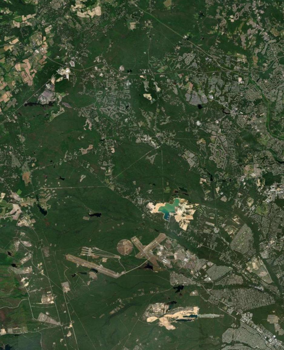
Berkeley Township Lakehurst Borough Manchester Township Toms River Township Lakewood Township Plumsted Township Jackson Township Upper Freehold Township Howell Township Millstone Township Freehold Township 9 70 37 3 547 10 622 628 53 39 44 32 46 4 16 59 537 31 28 18 6 50 12 626 639 23 2 26 42 638 54 52 641 14 8 526 34 636 640 524 528 539 571 527 195
of
of
Lakehurst NAES Fort Dix I 0 18,000 Feet Joint Base Boundary County Boundary Municipal Boundary Study Area County Route Major Highway State Route US Route Source: Municipal and County Boundaries from NJGIN, 2021. Esri World Imagery, 2022. Map created by PS&S, 2022.
County
Monmouth County
Ocean
Lakehurst Borough
Dock at Lake Horicon Park in Lakehurst Borough
Lakehurst Borough is approximately 632 acres in size, about 49 acres of which is within JB MDL. As of the 2020 census, Lakehurst Borough had a population of 2,636. An overview map of Lakehurst Borough is provided as Figure 1.5. Lakehurst Borough is a relatively small municipality that is surrounded by Manchester Township. The Borough contains an area of JB MDL housing, commercial development mostly along Route 70, residential development, community facilities, and natural areas including waterbodies.
1-13 P:\03143\0008 Reports\N-Envir\Regional Compatible Use Study\2023 Final Section 1.docx
Figure 1.5 - Overview: Lakehurst Borough, Ocean County
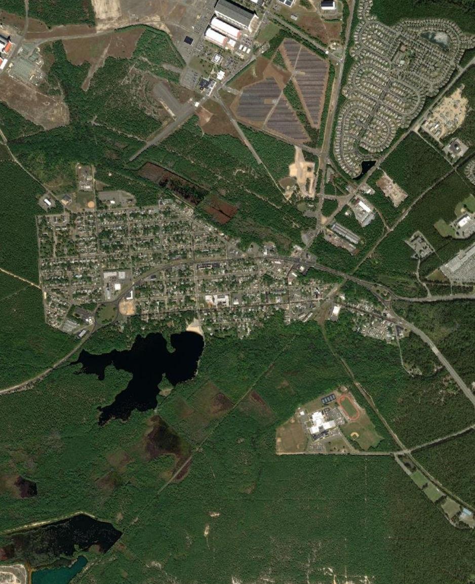
Lakehurst Borough Manchester Township 70 37 547 3 10 12 8 2 6 4 Lakehurst NAES
I0 2,000 Feet Joint Base Boundary County Boundary Municipal Boundary Study Area County Route Major Highway State Route US Route Source: Municipal and County Boundaries from NJGIN, 2021. Esri World Imagery, 2022. Map created by PS&S, 2022.
Manchester Township is approximately 52,756 acres in size, about 4,976 acres of which is within JB MDL. As of the 2020 census, Manchester Township had a population of 45,115. An overview map of Manchester Township is provided as Figure 1.6. Manchester Township is the second largest municipality in Ocean County by area. Manchester Township has experienced large population growth mostly associated with several large-scale retirement communities. In addition to the large-scale retirement communities, Manchester Township contains a mix of residential, commercial, industrial, agricultural, utility and landfill, professional offices, quasi-public, and public developments.
1-15 P:\03143\0008 Reports\N-Envir\Regional Compatible Use Study\2023 Final Section 1.docx
Manchester Township
Manchester Township municipal building
Figure 1.6 - Overview: Manchester Township, Ocean County
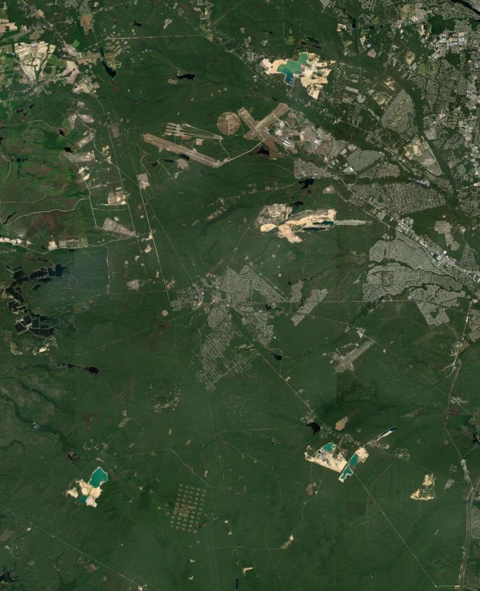
Barnegat Township Ocean Township Woodland Township Lacey Township Beachwood Borough South Toms River Borough Berkeley Township Pemberton Township Lakehurst Borough Manchester Township Toms River Township Lakewood Township Plumsted Township Jackson Township New Hanover Township 72 37 70 3 530 84 92 547 10 34 66 56 83 31 639 24 12 59 22 622 628 6 32 8 532 637 4 42 626 615 39 2 52 14 528 18 640 618 614 571 539 527 444 County of Burlington County of Ocean Lakehurst NAES Fort Dix I 0 20,000 Feet Joint Base Boundary County Boundary Municipal Boundary Study Area County Route Major Highway State Route US Route Source: Municipal and County Boundaries from NJGIN, 2021. Esri World Imagery, 2022. Map created by PS&S, 2022.
Plumsted Township
Plumsted Township is approximately 25,286 acres in size, about 11,836 acres of which is within JB MDL. As of the 2020 census, Plumsted Township had a population of 8,072. An overview map of Plumsted Township is provided in Figure 1.7. The community is largely agricultural with low-density residential development and a town center in New Egypt.
1-17 P:\03143\0008 Reports\N-Envir\Regional Compatible Use Study\2023 Final Section 1.docx
Ocean County Library System, Plumsted Branch
Figure 1.7 - Overview: Plumsted Township, Ocean County
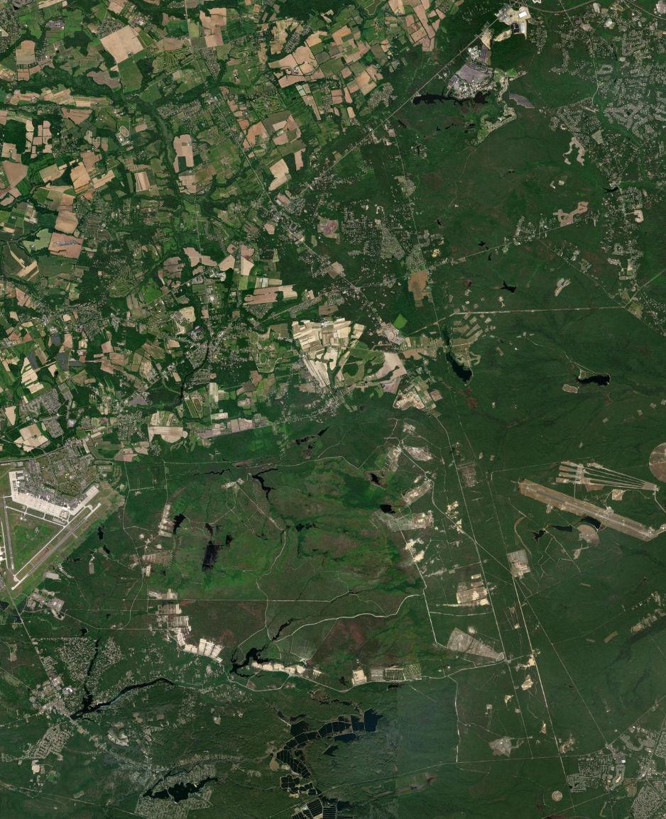
Pemberton Township Wrightstown Borough Manchester Township Plumsted Township North Hanover Township Chesterfield Township Jackson Township Upper Freehold Township Hamilton Township Millstone Township New Hanover Township 70 18 537 22 616 26 680 46 24 27 12 6 669 28 2 8 638 34 666 10 664 526 645 14 665 20 545 42 4 667 571 530 640 528 539 County of Burlington
of Monmouth County of Burlington County of Ocean CountyofMonmouth
Lakehurst NAES McGuire Air Force Fort Dix I 0 16,000 Feet Joint Base Boundary County Boundary Municipal Boundary Study Area County Route Major Highway State Route US Route Source: Municipal and County Boundaries from NJGIN, 2021. Esri World Imagery, 2022. Map created by PS&S, 2022.
County
CountyofOcean
Burlington County
New Hanover Cookstown Clock
New Hanover Township is approximately 14,448 acres in size, about 13,079 acres of which is within the JB MDL. As of the 2020 census, New Hanover Township had a population of 6,367. An overview map of New Hanover Township is provided as Figure 1.8 Approximately 90 percent of New Hanover’s land is within the JB MDL boundary. The majority of the civilian development is located in the Cookstown portion of New Hanover, and the character of the Township is largely agricultural, with low density residential and commercial development. In the last decade, New Hanover Township’s overall population has decreased.
1-19 P:\03143\0008 Reports\N-Envir\Regional Compatible Use Study\2023 Final Section 1.docx
New Hanover Township
Figure 1.8 - Overview: New Hanover Township, Burlington County
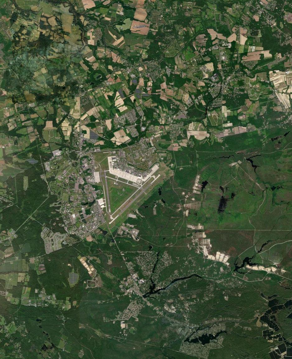
Pemberton Township Wrightstown Borough Wrightstown Borough Manchester Township Springfield Township Mansfield Township Plumsted Township North Hanover Township Chesterfield Township Upper Freehold Township New Hanover Township 68 70 18 22 616 27 26 28 687 543 24 6 644 8 670 646 539 664 10 20 640 630 665 680 666 4 545 669 645 667 528 537 530 Countyof Burlington Countyof Monmouth County of Burlington County of Ocean CountyofMonmouth CountyofOcean McGuire Air Force Fort Dix I 0 12,000 Feet Joint Base Boundary County Boundary Municipal Boundary Study Area County Route Major Highway State Route US Route Source: Municipal and County Boundaries from NJGIN, 2021. Esri World Imagery, 2022. Map created by PS&S, 2022.
North Hanover Township
North Hanover Township welcome sign
North Hanover Township is approximately 11,203 acres in size, about 473 acres of which is within the JB MDL. As of the 2020 census, North Hanover Township had a population of 7,963 An overview map of North Hanover Township is provided as Figure 1.9 North Hanover is one of the only RCUS Study Area municipalities in Burlington County that has had a population increase in the last decade, although the reported population in the 1980s and 1990s was greater than the most current reported population. Between 2006 and 2016 there were overhauls in the housing facilities within North Hanover Township which included demolition of higher density apartments and multi-family units which were replaced by suburban residential and single-family development. In 2006 there were approximately 1,600 military housing units and by 2016 that number was reduced to 1,153.
1-21 P:\03143\0008 Reports\N-Envir\Regional Compatible Use Study\2023 Final Section 1.docx
1.9 - Overview: North Hanover Township, Burlington County
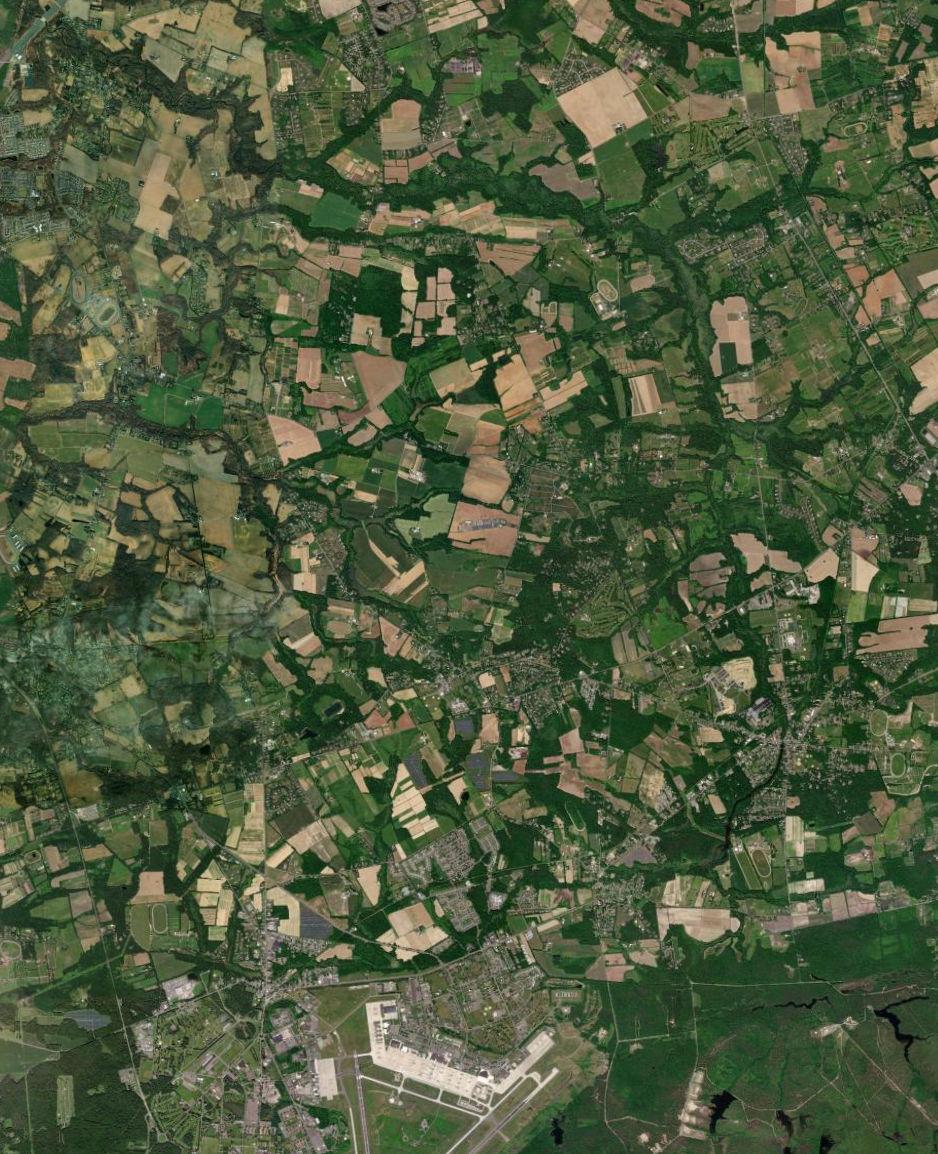
Wrightstown Borough Springfield Township Mansfield Township Plumsted Township North Hanover Township Chesterfield Township Upper Freehold Township Hamilton Township New Hanover Township 68 18 26 22 616 543 28 20 27 545 670 672 640 677 8 10 667 660 665 680 666 664 4 539 537 528 700 CountyofBurlington CountyofMercer County of Burlington County of Monmouth County of Burlington County of Ocean Countyof Mercer Countyof Monmouth CountyofMonmouth CountyofOcean McGuire Air Force Fort Dix I 0 10,000 Feet Joint Base Boundary County Boundary Municipal Boundary Study Area County Route Major Highway State Route US Route Source: Municipal and County Boundaries from NJGIN, 2021. Esri World Imagery, 2022. Map created by PS&S, 2022.
Figure
Pemberton Borough
Pemberton Borough is approximately 403 acres in size, all of which is outside the JB MDL. As of the 2020 census, Pemberton Borough had a population of 1,371 An overview map of Pemberton Borough is provided as Figure 1.10. Pemberton Borough is the only municipality within the Study Area that is entirely outside the JB MDL boundary. Pemberton Borough is bordered by Pemberton Township in all directions. Pemberton Borough has experienced an overall increase in population since 1980, however the reported population has decreased between 2010 and 2020. The Borough is primarily developed with medium density residential and commercial uses.
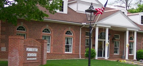
1-23 P:\03143\0008 Reports\N-Envir\Regional Compatible Use Study\2023 Final Section 1.docx
Pemberton Borough municipal building
Figure 1.10 - Overview: Pemberton Borough, Burlington County
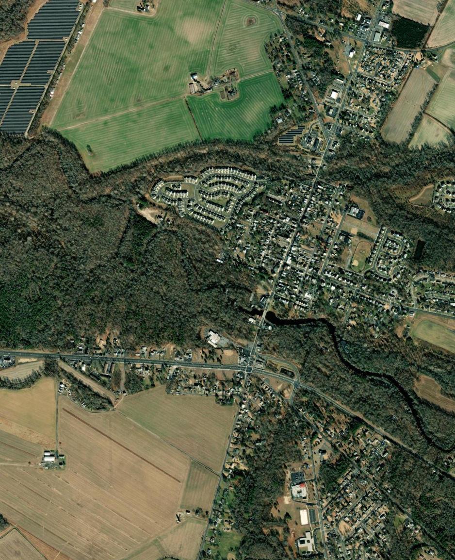
Pemberton Borough Pemberton Township 668 687 630 644 530 616
I0 1,980 Feet Joint Base Boundary County Boundary Municipal Boundary Study Area County Route Major Highway State Route US Route Source: Municipal and County Boundaries from NJGIN, 2021. Esri World Imagery, 2022. Map created by PS&S, 2022.
Pemberton Township
Pemberton Township municipal building
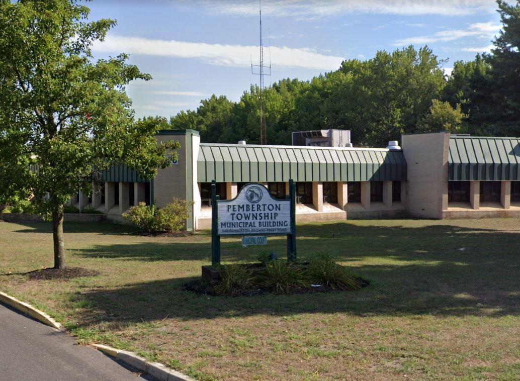
which is within the JB MDL. As of the 2020 census, Pemberton Township had a Pemberton Township is approximately 40,165 acres in size, about 4,335 acres of
Pemberton Township has had an overall population decrease since population of 26,903. An overview map of Pemberton Township is provided as
Figure
commercial businesses. In a meeting with the Study Team, representatives of Township has seen a decrease in population, school enrollment, and patronage to preservation of farmland, agriculture, and open space. However, Pemberton its peak population of 31,342 in 1990. Historically Pemberton Township prioritized
Pemberton Township prioritized economic growth opportunities.
1-25 P:\03143\0008 Reports\N-Envir\Regional Compatible Use Study\2023 Final Section 1.docx
1.11.
Figure 1.11 - Overview: Pemberton Township, Burlington County
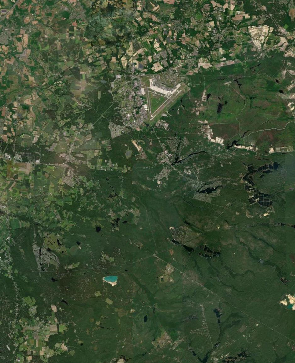
Shamong Township Tabernacle Township Woodland Township Pemberton Borough Southampton Township Pemberton Township Eastampton Township Wrightstown Borough Wrightstown Borough Manchester Township Springfield Township Mansfield Township Plumsted Township North Hanover Township Chesterfield Township Upper Freehold Township New Hanover Township 206 72 38 68 70 18 22 28 27 643 681 622 621 690 24 6 678 8 628 687 10 641 684 665 680 663 666 670 539 563 668 640 646 545 648 4 645 543 667 642 644 630 616 669 528 532 537 530 700 County of Burlington County of Ocean McGuire Air Force Fort Dix I 0 20,000 Feet Joint Base Boundary County Boundary Municipal Boundary Study Area County Route Major Highway State Route US Route Source: Municipal and County Boundaries from NJGIN, 2021. Esri World Imagery, 2022. Map created by PS&S, 2022.
Springfield Township
which is within the JB MDL. As of the 2020 census, Springfield Township had a Springfield Township is approximately 18,920 acres in size, about 268 acres of
Springfield Township is primarily an agricultural farming community. population of 3,245. An overview map of Springfield Township is provided as
Figure
space as detailed in Township planning documents and described to the Study prioritizes preservation of farmland, agriculture use and production, and open had an overall increase over the last several decades. Springfield Township population of 3,414 reported in 2010, the population in Springfield Township has Although the Springfield Township population has decreased since its peak
Team during interviews with Township representatives.
1-27 P:\03143\0008 Reports\N-Envir\Regional Compatible Use Study\2023 Final Section 1.docx
Arneys Mount in Springfield Township
1.12.
Figure 1.12 - Overview: Springfield Township, Burlington County
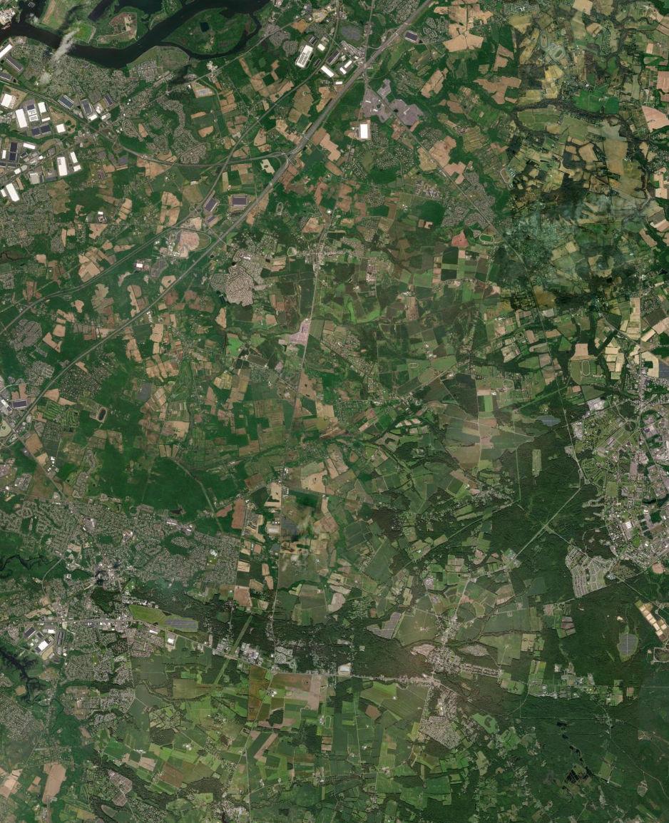
Pemberton Borough Southampton Township Lumberton Township Hainesport Township Pemberton Township Mount Holly Township Eastampton Township Wrightstown Borough Wrightstown Borough Westampton Township Springfield Township Burlington Township Mansfield Township Florence Township North Hanover Township Chesterfield Township Bordentown Township New Hanover Township Medford Township 206 130 38 68 662 691 626 636 617 664 682 643 683 693 690 687 659 640 681 642 545 666 680 677 661 638 639 646 621 684 663 644 645 541 678 668 528 612 641 656 530 670 669 660 628 543 616 630 537 700 295
McGuire Air Force Fort Dix I 0 15,000 Feet Joint Base Boundary County Boundary Municipal Boundary Study Area County Route Major Highway State Route US Route Source: Municipal and County Boundaries from NJGIN, 2021. Esri World Imagery, 2022. Map created by PS&S, 2022.
CountyofBurlington
Wrightstown Borough
Wrightstown Borough is approximately 1,181 acres in size, about 840 acres of which is within the JB MDL. As of the 2020 census, Wrightstown Borough had a population of 720, a decrease from the total of 802 as recorded by the 2010 census. The population of Wrightstown Borough has decreased since its most recent peak of 3,843 as counted in the 1990 census. An overview map of Wrightstown Borough is provided as Figure 1.13.
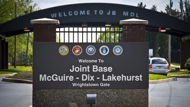
1-29 P:\03143\0008 Reports\N-Envir\Regional Compatible Use Study\2023 Final Section 1.docx
JB MDL Wrightstown Gate
Figure 1.13 - Overview: Wrightstown Borough, Burlington County
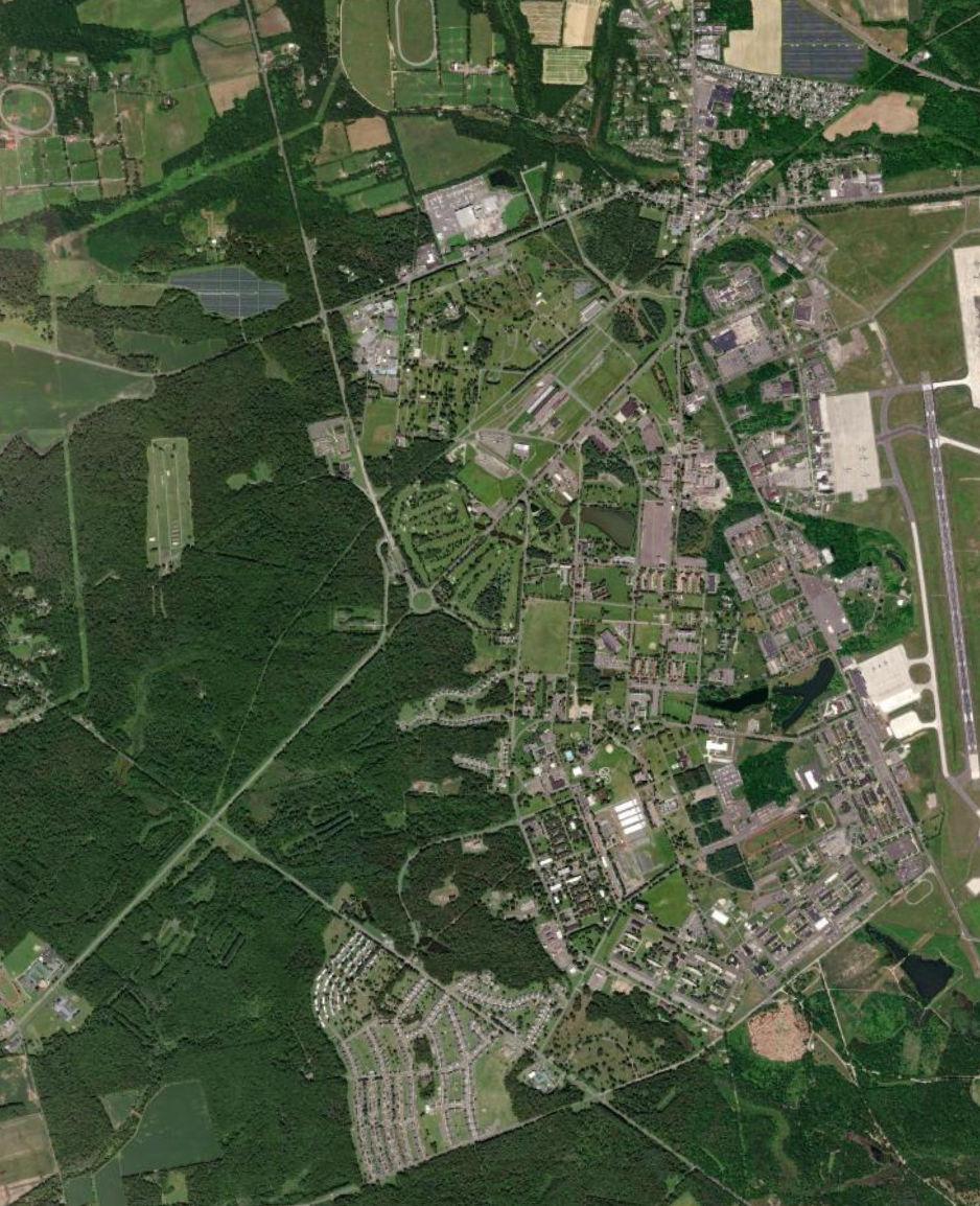
Pemberton Township Wrightstown Borough Wrightstown Borough Springfield Township North Hanover Township New Hanover Township 68 666 680 630 670 616 545 669 McGuire Air Force Fort Dix I 0 4,000 Feet Joint Base Boundary County Boundary Municipal Boundary Study Area County Route Major Highway State Route US Route Source: Municipal and County Boundaries from NJGIN, 2021. Esri World Imagery, 2022. Map created by PS&S, 2022.
1.3 ADMINISTRATION AND MANAGEMENT
The County of Ocean is the Administrator of this RCUS, with cooperation of the Burlington County Bridge Commission.
County of Ocean Department of Planning
Anthony M. Agliata, PP, LLA Planning Director
Mark A. C. Villinger, PP, AICP, CFM Supervising Planner
Burlington County Bridge Commission
Tom J. Stanuikynas, PP, AICP
Regional Planning Manager, Economic Development and Regional Planning
The County of Ocean awarded a contract with PS&S to manage the implementation of the RCUS. PS&S contracted with the firms of MCFA and Jennifer Gorini & Associates, LLC to support implementation of these services.
JB
Anthony Agliata, Director
Mark Villinger, Supervising Planner
Timothy Gleason, Planning Trainee
Ocean County Representatives
Ocean County Planning Department
Ocean County Planning Department
Ocean County Planning Department
Burlington County Representatives
Tom J. Stanuikynas, Regional Planning Manager
Rob Wells, Director of Economic Development & Regional Planning
Liz Verna, Director of Economic Development & Regional Planning (Retired)
Mary Pat Robbie, Resource Conservation Director
Matthew Bell, Chief, Portfolio Optimization
Douglas Miller, Chief, Planning
Lisa Avichal, Area Planner
Brad Lanue, Resource Planner
Burlington County Bridge Commission
Burlington County Bridge Commission
Burlington County Bridge Commission
Burlington County Resource Conservation Military Representatives
787th Civil Engineering Squadron (CES) / CENP (Optimization)
787th Civil Engineering Squadron / CENPL (Planning) Agency Representatives
NJ Business Action Center
New Jersey Pinelands Commission
1-31 P:\03143\0008 Reports\N-Envir\Regional Compatible Use Study\2023 Final Section 1.docx
Table 1 1: JB MDL Compatible Use Study - Technical Advisory Committee
MDL COMPATIBLE USE STUDY – TECHNICAL ADVISORY COMMITTEE
Table 1.2: JB MDL Compatible Use Study - Policy Committee
JB MDL COMPATIBLE USE STUDY – POLICY COMMITTEE
Ocean County Representatives
John P. Kelly, Director, Commissioner Liaison to Military
Mayor Robert Bowen
Mayor Robert Hudak
Mayor Michael Reina
Mayor Harry Robbins
Emil Kaunitz
Anthony Agliata, Director
Mark Villinger, Supervising Planner
Timothy Gleason, Planning Trainee
Mayor Christopher Doyle
Mayor Anthony Marinello
Deputy Mayor David Frank
Mayor Harold Griffin
Mayor David A. Patriarca
Mayor Paul D. Peterla
Mayor Scott Timberman
Felicia Hopson, Director
Ocean County Board of Commissioners
Township of Plumsted
Township of Manchester
Township of Jackson
Borough of Lakehurst
Specialty Systems, Inc.
Ocean County Planning Department
Ocean County Planning Department
Ocean County Planning Department
Burlington County Representatives
Township of North Hanover
Township of Springfield
Township of Springfield
Borough of Pemberton
Township of Pemberton
Township of New Hanover
Borough of Wrightstown
Burlington County Board of Commissioners
Tom J. Stanuikynas, Regional Planning Manager
Rob Wells, Director of Economic Development & Regional Planning
Liz Verna, Director of Economic Development & Regional Planning (Retired)
Mary Pat Robbie, Resource Conservation Director
Burlington County Bridge Commission
Burlington County Bridge Commission
Burlington County Bridge Commission
Burlington County Resource Conservation Military Representatives
U.S. Air Force Col. Wes Adams, JB MDL Commander
and 87th Air Base Wing Commander
JB
1-32 P:\03143\0008 Reports\N-Envir\Regional Compatible Use Study\2023 Final Section 1.docx
MDL - 87th Air Base Wing
Commander
MDL
Navy Capt.
Ingargiola, Deputy Commander
Navy; NSA-Lakehurst Commander
MDL - NSA-Lakehurst U.S. Air Force Col. Scott Wiederholt, 305th AMW Commander 305th Air Mobility Wing Mike Polhemus, 305th AMW Director of Staffing 305th Air Mobility Wing U.S. Air Force Capt. Mayrem Morales, Chief of Public Affairs 87th Air Base Wing Shaun Eagan, Chief, Mission Partner Support 87th Air Base Wing Philip Mohacsi, Chief, EC Program Management USAF Expeditionary Center Carl Champion, Supervisory Environmental Engineer 787th Civil Engineering Squadron / CEIE (Environmental) Matthew Bell, Chief, Portfolio Optimization 787th Civil Engineering Squadron (CES) / CENP (Optimization) Douglas Miller, Chief, Planning 787th Civil Engineering Squadron / CENPL (Planning) John Olson, Community Planner 787th Civil Engineering Squadron / CENPL (Planning) P. Conrad Smith, Community Planner 787th Civil Engineering Squadron / CENPL (Planning) Matthew Ebarb, Chief, Community Engagement 87th Air Base Wing Agency Representatives Donna Rendeiro, Executive Director NJ Business Action Center Lisa Avichal, Area Planner NJ Business Action Center Dennis Blazak, Community Plans and Liaison Officer Naval Weapons Station Earle Susan R. Grogan, Director of Planning/ Acting Executive Director New Jersey Pinelands Commission Brad Lanue, Resource Planner New Jersey Pinelands Commission Sean Thompson, Director of Local Planning Services New Jersey Department of Community Affairs Lieutenant Colonel Viviene McNamara, Director, Construction and Facilities Management Department of Military & Veterans Affairs
U.S. Army Col. Jon Brierton, Deputy CommanderArmy; ASA-Dix
JB
- ASA-Dix U.S.
Frank
-
JB
Colonel Lisa J. Hou, Interim Adjutant General Department of Military & Veterans Affairs
Terry Dearden, Government Relations Department of Miliary & Veterans Affairs
Honorable Andy Kim
Honorable Christopher H. Smith
Ben Giovine, District Director
Jeff Sagnip, Policy Director
Congressional Representatives
United States Congressman (NJ-03)
United States Congressman (NJ-04)
US Congressman Andy Kim’s Office
US Congressman Christopher H. Smith’s Office
1-33 P:\03143\0008 Reports\N-Envir\Regional Compatible Use Study\2023 Final Section 1.docx
2.0 RCUS PROCESS
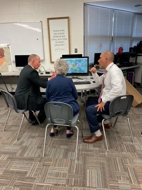
2.1 BACKGROUND
The OLDCC provides technical and financial assistance to states and local governments to analyze and implement actions necessary to foster, protect, and enhance military installation sustainability and on-going operational viability. At the request of the Joint Base MDL leadership, OLDCC made a grant available for a Compatible Use Study. Ocean County agreed to sponsor the study and was awarded a grant up to $450,000 and committed a 10% cash match of up to $50,000 to retain the consultant for the study. The RCUS includes studies to comprehensively understand concerns and opportunities, develop a responsive strategy, and define implementation actions local communities can take to achieve the goal of enabling planned growth in the communities while sustaining JB MDL mission capability now and in the future.
This RCUS is an opportunity to build upon the positive results of the Joint Land Use Study in continuance of the long tradition of good relations between the military and host communities. Compatible use guidance ensures that local communities can continue to grow and develop while mitigating or avoiding potential problems from development of sensitive land uses in areas impacted by military operations.
Compatibility of land uses that surround a military installation is characterized as the ability to maintain and grow military missions within the existing and planned land use pattern of the civilian areas. The RCUS uses information gathering and mapping techniques, participation of community stakeholders, and representation from the military installation and surrounding communities to identify existing and proposed conditions and activities on both sides of the fence line, assess resiliency and energy capabilities, natural and manmade hazards and risks, and develop a framework for identification and resolution of issues that can potentially affect mission capabilities. The goal of these efforts is threefold:
1) create opportunities for local communities to benefit economically from proximity to the JBDML employment base, 2)to develop a cooperative plan for limiting development of sensitive land uses, such as residences, in areas where military operations may have an impact on the quality of life of residents, and 3) utilize tools and funding sources to mitigate existing impacted areas and avoid developing sensitive land uses in areas where
2-1 P:\03143\0008 Reports\N-Envir\Regional Compatible Use Study\2023 Final Section 2.docx 2.0
RCUS PROCESS
existing or future military operations could create future impacts and nuisances which become concerns for local government officials and JBMDL
The Compatible Use Plan (CUP) that will result from this RCUS will be a strong basis for cooperation between the JBMDL and the surrounding communities. The RCUS process brings together residents, local decision-makers and installation representatives to study issues of compatibility in an open forum, to advance wherever possible both military and civilian interests. The resulting recommendations are intended to guide the local government in the implementation of appropriate land use controls around military installations.
2.2 OBJECTIVES
The RCUS objectives include:
• Analysis of current and future development patterns and land use compatibility around the base,
• Analysis of current air and ground noise, including Compatible Zones, Accident Potential Zones for fixed and rotary wing operations,
• Recommendations on continuing and improving intergovernmental communication,
• Recommendations on local ordinance changes following an analysis of military and community needs,
• Analysis of natural and man-made hazard mitigation around the Joint Base, especially regarding wildfires and drought,
• Recommendations on energy compatibility and resilience, including renewable energy planning,
• Analysis of resiliency opportunities to minimize the potential for energy interruptions and mitigate their impact.
2.3 RCUS COMMUNICATIONS AND PUBLIC OUTREACH PROGRAM
The RCUS Communication and Public Outreach program included Project Leadership Team meetings to set objectives and milestones and track progress, schedule and plan for the Policy and Technical Advisory Committee meetings to obtain guidance for areas of study and identify topics and issues for further study, and implementation of a multielement Public Outreach Program. Web-based access was an important tool for public outreach, providing a forum for public coordination, education, and feedback. An objective of the RCUS is to utilize publicly accessible means to present data, illustrate issues and
2-2 P:\03143\0008 Reports\N-Envir\Regional Compatible Use Study\2023 Final Section 2.docx
report findings in a useful, informative, and accessible manner. The GIS mapping and survey tool is accessible from county web pages and was accessible to mobile devices through a scan code. The mapping and survey tool allowed users to review the mapped information and study data and provide geo-location comments and issue identification.
RCUS Public Outreach
• Dedicated pages on Ocean and Burlington County official websites providing RCUS information and updates
• Press releases to local newspapers and outlets, coordination through the Ocean and Burlington County Public Information offices
• Web-based Geographic Information Systems (GIS) mapping and survey tool that is accessible from county web pages and accessible to mobile devices through a scan code.
• Informational flyers describing RCUS background, goals and objectives, public participation opportunities and scan code for GIS mapper/survey tool.
• Public Open House Program
o Ocean County- Tuesday, July 26 5PM-7PM at the Lakehurst Elementary School located at 301 Union Avenue in Lakehurst, NJ.
o Burlington County- Wednesday, August 3 5PM-8PM at the Pemberton Library located at 16 Broadway Street in Brown Mills, NJ.
The RCUS Public Outreach plan includes three public meetings during the study. The first two meetings were be held at two separate locations, one each in Ocean and Burlington County, to be scheduled upon completion of initial data collection and mapping activity. These meetings will present the study objectives and preliminary data, educate the public regarding JB MDL, and seek public comment. The objective of these meetings will be to share our understanding of the relationship of community and the JB MDL from a development perspective and to solicit citizen and stakeholder input. The final meeting was scheduled near the end of the performance period to share the final study results and recommendations with the public.
Regular Project Status Meetings with Policy and Technical Committees were held throughout the Study, with each meeting timed to allow presentation of key data and interim deliverables; facilitate review and acceptance of communication material; enable strategic decision-making and “course correction”, if warranted; evaluation of community feedback; and review of draft Final documents.
P:\03143\0008 Reports\N-Envir\Regional Compatible Use Study\2023 Final Section 2.docx
2-3
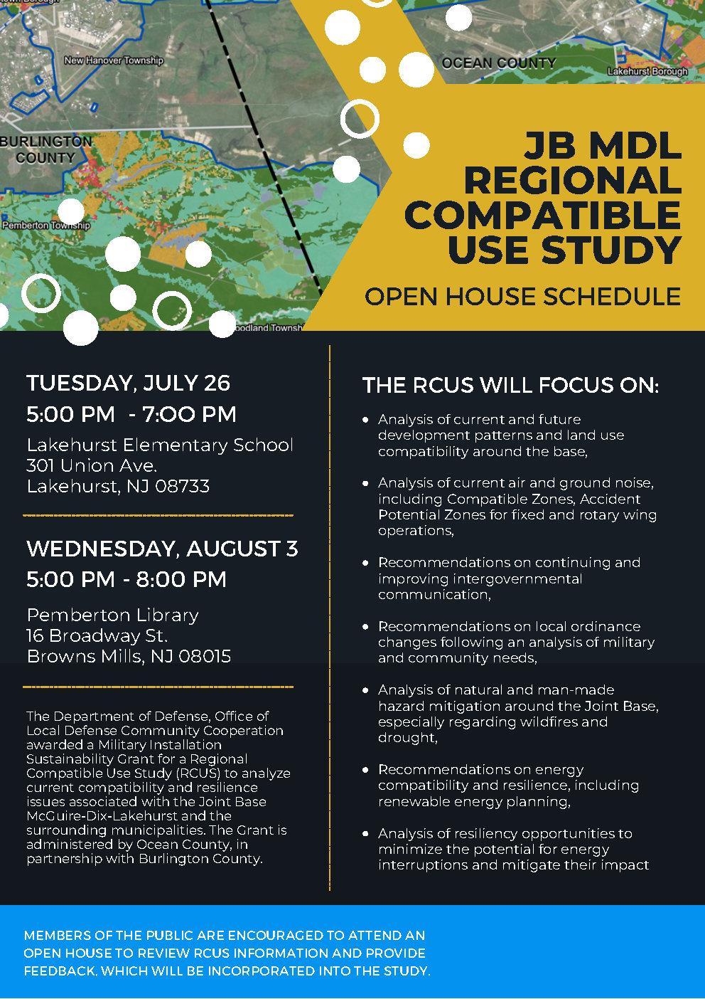
2-4 P:\03143\0008 Reports\N-Envir\Regional Compatible Use Study\2023 Final Section 2.docx
Figure 2.1: Open House Flyer
Figure 2.2 - RCUS Communications and Public Outreach Program - Noise Incidents
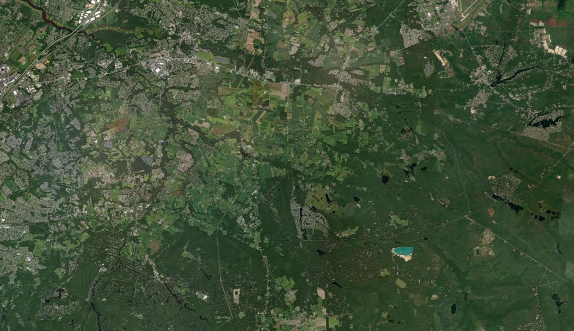
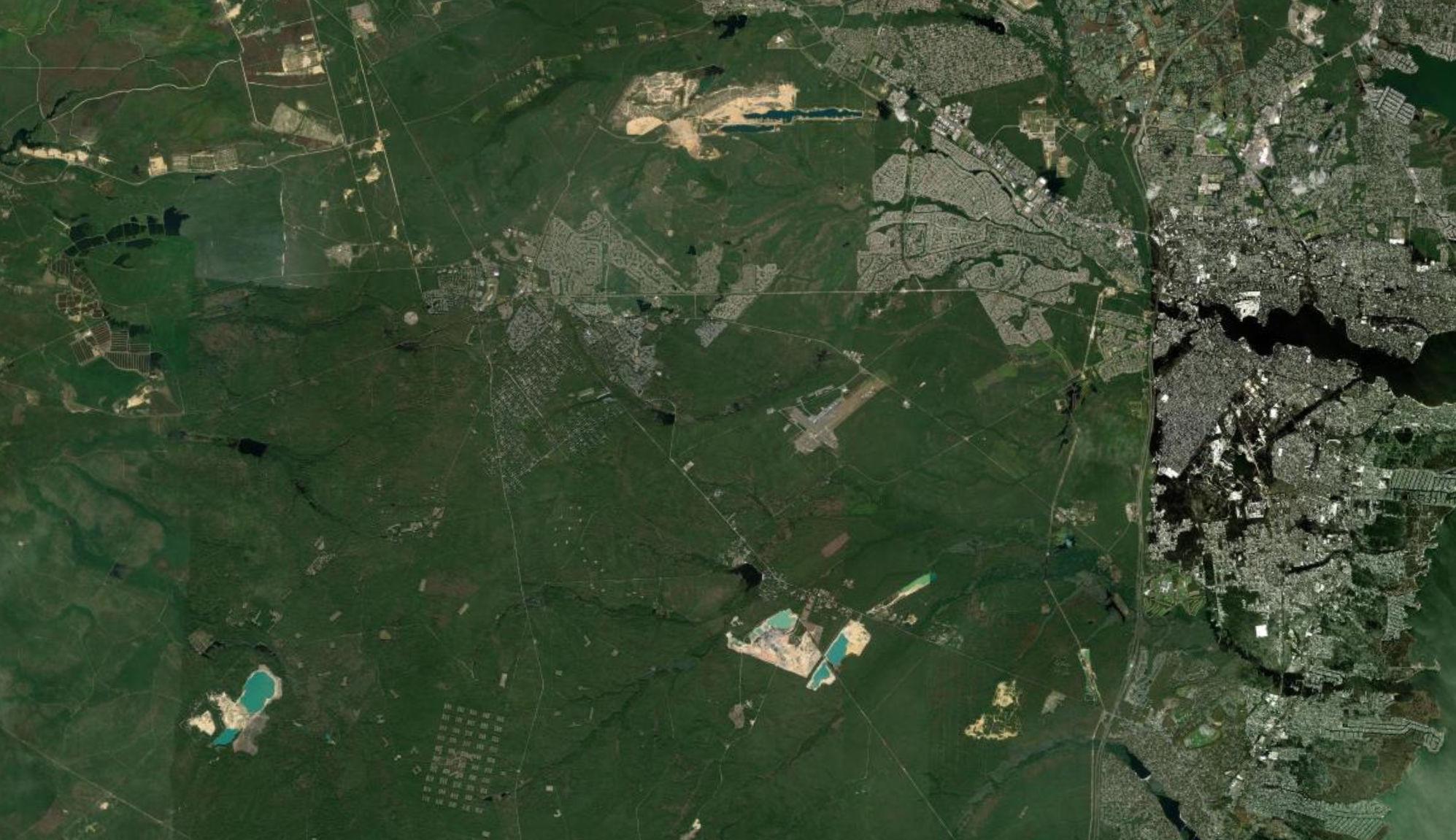
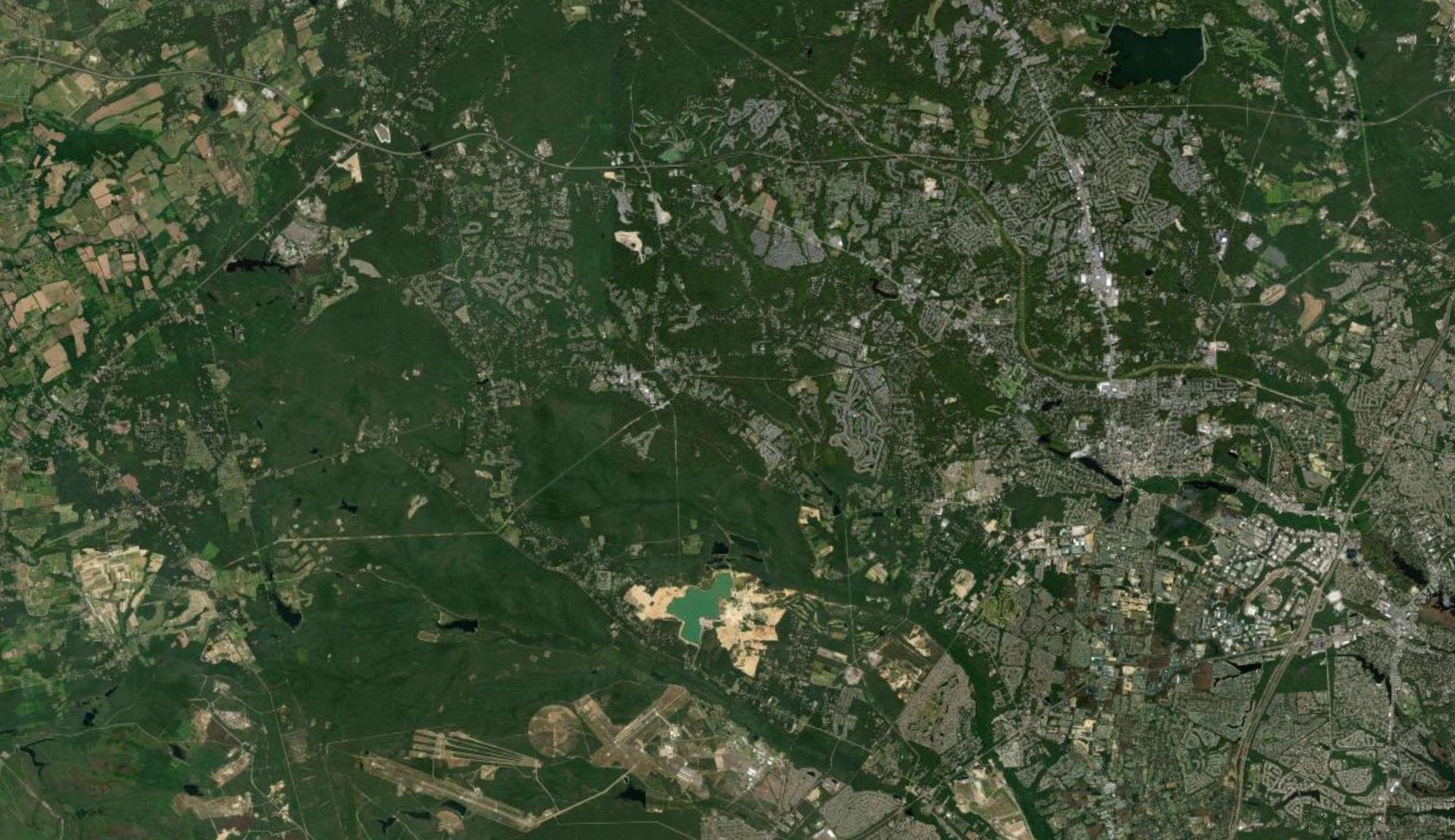
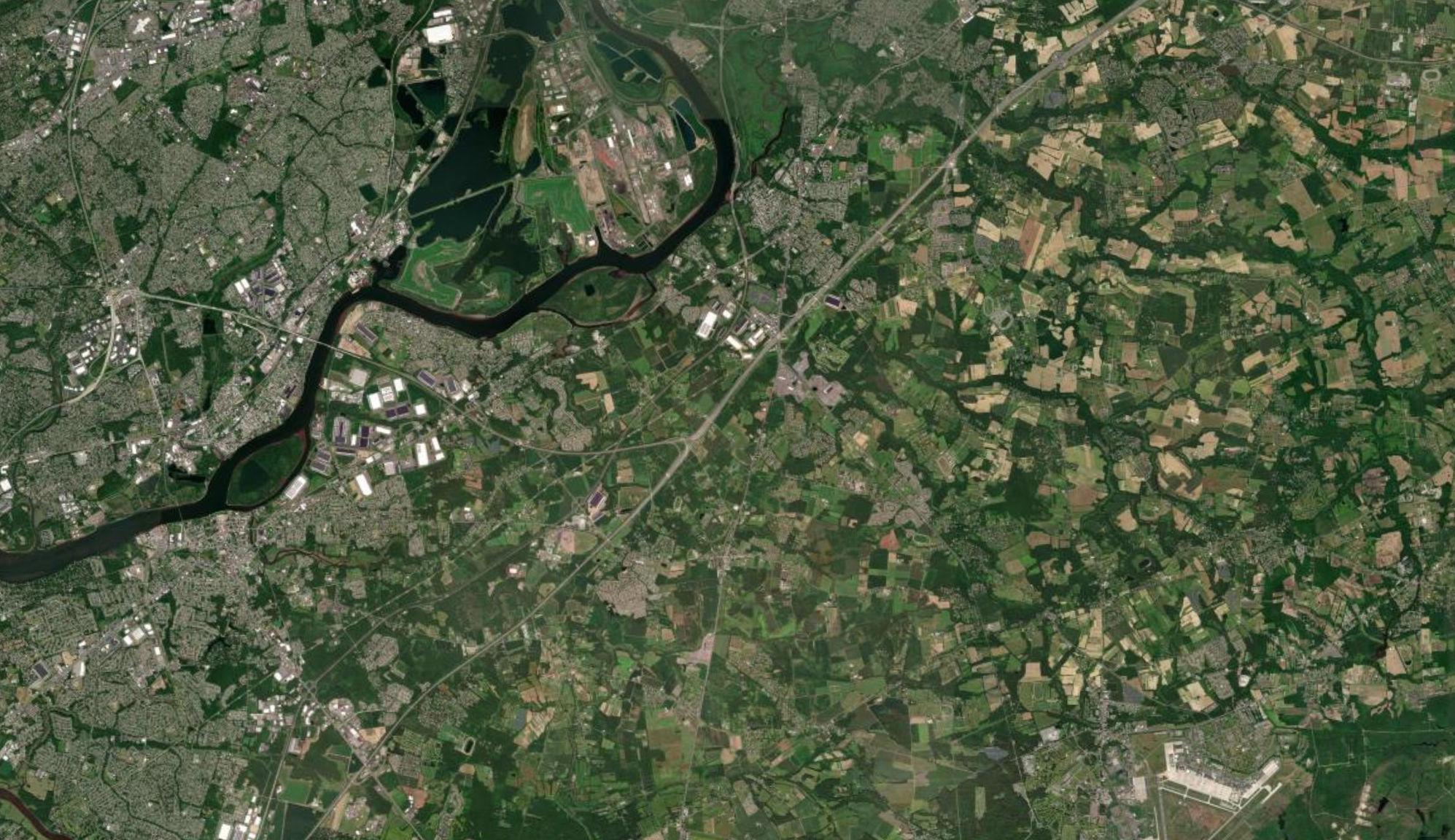
Shamong Township Medford Lakes Borough Tabernacle Township Woodland Township Ocean Gate Borough Lacey Township Pine Beach Borough Beachwood Borough South Toms River Borough Island Heights Borough Pemberton Borough Southampton Township Berkeley Township Lumberton Township Hainesport Township Mount Laurel Township Pemberton Township Mount Holly Township Moorestown Township Lakehurst Borough Eastampton Township Wrightstown Borough Wrightstown Borough Delran Township Westampton Township Manchester Township Willingboro Township Toms River Township Beverly City Edgewater Park Township Springfield Township Burlington City Lakewood Township Burlington Township Mansfield Township Florence Township Plumsted Township Brick Township North Hanover Township Fieldsboro Borough Bordentown City Chesterfield Township Jackson Township Bordentown Township Allentown Borough Upper Freehold Township Trenton City Howell Township Robbinsville Township Hamilton Township Millstone Township Freehold Township Wall Township Evesham Township New Hanover Township Medford Township CountyofBurlington CountyofMercer County of Burlington County of Monmouth County of Burlington County of Ocean CountyofBurlington Countyof Mercer County of Monmouth County of Monmouth County of Ocean Lakehurst NAES McGuire Air Force Fort Dix I 0 25,000 Feet Joint Base Boundary County Boundary Municipal Boundary Study Area Noise Incidents by Municipality (2015-2022) 8 - 32 6 - 7 5 0 Source: Municipal and County Boundaries from NJGIN, 2021. New Jersey Aerial Imagery, 2020. Noise incidents from DOD, 2015-2020. Map created by PS&S, 2022.
Figure 2.3 - RCUS Communications and Public Outreach Program - Survey Responses
Shamong Township Medford Lakes Borough Tabernacle Township Woodland Township Ocean Gate Borough Lacey Township Pine Beach Borough Beachwood Borough South Toms River Borough Island Heights Borough Pemberton Borough Southampton Township Berkeley Township Lumberton Township Hainesport Township Mount Laurel Township Pemberton Township Mount Holly Township Moorestown Township Lakehurst Borough Eastampton Township Wrightstown Borough Wrightstown Borough Delran Township Westampton Township Manchester Township Willingboro Township Toms River Township Beverly City Edgewater Park Township Springfield Township Burlington City Lakewood Township Burlington Township Mansfield Township Florence Township Plumsted Township Brick Township North Hanover Township Fieldsboro Borough Bordentown City Chesterfield Township Jackson Township Bordentown Township Allentown Borough Upper Freehold Township Trenton City Howell Township Robbinsville Township Hamilton Township Millstone Township Freehold Township Wall Township Evesham Township New Hanover Township Medford Township CountyofBurlington CountyofMercer County of Burlington County of Monmouth County of Burlington County of Ocean CountyofBurlington Countyof Mercer County of Monmouth County of Monmouth County of Ocean Lakehurst NAES McGuire Air Force Fort Dix I 0 25,000 Feet Joint Base Boundary County Boundary Municipal Boundary Study Area Public Survey Response Source: Municipal and County Boundaries from NJGIN, 2021. New Jersey Aerial Imagery, 2020. Survey conducted by PS&S, 2022. Map created by PS&S, 2022. Note: Some survey responses may not pertain to specific locations on map.
2.4 MUNICIPAL AND AGENCY STAKEHOLDER INTERVIEWS
The importance of establishing and maintaining direct communication with representatives of RCUS municipalities and additional agency representatives became clear during the Public Outreach and Policy/Strategic Advisory Committee meetings. Interviews with local elected representatives, staff and additional stakeholders enabled identification of specific issues for further review within this Study. The municipal and agency interviews were conducted after initial data acquisition and public comment to refine the description of issues, resolve open questions resulting from responses provided to-date and complete the list of topics for incorporation into the RCUS recommendations All Study Area municipalities were included in outreach efforts.
Table 2.1: Municipal Meeting Dates and Participants
Date Municipality Meeting Participants
September 16, 2022
September 20, 2022
September 21, 2022
September 22, 2022
Plumsted Township (Ocean County)
Wrightstown Borough (Burlington County)
Springfield Township (Burlington County)
Pemberton Township (Burlington County)
Robert Bowen (Plumsted Township); Mark Lennon (PS&S); Jennifer Gorini (JGA); Dianna Hook (PS&S)
Elizabeth MacLennan; Nicole Bryan (PS&S); Mark Lennon (PS&S); Dianna Hook (PS&S)
Leah Furey Bruder (LFB Land Planning, Springfield Township); Deputy Mayor David Frank (Springfield Township); Nicole Bryan (PS&S); Dianna Hook (PS&S)
Daniel Hornickel (Pemberton Township); David Benedetti (Pemberton Township); Nicole Bryan (PS&S); Dianna Hook (PS&S)
Key Discussion Topics
October 5, 2022
October 17, 2022
Manchester Township (Ocean County)
New Hanover Township (Burlington County)
Brandon Umba (Manchester Township); Michele Zolezi (Manchester Township); Timothy Gleason (Ocean County); Mark Lennon (PS&S); Dianna Hook (PS&S); Jennifer Gorini (JGA)
Kyle Tuliano (New Hanover Township); Paul D. Peterla (New Hanover Township); Susan Jackson (New Hanover Township); Thomas Stanuikynas (Burlington County); Nicole Bryan (PS&S)
Regional Compatible Use Study; Land Use, Planning and Building Codes; Community and Economic Development; Natural and Built Environment; RCUP and Ongoing Support
November 29. 2022
Jackson Township (Ocean County)
Stephen Schrieber (Jackson Township); Terrence Wall (Jackson Township); Peter Maher (Jackson Township); Michael Davis (Remington& Vernick); Ernest Peters (Remington& Vernick); Timothy Gleason (Ocean County); Mark Villinger (Ocean County); Jennifer Gorini (PS&S)
2-7 P:\03143\0008 Reports\N-Envir\Regional Compatible Use Study\2023 Final Section 2.docx
Table 2.2: Military Meeting Dates and Participants
Date Location Meeting Participants
March 9, 2022
Joint Base McGuireDix-Lakehurst
Connor Smith, (Community Planner, 787th Civil Engineering Squadron); Preston Smith (787th Civil Engineering Squadron); Brian Pieplow (MCFA); Brooke Schmoll (MCFA); Hannah Bacso, (MCFA)
Key Discussion Topics
Data requests and project actions
September 16, 2022
Joint Base McGuireDix-Lakehurst
Matt Bell (Deputy Director, 787th Civil Engineering Squadron); Connor Smith, (Community Planner, 787th Civil Engineering Squadron); Lieutenant Shane LaCroix, (Programmer, 787th Civil Engineering Squadron); Captain Christian Scherer, (Portfolio Optimization Chief, 787th Civil Engineering Squadron); Brooke Schmoll (MCFA); Hannah Bacso, (MCFA)
Table 2.3: Policy Meeting Dates and Topics
Meeting Date
Kick-off Meeting
County Meeting
MCFA and Joint Base
Meeting
1st Policy Committee Meeting
Technical Advisory Committee Meeting
Ocean County Open House
Burlington County Open House
2nd Policy Committee Meeting
February 3, 2022
March 3, 2022
March 9, 2022
April 27, 2022
June 23, 2022
July 26, 2022
August 3, 2022
October 19, 2022
Key Discussion Topics
Data requests, clarification on JBMDL's perspective on opportunities and concerns raised thus far from community meetings (traffic, future development, noise and safety concerns)
Consultant team introductions, project outreach, data management, and study timeline
Data sharing, role of the Policy Committee and Technical Advisory Committee, study timeline
Data requests and project actions
Overview of the RCUS process and request for information
RCUS project goals and objectives, mapping and survey participation, and overview of analysis
Public Presentation, community outreach, stakeholder participation and comments
Public Presentation, community outreach, stakeholder participation and comments
Preliminary RCUS results and recommendations
2.5 DATA COLLECTION AND REVIEW
2.5.1 Review Codes, Ordinances, Regulations for Potential Conflict Control/Reduction
A compilation of municipal and county master plans and land use data and regulations were studied to identify growth areas and conservation areas. State indices were consulted, including the Pinelands Protection Act, the New Jersey Department of Environmental Protection (NJDEP) wetlands and flood hazard area rules, and the federal Clean Water Act. Additional limits to new development activity considered in this RCUS include existing and proposed wastewater treatment infrastructure limits and treatment capacity. A particular emphasis was
P:\03143\0008 Reports\N-Envir\Regional Compatible Use Study\2023 Final Section 2.docx
2-8
placed on zoning ordinances which specifically regulate development in the area of flight or range operations.
The municipal building codes, zoning ordinances, site division regulations and the assembled land use and environmental regulations were reviewed to characterize the current development potential for the Study Area Information regarding location and type of recent development approvals was reviewed. Municipal and county build-out projections and specific regional planning studies were consulted and coordinated with demographic information and published population projections. The analysis integrated current and planned JB MDL activities and operations, the current land use regulatory framework and the development potential assessment.
2.5.2 Identify Public Infrastructure/Community Facility Improvements
The Study Team collected information and met with JBMDL facilities managers to delineate the Base energy consumption baseline, existing infrastructure energy distribution-destination, and areas and facilities needed to improve infrastructure reliability and source redundancy. The infrastructure study included analysis of current conditions, survey of existing tenant and mission requirements, facility utilization studies, infrastructure capacity analysis, site analysis, course of action analysis, and implementation/phasing plan.
Information regarding traffic and transportation issues was collected during meetings with representatives of RCUS municipalities. Public comments were also solicited during public open houses and online survey regarding traffic and transportation issues attributable to JB MDL operations and traffic impact, perimeter security, and gate operations The Joint Base Regional Transportation Mobility Study (2011) was reviewed, and the status of recommended improvements was identified
2-9 P:\03143\0008 Reports\N-Envir\Regional Compatible Use Study\2023 Final Section 2.docx
2.5.3 Identify Potential Natural and Man Made Hazards
The review of natural and man-made hazards within and adjacent to the Study Area included information and analyses presented in the 2019 Burlington County Hazard Mitigation Plan and 2018 Multi-Jurisdictional All-Hazard Mitigation Plan, Ocean County, New Jersey The delineation and characterization of hazards the previously published data and findings and additional risk data obtained during study interviews with JB MDL and local community representatives.
Ocean County and Burlington County have completed updates to county-wide hazard assessments. The2018 Multi-Jurisdictional All Hazard Mitigation Plan for Ocean County (Ocean County HMP) is an update to the 2014 County HMP. Burlington County’s hazard mitigation planning is summarized in the Disaster Mitigation Act 2000 (DMA 2000) Hazard Mitigation Plan Update- September 2019 (Burlington County HMP). Common elements in these documents include community profiles, inventory of resources, assessment of potential hazard risk in each municipality, and mitigation strategies and techniques. Authority for these plans originates from the following State of New Jersey and federal sources:
• Robert T. Stafford Disaster Relief and Emergency Assistance Act, 42 U.S.C., Section 322
• Code of Federal Regulations (CFR), Title 44, Parts 201 and 206
• Disaster Mitigation Act (DMA) of 2000, Public Law 106-390
• National Flood Insurance Act of 1968
• State of New Jersey 2014 State Hazard Mitigation Plan
Specifically, the DMA 2000 requires that to be eligible for receipt of federal disaster mitigation funds, local governments must prepare a mitigation plan that identifies hazards, includes risk assessment and vulnerability analysis, presents mitigation strategies, and includes a schedule for implementation within the communities. The intent of these programs is to identify hazards and develop plans, intend to safeguard property and lives, and minimize losses to properties and economic activity by taking actions to reduce or eliminate potential risks. This planning is intended to reduce the cost and time for recovery after a natural or man-made disaster.
2-10 P:\03143\0008 Reports\N-Envir\Regional Compatible Use Study\2023 Final Section 2.docx
The Burlington County HMP and Ocean County HMP include summary tables of the specific hazards that were identified as present in each county, with characterization of associated risk. The table presented below is a summary of risks from each county’s HMP. In some cases, risk categories were renamed from the original description in the County HMP to enable consistency between the two plans. Risk categories that were described in one county’s plan but not the other are shown as gray boxes in the table.
2-11 P:\03143\0008 Reports\N-Envir\Regional Compatible Use Study\2023 Final Section 2.docx
Hazard Hazard
Burlington
Rank Hazard
Ocean Risk Level Avalanche no no Coastal Erosion yes low yes moderate Drought yes medium yes moderate Earthquake yes low yes low Environmental Hazards yes moderate Expansive soils no no no minimal to no risk Extreme Temperature yes no yes moderate Flood (Riverine, Flash, Coastal, Dam Flooding) yes medium yes high Hailstorm yes no yes moderate Hurricane/Tropical Cyclone yes high yes high Ice Jams yes no yes (included in Flood risk) Ice Storm yes yes yes (included in winter storm risk) Infestation yes no Land Subsidence yes medium yes low Landslide yes medium no minimal to no risk Nor'Easters yes high yes high Nuclear Incidents yes moderate Severe Storm (Windstorm, Thunderstorm, Hail, Lightning, Tornados, Hurricanes) yes high yes high Severe Winter Storms yes high yes high Terrorism yes moderate Transportation Accidents yes moderate Tsunami yes not classified yes (included in flood risk) Urban Fire and Explosion yes moderate
Table 2.4: Composite Table: Hazard Concerns for Burlington County and Ocean County
Exists:
Impact
Exists:
The Burlington County HMP identified a total of 8 types of hazards that are hazards of concern; as shown on Table 2.4, several of the hazard categories have been listed as a separate hazard to enable comparison with the Ocean County HMP. Other natural and human-caused hazards have been identified but have low potential to occur or will result in no significant impacts within the county. The Ocean County HMP classified the identified hazards as High, Moderate or Low Risk Level. Potential hazards that were identified within one county plan but not both are shown as gray boxes in the other county columns. As described below the communities that comprise the RCUS area are subject to specific hazards listed in the HMPs, with the exception of Coastal Erosion, Ice Jams and Tsunami, as the Study Area is landward of coastal waters.
Flooding: The Flooding Hazard category includes coastal flooding, riverine, and stormwater flooding. Coast flooding includes several causes, including tropical storms, hurricanes and low-pressure systems (Nor’easters), lunar high-tides, street and flash floods from heavy rainfall, ice melts and ice jams, and dam failures. Flooding is one of the most common types of natural hazard. The RCUS area is not directly adjacent to coastal waters, however several streams extend into the RCUS municipalities from the tidal waters of Barnegat Bay. Flooding risk is higher downstream of dams classified “High-hazard”; 8 High-hazard dams are located in Ocean County, of which one is located in the RCUS area: Prospertown Dam in Jackson Township (Table 4.3.5-1, Ocean County HMP). High-hazard dams present a risk of extensive property damage and probable loss of life. High-hazard dams present additional risk dues to acts of terrorism, due to potential for destruction of property and loss of life. Flood risk is mitigated through floodplain management rules and municipal plans, construction codes, and preservation of flood-prone lands as open space.
2-12 P:\03143\0008 Reports\N-Envir\Regional Compatible Use Study\2023 Final Section 2.docx
Hazard Hazard Exists: Burlington Impact Rank Hazard Exists: Ocean Risk Level Utility Interruption yes high Volcano no no Wildfire yes medium yes high
Table 2.4: Composite Table: Hazard Concerns for Burlington County and Ocean County
Hurricane/Tropical cyclone/Nor’easter: Ocean and Burlington Counties are within the Eastern Seaboard and are subject to landfalling hurricanes, tropical storms and Nor’easters that cause extensive coastal flooding, riverine and street flooding, high winds, heavy rain and snowfall, and coastal erosion, with high potential for property damage and loss of life. These storms are characteristically very large, and the effects of these storms cover multiple states at once, therefore the effects of the storms will be prevalent across the region. The RCUS municipalities are recessed from the Atlantic Ocean coastline by several miles; coastal flooding is not anticipated except along tidal tributaries but risks of wind damage to structures and vegetation, power outage from downed utilities, and trees and flooded substations and river and street flooding are high.
Wildfire: Wildfire Hazard Potential Fig. 4.3.9-1 in the Ocean County HMP shows that most of Ocean County including the JB MDL and adjacent lands as extreme risk level based on conditions such as amount and type of fuel, topography and local weather. Overall Risk Impact classification for Wildfire Hazard in Ocean County is High. The Burlington County plan notes that the entire county is susceptible to wildfire, which can occur anywhere in the County, however the fuel hazard area classifications are higher for lands that are forested, including land within the Pinelands Management and Planning Areas as illustrated on Figure 5.4.8-2 of the Burlington County HMP. Overall Risk Impact classification for Wildfire Hazard in Burlington County is Medium.
Winter Storms: Winter storms are regional events, and include events such as ice storms, sleet, heavy snowfall and blizzards, which are characterized by blowing snow and high winds. Severe blizzards can cause drifting snow and very low visibility, leading to stranding of travelers and power outages, damage to structures and vegetation and creating risk of dangerous hypothermia or death from exposure to these adverse conditions. Flooding can occur after the event due to melting snow. Roads become impassable, and resupply of household essentials and food is prevented during the storms. In addition, school and business closures affect community life and economic conditions. The duration of these effects can range from hours to several days, subject to snow clearing. All communities in the RCUS area are vulnerable to Winter Storms
P:\03143\0008 Reports\N-Envir\Regional Compatible Use Study\2023 Final Section 2.docx
2-13
Hazardous Materials: Events that involve a release of hazardous materials including solids, liquids, vapors or gases represent a risk to human health and the environment. The Ocean County HMP describes four facilities within the RCUS area that are listed on the U.S. Environmental Protection Agency Toxic Release Inventory: one site each in Plumsted, Jackson, Lakehurst and Manchester. Additional risks from the transport of hazardous materials are present on roads throughout the study area and along rail lines. Most hazardous materials incidents reported in Ocean County are petroleum hydrocarbon or other liquids spilled due to traffic accident or improper preparation for transport.
Utility Interruption: The Ocean County HMP identifies Utility Interruption as a High risk level hazard. Ocean County has experienced utility interruptions for fuel, water, electric and telecommunications. The cause is attributable to equipment failure and accidents, but more frequently is caused by natural hazards including high winds and severe winter storm (Ocean County HMP, Section 4.3.16.1). Traffic accidents and wind damage will mostly cause localized outages, while severe storms can cause regional utility interruptions. In addition, rolling blackouts can occur during extreme hot weather.
Additional Hazards
Interviews conducted with representatives of the RCUS municipalities included a current review of conditions and potential hazards specific to ongoing operations of the JB MDL. During interviews with municipal representatives, stakeholders were provided an opportunity to address risks attributable to proximity of their communities to the JB MDL and JB MDL operations. Respondents identified these potential risks:
• Risk to water supply systems from groundwater contamination originating from the JB MDL
• Risk associated with air operations. An analysis of current land uses and air facility conflicts is presented in Chapter 8 and Appendix C of this RCUS.
• Risk of traffic disruption due to truck deliveries accessing an incorrect gate.
P:\03143\0008 Reports\N-Envir\Regional Compatible Use Study\2023 Final Section 2.docx
2-14
Natural and Man-made Hazard Planning for Integration in the Regional Compatible Use Plan
The Ocean County and Burlington County HMPs include methodologies for identifying risks associated with specific hazards and assessing the vulnerability of existing and future development. The Ocean County HMP specifically describes mitigation actions relating to the JB MDL:
• Continue to establish Joint Base priority locations for farmland and open space preservation.
• To alleviate concerns related to the use of PFAS at Joint Base, County health departments should work with Joint Base and NJDEP project managers to establish parameters for testing domestic water supply wells for PFAS as a precautionary step.
• Continue environmental impact studies in communication with Joint Base as additional information on base missions becomes available and work with Steering Committee to address future issues for natural resources.
• Implement wildfire management practices, including dust and bird control, to offset possible effects to Joint Base and JLUS municipalities.
• Distribute Bird/Wildlife Aircraft Strike Hazard (BASH) educational materials to local farmers to promote awareness on reducing the potential for bird and wildlife attractions that may impede safe air operations.
The Ocean County HMP described these measures as particularly effective to address transportation accidents, wildfires, and hazardous materials incidents.
The RCUP includes a Natural and Man-made Hazard Planning Element to review currently identified and potential new hazards and integrate hazard mitigation activities implemented through Ocean and Burlington counties Hazard Mitigation Planning programs.
2.5.4 Data Mapping
Multilayered maps of the Study Area were prepared of the JB MDL and surrounding communities to reflect current conditions for use by the Study Team, by the Policy and Technical Committees and, most importantly, the public at large. Existing GIS data as currently maintained by the participating County agencies, JB MDL and the neighboring municipalities was compiled into the RCUS database. Additional data sources include the Pinelands Commission, the Department of
2-15 P:\03143\0008 Reports\N-Envir\Regional Compatible Use Study\2023 Final Section 2.docx
State Office of Planning Advocacy, the State Agriculture Development Committee, the NJDEP and the County planning offices. Data collected from survey responses, interviews and information gathering tasks was compiled into a central GIS.
GIS maps were produced to support each of the RCUS tasks to illustrate and analyze areas affected by base operations, land use zones, natural areas and farmlands, sensitive resources, sensitive land uses and community facilities, natural and man-made hazards, air space and base operation conflicts.
2.6 CURRENT AND POTENTIAL JB MDL OPERATIONS
Analysis of Current Land Use and Air Facility Conflicts
The intent of this analysis is to illustrate the boundaries of potential noise and air hazard zones and identify land uses within the mapped boundaries. The mapping served to illustrate areas of potential conflict between base operations and existing and potential development. The GIS mapping and associated data was analyzed to geo-locate potential areas of effect of base operations and provide a baseline for evaluation of current operating procedures. The mapped data was also used to assess the potential benefits associated with revised procedures.
Existing and proposed land uses and developments within Air Installation Compatible Use Zones (AICUZ), noise contours and potential air hazard zones
The Study Team prepared GIS layers/maps that illustrate the current military operations using boundary data to be provided by JB MDL including current AICUZ zones (e.g., clear zone, Accident Potential Zone (APZ) I, APZ II) as well as noise contours (e.g., 65dbA, 75dBA) for runways at both the Lakehurst Area and McGuire Area. In addition, range buffers that have been established in the Dix Area were mapped.
The Land Use Map with the noise and hazard zone overlay was used by the Study Team to classify land uses in the area and identify incompatible land uses and any other potential conflicts.
P:\03143\0008 Reports\N-Envir\Regional Compatible Use Study\2023 Final Section 2.docx
2-16
Analyze impacts of current and future base operations, including firing ranges, electromagnetic radiation, radio frequency interference, and AICUZ, noise, and potential air hazard zone impacts
The Study Team evaluated the impact of current and planned Joint Base operations upon the two county regions. Consideration was given to the full spectrum of base operation factors including aviation (flight path and noise buffers), firing range operations, field training maneuvers, electromagnetic radiation, radio frequency interference, rail operations, and explosive storage from a noise, public safety, and nuisance perspective.
Evaluate Impacts of Past and Present JB MDL Mission Operations
In addition to the review of current and planned Joint Base operations, historical data was reviewed so that prior community concerns and complaints would be considered. This task included review of available records regarding complaints and reported incidents, the documented response to the reported incident, and summary of any measures implemented to resolve or mitigate the issue.
Evaluate Standard Operating Procedures
The Study Team reviewed standard operating procedures for military operations and determine the impact of operations on the host communities. Mitigation measures to reduce impact consistent with the Joint Base Mission were be identified. Feedback regarding the effectiveness of two-way communication between the base, surrounding communities and the public was obtained during public outreach and municipal interviews was obtained.
Under this task, the RCUS reviewed the current process by which the JB MDL interacts with the public. The team evaluated existing public affairs processes and determine to what degree military representatives participate in the local planning process (e.g., representation at planning boardmeetings) as well as procedures for participating in public affairs and community outreach.
2-17 P:\03143\0008 Reports\N-Envir\Regional Compatible Use Study\2023 Final Section 2.docx
Evaluate Airspace Conflicts
The analysis illustrated the boundaries of potential noise and air hazard zones and identified land uses within the mapped boundaries. This mapping was reviewed to assess areas of existing and potential future conflicts between base operations and surrounding communities. The GIS mapping and associated data was analyzed to characterize the impact of base operations and provide a baseline for evaluation of current operating procedures. The mapped data was used to assess the potential benefits associated with revised procedures.
2.7 ANALYSIS OF FUTURE DEVELOPMENT POTENTIAL AND ASSESSMENT OF FUTURE LAND USE CONFLICTS
Using information gathered in earlier phases of the project, the Study Team military mission specialists evaluated planned mission changes including air operations and reviewed growth objectives on air traffic patterns and volumes that may impact adjacent land use along with airspace usage patterns that are pertinent to the JB MDL.
The Data Gathering phase integrated existing and proposed land use at JB MDL. The data reviewed included the current JB MDL Master Plan, zoning, base inventories of leased space to governmental tenants, existing hangar and runway space, areas of historical significance, and environmentally critical areas to determine if planned mission changes and the vision plan are consistent with existing zoning and constraints. Developable parcels were also identified.
The current and future growth in RCUS municipalities was assessed using existing land use and zoning, by parcel and interviews with municipal representatives. Planning documents and recent growth reports were reviewed including land use approvals, market forecasts and State and regional planning reports to discern development forces and growth patterns. The RCUS includes a forecast of how the community might evolve under current zoning and development constraints and identify conflicts between military and community plans.
2-18 P:\03143\0008 Reports\N-Envir\Regional Compatible Use Study\2023 Final Section 2.docx
In order to characterize land use compatibility with regard to operations noise and air hazards zones, the RCUS assessed the types of future land uses likely to be developed within the ten municipalities that comprise of the Study Area. This assessment combined data retrieved from and created for each of the municipalities’ master plans, existing zoning, and existing codes and ordinances, regulatory agency data, land use guidance (Pinelands and State Plan), County of Ocean and Burlington County land use planning maps and data, and review of planned area infrastructure improvements was also reviewed Representatives of RCUS municipalities were interviewed to identify additional development activity and current trends to characterize the potential future growth areas.
Preferred Future Compatible Land Use Scenario
The RCUS includes a proposed “preferred future compatible land use plan” that maximizes the military operations potential of the Joint Base. This scenario reflects what might be possible from a military perspective, not limited by approved mission change.
2.8 LAND USE COMPATIBILITY RECOMMENDATIONS
The RCUS identified potential measures to facilitate implementation of the Regional Compatible Use Plan. Amendments to local regulations anticipated to minimize the potential for conflict while maximizing utilization of JB MDL facilities and mission capabilities are included. Beneficial land uses identified from civilian jurisdictions are also identified in the plan, including development that is responsive to the economic activity catalyzed by JB MDL operations. In addition, the Study Team has reviewed the recommendations in the prior JLUS that are regarded to be successful and identified measures that benefit from additional refinement.
Chapter 11 ofthis RCUS report provides a reviewand update of 2009 JLUS recommended actions, and new actions that reflect current conditions and recently identified issues, such as updated AICUZ mapping. Recommended actions for each RCUS municipality are also presented in Chapter 11. The recommended actions and agreements will be manifested and implemented through the RCUP Charter, which is a deliverable created with the participation of the newly-organized RCUP Committee, Policy and Technical Advisory Committee members and stakeholders in the JB MDL and surrounding communities. The
P:\03143\0008 Reports\N-Envir\Regional Compatible Use Study\2023 Final Section 2.docx
2-19
RCUP Charter outlines strategic objectives, meeting and communication plan, and procedures for amending the approved plan in response to new mission objectives and community needs to guide efforts supporting compatibility of the JB MDL and surrounding communities for years to come
2-20 P:\03143\0008 Reports\N-Envir\Regional Compatible Use Study\2023 Final Section 2.docx
3.0 JOINT BASE

MCGUIRE-DIX-LAKEHURST MISSIONS AND OPERATIONS
3.0 JOINT BASE MCGUIRE-DIX-LAKEHURST MISSIONS AND OPERATIONS
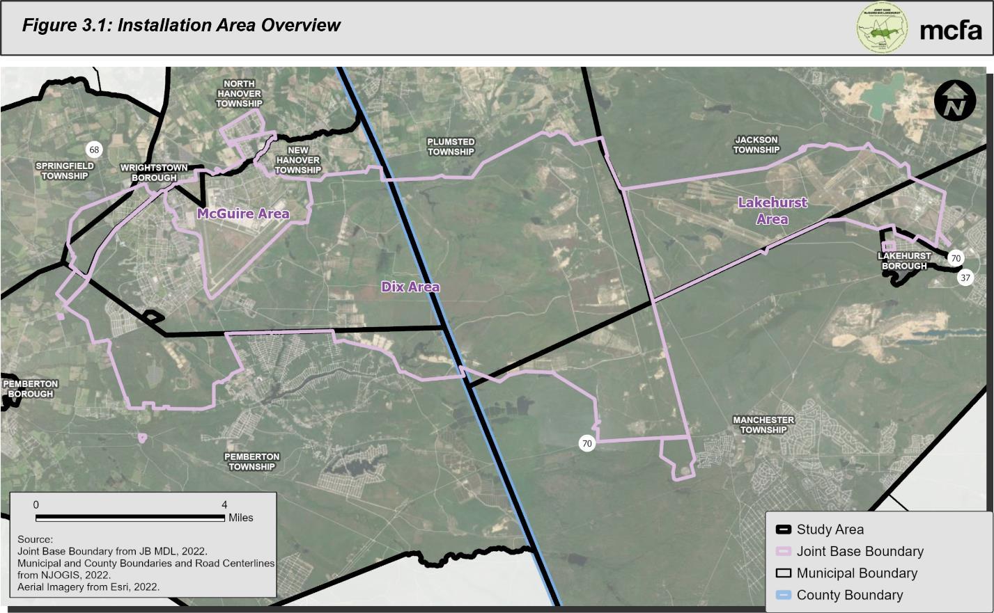
3.1 AREA HISTORY AND MISSIONS
In 1930s, JB MDL McGuire Area started as an expansion of Fort Dix to support its air missions. It became known as Fort Dix Army Air Base in 1941 as World War II training and mobilization mission requirements required further Base growth.
Following the end of World War II, the base closed. After being transferred to the Air Force and reopening in 1948, the base was renamed McGuire Air Force Base (McGuire AFB) in honor of Major Thomas B. McGuire Jr., the second leading American Ace of World War II and a posthumous Medal of Honor recipient.
3-1 P:\03143\0008 Reports\N-Envir\Regional Compatible Use Study\2023 Final Section 3.docx
Figure 0.1: Installation Area Overview
3.1.1 McGuire Area
By the end of World War II, the base became known as the “Gateway to the East” due to its role in transporting personnel and material to the European Theater of Operations The McGuire Area has continued the mission of global mobility ever since, becoming designated as the East Coast Air Mobility Wing in 1993. Other missions include expeditionary combat support and Operation Enduring Freedom (OEF) cargo support.
Today, the McGuire Area covers roughly 3,500 acres at New Hanover Township, North Hanover Township, and Wrightstown Borough. Facilities at the McGuire Area mainly support its two runways.
Primary units assigned to the McGuire Area include:
• 87th Air Base Wing (87 ABW);
• 305th Air Mobility Wing (305 AMW);
• 514th Air Mobility Wing (514 AMW), Air Force Reserve Command (AFRC);
• 108th Air Refueling Wing (108 ARW), New Jersey Air National Guard (NJ ANG);
• 621st Contingency Response Wing (621 CRW);
• United State Air Force Expeditionary Center (USAF EC);
• 21st Expeditionary Mobility Task Force (21 EMTF); and
• United States Air Force Mobility Warfare Center/United States Air Force Expeditionary Center.
Together, the units of the McGuire Area test and train airmen and provide maintenance, refueling, and support to aircrafts for deployment to ongoing global military operations.
3.1.2 Dix Area
In 1917, Camp Dix was established as a training and staging ground for soldiers during World War I. It was named in honor of Major General John Adams Dix, who fought in the War of 1812 and Civil War. Camp Dix grew to be the largest military reservation in the northeast. After the Armistice of November 11, 1918, Camp Dix became a center for demobilization and was renamed Fort Dix when the installation became permanent in 1939.
P:\03143\0008 Reports\N-Envir\Regional Compatible Use Study\2023 Final Section 3.docx
3-2
JB MDL, and Army National Guard units ever since its inception. It was an been an important training base during World War II, the Vietnam War, Desert Shield, and Desert Storm.
Today, the Dix Area covers approximately 31,200 acres across Jackson Township, Manchester Township, Pemberton Township, Plumsted Township, Springfield Township, and Wrightstown Borough. A significant portion of this property is occupied by training ranges. The Dix Area no longer trains Active-Duty Army units as a result of recommendations from the 1988 Base Realignment and Closure (BRAC) Commission However, Army Reserve and Army National Guard units continue to utilize the Dix Area for training exercises.
Army units assigned to the Dix Area of JB MDL include:
• Army Support Activity (ASA) – Fort Dix;
• 99th Readiness Division;
• 78th Training Division;
• Communications-Electronics Research, Development and Engineering Center (CERDEC);
• New Jersey Army National Guard (NJARNG);
• 2nd Mission Command Training Brigade/75th Division;
• 174th Infantry Brigade; and
• 72nd Field Artillery Brigade.
ASA-Fort Dix manages weapons ranges, tactical training locations, and mission facilities to support over 2 million man-days of training per year.
Other supported units and tenants on the Dix Area include:
• New Jersey State Police;
• Federal Correctional Institute;
• Federal Bureau of Investigations (FBI);
• United States Coast Guard (USCG) (Atlantic Strike Team);
• United States Marine Corps (Marine Aircraft Group 49); and
• United States Navy (USN)
3-3 P:\03143\0008 Reports\N-Envir\Regional Compatible Use Study\2023 Final Section 3.docx
As a United States Army Forces Command (FORSCOM) Power Projection Platform, missions at the Dix Area also include on- and off-base support services to military personnel, veterans, and their families.
3.1.3 Lakehurst Area
JB MDL Lakehurst Area began as a remote ammunition proving ground for the Russian Imperial Government in 1915. In 1917, the US Army acquired the facility, continuing the original use, and renamed it Camp Kendrick. The Navy obtained the property, which they renamed Naval Air Station (NAS) Lakehurst, in 1921. NAS Lakehurst played a critical role the development of airships. Until 1961, it operated a Lighter-than-Air Center for rigid airships, including the German Hindenburg and Graf Zeppelin, that became the United States’ first trans-Atlantic airport. Hangar No. 1 is listed as a National Historic Landmark.
Today, the Lakehurst Area covers around 7,500 acres at Jackson Township, Lakehurst Borough, and Manchester Township. Lakehurst features two main runways, test runways, and associated training, research, and operations facilities.
The Lakehurst Area continues to support Naval Aviation missions of research testing and evaluation, fleet logistics, technical training, and launch and recovery production. Naval Air Systems Command (NAVAIR) is the primary tenant at Lakehurst with missions including Aircraft Launch and Recover (ALRE), Airship Expeditionary Airfields, Naval Air Warfare Center Aircraft Division (NAWCAD), and Engineering Center. NAVAIR facilities include the Electromagnetic Aircraft Launch and Advanced Arresting Gear system. Other tenants include the Army’s Command, Control, Communications, Computers, Cyber, Intelligence, Surveillance and Reconnaissance (C5ISR) Center for Naval Aviation Technical Training and Navy Operational Support Center (NOSC), and the FBI.
3-4 P:\03143\0008 Reports\N-Envir\Regional Compatible Use Study\2023 Final Section 3.docx
3.2 JB MDL HISTORY AND MISSIONS
Situated 18miles southeast of Trenton, New Jersey, JB MDL covers approximately 42,000 acres in Burlington and Ocean Counties, New Jersey. Table 3.1 lists the municipalities hosting JB MDL by County.
Burlington County
• New Hanover Township
• North Hanover Township
• Pemberton Township
• Springfield Township
• Wrightstown Borough
Ocean County
• Jackson Township
• Lakehurst Borough
• Manchester Township
• Plumsted Township
The 2005 BRAC Commission and associated legislation directed the creation of a joint base which “realigned Fort Dix, NJ, and Naval Air Engineering Station Lakehurst, NJ, by relocating the installation management functions to McGuire AFB NJ, establishing JB MDL.” In October of 2009, the three bases began operation as JB MDL, the only tri-service joint base in the nation. Over 80 mission partners operate at JB MDL. Since 2005, the 87th Air Base Wing has been the host unit, assuming all installation management and support functions and reporting to the Air Mobility Command (AMC) through the Air Force Expeditionary Center (AFEC) JB MDL support services include:
• Facility Engineering, Operation, and Management;
• Utilities;
• Environmental Management;
• Transportation;
• Air Traffic Control;
• Force Protection and Fire Safety;
• Fire and Emergency Services;
• Installation Safety;
• Food Services;
• Fuel Services;
• Contracting;
• Supply and Ammunition Storage and Distribution;
• Unaccompanied and Family Housing and Temporary Lodging;
• Civilian and Military Personnel Administration;
• Public Affairs;
• Legal Support;
• Morale Welfare & Recreation;
• Community and Family Services; and
3-5 P:\03143\0008 Reports\N-Envir\Regional Compatible Use Study\2023 Final Section 3.docx
Table 3.1 JB MDL Host Municipalities
JB MDL has also become a major regional emergency response and logistics center, providing significant support to major disaster and emergency relief efforts, including the September 11, 2001 attacks, Superstorm Sandy, COVID-19, and Afghanistan refugees.
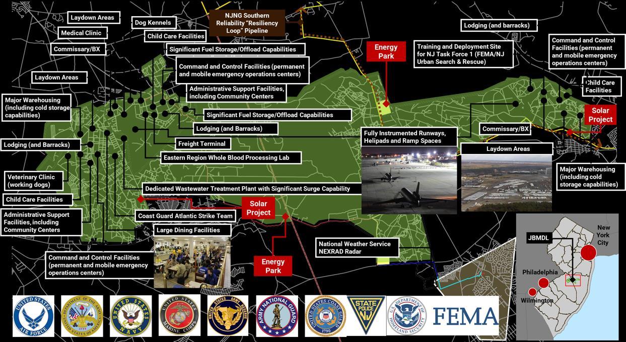
JB MDL has proved to be a critical asset supporting regional emergency response efforts.
3.2.1 JB MDL Economic Impact to New Jersey
JB MDL is the largest DOD employer and second largest employer overall in the State of New Jersey, second only to the State. Over 44,000 individuals, including military personnel, civilians, and their families, live and work on or near the installation, generating an estimated annual economic impact of $6 9 billion in the region. Table 3.2 breaks down the demographics coming onto the installation by area. During Fiscal Year (FY) 2018, JB MDL purchased $176 million of nonconstruction related goods and services produced within the tri-county area of
3-6 P:\03143\0008 Reports\N-Envir\Regional Compatible Use Study\2023 Final Section 3.docx • Child and Youth programs.
Figure 3.2 shows the locations for some of the major mission partners and activities on the installation.
Figure 0 2: JB MDL Mission Partners and Activities
Burlington, Ocean, and Monmouth Counties JB MDL’s economic impact is further discussed in Chapter 9.
3.3 FUTURE MISSIONS
JB MDL’s unique stature as the U.S.’s only tri-services base provides unique crossfunctional and cross-services capabilities that are becoming increasingly beneficial to the DOD in its need to support expanding multi-domain (land, air and sea) integrated warfare capabilities. While JB MDL is not anticipated to experience near-term major mission growth, the installation is expected to continue to experience requirements for an increase in capabilities to expand existing missions and host some new mission growth The future growth of the DOD mission at JB MDL is difficult to project given the dynamic and evolving security needs in the world today and the need to respond to decisions/directives from the DOD, Congress, and the Administration.
Notwithstanding that uncertainty, in the short-term horizon, JB MDL does have plans to enhance its regional emergency response capabilities and significantly improve its energy resiliency to meet DOD and emergency response mission requirements. This is further detailed in Chapter 7. Discussion about the capacity of JB MDL to support future missions can be found in Chapter 10.
3-7 P:\03143\0008 Reports\N-Envir\Regional Compatible Use Study\2023 Final Section 3.docx
McGuire Dix Lakehurst Military (Active Duty) 4,347 1,020 238 Civilian 779 48 1,602 NAF 338 228 65 Contractor 652 1,217 323 Guard/Reservists 3,919 1,128 3 Students/Mobilization 8 5,263 30 Other Supported Groups (Including Dependents, Tenants, Non-DOD Training) 7,953 14,476 614 Total 17,996 24,280 2,875
Table 3.2: JB MDL Demographics by Area JB MDL Demographics Area
4.0 JOINT BASE

MCGUIRE-DIX-LAKEHURST
TECHNICAL INFORMATION
NOISE AND SAFETY CONCERNS
4.0 JOINT BASE MCGUIRE-DIX-LAKEHURST NOISE AND SAFETY CONCERNS
4.1 ISSUE OVERVIEW
Operations of aircraft and artillery ranges at JB MDL are crucial components that support the military, disaster response and recovery, and law enforcement training missions located at JB MDL. These operations, however, do present noise and safety considerations to some areas outside of the JB MDLboundaries. The compatibility of land uses located outside of JB MDLare influenced by the operational frequency, schedule and type of aircraft in operation at JB MDL and noise from firing of large and small caliber munitions at training ranges. Compatible land use planning has been, and can continue to be, addressed by the pursuit of pro-active planning and development policies in collaboration between JB MDL and local communities. The focus of these actions is to encourage the location of compatible land uses in areas where noise or safety concerns may impact some types of land uses. For example, in high aircraft noise impact or aircraft accident potential safety zones, concentration of residential uses in these zones would not be considered a compatible land use due to potential safety and/or quality of life concerns.
4.2 SUMMARY FINDINGS
The Air Force Handbook (AFH) and DOD Instructions (DODI) define the compatibility of land uses. The 2022 Air Installation Compatible Use Zone (AICUZ) study prepared for JB MDL, identifies guidance to limit and manage the development of incompatible land uses in critical military operations areas. The document also gives recommendations to advance Compatible local growth and development in these zones. While the instance of incompatible land uses in critical military operations zones is currently limited, it is critical for local communities to limit the future development of incompatible land uses in critical military operations zones. This is required to help support the on-going viability of military operations at JB MDL well into the future.
Per Air Force guidance and the 2022 AICUZ study, land uses are considered Compatible, Compatible with Restrictions, or Incompatible based on several factors. These include; occupancy, density, quality of life impacts, and/or safety concerns of the use relative to its
4-1 P:\03143\0008 Reports\N-Envir\Regional Compatible Use Study\2023 Final Section 4.docx
location within aircraft or training range noise zones and noise impact levels. The use’s location within aircraft accident potential zones based on proximity to active aircraft runways is also an important safety consideration and evaluation factor
4.3 MORE INFORMATION
Chapter 8, Analysis of Existing Land Use and Planned Development, presents findings and recommendations of the RCUS Study Team to help improve compatibility of existing land use and future development in local jurisdictions that contain critical noise and safety zones within their boundaries. Appendix A summarizes the noise and air safety considerations related to military operations (airfields and ranges) that create land use compatibility concerns for development on properties outside JB MDL boundaries. For a more detailed understanding of the AICUZ process, refer to the 2022 AICUZ Study on the JB MDL website, which uses 2023 mission projections for all calculations. Compatibility concerns and existing management/mitigation strategies associated with noise and safety zones are discussed in Appendix C and D.
4-2 P:\03143\0008 Reports\N-Envir\Regional Compatible Use Study\2023 Final Section 4.docx
5.0 EXISTING LAND USES AND GROWTH POTENTIAL IN RCUS MUNICIPALITIES
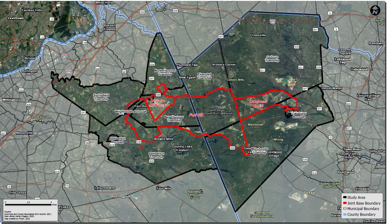
5.0 EXISTING LAND USES AND GROWTH POTENTIAL IN RCUS MUNICIPALITIES
The Study Team evaluated the existing land use in the Study Area and performed a build out analysis of areas that may be developed in the future. A build out analysis provides an estimate of the extent of future development within a specified area under current development regulations. When generating a build-out analysis, a number of different future development scenarios can be prepared utilizing a variety of data sources. The build-out analysis for the RCUS provides an estimate of the total number of housing units and land acreage of non-residential space that could be constructed on unprotected, buildable lands within the Study Area. This information is instrumental for identifying and evaluating the extent of future development based on current zoning after accounting for development constraints associated with land preservation activities and restrictions on development in sensitive environments (e.g., wetlands, flood hazard areas).
The RCUS Study Team analyzed a multitude of data sources to identify areas that are available for future development and areas that are fully built-out or protected/ preserved from development. The build out analysis methodology includes the following steps, listed below. A detailed technical discussion of the build-out methodology is provided in Appendix B.
5.1 BUILD OUT ANALYSIS METHODOLOGY OVERVIEW
1- Create land use composite and zoning composite
2- Categorize undeveloped / developed lands
3- For undeveloped lands, categorize vacant or farmland (all farmland including preserved, to be removed next step)
4- Remove areas to be excluded from build out analysis:
• All already preserved / funded land (preserved farmlands, open space, parks, recreation)
• Right-of-Ways: (roads, bridges, railway, etc)
• Joint Base boundary
• Specific portions of environmentally constrained areas including:
o Natural Heritage Priority Sites
o Water Areas
5- All undeveloped and unpreserved land areas are identified, then categorized by allowable use into residential and non-residential zoning
6- Build out calculations completed for:
• Classified vacant lands residential
• Classified vacant lands non-residential
• Classified farmland residential
• Classified Farmland non-residential
P:\03143\0008 Reports\N-Envir\Regional Compatible Use Study\2023 Final Section 5.docx
5-1
The last stage of the build out analysis involved calculating potential residential development units and non-residential development. Residential units were calculated by summing up all potential development lands and dividing the total acreage by the maximum density set forth by the zoning districts. Due to the regional scale of the Study Area, non-conforming lots; lots that do not meet the minimum lot area requirements by zone and have a potential development unit of less than 1 were included in the summation of total potential development lands.
The build out analysis assumes access to water and wastewater infrastructure. There are many instances of the study area lacking infrastructure services but the goal of the build out analysis is to anticipate possible land use scenarios. Inclusion of lands that do not have water and wastewater infrastructure in this analysis is predicated on an assumption that development could be possible on these lands. This development analysis assumes that existing zoning takes into consideration the growth capacity based on the existing infrastructure
The build out analysis is not an absolute determinant; rather it is a planning tool for understanding potential future municipal growth. The following is an overall summary of the results of the development analysis.
5.2 BUILD OUT ANALYSIS RESULTS SUMMARY
The build out analysis concentrates on potential future development, categorized as potential residential and potential non-residential development. Generally, residential development presents greater compatibility concerns to the military mission. Table 5.1 summarizes the result of the residential build out analysis by Study Area municipality. Table 5.2 summarizes the result of the non-residential build out analysis by Study Area municipality. Further detailed information and mapping of these results are provided in Appendix B.
5-2 P:\03143\0008 Reports\N-Envir\Regional Compatible Use Study\2023 Final Section 5.docx
5-3 P:\03143\0008 Reports\N-Envir\Regional Compatible Use Study\2023 Final Section 5.docx
Municipality Total Potential Residential Development Units (Vacant Lands) Total Potential Residential Development Units (Farmlands) Total Potential Residential Development Units Jackson Township 39,000 2,699 41,700 Lakehurst Borough 386 0 386 Manchester Township 8,069 0 8,069 Plumsted Township 1,843 0 1,843 New Hanover Township 10 135 145 North Hanover Township 140 1,078 1,218 Pemberton Borough 266 15 281 Pemberton Township 3,222 247 3,469 Springfield Township 55 291 346 Wrightstown Borough 127 0 127
Table 5.1: Study Area Residential Build Out Summary
Municipality Total Vacant Lands NonResidential (Ac.) Total Environmentally Constrained Land (Vacant Non-Residential) Total Farmlands NonResidential (Ac.) Total Environmentally Constrained Land (Farmlands Non-Residential) Jackson Township 3,150 1,063 0 0 Lakehurst Borough 56 24 0 0 Manchester Township 1,500 100 0 0 Plumsted Township 623 171 0 0 New Hanover Township 5.91 0 5.9 0 North Hanover Township 68.24 9.38 0 0 Pemberton Borough 0 0 0 0 Pemberton Township 112.18 54.77 226 73 Springfield Township 12.66 2.12 0 0 Wrightstown Borough 18 2.89 0 0
Table 5.2: Study Area Non-Residential Build Out Summary
6.0 COMPATIBLE LAND USE PLANNING CONSIDERATIONS
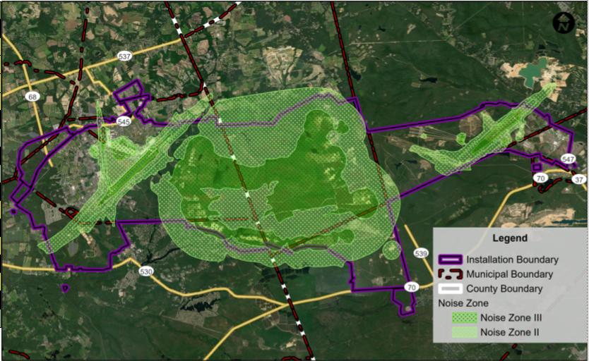
6.0 COMPATIBLE LAND USE PLANNING CONSIDERATIONS
6.1 STATE PLAN
The New Jersey State Development and Redevelopment Plan (State Plan) was adopted on March 1, 2001 in accordance with the State Planning Act of 1985. The State Planning Commission oversees implementation of the plan to guide new development, infrastructure investment, and other public actions that affect and support economic growth and development in the State. A significant part of the Study Area is within the Pinelands Management Area. The Pinelands planning region is established by statute and as such is not in the State Plan management area. The State Planning Commission relies on the adopted Pinelands regulations for these areas. The purpose of the State Plan is to:
“Coordinate planning activities and establish Statewide planning objectives in the following areas: land use, housing, economic development, transportation, natural resource conservation, agriculture and farmland retention, recreation, urban and suburban redevelopment, historic preservation, public facilities and services, and intergovernmental coordination (N.J.S.A. 52:18A-200(f)).”
The State Plan includes the State Plan Policy Map that identifies large masses of land that share a common set of conditions, such as population density, infrastructure systems, level of development, or natural systems. These large masses of land are called Planning Areas, and each Planning Area has a set of Policy Objectives to guide the application of the State Plan, local planning and decision-making, and protection and enhancement of environmental resources. Figure 6.1 illustrates the Planning Areas in the study area, which were last updated by the Office of Planning Advocacy in 2021, are described as follows:
• Suburban Planning Area (PA2) - Provide for much of the state’s future development; promote growth in Centers and other compact forms; protect the character of existing stable communities; protect natural resources; redesign areas of sprawl; reverse the current trend toward further sprawl; and revitalize cities and towns.
• Fringe Planning Area (PA3) - Accommodate growth in Centers; protect the Environs primarily as open lands; revitalize cities and towns; protect the character of existing stable communities; protect natural resources; provide a buffer between
6-1 P:\03143\0008 Reports\N-Envir\Regional Compatible Use Study\2023 Final Section 6.docx
more developed Metropolitan and Suburban Planning Areas and less developed Rural and Environmentally Sensitive Planning Areas; and confine programmed sewers and public water services to Centers.
• Rural Planning Area (PA4) - Maintain the Environs as large contiguous areas of farmland and other lands; revitalize cities and towns; accommodate growth in Centers; promote a viable agricultural industry; protect the character of existing stable communities; and confine programmed sewers and public water services to Centers.
• Rural/Environmentally Sensitive Planning Area (PA4B) - Some lands in the PA4 have one or more environmentally sensitive features qualifying them for delineation as PA4B. This sub-area contains valuable ecosystems, wildlife habitats or other environmentally significant characteristics. Rural/Environmentally Sensitive Planning Areas are supportive of agriculture and related economic development efforts that ensure a diversity of land uses within New Jersey. Policies should be adopted that support continuing agriculture, yet also should provide adequate protection of environmentally sensitive resources, along with appropriate guidance if agricultural uses are abandoned.
• Environmentally Sensitive Planning Area (PA5) - Protect environmental resources through the protection of large contiguous areas of land; accommodate growth in Centers; protect the character of existing stable communities; confine programmed sewers and public water services to Centers; and revitalize cities and towns.
The State Plan also identifies centers, which are delineated areas designated for more compact development where public and private services that support development and redevelopment are typically already present. Centers areas planned to the locations for growth. Centers are designated based on their land area, population, employment, and densities. Designated centers, shown on Figure 6.1, are centers that have been officially recognized as such by the State Planning Commission.
In addition to being illustrated in Figure 6.1, the presence of Planning Areas and Designated Centers within each municipality in the Study Area is summarized in Table 6.1 Further details on the Planning Areas and Designated Centers within each municipality in the Study Area are provided below. According to the State Plan, much of the growth in the Study Area should generally occur in the eastern limits of the Study Area.
6-2 P:\03143\0008 Reports\N-Envir\Regional Compatible Use Study\2023 Final Section 6.docx
Ocean County
Jackson Township – Jackson Township is mostly mapped as PA2 in the northeastern portion of the Township and PA3 in the northwestern portion. These areas represent the most developed portions of the Township, with retail, commercial, industrial, and entertainment uses along major roadways and residential subdivisions and public uses, such as schools, throughout. The densities in PA2 are generally greater than PA3. A small area along the boundary with Plumsted Township is mapped as PA4 and another small area along the northern boundary of Joint Base is mapped as PA4B. Additional areas adjoining the PA4 and PA4B areas are mapped as PA8, including the Colliers Mills Wildlife Management Area, Prospertown Lake Wildlife Management Area, and Butterfly Bogs Wildlife Management Area. No designated centers exist in Jackson Township. The southern half of Jackson Township does not have Planning Area designations because it is in the Pinelands Protection Act Protection and Preservation Areas.
Lakehurst Borough – In the eastern section of the Borough, the neighborhoods and areas surrounding Route 70 are designated as PA2 and the area surrounding Union Branch is designated as PA5. No designated centers exist in Lakehurst Borough. Most of Lakehurst Borough does not have Planning Area designations because it is in the Pinelands Protection Act Protection Area.
Manchester Township - The western portion of Manchester Township is predominantly in PA2 and includes residential developments that are dense compared to the surrounding
6-3 P:\03143\0008 Reports\N-Envir\Regional Compatible Use Study\2023 Final Section 6.docx
Designated Centers PA2 PA3 PA4 PA4B PA5 PA8 Ocean County Jackson Township X X X X X Lakehurst Borough X X Manchester Township X X X Plumsted Township X X X (expires 3/31/23) Burlington County New Hanover Township X North Hanover Township X Pemberton Borough X X Pemberton Township X X Springfield Township X X Wrightstown Borough X X (expires 10/16/23)
Table 6.1: State Plan Planning Areas and Designated Centers in the Study Area Municipality Planning Areas
area and that area segmented by forested areas and major roadways. Areas designated as PA5 extend throughout the PA2 along the waterbodies and tributaries. The Whiting Wildlife Management Area is mapped as PA8. No designated centers exist in Manchester Township. Most of Manchester Township does not have Planning Area designations because it is in the Pinelands Protection Act Protection Area.
Plumsted Township - The northern half of the Township is mostly mapped as PA4 and is made up of farmland, forested areas, and low-density development. Small areas along the border of the base and Jackson Township are mapped as PA8. The Township has a designated Center in the western corner, known as the New Egypt Town Center. The southern half of Plumsted Township does not have Planning Area designations because it is in the Pinelands Protection Act Protection and Preservation Areas.
Burlington County
New Hanover Township - The northernmost part of the Township, which is adjacent to the Joint Base, is designated as PA4. This area is mostly farmland with low density development. No designated centers exist in New Hanover Township. Most of New Hanover Township does not have Planning Area designations because it is in the Pinelands Protection Act Protection and Preservation Areas.
North Hanover Township – Most of North Hanover Township is designated as PA4. The Township is mostly farmland with some low-density development and forested areas. No designated centers exist in New Hanover Township. A small area of North Hanover Township along the New Hanover Township border does not have Planning Area designations because it is in the Pinelands Protection Act Protection Area.
Pemberton Borough – The entirety of Pemberton Borough is designated as PA4 and a designated center. The Borough is made of compact, mixed-use development with the North Branch Rancocas Creek and County Route 530 running along the southern boundary.
Pemberton Township – The northwestern corner of Pemberton Township is designated as PA4. This area is mostly farmland with low density development. The Pemberton
6-4 P:\03143\0008 Reports\N-Envir\Regional Compatible Use Study\2023 Final Section 6.docx
Borough designated center extends north into Pemberton Township. Most of Pemberton Township does not have Planning Area designations because it is in the Pinelands Protection Act Protection and Preservation Areas.
Springfield Township - Springfield Township is designated as PA4. This area is mostly farmland with low density development. Review of the New Jersey State Plan Advocacy Map on February 15, 2023, indicates that the three hamlets of Juliustown, Jobstown, and Jacksonville that had been mapped as designated centers on the State Plan are no longer mapped In addition, a small area of Springfield Township along the Wrightstown Borough border does not have Planning Area designations because it is in the Pinelands Protection Act Protection Area.
Wrightstown Borough - Wrightstown Borough is endorsed by the State Planning Commission, meaning that the municipal plan and accompanying development regulations have been reviewed for consistency with the adopted guidelines for Plan Endorsement. Wrightstown Borough has a designated Center, known as the Wrightstown Town Center, at the northern end of the Borough. The Center and a small area at the southwestern corner of the Borough are designated as PA4. Most of Wrightstown Borough does not have Planning Area designations because it is in the Pinelands Protection Act Protection Area.
6-5 P:\03143\0008 Reports\N-Envir\Regional Compatible Use Study\2023 Final Section 6.docx
Figure 6.1 - State Plan Policy Map - 2021
! ! ! ! ! ! ! ! ! ! ! ! ! ! ! ! ! ! ! ! ! ! ! ! ! ! ! ! ! ! ! ! ! ! ! ! ! ! ! ! ! ! ! ! ! ! ! ! ! ! ! ! ! ! ! ! ! ! ! ! ! ! ! ! ! ! ! ! ! ! ! ! ! ! ! ! ! ! ! ! ! U V 166 U 88 U 571 U V 37 U V 70 U V 68 U V 38 U 72 £ ¤ 130 £ ¤ 9 £ ¤ 206 Shamong Township Medford Lakes Borough Tabernacle Township Woodland Township Lacey Township Pine Beach Borough South Toms River Borough Pemberton Borough Southampton Township Berkeley Township Lumberton Township Mount Laurel Township Pemberton Township Mount Holly Township Lakehurst Borough Eastampton Township Wrightstown Borough Wrightstown Borough Westampton Township Manchester Township Willingboro Township Toms River Township Springfield Township Burlington City Lakewood Township Burlington Township Mansfield Township Florence Township Plumsted Township North Hanover Township Fieldsboro Borough Bordentown City Chesterfield Township Jackson Township Bordentown Township Allentown Borough Farmingdale Borough Upper Freehold Township Trenton City Howell Township Robbinsville Township Hamilton Township Millstone Township Freehold Township Evesham Township New Hanover Township Medford Township § ¨ 95 § 195 § 295
County of Burlington County of Ocean CountyofBurlington County of Monmouth County of Ocean Lakehurst NAES McGuire Air Force Fort Dix I 0 30,000 Feet Joint Base Boundary County Boundary Municipal Boundary Study Area ! ! ! ! ! ! ! ! ! Critical Environmental Site Designated Centers Planning Areas Suburban Planning Area (PA2) Fringe Planning Area (PA3) Rural Planning Area (PA4) Rural/Env. Sensitive Pl. Area (PA4B) Env. Sensitive Planning Area (PA5) Parks & Natural Areas (PA8) Source: State Plan Data from NJ Office of Planning, 2023 Water Supply Planning Areas from NJDEP, 2004 Municipal and County Boundaries from NJGIN, 2021. New Jersey Aerial Imagery, 2020. Map created by PS&S, 2022.
CountyofBurlington CountyofMercer
6.2 ENVIRONMENTAL JUSTICE
NJDEP has proposed a new Environmental Justice (EJ) rule (N.J.A.C. 7:1C) to enhance environmental protections and reduce health hazards within New Jersey’s overburdened communities. The Study Team examined EJ as a planning consideration, as the Study Area includes overburdened communities.
NEPA
If Joint Base McGuire Dix Lakehurst proposes any action which could cause significant change or alteration of its current operations, consideration of National Environmental Policy Act (NEPA) and subsequent preparation of an Environmental Assessment (EA) or EIS would be required in order to consider the potential consequences to the human and natural environment associated with the proposed action and the related changes in infrastructure to accommodate the proposed action.
NEPA (42 United States Code [USC] 4321 et seq.) is a federal statute requiring the identification and analysis of potential environmental impacts associated with proposed federal actions before action is taken. The Council on Environmental Quality (CEQ), established under NEPA, is charged with developing and implementing regulations and ensuring federal agency compliance with NEPA. The process for implementing NEPA is codified in Title 40 CFR Parts 1500–1508, revised 2020, Update to the Regulations Implementing the Procedural Provisions of the National Environmental Policy Act. These regulations specify that an EA be prepared to satisfy the following:
1) briefly provide sufficient evidence and analysis for determining whether to prepare an EIS or a Finding of No Significant Impact (FONSI)
2) aid in an agency’s compliance with NEPA when no EIS is necessary
3) facilitate preparation of an EIS when one is required
The Environmental Impact Analysis Process (EIAP) is the DAF implementing regulations for conducting environmental analyses, as promulgated at 32 CFR 989. To comply with NEPA, CEQ regulations and the EIAP are used together. NGB is the decision maker in this EA, but the FAA has final authority to approve or deny any proposal to alter airspace
6-7 P:\03143\0008 Reports\N-Envir\Regional Compatible Use Study\2023 Final Section 6.docx
times of designation. Therefore, the EA must also be consistent with FAA Order 1050.1F, Environmental Impacts: Policies and Procedures
Executive Order 12898, issued in 1994, established the responsibility of each Federal agency to "make achieving environmental justice part of its mission by identifying and addressing, as appropriate, disproportionately high and adverse human health or environmental effects of its programs, policies, and activities on minority populations and low-income populations ...." An accompanying Presidential Memorandum directed that human health, economic, and social effects, including effects on minority communities and low-income communities, be included in the analysis of environmental effects pursuant to NEPA. CEQ issued guidance (1997) for agencies on addressing environmental justice in the NEPA process
New Jersey Environmental Justice
Historically, New Jersey’s low-income communities and communities of color have been subject to a disproportionately high number of environmental and public health stressors, including pollution from numerous industrial, commercial, and governmental facilities located in those communities and, as a result, suffer from increased adverse health effects including, but not limited to, asthma, cancer, elevated blood lead levels, cardiovascular disease, and developmental disorders.
New Jersey’s Environmental Justice Law (NJSA 13:1D-157 to 161) (the Act) requires the NJDEP to evaluate the environmental and public health impacts of facilities in overburdened communities when making certain permit decisions (NJSA 13:1D-161(a)).
As of the date of this Study, the State and NJDEP have taken several steps to implement the Act. Actions taken include adoption of both Executive Order No. 23 and Administrative Order No. 2021-25 (AO). The AO Directs DEP staff to immediately incorporate the legislative intent of the Act agency actions covered by the while the implementing regulations are being developed This extended public comment periods and required public hearings on certain agency decision making and required special conditions be attached to certain types of permits and approvals for projects within an overburdened
6-8 P:\03143\0008 Reports\N-Envir\Regional Compatible Use Study\2023 Final Section 6.docx
community as may be necessary to avoid or minimize environmental or public health stressors upon that community.
In addition, NJDEP has proposed a new EJ rule (N.J.A.C. 7:1C) to codify the AO further and to further implement the Act. The purpose of all of these actions is to enhance environmental protections and reduce health hazards within New Jersey’s overburdened communities.
NJDEP in partnership with the New Jersey Department of Health (NJDOH) launched the Healthy Community Planning New Jersey (HCPNJ) website, which provides municipallevel reports to help local governments and the public understand and address environmental threats to public health faced by their communities.
Overburdened communities are identified on Figure 6.2. An overburdened community is any census block group, as determined in accordance with the most recent census, in which:
• (1) At least 35 percent of the households qualify as low-income households;
• (2) at least 40 percent of the residents identify as minority or members of a State recognized tribal community; or
• (3) at least 40 percent of the households have limited English proficiency
The proposed rule enhances existing NJDEP authorities that focus on reducing impacts to certain environmental media. The proposed rule seeks to address:
• Facility-wide impacts
• Concentration of facilities in given geographic areas
• Cumulative effects of facility-siting decisions
The proposed rule applies where the following criteria is met:
• 1- The proposed or existing facility is one of the following types of facilities:
o 1- Major sources of air pollution
o 2- Incinerators and resource recovery facilities
o 3- Large sewage treatment plants that process more than 50 million gallons per day
o 4- Transfer stations and solid waste facilities
P:\03143\0008 Reports\N-Envir\Regional Compatible Use Study\2023 Final Section 6.docx
6-9
o 5- Recycling facilities that receive at least 100 tons of recyclable material per day
o 6- Scrap metal facilities
o 7- Landfills
o 8- Medical waste incinerators, except those attendant to hospitals and universities
• 2-An applicant seeks a department permit or approval enumerated in the Act. See relationship to other regulatory programs (N.J.A.C. 7:1C-1.4):
o Solid waste and recycling
o Land resource protection
o Water supply and pollution control
o Air pollution control
o Pesticide regulation
• 3- The facility is located or proposed to be located in whole or in part in an overburdened community
Where applicable, NJDEP may not deem a permit application complete for review, unless the applicant completes the Environmental Justice Impact Statement (EJIS) process to assess the environmental and public health stressors in the overburdened community and the facility’s potential contributions thereto, including conducting a public hearing in the affected overburdened community and responding to public comment on the application.
The Study Team considered the NJDOH HCPNJ for the RCUS municipalities, as well as the Overburdened Communities Map, provided as Figure 6.2.
With regard to this RCUS, no planning initiatives proposed by the local municipalities have been identified that would co-locate low-income planned communities in areas subject to increased air operations risks or noise effects. RCUS municipalities are recommended to avoid location of residential uses within ACUIZ zones as residential land uses are identified as incompatible uses by the JB MDL RCUS.
6-10 P:\03143\0008 Reports\N-Envir\Regional Compatible Use Study\2023 Final Section 6.docx
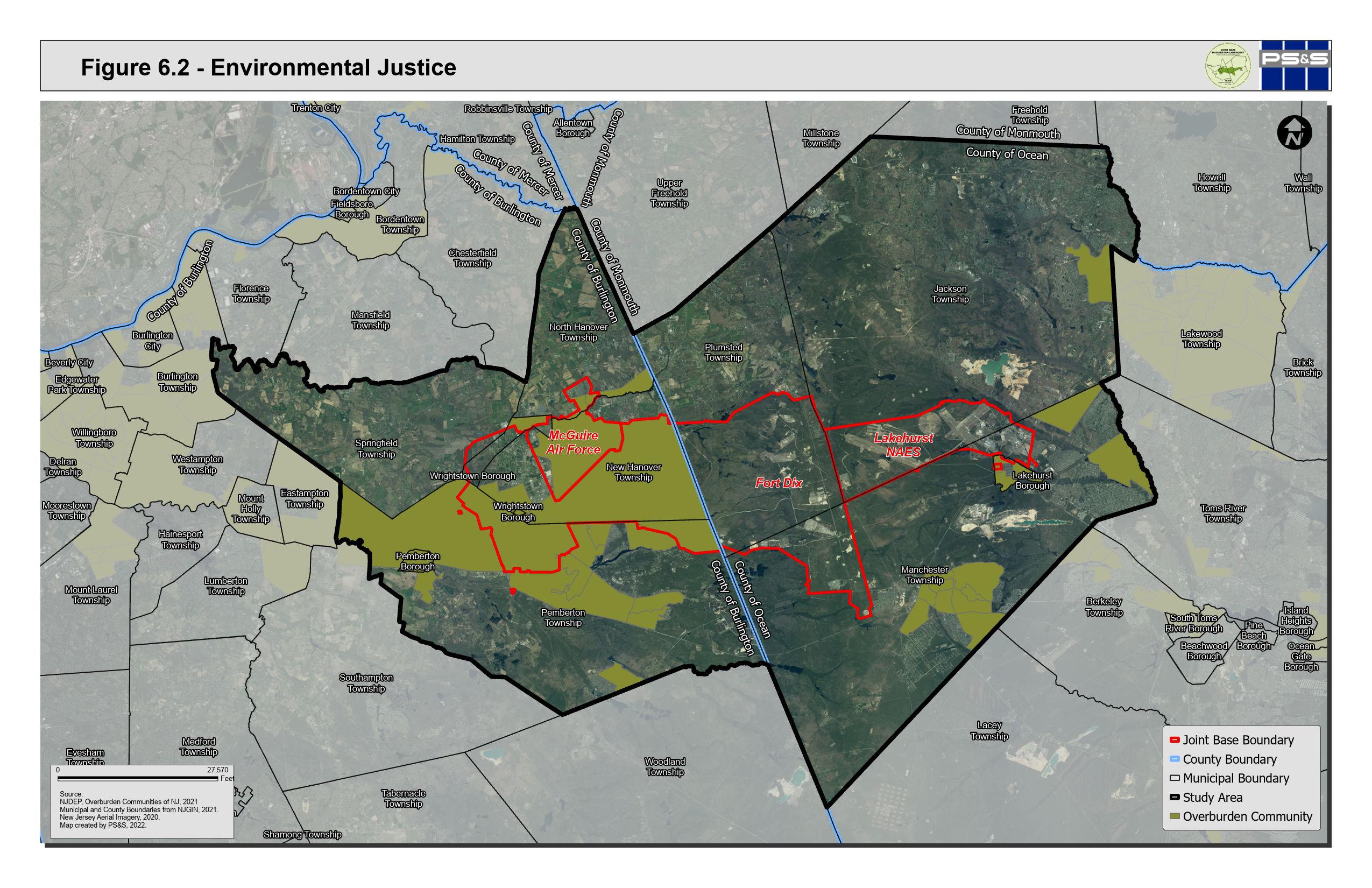
6.3 PINELANDS COMPREHENSIVE MANAGEMENT PLAN
The Pinelands National Reserve and the origins of the Pinelands Commission
The Pinelands National Reserve became the country's first National Reserve when it was established by the National Parks and Recreation Act of 1978. The Pinelands National Reserve consisted of more than 1,000,000 acres of land spanning 56 municipalities. Congress specifically noted the need for coordinated local, state, and federal government planning to manage the water and land resources of the Pinelands. The Interior Secretary was directed to request the state of New Jersey to establish "a planning entity to a comprehensive management plan for the Pinelands National Reserve." Governor Brendan Byrne created the Pinelands Commission by executive order in 1979 and the legislature passedthe Pinelands Protection Act that same year. The entirety of the JBMDL and at least a portion of each RCUS municipality is located within the Pinelands National Reserve.
Pinelands Comprehensive Management Plan
The New Jersey Pinelands Commission is an agency of the State of New Jersey with the mission to preserve, protect and enhance the natural and cultural resources of the Pinelands National Reserve, and to encourage compatible economic and other human activities consistent with that purpose. The Pinelands Commission implements its oversight through the Pinelands Comprehensive Management Plan (CMP). The CMP contains rules to guide proposed development within the Pinelands while protecting the area’s significant natural, agricultural, cultural, recreational, and historic resources. While local governments are responsible for implementing the CMP, the Pinelands Protection Act includes a procedure for review of county and municipal master plans and land use ordinances. Generally, while the local governments can create their own land use and zoning plan, the CMP establishes minimum standards that the municipal and county plans must conform to.
The CMP Land Capability Map establishes nine land use management areas with goals, objectives, development intensities and permitted uses for each management area:
6-12 P:\03143\0008 Reports\N-Envir\Regional Compatible Use Study\2023 Final Section 6.docx
Preservation Area District - The “heart” of the Pinelands, the Preservation Area is a forested wilderness-like area containing habitat for diverse species, including species listed as “Threatened or Endangered”. Very limited residential or commercial development in certain areas is conditionally permissible.
Forest Area – The Forest Area is largely undeveloped and is similar to the Preservation Area District in terms of ecological value. Undisturbed, forested portions of the Protection Area support characteristic Pinelands plant and animal species and provide suitable habitat for many threatened and endangered species. These largely undeveloped areas are an essential element of the Pinelands environment, contain high quality water resources and wetlands, and are very sensitive to random and uncontrolled development.
Agricultural Production Area - These are areas of active agricultural use, generally upland field agriculture and row crops, including adjacent areas with soils suitable for expansion of agricultural operations. Farm-related housing and non-farm housing are permitted subject to density thresholds, and non-residential uses including agricultural commercial and roadside retail are permitted subject to proximity to preexisting commercial uses.
Special Agricultural Production Area - This area supports berry agriculture and horticulture of native Pinelands plants; farm-related housing and expansion of existing non-residential uses are conditionally permitted.
Rural Development Area - This is a transitional area that balances environmental and development values between conservation and growth areas. Some parts of the Rural Development Area are more suitable for development than others due to existing development and an absence of critical ecological resources. Limited, low-density residential development and roadside retail is permitted.
Pinelands Villages and Towns - Pinelands Villages and Towns are existing spatially discrete settlements in the Pinelands. These traditional communities are appropriate for infill residential, commercial, and industrial development that is compatible with their existing character.
6-13 P:\03143\0008 Reports\N-Envir\Regional Compatible Use Study\2023 Final Section 6.docx
Regional Growth Area - Regional Growth Areas are areas of existing growth or lands immediately adjacent that can accommodate regional growth influences while protecting the essential character and environment of the Pinelands, provided that the environmental objectives of CMP are implemented through municipal master plans and land use ordinances. Residential development of is permitted subject to density thresholds. Commercial and industrial uses are also permitted.
Military and Federal Installation Area - This area includes the Joint Base. Permitted uses are those associated with function of the installation or other public purpose uses.
In addition, the Pinelands Commission has enacted a development credit program (Pinelands Development Credit (PDC)) with the intent to redirect growth from the Pinelands Preservation Areas into Regional Growth Areas. The PDC program allocates sending areas and receiving areas. Sending area development credits can be used to increase the amount of residential development on receiving area lands. Conservation or agricultural easements are placed on the sending properties when the credits are transferred. PDCs can be bought and sold privately or through the publicly chartered Pinelands Development Credit Bank. Pemberton, Jackson, and Manchester Townships are participating in the PDC program. The PDC program has resulted in the preservation of more than 50,000 acres since its inception in 1985. This program is considered one of the most successful examples of transfer of development rights (TDR) in the country.
6.3.1 Summary of Pinelands Land Use Management Areas within the RCUS Municipalities
The Pinelands CMP provides a closely managed set of controls for land use planning in much of the RCUS Study Area. The resource protection initiatives of the CMP have conserved land and limited development in land areas that are coincident with areas that are important from a JBMDL operational perspective. Implementation of the Pinelands CMP has constrained sprawl and preserved large areas of land with unique ecological integrity within the RCUS municipalities. The CMP has been successful in limiting growth in the core of the ecologically sensitive pinelands central area while supporting cranberry or blueberry crops, forestry, recreation, and fish and wildlife management areas.
6-14 P:\03143\0008 Reports\N-Envir\Regional Compatible Use Study\2023 Final Section 6.docx
The BRAC process that guided decision making for creation of JBMDL considered the presence or potential for incompatible land uses adjacent to the base that would be incompatible with missions and base operations. Although the primary purpose of the Pinelands CMP was to protect important natural resources, the CMP also had the effect of limiting new land development activity that would have been potentially incompatible with JBMDL mission growth
A description of the currently adopted Pinelands Land Use Management Areas within each of the RCUS municipalities follows:
6.3.1.1 Ocean County
Jackson Township - The southern half of Jackson Township is subject to the Pinelands CMP. The Pinelands land use management areas within Jackson Township are shown on Figure 6.3. The southernmost area of the township is mapped Military and Federal Installation; this area is within the Joint Base boundary. The lands directly adjacent to the military installation are designated Preservation Area and Forest Area. The eastern part of the township is Rural Development Area, with an inclusion of a Regional Growth Area along the boundary with Manchester Township. An additional Regional Growth Area is located in the eastern area of the Pinelands within Jackson Township. Three mapped Pinelands Villages are mapped within the central part of the Pinelands jurisdiction. The remainder of the Pinelands jurisdiction is mapped as Forest Area, with inclusions of Rural Development Area.
Lakehurst Borough - Lakehurst Borough is within the Pinelands Area, as shown on Figure 6.4 and is designated as a Pinelands Town.
Manchester Township - Figure 6.5 illustrates the Pinelands mapped areas within Manchester Township. The township area within the Joint Base boundary is mapped Military and Federal Installation, while much of the remaining Pinelands jurisdiction is Forest or Preservation areas. A Pinelands Town designation is found in the south-central area. Inclusions of mapped Rural Development, Pinelands Village, and Regional Growth follow development patterns within the township.
6-15 P:\03143\0008 Reports\N-Envir\Regional Compatible Use Study\2023 Final Section 6.docx
Plumsted Township - The southern half of Plumsted Township and parts of the eastern municipal boundary are within the Pinelands area, as shown on Figure
6.6. Most of the Pinelands jurisdiction is within the Joint Base Boundary, and is mapped as Military and Federal Installation. The township also includes Forest, Preservation and Rural Development management areas in the central eastern area of the Township and Rural development in the northeast corner.
6-16 P:\03143\0008 Reports\N-Envir\Regional Compatible Use Study\2023 Final Section 6.docx
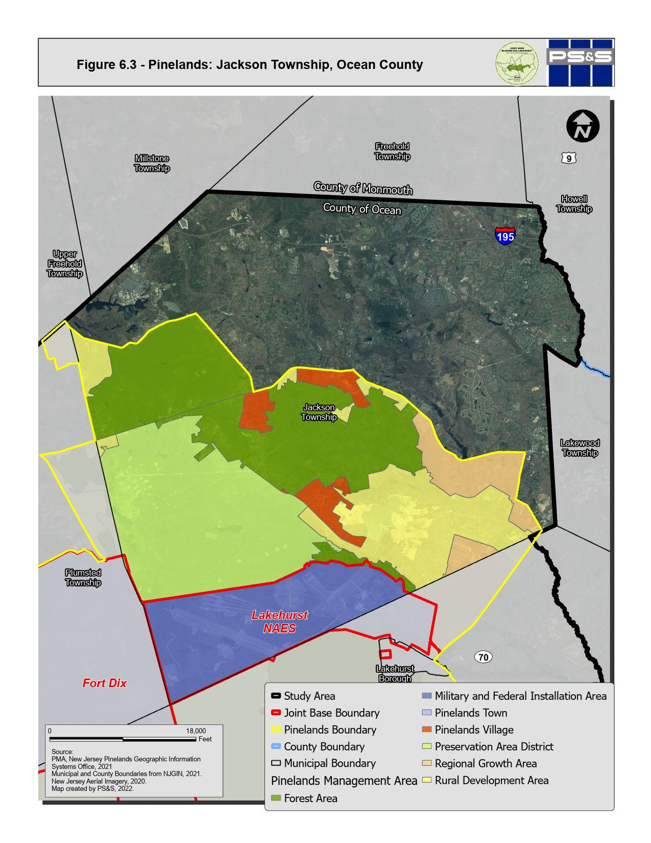
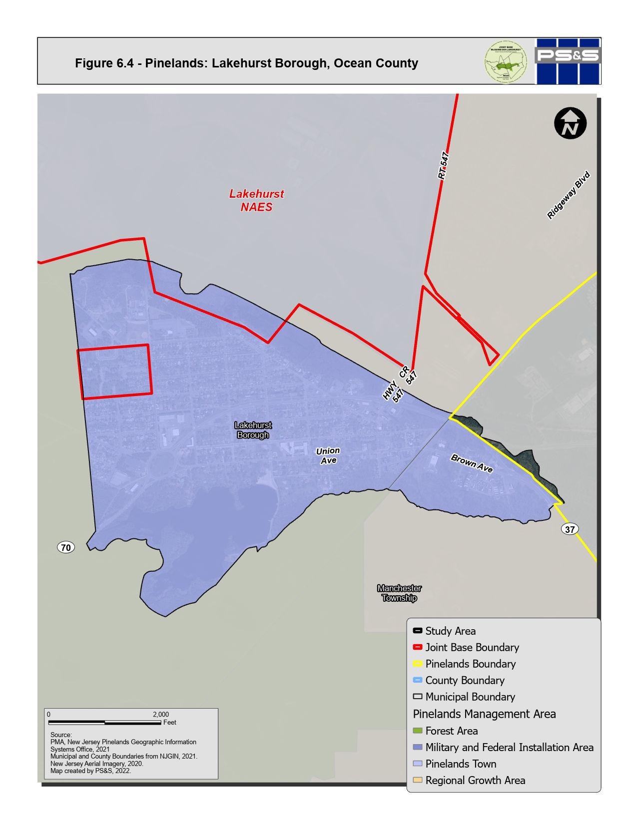
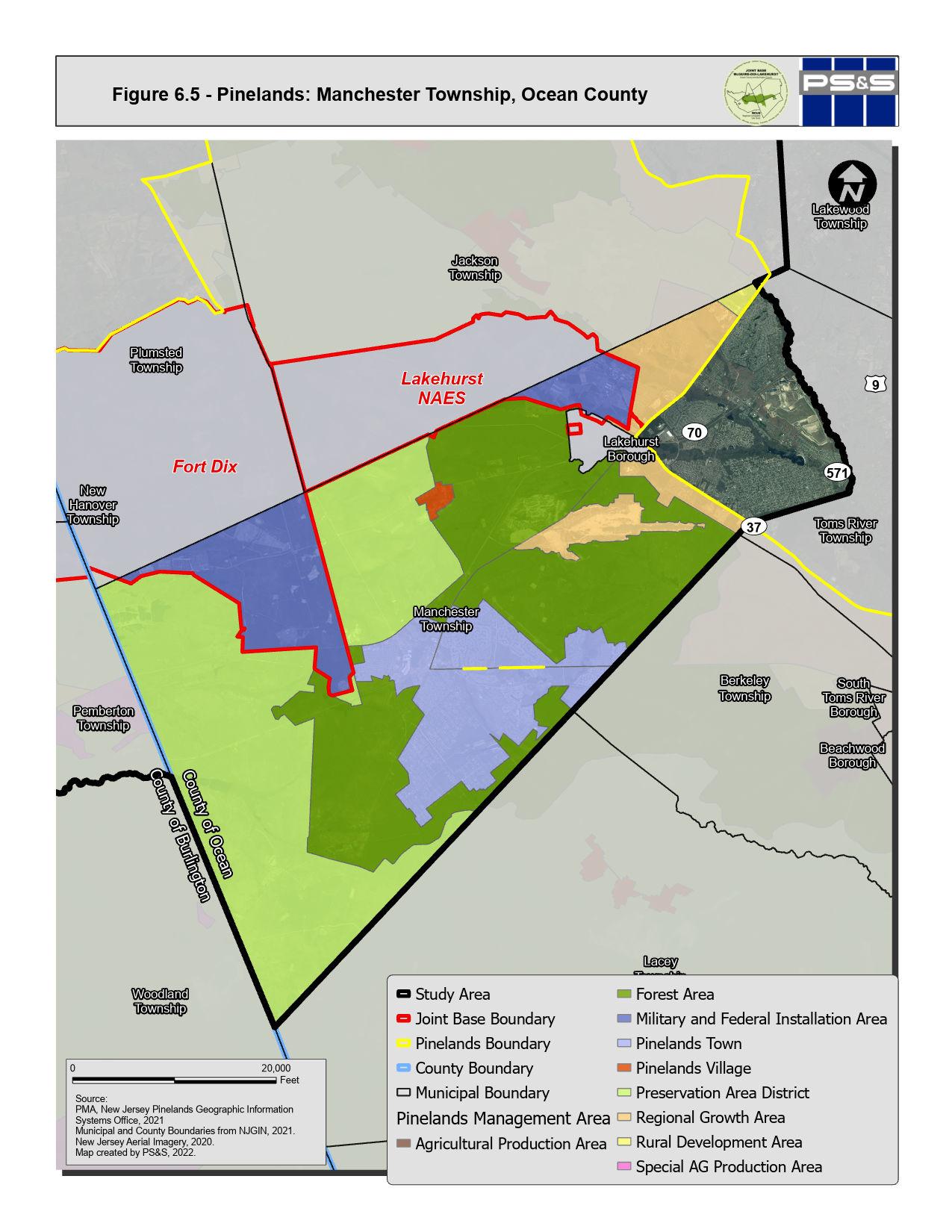
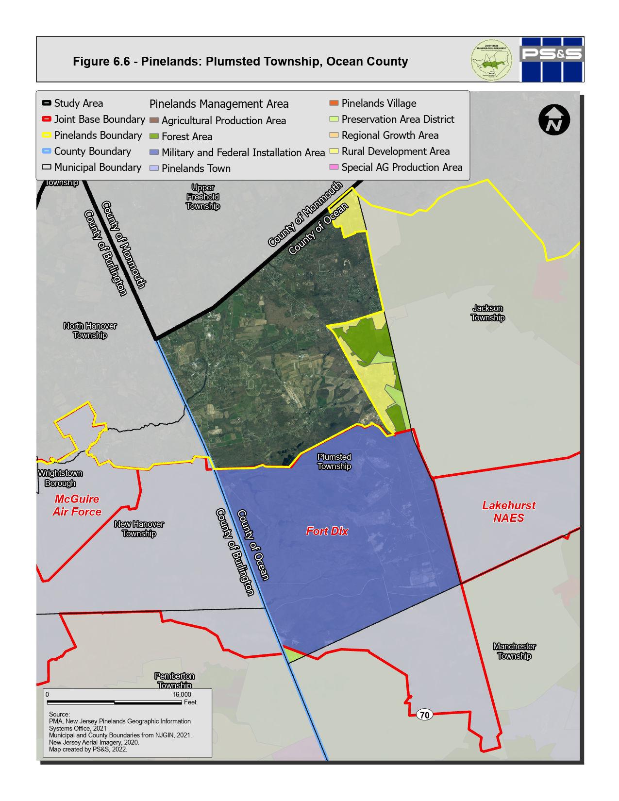
6.3.1.2 Burlington County
New HanoverTownship - Most of New Hanover Township is within the Pinelands. This area coincides with the Joint Base boundary and is mapped Military and Federal Installation.
North Hanover Township - A relatively small part of North Hanover Township’s land area (within the Joint Base boundary) is within the Pinelands and is mapped Military and Federal Installation.
Pemberton Township - As presented on Figure 6.9, most of the land area of Pemberton Township is within the Pinelands area. Two areas in the north of Pemberton Township are mapped Military and Federal Installation (within the Joint Base boundary). The eastern half of Pemberton Township is Forest Area, Preservation Area, Agricultural Production Area, and Special AG Production Area, while the western area of the Township includes Agricultural Production, Rural Development and Regional Growth Areas. The western corner of the Township is not within the Pinelands.
Pemberton Borough – Pemberton Borough is not within the Pinelands Area.
Springfield Township - The only part of Springfield Township within Pinelands jurisdiction is within the Joint Base boundary (Military and Federal Installation).
Wrightstown Borough - The Pinelands jurisdiction within Wrightstown Borough is shown on Figure 6.12. Most of this area is Federal or Military Facility, while a part of the northern-central area of the borough is Pinelands Town.
6-21 P:\03143\0008 Reports\N-Envir\Regional Compatible Use Study\2023 Final Section 6.docx
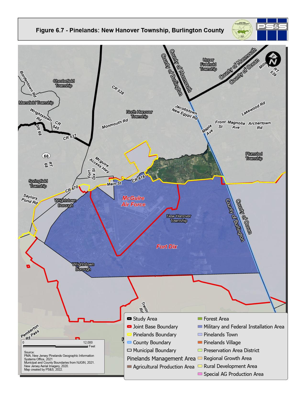
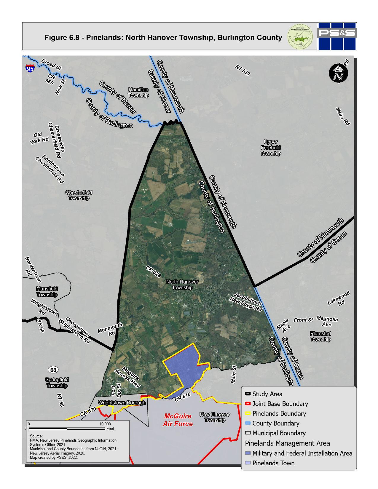
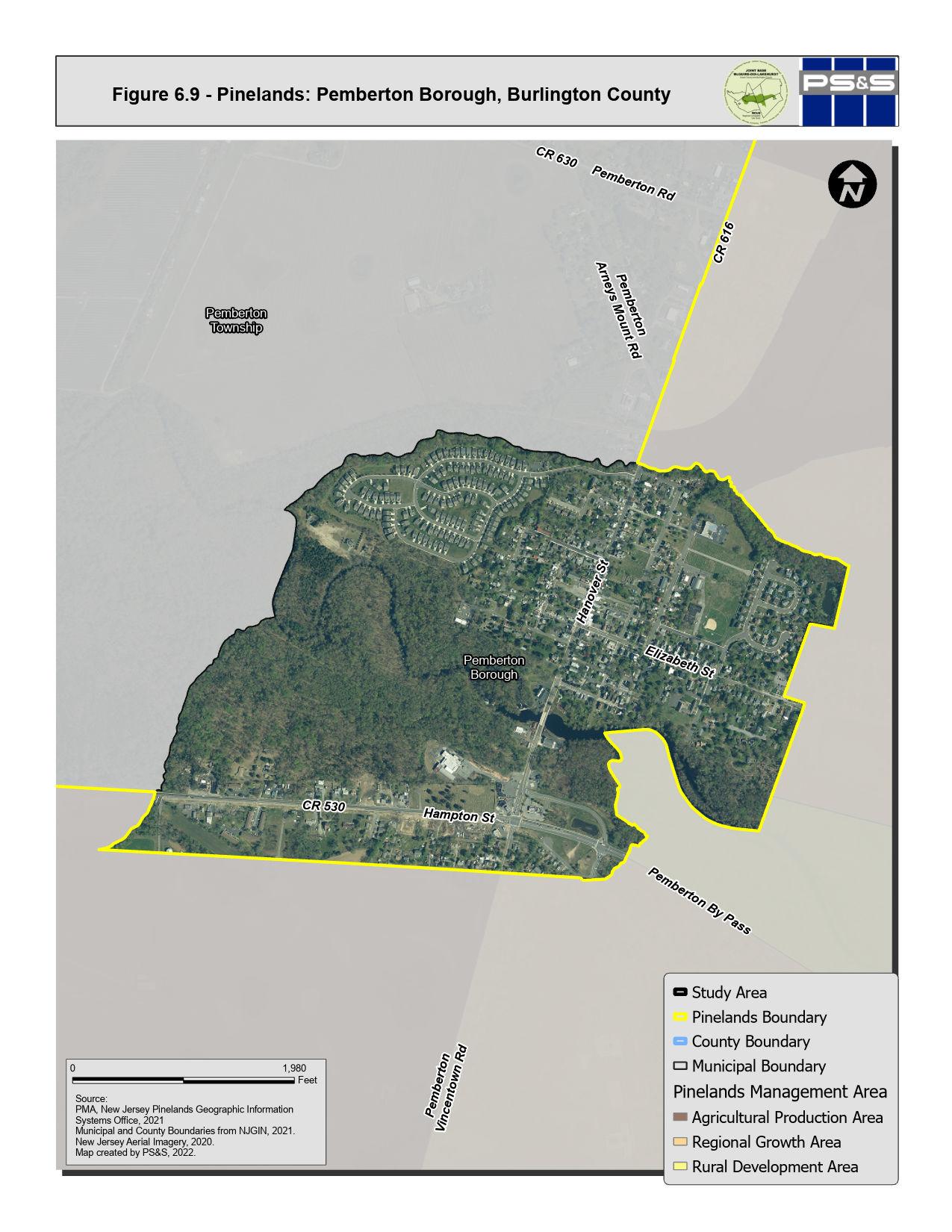
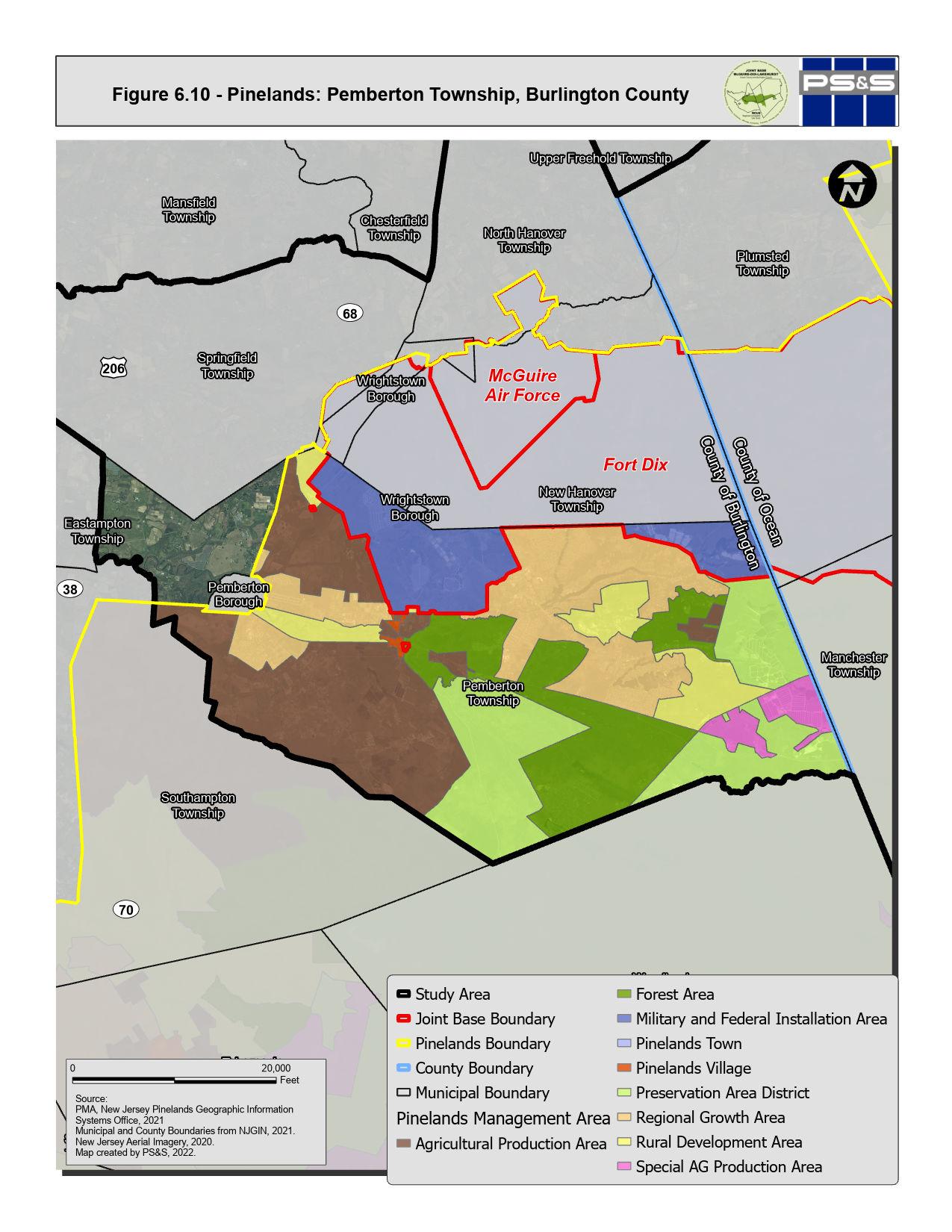
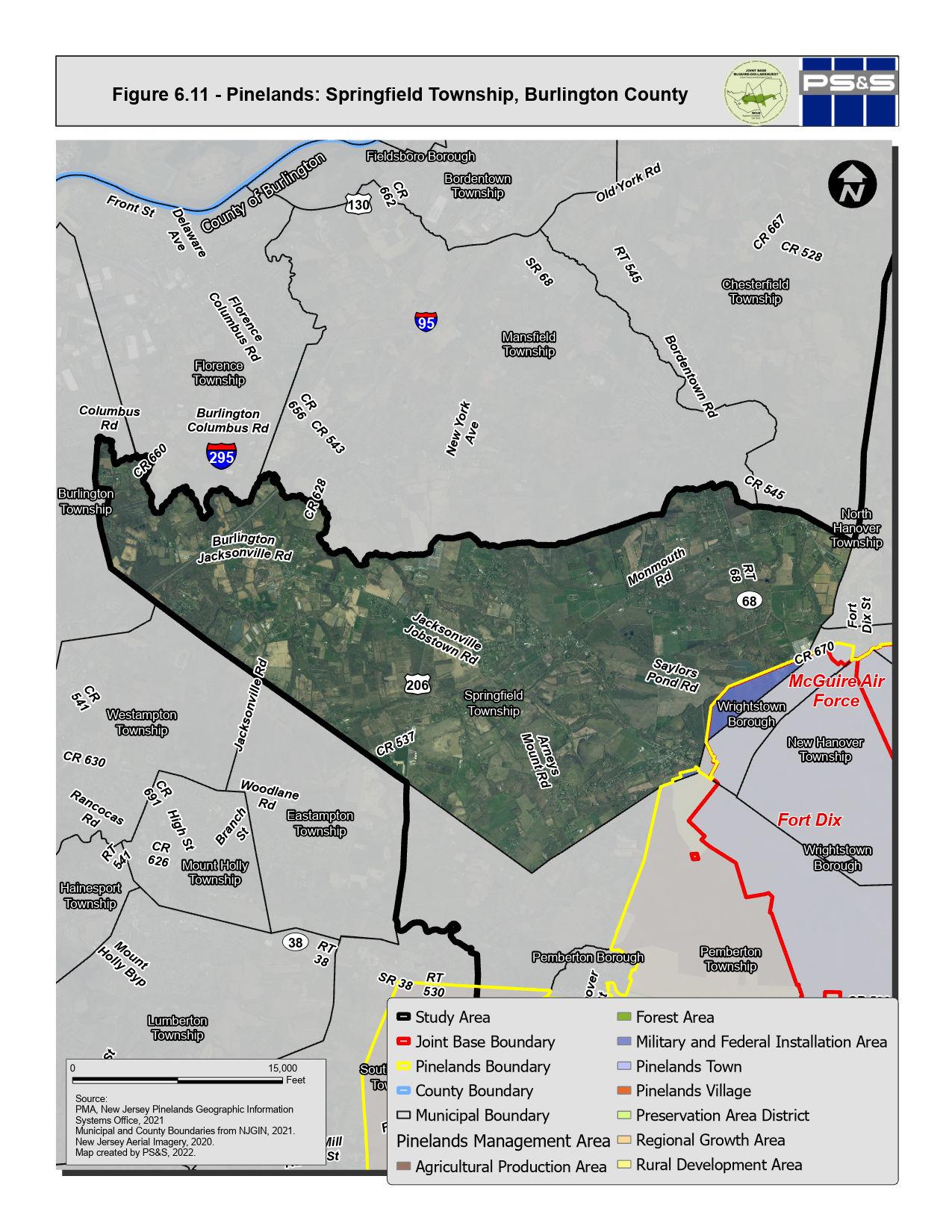
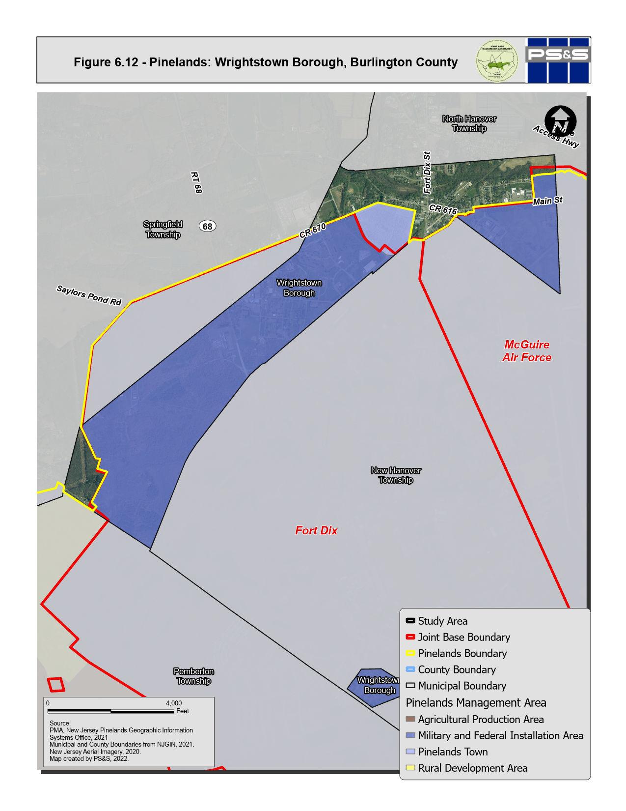
6.3.2 Pinelands Discussion
The Pinelands CMP provides a closely managed set of controls for land use planning in much of the RCUS area. The resource protection initiatives of the CMP have conserved land and limited encroachment of development in land areas that are coincident with areas that are important from a JB MDL operational perspective. Implementation of the Pinelands CMP has constrained sprawl and preserved large areas of land with unique ecological integrity within the RCUS municipalities. The Pinelands Commission has been successful in limiting growth in the core of the ecologically sensitive pinelands central area while supporting cranberry or blueberry crops, forestry, recreation and fish and wildlife management areas. During the 2005 BRAC process that was part of the foundation for merging the separate Army, Air Force and Navy installations into JB MDL, one of the deciding factors for whether to close, modify or maintain operations at a base is the surrounding encroachment of incompatible land use. While not part of the specific purpose of Pinelands regulations, the land use controls in place to influence land development surrounding JB MDL have had the beneficial effect of limiting potentially incompatible new land development in some areas that adjoin JB MDL.
The Pinelands Commission has enacted a development credit program (PDC) that has helped to redirect growth from the Pinelands Preservation Areas into the Regional Growth Areas. The PDC program allocates sending areas and receiving areas. Sending area development credits can be used to increase the amount of residential development on receiving area lands. Conservation or agricultural easements are placed on the sending properties when the credits are transferred. PDCs can be bought and sold privately or through the publicly chartered Pinelands Development Credit Bank. Pemberton, Jackson and Manchester Townships are participating in the PDC program. The PDC program has resulted in the preservation of more than 50,000 acres since its inception in 1985 and has helped to redirect growth from the Pinelands Preservation and Agricultural Production Areas to the designated Regional Growth Areas. This program is considered one of the most successful examples of TDR in the country.
6-28 P:\03143\0008 Reports\N-Envir\Regional Compatible Use Study\2023 Final Section 6.docx
Three municipalities within the RCUS area include land designated as Pinelands Regional Growth Area: Jackson Township and Manchester Township in Ocean County, and Pemberton Township in Burlington County. In Pemberton, much of the lands in the Pemberton Heights, Browns Mills and Country Lake Estates neighborhoods are designated Regional Growth. In Manchester, Regional Growth Areas are located near the eastern boundary of JB MDL; a former quarry site identified as Heritage Minerals is also designated a Regional Growth Area, however development proposals on that property have been the subject of extended discussions between the project sponsor and various review agencies. In Jackson Township, Regional Growth Areas are located on the eastern edge of the Pinelands area.
The availability of lands designated for Regional Growth provides potential for using TDR processes to shift incompatible land uses to redevelopment areas outside of JB MDL operational noise or air operations safety zones.
6.4 PRESERVED LAND
Preserved lands include those areas that are protected and preserved for their ecological, natural, or cultural values. Preserved lands are located throughout the Study Area as shown on Figures 6.13 through 6.22 and are preserved through several different programs as described below. Table 6.2 summarizes the amount of preserved land in each municipality.
6-29 P:\03143\0008 Reports\N-Envir\Regional Compatible Use Study\2023 Final Section 6.docx
Municipality Preserved Acres Total Acres Percent in Preservation Ocean County Jackson Township 24,034 58,064 41% Lakehurst Borough 109 583 18% Manchester Township 25,561 47,780 53% Plumsted Township 5,853 13,450 44% Burlington County New Hanover Township 353 1,369 26% North Hanover Township 4,416 10,730 41% Pemberton Borough 65 403 16% Pemberton Township 17,734 35,830 49% Springfield Township 7,081 18,652 38% Wrightstown Borough 20 340 6%
Table 6.2: Preserved Land in the Study Area
Note: This table provides acreages for the area of the municipalities outside of JB MDL.
6.4.1 Readiness and Environmental Protection Integration (REPI) Program
The DOD Readiness and Environmental Protection Integration (REPI) Program is a DOD tool that helps prevent and eliminate incompatible land use on and off base to protect and support military missions. Installations partner with state and local stakeholders to identify locations of potential encroachment and purchase easements to minimize incompatible land use, preserve habitats, and increase installation environmental resiliency. Funding for these efforts comes from the Military Service Fund, REPI Program Funds, and Partner Funds. Sources of Partner Funding cover approximately half of REPI project costs and include conservation organizations, landowners, and federal, state, and local programs
Through this program, the JB MDL has worked with the State of New Jersey, New Jersey Pinelands Commission, Burlington and Ocean Counties, and municipalities to preserve 9,192 acres. Lands protected through the REPI program within the Study Area are shown on Figures 6.13 through 6.22. REPI conservation and preservation efforts have focused on lands within a 2-mile buffer of the installation boundaries. Of particular concern are lands within and around the Accident Potential Zones associated with Joint Base runways. The military benefits from improved night flying capabilities, operational safety, and mission protection. The community enjoys the preservation of working lands and wildlife habitats, and advancement of regional planning objectives.
JB MDL wants to expand the REPI Program through integration into the Sentinel Landscape program. The United States Department of Agriculture (USDA), DOD, and Department of the Interior (DOI) define sentinel landscapes as areas in which natural and working lands are well suited to protect defense facilities from land uses that are incompatible with the military's mission. JB MDL is working with stakeholders throughout the area and with Naval Weapons Station Earl and Dover Air Force Base to develop a sentinel landscape program specifically for those installations. This partnership would support preservation past the 2-mile buffer of a single installation with stronger collaboration and increased access to funding opportunities.
6-30 P:\03143\0008 Reports\N-Envir\Regional Compatible Use Study\2023 Final Section 6.docx
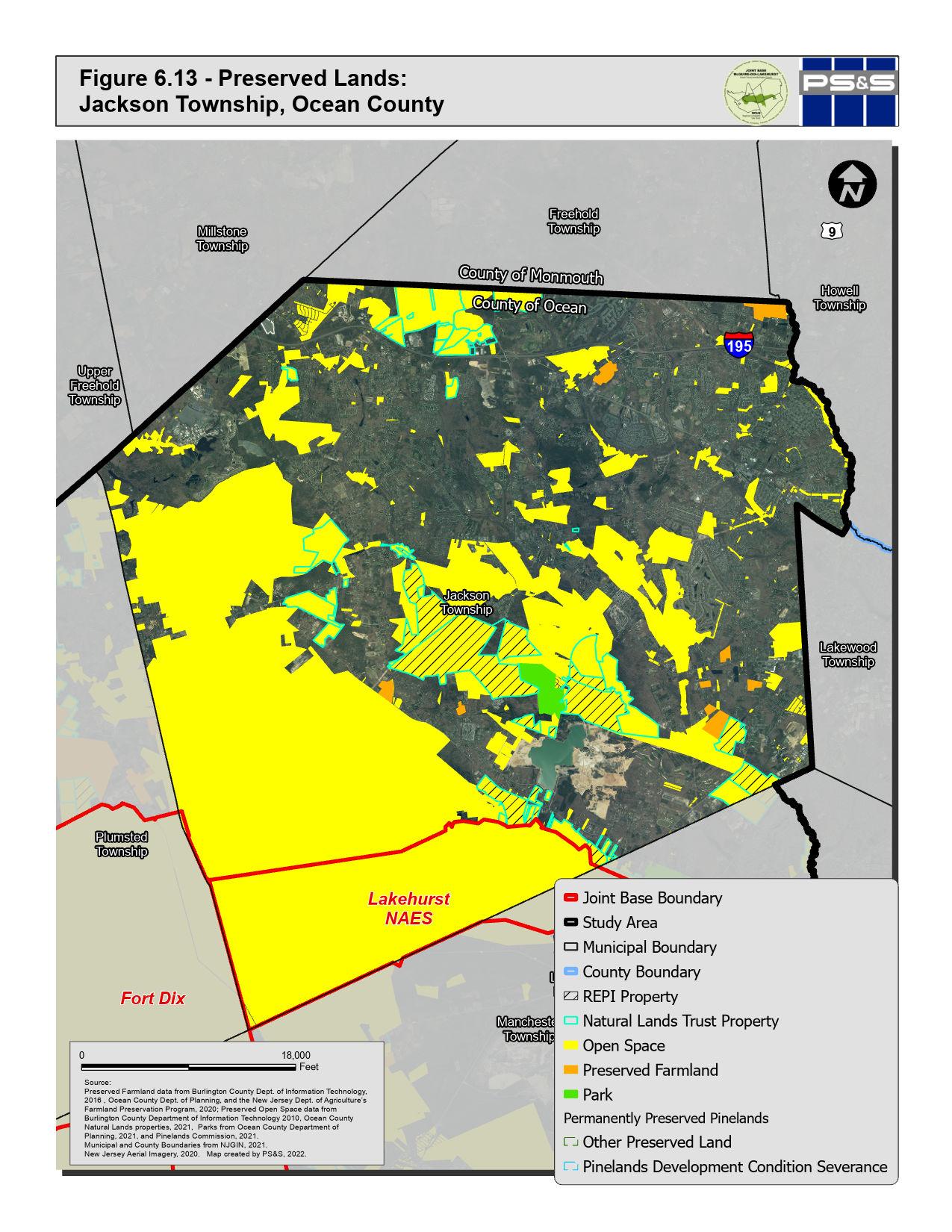
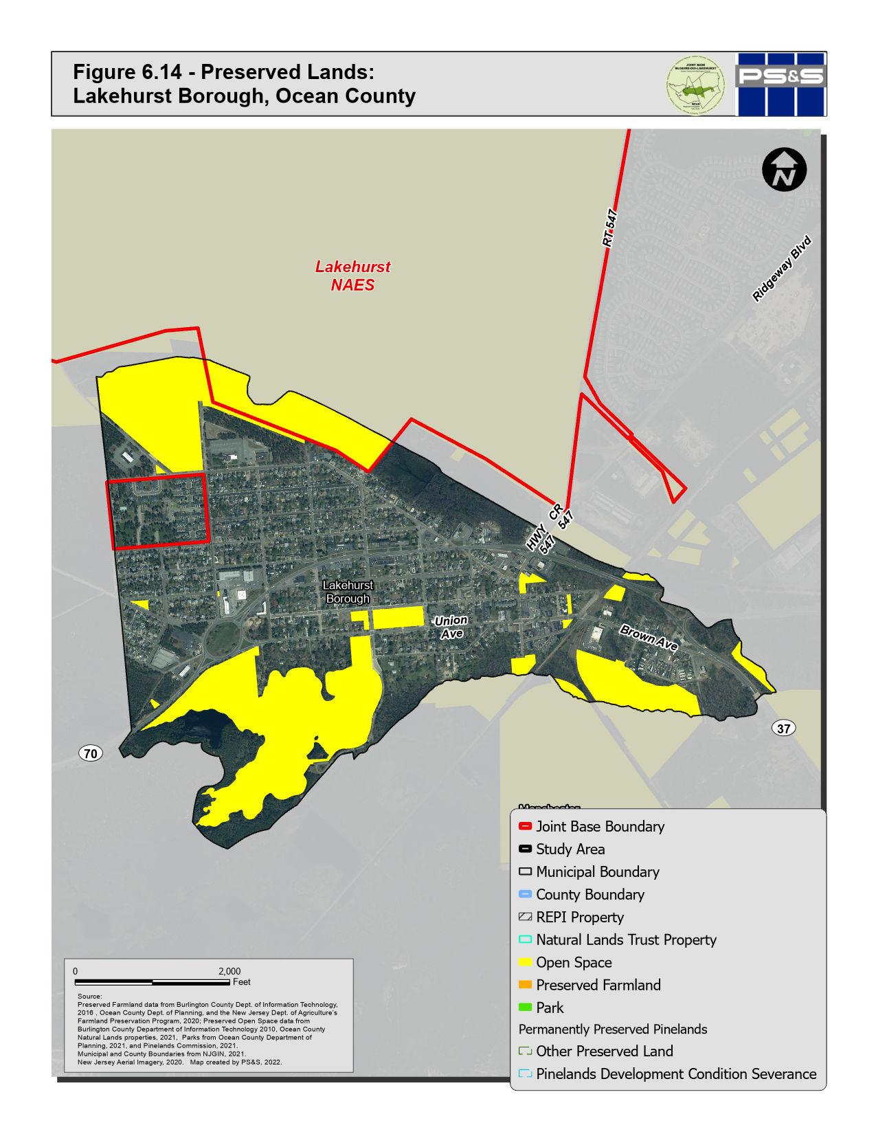
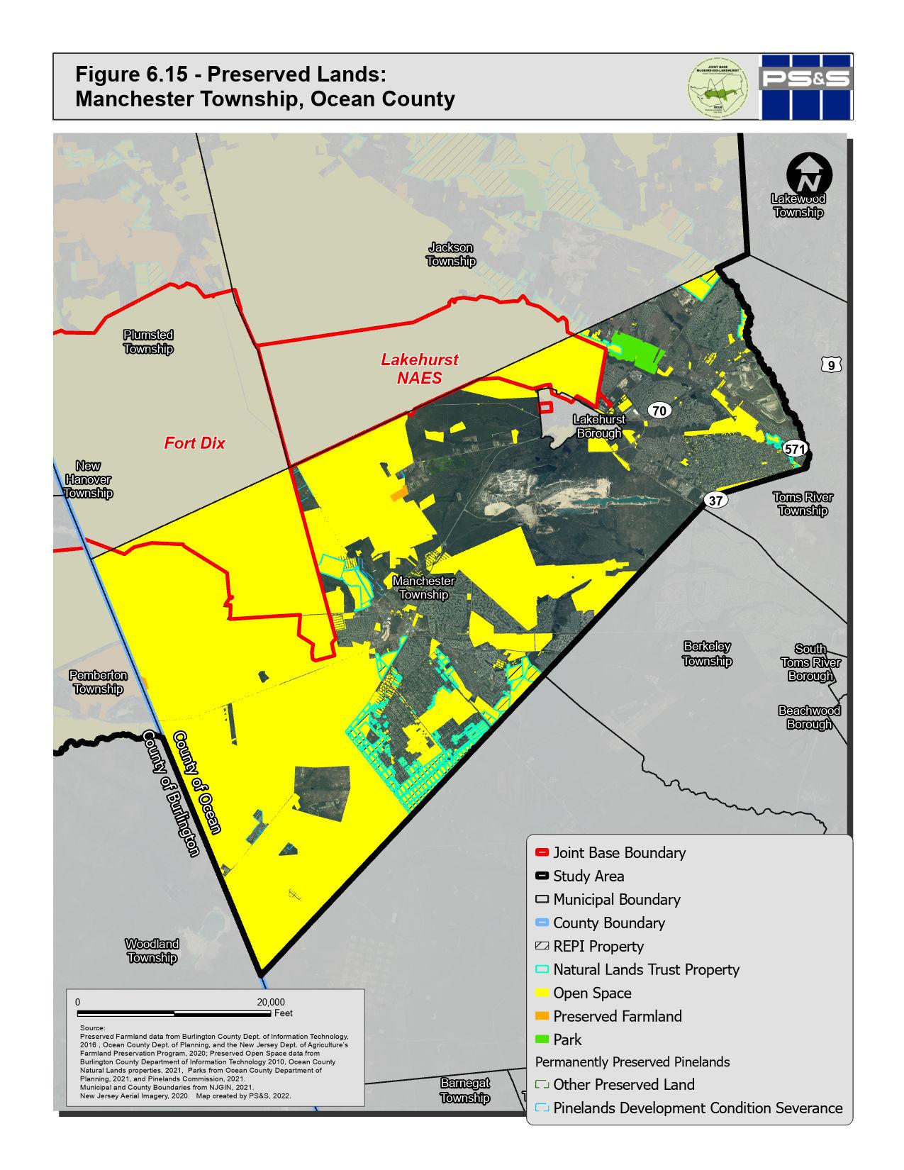
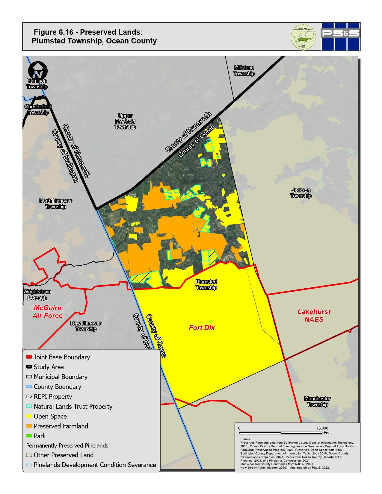
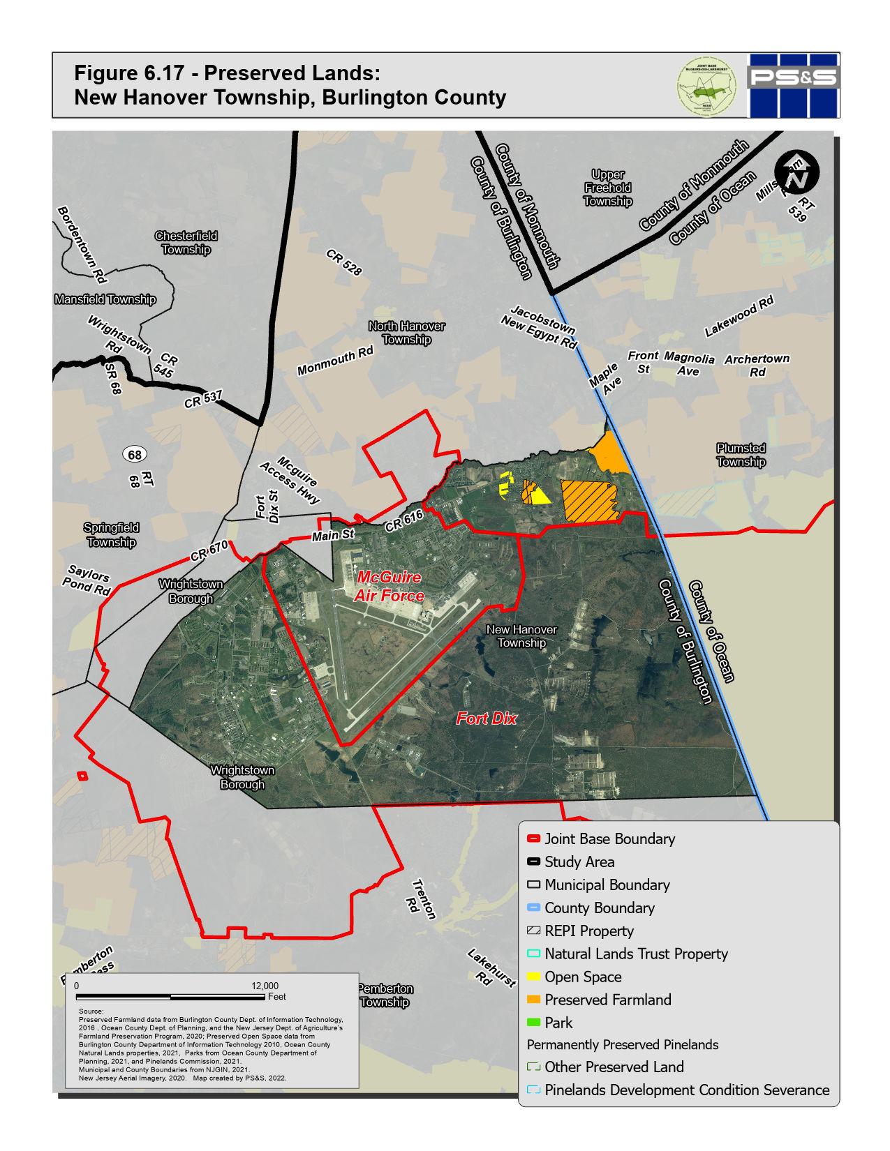
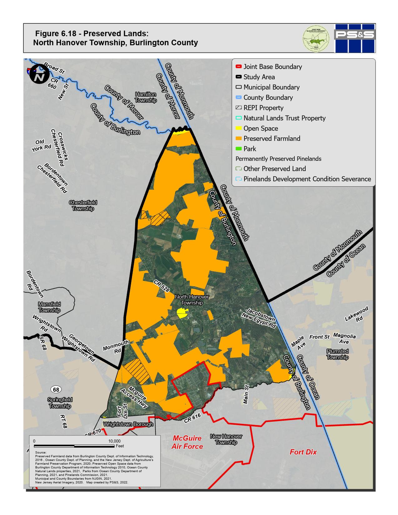
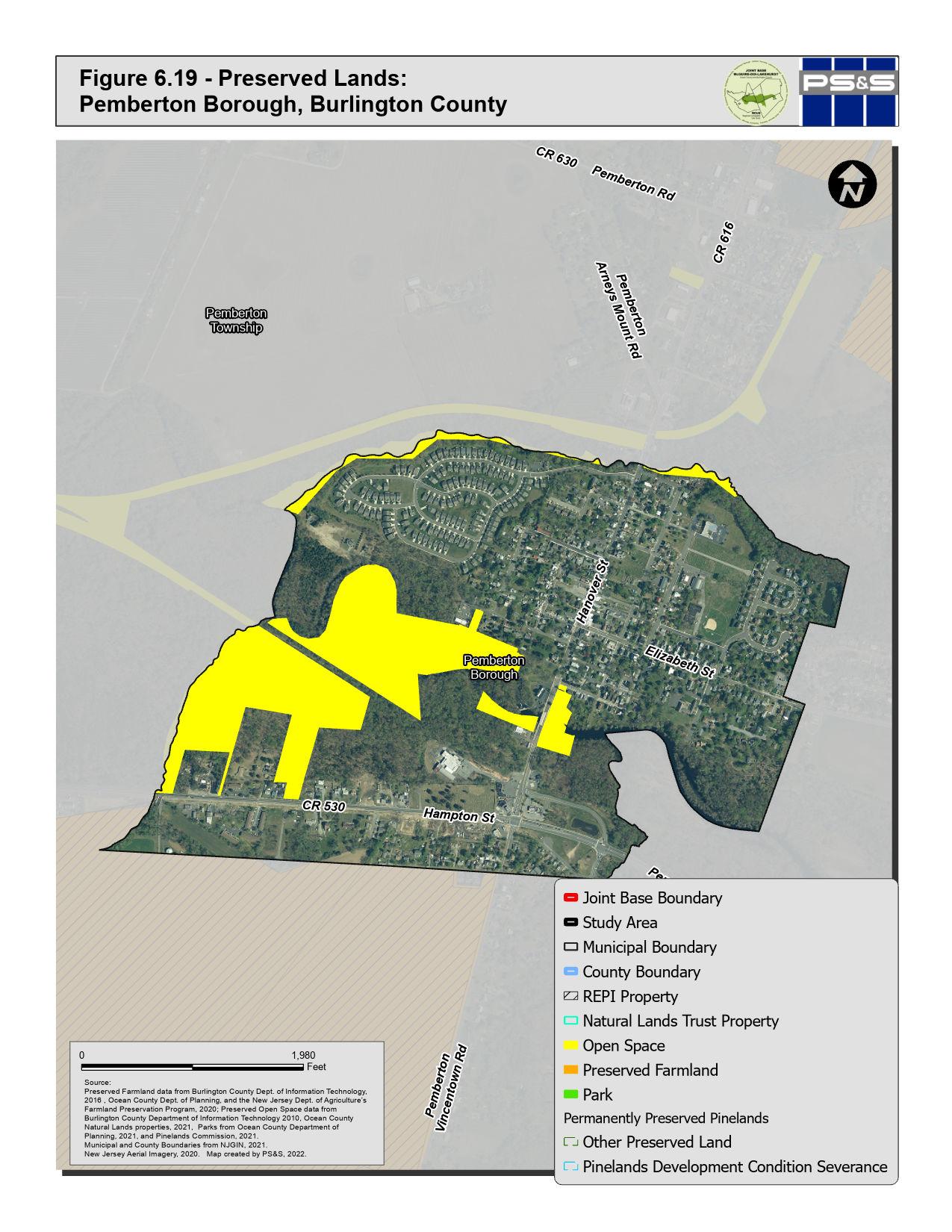
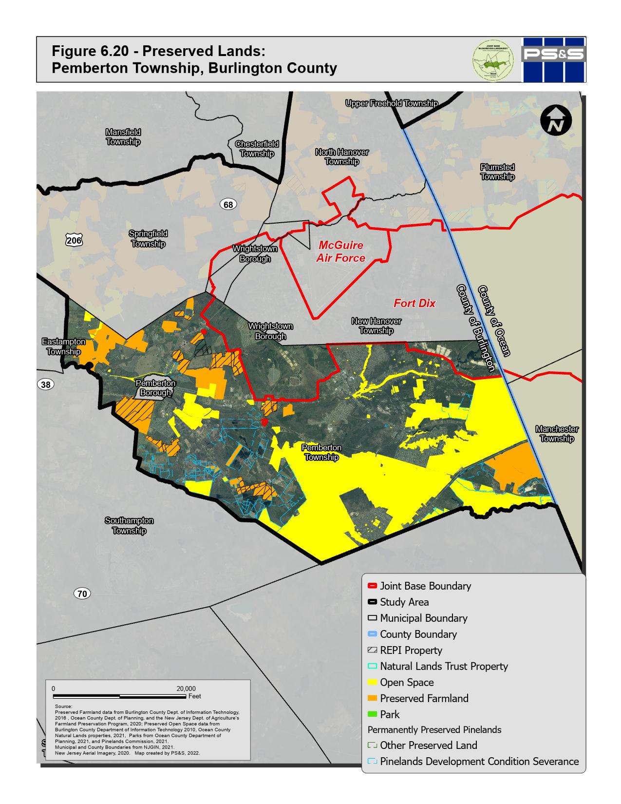
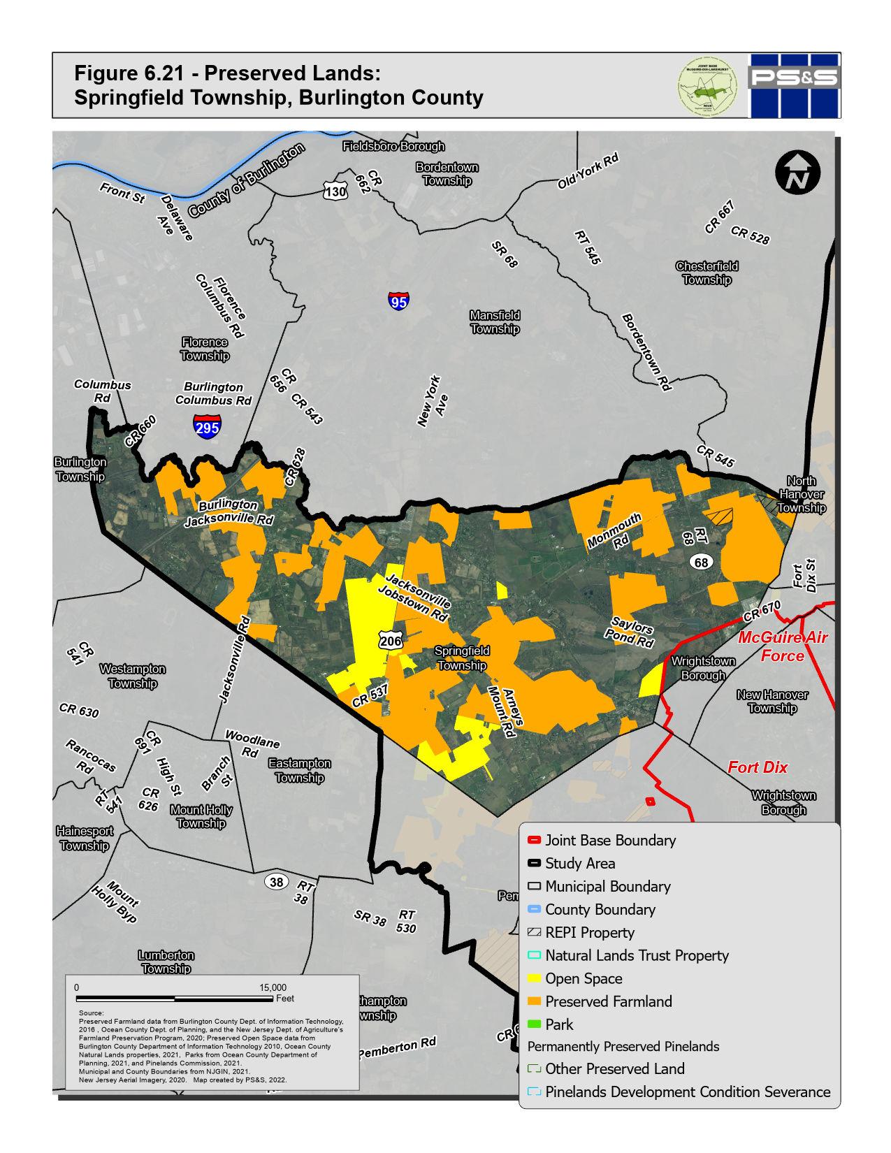
Figure 6.22 - Preserved Lands: Wrightstown Borough, Burlington County

Pemberton Township Wrightstown Borough Wrightstown Borough Springfield Township North Hanover Township New Hanover Township McGuire Air Force Fort Dix 0 4,000 Feet Joint Base Boundary Study Area Municipal Boundary County Boundary REPI Property Natural Lands Trust Property Open Space Preserved Farmland Park Permanently Preserved Pinelands Other Preserved Land Pinelands Development Condition Severance Source: Preserved Farmland data from Burlington County Dept. of Information Technology, 2016 , Ocean County Dept. of Planning, and the New Jersey Dept. of Agriculture’s Farmland Preservation Program, 2020; Preserved Open Space data from Burlington County Department of Information Technology 2010, Ocean County Natural Lands properties, 2021, Parks from Ocean County Department of Planning, 2021, and Pinelands Commission, 2021. Municipal and County Boundaries from NJGIN, 2021. New Jersey Aerial Imagery, 2020. Map created by PS&S, 2022.
6.4.2 Farmland Preservation Programs
Farmland Preservation Programs are administered by Ocean County and Burlington County with coordination with the State Agriculture Development Committee (SADC), municipal governments, nonprofit organizations, and landowners within the Study Area. Farmland is preserved in four ways:
• Sale of Development Easements – Intended for landowners who want to continue farming their land. The landowner can sell the rights to develop their land into a use other than agriculture. These deed restrictions remain in place for any future landowners. The rights can be sold to the SADC, County Agriculture Development Boards (CADBs), municipalities, or nonprofit organizations. This is the most popular way in which landowners enter the Farmland Preservation Program.
• Donation of Development Easements – Landowners can donate the rights to develop their land into a use other than agriculture. This option can result in significant income and estate tax benefits.
• Sale of Entire Property – A landowner can sell a farm outright to the SADC at fair-market value under its fee simple program. The SADC then auctions the farm to a private owner with agricultural deed restrictions in place to ensure its permanent preservation. This option allows farmers to purchase land at reasonable prices that reflect only farmland values, not development potential.
• Term Farmland Preservation – Landowners can restrict development on their land for eight to sixteen years. Under this program, landowners are eligible to apply for cost-sharing grants for soil and water conservation projects
6-41 P:\03143\0008 Reports\N-Envir\Regional Compatible Use Study\2023 Final Section 6.docx
Table 6.3 summarizes the acreage of preserved farmland within the Study Area by county and municipality.
Municipality Farmland Preserved
Ocean County 3,2791 Jackson Township 310 Lakehurst Borough 0 Manchester Township 80 Plumsted Township 3,246 Burlington County 15,248 New Hanover Township 318 North Hanover Township 4,348 Pemberton Borough 0 Pemberton Township 3,666 Springfield Township 5,939 Wrightstown Borough 0
Table 6.3: Preserved Farmland in the Study Area
Acres
1. Total acres in study area, not the entire County.
6.4.3 County Parks and Open Space
The Ocean County Department of Parks and Recreation offers 27 parks and conservation areas that provide opportunities for an array of active and passive recreation. 66,291 acres of Open Space and Parkland are located within the Ocean County part of the RCUS Area. One Ocean County Park, the Patriots’ County Park & Sports Field Complex in Jackson Township, is within the Study Area. Ocean County Parks is developing a new 260‐acre County Park located on Ridgeway Road (CR 571) and South Hope Chapel Road (CR 547). The park will include interpretive signage and educational programs about the history of Navy Lakehurst. The Parks Department hopes to work closely with the installation on incorporating this history and providing recreational opportunities for the military and civilians on the Base The locations of these parks are shown on Figure 6.13 through 6.16
12,486 acres of Open Space and Parkland are located in the Burlington County part of the RCUS Study Area. The Burlington County Parks System offers 14 parks, 7 museums and galleries, and 5 regional trails. Two Burlington County Parks, the Burlington County Fairgrounds and Arney’s Mount Park in Springfield Township, are within the Study Area. Additionally, a Rancocas Creek Canoe Trail follows the Rancocas Creek through Pemberton Township and Pemberton Borough. The locations of these parks are shown on Figures 6.17 through 6.22
6.4.4 Green Acres Program Recreation and Open Space Inventory
The Green Acres Program’s mission is “to achieve, in partnership with others, a system of interconnected open spaces, whose protection will preserve and enhance New Jersey’s natural environmental and its historic, scenic, and recreational resources for public use and enjoyment.” The Green Acres Program achieves their mission through five program areas:
• State Park and Open Space Acquisition
• Local Governments and Nonprofit Funding
• Stewardship and Legal Services
6-42
P:\03143\0008 Reports\N-Envir\Regional Compatible Use Study\2023 Final Section 6.docx
• Planning and Information Management
• Office of Natural Resource Restoration
Municipalities maintain a Recreation and Open Space Inventory (ROSI) of all Green Acres-funded properties and other lands held for conservation and/or recreation purposes.
6.4.5 Pinelands Commission Permanent Land Protection
The Pinelands Commission generally seeks the permanent preservation of environmentally, historically, and agriculturally significant land in the Pinelands region through state and local agencies, non-profit conservation organizations, farmland protection programs, and other regulatory initiatives. The Pinelands Commission promotes land preservation through the following programs:
• Pinelands Development Credit Program – Regional transfer of development rights program from the Preservation Area District, Special Agricultural Production Area and Agricultural Production Area to Pinelands Regional Growth Areas.
• Pinelands Conservation Fund – A fund that is dedicated to permanent land protection, conservation planning and research projects, community planning and design initiatives, and education and outreach.
• Limited Practical Use Program - Offers the owners of properties that are less than 50 acres with limited development potential an opportunity to sell their properties to the State of New Jersey
• Sub-Regional Natural Resource Protection Planning - Regional land-use program that protects natural resources through various measures, including planning and zoning.
Numerous properties in the Study Area, as shown on Figures 6.3 through 6.12, have been permanently preserved through the Pinelands Commission.
6.5 ENVIRONMENTAL RESOURCE REGULATIONS IN THE RCUS AREA
State land use regulation (i.e., Pinelands CMP, FWPA, and FHACA) all impose limitations to the development potential of properties in the Study Area. The Study Area includes lands that are subject to the land use regulatory programs of the New Jersey Pinelands Commission (i.e., the Comprehensive Management Plan) as well as State land use regulatory programs administered by NJDEP. Statewide, most site disturbance in a
6-43 P:\03143\0008 Reports\N-Envir\Regional Compatible Use Study\2023 Final Section 6.docx
freshwater wetlands or State open water and adjacent transition areas are subject to regulation by NJDEP under the New Jersey Freshwater Wetlands Protection Act (FWPA) Moreover, a wide variety of activities within wetlands and wetlands buffers are also regulated by the Pinelands Commission. Finally, New Jersey’s Flood Hazard Area Control Act (FHACA) authorizes NJDEP to regulate activities within both the riparian zone associated with regulated watercourses as well as areas subject to floodwater inundation adjacent to those regulated waters.
The presence of wetlands and flood hazard areas in the Study Area influenced historical development patterns. Historic aerial photographs of the area show streams and absence of agricultural or rural development on the land north, east, and south of the JB MDL, and mostly agricultural land uses to the west. Areas that were subject to flooding or inundation in the root zone, which is a characteristic of wetlands, would constrain agriculture and development activities. Much of this land area is now mapped by the NJDEP as wetlands, as shown on Figure 6.23
In addition to the area delineated as wetlands, a wetland transition area extends into uplands from the wetland/upland boundary 300 feet in areas within Pinelands jurisdiction and up to 150 feet in areas subject to the FWPA. While authorization of specific activities is subject to discretionary review by the Pinelands Commission and NJDEP, future development activity including commercial, industrial, and residential development is anticipated to be prohibited or significantly constrained. Therefore, for the assessment of potential land development within the RCUS areas mapped as wetlands are not anticipated to become developed.
As to the numerous streams that originate in or cross through the Study Area, the FHACA regulates activities in flood hazard areas and riparian zones, which are lands and vegetation adjacent to a regulated water. The extent of the riparian zone varies based upon characteristics of the water body and can be up to 300 feet from top of bank. Like wetlands, the presence of regulated streams, flood hazard areas and riparian zones affects the potential of a property to be developed.
The NJDEP Division of Fish and Wildlife Landscape Project has prepared regional mapping of wildlife habitats for the entire state, including Threatened and Endangered
P:\03143\0008 Reports\N-Envir\Regional Compatible Use Study\2023 Final Section 6.docx
6-44
Species habitats. The Landscape Project maps are used as guidance regarding the potential presence of species and habitat warranting protection in accordance with NJDEP rules. Under NJDEP’s rules, the Landscape Project mapping of Rank 3, 4, and 5 habitat creates a presumption that a protected habitat is present but that presumption can be refuted by a site specific study conducted in accordance with NJDEP requirements Virtually the entire Study Area is mapped as Rank 3, 4 and 5 habitat indicating a high potential for the presence of one or more individual threatened or endangered species and/or habitat for those species.
6-45 P:\03143\0008 Reports\N-Envir\Regional Compatible Use Study\2023 Final Section 6.docx
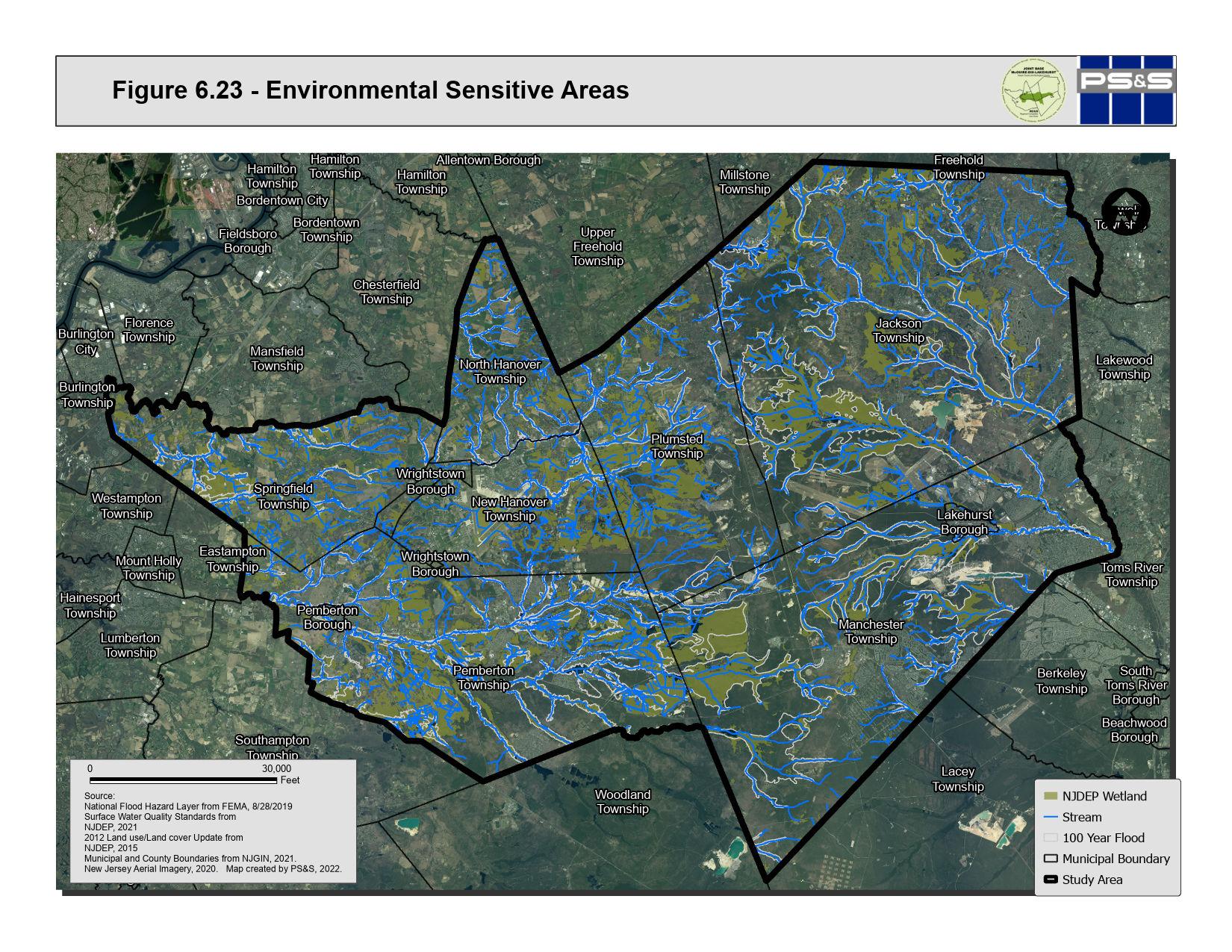
7.0 INFRASTRUCTURE CAPACITY

7.0 INFRASTRUCTURE CAPACITY
7.1 TRANSPORTATION
7.1.1 Roads and Highways
JB MDL is located centrally within the State of New Jersey, spanning 10 municipalities and 2 counties (Burlington and Ocean). The area surrounding the JB MDL is crossed by numerous Interstate and State of New Jersey highways and county routes. Principal north-south highways near the base are U.S. Interstate 95 (New Jersey Turnpike) and 295 and U.S. Route 206 to the west, and U.S. Route 9 and the Garden State Parkway to the east. Interstate 195 is an east-west route located approximately 7 miles north of the JB MDL New Jersey Highway 68 is a main connector between the JB MDL and Interstates 95 and 295 New Jersey highways 70 and 37 provide access from the JB MDL eastward towards U.S. Route 9 and the Garden State Parkway.
In addition to the U.S. and State highways, numerous Burlington County and Ocean County Roads provide access to and around the JB MDL. The JB MDL has controlled access points via security gates. The area is served by numerous Interstate and State highways, and Ocean and Burlington County roads. The regional highway system is mapped on Figure 7.1, Regional Transportation
Two roads provide access through the base in the north-south direction. Ocean County Road 539 (Whiting-New Egypt Road/Pinehurst Road) crosses the eastern part of the Dix land area. Burlington County Road 667 (Cookstown Browns Mills Road) crosses JB MDL in the area east of McGuire land area
7.1.2 Visitor Centers
McGuire Welcome Center
3021 McGuire Blvd, McGuire Air Force Base (Entry from Wrightstown Cookstown Road and McGuire Access Highway)
7-1 P:\03143\0008 Reports\N-Envir\Regional Compatible Use Study\2023 Final Section 7.docx
Dix Welcome Center
2270 Fort Dix Rd, Pemberton, NJ 08068
Lakehurst Welcome Center County Rd 547, Lakehurst, NJ 08753
7.1.3 Entry Control Facilities
A Comprehensive Traffic Engineering Study (Traffic Study), dated April 2011, was prepared for JB MDL by the Military Surface Deployment and Distribution Command Transportation Engineering Agency with the assistance of Gannett Fleming Joint Base McGuire-Dix-Lakehurst has several access points. As described in the Traffic Study, prior to the terrorist attacks of September 11, 2001, mandatory access control to military installations was not a DOD requirement. The three installations that were formed into JB MDL had numerous access points and several roads that enabled travel across the bases.
The Traffic Study included review of the Entry Control Facilities (ECF) in use at the base. The ECFs are listed in Table 7.1. The purpose of an ECF is to secure the installation from unauthorized access and intercept contraband while maximizing vehicular traffic flow. ECF priorities include security, safety (motorists and guards), traffic flow and aesthetics. The Traffic Study included monitoring of traffic volumes at each gate, and design recommendations were based on the existing traffic volume with a growth factor applied for future traffic volumes. ECF design standards integrate threat scenarios, safety considerations for drivers and gate personnel, threat containment, and additional engineering and manpower measures while minimizing congestion on the approach roads
The ECFs at JB MDL were the subject of an Entry Control Facility Study Final Report, dated June 2021 and prepared under contract by Transportation Engineering Agency in assistance with Gannett Fleming. The ECF Study included non-commercial ECFs and their adjacent internal and external intersections. Existing conditions were evaluated, and recommendations were developed using transportation engineering and safety standards; the standards used in the ECF Study are reviewed in Section 2.5 of that document. The ECF Study elements that
7-2 P:\03143\0008 Reports\N-Envir\Regional Compatible Use Study\2023 Final Section 7.docx
reviewed external roadways adjacent to JB MDL entry and exit portals have bearing on this RCUS and are potentially addressable via RCUP implementation measures. The ECF Study including studies of vehicle queuing at entry gates and intersection traffic volumes, which were subject to factoring to account for reduced trips attributable to reduced on-base staffing due to COVID-19 workforce management measures. The ECF Study also included survey of personnel for ECF preference for entering and exiting, decision-factors that influence choice of gate, preferences for gate if traffic or other conditions were not a factor including gates that are currently closed. The recommendations in the Entry Control Facility Study Final Report are currently under review and have not been implemented.
Dix Wrightstown Gate
Dix Browns Mills Gate
Dix Pemberton Gate
Dix Commercial Gate Lakehurst Main Gate Lakehurst Commercial Gate Lakehurst Gate 3
7-3 P:\03143\0008 Reports\N-Envir\Regional Compatible Use Study\2023 Final Section 7.docx
Table 7.2 presents a summary of short-term and long-term improvement options for external roads adjacent to JB MDL ECFs to address safety concerns and accessibility.
JB MDL Area Gate Name McGuire Main Gate McGuire Arnold Gate
Table 7.1: JB MDL Entry Control Facilities
(closed)
Dix Main Gate
Table 7.2: JB MDL Entry Control Facility Study Table of Improvement Options for External Intersections
Location Improvement
Juliustown Rd and Pointville Rd (Dix Pemberton External)
Replace the YIELD sign for the northbound channelized right and ROUTE signs on the eastbound approach with new signs that utilize Type III sheeting or better trim or remove the branches along the northern end of the westbound approach so there are no obstructions for pedestrians using the sidewalk. Ensure the branches no longer obscure the STOP sign.
Restripe the centerline markings along the westbound approach
Texas Ave and Range Rd (Dix Browns Mills External)
Remove the END 15 MPH sign. Install a R2-1 speed limit sign on the south leg with the desired speed limit.
Restripe the faded pavement markings throughout the intersection
Replace the STOP sign with a R1-2 YIELD sign for westbound right turning traffic
Install a raised concrete island for the westbound channelized right. Install a new STOP sign in the island for the left turning vehicles.
It is recommended to remove the northbound and southbound approach signal heads as they are not needed. If they are desired to stay, adjust the signal heads so that they are properly aligned with approaching vehicles. Install an approved end treatment for guiderail ends throughout the intersection. Delineate the barrier ends using retroreflective panels.
Route 68 and Fort Dix Rd (Dix Rt 68 External)
Fort Dix St and Railroad Ave (Dix Wrightstown External)
If the intersection is upgraded in the future to include sidewalk and other pedestrian accommodations, pedestrian push buttons should be installed anywhere where pedestrians are permitted to cross the intersection
Install a W3-3 SIGNAL AHEAD sign for the eastbound approach
Remove the two crosswalks on the northbound approach that lead to a grassy area on the western end. Install a crossing at the intersection on the northbound approach. Extend the sidewalk along the south leg to the intersection. Install a pedestrian warning (W11-2) sign and download arrow plaque (W16-7PL) at the point where the crossing occurs for both the northbound and southbound directions.
Remove or trim the tree so that the Right Lane Must Turn Right sign on the northbound approach can be clearly seen. An alternative option would be to mount the sign on a post in front of tree. Relocate the advance RLMTR sign to the beginning of the storage lane.
Replace the street name signs with ones that utilize Type III sheeting or better
Wrightstown Cookstown Rd and Bolling Blvd (Housing Gate External)
Install Detectable Warning Systems (DWS) for the intersection curb ramps
Replace the guardrail ends along Bolling Blvd with an approved end treatment. Delineate the guiderail ends using an OM3 object marker or retroreflective panels.
Remove the pedestrian buttons for the eastbound and northbound approaches. Note that the pushbutton for the southbound approach crossing is mounted on the wrong side of the signal pole and should be moved to the opposite side.
Replace the lane use sign for the southbound approach with one that uses Type III sheeting or better
Orange St and Chestnut St
/Proving Ground Rd (External Lakehurst Pinehurst)
Lansdowne Rd and Hope Chapel Rd (Lakehurst Main External)
Mount all signs to a minimum height of 5 feet measured from the bottom of the sign to the ground. The signs should be mounted to a height of 7 feet in areas where pedestrians are expected.
Install a DWS for each ramp and ensure the curb ramps and DWS are properly aligned for the northbound approach crosswalk
Install sidewalk to connect the existing sidewalk network to the bus stop on the north leg
7-4 P:\03143\0008 Reports\N-Envir\Regional Compatible Use Study\2023 Final Section 7.docx
Remove the Keep Right sign and install a DOUBLE ARROW sign for the northbound approach. The traffic cones on the south leg should be removed. An object marker can be installed if additional delineation is desired.
Adjust the lane use control sign for the eastbound approach
Restripe the faded pavement markings throughout the intersection
7.1.4 Air Travel
JB MDL Passenger Service Terminal provides space available air travel to eligible military personnel, family members and DOD civilians on official travel. The region includes several international airports, with the nearest being Newark-Liberty and Philadelphia
Additional airports in the region include Lakewood Airport, Ocean County Airport, South Jersey Regional Airport and Trenton-Robbinsville Airport, and Trenton Mercer Airport. The location of airports near the JB MDL is illustrated on Figure
7.1, Regional Transportation.
7.1.5 Mass Transit
Ocean County Department of Transportation Services operates Ocean Rides, which provides bus routes including service for Lakehurst and Manchester and enabling connections to New Jersey Transit routes. Burlington County operates the BurLINK Bus System, including a route connecting Browns Mills, New Hanover and Pemberton with destinations to the west including Mt. Holly, Willingboro and NJ Transit bus and River LINE rail stations.
7.1.6 RCUS Traffic and Transportation Topics
Traffic and road infrastructure were extensively studied after completion of the 2009 JLUS. A Joint Base Regional Transportation Mobility Study was completed in 2011, which examined the mobility impacts resulting from mission changes at Joint Base McGuire‐Dix‐Lakehurst, and regional growth in population and employment. The Mobility Study listed projects and improvements to promote safe and efficient transportation around the Joint Base, through targeted transportation
7-5 P:\03143\0008 Reports\N-Envir\Regional Compatible Use Study\2023 Final Section 7.docx
improvements. Improvements described in the Mobility Study have been completed as noted in Table 7.3 below, and other improvements remain to be completed subject to completion of additional planning and multi-agency coordination and funding.
Another important project has been identified following completion of the JLUS and that is proposed to improve traffic and safety is the planned Route 539 Overpass. Route 539 is an Ocean County Road that bisects the JB MDL, and cross traffic associated with base activities can create significant impact to civilian and commercial use of this road. Initial Federal funding for this project has been authorized.
Transportation issues were identified at interviews with RCUS municipal representatives and members of the public from survey responses and Open House events. During interviews with representatives of Wrightstown concerns about gate access of commercial vehicles for deliveries and other commercial needs was identified. Commercial vehicles that arrived at the JB MDL at a noncommercial entrance have caused disruption to traffic and damage to overhead utility lines during U-turn maneuvering.
In addition, representatives of municipalities that include JB MDL gate entrances have noted peak-hour congestion, with the effect that travel on roads near the base is avoided during the anticipated traffic periods. Interview participants described
7-6 P:\03143\0008 Reports\N-Envir\Regional Compatible Use Study\2023 Final Section 7.docx
Priority Rank Project Solutions Status 6 CR 528 and 639 Bus Prioritization/Safety Imp. Completed 7 CR 547 and 571 Capacity and safety Imp. Pending Completion of Lakehurst Gate Study 13 CR 527 and 622 Traffic signal modifications and safety Imp. Improvements completed, signal analysis to be completed 15 CR 527 and 528 Road improvements, Bus prioritization, signal mod. Completed 16 CR 528 and 640 Study/revise traffic control, safety improvements and crash mitigation measures Completed 20 CR 571 Capacity improvements Partial implementation
Table 7.3: Regional Transportation Mobility Study Improvements
that gate closure schedules have impacted commerce for businesses that rely upon patronage from base personnel. Mid-day closure of gates prevents personnel from venturing off-base for meals or shopping, and permanent gate closures have resulted in loss of business. Further, attendees at the Burlington County Open House Event described additional miles and time required to travel to destinations around the base perimeter, due to closing of roads that formerly crossed the base. The through-installation road closures occurred in response to security measures enacted after the September 11, 2001 attacks, and not specifically due to the formation of JB MDL.
7-7 P:\03143\0008 Reports\N-Envir\Regional Compatible Use Study\2023 Final Section 7.docx
Figure 7.1 - Regional Transportation


222 Hazleton 22 73 33 10 93 38 57 3 100 100 611 611 309 248 413 30 30 46 1 202 202 202 422 206 95 76 76 80 80 78 78 176 476 476 476 276 295 287 287 Readng Allentown Trenton Philadelphia 291 54 73 55 322 322 206 1 13 40 295 95 New Jersey Wlm ngton 23 70 36 25A 9 9 130 78 495 195 195 Jo nt Base McGu re-Dix-Lakehurs Ga eway Nat onal Recreat on Area Pars ppany Toms Rver Edison Bren wood West Baby on Levi town Hcksvi e Long Branch Elizabeth Yonkers Paterson Newark New York 539 9 9 97 495 Fire Is and Nat onal Seashore Lehigh Valley International Newark Intl John F Kennedy Intl La Guardia Philadelphia Intl I 0 100,000 Feet Study Area County Boundary Bus Route Passenger Rail Line Major Airport Other Airport Source: County Boundary from NJGIN, 2021. Esri, Street Map, 2022. Map created by PS&S, 2023. Airport data from FAA, 2023 Rail Line data from FRA, 2023 Bus Line data from Burlington & Ocean County, and NJ Transit, 2023
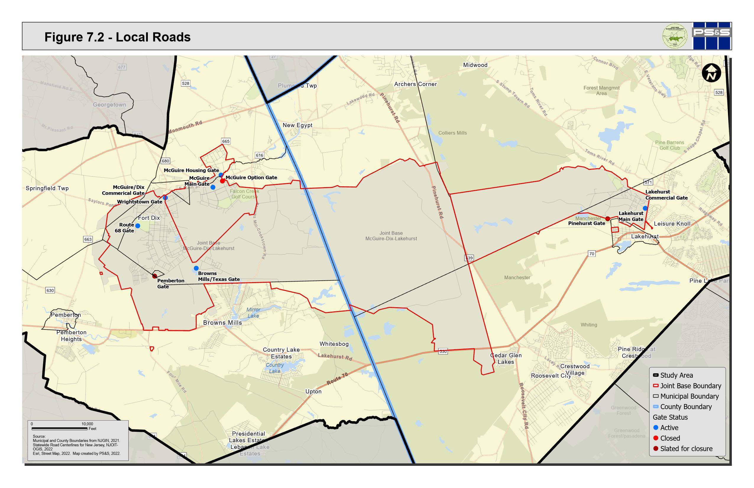
7.3 - Transporation Jackson Township, Ocean County
Jackson Township 9 70 37 3 547 10 622 628 53 39 44 32 46 4 16 59 537 31 28 18 6 50 12 626 639 23 2 26 42 638 54 52 641 14 8 526 34 636 640 524 528 539 571 527 195 Main Gate Lakehurst Pinehurst Gate Lakehurst Commercial Gate Lakehurst NAES Fort Dix I 0 18,000 Feet Study Area Joint Base Boundary Municipal Boundary County Boundary Railroad Gate Locations Bus Terminals Bus Route Bus Stops Trails County Route Major Highway State Route US Route Source: Esri Transportation Data, 2020. NJ Transit Data, 2022. Burlington and Ocean County, 2023 Esri World Street Map, 2030. Map created by PS&S, 2023.
Figure
Lakehurst Borough 70 37 547 3 10 12 8 2 6 4 Main Gate Lakehurst Pinehurst Gate Lakehurst NAES
0 2,000 Feet Study Area Joint Base Boundary Municipal Boundary County Boundary Railroad Gate Locations County Route State Route Source: Esri Transportation Data, 2020. NJ Transit Data, 2022. Burlington and Ocean County, 2023 Esri World Street Map, 2030. Map created by PS&S, 2023.
I
Figure 7.4 - Transporation Lakehurst Borough, Ocean County
Manchester Township 72 37 70 3 530 84 92 547 10 34 66 56 83 31 639 24 12 59 22 622 628 6 32 8 532 637 4 42 626 615 39 2 52 14 528 18 640 618 614 571 539 527 444 Main Gate Lakehurst Pinehurst Gate Lakehurst Commercial Gate Lakehurst NAES Fort Dix I 0 20,000 Feet Study Area Joint Base Boundary Municipal Boundary County Boundary Railroad Gate Locations Bus Route Bus Stops Trails County Route Major Highway State Route US Route Source: Esri Transportation Data, 2020. NJ Transit Data, 2022. Burlington and Ocean County, 2023 Esri World Street Map, 2030. Map created by PS&S, 2023.
Figure 7.5 - Transporation Manchester Township, Ocean County
Figure 7.6 - Transporation Plumsted Township, Ocean County
Plumsted Township 70 18 537 22 616 26 680 46 24 27 12 6 669 28 2 8 638 34 666 10 664 526 645 14 665 20 545 42 4 667 571 530 640 528 539 Main Gate McGuire Browns Mills Gate Lakehurst NAES McGuire Air Force Fort Dix I 0 16,000 Feet Study Area Joint Base Boundary Municipal Boundary County Boundary Railroad Gate Locations Bus Route Bus Stops Trails County Route Major Highway State Route Source: Esri Transportation Data, 2020. NJ Transit Data, 2022. Burlington and Ocean County, 2023 Esri World Street Map, 2030. Map created by PS&S, 2023.
Figure 7.7 - Transporation New Hanover Township, Burlington County
New Hanover Township 68 70 18 22 616 27 26 28 687 543 24 6 644 8 670 646 539 664 10 20 640 630 665 680 666 4 545 669 645 667 528 537 530 Route 68 Gate Main Gate McGuire Wrightstown Gate Browns Mills Gate Pemberton Gate McGuire/Dix Commerical Gate McGuire Air Force Fort Dix I 0 12,000 Feet Study Area Joint Base Boundary Municipal Boundary County Boundary Gate Locations Bus Route Bus Stops Trails County Route State Route Source: Esri Transportation Data, 2020. NJ Transit Data, 2022. Burlington and Ocean County, 2023 Esri World Street Map, 2030. Map created by PS&S, 2023.
Figure 7.8 - Transporation North Hanover Township, Burlington County
North Hanover Township 68 18 26 22 616 543 28 20 27 545 670 672 640 677 8 10 667 660 665 680 666 664 4 539 537 528 700 Route 68 Gate Main Gate McGuire Wrightstown Gate McGuire/Dix Commerical Gate McGuire Air Force Fort Dix I 0 10,000 Feet Study Area Joint Base Boundary Municipal Boundary County Boundary Gate Locations Bus Route Bus Stops Trails County Route Major Highway State Route Source: Esri Transportation Data, 2020. NJ Transit Data, 2022. Burlington and Ocean County, 2023 Esri World Street Map, 2030. Map created by PS&S, 2023.
Pemberton Borough 668 687 630 644 530 616 I 0 1,980 Feet Study Area Municipal Boundary County Boundary Bus Route Bus Stops Trails County Route Source: Esri Transportation Data, 2020. NJ Transit Data, 2022. Burlington and Ocean County, 2023 Esri World Street Map, 2030. Map created by PS&S, 2023.
Figure 7.9 - Transporation Pemberton Borough, Burlington County
Pemberton Township 206 72 38 68 70 18 22 28 27 643 681 622 621 690 24 6 678 8 628 687 10 641 684 665 680 663 666 670 539 563 668 640 646 545 648 4 645 543 667 642 644 630 616 669 528 532 537 530 700 Route 68 Gate Main Gate McGuire Wrightstown Gate Browns Mills Gate Pemberton Gate McGuire/Dix Commerical Gate McGuire Air Force Fort Dix I 0 20,000 Feet Study Area Joint Base Boundary Municipal Boundary County Boundary Railroad Gate Locations Bus Route Bus Stops Trails County Route Major Highway State Route US Route Source: Esri Transportation Data, 2020. NJ Transit Data, 2022. Burlington and Ocean County, 2023 Esri World Street Map, 2030. Map created by PS&S, 2023.
Figure 7.10 - Transporation Pemberton Township, Burlington County
Springfield Township 206 130 38 68 662 691 626 636 617 664 682 643 683 693 690 640 681 642 545 659 666 680 677 661 638 639 646 687 621 684 663 644 645 541 678 668 528 612 641 656 530 670 669 660 628 543 616 630 537 700 295 Route 68 Gate Wrightstown Gate Pemberton Gate McGuire/Dix Commerical Gate McGuire Air Force Fort Dix I 0 15,000 Feet Study Area Joint Base Boundary Municipal Boundary County Boundary Railroad Gate Locations Bus Terminals Bus Route Bus Stops Trails County Route Major Highway State Route US Route Source: Esri Transportation Data, 2020. NJ Transit Data, 2022. Burlington and Ocean County, 2023 Esri World Street Map, 2030. Map created by PS&S, 2023.
Figure 7.11 - Transporation Springfield Township, Burlington County
Wrightstown Borough 68 666 680 630 670 616 545 669 Route 68 Gate Wrightstown Gate Pemberton Gate McGuire/Dix Commerical Gate McGuire Air Force Fort Dix I 0 4,000 Feet Study Area Joint Base Boundary Municipal Boundary County Boundary Gate Locations Bus Route Bus Stops Trails County Route State Route Source: Esri Transportation Data, 2020. NJ Transit Data, 2022. Burlington and Ocean County, 2023 Esri World Street Map, 2030. Map created by PS&S, 2023.
Figure 7.12 - Transporation Wrightstown Borough, Burlington County
7.2.1 Public Water Purveyors
New Jersey’s water supply is almost evenly split between surface water and groundwater sources. In some cases across New Jersey there are areas that currently are, or are projected to be in, a water supply deficit. There are currently two critical water supply areas (Critical Area 1 and Critical Area 2) designated in New Jersey, both located within the New Jersey Coastal Plain. In 1982 NJDEP adopted the first NJ Statewide Water Supply Plan (NJ SWSP) as required by the Water Supply Management Act. In 1996 the NJDEP issued a follow up statewide water supply master plan, “Water for the 21st Century” to continue the process of estimating individual surface water supply and regional groundwater availability and projecting for future demand scenarios (population growth). A second complete revision of the NJ SWSP was issued in 2017, titled the New Jersey Water Supply Plan 2017-2022. Previously, the NJDEP had divided the State into 23 Regional Water Resource Planning Areas; the newest revision to the NJ SWSP uses Watershed Management Areas (WMAs) comprised of watersheds (HUC11) as a support tool to inform and assist local, regional, and State planning decisions.
The RCUS municipalities fall within WMAs 13, 19, and 20, and include a total of 43 public community water purveyor service areas. Water purveyors are regulated by the NJDEP Bureau of Safe Drinking Water, under the Safe Drinking Water Act. Public community water purveyors are systems that pipe potable water to at least 15 service connections at primary residences, or one that regularly serves at least 25 primary residents. Public purveyors can be government agencies, private companies, or quasi-governmental groups.
Table 7.4 summarizes the net water available for each WMA included in the RCUS, as well as the 2020 water demand and water surplus/deficit estimated by the 20172022 New Jersey Water Supply Plan.
7-20 P:\03143\0008 Reports\N-Envir\Regional Compatible Use Study\2023 Final Section 7.docx 7.2 WATER SUPPLY
WMA 13
All Ocean County RCUS municipalities are either partially or entirely located within the Barnegat Bay WMA, WMA 13 (Jackson Township, Lakehurst Borough, Manchester Township, and Plumsted Township). WMA 13 falls within the Atlantic Coast Statewide Water Region.
While WMA 13 is not projected to have deficits, a critical water supply area is located in WMA 13 and localized restrictions by the NJDEP have been put into place to reduce groundwater withdrawals, thereby reducing stress on the aquifer.
Large portions of WMA 13 are also located in the Pinelands, which carries its own set of water restrictions. Within WMA 13, there are 19 public community water purveyor service areas within RCUS municipalities (3 of which also fall within a second WMA).
Table 7.5 summarizes WMA 13 public water purveyor capacity within the RCUS municipalities. Shady Oak Trailer Court shows a firm capacity deficit, based on the physical ability of the firm capacity to provide treated water at adequate pressure when the largest pumping unit or treatment unit is out of service. All of the water purveyors within WMA 13 that have capacity data are operating with a watersupply surplus.
7-21 P:\03143\0008 Reports\N-Envir\Regional Compatible Use Study\2023 Final Section 7.docx
WMA Net Water Available 2020 Water Demand 2020 Water Surplus/Deficit Barnegat Bay (13) 121.4 MGD 89.1 MGD 32.3 MGD Rancocas (19) 39.2 MGD 26.7 MGD 12.5 MGD Assiscunk, Crosswicks, and Doctors (20) 32.2 MGD 7.5 MGD 24.7 MGD
per day
Table 7.4: WMA Water Statistics
MGD = million gallons
PWS ID Water Purveyor Water Supply Firm Capacity Daily Peak Demand Firm Capacity Deficit or Surplus Yearly Limit Yearly Demand Annual Deficit or Surplus Last Update (yr) 1511001 Jackson Township MUA 10.750 MGD 5.173 MGD 3.924 MGD 2060 MGY 1200.317 MGY Surplus 2022
Table 7.5: WMA 13 Public Water Purveyor Capacity within RCUS Municipalities
WMA 19
The Rancocas WMA, WMA 19, encompasses the southwest portion of the Study Area, in both Burlington and Ocean Counties. Portions of Manchester, Jackson, Plumsted, New Hanover, and Springfield Townships and Wrightstown Borough, and the entirety of Pemberton Township and Pemberton Borough fall within WMA
7-22 P:\03143\0008 Reports\N-Envir\Regional Compatible Use Study\2023 Final Section 7.docx 1511002 Jackson Estates Mobile Home Park 0.144 MGD 0.039 MGD 0.105 MGD 37.200 MGY 11.763 MGY Surplus 2022 1511003 Land of Pines Mobile Home Park 0.040 MGD 0.000 MGD 0.040 MGD 0.000 MGY 0.000 MGY Surplus 2020 1511004 Maple Glen Mobile Home Park 0.048 MGD 0.000 MGD 0.048 MGD 0.000 MGY 0.000 MGY Surplus 2020 1511005 Oak Tree Mobile Home Park 0.029 MGD 0.023 MGD 0.0006 MGD 37.200 MGY 6.857 MGY Surplus 2022 1511007 Shady Oak Trailer Court 0.648 MGD 0.932 MGD -0.284 MGD 140.000 MGY 145.772 MGY Deficit 2020 1511008 South Wind Mobile Home Village 0.144 MGD 0.081 MGD 0.063 MGD 37.200 MGY 17.233 MGY Surplus 2022 1511010 Naval Air Engineer Station Lakehurst 0.547 MGD 0.109 MGD 0.438 MGD 60.000 MGY 28.989 MGY Surplus 2022 1511011 Luxury Mobile Terrace 2020 1511013 Fountainhead Parks Incorporated 0.086 MGD 0.015 MGD 0.071 MGD 37.200 MGY 3.991 MGY Surplus 2022 1511016 Meadowbrook Co-Op Incorporated 0.060 MGD 0.008 MGD 0.052 MGD 37.200 MGY 2.856 MGY Surplus 2022 1513001 Lakehurst Water Department 0.432 MGD 0.279 MGD 0.153 MGD 140.000 MGY 85.630 MGY Surplus 2022 1518001 Cedar Glen Homes Inc 0.072 MGD 0.050 MGD 0.022 MGD 37.200 MGY 15.218 MGY Surplus 2022 1518002 Cedar Glen Lakes WC* 0.432 MGD 0.188 MGD 0.244 MGD 70.000 MGY 54.199 MGY Surplus 2022 1518003 Cedar Glen West Water Company 0.216 MGD 0.162 MGD 0.054 MGD 42.700 MGY 35.039 MGY Surplus 2022 1518004 Manchester Twp WUWestern* 4.536 MGD 1.688 MGD 2.848 MGD 810.000 MGY 462.592 MGY Surplus 2022 1518005 Manchester Twp WUEastern* 5.813 MGD 4.367 MGD 1.446 MGD 1145.000 MGY 963.079 MGY Surplus 2022 1518010 Manchester Village 0.058 MGD 0.011 MGD 0.047 MGD 37.200 MGY 3.001 MGY Surplus 2022 1523001 Collier Mills Mobile Estates* 2020
19. WMA 19 falls within the Lower Delaware Statewide Water Region. The major surface water source that supplies WMA 19 is the Rancocas Creek.
WMA 19 is not projected to have deficits. A critical water supply area is located in WMA 19 and localized restrictions by the NJDEP have been put into place to reduce groundwater withdrawals, thereby reducing stress on the aquifer. Large portions of WMA 19 within the Study Area are also located in the NJ Pinelands Region, which carries its own set of water restrictions. Within WMA 19, there are 14 public community water purveyor service areas within RCUS municipalities (5 of which also fall within a second WMA).
Table 7.6 summarizes WMA 19 public water purveyor capacity within the RCUS municipalities. Pineview Terrace Incorporated, New Jersey Water Company –Sudbury, and Pemberton Township Water Department show a firm capacity deficit; however, the only water purveyor within WMA 19 (of those that have capacity data) that is not operating with a water supply surplus is the Pemberton Township Water Department. According to the December 2015 comments in the Public Water System Deficit/Surplus data, this system is a bulk purchase system without the Department-approved contract, and therefore the annual available water shows as zero, resulting in a water supply deficit.
7-23 P:\03143\0008 Reports\N-Envir\Regional Compatible Use Study\2023 Final Section 7.docx
PWS ID Water Purveyor Water Supply Firm Capacity Daily Peak Demand Firm Capacity Deficit or Surplus Yearly Limit Yearly Demand Annual Deficit or Surplus Last Update (yr) 0325001 US Army Fort Dix* 6.048 MGD 1.934 MGD 4.114 MGD 1860 MGY 636.083 MGY Surplus 2021 0326006 McGuire Air Force Base* 2.880 MGD 0.814 MGD 2.066 MGD 437.534 MGY 255.776 MGY Surplus 2021 0328001 Pemberton Borough 0.576 MGD 0.241 MGD 0.335 MGD 80.000 MGY 49.078 MGY Surplus 2021 0329001 Burlington County Institute 0.288 MGD 0.085 MGD 0.203 MGD 45.000 MGY 21.223 MGY Surplus 2021 0329002 Hilltop Mobile Village 2021 0329003 Pemberton Township Water - Lake Valley Water System 0.396 MGD 0.274 MGD 0.122 MGD 80.500 MGY 65.370 MGY Surplus 2021 0329004 Pemberton Township 2.520 MGD 0.955 MGD 1.565 MGD 544.000 MGY 284.161 MGY Surplus 2021
Table 7.6: WMA 19 Public Water Purveyor Capacity within RCUS Municipalities
Table 7.6: WMA 19 Public Water Purveyor Capacity within RCUS Municipalities
WMA 20
The Assiscunk, Crosswicks, and Doctors WMA, WMA 20, encompasses the northwest portion of the Study Area, in both Burlington and Ocean Counties. Portions of New Hanover and Springfield Townships and Wrightstown Borough, and the entirety of North Hanover Township, fall within WMA 20. WMA 20 falls within the Lower Delaware Statewide Water Region. The major surface water source that supplies WMA 20 are the Assiscunk, Crosswicks, and Doctors Creeks.
WMA 20 is not projected to have deficits. A critical water supply area is located in WMA 20 and localized restrictions by the NJDEP have been put into place to reduce groundwater withdrawals, thereby reducing stress on the aquifer. A portion of WMA 20 is also located in the Pinelands, which carries its own set of water restrictions. Within WMA 20, there are 16 public community water purveyor service areas within RCUS municipalities (3 of which also fall within a second WMA).
Table 7.7 summarizes WMA 20 public water purveyor capacity within the RCUS municipalities. Spartan Village Mobile Home, Millstream South Apartments, and New Jersey American Water Company – New Egypt all show a firm capacity
7-24 P:\03143\0008 Reports\N-Envir\Regional Compatible Use Study\2023 Final Section 7.docx
PWS ID Water Purveyor Water Supply Firm Capacity Daily Peak Demand Firm Capacity Deficit or Surplus Yearly Limit Yearly Demand Annual Deficit or Surplus Last Update (yr) 0329005 Pineview Terrace Incorporated 0.000 MGD 0.027 MGD -0.027 MGD 18.600 MGY 6.908 MGY Surplus 2021 0329006 New Jersey Water Company - Sunbury 0.000 MGD 0.107 MGD -0.107 MGD 43.100 MGY 23.451 MGY Surplus 2021 0329008 Pinefield Apartments 0.079 MGD 0.008 MGD 0.071 MGD 37.200 MGY 2.333 MGY Surplus 2021 0329009 Pemberton Township Water Department 0.000 MGD 0.069 MGD -0.068 MGD 0.000 MGY 11.834 MGY Deficit 2021 1518002 Cedar Glen Lakes WC* 0.432 MGD 0.188 MGD 0.244 MGD 70.000 MGY 54.199 MGY Surplus 2022 1518004 Manchester Twp WUWestern* 4.536 MGD 1.688 MGD 2.848 MGD 810.000 MGY 462.592 MGY Surplus 2022 1518005 Manchester Twp WUEastern* 5.813 MGD 4.367 MGD 1.446 MGD 1145.000 MGY 963.079 MGY Surplus 2022
deficit; however, all of the water purveyors within WMA 20 that have capacity data are operating with a water supply surplus.
7-25 P:\03143\0008 Reports\N-Envir\Regional Compatible Use Study\2023 Final Section 7.docx
PWS ID Water Purveyor Water Supply Firm Capacity Daily Peak Demand Firm Capacity Deficit or Surplus Yearly Limit Yearly Demand Annual Deficit or Surplus Last Update (yr) 0325001 US Army Fort Dix* 6.048 MGD 1.934 MGD 4.114 MGD 1860 MGY 636.083 MGY Surplus 2021 0326001 Aqua New JerseyCalifornia Village 1 0.040 MGD 0.000 MGD 0.040 MGD 25.649 MGY 0.000 MGY Surplus 2020 0326003 Hanover East Apartments 2020 0326004 Hanover Mobile Village 0.325 MGD 0.073 MGD 0.252 MGD 37.200 MGY 17.823 MGY Surplus 2021 0326005 Cedar Grove Apartments 2020 0326006 McGuire Air Force Base* 2.880 MGD 0.814 MGD 2.066 MGD 437.534 MGY 255.776 MGY Surplus 2021 0326007 Souths Mobile Home Park 2021 0326008 Spartan Village Mobile Home 0.043 MGD 0.053 MGD -0.01 MGD 27.200 MGY 9.368 MGY Surplus 2021 0326009 Wagon Wheel Estates 2021 0326013 Millstream South Apartments 0.050 MGD 0.057 MGD -0.007 MGD 36.500 MGY 3.876 MGY Surplus 2021 0326014 Family Park 2021 0340001 Wrightstown MUA 0.504 MGD 0.075 MGD 0.429 MGD 60.000 MGY 23.663 MGY Surplus 2020 0340002 Maplewood Apartments 0.050 MGD 0.007 MGD 0.043 MGD 36.500 MGY 1.448 MGY Surplus 2021 1523001 Collier Mills Mobile Estates* 2020 1523002 Jensens Deep Run Adult Village 0.141 MGD 0.044 MGD 0.097 MGD 24.000 MGY 12.067 MGY Surplus 2022 1523003 New Jersey American Water CompanyNew Egypt 0.475 MGD 0.492 MGD -0.017 MGD 100.000 MGY 73.828 MGY Surplus 2022
Table 7.7: WMA 20 Public Water Purveyor Capacity within RCUS Municipalities
Figure 7.13 depicts the WMAs and the limits of water purveyor service areas. The WMAs are used as a basis for water supply analysis to support the 2017-2022 NJ
Water Supply Plan (previous iterations of the Water Supply Plan did not use WMAs and instead used Regional Water Resource Planning Areas). The water purveyor boundaries mapped are those of the actual water delivery or service area; water sources (wells or surface water intakes) are often located outside the delivery area boundaries. Franchise areas are not depicted (areas with legal rights for future service once developed).
This evaluation of water purveyor capacity and surplus/deficits does not include individual well owners (privately owned wells) or other non-public water withdrawal sources such as agricultural registration and private businesses.
7-26 P:\03143\0008 Reports\N-Envir\Regional Compatible Use Study\2023 Final Section 7.docx
Figure 7.13 - Watershed Management Areas and Public Water Purveyor Service Area Map for RCUS Municipalities
Shamong Township Medford Lakes Borough Tabernacle Township Woodland Township Lacey Township Pine Beach Borough South Toms River Borough Pemberton Borough Southampton Township Berkeley Township Berkeley Township Lumberton Township Hainesport Township Mount Laurel Township Pemberton Township Mount Holly Township Lakehurst Borough Eastampton Township Wrightstown Borough Wrightstown Borough Westampton Township Manchester Township Willingboro Township Toms River Township Springfield Township Burlington City Lakewood Township Burlington Township Mansfield Township Florence Township Plumsted Township North Hanover Township Fieldsboro Borough Bordentown City Chesterfield Township Jackson Township Bordentown Township Allentown Borough Upper Freehold Township Trenton City Howell Township Robbinsville Township Millstone Township Freehold Township Evesham Township New Hanover Township Medford Township
County of Burlington County of Ocean
County of Monmouth County of Ocean Lakehurst NAES McGuire Air Force Fort Dix I 0 30,000 Feet Joint Base Boundary County Boundary Municipal Boundary Study Area Public Water Purveyors Service Areas Watershed Management Area Assiscunk, Crosswicks, and Doctors Barnegat Bay Central Delaware Lower Raritan, South River, and Lawrence Monmouth Mullica Rancocas Source: Public Community Water Purveyor Service Areas from NJDEP, 2022 Watershed Management Areas, 2021 Municipal and County Boundaries from NJGIN, 2021. New Jersey Aerial Imagery, 2020. Map created by PS&S, 2022.
CountyofBurlington CountyofMercer
CountyofBurlington
7.2.2 Water Supply Issues by Municipality
As part of the RCUS Process outlined in Chapter 2.3, municipal and agency stakeholder interviews were conducted to identify specific issues subject to further review in this study. A discussion of concerns raised during this process pertaining to water supply in the RCUS municipalities is provided below.
The issues pertaining to water supply raised during municipal and agency stakeholder interviews were related to portions of the municipalities being outside of existing water service areas and residents using private well systems and known contamination levels in surface water features. A study performed by NJDEP in 2018, Investigation of Levels of Perfluorinated Compounds in New Jersey Fish, Surface Water, and Sediment, included 4 sampling locations surrounding JB MDL within the RCUS Study Area. This study suggested that the use of aqueous filmforming foams (AFFF), a type of fire-fighting foam used at military sites that is known to contain per- and polyfluoroalkyl substances (PFAS), has contributed to the levels of PFAS detected at Pine Lake, Little Pine Lake, and Mirror Lake. On March 14, 2023, the United States Environmental Protection Agency announced the proposed National Primary Drinking Water Regulation (NPDWR) for PFAS including perfluorooctanoic acid (PFOA) and PFOS). The proposed PFAS NPDWR does not require any actions until it is finalized. EPA anticipates finalizing the regulation by the end of 2023. The proposed standard for drinking water is 4.0 parts per trillion, which is also expressed as nanograms/liter (ng/l). The proposed rule would also require public water systems to:
• Monitor for these PFAS,
• Notify the public of the levels of these PFAS,
• Reduce the levels of these PFAS in drinking water if they exceed the proposed standards.
Municipality-specific data regarding the frequency of exceedances of maximum contaminant levels (MCLs), treatment techniques (TT), and Action Levels (ALs) for lead or copper by public water purveyors; and MCL exceedances in private well tests are also provided. Private wells that are required to be tested by the NJ
7-28 P:\03143\0008 Reports\N-Envir\Regional Compatible Use Study\2023 Final Section 7.docx
Private Well Testing Act (PWTA) include those on properties subject to a real estate transaction and rental properties.
Private wells are otherwise not required to be tested by the PWTA, and therefore only approximately 25% of private drinking water wells in New Jersey have been tested. Recommendations regarding water supply are addressed in Chapter 11.
7.2.2.1 Ocean County
Jackson Township – Jackson Township had one instance of a TT violation in a public water purveyor service area between 2019 and 2022. 5.1% of private wells tested between 2002 and 2018 in accordance with the PWTA exceeded MCLs for at least one of these categories: fecal coliforms (a type of illness-causing microorganisms), gross alpha (an indirect way to test radium levels), mercury, nitrates, and volatile organic compounds (VOCs).
Lakehurst Borough – Lakehurst Borough had one instance of a TT violation in a public water purveyor service area between 2019 and 2022. Fewer than 10 wells in Lakehurst were sampled between 2002 and 2018 and therefore no MCL exceedances were recorded. The 2018 NJDEP PFAS study included a sampling location at Horicon Lake, which is located in Lakehurst. It is upstream of a tributary to Pine Lake and to the south of the JB MDL southeastern boundary. Tests performed at Horicon Lake detected 22.9 nanograms per liter (ng/L) of PFAS in surface water and 4.76 nanograms per gram (ng/g) in sediment samples.
Manchester Township – Concerns regarding contamination in the Toms River were raised at a municipal meeting; according to meeting participants, the contamination is limiting water resources in the area and has forced shutdown of wells throughout the municipality.
Manchester Township had three instances of MCL violations for PFAS in public water purveyor service areas between 2019 and 2022. 4.1% of private wells tested between 2002 and 2018 in accordance with the PWTA exceeded MCLs for at least one of these categories: gross alpha, nitrates, and VOCs. Testing requirements
7-29 P:\03143\0008 Reports\N-Envir\Regional Compatible Use Study\2023 Final Section 7.docx
for PFAS in private wells were added in 2021 and they were therefore not included in the 2022 Healthy Community Planning Reports.
Pine Lake in Manchester Township was included as a sampling location in the 2018 NJDEP study for PFAS. The RCUS recommends monitoring of the status of ongoing studies and recommendations for treatment measures.
The availability of an alternative water source may need to be evaluated if contamination in the drinking water supply continues to present an issue.
Plumsted Township – Plumsted Township did not record any MCL, TT, or AL violations in public water purveyor service areas between 2019 and 2022. 3.6% of private wells tested between 2002 and 2018 in accordance with the PWTA exceeded MCLs for at least one of these categories: fecal coliforms, gross alpha, nitrates, and VOCs.
7.2.2.2 Burlington County
New Hanover Township – Meeting participants voiced concerns regarding contamination in well water as a result of certain activities associated with JB MDL operations. The entire municipality is on well water systems.
2.1% of private wells tested between 2002 to 2018 in accordance with the PWTA exceeded MCLs for either fecal coliforms or VOCs. Testing requirements for PFAS in private wells were added in 2021 and they were therefore not included in the 2022 Healthy Community Planning Reports.
The study performed by NJDEP to evaluate levels of PFAS in surface waters and sediments did not include any sampling locations in the lakes present in New Hanover Township or within the boundaries of JB MDL. As testing requirements for PFAS have recently been added to the PWTA, if PFAS contamination is detected in future private well testing data, alternative water sources may need to be evaluated.
7-30 P:\03143\0008 Reports\N-Envir\Regional Compatible Use Study\2023 Final Section 7.docx
North Hanover Township – North Hanover Township did not record any MCL, TT, or AL violations in any public water purveyor service areas between 2019 and 2022. 2.0% of private wells tested between 2002 to 2018 in accordance with the PWTA exceeded MCLs for either fecal coliforms or gross alpha.
Pemberton Township – During the municipal meeting process, issues raised pertaining to Pemberton Township included the Mirror Lake dam near Range Road. The dam was mentioned as needing replacement, as the possibility of a dam failure in the future could cause potential downstream damage to the RCUS municipalities. Further, Little Pine Lake, Mirror Lake, and the north branch of Rancocas Creek were all noted to contain high levels of PFAS.
Pemberton Township had one instance of TT violations for PFAS in public water purveyor service areas between 2019 and 2022. 15.2% of private wells tested between 2002 and 2018 in accordance with the PWTA exceeded MCLs for at least one of these categories: of fecal coliforms, gross alpha, nitrates, and VOCs. Testing requirements for PFAS in private wells were added in 2021 and they were therefore not included in the 2022 Healthy Community Planning Reports.
Little Pine Lake and Mirror Lake in Pemberton Township were included as sampling locations in the 2018 NJDEP study for PFAS. Tests performed at Little Pine Lake detected 279.5 ng/L of PFAS in surface water and 30.93 ng/g in sediment samples, the highest levels of all sampling locations throughout the State. Tests performed at Mirror Lake detected 180.9 ng/L of PFAS in surface water and 3.55 ng/g in sediment samples. High concentrations of PFOS contributed toward the high levels of PFAS in both surface water and sediments at Pine Lake and high levels in surface water at Mirror Lake. The study describes Little Pine Lake and Mirror Lake as impoundments receiving drainage from the western edge and central area of JB MDL, respectively. Little Pine Lake is associated with Jacks Run, which (along with Mirror Lake) ultimately drain to the north branch of Rancocas Creek. The Fiore et. al study was unable to determine whether conditions at Little Pine Lake were resulting in the lake water contributing to groundwater PFAS contamination.
7-31 P:\03143\0008 Reports\N-Envir\Regional Compatible Use Study\2023 Final Section 7.docx
The availability of an alternative water source may need to be evaluated if contamination in the drinking water supply continues to present an issue. Remedial actions to mitigate the high levels of PFAS found in surface waters influenced by runoff from JB MDL may need to be performed.
Pemberton Borough – Pemberton Borough did not record any MCL, TT, or AL violations in public water purveyor service areas between 2019 and 2022. Fewer than 10 wells in Pemberton were sampled between 2002 and 2018 in accordance with the PWTA and therefore no MCL exceedances by private wells were recorded.
Pemberton Borough’s Water Department utilizes 4 wells, which were evaluated by the NJDEP in seven potential contaminant categories. All 4 wells were ranked as low susceptibility to pathogens, nutrients, pesticides, VOCs, inorganics, and radionuclides; and as medium susceptibility to radon and disinfection byproduct precursors.
Springfield Township – There are no public water purveyor service areas present in Springfield Township. 2.8% of private wells tested between 2002-2018 in accordance with the PWTA exceeded MCLs for at least one of these categories: fecal coliforms, gross alpha, mercury, nitrates, and VOCs.
Wrightstown Borough – Wrightstown Borough did not record any MCL, TT, or AL violations in public water purveyor service areas between 2019 and 2022. No private wells were sampled in accordance with the PWTA between 2002 and 2018.
7.3 WASTEWATER MANAGEMENT
For residential homes, wastewater is generated from various sources including sinks, dishwashers, bathtubs, toilets and washing machines. Wastewater is also generated by commercial and industrial users where human waste may be mixed with a wide variety of other wastes emanating from cleaning, processing, or manufacturing operations. When wastewater is improperly discharged to groundwater or into a surface water body it can
7-32 P:\03143\0008 Reports\N-Envir\Regional Compatible Use Study\2023 Final Section 7.docx
deplete oxygen, stimulate undesirable growths of plants (algae), and introduce diseaseproducing organisms and toxic chemicals into the environment.
7.3.1 New Jersey Sewer Service Area
The NJDEP’s Water Quality Management Planning program originates from the Federal Water Pollution Control Act, commonly referred to as the Clean Water Act (33 U.S.C 1251 et seq.). Sections 201, 208 and 303 of the Clean Water Act provided a framework for water quality planning in the State.
One of the tools the NJDEP utilizes to assure that both current decision making and future planning adequately take into account protection of water quality and quantity is the Water Quality Management Planning rule, N.J.A.C. 7:15. The NJDEP develops and administers this rule pursuant to the NJ Water Quality Planning Act and as required by Sections 303(e) and 208 of the Federal Clean Water Act. Accordingly, the WQM Planning rules prescribe water quality management policies, procedures and standards.
In accordance with the Water Quality Management Planning Act and Section 208 of the Clean Water Act, the governor designated twelve areawide Water Quality Management Planning Areas in New Jersey. The areawide Water Quality Management Plans (WQMP) are umbrella plans, each with various adopted components that address different aspects of water resource planning. The Study Area is located within two of these areas:
• Ocean County
• Tri-County
Wastewater management plans (WMP) assess the cumulative water resource impact of future development and are a component of the areawide Water Quality Management plans. Wastewater management plans also address Sewer Service Area mapping. Sewer Service Area (SSA) is the land area identified in an areawide Water Quality Management plan from which wastewater generated is conveyed to, or has been determined to be eligible, to pursue a permit to connect to a domestic treatment works or industrial treatment works. Inclusion in a sewer
7-33 P:\03143\0008 Reports\N-Envir\Regional Compatible Use Study\2023 Final Section 7.docx
service area does not guarantee that capacity exists or will exist to provide treatment for all flow from that area.
SSAs can be assigned or unassigned.
• "Assigned sewer service area" means the eligible sewer service area from which sewage flows are conveyed to a specific DTW, or for the purposes of the wastewater capacity analysis, is reasonably expected by the WMP agency to generate sewage that will be conveyed to the Domestic Treatment Works (DTW), or to an industrial treatment works that accepts sewage generated from areas other than the industrial facility.
• "Unassigned sewer service area" means areas eligible for sewer service for which a specific DTW or industrial treatment works has not been identified.
Portions of the Study Area are within the SSA and portions of the Study Area are outside the SSA, in the non-sewer service area. "Non-sewer service area" means areas that are not designated as eligible to receive sewer service from a New Jersey Pollution Discharge Elimination System (NJPDES) permitted domestic or industrial treatment works. This type of wastewater service area allows wastewater facilities with discharge to ground water of 2,000 GPD or less.
For those facilities that generate wastewater flows greater than 2,000 GPD, the NJDEP regulates the quantity and quality (mass and/or concentration of pollutants discharged) of wastewater flows under its NJPDES Program. All SSA Facilities, which accept wastewater flow, are described in Table 7.8. These facilities include both areas served by on-site septic facilities as well as public treatment facilities.
Figure 7.14 displays the extent of the SSAs, categorized by the planned method of wastewater disposal for facilities described in Table 7.8 (i.e., whether the wastewater would be collected to a regional treatment facility or treated on site and disposed of through a Surface Water (SW) discharge or a groundwater (GW) discharge).
As per Figure 7.14, NJDEP Planned Method of Wastewater Disposal Map, developed by the NJDEP Division of Watershed Management, Bureau of Watershed Regulation mapping data, there are currently 66 NJPDES permitted
7-34 P:\03143\0008 Reports\N-Envir\Regional Compatible Use Study\2023 Final Section 7.docx
facilities with SSAs mapped within RCUS Municipalities. The facility names and NJPDES information are shown in Table 7.8
7-35 P:\03143\0008 Reports\N-Envir\Regional Compatible Use Study\2023 Final Section 7.docx
WQMP WMP Type of Discharge Facility Name WMP Agency NJPDES Ocean County Ocean County GW Clayton Sand Company Ocean County BOCF NJ0005169 Ocean County Ocean County SW OCUA Northern Ocean County BOCF NJ0028142 Ocean County Ocean County SW OCUA Central Ocean County BOCF NJ0029408 Ocean County Ocean County GW Maple Glen Ocean County BOCF NJ0062090 Ocean County Ocean County GW Jensens Mobile Home Park Ocean County BOCF NJ0080055 Ocean County Ocean County GW Land O Pines Ocean County BOCF NJ0083186 Ocean County Ocean County GW Indian Rock Campground Ocean County BOCF NJ0084794 Ocean County Ocean County GW Heritage Minerals Inc Ocean County BOCF NJ0089320 Ocean County Ocean County GW Jackson Estates Ocean County BOCF NJ0090158 Ocean County Ocean County GW South Wind Village United MHP Ocean County BOCF NJ0090344 Ocean County Ocean County GW New Egypt Middle School Ocean County BOCF NJ0104264 Ocean County Ocean County GW Jackson Factory Outlet Ocean County BOCF NJ0108963 Ocean County Ocean County GW Metedeconk National Golf Club Ocean County BOCF NJ0109193 Ocean County Ocean County GW Pine Barrens Golf Course Ocean County BOCF NJ0132225 Ocean County Ocean County SW Plumsted Twp Wastewater Treatment Plant Ocean County BOCF NJ0226271 Ocean County Ocean County GW New Egypt Trailer Park Ocean County BOCF NJG0084212 Ocean County Ocean County GW Colliers Mills Mobile Home Park Inc Ocean County BOCF NJG0084387 Ocean County Ocean County GW Luxury Mobile Home Park Ocean County BOCF NJG0084697 Ocean County Ocean County GW Ridgeway Manufactured Housing Community Ocean County BOCF NJG0085014 Ocean County Ocean County GW Butterfly Campground Ocean County BOCF NJG0085138 Ocean County Ocean County GW Tip Tam Camping Resort Ocean County BOCF NJG0085278
Table 7.8: Wastewater Disposal Facilities with A NJPDES Permitted Wastewater Discharge of Greater Than 2,000 GPD
7-36 P:\03143\0008 Reports\N-Envir\Regional Compatible Use Study\2023 Final Section 7.docx
WQMP WMP Type of Discharge Facility Name WMP Agency NJPDES Ocean County Ocean County GW Shady Lake Park Inc Ocean County BOCF NJG0086860 Ocean County Ocean County GW Maple Lakes Campground Ocean County BOCF NJG0088951 Ocean County Ocean County GW Harmony Hideaway Campground LLC Ocean County BOCF NJG0089010 Ocean County Ocean County GW Pleasant Garden Apartments Ocean County BOCF NJG0100404 Ocean County Ocean County GW Ocean County Vo Tech School Ocean County BOCF NJG0108545 Ocean County Ocean County GW Shady Oak Trailer Park Ocean County BOCF NJG0112658 Ocean County Ocean County GW Forest Resource Education Center State Nursery Ocean County BOCF NJG0133205 Ocean County Ocean County GW Cedar Glen West Inc Ocean County BOCF NJG0136387 Ocean County Ocean County GW Cedar Glen Homes Inc Ocean County BOCF NJG0136492 Ocean County Ocean County GW Doves Mills Apartments Ocean County BOCF NJG0136719 Ocean County Ocean County GW Jackson Colonial Apartments Ocean County BOCF NJG0137913 Ocean County Ocean County GW Red Cedar Village Ocean County BOCF NJG0139777 Ocean County Ocean County GW Meadowbrook Village Ocean County BOCF NJG0140368 Ocean County Ocean County GW Manchester Village Ocean County BOCF NJG0141933 Ocean County Ocean County GW New Egypt Speedway Ocean County BOCF NJG0154105 Ocean County Ocean County GW Oak Grove Mobile Home Park Ocean County BOCF NJG0157309 Ocean County Ocean County GW Ridgeway Industrial Park Ocean County BOCF NJG0168181 Tri-County Burl City and Twp SW Central Ave WTP Burlington Twp Burlington County BOCF NJ0021709 Tri-County Mt Holly MUA SW Mount Holly WPCF Burlington County BOCF NJ0024015 Tri-County New Hanover Twp GW Cookstown Quality Inn Burlington County BOCF NJ0065528 Tri-County New Hanover Twp GW US Army Fort Dix Burlington County BOCF NJ0074284 Tri-County No Hanover GW Hermans Trucking Wastewater Facility Burlington County BOCF NJ0137448 Tri-County No Hanover Twp SW Hanover Village Mobile Home Park Burlington County BOCF NJ0027464 Tri-County No Hanover Twp GW North Hanover Upper Middle School Burlington County BOCF NJ0146587 Tri-County No Hanover Twp GW Church of the Assumption Burlington County BOCF NJ0168556
Table 7.8: Wastewater Disposal Facilities with A NJPDES Permitted Wastewater Discharge of Greater Than 2,000 GPD
7-37 P:\03143\0008 Reports\N-Envir\Regional Compatible Use Study\2023 Final Section 7.docx
WQMP WMP Type of Discharge Facility Name WMP Agency NJPDES Tri-County No Hanover Twp GW Townsend Mobile Home Park Burlington County BOCF NJG0086851 Tri-County No Hanover Twp GW Maplewood Apartments Burlington County BOCF NJG0087360 Tri-County No Adopted WMP SW Springfield Twp Elementary School Burlington County BOCF NJ0021571 Tri-County No Adopted WMP SW Helen Forte Middle School Burlington County BOCF NJ0022438 Tri-County No Adopted WMP SW Pemberton Twp MUA STP Burlington County BOCF NJ0024821 Tri-County No Adopted WMP GW US Army Fort Dix Burlington County BOCF NJ0074284 Tri-County No Adopted WMP GW Esquire Diner Burlington County BOCF NJG0102415 Tri-County No Adopted WMP GW Country House Restaurant Burlington County BOCF NJG0128554 Tri-County No Adopted WMP GW Whitesbog Village Brendan Byrne SF Burlington County BOCF NJG0133132 Tri-County No Adopted WMP GW Springfield Golf Center Burlington County BOCF NJG0141674 Tri-County North Hanover Twp SW California Village Mobile Home Park Burlington County BOCF NJ0027511 Tri-County North Hanover Twp GW Tiny Bubbles Car Wash Burlington County BOCF NJ0054364 Tri-County North Hanover Twp GW US Army Fort Dix Burlington County BOCF NJ0074284 Tri-County North Hanover Twp GW Wagon Wheel Estates Burlington County BOCF NJ0105384 Tri-County North Hanover Twp GW Spartan Village Mobile Home Park Burlington County BOCF NJ0163945 Tri-County North Hanover Twp GW Maplewood Apartments II Burlington County BOCF NJG0066249 Tri-County North Hanover Twp GW Cedar Grove Apartments Burlington County BOCF NJG0085022 Tri-County North Hanover Twp GW South s Mobile Home Park Burlington County BOCF NJG0085081 Tri-County North Hanover Twp GW Family Park Burlington County BOCF NJG0169722 Tri-County Wrightstown MUA SW Wrightstown MUA Treatment Plant Burlington County BOCF NJ0022985 Ocean County Ocean County GW Jackson Diner Ocean County BOCF TBD Ocean County TBD Pinelands SSA Ocean County BOCF Ocean County TBD Pinelands SSA Ocean County BOCF Ocean County TBD Pinelands SSA Ocean County BOCF Ocean County TBD Pinelands SSA Ocean County BOCF
Table 7.8: Wastewater Disposal Facilities with A NJPDES Permitted Wastewater Discharge of Greater Than 2,000 GPD
Table
Note: Grayed cells in Table 7.8 indicate future planned wastewater disposal facilities in the study area that have not yet been assigned a facility name or NJPDES number
7-38 P:\03143\0008 Reports\N-Envir\Regional Compatible Use Study\2023 Final Section 7.docx
WQMP WMP Type of Discharge Facility Name WMP Agency NJPDES Tri-County No Adopted WMP GW Proposed Burlington County Fairgrounds Burlington County BOCF TBD
7.8: Wastewater Disposal Facilities with A NJPDES Permitted Wastewater Discharge of Greater Than 2,000 GPD
Figure 7.14 - NJDEP Planned Method of Wastewater Disposal Map
Shamong Township Medford Lakes Borough Tabernacle Township Woodland Township Lacey Township Pine Beach Borough South Toms River Borough Pemberton Borough Southampton Township Berkeley Township Berkeley Township Lumberton Township Hainesport Township Mount Laurel Township Pemberton Township Mount Holly Township Lakehurst Borough Eastampton Township Wrightstown Borough Wrightstown Borough Westampton Township Manchester Township Willingboro Township Toms River Township Springfield Township Burlington City Lakewood Township Burlington Township Mansfield Township Florence Township Plumsted Township North Hanover Township Fieldsboro Borough Bordentown City Chesterfield Township Jackson Township Bordentown Township Allentown Borough Upper Freehold Township Trenton City Howell Township Robbinsville Township Millstone Township Freehold Township Evesham Township New Hanover Township Medford Township CountyofBurlington
County of Burlington County of Ocean CountyofBurlington County of Monmouth County of Ocean Lakehurst NAES McGuire Air Force Fort Dix I 0 30,000 Feet Joint Base Boundary County Boundary Municipal Boundary Study Area Planned Method of Wastewater Disposal Groundwater Surface Water TBD Source: Sewer Service Areas from NJDEP, 2022 Municipal and County Boundaries from NJGIN, 2021. New Jersey Aerial Imagery, 2020. Map created by PS&S, 2022.
CountyofMercer
7.3.2 Wastewater Issues
The NJDEP Water Quality Management Planning Rules (N.J.A.C. 7:15), which designate all New Jersey WMP agencies responsible for developing WMPs for their respective counties, require counties to obtain information from and work with all their respective municipal officials, water and wastewater utilities and other affected entities to update the WMP documents. The components of WMP documents include:
• SSA Mapping
• Wastewater Capacity Analysis
• Nitrate Dilution Analysis
SSA capacity and potential capacity issues are addressed in the aforementioned components of the WMPs for each respective County. Wastewater treatment capacity is an important consideration in determining future development and future infrastructure needs. Each facility described in Table 7.8 has a planned flow (the maximum allowable flow (capacity) of each facility), and a permitted flow (the amount of planned flow allocated to development).
Connecting future development to an existing Wastewater Treatment Plant (WWTP) is the preferred approach for managing wastewater Within existing SSAs where excess WWTP capacity is available, connection into an existing system may be possible by a simple application for connection to the WWTP entity. Areas outside of a SSA cannot connect to an existing wastewater facility. Changes to a SSA boundary require an application for an amendment to the WQMP /WMP. WQMP/WMP amendments typically involve a lengthy process requiring various environmental evaluations associated with the proposed development itself as well as assessments of the conveyance and treatment capacity of the treatment provider. Once a WQMP/WMP amendment is obtained, a TWA permit may be issued for projects proposing flows of greater than 2,000 GPD.
Future development may be constrained by limitations in wastewater capacity / infrastructure inside the SSA. Future development outside the SSA is constrained by the WQMP rule as well as the SSA amendment requirements and process.
7-40 P:\03143\0008 Reports\N-Envir\Regional Compatible Use Study\2023 Final Section 7.docx
Therefore, future development is often planned within the boundaries of existing SSAs. Additional information is provided in Chapter 5 and 11.
As part of the RCUS Process outlined in Chapter 2.3, municipal and agency stakeholder interviews were conducted to identify specific issues subject to further review in this study. A summary of concerns raised during this process pertaining to wastewater management in the RCUS municipalities is provided below. Additional information is available in Chapter 5 and 11
• In some cases, RCUS Municipalities have planned growth in areas outside of the sewer service areas, and certain areas that are mapped within the SSAs do not have a permitted connection. Municipalities with planned growth in these areas, such as Jackson Township and Manchester Township, will need to go through the relevant approval processes to obtain new SSAs or connections.
• Municipalities provided feedback regarding lands located outside of a sewer service area – many of those areas are rural in character and are largely agricultural, preservation areas, and open space areas. RCUS municipalities that have prioritized open space and maintaining a rural character generally do not have concerns regarding development potential being hindered by the lack of sewer service area.
• Concerns were raised regarding the sewer system reliability of the sewer service area associated with JB MDL, and potential downstream effects in the RCUS municipalities should the system fail.
7.4 INFRASTRUCTURE RESILIENCY
7.4.1 Energy
According to the 2021 Air Force Installation Energy Strategic Plan, installations must establish strategies for minimizing future energy service disruption. The plan aims to “Identify Enabling System Vulnerabilities, Improve Resilience Planning, and Ensure Resilience Results.” Resilience is characterized by robustness, redundancy, resourcefulness, response, and recovery. Public-private partnerships are major tools to executing the plan. Examples of public-private partnerships include 3rd party performance contracts, Enhanced Use Leases (EULs) and Power Purchase Agreements (PPAs), and Utilities Privatization (UP).
7-41 P:\03143\0008 Reports\N-Envir\Regional Compatible Use Study\2023 Final Section 7.docx
JB MDL’s strategic location, capabilities, and resilient infrastructure and sources of energy make it the premier installation supporting the DOD and a key participant in advancing the resilience of infrastructure in areas surrounding the joint base and beyond. According to the 2015, the installation’s current energy provider has identified adequate capacity to meet mission needs. JB MDL’s comprehensive Energy Resiliency Program is an ongoing effort to acquire efficient, resilient infrastructure, and capabilities to ensure mission readiness. Key components of the Resiliency Program include public-private partnerships, on-site power generation assets, and acquisition of supporting infrastructure.
Programs supporting JB MDL Energy Resiliency Plan include:
• Installation Energy Plan (IEP) – the IEP identifies resiliency gaps and generates a Resiliency Solution Report.
• Energy Assurance Master Plan – The Energy Assurance Master Plan examines installation loads, the roadmap for energy resiliency solutions and phased implementation plan.
• Energy Savings Performance Contracts (ESPCs) – JB MDL has two active ESPC contracts: the recently awarded fence-to-fence ESPC to include power generation and storage and the Utility Energy Service Contract (UESC) at Lakehurst. As a part of this initiative, JB MDL began installing rooftop solar panels in the fall of 2022 that will provide 18 megawatts for installation use.
• Infrastructure Modernization & Upgrades – The installation is planning to upgrade inefficient distribution infrastructure and develop on-site power generation assets and microgrid capabilities.
• Enhanced Use Leases (EULs) – JB MDL engages their EULs with two completed utility scale solar arrays, totaling 30 MW, that provide revenues to support energy resiliency improvements. These solar fields will support community needs. There are additional opportunities to utilize EULs.
The JB MDL Energy Resiliency Program directly benefits the DOD mission, the local community, and the Region. By implementing on-site energy generation, storage, and energy efficiency improvements, JB MDL reduces the stress of its energy demand on local utility providers which increases local utilities’ ability to better serve residential and commercial customers. In addition, the installation’s energy resiliency improvements enhance its ability to operate key mission facilities during periods of energy service disruption from local utility providers. Subsequently, JB MDL can continue to perform emergency response logistics activities in support of local stakeholders, the State, and the Region.
P:\03143\0008 Reports\N-Envir\Regional Compatible Use Study\2023 Final Section 7.docx
7-42
7.4.2 State Energy Master Plan
While the focus of the State of New Jersey’s 2019 Energy Master Plan: Pathway to 2050 (EMP) is achieving 100% clean energy by 2050 and 80% emission reductions from 2006 by 2050, it also supports the strengthening of energy resiliency. The EMP defines clean energy as producing a net zero carbon footprint: carbon emissions are either eliminated or offset by carbon removal. The following are the strategies to accomplish clean energy outlined in the EMP:
• Strategy 1: reduce energy consumption and emissions from the transportation sector;
• Strategy 2: accelerate deployment of renewable energy and distributed energy resources;
• Strategy 3: maximize energy efficiency and conservation and reduce peak demand;
• Strategy 4: reduce energy consumption and emissions from the building sector;
• Strategy 5: decarbonize and modernize New Jersey’s energy system;
• Strategy 6: support community energy planning and action with an emphasis on encouraging and supporting participation by low- and moderate-income and environmental justice communities;
• Strategy 7: Expand the clean energy innovation economy.
JB MDL’s energy resiliency improvement projects strongly align with many of the strategies and tactics in the EMP to accomplish 100% clean energy. Installation solar projects help to “maximize local (on-site or remotely sited) solar development and distributed energy resources”. Infrastructure upgrades supports grid modernization, reduced energy consumption, and increased energy efficiency.
Future local energy-projects in the RCUS Study Area, including those to implement the EMP, will require review by “The Clearinghouse” and should include collaboration with JB MDL to ensure compatibility with military missions and resiliency. The Clearinghouse is the term used to describe the Department of Defense process to request a mission compatibility evaluation of a proposed energy project.
7-43 P:\03143\0008 Reports\N-Envir\Regional Compatible Use Study\2023 Final Section 7.docx
7.4.3 Implementation Strategy for Minimizing Energy Interruptions
JB MDL has an Energy Resilience Plan to minimize energy interruption, which inhibits mission readiness. It includes an Installation Energy Plan (IEP) and Energy Assurance Master Plan. These plans comply with the requirements set forth in 2021 Air Force Installation Energy Strategic Plan, which aims to “Identify Enabling System Vulnerabilities, Improve Resilience Planning, and Ensure Resilience Results.” Resilience is characterized by robustness, redundancy, resourcefulness, response, and recovery. Public-private partnerships are major tools to executing the plan. Examples of public-private partnerships include 3rd party performance contracts, Enhanced Use Leases (EULs) and Power Purchase Agreements (PPAs), and Utilities Privatization (UP).
7.4.4 Enduring Reactive Mobilization Center
JB MDL’s location, infrastructure, and capabilities uniquely positions the installation with the ability to play critical roles in emergency response efforts not only for the major metropolitan areas and population centers that are characteristic of the Mid-Atlantic Region but also nationally and internationally. Previously, the installation has proven to be a Critical Regional Emergency Response Platform for national and regional emergencies. This has included Hurricane Sandy, COVID19 pandemic, and Afghan refugee crisis. JB MDL is considering the development of an Enduring Reactive Mobilization Center (ERMC) using a public-private partnership. The ERMC would support:
• Temporary housing/barracks/food preparation;
• DOD and State missions;
• Flex space including warehousing and cold storage;
• Staging needs;
• Transportation access;
• Mobilization support facilities;
• Power and utilities; and
• Resilient and sustainable infrastructure.
7-44 P:\03143\0008 Reports\N-Envir\Regional Compatible Use Study\2023 Final Section 7.docx
8.0 ANALYSIS OF EXISTING LAND USE AND PLANNED DEVELOPMENT
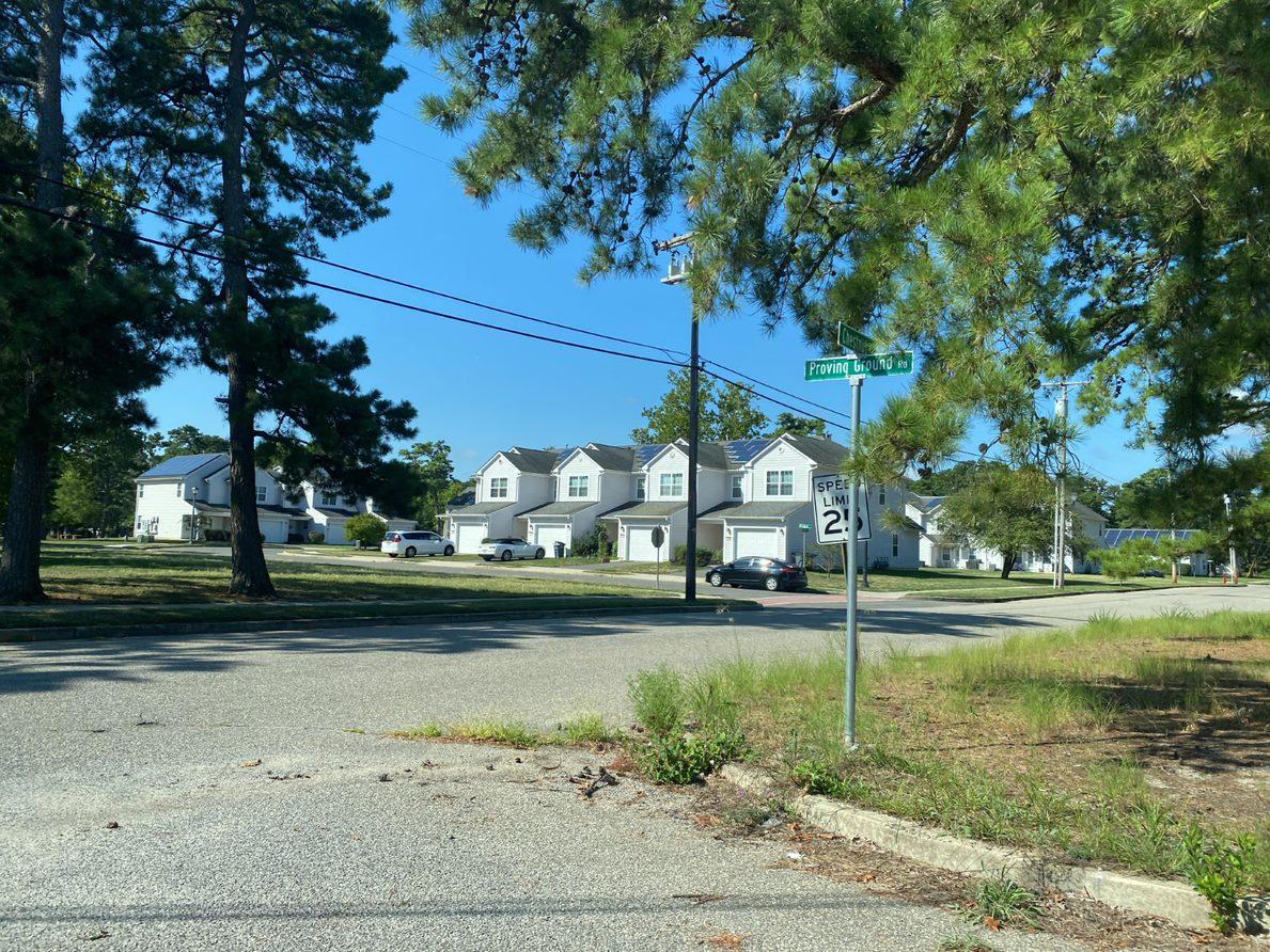
8.0 ANALYSIS OF EXISTING LAND USE AND PLANNED DEVELOPMENT
8.1 ISSUE OVERVIEW
JB MDL missions have not changed significantly since the 2009 JLUS while local communities have continued to grow and prosper Local communities and JB MDL enjoy a synergistic relationship that can be nurtured and enhanced through continued collaborative planning approaches. Operations of aircraft and artillery ranges at JB MDL are crucial components that support the military, disaster response and recovery, and law enforcement training missions located at JB MDL. These operations, however, do present noise and safety considerations to some areas outside of the JB MDL boundaries due to operational frequency and/or schedule of aircraft operations or noise from the firing of large and small caliber munitions at training ranges. These considerations can continue to be addressed by the pursuit of pro-active planning and development policies in collaboration between JB MDL and local communities.
Local communities need to support and sustain existing residences and businesses while providing opportunities for new growth and development of residential, commercial and employment uses. Planning guidance and tools discussed in Chapter 4, Joint Base McGuire-Dix-Lakehurst Noise and Safety Concerns, provide a framework for collaborative land use planning in municipal lands located within key JB MDL noise and safety zones located outside of the Base’s boundaries. These tools and collaborative planning approaches provide for development of land uses that are compatible with unique military and civilian operations found at JB MDL. Compatibility of land use is important to avoid or limit the future viability of JB MDL operations. Compatible land use planning also helps manage, mitigate and/or avoid nuisances and noises and potential safety impacts to local residents and communities from aircraft and range operations.
The RCUS examined the compatibility of existing land use and future development potential in local communities according to planning tools discussion in Chapter 4.0. Both existing land uses, and potential future development wereassessed to identify landuse compatibility concerns found in local communities that lie within critical noise and/or safety zones impacted by JB MDLoperations. The following Chapter present an overview of key findings and recommendations.
8-1 P:\03143\0008 Reports\N-Envir\Regional Compatible Use Study\2023 Final Section 8.docx
8.2 EXISTING LAND USE FINDINGS AND RECOMMENDATIONS
Table 8 1, Existing Development Compatibility Review on the following page presents a summary analysis of findings developed as part of the RCUS. As shown in Table 8 1, urban development uses represent 1,012 acres, or approximately 10% of the 9880 acres of land located in sensitive noise or air operations zones that lies outside of JB MDL and within local community jurisdictions. Natural or environmental uses such as conservation areas, woodlands, wetlands, water bodies, and agricultural areas occupy the remainder of the 9880 acres.
A review of existing developed land uses indicates that less than 1%, or 71 acres out of 9,880 acres of land located in sensitive noise or air operations zones present existing land use compatibility concerns. The primary compatible land use concern relates to residential development that is located within aircraft Accident Potential Zone I (APZ I). Residential uses are not considered compatible in this zone or within aircraft Noise Zone II (NZ II) that is typically located within APZ I. There are 47 acres of the 71 acres of residential uses that are located on land within NZ II that are also located in APZ I. These 71 acres of incompatible urban development uses are the areas where local communities can take proactive planning action to limit the expansion of incompatible uses. Local communities can also work with JB MDL, the Air Force and state funding sources to access funds to help property owners execute improvements to reduce noise impacts to residences located in NZ II but residences located within APZ I would still be considered incompatible uses. The best outcome would be to utilize federal, state and local jurisdiction funding to ultimately relocate incompatible residential uses out of APZ I areas.
8-2 P:\03143\0008 Reports\N-Envir\Regional Compatible Use Study\2023 Final Section 8.docx
As shown in Table 8.1, based on analysis of the 2022AICUZ study, there are an additional 597 acres (or 6% of the 9,880 acres of land located in sensitive noise or air operations zones) that are in urban development uses located in NZ II areas. These areas are not impacted by aircraft operations but are impacted by small arms training ranges. Residential uses in these zones are considered to be incompatible land uses. While there can be an impact to quality of life due to the firing of munitions at small arms ranges, these areas do not represent a noise or safety concern from aircraft operations. Local communities can take proactive planning action to limit the expansion of incompatible residential uses in these areas. Local communities can also work with JB MDL, the Air Force and state funding sources to access funds to help property owners execute improvements to reduce noise impacts to residences located in small arms range NZ II areas.
The final category of land uses that are considered incompatible in APZ I and II are 1,929 acres of land that are either wetlands or waterbodies. While these areas do not represent a threat of future incompatible urban development, they do attract waterfowl that can present a bird air strike hazard (BASH) to low flying aircraft in takeoff or final approach
8-3 P:\03143\0008 Reports\N-Envir\Regional Compatible Use Study\2023 Final Section 8.docx
Table 8.1: Existing Development Compatibility Review
Existing Development Compatibility Review Land Use NZ II NZ III NZ II NZ III NZ II NZ III CZ APZ I APZ II NET Totals1 % of Total Compatible Urban Development Uses 6 0 1 0 0 0 7 42 50 0.51% Natural/Environmental Uses 706 0 13 0 3347 131 24 613 1217 5345 Total Acreage 712 0 14 0 3347 131 24 620 1259 5395 54.60% Compatible with Restrictions Urban Development Uses 7 0 0 0 31 0 0 45 218 294 2.98% Natural/Environmental Uses 50 0 0 0 612 1 27 242 713 1595 Total Acreage 57 0 0 0 643 1 27 287 931 1889 19.12% Incompatible Urban Development Uses 47 0 0 0 576 21 0 71 0 668 6.76% Natural/Environmental Uses 0 0 0 0 2 0 69 725 1133 1929 Total Acreage 47 0 0 0 578 21 69 796 1133 2597 26.28% Grand Total 816 0 14 0 4568 153 120 1703 3323 9881 Totals 1NOTE: "NET Totals" nets out the acreage identified in Aircraft Noise Zones NZ II and NZ III as these are located entirely within APZ I or II areas Acres by LargeCaliber Weapon Noise Zone Areas Acres by Small Arms Noise Zone Areas Aircraft Accident Potential Zone (APZ) Area (Acres) Acres By Aircraft Noise Zone (ADNL) Area
mode. Local communities and the state can work with JB MDL to avoid expanding these areas and increasing the incompatible land use concern.
8.3 MORE INFORMATION
Appendix C summarizes the existing land use concerns related to noise zones, APZs, and other additional safety measures for the entire RCUS Study Area. Appendix A summarizes the noise and air safety considerations related to military operations (airfields and ranges) that create land use compatibility concerns for development on properties outside JB MDL boundaries. For a more detailed understanding of the AICUZ process, refer to the 2022 AICUZ Study on the JB MDL website, which uses 2023 mission projections for all calculations. Compatibility concerns and existing management/mitigation strategies associated with noise and safety zones are discussed in Appendix C and D.
8-4 P:\03143\0008 Reports\N-Envir\Regional Compatible Use Study\2023 Final Section 8.docx
9.0 ECONOMIC CONSIDERATIONS
9.1 ISSUES OVERVIEW
JB MDL is a major economic engine for local communities, the region and state. It is the nation’s only tri-service base, home to Air Force, Army, and Navy missions. It is the second-largest employer in the State of New Jersey, eclipsed only by the state government The base is reported to have a $6.9 billion impact on the regional economy annually. More than 44,000 people, including active-duty military, National Guard and Reserve, civilian employees, contractors and family members, are on the base daily. There are also an additional 62,000 military retirees in the region
A primary purpose of the JB MDL RCUS is to identify opportunities for JB MDL and local communities to work collaboratively to maintain and protect the on-going viability of both JB MDL and the surrounding communities for the benefit of all parties. From an economic perspective, the JB MDL RCUS supports three primary objectives:
• Protect Military Mission Operations Viability – The ability to accommodate and support a wide variety of current and future military operations at JB MDL is critical to maintain the current levels of DOD commitment to missions, personnel, and funding. Protecting the viability and capacity for military operations at JB MDL benefits the local, regional and state-wide economies. By their nature, JB MDL military operations extend beyond the physical boundaries of JB MDL. Active and collaborative planning between JB MDL and local communities to avoid conflicts between local land use and military missions is essential to maintain the viability of existing and future military operations and the value of JB MDL to the DOD
• Strengthen the Infrastructure Resiliency of the Region’s Major Employment Center and Disaster Response Center – As a major employment center for the region and the state, it is important that public and private investments in improving the capacity and service reliability of utility infrastructure to JB MDL continues to be a priority. Resilience of private utility infrastructure capacity and supply continuity is critical to support JB MDL missions. Critically, these missions include hosting federal and state level disaster response and recovery missions that support communities across the state. The ability to maintain military and disaster response capabilities within JB MDL is fundamental to sustaining and supporting residents and businesses across the state.
• Promote and Strengthen Economic Opportunities for Communities – The JB MDL RCUS identifies and promotes opportunities to build and strengthen communities Recommendations in the JB MDL RCUS guide commercial and residential development outside of the base in such a manner to avoid or reduce potential conflicts with military operations. From a local community perspective, the JB MDL RCUS recommends land use and development patterns that conform
9-1 P:\03143\0008 Reports\N-Envir\Regional Compatible Use Study\2023 Final Section 9.docx 9.0 ECONOMIC CONSIDERATIONS
to Air Force planning guidance to reduce conflicts while maintaining and enhancing real estate market viability while minimizing the costs of providing public services. As an example, areas subject to noise or air operations concerns are recommended for non-residential development Avoiding or limiting incompatible development, such as residential uses, in these areas helps to avoid negative impacts from military operations that can reduce the value of property for residential use.
9.2 DEMOGRAPHIC TRENDS IN BURLINGTON AND OCEAN COUNTIES
The 42,000 acres of land area that comprise JB MDL resides within Burlington and Ocean Counties. The economies of JB MDL and the two counties are strongly linked. According to a DOD REPI Program Fact Sheet from 2022, the State of New Jersey received $8.4 billion in Defense spending in FY 2020. This spending, of which more than 70% goes to support missions at JB MDL, provides direct funding for DOD civilian and military personnel salaries, defense contracts, operations, and capital improvement projects
Spending by DOD personnel, contractors, and their families is multiplied due to the significant secondary economic activity that is created by the ongoing infusion of federal funds. Essentially, direct federal spending on salaries and contracts supports households and commercial entities, and those households and commercial entities in turn spend those funds, inducing a demand for products and services from other businesses. That cycle of spending and induced demand results in private sector business activity and investment far beyond direct federal spending on JB MDL. This heightened economic activity also results in increased public revenues from sales and income taxes to state and local governments.
The following series of tables, Tables 9.1 through 9.3, present projections on population, employment, and households in the State of New Jersey and the Burlington and Ocean counties from 2020 to 2060. Data for 2020 is from the U.S. Census. Projections for 2030, 2040, 2050, and 2060 are from data prepared by Woods & Poole Economics, Inc. in 2022.
9.2.1 Population Growth
Table 9.1 presents decennial projections for population growth out to the year 2060. As shown in the table, the populations of both counties and the state are projected to increase over the next 40 years. Of note, while the total population of
P:\03143\0008 Reports\N-Envir\Regional Compatible Use Study\2023 Final Section 9.docx
9-2
the state is projected to increase by 8%, the total population of Ocean and Burlington counties is expected to increase by 31% and 9%, respectively. Continued projected strong growth in population in these counties, and particularly strong growth in Ocean County, helps provide support for continued development of quality residential, public, and commercial services of benefit to residents of the county and to personnel serving JB MDL Economic strength in the counties resulting from population growth and fiscally sound governance and management helps support the on-going viability and vitality of JB MDL missions.
9.2.2 Total Employment
Table 9.2 presents decennial projections for employment growth out to the year 2060. As shown in the table, total employment in both counties and the state is projected to increase over the next 40 years. Of note, total employment in the state is projected to increase by 52% while total employment in Ocean and Burlington counties is expected to increase by 95% and 49%, respectively. These projected increases are a result of anticipated changes in demographics (namely a growing cohort of working-aged adults) and higher participation of total population in the labor force. Projected strong growth in total employment (and corresponding wages) in these counties, and particularly strong growth in Ocean County, helps provide disposable income that supports the continued development of quality residential and commercial services and increased public revenues from sales and income taxes to state and local governments. Economic strength in the counties resulting from employment growth and fiscally sound governance and management helps support the on-going viability and vitality of JB MDL missions.
9-3 P:\03143\0008 Reports\N-Envir\Regional Compatible Use Study\2023 Final Section 9.docx
Table 9.1: Population Projections 2020-2060
Population 2020 2030 2040 2050 2060 Change State of New Jersey 9,279,740 9,494,780 9,669,900 9,805,270 10,006,350 8% Ocean County 638,824 694,800 740,254 783,576 836,455 31% Burlington County 461,862 477,015 485,739 491,521 501,277 9% % Share of State 11.9% 12.3% 12.7% 13.0% 13.4% Source:
Projections based on data and analysis from Woods & Poole Economics, Inc - 2022
9.2.3 Number of
Table 9.3 presents decennial projections for growth in the number of households out to the year 2060. As shown in the table, the numbers of households in the state and Ocean and Burlington counties are projected to increase over the next 40 years. The projected numbers of households in the state and the two counties track similarly to projected population. The total number of households in the State and in the two counties is projected to increase by 8%, 34%, and 10% between 2020 and 2060, respectively. Similar to total population growth, an increase in the number of households is an indicator of support for continued development of quality residential, public, and commercial services of benefit to residents of the county and personnel serving JB MDL Economic strength in the counties resulting from growth in the number of households and fiscally sound governance and management helps support the on-going viability and vitality of JB MDL missions.
The previous Chapter described demographic trends for the State of New Jersey and Ocean and Burlington Counties specifically. While some persons employed or engaged in economic activity at JB MDL reside in counties other than Burlington or Ocean counties, it is assumed that a majority of personnel engaged with activity at JB MDL reside in the
9-4 P:\03143\0008 Reports\N-Envir\Regional Compatible Use Study\2023 Final Section 9.docx
Table 9.2: Employment Projections 2020-2060
Households
Table 9.3: Number of Households 2020-2060
9.3 JOINT BASE AS AN ECONOMIC DRIVER
Total Employment 2020 2030 2040 2050 2060 Change State of New Jersey 5,166,210 6,297,360 6,867,630 7,372,890 7,854,990 52% Ocean County 254,501 392,302 381,892 436,844 497,401 95% Burlington County 265,311 316,924 346,119 371,433 395,104 49% % Share of State 10.1% 11.3% 10.6% 11.0% 11.4%
Number of Households 2020 2030 2040 2050 2060 Change State of New Jersey 3,528,040 3,687,810 3,725,850 3,765,770 3,848,100 9% Ocean County 255,178 285,959 302,411 319,176 341,235 34% Burlington County 182,588 193,075 195,018 196,684 200,872 10% % Share of State 12.4% 13.0% 13.4% 13.7% 14.1%
Source: Projections based on data and analysis from Woods & Poole Economics, Inc - 2022
Source: Projections based on data and analysis from Woods & Poole Economics, Inc - 2022
vicinity of the base No data sources were available to discern the current split between persons who reside in the two counties adjoining JB MDL andthose who reside elsewhere.
To address this deficiency, a calculation of the percentage share of military and federal civilian employment of persons residing in the two counties compared to the state has been calculated to create a relevant indicator of the demographic importance of JB MDL to the two host counties Absent of any major DOD or Congressionally mandated mission change, this percentage share of the state statistic at the county level creates a reasonable proxy for projected changes JB MDL may be expected to have as a percentage of demographic and economic activity in the state.
Figure 9.1 illustrates the calculation for the local county shares of state military and federal civilian employment and the local county shares of total population, employment, and number of households projected between 2020 and 2060. As shown in the figure, the two counties represent more than two times the share of persons employed in military and federal civilian personnel sectors than the total of all persons employed in all sectors. For example, in 2020, the number of persons employed in military and federal civilian occupations in the two counties represented 21.6% of all persons employed in these sectors in the state as a whole. As shown in the figure, for 2020, the number of persons employed all sectors residing in the two counties represented 10.1% of the state. As shown in the figures, the percentage share of persons employed in these sectors in the two counties is expected to increase to 22.8% by 2060. This demonstrates the continued importance of JB MDL to Ocean and Burlington counties in particular.
9-5 P:\03143\0008 Reports\N-Envir\Regional Compatible Use Study\2023 Final Section 9.docx
9.4 Economic Growth Opportunities
As discussed in Chapter 9.2, the projected growth in population, employment, and households in Burlington and Ocean counties will continue to drive demand for new residential, public, and commercial services and will help continue to fund sales, property, and income tax revenues to local and state government. When measured as a region, the two counties combined are projected to continue to have an increasing share of the state’s growth in population, employment, and households. It is noted that Burlington County is projected to lag state employment growth, however. Assuming the counties can continue to maintain a high level of fiscal responsibility and governance, it would be reasonable to expect that economic growth and activity would continue to increase over the next 40 years.
The 2019 update to the “Burlington County Workforce Development Area Four-Year Strategic Plan 2016-2020” and the “2019 Ocean County Workforce Development Board WOIA Strategic-Plan-Update” identified the following emerging/growing economic sectors:
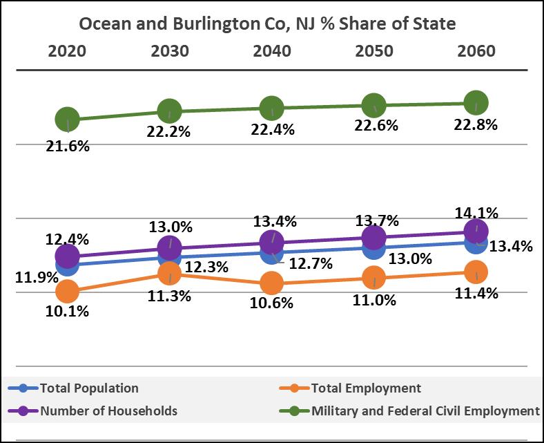
9-6 P:\03143\0008 Reports\N-Envir\Regional Compatible Use Study\2023 Final Section 9.docx
Figure 9 1: Ocean and Burlington County Share of NJ Military and Federal Civilian Employment
• Healthcare;
• Production and Manufacturing;
• Transportation, Logistics, and Distribution;
• Construction and Energy;
• Education;
• Retail/Sales; and
• Leisure and Hospitality.
Majority of these industries are well established within Burlington and Ocean Counties but continue to have a demand for skilled workers. According to the New Jersey Department of Labor and Workforce Development, the Arts, Entertainment, and Recreation sector is anticipating major growth of +95.7% in Burlington County and +61.2% in Ocean County. However, total employment by 2030 is estimated to be relatively small – 4,596 and 5,826, respectively – compared to total County populations.
9.4.1 Housing
The development of off-base housing that can support JB MDL military unaccompanied enlisted personnel presents a specific short-term economic development opportunity On-base housing - consisting of unaccompanied housing, military family housing, and temporary lodging - is intended to supplement private sector housing available in the community. According to the JB MDL 2018 Dormitory Master Plan, there is an estimated gap of approximately 172 beds/units in on-base housing for unaccompanied personnel, enlisted personnel with no dependents.
As shown in Table 9.4, an enlisted active-duty military service member with no dependents stationed at JB MDL would typically be able to pay rental rates ranging from $1,160/month for an E-1 rank service member to $2,520/month for an E-9 rank service member. Notably, grades E-1 through E-4 typically would be able to cover rents in the $1,200/month range based on current pay and housing support allowance rates offered by the military
As of mid-October 2022, the housing listing site Zillow identified total of 95 housing units available for rent ranging in price from $950/month for an 800 square foot duplex in Pemberton to $5,500/month for a 4-bedroom 1,835 square foot house.
9-7 P:\03143\0008 Reports\N-Envir\Regional Compatible Use Study\2023 Final Section 9.docx
Notably, the average of the 15 one-bedroom housing units (a typical unit size for unaccompanied enlisted personnel) available for rent was $1,440/month. However, only 6 units were available for rent at the $1,200 range that matches the housing allowances available to E-1 to E-4 personnel.
This situation is causing enlisted military personnel at lower ranks who are single and not assigned base housing to reside as far away as the Philadelphia metro area. Developing a stronger local housing stock at a variety of price points creates the potential for local communities to capture more of the off-base housing demand Having personnel reside closer to JB MDL benefits military missions by decreasing the time needed to report to stations in the case of an emergency. Increasing the opportunity for JB MDL military personnel to live in local communities near the base can also provide added benefits to local businesses and help strengthen economic and social ties between local communities and JB MDL.
9-8 P:\03143\0008 Reports\N-Envir\Regional Compatible Use Study\2023 Final Section 9.docx
Active-Duty Military Personnel Profile –October 2022 Rates Basic Housing Allowanc e Assumed Additional Contribution for Housing Potential Off-Base Housing Affordability Rank/Grad e Dependent s Average Monthly Pay (preTax) Assumed Avg. Years of Service 2022 Monthly BAH for JB MDL Area Contribution Rate (% of Monthly Pay) Additional Contributio n Amount Resources for Housing, Ins. + Utilities Resources Available for Rent @ 70% E1 NO $ 1,833 2 $ 1,581 0% $ - $ 1,660 $ 1,160 E2 NO $ 2,055 2 $ 1,581 0% $ - $ 1,660 $ 1,160 E3 NO $ 2,436 4 $ 1,581 0% $ - $ 1,660 $ 1,160 E4 NO $ 2,787 4 $ 1,581 0% $ - $ 1,660 $ 1,160 E5 NO $ 3,059 4 $ 1,839 10% $ 306 $ 2,230 $ 1,560 E6 NO $ 3,409 4 $ 1,983 10% $ 341 $ 2,410 $ 1,690 E7 NO $ 4,058 6 $ 2,064 15% $ 609 $ 2,750 $ 1,930 E8 NO $ 4,739 8 $ 2,238 15% $ 711 $ 3,030 $ 2,120 E9 NO $ 5,789 10 $ 2,364 20% $ 1,158 $ 3,600 $ 2,520
Table 9.4: Military Pay and Housing Allowances for Unaccompanied Enlisted Personnel
9.5 Economic Opportunities for RCUS Community Businesses
According to the United States Department of Defense Readiness and Environmental Protection Integration Program, State Fact Sheets | New Jersey, military bases and installations in New Jersey received $8.4 billion in DoD spending in Fiscal Year (FY) 2020. This investment included direct funding of $2 billion for DoD and civilian personnel salaries and $6.4 billion in defense contracts for the purchase of utilities, goods and services, and the construction of military facilities in the state. As the largest military installation in New Jersey, JB MDL supports 60% or 42,000 of the state’s 70,000 military, civilian and contractor personnel. Using the 60% ratio, it can be assumed that JB MDL could account for over $5 billion in DoD spending in New Jersey. Assuming 60% of the $6.4 billion in purchasing is spent on non-salary expenditures at JB MDL, more than $3.8 billion is spent annually in defense contracts for the purchase of utilities, goods and services, and the construction of military facilities at JB MDL.
Local businesses and service providers can compete for many of these contract opportunities. Opportunities for engaging with JB MDL can be found at JB MDL’s website; https://www.jbmdl.jb.mil/Home/Small-Business-Program/. The JB MDL contracting office buys the following:
1. Commercial-off-the-shelf products
2. Commercial, performance-based services, such as aircraft services, grounds maintenance, vehicle maintenance, fleet management services, postal services, equipment repair, medical services, janitorial services, airfield wildlife control, etc.
3. Construction services, such as minor construction, renovation and repair, repair and replacement of airfield concrete, asphalt paving, repair and replace curbs and sidewalks, roofing, stripping and rubber removal, etc.
4. Architectural and engineering services.
To do business with JB MDL, a business has to be registered with the Federal Government and have the following:
1. Obtain a Data Universal Numbering System (DUNS) number at www.dnb.com, or 1-800-333-0505.
2. Determine appropriate six-digit North American Industry Classification System (NAICS) code and four-digit Federal Supply Class or Services (FSC/SVC). Information is available at https://www.census.gov/naics/ and https://public.logisticsinformationservice.dla.mil/H2/search.aspx.
P:\03143\0008 Reports\N-Envir\Regional Compatible Use Study\2023 Final Section 9.docx
9-9
3. Register in www.sam.gov, SAM Registration is mandatory and must be reviewed annually.
4. Obtain a Contractor and Government Entity (CAGE) code. Your CAGE code will be provided when you register in DLA or at https://cage.dla.mil/. You may also call 1-877-352-2255.
5. Bonds-payment and performance (construction).
6. Good past performance.
Some key resources available to help businesses in RCUS Communities engage with JB MDL include the following:
• JB MDL Small Business Roundtable (JB MDL SBR) jbmdlsbr@gmail.com
• The Small Business Administration (SBA) https://www.sba.gov/
• The Procurement Technical Assistance Center (PTAC) https://www.njit.edu/ptac/
• NJ Small Business Development Center (SBDC) https://rsbdc.org/
In addition to the above resources, the DOD’s Office of Local Defense Community Cooperation (OLDCC) has a number of grants and programs available to support local communities address opportunities and needs resulting from proximity to JB MDL. The RCUS Executive Summary and Implementation Guide identify specific opportunities for local communities. Table 9.5, Federal Economic Assistance Programs Available to Support JB MLD Communities and Counties, on the following page presents a high-level overview of potential OLDCC and other federal agencies that could be leveraged by the two counties and local communities in support of JB MDL opportunities. Appendix E presents more information regarding each of the funding opportunities listed in Table 9.5.
9-10 P:\03143\0008 Reports\N-Envir\Regional Compatible Use Study\2023 Final Section 9.docx
Table 9.5: Federal Economic Assistance Programs Available to Support JB MDL Counties and Communities
Program
OLDCC Community Noise Mitigation
General Purpose
Address communities impacted by military fixed wing aviation noise for the purposes of installing noise mitigation for hospitals, daycare facilities, schools, Facilities serving senior citizens, and private residences
Potential Application
Potential program for funding of reducing impact from aircraft noise for uses that are compatible with restrictions in aircraft noise or safety zones
OLDCC Defense Community Infrastructure Pilot (DCIP) Program
OLDCC Defense Manufacturing Community Support Program
OLDCC Intergovernmental and Stakeholder Engagement
Address deficiencies in community infrastructure, supportive of a military installation, in order to enhance military value, installation resilience, and military family quality of life
Support long-term community investments that strengthen national security innovation and expand the capabilities of the defense manufacturing industrial ecosystem
Assist communities to foster cooperation with military installations to: enhance the military mission; achieve facility and infrastructure savings and reduced operating costs; address encroachment and compatible land use issues; support military families; and, increase military, civilian, and industrial readiness and resiliency
Could be used to construct community infrastructure and public facilities that would support goals or needs of the RCUS
Could be used to support local community businesses enter or expand services in the federal marketplace that support JB MDL mission purchasing needs
Could be used to help fund and support key implementation elements of the RCUS recommendations including the collaborative communication and development review portal, develop and adopt land management tools such as overlay zones, etc.
FHWA/Military Surface Deployment and Distribution Command (SDDC) Defense Access Road (DAR) Program
Provides the means for spending defense dollars on public highway improvements to mitigate unusual defense-generated transportation impacts. Eligibility includes public highways that require improvement due to one of the following reasons: 1) Defense installations requiring a new connection to the public road network, 2) Installation growth or change that significantly increases existing off installation traffic, 3) New public highways replacing those closed for military necessity, and 4) Upgrade of low-type roads to handle unique defense vehicles.
Could be used to support state and county spending on signing and delivery access route improvements to reduce congestion and impacts on communities as well as projects to improve access between JB MDL and local communities
9-11 P:\03143\0008 Reports\N-Envir\Regional Compatible Use Study\2023 Final Section 9.docx
10.0 ANALYSIS OF FUTURE DEVELOPMENT POTENTIAL AND ASSESSMENT OF FUTURE LAND USE CONFLICTS
10.0 FUTURE DEVELOPMENT POTENTIAL AND LAND USE CONFLICTS
Appendix D presents an analysis of the potential for future growth at JB MDL and the communities and capacity of future development and missions and JB MDL
10.1 EXISTING ZONING/FUTURE DEVELOPMENT FINDINGS AND RECOMMENDATIONS
Areview of areas with existing zoning but which are currently undeveloped (un-built lands) indicate there are 3,760 acres, or 38% of the 9,880 acres of land located in aircraft noise or safety zones, that are zoned for urban development. These areas could be developed as compatible land uses with some restrictions to use, construction methods, and/or density of use. Collaborative development review between the local communities and JB MDL is recommended to support the development of compatible uses in these areas, particularly for land that is in an APZ and/or high aircraft noise zone. Development of incompatible uses, such as many types of residential uses in these zones, should be discouraged.
There are an additional 4,650 acres of land, or 47% of the 9,880 acres of land located in small arms training range noise zone areas. These areas are zoned for urban development and could be developed as compatible land uses with some restrictions to use and/or use of construction methods. For residential uses in particular, compatibility of use may require use of sound walls, dense vegetation, berms/grading and/or sound mitigation in residential construction to avoid future conflicts between residential areas and JB MDL operations. Collaborative development review between the local communities and JB MDLis recommended to support the development of compatible uses in these areas.
The appendix also summarizes the future potential land use conflicts through examining zoning compatibility due to noise zones, APZs, and other safety concerns in the Study Area. Forest, Preservation, and Residential zones comprise most of the area considered Compatible with Restrictions. Housing is only Compatible at a density of less than two dwelling units per acre in APZ II. There is no Incompatible zoning present.
10-1 P:\03143\0008 Reports\N-Envir\Regional Compatible Use Study\2023 Final Section 10.docx
11.0 RCUS COMPATIBILITY RECOMMENDATIONS
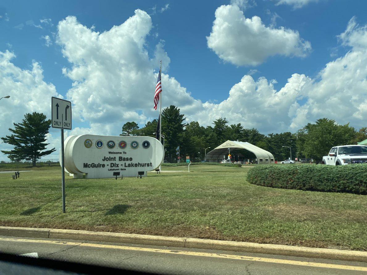
11.0 THE REGIONAL COMPATIBLE USE PLAN (RCUP)
11.1 INTRODUCTION
The 2009 Joint Land Use Study (JLUS) document provided a strong foundation for improving land use compatibility within the host communities. Since the development of the plan, a number of important steps and actions have been taken by JointBase McGuireDix-Lakehurst (JB MDL), the counties and municipalities to reduce, minimize, and avoid exacerbating conflicts in existing land use and creating new conflicts as future development occurs in the various municipalities that surround JB MDL.
The Regional Compatibility Use Study (RCUS) presents an update of the 2009 JLUS general recommended actions to reflect new or changed conditions (such as new Air Installation Compatibility Use Zones (AICUZ) study findings) as well as new programs and remedies available to build upon the land use compatibility efforts made to date In implementing the JLUS recommendations, RCUS municipalities have taken substantive actions to manage incompatible zoning, including adopting zoning provisions that restrict incompatible development on undeveloped property.
The 2009 JLUS developed a framework for implementation ofrecommendations beneficial to the host communities and counties. Numerous initiatives and community needs were identified during the study, including area-wide and community-specific Recommended JLUS Strategies. The JLUS resulted in the formation of a Policy Implementation Committee and other important planning initiatives: a Communication & Coordination Manual, a Transportation Mobility Study, Regional Wastewater & Growth Management Study, and Readiness and Environmental Protection Initiative (REPI) program funding of land acquisition.
The JLUS marked a significant milestone for the realignment of the three military bases into the JB MDL and commitment of the base, host communities and other involved agencies to support themilitary missions through compatible land use planning. In keeping with the guidance from the Office of Local Defense Community Cooperation (OLDCC), this RCUS has been prepared to review and update the recommendations for management of potential conflicts.
11-1 P:\03143\0008 Reports\N-Envir\Regional Compatible Use Study\2023 Final Section 11.docx
The RCUS continues the processes and successful programs initiated by the JLUS, while adding refinement and increased granularity in areas of potential land use conflicts. The RCUS includes additional tools and resources to support compatible uses and identifies funding sources for beneficial programs. The RCUS Recommendations are organized into Land Use and Zoning, Coordination and Communication, Infrastructure and Utilities, Safety, Natural Resources, Community Development, and Implementation Actions.
Chapter 11.2 presents recommended actions for each specific municipality regarding land use and zoning. The Land Use and Zoning Recommendations are summarized for each RCUS municipality to enable access tothe specific recommendationsfor each community. The Compatible Land Use Recommendations tables include summaries of land use categories, location of each land use type in relation to mapped operational and hazard zones (i.e., Clear Zones, Noise Zones and Accident Potential Zones), the area in acres of each land use type within the mapped zone and set of applicable recommendations.
11.2 OCEAN COUNTY LAND USE AND ZONING RECOMMENDATIONS
11.2.1 Jackson Township
Tables 11.1 and 11.2 provide recommendations regarding compatibility of noise and aircraft accident potential zones associated with airfields, ranges, and training areas at JB MDL Lakehurst and Dix Areas within Jackson Township
11-2 P:\03143\0008 Reports\N-Envir\Regional Compatible Use Study\2023 Final Section 11.docx
Table 11.1: Jackson Township Compatible Land Use Recommendations
Recommendations
• Consider actions such as transfer of development rights or applying for OLDCC grants to support the ultimate conversion or relocation of existing residential uses to Compatible uses and prohibit the further development or redevelopment of residential uses
• Existing uses are likely considered Compatible with Restrictions
• Jurisdiction should work with JB MDL if there is a significant change in use in the future to avoid or minimize potential land use compatibility concerns
• Work with JB MDL to ensure there are no obstruction concerns or concerns related to nighttime aircraft operations if, for example, recreation areas contain lighted ballfields
• Area of use is small, and operations would not likely raise any concerns
• Avoid the potential for increased impacts to aircraft operations from waterfowl by preventing the expansion or creation of wetland banking and bodies of water in these zones per Air Force guidance unless contacting the JB MDL airfield manager, FAA, and/or a Qualified Airport Wildlife Biologist to advise
• In CZ, consider acquisition of land by JB MDL
• Redevelopment for residential purposes should be avoided
• Collaborative development review of any new development proposal with JB MDL is recommended to avoid or minimize potential conflicts
11-3 P:\03143\0008 Reports\N-Envir\Regional Compatible Use Study\2023 Final Section 11.docx
Existing Land Use Compatibility Location Area (Acres)
Residential Incompatible NZ II APZ I 28
Residential Compatible with Restrictions APZ II
4
Commercial and Services Compatible with Restrictions NZ II APZ I 4 Recreational Compatible with Restrictions APZ II 36
Other Agriculture Compatible with Restrictions APZ I APZ II 6
Wetland Incompatible CZ APZ I APZ II 748
Barren Land Compatible with Restrictions NZ II 47
Figure 11.1: Land Use within Noise Zones and APZs in Jackson Township
Source:
MANCHESTER TOWNSHIP
Joint Base Boundary, APZ, ADNL, CDNL, Large-Caliber Weapons PK15 Noise Zone, Small Arms PK15 Noise Zone, Military Range, Range Impact Area, and Military Training Area from JB MDL, 2022.
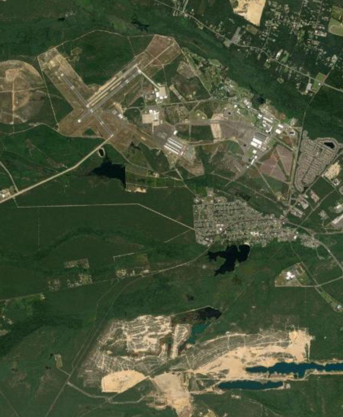
Land Use (2015) from NJDEP, 2022. Municipal and County Boundaries and Road Centerlines from NJOGIS, 2022. Aerial Imagery from Esri, 2022.
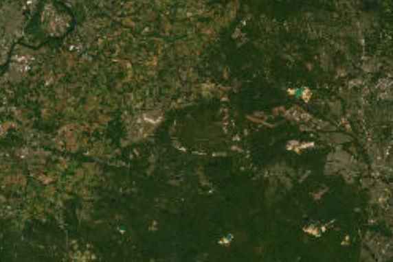
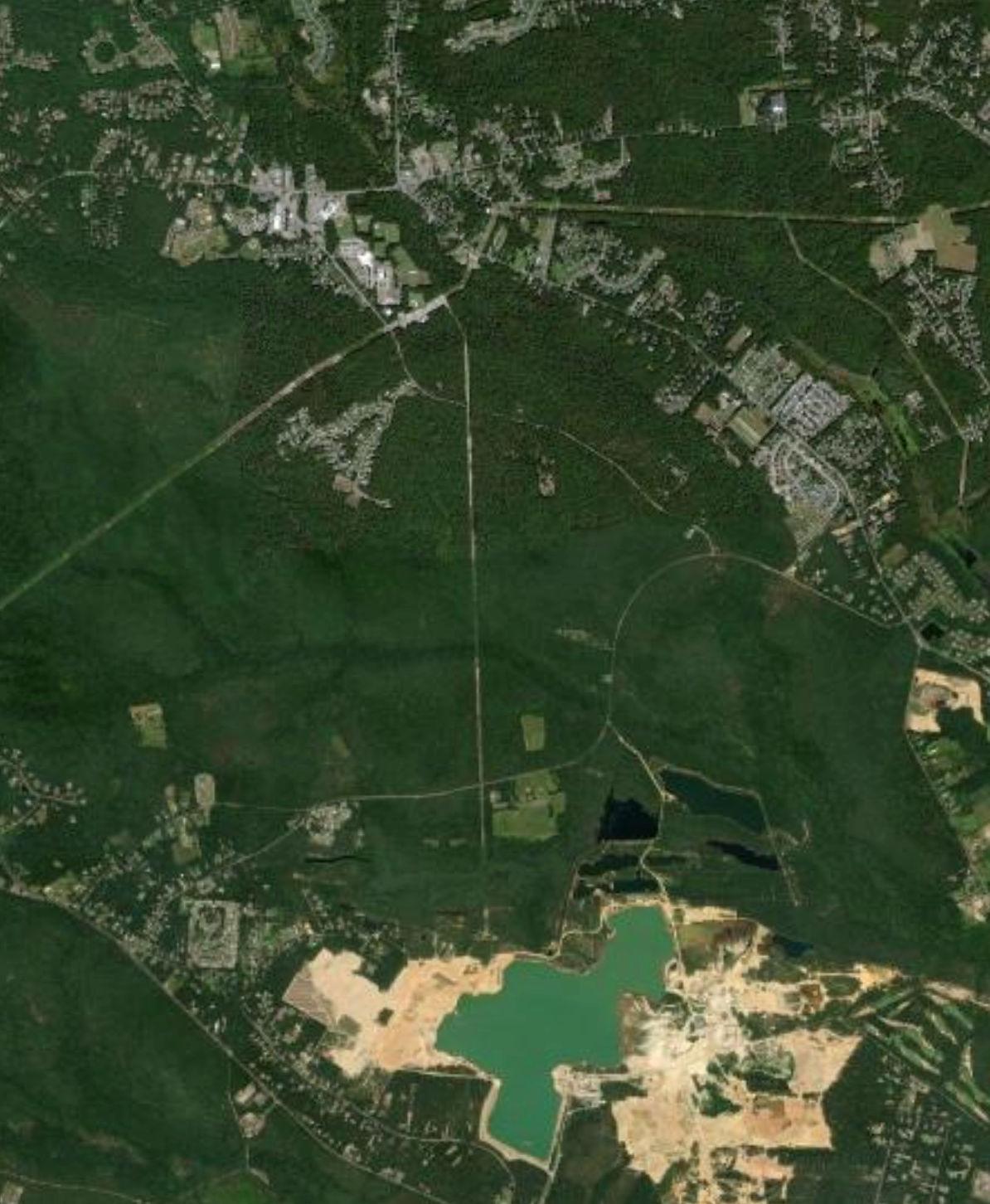
Large-Caliber Weapons PK15

LAKEHURST BOROUGH
547 527 14 638 12 539 2 34 46 8 3 10 6 528 4 52 42 8 571 2 636 37 70 70 Dix Area Lakehurst Area 12/30 15/33 06/24 I
Area Joint
Municipal Boundary County Boundary APZ ADNL CDNL
Study
Base Boundary
Residential
Small Arms PK15 Land Use (2015)
Commercial and Services
Other Agriculture Forest
Wetland
Transportation/Communication/Utility Other Urban or Built-Up Land Recreational
Water
Barren Land Runway
0 2 Miles
JACKSON TOWNSHIP
• For land in all zones, collaborative development review with JB MDL is recommended for all residential and non-residential development proposals allowed in this zoning category
• Work with JB MDL to require appropriate noise abatement considerations in construction of new residential units
• Mitigate potential effects of new residential uses on unbuilt land zoned for residential uses through one or more of the following tools:
o Overlay zoning or deed restriction mechanism to limit development of Incompatible uses in these zones
o Leveraging REPI or other funding programs to buy conservation easements or incentivize development elsewhere (e.g. utility development through Defense Communities Infrastructure Program) on these properties
o Rezoning undeveloped land to exclude residential uses in these areas
• For CZ, consider the acquisition of land by JB MDL
• Leveraging REPI or other funding programs to buy conservation easements on these properties
• Jurisdiction should work with JB MDL on development review if there is a proposed change in use in the future to avoid or minimize potential land use compatibility concerns
11-5 P:\03143\0008 Reports\N-Envir\Regional Compatible Use Study\2023 Final Section 11.docx
Zoning of Unbuilt Area Compatibility Location Area (Acres)
Medium Density Residential Compatible with Restrictions NZ II APZ I APZ II 176
Table 11.2: Jackson Township Compatible Zoning Recommendations
Recommendations
Low Density Residential Compatible with Restrictions NZ II APZ I 144 Preservation Compatible with Restrictions NZ II CZ APZ I APZ II 942
Forest Compatible with Restrictions NZ II CZ APZ I 68
Figure 11.2: Zoning within Noise Zones and APZs in Jackson Township
Source:
MANCHESTER TOWNSHIP
Joint Base Boundary, APZ, ADNL, CDNL, Large-Caliber Weapons PK15 Noise Zone, Small Arms PK15 Noise Zone, Military Range, Range Impact Area, and Military Training Area from JB MDL, 2022.
Land Use (2015) from NJDEP, 2022. Municipal and County Boundaries and Road Centerlines from NJOGIS, 2022. Aerial Imagery from Esri, 2022.
LAKEHURST BOROUGH
547 527 14 638 12 539 2 34 46 8 3 10 6 528 4 52 42 8 571 2 636 37 70 70 Dix Area Lakehurst Area 12/30 15/33 06/24 I Study Area Joint Base Boundary Municipal Boundary County Boundary APZ ADNL CDNL Large-Caliber Weapons PK15 Small Arms PK15 Zoning Medium Density Residential Low Density Residential Military Forest Preservation Runway
0 2 Miles
JACKSON TOWNSHIP
11.2.2 Lakehurst Borough
• Consider actions such as transfer of development rights or applying for OLDCC grants to support the ultimate conversion or relocation of existing residential uses to Compatible uses and prohibit the further development or redevelopment of residential uses
• Existing uses are likely considered Compatible with Restrictions
• Expansion or changes in development should be reviewed collaboratively with JB MDL
• Jurisdiction should work with JB MDL if there is a significant change in use in the future to avoid or minimize potential land use compatibility concerns
• Avoid the potential for increased impacts to aircraft operations from waterfowl by preventing the expansion or creation of wetland banking and bodies of water in these zones per Air Force guidance unless contacting the JB MDL airfield manager, FAA, and/or a Qualified Airport Wildlife Biologist to advise
11-7 P:\03143\0008 Reports\N-Envir\Regional Compatible Use Study\2023 Final Section 11.docx
Table 11.3 and 11.4 provide recommendations regarding compatibility of aircraft accident potential zones associated with airfields at JB MDL Lakehurst Area within Lakehurst Borough.
Existing Land Use Compatibility Location Area
Recommendations Residential Incompatible APZ I 16
Table 11.3: Lakehurst Borough Compatible Land Use Recommendations
(Acres)
Residential Compatible with Restrictions APZ II 23
Commercial and Services Compatible with Restrictions APZ II 13 Recreational Compatible with Restrictions APZ II 1 Water Incompatible APZ II 48
Wetland Incompatible APZ II 34
Figure 11.3: Land Use within Noise Zones and APZs in Lakehurst Borough
Source:
Joint Base Boundary, APZ, ADNL, CDNL, Large-Caliber Weapons PK15 Noise Zone, Small Arms PK15 Noise Zone, Military Range, Range Impact Area, and Military Training Area from JB MDL, 2022.
Land Use (2015) from NJDEP, 2022.
Municipal and County Boundaries and Road Centerlines from NJOGIS, 2022. Aerial Imagery from Esri, 2022.
MANCHESTER TOWNSHIP
Land Use (2015)
Commercial and Services
Transportation/Communication/Utility
Other Urban or Built-Up Land
12 2 8 3 10 6 6 4 547 547 37 70 70 70 Lakehurst Area I
Study Area Joint Base Boundary Municipal Boundary County Boundary APZ
Residential
Recreational Forest Water Wetland
0 0.5 Miles
LAKEHURST BOROUGH
Table 11.4: Lakehurst Borough Compatible Zoning Recommendations
• For land in all zones, collaborative development review with JB MDL is recommended for all residential and non-residential development proposals allowed in this zoning category
• Work with JB MDL to require appropriate noise abatement considerations in construction of new residential units
• Mitigate potential effects of new residential uses on unbuilt land zoned for residential uses through one or more of the following tools:
o Overlay zoning or deed restriction mechanism to limit development of Incompatible uses in these zones
o Leveraging REPI or other funding programs to buy conservation easements or incentivize development elsewhere (e.g. utility development through Defense Communities Infrastructure Program) on these properties
o Rezoning undeveloped land to exclude residential uses in these areas
• Collaborative development review of proposals with JB MDL is recommended to avoid or minimize potential conflicts
11-9 P:\03143\0008 Reports\N-Envir\Regional Compatible Use Study\2023 Final Section 11.docx
Zoning of Unbuilt Area Compatibilit y Locatio n Area (Acre
High Density Residential Compatible with Restrictions APZ I APZ II 123
s) Recommendations
Medium Density Residential Compatible with Restrictions APZ I 1 Business and Commercial Compatible with Restrictions APZ II 41
Figure 11.4: Zoning within Noise Zones and APZs in Lakehurst Borough
Source: Joint Base Boundary, APZ, ADNL, CDNL, Large-Caliber Weapons PK15 Noise Zone, Small Arms PK15 Noise Zone, Military Range, Range Impact Area, and Military Training Area from JB MDL, 2022. Zoning from Burlington and Ocean Counties, 2022. Municipal and County Boundaries and Road Centerlines from NJOGIS, 2022. Aerial Imagery from Esri, 2022.
MANCHESTER TOWNSHIP
12 2 8 3 10 6 6 4 547 547 37 70 70 70 Lakehurst Area I Study Area Joint Base Boundary Municipal Boundary County Boundary APZ Zoning High Density Residential Medium Density
Residential Business and Commercial
0 0.5 Miles LAKEHURST BOROUGH
11.2.3 Manchester
Township
Table 11.5 and 11.6 provide recommendationsregarding compatibility of noise and aircraft accident potential zones associated with airfields, ranges, and training areas at JB MDL Lakehurst and Dix Areas within Manchester Township.
• Consider actions such as transfer of development rights or applying for OLDCC grants to support the ultimate conversion or relocation of existing residential uses to Compatible uses and prohibit the further development or redevelopment of residential uses
• Area of use is small and no concerns with existing uses are anticipated
• Jurisdiction should work with JB MDL if there is a significant change in use in the future to avoid or minimize potential land use compatibility concerns
• Jurisdiction should consider adoption and enforcement of dust controls and protection of wind erosion that could obscure visibility for aircraft on approach or takeoff from runways
• Any future rezoning and development of this land should be limited to uses that are considered Compatible land uses in the zone located
• In CZ, consider the acquisition of land by JB MDL
• Avoid the potential for increased impacts to aircraft operations from waterfowl by preventing the expansion or creation of wetland banking and bodies of water in these zones per Air Force guidance unless contacting the JB MDL airfield manager, FAA, and/or a Qualified Airport Wildlife Biologist to advise
• In CZ, consider acquisition of land by JB MDL
11-11 P:\03143\0008 Reports\N-Envir\Regional Compatible Use Study\2023 Final Section 11.docx
Existing Land Use Compatibility Location Area (Acres) Recommendations Residential Incompatible NZ II APZ I 4
Table 11.5: Manchester Township Compatible Use Recommendations
Residential Compatible with Restrictions APZ II 2
Commercial and Services Compatible with Restrictions NZ II APZ II 4 Transportation/ Communication/ Utility Compatible with Restrictions NZ II NZ III APZ I 10 Livestock Farming Compatible with Restrictions APZ II 4 Crop Farming Compatible with Restrictions NZ II CZ APZ II APZ III 105
Other Agriculture Compatible with Restrictions APZ I APZ II 12 Water Incompatible CZ APZ I APZ II 25
Wetland Incompatible CZ APZ I APZ II 452
Figure 11.5: Land Use within Noise Zones and APZs in Manchester Township
Source:
Joint Base Boundary, APZ, ADNL, CDNL, Large-Caliber Weapons PK15 Noise Zone, Small Arms PK15 Noise Zone, Military Range, Range Impact Area, and Military Training Area from JB MDL, 2022.
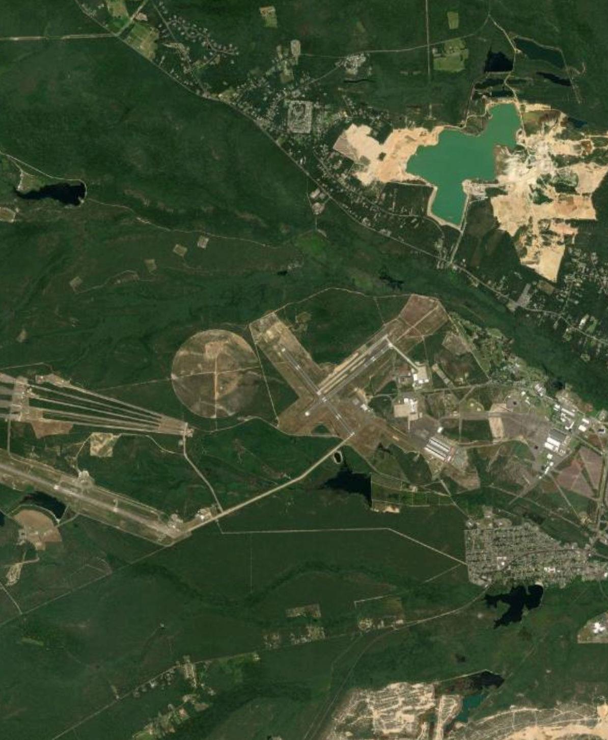
Land Use (2015) from NJDEP, 2022.
Municipal and County Boundaries and Road Centerlines from NJOGIS, 2022. Aerial Imagery from Esri, 2022.
Large-Caliber Weapons PK15
Arms PK15
530 18 14 615 547 12 571 2 24 2 8 614 539 10 12 528 22 539 640 24 39 6 4 42 52 618 4 530 6 70 70 Dix Area Lakehurst Area 12/30 15/33 06/24 I Study Area Joint Base Boundary Municipal Boundary County Boundary APZ ADNL CDNL
Small
Residential Commercial
Land Use (2015)
and Services Transportation/Communication/Utility Other Urban or Built-Up Land Recreational Livestock Farming
Crop Farming
Forest
Runway
Other Agriculture
Water Wetland Barren Land
PEMBERTON TOWNSHIP
MANCHESTER TOWNSHIP
TOWNSHIP
BOROUGH 0 3 Miles
JACKSON TOWNSHIP
PLUMSTED
LAKEHURST
Recommendations
• For land in all zones, collaborative development review with JB MDL is recommended for all residential and non-residential development proposals allowed in this zoning category
• Work with JB MDL to require appropriate noise abatement considerations in construction of new residential units
• Mitigate potential effects of new residential uses on unbuilt land zoned for residential uses through one or more of the following tools:
o Overlay zoning or deed restriction mechanism to limit development of Incompatible uses in these zones
o Leveraging REPI or other funding programs to buy conservation easements or incentivize development elsewhere (e.g. utility development through Defense Communities Infrastructure Program) on these properties
o Rezoning undeveloped land to exclude residential uses in these areas
• For CZ, consider the acquisition of land by JB MDL
• Leveraging REPI or other funding programs to buy conservation easements on these properties
• Jurisdiction should work with JB MDL on development review if there is a proposed change in use in the future to avoid or minimize potential land use compatibility concerns
11-13 P:\03143\0008 Reports\N-Envir\Regional Compatible Use Study\2023 Final Section 11.docx
Zoning of Unbuilt Area Compatibility Location Area (Acres)
High Density Residential Compatible with Restrictions APZ II 4
Table
11.6: Manchester Township Compatible Zoning Recommendations
Preservation Compatible with Restrictions CZ APZ I APZ II 1272
Forest Compatible with Restrictions NZ II CZ APZ I APZ II 1504
Figure 11.6: Zoning within Noise Zones and APZs in Manchester Township
PLUMSTED TOWNSHIP
PEMBERTON TOWNSHIP
Source:
Joint Base Boundary, APZ, ADNL, CDNL, Large-Caliber Weapons PK15 Noise Zone, Small Arms PK15 Noise Zone, Military Range, Range Impact Area, and Military Training Area from JB MDL, 2022.
Zoning from Burlington and Ocean Counties, 2022.
Municipal and County Boundaries and Road Centerlines from NJOGIS, 2022.
Aerial Imagery from Esri, 2022.
MANCHESTER TOWNSHIP
530 18 14 615 547 12 571 2 24 2 8 614 539 10 12 528 22 539 640 24 39 6 4 42 52 618 4 530 6 70 70 Dix Area Lakehurst Area 12/30 15/33 06/24 I
Municipal
County
APZ ADNL CDNL
Study Area Joint Base Boundary
Boundary
Boundary
Large-Caliber Weapons PK15 Small Arms PK15 Zoning High Density Residential Military Forest Preservation Runway
JACKSON TOWNSHIP
0 3 Miles
LAKEHURST BOROUGH
11.2.4 Plumsted Township
Tables 11.7 and 11.8 provide recommendations regarding compatibility of noise and aircraft accident potential zones associated with airfields, ranges, and training areas at JB MDL Dix Area within Plumsted Township.
• Consider actions such as transfer of development rights or applying for OLDCC grants to support the ultimate conversion or relocation of existing residential uses to Compatible uses and prohibit the further development or redevelopment of residential uses
• Existing uses are likely considered Compatible with Restrictions
• Jurisdiction should work with JB MDL if there is a significant change in use in the future to avoid or minimize potential land use compatibility concerns
• Jurisdiction should consider adoption and enforcement of dust controls and protection of wind erosion that could obscure visibility for aircraft on approach or takeoff from runways
• Any future rezoning and development of this land should be limited to uses that are considered Compatible land uses in the zone located
• Avoid the potential for increased impacts to aircraft operations from waterfowl by preventing the expansion or creation of wetland banking and bodies of water in these zones per Air Force guidance unless contacting the JB MDL airfield manager, FAA, and/or a Qualified Airport Wildlife Biologist to advise
• Jurisdiction should work with JB MDL on development review if there is a proposed change in use in the future to avoid or minimize potential land use compatibility concerns
11-15 P:\03143\0008 Reports\N-Envir\Regional Compatible Use Study\2023 Final Section 11.docx
Existing Land Use Compatibility Location Area (Acres) Recommendations Residential Incompatible NZ II 174
Table 11.7: Plumsted Township Compatible Land Use Recommendations
Commercial and Services Compatible with Restrictions NZ II 4
Transportation/ Communication/ Utility Compatible with Restrictions NZ II 10 Other Urban or Built-Up Land Compatible with Restrictions NZ II 8 Livestock Farming Compatible with Restrictions NZ II 99
Crop Farming Compatible with Restrictions NZ II APZ II 296 Other Agriculture Compatible with Restrictions NZ II 81 Water Incompatible APZ II 3
Wetland Incompatible APZ II 7 Transitional Area Compatible with Restrictions NZ II 1
Figure 11.7: Land Use within Noise Zones and APZs in Plumsted Township
Source:
Joint Base Boundary, APZ, ADNL, CDNL, Large-Caliber Weapons PK15 Noise Zone, Small Arms PK15 Noise Zone, Military Range, Range Impact Area, and Military Training Area from JB MDL, 2022.
Land Use (2015) from NJDEP, 2022.
Municipal and County Boundaries and Road Centerlines from NJOGIS, 2022.
Aerial Imagery from Esri, 2022.
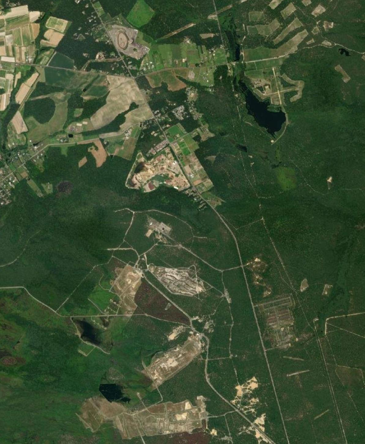
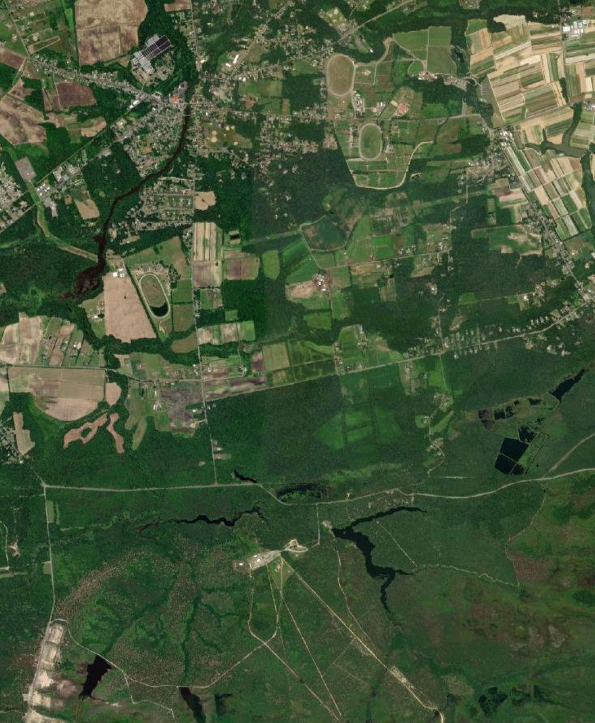
Study Area
Joint Base Boundary Municipal Boundary County Boundary
APZ
ADNL
CDNL
Large-Caliber Weapons PK15
Small Arms PK15
Land Use (2015)
Residential
Commercial and Services
Transportation/Communication/Utility
Other Urban or Built-Up Land
Livestock Farming
Crop Farming
Other Agriculture
Forest Water
Wetland
Barren Land
Transitional Area
Dix Area
28 4 616 640 18 528 8 10 22 24 539 6
Lakehurst Area I
JACKSON TOWNSHIP PLUMSTED TOWNSHIP
NEW HANOVER TOWNSHIP
NORTH HANOVER TOWNSHIP
MANCHESTER TOWNSHIP
0
2 Miles
PEMBERTON TOWNSHIP
Recommendations
• For land in all zones, collaborative development review with JB MDL is recommended for all residential and non-residential development proposals allowed in this zoning category
• Work with JB MDL to require appropriate noise abatement considerations in construction of new residential units
• Mitigate potential effects of new residential uses on unbuilt land zoned for residential uses through one or more of the following tools:
o Overlay zoning or deed restriction mechanism to limit development of Incompatible uses in these zones
o Leveraging REPI or other funding programs to buy conservation easements or incentivize development elsewhere (e.g. utility development through Defense Communities Infrastructure Program) on these properties
o Rezoning undeveloped land to exclude residential uses in these areas
• Jurisdiction should work with JB MDL on development review if there is a proposed change in use in the future to avoid or minimize potential land use compatibility concerns
11-17 P:\03143\0008 Reports\N-Envir\Regional Compatible Use Study\2023 Final Section 11.docx
Zoning of Unbuilt Area Compatibility Location Area (Acres)
Low Density Residential Compatible with Restrictions NZ II 1743
Table
11.8: Plumsted Township Compatible Zoning Recommendations
Preservation Compatible with Restrictions NZ II APZ I APZ II 144
Forest Compatible with Restrictions NZ II 3
Figure 11.8: Zoning within Noise Zones and APZs in Plumsted Township
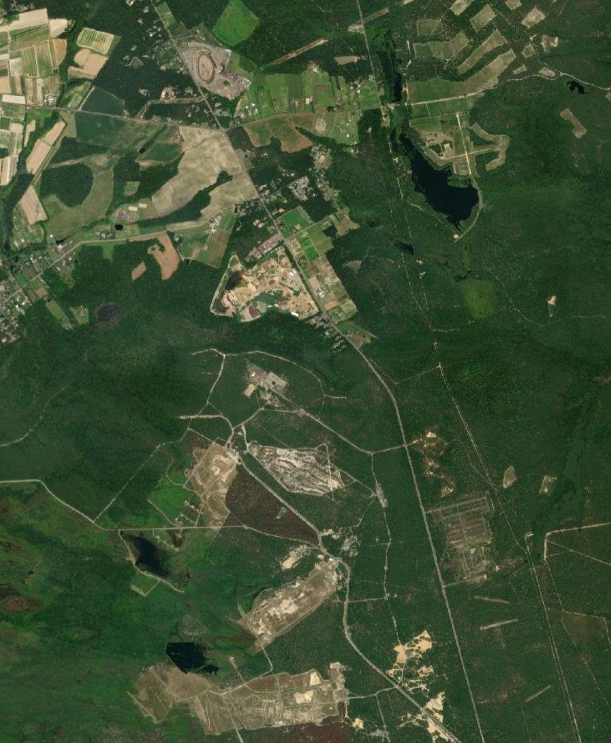
Source:
PEMBERTON TOWNSHIP
Joint Base Boundary, APZ, ADNL, CDNL, Large-Caliber Weapons PK15 Noise Zone, Small Arms PK15 Noise Zone, Military Range, Range Impact Area, and Military Training Area from JB MDL, 2022.
Zoning from Burlington and Ocean Counties, 2022. Municipal and County Boundaries and Road Centerlines from NJOGIS, 2022. Aerial Imagery from Esri, 2022.
Study Area Joint Base Boundary
MANCHESTER TOWNSHIP
28 4 616 640 18 528 8 10 22 24 539 6 Dix Area
Area I
APZ
CDNL
Lakehurst
Municipal Boundary County Boundary
ADNL
Large-Caliber Weapons PK15
Forest Preservation
Small Arms PK15 Zoning Medium Density Residential Low Density Residential Military
Undetermined
TOWNSHIP
TOWNSHIP
JACKSON
PLUMSTED
NORTH
NEW HANOVER TOWNSHIP
HANOVER TOWNSHIP
0 2 Miles
11.3 BURLINGTON COUNTY LAND USE AND ZONING RECOMMENDATIONS
11.3.1 New Hanover Township
Tables 11.9 and 11.10 provide recommendations regarding compatibility of noise and aircraft accident potential zones associated with airfields, ranges, and training areas at JB MDL McGuire and Dix Areas within New Hanover Township.
• Consider actions such as transfer of development rights or applying for OLDCC grants to support the ultimate conversion or relocation of existing residential uses to Compatible uses and prohibit the further development or redevelopment of residential uses
• Area of use is small and there are no concerns with the current use at this time
• Jurisdiction should work with JB MDL if there is a significant change in use in the future to avoid or minimize potential land use compatibility concerns
• Jurisdiction should consider adoption and enforcement of dust controls and protection of wind erosion that could obscure visibility for aircraft on approach or takeoff from runways
• Any future rezoning and development of this land should be limited to uses that are considered Compatible land uses in the zone located
• Avoid the potential for increased impacts to aircraft operations from waterfowl by preventing the expansion or creation of wetland banking and bodies of water in these zones per Air Force guidance unless contacting the JB MDL airfield manager, FAA, and/or a Qualified Airport Wildlife Biologist to advise
11-19 P:\03143\0008 Reports\N-Envir\Regional Compatible Use Study\2023 Final Section 11.docx
Existing Land Use Compatibility Location Area (Acres) Recommendations Residential Incompatible NZ II APZ I 50
Table 11.9: New Hanover Township Compatible Land Use Recommendations
Residential Compatible with Restrictions APZ II 3
Transportation/ Communication/ Utility Compatible with Restrictions NZ II 1 Recreational Compatible with Restrictions NZ II APZ II 1 Livestock Farming Compatible with Restrictions APZ I APZ II 97
Crop Farming Compatible with Restrictions NZ II APZ I APZ II 91 Other Agriculture Compatible with Restrictions NZ II APZ I APZ II 54 Water Incompatible APZ II 8
Wetland Incompatible APZ I APZ II 82
Figure 11.9: Land Use within Noise Zones and APZs in New Hanover Township
Source:
Joint Base Boundary, APZ, ADNL, CDNL, Large-Caliber Weapons PK15 Noise Zone, Small Arms PK15 Noise Zone, Military Range, Range Impact Area, and Military Training Area from JB MDL, 2022.
Land Use (2015) from NJDEP, 2022. Municipal and County Boundaries and Road Centerlines from NJOGIS, 2022. Aerial Imagery from Esri, 2022.
640 667 528 616 10 665 537 4 18 8 666 Dix Area 06/24 I Study Area Joint Base Boundary Municipal Boundary County Boundary APZ ADNL CDNL Large-Caliber Weapons PK15 Small Arms PK15 Land Use (2015) Residential Transportation/Communication/Utility Recreational Livestock Farming Crop Farming Other Agriculture Forest Water Wetland <all other values> Runway
NEW HANOVER TOWNSHIP
NORTH HANOVER TOWNSHIP
0 1 Miles
PLUMSTED TOWNSHIP
Table 11.10: New Hanover Township Compatible Zoning Recommendations
• For land in all zones, collaborative development review with JB MDL is recommended for all residential and non-residential development proposals allowed in this zoning category
• Work with JB MDL to require appropriate noise abatement considerations in construction of new residential units
• Mitigate potential effects of new residential uses on unbuilt land zoned for residential uses through one or more of the following tools:
o Overlay zoning or deed restriction mechanism to limit development of Incompatible uses in these zones
o Leveraging REPI or other funding programs to buy conservation easements or incentivize development elsewhere (e.g. utility development through Defense Communities Infrastructure Program) on these properties
o Rezoning undeveloped land to exclude residential uses in these areas
• Collaborative development review of proposals with JB MDL is recommended to avoid or minimize potential conflicts
11-21 P:\03143\0008 Reports\N-Envir\Regional Compatible Use Study\2023 Final Section 11.docx
Zoning of Unbuilt Area Compatibility Location Area (Acres)
Medium Density Residential Compatible with Restrictions NZ II APZ I APZ II 33
Recommendations
Low Density Residential Compatible with Restrictions NZ II APZ I APZ II 172 Government Compatible with Restrictions NZ II 5
Figure 11.10: Zoning within Noise Zones and APZs in New Hanover Township
Source:
Joint Base Boundary, APZ, ADNL, CDNL, Large-Caliber Weapons PK15 Noise Zone, Small Arms PK15 Noise Zone, Military Range, Range Impact Area, and Military Training Area from JB MDL, 2022. Zoning from Burlington and Ocean Counties, 2022. Municipal and County Boundaries and Road Centerlines from NJOGIS, 2022. Aerial Imagery from Esri, 2022.
640 667 528 616 10 665 537 4 18 8 666 Dix Area 06/24 I Study Area Joint Base Boundary Municipal Boundary County Boundary APZ ADNL CDNL Large-Caliber Weapons PK15 Small Arms PK15 Zoning Medium Density Residential Low Density Residential Government Military Undetermined Runway
NEW HANOVER TOWNSHIP PLUMSTED TOWNSHIP 0 1 Miles
NORTH HANOVER TOWNSHIP
11.3.2 North Hanover Township
Tables 11.11 and 11.12 provide recommendations regarding compatibility of noise and aircraft accident potential zones associated with airfields at JB MDL McGuire Area within North Hanover Township.
• Consider actions such as transfer of development rights or applying for OLDCC grants to support the ultimate conversion or relocation of existing residential uses to Compatible uses and prohibit the further development or redevelopment of residential uses
• Existing uses are likely considered Compatible with Restrictions
• Jurisdiction should work with JB MDL if there is a significant change in use in the future to avoid or minimize potential land use compatibility concerns
• Jurisdiction should consider adoption and enforcement of dust controls and protection of wind erosion that could obscure visibility for aircraft on approach or takeoff from runways
• Any future rezoning and development of this land should be limited to uses that are considered Compatible land uses in the zone located
• Avoid the potential for increased impacts to aircraft operations from waterfowl by preventing the expansion or creation of wetland banking and bodies of water in these zones per Air Force guidance unless contacting the JB MDL airfield manager, FAA, and/or a Qualified Airport Wildlife Biologist to advise
11-23 P:\03143\0008 Reports\N-Envir\Regional Compatible Use Study\2023 Final Section 11.docx
Existing Land Use Compatibility Location Area (Acres) Recommendations Residential Incompatible NZ II APZ I 15
Table 11.11: North Hanover Township Compatible Land Use Recommendations
Residential Compatible with Restrictions APZ II 59
Commercial and Services Compatible with Restrictions APZ II 2 Transportation/ Communication/ Utility Compatible with Restrictions APZ I 11 Livestock Farming Compatible with Restrictions APZ I APZ II 307
Crop Farming Compatible with Restrictions APZ I APZ II 113 Other Agriculture Compatible with Restrictions APZ I APZ II 35 Water Incompatible APZ II 5
Wetland Incompatible APZ I APZ II 62
Figure 11.11: Land Use within Noise Zones and APZs in North Hanover Township
Source: Joint Base Boundary, APZ, ADNL, CDNL, Large-Caliber Weapons PK15 Noise Zone, Small Arms PK15 Noise Zone, Military Range, Range Impact Area, and Military Training Area from JB MDL, 2022.
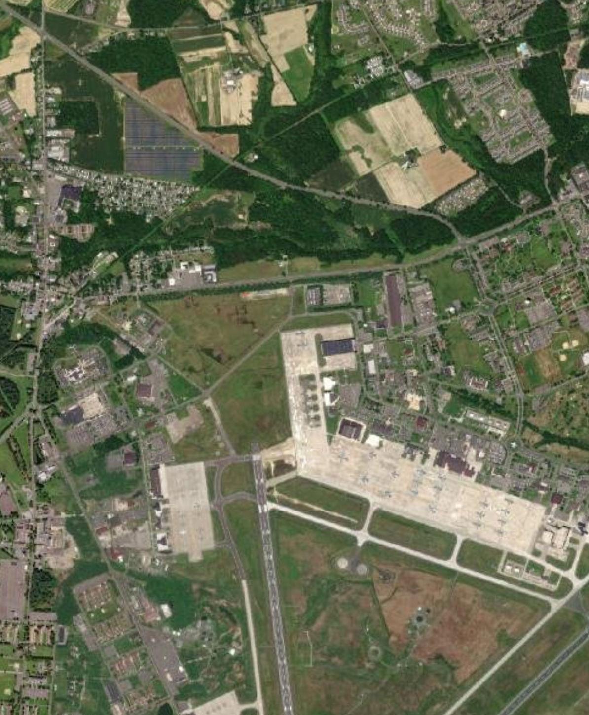
Land Use (2015) from NJDEP, 2022. Municipal and County Boundaries and Road Centerlines from NJOGIS, 2022.
from Esri, 2022.
680 666 667 616 528 545 665 665 616 537 Dix Area McGuire Area 18/36 06/24 I Study Area Joint Base Boundary Municipal Boundary County Boundary APZ ADNL CDNL Large-Caliber
PK15 Small Arms PK15 Land Use (2015) Residential Commercial and Services Transportation/Communication/Utility Other Urban
Land Livestock Farming Crop
Other Agriculture Forest Water Wetland Runway
Weapons
or Built-Up
Farming
0 1 Miles
Aerial Imagery
NEW HANOVER TOWNSHIP
TOWNSHIP
NORTH HANOVER TOWNSHIP
PLUMSTED
WRIGHTSTOWN BOROUGH
Recommendations
• For land in all zones, collaborative development review with JB MDL is recommended for all residential and non-residential development proposals allowed in this zoning category
• Work with JB MDL to require appropriate noise abatement considerations in construction of new residential units
• Mitigate potential effects of new residential uses on unbuilt land zoned for residential uses through one or more of the following tools:
o Overlay zoning or deed restriction mechanism to limit development of Incompatible uses in these zones
o Leveraging REPI or other funding programs to buy conservation easements or incentivize development elsewhere (e.g. utility development through Defense Communities Infrastructure Program) on these properties
o Rezoning undeveloped land to exclude residential uses in these areas
11-25 P:\03143\0008 Reports\N-Envir\Regional Compatible Use Study\2023 Final Section 11.docx
Zoning of Unbuilt Area Compatibility Location Area (Acres)
Table 11.12: North Hanover Township Compatible Zoning Recommendations
Medium Density Residential Compatible with Restrictions NZ II APZ I 13
Low Density Residential Compatible with Restrictions NZ II APZ I 167 Industrial Compatible with Restrictions NZ II APZ I 38
Collaborative development review of proposals with JB MDL is recommended to avoid or minimize potential conflicts Transportation/ Communication/ Utility Compatible with Restrictions NZ II APZ I 5
Collaborative development review of proposals with JB MDL is recommended to avoid or minimize potential conflicts
•
•
Figure 11.12: Zoning within Noise Zones and APZs in North Hanover Township
WRIGHTSTOWN BOROUGH
Base Boundary, APZ, ADNL, CDNL, Large-Caliber Weapons PK15 Noise Zone, Small Arms PK15 Noise Zone, Military Range, Range Impact Area, and Military Training Area from JB MDL, 2022.
680 666 667 616 528 545 665 665 616 537 Dix Area McGuire Area 18/36 06/24 I Study Area Joint Base Boundary Municipal Boundary County Boundary APZ ADNL CDNL Large-Caliber Weapons PK15 Small Arms PK15 Zoning Medium Density Residential Low Density Residential Industrial Transportation/Communication/Utility Undetermined Runway
Joint
Zoning from Burlington
Municipal and County Boundaries and Road Centerlines from NJOGIS, 2022. Aerial Imagery from Esri, 2022. 0 1 Miles NEW HANOVER TOWNSHIP NORTH
PLUMSTED TOWNSHIP
Source:
and Ocean Counties, 2022.
HANOVER TOWNSHIP
11.3.3
Pemberton Borough does not contain any noise or accident potential zones at JB MDL and therefore do not have subsequent compatibility recommendations.
11.3.4
Table 11.13 and 11.14 provide recommendations regarding compatibility of noise and aircraft accident potential zones associated with airfields, ranges, and training areas at JB MDL Dix Area within Pemberton Township.
• Consider actions such as transfer of development rights or applying for OLDCC grants to support the ultimate conversion or relocation of existing residential uses to Compatible uses and prohibit the further development or redevelopment of residential uses
• Existing uses are likely considered Compatible with Restrictions
• Jurisdiction should work with JB MDL if there is a significant change in use in the future to avoid or minimize potential land use compatibility concerns
• Jurisdiction should consider adoption and enforcement of dust controls and protection of wind erosion that could obscure visibility for aircraft on approach or takeoff from JB MDL runways
• Any future rezoning and development of this land should be limited to uses that are considered Compatible land uses in the zone located
• Area of use is small, and operations would not likely raise any concerns
• Avoid the potential for increased impacts to aircraft operations from waterfowl by preventing the expansion or creation of wetland banking and bodies of water in these zones per Air Force guidance unless contacting the JB MDL airfield manager, FAA, and/or a Qualified Airport Wildlife Biologist to advise
11-27 P:\03143\0008 Reports\N-Envir\Regional Compatible Use Study\2023 Final Section 11.docx
Pemberton Borough
Pemberton Township
Existing Land Use Compatibility Location Area (Acres)
Residential Incompatible NZ II NZ III APZ I 381
Table 11.13: Pemberton Township Compatible Land Use Recommendations
Recommendations
Residential Compatible with Restrictions APZ II 57
Commercial and Services Compatible with Restrictions APZ I APZ II 27 Transportation/ Communication/ Utility Compatible with Restrictions NZ II 3 Recreational Incompatible NZ II 2 Crop Farming Compatible with Restrictions NZ II 1
Other Agriculture Compatible with Restrictions NZ II NZ III 4
Water
II 4
Incompatible APZ
Wetland Incompatible APZ I APZ II 64
Table 11.13: Pemberton Township Compatible Land Use Recommendations
Barren Land Compatible with Restrictions NZ II 3
• Redevelopment for residential purposes should be avoided
• Collaborative development review of any new development proposal with JB MDL is recommended to avoid or minimize potential conflicts
11-28 P:\03143\0008 Reports\N-Envir\Regional Compatible Use Study\2023 Final Section 11.docx
Land
Existing
Use Compatibility Location Area (Acres) Recommendations
Figure 11.13: Land Use within Noise Zones and APZs in Pemberton Township
SPRINGFIELD
Source:
Joint Base Boundary, APZ, ADNL, CDNL, Large-Caliber Weapons PK15 Noise Zone, Small Arms PK15 Noise Zone, Military Range, Range Impact Area, and Military Training Area from JB MDL, 2022.

Land Use (2015) from NJDEP, 2022.
Municipal and County Boundaries and Road Centerlines from NJOGIS, 2022. Aerial Imagery from Esri, 2022.
630 680 616 666 545 665 644 4 616 667 645 670 669 18 530 646 642 68 70 Dix Area McGuire Area 18/36 06/24 I Study Area Joint Base Boundary Municipal Boundary County Boundary APZ ADNL CDNL
PK15 Small Arms PK15 Land Use (2015) Residential Commercial and Services
Farming
Farming
Agriculture Forest Water Wetland Barren Land
values> Runway
Large-Caliber Weapons
Transportation/Communication/Utility Other Urban or Built-Up Land Recreational Livestock
Crop
Other
<all other
PEMBERTON TOWNSHIP
PLUMSTED TOWNSHIP
0 2 Miles
TOWNSHIP NORTH HANOVER TOWNSHIP NEW HANOVER TOWNSHIP
WRIGHTSTOWN BOROUGH
11.14:
Recommendations
• For land in all zones, collaborative development review with JB MDL is recommended for all residential and non-residential development proposals allowed in this zoning category
• Work with JB MDL to require appropriate noise abatement considerations in construction of new residential units
• Mitigate potential effects of new residential uses on unbuilt land zoned for residential uses through one or more of the following tools:
o Overlay zoning or deed restriction mechanism to limit development of Incompatible uses in these zones
o Leveraging REPI or other funding programs to buy conservation easements or incentivize development elsewhere (e.g. utility development through Defense Communities Infrastructure Program) on these properties
o Rezoning undeveloped land to exclude residential uses in these areas
• Collaborative development review of proposals with JB MDL is recommended to avoid or minimize potential conflicts
• Jurisdiction should work with JB MDL on development review if there is a proposed change in use in the future to avoid or minimize potential land use compatibility concerns
11-30 P:\03143\0008 Reports\N-Envir\Regional Compatible Use Study\2023 Final Section 11.docx
Zoning of Unbuilt Area Compatibility Location Area (Acres)
High Density Residential Compatible with Restrictions NZ II APZ I 648
Table
Pemberton Township Compatible Zoning
Recommendations
Medium Density Residential Compatible with Restrictions NZ II NZ III 579 Low Density Residential Compatible with Restrictions NZ II 153 Business and Commercial Compatible with Restrictions APZ II 67
Preservation Compatible with Restrictions NZ II 280
11.14: Zoning within Noise Zones and APZs in Pemberton Township
630 680 616 666 545 665 644 4 616 667 645 670 669 18 530 646 642 68 70 Dix Area McGuire Area 18/36 06/24 I Study Area Joint Base Boundary Municipal Boundary County Boundary APZ ADNL CDNL Large-Caliber Weapons PK15 Small Arms PK15 Zoning High Density Residential Medium Density Residential Low Density Residential Business and Commercial Military Preservation Runway Source: Joint Base Boundary, APZ, ADNL, CDNL, Large-Caliber Weapons PK15 Noise Zone, Small Arms PK15 Noise Zone, Military Range, Range Impact Area, and Military Training Area from JB MDL, 2022. Zoning from Burlington and Ocean Counties, 2022. Municipal and County Boundaries and Road Centerlines from NJOGIS, 2022. Aerial Imagery from Esri, 2022. PEMBERTON TOWNSHIP PLUMSTED TOWNSHIP SPRINGFIELD TOWNSHIP NORTH HANOVER TOWNSHIP NEW HANOVER TOWNSHIP WRIGHTSTOWN BOROUGH 0 2 Miles
Figure
11.3.5
Springfield Township does not contain any noise or accident potential zones at JB MDL and therefore do not have subsequent compatibility recommendations.
11.3.6
Table 11.15 and 11.16 provide recommendations regarding compatibility of noise and aircraft accident potential zones associated with airfields at JB MDL
Area within Wrightstown Township.
• Consider actions such as transfer of development rights or applying for OLDCC grants to support the ultimate conversion or relocation of existing residential uses to Compatible uses and prohibit the further development or redevelopment of residential uses
• Existing uses are likely considered Compatible with Restrictions
• Jurisdiction should work with JB MDL if there is a significant change in use in the future to avoid or minimize potential land use compatibility concerns
• Jurisdiction should consider adoption and enforcement of dust controls and protection of wind erosion that could obscure visibility for aircraft on approach or takeoff from runways
• Any future rezoning and development of this land should be limited to uses that are considered Compatible land uses in the zone located
• Avoid the potential for increased impacts to aircraft operations from waterfowl by preventing the expansion or creation of wetland banking and bodies of water in these zones per Air Force guidance unless contacting the JB MDL airfield manager, FAA, and/or a Qualified Airport Wildlife Biologist to advise
11-32 P:\03143\0008 Reports\N-Envir\Regional Compatible Use Study\2023 Final Section 11.docx
Springfield Township
Wrightstown Borough
Dix
Existing Land Use Compatibility Location Area (Acres) Recommendations Residential Incompatible NZ II APZ I 10
Table 11.15: Wrightstown Borough Compatible Land Use Recommendations
Commercial and Services Compatible with Restrictions NZ II APZ I 12
Transportation/ Communication/ Utility Compatible with Restrictions APZ I 1 Livestock Farming Compatible with Restrictions APZ I 5
Wetland Incompatible APZ II 4
Figure 11.15: Land Use within Noise Zones and APZs in Wrightstown Borough
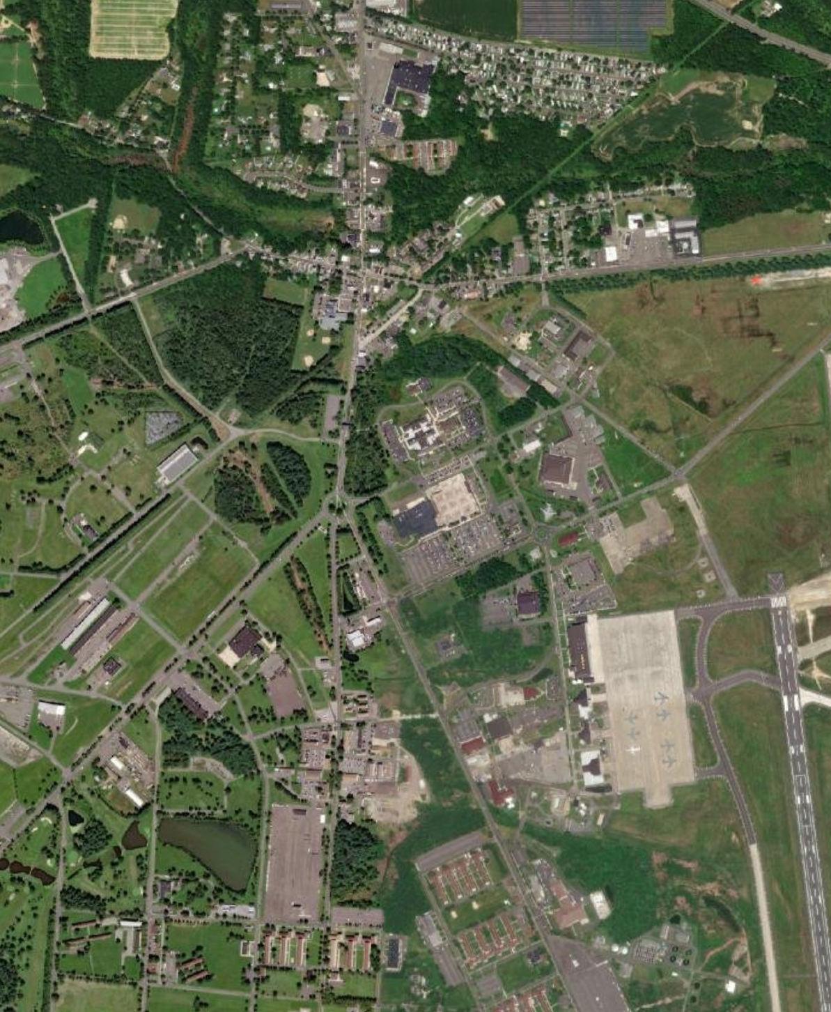
Source:
Joint Base Boundary, APZ, ADNL, CDNL, Large-Caliber Weapons PK15 Noise Zone, Small Arms PK15 Noise Zone, Military Range, Range Impact Area, and Military Training Area from JB MDL, 2022. Land Use (2015) from NJDEP, 2022. Municipal and County Boundaries and Road Centerlines from NJOGIS, 2022. Aerial Imagery from Esri, 2022.
666 616 630 616 545 545 669 616 670 680 68 Dix Area McGuire Area 18/36 I Study Area Joint Base Boundary Municipal Boundary County Boundary APZ ADNL Land Use (2015) Residential Commercial and Services Transportation/Communication/Utility Other Urban or Built-Up Land Livestock Farming Forest Wetland Runway
SPRINGFIELD TOWNSHIP
NORTH HANOVER TOWNSHIP
WRIGHTSTOWN BOROUGH
0 1 Miles
PEMBERTON TOWNSHIP
Table 11.16: Wrightstown Borough Compatible Land Use Recommendations
Recommendations
• For land in all zones, collaborative development review with JB MDL is recommended for all residential and non-residential development proposals allowed in this zoning category
• Work with JB MDL to require appropriate noise abatement considerations in construction of new residential units
• Mitigate potential effects of new residential uses on unbuilt land zoned for residential uses through one or more of the following tools:
o Overlay zoning or deed restriction mechanism to limit development of Incompatible uses in these zones
o Leveraging REPI or other funding programs to buy conservation easements or incentivize development elsewhere (e.g. utility development through Defense Communities Infrastructure Program) on these properties
o Rezoning undeveloped land to exclude residential uses in these areas
• Collaborative development review of proposals with JB MDL is recommended to avoid or minimize potential conflicts
11-34 P:\03143\0008 Reports\N-Envir\Regional Compatible Use Study\2023 Final Section 11.docx
Zoning of Unbuilt Area Compatibility Location Area (Acres)
Medium Density Residential Compatible with Restrictions NZ II APZ I 34
Business and Commercial Compatible with Restrictions NZ II APZ I 12
Source: Joint Base Boundary, APZ, ADNL, CDNL, Large-Caliber Weapons PK15 Noise Zone, Small Arms PK15 Noise Zone, Military Range, Range Impact Area, and Military Training Area from JB MDL, 2022. Zoning from Burlington and Ocean Counties, 2022. Municipal and County Boundaries and Road Centerlines from NJOGIS, 2022. Aerial Imagery from Esri, 2022.
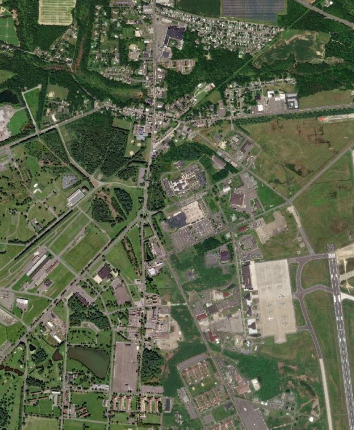
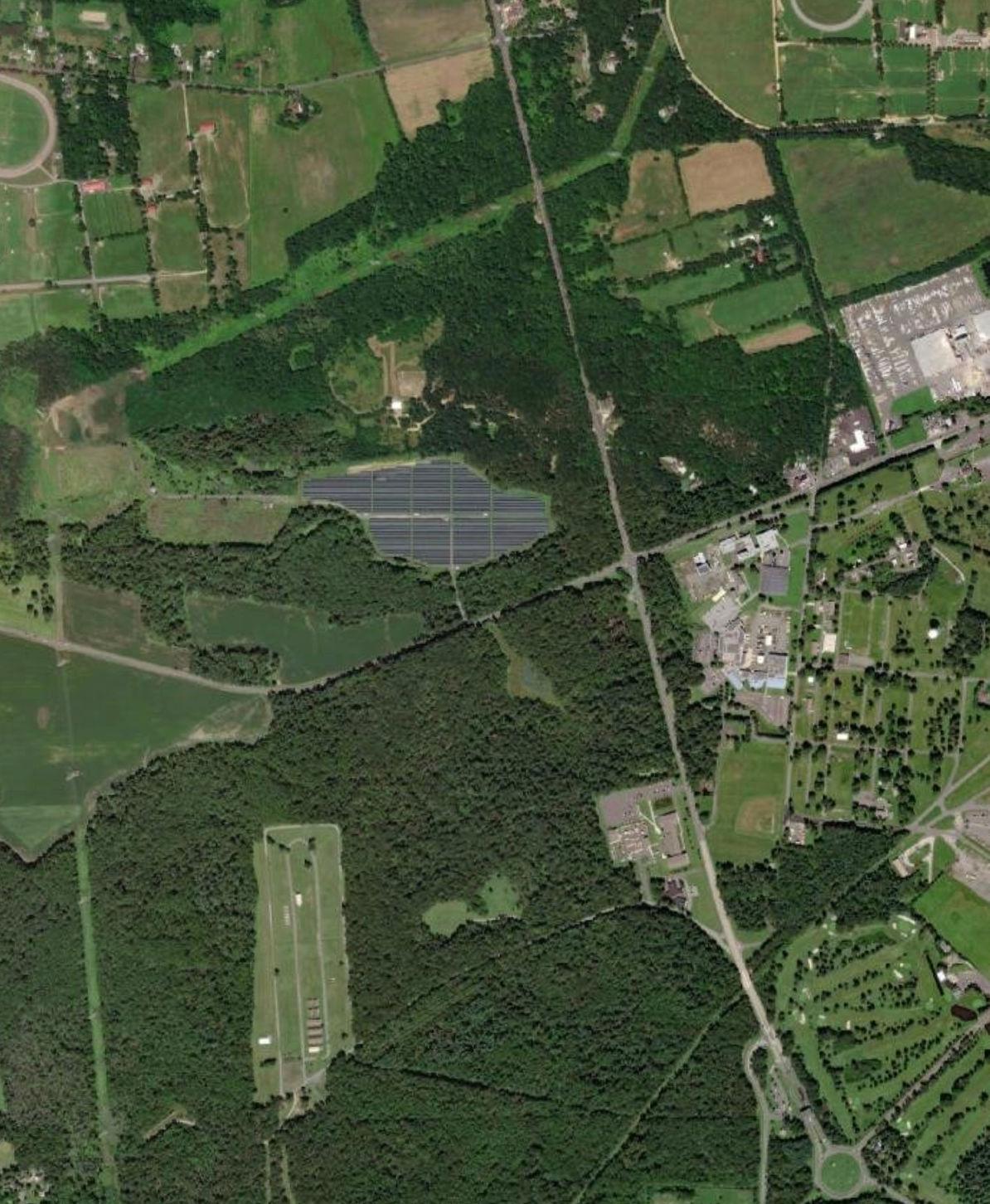
666 616 630 616 545 545 669 616 670 680 68 Dix Area McGuire Area 18/36 I Study Area Joint Base Boundary Municipal Boundary County Boundary APZ ADNL Zoning Medium Density Residential Business and Commercial Military Runway
SPRINGFIELD TOWNSHIP 0 1 Miles
NORTH HANOVER TOWNSHIP WRIGHTSTOWN BOROUGH
PEMBERTON TOWNSHIP
Figure 11.16: Zoning within Noise Zones and APZs in Wrightstown Borough
Table 11.17 General Study Area Recommendations
11-36 P:\03143\0008\Reports\N-Envir\RegionalCompatibleUseStudy\2023Final\Section11.docx
11.4 GENERALSTUDYAREARECOMMENDATIONS
ID Recommendation Description Applicable Location CountiesJacksonTwpLakehurstBoroManchester Twp Plumsted Twp New Hanover Twp North HanoverTwpPemberton Boro Pemberton Twp Springfield TwpWrightstown Boro Land Use and Zoning (LZ) LZ-1 Identify priority landsfor potential acquisition by JBMDL x x x x x x x x LZ-2 Identify opportunities to implement transfer of developmentrights x x x x x x x x x x LZ-4 Require deed notice on properties within the noise and safety zones x x x x x x x LZ-5 Revise building codes to include noise attenuation measures x x x x x x LZ-6 Continue outreach programming on Bird Aircraft Strike Hazard (BASH) x x x x x x LZ-7 Implement a Process for JB MDL to Receive Notice of Development Applications x x x x x x x x LZ-8 Implement Noise Zone Overlay Zoning Districts x x x x x x x x LZ-9 Implement APZ Overlay Zoning Districts x x x x x x x x LZ-10 Document compliance with the FAA review process x x x x x x x x a x LZ-11 Document compliance with The Clearinghouse review process x x x x x x x x a x LZ-12 Encourage local development projects within the HAFZ to engage with JBMDL x x x x x x x x a x LZ-13 Develop and publicize a location to send local development projects to JB MDL x LZ-14 Utilize REPI as a land use management tool x x x x x x x x x x x Communication and Coordination (CC) CC-1 Execute an RCUS Implementation Charter and Committee x x x x x x x x x x x CC-2 Coordinate resiliency efforts x
11-37 P:\03143\0008\Reports\N-Envir\RegionalCompatibleUseStudy\2023Final\Section11.docx ID Recommendation Description Applicable Location CountiesJacksonTwpLakehurstBoroManchester Twp Plumsted Twp New Hanover Twp North HanoverTwpPemberton Boro Pemberton Twp Springfield TwpWrightstown Boro Infrastructure (I) I-1 Evaluate a public-private partnership to fund gate manning and operation x x x I-2 Improve wayfinding around JB MDL gates x x I-3 PFAS contamination concerns x x I-4 Identify opportunities for additional grid-connected public/private financed renewable generation projects x Safety (S) S-1 Adopt ordinances regulating the use of UAS x x x x x x x x x x S-2 Conduct outreach programming about UAS x x x x x x x x x x S-3 Conduct outreach programming on UXOs x x x x Natural Resources (NR) NR-1 Continue to identify target areas for preservation x x x NR-2 Join the Sentinel Landscape Partnership Program x Community Development (CD) CD-1 Explore opportunities to improve housing opportunities for military personnel x x x x x x x x CD-2 Adopt JB MDL RCUS recommendations as guidance for local development x x x x x x x x x x CD-3 Update master plans and future developmentplans x x x x x x x x x x CD-4 Increase local employment opportunities through skilled workforce development training x x x x x x x x x x x CD-5 Explore opportunities to utilize Office of Local Defense Community Cooperation (OLDCC) grants x x x x x x x x x x x CD-6 Explore opportunities to utilize state and local grants x x x x x x x x x x x CD-7 Monitor new opportunities for partnerships and cooperation for new and expanded mission (i.e., ERMC) x x x x x x x x x x x
11.4.1Mitigation Strategies for Incompatible Land Use
LZ-1 Identify priority lands for potential acquisition by JB MDL
Level of Concern Location Schedule
HIGH APZ CZs
Ongoing
Under DODI 4165.57, “Air Installations Compatible Use Zones”, military bases with airfields, and therefore APZ CZs, are to acquired by an installation, where possible. JB MDL to work with RCUS Municipalities and Counties to determine the feasibility for transfer of these lands to prevent Incompatible uses.
LZ-2 Identify opportunities to implement transfer of development rights
Level of Concern Location Schedule
MEDIUM All RCUS Municipalities Long-Term
A Transfer of Development Rights (TDR) program would provide a method for an owner of property within AICUZ noise or safety zones to sell development rights to the owner of a property outside such zones. Municipal Land Use Law (MLUL) enables counties and municipalities to work together to establish TDR programs. Moreover, New Jersey municipalities can also establish zoning provisions that allow development clustering on discontinuous properties which can also be used to create a form of TDR.
LZ-3 Continue to evaluate and adjust flight paths to avoid sensitive land uses
Level of Concern Location Schedule
MEDIUM All RCUS Municipalities
Ongoing
The RCUS Team recommends that JB MDL continue their efforts to avoid flying over sensitive land uses such as housing units. According to the 2022 AICUZ Study, the installation evaluates and updates flight tracks regularly for this purpose.
LZ-4 Require deed notice on properties within the noise and safety zones
Level of Concern Location Schedule HIGH All RCUS Municipalities Short-Term
While some RCUS towns have deed notice provisions related to JB MDL, the RCUS Study Team recommends that all Municipalities require property owners to disclose if properties are located within in the AICUZ noise and safety zones when those properties are marketed for sale or rent. This provides prospective owners or renters the ability to identify potential impacts to the property prior to acquisition or lease of the property. Property transactions recorded with the County Clerk should include a deed disclosures or notification. For rental properties, these should take the form of disclosures in rental agreements between owners and tenants. In addition, planning and zoning board approval resolutions for land development applications within in the AICUZ noise and safety zones should include a provision requiring that structures be constructed to meet current noise attenuation codes.
LZ-5 Revise building codes to include noise attenuation measures
Level of Concern Location Schedule
HIGH All RCUS Municipalities Short-Term
The RCUS Study Team recommends that RCUS Municipalities update their building codes as necessary to require compliance with current noise attenuation measures for existing and future development. In 2022, the FAA published “AC 150/5000-9B - Guidelines for Sound Insulation of Structures Exposed to Aircraft Noise”, which includes recommendations for residential and non-residential buildings. Approving resolutions for land development applications should require that structures be constructed to meet current noise attenuation codes. The inclusion of noise attenuation measures in the development of future projects is more cost-effective than having to undertake post-construction measures.
11-38 P:\03143\0008 Reports\N-Envir\Regional Compatible Use Study\2023 Final Section 11.docx
LZ-6 Continue outreach programming on Bird Aircraft Strike Hazard (BASH)
Level of Concern Location Schedule
MEDIUM RCUS municipalities
Ongoing
The RCUS Study Team recommends that JB MDL regularly engage with the public and RCUS Municipalities on the causes of Bird Aircraft Strike Hazard (BASH). Important stakeholders include agricultural and industrial landowners, whose land uses attract wildlife. Outreach programming should be a dialogue between JB MDL and partners to coordinate mission and public activities.
LZ-7 Implement a Process for JB MDL to Receive Notice of Development Applications
Level of Concern Location Schedule
HIGH All RCUS Municipalities
Short-Term
The RCUS Study Team recommends that local municipal planners will amend application checklists to include a requirement to provide notice of an application to JB MDL designee(s). JB MDL planners can then identify applications of interest, review those applications, and provide comments to the municipal planners or interact with the applicants directly.
LZ-8 Implement Noise Zone Overlay Zoning Districts
Level of Concern Location Schedule
MEDIUM All RCUS Municipalities Short-Term
Noise Zone Overlay Zoning Districts can guide compatible planning within JB MDL noise zones. Overlay zoning provisions establish uses that are Compatible with restrictions as Conditional Uses with specific requirements to assure that proposed development meets applicable restrictions. Applicants seeking variances from those provisions would then need to apply to local planning or zoning boards for approval and JB MDL would be noticed of such applications.
LZ-9 Implement Accident Potential Zone (APZ) Overlay Zoning Districts
Level of Concern Location Schedule
MEDIUM All RCUS Municipalities Short-Term
APZ Overlay Zoning Districts can guide compatible development within areas mapped as JB MDL Accident Potential Zones. Overlay zoning provides an alternative to altering or creating zones while also restricting certain land uses or the design of structures. The APZ Overlay District should enforce the application of FAA and Air Force guidelines to prohibit Incompatible land uses and encourage Compatible land uses and require strict application of height limitations.
LZ10 Document compliance with the FAA review process
Level of Concern Location Schedule
HIGH All RCUS Municipalities
Ongoing
The RCUS Study Team recommends that RCUS Municipalities develop ordinances to require compliance to FAA restrictions, as set forth in 14 CFR 77, to activities adjacent to aircraft operations. For example, developers of properties within an APZ, or any construction or alteration that is more than 200 ft AGL at its site, should be required to submit proof of filing of a notice with the FAA regarding the construction. The FAA reviews development plan to assess impacts to aircraft operation procedures and identify mitigation strategies. Mitigation may involve changes to structural designs including but not limited to height, construction materials., and siting. Federal review of “construction and alteration” allows the implementation of mitigation measures earlier on in the project development process.
11-39 P:\03143\0008 Reports\N-Envir\Regional Compatible Use Study\2023 Final Section 11.docx
LZ11 Document compliance with The Military Aviation and Installation Assurance Siting Clearinghouse (The Clearinghouse) review process
Level of Concern Location Schedule
HIGH All RCUS Municipalities Ongoing
The RCUS Study Team recommends that RCUS Municipalities develop ordinances to enforce compliance of energy-related projects with JB MDL by requiring developers to submit proof of filing notice with The Military Aviation and Installation Assurance Siting Clearinghouse (The Clearinghouse) for informal and formal review. The DOD Clearinghouse supports project development by working partners to ensure compliance and compatibility with military activity. The Clearinghouse formal and informal review requires the same information, but the formal review process requires projects to be filed with the Secretary of Transportation, under Title 49 U.S.C., Section 44718 (Federal Aviation Administration obstruction evaluation process) and addresses all energy projects greater than 199 feet above ground level, proposed for construction within military training routes or special use airspace. The Clearinghouse process also works with developers to mitigate impacts of military activity to the local land uses.
LZ12 Encourage local development projects within the Hazard to Aircraft Flight Zone to engage with JB MDL
Level of Concern Location Schedule
HIGH All RCUS Municipalities Short-Term, Ongoing
The RCUS Study Team recommends that RCUS Municipalities and JB MDL require local development projects within an APZ, or any construction or alteration that is more than 200 ft AGL at its site, to be submitted to the installation to review for mission compatibility and HAFZ concerns.
LZ13 Develop and publicize a location to send local development projects to JB MDL
Level of Concern Location Schedule
HIGH All RCUS Municipalities Short-Term Notification of site plan, zoning and subdivisions applications to the JB MDL planners will enable provision of information regarding potential operational conflicts for review by the Board during decision-making processes.
LZ14 Utilize Readiness and Environmental Protection Integration (REPI) as a land use management tool
Level of Concern Location Schedule
HIGH All RCUS Municipalities Short-Term Municipalities and Counties as well as JB MDL have successfully utilized REPI to preserve lands which helps to support community goals for farmland preservation and the safety and security of military operations. Several stakeholders expressed an interest in continuing these efforts at properties already identified as targets and those to be identified in the future.
11.5 COORDINATION AND COMMUNICATION (CC) 11.5.1 Compatibility Concerns and Opportunities
The following recommendations support the further development of standard operating procedures for communication. Strong communication is integral to the continuous efforts to implement RCUS recommendations. Current communication between stakeholders requires improvement as officials in addition to the public
11-40 P:\03143\0008 Reports\N-Envir\Regional Compatible Use Study\2023 Final Section 11.docx
do not know who or how to reach out to with their plans and concerns. To the extent that the protocol for having JB MDL planners involved in the local development review process exists, it is not functioning effectively and needs to be revisited. Current processes are focused on reactive rather than proactive efforts: information is sent to JB MDL when requested. Miscommunication or the lack of contact contributes to adverse effects to both JB MDL and local communities as concerns are viewed as not being heard or addressed The recommendations below seek to reestablish and enhance communication between RCUS Municipalities and JB MDL.
11.5.2 Recommendations
CC1 Execute an RCUS Implementation Charter and Committee
Level of Concern Location Schedule HIGH RCUS Municipalities Short-Term
A RCUS Implementation Charter will formally define the organizations involved in the implementation of the RCUS recommendations and their goals. In doing so, it sets forth the guiding principles to establish the RCUS Implementation Committee. By signing the charter, local and regional officials demonstrate their commitment to executing the RCUS recommendations. The main priority of the committee is to seek the ongoing improvement of the compatibility of land uses within the study area. Members of the Policy Committee and Technical Advisory Committee should be invited to join the RCUS Implementation Committee. Other stakeholders instrumental to the committee’s success may be identified and added as implementation progresses.
The RCUS Implementation Committee should convene regularly after determining the appropriate frequency of meetings. Meetings should include the discussion of RCUS recommendation implementation updates and concerns.
CC2 Coordinate resiliency efforts
Level of Concern Location Schedule MEDIUM All RCUS Municipalities Ongoing
The JB MDL planning team, RCUS Municipalities, and Burlington and Ocean County should keep one another informed of the status of energy, security, and other resiliency efforts. Stakeholders may be able to provide assistance to another to support resiliency projects as well as implement mitigation strategies for any impacts. Moreover, all resiliency projects should include informal consultations with the DOD Siting Clearinghouse.
11.6 INFRASTRUCTURE AND UTILITIES (I)
11.6.1 Compatibility Concerns and Opportunities
Recent gate closures have generated accessibility concerns: increasing commute times and cutting on and off-base populations and resources off from one another.
11-41
P:\03143\0008 Reports\N-Envir\Regional Compatible Use Study\2023 Final Section 11.docx
Another concern is the traffic created by commercial vehicles attempting to enter the installation at the wrong gate. Drivers that miss the commercial gate must reverse out of the entry for other access to reach the commercial gate.
11.6.2 Recommendations
I-1 Evaluate a public-private partnership to fund gate manning and operation
Level of Concern Location Schedule
MEDIUM
All RCUS Municipalities Short-Term
JB MDL and RCUS municipalities should investigate the feasibility of a public-private partnership funded opening of a gate(s) for limited hours during the day or week. While JB MDL is obligated to mission security requirements first and foremost, the JB MDL planning team is open to conversation about this opportunity.
I-2
Improve wayfinding around JB MDL gates
Level of Concern Location Schedule
MEDIUM All RCUS Municipalities Short-Term Improvements to wayfinding, such as signs and road markings, will enhance a driver’s ability to navigate around the area and prevent congestion near gate entries.
I-3 Per/Polyfluoroalkyl Substances
(PFAS)
contamination concerns
Level of Concern Location Schedule
HIGH All RCUS Municipalities
To be determined
Update communities regarding status of PFAS studies and remediation measures
I-4 Identify opportunities for additional grid connected public-private financed renewable generation projects
Level of Concern Location Schedule
HIGH All RCUS Municipalities To be determined
Ongoing energy resilience projects at JB MDL include efforts that provide energy to the public grid and reduce JB MDL’s reliance on off-base energy. Joint efforts to add renewable energy generation in the area will support State Energy Master Plan goals for resiliency and 100% clean energy by 2050.
11.7 SAFETY (S)
11.7.1 Compatibility Concerns and Opportunities
Unmanned Aircraft Systems (UAS) have become more accessible and available for public, private, and military use. In doing so, public and private use creates
11-42 P:\03143\0008 Reports\N-Envir\Regional Compatible Use Study\2023 Final Section 11.docx
safety and security concerns for JB MDL Other concerns include the presence of unexploded ordnances (UXOs) off-base.
11.7.2 Recommendations
S-1
Adopt ordinances regulating the use of Unmanned Aircraft Systems (UAS)
Level of Concern Location Schedule
MEDIUM
All RCUS Municipalities Short-Term
Ordinances regulating the use of unmanned aircraft systems (UAS) disseminate information regarding their use restrictions, supporting the safety of private property, the public, and JB MDL’s missions They should reflect the No-Fly Zone encompassing JB MDL as well as other FAA guidelines.
S-2
Conduct outreach programming about Unmanned Aircraft Systems (UAS)
Level of Concern Location Schedule
MEDIUM RCUS Municipalities Short-Term
JB MDL and the RCUS Municipalities should add information about UAS regulations to the websites. Regulations differ depending on the intended use: recreational, commercial, etc. The FAA B4UFLY app, which maps spaces permitted for and restricted from UAS use, should also be highlighted as a useful tool. Other information should incorporate the requirement to register all UAS with the FAA and receive authorization from the FAA to fly UAS in a controlled airspace.
S-3 Conduct outreach programming on UXOs
Level of Concern Location Schedule
LOW All RCUS Municipalities Medium-Term
The development and implementation of a program to train officials and the public to identify UXOs and the proper procedure for its removal and remediation will help to mitigate against potential dangers to the community. The DOD has developed a website (https://www.denix.osd.mil/uxo/) to support the education of the all stakeholders.
11.8 NATURAL RESOURCES (NR)
11.8.1 Compatibility Concerns and Opportunities
Various species of wildlife classified as rare, threatened, endangered, and species of concern according to Federal and State resource agencies have been documented on or have the potential to be present on JB MDL
Preserved and open space also supports the mitigation of mission impacts, such as noise and safety, and prevention of community development encroaching on military activities Existing preservation programs include REPI, Natural Lands Trust, Farmlands Preservation Program, County Parks, Green Acres Program, and Pinelands Commission Permanent Land Protection.
P:\03143\0008 Reports\N-Envir\Regional Compatible Use Study\2023 Final Section 11.docx
11-43
11.8.2 Recommendations
NR1 Continue to identify target areas for preservation
Level of Concern Location Schedule MEDIUM All RCUS Municipalities Ongoing
JB MDL and several Municipalities identified goals of expanding upon ongoing efforts to preserve land. RCUS Municipalities, Ocean and Burlington Counties, and JB MDL should continue to update and share their target locations for preservation. Dissemination of target areas for preservation helps RCUS Municipalities and JB MDL to partner and identify appropriate funding opportunities.
NR2 Participate in the Sentinel Landscape Partnership Program
Level of Concern Location Schedule MEDIUM All RCUS Municipalities Medium-Term
The Sentinel Landscapes Partnership Program, facilitates cooperation of federal agencies such as the DOD and Department of the Interior, state, county and local agencies and nongovernment organizations to pursue initiatives for preservation of local agriculture, habitats, and natural resources while also supporting the local economy. JB MDL would benefit from the protection of mission readiness by ensuring Compatible land uses adjacent to installation.
11.9 COMMUNITY DEVELOPMENT (CD)
Many of residents of the RCUS Municipalities have a low/moderate income, as shown in Figure 11.1. Concentrations of individuals within this economic demographic strongly correlate with lack of access to resources and job opportunities. Additionally, higher percentages of the population have low- to moderate-income closer to JBMDL boundaries and, subsequently, the installation’s major noise sources. Therefore, increased attention is required to analyze and mitigate potential impacts of JB MDL activities and other recommendations on this vulnerable population.
11.9.1 Compatibility Concerns and Opportunities
The recommendations of the JB MDL are beneficial for local communities throughout New Jersey to guide local development.
11-44 P:\03143\0008 Reports\N-Envir\Regional Compatible Use Study\2023 Final Section 11.docx
11.9.2Recommendations
CD1 Explore opportunities to improve housing opportunities for military personnel
Level of Concern Location Schedule
HIGH All RCUS Municipalities Short-Term, Ongoing Stakeholders within the RCUS Study Area can mutually benefit from the development of housing within the region to support economic development within the local area and the mission readiness of JB MDL
CD2 Adopt JB MDL RCUS recommendations as guidance for local development
Level of Concern Location Schedule MEDIUM State Medium-Term
The compatible use guidelines and analytical tools used in this program serve to guide decision-making within JB MDL host communities, including measures to reduce conflict potential.
CD3 Update master plans and future development plans
Level of Concern Location Schedule MEDIUM All RCUS Municipalities Medium-Term
The reflection of RCUS findings and recommendations within master plans and future development within the next cycle of updates will further establish stakeholders’ commitment to compatibility and dialogue with one another
CD4 Increase local employment opportunities through scaled workforce development training
Level of Concern Location Schedule MEDIUM All RCUS Municipalities Short-Term
One way to support the development of the local economy is through workforce development of varying skill sets and ages. Potential programs include joint efforts to garner interest throughout education centers (high school, colleges, and universities, etc.) in STEM-related fields that can translate to roles in supporting JB MDL missions.
CD5 Explore opportunities to utilize Office of Local Defense Community Cooperation (OLDCC) grants
Level of Concern Location Schedule MEDIUM All RCUS Municipalities Short-Term
The DOD’s Office of Local Defense Community Cooperation (OLDCC) supports development and planning as it relates to the mission readiness and resiliency of military installations and their surrounding communities Programs include Construction, Mission Realignment, Diversification & Modernization, Installation Resilience Defense Community Infrastructure Pilot Program (DCIP), Defense Manufacturing Community Support (DMCSP), Intergovernmental and Stakeholder Engagement, and Public Schools on military Installations. Each program has unique purposes, requirements, and grant opportunities. More information about OLDCC grants can be found in Appendix E and their website (https://oldcc.gov/)
CD6 Explore opportunities to utilize state and local grants
Level of Concern Location Schedule MEDIUM All RCUS Municipalities Short-Term
State and local grants provide opportunities to support the implementation of RCUS recommendations.
P:\03143\0008 Reports\N-Envir\Regional Compatible Use Study\2023 Final Section 11.docx
11-45
CD7 Monitor new opportunities for partnerships and cooperation for new and expanded mission
JB
to maintain awareness of potential opportunities for cooperation with host communities associated as part of planning for expanding or new missions (i.e., ERMC).
11-46 P:\03143\0008 Reports\N-Envir\Regional Compatible Use Study\2023 Final Section 11.docx
Level of Concern Location Schedule MEDIUM All RCUS Municipalities, Counties and JB MDL Long-Term
MDL
Figure 11.17 - Low-Moderate Income Summary Within RCUS Municipalities




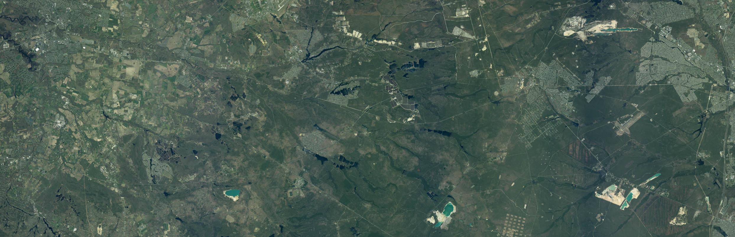
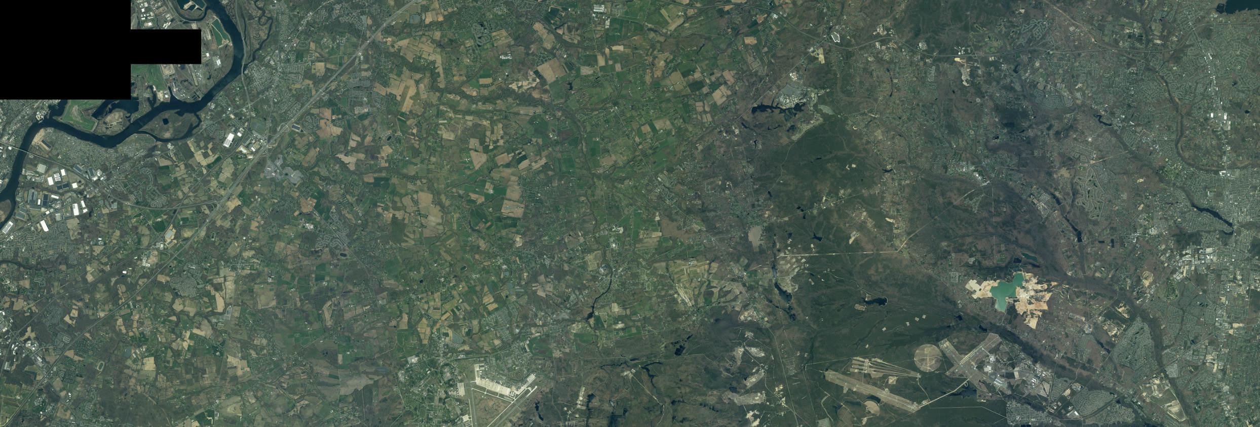
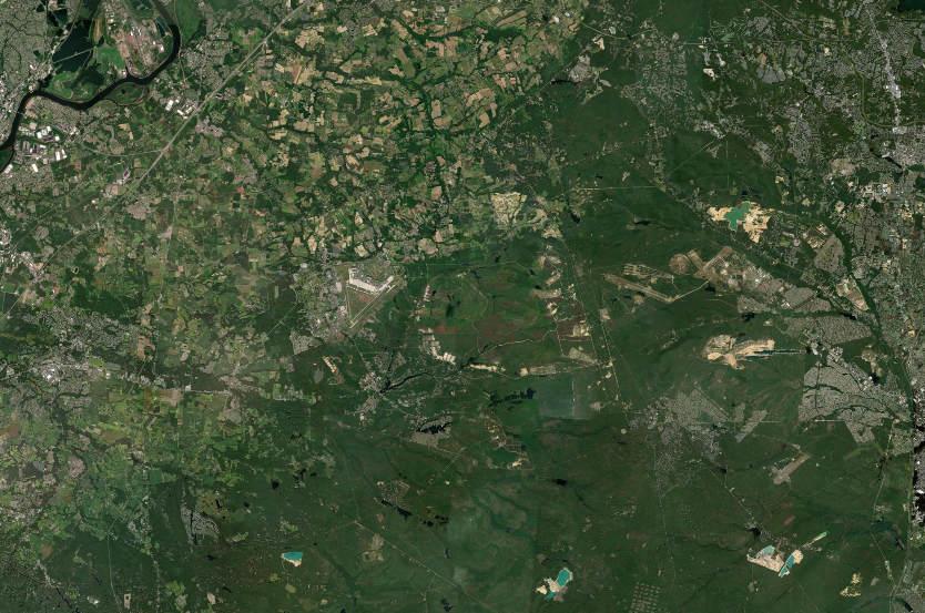
1 White Horse 68 670 630 616 616 616 524 528 646 13 206 206 130 95 195 Rancocas State Park Plumsted Twp Bristol Burlington Fort Dix airless Hills Country Lake Estates Bossert Estates onville New Egypt Browns Mills 541 70 Burlingt on Medford Lakes Leisuretowne Four Mile 524 547 571 571 571 636 528 622 527 641 530 537 9 Joint Base McGuire-Dix-Lakehurst Colliers Mills Manchester Whiting South Toms River Cedar Glen Lakes Coventry Square Crestwood Village Leesville Locust Manor Archers Corner Lakehurst Beachwood Toms River Lakewood Twp Greenwood Forest/pasadena Brendan T Byrne State Forest Ocean Barnegat Pines Lacey Twp Lakehurst NAES McGuire Air Force Fort Dix I 0 30,000 Feet Study Area Joint Base Boundary Municipal Boundary County Boundary Low/Moderate Income Summary <20% 20% - 40% 40% - 60% 60% - 80% >80% Source: Low to Moderate Income Populations by Block Group, FY 2022 ACS 5-Year 2011-2015 Low- and Moderate-Income Summary Data, U.S. Department of Housing and Urban Development, 2019 Municipal and County Boundaries from NJGIN, 2021. New Jersey Aerial Imagery, 2020. Map created by PS&S, 2022.
11.10 RECOMMENDED IMPLEMENTATION ACTIONS
The RCUS is intended to update JLUS programs and initiate the next round of cooperative efforts to enhance compatibility of land uses, foster communication and cooperation among the JB MDL and host communities, and identify opportunities for beneficial programs. The Regional Compatible Use Plan (RCUP) implements the RCUS, and the recommended way to move forward with this plan is to convene an RCUP Implementation Committee. The organization of the RCUP Committee reflects the RCUS stakeholders and include representation from the JB MDL, Ocean County, Burlington County, host municipalities, State and Federal agencies, and Congressional representatives.
The Implementation Plan anticipates creation of a RCUP charter subject to the consent of the RCUP Committee. A RCUP Charter provides the framework for review and implementation of selected recommendations of the RCUS. The RCUP Charter is anticipated to enhance the viability of the RCUP moving forward by laying out the process for stakeholder and community representatives to review RCUS recommendations, support recommendations that are acceptable to the committee, modify or remove recommendations from consideration, and identify new beneficial compatibility measures. The RCUP Charter will also include the RCUP Communications Plan.
The RCUP is dependent upon the active participation of the RCUP Committee, which in turn is reliant upon the support of leadership in the host communities, involved agencies including New Jersey Business Action Center Office of Planning Advocacy (NJOPA), New Jersey Pinelands Commission, New Jersey Department of Community Affairs (DCA), Department of Military & Veterans Affairs (DMVA), and JB MDL. It is recommended that mayors of host municipalities, Ocean County Board of Commissioners, Burlington County Commissioners, JB MDL Base Commander provide resolutions or similar documentation in support of the objectives of the RCUP. The Committee membership should be authorized by the municipal, county, involved agency, and JB MDL command to participate on the committee and guide the process for review and acceptance of the RCUP recommendations. The RCUP anticipates that participation of RCUS committee from NJOPA, Pinelands Commission, DCA and DMVA will continue throughout the RCUP implementation. The composition of the committee should include representatives that
11-48 P:\03143\0008 Reports\N-Envir\Regional Compatible Use Study\2023 Final Section 11.docx
have a defined role in their community or agency, whether by virtue of being an elected representative, holding an appointment, or being directly employed.
A primary objective of the RCUP Committee is to be informed of new developments in the communities and on the JB MDL, and adaptively respond in a manner consistent with the RCUP objectives to support compatible land uses. Regular meetings by the RCUP Committee will enable monitoring of new activities and necessary updates of the RCUP.
Table 11.18: Recommended Implementation Action Summary
Issue Opportunity/Need
Energy Supply Resiliency and Distribution Redundancy
Local Employment Growth and Workforce Development
Improve energy supply and distribution infrastructure redundancy to JB MDL and local communities
Recommended Implementation Action
• JB MDL – Identify opportunities and land area for additional gridconnected public/private financed renewable energy generation projects
• Counties – Apply for OLDCC Defense Community Infrastructure Pilot (DCIP) grants to support electric power supply, distribution or storage infrastructure of benefit to JB MDL and communities
• Host Municipalities – Identify opportunities for improvement to energy and utility infrastructure
• Local Utilities – Explore public/private funding and investor partnerships with JB MDL and the Air Force for new major power generation projects on JB MDL lands
• State Authorities – Explore opportunities for inter-connection of utility supply infrastructure between the two JB MDL providers, JB MDL and local communities as feasible
• Air Force – Support and facilitate the execution of key energy supply and distribution public/private partnership projects promoted by industry
• Counties – Apply for OLDCC Defense Manufacturing Community Support Program grant to help fund start up program for an advanced STEM and applied science workforce development program/center in collaboration with STEM educator partners
Increase local employment opportunities through skilled workforce development training to support key RDT&E JB MDL mission jobs
• Host Municipalities – Support establishment of local training centers and programs
• STEM Educators – Establish a collaboration consortium between industry, academia and JB MDL missions to provide advanced STEM and applied sciences workforce development training for High School and Community College students in electronics, machine learning and other critical skills of benefit to JB MDL missions and to provide a pipeline of key talent needed by those missions
• JB MDL – Work with key RDT&E missions to identify skills training needed to supply a pipeline of intern, research associate and full time employment candidates needed to support key mission requirements
11-49 P:\03143\0008 Reports\N-Envir\Regional Compatible Use Study\2023 Final Section 11.docx
Table 11.18: Recommended Implementation Action Summary Issue Opportunity/Need Recommended Implementation Action
Manage Wildlife Area Impacts
Wetlands and water bodies attract waterfowl which is considered incompatible in CZ, APZ I and II zones due to bird air strike hazards
• JB MDL/Counties – Continue to pursue funding tools such as REPI, Sentinel Landscape, Nature Conservancy, and other state and federal conservation easement tools to acquire or conserve key CZ and APZ I areas from expansion or encroachment of incompatible land uses
• Host Municipalities – Reinforce use of wildlife management measures on water bodies and lawn areas used by migratory waterfowl
• NJ DEP and USACE – Limit expansion of existing water bodies and wetland areas in critical APZ I, II and III zones and avoid the permitting or introduction of new water bodies and wetlands in these zone
TransportationAccess Transportation access routes to JB MDL can have a negative impact on local communities
• Counties and Communities – Explore opportunities for local funding to improve transportation routes and signing for commercial vehicles serving JB MDL to avoid impacts on residential areas and/or harden local roadways to better support truck traffic
• Counties and NJ DOT – Pursue OLDCC project funding under Defense Community Infrastructure Pilot (DCIP) grants and/or Federal Highway Administration Defense Access Road funding programs for design and construction of new commercial delivery access routes to JB MDL
• JB MDL – Improve directional signage and publicize instructions for contractor and delivery vehicles
Local Business Development Support opportunities for local businesses to grow or create new opportunities to sale goods and services to JB MDL
Reduce Current Incompatible Uses
Work to reduce existing land use compatibility concerns in CZ and APZ I areas
• Counties and Communities - Apply for OLDCC Defense Manufacturing Community Support Program grant and other state funding grants to help existing businesses and establish new local small and medium size companies enter the defense supply sector. Needs could include enhancement of cybersecurity requirements needed to support defense contracting and expansion of products, services and technologies offerings of interest to and purchase from JB MDL missions
• JB MDL – Expand “Doing business with JB MDL” information and Point of Contact, review gate staffing hours and personnel to facilitate trips on and off base
• JB MDL, Communities and Counties – Consider use of tools such as:
1. Outright purchase and expansion of base boundary (Air Force guidelines for CZ), 2. Purchase of conservations easement (use REPI or other applicable funding tools) to support relocation of residences in incompatible zones
• Communities and Counties – Explore tools such as transfer of development rights to reduce the likelihood of developing or expanding incompatible land uses such as certain residential uses in APZ I and/or support relocation of incompatible residential uses to areas where such use is compatible
11-50 P:\03143\0008 Reports\N-Envir\Regional Compatible Use Study\2023 Final Section 11.docx
Table 11.18: Recommended Implementation Action Summary Issue Opportunity/Need Recommended Implementation Action
Regulatory Plans for Land Use
Compatibility
Avoid the expansion of land uses that are incompatible in NZ and APZ zones and reduce future instances of negative impacts to residential areas from JB MDL operations
• Communities and Counties - Avoid designation, approval or expansion of land uses that are sensitive to noise and/or safety concerns in noise and/or safety areas where such uses would be considered incompatible
• Communities and Counties – Consider changing zoning and planning documents to support RCUS recommendations for areas where currently allowable uses would be considered incompatible uses with JB MDL operations
• Communities and Counties - Adopt planning policy framework and guidelines that consider land use compatibility with JB MDL operations in their future land use planning, zoning and development review processes
• NJ Planning Office – Adopt RCUS recommendations and RCUP planning collaboration framework as an overlay planning guideline for APZ and NZ areas.
• NJ DOT - Consider prioritizing state infrastructure investment support to communities and counties who enshrine RCUS and RCUP recommendations in their planning documents
Support Development Costs for Beneficial Land use
Access to JB MDL
Communic ations
Support the reduction in costs for the development of infrastructure to encourage development of housing and employment development beneficial to JB MDL
• State, Counties and Communities – Leverage infrastructure funding tools, grants and tax relief, benefit district or abatement tools to support development of quality housing and employment uses of benefit to JB MDL and local communities, a particular focus should be on exploring opportunities to write down risk and development costs to provide multifamily housing that can meet unaccompanied military personnel’s housing assistance allowances
• Counties – Consider applying for OLDCC Defense Community Infrastructure Pilot (DCIP) grants to assist with land acquisition and the development of infrastructure to support quality multi-family housing development near JB MDL and to include agreements with developers to set aside the majority of units to be available to unaccompanied military personnel’s housing at rent levels consistent with their housing assistance allowances
Opening of more JB MDL gates is desired by communities but limited due to resource constraints
Good communication between JB MDL and Communities will help support collaborative planning goals
• Communities – Explore opportunities to enter into inter-governmental agreements with JB MDL to allow for cost-sharing strategies and to fund security personnel during desired morning, noon and evening hours of operation to increase access to and from JB MDL and local communities at gates that are currently closed
• JB MDL – Support collaborative planning and development review and provide guidance with regard to compatibility of proposed projects with mission requirements
• Communities and Counties – Sign on to a collaborative planning compact that helps implement RCUS recommendations through the RCUP implementation
11-51 P:\03143\0008 Reports\N-Envir\Regional Compatible Use Study\2023 Final Section 11.docx
12.0 REFERENCES

12.0 LIST OF REFERENCES
2022 Military Pay Charts., n.d. Retrieved from Military.com. Available at: https://www.military.com/benefits/military-pay/charts
787 Civil Engineer Squadron, 2017. Joint Base McGuire-Dix-Lakehurst Wildland Fire Management Plan (WFMP).
87th Air Base Wing & Joint Base McGuire-Dix-Lakehurst Small Business Program, n.d. Retrieved from Joint Base McGuire-Dix-Lakehurst: https://www.jbmdl.jb.mil/Home/SmallBusiness-Program/
Air Force, 2021. SAF/IE releases Installation Energy Strategic Plan for energy assurance. Available at:
https://www.af.mil/Portals/1/documents/2021SAF/01_Jan/AF_Installation_Energy_Strategic _Plan_15JAN2021.pdf
Air Force Handbook, 2017. 32-7084, AICUZ Program Manager's Guide. Retrieved from Whole Building Design Guide: https://www.wbdg.org/FFC/AF/AFH/afh32_7084.pdf
Air Force Housing, n.d. Joint Base McGuire-Dix-Lakehurst Housing. Available at:
https://www.housing.af.mil/Home/Units/Joint-Base-McGuire-Dix-Lakehurst/
Basic Allowance for Housing Rate Lookup, 2022. Retrieved from Defense Travel Management Office. Available at: https://www.travel.dod.mil/Allowances/Basic-Allowance-forHousing/BAH-Rate-Lookup/
Burlington County, 2013. DMA 2000 Hazard Mitigation Plan Update, Section 4: County Profile. Available at: https://www.co.burlington.nj.us/DocumentCenter/View/852/Draft-Section-4--County-Profile-PDF?bidId=
Burlington County Board of Chosen Freeholders and Delaware Valley Regional Planning Commission, 2021. Burlington County Highway Master Plan. Available at:
https://www.dvrpc.org/webmaps/BCHMP/ [Data set]
Burlington County Board of County Commissioners (Burlington County), 2022. Burlington County Parks System Program Guide. Available at:
https://co.burlington.nj.us/DocumentCenter/View/16425/ProgramGuide-Fall2022-FINAL
Burlington County Board of County Commissioners, 2022. Burlington County Comprehensive Farmland Preservation Plan (2022 Update). Available at:
https://www.co.burlington.nj.us/DocumentCenter/View/16475/2022-ComprehensiveFarmland-Preservation-Plan WORKING-DRAFT-11-09-22?bidId=
Burlington County Department of Information Technology, 2016. Preserved Farmland Data [Data set].
Burlington County Department of Information Technology, 2010. Preserved Open Space Data [Data set].
12-1 P:\03143\0008 Reports\N-Envir\Regional Compatible Use Study\2023 Final Section 12 - List of References.docx
Burlington County Department of Information Technology, 2022. Zoning for the non-Pinelands geographic extent of Burlington County [Data set]
Jackson Twp., Lakehurst Borough, Manchester Twp, Plumsted Twp., Zoning Data [Data set.]
Burlington County Workforce Development Board, 2019. Burlington County Workforce Development Area Four-Year Strategic Plan 2016-2020. Retrieved from Burlington County: https://www.co.burlington.nj.us/337/WDB-Publications
Code of Federal Regulations and Preservation of the Navigable Air Space, n.d. Part 77 – Safe, Efficient Use, and Preservation of the Navigable Airspace. Available at: https://www.ecfr.gov/current/title-14/chapter-I/subchapter-E/part-77
Common Noise Levels – How Loud is Too Loud? n.d. Retrieved from International Noise Awareness Day. Available at: https://noiseawareness.org/info-center/common-noiselevels/
Department of Defense, 2015-2020. Noise Incidents [Data set].
Department of Defense, 2018. Manual 4715.20, Defense Environmental Restoration Program (DERP) Management.
Department of Defense, 2021. Instruction 4165.67, Air Installations Compatible Use Zones. Retrieved from Washington Headquarters Services: https://www.esd.whs.mil/Portals/54/Documents/DD/issuances/dodi/416557p.pdf
Department of Defense Office of Small Business Programs, n.d. Cybersecurity Available at: https://business.defense.gov/Programs/Cyber-Security-Resources/
Defense Travel Management Office, 2022. Basic Allowance for Housing Rate Lookup. Available at: https://www.travel.dod.mil/Allowances/Basic-Allowance-for-Housing/BAH-Rate-Lookup/
ESRI, 2021. Median Household Income. Available at: https://www.arcgis.com/home/item.html?id=39001018f2924cb5a7d4cd65932a9484 [Data set].
ESRI, 2022. Street Map [Data set].
Factsheet: Joint Base McGuire-Dix-Lakehurst, 2021, October 21. Available at: https://www.jbmdl.jb.mil/About-Us/About-Us/Fact-Sheets/Display/Article/243357/joint-basemcguire-dix-lakehurst/
Factsheet: Major Thomas B. McGuire Jr., 2021. Retrieved from Joint Base McGuire-DixLakehurst. Available at: https://www.jbmdl.jb.mil/About-Us/About-Us/FactSheets/Display/Article/243353/major-thomas-b-mcguire-jr/
Federal Aviation Administration, 2022. AC 150/500-9B – Guidelines for Sound Insulation of Structures Exposed to Aircraft Noise.
Federal Aviation Administration, 2022. B4UFLY App. Available at: https://www.faa.gov/uas/getting_started/b4ufly
12-2 P:\03143\0008 Reports\N-Envir\Regional Compatible Use Study\2023 Final Section 12 - List of References.docx
Federal Aviation Administration –Aeronautical Information Services, 2022. Class Airspace. Available at: https://adds-faa.opendata.arcgis.com/datasets/faa::class-airspace/about [Data set]
Federal Aviation Administration –Aeronautical Information Services, 2022. National Security UAS Flight Restrictions. Available at: https://uddsfaa.opendata.arcgis.com/datasets/faa::national-security-uas-flight-restrictions1/explore?location=40.035875%2C-74.465626%2C11.86 [Data set]
Federal Aviation Administration –Aeronautical Information Services, 2022. Special Use Airspace. Retrieved from: https://adds-faa.opendata.arcgis.com/search?q=special [Data set]
Federal Interagency Committee on Urban Noise, 1980. Guidelines for Considering Noise in Land Use Planning and Control.
Federal Regulations and Preservation of the Navigable Air Space, n.d. Part 77 – Safe, Efficient Use, and Preservation of the Navigable Airspace. Available at: https://www.ecfr.gov/current/title-14/chapter-I/subchapter-E/part-77
FEMA, 2019. National Flood Hazard Layer Data [Data set]. Available at: https://www.fema.gov/flood-maps/national-flood-hazard-layer
Fiore, A.R., Witzigman, C.M., and Resier, R.G., 2021. Hydrogeology and gain/loss assessment of two lakes contaminated with per- and polyfluoroalkyl substances, vicinity of Joint Base McGuire-Dix-Lakehurst, New Jersey, 2020-21. U.S. Geological Survey Scientific Investigations Report 2021-5107. https://doi.org/10.3133/sir20215107
Gill, J., 2022. Time to ‘block and tackle’: Draft strategy outlines Air Force’s future digital environment through 2028. Available at: https://breakingdefense.com/2022/08/time-to-blockand-tackle-draft-strategy-outlines-air-forces-future-digital-environment-through-2028/
Joint Base McGuire-Dix-Lakehurst, October 2021, Factsheet: Joint Base McGuire-DixLakehurst. Available at: https://www.jbmdl.jb.mil/About-Us/About-Us/FactSheets/Display/Article/243357/joint-base-mcguire-dix-lakehurst/
Joint Base McGuire-Dix-Lakehurst, October 2021. Factsheet: Major Thomas B. McGuire Jr. Available at: https://www.jbmdl.jb.mil/About-Us/About-Us/FactSheets/Display/Article/243353/major-thomas-b-mcguire-jr/
Joint Base McGuire-Dix Lakehurst, 2020. Integrated Natural Resources Management Plan.
Joint Base McGuire-Dix-Lakehurst, n.d. McGuire. Available at: https://www.jbmdl.jb.mil/MissionPartners/McGuire/
Joint Base McGuire-Dix-Lakehurst 787th Civil Engineer Squadron, 2022. New Jersey.
Joint Base McGuire-Dix-Lakehurst Housing, n.d. Retrieved from Air Force Housing: https://www.housing.af.mil/Home/Units/Joint-Base-McGuire-Dix-Lakehurst/
Joint Base McGuire-Dix-Lakehurst Air Installation Compatible Use Zone Study, 2022.
Joint Base McGuire-Dix-Lakehurst Congressional Staff Briefing, n.d.
Joint Base McGuire-Dix-Lakehurst Public Affairs Office, 2022. Complaint Tracker [Data set]
12-3 P:\03143\0008 Reports\N-Envir\Regional Compatible Use Study\2023 Final Section 12 - List of References.docx
Lang, K., 2018. DOD’s Cyber Strategy: 5 Things to Know. Available at:
https://www.defense.gov/News/Feature-Stories/story/Article/1648425/dods-cyber-strategy-5things-to-know/
Low to Moderate Income Populations by Block Group, FY, 2022. [Data set]
McGuire., n.d. Retrieved from Joint Base McGuire-Dix-Lakehurst. Available at: https://www.jbmdl.jb.mil/Mission-Partners/McGuire/
Michael Baker International, 2015. Joint Base McGuire-Dix-Lakehurst Installation Development Plan.
Military.com, n.d. 2022 Military Pay Charts. Available at: https://www.military.com/benefits/military-pay/charts
Military Aviation and Installation Assurance Siting Clearinghouse, n.d. Retrieved from Military Aviation and Installation Assurance Siting Clearinghouse: https://www.acq.osd.mil/dodsc/
Military Housing Privatization Initiative Tenant Bill of Rights, 2021. Available at https://download.militaryonesource.mil/12038/MOS/ResourceGuides/Military-HousingPrivatization-Initiative-Tenant-Bill-of-Rights.pdf
Morales, Airman 1st Class Joseph, 2020. Defending Cyberspace: 87th Communication Squadron Cybersecurity Technicians. Available at: https://www.jbmdl.jb.mil/News/Article/2396737/defending-cyberspace-87th-communicationsquadron-cybersecurity-technicians/
My Base Guide, n.d. Joint Base McGuire-Dix-Lakehurst Community. Available at: https://mybaseguide.com/installation/joint-base-mcguire-dixlakehurst/community/employment-economy-13/
Natural Resources Conservation Service, 2006. SSURGO Database for Ocean and Burlington Counties [Data set].
New Jersey, 2019. New Jersey Energy Master Plan: Pathway to 2050.
New Jersey Department of Agriculture Farmland Preservation Program [Data set], 2020.
New Jersey Department of Agriculture, 2021. 2021 Annual Report and Agricultural Statistics. Available at: https://www.nj.gov/agriculture/pdf/2021AnnualReportFinal.pdf
New Jersey Department of Environmental Protection, 2015. 2012 Land Use/Land Cover Update [Data set].
New Jersey Department of Environmental Protection, n.d. Division of Fish & Wildlife Endangered Nongame Species Program [Data set].
New Jersey Department of Environmental Protection, n.d. Environmental Justice. Available at: https://dep.nj.gov/ej/
New Jersey Department of Environmental Protection, 2019. Land Use/Land Cover 2015 Update [Data set]. Available at: https://gisdatanjdep.opendata.arcgis.com/documents/6f76b90deda34cc98aec255e2defdb45/about
12-4 P:\03143\0008 Reports\N-Envir\Regional Compatible Use Study\2023 Final Section 12 - List of References.docx
New Jersey Department of Environmental Protection, 2015. Land Use/Land Cover Wetlands [Data set]. Available at: https://gisdatanjdep.opendata.arcgis.com/documents/6f76b90deda34cc98aec255e2defdb45/about
New Jersey Department of Environmental Protection, 2017. NJDEP Landscape Version 2.1 [Data set].
New Jersey Department of Environmental Protection, 2017. New Jersey Water Supply Plan 2017-2022. Available at: http://www.nj.gov/dep/watersupply/wsp.html
New Jersey Department of Environmental Protection, 2018. Investigation of Levels of Perfluorinated Compounds in New Jersey Fish, Surface Water, and Sediment.
New Jersey Department of Environmental Protection, 2021. Overburden Communities of NJ [Data set].
New Jersey Department of Environmental Protection, 2022. Public Community Water Purveyor Service Areas [Data set].
New Jersey Department of Environmental Protection, 2022. Sewer Service Areas [Data set]. Available at: https://gisdata-njdep.opendata.arcgis.com/datasets/njdep::statewide-sewerservice-area-for-new-jersey/about
New Jersey Department of Environmental Protection, 2021. Surface Water Quality Standards [Data set].
New Jersey Department of Environmental Protection, 2004. Water Supply Planning Areas [Data set].
New Jersey Department of Environmental Protection, 2009. Watershed Management Areas in New Jersey [Data set].
New Jersey Department of Environmental Protection Division of Water Supply and Geoscience, n.d. Public Water System Deficit/Surplus Database, accessed December 2022. Available at: https://www.state.nj.us/dep/watersupply/pws.html [Data set]
New Jersey Department of Environmental Protection Green Acres Program (Green Acres), 2022a. Welcome to Green Areas. Available at: https://www.nj.gov/dep/greenacres/index.html
New Jersey Department of Environmental Protection Green Acres Program (Green Acres), 2022b. Open Space Database: Recreation and Open Space Inventory (ROSI). Available at: https://dep.nj.gov/otpla/rosi/
New Jersey Department of Environmental Protection, New Jersey Environmental Public Health Tracking, New Jersey Department of Health. 2022. 2022 Healthy Community Planning Report: Burlington County, New Hanover Township.
New Jersey Department of Environmental Protection, New Jersey Environmental Public Health Tracking, New Jersey Department of Health. 2022. 2022 Healthy Community Planning Report: Burlington County, North Hanover Township.
12-5 P:\03143\0008 Reports\N-Envir\Regional Compatible Use Study\2023 Final Section 12 - List of References.docx
New Jersey Department of Environmental Protection, New Jersey Environmental Public Health Tracking, New Jersey Department of Health. 2022. 2022 Healthy Community Planning Report: Burlington County, Pemberton Borough.
New Jersey Department of Environmental Protection, New Jersey Environmental Public Health Tracking, New Jersey Department of Health. 2022. 2022 Healthy Community Planning Report: Burlington County, Pemberton Township.
New Jersey Department of Environmental Protection, New Jersey Environmental Public Health Tracking, New Jersey Department of Health. 2022. 2022 Healthy Community Planning Report: Burlington County, Springfield Township.
New Jersey Department of Environmental Protection, New Jersey Environmental Public Health Tracking, New Jersey Department of Health. 2022. 2022 Healthy Community Planning Report: Burlington County, Wrightstown Borough.
New Jersey Department of Environmental Protection, New Jersey Environmental Public Health Tracking, New Jersey Department of Health. 2022. 2022 Healthy Community Planning Report: Ocean County, Jackson Township.
New Jersey Department of Environmental Protection, New Jersey Environmental Public Health Tracking, New Jersey Department of Health. 2022. 2022 Healthy Community Planning Report: Ocean County, Lakehurst Borough.
New Jersey Department of Environmental Protection, New Jersey Environmental Public Health Tracking, New Jersey Department of Health. 2022. 2022 Healthy Community Planning Report: Ocean County, Manchester Township.
New Jersey Department of Environmental Protection, New Jersey Environmental Public Health Tracking, New Jersey Department of Health. 2022. 2022 Healthy Community Planning Report: Ocean County, Plumsted Township.
New Jersey Department of Labor and Workforce Development, n.d. Labor Market Information. Retrieved from Department of Labor and Workforce Development: https://www.nj.gov/labor/labormarketinformation/employment-wages/industry-occupationalprojections/
New Jersey Department of State Office of Planning, 2021. Advocacy Locator Map. Available at: https://dosopa.maps.arcgis.com/apps/webappviewer/index.html?id=fbb0c0a8c7ce4a31b05d 123426c4a79a
New Jersey Future, n.d. New Jersey’s new Stormwater Rules are here. Available at: https://gitoolkit.njfuture.org/nj-stormwater-rules/
New Jersey Geographic Information Network, 2021. Municipal and County Boundaries from NJGIN [Data set]. Available at: https://njgin.nj.gov/njgin/edata/boundaries/index.html#!/
New Jersey Geographic Information Network, 2020. New Jersey Aerial Imagery [Data set]. Available at: https://njgin.nj.gov/njgin/edata/imagery/index.html#!/
New Jersey Geographic Information Network, 2022. New Jersey Office of GIS Statewide Road Centerlines for New Jersey. Available at: https://njogis-
12-6 P:\03143\0008 Reports\N-Envir\Regional Compatible Use Study\2023 Final Section 12 - List of References.docx
newjersey.opendata.arcgis.com/documents/2b11e237a6e149c0a94027780c22c9c4/about [Data set].
New Jersey Geographic Information Network, 2022. Statewide Sewer Service Area for New Jersey, Edition 20220727. Available at:
https://www.nj.gov/dep/gis/digidownload/metadata/html/Util_wastewater_servicearea.html [Data set]
New Jersey Natural Lands Trust (NJNLT), 2022. New Jersey Natural Lands Trust. Available at: https://www.nj.gov/dep/njnlt/index.htm
New Jersey Office of Planning, 2021. State Plan Data [Data set]. Available at: https://nj.gov/state/planning/state-plan.shtml
New Jersey Pinelands Geographic Information Systems Office, 2021. Pinelands Management Areas (PMA) [Data set]. Available at: https://www.nj.gov/pinelands/home/maps/datas/#1
New Jersey State Planning Commission, 2001. The New Jersey State Development and Redevelopment Plan. Available at: https://nj.gov/state/planning/assets/docs/2001-stateplan/stateplan030101.pdf
Ocean County Department of Planning, 2020. Farmland Preservation Program [Data set].
Ocean County Department of Planning, 2021. Parks [Data set].
Ocean County Department of Planning (Ocean County), 2020. Business and Employment for the Largest Industries in Ocean County, 2019. Available at:
https://www.co.ocean.nj.us/WebContentFiles/Lgest_Ind.pdf
Ocean County Department of Planning (Ocean County), 2021. Census 2020 Redistricting Data Release – Ocean County Summary. Available at:
https://www.co.ocean.nj.us//WebContentFiles//Census2020_Redistricting_Data_Summary.p df
Ocean County Department of Planning (Ocean County), 2021. Comparison of Total and Occupied Housing Units, 2010 and 2020. Available at:
https://www.co.ocean.nj.us//WebContentFiles//HH_total_occ1.pdf
Ocean County Department of Planning (Ocean County), 2021. Decennial Census Population Trends in New Jersey, 1930 – 2020. Available at:
https://www.co.ocean.nj.us//WebContentFiles//NJ_Pop30a.pdf
Ocean County Department of Planning (Ocean County), 2020. Employment by Occupation and Worker Class, 2018. Available at:
https://www.co.ocean.nj.us/WebContentFiles/Emp_byOcc.pdf
Ocean County Department of Parks and Recreation, 2022. Find a Park in our Interactive Map. Available at: https://oceancountyparks.org/frmFindPark
Ocean County Department of Planning (Ocean County), 2022. Household Income by Income Source, 2020. Available at:
https://www.co.ocean.nj.us/WebContentFiles/IncomebySource1.pdf
12-7 P:\03143\0008 Reports\N-Envir\Regional Compatible Use Study\2023 Final Section 12 - List of References.docx
Ocean County Department of Planning (Ocean County), 2021. Ocean County Population by Race and Hispanic Origin by Municipality, 2010 - 2020. Available at: https://www.co.ocean.nj.us//WebContentFiles//Race.pdf
Ocean County Department of Planning (Ocean County), n.d. Overview of Ocean County. Available at: https://www.co.ocean.nj.us/WebContentFiles/Overview.pdf
Ocean County Department of Planning (Ocean County), November 2020a. Profile of Ocean County, New Jersey. Available at: https://www.co.ocean.nj.us/WebContentFiles/Profile.pdf
Ocean County Natural Lands Properties 2021. Available at: https://www.planning.co.ocean.nj.us/frmMaps [Data set],
Ocean County Workforce Development Board, 2019. Ocean County Workforce Development Board WIOA Strategic Plan-Update. Retrieved from Google Drive: https://drive.google.com/drive/folders/0BxDBeC8PZpM7YVFuMmJ4LXplVzg?resourcekey=0 -fzyv-IpYcsh2CEeKLBAkMA
Oglesby, A., 2022. Joint Base shifts toward solar energy with $140M project. Available at: https://www.app.com/story/news/local/land-environment/2022/11/04/joint-base-movestoward-solar-energy-with-140m-project/69611410007/
Parsons, 2018. Joint Base McGuire-Dix-Lakehurst Dormitory Master Plan.
Part 77 - Safe, Efficient Use, and Preservation of the Navigable Airspace. (n.d.). Retrieved from Code of Federal Regulations and Preservation of the Navigable Air Space: https://www.ecfr.gov/current/title-14/chapter-I/subchapter-E/part-77
Paulus, Sokolowski, and Sartor, Sabre Systems, HR&A Advisors, 2009. Joint Base McGuireDix-Lakehurst Joint Land Use Study.
Pinelands Commission, 2021.
SolCyber, 2022. Cyber Resilience vs. Cybersecurity: What’s the difference? Retrieved from SolCyber. Available at: https://solcyber.com/cyber-resilience-vs-cybersecurity/
State Agricultural Development Committee (SADC), 2022. Farmland Preservation. Available at: https://www.nj.gov/agriculture/sadc/farmpreserve/
State of New Jersey Pinelands Commission (Pinelands Commission), 2022. Permanent Land Protection. Available at: https://www.nj.gov/pinelands/landuse/perm/
The Sentinel Landscapes Partnership, n.d. The Sentinel Landscape Partnership. Available at: https://sentinellandscapes.org/landscapes/
Toms River Corridor Wildlife Buffer, 2009. Received from Ocean County. [Data set],
United States Census Bureau, 2020. Populations from US Census [Data set]. Available at: https://www.census.gov/data.html
United States Department of Agriculture, 2022. Landscapes: What is a Sentinel Landscape? Available at: https://sentinellandscapes.org/landscapes/
12-8 P:\03143\0008 Reports\N-Envir\Regional Compatible Use Study\2023 Final Section 12 - List of References.docx
United States Department of Agriculture, 2017. 2017 Census of Agriculture County Profile, Burlington County, New Jersey. Available at:
https://www.nass.usda.gov/Publications/AgCensus/2017/Online_Resources/County_Profiles /New_Jersey/cp34005.pdf
United States Department of Defense Readiness and Environmental Protection Integration Program (REPI), September 2021. Project Profiles: Joint Base McGuire-Dix-Lakehurst. Available at:
https://www.repi.mil/Portals/44/Documents/Buffer_Fact_Sheets/Joint%20Bases/JBMDL.pdf
United States Department of Defense Readiness and Environmental Protection Integration Program (REPI), 2022. State Fact Sheets. Available at: https://www.repi.mil/Resources/State-Fact-Sheets/
United States Environmental Protection Agency, 2022. Clean Air Act Title IV – Noise Pollution, 2022.
United States Department of Housing and Urban Development, 2019. ACS 5-Year 2011-2015 Low- and Moderate-Income Summary Data [Data set].
Washington Headquarters Services, December 13, 2021. Department of Defense Instruction 4165.67, Air Installations Compatible Use Zones. Available at:
https://www.esd.whs.mil/Portals/54/Documents/DD/issuances/dodi/416557p.pdf
Whole Building Design Guide, November 2, 2017. Air Force Handbook 32-7084, AICUZ Program Manager’s Guide. Available at: https://www.wbdg.org/FFC/AF/AFH/afh32_7084.pdf
Woods and Poole Economics, Inc., 2022. 2022 Regional Projections and Database.
12-9 P:\03143\0008 Reports\N-Envir\Regional Compatible Use Study\2023 Final Section 12 - List of References.docx