EXPLORING THE PAST AND FUTURE OF SHEPARD FARM
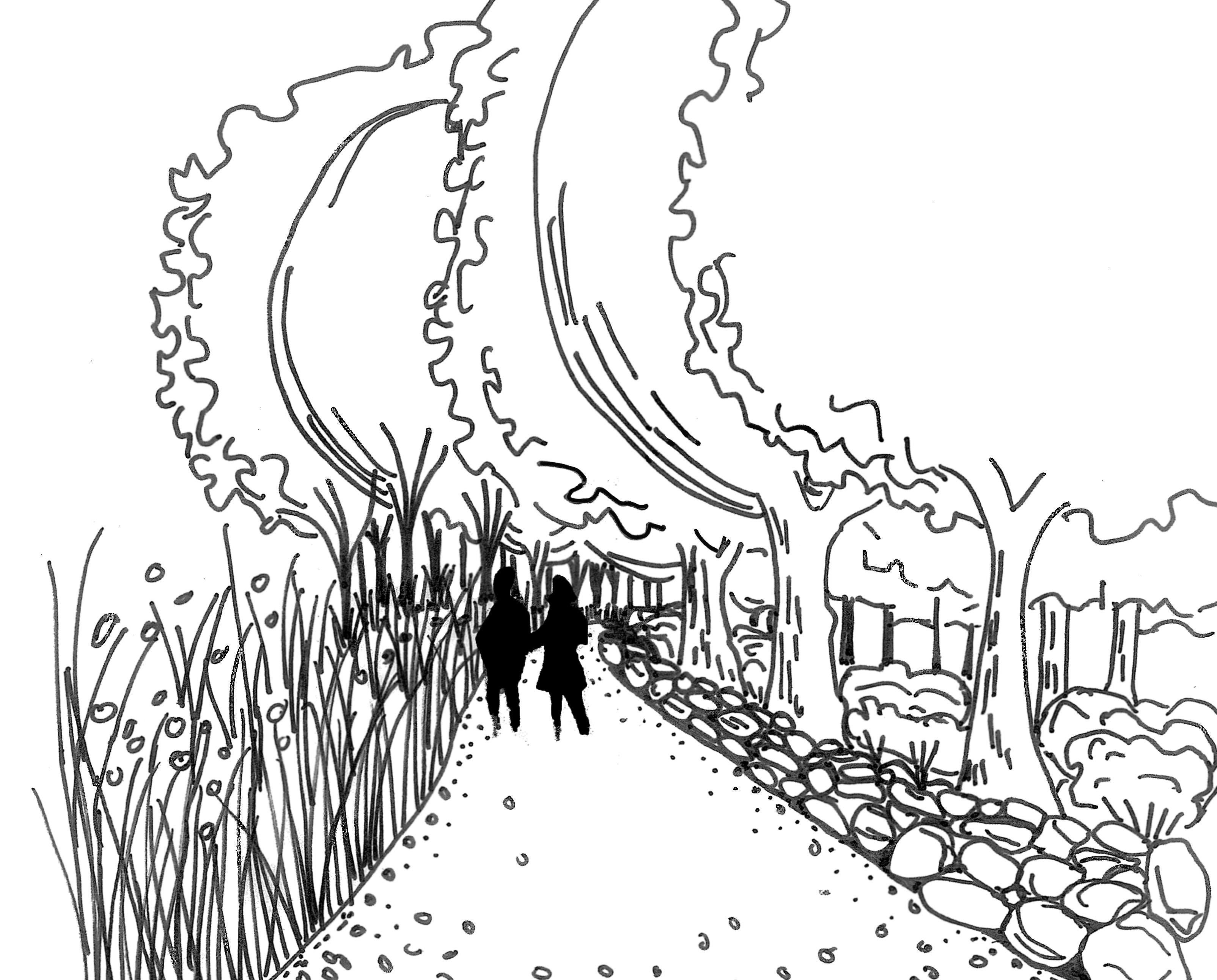
Prepared for The Town of Blandford
CarrieGotwals and Josie Kaul
The Conway School Spring 2023

Prepared for The Town of Blandford
CarrieGotwals and Josie Kaul
The Conway School Spring 2023

This plan set is possible due to the commitment and knowledge of various members of the Blandford government, most of whom are volunteers. This includes Christopher Dunn, the Town Administrator, Dick Gates and Nate Maynard of the Conservation Commission, and Katy Milford of the Historical Commission. Additional thanks to members of the Blandford community who participated in the two community engagement sessions, and whose feedback has been deeply appreciated.
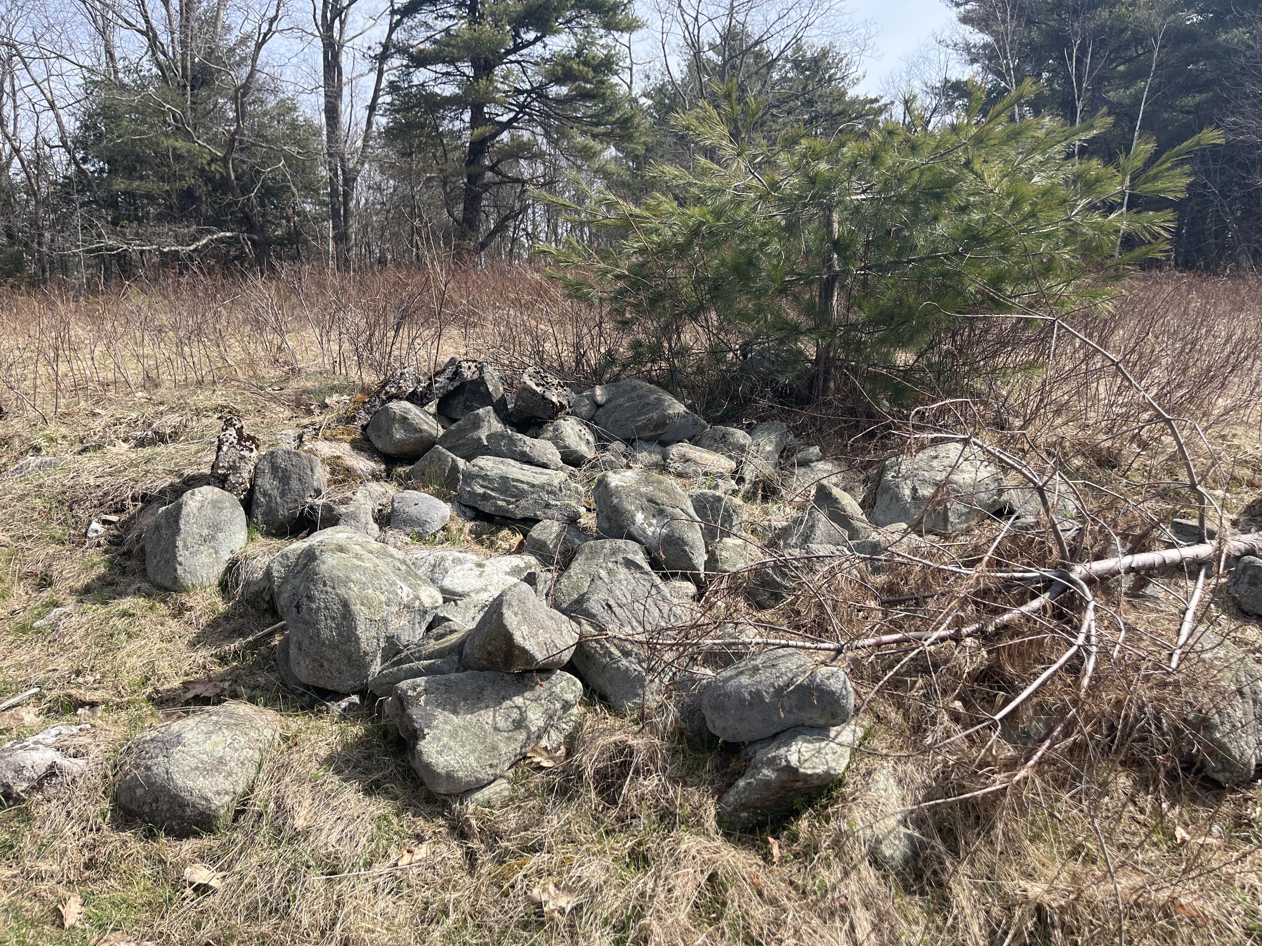
Shepard Farm is a 121-acre property owned by the Town of Blandford. The Town sought out the Conway School for support in visioning the possibilities for better use of this site. The Town Administrator, members of the Conservation Commission, and members of the Historical Commission advised the student team during this project. These commissions are part of the core advisory team because of the high ecological integrity of the landscape and the presence of a historical homestead.
The clients brought some preliminary ideas to the Conway team to guide their exploration of the site's potential uses. In response to community requests, the Town is looking for more recreation opportunities in Blandford including fishing, hunting, walking trails, and biking trails; additionally, there is desire for recreation spaces geared specifically towards children and families. For the Shepard Property in particular, they hope to:
• Expand and improve the quality of the trail system


¤ There are a few existing trails on site, but adding a broader network and a variety of difficulty levels is desired.

• Determine areas for gathering on site
¤ Exploring opportunities for school groups, families, or small groups to use the site thoughtfully and with intention.
• Explore arrival alternatives for vehicles and pedestrians, including parking
¤ Finding opportunities for improved access throughout the site and prioritizing a safe and feasible arrival sequence.
• Explore how the legacy of the Shepard family and the landscape history can be interpreted on site
¤ The changes in the landscape of Shepard Farm reflects local and regional historical trends, and both remnants of the past and the current site conditions present opportunities for education and exploration.

Blandford is in Hampden County, Massachusetts, and has a population of approximately 1,200 people. It is also large by area (51.7 square miles) compared to other towns in Massachusetts. Its relative lack of population density leaves abundant open space, including freshwater sources and large swaths of intact forest. It sits at roughly 1500’ of elevation in the eastern foothills of the Berkshire mountains. Many towns rely on Blandford’s freshwater resources and most notably the reservoir for Springfield, Massachusetts and surrounding communities is in Blandford.


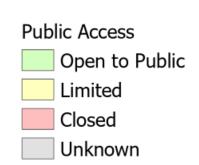
Blandford has abundant open space and high quality ecological features, most notably fresh water; approximately half of the town is considered open space. Of that open space, half is owned by the Springfield Water and Sewer Commission (14 square miles, or 27% of Blandford; see graphic to the right). The Cobble Mountain Reservoir, most of which is in Blandford, provides water for 250,000 people. Managing lands around upstream waterbodies is an important component of managing water quality in reservoirs. Forested land performs important ecosystem functions, like water filtration, that protects water quality. In this way the open space in Blandford benefits not only the residents and local wildlife, but also residents of Springfield and surrounding communities. Shepard Farm is one such upstream forested piece of land that is essential to protecting water quality for the region.


Though the Town of Blandford acquired Shepard Farm from the Springfield Water and Sewer Commission in 2009, the land is still under a conservation restriction related to preserving water quality.

Shepard Property Permitted Acts and Uses Include:
• Active and passive recreation, including the creation of new trails
• The commercial cultivation and harvest of forest products
• Non-animal agriculture
• Construction, maintenance, and repair of public parking areas
• Maintaining existing structures
Shepard Property Prohibited Acts and Uses Include:
• The construction of new buildings not explicitly for the purpose of water treatment, including septic systems
• The operation of motor vehicles for recreation
• Tillage or grazing or sheltering of livestock or animals
While Blandford has abundant natural resources and open space, much of its land is closed to the public. After 9/11, the Springfield Water and Sewer Commission decided to close many of their parcels to the public, citing safety concerns. Today, these lands are typically policed, so access is actively prevented. The acquisition of Shepard Farm by the town could set a precedent for future reclamation of land previously owned by water supply companies, or the opening up of those lands to the public, if the town can demonstrate it is possible to maintain ecological integrity and preserve water quality while enabling human use of the landscape.


Shepard Farm is mostly forested with a small pocket of meadow in the southwest. Bounded by Otis Stage Road to the south and Watson Brook to the north, the site is characterized by steep slopes, especially on the north side of the property. The extensive frontage along Otis Stage Road often gives way to steep topography. A small pond can be easily accessed from the road (E). Two paths bisect the property, one in the center and one on the eastern property edge. The path in the center of the property is the right-of-way for Springfield Water and Sewer Commission to access their land to the north (A). The path to the east, likely the old George B. Watson Road, has been out of commission for some time, and leads to Watson Brook. Both trails are roughly a third of a mile, with average grades of less than 5%. The surfaces are compact soil, with divets and mounds found throughout.


The forest is mostly white pine, with a mix of old-field succession species and mixed hardwoods. In the center of the property, the flat plateau supports a forested wetland. To the east of the existing meadow, there is a plantation of Christmas trees (F). These were planted by Boy Scouts in 2006, but the harvesting window was missed and they now grow very densely.


The meadow area has a steep driveway up from Otis Stage Road that leads to a historical house and barn; both buildings are unoccupied and in a state of disrepair. There is a small paved area between the two buildings. A large meadow surrounds the buildings and is divided into three sections by two lines of trees. At the top of the meadow area in the north, a long stone wall indicates past agricultural land use.


Shepard farm has a rich ecological and human history. Otis Stage Road, the state route along the southern boundary of the property, formed originally as an Indigenous footpath. Historically, the land that is now Shepard Farm had been a traveling ground for Indigenous tribes between their hunting and fishing locations, as well as a respite for travelers during colonial times.

Post-glaciation, approximately 15,000 year ago, primary succession begins on the landscape: lichens, mosses, shrubs, and other early successional species take hold. Spruce and pine species take hold next. The earliest record of humans on this landscape is roughly 12,500 years ago. By 11,000 years ago, pine, hemlock, and oak dominated the landscape.

Blandford and the surrounding hilltowns supported the Woronock and Pocumtuc peoples, who shared a common culture stretching from southern Vermont to Connecticut, along the Connecticut River. The Shepard Farm area in particular is adjacent to a primary trail going east-west from upstate New York to the Massachusetts coast; the Mahican people, associated with the Housatonic Valley and Hudson Valley, would travel to Western Massachusetts along this trail for seasonal hunting and fishing (Tager, Wilkie).

In 1735, Blandford was settled by colonists. On today’s Shepard Farm, an early colonist named Samuel Watts Esq., was an inn-holder at Pixley’s Tavern. This was a popular tavern along the busy road that had continued to be used by colonists after Native American displacement. In 1771, the Shepard family purchased the land and inn, and at an unknown date built the homestead (Walsh). In December 1775, during the American Revolutionary War, Henry Knox led soldiers, including native allies, from Fort Ticonderoga back to Boston with artillery. They passed through Blandford along Otis Stage Road, the road south of Shepard Farm. As a result of the journey, artillery was placed in Dorchester Heights, ultimately forcing the British to evacuate Boston.


Into the 1800s, the Shepard family continued living at Shepard Farm (Walsh). The family members were prominent figures in town: they owned a lumber company; hosted regular chicken barbecues for townspeople; showed stud horses and cows in agricultural fairs; and were major supporters of the town fair. Like many of their time, they farmed the land they lived on. Based on historical maps, regional trends, and present land cover, it is likely that large areas of the Shepard Farm forest were cleared for timber and pasture (Cronon); given the soil profile (very rocky and well-draining), crop-based agriculture would likely not have been present beyond subsistence, meaning most of the land has likely not been plowed. The dominant agricultural practice in the hilltowns would have been pasture for sheep, though the Shepard family in particular seemed partial to horses (Wessels).
In the 1900s, the Shepard family left the homestead, but many still lived around Blandford. The original tavern building was removed in 1908 (Walsh). Forest succession began in some felled areas. Between 1971 and 2003, the landscape experienced little disturbance, save the same southwest corner being regularly mowed (historicalaerials.com). In 2002, the land was sold to the Springfield Water and Sewer Commission. In 2009, the land was sold to the Town.


Given the history of disturbance on site, specifically timber harvesting and pasture clearing, the species composition of the Shepard Farm forest is associated with old-field succession (Wessels). The dominant species is white pine (Pinus strobus), with gray birch (Betula populifolia) and striped maple (Acer pensylvanicum) also appearing in large numbers. The white pine are all of a similar size and age, corresponding to the last large disturbance event, likely in the early 1900s; this could indicate the last time portions of the forest were harvested for timber. Other areas on site, especially to the east, appear to have been harvested more recently.
The understory is relatively sparse, with some exceptions being pockets of hemlock (Tsuga canadensis) and American beech (Fagus americana); neither species is particularly healthy, as hemlock in the Shepard Farm forest have woolly adelgids, while the beech trees are suffering from beech bark disease (observed on-site).

There are a number of trees on Shepard Farm that are distinctly older than the otherwise uniformly aged old-field successional suite that dominates the site. One example are the old sugar maples (Acer saccharum) found on the steep slopes surrounding the wetland plateau. This area displays a number of old growth characteristics, including the prevalence of moss around the base and trunk of the trees (B), gnarled canopies (C), and a relatively large proportion of large woody debris on the forest floor. This could indicate this area experienced less clearing than other portions of the property, perhaps due to the steep and wet conditions.


More distinctive examples of aged trees are the sentinel trees found along the stone wall by the meadow (A), and in the northwestern portions of the forest; these are hardwoods such as maples and oaks, distinct from the old-field species. Additionally they are especially large and display a full-sun growth habit (branches radiating widely to the sides, making use of the open space). This indicates that they were kept intact while the forest was cleared around them, a common practice along the edges of pastures (Wessels).
While most of the site experiences shade year round, given the 100+ acres of forest dominated by white pine, the meadow is characterized by the relative absence of trees and shade.

Analysis of sun/shade conditions from 8AM to 4PM on the summer solstice (D) reveals a meadow largely devoid of shade during much of the day. While this is an asset of the meadow (especially juxtaposed with the shady interior forest), it could be a constraint for prolonged gathering or walking.

Conditions from 8AM to 4PM on the winter solstice (E) show larger pockets of shade; however, much of the meadow is still bathed in full sun. Were trees to be planted to provide shade in the summertime, it would be advisable to choose deciduous species to preserve the sunny pockets that increase comfort in the winter and shoulder seasons.


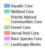
An important goal of the Town is to bring people onto the Shepard Farm site. Understanding the ecological integrity of the site, and Blandford at large, can help mitigate the disruptions humans may cause to wildlife habitat and water quality. For this project, ecological integrity is defined as a landscape's relative health when compared to adjacent ecosystems; this is quantified using BioMap, a conservation tool. BioMap analyses include unique or abundant wildlife habitat, and landscapes with important water features like high freshwater quality, wetlands, and vernal pool (categorized as BioMap Cores on the righthand graphic). Also featured are Landscape Blocks, which correspond to regional connectivity of ecosystems (BioMap).
As colonists established themselves in New England starting in the 1600s, New England experienced a mass clearing of forests for timber and agriculture; in the 1800s these agricultural endeavors were largely abandoned, and timber harvesting relegated to the north and west regions of the United States, leading to the reestablishment of forest seen today (Foster, Motzkin, et al.). This change in forest and wildlife abundance is represented in the graphic below; of note is the proliferation of bobolink and meadowlark birds during the 1800s, corresponding to both low forest cover and high meadow and agricultural land cover. Bobolink and meadowlark rely on grasslands for breeding, so less forest cover leads to more abundant populations of the two bird species. Today, Blandford is largely covered in forest, with ecologically important habitat cores found within that forest landscape (see map at right).

The relative abundance of meadow and forest, and the wildlife that thrive within them, has changed dramatically in the past four hundred years. While core forests are well represented on both the site and in the town (28% of total forest in town is considered core, and the same ratio on site is 18%), ecologically integral meadows are not (3% of total meadow in town is considered core, and the same ratio on site is 0%).


The ecological integrity of these landscape types is a result of present land management. Forested land left unmanaged is likely to fit BioMap criteria for ecological integrity. Meadow landscapes, however, require a more active management strategy in order to meet criteria for ecological integrity in this part of New England. Meadows need to be mowed or burned in order to prevent forest succession. Additionally, in order to not disturb nesting species and their food sources, this needs to be done at specific times (generally the early spring), and ideally in a way that is "patchy," i.e. staggering the clearance of the previous year's meadow (MDAR et al.).

Preservation of current conditions of the forested area within Shepard Farm, specifically along the riparian corridor to the north identified as Core Forest by BioMap, should be a priority. To strike a balance between increased access and ecological integrity, trail development should be done in ways that minimize clearing and avoid excessive erosion. Development of gathering spaces should be kept to the southern half of the property (avoiding the Forest Core).

As forests declined in New England, open grasslands became more abundant. In turn, bobolink and meadowlark became more abundant because they nest in grasslands (Foster, Motzkin, et al.)
In the meadow, maintaining current conditions would provide context to interpret the landscape history of the site. Meadow landscapes were once more prominent in New England than they are today; continuing to manage the meadow honors the site's history as a successional landscape. There is a suite of rare meadow-nesting bird species (e.g., bobolink, meadowlark) that require meadow landscapes larger than can be managed at Shepard Farm, starting at around 10 acres (the current Shepard Meadow is around three acres). However, meadow management in conjunction with other properties around Blandford could enable Shepard Farm to be part of a patchwork that supports these species on a broader scale (Audubon). Additionally, there are a number of rare species native to the Berkshire Foothills, such as the orange sallow moth and the barn owl, that require either smaller meadow acreage, or thrive in the edge landscape between forest and meadow (NHESP); supporting these species is very much possible at Shepard Farm.
In many ways the character of Shepard Farm is defined by its Hilltown topography. The slopes and valleys of the site (and the ways in which they channel water) support wildlife, protect and convey water as a natural resource, and provide beauty. The topography also provides design challenges in regards to access; the slopes make movement of people and vehicles difficult.
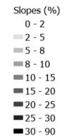

The southeastern meadow (A) owes much of its beauty to its steep topography. A south-facing slope, the meadow experiences consistent sunlight throughout the day and year and provides prospect from the high point. However, the steep topography of the hill abutting the road makes for difficult access (B); the driveway has a grade that sometimes exceeds 20%.
Another particularly steep section is the large hill (D) separating the wetland plateau (C) from the stream valley (E). This landform helps to create distinct identities for the eastern and western portions of the property, as well as create a sense of refuge and definition for the trail along the river. The large hill also constrains access between these two halves of the property.
Water moves down the hilly landforms to create habitats and features that provide both aesthetic and ecological benefit. Water sheds in all directions away from the high point (A). East of the high point, the water moves downhill and is slowed by the flat, forested wetland (C); this wetland filters water, which is important because the stormwater on site eventually flows to the Cobble Mountain Reservoir. Continuing downhill, the water moves south towards the street, southeast into the pond (F), or downslope into Watson Brook (E).
In regards to trail development, both excessively steep and flat areas can be challenging. Shepard Farm has its fair share of both these slope characters. Particularly steep areas are not only difficult for those with mobility needs, but also require special attention to mitigate erosion of the trail system in the long term.

Especially flat areas require special attention to prevent trails from becoming inundated with water. The trail along the river, as well as the access road for the Springfield Water and Sewer Commission, are prone to pooling (based on analysis and on site observations). This is particularly apparent for the easternmost river trail (E), which rests at the bottom of the large hill (D) and receives large amounts of run-off.


Shepard Farm is a property with a lot of frontage along Otis Stage Road, and a lot to see; the homestead, the pond, and two existing trails all have potential as points of entry onto the site. While there are informal vehicle pull-offs located at all of these areas, they are located immediately adjacent the high-speed State Route 23, are relatively narrow, and are liable to be washed out or muddy during rain events. Furthermore, the steep grade leading up to the homestead and meadow makes achieving all persons access a challenge. This document will follow the US Forest Service guidelines for the creation of all persons trails, which generally limits walking paths to a slope of 5%. For steeper slopes, rest areas and length limits are imposed.

There are five areas along Otis Stage Road that, due to both existing (if insufficient) infrastructure and proximity to points of interest, have been identified as potential access points. The driveway (A) leads straight to the historical homestead; between the barn and the house is a paved area that could form the foundation of a parking area. However, the grade of the driveway leading up to that area sometimes exceeds 20%, which is well above what is considered safe for vehicles. Ideally, the driveway would not exceed 10% grade, and the entry and exit of the driveway would be at 5% grade (or less) for the first forty feet.

To the east of the driveway is a pull-off (B), which allows vehicles to park without encountering the driveway. However, the surface of the pull-off is muddy gravel, and large, fast vehicles traverse Route 23; entering the site from the pull-off requires a walk adjacent to the vehicle traffic. Additionally, while the pull-off allows vehicles to avoid the steep topography leading up to the meadow, people still have to make their way up the hill, which can be a challenge for many. Three other pull-offs of a similar character are found along the frontage, in front of the right-of-way for the Springfield Water and Sewer Commission (C), the pond (D), and the trail leading to the stream (E). While the condition of these pull-offs are similar to those of (B), access to the points of interest (the trails and the pond) are not inhibited by the presence of steep topography.


Access would ideally minimize both ecological impact and cost. A regraded vehicular entry to the homestead area would bring visitors into the heart of the site and off of the busy road, thus kick-starting their experience. It also allows visitors to avoid a steep walk up the hill. This option would require earthwork to meet ideal grade, and would be relatively expensive (see sheet 14 for a breakdown of potential access costs).
Alternatively, regrading and resurfacing the existing pull-offs could save on cost and impact. Access in this scenario would be less direct, however, and would require a pathway from the pull-off to the homestead and meadow area; this could be graded for all-persons, making the walk up the hill a more reasonable endeavor.
Shepard Farm is in many ways representative of the historical themes of Blandford and much of New England. The site exhibits successional landscapes that tell the story of its past land uses as a respite for travelers, pasture, timber harvesting, and as water supply company lands. The site has high ecological integrity with intact forests and diverse wildlife, but people spend little time exploring either the forest or the meadow, due to poorly developed trails and access; to encourage use, interventions are necessary
The slopes of the site constrain comfortable walking for people of all abilities. Carving new trails here may require selective tree harvesting and earthwork.


Watson Brook is a beautiful feature of the site. There is a flat trail from the road to the brook, but it will need to be resurfaced to prevent inundation after rain events.
The meadow is reminiscent of the cleared New England landscapes of the 1800s. This area can help tell the story of this site. The meadow is also the sunniest pocket of the site.
The existing driveway is too steep for cars and people to safely enter. Finding a new access point is essential to help people of all abilities access the homestead area.
The flat plateaus on the site provide areas to gather that do not require much earthwork. The challenge will be getting people to these areas while meeting all persons trail criteria.

Shepard Farm is an expansive site with several noteworthy character zones, such as the meadow and homestead, the wetland, the pond, and the brook. This phase one design prioritizes improving access to select areas through moderate trail expansions from three parking areas.
While there are two parking alternatives explored for the meadow area (sheet 14), for the rest of the Otis Stage Road frontage it is recommended that the existing pull-offs be expanded, deepened, and resurfaced. For phase one, this includes the parking areas in front of the two existing trails (the Springfield Water and Sewer Commission right-of-way and the trail to Watson Brook).
By developing the Springfield Water and Sewer Right-of-Way and the Brook Trail, both cost and disturbance can be minimized (compared to building trails from scratch). This design expands the existing trails into two loops, the Wetland Trail being roughly 0.5 miles and the Brook Trail around 0.9 miles. These flat and compact trails experience pooling, especially the Brook Trail which receives large amounts of stormwater from the adjacent slopes. In lieu of regrading, imported materials can be added on top of the existing trail, with a gentle crown to prevent pooling. The new portions of these loops should be built to all-persons standards (as the grade is already below 5%, this would mostly involve proper materials, for example 3/8+ angular crushed stone).
Whether folks arrive to the meadow area via an expanded pull-off or a proper driveway (see sheet 14), phase one prioritizes a simple introduction to the meadow and forest surrounding the homestead. A landscape history trail (detailed on sheet 17) exposes people to both the beauty and history of Shepard Farm. With this initial trail in place, visitors can begin connecting with the landscape; as interest increases, more trails and programming can be developed in the meadow area. There are two design alternatives for the meadow (sheets 15 and 16); this design incorporates Alternative Two (sheet 16), and requires selective clearing of the Boy Scout forest.
Brook Trail (0.9 miles)
Brook Trail Parking
Wetland Trail (0.5 miles)
Springfield Water and Sewer Right-of-Way Parking
Meadow Parking
Landscape History Trail (0.5 miles)





While phase one gets folks acquainted with the landmarks around Shepard Farm, phase two connects these previously disparate elements. Starting at the homestead, people can move from the high point, to the wetland, to the pond, and finally to Watson Brook without having to travel along the street; in this way they are able to move with the flow of water across the land, an important piece of context for land associated with drinking water.
The pond, although beautiful and close to the road, is surrounded by dense vegetation, making access and gathering difficult. Phase two proposes an expansion and resurfacing of the pull-off next to the pond to increase safety and capacity, similar to the right-of-way and brook trail parking development in phase one. Additionally, a small area surrounding the pond has vegetation selectively removed in order to allow for basic gathering amenities (e.g., picnic tables, trash cans) and access to the newly developed connecting trail (C). The pond should also be considered as a recreational fishing asset; the Conservation Restriction (CR) permits stocking of native fish. With increased traffic and minor development around the pond, care should be taken to protect water quality. Erosion fencing should be errected during vegetation removal and trail development, and vegetation should remain whenever possible. This design also provides new opportunities to protect the pond. A reworked pull-off can ensure that stormwater from the street is diverted away from the pond, and easier access and increased public presence could lead to more frequent monitoring of water quality.
While mountain biking is permitted according to the CR (assuming nothing is motorized), there are areas where mountain biking trail development would not be advisable. Using International Mountain Biking Association (IMBA) criteria for intermediate and advanced trails (e.g., steep terrain, maximum trail length), the steep area to the east would be desirable. However, this area is designated as Core Habitat by BioMap, and given the very steep terrain, trail development (even with best practices) would likely lead to erosion and habitat degradation, especially given the relative density of the woods and the need for tree removal.
The IMBA criteria for beginner mountain biking trails, specifically for children, includes relatively gentle slopes and shorter trails, which are more conducive to ecologically sound trail development. Furthermore, the area in the western portion of the property has relatively dispersed canopy trees with little understory, meaning trail development would not require large amounts of vegetation removal. It is also not considered Core Habitat. For these reasons, this design incorporates a series of beginner mountain biking trails north of the meadow area; for safety, the walking and biking trails would be separate. For those desiring more advanced mountain biking, Shepard Farm could still serve as an asset. Immediately to the south of the meadow area is Shepard Road (B), a scenic dirt road which connects to others of a similar ilk; an 8 mile loop can be made by connecting to Standard Road and Beech Hill Road, and many other side roads could extend the journey and hit points of interest. By developing the parking area next to the meadow, mountain bikers could have easy access to these areas; additionally, infrastructure such as tire pumps could provide additional benefit.


Qualities of sustainable trails that are particularly important for Shepard Farm include proper drainage, low levels of maintanence, and maximum access. The design detail cross sections below highlight features of trail design that create these qualities in both steep (A) and flat (B) sections of the property Additionally, the trails are sited to minimize ecological disturbance and erosion by avoiding the steepest topography of the site, and keeping most of the development away from the core forest to the north. Most of the trails are sited at or below five percent grade, and whenever possible move along contour
Trails in these designs are sited to highlight the distinct character zones of Shepard Farm, bring visitors to specific points of interest, and explore the edges of different landscape types.The Landscape History Trail (A) explores the transition from meadow to forest, as well as the historical relics and clues still present on site; the forest is mostly white pine and other early successional trees, with some distinctive large old sentinel trees. The Wetland Trail (B) explores the unique topography and ecology of the wetland; along the trail are some examples of sugar maples with old growth characteristics. The Brook Trail (C) skirts the steep topography lining Watson Brook, drawing attention to the bedrock outcrops and the stream bed; the western portion moves through some groves of beech, unique on the site (if not a bit blighted).


Otis Stage Road
Retaining Wall
Expanded Pull-Off Parking
This design incorporates an expanded pull-off, with eight spaces ten feet wide and twenty feet long. The location is along the existing pull-off in order to keep disturbance to a minimum; grading is minimal, incorporating two retaining walls. North of the parking spaces is a four-foot-wide path following allpersons criteria; the grade does not go above five percent, and a rest interval is incorporated into the curve of the path.
The following is a rough cost estimate; items that are specific to the meadow entry (i.e., creation of an all-persons trail, demolition of the driveway and parking area) are included separately, so that the estimate can be applied to the other pull-offs along the Otis Stage Road frontage (e.g., in front of the Brook Trail).
This design regrades the driveway to meet conventional safety standards; the first twenty feet of the driveway are at or below five percent grade, and the rest of the driveway does not exceed ten percent grade. Two retaining walls minimize disturbance up slope, specifically near the barn and surrounding trees. The western side of the driveway drains downslope into a detention basin, slowing the movement of stormwater off the impermeable surfaces.

The parking area uses the existing paved area between the house and the barn. Five-foot buffers between the driveway and buildings allow for walking paths and for snow removal. There are sixteen parking spots total, two of which are ADA-compliant. There appear to be discrepencies between the topo lines (derived from lidar data) and the actual grade of the existing parking area; the area should be ground truthed, and the Striping/ Repairs cost could potentially be greater than indicated should additional grading need to be done.
Item Unit of Measure Quantity Cost Range Total (Low End) Total (High End)
Pavers (Gravel Stabilizers) SF 2,500 $4 - $6 $10,000 $15,000
Gravel SF 2,500 $2 - $4 $5,000 $10,000
Grading SF 14,500 $0.40 $5,800 $5,800
Gabion Retaining Wall SF 360 $20 - $40 $7,200 $14,400
Signage $1,800 $1,800 $1,800
Lighting $800 - $1500 $800 $1,500
Revegetation (seed) SF 12,000 $0.1 - $0.2 $1,200 $2,400
Striping/Repairs SF 4,200 $.75 - $1 $3,150 $4200
Demolition (Driveway) SF 750 $1-$2 $750 $1,500
Erosion Fencing LF 2,000 $3-$5 $6,000 $10,000
Grand Total $41,700 $66,600
This design activates the meadow area as a space for gathering and walking, while minimizing cost and impact. The existing pull-off is formalized (see previous sheet), and an all-person's trail leading from the parking to the homestead begins opposite the road, keeping people as far from traffic as possible. Implementation of this parking alternative is less expensive than a regraded driveway, and also opens up design opportunities around the homestead. The old driveway is replaced with a colonial-style revival garden, which provides historical context for the buildings and lets people know they've arrived at the beginning of their journey through the site (A). The landscape history trail (detailed on sheet 17) brings people from the open structure of the meadow to the shady canopy of the forest. Benches along the trail allow people to rest and enjoy the view down the hill and into the meadow, which is now managed to promote wildlife, such as pollinators. The top of the hill has become a formalized destination, with picnic tables and fruit trees to provide shade and snacks. The path follows the old stone wall and the view down the hill highlights the meadow and the old homestead.


Alternative 1, being relatively low cost and low impact, does not include any clearing of the Boy Scout forest to the east of the barn. However, selective clearing of the Boy Scout forest would be required in order to implement Phase Two of Site-Wide Trail Design (sheet 12). As there are no design elements precluding trail expansion into the Boy Scout forest, expansion could be a future phase of this alternative, in order to connect the meadow to the other points of interest on site.

This design allows for greater parking capacity and programming in the meadow, with a focus on outdoor education and play for young children. The regraded driveway and formalized parking area use existing infrastructure and allow visitors to exit their vehicles away from the highway, making this a more expensive but safer option than the pull-off. The parking area includes sixteen spots, two of which are ADA-compliant. Play structures allow adventurous traversal of the meadow for children (detailed on sheet 18). The top of the hill is kept mown, to allow for romping and rolling; sensory gardens line the path (plant palette on sheet 19). Shelter for an outdoor classroom is provided by an open pavilion, set just inside the forest edge (A). The Boy Scout forest is selectively cleared to expand the all-persons loop. This portion of the trail is shady with dense walls of white pine and spruce, creating pleasant conditions for play and quiet gathering. A tunnel maze is cut into the path, allowing children to run and explore while parents take the longer, more defined route. A similar cutthrough appears along the western forest path, creating options for those seeking a faster route with steeper terrain.


The landscape history trail, a 0.4-mile loop beginning at the homestead, is a means for people to engage with the rich history of Shepard Farm and Blandford; it highlights landscapes representative of past land use and historical relics and clues. It is a short all-persons trail with informational signs that elaborate on the points of interest.
Looking down from the hill at the road they just traversed, visitors can learn about the Mahican people, who for thousands of years traveled between New York and Massachusetts for seasonal hunting and fishing. Today, visitors can participate in these activities at Shepard Farm.
Visitors looking around see the historical Shepard family buildings, which provide context for the site today and the landscapes they're about to travel through.


Moving from the homestead to the meadow, visitors can experience the land as the Shepard family would have: open, sunny grasslands, which in this area would have been managed for pasture. Islands of young white pine hint at succession and the transition visitors will experience when they soon enter the woods.
This area also provides a setting to explain the meadow management on site, which prioritizes pollinators and the bird species that were much more common during the time of the Shepard family.


Transitioning from the open meadow to the dense forest, people can see what happens when a meadow is left to its own devices. Attention can be called to the suite of old-field successional species (white pine, yellow birch, striped maple) and their relative ages, to help deduce when these fields were abandoned, likely in the early twentieth century when the Shepard family was no longer working the land.
This is also an opportunity to imagine how the forest might have looked before it was cleared, prior to colonization; what species might have been here instead? Perhaps old growth hardwoods, and a more robust understory.
With a view of the old stone wall, big sentinel trees, and the old homestead, this area provides the perfect context to delve into the Shepard family and the agricultural practices of Colonial New England. Details could include the vast deforestation of the Eighteenth and Nineteenth centuries, and how, to the Shepards, Blandford likely looked like this hilltop clearing, very different from the dense forest cover found today. Examining the sentinel trees (how the species differs from those around it, its
its full-sun

helps develop the skills to read clues on the landscape.


The playscapes in these designs are largely composed of elements found naturally in the landscape. Hills are mown for rolling, or have slides built into the ground; stumps (repurposed from the Boy Scout forest clearing) are placed to allow for balancing and clambering. The placement of play elements along the path and near benches is both for convenience (of kids and watchful parents) and to encourage exploration throughout the trail experience, such as with the stone wall at the top of the hill.


It is recommended that meadow management be geared towards the encouragement of native pollinator species, as opposed to grassland birds that require greater acreage (Audubon). Two key components of this meadow management is mowing strategy and species selection.

Mowing should ideally be done in the early spring; this puts mowing outside of the breeding window for meadow bird species (May 15 through August 15), and allows for the full suite of flowering species to show for people and pollinators alike. Additionally, mowing should be kept to a low speed (allowing wildlife to react) and a height of 7'' to 12'' (MDAR et al), and done from the middle out to allow animals to escape and not become trapped in the middle of the field. The extent of planting or seeding depends on what species are currently present; a plant inventory should be conducted the first year to determine species abundance. If needed, the meadow should be supplemented with native species; Growing Wild Massachusetts suggests the New England Showy Wildflower Mix from New England Wetland Plants, detailed below.
Common Name Botanical Name
Little Bluestem Schizachyrium scoparium
Red Fescue Festuca rubra
Indian Grass Sorghastrum nutans
Partridge Pea Chamaecrista fasciculata
Canada Wild Rye Elymus canadensis
Riverbank Wild Rye Elymus riparius
Butterfly Milkweed (A) Asclepias tuberosa

Black Eyed Susan Rudbeckia hirta
Lance Leaved Coreopsis Coreopsis lanceolata
Ox Eye Sunflower Heliopsis helianthoides
Common Sneezeweed Helenium autumnale
Marsh Blazing Star Liatris spicata
Blue Vervain Verbena hastata
New England Aster (B) Aster novae-angliae

Wild Blue False Indigo Baptisia australis

HollowStem Joe Pye Weed Eupatorium fistulosum
Early Goldenrod Solidago juncea
Gardens in the seventeenth century, in the time of the Pixley Tavern and the early Shepard family settlers, were both aesthetic and practical, serving as a source of food and medicine. It was through Native American knowledge that many of these important plants came into the lives of colonists; butterfly weed (Asclepia tuberosa), snakeroot (Polygala senega), and blue cardinal flower (Lobelia siphilitica) were all popular medicinal plants that were used by Native Americans for hundreds of years before colonization (Leighton).

The following is a plant palette for the Revival Garden proposed in Meadow Alternative One. The garden's form is reminiscent of the colonial garden, with its rectilinear structure, while its plant composition is indicative of Indigenous knowledge and its transfer to European colonists, and includes both native and introduced medicinal plants. In this way the garden tells stories of both cultures, and represents different aspects of the history of Shepard Farm.
Common Name Botanical Name Traditional Uses
Butterfly Weed (A) Asclepia tuberosa Treatment of diarrhea and respiratory illness, seed pods spun into candle wicks
Snakeroot Polygala senega Treatment of a wide variety of ailments, as well as snake bites
Cardinal Flower (C) Lobelia siphilitica Treatment of respiratory and muscle disorders
Parsley Petroselinum crispum Treatment of bladder, kidney, and gastrointestinal disorders
Chamomile Chamaemelum nobile Treatment of anxiety, insomnia, and a wide variety of physical ailments
Comfrey Symphytum officinale Relief of arthritis and muscle pains
Mullein Verbascum thapsus Treatment of skin conditions, insulation in shoes, torches and wicks
Wintergreen Gaultheria procumbens Treatment of aches and pains, cold symptoms, tooth decay

While the sunny, open character of the meadow is largely an asset, prolonged gathering and walking in the heat of the summer requires areas of shade for comfort and safety. Criteria for species selection should include a deciduous canopy, so that south-facing sun can warm visitors in the wintertime, and longevity in regards to climate change; this would preclude species suffering from blight or pests, and those at the southern end of their range. Another level of criteria could be the sensory experience, particularly important for young children creating an understanding of the world. This could extend to a selection of species along trails and in the gathering space atop the hill. Categories could include edible fruit, aromatic or showy flowers and foliage, distinct textures, and sound when the wind passes through (Plants for Play).
Common Name Botanical Name Type Sensory Feature

Shingle Oak Quercus imbricaria Tree Leaves persistent in winter, distinct rustling sound
Eastern Cottonwood (D) Populus deltoides Tree Audible leaves, distinctive ridged bark
Pawpaw Asimina triloba Tree Edible fruit, distinct tropicallooking leaves
American Persimmon Diospyros virginiana Tree Edible fruit, distinctive blocky bark
Sweet Fern (E) Comptonia peregrina Shrub Fragrant foliage

Nasturium Tropaeolum majus Annual (self-seeds) All parts edible, unique leaf shape
Lamb's Ear Stachys byzantina Perennial Velvety texture
Bee Balm Monarda didyma Perennial Fragrant, showy flowers
Stonecrop Sedum ternatum Perennial Succulent leaves, dry parts in winter
Lowbush Blueberry (F) Vaccinium angustifolium Perennial Delicious fruit
Mountain Mint Pycnanthemum virginianum
Atwood, J., J. Collins et al., “Best Management Practices for Nesting Grassland Birds.” 2017, Mass Audubon. www.massaudubon.org/our-work/ birds-wildlife/bird-conservation-research/grassland-birds
Cronon, William. Changes in the Land: Indians, Colonists, and the Ecology of New England. Hill and Wang, 2003.
Foster, Motzkin, et al., “Wildlife dynamics in the changing New England landscape.” 2003.
IMBA, “IMBA Trail Difficulty Rating System.” www.imba.com/sites/ default/files/content/resources/2018-10/IMBATrailDifficultRatingSystem. jpg
Leighton, Ann. American Gardens in the Eighteenth Century: “For Use or for Delight.” University of Massachusetts Press, 1987.
MassGIS, “BioMap: The Future of Conservation.” MassGIS Data, 2022. www. mass.gov/info-details/massgis-databiomap-the-future-of-conservation. Mass.gov, Nov. 2022.
MDAR, DCR et al.,” Pollinator Habitat Best Management Practices.” 2023, Massachusetts Leading By Example Program. www.mass.gov/doc/interagency-pollinator-meadow-and-gardenbmp-31622-0/download#:~:text=limited%20mow%20zones%2C%20 seeded%20grasslands%2C%20and%20meadows.&text=Sites%20 are%20 typically%20mowed%20once,cutting%20during%20peak%20 flowering%20seasons.&text=Mow%20at%20low%20gear%20 and,wildlife%20the%20chance%20to%20react
Moore, Robin C. Plants for Play: A Plant Selection Guide for Children’s Outdoor Environments. MIG Communications, 2007.
NHESP, “List of Endangered, Threatened, and Special Concern species.” 2020, NHESP. www.mass.gov/info-details/list-of-endangeredthreatened-and-special-concern-species#mammals
Tager, Wilkie, “Historical Atlas of Massachusetts.” 1991, Univ of Massachusetts Pr.
Walsh, S., “Massachusetts Historical Commission Inventory Form for Shepard Farm.” Massachusetts Historical Commission, 2021.
Wessels, Tom. Reading the Forested Landscape: A Natural History of New England. Countryman Press, 1999.
Adobe Stock. “Stock Photos, Royalty-Free Images, Graphics, Vectors and Videos.” Adobe Stock. https://stock.adobe.com/.
“All Persons Trail at Arcadia.” MassAudubon, 2023. www.massaudubon. org/places-to-explore/wildlife-sanctuaries/arcadia/accessibility
Byrne, B., “Barn Owl.” NHESP, 2015. www.mass.gov/doc/barn-owl/ download
“Cobble Mountain Reservoir, Springfield Water Works, Springfield, Mass.” Digital Commonwealth, 1930-1945. www.digitalcommonwealth. org/search/commonwealth:5q47s502j
Letendre, C., “Entering Blandford.” Town of Blandford, 2016. www.townofblandford.com/galleries/scenery-2/
“Mission House.” Trustees, 2023. thetrustees.org/place/the-missionhouse/
“Pyrrhia aurantiago, male.” NHESP, 2020. www.mass.gov/doc/orangesallow-moth-0/download
Striniste, N., "Hillside Playscape." Earlyspace, 2023. www.earlyspace.com/ hillside-playspace/
—. "Montessori Outside." Earlyspace, 2023. earlyspace.com/montessorioutside/
MassGIS, “BioMap: The Future of Conservation.” MassGIS Data, 2022. www. mass.gov/info-details/massgis-databiomap-the-future-of-conservation. Mass.gov, Nov. 2022.
—. “Building Structures (2-D).” MassGIS Data, Sept. 2022. www.mass.gov/infodetails/massgis-databuilding-structures-2-d. Mass.gov, Sept. 2022.
—. “C-CAP Landcover, Massachusetts.” NOAA, 2016. www.fisheries.noaa.gov/ inport/item/54917. Office for Coastal Management, 9 Aug. 2022.
—. “Lidar Terrain Data, Massachusetts.” MassGIS Data, 2015. www.mass.gov/ info-details/massgis-data-lidar-terrain-data. Mass.gov, May 2023.
—. “MassDEP Hydrography (1:25,000)” MassGIS Data, Dec. 2019. www.mass. gov/info-details/massgisdata-massdep-hydrography-125000. Mass. gov, Dec. 2019.
—. “MassDEP Wetlands.” MassGIS Data, 2005. www.mass.gov/info-details/ massgis-data-massdepwetlands-2005. Mass.gov, Dec. 2017.
—. “Property Tax Parcels.” MassGIS Data, Dec. 2022. www.mass.gov/infodetails/massgis-data-propertytax-parcels. Mass.gov, Mar. 2023.
—. “Protected and Recreational OpenSpace.” MassGIS Data, Jan. 2023. www. mass.gov/info-details/ massgis-data-protected-and-recreationalopenspace. Mass.gov, Executive Office of Energy and Environmental Affairs, Jan. 2023.