Anno XVIIINumero 3edizione autunno 2022free press [ITA] [ENG] EVENTI & TURISMO TOURISM & THINGS TO DO INVERNO PRIMAVERA ESTATE AUTUNNO DUEMILA 22


WWW.FONDAZIONEAQUILEIA.IT


CiviBank si consolida: con l’entrata nel Gruppo Sparkasse siamo più forti, e continuiamo a essere la tua banca di casa. Ti aspettiamo in filiale.


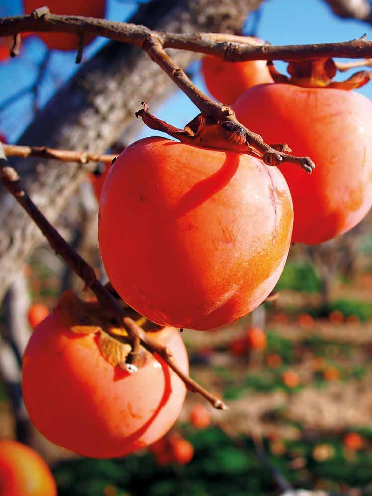
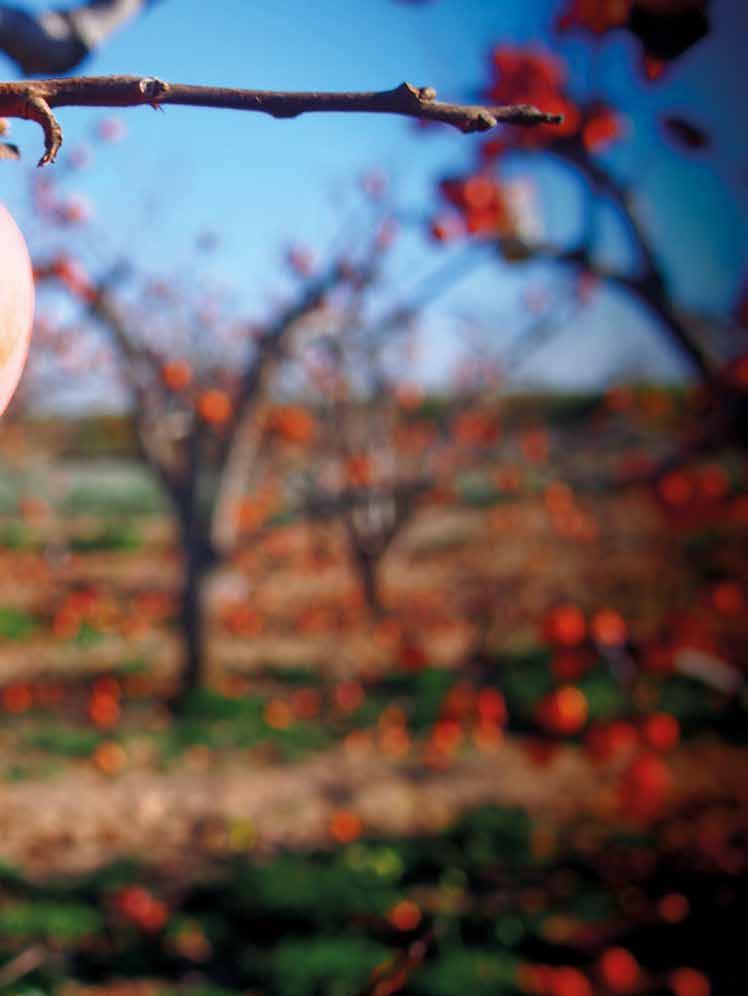
[ITA] Mentre in un pomeriggio bigio e freddo di metà set tembre aggiungo sulla maglietta estiva prima un maglion cino e poi un golf ben più pesante, mi pare di vederlo, av volto dal fumo della sigaretta, e di udirne le parole, pronunciate con una inconfondibile voce arrochita: « Le mezze stagioni erano un atto d’estrema delicatezza e corte sia da parte delle stagioni intere, per risparmiare agli uo mini il disagio di un brusco passaggio dal caldo al freddo». Che bella immagine aveva dipinto Andrea Camilleri! Cambio stanza e dalla televisione un illustre meteorologo mi spiega che molti sono i fattori che concorrono alla af fidabilità del suo lavoro, sintetizzabili con «una farfalla batte le ali in Brasile e scatena un tornado in Texas». È in quel momento che ripenso alle tradizioni contadine capaci di sfidare le odierne previsioni del tempo sul breve periodo e di giocare le proprie carte addirittura preannunciando le tendenze del meteo da una stagione all’altra o, addirittura, per un intero anno. Tra queste ce n’è una che permette di conoscere come sarà l’inverno che si appresta ad arrivare grazie ai cachi. Sì, proprio i cachi, i diospiri, quei teneri frut ti arancioni, tondi e dalla polpa zuccherina che in autunno, quando le foglie si ammonticchiano a terra, con i loro colori vivaci pendono dagli alberi e sembrano dei precoci addob bi di Natale. Tradizionalmente i semi di questi golosi frutti ci possono svelare come sarà l’inverno. Dividendo in due nel senso della lunghezza un seme di cachi si vede raffigu rata l’immagine di una posata: se troviamo una forma ton deggiante che sembra un cucchiaio, ci aspetta un inverno con abbondante neve; se l’immagine ci ricorda un coltello, andremo incontro a una stagione particolarmente fredda e secca, e se la forma interna al seme dei cachi è simile a una forchetta, allora sta per arrivare un inverno mite. So bene che si tratta di un metodo non comprovato scientifi camente, ma mi piace aprire questi semi e volgere lo sguar do al prossimo inverno. Mi riconnette con un passato in cui sento gli echi di chi ha accudito questa terra prima di me. E so bene che le figure bianche che spiccano rispetto al resto del seme non sono lì per raffigurare una posata, ma sono in realtà i germogli primordiali della pianta e la loro forma va ria a seconda dello stadio di maturazione. Eppure sbirciare un semino diviso in due e trarne i responsi per la stagione invernale mi aiuta a coltivare una vecchia tradizione.
In attesa di scoprire come sarà l’inverno, buon Giro!
Giusy Mancini[ENG] On this damp and dreary mid-September afternoon, as I add an extra layer of warmth and comfort over my t-shirt, I imagine him enveloped in cigarette smoke. I can hear his unmistakable, hoarse voice say: «Transition seasons were an extremely kind and courteous act on the part of the full seasons, to save humans from the uneasiness of an abrupt change from the hot to the cold». What an amazing image Andrea Camilleri offers us!
I then go into the lounge where an eminent meteorolo gist on TV is explaining how the reliability of his weather forecast depends on many factors, which basically boils down to «a butterfly flapping its wings in Brazil can pro duce a tornado in Texas » Immediately, my thoughts go back to the old folk tradi tions that could easily challenge modern weather fore casts, making predictions on the weather trends from one season to the next or even one year to the next. One curious way to predict what the winter will be like in volves persimmons. Exactly, persimmons, the nice, soft, round persimmons filled with a delicate sweet flavour. When the autumn leaves lie in piles beneath the trees, the lively orange fruits hanging on the branches look like ear ly Christmas decorations. Tradition has it that the seeds of this sweet fruit tell us what the winter will be like. If you split the seed vertically, you will see tiny cutlery inside. If the pip shows a spoon, winter will bring lots of snow, while a knife means the season will be freezing cold and dry, and finally, a little fork signals a mild winter. I know this is not a scientific method, but I love cracking open the seeds and fantasising about the coming winter. It connects me with the past, and I can hear the echoes of the ancestors who looked after the land before me.
Of course, I know that the little white silhouettes are not there to forecast the weather but are the primordial gems of the plant, and their shape depends on the maturation of the fruit. And yet, looking into the persimmon seed to seek its omen for the winter makes me feel I am continuing an ancient tradition.
Be happy in anticipation of what winter will bring. Have a nice Giro! Giusy Mancini
Giro FVG: la nostra passione per il Friuli Venezia Giulia, la continua scoperta di nuovi e meravigliosi paesaggi, di gusti, di sapori, di eventi e di persone speciali non si ferma.
tutto questo con TE!
Giro FVG: a passion for Friuli Venezia Giulia and a burning curiosity to discover new and wonderful landscapes, flavours, and local events and people are our drive to never give up.
want to share all this with YOU!
Editore: Giro
editoriale: Franco Fabbri
responsabile: Giuseppina Mancini
Tribunale di Trieste n. 1105 del 11.04.2005 - Iscrizione
Redazione: Via Galilei, 55 - Terzo di Aquileia (Ud) tel. 0431/35708 - e_mail: news@girofvg.com - www.girofvg.com
Progetto e realizzazione grafica: GAM Grafica di Andrea Macelloni, Terzo di Aquileia (Ud) tel. 347.0821078 - gamgrafica74@gmail.com
Stampa: Poligrafiche San Marco - Cormons (Go) Info sito Internet: www.girofvg.com - e_mail: giro@girofvg.com Pubblicità: +39 329 4321888 e_mail: giro@girofvg.com
18304
Hanno collaborato: Maria Stella Cinque, Franco Fabbri, Mariolina Favero, Elena Mancini, Giusy Mancini, Marco Pascoli, Nicola Picogna, Chiara Popesso, Giulia Sacilotto
Traduzioni: Maura Tomasi – maura.tomasi@gmail.com
Foto:
Archivio Giro, fotografi citati – foto di copertina: Trieste, Piazza Unità, dettaglio della Fontana dei Quattro Continenti_ph Giuseppe Anello

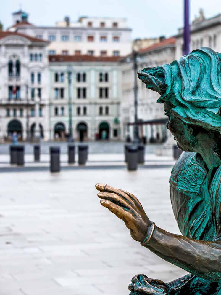
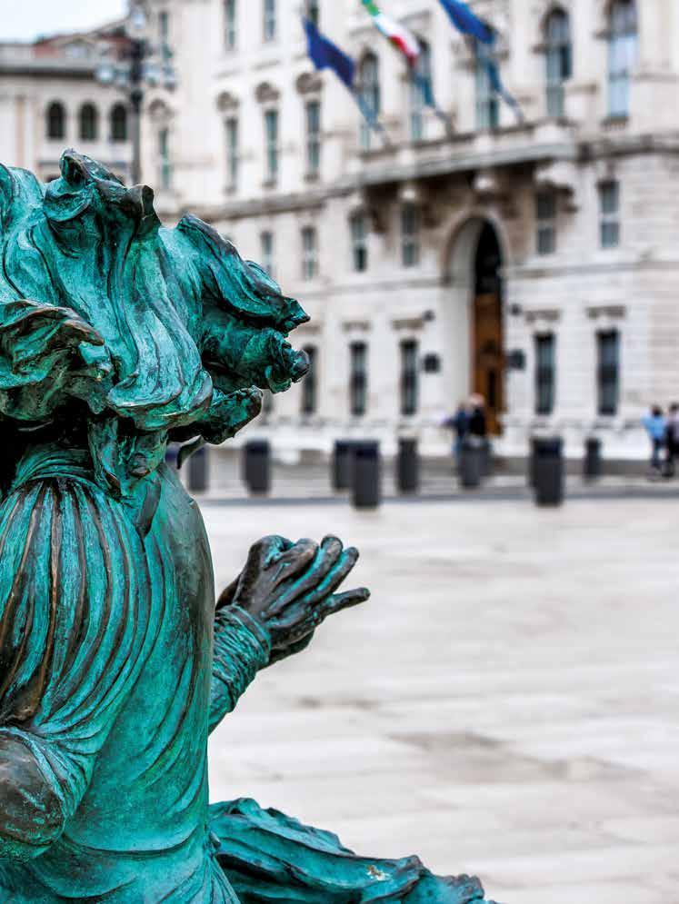
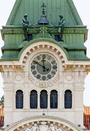
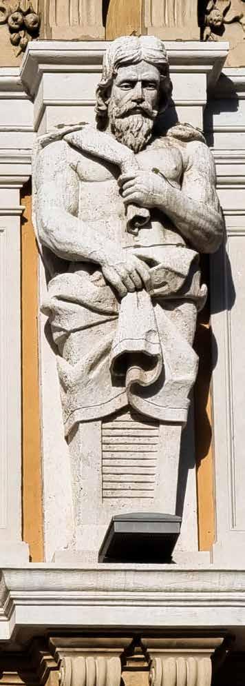
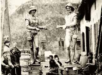
[ITA] Data di nascita: 1876 - Segni particolari: bronzei - Attitudini: il ritmo e la puntualità - Nomi: Micheze e Jacheze.
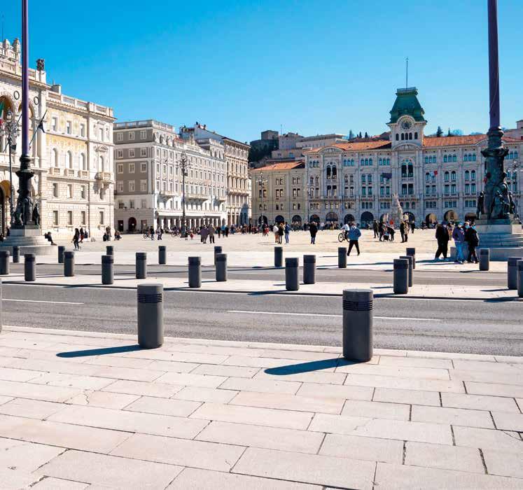
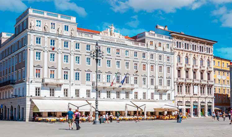
Sono le due statue più amate dai triestini e da 146 anni, con le loro braccia articolate mosse da un meccanismo a oro logeria, sollevano un martello e battono le ore dalla som mità del palazzo municipale. A dire il vero, gli originali e vetusti Michele e Giacomo, i cui nomi storpiati in dialetto diventano, appunto, Micheze e Jacheze (dallo sloveno Mihec e Jahec), dopo 96 anni di lavoro sotto le intemperie e sferzati dalla bora, nel 1972 sono stati sostituiti da un’identica co pia, amata tanto quanto quella originale, e dal 2006 hanno trovato ricovero nell’atrio del castello di San Giusto. I due paggi tirolesi vigilano sulla città dalla torretta del Pa lazzo del Municipio e godono di una vista spettacolare su Piazza Unità d’Italia, la piazza che, con 10.368 metri qua drati, è la piazza sul mare più grande d’Europa. In origine la piazza era meno della metà di come si presenta oggi, deli mitata dal Palazzo del Comune, chiusa dal lato verso il mare
 by Giusy Mancini
[ENG] Date of birth: 1876 - Distinguishing marks: bronze figures - Disposition: rhythm and punctuality - Names: Mi cheze and Jacheze.
The two bronze statues have been striking the hour on the town hall’s bell with their hammer for some 146 years and have become most loved by the local Triestines. To tell the truth, the original figures – Michele and Giacomo, who were playfully called Micheze and Jacheze (from the Slovene Mi hec and Jahec) in the local dialect – were replaced by identi cal copies in 1972 after 96 years of having endured harsh weather and strong bora winds. Nevertheless, the replicas are as loved as the original statues who found a new home in the entrance hall of the San Giusto Castle.
The two Tyrolian-style pages watch over the city from the bell tower of the imposing Palazzo del Municipio, enjoying a spectacular view overlooking Piazza Unità d’Italia. It has an area of 10,368 sq meters and is the largest sea-facing square in Europe. Originally the piazza was less than half its cur rent size, bordered on one side by Trieste’s Town Hall and by
[ITA]
dalle mura e dalla Torre del Porto (o dell’Orologio) che si affacciava sull’antico porto, detto Mandracchio. Piazza Unità d’Italia (già Piazza Unità, Piazza Grande o an che Piazza San Pietro o Piazza Francesco Giuseppe), chia mata così in onore della definitiva annessione di Trieste all’Italia del 1954, è uno dei simboli della città di Trieste, nonché il salotto in cui pulsa tutta la vita cittadina. Oggi è un luogo per passeggiate, per incontri di affari, per spetta coli, celebrazioni e manifestazioni come una volta è stato luogo di processioni, esecuzioni e giostre, insomma è, ed è sempre stato, il centro della vita quotidiana della città. E se oggi uno dei lati si apre su un mare cristallino, sugli altri tre si ergono splendidi palazzi dei massimi poteri civili. Uno di questi, di rimpetto al mare, è il Municipio. Progettato da Giuseppe Bruni e inaugurato nel 1875, occupa un inte ro lato della piazza e ingloba tre edifici preesistenti, in uno stile eclettico che mescola elementi architettonici venezia ni, toscani, tedeschi e francesi. Sin dalla sua realizzazione, i triestini lo soprannominarono goliardicamente Palazzo Cheba , per la sua forma che ricorda una gigantesca gabbia per uccelli, oppure Palazzo Sipario, poiché con la sua impo nenza nasconde la parte di città più vecchia alle sue spalle. La torretta dimora dei nostri Micheze e Jacheze fu realizzata per ricordare la preesistente Torre dell’Orologio, sulla qua le dal 1517 a fine Seicento facevano bella mostra di sé un orologio e due personaggi in bronzo che scandivano le ore, battezzati già allora come Mikez e Jakez. Poiché erano di bronzo, le due statue si ossidarono in fretta e assunsero una colorazione brunita o rossiccia, tanto che i triestini presero a chiamarli i mori di Piazza
[ENG] the city walls and the Port Clock Tower on the other towards the ancient port known as Mandracchio.
Piazza Unità d’Italia (once Piazza Unità, Piazza Grande or even Piazza San Pietro and Piazza Francesco Giuseppe), de rived its name from Trieste’s definitive annexation by Italy in 1954. It is one of the city’s most distinctive landmarks and a popular elegant hangout with the locals. The piazza always has been the hub of the city’s life, today it is a great place to stroll around, enjoy celebrations, shows and musical gigs, meet friends and get together for business coffee meetings, and in the past, it was where religious processions, execu tions and jousts took place.
The sea-facing square is surrounded on three sides by splen did civic and government buildings.
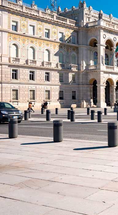
One of these stately buildings, just opposite the seafront, is Palazzo Municipio. The municipal building was designed by Giuseppe Bruni and inaugurated in 1875. It occupies the whole side of the square and incorporates three older build ings encompassing elements of Venetian, Tuscan, German and French architectural styles. From the very beginning, the Triestines playfully dubbed the building Palazzo Cheba , being that its shape resembled that of a bird cage, or also Palazzo Sipario for the grandeur of its facade that acted as a theatre curtain (in Italian, sipario) concealing the old town behind it.
A new clock tower was included to recall the pre-existing one that had already made a fine show of the two timekeeping figures nicknamed Mikez and Jakez between 1517 and the end of the seventeenth century. But unfortunately, the bronze statues soon oxidised, acquiring a dark brown,
[ITA]
Quando il Bruni progettò il palazzo del Municipio, l’edificio venne abbellito con due nuovi paggi, a ricordo dei mori di lontana data. Micheze e Jacheze furono installati tra il 5 e il 7 gennaio del 1876 e batterono i primi dodici rintoc chi a mezzogiorno del 14 gennaio.
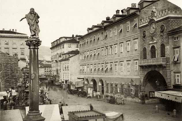
La parte di piazza più antica, quella antistante il Municipio, ospita la fontana del Quattro Continenti, con le sue figure allegoriche che rappresentano il mondo. Opera dell’architetto Mazzoleni del 1751, ha forma pirami dale e fu eretta «in gloria alle fortune commerciali della città e quale fonte d’acqua ad utilità di cittadini e visitatori». Ricca di conchiglie, delfini e rocce misti a casse, botti e balle di merci, è sovrastata dall’Angelo della Fama, che diffonde nel mondo la prosperità di Trieste. Ai quattro angoli della vasca ci sono quattro statue con un animale e ognuna rap presenta uno dei quattro continenti: l’Europa col cavallo, l’Asia col cammello, l’Africa col leone e l’America col cocco drillo. Quattro continenti? Vi chiederete. Beh, all’epoca della realizzazione della fontana l’Australia non era stata ancora scoperta.
Si tratta di una fontana alimentata originariamente da quel lo che era a metà Settecento il nuovo acquedotto teresiano e che doveva rappresentare Trieste come la città favorita dalla fortuna grazie all’istituzione del porto franco da par te di Carlo VI e delle politiche di sviluppo di Maria Teresa d’Austria.
[ENG] reddish patina, so much so that the locals referred to them as the “Moors” of the Piazza.
When Bruni designed the new Town Hall, he elevated its stat ure with two new pages recalling the old Moors. Micheze and Jacheze were installed between the 5 and 7 January 1876 and struck the first twelve clangs at noon on 14 January.
The oldest part of the square, just in front of the Town Hall, includes the Fountain of the Four Continents, conceived as a group of allegorical figures representing the world. The 1751 fountain, by architect Giovanni Mazzoleni, is pyramidal in design and was erected to “glorify the commercial fortunes of the city and provide fresh water to citizens and visitors ”. It is equipped with sculpted rocks, crates, barrels and bales of commerce, and still dolphin spouts that pour water into large seashells. On the top, the winged Angle of Fame dif fuses the prosperity of Trieste to the rest of the world. On each of the four corners of the fountain base, a different ani mal represents the four continents: Europe is represented by a horse, Asia by a camel, while a lion and a crocodile symbolise Africa and America, respectively. Why only four continents, you may wonder. Well, when the fountain was designed and built, Australia hadn’t been discovered yet.
E
proprio a Carlo VI è dedicata la colonna che si erge a po chi metri dalla fontana, ovvero una colonna con la statua dell’imperatore che nel 1719 istituì il porto franco a Trieste, dando un notevole impulso al commercio e allo sviluppo
The fountain was originally fed by the water of what, in the mid-eighteenth century, was Maria Theresa’s new aque duct, which embodied Trieste as the city favoured by great fortune thanks to the free port status granted by Charles VI and by Maria Theresa’s development policies.
The column standing just a few metres from the fountain is quite rightly dedicated to Charles VI of Habsburg, whose statue at the top stands tall, proudly pointing to the sea and
[ITA]
cittadino. La statua raffigura l’Imperatore in piedi che indica il mare, con il suo porto franco. Come il Municipio, è opera dell’architetto Giuseppe Bruni anche il palazzo che troviamo sul lato della piazza alla de stra di Micheze e Jacheze (ossia, guardando il mare), Palaz zo Modello. L’edificio sorge sul sito un tempo occupato dalla secentesca chiesetta di San Pietro e San Rocco. Demolita nel 1870, dalla chiesa fu salvato il rosone e fu installato nella Chiesa di San Bartolomeo a Barcola, sul lungomare che por ta a Miramare.
Il palazzo prese il nome di Modello perché doveva servire da modello architettonico per la ristrutturazione della Piazza Grande quale allora si stava definendo. In realtà è conosciu to come Palazzo degli scongiuri. Vi chiedete il perché? Guar date in alto: i telamoni (le statue) che ornano l’ultimo piano del palazzo sono stati scolpiti in un intento scaramantico! Attaccato a Palazzo Modello si erge Palazzo Stratti , il gran de edificio progettato dall’architetto Buttazzoni nel 1839 su incarico del negoziante greco Nicolò Stratti. I costi della costruzione furono talmente pesanti che il commerciante, caduto in disgrazia, pochi anni dopo dovette vendere il suo
[ENG] his free port. Indeed, the Emperor granted Trieste free port status, preparing the ground for a sharp boost in trade and city development.
To Micheze and Jacheze’s right, facing the sea, there is another building designed by Giuseppe Bruni: Palazzo Modello. The building rises where once the eighteenth-century church ded icated to Saint Peter and Saint Roch stood. In 1870 the church was demolished; however, the central rose window was sal vaged and installed in Saint Bartholomew’s Church in Barcola on the waterfront road that leads to Miramare Castle.
The building was dubbed Modello as it was the architectural model for the proposed renovation of Piazza Grande. Howev er, the actual name of the building is Palazzo degli Sgcongiuri (Incantations Building). You may wonder why such a weird name. Suffice it to look up at the atlas statues (telamones) adorning the top of the facade of the building. They were added purely for superstitious reasons to ward off evil spirits!
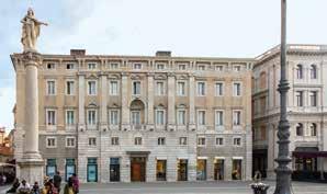
The building ajoining Palazzo Modello, is Palazzo Stratti, which was commissioned in 1839 by Greek tradesman, Nicolò Stratti, and designed by Architect Antonio Buttaz zoni. The construction costs were so high that the merchant fell into bankruptcy; a few years later, he was forced to sell his building to Assicurazioni Generali. The facade was ex tensively renovated to what it is today. On the parapet just above the high relief sculpted company name “Assicurazio ni Generali”, in the centre of the facade rises a benign female figure representing Trieste surrounded by the symbols of the city’s progress and commercial fortunes.
The ground floor is occupied by one of the historic cafés in Trieste, the acclaimed Caffè degli Specchi. Once a hangout for artists, writers and famous people like Svevo and Joyce, the café still retains the Hapsburg Empire’s old-world atmo sphere. It is the perfect place to enjoy a coffee, hot choco late and freshly baked pastry, sitting outdoors enjoying the views of the piazza and the seafront.


palazzo alle Assicurazioni Generali, le quali misero in atto una radicale ristrutturazione della facciata e conferiro no al palazzo l’aspetto attuale. Sulla parte centrale del tet to sopra la scritta scolpita delle “Assicurazioni Generali”, al centro di una complessa scultura spicca una grande figura femminile che rappresenta Trieste, attorniata dalle allego rie del progresso e dalle fortune della città.
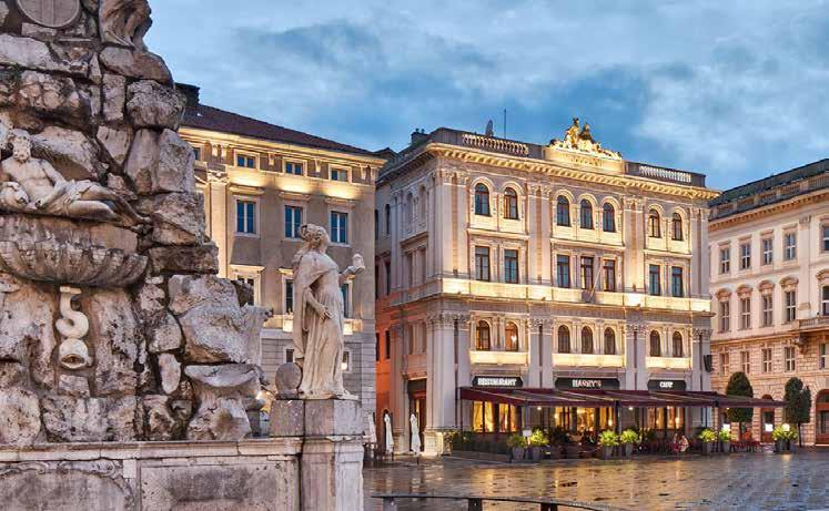
Il pian terreno dell’edificio ospita uno dei caffè storici di Trieste, il celeberrimo Caffè degli Specchi. Già meta di let terati e personaggi famosi come Svevo e Joyce, il caffè rega la ancora l’atmosfera dell’Impero Asburgico ed è una tappa immancabile dove gustare un caffè e un raffinato cioccola to, magari seduti ai tavoli all’aperto e godendo della vista sulla piazza e sul mare.
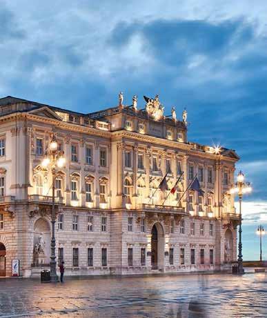
E sia sulla piazza che sul mare affaccia lo splendido Palaz zo del Governo, costruito tra il 1904 e il 1905 su progetto dall’architetto Artmann per ospitare la Luogotenenza Au striaca, e oggi sede del Commissariato del Governo e della Prefettura. Da lontano ci colpiscono la vasta balconata co perta che sovrasta un alto porticato centrale sul quale sven tolano la bandiera italiana e quella dell’Unione Europea. Ma la caratteristica che lascia a bocca aperta quando ci avvi ciniamo al palazzo sono i mosaici in vetro di Murano che ingentiliscono la facciata e le cui tessere dorate al tramonto si illuminano, in uno scintillio sempre mutevole.
Tra uno scoccare dell’ora e l’altro Micheze e Jacheze possono godere della vista, alla loro sinistra, di Palazzo Pitteri, l’edi ficio più antico della piazza. Il palazzo sorge laddove c’era la casa domenicale della ricca famiglia veronese dei Piccardi, ma quando l’edificio passò a Domenico Plenario, lui non la ritenne degna alla sua figura e nel 1780 incaricò l’architetto Ulderico Moro di costruire un edificio più grande e rappre sentativo, ovvero il palazzo di gusto neoclassico che possia mo ammirare ancor oggi, con il corpo centrale scandito da
The majestic House of Government faces both the square and the sea. It was built between 1904 and 1905 to a design by Architect Emil Artmann and served as the Aus trian Lieutenancy’s headquarters. Today it is the seat of the Council of Government and the Prefecture. What immedi ately strikes the eye is the vast balcony framed by an arched portico, where the Italian and European Union flags are flown. On closer scrutiny, though, what really inspires awe is the beauty of the Murano glass mosaics that soften the fa çade, sparkling iridescent colours in the warm sunset light. As Micheze and Jacheze wait to strike the next hour, they can enjoy the view of Palazzo Pitteri to their left. It is the oldest building among those surrounding the square and was built where the residence of the Piccardi family from Verona once stood. Indeed, when Domenico Plenario took ownership of the residence, he deemed it not up to his stan dards, so in 1780 he entrusted the renovation project to Ar chitect Ulderico Moro. The commission was to build a larger residence more in sync with his status. The result was the
sei lesene terminanti con un capitello ionico. Questa era la dimora preferita del famoso musicista triestino Lelio Luttazzi.
Oltre Palazzo Pitteri, ecco Palazzo Vanoli. Già in tempi an tichi l’area su cui sorge l’albergo ospitava piccole locande e alloggi per dare ospitalità ai mercanti che arrivavano a Trie ste per rifornirsi di merci e ai marinai che vi soggiornavano durante il periodo di sosta delle navi. Ma c’era posto anche per accogliere con le dovute cure personaggi importanti e teste coronate.
Nel 1847 quella che era diventata la Locanda Grande ven ne demolita, e nel 1873 le Assicurazioni Generali, al tempo proprietarie dell’area, incaricarono gli architetti Geirin ger e Righetti di costruire al suo posto un nuovo albergo che prese il nome di Hotel Garni. Nel 1912 il palazzo fu uno dei primi edifici di Trieste ad essere dotato di energia elettrica e oggi ospita il Grand Hotel Duchi d’Aosta, uno dei più presti giosi della città, e sulla piazza si affaccia il ristorante stella to Harry’s Piccolo, con il bistrò e la pasticceria. A chiudere il lato della piazza, troviamo il Palazzo del Lloyd Triestino, con la sua imponente facciata ispirata al Rinasci mento. Quello che oggi ospita il Palazzo della Regione, origi nariamente era il palazzo del Lloyd Triestino di Navigazio ne, eretto tra il 1881 ed il 1883 per celebrare la potenza della compagnia, grazie a due particolari fontane che evocano la navigazione lungo i fiumi e per mare. Sulla facciata infat ti vediamo due nicchie, una con la statua di Teti (a sinistra guardando il palazzo), l’altra con la statua di Venere, rispet tivamente custodi mitologiche dell’acqua dolce e dell’acqua di mare. In origine dalla fontana di Teti fuoriusciva acqua dolce mentre dalla fontana di Venere, mediante un mecca nismo di pompaggio, sgorgava acqua di mare.
La facciata del palazzo che guarda il mare ospita le statue di Leucotea, protettrice dei naufraghi, con in braccio il figlio
neoclassical-style building featuring a facade with six central pilaster strips topped with Ionic capitals . At a later date, it became the preferred residence of the nation ally acclaimed Triestine musician Lelio Luttazzi. Beyond Palazzo Pitteri, there is Palazzo Vanoli. The area on which the hotel building stands once buzzed with little inns and taverns offering lodging to merchants who arrived in Trieste for business and to the sailors from the ships at port. There was, of course, also premium accommodation for im portant figures and royal officials visiting the city.
In 1847 the inn that had become known as Locanda Grande was demolished, and in 1873 Assicurazioni Generali, the registered proprietor at the time, commissioned Architects Geiringer and Righetti to build a new hotel, Hotel Garni. In 1912 the building was one of the first in Trieste to have electricity. Today the building houses the Grand Hotel Duchi d’Aosta, one of the most prestigious hotels in town, and the starred restaurant and patisserie, the Harry’s Piccolo, which enjoys an unrivalled location on Trieste’s main square.
At the far end of the square, there is Palazzo del Lloyd Tri estino. Today home to the Regional Government offices, the building was built between 1881 and 1883 to be the Lloyd Triestino headquarters showcasing the company’s commer cial power. The palazzo features a grand facade of Renais sance style, characterised by allegorical statues and two fountains representing river and sea navigation. Each side of the facade has a niche, one containing a statue of Thetis (on the left, looking at the front of the building), the other a statue of Venus, both mythical protectors of the rivers and seas. Indeed, originally the water flowing from the fountain with Tethis was fresh water, while that containing the statue of Venus was fed by seawater.
The side of the building facing the seafront features two statues: Leucotea, the sea goddess who came to the aid of

Palemone (dio del porto sicuro) e quella di Urania, pa trona della navigazione e dei naviganti.
Chi lo direbbe, oggi, che fino alla seconda metà dell’Otto cento al posto dello splendido palazzo si affastellavano le precarie baracche di legno del vecchio mercato del pesce? Bella e maestosa di giorno, emozionante al tramonto quan do le pietre sembrano infuocarsi per salutare il sole, la sera Piazza Unità diventa magica, con i palazzi illuminati e le lucine blu sul pavè che ci riportano gli antichi echi di un porto laborioso e brulicante di imbarcazioni, di persone e di merci. Infatti un tempo tra il Palazzo del Governo e quello del Lloyd c’era il porto fortificato del Mandracchio, che è sta to interrato tra il 1858 e il 1863. Tra le pietre che lastricano questa parte di piazza sono stati incastonati dei proiettori luminosi blu distanti quattro metri l’uno dall’altro, che sim boleggiano una continuità con il mare antistante e rievoca re il vecchio mandracchio interrato. Nel 2005, dopo una primavera fredda e piovosa, il 28 aprile arrivò un sole quasi estivo e le pietre di Piazza Unità siste mate di recente si sollevarono e si spaccarono inspiegabil mente. Ci fu chi imputò la cosa a un geyser, chi alla ditta appaltatrice, chi alla giunta comunale. Quella che è diven tata una moderna leggenda vuole che le spaccature siano state create dal mandracchio interrato due secoli prima che vuole riemergere.
Ad interramento del mandracchio avvenuto, tra i due grandi palazzi che affacciano sul mare trovò posto un giardinet to, che fu eliminato nel 1919. Quattro anni dopo il Comune sistemò lì due piloni provvisori di legno a forma di fasci lit tori e con lo stemma di Trieste: l’alabarda su scudo. Questi furono sostituiti, nel 1933, con due piloni in bronzo a com memorazione degli autieri caduti durante la Prima Guerra
[ENG]
sailors in distress, depicted here with her son, Palae mon (god of the harbour and guardian of ships) in her arms, and Urania, patron of navigation and sailors.
It is difficult to imagine that up to the mid-nineteenth cen tury, wooden shacks of the fish market stood precariously in place of such a sumptuous, stately palazzo.
The building is beautiful and majestic in the daylight, but at sunset, when it sets ablaze with the light that reflects from the sun, it becomes truly enchanting. The whole Pi azza Unità is magical in the evening with its thoughtfully lit facades and subtle blue ground lights giving the sense of the ancient, busy, bustling port filled with ships, goods and people. Indeed, the area between Palazzo Lloyd and Palaz zo del Governo, on the opposite side of the square, was once part of the walled port, the Mandracchio , which was filled in between 1858 and 1863. The blue ground lights embedded into the paving slabs four metres apart symbolise a continu ity between the sea and the land and recall the ancient port that once was there.
In 2005, on 28 April, on a warm, sunny day following a cold, rainy spring, the paving slabs of Piazza Unità inexplicably started to lift and crack. Some stated this phenomenon was caused by a geyser, and others blamed the contractor and the local government. However, the urban myth now is that the cracks result from the ancient port buried below the sur face pushing up to re-emerge.
Stepping back in time, after the old port had been buried, the area between the two grand buildings was turned into an urban garden, which was eliminated in 1919. Four years later, the local government installed two temporary wooden posts in the shape of lictor fasces with the coat of arms of Trieste: a halberd on a shield. These posts were
Mondiale. Alti 6 metri, i piloni sorreggono un’antenna portabandiera di 25 metri, sulla cui sommità sono collocate le alabarde cittadine.
Ma Micheze e Jacheze non pensano alla bellezza della piaz za che sovrastano, alle grandi bandiere che garriscono al vento. Non si curano della vita che pullula e pulsa sotto di loro e non godono nemmeno dei tramonti che sembrano in fiammare le pietre dei palazzi tingendoli d’oro e di colori ru tilanti. No. I mori pensano alle loro spose, Tinza e Marjanza, due tedofore di metallo un tempo poste ai lati dell’entrata del palazzo municipale per illuminarne l’ingresso. Le brac cia sollevate, reggevano nella mano una lanterna di metallo e vetro opaco alimentata a petrolio (successivamente sosti tuita da una boccia di vetro opalino, quando l’alimentazio ne passò a gas), e furono rimosse nel 1936. Da allora i due mori (e nemmeno i triestini) non le hanno più viste. Ma non le hanno dimenticate. E ci piace pensare che i loro rintocchi siano una dolce melodia d’amore.
replaced in 1933 with two bronze pillars as a lasting memorial to the fallen military drivers of the First World War. The 6-metre tall pillars support 25-metre flag posts topped by halberds.
Micheze and Jacheze pay no attention to the beauty of the piazza down below or the flags fluttering in the wind. They don’t care about the bustling life out there and don’t even seem amazed by the blazing sunsets reflecting golden light on the buildings. No. The moors are distracted, thinking about their brides, Tinza e Marjanza, the two metal lamp holders on either side of the entrance to the town hall. The ladies held wrought iron opaque glass oil lamps (which lat er, when gas lighting became available, were replaced with opaline glass lamps) above their heads but were eliminated in 1936. Since then, the two moors, and all the Triestines for that matter, have never seen them again. But they hav en’t forgotten about them. So we like to think that the bell chimes are their melody of love.
[ITA] Prodotto, terroir e persone: il Carso incontra Slow Food. Ristoranti, pasticcerie, panetterie, gelaterie, negozi di alimentari e produttori di eccellenze alimentari uniti per farti conoscere le specialità gastronomiche e i prodotti regionali del Carso.
Lokanda Devetak Hotel Ristorante Restavracija Križman
Trattoria Gostilna Sardoč Ošterija Ferluga Personal Chef Catering Manuela Rossi Moving Chef Trattoria Gostilna
Trattoria Gostilna Valeria 1904 Antica Trattoria Stara Gostilna
Trattoria Sociale Društvena Gostilna Gabrovec 1902 Ristorante Restavracija Hotel Pahor
Caffè Storico Zgodovinska kavarna Antico Caffè San Marco Ristorante
Restavracija Il Vostro Eden
Panificio e Pasticceria Pekarna in Slaščičarna Bukavec
Panificio e Pasticceria Pekarna in Slaščičarna Čok
Panificio e Pasticceria Pekarna in Slaščičarna Cotič
Alimentari Trgovina
Despar Kukanja
Negozio e Rivendita Vino Trgovina in Vinotoč Cherti Ernesto di Chert Miroslav & C.
Bar Bar Alombra
Bar Caffè Bar Kavarna Vatta
Bar Caffè X Bar Kavarna X
Torrefazione Pražarna Primo Aroma
Negozio Salumeria Delikatesna Trgovina Sfreddo
contributo


[ITA] L’Europa è attraversata da sentieri, vie verdi e cammi ni a misura d’uomo che possono essere percorsi semplice mente… camminando. Queste vie spesso seguono i tracciati di antiche strade seguite nell’antichità da popoli che migra vano, mercanti, legioni ed eserciti. Altre volte le vie ricalca no storici cammini religiosi, solcati per secoli da pellegrini che per devozione, penitenza o per ricerca spirituale viag giavano verso i luoghi sacri.
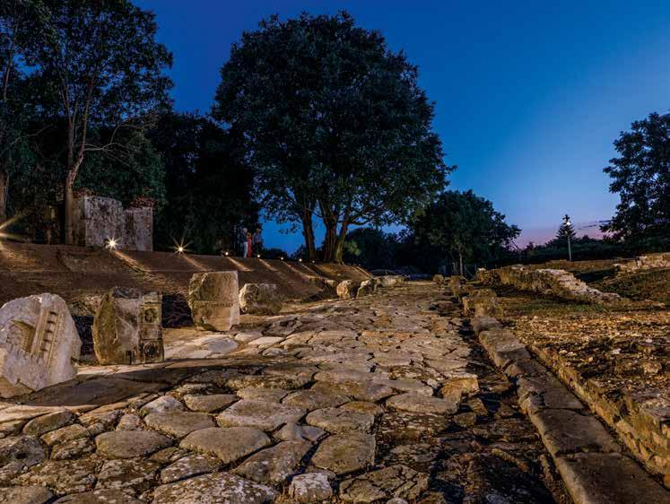
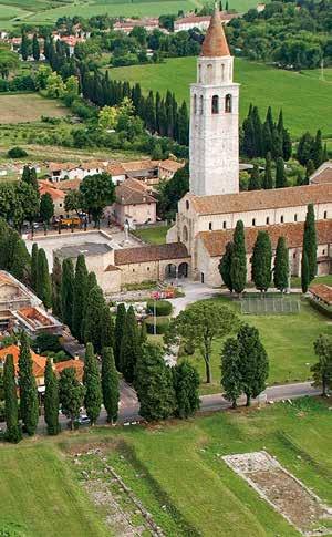
Il Friuli Venezia Giulia è sempre stata una terra di passag gio. Un’area che, come l’anello di una grande catena, uni va – e unisce tutt’ora - ambiti geografici e politici diversi, e dove hanno preso vita profondi scambi culturali ed econo mici. Non c’è da stupirsi, quindi, se molte erano le vie che solcavano questo territorio. E c’è un luogo in cui molte vie si sono incrociate e sovrapposte, per secoli e secoli. Si tratta di Aquileia.
La grande città romana, posta a ridosso della cerchia alpina e poco distante dal mar Adriatico, fin dalla sua fondazione venne messa in collegamento stradale con le vicine città dell’Italia romana grazie alla creazione delle vie Annia (che
[ENG] Europe is crisscrossed by ways, green trails and pil grim routes that can be travelled on foot. These walking ways often follow the lines of ancient roads trodden by migrating peoples, merchants, legions and armies. Sometimes they fol low the religious routes that devout pilgrims walked as a sign of repentance or in search of higher spirituality, and often touch holy sites on the way.
Friuli Venezia Giulia has always been an important pas sageway. Indeed, just like a link in a great chain, the region has always joined different geographical and political areas, becoming the hub of important cultural and economic ex changes—no wonder the region featured a network of routes. In particular, over the centuries, many roads either intercept ed or were laid out on other older ones in Aquileia. Since its foundation, several roads connected this important Roman city, located near the shores of the Adriatic Sea and sheltered by the alpine range, to other Roman towns and localities: the Annian Way, which joined Aquileia to Adria, continuing to Rome, the Aemilian Way, which according to recent research reached Aquileia from Bologna, and the Pos
univa Aquileia ad Adria, permettendo poi di giungere a Roma), Aemilia Altinate (che secondo recenti studi giun geva qui da Bologna) e Postumia (la strada di arroccamento militare al margine superiore della linea delle risorgive che arrivava fino a Genova e che oggi si può identificare con la Strada Napoleonica).
Successivamente la città ampliò ancor di più i propri oriz zonti, con la realizzazione delle vie Iulia Augusta (la prin cipale arteria transalpina diretta a nord che valicava le Alpi al passo di Monte Croce Carnico e proseguiva verso il Norico e verso l’Europa Centrale) e Gemina (aperta a est verso l’I sonzo, Tergeste – Trieste -, Emona – Lubiana - e l’Istria). Le vie romane europee sono oggi al centro dell’Iter Roma num, un progetto che ha l’obiettivo di promuovere le strade e i siti romani che aderiscono alla rete nata nel 2017. Sette enti - tra fondazioni, città e musei - di altrettanti Paesi eu ropei (Portogallo, Spagna, Italia, Francia, Belgio, Slovenia e Serbia) si sono associati nella “Cooperation Network Roman Roads in Europe”. E, consapevoli dell’importanza che l’Im
tumian Way, the military road leading from Genua across the Po valley to Aquileia passing north of the resur gence area of the region.
The city eventually widened its network of roads with the Iulia Augusta Way and the Gemina Way. The former was the main transalpine artery towards the Noricum and Central Europe, crossing the Alps at Passo Monte Croce Carnico; the latter ran towards the east, passing River Isonzo, Tergeste (to day Trieste), Emona (today Lubiana), and Istria.
The Roman ways in Europe are at the heart of Iter Romanum, a project launched in 2017 to promote the ancient roads and the many historical sites on the Roman network. Seven agen cies - including foundations, city councils and museums of several European Countries (Portugal, Spain, Italy, France, Belgium, Slovenia and Serbia) associated with creating the “Cooperation Network of the Heritage of Roman Roads in Eu rope”. In acknowledging the Roman Empire’s important role in the history of Europe, the agencies are committed to pro moting a vast European cultural itinerary and setting up a widespread network of sites that will coordinate cultural and tourist-friendly initiatives and activities.
Fondazione Aquileia is one of the founding associates of this project, and currently, its director, Cristiano Tiussi, is also the president of the European association. One of the following steps toward international recognition of the European cul tural itinerary is to advocate the project at the Council of Eu rope and have Iter Romanum listed as a Cultural Route of the Council of Europe. When implemented, the route will allow people to visit the various monuments and historical sites along the ancient Roman roads and appreciate the wide spread importance of the Roman Empire.
pero Romano ha avuto nella storia dell’intera Europa, stanno lavorando per promuovere un grande itinerario cul turale europeo e costituire un’ampia rete di siti che coordi nano tra loro le iniziative e le attività culturali e turistiche.

La Fondazione Aquileia è stata un socio fondatore di questa rete e attualmente il suo Direttore, Cristiano Tiussi, è anche presidente dell’associazione stessa. Uno dei prossimi passi verso il riconoscimento internazionale dell’itinerario sarà la candidatura al Consiglio d’Europa per ottenere l’inserimento dell’Iter Romanum nella lista degli Itinerari Culturali Trans nazionali. Quando sarà attivo, questo cammino ci permet terà di viaggiare tra le vestigia di grandi città, lungo strade antiche, borghi e monumenti che ancora oggi ci mostrano la grandezza di Roma. Info: www.iter-romanum.eu
Si innesta invece sui cammini solcati dai pellegrini un altro percorso che mira alla candidatura come itinerario ricono sciuto dal Consiglio d’Europa, la Romea Strata
La storia di questo cammino risale al medioevo, quando i pellegrini percorrevano le vie romee , o vie romane , ossia le strade che li conducevano a Roma, la città che, con Gerusa lemme e Santiago de Compostela, era tra le principali mete dei pellegrinaggi della cristianità occidentale. Su alcune di queste vie, il progetto Romea Strata ripropone il sistema di sentieri che dall’Europa centro-orientale conduceva i pelle grini a Roma sulla tomba di Pietro.
Tre sono i percorsi della Romea Strata che coinvolgono il ter ritorio del Friuli Venezia Giulia e che si congiungono a Con cordia Sagittaria, in terra veneta. Da nord giunge la Romea Allemagna, che conduce da Tarvisio a Concordia Sagittaria. Questo è il primo tratto italiano dell’antica via di pellegrinag gio che qui arriva dai paesi baltici, da Czestochowa, Cracovia e Vienna. La Romea Iulia Augusta segue invece l’antica via
Another cultural route on the tentative list to be rec ognized by the Council of Europe is the Romea Strata; a way travelled by pilgrims.
The history of this pilgrimage way dates back to the Middle Ages when the pilgrims followed the vie Romee, or vie Ro mane, to reach Rome, one of the most popular Christian des tinations, together with Jerusalem and Santiago. The Romea Strata project intends to reestablish a network of pathways of the former vie romee that led the pilgrims from CentralEastern Europe to Saint Peter’s shrine in Rome.
Three stretches of the Romea Strata pass through Friuli Vene zia Giulia and meet in Concordia Sagittaria in Veneto. The Romea Allemagna leads down from the north from Tarvisio to Concordia Sagittaria. It is the first Italian stretch of the ancient pilgrimage way that arrives in Friuli from the Baltic regions, Czestochowa, Krakow and Vienna. The Romea Iulia Augusta, instead, follows the ancient Roman consular road that connected the Noricum (the central region of Austria) to Aquileia. The route connects Passo Monte Croce Carnico
consolare romana che collegava la regione del Norico (l’attuale Austria centrale) ad Aquileia. Il percorso unisce il passo di Monte Croce Carnico (Plöckenpass) al confine con l’Austria, all’importante centro archeologico romano di Zu glio. E a Venzone si innesta sulla via Romea Allemagna. Più a sud troviamo la Romea Aquileiense, che solca il Friuli Vene zia Giulia da ovest a est. Il cammino parte da Miren, presso Nova Gorica in Slovenia, e arriva a Concordia Sagittaria dopo aver toccato l’antica sede episcopale di Aquileia. Nel 2018 la Fondazione Aquileia ha aderito all’Associazione Europea Romea Strata, che sta lavorando per la valorizza zione di questi itinerari che attraversano il nord-est dell’Ita lia. Info: www.romeastrata.org È già riconosciuto come Itinerario culturale del Consiglio d’Europa l’Itinerario dei Santi Cirillo e Metodio . Un grande cammino che presto coinvolgerà anche Aquileia. A fine ago sto infatti è stata avviata un’importante collaborazione per sviluppare e valorizzare questo itinerario in Friuli Venezia Giulia. Quello di Cirillo e Metodio è un cammino che collega i luoghi evangelizzati, dal IX secolo dai due santi compatro ni d’Europa e dai loro seguaci. Si tratta di un itinerario mol to vasto tra i paesi dell’Est Europa, che parte dalla Grande Moravia (oggi Repubbliche Ceca e Slovacca), si dirama in di verse direzioni e giunge fino a Roma. E proprio in direzione della Città eterna si innesta sul Cammino di Santia go e sui percorsi della Via Francigena e della Romea Strata. Info: www.cyril-methodius.cz
Anche il Cammino Celeste , o Iter Aquie liense , passa per Aquileia. Questo cam mino di fede varca i confini nazionali con tre distinti itinerari che hanno origine in altrettante località di Italia, Slovenia e Austria e si riuniscono a Camporosso, per risalire poi il Monte Lussari, guadagnandone la sommità a
(Plöckenpass) on the border with Austria to the im portant Roman archaeological site in Zuglio. In Venzone, the route merges into the Romea Allemagna. Further south, the Romea Aquileiense crosses Friuli Venezia Giulia from west to east. The pilgrimage way starts in Miren near Nova Gorica, in Slovenia, and reaches Concordia Sagittaria passing by the ancient episcopal seat in Aquileia.
In 2018, Fondazione Aquileia joined the European Associa tion Romea Strata, committed to enhancing the an cient routes that crisscross the northeast of Italy. Info: www.romeastrata.org
The Route of Saints Cyril and Methodius is listed as a European Cultural Route by the Council of Europe, which will soon also involve Aquileia. Indeed, at the end of Au gust, initiated an important collaboration to better establish and enhance this route in Friuli Venezia Giulia. The Route of Saints Cyril and Methodius connects the localities evangelized in the 9th century
1.760 metri di altitudine. I pellegrini che seguono il percorso italiano partono dalla maestosa Basilica Patriar cale di Aquileia e arrivano fino al Santuario della Regina dei Popoli d’Europa, dove l’immagine della Madonna è venerata da sei secoli e mezzo dai fedeli di tutte e tre le nazionalità. Info: www.camminoceleste.eu Racchiude in sé la romanità e la fede cristiana un altro gran de itinerario che tocca Aquileia, il Cammino di San Martino Si tratta del più antico cammino cristiano (risale alla prima metà del IV secolo) e segue le tracce lasciate da San Marti no di Tours, quel soldato romano originario della Pannonia che tagliò il suo mantello con la spada per vestire un mendi cante. Riconosciuto dal Consiglio d’Europa come Itinerario Culturale Europeo, il cammino parte da Szombathely, in Un gheria, tocca Lubiana - la capitale della Slovenia - e l’Italia, con Aquileia (dove nel VI secolo studiò, tra gli altri, San Ve nanzio Fortunato, uno dei più devoti pellegrini di Martino) e Pavia, per concludersi a Tours, in Francia. Alcune ramifica zioni del cammino hanno aggiunto percorsi in Belgio, Olan da e nelle terre intorno ai Pirenei. In Friuli Venezia Giulia parte del tracciato di questo cammino segue la Romea Stra ta Aquileiense. Info: www.saintmartindetours.eu
by the two patron saints of Europe and their follow ers. It is a long pilgrimage way that runs across the countries of Eastern Europe, from Great Moravia (today Czech Repub lic and Slovakia), splits into different directions and finally reaches Rome. On its way to the Eternal City, the route merges into the Camino de Santiago, known in English as the Way of St James, on stretches of the Via Francigena and the Romea Strata. Info: www.cyril-methodius.cz
The Cammino Celeste, or Iter Aquieliense, passes through Aquileia, too. This pilgrimage crosses the Italian borders through three distinct routes that start in Italy, Slovenia and Austria and merge in Camporosso to climb Mount Lussari to the top at an altitude of 1,760 metres. The pilgrims who choose the Italian route set out from the majestic Patriarchal Basilica of Aquileia and reach the Marian Sanctuary dedi cated to the Queen of the Peoples of Europe, where believers from the three countries have revered the image of the Virgin Mary for over six centuries Info: www.camminoceleste.eu
Yet another pilgrimage walk running through Aquileia that embodies its Roman origins and the Christian faith is the Cammino di San Martino. The most ancient Christian way (dating back to the first half of the 4th century) follows the footsteps of Saint Martin of Tours, the Roman soldier from Pannonia who cut his cape in two with his sword and shared it with a beggar. Listed by the Council of Europe as a Euro pean Cultural Route, the pilgrimage starts in Szombathely in Hungary, runs through Ljubljana in Slovenia, enters Italy and passes through Aquileia, the city where Saint Venantius For tunatus, one of Saint Martin’s devout pilgrims, studied in the 6th century, and Pavia, to finally reach Tours, in France. Some branches of the route have included stretches in Belgium, the Netherlands and areas of the Pyrénées. In Friuli Venezia Gi ulia, part of the Italian stage of the way follows the Romea Strata Aquileiense. Info: www.saintmartindetours.eu
Programme of the festival and info: www.amicidelborgo.it
[ITA] C’è un piccolo borgo incastonato nella pianura friula na che si addossa attorno a una chiesetta di origine romani ca. San Martino è il nome del paesino ed anche il santo a cui è dedicata la chiesa, un piccolo gioiello del patrimonio arti stico regionale che conserva ricchi affreschi del XV e XVI secolo.
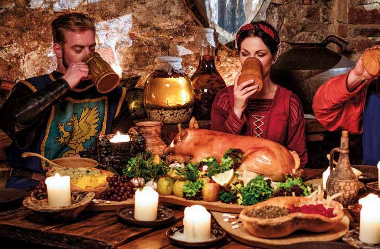
E proprio attorno a questa chiesa il terzo fine settimana di ottobre si svolge l’ormai tradizionale Festa della Zucca. Sabato 15 e domenica 16 ottobre 2022 si rinnova l’appun tamento con la Festa della zucca a San Martino di Terzo di Aquileia. Non “solo una festa della zucca” e non “solo una rievocazione storica”: ciò che rende questa manifestazio ne veramente speciale sono gli appuntamenti culturali e artistici che ogni anno approfondiscono un tema diverso, i
[ENG] There is a small village set in the Friulian plain that eagerly clusters around a little Romanesque church. San Martino is the name of the small village and the saint to whom the church is dedicated; a small gem amidst the re gional artistic heritage, which shrines fifteenth and six teenth-century frescoes.
It is near and around the church that the traditional Pump kin Festival takes place during the third weekend of October. Saturday 15 and Sunday 16 October 2022 mark the cel ebration of the Pumpkin Festival held in San Martino di Terzo di Aquileia. The festival is not only the celebration of “pumpkins” or a mere “historical pageant”: what makes this fête truly special are the many cultural and artistic fringe events dedicated to a specifically chosen theme, the food and wine stands where enjoy traditional local dishes, in particular those that highlight duck, the medieval market and the arts and crafts market that offer a wide variety of quality, unique, handmade products. And, of course, lots of pumpkin-based artisanal specialities and an exciting his torical re-enactment!
This year’s re-enactment revolves around a theme that is also a good omen for everyone: meet and fête together again, with pageant enactors and friends, leaving the dark times behind, just like in the past, when, after severe famines and calamities, the local communities would fast in atonement and then hold a grand feast to celebrate the end of hardship. The climax of the re-enactment pageant will be the banquet
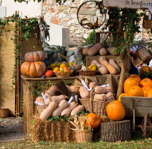
punti di ristoro dove gustare i piatti a base di oca e quelli di una cucina povera che fa parte passato locale, il mercato storico medievale e il mercatino dell’hobbistica con proposte sempre nuove e particolari. E, sì, ci sono anche pre libatezze artigianali a base di zucca e una accurata rievoca zione storica!
In questo 2022 la rievocazione e la festa ruotano attorno a un tema che è anche un augurio per tutti noi: banchettare di nuovo, con i rievocatori e con gli amici, per lasciarci alle spalle i tempi bui. Proprio come si faceva in passato, quando in occasione di gravi carestie e di catastrofi si indicevano di giuni collettivi a scopo espiatorio e poi un pranzo solenne ne celebrava la fine. Per questo l’appuntamento più atteso della rievocazione sarà il grande convito con la Reverendissima Madre Badessa per festeggiare il ritorno dei tempi sereni.
La festa sarà l’occasione per visitare la splendida chiesetta di San Martino, la mostra di antichi strumenti musicali e il mercato medievale (con Dramsam scopriremo, in una lezio ne-concerto gli antichi strumenti musicali). Lungo le strade del borgo incontreremo liutai, vasai e tanti altri artigiani che ci mostreranno come si lavorava nelle loro botteghe nei secoli andati. Le strade saranno animate da giullari, danza tori (quelli di Valvasone offriranno anche un laboratorio di danze medievali) e musici. E all’imbrunire crepiteranno gli spettacoli di fuoco. In questo ricco mercato c’è spazio anche per l’intrattenimento dedicato a bambini e famiglie, e trove remo gli asinelli e le pecore della Piccola Fattoria Cumugnai di Aquileia, particolarmente amati dai più piccoli. Come in una festa della zucca che si rispetti, potremo ammirare le opere realizzate nell’angolo dedicato all’intaglio della zucca. E poi, macchine fotografiche alla mano: il concorso fotogra fico, rivolto ad adulti e bambini, premierà la foto più rappre sentativa e significativa della 23ª Festa della Zucca.
with the Reverend Mother Abbess to celebrate the re turn of quiet times.
The fête is a great occasion to visit the splendid church ded icated to Saint Martin, the collection of historical musical instruments and the medieval market (Dramsam will hold a lesson-concert presenting ancient musical instruments).

Along the village streets, violin makers, potters and other craftspeople will show their traditional crafts and work shops. The atmosphere will be lively with the music and dances of the jesters and courtiers (the Valvasone danc ers will hold medieval dance workshops), and exciting fire shows will light up the evening. The market also offers fun things for children and families, including the donkeys and sheep of the Piccola Fattoria Cumugnai of Aquileia that are always a hit with the little ones. Finally, for the festival to be a proper pumpkin celebration, a stop at the Jack-O-Lantern Carving Exhibition should not be missed .
And still, the photography contest, open to adults and chil dren alike, will award the best and most representative pho tograph of the 23rd edition of the Pumpkin Festival.
[ITA] Nella visione occidentale natura e cultura sono rap presentate come due mondi separati. Ma c’è un punto in cui si incontrano: il paesaggio. Prodotto della cultura e del lavo ro dell’uomo sulla natura, il paesaggio ci mostra una conti nua sovrapposizione di storia e storie che si intrecciano nei millenni.
Addentrarsi in un paesaggio considerandolo come la som matoria di innumerevoli azioni, ponendo lo sguardo sui ma teriali che lo compongono, sulle pratiche che lo alimentano, sulle infrastrutture e sulle relazioni che tutto ciò ha con gli elementi naturali mette in atto un approccio dolce, empati co e ci predispone all’ascolto attivo.
Il paesaggio è anche il luogo ideale per affinare un “super potere” che spesso dimentichiamo di avere: quello di mera vigliarci. È qui che possiamo mettere in atto ciò che Chan dra Candiani definisce “la pratica della meraviglia”, ossia guardare le cose che già conosciamo come se fossero nuove. Questo superpotere ci permette di attraversare luoghi quo tidiani sentendoli diversi e di scoprire che hanno un inedito fascino “esotico”.
 by Nicola Picogna
[ENG] In the western vision, nature and culture are often thought of as separate realms. But there is a point where the two meet: the landscape. As a product of culture and human labour, the landscape shows layers of histories and stories interlaced over the millennia.
When you venture into a landscape, considering it as the sum of a myriad of actions, and look closely at the elements, the nurturing practices, the infrastructures and the rela tionships such actions establish with the natural elements, then you start feeling more receptive and open to actively listening.
The landscape is the ideal place to hone a “superpower” we often forget we already own: the ability to be amazed. Here, we can put into practice what Italian poet Chandra Candiani defines as “the practice of being amazed” or, more simply, to look at things we already know as if they were new.
This superpower allows us to visit everyday places around us, experiencing them as new, and discover they possess an unknown “exotic” allure.
[ITA]
Nel cuore del Friuli Venezia Giulia, a pochi chilometri da Udine, c’è un posto che sembra creato appositamente per questo tipo di sguardo sul paesaggio; che crea meraviglia e che guarda alle storie di uomini e natura. Si tratta del Sen tiero Stringher-Tacoli, un itinerario pedonale tra le colline di Moruzzo, un balcone affacciato sull’ampio panorama della pianura udinese.
Lungo sentieri, strade campestri e la viabilità minore di que sto territorio entriamo in contatto con gli aspetti della sto ria, della natura, delle tradizioni del luogo, in ambienti sug gestivi ben conservati, a volte nascosti, che si susseguono a testimonianza di un rapporto millenario tra natura e uomo. Colli dolci e sinuosi e piccole valli dove scorrono placidi rii sono il lascito del grande Ghiacciaio Tilaventino. Infatti la cerchia di colline che oggi vediamo è stata creata e modella ta dal ghiacciaio che nella fase di sua massima espansione ha rilasciato un ammasso caotico di ciottoli e blocchi, limi e sabbie (ovvero i detriti delle rocce che aveva eroso, trasci nato e abbandonato a più riprese). Circa 18.000 anni fa ha avuto inizio il ritiro della massa glaciale: le acque risultanti dalla fusione sono rimaste intrappolate tra i rilievi morenici dando origine a laghi, stagni e zone umide di cui ancora tro viamo testimonianza.
A partire dalla preistoria l’anfiteatro morenico è stato am piamente utilizzato dagli uomini, proprio perché era un am
[ENG] In the heart of Friuli Venezia Giulia, just a few kilo metres from Udine, there is a place that seems to exist to offer an authentic experience of amazement; a place that evokes a sense of wonder and perception of the people’s life histories and of nature. The Stringher-Tacoli Path is a walk ing trail through the hills of Moruzzo, overlooking the pan orama of the plains around Udine.
Walking along the paths, trails and country roads, we get in touch with the history, nature, and traditions of picturesque, unspoilt, secluded villages and rural hamlets that show us the age-old relationship between humans and nature.
A landscape of gently rolling hills and little valleys etched by babbling brooks is the natural legacy left by the Taglia mento Glacier. Indeed, the amphitheatre of hills we see to day was created and sculpted during the glacier’s phase of maximum expansion when it deposited masses of pebbles, boulders, silt and sand (the debris of the eroded cliffs). The glacial retreat initiated approximately 18,000 years ago: the water from the melted ice was trapped between the moraine hills forming lakes, ponds and wetlands, evidence of which still exists today.
Since pre-historic times humans have extensively inhabit ed the moraine amphitheatre because of its abundance of water and wild animals. In later ages, people continued to dwell on the moraine hills; indeed, the villages, the Roman
[ITA]
biente ricco di specchi d’acqua e di animali selvatici. Successivamente l’uomo ha continuato a vivere sui colli mo renici: centuriazioni, villaggi, fortezze e castelli sulle som mità più elevate e ville signorili sono il documento storico di questi luoghi.
Il percorso principale del Sentiero Stringher-Tacoli si svilup pa per 16 km ed è un compendio di tutte le caratteristiche naturalistiche e culturali che il territorio offre. Oltre a que sto sono state realizzate due variante più brevi: “Il sentiero delle fonti ” (7 km) e “Il sentiero del tempo ” (11 km), che con sentono di approfondire le tematiche legate ai fattori natu rali che hanno modellato queste terre e la relazione tra atti vità antropica e natura. Troviamo così 3 percorsi ad anello, lungo i quali i punti più notevoli sono illustrati da pannelli. Tre itinerari disponibili anche in una pratica mappa scari cabile dal sito del Comune di Moruzzo. Luogo ideale per la partenza è l’antico borgo di Santa Mar gherita del Gruagno, un gioiello rurale. Quasi subito entria mo nei boschi del Lavia imboccando un piccolo sentiero, im mergendoci in una dimensione “altra”, in cui possiamo dare la giusta attenzione ai passi, ai pensieri, al raggio di luce che riscalda la pelle e nutre il sottobosco. Siamo in un luogo la
[ENG] land divisions, fortresses and medieval castles on the higher reaches alongside the stately country residences remain as the heritage of these lands.
The main stretch of the Stringher-Tacoli Path runs for 16 km and is a compendium of all the natural and cultural features of the area. Besides the main path other two shorter alter native routes were established: “ The path of the sources ” (7 km) and “ The path of time ” (11 km), which allow walkers to discover the natural factors that shaped these lands and the relation between anthropic activity and nature. So, there are 3 loop-trails that feature information boards set in the most significant spots. An easy-to-use map of the trails can be downloaded on the Comune di Moruzzo website.
The best place to start your walk is the old village of Santa Margherita del Gruagno, a true rural gem. Almost immedi ately, you enter the Lavia woods by a little path and become immersed in “another dimension”, where you can be mind ful of your steps, sensations, and the dappled sun rays that warm you skin and nurture the forest floor. You find your self in a place where exquisite diversity can be felt. Crossing fords and walking the paths of this stunning landscape, you will be charmed by ancient waterworks, water mills and
[ITA]
cui diversità, preziosa, si può sentire. Lungo guadi e sentieri, questo ambiente incantato e intimo ci fa lambire antiche opere idriche, ex mulini e lavatoi, che sono testimo nianza del rapporto simbiotico tra acqua e attività umana. Quando l’intervento dell’uomo sul paesaggio si fa più evi dente, dal caos generativo del bosco si passa ad una ‘’secon da natura’’ ordinata e lineare: le imponenti farnie cedono il passo prima al maestoso viale dei tigli del Poggio Stringher e poi alla geometrica bressana di Villata (dove risuonano gli echi dell’uccellagione che qui si praticava); nel mezzo la ma gia dei prati stabili di San Clemente. Realtà che rispondono a diverse ma precise esigenze dell’uomo, dall’aspetto ricre ativo del viale che conduce al Poggio, al soddisfacimento di esigenze di sussistenza, attraverso l’aucupio (la caccia agli uccelli) e lo sfalcio.
In breve l’impronta umana nel paesaggio diventa prepon derante: il castello di Villalta domina la nostra vista. Sfrut tando la sua posizione possiamo lasciar scorrere lo sguardo sulla pianura friulana.
L’azione dell’uomo incontra ancora il territorio alle spalle del castello dove appare un piccolo e isolato rilievo, ricoper to da vegetazione erbacea e sulla cui sommità c’è un tiglio.
[ENG] washing places that tell of the symbiotic relationship between water and human activity.
When human activity becomes more evident, the natural chaos of the woods turns into a “different type of nature”, tidy and more orderly. The majestic oak trees give way to the linden tree-lined avenue of Poggio Stringher and the geometric bressana (old bird hunting ground) of Villata, and in between, the lush, painterly meadows of San Clemente. Different elements in the landscape, each responding to specific human needs, from the aesthetic and recreational aspect of the avenue that leads to the Poggio hillock, to a reasonable likelihood of survival (bird hunting and pasture scything).
The human footprint prevails just a short distance away, and the landscape is dominated by the Villalta Castle. You can enjoy a panoramic view of the Friulian plain from this elevated position.
Human activity again blends into the landscape behind the castle, where there is a small, isolated hillock covered in lush vegetation with a majestic linden tree at the top. The hill seems natural, but in actual fact is a man-made bronzeage burial mound, tumulus.
[ITA]
Il rilievo può apparire naturale, ma in realtà si tratta di un tumulo, una sepoltura ad opera di un’intera comunità dell’età del bronzo.
Questa piacevole ubriacatura di segni antropici consiglia una deviazione dal percorso ufficiale per giungere alla Tor biera di Borgo Pegoraro, un biotopo tutelato che conserva un elevato grado di biodiversità, dove si moltiplicano le forme naturali e le sfumature di verde, e dove la torba cela i suoi segreti. Nel borgo si trovano un piccolo acquedotto e tanti lavatoi: l’emozione è notevole davanti a infrastrutture che, con impatto minimo, erano segno del progresso e del mi glioramento della qualità della vita delle persone. Prima di tornare al punto di partenza, meritano una visita la chiesa di Santa Eurosia, invocata da generazioni di conta dini locali in quanto protettrice delle messi, e quella di San Michele, che rientra nei possedimenti della tenuta Brazzà, il cui castello è a pochi minuti di cammino. Ormai sullo sfondo si vede la sagoma arroccata di Santa Margherita, vi facciamo ritorno attraverso la Jevade , una ma gnifica salita in acciottolato che ci trasmette la fatica, le voci e i pensieri di coloro che la costruirono, ed anche il suono greve del ghiaccio e quello dolce dell’acqua che hanno tra sportato e modellato ogni singolo ciottolo di cui è composta. Il maestro Franco Battiato ha cantato «Se vuoi conoscere i tuoi pensieri di ieri osserva il tuo corpo oggi. Se vuoi sapere come sarai domani osserva i tuoi pensieri di oggi», lo stesso vale per il paesaggio: quello odierno è l’esito delle scelte di chi ci ha preceduto. Analogamente i paesaggi futuri saran no il frutto del nostro pensiero e del nostro agire di oggi. Per questo è di primaria importanza promuovere l’acquisizione di un senso di responsabilità che tenga conto del contesto, del sistema di regole, dell’apporto che ciascuno può dare e a volte è sufficiente imparare a vedere, perché è il presuppo sto per imparare ad agire.
Per godere appieno di questi e di altri suggerimenti e per escursioni accompagnati dalle guide professioniste dello Studio Naturalistico ForEst: www.studioforest.it
[ENG] This pleasant feed of anthropic sights allures you to take a detour to the Torbiera di Pegoraro bogland, a protect ed biotope that contributes to biodiversity conservation. Here there are landscapes of trees and vegetation of differ ent shapes and shades of green where the bog holds its se crets. In addition, the little village has a small aqueduct and several public wash places. Looking at these infrastructures that minimally impact the surroundings, you cannot but feel marvel in front of the progress and the improvements in the quality of life of the local inhabitants.
Before returning to the starting point, worth a stop is the church dedicated to Saint Eurosia, much revered by the lo cal farmers as the protector of the earth’s harvest, and that dedicated to Saint Michael located within the grounds of the Brazzà Castle estate.
From here, you get a view of the hamlet of Santa Margheri ta, where the trail leads you back via the Jevade. The grand cobblestone pathway is a permanent reminder of the hard work, the voices and the thoughts of those who built it, as well as the rumble of the ice breaking and the babbling of the water that carried and smoothed every single stone of the pavement.
The Italian singer and composer Franco Battiato sang, “If you want to learn about your thoughts of yesterday, observe your body today. If you want to know where you will be tomorrow, observe your thoughts of today”; and the same goes for landscapes: what you see today is the result of the choices made by our predecessors. In the same way, future landscapes depend on our thoughts and actions today. This is why we all need to acquire a sense of responsibility that considers the context, the set of rules and the realisation of the importance of individual actions. A starting point for ev eryone is to learn how to look at things because observation is the fertile ground for action.
To make the best of these getaway suggestions or book a tour with a qualified nature guide at Studio Naturalistico ForEst, visit www.studioforest.it


[ITA] Uno dei sogni più comuni è quello di starcene tutto il giorno sulla spiaggia a rilassarci. Ogni tanto un tuffo in mare e, dopo una bella nuotata, un po’ di relax sul lettino. Ma in certe spiagge del mondo questo sogno non è sempre praticabile a causa del sopraggiungere del mare che, lenta mente, ora dopo ora, si appropria della battigia. Questo fenomeno, più o meno intenso, è detto marea, ovve ro una variazione periodica del livello del mare che lo porta a invadere spazi che solo poche ore prima erano all’asciutto e viceversa. Non in tutto il mondo il fenomeno della marea è concretamente visibile e non dappertutto è di uguale entità. Una cosa però è identica nella maggior parte dei casi: la sa lita dell’acqua (il flusso) e la sua discesa (il riflusso) durano all’incirca 6 ore ciascuno, per un totale di 12 ore a ciclo.
[ENG] Most of us dream of spending the whole day simply relaxing on the beach, lying in the shade on the seashore, and enjoying refreshing dips in the cool water.
Unfortunately, certain beaches are unsuitable for such idle fantasies due to the seawater that slowly comes in and covers the shore as it rises.
This more or less intense phenomenon is called tide, a pe riodical variation of the sea level that causes the water to rise and cover areas that were dry just some hours earlier. Tides do not rise the same height everywhere on the planet and are not very evident in some areas. However, in most cases, there are approximately six hours between high and low tide at any location. Each tide cycle is twelve hours long and carries tons of water in and out.
Ma facciamo un passo indietro: da cosa dipende la marea? In primis dalla forza attrattiva della Luna ma anche del Sole. Sì, anche del Sole! È vero che è molto lontano da noi ma è anche spaventosamente grande. La forza attrattiva di Luna e Sole agisce su tutta la Terra, ma sarebbe un po’ difficile spostare le montagne e i boschi… molto più facile spostare qualcosa di liquido: i mari e gli oceani. L’escursione di marea (ovvero la differenza tra la bassa e l’alta marea) varia nel corso di un mese. La Luna infatti gira intorno alla Terra in circa 28 giorni (circa in un mese quin di), regalandoci quarti di Luna, Luna piena o nuova (scura). Quando la Luna è piena o totalmente assente (nuova) signifi ca che i 3 astri sono in congiunzione e potremmo tirare una linea immaginaria Terra-Luna-Sole. Allora la forza attrattiva di Luna e Sole si sommano, dandoci le massime escursioni (maree sizigiali). Quando invece vediamo un quarto di Luna, significa che Terra, Luna e Sole formano un angolo perpen dicolare e che le loro due forze un po’ si smorzano: avremo dunque le minime escursioni (maree di quadratura). Nel caso specifico del Friuli Venezia Giulia, in condizioni di Luna piena-nuova possiamo avere circa 1 metro di escursio ne di marea, mentre avremo solo tra i 30 e i 40 centimetri di escursione nelle giornate dei quarti di Luna.
Se avete mai guardato una carta delle maree vi sarete chie sti il motivo per cui vi è una leggera differenza tra le maree da un giorno all’altro. È perché il giorno lunare (il periodo che occorre alla Luna per completare un’intera rotazione in torno al proprio asse rispetto al Sole) dura 24 ore 53 minuti ed è quindi più lungo del giorno solare di 24 ore su cui ba siamo la nostra giornata. Pertanto la marea più alta arriverà ogni giorno più tardi di circa 53 minuti.
Sole e Luna non sono gli unici fattori che condizionano la marea. Senza andare troppo nello specifico, la conforma zione della costa può influire grandemente sulla sua entità.
But let’s take a step back: what do tides depend on?
Mainly on the attractive force of the Moon but also that of the Sun. Yes, the Sun as well! True – the Sun is very distant from Earth but also enormous. The attractive forces of the Moon and the Sun act on the Earth’s mass; however, they can hardly pull on mountains and forests … it is easier to move liquid water: the seas and the oceans.
The tidal range (the difference between the level of the water at high tide and low tide) varies throughout the month.
The Moon revolves around the Earth in about 28 days (a month), and we get to see Quarter Moons, Full Moons and New Moons. The Moon is either completely visible (Full Moon) or absent (New Moon) when the Sun, the Earth, and the Moon arrange themselves along a line in space. In this case, the attractive forces of the Moon and the Sun sum up, causing the maximum tidal range (spring tide). When we see a Quarter Moon, instead, the Earth, the Moon, and the Sun form a perpendicular angle and their two forces slightly lessen, and the tidal range is minimum (neap tide). In Friuli Venezia Giulia, when we see a Full or New Moon, the tidal
Nel nostro caso, l’Adriatico è un bacino molto piccolo e stretto e questa particolare forma dà una marcia in più alla marea.
Altri fattori invece possono variare solo temporaneamente la differenza tra alta e bassa marea. Quando si parla infatti di acqua alta siamo di fronte a una concomitanza di eventi che portano l’escursione di marea a essere più cospicua del solito: bassa pressione atmosferica, vento di scirocco (che spinge le masse d’acqua dell’Adriatico verso nord schiac ciandole verso le nostre coste e quelle venete), onda di sessa (un particolare tipo di onda a grande scala) in simultaneità a Luna piena o nuova possono arrecare diversi disagi alle cittadine situate sulla costa in quanto un’escursione media di 1 metro può aumentare fino a 1,60-1,80 metro! Dobbiamo aggiungere ancora una precisazione. Dato che la Terra è una sfera, non è possibile che si affacci tutta alla Luna nello stesso momento, come del resto non lo può fare verso il Sole. Banalmente, in metà Terra c’è il giorno e nell’altra metà è notte. Ci si aspetterebbe dunque che vengano attratte soltanto le masse d’acqua rivolte verso la Luna e quindi di
range is approximately 1 metre, while it is between 30 and 40 centimetres during the phase of the Quarter Moon.
If you have ever seen a tidal map, you might have wondered why there is a slight difference between tides from one day to the next. The reason is that a lunar day, the time it takes the Moon to complete a revolution around its axis, lasts 24 hours and 53 minutes, so it is longer than the 24-hour solar day we usually consider. Consequently, high tide will occur 53 minutes later each day.
The Sun and the Moon are not the only factors that affect the tides. Without going too in-depth in the matter, the confor mation of the coast can largely affect the tidal range.
In our case, the Adriatic Sea is a small, narrow basin whose particular form adds impulse to the tide.
Other factors only temporarily vary the difference between high and low tide. Therefore, when we say “high water”, we are describing a combination of events that cause the tidal range to be higher than usual: these events are low-pressure conditions, sirocco wind (that pushes the Adriatic water towards the north onto our coasts and those of Veneto), a seiche wave (a large-scale stationary wave) accompanied by Full or New Moon, which can cause problems for the towns on the coast as the 1-metre average tidal range can increase up to 1.60-1.80 metres!
We need to stress one more thing. Since the Earth is a sphere, only part of it faces the Moon at a time, or the Sun, for that matter. Indeed, at any one time, half of the Earth is in sunlight (day) while the other half is in darkness (night). Therefore, one would expect that only the masses of water facing the Moon are pulled, resulting in a single high tide a day (coinciding with when the meridian for a given location faces the Moon). But, in actual fact, all the water masses on the same moon-facing meridian are attracted. And in the meantime, the Earth continues to revolve, exposing the next
avere una sola alta marea al giorno (in concomitanza del passaggio del proprio meridiano “sotto” la Luna). In real tà sono attratte tutte le grandi masse d’acqua presenti sullo stesso meridiano che in quel momento si affaccia alla Luna. Intanto la Terra continua a girare, esponendo il meridiano successivo. Questo spiega perché in una giornata abbiamo 2 alte maree e 2 basse maree, ogni 6 ore abbiamo il cambio, anche se la Luna rimane (più o meno) nella stessa posizione rispetto al nostro pianeta.
Ora che abbiamo toccato i punti salienti che generano la marea, possiamo nominare che cosa “viene generato” dalla marea! Il Friuli Venezia Giulia è una nostra regione è molto fortunata, custode di un territorio molto delicato e vulnera bile, la laguna.
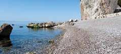
Se ci fate caso, non in tutte le coste italiane si sono forma te le lagune e non è soltanto una questione di costa alta o bassa. Per generarsi, le lagune hanno prima di tutto bisogno di (una adeguata) marea. Un metro di escursione mareale, unito alla presenza di grandi fiumi che portano materiale al mare e la spinta trasgressiva di quest’ultimo, hanno porta to negli ultimi millenni alla formazione di quel particolare territorio della Laguna di Marano e Grado, così come simi li fattori hanno portato alla formazione di altre lagune nel mondo, ad esempio la Ria Formosa nel sud del Portogallo (4 metri di escursione mareale).
In altre parti del pianeta però, anche se in presenza delle stesse condizioni al contorno, non è possibile che si generi un ambiente lagunare perché l’escursione di marea è o trop po bassa o troppo alta. Basti pensare a questo: in 6 ore nella laguna di Marano e Grado l’acqua riesce a salire dolcemente di 1 metro. In altre parti del mondo, come il celebre Mont San Michel, l’acqua sale di 15 metri nello stesso tempo! Inu
meridian. This explains why in a day, there are 2 high tides and 2 low tides, alternating every 6 hours, even if the Moon remains (more or less) in the same position relative to our planet.
Now that we have explained some of the main factors that generate the tides, we can outline what the tides “generate”!
Friuli Venezia Giulia is a fortunate region home to a very del icate, vulnerable body of water: the lagoon. If you think of it, not all the coasts of Italy are characterised by lagoons, and it is not only a question of higher or lower coast. Lagoons mainly form where there are sufficient tides to feed them with water. Tidal ranges of 1 metre, combined with rivers that carry sediment to the sea, and marine trans gression, have, over the millennia, created the suitable con ditions for the Marano and Grado Lagoon to form, just like other lagoons around the world, for example, Ria Formosa in the south of Portugal (with a 4-meter tidal range). However, in other regions of the planet, where apparently the same conditions occur, lagoons do not form because the tidal range is either too high or too low. In the Marano and Grado Lagoon, the seawater slowly rises to 1 metre in 6 hours. While in other parts of the planet, Mont-San-Michel, for example, the seawater rises up to 6 metres in the same amount of time! Clearly, the elements involved in these two cases are very different, and the force of the tidal current in the latter case destroys any possible lagoon environment; indeed, there are no shoals and sandbanks or coastal cor dons.
Tides and the Moon are closely connected to the human ac tivities associated with the sea, particularly fishing. Many ani mal species and marine plants benefit from the tides: the ebb and flow of the water carry essential nutrients from the shal

tile dire che le forze in gioco sono estremamente di verse e che la forza della corrente nel secondo caso distrug gerebbe qualsiasi ambiente lagunare come lo conosciamo noi (barene in mezzo alla laguna, cordone litoraneo …). Marea e Luna hanno strettissime relazioni con la principa le attività umana legate al mare: la pesca. Molti animali e piante marine beneficiano delle maree: il flusso e riflusso di acqua causa lo spostamento quotidiano dalle acque basse ai bassifondi non solo di materiali, ma anche di sostanze nu trienti. Specie ittiche giovani vengono spinte verso il mare profondo, mentre le uova deposte vengono portate al largo della costa.
I pescatori da sempre hanno osservato i cambiamenti det tati dalle diverse condizioni di marea e sanno bene che, ad esempio, il flusso di marea è sfruttato dai pesci predatori che pescano contro corrente. I pesci inoltre vanno in frene sia alimentare all’incirca nelle due ore a cavallo dei picchi di alta o bassa marea, ossia quando le correnti di marea sono maggiori.
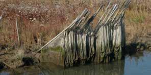
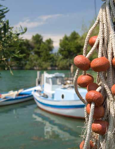
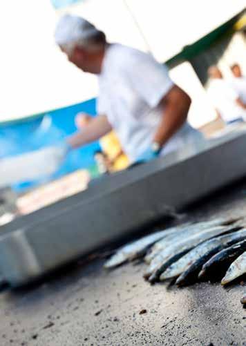
E che dire della Luna? Quando è piena illumina la notte, ren de più visibile le prede per i pesci predatori e rende anche i fondali lungo costa più visibili ai pesci grufolatori (cosi de finiti per l’abitudine di cercare il cibo nella sabbia frugando col muso), come ad esempio le mormore. E proprio a propo sito di mormore, in regione possiamo gustare la Mormora di Miramare, un pesce che quando raggiunge il golfo di Trieste, tra marzo ed ottobre, tende a stazionare nelle acque prospicienti l’omonimo promontorio. La pesca delle mor more, effettuata con apposite reti, è una tradizionale pesca esercitata dalle marinerie regionali. Questi pesci, annove
low water to the seabed alongside sediment deposits. Moreover, the young fish species are pushed towards the deep sea, while the laid eggs are carried away from the coast. Fishers have always observed the changes associated with the tides and know well that predatory fish take advantage of the water depth change and hunt prey against the tide. Furthermore, the fish go into a feeding frenzy in the two hours around the peak high and low tides, which is when the tidal current is more substantial.
And what about the Moon? A Full Moon lights up the night time and allows the predatory fish to spot their prey and the sand-dwelling fish, like mormora , or striped seabream, to easily grub around the shallow seabed for food. And speak ing of seabream, when visiting the region, we recommend trying freshly caught Mormora di Miramare. Between March and October, these fish reach the Gulf of Trieste and linger off the coast of the Miramare promontory. Seabream fish ing, usually done using special nets, is a traditional practice
riscoprire la stagionalità del pesce e le radici culturali del popolo lagunare. Partenze da Marano Lagunare e Aquileia.
rati tra i PAT (i Prodotti Agroalimentari Tradizionali) regionali, vanno consumati freschissimi. È per questo che si trovano quasi solo sul mercato ittico locale.
tutta colpa della Luna, quando si avvicina troppo alla Terra fa impazzire tutti » faceva dire Shakespeare al suo Otello e… forse aveva proprio ragione!
OTTOBRE
MOLLUSCHIMANIA 65€ domenica
SCAMPI CHI PUÒ
ORATE PRO VOBIS
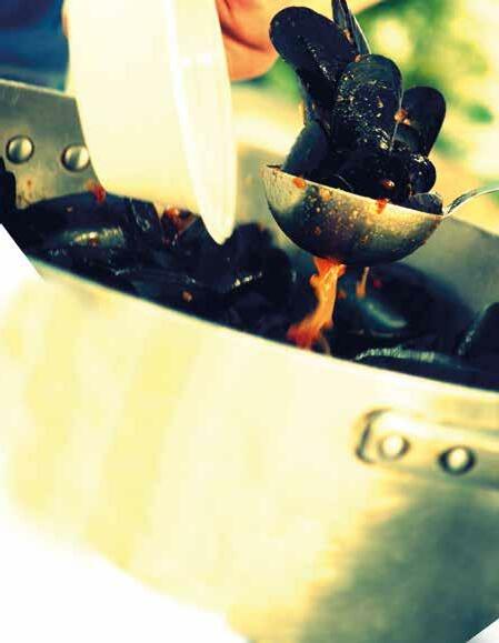
LAGUNA SELVAGGIA
CANOCCIA DAY
BISATO IN SPEO
AZZURRO
[ENG]
by the local regional fisheries. Mormora are listed as a Prodotto agroalimentare tradizionale( PAT) which is an of ficial approval for traditional Italian regional food products, which is why they are mainly found in the local fish market.
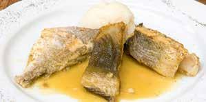
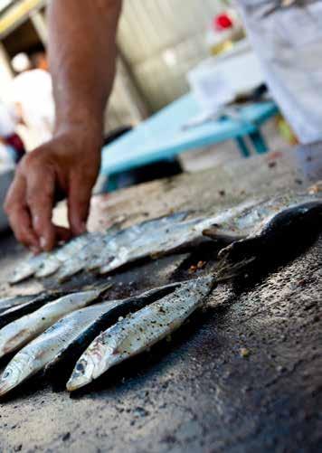
is the very error of the moon: She comes more nearer earth than she was wont, and makes men mad ”, Shakespeare has Othello say…and perhaps he was quite right!
MARANESE
CANOCCIA DAY
DAY
SUBITO
MARANESE
CHI
PARTENZE DA AQUILEIA

OpusLoci è un progetto della Camera di Commercio di Pordenone-Udine che mette in rete gli artigiani, i ristoratori, gli albergatori e i produttori locali in un percorso di scoperta che attraversa i luoghi Patrimonio UNESCO del Friuli Venezia Giulia.
A NEW WAY
TO DISCOVER THE REGION OpusLoci is a project led by the Pordenone-Udine Chamber of Commerce to create a network of artisans, local restaurateurs, hoteliers, accommodation hosts, and local farmers that o ers a journey to discover Friuli Venezia Giulia through its UNESCO World Heritage sites.
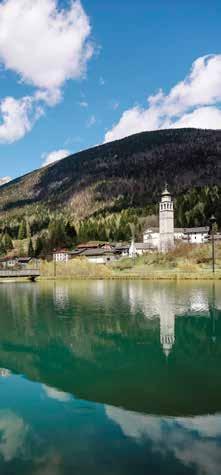
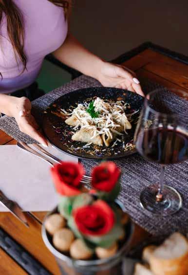
X edizione, e MIRABILIA FOOD&DRINK - VI edizione
Le imprese italiane incontrano tour operator stranieri.
17-18 OCTOBER - GENOVA BORSA INTERNAZIONALE DEL TURISMO CULTURALE
10th Edition, and MIRABILIA FOOD&DRINK - 6th Edition. Italian businesses meet foreign tour operators.
EVENTO IBRIDO
Il METAVERSO
può essere un business per la moda?
24 OCTOBER 11.00 am - UDINE
THE METAVERSE
FASHION OR REALITY?
HYBRID EVENT
THE METAVERSE can it be a fashion business?
Giovanni Da Pozzo
Presidente Confcommercio FVG e Camera di Commercio Pordenone - Udine Alessandro Tollon Presidente Federazione Moda Italia FVG – Confcommercio
Sergio Emidio Bini
Assessore regionale alle Attività Produttive e Turismo Regione Autonoma Friuli Venezia Giulia
Business matching a supporto dell’internazionalizzazione delle imprese attraverso eventi B2B digitali.
29 NOVEMBER - 1 DECEMBER INBUYER TOURISM to support internationalization through B2B digital events.
Info: CCIAA Udine tel 0432 273508 - 538
Info:
Partecipano:
Giulio Felloni
Presidente Nazionale
Federazione Moda Italia - Confcommercio Carles Ribot Cabrer Direttore creativo e produttore digitale virtual designer “Metaverse: just a buzz word?”
Michele Zanello
Head of Metaverse Event (Over The Reality) Marco Camisani Calzolari Professore di comunicazione Digitale e Divulgatore scientifico
Il Metaverso non esiste!
Le reali opportunità nella realtà aumentata. Metaverso does not exist! Real opportunities in augmented reality.
Siamo anche in diretta streaming
We will also be on live streaming
Info: CCIAA Udine tel 0432 273508 - 538
[ITA] Strassoldo è un piccolo borgo medievale alle porte di Cervignano del Friuli. Immerso in parchi secolari è un paesi no così curato da far parte del prestigioso club dei Borghi più Belli d’Italia. I suoi due antichi castelli, quello “di Sopra” e quello “di Sotto”) sono noti per due raffinate rassegne annua li dedicate all’artigianato e al vivaismo d’eccellenza che si tengono in primavera e in autunno. E proprio da venerdì 14 a domenica 16 ottobre i due manieri apriranno le proprie porte ai visitatori e ospiteranno espositori e artigiani selezionati. Ritorna infatti la manifestazione “Magici intrecci autunnali”. Antiquari, decoratori, artisti d’eccellenza e artigiani, circon dati dai nuovi addobbi che abbelliranno i manieri e i giar dini, renderanno ancora maggiore la suggestione di questi luoghi. Sarà il momento ideale per fare acquisti natalizi ori ginali e difficili da trovare altrove. Ma anche per assaggiare ricercate squisitezze che stuzzicano il palato e per scoprire piante insolite, rare, antiche e particolari proposte da ap passionati vivaisti. Gli eventi in programma per il week-end si terranno anche in caso di pioggia, così come le visite gui date che si dipaneranno fluidamente in parchi e giardini se colari e tra i siti limitrofi.
Info, prezzi e programma completo: www.castellodistrassoldo.it, Facebook e Instagram I biglietti sono in vendita online su Vivaticket.
[ENG] Listed as one of the Most Beautiful Villages of Italy, Strassoldo is a small medieval hamlet just a stone’s throw away from Cervignano del Friuli. The hamlet is surrounded by age-old trees and impeccably tended grounds. The two castles, “castello di Sopra” and “castello di Sotto”, are the venues for prestigious annual arts and crafts shows, includ ing the premium flower show and a fair held in autumn. This year the castles will be open to the public from Friday 14 to Sunday 16 October and host a selected group of arti sans and traders. The “Magica Intertwinging” autumn event is back!
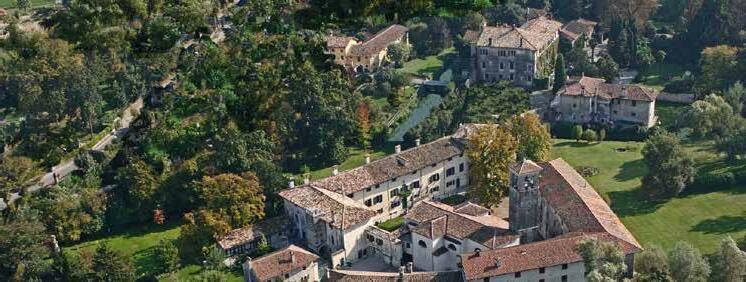
In a pristine natural setting dotted with fine decorations, the works of craftspeople, antiquarians, decorators and ex ceptional artists will enhance the allure of this location. It will be the ideal occasion for some original Christmas gift shopping, enjoy the delicious specialities that will entice and please your palate, and fill your eyes with the beauty of the unique and rare plants and flowers on display by pas sionate florists and nurseries. The event and the guided tours of the gardens, the park and the surroundings will be held regardless of the weather conditions.
Information, tickets and programme: www.castellodistrassoldo.it, Facebook e Instagram Tickets are on sale on www.vivaticket.it.
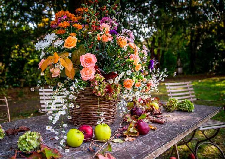

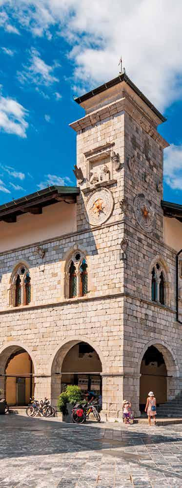
[ITA] Venzone, Vençon, Peuscheldorf o Pušja Vas: sono que sti i nomi con cui è conosciuto in Italia, in Friuli, nei paesi tedeschi e in quelli slavi.
Questo caso di “polimorfia toponimica” testimonia le fre quenti presenze, antiche come odierne, dei popoli limitro fi in questo fondamentale crocevia adagiato tra il monte San Simeone e il massiccio del monte Plauris, tra le Prealpi Carniche e le Giulie, nel punto in cui il Fella si getta nel Ta gliamento creando una via di comunicazione verso ovest, verso la Carnia, e interseca l’asse della via Julia Augusta che collega Aquileia all’Austria e che oggi ospita il tragitto della ciclovia Alpe Adria.
La sua posizione strategica è nota fin dall’epoca celtica come passaggio obbligatorio per i traffici mercantili. I Ro
[ENG] Venzone, Vençon, Peuscheldorf and Pušja Vas are the different names used in Italy, Friuli, the German-speaking countries and Slavic countries. The variety of names used is evidence of the many ancient and modern cultural influenc es of the neighbouring peoples of this principal crossroads nestled between Mount San Simeone and the Massif of Mount Plauris, and between the Carnic and Julian Pre Alps where River Fella flows into the Tagliamento. Being on the communication route to the west and Carnia, Venzone inter cepts the Via Julia Augusta connecting Aquileia to Austria, which today comprises the Alpe Adria Cycling Route. Its strategic position was well recognised as an obligatory trade passageway since Celtic times. The Romans took ad vantage of the position by establishing a statio (a stopping
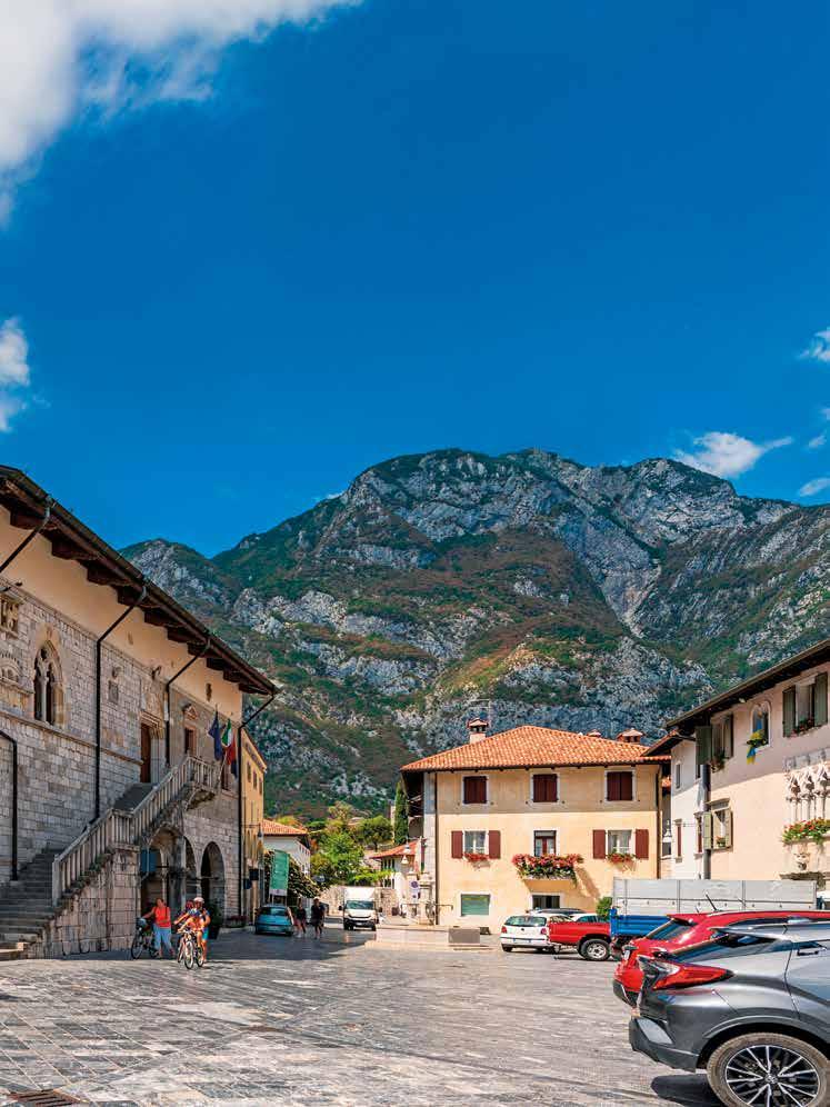
mani usufruirono di questo vantaggio ponendo in questo punto un loro statio e in epoche più recenti ebbe sede la muda , ovvero l’ufficio doganale.
Se il passato più remoto è testimoniato da alcuni ritrova menti archeologici, la prima citazione di un vero e proprio nucleo urbano certo risale al 923, in pieno dominio carolin gio, dopo le varie invasioni dei popoli barbarici. Comunque l’importante ruolo commerciale continuò con il 1077, quando entrò a far parte del Patriarcato, ponendosi a capo dei controlli degli scambi commerciali. Vi si esercita va il diritto di scaricare e far dimorare i mercanti esterni, specialmente tedeschi, che qui formarono addirittura una comunità stabile.
Nel Quattrocento la Serenissima Repubblica di Venezia su bentrò al potere nel Friuli, trovando nei venzonesi degli al leati alla lotta contro i Carraresi. Venzone, come gran parte del Friuli, subì una decadenza economica causata dall’aper tura di nuove vie commerciali preferenziali. L’intreccio tra la storia di Venzone e quella dei popoli tede schi continua quando, dopo l’occupazione di Napoleone, con il Trattato di Campoformido Venzone passò sotto la do minazione austriaca che terminò nel 1866, quando la citta dina fortificata entrò nel Regno d’Italia.
Nel 1965 viene dichiarata “monumento nazionale di grande interesse storico ed artistico”, risultando l’unico borgo forti ficato trecentesco della Regione.
Una data, però, risuona viva nei ricordi della popolazione friulana: il 6 maggio del 1976. Il terremoto rase al suolo Venzone, come molti altri centri della zona collinare e mon tuosa del Friuli. I danni e le perdite sono ancor oggi molto sentiti, ma Venzone incarna non solo la forza mirabile di rinascita, ma un vero e proprio modello di ricostruzione, su cui ancor oggi i professionisti del restauro e della ricostru zione post-sisma discutono.
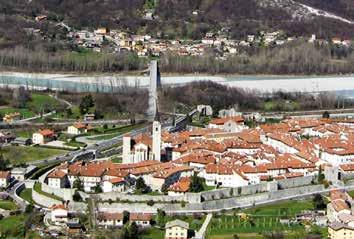
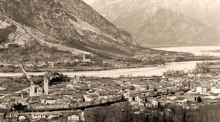
In quel frangente infatti, per la difesa del patrimonio cultu rale si aprì un vero e proprio fronte di guerra, in cui numero
place on the road for travellers resting for the night and a change of horses) which in more recent ages was the location of a muda or customs.
Even though some archaeological are evidence of the loca tion’s ancient history, the first written record of a proper urban core dates back to 923, during the Carolingian rule, following the various invasions of Barbarian peoples. The prominent commercial role of the area never faded, and indeed, in 1077, Venzone became part of the Patriarchy, ex ercising control over the important trade route. The hub al lowed the foreign merchants, especially those from the Ger manic regions, to dwell and carry on their business, and store their goods, so much so that they formed a stable community. In the 15th century, the Venetian Serenissima Republic gained power over Friuli, finding in the people of Venzone an ally against the dominating Carraresi family. However, like most of Friuli, the town suffered an economic decline as new preferential trade routes were established.
si volontari accorsero e avviarono una riflessione che andò ben oltre lo sgombero delle macerie. La maggioranza della comunità non volle solo una ricostruzione “dov’era, com’era”, ma si discusse sulla possibilità di mantenere i se gni di ciò che era stato, mantenere integra l’identità del pa ese e dei suoi abitanti anche dopo la catastrofe. Si sviluppò una febbrile opera di documentazione del patrimonio archi tettonico, di puntellazione, di cernita e catalogazione delle macerie, coinvolgendo professionisti e tecnologie elevate. Senza inutili slogan, gli interessi della comunità vennero fatti propri dal progetto di restauro. Del Duomo di Venzone, edificio a croce latina costruito in candida pietra bianca nel Trecento, furono recuperate cir ca 9.000 pietre del paramento murario, furono cataloga te e, grazie ad una accurata osservazione della funzione costruttiva, delle caratteristiche litologiche, di lavorazio ne, di usura, delle tracce di intonaco, e delle lesioni parti colari venne identificata ogni pietra con la sua posizione
The intermingling history of Venzone and the Ger manic peoples reached a peak with the Treaty of Campo For mio, which marked the conclusion of Napoleon’s campaigns in Italy; Venzone passed under Austrian rule, which ended in 1866 when the walled town was annexed to the newly formed Kingdom of Italy. In 1965, Venzone, the only 14th-century walled town in the region, was inscribed as a national heri tage site of particular interest for history and art.
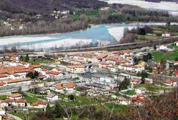
Another date is indelible in the memory of the Friulian peo ple: 6 May 1976. The devastating earthquake razed Venzone and many other towns and villages of the mountain and foot hill areas of Friuli to the ground. The damages and losses have not yet been forgotten, but Venzone has incarnated not only an admirable, heroic character but a comprehensive model of reconstruction that many key reconstruction professionals and post-earthquake experts still cite as a reference. In the aftermath of the earthquake, many volunteers swarmed to the area to help salvage the architectural and urban heritage initiating a reconstruction process that went well beyond clearing the rubble. The locals wished to recon struct their homes and neighbourhoods not only “where they were” and “the way they were” but discussed the op tion of maintaining the signs of what had been, preserv ing the identity of the towns and village, and of the people who inhabited them, even after the catastrophe. Feverish collecting documents regarding the architectural heritage, shoring up unstable and damaged structures, and selecting and cataloguing the rubble with the help of experts and cut ting-edge technology was immediately initiated. Without useless hype, the restoration project took the needs and in terests of the community into account. Nine thousand stones and architectural elements were sal vaged from the pile of rubble where the Duomo di Venzone stood. Each fragment of the 14th-century Latin cross church made of white stone was carefully inspected and cata logued according to its function in the building, the traces
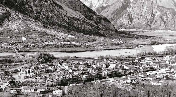
e si aprì quindi la possibilità di ricostruzione per anastilosi1. Non solo venne ricostruito il Duomo, e quindi l’identità del paese, ma è oggi possibile cogliere lo sposta mento e la deformazione causati dal terremoto guardan do la facciata stessa dell’edificio: i muri ricostruiti, grazie alle tecnologie di rilievo disponibili, sono stati ricollocati nella posizione definita dalle coordinate precedenti al si sma, creando uno scarto tra muratura rimasta in essere (ma che si è spostata a causa delle scosse) e muratura ri costruita, posizionata invece sulle coordinate preceden ti all’evento sismico. Fu un intervento senza precedenti. Venzone è uno dei più singolari esempi di restauro, operato su strutture tra le più differenti: dalle mura medievali all’an tico sentiero celtico, dalle chiesette quattrocentesche ai pa lazzi gotico-veneziani.
Ai fatti del ’76 è dedicata la mostra permanente “Tiere Mo tus. Storia di un terremoto e della sua gente” ospitata al primo piano del cinquecentesco Palazzo Orgnani-Martina, situato nel centro storico di Venzone.
Oggi una passeggiata all’interno della particolare cinta mu raria varcando la porta della cittadella porta a scoprirne la storia, i gioielli artistici e architettonici, gli usi, i volti e le voci di questo vivo borgo. Entrando dalla porta di sotto (l’arco risale alla metà del 1800) è visibile la doppia cinta muraria con fossato del XIII secolo che caratterizza il nu cleo urbano di Venzone. Eleganti e sobri palazzi in pietra ci accompagnano. Alzando lo sguardo notiamo Casa Marcuele
1. L’anastilosi è una tecnica di ricostruzione che consiste nel ricompor re nell’ordine e posizione di provenienza accertata gli elementi crollati, in genere costituiti da blocchi lapidei, elementi architettonici o, come l’etimo della parola, nell’innalzare rocchi di colonne cadute.
of remaining plaster, and particular signs of dam age. In addition, the original position of every stone was recorded to facilitate complete anastylosis1. As a result, the cathedral was not only beautifully reconstructed, restor ing the town’s identity, it evidenced the displacement and deformation caused by the earthquake. The reconstructed walls were positioned according to the pre-earthquake co ordinates, which created a gap between the remains of the original walls (displaced by the quake) and the newly recon structed ones. This type of intervention was unprecedented. Venzone is one of the most singular examples of post-earth quake reconstruction involving very different types of structures: from the medieval town walls to the ancient Celtic walkway, and still, from the 14th-century churches to the Venetian-Gothic buildings of the centre.
The events of 1976 feature in a permanent exhibition dubbed “Tiere Motus. History of an earthquake and of its people”. The exhibition is housed in the 16th-century Palazzo Or gnani-Martina, located in the historic town centre of Venzone.
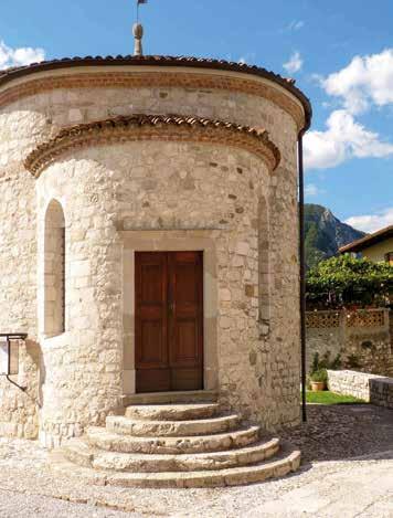
A stroll in the walled citadel through the old gate introduces you to the history, the architectural and artistic gems, and the customs and folk of this lively little town.
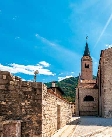
From the mid-19th-century arched Lower Gate (Porta di Sotto), you can appreciate the particular thirteenth-century double walls and moat surrounding the town. Genteel, clean stone facades line the main street. Lift your gaze and take in the important recessed mullioned windows of the 11th-cen tury Casa Marcuele, the oldest building in town.
1. Anastylosis is a reconstruction technique by which ruined buildings and monuments are restored using original materials and architectur al elements, set into the original positions.
(XI secolo), l’edificio più antico del borgo, con notevoli bifore in bassorilievo.
Procediamo sulla via principale. Di lato partono graziosi vicoli in ciottolato che ci portano al limite del nucleo ver so tratti di mura merlate, giardini privati e scorci nascosti. Raggiunta piazzetta del Duomo si è abbagliati dalla sua fac ciata romanico-gotica risalente al 1300. La pianta a croce latina è costituita da una navata unica e da un ampio tran setto con tre presbiteri absidati e da due torri. All’esterno gli elementi decorativi lapidei sono molti, a cominciare dalla lunetta del portale di ingresso principale raffigurante Cristo benedicente
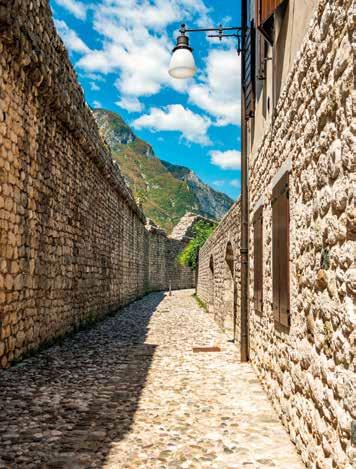
All’interno sono conservati resti di affreschi del XIV seco lo: interessanti quelli che raffigurano la consacrazione del Duomo stesso e quello dedicato a San Giorgio. Nella cappel la del Gonfalone si trova un Vesperbild in pietra del primo Quattrocento, un soggetto tipicamente nordico, una scul tura devozionale che rappresenta la Pietà, cioè la Madonna con in grembo il corpo di Gesù morto. Nella vicina cappella di San Michele costruita nel Duecen to ha sede il museo delle famose Mummie di Venzone. Nei secoli a partire dal 1647 sono stati rinvenuti dei corpi mum mificati per cause naturali, non ancora del tutto comprese ma dovute a particolari condizioni ambientali delle tombe intorno al Duomo dove si è sviluppata una particolare muffa che disidrata i tessuti inibendo la decomposizione. Proseguendo verso nord arriviamo in piazza Municipio, dove si erge il Palazzo Comunale. Ammirando la faccia ta, tra le bifore in stile gotico fiorito, è possibile cercare gli stemmi delle più antiche famiglie nobili venzonesi. Allo stesso periodo risale il vicino Palazzo Radiussi, riconoscibi le dalla bella trifora in gotico veneziano. Potrebbe succedere che proseguendo verso nord, ci si senta
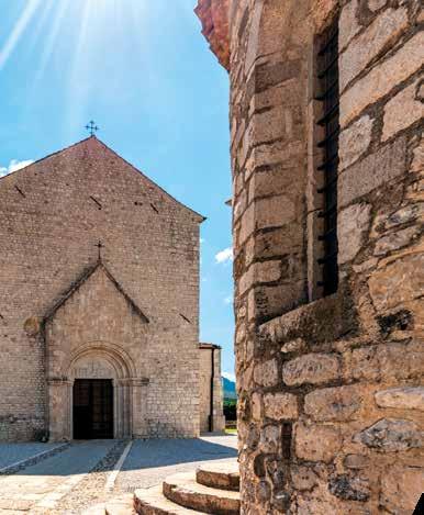
As you continue along the main street, you can get a glimpse of the pretty cobble-stoned alleys that lead from the centre to the crenellated town walls, private gardens and charming hidden corners. As you get to the little square fac ing the Duomo, what strikes the eye is its romanesque-goth ic facade dating back to the 14th century. The Latin cross cathedral consists of a single nave, a large transept with three apsed presbyteries and two towers. The outside of the church presents many decorative elements, including the lunette above the main portal depicting Christ Blessing. Inside the church are remnants of frescoes dating back to the 14th century. The fresco depicting the consecration of the Duomo and that dedicated to Saint George are particu larly interesting. In the Gonfalone chapel, there is an early 15th-century stone Vesperbild, a popular devotional subject in the German tradition representing the Pietà, the Virgin Mary cradling the dead body of Jesus.
The nearby 13th-century San Michele chapel is home to the museum of the Mummies of Venzone. In the centuries fol lowing 1647, several naturally mummified bodies were dis covered. Because of particular environmental conditions, the graves around the Duomo developed a particular mould that dehydrated the body tissues preventing them from de composing.
Walking further north, you reach Piazza Municipio, which the Town Hall dominates. Looking at the facade, just be tween the mullioned windows in floral-Gothic style, you can spot the coats of arms of the most ancient noble families of Venzone. Of the same age and style is the nearby Pala zzo Radiussi, recognisable by its striking Venetian-Gothic three-light window. On the way to the square, you might feel inebriated by the scent of lavender. Indeed, in summer, the fields around the town turn purple with Venzone Lavender,
inebriati da un profumo di lavanda. In estate i campi intorno al borgo si tingono di viola e danno vita alla Lavan da di Venzone che in paese viene trasformata e venduta. Se dalla piazza si gira verso occidente, ci si avvicina alla porta ovest costeggiando i resti della chiesa di San Giovanni Battista (XIV secolo) che testimoniano la violenza del terre moto del ’76.
Venzone offre diverse possibilità anche dal punto di vista naturalistico: dal piccolo borgo partono diversi percorsi escursionistici adatti al trekking o alla mountain-bike, per appassionati di fossili ed evoluzioni geologiche; qua e là malghe e chiesette votive diventano piacevoli punti di risto ro ricchi di tradizioni e tesori artistici da scoprire. Per gli amanti del buon cibo, degli usi e dei costumi locali, uno degli eventi da non perdere a Venzone è la festa della zucca, che si svolge a fine ottobre. Un’occasione per poter rivi vere una colorita atmosfera medievale: cavalieri, dame, musi ci, giocolieri e numerosi altri personaggi animano il paesino, offrendo al pubblico un’esperienza insolita e divertente. Oltre al recente premio come “Borgo più Bello d’Italia 2017”, Venzone vanta anche la nomina a “Villaggio ideale d’Italia 1991” da parte della Comunità Europea per l’ottima qualità della vita; questa pluripremiata località dista soli 35 chilo metri da Udine ed è raggiungibile facilmente in auto, treno e bus, ma soprattutto si presta per il turismo lento: il pas saggio della Ciclovia Alpe Adria rende questa località ideale per pernottare in arrivo da Tarvisio, per affrontare il giorno seguente il tragitto verso Udine, naturalmente dopo un’im perdibile visita tra i vicoli di meraviglio borgo fortificato del Friuli.
which is processed and sold in town. Heading west from the main square, you reach the western gate passing by the ruins of the church dedicated to St. John the Baptist (14th century), which are evidence of the devastating earth quake that shook the region in 1976.
Venzone offers plenty of options for those who love getting out into nature. Departing from the centre of town, there are various walking paths, mountain bike trails, and lots to ex plore for those keen on finding fossils and learning about geological evolution. Along the way the little mountain churches and alpine dairy farms offer an excellent excuse to stop and enjoy some traditional foods or indulge in hidden works of art and wonderful landscapes.
Foodies and people who enjoy experiencing the local tradi tions must not miss the Pumpkin Festival held in Venzone at the end of October. The festival delivers a magical medi eval atmosphere: knights and ladies parading the streets together with court musicians, jesters, and entertainers, in volving the audience in the fun.
Besides being awarded 2017’s “Borgo più Bello d’Italia” (most beautiful town in Italy), in 1991, Venzone was nominated as the “Ideal village in Italy” by the European Community for the excellent quality of life. Indeed, Venzone is just 35 kilometres from Udine, which can comfortably be reached by car, train and coach, but is also the perfect location for slow tourism. The locality intercepts the Ciclovia Alpe Adria Radweg cycling route and is a great place for travellers com ing from Tarvisio on their way to Udine to stop and rest for the night and enjoy the timeless atmosphere of this unique walled town of Friuli.
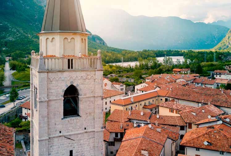
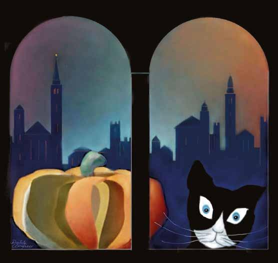


Il campione del ciclismo Ottavio Bottecchia, bersagliere nella Grande Guerra
[ITA] Ottavio Bottecchia è un mito del ciclismo. Classe 1894, nato a San Martino di Colle Umberto in Provin cia di Treviso, dopo la Prima Guerra Mondiale inizia la pro pria carriera sportiva nelle file dell’Unione Sportiva Porde nonese, per diventare in pochi anni un campione assoluto. È il primo italiano a vincere Tour de France del 1924, e ripete l’impresa da dominatore nell’anno successivo. Purtroppo, nel 1927 muore a causa di un incidente occorso mentre si allenava nelle vicinanze di Peonis, una frazione del Comu ne di Trasaghis. Con ogni verosimiglianza la motivazione del fatale sinistro è stata un malore improvviso, nonostante esista un coacervo di altre ipotesi... tanto alternative quanto poco dimostrate.
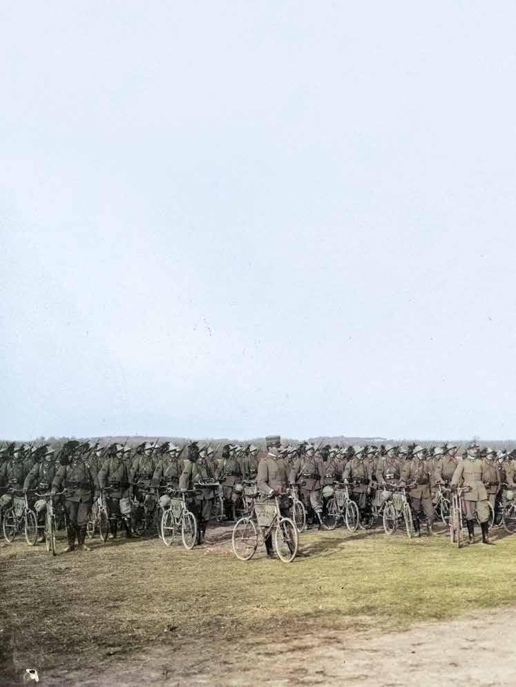
Se di Ottavio Bottecchia le glorie sportive risultano giusta mente celebri, così non si può dire per un passaggio fonda
Cycling champion Ottavio Bottecchia, a Bersagliere during the Great War.
[ENG] Ottavio Bottecchia was a legend of cycling. He was born in 1894 in San Martino del Colle Umberto in the Province of Treviso. After the First World War, he began his sporting career in the Pordenone Sports Union and became an absolute champion in just a few years. He was the first Italian to win the Tour de France in 1924 and repeated the feat the following year. Unfortunately, he died prematurely in 1927 in an accident while training near Peonis, a locality of Tasaghis. The cause of the accident was most likely a sud den illness, even though there have been speculations that are barely considered plausible and demonstrable. Ottavio Bottecchia’s sporting exploits are well known, less his involvement in a major global event so fundamental for his life and his training as a cyclist: The Great War. When he was conscripted on 5 June 1914, he was not yet twenty
mentale della sua vita e del suo percorso di forma zione ciclistica: l’esperienza militare nella Grande Guerra. Di lavoro fa il muratore e il carrettiere di legname, quando sotto la data del 5 giugno 1914 il non ancora ventenne Ot tavio riceve la chiamata per il servizio di leva. Assegnato al 6° Reggimento Bersaglieri, all’inizio del conflitto si tro va col suo reparto sulle Prealpi Giulie ed entra fra i primi a Caporetto, il 25 maggio 1915. Come bersagliere appiedato combatte sui contrafforti settentrionali del Monte Nero, nel la Conca di Plezzo, fra la Valle Aupa e Pontebba, sul Carso, sul Medio Isonzo.
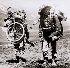
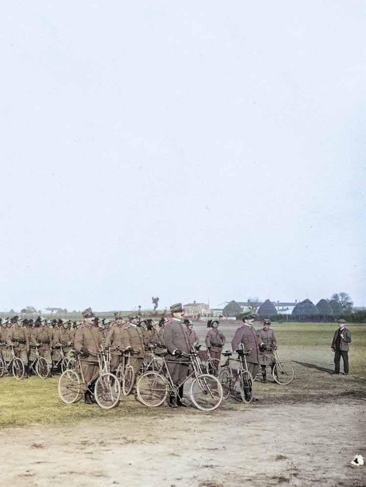
Promosso caporale, a un certo punto frequenta il corso per mitraglieri e, nel giugno 1917, destinato al VI Battaglione Bersaglieri Ciclisti. I bersaglieri ciclisti rappresentano l’élite dei fanti piumati: sono impiegati alla stregua degli arditi, nello sferrare puntuali e violente azioni che richiedono ad destramento, impeto, celerità, efficienza. Muoversi in tempi rapidi da un settore all’altro del fronte è la loro prerogativa,
and worked as a builder and woodsman. He was as signed to the 6th Bersaglieri Regiment. In the conflict’s initial phases, his division was posted on the Julian Prealps and was among the first to enter Caporetto on 25 May 1915. Serving in the high-mobility light infantry, he fought on the northern spurs of Monte Nero, in Conca di Plezzo, between Valle Aupa and Pontebba, and finally on the Carso and the mid-Isonzo region.
After being promoted to corporal, he received training as a machine gunner, and in June of 1917, was appointed to the 6th Battalion of Cycling Bersaglieri. The cycling Bersaglieri were the elite of the plumed light infantry and were em ployed to carry out shock attacks that required specialized training, force, and swift and efficient action. Moving rapid ly from one sector to another of the front was their special ity and bicycles were the most suitable means of transport. The cycling plumed warriors dominated their two wheels through intense training and sheer expertise.
la bicicletta è l’agile mezzo di trasporto che li rende speciali e ognuno di loro lo deve padroneggiare con allena mento e bravura assoluti.
Ecco allora che proprio nel militare fra queste truppe scelte, Ottavio Bottecchia dovette acquisire la capacità e l’amore per le due ruote che lo hanno reso campione! Durante la ritirata di Caporetto, fra ottobre e novembre 1917, i bersaglieri ciclisti incarnano la riserva mobile alla mano del Comando Supremo. Sono lanciati laddove serve ostaco lare l’avanzata nemica nei tempi più rapidi, con la massima energia. Ottavio e il suo battaglione partecipano alle bat taglie di retroguardia nella Valle della Venzonassa, fra Le stans e Sequals, sulla linea del Cellina, nella zona di Sacile e presso la testa di ponte di Vidor a ridosso del Piave. Durante i combattimenti di Lestans, il 4 novembre 1917, egli meritò la Medaglia di Bronzo al Valor Militare. Al ripiegamento se
It was serving in such elite troops that Ottavio Bottec chia acquired the attitude, skills and passion that would make him a cycling champion!
During the Caporetto Retreat, between October and Novem ber 1917, the cycling Bersaglieri were the mobile reserve serving the Italian High Command. They were employed to impede the enemy’s advance with sudden and overwhelm ing forceful action. Ottavio and his battalion fought in the rear line battles in Valle della Venzonassa, between Lestans and Sequals, on the Cellina line, in the area of Sacile and the Vidor bridgehead near the Piave River. On 4 November 1917, he was awarded the Bronze Medal for Military Value for the battles of Lestans. Following the retreat, several de fensive and counter-attack actions were carried out on the Piave front. In late June 1918, following the Solstice Battle, the Cycling Bersaglieri 6th Battalion was dissolved due to the many losses. The surviving men were diverted to the Arditi, the elite storm troops of the Italian Army. We don’t know for sure whether Bottecchia joined the assault units or was hospitalized for malaria or, as other sources state, for nerve-gas intoxication. However, by the end of the war, he was serving in the 9th Bersaglieri Regiment, appointed to carry out public order and reconstruction tasks. Finally, in April 1919, he was placed on permanent leave and allowed to return home.
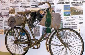
From Venzone to Sacile: the route followed by Ottavio Bottecchia during the 1917 Retreat
There is a panoramic itinerary along the route followed by Ottavio Bottecchia during the 1917 Retreat, from Venzone to Sacile. We suggest dividing the itinerary into three stretches
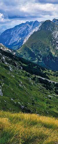
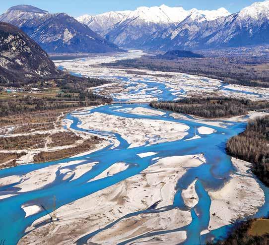
guono diverse azioni difensive e di contrattacco sul fronte del Piave. In seguito alla Battaglia del Solstizio, a fine giugno 1918 il VI Battaglione Bersaglieri Ciclisti si scioglie per le troppe perdite subite e i superstiti transitano negli ar diti. Qui non sappiamo per certo se il nostro passi ai reparti d’assalto o sia ricoverato per curare la malaria piuttosto che un’intossicazione arrecata dai gas, come vogliono alcune note biografiche. Finita la guerra, lo troviamo nei ranghi del 9° Reggimento Bersaglieri, con cui attende a compiti di ordi ne pubblico e di ricostruzione sino all’aprile del 1919, quan do finalmente riceve la licenza illimitata di smobilitazione e torna a casa.
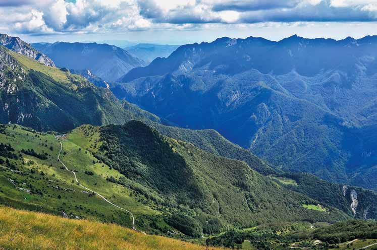
Da Venzone a Sacile: l’itinerario di Ottavio Bottecchia durante la ritirata del 1917
C’è un panoramico itinerario che ripercorre il percorso se guito da Ottavio Bottecchia durante la ritirata del 1917 e va da Venzone a Sacile.
Il percorso in bicicletta muscolare è riservato a persone alle nate: meglio scaglionarlo su tre giorni se si intende visitare i luoghi e le testimonianze storiche. L’uso di e-bike facilita l’impresa e ci sentiamo senz’altro di suggerirlo. Infine, si può spezzare l’itinerario, scegliere di farlo in automobile o in motocicletta (la strada della Val Venzonassa è aperta al traffico veicolare in concomitanza con il periodo di apertura della Malga Confin).
Partendo da Venzone, nella prima giornata possiamo risa lire la strada montana della Valle Venzonassa, lambendo un’edicola ex voto del 1915, sfiorando la località di Prabu nello che ha visto Bottecchia e i suoi commilitoni impe gnati nei combattimenti difensivi del 28 e 29 ottobre 1917,
to better appreciate the sites and historical evidence. The ride by muscle bike is suitable for cyclists with a good fitness level. Opting to use an e-bike to facilitate the ride is a good alternative. You can also, of course, choose to follow the itinerary by motorbike or car (the Val Venzonassa road is accessible by car when the Malga Confin is open).
On the first day, leaving from Venzone, you can climb up the Val Venzonassa mountain road and pass by the 1915 votive shrine in the locality Prabunello, where Bottecchia and his comrades engaged in defensive fighting on the 28th and 29th October 1917. Then head towards Malga Confin along a wind ing half-cemented and half-track road which involves an el evation gain of 1,100 metres in 13 km. Finally, for those who still have some energy left, in less than an hour’s ride, you can reach Forca Campidello Pass and the trenches overlook ing Val Resia built by the 1st Battalion of Cycling Bersaglieri.
per poi raggiungere Malga Confin lungo una tortuo sa rotabile un po’ sterrata, un po’ cementata. Il dislivel lo di 1.100 metri in salita è distribuito in 13 km. Per chi conserva qualche ulteriore energia, in meno di un’ora di escursione si raggiungono Forca Campidello e le trincee scavate dal I Battaglione Bersaglieri Ciclisti, affacciandosi sulla Val Resia.
Il secondo giorno inforchiamo le biciclette per trasferirci, via Trasaghis, fino a Lestans in Comune di Sequals. Il percorso del secondo giorno è di poco più di 40 km per circa 300 me tri di dislivello complessivo, su strada asfaltata e ciclabile oltre Pinzano. Le tappe obbligate sono molte. Si parte con il ponte di Braulins, interrotto dalle truppe italiane nella notte fra il 29 e 30 ottobre 1917; poi la strada militare di Peonis con il cippo che segnala il luogo dell’incidente mortale oc corso a Bottecchia nel 1927 e con le epigrafi risalenti al 1916 e al 1917. Giungiamo poi allo scenario della battaglia del Ta gliamento presso il ponte di Cornino, al Museo della Grande Guerra di Ragogna, che conserva una delle biciclette impie gate dai bersaglieri ciclisti nella Grande Guerra (info e orari di apertura su www.grandeguerra-ragogna.it) e a Pinzano, con il ponte e l’ossario germanico. Infine facciamo tappa alle sepolture comuni dei militari austro-ungarici e all’edicola commemorativa del cannoneggiamento su Lestans, località dove Bottecchia ha meritato la decorazione al Valor Militare. La terza tappa ci conduce da Lestans a Sacile, fiancheggian do a tratti la storica ferrovia Gemona-Sacile (a oggi in attivi tà solo parziale).
Qui incrociamo il campo di battaglia rappresentato dal pon te di Colle sul Meduna, valichiamo il Torrente Cellina grazie allo storico ponte Giulio ed entriamo a San Leonardo, teatro di

On the second day, you can ride to the Lestans lo cality in Sequals, via Trasaghis. This second stretch of the itinerary, mainly on a paved road and a cycling track from Pinzano, is a little over 40 km long with an elevation gain of 300 metres.
There are several interesting spots to stop by on the way. Starting from the bridge in Braulins, which was destroyed between the 29th and 30th October 1917 by the Italian troops; then the military road of Peonis featuring a memo rial stone to the accident that took Bottecchia’s life in 1927 and epigraphs dating back to 1916 and 1917. Following the itinerary, you can reach the battlefields of the Tagliamen to Battle at the bridge in Cornino, the Museum of the Great War in Ragogna, home to one of the bicycles employed by the Cycling Bersaglieri in the Great War (information and opening hours available on www.grandeguerra-ragogna.it), and Pinzano, its bridge and the German Ossuary. Finally, stop at the burial ground of Austro-Hungarian soldiers and the memorial to the bombardment of Lestans, the locality where Bottecchia was awarded a Medal for Military Value. The third day of the itinerary takes you from Lestans to Sac ile, along stretches of the historic railway Gemona-Sacile (only partly in activity today).
On the way, you will cross the Colle sul Meduna Bridge bat tlefield, and take the Giulio Bridge over the Cellina River into San Leonardo, the theatre of the battle of November 1917. Finally, you will pass by the American Military Base in Aviano, formerly a First World War Italian military air port and visit the Austro-Hungarian trenches on the hills behind Polcenigo (an interesting little detour). Leaving Fi aschetti behind, in Sacile, you can still notice the marks of
combattimenti nel novembre 1917. Sfiliamo quindi vici no alla base americana di Aviano che già fu aeroporto militare italiano nella Grande Guerra, visitiamo le trincee austro-un gariche sui colli adiacenti a Polcenigo (facile deviazione escursionistica) e, oltrepassato Fiaschetti, riconosciamo i se gni dei colpi di mitragliatrice sul Palazzo Ragazzoni a Sacile. Quest’ultima tappa si snoda su strade asfaltate ed è di circa 55 km, con circa 200 metri di dislivello. Il rientro a Venzone può essere completato via treno, pas sando per Pordenone, Udine e Gemona.
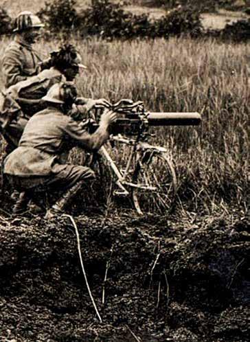
Per approfondimenti e visite guidate sui luoghi della Prima Guerra Mondiale, dott. Marco Pascoli (Ricercatore storico in dipendente, Esperto specializzato sui siti della Prima Guerra Mondiale, Guida Ambientale Escursionistica AIGAE, fondato re del Museo della Grande Guerra di Ragogna): tel e wapp +39 347 3059719, email marco_pascoli@alice.it
machine-gun fire on Palazzo Ragazzoni. The last stretch of the itinerary runs on paved roads for some 55 km, with a 200-meter elevation gain. You can get back to Venzone by catching a train passing by Pordenone, Udine and Gemona.
For further information and guided tours of the First World War sites contact Dr Marco Pascoli (Independent history researcher, specialized in First World War battlefield sites, AIGAE Professional Interpretive Nature Guide, founder of Great War Museum of Ragogna): tel and WhatsApp +39 347 3059719, email marco_pascoli@alice.
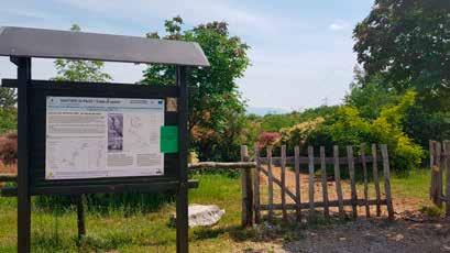
[ITA] Uno dei più grandi inconvenienti della scienza è, alle volte, l’impossibilità di scorgere a occhio nudo un fenome no. Di solito ne sperimentiamo le conseguenze ma spesso ci sfugge il vero motore. “Vediamo” la gravità solo perché una mela cade a terra e non fluttua nell’aria; cogliamo l’assun zione delle sostanze nutritive perché ci fanno crescere in altezza o in peso.
In geologia questo concetto si eleva! Siamo in grado di vede re le zolle terrestri spostarsi? O le montagne crescere? No, sono fenomeni troppo macroscopici e lenti... riusciamo solo a sentire i terremoti che vengono generati da questi movi menti.
C’è però un barlume di luce nei fenomeni geologici: i geositi! Secondo la definizione di Wimbledon un geosito è «qualsiasi località, area o territorio in cui è possibile definire un interes se geologico-geomorfologico per la conservazione». E il Grup po di lavoro che coordina l’attività di ricerca per i paesi del Nord Europa precisa che è «un’area o una località che rappre senta in modo esemplare eventi geologici, geomorfologici e regionali ». In poche parole, si tratta di aree dove si distingue chiaramente e inequivocabilmente il fenomeno geologico.
In Friuli Venezia Giulia i geositi censiti sono quasi 200 e vanno dalle Alpi al mare. In questo nostro appuntamento andremo a fare tappa tra quelli più evidenti nella zona pe demontana.
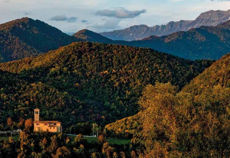
[ENG] One of the greatest setbacks of science is that some times phenomena are not visible to the eye. We usually ex perience the consequences but hardly ever understand what causes them. For example, we “see” gravity only be cause an apple falls to the ground and does not float in the air; we understand nutritional intake because we experi ence growth.
In geology, this concept becomes even more straightfor ward! Can we actually see the tectonic plates move? Can we see mountains grow? The answer is no. These phenomena are too macroscopic and slow. We can only experience the earthquakes these movements generate.
Geosites can, however, shed some light on the geology of Earth!
According to Wimbledon, a geosite is “any location, area, or territory, for which any geological and geomorpholog ical interest for conservation can be found ”. Moreover, the workgroup that coordinates the research activities for the Northern European countries clarifies that a geosite is “an area or a location that in an exemplary manner rep resents geological, geomorphological and regional events ”. Simply said, geosites are areas where you can clearly and unequivocally distinguish a geological phenomenon. There are some 200 registered geosites in Friuli Venezia Gi ulia, from the mountains to the shore. On this journey, we
Partiamo da ovest, dalla Statale 251 verso Montereale Valcellina. Superato il ponte di Ravedis è impossibile non notare l’imponente parete di roccia posta dall’altro lato del fiume Cellina. Con uno sguardo attento riusciremo a scor gere ad occhio nudo gli strati verticali di roccia sul versante del Monte Jouf. Inutile dire che questi, quando si sono for mati, erano in orizzontale! Vi state chiedendo come siano finiti in verticale? Sono state le spinte tettoniche, che hanno sollevato e piegato questi pacchetti di roccia in una piega di raggio chilometrico. Salendo con lo sguardo si vede molto bene infatti che quegli stessi strati da verticali cominciano a inclinarsi fino a “tornare” orizzontali, formando così una enorme piega di roccia. È un anticlinale, ovvero una piega con concavità rivolta verso il basso, e fa parte del geosito de nominato “Anticlinale di rampa del Monte Jouf”. Ora che il nostro occhio si è allenato a riconoscere strati di rocce posti in direzioni non usuali, andiamo alla ricerca di quelli che affiorano alla Bocca di Crosis presso Tarcento. Una bellissima e accessibile cascata del Torre è contornata da pareti rocciose con più che evidenti strati verticali, anche questi residui di un sistema geologico molto più grande.
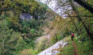

Le rocce che accolgono la cascata offrono, inoltre, un fla shback di quello che un tempo era l’ambiente in cui si sono formate: avete presente quando passeggiando sul bagna sciuga ci imbattiamo in delle pieghette-ondine sulla sab bia? Esse, in gergo, si chiamano ripple-marks e si formano proprio in zone marine e, più in generale, dove c’è acqua in movimento. Se fate attenzione alla parete… eccoli là: veri ripple-marks! Naturalmente anche questi sono posti in ver ticale invece che in orizzontale.
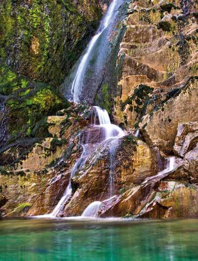
will stop and observe the most evident geological sites of the foothill area of the region.
We start our exploration from the west edge of Friuli, on the SS251 near Montereale Valcellina. Once you cross the bridge in Ravedis, it is impossible not to notice the imposing rock face on the other side of the Cellina River. Looking carefully, you can distinguish the vertical rock layers on the side of Mount Jouf. Needless to say, that when these layers formed, they were horizontal! Now you may wonder how they went from horizontal to vertical. First, the tectonic pushes caused the layers of rocks to rise and fold at a kilometric scale. Then, looking upward, you can clearly see that the vertical layers start to bend back to being horizontal, forming a fold in the rock. This is an anticline, an arch-like fold with its oldest beds at its core. It is part of the geosite known as the “Mount Jouf ramp anticline”.
Spostiamoci infine più a est, verso Stupizza. Come la maggior parte dei fiumi, anche il fiume Natisone, nella sua storia, si è dovuto spostare di qua e di là a causa dei mu tamenti negli ambienti circostanti. Alcuni fiumi sono stati deviati da una frana, o da eccessive erosioni, o ancora dal corso degli eventi glaciali, tutti fenomeni che li hanno por tati a raggiungere livelli più consoni al loro scorrimento. Il Natisone, variando più volte il suo percorso, ha lasciato die tro di sé una netta traccia di un tratto della sua valle. Da Stu pizza, guardando verso nord-ovest, si nota una bella valle, una profonda incisione a V che separa il Monte Mia (a est) dal Monte Vogu (a ovest). È la Valle di Pradolino. Cosa c’è di strano o di particolare? Il fatto che questa piccola valle sia… sospesa! Non passandoci più nessun fiume, la valle ha pre servato il profilo e la posizione che aveva quando era il letto del Natisone, che è più alta del territorio circostante. Quelli appena visti sono solo alcuni assaggi dei tanti geositi in zona pedemontana del Friuli Venezia Giulia. Ora che ve ne siete appassionati cercateli tutti! Buone geo-passeggiate a tutti!
Per godere appieno di questi e di altri suggerimenti e per escursioni accompagnati dalle guide professioniste dello Studio Naturalistico ForEst: www.studioforest.it
Now that we have become accustomed to seeing the unusual directions of the rock layers, let’s spot those at the Bocca di Crosis waterfall in Tarcento. It is a stunning water fall on the Torre River. It is surrounded by rock cliffs that feature very evident vertical layers of rock, remnants of a much larger geological system.
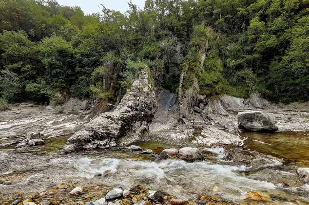
The cliffs around the waterfall are a sort of “flashback” of the environment at the time of their formation. You know when you are on the beach and see those little ripples of sand?
In geology, they are called ripple-marks and can be found in marine environments or where there is water in motion. Looking closely at the cliffs, you can see the ripple marks! But, of course, they are vertical rather than horizontal. Let’s travel further east, toward Stupizza. Like most rivers, also Natisone has altered its course to suit the changing environment surrounding its banks. Some rivers were di verted by landslides or excessive erosions, or still, by gla cial events. All these phenomena caused the river waters to adapt and find new courses for their flow. Along its changing courses, the Natisone River has left clear evidence of its for mer riverbed. From Stupizza, looking north-westward, you can notice a nice, deep, V-shaped valley between Mount Mia (to the east) and Mount Vogu (to the west). This is the Prad olino Valley. What’s strange or particular about it? The fact that this little valley is…hanging! Since there is no longer a river flowing through it, the valley maintained the same po sition and shape it had when it was the Natisone riverbed, at a more elevated position than the surroundings.
The geosites I have described in this article are just a few of the many you can explore in the foothill area of Friuli Vene zia Giulia. Now that I have piqued your curiosity, you must explore them all!
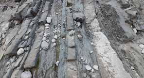
Enjoy your geo-walks!
To make the best of these getaway suggestions or book a tour with a qualified nature guide at Studio Naturalistico ForEst, visit www.studioforest.it


Al Tiare Shopping, trascorri il tuo tempo libero in assoluto relax, incontrando persone, sviluppando conoscenze e scoprendo quotidianamente le tante attività che ogni giorno riserviamo per te. Una cena con il partner, un giro di shopping con le amiche, un caffè tra amici, una giornata spensierata da trascorrere tra il museo immersivo, il cinema e un corso di cucina: al Tiare trovi tutto quello di cui hai bisogno e molto di più! Tiare Shopping: il “meeting place” del Friuli Venezia Giulia.
Il Tiare Shopping è uno dei 47 meeting place sparsi per il mondo del gruppo INGKA Centres e si compone di: oltre 130 negozi, incluso uno store IKEA • EmotionHall, il museo immersivo permanente più grande d’Italia • un cinema multisala • quattro aree tematiche dedicate alla cucina, al lavoro, ai bambini, agli animali domestici • oltre 30 servizi relax e alla persona.