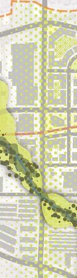
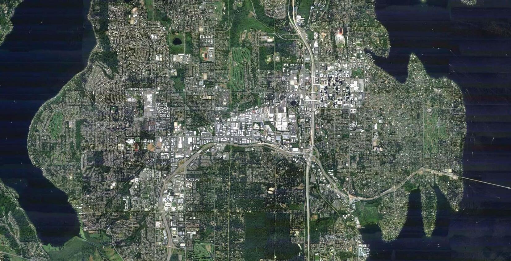
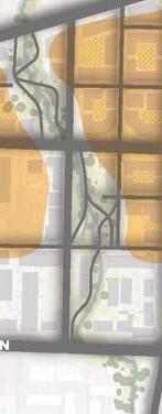
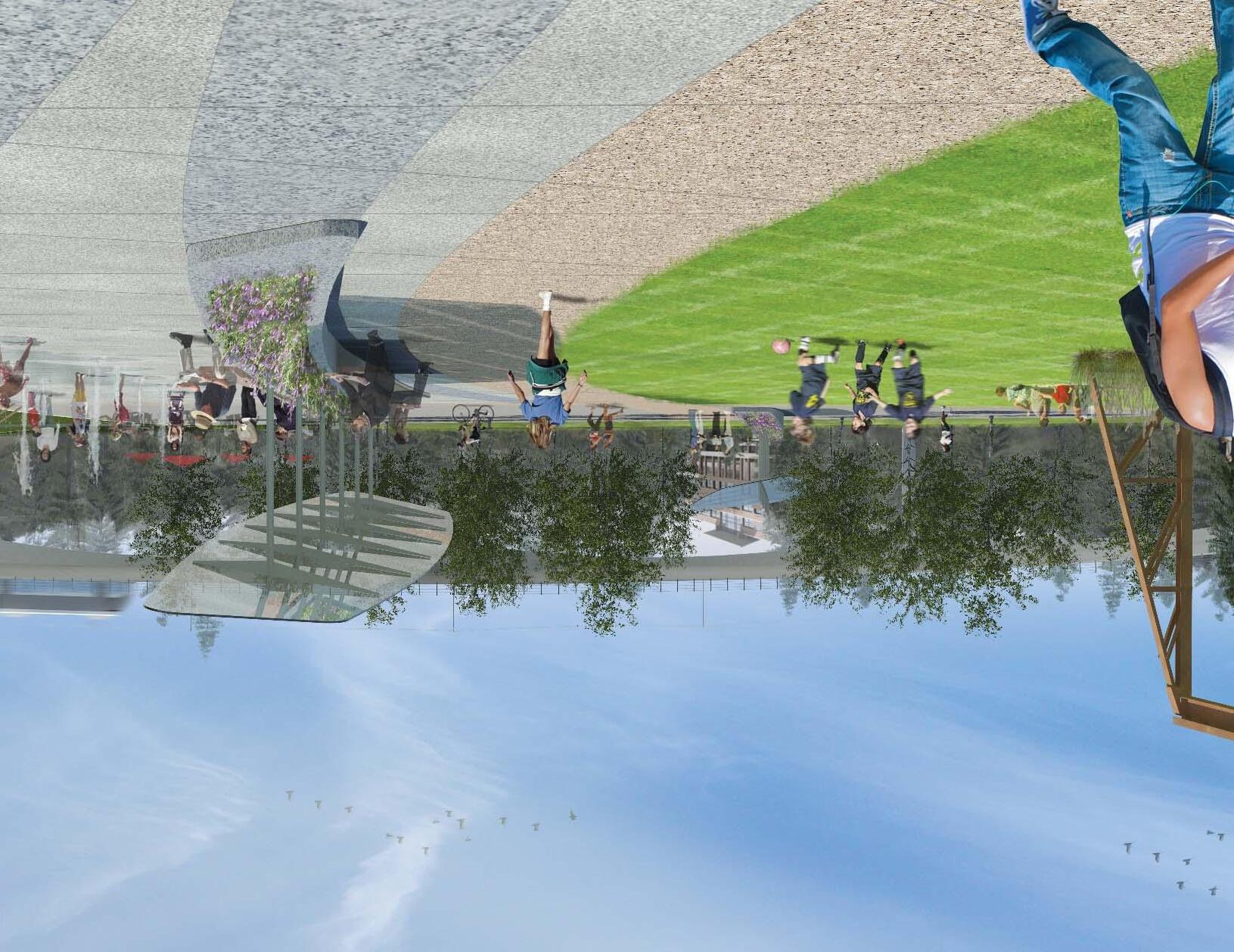
BelRed Park, Trail and Open Space System
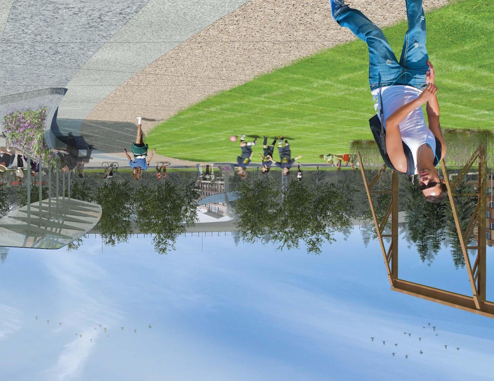
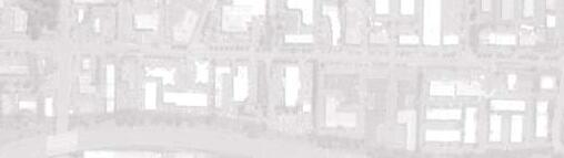
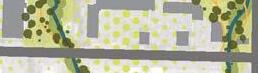
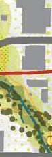
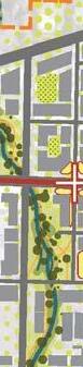
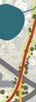
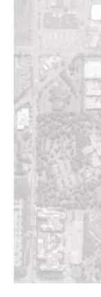
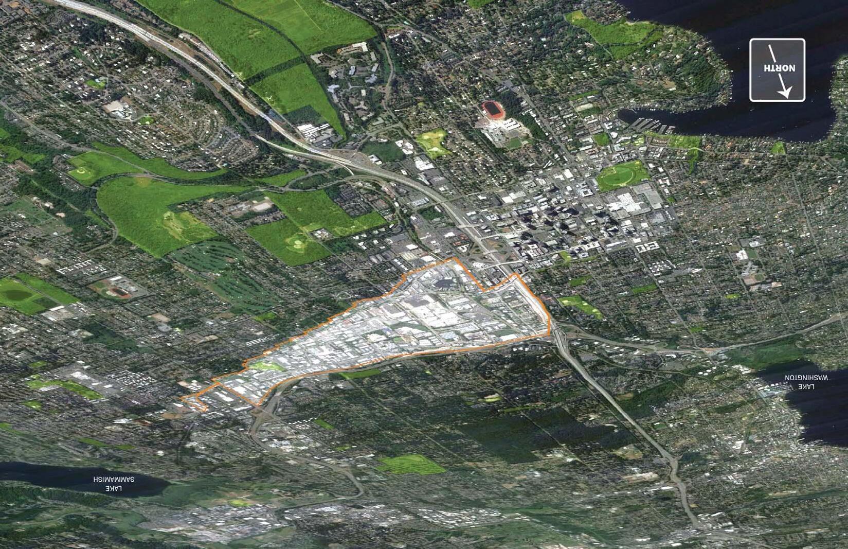
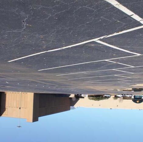
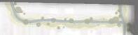
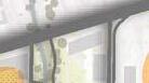
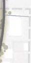
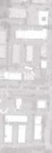
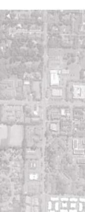
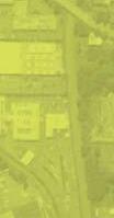
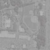
 aerial view of BelRed with Downtown Bellevue beyond
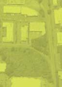

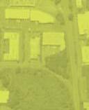
aerial view of BelRed with Downtown Bellevue beyond


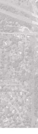
BelRed, as the name suggests, is a 900-acre area connecting the commercial and business centers of the cities of Bellevue and Redmond. The pressure for redevelopment in this area has built slowly and persistently over the years. In response, the City of Bellevue has planned extensively for a graceful transition from low-density commercial and light industry to a higher density built environment, introducing more commercial, office and residential uses.
Adopted in 2009, as part of the City’s Comprehensive Plan, the BelRed Subarea Plan establishes the vision and policy that will guide this transformation over time. A newly conceived BelRed will radically change the character of this area and provide the city as a whole with a completely new style of urban experience.
Parks, trails and open spaces are critical to achieving the vision for BelRed. Bellevue’s wooded character and extensive tree canopy make it a “City in a Park.” This concept plan outlines a strategy for introducing the ‘park’ to BelRed. The parks and trails of BelRed will be an entirely new and uniquely designed system within the city while at the same time connecting seamlessly to the city’s existing award-winning park and trail system. BelRed is intended to stand as a model of redevelopment, urban ecology and sustainability. New parks, open space and ties to nature, combined with improved civic and transportation infrastructure, will make BelRed a prime example of where people want to live and work in the 21st century.
This plan establishes a foundational program for the park and trail system by identifying critical elements for success without prescribing site-by-site design guidelines. This approach responds to the scale of the BelRed transformation, which is large in both space and time, and accepts that there are many unknown variables that will affect the location and design of individual sites.
While much is still unknown, it is important to acknowledge the extensive body of study already developed for the BelRed Subarea. This document builds upon that work by collecting the disparate findings and policies regarding parks, trails and open spaces sprinkled throughout many documents into one place. This plan maps the implementation of a successful and unique park system. While the primary focus is the design of a park system, it is seated within the context of many other factors that influence the Subarea’s development, such as transit, cultural arts, housing and commerce, as mutually dependent issues driving the vision of BelRed forward.
This plan is for you and others interested in BelRed to use as a tool to evaluate future decisions and development strategies. It is intended to inspire excitement and support for parks and open space as an integral piece of the vision for BelRed.
I invite you to read this plan. Get to know BelRed, its past, present and future. See the possibilities that are just beneath the surface of this unique corridor. Then, join with us in creating a new style of living, working and recreating designed with the same high quality of life standards for which Bellevue has long been known.
Patrick Foran, Director, Parks & Community Services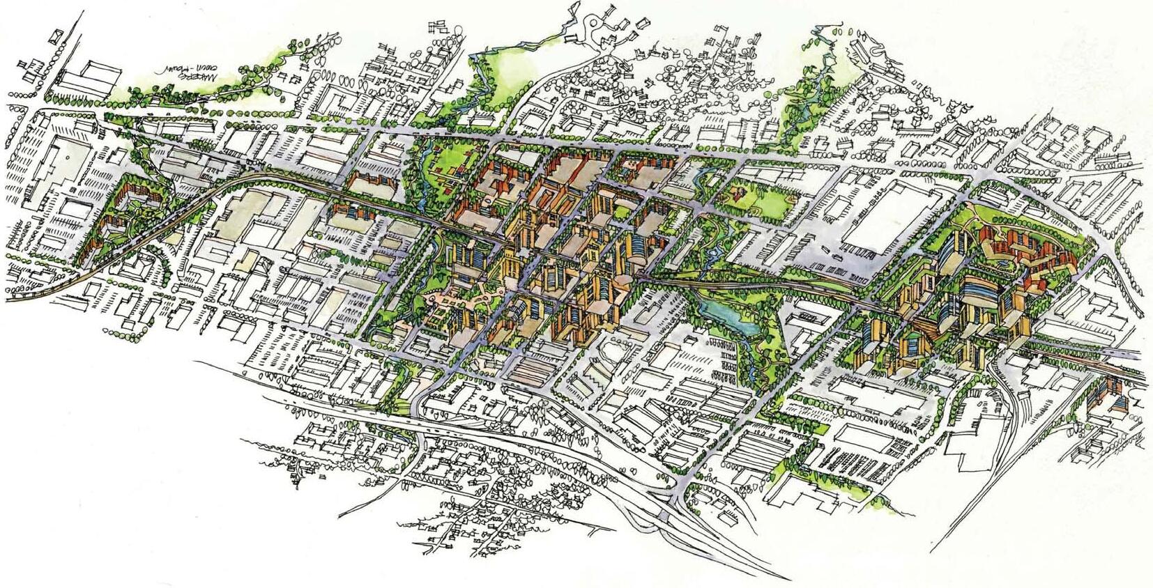
NOW, TOMORROW... EXISTING CONDITIONS PLANNING IN PLACE
FOREST: 0000’S
FUTURE: 20__...
FARM: 1870’S
FACTORY: 1970’S

The BelRed corridor has long been an evolving place. BelRed has quietly and unassumingly served the needs and interests of the rest of the city as Bellevue grew and prospered.
In planning BelRed’s future, we first understand its past:


Forest: Prior to development, the land functioned as a rich creek ecosystem and forest with associated habitat. Today, a few relics of this ecosystem are intact and can be seen in the multiple creeksheds that cross through BelRed—creeksheds that can again serve the city with restored ecological function.

Farm: In the early 1900s, during a time of settlement and land claims, the area transitioned to serve as agricultural land. It was home to numerous farms that fed the surrounding community with vegetables, fruit and meat. Today, long after the last farm left BelRed, food production of a different kind (ice cream, sandwich bread and soft drinks) remains as a current land use in the area.
Factory: As Bellevue developed further still, BelRed’s farming acres yielded to the automobile and eventually became the hub of light industry and low-density commercial service uses that has shaped it into the landscape we know today.
Today BelRed stands ready for yet another transition, one that will serve the city as a model for urban development in the 21st century. In this evolution, BelRed will take the best of its past to redefine its future.
Embodied within each of its past forms (forest, farm and factory) are a variety of specific qualities and characteristics: some good, some bad. The future BelRed should be a distillation of the best historical qualities and a proving ground for the best practices of the current time. Imagine a BelRed where…
• A diversity of building types brings both residents and workers into BelRed to create a vibrant and active neighborhood with people enjoying the public realm.
• Rooftops and streetscapes planted to reduce development impacts enhance the neighborhood aesthetic, enhance habitat and provide local food production.
• Creek corridors once in pipes are daylighted to provide wildlife habitat corridors even as they provide park space and trails to connect the community.
BelRed will be that model community, one that is firmly rooted in the present with an eye to both the past and future. This strategy generates a contemporary yet regionally specific place, a place that is uniquely Bellevue, and even more specifically, uniquely BelRed.

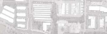
BelRed has a unique and interesting mix of characteristics, some highly visible and some well hidden. Highly visible is the BelRed many people think of, which is dominated by large-scale industries, big box retail and self-storage yards, including the warehouses, trucks and expansive pavement that come along with that land use. This is the BelRed that most people have few reasons to visit other than to drive though on their way elsewhere.
There is another side of BelRed that is known to most Bellevue and Eastside residents. This BelRed is a filled with small service and retail businesses that range from car and appliance repair shops to kitchen tile stores and veterinary clinics. The community highly values these businesses and they will remain an important feature of BelRed for years to come.
And yet another side to BelRed is perhaps the most hidden. BelRed is a haven for creative industries, including arts and crafts, music, dance and design professions. Many of these services cater to niche markets across the Puget Sound region. Also growing are indoor recreation providers. The Bellevue Family YMCA and Highland Community Center and Park have called BelRed home for decades. These institutions are supplemented by many private businesses now operating in the area providing tennis, trampolining, martial arts training, and other physical fitness services.
What is common to all these facets of BelRed is the fact that people drive to and from jobs or businesses, but tend not to stay and linger. There are few residential uses in BelRed, park amenities are greatly limited, sidewalks are infrequent and disconnected, transit opportunities are scarce, and the natural features of the area are largely neglected and degraded.
The existing conditions of BelRed provide exceptional opportunities to build upon its future. However, BelRed in its current condition is devoid of the basic attributes it will need to thrive as a neighborhood. Chief among the strategies for addressing this void is a well-designed park, trail and open space system.


This parks system plan is a product of a greater effort to define the future of BelRed. A large body of research, study and planning precedes it. This plan builds upon the depth of that material to describe the collective vision for the new park, trail and open space system.
A wealth of information is readily available to BelRed landowners and developers including land use and zoning regulations, density bonus systems, geotechnical surveys and statistics, hydraulic and hydrology studies, future transportation infrastructure plans and timeframes, light rail station area planning, regional stormwater management opportunities and urban design themes. All serve to kick-start development and real property investigation in order to quickly build an understanding of the development potential of any particular site.
More detailed information on any of these studies, reports and policy documents can be found at the city’s web page or by calling Bellevue Planning & Community Development at (425) 452-6800.
http://www.bellevuewa.gov/bel-red_intro.htm
DEFINING FEATURES
PARKS AND OPEN SPACE PLAN
HEALTHY OUTCOMES


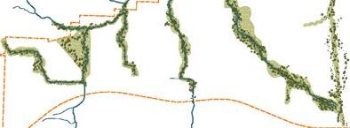
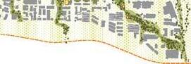
The planning for BelRed began with identification of the area’s foundational elements. These defining elements guided the park and open space system plan adopted in the BelRed Subarea Plan. Particular focus was given to topography, existing creeksheds and transportation networks both existing and proposed. These natural and built elements divide the land and create unique places within BelRed. At the same time, they allow for a connective network that weaves those unique places together into a unified whole.
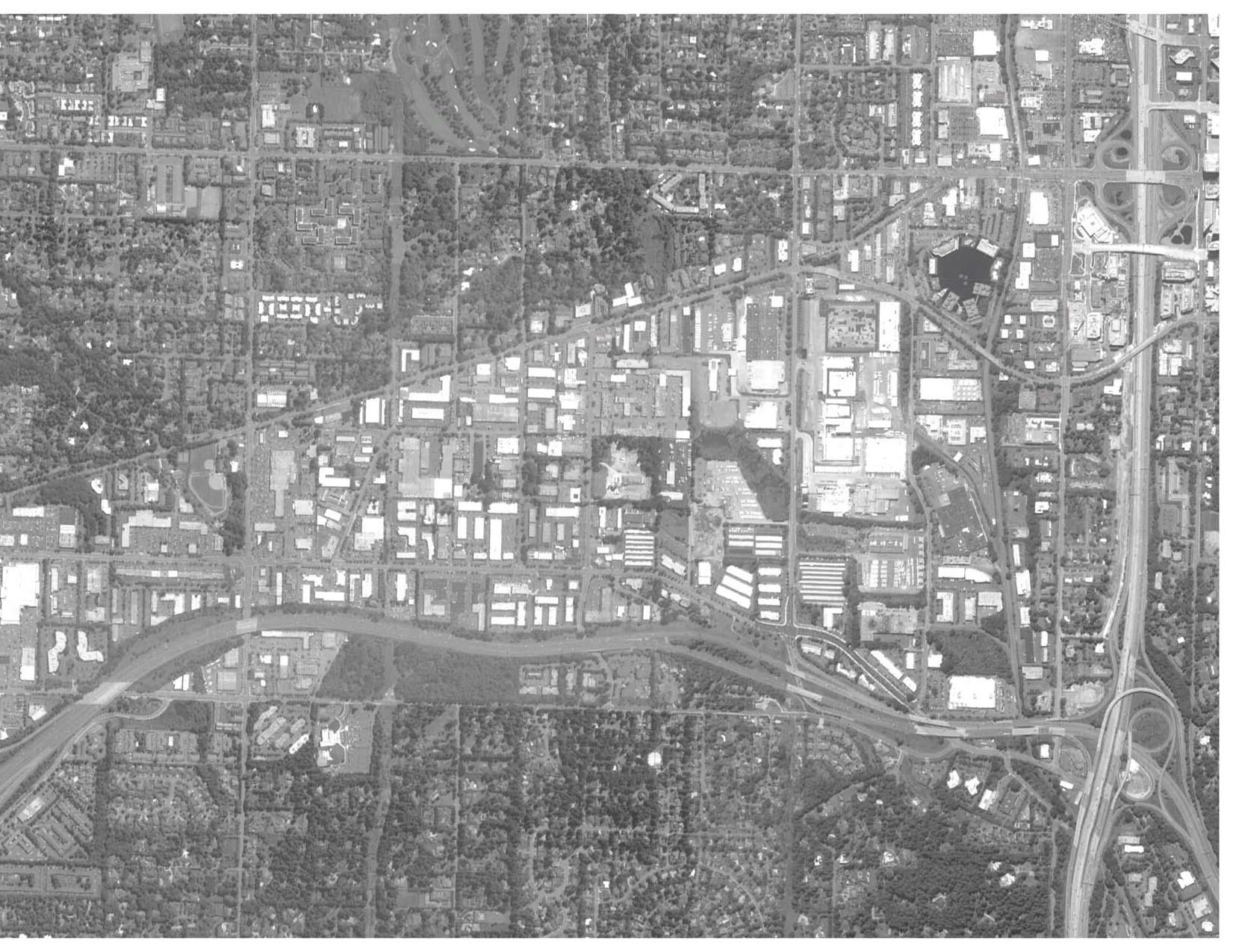
BelRed sits within a clearly defined boundary with I-405 to the east, SR-520 on the north, and BelRed Road closing off the south. Few prominent features currently exist on the interior of this boundary to help define or structure the area.
Future transportation improvements will form a new circulation spine that ties the community together:
The proposed NE 15th/16th Street and East Link light rail line (including two stations) will serve as a major east-west connection for transit as well as vehicle and bicycle traffic. Its streetscapes will also provide a pleasant pedestrian environment.
The existing Eastside Rail Corridor will be repurposed as a major regional, multi-use trail and will link BelRed to the region’s extensive and far-reaching non-motorized trail system.
One of the more extensive and interesting physical features is the stream network (West Tributary of Kelsey Creek, Goff Creek, and Valley Creek), which has great capacity to structure the development of the area. The importance of this stream network will increase with planned daylighting and restoration efforts.
Taken together, these physical site conditions create a sitespecific and coherent organization to the development and neighborhood identification of BelRed. And while the name BelRed suggests an east-west corridor that connects the metropolitan centers of downtown Bellevue and Redmond, BelRed also serves as an important north-south connection within the city of Bellevue.


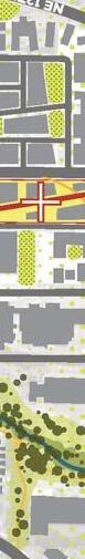


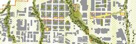
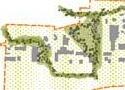
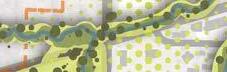
A parks and open space plan was adopted as part of the BelRed Subarea Plan (turn page for details). The plan includes several new parks at a range of scales and at strategic locations throughout the area. A trail network will make connections within and beyond BelRed. All future parks in BelRed, whether publicly or privately developed, will adhere to the general tenets of this plan.
The parks envisioned in the parks and open space plan are uniquely different from today’s Bellevue parks. The plan uses the broadest definition of the public realm and leverages both publicly and privately owned spaces to serve the future population as well as enhance the ecological function of the BelRed landscape. The public realm starts with the smallest building blocks, where residential terraces and green roofs on buildings complement streetscapes; plantings and tree canopies on every street bring landscape and ecological value to every corner of a redeveloped BelRed. This pervasive fabric of green space creates connections to larger open spaces, be they plazas or pocket parks, which are in turn linked by more streetscapes and trails to larger stretches of greenways (the creeksheds) and larger parks along the way.
By this approach, parks are part of a connected system rather than discreet islands of green. The focus shifts from the development of a large central park to developing a diverse interdependent collection of park spaces that weave through a community and offer a wide variety of recreational opportunities and environmental functions.
A fundamental element of the parks and open space plan is the extensive development of community amenities in both public and private developments. As BelRed transitions from light industry to a post-industrial mix of land uses, the blossoming of park space and programming is critical to the economic success of the area.

Parks and open space phase one investments
Combination of above projects totaling $16 million (2008 $). The intent is for the phase one improvements to focus on the western portion of the subarea.
N-1: Neighborhood Park – Along West Tributary, adjacent to NE 16th Street Parkway. Integrates major trail systems and regional stormwater detention with neighborhood park facilities. Includes 1-acre remnant transportation acquisition.
Size: 7 acres
N-2: Neighborhood Park – Along West Tributary, adjacent to Bel-Red Road. Integrates major trail and neighborhood park facilities. Includes 3-acre neighborhood park / 1-acre riparian.
Size: 4 acres
N-3/CP: Neighborhood Park/Civic Plaza – Along Goff Creek, north of NE 16th Street between 130th Avenue NE and 132nd Avenue NE. Integrates approximately 1-acre urban plaza along pedestrian oriented retail street with 3-acre neighborhood park and trail facilities along 1-acre riparian corridor.
Size: 5 acres
N-4: Neighborhood Park – Along Goff Creek, between Bel-Red Road and NE 16th Street. Integrates trail system along riparian corridor with neighborhood park facilities. Includes 3-acre neighborhood park / 1-acre riparian.
Size: 4 acres
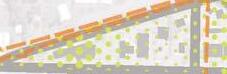
G: Gateway Park – Near the intersection of 124th Avenue NE and Bel-Red Road. Integrates mini park facilities and potential art component near major road intersection to serve as gateway to the BelRed Corridor.
Size: 1 acre
T-1: Trail Head – Located adjacent to BNSF at Lake Bellevue. Integrates a trailhead with mini park facilities at BNSF regional trail and Lake Bellevue.
Size: 1 acre
T-2: Trail Head – Located at the BNSF regional trail corridor and the NE 15th/16th Parkway. Integrates a trailhead with mini park facilities at the crossing of the two major multipurpose trails.
Size: 1 acre
M-1: Mini Park – Along Sears Creek west of 148th Avenue NE, between Bel-Red Road and NE 16th Street. Integrates trail system and riparian corridor with mini park facilities.
Size: 1 acre
M-2: Mini Park – Centrally located between Bel-Red Road, 156th Avenue NE, and NE 20th Street. Incorporates mini park facilities to serve node.
Size: 1 acre
M-3: Mini Park – Located between 120th Avenue NE and 124 Avenue NE and south of NE 15th/16th Street. Provides park facilities to serve residential and commercial mixed use development.
Size: 1 acre
C-1: Community Park – Along West Tributary adjacent to 120th Avenue NE. Incorporates trailhead and trail system along West Tributary and BNSF with community park facilities. Includes 10-acre acquisition through purchase for community park facilities and 7-acre open space dedication by adjacent owner.
Size: 17 acres
Major Indoor Recreation Facility – 150,000 square feet; Components could include sports, health and fitness facilities and major aquatic center, together with companion outdoor sports facilities. Location not shown on map.
Size: 10 acres
BelRed Environmental and Trail Project List
West Tributary Riparian Corridor & Neighborhood Park – Restore 100-foot-wide native plant riparian corridor on each side of the West Tributary from the BNSF right-of-way to Bel-Red Road with a paved ped-bike path (10 feet) on one side of the stream. Improve fish passage and rehabilitate in-stream habitat.
Length/Size: 6350 lf stream / 27-acre riparian corridor
Goff Creek Riparian Corridor – Develop a 50-foot-wide native plant and social amenity riparian corridor on each side, integrating natural drainage practices, 8-foot paved/boardwalk trail, art and place-making features as part of redevelopment north of NE 16th Street. Realign and daylight Goff Creek with additional floodplain stormwater capacity. Restore fish passage.
Length/Size: 4200 lf / 1.5 acres
Kelsey Creek Tributary Riparian Corridor – Restore a 50-foot average width native plant and social amenity riparian corridor on each side. Integrate natural drainage practices, soft surface pathway, art and place-making features in corridor. Restore fish passage.
Length/Size: 2000 lf / 12 acres
Valley Creek Riparian Corridor – Restore a 100-foot average width native plant riparian corridor on each side between Highland Community Park and State Route 520. Include paved multi-use trail/boardwalk on one side.
Length/Size: 500 lf / 3 acres
Sears Creek Riparian Corridor – Restore a 50-foot average width native plant riparian corridor along each side of Sears Creek. Rehabilitate salmon habitat, channel capacity, restore riparian functions, and provide soft surface pedestrian pathway. Daylight piped area of stream.
Length/Size: 1300 lf / 8.5 acres


The story of BelRed’s parks, trails and open spaces is about reimagining the landscape as a place that shapes a healthy community. This is measured in three key areas:
Healthy people: BelRed’s vibrant, pedestrian-centered character will foster the active and outdoor Northwest lifestyle to which so many people are attracted. Linked by a network of trails, the parks and open spaces will provide a welcome escape and an interconnecting fabric to encourage healthy activity yearround in all types of weather.
Healthy environment: A reimagined BelRed is a model for commercial and residential density, transit and pedestrianoriented connections. This new neighborhood will be in the unique position to reduce the environmental impacts of its growing population. In addition to reducing impacts of growth, the restoration of functioning creeksheds and healthy tree canopies will improve long lost habitat, provide a recreational amenity for the area’s new residents, and provide natural water and air quality functions benefiting the city as a whole.
Healthy economy: The unique lifestyle and character of BelRed, shaped largely by its parks, open spaces and trails, will be a catalyst for development and growth. This growth triggers a positive feedback loop, providing resources for additional investment in parks and public space, which then encourages added development and growth. Early public and private financial investment in parks is necessary to start the catalytic cycle that will lead to development of other public and private civic infrastructure in BelRed.
These three key areas are linked and can be mutually reinforcing entities if they are considered and designed into future BelRed projects. A well planned, cohesive park system is a critical conduit to allow the energy of each area to positively impact the others. BelRed parks will provide opportunities for active recreation, quiet reflection, environmental performance, and economic development, all of which are necessary ingredients for a diverse and healthy community.
BelRed’s growth into a hub of light industry placed little emphasis on the development of public amenities. It is the absence of green space, when compared to the rest of the city, which makes BelRed easy to locate on a map.
Subsequently, the site is devoid of the elements that enable healthy and thriving communities (i.e., parks, sidewalks, bike lanes, pedestrian-scaled blocks, and healthy open streams). The success of future growth and development is dependent upon an infusion of these elements, not the least of which is a great park system.
The first step is to break down the scale of the area. This is achieved by adding a diverse and extensive network of circulation options. At the pedestrian scale this includes sidewalks, bike lanes, and off-street trails. Transit also plays a critical role with regional light rail and neighborhood bus routes. A system of local streets introduces a human scale to the site while accommodating both vehicular and pedestrian traffic.

Resurrecting and celebrating any natural features of the site will eventually lead to a system of natural corridors that lend organization and identity to BelRed. The existing creeksheds offer a series of north-south corridors and should be restored and augmented to provide a greater richness and character to the fabric of the area.
To attract new residents and businesses, the human experience of BelRed must transition from a place to quickly get in and get out of to a place to stay and linger. Providing public and private parks, plazas and facilities will enable this transition. Building upon the organization and rich fabric created by new circulation and natural stream corridors, active nodes should infill those systems to provide appealing places to live, learn, entertain, and recreate.

Reveal and Restore is both a literal and thematic place-making strategy. In BelRed’s past, streams were buried, forests were cleared and much ecological character and function was lost. Future development must work to restore the ecological fabric of the area as a way to engage and attract new residential and commercial uses.


“How to reveal and restore?”


Contribute to the daylighting of streams on or near the site. Restore planting and tree canopy and endeavor to preserve any existing significant trees.
Reduce the extent of impervious surfaces on site.

Design using the highest industry standards for low-impact development and sustainable building construction.
Use natural drainage practices for on-site storm and surface water and/or consider participating in regional storm and surface water detention.


Land uses in BelRed currently tend to be highly segregated, physically separated and perform a single use or purpose. New development in BelRed will need to design for the opposite. This applies to both public and private investment.
For public infrastructure, each component of the park and trail system and street and utility network should perform multiple functions (e.g., pedestrian connectivity, storm and surface water capture and wildlife habitat). Maximizing the uses within existing or newly created open space enables a rich and layered pedestrian experience while accommodating a wide range of development densities.
For private development, layering uses will come in the form of mixed use structures that accommodate office and retail, residential and services, and many other combinations. Private developments must also participate cooperatively with their neighbors to create elements of public realm which when connected together create a new neighborhood.


Provide a variety of places and spaces that allow for wide ranging program activities to take place.
Diversify the types of activities that can take place on the site, including active, passive and cultural.

Ensure that the site is designed to engage the future neighborhood and connect with other nearby uses, parks and trails.

Consider atypical tenants, such as cultural arts organizations, non-profits, and educational institutions.
Plan the site to accommodate outdoor pet recreation on-site, and connect the site to larger park and trail facilities in the neighborhood. New residents (and increasing numbers of office workers) will come with pets.


The design of BelRed’s park, trail and open space system must be evaluated across a range of scales, from regional to sitespecific analyses. Designing concurrently at multiple scales generates a rich and layered place-based response that is well suited to the contingencies of a growing and dynamic BelRed.
While BelRed is currently identified as a single place, it will ultimately comprise a series of different yet complementary neighborhoods. Parks and open spaces will provide both the separation and connection that give these future communities their character.


“How to connect the dots?”


At the regional scale, design for connectivity (e.g., transit, habitat and the distribution of community amenities). Connective corridors west to east and north to south create new connections between Bridle Trails, Overlake, Downtown Bellevue and Wilburton. These serve to bring Bellevue into BelRed and weave BelRed better into the city’s existing urban fabric.
At the Subarea scale, the BelRed park system must be designed to function as one seamless and cohesive unit regardless of whether new civic spaces are publicly or privately owned and maintained. This is different from the development of Downtown Bellevue, where a multitude of beautiful, but unconnected civic spaces exist as individual islands, often hidden from the public realm. These underutilized spaces do not provide a sufficient return on investment for either the public or the developer. In some cases this can increase security and maintenance needs if the surrounding community does not use or feel a sense of stewardship of the place.
At the site scale, designs must consider each individual place. What does it look and feel like? What type of park users will live or work within a 10-minute walking distance of the site? How can the site express individuality while maintaining some common design language with neighboring parks and public spaces?


 Rainier Brewery: then/now Food Giant: then/now Ballard Garage: then/now
People are attracted to authentic spaces and places. An authentic sense of place can only be achieved if the underlying conditions of the site and character of the neighborhood are understood and incorporated into the design of new development.
BelRed has long been starved of this attention. Past clearing, grading and stream manipulation have erased or obscured much of the natural geography of the area. Despite the sterile physical setting, BelRed has cultivated a unique culture in its patchwork of small businesses and services focused on arts and culture, indoor recreation, automotive services and interior design and furnishing. These could be victims of redevelopment, erased as easily as the physical geography was erased in past development phases, if care is not taken to preserve and protect BelRed’s existing service and business culture.
“How to preserve local character?”
Avoid a “clean slate” mentality when considering the development potential and tenant mix of the site. What local businesses are operating on the site or nearby? Would they add value and attract future residents or workers to the new development?
Research, understand and design to the existing and future development of private and public infrastructure within ½ mile of the site.
Recruit existing or new local businesses as tenants before signing a national chain or franchise.
Design to accommodate unique commercial uses rather than generic storefront space.
Support local food production and urban agriculture. A common thread in BelRed’s past is food production, from large farms to industrial preparation. Keep this character trait alive by designing to allow small or larger scale gardening on the ground or rooftop. Seek out new or existing micro-breweries, creameries or bakeries for commercial tenants. Design space for a local farmer’s market.
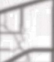
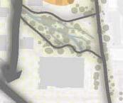
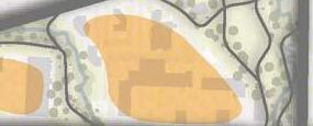
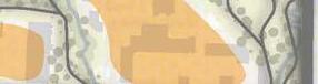
THE PARKS OF BelRed
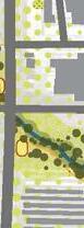
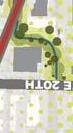
WEST TRIBUTARY PARK
EASTSIDE RAIL CORRIDOR TRAIL
SPRING DISTRICT
GOFF CREEK CIVIC PLAZA AND PARK


Today, the BelRed park and trail system exists in three states: existing, emergent and latent. Most of BelRed’s parks currently exist only in plan and policy. Over time, these latent parks (where the idea for the park is present, but in an undeveloped and unexpressed form) will begin to emerge with locations and designs. Then, with a combination of public and private investment, new parks will emerge to serve new BelRed residents and workers.
As of 2013 there are a handful of emergent park and trail facilities that are beginning to take shape. These have a unique set of conditions and stakeholders that will contribute to how they mature and realize. The challenge is bringing continuity, coordination and connection between them so that the public perceives a unifying strand of design and physical connection between the parks and facilities. Ideas and concepts for these parks follow in the remaining pages of this section.
The complete park, trail and open space system in BelRed will take decades to materialize. A key force in producing the resources necessary to construct the system is growth and development. Growth and development of these parks is difficult to forecast as it is highly dependent on changing development and economic pressures. While they may be long-term prospects, these latent parks must be kept in mind as emergent parks take shape, so that in time connections between existing and future parks, trails and facilities are anticipated and planned.
Existing Parks:
Highland Park & Community Center
BelRed Mini Park
Emergent Parks:

West Tributary Park
Eastside Rail Corridor Trail
Spring District Park
Goff Creek Park and Plaza
Latent Parks:
M1: Mini Park
M2: Mini Park
C1: Community Park
N4: Neighborhood Park


G: Gateway Park
Major Indoor Recreation Facility
Park Type
A City of Bellevue park - publicly owned, developed and maintained
Approximate Size
15 acres
Description
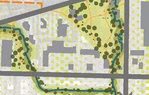
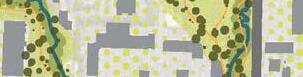
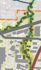
One of the BelRed park sites with the greatest potential for near-term development is West Tributary Park. The working title for this park reflects the design importance of the West Tributary of Kelsey Creek, which flows through the site and will be a dominant element in shaping the park experience. The park site consists of a collection of properties under City of Bellevue ownership. At 15 acres, the site is nearly three-quarters the size of Bellevue’s Downtown Park. In its existing state, the site is dominated by two key characteristics: to the north a stormwater facility provides emergent wetlands along the west tributary, while to the south the site consists of vacated pavement and a former industrial facility.
When developed, West Tributary Park will include a series of unique spaces and experiences that form a cohesive whole. The park will provide passive escape from the increased density of the neighborhood, yet will also offer a large area designed for gathering, activity and events where the new community can come together. The design is one that can be realized in the near term yet evolve in the long term to serve the changing conditions of BelRed.

In 2011, Bellevue Parks & Community Services commissioned a feasibility study and concept designs for the park. This report, entitled West Tributary Park Vision Study, is available to all, upon request.
West Tributary Park will be an important junction for the West Tributary Trail, which extends north to south, adjacent to the creek, and the NE 15th/16th Street multipurpose pathway that serves as the major west-to-east pedestrian and bicycle facility for BelRed. These trail connections put West Tributary Park at the center, with the large community park envisioned to the north, the Spring District parks to the west, and the Goff Creek civic plaza and parks to the east.


Park Type
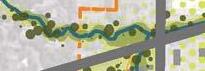
Regional Trail Corridor - with sections owned by King County/ Port of Seattle and Sound Transit
Approximate Size
1 mile through BelRed, 7 miles in Bellevue, and 42 miles total from Renton to Snohomish
Description
Because of its route and uninterrupted length, this corridor provides a backbone for the transportation and regional trail system in East King County. The corridor provides opportunities for accommodating local light rail, regional commuter rail or freight rail, a major regional trail facility as well as a corridor for utility services such as Cascade Water Alliance and Puget Sound Energy. The goal is to preserve the Eastside Rail Corridor for public dual use, including a dramatic expansion of the regional trails network and a valuable corridor for future motorized transportation uses.
Connections
This regional trail will create a fast pedestrian or bicycle connection to Downtown Bellevue and serve as an unparalleled recreational and commuter link to Kirkland, Newcastle and Renton.


 images courtesy of Wright Runstad
Park Type
A public mini-park - owned, developed and maintained by a private developer
Approximate Size
1 acre with other adjacent private plazas and open space
Description
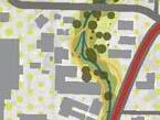
The Spring District is a 36-acre mixed-use urban neighborhood planned around a future light rail station on the west side of BelRed. The emerging urban neighborhood will have over 4 million square feet of office space with supporting retail amenities and up to 1,000 multifamily residences.
A network of open spaces will flow through the development, creating a pedestrian friendly environment and will connect all the commercial and residential buildings, as well as the light rail station to existing trail and bike networks in Bellevue. The parks and open spaces will offer quiet corners where new neighbors and office workers can meet, active water fountains for children, and open areas perfect for playing a game of Bocci ball with friends. The Spring District open spaces are an integral part of the sustainable design as they serve to capture rainwater run-off from the new buildings that surround them.
The Spring District public and private park spaces will benefit from an extraordinary number of new pedestrian, vehicle and light rail connections that will bring park users to and through these parks. Parks and plazas will be adjacent to a light rail station providing easy all-day access to the Spring District from Downtown Bellevue and Redmond’s Overlake neighborhood. The parks are also connected to the 15th/16th Street multipurpose pathway, which provides easy connections to major features of the BelRed park system including the regional Eastside Rail Corridor Trail to the west and the West Tributary Park and Trail to the east.


Park Type
A series of publicly accessible parks, plazas and restored riparian corridors - developed by a combination of public and private development
Approximate Size
9 acres (combined)
Description
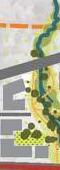
A restored Goff Creek corridor is a significant environmental enhancement and public open space component identified in the BelRed Subarea Plan. The Goff Creek corridor is the focus of the planned open space system in the 130th Avenue NE station area. In the future, a free-flowing stream and ecologically enhanced riparian corridor will characterize this currently degraded ecosystem. The restored stream corridor will accommodate strategically placed crossings for pedestrians and bicyclists and a sensitively designed multipurpose path will provide connections to the neighborhoods along the stream.
These parks and plazas are developed with strong north-south connectivity between all public features along Goff Creek. The BelRed area narrows toward the east, allowing shorter pedestrian and bicycle connections to Bel-Red Road and further east to Highland Park and Community Center as part of the major multipurpose pathway adjacent to NE 16th Street as well as the future light rail station at 130th Avenue NE.