
Heart of Hanover: Bringing New Life to B. Everett Hall Field
The
Sara Ozawa and Sarah Torresen
The
Conway
School Spring 2023
Thank you to all of the members of the Core Team for contributing their time and insights throughout this project. We are deeply grateful to the entire Hanover community for their feedback and engagement. Thank you to the Conway faculty and staff for guiding us through this process.


B. EVERETT HALL FIELD 495 HANOVER STREET, HANOVER, MA 02339 DESI g NED B y SARA O z A w A AND SARAH TORRESEN SPRIN g 2023 2/45 88 Village Hill Rd.Northampton, MA 01060 413-369-4044 www.csld.edu Not for construction. Part of a student project and not based on a legal survey. table of contents PROJECT OVERVIEW 3 EXISTING CONDITIONS ................................................................................................................................................. 4 HANOVER HISTORY ........................................................................................................................................................ 5 HANOVER TODAY ............................................................................................................................................................ 6 TOWN CENTER 7 TOWN OPEN SPACE 8 TOWN CIRCULATION 9 USE FREQUENCY ........................................................................................................................................................... 10 USE INFREQUENCY ....................................................................................................................................................... 11 ACCESS AND CIRCULATION ANALYSIS 12 VIEWS ANALYSIS 13 SUN AND SHADE ANALYSIS 14 SLOPES AND DRAINAGE ANALYSIS ......................................................................................................................... 15 WATER RESOURCE PROTECTION.............................................................................................................................. 16 VEGETATION + MAINTENANCE ANALYSIS............................................................................................................. 17 SUMMARY ANALYSIS 18 PRELIMINARY DESIGN ALTERNATIVES 19 FINAL DESIGN OVERVIEW ......................................................................................................................................... 20 FINAL DESIGN PROPOSAL .......................................................................................................................................... 21 FINAL DESIGN: SOUTHERN SIDE .............................................................................................................................. 22 DESIGN DETAIL: ROAD REALIGNMENT 23 DESIGN DETAIL: STORMWATER MANAGEMENT 24 VEGETATION RECOMMENDATION: STORMWATER MANAGEMENT 25 DESIGN DETAIL: TURF TO MEADOW ....................................................................................................................... 26 TURF CONVERSION AND MANAGEMENT .............................................................................................................. 27 MEADOW CONVERSION AND MANAGEMENT .....................................................................................................28 DESIGN DETAIL: ALL-PERSONS WALKING TRAIL 29 DESIGN DETAIL: PEDESTRIAN CONNECTIVITY 30 DESIGN DETAIL: INCLUSIVE PLAY AREAS 31 VEGETATION RECOMMENDATIONS: PLAY AREAS ............................................................................................... 32 VEGETATION RECOMMENDATIONS: GENERAL MANAGEMENT ......................................................................33 SITE AMENITIES AND INFRASTRUCTURE ............................................................................................................... 34 WAYFINDING AND INTERPRETIVE SIGNAGE 35 SPATIAL CONSIDERATIONS 36 COST ESTIMATION 37 APPENDIX: COMMUNITY RESOURCES ....................................................................................................................39 APPENDIX: SOURCES .................................................................................................................................................. 40 APPENDIX: COMMUNITY ENGAGEMENT SURVEY RESPONSES 42
HANOVER VETERANS MEMORIAL, DEDICATED ON NOVEMBER 11, 2017
PROJECT OVERVIEW
In the heart of Hanover, Massachusetts, there is a long-lived park.


B. Everett Hall Field has been in the center of town for over ninety years. During this time, individual components have been added on an ad hoc basis as time and funds allowed: a bandstand, veterans memorial, skating rink, street hockey court, softball field. The park's nearly 32 acres of land surrounding Sylvester School and Center Elementary have reflected town residents’ changing needs and desires without a long-term vision of compatible uses.
In 2022, the Town of Hanover embarked on a master planning process for B. Everett Hall Field to create a long-term, conceptual redesign with a plan for phased construction over a number of years. This project was funded by the Community Preservation Committee as the result of a 2022 Annual Town Meeting vote authorizing Community Preservation Act funds. At B. Everett Hall Field, the Town would like a space comfortable for people of all ages throughout the day, connection and cohesion between park elements and between the park and its neighborhood context, and a place for large and small community events.
Master Plan Goals
All-age, all-day comfort
Welcome people of all ages and provide basic amenities for comfort, like shade, bathrooms, benches, and water.


Connection and cohesion

Connect the sports courts, fields, and gathering spaces on site; connect B. Everett Hall Field to surrounding neighborhoods and town center.
Community gathering space
Maintain a place for beloved community events like Hanover Day, and a variety of programmed and unprogrammed events.
Low Maintenance
Improve site conditions in a way that will reduce maintenance over time.
Ecological function

Protect or improve the ecological functions of the site, including the protection of water resource areas.
“The field overall just looks tired and neglected.”
“I’ve been coming here for 15 years. My kids love it.”

B. EVERETT HALL FIELD 495 HANOVER STREET, HANOVER, MA 02339 DESI g NED B y SARA O z A w A AND SARAH TORRESEN SPRIN g 2023 3/45 88 Village Hill Rd.Northampton, MA 01060 413-369-4044 www.csld.edu Not for construction. Part of a student project and not based on a legal survey. project overview
“It’s kind of exactly what it was like 30 years ago.”
EXISTING CONDITIONS
B. Everett Hall Field has three large playing fields, bounded to the north and east by woodlands and the west by Center Elementary School. A oneway driveway for buses and school traffic enters the site on Silver Street, winds behind Center Elementary, and exits onto Route 139, a state highway under Massachusetts Department of Transportation (MassDOT) jurisdiction. A two-way entrance from Route 139 connects to a 47-spot parking lot. Sidewalks along Route 139 are very close to fast-moving traffic and unpleasant, as experienced by several Hanover residents interviewed at B. Everett Hall Field. There are no bike lanes on Silver Street or Route 139 and there are no bike racks on the site.
Two basketball courts, a tennis court turned do-it-yourself skatepark, an unused volleyball court, and a well-loved, but out-of-date, playground are clustered in the southeast corner of the site. The playground is the only public playground in town not attached to a school. Recent additions to the park include an inline skating rink dedicated to Sergeant Michael C. Chesna; a Veterans Memorial wall dedicated on November 11, 2017, by the entrance on Route 139; and a bandstand constructed by South Shore Vocational High School students in 2016. The parking lot is centrally located between these clustered features.
32 acres total
13.5
12 acres forested
6.5 acres impervious
The full-sized baseball field is one of three in town, and is currently the only field facility in town with lights. At the May 1, 2023 Town Meeting the addition of lights at Forge Pond Park was approved. The outfield of the baseball field is currently scheduled for youth soccer, football, and lacrosse practice, in addition to youth baseball.

The softball field to the north of the baseball field is technically owned by Center Elementary, although in effect all of the fields are shared and maintained by the Department of Public Works. Center Elementary also has their own playgrounds, basketball court, and covered picnic area. These facilities are open to the public when school is not in session. A wooded area north of Center Elementary contains a vernal pool. Two trails through the woods connect to neighboring properties and loop back onto the softball field.


In 2019, Town Meeting voters transferred the use of the Sylvester School building from educational use to general government use. The school was consolidated with Center Elementary School in January 2019. Read more on page 6.

B. EVERETT HALL FIELD 495 HANOVER STREET, HANOVER, MA 02339 DESI g NED B y SARA O z A w A AND SARAH TORRESEN SPRIN g 2023 4/45 88 Village Hill Rd.Northampton, MA 01060 413-369-4044 www.csld.edu Not for construction. Part of a student project and not based on a legal survey. existing conditions
View of entrance on Route 139 with Veterans Memorial wall on the left and baseball field backstop in the center.
View south across the parking lot towards the unlined asphalt formerly used for street hockey, portable toilet, and picnic tables under pines.
View across the sunny playground and basketball courts. A line of trees buffers the courts from the road.
A
B A B C C
acres turf grass
HANOVER HISTORY
Hanover, Massachusetts is located on the traditional land of the Wampanoag and Massachusett people. Descendants of original inhabitants live in Hanover and towns along the Massachusetts coast and belong to tribes known today as the Mattakeesett Tribe of the Massachusett Indian Nation, the Massachusett Tribe at Ponkapoag, and Mashpee Wompanoag Tribe. For thousands of years, indigenous people inhabited and stewarded the land on which the Town of Hanover was built.

European settlement and displacement of indigenous people in Hanover began in 1649 when William Barstow, a farmer, built a bridge along the North River. English settler colonists from Scituate, Massachusetts, flooded into the area and the Town of Hanover was incorporated in 1727.¹ The Town is looking forward to celebrating the 300th anniversary of Hanover in 2027.
The North River and native footpaths were the only means of traveling throughout the area at the time of European settlement. Settlement patterns along these thoroughfares coincided with the construction of roads. Today, major roads including state Routes 3, 53, 123 and 139 provide access through the town.


B. Everett Hall Field has historically remained open space adjacent to some of the oldest European building developments in town: the First Congregational Church and Hanover Cemetery were established in 1728. The church was used as the original town meetinghouse until the Hanover Town Hall was constructed in 1863.

B. Everett Hall, the park’s namesake, bequeathed funds "for the purpose of establishing and maintaining for the children public parks" in Hanover in March 1926.²

B. EVERETT HALL FIELD 495 HANOVER STREET, HANOVER, MA 02339 DESI g NED B y SARA O z A w A AND SARAH TORRESEN SPRIN g 2023 5/45 88 Village Hill Rd.Northampton, MA 01060 413-369-4044 www.csld.edu Not for construction. Part of a student project and not based on a legal survey. hanover history
Views of Hanover Town Center from three different angles taken in three different decades. In the 1940s a recently built Sylvester School (far right) is visible.
By the 1970s Center Elementary (top) had been added to Town Center. B. Everett Hall Field, which at this point in time included baseball fields and hard courts, is visible in the background.
Today, the roads and traffic patterns around the First Congregational Church, Sylvester School, and Town Hall have remained the same, though traffic volume has increased.
View of the North River facing the southern border of Hanover, taken circa 1900. The 12-mile North River ends in Hanover and the neighboring town of Pembroke at Ludden’s Ford. Water upstream from the Ludden’s Ford dam is the Indian Head River.
Hanover, Massachusetts was built on the traditional land of the Massachusett and Wampanoag people.
1940s 1970s 2020s
TOWN OF HANOVER
HANOVER HISTORICAL SOCIETY HANOVER HISTORICAL SOCIETY
HANOVER HISTORICAL SOCIETY NATIVE-LAND.CA
HANOVER TODAY
Primarily a suburban community, Hanover's median house value is $575,500 and the median household income was $149,048 as of the 2021 census, both of which are higher than the regional Plymouth County median house value of $470,500 and a median household income of $100,082. In the last few decades, the population has grown, from 13,164 in 2000 to 14,758 in 2022.¹ Although the town’s population has grown steadily since 1970, the pace of growth has slowed and is projected to plateau by 2030.²
Compared to the rest of Plymouth County and Massachusetts, Hanover’s population is relatively younger. Adults between 35 and 64 years old make up almost half (45%) of the population followed by children under 18 years old (28%). This age composition reflects the large proportion of young families in Hanover.³ Hanover also has a significant and growing senior population, or those age 65 or older (13%). The senior population is expected to increase 48% by 2030 if current trends persist.²
The Town is dependent on wells for residents' water supply and Title V septic systems to handle waste water. Title V rules in Massachusetts specify how to install, use, and maintain septic systems. As there is no public sewer in Hanover, the bathrooms at B. Everett Hall Field are connected to the septic system for Sylvester School. Center Elementary School has a separate septic system.
There is limited public transportation in Hanover; several MBTA regional commuter rail system stops are within two to three miles of the Hanover town line in Abington, South Weymouth, Greenbush, and Whitman. In the Hanover300 Master Plan, one of the most common concerns related to transportation articulated by Hanover residents is the lack of sidewalks.³ An incomplete sidewalk network deters walking as a form of transportation, especially on corridors with fast-moving traffic. The town also does not have any bike lanes, although several roads are wide enough to potentially accommodate a bike lane. The Master Plan identifies corridors near schools as particularly important for sidewalk and bike lane improvements, including by B. Everett Hall Field.³ Hanover developed a Complete Streets Policy in 2018 that could lead to funding for Complete Streets projects.

Community engagement process
On May 1, 2023 the Conway Team launched a survey during Town Meeting at Hanover High School. The annual Town Meeting is attended by hundreds of residents. In addition to conversations with residents at Town Meeting, the Conway Team had conversations at B. Everett Hall Field, Forge Pond Park, and the Senior Center with young parents, dog walkers, and senior citizens. Residents shared their favorite elements of the current park, memories of visiting the field as a child, and what they would change about B. Everett Hall Field.
316 Hanover residents completed the survey. Data from the survey responses is incorporated throughout this document, as community feedback was indispensable in the design process. For the full summary of survey responses, see the Appendix starting on page 42.

On June 6, 2023 the Conway Team engaged the public again at a virtual meeting. Eighteen community members joined the meeting to share their feedback on a proposed design. Feedback from this event informed the phased design approach to meet current and possibly changing needs for youth sports.


Posters providing context for the project at Town Meeting on May 1, 2023. The Conway Team spoke with town residents as they arrived at Hanover High School. Participants placed green stickers on their favorite elements at B. Everett Hall Field; most stickers were in the southeast corner of the field by the playground. Participants were also prompted to complete a survey (see the Appendix) on paper or online.
Screenshot of second community engagement meeting. A video recording of the Conway Team introduced the project and a Hanover Community TV news story about the project helped publicize a virtual community engagement meeting. The original plan to engage the public in-person at Forge Pond Park’s Food Truck Tuesday event was cancelled due to weather.
B. EVERETT HALL FIELD 495 HANOVER STREET, HANOVER, MA 02339 DESI g NED B y SARA O z A w A AND SARAH TORRESEN SPRIN g 2023 6/45 88 Village Hill Rd.Northampton, MA 01060 413-369-4044 www.csld.edu Not for construction. Part of a student project and not based on a legal survey. hanover today
Hanover is bounded by the Town of Rockland to the west, Norwell to the northeast, Towns of Pembroke and Hanson to the southwest. Twenty-three miles south of Boston, Hanover is connected to the major metropolitan area by Massachusetts Bay Transportation Authority (MBTA) commuter rail.
TO BOSTON
B. EVERETT HALL FIELD
Four major roads intersect in the historic heart of town. It is notable for its historic cemetery, Hanover's first church, and public buildings. Just east of this town center lies B. Everett Hall Field.


B. Everett Hall Field is just northeast of the Historic Town Center, which is listed on the National Register of Historic Places. This small area of town is built around a major intersection, where Silver Street, Main Street, Center Street, and Route 139 converge amid residential neighborhoods. The Town Center includes buildings on both sides of a small segment of Route 139 as well as the cemetery to the north on the opposite side of Silver Street from Center School and the site. This area is a hub for public services including the Town Hall, public offices, library, and fire station. The Hanover Historical Society is housed in the Stetson House, across Route 139 from the Sylvester School, which was built in 1927. Although the Sylvester School building is not listed on the National Register of Historic Places, it is located in the National Historic District of Hanover Center. It originally served as the high school until 1959 when the new Hanover High School was constructed. Sylvester School was then used for fifth and sixth grade classes and eventually used as an elementary school until a consolidation with Center Elementary School in 2019.
Today, the town is finding new ways to use the Sylvester School building, including as offices for the Department of Public Works and as the Hanover Food Pantry. The Center School information technology department and after-school programming through the town’s Department of Family and Community Engagement may share the space in the future.


The town has been working to increase accessibility of the building, which was built before the passing of the Americans with Disabilities Act. The main floor is now accessible via a long ramp in the back of the building, and the town intends to make the basement floor wheelchair accessible in the near future. Redeveloping the second floor of Slyvester for public uses is a costly endeavor which has not currently been funded. The future use of the Sylvester School building and the level of community access has not been determined.
B. Everett Hall Field is partially within the Central Historic District due to Sylvester School's location on the site. However, the town feels that the park feels disconnected from the rest of Town Center. Its long-standing place as the central green space in Hanover and its proximity to other historic, public amenities make it distinct from other open spaces in town.

B. EVERETT HALL FIELD 495 HANOVER STREET, HANOVER, MA 02339 DESI g NED B y SARA O z A w A AND SARAH TORRESEN SPRIN g 2023 7/45 88 Village Hill Rd.Northampton, MA 01060 413-369-4044 www.csld.edu Not for construction. Part of a student project and not based on a legal survey. town center
TOWN CENTER
Sylvester School, pictured with its front roundabout around a historic flagpole, has been converted into public offices, including the Department of Public Works and a food pantry.
Considerable measures, like the long ADA ramp in the back of the building, are being made to increase accessibility to the different parts of the building. These changes will also help the building to accomodate more public uses in the future.
The old Sylvester School playground is located between the building and the Center Elementary School play area. Some residents find this playground to be particularly out-of-date and the proximity to the active school playground to be confusing or a potential security concern.
GOOGLE EARTH
QGIS
TOWN OPEN SPACE
Hanover has approximately 1,785 acres of open spaces including wildlife preserves for water supply protection, passive recreation, sports fields, and spaces that combine these functions.¹ Creating links between the trails on different open spaces has been a priority for residents, and the Greenway trail system has become one of the town's most prized assets.² A few notable spaces in town that residents mentioned in conversation are Ludden's Ford Park, Myrtle Field, and Forge Pond Park. While Hanover has a plethora of open spaces, B. Everett Hall Field accommodates a number of recreational and community uses that cannot be relocated to other sites. Hanover Day, the annual Memorial Day parade and ceremony, and “Touch a Truck” events are all held at B. Everett Hall Field. It has one of the three Babe Ruth-sized baseball fields in town—used by the oldest age group and requiring the largest amount of space—for which there is currently demand. It also has storage capacity for bulky equipment in a 1,000-square-foot shed and is the only multipurpose field space that has lights. It currently accommodates up to four football teams at a time after sunset in the fall that require the lighting for practice.
Despite many community members expressing dissatisfaction with the quality of the grass and infrastructure at B. Everett Hall Field, there is a large subsect of the community that believes this park is critical for accommodating the demand for youth sports programming.

Myrtle Street Field, or Ceurvels Field, is located off Myrtle Street, a five-minute drive southwest of B. Everett Hall Field. In addition to a high quality basketball court, and lacrosse, soccer, and baseball fields there are trails in the wooded area behind the field that connect to the Senior Center and the larger trail network in Hanover. The playing fields are anecdotally used less because of the bugs and wet field conditions; Myrtle Field, unlike B. Everett Hall Field, was built in a low-lying, swampy area.
Hanover’s most recently redesigned park, Forge Pond Park, is linked to this system by trails through preserved forest as well as paved loops around the field complex. It is clear from community feedback gathered in this redesign process that Forge Pond Park truly set the standard for many residents for Hanover’s future parks.

Other recreational open spaces of note are the Hanover High School and Hanover Middle School fields. Between the two neighboring schools are two baseball fields, two softball fields, a football field, track, and eight tennis courts. The Melzar Hatch Wildlands Trust Trails wind between the two properties, across the Drinkwater River.
Ellis Field has four little league baseball fields and a short trail connects to the French’s Stream Trail, which connects with Forge Pond Park in Hanover and the Summer Street Conservation Lands in Rockland. Ellis Field is a five-minute drive east of B. Everett Hall Field.³
The cemetery across Silver Street from B. Everett Hall Field is the only site designated as a historical/cultural open space. Some residents mentioned cutting across the cemetery on foot or bike to access B. Everett Hall field, avoiding the Town Center intersection.

B. EVERETT HALL FIELD 495 HANOVER STREET, HANOVER, MA 02339 DESI g NED B y SARA O z A w A AND SARAH TORRESEN SPRIN g 2023 8/45 88 Village Hill Rd.Northampton, MA 01060 413-369-4044 www.csld.edu Not for construction. Part of a student project and not based on a legal survey. town open space
Forge Pond Park, redesigned in 2014, has paved paths around sports fields. Hiking trails follow the edge of the pond on wooded conservation land and connect to trails on other open spaces to create a 6.2-mile loop. The loop does not connect to B. Everett Hall Field.
Hanover Center Cemetery pictured from B. Everett Hall Field, across Silver Street. As the town's main active cemetery, the cemetery hosts over 6,700 memorials.³
TOWN CIRCULATION


The 2018 Open Space and Recreation Plan (OSRP) indicated that walking is a priority for the community, as represented by the community’s investment over the past few decades in creating trails to link and expand the town’s Greenway trail system.¹ Creating walking trails and linking trail connections remain top priorities for residents, according to the feedback gathered during this master planning process. Despite residents’ enthusiasm for walking, pedestrian circulation in Hanover is largely limited to the town’s open space trails. There are few sidewalks in town, which do not create a connected network and are sometimes perceived as unpleasant and unsafe, or are not ADAcompliant. B. Everett Hall Field is not located within the current greenway and does not connect to safe, ADA-compliant sidewalks. In 2018, the Town initiated a study that informed the adoption of a Complete Streets Policy, followed by a Neighborhood Traffic Calming, Traffic Safety, and Pedestrian Infrastructure Augmentation Policy in 2020. Although some traffic calming measures have been implemented in town since 2018, pedestrian- and cyclist-oriented improvements have been minimal.
There are 4,676 buildings within a two mile radius of B. Everett Hall Field, most of them residences. The field is a five minute drive from all senior housing. All buildings in town are within a four mile radius of B. Everett Hall Field.
79% of those who responded to a survey for this project live within two miles of B. Everett Hall Field, with 43% living within one mile. The light blue network shows the extent of 15-minute bike ride from B. Everett Hall field; the dark blue shows a 15-minute walk. Both presume the road network has connected sidewalks and bike lanes, which is not currently the case. Approximately 900 residences are within a 15-minute bike ride of the field. Yet, most visitors to the park drive.
Route 139
Route 139 is the only street with a sidewalk in the vicinity of Town Center, which means that this area is generally driven through and is not safe for walkers and bikers. The school superintendent reported that most school bus accidents happen at the major intersection of Route 139 and Silver, Main, and Center Streets.²
The town conducted a study on the Route 139 corridor, which has been a long-time safety concern for many residents, in 2020. This corridor includes the major intersection that most residents would need to pass through to access B. Everett Hall Field where Silver Street and Route 139 meet.

There are six to seven vehicle to vehicle crashes a year in the four intersections along 139 closest to the park’s main entrance. This is a particular concern because all of Center Elementary School traffic exits through that entrance onto Route 139. The average speed of vehicles on this segment of Route 139 is 42 miles per hour.³ An appeal made to MassDOT in November 2022 to lower the speed limit was denied.
The trail system in Hanover's open space does not reach the center of town due to a lack of sidewalks, though expansion of the trail system continues to extend farther into town as Hanover completes a new rail trail project.
Walking destination
Field destination
Open space
Historic Town Center
High-traffic commercial district
Senior facilities
“The Town of Hanover Complete Streets Policy will focus on developing a connected, integrated network that serves all road users. Complete Streets will be integrated into policies, planning, and design of all types of public and private projects, including new construction, reconstruction, rehabilitation, repair, and maintenance of transportation facilities on streets and redevelopment projects. As practicable, recommendations from the Complete Streets Working Group for incorporating complete streets elements will occur in projects’ beginning stages prior to design.”
2018 Complete Streets Policy ⁴
*
Main Center School entrance * * * *
Main exit and park entrance
Four entrances to the park are located off of Route 139: three for accessing the Sylvester School and one main entrance for the B. Everett Hall Field parking lot. This main entrance is also the exit for the Center School driveway which is accessed off of Silver Street.

B. EVERETT HALL FIELD 495 HANOVER STREET, HANOVER, MA 02339 DESI g NED B y SARA O z A w A AND SARAH TORRESEN SPRIN g 2023 9/45 88 Village Hill Rd.Northampton, MA 01060 413-369-4044 www.csld.edu Not for construction. Part of a student project and not based on a legal survey. town circulation
Route 139 looking west from the main park entrance toward Sylvester School and one of its driveways. The veterans memorial is visible on the right side of the frame. The sidewalk is along busy traffic. The caution light is active during school pick-up and drop-off. While there are occasional crosswalks, there are no indicators that encourage cars to yield to pedestrians or other traffic calming measures.
USE FREQUENCY

On a warm, sunny day, B. Everett Hall Field receives a steady stream of visitors. Nearly all visitors drive to the field and begin their stay in the southeast parking lot; the elements that receive the most consistent use are concentrated by the parking lot: the playground, the hockey rink, and the basketball courts.


The playground is a popular destination for children and their supervising adults and is the only playground in town not associated with a school. The playground is out-of-date and the metal play structures can get hot in the sun, but the playground remains popular. Outside of school hours, families use both the playground at B. Everett Hall Field and Center School’s play facilities. The old Sylvester School playground is lightly used, and generally considered the most outdated option.
The fields are used almost exclusively for scheduled sports practices after school hours on weekday evenings, leaving them vacant during most of the weekday. People walking their dogs occasionally criss-cross the fields, but mostly stick to walking around the perimeter along the forested edge. The northern fields and a story trail loop are used the least, and are farthest from the parking lot. The bandstand and veterans memorial area are lightly used, perhaps due to a lack of pathways or because pedestrian connection is fractured by the Center School driveway. Although the Town used to host live music events at the bandstand, in the years since it was rebuilt in its current location it has not been used for programming and only infrequently by the community. Survey respondents indicate that its proximity and relationship to the busy road create a space that is not conducive for gatherings.
Weekend morning
Students from Center Elementary school use the outfield of the baseball field for gym class. The youth sports association uses the outfield for football, soccer, lacrosse, and baseball practices as well.

Weekday morning
A father and his children play basketball on the courts next to the picnic area. The courts are also popular among teenagers. The former tennis court, now DIY skatepark, is behind the fence in the background.

Two dog walkers cross the northeast field. Sport teams sometimes use the field for practice, but its primary use today is for passive recreation.
Weekday evening

B. EVERETT HALL FIELD 495 HANOVER STREET, HANOVER, MA 02339 DESI g NED B y SARA O z A w A AND SARAH TORRESEN SPRIN g 2023 10/45 88 Village Hill Rd.Northampton, MA 01060 413-369-4044 www.csld.edu Not for construction. Part of a student project and not based on a legal survey. use frequency
Data from direct observation in Spring 2023
USE INFREQUENCY
Many residents do not currently use B. Everett Hall Field. So much open playing field space can feel like a large void for residents; the most frequent response to why residents don’t use the field more frequently was that they do not feel there is a reason to go, particularly for adults and those with kids who have outgrown the playground and are not on organized sports teams.
Additionally, people perceive a general lack of quality of facilities, saying they prefer other spaces in town to recreate. Most people specifically named Forge Pond Park as a preferred alternative. Some respondents also specifically noted that there are no walking opportunities on-site, or that because they do not have walking access to the site, it discourages them from using it more. While there are sidewalks along Route 139 in the immediate vicinity of the park, sidewalks into the surrounding neighborhoods are limited.

Hanover Day


Over half of survey respondents said they visit the park only a few times a year or less. However, one reason 89% of respondents come to the field is for Hanover Day, an annual weekend-long festival that supports arts, sciences, and humanities in the community. Because of the open fields and central location, B. Everett Hall Field is a well-suited place to host this large community gathering. Hanover Day has historically used about 3.5 acres of field space, or about half of the park’s total open field space, in addition to the parking lots and the driveway in front of Sylvester School.¹ Elements of Hanover Day include vendors, a car show, carnival rides, food trucks, a 3 v. 3 basketball tournament, an outdoor concert, and fireworks. All parking is off site at nearby lots–shuttle services are provided from lots and from the senior center.

Fireworks are set off from the northern edge of the open field space. The Hanover Fire Department confirmed that trees at B. Everett Hall Field do not pose a barrier for the fireworks; the tree line is an approved “Natural Barrier” by the State Fire Marshal’s Office.²
Rating the quality of park elements


B. EVERETT HALL FIELD 495 HANOVER STREET, HANOVER, MA 02339 DESI g NED B y SARA O z A w A AND SARAH TORRESEN SPRIN g 2023 11/45 88 Village Hill Rd.Northampton, MA 01060 413-369-4044 www.csld.edu Not for construction. Part of a student project and not based on a legal survey. use infrequency
Aerial view looking south over B. Everett Hall Field during Hanover Day. Tents are typically set up around the baseball diamond and a stage is constructed in the outfield. Parking for non-essential vehicles is offsite in the lots of the nearby town hall, library, churches, and more.
DAY COMMITTEE
HANOVER
COLLEEN SMITH
“We drive to Forge Pond Park to walk daily, if B. Everett had walking paths we would go daily.”
ACCESS AND CIRCULATION ANALYSIS
Center Elementary School’s one-way driveway connects to the entrance to B. Everett Field off of Route 139. On a school day, there is heavy vehicle circulation from Silver Street to Route 139 in the morning and afternoon for dropoff and pickup for buses and parents. This driveway is a major feature on the site, bisecting the open spaces and making the bandstand lawn feel like an island.

There are some paved or gravel paths for pedestrian circulation, but they dead end at individual elements rather than connecting elements together.
Where there aren’t existing paths, people cross over the lawn or walk on the street to get between the parking lot and playgrounds. Dog walkers walk on grass around the perimeter or the edge of the plateau for their route, though there is no marked path. An ADA Self-Evaluation in the 2018 OSRP noted that a lack of appropriately surfaced pathways was the biggest factor prohibiting accessibility at B. Everett Hall Field.¹
Unplanned paths through the wooded edges of the site connect to private properties, indicating a desire for walking access from adjacent neighbors. Town and Center School representatives are not concerned about proximity to neighbors or the public park.²

There are a few benches on site associated with the sports fields, but benches with backrests for spectators and other park visitors are fewer and further between. There are two picnic areas–one a covered pavilion at Center Elementary and one between the parking lot and basketball court beneath tall pines. The latter has several picnic tables designed to accommodate people using assisted mobility devices. There are six benches within the fenced playground. The new benches by the Veterans Memorial do not have backrests or armrests.


The Department of Public Works shut off water spigots and fountains on site due to lead in the pipes. Because of their sporadic use, lead from the pipes is able to leach into the water.³ Bringing potable water to the site would be a huge boost for all-day comfort, especially for those engaged in active recreation.
There is a bathroom building that is padlocked. In its stead, visitors can use an ADA-compliant portable toilet on the asphalt surface next to the picnic tables.
These “basic needs” amenities–benches, water, and bathrooms–were mentioned regularly by people through the engagement process as much needed upgrades.
B. EVERETT HALL FIELD 495 HANOVER STREET, HANOVER, MA 02339 DESI g NED B y SARA O z A w A AND SARAH TORRESEN SPRIN g 2023 12/45 88 Village Hill Rd.Northampton, MA 01060 413-369-4044 www.csld.edu Not for construction. Part of a student project and not based on a legal survey. access and circulation analysis
A paved path from the bandstand and Veterans Memorial area ends at the driveway and parking lot without a crosswalk.
This backless bench sits in the middle of the path used by the DPW and youth athletics to access maintenance sheds. Parents sometimes drive vehicles to this area of the field for a more comfortable and convenient sports-watching experience.
A
C
The picnic area between the parking lot and basketball court has new wheelchair-accessible picnic tables.
A B B
C
CENTER ELEMENTARY SCHOOL
CLOSED BATHROOM
COVERED PAVILLION
VIEWS ANALYSIS
The woods provide a visual buffer between the park and the adjacent residences along the northern and eastern borders of the site. A line of mature trees grow along the basketball and tennis courts. Although the canopy is high enough that Route 139 is visible from the courts, the distance from the road and the thickness of the tree trunks provide a sense of separation and protection between the courts and the traffic along Route 139.
This buffer fades on the west side of the driveway, however, exposing the area around the Veterans Memorial and bandstand to unobstructed views and noise of the state highway. Throughout the park, there are no visual buffers to the driveway and parking lots, which means cars and driving infrastructure dominate the viewshed.


It is difficult for spectators to watch sports as the benches are located at awkward angles and distances from the fields. Benches that are comfortable for visitors who need a backrest or an arm rest are few and far between. Some parents opt to stay in their cars and drive as close as possible to the field (if not on the field) to watch their children’s sports practice.
The playground is in close proximity to the basketball courts, with clear sightlines between the two elements. Several parents voiced appreciation for being able to keep an eye on older children using the courts as they chaperone a younger child on the playground. This same ease of supervision does not apply to elements like the fields, hockey rink, and bandstand which are too far or are hidden from the playground for parents to be able to keep in their line of sight.


RESIDENCES
A B C D
COURTS
ROUTE 139
VETERANS MEMORIAL
RESIDENCES

B. EVERETT HALL FIELD 495 HANOVER STREET, HANOVER, MA 02339 DESI g NED B y SARA O z A w A AND SARAH TORRESEN SPRIN g 2023 13/45 88 Village Hill Rd.Northampton, MA 01060 413-369-4044 www.csld.edu Not for construction. Part of a student project and not based on a legal survey. views analysis
A B C D
The northern edge of the fields abuts a wooded area with a story trail.
Traffic from Route 139 affects the experience in front of the bandstand and veteran's memorial.
Most benches are oriented for sports use, though many spectator benches are not angled properly for viewing sports.
Proximity of the playground to the courts was expressed by parents as helpful for keeping eyes on children of different ages.
SUN AND SHADE ANALYSIS

With the exception of the wooded areas around the northeast perimeter of the field, the site receives a significant amount of direct sunlight. The playing fields and parking lots are in full sun; the playground gets some shade from nearby trees but is mostly sunny. In community engagement conversations and surveys, parents said that the playground needs more shade.

There is a cluster of a few shade trees in front of the Sylvester School and another cluster of pine trees west of the basketball courts. This shady picnic area is a needed reprieve from the hot sun in the late spring and summer. Increasing thermal comfort on the site by adding shade would improve the all-age, all-day usability of B. Everett Hall Field.

Baseball field orientation

The angle of the sun has implications for how playing fields are sited. The full-sized baseball field at B. Everett Hall Field is used for practices after school hours from April through June. Considering the sun's location during the typical times the field is used, the field at B. Everett Hall Field is currently oriented in a way that the sun does not shine directly into the eyes of the batter or pitcher. For safety and player comfort, the field should not be changed to an orientation that results in direct sunlight affecting the batter and pitcher's vision.
“Amenities would be nice; shade structures would be ideal. Right now it's barren and exposed.”

B. EVERETT HALL FIELD 495 HANOVER STREET, HANOVER, MA 02339 DESI g NED B y SARA O z A w A AND SARAH TORRESEN SPRIN g 2023 14/45 88 Village Hill Rd.Northampton, MA 01060 413-369-4044 www.csld.edu Not for construction. Part of a student project and not based on a legal survey. sun and shade analysis
View across the current playground in the early afternoon in spring. The metal and plastic equipment becomes very hot. Five of the six benches are in full sun.
In front of the Sylvester School building a few large trees provide shade, but there are no benches or other areas for sitting. Traffic on Route 139 is very visible and audible.
PLAYGROUND
BASEBALL FIELD
SLOPES AND DRAINAGE ANALYSIS

B. Everett Hall Field and Center Elementary School were largely built on urban infill soils, where the original soils have been cut away and/ or filled. Thus, understanding the characteristics of the soils requires on-site observation. Soils in the wooded area are Hinckley loamy sand and Newfields fine sandy loam. Unlike the hydric wetland soils in the greater region, soils on the site are sandy and well-draining.¹ This means that despite the fields’ flatness, pooling during rain is limited as water infiltrates into the ground. During heavy rain events, water collects and pools on the southern edge of Center Elementary’s covered picnic area. In general, water falling on impervious surfaces, like the large parking lots and roofs, runs into storm drains. Sheet flows of water move across B. Everett Hall Field’s parking lot directly into the drain east of the Veterans Memorial. The storm drains empty into an unnamed stream south of the field which flows south through Hanover before flowing into the Indian Head River.² Capturing and filtering stormwater on site before discharging it into water bodies would help protect water quality for the town of Hanover and the watershed at large. The northwest field is about 4 feet higher than the lower fields, and all the fields are slightly elevated from the neighboring residences. There is a gentle slope down into the residential yards along the eastern edge of the site, a gentle slope down from Route 139 into the bandstand area east of Sylvester School, and a steep slope in the northwest corner of the site, from Silver Street down into the vernal pool. Interventions to limit the amount of polluted runoff entering the vernal pool buffer from Silver Street could protect the ecological function of this important water resource. In general, the flatness of the site is conducive to comfortable access for visitors walking, biking, or rolling, though the material of the surfaces can be a constraint.
Water quality

Many of Hanover’s waterways are considered by the U.S. Environmental Protection Agency (EPA) to be impaired or threatened by pathogens, heavy metals, excess nutrients, and/or other pollutants, including sections of waterways providing critical habitat. Stormwater runoff from highly developed areas is cited by the EPA as a major contributing factor to the diminished water quality of the North River.³ Since salt, sediment, automotive fluids and other pollutants from roads, as well as herbicides and fertilizers applied to lawns, are not filtered before they are carried via storm drain into waterways, stormwater runoff contributes to the warming, turbidity, and altered chemical characteristics of prime habitat for sensitive aquatic species.
All of Hanover’s wells are located in an aquifer that is highly vulnerable to contamination because it lacks hydrogeological boundaries, like clay, that prevent the infiltration of contaminants from the surface.³ Pollutants from lawn and impervious surfaces, particularly in the area of B. Everett Hall Field that drains into the Zone II aquifer recharge area, can directly impact long term drinking water quality.

98% of survey respondents from the 2018 OSRP agree that protecting Hanover’s water resources and drinking water is the most important open space preservation goal. Additionally, installing green stormwater infrastructure is listed as a priority in the document's Action Plan.³ The community's commitment to water protection and specific interest in green stormwater infrastructure suggest that measures to mitigate polluted runoff is a goal for the B. Everett Hall Field redesign that town residents will readily support.

B. EVERETT HALL FIELD 495 HANOVER STREET, HANOVER, MA 02339 DESI g NED B y SARA O z A w A AND SARAH TORRESEN SPRIN g 2023 15/45 88 Village Hill Rd.Northampton, MA 01060 413-369-4044 www.csld.edu Not for construction. Part of a student project and not based on a legal survey. slopes and drainage analysis
During a rainstorm, water flows southwest across the asphalt parking lot into a storm drain on the driveway east of the Veterans Memorial Wall.
STREAM COVERED PICNIC AREA A A' A' A
Thirteen storm drains on site and more on surrounding streets (mapped in orange) collect runoff and drain into an unamed stream and then the Indian Head River.
UNNAMED
WATER RESOURCE PROTECTION
The entirety of Hanover lies within the Narragansett Basin geology formation, a 1,000-square-mile basin formed by tectonic activity around 315 million years ago. The bedrock here includes coal, conglomerate, siltstone, sandstone and shale, which are overlain by a large number of swampy low-lying forests.¹


Hanover’s ecological assets are its abundant wetlands, streams, and water bodies. The Town is within the North and South Rivers Watershed. Water from Hanover first drains into the Indian Head River or the Third Herring Brook that run along the south and east town borders. Both of these waterways and the estuarine fresh/brackish tidal swamps that form along their edges provide habitat to rare species.² As these two rivers converge into the North River, they create a freshwater intertidal marsh that drains into the Atlantic. Freshwater tidal marshes are globally rare ecosystems; Hanover’s “Crotch” provides habitat for many rare species and is designated by the Natural Heritage and Endangered Species Program (NHESP) as a high-priority natural community.² Because Hanover has experienced extensive development, there aren’t other intact blocks of regionally significant habitat, but that means protecting natural landscapes and increasing biodiversity in small open spaces, like B. Everett Hall Field, is all the more important.


Wetlands and vernal pools


There are 24 vernal pools certified by the Department of Environmental Protection (DEP) in Hanover; one at B. Everett Hall Field.³ These seasonal ponds remain dry during late summer but fill as rain falls and groundwater rises in the fall and winter, staying wet through spring or early summer. These pools provide important habitat for amphibians and invertebrates to breed without the pressure of predation by fish.
The Hanover area is a patchwork of swampy, low-lying forested wetlands. The Wetlands Protection Act (Massachusetts General Laws (MGL) Chapter 131, Section 40) protects wetlands and the public interests they serve, including flood control, prevention of pollution and storm damage, and protection of public and private water supplies, groundwater supply, fisheries, land containing shellfish, and wildlife habitat. It regulates any work within 100 feet of a wetland resource area.⁴
The Hanover Wetlands Protection Bylaw (General Bylaw Section 6-14) protects all areas defined as wetlands, resource areas, protected districts, and any areas deeded to the care and maintenance of the Conservation Commission and its subcommittee, the Open Space Committee.⁵

The bylaw extends the protection of these areas beyond that of the Massachusetts Wetlands Protection Act. In Hanover, protections
extend to any freshwater wetlands, marshes, wet meadows, bogs, swamps, vernal ponds, springs, banks, reservoirs, lakes, ponds of any size, beaches, estuaries, lands under water bodies, and intermittent streams/brooks/creeks and buffers of 100 feet around each.⁵
Vernal pools, including the pond east of Silver Street at B. Everett Hall Field, are subject to the local laws’ protections. In addition to the scientific definitions found in regulations under the Wetlands Protection Act, the town bylaw defines vernal pools as “any confined basin or depression not occuring in existing lawns, gardens, landscaped areas, or driveways which, at least in most years, holds water for a minimum of two continuous months during the spring and/or summer, contains at least 200 cubic feet of water at some time during most years, is free from adult predatory fish populations, and provides essential breeding and rearing habitat functions for amphibian, reptile, or other vernal pool community species, regardless of whether the site has been certified by the Massachusetts Division of Fisheries and Wildlife.”⁵
All recommendations for the B. Everett Hall Field landscape plan will consider the vernal pool a sensitive area and aim to protect the critical natural habitat and abide by local and state regulations.

B. EVERETT HALL FIELD 495 HANOVER STREET, HANOVER, MA 02339 DESI g NED B y SARA O z A w A AND SARAH TORRESEN SPRIN g 2023 16/45 88 Village Hill Rd.Northampton, MA 01060 413-369-4044 www.csld.edu Not for construction. Part of a student project and not based on a legal survey. water resource protection
R e g i o na l l y S i g ni fi c a nt H a b i t a t R e i na S ni H b i a t Priorit y N a t ura l C ommunit ie s C ore H a bit a t W e t l a nd C ore H a bit a t R a re S pe c ie s C ore H a bit a t W e t l a nds a nd W a t e r B odie s R ive rs a nd S t re a ms
Indian Head River
North River
Freshwater intertidal marsh; “The Crotch”
Third Herring Brook
The large vernal pool in the northwest corner of the B. Everett Hall Field provides critical breeding habitat that is vulnerable to changes in hydrology, degraded water quality, and destruction of surrounding habitat.
HANOVER
VEGETATION + MAINTENANCE ANALYSIS
Turf grass is the dominant vegetation at B. Everett Hall Field. The extensive areas of lawn are mown weekly between April and October. Despite annual fertilizer and herbicide application on the fields in April,¹ the northeast playing field is particularly patchy, and the ground lumpy, to the extent that sports are no longer scheduled there.²
Turf grass typically does not thrive in sandy, acidic, soils without irrigation, which may in part explain the patchiness. The lumpiness is developing as tree stumps, disposed of and filled over when trees were cleared from another part of the park, decay and begin compacting unevenly.¹
To the north of the fields, there is a mixed hardwood forest of predominantly pine, oak, maple, and birch in a mid-successional state, meaning that the site has not been cleared in the past century. Significant woody debris suggests a long history of disturbance, however, and low-bush blueberry grows in pockets of sun that reach the forest floor through gaps in the canopy. Young beech trees grow in the midstory but are displaying symptoms of beech bark disease.
The story trail through the forest is compacted and clear, but the Town does not do any maintenance work in the wooded area. Non-native tree species, like black locust, Norway maple, and glossy buckthorn, are beginning to grow in the woods along the eastern edge of the property. These trees require management to limit their spread.
Between this invasive edge and the courts, three sheds are tucked into the treeline. These structures along with the restroom building are all beginning to deteriorate. The sheds are used to store maintenance and sports equipment.

In the portion of the site abutting Route 139 there are more managed areas. Trees around Sylvester School, the road edge, and the picnic area are limbed around utility lines and removed as needed. Ornamental garden beds around the flagpole in front of Sylvester School and the Veterans Memorial are tended by a part-time gardener.

An easily maintained landscape is a foundational consideration for the Town of Hanover, especially for the Department of Public Works (DPW) responsible for maintenance. The DPW crew of three is responsible for mowing the extensive lawns and fields on all town-owned property including school district property and has very limited capacity for more duties, according to the Director of Public Works.¹ The department is also at capacity for town water use, meaning that the lawn on site is currently not irrigated.¹ The Town also has mandatory water restrictions in place for summer months to ensure adequate drinking and firefighting supply. Watering new vegetation on the site may require stormwater capture or a reallocation of limited water resources for the DPW.
The lack of capacity for maintenance of the town’s open spaces has been a topic of discussion for decades, and while actions have been taken to streamline maintenance of town-owned land, capacity has not increased beyond mowing and limbing/tree removal. The Director of Public Works is aware that residents have long expressed a desire for better upkeep of trails and litter control, but that level of stewardship is currently outside the DPW’s purview and is unlikely to change unless initiatives to increase DPW’s budget and workforce are put forth and voted upon at Town Meeting.

32 acres total
13.5 acres turf grass
12 acres forested
6.5 acres impervious

B. EVERETT HALL FIELD 495 HANOVER STREET, HANOVER, MA 02339 DESI g NED B y SARA O z A w A AND SARAH TORRESEN SPRIN g 2023 17/45 88 Village Hill Rd.Northampton, MA 01060 413-369-4044 www.csld.edu Not for construction. Part of a student project and not based on a legal survey. vegetation and maintenance
The mixed hardwood forest that lines parts of the property boundary, separating the park from neighboring parcels.
The area around the Veterans Memorial and bandstand has ornamental beds tended by a parttime gardener. Young red maples line the path. This is the only area of the site with in-ground irrigation.
Two sheds along the eastern periphery store maintenance equipment and youth sports equipment.
A B C A B C
FLAGPOLE
VETERANS MEMORIAL BANDSTAND
The one-way driveway from Silver Street to Route 139 separates the sports fields, playground, and courts from the southwest area of the site, where the bandstand and Veterans Memorial are located. Realignment could improve cohesion on site and keep vehicle traffic away from people.
The southwest corner of the site is an island between driveways and the fast-moving Route 139. There is a lack of seating in this area, despite shade and recently updated structures. More seating may increase all-age and all-day use in this area.
Where the property abuts the street, there are no safe pedestrian connections to adjacent neighborhoods. Hanover residents expressed a desire for this infrastructure in past town plans and during community engagement. Right now, the parking lot is a central feature for almost every user, but by improving safe pedestrian and bike access the parking lot could become a less prominent part of the park experience.
Buffers and shade created by a dense tree edge on the southeastern, eastern, and northern edges of the property visually insulate the courts and fields.
The low-use northern fields, especially where they are patchy and uneven, could be converted to encourage different types of use given that their maintenance as fields is resource intensive. High use and high demand amenities, like the playground and hard courts, should be retained and improved.

Community vision for B. Everett Hall Field
Together with these analyses, community input informs the direction of the design proposals that follow. When asked what purpose B. Everett Hall Field should serve, most respondents envisioned a continued multi-purpose use of the site—especially a park for community gatherings with elements for children to explore and space for team sports. Current favorite elements of B. Everett Hall Field that people would like to retain are the playground, some sports fields, events like Hanover Day, and the location in town. Many respondents desire updated fields and playground, improved seating and bathroom facilities, increased walkability—meaning both options to walk on the site and to walk to the site–and new amenities, like pickleball.

B. EVERETT HALL FIELD 495 HANOVER STREET, HANOVER, MA 02339 DESI g NED B y SARA O z A w A AND SARAH TORRESEN SPRIN g 2023 18/45 88 Village Hill Rd.Northampton, MA 01060 413-369-4044 www.csld.edu Not for construction. Part of a student project and not based on a legal survey. summary analysis
SUMMARY ANALYSIS
1 1 2 2 3 3 4 4 5 5 5 FULL SUN CENTER SCHOOL PROPERTY
PRELIMINARY DESIGN ALTERNATIVES
SPORTS CENTER FIELD, FOREST, AND MEADOW COMMUNITY HUB
Sports Center keeps organized sports as a priority.
The driveway and parking lot are kept the same and an additional parking bump out near a new playground sited adjacent to Center Elementary’s playground allows for access to play spaces that does not require crossing a road. This parking location also allows people to park near the bandstand area. The bandstand lawn is visually insulated from Route 139 by new vegetation.
There is a closed-loop, paved all-persons walking trail around the fields. Curb cuts under the trail where it runs along the school parking lot feed stormwater into vegetated swales. Vegetated buffers also help provide shaded spots for seating and visual delineation between the fields.
All of the sports fields are retained and updated, with the northeast field converted to a leaner multipurpose field, allowing for most of the lumpy part of the field to return to forest. Updating the fields involves regrading, amending the soil, and reseeding with grass seed mix that may be better adapted to drought conditions and high intensity use. Continual upkeep and watering is required to keep the lawn in healthy condition. Additional courts in the southeast corner appease pickleball players and a skatepark in the southeast corner appeases Hanover’s youth.
Because the overall layout of the site has remained fairly similar to existing conditions, events like Hanover Day can remain the same.
Field, Forest, and Meadow balances the active and passive recreation functions of the park.
The school driveway extends straight down to Route 139 with singleload parking added along the length of the drive. The upper fields are converted into a meadow of native grasses, which takes initial management to establish but reduces maintenance in the long term and also provides habitat for pollinators and a visually interesting space for walking trails. A berm along Silver Street diverts polluted runoff from the road away from the vernal pool.
One baseball field with a multipurpose outfield still allows for youth sports and could be used for very large events. A new pickleball court is added in the southeast corner of the park.
The playground is moved to the former footprint of the parking lot and is expanded and updated to be an accessible, natural play area. A picnic grove northwest of the bandstand, between the parking and playground, is far enough from the road and buffered by new trees so that it is more comfortable as a community gathering space.
Finally, all of the elements are connected by all persons walking paths and enhanced crosswalks connect to residential neighborhoods northwest and southeast of the field.
Hanover Day can remain on the site, but the layout of the event space would change.
Community Hub prioritizes community gathering space for residents of all ages.
The driveway is rerouted behind Sylvester School to create a large, contiguous community gathering area that incorporates the front entrance of the Sylvester School building. Parking stays in its existing footprint by the hard courts.
Bioretention between the parking lot and the road intercepts stormwater before it reaches the storm drains and filters pollutants. The northeast field that was in poor condition is managed for forest succession, which in the long term eliminates the need for mowing.
The full sized baseball field and elevated field are updated for youth sports but both need more regular upkeep to stay in good condition. An updated playground stays in the same place, but expands into the volleyball court area.


An additional small play area is placed near an outdoor event lawn with a simple stage. A shady, wooded sitting area connects this space to the veterans memorial. A promenade in front of Sylvester can be used to accommodate food trucks and other setups for special events, including Hanover Day.
This promenade and other paths connect to safe pedestrian and biking infrastructure on Route 139 and Silver Streets that radiate outward throughout town.
B. EVERETT HALL FIELD 495 HANOVER STREET, HANOVER, MA 02339 DESI g NED B y SARA O z A w A AND SARAH TORRESEN SPRIN g 2023 19/45 88 Village Hill Rd.Northampton, MA 01060 413-369-4044 www.csld.edu Not for construction. Part of a student project and not based on a legal survey. preliminary design alternatives
UPDATED FIELDS NEW COURT S k ATEPAR k NEW COURTS BIORETENTION PROMENADE PICNIC GROVE SUCCESSIONAL FOREST CONNECTED WAL k ING LOOP STAGE AND EVENT LAWN DRIVEWAY REROUTED DRIVEWAY REROUTED CURB CUTS AND SWALES LARGER PLAYGROUND UPDATED FIELD UPDATED FIELDS BERM PLANT BUFFERS CONNECTED WAL k ING LOOP WAL k ING LOOP NEW PLAYGROUND NEW PLAYGROUND NEW PAR k ING LOT
FINAL DESIGN OVERVIEW
The final design proposal welcomes people of all ages to B. Everett Hall Field, providing basic amenities for comfort, like shade, bathrooms, benches, and water. The driveway realignment and network of paths connect park elements to each other and to surrounding neighborhoods. Open spaces for scheduled events and sports are designed for multi-functional use.

B. EVERETT HALL FIELD 495 HANOVER STREET, HANOVER, MA 02339 DESI g NED B y SARA O z A w A AND SARAH TORRESEN SPRIN g 2023 20/45 88 Village Hill Rd.Northampton, MA 01060 413-369-4044 www.csld.edu Not for construction. Part of a student project and not based on a legal survey. final design overview
FINAL DESIGN PROPOSAL
Driveway realignment
The driveway is extended past Sylvester School to Route 139, with parking added along its length. This opens up the central area of the park for new use. See page 23.
Curb cuts and bioretention
Curb cuts along the driveway divert stormwater into vegetated swales. A vegetated bioretention area is added south of the Center School’s covered picnic area where pooling occurs, managing stormwater and providing a buffer between the school and Sylvester School driveway. See page 24.
Pedestrian and bike connections
Enhanced sidewalks, bike lanes, and raised crosswalks are recommended, aligning with the ongoing Route 139 study. See page 30.
Refreshed turf field
The baseball field and a multi-purpose field are retained, regraded, and reseeded with resilient grass mixes. See page 27.
Managed meadow
Two acres of native, managed meadow replace the patchy northwest field, create habitat, and an opportunity for birdwatching. See page 28.
All-persons walking loop
A 1.2-mile all-persons walking loop connects various park elements and loops around the perimeter of the fields and meadow. See page 29.


New playground
A new inclusive playground replaces the old structure, and new shade trees and benches make the space comfortable for visitors of all ages. See page 31.
Pickleball courts
Two pickleball courts are added to meet enthusiastic community demand. Benches and a water station are added between the resurfaced basketball courts and pickleball courts.
Parking lot
The parking lot in the southeastern corner of the site remains, but is reduced in area by 15,900 square feet. This accommodates community demand while opening up more space for walking paths and gathering spaces. See page 23.
Open bandstand
The bandstand is opened on the north side to allow flexibility for performances and unprogrammed use. Between the baseball field and the bandstand, new planters provide seating options for spectators.
Bocce plaza
In the quieter, less active side of the new open lawn, there is an area designated for lawn games, like bocce.
B. EVERETT HALL FIELD 495 HANOVER STREET, HANOVER, MA 02339 DESI g NED B y SARA O z A w A AND SARAH TORRESEN SPRIN g 2023 21/45 88 Village Hill Rd.Northampton, MA 01060 413-369-4044 www.csld.edu final design proposal
A A'
DRIVEWAY
OPEN BANDSTAND
ALL - PERSONS WAL k ING LOOP CURB
AND
MANAGED MEADOW REFRESHED TURF FIELD 1 1 2 2 3 3 4 4 5 5 6 6 7 7 8 8 9 9 10 10 11 11
SECTION A-A'
REALIGNMENT
PAR k ING LOT
CUTS
BIORETENTION
FINAL DESIGN: SOUTHERN SIDE


DRIVEWAY REALIGNMENT
BIORETETION AREA
STORMWATER CURB CUT
BOCCE PLAZA

ALL-PERSONS LOOP
VETERANS MEMORIAL BANDSTAND
PLAY MOUNDS
MICHAEL C.
PLANTER SEATING
PUMP TRAC k /S k ATE PAR k
BATHROOM & WATER FOUNTAIN
INCLUSIVE PLAYGROUND
PICNIC AREA
BAS k ETBALL COURTS
WATER FOUNTAIN PIC k LEBALL COURTS
B. EVERETT HALL FIELD 495 HANOVER STREET, HANOVER, MA 02339 DESI g NED B y SARA O z A w A AND SARAH TORRESEN SPRIN g 2023 22/45 88 Village Hill Rd.Northampton, MA 01060 413-369-4044 www.csld.edu final design : southern side
SECTION A-A'
SARGENT
CHESNA MEMORIAL RIN k
A
B B'
SECTION B-B'
A'
DESIGN DETAIL: ROAD REALIGNMENT


The current driveway disrupts pedestrian flow between courts, fields, and playground and the bandstand and Veterans Memorial. In the final design proposal, the driveway is extended past Sylvester School to Route 139. Parking along the length of the driveway, similar to Center Elementary School’s parking, allows visitors to park near their intended use, be it the fields, bandstand, or Veterans Memorial. A one-way loop entering from Route 139 west of Sylvester School allows for public access during school hours; the school’s one-way loop entering from Silver Street can be used as usual for school drop-off and pick-up and by the public when school is not in session. A speed table slows traffic at the main pedestrian crosswalk across the driveway. Speed tables are typically 3 inches high and 22 feet long.¹
The parking lot in the southeastern corner of the site remains, but is reduced in area by 15,300 square feet. Where there were 47 spaces, there are now 20. An additional 40 spaces along the realigned driveway bring the total parking spaces up to 60. There are two universally accessible spaces in each lot, which meets and exceeds federal requirements for one space in a 1 to 25 space parking lot and two spaces in a 26 to 50 space parking lot.²
DO NOT ENTER SIGNS
24 parking spaces
2 accessible spaces
Driveway and parking signs
Signs designating vehicle entrances should be at least installed temporarily, if not permanently. While residents become accustomed to the realigned driveway, it may be necessary to use temporary signs to indicate where B. Everett Hall Field visitors can park and where parking should be reserved for Sylvester School visitors. Given the one-way loop of traffic from Silver Street to Route 139 and from the entrance west of Sylvester School to the exit east of Sylvester School, it will be necessary to install two “do not enter” signs where the Sylvester School driveway
16parkingspaces
ROUTE 139
9 parking spaces
11 parking spaces
B. EVERETT HALL FIELD 495 HANOVER STREET, HANOVER, MA 02339 DESI g NED B y SARA O z A w A AND SARAH TORRESEN SPRIN g 2023 23/45 88 Village Hill Rd.Northampton, MA 01060 413-369-4044 www.csld.edu Not for construction. Part of a student project and not based on a legal survey. road realignment
SPEED TABLE NATIONAL ASSOCIATION OF CITY TRANSPORTATION OFFICIALS
ONE-WAY AND STOP SIGNS
DO NOT ENTER SIGN STOP SIGN STOP SIGN
DESIGN DETAIL: STORMWATER MANAGEMENT

Cutting gaps into curbs compensates for the lack of irrigation capacity by allowing runoff from impervious surfaces to flow into bioretention beds. Bioretention is described by MassDEP as "a technique that uses soils, plants, and microbes to treat stormwater before it is infiltrated and/or discharged" into ground or surface water resources.¹ Stormwater curb cuts thus help water reach new vegetation on the site and divert untreated rainwater from flowing directly into storm drains.
According to the MassDEP's Structural Best Management Practices Specifications for the Massachusetts Stormwater Handbook, bioretention areas and rain gardens are more effective than conventional infiltration structures. With proper design, including the grading of the impervious drainage area, layering of soil substrates, and plant selection, bioretention areas can remove up to 90% of total suspended solids and reduce phosphorus, nitrogen, metals, and bacteria.¹
Bioretention basins can reduce the rate of stormwater runoff leaving a site during precipitation events, preventing flooding and erosion, while also sinking filtered water down to recharge groundwater resources.

Because of B. Everett Hall Field's location partially within the Aquifer Recharge Zone and upstream from streams, rivers, and wetlands, bioretention areas can help mitigate the park's impacts on water quality while also adding visual interest and increasing habitat for birds and pollinators without requiring irrigation.
Incorporating "pretreatment" mechanisms to catch sediment and litter before entering bioretention areas is required, and routine maintenance of these elements is crucial to ensuring the optimal, longterm functionality of the vegetation. However, planting bunch grasses and sedges has proven a successful method for preventing sediment from entering the basin, allowing for easy maintenance and long-term plant health.² Precedents using plants as sediment traps only required sediment removal from forebays twice a year, a process that maintenance staff did with shovels and that took approximately 30-minutes per forebay. Little weeding was required because selected plants grew vigorously and filled the space.²
asphalt drive and parking lot graded at a 2 to 5% slope toward cuts in the curb
5' sidewalk with a 2% cross-slope toward vegetation
5' pretreatment strip planted with low- or no-mow fesccues
3" mulch
3-4' planting media
2" choker course
2" drainage stone around perforated pipe
B. EVERETT HALL FIELD 495 HANOVER STREET, HANOVER, MA 02339 DESI g NED B y SARA O z A w A AND SARAH TORRESEN SPRIN g 2023 24/45 88 Village Hill Rd.Northampton, MA 01060 413-369-4044 www.csld.edu Not for construction. Part of a student project and not based on a legal survey. stormwater management
This sidewalk allows water to flow underneath. Water is then filtered by native vegetation before entering waterways.
JASON KOSKI / CORNELL UNIVERSITY PHOTOGRAPHY
VEGETATION RECOMMENDATION: STORMWATER MANAGEMENT


Plants that can tolerate periods of drought and periods of inundation should be selected for bioretention areas. Bunch grasses, sedges, and turf grass can provide low maintenance sediment pre-treatment when planted at the inlet. Their upright growth structure traps sediment and their deep roots absorb water effectively.³
Any plants from other palettes listed as rain garden species can be considered for these areas. Priority should be given to planting plants known for their resilience to suburban conditions, especially salt since these areas will be recieving runoff from roads.


B. EVERETT HALL FIELD 495 HANOVER STREET, HANOVER, MA 02339 DESI g NED B y SARA O z A w A AND SARAH TORRESEN SPRIN g 2023 25/45 88 Village Hill Rd.Northampton, MA 01060 413-369-4044 www.csld.edu Not for construction. Part of a student project and not based on a legal survey. vegetation : stormwater management
IDEAL GROWING CONDITIONS RESILIENCE ORNAMENTAL INTEREST LANDSCAPE BENEFIT Common name Botanical name Layer Height Spread Light Soil Drought Salt Compaction Deer Spring Summer Fall Winter Low maintenance Rain garden Erosion control Edible or Fragrant 1 Red maple Acer rubrum Tree 35-50' 20-40' Sun, p sh Averagewet x x Red bloom Multicolored foliage x x 2 River birch Betula nigra Tree 25-45' 15-25' Sun, p sh Average, wet x x x Yellow foliage x x 3 Sweet bay magnolia Magnolia virginiana Small tree 10-20' 8-15' Sun, p sh Averagewet x x White bloom Red fruit Semievergreen x F 4 Spicebush Lindera benzoin Shrub 6-12' 6-12' Sun, p sh, sh Averagewet x x Yellow bloom Red fruit Yellow, bronze foliage x x E, F 5 American cranberry bush Viburnum opulus Shrub 5-12' 4-7' Sun, p sh Averagewet x x White bloom Red fruit Red/purple foliage x x E 6 Winterberry Ilex verticillata Shrub 4-10' 4-10' Sun, p sh Averagewet x x x White bloom Red fruit x x 7 Sweet pepperbush Clethra alnifolia Shrub 4-8' 4-6' Sun, p sh Averagewet x x x x White bloom x x x F 8 Black chokeberry Aronia melanocarpa Shrub 3-10' 3-6' Sun, p sh Adaptable x x x x White bloom x x x 9 Inkberry Ilex galbra Shrub 3-6' 3-5' Sun, p sh Adaptable x x x White bloom Dark purple fruit Dark purple fruit Evergreen x x 10 Switchgrass Panicum virgatum Perennial grass 3-6' 2-3' Sun Averagedry x x x Green bloom Red seed head, orange foliage x x x 11 Swamp milkweed Asclepias incarnata Perennial 2-4' 1-2' Sun, p sh Averagewet x Pink bloom x x 12 Blue lobelia Lobelia siphilitica Perennial 2-3' 12-16" Sun, p sh Averagewet x x Purple bloom x x 13 Little bluestem Schizachyrium scoparium Perennial grass 1-4' 8-12" Sun, p sh Averagedry x x x Golden foliage x x x 14 Sweet goldenrod Solidago odora Perennial 1-3' 1-2' Sun, p sh Averagedry x x x Yellow bloom x x E 15 Black-eyed Susan Rudbeckia hirta Perennial 1-2' 12-18" Sun, p sh Averagedry x x x Yellow bloom x x 16 White wood aster Eurybia divaricata Perennial 1-2' 12-18" P sh, sh Averagedry x White bloom x x 17 Lowbush blueberry Vaccinium angustifolium Shrub/ groundcover 1-2' 1-3' Sun, p sh, sh Averagedry x White bloom Blue fruit x x E, F 18 Red columbine Aquilegia canadensis Perennial 8"-2' 8-12" Sun, p sh Averagedry x x x Orange bloom x x 19 Pennsylvania sedge Carex pensylvanica Groundcover 6-10" 12-18'" Sun, p sh, sh Averagedry x x White bloom x x x
All
Plant Trust
Plant Finder.² See the
on page 40 for
sources. 3 6 7 8 10 11 12 13 14 16 18 19
Photos for the plants not pictured on this page can be found on page 27 and 31.
plant information derived from the Native
Garden
appendix
photo
MANAGED MEADOW
Approximately 4.6 acres of turf grass field are kept in the final design proposal. This space accommodates youth sports practices and large events like Hanover Day. Just under two acres of native, managed meadow replace the patchy northwest field.


Reducing the amount of turf grass, and thus the amount of lawn mowing, on the site has positive environmental implications. The EPA estimates that over 17 million gallons of fuel, mostly gasoline, are spilled each year while refueling lawn equipment—more than all the oil spilled by the Exxon Valdez in the Gulf of Alaska.¹ Especially given the fields’ location in an aquifer protection area, all actions that protect the groundwater from contamination are important.
Additionally, replacing the current turf grass with seed mixes more resilient to the hot, dry conditions on site will help reduce turf maintenance, including the need for intensive watering and mowing.
Premium athletic field mixes used to seed the field currently are blends of Kentucky bluegrass (70%) and turf-type perennial ryegrasses (30%). When in full sun, like at B. Everett Hall Field, Kentucky bluegrass requires significant water to remain a healthy, dominant groundcover. "Ecograss" mixes that require less water can be used as an alternative for sports fields. For lawn areas that are not intended for heavy recreational use, grass mixes with varieties that grow no taller than 8 inches provide the option for a low- to no-mow maintenance approach, while still providing a groundcover conducive for picnicking and that can withstand the impact of foot traffic.
Where the northwest field is dry, patchy, and lumpy, maintaining highquality sports fields is an uphill battle. Replaced with 1.88 acres of managed meadow, the space can become a destination for walkers, with plants for multi-season interest, and pollinator habitat for insects.
B. EVERETT HALL FIELD 495 HANOVER STREET, HANOVER, MA 02339 DESI g NED B y SARA O z A w A AND SARAH TORRESEN SPRIN g 2023 26/45 88 Village Hill Rd.Northampton, MA 01060 413-369-4044 www.csld.edu Not for construction. Part of a student project and not based on a legal survey. turf to meadow
DESIGN DETAIL: TURF TO MEADOW
TURF GRASS
MANAGEMENT
First step: Work with what’s there
• Conduct a soil test to determine soil texture, porosity, drainage, and chemistry.
• If needed, amend soil with organic products to create soil conditions that may help existing turf flourish.
• Continue overseeding. The current seed mix used on site includes Kentucky bluegrass and perennial ryegrasses.
• If turf vigor continues to suffer despite otherwise compatible soil characteristics, lack of irrigation and full sun exposure may be creating conditions that are inhospitable for the existing grass species.


Second step: Replace
• Consult with organic lawn experts who can recommend specific blends of cultivars of grasses and fescues that are best suited for site conditions and that are compatible with low maintenance regimes.
• Selecting seed blends that incorporate a variety of cultivars of fescues, ryes, and other grasses that thrive in slightly different conditions creates an adaptable matrix that will grow in through a wider range of conditions. Fescues are native grass types that often require less intervention to thrive as they have adapted to the conditions present in Massachusetts.¹
• Replacement requires overseeding with new seed blend in the early fall after cutting the existing turf as short as possible to further weaken the cold-weather grass after it has likely experienced a period of dormancy in the heat of summer.¹
• Adding a 3-6” layer of topsoil may further encourage the new seed to establish deep roots for improved competitiveness and durability.¹
• Watering may help ensure quicker, more thorough success of establishment.
• Minimizing impact on the area will require youth athletics to use an alternative location for at least one year, to allow the grass to establish enough to sustain higher intensity use.¹

Third step: Maintain
• Conduct regular aeration to increase nutrient and water retention, and to relieve drainage issues in any highly compacted areas.²
• Do not allow high-impact activities on lawns after heavy rains; allow lawns to dry out before use as much as possible to prevent compaction.²

• Add green infrastructure–like vegetated swales and bioretention areas–at field edges to slow and filter stormwater runoff carrying excess nutrients.²
• Perform annual soil tests to determine necessary amendments
• Refrain from mowing when the ground is wet as much as possible to prevent disease, compaction, and ruts. Mow grass to be no less than 3”, never cutting more than 1/3 of its height to help grass outcompete weeds and retain moisture. Native grasses often require less frequent mowing and money to maintain.¹
What about synthetic turf?
While interest in synthetic fields was expressed in community feedback processes, this approach is incompatible with the project goals.

Goal of low maintenance
Synthetic fields are more expensive to install than a natural grass field, and require just as much maintenance to upkeep. Additionally, the condition of a synthetic field will deteriorate and require routine replacement no matter how diligently maintained.⁴ When adapted to site conditions, maintenance of natural grass can result in a field that is sustainable over time.⁴
Goal of ecological health
The environmental costs are also significant. Synthetic turf must be manufactured, and requires constant replacement of plastic and rubber infill that often spread into the surrounding landscape and into water resources. Synthetic turf cannot contribute the ecological functions organic, native natural grass has the potential to provide, like cooling the environment, filtering air and water, providing habitat for insects, and promoting healthy soil.⁵
Goal of all-day and all-age comfort
Artificial turf can become dangerously hot in summer providing a less comfortable and less safe environment for sports. Natural grass remains near air-temperature or is cooling.⁶
B. EVERETT HALL FIELD 495 HANOVER STREET, HANOVER, MA 02339 DESI g NED B y SARA O z A w A AND SARAH TORRESEN SPRIN g 2023 27/45 88 Village Hill Rd.Northampton, MA 01060 413-369-4044 www.csld.edu Not for construction. Part of a student project and not based on a legal survey. turf conversion and management
TURF CONVERSION AND
Synthetic turf can get dangerously hot when exposed to full sun.
KENTUCK Y BLUEGRASS
RYE G RASS FES C UE
SMITH COLLEGE ATHLETICS
MEADOW CONVERSION AND MANAGEMENT


A mature meadow is a mixture of mostly perennial grasses and some wildflowers, with deep root systems that can extend over 10 feet. Meadow plants are able to absorb water and nutrients in periods of extreme heat and drought. The biomass of surface material helps reduce the growth of annual weeds. Therefore, mature meadows require very little maintenance. Once established, meadows require no water, fertilizer, or herbicides. Mowing is only required once a year to prevent woody plants from establishing and transitioning the meadow into young forest.¹ Designing a meadow is really designing a meadow management plan. To begin, the Department of Public Works could experiment with a “no-mow” spring and observe which species naturally emerge. Clearly marking off the area and adding signs to explain this project will help educate the public.
If native and non-aggressive non-native plants proliferate, the department may not need to reseed. If many invasive species are in the seed bank, the Town may decide to remove existing vegetation and reseed. Successfully establishing a meadow from seed is a threeyear process, with the first year devoted to good site preparation.² The University of New Hampshire has an extensive guide to preparing turf/lawn area for conversion, the planting process, and long-term maintenance considerations. In year one, it is recommended to mow monthly during the growing season to allow sunlight in. Patches of bare soils are a good sign, because sunlight will get to the soil. In year two, the meadow will be sparse, visually and functionally dominated by early successional species like black-eyed susan (Rudbeckia hirta). By year three, grasses should become visually dominant, and longer-lived wildflowers will come in.²
There are many pre-made seed mixes. In general, it is better for longterm meadow endurance to purchase a seed mix heavy on perennials. Including black-eyed Susan (Rudbeckia hirta) and spotted bee balm (Monarda punctata) offers some blooms in the first season to satisfy the need for color. The cost for a seed mix runs an average of $60 to $80 per 1000 square feet, if seeded at a rate of 20 lbs per acre (0.5 lbs/1000 square feet). This means for a meadow of approximately 2 acres, the total seed cost would be between $5,000 and $7,000.²


Adding a few fruit trees in the meadow adds visual interest and an interactive component. Peach trees grow on a wide range of soil types but prefer a well drained sandy loam like the soil at B. Everett Hall Field (UMASS Amherst). Peaches could be accessed by a path mown through the meadow grasses. Not only are the trees a fun destination for people of all ages, they also nod to Hanover history. In the 1800s, Benjamin C. Pratt cultivated the Pratt Rare Ripe peach in Hanover. A life-long Hanover resident, Benjamin Pratt lived at 167 Elm Street, where his house still stands.
Dry, Average Sun May to July Drought tolerant

7. Dotted bee balm Monarda punctata 6-36” Dry Sun April to September Drought tolerant


8. Prairie goldenrod Solidago nemoralis 18-36" Dry Sun June to October Grows less aggressively than the more common tall goldenrod
*This plant palette shows a small selection of meadow species that will grow well in sunny, dry conditions. New England Wetland Plants, Inc. carries New England Wildflower Mix, New England Roadside Matrix Upland Mix, and New England Native Warm Season Grass Mix which are all good options for the site conditions. Plant information for this palette from UNH Cooperative Extension Program unless indicated otherwise.³

B. EVERETT HALL FIELD 495 HANOVER STREET, HANOVER, MA 02339 DESI g NED B y SARA O z A w A AND SARAH TORRESEN SPRIN g 2023 28/45 88 Village Hill Rd.Northampton, MA 01060 413-369-4044 www.csld.edu Not for construction. Part of a student project and not based on a legal survey. meadow conversion and management
COMMON NAME BOTANICAL NAME HEIGHT SOIL MOSITURE EXPOSURE BLOOM TIME NOTES 1. Big bluestem Andropogon gerardii 24-60” Dry, Average Sun August to October Drought, salt, and compaction tolerant 2. Common milkweed Asclepias syriaca 24-42” Dry, Average Sun, Part Shade June to August Winter interest 3. Bee balm Monarda fistulosa 12-48” Dry, Average Sun, Part Shade May to September Thrives in a wide range of soils² 4. Black-eyed Susan Rudbeckia hirta 12-36” Dry, Average Sun March to November Annual, biennial, or a short-lived perennial 5. Little bluestem Shizachyrium scoparium 18-24” Dry Sun, Part Shade June to December Winter interest 6. Pale purple coneflower Echinacea pallida 12-48”
A view across the northeast field showing bare spots spreading through the turf. A view across the northeast field imagined as a meadow.
STEPHANIE BRUNDAGE STEPHANIE BRUNDAGE
JAMES REVEAL R.W. SMITH
1 5 2 6 3 7 4 8
JOSEPH MARCUS THOMAS MULLER NORMAN FLAIGG LEE PAGE
DESIGN DETAIL: ALL-PERSONS WAL k ING TRAIL
Hanover residents demonstrated a huge interest in walking trails. Over 100 survey respondents indicated a desire for walking trails at B. Everett Hall Field. In the final design proposal, an all-persons walking loop connects various park elements and loops around the perimeter of the fields and meadow.


In conversations with seniors at the Senior Center, the following trailrelated desires emerged: many opportunities to sit; flat, smooth surfaces; trails that don’t feel too isolated; in a place with other people; and trails alongside a gathering space, especially a place to eat lunch.
What is an all-persons trail?
All-persons trails are built to be accessible to all people, including those with hearing, sight, or mobility impairments. All-persons trails require firm, stable surfacing; restrict the duration of steeply sloped trail segments; and ensure obstruction-free passage for people in wheelchairs. Municipals lands must use American Disabilities Act (ADA) standards for walking paths in developed areas. The Architectural Barriers Act (ABA) accessibility standards section 1017 details paths and picnic areas in public parks. The U.S. Forest Service Trail Accessibility Guidelines (FSTAG) are also a best practice standard in the industry for trails.¹
Basic all persons trail dimensions
• 36 inch minimum width of treadway
• 60 by 60 inch passing space every 200 feet
Crushed stone trails
Crushed stone paths are considered a step up in durability and stability level from a simple gravel path and are permeable, reducing problems with water runoff, unlike paved trails. Crushed stone trails are prone to spreading over time which can add to maintenance costs. Crushed stone is generally preferable to paved surfaces because it looks natural, compacts well, dries out after rain or snow, is "firm and stable" according to accessibility guidelines, and doesn't feel hard underfoot.²
¹
• 5% cross slope at maximum; 2% cross slope max for built structures (pavement, concrete, boardwalks)
• 5% or less running slope for any distance; 8.3% max running slope for up to 200 feet
• Transitions between slopes require rest interval at least 5 feet long and with a grade less than 5%
CONVERSATION - STYLE BENCHES


Paved trails
Paved trails are typically asphalt or concrete. Asphalt requires expensive maintenance as it deteriorates over time. Concrete is more expensive initially, but less expensive to maintain over its long lifespan. Both pavement types embody significant energy in their construction, and are less environmentally friendly than natural alternatives.²
Paths that would be accessible according to ADA standards are highlighted. The story book trail north of the fields has many roots that obstruct access, but could be retrofitted according to ABA standards to be accessible or maintained as an uneven natural surface trail.

B. EVERETT HALL FIELD 495 HANOVER STREET, HANOVER, MA 02339 DESI g NED B y SARA O z A w A AND SARAH TORRESEN SPRIN g 2023 29/45 88 Village Hill Rd.Northampton, MA 01060 413-369-4044 www.csld.edu Not for construction. Part of a student project and not based on a legal survey. allpersons walking trail
St. Catherine’s Chapel Park in Plymouth, MA, is an example of a crushed stone trail network. The 2-acre park has 0.25 miles of crushed stone and paved walking paths, with benches and interpretive signs to tell the history of the site.³
Forge Pond Park in Hanover is an example of a paved trail network, with connections to trails with various surface materials. The 40-acre athletic complex has over four miles of paved and woodland walking trails.⁴
PHOTO PROPERTY OF THE NSRWA, PHOTOGRAPHER KEZIA BACON
PLANTER BENCHES
DESIGN DETAIL: PEDESTRIAN CONNECTIVITY
"Tried to walk from field to the library -- sidewalk doesn't extend to the door of the library! It's hard for pedestrians to move around Hanover Center."

"I wish there were sidewalks or bike paths that went all the way to my house. If/when the rail trail gets extended fully, across town, a spur to get to the fields and library would be amazing."
"My goodness this town needs sidewalks. Amazing that more runners and bikers aren’t hit by cars…"
People


In survey responses from spring 2023, Hanover residents mentioned a desire for sidewalks and protected bike lanes throughout town. Creating safe, pleasant pedestrian and cyclist corridors through town is critical to achieving the project goal of increasing access to B. Everett Hall Field for residents of all ages and to connect B. Everett Hall Field to its surrounding neighborhoods.

safe
The final design proposal anticipates the implementation of various recommendations made by town studies related to Complete Streets, traffic calming, and Route 139 corridor safety. Hanover currently has traffic calming and Complete Streets policies that pave the way for realizing the pedestrian- and cyclist-friendly goals established in its Master Plan on a town-wide scale.
Possible pedestrian and cyclist improvements near B. Everett Hall Field include:

• New crosswalks across Silver Street between the cemetery and Center Elementary School
• Enhanced crosswalks across Route 139 with pedestrian signals. Primary crosswalks could be redesigned as speed tables.
• Traffic interventions where Route 139, Silver Street, and Main Street intersect, according to the Route 139 Corridor Study and in collaboration with MassDOT
• Sidewalks and bike lanes on Main Street, Route 139,
B. EVERETT HALL FIELD 495 HANOVER STREET, HANOVER, MA 02339 DESI g NED B y SARA O z A w A AND SARAH TORRESEN SPRIN g 2023 30/45 88 Village Hill Rd.Northampton, MA 01060 413-369-4044 www.csld.edu Not for construction. Part of a student project and not based on a legal survey. pedestrian connectivity
and Silver Street
most frequently mentioned a desire for pedestrian and biking infrastructure along Main Street and Silver Street. Other people also mentioned a desire for
pedestrian and bike routes from Circuit Street, Center Street, Spring Street, and Broadway. Existing trails and sidewalks derived from Figure 40 in Hanover300.¹
A conceptual 1.25-mile walking loop connecting to the rail trail and Greenway trail systems by bike lanes and sidewalks. The loop is inspired in part by the Historical Hanover Quest developed by Judy Grecco and Barbara Barker Kemp.²
DESIGN DETAIL: INCLUSIVE PLAY AREAS
The playground is one of the most high-use and high-demand amenities on site. As the only non-school-affiliated playground in town, parents can bring their young children to play during school hours. Updating this playground was one of the most common requests reported during the community engagement process.
Through survey responses and conversations at Forge Pond Park, the following playground-related community preferences emerged:
• More shade
• Materials and features that won't get hot, like tunnels and metal slides
• Fenced in
• Rubber surface instead of wood chips
• Inclusive play equipment
• "Natural" play structures—specifically boulders for climbing
• Proximity to amenities for older age groups to allow parents to keep sightlines on all children
Elements depicted in this conceptual playground redesign include these considerations, creating a variety of safe, pleasant, engaging play experiences by:
• planting vegetation to shelter areas from sun and wind
• using materials that will remain pleasant to use in all seasons
• making supervision easier by fencing or buffering the main play area with vegetation
• surfacing with poured-in-place rubber, which is the safest option, meets ADA requirements, and is most durable, requiring less ongoing maintenance and investment despite significant upfront costs¹
• creating sensory play environments that go beyond ADArequirements to enhance social, physical, and emotional development for all children
• incorporating playful features in the terrain that encourage organic interactions with the space


• keeping proximity to the other main recreational facilities older children may use, like the basketball courts and skate park
Play Mounds
Using soil from site improvement work, mounds approximately 3 feet tall can be constructed and seeded with fescue to create more built-in play structures and topographic interest between the parking lot and pump track area.
Pump Track/Skatepark
Children, teens, and adults can use a pump track-style skatepark which is built for continuous, smooth rolling. Paved pump tracks can be ridden by skateboarders, in-line skaters, bikers, and footpowered scooterers.

Inclusive Playground
The cost of a prefabricated inclusive play structure ranges between $36,000 and $100,000.¹ Inclusive Play has several models on their website. Natural play elements, like boulders, can supplement the play structure.

What is an inclusive playground?
A universally designed, sensory-rich environment that enables children to develop physically, socially and emotionally.¹ Well-designed playgrounds that go beyond current ADA standards, which require that playgrounds be accessible for those who use a wheelchair or other mobility aid, to include elements designed for children with Down syndrome, sensory disorders, and visual or hearing impairments.
Recommendations
Establish a Playground Planning Committee that includes a range of community representatives, including people with and parents of people with different disabilities such as visual impairment, hearing impairment, autism/SPD, mobility impairment, and cognitive disabilities.²
Develop a comprehensive maintenance and inspection plan before playground construction to determine which community members should be trained to perform routine inspections and to identify a National Program for Playground Safety-certified inspector for periodic assessments.
B. EVERETT HALL FIELD 495 HANOVER STREET, HANOVER, MA 02339 DESI g NED B y SARA O z A w A AND SARAH TORRESEN SPRIN g 2023 31/45 88 Village Hill Rd.Northampton, MA 01060 413-369-4044 www.csld.edu Not for construction. Part of a student project and not based on a legal survey. inclusive play areas
PLAY MOUNDS INCLUSIVE PLAYGROUND
PUMP TRAC k /S k ATEPAR k
FRIENDS OF GREEN HILLS PARK
FROG BIKES LTD.
PLAY LSI
VEGETATION RECOMMENDATIONS: PLAY AREAS


Vegetation can complement play structures to create engaging environments for exploration. Plants with a variety of textures, with visual appeal all year round, and that modify the microclimate to buffer the play area from winter winds and summer sun are great options. Plants that can be picked and interacted with, like edible herbs or perennials with interesting leaves or seed pods, can further enhance children's experiences. Fragrant or pollinator-attracting plants should be used sparingly, depending on the potential sensitivities of playground users to fragrances or insect stings.
All plant information derived from the Native Plant Trust Garden Plant Finder.¹ See the


B. EVERETT HALL FIELD 495 HANOVER STREET, HANOVER, MA 02339 DESI g NED B y SARA O z A w A AND SARAH TORRESEN SPRIN g 2023 32/45 88 Village Hill Rd.Northampton, MA 01060 413-369-4044 www.csld.edu Not for construction. Part of a student project and not based on a legal survey. vegetation : play areas
IDEAL GROWING CONDITIONS RESILIENCE ORNAMENTAL INTEREST LANDSCAPE BENEFIT Common name Botanical name Layer Height Spread Light Soil Drought Salt Compaction Deer Spring Summer Fall Winter Low maintenance Rain garden Erosion control Edible or Fragrant 1 Hackberry Celtis occidentalis Tree 30-50' 20-50' Sun, p sh Averagedry x x Blue fruit x x E 2 River birch Betula nigra Tree 25-45' 15-25' Sun, p sh Average, wet x x x Yellow foliage x x 3 Witch hazel Hamemalis virginiana Small tree 8-15' 6-15' Sun, p sh, sh Adaptable x x Yellow bloom x x 4 Spicebush Lindera benzoin Small tree 6-12' 6-12' Sun, p sh, sh Averagewet x x Yellow bloom Red fruit Yellow, bronze foliage x x E, F 5 Serviceberry Amelanchier canadensis Small tree 10-18' 5-10' Sun, p sh Adaptable x White bloom E 6 Mountain laurel Kalmia latifolia Shrub 4-10' 4-8' Sun, p sh, sh Averagewet x x White/pink bloom Evergreen x 7 American cranberry bush Viburnum opulus Shrub 5-12' 4-7' Sun, p sh Averagewet x x White bloom Red fruit Red/purple foliage x x E 8 Flowering raspberry Rubus odoratus Shrub 3-5' 4-6' Sun, p sh Average x Purple bloom, red fruit x x x E, F 9 Bayberry Morella caroliniensis Shrub 2-6' 3-6' Sun, p sh Averagedry x x x Blue fruit Evergreen x x E 10 Inkberry Ilex galbra Shrub 3-6' 3-5' Sun, p sh Adaptable x x x White bloom Dark purple fruit Dark purple fruit Evergreen x x 11 Blue false indigo Baptisia australis Perennial 3-4' 3-4' Sun Averagedry x Blue bloom x 12 Lowbush blueberry Vaccinium angustifolium Shrub/ groundcover 1-2' 1-3' Sun, p sh, sh Averagedry x White bloom Blue fruit x x E, F 13 Appalachian sedge Carex appalachica Perennial grass 8-10" 10-14" Sun, p sh Averagedry x Green bloom x 14 Wild Strawberry Fragaria virginiana Groundcover 2-5" 1-2' Sun, p sh Averagedry x x White bloom Red fruit x x E 15 Wintergreen Gaultheria procumbens Groundcover 1-4" 6-12" P sh, sh Averagedry x x White bloom Red foliage, red fruit Evergreen x E, F 16 Sweetfern Comptonia peregrina Shrub 1-3' 2-5' Sun, p sh Averagedry x x x x x x E, F 1 2 3 4 5 6 7 8 9 10 11 12 13 14 15 16
appendix on page 40 for photo sources.
VEGETATION RECOMMENDATIONS: GENERAL MANAGEMENT


Invasive species management

Currently, runoff from fertilized playing fields that drain to the east may be altering the soil’s pH and nutrient composition in the eastern woods to favor the types of invasive trees and shrubs that are beginning to proliferate there. Eliminating fertilizer application and converting the field adjacent to the invasive plant edge to hardy native species may help mitigate the spread of aggressive non-native plants. Glossy buckthorn and Norway maple are encroaching from the eastern property line. These species can suppress native understory plants and inhibit forest regeneration. If they become too dense, trail management becomes difficult. The Hanover Open Space Committee and/or conservation agent could assist with the management of these species. Because the eastern half of B. Everett Hall Field directly recharges the drinking water aquifer, strategic, organic control measures should be used. They include pulling saplings (making sure to remove all roots) after rains when soil is loose; cutting trees in the winter and girdling any stump sprouts; girdling trees, or severing the bark and cambium of a tree to kill it, and continuing these measures until the native seed bank is restored.
Landscaping with native plants

Choosing to landscape with plants native to the region benefits bird and insect populations. Ornamental varieties are unfamiliar to local bird and bug species and provide little sustenance, whereas plant species that have co-evolved with them provide the necessary foundation for them to flourish. In times where habitat is shrinking from human development, replanting these native species in yards and parks helps fill in gaps so that native birds, bugs, and wildlife necessary for the health of natural environments around us can continue to coexist in our neighborhoods.¹
Shade tree replacement

The primary shade trees throughout the site are white oaks, red maples, and sycamores which are generally in good health. However, some trees on B. Everett Hall Field have recently been cut down, and others will inevitably come down in the future. Proactively planting trees in canopy gaps of the shade trees in front of Sylvester School will help maintain a continuous shady experience as mature trees begin to age out. New species should be selected that are resistant to pests; are in the northern end of their range to anticipate a changing climate; and are recommended as street trees due to their general resilience and ability to survive without much maintenance.
Heritage plants

Two plants with town-level significance that could be planted on site.
Anne and Lucy Bonney were members of the Hanover Garden Club for many years. In 1924 they gifted their mother a daylily for Mother’s Day. The same daylily plant, divided countless times over the years, can be found in dozens of gardens in Hanover. Bonney's Heritage Daylily has been proclaimed by the selectmen as Hanover’s official town flower.² Working with the Hanover Historical Society and local garden clubs to uncover other plants of town significance that could be incorporated into the landscaping at B. Everett Hall Field could be a meaningful way to develop community engagement and stewardship, and connect the park to the historical society's headquarters, the Stetson House, located across the street.
The Pratt Rare Ripe Peach was a historical cultivar bred by Benjamin C. Pratt, life-long Hanover resident.³ While the cultivar is a relic of the past, planting modern peach cultivars pays homage to the important place peaches have had in Hanover's history.
B. EVERETT HALL FIELD 495 HANOVER STREET, HANOVER, MA 02339 DESI g NED B y SARA O z A w A AND SARAH TORRESEN SPRIN g 2023 33/45 88 Village Hill Rd.Northampton, MA 01060 413-369-4044 www.csld.edu Not for construction. Part of a student project and not based on a legal survey. vegetation : general management
Glossy buckthorn, also known as alder buckthorn or breaking buckthorn, at the northeastern edge of the property.
Herbaceous native plants in the meadow and forest edges provide valuable habitat for pollinators, birds, and small mammals.
Norway maple at the northeastern edge of the property.
RESILIENCE LANDSCAPE BENEFIT Common name Botanical name Height Spread Light Soil Drought Salt Compaction Deer Low maintenance Rain garden Erosion control Edible or Fragrant White oak Quercus alba 60-80' 30-40' Sun, p sh Average-dry x x x x E Scarlet oak Quercus coccinea 50-70' 25-40' Sun, p sh Average-dry x x x x x Hackberry Celtus occidentalis 30-50' 20-50' Sun, p sh Average-dry x x x x x x E
View of bandstand area showing mature white oaks (left), young red maples (right) and recently cut trees (center).
IDEAL GROWING CONDITIONS
Pratt's "Rare Ripe" peach
Daylily
ADAM STOUMEN
SITE AMENITIES AND INFRASTRUCTURE

Basic infrastructure
Restrooms
Updating the facilities will likely require demolishing the existing structure and building a 2-stall restroom with baby changing stations. Current restroom facilities are connected to Sylvester School's septic system, but high-quality composting toilets may be a water-saving option with comparable maintenance costs.¹
Benches
PLUMBINGSUPPLY.COM
Benches

Seating for watching sports, resting along the walking loop, and most other passive activities should be in shade at least part of the day, with some full-sun options for winter enjoyment. Senior citizens said they should have backrests and armrests for comfort and accessibility.

Water stations

Drinking water should be available at B. Everett Hall Field. However, providing safe drinking water on site would require replacing the pipes. If this is done, water station(s) should be located near the courts, playground, and field.


Moveable chairs and tables
Accessible picnic tables are present on site, and remain in the design proposal. Movable furniture provides an alternative that is comfortable and versatile. Incorporating this kind of seating in the shady area of the park creates a space conducive for lawn games and casual use by individuals, pairs, or small groups.
Field lights
Electrical lines could be buried underground. New lightposts for field lights and lights along pathways should be installed for safety. Electric lights can be made more efficient with solar-powered or LED-bulbs, although LED-bulbs can contribute to light pollution which harms insects.²


Planter benches

Planter benches behind the backstop of the baseball field offer spectator seating for games and practices. Benches on either side of the planter add additional seating for walkers, or those who want to face the bandstand area. Vaselike shrubs provide shade and demarcate the sports-related space and bandstand gathering area. By incorporating a water reservoir underneath the soil, water from storm events can be harvested. The soil can retain more moisture for a longer period of time after storm events as water from this reservoir evaporates. This approach can reduce maintenance and enhance the experience of those coming to the park to spectate or to sit in nature.
Plants should be low-maintenance, sun-loving, perennial, rain garden plants (plants that can tolerate periods of both drought and moist conditions) that won’t crowd seating, that won’t attract bees and birds, that require minimal maintenance, and can provide winter interest.
B. EVERETT HALL FIELD 495 HANOVER STREET, HANOVER, MA 02339 DESI g NED B y SARA O z A w A AND SARAH TORRESEN SPRIN g 2023 34/45 88 Village Hill Rd.Northampton, MA 01060 413-369-4044 www.csld.edu Not for construction. Part of a student project and not based on a legal survey. site amenities and infrastructure
Precedent photo of a Winterberry holly (Ilex verticillata) thriving in a planter bench in Turners Falls, MA.
Clark Park in Philadelphia, PA which has movable tables and chairs and space for petanque players.
FRIENDS OF CLARK PARK
PLUMBINGSUPPLY.COM
ALABAMA POWER
Existing condition Existing condition Existing condition Existing condition
PUBLIC RESTROOM COMPANY
Benches with armrests and backrests at intervals along a trail.
A simple, 2-stall restroom built for up to 90 users per hour.
Water fountain with bottle filling station and pet bowl.
Solar-powered field lights are more energy efficient.
WAYFINDING AND INTERPRETIVE SIGNAGE
Entry sign
A large sign at the eastern entrance to B. Everett Hall Field can help direct visitors in vehicles into the parking lot and welcome visitors on foot and bike. Some precedents for park entry signs from within Hanover are Forge Pond Park and Ceurvels Park, or Myrtle Field.


Trailhead sign
A kiosk-like sign where the bike racks, bathroom, and beginning of the walking loop meet can be multi-functional. On one side, it functions as a community repository for event postings and on the other (facing the parking lot) a Town-managed board. A map of the walking loop with accessibility details listed should be included. The Mt. Tom North Trailhead Park in Easthampton, Massachusetts, is a precedent for posted accessibility information, including the accessibility standard used (e.g. Forest Service Trail Accessibility Guidelines (FSTAG)); the width of the trail; the surface material; the length of the trail; the running slope and variations along the route; and the overall elevation change.
WaterSmart educational signs
New lawn care strategies, meadow management, and bioretention areas provide an opportunity to share information from the WaterSmart program. WaterSmart is a nonprofit partnership between the North and South River Watershed Association and 12 towns on the South Shore: Cohasset, Duxbury, Hanover, Hingham, Hull, Kingston, Marshfield, Norwell, Pembroke, Rockland, Scituate and Weymouth. ¹ Source material for signs by the fields and meadow can be found in their Greenscapes Guide.² Source material for bioretention features can be found in the Low Impact Development section of watersmartsouthshore. org and from the National Association of Home Builders.³
What’s a bioretention area?

A shallow topographic depression in the land that collects stormwater. Specialized vegetation and engineered soils filter, store, and infiltrate water into the ground. This bioretention area is designed to collect runoff from the parking lot. During heavy rain events, it may become inundated with water; otherwise, it remains dry.
The trailhead sign at Mt. Tom North Trailhead Park in Easthampton, MA includes accessibility information that reads as follows: "The trail that runs through this park is designed to the Forest Service Trail Accessibility Guidelines (FSTAG). It is a 5-foot width stone dust trail, 2,800 feet in length. Over this distance it climbs 86 feet in elevation. The trail slope is generally mild. Where slopes between 5% and 8.3% occur, they extend for no more than 200 feet between level landings. In a few limited places where slopes between 8.3 and 10% occur, they extend for no more than 30 feet between landings. The trail route was carefully chosen to navigate the site's hillside topography as gradually as possible while also respecting the site's existing natural features. This FSTAG-designed trail is highlighted in yellow on the map above."

What’s happening to the field?
We’re growing a meadow!
This old field is tired. Getting grass to grow on sandy, dry soils year after year is difficult. The Town of Hanover is trying something new with just under 2 acres of field space at B. Everett Hall Field by establishing a meadow of native plants.
Native grasses and wildflowers have deep roots that can absorb water and nutrients in periods of extreme heat and drought. Mature meadows require very little maintenance; once established, meadows require no water, fertilizer, or herbicides, and will only need mowing once a year.
Story book trail
The story book trail through the woods north of the fields is connected to the network of paths on site. There is currently no story or information on the posts along the trail. Having been off-campus due to the COVID-19 pandemic for a few years, Center Elementary School has not been recently using the trail, but Principal Jane Degrenier said they hope to increase use in the future. Adding new interpretive materials along the story book trail, which itself is in good condition, could be a welcome addition for students and teachers. Center Elementary School has also been collaborating with Holly Hill Farm, a local non-profit, on a raised bed initiative and other projects. The Town could partner with Holly Hill Farm to reinvigorate the trail.
Ecological interpretation
Work with local naturalists to create illustrated signs that identify common species (which could include low-bush blueberry, beech, etc.) and interpret their occurrence and abundance on the site.


History of Hanover
In collaboration with the Hanover Historical Society, create a series of signs that tell the story of B. Everett Hall Field and Hanover Center over time.

Place-based story
Work with students at Center Elementary School to write and illustrate a picture book based on species found in the woods (perhaps the story of a fairy shrimp living in a vernal pool).

B. EVERETT HALL FIELD 495 HANOVER STREET, HANOVER, MA 02339 DESI g NED B y SARA O z A w A AND SARAH TORRESEN SPRIN g 2023 35/45 88 Village Hill Rd.Northampton, MA 01060 413-369-4044 www.csld.edu Not for construction. Part of a student project and not based on a legal survey. wayfinding and interpretive signage
SPATIAL CONSIDERATIONS


Hanover Day
Youth Football Babe Ruth Baseball
Hanover residents wanted to ensure space was retained on site for these three main uses. For reference, the spatial dimensions of basketball, pickleball, and bocce courts are provided.


Basketball Court


To many residents, B. Everett Hall Field is the only location suitable for hosting Hanover Day because of its central location, available off-premises parking nearby, electricity, and open field space that can accommodate the breadth of vendors, fireworks, and the tall carnival structures.
Hanover Day has typically used approximately 3.5 acres of field space and other smaller portions of the park for a basketball tournament, emergency service stations, and a car show. The Hanover Fire Department confirmed that trees do not pose a barrier to fireworks. The proposed design can still host Hanover Day.
In the second community engagement meeting on June 6, 2023, several residents expressed that B. Everett Hall Field should have space to accommodate four football teams practicing at one time, as there are no other multi-purpose fields with lights in town. There are around 150 to 200 youth enrolled in the football program each year. Based on estimates provided by the Hanover Youth Athletics Association, four practice-sized field areas require approximately 2.2 acres. The design proposal retains ample turf field for youth sports practice.
B. Everett Hall Field has one of three fullsized baseball fields available in town for use by a league with 4 to 5 teams (50 to 65 players) each year, with occasional use by the Vocational High School team. A full-size baseball field is required for youth teams 13 years old and older. Several Hanover residents expressed that the full-sized baseball field needed to stay at B. Everett Hall Field.
A Babe-Ruth sized field is kept in the final design proposal, and remains oriented north to south.


Pickleball Court
Bocce Court
B. EVERETT HALL FIELD 495 HANOVER STREET, HANOVER, MA 02339 DESI g NED B y SARA O z A w A AND SARAH TORRESEN SPRIN g 2023 36/45 88 Village Hill Rd.Northampton, MA 01060 413-369-4044 www.csld.edu Not for construction. Part of a student project and not based on a legal survey. appendix : spatial considerations
FROM DIMENSIONS.COM MODIFIED FROM DIMENSIONS.COM FROM DIMENSIONS.COM CURRENT LAYOUT PROPOSED LAYOUT
COST ESTIMATION
Conceptual cost estimates provide the Town a rough estimate for the cost to install elements of the design proposal. To accomodate a limited budget, the project may be constructed in phases.
B. EVERETT HALL FIELD 495 HANOVER STREET, HANOVER, MA 02339 DESI g NED B y SARA O z A w A AND SARAH TORRESEN SPRIN g 2023 37/45 88 Village Hill Rd.Northampton, MA 01060 413-369-4044 www.csld.edu Not for construction. Part of a student project and not based on a legal survey. cost estimation
PHASE 1 WATER LINE REPLACEMENT ELECTRICAL AND LIGHTING DRIVEWAY REALIGNMENT PARKING LOT PHASE 2 SHEDS WALKING LOOP PLAYGROUND BANDSTAND COURTS PUMP TRACK/ SKATE PARK Item Amount/ Quantity Unit Unit Cost Total Cost Demolition and Site Preparation Bathroom demolition 1 lump sum $2,000 $2,000 Bury electrical 1,150 linear foot $35 $40,250 Full lead service line replacement* linear foot Asphalt demolition 71,600 square foot $0.5 $35,800 2” asphalt (includes regrading and prep of nonpaved area) 40,500 square foot $2.5 $101,250 Bioretention areas 1 lump sum $25,000 $25,000 Site Improvements Restroom facility with water fountain 1 each $75,000 $75,000 Field lights 4 each $100,000 $400,000 Trash receptacles 2 each $600 $1,200 Interpretive signage 2 each $2,000 $4,000 Landscaping 3” imported topsoil 280 cubic yard $50 $14,000 3” mulch*** 37 cubic yard $40 $1,480 Trees, 2” caliper 5 each $750 $3,750 Shrubs, 1 gall 60 each $27 $1,620 Grasses, plugs 120 flat $3 $360 Herbaceous plants, plugs 120 flat $3.5 $420 Turf grass (seed mix) 0.5 acre $2,500 $1,148 Maintenance** 1 lump sum Phase 1 Total $707,278 Demolition and Site Preparation Demo bandstand sides 1 lump sum $300 $300 Demo courts 1 lump sum $12,000 $12,000 Demo playground 1 lump sum $7,500 $7,500 Site preparation for maintenance shed relocation 1 lump sum $2,000 $2,000 Site Improvements Relocate maintenance and storage shed 1 lump sum $1,000 $1,000 Crushed stone paths, 5’ and 9’ widths 29,900 square foot $2.5 $74,750 Concrete walk, 5’ width 7,500 square foot $10.5 $78,750 Story trail signage 10 each $50 $500 Play equipment 1 lump sum $77,000 $77,000 Wood fencing, 3’ height 350 linear foot $35 $12,250 Specimen boulder 3 each $300 $900 Benches 33 each $600 $19,800 Bistro tables and chairs, set 8 each $500 $4,000 Water fountain 2 each $3,500 $7,000 Trash receptacles 4 each $600 $2,400
Total costs could be reduced through in-kind donations
*This will depend on length and size of the lead pipe to be replaced. Estimated by the EPA to cost $4,700 per line, ranging from $1,200 to $12,300 per line.
**To be repeated once or twice a year
***To be repeated once a year
B. EVERETT HALL FIELD 495 HANOVER STREET, HANOVER, MA 02339 DESI g NED B y SARA O z A w A AND SARAH TORRESEN SPRIN g 2023 38/45 88 Village Hill Rd.Northampton, MA 01060 413-369-4044 www.csld.edu Not for construction. Part of a student project and not based on a legal survey. cost estimation PHASE 3 MEADOW SPORTS FIELD REFRESH SYLVESTER SCHOOL ENTRANCE Entry signage 1 each $3,000 $3,000 Pickleball courts 2 each $45,000 $90,000 Basketball courts 2 each $50,000 $100,000 Lighting 12 each $4,000 $48,000 Pump track/skate facility 1 lump sum $150,000 $150,000 Bike rack 2 each $600 $1,200 Landscaping 3” mulch*** 36 cubic yard $40 $1,440 Trees, 2” caliper 22 each $750 $16,500 Shrubs, 1 gallon 42 each $27 $1,134 Phase 2 Total $711,424 Demolition and Site Preparation Aeration** 4.6 acres $565 $2,599 Tillage 1 lump sum $1,500 $1,500 Grading 1 lump sum $30,000 $30,000 Site Improvements Bistro tables and chairs, set 2 each $500 $1,000 Interpretive signage 1 each $2,000 $2,000 Benches 7 each $600 $4,200 Landscaping 6” imported top soil 1,855 cubic yard $50 $92,750 3” imported top soil 760 cubic yard $50 $38,000 Seed mix (turf)*** 4.6 acre $2,500 $11,500 Seed mix (meadow) 1.9 acre $3,500 $6,580 3” mulch*** 4.5 cubic yard $40 $180 Trees, 2” caliper 25 each $750 $18,750 Shrubs, 1 gallon 10 each $27 $270 Phase 3 Total $209,329 Subtotal $1,628,031 Design and Administration 15% $244,205 Mobilization 1.5% $24,420 Subtotal $1,896,656 Contingency 10% $189,666 TOTAL $2,086,322
(CONT.)
PHASE 2
APPENDIX: COMMUNITY RESOURCES
Possible implementation/stewardship partners
Hanover Garden Club – Founded in 1929, the Hanover Garden club meets monthly to learn about gardening and beautify Hanover. A partnership with garden clubs in Town could help reduce maintenance for the Department of Public Works.
South Shore Regional Vocational Technical High School – South Shore Regional Vocational Technical High School (SSRVTHS) is a vocational technical high school and adult education program in Hanover. SSRVTHS students built the bandstand on site, and could be involved with retrofits to add benches and open the northern side.
Cardinal Cushing Center – The Cardinal Cushing Center in Hanover supports individuals with intellectual disabilities. The St. Colette Day School (Braintree, MA) and Cardinal Cushing School (Hanover, MA) both serve students with mild to severe special needs including autism, intellectual disabilities and other multiple challenges. Representatives from Cardinal Cushing Center could serve on a Playground Committee and otherwise consult on inclusive and accessible design features.
John Curtis Free Library – Across the street from B. Everett Hall Field, the library is an obvious partner for the story book trail and other signage on site. They also check out outdoor game equipment, including pickleball, bocce, cornhole, and croquet.
Holly Hill Farms – Currently partnering with Center Elementary School, Holly Hill Farms is a nonprofit organic farm with an educational mission. They could be a partner for programming for children, and educational signage for the story book trail and/or play garden areas.
Traffic Safety Committee – The Town traffic safety committee reviews, vets, and publicly discusses all physical changes or proposed changes made to Town roadways and rights-of-way, including signs. The committee can help further and implement the pedestrian and bike connection elements of the design proposal that extend off site.
Open Space Committee – The Town open space committee prepared several maps of trails, sidewalks, and open spaces in Hanover that were instrumental for this project. Their continued involvement with the implementation will ensure uses at B. Everett Hall Field meet town-level outdoor recreation needs.
Route 139 Action Committee – The Route 139 Action Committee is dedicated to making improvements to dangerous intersections along Route 139 in Hanover. In May 2023 the committee met with the Massachusetts Department of Transportation which has funded roadway reconfiguration. Continued partnership with this committee can ensure B. Everett Field is integrated into pedestrian and bike improvements along Route 139.
Hanover Historical Society – Across Route 139 from B. Everett Hall Field, the Hanover Historical Society is a nonprofit organization with an educational mission. They could be a partner for interpretive historical signs along the story trail and use the park for programming.
Hanover Council on Aging – The Hanover Council on Aging provides services, educational programs, and activities that enhance the lives of seniors, people with disabilities, their families, and caregivers. As partners in the B. Everett Hall Field implementation, community gathering spaces and new courts (pickleball) can be promoted for use by these populations.
Hanover Youth Athletics Association – The Hanover Youth Athletics Association offers youth athletic programs primarily for children in Kindergarten through 8th grade. In-kind donations from interest groups like these can help reduce overall construction costs for sports fields and related amenities.
Hanover Conservation Commission – The Conservation Commission is a volunteer committee working to protect natural resources in town. The town conservation agent leads a trail team that could help clear invasives along the eastern edge of B. Everett Hall Field.
Resources
Regional environmental resources
North and South Rivers Watershed Association
Holly Hill Farms
Greenscapes Guide
Example of turf replacement (Ecograss) seed mix blend
Twin City Seed Co. Eco-Seed™ (Low-Grow Fescue) Mix
Example of composting and conventional toilets
Clivus Multrum Composting Toilets
Public Restroom Company
Play facility standards
U.S. Consumer Product Safety Commission’s Public Playground Safety Handbook
Access Board Guide for Play Areas
National Program for Playground Safety
Inclusive Play Design Guide
Pump track/skate park
Pillar Design Studios
Lead service line replacement
Environmental Protection Agency Funding Guide
Massachusetts Lead Service Line Planning Program
American Water Works Association
Relevant town planning documents
2018 Open Space and Recreation Plan
2018 Hanover 300 Master Plan
Complete Streets Prioritization Plan
Stormwater Management Rules and Regulations
2018 Complete Streets Policy
2020 Neighborhood Traffic Calming, Traffic Safety, and Pedestrian
Infrastructure Augmentation Policy
1998 Hanover Center Traffic Study
B. EVERETT HALL FIELD 495 HANOVER STREET, HANOVER, MA 02339 DESI g NED B y SARA O z A w A AND SARAH TORRESEN SPRIN g 2023 39/45 88 Village Hill Rd.Northampton, MA 01060 413-369-4044 www.csld.edu Not for construction. Part of a student project and not based on a legal survey. appendix : community resources
APPENDIX: SOURCES
4 Existing Conditions
¹ Base map (recurs throughout document) created from composite of: “Property Tax Parcels.” Bureau of Geographic Information (MassGIS), Commonwealth of Massachusetts, Executive Office of Technology and Security Services, May 2023. https://www.mass.gov/info-details/ massgis-data-property-tax-parcels.
“Building Structures (2-D).” Bureau of Geographic Information (MassGIS), Commonwealth of Massachusetts, Executive Office of Technology and Security Services, September 2022. https://www. mass.gov/info-details/massgis-data-building-structures-2-d.
“USGS Lidar: Central Eastern Massachusetts.” National Oceanic and Atmospheric Administration, 2021. https://coast.noaa.gov/ dataviewer/#/.
“2021 Aerial Imagery.” Bureau of Geographic Information (MassGIS), Commonwealth of Massachusetts, Executive Office of Technology and Security Services, Spring 2021. https://www.mass.gov/info-details/ massgis-data-2021-aerial-imagery#.
Direct observation and measurements at B. Everett Hall Field in May and June, 2023.
5 Hanover History
¹ Hanover Historical Society, n.d. http://hanoverhistoricalsociety.com/.
² Weston and Sampson. “2008 Parks and Rec Facilities Master Plan.” Town of Hanover, 2008. https://www.hanover-ma.gov/sites/g/files/ vyhlif666/f/file/file/hanover-parks-rec-facilities-master-plan.pdf.
6 Hanover Today
¹ US Census Bureau. “Households and Families.” American Community Survey, 5-Year Estimates, 2021. https://www.census.gov/quickfacts/ fact/dashboard/hanovertownplymouthcountymassachusetts/ PST045222
² “Population and Housing Demand Projections for Metro Boston.” Metropolitan Area Planning Council, January 2014. https://www. mapc.org/wp-content/uploads/2020/09/Hanover.pdf.
³ Metropolitan Area Planning Council. “Hanover300: Master Plan.” Town of Hanover, 2018. https://www.hanover-ma.gov/sites/g/files/ vyhlif666/f/uploads/hanover_master_plan.pdf.
⁴ “Trains.” Bureau of Geographic Information (MassGIS), Commonwealth of Massachusetts, Executive Office of Technology and Security Services, April 2022. https://www.mass.gov/info-details/ massgis-data-trains.
“2020 U.S. Census.” Bureau of Geographic Information (MassGIS), Commonwealth of Massachusetts, Executive Office of Technology and Security Services, December 2022. https://www.mass.gov/infodetails/massgis-data-2020-us-census.
8 Town Open Space
¹ “Protected and Recreational Open Space.” Bureau of Geographic Information (MassGIS), Commonwealth of Massachusetts, Executive Office of Technology and Security Services, April 2023. https://www. mass.gov/info-details/massgis-data-protected-and-recreationalopenspace.
Calculated by reprojecting layer to match project coordinate reference system and using the field calculator to find the area in acres.
² Metropolitan Area Planning Council. “Hanover Open Space and Recreation Plan.” Town of Hanover, 2018. https://www.hanover-ma. gov/sites/g/files/vyhlif666/f/uploads/hanover_open_space_and_ recreation_2017-2018_update_with_public_comments.pdf.
³ Town of Hanover. “Parks, Fields, and Athletic Facilities,” n.d. https:// www.hanover-ma.gov/about-our-town/pages/parks-fields-andathletic-facilities.
9 Town Circulation
¹ Metropolitan Area Planning Council. “Hanover Open Space and Recreation Plan.” Town of Hanover, 2018. https://www.hanover-ma. gov/sites/g/files/vyhlif666/f/uploads/hanover_open_space_and_ recreation_2017-2018_update_with_public_comments.pdf.
² Ferron, Matt. Interview with School Superintendent. Zoom, April 25, 2023.
³ Old Colony Metropolitan Planning Organization. “Hanover Route 139 Transportation Corridor Study.” Town of Hanover, September 2020. https://oldcolonyplanning.org/document/hanover-route-139transportation-corridor-study/.
⁴ Complete Streets Policy,. 18–02 (2018). https://www.hanover-ma. gov/sites/g/files/vyhlif666/f/file/file/4-2-18_-_complete_streets_ policy_-_as_voted.pdf.
11 Use Infrequency
¹ “Map Data.” Google, 2015. Calculated on GIS by estimating the footprint of Hanover Day from aerial photos.
² Cavallaro, Jason, Interview with Hanover Fire Department Chief. Phone, June 22, 2023.
12 Access and Circulation Analysis
¹ Metropolitan Area Planning Council. “Hanover Open Space and Recreation Plan.” Town of Hanover, 2018. https://www.hanover-ma. gov/sites/g/files/vyhlif666/f/uploads/hanover_open_space_and_ recreation_2017-2018_update_with_public_comments.pdf.
² Ferron, Matt. Interview with School Superintendent. Zoom, April 25, 2023.
Degrenier, Jane. Interview with Center Elementary School Principal, May 1, 2023.
³ Diniak, Victor. Interview with Director of Public Works, May 1, 2023.
15 Slopes and Drainage Analysis
¹ U.S. Department of Agriculture. “Web Soil Survey,” n.d. https:// websoilsurvey.nrcs.usda.gov/app/.
² North and South Rivers Watershed Association. “Hanover Playground/B. Everett Hall Field,” n.d. https://www.nsrwa.org/ listing/hanover-playground/.
³ Metropolitan Area Planning Council. “Hanover Open Space and Recreation Plan.” Town of Hanover, 2018. https://www.hanover-ma. gov/sites/g/files/vyhlif666/f/uploads/hanover_open_space_and_ recreation_2017-2018_update_with_public_comments.pdf.
16 Water Resource Protection
¹ Skehan, James W. Roadside Geology of Massachusetts. Mountain Press Publishing Company, 2001.
² Metropolitan Area Planning Council. “Hanover Open Space and Recreation Plan.” Town of Hanover, 2018. https://www.hanover-ma. gov/sites/g/files/vyhlif666/f/uploads/hanover_open_space_and_ recreation_2017-2018_update_with_public_comments.pdf.
³ “NHESP Certified Vernal Pools.” Bureau of Geographic Information (MassGIS), Commonwealth of Massachusetts, Executive Office of Technology and Security Services, 2023. https://www.mass.gov/infodetails/massgis-data-nhesp-certified-vernal-pools.
⁴ Wetlands Protection Act, Part 1, Title XIX Massachusetts General Laws § Chapter 131, Section 40 (n.d.). https://malegislature.gov/Laws/ GeneralLaws/PartI/TitleXIX/Chapter131/Section40.
⁵ Wetlands Protection Bylaw, General Bylaws § VI-14 (2019). https:// malegislature.gov/Laws/GeneralLaws/PartI/TitleXIX/Chapter131/ Section40.
17 Vegetation and Maintenance Analysis
¹ Diniak, Victor. Interview with Director of Public Works, May 1, 2023.
² Smith, Colleen, and Tammy Murray. Conversations with members of the Community Services Department, May 2023.
23 Design Detail: Road Realignment
¹ National Association of City Transportation Officials. "Urban Street Design Guide." n.d. https://nacto.org/publication/urban-streetdesign-guide/street-design-elements/vertical-speed-controlelements/speed-table/
² ADA.gov. “Accessible Parking Spaces.” U.S. Department of Justice Civil Rights Division, n.d. https://www.ada.gov/topics/parking/.
B. EVERETT HALL FIELD 495 HANOVER STREET, HANOVER, MA 02339 DESI g NED B y SARA O z A w A AND SARAH TORRESEN SPRIN g 2023 40/45 88 Village Hill Rd.Northampton, MA 01060 413-369-4044 www.csld.edu Not for construction. Part of a student project and not based on a legal survey. appendix : sources
APPENDIX: SOURCES
24 Design Detail: Stormwater Management
¹ “Structural BMP Specifications.” In Massachusetts Stormwater Handbook, Vol. Volume 2, Chapter 2. Massachusetts Department of Environmental Protection, 2008. https://www.mass.gov/doc/ massachusetts-stormwater-handbook-vol-2-ch-2-stormwater-bestmanagement-practices/download.
² “NE Siskiyou Green Street Project Report.” City of Portland, Oregon, April 2005. https://www.portlandonline.com/shared/cfm/image. cfm?id=78299.
25 Vegetation Recommendations: Stormwater Management
¹ American Society of Landscape Architects. “General Design Honor Award: NE Siskiyou Green Street.” ASLA 2007 Professional Awards (blog), 2007. https://www.asla.org/awards/2007/07winners/506_ nna.html
² Native Plant Trust. “Garden Plant Finder,” n.d. https://plantfinder. nativeplanttrust.org/Plant-Search.
Photo credits:
John Lynch © Native Plant Trust photo 3
© Donald Cameron photos 6, 8, 16, 18
Dan Jaffe Wilder © Native Plant Trust photos 7, 13, 14, 19
Frank Bramley © Native Plant Trust photo 11
Dorothy Long © Native Plant Trust photo 12
Photogapher unknown © Native Plant Trust photo 10
26 Design Detail: Turf to Meadow
¹ Lentz, Keelan. “Pollution from Leaf Blowers and Lawn Equipment.” Environment America (blog), November 17, 2021. https:// environmentamerica.org/texas/articles/pollution-from-leaf-blowersand-lawn-equipment/.
27 Turf Conversion and Management
¹ WaterSmart South Shore, and North and South Rivers Watershed Association. “Greenscapes Guide,” 2021. https://www.hanover-ma. gov/sites/g/files/vyhlif666/f/uploads/greenscapes_guide_2021.pdf.
² Boston Parks & Recreation Department, Reed Hilderbrand, Agency Landscape + Planning, and MASS Design Group. “Franklin Park Action Plan.” City of Boston, 2022. https://drive.google.com/file/d/1 Bq2vkFZx9xyVw2JCFLGTTkE7PsQ3fDsf/view.
³ Koss, Joshua. “Multi-Use Fields.” Parks and Rec Business Magazine, 2023. https://www.parksandrecbusiness.com/articles/2019/12/ multi-use-fields.
⁴ Safe Healthy Playing Fields Inc. “Environmental Hazards of Artificial Turf,” 2023. https://www.safehealthyplayingfields.org/ environmental-hazards.
⁵ McNitt, Andrew S., and Dianne Petrunak. “Evaluation of Playing Surface Characteristics of Various In-Filled Systems.” Pennsylvania State University, 2013. https://plantscience.psu.edu/research/ centers/ssrc/research/infill/temperature-and-color.
28 Meadow Conversion and Management
¹ Division of Science and Mathematics at Massasoit Community College. “Wildflower Meadow.” Sustainable Massasoit, 2023. https:// massasoitstem.com/wildflower-meadow/.
² Neal, Cathy. “Planting for Pollinators: Establishing a Wildflower Meadow from Seed.” Food and Agriculture. UNH Cooperative Extension Program, n.d. https://extension.unh.edu/sites/default/ files/migrated_unmanaged_files/Resource007652_Rep11219.pdf.
³ TWC Staff, and MAC. “Monarda Fistulosa.” Lady Bird Johnson Wildflower Center (blog), February 20, 2023. https://www. wildflower.org/plants/result.php?id_plant=mofi.
29 Design Detail: All-Persons Walking Trail
¹ Jensen, Peter. Class with Trail Design Expert, May 5, 2023. https:// www.trailbuilders.com/.
² Boone, Tony. “The Art of Building Crushed Stone Trails.” American Trails (blog), August 2008. https://www.americantrails.org/ resources/the-art-of-building-crushed-stone-trails.
³ North and South Rivers Watershed Association. “St. Catherine’s Chapel Park,” n.d. https://www.nsrwa.org/listing/st-catherines-chapelpark/.
⁴North and South Rivers Watershed Association. “Forge Pond Park,” n.d. https://www.nsrwa.org/listing/forge-pond-park/.
30 Design Detail: Pedestrian Connectivity
¹ Metropolitan Area Planning Council. “Hanover Walking Trails and Proposed Rail Trail.” Hanover300: Master Plan, page 52: Town of Hanover, December 4, 2017. https://www.hanover-ma.gov/sites/g/ files/vyhlif666/f/uploads/hanover_master_plan.pdf.
² Kemp, Barbara Barker, and Judy Grecco. “Historical Quest for the Hanover Historical Society.” Hanover Historical Society, n.d. https:// www.hanover-ma.gov/sites/g/files/vyhlif666/f/file/file/historical_ quest.pdf.
31 Design Detail: Inclusive Play Areas
¹ Inclusive Playgrounds. “How to Plan, Design and Build Inclusive Playgrounds,” n.d. https://www.inclusiveplaygrounds.net/.
² Playworld Systems, Inc. “Inclusive Play Design Guide,” 2015. https:// www.accessibleplayground.net/wp-content/uploads/2016/05/ Inclusive-Play-Design-Guide-LowRes-2.pdf.
32 Vegetation Recommendations: Play Areas
¹ Native Plant Trust. “Garden Plant Finder,” n.d. https://plantfinder. nativeplanttrust.org/Plant-Search.
Photo credits:
John Lynch © Native Plant Trust photo 4
© Donald Cameron photos 8, 9, 12, 16
Dan Jaffe Wilder © Native Plant Trust photo 14
Frank Bramley © Native Plant Trust photos 5, 6, 7
Adalaide Pratt © Native Plant Trust photo 3
Cheryl Lowe © Native Plant Trust photo 10
© Peter Westover photo 15
Photogapher unknown © Native Plant Trust photos 1, 2, 11, 13
33 Vegetation Recommendations: General Manage-
ment
¹ National Audubon Society. “Why Native Plants Matter,” n.d. https:// www.audubon.org/content/why-native-plants-matter.
² Hanover MA Historical Society. “Bonney’s Heritage Daylily Hanover’s Official Plant.” Facebook, July 18, 2015. https://www.facebook.com/ hanoverhistoricalsociety/posts/bonneys-heritage-daylily-hanoversofficial-plantin-1924-anne-and-lucy-bonney-twi/1093554810674412/.
³ Barry, John Stetson. “A Historical Sketch of the Town of Hanover, Mass., with Family Genealogies.” 1853. Accessed via Hanover Historical Society. https://play.google.com/books/ reader?id=QfwWAAAAYAAJ&hl=en
34 Site Amenities and Infrastructure
¹ University of Washington Department of Landscape Architecture. “Composting Toilets.” Design Integration for Sustainable Landscape Construction (blog), 2010. https://depts.washington.edu/ dislc/2010winter_composting_toilets/cost.htm.
² Evergreen, Shel. “Bright LEDs Could Spell the End of Dark Skies.” MIT Technology Review, August 17, 2022. https://www.technologyreview. com/2022/08/17/1057652/outdoor-led-lighting/.
35 Wayfinding and Interpretive Signage
¹ WaterSmart South Shore, and North and South Rivers Watershed Association. “Greenscapes Guide,” 2021. https://www.hanover-ma. gov/sites/g/files/vyhlif666/f/uploads/greenscapes_guide_2021.pdf.
² North and South Rivers Watershed Association. “Get Watersmart,” n.d. https://www.nsrwa.org/get-watersmart/.
³ National Association of Home Builders. “Builder’s Guide to LowImpact Development,” n.d. https://www.mass.gov/doc/builderlidpdf/ download.
B. EVERETT HALL FIELD 495 HANOVER STREET, HANOVER, MA 02339 DESI g NED B y SARA O z A w A AND SARAH TORRESEN SPRIN g 2023 41/45 88 Village Hill Rd.Northampton, MA 01060 413-369-4044 www.csld.edu Not for construction. Part of a student project and not based on a legal survey. appendix : sources
APPENDIX: COMMUNITY ENGAGEMENT SURVEY RESPONSES


A community survey was launched the same day as Hanover's annual Town Meeting, on May 1, 2023 and was open until May 13, 2023. Feedback received through conversations around town are not represented here but are included referenced throughout the document.

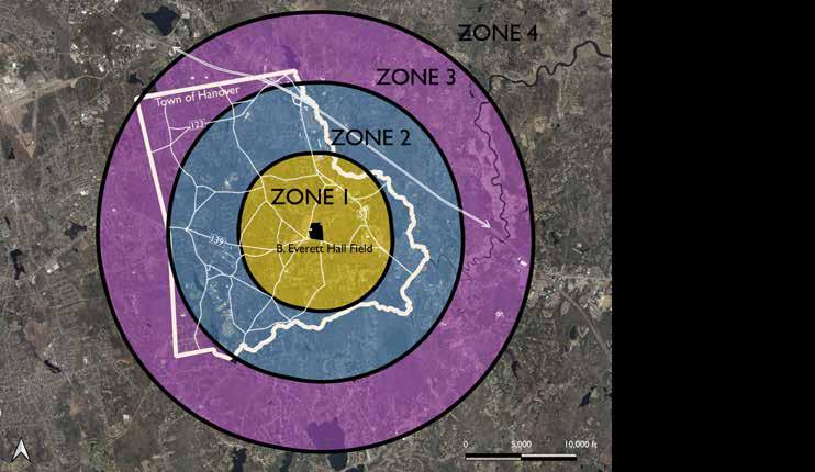
B. EVERETT HALL FIELD 495 HANOVER STREET, HANOVER, MA 02339 DESI g NED B y SARA O z A w A AND SARAH TORRESEN SPRIN g 2023 42/45 88 Village Hill Rd.Northampton, MA 01060 413-369-4044 www.csld.edu Not for construction. Part of a student project and not based on a legal survey. appendix : community engagement


B. EVERETT HALL FIELD 495 HANOVER STREET, HANOVER, MA 02339 DESI g NED B y SARA O z A w A AND SARAH TORRESEN SPRIN g 2023 43/45 88 Village Hill Rd.Northampton, MA 01060 413-369-4044 www.csld.edu Not for construction. Part of a student project and not based on a legal survey. appendix : community engagement
*Ambiguous phrasing may have led residents to interpret the survey question to mean the DIY skatepark or the inline skating rink. Therefore, quality ratings for "skatepark" are skewed.


B. EVERETT HALL FIELD 495 HANOVER STREET, HANOVER, MA 02339 DESI g NED B y SARA O z A w A AND SARAH TORRESEN SPRIN g 2023 44/45 88 Village Hill Rd.Northampton, MA 01060 413-369-4044 www.csld.edu Not for construction. Part of a student project and not based on a legal survey. appendix : community engagement
*
NEW COURTS
Community Feedback
After receiving core team feedback, we adjusted the "Field, Forest, and Meadow" design alternative to bring back parking near the courts and moved the playground to be in proximity to parking along the new driveway.

At the June 6, 2023 community engagement session, 18 Hanover residents shared their opinions on the draft design proposal. Their responses, summarized, were as follows:
FIELDS
Attendees expressed concern about the remaining field space being insufficient for youth football practices and the removal of field lights, which are necessary for evening practices that extend into November. There are currently no other places in town to relocate these sports. One person asked about grass or turf and irrigation on site. Some were concerned about mosquitoes/ticks.
PLAYGROUND
Some people were concerned that the playground’s proximity to Center School may confuse families about which facilities are affiliated with the school versus with the park, or otherwise deter people from using the playground. The safety and security of Center Elementary from park visitors was a recurring concern. One person asked about ADA compliance.
HANOVER DAY
Residents reported that this is the only space in town where Hanover Day can be held due to accessibility, safety, and other logistical reasons, and requested enough space for the event to continue and for fireworks to be able to be safely lit.
SITE AMENITIES
DRIVEWAY REROUTED
The draft design proposal shared with the public on June 6, 2023. It shows a combination of the design alternatives and was crafted taking into consideration feedback from the core team of Hanover employees.
PICNIC GROVE
People wanted to confirm that bathrooms and lights would be incorporated into the final design.
PARKING
People said that parking currently fills up for sporting events, and that decreasing or spreading out the number of available spots would cause problems. Parking near playgrounds was a priority for many.
MISCELLANEOUS
Other miscellaneous questions and comments were about sidewalks, noise, and school safety. People were interested to hear what sort of sidewalk improvement the design proposed. Some were concerned about the possibility of increased noise for neighbors to the east and safety of the elementary school if B. Everett Hall Field were to become more heavily used.
B. EVERETT HALL FIELD 495 HANOVER STREET, HANOVER, MA 02339 DESI g NED B y SARA O z A w A AND SARAH TORRESEN SPRIN g 2023 45/45 88 Village Hill Rd.Northampton, MA 01060 413-369-4044 www.csld.edu Not for construction. Part of a student project and not based on a legal survey. appendix : community engagement
DRAFT DESIGN PROPOSAL AND 2ND COMMUNITY ENGAGEMENT FEEDBAC k
UPDATED FIELD CONVERTED MEADOW CONNECTED WAL k ING LOOP
NEW PLAYGROUND


