Official publication of inside Locate conference Preview of 2024’s most essential geospatial event
magic CSIRO bathymetry reveals a long-lost shipwreck PNT policies 10 ways to increase Australia’s PNT resilience
Australasian magazine of surveying, mapping & geo-information April/May 2024 – No. 130 SPECIAL CONFERENCEISSUE LOCATE
CAD CAPABILITIES The evolution of survey software
Multibeam
The


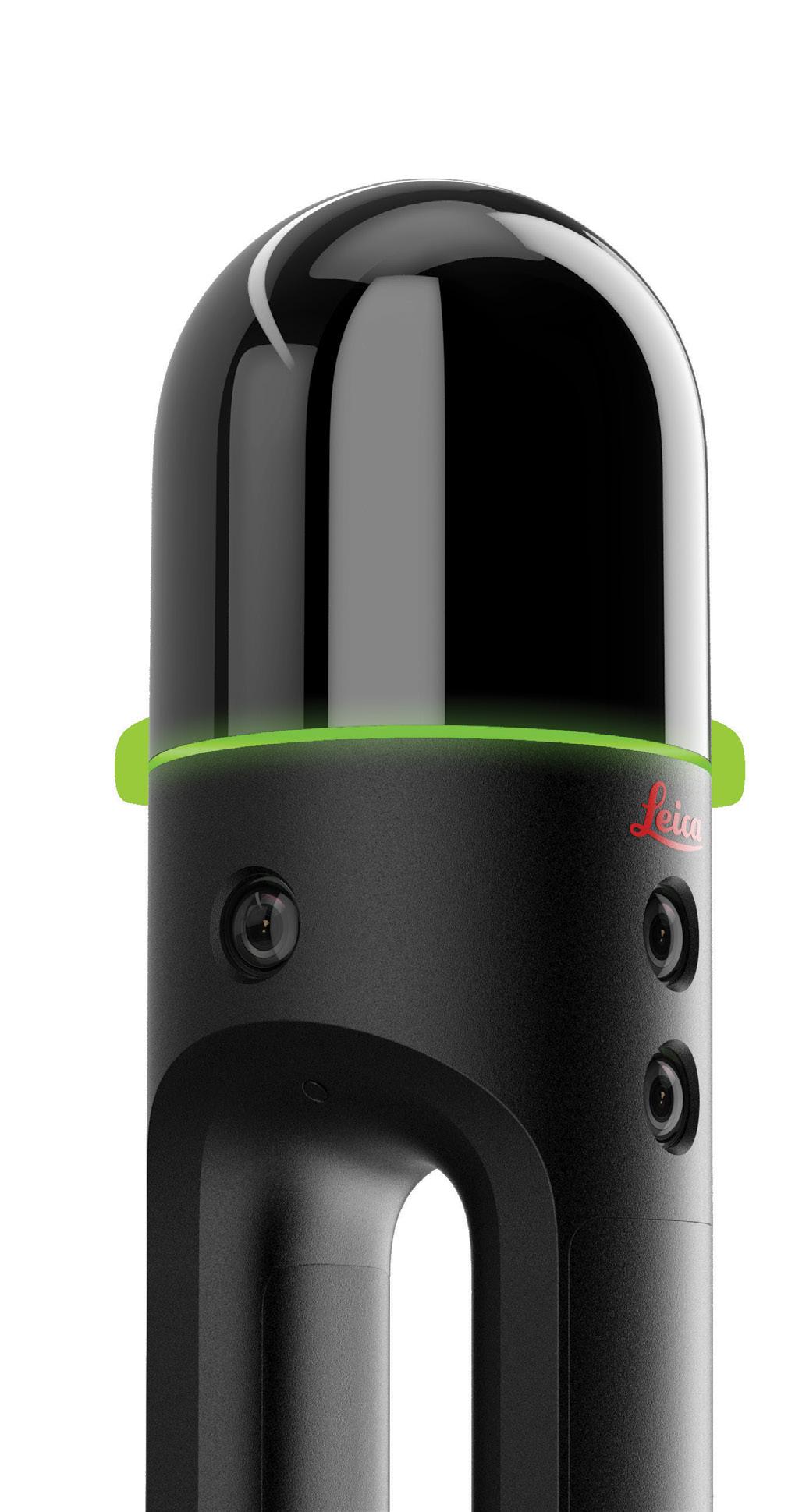
Push the boundaries of 3D laser scanning.
You make the impossible possible—going where others don’t want to go and achieving what others can’t. You lead the way in capturing and documenting the world around us with unparalleled accuracy and detail.
Push the boundaries of 3D laser scanning with powerful in-field automated registration, on-the-fly measurements, and annotations. Trimble® 3D laser scanning systems enable you to visualise and verify your projects before leaving the site, so you can capture complex real-world data with the confidence of getting it right the first time.
out more at:
Find
geospatial.trimble.com/3D-laser-scanning-solutions
© 2024, Trimble Inc. All rights reserved. GEO-229-en-UK (01/24)


16 36 28 contents April/May 2024 No.130 features Locate24 Conference issue 18 Locate24: The geospatial event Preview of the year’s most important industry conference. 31 Locate Vendor Focus Meet some of the companies who’ll be at Locate24. 14 Evolution of CAD survey software An eagerly awaited update for MAGNET software. 16 Q&A with Chris Rizos Why geodesy is misunderstood and underappreciated. 22 Revolutionising horizontal drilling Combining Leica’s iCON gps 160 and Bricsys’ BricsCAD. 24 Celebrating women in geospatial Profiles of five professionals excelling in the sector. 27 Transforming 4D monitoring Delivering frequent, high-quality 4D measurements. 28 Review of resilient-PNT Examining Australian PNT policies and activities. regulars 4 Upfront 4 Upcoming events 7 From the editor 8 News 37 New products 38 Geospatial Council of Australia updates 29 PNT for critical infrastructure Why reliable PNT services are vital for national security. 30 Putting SouthPAN to the test Students put devices and services through their paces. 32 Maps and cartographic context Improving design and developing interoperable standards. 34 Wreck of the SS Nemesis Bathymetry helps solve 120-yearold maritime mystery. 36 Kanyini a step closer to launch Testing the satellite and its hyperspectral payload. www.spatialsource.com.au 3
$140 million for Spatial Digital Twin
The Western Australia government has allocated $140 million over 10 years for the development of an Advanced Spatial Digital Twin (ASDT) for the state. The program, known as Spatial WA, is to be led by Landgate and will be developed in consultation with more than 30 government agencies. The funding is to come from the state government’s Digital Capability Fund.
The whole-of-government effort will result in a 4D representation of the natural and built environment and how it changes over time, leading to better management of resources, greater ability to prepare for natural disasters, improved administration of property planning and building activities, and greater insights in the establishment and maintenance of infrastructure.
“The launch of the Spatial WA program marks an important milestone in better utilising technology for the benefit of all Western Australians,” said Lands Minister, John Carey. “The Spatial WA program will not only enhance decision making processes, but it will also streamline planning, accelerate access to land and provide investment confidence - continuing our efforts to diversify the WA economy.”
Spatial WA will also enable predictive modelling and analytical insights, while streamlining digital workflows.
Although more than 250 uses for the Spatial Digital Twin have been identified, initially the work will focus on four priority use cases:
• Infrastructure projects and asset management
• Digital approval workflows for development application referrals
• Coordinated management of administrative land boundaries
• Exposure modelling for emergency management
A tender for ‘Business intelligence and data analysis software’ has been announced, with a closure date of 2:30pm AWST on 7 May 2024.
The tender describes a “Next Generation Spatial Cadastre (NGSC) which will provide the technology to uplift the State’s current 2D spatial cadastre to maintain property rights, restrictions, and responsibilities in 3D/4D across Government.”
“The ASDT will be enabled through a framework for data modernisation that will support agencies in uplifting their data, aligned to the 3D/4D spatial cadastre, with appropriate governance.”
At first, the Spatial Digital Twin will be used solely by state government agencies as they address the four priority areas, but eventually its capabilities will be opened up to other public and private sector use.
The first five years of the program
— known as Horizon One — will involve implementing Spatial WA’s technical capabilities. Thereafter, the project will be scaled up to become a single place to uncover, access and use government data. n
For more details about these events, go to www.spatialsource.com.au/ event-listing
upfront Upcoming Events 15–18 April: ION Pacific PNT Conference 2–4 May: GISTAM 2024 7–9 May: Locate24 Conference 9–10 May: 4th International Symposium on Applied Geoinformatics 14–May: GeoIgnite, Canada 13–16 May: Geospatial World Forum 2024 19–24 May: FIG Working Week 2024 28–29 May: Australian Space Summit & Exhibition 2024 4–6 June: ROTORTECH 2024 11 June: ISPRS TC II Symposium 16–21 June: 9th International Conference on Cartography & GIS 1 July: International GNSS Service 2024 Workshop 22–23 July: Disaster & Emergency Management Conference 6–8 August: ISPRS TC V Symposium 7–9 August: 14th Session UN-GGIM 19 August: AIMS 2024 National Conference 24–30 August: 35th International Geographical Congress 9–13 September: Advancing Earth Observation Forum 10 October: Intelligent Digital Twins in Natural Resources 22–25 October: ISPRS TC IV 2024 Symposium 25–29 November: Pacific Islands GIS & Remote Sensing Users Conference 1–8 December: FOSS4G Conference
4 position April/May 2024
Embracing neurodiversity for tomorrow’s geospatial workforce
Australian Spatial Analytics is delivering geospatial professionals and social impact.
I’ll say it straight up — Australian Spatial Analytics’ (ASA) existence helps solve these significant issues for Australia:
• Skills shortages: Geospatial and engineering professions are experiencing talent shortages, adversely impacting Australia’s ability to deliver critical infrastructure. We’re creating the professional workforce of the future.
• Economic growth: Embracing neurodiversity creates economic impact. We’ve succeeded with all levels of government and industry, delivering over $8.6 million worth of projects with Australian neurodivergent talent. A recent study estimated the United Kingdom loses over £14.5 billion (~AUD $28 billion) annually because of autistic unemployment.
• Creating social impact: Bringing young neurodivergent Australians out of long-term unemployment to learn real-world skills and earn above-award wages. People with autism spectrum disorder (ASD) face a 34% unemployment rate in Australia. It’s worse in regional areas. More than 375,000 have ASD, our fastest-growing ‘disability,’ yet alternatives

are scant for well-paid data economy work. However, research shows neurodivergent people are outstanding with pattern recognition, accuracy and diverse problem-solving — invaluable for any big data industry. When supported (and you don’t need to do much), neurodivergent people are star performers, fun and fiercely loyal — everything you want from a team.
We know combining the unique cognitive skills of neurodivergence with geospatial projects succeeds! We’ve created career pathways for more than 150 young neurodivergent adults across Australia while delivering award-winning, high-quality data services.
For example, ASA undertook extensive road and address validations for the Queensland Department of Resources, encompassing the Sunshine Coast Regional Council area. Analysts delivered geometry and attribution updates for more than 21,000 road features, 43,000 addresses and 100,000 access points in 10 weeks (<1% error rate!), training 10 people in our Cairns office, with most applying their geospatial skills for the first time. Most were unemployed only three months beforehand, with one of them having been out of work for over six years. The project generated improved datasets for multiple end-users who rely on accurate information.
Our team also works on complex electrical networks, including tracking the location and details of Queensland’s electricity infrastructure — a database storing over 25 million features! An enormous volume
of highly technical work was needed to merge multiple legacy systems, including data cleaning, validation and asset dataset merges into a ‘single source of truth’ using the Esri Utility Network Model. ASA now has more than 50 qualified users — one of the largest of any spatial consultancy in Australia.
ASA analysts make sense of large volumes of geospatial data to enable decisionmaking. Other projects include emergency data management for Brisbane City Council, maintaining travel advisory maps for Smartraveller and digitising historic mines for the Department of Regional NSW. These skills are highly desired, essential for Australia’s economic prosperity, and needed to deliver critical infrastructure. Our on-the-job training, an alternative to traditional education, prepares our talented people for sustainable careers. Social impact also happens as many are brought out of long-term unemployment, with some terminating disability support pensions.
Our Talent Services offering delivers workforces for other organisations,
including Geospatial Council of Australia members. ASA provides neurodiversity training and ongoing support for our transition candidates and partners. Four analysts are currently embedded at the Department of Resources in Brisbane and Acciona in Melbourne, working on multiple projects. Our first transition, Blake Morrison, has worked long-term at the University of New England as a GIS Officer after spending years struggling to find employment.
We’ve reached more than 120 employees (80% neurodivergent) after starting in 2020, attracting over 40 clients. We’re successful because our talented, 100% Australian data analysts deliver great work quickly, eliminating data sovereignty and modern slavery risks. Plus, we’re developing tomorrow’s geospatial workforce. With offices across Australia, we’re aiming for 300 employees by 2026.
Find out how you can embrace neurodiversity as a competitive advantage whilst creating social impact at asanalytics.com.au. n
Geoff Smith is the CEO of ASA, a social enterprise providing professional data services and careers for young neurodivergent adults.
GEOFF SMITH
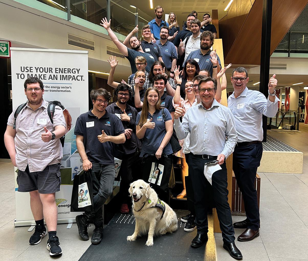
Australian Spatial Analytics at Energy Queensland’s offices. Their Unified Geographic Information System project won the 2023 Geospatial Council of Australia (Queensland) Award for Technical Excellence.
www.spatialsource.com.au 5
Queensland Department of Resources Acting Manager – State Imagery and Elevation, John Tasker, with ASA analyst Courtney Anderson.
partner feature


Publisher Simon Cooper Editor
Jonathan Nally
jnally@intermedia.com.au
National Advertising Manager
Anna Muldrock
amuldrock@intermedia.com.au
Prepress
Tony Willson
Production Manager
Jacqui Cooper
Subscribe
Position is available via subscription. A 12-month subscription (6 issues) is AU$76.00. To subscribe visit spatialsource.com.au/magazine, phone 1800 651 422 or email subscriptions@ intermedia.com.au Address
LAYING THE foundations
Continuing the geodesy theme begun in our December issue — when we interviewed Nick Brown, who has left Geoscience Australia to become head of the Head of Office for the United Nations Global Geodetic Centre of Excellence — in this issue (page 16) we speak with Chris Rizos, Emeritus Professor at the School of Civil and Environmental Engineering at the University of NSW, who outlines the importance of geodesy to Australia and the world, and why it needs more recognition. He contends that geodesy is often misunderstood, underappreciated or entirely overlooked.
And of course, geodesy is a crucial part of the foundation for Australia’s, and the world’s, positioning, navigation and timing (PNT) systems. Reliable PNT services are utterly vital for the operation of all sectors of industry and society, yet they remain highly vulnerable to interference or failure — especially in the case of countries such as Australia, which relies so heavily on services provided by other nations. So it’s great to see the release of a new report from FrontierSI (page 28) that outlines practical steps Australia can take to boost the provision of PNT through both traditional and newly emerging means. It’s good, also, to see the federal government taking the issue seriously, as outlined by the Department of Home Affairs (page 29).

As I write this, the program for the Locate24 conference has just been released, and what a program it is. As is always the case, there is so much packed into the three days that it’s hard to know where to begin. I’ve already gone through and highlighted all the sessions I’ll be attending, and even then I probably won’t get to see and hear everything I want to! But that’s a good problem to have.
If you haven’t yet registered for the conference, dinner and awards ceremony, please jump onto it and reserve your place. It promises to be a fabulous event, at which we’ll all get the chance to catch up with colleagues old and new and learn about the latest developments in the geospatial sector.
Jonathan Nally Editor
Position is published six times per year, in February, April, June, August, October and December by The Geospatial Council of Australia. ABN: 22 135 572 815 Reprints from Position are permitted only with the permission of the publisher. In all cases, reprints must be acknowledged as follows: ‘Reprinted with permission from Position Magazine’, and must include the author’s byline. The opinions expressed in this publication are those of the authors and do not necessarily represent those of the publisher. Official publication of We take our Corporate and Social Responsibilities seriously and is committed to reducing its impact on the environment. We continuously strive to improve our environmental performance and to initiate additional CSR based projects and activities. As part of our company policy we ensure that the products and services used in the manufacture of this magazine are sourced from environmentally responsible suppliers. This magazine has been printed on paper produced from sustainably sourced wood and pulp fibre and is accredited under PEFC chain of custody. PEFC certified wood and paper products come from environmentally appropriate, socially beneficial and economically viable management of forests. The Australasian magazine of surveying, mapping & geo-information June/July 2024 — Issue 131 Modern society — Digital twins, smart cities, IoT, transport, logistics Environment — Agriculture, forestry, conservation, sustainability Technology — Space services, GNSS and PNT devices and services Advertising booking date: 9 May 2024 Advertising material date: 14 May 2024 Publication date: 6 June 2024 For article proposals, contact the Editor: jnally@intermedia.com.au For advertising, contact the Advertising Manager: amuldrock@intermedia.com.au
ISSUE Position magazine acknowledges the traditional custodians of country across Australia, and we pay our respects to Aboriginal and Torres Strait Islander cultures and to their elders, past, present and emerging.
for mail: 41 Bridge Rd, Glebe NSW 2037. Ph: 02 9660 2113
NEXT
www.spatialsource.com.au 7 from the editor
Latest Ginan version released
Version 3 of Australia’s free Ginan service, an open-source toolkit for determining precise point positioning with centimetre-level accuracy based on GNSS observations, has been released.
Version 3 enables users to use Ginan to determine precise orbits for low Earth orbit (LEO) satellites, knowledge which in turn is used to boost the accuracy of positioning measurements on the ground, in the air and on the water.
“The benefits of the version 3 release will see simplified software configuration, improved positioning performance, the ability to estimate LEO orbital trajectories as well as a range of bug fixes and performance improvements,” said Anna
Riddell, Geoscience Australia’s (GA) Director GNSS Analysis.
Riddell hailed the achievement for GA and its collaborators, including Curtin University, the University of Newcastle, RMIT University, FrontierSI and the Industrial Science Group.
“Through this collaboration, we have already seen the impacts through research opportunities, such as RMIT University’s study on the Ionospheric effects of the 2022 Hunga Tonga Volcano Eruption and the Geoscience Australia, FrontierSI and the Australian Institute of Marine Science’s (AIMS) marine case study demonstrator,” said Riddell.
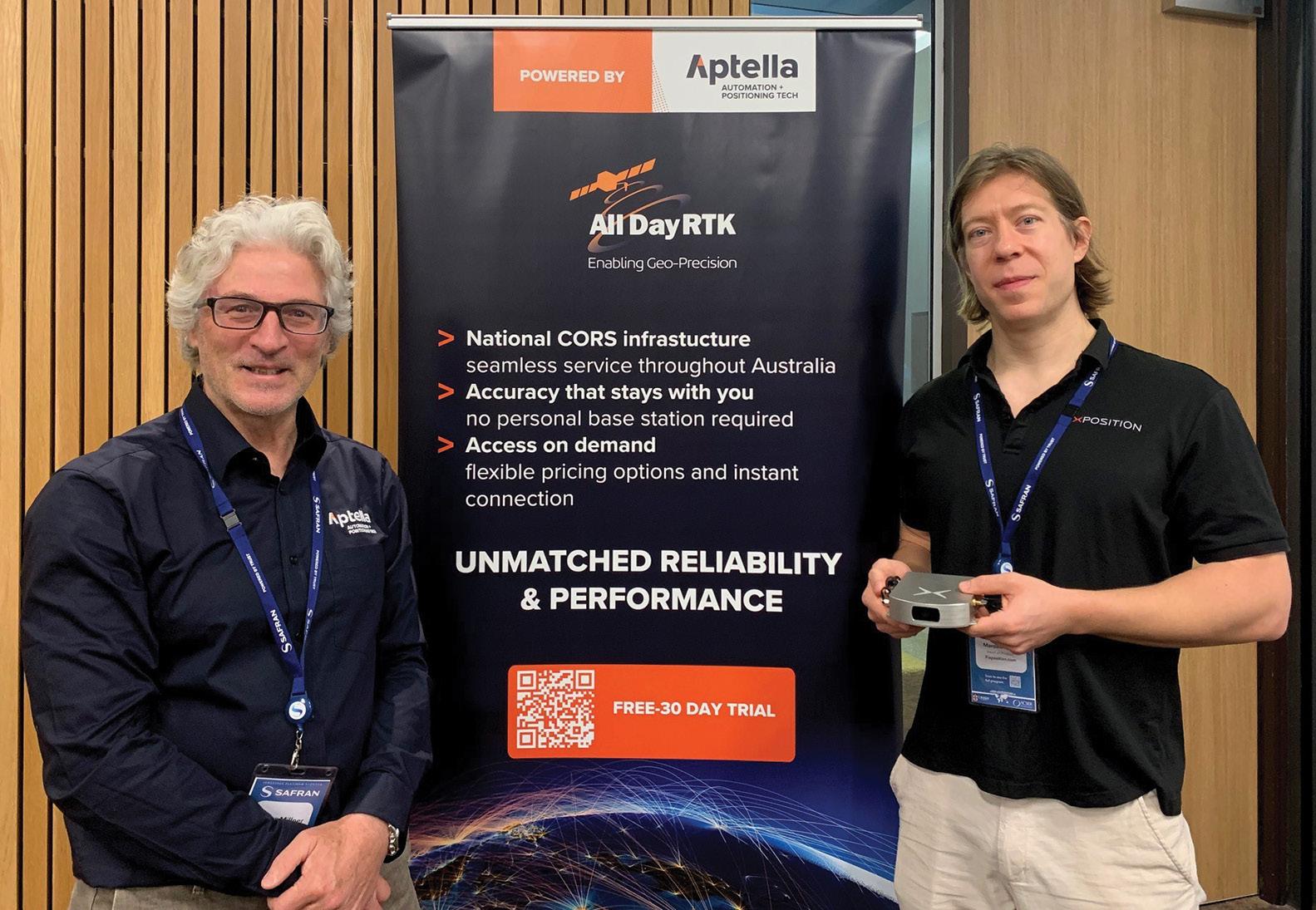
Aptella now representing Fixposition
Aptella (formerly Position Partners) is now representing Fixposition, a Swiss startup that has made a name for itself via its Vision-RTK 2 positioning solution, which increases accuracy through the integration
of RTK-corrected GNSS, computer vision and IMU technology.
“We are honoured to represent Fixposition and offer customers an exciting combined PNT [positioning, navigation
The marine case study involved working with AIMS and FrontierSI to trial Ginan at Reefworks, a tropical marine technology test range where equipment can be trialled in a real-world environment.
“In this environment, Ginan positioned a ‘surfbee’ aquatic drone and an aerial drone with centimetre accurate real-time positioning, which is now supporting AIMS’s work on the Great Barrier Reef,” said Riddell.
“I invite the global position, navigation and timing (PNT) community to join us to be part of the Ginan story through on-going open-source collaboration and the development of the toolkit.”
Ginan
and
and timing] solution at such incredible value. We expect it to be a major factor for the increased adoption of autonomous systems,” said Martin Nix, CEO at Aptella.
Fixposition says its Vision-RTK 2 delivers reliable, high-precision positioning in challenging scenarios such as beneath tree canopies, between skyscrapers and through tunnels.
“GNSS signals can be weak and easily interfered with, either unintentionally by the natural environment or by malicious intent,” said James Millner, Positioning Infrastructure Manager from Aptella.
“Moreover, our society is extremely dependent on GNSS (PNT) systems that impact our lives daily, from securing the borders to improving safety applications in cars.”
According to Peter Mardaleichvili, Head of Product at Fixposition, by “seamlessly fusing the absolute, global precision of GNSS with the agility of Visual Inertial Odometry (VIO), our positioning solution… mitigates the weaknesses inherent in each technology…”
was used to trial cm-level positioning with aquatic
aerial drones at the Reefworks test range. Pictured are Vic Grosjean (AIMS), Chris Marshall (FrontierSI), Joe Gioffre (AIMS), and Anna Riddell (Geoscience Australia).
Photo by Dan Woodrow, FrontierSI.
news 8 position April/May 2024
James Millner, Position Infrastructure Manager, Aptella (left) and Peter Mardaleichvili, Head of Product Management, Fixposition.
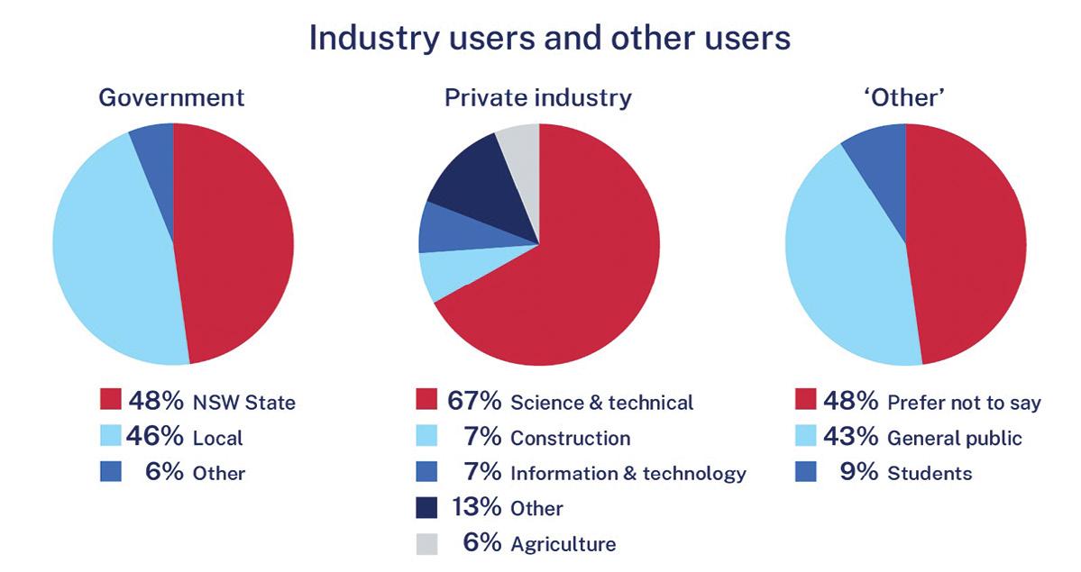
Spatial Collaboration Portal user survey
Spatial Services has released a summary of the results of a recent survey on the use of its Spatial Collaboration Portal. The September 2023 survey quizzed users on the how they used the Portal and the services it offers, as well as the ways in which they think it can be improved.
More than 300 respondents from across the public and private sectors provided their feedback. The results can be seen in the accompanying infographic.
In a post on its website, Spatial Services says that its “Live NSW team has already been working directly with survey participants to gain insights and identify areas for improvement which will be our focus moving into 2024”.
Spatial Services is a division of the NSW Department of Customer Service, tasked with providing the state’s official spatial and land information services.
Prototype US GEOID2022 under development
US National Geodetic Survey (NGS) has shared a prototype geoid model of the US and its territories, known as the GEOID2022, to select key academic and international partners for evaluation.
The model is a foundational component of the modernised National Spatial Reference System — or NSRS, the US coordinate system — which is expected to be released in 2025.
The prototype will increase the accuracy and coverage of precise surface elevation measurements over land and water and will be used to initialise marine circulation models. It will also communicate water-level forecasts and warnings for tsunamis, surges, flooding and inundation.
GEOID2022 develops a vertical reference of the earth’s surface and includes gravity data from the recently completed 16-year Gravity for the Redefinition of the American Vertical Datum, or GRAV-D project, which collected height data using aerial surveys.
The NGS says that more geoid products and services will be released later in 2024.
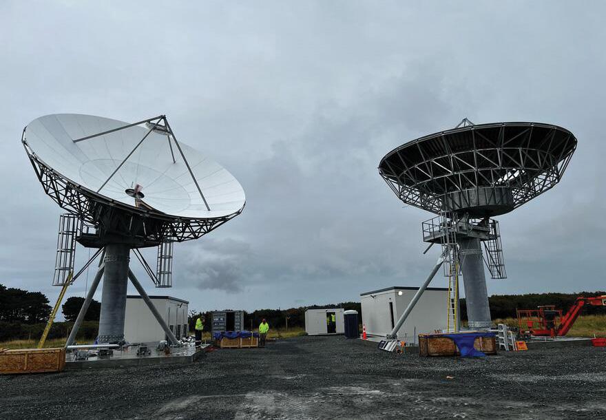
SouthPAN dishes taking shape in New Zealand
Two 11-metre satellite dishes have recently been hoisted into place at the SouthPAN uplink and ground control centre being constructed at Awarua on New Zealand’s South Island.
The centre is one of two being built for the New Zealand and Australian governments. The first opened at Uralla, New South Wales, in December 2023.
SouthPAN is a collaboration between Geoscience Australia and Toitū Te Whenua Land Information New Zealand to deliver Satellite-Based Augmentation System services to Australia, New Zealand and their maritime regions.
Lockheed Martin Australia was awarded a $1.18 billion contract In September 2022 to enhance precise positioning within the SouthPAN service areas. In December of that year, the company chose New South Wales communications specialist Av-Comm to establish a network of ground station uplink facilities for SouthPAN.
“The SouthPAN project is a key example of the collaboration necessary to advance Australia’s industrial positioning capability,” said Lockheed Martin Australia’s Regional Director for Space, David Ball, at the ribbon-cutting ceremony for the Uralla dish.
“By working together with Av-Comm on this critical infrastructure, we’re enhancing our nation’s technological capabilities while ensuring that Australia plays a pivotal role in the global economy.”
SouthPAN will improve the accuracy of GNSS services from the current 5 to 10 metres down to as little as 10 centimetres, vital for news industries and for improving safety in some sectors such as aviation.
“We’ve come to rely on precise positioning — whether it’s using a map on your smart phone or farmers using SouthPAN to ensure seeds are sown precisely and for fertiliser and herbicides to be applied with less wastage,” said Dr Martine Woolf, Geoscience Australia’s Branch Head for the Positioning Australia program, at the Uralla event.
“That’s why improving the accuracy of our positioning services down to as little as ten centimetres is a game changer — and today’s official opening of this satellite dish brings us one step closer to achieving that.”
The two SouthPAN dishes taking shape at Awarua in New Zealand. Image courtesy LINZ.
www.spatialsource.com.au 9
NOAA

MALA GPR Australia acquired by Guideline Geo AB
Australian ground-penetrating radar specialist, MALA GPR Australia, has been acquired by Guideline Geo AB. As of 15 January, the company is formally known as Guideline Geo Australia Pty Ltd, although it will still trade as MALA GPR Australia.
Guideline Geo is the manufacturer of the MALA and ABEM instrument brands and has been the main supplier to MALA GPR Australia for the past 15 years.
The company says that, apart from employing more staff, “there will be no immediate change to the way the company operates; it will very much be ‘business as usual’,” and it will continue to offer the same range of geo-instrument sales, servicing, rentals, consulting and training from its headquarters in Brookvale, Sydney.
James Meintjes will continue to lead the operation with support from Per Westholm, Global Sales Director, and the whole Guideline Geo team.
In a statement, Guideline Geo AB said that “With our own office in Australia we will further invest in the market and hope to work even closer with our customers. We have a plan to grow the team and to ensure that we cover the whole region with local expertise and outstanding support of our MALA and ABEM products.”
“I’m immensely thankful to everyone who’s been part of our success,” said Mads Toft, founder of MALA GPR Australia.
“It’s been great to be able to assist so many businesses with new and exciting technologies, and I’ve been blessed with involvement in an incredible number of interesting projects. I am confident the company will become an even bigger success going forward.”
US launches 24/7 geospatial intelligence centre
The US National Geospatial-Intelligence Agency (NGA) has opened a 24/7 operations centre to provide geospatial intelligence to US policymakers and military forces around the world.
Although the NGA has had a round-the-clock ‘watch floor’ since the National Imagery and Mapping Agency, an NGA predecessor organisation, was formed in 1996, the new National GEOINT Operations Center (NGOC) will deliver distinct visual products and geospatial information to military and civil decision makers in an expanded and continuous manner.
According to NGA Director, Vice Admiral Frank Whitworth, the NGOC is parallel to the National Security Operations Center operated by the National Security Agency, with multiple watch teams keeping watch and providing time-critical information.
The NGOC’s motto is ‘We own the night!’.
Federal funding for Australian space tech
The federal government has announced more than $9 million dollars in innovation grant funding for 12 Australian space technology initiatives. The grants have been made under the Moon to Mars program and are aligned with NASA’s Artemis mission.
“These projects show the agility and innovative nature of Australia’s space companies, and how we can carve our niche in big international missions,” said the Head of the Australian Space Agency, Enrico Palermo.
“Space is a global endeavour and by working with our partners like NASA we can create outcomes that benefit Australia, while also contributing to solutions to global challenges.”
The 12 initiatives include three of direct interest to the geospatial community:
• Arlula has been awarded $427,500 to develop new technologies to standardise satellite imagery between different Earth observation spacecraft. The aim is to enable users to more effectively integrate imagery for use in sectors such as agriculture, mining and natural disaster management.
• Quantx Labs has been awarded $532,222 to establish a hybrid advanced manufacturing facility for cutting edge and innovative photonics manufacturing. The facility and processes will support in-country manufacturing of quantum capable, miniaturised, precision timing and sensing systems for supporting time keeping, sensing and navigation in space and on Earth.
• Gilmour Space Technologies has been awarded $808,500 to collaborate with the University of New South Wales to develop an Australian-made, aerospace-grade GNSS receiver suitable for a range of civil, commercial and defence applications in position, navigation and timing. The GNSS receiver, a proven technology from UNSW, will benefit from Gilmour’s advanced space manufacturing expertise and commercialisation capabilities.
“These projects show the exceptional research and innovation that is happening in Australia’s space sector and how our companies can contribute on the global stage,” said the Minister for Industry and Science, Ed Husic.
“Excitingly, the technologies and products being developed also have applications that can see us respond to important challenges and opportunities — from addressing climate change to driving growth in Government priority areas like robotics, quantum and advanced manufacturing.”
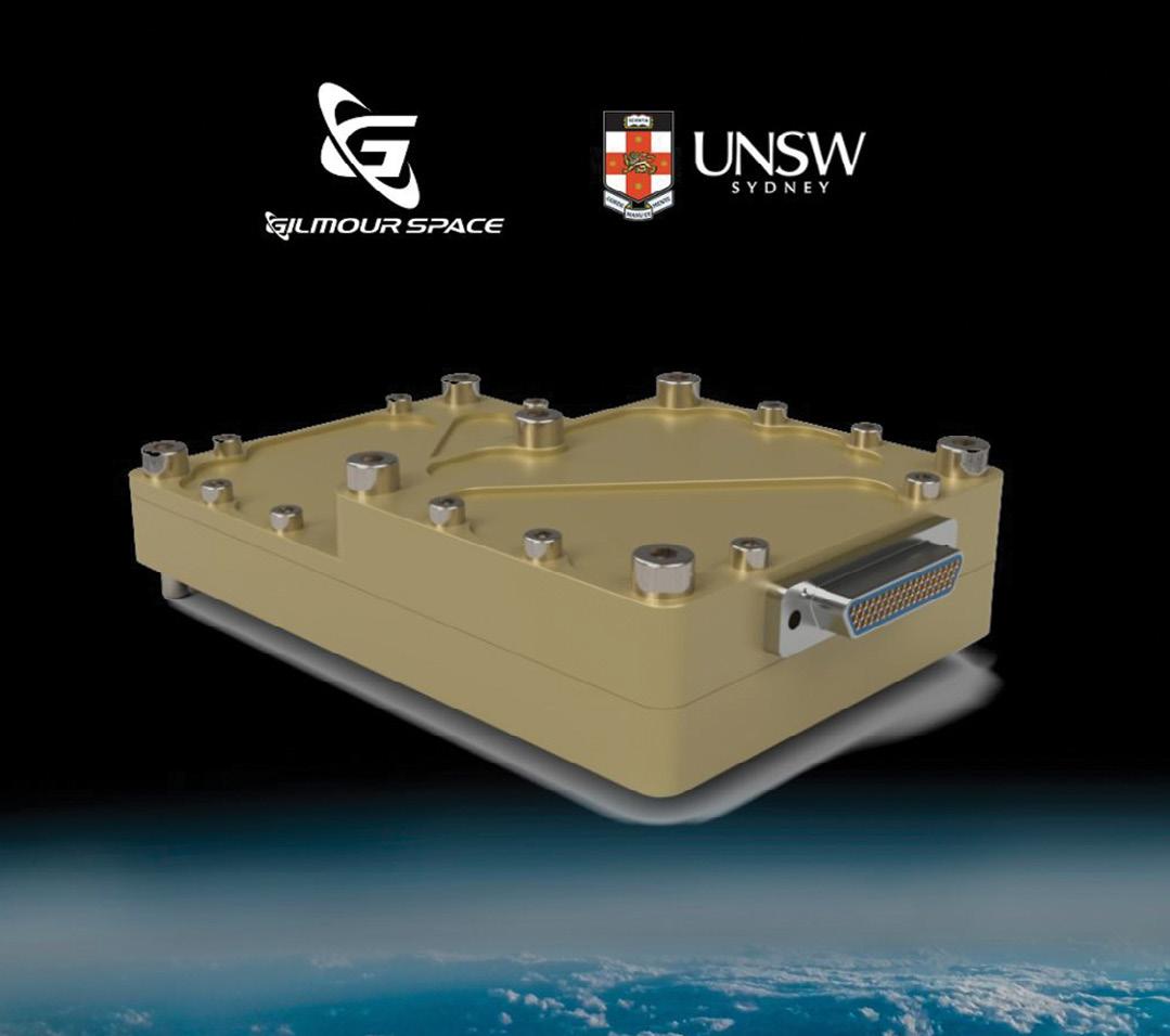
UNSW GNSS receiver technology. news 10 position April/May 2024
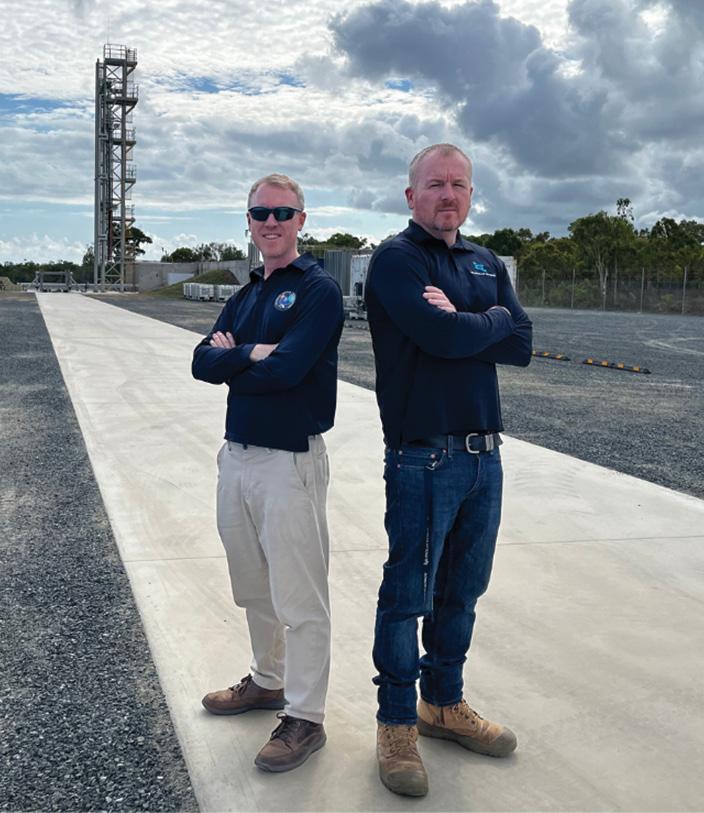
Gilmour Space obtains first orbital facility licence
Gilmour Space Technologies has been granted the first orbital launch facility licence in Australia, for use with its Bowen Orbital Spaceport in northern Queensland.
The Spaceport is located within the Abbot Point State Development Area, from which Gilmour Space aims to offer commercial orbital launch services to low-Earth orbit.
The licence, granted by Minister for Industry and Science (and Minister in charge of the Australian Space Agency), Ed Husic, has been issued under the federal Space (Launches & Returns) Act 2018.
Approval has also been secured from the Department of Climate Change, Energy, the Environment and Water.
“Australia now has its own ‘road’ to space,” said Gilmour Space co-founder and CEO, Adam Gilmour. “The ability to launch our own satellites, on launch vehicles that we own and control, to key orbits in space from Australia, will be a significant capability for our global customers, as well as for our nation and allies.”
James Gilmour, co-founder and Head of Launch Operations, said the milestone has come after two years of dedicate work, which included engaging with Juru traditional owners and other stakeholders at the local, state and federal levels.
“We’ve seen these efforts lead to diversified business opportunities, jobs, and investment in Bowen and greater Whitsunday region; and it will be exciting to see ‘rocket tourism’ emerging to support the local economy,” he said.
The Spaceport received grant funding from the Australian Government as part of its Modern Manufacturing Strategy, and is co-funded by the Queensland Government and Gilmour Space.
The first launch of Gilmour’s Eris rocket is expected to take place within the coming months, subject to approval of a launch permit by the Australian Space Agency.
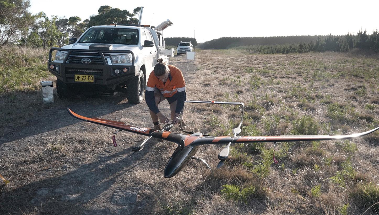
Carbonix milestone for SA Power Networks
In what has been claimed an Australian first, Australian drone manufacturer
Carbonix has flown is Volanti drone on a beyond visual line of sight (BVLOS) mission to inspect 150 kilometres of SA Power Networks powerlines in remote South Australia.
The CASA-approved mission opens the door to more-efficient and safer inspections of South Australia’s vast electricity distribution network, which covers more than 180,000 square kilometres.
Carbonix and SA Power Networks have been working together to pursue the use of long-range UAVs for the past 18 months.
“This is such an exciting time for the drone industry and for the energy industry,” said Carbonix CEO Philip van der Burg.
“We’ve addressed the risks and barriers, both regulatory and technical, and proven the capability. Long range drone adoption
means improved safety, faster response times and reduced carbon footprint for companies like SA Power Networks.
Inspections are currently conducted using conventional crewed helicopters and fixedwing light aircraft, or ground crews. A switch to drones would bring large reductions in operating costs and CO2 output, while also boosting safety and efficiency.
“We rely on aerial inspections to be able to meet inspection cycles,” said Head of Corporate Affairs for SA Power Networks Paul Roberts.
“Our crews also drive about 20 million kilometres annually patrolling and maintaining our vast network.
“Being able to deploy over the horizon drone patrols will drive greater efficiency in our asset management program and provide genuine safety benefits for our people and community.”
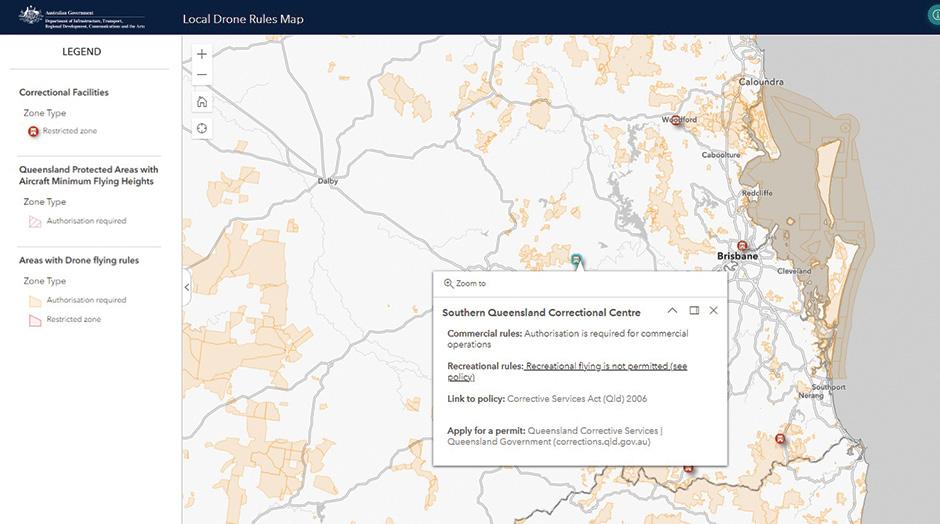
Local Drone Rules map released
A new digital map showing where drone users can and cannot fly their equipment has been made available by the federal Department of Infrastructure.
The first iteration of the Local Drone Rules map clearly shows where rules are in place that may restrict the use of drones, such as near prisons and parks. It currently covers 7,610 different areas managed by 15 different government agencies, with more still to dome.
The map displays information such as whether an area requires authorisation or is restricted, or whether, for example, altitude rules apply. It even extends to certain areas well beyond the coastline.
According to the Department, the map can be integrated into drone software applications to help with flight planning, thanks to open data and courtesy of a free API.
The Department says that it will “continue working with relevant
agencies to collect and improve the data, review and evaluate the impact of current rules, and share lessons learned to bolster regulatory policy, compliance and enforcement of drone laws in the future”.
The map is the result of 18 months of collaboration between the federal government and state and local governments, and accords with the Australian Government’s Data and Digital Government Strategy, which aims to contribute to the roll out of simple, secure and connected public services.
A section of the Local Drone Rules map, showing restriction rules near a prison in Queensland. Courtesy Department of Infrastructure.
Gilmour Space Technologies co-founders, Adam and James Gilmour at the Bowen Orbital Spaceport.
www.spatialsource.com.au 11
The Carbonix Volanti UAV used to conduct the powerline inspection for SA Power Networks.
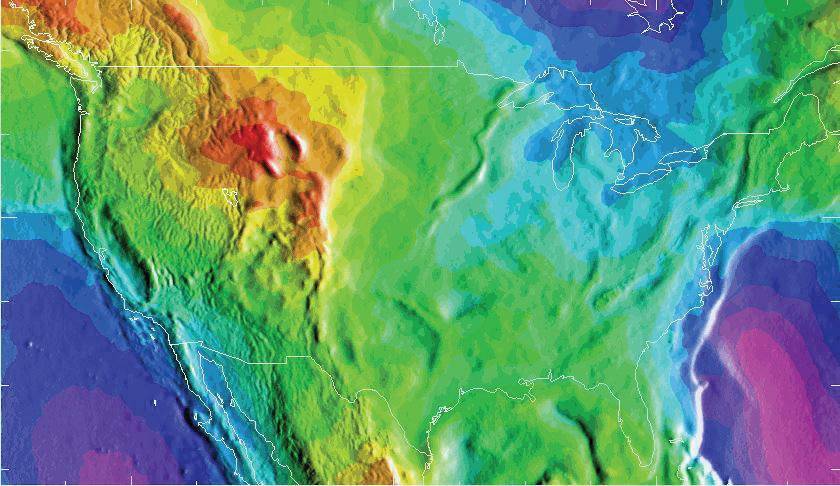
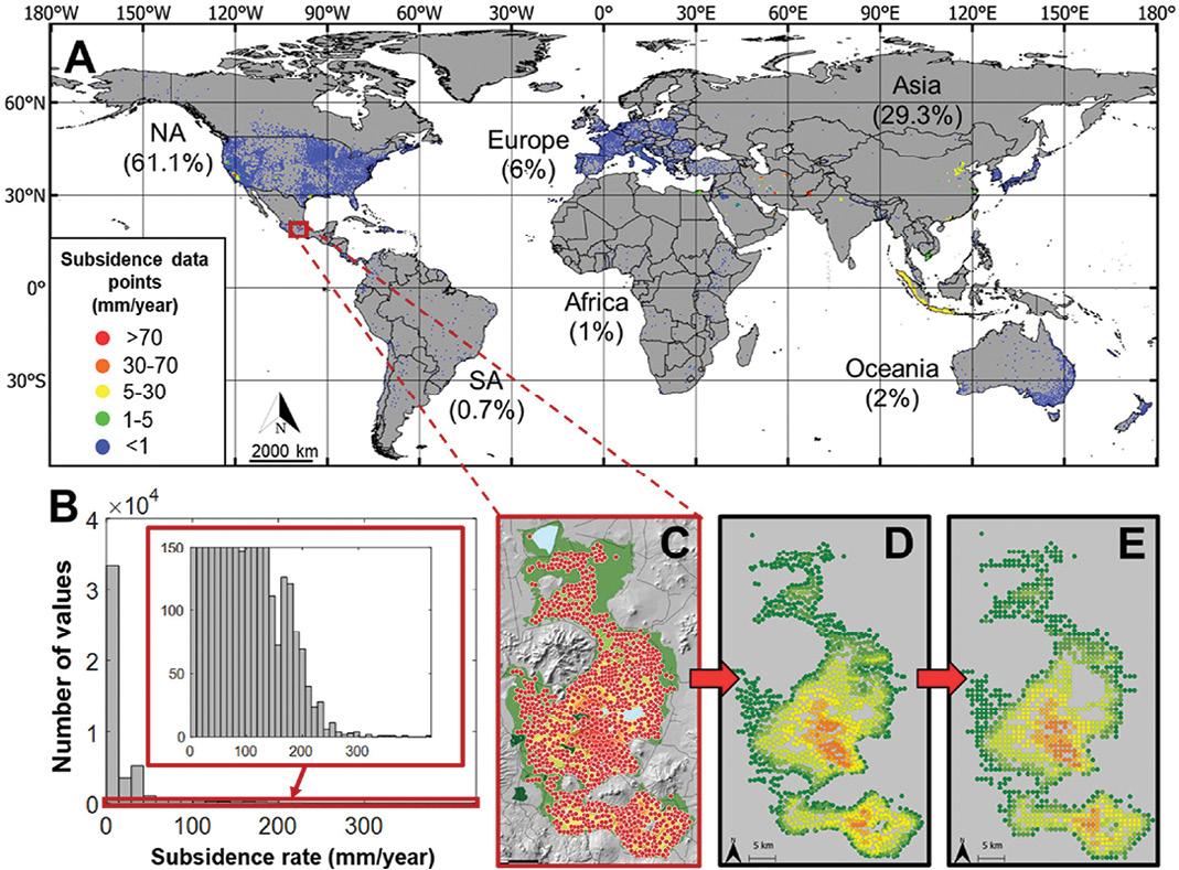
New map of global land subsidence rates
A team of scientists has produced what they claim to be first global map of land subsidence rates, using a data set of land subsidence which, they say, is likely the largest ever compiled.
The map has led the researchers to estimate that “more than 6.3 million square kilometres of the global land is influenced by significant subsidence rates”.
That includes 231,000 square kilometres of urban and dense settlement areas that are home to nearly 2 billion people.
Although subsidence can be caused by a number of natural and artificial factors such as seismic activity and mining, one of the main causes is groundwater extraction.
Indeed, the new research, ‘Unveiling the Global Extent of Land Subsidence: The Sinking Crisis,’ published in Geophysical Research Letters, shows a strong positive correlation between the intensity of groundwater extraction and subsidence rates.
The authors say they used the large data set and 23 spatially continuous environmental parameters to train a machine learning model, which “learned to accurately predict subsidence at any location based on the provided predictors”.
“We applied the resulting model to produce the first global map of subsidence rate to date, which can be used to identify previously undocumented subsiding areas, motivate further local investigation, and provide crucial information for developing actionable policies to manage and mitigate subsidence effects in vulnerable regions.”
The authors found that “5% of the global area and 25% of the population are affected by significant land subsidence. These numbers are expected to rise, as changing climate, increasingly prolonged periods of drought, and growing population only exacerbate global dependency on groundwater.”
The researchers are hopeful that their work will “be used to increase awareness, help plan mitigation measures, and provide a foundation for optimized and regulated groundwater use policy. Additionally, the maps will be useful for such practical applications as urban planning and infrastructure development for cities that are located in subsiding areas.”
They go on to say that “knowledge of land subsidence rates will be instrumental for the insurance purposes as areas with high subsidence rates could be more susceptible to potential hazards,” and that “as subsidence can affect water drainage, leading to waterlogging or altered flow patterns, the map can be used by farmers and land managers to adapt their irrigation practices and crop choices.”
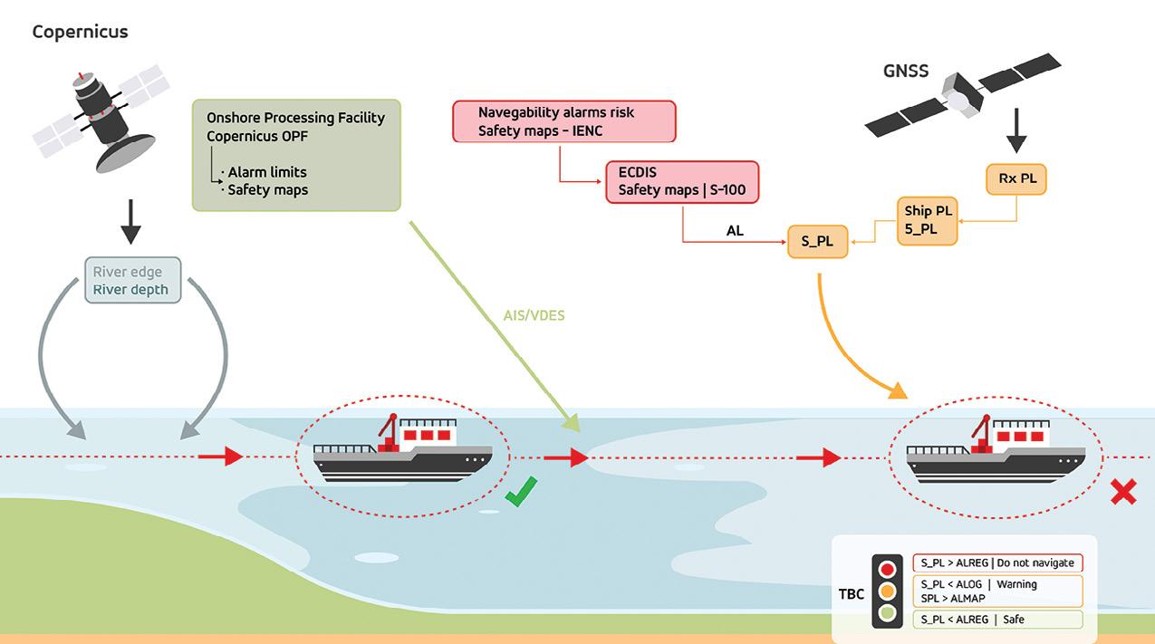
Autonomous navigation for inland waterways
The European Commission’s AVIS project, which is being led by multinational technology company GMV, officially got underway on 30 January. The goal of the 37-month-long project is to improve navigation for autonomous vessels along Europe’s inland waterways by using European Union space systems such as the European Global Navigation Satellite System (E-GNSS) and Copernicus.
In addition to improving navigation in inland waterways, the project is expected to help develop new applications for autonomous vessels, as well as contribute to the European Union’s goal of transforming transportation systems to make them more sustainable and less polluting.
Inland waterway transportation in Europe is undergoing several changes as a result of new and emerging technologies, which are making these processes increasingly safe, digitalised and sustainable.
While there is currently no autonomous vessel traffic in inland waterways, the industry is getting ready to incorporate it in the near future and is therefore exploring the challenges that could arise in various scenarios.
In this regard, the solution proposed in AVIS will increase the accuracy and reliability of forecasts and enhance positioning for vessels, in order to optimise their routes and make them safer.
Further goals of the AVIS project include:
• Defining requirements for autonomous vessels and for operating such vessels in Europe inland waterways.
• Developing a prototype for onboard equipment.
• Providing proof of concept for the AVIS solution through several pilot tests on European inland waterways to prove its feasibility and added value.
• Developing new regulations establishing the minimum requirements to guarantee safe navigation as a contribution to the European Committee for Drawing Up Standards in the Field of Inland Navigation.
news 12 position April/May 2024
Panel A shows the locations of recorded subsidence rates. Panels C to E show steps in the processing of the data.
Advanced Navigation awarded $1m for LiDAV research
Sydney-based company, Advanced Navigation, along with partners The University of Technology Sydney and CMG Operations, has been awarded $1,064,739 under Round 15 of the Cooperative Research Centres Projects (CRC-P) Grants support short-term collaborative research program.
The funding will be used to develop LiDAV (light detection, altimetry and velocimetry) navigation sensor technology for Earth applications.
The overall aim is to measure velocity in 3D using a compact, lightweight and low-cost solution to deliver precision that is not otherwise possible within the same size and weight constraints.
The company says the funding will result in significant R&D of hardware, software and algorithms that “will transition the tech from laboratory to commercial product”.
Sensor designs will be tested and validated in a range of real-world environments using ground vehicles, drones and light aircraft, compliant with defence and commercial industry standards.
The company says that its terrestrial-focused LiDAV “will solve complex autonomy challenges across aerospace, automotive, weather, as well as railways and logistics,” including for:
• Aiding aircraft during take-off and landing, particularly in difficult conditions.
• Measuring weather patterns far more accurately to significantly improve weather detection and forecasting.
• Guiding passenger drones and autonomous vehicles reliably under all conditions.

• Building geophysical models from gravitational surveys.
• Guiding autonomous navigation in GNSS-denied environments, particularly for defence and security applications.
Advanced Navigation says the effort will add to the project partners’ global competitiveness and help build Australia’s sovereign capability in the high-end UAV market.
In June last year, the company was awarded a $5.2 million Moon to Mars Initiative: Demonstrator Mission Grant by the Australian Space Agency, to support NASA’s endeavour to explore the Moon and beyond to Mars.
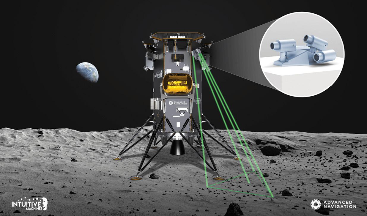
The Moon to Mars grant will accelerate development and production of the company’s LiDAV , culminating in the delivery of a space-qualified LiDAV sensor called LUNA (Laser measurement Unit for Navigational Aid) to US-based space systems company, Intuitive Machines, as part of NASA’s ongoing Commercial Lunar Payload Services (CLPS) program.
Project LUNA will be demonstrated aboard Intuitive Machines’ Nova-C lander during the final descent to the lunar surface. Following this demonstration, Advanced Navigation’s LUNA technology will be offered commercially for integration into landers from 2025–26.
Also announced in Round 15 of the grants is $2,005,463 for Q-CTRL, along with partners CMG Operations and the Australian National University, to develop airborne quantum sensors for resources and environmental monitoring.
According to Q-CTRL, the project will “address critical industry-identified challenges in geophysical surveying”.
“We focus on building novel technology for airborne gravity surveys that leverages recent advances in quantum sensors and signal processing. Our approach will be validated through the first Australian airborne trials of these next generation quantum devices.
“This will provide new sovereign capabilities in quantum sensing while delivering major value to Australia’s mineral exploration and water monitoring sectors, aligning with the National Reconstruction Fund ‘Value-Add in Resources’ priority and Science & Research priorities in ‘Resources’ and ‘Soil & Water’.” n
Advanced Navigation aims to develop its LiDAV navigation sensor technology for Earth-based applications.
www.spatialsource.com.au 13
Last year, Advanced Navigation was awarded $5.2 million to develop LiDAV technology for use on lunar landers.
CAD survey software evolution
The hugely successful MAGNET Office workflow solution will soon be upgraded to version 9.
Relied upon by cadastral and topographic surveyors, engineers, architects and drafters, computer aided design (CAD) survey software is used to create and manage plans or projects in a digital format.
The software available on the market today has come a long way from the early years of computer programs. In this article we’ll step through the evolution of the software now known as MAGNET Office, previously civilcad and before that CivilDes. Widely used in Australia and New Zealand, the program continues to be developed in Australia by Topcon software engineers, working alongside the global Topcon network that employs some 200 software developers.
Cliff Stewart is a land and
mine surveyor with more than 30 years’ experience in land development projects. During his career, he’s also worked on 13 mine sites and is authorised for all aspects of underground and open pit mine surveying.
As the founder and managing director of Stewart Surveys, which was established in 1985 in Gunnedah, New South Wales, Cliff remembers his first purchase of a CAD program that same year — CivilDes, which had been launched circa 1982 as a level book reduction program.
Remember floppy disks?
“The computer came with the software and had virtually no memory,” he recalls. “The software was on 5.25-inch floppy disks. Every time you
used it, you had to put in a floppy with program files and then another to store your data because the computer wasn’t able to store either,” he added.
The crisp, multi-coloured graphics surveyors are accustomed to today were certainly not available in the early days.
“There wasn’t much in the way of graphics,” Cliff said. “It basically calculated and plotted closes, long sections, cross sections and so on.”
Data collectors for use in the field were large and cumbersome. “My first plotter was an A3 tablet. We used to stick the A3 plans together and trace the final,” Cliff said. “In 1986 we bought a Housten pen plotter — it only held one pen and you had to change it to get different thicknesses.”
“The software users continue to rely on for their day-today CAD work has undergone multiple improvements and name changes over the years.”
Adam Burke, Aptella
civilcad version 5 is a step change in CAD software
Between 1985 and 1990 there were some rapid developments in computer memory capacity, with the ability to store megabytes of data. The name CivilDes was changed by the developer Peter Bloomfield to civilcad in 1985. In 1996 Topcon Positioning Systems purchased the program and retained the development team.
Cliff remembers civilcad version 5 as a major change to the software structure. “Version 5 was very good software for the time and we used it on a lot on large jobs,” he said. “It had a new file structure compared to version 4 and it was supplied on 3.5-inch floppies.”
Adam Burke, Geospatial Business Manager for Aptella
14 position April/May 2024
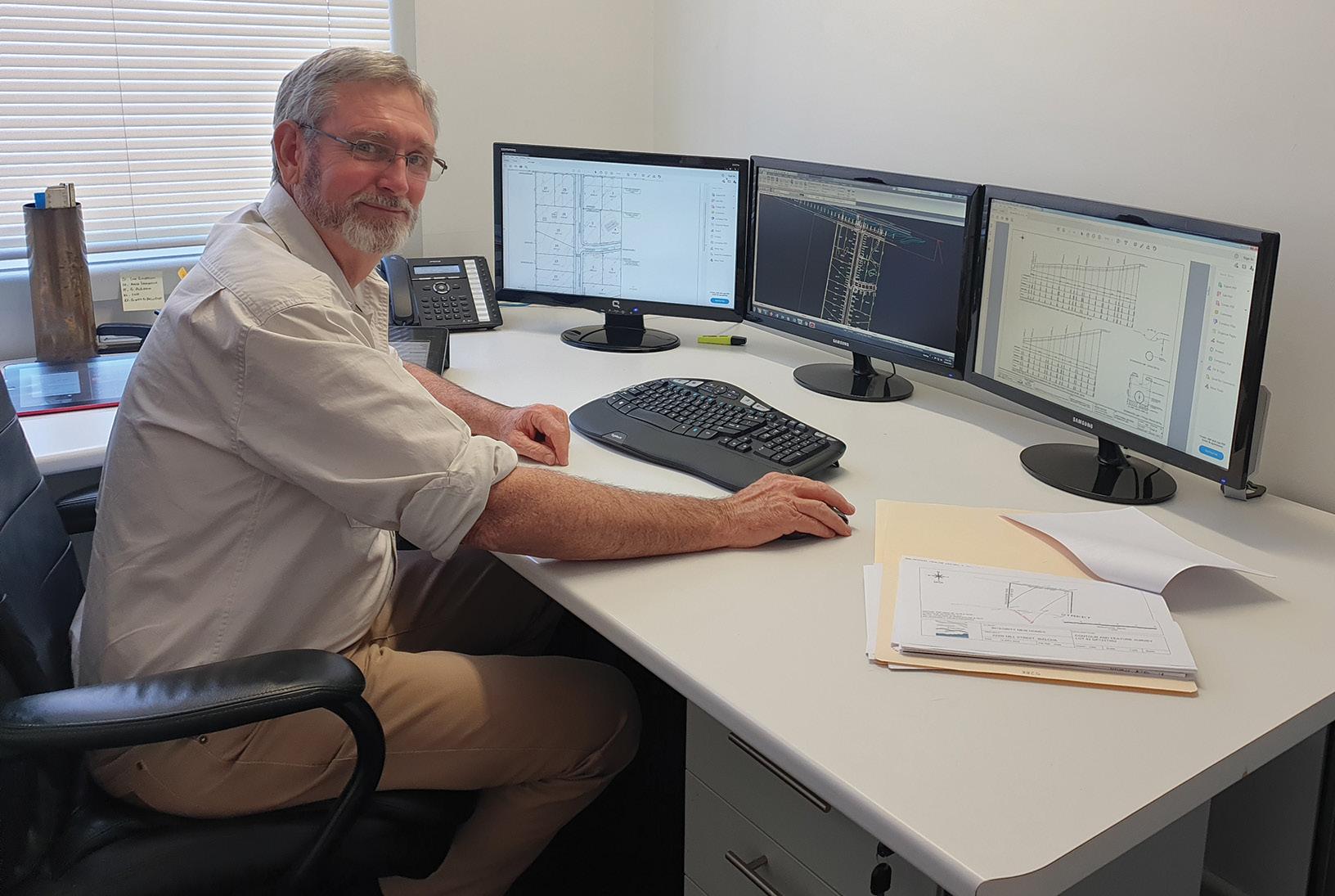
MAGNET Office CAD user, Cliff Stewart, has been using the software since it was called CivilDes way back in the 1980s.
partner feature
(formerly Position Partners), which sells and supports the software in Australia and New Zealand, remembers the challenges of supporting customers in his early days with the company.
“I joined when we were shipping 3.5-inch floppies,” he said. “We used to have to cut those floppies by hand; it took ages to produce all the disk sets to send to customers when there was an update. How times have changed now with customers just downloading updates when they want to in a few minutes.”
The move to version 6 in 2002 was a challenging time for the software, Cliff recalls, as the platform moved from DOS to a Windows environment. Many customers chose to stick with the robust version 5 until the bugs had been worked through. Version 7 was the first full Windows-based upgrade, released in 2010. Like version 5, it was a very stable platform that surveyors and engineers relied on for many years, often foregoing further updates.
In 2013, Topcon changed the brand from civilcad to MAGNET, bringing in a new era of modular application-based solutions and integration between field, office and enterprise
project management tasks.
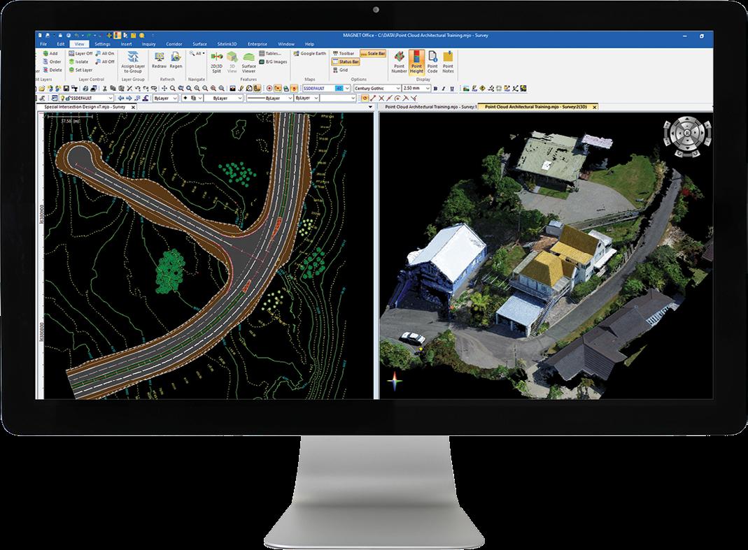
Fast-forward to the present, and MAGNET is a complete workflow solution that enables collaboration across multiple teams and stages of a project. Used by land surveyors, mine surveyors, engineers, project managers, building trades and more, the interface now has more than 10 modules that can be used for layout, data collection and large infrastructure 3D site management, to name just a few applications.
In recent years, the platform has evolved further still, with cloud computing enabling network licensing and the ability to import and work with large data files in many formats.
Graeme Hetet specialises in MAGNET Office support as a Customer Success Manager for Aptella, based in New Zealand. His experience with the platform goes back to the 1980s when he managed CAD designs for a local authority.
“I too remember the Houston 4 pen plotter — at the time we were all amazed by its capabilities to change pens for different thicknesses, tracing paper going back and forth!” he said.
Having served customers since the early 1990s with support for civilcad, now
MAGNET, Graeme says the software is far more user friendly and powerful.
“A lot of manual process and tasks that would take a lot of clicking around, can now be done effortlessly with a single click,” he said. Examples include the interactive road corridor design module that automatically recalculates volumes without manual adjustments, and the ability to work in other modes without changing screens, such as Layer Manager and Property Manager.
Many features, Graeme explains, have come about in

direct response to user input. Recent examples include plotting enhancements, an as-designed, as-constructed module, and the ability to import point cloud data.
“I think one of the reasons it continues to be a preferred software choice for surveyors is because of the close working relationship the Aptella team has with both end users and with Topcon’s development team,” he said. “We advocate for our customers in Australia and New Zealand to get their feedback heard and requests incorporated into future releases wherever possible.”
Later this year, the MAGNET name will be phased out with the release of Version 9, unifying the software suite under the global Topcon brand.
“It may come as a surprise to some users that Topcon is behind the MAGNET software suite, and has been for decades,” Adam said. “Many think of the company as a hardware manufacturer, but software is at the very heart of almost all products they design.”
“The software users continue to rely on for their day-to-day CAD work has undergone multiple improvements and name changes over the years,” he continued. “The team behind the scenes, however, has been Topcon software developers since the mid-90s, continuing to innovate locally here in Australia, with the backing of a global team.” n
The MAGNET name will be phased out with the release of Version 9, unifying the software suite under the Topcon brand.
www.spatialsource.com.au 15
Since the mid-90s, Topcon developers in Australia and overseas have continuously upgraded MAGNET’s capabilities.
CQ&A
with Chris Rizos
JONATHAN NALLY
Geodesy underpins surveying and many branches of science, yet it’s often misunderstood, underappreciated or overlooked, says Chris Rizos.
hris Rizos is an Emeritus Professor at the School of Civil and Environmental Engineering at the University of NSW. His research interests are geodesy, surveying and navigation, and he’s currently serving as President of the International Union of Geodesy & Geophysics (IUGG) for the term 2023 to 2027. Reflecting on his career and the rise of GNSS in general, he says that “basically GNSS is what made my academic reputation and it is what has given geodesy such high value and visibility”.
How do you define geodesy and its role in the sciences?
Geodesy is an applied science, because it had from its very beginnings the desire to answer the question of ‘How big is the Earth and what shape is it?’. Hence geodesy has a fundamental connection to geography, to geometry, to cartography. Then you could even say that once we started drafting accurate maps, geodesy had a role to play in land ownership and cadastral systems. That’s where the surveying connection comes in — it’s why surveying has geodesy at its core. In fact, surveying is the only profession that has geodesy as one of its foundations.
If you look at geodesy as a science on the other hand, you connect to physics and mathematics, you have people dealing with earthquakes, the physical and fluid surfaces of the Earth, the composition of the Earth’s interior, its gravity field, and many other geoscientific phenomena that have geometric or gravimetric signatures. The undergraduate degree for geoscientists is typically from the sciences, whereas the undergraduate degree that introduces geodetic concepts is to be found in the engineering disciplines, such as surveying. Hence geodesy has been around for many, many years, and has had many, many narratives. But the principle one has always been answering questions about the shape and size of the Earth and
its variation (that is, geometry), its orientation in space (hence its connection to astronomy), its rotation (related to time), and the Earth’s variable gravity field (principally dealing with the physics of the Earth).
Ultimately, of course, we moved into the satellite era. As the accuracy of determining position and gravity increased, and became global, then geodesy went well beyond just supporting cartography to being the vital geoscience that it is today.
So when did GPS start to make its presence felt?
The first GPS surveys in Australia were geodetic or control surveys — replacing the use of terrestrial distance and theodolite angle measurements. Using GPS receivers for geodesy was the first civilian use of GPS signals, before GPS became the indispensable navigation technology that it is today.
It must be remembered that even before GPS was fully operational, in the 1980s geodesists were using it to measure coordinates with millimetre accuracy. With such ultra-high accuracy, even the movement of ‘static’ ground points could be monitored over time. Although the US military had designed a navigation technology with 10 to 20 metres accuracy, scientists at JPL (and a few other places) developed the special GPS hardware, and then through the 1980s many of us worked on the software to be able to use differential positioning techniques, and through the processing of carrier phase measurements, to do things for which GPS was not designed. We still use GPS (or more correctly GNSS – Global Navigation Satellite Systems) in this way for precise positioning, which is quite distinct from what you can do with GNSS in smartphones.
But what is different now is that we can do it literally with the click of our fingers in real time. Back in 1985 it took us hours — we’d have the receiver set up on a stationary (ground) mark for many hours,
Chris Rizos, Emeritus Professor, School of Civil and Environmental Engineering, UNSW.
16 position April/May 2024 q&a
“The word ‘monitoring’... now probably best describes the capability that geodesy has developed.”
collecting data from all visible GPS satellites simultaneously from a number of these specialised GPS/GNSS receivers. The data was then downloaded from all receivers, and then we spent a few days processing the measurements on a computer.
In the decade that followed, companies like Trimble, Leica, Ashtech (and others) said, “Oh, maybe we can sell our equipment to surveyors because they can afford to sit still for a few hours and get coordinates which would have taken them days to determine using the old conventional techniques”. That was a productivity jump, as many survey agencies and larger companies could afford to spend up to $100,000 on a GPS/GNSS receiver. Of course, what has happened is operations became faster, and the hardware became cheaper. Precise differential GNSS positioning is now a standard, turnkey capability, with many services available to support this; some are free open services, and some are private subscription based.
Note that the precise positioning ‘productivity’ has increased, but not the coordinate accuracy.
You mentioned millimetres in the 1980s. That might surprise some people. When we achieved millimetre accuracy positioning in the 1980s, geodesy suddenly elicited the response “Wow!” In contrast to using satellite laser ranging stations and radio telescopes stations, which are very expensive, immobile and of which there are few — just a couple of dozen observatories around the world were able to have their position precisely measured and monitored — GPS could be utilised with highly portable ground a receiver that was relatively inexpensive, and operated for a couple of hours. GPS geodesists could obtain similar positioning accuracy to those who used multi-million-dollar telescopes. As you can appreciate, that dramatically changed geodesy, and since then geodesists
(and many other geoscientists) have benefited — just like surveying has — from the reduction in cost and the increased speed of precise positioning.
For instance, we have a heritage of decades of tracking tectonic plates, and at the end of the day we’re not going to get a more accurate estimate of the rate of change in movement of, for example, the Australian continent. What we’re going to do is increase the density of monitored ground points. That’s when you start seeing internal deformation of plates that are signatures of deeper Earth processes. In parts of the world which are tectonically active, even over a distance of a few kilometres, points might be moving at different rates.
The word ‘monitoring’ (of geometric and gravity changes) now probably best describes the capability that geodesy has developed. We’re monitoring what is a dynamic Earth — volcanoes are dynamic, the crust is dynamic, the atmosphere is dynamic, the oceans and ice sheets are dynamic. Many dynamic Earth phenomena can be investigated through continuous monitoring of changes in co-ordinates and changes in gravity. So that’s why we can measure sea level rise, because with satellites we can measure very accurately the shape of the surface of the ocean over time — not just day to day, but over many years, and we can see sea level rise in all its spatial and temporal complexity.
So geodesy underpins our understanding of the environment? Yes, that’s the message geodesists have been trying to get out for a long time. Modern geodesy helps so many of the other geosciences. For instance, seismologists can detect tsunamis but they are likely using buoys with GNSS receivers on them, or by monitoring fluctuations in the ionosphere, again using GNSS geodesy techniques.
Hydrologists are using what are essentially geodetic satellites to measure
changes in gravity to draw inferences on seasonal effects of rainfall in river basins such as the Amazon and the Ganges, or the long-term monitoring of underground water in the Great (Australian) Artesian Basin and elsewhere, or the secular loss of ice in Greenland or Antarctica. Atmospheric scientists are using networks of GNSS receivers on the ground as well as aboard orbiting satellites to monitor fluctuations in water vapour content. These data are vital for numerical weather models.
Seismologists, volcanologists, glaciologists, atmospheric and ocean scientists nowadays use geodetic techniques, technologies and data products from national agencies such as Geoscience Australia, and the global International GNSS Service (IGS) for many, many applications, from early warning systems to furthering the basic understanding of dynamic Earth processes.
But is modern geodesy too successful? Many of our peers in the geoscientific community take geodesy for granted. This is analogous to surveying — surveying is taken for granted because civil engineers assume that all this technology just works, it is easy to use and that they’ll determine coordinates without error, and everything will line up and fit. The geodetic infrastructure that underpins modern geodesy is largely invisible, because in the case of GNSS you’re dealing with satellites that you can’t see, using signals that you can’t see, tracked by small inconspicuous ground receivers. And you’re dealing with geodetic reference frames that you can’t see or touch, and concepts that are extremely complex and highly mathematical, with only a very few people across them.
That’s why we’re trying to draw attention to the fact that geodesy is indispensable for the primary function of determining co-ordinates, gravity field parameters and Earth orientation, for so many societal and scientific applications. n
www.spatialsource.com.au 17
Locate24: THE GEOSPATIAL EVENT
Geospatial professionals from Australia and beyond will gather in Sydney in May for the year’s major annual conference.
WHAT: Locate24: The geospatial event
WHEN: 7–9 May 2024
WHERE: International Convention Centre, Sydney WEB: locate.geospatialcouncil.org.au POP-UP CAFÉ SPONSOR


Excitement is building throughout the geospatial sector as the Geospatial Council of Australia’s (GCA) Locate conference makes its return to Sydney from 7 to 9 May 2024. Well over 1,000 delegates will enjoy three days of presentations, panels, workshops and exhibits as they catch up on the latest developments in the field and network with colleagues old and new.
The venue is the International Conference Centre (ICC) at Darling Harbour in the heart of the city. The ICC is a premium venue that conveniently combines conference and exhibition spaces in a single place, within easy reach of multiple modes of public transport. There’s also plenty of undercover parking available.
The conference will kick off on Tuesday, 7 May with 11 different workshop streams… covering topics such as harnessing synthetic aperture radar for hazard monitoring, leveraging digital twins for local government, progress on the ICSM Cadastre 2034 project, hands-on satellite imagery training for NSW government agencies and councils, unlocking Australia’s positioning potential, the OGC ANZ Forum workshop, the young and emerging professionals forum and many more.
The workshops will be followed by the official conference welcoming reception (canapes and drinks), beginning at 5:00pm.
Plenary program
The main program on the 8th and 9th of May, will comprise four plenary sessions plus technical workshops and concurrent speaker sessions.
The opening plenary will be chaired by Kate Lundy, Chair/President of the GCA, who will unveil the highly anticipated ‘Economic Impact of Geospatial Information’ report. She will be joined by Narelle Underwood (NSW DCS Spatial Services), Martine Woolf (Geoscience Australia) and Paul Farrell (NGIS), who will present industry case studies.
The second plenary will focus on ethics and governance in the field of generative AI, with a panel of experts — featuring Ian Oppermann (Service Generation), John Valastro (Simplyai) and Prof. Fang Chen (UTS Data Science Institute) — to discuss the governance of AI and how it will affect the geospatial sector.
The third plenary, titled ‘Sustainable horizons: Integrating culture, community and environment for a brighter future,’ will bring together Prof. Deen Sanders (University of Newcastle), Rory Brown (Transport for NSW), Dyan Currie (Brisbane City Council) and Dr James Johnson (Geoscience Australia) to lend their expertise to a thought-provoking discussion covering a diverse range of topics including indigenous mapping, smart cities, economic growth and sustainable development.
The fourth plenary will bring together leaders such as Brian Nicholls (Woolpert), Lisa Bush (Geoscience Australia), Dr Victor Khoo (Singapore Land Authority), Prof. Sisi Zlatanova (UNSW) and Tony Wheeler (GCA) to share their experiences, insights and applied learnings on how current and emerging geospatial programs, technologies and trends are shaping the future of geospatial ecosystems.
THEATRETTE WITH THANKS TO 18 position April/May 2024 conference
SILVER SPONSOR GOLD SPONSORS BRONZE SPONSOR EXHIBITION
Substantial sessions
As you’d expect, the Locate24 speaker program will see a who’s who of the Australian geospatial sector come together to provide overviews of developments across wide variety of topics — GIS, surveying, hydrography, remote sensing, aerial imagery, LiDAR, 3D, BIM, PNT, spatial data and more — all aimed at offering solutions to problems and challenges faced by the wider community. Here’s just a small selection to illustrate the range of the presentations on offer:
• The value of PNT in underwriting Australia’s GDF — Martine Woolf (Geoscience Australia)
• Extending your GIS toolkit for science and research — Dr Sharyn Hickey (UWA) and Jennah Williams (Esri Australia)
• Faster, smarter, stronger disaster response — Ericka Martin (Planet Labs)
• Spatial Vision’s Women in Spatial Program — Amanda Tyrer (Spatial Vision)
• Transforming environmental monitoring with AI — Nathaniel Jeffrey and Dr Yang Chen (Department of Transport and Planning, Victoria)
• Machine Learning to aid in bathymetric LiDAR data processing — Mick Hawkins (Fugro Australia)
• Capturing history: Digital twin of heritage buildings — A/Prof. Zahra Gharineiat (UniSQ)
• Automating building code compliance through integration of geospatial AI and BIM — Nikoo Mirhosseini (University of Melbourne)
• How spatial is at the centre of smart places — Rory Brown (Transport for NSW)
The full program can be viewed and downloaded from locate.geospatialcouncil. org.au/program.
Community conference
The convenor of this year’s conference is Narelle Underwood, Surveyor-General of NSW and Executive Director of NSW DCS Spatial Services. She has been working closely with the GCA as part of the Steering Committee and Program Committee.
“I think this will be my fifth Locate conference,” she says. “Personally, the part I enjoy most is being able to network face to face with a wide variety of professionals from our industry from across Australia (and from overseas). Catching-up with people I’ve known for a long time and meeting new people — the conversations I have at Locate often lead to valuable collaborations.
“I always look forward to discovering the latest advancements in technology and methodologies that are shaping the industry. Things like innovative software tools, techniques for data collection and analysis, as well as best practices for improving efficiency and accuracy in our work. I love learning about the new applications that geospatial data is being applied to and the benefits it provides to the community.”
Underwood said the themes of plenary sessions highlight some of the main challenges and opportunities facing the geospatial sector.
On the economic value of geospatial information, she says that “We’re often the silent enablers of outcomes that have significant impact or provide beneficial outcomes for clients and the community. But we’re not always the best at articulating our impact and celebrating our success. This session will be an opportunity to share the research, reflect on the findings and consider how we can continue to grow the value of the geospatial section in Australia.”
The same goes for ethics and the


 Narelle Underwood, NSW Surveyor-General
www.spatialsource.com.au 19
Kate Lundy, GCA Chair/President
governance of AI. “Every area of society is being impacted by AI and there are lots of opportunities to address the national skills shortage in the geospatial sector and improve productivity through AI,” she says. “The NSW Government is integrating the NSW AI Assurance Framework with the NSW Digital Assurance Framework to ensure that our state is leading when it comes to AI and project standards.”
“I’m keen to hear from the industry and academic experts on how organisations should be thinking about AI and how AI will impact the geospatial sector into the future.”
She’s also keen on the value of integrating culture, community and environment for a brighter future. “How can we use geospatial data to address global challenges at a local scale and build a more sustainable future?” she asks.
Economic impact
Kate Lundy, Chair/President of the GCA, says that Locate24 will “give us all the opportunity to reconnect, reflect, learn, collaborate and inspire”.
“Geospatial is a sector that grows in

relevance and size every day as the ongoing digital transformation of our society and economy reaches deeply into every part of our lives,” she says. “Geospatial information helps us understand what is happening in, and to, the world around us.”
Lundy says the conference represents the perfect opportunity for the GCA to discuss its strategic priorities in pursuit of this purpose with members and stakeholders.
“The Geospatial Council continues to adapt and respond to the needs of our business and professional members. To guide our priorities, we have updated our strategic plan which articulates our purpose: to sustain a vital, diverse and thriving geospatial community for the benefit of the nation,” she says.
With regard to the report on the economic contribution of the geospatial sector to Australia, which will be launched Locate24, she says that “Telling the story of the geospatial sector and its enormous impact on so many facets of everyday life is a key objective of this study. Helping the sector be recognised by the community and decision makers for its profound impact and relevance is one of the GCA’s strategic objectives, building geospatial industry recognition in Australia.”
“I am also really pleased that the GCA has adopted a comprehensive Diversity, Equity and Inclusion Policy to augment our efforts to make participation in the geospatial sector even more appealing. You can find it on the GCA website,” she adds.
Awards, exhibition and registration
Of course, a highlight of the conference will be the presentation of the annual Geospatial Excellence Awards, which will take place during the Gala Dinner on the evening of 8 May. The Awards are an opportunity for the sector to acknowledge the work done by individuals and teams across the land, recognising excellence and commitment to the greater good. Categories range from students to future leaders, community
impact and international partnerships, and many more (see geospatialcouncil.org. au/geospatial-excellence-awards). Tickets for the Dinner and Awards can be booked during the conference registration process at locate.geospatialcouncil.org.au/registration.
Indeed, registrations are now fully open, with a range of options and pricings available for individuals and groups, including special rates for students and young professionals — see the aforementioned registration page for full details.
Finally, don’t forget the Locate Exhibition, which will feature dozens of product and service providers, large and small, each of which will be displaying their latest offerings and with experts on hand to answer any questions. The Exhibition will be open to all full delegates, plus casual attendees will be able to explore it freeof-charge from 12:30pm until 4:30pm on Tuesday, 7 May (although registration will still be required).
“There are so many benefits to attending Locate,” says Underwood. “The conference provides professional development and an excellent opportunity to stay informed about the latest trends and developments in the geospatial sector. Locate24 will be a great place to collaborate, share knowledge, and learn from each other’s experiences. This can help improve communication and cooperation across the industry, leading to greater efficiencies and innovation.”
Lundy agrees. “I am really excited to hear about technical developments in digital twins, applied AI/machine learning and sensor interoperability. However, it is people that sit at the heart of technology and its uses, so most importantly, I am keen to hear more about the skills pathways, career promotion and future workforce. I hope to see you at Locate24!”
In summary, Locate24 promises to be a fabulously enjoyable and informative event, bringing the community together for its annual celebration of the fundamental and vital role geospatial plays in our modern world. Make sure you don’t miss it! n
20 position April/May 2024 conference
VENDOR FOCUS

1Spatial
We are thrilled to announce 1Spatial’s sponsorship of Locate24. As a leading software solutions provider, 1Spatial is committed to leveraging location and geospatial data to empower decisionmaking processes worldwide.
We’re renowned for our expertise in managing location and geospatial data, offering powerful solutions across on-premise, mobile, and cloud platforms. Our dedication to data validation, integration, and automation ensures that our clients, including utility companies, mining, government agencies, and transportation organisations, benefit from current, complete, and consistent data. We believe that the key to a more sustainable, safer, and smarter future lies within data, and we are dedicated to realising this vision.
We are excited to introduce the UN Migration App, a groundbreaking tool designed to streamline the migration processes to the new ArcGIS Utility Network. By harnessing the power of the Asset Package and other cutting-edge features, this app offers unparalleled efficiency and accuracy in data management. Additionally, we invite you to explore the latest features and enhancements in FME 2024, maximising the potential of spatial data.
At Locate24, 1Spatial will be presenting a live case study with Hunter Water, where we delved into a compelling use case study highlighting the challenges encountered during their migration to the new ArcGIS Utility Network. Hunter Water’s experience showcased the need for robust solutions to maintain data integrity and accuracy.
Join us at Stand 32 in Locate’s exhibition space to engage with our professionals and learn more about our products, and attend our workshop for a hands-on experience with FME Accelerator, GDVHub and the 1Spatial platform.
1spatial.com/au
03 7018 7600

Nova Systems Geospatial
Nova Systems Geospatial enables organisations to harness the power of geospatial information, technology and data to make our world safe, secure and sustainable. Our marketleading consulting team, based in Australia, designs and builds geospatial focused software and cloud solutions for government and enterprise organisations. We provide managed support and maintenance services to ensure the seamless operation and security of the systems we create. Our solutions are relied upon by clients in our core markets across fire and emergency services, land management, transport, utilities and defence.
Nova Systems is a 100% Australianowned and -controlled engineering services and technology solutions company. We employ more than 850 talented and dedicated professionals across our strategically located offices in Australia, New Zealand, the United Kingdom, Ireland, Singapore and Norway.
Don’t miss our special presentation by Samantha Le May, ‘Navigating Bushfire Risk: A Geoprocessing Approach to BAL Assessment in Development Applications’ at 2:15pm on Wednesday, 8 May. Sam is a Senior Data Architect at Nova Systems with a background in geospatial intelligence and academia who leveraging her skills in data processing, data science, and data governance to develop practical geospatial solutions in data-driven projects.
The presentation will explore the development of a tailored geoprocessing solution for the assessment of Bushfire Attack Level (BAL) within the NSW planning system. In collaboration with the NSW Rural Fire Service (NSW RFS), Nova Systems translated the method outlined in the Australian Standard (AS 3959:2018) into an executable geoprocessing service, embedded within the Development Application Screening Tool (DAST).
novasystems.com/au
08 8252 7100

Landair Surveys
For more than 50 years, Landair Surveys has been delivering exceptional results in aerial surveying, land and bathymetric surveying, for clients all over Australia. With talented teams available in Melbourne, Sydney and Brisbane, we love helping our clients capture aerial imagery, and producing orthophotos and 3D products that enable better management, mapping and monitoring in businesses and projects.
Working from our own Vulcanair P68C aircraft, as well additional aircraft through our partners, our team uses state-of-the-art Leica and Phase One camera equipment to capture 4-band aerial photography and create orthophoto mosaic and 3D products to meet exacting requirements. Landair is renowned and respected for our no-compromise commitment to client service, quality communication and strong relationships.
Our clients span government and corporate sectors, across infrastructure, environment, property and resources. If you can name it, we’ve surveyed it! In the last 12 months, we’ve undertaken large aerial photography projects for the Queensland, NSW, Victorian and Tasmanian state governments, including our largest ever aerial survey job for NSW Department of Planning and Environment, an area of 12,892 square kilometres.
From small project sites to bushfire and hazard reduction burn mapping; township and city mosaics to large rural areas; and 3D photogrammetric mapping from historical imagery, Landair Surveys has the resources and experience to provide high quality and timely spatial solutions for you.
Come and visit us on Stand 31 in the exhibition space. We’d love to chat with you to understand your project requirements and demonstrate our range of solutions.
info@landair.com.au
1300 130 158
www.spatialsource.com.au 21
ROBUST ROVER enhances horizontal directional drilling
Directional drilling company SADB is combining the power of the Leica Geosystems iCON gps 160 rover and BricsCAD software.
SADB is a family-owned company that began life back in the 1960s as a tree-lopping and landscaping business before evolving in the 1990s into a horizontal directional drilling and civil construction company.
“The horizontal directional drilling is the really unique part of our business,” said Sam Taylor, SADB’s Business Services Lead. “Rather than ripping up the road to put pipe in the ground, we can just politely drill from one side of the road to the other, under the surface. We can even do it while people are still using the road above, under bodies of water and across mass highways, covering kilometres of piping underground.”
The avoidance of disruption to what’s happening on the surface is a major consideration, according to Sam. “If you’re looking at it from a holistic point of view, it is impactful on the environment than trenching, too — we’re not disturbing any of the nature up on the top level.”
Drilling down
Naturally, one of the prime considerations when drilling is to avoid any underground services such as gas and water pipes or electrical cables. And that’s where precision positioning comes in.
Since late last year, SADB has been using a suite of solutions supplied by C.R. Kennedy to improve the accuracy and efficiency of its operations — a Leica Geosystems iCON gps 160 GNSS smart antenna along with iCON site software for field pickup and set-out, and Bricsys BricsCAD software for design and analysis. Previously, SADB had to outsource to third party survey providers.
The iCON gps 160, which SADB uses as a rover (it can also be used as a base station or for machine guidance), is designed to provide versatility for the construction industry. It features a large colour display and a quick setup without the need for extra hardware, plus tilt compensation of up to 20 degrees (along with an optionally available IMU to further increase efficiency with tilt-compensation). Other features include SmartLink Fill, which bridges interruptions in the RTK connection signal for up to 10 minutes; an integrated global modem; IP66/ IP67 protection; and seamless integration with other Leica iCON field solutions.
The iCON site software is designed with construction and civil engineering projects in mind, providing increased performance and productivity on-site through its smart digital workflows and easy-tounderstand user interface, all of which act to improve quality and reduce errors. Cloud connectivity, through Leica ConX, enables quick and safe exchange of data, reports and design updates… not only between different locations but also between personnel and machine operators on the same site.
Sam explains how a typical job works with the iCON equipment. “First, the client will give us a design drawing and we’ll use that to search Before You Dig Australia [previously Dial Before You Dig] to find out which, if any, services are in the area where we’ll be working”.
“We’ll then do a site visit to accurately determine the exact location of services, positively identifying where needed. This will then dictate where the pits will end up being dug — the entry pit and exit pit; we drill from one to the other. So of course, the pits have to be in locations where there’s no power or gas.”
“We use the iCON gps 160 rover to mark up the alignment from one pit to the other and produce the drawings. Then the drilling occurs based on the alignment we’ve chosen.”
In the past without the rover, SADB would have had to arrange for a service
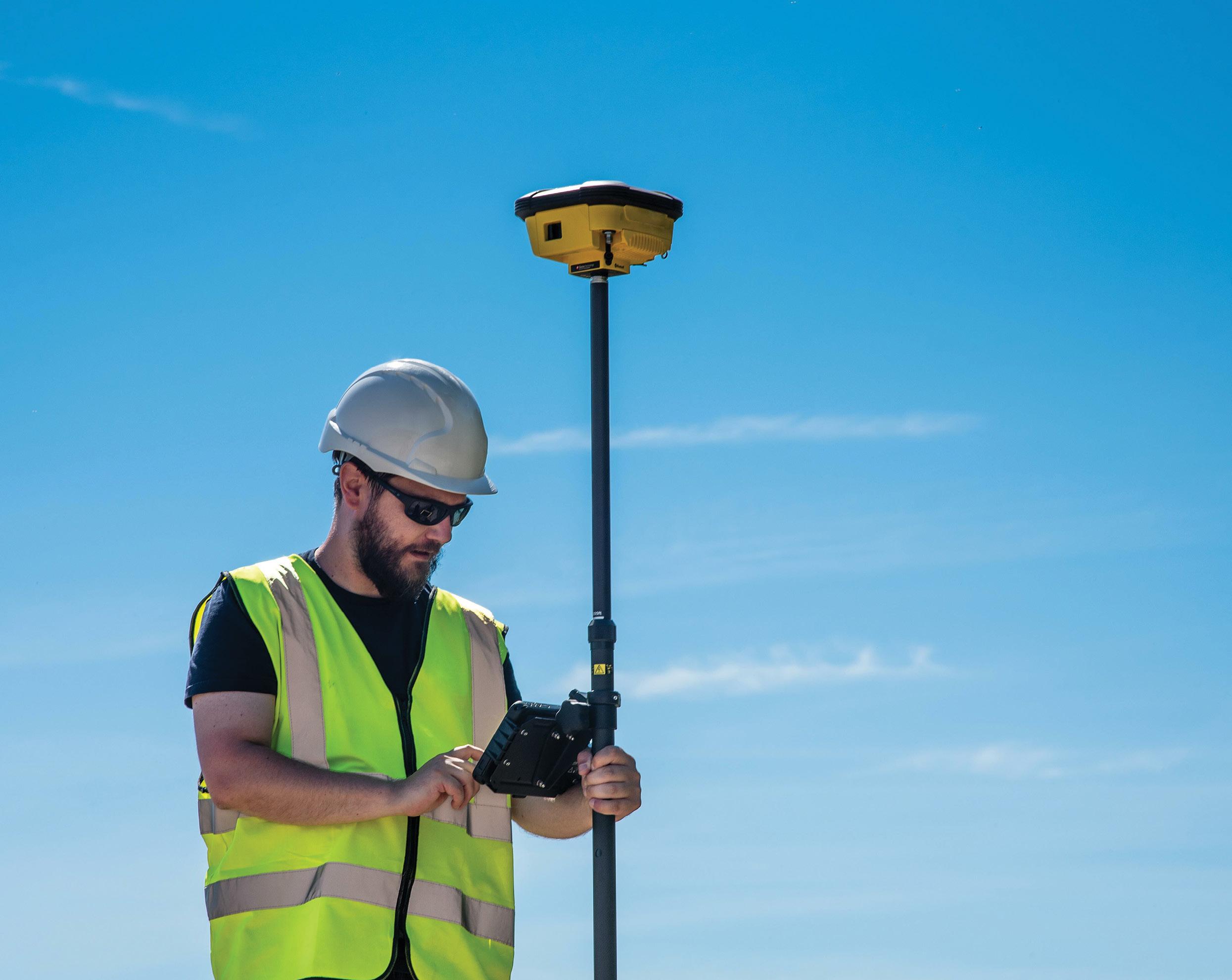
22 position April/May 2024
feature
SADB has found the iCON gps 160 rover very easy to use.
partner
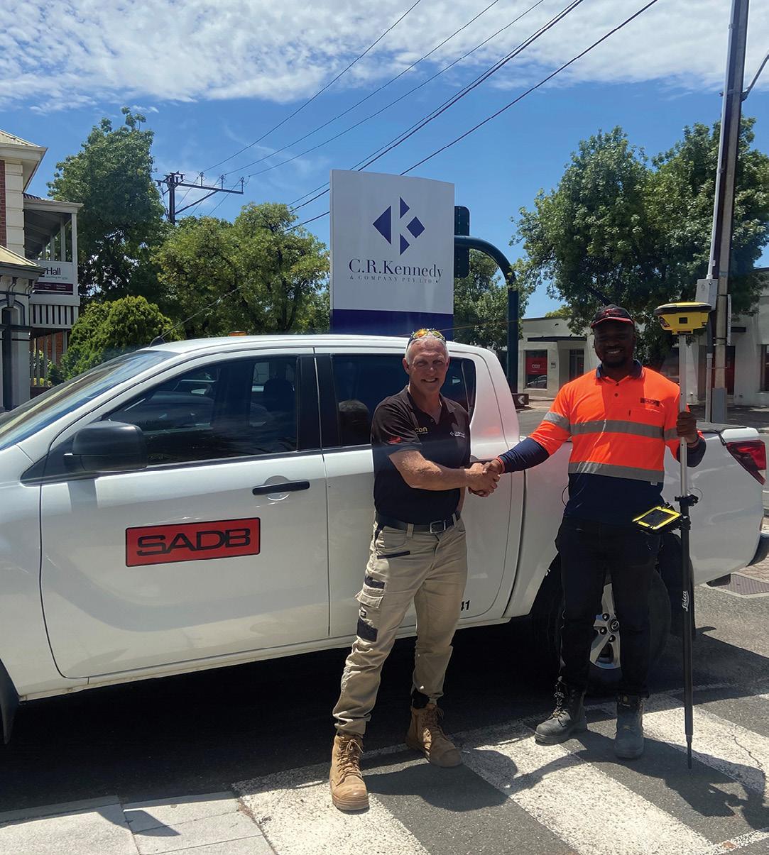
locator to come out and mark up the alignment by painting the ground or grass. But after just days or weeks the grass would have grown or been cut, or the rain would have come and washed away the paint… so it’d have to be marked again. Sometimes it would need to be marked three or four times in the course of a project.
Or if the job had needed a surveyor, it might have meant waiting until a surveyor was available. “And of course, that tied up our resources, plus having to take the surveyor out to site and explain the job to them. It took up time on both our side and also for the surveyor,” said Sam.
But the iCON gps 160 is so easy to use and so efficient that SADB’s own in-house engineers can do the job themselves. “Now with the rover, we mark the locations and then we have them forever,” added Sam. “We don’t have to worry about sending someone out there again.”
“The rover is very easy to catch on to,” said SADB engineer, Immanuel Ibeanu. “If there is a cadastral drawing for the project, you just throw that onto it and see the overlay of the drawing. Then you set up the coordinates for that particular project, and more often than not the plan says what the
coordinates are. Then once all of that is set up on the rover, it is just a matter of going to site, setting up your equipment, grabbing the rover and just measuring points as you go.”
“It is a really efficient set up and it’s easy to get what you need,” he added. “Depending on the size of the project, it will normally take me one to two hours to pick up all I need, then I’m back to the office and uploading the data onto BricsCAD.”
3D
by design
BricsCAD, developed by Bricsys (part of Hexagon), is a set of CAD and modelling tools made specifically for designers and engineers. Broadly speaking it features six functional tool sets: 2D drafting, 3D modelling, civil and surveying design tools, point cloud import and processing, 3D BIM tools, and 2D and 3D mechanical design.
BricsCAD enables users to add industry-specific toolsets using hundreds of third-party applications, while custom workflows can be built via LISP, .NET or BRX APIs. Menus and user interfaces can be customised, and you can even migrate legacy customisations from AutoCAD. It also enables the user to exchange design data freely across all project
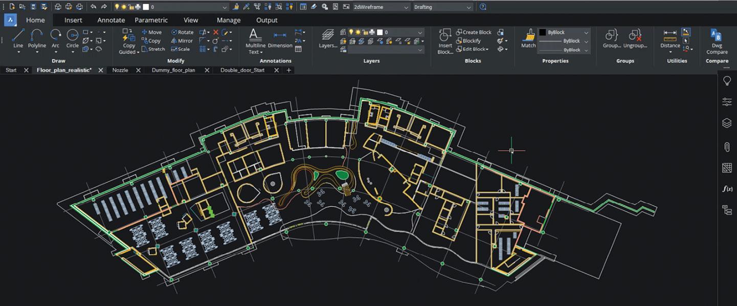
stakeholders using all major file formats.
Those comprehensive features and the ability to handle 3D has meant SADB’s experience with BricsCAD has been very positive.
“We had AutoCAD in the office, which can read two-dimensional drawings. But because the rovers produce 3D information, we needed software that could read 3D,” said SADB project manager, Alan Thong. “And BricsCAD is a system that is relatively cheaper than AutoCAD. So that’s why SADB is going down the path of making BricsCAD our go-to software.”
A helping hand
Like any new system, it takes time to get the hang of it. That’s why after-sales service and assistance is so vital, as time is money. And one of the great advantages of the iCON equipment is that remote assistance can be provided on the spot.
“As a beginner using the rover, I’ve gotten a lot of help from C.R. Kennedy by just connecting to them wherever I am on the job site, on the tablet, so they can see exactly what I’m seeing and go through it step by step on what I need help with,” said Immanuel. “The rover has a SIM card in it which it uses to connect to the Internet, so when we need help with it on site, whether it be on Kangaroo Island or wherever, we can call C.R. Kennedy and say, ‘Hey, can you please log into my device?’ and they can work to resolve the issue.”
Sam agrees, saying that SADB looked at three or four different suppliers and, after a detailed investigation, ended up going with C.R. Kennedy.
“C.R. Kennedy has been very helpful and co-operative and have gone out of their way to assist us in various ways,” he said. “We were up and running and doing in just weeks what would previously have taken months to complete.” n
David Visciglio (C.R. Kennedy) and Immanuel Ibeanu (SADB) with the Leica Geosystems iCON gps 160 rover.
The combination of the iCON gps 160 rover, iCON site software and BricsCAD software is making horizontal drilling a lot easier.
www.spatialsource.com.au 23
The BricsCAD software works seamlessly with the 3D data provided by the iCON gps 160 rover.
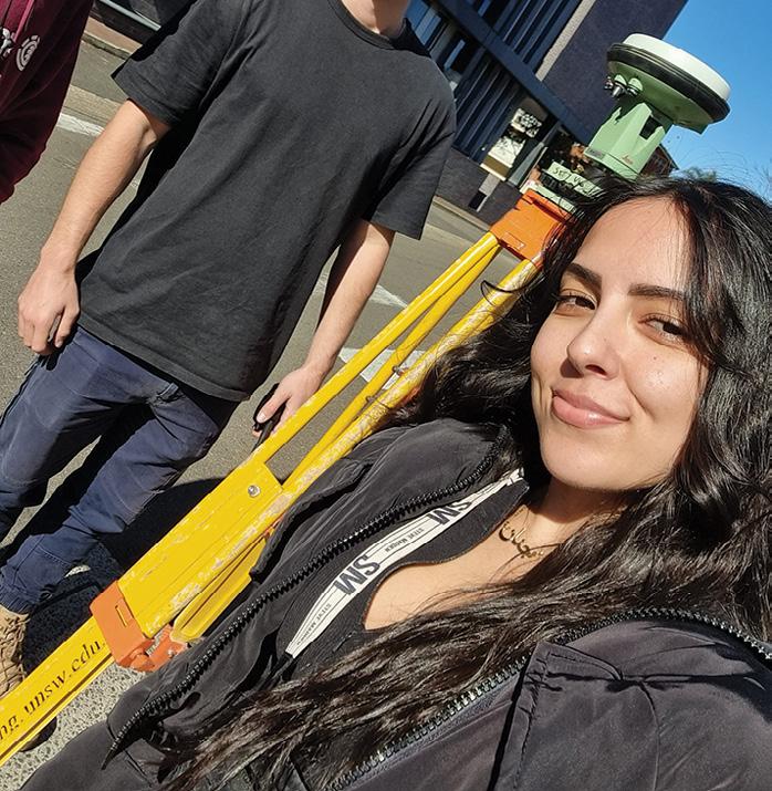
CELEBRATING women in geospatial
JONATHAN NALLY
Profiles of five professionals who are excelling in different segments of the geospatial field.
We celebrated International Women’s Day (8 March) this year by publishing online profiles of five outstanding professionals who have chosen different career paths within the spatial and space sectors. Edited versions of those interviews are presented below, but we encourage you to read the full profiles by going to spatialsource.com.au/international-womens-day-2024.
Jinan Al-Asadi
Jinan Al-Asadi is a surveying engineering student at the University of NSW.
How did you get into this field?
In my senior years of high school, I chose engineering studies as one of my electives, thinking it was related to architecture (which is what I initially intended on studying after graduating). When the term commenced, I realised the subject was very different and unique compared to anything I’d learnt about in the past. I was able to utilise the skills I was gaining in mathematics and physics within the course and very much enjoyed the problem-solving aspect of the subject.
I then attended a few UNSW engineering field days that were advertised and was set on studying engineering. Initially, I wanted to be a civil engineer, but after completing a surveying subject in my first year of university, I decided to apply to transfer to UNSW to study Surveying Engineering.
As a woman, have you had any struggles during your career? Conversely, have you had support? In the field of construction, I had some struggles as I am a small build and was relatively young (21 years old) when I started. However, I think engineers as a whole struggle in gaining respect from those outside of the field of engineering due to the construction culture.
I’m grateful for experiences, both negative and positive, because they helped me gain communication skills with all sorts of people, as well as gain resilience. I had support from management and other colleagues if there were any communication issues on- or off-site.
We need more women in the geospatial sector. Do you have any ideas? I believe both men and women should first be educated on what geospatial and surveying engineering are. Most people who I know who aren’t engineers ask me “What is surveying?” when I tell them that’s what I’m studying. I believe high school students should be exposed to all work fields so they can decide what they want to study after school.
There are female dominant fields as well as male dominant fields. Naturally, men and women may be inclined to particular fields and that’s okay! However, both should be given the opportunity and support to study/work in any field that they desire, including engineering.
Your environment at home also has a major impact on what you decide to do as an adult, so educating parents to be supportive and not forceful on their children is important. If your daughter/ sister/mate wants to be an engineer, just be supportive! Honestly, it’s not a big deal if a woman works in a male dominated field, just as long as they have support. It’s like a man working in a female dominated field (i.e. nursing). What’s the big deal?
24 position April/May 2024 DEI
Grace Mulcahy
Grace Mulcahy is Mine Surveyor for Resource Development with Rio Tinto, and Secretary of the Australian Institute of Mine Surveyors.
Please tell us about your current role.
I work a fly-in, fly-out roster in the beautiful Pilbara region of north-west Australia. I lead a team of survey assistants, and together we maintain a spatial model of all exploration activity across our East Pilbara Iron Ore assets. Our main responsibilities include mapping greenfield disturbance, protecting sites of ecological or heritage significance, curating GNSSempowered machine guidance systems, and providing survey support to our colleagues in the hydrology, geoscience, operations or environmental teams.
In my spare time, I hold the role of Secretary for the Australian Institute of Mine Surveyors (AIMS). It’s humbling and inspiring to meet so many of my peers through AIMS, all of whom passionately serve and contribute within our community.
What do you enjoy most about your job?
I love how a surveyor has the ability to speak on behalf of the physical landscape.

We respect the data we work with and share it lovingly, knowing that we’ve done our best to truthfully represent the shapes and trends that the landscape presents. Surveyors can translate concerns about water levels, road conditions, structural deformation or habitat loss into quantifiable data which can inform meaningful action. Our skills help us put bridges over water, roofs over heads, and minds at ease.
My current role relies on me to perform this translation; this is what I love most about my job. Every day I’m called upon to use my maps and data to communicate the challenges or opportunities the landscape is offering us. As a surveyor, I keep my colleagues safe by virtue of understanding our physical world.
As a woman, have you had any struggles during your career? Conversely, have you had support? I’ve never had to fight for a seat at the table, and for that I’m glad. But I feel that the modern challenge for women in our profession is to feel heard at the table.
We’re qualified and capable professionals, yet we feel the need to justify our presence as though we didn’t earn our place — as though the only reason we got the job is because they relaxed the standards for us. This is simply not true.
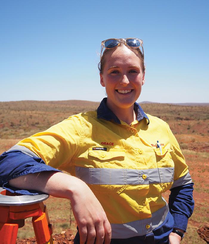
However, these feelings often manifest in persistent and complex anxieties, especially when some amongst our peers express their disapproval or scepticism towards things like diversity strategies or the gender pay gap. Many of us recall feeling as though we’ve been treated like a trainee or viewed as a novelty instead of the professionals we are. It’s not just women in surveying who feel this, but women in many of the adjacent STEM fields.
Establishing myself as a surveyor in the mining industry, both of which are traditionally male-dominated spaces, has proven to be the biggest challenge of my career so far. But I proudly report that I have felt nothing but pure support and appreciation from each of my surveying colleagues. I will never be made to feel unwelcome by a fellow surveyor — of that, I’m confident.
Please tell us about your current role. I oversee operations at the CSIRO NovaSAR-1 National Facility, which encompasses evaluating user requests, tasking the satellite images, overseeing data retrieval and ensuring accurate processing and distribution. Additionally, I handle administrative duties such as contract negotiations, website updates and addressing user enquiries.
How did you get into this field? I completed an MSc in Environmental Monitoring, Modelling and Management, which provided me with an introduction to earth observation (EO) and geographical information systems (GIS), showcasing their applications in assessing and analysing the world. Fascinated by the vast number of applications of EO data, I was determined to pursue a career in the field.
My professional journey began as an image processing assistant at DMCii, a subsidiary of Surrey Satellite Technology Ltd which later merged with Airbus UK. Here, I initially focused on tasks such as orthorectification, cloud-masking and image mosaicking. Progressing from there, I advanced to coordinating the DMC constellation satellites and the ESA satellite CHRIS PROBA-1 to support customer projects. Additionally, I assumed the role of an emergency on-call officer for The International Charter Space and Major Disasters, an experience I cherished as it underscored the impact of my work.
What do you enjoy most about your job?
I remain captivated by the diverse applications of EO data. NovaSAR-1 data,
for instance, has been utilised across various domains, ranging from flood and bushfire monitoring to iceberg tracking and ship detection. It also contributes to landuse analysis and vegetation monitoring and the decarbonisation efforts of rice paddies. I appreciate CSIRO’s commitment to making data freely accessible, eliminating financial barriers for students and researchers. This enables them to concentrate on scientific innovation without concerns about budgetary constraints.
As a woman, have you had any struggles during your career? Conversely, have you had support?
I have been lucky and had nothing but support in my career. At DMCii my team was predominately women and even after the merger with Airbus UK, where the environment was more male dominated, there were still numerous women occupying leadership positions. During this period, I successfully completed the Airbus ILM certified Management Development Program alongside several other women. Since joining CSIRO, I have been fortunate to work with several high-achieving women who have given every support and encouraged me to thrive.
Laura Brindle
Laura Brindle is Satellite Operations and Data Manager at the CSIRO Centre for Earth Observation.
www.spatialsource.com.au 25
Rachael Hurd
Rachael Hurd is Sub-discipline Leader, a Senior Lecturer and Course Coordinator for undergraduate courses in the Surveying & Spatial Sciences group, University of Tasmania.
Please tell us about your current role.
Over the past 18 years I have been in a teaching-focused role delivering units in satellite positioning, geodesy and surveying. As Sub-discipline Leader, I work with my colleagues to deliver a comprehensive and engaging educational program in geospatial science across all levels of tertiary studies.
Over the past two years I have led the team in a redesign of our curriculum and in 2024 we are very excited to welcome our first intake of students into our new Bachelor of Geospatial science with majors in surveying, landscape systems and data analytics.
The responsibilities that come with my current role also include advocating for and promoting the geospatial industry in Tasmania, to help increase community awareness of the importance of spatial data and its applications in society. As part of this I represent the University on both the Tasmanian Land Surveyors Accreditation Board and the Tasmanian Spatial Information Council.
Jemma Picco
Jemma Picco is Principal Surveyor for Survey Projects in the Queensland Government Department of Resources.
Please tell us about your current role and responsibilities.
I lead surveying projects for the Department of Resources. Our team of surveyors provides support to many areas of our Department, including the Land Services and the Native Title and Indigenous Land Operations teams. Our team also provides the surveying support to the Cape York Tenure Resolution team, which returns ownership and management
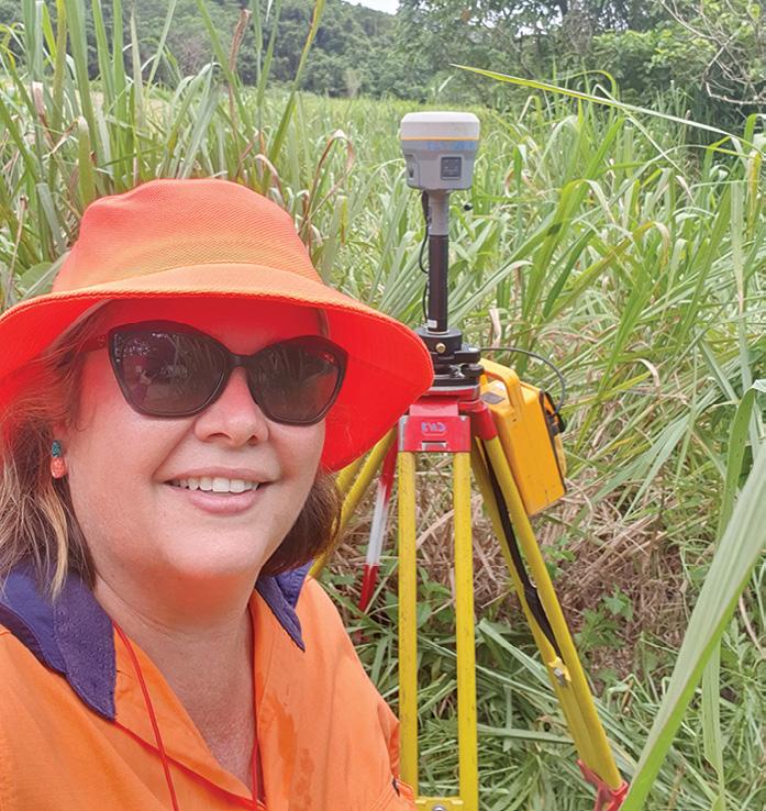
What do you enjoy most about your job?
The most rewarding aspect of my role is witnessing the journey of my students during their studies and in their careers beyond the University. It’s incredibly fulfilling to see them grow their skills and knowledge and then embark on a range of career paths, and eventually assume leadership roles.
Graduation day is one of my favourite days of the year. Knowing that I’ve played a part in shaping the next generation of spatial scientists who will contribute positively to society fills me with immense pride.
What makes you most proud about your achievements?
I am grateful for the opportunities that came my way and the decisions that I made that led me into this role. I’ve gone from a high school kid wanting to work outside (and never touch a computer; it was the late-1980s!), to a young graduate being convinced to do honours by a once-in-alifetime trip to Antarctica; to an honours graduate who told her supervisor she was never coming back to study but was then convinced a year later to do a PhD
of identified lands on Cape York Peninsula to local Aboriginal Traditional Owners, while ensuring the protection of Cape York Peninsula’s iconic natural areas and natural and cultural values.
What do you enjoy most about your job?
The people. I work with some of the most amazing, passionate and supportive people. The Department’s surveying services team has around 50 staff — a mix of cadastral surveyors, registered surveyors, surveying graduates, surveying associates, policy officers and surveying support staff. I understand that it’s the people that make all the difference in a workplace, and this enthusiasm has meant my part of my role has evolved into the lead for surveying recruitment for the Department.
As a woman, have you had any struggles during your career? Conversely, have you had support? Being a younger female in an ageing male profession, I have had to break some people’s unconscious bias of what a surveyor is. I have taken opportunities, worked with people who have supported and believed in me, fought for what I believed in, and I have learnt to believe in myself. I have found that proving yourself in a male-dominated profession is both real
when offered a twice-in-a-lifetime trip to Antarctica; to a PhD graduate who wanted to build a life and family in Hobart and who was offered research work and lecturing jobs; and finally to a senior leadership position at the University.
It’s been a journey of choices and chances that would not have been possible without enjoying what I do and having the unwavering support of some fabulous mentors and colleagues. I’m proud of the impact that I’ve been able to have and the support I’ve been able to provide to my students, colleagues and the broader geospatial science community.
and perceived, by others and by myself. Everyone has struggles in their career and some have been easier to deal with than others. I don’t find dwelling on them is particularly useful, so I choose not to elaborate here, but I do try to eliminate or reduce the struggles for others so that hopefully their journey can be smoother than where mine may have had potholes. I have had lots of support over the years, and I am so grateful for all the guidance, encouragement, training, and patience I have received from so many people. Hopefully I can be that person for others.
We need more women in the geospatial sector. Do you have any ideas?
In Queensland, approximately 1,400 new surveyors and spatial professionals will be required in the next decade. With only around 3% of registrants with the Surveyors Board of Queensland being female, there is a huge opportunity to engage with more women working in surveying to progress their qualifications, as well as encouraging more women to join surveying to help address the skills shortage.
I am honoured to be leading the initiative of formalising a Queensland Women in Surveying network. I am looking forward to meeting more women in industry and being able to connect, share experiences and continue to support one another.
26 position April/May 2024 DEI
Exploring Kurloo: Transforming 4D measurement monitoring
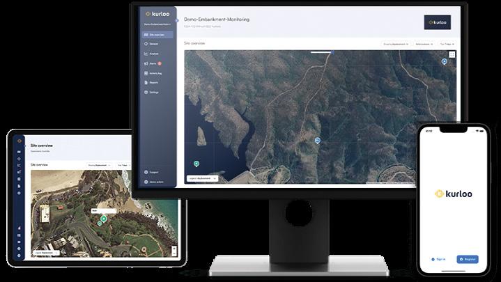
Kurloo makes delivery of frequent, high-quality 4D measurement brilliantly simple for monitoring. Let’s delve into why it is transforming the way surveyors, geotechnical engineers, engineers, operators, construction and project managers, scientists and asset owners manage ground and infrastructure movement.
Why use Kurloo?
When stability assurance or quantification of movement rates for slopes, structures and ground surfaces is required, Kurloo proves ideal for periods of three months or more, offering a seamless solution for pre-, during, and postconstruction phases while ensuring safety and efficiency. Kurloo delivers a new way of thinking that is more affordable and adaptable than current market offerings, bridging the gap between on-site surveying and expensive automated monitoring for 4D movement (X, Y, Z and time).
Which applications can benefit most?
Mining and quarries (e.g. tailings dams, waste heaps, slopes, settlement), ports (e.g. land filling by surcharge, seawalls), construction (e.g. embankments, tunnelling, abutments), transport (e.g. bridges, embankments, slope failures), dams and utilities (e.g. extreme risk and newly constructed dam assets, slope failures, pipelines) and local government (e.g. landslide remediation, coastal erosion, waste dumps).
How does data flow with Kurloo?
Kurloo’s patented device, simple to install, autonomously collects data in the field. The gathered raw GNSS and sensor data transmits to the Kurloo Nest Cloud via an on-board LTE-M modem or Wi-Fi gateway solution. Central storage and post-processing in the cloud enables easy access and sharing of data with multiple users 24 hours per day.
How does it differ from other methods?
Kurloo utilises a distinctive adaptation of GNSS, employing trilateration for precise Earth location calculation. This method efficiently measures global movement with minimal impact from local benchmark uncertainties. It’s also autonomous, meaning it doesn’t need frequent visits to site to collect data. Automatic data processing eliminates the delay between measurement and reporting. Other on-board sensors deliver insight into variables that affect the reading, which means you save considerable time in analysing the results.
Unlike total stations and some RTK GNSS streaming systems, Kurloo does not require direct line of sight to operate, making it ideal for many difficult to access monitoring site applications. And other angle-based monitoring solutions (tilt meters and inclinometers) are based on assumed distance and direction of gravity for displacement — Kurloo is true displacement reading because it measures the vertical dimension for XYZ displacement.
Is Kurloo an alternative to INSAR?
INSAR is a remote sensing method that is best used as an early warning system for ground deformation over large areas. It has limitations where the ground surface changes artificially or during snowfalls or on steeper slopes or gradients. Kurloo is permanently installed and may serve as an ideal tool to calibrate or validate areas of concern at scale, free from the impact of those limitations.
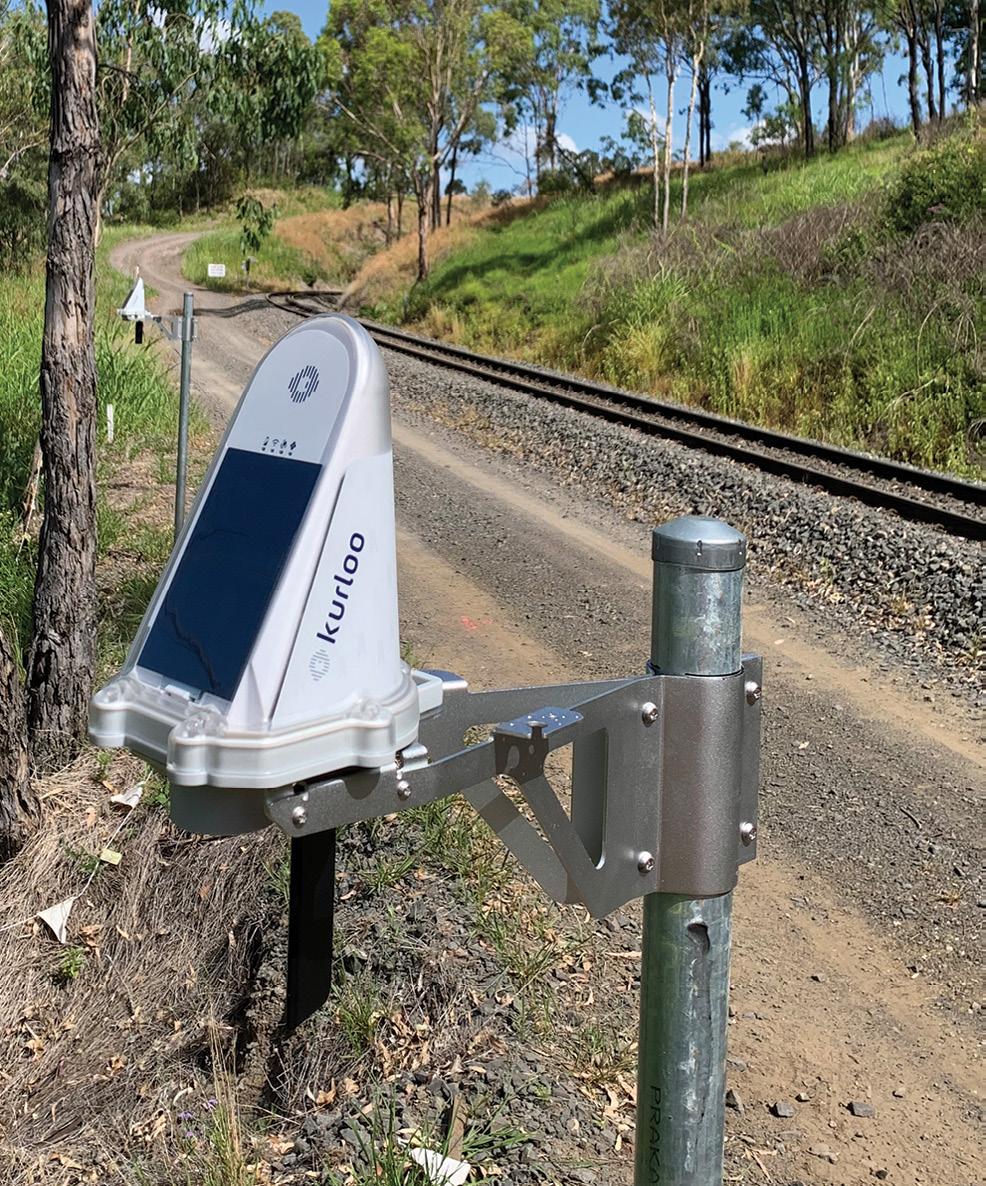
How accurate is Kurloo?
The accuracy will vary on a combination a variety of site conditions. Kurloo is capable of relative accuracy of <3 mm in horizontal and <5 mm in vertical at 95% confidence. The presence of high multipath and distances of >2 km from your reference device will affect these results.
Does it have any limitations?
Kurloo is solar powered and relies on GNSS, so it must have a view of the sky and cannot be installed underground or under dense vegetation. It does not measure below the ground, but it can be attached to a borehole inclinometer or shape array to deliver true 3D measurement of a borehole. Kurloo is also remotely operated, so communication relies on either a LTE-M mobile signal or an on-site Wi-Fi gateway with a site internet or satellite connection to operate.
What does Kurloo cost?
Kurloo offers a low-risk business model that's more accessible for small- to medium-sized project budgets or consulting practices. You simply pay a set amount for all hardware, processing software and support for your contract period. It includes our device replacement guarantee and free upgrade of hardware and software, so you get the latest in technology with no hidden costs or downtime. Packages start at AUD$18 per device per day, based on a minimum of two devices for three months.
What about servicing and support?
Kurloo's hardware and software products are made and supported in Australia by industry professionals with over 30 years' experience.Our support team can be contacted via email or video conference for any aspects of installation, documentation or interpretation of the results.
Kurloo is currently available in Australia and New Zealand, and there are plans to operate in Southeast Asia later in 2024. n
HAVE A
PROJECT OR OPPORTUNITY IN MIND? Contact us at www.kurloo.io/contact or email sales@kurloo.io
www.spatialsource.com.au 27 partner feature

Review of resilient-PNT policies
A new report examines Australian policies and activities related to the provision of assured PNT services.
FrontierSI has undertaken a review of policy and activities related to positioning, navigation and timing (PNT) services, and released a new report and a white paper on the subject.
Australia’s PNT ecosystem is almost entirely reliant on services such as the GNSS provided by other countries, leaving it vulnerable to interruptions and loss of access.
With the nation’s economy and social fabric now dependent on digital technology and services, and facing increasing cyber threats, such vulnerability cannot be allowed to continue.
“PNT is an essential utility we presently have no control over,” said Joshua CritchleyMarrows, FrontierSI Space PNT Lead.
“Australia’s access to PNT is intrinsically linked to satellite-delivered services from foreign-owned and operated assets, such as the Global Positioning System from the USA.
“We must invest in our own infrastructure so we can ensure continuous access to this critical service that underpins nearly all aspects of our daily lives.”
Other countries have recognised vulnerabilities within their own PNT
ecosystems and are acting swiftly to make current systems more robust and establish other systems that can be used as alternates or backups.
FrontierSI says that Australia needs to draw “from international strategies to tailor-make our solutions” to strengthen its systems “against disruptions while offering assured, robust, augmented, and alternative PNT solutions”.
Calling resilient PNT a “non-negotiable” requirement for safeguarding Australia’s critical infrastructure and economic vitality, FrontierSI’s report outlines proactive measures that can be taken — from legislative reinforcement to supply chain scrutiny, as well as ensuring vital industry sectors such as defence and maritime are at the forefront of a strategic approach.
The recommendations include:
Ensuring that building resilient PNT services is not treated as an outcome to enforcement of legislation, but that other methods should be considered to achieve the same level of resilience as other Australian critical infrastructure assets.
Developing an alternative source of timing, either through space or terrestrial
means, that will aid in synchronisation and dissemination across the nation.
Review and address the nation’s supply chain dependencies on atomic clock technology.
Undertaking a comprehensive study and appraisal of all vulnerabilities to a loss of GNSS, with recommended mitigations.
Importantly, the report says that given the “multifaceted intersection of PNT across various Australian Government agencies and departments, a National PNT Office is necessary to consolidate PNT-related outputs and provide governance of PNT issues for Australia”. The United Kingdom has recently taken this exact step, with the planned establishment of a National PNT Office and a National Timing Centre.
“In a world of escalating competition and geopolitical tensions, PNT disruption has become more frequent and severe,” said Graeme Kernich, FrontierSI CEO.
“Australia is not exempt from these threats, and they will continue to escalate. Protecting our nation’s critical infrastructure through resilient PNT technology is not just a priority — it’s a necessity in today’s volatile landscape.” n
PNT 28 position April/May 2024
©stock.adobe.com/au/TanyaJoy
PNT for Australia’s CRITICAL INFRASTRUCTURE
Reliable access to PNT services is vital for Australia’s national security, and the need for risk mitigation is growing.
All Australians rely on critical infrastructure to deliver the essential services that underpin our economy, security and sovereignty. The Cyber and Infrastructure Security Centre, within the Department of Home Affairs, assists critical infrastructure owners and operators to understand risk and meet regulatory requirements — for the shared benefit of all Australians.
The Security of Critical Infrastructure Act 2018
Critical infrastructure protection is also included in legislation. The CISC is responsible for implementing the Security of Critical Infrastructure Act 2018, or SOCI Act, which seeks to apply positive security obligations to critical infrastructure owners and operators.
The SOCI Act defines eleven critical infrastructure sectors: communications; data storage or processing; defence industry; energy; financial services; food and grocery; healthcare and medical; higher education and research; space technology; transport; and water and sewerage. What these diverse sectors all have in common is their importance to our everyday way of life, and the need for them to be protected for the benefit of all Australians.
The SOCI Act places certain security obligations on different types of critical infrastructure operators — for example, some may be required to register certain information with the CISC, or to notify the federal government about cyber security incidents.
Some companies may also be required to have a Critical Infrastructure Risk Management Program in place, which ensure entities identify, minimise and/or mitigate any material risks to the availability, integrity, reliability or confidentiality of the critical infrastructure asset. This program is intended to be address the impacts of all hazards, whether they be cyber, humaninduced or natural hazards.
How does this relate to positioning, navigation and timing (PNT)? PNT is critical to the effective and efficient operation of Australia’s critical infrastructure, and the need for accurate and reliable PNT is growing.
Much of Australia’s critical infrastructure relies on space-based PNT services. But we also know that PNT services are vulnerable to interference — including from environmental effects such space weather, cyber security incidents, equipment failure or deliberate jamming of signals. Disruption to these services would have significant

The CISC is working with critical infrastructure entities to better understand their dependencies on PNT services.
impacts to the Australian economy.
The CISC considers that a substantive loss of or loss of access to, or deliberate or accidental manipulation of, PNT services that would affect the functioning of a critical infrastructure asset, is a material risk. Critical infrastructure asset operators who are required to have a Risk Management Program in place will need to have a plan in place to mitigate material risks. Because we consider PNT to be so vital, a loss of PNT is actually explicitly mentioned in the Risk Management Program Rules as an example of a material risk. We’ve also referred to a loss of PNT services as a risk in our inaugural Annual Risk Review.
The CISC is working with critical infrastructure entities to better understand their dependencies on PNT services, as we know that different sectors and businesses will have differing requirements for accuracy and reliability. We are also engaging with industry to get a better understanding of the different technologies that can provide greater redundancy to critical infrastructure operators, and to help them to withstand and recover faster from outages to service. Partnering with industry will enable us to provide more tailored advice on how to mitigate the risk of a disruption to service.
How do we engage with industry?
The Trusted Information Sharing Network (TISN) is the primary way for industry and all levels of government to work together to enhance the security and resilience of critical infrastructure. The TISN brings together stakeholders from across the critical infrastructure community, including critical infrastructure owners and operators, supply chain entities, peak bodies, crosssectoral interest groups, academics, research institutes and all levels of government.
Through the TISN, members of the critical infrastructure community collaborate to identify and manage risks to critical infrastructure. If you are interested in joining the TISN, contact cir@ homeaffairs.gov.au. More information about the CISC can be found at cisc.gov.au. n Article provided by the Department of Home Affairs.
anystock
www.spatialsource.com.au 29
©stock.adobe.com/au/
Testing SouthPAN and commercial GNSS services
UNSW surveying students were challenged to put a range of SouthPAN devices and services through their paces.
Following the production of an exhaustive test-bed technical report coupled with a trial economic benefits analysis in August 2019, plus a competitive tender process and finally the awarding of a contract to Lockheed Martin, the SouthPAN service was switched on in September 2022.
SouthPAN is the new Satellite-Based Augmentation System (SBAS) for Australia and New Zealand, supported by both countries’ federal governments. A $1.4 billion investment over 20 years is expected to yield $7.6 billion benefit over 30 years from enhanced positioning across the agriculture, construction, transport and maritime sectors, as well as a host of other geospatial applications.
I attended the Locate conference in May last year and asked several exhibitors, “Hey, what’s your SouthPAN solution?”. The response was variations on “South what?,” combined with some quizzical looks and awkward shuffling. To be fair, it is a very new system, and I was being deliberately provocative.
Salivating, I thought, “What a great idea for a student project!”.
At UNSW, we offer a finalyear capstone project, designed to exercise a range of skills previously taught across the program in a group-based activity. There are no lectures
and no exams. Students are given a project and self-organise to achieve an ‘outcome’ (see ‘Putting RTK units to the test,’ Roberts, C., Position 120, Aug/ Sept 2022).
In the case of this project, the intended outcome was to determine which current GNSS devices offer a SouthPAN service, how does it work, how good is it and how does it compare with other services as well as some commercial GNSS services — and absolutely no RTK! These are the sort of questions we think many potential users are asking, so we decided to ‘lean in’ to the uncertainty and find out.
Preparation
Six weeks prior to the start of term in mid-September 2023, my colleagues and I started contacting GNSS equipment suppliers to loan and test their SouthPAN enabled devices during October. Big thanks go to GPSat Systems/Novatel, C.R. Kennedy/Leica, UPG/Trimble, 4DGlobal/EOS, FrontierSI/ Juniper and GMV for supplying their devices and for their ongoing support. When coupled with our school-owned u-blox and EOS Arrow Gold devices, we were able to equip the 12 enrolled students with 12 devices — a logistical triumph!
By the end of our first meeting, the students had started to realise the enormity of the task I had set for them,
DR CRAIG ROBERTS
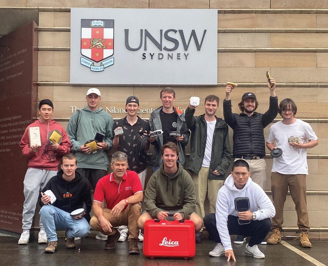
but were keen for the challenge. They elected a ‘managing director’ and ran proper meetings with minutes, action items and an agenda, rotating the role of chairperson every week. These formal structures help drive the project and enable them to learn valuable soft skills along the way. The team wrote a combined literature review as a foundation for the technical detail we expected to encounter during testing. With only 10 weeks to design a testbed, test and report, discussions were focused on achieving a useful result. The combined report was to be written as a cookbook for future users, including diagrams, cheat sheets, troubleshooting tips and some results of limited testing. We recognised that this was new not only for all of us, but also for likely readers of the final report.
It took a few weeks to get
all systems operating. The combining of the technical expertise of our UNSW staff, the equipment suppliers and the acquired knowledge of the group became a great exercise in communication and collaboration — another soft skill.
Putting it to the test
Because the SouthPAN service was so new, not all devices were SouthPAN capable, therefore some students used analogous commercial GNSS PPP services such as the Novatel Terrastar, SmartNet PPP, Trimble RTX and even the Galileo High Accuracy Service (GalHAS), which is currently not guaranteed in Australia.
Additionally, we recognised that SouthPAN is the first SBAS system to offer three planned service levels: L1 SBAS (submetre service), Dual FrequencyMulti-Constellation (DFMC,
The UNSW student team with Dr Craig Roberts (front, second from left).
30 position April/May 2024 positioning
half-metre service) and a PVS (PPP via SouthPAN, a 10cm to 20cm service).
Despite initial ambitious plans for kinematic and signal blockage testing, as the time raced away the testbed was reduced to a static test for accuracy and precision on a known pillar at 5-, 10- and 30-minute intervals and time to first fix (TTFF). Figure 1 shows a snapshot of the quantitative comparison results from our limited testing for the 30-minute result only.
The subscription-based commercial PPP services outperform the SouthPAN L1 service as expected.
Additionally, RINEX data from the DFMC mode of the GMV Magic UT 14 device was logged and post-processed using Geoscience Australia’s Ginan Open-source PPP software. The configuration of Ginan was set to process the GPS and Galileo constellations using the L1/L5 and E1/E5 signals. IGS Final products were used including correction products such as precise satellite orbit and clock corrections (as well as other correction products) to compute the best possible solution (Figure 2).
The results of the postprocessed PPP solution using Ginan were very encouraging and presented in Figure 3, showing accuracy from the known coordinate and precision of the result.
The overall conclusions from this exercise demonstrated that the SouthPAN L1 SBAS service is operating well and providing
sub-metre accuracy across a range of devices. For surveyors, a taxpayer-funded, free service on your phone offering shovelwidth positioning without the need for base stations will be a pretty handy addition to the toolkit.
As expected, the DFMC and PVS services are currently not yet operational in this developing system, but the PPPPP using Ginan shows great promise. Similarly, early testing of the Galileo HAS showed initial results were possible, and in time, with extra corrections added, will provide another free GNSS positioning service at
moderate accuracy. In contrast, the commercial GNSS services (paid subscription) proved more user friendly and were able to provide higher-quality positioning results (cm-level) than those using SouthPAN.
Overall, this was an educational exercise to expose senior undergraduate students to non-RTK, modern GNSS positioning. It required a deeper knowledge of multi-GNSS signals, data formats, hardware, software, datum conversions/ transformations, trial-and-error and a host of soft-skills to realise a final result in just 11 weeks.
I want to thank my
colleagues, Peter Mumford and Dr Badal Pokharel, and the commitment of the students: Thomas Judge (MD), Jonathan Cribb, Zachary Aubourg, Thomas Maile, Nathan Zeritis, James Gardner, Joshua Milliken, Lewis Li, Mitchell Shipp, Benjamin Hutchinson, Felix Zhang and Habib Akra. n
Dr Craig Roberts in Head of Discipline for the BE (Surveying) programme at the School of Civil and Environmental Engineering, University of New South Wales. The full 265-page report is available upon request; please email the author at c.roberts@ unsw.edu.au.
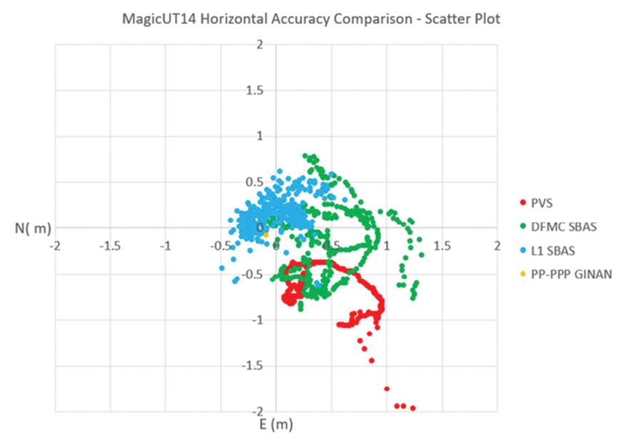
The overall conclusions from this exercise demonstrated that the SouthPAN L1 SBAS service is operating well.
Device Tested Service Tested Hori Acc 30 mins static (m) Hori Prec 30 mins static (m) Vert Acc 30 mins static (m) Vert Prec 30 mins static (m) Leica GS16 HxGN PPP 0.015 ±0.039 0.014 ±0.032 Leica GS18 HxGN PPP 0.014 ±0.031 0.04 ±0.035 Leica Zeno FLX100+ SouthPAN L1 1.01 -0.520 Novatel PwrPak7 SouthPAN L1 SBAS 0.328 ±0.236 0.322 ±0.624 Novatel PwrPak7 TerraStar 0.025 ±0.007 0.001 ±0.014 Juniper Systems Geode SouthPAN L1 SBAS 0.516 ±0.150 0.700 ±0.222 Trimble Da2 Antenna Trimble Centrepoint RTX 0.020 ±0.007 0.05 ±0.021 Trimble R12i SouthPAN L1 0.160 ±0.520 0.470 ±0.320 MagicUT SouthPAN L1 SBAS 0.142 ±0.410 0.224 ±0.478 MagicUT SouthPAN DFMC SBAS# 0.535 ±0.307 -3.683 ±1.775 MagicUT SouthPAN PVS# 0.562 ±0.494 -0.996 ±1.691 EOS Arrow Gold SouthPAN L1 SBAS 0.194 ± 0.241 0.374 ± 0.250 EOS Arrow Gold Plus SouthPAN L1 SBAS 0.069 ± 0.185 0.250 ± 0.442 EOS Arrow Gold Plus Galileo HAS* 0.545 ± 0.110 1.204 ± 0.213 ublox EVK-F9P SouthPAN L1 SBAS 0.667 ± 0.175 -0.146 ± 0.533
Figure 1: Accuracy and precision results of SouthPAN and GNSS testing of 12 devices. #Only the GMV devices — custom built for the 2018 testbed project — were capable of receiving all three SouthPAN services. It was noted that there is currently a technical issue with the DFMC service and the PVS service is only in the initial phases of operation. *The Galileo HAS does not account for ionosphere over Australia at present, which will significantly improve accuracy, precision and TTFF.
DFMC PP-PPP Ginan E (mm) N (mm) H (mm) Difference (30 min) −0.079 ± 31mm −0.091 ± 9mm −0.053 ± 15mm
Figure 2: MagicUT14 horizontal accuracy comparison of different SouthPAN services as a scatter plot. Note that both DFMC and PVS are currently not operational.
Figure 3: The results of the post-processed PPP solution using Ginan.
www.spatialsource.com.au 31
Putting maps into context
The ICA and OGC are collaborating to improve cartographic design and develop interoperable mapping standards.
The diversity of technologies we use to collect, handle and visualise geospatial data and the range of application domains to which geospatial solutions are applied are, on the one hand, an exciting aspect of our industry, and on the other hand, one of its big challenges. It can sometimes be difficult to make multiple technologies work together to solve a particular domain problem.
The Open Geospatial Consortium (OGC) is one organisation that arose in part to address some of these challenges. It has a long history of co-operation between government, industry and academic organisations to develop standards that help make geospatial technologies work together, providing people with better access to location information.
A key to many of its successes has been the co-operative development of standards that make geospatial technologies interoperable, and we can thank these standards for making it easier for geospatial professionals to build custom geospatial solutions using technologies built by different organisations. Although many jobs touch ‘raw’ geospatial data in one form or another, an even greater number of people interact with geospatial data through the
form of maps, with no idea whatsoever about the data that lies beneath.
Yet sometimes the geospatial software used to produce these maps is designed by developers with little background in cartography, resulting in maps that could be greatly improved. It’s hard to fault developers for this, though, as much cartographic design knowledge remains inaccessible, locked in the minds of cartographers, and is not necessarily in a format that is easy for software developers to understand.
Working together
In 2019, a group of cartographers who were collaborating through the International Cartographic Association’s (ICA) Commissions (introduced to Position magazine readers in the Feb/Mar 2024 issue) wondered why more cartographers were not involved in OGC activities. We convinced the ICA Executive Committee of the importance of engaging with the OGC, and the ICA joined the OGC as an Associate Member in 2020. Our group began by starting to explore some ways in which we could make cartographic knowledge understandable for more people.
Like the ICA, the OGC is a large
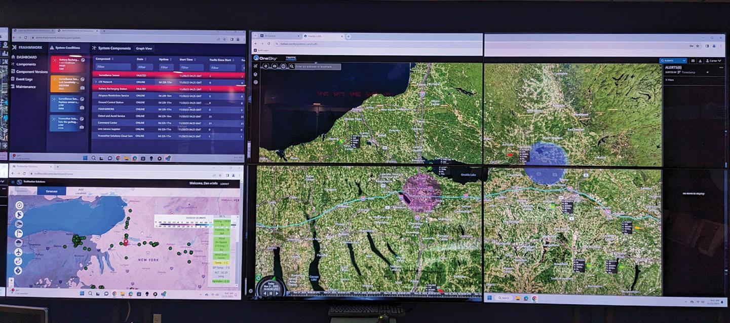 AMY GRIFFIN
organisation composed of people with varying interests. Much of the work of the OGC happens in its Domain Working Groups, which are focused on different thematic and application areas. Some of these areas are quite focused, while others cut across multiple domains and technology types. One of these cross-cutting areas and one of the most obvious touch points for ICA was to get involved with the OGC’s Portrayal Domain Working Group, which focuses on how geospatial information is presented to its human users, often, but not exclusively, in the form of maps. The group also addresses newer forms of visualisation like 3D visualisation, augmented and virtual reality, and gaming and simulation.
We looked at the work the DWG was already doing and our attention was caught by a quote from the 2018 Roadmap for the Portrayal DWG: “As part of this study, it was observed that there was a lot of frustration with what is considered poor cartographic practices. OGC is in a position to do something about this. It is not just a standards body, it is also a group of highly respected geospatial experts. The group should look for opportunities to identify and promote good cartography.”
OGC’s initial work in developing a Portrayal Standard (SymCore 1.0) focused on low-level details, like making sure symbol elements such as colours, fills and strokes are interoperable and can be reproduced accurately in different software systems. By intent it didn’t provide much guidance on what comprises ‘good design’. This latter effort seemed like a place where ICA members could contribute.
Initial steps
This led to our first explorations, where we examined what might be some of the barriers and solutions to making cartographic knowledge accessible to software developers. We held a workshop to discuss these ideas at the 2021 International
Maps designed for wall display in an emergency operations centre need their own approach.
32 position April/May 2024 cartography
Image credit: USAF, Andrew Carter.

Cartographic Conference (ICC) in Florence, Italy, and later presented our initial ideas to the Portrayal DWG members at one of their meetings to get feedback and gauge their interest in working together. We also began sending cartographers to OGC meetings to see what was else was being discussed.
The collaboration has been multidirectional. In 2023, the OGC sent two members to the ICC in Cape Town, South Africa, where one of them presented on the current work on the Portrayal Standard. SymCor 2.0 aims to try to implement some ‘good design’ guidance into the standard. We took advantage of the conference to get a wider array of cartographers from different countries to contribute to the project and we discussed pragmatic ways that cartographers could contribute to the Portrayal Standard. One practical action we identified was in developing a collection of good practice examples that could be used to illustrate some aspects of the standard and against which to test the proposed SymCor 2.0 standard.
Current work
From these interactions, we decided to work on developing an OGC technical paper, and our initial ideas for that paper were shared at OGC meetings in 2023. Technical papers take research and explore how it might be applied in operational practice. In the paper we aimed to identify areas of cartographic design where there are not even de facto standards, to identify areas of cartographic practice that could benefit from standardisation, and to consider the limits of standardisation.
We identified four main areas of interest: geospatial semantics/terminology and applied ontology; good cartographic practice in different map use contexts; 3D and immersive cartographies (VR/AR); and visualising big geospatial data. Our intent is for the technical paper to provide a high-level synthesis of relevant cartographic research and design recommendations for software developers.
Let me give you one example from that work related to good practice and map use context. A challenge of cartographic design
is that it is context-specific — the map you design for the small screen of a mobile phone that will be used in bright daylight is not the same map you would design for a huge wall display in an emergency operations centre. A skilled cartographer will recognise relevant context elements and adjust their design to accommodate the use context.
The importance of context means that a too-narrowly focused standard is doomed to failure, as it doesn’t take these context factors into account. But it’s also impossible to design a standard for every situation as there are too many impactful context elements that can vary, and many design decisions are trade-offs.
A step towards solving this problem could be the development of design patterns along with the automatic sensing of (at least some) context elements, which could determine which of the design patterns to use for the given context. A relatively simple example of this might be sensing the screen size, display resolution and display brightness to determine minimum element sizes and contrast levels for legibility within a map. Design patterns could suggest good starting points for meeting these design requirements for different display sizes (e.g. desktop, laptop, mobile) and different screen technologies (e.g. LED, LCD).
Want to get involved?
The work described above is one that cuts across several topic areas that the ICA addresses: cartographic design, how people understand maps, standards, open-source geospatial software, geospatial semantics, and augmented and virtual reality. If it sounds like something you’d like to be involved with, please reach out to me (amy. griffin@rmit.edu.au) and I will connect you with the right people. And if you have an example of a map that you think represents good cartographic practice and that you’d be willing to contribute to the effort, that would be one easy way in which you could get involved. n
Amy Griffin is a Senior Lecturer in Geospatial Sciences at RMIT University and current ICA Vice President. She would like to acknowledge colleagues working on the context project — from the ICA: Serena Coetzee (University of Pretoria, ZA), Petr Kubicek (Masaryk University, CZ), Silvana Camboim (Federal University of Paraná, BR), Dalia Varanka (USGS, USA), Francis Harvey (Leibniz Institute for Regional Geography, GER and University of Warsaw, PL), Franz-Josef Behr (Stuttgart Insitute of Applied Sciences, GER), Barend Köbben (University of Twente, NL) and Reese Plews (Plews Consulting, JP); and from the OGC: Keith Ryden, Iain Burnell, Gobe Hobona, Jerome Jacovella-St-Louis.
Changing illumination conditions can make maps hard to read if they aren’t adapted to the context.
www.spatialsource.com.au 33
Image Credit: Yash Bhavsar, Pexels.
Multibeam bathymetry of the wreck of the SS Nemesis
A 120-year-old maritime mystery has been solved following the discovery of the wreck of the SS Nemesis.
An investigation by CSIRO, conducted for Heritage NSW, has helped identify the wreck of a steamship that disappeared off the New South Wales coast in 1904.
On 8 July 1904, the 73-metre-long steamship, SS Nemesis, departed Newcastle bound for Melbourne with a cargo of coal and coke. Shortly after, the vessel ran into a strong southerly gale and large swells, and was seen struggling to make headway in waters off Wollongong on 9 July.
The Nemesis then disappeared at sea with the tragic loss of all 32 lives. What happened to the vessel, and its final resting place, would become one of NSW’s enduring maritime mysteries.
After nearly 120 years, that mystery has now been solved.
In May 2022, Subsea Professional Marine Services discovered an uncharted wreck while conducting a survey off Wollongong. Subsea reported the wreck to Heritage NSW, the agency responsible for maritime heritage management in NSW. From the imagery collected by Subsea, Heritage NSW suggested that the wreck could be
the Nemesis. However, strong currents at the wreck site hampered further surveys to gather additional data.
Heritage NSW then asked the CSIRO to investigate the wreck using CSIRO research vessel RV Investigator, should the opportunity arise, to assist in gathering further data and imagery to aid in its identification.
Fortuitously, Investigator was able to assist and conducted a detailed seafloor mapping and camera investigation of the wreck while on a transit voyage from Hobart to Sydney in September 2023.
Investigation by Investigator
CSIRO mapping specialists used Investigator’s advanced multibeam echosounders (MBES) to map the wreck and surrounding seafloor in high resolution. They followed this with a systematic visual inspection of the entire wreck site using a specialised underwater drop camera system.
The system used for the multibeam bathymetry survey was a Kongsberg EM710 MK2, operating at a frequency of

70-100 kHz. The CSIRO team designed the survey grid specifically to map along both the length and across the shipwreck, with line spacings that allowed significant overlap for a beam angle setting of 30° (to port and starboard).
In total, 18 survey lines were run in dual swath mode and with a combination of equidistant and equiangular beam spacing settings to maximise the soundings across the wreck. A bathymetry gridding resolution of 0.5 metres was selected, but all soundings were retained for the point cloud. Data processing and visualisation were undertaken with Caris HIPS and SIPS and QPS Fledermaus software.
Phil Vandenbossche, a CSIRO hydrographic surveyor on board the Investigator, said the bathymetry shows the wreck is lying at a depth of 160 metres approximately 28 kilometres off the coast of Wollongong, NSW.
“The wreck is located towards the edge of the continental shelf and is sitting upright on the seafloor but is showing significant damage and deterioration at both the bow and stern,” Vandenbossche said.
“It’s lying in a southeast to northwest orientation, with the bow pointing towards the northwest. However, due to the degree of damage, it wasn’t until we located a ship’s anchor in the camera investigation that we were entirely sure which was the bow and stern.”
The bathymetry also shows two large areas of seafloor scouring on the port (south) side of the wreck. These were investigated during the camera survey but nothing significant was found.
After the multibeam echo sounder survey had been completed, the data were processed and the imagery was used to aid in the precise positioning of Investigator for the drop camera investigation. The drop camera was deployed and tested with lights on and off. However, it was determined that there was too much reflection with the lights on and, surprisingly, there was sufficient ambient light at 160 metres depth to conduct the entire camera investigation without artificial lighting.
CSIRO voyage manager, Jason Fazey, said the Investigator was in the right place at
The SS Nemesis, a 73-metre-long steamship that disappeared off NSW in 1904, with 32 lives lost. Image courtesy of the Mitchell Library, State Library of New South Wales.
34 position April/May 2024
bathymetry
the right time to assist Heritage NSW and conduct the survey.
“Our voyage track took us right past the wreck and we were extremely lucky with the conditions for the survey, with our team on board doing a superb job in mapping and capturing incredible imagery of the wreck,” he said.
Confirming the wreck’s identity
The bathymetry and camera survey data, along with the previous imagery collected by Subsea, provided substantial detail to enable Heritage NSW’s maritime archaeology experts to identify the wreck as the Nemesis
Principle amongst these is a thick hull ‘sheer strake’, an unusual feature for this class of vessel and a notable feature of the Nemesis. Other evidence included the hatch and deck structure locations, the number of ventilators, the engine type and overall structural layout mapped to surviving historic ship’s plans, as well as the apparent cargo of coal.
Senior Maritime Archaeologist with Heritage NSW, Dr Brad Duncan, said locating and identifying the Nemesis was a highly collaborative effort between research and heritage agencies, and the maritime community.
“This discovery and confirmation of the wreck’s identity not only provides significant archaeological information about the ship and wrecking event but, more importantly, may offer some solace to the families of those who perished onboard as it provides a location at which they can mourn their loved ones,” Dr Duncan said.
The wreck of the Nemesis is one of many thousands of shipwrecks that lie along the Australian coastline, with many still to be found. It is protected as a historic shipwreck under the Underwater Cultural Heritage Act 2018.
The project was supported by an allocation of sea time on RV Investigator by the CSIRO Marine National Facility, national research infrastructure supported by the Australian Government’s National Collaborative Research Infrastructure Strategy (NCRIS) and operated by CSIRO on behalf of the nation. n
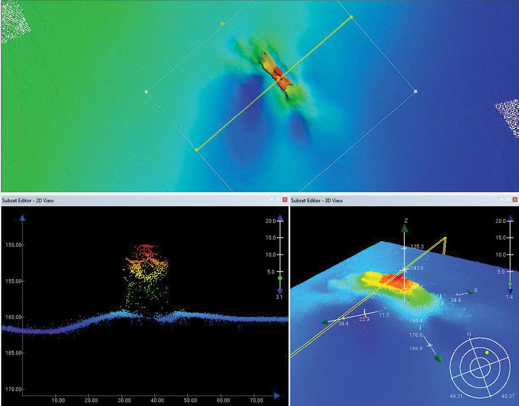
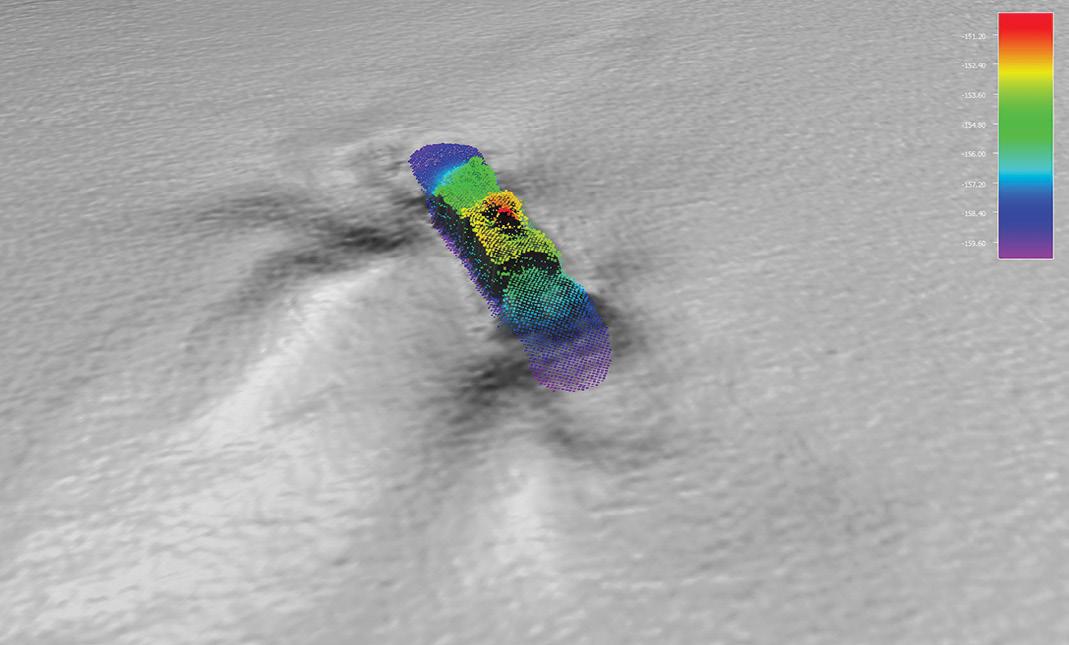
The Investigator was in the right place at the right time to assist Heritage NSW and conduct the survey.

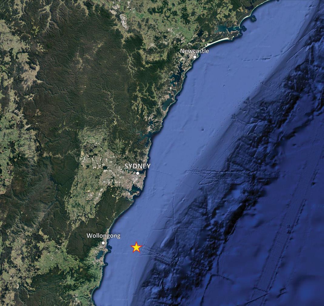 Above: Across-ship profile subset of the wreck of the Nemesis Below: Point cloud of the wreck. Courtesy CSIRO.
The Nemesis sank about 28 kilometres east of Wollongong, NSW.
Above: Across-ship profile subset of the wreck of the Nemesis Below: Point cloud of the wreck. Courtesy CSIRO.
The Nemesis sank about 28 kilometres east of Wollongong, NSW.
www.spatialsource.com.au 35
The RV Investigator, Australia’s advanced ocean research vessel operated by CSIRO. Image courtesy CSIRO, Owen Foley.
Kanyini satellite one step closer to launch
and vibration testing.
South Australia’s Kanyini satellite is one step closer to a mid-2024 launch following the completion of two weeks of Environmental Stress Screening (ESS). The 6U CubeSat is due to be launched onboard SpaceX’s Transporter-11 mission from Vandenberg Space Force Base in California, USA.
The tests were performed at the National Space Test Facility (NSTF) at the Australian National University in Canberra, and involved exposing the satellite to extreme temperature variations and vibrations, and the kind of vacuum conditions it will experience in orbit. The
spacecraft successfully passed all the test.
The satellite project is a collaboration between South Australia’s government, the SmartSat Cooperative Research Centre as mission lead, Adelaide-based commercial satellite manufacturer Inovor Technologies and IoT specialist Myriota. Kanyini was fully constructed at Adelaide’s Lot Fourteen high-tech precinct.
A full System Integration Review has also been successfully conducted, and the project team s in the final stages of preparing the satellite for launch.
“The stellar results from the ESS not only validate the
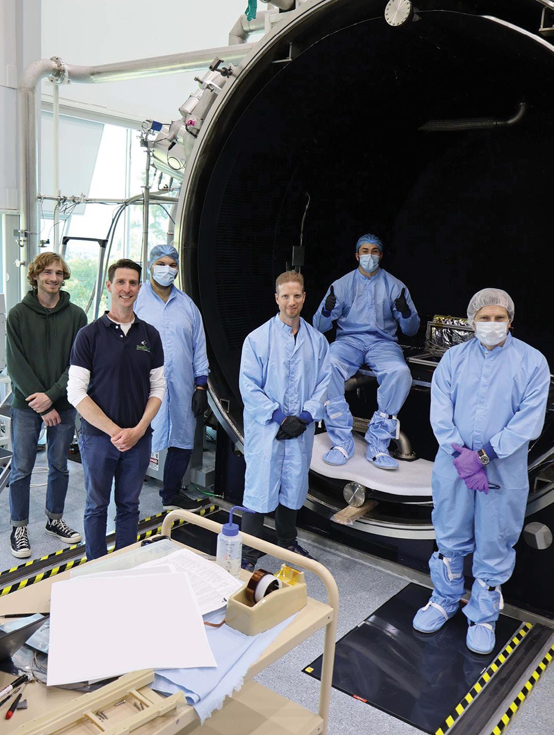
meticulous testing processes we’ve implemented but also exemplify the steady commitment of our team in producing world class technology,” said Inovor founder and CEO, Matt Tetlow.
“Our satellite bus technology is robust, resilient and ready to pioneer the next frontier of space-based applications. Our team has worked very hard over the past few years and is excited about the impact our technology will make in advancing Earth observation capabilities.”
Kanyini will carry IoT and Earth imaging payloads, the latter of which is called HyperScout 2, supplied by Dutch engineering company cosine.
HyperScout 2 is a three-inone instrument that combines hyperspectral and thermal imaging with high-level data processing and AI capabilities. It will provide hyperspectral imaging in the visible and near infrared to analyse the composition of the Earth, along with three thermal infrared bands to retrieve temperature distribution.
“We needed a compact imaging payload that gave us a nuanced Earth view,” said Peter Nikoloff, Kanyini Mission Director at SmartSat. “The spectral range of HyperScout 2 enables an extremely detailed analysis of land cover, supporting research into crop health, forests, inland water and coasts.”
“The thermal infrared imager will provide vital information on heat generators in South Australia. In parallel with the development phase, SmartSat is formulating a research program with our
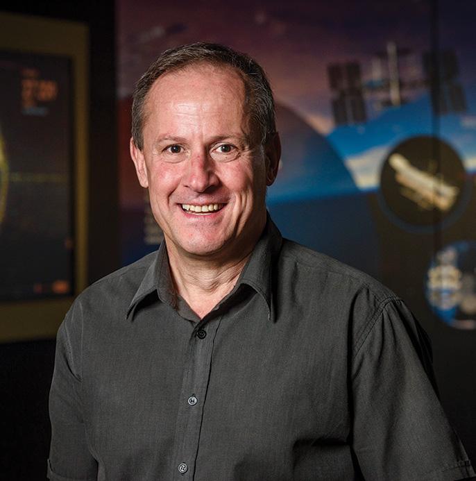
partners to make optimal use of the systems once in orbit.”
According to the South Australia Government, Kanyini’s dual IoT and imager payloads will deliver critical space data to be used by government and research institutions to expand their knowledge, particularly in relation to sustainability and climate impacts.
“The Kanyini build is a remarkable example of South Australian space industry collaboration and expertise driving major advances in local capability,” said Susan Close, Deputy Premier and Minister for Defence and Space Industries.
“The successful completion of this critical milestone brings us one step closer to realising our mission of seeing home grown South Australian space technologies launched into low Earth orbit. n
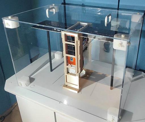 The Kanyini satellite being prepared for testing.
The satellite and its hyperspectral payload have completed temperature
Members of the Kanyini Mission team, including engineers from SmartSat CRC, Inovor and Myriota, load Kanyini into the Thermal and Vacuum Space Simulation chamber at the ANU.
The Kanyini satellite being prepared for testing.
The satellite and its hyperspectral payload have completed temperature
Members of the Kanyini Mission team, including engineers from SmartSat CRC, Inovor and Myriota, load Kanyini into the Thermal and Vacuum Space Simulation chamber at the ANU.
36 position April/May 2024 space
Kanyini Mission Director, Peter Nikoloff.

Long-range dual sensor drone
Carbonix, RIEGL and Phase One have announced the availability of what they say is the first fixedwing VTOL integration of a long-range dual sensor system, using the RIEGL VUX-120 laser scanner and Phase One iXM 100 medium-format camera aboard Carbonix’s Volanti platform. The system enables the capture of large-scale, detailed, colourised 3D models of infrastructure and terrain, and provides a scanning capacity of more than 12,000 hectares or a linear distance of up to 400 kilometres per mission.
Displacement monitoring platform update
Kurloo has announced an update to its Kurloo Nest cloud platform, which processes daily displacement data from Kurloo devices in near-real time. The company says the platform now has a revamped website featuring a design that’s not only more visually appealing but also more intuitive to navigate. In addition, users will find that the map is “front and centre”, enabling easier visualisation of the location of the Kurloo devices. The map will also appear more frequently throughout the Nest, such as in the sensors and analysis pages.
Navigation has been restructured for easier discovery and analysis of data, and Nodes have been renamed to Sensors.
Planning and Monitoring Platform
Deloitte has launched what it is calling its Geospatial and AI Platform for Scenario Planning and Monitoring. Powered by Google Earth integrations, Google Earth Engine and generative AI from Vertex AI, the platform is intended to help clients leverage AI and geospatial data to take action on sustainability and climate as they work toward positive economic, social and environmental outcomes. The company says the platform enables clients to improve planning processes for disaster response, infrastructure development and urban planning processes, which can enable more sustainable decision-making. It also provides insights on land use to help businesses optimise for sustainable outcomes, along with financial modelling capabilities that apply geospatial data to support sustainable investments.

© Google Earth
Dual-band GNSS platform
u-blox has announced the F10, its first dual-band GNSS platform combining L1 and L5 bands to offer enhanced multipath resistance and meter-level positioning accuracy. The F10’s firmware algorithm prioritises L5 band signals in weak signal environments, for reliable positioning accuracy even when paired with small antennae. The platform is equipped with protection-level technology that provides a real-time positioning accuracy estimate. Some F10 module models (NEO-F10N, MAX-F10S, and MIA-F10Q) are equipped with a RF circuit that enables the model and a cellular modem to operate without interference. The F10 platform is also pin-to-pin compatible with the previous u-blox M10 generation for easy migration.
new products
www.spatialsource.com.au 37
News and views from the Geospatial Council of Australia

CEO’s Column
GCA Board Members
GCA Board Members
Kate Lundy President/Chair
Paul Digney Acting President
Kate Ramsay Deputy Chair
Alistair Byrom Co-Deputy Chair
Alistair Byrom Deputy Chair
Darren Mottolini Director
Jacinta Burns Director
Roshni Sharma Director
Paul Digney Director
Jacinta Burns Director
Stewart Dunne Director
Kate Ramsay Director
Mary-Ellen Feeney Director
Darren Mottolini Director
Roshni Sharma Director
We are now well into the era of Digital Twins
In a monumental move, the Western Australia government has earmarked a substantial $140 million over the next decade for the groundbreaking development of an Advanced Spatial Digital Twin (ASDT), known as Spatial WA. Spearheaded by Landgate in collaboration with over 30 government agencies, this initiative stands as a testament to Western Australia’s commitment to pushing the boundaries of geospatial technology. This represents the largest public funded investment in a wide area Digital Twin to date, and it provides funding for a sustained period that allows ongoing expansion, data maintenance and continuous improvement.
Western Australia is now joining with other jurisdictions such as NSW and Victoria that are bold enough to take a strategic leap into the future. Envision a 4D representation dynamically capturing the evolution of the natural and built environment over time. This initiative goes beyond mere technology; it’s a pledge to leverage cutting-edge solutions for the collective benefit of the community.
This recent announcement echoes the growing recognition of the transformative power and value of spatially accurate digital data across Australia. Currently, the GCA is undertaking an Economic Impact Study in collaboration with key government and industry partners. ACIL Allen has been engaged to conduct the study, assessing
the impact of geospatial information and technology on the Australian economy.
While we are considering diverse factors in the study, our main emphasis is on showcasing the economic benefits, as this is crucial for garnering government interest and influencing policy. Digital twins play a pivotal role in this assessment, contributing significantly to the geospatial landscape.
Through a sector-by-sector analysis encompassing the entire spectrum of the economy, ranging from defence to agriculture and environmental management, we have already uncovered intriguing findings. Surprisingly, despite 85–90% of sectors across the Australian economy utilising geospatial information in their mission-critical operations, the overall uptake across the Australian economy is less than 10%. This low adoption rate, however, offers vast opportunities for growth and improved benefits across various industries.
Recently I spoke at an online Digital Twin Conference about current digital twin initiatives in Australia. Quite interestingly, a global perspective revealed the digital twins’ market will skyrocket from $2.7 billion in 2020 to a projected $73.5 billion by 2027 — a remarkable compound average growth rate of 60% over seven years. Reports also predict widespread integration of digital twins, with 40% of large companies and 89% of all IoT platforms incorporating this
GCA
38 position April/May 2024
As we look ahead, I believe the emphasis must shift beyond individual projects to a collaborative geospatial future.
technology by 2025. This surge underscores a paradigm shift in how industries approach and integrate digital twin technologies.
However, the rapid growth poses challenges, particularly in effectively utilising the vast amounts of data collected. In this instance, digital twins can emerge as the solution, offering a dynamic platform to transform dormant data into actionable insights. This not only drives efficiency but also fosters innovation, informed decisionmaking, and sustainable development.
The success of this transformative journey hinges on establishing standards — ontologies, modular standards and a collaborative digital ecosystem. These standards form the backbone of seamless data integration, ensuring interoperability and maximising the potential of geospatial insights. There is still work to be done on governance and federation models for wide area digital twins to reach their potential. Knowledge sharing across jurisdictions and countries will allow us to reach the potential of digital twins sooner.
During the conference, the concept of a Digital Twin Store was briefly mentioned — a centralised hub for all things digital twin. I do think there would be some merit in this, as it is far more achievable in the short term. It could echo the simplicity and accessibility of app stores, allowing users to access, integrate and leverage digital twin components effortlessly. Such an approach not only enhances efficiency but would also encourage innovation and collaboration within the geospatial community.
In essence, the digital twin journey surpasses financial investments and data metrics; it’s about reshaping how we perceive and leverage geospatial insights. NSW and Victoria have been on this journey for several years and are realising substantial benefits as their digital twins are applied to solving more and more real-world problems and answering specific questions. With Spatial WA’s recent funding, we are navigating uncharted waters that promise extraordinary opportunities for growth, sustainability,
and technological advancement. The opportunities for geospatial professionals to apply their deep understanding of precise measurement, reference frameworks, datums, and spatial accuracy opens up new career paths for those willing to go after it.
Digital Twins and digital engineering are converging. Increasingly engineering projects are designed and delivered in 3D. Surveyors capture the data in 3D using total stations, LiDAR, GNSS and drones. Designs are created and delivered in 3D, while ‘as constructed validation surveys’ are overlaid on the design file in 3D with the components of the structure that are outside of design tolerance (allowable error margins) are shaded red. Designers can then determine remedial action, if required.
Touching on the challenges and opportunities that lie ahead, the sheer magnitude of data generated by digital twins demands a robust framework for standards, governance/federation, privacy and security, to enable individual projects to be added to existing wide area digital twins. Balancing the openness of data with the need for accountability will become paramount. Predictive modelling and analytical insights, opens avenues for revolutionary advancements. Imagine a future where emergency management is not just reactive but predictive, enabling timely and effective responses. The integration of digital twins into administrative processes heralds an era of streamlined planning, accelerated land access, and heightened investment confidence.
As we look ahead, I believe the emphasis must shift beyond individual projects to a collaborative geospatial future. Multidisciplinary teams will become essential for the success of digital twin initiatives. The synergy between government initiatives, private sector innovation, and collaborative standards creates a robust foundation for a thriving geospatial ecosystem. It is an exciting time for the era of digital twins.
Tony Wheeler CEO, Geospatial Council of Australia
State and Territory Chairs and Co-Chairs
NSW Chair
Brittany Baker
NSW Vice-Chair
Hanno Klahn
ACT Chair
Mike Stapleton
Queensland Chair
Cameron Brittain
Queensland Vice-Chair
Koray Ozdogu
South Australia Chair
Graham Walker
South Australia Vice-Chair
Jennifer Brindle
Tasmania Chair
Anthony O’Flaherty
Victoria Chair
Richard Syme
Victoria Vice-Chair
Sam Houston
Western Australia Chair
Laren Collen
Areas of Practice Chairs
GDARS Chair
Dr Jagannath Aryal
Surveying Chair
Mike Stapleton
Hydrography Chair
Neil Hewitt
Young and Emerging Professionals Chair
Oscar So
www.spatialsource.com.au 39
Unlocking career excellence: The ESP-AP Certification re-defined

In the dynamic realm of engineering surveying, staying ahead of the curve is essential. As the Program Lead for the Engineering Surveying Professional –Australasia Pacific (ESP-AP) Certification, I am excited to share the significant enhancements we’ve made to the certification process, cementing its status as the benchmark in engineering surveying. In this article I discuss the revamped ESP-AP Certification and explore the value and benefits it brings to both individuals and industry.
Recognition and career opportunities
The ESP-AP Certification is open to everyone within the Australasian Pacific region, irrespective of membership status with the Geospatial Council of Australia (GCA). It is not just a credential; it’s a symbol of competence and expertise within the industry. Individuals who earn this
certification gain recognition for their advanced knowledge and experience in engineering surveying, which translates into numerous career opportunities. It offers a competitive advantage in a market where skill and expertise are highly valued, and also entitles a person to be recognised as an ESP-AP and listed on the ESP-AP Register.
For industry, large organisations such as government transportation agencies, local authorities and utility agencies, this certification assures confidence that a certification holder can competently undertake engineering surveying work. These organisations can further strengthen this confidence by choosing to adopt the certification in their specifications as a preference, or by mandating it for specialised, complex types of work.
For employers, the ESP-AP Certification enhances credibility. It assures clients that the professionals they engage possess the necessary skills to conduct engineering
Locate24 Workshop
To have your say on the draft ESP-AP Competency Framework proposal, the Certification Committee is holding an open consultation workshop on Tuesday, 7 May at Locate24. The workshop is open to all, and particularly to those who have an interest in engineering surveying and its certification. It is free to attend but you must register to secure your place as numbers are limited. For those who are booked into the workshop, a brief and the draft framework will be sent prior to the event.
For more details visit: locate.geospatialcouncil.org.au.
FRANCINE MILNE, ESP-AP PROGRAM LEAD
surveys with a high level of competency. In an industry where trust is paramount, having certified individuals on the team can boost client confidence and open doors to new opportunities.
Key enhancements to ESPAP certification assessment
Our commitment to excellence is reflected in the recent improvements to the ESPAP Certification assessment. The changes are designed to streamline the application process and provide a more user-friendly experience. Some notable updates include:
• Refreshed candidate guide and application form: We have streamlined and simplified the application process with an updated candidate guide with examples, and an updated application form, making it easier for candidates to navigate their certification journey.
• Updated competency framework: Our competency framework has undergone a review and has been enhanced to reflect the breadth of competencies for engineering surveying.
• Three intakes per year: ESP-AP Certification applications will be taken three times per year in March, July and November. Candidates can request an urgent submission in the event the Certification is required as part of a tender or bid process.
• Annual CPD focus: Maintaining annual continuing professional development (CPD) submission continues to be a key focus. Membership of GCA is encouraged, however, regardless of membership status, 15 CPD points must be accrued each financial year to retain certification, with at least five of those points related to engineering surveying.
The ESP-AP Certification recognises diverse pathways to expertise, accommodating different levels of education and experience. Whether through a surveying-related qualification or extensive practice, the certification is inclusive and adaptable.
Navigating the application process is now more straightforward, thanks to the updated forms and guides. While GCA membership is encouraged, it is
©stock.adobe.com/au/faber14
40 position April/May 2024
GCA

not mandatory for ESP-AP Certification applicants. The certification fees are tiered, ensuring accessibility for both members and non-members.
Surveyor-General of Victoria, Craig Sandy LS GAICD, recently shared his thoughts on the Certification:
“The ESP-AP is an important industry certification for engineering surveyors. It is a way to demonstrate the acquired skills and experience beyond the initial education provided by academic organisations. The accreditation provides a benchmark for employers to assess the skills and experience levels achieved by engineering surveyors against an industry standard.
Additionally, the program provides the ability to highlight specialist skills in the engineering surveying areas of expertise.”
Value and benefits of ESP-AP certification
Elevating careers and setting industry standards, the ESP-AP Certification brings immense value to both individuals and organisations. For individuals it can:
• Differentiate themselves in the job market, gaining a competitive edge through a recognised certification.
• Showcase their expertise proven through a rigorous certification process.
• Boost professional credibility.
• Expand their employability opportunities.
• Instil client confidence by ensuring competence in engineering surveying.
• Highlight specialist skills essential for complex projects.
• Garner industry recognition from both peers and leaders.
• Propel their careers forward with the prestige of certification, fostering development and advancement.
The ESP-AP Certification sets a national standard for competence. Therefore, for third-party organisations, contractors, users and government agencies, it helps them:
• Access professionals with the right skills.
• Ensure high standards in engineering surveying practices, providing quality assurance.
• Instil trust in clients and the public through certified professionals, fostering client and public confidence.
• Acknowledge and promote excellence in engineering surveying through industry recognition.
• Choose certified professionals for enhanced project success.
• Distinguish between general core skills and specialist skills (coming later this year).
Certificate holders also have to engage in CPD to maintain their Certification status, ensuring they remain up to date within the industry.
Looking ahead
The ESP-AP Certification is continuing to evolve to meet the dynamic demands of the industry. Currently, our dedicated Certification Committee and Working Group is diligently developing version 2.0, scheduled for release at the end of September. This upcoming release is a testament to our commitment to continuous improvement, ensuring that the ESP-AP Certification remains at the forefront of engineering surveying standards.
The upcoming intakes for 2024 are scheduled for 12 July and 15 November. Unlock your potential with ESP-AP Certification and pave the way for a successful career in engineering surveying. n
We are pleased to announce a new partnership with Australian Spatial Analytics (ASA), one of Australia’s largest and fastest-growing work-integrated social enterprises. Since 2020, ASA has been instrumental in providing careers in the Geospatial and Engineering professions for more than 150 neurodivergent adults, who normally face a 34% unemployment rate. This has been achieved by creating an inclusive workplace for them to undertake professional spatial data and digital engineering services.
As ASA enters a crucial period of rapid growth, GCA will be a key partner, strategically supporting ASA’s impactful initiatives. The collaboration not only solidifies ASA’s presence within the geospatial landscape but also underscores GCA’s commitment to championing and promoting ASA’s innovative and inclusive efforts. It collectively shapes a dynamic and forward-thinking geospatial community and provides a unique source of skilled employees to help address the current workforce shortages,
while creating significant social impact.
“The partnership with ASA underscores GCA’s commitment to fostering innovation and inclusivity in the geospatial sector,” says Tony Wheeler, CEO of GCA. “We believe this collaboration will create a dynamic synergy, contributing to positive change in the industry.”
“Given many people with conditions such as autism spectrum disorder and dyslexia have extraordinary skills in pattern recognition and mathematics, along with exceptional memories, this presents as a competitive advantage for those companies that embrace the opportunity within their own workforces.”
Australian Spatial Analytics staff at the company’s Melbourne office.
Francine Milne
www.spatialsource.com.au 41
ASA partners with GCA

The Geospatial Council of Australia (GCA) launched its much-anticipated Diversity, Equity & Inclusion (DEI) Policy on 8 March 2024 during the International Women’s Day events in Queensland and Victoria. At the heart of this step towards fostering a more inclusive geospatial community is Roshni Sharma, Board Director at GCA and Geospatial Project and Engagement Manager at FrontierSI.
In an industry where the demand for transformative changes can be as extensive as the landscapes it maps, Roshni stands out for her commitment to DEI. As the youngest director on the GCA Board, she has at times felt that creeping shadow of imposter syndrome, and of being uncertain whether she could bring meaningful value. She identified the pressing need for a profound shift and recognised the imperative for change within the boardroom, as well as the need to embed this transformation in the very essence of the geospatial community. These personal reflections and struggles propelled her to take the lead in developing the DEI Policy, a comprehensive framework designed to do more than merely acknowledge diversity — it aims to promote equity and foster a culture of inclusivity within the geospatial industry, and reflects a commitment to extend beyond surface-level changes and create a lasting impact.
“In reflecting on the board skills matrix and what I bring to the table, I realised that supporting GCA in creating and implementing a DEI Policy could redefine how we perceive diversity and inclusion,” Roshni says. “It goes beyond being a ‘people’ issue; it relates strongly to what we do technically too. As we navigate a future filled with challenges including impacts of climate change, growing and aging populations, and technological advancements, understanding the true
Roshni
Sharma:
Mapping a diverse, equitable and inclusive future
essence of diversity, equity, and inclusion becomes critical.”
The DEI policy signifies a commitment to transparency, as GCA pledges to report on its DEI performance annually in a dedicated Diversity Dashboard section within the Annual Report. Metrics from the annual member survey, member statistics, event statistics and more, will be disclosed to ensure openness and accountability. GCA recognises the pivotal role a diverse and inclusive community plays in advancing its purpose — to sustain a vital, diverse and thriving geospatial community for the benefit of the nation.
Shedding light on the distinctive challenges facing the geospatial industry and why a customised DEI approach is imperative, Roshni points to a pervasive lack of education and awareness within the industry about the true nature of DEI.
“The largest challenge we have as an industry regarding DEI is a lack of education and awareness of what it really is, and what the problem actually is. Without this, how can we find hope or create meaningful solutions without simply recreating situations where we continue to have the same problems?” she says.
“While we often acknowledge the outcomes of a lack of diversity, inclusion, and equity at conferences or boardrooms, we tend to overlook the broader workforce challenges such as the difficulty in getting the economic value of geospatial information recognised and funded, the implications for generative AI in our technologies and tools, how we create equitable smart cities, etc. All of these have a strongly embedded element of a lack of equity, inclusion, and diversity that we frequently fail to recognise.”
Roshni advocates for a collective effort within the industry to effectively implement the new policy, and dispels the misconception that DEI is a zero-sum
game. “There is a fundamental need for systemic changes” she says. “I hope that those in the industry might be able to do a few small but key things: educate ourselves on key definitions, stop thinking about DEI as just a ‘people’ problem, and create spaces for marginalised voices to have a meaningful impact.”
Looking ahead, Roshni shares her aspirations for the geospatial industry as it embraces the principles outlined in the DEI policy. Her hopes include fostering awareness that inclusion enhances opportunities for everyone involved, recognising and retaining diversity within the industry, and acknowledging the importance of mentoring and succession planning for positive change.
“My biggest hope is to create awareness that inclusion does not mean that anyone currently holding privilege has to lose out. Changing the lack of inclusion in our career pathways is within our power, requiring humility and reflection. Elevating those around us, rather than ourselves, lies at the heart of equity,” she says.
For organisations embarking on a similar DEI journey, Roshni provides valuable advice: provide authentic leadership, involve all stakeholders and instilling commitments that go beyond token gestures. “Consciously drive change management and ensure that there are roadmaps and plans to operationalise the policy,” she says. “Ensure that everyone involved participates in building these and takes a role in creating the change, rather than a select few at the top.”
As a Fijian-born New Zealander with Indian heritage and pansexual identity, Roshni draws from her life experiences to advocate for those who have been marginalised. She made a commitment to herself that DEI was a space where she could make a difference. And what a difference she is making! n
GCA 42 position April/May 2024
Share your success
The Australian geospatial sector has amazing success stories to tell, so make sure you share yours with the readers of Position magazine, Australia’s geospatial journal.
Please take a look at the features list below to see where you and your organisation’s accomplishments will fit in best, and then let us help spread your message.
ISSUE 131 — June/July 2024
• Digital twins, smart cities, IoT, transport, logistics, infrastructure
• Agriculture, forestry, conservation, environment, sustainability
• TECH: Space services, GNSS and PNT devices and services
ISSUE 132 — August/September 2024
• Remote sensing, Earth observation, photogrammetry
• Mining, resources, offshore, geology, exploration
• TECH: LiDAR, 3D modelling, photogrammetry
ISSUE 133 — October/November 2024
• Space industry, space services
• Data analysis, AI, machine learning, augmented reality
• TECH: Surveying and mapping devices, software and field services
ISSUE 134 — December/January 2024-25
• Leaders Forum issue
• Looking ahead — trends in surveying, space and geospatial, R&D
• TECH: 3D capture, processing and modelling, point clouds
ISSUE 135 — January/February 2025
• Regional activities, co-operation and collaboration
• Construction, transport, infrastructure
• TECH: Drones, RPAs, UAVs, aerial, UUVs and services
For article proposals, email the Editor, Jonathan Nally at jnally@intermedia.com.au
For advertising, contact the Advertising Manager, Anna Muldrock at amuldrock@intermedia.com.au


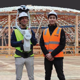


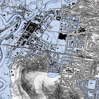


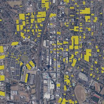


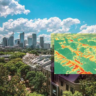


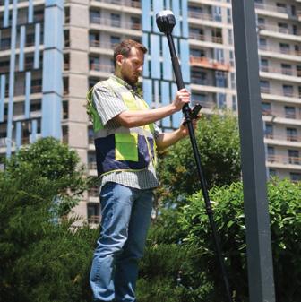


GROWING GREEN WITH GIS Making the City of Sydney even cooler inside The Australasian magazine of surveying, mapping & geo-information February/March 2024 – No. 129 LOCATE BEFORE YOU DIG Boosting accuracy for sub-surface surveys inside Q&A with Lisa Bush From military career to leading civilian programs Geospatial defence LiDAR and timing tech put through its paces Surveying on track Plotting the path of Australia’s new Inland The Australasian magazine of surveying, mapping & geo-information EXTENDING THE REACH OF GNSS Surveying operations in Australia’s Top End inside Q&A: Martine Woolf Digital twins The Australasian magazine of surveying, mapping & geo-information June/July 2023 No. 125 DIGITAL TWINS for smarter futures inside Annual Directory Complete guide to companies, products Plans for PNT What can Australia learn from the United Kingdom? Leaders Forum Industry experts on developments coming in 2024 The Australasian magazine of surveying, mapping & geo-information SAVING REWORK WITH 3D MAPPING Transforming design and build with mobile scanning inside Coastal geospatial The Australasian magazine of surveying, mapping geo-information August/September 2023 – No. 126 Mobile mapping Capturing survey-grade point clouds at speed inside Eyes in the sky Spotting bushfires using satellite imagery EO space mission More than $1.5bn promised for new EO satellite Up, up and away Challenges facing Australia’s drone industry The Australasian magazine of surveying, mapping & geo-information APPLICATIONREADY INSIGHTS The fourth era of geospatial data inside On the right track Surveyors dig deep for New Zealand rail project Spatial schooling Sherif Mohamed on UniSQ’s geospatial programs Space situation Developments in space-based location services The Australasian magazine of surveying, mapping & geo-information FIGHTING FLOODS FROM ABOVE Surveying Byron Bay’s aftermath with LiDAR inside Narelle Underwood How she built her impressive career in surveying AUSPOS in NSW Improving NSW’s statewide survey control network Shipwreck scan Making digital twin of the sunken SS Lake Illawarra The Australasian magazine of surveying, mapping & geo-information MAP FOR GOOD Air traffic helping the planet inside The Australasian magazine of surveying, mapping & geo-information April/May 2023 – No. 124 SPECIAL CONFERENCEISSUE LOCATE FOR THE GREATER GOOD Ensuring space tech such as EO has noble aims inside Annual Directory Complete guide to companies, products & services National mission Is the national EO space mission up in the air? Leaders forum Industry experts forecast the year ahead The Australasian magazine of surveying, mapping geo-information Location intelligence Having the right data at the right time inside RTK put to the test Low- and high-end gear tested out in the field. Drone safety plan CASA’s roadmap for the next decade and beyond. Geodesy in crisis What can be done about the lack of geodesists? The Australasian magazine of surveying, mapping geo-information inside LOCATE ISSUE Full guide to 2022’s most important conference Gravity mapping Enhancing the national vertical reference system Drawing the line Surveying’s risky role in adverse possession cases GIS-POWERED INNOVATION Inside Energy Queensland’s digital revolution The Australasian magazine of surveying, mapping & geo-information SPECIAL CONFERENCEISSUE LOCATE