www.markcreevey.com


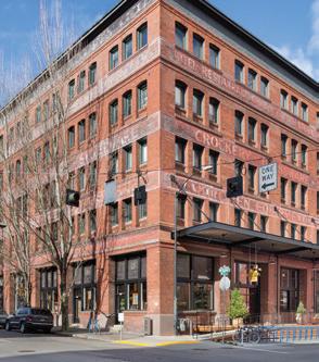
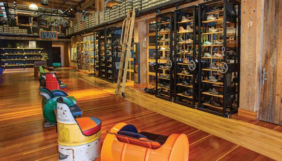
Since 2010, we’ve opened the KEEN Garage to all our Portland fans. It’s a place to get your hands on, and your feet in, the largest selection of KEEN footwear anywhere. It’s also a great place to meet fellow KEEN fans and to be inspired by how they have fun outside. Need insider tips from KEENmates about the styles that best suit your outside life? Come down to the Garage. Wanna test out how each of our styles fit? The Garage door is open. Slap high fives, share trail tales, or just spin the shoe racks. The Garage is there for you.
We mentioned the Garage is filled with the largest selection of KEEN footwear anywhere, right? There’s nowhere else to test out the fit and finish of so many different styles you may have only seen online. Go ahead, pull on those hikers you’ve always wondered about, feel the comfortable joy of the newest generation of Newport sandals, make sure your fave pair of socks will look good in ‘em. Make yourself right at home.
Plus, the Garage features in-person only savings events throughout the year, hosts the occasional party, and is fun for the kiddos (and the adultos, too). Heck, the Garage even has a near-perfect score on TripAdvisor— it’s that kinda fun. And there’s even free parking for KEEN fans right there at the Garage. We’ll see you there.
KEEN GARAGE
505 NW 13th Ave, Portland, OR 97209 971-200-4040
MON - THRS 10AM – 5PM, FRI - SAT 10AM – 6PM, SUN 11AM – 5PM
2 MAZAMAS We have T-shirts, stickers, historic prints, & water bottles Mazama Merchandise on Sale Now!
www.mazamas.org/merchandise
Order today at
MAZAMA BULLETIN
CONTENTS
FEATURES
Hiking the Olympic Coast, p. 8
Exploring the San Juan Mountains, p. 10
Zapotec Trek: Unveiling the Hidden Gems of Oaxaca’s Mountains, p. 14
Essential Gear for Backcountry Touring: Insights from Seasoned Veterans, p. 17
Summits and Setbacks: A Trekker’s Story of the Karakoram Mountains, p. 19
Don’t Have a Car? You Can Still Go Far!, p. 23
Trails and Triumphs: The Adventurous Young Mazamas on the Metolius, p. 24
Navigating Moral Crossroads: A Canyoneering Tale in Zion, p. 28
Green Milestones: The Mazama Mountaineering Center’s Eco-Progress, p. 33
Exploring Arthur Harmon Marshall’s Legacy in the Mazama Library, p. 34
COLUMNS
Executive Director’s Message, p. 4
President’s Message, p. 5
Upcoming Courses, Activities, and Events, p. 6
Mazama Classics, p. 7
Looking Back, p. 26
Saying Goodbye, p. 36
Board of Directors Minutes, p. 37
IN THIS ISSUE
The board’s number one priority this year is identifying a new vision and preparing a strategic plan to meet that vision. This priority will involve all of the membership to answer the question, who do the Mazamas want to be in the next 5–10 years?” p. 5
Our lasting impressions of the trek are of how few people we saw hiking in this area and how little impact trekking has had on the trail system.” p. 14
I had heard reports that the camp was one giant garbage heap from all the climbers and trekkers who had abandoned their trash there, but it was well-kept and fairly free of trash when we arrived.” p. 19
We hoped they were making their way along without any issues. Not knowing how many more hurdles lie ahead, a moral dilemma unfolded within our group. Questions of responsibility, risk, and the impact on our own expedition weighed heavily on our minds.” p. 28
MARCH/APRIL 2024 3
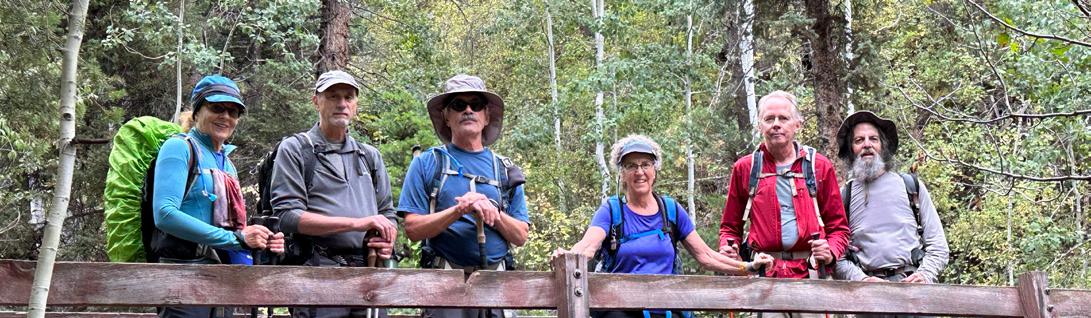
Above: Members of the 2023 Mazama San Juan Mountains Outing.
Photo by Doug Mathias.
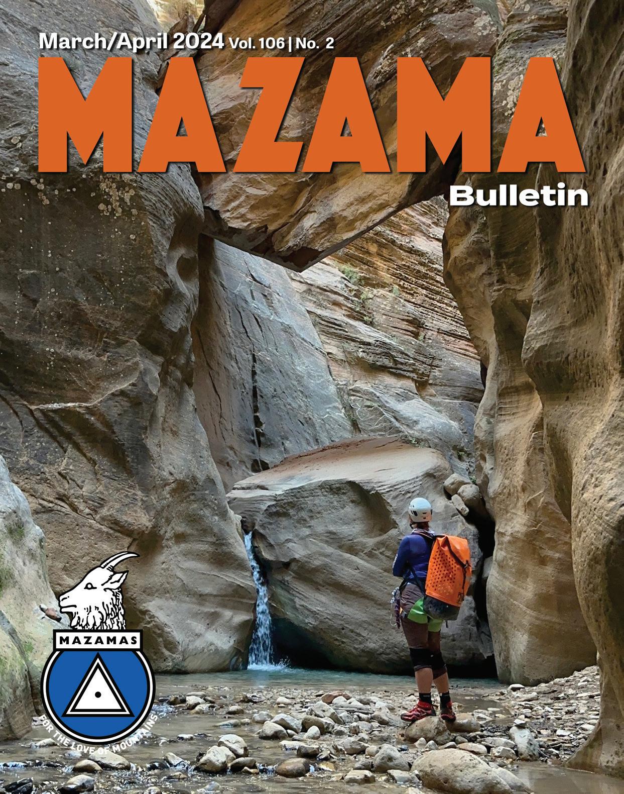
106 Number 2 March/April 2024
Volume
Cover: Anna Feigum waiting at the chockstone, Orderville Canyon, Zion National Park.
Photo by Heather Johnston.
EXECUTIVE DIRECTOR’S MESSAGE
by Rebekah Phillips, Mazama Executive Director
To many, terms like “mission,” “vision,” and “strategic plan” may not hold much significance, but in the nonprofit sector they’re driving concepts that define an organization’s presentday purpose, aspirations for the future, and the roadmap that takes that organization from the former to the latter. They’re not only critical tools in generating support among the external community; they also focus the entire team on the big picture, helping staff, board, and volunteers alike articulate messaging, guide decision-making, set goals, and measure impact. In short, these devices serve to communicate our shared beliefs about what we can achieve and summarize the plan to reach those dreams.
This year, the board and I are excited to explore these concepts deeper by examining the current context surrounding the Mazamas, and, out of that, identifying a renewed vision that ushers us across the next evolutionary bridge. Evaluating and rewriting missions, visions, and strategic plans is a normal part of the nonprofit life cycle, as both the people we serve and the landscape around us are constantly changing. We may not measure our worth by widgets sold like a for-profit company, but we still need to compete in today’s business environment and maintain relevance. In fact, not evolving with the times is one of the top reasons nonprofits fail—they become mundane, redundant, or obsolete, and fall short of their community’s shifting needs and expectations.
Rest assured, we’re not challenging “what” we fundamentally do as the Mazamas; the mission stays intact. What a vision does is identify the problem(s) we hope to solve by carrying out that mission. It asserts why the work we do matters.
It affirms our unwavering commitment to that work amidst a rapidly changing world. A vision statement is at once brave, optimistic, and pragmatic.
To me, developing a vision statement is one of the most empowering exercises a nonprofit can undergo. When done right, the process can be hugely rewarding, in that it engages a wide range of stakeholders to uncover their shared beliefs and dreams. Through the exchange of ideas, listening, imagining, and building consensus, we’ll come away with a clear understanding of what success looks like on the other side, hopeful and energized about our future.
Michelangelo is famously quoted as saying, “The sculpture is already complete within the marble block before I start my work ... I just have to chisel away the superfluous material.” Though we have 3,000 members and Michaelangelo was but one artist, I believe that our collective intention regarding the form we are to take will become similarly clear.
Between now and when this work begins, a little homework for our members:

Consider the role the Mazamas has played in your own lives. What need did it fill? What did it provide you with that no other outlet did? Where were you in your life when the Mazamas showed up? Do the Mazamas fill that need for you still today, or are there ways it needs to catch up? How are the economy, the land, the politics, the barriers, public awareness, the marketplace—indeed, the world—around us changing? Where do we fit in today, and how will we fit in 10 years from now? These will prove invaluable perspectives as we seek member input and chisel away at our own marble block.
Once the vision statement has been tested and adopted, the board will develop a multi-year strategic plan to ensure we reach our destination. At this stage, though, let’s not get distracted by the “how.” Let’s just get creative and curious about our “why.” Let’s have fun!
4 MAZAMAS
PRESIDENT’S MESSAGE
by Greg Scott, Mazama President
If you just joined the Mazamas, welcome! You may have joined because you applied for BCEP, or you have that co-worker who’s been trying to convince you to go on a hike or ramble finally got you out of the office. Regardless of the reason, we’re glad you are a member of our community. Oftentimes, people don’t give much thought to the inner workings of a membership organization and what goes on behind the scenes. The Mazamas is governed by a board of directors, and each year the board sets priorities and goals to inform the executive director about how to operate our programs. This year the board’s goals are centered around four main areas: vision, culture, facilities, and revenue.
The board’s number one priority this year is identifying a new vision and preparing a strategic plan to meet that vision. This priority will involve all of the membership to answer the question: Who do the Mazamas want to be in the next 5–10 years? We want a plan that has measurable outcomes so we can annually report back to the membership our progress in attaining our new vision.
The next priority is about the culture of the Mazamas. The board and our executive director plan to create forums for our committee volunteers to share information about how to continue to improve our programs and also our volunteer experience. We want to foster deeper engagement and sustainability by supporting volunteers, better preventing burnout, and ensuring that the resources needed to succeed are readily available. We also want to un-silo programs so everyone has a common understanding of where they fit in the Mazama ecosystem. Our board also plans to identify and meet with leadership from other organizations to better understand how to improve our culture around diversity, equity, and inclusion (DEI).
Our next priority centers around our facilities. Our number one goal under the
facilities priority is to re-open the lodge. The board is also forming an advisory committee to create a facilities/asset plan for each property to help the board plan for reserves and inform future revenue plans. Another advisory committee is evaluating our IT user experience and making sure the Mazamas is on the right path.
Learn from yesterday, live for today, hope for tomorrow. The important thing is not to stop questioning” –Albert Einstein
The last priority is making sure our revenue is enough to cover the costs of operating our programs. Revenue comes into the Mazamas from three main sources: membership, programs, and donations. In the recent past our investment fund and operations were heavily reliant on membership and programs. To this end, the board plans to evaluate how we can be more strategic to increase capacity for programs and increase repetition of programs with an eye towards more resiliency and flexibility. The board is working on finalizing a pricing policy so we can equitably evaluate annually how we set prices. Under the leadership of Rebekah and our treasurer Liz Crowe, the Mazamas is catching up on financial
reporting to provide more transparency about how funds are used. We also plan to work with our new development director to understand what grants are available to the Mazamas and plan to apply and win at least one grant. Finally, we plan to organize and hold a gala fundraising event in the fall to celebrate the organization’s 130th anniversary to help build back our investment funds and improve our donation revenue stream.
The purpose of setting goals is obvious. It gives us a map to help guide us and also helps us understand what steps we need to take to achieve the end result. The significant accomplishments the Mazamas has achieved in the recent past finally allow us to build back our investments and invest in our future community.
You are a part of that history.
Thank you.
MARCH/APRIL 2024 5
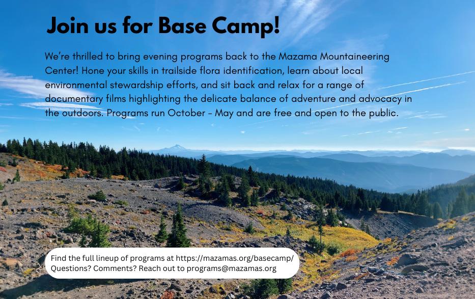
UPCOMING COURSES, ACTIVITIES, AND EVENTS
BASE CAMP PROGRAM
BOB WILSON EXPEDITION GRANT RECIPIENTS
Date: March 6
Time: 6:30 p.m.
Cost: free
Mazama Bob Wilson Expedition Grant recipients Steven Wagoner, Bob Breivogel, and Shawn Thomas will describe their travels and climbs in Nahanni National Park in the Northwest Territories of Canada. Their explorations include the Cirque of the Unclimbables, the Gates of the Arctic National Park, and a pure rock climb on an unnamed 2,150-meter peak within the great Stikine Icecap of Southeast Alaska.
BASE CAMP PROGRAM
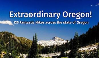
EXTRAORDINARY OREGON & HIKING BASICS
Date: April 3
Time: 6:30 p.m.
Cost: free
Everyone belongs in the outdoors and wild spaces, but where do you start? What gear is essential? Where should you go? Mazama member Matt Reeder will present his latest guidebook, Extraordinary Oregon!, which seeks to demystify and introduce our trails. The Adventurous Young Mazamas will, in true Base Camp style, take it back to the basics to ensure anyone who wants to can recreate safely in our backyard.
CANYONEERING 2024
Registration opens: April 16
Registration closes: April 30
Dates: May 23–June 30
Cost: $515/members & $625/nonmembers
Canyons, the final frontier of the Pacific Northwest! Five lectures and two field sessions will teach canyoneeringspecific anchor and rappel techniques to sustainably explore hidden canyons and wild waterfalls. The class culminates in a late-summer canyon outing to practice your new skills.
More info: mazamas.org/canyoneering
BASE CAMP PROGRAM
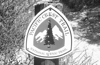
HIKING THE PCT & MENTAL HEALTH; PACIFIC CREST TRAIL GEOLOGY
Date: April 17
Time: 6:30 p.m.
Cost: free
Ever wonder how our volcanoes came to be? Who put that rock there? Always wanted to hike the PCT? We are bringing in two special guests to answer all of your questions regarding rocks and hiking. Kyra Miller is an outdoor enthusiast who spent half of 2022 taking a journey on the PCT to heal her mental health. Peter Laciano is a geologist by training and is currently doing fieldwork with the USDA regarding snowpack and water supply in the PNW.
STEENS MOUNTAIN BACKCOUNTRY NORDIC SKI TOUR
Date: May 17–19
Registration opens: April 1
The slopes of Steens Mountain (9,733 feet) often hold the winter snowpack until mid-June. These conditions can provide long sunny days of spring skiing. We’ll drive to the snow line, then ski up to find a good campsite and spend the next two days exploring up to the rim on our skis. Ski out on the last day. Backcountry Nordic (not alpine touring) skiing and snow camping skills required. Led by Lindsey Addison and Jen Travers.
STEEP SNOW & ICE 2024
Virtual Info Night: May 22, 6–7 p.m.
Registration open: June 1
Dates: Aug 6–25
Cost: $515/members and $625/ nonmembers
Steep Snow & Ice is pleased to announce dates for our 2024 skill builder. This short class of several evening sessions, practice on the foam artificial ice wall at the MMC, and a weekend field session provides training on winter alpine protection and movement to help prepare climbers to tackle objectives such as Mt. Hood’s Reid Headwall and Mt. Rainier’s Kautz Glacier route. All classes from 6–9 p.m. at the MMC
Course dates:
■ SSI class #1: Tuesday, August 6
■ SSI class #2: Thursday, August 8
■ SSI class #3: Wednesday, August 14 (Group A)
■ SSI class #4: Wednesday, August 21 (Group B)
■ SSI field session: August 17–18 (Group A)
■ SSI field session: August. 24–25 (Group B)
6 MAZAMAS
ROUND THE MOUNTAIN 2024
Mark your calendars! Round the Mountain (RTM) is back this Labor Day, Aug. 30–Sept. 2, 2024. Join us as we set out from the Mazama Lodge each day for a 13 to 14-mile adventure. We carry only day packs, because each night we return to the lodge for great food, hot showers, a cozy bunk, and stories from your day on the trail. Your adventure includes all meals and dorm lodging. Shuttle vans will transport you from our meeting place in Portland to the Mazama Lodge, as well as to/from the trailhead each day.
SOUTH OLYMPICS TREK
Dates: September 8–14, 2024
Cost: $350/members & $500/nonmembers
Join us as we hike the beautiful and scenic southern Olympics Coast Wilderness completing a loop along the Skyline Ridge, Elwha River, Hayden Pass, Dosewallips River, West Fork Dosewallips River, LaCrosse Pass, Duckabush River, O'Neil Pass, and East Fork Quinault River trails. The 6–8 participants will need to be in good physical condition for this approximately 101-mile adventure and should have experience in at least one 50+ mile trek. We will be hiking at a moderate to fast pace, traveling around 10–21 miles per day over easy to difficult terrain including stream fords. Elevation gains will range from 3,600–5,800 feet per day. Expect varying weather, wildlife, and miles and miles of scenery. We will use a short car shuttle to complete this loop hike. The outing dates are tent until a permit is obtained.
Contact leader Gary Bishop (gbish90@ hotmail.com) for more information.
MAZAMA CLASSICS
For members with 25 years of membership, or for those who prefer to travel at a more leisurely pace.
We lead a wide variety of year-round activities including hikes, picnics, and cultural excursions. Share years of happy Mazama memories with our group. All ages are welcome to join the fun.
CONTACTING THE CLASSICS
Contact the Classics Chair, Gordon Fulks at classics@mazamas.org.
SUPPORT THE CLASSICS
The Classics Committee needs a volunteer to put more content in our column on a quarterly basis. We want to document past Classics events and make sure that our postings to the web are current and complete. More generally, there is always work to be done on the committee. Our meetings are the fourth Monday of every other month at 11 a.m. on Zoom. Email classics@mazamas.org and tell us how you can help.
CLASSICS COMMITTEE MEETING
Keep an eye on the Mazama calendar for our next meeting.
UP COMING CLASSICS HIKES
The Classics Committee is still in the process of getting hike leaders to lead gentle hikes in March and April. We will announce upcoming Classics hikes via our Classics mailing list.
Flora Huber is our main hike leader (flobell17@comcast.net).
Potential Classic hikes for the spring include:
■ Rhododendron Garden
■ Reed campus hike
■ Mosier Ridge hike.
Dates and times to be determined.
MARCH/APRIL 2024 7
YOUR AD HERE! Contact the us to learn more about advertising in the Mazama Bulletin! mazama.bulletin@mazamas.org
HIKING THE OLYMPIC COAST
 by Beatrice Robinson, Lois Gearhart, and Gary Bishop
This is not your ordinary walk on the beach!
The Olympic Coast Wilderness in Olympic National Park features some of the most rugged and isolated coastal landscapes in the country. From tidepools full of life to sea stacks miles out in the ocean, every headland you round offers another breathtaking view.
The hike was challenging and our daily mileage depended upon making headlands at low tide or using rope or ladder assists to traverse overland trails. We encountered stretches of sandy beaches, pebble beaches, and scattered boulders that required scrambling and lots of rock hopping.
To make the one-way hike work, we left one car at the Oil City Trailhead at the southern end of the hike the day before we started our trip. We then had dinner in Forks, getting to know everyone on the team, and then spent the night at Bogachiel State Park campground just south of Forks.
The next morning we started the trip by driving our cars to the Rialto Beach Trailhead, just North of La Push, Washington. We left our vehicles there and took a private shuttle to the starting point of our trip, the Shi Shi Beach Trailhead in the Makah Indian Reservation. Our shuttle bus driver was very cheerful and gave us some tips on places to stop and scenery to anticipate on our trip. On the long drive, it was nice to see the area’s towns but daunting to know that we would be hiking back to our cars.
Above: Sea stacks along Shi Shi Beach.
Photo by Lois Gearhart.
FEATURED: OLYMPIC COAST OUTING
June 15–19, 2023
Leader: Gary Bishop
Assistant: Jean Hillebrand
Participants: John Creager, Brad Dewey, Lois Gearhart, Beatrice Robinson, and Terry Sherbeck
The hike through the forest on well-maintained trails to Shi Shi Beach was a fabulous way to start the trip. Stunning ocean views with many rock formations greeted us and it seemed like we saw eagles on average every mile and very few other hikers. Even with a late start, we made the 10.3 miles to our first campsite, just south of the Ozette River, by late afternoon.
On the second day, we started with the Olympic Coast's signature weather: foggy, drizzly, and chilly, but the weather improved as the day went on. Over this 12.6-mile day we realized a few things: Walking on rocks of various sizes is challenging and organized beach clean-up days are a necessary and worthwhile donation of time—so many washed-up plastic bottles. On the plus side, we saw the famous Wedding Rocks petroglyphs. We also got to pay our respects at the Norwegian (shipwreck) Memorial before making our camp nearby.
The next morning we departed our Norwegian Memorial campsite. Finally, some hard sand beach walking! Soon we
8 MAZAMAS
discovered many, many bear paw prints on the sand; it looked as if the bears had had a beach party sometime overnight, and was delightful to envision.
We hiked 10.1 miles to the Rialto Beach Trailhead where two of our cars were waiting for us with fresh clothes and a food resupply. We then drove to the 3 Rivers Resort to the east of La Push, where we enjoyed a very satisfying dinner and amazing milkshakes. It was then on to the Third Beach Trailhead and a 1.4-mile wooded hike to the Third Beach campsite. We selected a spot with a slight ledge on the back side of the beach and set up our tents. Our leader patiently worked with minimal materials to finally build us a roaring fire, taking his status to A+ outing leader.
We woke up the next morning to find a water line from the previous night's tide that went, in several cases, past our tents! A few very small logs and sticks near us had shifted six or so feet overnight. We lost two trekking poles in the incident. Fortunately, everything else and everyone was safe, if a little wet. Gary had warned us the night before that “the tide will sound very close but if you feel your tent getting wet, move.” A few of us were up and moving at a very fast pace at 1 a.m.!
By early afternoon we had made it 10 miles to our next campsite, Mosquito Creek, where this time we chose sites that were high up overlooking the beach.
The next morning saw us getting up early for a 6:30 a.m. start to make it past two headlands with tide levels of two and three feet. We first followed a headland trail with multiple rope assists. After a few miles, we were back on a sandy beach and then around the two rocky headlands. It was then just a short push to the mouth of the Hoh River followed by a wooded riverside stretch to where our car awaited us at the Oil City Trailhead, finishing our short 6.1-mile day.
With a sense of accomplishment, we all crammed into the single vehicle, making our way back to the Third Beach Trailhead and our other two vehicles. From there we returned to the 3 Rivers Resort where we enjoyed a celebratory lunch with more amazing milkshakes before making our way back home.
HIGHLIGHTS
■ Beautiful beach scenery
■ Abundant marine wildlife
■ Colorful sunsets over the ocean
■ Petroglyphs (be sure to get to Wedding Rocks at low tide!)
■ Solitude
■ The campsites all have amazing views
■ Despite the weather prediction, we all got a bit soggy but never soaked
LOWLIGHTS
■ Quickly changing tides make it difficult to get miles in at times
■ Long stretches of rocks and boulders to traverse
■ Soft sand and pebble beaches are exhausting to hike on
■ Steep overland trails with some sketchy rope assists
■ The Olympic Coast is often foggy, drizzly, and chilly
■ Permits, shuttles, and tides = lots of planning
MARCH/APRIL 2024 9
Above: Dinner with a view at our Mosquito Creek camp. Photo by Lois Gearhart.
Above: Wedding Rocks petroglyphs. Photo by Lois Gearhart.
EXPLORING THE SAN JUAN MOUNTAINS
 By Linda Machtelinckx
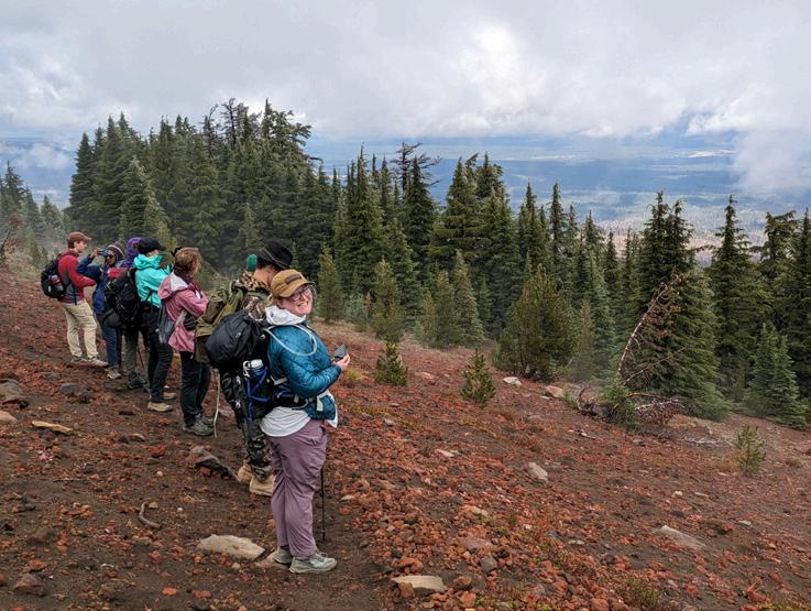
During this Mazama outing, we stayed outside the town of Ridgway, located in southwestern Colorado in a gorgeous modern chalet on 35 private wooded acres. At 8,000 feet atop a mesa, the chalet has spectacular views of the surrounding mountains that stretch upwards of 14,000 feet.
September 11
We landed in Durango, where we spent the night. Rainy weather was in the forecast for the week, but we were hopeful we would be able to dodge what Mother Nature had in mind.
September 12
One does not defy Mother Nature and she was determined to keep her promise. We skipped visiting Mesa Verde and drove straight to our chalet. As a consolation, the drive was pretty and we experienced the famous U.S. 550, or the Million Dollar Highway. In 1921, it was reported to have cost 1 million dollars to pave. U.S. 550 is one of the most dangerous highways in the U.S., with very few guardrails due to snowplow driver conveniences. So, if you are a back seat passenger, choose your side wisely!
We drove through and stopped in charming towns during the week: Ridgway, Ouray, Silverton, and Montrose. All offer grocery stores and various types of restaurants.
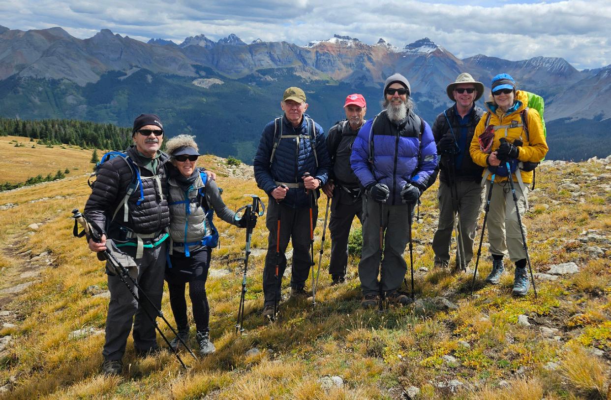
Above: Members of the San Juan Mountains outing.
Photo by Linda Machtelinckx.
FEATURED: SAN JUAN MOUNTAINS, SW COLORADO
September 2023
Leader: Larry Solomon
Assistant: Bruce Giordano
Participants: Peter Glaser, Doug Mathias, Linda Machtelinckx, Gordy Molitor, and Suellen Rinker.
Ridgway
We were greeted at our chalet by a friendly orange cat that brought us “presents” at the doorsteps over the course of the week. We were warned not to walk around the chalet at dawn or dusk as mountain lions and bears had been seen roaming. Was I the only one who was hoping to see a big cat or a bear from behind the windows? Instead, our mini mountain lion greeted us every day. At times, the menacing clouds traded places with the mountain range in the distance, inviting rainbows that pleased our eyes and souls.
Mother Nature kept her promise and tested our abilities to read the different weather apps. We dodged the weather and in the afternoon visited the South Rim of the Black Canyon of the Gunnison. Rather than looking up to the summits of the Rockies, we looked down into the canyon and at its interesting geology.
1.6 miles, 450 feet elevation gain
10 MAZAMAS
September 13
The friendly face of the orange cat greeted us from behind the windows of the chalet. Was it to cheer us up for another itinerary change to avoid the rain and thunder?
Hooray! We found a “rainless” pocket area. The small town of Ouray (7,792 feet) would be our first hike to get used to the altitude. The Ouray Perimeter Trail was a hike well worth it, with a lot of ups and downs and a couple of waterfalls that seemed to carefully drape the rocks. The early fall colors started to compete with the yellow water streams due to mining. A touch of blue from the hot spring pools, below in town, made this hike interesting in various ways. The Ouray Perimeter Trail was a nice conditioning hike with some historical and geological facts explained at the Box Cañon Bridge. The bridge runs 30 yards between the rock sides, about 200 feet higher than the base of the trail. The view of the falls and the thundering noise of crashing waters below our feet made us either slow down to admire the view or speed up to reach the firm soil leading to the entrance of a lowceilinged tunnel in the mountain, which exited to a steep downhill staircase.
5.9 miles, 1,600 feet elevation gain
September 14
Mother Nature! Mother Nature! You sent us on a beautiful hike that was not part of the original itinerary. To get there you tested us for miles on rocky and windy roads with deep potholes. I did not think about choosing the side in the back seat of the car, and my heart was pounding when we drove close to the ridges. Good job drivers! The trail started steep and windy, and led to a spectacular view of the mountain ranges that were flirting with the clouds. Baldy Peak was waiting for us in the distance. The trail took us through more ups and downs before a quick lunch at the foot of Baldy Peak while our eyes floated from peak to peak. The echoing sounds of thunder cut short our dreamy, cold, and windy lunch spot. The hike down offered different views of the snowy mountains that played hide-and-seek with menacing clouds. The landscape was dotted with trees and bushes turning red and yellow. Right on time! As we reached our cars, it started to rain, which made our drive back
a little more challenging (I traded my back seat side this time!).
7.2 miles, 2,200 feet elevation gain
September 15
Rain, rain, rain in the forecast! After consulting different weather apps the night before, we agreed to do the North Rim of the Black Canyon of the Gunnison, which seemed to be spared from the rain and thunder til early afternoon. The views were so different from yesterday’s hike, and I thought I was in a tropical country with green and black canyons. Threatening dark clouds slowly invaded the canyons, pleasing our camera lenses that would express more than just the views. We reached the top for a quick lunch, but soon, the downpour rain made us hike down as fast as possible, stretching our steps to avoid puddles.
6.8 miles, 1,250 feet elevation gain
September 16
As a reward for hiking in the heavy rain the day before, Mother Nature gave us a break. The weather cooperated, and we were able to do the scheduled hike: the Blue Lakes, with a blue sky. For miles with countless potholes, the rocky road led us to the trailhead. The steep hike started in the trees with the sound of water running down in the distance. The waterfalls in an
open area were a valid excuse to stop to catch our breath and immortalize the view. We did not know what would be around the next turn, which was an incentive to keep a steady pace til we reached Lower Blue Lake (10,980 feet), the first of a string of three turquoise beads linked with a string of steep trails. Breathless in all ways: Lower Blue Lake, turquoise and bordered with fall-colored vegetation, invited us to stay and rest while admiring Mt. Sneffels towering at 14,158 feet above the lake. But Middle Blue Lake and Upper Blue Lake were waiting for us at the end of a very steep and rocky trail, complete with stream crossings. Upper Blue Lake (11,720 feet) was majestic. The snowy mountain and the few fluffy white clouds were reflected in the lake, inviting some to take a nap or to meditate. No noise except for occasional rocks rolling in the white snow, leaving dark streaks down the snowy cliffs. After a long-deserved break, we initiated the hike down, saluting each lake one more time.
9.0 miles, 2,500 feet elevation gain
September 17
Mother Nature probably wanted to reward us for being flexible with our initial scheduled hikes and treated us one more time with a beautiful blue sky for our last hike: Black Face Peak (12,147 feet). The hike started on an easy-graded trail through meadows and aspen groves, followed by a relentlessly steep trail and switchbacks under a canopy of conifers. All I could focus on was my breath and keeping somewhat steady slow steps. Then, there was a succession of rewards. The trail gave way to jagged ridges and meandered through meadows. The last ridge took us to a 360-degree view of various mountains, valleys, meadows, and saddles, offering a pallet of white, black, gray, emerald, green, and rusty colors. In the distance, the Lizard Head, with its distinctive profile, seemed to proudly dominate the jagged peaks and, like a conductor, orchestrated the clouds dancing around, constantly changing the shade of colors. Some would say we felt like cherries on a cake, but I felt like being briefly part of a live painting.
8.0 miles, 2,100 feet elevation gain
Thank you, Mother Nature, for the spectacular views and for teaching us to respect you!
MARCH/APRIL 2024 11
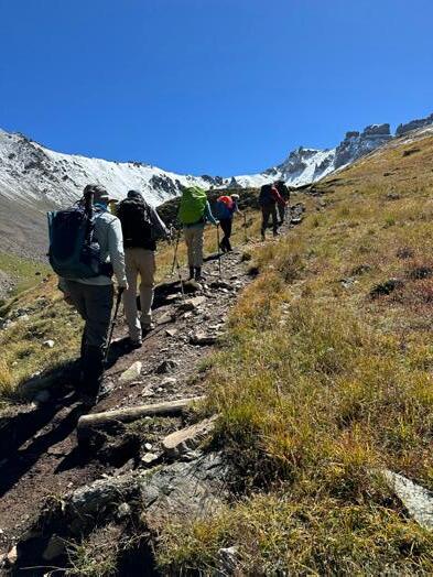
Above: hikers on ridge. Photo by Doug Mathias.
12 MAZAMAS
MAZAMA VALUES
Safety
We believe safety is our primary responsibility in all education and outdoor activities. Training, risk management, and incident reporting are critical supporting elements.
Education
We believe training, experience, and skills development are fundamental to preparedness, enjoyment, and safety in the mountains. Studying, seeking, and sharing knowledge leads to an increased understanding of mountain environments.
Volunteerism
We believe volunteers are the driving force in everything we do. Teamwork, collaboration, and generosity of spirit are the essence of who we are.
Community
We believe camaraderie, friendship, and fun are integral to everything we do. We welcome the participation of all people and collaborate with those who share our goals.
Competence
We believe all leaders, committee members, staff, volunteers, and participants should possess the knowledge, skills, abilities, and judgment required of their roles.
Credibility
We believe we are trusted by the community in mountaineering matters. We are relied upon for information based on best practices and experience.
Stewardship
We believe in conserving the mountain environment. We protect our history and archives, and sustain a healthy organization.
Respect
We believe in the inherent value of our fellow Mazamas, of our volunteers, and of members of the community. An open, trusting, and inclusive environment is essential to promoting our mission and values.

Whether you are new to the Northwest, a seasoned backcountry traveler, a longtime Portland resident who’s ready to start exploring, or somewhere in between, we can connect you to the hiking, climbing, and skiing adventures you seek.
■ Climb a mountain
■ Go rock climbing
■ Hike or backpack
■ Backcountry ski or snowshoe
■ Discover canyoneering
■ Meet interesting people
■ Learn new outdoor skills
■ Check out our library
■ Stay at our mountain lodge
■ See a presentation
■ Discover new places
■ Trek in a foreign country
■ Join an outing or expedition
■ Fix a trail
■ ... and so much more!

CONTACT US
Mazama Mountaineering Center
527 SE 43rd Ave., Portland, OR, 97215
Phone: 503-227-2345
Email: help@mazamas.org
Hours: Tuesday–Thursday, 10:30 a.m.–4 p.m.
Mazama Lodge 30500 West Leg Rd., Government Camp, OR 97028
Phone: 503-272-9214
Email: mazamalodge@mazamas.org
Hours: Closed
PUBLICATIONS TEAM
Editor: Mathew Brock, Bulletin Editor (mazama.bulletin@mazamas.org)
Members: Peter Boag, Darrin Gunkel, Ali Gray, Ryan Reed, Jen Travers, and Claire Tenscher (publications@mazamas.org)
MAZAMA STAFF
MATHEW BROCK Library & Historical Collections Manager mathew@mazamas.org
RICK CRAYCRAFT Facilities Manager facilities@mazamas.org
CATHY DOW Finance & Administration Manager cathydow@mazamas.org
REBEKAH PHILLIPS Executive Director rebekahphillips@mazamas.org
BRENDAN SCANLAN Operations & IT Manager brendanscanlan@mazamas.org
For additional contact information, including committees and board email addresses, go to mazamas.org/ contactinformation.
MAZAMA (USPS 334-780):
Advertising: mazama.bulletin@mazamas.org. Subscription: $15 per year. Bulletin material must be emailed to mazama.bulletin@mazamas.org.
The Mazama Bulletin is currently published bi-monthly by the Mazamas—527 SE 43rd Ave., Portland, OR 97215. Periodicals postage paid at Portland, OR. POSTMASTER: Send address changes to MAZAMAS, 527 SE 43rd Ave., Portland, OR 97215. The Mazamas is a 501(c)(3) Oregon nonprofit corporation organized on the summit of Mt. Hood in 1894. The Mazamas is an equal opportunity provider.
MARCH/APRIL 2024 13
Join Now! mazamas.org/join
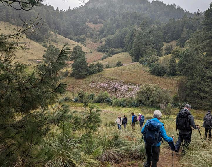
ZAPOTEC TREK: UNVEILING THE HIDDEN GEMS OF OAXACA'S MOUNTAINS
by Bronson Potter
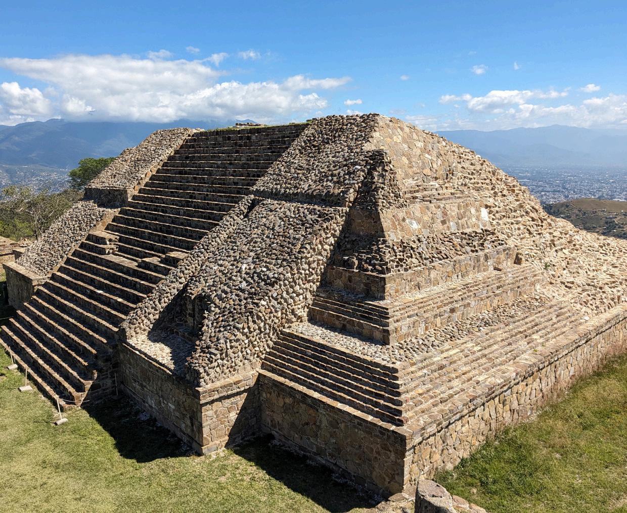
It is possible to trek in the mountains of central Mexico, hiking from one indigenous village to another. This is what six of us did the first week of this past November, after spending a few days in Oaxaca for the Day of the Dead celebration—three days of parades, music, and good times. We also visited Monte Albán, a site of Zapotec ruins above the city. Oaxaca sits in a high (5,000-foot) valley between the Sierra Norte and the Sierra Sur mountain ranges. The dry season in this area is from November to May.
We arranged for our guide based in Oaxaca, Fernando Barnetche, through Embark, a Portland-based expedition company. Fernando operates a tour company called Parabola, and was funny and well-loved by all the locals we met along the way. He is also a foodie and made a great effort to steer us to the best eateries
and bars in Oaxaca and the mountain villages.
The Sierra Norte is home to the Pueblos Mancomunados, a community of eight self-governing indigenous Zapotec villages working together to provide outstanding eco-tourism experiences, thereby protecting their land, culture, and
Above: Ruins at Monta Alban, outside Oaxaca city.
All photos by Bronson Potter.
heritage. While the federal government has a role in the regulation of this area, any development or commercial activity must also obtain the approval of the local village. The eight villages that comprise the Pueblos Mancomunados (Amatlán, Benito Juárez, Cuajimoloyas, La Nevería, Lachatao, Latuvi, Llano Grande, and Yavesía) have
14 MAZAMAS
been linked economically and socially for almost 500 years, sharing natural resources and trade routes. The people of the Pueblos Mancomunados have sent the mining (silver and gold are present in these mountains) and logging companies packing. In their place, the people have supported eco-tourism and have formed their own community-based logging company to engage in sustainable forestry.
When hiking there, it is highly recommended to have a local guide from the village of the area that you are hiking in. In certain areas, a local guide is required. When going from one area to another, the guides switch off and meet you at the boundary between the areas that the villages control. Even when not required, a guide is a good idea because some trails are unmarked and it is easy to get lost. Our local guides were very inexpensive and spoke English to varying degrees. They provided information on the area’s history, flora, and culture.
Each village has an eco-tourism information office to check you into the area and provide any assistance you may need. There is a basic road system connecting the villages, but we were on trails 90 percent of the time. The trail system is extensive, consisting of over 40 trails and covering over 300–400 kilometers. Most of the trails are used by locals for traveling from village to village. The trails extend all the way from Veracruz to Oaxaca and the Pacific Ocean. I was surprised to see that the trails are so little impacted—the vast majority are pine and oak duff with very few dirt sections. In four days of hiking, we only saw one other group of trekkers. Quite a pleasant difference from my experience on the congested Everest Base Camp trail.
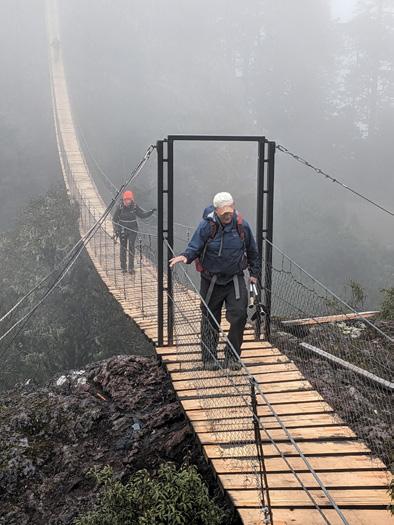
Our trek started by driving a couple of hours to the east and north of Oaxaca to the small village of Benito Juárez located at 10,200 feet in the Sierra Norte. From here we hiked in mist and wind (the Zapotec are called the Cloud People) to Cuajimolos. The hike was six miles of up and down in forests of pine, madrone, huge yucca, and agricultural plots of corn, agave, and potato. Each member of the Zapotec villages is required to contribute a year of community service without compensation. Failure to do so will result in exclusion from the local community. Two local guides accompanied us as part of their community service. Just out of Benito Juárez, there is a
viewpoint with a suspension bridge and a lookout tower. The trail was covered in duff and was very faint in many places. We stayed in cabins outside of Cuajimolos that had fireplaces and hot showers. A very welcome respite from the cool and damp weather.
Our second day took us from Cuajimolos to Lachatao. Shortly after leaving Cuajimolos, we hiked across the continental divide at 10,500 feet. From here, water flows north to the Gulf of Mexico or south to the Pacific Ocean. The trail took us through Las Vigas, which was the site of a critical battle in the revolution of 1910. We hiked eight miles up and down, mostly descending through forests. Lachatao is at 7,000 feet. The trails are used by both hikers and mountain bikers, but we didn’t see anyone else on the trail. Our van (which hauled our duffle bags from village to village) picked us up and took us the remaining 10 miles into Lachatao. We spent a couple of nights in Lachatao. Typical of the Zapotec villages, Lachatao has a church with a courtyard, a simple store to buy basic food and drink, a single restaurant, and several simple but clean places to stay.
Above, top: the group on the trail in the Sierra Norte between Bonito Juarez and Cuajmolos.
Above, bottom: suspension bridge just outside of Bonito Juarez. on the first day of the trek.
the steep and muddy road. So, we geared up and started to hike the four miles to town which would bring the day’s hike to 14 miles. The good news was that after walking a mile, a 4x4 pickup truck came down from town and fetched us. We had
On day three, we drove from Lachatao to Latuvi to start our hike to go 10 miles back to Lachatao. However, four miles from Latuvi, the van was unable to go further on continued on next page
MARCH/APRIL 2024 15
Zapotec, continued from previous page
five people in the cab and five more in the bed of the truck—a tight fit but better than hiking up the muddy road. This section of the trail is the Camino Real, a main trail used for hundreds if not thousands of years. It is one of the prettiest trails in the area and follows a stream. Our local guide took us to a Zapotec ruin of a small stone hut that is over 1,000 years old and was used as a sweat lodge. There were a lot of bromeliads and a few orchids hanging in the trees. The weather was markedly warmer along here and the skies had cleared up. We paused for a dip in the stream. The elevation along the trail varies from 6,500 feet to 8,500 feet.
Our last day of trekking among the Pueblos Mancomunados had us going a little over eight miles from Lachatao to Capulálpam de Méndez. Capulálpam de Méndez is the lowest village, where we stayed at 6,600 feet. It is designated as a Pueblo Mágico, an area of "cultural richness, historical relevance, cuisine, art crafts, and great hospitality,” by the Secretariat of Tourism, the first town to receive this designation in the state of Oaxaca. Before doing the hike, we drove to the small village of Amatlán and visited the site of the ruins of a Spanish hacienda
that was used to process silver and gold until the Spanish were run out in the 1820s. Capulálpam de Méndez is a charming village. We had a great meal overlooking the town. The owner of the restaurant took us to his brand-new bed and breakfast, which was the nicest place we stayed on the whole trip, with big rooms, tankless water heaters, and thick memory foam beds.
After trekking the Pueblos Mancomunados, we traveled to the city of Mitla, a very important Zapotec area and the location of the ruins located at the Zona Arqueologica de Mitla. This site is where the Zapotec moved to after abandoning Monte Albán for reasons that remain unknown. The next day we visited the famed mineralized waterfalls of Hierve el Agua. There are travertine pools at the top and you can hike down along the falls for different views. From Hierve el Agua, we hiked five kilometers to a slot canyon. A short hike up the canyon, walking in a stream, brought us to a waterfall and a pool to swim in.
Our last hiking was along the Nueve Puntas in the Sierra Sur. It is a 12.9-mile hike up and along a ridgeline traversing nine points. We had to be taken to the trailhead in a cattle truck because the primitive road was impassible by car. Beneath the seventh point, there are the
Above: on the trail in the Sierra Norte between Lachatao and Capulapum
ruins of stone walls that were used to make terraces for ancient Zapotec villages. The points offered great views of the valley Oaxaca sits in. Fernando enlisted several young men to assist in the guiding in order to allow them to build their guiding resumes and earn some fees and tips. There were six clients and eight guides. We enjoyed a dinner at the home of a family that grew agave and distilled mezcal.
This trip offered everything from the crowds, parades, and festivities of the Day of the Dead in the city to the simplicity and quiet of life in the Sierra Norte. My lasting impressions of the trek are of how few people we saw hiking in this area and how little impact trekking has had on the trail system. We saw just one other small group on the trail the entire time and a few small groups in the villages. The Zapotec live throughout this area tending small plots of crops and raising animals. They were friendly and helpful, once leaving their work in the fields to redirect us when we lost the trail. We didn’t see much in the way of wildlife, but the flora varies from massive yucca to small orchids growing in trees. This is not a trip of grand vistas. Rather, it is one rich in cultural experiences.
16 MAZAMAS
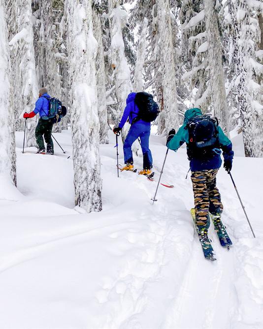
ESSENTIAL GEAR FOR BACKCOUNTRY TOURING : INSIGHTS FROM SEASONED VETERANS
by Emily Joy
Backcountry touring is one of those sports you really have to invest in—mentally, financially, and experientially. After paging through the latest gear review magazines, going down the rabbit hole of online reviews, and taking advantage of demo days at the resort, you’ve finally assembled your perfect backcountry setup, right?
The Mazama Backcountry Ski (and Snowboard) Touring class helps folks who are new to the sport demystify it. We talk a lot about the gear and the knowledge required to travel safely in the backcountry. What’s in your pack impacts the safety and enjoyability of your experience—being prepared and knowing how to use your equipment are keys to success. We asked our team of volunteers, who have at least 411 years of combined experience (source: unverified but likely), to weigh in on the most important, yet unassuming, pieces in their kit. And we’ve broken down an example of what a good repair kit looks like, so that you can benefit from our backcountry travel trial and error.
1. Emergency bivy: Ever tried to snow camp without any camping gear? It’s cold, wet, and not fun at all. An emergency bivy can protect you from the elements during an unplanned overnighter and provide critical warmth during a rescue scenario. The OR Helium Emergency Bivy is worth more than its 10 onces of weight in gold.
2. First aid kit: This seems obvious, but you’d be amazed at how many people leave this one behind on backcountry day tours. Frankly, this is not optional, it’s part of the ten essentials. Always discuss group gear before hitting the skin track to make sure you have at least one or two quality first aid kits to respond properly in an emergency situation. It’s also good to discuss if any of your ski/snowboard buddies have medical training of any kind before things go sideways.
3. Extra batteries, including a battery pack for your phone: Many of us use mapping apps on our phones for backcountry travel—and while a paper backup is always recommended‚ don’t forget your battery pack to keep that Strava track rolling! Remember, when your phone gets cold your phone battery dies—it’s one more piece of gear to manage. And maybe this goes without saying, but your avy beacon should always be above 90 percent battery life when you embark on your tour. If it’s not, having some extra batteries on hand to change them out before you start your tour is the responsible
choice. Lastly, don’t forget a couple extra AAAs for your headlamp and you’ll be in good shape.
4. Skin wax: Yes, wax that goes on the furry side of your ski or snowboard skins. If you ski in the northwest, where temperatures and snow conditions change rapidly, skin wax is a lifesaver. Glomping, the dreaded snow buildup on the bottoms of your skins that stops you in your tracks, is simply not a good time. If snow starts sticking, stop and throw some wax on your skins—the earlier you catch this, the better. Oh, and if you can keep your skins warm inside your jacket when not in use, and/or try to keep them dry when possible, your all-day skin use will improve.
5. Inclinometer: Want to know what slope angle you're skiing? (Hint: the answer is yes.) This handy tool gives you instant feedback on making decisions on what terrain to travel on,
continued on next page
MARCH/APRIL 2024 17
Above: Backcountry students set the skin track. Photo by Backcountry Ski Touring Committee.
Gear, continued from previous page
and the more you use it, the better you get at eyeballing slope angle.
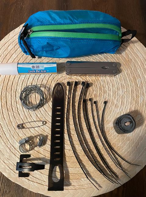
6. Repair kit: When your boot, binding, pole, or skin breaks and you’re way out in the backcountry, it’s imperative that you find a quick fix so that you can get back to the car. There are tutorials and forums online where you can find suggestions on what hardware to bring and how to use them in a pinch. A good kit contains: extra skin tail (specific to my skins), wire, safety pins, hose clamps (multiple sizes are good to have—think splinting a broken pole), zip ties, gorilla tape, a multi-tool with pliers, lock de-icer (works miracles if your binding is frozen solid), and a lightweight carrying case.
We’re halfway through the 2024 Backcountry Ski Touring class, if you’d like to learn more, check out the website or contact us at skimt@mazamas.org.
Happy and safe travels in the backcountry—from all of us on the Backcountry Ski Touring Committee!
18 MAZAMAS
Above: Components of a small but mighty backcountry skiing repair kit Photo by THE Backcountry Ski Touring Committee.
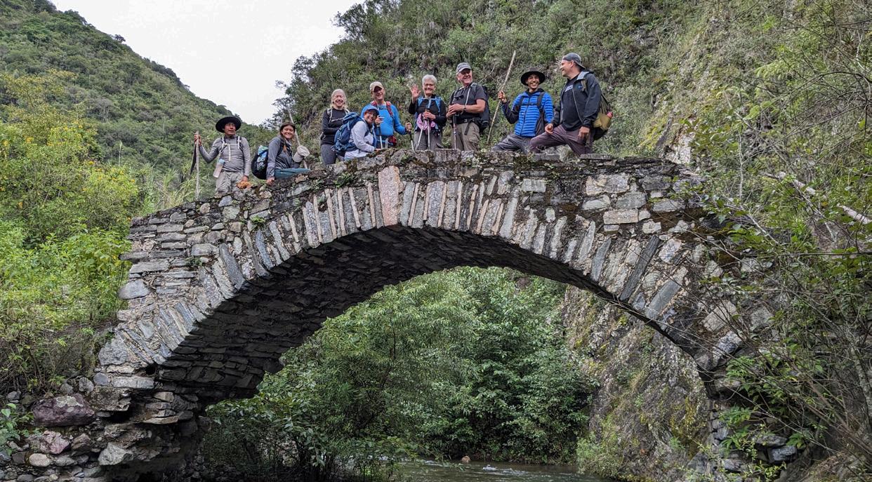
SUMMITS AND SETBACKS: A TREKKER'S STORY OF THE KARAKORAM MOUNTAINS
 by Steve Wadley
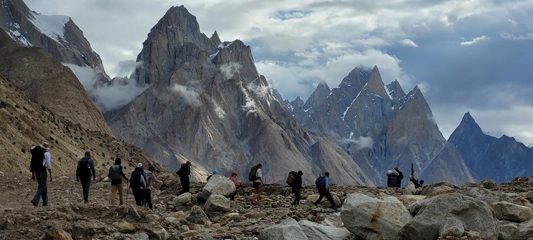
This last summer, I and 12 others embarked on an ambitious 23-day trek in the Karakoram mountains of Northern Pakistan. Our goal was to visit Trango Towers base camp and the base camps of all four of the 8,000-plus meter mountains located in the Karakorams. To begin our trek, we would fly from Islamabad to Skardu in northern Pakistan, take an eight-to-nine-hour jeep ride to Jhola Camp east of the town of Askolek, traverse the Gondogoro Pass after visiting the base camps, and come out in Hushe town, where we would be transported by Jeep back to Skardu. As it turned out, we were a bit too ambitious with our plan, not accounting for the inevitable complications that arise with such treks in Pakistan. But we did achieve most of our goals and were able to have an amazing and memorable experience.
For our trip, we contracted with Apricot Tours, a local Pakistani tour company. Though it may be possible to travel in the Karakorams without contracting with a guide service, going through all the permit processes, contracting drivers, porters, and guides, and arranging all the logistics of such a trip would be complicated and timeconsuming. And the tour company’s prices are eminently reasonable. They arranged for our Pakistani visas, took care of all transportation within the country, hired the necessary drivers, porters, cooks, and
guides, and were able to navigate problems and issues that arose during the trek. And problems and issues began from the first day. When we arrived in Islamabad, none of our luggage arrived with us. We assumed the airlines had misdirected our luggage but later found out that it was stopped at customs when we arrived in the country. We happened to arrive late at night on a Friday and the customs office closed for the weekend with our bags in their custody. We went ahead and flew to Skardu a day and a half later hoping our bags would catch up
with us. Nine of the 11 bags did eventually arrive in Skardu, where we waited an extra day for them to catch up. The other two bags were delivered by mule to one of our camps a number of days into the trek. Without Apricot working to get us our bags, we would have been delayed much longer than we were. As it was, we lost a day waiting in Skardu and we lost another day because the government had closed down vehicular travel between Askole and
continued on next page
MARCH/APRIL 2024 19
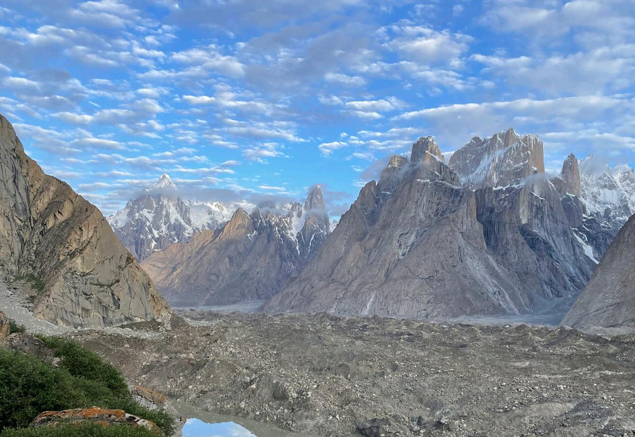
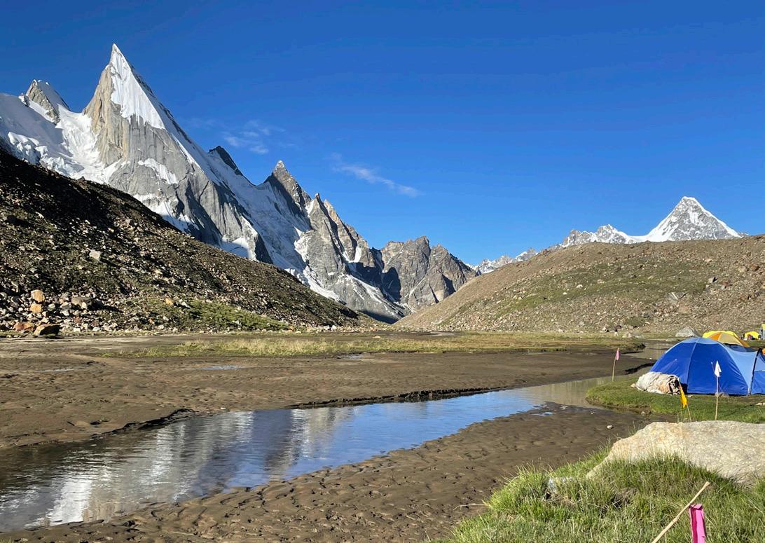
Above: Looking back at the Trango Towers from Urdukas Camp.
Photo by Steve Wadley.
Karakoram, continued from previous page
Jhela Camp. (Some may be familiar with the town Askole from Greg Mortenson’s book Three Cups of Tea. The schools his institute founded there and at a small town across the river are still there but barely functioning since there is a dearth of teachers.) With two days gone from our itinerary, we had to give up going to the base camp of Gasherbrum I and II.
The trek from Askole to Jhela Camp and on to Paiju Camp was through desert lands, though not without interest. The river we hiked along was a raging torrent and the mountains on all sides, though barren, were tall and majestic. They were a preview of even more majestic mountains to come. From Paiju Camp we traveled to the snout of the Baltoro Glacier. The path from there normally skirts the southern edge of the glacier, but since we wanted to go to Trango Towers base camp we traveled along the northern edge. The Trango Towers are a group of several peaks whose sheer cliffs constitute some of the most challenging big wall climbing in the world. None of them were climbed until the 1970s, and several routes were not climbed until the last decade. When we arrived at the base camp there were several teams there waiting for a break in the weather to be able to climb. We met an Italian team and a Chinese team, and heard of an American and a Korean team there. We stopped for tea at one of the camps because our assistant guide was from the same town as
Above: On the way to the Trango Towers from Paiju Camp.
the head guide there and knew him fairly well.
After visiting Trango Towers base camp we had to figure out a way to traverse the Baltoro Glacier to connect with the main trail on the south side. Traveling back to the snout of the glacier was an option but it would have meant the loss of close to another day, so our guide and porters scouted out a way over the glacier. We were able to arrive at Urdukas Camp after a day’s scrambling through glacial talus. Urdukas Camp provided dramatic views back toward the Trango Towers and forward to Gasherbrum IV and surrounding peaks. Our next camp, Goro II was on the glacier itself. I assumed it would be very cold, as my prior experiences camping on glacial ice were, but Apricot Tours provided mats inside the tents, and, along with our air mattresses, they kept the cold from seeping upward for the most part. Goro II boasts spectacular views of Masherbrum (the White Tiger). Though not quite 8,000 meters (7,821 meters) Masherbrum is an impressive peak, one of the great mountains of the Karakoram. One of our group commented that if any one of these mountains we were passing by were located in the United States, they would have been instantly designated a national park, and hotels and concessions would have sprung up all around them. But these mountains are rarely visited and we barely knew the names of most of them.
From Goro II we trekked on to Concordia, the point where the GodwinAusten Glacier flows into the Baltoro Glacier, and the first place where one can catch a glimpse of K2. Indeed, the iconic pictures one sees of K2 are all shot at Concordia. The anticipation of seeing K2 in person was high but when I actually saw it, can I say it was a tiny bit anticlimactic? I had seen numerous pictures of K2 before I got to Concordia, and when I saw it in person I thought, “Yep, just like the pictures.” That said, Concordia is an awesome place—there are views of both K2 and Broad Peak, two of the four 8,000-plus meter peaks in the Karakoram, as well as Gasherbrum III and IV and many other impressive peaks. I had heard reports that the camp was one giant garbage heap from all the climbers and trekkers who had abandoned their trash there, but it was well-kept and fairly free of trash when we arrived. It appears Pakistan is exerting efforts to make the Karakoram camps inviting places.
After a day at Concordia, we traveled up the Godwin-Austen Glacier to Broad Peak base camp. Traveling on the GodwinAusten Glacier was somewhat easier than the Baltoro. Much less scree and fewer ice mounds to scramble over. In fact, from Broad Peak base camp up to K2 base camp, the travel was almost all on glacial ice rather than gravel and rocks. We traveled up to K2 base camp as a day trip, returning to stay overnight at Broad Peak. On the
20 MAZAMAS
Photo by Trevor Sadler.
way to K2, we took a small detour to visit the Gilkey Memorial, where climbers who died on K2 and nearby mountains are commemorated by small metal plates and plaques. I thought it would not be such a big deal to visit the memorial, but it turned out to be quite moving.
We arrived at K2 base camp just after the climbing season had ended, and the camp was essentially abandoned. There had been some controversy this year at K2 when it was alleged that the climbing party of Kristin Harila and Tenjin Sherpa had stepped over a dying porter in their bid to obtain the record of climbing all fourteen 8,000-plus meter mountains in the shortest period of time. This all happened the week before we arrived at the mountain but we were unaware of it until we returned to Islamabad. We met one climber on the trail who was returning from a successful K2 climb but he didn’t mention anything to us about the incident.
When we arrived at K2 base camp, the porters pulled out a liter bottle of CocaCola to provide us with a toast. It was too bad the mountain was shrouded in clouds during the time we were at the camp, so our best views of the mountain were actually back at Broad Peak base camp and Concordia.
Back at Concordia, we were faced with a decision. Should we hike back the way we came or take a chance on being able to go over the Gondogoro Pass in the south? Tour companies will not take groups over the pass in poor weather because of the danger involved. The weather report was mixed, but we decided to chance it. The top of the pass boasted incredible views of all four 8,000-plus meter peaks in the Karakorams, and we had little interest in going back over ground we had already covered.
From Concordia we traveled south on the Chogolisa Glacier. It was fairly easy travel over hard glacial ice, though we did have to cross over some softer snow toward
the end of the trek to Camp Ali where a few of us, unhappily, sunk up to our waists.
Camp Ali is located on a rocky outcrop at the intersection of the Chogolisa and Vigne Glaciers. It was named for the first person who discovered a way over the mountains into the Hushe Valley. We had a heavy rainstorm strike shortly after we arrived at the camp and the tent of one of our group was flooded and much of his clothing and gear was soaked. But he was able to bunk with the porters and his clothing was at least partially dried next to a kerosene stove.
We left Camp Ali at 11 p.m. that night to cross the Vigne Glacier and head up the pass, hoping to get over the pass early enough to avoid possible rockfall down the other side. This was the only place where we used our ice axes and crampons, but they were definitely needed. There were fixed ropes put in place on both sides of the pass to clip into. Climbing up the north continued on next page
MARCH/APRIL 2024 21
Above: Laila Peak (6,096 meters) from Chuspang Camp.
Photo by Steve Wadley.
Karakoram, continued from previous page
side of the pass was entirely on snow, fairly steep but no steeper than the south side of Mt. Hood. We wound around a handful of crevasses, sucking in the thin air at over 18,000 feet. The first to reach the top of the pass were rewarded with the spectacular view of the four 8,000+ meter peaks, but later arrivers, including myself, missed it because low clouds had moved in. The far side of the pass was a mix of hard snow, rockface, and scree, and was steeper. I felt fortunate to have the fixed line to rely on. After an hour or two of downclimbing, the trail became less steep, but it was quite a long hike still to arrive at Chuspang, our next camp.
We spent a day at Chuspang recovering from the difficult climb over the pass. The camp boasted impressive views of Laila Peak (20,000 feet), a mountain that it is
said has only been climbed twice, with a total of only seven people summitting it (information obtained from Wikipedia).
From Chuspang Camp we made the long trek down to Saicho Camp, where we bid farewell to the Gondogoro Glacier and met the Saltoro/Hushe River. The camp is relatively low in elevation and surrounded by trees (though they were a bit scrubby). The next day from Saicho Camp we crossed the river and hiked down the valley to Hushe town passing scattered herds of cattle and goats and by shepherds’ huts. Hushe, a bit larger than Askole, also boasted a school associated with Greg Mortensen’s Central Asia Institute. It has spectacular views of the south side of Masherbrum and though it is obviously very poor, the surroundings are green and beautiful.
From Hushe we took another eighthour jeep ride back to Skardu, where we
stayed another night and then flew back to Islamabad. On the plane on the way back, we were able to get a bird’s-eye view (a very high-flying bird) of Nanga Parbat, the only other 8,000-plus meter mountain in Pakistan, located on the very northwestern flank of the Himalayas.
Another day in Islamabad, a celebratory dinner, and we were off on the 23-plus hour plane trip back to the United States.
The trek was challenging for me but probably wouldn’t be terribly hard for most Mazama members. I recommend Apricot Tours—the price was reasonable and they did their best to make the trip successful and enjoyable for us. Their porters and guides are freelance for the most part. Our guide from the Hunza Valley, Amanulla Khan, was wonderful and you could arrange a trip directly with him if you’d like.
22 MAZAMAS
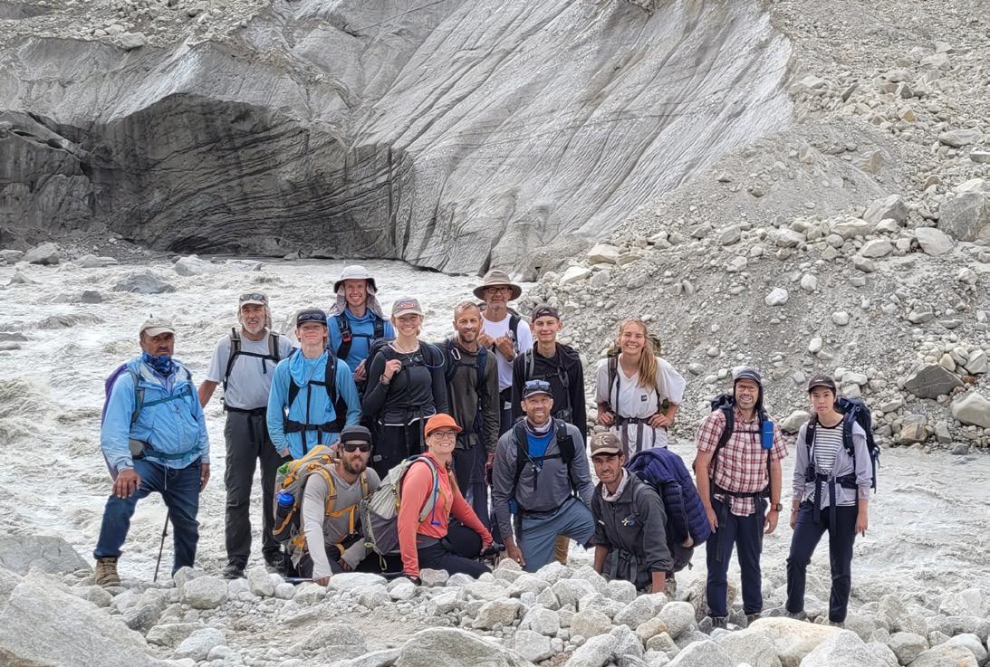
Below: The group at the snout of the Baltoro Glacier and the beginning of the Braldu River. Photo by Trevor Sadler.
DON’T HAVE A CAR ? YOU CAN STILL GO FAR!
 by Luke Davis
Last August, my fiance and I hiked from Timberline Lodge to Paradise Park and camped overnight for the Perseid Meteor Shower. The sunset was beautiful, the air was clean and cool, and the stars were spectacular. In the morning we hiked up towards Mississippi Head and caught a beautiful mountain shadow from a viewpoint beside some glacial waterfalls. Overall, it was an amazing trip. But the other amazing part was that we were able to do this without a car and only $10 in cash for transportation!
For those without cars, hiking and backpacking is still an option! I will overview two buses that can be accessed via TriMet, and their respective hikes.
First is the CAT bus, which leaves from Gateway Transit Center (and also has a stop in Troutdale, with Bus 77 and 81). The CAT bus is $10 for a day pass, or $40 for an annual pass. Once on the bus, one can get off at Multnomah Falls, which provides access to Franklin Ridge (14 miles), Waespe Point (9 miles), Larch Mountain (14 miles), the Multnomah-Wahkeena Loop (5 miles), and Devil’s Rest (9–11 miles). The next stop is in Cascade Locks, which provides access to Dry Creek Falls (4 miles) and the Herman Creek Pinnacles (9 miles). One can also backpack up to Benson Plateau (18+ miles), or ride their bike on the bike path west as far as John B. Yeon State Park. There’s also a connection bus from Cascade Locks to Dog Mountain, which provides access to Dog Mountain (6–7 miles) and Augspurger Mountain (14+ miles). If you pass Cascade Locks to Hood River, a second CAT bus goes all the way to Mt. Hood Meadows, which provides access to Wizard Head (8 miles), Elk Meadows (8+ miles), Umbrella/Sahalie Falls (4 miles), and the Timberline Trail.
The second bus is the Mt. Hood Express, which can be accessed at the Sandy Transit Center via the SAM bus. The SAM bus can be
accessed at the Gresham Transit Center. The Mt. Hood Express and SAM bus are $5 for a day pass to both. The first stop is at Mt. Hood Village, a quarter mile down the road from Wildwood, which provides access to Huckleberry Mountain (12 miles). The next stop is at Salmon River Road, a quarter mile from the Zigzag Ranger Station, which provides access to Hunchback Mountain (10 miles) or a backpack to Devil’s Rest (19+ miles). If you’re willing to add an extra 2 miles, you can also carefully cross the highway and reach West Zigzag Mountain (13 miles, including 2 extra). The next stop is in Rhododendron, which provides access to the Flag Mountain Loop (8 miles). After that is Mirror Lake Trailhead, providing access to Mirror Lake (4 miles) and Tom Dick Harry Mountain (8 miles). If you like huckleberries, you can get off at the Summit Rest Stop and carefully cross the highway to Multorpor Mountain (5 miles). Finally, the last stop is at Timberline Lodge, which provides access to Zigzag Overlook (5 miles), Paradise Park (12 miles), South Side climbing access, the Timberline Trail, and the PCT. You can also visit the Mazama Lodge by getting off at Government Camp.
As the Mazamas strives to be inclusive to all, it is important to me that our car-free friends (and drivers who want to use less gas.) know that there are still options to get outside and explore the mountains!
MARCH/APRIL 2024 23
TRAILS AND TRIUMPHS: THE ADVENTUROUS YOUNG MAZAMAS ON THE METOLIUS
by Matt Reeder
The Metolius River is my mountain home away from home. Set on the dry side of the Cascades east of Mt. Jefferson and Three-Fingered Jack, this river, entirely spring-fed, flows through an impressive forest of tall ponderosa pines and incense cedars. I grew up in Salem and I first visited the area as a teenager many years ago. I was captivated, and I’ve been coming back ever since. In the wake of the fires in September 2020, the Metolius River became my sanctuary after many of my favorite places (such as Opal Creek and the Clackamas River) were catastrophically damaged. This year alone I’ve visited the river four times!
I led a group of Adventurous Young Mazamas on a camping trip along the Metolius on the last weekend of September. It rained for almost the entire drive, and despite camping on the dry side of the Cascades, the rain continued for much of Friday evening. After the recent rains, there was no longer a fire ban, and we were able to start a fire in the rain after a considerable amount of effort. As we crowded around the fire, we were nervous with anticipation for Saturday’s hike to
Adventurous Young Mazamas (AYM) provides exciting adventures tailored for individuals in their 20s and 30s, as well as those young at heart. AYM activities welcome participants of all ages.
Joining an AYM event guarantees exceptional leadership, stunning destinations, and above all, an abundance of fun!
Learn more about the Adventurous Young Mazamas, including upcoming AYM activities, at www.mazamas.org/aym.
Park Meadow and Golden Lake. After some good times around the fire, we all retired into our tents for the night.
When dawn came on Saturday, it was still raining. After some discussion, we decided to hike up to the summit of Black Crater on the McKenzie Pass Highway instead. This presented a shorter hike and a chance to get a later start in hopes of waiting out the rain that was moving out of the area. This turned out to be the perfect choice! We began the hike in a dense fog
but by the time we reached the summit, the fog began to clear, and we were treated to views of the area, with Mt. Washington visible to the north. While the Three Sisters remained in the clouds, we were able to enjoy the spectacular blue fall sky above us and around us, and we hiked down the mountain in a great mood. After dinner at a wonderful Himalayan restaurant in Sisters, we returned to camp and had a nice fire under clear skies. What a wonderful day!
24 MAZAMAS
Sunday dawned clear and cold, and we planned to go explore the Jefferson Lake Trail on the eastern edge of the Mount Jefferson Wilderness. This is a trail I know very well; when I was working on my book 101 Hikes in the Majestic Mount Jefferson Region, I visited the trail twice. At the time, the trail was in danger of being permanently abandoned. In the aftermath of the devastating B+B Fire in 2003, ceanothus took over this part of the Mount Jefferson Wilderness, obscuring many trails and creating a serious obstacle for trail crews. When I first visited this trail, much of the area was a head-high thicket of this tough-limbed plant. A group of volunteers in central Oregon spent thousands of hours painstakingly clearing the trail, and today this beautiful path has been
brought back into the trail network in this corner of the Deschutes National Forest. We hiked less than 2 miles, but it was a beautiful morning and there was much to see! The trail crosses Candle Creek and immediately passes through an enormous downed Rocky Mountain Douglas fir; before this giant fell it was the tallest such tree in Oregon. From there the trail passes under a canopy of vine maple, much of which was turning yellow and red for the season, before reaching the edge of the Forked Butte Lava Flow. The lava flow is the most prominent in the Mount Jefferson Wilderness, dating from approximately 4,500 BC. The Jefferson Lake Trail follows the lava flow for many miles as it passes deeper and deeper into the wilderness. We turned around at the lava flow, where we
were treated to magnificent fall colors and spectacular views of Mt. Jefferson. From there, we drove down the Metolius for a picnic before going our separate ways to drive back to Portland.
Overall, this trip reminded me yet again why I lead trips for the Mazamas. It was a wonderful weekend, and I think we all felt the love of the mountains and an immense gratitude to live where we live and be able to explore our beautiful state together as part of the Mazamas. All thanks go to everyone who joined us on this special weekend! Look for the Adventurous Young Mazamas to host more such trips in the future. Happy Trails!
MARCH/APRIL 2024 25
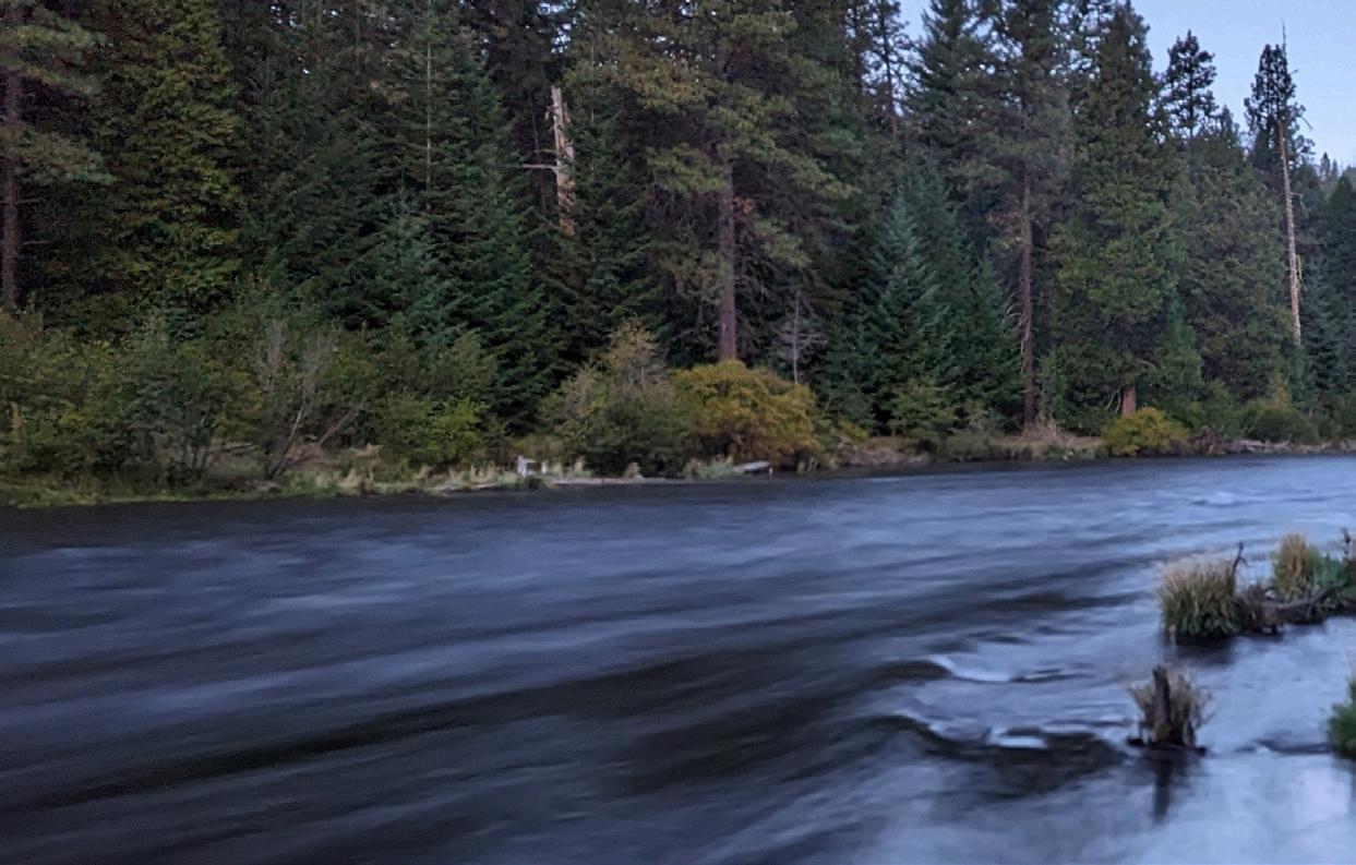
Above: The Metolius River from camp at dawn.
Inset: AYM hikers on the Black Crater Trail. All photos by Matt Reeder.
LOOKING BACK
by Mathew Brock, Mazama Library and Historical Collections Manager
Welcome to “Looking Back,” an occasional column that delves into the rich history of the Mazamas. As your guide through the annals of time, we’ll embark on a journey back 25, 75, and 125 years to revisit the remarkable events, happenings, and adventures that have shaped the organization’s legacy. From awe-inspiring mountaineering triumphs to community milestones, this column serves as a nostalgic chronicle, offering a lens into the enduring spirit of the Mazamas.
25 years ago (1998)
In March 1998, the Mazama community was abuzz with various activities and announcements. The organization’s headquarters boasted an impressive museum display featuring a collection of vintage ice axes, a must-see for climbers and enthusiasts alike. Members were encouraged to support Portland Mountain Rescue through donations, with the promise of a 100 percent match from the Mazama Executive Council, ensuring the organization’s continued readiness. Additionally, a CPR recertification class was offered, providing an opportunity for members to refresh their skills.
Proposed amendments to the Mazama Bylaws were discussed, including the elimination of the Endowment Committee due to functions being assumed by the Mazamas Foundation, and the Whitewater Committee, prompted by regulatory concerns. Members were reminded of the upcoming Second Annual Nordic Family Weekend at the Mazama Lodge, promising free Nordic ski lessons for kids and family-friendly activities. Another highlight was the “Peru for You” event featuring a presentation on the Peruvian Andes and a special Peruvian cuisine dinner.
aimed to enhance the quality and accessibility of the Mazama Library, ensuring its continued role as a valuable resource for outdoor enthusiasts.
75 years ago (1948)
In March 1948, the Mazamas announced plans to potentially revive the Mazama Cup Downhill and Slalom race in April, contingent upon sufficient interest from members. The race would be open to all members, with entry blanks and sign-up lists for officials available in the clubroom and lodge throughout March. Additionally, the Mazamas provided information on various ski races in the Pacific Northwest and subscribed to the official publication of the Pacific Northwest Ski Association, “Skier’s Informant,” which would be made available in the library.
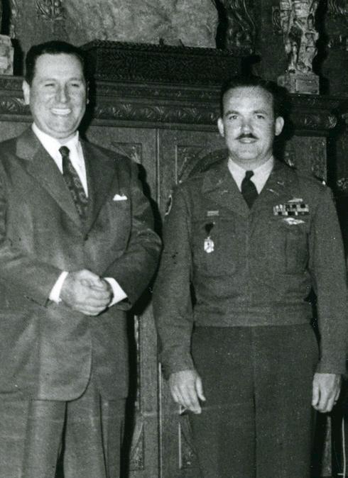
Mazama Lt. Bill Hackett achieved a significant feat by reaching the summit of Aconcagua on Feb. 19, becoming one of the few to stand on the highest points in both North and South America. The Mazamas received word of his accomplishment and awaited further details.
Looking ahead to April, the Mazama Expedition Duathlon was set to take place, offering a flat and fast course for both bikers and runners. The organization also addressed safety concerns, reminding members to keep the headquarters doors closed in compliance with fire codes, and sought out new members for the Financial Affairs Committee. Exciting opportunities for learning and exploration were on the horizon, with a conference on Mountaineering Issues of Tibet at Portland State University and the display of rare mountaineering books from the library’s collection.
As the organization continued to thrive through member participation and support, initiatives like the book donation drive
Wednesday evening programs included presentations by notable adventurers and explorers. On March 9, Amos Burg shared his experiences and adventures, including travels to Alaska, the Yukon, and the Colorado River, through a captivating film accompanied by descriptive commentary. Subsequent programs in March featured Fred Ayres showcasing Kodachrome slides of the Tetons and Herve Barrett presenting images of Glacier National Park and the Canadian Rockies. The Wednesday evening programs concluded with an April Fools party organized by Anne Felix, promising a fun-filled evening of surprises and pranks.
The Climbing Committee announced hiking opportunities for non-skiing mountain climbers in March. These hikes aimed to engage members and prepare them for more challenging expeditions. Equipment recommendations included sturdy boots, outdoor clothing suitable for rainy weather, goggles, gloves, and an
26 MAZAMAS
Above: Lt. Bill Hackett (left) in the presidential palace with then Argentinian dictator, Juan Perron (right). Image from Mazama Library and Historical Collection, VM2000.020.
ice axe or stout cane. Meeting points and logistics were provided for two hikes scheduled on March 6 and March 20.
The big news in April 1948 was the announcement of the FiftySixth Annual Mazama Outing, this year to the Grand Tetons of Wyoming. Members had the pleasure of previewing the stunning scenery through Fred Ayres’ color slides, showcasing several summers’ worth of exploration in the Teton Range. A variety of activities were planned, including trail hikes and ascents, catering to various interests and skill levels.
Set in the breathtaking landscape of Grand Teton National Park, the outing offered access to a variety of trails leading to picturesque lakes, meadows, and towering peaks. Trails like the Teton Glacier Trail, Cascade Canyon Trail, and Indian Paintbrush Trail provided opportunities for both leisurely exploration and challenging climbs. The outing itinerary included plans to summit Teewinot Mountain, the Middle Teton, and the Grand Teton, with the potential for additional climbs depending on local conditions.
Plans called for participants to depart from Portland on a chartered bus and establish a base camp at String Lake. From there, excursions to nearby peaks like Ice Point, Storm Point, and Rockchuck Peak were planned, allowing climbers to acclimate to the terrain and conditions. The outing aimed to offer a memorable experience while keeping costs affordable for participants, with the $65.00 fee covering transportation and accommodation for the twoweek duration.
125 years ago (1898)
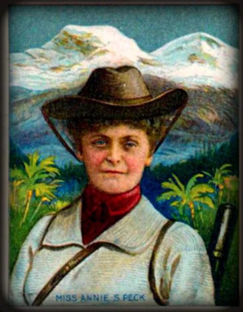
The Mazamas did not publish an Annual in 1898, and the birth of the Mazama Bulletin was still 25 years away. Looking back at the minutes of the Mazama Executive Council, as the Board of Directors was known at the time, shows that during the April meeting updates were provided by the printing committee on the bulletin’s progress1 and by the committee on constitution regarding the distribution of the new constitution. Correspondence was read, including a letter from the esteemed female climber, Ms. Annie S. Peck of New York. Ms. Peck was elected as a member of the Mazamas, with her dues for 1898 waived due to her renowned status as a mountain climber and the distance of her home from the organization. Recognizing her historical significance2, it was decided that the secretary would reply to Ms. Peck’s letter. The outing destination for the year was chosen, with Mount St. Helens winning the majority vote. Plans were made for the annual outing, scheduled to start from Portland on July 11, with the climb date to be determined later. Additionally, the secretary was authorized to request 1,000 copies of the Mt. Rainier glacier map from the publisher in New York, pending approval from the printing committee. The publication of the bulletin was postponed to incorporate details about the Mount St. Helens trip, reflecting the organization’s commitment to sharing their adventures and achievements with their members.
1 This reference to the “bulletin” predates the establishment of the Mazama Bulletin we know today, and likely refers to more of a newsletter format bulletin mailed occasionally to members.
2 Annie Smith Peck (October 19, 1850–July 18, 1935) was an American mountaineer, adventurer, and suffragist who became renowned for her climbing achievements and for advocating for women’s rights. She made history with her ascent of Peru’s Mount Huascarán and was also known for planting a “Votes for Women” flag atop the Coropuna volcano at the age of 61.
MARCH/APRIL 2024 27
Above: Annie Smith Peck trading card. Image from Wikipedia.
NAVIGATING MORAL CROSSROADS: A CANYONEERING TALE IN ZION
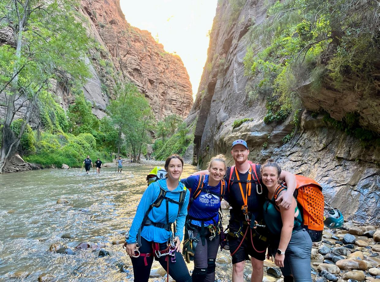 by Anna Feigum, Heather Johnston, Lisa Hefel, and Riley Arner
Can we just wait ten more minutes?” Anna tentatively posed a question to our group as we took a break on a shallow pebble bar in the Orderville River in Zion National Park. Tension was building as we discussed our opposing views on a moral dilemma we hadn’t anticipated encountering on our trip. Riley paced. Heather and Lisa sat on the bar, feeling the weight of the pending decision. Anna had her eyes locked on the top of a massive boulder up the canyon, “How bad would you feel if they didn’t make it out of this canyon?”
In September 2023, we—Anna, Heather, Lisa, and Riley— embarked on our first canyoneering trip together. Our group found its genesis in the immersive setting of the Mazama Intermediate Climbing School (ICS) during the Fall of 2021. United by a shared spirit of support, efficiency, and perseverance in challenging situations, our bond formed. This friendship laid the foundation for so many great opportunities to adventure together.
Our individual introductions to canyoneering varied. Heather was introduced to the sport in 2017 and attended the Mazama Canyoneering course in 2019. She had run canyons in Switzerland, Mexico, and the Pacific Northwest. Heather was also the sole member of our group who had previously descended canyons in
Zion. Riley completed the Mazama class in 2022 and transitioned into an assisting role in 2023. Meanwhile, Lisa and Anna, inspired by their New Zealand canyoneering experience in 2022, attended the Mazama course the following year. Despite our individual accomplishments in climbing and canyoneering, we had yet to climb or canyon together.
After the Canyoneering class in June 2023 closed out, Riley motivated our group to make concrete plans to visit Zion National Park. This would be our first canyon trip all together and a sort of rite of passage in our canyoneering careers. Our strategy was to ease into the adventure gradually over four consecutive days of canyons, running Keyhole, Pine Creek, Mystery, and Birch.
28 MAZAMAS
Above (from left to right): Heather, Anna, Riley, and Lisa at the exit of the Narrows.
Opposite page: Riley on the longest Birch Canyon rappel.
The idea was that our objectives would progressively increase in complexity and require time. The easier, shorter days would provide us the opportunity to fine-tune our communication and efficiency as a team. Each day would bring its unique challenges, learnings, and triumphs. But it was on the fourth day that our narrative took an unexpected turn.
We reached the Birch Hollow trailhead at 7 a.m. via the Zion Adventures shuttle. The plan for the day was to run Birch Canyon, which exits into Orderville Canyon. After six miles, Orderville intersects with the Narrows for the last 1.5 miles of the day. With three days of canyons (and an Angel’s Landing hike) behind us, we were running on tired bodies and knew we were in for a long day. Our understanding was that Birch Canyon was dry, but we would be swimming in Orderville. We packed our wetsuits, warm layers, first aid kits, and more provisions than in previous days. [Water note: Cyanotoxins are relatively common in the Virgin River and other water sources in the area. Filters are unable to remove cyanotoxins, so it was advised by the National Park Service to not drink the water, even with a filter.] With our health in mind, we packed in all the water we would need.
Compared to Mystery, the canyon we ran the previous day, the approach was short and relatively straightforward, with a wellworn trail and helpful beta for the rappel into the “quarry.” The canyon itself was fast and fun, with 12 back-to-back rappels which we were excited to safely run in less than three hours, utilizing our now well-honed leap-frog approach. Our goal was to be as efficient as possible through Birch, and we did just that. We felt good about our time thus far and were looking forward to cruising through Orderville. We knew there would be a couple of rappels and swim holes, and we were anticipating being able to make on-the-go decisions.
On the last rappel out of Birch, three people poked their heads around the bottom of the chimney we were descending. We spoke with them for a few minutes about what we were doing and our respective paths for the day. They were hikers visiting from Tennessee. They had started at the Orderville Trailhead up canyon from where we were, and were also headed down to the Narrows. They continued down Orderville after our chat, and we anticipated passing each other again down-canyon.
From the last rappel of Birch Canyon, the exit down Orderville Canyon starts with three miles of dry riverbed cutting through steep canyon walls. Tom’s Utah Canyoneering Guide describes the canyon as, “...the easiest technical canyon in the Zion: Canyoneering book, or the hardest off-trail hike.” The canyon walls gradually become steeper and narrower. Fresh springs and creeks start to introduce water to the canyon. Challenges introduce themselves with awkward downclimbs and difficult entry points to swimmable sections. We had leapfrogged the hiking group a few times as either group stopped for food or photos. Eventually, we came upon the hikers at a cluster of massive boulders with a 15-foot drop. Depending on water levels, the difficulty of downclimbing the openings on the sides of those boulders can vary. And, if someone isn’t comfortable with downclimbing techniques, drops like these can feel more daunting. Orderville necessitates downclimbing over or through rocks and logs at several points in the canyon. Knowing this, we were looking forward to the opportunity to utilize our skills and knowledge in these moments. It was a challenge we wanted to experience and share. However, the hikers did not seem continued on next page
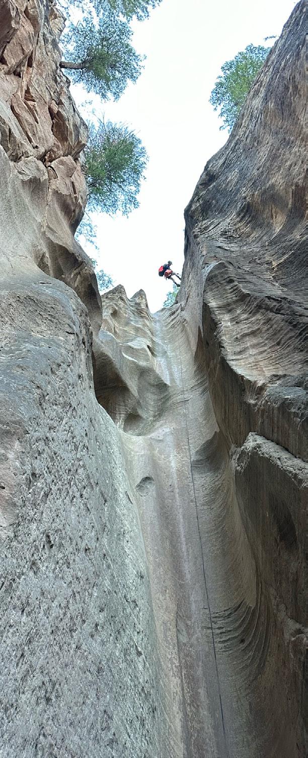
MARCH/APRIL 2024 29
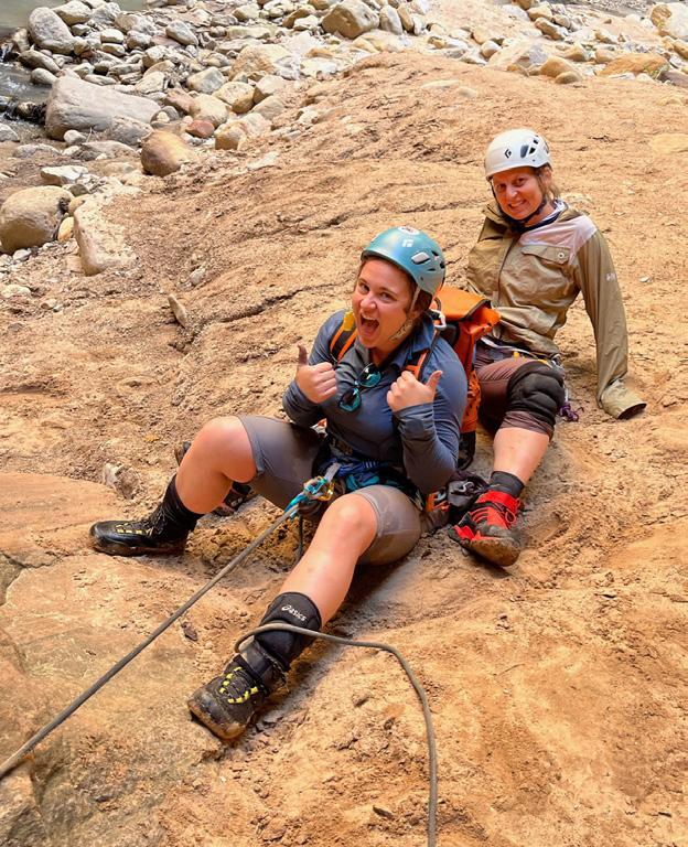
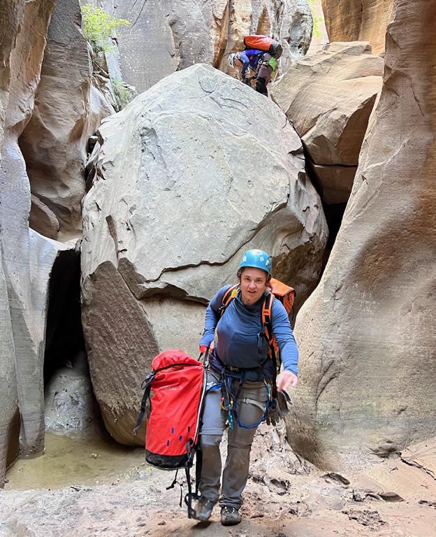
Zion, continued from previous page
to be outfitted to the same degree; they had intentionally waited for us and expressed concern about being able to downclimb this drop. They referenced some printed beta and shared that their friends insisted this was a fun hike with just two short rappels. This moment became the first critical decision point for our group.
We knew there were more obstacles ahead, but we were unsure of the specific details. Beta is dependent on the water levels in the canyon and is vague in most write-ups for Orderville. We were comfortable with the information we had and the plans we had made. We knew there was at least one rappel with a bolted anchor, which the hikers had confused with the boulders we were standing on at that time. We assumed that this other group was familiar with rappelling and had their own gear. Regardless, we had very little conversation about whether we would help them down this drop, and instead proceeded efficiently to set up a meat anchor and aid their descent. People needed some help, and we were willing to help them. Not yet knowing their collective experience level, we didn’t consider telling them to turn around. To our credit, each of us easily assumed an essential role in the process without much deliberation—Anna and Riley would be the meat anchor, using their own bodies to support the rappel as there were no other resources to use as a natural anchor. Heather rappelled first to assist from the ground and provide a fireperson’s belay. Lisa would check equipment and talk the hikers through a soft start to minimize the load on our precious anchors.
As we set up, it became abundantly clear that the hikers were not familiar with rappelling. One said it was her first time, another let go of the rope with their brake hand. The group had only one harness and one rappel device to share among the three of them, and they were not equipped to ascend back up the drop if they needed to turn around. As we moved down the canyon, down various obstacles and ahead of the other group, we began questioning how and if our team could support them moving forward. We hoped they were making their way along without any issues. Not knowing how many more hurdles lay ahead, a moral dilemma unfolded within our group. Questions of responsibility, risk, and the impact on our own expedition weighed heavily on our minds. Did they assume this risk by entering the canyon and accepting our help? Did we now have an obligation to see them through the rest of the canyon since we helped them potentially get into a predicament? If we helped out to make sure they made it to the Narrows, our team would grow to seven people (with five harnesses). How much time would this add to our day? Were we putting ourselves at risk? We plodded forward and decided to reassess once we came to another rappel point.
We arrived at a double chockstone drop, which was a notable milestone as it was the singular bolted rappel in Orderville. We were not sure how far back the other group was at this point, as they had been moving slower than us. The hikers had mentioned being comfortable with setting up a rappel from a bolt, but their experience level and technique had concerned us. As we finished and cleaned our rappel, we reached our second critical decision
30 MAZAMAS
Above, left: Lisa and Anna serving as a meat anchor for hikers to rappel from on a subsequent rappel. Above, right: Lisa cleaning up a rappel station after we initially helped the hikers.
point. Do we wait or do we go? Our group was split on the decision. We initially decided we would wait 20 minutes to see if they appeared. We needed a lunch break anyway and then was as good a time as any. The 20 minutes came and went. Our team had grown quiet as there was some anxiety about leaving the woefully underprepared group to fend for themselves. We had only passed two other canyoneers, and they were heading upstream at the start of Orderville, and it was unlikely that others would pass through so late in the day. Anna, unsettled with the thought of stranding these hikers in the canyon, suggested “Can we just wait ten more
wait longer. It was a real-life Homeward Bound moment with Anna staring up the canyon, willing the arrival of our new acquaintances. The stress of all the possible outcomes continued to build.
Remarkably, after just a few additional minutes, the other group came into view, and we were all able to breathe a sigh of relief. We stayed with the hikers to make sure they safely descended the rappel. After moving through the rappel, we initially headed down the canyon with the notion that the remainder of our day would be smooth sailing. However, we continued to encounter additional obstacles, some with water, that the group would need our
other two would advance down the canyon with rope, to assess the next obstacle and set up any needed support. We aided the hikers down the canyon bit by bit, either by setting up stations or finding the path of least resistance to move through, under, or over whatever we came across. Orderville had initially felt like a casual, featureless stroll and now we were on a mission that seemed to go on forever.
Just as it felt like Orderville would never release its grip on us, we joyfully encountered the sun at the Narrows of the Virgin River. It had been a challenging sixhour ordeal since we had exited Birch. The four of us ran to the junction and hugged,
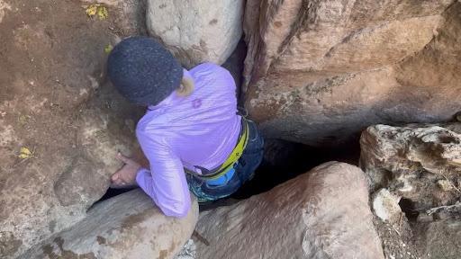
minutes?” Wanting to make sure every member of our team felt okay about the decision, we compromised on waiting another ten minutes. We discussed ways we could potentially alert a ranger at the end of the day if we did end up moving on without them. As the additional ten minutes passed, tension rose. We could have waited for hours; the hikers might not show up at all. “How bad would you feel if they didn’t make it out of this canyon?” Anna had a point. Not seeing them through to the Narrows wasn’t going to sit well on our consciences. And so, we continued to
support on. They were not familiar with setting up natural anchors nor did they have tools to do so.
The process was slow going as we tried to reach a group consensus on our strategy at each stop, and we all were starting to get chilled with the slow progress. Although our group of four had wetsuits in our packs, the hikers had minimal clothing and water and the sun was not reaching the canyon floors—we understood the urgency to move quickly. We opted to split our group into two teams; two people would stay to support the hikers with an obstacle and the
feeling accomplished and that we made it through something significant. Although initially unaware of the gravity of the situation, the hikers expressed immense gratitude for our assistance. We exchanged handshakes, captured a group photo, and bid farewell. Despite the chilly water, the hikers simply had to wade downstream to reach the shuttle that would take them safely to the Visitor’s Center. Our team picked up our pace to charge further down the Narrows, as we were eager to exit—dry
continued on next page
MARCH/APRIL 2024 31
Above: Squeezing through a small opening to descend—a welcome alternative to swimming, as many in the group were chilled.
Zion, continued from previous page
off, warm up, and claim our bounty of a full meal and a beer.
The takeaways from our Zion trip were plentiful: efficient teamwork, effective communication, and pride in our collective ability to navigate diverse situations, all nurtured by our Mazama education. Yet, it also underscored the potential pitfalls of well-intentioned assistance in the outdoors. While we were quick to support each other, we were also quick to support others outside our group, which led us quickly to a moral crossroads and a rescue scenario. If our team had not assisted the hikers down that first obstacle, our first decision point, their day may have been very different. They would have had a frustrating hike back to their original trailhead and would have needed to find transportation back to their car. But, they wouldn’t have been dependent on our help. Subsequently, if we had not chosen to wait for them at the bolted rappel, our second decision point, we could have put them at risk of spending much more time in Orderville. A night in the cold and wet canyon was a very likely possibility.
As trained canyoneers (and mountaineers), we take pride in our skills and willingness to assist in the outdoors. It is crucial to recognize that even wellintentioned assistance could lead to unintended consequences. In an ideal scenario, we would have been able to assess the skill level of the group before offering our initial assistance. This story transcends the dangers of being underprepared. It evolves into a narrative of moral dilemmas and the responsibility we bear in the outdoors to consider the impact our decisions have on others’ safety and well-being. Sometimes making the hard decisions—in this case, encouraging a group to return to their starting point—is
we all need to
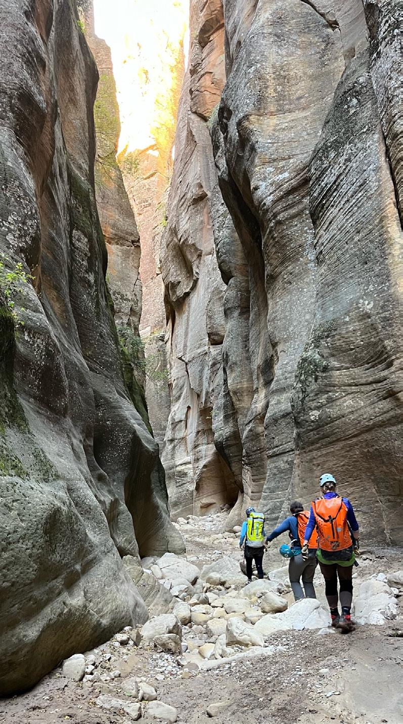
32 MAZAMAS
the courage
possess in the outdoor space.
Right: Heather, Lisa, and Anna making their way down Orderville.
Photo by Riley Arner.
GREEN MILESTONES: THE MAZAMA MOUNTAINEERING CENTER’S ECO-PROGRESS
by Rick Craycraft
We have made significant environmental strides at the Mazama Mountaineering Center in the last several years. First, there was the installation of solar panels to mitigate our dependence on the electrical grid, then the LED conversion project to make our electrical lighting needs even more efficient. This fall, we launched the major project of replacing our antiquated, natural gas-powered heating system with all-electric heat pumps. And, at last, we installed a water bottle filling station and water fountain to reduce the solid waste of single-use paper cups and to replace our long-decommissioned water fountains. We have made a multi-pronged effort to walk our talk. We are now officially carbon-neutral to align with our environmental values.
In addition to all this, our comprehensive recycling system has been there all along, functioning as smoothly as could be hoped, and is continually expanding. We’ve met each challenge, both within our existing curbside service and elsewhere. We have tried where possible to find outlets to responsibly dispose of, or recycle, anything that might have to do with the operations of the Mazamas. It’s important to know that the opportunities to recycle in the auditorium receptacles are just the tip of our institutional efforts.
My job, along with occasional volunteers, is to find resources to do the above and beyond and bring this awareness to the membership. I need your help. Not only in educating yourselves and paying attention to the three-dimensional signs in the auditorium, but in stepping up to help directly, or by being a trained fill-in while I am out climbing (smiley face). We also need to work together as co-coordinators of Mazama events and classes, and with outside groups that use our facility, especially those whose activity includes food and drink. For years we have had a Mazama policy and practice that provides sustainable supplies for food and drink
events that align with how our recycling system works. Please spread the word. How you can help:
■ Volunteer: Trash and recycling is not pretty work, but there is a lot to be learned from helping take care of our building.
■ Promote: Event leaders and class leaders can point out the recycling receptacles in the auditorium and encourage participants to use them carefully and conscientiously. Plan ahead: Groups that want to have food and drink included in their event can think through purchases that will align smoothly with our system.
■ Communicate: Liaisons with outside groups can educate them about the way things are done at the MMC and nudge them to cooperate.
■ Take initiative: Be a leader toward sustainable practices as you see fit within your area of involvement in the Mazamas. A good example of this is the efforts of Christine Roy to collect and recycle all synthetic gloves used in Mazama First Aid classes.
I’m open to feedback and suggestions about recycling at the Mountaineering Center. Please, reach out to facilities@ mazamas.org with ideas or even complaints about what we’re trying to do. We have the opportunity as an organization, as a community of Mazamas, to create and sustain a system that, along with all our other internally generated accomplishments, can truly be a model for others to follow.
BEYOND THE BIN: WHAT WE RECYCLE AT THE MMC
■ Non-curbside plastic, as possible
■ First aid classes synthetic gloves
■ To-go paper coffee cups (and lids)
■ Used printer cartridges
■ All used bulbs generated in the MMC lighting
■ Plastic screw-on bottle caps
■ Plastic straws
■ All sizes of small batteries
■ Mountain House brand empty and clean pouches
■ Worn-out hiking and climbing socks
■ Retired ropes and rope scraps
MARCH/APRIL 2024 33
EXPLORING ARTHUR HARMON MARSHALL'S LEGACY IN THE MAZAMA LIBRARY
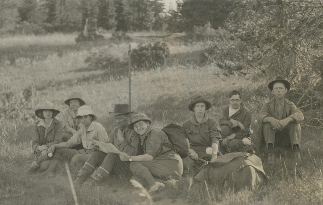 by Mathew Brock, Mazama Library
and Historical Collections Manager
Arthur Harmon Marshall, a trailblazing mountaineer born in 1886, left an indelible mark on the history of American exploration. His remarkable journey began when he joined the Mazamas upon moving to Portland in 1910, inspired by an article in The Oregonian. From there, Marshall set his sights on conquering Mt. Rainier in 1919, sparking a fervent ambition to summit the highest peaks in each of the 48 contiguous states.
Navigating the challenging terrain of the 1930s, Marshall faced daunting obstacles. Armed with rudimentary maps and fueled by determination, he embarked on solo ascents across the country, often traveling on foot through rugged landscapes and adverse weather conditions. Despite never learning to drive, Marshall ingeniously utilized free rail passes from his job with the railroad, showcasing his resourcefulness and resilience.
Marshall's unconventional approach to climbing, devoid of modern equipment, exemplified his courage as he tackled peaks exceeding 7,000 feet in elevation. From the treacherous slopes of Granite Peak in Montana to the remote summits of Nevada and Arizona, Marshall's adventurous
spirit propelled him forward, overcoming setbacks with unwavering determination.
Expanding his quest to include the highest points of all 48 states, Marshall meticulously documented his expeditions over 17 years. In 2012, his journals found a home in the Mazama Library, enriching our historical collection. Marshall's legacy extended beyond climbing, he was also an active Mazama Local Walks leader. In addition, he shared his adventures through articles and presentations, captivating the Mazama community and inspiring future generations of explorers.
In November of 2022, Marshall's niece generously donated seven photograph albums to the Mazama Library, expanding the A.H. Marshall Collection. This treasure trove contains over 17,000 images,
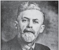
Above, top: Mazamas rest on a hike from Cresent Lake to Crater Lake in 1921. Above, inset: A.H. Marshall, undated. All photos by A.H. Marshall.
chronicling not only Marshall's pursuit of high points but also his explorations of state and national parks, cities, and other landmarks across the nation. The meticulous cross-referencing of photographs with journals provides invaluable insight into Marshall's expeditions, offering a vivid portrayal of America's past.
Processing the collection unveiled early images of Moab, Utah, and the Four Corners region, among others, providing a fascinating glimpse into the changing landscapes of America. The A.H. Marshall Collection stands as a testament to Marshall's adventurous spirit while preserving a snapshot of the United States in the 1920s, 1930s, and 1940s.
34 MAZAMAS
MARSHALL’S STATE SUMMITS IN ORDER OF ASCENT.
It’s worth noting that many of the “highest points” in the United States have changed over the years. To the left is Marshall’s typed list of his 48 summits, in order by date, with subsequent ascents listed to the left.
Looking at the list today, we can see that 15 of the 48 are no longer considered the highest in their respective states. How has the establishment of official elevations changed?
The calculation of elevations has undergone significant evolution over time. Prior to the 1930s, when Marshall was at his traveling peak, elevations were primarily determined through traditional surveying methods involving theodolites, leveling instruments, and trigonometric surveys. Surveyors painstakingly measured angles and distances between known points on the Earth's surface, using this data to create topographic maps and establish elevation contours based on contour lines. However, with the advent of technological advancements post1930s, including satellite-based positioning systems like GPS and sophisticated mapping techniques, the determination of elevations has been revolutionized. These modern methods enable precise measurements of elevation with unprecedented accuracy, enhancing various aspects of life in the United States, from urban planning and land development to climate change research and natural resource management.
MARCH/APRIL 2024 35
SAYING GOODBYE
CANDACE DUNN MORGAN
APRIL 9, 1942–DECEMBER 16, 2023
Candy Morgan was born on the Presidio Army Base in San Francisco during World War II. She served notice that she was going to be a force to be reckoned with by being the valedictorian of her high school and graduating from the University of California, Riverside with a degree in Political Science in just three years. She went on to earn a Master’s degree in Library Science from Columbia University.
She began her career as a librarian in the Los Angeles public library system. In the ensuing years, Candy followed her husband’s academic career, with stops in Michigan, Chicago, and Springfield, Illinois. Out of a love for the water, mountains, and forests, the Morgan family, now with two daughters, moved to Oregon in 1977, where Candy took a job with the Oregon State Library. She subsequently finished out her career at the Fort Vancouver Regional Library as Associate Director of Community Library Services until her retirement in 2004.
While a public librarian to the core, even more Candy was devoted to public service writ large. In this role she touched the lives of thousands of public servants as a librarian, First Amendment champion, legal activist, educator, lecturer, and author. She served for more than 15 years on the American Library Association’s Intellectual Freedom Committee. As a devoted First Amendment advocate, Candy served nearly 20 years on the American Library Association Freedom to Read Foundation Board of Trustees. During the same time, she served on the Oregon ACLU Board and was twice its President (2005–2006 and 2011–2014).
Because she already loved the mountains, Candy joined the Mazamas in 1985. She became a climb leader in 1991 and made her presence felt immediately. She taught numerous BCEP groups, joined the Climbing Committee in 1992, and was its chair by 1994.
RUTH SCHEIBEL MCNITT JUSTEN
NOVEMBER 6, 1920–JANUARY 23, 2024
Ruth McNitt died in January at the end of a long, full life. She had just quit driving the year before. Another example that these Mazama women are tough. She was 103 years old and still lived independently.
An athlete from childhood, Ruth grew up in Chicago, where they have real winters. She skated and rode her sled then, and swam in Lake Michigan in the summer.
After high school she joined the Red Cross and traveled to England, where she served as a driver. Later, she would make the first of many trips back to Europe. Back home, Ruth attended Northwestern University. In 1946, she married Robert (Bob) McNitt, whom she had first met in Germany. The newlyweds immediately moved to Portland and bought a house in the Hillsdale area (for $10,000!). Ruth would live there for the rest of her life.
In 1948–49, Ruth and her friend Jeannette Bates founded the first co-op preschool in Oregon. Ruth also taught in the Head Start program, then got a Master’s degree in Special Education from Portland State. She taught for Portland Public Schools until retirement, and continued to substitute teach until she was 80.
Ruth joined the Mazamas in 1961 and embraced that activity with the gusto she did everything else with. She climbed South
Eschewing anything less, she was awarded the 16 Northwest Peaks Award in 1995. She was a climb leader for 17 years, assisted more often than not by Dennis Sword, the facilities manager at the Vancouver Library. When Dennis became a climb leader, Candy assisted him with regularity for more than a decade.

As head of the Climbing Committee, Candy embraced the issue of access. She got the Mazamas to join the Access Fund and helped form an access sub-committee within the Mazamas, that in 1999 became a full committee of its own. In an almost visionary way, she used her civic and political skills to bring the idea of access to the full attention of the organization. For this, she was awarded the Parker Cup in 1995.
Candy was no stranger to awards. In her public life, she received the highest awards for her contributions to the cause of intellectual freedom. She was honored by the likes of the Oregon Library Association, the Washington Library Association, and the American Civil Liberties Union, many times more than once.
She is survived by Doug Morgan, her husband of 60 years, two daughters and sons-in-law, a brother, and a grandson. Also, it was no secret that she was a cousin to the family that included former Portland Trailblazer star Bill Walton.
Memorial contributions in Candy’s honor may be made to:
▷ ACLU of Oregon9
▷ Fort Vancouver Regional Library Foundation
▷ Freedom to Read Foundation
Sister that first season with Lorne and Irene Turville. By the end of 1964, she had the Guardian Peak Award in hand, and added the Oregon Peaks honor over the next years. Although never a climb leader, she did serve as assistant four times in the mid-60s. This is significant because she helped iconic Mazama leaders like Carmie Dafoe and Don Onthank.
As her climbing career wound down, Ruth lent her educational skills to the Library Committee (1975–81), Publications (1978), and helped produce three Mazama Annuals (1978–80). She also kept up her interest in travel by participating in numerous Mazama outings. Ruth remained committed to exercise until the end of her life. She took lengthy walks in her neighborhood and swam at the local community center into her 90s.
She is survived by her daughter, Diana Stubblefield, her grandson, Jason Williams, great-grandchildren, Niko, Nikole, and Nailani, and great-great-grandchildren, Jalland, Leiam, Ava, and Noah. Also surviving her are nieces, including Martha Bowhan, nephews, and devoted friends.
36 MAZAMAS
GRETCHEN GUYOT
JANUARY 10, 1945–DECEMBER 27, 2023
The youngest of three children, Gretchen spent her childhood ice skating on Lake Phalen, spending quiet time with her Norwegian grandmother, and trying hard to keep up with her older brother and sister. As a teen, she enjoyed hosting an exchange student from Asia and touring Europe with her youth group.
Gretchen’s interest in travel led her to Alaska for summer breaks from the University of Minnesota, where she studied elementary education. While working at Mt McKinley (now Denali) National Park, she met Tom Guyot, an art student from Idaho. They married in the summer of 1967 and spent their honeymoon driving a VW Bug to Oregon.
Gretchen spent her early teaching career in Eugene, at Riverdale in Portland, and on the Siletz Reservation, before transferring to the Centennial District where she taught for 24 years. Gretchen was a gifted teacher—touching the lives of hundreds of students and serving as mentor for many other teachers over the years.
Gretchen loved being retired just as much as she loved teaching. At age 52, she embarked on what she often called her ‘second career—painting Santas and doing arts and crafts shows with her woodcarver husband. For more than 15 years, they travelled the country, driving a pick-up truck and pulling a trailer through every state in the lower 48. In retirement, Gretchen’s ‘travel bug’ took her to Australia, Costa Rica, England, Norway, New Zealand, Tanzania, Jordan, Russia, and even Antarctica—enabling them to fulfill their 'bucket list' goal of visiting all seven continents.
Gretchen always loved to explore Portland—especially the cherry blossoms and the Rhododendron Garden—and often joined her husband, a mountaineer and long-time Ramble leader, on his scouting hikes in the West Hills and Forest Park. Finally, when Gretchen was in her late 60s, Tom convinced her to go on a few official Rambles, the level 2.5, while he continued to lead the level 3s.
She was hooked and kept going back— but it soon became clear that she knew more routes and stories than some of the official leaders. Soon, she was unofficially leading the 2.5s alongside Bob Smith—who was quietly pushing the Mazamas to allow Gretchen to become an official Ramble leader despite not having climbed a glaciated peak. They agreed, and Gretchen's first official ramble lead was on October 20, 2016. She went on to record 90 more leads in two years, and she co-led 2.5s with Tom after the pandemic until her health concerns forced her to step back.
Gretchen’s contributions to the Mazamas were not limited to the Rambles. For a few years, she and Tom co-led Heritage Tree Hikes all over Portland. He would bring samples of wood from the different species of trees, and Gretchen would bring cookies for the hikers. These Heritage Tree Hikes attracted a number of people who weren’t already Mazamas, and some of those folks began doing Rambles and other Mazama activities as a result. In addition, with help from a few others, Tom and Gretchen mapped 50 different Ramble routes, making the directions and route maps publicly available for Ramble leaders and urban hikers alike on the Mazama website. She was also known amongst the Ramblers for hosting an annual Holiday Open House—and for the endless supply of cookies at those parties!
Gretchen is survived by her husband of 56 years, her daughters Wendy and Molly, son-in-law Mickey, her brother Chip and sister Kristin, and nieces, nephews, and inlaws in Minnesota, Idaho, and Oregon.
There was a gathering to celebrate her life on February 25, 2024 and in the spring, there will be a Memorial Ramble in her honor on a day when her beloved Cherry Blossoms are in full bloom. Details will be announced at a later date.
Though instrumental to the Mazamas for over a decade, Gretchen never summited a glaciated peak and therefore never qualified for official membership. With the 2023 removal of that requirement, we are honored to posthumously make Gretchen a member of the Mazamas.
BOARD OF DIRECTORS MINUTES
NOVEMBER, 15, 2023
Attending: Greg Scott, President; David Urbaniak, Vice President; Claire Tenscher, Secretary; Liz Crowe, Treasurer; Bob Breivogel, Marty Hanson, Aimee Filimoehala, Chris Jaworski; Staff: Rebekah Phillips, Executive Director; Brooke Harris and Julia Williams, Mazama Lodge Committee.
WELCOME & CALL TO ORDER
■ The meeting was called to order at 6:08 p.m. by President Greg Scott.
■ A quorum was present.
BUSINESS AGENDA
■ Minutes
□ Chris moved to approve the October minutes, Liz seconded, Marty abstaining, all others in favor.
□ Minutes approved.
EXECUTIVE DIRECTOR’S REPORT
■ 1,631 members, 137 new members.
■ Oregon Historical Society xxhibit is up, it looks great.
■ Volunteer Appreciation Event is full.
■ Lodge temporary plumbing repair to broken pipes—there’s a patch that will get us through the season, the risk is that we do not know if other pipes may be affected.
MAZAMA LODGE COMMITTEE
UPDATE
■ Priorities:
□ Ensuring lodge facilities readiness for member usage,
□ Bolstering Mazama programs access to the lodge,
□ Creating member access throughout the winter,
□ Continued planning for much needed capitol campaign projects in 2024.
continued on next page
MARCH/APRIL 2024 37
BOARD OF DIRECTORS MINUTES
■ Maintenance
□ Burst pipe due to low points not being cleared correctly,
□ No current leaks in roof (not even in the bathroom!).
■ Workday
□ Cleared full trail to Tyee Lodge,
□ Kitchen is sparkling,
□ Updated key boxes prepared,
□ New volunteer hosts began their training, there’s significant interest.
■ Education and member groups
□ Supporting existing Mazama programs,
□ Expectations clear for upcoming groups,
□ Clear calendar for registering for dates at the lodge.
■ Member access
□ Increase member access through volunteer hosts,
□ Dedicated member weekends, piggybacking programming weekends this winter, updating website, streamlining ordering/ expenses.
■ Questions
□ How are we providing food at the lodge? Groups were asked to think about it from a catering perspective, there’s a list of vendors who can be used. .
□ How is lodge food paid for?
□ When will target dates for spring skiing be listed? When website is updated.
FY24 BUDGET
■ We’re $100,000 unfavorable to date, budgeting revenue conservatively due to recent historical data not being fully available.
■ We would need to draw down $100,000 from our investment account next year based on this budget.
■ We have budgeted for a full-time position of Development Director.
■ Budgeting for Round the Mountain to come back.
■ Budgeting includes a new intro class.
■ Opportunities: $30,000 favorable re: taxes, opportunity for revenue, new courses.
BOARD MEMBER RECRUITMENT
■ Shared survey results.
■ Aim to have an election for our January meeting.
DECEMBER MEETING SCHEDULE
■ December 20 for December meeting. Meeting adjourned at 7:31 p.m.
DECEMBER, 20, 2023
Attending: Greg Scott, President; David Urbaniak, Vice President; Claire Tenscher, Secretary; Liz Crowe, Treasurer; Bob Breivogel, Aimee Filimoehala, Chris Jaworski; Staff: Rebekah Phillips, Executive Director; Absent: Marty Hanson.
WELCOME & CALL TO ORDER
■ Minutes
□ Liz moved to approve the November minutes, Aimee seconded. Minutes approved.
EXECUTIVE DIRECTOR’S REPORT
■ Working closely with Liz on the budget.
■ Property tax exemption was approved.
■ The search for a new finance administrator will be posted in January.
■ The end-of-year campaign is going well, raised $20,000 in December to date.
■ Membership is going well, with 2,155 members, and 195 new members to the organization.
■ The fire alarm at the MMC is not working, quotes are being gathered.
TREASURER’S REPORT
■ Oct 31, 2023, report YTD -$65,000 unfavorable, likely a timing difference to catch-up.
■ Program revenue, net of expenses in -$31,000 unfavorable. No change from the prior month.
■ Shared expenses: +$26,000 favorable.
■ Expedition grant: -$25,000 unfavorable, the release of restricted funds was not budgeted, no impact to net assets available for operations.
COMMITTEE REPORTS
■ Nothing to report.
2024 PROPOSED BUDGET
■ -$136,000 deficit budget added lodge roof repair $80,000, expecting $40,000 donations for the lodge.
■ Opportunities that aren’t budgeted:
□ Fundraiser gala, getting the lodge operational and breaking even, development grants, increasing
membership and programming revenue.
■ Aimee Fililmoehala motioned to approve the proposed 2024 budget, Claire Tenscher seconded.
APPROVE HERITAGE BANK
■ Rebekah Phillips and Liz Crowe will be added as signers, and Kaleen Deatherage and David Urbaniak will be removed.
□ Greg Scott motioned to approve, Aimee Fililmoehala seconded.
BOARD RECRUITMENT
■ Claire Tenscher updated on the upcoming election, three candidates will be running for the board, and the election will be uncontested. The election will be held in January 2024.
LODGE PROPOSAL UPDATE
■ The board is considering a proposal from a contractor to support volunteer operations and work on system development for the implementation of full lodge operations.
■ Fee includes monthly base retainer to the contractor plus an incentive on revenue.
■ Liz Crowe broke down the pros and cons of the proposed budget.
■ Aimee Fililmoehala made a motion to move forward with getting references on the contractor, based on positive references Rebekah Phillips will draft a contract and present it to the board, and Liz Crowe seconded.
MT. HOOD PERMIT UPDATE
■ We are working on a special process to purchase climbing permits above 9,500 feet with Mt. Hood National Forest at the end of the season based on actual use from Mazama climbs.
OUTINGS
■ Backpacking trips will be offered for free to be in alignment not to charge fees for events on federal lands, similar to the policy change earlier in 2023 for most climbs and hikes.
■ Greg Scott made a motion to approve no fees on typical outings on federal land, Bob Breivogel seconded.
Meeting adjourned at 7:40 p.m.
38 MAZAMAS
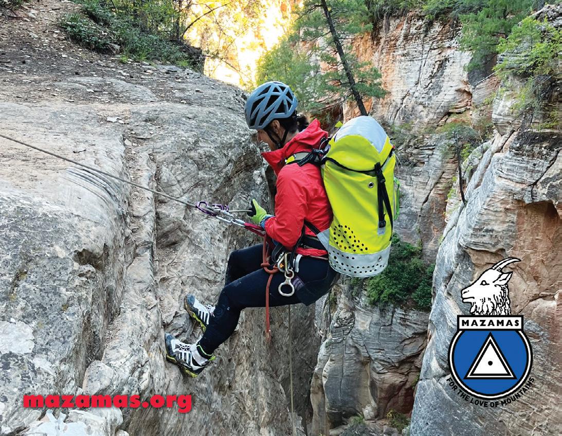
40 MAZAMAS Mazama Periodical Postage Paid in Portland, Oregon Mazamas® 527 SE 43rd Ave. Portland, OR 97215 www.mazamas.org Heather Johnston on rappel in Birch Canyon, September 2023. 2024 MEMBERSHIPS ON SALE NOW! Join or renew today at www.mazamas.org/join
