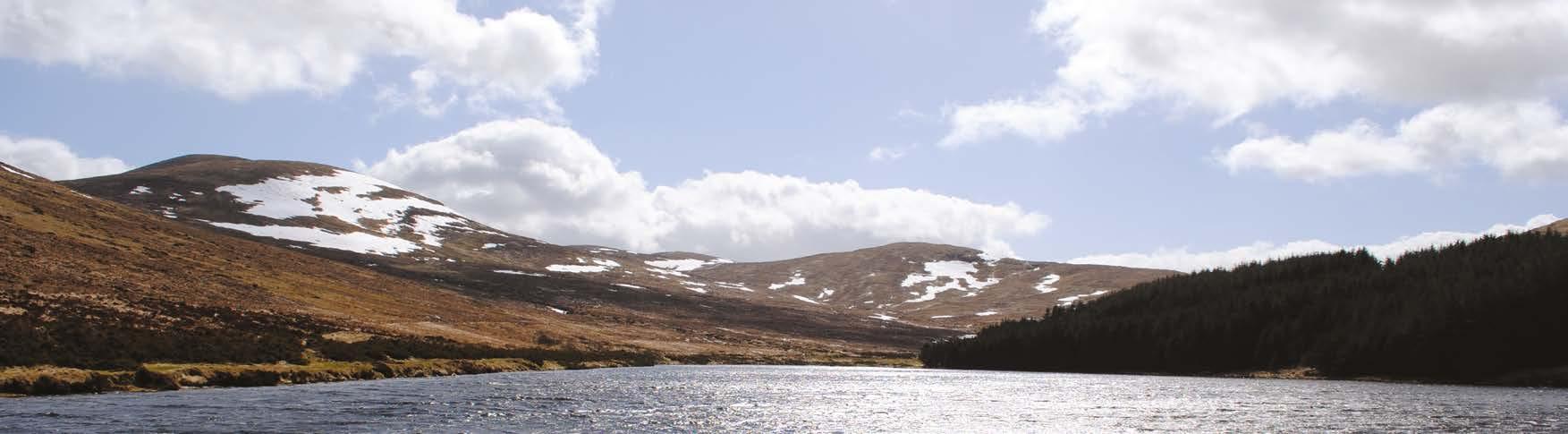
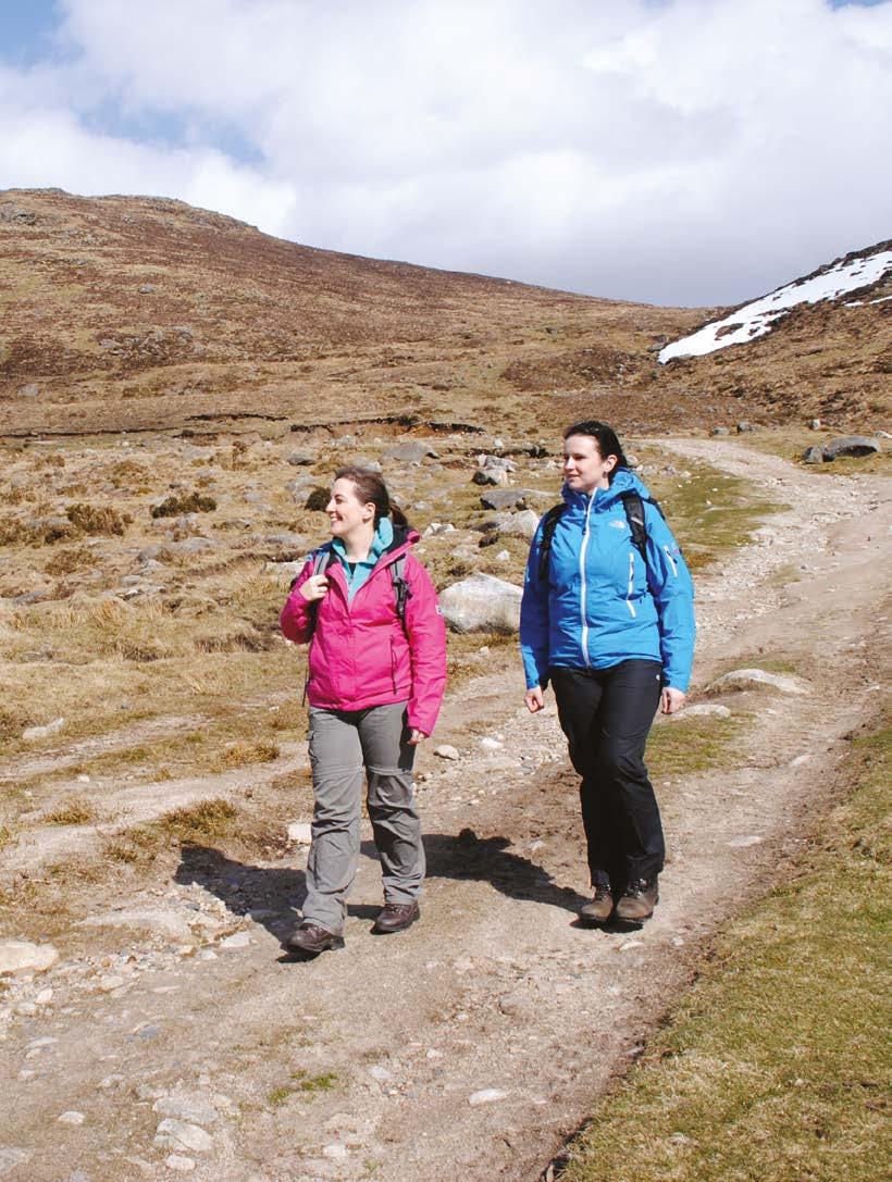
Welcome to the Mourne Way
This marvellously varied, twoday walk carries you from the coast, across the edge of the Mourne Mountains, and back to the sea at the opposite side of the range. Almost all of the distance is off-road, with forest trails and mountain paths predominating. Highlights include a climb to 500m at the summit of Butter Mountain.
02 | walkni.com walkni.com | 03 A2 A2A2 A25 B8 B180 B25 B27 Tollymore Forest Park Moneyscalp Wood Donard Forest Annalong Wood Mourne Wood Rostrevor Forest HILLTOWN ROSTREVOR ANNALONG NEWCASTLE Spelga Dam Slieve Donard Slieve Meelmore Ott Mounatin Lough Shannagh Ben Crom Silent Valley Hen Mounatin Rocky Mounatin Finlieve Slieve Commedagh Lukes Mounatin Slieve Binnian 6 04
06
08
Happy
10
Spelga
12
Leitrim
14 -
Yellow
16 - Accommodation/Dining 18 - Other useful information SECTION 1 - NEWCASTLE TO TOLLYMORE FOREST PARK (5.7km)
- Section 1 Newcastle to Tollymore Forest Park
- Section 2 Tollymore Forest Park to Happy Valley
- Section 3
Valley to Spelga Pass
- Section 4
Pass to Leitrim Lodge
- Section 5
Lodge to Yellow Water Picnic Area
Section 6
Water Picnic Area to Kilbroney Park
Contents Key to Map SECTION 2 - TOLLYMORE FOREST PARK TO HAPPY VALLEY (9.2km) SECTION 3 - HAPPY VALLEY TO SPELGA PASS (7km) SECTION 6 - YELLOW WATER PICNIC AREA TO KILBRONEY PARK (5.3km) The Western Mournes: Hen Mountain, Cock Mountain and the northern slopes of Rocky Mountain The Mourne
Slieve Meelmore NEWCASTLE ROSTREVOR
SECTION 4 - SPELGA PASS TO LEITRIM LODGE (6.7km) SECTION 5 - LEITRIM LODGE TO YELLOW WATER PICNIC AREA (3.5km)
Way at
Section 1 - 5.7km
The route begins by climbing from urban parkland to a series of high forest tracks.
From Newcastle tourist office, cross the road and turn right. Just before the Shimna bridge, turn left into Castle Park. Follow a paved footpath past the boating lake and cross the busy Shimna Road. Continue through Islands Park to a footbridge. Cross the bridge and follow a path along the river, past a series of recreational facilities.
Leave the park and turn left along Bryansford Road. Cross over the road bridge, then turn right onto a track known as Tipperary Lane. This leads you into Tipperary Wood, an enclave of deciduous woodland on the banks of the Shimna River. Climb through the trees and past several houses to reach a road. Head right here for 400m, then turn left onto a narrow lane. Climb
steeply now to reach the gate that bars the end of the lane. Cross the adjacent stile and continue to a second gateway that marks the boundary of Tollymore Forest.
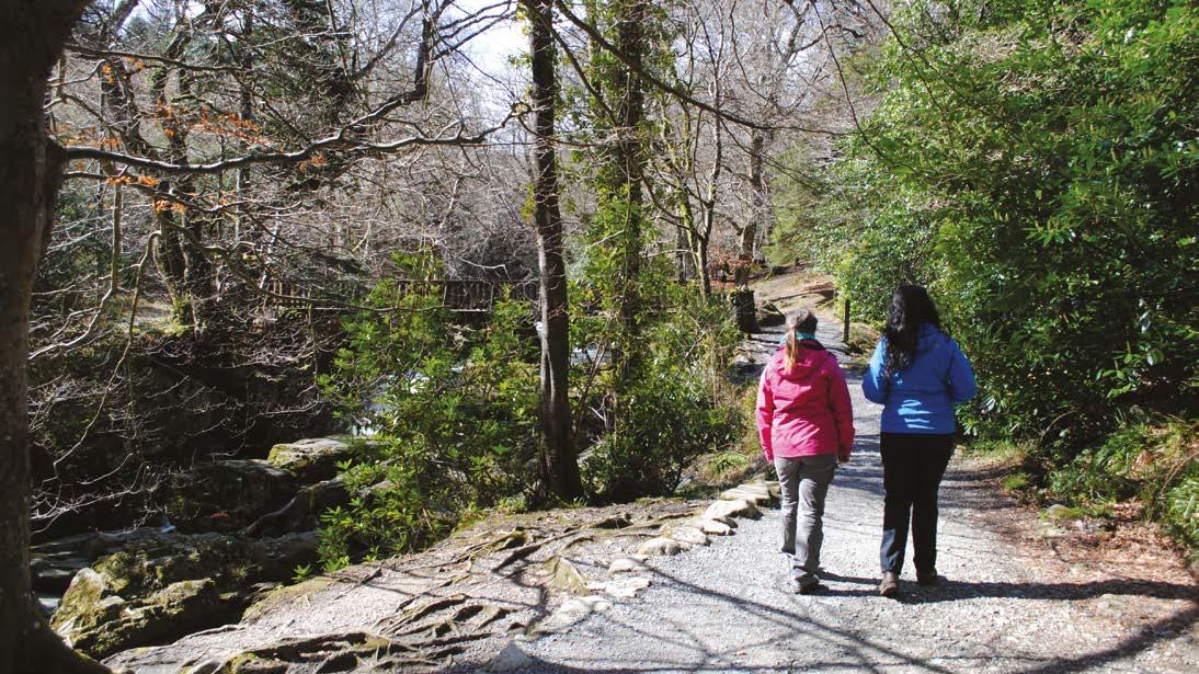
For the next 6.5km you’ll be following tracks and footpaths through Tollymore Forest Park. Begin by climbing to a track, then turn left. The track swings round to the right and starts to descend. Turn left at the next junction and skirt along the stone wall that marks Tollymore’s southern boundary. The mountain that rises on your left is Slieve Commedagh, the second highest summit in Northern Ireland at 767m.
Keep left at the next two junctions, descending to meet the Spinkwee River. Cross Hore’s Bridge then turn right, soon passing the beautiful, 10m-high Cascade Falls. The section ends at a track junction at the bottom of the Spinkwee River.
Did You Know?
The woodlands of the Tollymore estate have long served the dual purpose of pleasure and commerce. Oak wood from this forest was the preferred material for the interiors of the mighty White Star shipping liners, including the ill-fated Titanic which was built in Belfast in 1911.
SECTION 1 - NEWCASTLE TO TOLLYMORE FOREST PARK NEWCASTLE TO TOLLYMORE FOREST PARK - SECTION 1 1:25,000 00.5 10.25 Kilometers This material is Crown Copyrigh and is reproduced with the permission of Land and Property Services under delegated authority from the Controller of Her Majesty’s Stationary Office, © Crown Start Section 1 Section 2 Section 1 End Section 1, Start Section 2 04 | walkni.com
Tollymore Forest Park
walkni.com | 05
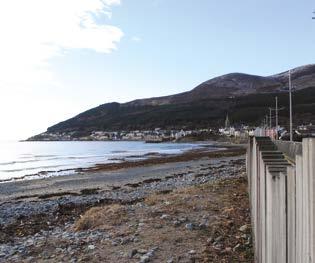
Eastern slopes of Slieve Donard from Newcastle Beach
Did You Know?
The Trassey Track is the end of a path known as the Brandy Pad, which crosses the heart of the Mournes and meets the coast just south of Slieve Donard. The route was used in the 18th and 19th centuries by smugglers, who journeyed across the mountains at night with ponies laden with tobacco, wine, spirits and silk.
to the Spinkwee junction. Continue straight along the river’s southern bank and cross the Shimna via a wooden footbridge some 500m further upstream. Once on the northern bank of the river, turn left onto a beautiful stretch of path that follows the chutes and rapids upstream. Pass another set of stepping stones and Parnell’s Bridge on the left. Continue until reaching the Boundary Bridge and cross the Shimna River to the southern bank. Follow the path bearing right and at the next junction with a small path bear left. At the next junction turn right. A sign soon indicates the location of the King’s Grave, which dates from 1500-1000 BC.
Section 2 - 9.2km
This section brings you out of the trees and into the wild terrain of the Mourne Mountains.
Turn right at the junction at the bottom of the Spinkwee, then look out for a path on the left that descends to a set of stepping stones over the Shimna River. These stepping stones date back over 200 years, but if the water is too high to cross, turn around and retrace your steps back
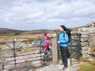
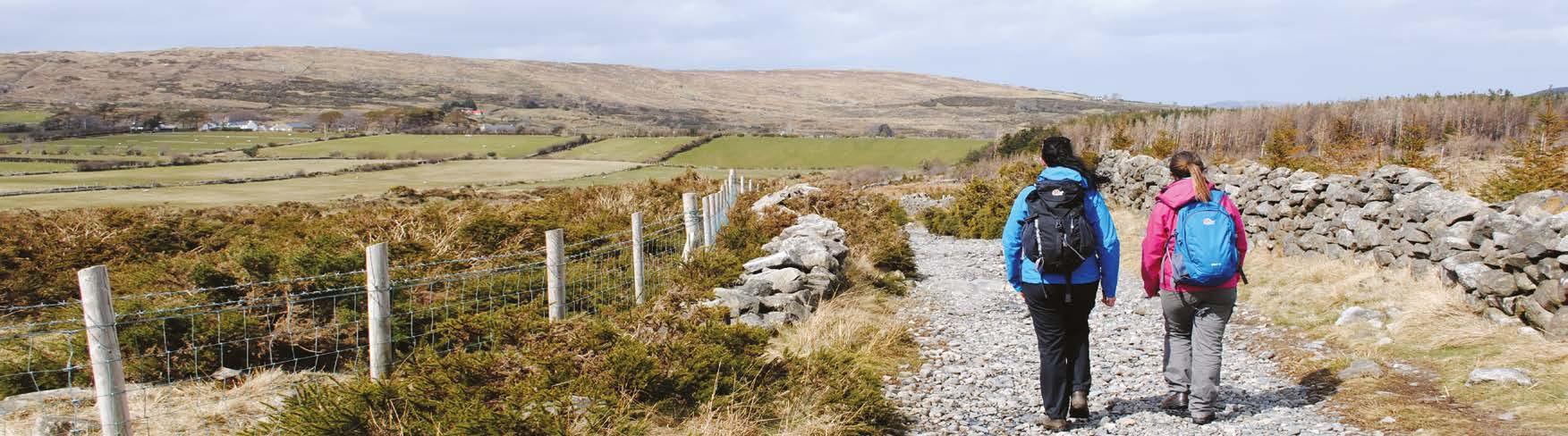
Continue past several stiles and turnstiles to reach a road. Just 20m away to the left, you’ll see a gated track. This is the Trassey Track, one of the busiest walkers’ routes into the Mournes. Cross the stile and follow the track south, passing two further gates before you reach open mountain terrain.
At the final gate, a stone wall can be seen extending west; this is your guide for the next part of the route. Turn right onto a footpath and follow the wall, passing beneath the steep northern slopes of Slieve Meelmore. After almost 2km you arrive a stream that drains the Happy Valley between Slieve Meelmore and Slieve Meelbeg.
SECTION 2 - TOLLYMORE FOREST PARK TO HAPPY VALLEY TOLLYMORE FOREST PARK TO HAPPY VALLEY - SECTION 2
06 | walkni.com walkni.com | 07
Trassey Track
1:25,000 00.5 10.25 Kilometers This material is Crown Copyrigh and is reproduced with the permission of Land and Property Services under delegated authority from the Controller of Her Majesty’s Stationary Office, © Crown Section 2 Section 3 Section 1 End Section 2, Start Section 3 End Section 1, Start Section 2
Stepping Stones in flood at Tollymore Forest Park
Happy Valley
The Mourne way leaving Trassey Track
Section 3 - 7km
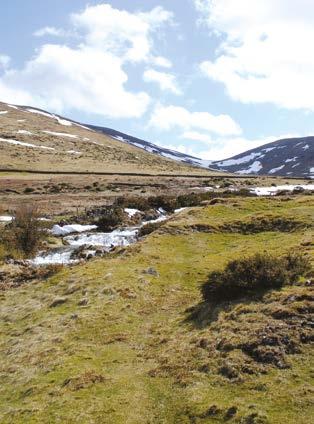
You now climb across a 500m summit on the most mountainous section of the route.
From Happy Valley, continue to follow the path around the northwestern base of Slieve Meelbeg. You soon arrive at Fofanny Reservoir. Cross a metal footbridge and head along the eastern bank of the reservoir, following a narrow path flanked by gorse bushes. A short section through pine trees then brings you to a road. Turn left here and walk along the tarmac for 900m to reach Blue Quarry car park (also known as Ott Mountain car cark).
Here there’s a choice of routes. The official route to Spelga Pass crosses open mountainside and is not waymarked. Only consider this option in clear weather, if you’re an experienced mountain walker with good navigational skills. Otherwise, take the alternative route along the road.
To follow the mountain trail, climb the stone steps and cross the stile above the car park. Follow a faint grassy trail directly up the slope to the top of the ridge. The 500m-high summit of Butter Mountain, the highest point of the route, lies just to the left, and provides fantastic views over the northwestern Mournes.
Now follow the ridge northeast to a fence, which is marked by Mourne Way signs. Turn left and follow the fence for 600m. Now turn left (southwest) and follow a faint
Did You Know?
track through boggy tussock grass, past the summit of Spaltha. Continue to the broad col beneath Spelga Mountain, then turn right (west) and descend steeply, keeping just south of a stream. Keep descending until you meet a stone wall, where you rejoin the waymarkers. Turn left and contour along the wall to reach the road at Spelga Pass.
This route takes you past two important mountain reservoirs. First is Fofanny Reservoir, with an underground water treatment works capable of processing 52 million litres of water a day. Second is the larger Spelga Reservoir, which was completed in 1957 and flooded a mountain pasture previously known as Deer’s Meadow.
SECTION 3 - HAPPY VALLEY TO SPELGA PASS HAPPY VALLEY TO SPELGA PASS - SECTION 3 1:20,000 00.4 0.80.2 Kilometers This material is Crown Copyrigh and is reproduced with the permission ofLand and Property Services under delegated author y from the Controller of Her Majesty’s Stationary Office, © Crown End Section 2 Start Section 3 Section 2 Section 3 Section 4 End Section 3, Start Section 4 08 | walkni.com
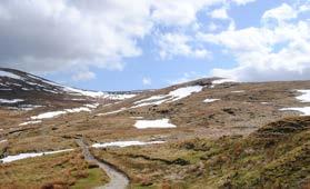
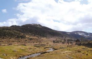
The Mourne Way at Slieve Meelbeg
Fofanny Reservoir, Slieve Meelbeg and Slieve Loughshannagh
walkni.com | 09
Ott Mountain and Slieve Loughshannagh
Section 4 - 6.7km
Follow a series of upland paths and tracks on your way between three mountain valleys.
Cross the road at Spelga Pass and pass through two metal gates. Now descend across a footbridge that spans the nascent River Bann. Turn right on the opposite bank and contour around the base of Slievenamiskan. The route then turns right and descends across a hollow, heading towards a stone wall that runs around the base of Hen Mountain. When you meet the wall, turn left and contour beneath the northern slopes of the mountain.
The path is sometimes wet underfoot, but brings you to the firm surface of a mountain track know as the New Bog Road. Turn left here and follow the track for 2km, climbing gradually along the Rocky River valley. At first there are good views of the granite tors that decorate the summit of Hen Mountain - a popular rock climbing venue - then the feeling of isolation increases as you continue into the upper part of the valley.
Follow the track towards Pigeon Rock Mountain, then turn right and cross a ford over the Rowan Tree River. Turn right again on the opposite bank and descend over rough ground to a footbridge across the Rocky River. Now begin to climb west up an open mountain slope, heading for the col between Rocky Mountain and Tornamrock. A faint path indicates the route across the sometimes wet ground.
The path consolidates at the col, and a steady descent brings you to a track at the base of the valley. Turn left here to reach the end of the section, marked by a track junction at Leitrim Lodge.
Did You Know?
This section starts by crossing the nascent River Bann. Rising just 12km from Northern Ireland’s southeast coast, this river eventually flows into the sea near Coleraine, at the opposite end of the province. Passing first through Spelga Reservoir and then through Lough Neagh, its 129km journey makes it the longest river in Northern Ireland.
SECTION 4 - SPELGA PASS TO LEITRIM LODGE SPELGA PASS TO LEITRIM LODGE - SECTION 4 10 | walkni.com walkni.com | 11
1:25,000 00.5 10.25 Kilometers This material is Crown Copyrigh and is reproduced with the permission of Land and Property Services under delegated authority from the Controller of Her Majesty’s Stationary Office, © Crown End Section 3, Start Section 4 Section 3 Section 4 Section 5 End Section 4, Start Section 5
walkni.com | 11
Views of Altataggart Mountain and Tievedockaragh from Leitrim Lodge
Spelga Pass
Section 5 - 3.5km
A mixture of tracks and footpaths lead out of the mountains and into the pines of Rostrevor Forest.
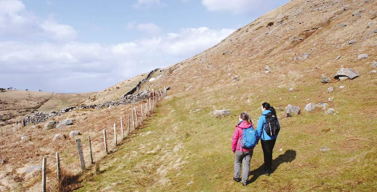
At the track junction near Leitrim Lodge, turn left and begin to contour southwest along the base of Altataggart Mountain. You are now within the old Batt’s Estate and tall scots pine trees lie scattered across the hillside, providing a welcome vertical dimension after the previously bare slopes. The track soon veers right at a forestry plantation, but you should keep straight ahead along a rough footpath that follows along the edge of the trees.
Pass around the platation and continue back out into the open. The trail climbs briefly onto the lower slopes of Tievedockaragh, then descends to a stile. Cross this and join the firmer terrain of a gravel forest track. You are now inside the grounds of Rostrevor Forest, though most of the initial trees have been felled and the slopes remain relatively open for at least a kilometre. Across the valley to your right, a cluster of outlying hills mark the gradual demise of the Mourne Mountains as the peaks merge back into the rolling countryside.
Within long the track plunges into thickly-planted pine trees and you arrive at a T-junction with another track. This marks the access point for Yellow Water Picnic Area, and the end of the section.
Did You Know?
The name Altataggart translates from the Gaelic as ‘Hill of the Priest’. It refers to the fact that this mountain was a site of clandestine religious worship during the period of penal law in the 18th century. The mass rock is located part-way up the mountain, just above the present-day forest.
SECTION 5 - LEITRIM LODGE TO YELLOW WATER PICNIC AREA LEITRIM LODGE TO YELLOW WATER PICNIC AREA - SECTION 5 12 | walkni.com walkni.com | 13 1:25,000 00.5 10.25 Kilometers This material is Crown Copyrigh and is reproduced with the permission of Land and Property Services under delegated authority from the Controller of Her Majesty’s Stationary Office, © Crown End Section 4, Start Section 5 Section 4 Section 5 Section 6 End Section 5, Start Section 6
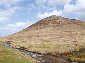
Rocky Mountain
The Mourne Way at Tornamrock
Did You Know?
Kilbroney Church is the location of the legend of St Bronach’s Bell. The story recalls an invisible bell that rang in the churchyard during storms, continuing St Bronach’s work of caring for troubled sailors. The apparently supernatural origin of the noise was explained in 1795 how ever, when an ancient oak tree blew down, re vealing a 9th-century church bell that had been hidden in its branches during the reformation.
Section 6 - 5.3km
A gradual descent along a forest track carries you easily to the finish above Carlingford Lough.
Begin by turning left at the T-junction near Yellow Water Picnic Area. Just 30m later, turn right and cross a wooden footbridge over the Yellow Water River. Climb to the end of a track and turn right, beginning to contour along the hillside through dense pine trees.
Where there are gaps in the vegetation, there are good views over the fertile Kilbroney River valley. As you progress the panorama extends south to include the town of Ros trevor, with Kilbroney Church on its northern edge. This church lies on the site of a former convent founded in by St Bronach in the 6th century, and the whole scene is backed by the tidal waters of Carlingford Lough.
The track passes several junctions, but the route is always well signed and generally continues straight ahead. As you near the end of the section, you begin to descend stead ily through the trees. Pass the camping ground and join the bottom of the tarmac forest drive. Cross over a stone bridge and 200m later you will arrive at the main car park for Kilbroney Park, the official end point of the route.
SECTION 6 - YELLOW WATER PICNIC AREA TO KILBRONEY PARK YELLOW WATER PICNIC AREA TO KILBRONEY PARK - SECTION 6 14 | walkni.com walkni.com | 15
1:25,000 00.5 10.25 Kilometers This material is Crown Copyrigh and is reproduced with the permission of Land and Property Services under delegated authority from the Controller of Her Majesty’s Stationary Office, © Crown End Section 5 Start Section 6 Section 5 Section 6 Finish
Yellow Water Picnic Area
Kilbroney Forest Park
Walker Friendly Accommodation
You will find 100’s of accommodation options in the Mourne region – from 5* hotels to self catering cottages. For a full list visit www.discovernorthernireland.com. However the following accommodation providers offer services and facilities specifically to meet the needs of walkers. These include:
• Location within 500m of the route
• Packed lunches available to take away in the morning – upon request
• Suitable overnight area for drying wet clothes/boots
• Late meal/early breakfast available - upon request
• Detailed walking information available
• One night bookings available
• Approved by the Northern Ireland Tourist Board
Tollymore Outdoor Centre B&B
Avoca Hotel - 1 star hotel
Cherryhill Lodge B&B
Clonmore House B&B
Accommodation Location Telephone Email/Website
Tollymore National Bryansford +44 (0)28 4372 2158 admin@tollymore.com Outdoor Centre www.tollymore.com
Avoca Hotel Newcastle +44 (0)78 4372 2253 info@avocahotel.com www.avocahotel.com
Cherryhill Lodge Newcastle +44 (0)28 4372 4866 stay@cherryhill-lodge.com www.cherryhill-lodge.com
Clonmore House Newcastle +44 (0)28 4372 5285 mebgrimley@hotmail.com
Coolnagreeny Newcastle +44 (0)28 4372 6390 colleensmith2010@gmail.com House www.coolnagreeneyhouse.com
Mourne Wood B&B Rostrevor +44 (0)77 8626 8505 mournewoodbandb@gmail.com www.mournewoodbandb.com
Ross House Rostrevor +44 (0)28 4173 8127 jmt.kelly@btinternet.com
Oyster Catcher B&B Rostrevor +44 (0)28 4173 9999 james@cpddirect.com www.oystercatcher.ie
Where to Eat
The Mourne area is home to an extensive range of eateries catering for all tastes. Many are frequented by walkers – where backpacks and walking boots are very welcome! Please see below for places to eat, as recommended by walkers.
Newcastle
Anchor Bar – home cooked pub grub, +44 (0)28 4372 3344
Sea Salt – deli and bistro, +44 (0)28 4372 5027
Maud’s Coffee Shop – café snacks, +44 (0)28 4372 6184
Broadway Café – grills and frys, +44 (0)28 4372 2263
The Strand Restaurant – traditional meals, +44 (0)28 4372 3472
Hilltown
The Downshire Arms – a la carte restaurant and bar snacks, +44 (0) 4063 8899
The Village Inn - pub grub, +44 (0) 2840638649
Coolgreeny House B&B
Mourne Wood B&B
Ross House B&B
Oyster Catcher B&B
Rostrevor
The Kilbroney Restaurant – steak house and pub grub, +44 (0)28 4173 8390
Kilbroney Park Café – café snacks, hot food, +44 (0)28 4173 8026
For a full list of where to eat in the Mourne area please contact the Newcastle Tourist Information Centre or Newry Tourist Information Centre (see page 19).For a full list of accommodation in the surrounding area visit www. discovernorthernireland.com
ACCOMMODATION ACCOMMODATION & DINING 16 | walkni.com walkni.com | 17 A2 A2A2 A25 B7 B25 B8 B8 B180 B25 B27 Tollymore Forest Park Moneyscalp Wood Donard Forest Annalong Wood Mourne Wood Rostrevor Forest HILLTOWN ROSTREVOR ANNALONG NEWCASTLE Slieve Commedagh Spelga Dam Spelga Dam Slieve Donard Slieve Meelmor Ot Mounatin Lough Shannagh Ben Crom Silent Valley Hen Mounatin Rocky Mounatin Finlieve Slieve Commedagh Lukes Mounatin Slieve Binnian 6
Other Information Other Information
Other useful maps – available from www.osni.gov.uk/mapstore
OSNI Discoverer Map Series 1:50 000 Sheets 21 and 29.OSNI The Mournes 1:25,000. Walkers are always recommended to carry the relevant OSNI map.
Leave No Trace
In order to minimise your social and environmental impacts on the outdoors, please follow the principles of Leave No Trace. Leave No Trace is an outdoor ethics educational programme designed to promote and inspire responsible outdoor recreation through education, research and partnerships. For more information please visit www.leavenotraceireland.org.
Emergency
In the event of an emergency call the police on 999 or: Police Service NI Newcastle (same number for Mountain Rescue) 0044 (0)28 4372 3583 Daisy Hill Hospital A&E, Newry 0044 (0) 28 3083 5000
Go Prepared
Weather conditions in the Mournes area can be changeable – even during summer months. Waterproof and windproof clothing are essential and strong walking boots are advised.
Walking Providers
Should you wish to explore the wider area including the Mourne Mountains, contact one of the guides specialising in this area to guide you.
Name Telephone Email/Website
Mourne Spirit +44 (0)77 1184 7125 caroline@mournespirit.com www.mournespirit.com
Mountain Sojourns +44 (0)77 4028 5794 info@mountainsojourns.co.uk www.mountainsojourns.co.uk
Outdoor Ireland North +44(0)79 7340 8056 loretto@outdoorirelandnorth.co.uk www.outdoorirelandnorth.co.uk
Walks in the Mournes +44 (0)28 4372 5143 domnall.mccomish@btinternet.com www.walksinthemournes.com
Tollymore Outdoor Centre
Tollymore Outdoor Centre is Northern Ireland’s National Centre for mountaineering and walking based on the edge of the Mournes. It runs courses on hillwalking and mountaineering mainly based in the Mournes and has accommodation for up to 40 people in twin ensuite rooms. Visit www.tollymore.com
Mourne International Walking Festival
This festival takes place during the last weekend in June every year. A range of guided and self-guided walks including some strenuous mountain routes are available. www. mournewalking.co.uk or tel: +44 (0)28 4175 2256
WalkNI.com
For further information on the Mourne Way and all other walks across Northern Ireland, please visit www.walkni.com. Here you will find short, medium and long distance walks, as well as downloadable maps, suggested itineraries, and everything you need to know when planning a walking trip in Northern Ireland.
Other Activities & Places to See
The Mourne area is renowned for its natural beauty, outdoor recreation, culture, tradition, folklore and heritage. In addition to walking, a wide variety of activities are on offer –pony-trekking, bouldering, canoeing, abseiling to name a few. To find out more visit Newcastle Tourist Information Centre or Newry Tourist information Centre (contact details below).
Newcastle Tourist Information Centre 10-14 Central Promenade Newcastle, Co Down BT33 0AA www.downdc.gov.uk newcastle.tic@downdc.gov.uk +44 (0)28 4372 2222
Outdoor Shops in the area
Newry Tourist Information Centre
Bagenal’s Castle Castle Street, Newry BT34 2DA www.newryandmourne.gov.uk newrytic@newryandmourne.gov.uk +44 (0)28 3031 3170
Hill Trekker: Independent Walking Shop selling everything you need for walking in the Mournes 115, Central Promenade, Newcastle, BT33 0EU +44 (0)28 4372 3842
Tresspass: Outdoor clothing including rain jackets, camping equipment and much more. Unit 33, Buttercrane Shopping Centre, Buttercrane Quay, Newry, BT35 8HJ + 44 (0)28 3025 6089
Public Transport
Newcastle is well served by buses from Belfast. Buses from Newcastle link Downpatrick, Banbridge, Lisburn, Bryansford, Rathfriland and Kilkeel. Newcastle bus station is within 600 metres of the start of the route. The Mourne Rambler runs from May to September each year, linking popular access points around the Mournes.
Timetables are available from Bus Stations or Tourist Information Centres across Northern Ireland. For more information call (028) 9066 6630 or visit www.translink.co.uk. Over 60s travel free on presentation of a valid SmartPass.
Taxis: Donard Taxis, Newcastle: +44 (0)28 4372 2823 Shimna Taxis, Newcastle:+44 (0)28 4372 3030 AV Taxis, Warrenpoint: +44 (0)28 4177 3966 VIP Taxis, Warrenpoint: +44 (0)28 4177 3999
OTHER USEFUL INFORMATION OTHER USEFUL INFORMATION 18 | walkni.com walkni.com | 19
Disclaimer Every care has been taken to ensure accuracy in the compilation of this guide. The information provided is, to the best of the promoter’s knowledge, correct at the time of going to print. The promoters cannot accept responsibility for any errors or omissions but if any are brought to their notice, future publications will be amended accordingly.
Land Access
Some popular walking routes in Northern Ireland are not formally designated public rights of way. Access is on a de-facto basis and depends on the goodwill and tolerance of local landowners. Walkers are advised to respect that they may be walking on private land and are encouraged to make themselves aware of and adhere to the principles of ‘Leave No Trace’ www.leavenotraceireland.org.
Please note:- sections of the Trail may close from time to time to facilitate forestry and other essential operations.

For any questions on walking in Northern Ireland contact Outdoor Recreation NI The Stableyard, Malone Road, Barnett’s Demesne, Belfast BT9 5PB Tel: +44 (0)28 9030 3930 Email: info@walkni.com This guide is available on request in alternative formats. © Outdoor Recreation NI Route Descriptions by Helen Fairbairn. Design by www.thinkstudio.co.uk