


& Conservation Workshop Street Plans | 02.15.24
Growth
Agenda 01. What is Connect Senoia? 02. How should we think about conservation? | Georgia Conservancy 03. Where & how could growth happen? | Street Plans 04. Growth Mapping Activity 05. Share-out
What is Connect Senoia?
Growth + Conservation Plan
2 4
Connectivity Plan
3
Town Center Master Plan
Unified Development Ordinance
to codify the vision identified in the master plans.
Growth & Conservation Winter Workshop Summer Public Kickoff Meeting Town Plan Spring Charrette Fall Charette Kick-off Workshop Public Unveiling Meeting Fall Charette Wrap-up Presentation February 15 June 13, 2024 April 25 - May 1 October 23, 2023 TBD October 27, 2023


to lay out a vision for continued development in the town center. 1
to control growth and conserve natural lands.
that includes a full range of options - from walking, biking, transit, and micro-mobility.
Why should Senoia have a plan for growth & conservation?


Yesterday 2000 Today 2023 Tomorrow Current Applications Today Suburban Sprawl
Tomorrow?
We can be proactive about directing the location and type of growth that will occur so that it builds on - and doesn’t take away from - the town character.
?
Yesterday Today Tomorrow
How do we preserve Senoia’s small town character and ecological value while allowing for intentional growth?
Step 1
Identify areas of high ecological value for conservation
Georgia Conservancy
Growth and Conservation Workshop | Winter 2024

Georgia Conservancy February 14, 2024 Connect Senoia
Master Mmaster@gaconservancy.org
Michaela
senoia conservation strategy
Table of contents
IV
Defining conservation in Senoia
Methodology and ranking process
Findings and initial strategy
Next steps
I II III
X X X X
I. Conservation, defined
What exactly is conservation? What should it look like in Senoia?
Short-term Small scale


Long-term Large scale Site (Patch/Garden)Local (Park) Regional Wilderness
Short-term
Small scale
Site (Patch/Garden) Local (Park)
Long-term Large scale
Regional Wilderness
Today’s focus
Senoia Conservation
Goals
1. Conserve small-town community character
• Viewsheds, experience of being surrounded by nature
• Emphasis on natural resources, specifically:
• Tree canopy
• Bodies of water
• Protection of ecological resources on private lands

Senoia Conservation
Goals
2. Prioritize active use and recreation-oriented conservation
• Public access and enjoyment of lands and resources
• Tie in to parks and greenspace

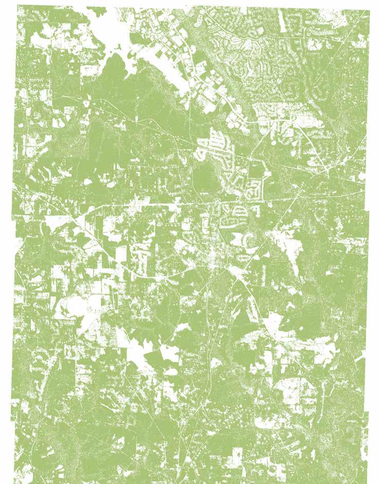
Connect Senoia | Existing Conditions Report N 1 2 3 Leroy Johnson Park Marimac Lake Park Seavy Street Park Proposed Coweta Street Park 1 2 3 4 LEGEND Greenspace Streams Lakes and Reservoirs Streets .5 Mile Radius (10-Minute Walk) Rail Line City Limits 4 DeadOakCreek KegCreek
Dead Oak C reek
LineCreek
Senoia Conservation
Goals
Short term: protect within Senoia, particularly existing tree canopy and riverside/ lakeside property
• Building off a strong foundation, early intervention,
• And: If you fail to plan you plan to fail
Long term: buffer around existing development as town boundaries expand

Conservation Goals
Conservation Goals Growth goals
Conservation Goals Conservation Tools
II. Methodology and analysis
Conservation scoring and process
Methodology
1. Analyze data on five key categories of conservation (see graphic on right)
2. Score each parcel for each category:
• D etermine if parcel meets criteria
• Apply binar y scoring of 0 or 1
• Apply weights per category (see percentages in graphic on right)
3. Sum each cateogry together for a final score per parcel
4. Identify clusters of high scoring, high ecological-value parcels


Additional notes:
• Area of interest: 5 mile radius from center of Senoia, not including Fayette County
• Basic unit of analysis: parcel level data


Tree Canopy
(30%) (25%) (20%) (15%) (10%)
Hydrology Habitat Developed Slope
Tree Canopy (30% weight)
Criteria:
• Properties with greater than 80% tree canopy cover=1
• Properties with less than 80% tree canopy cover=0
FayetteCounty
Area of Interest
5 liM e Rida su
5MileRadius
Hwy 85 Hwy16
Hwy85
Hwy16
Legend Tree canopy >80% Canopy Coverage
hydrology (25% weight)
Criteria:
• Properties overlapping with wetlands=1
• Properties with minimal/no overlap with wetlands=0
Legend
Parcels w/ Wetland Overlap
Wetlands
Wetland Buffer (300ft)
Watershed Protection District
Water Supply Watershed
FayetteCounty
DeadOakCreek
Area of Interest
5 liM e Rida su
5MileRadius
Water SupplyWatershed Wat e r S u p p yl dehsretaW
Hwy 85 Hwy16
Line Creek
Hwy85
Hwy16
habitat (20% weight)
Criteria:
• Properties intersecting with top ranked habitat=1
• Properties with no intersection of top ranked habitat=0
FayetteCounty Hwy85
Interest
5 liM e Rida su
Area of
5MileRadius
Hwy 85 Hwy16
Hwy16
Legend Parcels w/ High Quality Habitat
Quality Habitat Score
Quality Habitat Score
High
Highest
Developed (15% weight)
Criteria:
• Undeveloped or minimally developed properties=1
• D eveloped properties=0
Area of Interest 5MileRadius 5 liM e Rida su
Hwy85 Hwy 85 Hwy16 Hwy16
FayetteCounty
Legend Undeveloped Minimally Developed Development Applications
Slope (10% weight)
Criteria:
• Steeply-sloped properties=1
• Gently-sloped or flat properties =0
**Note: High slope areas are harder to develop, more likely to remain conserved (all else held equal)

FayetteCounty
Area of Interest 5MileRadius 5 liM e Rida su
Hwy85 Hwy 85 Hwy16 Hwy16
Legend Parcels w/ 25% High Slope High Slope (>25%)
III. Findings
Results, vision, and strategy
Results: High ranking parcels


Tree Canopy
Hydrology
Habitat Developed Slope
(30%) (25%) (20%) (15%) (10%)
Results: High ranking parcels
Tree Canopy
Hydrology
Habitat Developed Slope
(30%) (25%) (20%) (15%) (10%)
Results: High ranking parcels
Tree Canopy Hydrology Habitat Developed Slope
(30%) (25%) (20%) (15%) (10%)
Count
Mean: 0.248
Normal Distribution
Distribution of conservation scores for all parcels
Total Score
0 0.05 0.1 0.15 0.2 0.25 0.3 0.35 0.4 0.45 0.5 0.55 0.6 0.65 0.7 0.75 0.8 0.85 0.9 0.95 1 0 500 1,000 1,500 1,755 0 1,571 243 10 460 1,155 0 756 0 160 272 416 65 0 28 176 29 0 39
Results: High ranking parcels
Tree Canopy Hydrology Habitat Developed Slope
(30%) (25%) (20%) (15%) (10%)
Count
Mean: 0.248
Normal Distribution
Distribution of conservation scores for all parcels
Total Score
Top 10% of all parcels
0 0.05 0.1 0.15 0.2 0.25 0.3 0.35 0.4 0.45 0.5 0.55 0.6 0.65 0.7 0.75 0.8 0.85 0.9 0.95 1 0 500 1,000 1,500 1,755 0 1,571 243 10 460 1,155 0 756 0 160 272 416 65 0 28 176 29 0 39
}
Results: High ranking parcels map
Tree Canopy
Hydrology
Habitat Developed Slope
(30%) (25%) (20%) (15%) (10%)
Hwy16
Hwy 85
FayetteCounty
Hwy85
Hwy16
of Interest
5 liM e Rida su
Area
5MileRadius
results: Potential Conservation cores
Tree Canopy Hydrology Habitat Developed Slope
(30%) (25%) (20%) (15%) (10%)
Area of Interest 5MileRadius 5 liM e Rida su FayetteCounty Core 1 Core 3 Core2 Line Creek
LittleWhiteOakCreek D o u b l e Branch Hwy85 Hwy 85 Hwy16 Hwy16
DeadOakCreek
Conservation Cores
• L arge swaths of connected, contiguous lands
• Priority on ecological value - wilderness, wildlife, biodiversity, and protecting existing natural resources
• Particularly protecting greenfields from low-density sprawl
• D enotes either public ownership and/or public access to landthough neither are required.
• C an look like, for example:
• Conser vation-oriented development (cluster development close together, leave aside conserved areas)
• Publicly owned parks and recreational facilities
• Sending areas for transfer of development rights (TDR) via conservation easement

senoia conservation goals:
1. 2.
Conserve smalltown community character
Prioritize active use and recreation-oriented conservation
Potential Conservation cores
high ranking conservation parcels
Primary Conservation cores
secondary cores
Rivers
Area of Interest 5MileRadius 5 liM e Rida su FayetteCounty Core 1 Core 3 Core2 Line Creek
LittleWhiteOakCreek D o u b l e Branch Hwy85 Hwy 85 Hwy16 Hwy16
DeadOakCreek

Potential Conservation cores
high ranking conservation parcels
Primary Conservation cores
Rivers
Conservation Core character
areas:
Core 1: “Dense Forest”
Core 2: “Wetland Pass”
Core 3: “Creek Confluence”
*Definitions provided in appendix

Area of Interest
5 liM e Rida su
5MileRadius
FayetteCounty
Core 1
Core 3
Core2
eWhiteOakCreek D o u b l e Branch
DeadOakCreek Littl
Hwy85
Hwy 85
Hwy16
Hwy16
What about areas outside of the cores?
• This framework is quantitative in nature. Our work is intended to create a cohesive, clear, action-oriented vision but it is not prescriptive.
• You all know your place better than we do!
• Use our findings as a springboard for action - where and what to focus on.
• Any property with interested, active landowners should be engaged with!
• True regardless of size, location, rural/suburban/urban, etc.
• Nearly all land in area of interest is privately ownedregardless of location, need strong incentives for landowner participation
• D on’t let perfect be the enemy of good- better to conserve bits and pieces than nothing

Iv. Next steps
Where do we go from here?
Conservation Goals Conservation Tools
Conservation Toolkit
Transfer of Development Rights (Conservation Easement)
Purchase of Agricultural Easements (Conservation Easement)
Zoning strategies
Green infrastructure
Landowner assistance
Community benefit agreement/developer agreement
Watershed management plans
Urban Growth Boundary
Georgia Statewide programs: Georgia outdoor stewardship program, Georgia Conservation Tax Credit, Conservation Use Valuation Assessment
Conservation Toolkit
Transfer of Development Rights (Conservation Easement) X
Purchase of Agricultural Easements (Conservation Easement)
Zoning strategies X
Green infrastructure
Landowner assistance
Community benefit agreement/developer agreement
Watershed management plans
Urban Growth Boundary
Georgia Statewide programs: Georgia outdoor stewardship program, Georgia Conservation Tax Credit, Conservation Use Valuation Assessment
Core
X
X
X
X
Conservation Toolkit CoreEverywhere Transfer of Development Rights (Conservation Easement) XX Purchase of Agricultural Easements (Conservation Easement) X Zoning strategies XX Green infrastructure X Landowner assistance X Community benefit agreement/developer agreement XX Watershed management plans XX Urban Growth Boundary XX Georgia Statewide programs: Georgia outdoor stewardship program, Georgia Conservation Tax Credit, Conservation Use Valuation Assessment XX


Conservation Toolkit CoreEverywhere TransferofDevelopmentRights(ConservationEasement)XX Purchase of Agricultural Easements (Conservation Easement) X Zoning strategies XX Green infrastructure X Landowner assistance X Community benefit agreement/developer agreement XX Watershed management plans XX Urban Growth Boundary XX Georgia Statewide programs: Georgia outdoor stewardship program, Georgia Conservation Tax Credit, Conservation Use Valuation Assessment XX Short-term Small scale Long-term Large scale Site (Patch/Garden) Local (Park) Regional Wilderness Short-term, Small scale Long-term, Large scale
Transfer of development rights (TDR)
• Voluntary, legal agreement that permanently limits development of the land in order to protect its conservation values
• Voluntary, market-based mechanism
• TDR removes development rights from a conservation-focused area, and transfers these development rights to a growthfocused area which can then be developed at a higher intensity
• Moving development from one area to another, not restricting it outright
• Ties together conservation strategy with growth strategy
• Especially relevant for regional conservation strategy
• One of many conservation tools to utilize!

Sending zone before
Receiving zone before
Sending zone after
Receiving zone after
Development credits
payment
GROWTH AND CONSERVATION ARE TWO SIDES OF THE SAME COIN
Area of Interest 5MileRadius 5 liM e Rida su FayetteCounty Core 1 Core 3 Core2 DeadOakCreek LittleWhiteOakCreek D o u b l e Branch
Hwy 85 Hwy16
Hwy85
Hwy16
GROWTH AND CONSERVATION ARE TWO SIDES OF THE SAME COIN
Conservation cores seek to protect the things you love about senoia...
Area of Interest 5MileRadius 5 liM e Rida su FayetteCounty Core 1 Core 3
LittleWhiteOakCreek D o u b l e Branch
85
Core2 DeadOakCreek
Hwy85 Hwy
Hwy16 Hwy16
...You cannot ACHIEVE this without strategic, planned, sustainable growth
Growth exercise
Appendix/references
Conservation cores Character
area Definitions
Core
1: “Dense Forest”
Large properties of densely forested land, with some agricultural activity, and minimally developed overall. Bordered by Line Creek and straddling Keg Creek and overlapping with the water supply watershed.
Core 2: “Wetland Pass”
Significant overlap with wetlands, downstream Keg Creek and Line Creek, and minor tributaries. Some large, minimally developed agricultural land; essentially no low intensity suburban development. Much of the land adjacent to the east of Line Creek (Fayette County) also undisturbed.
Core
3: “Creek Confluence”
Envisions conservation areas along tributaries that feed Little White Oak Creek. Tributaries converge on a larger undisturbed tract of land southward along Little White Oak Creek. Most developed and subdivided of the three conservation cores.
high ranking conservation parcels
Primary Conservation cores secondary cores
Rivers
Area of Interest 5MileRadius 5 liM e Rida su
FayetteCounty
Core 3
Core 1
Line Creek
Core2
eWhiteOakCreek D o u b l e Branch
DeadOakCreek
Littl
Hwy85
Hwy 85 Hwy16
Hwy16
Step 2
Set a growth boundary
Street Plans


Where is Senoia’s Annexation Boundary? [2] ? ? ? Fayette County Coweta County Hutchins Lake SouthernRa way Seaboard Coa tL n Rail oad Planned Extent o f Anne a tion A ea/Future Service A ea PannedEx en ofAnnexa on A ea Fu u e Se v ce Area K e gCreek Line Creek DeadOakCreek Keg Creek Dead OakCreek Senoia S talli n gs Rd Roc k wa Rd Dolly Nixon Rd BaileyRd S t ByonRd NotonRd S d n R R Pyan St h u R C o o k R d Ba ks Rd L ther B ey Rd d O k R d M k g h R d N R y a n S LBa yRd McInoshTrl Ga y S mme Rd RockHouseRd Htche Rd a d S y L n T eyWay Ga o Ch se C h e s h s W y Hugh wn Rd h S a n g Se ySt B r dg e S h o Mo g n S C ow S C a k S t Sp ing C i R d g e D T avis S Andrew Pkwy T C B a S T R d M d d e S Tcke Rd Q D Miler Ct y S Ma ew S C k S B h S SpingCt H or eshoe Bnd E m R d City of Senoia 2006-2026 Comprehensive Plan 07/17/06 P:\02\02402\001\GIS\charmap_cak_011106.mxd Future Development Map { 01,0002,000 500 Feet Figure 5 State Highway Road Railroad River/Stream City Boundary County Boundary County Road Lake/Pond Highway Commercial Industrial Historic Downtown Senoia Neighborhood Village Commuter Rail-Oriented Development Suburban Residential Historic Residential Conservation Park/Greenway Rural/Open Traditional Neighborhood Development ! ! ! ! ! ! HIGHWAY 54 GORDON RD HIGHWAY 154 HIGHWAY85 DEADOAKRD ELDERS MILL RD EHIGHWAY16 TOPE RD REESE RD LINE CREEK RD LUTHER BAILEYRD OLD HIGHWAY 85 BEAR CREEK RD ROCKHOUSERD LINCH RD MCINTOSHTRL ROWE RD DOLLY NIXON RD BOB SMITH RD PARKS RD STANDING ROCK RD STALLINGS RD LOWER FAYETTEVILLE RD LAWSHE RD LORA SMITH RD SEAVY ST NEELY RD GARY SUMMERS RD ROCKAWAY RD GRAYGIRLSRD WELLSST CANNONRD LITTLE RD CHRISTOPHER RD SID HUNTER RD WILLIS RD MAIN ST RAGSDALE RD GLAZIER RD IVY LN EASTSIDE SCHOOL RD WOOLSIE RD HUNTER RD NIXON RD PYLANT ST RISING STAR RD BILL HART RD JOHNSON RD CRAWFORD RD DEEP SOUTH RD RAINWATER RD HALLRD HARDY RD NORTON RD ORRRD JOHNSON ST EBENEZER CHURCH RD HOWARDRD BERTUS HUNTER RD MARIONBEAVERSRD SKYVIEW RD NORTH RD BROWNRD BERT RD JOHN C HUNTER RD CABINRD MCDONALD RD COVEY TRL NECTARINE DR TRANQUIL RD OLDHIGHWAY16 WEST RD MULBERRY DR RENWICK DR TURINRD CHESTLEHURST RD CARL WILLIAMS RD CROOK RD OVERLAND TRL MEADOWSDR SAVANNAH DR ADDY RD MARTIN RD MORGAN ST OAKRIDGE DR BEAUBROOK LN LOWELL DR MCKNIGHTRD MORGAN RD STURGESS RUN CODY TRL ROCK MILL TRL N HUNTER ST CIRCLE H RD STEWART RD RAWSON RD MASTERS DR WOODSTREAMDR EMORYPHILLIPSRD PEEKSCROSSINGDR WINCHESTER DR BILL ESTES RD ROY RD DALLAS DR ROCKLAND DR TENNEY RD WILLS RUN DR RIDGE DR SPRING CIR WINTHROP DR RAILROADST LASSETTER HELEN CAMP RD FREESTONE DR CHASEWOOD LN DELTA CT LEGACY LN LAKE PARK DR TINSLEY WAY COUNTRYLAKEDR ASHTON PL TERRENTINE RD CRAWFORD CIR VINEYARD DR MARY LYNNLN YORKSHIREPL OLD MILL WAY ALLISON LN PARKSPL RED OAK TRL SHELLEYLN BLUEHERONBLVD WATER OAK DR PIEDMONT DR WALDEN POND WAY INDIAN TRL LEGENDS DR SUNSET CT PINTAIL PT NORTHWYNN DR GLEN ROCKLAND TRL RIDGE DR CUMBERLANDTRL GIN ST BEAVER CREEK LN RIDGEWAY CT AARON TODD RD BROOK RUN SHUNTER ST HAYWARD BISHOP WAY ELBERTA DR STJAMESPL PARK TIMBERS DR WHISPER CREEK DR LENTRY DR GLAZIERFARMSDR WILLOWDELLDR CARMEL RD FOXHALLXINGW BRADSHAWFARMS DR LINDSEY LN GARRISON CHASE COLEST RAYNER DR BUCK TRL MEADOW WAY MAGNOLIA PLACE DR AUTUMN CRK FOX HALL XING E LEXINGTON PL CREEKWOOD DR GLEN WINKLES DR DEERWOOD TRL ANGEL TRCE APACHE POINTE DR DARIEN DR BIG HORN DR HENRY LN KENSINGTON DR ROCK HOUSE RDG DOE RUN DR WYNNWARDWAY TUCKERRD HALOTRCE HUNTINGTON CT MANOR CIR PEACHTREEDR BRITTANY LN ELDERS MILL ESTATES DR LEYLOR LN MELROSE DR DOROTHYDR TRALEE TRCE SPRINGDALE ESTATES DR ST CHARLES PL JOHNGRIMESRD HAWKS NEST DR SANDSTONE DR SHELBY BLUFF TANGLEWOOD LN RHINOCT DR MOUNT PARAN DR MOSSWOOD DR STONE BRIDGE WAY BEARCREEKTRL BILL GABLE BEAVER CREEK DR GORDON MANOR CT NINALN BLOOMFIELD WAY SOUTH RDG W DOGWOOD TRL SHOAL HUNTER FARM DR COMMON OAK PRESTIGIOUS PL CANOE DR MUSICK PARK DR BLOSSOM CONCORDCIR SPEARCIR COTTAGE DR HIGHWAY EHIGHWAY16 MAIN ST MCINTOSHTRL SENOIA TURIN SHARPSBURG HARALSON ¬ 154 ¬ 16 ¬ « 54 ¬ « 54 ¬ 85 ¬ « 74 0 3 1.5 Miles ! ! ! ! ! ! ! ! ! ! ! ! ! Sargent East Newnan Arnco ! HIGHWAY GORDON CORINTH HIGHWAY GHWAY FISCHER RD HIGHWAY16 POPLAR HIGHWAY CARMELRD WELCOMERD TOMMY CORINTHRD RD GRANTVILLE RD MARTIN ELDERS RD COWETAHEARD BOHANNON SEWELLMILL LUTHE AILE HANDYRD HAYNIERD BEAR CRE HOLBROOK WALTON BRIMER ROCKHOUSE CH POSEY WALTON MCINTOS TRL BULLSBORODR HINESRD WITCHER BEAVERS BEXTON NEWNANBYPASS PAYTON DYER WAY BEXLEY RD FAYETTEVILLE HIGHWAY ALTERNATE WAGERS MILL SULLI SMITH ITH RD WELDONRD LME TYRON NEELY PINE RD BETHLEHEMCHURCH ROCK COLLINSWORTH STARR MACEDONIA BOYSCOUTRD BUDDY MAJO GRIFFINST HAPPYVALLEYCIR VALLEY GLOVER MILLARD WYNN KORY DR TURKEYCREEKRD RAYMOND HILL 4TH CARRO CEDARCREEK NEWTON COUNTRYCLUBRD CANNONRD GRANDMABRANCH EARLNORTH GREISON TRL WILLIS DINGLERRD SEWELL WHITEOAK ANNO ATERD HAWK HANNAH MIKE POWERS NEWNAN COGGIN HAYNES MIDWAY ASTSID HEERY LAMB GIBSON MCKOYRD WOOLSIE CATES KELLYFARM ODW CECILHUNTERRD CLINE OLD ATLANTA JEFFERSON LAMAR SMITH PETE PROVIDENCE CHURCH BABRACK WALT SANDERS SPRING WALLACEGRAYRD WASHINGTON HAL JONES WALT CARMICHAEL LAMAR POTTS TINGLE ELM ST WARE WINDSOR CHANDLERRD HOGAN COWETARD FAIRWAY HALLRD COUNTRY HAMMOCK COPELAND RYANSCT ORR DOC PERRYRD EBENEZ CHURCH WESTHILL HYDE CRESCENT BERTUS MA IONBEAVERSRD EDGEWORTHRD RD SANDERSDAVIS SUMMERGROVE CLUB BROWN TOM WITCHER COLLEYST CABINRD MCDONALD PERSIMMON OLIVERPOTTS OLDHIGHWAY SELT TURIN STRONGRD BILL RUTH LONE BERRY INTERNATIONAL PARK SHORES GEORGE COGGIN TRISHA ELYSRDG LAZENBY EDDIELEEALLEN WATKINS BLALOCKLAKESDR OAKRIDGE ISLAND TEASLEY STRATHMORE BRANDY VANDERBILT FIELDSRD WOODLAKEDR MORGAN WN ARKET WESLEY AVIATION TINICA PEGASUSTRCE CELEBRATE UNTER SPENCEAVE TIMBERIDGEDR PINTAIL GRANITEWAY CIRCLE RICHMOND STEWART RAWSON WOODSTREAMDR EMORYPHILLIPS PEEKSCROSSING LANTATIONDR SMITH SCOGINRD JASPERDR SAMRD MCBRIDEST WINCHESTER WESTSIDESCHOOLRD BOULEVARD YEL OWWOODDR HICKORYHILLS HAMILTONDR THOMAS WAY RUDDERSXING LAKECIR LAKEWOOD DR HENRY BRYANT WIDEWATER FOX FIELD TRL DALLAS LYNHAVEN DR ROCKLAND DR COBBL WINTHROP RAILROADST ESTATES LASSETTER DOGWOOD LOWERY CHASEWOOD LAGRANGE ROSEBAY HOWARD HUGHESRD BEECH ST ELTA MOODY INECREEK LEGACY ASHLEY EKDR BURNHAM SILVERB ROGERARNOLDRD STOWEWAY COUNTRYLAKEDR ON RAMP DIPLOMATPKWY PARADISBLVD BALDWIN ASHTON WESTMINISTER VILLAGE CRAIG ON RAMP ARNCOFIFTHST ENTINE CRAWFORD BROOK TRL FESTIVA MARYLYNN YORKSHIRE ALEXANDER CREEK FLORENCE RUSTICA RD BOWERS CAMPUS STILLWOOD DR ODELLRDG BROAD LEAH FRONTIER HAMMETTCIR AARON YOUNG ELLIOTTRD OFF RAMP HORIZON PARK SHELLEY WILLOW WYNN MARTINSPOND EX RAMP STONEBRIDGE XING WALDEN EX AMP EDGE EX RAMP EAUMONT CALLAWAY ENDS CORN CRIBDR FLOYD LUTHER GALES HARRIS HIGHLAND PT SHEPPARD MAGNOLIA AST TRCE AMLAJACKWAY CALUMETPKWY WEE WAY HILLBROOKCHASE BAI FORESTTRL INGDALE JOHNSON ROBIN ROLLING HILLS CHELSEA BANTRYPARK HUBBARD DR KNIGHT FOXRIDGE LASSETTER BREWSTER CUMBERLANDTRL WIND TLA BROOKRUN NT SKYVIEW NORTHMILL HAYWARD BISHOPWAY SOUTH SHORE WINFIELD HIGHLAN GLOVERCIR JAMES INLAND APRIL GLAZIERFARMSDR FOREST OFF MP LONGWOOD RD ANDREWS WALK FOXHALLXING BRADSHAWFARMS VALE COLEST RAYNER FRANKLIN LAKE RIDGE ! OOT OWL HOLLOW RD GRACIE GARDENS BUCK TRL MEADOW WA RIDGE MILTON BRIGHTLING JOHNSTON GREENRDG WAY HEMLOCK FOX ALL ZABETH HOPESHIREYWAY KINGSBROOKE LEXINGTON CARLISLE PINELAKE FAW CARROLL CREEKWOOD DR GLEND TR GORDON MATADORWAY CONNIE TRL NIMMONS DEERWOO TRL IGHLAND PARKDR SOUTHST ANGEL RANAN PRIMROSEPASS APACHE POINTE WENTWORTH WAY PACES LANDING FAIRGREEN TRCE NEWNANLAKESBLVD SUNSETRIDGEDR CREEK HEATHRIDGEDR FARRINGTON HIDDEN BROOK LN ASPENLAKE STONY WOODLAND WAY BELLEAUWOODS DR SYCA WAY BROOK ESTATES THOMASDR WYNNWARDWAY BUCKEYE HALOTRCE DREWS WINKL RD ROSIGNOL HUNTINGTON ACHTREE PENINSULA CIR DO THY VILLAGE POR SPRINGDALE ESTATES AVIATIONWAY SMOKEY PEMBERTON GREENPARKWAY AIRPORTRD JOHNGRIMES SPRINGFIELDDR INTERSTATE LUNSFORD WAHOO ORRENS GH WALTON PLACE DR HARRISTRL BAYLAUREL OLD HIGHWAY OVERBROOK BAVARIAN DEER CREEK TRL AYMON AY CALEDON TANGLEWOOD MIDDLEBURY VALLE NORTH DR WILKES CT MAPLEHILLDR NQUERAY OUN ARAN JOHNS FLORA PEAK CARROLL WELDON WAY BEARCREEKTRL LAKESIDEDR BEAVER HARBOR PARKFORD CT GARY NORTH ALESSIE LINK WOODSFORDRD NINALN BRENDA CT BLOOMFIEL MADRIDAVE LEXINGTONDR YEAGERDR TREETOP DYERSPUR FRANCISWAY OLLZ WILSONCIR CLOISTER TROTTERCT HUGULEY GLENMAR ROOK REESE PECAN TRCE BARCLAY PREST FULLERCT POOLWOODSDR GRANGE HARRIS OSSO FRESH BRUDR NELSO NOOK WISTER WAY LINDEN BUTLERLN CONCORDCIR CYPRESSTRL FENDLEYTRCE AR COTTAGE DR HIGHWAY HIGHWAY BRADBURY HIGHWAY HIGHWAY SHENANDOAH MCINTOSHTRL HIGHWAY16 HIGHWAY MACEDONIARD JEFFERSON 4TH HIGHWAY NEWNAN GRANTVILLE TURIN PALMETTO MORELAND SHARPSBURG HARALSON CHATTAHOOCHEE HILLS § 85 § £ 29 £ ¬ « 34 ¬ 34 £ 27 ¬ 70 £ ¬ 34 ¬ 154 ¬ ¬ « ¬ ¬ 16 ¬ 16 0 8 Character Area Map Coweta Character !
We can develop the growth boundary by identifying conservation cores and growth nodes that create an intentional physical boundary
Context
Legend
City Limits
Fayette/Coweta County Boundary
Streets
Rail Lines
Town Center
Parks and Cemeteries

Turin
StallingsRd
Standing Rock Rd
Leroy Johnson Park
Peachtree City Coweta Street Park
RockawayRd
5MILES - 20min . bygolfcart|8minbycar
3 MILES - 12min . bygolfcart|5min bycar
Marimac Lakes Park
Senoia City Cemetery Seavy Street Park
Dolly NixonRd RockHouseRd OldHwy85
LutherBaileyRd
Haralson
Main St Hwy85 Hwy16
Fayette/Coweta Boundary
Developable Areas
Legend
City Limits
Fayette/Coweta County Boundary
Streets
Rail Lines
Town Center
Parks and Cemeteries
Developable Parcels

Turin
StallingsRd
Standing Rock Rd
Leroy Johnson Park
RockHouseRd
LutherBaileyRd
OldHwy85
Peachtree City Haralson
5MILES - 20min . bygolfcart|8minbycar
Marimac Lakes Park
RockawayRd
Coweta Street Park
3 MILES - 12min . bygolfcart|5min bycar
Senoia City Cemetery Seavy Street Park
Dolly NixonRd
Main St Hwy85 Hwy16
Fayette/Coweta Boundary
Potential Conservation Cores
Turin
Legend
City Limits
Fayette/Coweta County Boundary
Streets
Rail Lines
Town Center
Parks and Cemeteries
Primary Conservation Areas
Secondary Conservation Areas

RockawayRd
Leroy Johnson Park Marimac Lakes Park
RockHouseRd OldHwy85
LutherBaileyRd
Peachtree City Haralson
5MILES - 20min . bygolfcart|26min . bybike
3 MILES - 12min . bygolfcart|15min bybik e
Senoia City Cemetery Seavy Street Park
Coweta Street Park
Dolly NixonRd
Main St Hwy85 Hwy16
Fayette/Coweta Boundary
Standing Rock Rd
Potential Growth Nodes
5MILES - 20min . bygolfcart|26min . bybike City
Fayette/Coweta

Turin
Standing Rock Rd
Leroy Johnson Park
RockHouseRd OldHwy85
LutherBaileyRd
Peachtree City Haralson
RockawayRd
Coweta Street Park
Marimac Lakes Park
3 MILES - 12min . bygolfcart|15min bybik e
Senoia City Cemetery Seavy Street Park
Dolly NixonRd
Main St Hwy85 Hwy16
Fayette/Coweta Boundary
Limits
County Boundary Streets
Rail Lines
Town Center
Cemeteries
Nodes Developments Legend
Parks and
Potential Growth
Potential Future Annexation Boundary

Standing Rock Rd RockawayRd LutherBaileyRd Dolly NixonRd RockHouseRd OldHwy85 Fayette/Coweta Boundary Main St Hwy85 Hwy16 Leroy Johnson Park Marimac Lakes Park Senoia City Cemetery Seavy Street Park Coweta Street Park City Limits Potential Annexation Boundaries Streets Rail Lines Town Center Parks and Cemeteries Potential Growth Nodes Developments Potential Conservation Cores Legend Peachtree City Haralson Turin
Step 3
Specify how growth look & function
How much growth could occur surrounding Senoia if we do nothing?
~3,500 units
There are ~7,000 acres of undeveloped land surrounding the current Senoia city limits
We can assume a density of 0.5 units/acre which is in line with Coweta County ‘s zoning
Suburban Sprawl v. Traditional Neighborhood
Suburban Sprawl Traditional Neighborhood
0.5 units / acre
7,000 acres
10 units / acre
350 acres
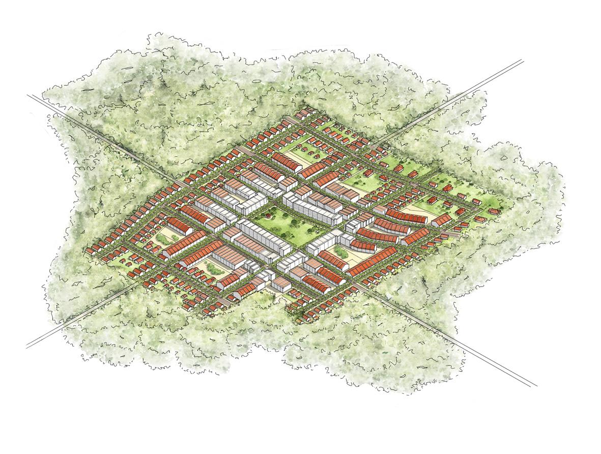
What could this look like?
Growth Nodes
Town Center Village Hamlet
Density & Building Types


 Commercial & Loft Townhome
Cottage House
Denser
Less dense
Commercial & Loft Townhome
Cottage House
Denser
Less dense
Density & Building Types
Denser Less dense
Hamlet [3-5 units/acre]
Village [6-8 units/acre]
Town Center [14-20 units/acre]
Commercial & Loft Townhome
Cottage House
Hamlet RANGE
10-20 acres
3-5 units/acre EXAMPLE
20 acres
80 units [4 units/acre]

Village RANGE
20-40 acres
6-8 units/acre EXAMPLE
40 acres
320 units [8 units/acre]

Town Center RANGE
40-80 acres
14-20 units/acre EXAMPLE
80 acres
1,280 units [16 units/acre]
Growth Nodes


Hamlet
10-20 acres
3-5 units/acre
20 acres
80 units [4 units/acre]
Town Center Village
20-40 acres
6-8 units/acre
40 acres
320 units [8 units/acre]
40-80 acres
14-20 units/acre
80 acres
1,280 units [16 units/acre]
RANGE
EXAMPLE
Mapping Activity
Which areas should be conserved?
Where should growth happen?
Potential Growth Nodes & Conservation Cores

Peachtree City
RockHouseRd OldHwy85
LutherBaileyRd Dolly NixonRd
RockawayRd
St Hwy85 Hwy16
Fayette/Coweta
Boundary
Standing Rock Rd
Main
Leroy Johnson Park Marimac Lakes Park
Cemetery Seavy Street
Coweta Street
Senoia City
Park
Park
Turin
Haralson
Mapping Growth
3,500 units
350 dots
2 units/acre
1 dot = 10 units
