Message from the President
Thoughts on Professional Practice & Education: Professional Partnering with Surveying Programs
Side-Shot From Harrisburg
NSPS: Capitol Contours
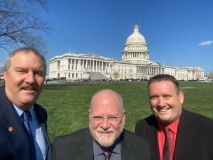
NSPS Day on the Hill
Breaking My Comfort Zone – Going Back to School Later in my Career

Boundaries (Special Virtual Seminar)
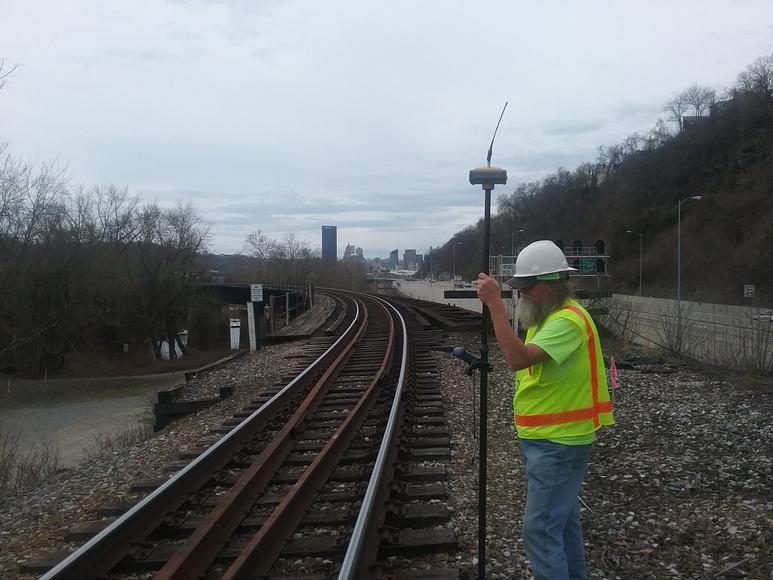
May 8, 2024 from 12PM – 1PM: Railroads
June 12, 2024 from 12PM – 1PM: Manning's Equation for Stormwater Management
Save the date for the 2025 Surveyors’ Conference Hershey, PA | January 12-15, 2025!
Surveying the World Over - It’s a Jungle Out There!
What Are Your Business Succession Options? Here are 5 Strategies to Consider.
Bemused Spouse Accompanies PSLS Member on Surveying-Themed Romp through New Zealand
Member Spotlight: Thomas Hewitt, PE, PLS
Before You Go
We’re just about 2 months past our annual PSLS conference, and I want to ask how many of you have taken my challenge to find a younger surveyor and attended a chapter event with them or gone up to someone you don’t recognize at a chapter event to introduce yourself? Of all the benefits that our organization provides, I believe providing that conduit for us to meet and develop relationships with other surveyors in our area is paramount.
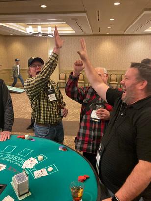
If you were unable to attend the members-only party at the conference you really missed an opportunity to have a good time with your fellow surveyors from all over the state Over 75 members attended the event to catch up with old friends and make new acquaintances while playing cornhole, casino table games, and drinks I think everyone in attendance will agree that it was a great time and one that we plan to duplicate at future conferences
Encouraging chapters to provide more opportunities to get together is one of the goals I’ve set for my term as president Getting together for social purposes, to strengthen and forge new relationships is just as important as learning about a project that utilized some new piece of technology
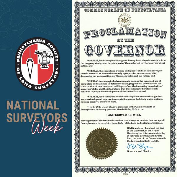
The third week of March is National Surveyors week I look at this week as an opportunity to do a couple of things The first is to advertise who we are Many people don’t know what a surveyor is, and they don’t realize how their everyday lives might be touched by surveyors During Surveyors week especially, but even when it’s not Surveyors week, I encourage you to share the surveying posts about the fun and challenging stories that PSLS and all the surveying organizations post on social media Forwarding a link to a post might cause someone to ask a question or share that story and soon that post will be seen by thousands of people who now have a better understanding of what we do
The second thing I think about during Surveying Week is all the surveyors that have guided my along my path to surveying I encourage you to reach out to your mentors and thank them for helping you get where you are Then, after you’ve thanked the person that helped you get where you are, look for someone that you can help on their journey Teach them what you’ve learned, tell them about your successes and mistakes, bring them to chapter meetings to meet other surveyors But most importantly, help our profession to continue to grow and to protect the public with the service we provide
 Larry Leso, PLS, PE PSLS President

This is the tenth article I have prepared in the series offering thoughts on professional practice and education In this article I advocate for a close partnership between professional members and the regional or state surveying programs
In preparing this article, I draw on over thirty years of teaching in surveying studies. I have taught courses at Penn State University, University of Maine, Florida Atlantic University, and Florida State University Each is different All have strengths and weaknesses With more than fifty years of practice, I have been a member of several state professional societies and national professional societies I have maintained active professional consultation throughout my careers as an educator and military member
I begin with the premise that I believe a surveying program should be a professional program. By professional program I mean a program that offers a focused education providing graduates with skills that are both practical and applicablea program that pointedly leads to a career as a licensed professional Examples of other professional programs at the bachelor accounting, a
I believe the f graduates ab surveying and graduation. I program sho practicing wi upon graduat provide an em profitable for
In previous qualifications this article. S and qualified what an empl and possess
Many faculty lack practical knowledge while often exceling in research knowledge Yet, it is the practical knowledge that is much more important to the employer than cutting edge research knowledge The reason for this disparity in faculty focus is not necessarily the faculty member’s fault University administrators are apt to focus their attention and efforts on increasing the money flowing into the university rather than upgrading the knowledge of graduates leaving the university. For state institutions, much emphasis is placed on obtaining research grants Faculty promotion and tenure is often tied to research dollars Hence, faculty focus their efforts on research rather than practice
In order that students be taught practical and applicable knowledge, there should be a consistent and constant assessment of program courses, course content, and suggested course requirements. This assessment should be done by knowledgeable practitioners of the surveying profession. For ABET accredited programs, this is often done by an advisory committee mandated by ABET continuous assessment requirements

Participation in this advisory committee is usually done by invitation of the program faculty I will suggest that faculty invitations are not always sent to practitioners best able to assess or improve the program content for practical, relevance, and current knowledge. Many are the committees I have seen that seem to be composed of mostly alumni and retired faculty from the program. This makeup of an advisory committee is like asking grandparents, cousins, nieces, and nephews to look for faults in the family tree that are to be made public.
In my experience an advisory committee composed of practical and knowledge members usually provides a great deal of good, practical advice with the added bonus the members can be strong outside advocates of the surveying program when the program seeks donations or is thwarting attempts by the university administration to eliminate or modify the program into something useful for the administration but not necessarily for the program, the profession, or the employer of the graduate from the program
A second method of assuring relevant and practical education of the surveying student is to assess and improve the success rate of students and graduates that take the fundamentals of surveying exam. I believe NCEES does a credible job of keeping the contents of the exam consistent with current practice due in large part by relying on licensing board members and professional input. However, if a program does not require students take the fundamentals of survey exam or use the exam scores for program assessment, this valuable source of assessment is wasted.
A much less effective manner of assuring relevant and practical education of the surveying graduate is through ABET program accreditation By not fully lauding and embracing this avenue, I do not wish to discourage a program from seeking and obtaining accreditation or disparage ABET accreditation The program content guidance available under common disciplines listed within ABET looks at a macro view of the surveying studies rather than focus on a micro view of professional needs As an aside, I am not going to argue or encourage ABET take on a micro view by discipline
Rather, I wish to make a point that ABET accreditation does not assure the program contents of an ABET accredited program are necessarily offering a relevant and practical education sought by the typical employer within the profession. The criteria that ABET accredited programs undergo continuous improvement and periodic assessment, often with the aid of an advisory committee, can help considerably with relevant and current knowledge if the assessment is taken seriously and aid sought from the profession through advisory committee members I hope to write more about the benefits and limitations of ABET accreditation in another article
Having given my opinion, I now offer advice by suggesting that yearly evaluation of program courses and course content be done by a committee composed of members of the profession The committee should take on the role of friendly guidance – much like the bride’s mother for her daughter’s wedding Then again, I may have used the wrong example given stories I have heard about the weddings of others where mothers went way beyond friendly guidance. I shall refine my parallel by adding so long as the bride’s mother is not allowed to take over the planning of the wedding itself.

Let me give some advice in detail I think a committee is best composed of at least one active member of the state surveying profession that is supporting the program such as the immediate past president of the state society If the surveying program is a regional program, a member from each state should be sought Another member should be a current licensed member of the state surveyor licensing board
All other members of the advisory committee should be employers or likely employers of the graduates from the program Large multidisciplinary firms and small firms should be well represented. Public and private sector employers should be represented as well. Donors or potential donors to the program should be welcomed as members. Someone that is willing to back their advice with donations are to be actively sought. For example, including a member that is an equipment supplier that generously donates up-to-date equipment to the program would be wise
Some may fault the perception I have just ‘painted’ that membership on the committee can be bought I would wink and nod while countering with a Jewish saying that: “Life's not as good with money as it is bad without it ” Let me state the intention of this Jewish saying in other terms, “A program that brings money to the university is less likely to be eliminated than a program that costs the university money ”
ABOUT THE AUTHOR
Knud E. Hermansen began his surveying career in the United States Marine Corps over 30 years ago. After completion of basic training, Knud was sent to surveying school and spent the next three years with the 2nd Topographic Platoon, 8th Engineer Battalion performing control surveys throughout the world. After his discharge from active duty as a sergeant, Knud worked for various consulting firms providing a wide range of services involving boundary surveys, site development, and engineering. During the last several years, Knud has provided consulting services in land surveying, civil engineering, and law. Much of Knud’s present consulting activities involve boundary disputes, easements, land development, liability, title, and contract issues.
* Other books and articles by Knud can be found at https://umaine.edu/svt/faculty/hermansen-articles/

Gold Silver Bronze


JHHickmanSurveying,LLC


Thanks to the organizations participating in the Membership Partner Program.

As the Senate and House get ready to return to work from a long recess, I continued to have many discussions and attended several events These discussions focused on our several legislative issues, which are the following:
SB 403 (Licensing Update) removes an existing barrier to becoming a Licensed Professional Land Surveyor (PLS) and Professional Engineer (PE). This legislation makes the necessary updates to be more consistent with the national model law. Currently, in order for an applicant to be granted licensure as a professional engineer or a professional land surveyor, the applicant must hold an Engineering-In-Training (EIT) Certificate or a Surveyor-In-Training (SIT) Certificate and show proof of four or more years of experience in engineering or surveying work performed AFTER the issuance of the EIT or SIT Certificate This legislation will allow the qualified experience to apply regardless of whether it was earned before or after the EIT or SIT certificate. This bill was voted out of the Senate Consumer Protection and Professional Licensure Committee unanimously. The bill was then passed by the Senate by a vote of 48-1. Recently, it was referred to the House Professional Licensure Committee
Secondly, we are working on the Right-of-Entry This legislation will be introduced by PSLS to grant surveyors and their subordinates the limited right-of-entry to the lands of others which are necessary to perform their work. This legislation will be similar to the West Virginia Law which states NO notification is required. Currently, 29 states allow for Right-of-Entry.
Thirdly, we are working on the State Plane Coordinate System Law This legislation will replace the current Pennsylvania Coordinate System Law, P L 1223, No 161, Cl 76 An update of this law is necessary to provide users with a new framework of planar coordinates that are aligned to the new geometric reference frame (AKA horizontal datum) in development by the National Geodetic Survey (NGS) and to allow those users of the State Plane Coordinate System (SPCS) to update/modernize their data while maintaining compliance with applicable Federal guidelines There is a plan in place by NGS to modernize the National Spatial Reference System (NSRS), which is the official definition of positional parameters including latitude, longitude, height, scale, gravity, and orientation throughout the United States The new datum is known as the North American Terrestrial Reference Frame of 2022 and the final definition and acceptance is expected to occur in 2025.
Finally, PSLS will be working on updating the Registration Law (Act of 1945) We will review and make necessary revisions to bring the profession to today’s standards This will address a lot of what we were trying to accomplish in Old House Bill 609
Also, Josh Shapiro, Governor of the Commonwealth of Pennsylvania, proclaimed March 18-24 to be Land Surveyors Week.
With everything that was mentioned above, PSLS will have a very active legislative session
House Session Schedule:
April 8, 9, 10, 15, 16, 17, 29, 30
May 1, 6, 7, 8, 20, 21, 22
June 3, 4, 5, 10, 11, 12, 17, 18, 24, 25, 26, 27, 28
Senate Session Schedule:
April 8, 9, 10, 29, 30
1, 6, 7, 8 June 3, 4, 5, 10, 11, 12, 24, 25, 26, 27, 28, 29, 30
With the amount of legislation that PSLS is attempting to get done and to accomplish our agenda, we must continue to donate to the Political Action Committee (PAC). This will enable us to discuss pending legislation affecting the profession and allow us to protect the interests of surveyors I encourage everyone to consider donating to the PAC so that we can protect our profession!

’ f h h l isit our website at www psls org to donate

A few highlights since our last update include:
On January 23, the Hire Veterans Act, S 3636, was introduced in the Senate to help employ American veterans while strengthening the federal skilled labor force, specifically at the U S Forest Service, National Park Service, and Bureau of Land Management via a pilot program to be initiated by the Office of Personnel Management (OPM) Section 2 highlights Aviation, Forest engineering, Inventory monitoring of land under the management of a Federal land management agency, Landscape restoration, Analysis of geospatial data, Civil Engineering, Hydrology, and Land surveying The House version, H R 7490, was introduced on February 28
On January 31, the Natural Resources Committee in the U S House of Representatives held a hearing on H R 7003, the National Landslide Preparedness Act Reauthorization Act of 2024 which would reauthorize USGS 3DEP through 2028. Introduced on February 8, the Senate bill, S. 3788, would reauthorize 3DEP through 2034.
On February 20, Vice President Kamala Harris and Environmental Protection Agency (EPA) Administrator Michael Regan traveled to Pittsburgh as part of the Administration’s Investing in America Tour to announce $5 8 billion in funding for clean water infrastructure from President Biden’s Investing in America agenda Their announcement brings the total amount of clean water funding announced by EPA from the President’s Bipartisan Infrastructure Law to $22 billion
On February 28, the Senate Environment and Public Works Committee held a hearing on the 2024 Water Resources Development Act (WRDA) featuring the testimony of Michael C Connor, the Assistant Secretary of the Army for Civil Works, and Lieutenant General Scott A Spellmon, the 55th Chief of Engineers and Commanding General for USACE.
On March 7, Rep. John Joyce (R-PA) introduced a "Sense of the Congress" resolution, House Concurrent Resolution (H.Con.Res.) 96, distinguishing the important role licensing of design professionals plays in protecting the public health, safety, and welfare in the current debate over occupational licensing reform The design professions include but are not limited to architecture, engineering, surveying and mapping The resolution, although non-binding, sends a signal to states that they should not affect these professions in occupational licensing reform While the case for reform of licensing in some occupations is desirable, bills introduced in some state legislators are too broadly drafted and fail to exempt or recognize the importance of licensing of design professionals This the introduction of this resolution sends a strong message from Congress to the states that care should be taken to preserve the necessary and legitimate licensing of architects, engineers and surveyors
On April 23, NSPS members including PSLS members are planning to attend the NSPS “Day on the Hill” to discuss the following three issues in Congressional offices: 1) Monument Preservation; 2) Professional Licensure; and 3) DOD Transition Assistance Program (TAP) Pilot in the 2025 National Defense Authorization Act (NDAA).
As Congress continues its work, NSPS will provide updates as part of Capitol Contours with JB


Each year the National Society of Professional Surveyors (NSPS) engages in “citizen lobbying” on behalf of the surveying profession. The society’s efforts help raise the profile of the surveying profession in Congress, as well as educate Congressmen and Senators on legislation that will improve the quality of life of all Americans and serve the public health, safety, and welfare. Past NSPS efforts have proven to be very effective. The enactment of the Digital Coast Act, the National Landslide Preparedness Act, a provision in the Senate’s highway bill, and other legislation supported and impacted by NSPS provide evidence of the success of the society’s efforts.
We encourage as many PSLS members as possible participate in this Day on the Hill on April 23, 2024! You must register by April 3 to participate, please register here. Please note: you may live and work in different Congressional districts, so please provide address information for both your home and office in order for meetings with both representatives, if applicable.
Training Webinar: NSPS will host a training webinar on April 11, 2024 at 2PM ET prior to your meetings and visit to Washington DC to ensure each attendee feels comfortable discussing policy talking points. All NSPS Day on the Hill registrants will receive a link to access the live training webinar one day prior to the webinar (April 10)
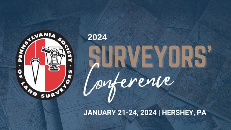
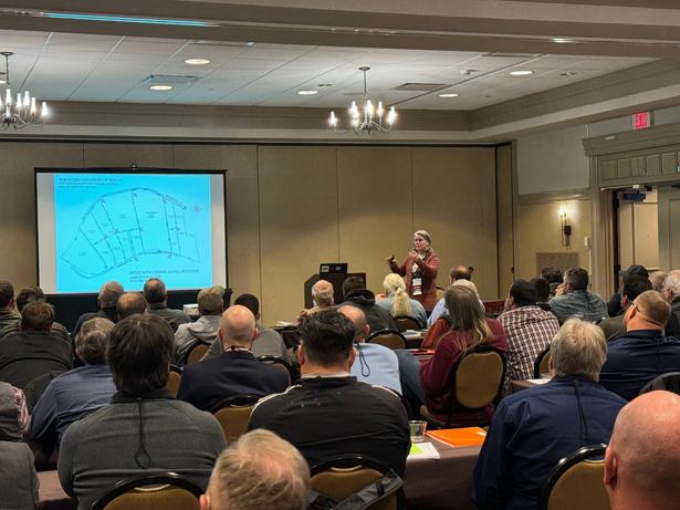
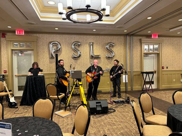
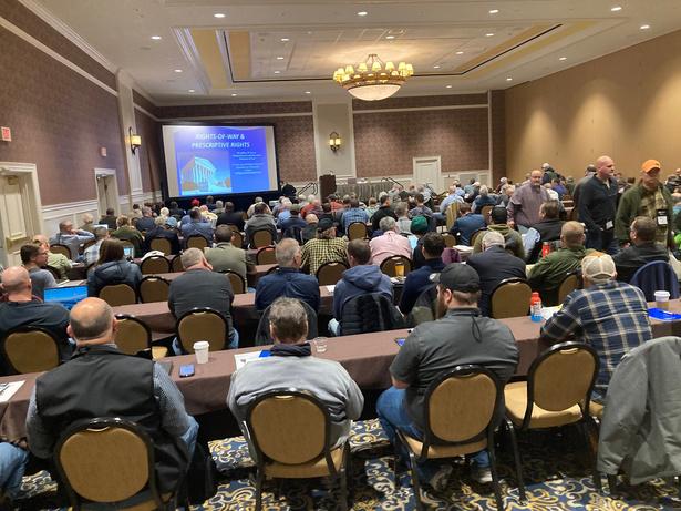
Thanks to everyone that attended the 2024 Surveyors’ Conference in January in Hershey, PA. We had nearly 600 people participate in the conference including attendees, exhibitors, sponsors, speakers, hosts, students, guests, and more!
Certificates have been posted to attendees’ online profiles Click here for instructions on how to access and download certificates All photos elow are a few conference photos


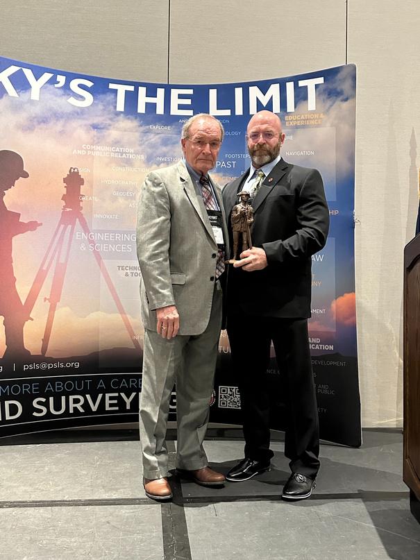
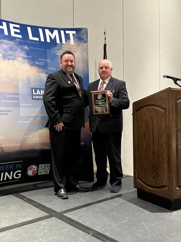
Congratulations to the following award winners that were recognized at the 2024 Surveyors’ Conference
2023 Surveyor of the Year = Terry McMillen Jr., PLS
2023 Chapter of the Year = Laurel Highlands
2023 President’s Award = Michael F Brinkash, PLS
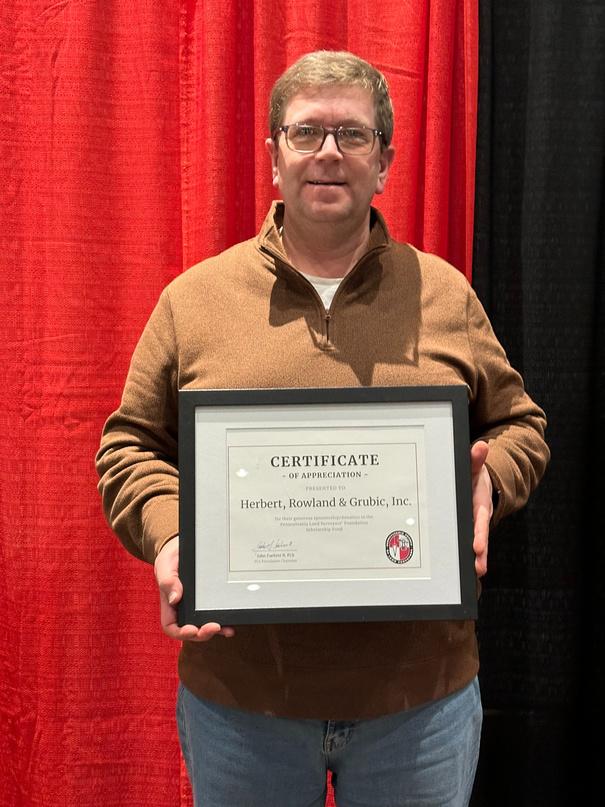
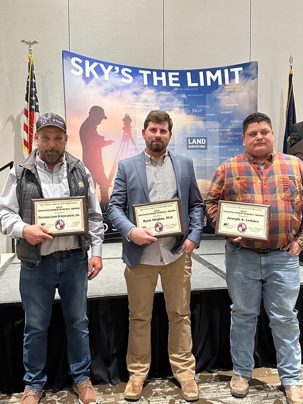
2023 Distinguished Service Awards
Precision Laser & Instrument, Inc.
Rylan Deglau, PLS
Howard D Taylor, PLS
Joseph A Lehner
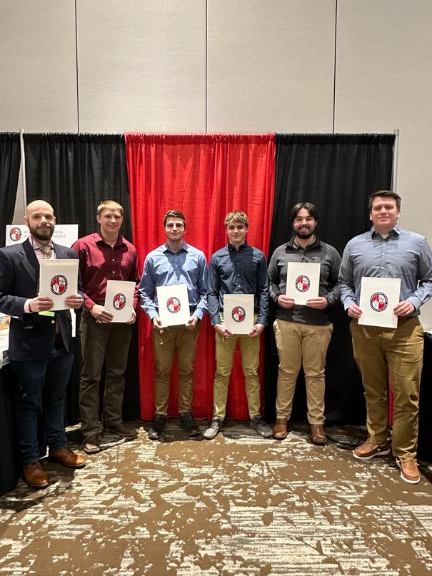
2023-2024 PLS Foundation Scholarship Winners
College Level:
Arthur Busch
Lucas Carpenter
Nicholas Cosper
Nathan Crotts
Andrew Fennell
Luke Jones
Frankie Nocito
Brandon Richie
Tristan Zawalsh
High School Level:
Nathan Chronister
Ethan Hillenbrand
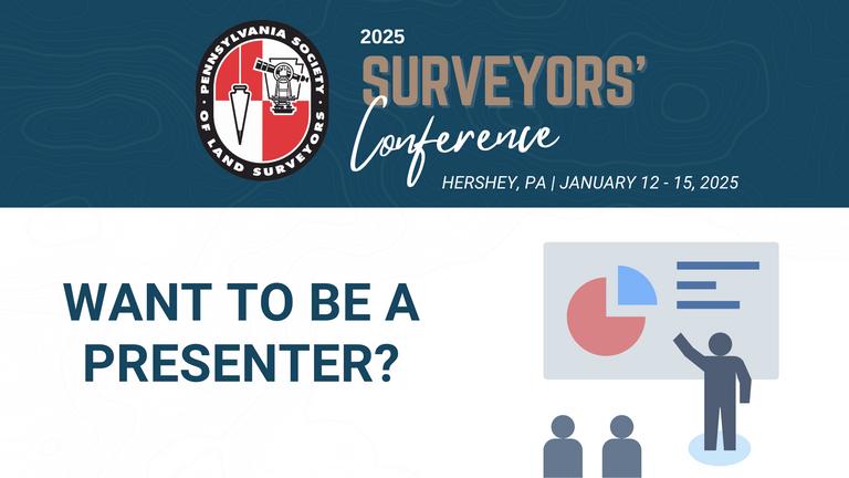
We will be back at the Hershey Lodge from January 12-15, 2025 for next year’s Surveyors’ Conference. We are now accepting 2025 Surveyors’ Conference presentation proposals. If you’d like to present at the conference, please submit your proposal here by April 3
National Surveyors Week was March 17-23, 2024. Check out this video from PSLS President Larry Leso regarding the significance of this important week!
Below is a proclamation for the Pennsylvania Land Surveyors Week from Governor Shapiro
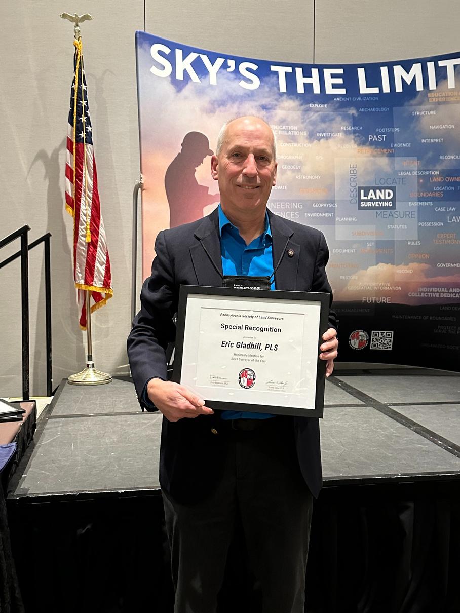
Ralph Winkelvoss is the winner of the photo contest, and Eric Gladhill is the winner of the story contest Each will receive a $100 gift card
Thank you to everyone who submitted
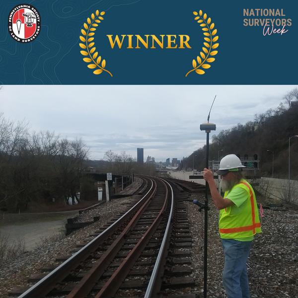
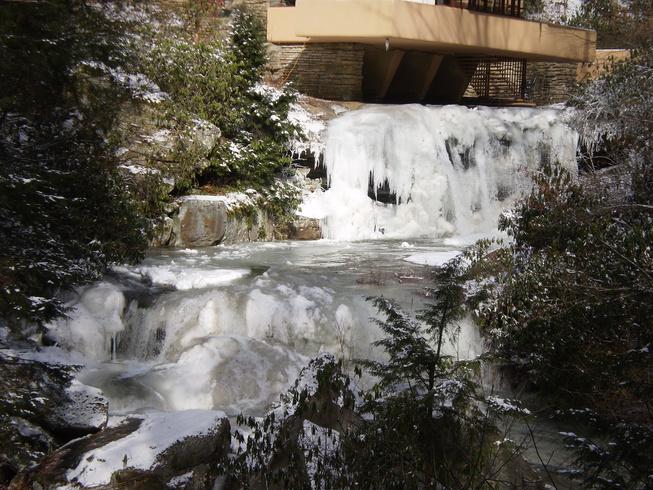
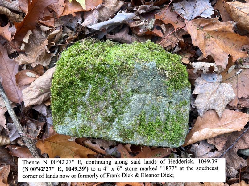
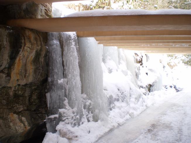
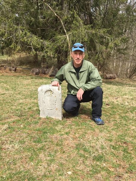
BELOW ARE THE PICTURES THAT WERE SUBMITTED FOR THE PSLS NATIONAL SURVEYORS WEEK PHOTO CONTEST


After being out of school for 26 years, I decided to go back to get my bachelor’s degree in Survey Engineering Technology from the University of Maine at the age of 46
I received my associate’s degree in Civil Engineering Technology from the Pennsylvania College of Technology in 1994. I did not know it at the time, but I would end up spending most of my career working for companies in New Jersey. Over the years I became licensed in multiple states, but New Jersey was not one of them due to their bachelor’s degree requirement.
In 2020 my current company asked if I would consider obtaining my New Jersey license This is something I had not previously considered Going back to school at this point in my career seemed overwhelming; but if we don’t challenge ourselves, we don’t grow After some thought, I agreed to obtain my New Jersey license I informed my employer this would require me to go back to school for my bachelor's degree and that if they were willing to support me, I would be willing to do it
After some research on ABET-accredited programs that would fit my needs and my schedule, I applied to the University of Maine’s Survey Engineering Technology program. I started my second act in academia in the summer of 2020. I was nervous about going back to school after 26 years and being fully online did not make it easier. Blackboard, an online course management system, was new to me, and I quickly felt out of place in this new world of online schooling. The smartest thing I did was to start with an elective to get my feet wet. The History of Rock n’ Roll was the perfect course I have always loved music and figured this course would help me get back into school without too much pressure I didn’t consider that this was an accelerated three-week summer course The work came fast, and I spent every night after work reading, writing, and preparing for tests It was challenging, but I made it through the course One done and many more to go
I found the surveying courses to be challenging but also fun Adjustment Computations had me doing math that I had not used in years Boundary Law taught me to think about certain situations differently than I had been I always felt that boundary was one of my strengths, and now I feel it is even more so
I have made a lot of sacrifices over the last three and a half years as I worked toward my degree. After a long day at work, the last thing I want to do is listen to a lecture, read a few chapters, or do homework. I have given up the time I should be spending with family and friends. I have not had time to watch sports on TV; forget about going to a game. I used to be very involved with the Pennsylvania Society of Land Surveyors (PSLS) on a state and local level I was involved with several committees within PSLS, but school did not allow me time to make a meeting or be involved and I had to put those things on hold
The path has not been easy and at times I wondered if it was worth it In those times, I reminded myself that this was for the long-term and the sacrifices were only short-term I graduated in December, and I have applied to sit for the New Jersey exam I am proud of what I have accomplished Going back to school has made me more focused and a better all-around land surveyor My advice for anyone thinking about going back to school is to do it. I am sure, like me, you have a thousand reasons not to but remember, only when you break out of your comfort zone, can you achieve anything great.


Here are the ground rules: cold showers, warm bottled drinking water, sultry hot humid days, meters (not feet) is the lingo here, quadruple the UV exposure you’re accustomed to, no flushing toilet paper, thick jungle, chiggers and lots of mosquitos with some carrying the virus Dengue. (The cold showers where actually an upgrade from a previous trip where the only way to get clean was with a gallon size bucket of water, soap and a wash cloth.) Last week a ministry staff person was bit while on the property by a poisonous snake and it took 4 different anti-venoms until finding the cure Of all the time spent packing and checking my list twice, can you believe I forgot my snake chaps?
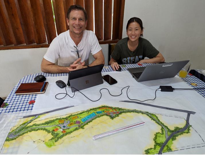
After much travel, my wife and I, the project surveyors, and a team of architects and engineers have arrived at the jobsite in Nauta, Peru We all are volunteers or staff of Engineering Ministries International (EMI) serving a Christian organization called Jungle Master Ministries Nauta is a small sibling to the larger City of Iquitos, the largest city in the world not accessible to the outside world by road The only way to get there is by boat, air or foot
The proposed project is a vocational school campus, with onsite housing, on a property with mostly steep hilly terrain. Our team’s scope of services is to provide a Master Plan showing the proposed development (much like a Land Development Plan here in Pennsylvania), but with much more structural and architectural design and building renderings.
Others on the team include a structural engineer, two civil engineers and four architects Two of the personnel are college graduate interns working towards professional licensure It’s always fascinating to be part of a team of people who are likely meeting for the first time in the airport and are from different states and even countries, coming together and working as a unified team Persons on this trip were from the states of Florida, California and Pennsylvania and the countries of Canada, Mexico and New Zealand We were afforded the opportunity to meet with a local Peruvian contractor who helped the team to understand what construction materials are available and what construction methods are commonly employed
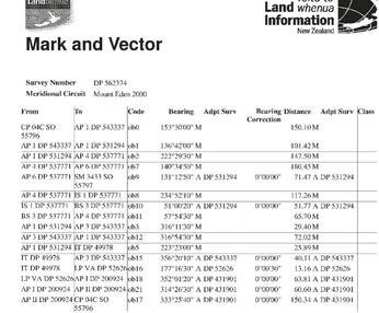
An engineering company located in nearby Iquitos, Peru had provided topographic and boundary survey as well as a site development plan, but the topographic survey work was thought to have serious errors and the proposed site plan did not meet our clients’ expectations. I was sent a copy of their AutoCAD files prior to the project trip. By experimenting using Carlson Survey AutoCAD EOM and exporting to Google Earth, I determined that their survey was on the WGS 84 UTM 18 South Datum or some autonomous position close to that datum A shape file of the boundary and seek points for the property corner locations were loaded onto the data collector in preparation for field survey
Upon meeting with the client in Peru, a copy of a survey report and map from the previous engineer was now in my hands It confirmed that the survey was done on the WGS84 UTM 18 South Datum I quickly scanned the document and maps using an app on my phone so I had them for later reference My Spanish communication skills, predominantly the lack thereof, led me to an app on my phone called DeepL Translate This app is capable of translating a picture of text in one language into 30 different languages in written and verbal form.
As is typical on EMI trips, the surveyors need to work quickly in getting the majority of the survey work completed and base mapping to the team so that they can start determining the layout of the building, roads, water supply system and sewer system. This is a shorter than normal project trip and the team only has four days to design and present a preliminary version of the Master Plan on day five The first day was spent with the whole team on site taking inventory of the site characteristics, identifying the scope and size of the proposed site development and determining what portions of the site will be developed This information was used to determine a topographical survey limit My goal was to have a basemap to the team by the end of the second day
Day Two; the much-anticipated field survey time has arrived. We wake up to a downpour, but why not, it is rainy season here in the Amazon Rainforest By 8:30 am the rain has become lighter and actually felt nice and cool in comparison to the blazing hot sun felt on other days The survey team has now increased to also include two Spanish speaking Peruvian bush whackers named Andy and Nelson (the person who was recently bitten by the poisonous snake) armed with machetes and a Spanish translator named Peidro A Trimble R10 base station was setup over a maghub with a plastic disk on an autonomous position and logging static data, while running an R12i RTK
The property corners forming the property lines closest to the proposed improvements were searched for and found within 2 meters of the seek points loaded on the data collector; not bad for an autonomous setup. Fortunately, in a previous boundary retracement of the property, tall concrete monuments were erected at the corners and spaced every 10 meters online. Three property corners were located and my measurements between them were consistent with the previous survey provided to me.
Topographic survey of the most critical portions of the survey limit were obtained Features were located such as the existing home, water tank, well, edges of jungle, large trees in the clearing, biodigester and driveway
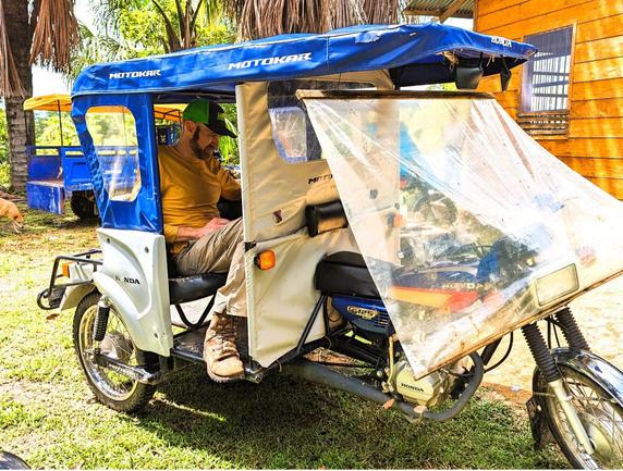
Lunch was being served around 1:30 pm, which I’m finding is typical in Latin American countries By this time, the most critical field data was collected and my 6’-5” tall frame squished in the back seat of a Motokar (a three wheeled motorcycle used to transport people) with my laptop in hand as a temporary office preparing the first version of the basemap in AutoCAD By 4:30 p m the first iteration of the basemap was complete and emailed to the rest of the team Day Two mission accomplished!
The following days consisted of additional iterations of field survey, processing and upgrades to the initial basemapping that were sent to the team with an expanded limit of survey and specific information requested by the design team. OPUS was used to refine the position of the survey from the original autonomous position to the WGS 84 UTM 18 South Datum
The survey results were compared with the previous survey and the suspicion of the client was correct that there were errors in the topographic survey done by the local consultant These errors would have had a major impact on the proposed development site planning Benchmarks were established onsite for future layout of the campus infrastructure
The civil engineers designed a water and wastewater system for the campus, planned for erosion control and designed the roadway. The structural engineer determined the types of structural components to support the buildings and water tower The architects determined the types, sizes and positioning of the buildings using 3-dimensional modeling On Day Five, the Master Plan was presented to the Ministry leaders using PowerPoint, who were very pleased with the results Jungle Master Ministries can now move forward in confidence with a cost-effective design that meets their goals and vision for the school campus to benefit the community of Nauta
This has been my fifth international land surveying trip volunteering through EMI Other project trips have been in the Dominican Republic, Chile, Paraguay and Liberia (Africa). Every project trip has been different and a unique learning experience. A highlight on the Liberia trip was that our team was accompanied by five of the top engineering students from a Liberian university to job shadow us. I had the opportunity to teach them how to do surveying using GPS and a total station where they were doing the work. They related to me that the university they attend had only one total station and none of the students were allowed to even touch it. How blessed we are to have the quality of hands-on education that we do in the United States
EMI typically serves under-developed parts of the world and is a Christian non-profit made up of architects, engineers, surveyors, and construction managers who value Design, Discipleship, and Ethnic Diversity EMI’s worldwide mission is to develop people, design structures, and construct facilities which serve communities and the Church facilities like hospitals, schools, water systems, and more EMI also provides internships and fellowships for young professionals
If you’ve ever had the desire to use your skill set for the benefit of serving those less fortunate than yourself, EMI may be of interest to you. More information at https://emiworld.org/
Succession planning is a crucial process for any business owner looking to secure their company's future, whether through family transition, employee buyouts, or external sales. This guide outlines five primary strategies for successful business succession, each with its unique considerations and benefits.
1 Transfer the Business to a Key Employee(s): Transferring the business to a key employee(s) requires careful consideration of time constraints, valuation, financial objectives, and structuring the buyout to ensure access to capital for employees. Exploring alternative paths like Salary Continuation Plans, Deferred Compensation Plans, or Qualified Retirement Plans can help mitigate tax implications and assess the feasibility of the transition While this approach may not yield the highest price for the business, it often offers advantages over family transitions and can be a viable option when transitioning to a family member
Keep the Business Within the Family: When considering keeping the business within the family, two methods are typically explored: hiring a professional management team or passing the business to adult children Method A involves building a professional management team with formal responsibilities and accountability structures, while Method B involves transferring ownership to adult children, which often requires addressing communication gaps, value-versus-control issues, and managing different financial personalities Both approaches necessitate careful planning, communication, and consideration of factors such as business transfer structuring, stock recapitalization, equalization of inheritances, and management of diverse financial behaviors, requiring professional expertise to achieve optimal outcomes while ensuring family harmony and financial efficiency.
2. Utilize Employee Stock Ownership Plans (ESOPs): Employee Stock Ownership Plans (ESOPs) offer a complex yet potentially advantageous method for transitioning business ownership to key employees, including family members Despite the intricacies involved, ESOPs provide design flexibility and tax benefits for both sellers and buyers, although the price is typically based on the appraised rather than the highest value However, establishing and maintaining an ESOP can be costly and intricate, offering options for phased selling, owner control retention, post-sale involvement, tax-deferred exchanges, and deductible monthly payments, while fostering increased loyalty, camaraderie, and productivity among employee-owners.
3 Selling to or Partnering with a Private-Equity (PE) Company: Selling to or partnering with a Private-Equity (PE) company is often favored for its potential for higher prices compared to other options like family sales or ESOPs, but it requires careful planning and attention to post-sale considerations Decisions must be made regarding whether to sell all or part of the company, how to structure financing, and defining terms such as earnings, while also considering the timeline for future sales and potential changes in roles for yourself and your family within the company Expert negotiation skills and a cohesive team are crucial for navigating these complexities
5
4. Sell to or Partner with a Strategic Competitor: Selling to or partnering with a strategic competitor often yields the highest price due to their familiarity with the business and willingness to pay a premium, with potential for the seller to maintain involvement at a chosen level Considerations for such a deal resemble those of a Private-Equity (PE) deal, albeit with a potentially longer timeline and clearer future outlook for the company. Initial steps in this transition involve determining post-sale financial needs, completing estate planning, considering gifting strategies, ensuring financial and legal readiness for due diligence, assembling a competent advisory team, and evaluating the potential value and costs associated with hiring an investment banker.
Effective succession planning demands early and thorough preparation, understanding of financial and legal implications, and alignment with personal and business goals Regardless of the chosen path, integrating succession planning into the broader financial strategy ensures a smoother transition and secures the business's legacy for future generations
Please contact Legacy Planning if you are interested in taking your first steps to preparing for this transition https://www legacyonline.com/robert-wermuth/
PSLS member Kevin Brockett recently satisfied his lifelong ambition of visiting the beautiful Pacific nation of New Zealand While there, he enjoyed the distinct privilege of meeting several local land surveyors and learning about New Zealand’s land surveying history and practices. His wonderful spouse also learned many of these same things, although in her case it was less by design and more as the result of circumstantial proximity to somebody with an excessive enthusiasm for the geospatial sciences.
Kevin, a member of the Southwest Chapter of PSLS, and his wife, Alice, left the United States on November 23rd aboard a direct flight to New Zealand’s largest city of Auckland Following fifteen uninterrupted hours in the air, they arrived on November 25th, having never encountered November 24th due to the peculiarities of transit across the International Date Line This time-travel adventure would later be balanced by the couple’s subjective experience of a December 12th that lasted for forty-two continuous hours (Members of the Flat Earth Society are invited to explain to Kevin how this phenomenon can be reconciled with their preferred perception of reality )
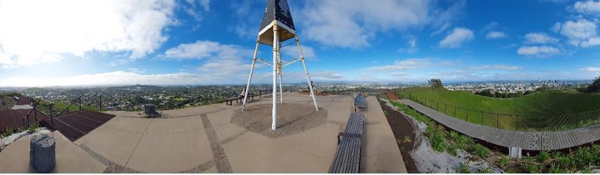
Upon checking into their first hostel near downtown Auckland, the desk clerk suggested local points of interest worthy of a visit, including the relatively nearby summit of imposing Mount Eden, a dormant volcano overlooking the city. Kevin and Alice rose early the next morning and started walking across town with the sunrise. Along the way, Kevin engaged in his customary habit of mumbling, “ survey nail,” every time he noticed a survey monument or control point in the sidewalk. Alice encouraged this behavior with her usual saintly patience. A few kilometers of strolling through the city’s streets brought them to Mount Eden, which they ascended via well-maintained pedestrian paths through public green spaces
Arriving at the peak, they were amazed by the beautiful three-hundred-and-sixty-degree views of the entire verdant region, extending far into the distance Benches spread around the perimeter of the wide viewing platforms offered respite to visitors who felt the strain of the climb As they relaxed and admired the surroundings, Kevin noticed an unusual structure at the highest point of the broad summit, thinking that it looked a lot like an old geodetic triangulation station Subsequent investigation would validate this suspicion, revealing that they had stumbled across the extant principal station that was employed by New Zealand’s early geodetic surveyors. Indeed, this very station remains the datum point for the coordinate system that serves to define positions across the greater Auckland and Northland regions.
Alice and Kevin leisurely descended Mount Eden, sighting tui birds and a wild parrot as they returned to their hostel They paused near the end of this trek by the intersection of Karangahape Road and Ponsonby Road at a survey marker vault that Kevin considered to be especially remarkable Alice complied with his request to be photographed next to the vault, having long since become inured to her husband’s eccentricities This photograph became one of Kevin’s favored mementos of the trip
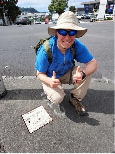
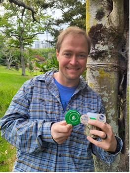
THE AUTHOR, DEMONSTRATING THE ENTHUSIASM WHICH LAND SURVEYORS COMMONLY EXHIBIT UPON DISCOVERING SURVEY MARKERS IN UNEXPECTED PLACES
The day after their encounter with the Mount Eden datum point, Kevin and Alice boarded a train on a scenic railway that carried them from Auckland all the way to the capital city of Wellington at the southern end of the North Island. This twelve-hour journey passed through stunning and seemingly endless landscapes that belied Kevin’s previous underestimation of the country’s vastness. Throughout the day, an audio commentary track provided passengers with cultural and historical background regarding the areas that they passed One particularly notable anecdote was related as the train approached the National Park region
During the late nineteenth century, completion of the country’s North Island Main Trunk railway line was stymied by topographical challenges presented by the interface of a major volcanic plateau with a river valley system The interposing slopes were apparently too steep to permit construction within the gradient constraints that were required by the railroad’s designers. Project engineers proposed various alternative routes and design compromises that were determined to be either unworkable or cost-prohibitive. At last, the project was saved by a government surveyor who carefully inspected the problematic landforms. He overcame the obstacle by proposing an unusual spiral alignment that would cause the track to loop backward upon itself in order to adhere to the gradient limitation The resulting Raurimu Spiral remains in regular use to the present day and has been noted for its masterful utilization of the landscape’s natural topography
In Wellington, Kevin and Alice explored some of the city’s fascinating heritage, including New Zealand’s national museum, Te Papa Tongarewa Departing the harborside Te Papa one morning, Kevin observed a survey crew setting up nearby As the party chief stood casually by his instrument while the rodman busied himself with something in the distance, Kevin seized the opportunity to introduce himself as a fellow surveyor and strike up a conversation with the party chief They talked about equipment brands, with the friendly instrument operator stating that his firm’s usage of Leica instrumentation was an outlier, given that most Wellington-area firms employed Trimble’s hardware.
Mentioning the preceding day’s strong winds, Kevin asked if such conditions were an impediment to working in the area The party chief replied that his crew regularly employs heavy sandbags to stabilize tripods when surveying around “windy Wellington,” and that local surveyors know to anticipate “three-seasons-in-a-day” weather conditions He went on to explain that his present task related to a major survey of the entire wharf district, which would serve to inform the design of an illumination improvement scheme He suggested that the impetus for this project derived from a recurrent issue with late-night revelers who drunkenly fall into the harbor and then attribute their consequent dampness to inadequate lighting along the water’s edge.

THE AUTHOR AND HIS TRAVELING COMPANION IN “WINDY WELLINGTON”, ALONG THE HARBOR INTO WHICH TIPSY TIPPLERS TEND TO TIP FROM TIME TO TIME
An inter-island ferry ship transported Alice and Kevin from Wellington across the Cook Strait – so-named for the famed navigator and surveyor, Captain James Cook – to the pleasant town of Picton on New Zealand’s South Island Picton is home to numerous historical exhibits, displays, and museums, several of which are dedicated to Captain Cook, who spent a significant amount of time in this vicinity during each of his three voyages of exploration around New Zealand. As in any vibrant community, surveying has remained a vital activity in Picton. Kevin observed a surveyor in front of his hostel on Auckland Street who was using an R10 GNSS receiver to locate the curbing. An attempt to engage this gentleman in dialogue failed when the surveyor expressed his disinterest in interrupting his work to exchange pleasantries with a bothersome tourist
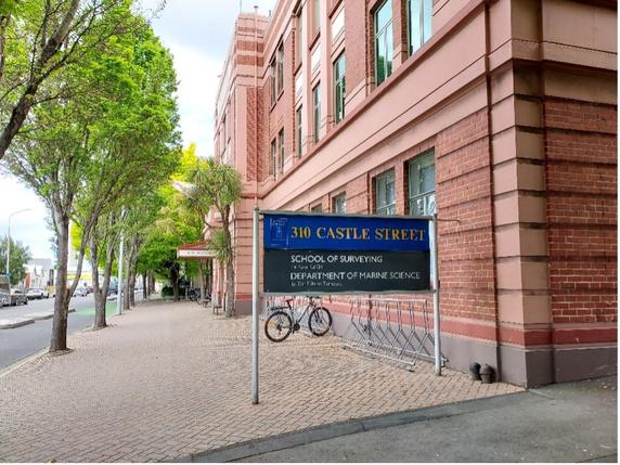
From Picton, Alice and Kevin traveled by rail and bus along the South Island’s eastern coast until they arrived in the city of Dunedin, which is home to New Zealand’s oldest institution of higher learning, the University of Otago. Otago houses the country’s National School of Surveying, which – among other responsibilities – maintains the only curriculum that is approved to satisfy the educational qualifications required to become a Licensed Cadastral Surveyor in New Zealand Kevin made an appointment to call upon the faculty in this department and was welcomed by several instructors who undoubtedly had more important demands upon their time but nevertheless graciously received him and entertained his curiosity on a variety of subjects
Dr Paul Denys, a soon-to-retire Senior Lecturer whose research interests include geodesy and precise GPS measurements, spoke with Kevin at length regarding the School’s curriculum and courses, which incorporate the most modern geospatial theories, technologies, and methods. A bookshelf in Paul’s office showcases many of the intriguing research papers that his postgraduate students have completed over the years.
Professional Practice Fellow Richard Hemi shared a wide-ranging discussion with Kevin, through which Kevin learned more about Landonline, the geospatially-accurate national cadastral system that demonstrates how the term “GIS” doesn’t necessarily have to mean, “Get It Surveyed”, despite insistent claims by some American surveyors Landonline is administered by a government agency known as Land Information New Zealand (LINZ), which is responsible for managing land titles, geodetic and cadastral survey systems, and other geospatial data.
The old survey books shelved in Richard’s office recalled similar tomes back in Kevin’s office, leading to recommendations for biographies of notable historic New Zealand surveyors such as Archie Bogle and John Turnbull Thompson They also discussed more contemporary issues, such as potential approaches to addressing the problem of workforce development in the field of surveying, an issue no less pressing in New Zealand than in the United States.
Richard introduced Kevin to Emily Tidey, the School’s Hydrographic Surveying Lecturer, who described her work and the School’s research into many aspects of hydrography Her ability to clearly communicate the subtleties of her discipline to an ignorant landlubber (i e , Kevin) demonstrated her mastery of a field that holds vital importance to a maritime nation surrounded by the Pacific Ocean Incidentally, Kevin continues to labor without success in his effort to construct a reasonably clever pun that would relate Emily’s last name to her professional specialty; he remains confident that one must exist, somewhere just beyond his grasp
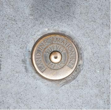
After finally concluding this enlightening visit to the National School of Surveying with grateful thanks to the faculty members who had been so generous with their time, Kevin meandered through the busy streets back to his accommodations in central Dunedin In so doing, he passed a brass LINZ monument that was embedded in a sidewalk as a physical manifestation of the modern cadastral system, about which he had just learned.
Leaving Dunedin a few days later, the American couple continued their travels through New Zealand by taking a bus to Queenstown, where Kevin enjoyed pointing out for Alice’s inspection several survey control stations associated with a pavement project that was progressing on the street where their hostel was situated. A domestic flight from the Queenstown airport then returned them to their point of beginning in Auckland, where they had a few more days to relax before embarking on the jet back to their native hemisphere.
Some months prior to traveling to the far side of the world, Kevin had connected with a stranger on the Internet through the LinkedIn account for the Survey and Spatial New Zealand professional society Kevin and this stranger corresponded by email, discovering a common interest in surveying history, and when Kevin disclosed his travel plans with an invitation to meet for tea, the stranger replied with an offer to take Kevin and Alice on a guided personal tour of Auckland With willful disregard for basic Internet safety protocols, Kevin immediately accepted this offer Alice’s response to Kevin’s announcement of a budding friendship with an unconfirmed surveyor from the Internet was along the lines of, “Okay, sure, great, but if we don’t get murdered, then I want to go see Hobbiton before we leave New Zealand ” An agreement between the spouses was thus struck, notwithstanding Kevin’s suspicion that the world of J.R.R. Tolkien had little to do with land surveying and was therefore likely to be dull.
Fortunately for all involved, it transpired that Kevin and Alice were not being catfished. Two mornings before their return to North America, the person who arrived to pick them up from their hostel was the gentleman whom he claimed to be: Mr Don McKay, a gregarious retired surveyor who had spent a productive career in private practice around Auckland Don has long participated in his professional society’s activities, including through a number of publications His current professional endeavor is an effort to prepare an annotated list of all books that have been published in New Zealand on the subject of land surveying He divulged to Kevin that although he initially estimated that this list would include approximately thirty books, the number has now surpassed two hundred and has yet to become exhaustive
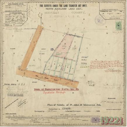
Immediately following their in-person introduction, Don drove Kevin and Alice to the iconic Auckland Museum. There he introduced them to his colleague, Andrew Blackman, an active licensed cadastral surveyor whom Don had invited for the occasion. Andrew and Kevin quickly bonded over the copies of plats that Andrew had brought to demonstrate how survey drawings in the Auckland region have evolved over time, from the early twentieth century until the present day. The older plats bear a remarkable similarity to the highest-quality American exemplars from the same era, at least within the limits of the author’s personal experience Even the units of measurement on older New Zealand plats are familiar to an American surveyor, which should not be surprising when one considers that both nations share a common surveying heritage and it was not until the 1970s that New Zealand succumbed to France’s neo-imperialist conspiracy of metrification
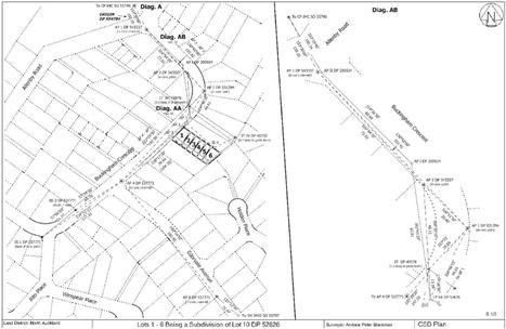
Modern New Zealand plats are prepared in conformance with strict guidelines that allow information to be seamlessly integrated into Landonline. Submissions to the cadastral system must include specifically-formatted measurement data, which is presented as a digital file that accompanies the actual drawing In some respects, this format has reduced the artistic character of plats, such as through enforced restrictions against the varied colors that characterized older plats, but it is difficult to discount the myriad advantages afforded by the standardized system Upon acceptance into Landonline, new subdivisions of land are immediately incorporated into the official cadastre and their information becomes available for reference and use, which represents an effective organizational structure that stands in stark contrast to the many jurisdictional idiosyncrasies of the cadastral patchwork in the United States
Andrew’s fascinating overview of Auckland-area survey plats was of a regrettably brief duration due to his other commitments on that particular Sunday, but he cheerfully shared copies of his plat examples for Kevin to keep. Prior to Andrew’s departure, Alice captured a photograph of Kevin with Don and Andrew in front of the Auckland Museum’s tyrannosaurus rex display.
BEMUSED SPOUSE ACCOMPANIES PSLS MEMBER ON SURVEYING-THEMED ROMP THROUGH NEW ZEALAND - CONTINUED
A SURVEY DRAWING FROM A 2022 SUBDIVISION PLAN SET FOR THE NORTH AUCKLAND REGION (IMAGE COURTESY OF ANDREW BLACKMAN)
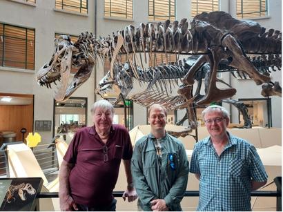
“I’M NOT THAT BLOODY OLD,” SAID DON MCKAY, WHEN ASKED TO POSE FOR A PHOTOGRAPH IN FRONT OF A DINOSAUR SKELETON (LEFT TO RIGHT: DON
ONE OF THE GEOSPATIAL DATA SHEETS FROM THE SAME 2022 SUBDIVISION PLAN SET REFERENCED ABOVE (IMAGE COURTESY OF ANDREW BLACKMAN)
Don acted as docent for a whirlwind tour of the museum’s exhibits before leading the Americans outside to a small park area, where he undertook to educate Kevin with a short dendrological seminar This lesson imparted the knowledge of the native kauri tree’s superior characteristics as a source of carved survey pegs It also disabused Kevin of the idea that the distinctive and ubiquitous Norfolk Pine tree is native to New Zealand (Shockingly, the Norfolk Pine is a native of Norfolk Island )
From the Museum grounds the trio left for an extended drive around the greater Auckland region in Don’s Honda. Over the next several hours, Don highlighted numerous local landmarks and items of note. These highlights included the most expensive street in Auckland, where houses sell for five to ten million dollars; this street is remarkable for the large trees growing through the roadway’s pavement, which are protected from removal by restrictive deed covenants The tour paused long enough for lunch at Don’s house with his lovely wife, Bronwyn, who could not have been more welcoming to the two travel-bedraggled strangers whom her husband invited into her home
Throughout the day’s tour, Kevin and Don conversed on a variety of survey matters while Alice bravely endured in the car’s backseat with only the dazzling scenery to sustain her Among many other things, Kevin learned that the familiar rules of construction apply to surveying questions in New Zealand just as they do in the United States, such as in the priority of an original survey monument over record measurements.
When at last the wide-ranging excursion with Don McKay drew to a close, Kevin could only offer a wholly inadequate expression of sincere gratitude for the older surveyor’s unbelievable cordiality and generosity toward two visitors from a foreign land
Before catching a shuttle to the airport for their flight home, Alice and Kevin spent their final morning in New Zealand searching for a geocache among the sprawling expanses of Auckland’s Western Park Once Alice succeeded in locating the jar that had been hidden in a hollow tree, Kevin pulled from his pocket a few wooden tokens that he had carried from home The tokens were printed with the logo of the National Society of Professional Surveyors and had been personalized with an ink pen to note one of Kevin’s professional surveyor license numbers If another geocaching surveyor should happen across one of these tokens in the future, hopefully she will track down Kevin to share her own story of adventure.
On the topic of adventure, Alice did get a chance to channel her inner Bilbo Baggins on the day before the return flight, when she and Kevin finally went to Hobbiton, all the way there and back again Kevin was forced to admit that he was quite impressed by the hobbits’ spectacularly detailed and meticulously maintained homes, even if none of the resident halflings evinced an interest in the noble profession of land surveying
Their trip to New Zealand far surpassed whatever expectations Kevin and Alice had harbored when they began planning their vacation Beyond the memories of the amazing landscapes, food, travel experiences, and wildlife encounters that are all stories for another time, they cherish the unforgettable interactions with the exceedingly kind and hospitable people whom they met along the way They can only hope for opportunities to pay forward the boundless good will with which they were showered by wonderful New Zealanders.
The author is a licensed professional land surveyor who is employed as the Survey Practice Leader for Triad Engineering, Inc , at the firm’s location in Morgantown, West Virginia He is a member of both the Southwest Chapter of the Pennsylvania Society of Land Surveyors and the Mountain Regional Chapter of the West Virginia Society of Professional Society of Surveyors, and he presently serves as the NSPS Director for the West Virginia society. He is extremely fortunate to be married to someone who unfailingly encourages him to pursue his interests.


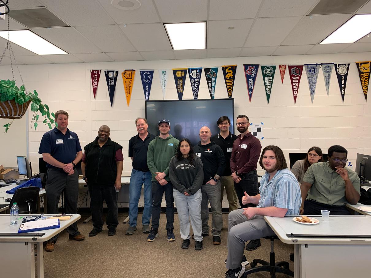
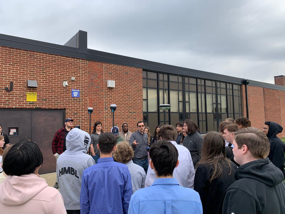
On Wednesday March 20th members of the Bucks Chapter of PSLS met with the Bucks County Technical High School Surveying class (which now has a High School Student PSLS Chapter) Representatives from the Penn State Wilkes Barre Campus Surveying Program and their Student Chapter of PSLS gave a great presentation to the students. JMT Engineering and Surveying happened to be at the school’s career fair and stopped in to give a presentation of career opportunities at their firm. The Bucks Chapter of PSLS sponsored the pizza luncheon for everyone. Representatives of the following local firms attended and shared their personal career experiences with the students- Dumack Engineering, Gilmore and Associates, Kelly Engineers and Surveyors, Rodriguez Consulting and SAS Geospatial. This was a great way to celebrate Surveyors Week!
Tell us a bit about yourself.
I’m originally from Greensburg, PA, but I grew up in a town in the Poconos called Gouldsboro. My family moved back around Greensburg when I was a sophomore in high school, and I’ve lived in the area since. In high school I worked for a construction company where I decided I wanted to be a part of this industry, so I attended West Virginia University and obtained my BS in Civil Engineering. Throughout college I worked multiple part-time jobs and internships and was introduced to the surveying aspect of construction. Thankfully, it was early enough that I could enroll in additional surveying courses in hopes of becoming dual-licensed. I ultimately decided to stay with one of the companies where I interned, Pennsylvania Soil & Rock, Inc. (PS&R), and I am now dual licensed as a PLS and PE. I reside near Latrobe with my two German Shepherds, who take up most of my time.
What is the most unique project you have worked on, and why?
Working for a predominately geotechnical investigative firm, I have worked on quite a few unique projects. The one that stands out is an elementary school which has endured upheaval and movement due to potentially expansive shale under the foundation. We were hired to perform the geotechnical analysis, and I was involved in providing routine settlement monitoring surveys throughout the interior and exterior of the building. The project involved multiple traverses and calculations to relate the distress to undisturbed benchmarks. At the time I had never been exposed to such a structure in distress (gaps and cracks in the block wall over an inch wide), let alone in an elementary school. Being on the back end of something so impactful to a community really puts this industry into perspective. Did you have a mentor, and if so, how did it affect your career?
Yes, and I still have multiple mentors. My first and primary mentor was William A. Roth, PE, PLS at PS&R. Throughout my SIT years he demonstrated the laws, regulations, and ethics of this industry exceptionally well. Unfortunately, Bill was “semi-retired” for my whole career, and old enough to have obtained his PLS by application without examination, so in-the-field experience with him was limited as I’m sure you can imagine. I think he was happier and more relieved than I was on the day I called him to tell him I passed my PLS exams. I still routinely coordinate with Bill on complex issues, and I’m forever thankful for the experiences and education I’ve gained working with him.
I have met multiple reputable surveyors having attended the PSLS events and conferences. One of whom, Amy Hopkins, PLS (of Urban Terrain), I recognize as another industry mentor. I routinely reach out to her with dilemmas or questions and she’s always glad to help. I believe it’s important to engage with mentors outside of your immediate workplace.
What advice can you give to young surveyors?
Work as much as possible and don’t limit yourself. There is no substitution for real-world experiences in this industry. I believe in higher education and pursuing a degree, however it’s important to do so while gaining practical experiences outside the classroom. Don’t limit yourself to just one company or mentor – every surveyor has their own unique experiences to learn from. And get involved as much as possible with PSLS and your local chapter, networking goes a long way.
A top benefit for me has been the ability to become dual-licensed at such a young age and seeing the doors that it has opened for me. Licensed surveyors are becoming scarce, even being on track to eventually sit for your exam makes you extremely valuable in this profession. Aside from that, having a career in the environment you enjoy/choose – the office, field, etc. and the experiences you’ll gain along the way is invaluable.
Tell us an interesting or funny surveying story.
There are two that come to mind. The first is regarding the unique project I described. We had several subsequent surveys spread out throughout the year to monitor the movement; some of them occurring during the winter months. The data was showing that the exterior brick of the building would lift during the winter months upwards of about 1/2 inch, especially days there was snow on the ground. We double-checked our benchmarks, and even set additional benchmarks even further away. Somehow the interior monitoring locations weren’t moving, while the exterior was. This perplexed us, and after multiple re-surveys and company meetings we chalked it up to frost heave. When discussing the project a few years later, the rodman who held the level during the surveys said “well if it’s only 1/2 inch that’s probably the thickness of my gloves,” needless to say I never thought to consider his winter gloves or tell him to take them off when holding the level on the brick ledges. And I don’t know why he waited years to tell us.
The other story is when Amy Hopkins invited me and my significant other to Urban Terrain’s Christmas party. I thought this would be a great introduction for her to meet the people I associate with in this profession. We were enjoying dinner and conversation when Amy came over to sit down to talk with her. The first thing Amy does is call her by the wrong name… needless to say, it was a long and quiet ride home. I guess more advice for other young surveyors is to never call your significant other by the wrong name.
Thomas Hewitt, PE, PLS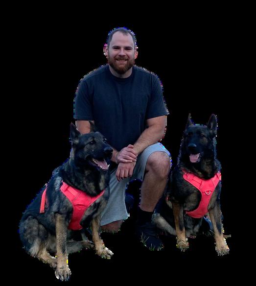

Survey Technician - C.S. Davidson, Inc. - York and Gettysburg, PA
Land Surveying Party Chief - Hillcrest Associates, Inc. - Landenberg, PA
Professional Land Surveyor - Edward B. Walsh & Associates, Inc. - Exton, PA
Professional Land Surveyor - Dennis E. Black Engineering, Inc. - Franklin County, PA
VIEW MORE EMPLOYMENT OPPORTUNITIES
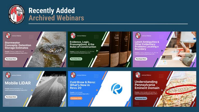
Are you looking to expand your professional development? The Pennsylvania Land Surveying Institute (PLS Institute) is a hub for recorded webinars on essential topics to the surveying profession
PLS Institute recorded webinars are eligible for credit/Professional Development Hours (PDHs) in Pennsylvania We hope this allows you to learn and earn credit/PDHs when it is most convenient, to further your professional development at your own pace.
There are currently fourteen archived webinars available for purchase Pricing is $50 per hour for members and $70 for non-members. The webinars vary in length from 1-3 hours. Make sure to log into your PSLS online account to get the member discount
Check out the books available through the PSLS store here.
Do you want some PSLS apparel?! PSLS now has button-down business shirts and crew neck sweatshirts available in the PSLS online store Thanks to the Delaware Valley Chapter for coordinating the creation and distribution of this apparel Get your new PSLS apparel before it sells out!

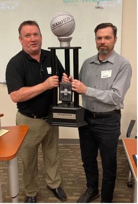
The 3rd annual PLS Foundation Fantasy Football League was a success $1500 was raised through Fantasy Football to support the Foundation’s scholarship programs
Mike Given’s team “Big Mikes Posse - It’s a Given” won the league Mike was presented with the trophy at the 2024 Surveyors’ Conference in Hershey, PA on January 22
Thanks to all the teams below that participated (in no particular order).
Urban Distilling (Randy Miller)
Legion of Doom (Richard Shewman)
Team Brothers (Pete Brothers)
Step2TheSide (Michael Kreiger)
Philly Philly Spellmania (Dave Spellman)
Urban Bourbon (Logan Sayre)
Ghost Riders (Katherine Shewman)
PLI n’ at (Chris Walker)
Urban Terrain Utes (Derek Horneman)
King Henry’s Surveyors (Christine Kent)
Big Mikes Posse It’s a Given (Mike Given)
Control Pnt FT Warren, NJ (John Lynch)
Once again PSLS has organized a March Madness Challenge to benefit the PSLS Political Action Committee (PAC) We have nine participants in the men’s NCAA bracket challenge Good luck to the people below The winner will get a March Madness trophy!
Mark Amirault
Ryan Deglau
Amy Hopkins
Mark Hummel
Mike Given
Troy Leighty (last year’s winner)
Terry McMillen Jr
Taylor Shepley
Terry Siefers

Geo Week Breaks Attendance Records; Sold Out Exhibit Hall Floor Largest in Event History
Resolution in Congress Seeks to Preserve Licensure of Design Professionals in Architecture, Engineer, and Surveying
GeoMax Introduces a New Construction Innovation: The Zone40 T One-Button Rotating Laser
UP42 and Geoawesomeness Unveil 2024 Report on the Adoption of Earth Observation
How to Improve Surveying Efficiency by Using Robots and Precision Positioning
Pete Brothers presents Troy Leighty wit hy last year

Random Headlines
Choo choo: The most exciting new trains coming in 2024.
Pretend you’re Jacques Cousteau: The most stunning deep-sea footage of 2023 Dance in the dark: 180 songs that turn 40 years old this year
Explore: The biggest 2024 travel trends, from astro-tourism to “coolcationing ” Type: Practice your typing speed and accuracy on dozens of the most famous novels of all time.
A river runs to it: These maps show where the world’s rivers end up.
Three Headlines and a Lie
Three of these headlines are real and one is faker than the 6am alarm clock you set for today. Can you spot the odd one out?
Kentucky city beams message into space inviting extraterrestrial visitors
American passenger bites flight attendant, forcing plane to return to Tokyo, airline says
Arnold Schwarzenegger detained at Munich airport over luxury watch
‘No golfers’ now most used phrase in East Coast Hinge profiles
Fun Fact
Aerosmith’s “I Don’t Want to Miss a Thing” from Armageddon was nominated for both a Razzie (Worst Original Song) and an Oscar (Best Original Song).
“
The two most important days in your life are the day you’re born and the day you find out why.”
MARK TWAIN
There are six professional sports teams in the major North American leagues (MLB, NBA, NHL, NFL) that share the same name. Can you identify them?


Allegheny Heartlands Chapter: Joseph Hood, PLS & James Mostoller, PLS
Bucks Chapter: Brian Yorkiewicz, PLS & David Spellman
Delaware Valley Chapter: Jason Bertzos, PLS & Karl Kriegh, PLS
Harrisburg Chapter: John Clark III , PLS & James Hartman, PLS
Laurel Highlands Chapter: Ryan Deglau & Randall Myers, PLS
Lehigh Valley Chapter: Stephen Ombalski, PLS & Arthur Swallow, PLS
Mid-State Chapter: David Archibald, PLS & Gregory Shufran, PLS
North Central Chapter: K Robert Cunningham, PLS
Northeast Chapter: Glenn Johnson, PLS & Brent Birth, PLS
Northwest Chapter: Ryan Courtney, PLS & Allen Yard, PLS
Pocono Chapter: Gregg Davis, PLS & Brian Zick, PLS
Reading Chapter: John Fuehrer, PLS & John Huck, PLS
South Central Chapter: Thomas Farcht, PLS & Timothy Rojahn, PLS
Southwest Chapter: Donald Groesser, PLS & Vincent Paparella, PLS
Susquehanna Chapter: Matthew Madden, PLS & Robert Weaver, PLS


Lawrence Leso, PLS, President
Dylan Sites, PLS, President - Elect
Troy Leighty, PLS, Vice President
Terry, McMillen, Jr., PLS, Treasurer
Don Groesser, PLS, Secretary
Michael Given, PLS, NSPS Director
Pete Brothers, PLS, Immediate Past President
Sign


Carlson Software
Attn: Mike Hyman
357 Baldwin Rd
Fulson, NY 13069
P: 585-737-1800
mhyman@carlsonsw com
https://www carlsonsw com/
Civil Training, LLC
Attn: John Cooke
5300 Wellington Branch Drive, Suite 100
Gainesville, VA 20155
P: 732-859-8353
F: 732-377-5454
john cooke@civiltraining com
www civiltraining com
Cooper Aerial Surveys
Attn: Pete Priestner
412 East Street Rd Trevose, PA 19053
P: 800-229-2279
pete@cooperaerial com
www cooperaerial com
CHC Navigation USA Corp
Attn: Jack Wang
227 Granite Run Drive, Suite 100
Lancaster,Pennsylvania 17601
P: (570) 447-9380
jack wang@chcnav com
https://chcnav com/
Keystone Custom Homes
Attn: Thomas Blasi
227 Granite Run Drive, Suite 100
Lancaster,Pennsylvania 17601
P: (570) 447-9380
tblasi@keystonecustomhome com
https://www keystonecustomhome com/
Keystone Precision Solutions
Attn: George Allport, Jr
1670 East Race Street Allentown, PA 18109
P: 610-266-2699
georgejr@keypre com
www keypre com
Klein Agency, LLC
Attn: Mark Amirault
PO Box 219 Timonium, MD 21094
P: 410-832-7600
F: 410-832-1849
mamirault@kleinagencyllc com
www kleinagencyllc com
Porter Consulting Engineers, P.C.
Attn: L Ashley Porter
552 State Street, Meadville, PA 16335
P: 814-337-4447
aporter@pceengineers com
https://www.pceengineers.com/
Answer:
Precision Laser & Instrument, Inc.
Attn: Robert J Barth
85 11th Street Ambridge, PA 15003
P: 724-266-1600
F: 724-266-8161
rjb@laserinst com
www laserinst com
Steckbeck Engineering & Surveying, Inc.
Attn: Jason E Chernich, PLS
279 N Zinns Mill Road Lebanon, PA 17042
P: 717-272-7110
jchernich@steckbeck net
https://www steckbeck net/
Szalankiewicz Engineering
Attn: James Szalankiewicz
PO Box 206 Elderton, PA 15736
P: 724-354-4852
sellc@windstream net
Wetland Studies & Solutions, Inc.
Attn: Eric Calladine
5300 Wellington Branch Dr , Suite 100
Gainesville, VA 20155
P: 703-679-5600
F: 703-697-5601
ecalladine@wetlandstusies com
www.wetlandstudies.com
Kings: Sacramento (NBA) & LA (NHL) - Giants: San Francisco (MLB) & NY (NFL)Jets: Winnipeg (NHL) & NY (NFL) - Panthers: Florida (NHL) & Carolina (NFL)Cardinals: Arizona (NFL) & St. Louis (MLB) - Rangers: Texas (MLB) & NY (NHL)
The Pennsylvania Society of Land Surveyors (PSLS), a statewide professional organization, exists for the purpose of supporting, improving and enhancing the profession, its members, and the practice of land surveying. PSLS focuses on providing education, legislative involvement, enhancing the public awareness, and the promulgation of the ethics of the profession.