SURVEYING+
SPATIAL
December 2016 Issue 88
Virtual Reconstruction of the Lyttelton Timeball 2016 NZ Spatial Excellence Awards Climate Change – what role can a surveyor play?
www.surveyors.org.nz
Time to Upgrade to the Next Level of GNSS
Trimble GNSS Solutions. Now is the time to modernise your GNSS fleet with the next generation of Trimble GNSS technology that lets you survey faster, more accurately, and in more places. Find out more about limited time trade in programs from your local Trimble distributor.
AllTerra New Zealand 0800 ALLTERRA info@allterra.co.nz
www.allterra.co.nz
formerly
Š 2016. Trimble Navigation Limited. All rights reserved. GEO-104 (08/16)
RPA
SURVEYING+
SPATIAL
DECEMBER 2016 ISSUE 88
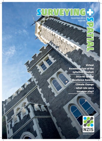
COVER IMAGE Lyttelton Timeball station before it was ruined by the September 2011 Canterbury earthquake. Credit Tony Bridge www.thistonybridge.com See page 8 for more details.
13
ARTICLES
20
3
Two New NZIS Fellows Welcomed
8
Virtual Reconstruction: the Resurrection of the Lyttelton Timeball Station in a Digital Space
13 2016 New Zealand Spatial Excellence Awards 20 Cambridge Park: Vision, Asparagus and the Global Financial Crisis 25 Monitoring, Mitigating and Adapting to Climate Change 29 Geodetic Upgrade for Nepal 33 The Unlimited Issues of a Limited Title Survey 37 Whanganui River: An Indivisible Entity – a Legal Personality?
29
REGULAR FEATURES 2
Editorial
4
Professional Stream News
7
Surveyor-General
18 Technology 23 Legal Column 41 Perspective 44 University Happenings
37
• EDITORIAL
Shrinking Violets Diane Moriarty
ISSUE 88 DECEMBER 2016 SURVEYING+SPATIAL A publication of the New Zealand Institute of Surveyors – Te Rōpū Kairūri o Aotearoa ISSN 2382-1604 www.surveyors.org.nz EDITOR Diane Moriarty survey.editor@yahoo.co.nz All rights reserved. Abstracts and brief quotations may be made, providing reference is credited to Surveying+Spatial. Complete papers or large extracts of text may not be printed or reproduced without the permission of the editor. Correspondence relating to literary items in Surveying+Spatial may be addressed to the editor. Papers, articles and letters to the editor, suitable for publication, are welcome. Papers published in Surveying+Spatial are not refereed. All correspondence relating to business aspects, including subscriptions, should be addressed to: The Chief Executive New Zealand Institute of Surveyors PO Box 5304 Lambton Quay Wellington 6145 New Zealand Phone: 04 471 1774 Fax: 04 471 1907 Web address: www.surveyors.org.nz Email: nzis@surveyors.org.nz Distributed free to members of NZIS. Published in March, June, September and December by NZIS. DESIGN & PRINT MANAGEMENT KPMDesign – www.kpmdesign.co.nz info@kpm.co.nz TO ADVERTISE Email: nzis@surveyors.org.nz or contact Jan Lawrence +64 4 471 1774
2
Usually the December edition is all about awards and celebration. This year however is a little more subdued. Yes, we do have the New Zealand Spatial Excellence Awards (NZSEA) and we celebrate the appointment of two new NZIS Fellows. However, there are no NZIS Awards of Excellence and the Cadastral Stream awards also do not feature this year. What does this tell us? Possibly that we have all been too busy to submit an entry, or is it that Surveyors shrink away from the limelight and do not like to showcase their success? The NZSEA on the other hand are going from strength to strength with entry numbers up 55% on last year. It seems that the geospatial professionals amongst us are not shy to talk up their success. This is also something I have noticed when sourcing articles, whenever I approach a geospatial company they are always extremely willing to contribute to the magazine and see the value of gaining exposure for the work they are producing, something the surveyors amongst us could learn from. Maybe we need to do away with the NZIS Awards of Excellence and instead combine these with the NZSEA by the addition of another category or two? This would aid in our mission of bringing the two industries closer together. At the end of the day we are all Spatial Professionals. Our feature article (page 8) grabbed my attention at the FIG Working Week. Guillaume Clin spoke with such passion about his Lyttelton Time Ball virtual reconstruction project that it was hard not to be swept up by his enthusiasm. It is such a unique and technically complicated project that demonstrates how our skills as surveyors can be put to use in the most diverse ways. Our Professional Streams have been providing some great articles all year and this month is no exception. Mark Geddes from the Cadastral Stream provides a case study of an extremely difficult limited title survey in the hill suburbs of Dunedin and stresses the importance of comprehensive searching of both cadastral and historic records. David Timms of the Land Development and Urban Design Stream provides an account of a large scale residential development, ‘Cambridge Park’, built on an old asparagus field and designed and constructed in a time which spanned the global financial crisis. Finally Chris Pearson of the Positioning and Measurement Stream tells of his work with the New Zealand Aid Project to develop a modern geodetic datum for Nepal following the April 25, Gorkha earthquake. I would like to take this opportunity to thank all the members of the Professional Streams who have provided both feature articles and news items to the magazine this year. Your input is most appreciated by myself and of great benefit and interest to the members of NZIS. Finally I wish you all a merry Christmas and a safe and happy New Year. SURVEYING+SPATIAL
•
Issue 87 September 2016
Two new NZIS Fellows welcomed Andrew John Craig Stirling Andrew graduated from Otago University with a Bachelor of Surveying degree in 1982. After graduation Andrew worked in the Wellington and Auckland regions in consulting surveying and land development. He became a Registered Surveyor in 1986 after passing the Survey Board professional examination. Travelling extensively from 1986 to 1989, Andrew worked on building projects in London and oil exploration surveys in Egypt. His work experience from 1992 to 1994 included a variety of hydrographic surveying projects in Singapore, Indonesia, Malaysia, Papua New Guinea and the United Arab Emirates. The summer season of 19931994 was spent surveying in the Dry Valleys and at Taylor Dome in Antarctica. Andrew is a Director of Axis Surveying Consultants in Auckland and is a Registered Professional and Licensed Cadastral Surveyor as well as a member of the Urban Design Forum. He was admitted to NZIS as a Member in 1989, and has dedicated a huge amount of his time very generously to the betterment of NZIS and its members over many years. Andrew has been a past president (2011/2012) and has held the position of NZIS Board Chair since its establishment under the new constitution in 2013. Andrew served on the Executive of the Auckland Branch for five years including three years as Chair from 20022004. He was elected to Council in 2007 and served as Chair of the Education Committee along with representing NZIS on the Advisory Board to the National School of Surveying at Otago University. Andrew is a significant supporter of the profession and his involvement through various and ongoing roles with the NZIS continue to champion the importance of the surveyor in New Zealand society. Andrew has worked tirelessly in his role as Chair of the NZIS Board as well as sitting on the Audit and Risk Committee. Through Andrew’s efforts teamed with many others, significant advances have been made in the options and quality of tertiary education for the surveying profession. Andrew was a significant advocate of change for the NZIS, working with other councillors to conceive the new constitution and governance structure with a view to future proofing the NZIS as a viable and relevant professional body for surveyors, the spatial community and society in general.
SURVEYING+SPATIAL
• Issue 88 December 2016
Lester Simon Ironside Simon began his surveying career while living abroad with his family. He completed a Higher Diploma in Land Surveying from North East London Polytechnic and spent subsequent years operating out of Aberdeen as a Hydrographic Surveyor. Returning to New Zealand in 1991, Simon joined Trimble Navigation in Christchurch. In 1995 he enrolled at Survey School in Dunedin and completed his B.Surv Degree in 1996. After gaining registration, while working at Christchurch City Council, Simon spent a period at Middleton Williams and then joined Eliot Sinclair in 2003 and is now an Associate of the company and holds the titles of Registered Professional Surveyor, Licensed Cadastral Surveyor and Level 1Certified Hydrographic Surveyor. Simon’s services to the surveying profession commenced with roles as Secretary (1998-2002) and then as Chairman (2009 to 2012) for the Canterbury Branch. Simon served on NZIS Council from 2001-2003 and in that period chaired the Christchurch based Public Relations Committee. Simon was chair of the NZIS local organising committee responsible for the Ninth South East Asia Survey Conference in Christchurch in 2007. In parallel to his services to NZIS he served on the Australian Hydrographic Surveyors Certification Panel from 2001-2010. Simon chaired the SSSI Hydrographic Commission for five years from 2010 and during that time served on the SSSI Consultative Council and was a member of the SSSI Board from 2010-2012. His service to FIG is currently in the capacity of chair for Working Group 4.1 responsible for Standards and Guidelines for Hydrography. In Rome 2012, together with the NZIS, Simon successfully secured a bid for the 2016 FIG Working Week to be held in Christchurch. Simon went on to then chair a personally selected, ever-expanding Local Organising Committee that successfully delivered the largest international survey conference the NZIS has ever hosted. Whilst Simon may be quick to deflect the success of this conference to others who stepped in when requested to take responsibility for parts of the programme, it was Simon’s inspirational leadership, delegation and trust of his fellow professionals that underlined his most recently completed service to the local, national and international survey profession.
3
• PROFESSIONAL
STREAM NEWS
Cadastral The Cadastral Stream, together with NZIS National Office, are in the early stages of preparing seminar/webinar topics for the coming year. It is planned to offer three events and our proposed topics are GNSS and Cadastral Surveys, Cross Lease updates, and Landonline tips, tricks and functionality. We hope that these three topics will be of interest to our Stream and feel that all members will be able to gain benefit from these topics in their daily practice. The Cadastral Survey Act Working Group (CSA WG), report that the Chair has collated and summarised the responses of consultation with NZIS members. The Group is now consulting on potential wider implications of s52 on members of the NZIS. Once this further consultation is complete, the WG will issue a report. The Proposed Rules for Cadastral Survey for Greater Christchurch was released for consultation by LINZ on the 6th September and submissions closed on the 12th October. The Cadastral Stream lodged a submission to LINZ and would like to acknowledge the work by other groups such as the NZIS Canterbury Branch and the NZIS/ICS Canterbury Earthquake Working Party for their own submissions. The Cadastral Stream has also received some feedback regarding Cadastral Corner published in Newslink. This is written by Ralph Winmill, who we thank for his efforts, and as like most things Cadastral, open to individual interpretation. We would like to encourage members to debate these items on the forum on the NZIS webpage should their view differ to that of the writer. We would hope the forum would allow robust debate, allowing others to form their own opinions based on all the information presented. As always, if there is anything which you believe the Cadastral Stream may be able to help with, we can be contacted via the National Office: nzis@surveyors.org.nz The Cadastral Stream Exec
Engineering Surveying In October Michael Cutfield and I went along to the NZIS AGM in Wellington, representing the Engineering Surveying Professional Stream (ESPS). It was a great occasion, networking with the other stream delegates, Council and the Board. The forums held were challenging and very informative, highlighting the needs and desires of the various Streams. The ESPS has gained some good traction in getting a pathway for certification finalised and is now focusing on the detailed execution over the coming months. Being an engineering surveyor is currently extremely exciting, particularly in big centres such as
4
Auckland. There are plenty of infrastructure projects on the go - helping to manage the bursting growth of our biggest city. From the largest project City Rail Link (CRL) https://www.youtube.com/watch?v=vlfnd9u3dds with its many challenges, such as the continuation of two railway tracks under and through the historic Britomart Post Office to the installation of new bus /train interchanges, bus station upgrades, new ferry terminals and many kilometres of new cycle lanes, form only part of our busy work schedules. Roading projects of all sizes are also high in demand, with ever-rising construction tolerances making an engineering surveyor’s presence invaluable. With the rise in demand for accurate surveying and spatial measurements, utilising new technologies is putting a lot of pressure on our industry. Keeping up with the latest developments and identifying the usefulness of such is a must for any big player within the industry. Just as important is the education of our young survey professionals, teaching them how to use these applications and ensuring we provide a solid and interesting platform for their development. Times like these show once again that finding experienced engineering survey professionals is harder than it seems. Daniel Wiederkehr, Engineering Surveying Stream Committee Member
Hydrography LINZ’s civil hydrography programme is underway for the year, with four surveys scheduled; Queen Charlotte Sound/Tōtaranui and Tory Channel /Kura Te Au, Approaches to Auckland, Kawau Bay and Tamaki Strait. These areas were recently highlighted for survey by the New Zealand Hydrographic Risk Assessment. Large areas of Queen Charlotte Sound/Tōtaranui and Tory Channel /Kura Te Au haven’t been surveyed since 1942. Measurement technology has vastly improved and allows us to significantly improve our understanding of the area beyond the traditional remit of safety of navigation surveys. With this in mind LINZ has teamed up with Marlborough District Council (MDC); the project will enable both hydrographic and scientific data to be collected that will significantly improve the charted and non-charted hydrographic information available for the region, and
Queen Charlotte Sound
SURVEYING+SPATIAL
•
Issue 88 December 2016
directly contribute to the provision of a safe and navigable waterway for vessels of all sizes. Beyond the Safety of Navigation deliverables this survey will provide MDC with products derived from Multibeam backscatter and watercolumn data that will enable decision making for the sustainable management of resources and protection of important coastal marine ecosystems. Andrew Price, Hydrography Stream Representative
Land Development and Urban Design This report is being written the morning after the large earthquake in North Canterbury that has also affected some Wellington buildings and infrastructure. Hence urban design and land development issues don’t seem so important in the immediate aftermath. However, life goes on and development in the Wellington region is strong at present causing demand for new houses in the city and the regions so we are all busy in our sector. A wrap up of news from the Wellington region is outlined below.
A view of the Transmission Gully motorway project
Wellington City Focus is on apartment blocks and infill medium density projects. An example is Shelly Bay Special Housing Area mixed use redevelopment on the former air-force base in Evans Bay just north of Wellington Airport.
A new District Plan in draft form will be out for initial comment early in 2017 and the local LDUD Stream members will debate the new plan as it goes through the consultation process.
NZIS members need skills to have good collaboration with other disciplines, and to develop excellent project management, coordination and communication skills to succeed in this type of work. Stream members are encouraged to get involved in Urban Design Forum affairs between now and the next Forum election in 2018 and be ready to stand for the committee so that surveyors remain represented on the forum.
Significant work is being undertaken on urban amenity and pedestrian linkages in the CBD.
Brett Gawn, Land Development and Urban Design Stream Representative
Porirua
All this season’s stock of sections ranging from 300m2 upwards, for free standing houses in the Aotea development are sold. Kenepuru Developments Ltd (a joint venture with Carrus and local Iwi Ngati Toa) is currently planning a 900 dwelling, medium density, housing development on former Kenepuru Hospital land only a few minutes walk from the CBD.
Hutt City Hutt City is planning for, and encouraging new housing areas in Wainuiomata and other suburbs.
Kapiti Kapiti has been planning for the impact of Transmission Gully and the Kapiti Expressway transport projects.
Positioning and Measurement This summer Otago University will be undertaking a project to determine the velocity field following the Dusky Sound 2009 earthquake. It appears that the secular component is up to about 3 mm/year different compared to the pre-earthquake velocity. While this is not a large difference, the effect over a period of years will start to affect the geodetic infrastructure (i.e 3 mm/yr x 10 years = 30 mm). This campaign will observe the existing LINZ sites and up to 16 new sites that allow for rapid and secure occupation. These new sites are constructed using 5/8" marks, to which the antenna can be directly attached and left unattended for several days. These sites will be augmented with a number of sGPS sites that will collect data for several months. Contact Chris Pearson for more information about this project: chris.pearson@otago.ac.nz Rachelle Winefield, Positioning and Measurement Stream Chair (Professional Stream News continued page 7)
SURVEYING+SPATIAL
• Issue 88 December 2016
5
ULTIMATE
SPEED
8UltraSonic
Motors 830% Smaller 8TSshield™ Service 8UltraTrak Technology 8Guaranteed Reliability iX Series
Robotic Total Station
Experience performance like you’ve never seen before. This is the fastest, lightest and most powerful robotic instrument on the market. And it’s backed by a best-in-the-industry three-year instrument, five-year motor guarantee.
www.sokkia.com
Contact your local dealer for more information about Sokkia products Position Partners Auckland
6
09 479 3064 info@positionpartners.co.nz www.positionpartners.co.nz
Position Partners Christchurch 03 366 2658 info@positionpartners.co.nz www.positionpartners.co.nz SURVEYING+SPATIAL
•
Issue 88 December 2016
• SURVEYOR-GENERAL
Shaping our future with spatial surveying Mark G. Dyer 2016 has been a busy year for surveyors. With housing affordability, land scarcity, Christchurch and rapid growth in our cities we’ve had our work cut out for us. Much of my time has been taken up with developing and putting into practice a new law to help locate quake-affected property boundaries in Christchurch. This involved a lot of discussions and workshops, and I’d like to thank everyone who took part for helping to solve an ongoing issue. Next year my discussions with surveyors will continue as we seek your views on the cadastral surveying rules. LINZ, through the recently established Cadastral Survey Working Group, will also be engaging with surveyors on the design of the ASaTS project to make sure the final product meets your needs. As we work through these things, we also need to consider the relevance of our work in shaping New Zealand’s future, in particular, surveyors’ involvement in New Zealand’s infrastructural development. Government is developing standards to achieve consistency with data on New Zealand’s national assets – that’s data that tells us how well anything from the pipes and cables under the ground to state buildings are performing.
Doing this will mean engineers, asset managers, designers, developers and others using the data will have more reliable and consistent information on which to base their work. From an economic perspective it means our national assets will function more efficiently and planners will be able to make better decisions around the management and development of our infrastructure. Surveyors gather and provide much of this data through our surveys. It’s something we are used to doing. However, as New Zealand’s development depends on this information I’d like to see us more involved. Surveyors having more of a say on how the data should be collected and made available would be a start. People rely on us to provide accurate measurements, and we do – the accuracy of our cadastre is one of the reasons we have a world-renowned property rights system. As the government moves towards a data-based approach to managing and developing our infrastructure, we need to bring our skills and expertise to the table. Next year, I’ll be working to do just this. It is, after all, about the future – the future of our profession and the future of New Zealand.
(Professional Stream News continued from page 5)
Spatial The NZ Spatial Excellence Awards were held on Wednesday 16th November. As always this was a great event – a night to showcase our finest industry talent and celebrate emerging professionals and talented geospatial industry experts. A write up on the awards can be found on page 13. The NZIS AGM and Stakeholder Workshop in October highlighted a number of areas where NZIS can improve interaction with geospatial professionals. This will have input into the ongoing discussions around certification and pathways to a geospatial career, and what spatial industry professionals want. It was useful to get this information from the stakeholders themselves and the workshop was a good mechanism to do this. We will be taking those views into account as we move into a transition phase with a greater number of people now joining the Spatial Stream.
SURVEYING+SPATIAL
• Issue 88 December 2016
With this in mind please do let us know if you have any training requirements in spatial sciences. NZIS support the Stream in creating training opportunities for members and building skills on the way to a geospatial career and beyond. Your feedback will allow us to determine the right courses and organise discounted rates. In recognition of the need for providing a career path for spatial professionals, we intend to organise a meeting of the main tertiary providers in the spatial sector to discuss how such a career should develop. This is still in planning but will be happening soon. The main topic of discussion will be the definition of entry points to a Spatial career and how tertiary students can be given the information on how to embark on this career path given that there are any number of entry points to such a career from very diverse experience and qualification levels. Greg Byrom, Spatial Stream Representative greg@gregbyrom.com
7
VIRTUAL RECONSTRUCTION The resurrection of the Lyttelton Timeball Station in a digital space
Grant Sheehan Photography 2010
Guillaume Clin and Richard Harrison, Beca Ltd Introduction The Beca survey team was commissioned in 2014 to scan the site of the Lyttelton Timeball Station in preparation for the design phase of this ambitious reconstruction project. Our commission was subsequently extended to include scanning of salvaged limestone facing stones to help the project team save time and reduce errors by avoiding hand measurement of every stone. Our task was to identify, match and place each stone back in its original position to facilitate a virtual rebuild of the tower – a subtle and complex 3D jigsaw puzzle. In addition to the stonework, the critical mechanical workings of the Timeball equipment were scanned at their storage location and digitally reconstructed to determine their original position within the tower – a process that hinged on the fortuitous availability of a single photograph of the rubble following the collapse of the tower. The unique nature of this project has pushed the avail-
8
able point cloud data to its limits, driven the development of unique new analysis tools, utilised web-sourced imagery and ultimately benefitted from a great deal of luck.
An Historical Legacy Built in 1876, the Lyttelton Timeball Station (the Timeball) has played an important role in the maritime history of Lyttelton and its harbour. Located on the side of the hill above the harbor, the Timeball has a dominant view over the harbour and was clearly visible to ships coming in and out of the harbour. In the past, the Timeball was one of the most important tools for navigation and exploration in the region. Its significance is easily forgotten in today’s world of ubiquitous GPS navigation and precision timekeeping. The function of the Timeball was to give the exact time of the day to ships in the port by dropping a large round ball down a mast at 1pm each day. Knowledge of time
SURVEYING+SPATIAL
•
Issue 88 December 2016
was extremely important for calibrating navigation instruments. Latitude could be measured using a sextant, but longitude was defined by time. An error of a few seconds could result in a significant error of position, which could lead to catastrophic consequences. In 1934, the Timeball as a timekeeping device was replaced by radio signals, but in 1983 the building was classified as Heritage Category 1. At this time the Timeball was the only one to remain in working order in New Zealand, and one of only five worldwide. The distinctive tower with its large red and black ball was an often-photographed landmark in the harbour, a fact that would prove useful during reconstruction efforts.
The Fall of the Timeball In September 2010 the Timeball, like so many other un-reinforced masonry buildings in Canterbury, was subjected to damage caused by the first of the Canterbury earthquake sequence. Stones from the building fell, the east facade collapsed and cracks could be observed throughout the building. During the following months, the building was the subject of detailed repair planning which included controlled deconstruction. The goal was to remove and catalogue every stone and store them carefully for future reconstruction. This plan would allow rebuilding of the Timeball in the shortest and most efficient manner. In February 2011, Archeological Solutions Ltd laser scanned what remained of the tower and residence building. The structure was still standing but very unstable and the risk of further collapse was high. The purpose of this scan was to monitor the structure of the building, not to create a detailed heritage record. As a consequence, scans were completed from some distance from the building, which was surrounded in places by trees and bushes and not all building faces could be seen. The scan was also not related to any specific height datum. Sadly, in June 2011 after a significant aftershock, the remaining structure of the Timeball Station collapsed. The collapse removed the need for further monitoring and the scans were set aside. The goal to re-instate this unique piece of history was placed on hold. Heritage New Zealand was able to salvage a significant amount of the original building material including 250 of the original 350 facing stones that gave the Timeball its particular shape and appearance. These were the large Oamaru stone blocks that run up each corner of the tower and around doors and windows. The salvaged stones were carefully catalogued, but the strong desire to rebuild the Timeball tower as close as physically possible to the original resulted in a project to determine where in the original structure each salvaged stone fitted.
SURVEYING+SPATIAL
• Issue 88 December 2016
The Challenge Heritage New Zealand was strongly motivated to see the Timeball resurrected. Beca was engaged to provide project management services and the survey team engaged to provide further laser scanning and data extraction. The challenge was to determine the precise shape and form of the original tower, and identify where each individual stone, now on the ground, belonged back in its original location.
Map the original structure With no existing as-built data, key measurements such as tower height, door and window levels, base measurements and shape were unknown. The scan completed in February 2011 became a valuable resource, used for an application far beyond its original purpose. From this scan data, the dimensions of each visible facing stone were to be extracted, including width, height and external angle. Using a combination of Leica 3D Reshaper software to create a detailed surface model of the building façade and AutoCAD to extract the dimensions, a catalogue of over 200 stones was created for six of the eight tower facades. This achievement was a starting point for the more intensive stone by stone measurements to follow. A highly visible outcome of this stage in the project is the architectural model that has been made of the tower using the dimensions derived from the scan data. This model has been used for publicity and to allow people to visualise what the rebuilt tower will look like.
9
An attempt was made to use crowd-sourced images of the tower to create a 3d model of the tower. This was surprisingly successful but inadequate for accurate mapping, especially considering that the two missing faces were largely unseen on tourist or historic images in any case.
Model individual stones After evaluation of the repair strategy, the decision was reached to rebuild the tower and its crowning mast and ball. The major challenge was now to work out how to reassemble the stones lying stored in crates at ground level – essentially rebuilding this giant 3d jigsaw puzzle back into a tower. Many of the 250 salvaged facing stones had suffered damage, so their dimensions would not be the same as when new. Every stone was laid out on the ground and a high-density laser scan of all visible faces completed. In many cases, stones could have been placed upside down, effectively doubling the number of possible scenarios that had to be considered. Some stones had unique features such as cable attachments or window frame detailing, but 90% did not have enough detail to be easily relocated in the tower. Very quickly it became clear that the exterior corner angles of the octagonal facades were similar (approximately 135 degrees). It was also clear that not every stone had unique dimensions (face lengths and height), so the number of potential locations for each stone became very large. The
goal of fitting as many stones back to their original location in the tower would require considerable effort. Expecting a stone mason to solve this complex 3D jigsaw would make the project near impossible to price and leave it open to cost overruns and delays, so this complex task had to be completed and provided as part of the tender process for stone masons. More than 300,000 comparisons had to be completed (200 locations extracted from the tower, 250 stones, and three-dimensions: Height / Face 1 /Face 2 and two orientations of the stone). Completing this manually at a rate of two comparisons per minute it would take 325 working days to be completed.
Develop a software solution Searching the internet for a suitable software application already in existence was unsuccessful. Many organisations had mapped and modelled existing facades, but none we could find had tried to match a pile of collapsed stones back to their original location. New software would have to be written using the macro language in Microsoft Excel. As the application developed over several weeks, new variables and potential combinations of stones became apparent. It was known that every stone was from the tower, so the software needed to find a way to place as many stones as possible. One of the significant features of the application was the ability to set a confidence level for the measurements being applied. Many stones were damaged and the original scan was of medium resolution, so accurate measurement was difficult to guarantee. The application first allowed measurements a tolerance of +-5mm, and then as more stones were located with high confidence, the allowable tolerance was gradually relaxed. Ultimately, the tool takes a list of original target measurements, a list of actual measured objects and a folder of images and by simply clicking a button returns a complete analysis report. 65% of the available stones have been matched to a position in six of the eight visible tower faces. Approximately 100 stones could not be matched to a location, so it is reasonable to expect that these stones are from the two obscured faces of the tower. When additional stones were later found in storage, the programme was able to place them in the tower and provide an updated answer in a few seconds.
Model the mechanism – the image that saved the ball.
Stones laid out for scanning
10
The tower without the ball and internal mechanism would not be a complete rebuild. But original as-built documentation didn’t exist so there was no clear detail of the mechanism and what did exist were only old paper sketch-
SURVEYING+SPATIAL
•
Issue 88 December 2016
es. Nothing accurate could be found. A project was started to virtually reconstruct the mechanism in a digital space. The first step was to scan the remaining foundation in terms of Lyttelton height datum and a known coordinate system. The point cloud from February 2011 could then be positioned on its virtual foundation and correctly coordinated. This task was complex as during the 2011 scan a large amount of stone piled on the ground hid the actual remaining ruin and only minimal data overlap was available. With careful effort, a satisfactory result was achieved and the virtual reconstruction could continue. The architect, Dave Pearson Architects, tasked with creating the Revit model of the tower needed more information about the height of each element of the mechanism above the ground floor. The solution was to scan each piece of the mechanism as it lay in storage to obtain accurate measurements. Work started with the stone tower dome which was well conserved and only partially damaged. Clear paint marks showed exactly where the mast fitted to it. Subsequently the two parts of the broken mast held in storage were scanned. Virtual reconstruction allowed us to move the pieces of this very heavy mast, one square and one round, with only the click of a mouse. The central axis of each piece was modelled and using matching connection points the mechanism was brought together in a digital space. Together perhaps, but the precise location and level of the mast in the tower was still unknown. Only the internal structure of the dome and the mechanism were available and the February 2011 scan shows only the exterior of the building. There was no way to relate the two together. Completion of the project was close, but this important information for the architect and the rebuild was missing. During one final meeting new images became available. One was a picture after the June 2011 earthquake where the building appeared no more than a mountain of debris with the dome on top. This critical image included a view of the exterior of the dome, with one broken stone that allowed visibility to a piece of metal which held the internal structure. This unique image provided the key to link exterior and interior scans together and completed the project to virtually rebuild the Lyttelton Timeball Station. Now the hard work of the real reconstruction can begin‌
Conclusion The work that Beca surveyors undertake often requires us to apply geospatial expertise to applications that go beyond the typical realm of the surveyor. However it is not often that a project emerges that offers opportunities as truly unique as the Lyttelton Timeball Station project for Heritage New Zealand. The combination of technical challenges and the status of the project as a landmark her-
SURVEYING+SPATIAL
• Issue 88 December 2016
Virtual reconstruction of the tower
itage restoration have been inspirational for the author and the outcomes have certainly justified the effort. References http://www.heritage.org.nz/places/places-to-visit/canterbury-region/lyttelton-timeball
11
Glenn Stone Insurance Our story with the NZIS – So Far Glenn Stone Insurance have partnered with the NZIS over the last 3 years and service over 50 land surveying and multi-disciplinary firms. We were the first diamond sponsor and this has enabled the NZIS to better support its members and the land surveying profession in general. We work with the NZIS on insurance related topics or legislative changes that might impact the profession. Most recent examples include our advice on health and safety changes, construction contracts legislation and individual cadastral survey cover.
Some of our key achievements over the last few years: Lowering costs to land surveyors. Introducing an alternative insurance choice. Delivering covers not previously available in New Zealand. Scholarship introduced for School of Surveying. Continuous development of innovative solutions.
We recognise relationships are important Glenn Stone insurance is a New Zealand owned brokering firm, not a multi-national company. You will get to deal with the owners of the company directly. We provide personalised service.
Whether you are a present client of ours or not if you need help or simply want some advice contact us.
Start a conversation Free call us on 0800 555 474 or email us at: info@glennstone.co.nz
12
www.glennstone.co.nz
SURVEYING+SPATIAL
•
Issue 88 December 2016
On the stage at Te Papa with MC Mark Sainsbury and Mark Allan, NZIS President, welcoming all by video
2016 NEW ZEALAND SPATIAL EXCELLENCE AWARDS Compiled by Jan Lawrence, NZIS Now in their third year, the New Zealand Spatial Excellence Awards (NZSEA) are going from strength to strength – borne out with 55% rise in entries this year. Alma Hong, Chief Technology Officer at Radio NZ and one of this year’s judges says, “Being a judge at the New Zealand Spatial Excellence Awards is no picnic... but it is always a rewarding experience and being an NZSEA judge in 2016 is no different. I have had the privilege to see the diversity and quality of entries where spatial technologies and spatial industries can truly make a difference to outcomes.” The following winners were announced at the Awards dinner once again hosted by Mark Sainsbury, held at the stunning Te Marae, Te Papa Tongarewa in Wellington in November. Congratulations to all the organisations and individuals who submitted outstanding entries this year. NZSEA website: http://www.nzspatialawards.org.nz/
S U P RE M E E X C E L L E N C E A WA R D Representing the pinnacle of achievement in the spatial industry and showing the highest level of excellence or achievement. Entered under the People and Community Award category that recognises products or projects that make a difference to national, regional or local issues and affect communities via ‘grass roots ’ initiatives, and/or educational programmes, services or tools that permit the widespread adoption, use, understanding and access to spatially enabled products or services.
Awarded to Wellington City Council LIVING LAB A community driven cross-sector collaboration with the technology company NEC using smart technology to develop solutions to assist with improving community safety and assisting the city’s vulnerable. The project came from series of workshops with community groups, agencies, residents and retailers who were concerned at the increased presence of aggressive begging and anti-social behaviour relating to the sale of psycho-active substances. There was also a strong interest in being able to integrate and map shared data and information to provide a mechanism for evidence based future planning and opportunity for real time responses to local incidences and concerns.
SURVEYING+SPATIAL
• Issue 88 December 2016
The community were interested in looking at ways to use technology to address these and Cuba Mall was identified as an ideal geographic location for a “Living Lab” to develop these solutions. The Living Lab leveraged existing assets (CCTV) and sources of data and information which were streamlined and integrated. This was coupled with new sensory and analytical methods and technologies and use-cases included: glass breaking, screaming, detection of beggars/rough sleepers and antisocial behaviour. The project also provided an enhanced situational awareness with a GIS map overlaid with real changes, real-time alerts/detections and using integrated community data.
13
IN DI V I D UA L A WA R D S Education & Professional Development Conferred on practising teachers, facilitators or academics who have substantially contributed, through teaching, research, publication or professional activities. It acknowledges leadership not only in empowering students in the use of technologies, but also in supporting other teachers to acquire knowledge and/or promote excellence for practising academics in the fields of surveying and spatial science.
Awarded to Dr Antoni Moore, University of Otago Dr Antoni (Tony) Moore represents a true scholar, ever extending his own knowledge, while always making sure that others who pursue geospatial science have his undivided attention and help. His research in the field of geospatial science is broad and deep from the technically demanding aspects of subjects such as vector agents to the artistic visualisations of cartography. He has an appetite for expanding not only his own vision but to continually offer his expertise to others who are
only beginning to see the importance of space and time in their research; for instance, projects to understand how augmented reality can be utilised as a teaching tool, the spatial analysis of the importance of adolescents actively getting to school, or the influence of a single physiologist and how his work has stretched around the globe, all the while encouraging postgraduate students in the field of geospatial science.
Postgraduate Student of the Year
Undergraduate Student of the Year
Conferred on a Postgraduate student who has undertaken a research project that contributes to the ongoing progression of the surveying and spatial profession. Students eligible to enter this award include PhD and Masters Research students.
Conferred on a student who has undertaken a research project in the course of their studies that contributes to the ongoing progression of the surveying and spatial profession.
Awarded to Mike McConachie, University of Otago
Awarded to Jeanette Ma, University of Otago
RANDOM FOREST LEARNING-BASED CLASSIFICATION OF ULTRA-HIGH RESOLUTION IMAGERY OF COASTAL DUNES AT MASON BAY, STEWART ISLAND
3D MODELLING OF AIRPORT PLANT ROOM USING LASER TECH, 3D AND VIRTUAL ENVIRONMENT
This nomination is on the basis of Mike’s research project on duneland vegetation classification of drone (RPAS) spatial data, undertaken as part of his Master of Applied Science in GIS at Otago. The project was completed to a very high degree of quality (A grade, 85%). It has made advances in knowledge, both in the recent exploration of the potential of drones and the (classified) products that are derived from it, and establishing drone-mounted sensors and intelligent, object-based classification as valuable tools in coastal dune management. The research output revealed a significant improvement in classification accuracy, making this approach a valuable management and monitoring tool for dune management.
14
This nomination for the undergraduate student award is for Jeanette Ma, and in particular the special topic professional project she undertook on the 3D modelling of an airport plant room, in the last semester of her Bachelor of Surveying degree at Otago. The project was completed to a very high standard (A+, 94%). Arising out of a need to investigate why seamless laser scanning to building information modelling solutions have not yet been demonstrated, Jeanette undertook an excellently planned and executed project, encompassing the technologies involved: laser scanning, 3D modelling and also virtual environment interaction. The project was also an exercise in engaging with a client and responding to the client’s needs, as an initial stage of project plan negotiation was undertaken.
SURVEYING+SPATIAL
•
Issue 88 December 2016
I N D I V I D UA L A WA R D S Professional of the Year Recognising a practitioner who is working in any of the disciplines of the surveying and spatial sciences whose professional achievements are widely acknowledged as exemplifying the highest standards of excellence and ethical conduct.
Awarded to Wendy Lawson, University of Canterbury PASSIONATE ADVOCATE, CHAMPION OF DEVELOPMENT OF GEOSPATIAL RESEARCH Professor Wendy Lawson has been one of the most influential people in the Geospatial Education and Research areas within New Zealand. A passionate advocate of the Geospatial Industry, she has championed the development of Geospatial Research within tertiary education as well as all levels of government and private industry, both national and international. Professor Lawson’s drive has led to the establishment of a range of innovations in Geospatial research, and has maintained that commitment throughout her roles at
the University of Canterbury from Head of Department of Geography to Pro Vice Chancellor of Science. Some of these innovations include the establishment of the Masters in GIS programme, membership and participation in the CRCSI, and the establishment of the Geospatial Research Institute. She was also closely involved and has continued to support the growth of the GeoHealth Lab. Professor Lawson is also firmly committed to bi-cultural development of Geospatial Research and Education.
Young Professional of the Year Recognising a young professional who has made significant contributions in the field of Surveying and Spatial Science and acts as a role model for others in the industry.
Awarded to Kurt Janssen, Interpret Geospatial Solutions AN EXTRAORDINARY SPATIAL PROFESSIONAL Kurt Janssen is an extraordinary spatial professional. He has demonstrated considerable technical excellence across many geospatial areas, and has established a successful consulting firm, with 18 staff across two offices in a remarkably short time. Throughout his career, Kurt’s technical expertise has been recognised with numerous accolades, and he is now passing on these skills to his team. Kurt has been involved in the delivery of many key projects during his career, including a number of award-win-
Sean Audain receives the Supreme award on behalf of Wellington City Council for Living Lab
SURVEYING+SPATIAL
ning road safety solutions. These projects, such as SafetyNET, showcase the power of GIS to turn data into actionable insight, and have opened up new industries to innovative geospatial technologies. Kurt contributes to the GIS community in a variety of ways via user groups as a committee member, president, speaker and supporter. In doing so, he is continually building a platform for geospatial professionals to network and connect to their peers.
Jeanette Ma, Undergraduate of the Year
• Issue 88 December 2016
Hon. Louise Upston and Professional of the Year winner, Wendy Lawson of University of Canterbury
15
ORGA N I S AT I O N A L A WA R D S Environment & Sustainability Recognising products and projects that help to resolve any issue in an environmental context.
Awarded to Statistics New Zealand/ Ministry for the Environment ENVIRONMENT AOTEAROA 2015 To make good decisions about our environment we need an accurate picture of it. Environment Aotearoa 2015 gathered data from hundreds of sources to tell an epic story about our environment, ranging from the atmosphere above New Zealand to our deepest oceans. It is the first State of the Environment report to be produced collaboratively between the Ministry for the Environment and Statistics New Zealand under a new environmental reporting framework. It is the first environmental report to be electronically published and feature a suite of interactive maps. Maps are integral
features of Environment Aotearoa 2015. They are visually engaging and tell a story that’s easily understood by people with a limited range of technical capability. The report and website include 76 interactive and static maps that display a total of 380 spatial data layers. Readers can view an animation of 42 years of annual rainfall, compare current with historical wetland extents, view the state and trend of water quality, and build their own map of land cover classes. The layers are available to the public from the data service. Users are free to reuse all the data used in the maps.
Technical Excellence Award Recognising products or projects that implemented spatial solutions to an exceptionally high technical standard, overcoming significant technical challenges, and delivering outstanding results for the client. In contrast with the Innovation Award, this category focuses on excellence in applying existing technology and methodologies.
Awarded to National Geodetic Office, Land Information New Zealand IMPROVING NEW ZEALAND’S VERTICAL DATUM In partnership with GNS Science and Victoria University of Wellington, LINZ has launched a new vertical datum for New Zealand. NZVD2016 is a nationally consistent reference for measuring heights, accurate to 3 cm. During the project’s five-year duration, the team collected a new national gravity dataset by air, and manipulated a huge amount of data points into a model of the earth – the geoid — that underpins NZVD2016. The gravity dataset provides a much richer, more consistent basis for the new datum. There are now precise heights data across New Zealand. As a result, surveyors and engineers can get accurate heights wherever they need it. NZVD2016 en-
16
ables engineers to consistently locate underground services and surveyors to efficiently define three-dimensional property boundaries. Local government now has a reference frame that makes it easier to share information about the height of land, buildings and infrastructure across boundaries; to predict water flow during floods or storms; and to measure sea-level rise consistently across the country. NZVD2016 has global applications, as it will feed into monitoring of change such as sea-level rise. The gravity dataset alone is valuable for what it can help reveal about New Zealand’s subsurface geology, such as the presence of minerals.
Innovation & Commercialisation Recognising products or projects that made a significant contribution to the industry through the introduction of a new idea, method, technology, process or application resulting in social, environmental and/or economic benefits.
Awarded to Ballance Agri-Nutrients SPREADSMART Clearview Innovations (PGP), Ballance Agri-Nutrients and the Ministry of Primary industries have developed a system for fixed wing aircraft to apply variable rates of fertiliser across contrasting topographic areas using prescription maps.
SURVEYING+SPATIAL
•
Issue 88 December 2016
ORGA NI S AT I O N A L A WA R D S Spatial Enablement Recognising products or projects in which the application of spatial information, methodology and/or tools has greatly improved the outcomes of a project, process or product.
Awarded to New Zealand Transport Agency SPATIALLY ENABLING A THRIVING NZ Our purpose is to create transport solutions for a thriving NZ. We believe this is can be achieved more effectively when we bring the power of location to the heart of every transport decision maker. Spatial enablement is about making it easy for everyone to think differently and act differently, empowered with insight that only a location perspective can bring. It’s about how many people you enable and how many decisions this can improve; not how spatially enabled you can make one person through a technically brilliant solution. We illustrate how we are spatially enabling the NTBFree Programme – Possum HabitatZ Transport Agency, transport sector and our customers through
the six examples taken from across the transport system covering safety, freight, road maintenance and traveller information. The submission showcases a wide range of spatial enablement techniques and approaches that the Transport Agency used to deliver significant benefits including better transport and community outcomes, increased value for money, better service delivery, improved decision making, greater customer and stakeholder satisfaction, and greater trust and transparency. This is our story of how we are spatially enabling the Transport Agency, the sector and every one of our customers – millions of people from every corner of NZ.
Award for Export Recognising products or projects that successfully and commercially apply specific spatial knowledge, products, and/or IP in an export market.
Awarded to ThunderMaps Scott Campbell from SIBA presenting the Award for Export to ThunderMap’s Clint Van Marrewijk
LINZ geodetic team receiving the Technical Excellence Award; Graeme Blick, Matt Amos, Rachelle Winefield, Jan Pierce, and Robert Deakin with Hon. Louise Upston and Mayor Justin Lester
THUNDERMAPS EUROPE Citywide implementations of ThunderMaps location data collection and awareness apps are being rolled-out into European cities, to help keep their citizens informed and safe. The ThunderMaps platform is able to share “location data” from one person to another, from one contractor to another, and from one government organisation to another. Because each organisation can share location data (as they feel appropriate), each entity can use the platform to significantly reduce administration time and increase the situational awareness of their staff and contractors. ThunderMaps assigns an intelligent agent to each user of their
software, to help the user’s smart devices suck large amounts of data from the world. The non-confidential data gathered by one user, is then shared with other users that may need that information – all in real-time. The ThunderMaps Smart City solution helps local councils engage citizens with a personalised communication stream – this full stack solution has both web and mobile apps, and can be branded for each city. Closer to home ThunderMaps is also expanding its health and safety and data collection offerings in the New Zealand, Australian and now American marketplaces.
Bill Robertson receiving special recognition of his contribution to the geospatial industry with Andrew Stirling, NZIS Board Chair
SURVEYING+SPATIAL
• Issue 88 December 2016
17
• TECHNOLOGY
HYPERSPECTRAL IMAGING Steve Smith, Business Development Manager, Aerial Surveys Limited Aerial Surveys Limited, an aerial surveying company and hyperceptions Limited, a Massey University start-up have partnered together to deliver end-to-end hyperspectral imaging services within New Zealand. This article outlines what is hyperspectral imaging, the technology used to capture the data and the processing of the data to provide real-world solutions for many varied applications and industries.
What is Hyperspectral Imaging? The electromagnetic spectrum is the collective term for all known frequencies and their linked wavelengths of the known photons, or otherwise known as electromagnetic radiation. Hyperspectral imaging, collects and processes information from across the electromagnetic spectrum in the visible, near infrared (NIR) and shortwave infrared (SWIR) bands. The “electromagnetic spectrum” of an object is the individual characteristic distribution of electromagnetic radiation emitted or absorbed by that particular object. Because objects reflect light differently they each have unique spectral signatures.
Today’s aerial mapping cameras can be considered a multispectral sensor in that they not only capture the visible red, green and blue bands, but also the near infrared (NIR) band. Industries such as forestry and agriculture already use the NIR band for vegetation analysis using various indices such as the Normalised Difference Vegetation Index (NDVI), or Enhanced Vegetation Index (EVI). These indices are a numerical indicator that use the visible and near-infrared bands of the electromagnetic spectrum, and is adopted to analyse remote sensing measurements. Hyperspectral imaging sensors take this approach to the next level and instead of four frequency bands; the unit will capture hundreds of frequency bands and extend the capture into the SWIR band. The Asia Fenix hyperspectral sensor from Specim, Spectral Imaging Ltd captures up to 620 bands ranging from 380nm through to 2500nm. The sensor is a “Push-broom” imaging device in that unlike a normal camera which takes a full frame instantaneously, the Fenix captures a row of pixels over its field of view, one row at a time, like pushing a broom. The goal of hyperspectral imaging is to obtain the spectrum for each pixel in the image of a scene. Modern hyperspectral sensors have the capability to capture the full data cube over the entire range of bands.
FIGURE 2: The AsiaFenix captures the hyperspectral data cube over all bands for each pixel to produce a full data cube
FIGURE 1: an example of a spectral response for vegetation
Chlorophyll, carotenoids, water and cellulose are the main parameters that determine plant spectral reflectance. The visible region is dominated by leaf pigments and absorbs chlorophyll, while the NIR range is dominated by the cell structure with a rapid increase in reflectance known as the red edge which then plateaus out. The SWIR band is dominated by the water content and the spectral reflectance shows water absorption bands.
18
The advantage of capturing the full data cube is that the hyperspectral data can be used for many different analyses from the same data set. The purpose of hyperspectral processing is to find objects, identify materials, or detect processes. This is achieved through the use of spectral libraries, a collection of individual spectral reflectance from various materials. Although there are global libraries available, they may not represent many of our native species, materials or the environmental situations within New Zealand. hyperceptions is creating an extensive library of spectral reflectance for use in New Zealand conditions through the use of in-field and laboratory analysis.
SURVEYING+SPATIAL
•
Issue 88 December 2016
Applications for hyperspectral imaging
Environmental health and monitoring is another area where hyperspectral imaging has potential to help in analysis. Water quality or eutrophication of reservoirs, lakes, rivers and coastal areas where excessive richness of nutrients causes a dense growth of plant life can be quantified and mapped. Hyperspectral processing can be used to map agricultural runoff, water turbidity, chlorophyll and algae growth levels. In urban environments, hyperspectral imaging can detect surface differences such as pervious and impervious delineation of roads, bare ground, buildings, vegetation and water. Further classification can also be identified such as whether the vegetation is herbaceous, coniferous or deciduous, or even the identification of individual species. Roof materials can also be identified as iron, aluminium, stucco, terra cotta, asphalt, wood or concrete which can be used along with fuel mapping to identify homes at greatest risk in the event of a wildfire. Other promising applications include geological exploration to map mineral deposits, law enforcement for the detection of illicit crops and defence applications such as detection of camouflaged targets and IED/mine detection through analysis of disturbed earth, change detection and detection of explosive materials. An exciting new development in this field is the fusion of LiDAR and hyperspectral data when acquired concurrently. When the hyperspectral data is overlaid on the surface model created from LiDAR data, automatic classification of the LiDAR point clouds are possible. The data fusion can aid in the identification of desired targets such as tree crowns for tree counting. The characterisation of the forest canopy in terms of tree species and health, tied to the stand height and structure can be used for more in-depth knowledge for the forest inventory. It is also possible to obtain an individual reflectance spectrum for each tree which in the future could lead to “precision forestry” where everything is known about each specific tree leading to advancements in how forests are managed.
One of the main applications for hyperspectral imaging is in agriculture. Hyperspectral imaging lends itself very well to use in precision agriculture. Mapping of the biomass can help determine crop yield and growth vigour. Nutrient analysis can determine areas of nutrient deficiencies for targeted spraying or fertiliser applications to ensure areas receive the correct amount and eliminate gaps or over application to reduce the fertiliser or chemical costs of the products and reduce the costs associated with the application of those products. Invasive species, both pests, such as the Asian Gypsy Moth and vegetation such as wilding pines can be detected and mapped. Repeat surveys provide a means to monitor and map changes over time and analyse the crop quality and disease treatment results in high value crops. Significant research using hyperspectral imaging in agriculture is being undertaken around the world relating to precision agricultural practices. Vegetation research such as the identification and mapping of genetically modified plants and organisms are also possible. Forestry is another industry where research relating to the use of hyperspectral imaging is being undertaken. In forest inventory, species identification and classification, biomass and carbon cycle related measurements can be made. The health of the forest can be analysed by detecting and identifying disease and mapping the locations and the level of infection in those areas. Dothistroma needle blight, Cyclaneusma needle cast, Physiological Needle Blight (PNB) and Red Needle Cast (RNC) are common diseases in commercial Pinus Radiata forests within New Zealand. Forest stress is another area where hyperspectral imaging can help. Mapping chemical composition to produce forest yield maps that can show areas of nutrient deficiencies where targeted applications can improve the nutrient levels while reducing the amount of fertiliser applied by specifically only targeting the problem areas. Pest damage can also be detected, and in North America, hyperspectral imaging has been used to map areas where invasive non-native insects such as the Emerald Ash Borer or Mountain Pine Beetle are causing damage to the forests. In fire science, hyperspectral imaging can be used to map fire fuel and help in fire risk analFIGURE 3: Mapping ysis. Other stresses such as water deficiency, Dothistroma needle blight over commercial forestry heat or pollution can also be identified. SURVEYING+SPATIAL
• Issue 88 December 2016
Conclusion Hyperspectral imaging is a complex technology which requires specialist expertise to process and deliver real-world solutions. To ensure success, the process between service provider and client is highly consultative to determine the best approach to achieve the client’s goals.
19
• LAND
DEVELOPMENT AND URBAN DESIGN PROFESSIONAL STREAM
CAMBRIDGE PARK Vision, Asparagus and CAMBRIDGE PARK the Global Financial Crisis
Vision, Asparagus and the Global Financial Crisis Dave Timms, Director, Nicklin CE Ltd, Cambridge Dave Timms, Director, Nicklin CE Ltd, Cambridge Introduction From a ‘light-bulb moment in 2004 ‘Cambridge Park’ is now fully developed as a residential community encompassing ultimately some 270 household equivalent units. The property is located at the south western extent of Cambridge within the Leamington suburb. The property fronts Cambridge-Te Awamutu Road to the north, is bound to the east by the Cambridge Town Belt and is surrounded by a deep incised gully to the south. Rural zoned land to the west is now zoned Residential and is currently being developed. Three separate parcels of rural land, combining 39.3 hectares were combined into a ‘super lot’ for the purposes of the development. Existing land-use included maize, pastoral and asparagus. The owners of the separate blocks formed ‘Cambridge Park Ltd’ for the purposes of creating the residential development. The ‘light-bulb’ moment came when the asparagus land required replanting. Until that time the asparagus yield was equivalent to a 9 tonne/hectare/sold compared to a national average of 4 tonne/hectare/sold. This extraordinary yield was reflective of the deep topsoil (up to 500mm) over 500mm of yellowish brown loams overlaying some 15m of Hinuera formations encompassing shingle, gravels and sands. Perfect soils for asparagus production and ultimately perfect for residential construction, including earthworks, road subgrades and building platforms. Replanting asparagus crowns was an option, however the owners recognised a demand for residential zoned land in the Cambridge environs and so the ‘vision’ was ignited.
Development Background Waipa District Council had, and continues to recognise, the growth demands within the district and had established a ‘growth cell’ incorporating the rural zoned land of the future Cambridge Park. Cambridge Park required a consultant to assist their realisation for a residential development, and commis-
20
sioned the services of Antanus Procuta, Architect and his Planner David Pronger to formulate the parameters on which Cambridge Park would be developed, including: Grid roading pattern (reflective of the original Cambridge Town layout), and to limit ‘rat run’ traffic movements; Interconnecting reserves providing pedestrian and cycle linkages. At 15m in width usable public space is provided whilst providing separation between the adjoining residential Lots; A central ‘oval’ (public park) and an adjacent commercial Lot for a ‘café’; Larger Lots (average 700m2 ) to replicate ‘traditional’ New Zealand and existing Cambridge development patterns; Creation of ‘Character Areas’ for future medium density development. Town houses and apartment living was not within the ‘market’ psyche at that time; Wide legal road widths (20-23m,) wide berms (5.60m – 7.0m), car parking bays and narrow carriageways (6.0-7.0m). These design principles have proved resilient throughout the development process, save some inevitable issues where surveyors and engineers have to ‘make it work’ (primarily for road and Lot drainage purposes on what was essentially a ‘level site’). Question: Why was an Architectural Consultant commissioned as the lead consultant? Answer: Because they were local with a strong vision for the development of Cambridge and which they ‘marketed’ aggressively. Cambridge Park did not consider either surveyors or engineers as their first port of call. We came later when the ‘vision’ was required to be implemented. A lesson exists here! The private plan change prepared by the Architectural Consultant was successful and Cambridge Park was zoned residential in 2006.
SURVEYING+SPATIAL
•
Issue 88 December 2016
Cambridge Park commissioned a joint venture between ‘Nicklin Surveying and Resource Management’ and ‘Churchill Timms Ltd’ to undertake consultancy work for the remainder of the development inclusive of: Subdivision Resource Consent applications and approvals; Earthwork design and approval; Civil engineering design and approval; Project management: compliance, engineering construction and certification; Land transfer processing and issue of titles. Resource Consent Approval was obtained in 2007 for four stages with stage one comprising 100 lots.
Global Financial Crisis (GFC) In March 2008 an earthworks contractor was tentatively assigned the earthworks contract for the entire development. Scrapers, contractor sheds and containers were ready to establish on-site. Bank funding was in place and all seemed well. By late March 2008, what we now know as the GFC, was snow-balling. Cambridge Park were nervous that their market would possibly evaporate by the time 100 lots were scheduled to issue titles in late 2009. The Directors of Cambridge Park have always been realistic, financially savvy and decisive. Consequently, the earthworks contractor was advised that no works would commence. To this day Cambridge Park respect the attitude of the contractor who accepted the situation realistically. Most gracious considering a contract of $1.5 million plus was at stake. Cambridge Park, however, commissioned the entire civil works for the project to be completed at that time. This was a huge relief for the ‘joint venture’ consultants and ensured consistent work through a period when times were tough. That pro-active decision, to commission the civil works design and engineering acceptance (approval) for construction, would prove to be visionary in years to come. Cambridge Park was held in abeyance until early 2010.
Funding, Brain Storming and Strategy By early 2010 Cambridge Park were frustrated: Their project had stalled and all market signals were not encouraging; The land was being utilised for maize cropping and with minimal financial return when compared to re-establishing asparagus production; and Their original financer was no longer wanting to fund significant residential developments.
SURVEYING+SPATIAL
• Issue 88 December 2016
In a nutshell, Cambridge Park resolved to: Source an alternative project financier; Re-design the project staging and sub-staging such that: ss Four initial – pre GFC – stages became six (6) stages and seventeen (17) sub stages post GFC. This would facilitate flexibility for the release of Lots to the market as aligning with demand and construction and other project costs; ss Pre GFC thinking was aligned to creating the more desirable Lots adjacent the incised gully and surrounding the ‘oval’. This would have necessitated significant infrastructure spend incorporating construction of a 225mm wastewater trunk main and construction of approximately $350– $400,000 stormwater disposal system connecting the adjacent wetlands; A ‘brainstorming’ exercise involving Cambridge Park, a potential funder, marketing experts and eventually the design consultants turned the project on its head. It was resolved to: ss Re-design the project staging and incorporate sub-stages; ss Stage 1 would access Cambridge Te Awamutu Road via the existing roundabout built in 2007; ss The wastewater trunk main works were immediately adjacent Stage 1 and therefore provided an optimal cost solution; ss A stormwater pond was envisioned to discharge all stormwater to soakage (shingles, gravels and sands were optimal in this respect) within the last Stage (6) of the development; ss The shingles ‘won’ from the pond would be utilised within the ‘fill’ areas necessitated within Stage 1. A positive response was obtained from the financier, subject to various conditions, including: A requirement to obtain new subdivision consents inclusive of re-consenting engineering approvals, was required for the re-staging including the temporary stormwater soakage solutions; The initial project mortgage held over the property was required to be re-paid, as an unencumbered project was required. This emphasised the complete change in project financing risk that existed post the GFC; A minimum number of pre-sales would also be required for Stage 1.
21
Strategy: How to make this work? Driven by their desire to complete the subdivision, Cambridge Park re-ignited the project. In hindsight, the best decision they ever made given the phenomenal desire for residential housing that has followed. At the time many considered the decision as extremely risky and even fool-hardy. Instructions were received to complete the project re-staging inclusive of earthworks and tweaks to the already completed civil design. Having a full civil design completed inclusive of Council approvals cannot be underestimated. Local and Regional Authority consents and engineering approvals (including the stormwater soakage solution) were in place by November 2010.
How to clear the mortgage? The Cambridge Park directors could commit more capital to the project. This was not an option given their existing level of equity investment. Solution: Each director would dilute their shareholding to generate ‘shares’ (private company) to be sold to investors. A project valuation was undertaken to value the shares and Cambridge Park approached local investors with an investment opportunity. This investment opportunity was well received and all shares were sold without having to take the offer to the general public. Outcome: The existing mortgages were cleared and removed from the title.
Pre-Sales Feedback from the market (2016) has confirmed that Cambridge Park have always had a realistic pricing model. This model has worked, as the development has been
Typical street layout. Note traffic calming at intersection, wide berms, car parking bays and no parking restrictions to carriage way.
22
Pedestrian and cycle connections between roads. All reserve fencing undertaken by Cambridge Park for consistency. Reserve lighting is distinct from street lighting. Reserves are generally 15m in width.
completely sold and Cambridge Park is a sought after and desirable residential development. This was not the case in 2010. The market was risk adverse; the fallout from the GFC had affected public confidence. Job security was problematic for many and generally it was ‘batten down the hatches’. Purchasing a residential lot to construct a new home was the last thing many families were considering. Local builders were reluctant to sign-up on sites for speculation or contract builds, as they could not see the market. Somehow Cambridge Park managed to meet the pre-sale threshold. Mention must be made of the somewhat maligned Chinese developers, for they were some of the initial purchasers who could see the opportunity that the Cambridge Park development presented. It was some time before the local builders also realised those opportunities. Cambridge Park commenced an earthwork and civil contract for Stage 1 in June 2011. The shingle sub-soils allow winter works for earthworks and as a consequence construction can occur throughout all seasons. The rest, as they say, is history, and the Cambridge Park attitude of ‘let’s build and they will come’ marketing has prevailed.
Comment Land development is not just about appropriate urban design, sustainable environmental design and the other raft of planning, engineering and survey principles that we are required and should adhere to. Cambridge Park has those elements and which can be specifically addressed in another paper. Cambridge Park is a successful residential development that provides a variety of urban living options including:
SURVEYING+SPATIAL
•
Issue 88 December 2016
➔
• LEGAL
COLUMN
Remediation of leaky buildings requires a survey input Stephanie Harris, Glaister Ennor Solicitors In reading this article, most surveyors would doubt whether the title is in fact correct. However, as this article will identify, a surveyor’s involvement in any leaky building case is required in a variety of different aspects, not least of which is the requirement to record changes to the building outline once the remedial works have been completed. The basic premise is that in most instances a leaky building will require the building to be remediated. In many cases that requires an exterior cladding to be removed from the building as a first step. The second step is then to remediate all or any internal damage caused by the leaks and then to return the building to a state that complies with the current building code. This often requires the installation of cavities and the re-fixing of exterior cladding that can then produce a building outline that deviates from and is different to the original footprint of the building, or even the plan and elevation. Where the leaky building is a unit title development this raises further issues which can have significant consequences for the unit title owners and the body corporate. A recent case in Auckland that we dealt with has caused all of us involved in unit title advisory work and leaky building cases to take a good hard look at the survey implications of this whole problem area. The circumstances
Stand alone homes; Terraced freehold apartments; Medium density freehold homes. However, and as is the case of nearly all successful land development projects, there must be visionary individuals with the desire and wherewithal to make it happen. Land development is no walk in the park, issues must be resolved, decisions made as overseen by prudent financial management. The Directors of Cambridge Park
SURVEYING+SPATIAL
• Issue 88 December 2016
of the case involved the re-cladding of twelve units in a development which were unit title units, all standalone, constructed in the early 2000s. Those units were on a unit title development with a central driveway servicing the units. The body corporate became caught in a situation where the local territorial authority required the exterior outline of each of the units to be changed on the unit plan to match the intended remedial work before it would grant a building consent for any of the remediation work. Obviously, the remedial work could not be undertaken without the building consent being issued. This in turn required consideration by the body corporate and the body corporate owners of whether or not this was a redevelopment as defined in the Unit Titles Act 2010 (“the Act”). Unfortunately because in the case of some units, it included intrusion into common property (both in plan and elevation) this required complete “complex” redevelopment under Section 68 of the Act. This provision of the Act states that the redevelopment in this case requires a new unit plan. Accordingly, the body corporate had to halt its remediation process to consider the redevelopment process as set out in the Act. Up to that point in time the body corporate committee had not even consulted a surveyor over this matter. Expert
covered all of those attributes between them and as a consequence can be proud of the resultant environment they have created and their financial success. Without these individuals we do not have a client or a project to exercise our considerable skills. Whilst our joint ventures were significantly involved in the completion of this project, we must never take for granted that the surveyor will be the first port of call for a visionary client. Cambridge Park is an example of that.
23
➔
survey advice was required and obtained. An urgent redevelopment plan was drafted and submitted to the territorial authority for approval. However, the complexities of redevelopment under Section 68 became apparent to the body corporate committee because the process requires a designated resolution of the body corporate under Section 212 of the Act which, in turn, requires a 75% special resolution to be passed at an Extraordinary General Meeting (EGM). Following that, the body corporate needs to serve the designated resolution on all owners and all mortgagees. Once that notice is served the body corporate then has to wait a further 28 days for the possible objection procedure under Section 213 to be extinguished. It is also worth noting that a further consequence of a deviation from the registered plan of a unit title development could also mean a change in the ownership entitlements of individual owners which would result in levies needing to be reapportioned on the new entitlements. The body corporate committee in this case, was severely hampered by this delay, both in terms of getting a building consent for the redevelopment plan and having to go through the designated resolution procedure. However, eventually both building consents were granted and a designated resolution procedure was finalised. All the documentation was then complete for the implementation of the building consent. Transfers had to be completed, mortgagees had to be advised and consents obtained. The whole process was quite time consuming and naturally enough – costly. The body corporate committee had no expectation at the outset that what they saw as a building task would require expert survey involvement and the complicated process that redevelopment under Section 68 requires. It has held the process up for the body corporate for some many months and has cost many thousands of dollars. All of this is a lesson for those involved in leaky building cases, especially for unit title property, that suggest that a surveyor should be involved in the process from
24
the very outset. Many surveyors are unfamiliar with the redevelopment process and could be well advised to consider the implications and the requirements of the Act and territorial authorities in such leaky building cases for unit title developments. The other feature of leaky building cases for unit title developments is the determination of the boundary between unit property and common property. At the outset of many leaky building cases is a requirement to apportion the remedial costs between the body corporate on one hand and the unit owner on the other. This all comes down to a boundary definition as to what is unit property and what is common property. The ultimate arbiter of such a matter is an expert surveyor analysing the unit plan, reviewing the cadastral survey rules applicable at the time the plan was drawn, and making expert determinations of the area of common and unit property. This in turn may well go before a High Court under an application under Section 74 of the Act, or it may form the core of a remedial works agreement amongst all of the owners of the body corporate. So that the basic premise is that in leaky building cases, especially for unit titles, a surveyor’s role is both pivotal and important for the whole process. Alongside that will be the other consultants, not least of which is the legal advisor who can assist the body corporate and the committee in the rather complex rigmarole and procedures required by the Act. Stephanie Harris is the joint managing partner of Glaister Ennor Solicitors. She has extensive experience in property and commercial law. She acts for SMEs, larger corporates, investors and developers on many large and complex property transactions and developments, ownership structures, leases, security interests and general structuring and finance. Contact Details: DDI: Fax: Email:
(09) 356 8232 (09) 356 8244 stephanie.harris@glaister.co.nz
SURVEYING+SPATIAL
•
Issue 88 December 2016
Monitoring, mitigating and adapting to climate change What role can the Surveyor play? John Hannah, Vision NZ Ltd/School of Surveying, University of Otago Introduction In 2011, the International Federation of Surveyors (FIG) established a Task Force to consider the contribution that surveyors could make, not only to monitoring climate change, but also to mitigating its effects and adapting to its outcomes. The Task Force report was completed in 2015 and has subsequently been published (FIG 2015). The author of this paper, who was the Chair of the Task Force, has attempted to condense its findings into this article. In setting the scene it needs to be stated unequivocally that there is no debate over the reality of climate change (global climate has always been subject to change), the real issues are the cause of such recent changes, the quantum that can be expected in coming decades, the mitigation strategies that can and should be used, and the adaptation processes that may be required. These are issues that are firmly on the agenda of global agencies such as the United Nations and the World Bank. It is the author’s view that any truly independent analysis of climate and sea-level data will draw the unmistakable conclusion that humankind is substantially (if not completely) responsible for the global warming that has been evidenced over the last century. Many of the observed changes in temperature are unprecedented over decades to millennia with each of the last three decades having been increasingly warmer on the Earth’s surface than any decade since 1850 (Figure 1). Globally averaged combined land and ocean temperature data show a warming of 0.85°C over the period 1880 to 2012 (IPCC, 2013). This warming has produced with it a rise in global sea levels – a rise that has accelerated from approximately 1.7 ± 0.2 mm/yr between 1900 and 2010, to 3.3 ± 0.1 mm/yr between 1993 and May 2016 (MfE, 2016). Climate change studies, whether in the scientific, social, political, or environmental disciplines bring with them
SURVEYING+SPATIAL
• Issue 88 December 2016
Figure 1. Global Temperature Changes from (IPCC, 2013)
sufficient depth, breadth and complexity that interdisciplinary cooperation becomes an essential prerequisite to finding robust solutions. Interestingly, and despite such a need, there is good evidence to suggest that collaborations amongst professional people from the natural and social sciences are relatively uncommon (Gornish et al, 2013). Surveyors are able to bridge this divide. They are typically practical, pragmatic professional people, skilled in spatial measurement, capable in representing, interpreting and analysing spatial information, highly knowledgeable in the administration and governance of rights to the land and sea, and able to plan for the development and use of land resources. In a world where the challenge is to balance the needs of a growing global community (e.g., food, sustainable housing, education, and health services) with the likely impacts of climate change, the question to be addressed is where and how can surveyors contribute?
Leveraging the Surveyors’ Skills into the Climate Change Arena If the above description of the surveyor’s core skills is used as a starting point, then with a little thought it becomes apparent that these can be used in at least five distinct but important ways.
25
1. In the development of land administration systems In many parts of the world, there is an urgent need for cadastral, land tenure, and land administration systems that fully reflect property rights and give tenure security. In regions where such systems are largely inaccessible (e.g., Figure 2. A poorly maintained land administration system Figure 2) or, more likely, Land use decisions, such as where to permit construclacking, it becomes almost impossible to implement land tion in coastal areas, the type of allowable construction, management practices which, for example, lead to carbon and the establishment of any minimum floor levels are capture and storage rather than greenhouse gas release. typically based upon detailed topographic data that may Greed and commercial exploitation lead to illegal forest be captured by conventional land surveying, airborne ladestruction, soil depletion and the marginalisation of ser scanning, or from digital image analysis (Figure 3). poor peoples into settlements (typically on flood plains The same type of data is needed for determining and then and low-lying coastal land) that are at risk from severe mitigating the likely impacts of flooding, whether from weather events. rivers or from storm driven coastal waves. Fit-for-purpose land administration systems that are At a very practical level, many elements of precision accessible and able to be integrated with other land use agriculture (an increasingly important technique for indata, enable climate change mitigation and adaptation creasing crop yields in a sustainable manner), rely heavily strategies to be devised around the legitimate spatial exupon GPS measurement technology. If land use is to be tent and rights of land owners and land occupiers. Local subject to greater control such that carbon capture can be authorities and governments are then able to implement enhanced then, at the other end of the use spectrum, crop policies that reward wise and sustainable land use. In adyield optimisation on highly productive lands will become dition, the use of ‘unbundled’ property rights can enable increasingly important if food needs are to be met. carbon credit titles, for example, to be registered as sepFurthermore, it is clear that new engineering infrastrucarate entities within a land administration system. Such ture will be needed to support climate change adaptation developments as these are crucial if the climate related strategies, whether these be dams, roads or coastal retainland use changes that will inevitably occur are to work ing structures. All of the above will require the use of the to the benefit of the human race. Surveyors are not only spatial measurement skills that are an integral part of the capable of developing formal land administration systems surveyor’s toolkit. to help with the demarcation of boundaries, cadastral and 3. In designing and using spatial information participatory mapping of social tenures, and with the management tools recording of rights, but are also able to understand the variation in tenures that exist in different legal and adThe development of land related databases not only inministrative jurisdictions. volves the collection of relevant data, but also its integra-
2. Through the use of our spatial measurement tools and expertise Precise spatial measurement is essential, both for monitoring the impacts of climate change and in the development of adaptation strategies. For example, sea level change analyses not only require the ongoing collection of tidal data but also the precise spatial monitoring of tide gauges, using both conventional levelling techniques and GPS positioning.
26
tion into a common coordinate framework. The collection of such data, its integration, and the definition of relevant coordinate systems all fall firmly into the domain of the surveyor. One future challenge will be to extend the data integration to include social, economic, environmental and geographical factors so as to allow the type of data mining that will assist with the interpretation and visualisation of different climate change mitigation and adaptation strategies. Additionally, the representation of three
SURVEYING+SPATIAL
•
Issue 88 December 2016
dimensional data, typically in some type of digital environment, may well necessitate the use of map projections and map projection theory. Here again the knowledge and skills of the surveyor will be needed.
4. In supporting land-use planning Long term land-use planning is an essential part of greenhouse gas emission reduction policies. In areas with high levels of land administration (typically the developed world), energy conservation is being achieved through improved subdivision, and building design and orientation processes. Heat leakage from buildings is able to be determined from infra-red photography. Moore and Zhang (2014), note the development of acces- Figure 3. Tools for spatial data capture and information analysis sible virtual reality tools based upon 3D adapation, it becomes apparent that in many regards, surspatial data. These are useful tools in urban planning. veyors are actually the custodians of a substantial number In rural areas green-house gas emissions can be reduced of enabling technologies that are critically important to by switching from conventional cropping to no-till cropthe future of the human race. It is the surveyor who estabping. Additionally, forest replanting can increase carbon lishes and maintains the very coordinate systems that the capture. In the New Zealand context such forest plantings science community uses for measuring and monitoring can help stabilise gullies and other marginal lands while global change. It is these systems that allow data to be at the same time improving water quality. Incentives for both integrated and analysed in a correct manner. Fursuch land use may be required. Unfortunately, however, thermore, the surveyor is both the custodian and a user of in areas with low levels of land administration capacity the digital tools and the digital databases used in urban and poor records, little tends to be done. Here, the lack of planning. These allow the surveyor to analyse planning direction for such activities is typically a result of limited options and make policy decisions. Furthermore, the surenforcement of land use policies, corruption, and poorly veyor, being skilled in the definition of land boundaries regulated land markets. and having knowledge of the associated tenure rights
5. In developing specific adaptation strategies A range of adaptation strategies can be embedded into a land administration system so as to control the occupation and use of land. The surveyor, in bringing together his/her intimate knowledge of the cadastre, training in engineering design, knowledge of the topography, and understanding of planning processes is the professional person perhaps best equipped to identify possible disaster risk and with it, options for climate change adaptation strategies. In some nations the identification of land suitable for the resettlement of climate refugees, the provision of secure land rights, and then the development of the necessary infrastructure are all essential tasks.
Concluding Thoughts In reviewing how and where surveyors can make a contribution to climate change monitoring, mitigating and
SURVEYING+SPATIAL
• Issue 88 December 2016
(whether formal or informal), can integrate information with climate proof urban design processes, thus vastly improving climate change outcomes for many of the world’s disadvantaged peoples. However, the depth and breadth of the issues involved in climate change studies (whether scientific, social, political, or environmental), are of sufficient complexity that the surveying community will be but one player (albeit an important one) amongst many if robust solutions are to be found. While the solution to many of the problems at hand will require the formation of professional partnerships at local, regional, national and international levels, it is the surveyor who is able to bridge much of the professional spectrum. Let’s be bold and take the opportunities on offer. References A full list of references can be supplied on request
27
GROW YOUR PEOPLE We are proud to be the first and exclusive recruitment partner to the NZIS. We offer recruitment and HR consultancy services to improve your business through its people – ultimately increasing your bottom line. •
RECRUITMENT SERVICES We recruit for both permanent and contract roles, accessing the very best local and global candidates and returning Kiwis ready for a new challenge.
•
HR CONSULTANCY Full HR analysis and review, offering recruitment strategies, expertise on how to build a successful team and best practice in all HR areas.
•
JOBS Multiple opportunities NZ wide to progress your career. Contact us for a confidential chat and FREE salary check.
“After exhaustive attempts without success to recruit suitable staff for our land surveying consultancy, I met with Mark to discuss recruitment services. We have now employed 8 additional staff in the last 2 years, all of whom were carefully interviewed and screened by Mark and his team. Although recruitment costs are not cheap, the cost of not employing staff is even more expensive!”
- Kevin Birch, Director of Birch Surveyors
EXCLUSIVE OFFER TO NZIS MEMBERS: FREE ONE HOUR CONSULTATION ON ANY HR AND RECRUITMENT NEEDS.
CONTACT: Mark Fisher 09 391 8484 or 021 347 445 mark@eighty4recruitment.com www.eighty4recruitment.com
100% NEW ZEALAND OWNED AND OPERATED
• POSITIONING
AND MEASUREMENT PROFESSIONAL STREAM
GEODETIC UPGRADE FOR NEPAL Developing a modern geodetic datum for Nepal following the April 25, 2015 Mw7.8 Gorkha earthquake Chris Pearson, School of Surveying, University of Otago Niraj Manandh, Survey Department, Nepal chris.pearson@otago.ac.nz Introduction Nepal currently uses a classical datum developed in 1984 by the Military Survey branch of the Royal (UK) Engineers in collaboration with the Nepal Survey Department. Like all classical datums it has no way of correcting for tectonic motion. However, like New Zealand, Nepal is located on a plate boundary – positioned between the Indian plate to the south and the overriding Eurasian plate to the north. As a result of the convergence of these plates, the existing passive geodetic control network at the time of the Gorkha earthquake was already distorted to some extent. This, combined with the effect of the April 2015 earthquake, which caused over 2m of deformation over a large area centred on Kathmandu, convinced the government of Nepal to introduce a modernised geodetic datum for the country. This paper describes the New Zealand Aid project to develop a modernised geodetic datum, similar to NZGD2000 that will have the capacity to correct for the earthquake displacements and ongoing tectonic deformation associated with Nepal’s location on the India/Asia plate boundary.
For the new Nepal datum we plan to use January 1, 2016 because this is far enough after the Gorka earthquake that much of the aftershock afterslip has decayed away. Tectonic motion and earthquakes are corrected for using a mathematical model. This usually includes a way of estimating the velocity of each point and a way of calculating the effect of any earthquakes that may have occurred between the time that the coordinates were measured (epoch of observation) and the reference epoch. The effect of earthquakes is an instantaneous offset while the effect of the velocity increases linearly with time. This process is illustrated in Figure 1, which shows the trajectory of a point affected by a constant velocity and the displacement caused by two earthquake.
Semi-dynamic datums Because of the effect of plate tectonic motions, the actual position of points on the earth change continuously. Modern semi-dynamic datums are based on a realisation of the International Terrestrial Reference Frame (ITRF). In the case of Nepal we hope to use ITRF2014. Stable coordinates are produced by projecting each coordinate to its position at a common date called the reference epoch.
SURVEYING+SPATIAL
• Issue 88 December 2016
Figure 1. Schematic diagram of a dynamic datum. Green shows the secular velocity and co-seismic contribution to the deformation model. The purple line shows the deformation model with both contributions.
29
Semi-Dynamic Datum for Nepal The velocity field for Nepal was developed by combining published velocities for Nepal and adjacent parts of China and India. Using these velocities we developed a grided velocity field that covers the region from 80°E to 89°E and 26°N to 31°N (Figure 2).
In order to test the effectiveness of the earthquake model patch to correct for the deformation due to the Gorkha earthquake, the model predictions have been compared to measurements of the earthquake displacements at 12 continuous GNSS (cGNSS) stations that were operating during the earthquake. These test points define a rectangle, centred on Kathmandu, extending about 200 km in the NW-SE direction and 50 km wide. Residuals range between +4cm and -4cm in the east component, +12cm and -17cm in the north component and +6cm and -3cm in the up component. The RMS residuals are ±2cm in the East component, ±7cm in the North component and ±3cm in the up component. Only two residuals are greater than 0.1 m, both are in the North component.
Control
Figure 2 Velocity grid for Nepal. The black lines indicate country borders.
To correct for the Gorkha Earthquake and a major aftershock using models, additional earthquake models were developed by geoscientists. These additional models are implemented as patches in a similar way as the Christchurch earthquake patches were developed by LINZ. Figure 3 shows the co-seismic slip from the Gorkha Earthquake. The Kathmandu Valley (the most densely populated region in Nepal) is located in the area where the displacements are at their greatest. Note that it has moved by nearly 2.5 m.
Generally the top level control for Nepal’s semi-datum was based on a CORS network with coordinates being rigorously aligned to the ITRF. In Nepal, this network could make use of stations from the Nepal GPS Array (a network established by Caltech and run by UNAVCO to study earth deformation). The distribution of potential CORS stations is shown in Figure 4.
Figure 4. Location of stations from the existing Nepal GPS Array that are potential stations for a Nepal CORS network.
Figure 3 Predicted displacement associated with the 25th April 2015 Mw7.8 Gorkha Earthquake. The model of this displacement is implemented as a deformation model patch.
30
Once the cGNSS stations have been identified, the next task is to determine coordinates for these stations in the new datum. cGNSS stations produce a coordinate estimate each day and this time series records the motion of the site. We estimated the 2016.0 coordinate by taking the resulting time series and modelling it using a function that contains terms for the constant velocity, earthquake co-seismic shifts and post-seismic relaxation. The epoch 2016.0 coordinate is determined by evaluating the modelled function for t0 = 2016.0. This process is illustrated in figure 5.
SURVEYING+SPATIAL
•
Issue 88 December 2016
Figure 5. Time series for BESI. The black line represents the modelled function, red crosses each daily solution and the dashed yellow line the time of the April 2015 Gorka Earthquake. The vertical black line represents epoch 2016.0.
New coordinates for existing lower order coordinates would be determined by readjusting existing measurements combined with new surveying data, particularly in the Kathmandu area. Least square adjustments must use packages that can apply the deformation model correctly. For this project we have adopted LINZ’s SNAP package. A successful readjustment will also require that observation dates are available for all historic measurements and it will require that the data is available in a digital form stored in a suitable geodatabase. Comparing the old and new coordinates from existing control will allow a series of correction grids to be developed and these will provide the basis of an accurate datum transformation between the modernised and original Nepal datums. The correction grid will be used to transform coordinates and spatial references in geodatabases into the new system.
Tools for Surveyors to Connect to the New Datum In addition to the network of passive control marks, Nepal could consider developing web based products and other infrastructure to allow surveyors to connect their surveys directly to the CORS network. At its simplest this might take the form of hosting RINEX files from the CORS on a server under the control of the Survey Department. There is also consideration to developing a NetworkRTK facility incorporating Nepal GPS Array along with other
SURVEYING+SPATIAL
• Issue 88 December 2016
stations still to be deployed. It may also be possible to develop capacity for online data processing along the lines of the existing PositioNZ-PP, AUSPOS or OPUS services.
Conclusions Because of the effect of the Gorkha earthquake, significant earth deformation has occurred in a large area of Nepal centred on the Kathmandu Valley. As a result, the geodetic control in this region is significantly distorted with published geodetic control coordinates being displaced from their true position on the ground by up to 2m. Correcting these distortions will require a new geodetic datum. This would probably be a semi-dynamic datum, which is based on ITRF2014 and include a national deformation model capable of correcting for the recent earthquakes and normal tectonic motion. We demonstrate that it is possible to develop a deformation model for Nepal incorporating the Gorkha earthquake and the variation of the long term (or secular) crustal velocity across the country using published information. Our test shows that its use does a good job of correcting survey measurements for the effect of the earthquake.
31
www.accurate.kiwi | 0800 500 380 Promoting Best Practice & Industry Training for all facets of leveling and precision locating - above and below ground
New Product Release: Stream C Ground Penetrating Radar Unit From IDS Corporation, comes the new compact solution for accurate 3D Utility Mapping. It will be the first of its kind in the GPR Survey world. Global Launch Date: September 1st 2016.
We extend an exclusive invitation to all NZIS members only to register for demonstrations. For more information on the new Stream C or to register your interest, please email: elle@accurate.kiwi
• CADASTRAL
PROFESSIONAL STREAM
The Unlimited Issues of a Limited Titles Survey – DP 462646 Mark Geddes, Licensed Cadastral Surveyor A Case Study The hill suburbs of Dunedin are known for a broad array of views and quality real estate, not for the cadastral surveying ordeal that lay in wait for us. While new titles have been issued for some time now, this survey still resonates as one which faced many issues we might face today and was conducted under the Rules for Cadastral Survey 2010. With the many issues that accompanied this survey, it was not long before it became known as the ‘Special Job’. The Township of Williamstown is a little known part of Maori Hill originating on Deeds Plan 37 (1862) with roads shown with straight alignments. Many years and many half-angle attempts later, Henry Street, as with nearby Stonelaw Terrace, is poorly defined and unique even within Dunedin. Henry Street was deemed legal in 1940 by virtue of the local authority confirming that ratepayer’s money had provided for the upkeep of the road. Stonelaw Terrace had the usual occurrence of having a portion of the ‘green belt’ reserve still in the Deeds Index, spatially separated on its eastern side from the primary part of the ‘green belt’ adjoining to the west. The subject titles formed an island with distinct features floating between vague road definitions and diagram dimensions not well anchored to the recognised cadastral framework. The intent of the ‘Special Job’ subdivision was to reconfigure two titles in common ownership by way of a boundary adjustment. The unused rear of the 30 Henry Street property would be cleared of vegetation and added to the adjoining 8 Stonelaw Terrace site as a garden improvement. The house on the Henry Street property was in very poor repair and the balance of the land in this title would become the site for a modern replacement for the dilapidated house. The resource consent was processed by the Dunedin City Council on a limited notification basis with concerns over shading, a side yard breach and an undersized lot. Our clients had approached neighbouring properties in advance with details of their proposal and a willingness to discuss the project. One neighbour’s concerns were alleviated when a shading diagram was produced showing the effects of the proposed house on their property. Another neighbour, after repeatedly failing to respond to correspondence, submitted and produced a large docuSURVEYING+SPATIAL
• Issue 88 December 2016
ment as supplementary comment for the council hearing. The document stressed concerns over the undersized lot and shading. Due to the issues and the vivid descriptions used by the neighbour, the hearings panel felt the need to visit the site. The visit was brief, the time taken to reach a decision was briefer still and we had a call from the panel while they were travelling back from the site with the news consent would be granted. The submitter then intended to appeal and when correspondence was sent to the Environment Court, the judge responded stating that the intended appeal was not only “wrong” but “offensive”. The initial topographical survey picked up site occupation that was later used in our initial discussions with LINZ. With an absence of Deeds Plan 37 monuments and adjoining surveys of recent vintage, occupation ties were also taken along the entire frontages of Henry Street and Stonelaw Terrace. Titles were searched and dimensions were compared with occupation distances. Good agreement was generally found along the Henry Street frontage where title dimensions existed however significant discrepancies were apparent within the block and on Stonelaw Terrace. A number of definition approaches were then considered using elements from the only ‘modern’
33
able and the road legislation documents for Stonelaw Terrace also lacked dimensions for this parcel. Calculations based on combinations of extending bearings from fixed LT plan points over a road width or with intersections from occupation ties that matched well with diagram on transfer dimensions were trialled to anchor both the Henry Street/Stonelaw Terrace corner and the street frontages. Parcels were checked upon each resultant calculation and compar30 Henry Street and 8 Stonelaw Terrace with the cadastral minefield that surrounded them isons were made to title dimensions plan at the western end of the block (DP 8500, 1955) but and road widths under each scenario. After much delibnone produced results that were within a metre of the oceration the final DP 462646 definition was considered to cupation on our subject land. With few connections into provide the best balance of all of the considerations. the block, the dimensions from the diagrams on transfer and road legalisation documents were compared to ocThe searches of the more graphical records however procupation ties in an attempt to gain some semblance of duced evidence on the subject sites of the pattern of ocagreement. cupation we had observed ourselves and spanned either The timing of this survey was notable in that it shortly side of the date of the issue of the first limited title for preceded the NZIS Masterclass seminar series on limited the site, most notably in a plumber’s diagram of 1932. titles definitions, yet it was a classic example of the issues Various subsequent communications determined that a that seminar series went on to discuss. The survey had residue parcel was required to be shown on the plans due two limited titles, errors on those said titles, diagrams on to the age of an old concrete wall and a small area of land transfer, a base plan with no bearings, incorrect underlythat had been adversely occupied since before 1932. This ing linework in Landonline, roads that aren’t fully defined approach to create a residue parcel differed from common on a survey plan, a residue parcel, excess and shortage within the block, a poorly defined drainage right, a building line restriction and a neighbour that created an elongated s.207 adjoining owners approval process under the Land Transfer Act 1952. After contacting LINZ to request that the database be corrected, a number of issues became apparent with the LINZ approach to limited titles and a significant amount of additional research was required into the definition approach. Max Warburton’s paper on ‘The Doctrine of Possession in New Zealand’s Land Transfer System’ (1995) and Chapter 6 of Land Titles Surveys were key aspects in our definition discussions with LINZ when discrepancies were found with comparisons to the subject titles. The date of a limited title is critical to any assessment in such cases and further evidence of what existed on site in 1933 or before was sought. Local authority property files and early aerial photography were searched along with Archives New Zealand records of the Deeds Index. The Deeds Index diagrams for the parcel on the Henry Street/Stonelaw Terrace corner, like its certificate of title that lacked dimensions, threw up conflicts with its overlap with the ‘green belt’. Scaling the dimensions proved no more reliResource consent planning application diagram
34
SURVEYING+SPATIAL
•
Issue 88 December 2016
boundaries or to confirm they respected other adjoining practice in the Otago Land District under the former Chief titles. Surveyors and prompted much discussion. With the boundaries ground marked and the plans comAs the definition took some form, the collection of site pleted, the survey was lodged with LINZ. Following surevidence to confirm and add to our case proved difficult as vey approval, a request to issue notices under s.207 Land we did not have open access to some neighbouring propTransfer Act was actioned by LINZ and notices were sent to erties. However additional clearance of vegetation within the adjoining owners for limited titles boundary approval. our site unearthed hawthorn hedge stumps that enabled This process started yet one more chapter in the saga. The us to show a straight alignment on our western boundnotices were issued but one was returned late in the statary, consistent with the documentary alignment. While utory period. Unfortunately it became apparent that not the survey was undertaken using conventional theodolite all s207 notices were being received. The notice period traversing methods, the access issues prompted us to use was restarted with the issue of a new notice and we were a combination of reflectorless measurements and offset able to source an alternative point of contact to avoid the measurements from a baseline using a telescopic survey lodgement of a caveat on the title. pole held on the horizontal for features on the neighbouring property. Other owners occupying the residual parcel helpfully provided anecdotal evidence of site usage. They also granted us entry to enable us to assess occupation within the block, further confirming the residue parcel decision and where the calculated excess (1.94m) within the block lay relative to occupation. The eastern boundaries of 30 Henry Street unmistakeably matched the diagram on our underlying title and we could One of the neighbouring properties who raised 'shading concerns' from our subject property to the left demonstrate the straight This survey reinforced the need for a comprehensive alignment on the western boundary. However, given the search for evidence on site and throughout the block exconsiderations with documentary title we discussed the amining occupation and the cadastral pattern. The histormatter of excess with LINZ as the width of the parcel was ic survey records and wordy documents written in wondernow greater due to much of the excess lying within our ful script barely decipherable at times but artistic in their land. Having confirmed that 0.44 of the excess still lay in very nature are a rarely touched source in areas of recent the three properties stretching east to DP 8500, we were definition, but are rich in detail. The potential to access entitled to claim the balance of the excess that lay within old records through Archives New Zealand, local authoriour occupation (1.50m). Reasons for this excess can be ties and other professions should be considered and lastly surmised at length but likely rest in the original Deeds the anecdotal evidence of local residents can so often lead Plan 37 fieldwork, given the sloping land and gully near to findings that assist in confirming definitions. DP 8500 and the diagrams on transfer. These diagrams as Thanks must be extended to our most patient of clients with the Deeds Index road legalisation documents were and to my former colleagues at Paterson Pitts Group for commonly drawn up in solicitor’s offices and many within their assistance. Never have I been more happy to receive this block bear the names of law firms and carry solicia deposit notice and never before have I framed one. Any tor’s signatures on them. While many clearly replicate the one of the many issues faced could result in difficulties pattern of occupation on the ground it is unclear how the for a survey but this job had them all. This was the most measurements were taken or whether origin and refer‘special’ of jobs. ence mark checks were used to validate the proposed new
SURVEYING+SPATIAL
• Issue 88 December 2016
35
...aren’t like meetings in other countries. Relationships matter more than long emails and formal committees. Because of our unique way of doing business you need a training company that teaches your team skills tailored to the Kiwi business psyche. When you’re looking to significantly boost the performance of your sales and marketing don’t choose a licenced solution from abroad, choose a company that grew up here and understands just how great it is to work differently. Choose THE Marketing Company. If you want to be smarter in your sales & marketing call us for a free assessment.
36
SURVEYING+SPATIAL
•
Issue 88 December 2016
WHANGANUI RIVER An indivisible entity – a legal personality? Mick Strack, National School of Surveying mick.strack@otago.ac.nz The Whanganui Deed of Settlement was signed in 2014. Te Awa Tupua (Whanganui Claims Settlement) Bill which will give statutory effect to the settlement is currently before the Select Committee in Parliament. The effect of the Bill will be to grant the Whanganui River its own legal personality and that the river owns itself. This article describes and comments on the effect of this settlement. Common law river ownership In 1983 the Property Law & Equity Reform Committee investigated the definitional and property entitlements situation for rivers and recommended that rivers should be statutorily vested in the Crown. This proposal would clearly have been confiscatory of existing property rights, and may have elicited a strong adverse response from property owners, notwithstanding the fact that rivers are often assumed to be public space. Also there was no acknowledgement of pre-existing Maori rights. The Crown decided not to act on the recommendations and left it up to the courts to define the extent of property rights in rivers. Ownership of waterways is generally based on presumptions of law, with two categorisations of waterways (tidal and non-tidal) and two possibilities for ownership (Crown and private, respectively – in the absence of specific grants to the contrary). The fact of navigability throws further uncertainty into the mix. If a river is tidal then it is assumed to be an extension of the sea, and like the sea, is assumed to be owned by the Crown. Beyond the extent of tidal influence, the common law assumes that the adjoining owners have common law title to the river centre line – ad medium filum.
SURVEYING+SPATIAL
• Issue 88 December 2016
Rivers are poorly legally and spatially defined. They are not defined as separate parcels, no titles are issued for them, and even the ad medium filum rights are unspecified. Our cadastre, therefore, is silent on river ownership. According to the cadastral record, rivers are shown as the spaces left over after adjoining land parcels have been defined. If they are not shown as that left over space, they legally disappear and are incorporated into land parcels without record.
Defining the extent of a river While many rivers have settled into relatively stable geological and topographical space and are distinctly defined by clearly identifiable banks, many other rivers in New Zealand are in a state of continual formation and reformation – for example the wide, braided snow-fed rivers of the South Island, whose banks are very mobile and ill-defined. The Resource Management Act 1991 states a “river means a continually or intermittently flowing body of fresh water” and the bed is described as “the space of land which the waters of the river cover at its annual fullest flow without overtopping its banks.” The bank of a river is not explicitly defined, but must
37
represent the point over which the fullest flow reaches. It is the bank which is measured to and depicted as a boundary on survey plans, irrespective of who owns the adjoining bed. However, the particular point determined to be the bank by a surveyor in the field is very subjective. The bank is graphically illustrated by a freehand drawn line as a natural boundary, which indicates the existence of riparian rights and the ambulatory nature of that ‘boundary’ due to the processes of accretion and erosion. Perhaps, given that the survey of the bank is only representative of a decision made at a particular point in time, the accuracy of its depiction should be of only minor concern. The foregoing explanation serves to demonstrate the fragmented definition of rivers. They are separately bounded either by banks or by a centre line, and then further divided into beds, subsurface space, water column and airspace above. And those spaces may include or exclude ownership of gravels and minerals and other resources within that space, but normally will not include the ownership of the water.
Maori claims to rivers The effect of these common law doctrines on Maori rights in rivers has been to alienate any riparian rights (including ownership of rivers) along with the adjoining land. If Maori sold land adjoining a river, it was assumed that title to half the river passed with it, in spite of the fact that Maori were unlikely to have contemplated the effect of a sale of the river, much less considered the foreign notion of transferring just half the river. The Waitangi Tribunal has provided an opportunity for Maori to tell their oral histories and to express their Tikanga. In this process the Tribunal has made authoritative and influential statements about the nature of Maori property. Amongst these statements are explanations of the Maori relationship with rivers. The Whanganui River report stated: “in rendering native title in its own terms, the river is to be seen as an indivisible whole, not something to be analysed by the constituent parts of water, bed, and banks, or of tidal and non-tidal, navigable and non-navigable portions, as may be necessary for the purposes of English law”. The Court of Appeal has further confirmed the concept of a river as being taonga. One expression of the concept is “a whole and indivisible entity, not separated into beds, banks and waters.”
Treaty Settlements The Waitangi Tribunal provided for a growing recognition of Maori rights in water and waterways. The following commentary explains some recent settlements, that provide for a variety of tenure forms and spatial distinctions for rivers and lakes.
38
Ngai Tahu Claims Settlement Act 1998 In the Ngai Tahu Settlement Act 1998, Crown title to the lake bed of Waihora was vested in Te Runanga o Ngai Tahu as fee simple title, providing a full bundle of rights to the lake bed. This includes the space above and below, but explicitly excludes ownership of the water, aquatic life, public structures on the bed and the minerals beneath the bed. The Act also provides for all existing public rights of access to be unaffected. This in part recognises the cultural importance of the lake and allows for some management authority over the lake, but also largely protects all existing public rights to the lake. The Act added some responsibilities and authority to Ngai Tahu, but only in a minor way does it recognise customary tenure, and it is a far cry from providing for the lake as an indivisible entity.
Te Arawa Lakes Act 2006 The Te Arawa Lakes claim was settled with the establishment of Te Arawa Lakes Act 2006. This claim encompassed many of the lakes in the Rotorua district. Crown title to the beds of the lakes was vested in the iwi (Te Arawa Lakes Trust), but a new exclusion was created – defined as the Crown Stratum (“Crown stratum means the space occupied by water and the space occupied by air above each Te Arawa lakebed”). As far as this author is aware, there has never previously been such a thing as Crown Stratum able to be separated from the bed of a river or lake. This means that the space and everything above the lake bed is still owned by the Crown and public interests in the water, aquatic life, access and recreation are unaffected. While the lake bed here may still include the space beneath the bed, the Crown continues to retain ownership of all minerals in that space. This represents even more fragmentation of the full and indivisible entity that is a full customary title. It may well be questioned what the value of the bed of a lake is, when all other interests are retained by the Crown.
Te Awa Tupua There has been a long history of iwi claims to the Whanganui River. Although many courts recognised that Maori were in full possession of the river and the surrounding lands at the time of the Treaty of Waitangi, the courts nevertheless required Maori to argue colonial common law concepts: Maori had to claim the bed of the river when what they should have been able to claim was the possession and rights over the whole river as an entity in itself. When finally, the Waitangi Tribunal examined the very close relationship with the river they stated: “We are satisfied that, in Maori terms, the river was a single and indivisible entity, a resource comprised of water, banks, and bed, in which individuals had particular use rights of parts but where the underlying title remained with the descent
SURVEYING+SPATIAL
•
Issue 88 December 2016
group as a whole, or conceptually, with their ancestors. Thus, the river is called a tupuna awa, or a river that either is an ancestor itself or derives from ancestral title.” The Tribunal proposed several arrangements to recognise the ongoing rights and responsibilities of Maori, including some form of ownership and/or co-management authority. However, as a result of the subsequent settlement negotiations, a new arrangement was agreed: to abandon the concept of ownership and to accept the river as its own legal entity and therefore possessing itself in the name of the ancestors. Perhaps this is a fairer representation of customary possession, recognising the direct relationship connection back to the ancestors and the gods. The settlement establishes the river as the legal entity: “Te Awa Tupua is a legal person and has all the rights, powers, duties, and liabilities of a legal person”. Te Awa Tupua Bill 2016 states “Te Awa Tupua comprises the Whanganui River as an indivisible and living whole, from the mountains to the sea, incorporating its tributaries and all its physical and metaphysical elements”. In spite of this acknowledgement of the indivisibility of the river, conventional statutory definitions of the bed prevail: the bed is “the space of land that the waters of the Whanganui River cover at its fullest flow without overtopping its banks; and includes the subsoil, the plants attached to the bed, the space occupied by the water, and the airspace above the water.” The Act then details the limits to what is granted – it does not affect any private property rights and does not create any rights to the water or aquatic life. The shingle and sand is included but all other minerals are retained by the Crown. It would be easy to be seduced by the beauty and the form of the vesting of the river in its own legal personality, which certainly appears to adopt a Maori vision of the river as their ancestor, but the limits of the vesting and what the Crown retains for itself, undermines the concept of the river as a whole and indivisible entity. Te Awa Tupua is the bed, including the sand, gravel and the space under the bed but not the other minerals; it is the space above the bed, but not the water or the aquatic life; and it includes customary interests in the whole river but protects all public rights.
SURVEYING+SPATIAL
• Issue 88 December 2016
Cultural perspectives and the rights of nature Our property rights regime needs to adapt to continue to suit society’s needs. The bundle of rights that can be owned may change. The currently accepted property bundle includes the rights to exclude, to possess, to use and to transfer. The settlement which establishes the river as a legal entity with its own rights does not, however, recognise such a bundle of rights. There is no right to exclude public access, there is no right to alienate or transfer interests, there is a limited right to use, and the extent of possession is limited by the space and resource exclusions. While this different bundle of rights might more appropriately mirror customary rights, the arrangement carefully provides that Maori interests will not seriously undermine wider public interests. It is difficult to explain why this settlement, as progressive as it is, does not complete the remedy by truly recognising the indivisibility of rivers. The Crown’s ‘gift’ to Maori (the return of the river to the ancestors) is powerfully symbolic, but offers little of substance. Within the framework of case law, Tribunal reports, settlement agreements, and legislation we can observe some philosophical changes from a strict upholding of English common law principles towards a growing recognition of customary relationships with their lands, rivers and treasures, and an effort to bend and extend the common law to accept the Maori understanding of their possession of and responsibilities towards natural resources. The Maori world view and cosmological relationship cannot easily fit with western perspectives of property. However the settlement for the Whanganui River is both brave and innovative in pushing the boundaries of the common law, although not quite breaking through into customary law and satisfying Maori aspirations for unity with their ancestral relations. “The concept that nature itself can possess rights runs counter to the classical liberal theories of government, which hold sway throughout much of the West and which view rights as possessed only by individual human beings” ( Borràs, 2016). The establishment of Te Awa Tupua allows for the rights of the river to defend itself against environmental and cultural damage. It will be interesting to observe how well this may allow for ecological and cultural restoration of our waterways.
39
MAKE smart savings
HAPPEN
Your partner, Staples. At Staples,™ our aim is to provide you with everything your business could ever need, easily and cost effectively. Our partnership with NZIS means that you can access competitive pricing and dedicated account management to help your business succeed. With an unparalleled distribution network, Staples™ is the right partner for your business. Our range includes: • Safety Solutions
• Print Solutions
• Facility Solutions
• Promotional Products
• Office Products
• Technology Solutions
• Furniture Solutions
• Kitchen Supplies
For more information visit staplesadvantage.co.nz or call 0800 800 547. Staples New Zealand Limited.
• PERSPECTIVE
GEOSPATIAL SURVEYORS What are they good for? Donald Grant, Australia, Brian Coutts, New Zealand Introduction Current and expected future technological changes will mean that formerly time-consuming tasks are increasingly performed by devices. It will be important for surveyors to define their professional role, not by the rapidly changing set of tasks they perform or what they produce, but by what they are good for – the positive results they contribute to clients or society, and the confidence they provide for the economic, social and environmental benefits of decisions based on that confidence. In doing so, they may find how much they have in common with their geospatial colleagues.
A split in the profession of surveying Historically, mapping and cartography were recognised as activities conducted by, or under the guidance of surveyors. Over time as mapping technology became more specialised, it became somewhat distinct from what many regarded as “core” surveying. More recent advances in spatial software systems have seen the specialist areas of mapping and cartography relabelled (variously) Geographic Information Systems (GIS), Spatial, or Geospatial Science. Experts and specialists in mapping and cartography were often not described as “surveyors” – either by other surveyors or even by themselves. Therefore a group of experts, well educated in their particular body of knowledge and serving a wide range of society needs, became somewhat separate from the profession of surveying. Surveying includes other specialisations; geodesy, cadastral surveying, hydrographic surveying, engineering surveying, but these generally remained within the broader domain of surveying.
Technological changes in surveying In the core areas of surveying, changes to distance and angular measurement, culminating in total stations, made surveying more efficient and reliable. Electronic calculators and computers required new technical skills and added to the speed with which land surveying data could be processed. However these generally did not bring about fundamental change to the land surveyors work or their underlying methodologies. More recently, development of global navigational satellite systems (GNSS) is leading to fundamental change in the way in which position is established on the surface of the planet. Trends in development of GNSS point toward sub-decimetre accuracy for hand-held mobile devices compared with the current 5-10 metre accuracy of a smartphone with GPS. An increasing range of mobile platforms for sensors is also being used. An increasing range of satellite systems, vehicle-mounted systems unmanned aerial vehicles (UAV – more correctly, remotely piloted aircraft systems – RPAS) are in common usage. Backpack-mounted or hand-held measurement systems are under development or in use. Further technological changes are expected. Multi-sensor instruments allow differ-
SURVEYING+SPATIAL
• Issue 88 December 2016
41
ent types of systematic measurement error to be detected, estimated and eliminated. Survey instruments are available that not only include angular and distance measurements (total stations) but also GNSS, imagery and laser scanning. The concept of a surveyor’s measuring equipment set up on a tripod over a survey mark and manually operated by a surveyor is still applicable today. But the days of this as a default concept seem likely to be numbered – particularly the common assumption (despite evidence to the contrary in many surveying companies) that it will be a professional surveyor operating the equipment in the field. Finally, the impact of Information Technology on the storage, management and manipulation of location data in GIS’s has made possible a range of new products. How long will the spatial data gathering expertise of the land surveyor be a necessary component in the creation of maps and other spatial data representations?
Changes in surveying practice When asked to describe what they do, surveyors most commonly describe themselves as professionals who measure the land. The direct act of measurement to objects in the physical world is the dominant self-description that distinguishes surveyors from others in related areas of expertise such as photogrammetry, cartography and remote sensing. For much of the history of the profession, this was a correct description. The measurement itself was a complex and time-consuming task requiring skill and care to perform correctly and surveyors typically reserved this task for themselves. A change over the last few decades has been that survey technicians increasingly undertake the measurement task. The measuring equipment has become faster to use and digital recording has reduced the risk of recording errors. It is more common for junior staff familiar with the latest instrumentation to be entrusted with making the measurements under the direction of the surveyor. With a robotic total station or laser scanner, it is no longer even clear that the person who set up the instrument can claim to have made the measurements, although they do govern to some extent what measurements will be taken. Similarly with optical, radar or laser imagery from a range of platforms from satellites, aircraft, RPAS, vehicle mounted sensors or human carried sensors. Another process, in this case a social process, has occurred over the same time frame. Many decades ago, lay people would seldom question a professional as to how he or she would undertake their work. However, access to information through the internet gives many people some understanding of the task – and also a belief (partly
42
true) that measurement is not so complicated these days. They may believe that anyone can make measurements with the latest technology. And to some extent that is true too. In response to these changes, surveyors, need to focus on the result they will provide for their client rather than the actions and processes they will use to achieve that result. This is now part of expected good customer service and business practice in all areas of business. If the outcomes that surveyors achieve for clients are generalised, it can be said that they use a combination of new measurements (designed or made by themselves or by others); new spatial products derived from measurements; and existing geospatial datasets, to define the spatial relationships between objects of interest to their client in the real world – to solve client or community problems, provide client advice, or provide client assurance.
Changes in geospatial practice Technology has also introduced changes into geospatial science. Some decades ago the datasets available for geospatial analysis were relatively low accuracy with resolution often at the level of tens of metres. More recently, remotely sensed data with sub metre accuracy or better has become available. The understanding of the general public has been greatly increased by the widespread use of applications such as Google Maps. Clients are more aware of what they want and what ought to be possible. Therefore geospatial practitioners, like surveyors, need to define themselves not so much by what they do, and the software that they are expert users of, but by the outcomes they can deliver to clients. They use a combination of new measurements or new spatial products derived from measurements (designed or generated by themselves or by others) and existing geospatial datasets to define the spatial relationships between objects in the real world, or a virtual future world of interest to their clients - to solve client or community problems, provide client advice or provide client assurance. Those outcomes are almost indistinguishable from the outcomes that surveyors deliver.
A reconstituted profession? This raises the possibility that the disciplines of surveying and geospatial science need to redefine themselves in a common way – recognising their different specialist expertise (just as the geodesist and the cadastral surveyor do now) but acting towards common client and community outcomes. Some of the arbitrary divisions that have formed within the historically broader scope of the “surveying” profes-
SURVEYING+SPATIAL
•
Issue 88 December 2016
sion – especially the division between those who measure the land (thought of as surveyors) and those who make those measurements understandable to lay-people (thought of as geospatial experts – but often including surveyors) – will become less apparent. As technology increasingly takes over the expert aspect of field work, operating from a variety of fixed or moving platforms – not all mounted on tripods and not all with a person standing next to them – surveyors will find that the community outcomes they serve are similar or identical to those of the geospatial community – cartographers, GIS experts, remote sensing experts, developers of spatial software, etc. Because the terms “Surveyor” on the one hand and “GIS professional”, “GIS expert” or “Geospatial expert” on the other hand are widely used across the surveying and spatial domain, the term “Geospatial Surveyor” is suggested to describe a possible combined professional grouping that focuses more on the outcomes that all of these survey and geospatial experts achieve – what the profession is good for – rather than the rapidly changing set of tasks performed.
Geospatial Surveyors’ outcomes in a new world At a high level, the outcome that geospatial surveyors will deliver to clients, employers, governments, and other professionals, is to clarify the spatial relationships that need to be known with confidence to make good decisions or to correctly interpret other information. At a more detailed level, different groups of clients have different outcomes. For example: Landowners need to know the location of their boundaries with confidence so that they can fully utilise or develop their land and avoid conflicts with neighbours. Or they may need their property subdivided. Buildings and other construction need to be accurately designed and built. This depends on accurate spatial datasets before, during and after construction.
precise global or local geospatial datasets can be routinely accessed and used by anyone through common devices such as smartphones, what will distinguish the geospatial surveyor’s data from anyone else’s? Previously, surveying and mapping were clearly within the domain of a profession called “Surveying”. More recently, a focus on activities rather than outcomes, created an artificial division between those who gather spatial data (surveyors) and those who process spatial data. A focus on outcomes reveals both groups as experts who obtain spatial information, assess its suitability for their clients’ needs, and process it to generate outcomes such as confidence in boundary location, good decisions based on spatial models, etc. The shared outcomes delivered for their clients, and for society, unify these experts more than their activities divide them. That is what geospatial surveyors are good for. Donald Grant was the New Zealand Surveyor General from 2004 to February 2014. He holds a BSc Honours in Physics from Canterbury University, a Diploma in Surveying from Otago University and a PhD in Surveying from the University of New South Wales. He registered as a surveyor in 1979 and is currently registered as a Licensed Surveyor in Victoria. Don was elected as a Fellow of the NZ Institute of Surveyors in 2007 and is New Zealand’s delegate to FIG Commission 7. In 2014 he took up the position of Associate Professor in Geospatial Science at RMIT University. donald. grant@rmit.edu.au Brian Coutts, a Senior Lecturer at the New Zealand National School of Surveying, is a professionally qualified surveyor and planner. Brian was elected as a Fellow of the New Zealand Institute of Surveyors in 2002, and has been President of the New Zealand Institute of Surveyors (NZIS), President of the Commonwealth Association of Surveying and Land Economy (CASLE), Chair of the Cadastral Surveyors Licensing Board of New Zealand (CSLB) and Deputy Head of School of Surveying. He was Chair of the FIG Working Group on Voting Rights, is now the Chair of FIG Commission 1 and the ACCO representative on the FIG Council. His current research interest is focused on the breadth and depth of the changing role of the land surveyor over the last half century. brian.coutts@otago.ac.nz
A wide range of design and planning outcomes depend on a virtual model of the real world (land or sea). These geospatial models are often derived from remotely sensed data and managed in GIS.
Summary In a world where anyone can use a measurement device, where that device has very high levels of redundancy and self-checking algorithms – what distinguishes the surveyor’s measurements from anyone else’s? When sufficiently
SURVEYING+SPATIAL
• Issue 88 December 2016
43
• UNIVERSITY
HAPPENINGS
ANTARCTIC ADVENTURES Christina Hulbe, Dean, National School of Surveying A recent news headline urged Kiwis to “be proud!” After years of New Zealand diplomatic engagement on the issue, every Antarctic treaty nation has signed on to the new Ross Sea Marine Protected Area. This is a landmark achievement and it belies our national interest in and stewardship of the Antarctic. Apart from the historical connection and a track record of research excellence, why should New Zealanders care about the remote, mostly frozen, wilderness? There are at least as many ways to answer that question as there are people working on and around the continent. Antarctic ecosystems are more diverse than you might expect and in the Ross Sea, they are largely undisturbed by human activity. Chemistry of the polar stratosphere directly affects our skin health and understanding the ozone hole is connected with understanding climate change as well. The ocean currents and atmospheric fronts that shape our climate and our economy are connected, through the southern ocean, to change in the Antarctic ice masses. And as the ice sheets shrink, water returns to the ocean, causing sea level to rise. Antarctic studies are a long-standing area of excellence at Otago and nearly everything we do involves collaboration with researchers elsewhere in New Zealand. Greg Leonard (Land Development Engineering, Environmental Engineering) is spending his spring in Antarctica as part of a sea ice research programme led by Prof Pat Langhorne in Physics, working together with scientists from NIWA, Canterbury, Victoria, and Callaghan Innovation. Their objective is to transform the team’s expertise with in-situ sea ice observation and process modelling into better representation of those processes in Earth system models. Every winter, as air temperatures decline, already cool water freezes, forming a floating ice lid on the ocean surface. The process reverses in summer. The annual advance and retreat of Antarctic sea ice one of the largest seasonal changes on Earth and it affects both the biology of the southern ocean and global climate systems. You can find out more about this work and see near real time data at the group’s website http://seaice.otago.ac.nz/.
44
I too will spend springtime in Antarctica, with the second season of the Aotearoa New Zealand Ross Ice Shelf Programme. The shelf is made of ice that formed on land, flowed down to the coast, and went afloat on the ocean surface. In the case of the Ross Ice Shelf (RIS), the ice comes from both the West Antarctic Ice Sheet (WAIS) and numerous glaciers flowing down through the Transantarctic Mountains. We know from the paleoclimate record (evidence about past climate recorded in sedimentary deposits) that as climate warms, the WAIS will retreat, sea level will rise, sea ice extent will change, and the circulation of both the ocean and atmosphere will be modified. These changes will propagate northward through the climate system to impact New Zealand. The RIS is the gateway through which warming will make its way to a large sector of the WAIS. The rate at which the WAIS will retreat depends on a set of processes involving ice, ocean, atmosphere, and the terrestrial subglacial environment. For example, the interface between the ice shelf and the ocean on which it floats is actually a boundary layer with its own properties and processes. We need to observe those first hand, out in the middle of the ice shelf, if we want to really understand them. That requires travelling a long way from Scott Base, drilling down through the ice, and lowering instruments down through the borehole in order to observe the hidden ocean beneath. Every other part of the system is similarly complicated and similarly challenging to measure. By working in an interdisciplinary group at the remote locations where key sediments/ocean/ice/atmosphere observations can be made, we aim to better understand key processes and process interactions. This, in turn, requires a large cast of characters and substantial support from our primary funder, the New Zealand Antarctic Research Institute, our home institutions, and the logistics provider, Antarctica New Zealand. All together, the team includes staff and students from Otago, Canterbury, Victoria, GNS Science, NIWA, and several international partners. It’s an exciting programme to be part of. You can follow our progress and check the archive of last year’s work on Instagram at the_ross_ice_shelf_programme.
SURVEYING+SPATIAL
•
Issue 88 December 2016
START TO FINISH Survey Grade RPAS
From $9K - $26.5K+GST Aerial mapping with cm accuracy has never been so easy!
PHANTOM 4 ESSENTIAL
B.Y.O RPAS AeroPoints M100 HIGH PERFORMANCE
With our RPAS survey bundles, you get:
Already own a Remotely Piloted Aircraft?
• Your choice of DJI Phantom 4 or Matrice 100 • AeroPoint revolutionary control points • Propeller web-based processing & analysis tools
Simply purchase a pack of AeroPoints to add accuracy, efficiency and simplicity to your aerial mapping tasks.
1. Set out AeroPoints
RPAS bundle A4 advert w BYO NZ pricing.indd 1
2. Fly RPAS
3. Collect AeroPoints
4. Analyse Data
28/10/2016 2:36:43 PM
“The Leica Captivate solution enables Envivo to make better on site decisions improving the efficiency of our field crews and the quality of our field work. We can now visually check on site the completeness of our job, ensuring that we have captured all the data we need and thus avoiding costly returns to the site. The Captivate hardware along with Global Surveys support solutions also provide Envivo with the technological framework to allow us to cope with the industries changing needs and venture confidently into the exciting world of 3D and BIM.� MARK FINLAYSON Survey Director, Envivo Planning, Surveying & Engineering