
June 2021 NE CENTRAL GREENWAY A Vision for the Olentangy River Corridor

EXECUTIVE SUMMARY A Vision for One Central Greenway For the past several generations in Central Ohio, our river corridors and interstates have physically divided our community, acting as barriers to access and connectivity. At the same time, persistent crises like climate change and equity, and pressing crises like COVID have reinforced the importance of the outdoors, natural habitat, and access to park space for well-being. RAPID 5 seeks to redefine Central Ohio’s five major river corridors as multi-layered features that interconnect our communities. This effort strives to change our focus and mental maps from freeway networks to greenway and blueway networks that connect all our neighborhoods and become part of, and enrich, our daily lives. This project establishes a foundation for this effort and sets forth a vision for a more equitable and livable future where all residents have access to places that uplift, meet their needs, and improve their wellbeing. 1
PILLARSQUESTIONSACTIONS

The framework for this Olentangy River corridor vision consists of 5 questions, 5 pillars, 5 actions, and 15 pulse points. 5 questions organized our approach to this project; the Olentangy River corridor vision is rooted in 5 pillars of equity & inclusion, activation & recreation, connectivity & mobility, lifelong learning, and ecology; 5 actions portray tangible steps stakeholders can implement to achieve the vision; and 15 pulse points illustrate how the vision for ONE CENTRAL GREENWAY comes to life.
PULSEGREENWAYBLUEWAYPOINTS 2
As the most centrally located of these waterways, the Olentangy River corridor serves as the main geographic spine of the system. It also functions as the center of activity for the area, as it is connected to a substantial portion of the region’s population, major institutions, employment centers, and other amenities. Built fifty years ago, the Olentangy Greenway proved to Central Ohio what was possible for a multi-use trail corridor and how popular such systems could be. While it is well loved and well used, it is overwhelmed and aging in some places. While it is essential that we continue to grow the RAPID 5 network of greenways and tributaries, it is also imperative that we reinvest in the Olentangy River corridor. Given its prominence, the Olentangy River corridor can also be the realm through which to address the ecological and equity challenges facing our region. From the north gateway of Highbanks Metro Park to the southern gateway of Scioto Grove Metro Park, the river and its environs have the potential to become interwoven into the surrounding neighborhoods creating a unique tapestry of greenways, blueways, parks, destinations, green streets, and community amenities.


3

VISION NE CENTRAL GREENWAY 4
PROJECT PURPOSE
By creating a unified vision for the Olentangy and Scioto River corridors and adjacent neighborhoods, we can strive for a more equitable and livable future where all Central Ohioans have safe, easy access to places that uplift them and improve their well-being. The system of blueways, greenways, and parks along the Olentangy River corridor are woven together to form
The RAPID 5 project unlocks the potential to improve the quality of life for all through the celebration of our shared and cherished natural resources. This bold idea will transform our community’s future by interconnecting our 5 river and stream corridors and redefining our region by our shared natural, recreational, and civic spaces and the network of waterways, trails, and streets that connect them. OUR
563K RESIDENTS WITHIN A 20 MIN. BIKE RIDE OF THE OLENTANGY RIVER CORRIDOR... 15K FOOD & ESTABLISHMENTSBEVERAGE 608 SCHOOLS 434K JOBS 555 ACTIVITY CENTERS Bgi D arb y C r e e k Sciot o R i v e r A l um CreekOlentangyRiver giB W a l n ut Creek 20 min Walkshed Downtown20minBikeshed THE OLENTANGY RIVER CORRIDOR TODAY 5
05
03
04
How can we frame ecological health and climate resiliency as urgent crises in our communities? How can we address the environmental justice issues affecting marginalized neighborhoods in our community? How can the greenway, blueway, and public spaces be designed to support healthy daily life? How can we create the next generation of environmental stewards for the Olentangy River Corridor and ensure its legacy?
01 How can the Olentangy River Corridor activate and enliven cultural and individual experiences that are accessible to all? 02
QUESTIONS 6

7
CITYCOLUMBUS:OFNEIGHBORHOODS
Elements of a Great Neighborhood Shared andgreenways,Accessiblegatheringcommunityspacestrails,bluewaysparksLocalpublictransit, safe cycling networks, and walkability Local Shops and OptionsDiverseAffordableServicesHigh-QualitySchoolsandDaycaresandHousingAccesstoJobs
Columbus Today Within the bounds of Columbus and Central Ohio are a multitude of distinctive neighborhoods and jurisdictions, each with their own unique character, identity, and assets. On the whole, Columbus and Central Ohio have seen profound growth over the past couple of decades. This growth has led to the development and redevelopment of many of Columbus’ core neighborhoods, including Downtown, the Short North, Italian Village, the University District, and Franklinton, to name a few. Many of these denser urban neighborhoods are situated near the Olentangy River Corridor, with more than half a million residents within a short bike ride of the river. These neighborhoods possess many of the elements that comprise a great neighborhood, but RAPID 5 can amplify them by improving each element. RAPID 5 also presents an opportunity for equitable uplift so all residents can experience great neighborhoods.

315 33 71 270 670 71 70 70 270 HILLTOPGREATER LINDENDOWNTOWN EASTLANDSOUTH SIDE 51% OF OPPORTUNITYLOW AREAS ALOCATEDAREWITHIN 20 MIN. BIKE RIDE OF OLENTANGYTHE RIVER 40% 2ND MOST SEGREGATEDECONOMICALLYCITY IN THE COLUMBUSNATIONISTHE COLUMBUS HAS A GOAL TO REDUCE INFANT MORTALITY RATES AND CUT THE RACIAL DISPARITY GAP BY Scioto River AlumCreek BigWalnutCreek OlentangyRiver GRANDVIEWHEIGHTS WHITEHALL ARLINGTONUPPER WORTHINGTON DUBLIN GROVECITY OBETZ GROVEPORT HILLIARD BEXLEY Sources: CelebrateOne, Kirwan Institute, City of Columbus CONNECT THE OLENTANGY RIVER TO NEIGHBORHOODSOUR Low Opportunity Tracts Celebrate One Areas Columbus Neighborhoods 8

9
Connecting Low Opportunity Neighborhoods Many of Columbus’ neighborhoods are not thriving or experiencing equitable growth in the same way. According to a 2015 study, Columbus is the second most economically segregated city in the U.S. and this disparity can be most profoundly observed at the neighborhood level. (Source: University of Toronto, 2015) Many of these same neighborhoods experience many other social inequities, including poverty, food insecurity, lack of access to healthy foods, unstable housing situations, public safety challenges, and transportation barriers. These social determinants have serious implications for individual health outcomes. For example, Franklin County has one of the highest infant mortality rates in the country and environmental justice and the uneven neighborhood conditions are a leading factor in this problem. (Source: CelebrateOne) The city and region have made significant efforts in recent years to focus on those low opportunity areas to ensure that residents in all neighborhoods can thrive. These efforts have predominantly focused on the Linden, Greater Hilltop, South Side, and Eastland areas. As the central north-south spine through Central Ohio, the Olentangy River Corridor has the potential to provide access to the elements of a great neighborhood in the areas where they are deficient. Access to parks and highquality green spaces is an important metric to consider. Access to these areas includes safe and efficient physical access as well as creating inclusive and welcoming spaces that enable social and cultural access. High-quality parks and green spaces provide not only opportunities for recreation, but also, improved air quality, space for tree canopy, reduced urban heat island effect, and other environmental justice metrics. Access for low opportunity areas also means acknowledging the physical barriers that cut off these neighborhoods from essential amenities and resources. Most significantly, I-71 and SR-315 are major obstacles in fostering a more connected urban environment. The Olentangy River Corridor, located between these two highways can be a new connective column from which east to west connections are made.
WHAT’S MISSING?
33 71 270 670 71 70 70 270 315HILLTOPGREATER LINDEN EASTLAND 65% IN COLUMBUS 81% IN AREASOPPORTUNITIESLOW 59% IN FRANKLIN CO. WITHINRESIDENTSA10 MIN. WALK OF PARK OR TRAIL: BUT THE DON’TCONNECTIONSEXIST DOWNTOWN SOUTH SIDE Scioto River AlumCreek BigWalnutCreek OlentangyRiver GRANDVIEWHEIGHTS WHITEHALL ARLINGTONUPPER WORTHINGTON DUBLIN GROVECITY OBETZ GROVEPORT HILLIARD BEXLEY ENSURE EQUITABLEACCESS Parks along Olentangy River Areas Outside of Park & Trail Walkshed 10

11
PREPARING FOR CLIMATE CHANGE Making Our Community More Resilient to a Changing Ecology and Climate in Central Ohio Climate change is bringing an increased frequency of flash flooding, drought, and rising temperatures to the Midwest. By 2050, these impacts will have reached a tipping point, and we will see plants and animals in our region respond to these changes with mass migration. Our river systems will also experience significant strain as flooding becomes more frequent and violent storm events push flood levels higher. In parallel, our rural landscapes are transforming as population in the Columbus area booms. Increased housing demand drives more development in the region, replacing woodlands and agricultural lands with paved surfaces that will route even more water into our sewer system, and eventually into our rivers. These waterways are essential to the health and welfare of our city and the only opportunity we have to create a continuous resilient corridor that is able to respond to the need for increased flood capacity, wildlife migration, and a cool shady respite from the rising temperatures and exacerbated heat island effect within our city limits. With proactive planning, we can ensure that our natural systems are poised to respond resiliently to these extreme conditions and offer important infrastructure for our collective wellbeing that goes much deeper than bike and parkland connectivity.
DUBLIN-GRANVILLE DAM BROADMEADOWS DAM NORTH BROADWAY DAM UNION CEMETERY DAM DODRIDGE ST. DAM 5th AVE DAM (demolished) MAIN STREET DAM (demolished) GREENLAWN AVE. DAM <GAP> LEAST RESILIENT LESS RESILIENT LESS RESILIENT MOST RESILIENT • DEGRADED WATER QUALITY INCREASEDFROMRUNOFF • DAMS MOVEMENTRESTRICT • FRAGMENTED HABITAT • CORRIDORWILDLIFEFRAGMENTED • DEGRADED WATER QUALITY INCREASEDFROMRUNOFF • DAMS MOVEMENTRESTRICT • FRAGMENTED HABITAT • CORRIDORWILDLIFEFRAGMENTED • GOOD QUALITYWATER • HABITATCONNECTED • CANOPYCONNECTED • HABITATCONNECTED • CORRIDORSWILDLIFECONNECTED • MULTIPLE DAMS RESTRICT MOVEMENTAQUATIC • DEGRADED WATER QUALITY • SCARCE FRAGMENTSHABITAT • SCARCE FRAGMENTS OF INTACT WILDLIFE CORRIDOR OlentangyRiver Sources: The Nature Conservancy, EPA, FLOW LeastLessMostMoreResilient/BiodiverseResilient/BiodiverseResilient/BiodiverseResilient/BiodiverseResilient/Biodiverse IDENTIFY GAPS IN ECOSYSTEMTHE 12

RIVER + RAVINES FLOOD LEVELS + DEVELOPMENT AT RISK FRAGMENTED CANOPY + CROWDED HABITAT THE CORRIDOROLENTANGY Act Local - Making a Local Impact on a Global Problem Along the Olentangy River Corridor, there are several opportunities for local actions to address the following issues to improveRavinesresiliency.andrivers that weave their way through our neighborhoods need remediation due to increased development and foot traffic, eroding plant communities, and an influx of rainwater runoff and water quality impacts from runoff loaded with sediment, nitrogen, and other Waterwayschemicals. are constricted by low head dams and rock weirs, and some development sits within or adjacent to existing floodway levels. Canopy cover is fragmented and the river buffer is often constricted by development built too close to the river and ravines, restricting the habitat area below that necessary to protect the river corridor. 123 15MILES OF THEGOODRIVERWHILECANOPYFRAGMENTEDTHEMAINSTEMHASRELATIVELYWATERQUALITY, RAVINES/STREAMSTRIBUTARIES/ TEND TO HAVE POOR WATER QUALITY SOME STRETCHES OF THE RIVER IN THIS AREA ARE CLASSIFIED AS “MODIFIED WARM-WATER HABITATS” MAINLY DUE TO THE IMPACTS OF LOWHEAD DAMS AND RIVERCHANNELIZATIONLOCALOFTHE VERY POOR FAIRPOOR COMMUNITYBIOLOGICAL SCORE 1.2BI SQUARE FEET ANRISKDEVELOPMENTOFATESTIMATED 13


GLENECHORUN GRANTRUNREPUBLICANRUNKIARUNSCIOTORIVERATGREENLAWNPLUMRUN WALHALLACREEKADENABROOKRUSHRUNTUCKERRUNGREENRIDGECARHARTDITCHRUNKEMPTONRUNTURKEYRUN GROVEBROWNMARSHSCIOTOBIGRUNEARLYRUNSCIOTOBIGRUNSCIOTORIVERATTOWNRUNRUNCITYCREEK BILLMOOSERUN321 FLOODPLAINYEAR500RISKLOWERED WALLFLOOD/LEVEEFLOODPLAINYEAR100 RISKATDEVELOPMENT PARKMETROHIGHBANKSFLOODWAYPARKMETROGROVESCIOTO 14


Our vision for the Olentangy River is grounded in five key pillars: Equity + Inclusion
The river and its environs should create ample opportunities for learning and curiosity. Programming along the corridor should be engaging for all generations and inspire environmental stewardship. Ecology A restorative approach should be taken to maximize the ecological healing of the riparian ecosystem and surrounding ecology. Examine how to use the river to advance environmental sustainability and to mitigate the negative impacts of climate change.
Connectivity + Mobility
GUIDING PILLARS
The Olentangy River Corridor should be a communal space that is welcoming and accessible for people of all backgrounds, ages, and abilities. Residents from low opportunity areas need to know that this is their river. Strong connections should be made to the surrounding neighborhoods to connect people to our natural resources for recreation, enjoyment, and mobility.
Facilitate a more connected community through an integrated multi-modal network of trails, bike facilities, transit routes, and vehicle connections that utilize the north-south Olentangy River Corridor. Improve access and safety throughout the corridor transportation network. Expand east-west linkages from the river corridor. Create opportunities for transit-supportive development.
Activation + Recreation
Lifelong Learning
15
The corridor should provide a breadth of experiences that meet the health, wellness, social, and cultural needs of the community through active and passive recreation. Activities and programs should reflect the distinctive neighborhood characters and historical attributes of the corridor.
01 EQUITY + INCLUSION Create a Common Ground for All 02 ACTIVATION + RECREATION Provide a Space for Individual and Community Wellbeing 03 CONNECTIVITY + MOBILITY Build a Safe, Connected Network 04 LIFELONG LEARNING Transform the Olentangy River into a Living Lab 05 ECOLOGY Make an Ecological Sanctuary for the Region PILLARS 16
Along the Olentangy River Corridor, we’ve identified fifteen pulse points, which are existing and potential activity sites that require renewed thought around their program and design. The five pillars are thoughtfully incorporated into the recommended improvements and design concepts of all fifteen pulse points. The design of these places is also intended to provide spaces and amenities that meet the needs of the community so that the Olentangy River Corridor becomes a part of daily life for Central Ohioans. The locations of the pulse points maximize the potential community impact of these sites and create needed neighborhood amenities, with the goal of creating a pulse point for every neighborhood along the corridor. The pulse points fit into several different typologies. The crown jewel, Confluence Park, is a signature green space that will unite and uplift the entire city. Gateway parks flank the north and south ends of the corridor and are entry points into Franklin GreenwayCounty.neighborhoods are mixed-use, transit supportive developments that are situated adjacent to the river and greenway. Cultural parks are all the other parks located near urban neighborhoods and which are designed with unique programming in mind that is authentic to the adjacent populations. These pulse points also serve as a central junction from which east-west green streets comprised of pedestrian, bike, and transit links can extend, connecting to the Scioto River and Alum Creek corridors. Tying all these elements together is a network of braided trails, catering to all mobility types—from the parent pushing a stroller to the mountain bicyclist to the person using an assisted mobility aid. This woven system of the Olentangy River blueway, greenways, and parks come together to form ONE CENTRAL GREENWAY that serves the entire community.
APPROACH Weave the Olentangy River Corridor into NeighborhoodsAdjacent
17
315 71 270 71 70 270 15 POINTSPULSE 01 HIGHBANKS METRO PARK Complete the North Gateway 02 ANTRIM + SR 161 Enhance an Urban Oasis 03 BETHEL Create a Cultural Gathering Space 04 RIVERSIDE Develop a Riverfront Neighborhood 05 HUDSON + OSU LEARNING LAB Uncover Space for Adventure 06 OSU LONG WALK Create a New Campus Destination 08 5TH AVENUE Establish a Greenway Neighborhood 09 CONFLUENCE Center Community Through a Crown Jewel Park 10 SCIOTO MILE Activate the Urban Riverfront 12 SCIOTO AUDUBON 11 BICENTENNIAL PARK 13 THE FORT Connect the South Neighborhoods 15 SCIOTO GROVE METRO PARK Strengthen the South Gateway 14 SCIOTO TRAIL PARK + SCHOOL Unveil Urban Nature 07 LENNOX Establish a Greenway Neighborhood AlumCreek OlentangyRiver SciotoRiver 18

PILLAR 1 EQUITY INCLUSION+
Action #1: Enhance access between the river and the neighborhoods.
» Identify sites for new greenway neighborhoods. » Use parks and green space to mitigate environmental injustices in “Allneighborhoods.ofourcommunities need to be able to enjoy the outdoors as well as have safe and convenient paths to work or recreation.”
» Connect neighborhoods to public spaces. » Create welcoming destinations.
19
Communitycommentsmember
Create a Common Ground for All Equity and inclusion are about ensuring that all residents have safe and equitable access to our region’s natural and cultural resources and that all feel safe and welcome in those spaces. This involves understanding what type of recreational amenities and programs would have the greatest social impact and would help to uplift adjacent neighborhoods. The pulse points aim to provide these types of amenities in a centralized way. By addressing equity and inclusion, we also seek to uncover the importance of east-west connections in reducing physical barriers to green space, trails, neighborhood assets, and other essential institutions or resources. These elements should be prioritized in neighborhoods that have been marginalized and experience environmental justice issues. “The parks and trails need to be at the same level and with the same resources as those in our suburban areas.”
315 33 71 270 670 71 70 70 270 SHORT BIKE RIDE TO WORK ON A LOW-STRESS NETWORK ENJOY TIME WITH FRIENDS AND FAMILY BROWSE GOODS AND CELEBRATE CULTURE AT AN OUTDOOR MARKET ENGAGE IN RELAXATION AND RECREATION GET PERSONALUP-CLOSE-AND-WITHNATURE AlumCreek BigWalnutCreek OlentangyRiver SciotoRiverGRANDVIEWHEIGHTS WHITEHALL ARLINGTONUPPER WORTHINGTON GROVECITY OBETZ GROVEPORT HILLIARD BEXLEY INVITE RESIDENTS OF ALL NEIGHBORHOODS TO THE RIVER 20


» Honor the history and heritage of the river. “Small attractions (like micro brews or restaurants should have trail frontage instead of being oriented towards the roadway.”
» Provide essential amenities.
21
» Create retail and service business opportunities in strategic locations.
The activation of these pulse points can also help to spur economic development along the corridor and into the neighborhoods, by attracting new local businesses and entrepreneurship that will help to enliven the experiences along the river and its east-west extensions.
Provide a Space for Individual and Community Well-being The activation of the pulse points is about creating authentic and exciting destinations that draw people from adjacent neighborhoods, the city, and the region. Across the fifteen pulse points, there will be a variety of spaces and activities to meet the needs of a diverse population. These pulse points will include amenities that aim to address the dimensions of health and wellness— physical, emotional/mental, social, spiritual, intellectual, and environmental.
Community member comments + survey results
Action #2: Reflect the community through authentic activation.
» Create a more defined blueway system and access points. » Orient and educate through wayfinding.
“All parks should have at least a few designated hammock poles! It’s perfect for hanging out in the fresh air and enjoying nature.”
33.95% of people visit parks and natural areas to exercise while 34.14% visit to relax.
PILLAR 2 ACTIVATION RECREATION+
22


3
» Create healthy, green streets that branch out from the Olentangy River Corridor into the neighborhoods.
» Create a braided trail network of different trail types.
» Create additional trailheads to access the trail network.
Community member comments + survey results
Build a Safe, Connected Network
PILLAR CONNECTIVITY + MOBILITY
The Olentangy River Corridor is located between SR-315/I-71, Olentangy River Road, and High Street/US-23, all major vehicular transportation corridors. Creating a safer and more connected network involves the use of trails, sidewalks, on-street and off-street bike facilities, and transit routes to create a transportation network that prioritizes all users. The current Olentangy Trail is a very popular regional trail, drawing about 500,000 annual users (Source: MORPC). With this popularity, however, comes the need to expand the trail to accommodate more capacity and different types of users. The desired configuration is a braided trail network of different trail types that would extend along the corridor. “We need more eastwest connections for multi-use trails, allowing people to cross rivers and interstate highways.”
23
» Explore opportunities for transitsupportive development near the corridor. “I would like to see more places for canoeing and kayaking.” 61.34% of people get to parks or trails by car.
Action #3: Focus on east-west links.
315 33 71 270 670 71 70 70 270 71 BLUEWAY GREENWAYBIKESHEDmin.20 LINKUS 14%4 OF HOUSEHOLDS IN THE LINKUSEAST-WESTCORRIDOR DO NOT HAVE A CAR. PLANNED ANDCORRIDORSLINKUS MULTIPLE COTA SERVICE ROUTES ARE LOCATED WITHIN 20 MIN BIKESHED 36% ARE AT OR ABOVE 150 PERCENT OF THE POVERTY LEVEL IN THE HOUSEHOLDSAMONGLINKUSEAST-WESTCORRIDORZERO-CAR LinkUS Planned Corridors Central Ohio Greenways (Existing) Central Ohio Greenways (Proposed) Sources: MORPC, City of Columbus Scioto River AlumCreek BigWalnutCreek OlentangyRiver GRANDVIEWHEIGHTS WHITEHALL ARLINGTONUPPER WORTHINGTON GROVECITY OBETZ GROVEPORT HILLIARD BEXLEY STRENGTHENCONNECTIONSEAST-WEST 24

» Use the information generated by research and data collection to guide further efforts to improve the health of the Olentangy River Corridor
Transform the Olentangy River into a Living Lab The Olentangy River represents a tremendous opportunity to become a place of lifelong learning. With two local high schools and The Ohio State University directly adjacent to the river corridor, the Olentangy has the ability to play a central role in educational curriculum, academic research, and data collection. In addition to using the Olentangy River as a teaching tool, students and researchers can also help to monitor the health of the river corridor and provide insights into how we can best protect our critical natural assets. These formal educational opportunities should be complemented by numerous informal opportunities that will allow the 1 million annual users of the Olentangy Trail to interact with educational and interpretive displays to better understand the ecological value of our river corridors. By creating opportunities for people to engage directly with the river and the natural environment that surrounds it, we will nurture the next generation of environmental stewards.
» Create learning hubs to provide local students with the opportunity to engage in ecological educational curriculum and academic research and data collection.
25
» Monitor and document the health of the river corridor by collecting data on water quality, habitat health, and species counts.
Action #4: Inspire the next generation of environmental stewards.
» Provide self-guided educational opportunities through interpretive signage and access points highlighting unique habitat and the ecological value of the Olentangy River.
PILLAR 4 LEARNINGLIFELONG
26


DiversityHabitat WaterClean FilterGreenAccessPublic EngagementPublic 27
» Engage the public to foster future care of our waterways and wildlife.
» Create new green spaces designed to absorb floodwater and to filter runoff.
Action #5: Give the river room for restoration.
» Increase habitat diversity and enable species to succeed.
Make an Ecological Sanctuary for the Region In order to improve the resiliency along the river corridor and in the region, ecological gaps need to be filled to create a continuous green corridor. Habitat diversity, stormwater management, water quality, and tree canopy are all elements that would be improved if a more continuous green corridor is created along the Olentangy River. In addition, the community can be engaged in this work to better care for our waterways and the wildlife along them.
» Improve water quality.
PILLAR 5 ECOLOGY
» Celebrate our unique river character.


MOST RESILIENT OFFEASIBILITYEVALUATEDAMREMOVAL OlentangyRiver CREATE RESILIENT CORRIDORS • GOOD WATER QUALITY • CONNECTED HABITAT • CONNECTED CANOPY • CONNECTED HABITAT • CONNECTED WILDLIFE LeastLessMostMoreResilient/BiodiverseCORRIDORSResilient/BiodiverseResilient/BiodiverseResilient/BiodiverseResilient/Biodiverse 28


VISION FOR RIVEROLENTANGYTHECORRIDOR
The vision for the Olentangy River Corridor is about creating a connected, low-stress mobility network that provides access and common ground for all; that brings us together, that offers spaces for health, reflection, and recreation; that substantially enhances the ecology and habitat of our community; and serves as a lifelong learning opportunity – creating community stewards for life.
29
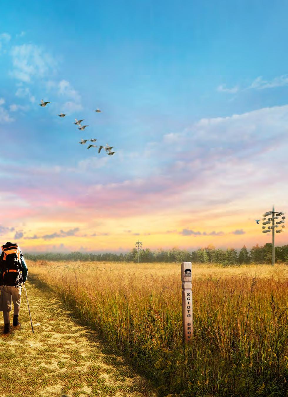
One Central Greenway As the most centrally located of Central Ohio’s five major waterways, the Olentangy River Corridor serves as the main geographic spine of the system. It also functions as the center of activity for the area, as it is connected to a substantial portion of the region’s population, major institutions, employment centers, and other amenities. Given its prominence, the Olentangy River Corridor can be the realm through which to address the pressing ecological and equity challenges facing our region. From the north gateway of Highbanks Metro Park to the southern gateway of Scioto Grove Metro Park, the river and its environs have the potential to become interwoven into the surrounding neighborhoods to create a unique tapestry of greenways, blueways, parks, destinations, green streets, and community amenities.
01ACTIONS ENHANCE ACCESS BETWEEN THE OLENTANGY RIVER AND THE NEIGHBORHOODS » Connect neighborhoods to public spaces » Create welcoming destinations » Identify sites for new greenway neighborhoods » Mitigate environmental injustices 02 REFLECT THE COMMUNITY THROUGH AUTHENTIC ACTIVATION » Create a more defined blueway system » Orient and educate through wayfinding » Provide essential amenities » Create retail and service business opportunities » Honor the history and heritage of the river 03 CREATE EAST-WEST LINKS » Create healthy, green streets » Create a braided trail network » Create additional trailheads » Explore opportunities for transit-supportive development 04 INSPIRE THE NEXT GENERATION OF ENVIRONMENTAL STEWARDS » Create learning hubs » Monitor and document the health of the river » Use information to improve the health of the river » Provide self-guided educational opportunities 05 GIVE THE RIVER ROOM FOR RESTORATION » Increase habitat diversity » Create new green spaces to absorb floodwater » Improve water quality » Celebrate our unique river character » Engage the public to foster care of our waterways and wildlife 30

PULSE POINT CASE STUDY: HIGHBANKS Complete the North Gateway As its name suggests, Highbanks Metro Park is situated along a 100-foot shale bluff that overlooks the Olentangy River. It is already a picturesque and highly visited park that serves as the northern gateway for the river in Franklin County. Highbanks is also surrounded by residential neighborhoods, but direct connections between these areas and the park are lacking. To create one central greenway from Highbanks Metro Park to Scioto Grove Metro Park, this northern portion of the trail needs to be completed. New pathways across the Olentangy River will connect Highbanks with the River Bluff Area, Worthing Hills Park, and the Olentangy Parklands. Extended pathways into the ravines will connect surrounding neighborhoods with the park, allowing people to visit the Metro Park without the need for a car. Diverse, native species will replace invasive ones, especially along the river to enhance the biodiversity of this area.
31

Expanded Entr y Trail Network BikeTrail Connections 32


Olentangy River Road Powell Road River Crossing River Crossing River Bluff ObservationAreaDeck Dragonfly Day Camp Nature Center In-Water Play Area North TrailheadKayak Launch N 33

High Street OlentangyRiver River Crossing Ropes Course Hills WorthingtonMarket Hills Park Olentangy Parkland Olentangy Parkland Observation Deck Kayak Launch Nature Preserve HIGHBANKS Complete the North Gateway Existing Area Landmark or Amenity Proposed Enhancement River Crossing 34

PULSE POINT CASE STUDY: ANTRIM + SR 161 Enhance an Urban Oasis Currently a 120-acre park surrounding a quarried lake, Antrim Park is a highly trafficked destination in Columbus and is regularly overwhelmed with visitors. Key improvements will transform this well-loved park into a more enhanced urban oasis. Expanding Antrim Park’s path systems and allowing more access to and across the Olentangy River, including into the east-west ravines, will increase the park experience. Improved pedestrian and bike connections should be made between Broadmeadows Park, Antrim Park, and Thomas Worthington High School. Antrim can become a major ecological habitat along the Olentangy Trail. By expanding and reshaping the existing fish and wildlife habitats we can promote diverse plant and animal expansion into the greenway.
35
Expanded Path System


Woodlan d Brewery
36
Observation Deck


Olentangy River Road SR 161 SR 315 AntrimLake Indian NeighborhoodHills KilbourneVillage WorthingtonOld River Crossings Thomas Worthington HSAntrim Park Community Pavilion Expanded AquaticNaturalizedHabitatEdge The HUB Microbrewery (Trail Stop) Kayak Launch N 37

High Street OlentangyRiver RushRun Village of RiverleaRiver Crossing River Crossing Rush Run BroadmeadowsParkPark Wildlife Habitat & Observation Deck Neighborhood Pavilion KayakANTRIMLaunch + SR 161 Enhance an Urban Oasis Existing Area Landmark or Amenity Proposed Program River Crossing 38

Festiv al Lawns CulturalGardens 39


Create a Cultural Gathering Place The Bethel Road cultural gathering place expands upon the existing AnheuserBusch Sports Park to create a more neighborhood focused space. The Bethel Road corridor has a diverse population, with many different races and ethnicities represented. Providing spaces for residents to celebrate their distinct cultures is a key program element for the Olentangy corridor in this area. Festival lawns and small market spaces will be provided to give vendors places to sell food and wares, while small gardens will salute the cultures represented in this part of Columbus. Expanding the existing Recreation Center into a Community Center and creating outdoor community gathering space and cultural gardens will provide more programmable space for events such as farmers markets, festivals, pop-up activities, and more. Enhancing the existing baseball fields and adding soccer fields will create more space for active recreation. River crossings connect residents to the east with this new amenity.
40
Cultural Food Hub & Market PULSE POINT CASE STUDY: BETHEL


Bethel Road HendersonRoad Olentangy River Road SR 315 OlentangyRiver River Crossing Olentangy Plaza Stormwater BasinMulti-Use Fields Cultural Market Pavilion BETHEL Create a Cultural Gathering Place Existing Area Landmark or Amenity Proposed Program River Crossing 41

River Crossing River Crossing Olentangy ParkTransit HubCommunity Center Nature Preserve Outdoor Gathering Space & Cultural Gardens Kayak Launch N 42

PULSE POINT CASE STUDY: RIVERSIDE Develop a Riverfront Neighborhood The existing job hub of Ohio Health’s Administrative Campus and Riverside Methodist Hospital is supplemented with additional uses to create a new neighborhood that is immediately adjacent to the Olentangy River and Greenway Trail. A new transit hub along Olentangy River Road is supported by a density of residents and workers in this new neighborhood. The density of the development allows for some strategic park space on-site, but a new riverfront park on the west side of the Olentangy River and easy connections across the river to Clinton-Como Park provide ample green space for existing and future residents and workers to enjoy.
Multi-modal Transit Transit Hub and Park Riverfront Cafe
43


Transit Connection PedestrianBraidedBridgeTrails Community Pavilion 44


Olentangy River Road SR 315 OlentangyRiver CemeteryUnion Transit Hub New LinkUs Transit Supportive District Columbus Nature Preserve River Crossing RIVERSIDE Develop a Riverfront Neighborhood Existing Area Landmark or Amenity Proposed Program River Crossing 45

North BroadwayRiverfront Cafe Pavilion Riverside Hospital Ohio Clinton-ComoHealthPark River Crossing Kayak Launch N 46

Kayak launches and river crossings will help to activate the Olentangy River in this part of the city, while connections to the OSU Wetland Research Park create opportunities for learning experiences and outdoor classes that utilize the park. A new east-west connection along Hudson Avenue will connect the new Hudson Adventure Park to Mock Park in Linden, making active transportation more accessible for the residents in between.
47
PULSE POINT CASE STUDY: HUDSON + OSU LEARNING LAB Uncover Space for Adventure The portion of the Olentangy River Corridor between the Wilma H. Schiermeier Wetland Research Park and Lane Avenue has a lot of potential to be an exciting destination in close proximity to a large population, especially students and young professionals. The Hudson Adventure Park is a large playscape with regional appeal for all ages. An exciting playground and festival lawn will accompany a rock-climbing wall, multiseason garden, river observation tower, boat house, and community spaces.

Adventure Park BoatHouse 48


LaneAvenue Olentangy River Road OlentangyRiver River Crossing Rec Center Tuttle Park FawcettCommunityCenterCASSkateParkCenter HUDSON + LEARNINGOSULAB Uncover Space for Adventure Existing Area Landmark or Amenity Proposed Program River Crossing 49

NeilAvenue Hudson StreetDodridgeHighStreetStreetRiver Crossing River Crossing Tuttle Park Hudson Connection to Mock Park GoodwillWetlandIndustriesResearch Park Play Garden + AdventureOverlookParkBoat House & Launch N 50

CulturalGatheringSpace 51


Create a New Campus Destination
River A ccess PULSE POINT CASE STUDY: OSU LONG WALK
The OSU Long Walk, the path from the Oval to the Olentangy River, currently lacks an exciting destination that will draw students and others to the river. To remedy this, a new riverfront gathering place and park is proposed, situated between Morrill and Lincoln Towers. The Long Walk from the Oval will lead people through campus and Lincoln Tower Park to a new green space and plaza between the residential towers. An amphitheater at the river’s edge will be a space for cultural celebrations, performing arts, and other university events. The revamped park and trails surrounding the amphitheater will connect south with the new park space created from the relocation of Cannon Drive and north to the existing green space and trail network. The river will be more accessible around campus through new kayak and boat launches. River crossings connect Main Campus and West Campus.
52


Lane Avenue Olentangy River Road Canon Drive OlentangyRiver N OSU LONG WALK Create a New Campus Destination Existing Area Landmark or Amenity Proposed Program River Crossing River Crossing River Crossing River Crossing Tuttle ParkSt. John Arena Rec Fields 53

KinnearRoad Annie&JohnGlennAvenueOhio Stadium The Oval Event Pavilion Kinnear Road Connection River Crossing 54

Bike BraidedConnectionsandMulti-modal Trails Park
Underpass
55
The redevelopment of Lennox Town Center and the corridor south to 5th Avenue would create a new riverfront neighborhood. This will be a mixed-use and higher density neighborhood to support transit along Olentangy River Road, a major connector road for Central Ohio, in accordance with Columbus’ LinkUS initiative. Green streets and smallscale park spaces will be integrated throughout the development to provide comfortable shade and green space.
PULSE POINT CASE STUDY: LENNOX + 5TH AVENUE Establish A NeighborhoodGreenway
Direct pedestrian and bike connections lead people across Olentangy River Road to a new riverfront park situated beneath the SR315 underpass. Redesigned streets that prioritize pedestrians and cyclists will connect to the east side of the river into a braided trail system and the new Cannon Drive Park.

SR315 BRT Connection Underpass Park BikewayCrosswalks 56


3rdAvenue Olentangy River Road SR 315HarrisonKayakWestLaunchTransit Hub LENNOX & 5TH AVE Establish a Greenway Neighborhood Existing Area Landmark or Amenity Proposed Program 57

5th Avenue King Avenue Kinnear CannonRoadDriveOlentangyRiver Wexner Medical Center Cannon Drive ParkTransitNeighborhoodBattellePavilionHub Lennox RedevelopmentN 58

PULSE POINT CASE STUDY: CONFLUENCE Center Community through a Crown Jewel Park The Franklinton neighborhood currently does not benefit from the nearby greenway trails or the Olentangy and Scioto Rivers because they are blocked off by infrastructure barriers—roads, railways, highways, and the floodwall; they are close in proximity, but lack access. An expanded and enhanced Confluence Park would create a better union between the neighborhood, the new CoverMyMeds headquarters, the new Crew Stadium, redevelopment of the Mount Carmel site, and the highquality recreational amenities along the river. The new Confluence Park extends south, creating frontage along Broad Street to serve as a neighborhood park and to directly connect Franklinton residents with the riverfront. It would be a hub for youth recreation, with an indoor fieldhouse and outdoor basketball facilities. A sweeping circular pedestrian walkway, the “ONE Columbus” bridge, that spans across the Olentangy and Scioto Rivers, providing spectacular views of Downtown Columbus and Franklinton.
59

Sweeping Pedestrian Walkway Expanded Confluence Park 60


Com munity FieldHouse Kayak Launch Crew Stadium Community Fieldhouse River Pavilion Confluence Tower/DRREDUOSOLENTANGYRIVERRD 61


RiverDeck Multi-purposeSports Courts RiverMulti-PurposeDeck Sports Courts BROADSTREET CONFLUENCE 62


Community Fieldhouse Broad Street Cap Mt RedevelopmentCarmel Site CoverMyMedsOrangeBarrel Media SR Franklinton315 N Souder/OlentangyRiverRd CONFLUENCE Center Community through a JewelCrownPark Existing Area Landmark or Amenity Proposed Program River Crossing 63

SR315 RiverConfluencePavilion Tower Kayak Launch Kayak Launch River Deck Multi-Purpose Sports Courts Crew GravityStadium Broad Street Spring StreetLong Street Scioto River OlentangyRiver I-670 East Franklinton River Crossings 64

Urban Beach 65


Dining & W ater Access PULSE POINT CASE STUDY: SCIOTO MILE Activate the Urban Riverfront At the western terminus of Gay Street at the Scioto Greenway in Downtown Columbus is a chance to activate the urban riverfront in a way that will attract people to linger in this part of the park. A new center of activity at this section of the riverfront is defined by local retail and dining. Attracting and spurring small, local businesses and entrepreneurship should be a priority to fill these spaces. An urban beach acts as a backdrop for lounging and recreation. Spectacular views of the river and plentiful outdoor seating will entice people to enjoy this space as they make their way along the Scioto Greenway in Downtown.
66


SciotoRiver Long Street Urban BeachKayak Launch McFerson Commons Nationwide Arena AEP N 67

Broad Street Gay StreetMarconi Boulevard Gay Street Terrace Scioto Hub SCIOTO MILE Activate the Urban Riverfront Existing Area Landmark or Amenity Proposed Program 68

The vision for The Fort and Columbus’ South Side amplifies the existing draw of the Lou Berliner Sports Park by expanding the park south and east, connecting across the river to reach three neighborhoods on the South Side: Merion Village, Hungarian Village, and Reeb-Hosack. The expansion of Berliner Park south would create more ball fields and a new public gathering space and food truck commons in the center of the park. This new space and the recently completed mountain bike trails create opportunities for more user groups to enjoy the park. To the east, a new neighborhood-oriented section of the park is connected across the river by a new bridge. This section of the park will help to serve the redevelopment of the Fort site and new southern neighborhoods. New trails, event lawns, ponds, and a ropes course will provide active and passive recreation opportunities for the South Side.
PULSE POINT CASE STUDY: THE FORT Connect the South Neighborhoods
Movie/Event
MountainLawnBike Trail
69


Expanded Trails Remediated Quarry NeighborhoodsTo To Berliner Park 70


Harmon Avenue Hart Road I-71 SciotoRiver MerionVillage GermanVillage Berliner Expansion Food TruckBerlinerCommonsSingletrack Scioto Audubon Metro Park Berliner Park River Crossing 71

High Street SR 104 Parsons Avenue HungarianVillage HosackReebRemediated Quarries The Fort Neighborhood New South Neighborhood Ropes Course The Fort THE FORT Connect the South Neighborhoods Existing Area Landmark or Amenity Proposed Program River Crossing 72

PULSE POINT CASE STUDY: SCIOTO TRAIL PARK + SCHOOL Unveil Urban Nature On the far South Side, an enhanced Scioto Trail Park and the existing Columbus Scioto School anchor a new community hub for urban nature. An urban farm and greenhouse learning center serve as the backdrop for handson opportunities for children to learn about gardening and food systems. They also act as a local source of healthy food for the neighborhood. A nearby wetland learning lab is another spot for school children to engage with nature and learn about environmental science, while also creating more research opportunities for university students and faculty. An overlook and river crossings offer stunning views, while new trails extend throughout the expanded park and a remediated quarry on the west side of the river.
Remediat ed Quarry
73


Greenhouse Learning Center
n Farm 74
Urba


SciotoRiver Remediated QuarryWetland Learning Lab River Crossing N SCIOTO TRAIL PARK + SCHOOL Unveil Urban Nature Existing Area Landmark or Amenity Proposed Program River Crossing 75

High Street River GreenhouseUrbanOverlookAgricultureLearningCenter River Crossing South Drive-In Theater Scioto School 76

77
Strengthen the South Gateway The continued transformation of Scioto Grove and the surrounding quarries will establish this portion of the river as the southern gateway and outdoor adventure destination for the region. Building on the unique existing program at Scioto Grove, like the REI River Trail and backpacking sites, the expanded Scioto Grove will inspire explorers to hike, bird watch, practice skills like backpacking and archery, and climb up into the tree canopy along the sky bridge for a view like no other. The park will expand to the east side of the river, utilizing the existing quarries as the backdrop for a new park entry point and wetland research center. Multiple viewing stations and decks will create spaces for park users to admire the natural surroundings and the animals that inhabit them.
PULSE POINT CASE STUDY: SCIOTO GROVE

Canopy O verlooks Reclaimed Quarry Edges 78


Jackson Pike High Street I-270 River Crossing River Crossings Sky Bridge & View Towers Lowland Bird Habitat Kayak Launch Disc Golf Course REI River Trail & Backpacking Sites N 79

SciotoRiver River Crossings Quarry OverlookSouth TrailheadAviaryViewing Station Wetland Research & Event Center Open Prairie & Bird Habitat Kayak Launch Hikers Hill Scioto SCIOTODownsGROVE Strengthen the South Gateway Existing Area Landmark or Amenity Proposed Program River Crossing 80

NE CENTRAL GREENWAY 81

OUTCOMES OF THIS VISION The outcomes of the vision for the Olentangy River Corridor would be transformational for Central Ohio. It would give more residents access to parks and green space, create a more resilient ecology, provide space for well-being and culture, and result in new neighborhoods that prioritize transit and active recreation. JewelCrownParkConfluence GatewayParks CulturalParks NeighborhoodsGreenway StreetsHealthy&BraidedTrails 50 1302,700 1,000+ 74 ACRES OF PARK SPACE FOR THE COMMUNITY, WITHIN A 20 MIN. WALK OF 18,175 RESIDENTS ACRES OF EXISTING AND THEPARKPROPOSEDSPACEWITHINTWO GATEWAY METRO PARKS MILES OF HEALTHY STREETS EXTENDING FROM THE OLENTANGY RIVER ACRES OF CULTURAL PARKS ACROSS NEIGHBORHOODS7 ACRES OF NEIGHBORHOODS,GREENWAYWITH MORE THAN 9,000 FUTURE RESIDENTS AND 17,000 FUTURE EMPLOYEES 82

Special Thanks To:


