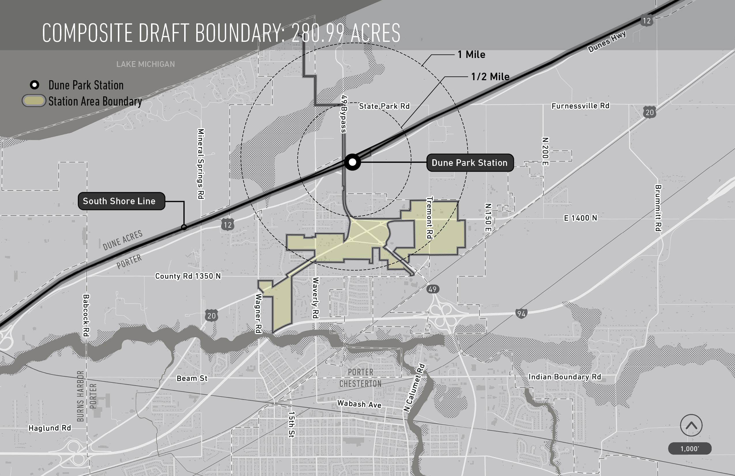
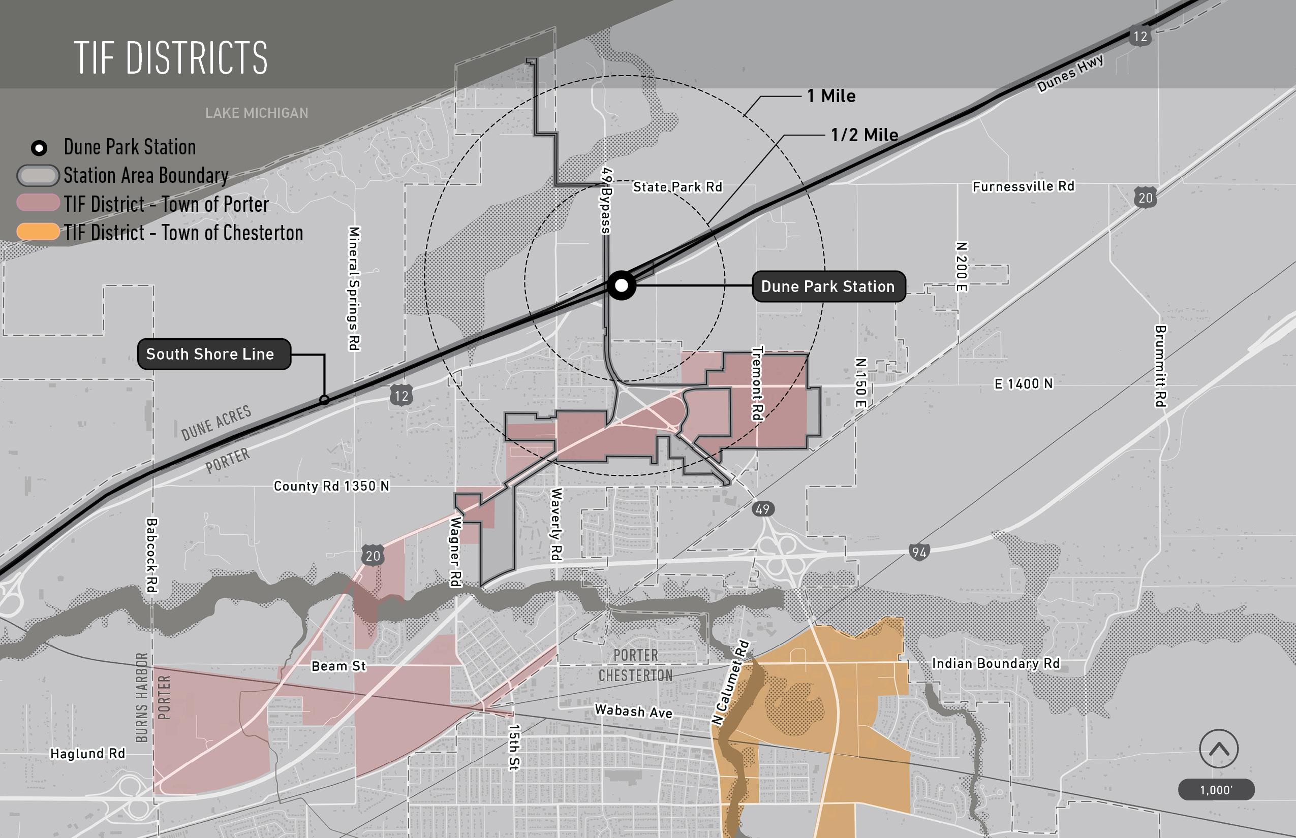
TRANSIT DEVELOPMENT DISTRICT PROPOSED DRAFT BOUNDARY


Porter, IN public engagement session
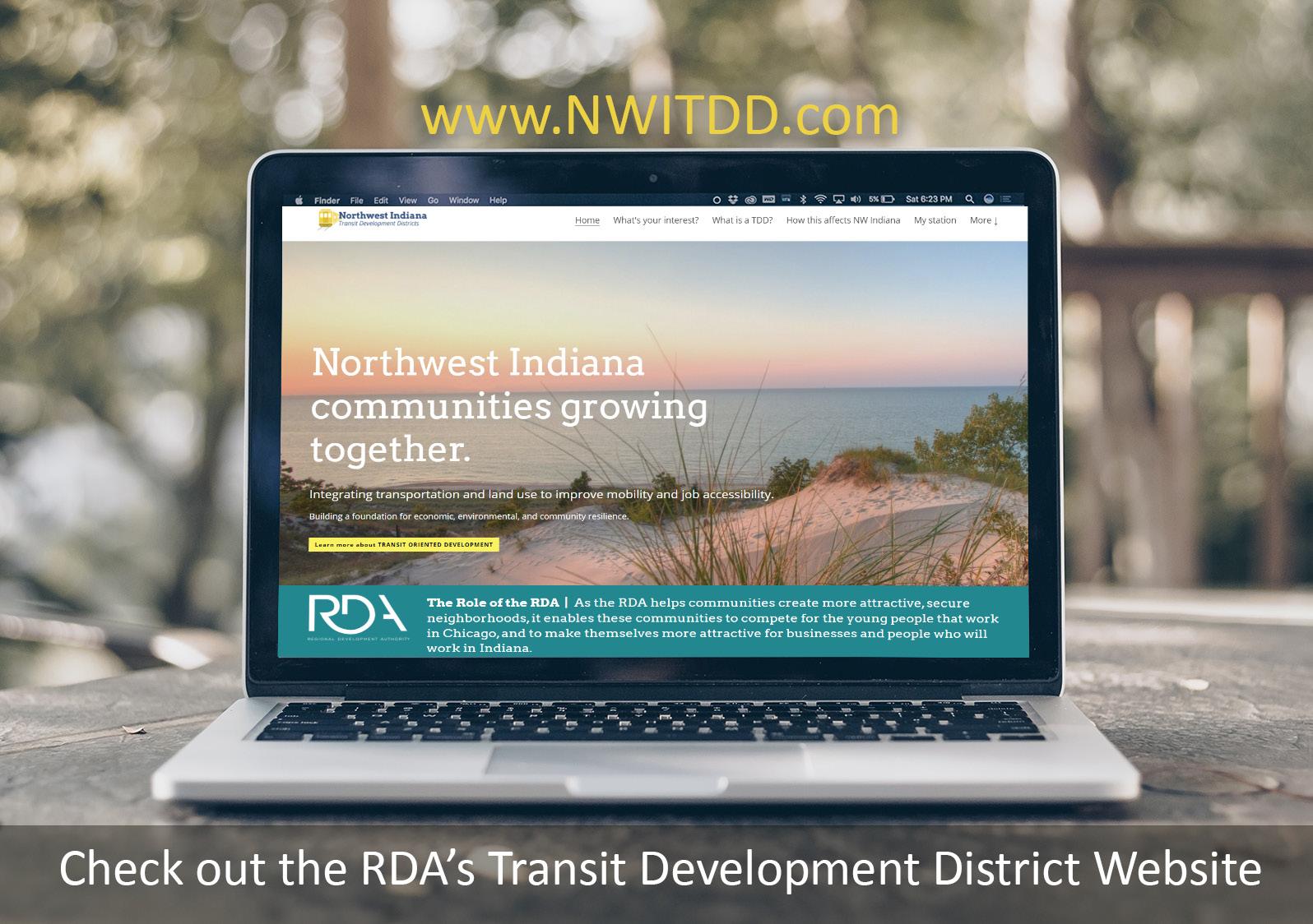
website


how you can interact during this meeting

08/31/2023

Porter, IN public engagement session
website
how you can interact during this meeting
Northern Indiana Commuter
Transportation District
City of East Chicago
City of Gary
City of Hammond
City of Michigan City
City of Portage
City of South Bend
Town of Beverly Shores
Town of Dyer
Town of Munster
Town of Ogden Dunes
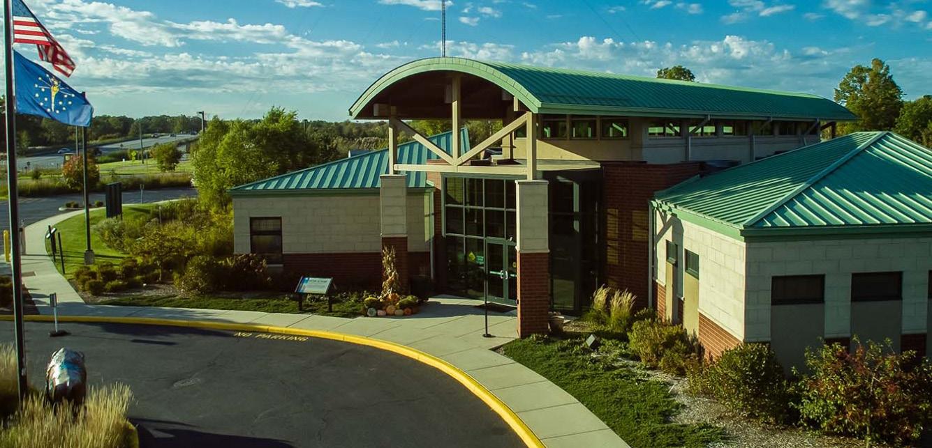
Town of Porter
Regional Development Authority
Leading the Project Overall Project Steering Policy and Planning Guidance
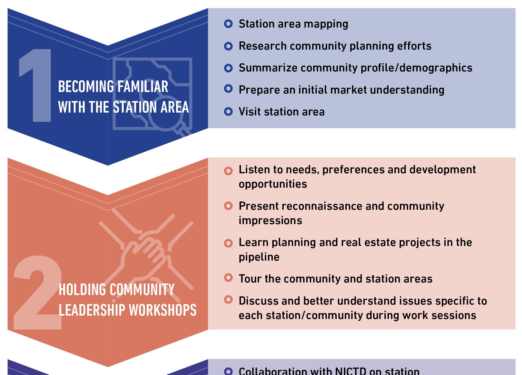
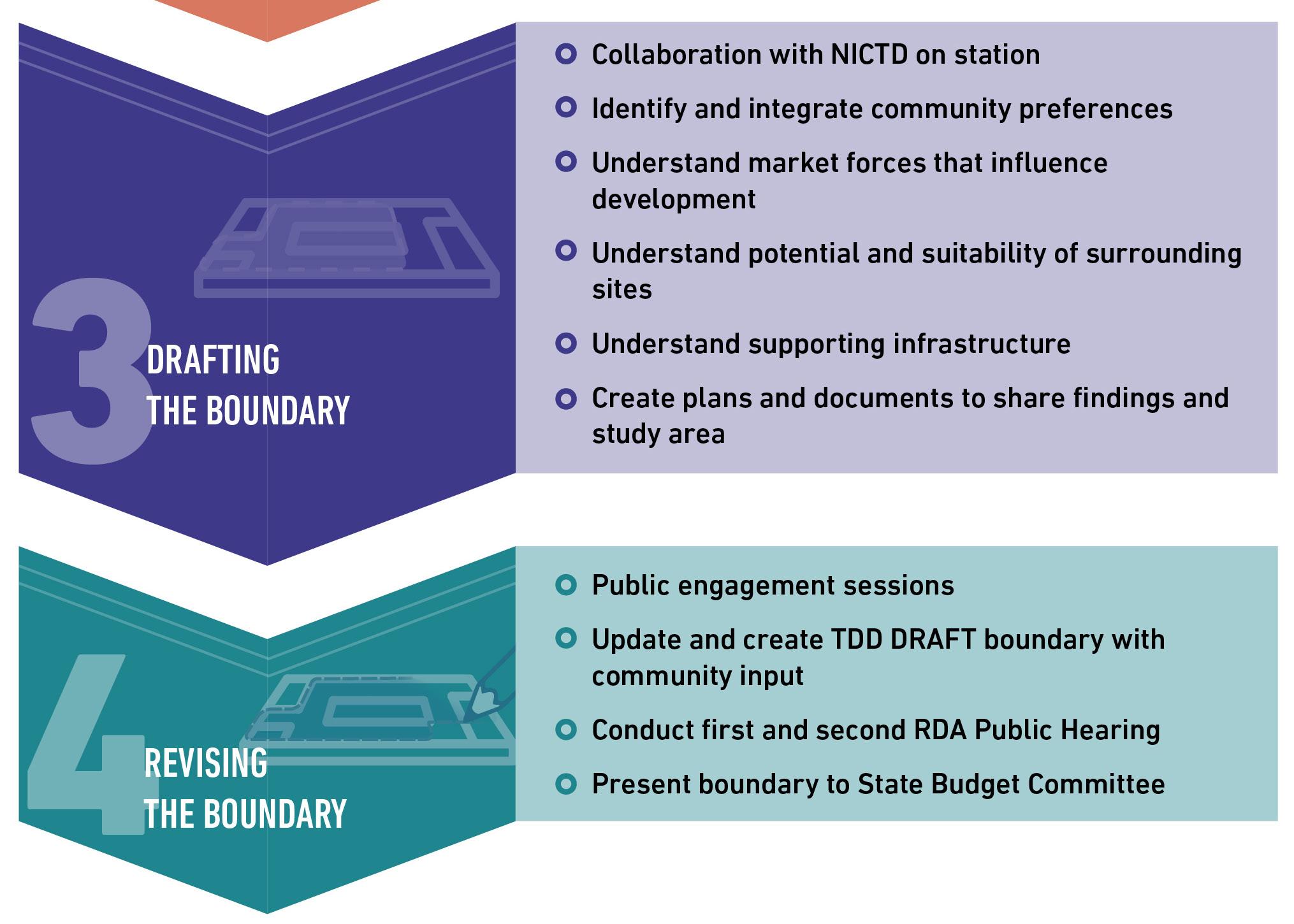
Key steps that RDA will take working closely with each community
• Meet with communities to understand their goals and preferences for growth and development
• Engage with the public through meetings and hearings
• Collaborate with NICTD on parking and development topics
• Conduct community analysis to prepare preliminary and final transit development district (TDD) boundary
• Identify potential development and infrastructure opportunities
• Shepherd the TDD boundary through the state approval process

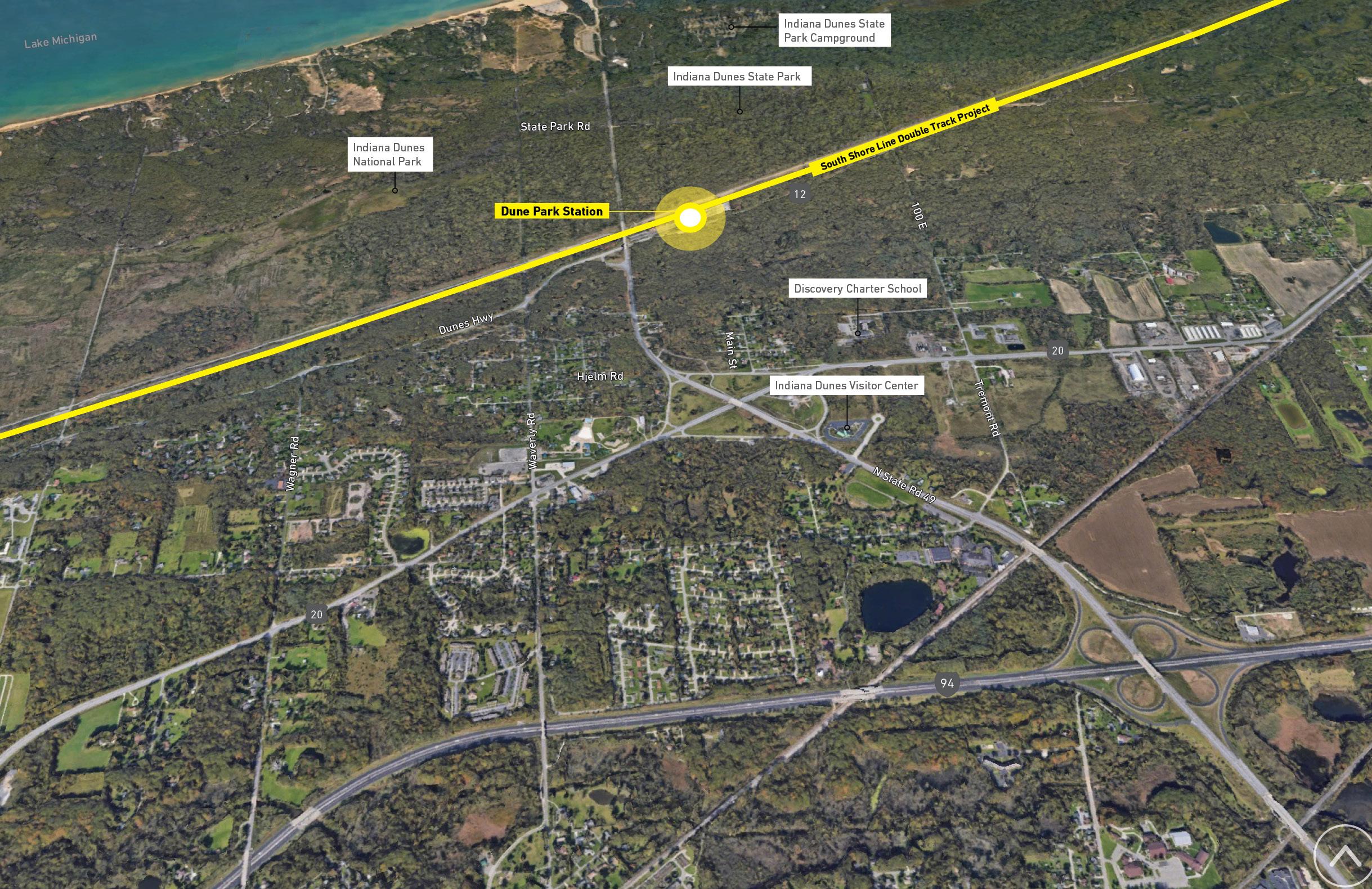
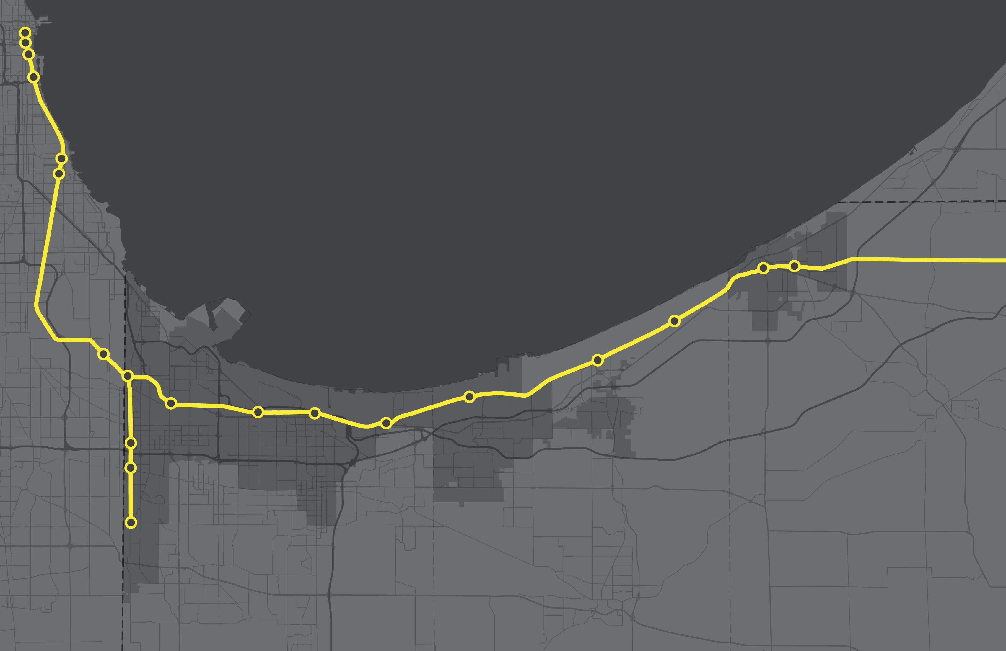
Project Area New Second Track 25
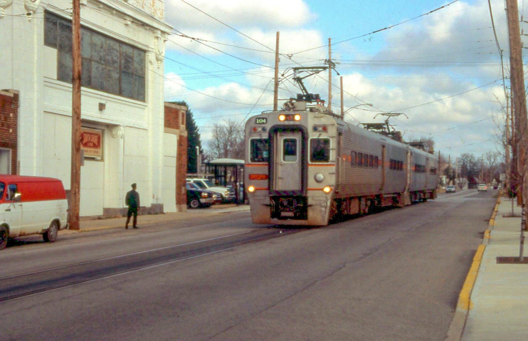
South Shore Line Double Track Project
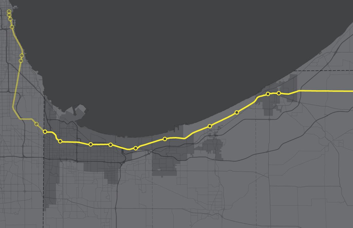
Estimated cost: $643M
• 25-mile project area, includes 16 miles of new second track, the closing of 20 grade-level crossings in Michigan City, and the elimination of “street running” in Michigan City.
• Construction Substantial Completion projected on January 17, 2024
• Revenue Service Date Projected on November 11, 2024
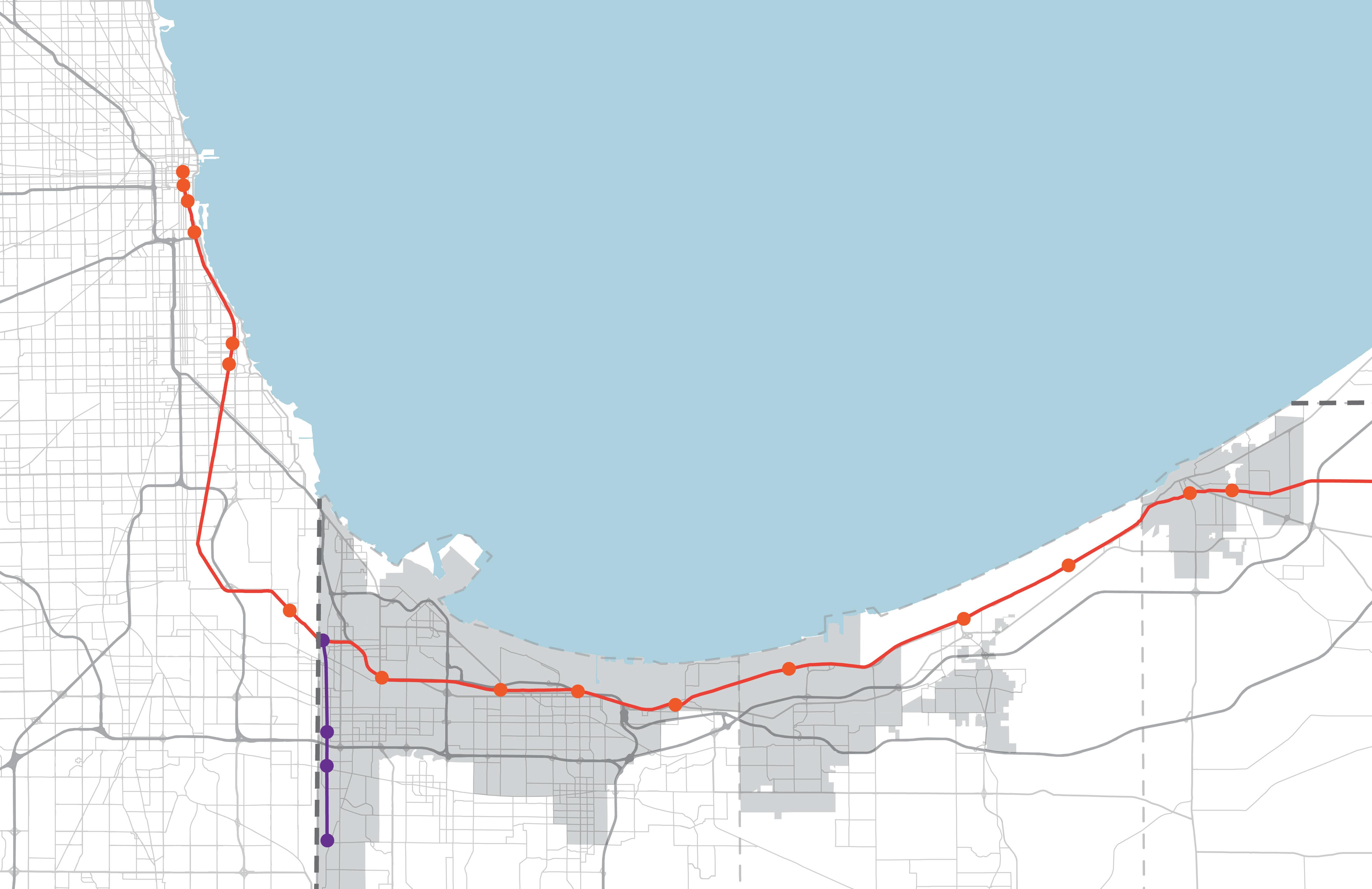
EAST CHICAGO
HAMMOND
MUNSTER
DYER
GARY
OGDEN
DUNES PORTER
BURNS
HARBOR
PORTAGE
CHESTERTON
MICHIGAN

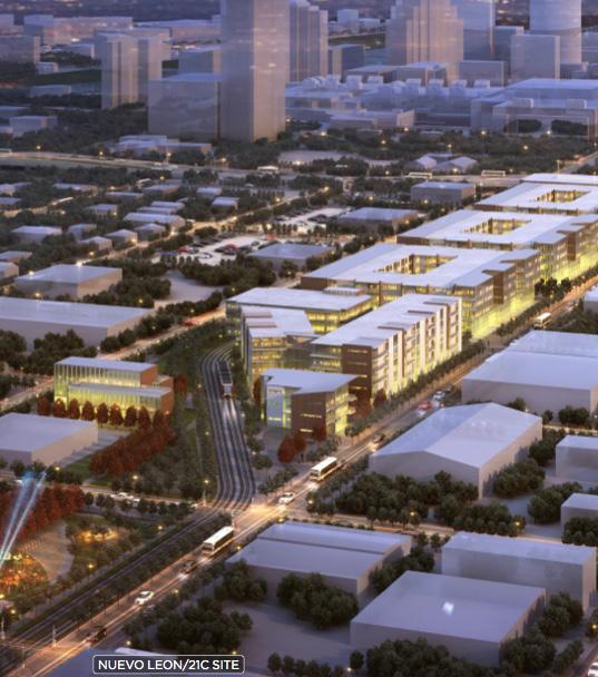
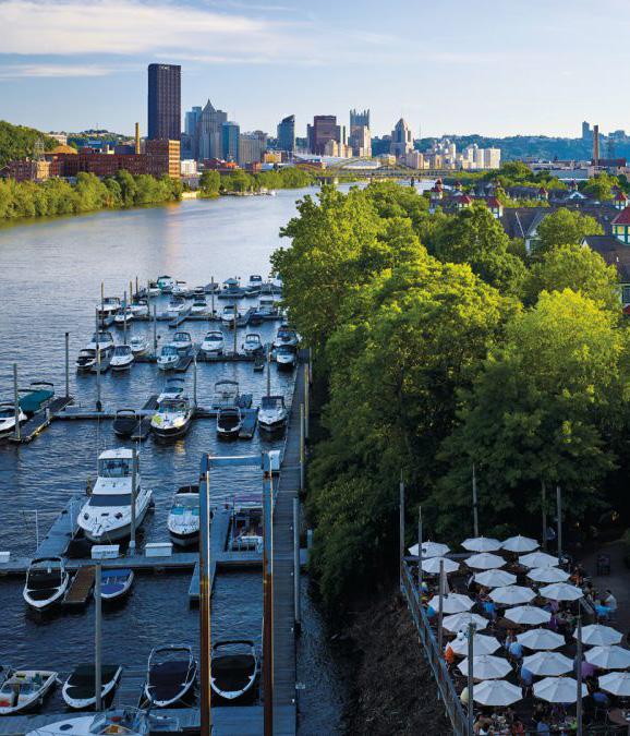
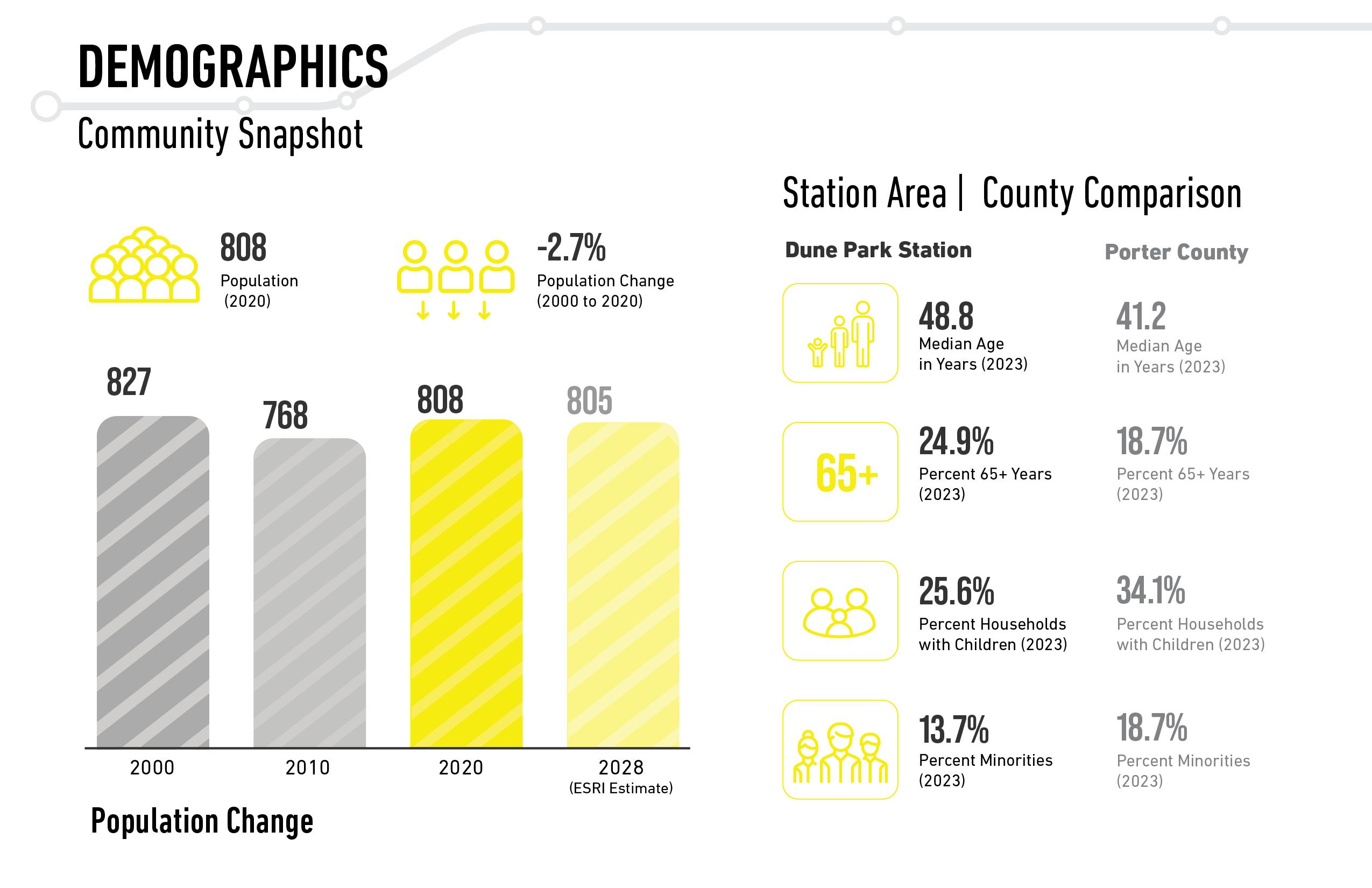
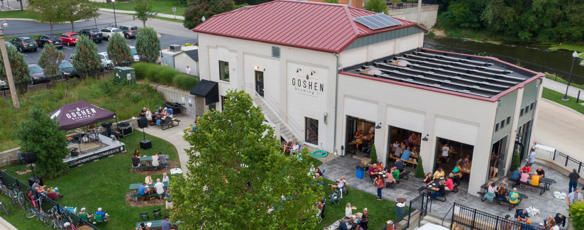
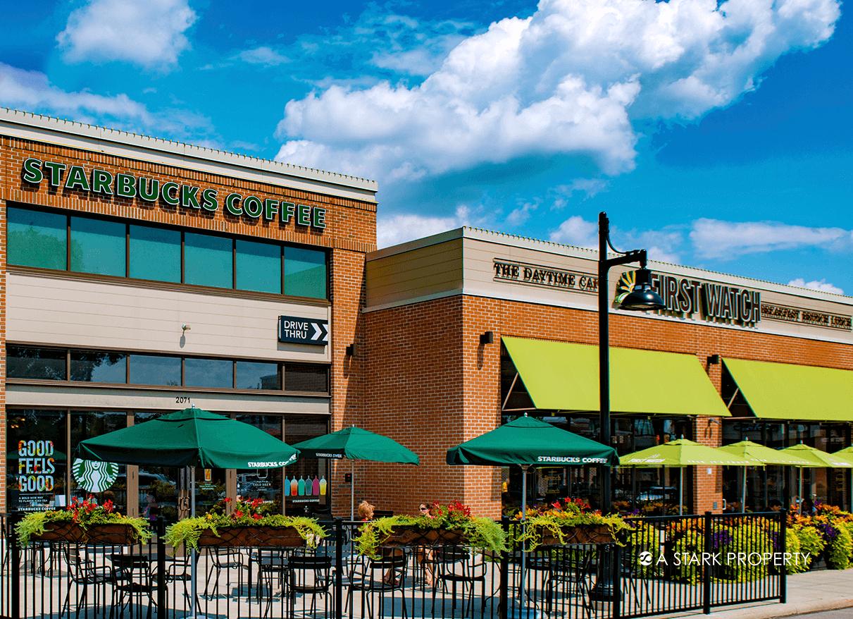
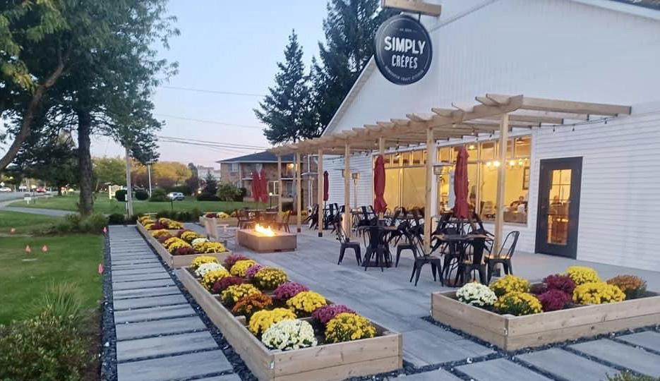
The transit development districts around various suburban train stations in the Chicagoland area have seen significant improvement in real estate development activity since the development/ redevelopment of the station…
Population growth in the 1 mile radius between 2000 and 2020 (estimate). New construction and Real Estate value change are measured in a 1 mile radius between time of TOD reinvestment or construction to August 2020.
1 Transit development district boundary basics
2 Transit development district boundary process
3 Porter goals, unique qualities and current conditions
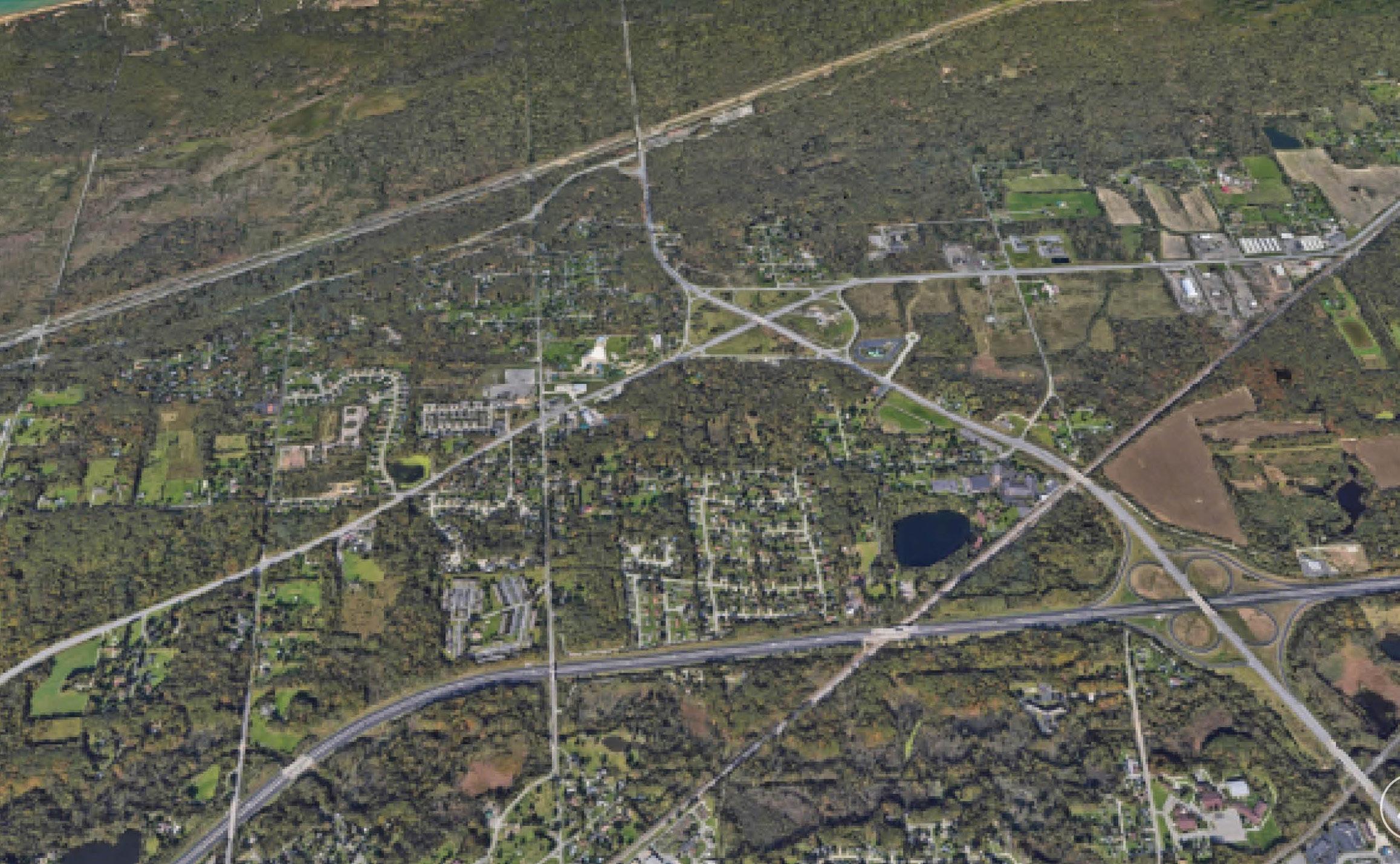
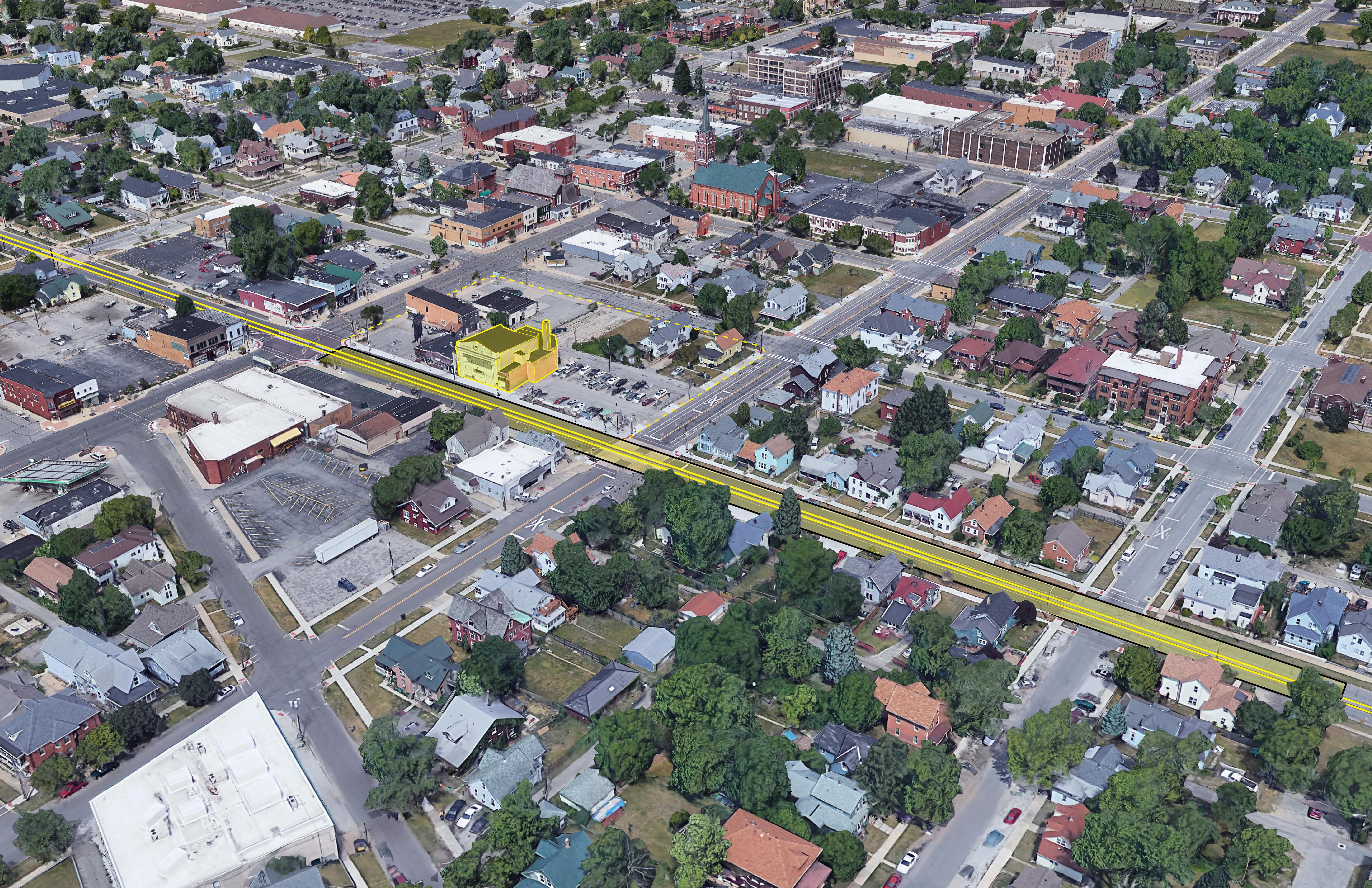
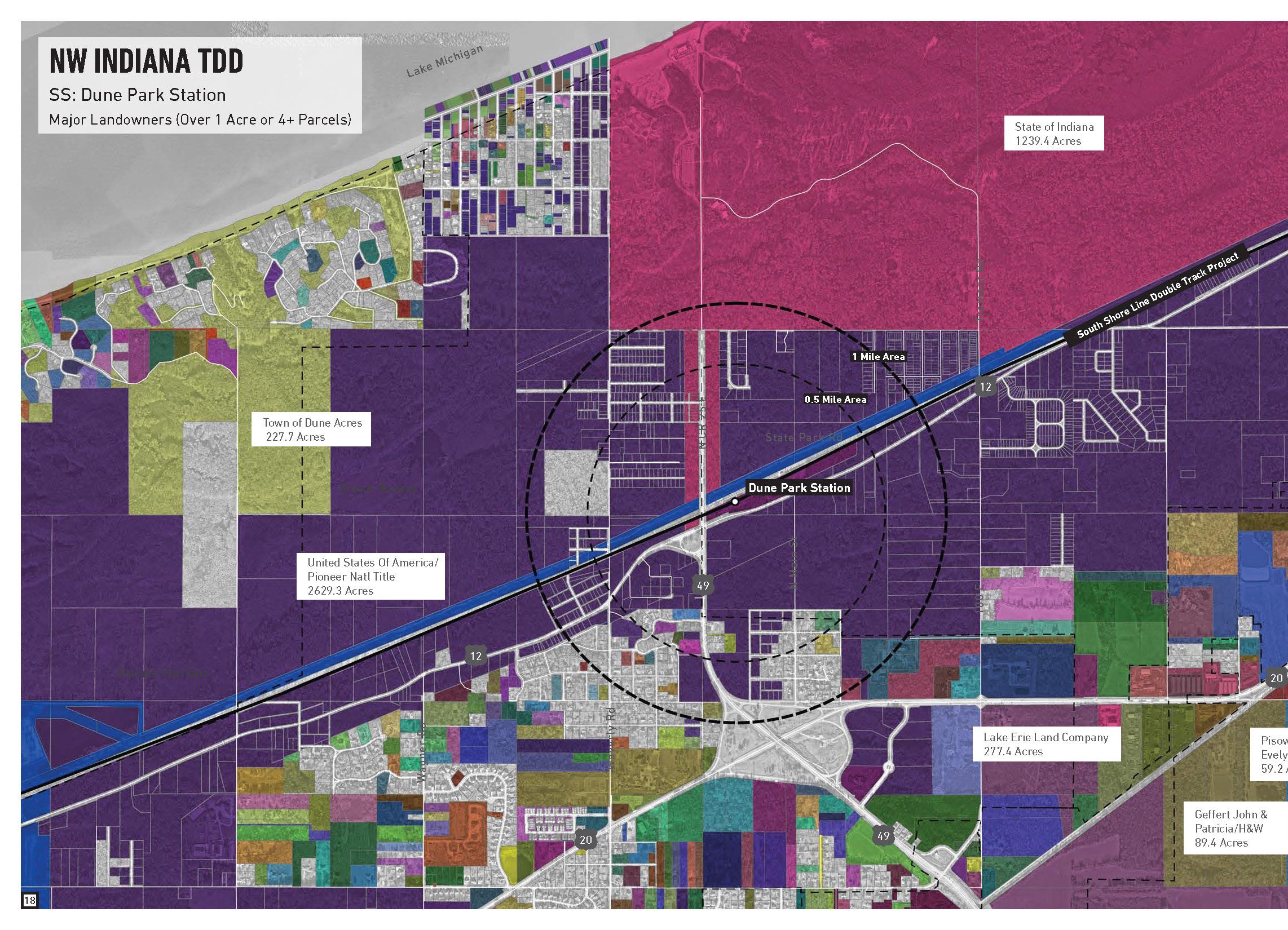
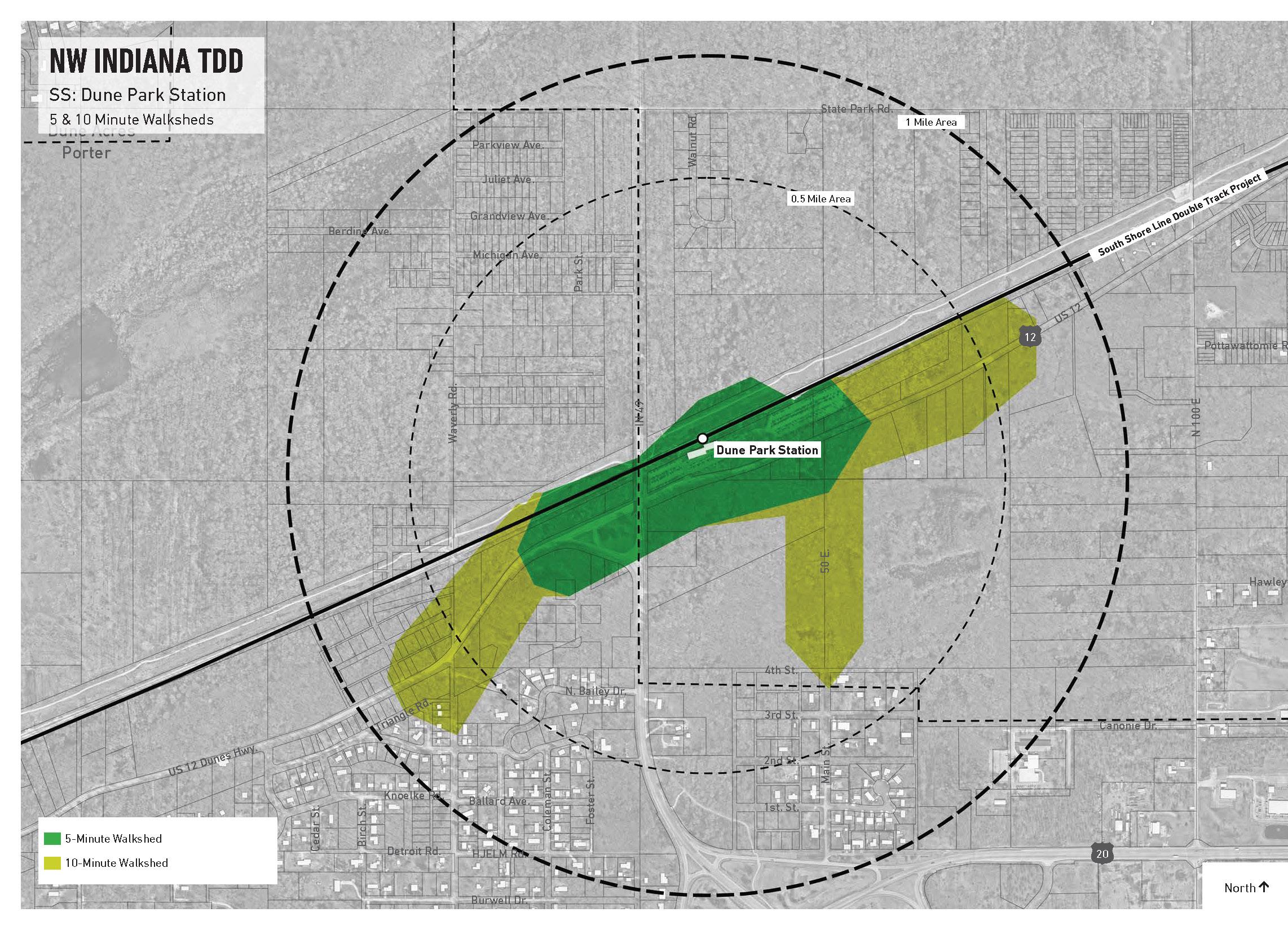
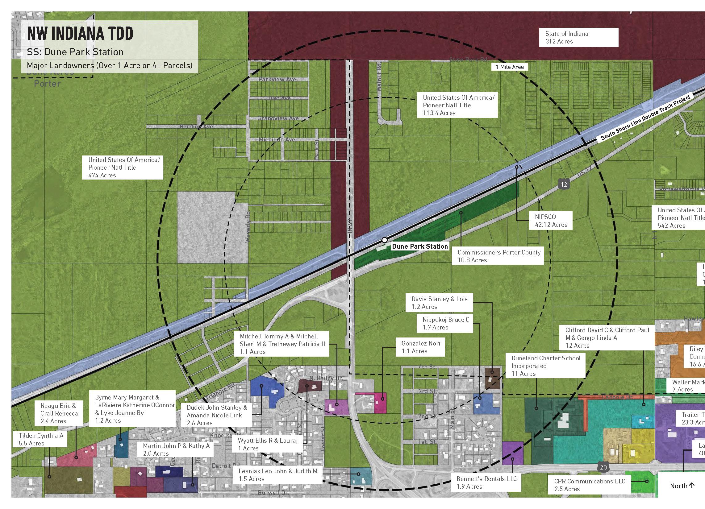
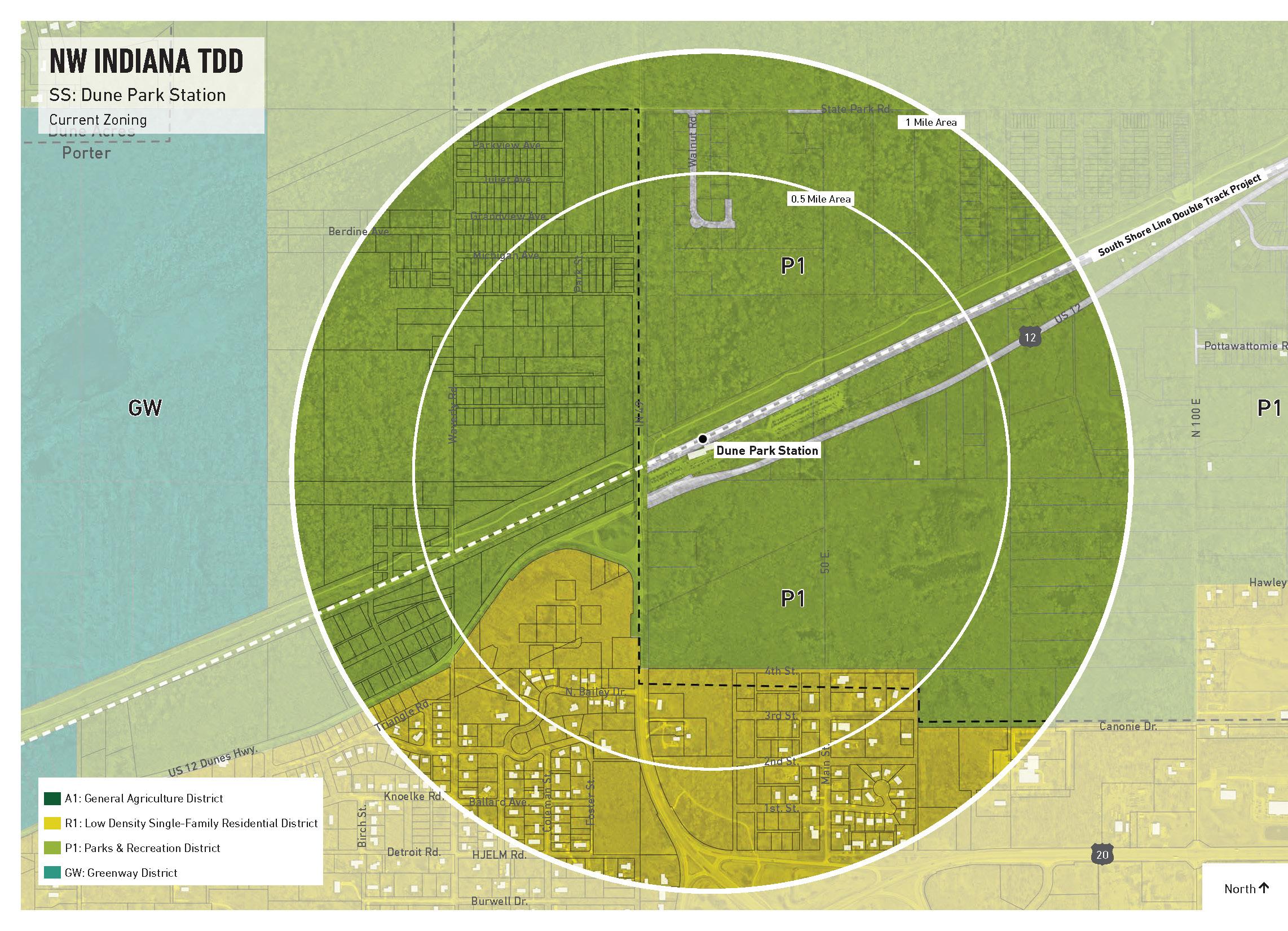
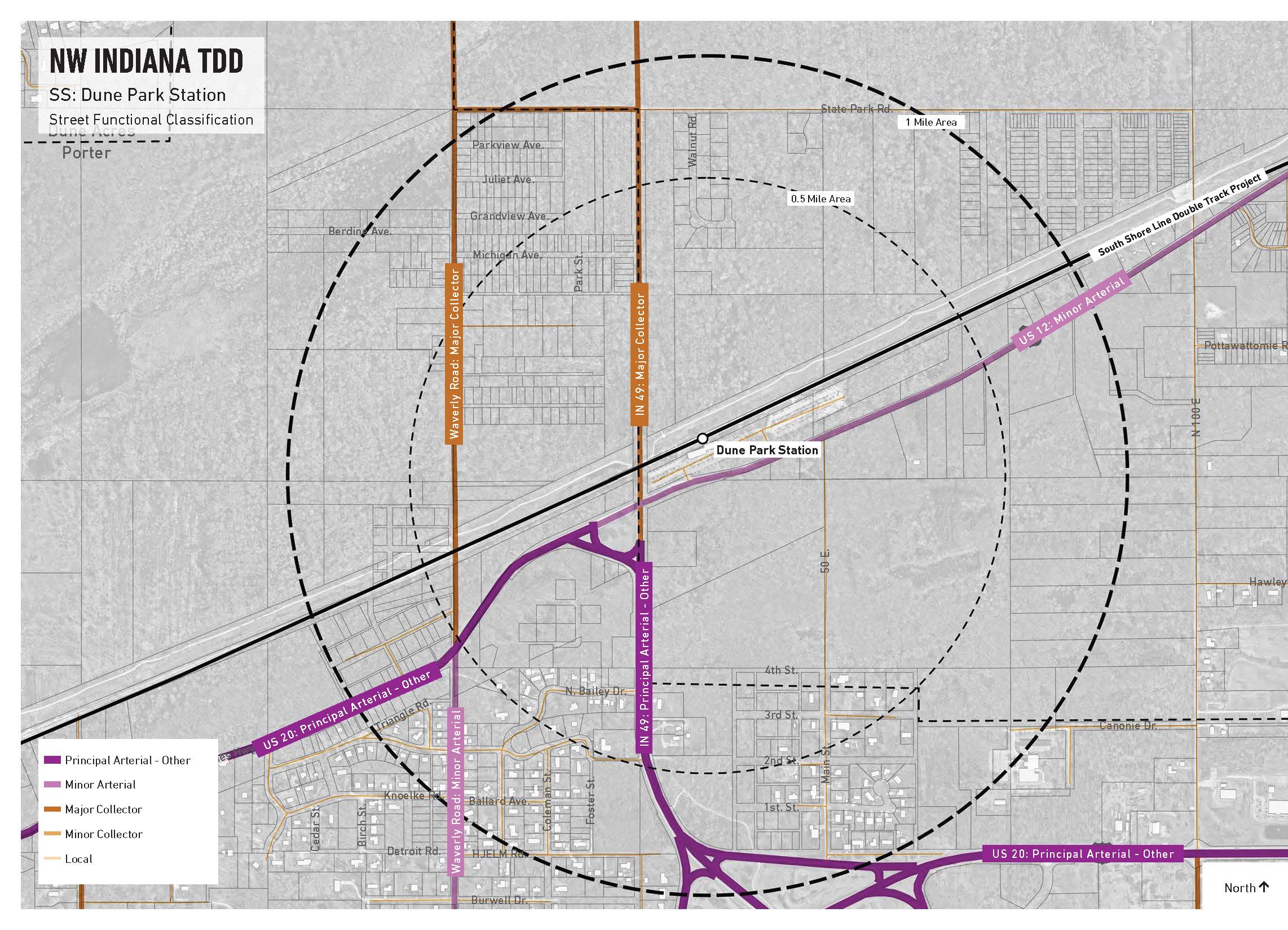
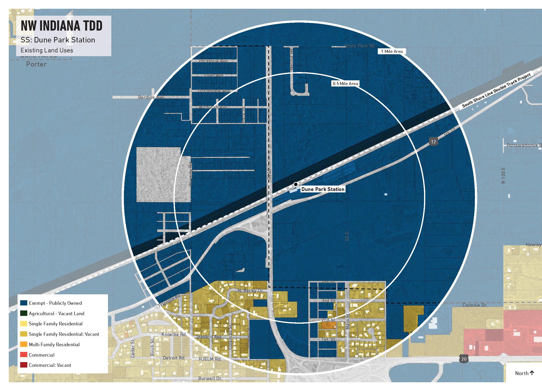
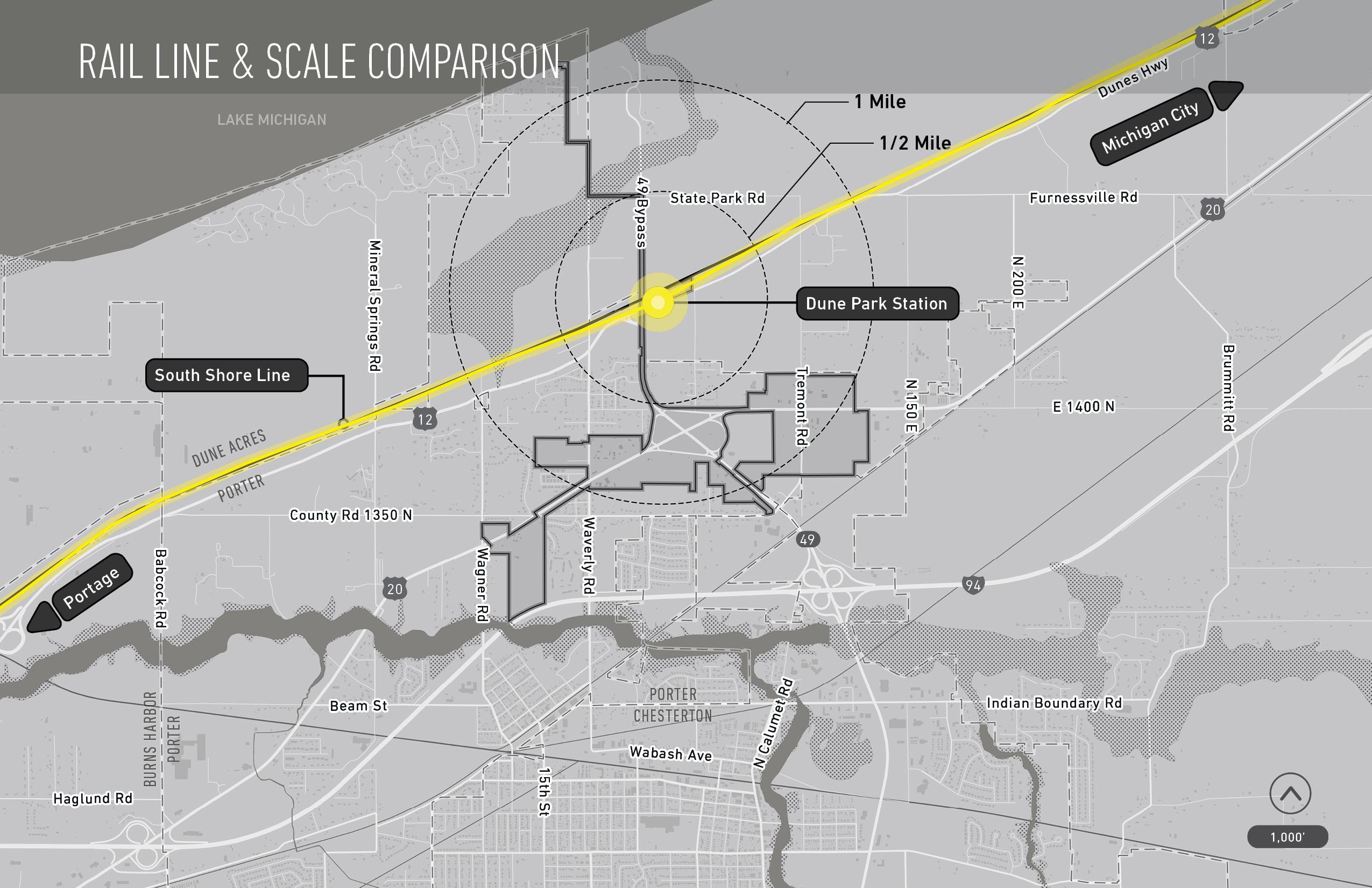
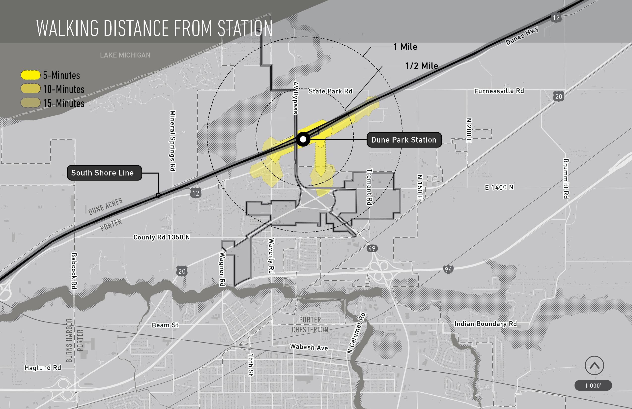
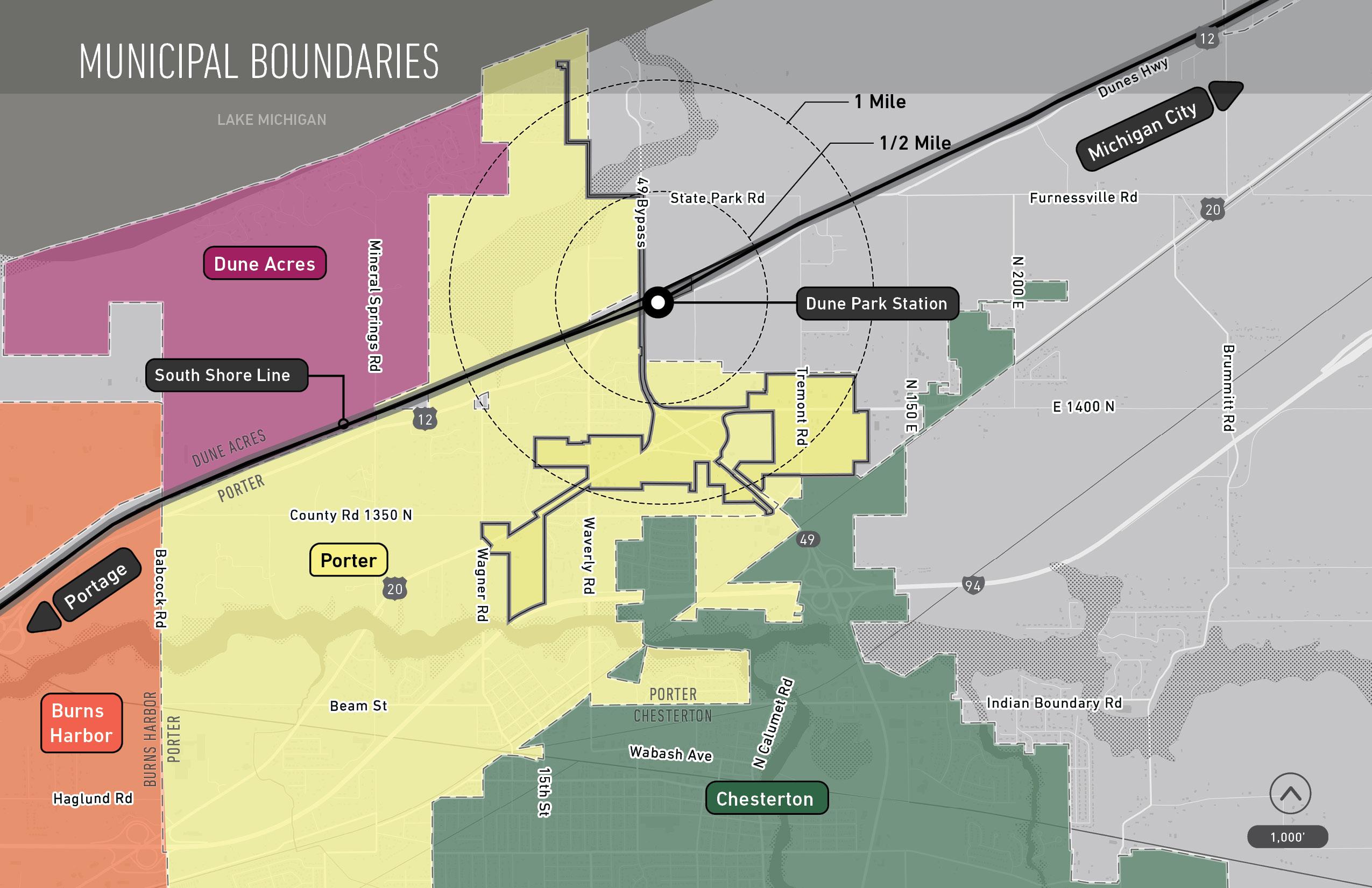
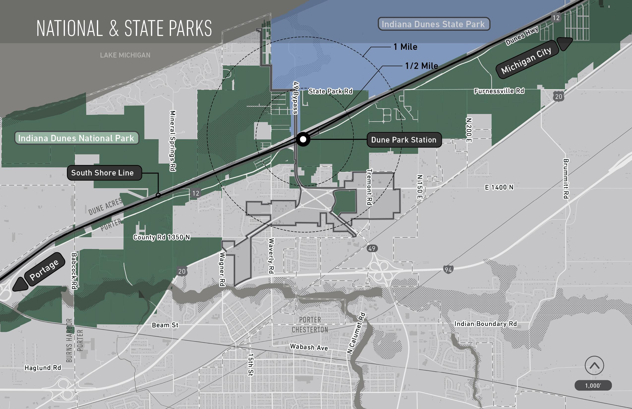
4 Dune Park Station DRAFT TDD boundary
How we will obtain public input
Website - www.nwitdd.com
Find video recording of meetings and Q+A responses, gallery materials, and ability to contact us
what you should know
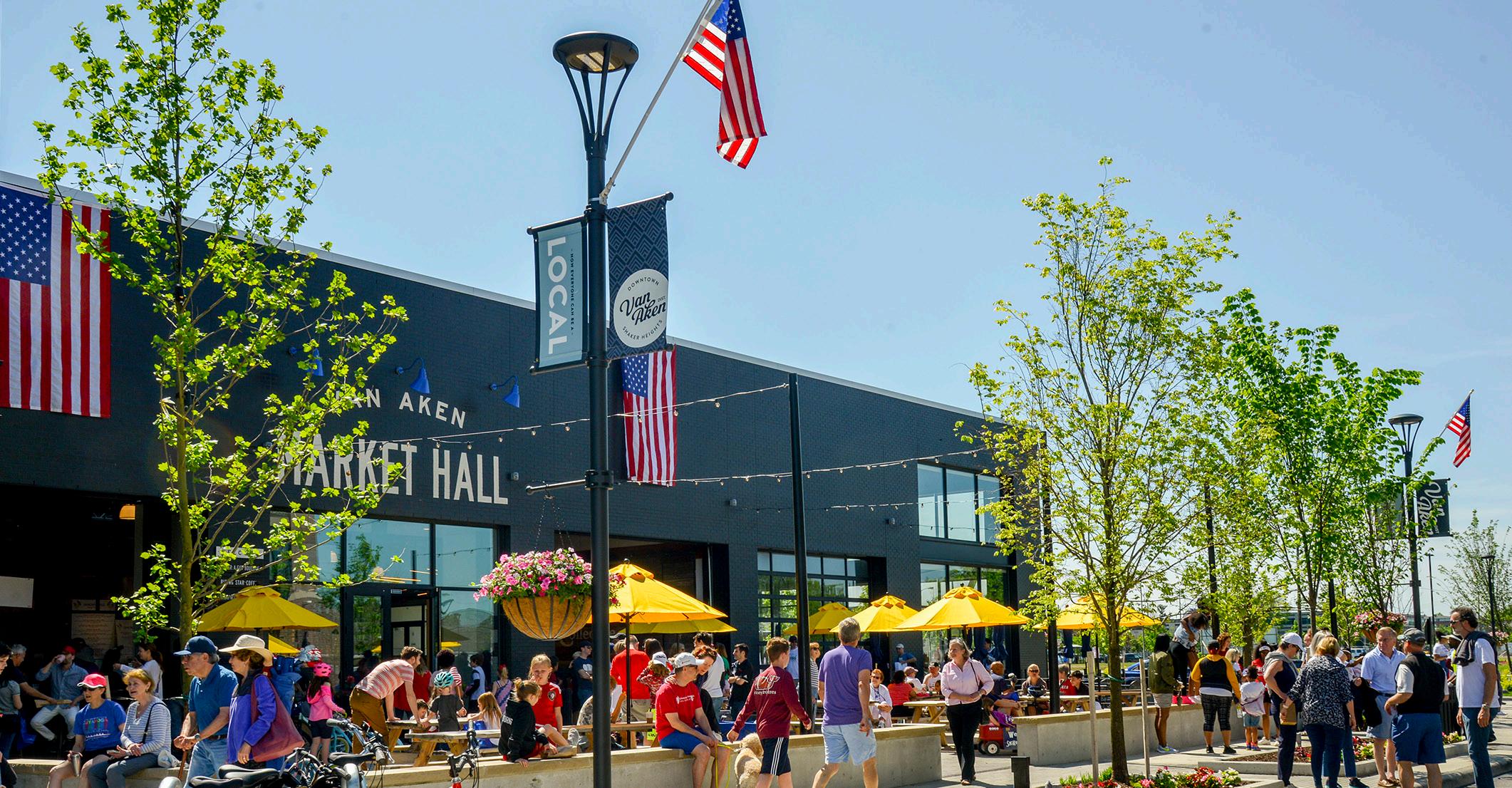
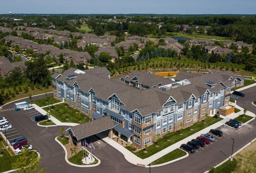
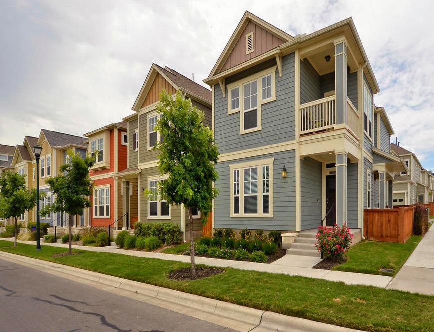
The main focus is on promoting Transit-Oriented Development.
Transit development districts provide economic tools and strategies to support local communities to implement high-quality transit-oriented development. The goal is to create a boundary calibrated specifically for each community based on analysis, areas of opportunity and the goals and visions of the community.
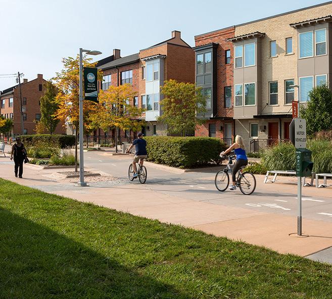
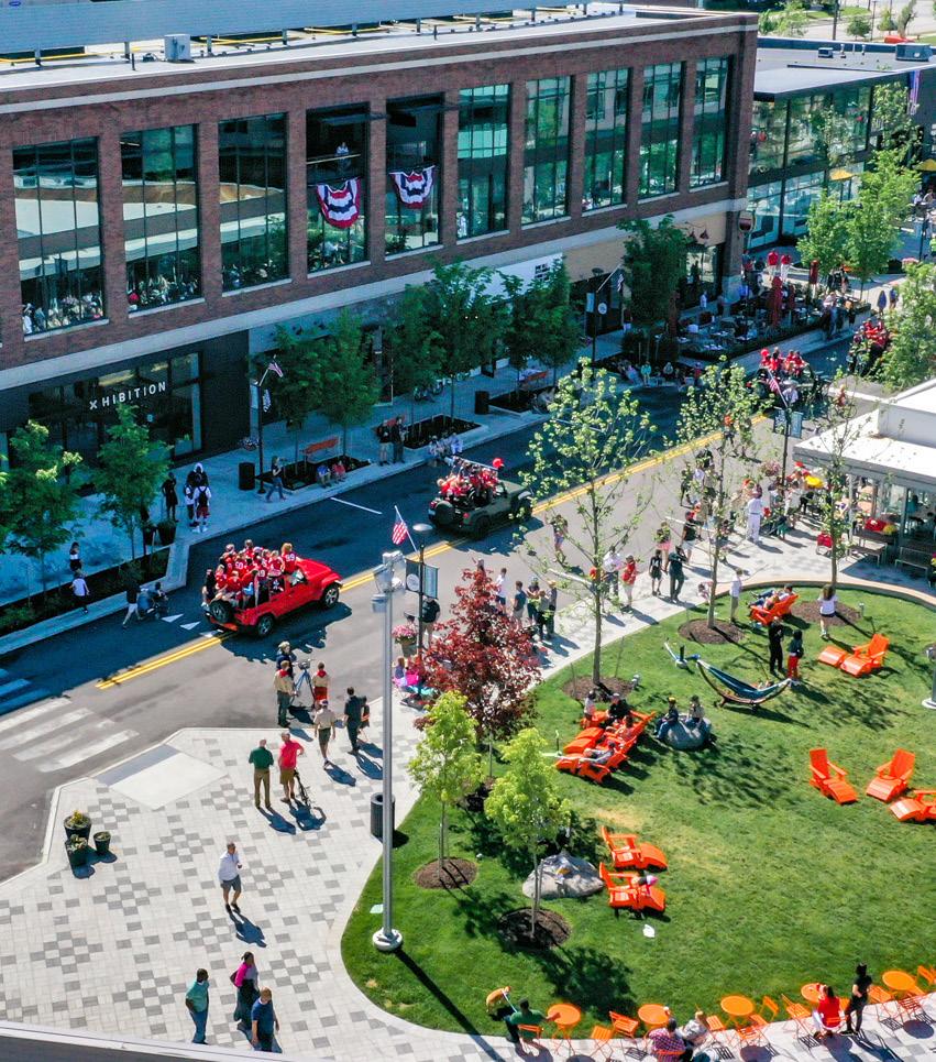
This isn't just a boundary. It complements the economic growth path of communities.
TDD IS...
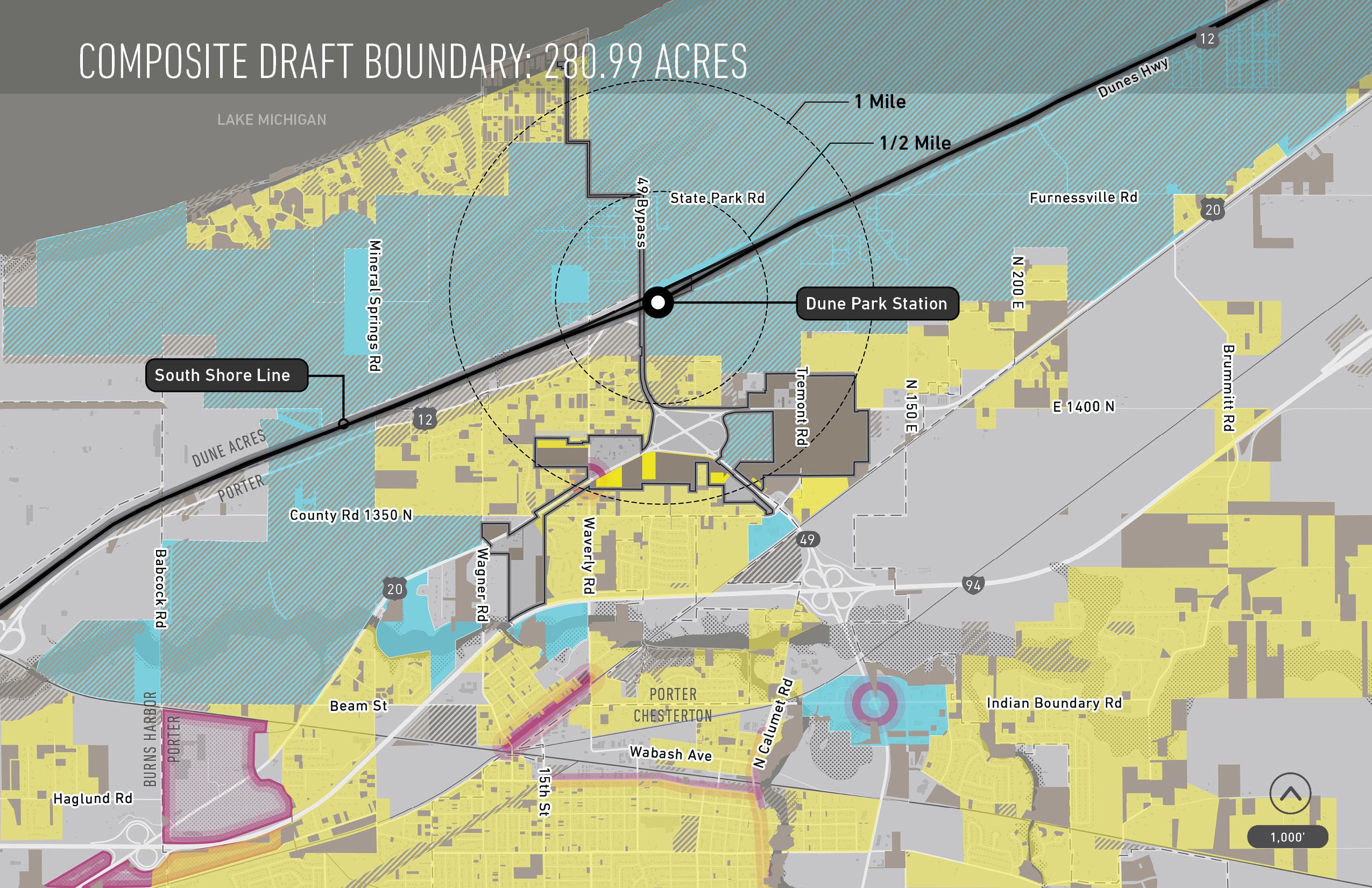
A 1/2 mile (320 acre) special economic development district approved by the State Budget Committee
TDD IS NOT...
Zoning or comprehensive planning
A city or town-sponsored planning process
Eminent domain
An effort to realize economic development in Northwest Indiana communities
Formed by an analysis process that includes community-wide input, best practices and market analysis
A partnership with developer or realtor
A project designed to gentrify or to create low-income housing
NICTD South Shore Double Track or West Lake rail projects
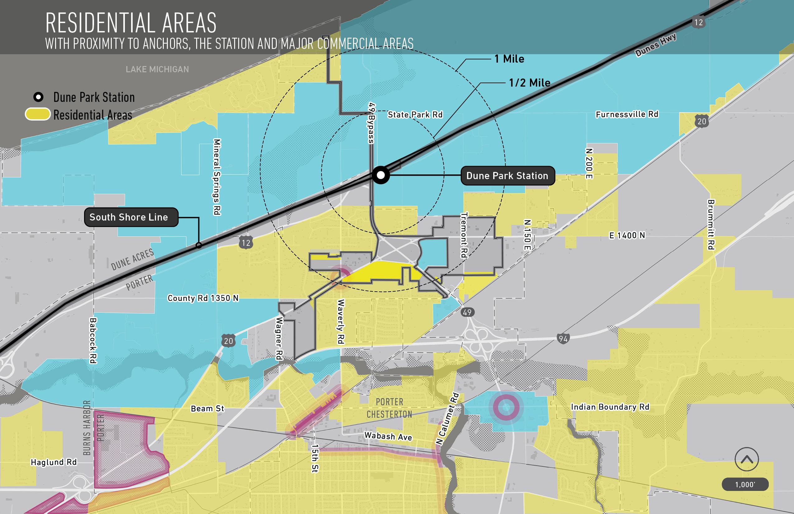
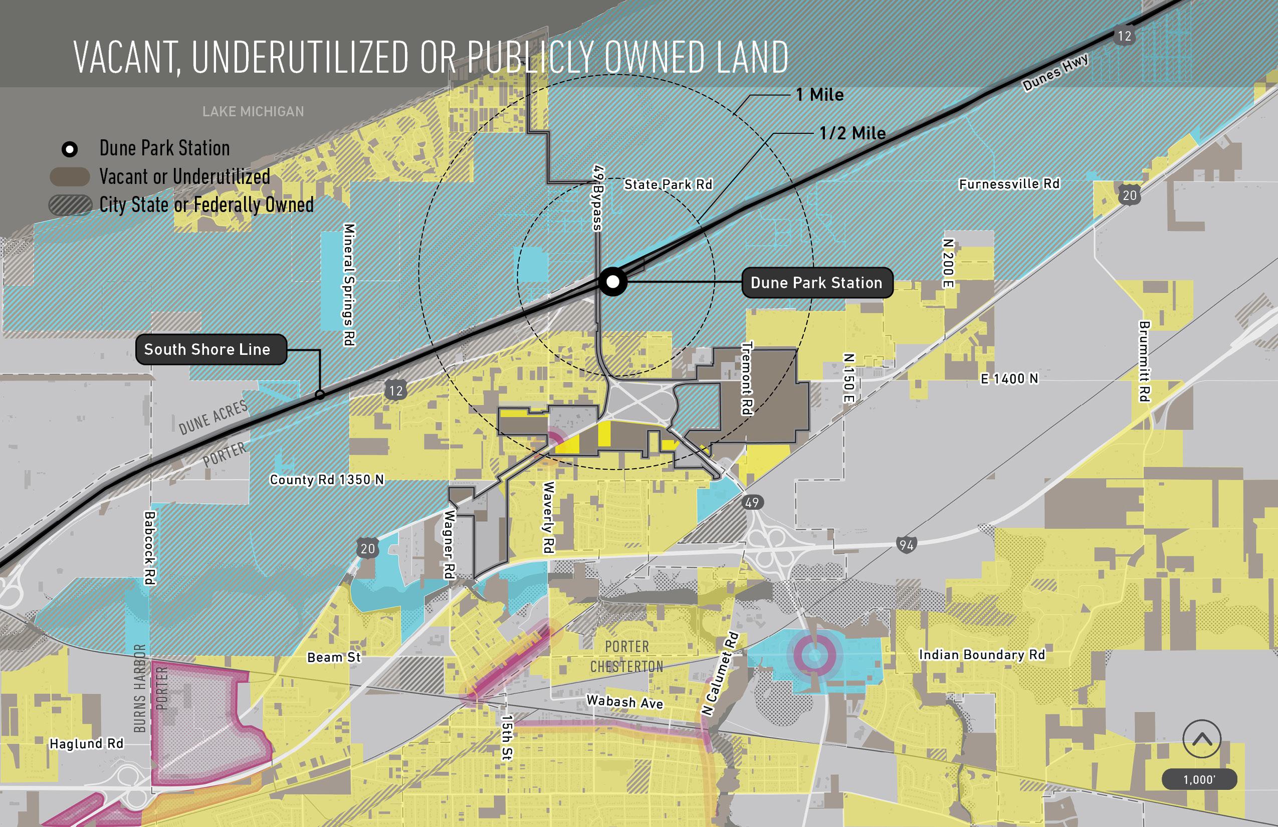
Transit development districts are contiguous boundaries drawn around station areas, and must be no more than 0.5 square miles (320 Acres) in area.
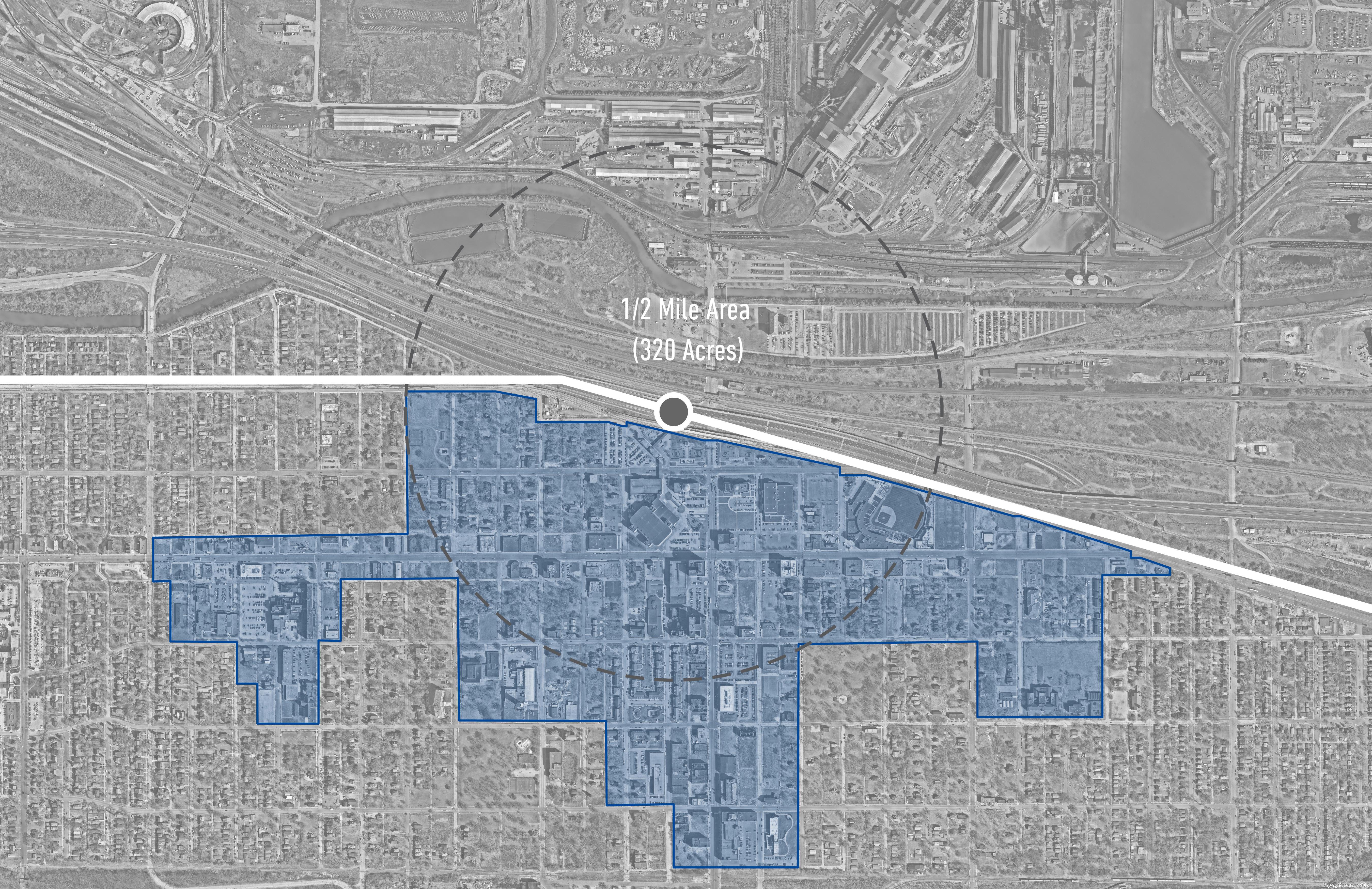
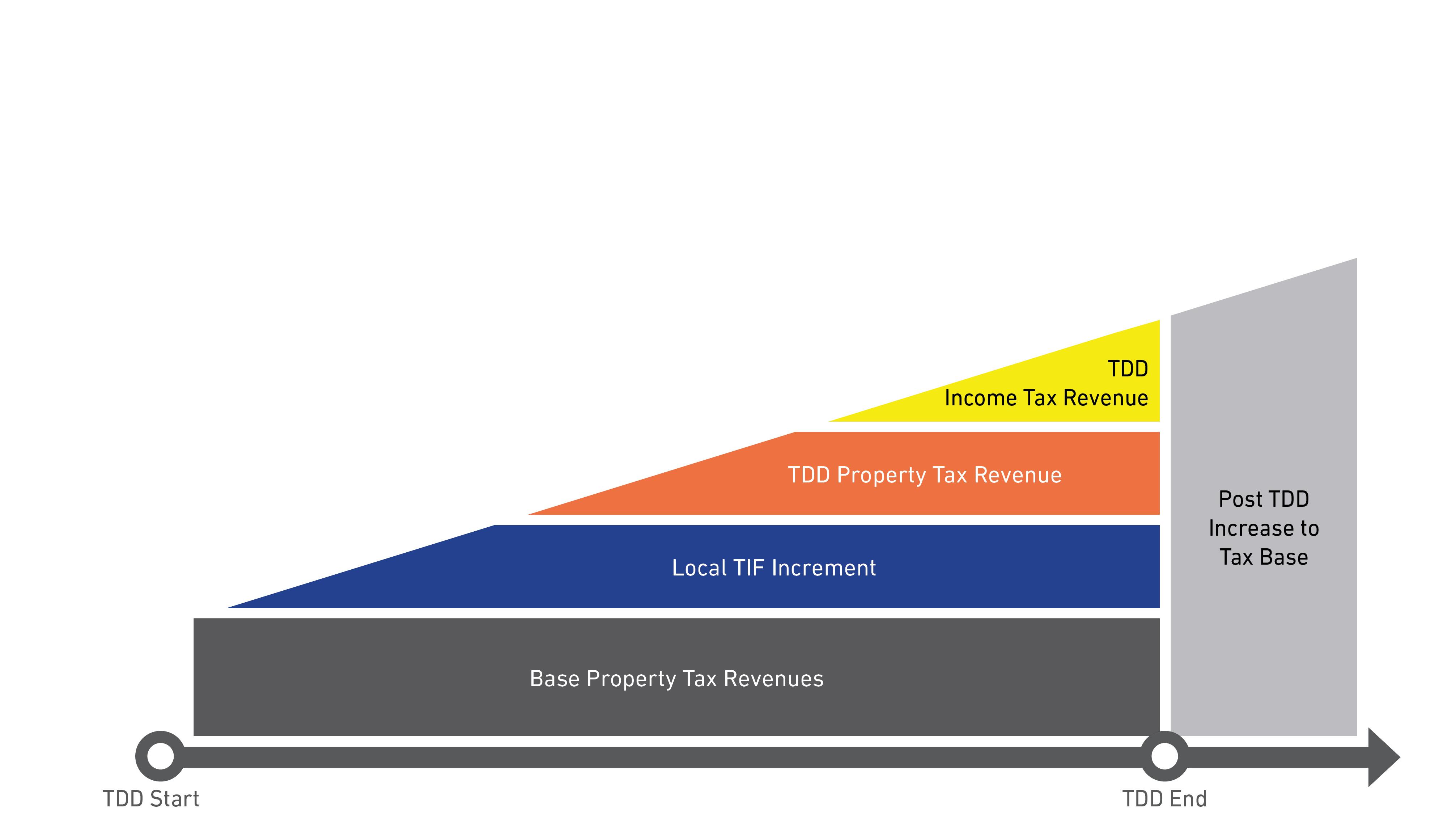
Transit development districts capture the incremental growth in local income and property tax revenue, for use in public investment related to the station area.
Revenue collected from the district –is spent in the district. Local community retains land use and zoning control.
A TDD permits the capture of incremental property tax and local income tax revenues for the development of the area around the transit station
The incremental revenue that is captured can only be used within the same district
After the TDD expires, all of the TDD increment is transferred to the tax base
If a TDD and a TIF overlap, the split of the incremental revenues between the TDD and TIF are negotiated by the RDA and the RDC
After consultation with local communities, two public hearings must be held before the RDA approves the TDD boundaries for review and approval by the State Budget Committee.
How will an MOU take place?
An MOU within the TDD process functions much like a “developer agreement” in the negotiations between a municipality and a project developer as an investment is taking place.
An MOU will be between the NWI RDA and the municipality or municipalities over which the TDD extends
An MOU must have legal status to bind both the RDA and the unit of government to allow for debt obligations to be issued on the basis of the underlying revenues which it controls; and therefore, may be required to be passed by the legislative body of the municipality or county
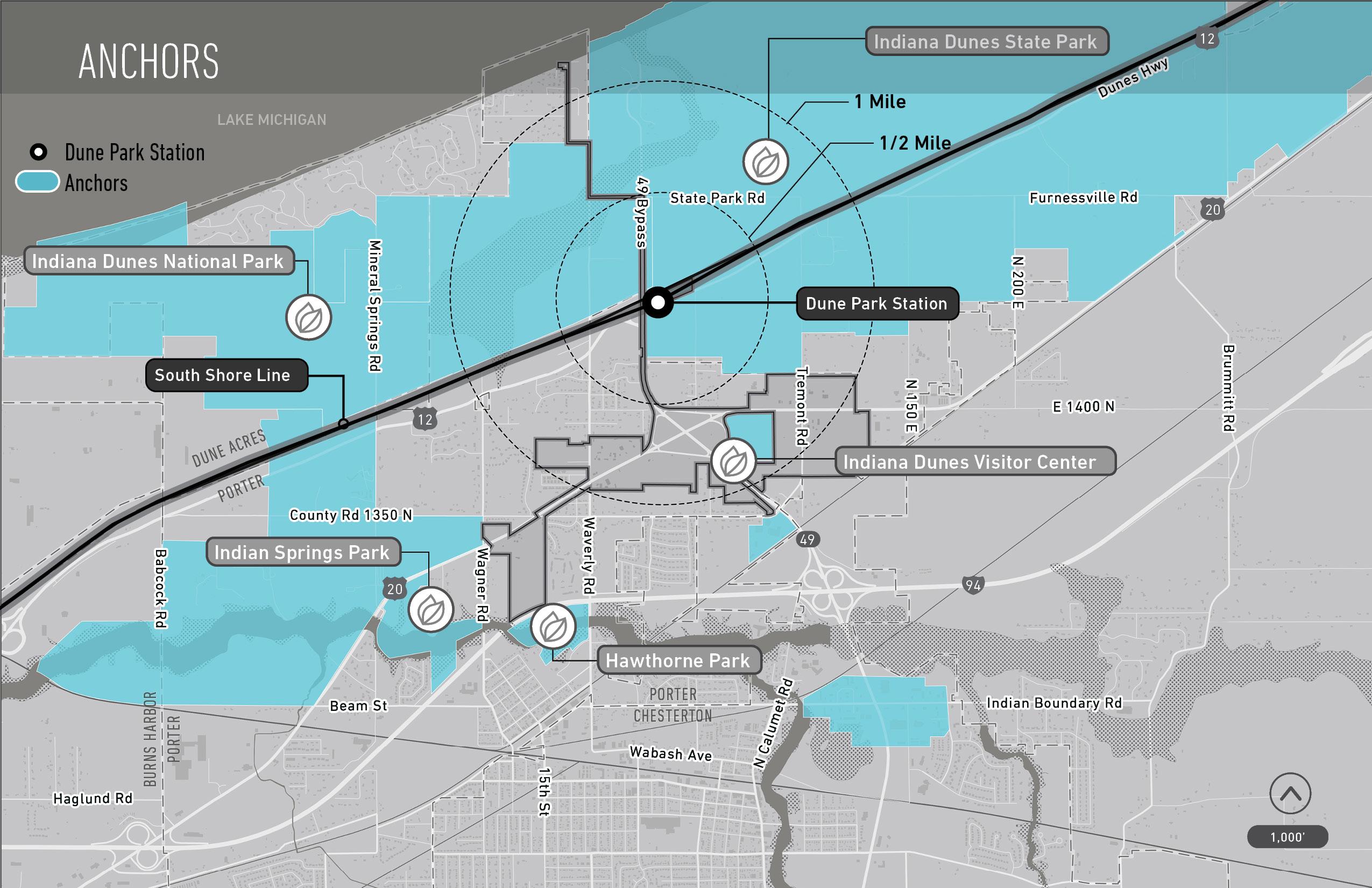
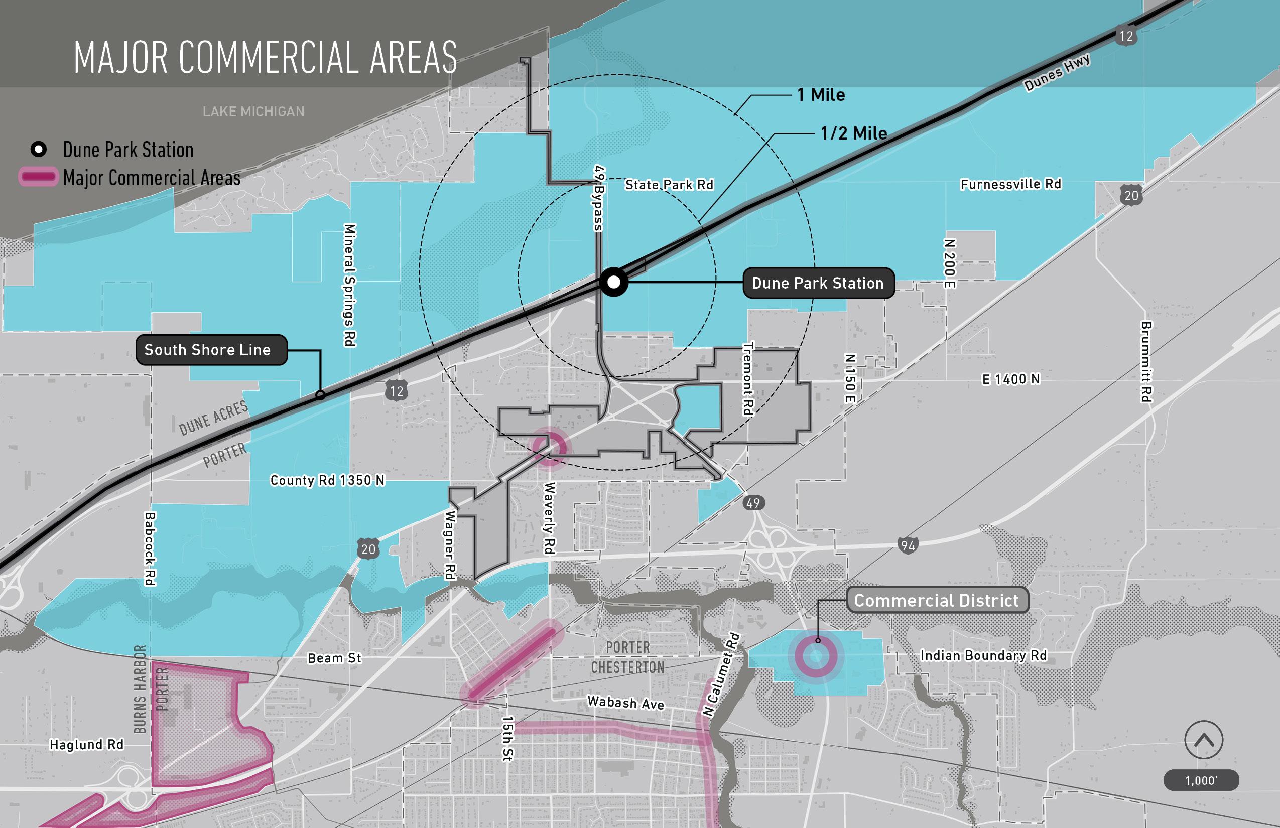
Station context | Utilities | Walkability/connectivity
Cultural or civic assets | Barriers to redevelopment
Buffers | Zoning restrictions
Qualitative Area Specific
Redevelopment potential | Community desires
Previous planning findings | Community vision
Future/planned projects | Understanding the needs of a historically underrepresented community
Site analysis | Location analysis | Legal analysis
Zoning/future land use | Potential property tax yield
Existing public debt obligations | Impact
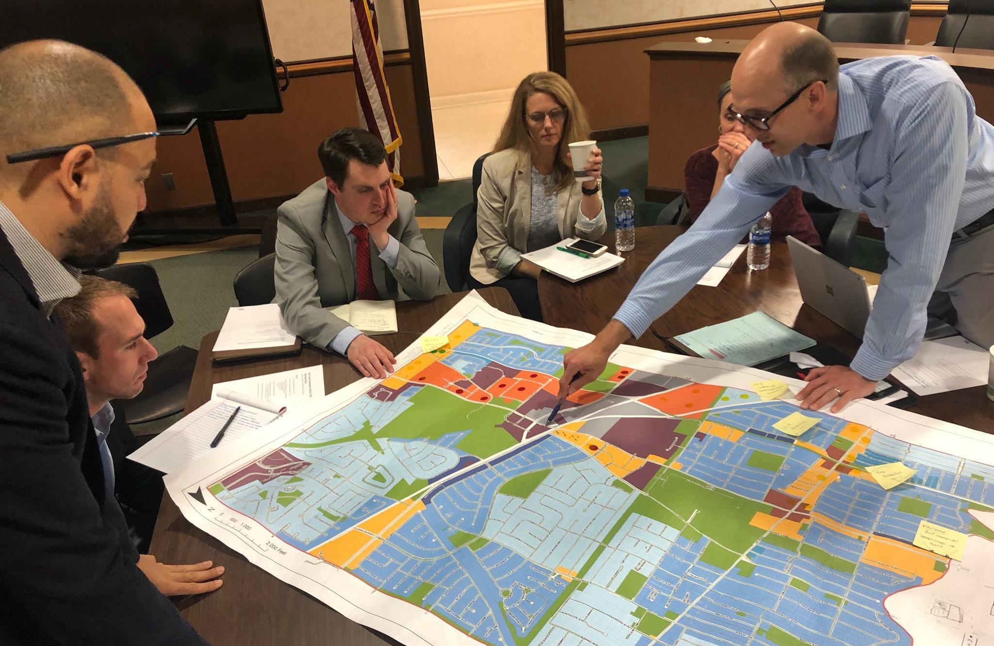
Our area development opportunity criteria included the following...
Acreage (Developable acreage)
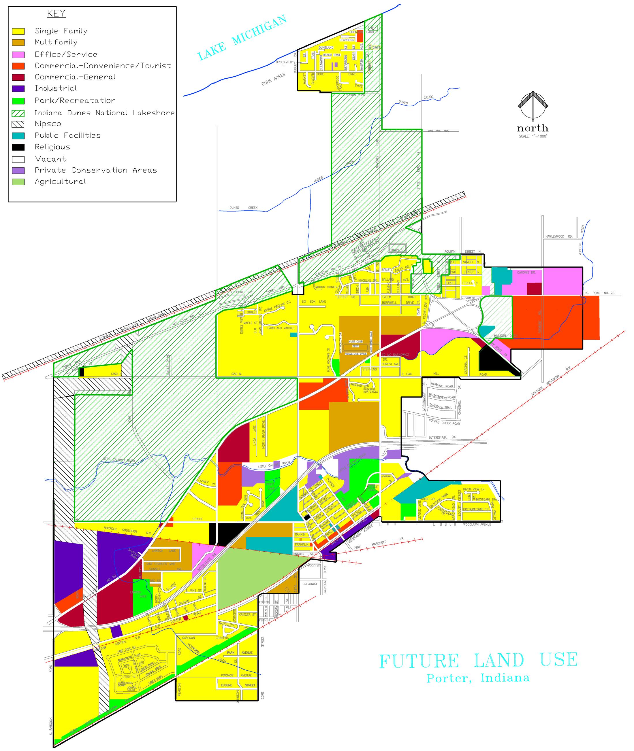
Future land use or planned use
Ownership (Public vs private, single vs. multiple)
Vacancy status (Occupied vs vacant lot/ building and notable condition)
Access / location / walkability
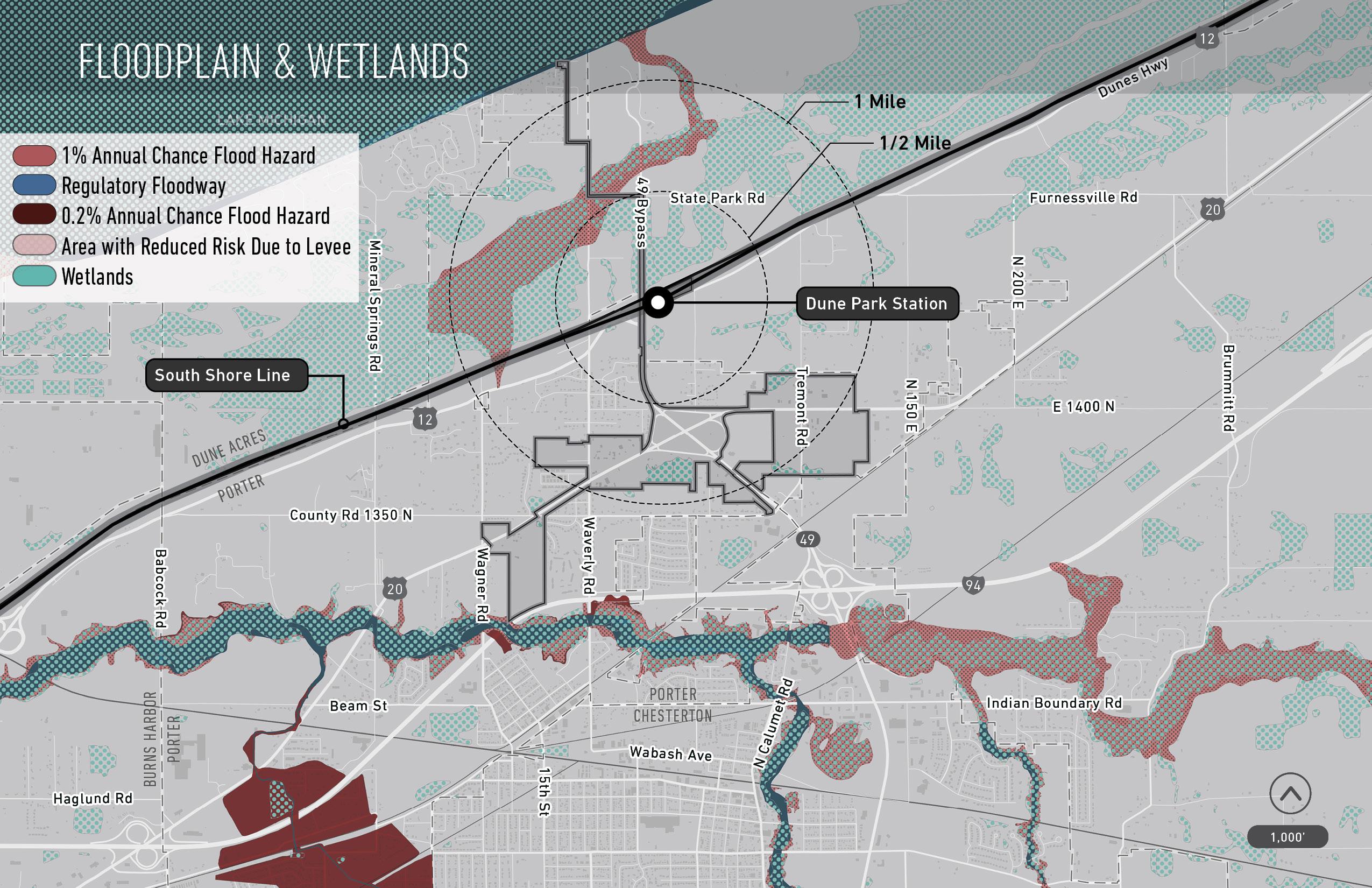
Conditions (Utilities, infrastructure, flood/ wetland, slope, brownfield issues, other)
TIF district / Opportunity Zone status
Comprehensive impact Proximity to station
REDEvELOP INfILL
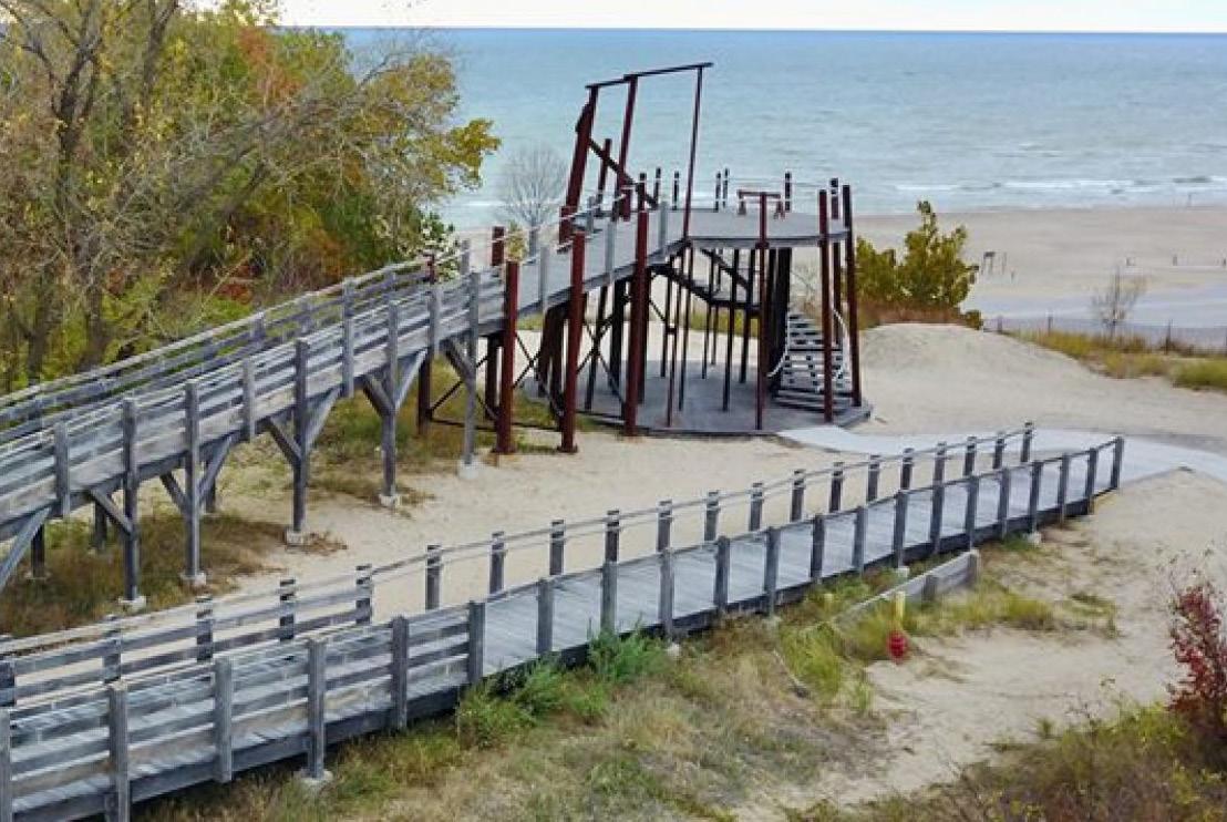
1 Embrace the value of the recreational setting and use it to guide development.
2 Plan for capital infrastructure improvements, support favorable development along US-20 and IN-49, and encourage mixed-use, missing middle and upscale housing in the transit development district.
3 Develop creative strategies for parcels with the highest potential for community good.
4 Develop policies for the use of tax abatement and tax increment financing (including transit development district).
Consider proposals that include mixed development to meet residents’ interest in services, and ‘missing middle’ development that creates diverse owner-occupied housing.
Make the most effective use of alternate funding mechanisms to pursue strategic goals with limited tax revenue
Facilitate favorable development by planning and implementing relevant capital improvements
Direct future development toward the goals of the comprehensive plan by updating the future land use map
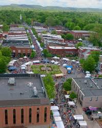
Revitalize the Downtown Area
Improve thoroughfares and intersections
for community consideration
REDEvELOP INfILL
This isn't just a boundary. It complements the economic growth path of communities.
also linked on the RDA’s main website
learn more and follow this process
1 vISIT INfORMATIONAL GALLERy
2 vISIT wEBSITE (www.NwITDD.com)
3 REfINING BOUNDARy wITh LOCAL OffICIALS
4 RDA BOARD PUBLIC hEARINGS
5 STATE BUDGET COMMITTEE REvIEw AND APPROvAL
Q&A we appreciate your time and comments