
INNSBRUCK Rock
SPORT CLIMBING in Innsbruck and surroundings Hall – Brennero – Silz

EDIZIONI VERSANTE SUD | COLLANA LUOGHI VERTICALI | CLIMBING iCLIMBING APP FREE DOWNLOAD
First edition March 2023
ISBN 978885547 0872
Copyright © 2023 VERSANTE SUD – Milano (I), via Rosso di San Secondo, 1. Ph. +39 02 7490163 www.versantesud.it
All translation, reproduction, adaptation and electronic registration, either totally or partially, by any methods, are rights reserved for all countries.
Cover image Höttinger Steinbruch. © Innsbruck Tourismus
Text Andreas Würtele
Drawings and topos Damiano Sessa and Chiara Benedetto
English translation Lukas Knapp
Maps Tommaso Bacciocchi. © Mapbox, © Open Street Map
Symbols Tommaso Bacciocchi
Layout Chiara Benedetto
Printing Press Grafica - Gravellona Toce (VB) Italy

ZERO miles
This guidebook is homegrown and locally produced ZERO miles!
First aid/Emergency
Mountain rescue: 140 respectively European emergency call: 112 respectively best download the SOS EU-ALP-App


This is a “zero-miles” guidebook. It’s locally produced!
It has been compiled by local authors, who live and promote climbing in the area reviewed.
Climbers benefit from local authors: – locals know the latest news and updates
locals don’t promote only the most “commercial” spots – locals invest the revenues from the guidebook in equipping new crags
Local authors promote and respect their area:
they review only the spots where climbing is allowed – they pay attention in the same way to any different spot
they meaningfully interact with local actors
Note
Climbing is a potentially dangerous sport in which participation is entirely at your own risk. All the information in this guide has been updated based upon information at the time of publication, however it is vital to evaluate every situation yourself before placing yourself in a life threatening situation or to seek the advice of experienced and qualified individuals.
–
–
–
ZERO miles
This guidebook is homegrown and locally produced
2% of the proceeds from this guidebook are re-invested in material for re-bolting routes and crags
ANDREAS WÜRTELE
INNSBRUCK Rock
SPORT CLIMBING in Innsbruck and surroundings Hall – Brennero – Silz
EDIZIONI VERSANTE SUD
INNSBRUCK – TAP INTO THE POWER OF THE ALPS


INNSBRUCK, DER KRAFTPLATZ INMITTEN DER ALPEN
LEBENSFREUDE PUR, FÜR
EINEN UNVERGESSLICHEN
PURE JOIE DE VIVRE FOR AN UNFORGETTABLE
HOLIDAY:
URLAUB:
Between culture and nature, ups and downs, traditions and trends – no other region combines such extreme contrasts as charmingly as Innsbruck. You can travel from the heart of the Tyrolean capital to the lofty heights of the Nordkette range in just 20 minutes to experience this Alpine jewel from up close and marvel at the pulsating activity from on high.
Zwischen Kultur und Natur, Höhen und Tiefen, Tradition und Trends – keine andere Region verbindet extreme Gegensätze auf so charmante Weise wie Innsbruck. Hier kann man sich vom Herzen der Tiroler Landeshauptstadt in nur 20 Minuten in luftige Höhen auf die Nordkette begeben, um das Alpenjuwel hautnah zu erleben und das pulsierende Treiben von oben zu bestaunen.
Or you can discover the city’s alpine-urban style as you leap in time between modern architecture and historic buildings.
The special old town ambience with its famous sights is just a short distance away from your next hiking or biking tour, your next day’s skiing or your winter hiking adventure. A wealth of contrasts squeezed into the smallest of spaces...
Where else can you find such personal freedom – from enjoyable to challenging – in just one place?
Oder man entdeckt auf einem Zeitsprung zwischen moderner Architektur und historischen Bauten den alpin-urbanen Stil. Das besondere Altstadt-Flair mit seinen berühmten Sehenswürdigkeiten ist nur einen Atemzug von der nächsten Wanderung oder Radtour, dem nächsten Skigebiet oder Winterwandererlebnis entfernt. Eine Fülle an Kontrasten verdichtet auf engstem Raum... Wo sonst kann man von genussvoll bis an-spruchsvoll seine persönliche Freiheit an nur einem Ort erleben?
WWW.INNSBRUCK.INFO/IC #MYINNSBRUCK
Photos: Innsbruck Tourismus / Schönherr, Lackner, Vorhofer;
unlimited
Fotos: Innsbruck Tourismus / Schönherr, Lackner, Vorhofer;
THE INNSBRUCK REGION: CLIMB LIKE A WORLD CHAMPION


Whether in the city, out in the country or on a climbing wall, if your favourite direction is skywards then Innsbruck is a paradise of steep cliffs, climbing gyms and multiple pitches. Beginners or more ambitious climbers, adults or children, indoors or outdoors – the city of innsbruck and its surrounding villages offer perfect climbing conditions for all requirements.
In addition to a total of 6 climbing gyms , there are 17 sports climbing walls and 29 sports climbing areas , well over 1,000 single pitches and 90 multiple pitch routes, 6 fixed-rope routes, 2 family climbing walls and 8 ice climbing routes . Rocky crags, steep walls and five mountain ranges, each with a completely different character, offer the ideal conditions for wonderful climbing adventures.
Preface
Is there really a need for another climbing guide about Innsbruck? By writing this guide I answered the question for myself but to be honest it came up more than once during talks about this project. When sitting together and discussing what makes a good climbing guide, we, however, agreed that there is not really a worthy successor of the last edition of the guide “Kletter um Innsbruck” by Otto Wiedmann from 2002. Either the current guides show just a selection where a lot of crags are missing, the information is very shallow or sport climbing is just a side issue in an alpine climbing guide. Wrapped up this guide is the attempt to follow up the “Tirol-West-Führer” of Otto (and the tedious support by other first ascenders such as Reini Scherer, Reinhard Schiestl, Jörg Brechja, and many more) and a conclusion of sport climbing around Innsbruck. The idea was to document all sport climbing options without leaving out unrewarding crags (information on that is available in the description of the various crags). What was not covered, however, are classic alpine routes which we define as routes where you have to bring most of the protection by yourself (e.g. Hechenberg) or where the approach leads up into high alpine terrain. This is because they would blow up this guide to the size of the telephone book of Tokyo (and who wants to carry kilograms of paper through the world?). Furthermore, there are already good and current guides available for these types of routes (see literature review on page 22).
One or the other might complain now that “his” (really?) secret crag was published. I want to push back here by saying that basically, everything in this guide was available in some kind somewhere – obviously not as detailed and combined as here though. There are, however, still various spots that have for different reasons not (yet) been covered in this guide. Furthermore, most of the people complaining probably have a new version of the Arco guide on their bookshelf because they like to visit new areas now and then and do not always want to go to Massone…
“Nobody is perfect” and although the great effort I put into this guide this will probably not be the last edition of it. That is why I not only ask for indulgence but also feedback. I am furthermore very grateful for information concerning new routes and areas which makes the life of a guide author far easier ;o)
All I can say now is have a good time on the rock and I have one final request: Please respect the locals – not only climbers but far more important the landowners, farmers, hunters, environmentalists, and alike.
6

7
Paul Lewandowski, Rokoko, Martinswand (© Arch. Lewandowski)
Index Preface .............................. 6 Index 8 Map 12 Acknowledgments 14 Best time of the year 14 Geological Overview 16 Access and useful information 18 Climbing Etiquette Manual 20 Bibliographie 22 Regional information 24 Different grading scales 28 Reading scheme 30 TELFS 32 01. Guanacho 34 02. Silberleite 38 03. Crazy Eddy 42 04. Minsky 44 05. Mötz - Springfield 46 06. Burg ........................... 50 07. Locherboden 54 08. Hängebrücke .................... 58 09. Hex 60 Turm Jungmannschaftsturm Fichtenmoped Shaman Jochgramille Antares Pepato Le Figaro 10. Weiher 80 Pumuckl Pinocchio Load Extreme Cats In The Cradle Tal Ohne Weiher Talwächterwand Staustufenwandl Höhlensektor Maulwurf Plattenfuchs ZIRL 98 11. Schlossbachklamm 102 Röhrenwandl Guggeler Ruinengartl Schlossbachpfeiler 12. Ehnbachklamm - front 112 Bachgartl Wasserbasin Kapellenwandl Zeckenwandl Schwarze Riepe Jungmannschaftswand Wrackwand Plan B-Wand Altherrengartl Bruchharsch 13. Ehnbachklamm - back 134 Neunerplatten Äussere Platten Matterhorn Büffelboulder Gotenturm Zuller Lochkofel Alpenkofel Buchenwandl 14. Thomasegg 152 MARTINSWAND 154 15. Martinswand West 158 Mundart-Gartl Hafeles Kluppn Mull Grottenweg 16. Dschungelbuch 176 Hauptteil (Main Sector) Plattenschleicher Wunderbare Welt Bogen13 Oberer Stock Theater Am Turm 17. Multipitches 206 Grotten-Spitz Klassische Martinswand Martinswand-Vorbau (Buttress) 8
OFFISHIALLY THE BEST.

Safe. Stylish. Smart.
With the FISH
Mit dem FISH
Autotuber immer auf der sicheren Seite.
belay device always on the safe side.


MADE IN AUSTRIA.
Index and map 18. Martinswand East ............... 258 Headless Schleicherplatten AV-Klettergarten Alpinmagazin Plattlgraben Galerie Sandburg Supermarkt INNSBRUCK-NORTH 290 19. Kranebitter Klamm 292 Waldorf Wandl Bockgufel Hundskirche Scherer-Wandl Wagnerwand 20. Kranebitter Klettergarten 302 21. Höttinger Steinbruch 306 22. Höttinger Graben 312 23. Blechhüttenmauer 320 24. Sattelspitze 322 25. Sonnendeck 324 26. Zwischendeck 328 27. Seegrubenkessel 330 28. Laktat . . . . . . . . . . . . . . . . . . . . . . . . . 340 MARTHA .......................... 342 29. Boulder area Mühlauer Klamm 346 30. Mühlau Rope Climbing ............ 378 Simba Altes Eisen Campanile Oberer Stock 8m-Wandl Ostwand Klammnase - Oberes Nasenloch Klammnase - Vorderes Nasenloch Klammnase - Sonnenbalkon Toprope-Wandl Unterwelt Teufelskanzel Kenyatta Conference Center 31. Gschaftl-Wandl/Thaurer Mur 396 HALLTAL 402 32. Barras-Klettergarten 406 33. Rädermacherwand 408 34. Sonnenplatten 410 35. Wasserrohr .................... 412 36. Halltaler Klettergarten ........... 416 37. Bettelwurfeck 422 38. Winklerwand ................... 424 39. 7a+ Gartl 430 40. Sagenwandl .................... 432 41. Halltaler Sonnenplatten 434 42. Magdalena-Bach 436 43. Jungmannschaftsturm 438 44. AV-Klettergarten 440 INNSBRUCK SOUTH 444 45. Sillschlucht 446 46. Hauptquartier 452 47. Paschberg 454 48. Viller Köpfl 458 49. Goldbichl 462 50. Ahrntal 464 51. Zifres/Spucher 468 SAILE 472 52. Lizumerwand 476 53. Hörzingwand 480 54. Birgitzköpflhaus 482 55. Innsbrucker Wohnzimmer 488 STUBAI 492 56. Pyramidenspitze 494 57. Kampler Mauer ................. 496 58. Pinnis 498 59. Elfer .......................... 504 60. Eldorado 512 61. Fernau Zollhäusl ................ 520 62. Fernau Egesengrat 522 GSCHNITZ 524 63. Mulleschrofen 526 64. Barbeleswand 530 65. Schmurzwände 532 66. St. Magdalena 536 VALS 542 67. Stafflacher Wand 544 68. Innervals 556 Sahara Pfeiler Schwalbengufel Roßstall Deant De Vals Moniland Schnitzlparadies Heiziacha-Riese Ladestatt Togewoade 69. Obernberg ..................... 582 10

11
Philp Flörl, Superflip, Dschungelbuch (© Raphael Jäger)

07 10 01 11 02 03 04 05 08 06 09 61-62 12

27 47 67 17 57 50 20 21 31 51 22 12 32-44 52 23 63 13 53 24 64 14 54 25 45 65 15 55 28 48 68 18 58 26 46 66 16 56 29-30 49 69 19 59 60 13
Acknowledgments
When writing a guide like this there are many people out there who deserve a big “Thank You”. First and foremost, obviously, everybody who was involved in establishing, setting up, and restoring crags and routes. Without them, there would be no guide. Then everybody who shared information and topos with me which includes: Reini Scherer, Daniel Peis, Andi Strolz, Markus Haid, Thomas Brandstätter, Albert Leichtfried, Michael Staud, Thomas Senfter, Werner Gürtler, Mike Zach, Johnny Demaine, Felix Erlacher, Wolfi Peer, Klaus Pietersteiner, Jef Verstraeten, Gebi Bendler, Armin Fuchs, Hanspeter “Hafner“ Huter, Benni Purner, Christian “Picco“ Piccolruaz, and Alex Ölberg. This guide would only be half as good without the pictures which thankfully have been provided by Simon Schöpf, Paul Lewandowski, Raphael Jäger, Daniel Peis, Albert Leichtfried, Daniel “Dalton“ Horvarth, Heiko Wilhelm, Peter Manhaertsberger, Markus Schwaiger, Christina Plattner, Andi Klotz, Daniel Stadler, Denise Schönegger, Gerhard Mössmer, Lisa Pollinger, Roland Laucher, Simon Peer, Tjitte Stolk, Tobias Lanzanasto, Manuel Behr, Nina Übelhör, Mike Zach, Thomas Senfter, Manuel Baldauf, David Reinalter, Felix Erlacher, Thomas Reichart, Cornelia Rudigand and Julian Paul. I hope that I did not forget anybody!
Also, I want to thank the team of Versante Sud – mainly Chiara, Matteo, and Roberto – which stood behind this project from the very beginning and did their very best to put my notes together into this nice guide.
Finally, I want to thank my dear family Paul, Frieda, and Johanna who endured my hourlong, stoic work in the office ;o)
Best time of the year
In general, you can climb around Innsbruck almost all year through: Crags which are close to the valley and oriented towards the South such as parts of the Martinswand are only not good for climbing a few days after heavy snowfall – the main sector of Dschungelbuch offers useful conditions even on sub-zero days when the sun is out. This however means that it is too hot there between late spring and autumn which is when you should go to higher crags respectively (depending on the time of day) crags faced towards the West or the East.
Current information about local weather (which is way better for this area than any questionable weather app) can be found at www.zamg.ac.at or www.alpenverein.at/wetter.
Alpine dangers
Depending on the time of the year and the weather you must take into account various hazards: Avalanches are an important topic in higher located crags, not only in winter and spring but also in summer after a sudden fall in temperature which can cause big amounts of snow in the mountains. Furthermore, mind thunderstorms which can lead to lightning, flood, and landslide destroying paths. Thereby a nice sport climbing session can turn into a high-risk situation.
14

15
Much Mayr,
Get Hungry, Dschungelbuch (© Paul Lewandwoski)
Geological Overview
Obviously, the reality is far more complex, and “real“ geologists will shake their heads when hearing this simplified description but I think for us climbers this overview is more than enough and contains the information necessary for climbing:
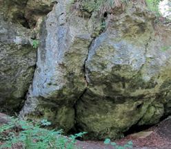
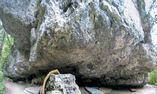
In general, you can see the big valley in the Northern part of Tyrol as geological boundaries: North of the Inn you will find almost exclusively Limestone of various qualities ranging from perfect Wetterstein-Limestone to very wild Karwendel-bruch (“split”). This split is mainly caused by sinters on the surface of the stone. This describes the very different styles of climbing: Holds and footholds at low levels of sinter consist mainly of a fracture line (e.g. Dschungelbuch main sector) but at high levels of sinter exposure can consist of very fine slopers, holes, and others. One local distinction is the “Höttinger Brekzie” (breccia) which basically are landfills from the area around Nordkette which have somehow consolidated and are now quite firm and steep Conglomerate rocks in the North of Innsbruck. This rock which almost reminds one of the famous Spanish climbing areas Riglos or Margalef (and obviously Meteora in Greece) was discovered centuries ago as a firm material for construction which is why many houses in the old town of Innsbruck and Hall consist of it. This discovery was important for climbers because the mining created the “Höttinger Steinbruch” (quarry) which is one of the popular climbing areas directly in the city.
Tyrolean Regional Government Faculty for Geology Cartography: Department Geo-information

of Permoskyth (Shale, Sandstone, Conglomerate); different grades of metamorphose. Mainly water impermeable.
Gneiss, Granites, Tonalites, Amphibolites, Eclogites… Water impermeability depends on the dismantling stage of the rock. Lower-Invalley-tertiary including sediments of Chalk (Marl, Sandstone, Conglomerate): Predominantly waterpermeable rock.
GEOLOGICAL BIBLIOGRAPHY:
Tirolatlas - Geologische Übersichtskarte 1:300.000 (R.BRANDNER, 1980)
Geologische Übersichtskarte 1:500.000 “Einflußgröße Boden, Untergrund” (WWT/TIWAG, Landeskonzept 1992; WVT 150-001)
Map legend: Northern Limestone Alps, Lienzer Dolomites, Carbonate rock ledges and plates of varying age and different grades of metamorphose (e.g., marble). Carbonate rock: Depending on the fissurization more or less permeable to water; partly karst possible. Mica slate, Phyllite Gneiss, Quartz-phyllite, Limestonephyllite, Porphyrite, etc. including sediments
Quarternary sediments such as moraines, gravel, sand, clay, breccia, etc. are not shown due to a cleaner layout and more clarity in the map. Tectonic structures are also not shown on the map. Small, neighboring rock plates that belong together have been drawn together for clarity.
16
South of the Inntal you will find a completely different geological setting: There are a few secluded Limestone islands (e.g. Serles or the line from Tirbulaunen towards Kalkögele) but the quality is definitely worse than in the North. This makes the area not really interesting for sport climbers, but fans of adventurous routes find a big playground here.
In the South the Wipptal acts as a rough geological borderline: Eastwards of it, the Schist area starts which is amazing for skiing and therefore also quite popular (e.g. Tuxer and Kitzbühler Alps). The rock here is quite soft which probably is also why few rock faces developed all of which are fragile and thereby not good for climbing. A few of the exceptions are the Viller Kopf, Goldbichl, or the recently developed Stafflacher Wand.

West of the Wipptal respectively South of the Inntal the Gneiss zone of the Stubaier and Ötztaler Alps starts. The Ötztaler Alps offer a lot of good climbing crags but also some areas in the back of Stubaital can keep up with them (there are however way more areas in the Ötztal).
In Vals the situation is similar: The Northern part consists of Schist. Directly at the valley entry, the Stafflacher Wand is located which is probably the biggest climbing area on this rock. At the back of the valley, you are at the Alpenhauptkam (the main ridge of the Alps), and from the East, the Gneiss of the Zillertaler Alps is coming in, which can be seen by the prominent trio of Olperer, Fußstein, and Schrammacher. The rock quality here is like the one in Zillertal but sport climbing development is still at the beginning which means there is a lot of potential.
17
Access and useful information
Innsbruck is located in the center of the Eastern Alps and can easily be reached by car from the South via the Brenner or from all other directions on the Inntal motorway. Especially in winter (approx. December until April), there are also many direct flights to Innsbruck Airport. In summer it is more likely that you have to change at one of the classic hubs like Frankfurt or Vienna when flying into Innsbruck. Details can be found at www.innsbruck-airport.com. Alternatively, you can also fly into Munich, Verona, or Memmingen because these airports are destinations of a lot of low-budget airlines.
Another way to easily travel to Innsbruck is by train or bus which both drive to Innsbruck multiple times a day (oebb.at, flixbus.com, and so on).
Around Innsbruck, all villages can be reached by public transport very well but a lot of the crags are far outside which can make the way from a station to the crag tedious and long. When choosing that option, you should consider taking an e-bike with you which, however, depends on the mood of the bus driver so it cannot be guaranteed. That is why for most areas the use of a car is (unfortunately) still the easiest option.
Some crags in this guide have a long approach which is - as you know – the “enemy” of sport climbing. Fortunately, oftentimes the long approach can be shortened tremendously by using an e-bike.
Parking: Climbing is booming! Please park space-savingly and accept when there is no more free parking spot! Please do not park in just any meadow, driveway, or dirt road. When a local is complaining about your parking – does not matter how friendly he is – try to de-escalate, apologize and ask him for possible alternatives. It would not be the first crag that would be shut down because of such an issue... Land-air signs
Red material / red flag
Square shape 100x100cm.
Red central circle (60cm diameter). White ring 15cm
First aid/Emergency
Mountain rescue: 140 respectively European emergency call: 112 respectively best download the SOS EU-ALP-App

or
Land-air signs Red flare
light
WE NEED HELP WE DON’T NEED HELP Yes INTERNATIONAL LAND-AIR RESCUE SIGNS FOR HELICOPTERS AND PLANES No
18
Areas which can be easily reached by public transport
In the following list, you will find crags that are maximum 10 minutes of walking away from the last bus or train station. All info about public transport can be found at www.vvt.at respectively by scanning the QR code for direct route and timetable information.
Telfs
05. Mötz - Springfield
06. Burg
07. Locherboden
08. Hängebrücke
10. Weiher
Zirl
11. Schlossbachklamm
12. Ehnbachklamm
Martinswand
15. Hafels Kluppn
15. Mull
16. Dschungelbuch
17. Martinswand-Multipitches
Innsbruck – North
20. Kranebitter Klettergarten
21. Höttinger Steinbruch
23. Blechhüttenmauer
24. Sattelpitze
25. Sonnendeck
26. Zwischendeck
27. Seegrubenkessel
28. Laktat
Martha
32. Halltal
Innsbruck South
45. Sillschlucht

47. Paschberg
48. Viller Köpfl
49. Goldbichl
51. Zifres/Spucher
52. Saile
56. Pyramidenspitz
57. Kampler Mauer
58. Pinnis
59. Elfer
60. Eldorado
61. Fernau
64. Barbeleswand
66. St. Magdalena
67. Stafflacher Wand
69. Obernberg
Pilip Flörl, Fingertang, Dschungelbuch (© Raphael Jäger)19
Climbing Etiquette Manual
Climbing outdoors is different from climbing indoors. Respectful and responsible behavior towards people as well as nature is a bedrock for avoiding closures and guaranteeing access to crags.
For the sake of nature and the environment:
Area closures: It does not matter whether timely restricted or forever, closures of certain areas must be accepted. The responsibility to be aware of a possible closure lies at the climber!
Parking: Inform yourself where you can park and thereby do not park wild, or block roads, paths, or driveways. Please accept that if parking should be full you have to drive to another parking space even if it extends the approach by five minutes.
Approach paths: Please use the paths and do not walk through the vegetation – always walk around fields and meadows. Do not shorten tracks even if they might be enticing.
Fire: Open fire is strictly prohibited – at the base of the face as well as everywhere else.
Music and noise: Ghetto blasters, loud mobile phones, screaming, and similar are out of place here. It does not only annoy other climbers but also the inhabitants of the forest.
Dogs: Dogs must be leashed! Other climbers, as well as inhabitants of the forest, will be grateful.
Trash: By now it should anyway be taken for granted that you take down again your garbage, including tape pieces. This also holds for supposed “organic waste” such as banana or orange peels. They only degrade very slowly and give the surrounding area the fragrance of compost.
Cigarettes: Smokers should also take their butts down with them and not stick them into various holes, cracks, and so on. Old chewing gum boxes are perfect for collecting them.
Feces: When there is no holding back go as far away as possible from the base of the face and do not use any paths as a toilet. Handkerchiefs and toilet paper are made of cellulose regenerate fiber which degenerates very slowly. That is why you should put used paper in an old nylon bag, tie it up and throw it away at home. Cover the rest with stones, mud, or similar so nobody steps into it.
Rest period: The inhabitants of the forest deserve some recovery from our disruption. That is why you should finish climbing at dusk because a lot of animals are active during dusk and do not want to be disturbed. “Night sessions” (especially for bouldering) are not good for nature and do not help in establishing a good relationship with people like farmers, hunters, and environmentalists.
For the sake of other climbers: Reserving routes: Please do not occupy routes for hours with ropes – especially not if they are very nice or easy.
Quickdraws and carabiners in the routes: Be grateful when you find quickdraws in a route that you are happy to use. Also, be grateful for the carabiners at the top instead of stealing them. If the state of the carabiners should be bad, do not complain (on the internet) but rather replace them with one of yours. If everybody contributes a little something all can profit.
Quickdraws for projects: Understandably, you want to leave your quickdraws on a hard, longtime project to avoid the tiring process of bringing them up every time. However, a climbing route is not a scrap metal repository. Quick draws suffer outdoors in winter and if your chances of sending the route are not very high, please take them down again. This obviously is the same after a successful send.
Projects: Projects are routes that were already bolted but not yet climbed by the person who bolted them. Also, if the route should be easy for you, do not climb it until the one who established it, gives it free! Oftentimes they are marked by a thin rope through the first bolt or a “P” at the start.
20
Adding bolts: Often there are routes where you start to hate the person bolting it because the bolt distance is very wide at the hardest part. This nevertheless does not give you the right to add another bolt there. Run-outs are part of a route’s character. Without talking to the first ascender, you should never change a route.
New routes and variations: Please first inform yourself if you are even allowed to bolt new lines at a specific crag. If so, then think about if it is necessary: Beautiful and straight lines should not be disrupted by less useful variations. If you have to “dig out” a route first it is questionable if that really makes sense and whether it is environmentally friendly.
Chalk and tick-marks: Oftentimes tick-marks (marking holds) help in finding the right holds. Also, holds who are wet sometimes need a good amount of chalk. That is no problem at all but after a successful send, please remove these chalk signs with a brush.
Children: Understandably, parents bring their children with them to the crag. However, please be aware of other climbers and your responsibility. Do not “park” your kids at the base where falling rocks can hit them or starts to routes will be blocked. Furthermore, falling climbers – especially when taking swings – might hit them. A helmet is always a good choice!
 (© Philip Flörl)
21
Bibliographie (in chronological order)
Damisch Christian, Rudi Mayr Klettergärten und Eiswasserfälle zwischen München, Bregenz, Bozen; Steiger Verlag 1986
Scherer Reinhold Klettergärten in Innsbrucks Umgebung; Eigenverlag Otti Wiedmann, 1990
Klier Heinz und März Fritz Alpenvereinsführer Karwendelgebirge; Rother Verlag, 1990 (13. und leider letzte Auflage)
Wiedmann Otti (Hrsg.) Klettergärten Tirol West; Eigenverlag Otti Wiedmann, 1992 (1. Auflage) bzw. 1996 (2. Auflage)
Orgler Andreas Klettern in den Stubaier Alpen und im Valsertalkessel; Panico Alpinverlag, 1992
Trauner Bernd and Wutscher Gerhard Der ultimative Kletter- und Boulderführer für Telfs; Eigenverlag, 1998
Wiedmann Otti (Hrsg.) Klettergärten Tirol; Eigenverlag Otti Wiedmann, 2003
Marschner Timo, Schepers Martin Austria Vertical – Sportklettern in Österreich; tmms-Verlag, 2007 (4.Auflage)

22
Maria-Theresia Wagner, sector Wasserohr/Halltal (© Simon Schöpf)
Meisl Michael Sportklettern in Nordtirol; Eigenverlag Michael Meisl, 2016 (2. Auflage)
Eberle Bernd, Lindemann Stefan, et.al Alpinkletterführer Karwendel; Panico Alpinverlag, 2020 (5. Auflage)
Durner Günther, Gürtler Werner Sportklettern Innsbruck und seine Feriendörfer; AM-BERG Verlag, 2017.
Further useful climbing guides for this or bordering areas
Michael Meisl Sportklettern in Nordtirol; Eigenverlag Michael Meisl
Bernd Eberle, Stefan Lindemann, et.al Alpinkletterführer Karwendel; Panico Alpinverlag, 2020
Benni Hangl sen., Karlheinz Grübler und Albert Neuner Alpinkletterführer Wetterstein Süd; Panico Alpinverlag
Markus Schwaiger Zillertal Klettern und Bouldern; Lochner Verlag

Michael Meisl Routebook Zillertal; Eigenverlag Michael Meisl
Günther Durner Klettern im Ötztal und Pitzal; AM-BERG Verlag
Guido Colombetti Südtirol – Sportklettern; Versante Sud
Axel Jentsch-Rabl Eisklettern in Tirol; Alpinverlag.
23
Regional information
TELFS
Climbing shop: Hervis at the Inntalcenter respectively the shop in the gym which also offers a small selection of the most important gear (chalk, harnesses, shoes, clothes, hardware). For shoe resoling, the “Schuhhaus Ruech” (www.schuhhausruech.at) in Mieming is recommended.
Gym: Bergstation Telfs (www.bergstation.tirol), approx. 1400qm climbing area (of which approx. 2/3 are for bouldering) with a big area for children, a small shop, and a nice bistro which is the local climbing community meeting spot (Definitely recommended for BBQ evenings!!!).
Camping: The best locations are in Stams (www.camping-eichenwald.at) and in Pettnau (www. camping-tiefental.at) who is a perfect basecamp for the area around Zirl/Martinswand.
Nearest e-bike rental: Bike Repair Oberhofer (www.bike-repair-oberhofer.at) in Silz respectively Alpine Easy Stay Seelos in Mieming (www.pension-seelos.at).
More information at www.innsbruck.info.
ZIRL AND MARTINSWAND
Climbing shop: Sport Okay at the Cyta (Völs).
Gym: Bergstation Telfs (www.bergstation.tirol), approx. 1400qm climbing area (of which approx. 2/3 are for bouldering) with a big area for children, a small shop, and a nice bistro which is the local climbing community meeting spot (Definitely recommended for BBY evenings!!!).
Camping: Camping site Tieftal in Pettnau (www.camping-tiefental.at): simple place without bells and whistles. Farm Camping in Unterperfuß (www. brangeralm.at): also a small camping place with its own(!) brewery; Another simple camping site is the one in Völs (www.camping-stigger.at) directly located next to the public pool and close to good local infrastructures such as a pizzeria, bakery, butcher and only 5 minutes walking away from the shopping center Cyta.
Nearest e-bike rental: Bike Base Zirl (Meilstraße 54), Intersport Okay in Völs.
More information at www.innsbruck.info.
INNSBRUCK NORTH
Climbing shop: Sport Okay and Sportler both have several locations in Innsbruck and Sport Grashammer offers a very good selection of mountaineering and climbing equipment. The shop in the gym in Innsbruck is open at the same times as the gym (also in the evening and on weekends) and offers everything you might need urgently.
Gym: KI - Kletterzentrum Innsbruck (www.kletterzentrum-innsbruck.at) with over 6.000 square meters of climbing and bouldering area. It is the biggest gym in Austria and is open daily from 9 AM to 10 PM.
Camping: Camping Kranebitten (www.kranebitterhof.at): classic camping place – good pizzeria; Pure place to stay (without toilets and so on) next to the motorway: www.innrain149-157.at - Alternatively camping sites Tieftal, Völs, and Branger Alm (see chapter Zirl).
24

25
Florian Klingler, Höttinger Steinbruch (© Daniel Peis)
Nearest e-bike rental: Die Börse (www.dieboerse.at), Crazy Bikez (www.crazybikez.com).
More information at www.innsbruck.info.
MARTHA
Climbing shop: See Innsbruck North.

Gym: KI - Kletterzentrum Innsbruck (www.kletterzentrum-innsbruck.at) with over 6.000 square meters of climbing and bouldering area. It is the biggest gym in Austria and is open daily from 9 AM to 10 PM.
Camping: Camping Hall (www.camping-hall.at) directly next to the public pool.
Nearest e-bike rental: Bikebox directly at the lower town square (diebikebox.com).
More information at www.hall-wattens.at.
INNSBRUCK SOUTH
Climbing shop: Unfortunately, there is no store with a bigger selection which is why it is recommended to drive to Innsbruck. You can get small stuff at “Tirol Alpin” at the main square of Fulmpes and at “Sport Bittl”. For the areas in the Southern Wipptal the climbing gym Matrei (www.basecamp-tirol.at) can offer “first aid”.
Höttinger Graben (© Innsbruck Tourismus/Th. Bause)Regional information 26
Gym: Basecamp Matrei (www.basecamp-tirol.at) with almost 1440 square meters of climbing and boulder area. Small gym in Fulpmes (www.climbfulpmes.at) respectively KI - Kletterzentrum Innsbruck (www.kletterzentrum-innsbruck.at).

Camping: F1 bis F6: see Innsbruck; For the areas F7 – F8 the camping site in Völs (camping-stigger.at) and the one at Natterer See (www.natterersee.com) are perfect; For F9 Stubai there are various campgrounds in the Stubaital and for F10 - F12 there are various parking sites in the Wipptal: Zentralalpen-StellplatzTrins (www.stellplatz-trins.tirol), at the Parkhotel Matrei (www.parkhotel-matrei.at) and in Nösslach at the Humlerhof (www.humlerhof.com), but no campground.
Nearest e-bike rental: 45-50: see Innsbruck.
52-55: Sport News Axams (www.sportnews-axams.at) respectively Sport Siebert (www.siebertsports.com).
56: Sport Pittl (www.intersport-pittl.at); 57-62: Sport Hofer (www.hofer-sport-2000.at), Sport Stubai (www.sport-stubai.com), Sport Schönherr (www.schoenherr.cc).
63-69: Wipprad (www.wipprad.at) and Bike Tirol Lounge (www.bike.tirol).
More information at www.stubai.at respectively wipptal.at.
Adam Riese, Dschungelbuch (© Peter Manhartsberger)27
Different grading scales
UIAA USA HVD VD MS S VS HVS E1 4a 4b 4c 5a 5b 5c 6a 6b 6c 7a 7b E2 10-12 13 14 15 16 17 18 19 20 21 22 23 24 25 26 27 28 29 30 31 32 33 34 E3 E4 E5 E6 E7 E8 E9 E10 1-3 4 4+ 55 5+ 66 6+ 77 7+ 88 8+ 99 9+ 1010 10+ 1111 11+ 1-3 4 4+ 5a 5b 5c 6a 6a+ 6b 6b+ 6c 6c+ 7a 7a+ 7b 7b+ 7c 7c+ 8a 8a+ 8b 8b+ 8c 8c+ 9a 5.0-5.2 5.3 5.4 5.5 5.6 5.7 5.8 5.9 5.10a 5.10b 5.10c 5.10d 5.11a 5.11b 5.11c 5.11d 5.12a 5.12b 5.12c 5.12d 5.13a 5.13b 5.13c 5.13d 5.14a 5.14b 5.14c
FRANCE GREAT BRITAIN AUSTRALIA 28


REACHING NEW HEIGHTS TOGETHER!
have what it takes.
We
READING SCHEME
This description takes into account a number of factors which include, besides the beauty of the rock and the pitches, the surrounding environment, how peaceful the area is and anything that can make a crag splendid, beautiful, deserving or not at all interesting This evaluation is personal and individual.
General indication which evaluates how comfortable the terrain is where one stands to belay. In some crags, even if the majority of the bases below each pitch are comfortable, for some it might be necessary to tie in or balance on a small terrace.
This indication is useful when planning any transfers, especially in case there are many people with more than one car: if the car park is not big enough or difficult to find we recommend to use the least possible number of cars or to use public transport.
This indication refers to the average amount of people found at the crag during the recommended period and with ideal climatic conditions.
This information is very useful when deciding which crag to choose depending on one’s personal taste. For many gneiss crags, the indications can be sometimes misleading since this kind of rock is also very different and usually the climbing can change a lot from crag to crag. This doesn’t happen for dolomite rock, limestone, granite or sandstone crags where the rock and type of climbing are always very similar.
30 ÙÙÙÙ
ÙÙÙÙ
ÙÙÙÙ
ÙÙÙÙ ÙÙÙÙ ÙÙÙÙ ÙÙÙÙ ÙÙÙÙ ÙÙÙÙ ÙÙÙÙ ÙÙÙÙ equipment number of visitors beauty splendid worthy nice not exciting perfect good pay attention terrible very low low medium high parking very good good sufficient difficult comfortable uncomfortable take care tie in comfort at base
ÙÙÙÙ ÙÙÙÙ
ÙÙÙÙ ÙÙÙÙ
ÙÙÙÙ ÙÙÙÙ ÙÙÙÙ ÙÙÙÙ ÙÙÙÙ
type of rock
The description takes into account the distance between each protection placed and their position in relation to the route.
approach time
The indications of how long an approach walk is on foot from the cark park, to the base of the crag or the first sector you reach, is calculated at an average walking speed considering even the weight of the gear (rope, back pack, quick draws, climbing shoes, water, clothes etc). The length of time can vary on the basis of the climatic conditions and terrain. For example in late autumn, some paths may be totally covered by leaves so as well as losing the tracks, walking becomes slower. Same thing happens in case of steep access during hot summer days under the beating sun. The indication is personal and variable depending on other factors which can affect the times of the approach walk.
beginners school
This indication highlights the crags which have the ideal pitches for beginners or for anyone climbing for the “first time”. The bolts on these routes are usually very safe and placed nearby even if some exceptions might exist.
This indication should not be confused with the presence or not of easier pitches but simply to make it clear if it is possible to reach the base of this crag with small children or if a constant control is needed on the part of the adults. Many crags are often not ideal for families or small children due to exposed ledges, difficult or dangerous approach walks, rock fall, or the presence of a busy road or other objective dangers.
BRINGING CHILDREN INTO A NATURAL ENVIRONMENT IS NONETHELESS RISKY. THE AUTHOR’S INDICATION ONLY TRIES TO HELP ADULTS FIND THE AREAS WITH MINOR OBJECTIVE RISKS. IT IS OBVIOUSLY UP TO THE PARENTS THE FINAL ASSESMENT OF THE AREA IS THE CONSTANT ASSISTANCE TO MINORS.
Is there a significant advantage to using an eBike for the approach? If yes, the time saved is given in comparison to the given approach time.
Is it difficult to find the car park? With a simple scan of this code through one of the many available apps it is possible to activate the navigator through your smartphone which will lead you directly to the car park. The coordinates refer to Google maps.
In spite of the effort to make the accesses to the car parks and crags as clear as possible, if it is very difficult to understand where to go, just scan this code you will be able to visualise the crag’s position on Google or other maps.
31
qrcode parking
qrcode base of wall
fit for family e-bike
TELFS
With approximately 18.000 residents Telfs is the third biggest town in Tirol and with the nearby Mieminger Plateau home to one of the most active climbing scenes of Tirol. The climbing community led by “grandmaster” Bernhard Hagl is constantly adding new crags and routes in the Tyrolean Oberland. Arthur Wutscher, Daniel “Dalton“ Horvath, Martin „Leche“ Hasselwanter, Benni Hangl junior, Alexander Hackl, Berni Ruech or the „migrants“ Reini Scherer and Angy Eiter, just to name a few.

01 02 03 04 05 06 07 08 10 09
01. Guanacho 34 02. Silberleite 38 03. Crazy Eddy 42 04. Minsky ......................... 44 05. Mötz - Springfield 46 06. Burg 50 07. Locherboden 54 08. Hängebrücke 58 09. Hex 60 Turm ........................... 62 Jungmannschaftsturm 66 Fichtenmoped 67 Shaman 68 Jochgramille 70 Antares 72 Pepato 74 Le Figaro 78 10. Weiher 80 Pumuckl ........................ 82 Pinocchio 83 Load ........................... 84 Extreme 86 Cats in the Cradle 87 Tal ohne Weiher 89 Talwächterwand 90 Staustufenwandl 92 Höhlensektor 94 Maulwurf 96 Plattenfuchs 97 32

33
Markus Haid, Minsky Moment, Minsky (© Heiko Wilhelm)
The crag was once discovered by the “Hangls” (Benni sen. + jun.) but due to the reason that an archery field was located directly under the wall, which made the place quite dangerous, the development stopped. The archery field is gone now and in 2018/19 the face was fully bolted and converted into a summer hotspot for ambitious climbers.
For a culinary experience, a visit to the inn “Die Poscht” directly on the main road in Silz is recommended. During the week they also provide cheap lunch menus.
MAIN EQUIPPERS
Bernhard Hangl Senior&Junior, Mike Zach, Michael Öfner.
ACCESS
Exit A12 at Mötz and continue on the main road 171 towards west. After approx. 6 kilometers, turn right onto the Schlossergasse, in the center of Silz, directly after the church. Follow it to the big parking space at the school center.
APPROACH
Follow the path eastwards and then continue southwards passing by the Schützenheim towards the waterfall. Take the hiking path to the left (signpost “Stadlinger Wasserfall/Stams”) – please close all gates! - and then, directly after the edge of the forest, follow the trail towards the face.
01 700 m ÙÙÙÙ ÙÙÙÙ ÙÙÙÙ ÙÙÙÙ ÙÙÙÙ Telfs GUANACHO GUANACHO 3 4 5 6 7 8 9 10 11 ? 6 7 4 4 8 29
altitude orientation beauty equipment number of visitors comfort parking approach time beginners school possible when raining multi-pitch NORTH 15 min fit for family Yes - No Yes - No Yes - No Yes - No e-bike Gneiss type of rock Yes - No
Schützenheim
Mötz A12 Inntal motorway SILZ School
Schlossergasse Haiming
34
Railway Inn «Post»
1. PROJECT ?
2. PROJECT ?
3. HADERLUMP 7
4. TIROLER KAMPFKUA
7 Warm-up climb through the corner
5. PROJECT ?
6. SISYPHOS
7. MUCHITO
8. HAVANA CLUB
8+ Big moves on good holds
9+/10- Brutal shoulder move in the middle, afterwards push through to the top
10- First ascent quote: Dwarf killer on small crimps! Also not easy with longer limbs!
9. PROJECT ?
10. RISS 7
11. PROJECT ?
12. SULTANS OF SWING 9+/10- Magical line with a tricky swing - harder after a hold broke out
13. UN POPUITO LOCO
Arete climbing with a tendecy to barn dooring when not being cautious 14.
7 7 7 8+ 9+/109+/10998+/98+/99+ 9+ 7 10? ? ? ? ? ?
07 17 10 20 01 11 02 12 03 13 04 14 05 15 08 18 06 16 09 19
GUANACHO
DANCING OCTOPUS 9-
LITTLE LENNY 8+/9- 5-star
35
9-
15.
endurance route
ZIRL
When talking about sport-climbing in Innsbruck what is actually meant is the area around Zirl which is the epicenter of sport-climbing in Innsbruck. The main spot here is the Martinswand which offers so much that a whole section of the guide is dedicated to it. But apart from this area, various other nice climbing crags can be found around Zirl that are especially worth a visit when it is too hot on the south-exposed Martinswand.
 Thomasegg
Ruinengartl
Thomasegg
Ruinengartl
Röhrengartl Schlossbachpfeiler
Guggeler
(© Innbruck Tourismus - Stögerer)
98
The city offers almost everything one could ask for (supermarkets, drugstores, etc.) except for climbing gear which can be found in Völs. For “après climbing” especially in summer a visit to the inn “Schwarzer Adler” is highly recommended which also offers amazing food (especially when the chef makes barbecue) for reasonable prices.
For climbing campers that need a place to stay the camping place “Camping Tieftal” is recommended. Wild camping is forbidden in all of Tyrol and it is not recommended because authorities control rigorously and collect high fines.
 Mundartgartl
Hafeles Kluppn
Mull
Dschungelbuch
Grottenweg
Ehnbachklamm
Mundartgartl
Hafeles Kluppn
Mull
Dschungelbuch
Grottenweg
Ehnbachklamm
99

Zirl 13 11 12 14 11. Schlossbachklamm ............. 102 Röhrenwandl 104 Guggeler ....................... 106 Ruinengartl 108 Schlossbachpfeiler .............. 110 12. Ehnbachklamm - front 112 Bachgartl 114 Wasserbasin 115 Kapellenwandl 116 Zeckenwandl ................... 118 Schwarze Riepe 120 Jungmannschaftswand ........... 122 Wrackwand 126 Plan B-Wall 128 Altherrenwandl 132 Bruchharsch 133 13. Ehnbachklamm - back ........... 134 Neunerplatten 136 Äußere Platten .................. 138 Matterhorn 140 Büffelboulder ................... 141 Gotenturm 142 Zuller (Auckenthalerturm) 144 Lochkofel 148 Alpenkofel 148 Buchenwandl 150 14. Thomasegg 152 100

101
Hinterm Eck, Buchenwandl (© Simon Schöpf)
Established back in 1998 by Reini Scherer this sector offers short but technically demanding climbing. Since there have been excavations of the blocking back in 2002 the starts are most of the time underwater which leads to little climbing on these routes.
13 780 m ÙÙÙÙ ÙÙÙÙ ÙÙÙÙ ÙÙÙÙ 6 9/9+ 5+/6+ 801 02 03 04 Zirl Ehnbachklammback
K - NEUNERPLATTEN
Height: 12m 1. DAS BÖSE IST ÜBERALL 6 2. TERRORIST 9/9+ 3. ÜBERHÄNGENDES GERÖLL 5+/6+ 4. LA PICCOLA 8altitude orientation beauty equipment number of visitors comfort approach time beginners school possible when raining multi-pitch WEST 30 min fit for family Yes - No Yes - No Yes - No Yes - No e-bike Yes - No EHNBACHKLAMM K - NEUNERPLATTEN 136

137
Gotenturm (© Simon Schöpf)
L - ÄUSSERE PLATTEN
A masterpiece from Reini Scherer for beginners. Probably nobody else would have believed that something to climb could be set up here but Reini – with help from Gabi Anker and Claudia Draxner – set up a nice beginner sector that required a ton of cleaning. Watch out for the big holes in the very left route because snakes love them too.
Height: 20-35m
1. BON SORTIE 6- Attention: 40m from the riverbed! (maybe mid-belay at the ledge)
2. BON POSITION 6- Attention: 36m from the riverbed! 3.
13 780 m ÙÙÙÙ
Zirl Ehnbachklammback
ÙÙÙÙ ÙÙÙÙ ÙÙÙÙ
KÖCK 5+ 4. 08/15 5+ 5. VINCENT 5+ 6. LO SPAZZOLINO 6 7. LA CASALINGA 5altitude orientation beauty equipment number of visitors comfort approach time beginners school possible when raining multi-pitch
30 min fit for family Yes - No Yes - No Yes - No Yes - No e-bike Yes - No 138
CAPTAIN
EAST
665+ 5+ 5+ 6 507 01 02 03 04 05 06 EHNBACHKLAMM L - ÄUSSERE PLATTEN 139
DSCHUNGELBUCH E - HAUPTTEIL (MAIN SECTOR)
tough start followed by a climbing in the 7th grade until the traverse to the right. Some more hard and wide moves before a powerful finish
crimpy route which got a little bit harder with the new start (previously 7)
part
start boulder followed by easier terrain leading to a second crux and an enduring finsih (previously 7+)
16 9 9 8 8+ 8+ 8+ 8+ 9/9+ 8-/8 9-/9 888 8+/998/8+ 8+ 8-/8 7 9 9+/109/9+ 9/9+ 10-/10 11-/11 8 9/9+ ? 1110+ 37 27 30 40 41 31 42 32 33 23 34 24 35 25 28 38 36 26 29 39 47 50 51 52 43 53 44 45 48 46 49 Martinswand Dschungelbuch 43. NO SPORTS 8+/9- 20m Enduring
44. SKY DIVER 9- 20m A
45. KEINE AHNUNG 8+ 25m Boulder
46. TOD UND MÜDE 8 25m Easier
47. TOD UND MODE 8+ 25m
48. HEKTISCH AM ECKTISCH 8-/8 18m Nice,
49. HEKTISCH AM ECKTISCH EXTENSION 8- 10m Closing
overhanging
50. SEX PICKL 8- 18m A
and technical route on crimps
boulder passage at the bulge - the one who falls here turns into a … (but harmless!)
passage - unfortunately a good crimp broke out which made it harder
version of “Tod und Mode” - nice endurance line
A
moves through the
184

185
Alexander Bauer, Paradies der Tiere, Dschungelbuch (© Simon Schöpf)
DSCHUNGELBUCH E - HAUPTTEIL (MAIN SECTOR)
As the name suggest: After the former mid-belay a very hard boulder follows (very honest people also do not reach over to the left to “Mogli” to make it even harder)
16 8+ 8+ 8+/98+/996 9-/9 9 9/9+ 9-/9 88+/960 61 62 57 58 59 59 58 52 53 54 55 56 59 Plattenschleicher Martinswand Dschungelbuch 51. SEX PICKL EXTENSION 8 10m A boulder passage with a jug exit - slightly size-dependent 52. SCHWEIZERMACHER LEFT 8+ 20m A hard start followed by easier terrain 53. SCHWEIZERMACHER RIGHT 9/9+ 20m Very hard boulder at the start 54. SCHWEIZERMACHER EXTENSION 9-/9 8m Hard boulder - barely climbed 55. POMPIDOU 8+/9- 20m Quite steep climbing for the Dschungel with a boulder passage 56. MOGLI 8+/9- 18m Dream line - one of the best routes in this grade 57. FINGERTANGO 9 22m
58. PARADIES DER TIERE 9-/9 20m Hard boulder passage that requires crimp power
186

2 x VÖLS 3 x IN INNSBRUCK VOMP 2 x WÖRGL KUFSTEIN 4 x AM STUBAIER GLETSCHER ITTER ST.JOHANN 15 x in Tirol Wir leben Sport www.intersport-okay.at WILLKOMMEN AUF 22.000 m 2 / intersportokay / intersportokay © ORTOVOX | MaxDraeger
22 HÖTTINGER GRABEN PROMML HÖTTINGER GRABEN FILOU 8/8+ 9+/10? 7+ ? 7-/7 7-/7 8 8+/98/8+ 7+/86+/77/7+ 37 30 40 41 31 42 32 43 33 34 35 38 36 39 Innsbruck-North Höttinger Graben 30. DORFSTRASSE 8A 8/8+ 14m Hard boulder passages 31. BONSAI 9+/10- 14m Short and very powerful 32. PROJECT ? 16m Project 33. DIE OARSCHRITZN VON DER HEX 7+ 16m Nice route following the arete 34. PROJECT ? 18m Project
35. GRÜSS GOTT FRAU THÖNI 7-/7 22m Nice and long endurance climbing 36. LSD 7/7+ 18m Steep face climbing 37. VIA DALLAPOZZA 7-/7 18m Steep face climbing 38. PABLO 8 18m Crux over the bulge 39. MR. T 8+/9- 18m Hard overhang 40. MUTTERTAG 8/8+ 18m Steep face climbing with bouler passages 41. STELL’N HIN 7+/8- 18m Endurance route 42. HÖTTINGER NUDL 6+/7- 14m Warm-up 43. NATUR PUR 6+/7- 12m Warm-up 318
SECTOR FILOU

319
Höttinger Graben (© Simon Schöpf)
MÜHLAUER
– EAST
29 07 27 17 10 20 21 11 22 12 30 23 13 24 14 05 25 15 08 28 18 06 26 16 09 29 19 Hungerburg
Rosnerweg Rechenhof Martha > Mühlauer Klamm Boulder area Mühlauer KlammEast
Josef Schraffl Straße
KLAMM
MÜHLAUER KLAMM EAST
1 STEIGERRUHE 2 UNTERM WEG 3 SCHLUMPF 4 EASY WANDL 5 SCHIANS PLATZL 6 SÜDHANGL 7 NO NAME 8 GUPF 9 LINKES EISEN 10 ALTES EISEN 11 MÜHLAU CLASSICS 12 WARM UP 13 CAMPANILE 14 MAN IN TREES 15 WARM UP II 16 8-METER- WANDL 17 SIKALOCH 18 HANGBLOCK 19 UNDERGROUND UNO 20 MÜHLAUER DACHL 21 AM BACH 22 REISSABLOCK 23 20ER 24 WINTERGARTEN LEFT 25 WINTERGARTEN RIGHT 26 UNTERWELT 27 HIGHLANDER 28 WEIHNACHTSPLATZ 29 TEUFELSKANZEL 30 LOCHWAND 362
Woodyard
19 UNDERGROUND UNO
Approach: follow the hiking path into the gorge until the big avalanche protection. Continue over the bridge and at the first turn walk straight where you will see the block after a few meters.
Style: steep, overhanging boulders on small holds and therefore quite tough.

A - Linksausleger 6a Start like “Sami” but to the left – without the crack, s.d.
B - Sami 6a+ Crack corner, s.d.
C - Hotel Corsa 7a Direct variation 7b, s.d.
D - Crack Attack 7b+ S.d.
E - Underground Uno 8a Traverse under the roof to the right, s.d.
F - Rebound 6c+ s.d. at the “Underground-Uno”exit-jug, s.d.
G - Living a Dream 8a+ Start at “Hotel Corsa” over to “Underground Uno” and then up “Rebound”, s.d.
H - Ice in the sunshine 7c S.d.
G A A B B C C D D E E H F F
363
Approach: follow the path on the Eastern edge steep up the slope – very slippery when wet (partly fixed ropes) – and then on a ledge to the right.
Style: overhanging, partly quite polished but still nice boulders with endless variations. “Schnitzeljagd” is THE classic and Gebi Bendler added a few more hard route/boulder combinations.
A - Gelb+ 7a Traverse “Gelb” + “Grün”, s.d.
B - Grün 7b Traverse with green markings, s.s. to A
C - Zauberwürfel 8a S.d.
D - N.N. 5 Straight up, s.d.
E - Jo3 6b Ss.d.
F - Anger is a Gift 7a+ S.d.
G - N.N. 6c+ S.d.
H - Grün 7a+ Defined: without pedestal (otherwise 6a+), s.d.
I - Modo 7a+ Start hold defined, s.d.
J - N.N. Project?
K - Unterwelt (Schnitzeljagd) 7c+/8a The Testpiece in Innsbruck (FA. Gerhard Hörhager), s.d.
L - Ninnuha 8a 7b+ FA ??? S.d., s.s
M - Superskunk 7a Yellow, s.d.
N - Wup 6a S.s.
O - N.N. 6a S.d.
P - N.N. 5 S.d.
Q - N.N. 6a+ S.d.
R - N.N. 6a Traverse over the right corner, s.d.
1-4: routes on page 392.
29 G J P O K B A 01 Q L C 02 R M D 03 N E 04 H F I Martha > Mühlauer Klamm Boulder area Mühlauer KlammEast
26
UNTERWELT
370
Komm zu uns in den Flagshipstore, Hoferweg 13 in Vomp

Öffnungszeiten: Freitag, 14 – 19 Uhr
Samstag, 9 – 12 Uhr

Chillaz International GmbH | Hoferweg 13 | 6134 Vomp | www.chillaz.com
APPROACH
On the Western side of the valley a dirt road leads outwards of the valley which you follow for 300m until a branch to the left. Follow it leading to the “Falbesuner Ochsenalm“ until the first left turn in which a path leads away from the road. Follow the path steeply up into the forest after which it continues almost horizontal to the left. Cross the river at the base of the “Falbesuner-Fall” and then walk up in the forest on the opposite side to the rock.
7-
7+/8-
8
60 77+/87+/87+ 10 8 7 7 8ELDORADO 07 01 02 03 04 05 08 06 09
1. FICHTENMOPED
18m Jug climbing with an interesting mantle at the top
2. HILTI ADE
18m Face climbing followed by a steep finish in the crack
3. KUISA LINKS
Innsbruck South > Stubai Eldorado
18m Go left at the 8th bolt: steep jug climbing and finish boulder
514

515
Florian Psenner, Dopplerleben (© Tobias Lanzanasto)
D - DEANT DE VALS
Small but nice! The rock needle stands very impressive on the slope and offers short but demanding routes. Also, the rock structure is very interesting for Gneiss because in the left area pocket climbing can be found!
Main equipper: Andi Stolz.
Approach: Directly after the parking a path branches off to the left (do not go straight towards Zeisch). Follow it into the valley – later it merges into a steep path – until you see a rock needle high up in the forest, shortly before arriving at the sector “Roßstall”. Walk up pathless, first on the left side, through the blocky terrain.
1480 m ÙÙÙÙ ÙÙÙÙ ÙÙÙÙ ÙÙÙÙ 68 109 8+ 01 02 03 INNERVALS D - DEANT DE VALS altitude orientation beauty equipment number of visitors comfort approach time beginners school possible when raining multi-pitch NORTH 20 min fit for family Yes - No Yes - No Yes - No Yes - No
1. N.N. 10- 8m 2. N.N. 9 8m 3. N.N. 8+ 8m e-bike Yes - No -10 min Innsbruck South > Vals Innervals 566

567
Markus Haid, Savoir Vivre, Schwalbengufel (© Heiko Wilhelm)

 Athlete: Guido Unterwurzacher, Photo: Moritz Attenberger © 2023Petzl Austria