
EDIZIONI VERSANTE SUD | COLLANA LUOGHI VERTICALI | TREKKING PRIMIERO HIKING HIKING 116 itineraries on foot around the Primiero and Pale di San Martino areas


First edition July 2022 ISBN 978 88 55471 022 Copyright © 2022 VERSANTE SUD – Milano, via Rosso di San Secondo, 1. Ph. +39 02 7490163 Allwww.versantesud.ittranslation,reproduction, adaptation and electronic registration, either totally or partially, by any methods, are rights reserved for all countries.
Local authors promote and respect their area: they review with a local attention to the territory they pay attention in the same way to any different tours they meaningfully interact with local actors
Symbols
Photos Primiero Hiking English translation Alexandra Ercolani Maps Tommaso Bacciocchi. © Mapbox, © Open Street Map Tommaso Bacciocchi Layout Silvia Ruju Printing Press Grafica S.r.l. - Gravellona Toce (VB), Italy
Trekkers benefit from local authors: locals know the latest news and updates locals don’t promote only the most “commercial” tours locals invest the revenues from the guidebook in exploring new itineraries
Cover image © Primiero Hiking Text Primiero Hiking - Simion Giancarlo, Gaio Aaron, Simoni Simone, Zugliani Hermann, Pintar Andrej, Nava Alessandro
ZEROmiles This guidebook is homegrown and producedlocally ZERO miles! This is a “zero-miles” guidebook. It’s locally produced! It has been compiled by local authors, who live and promote trekking in the area reviewed.
Note Trekking is a potentially dangerous sport in which participation is entirely at your own risk. All the information in this guide has been updated based upon information at the time of publication, however it is vital to evaluate every situation yourself before placing yourself in a life threatening situation or to seek the advice of experienced and qualified individuals.
PRIMIERO HIKING HIKING 116 itineraries on foot around the Primiero and Pale di San Martino areas ZERO miles This guidebook is homegrown and locally produced

INDEX General map ......................... 6 Author’s introduction 8 The irresistible charm of walking 10 Primiero’s history 14 The mines 20 The farmhouses 24 Key to reading itineraries and legend .... 30 How this guide book is organized 36 Information for hikers 40 Useful info 44
PRIMIERO VALLEY FLOOR AND ITS SURROUNDINGS 1.01. Via di Schener .................. 46 1.02. Street Barch di Imer 52 1.03. Speteme che rue trail 56 1.04 Solàn 60 1.05. Camp 64 1.06. Stoli di Morosna 68 1.07. Alpe Vederna ................... 72 1.08. Malga Agnerola 76 1.09. Romantic Mezzano 80 1.10. The Path of the Giant Fir Trees 84 1.11. The Tour of Lake Noana 88 1.12. Fonteghi and Valpiana 92 1.13. The Tour of San Giovanni ......... 96 1.14. Falasorni Loop 100 1.15. Monte Bedole from Camp 104 1.16. Fiera and Pieve 108 1.17. Via Nova 112 1.18. Piani di Molaren 116 1.19. The Tour of Sei Colmelli ......... 120 1.20. The Tour of Croce del Padela 124 1.21. Le Vale ams Caltena 128 1.22. Troi delle Caore 132 1.23. Family Trail 136 1.24. Madonna del Sass 140 1.25. A walk from Vallombrosa 144 1.26. A countryside walk 148 1.27. Prati Piereni from Tonadico 152 1.28. Civertaghe from Siror 156 1.29. Petina from Siror 160 1.30. The Pinedi Loop 164 1.31. The Tour of Pale Alte ........... 168 1.32. Croce del Padela from Caltena 172 1.33. The Dismoni Loop 176 SAN MARTINO DI CASTROZZA 2.01. Prà delle Nasse 180 2.02. San Martino - Fiera ............. 184 2.03. Loop of Forcella Scanaiol 190 2.04. Malga Pala 194 2.05. Ces - Valcigolèra 198 2.06. Piani della Cavallazza 202 2.07. Cavallazza from Ces 206 2.08. Forcella Ceremana ............. 210 2.09. The Loop of Civertaghe 214 2.10. Crode Rosse 218 2.11. Pala Monda 222 PALE DI SAN MARTINO 3.01. Rifugio Velo ................... 226 3.02. Rosetta Verticale 230 3.03 The Ascent of Barone 234 3.04. The Loop of Altopiano 238 3.05. Fradusta Glacier 242 3.06. Riviera di Manna 244 3.07. Comelle and Viaz del Bus 248 3.08. Bolver-Lugli and Vezzana 252 3.09. Quattro Ferrate delle Pale 258 4
3.10. Tour of the South-Western Pale ... 264 3.11. Ascent to Rifugio Pradidali 268 3.12. The Loop of Lede 272 3.13. The Tour of the Southern Pale 276 3.14. Regade dalla Val Canali 280 3.15. The Tour of Sedole 284 3.16. Camillo Depaoli and Cacciatore 288 3.17. Monte Cimerlo 292 3.18. Tour of Vani Alti 298 3.19. The Loop of Leslie Stephen 302 3.20. Croda Granda 310 PASSO ROLLE AND VALLES 4.01. Farangole Loop ................ 316 4.02. Lakes of Colbricon 320 4.03. Baita Segantini 322 4.04. Cristo Pensante 328 4.05. Juribello 332 4.06. Juribrutto 336 4.07. The Great War at Cima Bocche ... 340 4.08. The Venegia Loop 344 4.09. Malga Bocche 348 4.10. Buse dell’oro 352 4.11. Monte Mulaz from Valles 358 VAL CANALI AND PASSO CEREDA 5.01. The Castel Pietra Loop 346 5.02. Walk along Lower Val Canali 372 5.03. Rifugio Treviso 378 5.04. Malga Pradidali 382 5.05. Pedemonte / Portela 386 5.06. Prati Piereni ................... 390 5.07. The Tour of Col dei Cistri 394 5.08. Passo Cereda from Transacqua 398 5.09. Zenguei and Stiozze 402 5.10. Passo Palughét 406 5.11. Anello del Col Molinai 410 5.12. The Tour of the South Eastern Pale 414 5.13. Piani Eterni from Sagron 418 5.14. Col di Luna from Domadore 422 5.15. Tibetan Temple 426 VETTE FELTRINE AND CIMONEGA 6.01. Monte Pavione from Imer 430 6.02. Pavione Loop 436 6.03. Monte Pavione from Valpiana 440 6.04. Neva 444 6.05. The Tour of Banche 450 6.06. Piz di Sagron Loop 456 6.07 Sass de Mura Loop 460 VALLE DEL VANOI AND LAGORAI 7.01. Church of San Silvestro 464 7.02 Monte Totoga 470 7.03. Colmei di Ronco 476 7.04. Sora i Ardeni 480 7.05. Cima Valsorda from Zortea ....... 486 7.06. The Loop of Lozen 490 7.07 Malga Grugola 492 7.08. Folga and Grugola 496 7.09. Laghi di Agnelessa and Pisorno 500 7.10. Valsorda and Tognola from Calaita 506 7.11. Monte Bedole from Calaita ....... 510 7.12. Lakes of Reganel 514 7.13. Masi di Tognola and Fiamena 518 7.14. Cima d’Asta from Caoria 522 7.15. The Tour of Busa Alta 526 7.16. The Great War on Cardinal 534 7.17. Cima Paradisi ................. 540 7.18. Stretta and Miniere di Pralongo 544 7.19. The Lago Nero 548 5
1.01 1.041.02 1.07 1.15 2.05 2.06 2.07 2.08 3.03 4.02 4.03 4.04 4.05 4.06 4.07 4.08 4.09 4.10 6.02 7.01 7.02 7.03 7.04 7.05 7.06 7.08 7.09 7.127.11 7.13 7.14 7.15 7.16 7.17 7.18 7.19 Valsorda Val Regana ValledelVanoi ValdelLozen Va Cima di Lusia CATENA DEL LAGORAI MASSICCIO DI CIMA D’ASTA Tognola Monte Colbricón Cima Cavallazza Cima Cece Coltorondo Cima Paradisi Cima Folga Monte Cauriòl Cima d'Asta Monte Totoga Monte Monte Bedolé Monte Coppolo Passo Broccon V a l l e de l l o S c h e n è r Passo VallesP GRUPPO DI BOCCHE Paneveggio ValFosserenica 6
1.02 1.03 1.05 1.06 1.07 1.08 1.09 1.10 1.11 1.12 1.13 1.14 1.15 1.16 1.181.17 1.201.19 1.21 1.22 1.23 1.24 1.25 1.26 1.27 1.28 1.29 1.30 1.321.31 1.33 2.01 2.02 2.03 2.04 2.07 2.09 2.10 2.11 3.01 3.02 3.03 3.04 3.05 3.073.06 3.08 3.09 3.10 3.11 3.12 3.13 3.14 3.15 3.16 3.17 3.18 3.19 3.20 3.21 4.01 4.03 4.05 4.06 4.08 4.11 5.01 5.02 5.03 5.04 5.05 5.075.06 5.08 5.09 5.10 5.11 5.12 5.13 5.14 5.15 6.01 6.02 6.03 6.04 6.05 6.06 6.07 7.07 7.08 7.09 7.10 7.11 ValledelMis Val Canali Val Giasinozza VNeva alNoana Val Venegia Monte Mulaz VETTE FELTRINE CIMONEGA Monte Castelaz Cima Vezzana Cimon della Pala Monte Agnèr Croda Granda Cima Rosetta Cima Fradusta Pala di San Martino Cima CanaliCima di Ball Cima della Madonna Sass d'Ortiga Monte Vederna Bedolé PadellaMonte Cima Palughét Piz di Sagron Sass de Mura Monte Pavione PALE DI SAN MARTINO Passo Cereda asso VallesPasso Rolle 7
Atrips.hiking

INTRODUCTIONAUTHOR’S
This issue introduces some of the most intere sting walkable itineraries in the mountain territo ry of Primiero, which range from the porphyry en vironment of the Lagorai mountains and Valle del Vanoi, to San Martino di Castrozza, Passo Rolle, Passo Valles and Val Canali, with their proximity to the Dolomites of Pale di San Martino, until the lesser known but just as evocative corners of the Vette Feltrine range and the Cimonega Group. We have personally walked along the 116 itine raries described here, covering 1354 kilometres with 450 hours of hiking and these routes hi ghlight the historical-natural beauties of these areas thanks to both the photographic and de scriptive work. A guide book for those who already know, love and frequent these valleys, but above all for tho se who are approaching the area for the first time and wish to discover its secrets along the paths. The itineraries try to cover everyone’s hiking needs, offering a wide range of difficulties from simple walks to more difficult mountaineering guide book which we have enhanced and reviewed broadly compared to the first edition but in which we have chosen to almost entirely pre serve the extraordinary introductory part written by Samuele “Pape” Scalet, an unreachable snap shot of our territory, of its story and philosophy which goes beyond hiking. We take the opportunity to thank him for the le gacy he has left us with, hoping to have achieved our aim of elaborating a second edition which is up to his level of authority. We would also like to thank for their help the fol lowing people: Luigi Todesco, Carlo Boninsegna, Andrea Bettega, Valentina Taufer, Giorgio Simion, Tazia Lorenzet, Nicolò Simoni, Ada Simion and all the other people we have no room to mention here but who have given us invaluable help over the years. 8
9

THE
The time for trails, the humble trails, has returned. We are talking about the ones that are formed from the continuous passage of the lumberjacks, shepherds, coalmen, miners, hunters, wild and dome stic animals. They are an open book which narrates the life, the brilliance and immense efforts of our ancestors who colonized the valleys, the slopes, the last pastures, tilling land torn from the torrents and vegetation transformed into magnificent meadows which together with luxuriant woods and the mountains represent all the richness and beauty of the territory that this guide book describes. The paths, which the locals call “trói”, were the canals across which the life of the community ran by and Thanksvibrated.to them every farmhouse was connected to the nearby farmhouses and the valley floor, and from 10
IRRESISTIBLE CHARM OF WALKING

Coldosé (© Simone Simoni) the ones bordering with the woods other paths set off for the provision of wood and timber. We must not lose them, because they are the heritage which was left behind by our hunter ancestors, the memory of a primordial agriculture, of sheep farming, from the work carried out in the woods in the coal holes, in the quarries, the furnaces, the mines and the forges. They make it possible to freely travel on foot and cover the untouched territory of our valleys, to discover it, appreciate it, enter in symbiosis with it and in harmony with ourselves. We must not abandon it because walking in nature does not only mean moving your legs to move the body from one place to another, walking means activating a powerful instrument to improve our lifestyle, to progress along the route of inner development and the potential of intellectual ability. Walking and even losing oneself in nature helps to understand ourselves and to satisfy our need for freedom and thirst for adventure. Walking in nature helps us feel part of it, it helps us forget that nature has led us into a marvellous world, where we meet, we follow the same road for a long section to then disappear into the same absurd and sudden way in which we arrived. Gradually, the areas seen, the 11

views, the torrent, the mountains, the woods among which we have found the essence of ourselves, become a part of us and live within us. Not only exterior journeys, but inner journeys which last a lot longer. Maybe it is in this interconnection between material objects and spirituality, almost of identity, that the irresistible charm of walking can be found. If you feel the need to calm and restore your mind, walk out of your house and walk in nature. This is an unlimited source of inspiration and it will never disappoint you. Get comfortable, look at the sky above you, at the stars if there are any, and let mind, thoughts and emotions lose themselves and expand in that immensity, naturally, without any effort. Listen to your body, “listen” to its shape and its mass in space, listen to the messages which come from outside, the gurgling of the stream, the cheerful roar of a waterfall, the moon which rises majestically in the night without clouds. Admire what is inside and what is outside and let yourself be charmed, sweetly cast away in the immense river of light without shores and without borders which accompany us. Attempt the difficult experience of being alone with yourself. Try to reach a state of great balance where the good and the bad, peace and anxiety, the pleasure and pain are emptied of any identity and will become tran sparent. You will realise that your inner self will blend with everything and yourself in a new dimension of greater inner balance that will help you feel part of a true dimension to which we belong. Living these experiences you will convince yourself that what we see is our world, consisting of real things, which we can touch with hand, and not crazy splinters of our conscience.
Youspecial.will certainly not find crowds. Not like on a ski slope, because there are 1,354 kilometres scatte
12
The charm of walking (drawing by A.Dupaigne “Les Montagne: 1874)

For example, a torrent is beautiful, but you cannot say you know it because to do so you have to walk along it and wade through it, discovering the waterfalls one by one, the pools, the lakes, the bottlenecks, the polished boulders or the water sources, you have to bathe in its water; the forest can be beautiful, but it won’t be possible to seize all of its charm, its mystery and its strict and natural power until you don’t follow it on foot. To allow your body to be in harmony with itself make sure that with your mind your heart is there too. If everything goes well you will feel a little bit wild, one single unit with the world, the earth, the sky and the clouds, you can experience such an exquisite and harmonious feeling that in spite of the effort, you will feel as if you are flying instead of walking.
If you want to make walking a pleasure, choose your itinerary with care, evaluating the effort, the avai lable time, the weather conditions, the time you choose to set off. Choose the main modality: on your own or with someone? These are two com pletely different experiences, and we leave you to naturally develop the subject. Concentrate on what you wish to do if you want to gain maximum benefit. Collect everything you think you might need and set off. We do not wish to send you off onto an adventure nor give you particular advice, we will take away the pleasure of organizing your own small or large adventure. In this guide book you will find more than one hundred itineraries described, almost all of them are loop itineraries. Some are short and easy, others long and difficult; usually they are well sign posted and easy to find, but some aren’t, or they aren’t in sections. All of them though are beautiful, each one offers something different or
red along a territory of over 400 square metres! You can freely walk and relax surrounded by an evocative environment consisting of meadows, woods, streams torrents, lakes, pastures and farmhouses, rocks and small snow fields; fill your eyes with the faded colours of the plateau or of the green forests of spruce, larch and beech trees, or of the grey, ochre and yellow of the Pale and Lagorai rocks. There are so many opportunities, you will be spoilt for choices. An important factor to take into consideration is at what time you set off. If possible, and the itinerary has the suitable characteristics, try not to miss out on sunrise or sunset. To admire the rising or the setting of the sun is an exciting experience, unique, without comparison, almost mystical. If you have seen one, you still haven’t seen anything, because they will never happen again. Never say “I’ve already seen it”! Look at your watch and you can say – now! An instant later, just like a faithful friend, on the horizon a shiny dot which in less than three minutes transforms itself, just like magic, with vast backgrounds, intermittent, now splendid, now threatened and dominated by chaos, in a charming scenery from which an explosion of light is born. Difficult to forget. Then at sunset, while the valley is already dark, the lights are being switched on and the mountains become more fragile and transparent, immersed in a red sea of sublime beauty, you can admire the flare of alpenglow. The mountain chain of the Pale will give off sparks and for a few instances everything will be lit up. Then the peaks will go back to being silver, violet, grey and eternal. Shortly after the first star will appear. Now you will feel that the world belongs to you, and nature is not only surrounded by you but also inside of you! pastures of Malga Pala (© Simone Simoni)
The
13
Another important find was in 1966, in Le Pezze Alte sul Bedolé, of traces of two melting furnaces for bronze, dating back at least to the 6th or 7th century BC. Even if the discovery did not confirm that at that time there was a permanent population, it is at least evidence and proof that the valley had been carefully explored, in the search for useful minerals. These are also some of our ance stors. But it is not easy to establish where these seekers of copper and tin came from. There are some good reasons to believe they were Etruscans, instead of Celts from the North, who passed by here two centuries later. Certainly they were part of the great Neolithic migrations coming from the Caspian centre along the intermediate route (Balkan-Mediterranean), to which the Romans, Etruscans and Illyrians (who become Venetians) belonged to, while the Celts passed along the Danubian route, later crossing the Alps southwards guided by Brennus, until they reached Rome which they sacked, inflicting on the Romans the most humiliating defeat in their history. It was the 5th century BC.
First Roman Settlements Proof of the presence of Romans in the valley, in the first centuries AD, was discovered at Siror with the casual finding, during an excavation, of an ancient tomb containing bones and Roman coins dating certainly from the end of the 3rd century AD during the period of Emperor Diocletian. Further proof of Roman presence is the unquestionable Latin origin of some place names like Transacqua, Romanìc and Imer, Sass Maor and the ancient presence of Latin words like “ii” to encourage a horse to move. Whilst the existence of a place name generally conisered pre-latin only because incomprehensible like Tonadico, for some would show a permanent pre-roman pre sence, without a definite date. But Tonadico is probably the most Latin place name in the whole valley! It is highly probable that Tonadico is derived from Tonavico, remembering Vico di Ton in Val di Non and many similar, where vicois notoriously means village, while Ton can only be Giove Tonante (Thundering Jupiter), the most common of the divinities on both sides of the Alps. Taranis for the Celts, Tinia for the Etruscans, the venerable Thor of the Germanic tribes and the Retia, in every case the most authoritative of the gods, protector of the home, the only one to have the de structive power of thunder and lightening. Cismon is also a name of Latin origin meaning coming from the mountains over there. It must therefore be a name from Feltre proposed by a Roman geographer with the legions. It was called ghebo in the valley, certainly of Venetian origin where it means canal. In Venice it indicates the lagoon routes where the water is deeper. Ghebo can be 14
PRIMIERO’S HISTORY
Other traces of the Mesolithic age, around 9000 years ago, were found near the Laghetti di Colbri con, a little to the west of Passo Rolle, at a height of 1930 m. In 1971 an area rich in semi-finished flint used for cutting was discovered. Hunters coming from the lowlands at the end of the last glaciation era, came up the valleys still partly covered in ice or on the high moraines in order to reach the highest point to pursue their prey.
The first traces of human presence of which we have information goes back to around 14000 years ago, towards the end of the last of the five glaciations of the Quaternary. During work to remove a sandy conoid at the side of the state road, beside Val Rosna, in the central area of the Schener canyon, a skeleton of a paleolithic hunter in hunting clothes was discovered in 1986. The burial place was covered in large stones with stylised designs in an ochre colour, showing men, animals and trees. It is to be found 150 metres above the river bed of the Cismon, in a place easily reached only “by glacier” which at that point must have had that depth.
The Roads As was their tradition, the first sign of Roman dominion was building a great road, the Via Claudia
The castle Della Pietra recently finished (by A.Zieger- Primiero and its history)

15
used as a common name or a proper name. These circumstances assume that the first fixed settlements of any consistency were established in the valley during the period the Romans conquered the Cisalpine Province, immediately after liquidating the Etruscans and cancelling their every trace, that is in the 3rd century BC.
The difficulties and dangers of the Schener path on the one hand created a serious problem of transit, still today unresolved, on the other hand it was a perfect defence system against intru ding foreign populations coming down from beyond the Alps. These were warriors with women, children and old folks, well informed that the Roman emperors were busy cutting each others’ throats and the empire was in decline, so decided to find new territories on the Veneto plain wi thout asking anybody’s permission. And so arrived, the Huns, Hungarians, Alani, Heruli, Goths, Bavari, Cymbrians, Lombards and finally the Franks guided by Charlemagne, in successive waves of half a million at a time. The fleeing Veneto population sought refuge to the west, south and partly in the mountains. This was how Primiero’s population rapidly increased and established new settlements which were more secure and far from flooding and more exposed to the sun. The common factor uniting the old and new inhabitants of the valley and the desire of the latest arri vals to create a safe place to put down roots, helped a lot in the formation of a local organisation based on a representation of four districts (Imer with Canal S.Bovo, Mezzano, Transacqua with Pieve and Siror, Tonadico) then called i “columelli” (Fiera did not exist yet). At the head of each “columello a marzolo” (elected in March) was nominated and the four marzoli could have common 16
Augusta which followed on with the opening of other roads branching off into the neighbouring valleys, in particular the widening of the Via di Schener (first excursion in the guide book) to adapt it for horses and mules. Their presence is confirmed by an important stone document, no date, but certainly of Roman times in the cathedral of Feltre, dedicated to CAIO FIRMIO CONSOLE for having built the Via Claudia Augusta Altinate. It started from Aquileia, crossed Feltre territory reaching the highlands of Sovramonte by Croce d’Aune. After crossing the Cismon it went up to Lamon and through Val Senaiga continued to the Tesino and Valsugana straight to Maja (Merano). Just recen tly the Roman Bridge over the Rio Senaiga has been reopened. The map gives a visual idea of the road routes in Roman times. Whoever wanted to enter the Valley from the South, could leave from Feltre on the edge of the Venetian plain, at the foot of the first mountains, or from Fonzaso along a winding and uncomfortable path. Leaving from Feltre, first of all one had to go up to the Passo Croce d’Aune (1000 m) and then down to the Altopiano di So vramonte. Just before Sovramonte you left the Claudia Altinate to continue along the mule trail to the North taking you to Bettola. Down next to the control point of the Castello dello Schener and then to the votive shrine of Saint Anthony, just North of Val Rosna, 100 m. above the Cismon river bed. There was only a little more than a kilometre to arrive at Pontet, but the chronicles of the time defined that part as very difficult and dangerous and considered to be the most impervious in the Alps. Unfortunately this part cannot be seen as in 1882 the new road was carved out with hundreds of mines. In Roman times the widening of the Schener path would certainly have been considered an event, but those without a horse or a mule continued the descent of the interminable canyon on foot with loads on their backs. Those left on foot had at least two satisfactions: to contribute to the name of the gully of the low valley and the other was to overtake hesitant horses and terrified riders, afraid of their animals and loads plunging down into the Cismon.
Having climbed up, one way or another, the Schener canyon, to the Bridge of San Silvestro where the path ends, even those walking up with a load immediately forgot their fatigue: an enchanting hollow of meadows surrounded by woods greeted the visitors and still do today. Prà Imer, slowly became more important until it gave its name to the whole basin of the upper valley which became Primer, and over time suffered different mispronunciations: Primerium, Primeja, Primör, Primiero nowadays and Primier in dialect. Primiero had to wait till 1882 before they had a proper road to Veneto. The chronicles report the “delirious jubilation” of everybody when they saw the first little carriage driving along the road carved out of rock and propped up with wood in parts. The Columelli and the Statutes of the Community
Another four centuries passed before the statutes also became official abroad. In the meantime Europe had become Carolingian with Charlemagne Emperor of the Holy Roman Empire, who, to limit the exuberance of the lay landowners, adopted the policy started by Constantine, followed by his successors, of the progressive disposal of lands to the bishops, some of whom also became princes, like those of Feltre and Trento. In 974 Emperor Ottone handed over Feltre and Primiero to the Bishop with all its privileges of collection of communal taxes. The investiture became official in 1128 by a Papal Bull of Lucio III, in which the valley was cited as Primeja Primerium.
Schener Castle in a drawing of the early 800s meetings to deal with the general problems of the Commune. So clear and simple rules were instituted, contained in the Statutes (Statuti), concerning all aspects of community life, including the internal use of the pastures and woods and border problems with the outside world. There was probably also a small group of armed men, not so much to keep order, as to control the entries into the valley. In the 6th century it is possible that there was an attempted entry into the valley by a hostile group, surprised and wiped out at Prà Imer just at the exit to the Scherer canyon. In fact in 1965 during excavation works a common grave was found with bones and objects from Lombardy. However at the end of the 6th century, with their king Aloino they were by now in charge of Veneto and especially of Feltre to which the territory of Primiero and Canale (San Bovo) were associated. Instead the valley was easily penetrated by Christianity whose spirituality was absorbed into the tissue of its daily life. The first Church in the valley (6th century) was dedicated to St. Sylvester built with a great sense of space and sacredness on the point which dominates the Schener and all of the high valley, on a hill surmounted by a pillar of rock, on the right hand bank of the Cismon. The little Church and the hill on which it was built, became sacred territory and untouchable. Rubrica 25 of the statutes established this unequivocally: “DO NOT ASCEND THE HILL OF ST. SYLVESTER –we establish that nobody from Primiero or other Locho presumes to ascend the hill of St. Sylvester with the pretext of caring for the hill or building without a licence, and must be punished, as for other crimes, and must die, and all his possessions handed over to the Commune.”
Naturally Primiero became immediately Ghi beline and pro-Tyrol because the institution of the Canipa Primierensis which looked after the interests of the bishops was not apprecia Itted.is certainly during this period that the Castel lo della Pietra was built for the Bishop of Fel tre, to defend his interests better. He installed a vicar there and a captain with an armed gar rison. The castle was completed in 1200, with numerous rooms, a huge stone at the entrance to the Val Canali in a position dominating the whole valley, inaccessible, protected by crenel lated walls and three menacing towers. In 1206 the marzoli proposed to the bishop that they themselves collect the taxes in the name of the Commune and pay the Bishop yearly in advance 10000 lire. Turesino da Feltre accep ted the proposal and came to Primiero to hear the assurances of the responsible marzoli, to whom he released a written power of attorney. During this period (1257-1290) the Statutes of 17

And so Carlo, in the spring of 1337 gathered together in great secrecy at Egna a small army of 300 well armed horsemen with all necessary 18
Pieve’s main square Primiero were modernised and brought up to date with the times, they were recognised by the Bishop who reserved for himself the questions of penal justice. The statutes comprised of 82 articles in 4 books of which we give six complete choices from the briefest and most characteristic, and the title of another 30. The complete statutes can be found in Notizie Storich and in Primiero di G.Rizzoli - Feltre - anno 1900. Once the Bishop saw that the community of Primiero paid without protest, he started to increase his demands. To look after the interests of the community, the marzoli turned to the Emperor Frederick II who supported them and wrote to the bishop: «…pro parte fidelium nostrorum de Primerio nuper nobis oblata est querela tu ab eis indebita servitia exigis …». In the end the marzoli won the case. The Bishop emerged the worse for wear, while the inhabitants of Primiero develo ped a more deeply rooted sense of independence. The terrain was being prepared for important Invigoratedchanges. by their recent success and secretly supported by the marzoli who had started to be have like heads of state, at the beginning of 1300 shepherds and woodsmen from Primiero cros sed the boundary towards Val di Fiemme the natural border of the Travignolo and the Avisio and pushed on as far as Bellamonte. At the request of the inhabitants of Val di Fiemme the Bishop of Trento intervened and asked the ‘invaders’ to withdraw, but the invitation fell on deaf ears because the people of Primiero maintained they had to pay the cost of maintaining the road which was their responsibility and carried on again to Bellamonte where they met the men from Val di Fiemme re ady to receive them. On the plain of Tegoden, after an exchange of reciprocal accusations, a fierce fight started with fists and sticks flying. The people of Primiero had the worst of it and withdrew in an orderly fashion to Paneveggio where they proposed to their pursuers to open negotiations which were very long but in the end established that the border consisted of the crest of the Lago rai on one side and by the Rio Bocche on the other, where it still lies today.
An important period started in 1336 which brought about the separation of Primiero from Feltre and the beginning of their being part of Tyrol.

In 1320 the Primiero shepherds had to face up to another hard controversy with those from Feltre who stopped them from grazing in their territory. There was no fighting and the case was handled very carefully by Vecellius de Camino Captain of Feltre, who after a long series of meetings with the two marzoli of Primiero, Jacobo Capola di Mezzano and Mario de Zasso di Transacqua and other sworn witnesses, said the shepherds of Primiero were in the right.
In the autumn of 1336 the troops of Mastino della Scala, left Verona and invaded Val Lagarina, arriving at the gates of Trento. This allarmed Charles of Luxemburg (son of King John of Bohemia), at that time Regent of Tyrol, who had laid down the political foundations in order to take control of the area. It was Venice which was encouraging the Tyrol intervention, busy conquering the Scaligero cities of Padua and Feltre, while the two powerful lords of Padua and Feltre, Giacomo Avoscano and Endrighetto Bongajo supported respectively the Venetians and the Scaligeri.
The separation from Feltre and the Tyrol domination
On 26 December 1675, the castle caught fire once more reducing it to a heap of ashes. The Welsperg family had to abandon it. It was partially rebuilt again at the beginning of the 1700s, but in 1725 a violent blast of wind blew off the whole ,badly secured, roof down to the bottom of the valley. Since then it has been abandoned for ever. Scalet
Samuele
19
The works dragged on and the castle was only partially reconstructed and left looking nothing like the original. It should be mentioned that the Welsperg family never had a problem regarding their home, as right from the beginning of the 1500s they had built in the centre of Fiera their family palace (today Albergo Roma) where they lived almost all year round.
The Welsperg family established themselves in the Castello della Pietra, in excellent condition of conservation, surrounded by vast fields and the flourishing Tamajon woods which supplied, game, timber for its maintenance and large stacks of wood to heat it!
supplies and more armed men on foot. In the month of June it was decided to set off passing by Rolle and Castel della Pietra with the intention of covering their backs and surprising Feltre, whoever was the master. Only the disorderly and ambitious genius of Carlo could choose such a difficult route, with a long section on paths hardly visible or non-existent and uprooted trees. After having crossed the Val Male and Cistri, when they got near to the castle they were so surprised that the little Venetian garrison took flight before the castle was surrounded. Then Carlo’s army fell upon Feltre, besieged by the Venetians, who, according to those ‘saved’ in the Castello della Pietra, decided to take away their support. Carlo entered Feltre triumphantly, to the extent that the Feltre people decreed 1 September as a holiday for the liberation from the Scaligero dominion and the Venetian danger. Carlo returned up North, to become the new Emperor Charles IV of Lu xemburg, leaving Feltre in the hands of the nobles of that city, Belluno in trust to Giacomo da Avo scano, while Bonifacio de Lupis, his faithful horseman, was nominated Captain of Primiero with complete independence from Feltre as a result of his imperial investiture. In 1401 the jurisdiction of Primiero gave it definitively as a fief (until the 19th century) to the nobleman Giorgio Welsperg of Monguelfo and his descendants from Duke Leopold of Austria, as compensation for the amount of 4000 gold florins which he had received as a loan from Welsperg.
Around 1550 a first fire half destroyed the castle which was then rebuilt in 15 years although the damage was not serious. In 1611 another fire caused more serious damage to the extent that the Count Sigismondo established by an Agreement in 1440 for an annual fixed tax on the population.
Entrance to the mine “Valporoline” at Canal San Bovo (© Collezione G. Conci)

THE MINES
During the 1300s a period of exceptional activity began which lasted almost 500 years. Mine fever broke out! Because of the great economic and social impact it had, it was called the Golden age. Wrongly I think, and we shall see why. Silver, gold, lead, copper and iron were discovered and extracted from hundreds of underground shafts. In 1464 there were 500 with more than 100 workshops and 3000 workers. The richest were those of Monte Arzon in Vanoi and Val Martina above Siror for silver. The triangle Pieve-GobberaBedolé is probably the oldest and produced copper and iron. The ore deposits of Transacqua are at the bottom of Monte Padella, previously called Monte Asinozza because of the siderite and the argentiferous galena. Here the mines took their names from their holy protectors: S. Giovanni, S. Gaetano, S. Teresa, S. Carolina, S. Giuseppe, Ponte delle Beate. The valley had a rude awakening. After centuries of tranquility of grazing sheep and exporting timber, the roads filled up with horses, mules and donkeys to pull carts or as beasts of burden and became noisy and dusty. The valley was invaded by smoke with the furnaces lit day and night; the dark silent woods were plundered to produce timber to support the tunnels and produce coal; vast areas were occupied with mountains of discarded material. Large numbers started to arrive from Schwatz, an old mining area in North Tyrol, experts and wellpaid miners called “canopi”, smelters, blacksmiths and wood cutters, united in the Guild of the 20
A short distance downhill from the blast furnaces for the smelting of iron, in via Forno, there was also a small workshop, where they made hammers, tongs and above all nails, large and small.
The activity of extraction gradually diminished until only the mines of siderite (iron) and lead glance at Transacqua were involved up until 1870. The minerals were worked on at the Ferrarezza di Tran sacqua (1500 t/per year of iron), which was at the end of via Forno. The name of the road and the recently removed ruins of a blacksmith’s workshop along the old road bank which together with the Canali created the Artisans’ Island, is all that is left.
“Canopi”. Primiero became a mining colony with the people of the valley emarginated and forced to do work which was paid less. Who were the owners of this great machine which searched and robbed the underground of this valley? The first to purchase the concessions for excavating were Venetian merchants, who got them from the Bishop of Feltre, lords and princes of the valley. After the annexation of Primiero to Tyrol the Germans also arrived, with the Welspergs top of the list, followed by the families Botsch, Römer, Neydeck, Veis, Byandis who joined together in mining consortiums. They worked through good times and bad until 1472 when the Archduke Sigismondo of Austria realised how much profit he could have been making by directly exploiting the riches of the valley. With two similar decrees he called back to himself the right to sell concessions and to take advantage without limit of the woods necessary for the mines and nominated a German Mining Judge, loyal to him, with more power than that of the Welspergs themselves. His provisions, always favouring the “canopi” and the German families, became law for everybody. The profit from the mining activity was sent by the judge to the Chambers of TheInnsbruck.centreof this power was the Palace of the Mines through which the provisions all passed regar ding prospecting, excavations, tunnels, transport, mine working and commerce. This situation obviously caused strong reactions. The first to complain was the community which had been deprived of its woods, its main source of income. But the protest, which started with the first concession, was deaf and inefficient because it concentrated on cuts and nocturnal timber floating, with subsequent fines and arrests! The Bishop of Feltre appealed to the Pope and the Venetian Republic as he felt deprived of the income which he considered to be due to him. Again in Venice the merchants revolted as they had been deprived of their concessions, but Venice cautiously and wisely did not make a move despite their expansionistic aims on land to make up for their losses in the Orient. In 1487, assuming the Venetians wanted to start their conquest of the Tyrol by going up through Valsugana and Val Lagarina, Sigismondo of Austria anticipated their move: he had 150 Venetian merchants arrested who were attending the fair in Bolzano to use them as hostages and started the siege of Venetian Rovereto. After 37 days Rovereto surrendered; then the Venetians decided to make a move and a war broke out which dragged on until the Pope managed to convince the adversaries to meet in Venice and make peace. The occupied territories were reciprocally returned and, as far as the Valley of Primiero was concerned the concessions for the mines were returned to the Venetian owners. The Bishop of Feltre and the community of Primiero were those who were left unsatisfied.
The activities of prospecting and excavation started up again after the First World War on behalf of Breda of Milan, then suspended during the Second World War and never reactivated. However it was the opinion of experts that the work, despite having been abandoned, deserved to be started up again with a substantial financial investment and would be certain to have positive results. 21
Those with a wide, flat head and short stem were called “broche”. They were all made precisely with the hammer and then finished off by hand. When the mines closed, the workshop became a mill, a magnificent mill with hand-made, indented wooden wheels which was then destroyed.
22
Palazzo delle Miniere - Palazzo del Dazio (© Simone Simoni)

23

During the great migration which branched out from the Caspian centre, to survive, the ancient Ne olithic population brought livestock with it, especially sheep and goats, which with their minute and agile physical structure were able to easily reach the high mountain pastures which offered safer spaces to feed on and prolificate. While on the easier to reach pastures the cattle spread out but this happened later when the farmhouses were created with the tillage of the land to avoid winter Whentranshumance.theyreached the Alps, the neolithics found free pastures in abundance for their herds and they took them over. In the early days everyone was happy in their element, but even before the year 1000 the regular investitures of the first outlines of farmhouses and farmsteads with relative borders and tithes began. Squires and noblemen and prince bishops managed the distribution and exploited the pastures through renting, but this was not enough to avoid arguments, trespassing, violent conflicts, especially in avoiding external communities to enter the already assigned land. That is how the com
24
THE FARMHOUSES

25
Malga Fossetta (© Andrea Bettega)
munes had the legal right to confiscate the livestock, imposing strict sanctions to anyone who eva ded tax. A right which was not performed because many communes did not have clear borders with their neighbours. Transacqua and Tonadico only regulated its borders in 1269. But towards Fiemme there were no borders and this brought to the clash of Bellamonte. This episode however, compared to others was very civil. For the rights of pasture Valsugana was involved in violent fights, houses, bridges and roads were destroyed. The fight for the Alpe di Val di Fumo between Daone and Cedegolo brought to an act of brutal violence: in 1656 the shepherds of Cedegolo attacked the shepherds of Daone, who according to them had established themselves illegally on their land, they caught seven of them and drowned them in their own milk cauldron ready for making cheese, then they cut all the animals’ hocks! Even without reaching these extremes there were numerous controversies, to which they tried to remedy with a tangle of rules on the times and costs of the pastures and their transit. Even the pools of water were rented out and if there was no water you still had to pay rent in proportion to the number of animals. At the beginning of the 1800s almost all the villages in Trentino had farmhouses and pastures. The richest valley was Primiero which owned over 80 with a receptive capacity of 4500 heads of cattle, a good part came from the province of Belluno. The cheese and ricotta of Primiero were well known reaching the Venetian tables.

26
In all the farmhouses you will notice the “casera” – cheese hut -, separated from the “stalon” where butter, cheese and ricotta is produced (or was produced) with a “zangola” or “batilat” for the butter, the “mussa” to sustain the copper cauldron of large dimensions for cheese and the “carote” for the ricotta; a cool area, usually north facing, to conserve the milk better inside the swiss pine container known as “mastele” of a round shape, wide and flat; in a dark room with not a lot of ventilation to conserve and work the cheese and a room for sleeping in. Once the roofs were made of wooden tiles, today replaced by easier copper roofs or cheaper roofs of metal sheets. Today the milk is usually delivered twice a day to the main cheese factory, for a more well-finished product. From the cheese factory then some of the products go back to the farmhouse which nowadays have in many cases become Agriturismo. Life at the farm house begins late spring when the livestock is brought from the owners to the shepherds hired to manage the mountain pasture. When the milk was processed on site, the farmhouse’s staff consisted of a dairyman responsible for the production and also chief of the farmhouse “capomalga”, helped by an assistant; then two or three “vacherin”, people responsible for the cows’ pasture and their milking, their pasture and their milking; and then two “manderi” who were responsible in the safekeeping of the pastures and the cow’s health. The extension of the farmhouse determines the maximum number of cows it can be filled up with. Usually 1 hectare per head of cattle. An average size farmhouse consists of 100 hectares per pasture per 100 head of cattle with a staff of five people. The chief wakes everyone up early in the morning, gives the orders for the day and entertains visitors, tourists and guests. Venegiota (© Simone Simoni)
Malga

A typical day in the farmhouse starts around four am, when it is still dark, with the first milking. For a few years machine milking has been used, but before this it was a very tiring manual operation which required sensitivity and practice, and lasted three or four hours for an average of 25 cows per milker. The milker kept the bucket between his/her legs and sat on a stool which would allow small movements. After a massage on the udder to stimulate the release of milk, which is done even with mechanical milking machines, the proper milking began with the squeezing of the udder’s milk. The operation lasted 8-10 minutes for an average of 15-20 litres of milk. The “vacherin” and “manderi” go out around 8am, with any kind of weather and a supply of salt in a bag, indispensable food for the animals, which they love. If necessary they cover their shoulders with a shawl and a felt hat with wide brims. The “malgari” know the name of the most of their animals and they call or scare them off by chan ging their tone of voice. Gradually as the days pass a sort of mutual understanding develops: they know what the shepherds want and the shepherds know how to treat them to obtain what they need without irritating them. They encourage them to move towards the chosen meadow, slowly, grazing the grass. Stopping at the drinking trough made out of carved out trunks called “laibi” full of clear fresh water. Late afternoon the herd of cows returns for the second milking and when the work ends it is dark Anyoneagain. hiking in our valleys will find “malghe” farmhouses, “masi” farmsteads and “scofe”. What is the difference? There is a great difference, and it may not be clear to everyone. The “malghe” and that is the sfarmhouses, are situated at higher altitudes, usually between 1500 and 2500 metres, they have a variable receptive capacity, but are large. They belong to a society or to the communes. The grass is rarely cut because the animals graze on it: cows, horses, donkeys, sheep. The “malga” is used only during summer time. The “masi”- farmsteads- instead are smaller, and are found at lower altitudes and belong to very few owners, in most cases only to one. They are situated out of the village up to 1800 metres of altitude and are always supplied with a kitchen, also known as a “casera” and one or two rooms to sleep in. Around the farmsteads the grass is mainly scythed, dried (so the grass becomes hay!) in the sun and then stacked in haylofts in large squashed up bundles, known as “mità” and stored for the winter when the pastures are not usable. The farmsteads are therefore frequented, sometimes even lived in both during summer and winter. “Scofe” instead are farmhouses without the cheese hut. When it is time to cut the grass, there is a packed lunch and if you have to sleep, the hay is collected to make into a bed. Malga Agneròla 1.08; 6.01; 6.02; 6.03 Malga Boalòn 7.05 Malga Bocche 4.07; 4.09 Malga Canali 3.12; 3.14; 3.15; 3.18; 3.20; 5.03; 5.04 Malga Ces 2.05; 2.06; 2.07; 2.08 Malga Civertaghe 1.28; 2.02; 2.09; 3.01 Malga Costoncella 4.02 Malga Crél 2.03 Malga Fosse 2.06; 2.10; 2.11; 4.01 (di Sopra e di Sotto) Malga Fossetta 1.31; 5.08; 5.10 Malga Fossernica (di dentro e di fuori) 7.17 Malga Grùgola 7.07; 7.08; 7.10 Malga Juribello 4.05; 4.08 Malga Juribrutto 4.06; 4.07 Malga Nèva 6.04; 6.05 Malga Pala 2.04; 2.10; 2.11; 3.02 Malga Pradidali 3.15; 5.04 Malga Rolle 4.02; Malga Scanaiòl 2.03; 7.10 Malga Tognòla 2.03; 7.10 Malga Valcigolèra 2.05 Malga Val de Stùa 1,10 Malga Valazza 4.06; 4.07 Malga Venégia 4.08 Malga Venegiòta 4.08; 4.11
27
The Upper Primiero Area (© Simone Simoni) 28

29

I encourage you to always check that what you are about to tackle is consistent with your physi cal and technical preparation to avoid finding yourself in situations and environments that are difficult to deal with.
The itineraries have all been checked and veri fied recently before publishing the guide book, the information described here could be subject to change due to external factors which are impossible to predict and which could change with the passing of time and the change in se asons. Exceptional weather conditions, severe phenomena of instability or man’s intervention can change, even radically, the conditions and characteristics of the itinerary.
NAME OF ITINERARY
Indicates the difficulty according to the table on page 33. Physical effort
Vertical left hand band: province, geographical area, title of the itinerary, progressive number.
VERTICAL LEFT HAND COLUMN Difficulty
Opposite page: layout with areas and waypoints Withcrossed.the data and information laid out in this order, you will understand the itinerary’s cha racteristics and check if it is ideal for your ex pectations, your experience, and the type of physical effort and time needed to complete it.
Usually the name of the itineraries respects the toponym of the territory and often indicates the arrival point and the line followed to reach it; in other cases you will find the reference of the path indicated with their name such as Familty Trail or Leslie Stephen loop.
This is a personal value that is made as homogenous as possible by evaluating the distance, vertical height gain and technical difficulty for each itinerary. It is expressed with five figures which vary from easy using one star, and particularly difficult using five stars indicating the need for excellent fitness level to tackle the itinerary within the indicated times. Beauty Probably this is the most difficult value to assign; the evaluation is obviously personal and rewards the views and the variety of the surrounding environments which are seen during the walk. The mountains and valleys of the Park all deserve five stars however a classifica tion was necessary; do not be fooled by the opinion expressed, it is the result of an overall evaluation and obviously short itineraries offer different characteristics than a long traverse…choose where to walk above all depending on your expe rience. 30
Vertical left hand column: contains fundamental technical information to quickly contextualise the itinerary.
The information relative to each itinerary is or ganized in the following way:
KEY TO READING ITINERARIES AND LEGEND
Horizontal opening band: progressive number, province, geographical area, title of itinerary.
Vertical right hand column: it contains a few technical notes, the detailed description of the itinerary and its elevation profile.
Minimum altitude reached Indicates the lowest altitude reached by the itinerary. Vertical height gain To evaluate the vertical height gain all the uphill sections of each itinerary have been taken into consideration; it is a rounded up value which allows you to evaluate the physical effort needed to complete the course.
Mountain huts or bivouacs
It can be very useful on long or very diffi cult itineraries to know where it is possi ble to interrupt the walk safely, and how to reach a road or a safe place. Type of terrain Four kinds of surface have been descri bed, in order to allow a better analysis of the itinerary: meadow, woods, rock, urban. Best time The diagram chosen allows to quickly evaluate when is the best time of year to tackle an itinerary. The majority of the paths are covered with snow or ice even up to late spring. In a few cases it is possible to find some patches of snow even during summer; the green colour indicates the best period for hiking, yellow means you need to be careful of rock conditions, and the months marked in red means it is best not to tackle the itinerary because it could be very dan gerous. QR-code In every itinerary you will find a QR-Co de with the coordinates of the starting point. 31
Trail signs
Distance Here you will find the total kilometres covered from the start of an itinerary to its end; if it is a loop itinerary the total distance is overall, in addition only the distance covered uphill is indicated.

You will find the type of signs and how often they are used along the itinerary.
Duration It is an average measure which has been calculated taking into account the length and vertical height gain of the itinerary walking at a regular pace and not too quic kly; with the itinerary’s increase in difficulty good physical shape was taken into consi deration. As for the distance the measure is considered overall only if it is a loop. Water sources All points where it is possible to stock up on water are indicated.
Maximum altitude reached This indicates the maximum height rea ched by an itinerary: this is important in formation due to the territory’s characte ristics. Always pay attention to its value and always check the weather conditions as soon as you start the itinerary.
You will find directions relative to the mountain huts and the bivouacs found along the itineraries, not all of them have a hut warden and if you wish to stay overnight it is best to book by phoning them before hand. Escape routes
OPPOSITE PAGE Map Allows to see the total length of the itinerary with the main points of reference indicated to help orientation and to see the waypoints which you will find in the description and the main areas reached by the itinerary. The camera indicates a panoramic point which is especially beautiful and where a break is recommended. In the GPX files which you can download by registering the guide with a specific code you will find all the waypoints and the photographic spots.
Equipped routes or vie ferrate, the use of self belay devices are necessary (harness, energy absorber, carabiners, Kevlar threads) and personal protection gear (helmet, gloves).
EE = for expert excursionists
CLASSIFICATION OF THE ITINERARIES DEPENDING ON THEIR DIFFICULTY
E = ItinerariesExcursionistwhich almost always run along paths, or else along tracks on varied terrain (pasture land, debris, screes), usually with sign posts; can be short, flat sections or slightly inclined with residue snow, and in case of falling, the sliding down can be stopped within a short distance and is without dangers. They often develop along open terrain, without paths but not problematic, always with adequate sign posting. They may develop along steep slopes; the exposed sections are generally protected (barriers) or can be carried out in safety (cables). They may have single passages on rock, not exposed, or short sections which are not tiring nor difficult thanks to equipment (ladders, pegs, cables) which do not require specific gear (harness, carabiners, etc). They require a sense of orienteering, as well as a certain amount of experience and knowledge of mountainous terrain, fitness in walking, as well as adequate footwear and gear.
introductionTechnical
VERTICAL RIGHT HAND COLUMN Main text Main characteristics of the itinerary Short description and introductory note of the itinerary’s general characteristics. Description Complete description of the itinerary. Elevation profile This quickly indicates the positive and negative gradients which the itinerary offers.
Itineraries which are usually sign posted but that require ability to move along particular terrain. Paths or tracks on arduous and treacherous terrain (steep slopes and/or slippery on grass, or mixed with rocks and grass, or rock and debris). Varied terrain at relatively high altitudes (scree, short and not steep snow fields, open slopes with no points of reference, etc). Rocky sections, with slight technical difficulties (equipped routes, vie ferrate, the least difficult).
T Itineraries=Tourist
EEA = for expert excursionists with gear
32
Excluding itineraries along glaciers, even if flat and/or with no crevasses on appearance (because crossing them would require the use of a rope and ice axe and knowledge of belaying manoeuvres). You will need: experience in the mountains in general and good knowledge of alpine environments; a steady step and must not suffer from vertigo; equipment, gear and adequate physical preparation.
EEAEEET
which run along lanes, mule tracks or easy paths, with evident routes and do not offer uncertainty or orienteering problems. They are usually carried out below 2000m and usually consist of access paths to alpine pastures or mountain huts. They require some knowledge of mountain environments and fitness for walking.
33

34
Baita Segantini with Cimon della Pala (© Simone Simoni)

35

We have walked along all the itineraries and they have all been checked and double checked up to the guide’s publishing date, the information described may be subject to change due to external factors which could occur with the passing of time and the change in seasons. Exceptional weather conditions, severe phenomena of instability or man’s intervention can change, even radically, the conditions and characteristics of the itinerary. Every itinerary is described using a numbered fact sheet according to the geographical area and a progressive number. For example 1.01 indicates the first itinerary of the PRIMIERO VALLEY FLOOR AND SURROUNDINGS.
First of all, who is this guide book for? If we wish to identity a user, we can say that it is dedicated to those who love discovering the territory on foot, along old and new paths, to visit meadows, woods, mountains, lakes, farmhouses…A guidebook to be used, to be read, because the general descriptive part, especially the history, occupies quite an impressive part of the book, we hope even those who don’t enjoy getting too tired out on walks and paths also find it pleasant and useful. In a few words, a book which is ideal for everybody. In the guidebook there are more than one hundred itineraries described and illustrated which have been divided into seven geographical areas to simplify looking for and choosing the routes.
PRIMIERO
SUMMARY TABLE OF THE ITINERARIES’ CHARACTERISTICS
36
2. SAN
NAME OF ITINERARY
HOW THIS GUIDE BOOK IS ORGANIZED
4. PASSO ROLLE AND VALLES 5. VAL CANALI AND PASSO CEREDA 6. VETTE FELTRINE AND CIMONEGA 7. VALLE DEL VANOI AND LAGORAI
Usually the name of the itinerary carries the names of the territory and often indicates the arrival point and the line which needs to be followed to reach it; instead in other cases you will find a name such as Family Trail of Leslie Stephen Loop.
3. PALE DI SAN
1. VALLEY FLOOR AND ITS SURROUNDINGS MARTINO CASTROZZA MARTINO
DI
Passo Rolle da Punta Rolle (© Simone Simoni)
37

Cimon della Pala from Passo Rolle (© Simone Simoni)
38

39

Pala di San Martino from Alpe Vederna (© Simone Simoni)

INFORMATION FOR HIKERS
During the last decade satellite technology has made huge progress, putting an efficient navigation tool in the pockets and even on the wrist of each of us; there are dozens of apps for smartphones which allow to track and navigate on the basis of a GPX track or consult a topographic digital map with instant detection of the position. In its technological progress the GPS system also takes on another role in the world of outdoor activities with the spread of satellite communicators – once used only by mountaineering expeditions – even among normal common mountain users with the possibility of communicating in the absence of a telephone network. If on the one hand this evolution without a doubt brings advantages to the occasional hiker who can use precise and reliable means of navigation and communication, on the other hand it encourages laziness, replacing any effort in looking for and discovering the territory. It is definitely useful to take advantage of innovations which nowadays technology puts at our disposal, but it is good practice when you go on a hike, not to blindly rely on the algorithm of an app or the battery of a mobile phone. No electronic device can substitute the importance of studying the itinerary, getting to know its cri tical issues, hypothesizing a walking timeline, finding the points where it is possible to stock up on 40
GPS, ALTIMETER AND COMPASS
water, evaluating eventual escape routes in case of emergencies and constantly keeping the weather conditions monitored when you are out hiking. Based on spatial triangulations, the GPS signal generally works well throughout the territory, except when these triangulations are difficult to get due to the terrain’s conformation; for example near a vertical rock face (as when you are in a gully or on a via ferrata) there is no signal. Cell phones’ networks on the other hand have antennae which are normally oriented towards more popular areas, in the mountains therefore there are large grey areas which make the use of the cellular network by smartphones very precarious. Different considerations instead should be made on altimeters and compasses. If a GPS can be considered an optional, since dependent on signal, altimeters and compasses are extremely useful and reliable tools. If for example you are following an uphill road and you have found the road on the map, for example 1:25000 with contour lines with a distance of 25 metres, by bringing the altitude of the altimeter to the point of the road that is at the same altitude, you can identify your position on the map. Same thing using a compass, which can be particularly valid in case you are trying to locate using well known natural references and in the case you want to understand your position based on the direction you are following.
Villa Welsperg and the Val Canali Dolomites (© Simone Simoni)

CLIMATE AND WEATHER FORECAST
Up to a few years ago, where there were no weather apps on smartphones or weather channels, you would observe the wind direction up at altitude. With north blowing wind everybody knew that it was possible to make plans, while with south winds or even worse, with winds from south-west, it 41
42
Mixed woods of conifer trees and broadleaved trees at Transacqua (© Simone Simoni) was best to be more cautious. And this concerns both people working outdoors and hikers who are planning a walk. This method is still effective and it would be nice to keep on observing the sky and then look at the official weather forecast. A peculiarity of this valley, common to all Alpine valleys with a North-South orientation on the sou thern side of the Alps, is the almost always present presence of local wind. The morning wind, which in the Pale has no name, blows from North to South during the night and in the early hours of the day. Then its intensity drops quickly and just as quickly it inverts, and blows from South over the afternoon. This happens late in spring, summer and at the beginning of autumn. The effect of this cycle is that the morning wind blows over the mountains from North and the sky becomes of an intense blue colour, while the large rock walls facing South warm up. Strong thermal currents are thus created which attract the air saturated with humidity and confined to the Venetian plains. The result of the rise and consequent cooling of the air are the heavy rains on the pre-Alps and the formation of thunderstorms on the rock faces and the highest reliefs during the afternoon. To avoid surprises it is best to evaluate the temperature. If it is very hot, the phenomena is more accentuated. A rain friendly piece of clothing should never be missing when you go to the Pale. But this is not a good reason not to go! When the atmosphere is turbulent and the clouds and fog bubbles up in the gullies and valleys, unexpected scenarios are created, often followed by the clever return of the sunshine. There is no shortage of spectacles. Of course in all seasons there are more or less periods of good weather. If possible it is best to make the most of it.

Another group of proverbs talks about where the bad weather comes from. If the rain comes from Passo Cereda it will be quite abundant – if it is a “ghèda” it is the quantity that fills up a pinafore – if it comes from San Martino it won’t be much, if it comes from Valle dello Schenèr it will be a lot - “stèr” is a measure of quantity of roughly 20 litres.
There are some excellent local proverbs which help make good weather forecast predictions. Here are a couple of efficient local proverbs: When Sass Maór is wearing a belt, grab your sickle without fear
Even these three proverbs have an objectively scientific foundation. When the unstable weather co mes from Passo Cereda or from Schenèr it is brought directly from the humid air confined on the Venetian Plains which is the true source of afternoon thunderstorms. From San Martino not much arrives. The summer rainfall data of the valley proves the proverbs to be right Another proverb that finds confirmation in the rainfall data of the valley is the Ascension one: If it rains during Ascension, it will rain for another forty days. The Ascension falls forty days after Easter, so it is a variable date between April, May, mid-June. These are clearly the wettest months of the year, so it is very likely that the forecast will be right!
Both have scientific explanations and their efficiency is close to 100%. If on Sass Maor, or on the Pale there is a band of clouds shaped like a belt, this means there is temperature inversion, usually between 2.100m and 2.500 metres of altitude, the atmosphere is stable and it is most improbable that there will be unstable weather. When the clouds are high up and form a hat there is no tempe rature inversion, the atmosphere is turbulent and thunderstorms are probable.
43
When Sass Maór has a hat on, leave your sickle and grab your rake
Rifugio Pradidali (2278 m) – CAI Treviso
Visitor centre Centro of Villa Welsperg in Val Ca nali. Open all year round Tel. 0439-64854 (Staff Park) - 0439-765973
CARABINIERI Transacqua: tel. 0439-762008 – 762487
PARK NUMBERS
From Cant del Gal in 2,30 h or else 1,30 h from the top station of the Rosetta cable car. tel. +39 0439-64180 Rifugio Velo della Madonna (2358 m) –SAT FromTrentoSanMartino in roughly 3,30 h on foot or else 2,30 h from the car park of Malga Zighertaghe. tel.+39 0439-768731
From the car park in Malga Veniai in roughly 2,50 h tel. +39 0437-599420
Rifugio Rosetta (2578 m) – SAT Trento
Rifugio Treviso (1629 m) – CAI Treviso
CAMP SITES Val Canali – Primiero tel. 0439-62426 Imer – Primiero: tel 0439-67468 MOUNTAIN RESCUE Telephone number 112 Primiero: tel. 0439-762385 San Martino di Castrozza: tel 0439-768868
Passo Rolle (Guardia di finanza): tel. 0439-68040
Visitor Centre of San Martino di Castrozza. Apertura estiva e da Natale a Pasqua. Tel. +39 0439-1905216 Visitor Centre of Paneveggio. Summer opening and from Christmas to Easter. Tel. +39 0463-576283
From San Martino in roughly 3h on foot or else with the Colverde bubble car + Rosetta cable car. tel. +39 0439-68308
S. Martino di Castrozza MOUNTAIN GUIDES Tel. +39 0439-768795 | 342 9813212
APT (Tourist Association)
USEFUL INFO
From the car park in Malga Canali in roughly 0,50 h tel. +39 0439-62311 Rifugio Mulaz (2571 m) – CAI Venezia
APT of San Martino di Castrozza: tel. +39 0439Funivia768867 Rosetta Tel. +39 0439-68204
44
Imer: tel. 0439-67001 San Martino: tel. 0439-68234 INTERNET www.primieroiniziative.comwww.sat.tn.itwww.arpa.veneto.itwww.meteotrentino.itwww.aquilesanmartino.comwww.sanmartino.comwww.primierohiking.com
APT of Primiero: tel. +39 0439-62407
MOUNTAIN HUTS
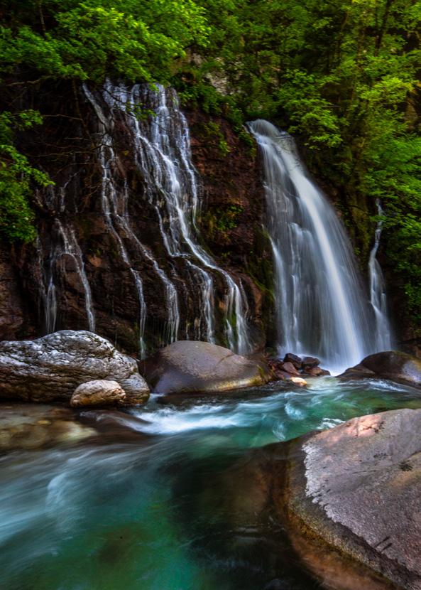
Torrente Noana (© Simone Simoni) 45
The excursion starts off from Ponte Oltra and runs along almost 14 km passing by Zorzoi, then Sorriva di Sovramonte to then follow one of the communication routes which allowed relations and trading with the Primiero area. The first part of the route is a variant of the traditional Via delle Vit, which now is not in great condition.
Once you reach Zorzoi by following the road go through the town to wards Sorriva, where it is possible to admire the Church of San Gior gio (1), which dates back to the VI-VII century, and has paintings from the 14th century as well as more recent paintings by Andrea Nasoc chio from Bassano (ask the sacristan to see them). From the church of San Giorgio, continue uphill towards the Church of San Rocco di Sorriva (2), turning straight to the right after the building and heading up towards Col dei Mich. Just before arriving at Col dei Mich, you can admire a nice private building in limestone, built using pediments and shortly after the Antica Torre (3), now made into a restaurant. We are now at an altitude of 770m asl, the maximum altitude. You return, 46
PONTE OLTRA – VIA DI SCHENÈR – PONTÉT 13,54h km 725 m 630 m 790 m ÙÙÙÙÙ ÙÙÙÙÙ E VIA DI SCHENER 1.01 417,4 m 500 796,2700600mmmm 0 km 2641810123,462 1 2 3 4 5 6 7 8 minimumtrailbeautyphysicaldifficultyeffortsignsaltitude reachedmaximumdistance altitude reached vertical height gain mountaintypeescapewaterdurationsourcesroutesofterrainhuts or bivouacs JulJanDecAugOctSepNov Jun MayAprMar Feb PRIMIERO VALLEY FLOOR AND ITS SURROUNDINGS
white and blue signs in the woods, not very visible 40% woods 20% meadow 40% urban DESCRIPTION. Still to this day, the ancient road, which ever since 1882 was Primiero’s first road to be inaugurated along the bottom of the Schenèr Valley, has been completely forgotten and now lies in a state of abandonment. Thanks, above all, to the work of M. Melchi orre, the process of rediscovery of this ancient access road has begun since 2016. The route described here does not follow the entire Via di Schenèr mainly because there were multiple variants, and north of Castel Schenèr where the more demanding section began, the orig inal mule track was irreparably compromised. This excursion makes it possible to visit all the most important places which run along this historical commercial road, together with the better known section which leads from Sovramonte to Pontét, where the border ran be tween Venice and the Hapsburg territory up until 1918.

Bettola Roe Alte LagodelloSchener 1 2 3 4 5 6 7 8 Antica Torre Castel Schener Chiesa di San Rocco di Sorriva Chiesa di San GiorgioChiesa di San Zenone Zorzoi SSP473 SR20 Col del Mich Pontét 61238745 Church of San Giorgio Church of San Rocco di Sorriva Antica ChurchTorreofSan Zenone CrossingCastelBettolaSchenerofRio Rosna Roe Alte WAYPOINT 47

80% woods - 20% meadow Malga Tognola di Siror
190
FRATAZZA - MALGA TOGNOLA - FORCELLA SCANAIOL - CREL - FRATAZZA ÙÙÙÙÙ 1400 m 2087 m 835 m 16 km ÙÙÙÙÙ 4,30hE SAN MARTINO DI CASTROZZA2.03 16001400m1800m2000m2096m 0 km 16,628264 12 14108 1 2 3 4 5 6 7JulJanDecAugOctSepNov Jun MayAprMar Feb minimumtrailbeautyphysicaldifficultyeffortsignsaltitude reachedmaximumdistance altitude reached vertical height gain mountaintypeescapewaterdurationsourcesroutesofterrainhuts or bivouacs

LOOP OF FORCELLA SCANAIOL
After a first section, the road crosses the forestry road for Malga Crel (CAI-SAT 350 path). Ignore the signs for Crel or Calaita, follow the road to the right towards San Martino di Castrozza for a few hundred metres to then turn left onto the other forestry road which climbs, towards Malga Valcigolera and Malga Tognola (2)- path CAI-SAT 368 of Valzanchetta -.
After a first section, the road crosses the forestry road for Malga Crel (path CAI-SAT 350). Ignoring signs for Crel or Calaita, follow the road to the right in the direction of San Martino di Castrozza for a few hundred metres to then turn left onto the other forestry road which climbs up in the direction of Malga Valcigolera and Malga Tognola (2) – CAI-SAT path 368 of Valzanchetta – After a few hair pin bends, the road continues following Valcigolera, until the bridge which you cross; straight after this bridge, take a junction to the right (3 – for estry road Tognola, CAI -SAT 352) towards Malga Tognola. With a last section, the road leads back to Val Tognola; just before crossing the valley (1690m), to the right a sign indicates a path which goes towards Malga Tognola- ecological path, CAI SAT 352 – The path runs up, with accentuated gradients, through the beautiful woods of the area, with space for a few panoramic glimpses over the Pale
Well sign posted DESCRIPTION. The itinerary begins at San Martino di Castrozza at the car park of the Tognola lifts, in the area of Fratazza, and climbs up Val Tognola, to then go round Cima Tognazza and run down towards Malga Crel, across the Scanaiol saddle. Park the car in one of the large openings in the Fratazza area (1400m), the itinerary starts along rio Tognola, right behind the base of the Tognola lifts, turning onto a dirt road which begins almost flat and passes straight below Malga Fratazza (1)
Malga Fratazza Malga Tognola di SirorForcella Scanaiol Malga Scanaiol Malga Crel 1 2 3 4 5 6 7 2326 Cima Cavallazza Punta2229Ces 2539 Cima Val Cigolera 2383 Cima Tognola 2467 Cima Scanaiol Forcella2424Ceremana 2235 Cima Tognazza SS50 6123745 Malga JunctionJunctionFratazzaValcigoleraforestryroad Tognola Malga Tognola di Siror Forcella Scanaiol Malga Scanaiol Malga Crel WAYPOINT 191

2.03
Heading back towards San Martino with the Pale in the background (© Aaron Gaio) di San Martino behind us, until you reach the opening on the Alpe Tognola with its ski lifts. Go past the first ski lift, climb up the meadow until Malga Tognola di Siror (4-1981m). From Malga Tognola, follow the path which sets off flat in a SW direction, marked as n.9 in the direction of Malga Arzon - Forcella Scanaiol. The path continues through woods, meadows, marsh land with trickles of water and grad ual gradients, climbing only the last part until Forcella Scanaiol (5- 2087m), highest point of the itinerary. Just be careful, half way along the path there is a detour for Malga Arzon which is not well sign posted, ignore it and stay on the main path. From Forcella Scanaiol you go down steeply, entering the woods and quickly reaching Mal ga Scanaiol (6- 1745m); from here turn left, to wards N-NE a path which goes towards Malga Crel and San Martino di Castrozza. The path leads to the “Calaita” forestry road – path 350, which you follow towards San Martino, until Malga Crel (7-1598m, slightly above the forestry road which crosses the meadows) and succes sively San Martino di Castrozza, cutting through the woods downhill, along a path which runs di rectly into Fratazza, well sign posted.

192
SCANAIOLFORCELLAOFLOOPCASTROZZADIMARTINOSAN
193

Along easy paths which are well sign posted, technical along some sections
BivaccorockAldo
210
mountaintypeescapewaterdurationsourcesroutesofterrainhuts bivouacs
or
DESCRIPTION. This itinerary, which sets off from Malga Ces, goes around Cima Colbricón and presents a possible detour to reach the Bivouac Aldo Moro along the Translagorai route. Set off from Malga Ces (1.670m asl),at San Martino di Castrozza, up a first section which runs up Path No.348 towards the Lakes of Colbricón. After an initial section which runs up the ski slopes, the path turns right and starts climbing, immersed in the woods (1). At the end of the ascent, you reach the famous Lakes of Colbricón and Cavallazza just above 1.900 metres of altitude. From the lakes, the track continues on the left along Path No. 349 (3), it runs along the south western shores of the highest lake (1.922 metres asl) to then leave the lakes behind and reach some remains of buildings, an im portant site historically, both for the events relative in terms of the Great War as well as for the findings of the remains of a settlement of Mesolithic hunters. After a short downhill section, Path No.349 leads to the 1.908 m asl of Passo del Colbricon (4) (from where it is possi ble to reach Malga Ces, crossing Pian delle Cartucce, to complete a shorter loop); head back uphill towards Forcella Colbricón and Cima Colbricón along the classic Translagorai itinerary. Head up the valley which leads to the saddle, situated between Cima Colbricón (on the left, to the south) and Colbricón Piccolo (on the right, north west), the view opens up. Once you reach Forcella Col bricón (2.420m asl) (5) from where a great view opens up over Pale di San Martino, over Val di Fiemme and over a part of the Lagorai chain, the path tackles a short downhill section, to then follow the slope along an up and down section which leads directly to the near by Forcella Ceremana (2.428 m asl) (6). The path between Forcella Colbricón and Forcella Ceremana has a couple of variants at differ ent altitudes: even if there are a few short rock steps, the terrain isfrom the Colbricón Pass it is possible to return to Malga Ces 40% woods, 15% meadows, 45% Moro
MALGA CES – PASSO COLBRICÓN – FORCELLA CEREMANA – BIVACCO ALDO MORO – PUNTA CES 2.08 ÙÙÙÙÙ 1670 m 2565 m 1100 m SAN MARTINO DI CASTROZZA 13 km ÙÙÙÙÙ FORCELLA CEREMANA 6hEE 1667 m 1900257223002100mmmm 0 km 26418102,557 1 2 3 4 5 6 7 8 9 JulJanDecAugOctSepNov Jun MayAprMar Feb minimumtrailbeautyphysicaldifficultyeffortsignsaltitude reachedmaximumdistance altitude reached vertical height gain

Laghi di Colbricón 1 2 3 4 5 6 7 8 9 La g h i /G h i a cc i a i Passo del Colbricón Forcella Colbricón Forcella Ceremana Cavallazza2326 CeremanaCima2699di Cima Piccolo Colbricon Bivacco Aldo Moro Punta2229Ces SS50 619238745 LakesJunctionof Colbricon Path PuntaPathBivouacForcellaForcellaPassoNo.349delColbriconColbriconCeremanaAldoMoroNo.337Ces WAYPOINT 211

2.08 CEREMANAFORCELLACASTROZZADIMARTINOSAN
212
Bivouac Aldo Moro (© Aaron Gaio) covered in tracks and any one of them can be followed. From the Forcella Ceremana the track offers an interesting variant which allows to reach the Bivacco Aldo Moro (7): continue for roughly 2,5 km always along the Path No.349 “Achille Gadler” it is possible, in fact to reach the bivouac. The route towards Bivacco Aldo Moro (2.565 m), among rocks and boulders situated on the northern rock faces of Cima Ceremana and the Bragaröl peaks (which made up a part of the Austro-Hungarian line during the First World War) allows to be immersed in the typical moonlike landscape that only Lagorai can offer. The bivouac lies on a saddle of the Bragaröl peaks; from here towards south it is possible to observe the Buse di Malacarne, Alpe Tognola and fur ther away, the massif of Folga-Arzon. From the bivouac, the return to Forcella Ceremana runs along the same section in reverse. Ending this detour, it is worth pointing out the presence of metal steps which run up the rock face, along the path which then continues towards the basin of Forcella Colbricón slightly towards east com pared to Path No.349. The return from Forcella Ceremana follows Path No. 337 (8), which runs down a very steep first section to then pass un der the rocks of Cima Colbricón and continue to wards Punta Ces. From Punta Ces (2.235m asl) (9) you can enjoy the last 360° view offered by this itinerary, with an excellent view on San Mar tino di Castrozza and over the Pale di San Mar tino, to then return back down towards Malga Ces, following the itinerary “Vertical Ces” which leads directly to the farmhouse.

Going down from the Forcella Ceremana (© Aaron Gaio)
213

3.08 scribed here goes back towards Rifugio Roset ta following in reverse the track which leads to Passo del Travignolo. During this short section, from the saddle above Passo del Travignolo with a detour of 10-15 minutes, it is even possible to reach the southern Cima del Nuvolo (3.075m asl). From Passo del Travignolo the itinerary continues downhill along Path No.716; along this section you need to be careful, it is possible to find snow even during the summer season along a few sections. Once the descent has ended, Path No.716 heads up to the right towards SW in the direction of Passo Bettega (6) (2.658m asl). From Passo Bet
VEZZANAANDLUGLI-BOLVERMARTINOSANDIPALE 256

Plateau of Pale di San Martino from Cima Vezzana (© Simone Simoni) tega the path runs down slightly, to then keep the same altitude until you are near Rifugio Ro setta (7), on the moon-like Plateau of the Pale di San FromMartino.theplateau, more precisely from Passo di Rosetta, Path No. 701 sets off towards Rifugio Colverde, the route runs downhill until Rifugio Colverde before and San Martino di Castrozza after, returning back to the starting point. 257

40% woods, 50% meadows, 10% rock VALLE DEL VANOI AND LAGORAI FOLGA AND GRUGOLA 496
or bivouacs Well sign posted, from the saddle Folga to Cima Folga the tracks get lost DESCRIPTION. This classic excursion sets off from Calaita, location with the Lake of Calaita situated on the eastern corner of the Lago rai group, in the upper Valle del Lòzen. The first part of the itinerary develops through the woods and initially follows the forestry road of Path No.347 towards west which starts from the access road of Lago di Calaita, a few hundred metres before reaching the lake. After walk ing along a pleasant flat section and going past a junction (1), al ways continuing along the road, you get to a second junction (2), from where, on the right towards west, the path which runs up towards Malga Grùgola (Path No.358) sets off. Once you reach Malga Grùgola (1.782 m asl) (3), Path No. 358 contin ues uphill along Valle di Grùgola, carved out by the Grugola stream. During the ascent of Valle di Grùgola, which leads to Forcella Fólga, the view opens up and the vegetation becomes more sparse, allowing to enter the magical landscape offered by Lagorai, with a magnificent view over the valley and the mountains far away. Shortly after pass ing onto the southern side of Col Móngo 2.146 m asl) (4) you reach Forcella Fólga (2.195 m asl) (5) Leave the main path and head towards north, along the trail which leads to Cima Fólga. The trail, which on sections is not perfect ly marked, follows the ridge to then clamber up grassy slopes; the terrain is not technically difficult and you can easily reach the peak climbing up the grassy terrain. Once at Cima Fólga (2.436 m asl) (6), you will be fascinated by one of the most beautiful views of Lagorai with a view which includes all the Vette Feltrine range and the Dolo mites of Pale di San Martino. From Cima Fólga the excursion continues along the ridge (with a few small technical sections) which joins up the Cime Fólga and Grùgola, towards north-east in the direction of Cima Grùgola (2.405 m asl) (7)
CALAITA – CIMA FÓLGA – CIMA GRÙGOLA – LAGO PISÓRNO ÙÙÙÙÙ 1595 m 2436 m 865 m 10,8 km ÙÙÙÙÙ 4,30hEE 7.08 JulJanDecAugOctSepNov Jun MayAprMar Feb minimumtrailbeautyphysicaldifficultyeffortsignsaltitude reachedmaximumdistance altitude reached vertical height gain

mountaintypeescapewaterdurationsourcesroutesofterrainhuts

121110619238745 First junction towards left Path AqueductPathLakePossibleForcellaCimaCimaForcellaColMalgaNo.358GrùgolaMóngoFólgaFólgaGrùgolaGrùgoladetourPisornoNo.347Malga Doch WAYPOINT 497


Lake Pisorno (© Simone Simoni)

From Cima Grùgola the route runs down quickly to Forcella Grùgola (8), from where it continues along Path No.347 coming from Forcella Fól ga. The itinerary continues downhill along Path No.347 towards north, returning towards Lake DuringCalaita.the return to Lake Calaita it is possible to make a short detour (9), marked with signs after a couple hair pin bends downhill, which allows to reach Lake Pisórno (2.227m asl) (10), a clear lake wedged in among the black rock faces of Cima d’Arzon. Lake Pisórno, a small but deep, high altitude lake, according to the legend, is in habited by witches and evil spirits; it is said that if you throw stones or move the water, the spirits will make it hail. The itinerary runs finally down Path No.347 (11) and after going past the Aqueducts of Malga Dòch (12) and following the course of the im petuous Lòzen Torrent, it returns to Lake Calaita (1.604m asl).
GRUGOLAANDFOLGALAGORAIANDVANOIDELVALLE 498
7.08
On the ridges of Cima Folga (© Aaron Gaio) 499

CLOTHING,FOOTWEARANDEQUIPMENTFOR YOURADVENTURESINTHEDOLOMITES M O U N T A I N S T O R E NIVALISMOUNTAINSTORE ViaGaribaldi17a,FieradiPrimiero PrimieroSanMartinodiCastrozza(TN) Tel +390439763967 Mailinfo@nivalisfiera.com


