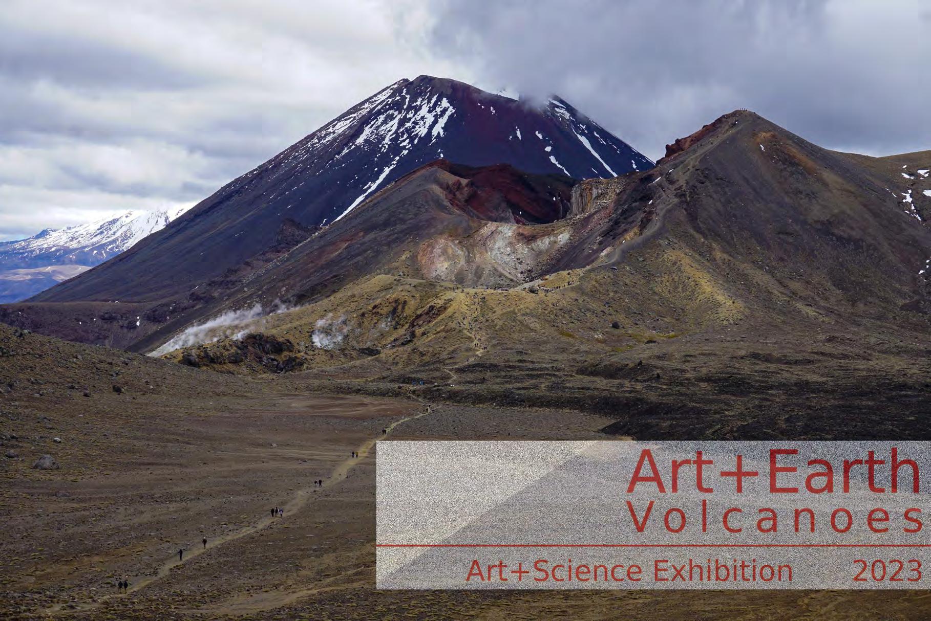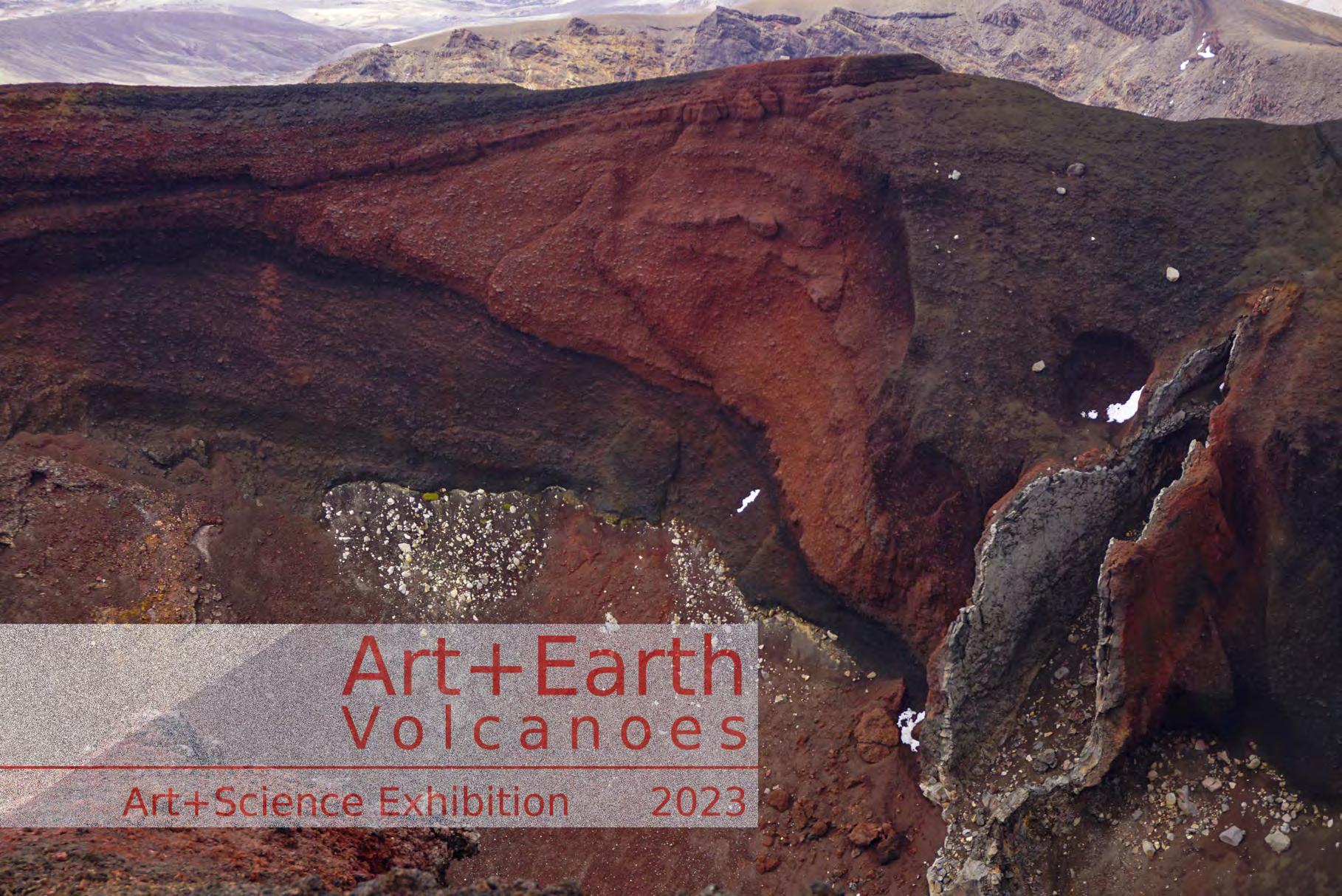
Art+Earth
Volcanoes
In association with IVACEI* Conference 2023, Rotorua *International Association of Volcanology and Chemistry of the Earth’s Interior Art+Science Exhibition 2023
Nature and timing of Earth and ocean processes through magnetic minerals
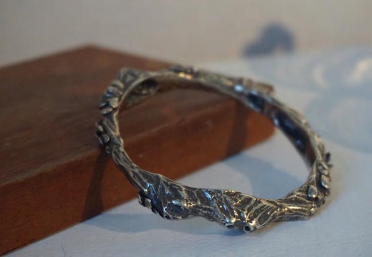
Earth is surrounded by a geodynamo-generated magnetic field, with the angle, polarity and flux density of the field lines loosely dependent on latitude. At times the magnetic poles weaken and eventually settle in the opposite polar region. The last time this happened was 780,000 years ago. These reversals are represented as the black and white stripes of the Magnetic Polarity Time Scale. We know reversals have happened because magnetic minerals—such as magnetite—lock-in a record of Earth’s past magnetic field. For volcanic and metamorphic rocks, the lock-in happens as the minerals cool below a certain temperature. In sediments, the magnetite minerals are like little compasses that rotate to align with the Earth’s field as they settle.
Otago Paleomagnetic Research Facility’s Superconducting Rock Magnetometer is sensitive enough to measure the strength and angle of magnetisation in long mud cores, which form a nearly continuous record of the Earth’s magnetic field. We also apply magnetic fields and measure the response to determine changes in magnetic mineralogy, grain-size and concentration that can be used as a proxy for environmental change.
I study sediment cores from offshore New Zealand that record continuous climate cycles back as far as 2.5 million years ago. These records are significant because the relentless uplift and erosion in the Southern Alps has erased so many terrestrial deposits. We can then compare the timing of Southern Hemisphere events to the timing of events in the Northern Hemisphere and learn more about global climate connections.
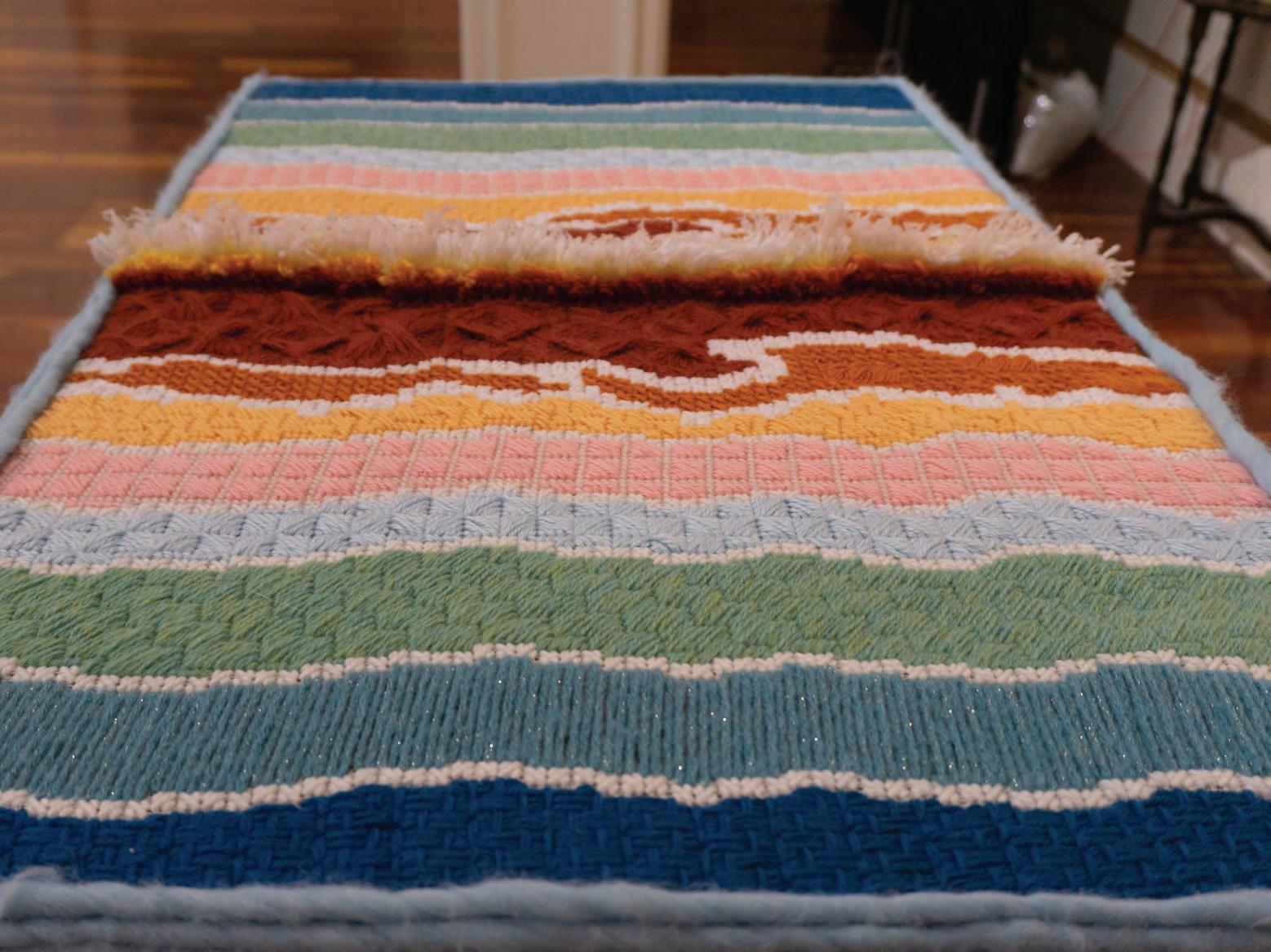
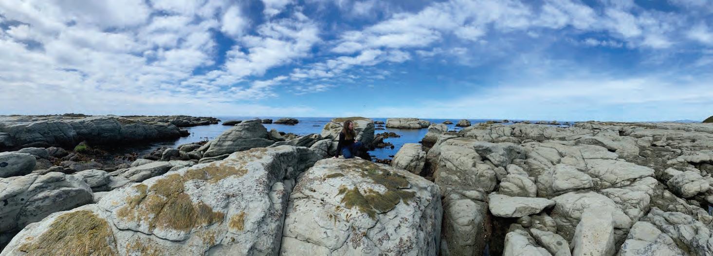
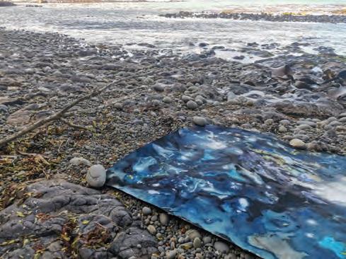
Floor spreading in the ocean
This piece is special to me as plate tectonics was one of the things I found absolutely fascinating about geology. The idea that one can find almost mirror images on either side of the mid oceanic mountains lead me to replicate the process in textile form but keeping the regular irregularities of the natural process as well. Because this is a hot process, I have used warmer colours in the centre and have used a horizontal surface to display it on as the process itself is on the surface of the earth in the crust that floats above the mantle.
Faye Nelson
Vivien Dwyer
Artist
Scientist
Faye Nelson
Scientist
Nature and timing of Earth and ocean processes through magnetic minerals
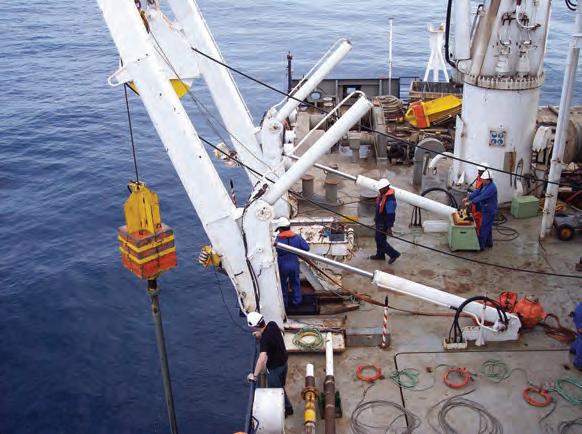
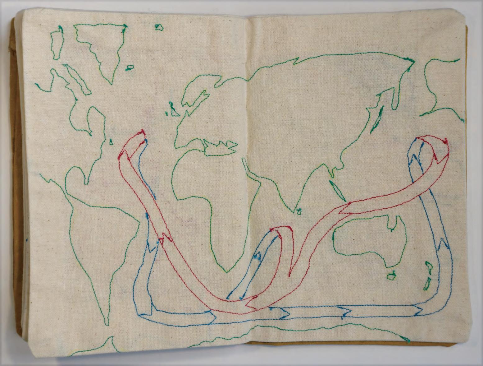
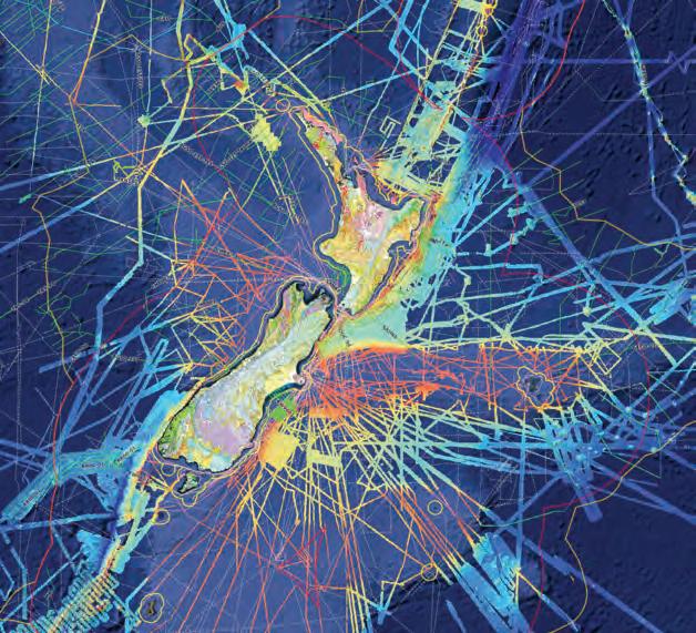
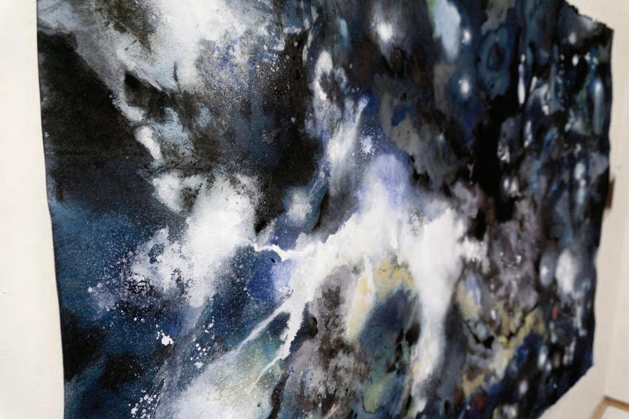
The field notebook is a ubiquitous piece of field kit for geologists. During my visit to Viv’s studio, I was fascinated by her stratigraphic tapestries and inspired by her fabric book projects. Viv’s piece for this project takes us into the deep ocean where seafloor spreading at a mid-ocean ridge forms magnetic polarity stripes. These magnetic anomalies (mapped by a magnetometer towed behind a ship), deep-sea core magnetostratigraphy and paleomagnetic evidence of drifting continents contributed to the acceptance of plate tectonics in the 1960s.
With this textile field notebook, I am tracing my journey across the Pacific from land-based paleomagnetism in North America to marine paleo- and environmental magnetism on Te Riu-a-Māui/Zealandia. Using fibres and a vintage Singer sewing machine to recreate field notes, sketches and big-picture concepts in paleomagnetism has led me to contemplate my journey from a different angle.
Nick Mortimer
Te Riu-a-Māui / Zealandia
Te Riu-a-Māui / Zealandia, Earth’s eighth continent, has been a research focus of mine for more than twenty years. I am always seeking new ways to communicate Zealandia’s place and importance in the environment.
This three-piece artwork is inspired by the title of a 2017 research paper “Zealandia: Earth’s Hidden Continent” and by GNS Science’s 2020 scientific map posters of Te Riu-a-Māui / Zealandia. On everyday maps the continent is invisible, hidden from view underwater. A few maps show sea floor mountains, ridges and plateaus that hint at underwater connections between islands. Geological maps fully reveal the continent’s hidden rock foundations.
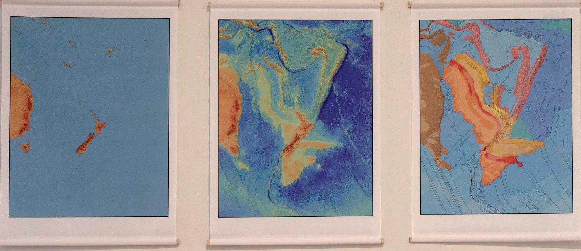
Conveying technical data in maps that are informative and aesthetically pleasing is an art, a craft and a little bit of science, too. In preparing the 2020 GNS map posters we paid particular attention to colour palettes, shading and patterns to show geological relationships and to highlight structural changes that are affecting our continent. This enables the maps to work individually or together.
For this triptych artwork, we have retained the original poster colours but have stripped out all text and technical information such as labels, map legends, and latitude and longitude lines. This leaves colours, shapes and textures to speak for themselves. The viewer is invited to realise just how much of our natural world is hidden and ponder discoveries still to be made.
 Te Riu-a-Māui / Zealandia
Belinda Smith Lyttle & Jenny Black
Artist
Scientist
Te Riu-a-Māui / Zealandia
Belinda Smith Lyttle & Jenny Black
Artist
Scientist
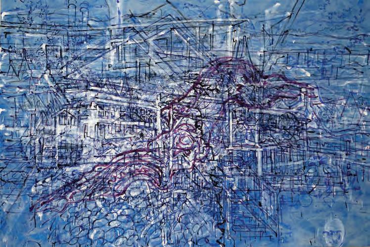
Tūrangawaewae
Tūrangawaewae is one of the most well-known and powerful Māori concepts. Literally tūranga means ‘standing place’, and waewae ‘the feet’, thus it is most commonly translated as ‘a place to stand’. But simple translation misses a deeper spiritual meaning. Tūrangawaewae are places where we feel connected and empowered. They are our foundation, our place in the world, our home. Connection to place and the whenua (land) is fundamental to Māori identity. It shapes our thinking, our way of being, our priorities and values.
Connection to the land is also a concept well-known to Earth Scientists. It forms a large part of their daily lives and is often a raison d’être. After more than three decades mapping geology and observing landscapes, the way I understand and ‘read’ the landscape has gradually evolved. While trained initially to see a hard, static, old and ‘timeless land’ of hard rocks and deep geological time, New Zealand’s active tectonics and Natural Hazard events have shown me a more dynamic, lively, and dramatic set of processes that shape Papatūānuku (mother earth). But how might the ‘spirituality’ of tūrangawaewae and connectedness be captured, quantified or represented? Is it possible that art can show some of the depth, complexity and layering of thought that enables scientists to feel empowered to provide recommendations and advice?
The exhibit ‘Tūrangawaewae’ captures a spiritual side of Earth Science and a connectedness to the landscape that will not be found amongst rigid scientific manuscripts and equations. As a collaboration between art and science, its concept may have been complex but its execution relatively simple. While the world locked down and turned to online-only relationships during Covid, I recorded a stream of consciousness and immediate thoughts as I looked at, and read, the landscape. Warrington beach, where I live, near Dunedin city provided the setting for physical walks and mental wanderings. A set of ‘online lectures’ were created from views to the East, South, West and North outlining some science of tectonics, earthquakes, sea level rise and climate change across Te Waipounamu – the South Island of New Zealand.
Sarah Shackleton
Tūrangawaewae
Although living in Spain on the other side of the planet, Te Waipounamu was also my birthplace. It is a place where I have stood, have family and am still very connected to. Projecting the videos on the wall, I dissected the lectures into a series of complex lines, shapes, colours and textures, reconstructing the science into a chaos of layers on canvas. Almost like an experiment itself, Simon teased me with images and views with potential to evoke an old sense of belonging. As I painted the land of my birth and layers upon layers of the science behind it, my connectedness did indeed evolve. All the while the artistic side of the project was both recorded and mirrored in video.
Represented by five large canvasses and digital recordings, Tūrangawaewae was an art and science collaboration that evolved through the stratification of geological processes, landscape evolution, scientific thoughts, online lectures, painting and drawing, digital editing and artistic expression.
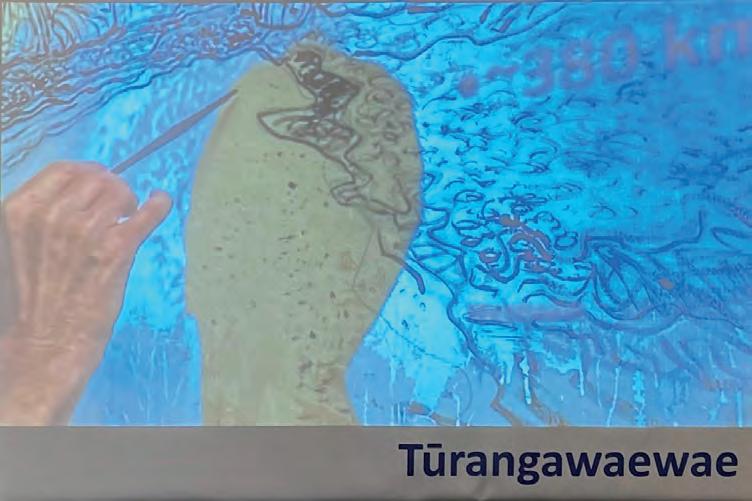
Above (Clockwise): East, South, North and West, 1300 x 1950 mm acrylic on canvas works created by Sarah Shackleton in response to Earth Science lectures that were projected onto the canvas. Each was filmed as it was created. A compilation of the film will be projected in the exhibition. Also showing in Zaragova, Spain in “S.A. de Prójimos” (Encounter between Art + Science) 2021.
Simon Cox
Artist
Scientist
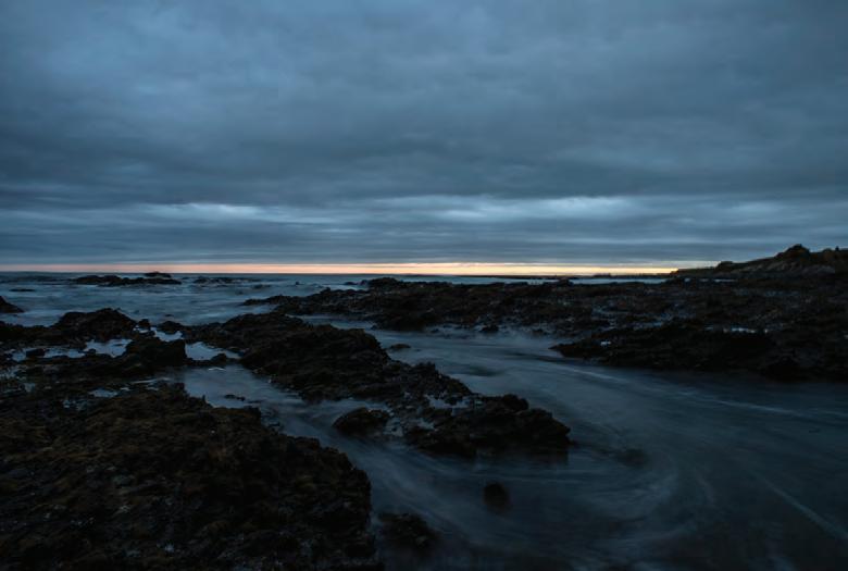
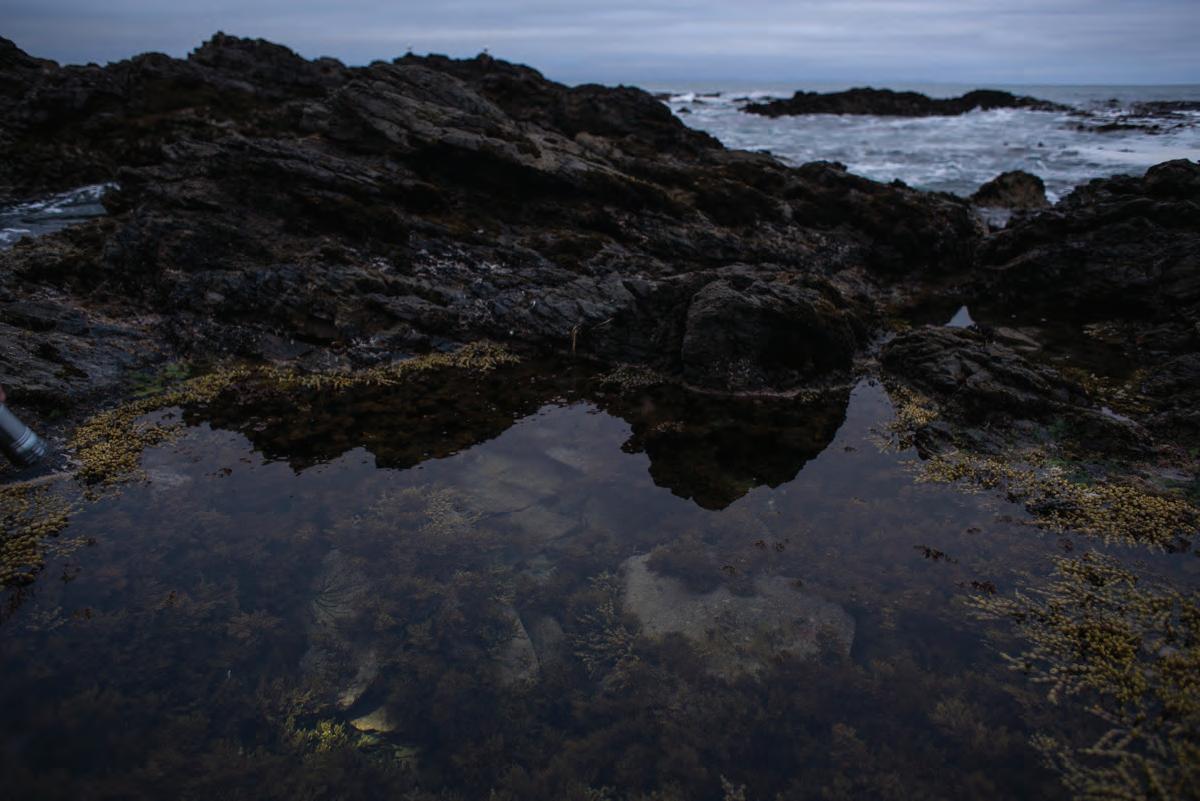
Kaikōura wave energy
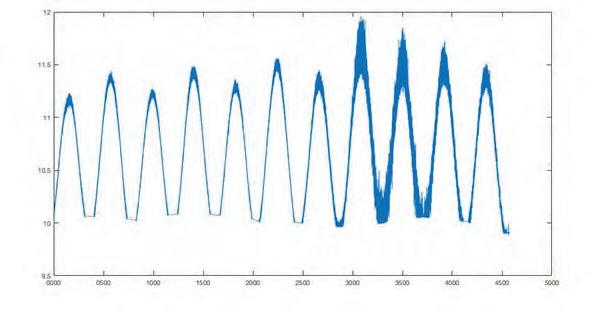
The ocean waves and their interaction with coastlines have fascinated scientists for centuries: as the frontier between the inexorable advance of the ocean abutting against the stalwart land margin. How and when a cliff face or rocky shoreline will be broached, and under what conditions this happens is a key area of coastal science research. Rocky shorelines that are intertidal are of particular interest, where the shore is inundated for a few hours each tide, and then exposed again. These shore platform environments protect some of the most precious land. Often ancient urupa and middens are hidden within the nearshore zone and if the wave energy is sufficient and frequent, waves will erode the material and expose taonga. As a scientist I am researching wave energy in shore platforms, and how this is dispersed and expended at the coast. On coastlines such as Kaikōura and Māhia in New Zealand, it is the infragravity waves, those that form across the ocean far away, that are responsible for erosion of the wide platforms that surround both peninsulas. We measure these waves with recording devices that determine the frequency that the wave forms occur. The wave record you can listen to here is from Kaikōura in 2019, and the change in intensity is because of an incoming southerly. In these conditions, the quiet, rolling lulls of infragravity breaths are disrupted with the discordant roars of the swell that picks up energy as the low pressure air system moves northwards.
Eden Smith
The starting point for my piece was a series of charts that Sophie provided me of her work. These charts showed the tidal cycles and wave intensity of an area in the Kaikoura Peninsula that had been affected by the recent earthquakes. What struck me about the charts was their rhythmic regularity across the x axis and their ‘randomness’ (for want of a better word) along the y axis (that is, the peak of each cycle has a slightly different height)
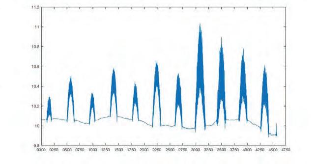
My soundscape is an ‘interpretation’ of Sophie’s data. To mirror the regularity of the x axis, the tempo is a constant 60 beats per minute. The ‘dips’ in the chart are conveyed by a cyclic foundation ‘low’ sound that is 8 bars long and repeats constantly. The ‘peaks’ of the chart are represented with another 8 bar long sound (that has a slightly higher note) that occurs every 16 bars (i.e. 8 bars on, 8 bars rest) and creates a crescendo. To convey the varying intensities of the ‘peaks’ (which in the graphs are shown by some peaks being ‘heavier’ than others), four higher sound waves (also 8 bars long) come and go at different intervals. Some play every 32 bars (i.e. 8 bars on, 24 bars rest), some every 64 bars (i.e. 8 bars on, 56 bars rest) and so on. Because of the different time cycles, different combinations of sounds happen every 16 bars, with it returning to the ‘base sound’ (the ‘dips’) every eight bars. Depending on how the parameters of this soundscape are set up, you could have something which never repeats in quite the same way during the course of a day.
Sophie Horton
(Soundscape)
Artist
Scientist
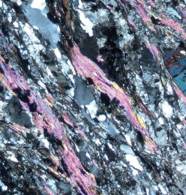
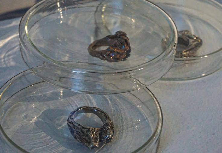
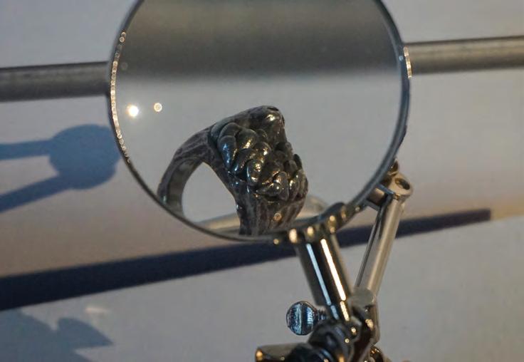
The iconic Central Otago landscape of tors (pillars of rock) are made of schist. Schist is a type of rock that was deposited as mud- or sand-sized fragments in the ocean some 250 million years ago. The fragments were buried and heated (metamorphosed) and squashed and stretched (deformed) on the long journey from ocean floor to onshore New Zealand. This history is recorded in the rocks as can be partly seen when looking at them under the microscope (above image). Here, schist rock has been polished to exactly 0.03 mmthick, which is so thin that light can shine through. Scientists use polarised light which highlights ribbons of the mineral mica as bright pinks, purples and yellows. This is juxtaposed against the grey, blues, blacks and whites of the minerals - feldspar and quartz. This specimen is from the most strongly metamorphosed and deformed areas of the Otago schist, such as can be seen around the Maniototo in Otago. The layering of minerals defines a dominant fabric. The fabric records one of the important events that deformed this schist rock as it was lifted from deep in the Earth towards the surface. The art of weaving beautifully represents the colours, layers and fabrics seen in schist rock from Otago.
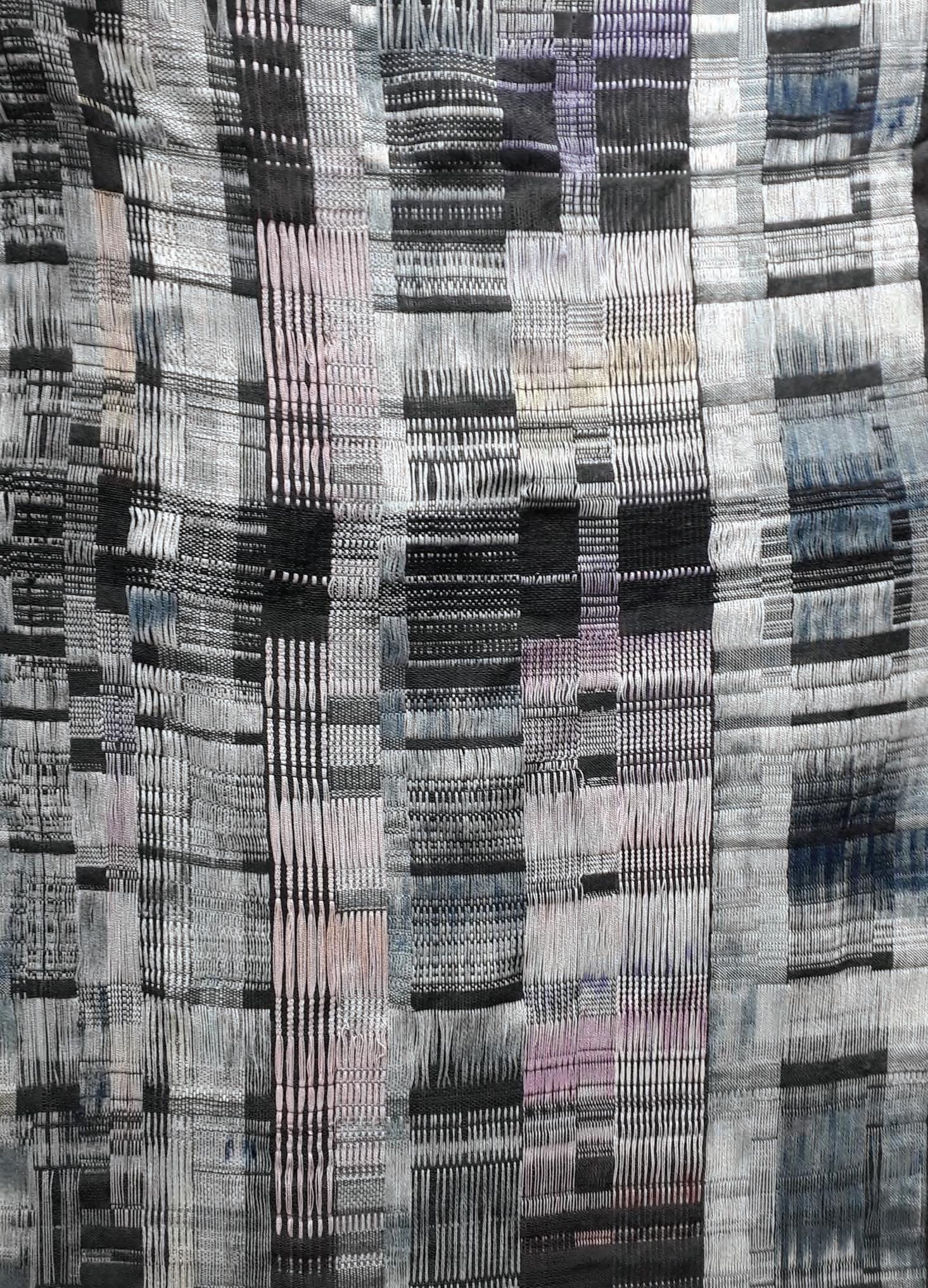
Patterns and colours have always inspired me. As a little girl my father sat me down at a microscope and showed me how crystals grow. The polarised light turned colourless preparations into beautiful, colourful patterns. In choosing my scientist I had an affinity to these kinds of patterns from the beginning. Adam took time to explain the schist to me and was equally curious about the weaving process. He inspired me to use material from Otago in the weaving. Most of the yarn used is super fine merino (from NZ or Australia), spun in Italy, sold to Germany, and returned to NZ; the pink stripes are made from wool from the Paterson Armidale farm near Ranfurly, spun at Bruce Woollen Mills in Milton before they closed. The material for the piece has its own past, as does the rock from the Maniototo. The schist rock was cooked and stretched in geological terms as was the wool I used to weave the piece. The process of the making has been refreshingly intuitive. I did not make detailed notes but just trusted the process and my experience. Warp threads were dyed and arranged onto 2 beams and 16 shafts on the loom with the given photo in mind. I did not fully control the weave structure as a whole but responded to woven segments on the go. I could never exactly repeat this piece. I really enjoyed making it!
Adam Martin
Christine Keller
Artist
Scientist
Ground Work
To Earth scientists, the mineral zircon is like a library containing the oldest and most extensive volumes of Earth’s history. Zircon crystals form in many different parts of Earth and are physically robust, meaning they can churn through Earth’s rock cycle multiple times and survive intact. Each time new zircon crystallises, it preserves a chemical fingerprint of the rock, magma or fluid that it crystallised in, which helps us understand the Earth processes involved in its formation. Zircon also incorporates radioactive isotopes of uranium and thorium into its crystal structure. The radioactive decay of uranium and thorium in zircon occurs at a steady rate over time, allowing zircon to be used as a timekeeper. Coupled with its resistance to physical modification, the chemical properties of zircon make it an ideal tool for unravelling the history of Earth processes. At MacFarlane Ridge near the Haast Pass, zircon records the injection of sheets of magma into cracks and foliation planes in the surrounding schist rock. The abundance of rare earth elements in zircon’s chemical fingerprint reflects the unusual composition of the magma from which it crystallised. This magma is one of the richest sources of rare earth elements (lanthanides) on Earth, providing key components for green technologies such as batteries and wind turbines. Zircon not only tells us when and why the magma was injected into the crust, but its chemical fingerprint also helps us track the complex pathways that rare earth elements take through magmatic systems.
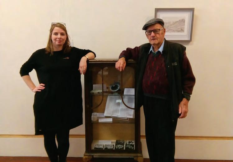
Katharine Allard
The starting point for this project was seeing Sophie’s beautiful images of zircon crystals viewed through the petrographic and scanning electron microscopes and learning how zircon has told stories of the earth over billions of years. The next step was wondering how I could do justice to any of it.
It’s fascinating to marvel at the secrets of a tiny rock, and difficult to reconcile its significance to earth science with wider use of mineral resources, including making art. I’m interested in the way larger industries influence the development of artist materials. For example, properties that are desirable in commercially produced pigments such as stability, consistency and permanence may limit the potential for more dynamic outcomes.
After experimenting with the high-refractive and abrasive nature of zircon (zirconium silicate), I’ve developed a sand-coloured drawing ground using commercially available zircon flour (commonly used in manufacturing ceramics).
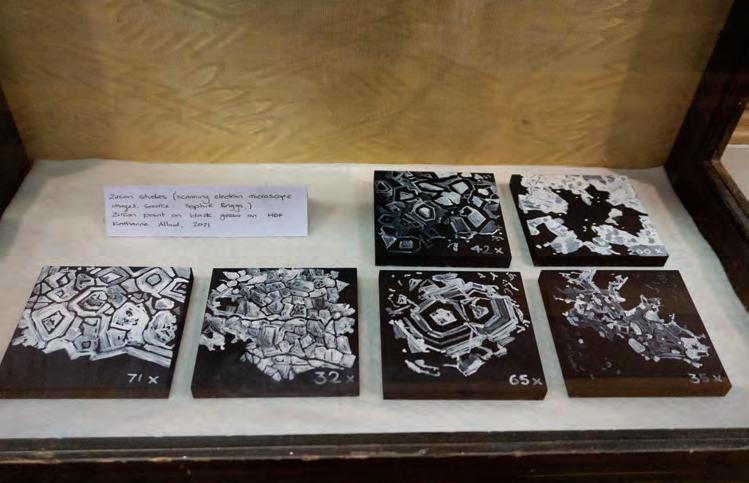
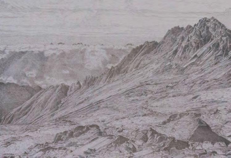
Over the zircon ground I’ve drawn an alpine landscape based on Sophie’s fieldwork sites on MacFarlane Ridge. The smooth, hard surface is perfect for drawing with silverpoint which will tarnish over time. I hope to draw attention to the art materials from a geological perspective and honour them through my work.
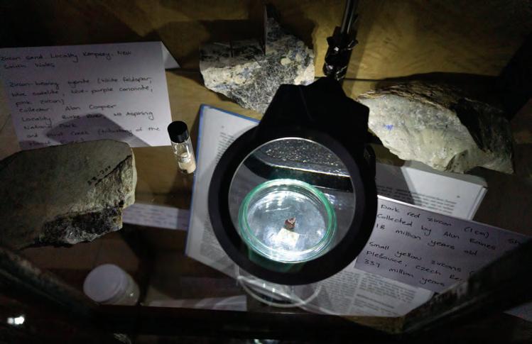
Researching zircon, making observational drawings and meeting with Sophie over the year taught me a huge amount. Additional items on display are linked to the accumulative process of knowledge-gathering: from rock specimens kindly lent from the Geology Department collection, to artefacts from personal investigation into the incredible materials that shape the earth.
Sophie Briggs
Ground Work
Artist
Scientist
Fossil wood
Ancient forests covered much of New Zealand’s landscape. These persisted from the time of Gondwana into the modern era. On occasion, the trees forming these forests became covered by ash fall or an anoxic bog, the first step of fossilisation. Exposure to ground water with high amounts of dissolved silica, calcite and other minerals is the second. This fluid flows over the dead trunks, replacing the organic tissue with these dissolved minerals, turning them to stone.
Eventually, after millions of years, they may be brought back to the surface. Once at the surface, it is possible to study these ancient stone trees, to discover which modern family or genera the fossil trees were most closely related to. This is done by taking sections at different orientations – transverse, tangential and radial– which give three different views of the fossil cellular structure. These sections are carefully ground until they are less than a hair width across. The structures revealed are compared to those of modern trees. In the South Island, there are many sites that yield fossil wood of different ages. It is possible to find a nearly complete record of wood from the Jurassic (200 mya) to the Quaternary (almost modern). Araucarioxylon, ancient Kauri, has been present in New Zealand for the entirety of that record. Nothotfagoxylon, precursor of Southern Beech, has fossilised wood of Miocene age and is still present today. Casuarioxylon and Eucalyptus-like wood are also present in the Miocene but die out before the end of the Pliocene.
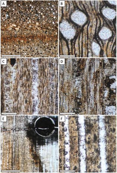
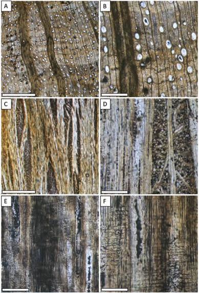

Petrified wood is rock and like other ancient fossils reveal something particular to the individual trees from the time and conditions when they were living. Somewhat miraculously the textures and patterns are captured in the fossilised wood and can be seen millennia later in the remains.
In a free-weaving response to the petrified wood samples from Mathew Vanner’s research I designed a weaving sampler using a series of experimental lifts, weft manipulation and tapestry techniques to interpret his microscope slides. The title reflects both his scientific methodology of preparing fine slivers of petrified rock samples for microscopic examination and the weaving of short experimental blocks to depict the visual material in the slides. Across the different species the cumulative fragments reveal morphological similarities and distinctive characteristics at the cellular level. Reading from top to bottom the Araucariaceae, Casurinaceae and Myrtaceae families traverse the Jurassic to Quaternary periods in a linear paleo-botanical timeline. As we view the stops and starts we might also reflect on the continuity of the Araucariaceae lineage and ponder its future and conservation status in the new century: with Kauri die-back (New Zealand), the constant double threat of extinction and wildfire for the remaining stand of Wollemi pine (Australia) and life on the endangered list and CITES Appendix for monkey puzzle trees (Chile, Argentina).
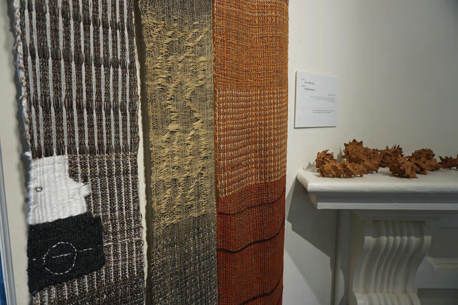
Mathew Vanner
Petrified Sampler - forest timelines caught in stone
Pam McKinlay
Artist
Scientist
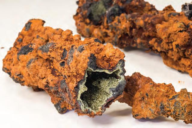
Hot Rock Time Machine
Thirty-four million years ago, the rocks the students are studying in this photo were on the seafloor. At that time, the young continent of Zealandia was mostly covered by warm Pacific waters even though it was further south. Earth was much warmer then in part because Australia and South America were still tenuously connected to Antarctica, blocking what would become the Antarctic Circumpolar Current. As a consequence, Antarctica was ice-free and sea-level was 100m higher than today.
Geologists know this because the rocks contain evidence of how and where they were formed.
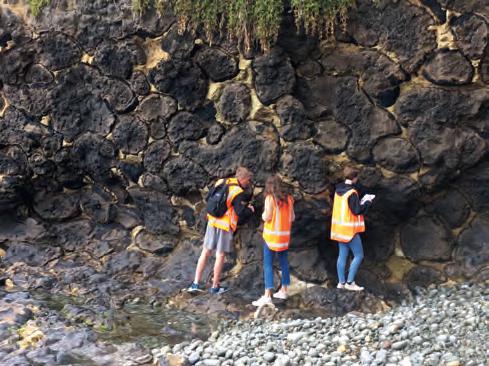
They are a kind of time machine to the past. The dark brown-gray blobs are basalt – solidified lava composed of tiny crystals. If you look carefully, each has a thin black outline. That is a rind composed of glass made when lava contacts water and cools so quickly no crystals can form. Because of their shapes, we call these “pillows” and they are a characteristic feature of lava erupted underwater. The white rock between the pillows is limestone - Oamaru Stone - composed of broken fossil shells. The kinds of organisms and the chemical compositions of their shells reveal that they lived in waters that were twenty degrees or warmer.
These rocks are particularly relevant because they formed the last time Earth’s atmosphere had twice as much carbon dioxide as at present. We are trying to reduce fossil-fuel carbon emissions in order to avoid repeating those levels and their attendant high temperatures and sea-levels.
 Jessica Ritchie & Craig Cook
Time scales of human-earth interactions, are so vastly different. Earth is static for such a long time, we get lulled into a sense of it has always been this way. And then there can be changes, either slow changes that are imperceptible (as with climate) or sudden catastrophes that can happen and it takes us by surprise. Geological time is measurable, but also incomprehensible.
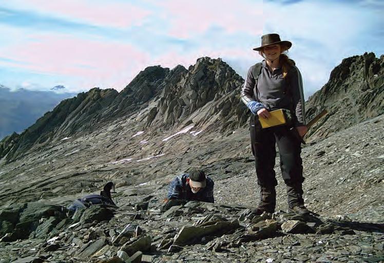
Mike Palin invited us to join a geology field trip. One of the locations was Boatman’s Harbour at Cape Wanbrow in Oamaru, a site of spectacular “pillow lavas”. The volcanic structures were formed in the late Eocene to Early Oligocene. We found ourselves standing in a place that was once 60 metres below the sea surface.
Inspired by the fascinating shapes and patterns in the rock formations at Cape Wanbrow, the drawing was created on site, beginning as a wall rubbing. We then used a cyanotype process, which encompasses the materials of water, sun, and time. The layers in the artwork travels a journey through time, the initial rubbings taken from the physical traces of the lava, formed millions of years ago, to the marks formed by water, sun, and paint.
In the video the push and pull of the waves bring a sense of vertical rather than linear time, the experience becoming almost ‘present’ orientated. Low level dynamics and extremes of durations encourage a heightened awareness, particularly of small details, which in turn may create a sense of time lengthening and creating a ‘space’ for the sound of each wave to be itself and the sound of the clattering rocks, is quite unique to this place.
 Standing Still at Boatman’s Harbour
Michael Palin
Scraped from ancient seafloor Forged and folded beds of rock Upstanding, withstanding Worn face of Nature’s clock
J. M. Palin 2016Artist Scientist
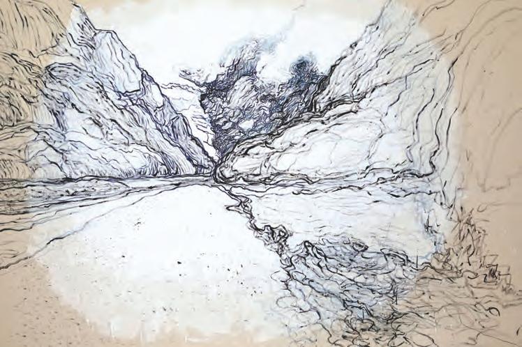
Geologic time is vast. Around 250-290 million years ago, a subduction zone off the edge of the ancient supercontinent of Gondwana produced a chain of island and submarine volcanoes. These volcanics would, much later, become known as the Brook Street Terrane.
Subduction occurs when tectonic plates collide and one plate sinks beneath the other into the mantle. Molten rock formed through this process finds its way up to the surface and produces a line of volcanoes.
My research focused on the eruptive processes of a sequence of volcanic rocks in Southland, a snapshot across a thin sliver of geologic time, perhaps a scant few hundred years or less.

These volcanoes grew from the seafloor, producing explosive eruptions and lava flows. Some built up enough to form islands, while others remained underwater. Underwater, the outer surface of the lava cools quickly to produce a skin that protects the lava inside, forming budding, bulbous pillow shapes. Elsewhere, lava is fragmented in the sudden shock of cold water, or by flowing down steep slopes. A new generation of lava burrows under these fragments, expanding the volcano.
About 230 million years ago, another subduction zone scraped the Brook Street Terrane onto the edge of Gondwana. 145 million years later, New Zealand split from the supercontinent and shifted to its present-day position, deforming along the Alpine Fault and displacing the Brook Street Terrane along its length. Geoff’s art speaks to the millions of years of history that put these rocks where they are today.
Jasmine’s research has examined the form, microstructure and chemistry of ancient volcanic rocks from a site near Riverton and revealed something about the process that created them. My work is inspired by the background to this research.
The pillow lavas of the Brook Street Terrane were formed in the deep ocean somewhere east of Gondwana in the late Permian era. My purpose has been to express my feelings and understanding of the vast process which over millions of years has created our islands and exposed these outcrops on the coast. We can remember events from the previous day and know when they occurred within a few minutes. We can use the growth rings on a tree trunk to estimate the age of the tree within a year. The clues as to the age of these rocks are more difficult to understand and experts seem to disagree. Estimates vary by 40 million years.
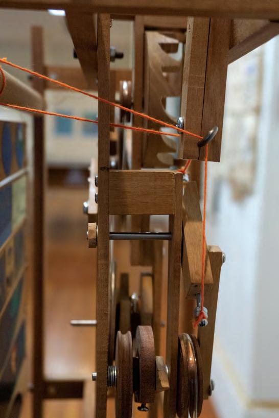
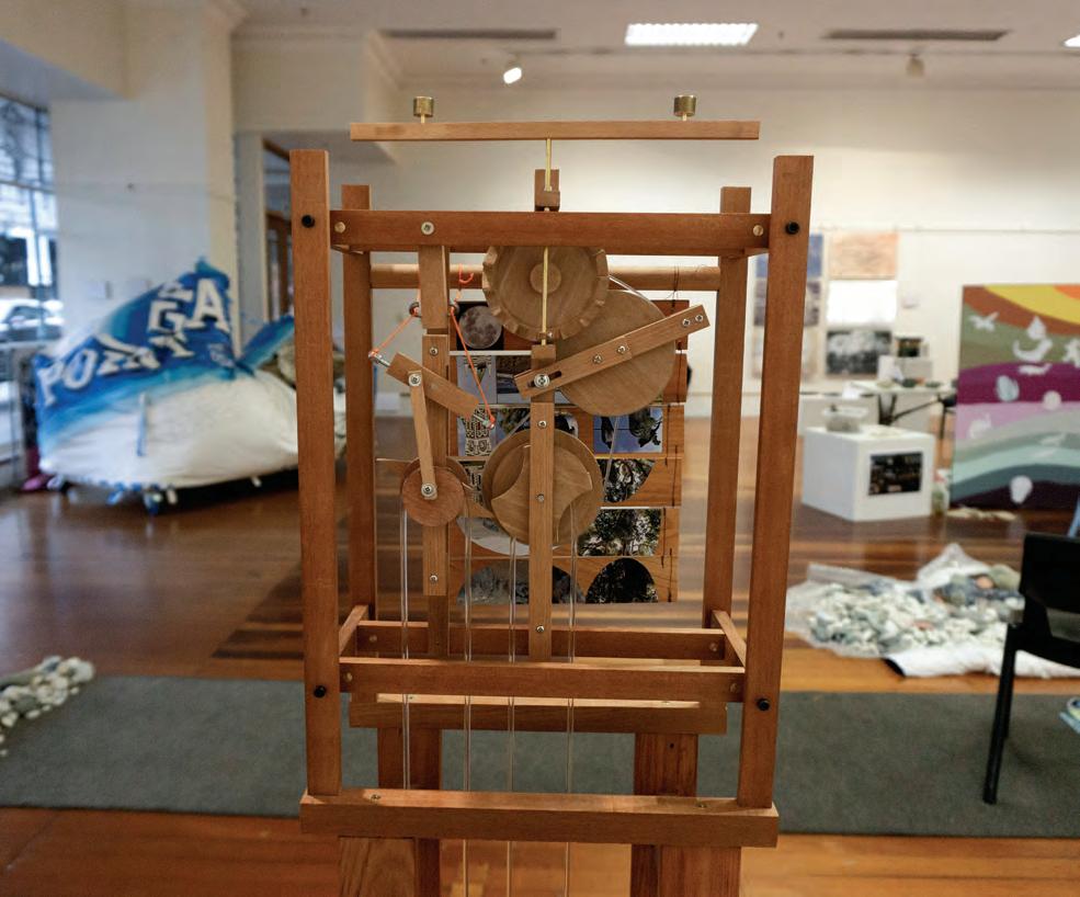
About Time displays two images alternately using a traditional toy: the Jacob’s Ladder, driven by clockwork. The elements of this installation convey hints about time and change. The machinery resembles the earliest mechanical clock designs of the fourteenth century. Most of the wood is recycled rimu from a hundred year old demolished building. The Jacob’s Ladder is made from matai, a native New Zealand tree that can live for over a thousand years. The images represent the rocks in context at times separated by 260 million years. You may have to wait five minutes to see both.
Jasmine Mawson
Brook Street Terrane
Geoff Wyvill
About Time
Artist
Scientist
Trace elements and acidificationfrom necessity to toxicity in the aquatic environment.
Human activities, such as urbanisation, industrialization and agricultural intensification have produced a measurable increase in the concentrations of trace metals in the aquatic environment. These anthropogenic inputs are a cause for concern because metals like copper serve as either essential micro-nutrient to marine organisms or as toxicant when surpassing a certain critical concentration threshold in the aquatic environment. To date, copper concentrations in several natural water masses and/ or in the tissue of aquatic organisms are high and somtimes even exceed essential levels and thus cause sub-lethal and/or toxic effects on adults, or more crucial, their larvae stages. That in turn drastically impacts the diversity, health, structure and functioning of affected ecosystems. The detection, monitoring, and assessment of copper concentrations are therefore key in aquatic environments and are becoming increasingly important as a result of legislation and increasing public awareness.
The bioavailability of copper to biota, with respect to both toxicity and necessity, is generally correlated to the free copper-ion concentration in the water column. The level of free copper ions in the water column is strongly mediated by the presence of copper-complexing ligands, which alleviate metal limitation and reduce toxicity to affected organisms, and geochemical conditions such as pH, temperature, salinity etc. For instance, low pH (i.e., ocean acidification) increases the free copper ion concentration in the water column and can thus potentially shift a system in a short amount of time from a healthy to a toxic state. All in all, the final fate of copper has to be determined a site-by-site basis, as varying local conditions prevent the generalization of copper toxicity over regions.
Emily Brain
Where’s your lab?
Hydrothermal vents are great study sites to investigate metal stress to biota in an un-manipulated “natural laboratory”. Hydrothermal systems along volcanic island arcs have mostly shallow water depths and strong magmatic input into their fluids and hydrothermal plumes. As these plumes often reach up into the productive photic zone, they discharge large quantities of material into the surface water layers. These systems are crucial to understanding the global elemental budget of micro-nutrients and toxic elements in the ocean, as well as helping scientists to clarify chemical and biological processes regarding metals in a natural multi-stressor environment. Shallow hydrothermal vents also provide a unique opportunity to investigate the impacts of ocean acidification and rising temperatures on metal-cycling and the effects of metals to aquatic organisms. – Rebecca Zitoun
These “natural laboratories” were of particular interest to me. A visit to Rebecca’s lab space in Dunedin, complete with lab-coated scientists and chemical smells, highlighted the difficulties of applying the scientific research to real world scenarios. Nature has ways of reacting and adapting to harmful environments, and these naturally-occurring labs give chemists a chance to observe these effects without disturbing native species. Marine organisms typically need a certain level of copper ions in their environment to function, but what happens when the level passes the threshold between healthy and toxic?
An artist’s workshop can be a lot like a laboratory. We start with an idea, a theory. Then we combine materials, mix chemicals, run tests, record the results, and then test again until we either get the result we want or find something we could never have predicted. These pieces are both laboratory and experiment, combining copper and silver to create curious hydrothermal environments where biota might struggle or thrive.
Rebecca Zitoun
Scientist
Artist
Bryce Peebles
The Changing Oceans
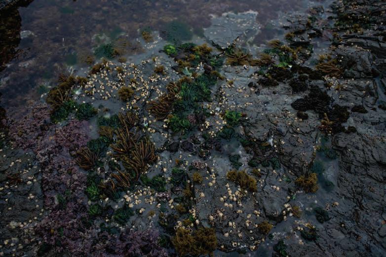
As the ocean gets warmer and relatively more acidic, it becomes harder for marine animals to form their shells. Marine creatures that form shells are called “calcifiers” since they use calcium carbonate to build their shells. These animals can pull calcium and carbonate ions directly from the water around them to form their shells, skeletons, or almost any hard part on their body. Many of the local organisms that we eat are marine calcifiers including: pāua, mussels, oysters and pipi, some of which live in or near rock pools on the Otago coast. The amount of shell material present in the water column depends on the temperature and pH of the ocean. Marine calcifiers have evolved with the current balance of dissolved calcium and carbonate in the ocean, so they can form their shells without any problems under normal conditions. However, if the water is too warm or too acidic, the balance will be thrown off and any existing shells will start to dissolve.
This dissolution happens because the ocean always tries to maintain an equilibrium, so if there is too little carbonate in the water it will be taken from the shells of marine animals. This weakens the shell, makes the animal vulnerable to predators, and forces the critter to spend energy fixing its shell instead of on: gathering food, mating, regulating body functions, and other things necessary for it to stay alive. Current research shows that the ocean is steadily getting warmer and more acidic, which is bad news for both marine calcifiers and us since the health of our oceans (and some of the tastiest food) relies on these organisms.
Fortunately, we can to mitigate this process and protect our oceans by reducing our carbon footprint and studying how marine caclifiers can cope with changing oceans.
 Marie Basquin
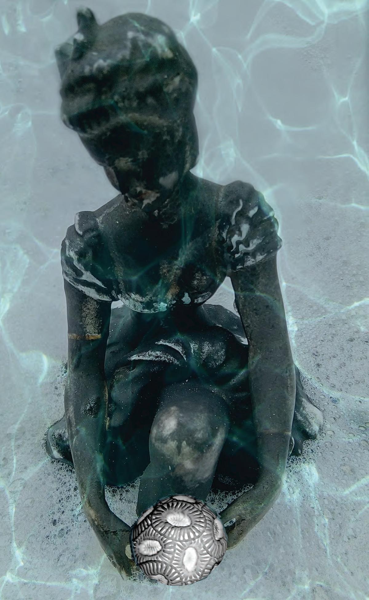
Drawing on Bryce’s work with chitons for inspiration, I explored. I took underwater images at noon from inside rock pools formed by the eruptions of Dunedin Volcano, on the South Otago coastline, creating submerged still-lifes of creatures which experience a process akin to ocean acidification during any low tide at peak sunlight hours. Hours spent peering into these pools led to long exposures at dusk, capturing the tide on its way in, leading to even longer exposures of star trails rising over the Southern Ocean, rock pools glittering in the star-shine beneath.
The canyon maps Bryce sent me led me deeper. I sketched and traced and coloured their lines until my hand had memorized them. Neither Bryce nor I could pick an area to focus and refine: the rock pools? The stars? The canyons? What we kept coming back to was the intrinsic connection between all things. A quote from Elizabeth Kolbert’s The Sixth Extinction, describing the endPermian world struck me: “glassy purple seas released poisonous bubbles that rose to a pale green sky.” I imagined epochs beginning and ending and couldn’t get the colours out of my mind. Nor the whales I swam with in the South Pacific whose migratory routes pass right through the deep canyons I had been tracing.
Anne The Changing Oceans: Rock Pools Artist ScientistNava Fedaeff, NIWA
Sunrises and sunsets reveal the dramatic and picturesque effects of volcanic aerosols in the stratosphere (at around 20-25km) above New Zealand). The aerosols causing this unusual phenomenon originate from the plume of gas and ash that was ejected when the Hunga Tonga-Hunga Ha’apai (HT-HH) volcano erupted in January. They have been dispersing around the globe, with concentrations spiking in the New Zealand region since mid-May. The effects of glowing purple and violet are most pronounced just before or just after the sun crosses the horizon.
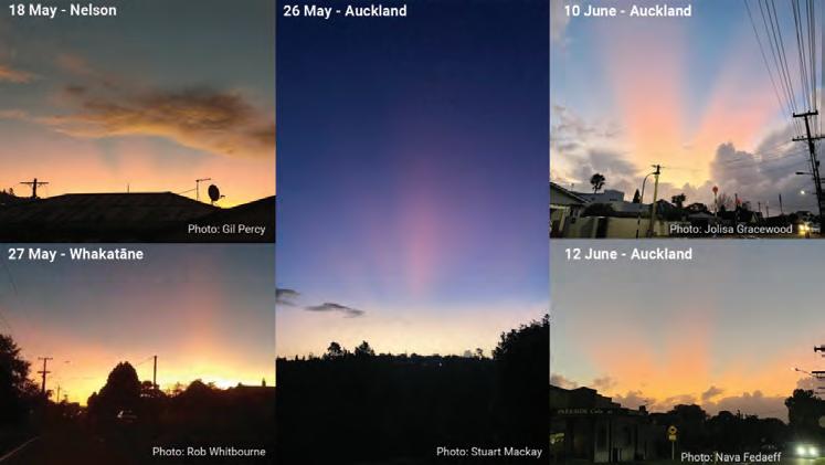
“Since the colours achieve their greatest intensity after the sun has set or before it rises,” Nava Fedaeff NIWA weather forecaster says. “volcanic twilights are known as "afterglows." The colour and intensity of the afterglow is affected by the amount of haze and cloudiness along the path of light reaching the stratosphere.”
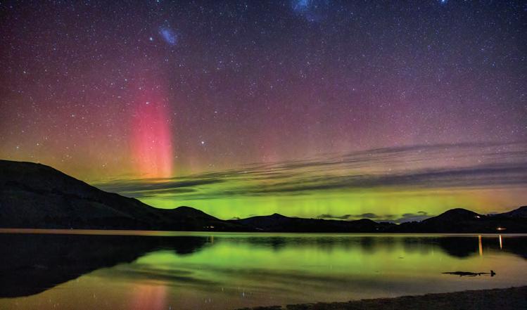
(Composite image by Nava Fedaeff, NIWA. Below Ian Griffin, Aurora Papanui Inlet, 2022.)
 Rowan Wernham
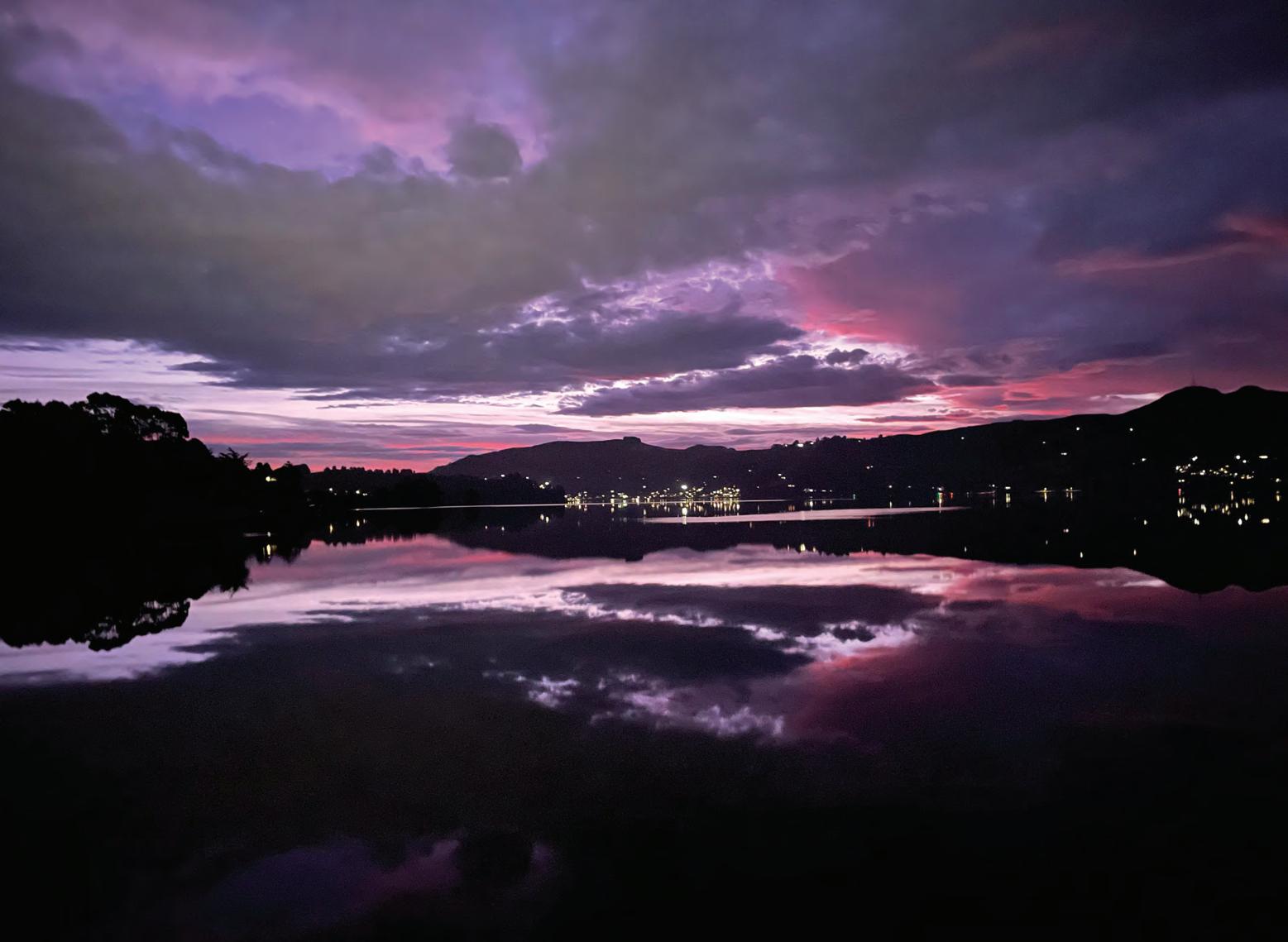
Sunset, Otago Harbour
Sunset, Otago Harbour
Artist
Scientist
Rowan Wernham
Sunset, Otago Harbour
Sunset, Otago Harbour
Artist
Scientist
Linn Hoffmann
Too hot to handle at 20 warming
Recently Linn Hoffmann was part of a research group that visited Tongan waters after the eruption of Hunga Tonga–Hunga Ha’apai, a submarine volcano in the Tongan archipelago in the southern Pacific Ocean. Every ash fall has a unique trace metal composition. The eruption in Tonga raises many questions about how it will affect phytoplankton growth.
For “Too Hot to Handle,” Pam McKinlay talked to Linn Hoffmann (Botany) about the importance of photosynthesising phytoplankton and effects of elevated carbon dioxide levels on coccosphere form and function which was explored in a art+science communication piece. Calcifying marine phytoplankton— coccolithophores— are some of the most successful yet enigmatic organisms in the ocean and are at risk from global climate change.
In 2018, a species of plankton, Syracosphaera azureaplaneta, was named after the television series Blue Planet and its world-renowned narrator Sir David Attenborough, who stated, “If you said that plankton, the phytoplankton, the green oxygen-producing plankton in the oceans is more important to our atmosphere than the whole of the rainforest, which I think is true, people would be astonished.”
What are function of the coccoliths?
There are different theories about why coccolithophores calcify from an armour like structure that inhibits grazers and protects from viral penetration, to curvatures that accentuate energy flow. There are species where the shape of the coccolithore might work like little mirrors to direct or funnel the photons to the cell for photosynthesis. Alternatively the shape of the liths might act as a shade like a sun umbrella to scatter light away at times of solar intensity to protect the cell from sun damage.
Coccolithophores need the right trace metals in the right concentrations to make these beautiful scales and if they have too little or too much of certain metals, something goes wrong. Deformation of liths is similar to what ocean acidification does.
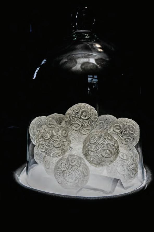
Trace metal concentrations in the ocean affect coccolithophore growth and morphology. A study by Faucher (2017) found that adding trace metals in concentrations similar to those present during Cretaceous times cause the cells to produce smaller coccoliths (dwarfism) which is something that has been found in sediment cores samples from that time as well. In an ongoing project Antarctic seawater that has very low trace metals concentrations, also causes many coccoliths to be malformed.
Coccolithophore species are adapted to different ecological niches. Emiliania huxleyi is one of the smallest coccolithophore species and is omnipresent in all oceans except polar oceans. Because it can be successfully grown in the lab, Emiliania huxleyi has become the “lab rat” of coccolithophore laboratory studies. Scientists have found that when Emiliania grows with the addition of volcanic ash, fewer cells produce malformed coccoliths with the assumption that they need certain metals that were limited in the seawater and that they are made available from the volcanic ash.
Pam McKinlay
DTRH 2022*
3D
“3D
https://www.fractalteapot.com/portfolio/3d-
 Scientist
*Down the Rabbit Hole Art Collective 2022 works came about from a series of conversations: Pam McKinlay with Grace Duke (Geology) and Linn Hoffman (Botany) and Jamie Perrelet (Holistic Science UK, BC)
printing file
Printing the Long Term Carbon Cycle”,
printing-carbon-cycle/ with assistance from William Early, Lynn Taylor (Sandpit Collective) for 3D modelling and printing.
Artist
Scientist
*Down the Rabbit Hole Art Collective 2022 works came about from a series of conversations: Pam McKinlay with Grace Duke (Geology) and Linn Hoffman (Botany) and Jamie Perrelet (Holistic Science UK, BC)
printing file
Printing the Long Term Carbon Cycle”,
printing-carbon-cycle/ with assistance from William Early, Lynn Taylor (Sandpit Collective) for 3D modelling and printing.
Artist
acknowledgements
The earth sciences explore the formation of rocks, as they are layered across geologic time, under restless pressures, ruptures and constant change. They engage with the macro and the micro, with chaos and order. And then there is the place of the human. How has our planet made us? How have the connections between earth systems affected evolution throughout time, and how have our use of natural resources changed the course of histories and cultures? What will our new horizons look like in the next geological era where people have become an earth shaping force?
We would like to thank all those who have helped to make this Art+Science Project possible: We would like to thank all those who have helped to make this Art+Science Project possible: DCC Creative Communities, Dunedin School of Art and Otago Polytechnic, GNS Science, the Geology Department and Marine Sciences at the University of Otago.
 Pam McKinlay, Project Curator.
Cover image photos by Pam McKinlay - Tongariro Crossing