landwithoutlimits.com
cariboo chilcotin coast of the
StOrieS
Stories of the Cariboo Chilcotin Coast | landwithoutlimits.com 2# ShareTheCoast
For local travel information, contact Cariboo Chilcotin Coast Tourism Association: 1-800-663-5885 | landwithoutlimits.com

For BC accommodation and travel information visit: HelloBC.com
©2022 – Cariboo Chilcotin Coast Tourism Association (the “Region”). All rights reserved. Unauthorized reproduction is prohibited. This Guide does not constitute, and should not be construed as, an endorsement or recommendation of any carrier, hotel, restaurant or any other facility, attraction or activity in British Columbia, for which neither Destination BC Corp. nor the Region assumes any responsibility. Super, Natural British Columbia, Hello BC, Visitor Centre and all associated logos/trade-marks are trade-marks or Official Marks of Destination BC Corp. Cariboo Chilcotin Coast Tourism Association and all associated trade-marks and logos are trade-marks or official marks of the Region. Admission fees and other terms and conditions may apply to attractions and facilities referenced in this Guide. Errors and omissions excepted. Photography: All images in this guide are intended to provide informative historical context and fair representation of activities which are available in this region.

Share With Us #CCCLives

3 Stories of the Cariboo Chilcotin Coast | landwithoutlimits.com Contents Facebook.com/CaribooChilcotinCoast Twitter @CarChiCoa Instagram @CaribooChilcotinCoast YouTube.com/theCCCTA the Region's top seven wonders 6 the Gathering Place 12 high country hunt 18 the Road less travelled 24 map 32 salmon tales 34 the Rugged chilcotin 38 happy trails 44 discovering our secret season 50 land of the spirit Bear 54 travel information 60 directory 62
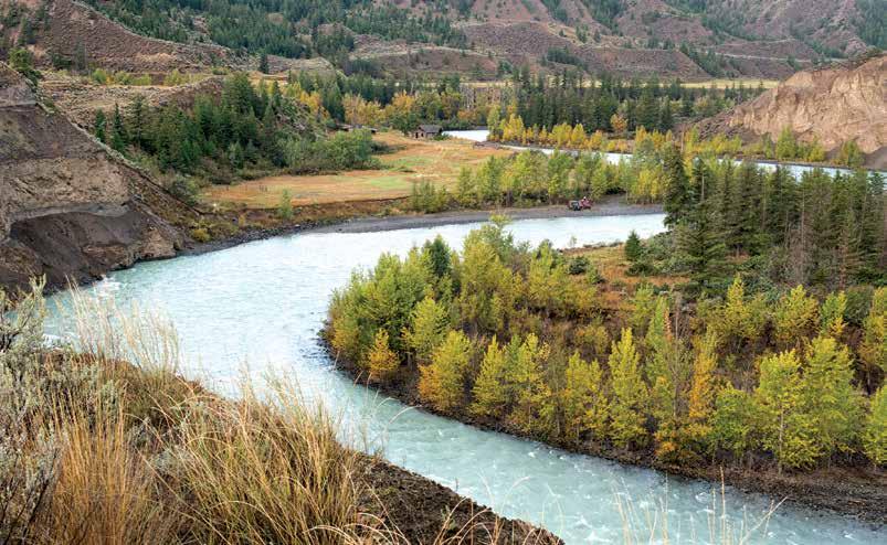
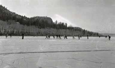
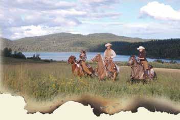
South Chilcotin Mountains
Nick Trehearne

4 Stories of the Cariboo Chilcotin Coast | landwithoutlimits.com
From the Editorial Team
We are proud to share with you the Stories of the Cariboo Chilcotin Coast. We hope this selection of tales gives you a true sense not only of the dramatic scale and diversity of our region, but also the genuine welcoming nature of those who live here. After all, that is our goal: sharing our home with you.
Visitors to our region know that it is home to countless magical places. “The Region’s Top Seven Wonders” identifies seven spots that stand out for their extraordinary geography, ecosystems and wildlife.
“The Gathering Place” unfolds a traditional legend of how wild potatoes came to be found on the Chilcotin Plateau, and how the tradition of harvesting these starchy gems is kept alive even today by the Tŝilhqot’in people.
“High Country Hunt” takes us on mule deer hunt in the high Chilcotin Mountains; while the quest proves to be illusive the journey leaves the author craving his return.
And who doesn’t love a great road trip? In “Road Tripping the Road Less Travelled,” the reader is guided along an epic tour, as the writer explores the changing terrains, climates, adventures and people of this massive land.
Outdoor enthusiasts will have no trouble finding their happy place in “Happy Trails,” where we detail the unlimited mountain biking and hiking trails of the region.
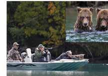
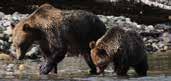
Many of us know that salmon makes for a delicious feast. In “Salmon Tales,” we discover how integral the salmon are to BC's entire ecosystem and learn about the best places to catch the next “big one” or watch a grizzly catching their next dinner.
In “The Rugged Chilcotin,” we learn that people who live in the Chilcotin seem to belong to another time, where life is calmer and more focused on the land, wildlife and the human connection.
Our story “Land of the Spirit Bear” introduces us to the elusive Kermode bear— also known as the Spirit Bear—and its home in the Great Bear Rainforest. Read and learn about this lush, pristine wilderness and the mystical Spirit Bear.
Then we reveal one of our best kept secrets in “Discovering Our Secret Season.” Every season has its perks, but autumn is a truly transformative time in this region, with the added benefit of being uncrowded.
So, pour yourself a cup of something hot, take a seat in your comfy chair and prepare to be inspired. Explore our stories, and then come experience them for yourself.
5 Stories of the Cariboo Chilcotin Coast | landwithoutlimits.com
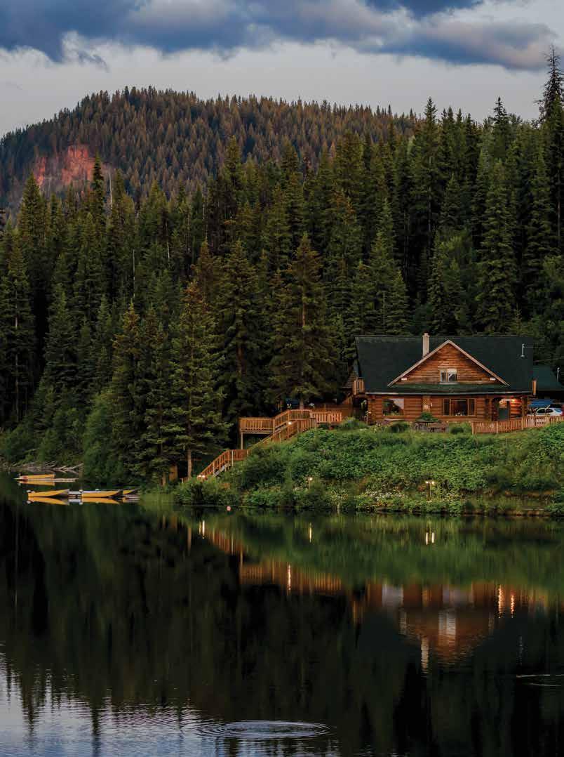
Cover Photo: Lac des Roches
Photo Credit: Destination BC/Andrew Strain
Editorial Contributors: Sage Birchwater, Jonny Bierman, Mary Elliott, Jo Johnson, Greg Thomas, Amy Watkins, Jane Zatylny
Design & Layout: Jill Schick
Tweedsmuir South Provincial Park Tyler Cave

6 Stories of the Cariboo Chilcotin Coast | landwithoutlimits.com
The Region’s Top Seven Wonders
Story Contributor: The Editorial Team
Aspirational. Rugged. Unique. Here are seven sensational sites that should be on your bucket list.
mount waddington
Once named Mystery Mountain for its incredible inaccessibility, 4,016 m (13,175 ft) Mount Waddington in the Coast Mountain Range is the highest mountain peak entirely in BC. Experienced climbers and film producers compare it to the Himalayas for its jagged, near vertical profile. A difficult test, even for the most experienced of mountaineers, remote “Wadd” and its gnarly ranges are surrounded by long valleys and vast glaciers, rewarding visitors with jaw-droppingly beautiful scenery. If you’re not up for the climb—and let’s face it, not many people are— you can take a flightseeing tour through the region and take in other stunning highlights, including the Klinaklini and Tumult Glaciers and the Homathko Icefield. You can also heli-ski Mount Waddington’s pristine alpine terrain and carve a fresh path all your own on the snowy slopes of Mystery Mountain.
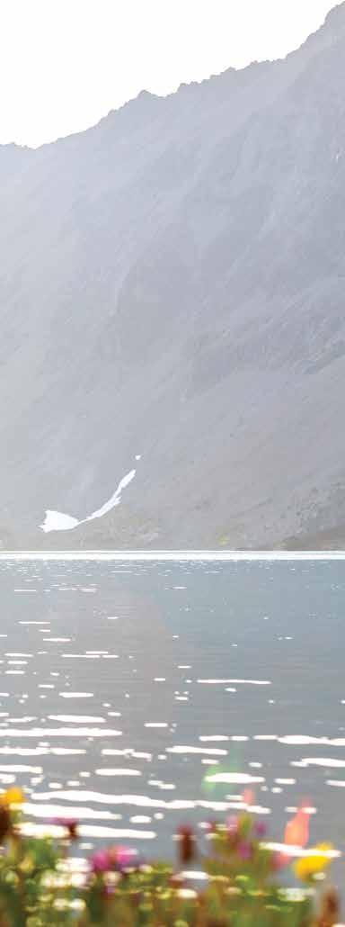
tŝilhqox Biny (chilko lake)
Located at the head of the Chilko River on the Chilcotin Plateau in Tsʼilʔos (sigh-loss) Provincial Park, Chilko Lake is the largest high-altitude lake in North America at 1,171 m (3,842 ft). At 65 km (40 mi) long, with depths ranging up to 366 m (1,201 ft), it is also one of the largest lakes in the province. Fed by dozens of mountain creeks, the lake, which is now officially called Tŝilhqox Biny, is located in a preserved and remote wilderness region surrounded by glaciers, towering mountain ranges, impressive waterfalls and Douglas fir forests. You’ll find superb fishing and boating on the lake’s turquoise-coloured glacial waters. Be aware of
7 Stories of the Cariboo Chilcotin Coast | landwithoutlimits.com
Tweedsmuir South Provincial Park Destination BC/Taylor Burk
windy conditions: fishers and boaters are advised to use larger vessels here. One of the province’s best places to view grizzly bears, you might also spot black bears, cougars, moose, wolverines, bald eagles or even California bighorn sheep in the area around Tŝilhqox Biny. Backcountry hiking and camping are popular here, but you can also hang your hat at one of the area’s inviting adventure lodges. Check with the Xeni-Gwet'in (honey-gwe-teen) First Nations before heading here to see if there are any restrictions in place due to increased bear activity during salmon-spawning season, or stay with a private business who will be knowledgeable about current conditions.
the Great Bear Rainforest

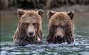
Wild, rugged and remote, the world’s largest coastal temperate rainforest covers 6.4 million hectares (15.8 million acres) – almost the size of Ireland – on BC's north and central coast. The Great Bear Rainforest draws artists, photographers, naturalists, scientists and travellers, all keen to explore its natural wonders and Indigenous experiences. It’s also the only place on Earth where you may glimpse the white Kermode bear, also known as the Spirit bear. Other wildlife viewing possibilities in this vast green sanctuary include grizzly bears, eagles, seals, dolphins and whales. A true escape into wilderness, access to outer coast communities is mainly by ferry, seaplane or private charters, although one can drive into the inland Bella Coola Valley via Highway 20. For a novel approach, consider a small-boat cruise with an on-board chef and naturalist. Or fly or sail into a remote lodge on the coast and base your adventure there. (For more about the Great Bear Rainforest, see page 54.)
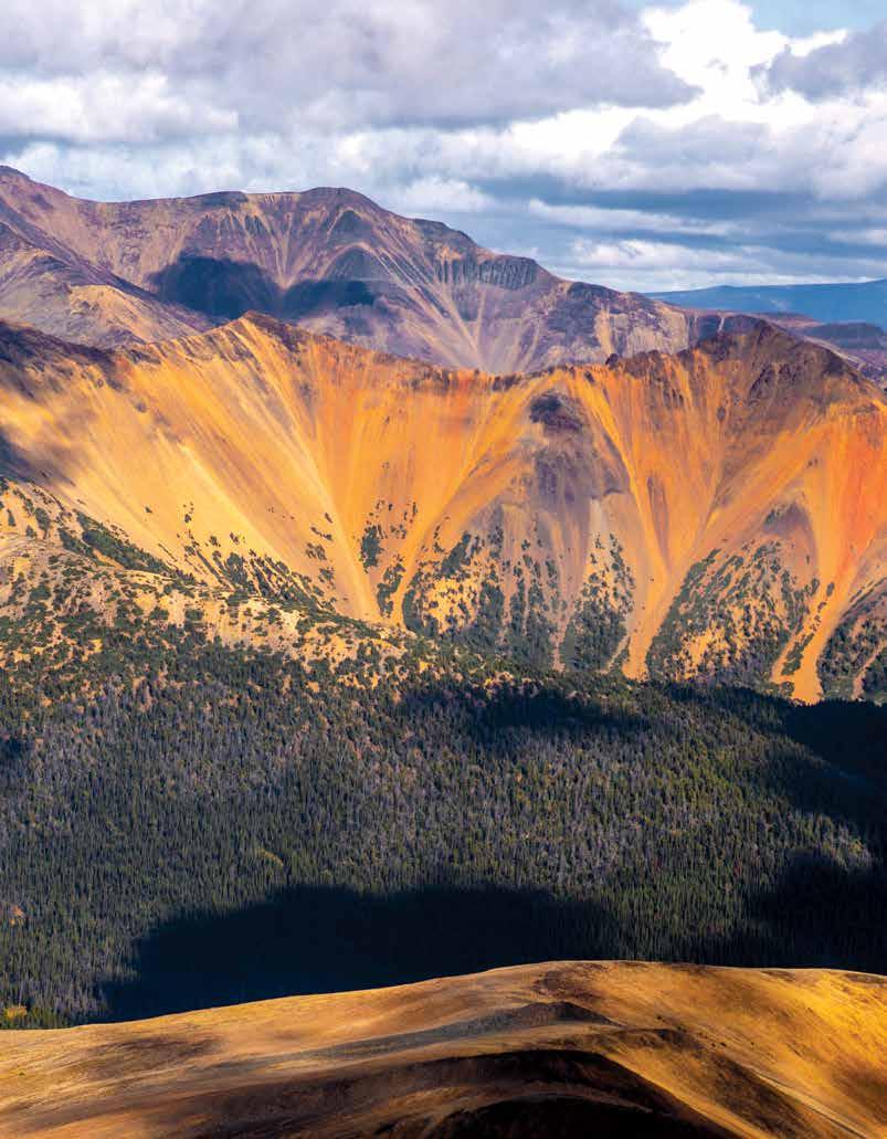
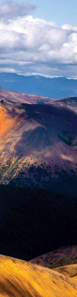
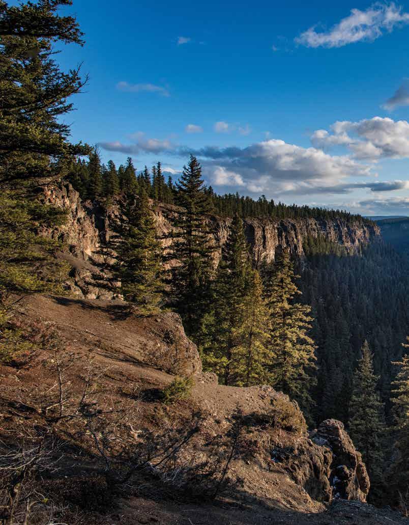
tweedsmuir south Provincial Park
At 989,616 hectares (2.5 million acres), Tweedsmuir South Provincial Park is one of BC's largest provincial parks. Journey to this remote region with spectacular scenic vistas to hike, fish, explore by horseback, camp, view wildlife— especially grizzly bears—and canoe the storied Turner Lake Chain. One day-hike that should not be missed takes in the colourful Rainbow Range of shield volcanoes. The ancient volcanic mountain range is named for its vibrant red, orange, and yellow coloured lava rock. The park also includes Hunlen Falls, Canada’s third-highest single-drop waterfall. There are 78 switchbacks on the tough, forested trail to the falls, and you’ll cover a distance of 16.4 km (10 mi) with a vertical rise of 800 m (2,625 ft). An easier option is to take a 20-minute flightseeing tour by floatplane from Nimpo Lake.
Stories of the Cariboo Chilcotin Coast | landwithoutlimits.com 8
Bella Coola Valley Jesaja Class
cariboo mountains Provincial Park
As the northernmost subrange of the Columbia Mountains, the Cariboo Mountain Range is 7,700 sq km (3,000 sq mi) in area, 245 km (152 mi) in length and is the only inland temperate rainforest in North America. A true wilderness, the 113,469-hectare (280,388-acre) Cariboo Mountains Provincial Park’s densely forested valleys, picturesque lakes and wetland are dominated by mighty serrated peaks and glaciers. More than 500 km (311 mi) from the coastline, this biodiverse region, with its mountain peaks and lakes in alpine valleys, extensive meadows, large wetland complexes and ancient Pacific redcedar and hemlock forests is home to endangered caribou herds and one of the BC Interior’s largest populations of grizzly bears. You’ll find abundant opportunities for backcountry adventures here, including wildlife viewing, snowmobiling, hiking, hunting and fishing. You can reach the Ghost Lake recreation site by driving about 70 km (44 miles) from Barkerville on 3100 Forestry Road, an active logging road. Drive carefully with headlights on. Turn left on a sign-posted 4-km (2.5-mi) access road leading to the recreation site. You can also drive from Likely on the 8400 Road (Cariboo Lake Road) past Cariboo Lake, which meets up with 3100 Forestry Road. Follow 3100 to the Ghost Lake turnoff (signed), turn right and drive another 4 km (2 mi) to the recreation site.
chilcotin Grasslands
The last intact grasslands on the planet, created millions of years ago by retreating glaciers, the Chilcotin Grasslands flank the Fraser River Basin and are home to diverse and at-risk species of birds, bats, bighorn sheep and insects. The canyons in this area experience extreme summer heat and dry, milder winters. Early spring heat allows a great variety of plants to flourish, including prickly pear cactus, big sage, rabbit bush and bunchgrass, which have sustained livestock on local ranches since the 1850s. Said to be one of the ecological wonders of the world and British Columbia’s most endangered ecosystem, these biodiverse grasslands are a place for cautious exploration, birdwatching and nature viewing. Chilcotin photographer Chris Harris showcased their beauty in his 2007 book, Spirit in the Grass: The Cariboo Chilcotin's Forgotten Landscape.

Stories of the Cariboo Chilcotin Coast | landwithoutlimits.com 9
Farwell Canyon near Williams Lake Destination BC/Nikita Pretty
ells Gray Provincial Park
At 529,748 hectares (1.4 million acres), Wells Gray Provincial Park is a vast wilderness and one of BC’s largest and most scenic parks. From its location high in the Cariboo Mountains, it offers alpine meadows and flowers, snow-capped peaks and glaciers, major lakes, rivers and waterfalls, small lakes and streams, extinct volcanoes, lava beds and mineral springs. With 41 named waterfalls, it is perhaps best known as Canada’s waterfall park. Guide outfitters offer horseback riding, canoeing, river-rafting, fishing and hiking excursions through the park. They can also tell about the area’s early homesteaders, trappers and prospectors and the natural forces that produced Wells Gray’s unique geology. Hike through ancient forests, explore the waters of Eagle Creek, Canim Lake and Mahood Lake—and be sure to return to the park in the winter to view frozen waterfalls and explore pristine backcountry skiing. ¤
For up-to-date conditions, cautions and directions to these remote wonders, please visit bcparks.ca.


Stories of the
Coast | landwithoutlimits.com 10
Cariboo Chilcotin
Explore with Grace & leave no trace. here's how:
leave no trace Anyone visiting the outdoors should familiarize themselves with the seven Leave No Trace principles for leaving a negligible impact on the outdoors:
1. Plan ahead and prepare
2. Travel and camp on hard or durable surfaces
3. Discard of waste properly
4. Leave what you find
5. Minimize the impact of campfires
6. Respect wildlife
7. Be considerate of other visitors
If you pack it in, pack it out, and always be sure to stay on designated trails. Our alpine environments have short growing seasons and are very fragile, so always ride or hike on the path.
Be Prepared Take the essentials and know how to use them:
• Headlamp or flashlight with extra batteries
• Fire making kit
• Extra clothing, including rain gear
• Extra food and water, and a means of purifying it
• Pocket knife
• Sun protection including sunscreen, lip protection and sunglasses
• Emergency blanket or shelter
• First aid kit
• Navigation and communication devices like cell phones, paper maps, compass and/or a GPS.
Stories of the Cariboo Chilcotin Coast | landwithoutlimits.com 11
Perkins Peak in the Chilcotin Jesaja Class
12 Stories of the Cariboo Chilcotin Coast | landwithoutlimits.com
the gathering pLAce
Story Contributor: Sage Birchwater
The Potato Range in the south-central Chilcotin region is known by not one but three Indigenous names: Tŝimolch’ed, Chonoz-ch’ed and Chinaz-ch’ed. Regardless of which one you use, this keystone place has great cultural significance--historically, and to this day.
The rounded range, part of the caretaker area of the Xeni Gwet’in (Nemiah Valley), lies within the 1,900-sqkm (734-sq-mi) Aboriginal Title Lands acknowledged to belong to the Tŝilhqot’in Nation by the Supreme Court of Canada in June 2014. The mountain range is bounded by three lakes: Telhiqox Biny (Tatlayoko Lake) on the west, Tŝilhqox Biny (Chilko Lake) on the east, and Naghatalhchuz (Big Eagle or Choelquoit Lake) to the north.
Stories abound how the Tŝilhqot’in people would gather here from across the Nation in late spring and early summer to dig sunt’iny, the wild potatoes that grow there. They would also hunt deer, pick berries and celebrate with horse races and lahal games.
A Tŝilhqot’in legend explains why wild potatoes, known by botanists as springbeauty, are not found any further west on the Chilcotin Plateau. Tŝ’ilʔoŝ and his wife ʔEniyud were travelling across the land with their children, planting the wild potatoes. They got as far as Nemiah Valley on the east side of Tŝilhqox Biny where they separated. Tŝ’ilʔoŝ stayed there with three of their children while ʔEniyud and their other children continued further west. After reaching the far side of Telhiqox Biny, ʔEniyud looked back, causing her and Ts’ilʔoŝ, as well as their children, to turn into mountains: Tŝ’ilʔoŝ in Nemiah Valley above Xeni Biny (Konni Lake), and ʔEniyud on the west side of Telhiqox Biny. The high jagged peaks of Tŝ’ilʔoŝ and ʔEniyud can be seen
13 Stories of the Cariboo Chilcotin Coast | landwithoutlimits.com
South Chilcotin Mountains Albert Normandin
from the top of Tŝimol-ch’ed and throughout much of the Chilcotin area.
The early non-Indigenous settlers also had colourful stories of the Tŝilhqot’in people travelling to Tŝimol-ch’ed in late June or early July for the wild potato harvest. Lou Haynes was 14 when his mother brought him and his four brothers to the Tatlayoko Valley in 1929.
“In July, the Tŝilhqot’in people would migrate to Potato Mountain. Wagon load after wagon load, saddle horses and pack horses all tied on behind. Some herded along. They’d go up there and spend about a month. The women would dig potatoes and the men would hunt deer and hold races.
“Everyone from Redstone would be there. They would come down Tatlayoko Valley and would take their wagons as far up the hill as they could. They’d leave all the harnesses and stuff on the wagons and go the rest of the way up the hill with saddle horses and pack horses.
“Nobody would touch their stuff. They’d leave all the old people too feeble to ride up the hill on horseback at the camp with the wagons. I remember one old blind woman at the camp. They had pieces of buckskin all tied together so she could find her way outside.
“A woman could dig 50 pounds of those little potatoes in a day. They used an old broken dump rake tooth. They’d straighten it out and put a T-handle on it.”
Lou’s brother, Harry Haynes, described how the Tŝilhqot’in would come down through Tatlayoko Valley and go way up the sidehill as far as they could get up the creek.
“The men would go hunting and get two or three deer. In two or three days they’d get a bellyful of deer meat. Then they would take all the horses and pack them and take everything they owned right to the top of Potato Mountain. Old Eagle Lake Henry and a whole bunch of Tŝilhqot’ins from Nemiah Valley would come up from the other end, and they would all meet up on top there. Oh, my goodness, they would have a ball. A big party. A rodeo with race horses.”
Henry Solomon, a Tŝilhqot’in man from Nemiah Valley, said Alec Jack was in charge of the horse races held on Potato Mountain:
“Those guys, they race. Bet money. Stake race. Four or five horses at one time. Just bet each other. Bet on anything. Some good wrestler. Some guy from Anahim Peak, Stone. Some good boxer. Find out the best man in the whole
Stories of the Cariboo Chilcotin Coast | landwithoutlimits.com 14
Farwell Canyon near Riske Creek Destination BC/Michael Bednar
Chilcotin. Race horses all that kind. Kind of a rodeo in the mountain.”
Casimil Lulua was a Tŝilhqot’in man born at Naghatalhchuz. He and his sisters Doris and Madeline would take the eastside trail up Potato Mountain.

“No bridge over Chilko River. Nemiah people just go across with a canoe. Make a canoe and just swim their horses right across the river. They leave the canoe on this side. When they go back, they take their canoe. Eagle Lake Henry, (a notable elder of the Tsilhqot’in who got his ‘white’ rights, and pre-empted a ranch at Mountain House on the east side of Tsilhqox River), used a big-wheel wagon to go across the river. He had lots of good strong workhorses.
“Everybody would take them mountain spuds. Take them off the mountain and make them dry. Then they keep them all winter. When you want to eat them, make them soaked. Keep them one night in the water then cook it. When we’re digging potatoes, that’s all we eat.”
Louisa Jeff, a Tŝilhoq’tin woman from Tl’esqox (Riske Creek), remembered going all the way by saddle horse as a little girl to Tatlayoko to dig wild potatoes. She looked for little white flowers, then used her finger to dig up the deeply buried, spherical, underground stems.
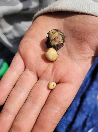
Tŝilhqot’in people still go up to Tŝimol-ch’ed to dig the wild potatoes, which are rich in starch with a pleasant nutty flavour. The mild-flavoured leaves and stems can also be eaten raw or cooked. As recently as 2021 the Xeni Gwet’in community had a wild potato harvesting gathering in the Potato Range. Using a local wilderness resort as a staging point, they accessed the Potato Mountains by horseback and helicopter. ¤
inFo:

While the Tŝilhqot’in Nation develops its tourism protocols for public use of their territory, they ask visitors to stay on designated trails and camping areas and respect cultural sites. They also ask people to remove all their garbage and leave only as small a footprint on the land as possible.
Stories of the Cariboo Chilcotin Coast | landwithoutlimits.com 15
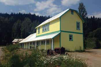
250.593.4431 www.loonbayresort.com info@loonbayresort.com
on Sheridan Lake, Hwy 24
Cabins and RV sites on the lake Boat / Canoe Rentals • Playground
Wild Potatoes Dinah Lulua
w w w . r i v e r s i n l e t . c o m All-Inclusive Direct 90-Min Seaplane Flight
Best Salmon Fishing Lodge - BC Canada
Stories of the Cariboo Chilcotin Coast | landwithoutlimits.com 16
Respect The Cariboo Chilcotin Coast region is home to nine Indigenous Nations, each with its own language dialect, traditions, stories and cultural practices. If you are invited to participate in any part of Indigenous culture, lead with curiosity and respectfully ask questions; for instance, ask for common names and pronunciations.
safety Keeping communities safe means accepting all visitors and locals for who they are. It also means respecting the environment and adhering to community health and safety guidelines. Many rural communities have limited infrastructure to handle unnecessary strains, such as emergency responses for those that visit unprepared.
Preparation Being prepared helps ensure a positive experience and is respectful to your hosts, but you don’t need to buy all your supplies in advance. You’ll find roadside fruit and veggie stands (be sure to carry cash), as well as local grocery stores, coffee shops, and many unique stores along the way.
Stories of the
Coast | landwithoutlimits.com 17
Cariboo Chilcotin
Be Respectful, safe & Prepared. here’s how:
Xatśūll Village Michael Bednar
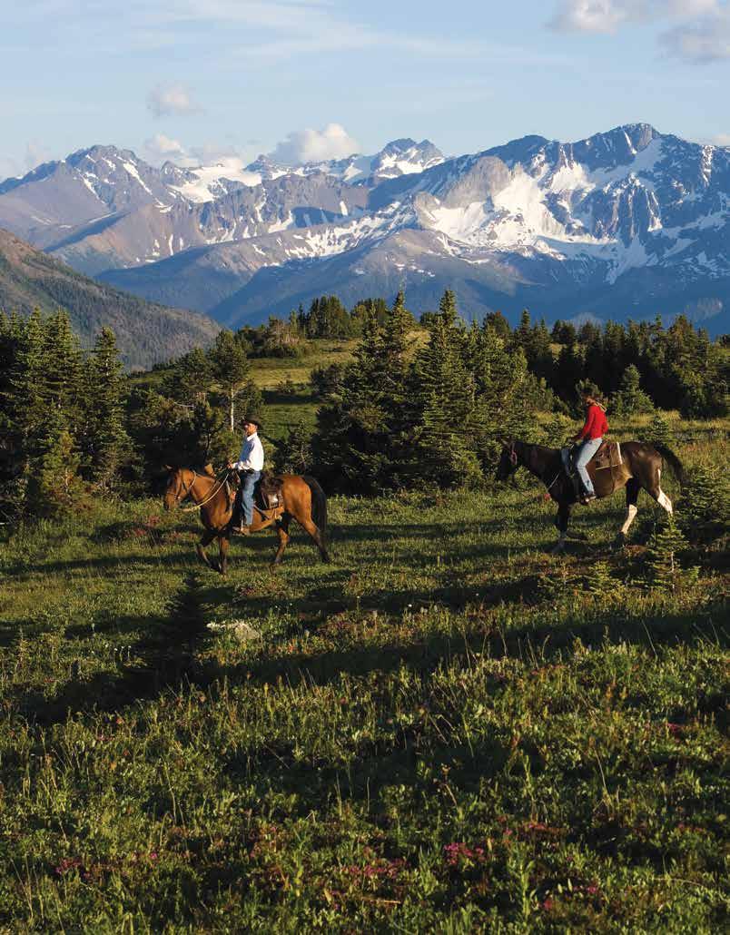
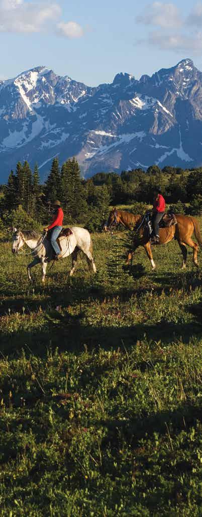
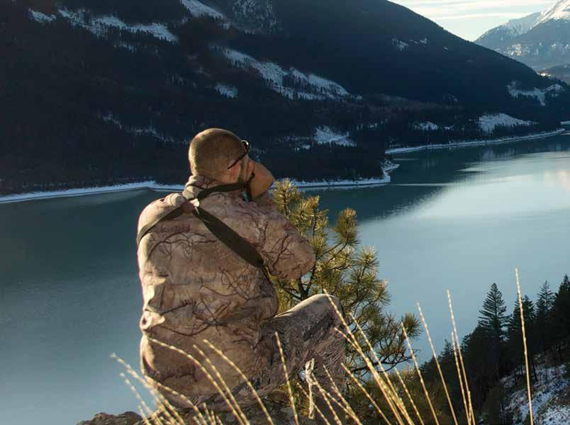
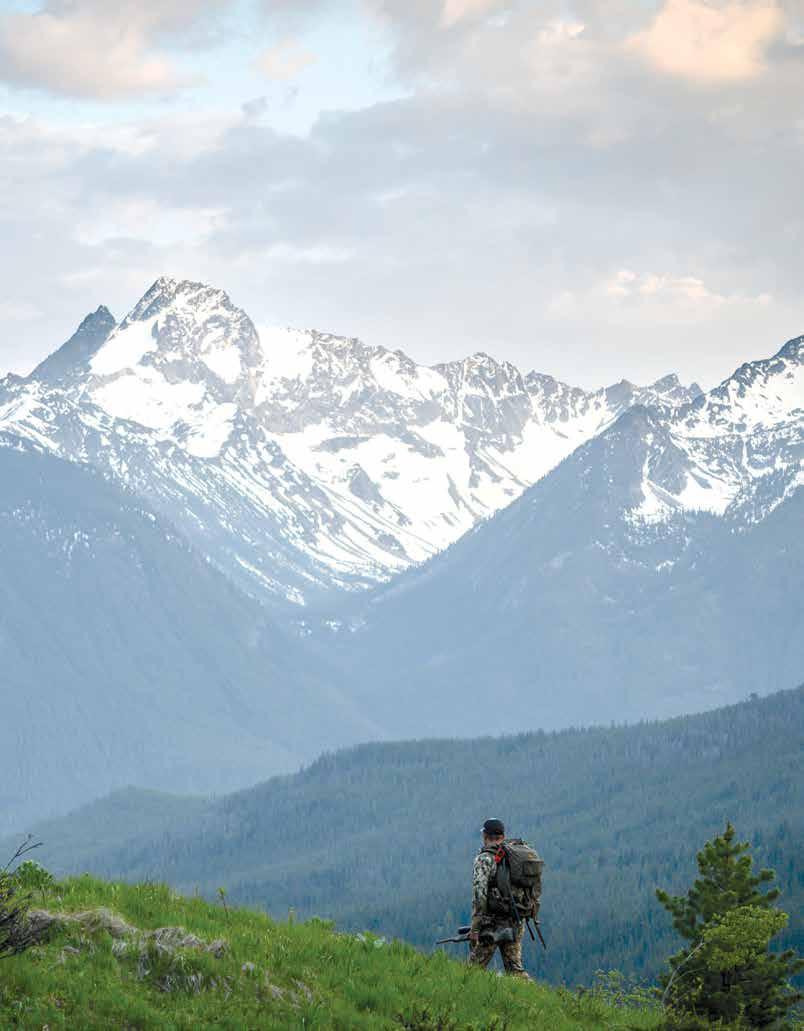
High Country Hunt
Story Contributor: Greg Thomas
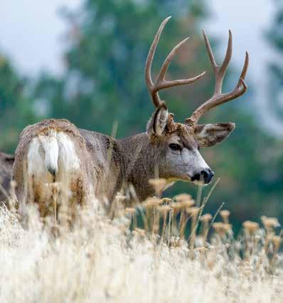
I visited the South Chilcotin a few years ago to hunt mule deer in the rut during the first week of December. A guide and I spent each day driving from one vantage to another, glassing for deer, and hiking up ridges and low mountains. We saw deer, plenty of them, probably a hundred in fact. On the final full day, near last light, I spotted a giant and hiked up the ridge to find it.
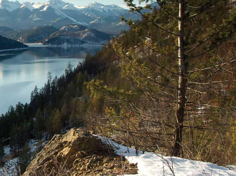
British Columbia produces some of the largest mule deer in the world, and the rugged South Chilcotin Mountains, ranging northwest from Lillooet, are a premier place to hunt this challenging species. The Chilcotin’s rugged terrain, including wide swaths of roadless habitat above 1,981 m (6,500 ft), means these deer don’t come easy. The Chilcotin also offers hunts for California bighorn sheep, moose, wolf, cougar and black bear.
Hunting in the early season involves hiking into the alpine, as the lack of access roads does not allow for ATVs. Although physically demanding, this helps to protect the resource by limiting the number of people who can handle the trip. September hunts by horseback can be even more old-fashioned: they involve securing your gear to a packhorse and camping in mountain meadows full of trickling streams and wildflowers. The alpine view of the valleys below showcases turquoise-blue glacial streams and mountainsides coloured green and red from copper and iron ore.
18 Stories of the Cariboo Chilcotin Coast | landwithoutlimits.com
Mule deer and other animals head to the high country in July to escape the summer heat. They remain in the fertile alpine country until snow drives them lower in November and December. Between September 1 (when the deer season opens) and September 30 in the South Chilcotin, hunters must harvest a buck with four or more points on its antlers, a regulation that ensures the area’s ability to produce exceptional animals.
At this time, mature bucks are separated from does and gather in “bachelor groups,” which can provide some exciting hunting opportunity—hunters could spot several large bucks staring back at them and have trouble deciding which one to shoot. Even though some may be looking for the biggest buck, the record-book bucks aren’t behind every tree. The careful management of the area means everyone has the possibility of taking a great animal, but that the only thing guaranteed is the journey along the way.
In October, hunters can harvest any buck in the South Chilcotin, a regulation that provides an opportunity for young hunters and families that want to experience a fun and productive hunt. In November and December, when mule deer move out of the high country and into more accessible lower-elevation areas, the four-point restriction is reinstated. This helps limit harvest when bucks are rutting.
19 Stories of the Cariboo Chilcotin Coast | landwithoutlimits.com
South Chilcotin Mountains Greg Thomas
Late-season hunts in the South Chilcotin are typically based out of a lodge. Hunters access the deer grounds in vehicles and then set out on foot hiking mountains, ridges and decommissioned logging roads. Lots of time is spent with binoculars and spotting scopes, glassing open hillsides where deer feed in the mornings and evenings and bed down during the day. Once a desired animal is located, hunters determine how to get into range, which is not as easy as it may sound. Crunchy snow coupled with a mule deer’s keen hearing and eyesight offer the deer a major advantage.
The temperature can be cold, and snow is typically on the ground. What these hunts lack in high-mountain alpine scenery, they make up for in opportunity—when mule deer bucks have mating on their minds they are significantly less wary than they would be at other times of the year. When a hunter locates does, they can be sure the bucks are nearby.
Chilcotin deer are highly migratory; some of the animals a hunter sees in November and December may have spent their summers as far away as Tweedsmuir Park, having navigated down the Chilcotin Ark to find the most productive winter feeding grounds. Chilcotin mule deer can move as far as over a hundred miles as compared to other areas of BC, where they might only move a few miles between their summer and winter ranges.
That interconnectivity means comprehensive management of mule deer, and other species, is key to long-term survival. Outfitters play a large role in the effort by placing their highest priority on conservation and stewardship. For them, it’s both
a personal passion and one vital to preserving their livelihoods and backyards. Outfitters coordinate with biologists, natural resource industries, ranchers and Indigenous groups for habitat management and predator control.
Mule deer live on the lee side of the mountains where precipitation rarely measures more than 25 cm (10 in) a year in the South Chilcotin and arrives mostly as snow. But snow can fall in the high country every month of the year. A rule of thumb is this: hope for the best conditions and prepare for the worst with responsible travel planning (see “Be Prepared” on the next page for tips on responsible travel planning).
Hunters visiting the South Chilcotin should bring waterproof boots and plenty of layers of clothing. Wool hats, rain jackets and pants, gloves or mittens and 3-season sleeping bags with ratings from -15° C to -1° C (5° F to 30° F), should be part of the mix. A small daypack is perfect for carrying extra layers and quality binoculars. Deer move in low-light conditions, so it makes sense to invest in the best optics you can.
While horses and horsepower perform some of the heavy work (depending on whether you hunt the early or late season), hunters who show up in good physical condition and have practiced shooting their rifles have the best chance for success. When a mule deer is spotted, hunters must quickly get within range, often hiking up steep terrain and across rocky, scree slopes. You don’t want to be out of breath when trying to settle crosshairs on a big buck.
Even when you prepare properly, however, there’s no guarantee you’ll get the buck of your lifetime. Unfortunately, the buck and its does spotted me before I saw them and ghosted into the forest. I knew I could look at my failure in two ways. I chose the “glass-half-full” option. This gave me a reason to return, maybe for a September high country hunt. I’d have a singular goal in mind—find that big buck on his summer range and put an end to the story. ¤
VISITORS@WLCHAMBER.CA

WWW.TOURISMWILLIAMSLAKE.COM
WWW.WILLIAMSLAKECHAMBER.COM
Stories of the Cariboo Chilcotin Coast | landwithoutlimits.com 20
South Chilcotin mule deer Nick Trehearne
250-392-5025
South Chilcotin Mountains Nick Trehearne
1660 SOUTH BROADWAY WILLIAMS LAKE, BC
1-877-967-5253
OUTDOOR RECREATION RESTAURANTS• EVENTS
LOCAL ATTRACTIONS TRANSPORTATION SHOPPING MAPS WIFI
& GIFT
HIKING•ACCOMODATIONS
COFFEE
SHOP
Be Prepared
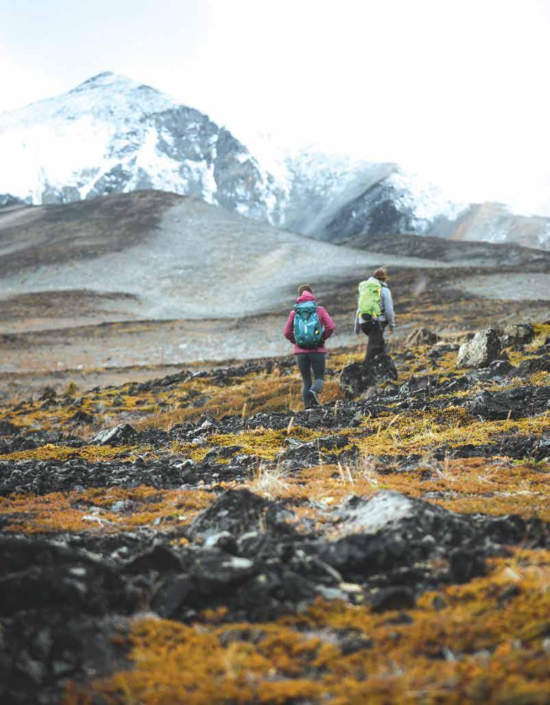
The Cariboo Chilcotin Coast is a diverse landscape with often unpredictable weather, plentiful wildlife, rugged terrain, and large distances between communities. Understand the terrain and conditions you’ll encounter, check the weather, and fill out a trip plan so someone knows where you’re headed and when you’re due back.
Learn the skills and acquire the knowledge you need before you start the trip. Know your limits – whether that be how far you can hike in a day or whether you’re comfortable camping in the wilderness – and stay within them. Always consider the location and the season.
Take the essentials and know how to use them:
• Headlamp or flashlight with extra batteries
• Fire making kit
• Extra clothing, including rain gear
• Extra food and water, and a means of purifying it
• Pocket knife
• Sun protection including sunscreen, lip protection and sunglasses
• An emergency blanket or shelter
• A first aid kit
• Navigation and communication devices like cell phones, paper maps, compass and/or a GPS. (Much of the Cariboo Chilcotin Coast region has little to no cell phone service and a device like an inReach is ideal to bring along.)
Stories of the Cariboo Chilcotin Coast | landwithoutlimits.com 21
Be Respectful, Prepared
& safe with wildlife. here's how:
Respect In the Cariboo Chilcotin Coast, the chances of encountering wildlife are high, but the prospect of human-wildlife conflict is low. You might meet beavers, squirrels, and rabbits, or animals that will stop you in your tracks, such as moose, black and grizzly bears, wolves, elk, coyotes, cougars and wolverines. Most wild animals want nothing to do with you. Make them aware of your presence and give them space to move away. Respect them.
Be Prepared When travelling through bear country, always carry a fresh can of bear spray on your belt or waist strap. Know how and when to use it. For more information and a checklist to stay safe in our region, visit landwithoutlimits.com/safetravel.
stash Your Goods Stashing food and scented items in a secured area is easy if you’re travelling in a car or RV. Most campgrounds in bear country offer metal bear-proof boxes or poles for hanging your food. A waterproof bag for your food and a couple of carabiners are useful additions. If you must improvise, a long piece of rope thrown over a pole or tall tree should do the trick in the wilderness. A portable bear canister, available at sporting goods stores or online, is another great option. If there are no trees nearby to hang your food, bury it under a cairn or rocks – as a last resort.
22 Stories of the
| landwithoutlimits.com
Cariboo Chilcotin Coast
Chilko River Destination BC/Yuri Choufour
23
Stories of the Cariboo Chilcotin Coast | landwithoutlimits.com
the Road Less Travelled
Story Contributor: Jo Johnson
It has been said that every journey taken is, in fact, two: an outer and an inner journey. Nowhere is this more true than in the Cariboo Chilcotin Coast, where the further we travel across the region, the more we travel into ourselves. Here it is easy to take the road less travelled, and to venture on a journey of true discovery — of the region’s dramatic and powerful nature, and of its impact on us.
Retrace the route of prospectors during the famed gold rush of the 1860s; fish hundreds of lakes; roll through cowboy country, panoramic peaks and backcountry vistas in the same day; visit Indigenous heritage sites where there are opportunities to have immersive experiences with Indigenous culture; and then arrive at the shores of the Pacific to look for whales swimming in the inlets while bears and wolves fish for salmon in the rivers nearby.
The topography of British Columbia was in part built on gold, a history shaped by nature — in the form of massive placer deposits discovered along the Fraser River and through the Cariboo. Once word of the discovery caught on in the 1860s, droves of prospectors from all over the world flooded into the province with dreams of striking it rich and finding their fortunes. Hordes of men and women gathered provisions for the harrowing three-week journey inland and then set out along the gold route, following the Fraser River. With the help of many Indigenous guides, who showed them
24 Stories of the
Coast | landwithoutlimits.com
Cariboo Chilcotin
Heckman Pass, Highway 20 Tyler Cave
25
Stories of the Cariboo Chilcotin Coast | landwithoutlimits.com
the way using their ancient trade routes, a massive influx of people not only sought gold but also settled in and built communities along the way, falling in love with the raw nature and abundant wildlife all around.
Today, many towns along the Gold Rush Trail pay homage to their storied past with museums, monuments and other experiences that help to bring the gold rush era alive. Cache Creek, and nearby Historic Hat Creek, where visitors can explore a historic roadhouse or try their luck at gold-panning, are examples of this. Many of these towns that sprung up to provide a resting stop and supplies, now offer the modern traveller the same respite today. As you head out of the Cariboo Chilcotin Coast and into northern BC, your last stop for gas and road trip grub is in Hixon, where you can catch some shut-eye and grab a meal. But take note, some local roadside eateries are only open during the summer months.
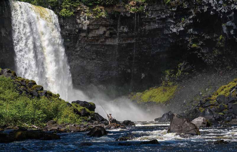
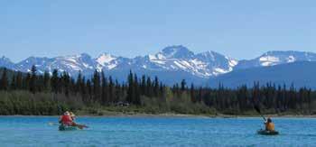
Nothing is quite as thrilling as discovering the perfect fishing spot to reel in dinner. In the Land of Hidden Waters, there are hundreds of lakes and streams to sample, many of which are off the beaten path and far from the crowds, yet easily accessible to the road warrior.
This area of the region includes a strip of road called the “Fishing Highway” (officially Highway 24), so named for its endless options for dropping a line at one of over 100 lakes along the highway. As you drive the highway you will spot Lone Butte, a low, steep-sided mesa butte that was formed within a prehistoric volcano over six million years ago. Near the butte’s north side is the small community by the same name. Also in the neighbourhood is Green Lake Provincial Park, with its crystal-clear, wide and shallow lake perfect for summer and winter recreation. With lakeside camping and plenty of nearby accommodation, it’s a popular destination for families and nature-seekers alike.
Two gems on this road less travelled, Canim Lake and Mahood Lake, offer three majestic waterfalls: Canim, Mahood and Deception Falls. The Canim-Mahood trail is a 1-km (0.62 -mi) groomed trail that leads first to the 15-m (49-ft) Mahood Falls, and a short couple hundred meters away to the lookout of the 20-m (66-ft) Canim Falls.
Stories of the Cariboo Chilcotin Coast | landwithoutlimits.com 26
Fly fishing near Canim Lake Destination BC/Andrew Strain
The 0.8-km (0.5-mi) trail to Deception Falls is accessible via the provincial park campground on Mahood Lake, where you can view the 50-m (164-ft) waterfall from an overlooking bluff. To get to Canim and Mahood Lakes, head northeast of 100 Mile House, on Highway 97. Approximately 3 km (2 mi) north is the turnoff that heads east on Canim-Hendrix Lake Road (paved) a further 34 km (21 mi) to Canim Lake and on to Mahood Lake.
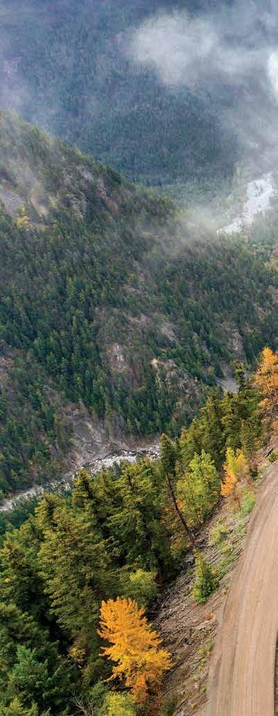
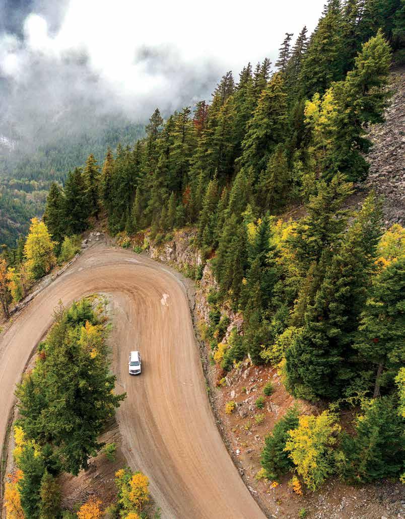
The wanderer will be drawn to the rugged Chilcotin, along Highway 20. The highway cuts a lonely line through bigsky country, from Williams Lake across the Chilcotin Plateau all the way to Bella Coola on the central coast. Dotted with small communities, old-fashioned general stores and panoramic vistas, Highway 20 stretches 456 km (283 mi) without a single traffic light.

Many communities along Highway 20 were initially supply centres (a common theme of the entire Cariboo Chilcotin Coast region), including Nimpo Lake, Anahim Lake, Tatla Lake and Alexis Creek. Nimpo and Anahim Lakes in the West Chilcotin are filled with rainbow trout and offer flightseeing tours to stunning Hunlen Falls, the Monarch Icefields and the Rainbow Mountains. The Puntzi Lake area offers great camping and fishing for kokanee.
As the highway descends into the Bella Coola Valley, it offers exhilarating hairpin turns and steep grades as it drops from the plateau’s elevation of over 1,500 m (5,000 ft) to sea level. This is the lush and otherworldly Great Bear Rainforest, with over 15,000 km (9,320 mi) of pristine shoreline, ecological preserves and conservancies, and no fewer than six marine parks.
This is where you may need to leave the road and travel by boat, to truly experience the Great Bear Rainforest. The Fjordland Conservancy, a provincial marine park set deep in the inner channels near Klemtu, is wonderfully remote. Dotted with pristine beaches, including exceptionally picturesque stretches near Lady Douglas Island, the
KYNOCH ADVENTURES

conservancy encompasses Kynoch and Mussel inlets (two glacier-gouged fjords where sheer granite cliffs rise more than 1,000 m (3,280 ft)) and Higgins Passage. The passage is an intricate waterway with Indigenous sites amidst a maze-like multitude of small islands, sinuous passageways and cascading waterfalls.
The myriad of inlets, tiny coves and narrow passageways around Bella Coola offer unforgettable sea kayaking and wildlife viewing. To the south, just 10 km (6 mi) west of Namu, Hakai Luxvbalis (looks-bal-ease) Conservation Area offers some of the finest kayaking on the coast. Its twisting passages, island clusters and white sandy beaches are perfect for strolling, foraging, relaxing and camping. To the southwest, luxury lodges offer a base for fishing some of the largest chinook salmon in the world, along Rivers Inlet and Knight Inlet.
The Central BC coastline journey is completed on BC Ferries’ Northern Sea Wolf from Bella Coola to Port Hardy, on the northern end of Vancouver Island. The BC Ferries Inside Passage routes also offer connections between Bella Bella, Klemtu, Shearwater, Ocean Falls and Prince Rupert. Even from the ferry, there are many chances to see whales blowing up spray or sea lions sunning themselves on the small islets and rocky shorelines.
Stories of the Cariboo Chilcotin Coast | landwithoutlimits.com 27
info@eaglebearlodge.com 604.629.9577 www.eaglebearlodge.com
3 hours east of Bella Coola, 15 min. from Tatla Lake, BC
David Hemmings Photo Tours
¤
www.kynochadventuretours.com
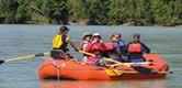
Kynoch is the longest established Eco-Rafting & Bear viewing tour operator in Bella Coola Valley. Our guides are biologists and accredited Bear Viewing Guides. Join us Eco-Rafting, Bear Viewing, or on other Wilderness Adventures.
1896
Hwy 20 Bella Coola Valley 1+ 250-398-0390
info@kynochadventuretours.com
28 Stories of the
Coast | landwithoutlimits.com
Cariboo Chilcotin
Going For the Gold Roadtrip
For the explorer wanting to retrace history, there’s no better route to take than the Gold Rush Trail. This historic route follows the path of gold seekers looking to find their fortune along the mighty Fraser River from New Westminster, near Vancouver, through the valley and up through the Fraser Canyon. Roads and communities were built to ease the way for prospectors, and many of these communities still thrive today. Places like 70 Mile House, 100 Mile and 108 Mile eventually became communities of settlers who took up ranching and agriculture after the rush ended.
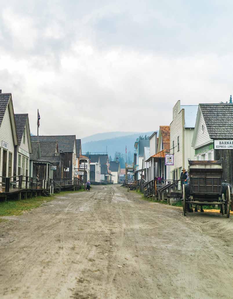
To catch some of the explorer spirit, take the backroad northeast from Likely to Barkerville to seek the uncrowded nature the original prospectors experienced. Before hitting the backroad, pause to enjoy the outdoor adventures and history of the Cariboo Mountains area numerous natural wonders, the largest man-made bullion pit in North America or stop at the nearby ghost town of Quesnelle Forks to explore a historic graveyard and remains of Canada’s oldest Chinese Tong house.
To discover more about the history of the Gold Rush Trail, learn about the communities along the way, and obtain a guide and map, visit goldrushtrail.ca.
29 Stories of the
Coast | landwithoutlimits.com
Cariboo Chilcotin
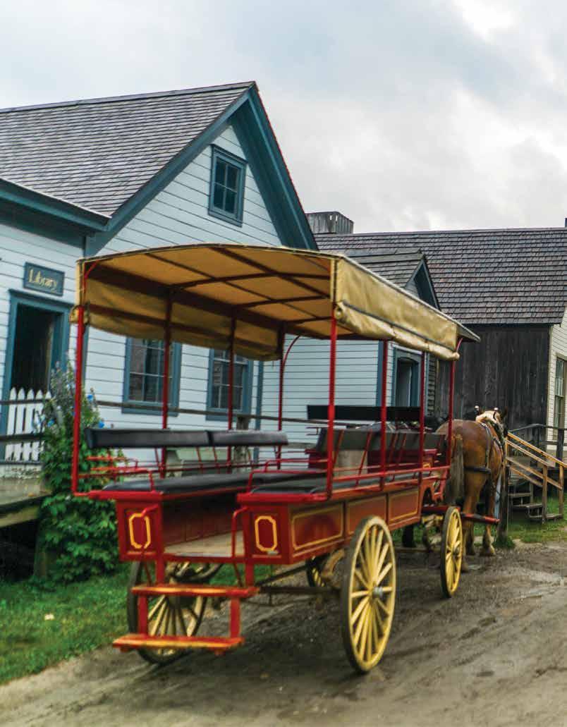
Barkerville Historic Town & Park Tyler Cave
30 Stories of the Cariboo Chilcotin Coast | landwithoutlimits.com
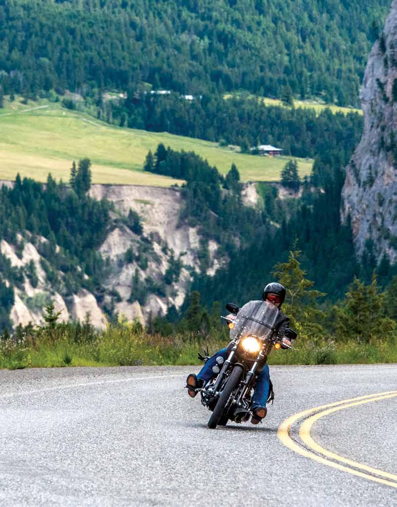
two-wheel Exploring
There’s no better way to enjoy the twists and turns and take in the dramatic scenery of the region than on two wheels. The sights and scents of the road, the exhilarating feel of the wind and the clarity of the sky are so much more immediate as you motor through the countryside. A bonus: the roads here are quiet, with few RVs or trucks to slow you down. In fact, in many places you are more likely to see wildlife – bears, deer, bighorn sheep, wild horses and caribou – than vehicles.
Adventure bike enthusiasts delight in the extensive network of backcountry gravel roads. One such ride, the “Hurley River Road” that connects Gold Bridge in the Bridge River Valley to Pemberton, is open seasonally from June to October. Complete this circle tour along the gravel surfaced Carpenter Lake/Pioneer Road 40 to Lillooet.
Highway 20 Geoff Moore
31 Stories of the
Coast | landwithoutlimits.com
Cariboo Chilcotin


Mt. Waddington 4016m (Highest Mountain in B.C.) Silverthorne Mountain 2896m Mt. Saugstad 2908m Heckman Pass 1524m Anahim Peak 1876m Monarch Mountain 3533m Hunlen Falls Kl inakliniGlacier TumultGlacier VANCOUVERISLAND Princess Royal Island Aristazabal Island KingIsland Gil Island Campania Island Swindle Island Price Island Calvert Island Hunter Island Denny Island Campbell Island Port Hardy Port McNeill Campbell River TWEEDSMUIR PROVINCIAL PARK RRAINBOW ANGE ENTIAKO PROVINCIAL PARK & PROTECTED AREA ITCHA ILGACHUZ PROVINCIAL PARK UPPER KLINAKLINI PROTECTED AREA DEAN RIVER ESTUARY PROTECTED AREA KITASOO SPIRIT BEAR CONSERVANCY FIORDLAND RECREATION AREA Mount Qenxv’ KITLOPE HERITAGE CONSERVANCY PROTECTED AREA 19 20 Bella Coola Kimsquit Hagensborg Firvale Stuie Anahim Lake Kleena Kleene Nimpo Lake Courtenay Gold River Waglisla (Bella Bella) Shearwater Klemtu Ocean Falls Namu Dawsons Landing Hakai Pass Oweekeno (Wuikinuxv) Butedale Hartley Bay Kenny Dam CaamañoSound QueensSound SmithSound LoredoSoundMilbankeSound Charlotte Lake Clearwater Lake Turner Lakes Sapeye Lake Bluff Lake Middle Lake Nimpo Lake Finger Lake Tatelkuz Lake Tsacha Lake Moose Lake QueenCharlotteStrait Queen Charlotte Sound Great Bear Rainforest Ootsa Lake Eutsuk Lake WestRoadRiver Dean R i ver K linak l i n i R irev Knight Inle t Bute I DeanChanne l Burke Channel Rivers Inlet Kingcome Inlet Whitesail Lake Tetachuck Lake Johnstone Strait Bella Coola River SouthBentinckArm 0 10 20 30 40 50 Kilometres N HAKAI LUXVBALIS CONSERVANCY AREA BC Ferry Routes Nuxalk-Carrier Grease/ Alexander Mackenzie Heritage Kuyakuz Lake 60 km of gravel surfaced road from Anahim Lake to the bottom of the Hill SIR ALEXANDER MACKENZIE PROVINCIAL MARINE PARK C O A S T M O U N T A I N S Airport Floatplane Base Info Booth Main Highway Main Road Railways Ferry Routes Parks Secondary Roads Gold Rush Trail Visitor Centre The Fishing Highway 1 Advertisers’ Index Tsilhqot’in Title area Airport Floatplane Base Info Booth Main Highway Main Road Railways Ferry Routes Parks Secondary Roads Gold Rush Trail Visitor Centre The Fishing Highway 1 Advertisers’ Index Tsilhqot’in Title area Cariboo Chilcotin Coast Toursim Association/Jill Schick
5 5 5 Owen Lake Stum Lake Dragon Lake Bootjack Lake Hen Ingram Lake Tyee Lake Fir Lake Tzenzaicut Lake Puntataenkut Lake Puntchesakut Lake Marmot Lake Fishpot Lake Till Lake Dugan Lake Raven Lake Owen Lake Stum Lake Fir Lake Raven Lake Till Lake Dugan Lake Tyee Lake Bootjack Lake Hen Ingram Lake Hope Kamloops Mt. Robson 3954m Mt. Queen Bess 3313m Mt. Warner 2833m Black Dome Big Timothy 2157m Mt. Timothy Ski Hill Horsefly Mountain 1793m Yanks Peak Mt. Agnes 1983m Mt. Murray 1989m Eureka Peak 2426m Homathko Icefield L i l l o o e t Glacier Williams Lake Merritt Quesnel Nazko Whistler 150 Mile House WELLS GRAY PROVINCIAL PARK BOWRON LAKE PROVINCIAL PARK WEST TWIN PROVINCIAL PARK & PROTECTED AREA TS’YL-OS PROVINCIAL PARK NUNSTI PROVINCIAL PARK GARIBALDI PARK GOLDEN EARS PARK STEIN VALLEY NLAKA’PAMUX HERITAGE PARK FINGER-TATUK PROVINCIAL PARK FRASER RIVER PROVINCIAL PARK KLUSKOIL LAKE PROVINCIAL PARK NAZKO LAKE PARK JUNCTION SHEEP RANGE PARK MARBLE RANGE PROV. PARK EDGE HILLS PROVINCIAL PARK BIRKENHEAD LAKE PROVINCIAL PARK TAWEEL PROVINCIAL PARK CHASM PROVINCIAL PARK CHURN CREEK PROTECTED AREA FLAT LAKE PROVINCIAL PARK MOOSE VALLEY PROVINCIAL PARK BIG CREEK PROVINCIAL PARK SOUTH CHILCOTIN MOUNTAIN PARK CARIBOO MTNS. PROVINCIAL PARK Ghost Lake CHILCOTIN PLATEAU CARIBOO MOUNTAINS SOUTH CHILCOTIN RANGE FRASER CANYON OUNTAINS 99 99 7 99 5 5A 3 12 5A 1 1 1 1 1 1 97C 97C 97D 97C 5 5 97 26 20 16 Lillooet Cache Creek Lytton Stoner Hixon Cinema Keithley Creek Alexis Creek Redstone Chezacut Hanceville (Lee’s Corner) Riske Creek Farwell Canyon Springhouse Alkali Lake Gang Ranch Big Creek Big Bar Jesmond Dog Creek Chilanko Forks Lake Tête Jaune Cache Wells Barkerville Likely Quesnelle Forks Horsefly Black Creek McLeese Lake Xat’sull (Soda Creek) Blackwater Mount Currie D’Arcy Bralorne Gold Bridge Logan Lake Yale Boston Bar Gibsons Squamish Nanaimo Comox Sechelt Powell River Aspen Grove Princeton Spuzzum Hell’s Gate Kanaka Bar Little Fort Barriere Lone Butte 70 Mile House Lac la Hache 108 Mile Ranch Canim Lake Forest Grove Pemberton Birken Seton Portage Pavilion Hat Creek Spences Bridge Ashcroft Clinton Clearwater 100 Mile House Seasonal gravel road from Likely to Barkerville Big Lake Blackwater River Nazk o R i ver Stein River Quesnel Lake Bowron Lakes Mitchell Lake Horsefly Lake Tatlayoko Lake Horn Lake Finger Lake Naltesby Lake Tatuk Lake Batnuni Lake Hanham Lake Boat Lake Euchiniko Lakes Lake Taseko Lakes Carpenter Lake Tyaughton Lake Harrison Lake Slave Lake Tatla Lake Eagle Lake Puntzi Lake Nazko Lakes F r a s e r Ri v e r Chilcotin River QuesnelRiver Canim Lake Green Lake Loon Lake Sheridan Lake Watch Lake Lac des Roches Bonaparte Lake Big Bar Lake Snag Lake Spring Lake Timothy Lake Bridge Lake Deka Lake Sulphurous Lake Murtle Lake Clearwater Lake Azure Lake Crooked Lake Hobson Lake Mahood Lake Kamloops Lake te Inle t TobaInlet JervisInlet Lillooet Lake N. T homp s no R i rev Bridge River Thomp s o n R i v re B ig Creek ChilakoRiver Vancouver To Banff/ Calgary To Jasper/ Edmonton To Kelowna Sun Peaks Ski Resort Chilliwack To Victoria Troll Mtn. Ski Hill Ten Mile Lake Bouchie Lake Puntchesakut Lake Puntchesakut Lake Tzenzaicut Lake Marmot Lake Fishpot Lake Grease/ Heritage Trail Seasonal Road 24 97 WHITE PELICAN PROVINCIAL PARK BULL CANYON PROVINCIAL PARK Bridge Lake ChilkoRiver Chaunigan Lake Tsuniah Lake Nemiah Valley Choelquoit Lake T a s e ko R i v re Chilko Lake Tatla Lake
34 Stories of the Cariboo Chilcotin Coast | landwithoutlimits.com
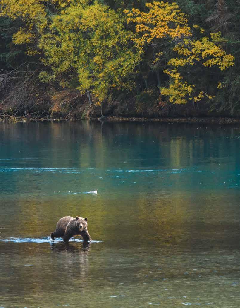
Salmon Tales
Story Contributor: Jane Zatylny
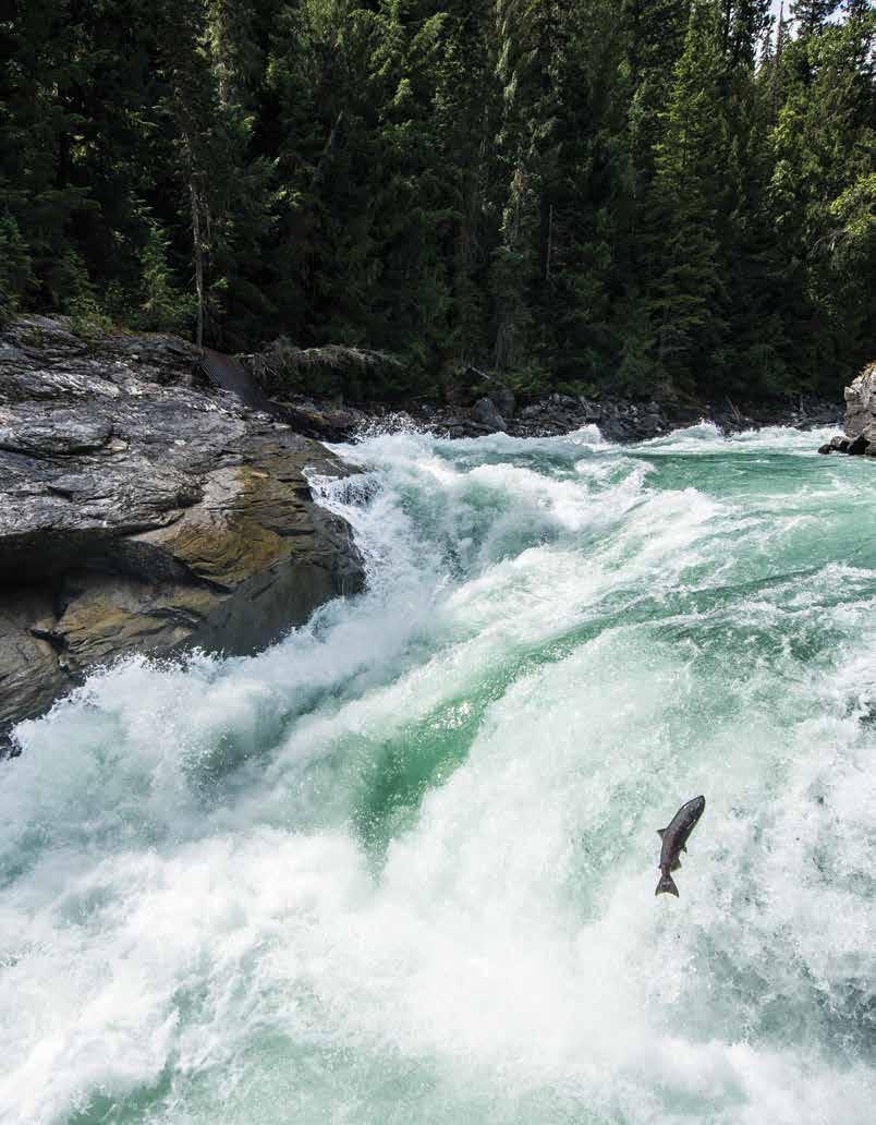
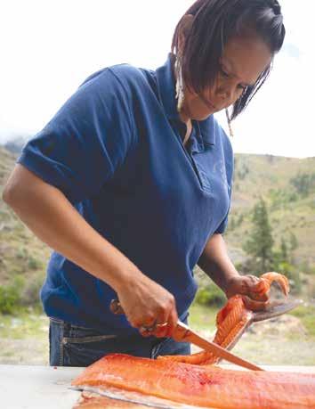
Flavourful wild Pacific salmon never disappoints, whether poached and served with a rich buttery sauce or savoured in all its robust red glory, delicately smoked and thinly sliced. But this princely protein is so much more than its tasty end result. Salmon are a keystone species, meaning that entire ecosystems rely on their abundance. Salmon feed not only humans, but also whales, bears, eagles, and a multitude of other species. In fact, the Pacific Salmon Foundation estimates that more than 130 different species of plants and animals rely on wild Pacific salmon.
Wild Pacific salmon are anadromous, which means they divide their lives between fresh and saltwater. Born in freshwater, they make their way to the ocean, then in maturity battle their way home against river currents, as far as 3,000 km (1,864 mi) to their natal waters, where they spawn and die. Their decaying carcasses, abandoned by eagles and bears, then fertilize coastal and inland forests with vast amounts of nitrogen. For thousands of years, salmon have also played an integral role in the cultural identity of this region’s Indigenous people, who recognize five tribes of Pacific salmon. We know these species as chinook, sockeye, coho, pink and chum. While they may look similar at first glance, each type of salmon has its own unique flavour and fat content. Prized chinook salmon have the highest fat content and offer a rich, buttery texture, while pink salmon have lighter-coloured flesh and is more delicate in flavour. Versatile and nutritious, salmon can be grilled, poached, fried, baked, smoked or candied.
Throughout history, salmon have been captured through a variety of methods, some of which are still in practice today. For example, in the Fraser River canyon, fishers “gaff” or dip-net fish in the turbulent water below from perilous positions on rocks or wooden platforms. You can
35 Stories of the Cariboo Chilcotin Coast | landwithoutlimits.com
Kokanee salmon at Cariboo Falls near Likely Destination BC/Blake Jorgenson
observe this Secwepemc (shi-huep-muh-k) fishing method at one of the four Xatśūll (hat-sull) fishing rocks on the Fraser River, part of the Xat’sull Heritage Village, about 38 km (20 mi) north of Williams Lake. The heritage centre also offers a traditional roasted salmon lunch, prepared in a fire pit. The fishing grounds of the St’at’imc (stat-leeum) people at Xwisten (hoist-in), near Lillooet, also offer demonstrations of their traditional wind-dry method in preparing salmon for the winters ahead.
There are many ways to experience salmon fishing in this region, whether it’s inland or closer to the ocean, with most visitors choosing a lodge as their home base. On the coast, millions of salmon make first landfall at River’s Inlet and Hakai Pass after battling northern Pacific currents in search of their natal streams. En route, these salmon pass some of the most famous fishing holes on the coast, including Odlum Point, the Gap and Barney Point, where gentle back eddies provide rest and feeding areas for salmon and outstanding fishing opportunities for anglers and Orcas. The Dean River is another well-known salmon fishing spot; some outfitters on the river provide a base camp for fishing expeditions. The tiny settlement of Kleena Kleene, just 31 km (19 mi) west of Tatla Lake on Highway
20 and mere minutes from Clearwater Lake, is a departure point for float-plane excursions to remote fishing lakes and rivers and the region’s celebrated alpine wilderness. Local guest ranches and lodges, some with canoe-to-your-door chalets, also offer land and boat touring, photography treks and working ranch holidays.
If you would rather watch grizzlies and black bears fish for salmon, or just witness this miraculous migration for yourself, consider staying at one of the region’s numerous fishing lodges in September or October. Many business operators are active environmental stewards, providing opportunities to educate their guests about salmon and their circle of life. Their guides can lead you along rivers and tributaries as they turn crimson with spawning fish, not only to fish, but also to observe. Pack your camera and longest lenses and take your place along the shore on a viewing platform or board a boat and capture grizzly bears fishing for salmon.
Witness the spawning spectacle for yourself just by hiking along the banks of the Atnarko River (Tweedsmuir South Provincial Park), Quesnel Lake, the Bowron chain (Bowron Lake Provincial Park), Cariboo River (Cariboo River
Stories of the Cariboo Chilcotin Coast | landwithoutlimits.com 36
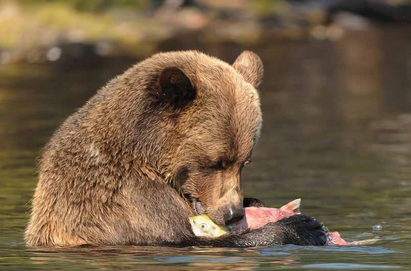
Grizzly feeding on salmon, Chilko Lake David Jacobson
Provincial Park), Horsefly River (Horsefly Provincial Park) and the Mitchell River. In fall, keep your eyes trained on the water for a flicker of red.
Aside from the five species of wild Pacific salmon, you can also fish the region’s crystal-clear lakes for kokanee salmon, the freshwater, or non-anadromous, subspecies of sockeye salmon. Follow Highway 24, known as the “Fishing Highway”, a modern, paved road that runs east to west between Little Fort and 100 Mile House in the South Cariboo (atop of the Fraser Plateau). Many of the lakes in this area, including spring-fed Bridge Lake and Lac La Hache (known as the Longest Town in the Cariboo), are teaming with kokanee as well as burbot, rainbow and lake trout. They also reflect their smalltown hospitality and welcome with the many resorts, ranches, restaurants and vacation homes scattered along the lake shorelines.


Whether you experience salmon through an Indigenous tour, watch local wildlife fish for dinner, or cast a line into a remote salmon river yourself, you are sure to appreciate your next meal of wild Pacific salmon when you understand the cultural and biological importance of this species. ¤


landwithoutlimits.com 37
SULPH U R OUS LAKE 6045 Mahood Lake Rd, Lone Butte, BC V0K www.sulphurouslakeresort.com (250) 618 RESORT a fisher’s paradise ... CABINS • SERVICED RV SITES • TENT SITES FIRE PITS • PICNIC TABLES • BOAT LAUNCH • 3 DOCKS • BOAT, CANOE AND KAYAK RENTALS
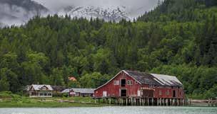
chilcotin ho�e of the �� �o��o� hall of fa�e ���� �road�a� a�e�ue s� ��ll�a�s la�e ������������ INDIGENOUS | RANCHING | RAILROAD ��dustr� | E�o�o�� | Sta��ede rodeo | fur trade | gold rush Tallheo Cannery Guest House your exclusive oceanfront destination Come explore the rich history of one of the last remaining salmon canneries Oceanfront Accommodation ~ Scenic Inlet Tours ~ Wildlife Viewing www.bellacoolacannery.com 1-604-992-1424 info@bellacoolacannery.com
Xwisten Experience Tours , Lillooet
The Rugged Chilcotin
 Story Contributor: Jo Johnson
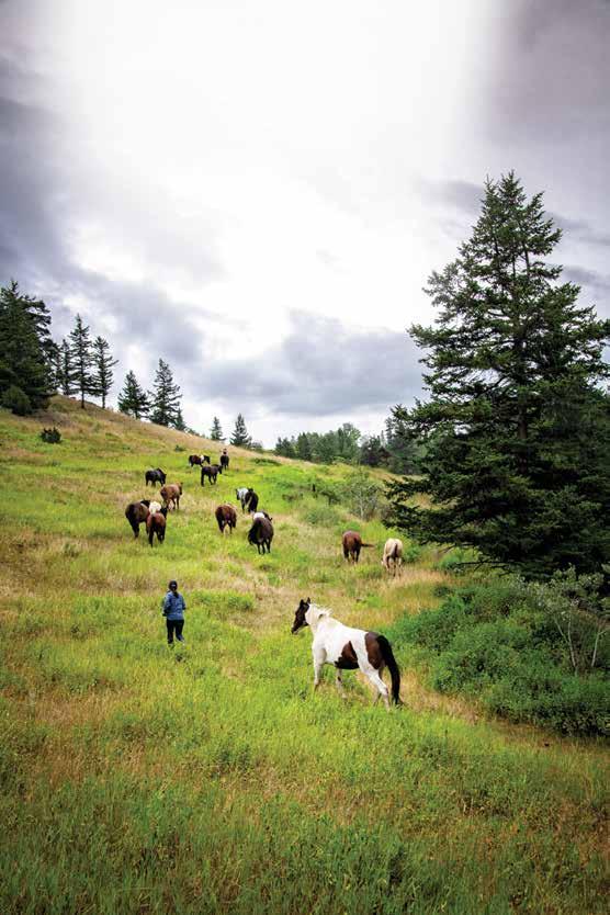
The Chilcotin is an area of golden plateaus and dramatic mountains that stretches west from the Fraser River all the way to the shores of the Pacific Ocean. Its pristine and varied wilderness — dotted with sporadic communities and very little industry — as well as its diverse and abundant wildlife make it ideal for both backcountry adventurers and folks who crave the quiet and peaceful spaces. The culture of the Chilcotin is also, undeniably, cowboy, so it’s no surprise that my three-year stint of living there as a young woman started with a very unusual introduction to an Indigenous cowboy named Roy.
Early one morning in 1994, I sat on the fence overlooking the horse paddock of a comfy lakeside resort at the edge of the South Chilcotin Mountains, where I would begin working the following morning. Soaking in the sun, the fresh air, and the blissful peace and quiet (something I had forgotten existed in the past few years of living in the city), my eyes eagerly took it all in. I looked down, past the paddock to the lake (where the Beaver floatplane I’d flown in on my way to the resort the day before was docked), and then up past the forest behind me to the mountains. The densely mixed fir and pine, broken only by trails blazed by generations of riders, bush ponies and backcountry enthusiasts, was more than enough to strike wonder and curiosity in my city-girl senses. As my eyes continued to sweep high up the mountain, I saw something strange that I couldn’t wrap my head around, a bright red speck moving through the trees. It was only there for a moment but when I blinked, it disappeared into the sun and I found myself wondering if I’d imagined it.
38 Stories of the
Coast | landwithoutlimits.com
Cariboo Chilcotin
Near Kleena Kleene Jesaja Class
39
| landwithoutlimits.com
Stories of the Cariboo Chilcotin Coast
Two days later, my second day working at the resort, I was frazzled, exhausted, and lamenting my foolish confidence at agreeing to take a wrangling job with zero horse experience. As I was pulling the saddle off a beautiful, but very temperamental Palomino named Bailey, who seemed to truly relish her efforts to step on my feet, I looked up to see a man riding out of the forest on a big black beauty.
I stood there, staring at the red bandana tied around his neck, as he stopped in front of me, dismounted and stretched.
“It was YOU!” I said, incredulously.
“What was me?” he asked, grinning.
I told him how I had seen a speck of red flash through the trees high up the mountain two days prior to his arrival and thought I’d imagined it. He pushed his hat up, turned to look up the mountain, shrugged nonchalantly and admitted, “Yah. That was me. I rode here from Gang Ranch.” When I asked him how long it had taken him, he’d shrugged again and said,
“I dunno. Week maybe.”
He rode his horses over the South Chilcotin Mountains—an arduous, treacherous, long trek through the untamed
Experience
@CoolestColin
CLEAN, SAFE, RELIABLE Business and Tourism Rentals
Located at the Bella Coola Airport Harbour and Hotel Pick up and Drop off available Cell/Text 250.957.7072 - Steve 250.302.9549-David email - coolawheels@netbistro.com www.bellacoolavehiclerentals.com
Stories of the Cariboo Chilcotin Coast | landwithoutlimits.com 40
beauty of the Chilcotin Coast with our Rough
the unspoiled natural
Road 4WD SUVs
Hunlen Falls/Turner Lake Trail Jesaja Class
wilderness—with only a small amount of supplies, his faithful equine companions, Goofy and Joe, and one amazing sense of direction. He didn’t follow a map although he’d never travelled over the mountains this far before, but he’d needed a change of pace and decided to ride over and look for work at one of the local ranches. I was flabbergasted. I hadn’t known people like him still existed anymore.
It didn’t take me long to figure out that the people who live in the Chilcotin all seem to belong in a different time—a simpler time. Life there is calmer, more focused on the land, the wildlife, and human connection, rather than the hustle and bustle of life, deadlines and devices. I am completely convinced that the Chilcotin way of life has everything to do with its set up of small communities, sporadically connected by vast, virtually uncharted landscapes and big skies. Being separated by large distances allows people to slow down and focus on each other and their surroundings.
However, it’s not as remote as it may seem because the communities of the Chilcotin are surprisingly well connected by the easily accessible Freedom Road (aka Highway 20)—the highway that first opened up the central coast. Sometimes referred to as the Chilcotin Highway, Highway 20 stretches from Williams Lake, through the heart of the Chilcotin, all the way to Bella Coola. Aptly named, the Freedom Highway opened a vital corridor. When the government of BC ended the construction of Highway 20 at Anahim Lake (a community approximately 43 km (27 mi) away and 1,800 m (5,905 ft) above the Bella Coola valley), a group of local volunteers banded together to finish the job and connect the central coast to the Chilcotin. All it took was a bulldozer at the top and a bulldozer at the bottom to connect the two existing roads.
Wildlife abounds along Highway 20, making it natural to catch glimpses of animals appearing along the road. On


Stories of the Cariboo Chilcotin Coast | landwithoutlimits.com 41
Coast Mountain backcountry Kent Bernadet
a
Just 4 hours north of Vancouver 1-800-553-3533 www.sundanceguestranch.com saddleup@sundanceguestranch.com Hotel - Cafe - Lounge - Casino 250-992-5533 www.billybarkercasino.com 308 McLean Street Quesnel, BC info@billybarkercasino.com Old World Elegance & Modern Amenities Fully Renovated Rooms 7 Luxury Suites Corporate Discounts Showroom and Banquet Facilities
“The first time, it’s
vacation. After that, it’s coming home.”
the Chilcotin plateau, range cattle graze alongside deer, moose, caribou, and even bears under the ever-watchful and steadfast gaze of Mount Waddington—the highest peak in the Coastal Mountains. This area also plays host to Canada’s largest population of non-migratory California bighorn sheep and is home for hundreds of wild horses. It’s common to spot lynx, wolves, trumpeter swans and other bird species. The only nesting colony of endangered white pelicans in BC can be found along Highway 20. Although their nesting grounds are off limits due to the sensitivity of their young, the adults can still be viewed during feeding time at Nazko Lake Park, near Alexis Creek, as a truly spectacular sight to behold.
The Freedom Road is also an endless route to outdoor recreation and adventure. The Homathko Icefield and Hunlen Falls are installations of nature best witnessed from the birds-eye view of a flightseeing tour, worldclass heli-skiing in the South Chilcotin range, and the longest continuous stretch of class 3+ whitewater in North America on the Chilko River all provide a kick-start to the heart. Fishing enthusiasts can also charter a floatplane to remote sweet spots, such as the incomparable Spruce and Turner Lakes or to the world-renowned Dean River, where record steelhead are commonplace.
Whether you are there for the peace and tranquillity, the wildlife, or the views, the Chilcotin is guaranteed to strike awe and wonder, even as it lowers your heart rate and calms your mind. ¤
inFo:

The Chilcotin is divided by the South Chilcotin Mountains, with the north accessible via Highway 20 and the South Chilcotin requiring a journey down Highway 97 with access through Lillooet.
Stories of the Cariboo Chilcotin Coast | landwithoutlimits.com 42
LOVECENT RALCOAST BC.COM LOVEQU ESNEL.COM LOVEWELLSBC.COM Unique. Eclectic. Diverse.
to one of the most colourful, diverse and eclectic regions in Canada!
our
the unique businesses and
that are at the heart of our vibrant communities. Enjoy a true northern experience by discovering some of the locally owned, independent businesses that are here.
the colourful history of Wells and the second Cariboo gold rush thewellsmuseum@gmail.com facebook.com/WellsMuseum wellshistoricalsociety.ca 778-414-8035 (May -Sept) Pooley St & Burnette Ave, Wells
Welcome
The character of
area is largely shaped by
entrepreneurs
Explore
Wells Museum & Historical Society
(Archives access by appointment)
Be Fire-aware, Prepared & safe. here's how:
Fire-aware Wildfires are a seasonal event in many of British Columbia’s ecosystems, including the Cariboo Chilcotin Coast region. They can refresh the ecosystem and make way for new growth, but wildfires can also pose a hazard to people and infrastructures.
Preparation The British Columbia Wildfire Service manages wildfire response throughout the province; they also provide information on current wildfire events. To see information on current wildfires, fire danger ratings and air quality, visit the BC Wildfire Service website at bcwildfire. ca or call the Fire Information line: 1-888-336-7378.
safety It is sometimes necessary to restrict the use of campfires and other open fires. These bans or restrictions affect public and private land, including crown land, wilderness areas and campgrounds. When public safety is threatened, Evacuation Alerts and Evacuation Orders may be issued by local authorities.
If you encounter a wildfire, you can help keep people safe by reporting it. Call 1-800-663-5555, or *5555 on your cell phone.
Stories of the Cariboo Chilcotin Coast | landwithoutlimits.com 43
Chasm Provincial Park Michael Bednar
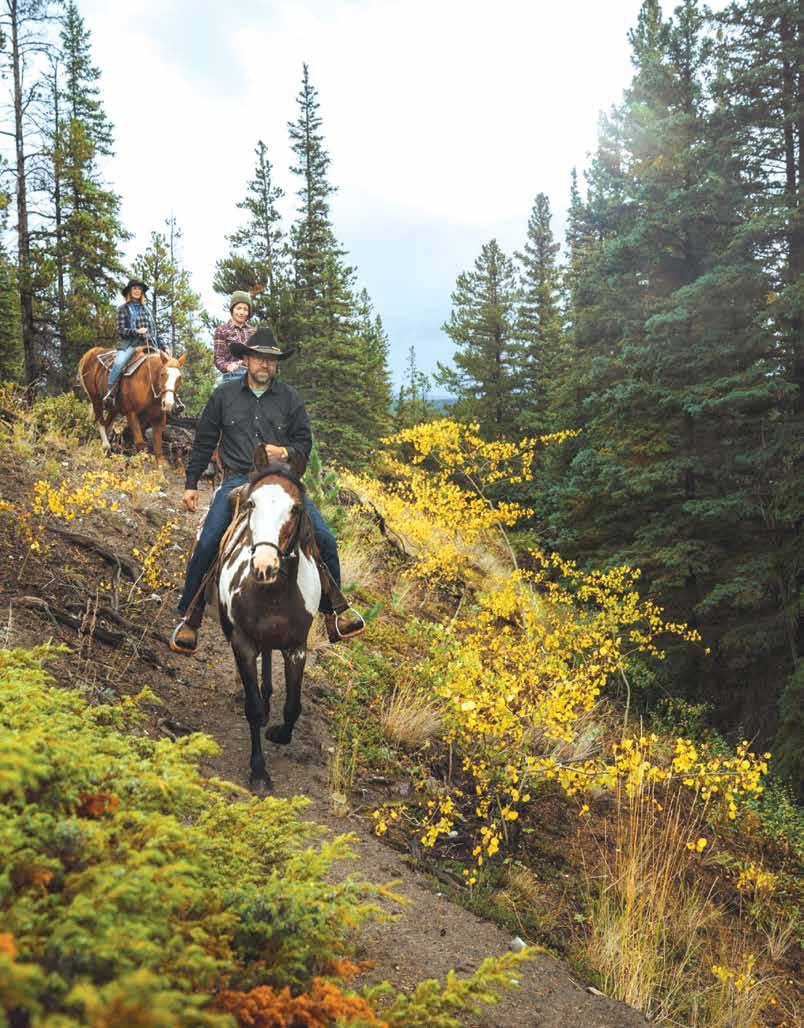
Happy Trails
Story Contributors: Jane Zatylny & Mary Elliott
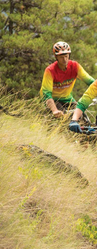
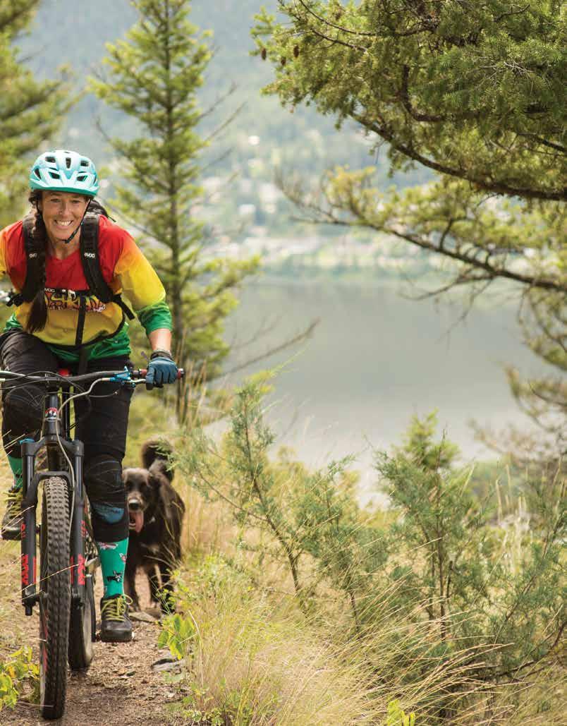
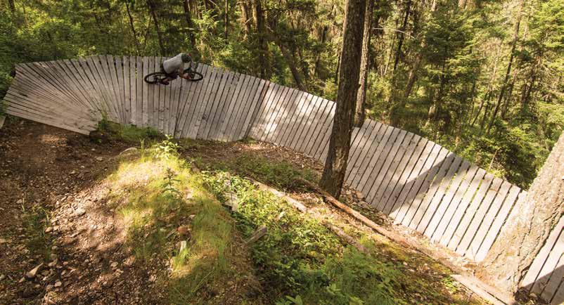
The Cariboo Chilcotin Coast beckons outdoor enthusiasts of all persuasions, from riders and ramblers to hikers and birders. Many members of the global mountain biking community, for instance, consider this region the unofficial mountain biking capital of Canada, with unlimited riding for both leisure bikers and adventure-seeking free riders. Whether you’re seeking an adrenaline rush or a calming escape, the terrain and quality trail systems offer distinct experiences in river valleys, mountain peaks, steep downhill, ramps and single-track ridges. With such a vast variety of rides to choose from, it’s possible to spend an entire year here without setting a wheel in the same place twice.
Roll into Williams Lake, and you’ll understand why. Bike magazine named Williams Lake North America’s “Shangri-La of mountain biking.” With more than 200 documented tracks and trails around the city, riders have an astounding choice of technical loops. Aflo, with its awesome, flowy, banked turns, is one of the most popular trails here. The city’s downtown Boitanio Bike Park is the largest park of its kind in BC’s Interior, it covers more than four ha (10 ac), and includes six major jump lines, flow trails, log work, a pump track and a drop zone.
The 100 Mile House area also offers hundreds of kilometres of marked and unmarked backcountry trails crisscrossing the plateau, with trails accessible around 108 Mile Ranch and downtown. On the 99 Mile trail network, riders need not stray from the trails (also not recommended!) for amazing rides. This area challenges riders of all skill levels and age groups.
Fox Mountain Trail Network, Williams Lake John Wellburn
44 Stories of the
Coast | landwithoutlimits.com
Cariboo Chilcotin
45
Stories of the Cariboo Chilcotin Coast | landwithoutlimits.com
Spring Lake ranch
In the South Chilcotin, Spruce Lake offers epic grassland riding through alpine and sub-alpine meadows, skirting spectacular freshwater lakes. The classic 26-km (16-mi) single-track Gun Creek route gains elevation through a conifer forest mixed with aspen and cottonwood, opening to wildflower meadows in the late summer. Also popular are the South Tyaughton Lake’s 28-km (17mi) Taylor-Pearson loop and the 44-km (27-mi) High Trail Loop into Windy Pass. Adventurous backcountry mountainbikers can also opt for multi-day float plane or packhorse-assisted guided tours, complete with gourmet catering and cozy backcountry accommodations.
In the Great Bear Rainforest, along the central coast, you can take a leisurely ride through lush rainforest on the Snooka Trail System. Awesome alpine views reward those who reach the network’s Purgatory Lookout. A series of trails between Bella Coola and Hagensborg offer various levels of difficulty. The East Loop Trail is an easy-grade circle route of 5.5 km (3 mi), with only a 50-m (164-ft) elevation gain; the West Trail is more challenging, with an elevation gain of 500 m (1640 ft) over this 3.8-km (2.4-mi) one-way trek. This system of trails also links to other wilderness routes that lead deeper into the Bella Coola Valley backcountry.
Our region also delights hikers and ramblers. Lillooet is home base for scenic hiking trails with historic
Stories of the Cariboo Chilcotin Coast | landwithoutlimits.com 46
Westsyde Trail Network, Williams Lake John Wellburn
Facing Page: Hunlen Falls/Turner Lake Trail Jesaja Class
and the more experienced. 10,000 aces of range surrounding a private lake. Open year round. 15 km from HWY 97 at 111 Mile. 5770 Spring Lake Rd. 1-877-791-5776 or 250-791-5776 info@springlakeranchcom www.springlakeranch.ca
A beautiful and affordable guest ranch near 100 Mile House. Log cabins, scenic trail rides for beginners
Spring Lake Ranch
Log
10,000 aces of
lake. Open year
1/4 page ad directory ad Close to nature. Far from crowds. Close to nature. Far from crowds. 15 km from HWY 97 at 111 Mile. 5770 Spring Lake Rd. 1-877-791-5776 or 250-791-5776 info@springlakeranchcom www.springlakeranch.ca
A beautiful and affordable guest ranch near 100 Mile House.
cabins, scenic trail rides for beginners and the more experienced.
range surrounding a private
round.
Stories of the Cariboo Chilcotin Coast | landwithoutlimits.com 47
connections to the gold rush era, while trails from 108 Mile Ranch meander past bays and lagoons filled with waterfowl. Rock collectors can scramble around the Marble Range near Clinton, an area noted for limestone karsts, wooded groves and alpine ridges.
No fewer than 18 wheelchair-accessible trails form the Cariboo’s Low Mobility Trail Network. The Stanley Cemetery Low Mobility trail provides access to the historic graveyard, the final resting spot of many pioneers and Chinese immigrants from the gold rush era. The Interlakes Pioneer Heritage Accessible Trail ventures past wetlands and through forest, while the 2.2-km (1.4-mi) Horsefly Accessible Trail meanders along the Horsefly river, offering views of the salmon spawning channel and the beautiful ever-changing landscape.

Family-friendly hikes include Williams Lake’s popular River Valley Trail and the Mt. Agnes Trail network, near Barkerville, which follows the original Cariboo Waggon Road to wildflower-strewn alpine meadows below Summit Rock. Williams Lake’s Esler Bluffs boasts 44 routes, offering hikes for any ability and fitness level.


Looking to scale new heights? Heli-assisted hikes and climbs can be arranged by local operators. Mountaineers come from around the world to tackle the 3,000-m (9,842-ft) peaks of the Coast Range, including 4,016m (13,176-ft) Mt. Waddington, BC’s highest peak. Experienced hikers can also do a multi-day trek up the Niut Range to spectacular vistas framed by the contrast of bright blue glacial lakes against orange rock; or to get up there more quickly, charter a plane.
Birdwatching is the perfect companion activity to hiking. Many of the region’s hiking trails are situated by scenic lakes or streams, where birdwatching opportunities abound. At Bowron Lake Provincial Park, for example, you can view up to 20 different species of waterfowl between late April and mid-September. The park is also notable for its large songbird population, including the western wood-pewee, Hammond’s flycatcher and Eastern kingbird.
The wetlands near 100 Mile House is also a birdwatcher’s paradise. Visitors can expect to catch a glimpse of yellowheaded and red-winged blackbirds, as well as sandpipers, swallows, grebes and ducks. The Scout Island Nature Centre, in the heart of Williams Lake, is a fantastic spot for wildlife viewing. The Centre, which encompasses 2.5 km (1.5 mi) of trails along a lake and marsh, promises the opportunity to spot foxes, beavers and turtles. But the main attraction is the hundreds of species of birds, including osprey, riparian songbirds and American white pelicans. Scout Island is dog and wheelchair friendly and offers community programs year-round, though birdwatching is at its best during spring and fall.
Tweedsmuir Provincial Park is also a top-notch place to view birds, including spruce grouse and white-tailed ptarmigans. And Anahim Lake, near Nimpo Lake, offers opportunities to sight many species including white pelicans, trumpeter swans, waterfowl and bald eagles.

Whether you crave the wild rush of hurling on two wheels down a rugged backcountry trail, the peaceful calm of an easy ramble along a countryside trail, or the thrill of sighting a rare bird on a lakeside trail, this region delivers the goods to outdoor enthusiasts. ¤


Stories of the Cariboo Chilcotin Coast | landwithoutlimits.com 48
Be Prepared & safe in winter. here’s how:
choose Your adventure & Route Travelling in the Cariboo Chilcotin Coast in winter can require more research and preparation. When choosing your adventure, consider a guided adventure or inclusive overnight stay, adjust your plans for winter driving, and be sure to leave a copy of your itinerary with a family member or friend. Be prepared for poor road conditions and/or road closures, ensure to give yourself ample driving time considering when you will be travelling in daylight, and make sure your route includes gas stations and amenities needed to ensure a safe travel.
Pack & Prep Your Vehicle Make sure to pack a winter kit that includes proper equipment for your vehicle as well as warm winter clothing for yourself and family. Being prepared for all winter conditions including having winter tires on your vehicle to dressing in layers with water-resistant, insulated non-slip winter boots will help you be prepared for your winter travels.
driving For the conditions Winter roads often require their own set of skills, as slippery sections, compact snow and decreased visibility are common conditions. Make sure to remove all snow, frost or ice from your vehicle and travel with clean headlights and taillights for best visibility. Most importantly have fun, and remember that winter road trips often take longer than those in the summer, but as long as your not in a rush and are careful, the drive itself can be part of the journey!
For more information and a checklist to stay safe in our region, visit landwithoutlimits.com/safetravel.
Stories of the Cariboo Chilcotin Coast | landwithoutlimits.com 49
Cariboo Mountains Michael Bednar
Discovering Our Secret Season
Story
Contributor: Jonny Bierman
British Columbia has been sculpted through time by an element so powerful, it’s moved mountains. Water chooses its own path and changes with every season – much like the wildlife it supports and the vegetation it feeds. As an avid outdoorsman, I’ve long been drawn to salt and freshwater for my aquatic adventures. Last year, I discovered a secret season where rivers come to life, lakes reflect golden colours, and the salmon bring the ocean to the rainforest. The season is autumn, full of life and action. It was this season that transformed my connection with water and nature.
The Cariboo Chilcotin Coast is home to the world’s largest coastal temperate rainforest – The Great Bear Rainforest – and it’s alive from the ocean floor to the glacier-capped mountaintops. Its wildlife thrives in a place that is unphased by the outside world and listens only to the moon, tides, seasons and, most importantly, the salmon migration.
Autumn touring in the Great Bear Rainforest comes in the form of small cruise expeditions that take visitors through uncharted waters, glacial fjords, remote islands and unnamed estuaries. There’s a big reason why we visit this place in the autumn – bear viewing. As the salmon make their annual migration from the ocean to the rivers, they bring an abundance of food and energy necessary for wildlife to survive the winter ahead.
It was one such cruise that I was fortunate enough to enjoy. As we floated down the waters and walked the riverbanks and beaches, salmon carcasses with evidence of wolves, bears, and eagles feeding on them were endless. We were searching for wildlife and clearly we were in the right place. It wasn’t long into the trip before we saw black bears and even a Spirit bear feeding below from a bear viewing platform. Our local Indigenous guide interpreted his people’s connection to the land and animals while salmon splashed around, teasing their not-always successful furry hunters above.
50 Stories of the Cariboo Chilcotin Coast | landwithoutlimits.com
Bowron Lake Thomas Drasdauskis
51
| landwithoutlimits.com
Stories of the Cariboo Chilcotin Coast
Coastal sea wolves paced a foggy beach and howled from the forest while making their presence known in an eerie encounter I’ll never forget.
No one day is the same out there, and our expedition cruise put us in the path of magic each and every moment. Magic came from the sky as the northern lights lit up the night (a sight hard to see with the long summer days, but easier as the nights become longer in autumn and winter). It came from the ocean as whales surrounded our ship almost daily, and from the rainforest with the countless land-dwelling animals unphased by our presence and mostly concerned about their next meal. Glacial runoff turned the ocean turquoise as the ship cruised narrow fjords, with kayaking excursions leading us deeper into the unknown but closer to the coastline where curiosity ensued. Through seven days of transformational experiences and unforgettable connections, I learned the Great Bear Rainforest is a gift – and this gift is best opened in the autumn.
When water chooses its path, its destination is always, eventually, the ocean. In BC, all waters end up in the Pacific Ocean but where they came from is a different story. The element that has shaped this province over millennia usually starts at glaciers and in the South Chilcotin, a floatplane ride will bring the ancient ice to life.
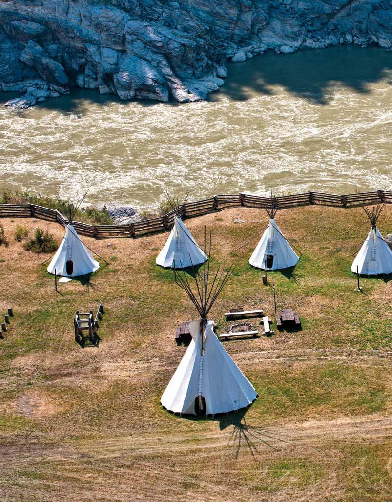
On another trip, I discovered this colourful season in a dramatically different part of the region. After a scenic five-hour drive from Vancouver, we arrived in the Bridge River Valley – the gateway to the South Chilcotin Mountains. Most activities out here – whether it be lakeside overnight ‘glamping’ trips (fully catered comfort tent camping), hiking or biking – involve a horseback trip or floatplane ride. Autumn here can arrive early due to the elevation and, as nights cool off, the countless lakes reflect the golden foliage from changing trees lining their shores. BC from above offers a different perspective and, any chance I get, I climb into a floatplane and explore. This time out, the first stop was the Bridge Glacier where I learned of the existence of freshwater icebergs. After soaring over alpine lakes and mountain peaks, we cut in
Stories of the Cariboo Chilcotin Coast | landwithoutlimits.com 52
Tesla Lake Destination BC/Taylor Burk
over the glacier before landing on the lake and cruising next to icebergs larger than a house. From beginning to end, the trip took us over valleys painted with golden fall browns and azure-blue lakes in unimaginable natural contrasts that can only exist in these mountains.
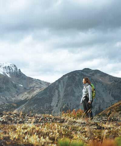
The Bridge River Valley is very much a “choose your own adventure” kind of place. While soaring above got my adrenalin pumping, I was more at peace while channeling my inner pioneer on a horse pack trip. Accommodations can range from glamping (a pampering way to experience nature up close while enjoying the luxuries of a soft bed and delicious meals), to lodges and cabins. No matter the adventure option you choose, an autumn experience in the South Chilcotin will bring you closer to a part of the province that I’ll bet you never knew existed and at this time of year. Best of all, you’ll have it all to yourself.
Driving east from the Bridge River Valley to Lillooet, the autumn adventures continued through dramatic mountain scenery as Pioneer Rd 40 snaked through the valley bottom. Towering peaks with roadside waterfalls, rich vegetation, scrambling mountain goats, and the feeling of a real “off the beaten path” road trip kept me entertained before arriving at the confluence of the Bridge and Fraser rivers.
I mentioned at the start of this story how this season transformed my connection with water and nature. Well, this transformation actually goes deeper. I learned more about the season and its cultural importance through a local Indigenous cultural tour at the Xwisten (hoist-in) Heritage Site. They referred to nature and the planet as ‘Mother Earth’ or the ‘Creator’, and our local Indigenous guides put our recent natural experiences and adventures into perspective as we paid respect and thanked the Creator for what was provided. I found my own connection while learning about theirs through teachings dating back millennia, eating barbequed salmon caught from their traditional fishing rocks, and sitting in on a drumming ceremony. Further on, we learned about Indigenous environmental stewardship through an interpretive walk into salmon estuaries at Splitrock Environmental and then both sampled and purchased locally foraged teas and soaps from the gift shop.
Water’s relationship and its importance with seasons gave me a new appreciation of the element itself, and with the land. Travelling in this season brings with it uncrowded destinations and a better chance to connect with the nature surrounding you. I discovered autumn as my new secret season.
Stories of the Cariboo Chilcotin Coast | landwithoutlimits.com 53
¤
Perkins Peak in the Chilcotin Jesaja Class
Land of the Spirit Bear
Story Contributor: Amy Watkins
Reclusive and elusive, the graceful movements of the Kermode bears of the Great Bear Rainforest have earned them the nickname ghost bears or Spirit bears. Hidden in the emerald, old-growth forests of the world’s largest coastal temperate rainforest, these white-furred bears are unique to the central and northern coast of British Columbia and have even been named the province’s official mammal.
Spiritually significant to the Indigenous people who have called these isolated inlets and islands home for millennia, the Spirit bears of the Great Bear Rainforest are a magical sight for lucky visitors to the region. Stretching along the central and northern coast of British Columbia, the six million hectares of the Great Bear Rainforest encompass a quarter of the world’s coastal temperate rainforest and spans an area that is around the size of Ireland.
Between June and October, Spirit bears can be spotted — or at least searched for — amongst the thick thousand-year-old cedars, Sitka spruce, Douglas fir and mossy dens of the Great Bear Rainforest. Feeding on berries, plants, and salmon, the bears can sometimes be seen filling up in the forest in the summer or gorging on salmon from fast-flowing rivers in the fall. It’s thought that the Spirit bears have survived here so well because their white fur makes it harder for salmon to spot the mighty mammal.
Tours have better chances to encounter these ghostly bears when the animals are fishing for salmon in September and October; tour operators are mindful of staying at a respectful distance (even though the Kermodes have little fear of humans, due to the remote nature of their surroundings).
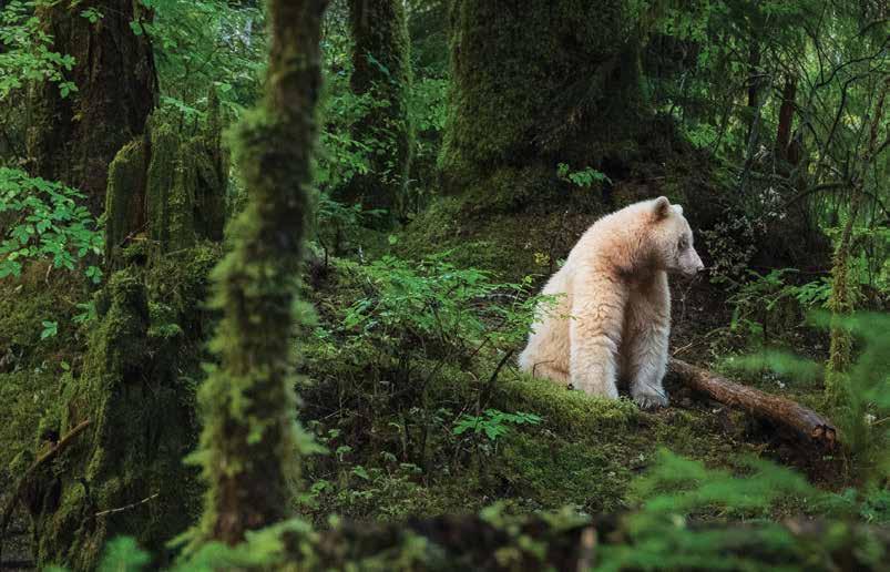
54 Stories of the Cariboo Chilcotin Coast | landwithoutlimits.com
Standing at an average height of 122-183 cm (4-6 ft) and weighing an average of 68-136 kg (150-300 lbs), these Spirit bears can weigh as much as 290 kg (639 lbs) and live up to 25 years in the wild. Given the Latin name Ursus americanus kermodei, the bears are named after Francis Kermode, who helped zoologists find the bears in the early 1900s and later became the director of the Royal British Columbia Museum in Victoria.
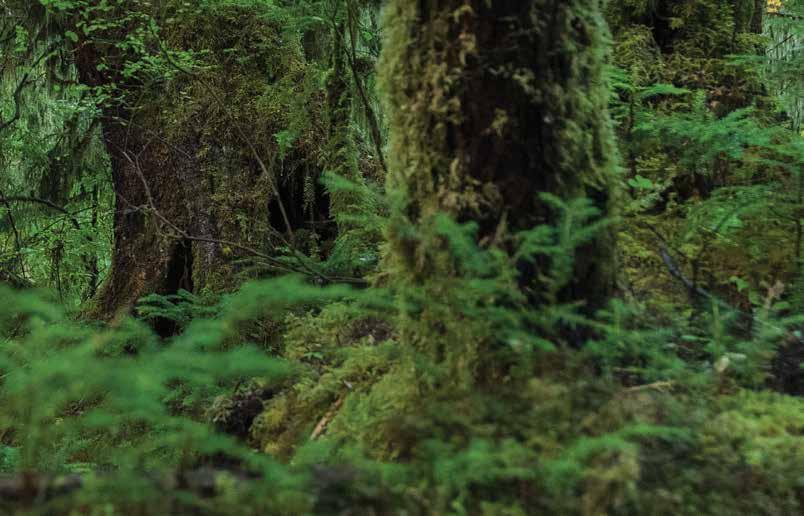
Spirit bears have white fur but black noses and paws — marking them as different to albino or polar bears. Kermode bears are actually a subspecies of black bears and are the result of a double recessive gene, similar to the phenomenon that results in red hair or blue eyes in humans. Found uniquely in this area of BC, it is estimated that there are only around 100 of them in the wild and that their gene occurs in one in every 40-100 black bears on BC’s mainland coast. This number rises to one in 10 on Princess Royal Island and one in three on Gribbell Island, in the traditional territory of the Gitga’at (git-gat). The Gitga’at are one of the 14 nations that make up the Tsimshian (sim-she-an) people of British Columbia’s central coast. The islands are only accessible by air or sea and are situated in remote wilderness that is around 800 km (497 mi) north of Vancouver and 228 km (142 mi) northwest of Bella Coola.
For a long time, the Spirit bears were considered a legend of the Gitga’at and Kitasoo (kit-ah-soo) people, based on the story of the time when the glaciers receded and Raven, creator of the rainforest, made one in 10 black bears white to remind people of the time when the earth was covered in ice and snow. Raven located these bears in the Great Bear Rainforest, where they can still be seen today.
55 Stories of the Cariboo Chilcotin Coast | landwithoutlimits.com
Kermode bear in the Great Bear Rainforest Destination BC/Yuri Choufour
Scientists believe that the white fur of the Spirit bears could have evolved as protection during the last ice age, when perhaps these bears were isolated from the mainland but survived and thrived due to the lack of predators. Today it’s estimated that 500 to 1,200 black bears might be carriers of the Kermode gene – it’s possible for two black bears to produce a white bear if they both carry the gene.
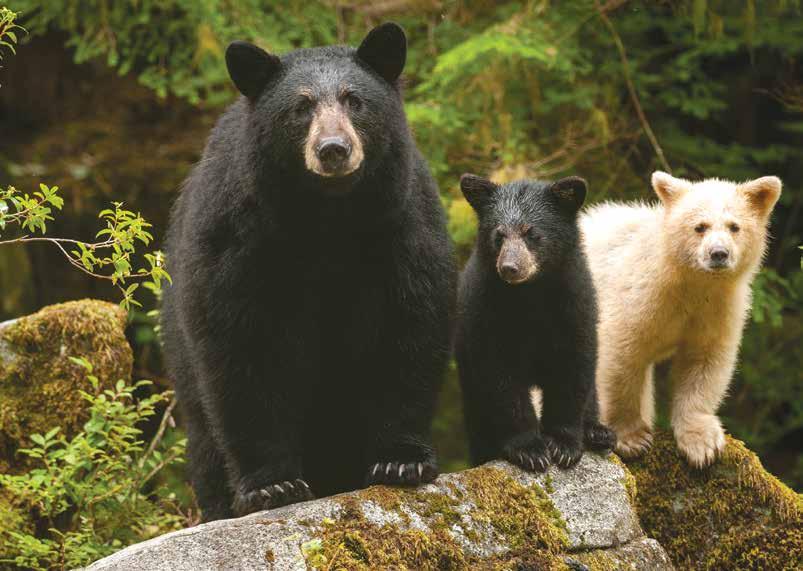
Spirit bears continue to have spiritual significance to the Indigenous people of the area, although for many years nobody would speak of the bears in order to protect them from hunters. The local Kitasoo people also tell the tale of a kidnapped woman who married her handsome captor, who was really a bear, and that they had three children with bear bodies and human faces. One of the offspring was white because the creator Raven made a deal with the bears long ago — after Raven shape-shifted into a child to learn how to make fire, the then-white Raven flew out of the hut via a smoke hole, covering himself with soot and remaining black. He then told the bears that some of them must remain white in his honour.
During the second half of the 1800s the Kitasoo merged with the Xai’xais (hay-hace) and founded the community of Klemtu, in a beautifully pristine cove on Swindle Island, close to Princess Royal and Gribbell islands, in the Inside Passage between BC and Alaska. With a small population of 420 people, the community is comprised of these two First Nations that speak different languages.
The village became a refueling stop for coastal steamers that needed wood and, today, fishing is the main industry here. Visitors can see the red cedar “Big House,” a traditional communal place for celebrations that features the village’s clan emblems of a raven, eagle, wolf and Orca (killer whale).
Spirit bears are deeply respected by the Indigenous peoples who share their traditional territory with the Kermode, and they are eager to share their knowledge and reverence for them through cultural tours, where you can take a sea safari or hike into the forests to spot wolves, whales and grizzlies; hear their stories and lessons; and hopefully catch a glimpse of these elusive creatures. ¤
Stories of the Cariboo Chilcotin Coast | landwithoutlimits.com 56
Great Bear Rainforest Ian McAllister/Pacific Wild


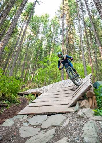
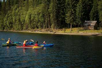


Stories of the Cariboo Chilcotin Coast | landwithoutlimits.com 57 Great Locations in the Cariboo Chilcotin Coast So Many Reasons to Stay*: Centrally located | Standard, kitchenette & executive suites available | Complimentary high speed Internet | Complimentary parking | Moxies | Rockford Bar & Grill | Denny's Restaurant with room service | Indoor pool & whirlpool | Fitness facilities | Meeting & banquet rooms | Business centre *Amenities vary by location For the best rates, book online at sandmanhotels.com or call 1-800-SANDMAN (726-3626) Sandman Signature Prince George Hotel Sandman Hotel & Suites Williams Lake Sandman Hotel & Suites Prince George CACHE CREEK | PRINCE GEORGE | QUESNEL | WILLIAMS LAKE Adventure in our backyard. tourismquesnel.com LIKELY COME EXPLORE BRITISH COLUMBIA EXPERIENCE WORLD CLASS NATURE & HISTORY IN THE HEART OF THE CARIBOO MOUNTAINS www.likely-bc.ca John Wellburn P r i v a t e L o g C a b i n R e n t a l s H o t s p r i n g a n d G l a c i a l F j o r d T o u r s W i l d e r n e s s W i l d l i f e T o u r s O c e a n F i s h i n g C h a r t e r s PRIVATE LOG CABIN RENTALS WILDERNESS WILDLIFE TOURS OCEAN FISHING CHARTERS HOT SPRING AND GLACIAL FJORD TOURS 250-982-0098 INFO@BCGRIZZLYTOURS.COM WWW.BCGRIZZLYTOURS.COM
EXPERiEncE:
Exploring the Great Bear Rainforest by water offers an intimate and unforgettable experience. Operators offer a variety of services, from scientific missions to relaxing sailboat cruises, traversing the protected channels.
10 km (6 mi) west of Namu and south of Bella Bella, the 123,000-ha (303,940ac) Hakai Luxvbalis (looks-bal-ease) Conservation Area offers some of the finest kayaking.
Visit greatbeartales.com for stories of BC's Great Bear Rainforest.
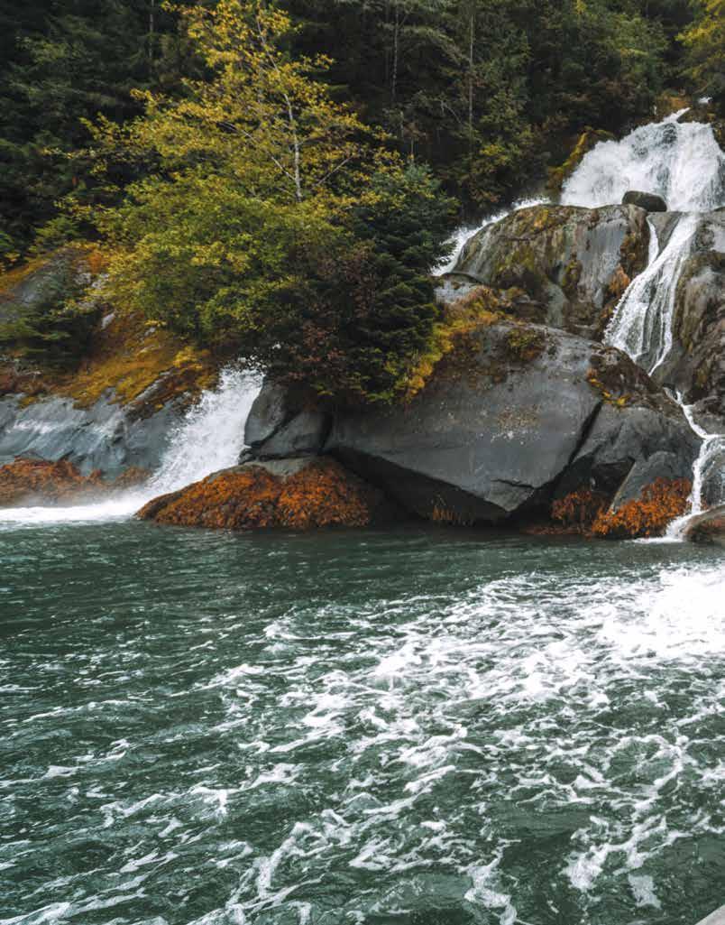
58 Stories of the
| landwithoutlimits.com
Cariboo Chilcotin Coast
Inlet Tour Near Bella Coola Tyler Cave
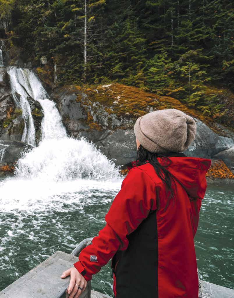
59
Stories of the Cariboo Chilcotin Coast | landwithoutlimits.com
know bEfore you go
Visitor centres & Booths
BC Visitor Centres and Booths offer friendly, professionally trained staff with local knowledge of attractions, activities, events and current seasonal road travel to help you make informed travel plans. They can also assist with accommodation, transportation and sightseeing tour bookings. Please refer to the map in the centre of this guide for locations of BC Visitor Centres and info booths throughout the region.
international Visitors to canada
Canadian law requires that all persons entering Canada carry both proof of citizenship and proof of identity. A valid US passport, passport card or NEXUS card satisfies these requirements for US citizens. Children under 16 need only present proof of US citizenship. Other international visitors to Canada must carry a valid passport and, if required, a visa. Visit the Citizenship and Immigration Canada website for a complete listing of countries whose citizens require visas to enter Canada. All other visitors should contact their Canadian consulate or embassy to learn which documents are required. To learn more about Canadian customs regulations, visit the Canada Border Services Agency website. Citizenship & Immigration Office: cic.gc.ca Canada Border Services Agency: cbsa.gc.ca
Ferry Travel
The region is accessed by multiple BC Ferries vessels. Depending on your destination, you may change vessels along the way. Reservations should be made well in advance for travel on the Inside Passage and Central Coast Connector routes to Great Bear Rainforest communities. Check with BC Ferries for current schedules and to book ahead. bcferries.com/schedules or bcferries.com/vacations
1-888-223-3779
Air Travel
Pacific Coastal Airlines services Williams Lake, Anahim Lake, Bella Coola and Bella Bella.
pacificcoastal.com
1-800-663-2872
Central Mountain Air services Quesnel and Williams Lake. flycma.com
1-888-865-8585
Wilderness Seaplanes offer both charter and scheduled service to a number of destinations along the central coast.
wildernessseaplanes.com
1-800-343-5963
Rail Travel
The Rocky Mountaineer’s Rainforest to Gold Rush route travels from Vancouver to Jasper, Alberta, through the historic Cariboo, with an overnight stop in Quesnel. Reservations are required. rockymountaineer.com
1-877-460-3200
Firearms in Canada
For information regarding the importation of firearms to Canada, contact the Canadian Firearms Centre at 1-800-731- 4000 from Canada, or from the US at 1-506-624-6626 from other locations. rcmp-grc.gc.ca/firearms
Watercraft Regulations
Everyone who operates a power-driven boat in Canada needs proof of competency — something that shows they understand the rules of the ‘road’ and how to safely operate a boat. The most common proof of competency is the Pleasure Craft Operator Card. For more information visit Transport Canada’s Office of Boating Safety online or call the safe boating line. tc.gc.ca/boatingsafety
1-800-267-6687
Recreational Vehicle Operation
Operators of recreational vehicles in BC are required to comply with provincial regulations. To ensure you are aware of current updates and requirements in your area, review websites regularly. Visit gov.bc.ca and search for off road vehicle management.
The following websites may provide helpful information for planning your visit to the region.
BC Driving Conditions
drivebc.ca or 1-800-550-4997
BC Wildfire Travel Advisories
The BC Wildfire Service provides up-to-date information on wildfire conditions. bcwildfire.ca
@BCGovFireInfo
@BCForestFireInfo
1-888-336-7378 (information line)
Parks & Camping bcparks.ca sitesandtrailsbc.ca
Fishing, Hunting, Wildlife
Check current regulations and restrictions: gov.bc.ca//gov/content/sports-culture/recreation goabc.org
Stories of the Cariboo Chilcotin Coast | landwithoutlimits.com 60
know before you go
Emergency contacts
Police, Fire, Ambulance, most of BC* 911
Bella Coola Police
Bella Coola Ambulance
Ambulance, from a satellite phone
1-250-799-5363
1-800-461-9911
1-250-374-5937
Ambulance, if 911 does not work* 0, ask for operator
*911 does not work in some areas, such as Bella Coola and backcountry areas
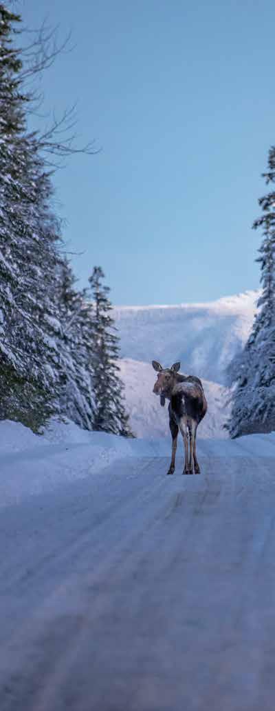
Emergency information
Emergency Info BC is the provincial source for information on ongoing emergency situations.
emergencyinfobc.gov.bc.ca
@emergencyinfobc
Evacuation alerts and orders
When a hazard poses a risk to the public, the government may issue evacuation notices. These come in two different levels: alerts and orders. For more information on evacuation notices, contact EmergencyInfoBC or the local government.
Evacuation Alert: An evacuation alert is issued when there is a chance that a hazard may become a threat to the area. You do not have to leave an area under an evacuation alert and can travel in and out of these areas normally. However, you should be ready to leave if the alert is upgraded.
Evacuation Order: An order is issued when there is an immediate threat to an area. When an order is issued, all people in the area must leave immediately. Please leave the area as soon as possible along the evacuation route.
Stories of the Cariboo Chilcotin Coast | landwithoutlimits.com 61
Moose near Wells Destination BC/Michael Bednar


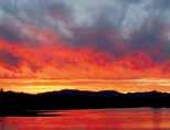

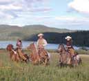


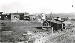
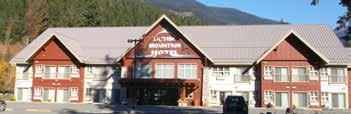

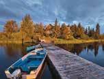


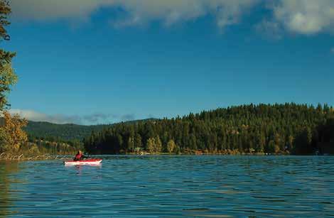


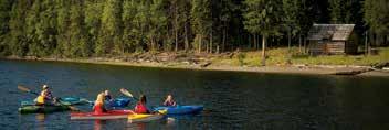
Stories of the Cariboo Chilcotin Coast | landwithoutlimits.com 62 DIRECTORY Cariboo • Bookkeeping • Strategic Planning •Financial Coaching • Tenure and License Applications www.afk-consulting.com• 250-217-6438 • info@afk-consulting.com Andre Kuerbis, CPB, I.C.I.A Principal Larry & Jerri New 3504 Hwy 97 Lac La Hache, BC P: 250.396.7109 F: 250.396.7129 info@crystalspringsresort.ca www.crystalspringsresort.ca Discover the Cariboo on the shore of Lac La Hache HIGH COUNTRY INN 6252 Cedar Creek Rd • Likely, BC • 250-790-2218 Motel & Restaurant • Open Year Round Pet Friendly • Free Wifi & Satellite TV Full Bathrooms in Every Room Modern. Clean. Quiet. Comfortable. www.likelyhighcountryinn.holiday likelyhighcountryinn@gmail.com www.likelyhighcountryinn.holiday likelyhighcountryinn@gmail.com A beautiful and affordable guest ranch near 100 Mile House. Log cabins, scenic trail rides for beginners and the more experienced. 10,000 aces of range surrounding a private lake. Open year round. 15 km from HWY 97 at 111 Mile. 5770 Spring Lake Rd. 1-877-791-5776 or 250-791-5776 info@springlakeranchcom www.springlakeranch.ca Spring Lake Ranch Spring Lake ranch A beautiful and affordable guest ranch directory ad Close to nature. Far from crowds. info@springlakeranch.com www.springlakeranch.com Chilcotin 3556 Puntzi Lake Rd Chilanko Forks BC www.barneyslakesideresort.com mail@barneyslakesideresort.com Barney’s Lakeside Resort On Site Restaurant • Open All Year museum of the cariboo www.eaglesnest-resort.com 250-742-3707 1-800-742-9055 Anahim Lake, BC Here you find wilderness and elegance Here you find wilderness and elegance LIKELY COME EXPLORE BRITISH COLUMBIA EXPERIENCE WORLD CLASS NATURE & HISTORY IN THE HEART OF THE CARIBOO MOUNTAINS likely-bc.ca John Wellburn


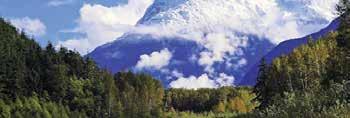

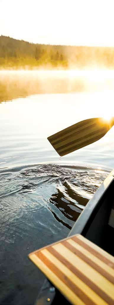
Stories of the Cariboo Chilcotin Coast | landwithoutlimits.com 63 Lake Front Cabins 12 RV Sites with partial or full hook ups A popular area destination, Puntzi Lake Bakery Cafe Join us in our restaurant, and check out our Gift Shop Join us for Puntzi Lake Fishing Derby July 8, 9, 10 info@woodlandsfishinresort.com www.woodlandsfishinresort.com 250-481-0011 • 250-230-5099 Coastal Adventures in the Heart of the Great Bear Rainforest www.bellacoola.ca info@bellacoola.ca (250)799-5202 (seasonal) Visitor Centre 442 MacKenzie St., Bella Coola Box 670, Bella Coola BC Canada V0T 1H0 1.888.982.0098 www.bcgrizzlytours.com 250.982.0098 Private Log Cabins at Resort Hotsprings and Glacial Fjord Tours Wilderness Wildlife Tours • Ocean Fishing Charters Bella Coola Grizzly ToursINCYour Guide to the Great Bear Rainforest for over 30 years Coast Chilcotin Experience the unspoiled natural beauty of the Chilcotin Coast with our Rough Road 4WD SUVs coolawheels@netbistro.com www.bellacoolavehiclerentals.com Bella Coola Airport Harbour and Hotel Pick up and Drop off available Cell/Text 250.957.7072 - Steve 250.302.9549-David CLEAN, SAFE, RELIABLE Paddling in the Cariboo Aaron Froese
Stories of the
Coast | landwithoutlimits.com 64
Cariboo Chilcotin

