Griffy Lake Nature Preserve Master Plan Monroe County, Indiana Summer 2008
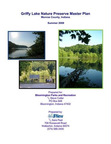
Prepared for: Bloomington Parks and Recreation c /o Steve Cotter PO Box 848 Bloomington, Indiana 47402 Prepared by: c
/o Sara Peel 708 Roosevelt Road Walkerton, Indiana 46574 (574) 586-3400
Griffy Lake Master Plan Update 2008 Monroe County, Indiana
August 13, 2008
GRIFFY LAKE NATURE PRESERVE MASTER PLAN UPDATE 2008 EXECUTIVE SUMMARY Bloomington Water Company, a public utility company, originated in 1923 with the intent to build a dam on Griffy Creek in an attempt to ease periodic water shortages caused by leaking reservoirs on the west side of Bloomington. The dam was constructed at its present location in 1924 and with it, Griffy Lake was born. By 1934, the City of Bloomington acquired ownership of the water treatment plant located adjacent to Griffy Lake and much of the surrounding property. In 1995, the Griffy Lake Water Treatment Plant was decommissioned; however, Griffy Lake remains as a back-up water supply to the City of Bloomington. The nature preserve was formed from more than 45 property acquisitions which occurred between 1922 and 2007. In total, the Griffy Lake Nature Preserve covers 1,180 acres including the 109-acre Griffy Lake and is located on the north side of Bloomington. Griffy Lake and the Griffy Lake Nature Preserve (GLNP) are City-owned and under the control of the City of Bloomington Utilities Services Board. An agreement between the Utilities Services Board and the Board of Parks and Recreation allows for activity development and recreational facility maintenance for the property to occur under the purview of the Board of Parks and Recreation. All activities which occur within the Griffy Lake Nature Preserve boundary are required to be compatible with the long-term strategy of using Griffy Lake as a drinking water source. Despite these controls, the Griffy Lake Nature Preserve is a popular destination for hiking, fishing, boating, wildlife observation, and other outdoor recreational activities. The overall goal of the Griffy Lake Nature Preserve Master Plan Update is two-fold: 1. To establish a consensus community vision, and 2. To develop strategies and a funding plan to protect and preserve Griffy Lake Nature Preserve for future generations. The GLNP Master Plan Update builds on the original Griffy Lake Long-Range Use and Management Plan with the intent of preserving the ecological integrity of the Griffy Lake Nature Preserve while providing recreational opportunities throughout the property. With these ideals in mind, JFNew and their team from Indiana University Bloomington, The Eppley Institute, Indiana State University, Indiana University Northwest, and Woolpert, Inc. developed a program to identify the natural features and resources; document changes in land use, development, and adjoining property influences; and determine user values with relation to recreational opportunities, facilities, land acquisition, and property expansion. These tasks were completed through a series of field visits, public user surveys, open houses or public meetings, and document reviews. All identified recommendations were discussed within the quarterly citizen steering committee meetings and were reviewed by the public during the project open houses. During the course of this project, JFNew team members identified more than 565 terrestrial plant species, including 15 state ETR-listed species; observed nearly 100 small mammal species; documented nearly 160 bird species; and documented nearly 50 reptile and amphibian species. Soil erosion sites throughout the GLNP, the Griffy Lake watershed, and along Griffy Lake’s shoreline were identified during the course of the project and were subsequently classified based on levels of severity. Additionally, user surveys and property-wide assessments were completed to determine the human-use factor associated with trails, parking, safety features, fishing, and other potential problem areas throughout the nature preserve. Survey results indicate that most respondents visited GLNP within the last month and that individuals travel less than 15 minutes to reach GLNP. Overall, GLNP rated as safe (98%) with most users living within the city of Bloomington (70%). Nearly 90% of respondents indicated that they use JFNew Project #070331.00
Page i
Griffy Lake Master Plan Update 2008 Monroe County, Indiana
August 13, 2008
GLNP for hiking or walking and that this is their primary activity and that they visit the nature preserve two or more times per week. In total, more than sixty-five options were recommended to protect and improve water quality within Griffy Lake and to enhance and expand the experience of visiting Griffy Lake Nature Preserve over the next 10 years (2009-2019). Some specific recommendations include the following: • Implement watershed-based water quality improvement projects; • Increase programming efforts and coordinate these efforts with Monroe County and Indiana University; • Implement exotic, invasive species control and protection of high quality plant communities; • Stabilize Griffy Lake’s shoreline and implement GLNP-wide efforts to reduce erosion and sedimentation to Griffy Lake; • Continue efforts to monitor Griffy Lake’s aquatic plant community and the impacts of lake-wide treatment of the exotic plant community on Griffy Lake’s biota; • Install consistent signage throughout the Griffy Lake Nature Preserve with a focus on safety and information conveyance; • Address severely eroded trail areas including those impacted by dog-human overuse and provide fishing access along Griffy Lake’s shoreline; • Establish safety measures and alternate transportation routes for individuals traveling to and from Griffy Lake Nature Preserve; and • Close the dog exercise area located within Griffy Lake Nature Preserve.
JFNew Project #070331.00
Page ii
Griffy Lake Master Plan Update 2008 Monroe County, Indiana
August 13, 2008
ACKNOWLEDGEMENTS The Griffy Lake Nature Preserve Master Plan Update was made possible with funding from the City of Bloomington Utilities and Bloomington Parks and Recreation Department. The Griffy Lake Nature Preserve Master Plan Update was completed by JFNew and their team, which included The Eppley Institute, Bill Jones with Indiana University School of Public and Environmental Affairs, John Whittaker and his team at Indiana State University, Spencer Cortwright at Indiana University Northwest, Susan and Jim Hengeveldt at Indiana University Bloomington, and James Dobrozsi at Woolpert, Inc. Contributors to this study included Angela Sturdevant and Doug Keller with the IDNR Division of Fish and Wildlife; Ron Hellmich with the IDNR Division of Nature Preserves; and Nate Long, with Aquatic Control, Inc. Thanks to Rob Serbent for providing trails expertise and Alex Harrington for trails expertise and assistance with survey interviews. Special thanks to the dedicated staff of Bloomington Parks and Recreation, City of Bloomington Utilities, and the Steering Committee members for their initiative and assistance in getting this study completed. Authors of this report included Sara Peel, Scott Namestnik, Aaron Johnson, and Betsy Ewoldt with JFNew; Bill Jones, Spencer Cortwright, Susan and Jim Hengeveldt, and Elizabeth Boseker with Indiana University; Andrea Titzer and John Drew with The Eppley Institute; Brianne L. Walters, Ronny Eidels, and John O. Whitaker, Jr. with Indiana State University; and James Dobrozsi with Woolpert.
JFNew Project #070331.00
Page iii
Griffy Lake Master Plan Update 2008 Monroe County, Indiana
August 13, 2008
TABLE OF CONTENTS PAGE 1.0 1.1 1.2 1.3
Introduction ....................................................................................................................... 1 History of Griffy Lake Nature Preserve ............................................................................. 1 Physical Characteristics .................................................................................................... 1 Scope of Study .................................................................................................................. 3
2.0 2.1 2.2 2.3
Environmental Resources ................................................................................................. 4 Geologic History ................................................................................................................ 4 Topography ....................................................................................................................... 4 Soils .................................................................................................................................. 6
3.0 3.1
Past Activities .................................................................................................................. 10 1984 Plan Details ............................................................................................................ 10
4.0 4.1 4.2 4.3
Adjoining Property Influences ......................................................................................... 12 Adjacent Land Use Changes Since 1984 ....................................................................... 12 Adjacent Land Use Effects .............................................................................................. 17 IURTP Collaboration Opportunities ................................................................................. 25
5.0 5.1 5.2 5.3 5.4 5.5
Land Acquisition and Protection ...................................................................................... 28 Adjacent Land Use Zoning .............................................................................................. 28 Sensitive Habitat Protection ............................................................................................ 33 Land Acquisition Recommendations ............................................................................... 35 Acquisition Alternatives ................................................................................................... 36 Nature Preserve Classification Review and Expansion .................................................. 37
6.0 6.1 6.2 6.3 6.4 6.5
Natural Features Inventory .............................................................................................. 38 Natural Community Survey ............................................................................................. 38 Mammal Community Inventory ....................................................................................... 58 Bird inventory .................................................................................................................. 62 Amphibian and Reptile Inventory .................................................................................... 68 Soil Erosion Survey ......................................................................................................... 75
7.0 7.1 7.2 7.3 7.4 7.5 7.6 7.7
Griffy Lake Inventory ....................................................................................................... 81 Mercury Assessment ....................................................................................................... 81 Bathymetric Survey Results ............................................................................................ 83 Sedimentation Rate Determination ................................................................................. 84 Water Quality Assessment .............................................................................................. 85 Aquatic Plant Community Assessment ........................................................................... 89 Fish Community Assessment .......................................................................................... 94 Water Level Management Assessment .......................................................................... 94
8.0 8.1 8.2 8.3 8.4 8.5
User Group and Property Use Profiles ............................................................................ 95 Hiking Use Evaluation ..................................................................................................... 98 Trail Runner/Jogger Evaluation ....................................................................................... 98 Fishing Use Evaluation ................................................................................................... 99 Boating Use Evaluation .................................................................................................. 99 Dog Impact Evaluation .................................................................................................... 99
JFNew Project #070331.00
Page iv
Griffy Lake Master Plan Update 2008 Monroe County, Indiana
August 13, 2008
PAGE 8.6 8.7 8.8 8.9
Boat Rental and Launch Fee Assessment .................................................................... 102 Programming Assessment ............................................................................................ 105 Nature Center Feasibility and Desirability Evaluation ................................................... 111 Friends of Griffy ............................................................................................................. 112
9.0 9.1 9.2 9.3 9.4 9.5 9.6
Facilities and Infrastructure Assessment ...................................................................... 113 Griffy Filtration Plant Condition Evaluations .................................................................. 113 Parking Facility Evaluation ............................................................................................ 115 Off-road Vehicle Access Point Location and Determination of Use .............................. 120 Bicycle and Pedestrian Facility Assessment ................................................................. 122 Trail System Update and Re-route Evaluation .............................................................. 125 Visitor Risk Assessment and User Safety Improvement ............................................... 139
10.0 10.1 10.2
Public Participation ........................................................................................................ 141 Steering Committee ...................................................................................................... 141 Open Houses/Public Meetings ...................................................................................... 141
11.0
Recommendation Review and Implementation Goals .................................................. 141
12.0
Literature Cited .............................................................................................................. 152
JFNew Project #070331.00
Page v
Griffy Lake Master Plan Update 2008 Monroe County, Indiana
August 13, 2008
LIST OF TABLES PAGE Table 1. Table 2. Table 3. Table 4.
Land use changes in the Griffy Lake watershed, 1992 to 2005. ................................ 12 Environmental Constraints Overlay (ECO) building limitations and requirements ..... 33 ETR/Watch list plant species observed at Griffy Lake Nature Preserve in 2007 ........ 50 Small mammals trapped at Griffy Lake Nature Preserve, June 14 to July 23, 2007 .............................................................................................................. 61 Table 5. Bird species observed at Griffy Lake Nature Preserve from April 2007 through April 2008 seasonal surveys ......................................................................... 62 Table 6. Advisory Groups of the Indiana Fish Consumption Advisory ..................................... 81 Table 7. Summary of historic data for Griffy Lake .................................................................... 85 Table 8. Annual and daily boat launch permits sold at Griffy Lake Nature Preserve ............. 103 Table 9. Comparative boat rental fees for Griffy Lake Nature Preserve, state-owned, and privately-owned boat liveries........................................................ 103 Table 10. Boat rental fees for selected Indiana boat liveries. ................................................... 104 Table 11. Griffy boat rental hours, fees and revenue for rentals at Griffy Lake, 1998-2007..... 105 Table 12. Paid programs held at Griffy Lake Nature Preserve in 2007 .................................... 107 Table 13. Free educational programs held at Griffy Lake Nature Preserve in 2007 ................ 108 Table 14. Locations offering programming throughout the state of Indiana ............................. 108 Table 15. Volunteer programs, volunteer hours, and number of volunteers for Griffy Lake Nature Preserve programs, 2007...................................................... 110 Table 16. Boathouse parking lot car counts, Griffy Lake Nature Preserve, 2004 to 2007........ 117 Table 17. Critical risks present at Griffy Lake Nature Preserve ................................................ 139 Table 18. Capital expenditures recommended to occur at Griffy Lake Nature Preserve from 2009 to 2019 ..................................................................................... 147 Table 19. Operational expenditures recommended to occur at Griffy Lake Nature Preserve from 2009 to 2019 ..................................................................................... 148 Table 20. Policy updates recommended to occur at Griffy Lake Nature Preserve from 2009 to 2019 .................................................................................................... 150
JFNew Project #070331.00
Page vi
Griffy Lake Master Plan Update 2008 Monroe County, Indiana
August 13, 2008
LIST OF FIGURES PAGE Figure 1. Figure 2. Figure 3. Figure 4. Figure 5. Figure 6. Figure 7. Figure 8. Figure 9. Figure 10. Figure 11. Figure 12. Figure 13. Figure 14. Figure 15. Figure 16. Figure 17. Figure 18.
Figure 19. Figure 20. Figure 21. Figure 22. Figure 23. Figure 24. Figure 25. Figure 26. Figure 27. Figure 28. Figure 29. Figure 30. Figure 31. Figure 32.
Griffy Lake Nature Preserve boundary ..................................................................... 2 Griffy Lake watershed boundary .............................................................................. 3 Topographical map of the Griffy Lake watershed ..................................................... 5 Slope variation within the Griffy Lake watershed. .................................................... 6 Soil formations and units present within the Griffy Lake Nature Preserve ............... 8 Soil erodibility (highly erodible and potentially highly erodible soils) within the Griffy Lake watershed ........................................................................................ 9 Hydric soils present within the Griffy Lake watershed ............................................ 10 Land use categories for the Griffy Lake watershed, 1992 ...................................... 13 Land use categories for the Griffy Lake watershed, 2005 ...................................... 14 The Meadowood Retirement Community development represents the major land use change in the southern watershed since 1975 .............................. 15 Development in the southeastern part of Griffy Lake’s watershed since 1975 ...... 16 Water quality-based problem areas identified within the Griffy Lake watershed, March 2008 ......................................................................................... 17 Streambed and bank erosion along Griffy Creek adjacent to Lanam Road ........... 18 Runoff from the Indiana University (IU) Foundation drains via a rip-rap lined ditch but substantial erosion is apparent where the rip-rap ends .......................... 18 Runoff from the IU Motor Pool and Auxiliary Library Facility contribute to standing water along Range Road ........................................................................ 19 A gravel road to the storage area at the new IU Physical Plant building is unstable and erodes into Griffy Creek ................................................................... 20 Equipment storage area leveled with fill dirt left a steep, unprotected embankment that erodes into Griffy Creek ............................................................ 20 The new development at Grammercy Park sits on the edge of the Griffy Lake watershed. Such developments have the potential to increase water runoff, sediment loading, and nutrient loading .................................................................. 21 The IU Golf Course lies within the South Fork Griffy Creek watershed.................. 22 University Lake is a hypereutrophic reservoir that receives drainage from the IU Golf Course ................................................................................................. 22 The unprotected horse manure pile at the Devonshire equestrian facility ............. 23 Clogged water control structure in the Tamarron retention basin .......................... 24 Eroded Tamarron retention pond outlet ................................................................. 24 Indiana University Research and Teaching Preserve (IUIURTP) boundaries ........ 25 Deer heavily browsed the understory in the foreground in contrast to the exclosure in the background .................................................................................. 26 Selected issues of interest to both the GLNP and IURTP ...................................... 28 Zoning designations surrounding Griffy Lake Nature Preserve .............................. 29 Environmental Constraints Overlay (ECO) within the Griffy Lake Nature Preserve and Griffy Lake watershed ..................................................................... 32 Sensitive Habitat Areas mapped in Griffy Lake Nature Preserve ........................... 34 Existing dedicated State Nature Preserve boundaries within the Griffy Lake Nature Preserve ..................................................................................................... 37 Plant communities mapped at Griffy Lake Nature Preserve, May, June, and September 2007 .................................................................................................... 41 Terrestrial exotic and invasive species mapped within Griffy Lake Nature Preserve, May, June, and September, 2007 ......................................................... 54
JFNew Project #070331.00
Page vii
Griffy Lake Master Plan Update 2008 Monroe County, Indiana
August 13, 2008
PAGE Figure 33. Figure 34.
Figure 35. Figure 36. Figure 37. Figure 38. Figure 39. Figure 40. Figure 41. Figure 42. Figure 43. Figure 44. Figure 45. Figure 46. Figure 47. Figure 48. Figure 49. Figure 50. Figure 51.
Figure 52. Figure 53. Figure 54. Figure 55. Figure 56. Figure 57. Figure 58. Figure 59.
Prioritized recommendations for exotic, invasive species control at Griffy Lake Nature Preserve .................................................................................. 56 Deployed trap locations used during mammal surveys completed in 2007 at Griffy Lake Nature Preserve. Numbered dots indicate trapping locations, while numbers preceded by a C indicate sunken can lines, and numbers preceded by N indicate a net site. .......................................................................................... 60 Lakeshore/beach area............................................................................................ 67 Signage at boathouse parking lot ........................................................................... 67 Streambed and bank erosion areas identified throughout Griffy Lake Nature Preserve, May and September 2007 ...................................................................... 76 Streambank erosion occurring within tributaries to Griffy Lake on the Griffy Lake Nature Preserve, May and September, 2007 ...................................... 78 Streambank erosion occurring within tributaries to Griffy Lake on the Griffy Lake Nature Preserve, May and September, 2007 ...................................... 78 Streambank erosion occurring within tributaries to Griffy Lake on the Griffy Lake Nature Preserve, May and September, 2007 ...................................... 78 Streambank erosion occurring within tributaries to Griffy Lake on the Griffy Lake Nature Preserve, May and September, 2007 ...................................... 78 Shoreline erosion rating for the shoreline of Griffy Lake, October 2007 ................ 79 Severely eroding shoreline documented along Griffy Lake’s shoreline, October 2007.......................................................................................................... 79 Severely eroding shoreline documented along Griffy Lake’s shoreline, October 2007.......................................................................................................... 79 Exposed roots and recently eroded soil within Griffy Lake along the shoreline adjacent to the dog exercise area .......................................................................... 80 Exposed roots and recently eroded soil within Griffy Lake along the shoreline adjacent to the dog exercise area .......................................................................... 80 Moderately eroding shoreline documented along Griffy Lake’s shoreline, October 2007.......................................................................................................... 80 Moderately eroding shoreline documented along Griffy Lake’s shoreline, October 2007.......................................................................................................... 80 Sediment erosion areas identified within Griffy Lake Nature Preserve, May and September, 2007 ............................................................................................. 81 Sediment erosion areas identified within Griffy Lake Nature Preserve, May and September, 2007 ............................................................................................. 81 Change in lake depth over time. Filled polygons indicate the updated (2008) draft lake bottom contours in 5-foot increments; lines represent the previous lake contours in 4-foot increments ......................................................................... 84 Historic Secchi disk transparency data for Griffy Lake ........................................... 86 Historic total phosphorus concentrations measured in Pretty Lake. ...................... 87 Total phosphorus and chlorophyll a concentrations measured in Griffy Lake, 1991 to 2007 .......................................................................................................... 88 Docks adjacent to the boat ramp during typical conditions and during an 1.5-inch rain event, March 2008 ............................................................................. 89 Docks adjacent to the boat ramp during typical conditions and during an 1.5-inch rain event, March 2008. ............................................................................ 89 Areas of Griffy Lake targeted for curly-leaf pondweed treatment in 2008 .............. 91 Primary activities of GLNP users ............................................................................ 97 Users at the Griffy Lake Nature Preserve dog exercise area .............................. 100
JFNew Project #070331.00
Page viii
Griffy Lake Master Plan Update 2008 Monroe County, Indiana
August 13, 2008
PAGE Figure 60. Figure 61. Figure 62. Figure 63. Figure 64. Figure 65. Figure 66. Figure 67. Figure 68. Figure 69. Figure 70. Figure 71. Figure 72. Figure 73. Figure 74. Figure 75. Figure 76. Figure 77. Figure 78. Figure 79. Figure 80. Figure 81. Figure 82. Figure 83. Figure 84. Figure 85. Figure 86. Figure 87. Figure 88. Figure 89. Figure 90.
Dog-related issues identified at Griffy Lake Nature Preserve including shoreline erosion, swimming in Griffy Lake, and off-leash dogs .......................... 101 Dog-related issues identified at Griffy Lake Nature Preserve including shoreline erosion, swimming in Griffy Lake, and off-leash dogs .......................... 101 Dog-related issues identified at Griffy Lake Nature Preserve including shoreline erosion, swimming in Griffy Lake, and off-leash dogs .......................... 101 Erosion and compaction resulting from high-density use within the dog exercise area ........................................................................................................ 101 Educational kiosk at Brown County State Park .................................................... 111 Parking and off-road vehicle access areas .......................................................... 116 Boathouse parking lot at Griffy Lake Nature Preserve ......................................... 117 Roadside parking along Headley Road near the North Shore trailhead............... 118 Flooding in dam parking lot, 2/1/08 ...................................................................... 119 Dirt mound blocking off-road vehicle access to Griffy Lake Nature Preserve, north point Hiking Trail near the boathouse parking lot ........................................ 120 Evidence of ORV or other heavy access at hill adjacent to Lanam Road entrance to GLNP ................................................................................................. 121 Bike rack at the boathouse ................................................................................... 122 Boardwalk at boathouse ....................................................................................... 123 Existing and proposed bike and pedestrian connector routes from the City and County to Griffy Lake Nature Preserve ........................................................ 124 Griffy Lake Nature Preserve trail map .................................................................. 126 North Shore hiking trail, Griffy Lake Nature Preserve .......................................... 127 North Shore hiking trail, Griffy Lake Nature Preserve .......................................... 127 Stairs at boathouse parking lot ............................................................................. 128 Bridge on hiking trail ............................................................................................. 128 Boardwalk bridge near Wetland/ Hiking trail trailhead .......................................... 129 Metal post on trail at Griffy Lake Nature Preserve ............................................... 129 Logs installed to maintain downhill edge of trail ................................................... 130 Steep grades on the Hiking Trail .......................................................................... 131 Steep grades on the Hiking Trail .......................................................................... 131 A secondary trail shoots off of the Hiking Trail ..................................................... 132 Grade reversal on Nature Trail ............................................................................. 133 Out-sloping in Brown County State Park .............................................................. 134 Log maintaining downside edge of trail ................................................................ 135 Retaining wall at Brown County State Park .......................................................... 136 Signage at the boathouse parking lot with incomplete trail information................ 138 Architectural design for boathouse boardwalk along the south side of the causeway (Jones et al., 1984) .............................................................................. 140
JFNew Project #070331.00
Page ix
Griffy Lake Master Plan Update 2008 Monroe County, Indiana
August 13, 2008
LIST OF APPENDICES Appendix A. Appendix B. Appendix C. Appendix D. Appendix E. Appendix F. Appendix G. Appendix H. Appendix I. Appendix J. Appendix K. Appendix L. Appendix M.
Endangered, Threatened, and Rare Species List 2007 Plant Community Inventory Master Species List Exotic Plant Species Control Techniques Small Mammals Trapping Results Bird Observations by Seasons Historic Water Quality Data User Survey Questions and Results Friends of Griffy Planning Information Historic Building Status Memo Griffy Focus Group Results Steering Committee Minutes Public Meetings/Open Houses
JFNew Project #070331.00
Page x
Griffy Lake Master Plan Update 2008 Monroe County, Indiana
1.0
August 13, 2008
INTRODUCTION
1.1 History of Griffy Lake Nature Preserve Bloomington Water Company, a public utility company, originated in 1923 with the intent to build a dam on Griffy Creek in an attempt to ease periodic water shortages caused by leaking reservoirs on the west side of Bloomington (League of Women Voters, 1971). The dam was constructed at its present location in 1924 and with it, Griffy Lake was created. By 1934, the City of Bloomington acquired ownership of the water treatment plant located adjacent to Griffy Lake and much of the surrounding property. At that time, the dam was increased in size to reach 44 feet in height (644 feet mean sea level) and measures 900 feet in length holding approximately 1,280 acre-feet of water storage. In 1984, the Griffy Lake Water Treatment Plant processed 7.5 million gallons per day (Jones et al., 1984). In 1995, the Griffy Lake Water Treatment Plant was decommissioned; however, Griffy Lake remains as a back-up water supply to the City of Bloomington, while the Griffy Lake Nature Preserve (GLNP) is a popular destination for hiking, fishing, boating, wildlife observation, and other outdoor recreational activities. Griffy Lake and the Griffy Lake Nature Preserve are City-owned and under the control of the City of Bloomington Utilities Services Board. An agreement between the Utilities Services Board and the Board of Parks and Recreation allows for activity development and recreational facility maintenance for the property to occur under the purview of the Board of Parks and Recreation. All activities which occur within the Griffy Lake Nature Preserve boundary are required to be compatible with the long-term strategy of using Griffy Lake as a drinking water source. Nonetheless, Griffy Lake Nature Preserve is a very popular destination for area residents. In fact, the Community Attitude and Interest Citizen Survey, Findings Report, conducted for the City of Bloomington, Park and Recreation Department by Leisure Vision in December 2006 found that: • 32% of respondent households visited GLNP over the past 12 months (2006); • 24% of respondent households chose GLNP as one of the top three parks they visit most often. These data suggest that Griffy Lake Nature Preserve is one of the choice destinations in the area and that it is likely to experience continued use in the near future. 1.2 Physical Characteristics In total, the Griffy Lake Nature Preserve covers 1,180 acres including the 109 acre Griffy Lake on the north side of Bloomington (Figure 1). The Nature Preserve was formed from more than 45 property acquisitions which occurred between 1922 and 2007. A portion of the property is a state nature preserve that was dedicated in 1991. Indiana University owns approximately 1,100 acres within the Griffy Lake watershed. All of this property is located on the south side of the Griffy Lake Nature Preserve and includes the area immediately south of Griffy Lake contained within the Indiana University Research and Teaching Preserve (IURTP). Property acquisition is on-going and as a point of reference, all surveys and property documentation occurred within the Griffy Lake Nature Preserve boundary as of May 2007. The Griffy Lake Nature Preserve is almost entirely contained within the Griffy Lake watershed, which stretches out to the east and south of the lake. The Griffy Lake watershed covers approximately 5,160 acres (Figure 2).
JFNew Project #070331.00
Page 1
Griffy Lake Master Plan Update 2008 Monroe County, Indiana
August 13, 2008
Figure 1. Griffy Lake Nature Preserve boundary.
JFNew Project #070331.00
Page 2
Griffy Lake Master Plan Update 2008 Monroe County, Indiana
August 13, 2008
Figure 2. Griffy Lake watershed boundary. 1.3 Scope of Study The overall goal of the current project is two-fold: 1. To establish a consensus community vision, and 2. To develop strategies and a funding plan to protect and preserve Griffy Lake Nature Preserve for future generations. The current project builds on the original Griffy Lake Long-Range Use and Management Plan with the intent of preserving the ecological integrity of the Griffy Lake Nature Preserve while providing recreational opportunities throughout the property. With these ideals in mind, JFNew and their team from Indiana University Bloomington, The Eppley Institute, Indiana State University, Indiana University Northwest, and Woolpert, Inc. developed a program to identify the natural features and resources; document changes in land use, development, and adjoining property influences; and determine user values with relation to recreational opportunities, facilities, land acquisition, and property expansion. These tasks were completed through a series of field visits, public user surveys, open houses or public meetings, and through document review. All identified recommendations were discussed within the quarterly citizen steering committee meetings and were reviewed by the public during the project open houses. This report documents all surveys and reviewed items, and provides recommendations and estimated costs for future implementation efforts at Griffy Lake Nature Preserve.
JFNew Project #070331.00
Page 3
Griffy Lake Master Plan Update 2008 Monroe County, Indiana
August 13, 2008
2.0 ENVIRONMENTAL RESOURCES Although the environmental resources were thoroughly reviewed in the Griffy Lake Long-Range Use and Management Plan, these items are detailed again herein as they form the foundation for all ecological and recreational activities which occur on the GLNP. As such, these environmental resources also demarcate constraints for the site with regards to potential recreational and land use options. 2.1 Geologic History As detailed by Jones et al. (1984), the Griffy Lake watershed, and thus the Griffy Lake Nature Preserve, is considered highly dissected. This results in the exposure of Mississippian Age siltstone and shale of the Borden Group along with exposure of overlying Harrodsburg, Salem, and St. Louis limestones. The dissection is a result of lying south of the glacial boundaries within Indiana. This means that the substrate present is typically eroded bedrock which is sometimes covered by thin soils. The Griffy Lake Nature Preserve is located within the Norman Upland bedrock physiographic unit (Schneider, 1966). Flat-topped narrow divides, steep slopes, and deep V-shaped valleys characterize the Norman Upland. Schneider (1966) details the typical small stream patterns within this physiographic unit, like the branches of Griffy Creek, as possessing narrow or absent floodplains with steep slopes and characterizes larger streams as being marked by narrow, flat valleys with small floodplains. The dendritic drainage system that occurs within the Griffy Lake watershed is typical of watershed patterns within the Norman Upland. Gray (2000) further characterizes the Norman Upland as rugged topography with high relief where the extensive dissection of ridges and the deeply entrenched stream channels present in the Griffy Lake watershed and Griffy Lake Nature Preserve are commonplace within the Norman Upland. The Griffy Lake watershed lies near the boundary of the Mitchell Karst Plain and the Brown County Hills Sections of the Highland Rim Natural Region (Homoya et al., 1985). The Mitchell Karst Plain Section is characterized by the karst plain, which is relatively level, although limestone cliffs and rugged hills are present in some areas, especially near the periphery of the section. Soils are generally well-drained silty loams derived from loess and weathered limestone. The Highland Rim Natural Region is unglaciated with large expanses of karst topography, including rugged hills and cliffs. The region was largely forested with small limestone and siltstone glades and gravel wash communities typically occurring in presettlement times. The Brown County Hills Section is specifically known for deeply dissected uplands which cover siltstone, shale, and sandstone. The soils within this section are typically thin, acid silt loams and bedrock is near the surface. The Griffy Lake Nature Preserve fits well into the characterization of the Brown County Hills Section of the Highland Rim Natural Region. 2.2 Topography The topography of the Griffy Lake watershed and the Griffy Lake Nature Preserve is typical of the area. The highest areas of the watershed lie along the watershed’s headwaters reaching elevations greater than 800 feet above mean sea level. Griffy Lake, elevation 633 feet above mean sea level, is the lowest point in the watershed. Figure 3 presents a topographical relief map of the Griffy Lake watershed.
JFNew Project #070331.00
Page 4
Griffy Lake Master Plan Update 2008 Monroe County, Indiana
August 13, 2008
Figure 3. Topographical map of the Griffy Lake watershed. The Griffy Lake watershed is characterized by relatively steep slopes. Slopes range from 0% to nearly 75%. The shallowest slopes, those measuring less than 2%, are located along ridgetops or in bottom valleys of the larger streams. Slopes increase below ridgetops to approximately two-thirds of the way along the entrenched stream channels. Here, surface slopes measure 9 to 27%. The highest slopes occur along the sandstone bedrock in the eastern portion of the watershed and are specifically located along the lake’s shoreline (Figure 4). The impact of the variations in slope on the watershed and nature preserve’s soils, flora, and fauna will be discussed in further detail in subsequent sections.
JFNew Project #070331.00
Page 5
Griffy Lake Master Plan Update 2008 Monroe County, Indiana
August 13, 2008
Figure 4. Slope variation within the Griffy Lake watershed. 2.3 Soils The soils in the watershed consist mainly of silt loam with small percentages of sand and clay. Silt loam, or loess, soils are small, measuring 0.002 to 0.05 mm in diameter, and are easily transported by wind and water action. Because of these properties, soils within the Griffy Lake watershed and Griffy Lake Nature Preserve are relatively thin near stream channels and are only moderately deep on ridgetops or along moderately sloped areas. The soils within the watershed are also acidic due to their development under forested cover. Based on maps provided by Thomas (1981), the following soil series are located within the Griffy Lake watershed:
Bedford silt loam soils: These soils are found on ridgetops in the eastern portion of the watershed, are moderately deep (48 to 96 inches to bedrock), with a moderately deep impermeable layer measuring 20 to 36 inches deep, and loess cap 20 to 50 inches thick. Bedford silt loam soils formed in loess and limestone residuum.
Berks-Weikert silt loam soils: Berks-Weikert silt loam soils are found on the lowermost slopes (25 to 75% slopes) and are typically shallow measuring 10 to 40 inches to bedrock with coarse fragments at the base. These soils developed in siltstone and shale.
JFNew Project #070331.00
Page 6
Griffy Lake Master Plan Update 2008 Monroe County, Indiana
August 13, 2008
Bonnie silt loam soils: These soils formed in acid, silty alluvium on typically inundated floodplains. These soils are typically deep, measuring up to 50 inches deep, and are typically poorly drained and moderately slowly permeable.
Burnside silt loam soils: These soils formed on floodplains which are occasionally inundated. Burnside silt loam soils are moderately deep (40 to 54 inches to bedrock) with substantial coarse fragments due to their formation on coarse alluvium.
Crider silt loam soils: These soils formed on ridgetops and upper sideslopes (typically 2 to18% slopes), are moderately deep (60 to 100 inches) with a loess cap measuring 20 to 45 inches thick. These soils formed in loess and limestone residuum.
Caneyville silt loam soils: These soils are found at the heads of stream channels and along north facing slopes. Caneyville silt loam soils are shallow measuring 20 to 40 inches to bedrock with coarse base fragments. This soil formed in limestone residuum.
Hagerstown silt loam: These soils are found near the heads of stream channels or along midslope areas (4 to 35% slopes) and are typically moderately deep (40 to 60 inches to bedrock) with a loess cap measuring 5 to 20 inches thick and coarse fragments at its base. Like most of the other watershed soils, Hagerstown silt loam formed in limestone residuum.
Haymond silt loam soils: Haymond silt loam soils formed in silty alluvium on floodplains which are often inundated. These soils are typically deep measuring up to 60 inches to bedrock, somewhat poorly drained, and are moderately permeable.
Gilpin silt loam: These soils are found along lower mid-slope areas (12 to 25% slopes) and are shallow (20 to 40 inches to bedrock) with coarse fragments at the base. Unlike many of the other soils in the watershed, Gilpin silt loam soils formed on siltstone and shale. The soils at the Griffy Lake Nature Preserve are within the Berks-Weikert, Crider-Caneyville, and Haymond-Stendal soil map units (Thomas, 1981). Eleven soil units are present on the site (Figure 5). The most common soils on the site are Berks-Wiekert complex, 25-75% slopes; Caneyville silt loam, 12-18% slopes; Crider silt loam, 2-6% slopes; Crider silt loam, 6-12% slopes, and Hagerstown silt loam, 12-18% slopes. The soil units at the site can be generally split into three groups: soils formed in alluvium; soils formed in sandstone, siltstone, and shale residuum; and soils formed in limestone residuum (Thomas, 1981). In general, the soils formed in alluvium are present in the floodplains, the soils formed in sandstone, siltstone, and shale residuum are present on the steep slopes, and the soils formed in limestone residuum are present on the terraces (Figure 5). Because of the chemical makeup of underlying substrate and soil forming processes, soils formed in sandstone, siltstone, and shale residuum are shallow, dry, and acidic in nature, while those formed in limestone residuum are generally deeper, more moist, and neutral or alkaline. The soil chemistry has influenced the formation of the vegetation communities on the site. The specifics of this process will be detailed further in the natural community survey section of this report.
JFNew Project #070331.00
Page 7
Griffy Lake Master Plan Update 2008 Monroe County, Indiana
August 13, 2008
Figure 5. Soil formations and units present within the Griffy Lake Nature Preserve. 2.3.1 Highly Erodible Soils As detailed by Jones et al. (1984), slope and the threat of erosion are the two greatest constraints placed on the Griffy Lake watershed and nature preserve. The best assessment for soil erosion concern relates to classification of soils by their erodibility. Specifically, soils are classified as highly erodible soils, potentially highly erodible soils, or neither. As implied by the name, highly erodible soils are the easiest to erode from the land surface. While potentially highly erodible soils (PHES) are also in danger of erosion, their potential is not as high as highly erodible soils (HES). As Figure 6 indicates, highly erodible soils cover a substantial portion (4750 acres or nearly 92%) of the Griffy Lake watershed. This acreage is spread throughout the watershed. Additionally, highly erodible soils cover nearly 78% of the Griffy Lake Nature Preserve. The highly erodible soils cover most areas of the watershed that are not covered by water or located within the wetland adjacent to Griffy Lake. Nearly the entire watershed is covered by highly erodible soils due to the thin nature of the soils present and the steep slopes located throughout the watershed and nature preserve. However, the highest concern for soil erosion is associated with the steep ravines located throughout the watershed and nature preserve and along the convex slopes adjacent to Griffy Lake’s shoreline. These soils are typically Berks-Weikert and Caneyville silt loam soils. Specific erosion issues resulting from the prevalence of highly erodible soils within the nature preserve will be discussed in subsequent sections.
JFNew Project #070331.00
Page 8
Griffy Lake Master Plan Update 2008 Monroe County, Indiana
August 13, 2008
Figure 6. Soil erodibility (highly erodible and potentially highly erodible soils) within the Griffy Lake watershed. 2.3.2 Hydric Soils A secondary concern for soils within the Griffy Lake watershed and thus the Griffy Lake Nature Preserve is the flooding or periodic inundation of the soils. Soils which formed under periodically flooded or wetland conditions are referred to as hydric soils. Figure 7 displays the limited distribution of hydric soils within the Griffy Lake watershed. Hydric soils cover approximately 10% of the Griffy Lake Nature Preserve but are present on less than 4% of the Griffy Lake watershed. Bonnie silt loam soils are found near the east end of the lake and are typically subjected to periodic inundation. This inundation typically occurs during the runoff season or from March to June and is exacerbated by the poor drainage present on these soils. Other floodplain soils, including Burnside silt loam, Haymond silt loam, and Wakeland silt loam soils, are subjected to inundation only during periodic high magnitude runoff events (50 to 75 year rain events).
JFNew Project #070331.00
Page 9
Griffy Lake Master Plan Update 2008 Monroe County, Indiana
August 13, 2008
Figure 7. Hydric soils present within the Griffy Lake watershed.
3.0
PAST ACTIVITIES
3.1 1984 Plan Details Most of the recommendations in the 1984 Griffy Lake Long-Range Use and Management Plan (Jones et al., 1984) have been implemented by the Bloomington Parks and Recreation Department. That this plan has successfully served to guide management activities at Griffy Lake for the past 23 years is quite remarkable, given that such plans typically have a ten-year lifetime. The 1984 Plan recommended implementation of program elements in three phases, based on priorities at the time. Below is a summary of these recommendations and their status today. 3.1.1 Phase I Recommendations and Current Status 1. Trail improvements to the most eroded sections. Some hiking trails have been stabilized with mulch on the walking surface, erosion reinforcements to maintain soil on steep areas, and with wooden walkways and stairs in steeper areas. This is an ongoing maintenance activity that has not kept up with erosion problems on some trail segments. The Facilities and Infrastructure Section of this report details additional trail maintenance and improvement needs.
JFNew Project #070331.00
Page 10
Griffy Lake Master Plan Update 2008 Monroe County, Indiana
August 13, 2008
2. Site access measures: barriers, posting signage, bicycle racks. Barriers to discourage access by ATVs, bicycles, and horses have been placed at access points off Russell and Baugh roads. Signs have been posted at these and other access points. Signs, in particular, have a short life span as many are removed and destroyed by users presumably disgruntled by the restrictions. Bicycle racks were installed at the Hinkle Road parking area. Other bicycle racks are needed at other access points, such as the Griffy Dam parking lot and along the north end of the causeway near the north shore trailhead. The Facilities and Infrastructure Section of this report details additional access issues, signage needs, and biking and hiking needs. 3. Erosion controls at lake access points. This is an area that needs more attention. Shoreline re-vegetation with native herbaceous species and erosion control mats has been attempted but successful growth has been limited by lack of watering, the steep slopes, and the shallow clay soils. Foot traffic by people and dogs has also prevented vegetation from becoming established in many areas. Steps have been installed in a few locations; however, wooden structures have not been placed at lake access points other than the wooden dock near the boathouse. The Natural Features Inventory Section details continuing shoreline and streambank erosion issues, while the Facilities and Infrastructure Section details lake access needs. 4. Speed limit and/or rumble strips on Hinkle Road causeway. The speed limit on Headley Road has been reduced to 25 miles per hour; however, traffic calming devices have not been installed. New residential development at Grammercy Park and possible future developments north of the lake will likely increase the use of the causeway for commuter automobile traffic. Additional traffic will pose a hazard to pedestrians using the causeway for walking and to cars and bicycles entering and exiting the parking lot off the causeway. The Facilities and Infrastructure Section of this report details traffic calming needs along the causeway. 5. Interpretive nature trail – Hinkle Road parking lot. This trail was installed and is well-used and enjoyed by the public. 6. Canoe/row boat rentals. Canoe, row boat and kayak rentals are available during the summer months and on April and October weekends. 7. Sanitary facilities – Hinkle Road parking lot. Two vault toilets are available at the boathouse during the hours of operation. However, for security reasons this facility is locked when the boathouse is not staffed. 8. Marker buoys restricting boat access in eastern end of lake. Buoys have been installed.
JFNew Project #070331.00
Page 11
Griffy Lake Master Plan Update 2008 Monroe County, Indiana
August 13, 2008
3.1.2 Phase II Recommendations and Current Status 1. Pedestrian walkway along causeway. This has not been implemented, although several grant applications have been prepared but not awarded. The Facilities and Infrastructure Section of this report details pedestrian access needs along the causeway. 2. Interpretive nature trail – Dunn Street site. This has not been implemented. 3.1.3 Phase III Recommendations and Current Status 1. Nature center building – Dunn Street site. This has not been implemented. The Facilities and Infrastructure Section of this report the community’s opinion on a nature center and potential solutions.
4.0
ADJOINING PROPERTY INFLUENCES
4.1 Adjacent Land Use Changes Since 1984 Table 1 and Figures 8 and 9 show land use changes in the Griffy Lake watershed and Griffy Lake Nature Preserve between 1992 and 2005. These data are considered representative of the land use/land cover present within the Griffy Lake watershed during both the current planning period and during development of the previous master plan. Since the 1992 and 2005 land use data are from different sources, several of the categories from 1992 do not match corresponding categories for 2005. Several land uses were consolidated into broader categories to facilitate comparison between the datasets. At the watershed level, there has been a conversion of open land (pasture, cropland, grassland) to high intensity residential land uses. Between the two dates, open field acreage decreased by 1,133 acres while high intensity residential land use increased by 1,325 acres. Other categories were roughly similar between the two time periods given the differences in the source data and classification of high intensity and low intensity residential land uses (Table 1). Table 1. Land use changes in the Griffy Lake watershed, 1992 to 2005. Griffy Lake Nature Preserve Griffy Lake Watershed Land Use Category 2005 (acres) 1992 (acres) 2005 (acres) 1992 (acres) Forest 1,008.20 1,024.80 2,913.54 2,860.12 Open field1 10.77 24.67 503.26 1,636.30 High intensity residential 13.87 0.26 1,355.21 30.64 Low intensity residential 0 7.93 13.70 409.23 High intensity commercial 0 1.05 NA 90.65 2 Water 134.46 107.35 176.47 112.31 Hardscape/right-of-way 14.90 NA 198.07 NA Woody wetlands NA 15.01 NA 18.25 TOTAL 1,182.20 1,181.06 5,160.25 5,157.49 1
includes cropland, pasture, other grasses; 2 2005 data includes streams and retention ponds NA = category not included
JFNew Project #070331.00
Page 12
Griffy Lake Master Plan Update 2008 Monroe County, Indiana
August 13, 2008
Figure 8. Land use categories for the Griffy Lake watershed, 1992.
JFNew Project #070331.00
Page 13
Griffy Lake Master Plan Update 2008 Monroe County, Indiana
August 13, 2008
Figure 9. Land use categories for the Griffy Lake watershed, 2005. Development in the Griffy Lake watershed can be better seen by comparing 1975 aerial photographs with the 2005 aerial coverage. (1975 aerials occurred closest in date to the 1984 master plan and are therefore being used for comparison purposes.) The Meadowood Retirement Community is the largest property that has been developed within Griffy Lake’s watershed since 1975. The property is located immediately south of the Griffy Lake Nature Preserve (Figure 10). Additional expansion of this facility and Jill’s House represent in-progress development within the watershed at the time of plan development. At the eastern edge of the watershed, a number of developments have occurred since 1975 and continue currently. These developments include Indiana University facilities along Range Road, expansion of Fountain Park, and construction of housing at Woodbridge, Tamarron, Devonshire, Rachel’s Glen, and Timbercrest (Figure 11).
JFNew Project #070331.00
Page 14
Griffy Lake Master Plan Update 2008 Monroe County, Indiana
August 13, 2008
Figure 10. The Meadowood Retirement Community development represents the major land use change in the southern watershed since 1975. Source: 1975 aerial photograph.
JFNew Project #070331.00
Page 15
Griffy Lake Master Plan Update 2008 Monroe County, Indiana
August 13, 2008
Figure 11. Development in the southeastern part of Griffy Lake’s watershed since 1975. Source: 1975 aerial photograph.
JFNew Project #070331.00
Page 16
Griffy Lake Master Plan Update 2008 Monroe County, Indiana
August 13, 2008
4.2 Adjacent Land Use Effects In addition to the steep slopes and shallow soils that characterize Griffy Lake’s watershed, the numerous developing urban areas pose significant water quality challenges. Removal of the natural and protective vegetative cover during land-disturbing activities has the potential to increase water runoff and the concurrent loss of sediments, nutrients and pesticides. There are numerous visual signs of these problems within the watershed. Some of these problems, observed during watershed reconnaissance, are shown in the map on Figure 12, and in the photographs following.
Figure 12. Water quality-based problem areas identified within the Griffy Lake watershed, March 2008. Urban and suburban development replaces undisturbed land having higher water infiltration capacities with impervious surfaces (roofs, roads, parking lots, etc.) that allow no water infiltration. The result is an increase in runoff during storm events. The increased runoff may create erosion channels on the land and thereby increasing flow velocities of water in stream channels. The higher velocities contain more kinetic energy that erodes the bottom and sides of the existing stream channels. This eroded sediment, and nutrients and other materials, make their way down the channels to Griffy Lake. Representative problem areas related to streambed
JFNew Project #070331.00
Page 17
Griffy Lake Master Plan Update 2008 Monroe County, Indiana
August 13, 2008
and bank erosion are shown in Figures 13 and 14, while Figure 15 documents the impact of development within the watershed which results in reduced groundwater infiltration.
Figure 13. Streambed and bank erosion along Griffy Creek adjacent to Lanam Road.
Figure 14. Runoff from the Indiana University (IU) Foundation drains via a rip-rap lined ditch but substantial erosion is apparent where the rip-rap ends.
JFNew Project #070331.00
Page 18
Griffy Lake Master Plan Update 2008 Monroe County, Indiana
August 13, 2008
Figure 15. Runoff from the IU Motor Pool and Auxiliary Library Facility contribute to standing water along Range Road. In order to prevent erosion, a stable vegetation cover should be reestablished following disturbances associated with new construction. Without a stable cover, precipitation and runoff cause soil erosion. Figures 16 to 18 illustrate examples of current development within the Griffy Lake watershed and the development’s potential impact to Griffy Lake.
JFNew Project #070331.00
Page 19
Griffy Lake Master Plan Update 2008 Monroe County, Indiana
August 13, 2008
Figure 16. A gravel road to the storage area at the new IU Physical Plant building is unstable and erodes into Griffy Creek.
Figure 17. Equipment storage area leveled with fill dirt left a steep, unprotected embankment that erodes into Griffy Creek.
JFNew Project #070331.00
Page 20
Griffy Lake Master Plan Update 2008 Monroe County, Indiana
August 13, 2008
Figure 18. The new development at Grammercy Park sits on the edge of the Griffy Lake watershed. Such developments have the potential to increase water runoff, sediment loading, and nutrient loading. Recreational facilities located within the watershed also may contribute contaminants to Griffy Lake. For example, the Indiana University Golf Course (Figure 19) lies within the South Fork Griffy Creek watershed. Erosion along ravines and streams adjacent to the golf course is visually apparent with on-going monitoring of water flow from these streams to the South Fork Griffy Creek being conducted by IURTP. Fertilizers and pesticides used at the golf course have the potential to drain directly into Griffy Creek and indirectly through University Lake. University Lake (Figure 20) is extremely eutrophic and could be a source of nuisance aquatic plants of the type being managed within Griffy Lake. At another location, the equestrian facility of Devonshire has an unprotected horse manure storage pile located on the edge of Griffy Creek (Figure 21) providing a source of nutrients, sediment, and pathogens to Griffy Lake.
JFNew Project #070331.00
Page 21
Griffy Lake Master Plan Update 2008 Monroe County, Indiana
August 13, 2008
Figure 19. The IU Golf Course lies within the South Fork Griffy Creek watershed.
Figure 20. University Lake is a hypereutrophic reservoir that receives drainage from the IU Golf Course.
JFNew Project #070331.00
Page 22
Griffy Lake Master Plan Update 2008 Monroe County, Indiana
August 13, 2008
Figure 21. The unprotected horse manure pile at the Devonshire equestrian facility. Retention ponds are required in many instances to retain sediments, water, and pollutants generated during home construction within subdivisions. While these can be a benefit to clean water, they must be maintained. The outlet of the retention pond at Tamarron is clogged (Figure 22) creating substantial erosion at and below its spillway (Figure 23). The eroded sediment flows directly into the South Fork Griffy Creek and travels but a short distance to Griffy Creek.
JFNew Project #070331.00
Page 23
Griffy Lake Master Plan Update 2008 Monroe County, Indiana
August 13, 2008
Figure 22. Clogged water control structure in the Tamarron retention basin.
Figure 23. Eroded Tamarron retention pond outlet.
JFNew Project #070331.00
Page 24
Griffy Lake Master Plan Update 2008 Monroe County, Indiana
August 13, 2008
4.3 IURTP Collaboration Opportunities The Indiana University Research and Teaching Preserve (IURTP) was created in 2001 by the Indiana University Board of Trustees to better facilitate research and teaching outside the traditional classroom. The 185-acre site (Figure 24) is adjacent to the Griffy Lake Nature Preserve and the Indiana University Championship Golf Course, and includes 1,500 feet of shoreline along Griffy Lake. The IURTP completely encloses University Lake. Topographic features include flat-topped elongate ridge tops, rugged, highly ravined slopes, and a wetland valley along south fork of Griffy Creek. Elevations range from 630 to 810 feet MSL. Additional information is available on the Preserve’s website at: http://www.indiana.edu/~preserve.
Figure 24. Indiana University Research and Teaching Preserve (IURTP) boundaries. At a meeting with preserve Director Professor Keith Clay and assistant Angie Shelton, current environmental problems, human use concerns, and potential relationships between the GLNP and the IURTP were discussed. The following sections are based on this discussion.
JFNew Project #070331.00
Page 25
Griffy Lake Master Plan Update 2008 Monroe County, Indiana
4.3.1
August 13, 2008
Current Environmental Problems
Soil Erosion Due to naturally steep slopes and shallow soils, and human and animal (domestic and wild) activities that remove the protective vegetation cover, soil erosion is a serious problem affecting the IURTP and the GLNP. Soil erosion in the upper watershed causes siltation in Griffy Creek and ultimately sediment deposition within Griffy Lake. Creek siltation destroys aquatic habitat by embedding rocky substrates and covering macroinvertebrate and fish eggs. Lake sedimentation decreases lake capacity and water depth, and provides substrate for expanding aquatic macrophyte populations. Soil erosion along the banks of Griffy Creek and the shoreline of Griffy Lake are a further source of siltation and sediment deposition. Human use of these sensitive edges is a primary cause. Deer Browse The large deer population is stripping vegetation in the forest understory. This has destroyed plant and animal diversity in the most heavily browsed areas. These heavily browsed areas also provide opportunities for invasive species to become established. Experiments with exclosures visually show the effects of deer browse (Figure 25).
Figure 25. Deer heavily browsed the understory in the foreground in contrast to the exclosure in the background. Source: Angie Shelton.
JFNew Project #070331.00
Page 26
Griffy Lake Master Plan Update 2008 Monroe County, Indiana
August 13, 2008
Beaver Activity Beavers are active on the southwest bank near the Griffy Lake dam and at University Lake. Small trees cut by beavers no longer stabilize the soil on steep slopes and beaver dens and lodges often destabilize dam structures and shorelines. Invasive Species Invasive plant species such as garlic mustard (Alliaria petiolata) and Japanese stilt grass (aka Nepalese browntop), Microstegium vimineum, are abundant in the IURTP. Of additional concern are bush and vine honeysuckle (Lonicera maackii and Lonicera japonica, respectively) and other woody shrubs, which are partially prevalent adjacent to roadsides and disturbed areas within IURTP. These invasive species out compete native species and reduce plant diversity. Seeds of thes species are often transported from upstream during periods of high rain and runoff leading to large invasions along creekbeds and floodplains. 4.3.3 Destructive Human Uses Some human activities within the IURTP and GLNP are more damaging to the natural environment than are others. For example, all terrain vehicles (ATVs) access both properties via Russell Road. These vehicles damage vegetation, disrupt wildlife, and cause soil erosion. Mountain bicycles and horses, although prohibited, have also been seen within both properties. IURTP staff has observed fire pits and signs of tents within the GLNP off the end of Matlock Road. 4.3.4 Areas for Potential Cooperation The IURTP is a valuable partner with the City of Bloomington at the Griffy Nature Preserve. Both facilities share numerous policy and program goals. • •
• •
The IURTP has sponsored nature walks in the past. With City coordination and advertising, and IURTP staffing, such programs could reach a wider audience. Better cooperation between the IURTP and GLNP could address research issues of concern to both parties. Indiana University students could work on questions specific to the GLNP. A joint internship program could provide research and learning opportunities for University, Ivy Tech, and high school students. A small grants program could provide financial support for these internships and research projects. The IURTP is constructing a pavilion shelter near Griffy Creek (Figure 26). A footbridge across Griffy Creek near this point would provide important connectivity that could benefit both properties. Another area of potential cooperation is in the preparation of a coordinated map of both properties. Both the City and IURTP utilize Geographic Information Systems that could be merged and/or shared to facilitate this.
JFNew Project #070331.00
Page 27
Griffy Lake Master Plan Update 2008 Monroe County, Indiana
August 13, 2008
Invasives along floodplain of creek: Nepalese browntop and garlic mustard
Beaver Damage
New bridge to connect IURTP with Griffy Preserve
Cleared area with fire pit – “squatters”?
IURTP x Pavilion
IURTP Parking
Figure 26. Selected issues of interest to both the GLNP and IURTP.
5.0
LAND ACQUISITION AND PROTECTION
5.1
Adjacent Land Use Zoning
5.1.1 Zoning Designation Evaluation A review of zoning and land use surrounding the Griffy Lake Nature Preserve reveals a variety of current zoning districts and land uses from medium density residential to institutional and agricultural to conservation reserve. Monroe County has zoning jurisdiction over the majority of the land in the Griffy Lake watershed, and has done a good job of defining zoning districts in the area that err on the side of conservation and protection of the lake and nature preserve (Figure 27).
JFNew Project #070331.00
Page 28
Griffy Lake Master Plan Update 2008 Monroe County, Indiana
August 13, 2008
Figure 27. Zoning designations surrounding Griffy Lake Nature Preserve. The City of Bloomington has zoning jurisdiction over land in the Griffy Lake watershed to the west and south of the Griffy Lake Nature Preserve. All of this land is in the institutional zoning district. This district is defined in the City of Bloomington Unified Development Ordinance (UDO), Chapter 20.02, Sections 490, 500, 510, and 520. All of this land is owned by Indiana University and, according to the UDO, has a large number of allowable uses. Many of these uses could be seen as a threat to the lake and nature preserve Zoning Tags are defined by the Monroe County Zoning Ordinance Chapters 802 and 833 and are as follows: Agriculture/Rural Reserve (AG/RR) District (brown). The character of the AG/RR District is defined as that which is primarily intended for agriculture uses, including, but not limited to, row crop or livestock production, forages, pasture, forestry, and single-family residential uses associated with agriculture uses. Single-family uses are limited and include very low density, rural non-farm related single family uses and areas not in (major) subdivisions. The AG/RR District purposes are to encourage the continuation of agriculture and associated single family residential uses; to discourage the development of residential subdivisions and non-farm-related nonresidential uses; to protect the environmentally sensitive areas, such as floodplains and steep slopes; and to maintain the character of the surrounding neighborhood. Based on these purposes, the number of uses permitted in the AG/RR District is limited. However, some uses
JFNew Project #070331.00
Page 29
Griffy Lake Master Plan Update 2008 Monroe County, Indiana
August 13, 2008
are conditionally permitted. The conditions placed on these uses are to ensure their compatibility with the agriculture-related uses. The development of new non-farm residential activities proximate to known mineral resource deposits or extraction operations may be buffered by increased setback distance. Conservation Residential (CR) District (royal blue). The character of the CR District is defined as that which is primarily intended to provide a residential option (planned unit or cluster development) at environmentally sound locations while protecting the environmentally sensitive watersheds of Lake Griffy and Monroe Reservoir. The CR District’s purposes are to protect the environmentally sensitive watershed, especially the floodplains and steep slopes; to permit limited single-family residential development on very large lots or in subdivisions (planned unit or cluster development) at environmentally sound locations; to discourage the development of nonresidential uses; to discourage the development of sanitary sewer systems, except for existing development; and to maintain the character of the surrounding neighborhood. Development in the CR District is hindered by concern over the watershed environment, and, in some cases, extreme topography, poor access, and the availability of few or no public services. Based on these limitations, the number of uses permitted in the CR District is limited; however, some uses are conditionally permitted. The conditions placed on these uses are to insure their compatibility with the watershed environment and low-density residential uses. The development of new residential activities proximate to known mineral resource deposits or extraction operations may be buffered by increased setback distance. Forest Reserve (FR) District (green). The character of the FR District is defined as that which is primarily intended for the preservation of forests, recreational areas, parks and greenways, limited agricultural uses and very low density single family residential uses. The FR District’s purposes are to permit limited single family residential development on very large lots; to discourage the development of residential subdivisions and nonresidential uses; to protect environmentally sensitive areas, such as floodplains and steep slopes; and to maintain the character of the surrounding neighborhood. Development in the FR District is hindered by extreme topography, poor access, and the availability of few or no public services. Based on these limitations, the number of uses permitted in the FR District is limited; however, some uses are conditionally permitted. The conditions placed on these uses are to insure their compatibility with the low-density residential and public open space uses. Estate Residential (ER) District (bright pink). The character of the ER District is defined as that which is primarily intended for low density, single family residential development on relatively flat land in areas that have some, but not full, public services, generally along or near major county roads or state highways. The ER District’s purposes are to permit limited single family residential development on large lots; to discourage the development of sanitary sewer systems except for existing development; to discourage the development of residential subdivisions and non-farm nonresidential uses; to protect environmentally sensitive areas, such as floodplains, karst, and steep slopes; and to maintain the character of the surrounding neighborhood. Based on these limitations, the number of uses permitted in the ER District is limited; however, some uses are conditionally permitted. The conditions placed on these uses are to ensure their compatibility with the low-density residential uses. The development of new residential activities proximate to known mineral resource deposits or extraction operations may be buffered by increased setback distance. Estate Residential 2.5 (RE2.5) District (mustard). The intent of this district is to require minimum lot sizes of 2.5 acres where sensitive environmental resources exist. Such environmental resources may include karst formations, wetlands, hillsides, heavily wooded land, and the lake’s
JFNew Project #070331.00
Page 30
Griffy Lake Master Plan Update 2008 Monroe County, Indiana
August 13, 2008
watershed. The dual purposes of this district are to protect these sensitive environmental resources and to permit a rural level of development which will not endanger and can be used to protect these sensitive resources. Estate Residential 1 (RE1) District (purple). The intent of this district is to accommodate large lot, estate type residential uses in a rural environment along with limited compatible agricultural uses. It is meant specifically to accommodate those persons who desire estate type living; to maintain a pattern of growth that is consistent with the cost-efficient provision of urban services to promoted compactness in the city structure; to provide for development in a rural setting not necessarily requiring urban utilities; and to provide for limited compatible agricultural uses. Institutional (I) and No Tag (NT) Districts (turquoise and teal, respectively). Note the abbreviation NT designates No Tag. This area represents zoning in the City of Bloomington Jurisdiction, and the city has designated this as an Institutional district (City of Bloomington UDO, 20.02.490). The Institutional District is intended to be used to provide regulations for properties owned by state, county, city, and quasi-public institutions. These include, but are not limited to, parks, schools, cemeteries, golf courses, and other facilities. Plan Commission and Board of Zoning Appeals Guidance indicate that these districts are designed to ensure that institutional uses are adequately distributed throughout the community to prevent segments from being under served. Additionally, institutional uses should be located in areas that contain adequate public services. In particular, educational uses must be accessible via all modes of transportation. Planned Unit Development (PUD) District (brick red). The character of the Planned Unit Development (PUD) District is defined as an area where the placement of large scale, unified land developments, typically involving a configuration and/or mix of uses not otherwise permitted "as of right" under the Zoning Ordinance, may nevertheless promote the purposes of the Zoning Ordinance and may be considered by the County and the Commission. Additional clarification of the process for approval of Planned Unit Developments is detailed in Chapter 811 of this Ordinance. Suburban Residential (SR) District (light brown). The character of the SR District is defined as that which is primarily intended for existing, possibly nonconforming, recorded single family residential subdivisions and lots of record. The SR District’s purposes are to accommodate existing, substandard subdivision developments and lots; to permit the build-out of single family residential uses in those developments and lots; to encourage the development of sanitary sewer systems for the existing development in the Lake Lemon area; to discourage the development of nonresidential uses; to protect environmentally sensitive areas, such as floodplains, karst, and steep slopes; and to maintain the character of the surrounding neighborhood. Therefore, the number of uses permitted in the SR District is limited; however, some uses are conditionally permitted. The conditions placed on these uses are to insure their compatibility with the residential uses. The need for expanding this district beyond the areas designated on the Official Zone Maps on the date of the adoption of the zoning regulations is not anticipated or encouraged. Single Dwelling Residential (RS2, RS3.5, RS4.5) Districts (magenta). These three districts are intended to serve the traditional single family dwelling needs of the City of Bloomington. The RS Districts are maintained in a single section of the ordinance for easy interpretation; the primary difference among these three districts is density. By providing three districts, zoning is established which is appropriate to the existing development in each district. These districts provide a flexible density structure whereby developments of varying densities are permitted
JFNew Project #070331.00
Page 31
Griffy Lake Master Plan Update 2008 Monroe County, Indiana
August 13, 2008
subject to appropriate review. The intent of these districts is specifically to provide for the development of single family neighborhoods; to assure the protection of existing residential environments; and to promote compatibility with the existing pattern of development. 5.1.2 Environmental Constraints Overlay (ECO) Zone In addition to the zoning districts, the Monroe County also has an Environmental Constraints Overlay (ECO), which restricts building and development in specific areas around Griffy Lake and the Griffy Lake Nature Preserve (Table 2; Figure 28). The highest restrictions exist within areas immediately adjacent to Griffy Lake. These areas rate as Area 1 and require a minimum lot size of five acres with no more than 1 acre of development. Additionally, development cannot occur in areas with a 12% or greater slope. As one moves farther away from the lake, the restrictions lessen. However, development within the Griffy Lake watershed rates as Area 3 at a minimum. These restrictions require a minimum of a 2.5 acre lot size with no more than 1 acre of development. Additionally, development cannot occur in areas of 18% slope or greater.
Figure 28. Environmental Constraints Overlay (ECO) within the Griffy Lake Nature Preserve and Griffy Lake watershed.
JFNew Project #070331.00
Page 32
Griffy Lake Master Plan Update 2008 Monroe County, Indiana
August 13, 2008
Table 2. Environmental Constraints Overlay (ECO) building limitations and requirements. ECO Slope limitation for Minimum Limit for contiguous Area land disturbance lot size buildable area Area 1 12% 5 acres 1 acre Area 2 15% 2.5 acres 1 acre Area 3 18% 2.5 acres 1 acre 5.1.3 Zoning Recommendations In general, it is important to monitor any changes in land use that might result in higher rates of chemical runoff or other contaminants entering and flowing through the GLNP and affecting the soils or water. Invasive plant species propagation is another concern from adjacent land uses. The primary goal of the Bloomington Parks and Recreation Department in monitoring land uses and zoning around the Griffy Lake Nature Preserve and within the Griffy Lake watershed should be to ensure there are no changes that could be harmful to the GLNP. The department should work closely with the city and county planning departments so that they are informed any time there is an application for a land use variance or a transfer of ownership of an adjacent property. The Parks and Recreation Department then has an opportunity to influence planning department decisions. At appropriate times and under certain political climates, Bloomington Parks and Recreation may want to consider being an advocate for more restrictive zoning in the Griffy Lake Watershed that is more conservation and preservation oriented. Additionally, as recommended by the Bloomington Environmental Commission (EC): •
•
The BPR should conduct a study regarding the adequacy of the ECO and should work with the City and County to increase and coordinate zoning protection for the Griffy Lake watershed. At a minimum, zoning restrictions and the ECO should be comparable to environmental protection ordinances of Bloomington’s UDO including karst feature protection, stream buffer requirements, stormwater management, and tree preservation. Additionally, the BPR should be notified in advance of all pending development and variance requests within the watershed allowing for BPR to have adequate opportunity for input on said requests.
5.2 Sensitive Habitat Protection Several areas at the site have been identified as Sensitive Habitat Areas for various reasons. Sensitive Habitat Areas include slopes of greater than 30%, Emergent Marsh, Floodplain Forest (Wet, Wet-Mesic, and Mesic), and Dry-Mesic Upland Forest. In addition, two locations dominated by large (greater than 24 inches diameter at breast height) trees were also noted. Areas identified as Sensitive Habitat Areas are mapped in Figure 29.
JFNew Project #070331.00
Page 33
Griffy Lake Master Plan Update 2008 Monroe County, Indiana
August 13, 2008
Figure 29. Sensitive Habitat Areas mapped in Griffy Lake Nature Preserve. Slopes of greater than 30% are found throughout the site and are mostly correlated with steep ravines leading into Griffy Creek and Griffy Lake. These slopes generally are comprised of Mesic Upland Forest and Dry-Mesic Upland Forest. In some places, the slopes consist of exposed bedrock with very little to no soil present. The steep slopes are considered Sensitive Habitat Areas because of their potential for further erosion. Where soil is shallow and bedrock is exposed, a unique community is created that often is comprised of uncommon and specialist plant species. It is recommended that these areas be avoided to the extent possible. Trails should be constructed away from the steep slopes, both for safety of hikers and to avoid destroying the sensitive habitat. If trails are constructed from the uplands to Griffy Creek or Griffy Lake, they should be constructed in areas where the slope is less than 30%. Emergent Marsh is a wetland community found at several locations in low ground around the perimeter of Griffy Lake. Another area of Emergent Marsh (not mapped) is located west of Griffy Lake; this area is not directly adjacent to Griffy Lake or Griffy Creek and appears to have been restored to wetland recently, and is therefore not included as a Sensitive Habitat Area. Of the Emergent Marsh areas that are Sensitive Habitat Areas, the largest area is at the east end of Griffy Lake where Griffy Creek becomes Griffy Lake. Smaller Emergent Marsh areas are located at the bottoms of ravines adjacent to Griffy Lake. All of these areas are considered Sensitive Habitat Areas because they are directly adjacent to the creek and lake. Any disturbance to these areas will lead to increased sediment loading into Griffy Creek and Griffy
JFNew Project #070331.00
Page 34
Griffy Lake Master Plan Update 2008 Monroe County, Indiana
August 13, 2008
Lake, which would negatively impact fish and macroinvertebrate populations. These areas are also habitat for a variety of wildlife including wading birds, shorebirds, songbirds, and amphibians. Finally, Emergent Marsh filters runoff before it enters Griffy Creek and Griffy Lake. It is recommended that disturbance to these Sensitive Habitat Areas be avoided. If trails are to be constructed into or through the Emergent Marsh communities, boardwalks or viewing platforms are recommended to minimize disturbance. In addition, wetlands adjacent to navigable waterways are regulated by the United States Army Corps of Engineers (Corps), and any impacts to the Emergent Marsh would require authorization from the Corps prior to work. Floodplain Forest is located along the length of Griffy Creek and in ravines leading into Griffy Lake. The Floodplain Forest has been divided into three communities based on hydrologic regime: Wet Floodplain Forest, Wet-Mesic Floodplain Forest, and Mesic Floodplain Forest. All three of these communities are considered Sensitive Habitat Areas because Griffy Creek overflows into these communities during high flow events. Disturbance to these communities would lead to increased sediment loading into Griffy Creek, negatively impacting fish and macroinvertebrate populations. In addition, large-seeded mercury (State Rare plant species) and butternut (State Watch List tree) are located throughout this area. Exotic and invasive species are also present throughout the Floodplain Forest, and control of these undesirable species is recommended. Aside from control work, it is recommended that this Sensitive Habitat Area be avoided. Dry-Mesic Upland Forest is present on upper slopes and terraces throughout the site. In many cases, this community is present on slopes of greater than 30%. Therefore, this community is considered a Sensitive Habitat Area for the same reasons as the slopes of greater than 30%. In addition, the Dry-Mesic Upland Forest is being encroached upon by Mesic Upland Forest as natural succession takes place. As succession continues, plant species found only in the DryMesic Upland Forest community will be lost. It is recommended that the steep slope portions of this community be avoided; however, trails leading through the portions of this community with a less steep slope could be constructed. Preservation of this community could be achieved by selective tree removal or by prescribed burning. Two areas north of Griffy Lake and Griffy Creek were noted as having large trees present. These areas are within the Mesic Upland Forest and Dry-Mesic Upland Forest communities. The large tree areas are considered Sensitive Habitat Areas because of the presence of large trees. Much of the Griffy Lake Nature Preserve has been logged relatively recently, but there is no evidence of logging in these two locations. It is recommended that these areas be preserved. Trails through these areas would not directly negatively impact the areas. 5.3 Land Acquisition Recommendations With a primary goal of the GLNP being to preserve the natural resources of the property for use and enjoyment by Bloomington and Monroe County residents, it is important that the managers of the property proactively pursue opportunities that could contribute to the long-term preservation. Adjacent properties that are likely to undergo land use changes with potentially negative impacts to GLNP should be considered as an acquisition opportunity for the BPR. Likewise, when any adjacent properties are listed for sale, the BPR should make a determination on a case-by-case basis about whether the property is critical enough to purchase and add to the nature preserve. Some variables that might be considered when making these decisions are: price, likelihood of dense development in the future, natural features, possibility of connectivity with other city or county facilities, and other specific intentions of the seller.
JFNew Project #070331.00
Page 35
Griffy Lake Master Plan Update 2008 Monroe County, Indiana
August 13, 2008
In general, it is recommended that serious consideration for acquisition be given to properties along the northern and eastern borders of the property. These properties are still rural and are generally in their natural state. They would contribute to the mission of GLNP by widening the buffer for protected land around the lake, and adding additional recreational opportunities and possibly more access to the property for recreational users. Finally, the Bloomington Environmental Commission recommends that the BPR develop an inventory of undeveloped land parcels in the Griffy Lake watershed. Secondarily, the EC suggests that a monitoring system and strategy be developed for acquisition of key parcels within the watershed and that a fund be created to allow for timely acquisition of parcels as they become available. 5.4 Acquisition Alternatives Land managers have a variety of tools that can be used to acquire and protect property for preservation, access, right-of-way, or other purposes. In the case of GLNP, as explained in the previous section, likely reasons for acquiring property would be to widen the protective buffer of land around the lake to maintain or improve its ecological sustainability, to gain additional access, or to provide recreational opportunities. Besides the outright fee simple purchase of land when it becomes available for sale, there are several other options that should be considered. These options are described below: Land Donations occur when a landowner wants to see land preserved and entitle the previous owner to deduct the appraised value of the land from his or her taxes. Developers have utilized this method, as it allows them to donate and preserve portions of property that have development constraints. Conservation Easements is a contract between a landowner and the city that limits activities on the land now and in the future while the landowner maintains title to the land itself. Conservation easements can be tailored to the property and wishes of the donor to cover only certain activities or areas. The process requires work by the donor and the city to develop the exact contract required. A conservation easement is potentially difficult for the city in the long run, as it must establish a relationship with each new owner and educate them as to the restrictions on the property. There are two advantages to conservation easements. First, the landowner can take a deduction from their federal income tax for a charitable contribution for the difference in appraised value of the property before and after the easement is granted. Second, an easement reduces the inheritance tax that the landowner’s heirs will have to pay upon inheriting the property. Life Estates are used by landowners who want to continue to use their property during their lifetime but want to ensure that their preservation wishes are carried out after their death. The property can be deeded to the city but the landowner continues to have full use of the property during his or her lifetime. Charitable Remainder Trust is when the donor promises to give the title to the property to the city upon their death. The donor retains the title to the property until that time. The advantage of this technique over a will is that a tax deduction can be taken for the contribution. The deduction will be less than an outright donation, because the IRS deducts the value the donor receives from owning the property for the rest of their life. This is determined through statistical tables that depend on the landowner’s age.
JFNew Project #070331.00
Page 36
Griffy Lake Master Plan Update 2008 Monroe County, Indiana
August 13, 2008
5.5 Nature Preserve Classification Review and Expansion Currently, only the southwest corner of the Griffy Lake Nature Preserve (with the exception of small parcels at the far southwest corner) is dedicated as State Nature Preserve by the Indiana Department of Natural Resources – Division of Nature Preserves (IDNR-DNP; Figure 30). IDNR personnel indicate that one reason that only this area was originally selected was that Winona Welch, a local naturalist, studied this area extensively and documented its high natural area quality in the early 1900s (Lee Casebere, personal communication). The current study shows that high natural area quality is present throughout the site, and that a larger area would likely be dedicated as State Nature Preserve by the IDNR-DNP if so desired.
Figure 30. Existing dedicated State Nature Preserve boundaries within the Griffy Lake Nature Preserve. As will be detailed in subsequent sections, the GLNP harbors more than 560 vascular plant species, of which approximately 82% are native to Indiana. The mean C value for the site as a whole is 3.2 and the FQI is 77.0. (Please refer to the Natural Resources Inventory Section for an explanation of these values.) These values include the 99 non-native plant species observed at the site. (Non-native plant species automatically receive C values of 0.) When only the native species observed are included, the mean C value is 3.9. Many high quality plant species are present throughout the site; 71 species with C values greater than or equal to 7 were observed. Natural plant communities are present throughout the 1,180 acres, with Wet Floodplain Forest, Wet-Mesic Floodplain Forest, and Mesic Floodplain Forest found mostly in the eastern half of
JFNew Project #070331.00
Page 37
Griffy Lake Master Plan Update 2008 Monroe County, Indiana
August 13, 2008
the site, and Mesic Upland Forest and Dry-Mesic Upland Forest located throughout the site. In addition, rare plants (State Rare and State Watch List) are present throughout the site. Largeseeded mercury, blue curls, and wild sensitive plant are found in the eastern half of the site. Spotted wintergreen is present in the northeast corner of the site. Butternut is scattered in the southeast portion of the site. Horned pondweed is found at the east end of Griffy Lake. Golden seal, Illinois wood sorrel, and ginseng are all present in the western half of the site. Oval ladies tresses and synandra are also present at various locations throughout the site. It is difficult to identify any specific portions of the site that are of higher quality than the rest of the site. Exotic and invasive species are present in defined areas around the perimeter of the site, adjacent to roads, adjacent to development, in areas that were historically cleared and are beginning to reforest naturally, and in areas prone to natural disturbance such as flooding. Wildlife is also abundant at the study site. Nineteen species of mammals, nearly 160 bird species, and greater than 20 species of reptiles and amphibians were observed using the property during the current study. Of these species, one bird species of global conservation concern, nine birds of continental conservation concern, ten birds of regional conservation concern, and eight bird species listed as Endangered, Threatened, Rare, or Special Concern in Indiana were observed. Additionally, most of these were observed breeding or are considered likely to be breeding on the site. Among these is the Cerulean Warbler, a species of global conservation concern, which was found breeding along Griffy Creek to the east of the lake. Overall, the Griffy Lake Nature Preserve consists of several natural plant communities with relatively high natural area quality, high vascular plant species richness, the presence of several rare plant species, fairly defined areas of exotic and invasive plant species, and a diversity of wildlife. For these reasons, it is recommended that Bloomington Parks and Recreation work with the IDNR Division of Nature Preserves to expand the portion of the Griffy Lake Nature Preserve that is protected by being state-dedicated nature preserve.
6.0 NATURAL FEATURES INVENTORY The natural features inventory included efforts to inventory the native and exotic vegetation; inventories of the mammal, bird, reptile, and amphibian communities present at the Griffy Lake Nature Preserve; an evaluation of soil erosion issues at GLNP; and an assessment of habitat types and locations within GLNP. Native and exotic vegetation and habitat types and locations are detailed in the Natural Community Survey, while mammal, bird, and herp (reptiles and amphibians) surveys are detailed in subsequent sections. Erosion issues are cataloged in the Soil Erosion Survey which included identification of property-wide, stream-associated, and shoreline erosion issues within Griffy Lake Nature Preserve. 6.1 Natural Community Survey The natural community survey consisted of a native and exotic vegetation survey and habitat assessment of Griffy Lake Nature Preserve. A field investigation was conducted to map the ecological communities, to inventory native and exotic vegetation, and to identify plant species listed as Endangered, Threatened, or Rare (ETR) by the Indiana Department of Natural Resources (IDNR). The field investigation was conducted during several site visits throughout the 2007 growing season. As previously detailed, the site is located near the boundary of the Mitchell Karst Plain and the Brown County Hills Sections of the Highland Rim Natural Region (Homoya et al., 1985). The Mitchell Karst Plain Section is characterized by the karst plain, which is relatively level, although limestone cliffs and rugged hills are present in some areas, especially near the periphery of the
JFNew Project #070331.00
Page 38
Griffy Lake Master Plan Update 2008 Monroe County, Indiana
August 13, 2008
section. Soils are generally well-drained silty loams derived from loess and weathered limestone. The karst plain contains caves, sinkhole ponds and swamps, flatwoods, barrens, limestone glades, and several upland forest types, including the western mesophytic forest dominated by white oak (Quercus alba), sugar maple (Acer saccharum s. saccharum), shagbark hickory (Carya ovata), and pignut hickory (C. glabra), and the xeric forest dominated by post oak (Quercus stellata), chinquapin oak (Q. muhlenbergii), and blue ash (Fraxinus quadrangulata); mountain chestnut oak (Q. montana) is uncommon in this section. The Brown County Hills Section is characterized by deeply dissected uplands whose forests are dominated by oak-hickory, especially chestnut oak, and ravines with mesic species such as American beech (Fagus grandifolia), northern red oak (Q. rubra), sugar maple, and white ash (F. americana). Soils are generally well-drained acid silt loams with minor amounts of loess. The plant communities at the site fit best into the description of the Brown County Hills Section. Steep ravines and flat plateaus characterize the site. Floodplains are present along the creek channels. Oak-hickory and beech-maple forests dominate the slopes and uplands. As previously detailed, eleven soil units are present on the Griffy Lake Nature Preserve. Thomas (1981) details that the soils can generally be grouped into three categories: soils formed in alluvium; soils formed in sandstone, siltstone, and shale residuum; and soils formed in limestone residuum. In general, the soils formed in alluvium are present in the floodplains, the soils formed in sandstone, siltstone, and shale residuum are present on the steep slopes, and the soils formed in limestone residuum are present on the terraces (Figure 5). Because of the chemical makeup of underlying substrate and soil forming processes, soils formed in sandstone, siltstone, and shale residuum are shallow, dry, and acidic in nature, while those formed in limestone residuum are generally deeper, more moist, and neutral or alkaline. The soil chemistry has influenced the formation of the vegetation communities on the site; hydrophytic and disturbance-tolerant plant species are present in the alluvial floodplain, dry-mesic species and acidophiles are present in the sandstone, siltstone, and shale soils on the steep slopes, and mesic species and calciphiles are present in the limestone soils on ridges. The presence of these three groups of soils on the site has led to high plant species richness. 6.1.1 Methodology Prior to the site investigation, an Endangered, Threatened, and Rare (ETR) species query for the project area was submitted to the IDNR Division of Nature Preserves Natural Heritage Database. In addition, the IDNR website (IDNR-DNP, accessed April 2007) was consulted to generate a list of ETR plant species known to occur in Monroe County. The information received in response to these queries is included in Appendix A. Seventeen ETR vascular plant species appear on the Monroe County list; three of these species appear on the list generated by the IDNR for the project area. A total of 260.5 person-hours were spent investigating the site on May 1 through 3, July 25 and 26, and September 12 through 14, 2007. Additional time was spent in the office identifying unknown plant species. The on-site investigation was conducted by teams of two individuals using meander survey methodology, zig-zagging across all portions of the project area. During the meander surveys, all vascular plant species observed were recorded (Appendix B). Plant communities were mapped across the site; within each community, representative photographs were taken and dominant species were noted. A search was conducted for ETR plant species during each field survey. For each ETR species observed, the population was mapped and photographed, notes on the population size and vigor were recorded, and associate plant species were noted. Mapped locations of ETR species are not contained herein but were provided along with GPS coordinates and photographs in separate files to the Parks and Recreation Department. Finally, infestations of exotic and invasive plant species were mapped
JFNew Project #070331.00
Page 39
Griffy Lake Master Plan Update 2008 Monroe County, Indiana
August 13, 2008
and photographed, and notes regarding size and threat to native communities were recorded on the infested areas. Botanical nomenclature and acronyms, both in the text and in the species inventories, are taken from Rothrock (2004), which references both the Flora of North America Editorial Committee, eds. (1993+) and the Biota of North America database for nomenclature. The Floristic Quality Assessment (Rothrock, 2004) computer program (Conservation Research Institute/ Conservation Design Forum, 1999; Indiana Database) was used to compile the 2007 species inventory. Rothrock (2004) assigns each native plant in Indiana a Coefficient of Conservatism value (C value) from 0 to 10, which is a measure of its ability to withstand degradation. Plants with C values of 10 are typically the first to be lost from a site when the site begins to become degraded. Conversely, plants with C values of 0 can withstand a large amount of degradation. The mean C value was determined by averaging the C values of all species identified on the site. The Floristic Quality Index (FQI) is a function of both the C value and the number of species observed at the site. The Master Plant Species List (Appendix C) was compiled by adding the 2007 species inventory to previous botanical reports for the site; nomenclature is based on Rothrock (2004) and the Natural Resources Conservation Service (NRCS) Plants Database. The likelihood of species listed in previous botanical reports being present on the site was assessed; comments regarding this assessment on the Master Species List are based on information obtained from the NRCS Plants database (NRCS, accessed January-February 2008), Yatskievych (2000), and Jackson (2004). 6.1.2 Plant Inventory A total of 564 vascular plant species were identified at the Griffy Lake Nature Preserve in 2007, with an additional 11 species identified only to genus and one species listed as an unidentifiable fern (Appendix B). In total, 82% (465 of 564) of the species identified are native to Indiana. The mean C value at the site was 3.2, and the FQI value was 77.0. Rothrock (2004) states that “an intact site accommodating the wide array of species characteristic of a pre-settlement plant community would have a mean C of 5 or greater,” and that “an old field or highly degraded sites (Wilhelm et al., 2003) might be expected to have Mean C values of 2 or less.” 13% (71 of 564) of the species identified have C values of 7 or greater. According to Rothrock (2004), plants with C values of 7 or 8 are “found in high-quality remnant plant communities but appear to endure, from time to time, some disturbance,” and those with C values of 9 or 10 are “restricted to remnant landscapes that appear to have suffered very little post-settlement trauma.” The Master Plant Species List (Appendix C) is a list of all vascular plant species identified at the site during historical botanical studies at the site, including the species observed in 2007. Several species on the historic lists are not known to occur in Indiana, while other species were identified by historic names (synonyms) for species included in the 2007 inventory of the site. The Master Plant Species List incorporates updated botanical nomenclature and includes comments about plant species recorded during historic studies that are not likely to occur on the site. 6.1.3 Ecological Communities Ten distinct ecological communities were mapped at the site (Figure 31). Several of the communities contained several variants, which were similar enough to each other to be grouped into the same community; the communities and variants are described below. Several of these communities fit within natural community type descriptions published in Jacquart et al. (2002),
JFNew Project #070331.00
Page 40
Griffy Lake Master Plan Update 2008 Monroe County, Indiana
August 13, 2008
although they may not be consistent with the minimum size requirements for classification by the State as a natural area. These communities are noted with an asterisk (*) below.
Figure 31. Plant communities mapped at Griffy Lake Nature Preserve, May, June, and September 2007.
JFNew Project #070331.00
Page 41
Griffy Lake Master Plan Update 2008 Monroe County, Indiana
August 13, 2008
Community 1: Lake (109 acres) This community type is characterized by the presence of permanent open water. The Lake community, which is located through the middle of the western half of the site, is a manmade water body that was created by damming Griffy Creek. Casual observations of plant species within the Lake community were recorded, but a detailed inspection was not conducted as part of the botanical inventory.
Community 2: Emergent Marsh (13.9 acres) This community type is characterized by the presence of wetland soils and hydrology, and emergent, herbaceous wetland vegetation. The Emergent Marsh community was observed adjacent to Griffy Lake in the bottoms of some of the ravines, at the eastern end of Griffy Lake, and in one location in a depression in an old field in the northwest corner of the site. This community was dominated by swamp milkweed (Asclepias incarnata), swamp tickseed (Bidens comosa), common hop sedge (Carex lupulina), cinnamon willow herb (Epilobium coloratum), marsh fleabane (Erigeron philadelphicus), spotted Joe Pye weed (Eupatoriadelphus maculatus), common rush (Juncus effusus), rice cut grass (Leersia oryzoides), common water horehound (Lycopus americanus), moneywort (Lysimachia nummularia), creeping smartweed (Persicaria caespitosa), mild water pepper (P. hydropiperoides), smartweed (P. punctatum), arrow-leaved tear-thumb (P. sagittata), wool grass (Scirpus cyperinus), and hybrid cattail (Typha x glauca). Scattered black willow (Salix nigra) trees were present at some
JFNew Project #070331.00
Page 42
Griffy Lake Master Plan Update 2008 Monroe County, Indiana
August 13, 2008
locations, particularly in the transition between Emergent Marsh and Wet Floodplain Forest at the east end of Griffy Lake. This is a community type of moderate natural area quality. Community 3: Floodplain Forest* (135.3 acres) This community type is characterized by the presence of trees along a stream. Periodic flooding causes a natural disturbance that selects for early successional plant species and species that can tolerate changing conditions. The Floodplain Forest community was observed along the bottoms of some of the wider ravines, and in one location downstream of the dam in the northwest corner of the site. The Floodplain Forest community was split into three variants: Wet Floodplain Forest, Wet-Mesic Floodplain Forest, and Mesic Floodplain Forest. These variants are consistent with natural community type descriptions in Jacquart et al. (2002). Community Variant 3a: Wet Floodplain Forest* (31.7 acres) This community is a variant of the Floodplain Forest community in which flooding occurs very frequently, or where floodwaters persist for a long duration. These factors lead to a more open overstory and a denser herbaceous layer than in the other two variants of the Floodplain Forest community. The Wet Floodplain Forest was found along the lowest elevation terraces along creek channels in the eastern half of the site, along Griffy Creek west of the dam in the northwest corner of the site, and at several locations in ravines leading into Griffy Lake. Dominant trees observed at various locations in this community included box elder (Acer negundo), silver maple (Acer saccharinum), sycamore (Platanus occidentalis), eastern cottonwood (Populus deltoides), black willow, and American elm (Ulmus americana). The understory in this community was dominated by false nettle (Boehmeria cylindrica), ground ivy (Glechoma hederacea), Canada wood nettle (Laportea canadensis), hairy spicebush (Lindera benzoin), Nepalese browntop (Microstegium vimineum), clearweed (Pilea pumila), creeping smartweed, and Japanese rose (Rosa multiflora). This community contains numerous small pockets of degraded areas due to the presence of exotic invasive species, but is regardless a community type of moderately high natural area quality. Community Variant 3b: Wet-Mesic Floodplain Forest* (76.9 acres) This community is a variant of the Floodplain Forest community in which flooding occurs somewhat frequently. Moisture levels in this community lie between those of the other two variants of the Floodplain Forest community. This variant represents a transition between the Wet and Mesic Floodplain Forests, and typically contains a mixture of wet and mesic tree species. The Wet-Mesic Floodplain Forest was found along the middle elevation terraces along creek channels in the eastern half of the site, and at several locations in ravines leading into Griffy Lake. Dominant tree species observed at various locations in this community included silver maple, Ohio buckeye (Aesculus glabra), black walnut (Juglans nigra), tulip poplar (Liriodendron tulipifera), sycamore, wild black cherry (Prunus serotina), American elm, and slippery elm (Ulmus rubra). Common understory shrubs were leatherwood (Dirca palustris), common privet (Ligustrum vulgare), hairy spicebush, and Japanese rose. Poison ivy
JFNew Project #070331.00
Page 43
Griffy Lake Master Plan Update 2008 Monroe County, Indiana
August 13, 2008
(Toxicodendron radicans s. radicans) was common in the vine stratum. The herbaceous understory of the Wet-Mesic Floodplain Forest was dominated by garlic mustard (Alliaria petiolata), hog peanut (Amphicarpaea bracteata v. bracteata), Virginia bluebells (Mertensia virginica), Nepalese browntop, golden ragwort (Packera aurea), clearweed, creeping smartweed, Virginia knotweed (Tovara virginiana), and wingstem (Verbesina alternifolia). This community contains some extensive pockets of degraded areas due to the presence of exotic invasive species, and is therefore a community type of moderate natural area quality. Community Variant 3c: Mesic Floodplain Forest* (26.7 acres) This community is a variant of the Floodplain Forest community in which soils are not as wet as in the other two variants. The Mesic Floodplain Forest was found at the highest elevation of the floodplain along ravines throughout the site, where it transitions into the Mesic Upland Forest community. Dominant tree species observed at various locations in this community included sugar maple, papaw (Asimina triloba), black walnut, tulip poplar, black cherry, and American elm. The understory of the Mesic Floodplain Forest was dominated by garlic mustard, various sedges (Carex spp.), wild geranium (Geranium maculatum), and Japanese rose. This community contains pockets of degraded areas, and is therefore a community type of moderate natural area quality. Community 4: Mesic Upland Forest* (702.4 acres) This community type was the most extensive of the plant communities identified. The Mesic Upland Forest is typically known as the climax community in the successional process. The area covered by this community is increasing as organic matter accumulates within the DryMesic Upland Forest, creating deeper, cooler, and moister soils. The Mesic Upland Forest community is characterized by low levels of disturbance and the presence of very few exotic species. Very large trees were observed in some areas within this community, such as the north central portion of the western half of the site and the northwestern portion of the eastern half of the site. The Mesic Upland Forest community was observed within a wide range of topography, from ridges to steep slopes and bottoms of ravines. The over story was dominated by sugar maple, Ohio buckeye, American beech, white ash, tulip poplar, wild black cherry, and
JFNew Project #070331.00
Page 44
Griffy Lake Master Plan Update 2008 Monroe County, Indiana
August 13, 2008
northern red oak. In some locations, particularly in areas of transition between Mesic Upland Forest and DryMesic Upland Forest, red maple (Acer rubrum v. rubrum), white oak, and black oak (Quercus velutina) were also among the dominant tree species. The herbaceous layer of this community type varied across different portions of the site. In some places, the herbaceous layer was sparse, especially during the July and September site visits. Ephemeral woodland wildflowers were abundant during the May site visit. Herbaceous species commonly seen included wild ginger (Asarum canadense), squirrel corn (Dicentra canadensis), yellow adder’s tongue (Erythronium americanum), twinleaf (Jeffersonia diphylla), round-leaved ragwort (Packera obovata), and celandine poppy (Stylophorum diphyllum). Sedges were also dominant in the Mesic Upland Forest community. Those seen most frequently included blunt-scaled wood sedge (Carex albursina), grass sedge (Carex jamesii), and weak-stemmed wood sedge (Carex laxiculmis v. laxiculmis). The bottoms of the narrower ravines within this community, while not characterized as floodplains, contained some typical floodplain species, such as sycamore, false nettle, and feathery false Solomon’s seal (Maianthemum racemosum), in addition to many of the dominant species listed above. Some areas within this community also contained autumn olive (Elaeagnus umbellata), common privet, amur honeysuckle (Lonicera maackii), Morrow's honeysuckle (L. morrowii), black locust (Robinia pseudoacacia), Japanese rose, and periwinkle (Vinca minor) among the dominant species. However, the areas dominated by exotic species are relatively small in the Mesic Upland Forest community, and this community type is generally of high natural area quality. Community Variant 4a: Young (Successional) Mesic Upland Forest (52.4 acres) This variant of the Mesic Upland Forest community is characterized by higher levels of disturbance, smaller over story trees, and the common occurrence of exotic/invasive plant species. The Young Mesic Upland Forest community was observed on the upper slopes of a large ridge in the southwest portion of the site, in an area that had been previously mapped as an old-field community (Jones et al. 1984), In the 23 years since the previous classification, the old-field community has been undergoing the process of succession into Mesic Upland Forest. The over story of this community was dominated by sugar maple and northern red oak. The shrub and herbaceous layers were dominated by sugar maple seedlings, autumn olive, May apple (Podophyllum peltatum), and Japanese rose. This is a community type of moderately low natural area quality.
JFNew Project #070331.00
Page 45
Griffy Lake Master Plan Update 2008 Monroe County, Indiana
August 13, 2008
Community 5: Dry-Mesic Upland Forest* (71.1 acres) This community type is characterized by drier, shallower soils than those found in the Mesic Upland Forest, and by plant species adapted to them. The DryMesic Upland Forest community was observed along various upper slopes and terraces throughout the site; on some slopes, soils were completely lacking and rocky outcrops were present. The amount of Dry-Mesic Upland Forest at the site is decreasing as successional processes move the community to Mesic Upland Forest. The over story of the Dry-Mesic Upland Forest was dominated by pignut hickory, American beech, eastern red cedar (Juniperus virginiana), white oak, and black oak. In some locations, red maple, sugar maple, chinkapin oak, and northern red oak were also common. Mountain chestnut oak was present in the driest portions of this community, in an environment grading toward that of an Dry Upland Forest community, although no Dry Upland Forest was identified on the site. Dominant understory tree and shrub species included flowering dogwood (Cornus florida), cat brier (Smilax rotundifolia), and late low blueberry (Vaccinium pallidum). The herbaceous layer was dominated by autumn bent grass (Agrostis perennans), common pussy toes (Antennaria plantaginifolia), Pennsylvania oak sedge (Carex pensylvanica), painted sedge (Carex picta), poverty oat grass (Danthonia spicata), shining bedstraw (Galium concinnum), and lion's foot (Prenanthes alba). Pennywort (Obolaria virginica) was also common in some locations. Exotic and invasive plant species were mostly lacking from the Dry-Mesic Upland Forest community. This is a community type of high natural area quality. Community Variant 5a: Young (Successional) Dry-Mesic Upland Forest (32.8 acres) This variant of the Dry-Mesic Upland Forest contains smaller over story trees and a greater level of recent disturbance; in addition, oaks are absent from the over story. The Young Dry-Mesic Forest was observed along a ridge in the northwestern portion of the site and along several ridges in the eastern half of the site. Several of the areas identified as Young Dry-Mesic Upland Forest were previously mapped as old-field (Jones et al. 1984). In the 23 years since the previous classification, the old-field areas have been undergoing the process of succession into Dry-Mesic Upland Forest. The over story was dominated primarily by red cedar (Juniperus virginiana); in some areas, the red cedar trees were large and dying. Black gum (Nyssa sylvatica) and sassafras
JFNew Project #070331.00
Page 46
Griffy Lake Master Plan Update 2008 Monroe County, Indiana
August 13, 2008
(Sassafras albidum) trees were also dominant in the over story at some locations. The understory was dominated by flowering dogwood, red maple, tulip poplar, and sassafras saplings. The herbaceous layer was dominated by common wood sedge (Carex blanda), Pennsylvania oak sedge, hairy wild licorice (Galium circaezans v. hypomalacum), and woolly blue violet (Viola sororia). The Young Dry-Mesic Upland Forest community contained several small open pockets with greater diversity and cover of herbaceous species, which were similar in understory composition to the Red Cedar Barrens community. This community also contained some autumn olive and Japanese rose, and is therefore of moderate natural area quality. Community 6: Red Cedar Barrens (0.5 acre) This community type is characterized by soil moisture similar to that of the Dry-Mesic Upland Forest, but over story trees are absent and the understory is dense with mostly herbaceous species. The Red Cedar Barrens community was observed in one small location on a ridge in the northeast corner of the property. This community was typically surrounded by Young Dry-Mesic Upland Forest and may represent an earlier successional stage of this community. Small scattered red cedar trees were present in the Red Cedar Barrens community, but the dominant plant species were herbaceous: stiff tick trefoil (Desmodium obtusum), hairy bush clover (Lespedeza hirta), little bluestem grass (Schizachyrium scoparium), and old-field goldenrod (Solidago nemoralis). Some form of disturbance, possibly anthropogenic in nature, must have occurred fairly recently to prevent the growth of trees and shrubs in this area; however, the plant community consisted mostly of native species. This community is of moderate natural area quality. Community 7: Historic Conifer Plantation (15.9 acres) This community type is characterized by planted conifers with a hardwood and/or herbaceous understory. The Historic Conifer Plantation community was observed on flatter areas on two ridges in the southwest portion of the site, and also adjacent to developed private property at the far northeast corner of the site. In the southwest portion of the site, the overstory in the Historic Conifer Plantation community was dominated by white pine (Pinus strobus). Hardwoods observed include sugar maple and tulip poplar, and red cedar was present. The shrub layer was dominated by Japanese honeysuckle (Lonicera japonica) and Japanese rose,
JFNew Project #070331.00
Page 47
Griffy Lake Master Plan Update 2008 Monroe County, Indiana
August 13, 2008
and the herbaceous layer was dominated by May apple. In the northeast corner of the site, the overstory in the Historic Conifer Plantation was dominated by Scotch pine (P. sylvestris) and scrub pine (P. virginiana). Other trees present included red maple, flowering dogwood, red cedar, and sassafras. The understory was dominated by longawned wood grass (Brachyelytrum erectum) and white ash seedlings. This is a community type of moderately low natural area quality. Community 8: Old Field (9.6 acres) This community type is characterized by an herbaceous layer dominated by grasses and other typical old-field species. This community has arisen as a result of recent anthropogenic disturbances. The Old Field community was observed in a low flat area below the dam in the northwest corner of the site. Dominant plant species observed include giant ragweed (Ambrosia trifida), broom sedge (Andropogon virginicus), staghorn sumac (Rhus typhina), tall goldenrod (Solidago altissima), and tall ironweed (Vernonia gigantea). This community is of low natural area quality. Community 9: Heavily Degraded / Exotics (27.9 acres) This community type is characterized by high levels of disturbance and evidence of grazing, and a high proportion of exotic/invasive plant species. These factors have created a condition in which a natural plant community is no longer recognizable. The Heavily Degraded/ Exotics community was observed along much of the west property boundary, extending into the site somewhat at the southwest corner. A small pocket of the Heavily Degraded/ Exotics community was also noted within the Mesic Upland Forest Community north of Griffy Lake in the western half of the site. The dominant species in this community were garlic mustard, autumn olive, amur honeysuckle, black locust, and Japanese rose. Scattered native species, including sugar maple, various sedges (Carex spp.), flowering dogwood, golden ragwort, and sassafras, were also observed. This is a community type of low natural area quality.
JFNew Project #070331.00
Page 48
Griffy Lake Master Plan Update 2008 Monroe County, Indiana
August 13, 2008
Community 10: Developed (11.6 acres) This community type is characterized by the presence of manmade structures such as buildings, pavement, and the dam. Vegetated areas consisted of mowed turf. This community is located in two locations, on the northwest side of Griffy Lake, and on the east side of Hinkle Road north of Griffy Lake. Where vegetation was present, dominant plant species included English plantain (Plantago lanceolata), annual blue grass (Poa annua), Kentucky blue grass (P. pratensis), common knotweed (Polygonum aviculare v. aviculare), and white clover (Trifolium repens). This is a community type of very low natural area quality. 6.1.4 Endangered, Threatened and Rare Flora Species Endangered, Threatened, and Rare (ETR) plant species are tracked by IDNR. A fourth category of plants of concern is Watch List. To be listed as Endangered, there must be one to five occurrences of the plant statewide. Plant species with six to 10 known occurrences are listed as Threatened. Rare species are those with 11-20 known occurrences statewide. Watch List species include those that were previously on the ETR list but that have been removed, often because enough occurrences to surpass the Rare category exist. If a species is removed from the ETR list, it remains on the Watch List perpetually, unless there is a reason to move it back to the ETR list. Watch List species are not actively tracked by IDNR (Homoya, personal communication, February 2008). No vascular plant species listed as Endangered or Threatened by IDNR were identified on the site. Five species listed as Rare were positively identified. Populations of 10 species on Indiana’s Watch List were identified on the site; one additional Watch List species was observed just outside the site boundary. Of the 15 species of concern on the site, three represent species that were planted or have escaped from cultivation. The 15 ETR or Watch List species observed at Griffy Lake Nature Preserve are detailed in Table 3. Six of the 15 ETR and Watch List species found at the site are on the list received in response to the query sent to the IDNR and the list of ETR and Watch List species known in Monroe County (IDNR-DNP, accessed April 2007). A post-fieldwork review identified nine additional species found at the site as ETR and Watch List species. Notes on these additional populations were minimal, and their locations were not surveyed in the field. Three of the listed species found on the site, Cigar tree (Catalpa speciosa, State Rare), white pine (Pinus strobus, State Rare), and scrub pine (Pinus virginiana, State Watch List), are assumed to have been planted or are the result of reproduction from planted individuals. Both white pine and scrub pine were observed in plantations and were obviously introduced at the site. Cigar tree was historically present in a few counties in southwestern Indiana, but has now spread throughout the state due to being planted (Jackson, 2004); the individuals found at the site were not in natural plant communities.
JFNew Project #070331.00
Page 49
Griffy Lake Master Plan Update 2008 Monroe County, Indiana
August 13, 2008
Table 3. ETR/Watch list plant species observed at Griffy Lake Nature Preserve in 2007. Scientific Name Common Name Conservation Status Large-seeded mercury State Rare Acalypha deamii Cigar tree State Rare Catalpa speciosa Wild sensitive plant State Watch List Chamaecrista nictitans Spotted wintergreen State Watch List Chimaphila maculata Golden seal State Watch List Hydrastis canadensis Butternut State Watch List Juglans cinerea Illinois wood sorrel State Watch List Oxalis illinoensis Ginseng State Watch List Panax quinquefolius White pine State Rare Pinus strobus Scrub pine State Watch List Pinus virginiana Spiranthes ovalis v. erostellata Oval ladies’ tresses State Watch List Synandra State Watch List Synandra hispidula Blue curls State Rare Trichostema dichotoma Downy yellow violet State Watch List Viola pubescens Horned pondweed State Rare Zannichellia palustris Five populations of large-seeded mercury (Acalypha deamii, State Rare) were identified in the Wet-Mesic Floodplain Forest. The number of plants observed in each population ranged from one to 15. Associate plant species included black maple (Acer saccharum s. nigrum), papaw, sedges, flowering dogwood, American beech, Kentucky coffee tree (Gymnocladus dioica), butternut (Juglans cinerea), Canada wood nettle, common privet, tulip poplar, creeping smartweed, Christmas fern (Polystichum acrostichoides), Japanese rose, Virginia knotweed, and slippery elm. This species has not been previously documented by IDNR in the Griffy Lake area, but it has been documented by IDNR in Monroe County. Large-seeded mercury has not been observed during any of the past studies at the site. One population of few individuals of blue curls (Trichostema dichotoma, State Rare) was identified in an opening within the Young (Successional) Dry-Mesic Upland Forest. Associate plant species included spotted wintergreen (Chimaphila maculata), eastern red cedar, ox-eye daisy (Leucanthemum vulgare), red-stalked plantain (Plantago rugelii), an unidentifiable rose (Rosa sp.), and rose gentian (Sabatia angularis). Other trees were present but were not recorded as associate species. This species has not been previously documented by IDNR in either the Griffy Lake area or Monroe County. Blue curls has not been observed during any of the past studies at the site. According to Homoya (personal communication, February 2008), blue curls will soon be removed from the list of State Rare species and become a Watch List species.
JFNew Project #070331.00
Page 50
Griffy Lake Master Plan Update 2008 Monroe County, Indiana
August 13, 2008
Horned pondweed (Zannichellia palustris, State Rare) was identified on the edge of Griffy Lake. Formal surveys for this species were not conducted; it is possible that horned pondweed is present at various locations throughout the lake. Associate plant species included Eurasian watermilfoil (Myriophyllum spicatum) and curly-leaf pondweed (Potamogeton crispus). Horned pondweed has been previously documented by IDNR in Monroe County and in the Griffy Lake area. Aquatic Control (2007) documented the presence of horned pondweed in relatively low density during their August 6, 2006 aquatic plant survey. Aquatic Control also documented the presence of horned pondweed in the headwaters of Griffy Lake during informal surveys prior to aquatic plant treatment (Nate Long, personal communication). Wild sensitive plant (Chamaecrista nictitans, State Watch List) was observed in scattered locations in canopy openings within the Young (Successional) Dry-Mesic Upland Forest. Associate plant species included common milfoil (Achillea millefolium), butterflyweed (Asclepias tuberosa), Queen Anne’s lace (Daucus carota), round-leaved tick trefoil (Desmodium rotundifolium), purple love grass (Eragrostis spectabilis), rough hawkweed (Hieracium scabrum), hairy bush clover, old-field goldenrod, and common purpletop (Tridens flavus). Trees were present but were not recorded as associate species. This species has not been previously documented by IDNR in the Griffy Lake area or in Monroe County, but it was recorded in an undated Flora of Monroe County (Longmire and Meyer, no date). Spotted wintergreen (State Watch List) was observed in scattered locations at the site, including in an opening within the Young (Successional) Dry-Mesic Upland Forest. Associate plant species included eastern red cedar, ox-eye daisy, red-stalked plantain, an unidentifiable rose, rose gentian, and blue curls. Other trees were present but were not recorded as associate species. This species has not been previously documented by IDNR in the Griffy Lake area or in Monroe County, but it was recorded in an undated Flora of Monroe County (Longmire and Meyer, no date). It has also been noted at the site in an undated inventory of Griffy Lake (Longmire and Meyer, no date), by Thiele (1982), by Huffman (undated), and by Blatchley (Meyer, personal communication August 2007). One population of golden seal (Hydrastis canadensis, State Watch List) was identified within the Dry-Mesic Upland Forest community. The population consisted of several plants within an area of approximately 25 square feet. Associate plant species included wild garlic (Allium canadense), serviceberry (Amelanchier sp.), common wild yam (Dioscorea villosa), trailing ground pine (Lycopodium digitatum), bladdernut (Staphylea trifolia), and southern arrowwood (Viburnum dentatum). Trees were present but were not recorded as associate species. This species has not been previously documented by IDNR in the Griffy Lake area, but it has been documented by IDNR in Monroe County. It has also been recorded in an undated Flora of Monroe County (Longmire and Meyer, no date), in an undated inventory of Griffy Lake (Longmire and Meyer, no date), in an undated floristic inventory of Griffy Lake and Leonard Springs (Longmire and Meyer, no date), and by Huffman (undated).
JFNew Project #070331.00
Page 51
Griffy Lake Master Plan Update 2008 Monroe County, Indiana
August 13, 2008
Two large areas within the Floodplain Forest and Mesic Upland Forest Communities contained sparsely scattered individuals of butternut (State Watch List) mixed with black walnut. In addition, a single butternut tree was observed in the Wet-Mesic Floodplain Forest. Butternut trees ranging from 8-24 inches in diameter at breast height (DBH) were observed. In some locations, butternut fruits were noted on the ground, providing positive evidence of the presence of this species; definite identification of butternut trees in some locations could not be made, due to the similarity of this species to black walnut. Associate plant species included large-seeded mercury, black maple, white snakeroot (Ageratina altissima), papaw, false nettle (Boehmeria cylindrica), sedges, flowering dogwood, American beech, Kentucky coffee tree, great waterleaf (Hydrophyllum appendiculatum), Canada wood nettle, common privet, hairy spicebush (Lindera benzoin), tulip poplar, Nepalese browntop, creeping smartweed, Christmas fern, Japanese rose, Virginia knotweed, slippery elm, and wingstem (Verbesina alternifolia). This species appears on both the IDNR list of species documented in the Griffy Lake area and the IDNR list of species documented in Monroe County. It has also been noted on the site in an undated inventory of Griffy Lake (Longmire and Meyer, no date) on a vascular plant species list compiled for the preserve (anonymous, 1996), by Thiele (1982), and by Huffman (undated). Butternut was also recorded in an undated Flora of Monroe County (Longmire and Meyer, no date). One population of Illinois wood sorrel (Oxalis illinoensis, State Watch List) was identified within the Mesic Upland Forest community. The population consisted of few plants. Associate species included blue cohosh (Caulophyllum thalictroides), climbing bittersweet (Celastrus scandens), bottlebrush grass (Hystrix patula), and Japanese rose. Trees were present but were not recorded as associate species. This species appears on the IDNR list of species documented in Monroe County, but has not been previously documented in the Griffy Lake area. It was also recorded in an undated Flora of Monroe County (Longmire and Meyer, no date). One population of ginseng (Panax quinquefolius, State Watch List) was identified within the Mesic Upland Forest community. The population consisted of a single plant growing with mesic woods species, including green ash (Fraxinus pennsylvanica v. lanceolata), two-flower false dandelion (Krigia biflora v. biflora), bloodroot (Sanguinaria canadensis), bluestem goldenrod (Solidago caesia), and downy yellow violet (Viola pubescens). Other trees were present but were not recorded as associate species. This species appears on the IDNR list of species documented in Monroe County, but has not been previously documented by IDNR in the Griffy Lake area. It was, however, noted on the site in an undated inventory of Griffy Lake (Longmire and Meyer, no date), in an undated floristic inventory of Griffy Lake and Leonard Springs (Longmire and Meyer, no date), in a plant study at Griffy Lake and other State Parks and Nature Preserves (anonymous, 1995), by Thiele (1982), and by Huffman (Longmire and Meyer, no date). It is also included in an undated Flora of Monroe County (Longmire and Meyer, no date).
JFNew Project #070331.00
Page 52
Griffy Lake Master Plan Update 2008 Monroe County, Indiana
August 13, 2008
Oval ladies’ tresses (Spiranthes ovalis v. erostellata, State Watch List) was observed at several locations throughout the site, primarily in the Mesic Upland Forest. Populations consisted of one to a few plants. Associate plant species included woodland brome (Bromus pubescens), sedges, Virginia waterleaf (Hydrophyllum virginianum), common privet, common cinquefoil (Potentilla simplex), poison ivy, and violets. Trees were present but were not recorded as associate species. This species does not appear on the IDNR list of species documented in the Griffy Lake area or in Monroe County, but it has been observed in Monroe County by Homoya (personal communication February 2008). It has not been observed in previous studies of the site. Few individuals of synandra (Synandra hispidula, State Watch List) were observed at the site in Mesic Upland Forest. Associate plant species were not recorded. This species does not appear on the IDNR list of species documented in the Griffy Lake area or in Monroe County. It was, however, recorded in an undated Flora of Monroe County (Longmire and Meyer, no date), and it was noted on the site in an undated inventory of Griffy Lake (Longmire and Meyer, no date), by Huffman (undated), and by Blatchley (Meyer, personal communication August 2007). Downy yellow violet (State Watch List) was observed commonly at the site throughout the Mesic Upland Forest. Associate plant species were not recorded. Downy yellow violet is included on the State Watch List because it once consisted of two separate species (Viola pensylvanica and V. pubescens). When it was considered a distinct species, V. pensylvanica was uncommon. However, because these species have been lumped together into V. pubescens, downy yellow violet was reduced to a State Watch List species (Homoya, personal communication February 2008). This species does not appear on the IDNR list of species documented in the Griffy Lake area or in Monroe County. It was noted on the site in an undated inventory of Griffy Lake (Longmire and Meyer, no date), by Thiele (1982), and by Huffman (undated). In addition to the populations observed on-site, one population of five leaves (Isotria verticillata, State Watch List) was identified just outside the boundary of the site. The population consisted of approximately 30 widely scattered vegetative plants growing with red maple, sedges, flowering dogwood, American beech, and late low blueberry. This species has not been previously documented by IDNR in either the Griffy Lake area or Monroe County. It has, however, been noted on the site in an undated inventory of Griffy Lake (Longmire and Meyer, no date), in a plant study at Griffy Lake and other State Parks and Nature Preserves (anonymous, 1995), by Huffman (undated), and by Blatchley (Meyer, personal communication August 2007). It was also recorded in an undated Flora of Monroe County (Longmire and Meyer, no date).
JFNew Project #070331.00
Page 53
Griffy Lake Master Plan Update 2008 Monroe County, Indiana
August 13, 2008
6.1.5 Exotic and Invasive Species Infestations of exotic and invasive species throughout the site were mapped (Figure 32). Exotic and invasive species observed in abundance include garlic mustard, autumn olive, ground ivy, Japanese honeysuckle, amur honeysuckle, Morrow’s honeysuckle, Nepalese browntop, black locust, Japanese rose (multiflora rose), Siberian elm (Ulmus pumila), common privet, and common periwinkle. These infestations are primarily located around the perimeter of the site, adjacent to roads, adjacent to development, in areas that were historically cleared and are beginning to reforest naturally, and in areas prone to natural disturbance such as flooding (along Griffy Creek and its tributary). Exotic species are also present in Griffy Lake, but were not surveyed in this study.
Figure 32. Terrestrial exotic and invasive species mapped within Griffy Lake Nature Preserve, May, June, and September, 2007. 6.1.6 Summary A total of 564 vascular plant species were identified at Griffy Lake Nature Preserve in 2007, 465 of which are native to Indiana. Twelve additional plants were observed but not identified to species. The site contains a diverse mix of plant species because of elevation differences and the presence of a wide range of soil moisture and chemistry. Ten ecological communities were mapped on the site, ranging in natural area quality from very low to high. The largest of these is the Mesic Upland Forest, followed by the Dry-Mesic Upland
JFNew Project #070331.00
Page 54
Griffy Lake Master Plan Update 2008 Monroe County, Indiana
August 13, 2008
Forest and Floodplain Forest. Areas of highest natural area quality include the Mesic Upland Forest, Dry-Mesic Upland Forest, and Wet Floodplain Forest, while areas of lowest natural area quality include Developed, Heavily Degraded/Exotics, and Old Field. Other ecological communities observed include Lake, Emergent Marsh, Wet-Mesic Floodplain Forest, Mesic Floodplain Forest, Young (Successional) Mesic Upland Forest, Young (Successional) Dry-Mesic Upland Forest, Red Cedar Barrens, and Historic Conifer Plantation. Populations of 16 listed plant species, one of which was located just off-site, were observed during the site visits. Three of these species have been introduced at the site in plantations or as escapes from cultivation. Of the other 12 species, three are currently listed as State Rare, and nine are included on the Indiana Watch List. Twelve exotic and invasive species are present in abundance at the site. Populations of these species are concentrated around the perimeter of the site, adjacent to roads, adjacent to development, in areas that were historically cleared and are beginning to reforest naturally, and in areas prone to natural disturbance such as flooding (along Griffy Creek and its tributary). Exotic species are also present in Griffy Lake. 6.1.7 Recommendations Several action items are recommended to maintain the diversity and richness of plant species and the high quality of the natural plant communities at Griffy Lake Nature Preserve. Recommendations include controlling exotic and invasive plant species, performing a study on the impacts of deer on the native plant communities, making decisions regarding successional plant communities, preserving areas with large/old trees, and continuing to monitor populations of ETR and Watch List plant species. Additionally, Bloomington Parks and Recreation should continue their involvement with the newly-formed Southern Indiana Cooperative Weed Management Area (SICWMA). The SICWMA is in its foundation stage and hopes to formalize structure, establish funding, and develop operational and programming information during 2008. In the future, SICWMA hopes to offer grants and assistance for partners and area residents to control the spread of exotic species. At a minimum, Bloomington Parks and Recreation should continue to be involved in this effort. Exotic, Invasive Species Control Currently, the greatest threat to the biodiversity of the site is the presence and abundance of exotic and invasive species. Figure 33 details the prioritized recommendations for exotic, invasive species control at Griffy Lake Nature Preserve. It is recommended that exotic and invasive species be eradicated where possible, and controlled where complete removal is not possible. Priority should be placed on exotic species populations that immediately threaten imperiled plant species or high quality natural communities. Specifically, populations of largeseeded mercury are located along Griffy Creek and its tributary, areas which are also infested with garlic mustard, ground ivy, Nepalese browntop, Japanese rose (multiflora rose), and common privet. If left untreated, these exotic and invasive species have the potential to create habitat unsuitable for this State Rare species. In areas where major infestations of exotic and invasive species border natural communities, such as Mesic Upland Forest and Dry-Mesic Upland Forest communities, the perimeter of the exotic and invasive species area should be surveyed from year to year, and if these areas are increasing in size, they should be controlled to prevent encroachment into the natural communities. Similarly, minor occurrences of exotic and invasive species that are present within the natural communities should be sought out and removed before they become major infestations. In total, treatment of exotic and invasive species included in this high priority (Priority 1) treatment area cover 97.3 acres. This includes a 30’ wide buffer around the perimeter of exotic and invasive species populations that are
JFNew Project #070331.00
Page 55
Griffy Lake Master Plan Update 2008 Monroe County, Indiana
August 13, 2008
adjacent to natural communities, but does not include minor occurrences of exotic and invasive species present within natural communities. The next priority area for removal of exotic and invasive species should be in the Young (Successional) Mesic Upland Forest. Removal of exotic and invasive species will give this community the opportunity to develop into a mature Mesic Upland Forest. Treatment of exotic, invasive species included in this moderate priority (Priority 2) treatment area cover 17.5 acres. Finally, the Heavily Degraded/Exotics community should be treated to reduce and eventually eliminate exotic species; in these areas, it will be necessary to plant and seed native vegetation after controlling the exotic and invasive species. Native species should also be reintroduced in other areas of exotic and invasive species control, if the amount of disturbance caused by the control efforts warrants it. In total, treatment of exotic, invasive species included in this low priority (Priority 3) treatment area cover 32.7 acres.
Figure 33. Prioritized recommendations for exotic, invasive species control at Griffy Lake Nature Preserve. Specific options for controlling each of the exotic species identified on-site are included in Appendix D. Species and/or community specific recommendations for the control of individual exotic species are detailed below. Woody Species It is recommended that the woody species be controlled during the winter. Control of all species should be concurrent to maximize efficiency. Woody species should be controlled using cut stump methods for smaller individuals and girdling on larger trees. All cut
JFNew Project #070331.00
Page 56
Griffy Lake Master Plan Update 2008 Monroe County, Indiana
August 13, 2008
surfaces should be treated with a 50% glyphosate solution. Crews can typically move at a rate of one-half acre per man hour depending on the density of the species to be controlled and the terrain. This method uses a very minimal amount of herbicide as a minimal amount of actual surface area is actually treated with the herbicide. Aquaneat, a typical glyphosate-based chemical, costs $31 for one gallon of concentrated chemical. Five gallons of concentrate chemical should be sufficient to treat the woody species identified at Griffy Lake Nature Preserve. Chemical amounts can vary widely based on the density of individuals present; therefore, these costs are estimated based on moderate density and moderate terrain. Garlic Mustard It is recommend that large populations be controlled using a cold weather application of 2% glyphosate solution. Smaller populations can be controlled by pulling. Hand pulling should be done after the plants have bolted (produced flowers from the stalk). Pulled plants need to be bagged and removed from the site for proper disposal. Winter foliar applications can be done at a rate of 2 acres per man hour. This rate can vary depending on the terrain and the proximity to a staging area where herbicide can be refilled. A 2.5 gallon of aquaneat should be enough to treat the garlic mustard found on site. Hand pulling efforts are slower due to the need to bag and remove pulled plants. Hand pulling can be done at a rate of one-half acre per man hour. Again, this rate can vary depending on the terrain and the density of the populations. Nepalese Browntop It is recommended that small populations be hand pulled. Industry standards suggest that large populations should be controlled using an aquatic approved glyphosate herbicide, such as aquaneat. However, research completed at IURTP indicates that the use of glyphosate kills not only the Nepalese browntop, but also adjacent native species. Flory (2008) indicates that grass-specific herbicides, such as Fusilade DX, are actually the preferred treatment method. Hand pulling of small populations can be done at a rate of 1 acre per man hour with chemical control of larger populations being done at a rate of 2 acres per man hour. A 2% solution of aquaneat and/or the level recommended on the grass-specific herbicide should be used in control efforts. Chemical amounts depend on the actual size of areas to be treated. Ground Ivy and Common Periwinkle As these species are relatively non-invasive, their control is not necessary. However, if their control is determined a priority, it is recommended that small populations of these species be hand pulled and that large populations be treated with a broadleaf-specific herbicide, such as Garlon 3A. Another option that Bloomington Parks and Recreation may wish to try for these herbaceous species is an organic pesticide. Two options (d-limolene and acetic acid) are currently available and are targeted at controlling young, herbaceous growth with one application. Marketing materials for both species indicate the highest likelihood of success on vegetation that is immature and actively growing. Hand pulling is another option for these species. Small populations can be pulled fairly quickly if the soil is damp. Populations could be hand pulled at a rate 1 acre per man hour. Chemical control can be accomplished more quickly at a rate of 2 acres per man hour. These rates will vary depending on the terrain and the density of the populations to be controlled. Deer Population Effects Effects of recent deer activity were noted during the site inspections. In some parts of the site, particularly in the Mesic Upland Forest and Floodplain Forest, deer browse and trampling along deer paths appeared severe. A study to determine the effects of deer browse at the site is recommended. The study should use deer exclosure plots to determine whether there is an overabundance of deer at the site, and how the plant communities respond when the pressure
JFNew Project #070331.00
Page 57
Griffy Lake Master Plan Update 2008 Monroe County, Indiana
August 13, 2008
of the presumed overabundance of deer is removed. It may be necessary to introduce population controls in the future to reduce the number of deer and their effects on the site. Prescribed Burning Depending on the long-term management goals for the property, prescribed burning or selective thinning of trees may be recommended. Windthrow is likely a natural cause of disturbance at the site, especially in areas with shallow soil. With heavy winds, trees are felled, and the resulting canopy gap is colonized by early successional, shade-intolerant species. Fire may also have occurred at the site historically, preventing open oak woodlands on terraces from transitioning into the climax community of beech-maple forests. Griffy Lake Nature Preserve currently exists in various stages of succession, ranging from Old Field to mature Mesic Upland Forest communities. Dry-Mesic Upland Forest is currently present in shallow, dry soils along many upper slopes and terraces throughout the site. Evidence at the site suggests that the portions of the Dry-Mesic Upland Forest that are not located on steep slopes are transitioning into Mesic Upland Forest as organic matter accumulates, soils become deeper and more moist, and climax community native plant species begin to move in. Similarly, the Young (Successional) Dry-Mesic Upland Forest areas that are currently rich with understory vegetation are beginning to transition into Dry-Mesic Upland Forest, as the over story matures and native species typical in this plant community begin to move in. While they are natural, these successional processes will eventually lead to a reduction in overall species richness as these communities progress towards the climax community. Decisions must be made regarding the desired successional stage(s) for the property. If the long-term management goals include maintaining open areas and keeping Dry-Mesic Upland Forest on terraces from transitioning into Mesic Upland Forest, it is recommended that prescribed burning, and potentially selective thinning of native trees, take place within these communities. If the goal is to allow the site to progress naturally into the climax community, then burning is not recommended; it is then recommended that the young forest communities be allowed to naturally transition into more mature forest after exotic species are controlled. Either strategy will affect the continued presence and vigor of individual plant species, including the ETR and Watch List species, in some way; individual species have different responses to burning and the resulting increase in light levels, as well as to the decreasing light levels expected as a community matures. ETR and Watch List Observations Although this survey included noting ETR and Watch List plant species when observed, the site visits did not include an exhaustive survey for these species. It is recommended that additional surveys targeting specific ETR and Watch List species take place, and that the populations of ETR and Watch List species be monitored every several years to ensure that the populations are not decreasing. It is also recommended that the areas with ETR and Watch List species present be preserved in their current successional stage. Walking trails should avoid areas with sensitive species, including the steep slopes in the Dry-Mesic Upland Forest. It is also recommended that areas with large, mature trees be preserved. Specifically, areas in which larger trees were noted were located near the southeast corner of the western half of the site, near the middle of the western half of the site north of Griffy Lake, and northeast of the parking lot along Hinkle Road. 6.2 Mammal Community Inventory The purpose of the present study is to accumulate information on the mammals of Griffy Lake Nature Preserve, and particularly to determine if endangered or threatened species are present.
JFNew Project #070331.00
Page 58
Griffy Lake Master Plan Update 2008 Monroe County, Indiana
August 13, 2008
6.2.1 Introduction Prior to completing on-site work, an assessment of anticipated species was completed. Based on this bench research, mammal species that might reasonably be expected to occur at Griffy Lake Nature Preserve, as documented in Mumford and Whitaker (1982), are as follows: the Virginia opossum (Didelphis virginiana), masked shrew (Sorex cinereus), smoky shrew (Sorex fumeus), pygmy shrew (S. hoyi), southeastern shrew (S. longirostris), short-tailed shrew (Blarina brevicauda), eastern mole (Scalopus aquaticus), big brown bat (Eptesicus fuscus), eastern red bat (Lasiurus borealis), hoary bat (Lasiurus cinereus), silver-haired bat (Lasionycteris noctivagans), little brown myotis (Myotis lucifugus), northern myotis (M. septentrionalis), Indiana myotis (M. sodalis), eastern pipistrelle (Perimyotis subflavus), evening bat (Nycticeius humeralis), eastern cottontail (Sylvilagus floridanus), eastern chipmunk (Tamias striatus), woodchuck (Marmota monax), gray squirrel (Sciurus carolinensis), fox squirrel (S. niger), southern flying squirrel (Glaucomys volans), American beaver (Castor canadensis), common muskrat (Ondatra zibethicus), Norway rat (Rattus norvegicus), white-footed mouse (Peromyscus leucopus), prairie deer mouse (Peromyscus maniculatus bairdii), meadow vole (Microtus pennsylvanicus), prairie vole (M. ochrogaster), woodland vole (M. pinetorum), bog lemming (Synaptomys cooperi), house mouse (Mus musculus), coyote (Canis latrans), red fox (Vulpes vulpes), gray fox (Urocyon cinereoargenteus), raccoon (Procyon lotor), least weasel (Mustela nivalis), long-tailed weasel (M. frenata), mink (M. vison), striped skunk (Mephitis mephitis), and white-tailed deer (Odocoileus virginianus). No endangered, threatened, or rare (ETR) mammal species are included in the IDNR Natural Heritage Database for the Griffy Lake Nature Preserve. However, the ETR listing for Monroe County indicates that northern river otter (Lutra canadensis), bobcat (Lynx rufus), least weasel (Mustela nivalis), Indiana bat, eastern woodrat (Neotoma magister), and American badger (Taxidea taxus) were present in Monroe County at some point in the past. 6.2.2 Methods Small, snap-back mousetraps and pitfall traps (sunken cans) were used to sample the small mammals at Griffy Lake Nature Preserve. An attempt was made to sample the major habitats present. However, since the majority of the property is wooded, a limited number of distinct mammal habitats were present with GLNP. In order to document communities present within each distinct habitat, traps were set near the dry edge of the property where it abutted old field (grassy and/or weedy), within forested areas, and in marshy areas close to the lake. Figure 34 details trap locations. Specifically, traps were set in 33 mousetrap lines, each of which contained 100 traps per line, and in 8 pitfall lines, which contained 10 sunken cans (1000 ml beakers) per line. These traps were sunk to ground level usually under logs and in the runways of small mammals. For comparison, data were summarized as number trapped per 100 trapnights with one trap for one night counting as a trap-night.
JFNew Project #070331.00
Page 59
Griffy Lake Master Plan Update 2008 Monroe County, Indiana
August 13, 2008
Figure 34. Deployed trap locations used during mammal surveys completed in 2007 at Griffy Lake Nature Preserve. Numbered dots indicate trapping locations, while numbers preceded by a C indicate sunken can lines, and numbers preceded by N indicate a net site. No attempt was made to trap the larger animals at Griffy Lake Nature Preserve. Rather, documentation of these species was made by observation on site and the presence of tracks, dens, markings, scat, and road kill. Mist-netting for bats was conducted at four sites on the property. Each site was netted for one night with two nets deployed per site as detailed in Figure 34. Nets were draped across the flyway between the vegetation at each side and extended up to the canopy above. The nets were on a pulley system so that they could be raised and lowered as necessary to retrieve bats. Nets were erected before sunset and in place for 3 hours. Bat detectors were used in addition to the nets to monitor the bat activity in the vicinity of the nets. Data on species, sex, age, reproductive condition, right forearm length, and weight were collected for each captured individual. 6.2.3 Survey Results A total of 100 small mammals representing seven species were collected in small mammal traps at GLNP between June 14 and 23, 2007 (Table 4). Trapped mammals include 58 white-footed mice, 19 short-tailed shrews, 14 woodland voles, five smoky shrews, two pygmy shrews, one
JFNew Project #070331.00
Page 60
Griffy Lake Master Plan Update 2008 Monroe County, Indiana
August 13, 2008
meadow vole, and one eastern chipmunk. Additionally, three species of bats were documented while mist-netting during this survey including the big brown bat, northern myotis, and eastern pipistrelle. Details of each collection by location are documented in Appendix E. Table 4. Small mammals trapped at Griffy Lake Nature Preserve, June 14 to July 23, 2007. Woods Pitfalls Total Species name 33 lines; 13,100TN 8 lines; 1,370TN 41 lines; 14,470 TN Short-tailed shrew 15 4 19 Smokey shrew 0 5 5 Pygmy shrew 0 2 2 White-footed mouse 57 1 58 Woodland vole 5 9 14 Meadow vole 1 0 1 Eastern chipmunk 1 0 1 Total 79 21 100 (Number/100TN) (0.60) (1.53) (0.69) TN = trap nights In addition to the animals trapped and netted, several other species were documented on the property by observing them, their tracks, dens, markings, and/or scat. Documented species include: eastern mole, woodchuck, fox squirrel, gray squirrel, flying squirrel, striped skunk, eastern cottontail, white-tailed deer, coyote, red fox, Virginia opossum, and raccoon. The number of small mammals trapped was relatively low. This is likely due to the area containing relatively uniform habitat with most of the site being forested. Even though there was low species abundance, an interesting assemblage of small mammals was document. The woodland vole is seldom taken in numbers, but was the third most commonly taken species at GLNP. The species most commonly found in woods in southern Indiana is the white-footed mouse and, not surprisingly, it was the most common species trapped at GLNP. Two species of shrews, the smoky shrew and pygmy shrew, were first taken in Indiana in the un-glaciated hill country (Caldwell et al., 1983) and considered are restricted in Indiana to that area (Cudmore and Whitaker, 1984; Whitaker and Cudmore, 1988). Both species were trapped during this study. Many of the small mammal species that Mumford and Whitaker (1982) document as potential for this site, such as prairie voles and least shrews (Cryptotis parva), are found in grassy fields. This type of habitat is limited within Griffy Lake Nature Preserve; therefore, their absence is not surprising. Also, there were no cultivated fields on the property, which is probably the reason that prairie deer mice or house mice were not collected. These findings are consistent with other mammal surveys completed at Griffy Lake Nature Preserve. Thiele (1982) documented the presence of white-tail deer, raccoon, striped skunk, opossum, eastern cottontail, gray squirrel, red fox, chipmunk, white-footed mouse, common shrew, woodchuck, and muskrat within Griffy Lake Nature Preserve. Neither study detailed densities of medium and large mammals, such as white-tail deer; therefore, discussions of population changes over time are difficult. However, it should be noted that negative impacts from this component of the mammal community have been documented. Therefore, control of the deer community should be considered as a long-term management option for both the
JFNew Project #070331.00
Page 61
Griffy Lake Master Plan Update 2008 Monroe County, Indiana
August 13, 2008
health of the white-tail deer population and for the continued density and diversity of the flora present within the Griffy Lake Nature Preserve. 6.3
Bird inventory
6.3.1 Introduction Over the later half of the spring season (2007) through the first part of the winter season (2008), 157 bird species were recorded utilizing the Griffy Lake area. The censuses were completed by visual and auditory identification during informal walks and observations of the area with an emphasis to maximize the different types of habitats (on the lake, lake-side, stream-side, wooded, riparian, secondary growth, and mature forest) and area covered. 6.3.2 Survey Methods Using the Breeding Bird Atlas protocol (IDNR, 2007), surveyors meandered the Griffy Lake Nature Preserve to document bird species. Once birds were identified by site or call, notation of bird’s activity at the time of observation was made, if possible. Surveys were completed throughout the seasons from April 2007 through April 2008. Surveys occurred on April 19 and 20; May 1-3, 5, and 7; June 6, 7, and 21; July 10 and 16; September 12-14, 21, and 29; October 5, 9, and 29; November 9 and 15, 2007; January 16; February 12 and 29; March 5, 23, 31; April 9, 11, 13, 15-18, 23, and 28-29. Historical records for birds previously observed at Griffy Lake Nature Preserve but not observed during the current survey period are also included in the listing. 6.3.3 Survey Results During the seasonal surveys, surveyors identified 130 bird species and confirmed nesting of 27 species, and have probable designations for five more species. Table 5 details the birds identified at Griffy Lake Nature Preserve during the surveys, while Appendix F documents the dates which birds were observed and any activities in which the birds were engaged during observation. (Bold species in Appendix F detail those for which nesting designations have not yet been confirmed.) Since surveyors did not repeatedly survey the same area during the breeding season, nor did systematic observation of nest occur, these numbers are conservative with respect to the species that are breeding in the area. It is probably safe to assume that species that species found on multiple sites or in the same area throughout the breeding season were breeders. Table 5. Bird species observed at Griffy Lake Nature Preserve from April 2007 through April 2008 seasonal surveys. Common Name Scientific Name Acadian Flycatcher Empidonax virescens Alder Flycatcher Empidonax alnorum American Coot Fulica americana American Crow Corvus brachyrhynchos American Goldfinch Carduelis tristis American Kestrel Flaco sparverius American Redstart Setophaga ruticilla American Robin Turdus migratorius American Tree Sparrow Spizella arbore American Woodcock Scolopax minor Baltimore Oriole Icterus galbula Bank Swallow Riparia riparia
JFNew Project #070331.00
Page 62
Griffy Lake Master Plan Update 2008 Monroe County, Indiana
Common Name Barn Swallow Barred Owl Bay-breasted Warbler Belted Kingfisher Black Tern Black Vulture Black-and-white Warbler Black-billed Cuckoo Black-crowned Night-heron Blackpoll Warbler Black-throated Green Warbler Blue Grosbeak Blue Jay Blue-gray Gnatcatcher Blue-headed Vireo Blue-winged Teal Blue-winged Warbler Broad-winged Hawk Brown Creeper Brown Thrasher Brown-headed Cowbird Bufflehead Canada Goose Cape May Warbler Carolina Chickadee Carolina Wren Caspian Tern Cedar Waxwing Cerulean Warbler Chestnut-sided Warbler Chimney Swift Common Goldeneye Common Grackle Common Loon Common Moorhen Common Yellowthroat Cooper's Hawk Dark-eyed Junco Downy Woodpecker Eastern Bluebird Eastern Kingbird Eastern Phoebe Eastern Screech-Owl Eastern Towhee Eastern Wood-Pewee European Starling Field Sparrow
JFNew Project #070331.00
August 13, 2008
Scientific Name Hirundo rustica Strix varia Dendroica castanea Ceryle alcyon Chlidonias niger Coragyps atratus Mniotilta varia Coccyzus erythropthalmus Nycticorax nycticorax Dendroica striata Dendroica virens Guiraca caerulea Cyanocitta cristata Polioptila caerulea Vireo solitarius Anas discors Vermivora pinus Buteo platypterus Certhia americana Toxostoma rufum Molothrus ater Bucephala albeola Branta canadensis Dendroica tigrina Poecile carolinensis Thryothorus ludovicianus Sterna caspia Bombycilla cedrorum Dendroica cerulea Dendroica pensylvanica Chaetura pelagica Bucephala clangula Quiscalus quiscula Gavia immer Gallinula chloropus Geothlypis trichas Accipiter cooperii Junco hyemalis Picoides pubescens Sialia sialis Tyrannus tyrannus Sayornis phoebe Otus asio Pipilo erythrophthalmus Contopus virens Sturnus vulgaris Spizella pusilla
Page 63
Griffy Lake Master Plan Update 2008 Monroe County, Indiana
Common Name Forster’s Tern Fox Sparrow Golden-crowned Kinglet Gray Catbird Gray-cheeked Thrush Great Blue Heron Great Crested Flycatcher Great Egret Greater White-fronted Goose Green Heron Hairy Woodpecker Hermit Thrush Hooded Merganser Hooded Warbler House Finch House Wren Indigo Bunting Kentucky Warbler Killdeer King Rail Least Flycatcher Lesser Scaup Lesser Yellowlegs Little Blue Heron Louisiana Waterthrush Magnolia Warbler Mallard Merlin Mourning Dove Mourning Warbler Nashville Warbler Northern Bobwhite Northern Cardinal Northern Flicker Northern Mockingbird Northern Parula Northern Rough-winged Swallow Northern Saw-whet Owl Northern Waterthrush Orchard Oriole Osprey Ovenbird Palm Warbler Philadelphia Vireo Pied-billed Grebe Pileated Woodpecker Prairie Warbler
JFNew Project #070331.00
August 13, 2008
Scientific Name Sterna forsteri Passerella iliaca Regulus satrapa Dumetella carolinensis Catharus minimus Ardea herodias Myiarchus crinitus Ardea alba Anser albifrons Butorides virescens Picoides villosus Catharus guttatus Lophodytes cucullatus Wilsonia citrina Carpodacus mexicanus Troglodytes aedon Passerina cyanea Oporornis formosus Charadrius vociferus Rallus elegans Empidonax minimus Aythya affinis Tringa flavipes Egretta caerulea Seiurus motacilla Dendroica magnolia Anas platyrhynchos Falco columbarius Zenaida macroura Oporornis philadelphia Vermivora ruficapilla Colinus virginianus Cardinalis cardinalis Colaptes auratus Mimus polyglotto Parula americana Stelgidopteryxserripennis Aegolius acadicus Seiurus noveboracensis Icterus spurius Pandion haliaetus Seiurus aurocapillus Dendroica palmarum Vireo philadelphicus Podilymbus podiceps Dryocopus pileatus Dendroica discolor
Page 64
Griffy Lake Master Plan Update 2008 Monroe County, Indiana
Common Name Prothonotary Warbler Purple Finch Red-bellied Woodpecker Red-breasted Nuthatch Red-eyed Vireo Redhead Red-headed Woodpecker Red-shouldered Hawk Red-tailed Hawk Red-winged Blackbird Rose-breasted Grosbeak Ruby-crowned Kinglet Ruby-throated Hummingbird Ruddy Duck Rusty Blackbird Sandhill Crane Scarlet Tanager Sharp-shinned Hawk Solitary Sandpiper Song Sparrow Sora Spotted Sandpiper Summer Tanager Swainson's Thrush Swamp Sparrow Tennessee Warbler Tree Swallow Tufted Titmouse Turkey Vulture Veery Warbling Vireo White-breasted Nuthatch White-eyed Vireo White-throated Sparrow Wild Turkey Wilson’s Snipe Wilson's Warbler Winter Wren Wood Duck Wood Thrush Worm-eating Warbler Yellow Warbler Yellow-bellied Flycatcher Yellow-bellied Sapsucker Yellow-billed Cuckoo Yellow-crowned Night-Heron Yellow-headed Blackbird
JFNew Project #070331.00
August 13, 2008
Scientific Name Protonotaria citrea Carpodacus purpueus Melanerpes carolinus Sitta canadensis Vireo olivaceus Aythya Americana Melanerpes erythrocephalus Buteo lineatus Buteo jamaicensis Agelaius phoeniceus Pheucticus ludovicianus Regulus calendula Archilochus colubris Oxyura jamaicensis Euphagus carolinus Grus canadensis Piranga olivacea Accipiter striatus Tringa solitaria Melospiza melodia Porzana carolina Actitis macularia Piranga rubra Catharus ustulatus Melospiza georgiana Vermivora peregrina Tachycineta bicolor Baeolophus bicolor Cathartes aura Catharus fuscescens Vireo gilvus Sitta carolinensis Vireo griseus Zonotrichia albicollis Meleagis gallapavo Gallinago delicata Wilsonia pusilla Troglodytes troglodytes Aix sponsa Hylocichla mustelina Helmitheros vermivorus] Dendroica petechia Empidonax flaviventris Sphyrapicus varius Coccyzus americanus Nyctanassa violacea Xanthocephalus xanthocephalus
Page 65
Griffy Lake Master Plan Update 2008 Monroe County, Indiana
Common Name Yellow-rumped Warbler Yellow-throated Vireo Yellow-throated Warbler
August 13, 2008
Scientific Name Dendroica coronata Vireo flavifrons Dendroica dominica
6.3.4 Special Conservation Concern List Species Griffy Lake Nature Preserve is used by many migratory species including the Solitary Sandpiper and many warbler species. Below is a list of species that were identified during the GLNP surveys that are on the National Audubon Society’s (2007) and/or the Partners In Flight (2007) Species of Special Conservation Concern lists: Species of Conservation Concern: Global (showing global population declines) Cerulean Warbler (breeder) Species of Conservation Concern: Continental (showing continental population declines) Solitary Sandpiper (migrant) Red-headed Woodpecker (breeder) Wood Thrush (breeder) Blue-winged Warbler (likely breeder in nearby area) Prairie Warbler (breeder - in adjacent area) Prothonotary Warbler (likely breeder) Worm-eating Warbler (breeder) Louisiana Waterthrush (breeder) Kentucky Warbler (breeder) Species of Conservation Concern: Regional (showing regional population declines): Yellow-billed Cuckoo (likely breeder) Chimney Swift (likely nearby breeder) Northern Flicker (likely breeder) Eastern Wood-Pewee (likely breeder) Eastern Kingbird (breeder) White-eyed Vireo (likely breeder) Blue-gray Gnatcatcher (breeder) Eastern Towhee (likely breeder) Field Sparrow (likely nearby breeder) Orchard Oriole (likely breeder) Finally, the IDNR Natural Heritage Database does not list any ETR species as occurring at GLNP. However, the Monroe County listing details the following ETR or species of special concern bird species as historically being present in the county. Those species marked with an asterisk (*) indicates that the species was identified at GLNP during the 2007 to 2008 survey period. Sharp-shinned Hawk* Bachman’s Sparrow Great Egret Great Blue Heron* Upland Sandpiper Red-shouldered Hawk* Broad-winged Hawk
JFNew Project #070331.00
Black Vulture Cerulean Warbler* Black-throated Green Warbler* Bald Eagle Worm-eating Warbler* Least Bittern Black-and-white Warbler*
Hooded Warbler*
Page 66
Griffy Lake Master Plan Update 2008 Monroe County, Indiana
August 13, 2008
6.3.5 Canada Goose Populations The non-migratory population of Canada Goose, which breed at GLNP, is growing, often at the expense and to the detriment of smaller, more sensitive waterfowl species. While data detailing population changes at Griffy Lake Nature Preserve are not available in any form other than anecdotal; this information suggests that a substantial increase in the population has occurred over the past 20 years. The non-migratory population of Canada Geese has expanded exponentially in the eastern United States and is widely considered a nuisance species. Canada Geese are noisy and aggressive and their presence likely will deter other waterfowl (e.g., Wood Duck), and perhaps other land birds from nesting in the area. The grassy shoreline near the boathouse is sometimes overrun with geese (Figure 35). Goose droppings are a problem on the beach area since this is a popular visitor spot. A “Please do not feed the geese” sign is posted at the boat ramp (Figure 36). However, this does not deter geese from the relatively attractive, mowed turf grass area adjacent to the boathouse. Control of the Canada Goose population by active management via preventing successful reproduction is sanctioned by the IDNR and is recommended for implementation at Griffy Lake Nature Preserve. A simple technique that involves addling the eggs of incubating geese will prevent the eggs from hatching and will encourage the incubating parents to remain with the nest for a long period of time, thereby reducing the likelihood that the pair will re-nest. Additional population control measures may be necessary to reduce the impact of Canada geese on this area of Griffy Lake Nature Preserve. The IDNR can assist with developing a control plan and should be consulted before any control measures are instituted. Additionally, stabilization and/or revegetation of the shoreline adjacent to the boat ramp is recommended. (See the Shoreline Erosion Section.) At a minimum, a native plant buffer should be installed in this area to reduce runoff from the parking lot and to deter geese from accessing the shoreline in this location.
Figure 35. Lakeshore/ beach area. Figure 36. Signage at boathouse parking lot. 6.3.6 Recommendations The Cerulean Warbler is the most significant breeding species in the Griffy Lake Nature Preserve as it is designated as a species of global conservation concern by National Audubon Society and by Partners In Flight. This species appears to be concentrated along Griffy Creek to the east of the lake. With respect to the perpetuation of this species in the area, it is critical to avoid significant disturbance to this riparian area. The trail system is quite extensive and heavily utilized at Griffy Lake Nature Preserve. At this point in time, the bird population appears to be unaffected by human interaction; therefore, there
JFNew Project #070331.00
Page 67
Griffy Lake Master Plan Update 2008 Monroe County, Indiana
August 13, 2008
is no need to restrict movement of hikers in the area. The area is extensive enough and maintained in such a way that the species utilizing the area appear to show little disturbance by human activity. Additionally, the presence of many species of conservation concern bodes well for the current management practices at Griffy Lake Nature Preserve. Increases in human activities could alter this situation; therefore, recommendations targeting the bird population within Griffy Lake Nature Preserve should be revisited should visitor levels substantially increase within GLNP. Additionally, off-leash dogs can impact ground nesting bird species and destroy understory habitat. Wood Thrushes, Worm-eating and Kentucky Warblers, and Eastern Towhees are all ground-nesting species of special concern. These populations could be negatively affected by free-ranging dogs. At a minimum, education of GLNP users regarding the problems associated with off-leash dogs and ground nesting bird species should be initiated. Additionally, signage detailing the benefits to wildlife which result from keeping dogs on leash should be posted. 6.4
Amphibian and Reptile Inventory
6.4.1 Introduction Amphibians and reptiles play key ecological roles in present-day ecosystems as well as important roles in the evolutionary history of animals on Earth. About 360 million years ago, the first amphibian-like animals moved out of water and spent part of their lives on land. This was a key step, because all vertebrate animals (animals with a backbone) on land today descend from this bold ancestor. Today, many amphibians and reptiles fill vital ecological roles in the interface between water and land, though others have left water altogether. The primary role these animals typically fill today lies in the center of the food web, where they can keep animal populations below them in check while serving as conduits of energy to animals above them. Amphibians and reptiles (hereafter referred to as herps) are cold-blooded, which means that they do not expend biochemical energy to generate body heat. Herps collect their heat from their environment including sunlight, warm rocks, pavement, and other resources. (Amphibians do not do much basking.) Because of this rather large energy savings, herps can be present in surprisingly large numbers. However, they achieve high densities only when other environmental factors are conducive to them. This report focuses on the status of herps at Griffy Lake Nature Preserve, highlighting both the presence of species and insight into their habits or population status. Additionally, this assessment of the property documents the presence of any Endangered, Threatened, or Rare species at GLNP. The INDR Natural Heritage Database does not identify any ETR herps at GLNP. However, two amphibians, including four-toed salamander (Hemidactylium scutatum) and northern crawfish frog (Rana areolate circulosa), and four reptiles, such as Kirtland’s snake (Clonophis kirtlandii), timber rattlesnake (Crotalus horridus), rough green snake (Opheodrys aestivus), and western ribbon snake (Thamnophis proximus), are included on the ETR listing for Monroe County. 6.4.2 Survey Methodology Amphibian and reptile survey methods fall into five categories: visual searches, drift fence traps, turtle traps, aquatic dip net samples, and minnow traps. Visual searches strive to cover as much ground as possible in search of individuals. For terrestrial herps, surveyors walk through areas likely to have these animals, such as sunnier patches in woods or along the north shore of Griffy Lake, but even shadier areas are included. Visual searches also include scans of basking areas, turning over logs and rocks, and removal and replacement of bark.
JFNew Project #070331.00
Page 68
Griffy Lake Master Plan Update 2008 Monroe County, Indiana
August 13, 2008
Drift fence traps consist of a portable fence measuring approximately 50 feet long and 3.5 feet tall anchored by poles at each end with a chain sewn into the bottom (heavy chain presses the base of fence to contours of the ground). At each end, two funnel traps (with a wet sponge in each) catch animals that encounter the fence and walk along it. Traps are checked each morning and any animals are released unharmed; the fence is moved as needed. Turtle traps consist of a 50 foot seine tied to two turtle hoop traps, one at each end. A punctured can of tuna is placed in each trap. Turtles cruising the area run into the seine and swim/prowl along it. Once they get a whiff of rotting tuna they continue on into the trap. Traps are checked each morning and any turtles are released unharmed. Traps are placed at various areas around the lake. Dip net samples are made with a dip net (opening about 50cm X 20cm) in still water areas. Amphibian larvae and adults are the target. Minnow traps are wire mesh, double funnel traps. These traps are deployed in leafy areas of Griffy Lake during the spring. The intended targets are newts and mudpuppies that may reside in Griffy Lake. Survey work was conducted on the following days: May 18-21 and 25-27, 2007; July 7-10, 2007; September 9 and10, 2007; March 11 March, 2008; April 20-21, 2008; May 5,6, and 22-27, 2008; and June 1 June, 2008. 6.4.3 Amphibian Community Frogs and Toads All frogs and toads in Indiana lay eggs in water. (This is not true of all tropical species.) To serve as breeding habitat, aquatic habitats are almost exclusively still waters. This usually means acceptable breeding habitat is in wetlands or lakes; however, still water areas of streams and creeks are sometimes used. Most frogs and toads must use aquatic sites without fish. However, if there is enough submerged cover (e.g. leaf litter, vegetation) some frog and toad species can use aquatic sites with fish as their tadpoles can successfully evade fish predators. Additionally, other species can avoid predation to fish because they possess skin toxins or extremely cryptic coloration and behavior. For the frogs and toads that require fishless waters, this usually means wetlands are their ideal breeding habitat. For some species that breed in late winter/early spring, their tadpoles metamorphose by early or mid-summer; thus, these species can breed in wetlands that sometimes or always dry up. Other species require more reliable water. Upon metamorphosis, juvenile frogs and toads of all Indiana species disperse onto land to some degree. For many species, movements up to 1 km are not uncommon. Frog juveniles seek areas that have access to moisture, which might be a small, remote body of water (e.g. intermittent creeks) or an area with thick leaf litter and somewhat moist soil. Toad juveniles have thicker skin and can handle somewhat drier conditions, although big-bodied adults are better able to handle dry conditions than juveniles. Anytime it rains, frog and toad juveniles and adults may move. Such movements are primarily to find locations that supply better food, cover, or moisture. However, during mating season, movements tend to be en masse and are directed toward breeding sites. Griffy Lake Nature Preserve primarily features the lake and backwater “sloughs” as breeding sites. There are a few floodplain pools in the eastern part of the property. Few species breed in Griffy Lake and adjacent fringe wetlands. One floodplain pool connects to the lake, but only
JFNew Project #070331.00
Page 69
Griffy Lake Master Plan Update 2008 Monroe County, Indiana
August 13, 2008
very small fish enter the wetland, therefore, some amphibians normally intolerant of breeding with fish, can breed with them. Other floodplain pools are isolated from entry of fish. One very interesting floodplain wetland is below the Griffy Lake dam and across Dunn Street. This sedge/cattail marsh appears to be a natural wetland; however, beaver have built a dam near where the wetland connects to the creek. This raises water level and enlarges surface area. The dam appears fairly recent, which means now the site should hold water longer into summer and as such should allow for more herps to use the site. But not all wetland-breeding amphibians living in terrestrial refuges in GLNP will breed on the property. There likely are wetlands (including bull-dozed ponds, some without fish) in the vicinity of GLNP. Juvenile and adult frogs and toads from those wetlands can disperse widely, as noted above. Thus, GLNP can contribute terrestrial habitat to frog and toad (and salamander) populations that actually breed off-site. GLNP offers prime terrestrial habitat. Many frog and toad species prefer shady conditions for the obvious reason that shade reduces water stress on terrestrial individuals, while leaf litter and logs provide refuges that are safe and moist. Some species of frogs and toads prefer and can tolerate sunnier conditions. These species can find sunny, protected spots in some bayheads, tree blowdown areas, and on some south-facing slopes. One problem for these species is that the dense forest acts somewhat as a barrier to dispersal. Suppose a breeding population of southern leopard frogs were to go extinct in the bayheads on the north side of Griffy Lake. Because of the dense forest around those breeding areas, it may take a while for the species to recolonize the site. Overall, most species find the shady GLNP conditions favorable. Salamanders and Newts Salamanders and newts (hereafter salamanders) fall into two neat groups: species that breed in water and species that do not. Representatives of each group live in GLNP. Salamander species that breed in water can be subcategorized: species that breed in still water and species that breed in gently flowing water (e.g. rocky streams with pools and riffles). For the former, GLNP has floodplain pools, but sampling shows salamanders are very sparse. The main site with salamanders is the sedge/swamp attached to the east of Griffy Lake. Salamander larvae both are preyed on by fish and compete with fish for food. That explains why salamanders are so sparse. It may be that most individuals of still water breeding species are dispersers from off-site breeding populations. (Newt and mudpuppy exceptions are discussed below.) For the latter, the primary aquatic breeding salamanders are two species that breed in fishless streams that sometimes dry up completely or dry to isolated pools. The larvae of these two species prefer fishless sites, but can coexist with small fish. The small streams and deeply wooded stream valleys at GLNP provide ideal habitats for these two species of salamanders. As long as no pollutants enter the streams and the rocky streambeds are left intact, the streams should continue to provide adequate or even exceptional habitat. As long as the woods persist, the terrestrial habitat should also be exemplary for salamander populations. Red-spotted newts are a special case. Newts prefer small, sunny ponds that hold water most years. However, they are sometimes found in lakes with fish, sometimes even fairly large lakes. In such cases, red-spotted newts are difficult to find. Another species, the mudpuppy, might also be found in the lake, but is also difficult to find. Anglers are a good source of information on this, as mudpuppies are sometimes caught on hook and line. Sixteen minnow traps were
JFNew Project #070331.00
Page 70
Griffy Lake Master Plan Update 2008 Monroe County, Indiana
August 13, 2008
placed over two nights in a leafy bayhead that seemingly might contain newts and/or mudpuppies, but none were caught. If present, they likely are at low density. Some salamander species do not breed in water. Rather, their eggs are laid in moist enclaves such as burrows by small mammals, in thick piles of leaves, under rocks, or in damp logs. These species tend to be fairly abundant and are relatively easy to detect in spring by turning over logs. As long as the forest is kept more or less intact and logs allowed to decompose naturally, these species will continue to be present at Griffy Lake Nature Preserve. 6.4.4 Reptile Community Turtles Most turtles use Griffy Lake, which should harbor a fair number of species. However, only two species are common; the rest are relatively sparse. Turtle trapping and observations readily detect the common species. As long as the lake does not undergo radical changes, turtles should continue to occur within GLNP. However, turtles breed on land, which can pose natural and unnatural threats to their population. Turtles generally prefer partly sunny or sunny spots on land for digging their nests. These often are along road embankments, which provide a clear danger to the population. However, they usually move at night, which should reduce vehicle contact somewhat. Raccoons are abnormally abundant along roadsides, so they encounter turtles themselves or their nests at unnaturally high rates, both of which often result high levels of predation. Turtles are cold-blooded and like to bask in order to elevate their body temperature. This is especially true in spring, but not restricted to that time of year. Elevated body temperature allows turtles to improve digestion of meals, avoid predators (can move more quickly when warm), and improve mating options. Trees that fall into any part of Griffy Lake should be left, for turtles will clamber onto them for basking. Sunny spots away from roads, but within GLNP, are uncommon. Because of the thin soils throughout much of the property, tree falls are not uncommon. Recent treefalls can be good areas to dig nests somewhat away from raccoons. As these areas experience blow downs, no attempt should be made to clean up the area or hasten tree re-growth. These openings are good for turtle nesting areas and provide habitat for other reptiles as described below. Box turtles do not use Griffy Lake, although sometimes during drought they will burrow in the mud on the fringe of the lake or will be found in streams feeding the lake. Otherwise, box turtles use nesting areas similar to those of aquatic turtles. Box turtles spend most of their time scavenging for food, which brings them into frequent encounters with roads and people. Box turles are often collected to be kept as pets. Visitors to GLNP should be encouraged to admire but not touch box turtles, as even picking one up can frighten the turtle into expelling its water reserve, which can be a lethal event during drought. Snakes Snakes generally are terrestrial for all phases of their life cycle. Water snakes spend some time foraging in water, so they form the main exception. Like turtles, snakes often lay eggs in areas with some sunlight, which helps speed development of young in the eggs. Sites for egg deposition include underneath flat rocks, in rotting logs, in natural crevices, or under humangenerated debris, such as lumber or sheet metal. Therefore, naturally created forest openings should be allowed to revegetate at their own pace.
JFNew Project #070331.00
Page 71
Griffy Lake Master Plan Update 2008 Monroe County, Indiana
August 13, 2008
Juvenile and adult snakes like to be warm, which means finding sun. However, most of GLNP is covered by dense forest canopy, where most snake species should be sparse and hard to detect. Higher snake density should be expected in recent blowdown areas. However, drift fence trapping in such an opening on the north side of Griffy Lake yielded no captures over 8 nights of sampling. Snakes also like edges of woodlands and grassy fields; however 6 nights of drift fence did not capture any snakes in such an ecotone on the north side of GLNP. Not unexpectedly, two nights of drift fence in dense forest yielded no snakes. I have considerable experience and success in using drift fences to capture snakes, so lack of captures strongly suggests snake density at GLNP is generally low. Tens of hours were spend walking the site, searching every opening or other sunny location, lifting and searching logs and rocks for snakes. These efforts produced some snakes, but the encounter rate was very low from my experience, again emphasizing the general low density of snakes at GLNP. Sunny areas suitable for snakes are found along Griffy Lake and along roads. However, these locations present danger for snakes; they are easily run over or encountered by human foot traffic. Because of a fear or hatred of snakes by many humans, encounters with humans often result in dead snakes. Pets, feral cats, and dogs also pose dangers to the snake population either. In addition, grassy areas along the dam are periodically mowed which can increase snake mortality. GLNP does not at present feature optimal snake habitat. Much of it is too shady for most species, thereby funneling them into sunny areas along roads, the lakeshore, and the dam. None of these areas are friendly to snakes. Lizards In most ecological senses, lizards are very similar to snakes. They are completely terrestrial. They lay eggs in similar microhabitats (under rocks, in rotting logs, in natural crevices, or under human-generated debris such as lumber or sheet metal). Most species prefer openings in the woods or other sunny areas. In openings, they sometimes can be seen running along downed trees where sunlight is plentiful. Lizards are common along the sunny, south-facing shore of Griffy Lake and in areas of rip-rap. As described earlier, any natural tree mortality is beneficial for lizards. Openings provide lizards with habitat areas in open sunlight, but also logs on which to travel and in which to breed or hide. That does not mean more shady areas are useless, but they are of lower habitat quality. 6.4.5 Summary of Findings Below is a summary of species found at GLNP. By each species is a comment on its ecology. Species name and background information follow S.A. Minton. 2001. Amphibians & Reptiles of Indiana. Indiana Academy of Science, Indianapolis. Frogs and Toads Cricket frog (Acris crepitans blanchardi) breeds in bayheads of Griffy Lake. This species has become very rare north of an east-west line through Indianapolis, but remains common to the south. Cricket frogs are prevalent at GLNP American toad (Bufo americanus) breeds in Griffy Lake, especially the shallowest parts of the east end, and are also found in floodplain pools. Fowler’s toad (Bufo fowleri) and some hybrids breed in the shallowest part of Griffy Lake near the east end and in the floodplain pools.
JFNew Project #070331.00
Page 72
Griffy Lake Master Plan Update 2008 Monroe County, Indiana
August 13, 2008
Cope’s gray treefrog (Hyla chrysoscelis) probably breeds in off-site ponds, but can breed in lakes with sufficient cover (e.g. leafy, weedy bottom). This species was not identified at GLNP. Bullfrog (Rana catesbeiana) probably breeds in Griffy Lake where tadpoles not readily eaten by fish. Green frog (Rana clamitans melanota) could breed in vegetated/leafy backwaters of Griffy Lake and were observed during these surveys. Wood frogs (Rana sylvatica) breed in floodplain sedge/swamp connected to Griffy Lake and in fishless floodplain pools. It is rare for wood frogs to breed in waters with fish, but in the sedge/swamp west of Dunn Street fish are very small. Wood frogs also breed in off-site ponds. Southern leopard frog (Rana utricularia) is present and probably breeds in dense, leafy bayheads, especially if grassy areas nearby. Spring peeper (Pseudacris crucifer crucifer) breeds in dense vegetation areas adjacent to Griffy Lake and in floodplain pools east of the lake.
Salamanders Two-lined salamander (Eurycea cirrigera) breeds in the clean, rocky, ravines feeding Griffy Lake. Longtail salamander (Eurycea longicauda longicauda) are found in similar locations as the two-line salamander. Four-toed salamander (Hemidactylium scutatum) were not identified during the current survey, but were previously identified on-site. Dr. Clara Cotton of IUB reports finding this species in the area east of Griffy Lake. Typically they require mossy tussocks in shallow wetlands, so as long as these wetlands are not adversely affected, this species should be fine. This species is listed by Indiana DNR as “State Endangered”. Northern slimy salamander (Plethodon glutinosus) does not breed in water, but is found on Griffy Lake Nature Preserve. Redback salamander (Plethodon cinereus) also does not breed in water. This species is very common in and under moist logs in spring. It is found in two forms at GLNP, some with a red stripe down the back and some with no stripe. Zigzag salamander (Plethodon dorsalis dorsalis) does not breed in water and is very common in and under moist logs and rocks. It looks like redback salamanders, but its reddish orange dorsal stripe is wavy (sometimes lacking stripe as well). Jefferson’s salamander (Ambystoma jeffersonianum) were identified on-site in the form of one egg mass found in the sedge/swamp connected to Griffy Lake. Both competing with and being preyed on by fish prevents Jefferson’s salamander from being very abundant. However, if better fishless ponds are near GLNP, then some terrestrial dispersers onto GLNP may increase their population size. Marbled salamander (Ambystoma opcaum) were found in low densities at Griffy Lake Nature Preserve. Turtles Eastern spiny softshell (Apalone spinifera spinifera) were identified at GLNP in areas away from raccoon predation. Common snapping turtle (Chelydra serpentina serpentina) can tolerate almost any water quality. Snappers eat almost any kind of animal, but big individuals often eat plant material (e.g. duckweed). Snapping turtles were identified in Griffy Lake during the survey. Midland painted turtle (Chrysemys picta marginata) can tolerate almost any water quality and were present at GLNP.
JFNew Project #070331.00
Page 73
Griffy Lake Master Plan Update 2008 Monroe County, Indiana
August 13, 2008
Common musk turtle (Sternotherus odoratus) can be common, but not readily detected as they spend a lot of time in hiding. Eastern box turtle (Terrapene carolina carolina) are readily detected and probably common at GLNP. Individuals disperse widely and should not be picked up. This species is listed by Indiana DNR as a “Species of Special Concern”. This is primarily due to the frequency with which people collect them as pets. They are common at GLNP, although some are regularly killed on the road leading to the boathouse. Red-eared slider (Trachemys scripta elegans) were present but are probably not very numerous in Griffy Lake.
Snakes Northern copperhead (Agkistrodon contortrix mokasen) snakes like dry hillsides, which at GLNP includes some hiking trails, thus encounters with hikers is possible. A bite should not result in panic, just a drive to Bloomington Hospital with an advance phone call. Northern ringneck snake (Diadophis punctatus edwardsi) is common at GLNP and are often found in sunny openings in the woods. However, it is usually hiding in or under logs. Black rat snake (Elaphe obsoleta obsoleta) are present at GLNP. Midland banded water snake (Nerodia sipedon pleuralis; taxonomy of this species sometimes changes) is fairly common along rocky shores of Griffy Lake. When cornered it strikes fiercely and is, as a result, needlessly killed. Rough green snake (Opheodrys aestivus) is usually found in sunny blowdown areas clinging to branches of small trees. This species is listed by Indiana DNR as a “Species of Special Concern”, which means that some decline has been noted, so remaining populations should be monitored. Since GLNP has a fair number of recent blowdowns and many old trees to fall regularly, habitat in the short term at least should be good for this snake. Eastern garter snake (Thamnophis sirtalis sirtalis) is likely to be found in much of GLNP.
Lizards Five-lined skink (Eumeces fasciatus) are often found darting along logs on the slopes by Griffy Lake, but also can be found in somewhat shady areas. Northern fence lizard (Sceloporus undulatus hyacinthinus) are also common on logs on slopes by Griffy Lake, this species is doing very well in its favorite sunny spots.
6.4.5 Recommendations Blowdowns Snakes, lizards, and turtles all require sunny areas, so allow for windblown trees to remain down in place and become open habitat areas for sun-loving reptile and amphibians away from roadsides and trails. Dry-mesic woodland GLNP is like much of south-central Indiana in that it historically was a mosaic of woodland types. In floodplains a mixed woodland tolerant of short-lived flood was present. In moist soil areas (low slopes grading to floodplain), dense beech-maple forest primarily existed as a climax forest. Extensive disturbance was infrequent as low position tempered high winds and moister soils reduced frequency and intensity of fire. From there, this forest could at times spread to mesic slopes, especially when disturbances (e.g. wind, fire) were reduced. Drier, more exposed (e.g. south or southwest facing slopes) probably faced more frequent intense wind and fire. Historically, this meant that dense shade of beech-maple forest was rare on these sites. However, decades of fire suppression have allowed beech and maple (among others) to invade
JFNew Project #070331.00
Page 74
Griffy Lake Master Plan Update 2008 Monroe County, Indiana
August 13, 2008
some relatively dry sites. Periodic fire here would have kept the low and mid height vegetation sparse, thereby allowing significant sun to the woodland floor. This would have benefited snakes, lizards, and turtles such that they did not have to rely solely on blowdown areas to get sufficient sunlight. Periodic prescribed fire on dry or dry-mesic sites (e.g. south or southwest facing slopes, hilltops) would improve overall habitat for herps that require partial or full sun. Such prescribed fire should be done at a time of year when herps are not active, as they may have trouble escaping flames. (During presettlement times, when natural landscape was everywhere, occasional herp losses to fire were easily offset by improved habitat. In today’s more fragmented world, prescribed fire losses should be reduced.) Dry periods in late winter or very early spring (e.g. mid-February to mid-March) should generally be acceptable for herps, as would be most burn times in November. Nonnative species Nonnative plant species can proliferate and cause excessive shade in the understory, which is clearly adverse to sun-requiring herps. Removal of these species should be done using best available management practices. In some areas, (e.g. bottomland at east end of Griffy Lake and upstream) significant problems with multiflora rose exist, and garlic mustard is poised to explode. (Garlic mustard is also poised for dastardly duty in the wooded areas below the dam.) In other areas, impenetrable masses of nonnative shrubs (e.g. the southwest sector of GLNP) are ruining habitat by casting excessive shade and fostering no or little leaf litter. Sedge Marsh below Griffy dam The sedge marsh below Griffy dam and across Dunn Street appears to be enhanced by recent beaver activity. Overall, this area offers good habitat for reptiles and amphibians. No action should be taken to interfere with beaver activity in this area. 6.5 Soil Erosion Survey The soil erosion survey consisted of a field investigation to document erosion areas throughout the property and an erosion survey to document shoreline erosion along the shore of Griffy Lake. The property-wide and shoreline erosion field investigations were conducted during several site visits throughout the 2007 growing season. As previously detailed, soils throughout the Griffy Lake Nature Preserve are considered highly erodible (Figure 6). As such, these soils easily erode due to wind and water often resulting in head-cut formation within stream channels and erosion along steeply-sloped areas. Additionally, many of the steepest slopes within the GLNP are found along Griffy Lake’s shoreline (Figure 4). This survey effort attempted to catalog all erosion sites; however, due to the steep nature and thin soils on the property, additional erosion areas may have appeared since the initial survey was completed. The techniques suggested here can likely be used at any other eroding areas as well. 6.5.1 Methodology The erosion survey was completed during the initial natural resources inventory survey which occurred May 1 through 3, 2007. Follow-up surveys of specific erosions areas occurred on September 4, 2007. A survey of shoreline erosion areas occurred October 5, 2007. All areas classified as eroding were mapped using a GPS unit and documented with photographs. 6.5.2 Streambed and Bank Erosion Much of the soil erosion occurring within the Griffy Lake Nature Preserve is associated with streambed and bank erosion along Griffy Creek (Figure 37). In some cases, the cause of the identified erosion is likely associated with natural erosion processes, such as water moving over
JFNew Project #070331.00
Page 75
Griffy Lake Master Plan Update 2008 Monroe County, Indiana
August 13, 2008
the thin soils on the property. However, many of the erosion areas along Griffy Creek, its tributaries, and other streams within the Griffy Lake Nature Preserve are likely exacerbated by increased runoff. This runoff is likely associated with land use changes throughout each streams drainage, or watershed. As more water flows into the stream, the erosion rate increases as the drainages incise or down cut within their banks to create additional floodplain storage space.
Figure 37. Streambed and bank erosion areas identified throughout Griffy Lake Nature Preserve, May and September 2007. The conversion of natural landscapes to residential and commercial land uses results in the removal of vegetation and, in the case of urban land, the creation of more impermeable surfaces (Basnyat et al., 2000). These impermeable surfaces, coupled with the lack of vegetation to intercept precipitation and runoff, results in a decline in the volume of water infiltrating the soil (Corbett et al., 1997). The lack of infiltration causes stormwater, which normally would move through the soil as groundwater or subsurface flow, to move as overland or surface flow. Eventually, overland flow enters the stream channel. Ultimately, the increase in impervious surfaces, lack of emergent vegetation, and absence of stormwater infiltration results in more surface water reaching the stream at a faster rate, thereby creating a flashy stream system characterized by greater variability in water level fluctuations (Tourbier, 1994). Flashy streams, like many of the small drainages located within GLNP, are often subjected to greater peak flows as a result of the volume and velocity of surface runoff (Ferguson and Deak,
JFNew Project #070331.00
Page 76
Griffy Lake Master Plan Update 2008 Monroe County, Indiana
August 13, 2008
1994). Rapidly fluctuating water levels and high flow volumes increase the erosive force of the water resulting in streambank and bed erosion. As water erodes material at the toe of the slope, the streambanks become unstable. This results in the sloughing of bank material. This material is then carried downstream and deposited in areas of lower velocity. The erosion and deposition of instream material continues until sediments and sediment-attached nutrients eventually reach Griffy Lake. The processes of erosion and deposition of bank material continues until the stream reaches a stable condition. In the case of the drainages to Griffy Lake, the relatively steep gradient, thin, erodible soils, and steep streambanks limit the ability of the stream to create stable conditions. Nearly continuous lateral channel migration, bed scour, and bank sloughing results from the unstable conditions present within the streams. Additionally, as more water flows into the stream, the erosion rate increases as the drainages incise or down cut within their banks to create additional floodplain storage space. Several critical erosion areas were identified during field inventories of Griffy Lake Nature Preserve. Photographs of some representative areas are included in Figures 38 to 41X. The most critical areas of bed and bank erosion occur along Griffy Creek; however, bed and bank erosion also occurs in isolated locations along stream channels throughout the property. Multiple options to reduce streambed and bank erosion and to control the transport of sediment and sediment-attached nutrients to Griffy Lake were identified. Possible solutions include surface water interceptors, such as rain gardens or wetlands, installed in the headwaters of each drainage; water storage on-site in step pools in narrow ravines; streambank stabilization using armoring in the form of wood or rock; or rock check dam installation to reduce the grade and increase flooding frequency within isolated areas of GLNP.
JFNew Project #070331.00
Page 77
Griffy Lake Master Plan Update 2008 Monroe County, Indiana
August 13, 2008
Figures 38 to 41. Streambank erosion occurring within tributaries to Griffy Lake on the Griffy Lake Nature Preserver, May and September, 2007. 6.5.3 Shoreline Erosion Approximately 610 feet of Griffy Lake’s shoreline rated as severely eroding, while an additional 4,350 feet of shoreline rated as moderately eroding (Figure 42). Slight shoreline erosion occurs along approximately 8,050 feet of Griffy Lake’s shoreline, while the remaining 8,380 feet rate as not eroding. Severely eroding shoreline are defined as those areas where erosion occurs along a length of 50 feet or more and extends five or more feet along the face of the slope. Moderately eroding shoreline represents those locations where erosion occurs along 20 feet or more of the shoreline and extends more than two feet along the face of the slope. Areas rated as severely eroding are typically in this condition due to a combination of natural and anthropogenic forces. Figures 43 through 44 document severely eroding shoreline. As shown in Figures 45 and 46, the area adjacent to the dog exercise area is one of the highest use areas along the shoreline. This combination of thin soils and excessive foot traffic limits the ability of shoreline vegetation to grow in this area. Without vegetation, the thin soils are exposed to further erosion. These soils stay in suspension and are then transported throughout the lake (Figure 46). In these areas, access to the lake needs to be restricted to allow stabilization and vegetation regrowth to occur. A combination of fencing, brush piles, and down trees should be used to restrict human and pet access to the shoreline. A boardwalk or fine gravel path could also be used in these areas to demarcate the trail and limit off-trail use. Additionally, a variety of stabilization techniques are options for stabilization. These include: riprap installation, rock toe
JFNew Project #070331.00
Page 78
Griffy Lake Master Plan Update 2008 Monroe County, Indiana
August 13, 2008
shelf creation, and brush mattress and live stake installation. Stabilization of severely eroding areas is likely to be the most expensive due to the severity of the erosion.
Figure 42. Shoreline erosion rating for the shoreline of Griffy Lake, October 2007.
Figures 43 and 44. Severely eroding shoreline documented along Griffy Lake’s shoreline, October 2007.
JFNew Project #070331.00
Page 79
Griffy Lake Master Plan Update 2008 Monroe County, Indiana
August 13, 2008
Figures 45 and 46. Exposed roots and recently eroded soil within Griffy Lake along the shoreline adjacent to the dog exercise area. Figures 47 through 48 detail moderately eroding shoreline along Griffy Lake. In most cases, moderately eroding shoreline could be stabilized using similar techniques to those detailed for the severely eroding shoreline. In most areas, a combination of rock toe, brush piles, breakwater shelves, and live staking of available woody materials will create a stabile shoreline. However, in areas of high use such as those adjacent to the boat launch parking area (Figure 48) or in areas where lakeside fishing access is popular, board walks or fishing access points will need to be established.
Figures 47 and 48. Moderately eroding shoreline documented along Griffy Lake’s shoreline, October 2007. 6.5.4 Miscellaneous Erosion Several areas of minor erosion were identified throughout the property. Figure 37 documents locations of erosion identified throughout the Griffy Lake Nature Preserve. These erosion areas are typically associated with slumping of steeply sloped areas due to natural occurrence or associated with anthropogenic impacts to steeply sloped areas. Figures 49 and 50 detail some of the naturally-occurring erosion within GLNP. In most cases, limiting access to these areas can help reduce further erosion. Additionally, seeding these areas with deep-rooted native species suited to steeply sloped areas and covering the newly seeded area with erosion control blanket can reduce erosion and increase the likelihood for seed germination. However, as some areas are located within densely wooded location, seed germination may occur at a high rate. In
JFNew Project #070331.00
Page 80
Griffy Lake Master Plan Update 2008 Monroe County, Indiana
August 13, 2008
these cases, identifying locations downhill of the erosion area as a soil accumulation area may be the best alternative. These areas should be located as far away from the lake as possible.
Figures 49 and 50. Sediment erosion areas identified within Griffy Lake Nature Preserve, May and September, 2007. 6.5.5 Recommendations As previously detailed, recommendations for addressing property-wide and shoreline erosion at Griffy Lake Nature Preserve are dependent upon the location and erosion issues present at the specific site. General recommendations are detailed above to address streambed and bank erosion and shoreline erosion. However, without specific site information, including elevation and grading information, specific on-site recommendations cannot be generated. Therefore, it is recommended that the Bloomington Parks and Recreation Department use grant monies through the IDNR’s Lake and River Enhancement (LARE) Program to complete a feasibility/design study to address both streambed and bank erosion within the streams draining to Griffy Lake and the shoreline erosion issues along Griffy Lake’s shoreline. 7.0
GRIFFY LAKE INVENTORY
7.1 Mercury Assessment In the 2007 Fish Consumption Advisory (FCA) for Indiana (ISDH et al., 2007), Griffy Lake largemouth bass greater than 11 inches in size are listed under Advisory Group 3 for mercury (Table 6). This means that adult males and females should eat no more than one meal of these fish per month. Women who are pregnant or breast-feeding, women who plan to have children, and children under the age of 15 should not eat any of these fish. Table 6. Advisory Groups of the Indiana Fish Consumption Advisory. Group Advisory Level Group 1 Unrestricted consumption. One meal per week for women who are pregnant or breast-feeding, women who plan to have children, and children under the age of 15. Group 2 Limit to one meal per week (52 meals per year) for adult males and females. One meal per month for women who are pregnant or breast-feeding, women who plan to have children, and children under the age of 15. Group 3 Limit to one meal per month (12 meals per year) for adult males and females. Women who are pregnant or breast-feeding, women who plan to have children, and children under the age of 15 (DO NOT EAT).
JFNew Project #070331.00
Page 81
Griffy Lake Master Plan Update 2008 Monroe County, Indiana
August 13, 2008
Group Group 4
Advisory Level Limit to one meal every 2 months (6 meals per year) for adult males and females. Women who are pregnant or breast-feeding, women who plan to have children, and children under the age of 15 (DO NOT EAT). Group 5 No consumption (DO NOT EAT). Source: ISDH et al. 2007 In 1996, the Indiana State Department of Health (ISDH) discontinued its use of the FDA Action Level for mercury in fish (1.0 ppm) and went to a risk-based approach for safe consumption of fish. This is a sliding scale of consumption rates based on the level of contaminants found in the fish. The quantitative health risk assessment for a non-carcinogen, such as mercury, relies on a reference dose (RfD). This is an estimate of a daily exposure to the human population that is likely to be without an appreciable risk of deleterious health effects during a lifetime. This estimate is based on an uncertainty value which can span several orders of magnitude and several subgroups including men, women, pregnant women, and children (EPA, 2001). The Indiana FCA makes the assumption that one-half pound of uncooked fish constitutes a standard meal, that standard body weight measures 70 kg, standard consumption rate is 225 meals, 52 meals, 12 meals, 6 meals, or no meals per year averaged out over 365.25 days. These combined statistics create an average gram per day consumption rate. The RfD, or exposure limit, for mercury is currently set at 0.1 µg/kg body weight/day. The calculation of fish consumption advisories for mercury back calculates to a fish tissue concentration where consumers can safely eat an amount to not exceed that exposure limit (Jim Stahl, personal communication). 7.1.1 Sources of Mercury Much of the mercury found in aquatic ecosystems comes from atmospheric deposition via precipitation and dry deposition. Mercury is emitted to the atmosphere from coal combustion, waste incineration, steel mills, metal smelting, refining, and from mobile sources (Risch, 2007). Industrial and municipal discharges of wastewater and stormwater may introduce mercury directly into waterbodies. Natural processes that cause mercury emissions include wildfires, volcanoes, and geothermal sources (Risch, 2007). Stormwater flowing over land may also pick up deposited mercury and transport it to waterbodies. Engstrom et al. (2007) found a direct link between human disturbance in watersheds, increased soil erosion rates, and elevated mercury loadings to Minnesota lakes. Undisturbed forest soils contained higher concentrations of mercury than agricultural lands. Engstom et al. (2007) indicated that these differences were likely due to mercury being lost from agricultural areas through runoff and soil erosion. The source of mercury to these watersheds was atmospheric deposition from local and regional sources. Fish living in aquatic systems containing low concentrations of mercury are known to accumulate mercury over time. This bioaccumulation can eventually result in fish exceeding the reference dose for mercury, posing a health risk to humans and wildlife that consume the mercury-contaminated fish. In a three-year study of mercury in precipitation in Indiana, normalized total mercury deposition measured in Bloomington was 259 ng/m2/inch of precipitation. The volume-weighted total mercury concentration in Bloomington was 10.3 ng/L of precipitation (Risch 2007). The
JFNew Project #070331.00
Page 82
Griffy Lake Master Plan Update 2008 Monroe County, Indiana
August 13, 2008
concentrations in Bloomington were lower than those from three other sampling locations in Indiana (Indiana Dunes, Clifty Falls, and Roush Lake). 7.1.2 Recommendations There is little that Bloomington can do to decrease the concentration of mercury in atmospheric deposition since this is a regional and even global phenomenon. However, society can reduce sources of mercury to the atmosphere by requiring technology to reduce mercury release from coal-fired power plants and other industrial sources, prohibiting household waste incineration, and proper disposal of household products containing mercury, such as thermometers, switches, and fluorescent light bulbs. Loading of mercury to Griffy Lake from its watershed can be mitigated by policies and actions designed to prevent runoff and soil erosion. Specific areas where these activities can be enacted are discussed in further detail in the Adjoining Property Influence Section. 7.2 Bathymetric Survey Results IDNR completed lake-depth mapping efforts in the summer of 2007. Data were analyzed and are presented below in draft format (Figure 51). A final map will be completed by the IDNR during 2008. Historic volume estimates indicate that Griffy Lake maintained a capacity of 1,868 acre-feet. Current estimates indicate that the lake’s volume decreased over time resulting in a current capacity of 1,488 acre-feet or roughly a 3.4 foot loss over the entire 109-acre lake. These calculations should be considered estimates at this point in time due to a number of factors including: a comparison of 5-foot and 4-foot contours; issues with reading the 5-foot contour along much of the lake’s shoreline; low water levels at the time of the survey; and limitations in measuring depths east of the causeway. All of these items will be resolved by the IDNR Biologists in the process of finalizing the revised depth contour map.
JFNew Project #070331.00
Page 83
Griffy Lake Master Plan Update 2008 Monroe County, Indiana
August 13, 2008
Figure 51. Change in lake depth over time. Filled polygons indicate the updated (2008) draft lake bottom contours in 5-foot increments; lines represent the previous lake contours in 4-foot increments. 7.3 Sedimentation Rate Determination Sediment sampling data completed by Indiana University School of Public and Environmental Affairs in 2004 indicate that sediment is accumulating in Griffy Lake. This is not surprising as Griffy Lake is a reservoir located within a developed, urban area. As noted by Jones (2004), the sedimentation rate of Griffy Lake is relatively low; however, sedimentation is a problem within specific areas in the lake. Specifically, sediment deposition occurs at the mouth of Griffy Creek where water velocities slow as the creek enters the lake and at the causeway where the Headley Road bridge constricts water flow. In both of these areas, sediment deposition is occurring with accumulations estimated between 0.5 m east of the causeway to less than 20 cm in the deepest water near the dam (Jones, 2004). Based on this and other observational assessments, a two-pronged approach should occur. First and foremost, efforts to reduce sediment loading to Griffy Lake should occur. As Griffy Lake is a back-up drinking water source, efforts should be made to maintain as large of a pool volume as possible. Since sediment has already accumulated within the lake, dredging of accumulated material should be investigated as a future option.
JFNew Project #070331.00
Page 84
Griffy Lake Master Plan Update 2008 Monroe County, Indiana
August 13, 2008
A number of mechanisms exist for removing accumulated sediment from Griffy Lake. The three primary options include hydraulic dredging where accumulated sediment and water are pumped from the dredging location to a spoils basin. There, the spoils are allowed to dry with accumulated water running through a filter and returning to Griffy Lake. This would be a feasible option for dredging east of the causeway if the boat ramp and parking lot were closed and used as a temporary staging area. Secondarily, dredging using a backhoe or crane may be an option for specific areas along the causeway or in areas that are reachable via shore. As with the hydraulic dredging option, sediment would need to be transported to the parking lot, allowed to dry, and then be trucked off-site. Additionally, sediment removal with a combination of these options may be possible during lake drawdown for dam repairs as more areas of the lake bottom become accessible. None of the above options will be easily accomplished given the steep topography within and surrounding Griffy Lake. Dredging is estimated to cost a minimum of $10,000 for equipment mobilization to the site and upwards of an additional $35,000 per acre for sediment removal, placement, and/or hauling, as necessary. Long-term solutions involving placement of dredged materials, access to the lake, and funding must be addressed prior to any activities related to dredging being initiated. Additionally, permits are required from the IDNR, IDEM, and Army Corps of Engineers in order for dredging to occur within Griffy Lake. 7.4 Water Quality Assessment Griffy Lake’s water quality has been assessed regularly over the past 16 years. Most data were collected by the Indiana Clean Lakes Program, volunteer monitors through the ICLP, and Indiana University students as part of a Limnology class exercise. More recent sampling efforts include those by Aquatic Control, Inc. during completion of aquatic plant surveys as part of the effort to manage Griffy Lake’s aquatic plant community. Table 7 details the water quality data collected within Griffy Lake’s recent past, while all identified data are included in Appendix G. Table 7. Summary of historic data for Griffy Lake. Date
Secchi (ft)
% Oxic
Epi pH
TP (mg/L)
Chl a (μg/L)
ITSI Score
7/1/91 1994 mean 1995 summer mean 1995 fall mean 1996 mean 1997 summer mean 1997 fall mean 7/22/97 1998 mean 1999 summer mean 1999 fall mean 2000 mean 2001 mean 2002 mean 7/2/03 5/17/04 2004 mean 2005 average 2006 mean 6/6/07
13.5 9.2 10.4 10.0 14.2 14.1 7.9 16.4 9.5 16.2 15.6 10.8 -13.6 11.2 11.0 10.5 8.0 8.3 10.1
66.7% --57.8% --70.4% 66.7% --88.9% ----------
---7.9 --8.0 8.2 --8.2 ----------
0.028 --0.024 --0.030 0.062 0.360 0.040 0.034 0.093 0.035 0.037 --0.010 0.029 -0.029
---14.5 --6.2 0.9 5.2 1.4 2.5 0.9 1.9 1.4 --1.6 2.5 -1.8
19 ------7 -------------
JFNew Project #070331.00
Source CLP, 1991 Volunteer Monitor Volunteer Monitor IU-SPEA, 1995 Volunteer Monitor Volunteer Monitor IU-SPEA, 1997 CLP, 1997 Volunteer Monitor Volunteer Monitor IU-SPEA, 1999 Volunteer Monitor Volunteer Monitor Volunteer Monitor Volunteer Monitor Kittaka, 2006 Volunteer Monitor Volunteer Monitor Aquatic Control, 2007 Volunteer Monitor
Page 85
Griffy Lake Master Plan Update 2008 Monroe County, Indiana
August 13, 2008
Date
Secchi (ft)
% Oxic
Epi pH
TP (mg/L)
Chl a (μg/L)
ITSI Score
8/1/07 8/20/07 8/28/07
10.0 8.2 --
-66.7% --
-7.4 --
-0.041 0.020
-0.9 3.2
-28 --
Source Aquatic Control, 2008 CLP, 2001 Volunteer Monitor
Note: Secchi=Secchi disk transparency, % oxic=percentage of the water column containing >1 mg/L dissolved oxygen, epi pH=epilimnetic pH or surface water pH; TP=total phosphorus, Chl a=chlorophyll a, ITSI=Indiana Trophic State Index
Based on the data presented in Table 7, water quality in Griffy Lake has remained stable over the past 17 years. Water clarity in Griffy Lake rates as relatively good for the region, and is better than most lakes in Indiana. Since 1991, Secchi disk transparency (a measure of water clarity) has ranged from 4.0 feet in April 2006 to 23.0 feet in September 1999. Data collected by a variety of organizations confirms that clarity has remained relatively stable at Griffy Lake over the past 16 years; however, the trend line indicated in Figure 52 suggests that water clarity may be declining slightly. (Note that poor water clarity (0 feet) is displayed at the top of the graph.) In actuality, the number of samples collected on an annual basis and the timeframe in which the samples are collected likely accounts for the water clarity differences observed early in the sample period compared to later in the period. Prior to 1999, water clarity measurements were taken throughout the growing season from April to October. Since 1999, the number of samples and the range of time in which the samples were collected declined. During the most recent years, only a few measurements of Griffy Lake’s water clarity occurred. Additionally, these assessments occurred in mid-summer when water clarity is typically at its poorest. All of these factors combine to suggest a decline in water clarity based on the trend line; however, it is more likely that water clarity within Griffy Lake has changed little over the past 16 years.
Griffy Lake Secchi Disk Transparency 0.0
Secchi Depth (ft)
5.0 10.0 15.0 20.0 25.0 Jun-90
Jun-93
Jun-96
Jun-99
Jun-02
Jun-05
Jun-08
Figure 52. Historic Secchi disk transparency data for Griffy Lake. Source: CLP, 1991, 1997, 1999; Volunteer monitors 1994-2007; Aquatic Control, 2005-2008.
JFNew Project #070331.00
Page 86
Griffy Lake Master Plan Update 2008 Monroe County, Indiana
August 13, 2008
Total phosphorus concentrations measured relatively low within Griffy Lake with all samples well below the median concentration (0.17 mg/L) observed in Indiana lakes. Total phosphorus concentrations ranged from 0.010 mg/L in 1998, 1999, and 2004 to 0.113 mg/L in 2000 (Figure 53). There is not an apparent trend in total phosphorus concentrations in Griffy Lake; however, concentrations suggest a slight improvement in water quality throughout the sample period (Figure 53). Overall, concentrations remain low within Griffy Lake but fluctuate throughout the sampling season. Similarly low dissolved phosphorus concentrations are present within Griffy Lake. Dissolved phosphorus concentrations typically measured more than an order of magnitude less than the dissolved phosphorus concentration found in Indiana lakes (0.12 mg/L). This suggests that most of the phosphorus present in Griffy Lake is in the particulate form, arriving in the lake attached to sediment. This form of phosphorus is generally considered to be unavailable to lake biota and therefore is not usable for plant and algae production.
Griffy Lake Total Phosphorus Concentration
Total Phosphorus (mg/L)
0.12 0.10 0.08 0.06 0.04 0.02 0.00 Jun-90
Jun-93
Jun-96
Jun-99
Jun-02
Jun-05
Jun-08
Figure 53. Historic total phosphorus concentrations measured in Griffy Lake. Source: CLP, 1991, 1997, 1999; Volunteer monitors 1994-2007; Aquatic Control, 2005-2008.
The lake’s algae (plankton) densities are relatively moderate as is expected given the lake’s relatively low phosphorus concentrations. Nutrients (nitrogen and phosphorus) promote the growth of algae and/or rooted plant populations. Thus, lakes with high nutrient levels are expected to support dense algae and/or rooted plants and lakes with lower nutrient levels are anticipated to support less dense algae and/or rooted plant communities. Plankton densities have been relatively low within Griffy Lake ranging from 4,647/L to 20,485/L (CLP data files). Overall, plankton density and total phosphorus concentrations were unrelated in that the highest plankton density does not coincide with the highest total phosphorus concentration measured in the lake. Conversely, the lowest plankton density does coincide with the lowest total phosphorus concentration (1991). These data suggest that something other than nutrients limit plankton production within Griffy Lake. Chlorophyll a concentrations further support this idea as chlorophyll a concentrations rarely reflect the variation in plankton densities or total phosphorus
JFNew Project #070331.00
Page 87
Griffy Lake Master Plan Update 2008 Monroe County, Indiana
August 13, 2008
concentrations found in the lake (Table 7; Figure 54). Additionally, these chlorophyll a concentrations rarely exceeded the median concentration observed in Indiana lakes (12.9 μg/L). Chlorophyll a versus Total Phosphorus Concentrations 25.0
Chl a (μg/L)
20.0
15.0
10.0
5.0
0.0 0.000
0.020
0.040
0.060 TP (mg/L)
0.080
0.100
0.120
R2 = 0.2118
Figure 54. Total phosphorus and chlorophyll a concentrations measured in Griffy Lake, 1991 to 2007. The lake’s Indiana Trophic Score Index (ITSI) ranged from 7 in 1991 to 28 in 2001. These scores suggest that the lake is oligotrophic (unproductive) to mesotrophic (moderately productive) which may under-represent Griffy Lake’s true trophic status. Carlson (1977) analyzed summertime total phosphorus, chlorophyll a, and Secchi disk transparency data for numerous lakes and found statistically significant relationships among the three parameters. He developed mathematical equations for these relationships, and these relationships form the basis for the Carlson TSI. Using this index, a TSI value can be generated by one of three measurements: Secchi disk transparency, chlorophyll a, or total phosphorus. Data for one parameter can also be used to predict a value for another. The TSI values range from 0 to 100. Each major TSI division (10, 20, 30, etc.) represents a doubling in algal biomass. Using Carlson's index, a lake with a summertime Secchi disk depth of 1 meter (3.3 feet) would have a TSI of 60 points (located in line with the 1 meter or 3.3 feet). This lake would be in the eutrophic (highly productive) category. Because the index was constructed using relationships among transparency, chlorophyll a, and total phosphorus, a lake having a Secchi disk depth of 1 meter (3.3 feet) would also be expected to have 20 μg/L chlorophyll a and 48 μg/L total phosphorus. For Griffy Lake during the most recent assessment (2001), Carlson’s TSI scores using transparency and total phosphorus concentration are equal (TSI (SD) = 47 and TSI (TP) = 47). However, Carlson’s TSI score for chlorophyll a concentration is much lower (TSI (chl a) = 30). When TSI (SD) = TSI (TP) > TSI (chl a), something other than phosphorus is limiting algae growth. Potential limiting factors include zooplankton grazing and/or nitrogen limitation. In the case of Griffy Lake, zooplankton grazing may affect the lake’s algal community. (Further studies would be needed to confirm this.) Additionally, the lake’s rooted plant community likely
JFNew Project #070331.00
Page 88
Griffy Lake Master Plan Update 2008 Monroe County, Indiana
August 13, 2008
plays a role in limiting algae growth. Rooted plants have been shown to secrete alleopathic chemicals preventing algae growth (Van Donk and van de Bund, 2002; Erhard and Gross, 2006). Again, more research (i.e. year round evaluation of the lake’s temperature profile) is needed to determine if this is a factor in limiting algae production. Additionally, it should be noted that when Carlson’s Trophic State Index is used to assess Griffy Lake’s transparency, algal density (chlorophyll a concentration), and total phosphorus concentration, data suggest that Griffy Lake’s trophic status is poorer than that suggested by the ITSI. Carlson’s TSI rates Griffy Lake as mesotrophic to slightly eutrophic during the most recent assessment. 7.4.1 Recommendations At this time, City of Bloomington Utilities (CBU) maintains Griffy Lake as a back-up drinking water source. Maintenance as a back-up drinking water source should continue. Ideally, the community should strive to maintain the quality of Griffy Lake’s water; however, watershedbased improvements could result in better than typical water quality in Griffy Lake. Based on this, efforts should be made to not only reduce the amount of sediment and nutrients flowing into Griffy Lake, but also to reduce the volume of water reaching the lake. As evidenced in Figures 55 and 56, Griffy Lake receives a large volume of water during typical storm events (greater than 1-inch of precipitation). In order to maintain and/or improve water quality within Griffy Lake, sediment stabilization and water retention efforts should be initiated. Specific examples of projects which could be implemented to reduce sediment and nutrient loading to Griffy Lake and to reduce the volume and velocity of water reaching the lake are identified in both the Soil Erosion Survey Section and in the Adjoining Property Influences Section of this report.
Figures 55 and 56. Docks adjacent to the boat ramp during typical conditions and during a 1.5-inch rain event, March 2008. 7.5
Aquatic Plant Community Assessment
7.5.1 Historic Aquatic Plant Community Control Aquatic plant control efforts over the past five years targeted the eradication of Brazilian elodea (Egeria densa). Griffy Lake is the sole public waterbody in Indiana where Brazilian elodea has been identified. Due to its invasive nature, propensity to crowd out native aquatic plant species, and ability to dominate a waterbody, the IDNR, City of Bloomington Utilities, and Bloomington Parks and Recreation deemed that eradication of this species was of utmost importance. Brazilian elodea was first identified in Griffy Lake in 2004 and Aquatic Control, Inc. completed an initial plant management plan for Griffy Lake targeting the eradication of this species. Aquatic Control identified Brazilian elodea at nearly 32% of sample sites within Griffy Lake and also
JFNew Project #070331.00
Page 89
Griffy Lake Master Plan Update 2008 Monroe County, Indiana
August 13, 2008
identified two other exotic invasive species in Griffy Lake: Eurasian watermilfoil (Myriophyllum spicatum) and curly-leaf pondweed (Potamogeton crispus). Surveys completed by Aquatic Control and IDNR biologists in 2005 indicated that Brazilian elodea continued to spread throughout the lake (Aquatic Control, 2008). Based on these findings, the IDNR funded a wholelake treatment in 2006 with the end goal of eradication of Brazilian elodea from Griffy Lake. No rooted Brazilian elodea was identified in 2006; however, due to the identification of floating stems, another whole-lake treatment was completed in 2007. Since this treatment, no additional Brazilian elodea has been observed in Griffy Lake; however, this does not indicate that Brazilian elodea has been eradicated from Griffy Lake (Aquatic Control, 2008). As a by-product of these high-dose, whole-lake treatment efforts, many of the aquatic plant species historically present in Griffy Lake were not observed in 2007 (Aquatic Control, 2008). During Aquatic Control’s 2007 survey efforts, only musk grass (Chara) was observed within the lake. During JFNew’s community mapping effort, horned pondweed, Eurasian watermilfoil, variable-leaf watermilfoil (Myriophyllum heterophyllum), and curly-leaf pondweed were identified from the shoreline. However, as a complete survey of the lake’s plant community was not completed, it is likely that additional aquatic plant species that were present within the lake but were not identified during this property-wide survey. These observations suggest that the seed bank is sufficient within Griffy Lake for the aquatic plant community to return on its own volition. IDNR biologists concur with this and anticipate that the native plant seed bank will provide adequate density and diversity within Griffy Lake during the 2008 growing season (Doug Keller, personal communication). Results from other lakes undergoing whole-lake sonar treatments in the past support this premise. Survey efforts in Burr Pond (Vermont) indicate that native species density and diversity declined within the first year following whole-lake sonar treatment (Eichler and Boylen, 2007). Two years following treatment, more than 25% of the native species returned to densities similar to pre-treatment conditions. Native species diversity continued to increase within Burr Pond following whole-lake treatment with native plant density and diversity reaching pre-treatment levels six years following treatment (Eichler and Boylen, 2007). Treatment and monitoring efforts in Lake Hortonia (Vermont) indicate similar but mixed results. Overall, the native plant community returned to pre-treatment density and diversity levels; however, native plant diversity in shallow areas (less than 2 meters in depth) remains lower than pre-treatment densities even five years after treatment. Similar conditions and conclusions are also drawn when data from Lake St. Catherine, Little Lake, and Lilly Pond (New York) are observed. Four years after treatment, exotic species biomass decreased in all three lakes, while plant cover and plant biomass remained constant and/or increased within the lakes (ACT, 2007). Based on these examples, transplanting of native species into Griffy Lake is not considered necessary at this time as the native seed bank is likely able to supply sufficient density and diversity of native species to revegetate Griffy Lake without human intervention. 7.5.2 Future Aquatic Plant Control Efforts As previously stated, the ultimate goal of the previous year’s aquatic plant community control efforts was the eradication of Brazilian elodea. Future efforts should target the continued observation for this species and other exotic, invasive species like Eurasian watermilfoil and curly-leaf pondweed, both of which have been identified in Griffy Lake in the past. Based on City of Bloomington Utilities (CBU) Department’s goal to maintain Griffy Lake as a back-up drinking water supply, it is necessary to maintain a balanced aquatic plant community that does not prevent accessibility to open water and/or prevent any future water withdrawals due to pipe clogging or overgrowth of aquatic plants. To meet the first goal, three aquatic plant surveys are scheduled to occur during 2008 in an effort to observe changes in the lake’s aquatic plant
JFNew Project #070331.00
Page 90
Griffy Lake Master Plan Update 2008 Monroe County, Indiana
August 13, 2008
community. During the most recent survey, which occurred April 9, 2008, curly-leaf pondweed was identified within Griffy Lake. Curly-leaf pondweed is like other exotic, invasive species in that it takes advantage of unique qualities to increase its growth and viability. This includes growing earlier than most other species, especially native species, and over-summering and over-wintering in the form of turions, which can survive in the lake’s sediment for prolonged periods of time. In an effort to remove this species, 15.7 acres of curly-leaf pondweed treatment were recommended by Aquatic Control (Figure 57). Treatment will occur this spring in the first of a (minimum) three-year program targeted at reducing the growth and, if possible, eradicating curly-leaf pondweed from Griffy Lake.
Figure 57. Areas of Griffy Lake targeted for curly-leaf pondweed treatment in 2008. Source: Aquatic Control, Inc.
7.5.3 Aquatic Plant Control Options At this time, chemical control of the aquatic plant community is the most well-proven treatment option to control the exotic, invasive species present in Griffy Lake. In the IDNR’s opinion, chemical treatment was the only option available to provide the highest likelihood of eradicating Brazilian elodea from Griffy Lake thereby preventing its spread to other lakes within Indiana. There are other options for the long-term control of the other exotic, invasive species present in Griffy Lake. A number of these options are detailed in the 2007 Aquatic Vegetation
JFNew Project #070331.00
Page 91
Griffy Lake Master Plan Update 2008 Monroe County, Indiana
August 13, 2008
Management Plan Update completed by Aquatic Control (2008). Some potential options are discussed below, including their likelihood for success within Griffy Lake, where possible. No Action As detailed by Aquatic Control, no action is typically an option in most lakes in Indiana; however, this has not been and will not really be a viable option in Griffy Lake in the future. To date, the IDNR spent more than $150,000 to eradicate Brazilian elodea from Griffy Lake. Because Griffy Lake is a back-up drinking water supply and the sole lake in Indiana where Brazilian elodea has been observed, lack of treatment of this threat was not and will not be an option in the future. However, with regards to the two other species, Eurasian watermilfoil and curly-leaf pondweed, no action could be an option if the lake were not to remain a back-up drinking water supply. Based on CBU’s desires, Eurasian watermilfoil and curly-leaf pondweed population control efforts in Griffy Lake must be continued. Prevent Exotic Species Introduction The most important effort that should occur in the community in the future is an education effort targeted at the prevention of the spread of exotic species. All of the exotic species previously identified within Griffy Lake are prevalent within the aquarium trade and/or are present in many lakes throughout the state. The spread of these species occurs due to wildlife and human factors, namely boat trailers and aquarium dumping. All individuals using lakes should be educated on the long-term risks of transporting aquatic plants in any fashion from one location to another. Additionally, Bloomington Parks and Recreation should search upstream drainages for the presence of exotic species to prevent their spread to Griffy Lake. Water Level Manipulation As detailed in subsequent sections, the CBU will likely need to draw Griffy Lake down in order to repair structures associated with the Griffy Lake high-hazard dam. If timed correctly, this drawdown could be coupled with an aquatic plant control effort to reduce the density of exotic species. Water level drawdown, especially in the winter, has been used widely to control nuisance aquatic plants. Lowering the water level in the late fall dries out the sediments and resultant freezing action stresses tubers, rhizomes, turions, and other underground plant parts that accumulate carbohydrates necessary to grow new stems in the spring. The desiccation and freezing action stresses the wintering plant parts so that they are less viable in the spring. Additionally, winter drawdown minimizes negative interaction between water temperature and dissolved oxygen depletion caused by organic matter decomposition because decomposition processes are reduced at cooler temperatures and cold water contains more dissolved oxygen than warmer water. There can be negative consequences for benthic macroinvertebrates when their habitat is exposed during drawdown but mobile macroinvertebrates can move to stay within the saturated zone. Some plants, such as Eurasian watermilfoil and curly-leaf pondweed are quite susceptible to winter drawdown (Cooke et al., 2005; Hoyer and Canfield, 1997). These are two of the ubiquitous nuisance non-native species that plague Griffy Lake. Control rather than eradication of these species is more likely given the preponderance of results of management experiences on other lakes. Cooke et al (2005) present numerous case studies of successful drawdowns for macrophytes control. Massachusetts and Wisconsin policy both facilitate drawdown and Massachusetts has guidelines for its use (see http://www.glenecholake.org/weedcontrol.htm).
JFNew Project #070331.00
Page 92
Griffy Lake Master Plan Update 2008 Monroe County, Indiana
August 13, 2008
Benefits to water quality and fisheries from winter drawdown have been documented on other lakes (Weitkamp, 2004; Cooke et al., 2005). On Lake Spokane (WA), water quality was improved due to the physical flushing of water from the lake and due to sediment consolidation (Weitkamp, 2004). Water level drawdown is an “effective, inexpensive, and widely recognized reservoir fishery management method” (Cooke et al., 2005). Not only are dense, monotypic stands of plants controlled but fish are focused together in a smaller lake volume. This allows greater access of predator fish to abundant, stunted forage fish. Cooke et al. (2005) give numerous case study examples in their text. Drawdown is also a convenient time to add bottom structures that could attract more fish. Drawdown for positive fisheries management benefits is supported by Indiana DNR activities. A three-year drawdown was conducted at Sylvan Lake in Rome City, Indiana in hopes of improving the fishery; however, few benefits, either positive or negative, resulted (Pearson, 2008). Nearby Yellowwood Lake is being drawn down during Spring 2008 to facilitate dam repairs. Larry Lehman, IDNR fisheries biologist, expects an “increase in predation on small bluegill, bass, longear sunfish, redear sunfish, warmouth, and bullheads as they are slowly forced out of some of their weedy cover along the shoreline…” Improved bass growth is a likely result (Lehman, 2008). Using the recently-completed (draft) bathymetry for Griffy Lake, a 5-foot drawdown would expose 14% of the lake bottom and 26% of the lake’s volume. Likewise, a 10-foot drawdown would expose 24% of the lake bottom and 49% of the lake’s volume. The 5-foot drawdown would expose most of the lake bottom that supports the growth of aquatic invasive species with minimal reduction of the lake’s volume. The 10-foot drawdown would expose most of the lake bottom capable of supporting Eurasian watermilfoil and curly-leaf pondweed; however, the full consequences of a 49% volume reduction would need to be investigated further. In summary, drawdown appears to be a safe, inexpensive and effective method to help manage nuisance aquatic plants in Griffy Lake and the method has the potential for water quality and fishery improvements. Nutrient Reduction Second only to education in the effort to control exotic, aquatic plants is an effort to reduce nutrient and sediment loading to Griffy Lake. As previously noted, Griffy Lake’s nutrient levels are relatively low; however, sufficient nutrients are present to allow for aquatic plant growth. If watershed and shoreline efforts are implemented to reduce the flow of sediment and nutrients to Griffy Lake, then the lake should be a sustainable resource as both a back-up drinking water supply and a source of low-impact recreational enjoyment for the community for years to come. 7.5.4 Recommendations Long-term aquatic plant control efforts are a necessity within Griffy Lake. Specific recommendations are as follows: • Expand the current education program to educate area residents and university students on the impacts of exotic, invasive aquatic species to Griffy Lake and other waterbodies. • Continue observation efforts for Brazilian elodea and implement immediate control actions as specified in the 2007 Griffy Lake Aquatic Vegetation Management Plan Update. • Implement watershed-based actions to reduce sediment and nutrient loading to Griffy Lake.
JFNew Project #070331.00
Page 93
Griffy Lake Master Plan Update 2008 Monroe County, Indiana
•
August 13, 2008
Investigate opportunities to couple water level manipulation opportunities (lake drawdown) to control aquatic plants with efforts to repair the existing high hazard dam.
7.6 Fish Community Assessment The Griffy Lake fishery is managed by the Indiana Department of Natural Resources. Due to Griffy Lake’s proximity to Bloomington, it is a popular fishing destination. As detailed in the Facilities and Infrastructure Assessment Section, boat rental and boat ramp usage has increased over the last few years. This is readily apparent when comparing pre- and post-ramp closing usage data from when the ramp was closed for Brazilian elodea treatment. Local residents indicate that the fishery may feel the pressure of the high density of fishing that occurs throughout the lake and along the shoreline. During the spring open house, individuals suggested that the lake may be over-fished (personal communication). As a fisheries assessment component was not part of this master plan update, reliance on available historic data is the best way to assess the condition of the fish community within Griffy Lake. 7.6.1 Historic Assessments The DNR surveyed the fish community in 1982, 1992, 1998, and most recently in 2004. During the 1982 assessment, carp dominated the Griffy Lake fishery. The DNR opted to conduct a fish renovation following this assessment in hopes of rebalancing the fish community to create an active game fishery. Subsequent surveys conducted in 1992 indicated that the fishery was in good condition and that no management changes were required. The current management program includes a 14-inch size limit on largemouth bass and biennial stocking of channel catfish at a rate of 17 fish per acre (Kittaka, 2006). A total of 615 fish were collected during the most recent assessment, which occurred May 17 and 18, 2004. Bluegill were the most abundant species accounting for 58% of the fish community. Largemouth bass (16%) and redear (13%) were also prevalent during this assessment. Warmouth, longear sunfish, white sucker, black crappie, channel catfish, yellow bullhead, common carp, and hybrid sunfish were also collected during the assessment. Overall, bluegill of harvestable size (6 inches or greater) comprised 17% of the community. Additionally, bluegill growth rates were below average for bluegill under five years of age, while growth rates were above normal for bluegill over five years of age. The largemouth bass community rated similarly with 17% of collected largemouth bass measuring at or above legal size (17 inches). The DNR rated age 1 and 2 largemouth bass growth rates as below average, while age 3 and 4 largemouth bass rated as slightly below average (Kittaka, 2006). 7.6.2 Recommendations Based on these data, Griffy Lake contains a quality fishery. However, fisheries surveys have not been completed since the lake was re-opened following treatment for Brazilian elodea; therefore, it is not possible to determine whether the public’s concerns that the lake is ‘overfished’ are in fact reality. Bloomington Parks and Recreation should consult with the DNR in order for a post-Brazilian elodea treatment fisheries assessment to occur. 7.7 Water Level Management Assessment As part of the Griffy Reservoir Dam Restoration Plan, the City of Bloomington Utilities Service Board hired ms consultants, inc. to complete a dam restoration plan, develop an emergency action plan, and identify any water level management issues associated with the dam structure. The restoration and emergency action plans are currently in their development stage. The improvement needs identified by ms consultants, inc. (Kratofil, 2008) include: • Control of seepage through the earthen dam embankment;
JFNew Project #070331.00
Page 94
Griffy Lake Master Plan Update 2008 Monroe County, Indiana
• • • • •
August 13, 2008
Removal of debris and vegetation overgrowth around the dam; Repairs to the 66-inch diameter drawdown conduit; Outlet channel clearing, regrading, and stabilization; Repairs to the inboard concrete slope protection; and Security and signage improvements.
The initial phase of the restoration plans target three main items: routine maintenance, including vegetation and debris removal; fence removal and replacement; sign posting; and joint and crack repair. Long-term restoration plans will include outlet channel work and water drawdown conduit repairs. These items will require water level draw downs to occur, which could impact the biota within Griffy Lake. Finally, MS Consultants, Inc. will be developing an emergency action plan which will identify downstream areas which could be impacted due to flooding if the dam were to breach or fail and establish a protocol for information distribution and action if a breach or failure were to occur. 7.7.1 Recommendations The items associated with the Griffy Reservoir Dam Restoration project should be implemented by the City of Bloomington. Coordination should occur between the City, the Indiana Department of Environmental Management, who is charged with water control structure maintenance, and the Indiana Department of Natural Resources, who is charged with maintenance of the biotic community within Griffy Lake. This effort should ensure that structural repairs are completed in compliance with IDEM requirements while causing minimal negative impacts to the lake’s biotic community. Additionally, the City of Bloomington should take this opportunity to install a water level gauge so that water levels can be routinely monitored. Finally, the IDEM, DNR, and City of Bloomington should work together to develop a water manipulation strategy which could be used to target exotic, invasive aquatic plant species control efforts.
8.0 USER GROUP AND PROPERTY USE PROFILES The visitor survey was conducted at Griffy Lake Nature Preserve in the summer and fall of 2007 and the winter and spring of 2008. The purpose of the survey was to learn about user patterns, motivations, preferences, perceptions, expectations and needs of visitors to the Griffy Lake Nature Preserve. The results gathered from the survey serve as a basis for determining facilities needs, management priorities and recreational needs. 8.0.1 Survey Design Sample Size and Plan A systematic sampling procedure used a predetermined interval chosen to ensure that 5 surveys per hour would be distributed to every visitor to the park over 16 years of age. The goal was to intercept 600 visitors over the 4 month period. The parking lot by the boathouse and the parking lot by the dog area/dam served as sampling locations. Approximately 80% of the intercepts occurred at the boathouse lot, while the remaining 20% occurred at the dam parking lot. Two self-serve survey sign-up sites were also available at the Lanam Road entrance and at the Meadowood trailhead. Sampling locations were selected based on visitor data and advice from Bloomington Parks and Recreation. Questionnaire Design The survey was developed and designed by project staff with input from the Bloomington Parks and Recreation staff. Appendix H contains the survey.
JFNew Project #070331.00
Page 95
Griffy Lake Master Plan Update 2008 Monroe County, Indiana
August 13, 2008
Survey Procedure A random sample of visitors was chosen by project staff during 4 one-month long intervals (one per season) at two locations in the preserve. To achieve the goal of intercepting 600 visitors over the 4 month period, there were 60 two-hour shifts during which visitors were intercepted. Based on visitor data, six shifts occurred during the month of January 2008, 24 shifts during the month of April 2008, 12 shifts from June 25 to July 15 2007, and 18 shifts from September 15 to October 15, 2007. Time of day and the day of the week were randomly calculated for each month long interval. The distribution interval used was calculated based on the target of distributing five surveys per hour. If visitation was heavy, the interval increased. If visitation was light, the interval between distributions was shortened. Interviewers began by intercepting every third group of visitors that either entered or left the parking lot and adjusted the distribution level form based on the number of visitors present during the shift. The initial contact lasted approximately 30 seconds. During this time, the surveyor explained the study and determined if visitors were interested in participating in the survey. Additionally, a human subjects incentive was presented in the initial contact. Visitors who agreed to participate in the survey were automatically entered into a drawing for one of two $25 gift certificates. If a visitor declined to participate in the survey their response was recorded. These data were used to calculate acceptance rate of the survey. Visitors who agreed to participate in the study were first asked a short set of questions, lasting approximately two minutes. This verbal interview collected basic demographic information to be used in a non-response bias check. At the end, each participant was asked to provide their email address so that a link to a longer, online survey could be sent to them. If the participant was uncomfortable with providing an e-mail address, they were instead given an identical stamped, addressed questionnaire to complete and return. All online participants were e-mailed a thank you/reminder within seven working days after providing their agreement to complete the survey. A second e-mail was sent 21 working days following agreement, and a final reminder was sent 35 days after agreeing to participate. 8.0.2 User Survey Results The total response rate for the User Survey was 62%: 320 valid invitations were sent with 200 responses. The 320 invitations represent slightly more than half the total goal of responses, which resulted in responses which numbered only one-third of the overall goal (600 respondents). According to the User Survey results, the typical user: • Has visited Griffy between one and five times in the past month (the month prior to completion of the survey), (63% of respondents); • Travels 6 – 10 or 11 – 15 minutes to reach Griffy Lake Nature Preserve (62%); • Travels to Griffy Lake Nature Preserve by car (94%); • Has hiked or walked at Griffy Lake Nature Preserve (83%); • Considers Griffy Lake Nature Preserve safe (98%); and • Lives in the city of Bloomington (72%)
JFNew Project #070331.00
Page 96
Griffy Lake Master Plan Update 2008 Monroe County, Indiana
August 13, 2008
Additionally, the typical user: • Would visit Griffy more often if they could (90%); • Is satisfied to very satisfied overall with GLNP (87%); • Feels the lake (67%) and trails (82%) are not congested; • Does not visit Griffy more often uniquely because of a lack of time (79%); and • Would support the purchase of more land in the watershed (88%). Approximately 40% of Griffy survey respondents use the boathouse. Of these users, 62% consider service at the boathouse to be good to very good. Figure 58 details primary activities of GLNP users: • 49% of users declare their primary activity as hiking/walking. • 17% of users declare that they use the dog area as a primary activity. • 14% of users declare that they fish either from a boat or from the shore. • 10% of users declare trail running/jogging as their primary activity. • 7% of users boat as their primary activity. Recreational user profiles are detailed in subsequent sections. All survey findings may be found in Appendix H.
Figure 58. Primary activities of GLNP users. Survey Results Three surveys were conducted during the survey period using the same survey form and questions: • A Random Survey as defined above with 200 respondents;
JFNew Project #070331.00
Page 97
Griffy Lake Master Plan Update 2008 Monroe County, Indiana
• •
August 13, 2008
An “Other User/Non-user Survey” allowing GLNP users and non-users not intercepted at Griffy Lake Nature Preserve but wishing to participate in the survey to provide input with 100 respondents; and A Spanish language version of the survey (0 respondents).
The Random Survey results are reported in the following sections. A summary of the “Other User/ Non-user Survey” results is outlined below. Users responding voluntarily to the “Other User/Non-user Survey” are more frequent users of GLNP compared to respondents participating in the Random Survey sample. A majority of the respondents live 0 to 5 minutes from GLNP. In total, 75% of respondents travel to GLNP by car, 32% walk, and 14% bike. Overall, 99% of respondents have hiked or walked at GLNP, 41% have participated in boating, and 30% have participated in trail running. Over 72% of respondents declare hiking/walking to be their primary activity at GLNP compared to 49% in the Random Survey sample. The majority of the “other users” go to GLNP once a week, mainly during the weekend with use spread evenly during the week and throughout the day. Overall, 46% of this user group feels more signage is needed at GLNP (particularly signage indicating nature information, directional information, rules and regulations); 27% feel nothing is wrong with GLNP; 26% feel that the biggest problem at GLNP is off-leash dogs; and 21% feel that trails are not long enough. This user group feels that controlling invasive species, keeping GLNP clean by providing trash cans, controlling development in the watershed, enforcing leash laws, and providing better signage and maps are the main issues of concern at GLNP. 8.1 • • • •
8.2 • • • • •
Hiking Use Evaluation 34% of hikers/walkers visit Griffy Lake Nature Preserve two or more times per week. Visits occur most frequently on Saturday and Sunday; however, consistent usage occurs throughout the weekdays as well. 42% of hikers/walkers usually hike or walk in the mid-to-late afternoon and normally spend an hour on the trails. If Griffy Lake Nature Preserve were not available, over 66% of respondents indicated that they would hike or walk less often. A majority of respondents indicated that their primary reason for hiking or walking was to enjoy the outdoors (64%); their secondary reason was to get exercise (34%). Trail Runner/Jogger Evaluation 60% of runners/joggers go to Griffy Lake Nature Preserve two or more times per week. The heaviest usage occurs from Monday to Thursday, while the least usage occurs on the weekend. Runners/joggers use Griffy Lake Nature Preserve most heavily in the late afternoon/early evening hours. Most runners/joggers spend on average one hour per visit at GLNP. Over 60% of the trail runners/ joggers indicated that they would trail run/jog less often if Griffy Lake Nature Preserve were not available. 79% said their primary reason for trail running/jogging at GLNP was for exercise; their secondary reason (70%) was to enjoy the outdoors.
JFNew Project #070331.00
Page 98
Griffy Lake Master Plan Update 2008 Monroe County, Indiana
August 13, 2008
8.3
Fishing Use Evaluation
8.3.1 •
Fishing from Boat User Profile Griffy Lake users who typically fish from a boat typically fish at Griffy Lake Nature Preserve once per week (44%). Fishing occurs most frequently on Sunday with the average trip to GLNP lasting four hours during the early-to-mid morning or mid-to-late afternoon. 80% of respondents fishing from a boat brought their own boats to Griffy Lake for use. 67% of the respondents indicated that they would fish approximately the same amount if GLNP were not available. Most indicated that they would fish at Lake Lemon or Lake Monroe if Griffy Lake were not an option. The main reason for fishing from a boat at Griffy Lake was to enjoy the outdoors (40%).
• • •
8.3.2 Fishing from Shore User Profile • Typically, visitors to Griffy Lake Nature Preserve fishing from the shore fish two or more times per week (40%). • A majority of respondents fish from the shore on Saturday with usage also being spread out during the other days of the week. • Around 40% of respondents enjoyed fishing from the shore in the early evening. • Most (64%) respondents indicated that they fish two hours while fishing from the shore at Griffy Lake. • 47% those who fished from the shore would fish less often if Griffy Lake was unavailable. • 50% of respondents indicated that their primary reason for fishing from the shore was for recreation, while 50% said their secondary reasoning was to enjoy the outdoors. 8.4 • • • • •
8.5 • • • • • •
Boating Use Evaluation Griffy Lake Nature Preserve visitors who rent boats do so occasionally (less than once a month). The most frequent days for boating are Saturday and Sunday. Typically, boaters spend one hour boating in mid-to-late afternoon. A majority of boaters (57%) indicated they would never go boating if Griffy Lake were not available. The primary reasons that respondents boated at Griffy Lake were to spend time with friends and family (43%) and to enjoy the outdoors (43%). Dog Impact Evaluation Users of the dog exercise area typically use the area two or more times per week (65%). Usage is spread out evenly throughout the week. A majority of users typically spend one hour per visit at the dog exercise area. The most common use time occurs in the early evening (50%). 45% of the dog exercise area users would use a designated dog area less if the area at GLNP were not available. The primary reason for using the dog exercise area is in order to get exercise for the dog (82%). The secondary reason for using the dog exercise area at Griffy Lake Nature Preserve is to enjoy the outdoors (48%).
JFNew Project #070331.00
Page 99
Griffy Lake Master Plan Update 2008 Monroe County, Indiana
August 13, 2008
8.5.1 Dog Presence at GLNP Griffy Lake Nature Preserve is a popular destination for humans and their canine companions (Figure 59). The dog exercise area offers an opportunity for dogs to be off-leash while allowing for socialization for dogs and their owners. Rules associated with dogs are posted at GLNP; rules include dogs remaining on-leash throughout Griffy Lake Nature Preserve with the exception of dogs using the dog exercise area and no swimming.
Figure 59. Users at the Griffy Lake Nature Preserve dog exercise area. Multiple dog-associated problems were identified by GLNP-users. The most common issues were identified as off-leash dogs, dogs swimming in Griffy Lake, and shoreline erosion due to human and dog access to Griffy Lake (Figures 60 through 62). Additionally, respondents included the following issues with dogs at Griffy Lake Nature Preserve: off-leash dogs roaming the GLNP, wildlife and human intimidation, young children and older adult fears associated with off-leash dogs, and potential water quality impacts, including sediment, fecal material, and nutrients. Many of these issues arise due to the proximity of the dog exercise area to the trails within GLNP. The small area (less than 2 acres) available for use at the current dog exercise area limits space available for dogs, creates high density and use patterns (Figure 63), and does not allow for separation of large and small dogs. Additionally, there are no checks or balances on the status and natures of the dogs using the exercise area. Finally, if the dog exercise area remains in its current location or is converted to an official, full-time dog park, the Indiana Department of Environmental Management will require that Bloomington Parks and Recreation complete a waste management plan to account for any nutrient and fecal material loading to Griffy Creek.
JFNew Project #070331.00
Page 100
Griffy Lake Master Plan Update 2008 Monroe County, Indiana
August 13, 2008
Figures 60 through 62. Dog-related issues identified at Griffy Lake Nature Preserve including shoreline erosion, swimming in Griffy Lake, and off-leash dogs.
Figure 63. Erosion and compaction resulting from high-density use within the dog exercise area. 8.5.2 Dog Park Requirements The following are considered general dog park requirements and should be considered in relation to the opportunities offered at the current dog exercise area and at any future dog parks operated within the Bloomington Parks and Recreation system. Size The most important factor, and the biggest drawback with the current dog exercise area, is size. A minimum of two acres is necessary to accommodate the number of users currently using the dog exercise area. The current area measures 1.9 acres if all available fenced space is measured to the very edge of Griffy Creek. Ideally, an official dog park would offer two mutually exclusive areas for small and large dogs. Each area would measure a minimum of 2 acres and allow for rotational usage of the entire space. Access Ample parking is required to accommodate the current number of users. An on-site count during September 2007 indicated a user group of 25 dogs, while an April 2008 count indicated more
JFNew Project #070331.00
Page 101
Griffy Lake Master Plan Update 2008 Monroe County, Indiana
August 13, 2008
than 50 dogs were present within the dog exercise area. Given these numbers of dogs, a minimum of 30 parking spaces with at least two handicap-accessible spaces is required. Additionally, any official dog park should be fenced (6-foot recommended) and provide a double gate to reduce escapes. Amenities Any official dog park should offer a water supply and include a wastewater treatment facility. Ideally, the wastewater treatment facility should incorporate a wastewater wetland in an attempt to maintain as natural of facilities as possible. The dog park areas should be maintained in deep-rooted grasses, wood chips, or similar substrate to reduce water quality impacts from the facility. Drinking water for humans and dogs, restrooms, shade in the form of trees and/or gazebos, and benches should also be provided. Rules At a minimum, a standard set of rules should be established including limitations on dog age, necessitation of updated vaccinations, and behavior requirements. Additionally, an area should be provided to either tie up or hold misbehaving dogs. Other potential rules should establish hours of operation, owner responsibilities, limitations on the number of dogs allowed (capacity) and number of dogs per person, types of collars allowed, age limits for dogs and humans, annual fees, and points of contact for emergency assistance and general information. 8.5.3 Recommendations The dog exercise area does not provide adequate space for the number of users. The close proximity of the area to Griffy Lake, Griffy Creek, and trails within the nature preserve coupled with the thin soils present throughout much of the steeply-sloped Griffy Lake Nature Preserve creates additional erosion, trampling, and site access issues. Additionally, the high density of GLNP dog exercise area users and the tendency for these users to venture into GLNP with their dogs off-leash results in an inability for GLNP to continue to provide the natural environment for which the preserve is known. For these reasons, it is recommended that Bloomington Parks and Recreation close the dog exercise area, open an official dog park within the Griffy Lake area but outside of Griffy Lake Nature Preserve, and that enforcement of current leash and swimming limitations be enforced. 8.6 Boat Rental and Launch Fee Assessment GLNP operates with an approximate 90% subsidy of operations and maintenance costs. Revenue generated from boat rentals and launches are attributed to a general fund whereas program revenue is attributed to a reverting account. Revenue pressure is increasing for Parks and Recreation departments statewide, including Bloomington Parks and Recreation. The following analysis details revenue generating activities at GLNP and compares basic operating and maintenance costs with revenue generated at GLNP with other facilities throughout the state. 8.6.1 Boat Launch Fee Assessment The boat launch fee at GLNP was raised from $4.00 for a daily launch permit in 2007 to $5.00 in 2008 and from $40 for an annual launch permit in 2007 for non-motorized boats (including trolling motors) to $50 in 2008. State parks, forests, recreation areas, and reservoirs do not offer daily launch permits. Annual launch permits are provided at state-owned properties for nonmotorized boats at $5.00 and for motorized boats (including trolling motors) at $20. However, GLNP launching fees cannot be directly compared with the state institution fees. Due to the proximity of GLNP to an urban area, as with other users of the GLNP, Griffy Lake has many
JFNew Project #070331.00
Page 102
Griffy Lake Master Plan Update 2008 Monroe County, Indiana
August 13, 2008
private boaters who are frequent users. Considering this proximity and ease of access to Griffy Lake, the annual launch permit fee of $50 is justified. Boat launch permit sales have generally increased over time (Table 8). From 1998 to 2004, between 18 and 35 annual launch permits were sold each year. In 2005 and 2006, the boat ramp was closed due to the Brazilian elodea management and control program. (See the Griffy Lake Inventory Section for more details on this effort.) In 2007, 66 annual launch permits were sold. This number is almost double the number of annual permits sold in the previous highest year of sale (2001). Approximately 450 to 700 daily permits were sold per year from 1998 to 2004. In 2007, 753 daily permits were sold. Table 8. Annual and daily boat launch permits sold at Griffy Lake Nature Preserve. 1998 1999 2000 2001 2002 2003 2004 2005 2006 Griffy Annual 18 28 32 35 24 19 31 15 0 Annual permit cost $36 $36 $36 $36 $36 $36 $36 $40 $40 Griffy daily permit 687 549 529 442 466 453 653 271 0 Daily permit cost $3.50 $3.50 $3.50 $3.50 $3.50 $3.50 $3.50 $4 $4
2007 66 $40 753 $4
Source: Bloomington Parks and Recreation
8.6.2 Boat Rental Fee Assessment The boat rental fee at GLNP in 2007 was $5.00 per hour with a two hour limit on holiday and weekend rentals. The rate increased in 2008 to $6.00 per hour. GLNP boat rental rates are similar to state park, forest, recreation area, and reservoir offering similar services. Rental prices at state parks, forests, recreation areas, and reservoirs are set by the Department of Natural Resources. The rental price structure for the above mentioned State facilities is as follows: • Rowboats and canoes: $5.00/hour or $20.00/day • Paddleboats: $8.00/hour Concessionaires operating at any of these state-owned venues consistently charge more for the same services as those offered at GLNP. Additionally, they have varying price structures. In sum, canoe and kayak rental rates range from $8 to $20 per hour for the first hour of rental, $15 to $40 for a four hour rental, and $27 for an all day rental (Tables 9 and 10). Privately-owned businesses providing the same services have a variety of pricing structures, charging between $20 and $40 for a 24-hour canoe or kayak rental. The tables hereafter summarize rental fees for state institutions, on-site concessionaires, and selected Indiana liveries. Table 9. Comparative boat rental fees for Griffy Lake Nature Preserve, state-owned, and privately-owned boat liveries. Site Type(s) of boats Rental fees $5/hour with a 2-hour limit on holiday and Griffy Lake Canoes, rowboats weekend canoe and boat rentals Indiana State Parks, Reservoirs, and Forests with boat rental Chain of Lakes, Albion Lincoln, Lincoln City Pokagon, Angola
JFNew Project #070331.00
canoes, rowboats, paddleboats canoes, rowboats, paddleboats paddleboat, rowboat
State rental prices set by DNR. Rentals are subject to sales tax. Rowboats and Canoes $5/hour, $20/day Paddleboats $8/hour
Page 103
Griffy Lake Master Plan Update 2008 Monroe County, Indiana
August 13, 2008
Site Potato Creek, North Liberty Shakamak, Jasonville Summit Lake, New Castle
Type(s) of boats Rental fees canoes, rowboats, paddleboats paddleboat, rowboat canoes, rowboats, paddleboats canoes, rowboats, Versailles, Versailles paddleboats canoes, rowboats, Whitewater Memorial paddleboats Cecil M. Harden Lake rowboats Hardy Lake rowboats Yellowwood Lake rowboats Ferdinand Lake rowboats, canoes Concessionaire operations at state-owned institutions Monroe Lake
Lake Monroe Boat Rental, Paynetown SRA
Paradise Boat Rentals, Fourwinds Resort and Marina
Boat 14ft.-16ft. Row Boat Canoe Kayak Paddleboat
Boat Canoe Kayak
Capacity
1st Hr.
4 Hr
8 Hr
All Day
3 People
$9.00/hr.
$20.00
$25.00
$27.00
3 People 1 People 2 People
$9.00/hr. $9.00/hr. $9.00/hr.
$20.00 $20.00 $20.00
$25.00 $25.00 $25.00
$27.00 $27.00 $27.00
1st Hr. $20.00/hr. $10.00/hr.
4 Hr $40.00 $20.00
8 Hr $60.00 $40.00
All Day $27.00 $27.00
Capacity 3 People 1 People
Hardin Ridge Deam Lake
paddleboats rowboats
White River
paddleboats
$7/half hour, $20/4 hours, $30/8 hours $8/hour, $15/4 hours, $25/24 hours 2 people $20/hour 4 people $25/hour
Source: IDNR, 2007.
Table 10. Boat rental fees for selected Indiana boat liveries. Livery Type of Half day Full day Note boats IU Outdoor Canoe n/a $20 Student rates and 2-3 night rates Adventure, available Kayak n/a $20 Bloomington Cave Country Canoe $20 $25 * Individual rates, all rates are per Canoes Blue River person Kayak $25 $30 Marina, Milltown* Group rates available Rusted Moon Boat Canoe n/a $40 Rentals, Indianapolis Kayak n/a $40 Source: Indiana Memorial Union, 2007 ; Cave Country Canoes, 2007 ; Rusted Moon Outfitters, 2007.
JFNew Project #070331.00
Page 104
Griffy Lake Master Plan Update 2008 Monroe County, Indiana
August 13, 2008
Boat rentals ranged from approximately 1750 rentals to 3058 rentals from 1998 to 2006 (Table 11). Approximately 3000 boat rental hours are counted for each year from 2004 to 2006 with a substantial increase in 2007 with 5058 rental hours. Table 11. Griffy boat rental hours, fees and revenue for rentals at Griffy Lake, 1998-2007. Number of Year Boat Rental Fee Boat Rental Revenue Boat Rental Hours 1998 2,697 $3.50 $9,439.50 1999 2,405 $3.50 $8,417.50 2000 2,201 $3.50 $7,714.00 2001 2,441 $3.50 $8,543.50 2002 1,767 $3.50 $6,184.50 2003 1,625 $4.00 $6,500.00 2004 2,996 $4.00 $11,984.00 2005 2,986 $5.00 $14,930.00 2006 3,058 $5.00 $15,290.00 2007 5,058 $5.00 $25,290.00 Source: Bloomington Parks and Recreation
Several User Survey comments address the condition of the rowboats. Six new rowboats and six new kayaks have been purchased, which should satisfy user concerns in that area. During the summer 2007 season, three canoes were in need of serious repair and were not being used. The User Survey also addressed the desire of the public to have paddleboats available for rental. 57% of users said they would not rent paddleboats at GLNP. However, if paddleboats were made available, this activity may draw different users. 8.6.3 • •
• • •
Recommendations A yearly adjustment in fees is recommended to help defray lake maintenance costs. A periodic scan to assess other facility fees is recommended. In order to generate the most revenue possible, all boats should be in working order and properly maintained to be readily available for rental. Proper maintenance includes not only patching and replacing skid pads and other necessary maintenance but also educating boathouse employees to properly care for equipment. Proper care includes carrying boats to the water instead of sliding them and logging damage and maintenance needs. Regular renewal of equipment to satisfy visitor expectations is also recommended. The creation of self-generated funding for Griffy Lake Nature Preserve by dedicating revenues generated through programs, boat launches, and rentals to a non-reverting fund is recommended. If provision of paddleboats is deemed desirable by Parks and Recreation, it is recommended that one boat be provided on a trial basis for one season to determine the level of use, cost of maintenance, and overall value of such an investment.
8.7 Programming Assessment The 1,180-acre Griffy Lake Nature Preserve includes wet and dry woodlands; a lake; a cattail marsh; 11.3 miles of trails; a boathouse providing canoe, kayak, and rowboat rental; and an informal dog exercise area. Bloomington Parks and Recreation Department provides a wide range of programs to the community appealing to many different interests and age groups
JFNew Project #070331.00
Page 105
Griffy Lake Master Plan Update 2008 Monroe County, Indiana
August 13, 2008
throughout the city parks. Approximately 50 to 60% of the nature programs offered by BPR are held at Griffy Lake Nature Preserve. Nature hikes, night hikes, night paddles, observation of birds and plants, geology, fishing, boating, and compass use are just a few examples of programs currently offered at the GLNP. Programs are offered throughout the year and appear in the seasonal program guides distributed by Bloomington Parks and Recreation. Programs are regularly created and updated based on trends and perceived public interest. Various unique and intriguing programs are offered at GLNP for children, adults, and families. The Parks and Recreation staff is enthusiastic and proactive about offering a variety of programs. The Junior Rangers program will soon be re-implemented for 7-10 and 11-13 year olds. A Roving Naturalist program is currently being created. This program will offer a weekly or biweekly Saturday hike led by a boathouse employee. Programs follow current trends as determined by a benchmarking comparison with programs offered by the Hoosier National Forest System, Indianapolis Parks and Recreation, and 13 other organizations throughout Indiana (nature centers, state parks, city parks). All park facilities are unique in programs and experiences. Statewide, interpretive programs have become more innovative in order to keep visitors returning to parks, preserves, and nature centers. However, it is important to note that these facilities are not retiring programs that have always been available. Classic activities such as nature hikes, night hikes, demonstrations, and interpretive talks are all popular, core activities that generate an understanding of nature. Park facilities are increasing in creativity when creating adventures for their visitors to embark upon. Incorporating the unique aspects of the communities that a nature center serves allows for a more individualized and personal experience through nature. The following are examples of innovative programming ideas: • An increasingly popular form of programming and interpretation includes incorporation of programs that inform visitors about human impacts that harm the park, environment, or animals, and then teaching ways to protect these resources. • In an effort to increase visitation, various parks and nature centers have begun to use popular television shows as a hook. Clifty Falls State Park, located near Madison, Indiana, has a nature center that offers a Survivor™ Series for visitors. A new Survivor program implemented by Bloomington Parks and Recreation is scheduled for the summer 2008. • Stimulation of imagination and creativity are currently popular criterion when considering programming ideas. For example, the Bloomington Parks and Recreation Department is offering a Natural Art series. The series will include seven programs held in different parks from February through April in an effort to meet current trends. The attendance at programs held at GLNP varies. Twenty people is considered the maximum capacity per program or activity. A program must have a minimum of five or six participants for it to occur. Some Bloomington Parks and Recreation programs have low attendance as illustrated in the following tables. Approximately 20% of programs per program season are cancelled at all program sites due to low attendance. Five programs out of approximately 30 offered were filled to capacity over a two-year period (2006 to 2007). According to the User Survey, 51% of users said they would participate in nature programs at Griffy Lake Nature Preserve. When asked what types of programs users would participate in at a nature center, the response corresponded with the actual offerings by Bloomington Parks and Recreation. The majority of users (53%) said they would be willing to pay $3 to $5 for nature programs. Nature programs offered at GLNP range from free to $6, with a majority of programs
JFNew Project #070331.00
Page 106
Griffy Lake Master Plan Update 2008 Monroe County, Indiana
August 13, 2008
costing $4 to $5. This suggests that user desires for nature programming is available and within their anticipated price range. Program information is readily available and registration is relatively easy. Program information is made public through the Bloomington Parks and Recreation Seasonal Program Guides. Programs are sometimes printed in the Herald Times’ Outdoor Recreation Section free of charge as a service to the community. Fliers relating to specific events are placed at selected locations. Posters are sometimes also used in this way. Bloomington Parks and Recreation advertises larger events on a local radio station (105.1 FM). Registration for programs is possible through advanced online registration, which must be completed generally four to five days before the event takes place, but sometimes as much as 12 days in advance. Table 12 outlines the paid programs offered at GLNP during 2007, dates of programs, number of participants, cost of program and revenue per program. Table 13 outlines the free programs offered at GLNP during 2007 and attendance rates. Table 12. Paid programs held at Griffy Lake Nature Preserve in 2007. # of Date Program Participants 1/13/2007 Follow that Armadillo 8 3/11/2007 Boating for Beavers 22 4/21/2007 Compasses on Canoes 16 4/21/2007 Webelos Naturalist Badge 10 5/30/2007 Night Paddle 21 6/7/2007 Youth Services Bureau: Botanical Journey 12 6/9/2007 Kids Fishing Derby 33 6/12/2007 Youth Services Bureau: Anthropology 6 6/30/2007 Night Paddle 21 7/25/2007 Youth Services Bureau: Animal Tracks 5 7/29/2007 Night Paddle 17 8/28/2007 Night Paddle 15 9/24/2007 Tiger Cubs – Boy Scout Program 6 9/26/2007 Night Paddle 15 10/10/2007 Webelos Geologist Program 19 10/17/2007 Webelos Naturalist Badge 19 10/25/2007 Night Paddle 6 11/8/2007 Webelos Program – Naturalist Badge Blitz 10 11/17/2007 Webelos Program – Geologist Badge Blitz 8 Total Participants/Revenue Average per Program
JFNew Project #070331.00
269 14.2
Cost
Revenue
$4.00 $5.00 $6.00 $5.00 $5.00 $15.00 $1.00 $15.00 $5.00 $15.00 $5.00 $5.00 $5.00 $5.00 $5.00 $5.00 $5.00 $5.00 $5.00
$32.00 $110.00 $96.00 $50.00 $105.00 $15.00 $33.00 $15.00 $105.00 $15.00 $85.00 $75.00 $30.00 $75.00 $95.00 $95.00 $30.00 $50.00 $40.00
$6.37
$1,151.00 $60.58
Page 107
Griffy Lake Master Plan Update 2008 Monroe County, Indiana
August 13, 2008
Table 13. Free educational programs held at Griffy Lake Nature Preserve in 2007. # Date Program Participants 3/22/2007 FrogWatch 2 4/17/2007 IU Exec Development Canoeing 8 4/27/2007 Fossil Hike 25 5/16/2007 Canoe Group 17 5/17/2007 Girls Inc. Canoes 21 6/2/2007 National Trails Day - Volunteers 12 6/12/2007 Kid City – Canoe and Hike 40 7/2/2007 Crestmont Boys and Girls Club – Fossil Program 5 7/2/2007 Kid City – Teen Extreme – Trash Pick-up 12 7/11/2007 Kid City – Canoe and Hike 54 7/17/2007 International Summer Studies - Volunteers 25 7/17/2007 Kid City Quest – Canoe and Hike 44 7/30/2007 Kid City – Canoe and Hike 54 7/31/2007 Association of College Unions - Volunteers 24 8/8/2007 Monroe County Parks – Canoe and Hike 35 8/18/2007 IU Beginnings Trail Day 30 9/12/2007 Bloomington High School North – Water Testing 54 9/15/2007 Sassafras Audubon Society – Family Flock Day 40 10/3/2007 Banneker Center Group 25 10/8/2007 IU Sign Language Club 20 10/15/2007 Row, Row, Row a Boat – Health Week Program 10 11/27/2007 Griffy Lake dam visit - Pinnacle School 39 Average per Program
27.1
Source: Bloomington Parks and Recreation Department
Table 14 lists, as a comparative reference, different interpretive programs and services offered by the Hoosier National Forest System, Indy Parks and Recreation, and different organizations throughout Indiana (nature centers, state parks, city parks). Table 14. Locations offering programming throughout the state of Indiana. Facility Fee Programming information (Location) 2007 programs: Nature’s Greatest Engineer: The Beaver, Hardin Ridge, Water Safety Dos and Don’ts, The Life of a Butterfly, Free, with Hoosier Nature’s Neighbors, Wildcare, Inc.(organization that purchase of National Forest provides care to sick, injured and orphaned wildlife), parking permit = (Bedford) Operation Migration: whooping crane, Tracks, Scats and $5.00 Animal signs, Bat World Sanctuary Tipsaw/Celina Free, with Recreation 2007 programs: Funky Frogs, Scavenger Hunt on purchase of area, Hoosier Interpretive Trail, Totally Trees, Fish Frolic, Bat Chat, Hike parking permit = National Forest the Interpretive Trail, Bees with Bill Bockstahler $5.00 (Tell City)
JFNew Project #070331.00
Page 108
Griffy Lake Master Plan Update 2008 Monroe County, Indiana
Facility (Location)
August 13, 2008
Fee
Programming information
Zion Nature Center (Zionsville)
Free
2008 programs: Animal Adventures, Composting, Owls of Indiana, Rain Gardens, Animal Tracks, etc. Exhibits such as ‘What’s the Buzz?’, observation of a working colony, and ‘Raptors – Rulers of the sky.’
Cool Creek Park and Nature Center (Carmel)
Free
Children's programs, educational programs, Indiana Wildlife Artists’ Annual Exhibit, Archaeology Month, multiple tours, hikes, and special events
Woodlawn Nature Center (Elkhart)
Free for members and children under age 6, $1.00 for non-members
Summer nature classes and camps educating children about the importance of nature and the environment
Eli Lilly Nature Center (West Lafayette)
Free
2008 programs: Bluebird Basics, Feathered Fishermen, Indiana’s Ospreys and Eagles, From Fen to Pen: Writers as Observers and Interpreters of Nature, Shorebirds of Indiana, Forensic Entomology: Use of Insects in Crime Scene Investigation, Sounds of Spring-The Wacky wood cocks, etc.
Hayes Arboretum (Richmond)
Free
Interpretive displays, educational exhibits, and a bird observatory room.
Hilltop Garden and Nature Center (Bloomington)
Free
Brown County State Park (Nashville)
Free with park admission
Chain O’Lakes (Albion)
Weekdays: Free, Weekends: $5.00 per car, $7.00 per out of state car
JFNew Project #070331.00
Educational and research opportunities related to gardening and horticulture, year-round opportunities for student participation as interns or volunteers, noncredit education series offers classes and workshops year-round in topics related to gardening, horticulture, and natural history, professional training workshops and consultations offered yearly on similar topics, summer youth garden program for children and teens, therapeutic horticulture programs serving elder adults and people with disabilities, a community garden program, home-school programs, pre-school program, and numerous volunteer opportunities Interpretive naturalist services and cultural arts programs available year-round along with scheduled programs including hikes, guest speakers, history talks, a junior naturalist program, and evening programs Offers a snake exhibit, bird-watching room and other informative displays and interactive exhibits. The nature center has outdoor interpretive gardens along with a variety of gardening exhibits Nature programs, interpretive exhibits about the wildlife and history of the park, and educational activities for children
Page 109
Griffy Lake Master Plan Update 2008 Monroe County, Indiana
August 13, 2008
Facility (Location)
Fee
Programming information
McCormick’s Creek (Spencer)
Free with park admission: Weekdays: $4.00 per car, Weekends: $5.00 per car
Natural history exhibits, nature games and quizzes, a wildlife observation room, full range of naturalist-led activities and a self-guiding nature trail. There are programs including hikes, history talks, and a junior naturalist program.
Southeastway Park (New Palestine)
Environmental education programs such as Habitats, Sensory Adventures, Pond Study, Signs of Spring and Outdoor Living Skills, monarch tagging, movies in the park, Bug Fest, and hayrides Interpretive programs and nature discovery camps for ages 2 and up, summer concert series, nature photography, exploring nature writers, gardening, animal of the month, after-school activities and arts and crafts with an environmental theme
Free
Holliday Park (Indianapolis)
Free
Eagle Creek Park (Indianapolis)
Nature Center: Free with park admission - Park: $0.25 each for large groups/ $4.00 per car
Indy Parks Outreach Environmental Education
Garfield Park (Indianapolis)
Free
Nature stories, crafts, after school explorers- nature-related adventure each month, kids’ garden
8.7.1 Volunteerism Every year, GLNP benefits from a number of volunteers who participate in various park service activities. In 2007, approximately 84 volunteers dedicated an average of 4.25 hours each to a GLNP service project totaling approximately 360 volunteer hours. Table 15 illustrates the volunteer programs, number of volunteer hours, and number of volunteers. The value of these hours can also be calculated at approximately $10 per volunteer hour, totaling a net value of approximately $3600 for 2007. Table 15. Volunteer programs, volunteer hours, and number of volunteers for Griffy Lake Nature Preserve programs, 2007. Volunteer Program Number Hours Number of Volunteers Adopt a Trail Bird ID/List Griffy Improvements Kids Fishing Derby National Trail Day Trick or Treat Trek
11 43.3 147.45 18 36 101.45
3 1 55 6 12 7
TOTAL 357.2 Average Hours per Volunteer
84 4.25
Source: Bloomington Parks and Recreation Department
JFNew Project #070331.00
Page 110
Griffy Lake Master Plan Update 2008 Monroe County, Indiana
August 13, 2008
8.7.2 Program Recommendations To actively increase attendance at GLNP programs, it would be advisable to provide a more open registration process. Advanced registration can sometimes be inconvenient in hectic daily lives where it is often difficult to plan ahead. On-site registration before the activity begins and advanced online registration complemented by on-site registration at the GLNP boathouse handled by a boathouse employee would provide more opportunity for attendance at programs. These alternate registration processes also cater to more spontaneous reactions to more accessible program information as made available through signage and an information kiosk. It is recommended that a kiosk be designed and installed at the boathouse. For example, the Brown County State Park kiosk is shown in Figure 64. Ideally, the GLNP kiosk would be twosided. The front would contain a map of the area highlighting trails. The back of the kiosk would display informational material in the form of posted announcements and provide informational handouts. This two-sided approach may deter vandals since the front appearance of the kiosk is quite simple.
Figure 64. Educational kiosk at Brown County State Park. Program posters and fliers should also be made available at the boathouse. A foldable sign at the entry of the parking lot comparable to display signs at state parks should be used each day that a program is occurring. As in state parks, the sign should announce the event name, time, and short description, if possible. 8.8 Nature Center Feasibility and Desirability Evaluation The Griffy Lake Nature Preserve User Survey results indicates that 38% of GLNP users would not pay to visit a nature center, while 29% would pay $3 to $5 to visit a nature center, and 30% would pay $1 to $2. Overall, 49% of users say they would participate in nature programs at GLNP, while 51% said they would not participate in nature programs at Griffy Lake Nature Preserve. Users designated the kind of programs already offered by Bloomington Parks and Recreation as programs they would participate in at a nature center. Also, several qualitative comments demonstrated concern over having a nature center at Griffy Lake Nature Preserve (“I would prefer that it remain a nature preserve and not make it into a park…”). Users believe that this would attract more visitors creating negative impacts to the land and lake. Several users raised the question of funding for a nature center. Many users liked the
JFNew Project #070331.00
Page 111
Griffy Lake Master Plan Update 2008 Monroe County, Indiana
August 13, 2008
idea, but questioned the practicality of financially-sustaining such a facility. Other users commented that there is no need for this in Bloomington given the proximity of nature centers in Brown County State Park nature center and Indianapolis parks. The Executive Summary of the Community Attitude and Interest Citizen Survey, Findings Report, conducted for the City of Bloomington, Park and Recreation Department by Leisure Vision, December 2006 found that: • 52% of respondent households have a need for a nature center and trails. This represents an estimated 13,790 households in the City of Bloomington. • 34% of respondent households’ needs are being fully (100%) met by current Parks and Recreation facilities for a nature center and trails. An additional 34% of users indicated that their needs were 75% met by current offerings, while 20% indicated 50% of their needs were met, 8% indicated that 25% of their needs were met, and 5% indicated that their needs were unmet (0% met). • An estimated 4,426 households’ needs for a nature center and trails are being 50% met or less. • Nature center and trails are most important to 25% of respondent households among all parks and recreation facilities. • 33% of respondent households would use a nature center if it were developed. According to GLNP User Survey responses as well as responses from the 2006 Community Attitude and Interest Citizen Survey, a strong desire to create a nature center at Griffy Lake Nature Preserve is not expressed. 8.8.1 Recommendations To satisfy the demand for a nature center with trails and programs among the interested public, pursuit of the current Bloomington Parks and Recreation programs is recommended. The Parks and Recreation staff keeps programs current, follows trends, and provides classic nature programs. Information made available at the boathouse through an informational kiosk and a flexible registration process is recommended to increase public awareness and participation. 8.9 Friends of Griffy According to the User Survey, approximately 42% of users (79 people) would purchase a membership for a Friends of Griffy Lake Nature Preserve group. Of these, 39% said they would purchase a membership costing between $5-$10, 37% indicated that they would purchase memberships costing between $11-$25, and 18% indicated that they would purchase memberships costing between $26-$50. Additionally, approximately 20 people expressed their interest in a Friends of Griffy group at the March 2008 Open House. Friends’ groups take on many different roles in the interest of the area supported. These roles range from financial support to maintenance support to providing education. Many possibilities of activity exist for a Friends of Griffy group, such as trail maintenance, trash pickup, invasive species control, and event and program organization. At this time, the activities of a Friends of Griffy group have not been determined. 8.9.1 Recommendation Bloomington Parks and Recreation should pursue the creation of a Friends of Griffy group. Although BPR may not manage this group in the long term, the initial actions to launch a nonprofit organization dedicated to the GLNP should come from BPR. The Indiana Department of Natural Resources launched a number of friends groups to support efforts at state parks and
JFNew Project #070331.00
Page 112
Griffy Lake Master Plan Update 2008 Monroe County, Indiana
August 13, 2008
recreation areas throughout Indiana. Appendix I details the IDNR’s general start-up information and provides a place for such a group to begin at Griffy Lake Nature Preserve.
9.0
FACILITIES AND INFRASTRUCTURE ASSESSMENT
9.1
Griffy Filtration Plant Condition Evaluation
9.1.1 Facility Construction The facility consists of one main building; the original portion was built in 1925 and the second portion was built in 1954. Various renovations have been made to the buildings over time; however, the general footprint consists of these two phases. The 1925 portion of the building consists of concrete columns and floors with structural bearing masonry exterior walls supporting steel roof trusses and wood decking. The brick on the exterior is applied to the bearing masonry as veneer for weathering and aesthetic value. The roof system, which includes the metal trusses and wood decking, is a single span system on the eastern pump area of the building. On the western filter area of the building, the roof is a sloping structural slab roof. The 1954 addition consists of steel and concrete columns for interior and exterior bearing support. The stone on the exterior of building is applied to concrete walls and is for weathering and aesthetic value as well. Floors and roof deck are concrete slabs. Molding and trim on the exterior were originally copper with most of it still intact although some of it has been replaced with a lower grade textured metal. The roofing system on the 1925 portion is tab asphalt shingles over the original deck; both the roofing and deck are in good condition. The roofing system on the 1954 portion is a rubber membrane with gravel ballast; this roofing system is also in good condition. There are minor leaks in both buildings with very little resulting damage. The roof leaks are located in the northwest corner of the 1925 portion; both leaks occur on original exterior walls. Neither roofing system will need to be replaced for five to ten years; however, the leaks should be repaired to protect the buildings. The coagulating basins, which are the exterior and interior containment tanks on the south side of the buildings, are concrete and brick. These basins are deteriorating and some concrete is failing beyond safe limits; masonry is falling off in several locations. These tanks are both interior and exterior to the building. The failure was only noticed on the exterior portions above grade. The filtered water basin, which is exterior to the buildings on the north side, was not entered. This one million gallon basin is underground. The construction of both buildings is basically similar. Both are considered to be Class 2B, which is non-protected (no fire-proofing), and are constructed of non-combustible materials. The walls of the entire building and the roof of the 1925 portion have no insulation, while the 1954 portion has minimal insulation below the roofing membrane. The windows are original and are not insulated glass.
JFNew Project #070331.00
Page 113
Griffy Lake Master Plan Update 2008 Monroe County, Indiana
August 13, 2008
9.1.2 Facility Condition Visual inspection of both buildings indicates that they are in sound condition and have been properly maintained. The following building failures were found and are recommended to be addressed to prevent further deterioration and unsafe conditions. • Roof leak where the two buildings connect near the north side. • Roof and wall leaks on the north exterior wall of the 1925 portion. • Failing concrete on the elevated walkways of the south exterior basins. • Openings on the top floor of the 1954 portion allow bird access to the interior. • Removal of water in the crawl space of the 1954 portion. • Replacement of roof caps on the hip portion of the 1925 portion. • Sealing of joints in gutters. • Replacement of removed flashings. These recommendations represent repair to minimize deterioration of the building only. 9.1.3 Potential Uses Further review of the building by a structural engineer would need to be performed to make determination regarding its actual floor loading capabilities; however, it can be determined that the only limitations for future use would be those resulting from spatial restrictions. The floors are industrial grade structural concrete and will support any new loads resulting from a business or public type use. The facility could be renovated for the following uses without structural modifications: • Education • Retail • Dining • Banquet • Business • Office • Residential The occupied areas of the building are conducive to these potential uses; however, the unoccupied areas, which consist of the interior basins, would need access stairs and proper railings to be used. The following general upgrades would need to be completed for any reuse other than industrial: • Accessible parking and building entrance • Accessible elevator between publicly-used floors • Safety railings and guards • Window replacement • Insulation • Accessible restrooms • Fire alarms • Lighting • New utilities inside the building • New mechanical systems • New power and distribution • Demolition of exterior basins on the south side
JFNew Project #070331.00
Page 114
Griffy Lake Master Plan Update 2008 Monroe County, Indiana
August 13, 2008
In general, the structural systems and envelope systems of the buildings are adequate for a variety of new uses; upgrades or replacement of access/egress and mechanical, electrical and plumbing would be required. If the facility is to be reused the following steps should be taken: • Repair of leaks • Hazardous material assessment 9.1.4 Hazardous Materials Assessment There are possibilities that hazardous materials in the building are present and an environmental study would need to be completed to determine the extent and cost of remediation. The buildings were built prior to restrictions on asbestos, lead paint, and the storage of chemicals used in water treatment; therefore, it is possible that any of these items could be present within this facility. If the facility is to be demolished, an environmental study would need to be completed to determine if the rubble could be treated as typical construction debris or if some elements would need to be remediated prior to general demolition and sent to land fill. 9.1.5 Demolition Cost Building demolition, not inclusive of environmental testing and possible hazardous material remediation, can be assumed to cost in the range of $575,000. These estimates include asbestos removal costs of nearly $182,815 and building demolition costs of $391,550 (MLE, unpublished). In order to generate a more accurate cost for this effort, an environmental study might need to be completed to determine which materials cannot be treated as normal construction debris and what possibilities can be used for filling in the underground basins with building debris. 9.1.6 Potential Future Uses The existing facility could be used for any number of for-profit entities in the future. However, the City of Bloomington Utilities (CBU) does not wish to allow private industry to exist at the site of the former filtration plant. This decision is based on two main precepts: the potential future need for a building to treat water from Griffy Lake and the limitation provided by the GLNP for flat areas outside of the floodplain where construction of such a building could occur, if necessary. At this time, it is recommended that the CBU consider their future need and uses for the building. Potential options include asbestos removal though moth balling, regular building maintenances and upkeep, or demolition. If demolition is to occur, all efforts should be made to maintain the historically significant front face of the building as detailed in Appendix J. 9.2 Parking Facility Evaluation Parking facilities at GLNP are present at the following locations (Figure 65): • The boathouse on Headley Road; • The dam area off of North Dunn Street; • Two pull off areas on North Dunn Street; • Headley/ Hinkle roadside pull off areas on both ends of the causeway and at the North Shore trailhead; and • The Lanam Road entrance. The following sections contain an evaluation of issues relating to three main parking areas for GLNP.
JFNew Project #070331.00
Page 115
Griffy Lake Master Plan Update 2008 Monroe County, Indiana
August 13, 2008
Figure 65. Parking and off-road vehicle access areas. 9.2.1 Boathouse Parking There are currently approximately 60 parking spots in the boathouse parking lot. On-site, several problems with the physical parking facilities were observed (Figure 66). • Vehicles with boat trailers take up a lot of space in the parking lot. It can also be difficult for these vehicles to maneuver in the lot, especially among other vehicles with trailers. • Cars entering the parking lot sometimes arrive at high speeds and continue at this speed through the parking lot to the spaces near the trailheads at the far end of the lot. • During rainfall, water rushes down near the edges of the parking lot towards the boathouse creating a muddy pool of water. Since this area is in the shade, it can stay muddy for several days. • Potholes are present throughout the parking lot.
JFNew Project #070331.00
Page 116
Griffy Lake Master Plan Update 2008 Monroe County, Indiana
August 13, 2008
Figure 66. Boathouse parking lot at Griffy Lake Nature Preserve. To evaluate the use of the boathouse parking lot, a quantitative analysis of car count data provided by Bloomington Parks and Recreation was performed. These data were collected by boathouse employees and included a 2:00 p.m. car count from April to October 2004 and 2005, August through October 2006, and April through August 2007. According to the survey, 20 or more cars were present in the parking lot on 118 days from August 2006 to August 2007. Similarly, there were 50 days with 30 or more cars, 21 days with 40 or more cars, and 6 days with 50 or more cars. The parking lot was filled to capacity one day during this time period. Table 16 details car counts from the boathouse parking lot from 2004 to 2007. Table 16. Boathouse parking lot car counts, Griffy Lake Nature Preserve, 2004 to 2007. Year 20+ cars 30+ cars 40+ cars 50+ cars 2004 64 days 19 days 5 days 1 day 2005 32 days 11 days 4 days 1 day 2006 26 days 8 days 3 days 1 day 2007 92 days 40 days 18 days 5 days Source: 2004-2007 Griffy Lake Boathouse Parking Lot Car Count, Bloomington Parks and Recreation
When considering these evaluations, it is important to note the following: • These car counts were not exact observations. Late afternoons and evenings appear to be the most heavily used times of day. • The counts did not occur every day. Cars were not counted on days that boathouse staff was too busy to complete the counts. There were likely a high number of cars in the parking lot at these times. • These car counts did not take into account the type of vehicle; and therefore, did not distinguish vehicles with and without boat trailers. • The numbers of cars in the lot were affected in 2006 by the closure of the boat ramp. 9.2.2 Boat House Parking Recommendations Although, according to the observational data, the boathouse parking lot is rarely used to capacity, the surface area of the parking lot should be reorganized to better allocate the number of spaces and use of space. The parking area would be made more efficient by organizing a
JFNew Project #070331.00
Page 117
Griffy Lake Master Plan Update 2008 Monroe County, Indiana
August 13, 2008
separate parking area for vehicles with boat trailers and creating a maneuvering area for these vehicles. Additionally, establishing a traffic flow direction in the parking lot would help alleviate some of the issues identified above. To better control incoming and outgoing traffic speed from the boathouse parking lot, a traffic calming device is recommended. The installation of speed bumps or dips near the entrance of the gravel parking lot will cut down on vehicles speeding through the lot. The parking lot needs general, consistent maintenance for potholes and runoff water concerns. During wet weather, water runs down the parking lot towards the boathouse essentially flooding the ground between the boathouse and parking lot. Water runoff should be addressed by channeling water to avoid the immediate area surrounding the boathouse. A pervious pavement structure would also help reduce storm water runoff while preserving the water quality of Griffy Lake. Pervious pavement structures have a rough surface texture which slows surface flow of storm water even when saturated. Alternately, revegetating the surrounding boathouse area with native plants would also help minimize the impact from the parking lot water runoff. 9.2.3 Headley/Hinkle Roadside Parking It is important to note the problematic and dangerous parking areas off of Headley/Hinkle Road. Parking areas are located on both ends of the causeway and at the small pullout area near the North Shore trailhead at the east end of the causeway (Figure 67). Cars maneuvering in and out of these spaces create dangerous situations to other motorists and cyclists because there is limited visibility. Recent traffic data (2003 to 2007) report one accident in this area and a total of 10 accidents along Headley/Hinkle Road.
Figure 67. Roadside parking along Headley/Hinkle Road near the North Shore trailhead. Taking into account the present dangers at these locations to motorists, cyclists, and pedestrians, it is advisable to limit Griffy Lake Nature Preserve parking access in this location. This should be accomplished by permanently making these small parking areas and pull offs inaccessible through the installation of guardrails or limestone blocks. The installation of these materials should also leave access to designated bicycle parking spaces with bicycle racks which will allow bicycle access from the boathouse parking lot to the trailhead. (Additional pedestrian and bicycle access to the North Shore trailhead is discussed in further detail in subsequent sections.)
JFNew Project #070331.00
Page 118
Griffy Lake Master Plan Update 2008 Monroe County, Indiana
August 13, 2008
9.2.4 Dam Parking Area The gravel lot at the dam parking area floods almost completely at heavy rainfall (Figure 68). Standing water covering most of the lot has been observed on many occasions. The parking area needs major improvement considering its heavy use. Ata minimum, an improved drainage system to insure the lot remains accessible after rain is necessary.
Figure 68. Flooding in dam parking lot, 2/1/08. There are no signs providing direction, information, or rules and regulations for the GLNP or the dog use area at this location. Because this location is a secondary entry point to the Griffy Lake Nature Preserve, improved signage is necessary. Examples of information for comprehensive signage at this location should indicate: • Dam access (or lack thereof) directions; • Dog exercise area and hiking trail access directions; • That dogs should remain on leash on all trails; • That dog owners must pick up after their dogs; • Information about areas undergoing restoration due to erosion; and • That individuals and animals should stay on trails. 9.2.5 IURTP Parking Area Data provided by IURTP indicates that their small parking lot located off of Headley Road is a popular parking area for access not only IURTP trails, but GLNP trails as well. During an electronic traffic count completed from April 39 to May 14, 2007, an average of 40 vehicles per day was counted on weekdays with a maximum of 48 vehicles in one weekday. On weekends, an average of 60 vehicles per day were counted, with a high of 74 vehicles in one 24-hour weekend period. This parking lot is designed for a maximum density of 10 vehicles (Angie Shelton, personal communication). 9.3
Off-road Vehicle Access Point Location and Determination of Use
JFNew Project #070331.00
Page 119
Griffy Lake Master Plan Update 2008 Monroe County, Indiana
August 13, 2008
The following locations (Figure 67) are used as access points by off-road vehicle (ORV) users: • Lanam Road entrance • Open field at the north point of the Hiking Trail off of the boathouse parking lot. A dirt mound preventing ORV entry from the field to Griffy Lake Nature Preserve has been installed to limit access through this location. No tracks or ORVs were observed during several informal surveillance visits. • Parking lots: Boathouse parking lot and two small parking lots off of Dunn Street • Baugh Road off Bethel Lane • IU Research and Teaching Preserve At the open field at the north point of the Hiking Trail off the boathouse parking lot, a dirt mound (Figure 69) now prevents ORV entry from the field to Griffy Lake Nature Preserve. The other access points must remain accessible to the public; therefore, physical barriers are not possible. At Lanham Road, the entry point has been gated for foot-traffic only; however, the fence and gates have been repeatedly vandalized. Additionally, erosion along the hills adjacent to Lanam Road suggests that ORV or other access is occurring (Figure 70).
Figure 69. Dirt mound blocking off-road vehicle access to Griffy Lake Nature Preserve, north point Hiking Trail near the boathouse parking lot.
JFNew Project #070331.00
Page 120
Griffy Lake Master Plan Update 2008 Monroe County, Indiana
August 13, 2008
Figure 70. Evidence of ORV or other heavy access at hill adjacent to Lanam Road entrance to GLNP. Habitually, motorcycles and four-wheelers have been observed and reported at Griffy Lake Nature Preserve by GLNP users. ORV use in GLNP is one of the most cited complaints reported to Bloomington Park and Recreation. These citations are recorded on daily report logs recorded at the boathouse and by Citizen Action Reports filed with Bloomington Parks and Recreation. 9.3.1 Recommendations Several comments in the User Survey recommended education through signage to decrease ORV use in the GLNP. It is recommended that as part of a new, comprehensive signage effort throughout the GLNP that signs be posted at different access points indicating that Griffy Lake Nature Preserve is open only to foot traffic as per Title 11 of the Municipal Code. Comprehensive, coherent signage should be posted at all Griffy Lake Nature Preserve boundaries where trails access GLNP. For example, signs should be posted at the Creek Trail where it enters non-BPR property. Additionally, as gates and fencing are not limiting access to foot traffic only through the Lanam Road entrance, other methods should be considered. One option is the placement of limestone blocks in the current fence and gate location.
JFNew Project #070331.00
Page 121
Griffy Lake Master Plan Update 2008 Monroe County, Indiana
9.4
August 13, 2008
Bicycle and Pedestrian Facility Assessment
9.4.1 On-site Bicycle and Pedestrian Facilities On-site bicycle facilities include a bike rack (Figure 71). On-site pedestrian facilities include boardwalks around the boathouse that are slippery when wet.
Figure 71. Bike rack at the boathouse. Other pedestrian facilities include bridges and stairs throughout the trail system and immediately annexing the boathouse parking lot. The Visitor Risk Assessment Section addresses the recommendation of providing pedestrian facilities along the causeway as well as improving the state of boardwalks around the boathouse that become extremely slippery when wet (Figure 72).
JFNew Project #070331.00
Page 122
Griffy Lake Master Plan Update 2008 Monroe County, Indiana
August 13, 2008
Figure 72. Boardwalk at boathouse. 9.4.2 Trail Connections Alternatives to automobile transportation are an established need and an important consideration for the Griffy Lake Nature Preserve. The User Survey indicated that 94% of Griffy users arrive by car. Projected recreational trends indicate that use of GLNP will increase. This will result in the use of more of the allotted parking space currently present at Griffy Lake Nature Preserve. Making GLNP more accessible to users who arrive on foot or by bicycle should be a mid-term length goal. Planning for increased visitor numbers means facilitating travel to and from GLNP by connecting bike routes and trails from the city and providing additional bicycle ‘parking’ areas at current GLNP access points. Creating opportunities for people to get to and from public facilities like GLNP without having to drive a car is an overall objective of the City of Bloomington and Monroe County. The city and county have both adopted alternative transportation and greenways plans, which specify corridors for development of bicycle and pedestrian trails. Several of these proposed trail corridors will connect Griffy Lake Nature Preserve with other trail networks in Bloomington and Monroe County. Figure 73 presents a map of the area surrounding the GLNP including all existing designated bike routes and pedestrian trails. All proposed alternative transportation routes from the Bloomington and Monroe County alternative transportation and greenways plans are included on this figure. Currently, there is only one designated bike route connecting the city with GLNP. This route is frequently used by local cyclists and follows Hinkle Road to the boathouse parking area, which is where the city jurisdiction ends. Monroe County designated the continuation of that route (Headley Road) as a road improvement opportunity. This means that when an opportunity arises, that route, which is on an existing road, would undergo improvements to better accommodate bicycle and pedestrian traffic.
JFNew Project #070331.00
Page 123
Griffy Lake Master Plan Update 2008 Monroe County, Indiana
August 13, 2008
Figure 73. Existing and proposed bike and pedestrian connector routes from the City and County to Griffy Lake Nature Preserve. The map makes clear that both city and county planners have considered the need for bicycle and pedestrian access to Griffy Lake Nature Preserve. One proposed trail route that connects Miller-Showers Park via Cascades Park to the Griffy Dam is slightly beyond the planning phase. The City of Bloomington completed a feasibility study for this trail in June 2007. Other trail opportunities abound and, although the development of these trail opportunities is beyond the scope of managing the Griffy Lake Nature Preserve, it is important to remain informed about any progress made on these trail opportunities. Additionally, Bloomington Parks and Recreation should be cooperative in planning for and providing infrastructure improvements to accommodate easy connections. On a more local level, there are at least two places where GLNP trails could connect with trails at the adjacent Indiana University Research and Teaching Preserve. A desire for these connections to be developed and maintained was expressed both in the User Survey and in a public meeting. 9.4.3 City Bus Service to GLNP Providing bus service to GLNP was mentioned in the User Survey qualitative comments. It is not possible to predict the amount of projected use based on this information. Bloomington transit does not currently provide service to GLNP. The closest stop is on Route 1 North at
JFNew Project #070331.00
Page 124
Griffy Lake Master Plan Update 2008 Monroe County, Indiana
August 13, 2008
Assembly Hall, approximately 1.8 miles from the GLNP boathouse. A modification to Bloomington Transit Route 1 North is the most obvious solution to providing bus service to GLNP. This modification could take place along the route from Assembly Hall with a return along either the same route or a loop along county roads to incorporate the dam parking area. If the City (via Bloomington Transit) is interested in pursuing this route modification to provide bus service to GLNP, service could be provided during the spring and summer seasons on a trial basis. 9.4.4 Recommendations The following recommendations address Bicycle and Pedestrian Access concerns at GLNP. • A safe route for visitors arriving at GLNP on foot or bicycle should be designated. • Maintain a policy of staying informed about any progress made on Bloomington and Monroe County planned trail and road improvement opportunities. • Ensure collaborative planning for alternative transportation connections by including provisions for infrastructure improvements to accommodate easy connections. • Improve the parking area and boathouse safety and walk-ability by re-grading and relandscaping the area to accommodate proper drainage. • Create and maintain trail connections at appropriate locations to connect the Griffy Lake Nature Preserve with the Indiana University Research and Teaching Preserve. • Open dialogue between BPR and Bloomington Transit to provide public transportation to GLNP. 9.5 Trail System Update and Re-route Evaluation According to recent trend research conducted by the Outdoor Industry Foundation reported in the 2006 Outdoor Recreation Participation Study, close to one-third of Americans 16 and older hike. Participant numbers are stable with an increase in frequency of participation; numbers of total hiking outings are increasing. The Community Attitude and Interest Citizen Survey, Findings Report, conducted for the City of Bloomington, Park and Recreation Department by Leisure Vision, December 2006 found that: • 70% of respondent households have a need for walking and biking trails. This represents an estimated 18,528 households in the City of Bloomington. • Walking and biking trails are most important among all parks and recreation facilities to 51% of respondent households. • 77% of respondent households’ needs are being met by 75% or more through Parks and Recreation walking and biking trails. At GLNP, the diverse 1,180-acre setting offers each visitor a distinctive experience depending upon which part of the preserve they wish to experience. The GLNP contains some 11.3 miles of trails through woodlands, wetlands, and along the Griffy Creek corridor (Figure 74).
JFNew Project #070331.00
Page 125
Griffy Lake Master Plan Update 2008 Monroe County, Indiana
August 13, 2008
Figure 74. Griffy Lake Nature Preserve trail map. Listed below are the GLNP trails and their respective mileage. • Nature Trail (0.4 mi., loop) • North Shore Loop Trail (1.0 mi., loop) • Griffy Creek Trail (1.5 mi., non-loop) • South Shore Trail (3.7 mi., non-loop) • Wetlands Trail (0.5 mi., non-loop) • Lanam Trail (1.1 mi., non-loop) • Hiking Trail (1.6 mi., loop) • Trails accessible from Meadowood property • North Shore Trail (1.5 mi., non-loop) 9.5.1 North Shore Trail Erosion The trail is used by many hikers, by hikers with off-leash dogs, and by people who swim with or without their dogs. Visitor impact issues directly related to erosion are the most severe of trail concerns at GLNP (Figures 75 and 76). The following section details several areas of avoidable impacts that should be taken seriously. Steps are recommended hereafter to curb visitor impacts. • The North Shore Trail needs serious consideration regarding many factors. • The trail is the natural gateway into the Griffy Lake Nature Preserve for dog owners who begin their GLNP visit at the dog exercise area. Many people walk along the trail with off-leash dogs allowing them to run in and out of the water and/or up and down the slopes. Dog waste is found everywhere on and along the trail. Trash is also sometimes abundantly found along this trail.
JFNew Project #070331.00
Page 126
Griffy Lake Master Plan Update 2008 Monroe County, Indiana
•
•
August 13, 2008
In keeping with Nature Preserve standards, the obtrusive impact that the heavy use of this trail has on the natural environment of this area should continue to be a priority of BPR. Visitors need guidance in the form of directional signage and clear definition of the main trail. Providing this guidance will reduce visitor impact. Education is one of the most important tools in empowering people to make conscious decisions about changing their behavior. The User Survey provided numerous comments about providing some form of education for facility users; that if people were more informed about the impact they have on the land and environment of Griffy Lake Nature Preserve as individuals they would act more responsibly at this shared resource.
Figures 75 and 76. North Shore hiking trail, Griffy Lake Nature Preserve. 9.5.2 Safety The User Survey indicated that 90% of users feel that Griffy Lake Nature Preserve is safe. However, several physical trail safety concerns were identified during site visits. These issues are detailed below; many are directly related to maintenance. Stairs All stairs require constant maintenance to stay level and control wash out. The log handrail on the stairs immediately accessing the boathouse parking lot is in need of replacement (Figure 77). The bridges along the trails are in fairly good shape (Figure 78). Boardwalks are in need of general repair and maintenance and should adhere to trail design principles as outlined in the trail recommendations section (Figure 79).
JFNew Project #070331.00
Page 127
Griffy Lake Master Plan Update 2008 Monroe County, Indiana
August 13, 2008
Figure 77. Stairs at boathouse parking lot.
Figure 78. Bridge on hiking trail.
JFNew Project #070331.00
Page 128
Griffy Lake Master Plan Update 2008 Monroe County, Indiana
August 13, 2008
Figure 79. Boardwalk bridge near Wetland/ Hiking trail trailhead. Trail Hazards Metal posts extend out of the ground (Figure 80) in several areas, many of which occur along the Wetlands and North Shore trails. These posts formerly anchored logs in an effort to maintain the downhill edge of trails (Figure 81). However, the logs have washed or rolled away, leaving the posts intact to act as a hazard along the trail.
Figure 80. Metal post on trail at Griffy Lake Nature Preserve.
JFNew Project #070331.00
Page 129
Griffy Lake Master Plan Update 2008 Monroe County, Indiana
August 13, 2008
Figure 81. Logs installed to maintain downhill edge of trail. On the dam side of the North Shore trail, exposed jagged concrete was found at the base of the stairs leading from the creek to the trail. Improved stairway access is essential at this location due to the numbers of people using this trail. Trails on the south side of Griffy Lake, particularly those adjacent to the Meadowood property, should be taken into special consideration. A collaborative trail maintenance effort exists between Meadowood Retirement Community and Bloomington Parks and Recreation. Residents of Meadowood are frequent users of the trails and were able to voice their concerns during focus group meetings of users and non-users convened at Meadowood on November 14, 2007. The comprehensive results of this focus group meeting can be found in Appendix K. Trail safety issues raised by residents are detailed below. The user group noted some maintenance issues including: • Bridge near the dam by the pond (if on Griffy Lake Nature Preserve) needs repair; • Yellow trail needs more maintenance; • Trails are very narrow on some ridges and slopes; • Handrails should be installed in some places; Additionally, Meadowood residents noted paintball teams as a safety concern and indicated that they deplore the lack of signage. (It should be noted that there are higher densities of signage in this area of Griffy Lake Nature Preserve than others.) Non-users cited fear of falling, lack of endurance to complete a trail loop, and lack of rest stops along the trails among reasons for not using GLNP.
JFNew Project #070331.00
Page 130
Griffy Lake Master Plan Update 2008 Monroe County, Indiana
August 13, 2008
9.5.3 Erosion and Maintenance As previously discussed, erosion is a main concern in the Griffy Lake Nature Preserve trail system. In many areas, trails do not meet universally-recognized trail construction techniques especially those foreseeing a gentle slope, using grade reversals, clearly defining the trail, outsloping, and avoiding flat trail. Several areas are experiencing severe erosion problems and erosion is common in areas of steep slopes along the Hiking Trail (Figures 82 and 83). The Hiking Trail also contains a section of extremely steep grade which cuts directly up the hill. Water bars are installed in this location, but cannot direct water effectively on such a steep grade.
Figures 82 and 83. Steep grades on the Hiking Trail. Severe erosion is also found in several locations along the North Shore trail: • The trail is severely eroded to the water line near the dam exposing tree roots and rocks, • The trail cuts directly up some ridges making it unstable and difficult to climb • Near the Hinkle Road trailhead, the trail has several heavily used “fishing spots”. Additionally, many “visitor-made” secondary trails shoot off of the main trails (Figure 84). These trails are mainly dead ends.
JFNew Project #070331.00
Page 131
Griffy Lake Master Plan Update 2008 Monroe County, Indiana
August 13, 2008
Figure 84. A secondary trail shoots off of the Hiking Trail. 9.5.4 Trail Design Issues No trail closures or reroutes are recommended due to the difficulty in enforcing these policies. Maintaining current trails to meet visitor expectations, basic safety standards, and erosion control guidelines is recommended. The trail system should generally be improved and maintained by meeting nationally recognized trail building, design, and maintenance standards, such as those promoted by National Recreation Trail Program, which are outlined below. Some standards should be tailored to fit the specific needs of GLNP as related to its particular soil types, invasive species control issues, etc. Many excellent resources for designing and building sustainable trails exist. In evaluating trails at Griffy Lake Nature Preserve, two goals are unmet. Trail design should limit environmental impacts and keep maintenance requirements to a minimum. At GLNP, contour trails, or those traversing a hill or sideslope, are in need of a great deal of maintenance. Efficient contour trails are designed with a gentle slope using grade reversals and out-sloping. (Figure 85 displays a representative grade reversal which occurs on the Nature Trail at GLNP.) A tread that tilts slightly towards the outer edge and a gentle grade encourages sheet flow of water thereby allowing water to drain in a non-erosive manner in thin, dispersed sheets.
JFNew Project #070331.00
Page 132
Griffy Lake Master Plan Update 2008 Monroe County, Indiana
August 13, 2008
Figure 85. Grade reversal on Nature Trail. The following five sustainable trail principles are recommended: • A trail’s grade should not exceed half the grade of the sideslope. • The average grade should stay under 10% including grade reversals. • Maximum sustainable grade should be 15%. • Frequent grade reversals should be used. • Out-sloping, bench–cut construction, or excavating soil from the hillside should be used. Figure 86 displays a representative out-sloped area in nearby Brown County State Park.
JFNew Project #070331.00
Page 133
Griffy Lake Master Plan Update 2008 Monroe County, Indiana
August 13, 2008
Figure 86. Out-sloping in Brown County State Park. Avoiding the fall line, the shortest distance down a hill, when constructing or creating a trail is critical. Failure to adhere to this practice is a problem noted at several locations in the GLNP, particularly on the North Shore trail, on the loop trail off the boathouse parking lot, and along the South Shore where the trail plunges to meet the water. In these locations, water speeds directly down the trail stripping it of soil. Avoiding flat areas wherever possible is also critical. Additionally, the National Recreation Trails Program recommends that as a rule, trail tread must always be slightly higher than the ground on at least one side so that water can drain properly. The trails near the boathouse parking lot and leading to the Lanam Road entrance provide excellent examples of the problems associated with trails through flat areas. These trails become water basins in wet weather thus widening the trail as users walk around the water. This is an extreme danger in this area of the GLNP because wider trails create wider canopy openings. Wider canopies allow more sunlight to penetrate to the forest floor creating access and growth potential for more invasive species. Proof that this process is already underway is the presence of several well-established invasive species populations in this area. These include: Amur honeysuckle, autumn olive, Japanese rose, privet, garlic mustard, ground ivy, Nepalese browntop. As a rule, it is recommended that the trail width be kept to a minimum wherever possible in GLNP. A width of approximately two feet is recommended. A narrow width helps reduce the spread of invasive species by keeping the canopy as intact as possible. If the trail is kept at two foot wide, the canopy is maintained at a comfortable distance, approximately 4 foot wide. Generally, great care should be taken to keep people on established trails while at the same time keeping water off the trail. Keeping visitors on trails may be achieved through greater trail definition; blocking and reclaiming secondary paths physically; blocking the visual corridor; and
JFNew Project #070331.00
Page 134
Griffy Lake Master Plan Update 2008 Monroe County, Indiana
August 13, 2008
routing trails to positive control points, such as viewpoints along the North and South Shore trails. Keeping water off trails may be achieved by adhering to the sustainable trail principles outlined above. Additionally, tailoring trail standards to specific locations and characteristics of soil, vegetation, and trail use is necessary. For example at several points along the North Shore trail, Bloomington Parks and Recreation has attempted to maintain the downside edge of the trail to limit soil erosion by anchoring logs with steel stakes (Figure 87). This method was chosen because of the very poor quality of the soil in this area. However, a close inspection of the water runoff at these points shows that water rushes down along the logs, washing out the soil under the logs as it speeds to the end of the log to rush over the downside edge. The logs have in some places disappeared leaving exposed steel stakes.
Figure 87. Log maintaining downside edge of trail. Throughout Griffy Lake Nature Preserve, secondary paths should be reclaimed to help in keeping people on the main path. Paths should be refined so no confusion over the main path is possible. Refinement and definition of trails will help reduce secondary paths or offshoots around the main trail. Reclaiming these secondary routes may be achieved by revamping the main trail (clear trail definition, retaining walls, bridges in key areas, etc.); educating trail users by posting signs to let them know what changes are taking place and why; breaking up the old tread to allow new growth; and installing check dams in key areas to stop water flow. Erosion control materials, such as straw wattles or erosion control blankets, can also be used. Native plant species may be transplanted in these blankets to start vegetation on the old tread. The old corridor should be disguised by eliminating the visual corridor or making it look like it was never there. Old debris should be used for this. The airspace above the tread should also be considered. 9.5.5 Recommendations The following discussion highlights specific areas along each trail where maintenance issues exist. North Shore Trail The North Shore Trail route follows an appropriate line so no closure or reroute is recommended. However, several specific recommendations for this area should be followed along with the above general recommendations. Most importantly, in steep sections, present stone should be used to build more permanent retaining walls. Figure 88 highlights an example retaining wall from nearby Brown County State Park.
JFNew Project #070331.00
Page 135
Griffy Lake Master Plan Update 2008 Monroe County, Indiana
August 13, 2008
Figure 88. Retaining wall at Brown County State Park. More water bars may be installed where needed; however, current trail building techniques discourage water bar usage and consider them only as a short-term solution. Sedges or grassed may be planted in some eroded areas. Other native species, including emergent species, shrubs, and trees, may be planted in some areas to hold soil on the banks. Closing the trail completely for regeneration would be difficult to implement. Closing the trail for short periods during trail work is recommended, as necessary. During trail closure, an alternate route can be implemented with proper signage using part of the loop that passes high behind the shore starting at the dam and intersecting the trail further along the shore. Construction of a fishing pier is recommended off the Hinkle Road side of the North Shore trail to attract fisherman to the pier and away from the heavily eroded areas along the North shore trail. To protect the North Shore Trail from further erosion and to allow plant regeneration along the trail, several recommendations are possible: • Adopt a “no dogs allowed policy” on the trail. This policy can be enacted for a defined period of time or can be adopted indefinitely. Proper signage accompanying this policy is crucial to explain to the public the reasons for this decision and future plans. • Adopt a short term “no dogs allowed policy” on the trail until a decision or more permanent solution about the dog exercise area is made. According to Bloomington Park and Recreation prior experience, if a satisfactory facility for a particular use is introduced, this new facility will attract users away from areas not properly adapted for their activity. For example, upon the creation of Wapehani Mountain Bike Park, mountain bikers generally abandoned other City properties including GLNP in favor of a new facility specifically designed for their use. It can thus be hypothesized that if an official dog park facility is developed at a location other than the current dog exercise area, dog owners will adopt the new facility specifically designed for them and abandon the current dog use area. This will likely decrease dog presence along the North Shore Trail. If an official dog park facility is created, it is further recommended that the fencing around the dog exercise area be dismantled to encourage use of the new, official dog park. Once the fencing is removed, the area could be revegetated with native species.
JFNew Project #070331.00
Page 136
Griffy Lake Master Plan Update 2008 Monroe County, Indiana
August 13, 2008
Meadowood Trails near Meadowood Retirement Community require special attention regarding safety issues. Trails in this area require a higher standard of maintenance considering the partnership between Meadowood and Bloomington Parks and Recreation and due to the residents of Meadowood as the specific user group. Special attention should be paid in this area to close all secondary trails so that maintenance effort may be effectively focused on the main trails. Also, as an exception to the recommendation for trail width made previously, it is recommended that specific trails designated by Bloomington Parks and Recreation near Meadowood be maintained at seven to eight feet in width so that two people may walk side by side. Signage In addition to responding to maintenance and trail construction issues, a signage policy should be developed for several reasons. • Signage is inconsistent at GLNP. Signage should be consistent throughout Griffy Lake Nature Preserve. Similar signs should be use for both informational and directional signage and park boundary signage. • Signage should be more prevalent at “intersections” with other official and unofficial trails. By better defining the main trail through signage and physical barrier techniques (ie. fallen trees clearly designating the main path, fallen trees and brush blocking shoot off paths, etc.) users will be less likely to take the side paths. Messages of “Please stay on the trail” or “Trail at rest” at some of these key intersections may also alleviate the problem of many shoot off paths. • Adequate signage will increase visitor satisfaction. Inadequate signage was cited as one of the biggest problems and many comments about recommendations for the future of Griffy Lake Nature Preserve requested more signage. Visitors sometimes do not take full advantage of GLNP simply because they do not have enough information about the trails (length, difficulty, average completion time, etc.) and because the trails lack directional signage (Figure 89). o Directional signage throughout the trail system is needed. Common practices on DNR and BLM (Bureau of Land Management) -managed lands use small paint markers on trees or rocks to indicate the main trails. This type of signage eliminates maintenance of classic and easily vandalized signs with posts. One symbol such as a triangle which can be pointed in the direction of the trail and a different color of paint per trail would clearly distinguish individual trails. o Informational trail signage at all trailheads is essential. The International Hikers Council criteria for informational trailhead signage include the following information: Trail length Difficulty Grade Average completion time Nature: loop, out and back, connector Surface
JFNew Project #070331.00
Page 137
Griffy Lake Master Plan Update 2008 Monroe County, Indiana
August 13, 2008
Figure 89. Signage at the boathouse parking lot with incomplete trail information. Loop Trail Based on user preference, the creation and maintenance of a perimeter trail around GLNP property adhering to sustainable trail-building techniques should be investigated. Trails at GLNP are relatively short ranging from less than one-half mile to approximately two miles in length. One-third of all users who completed the GLNP User Survey indicated that they believe the biggest problem at GLNP is that trails are not long enough. When asked what improvements GLNP users would like to see over the next 10 years, over 80% of users indicated that they would like to see a loop trail around the lake, with over 50% indicating they would like to see a perimeter trail around the GLNP property. (Users were able to provide more than one answer.) Construction of a loop trail around the lake will be challenging due to the thin soils, steep slopes, and erosion that has already occurred in areas along the trails near the lake. A loop trail around the lake will encourage higher numbers of people to use the trail, with a higher number of dogs running the banks. Any construction of an official loop trail must include infrastructure options, such as stairs, boardwalks, and bridges, and will need to be built away from the lake. Additionally, access to the trail will need to be established across the top of the dam or through the completion of a secondary bridge across Griffy Creek downstream of Griffy Lake. Direct lake access could be established through specific user points; however, the only sustainable loop trail will require infrastructure, planning, and foresight. American Disabilities Act (ADA) Compliant Trail Input received at public meetings suggests that the public feels there is no community resource allowing total immersion in nature or the woods in the Bloomington area. Based on input at public meetings and focus groups held at Meadowood Retirement Community, the creation of an ADA trail at Griffy is a project desired by the community. It is recommended that an ADA trail project be considered in conjunction with improvements made to the Wetlands Trail. Construction of a boardwalk and redefinition of this trail in some areas will satisfy both projects.
JFNew Project #070331.00
Page 138
Griffy Lake Master Plan Update 2008 Monroe County, Indiana
August 13, 2008
9.6 Visitor Risk Assessment and User Safety Improvement Twelve major hazards that affect visitors of the Griffy Lake Nature Preserve were identified during this project (Table 17). These risks were identified through observation, input from the User Survey and input from Bloomington Parks and Recreation. Table 17 illustrates the critical risks present at GLNP, identifies the location of each risk, and provides recommendations for addressing the risk. Table 17. Critical risks present at Griffy Lake Nature Preserve. Assessed risk
Location
Recommendation
Provide a pedestrian/ bike specific access path along causeway Install traffic calming devices on Headley/ Hinkle Road
Pedestrian and bike access along causeway, ex. accessing fishing spots
Causeway
Physical injury such as twisted ankles when walking/ hiking Tree fall during high wind
Trails, steep ravines Woods
Snake bite
Woods
Make snake bite kit available at boathouse, provide educational snake identification display
Illegal hunting on property or hunting on neighboring property
Woods
Post property: “No hunting”
Off leash dogs
Trails
Provide signage indicating dogs must be on leash at all times
Getting lost due to insufficient signage
Trails
Provide adequate signage
Extreme weather: Current policy states no boat rentals or launches within 30 minutes of lightning.
GLNP
Define a detailed EAP (Emergency Action Plan); an extreme weather policy outlining when to close facilities, if evacuation is necessary, evacuation location, etc.
Ice: Current signage indicates "at your own risk"
Lake
Boat overturn, drowning, swimming
Lake
Slick boardwalks
Boathouse
Upgrade trails to National Hiker's Council standards, properly maintain stairs, bridges
Continued risk, no changes in policy recommended at this time Boathouse employees are already trained in first aid and CPR; more training may be necessary. Resurface
9.6.1 Headley Road/Causeway User Access One of the major identified risks at GLNP surrounds pedestrian and bike access on the causeway and along Headley Road. Pedestrians and fisherman use the road to access different fishing spots along the causeway. No sidewalk or path is available. This risk was identified in the 1984 Griffy Master Plan (Jones et al., 1984). The danger for pedestrians and cyclists along the causeway is two-fold and has increased since 1984. First, the flow of traffic has perceivably increased with additional housing development in the surrounding area. Additionally, cars travel along Headley Road and across the causeway at high rates of speed.
JFNew Project #070331.00
Page 139
Griffy Lake Master Plan Update 2008 Monroe County, Indiana
August 13, 2008
In the 1984 Griffy Lake Master Plan, it was recommended to alleviate this problem through the construction of a boardwalk from the boathouse along the south side of the causeway. Architectural plans were created envisioning an accessible fishing pier (Figure 90). Also recommended in the 1984 Griffy Lake Master Plan, was the installation of traffic calming devices. Both of these recommendations should be implemented.
Figure 90. Architectural design for boathouse boardwalk along the south side of the causeway (Jones et al., 1984). 9.6.2 • • • • • •
Recommendations Follow through with the construction of a boardwalk and accessible fishing pier along the south side of the causeway. Recommend a reduced speed approaching and across the causeway. The current speed is 25 mph. Install traffic calming devices such as speed bumps on Hinkle/Headley Road. Upgrade trails to National Hikers Council standards. Install appropriate signage throughout Griffy Lake Nature Preserve. Define an Emergency Action Plan, provide first aid/CPR training to boathouse employees, and stock snake bite kits in the boathouse.
JFNew Project #070331.00
Page 140
Griffy Lake Master Plan Update 2008 Monroe County, Indiana
August 13, 2008
10.0 PUBLIC PARTICIPATION Public participation in the Master Plan Update occurred in three general ways: through the formation of a project steering committee, via open houses held twice during the planning process, and as part of the user survey. 10.1 Steering Committee Bloomington Parks and Recreation identified twelve individuals to participate in the planning effort as the Master Plan Update Steering Committee. This committee served as a sounding board; provided comments from diverse points of view; and assured that local priorities, issues, and concerns were received, evaluated, and recorded as part of the plan update process. The twelve individuals which served on the committee represented the Utilities Service Board, Board of Park Commissioners, Indiana University Research and Teaching Preserve, Sycamore Land Trust, Parks and Recreation Environmental Resources Advisory Council, Monroe County Parks and Recreation, Bloomington City Council, South Griffy Neighborhood Association, local biologists, community representatives, neighbors, and general users. Steering committee members and their affiliation are identified in Appendix L. In total, four steering committee meetings occurred as part of the plan development process. Meetings were held June 28, 2007, September 4, 2007, December 4, 2007, and May 7, 2008. The minutes from each of these meetings are contained in Appendix L. The exchange of information, discussion of study findings, and evaluation of potential management decisions were invaluable in the completion of the Master Plan Update. 10.2 Open Houses/Public Meetings Two public meetings were held to encourage public input in the Griffy Lake master planning process and content. The first public meeting was held June 28, 2007 from 5:00 p.m. to 7:00 p.m. in the Council Chambers at the Showers Building. This meeting included a presentation of the process of the Griffy Lake Master Plan. The public was given the opportunity to provide written and oral comments as well as complete the Griffy Lake User Survey. Comment sheets and maps were provided as support for written comments. In total, 15 members of the general public and five speakers and/or organizers were in attendance. The comments generated from this meeting were used to align future work in the development of the Griffy Lake Master Plan. The minutes from the first public meeting are found in Appendix M. The second public meeting was held March 3, 2008. This meeting was held in the form of a public forum whereby a poster session outlined critical topics defined during the elaboration of the study. Comment sheets outlined recommendations corresponding to each topic. The public commented on the comment sheets as well as on maps. Attendees included 50 people, as well as 6 facilitators. Small format posters, initial comment sheets, and comment sheet results and comments are included in Appendix M. Results and comments obtained during this open house were used to target management options and prioritize needs within the Griffy Lake Nature Preserve.
11.0 RECOMMENDATION REVIEW AND IMPLEMENATION GOALS The following list details recommendations developed during completion of the Griffy Lake Nature Preserve Master Plan Update. Recommendations are listed in order of appearance in the text and are numbered for purpose of clarity only. Numbers do not reflect recommendation priority. Tables 18 through 20 detail the prioritized recommendations divided into those that reflect capital expenditures (>$10,000), operational expenditures (<$10,000), and policy changes.
JFNew Project #070331.00
Page 141
Griffy Lake Master Plan Update 2008 Monroe County, Indiana
August 13, 2008
1. Address areas identified as problem sites during the watershed tour. Complete a feasibility project to identify landowners that are willing to implement projects, determine design details, and develop cost estimates for implementation. 2. Coordinate IURTP-sponsored nature walks with city efforts and advertising to reach a broader audience. 3. Enact cooperation between the IURTP and GLNP to address research issues of concern to both parties. a. Indiana University students could work on questions specific to the GLNP. b. A joint internship program could provide research and learning opportunities for Indiana University, Ivy Tech, and high school students. c. A small grants program could provide financial support for these internships and research projects. 4. Determine the level of cooperation and the correct locations, if any, for trail connections between the IURTP and GLNP. 5. Prepare a coordinated Geographic Information Systems map of GLNP and IURTP. 6. Monitor water quality impacts of areas within the Griffy Lake watershed where septic systems are used to treat residential wastewater. If high nutrient and pathogen concentrations indicate a problem with septic system usage, then work with CBU and the county health department to identify and implement a solution to reduce water quality impacts to Griffy Lake. 7. Limit development and avoid use of areas classified as sensitive habitat areas. These include: slopes of 30% or greater; high quality communities including wetlands, wet, mesic, and dry forests; and areas containing large trees. 8. Determine, on a case by case basis, the desirability to purchase of properties in the GLNP watershed. 9. Purchase identified properties in the GLNP watershed from willing landowners. 10. Work with the IDNR Division of Nature Preserves to expand the state-dedicated portion of the Griffy Lake Nature Preserve. 11. Work with the county planning department to determine need to address water quality and/or water quantity assessment need with relation to the ECO zone. 12. Control exotic, invasive species using the best-possible method, typically herbicidebased treatments. a. Control exotic species populations that immediately threaten imperiled plant species or high quality natural communities. b. Control exotic and invasive species area perimeters if these areas are increasing in size. c. Seek out and remove minor occurrences of exotic and invasive species that are present within the natural communities before they become major infestations.
JFNew Project #070331.00
Page 142
Griffy Lake Master Plan Update 2008 Monroe County, Indiana
August 13, 2008
d. Treat exotic and invasive species within the Young (Successional) Mesic Upland Forest. e. Target the Heavily Degraded/Exotics community to reduce and eventually eliminate exotic species. Plant and seed native vegetation after controlling the exotic and invasive species in these areas. 13. Initiate a study to determine the effects of the deer population on the native plant community. Enact a course of action according to results of the study which could include deer population reduction. 14. Define long term management goals of the forest regarding natural succession. 15. Implement long term management goals for the forest regarding natural succession. a. Depending on the long-term management goals for the property, prescribed burning or selective thinning of trees may be enacted. b. If the long-term management goals include maintaining open areas and keeping Dry-Mesic Upland Forest on terraces from transitioning into Mesic Upland Forest, it is recommended that prescribed burning, and potentially selective thinning of native trees, take place within these communities. c. If the goal is to allow the site to progress naturally into the climax community, then burning is not recommended; it is then recommended that the young forest communities be allowed to naturally transition into more mature forest after exotic species are controlled. 16. Conduct surveys every 3-5 years to monitor specific ETR and Watch List species to ensure that the populations are not decreasing. 17. Preserve areas with ETR and Watch List species in their current successional stage. 18. Avoid disturbance to the habitat of the Cerulean Warbler, which occurs along the Griffy Creek riparian area east of the lake. 19. Periodically (every 3-5 years) revisit the impact of trails, off-trail usage, and other anthropogenic uses on the bird, reptile, amphibian, and mammal communities of GLNP. 20. Pursue opportunities for design-based funding to address shoreline, streambed and bank erosion, and erosion areas throughout the GLNP. 21. Pursue funding to implement shoreline and streambed and bank stabilization as prioritized during the design effort. 22. Begin Canada goose control program. 23. Encourage efforts to reduce soil erosion and runoff from properties throughout the Griffy Lake watershed in order to reduce the transport of mercury and to limit sediment and nutrient loading to the lake with the overall goal of maintaining or improving water quality within Griffy Lake. 24. Continue exotic, invasive aquatic plant monitoring and control methods to limit the negative impacts of exotic species on Griffy Lake.
JFNew Project #070331.00
Page 143
Griffy Lake Master Plan Update 2008 Monroe County, Indiana
August 13, 2008
25. Investigate opportunities to couple lake drawdown efforts for dam repair with aquatic plant community control efforts. 26. Complete a sediment removal plan to investigate options for future dredging of areas of accumulated sediment within Griffy Lake. 27. Implement an education program to inform area residents about the issues associated with exotic, invasive aquatic species and their impact to Griffy Lake as a back up water supply. 28. Encourage the IDNR to complete a post-Brazilian elodea fish community assessment of Griffy Lake to determine the impact of treatment on the fish community and the impact that additional post-ramp re-opening fishing pressure may have on the fish community. 29. Complete recommended and/or required water control structure/dam repairs as detailed by MS Consultants, Inc. 30. Install a water level gauge and implement a water level monitoring program so that changes in water level can be tracked and a water level management program implemented 31. Close the dog exercise area located within GLNP and open an official dog park within the Griffy Lake area but outside of Griffy Lake Nature Preserve. Once this move occurs, implement enforcement of current leash and swimming limitations within GLNP. 32. Evaluate and adjust if necessary, boat rental and launch fees yearly. Conduct a periodic scan to assess other Indiana facility fees. 33. Maintain all boats to be readily available for rental, educate boathouse employees to properly care for equipment, regularly renew equipment to satisfy visitor expectations. 34. Determine if paddleboats are a desirable activity at GLNP. If yes, provide a paddleboat on a trial basis for a season to evaluate the coherency of such an investment. 35. Create self-generated funding for GLNP by dedicating revenues generated through programs, boat launches, and rentals to a non-reverting fund. 36. Provide a more open program registration process: provide onsite registration before the activity begins and advanced online registration complemented by onsite registration at the GLNP boathouse handled by a boathouse employee to provide more opportunity for attendance at programs. 37. Provide program posters and fliers at the boathouse. 38. Display a foldable sign at the entry of the parking lot announcing program information. 39. Design and install a kiosk of information near the boathouse. 40. Pursue the formation of a Friends of Griffy group with the funding requirements and duties to be determined by individuals interested in joining said group.
JFNew Project #070331.00
Page 144
Griffy Lake Master Plan Update 2008 Monroe County, Indiana
August 13, 2008
41. Re-landscape and re-plant the boathouse area with native plants to accommodate proper drainage and to deter Canada Geese access in this area. 42. Improve the design and layout of the boathouse parking area. a. Improve safety and walk-ability b. Investigate the installation of a pervious pavement structure to help reduce storm water runoff and preserve the water quality of Griffy Lake. c. Reorganize the number of spaces and use of space in the boathouse parking lot providing a separate parking area for vehicles with boat trailers and a maneuvering area for these vehicles (or traffic flow direction). 43. Improve drainage system in dam parking area to insure the lot remains accessible after rain. 44. Place large limestone blocks or guardrails in the curve at the pull off area between the boathouse parking lot and the base of the hill on Headley Road as well as at the North Shore trailhead. Install bike racks behind the blocks or guardrails. 45. Place large limestone blocks at the Lanam Road entrance to deter ORV access. 46. Improve boardwalk conditions adjacent to the boathouse parking lot to reduce slipperiness and improve overall condition. 47. Designate a safe route for visitors arriving at GLNP on foot or bicycle. 48. Maintain a policy of staying informed about any progress made on Bloomington and Monroe County planned trail opportunities. 49. Ensure collaborative planning for alternative transportation connections by including provisions for infrastructure improvements to accommodate easy connections. 50. Open dialogue between BPR and Bloomington Transit to provide public transportation to GLNP. 51. Install traffic calming devices near the entrance of the boathouse parking lot. 52. Reduce speed limit across the causeway. 53. Follow through with the construction of a boardwalk and accessible fishing pier along the south side of the Causeway as recommended in the 1984 Master Plan. This will require a safe pedestrian crossing across Headley Road from the boathouse parking lot. 54. Construct fishing access piers along Griffy Lake’s shoreline and limit access to other areas of the shoreline to deter user access and limit shoreline erosion. 55. Provide consistent signage throughout the GLNP providing clear informational/ educational information for users as well as directional information. 56. Provide vandalism resistant signage at different access points indicating that Griffy Lake Nature Preserve is open to foot traffic only as per Title 11 of the Municipal Code.
JFNew Project #070331.00
Page 145
Griffy Lake Master Plan Update 2008 Monroe County, Indiana
August 13, 2008
57. Post property: “No hunting”. 58. Provide vandalism resistant signage indicating dogs must be on leash at all times. 59. Provide vandalism resistant signage at dam parking area, indicating: a. Dam access (or lack thereof) directions; b. Dog exercise area and hiking trail access directions; c. That dogs should remain on leash on all trails; d. That dog owners must pick up after their dogs; e. Information about areas undergoing restoration due to erosion; and f. That individuals and animals should stay on trails. 60. Clearly define main trails throughout GLNP, block and obstruct view of secondary paths. 61. Improve stairway access at base of stairs at the creek on the North Shore trail. 62. Redesign and rebuild sections of trail presenting severe erosion and having a grade greater than 10%. Adhere to use of sustainable trail principles as outlined in the report. a. Build retaining walls along the North Shore Trail in steep sections b. A trail’s grade should not exceed half the grade of the sideslope. c. The average grade should stay under 10% including grade reversals. d. Maximum sustainable grade should be 10%. e. Frequent grade reversals should be used. f. Out-sloping, bench–cut construction, or excavating soil from the hillside should be used. g. Some standards should be tailored to fit the specific needs of GLNP as related to its particular soil type, controlling invasive species, etc. 63. Maintain trails near Meadowood at a higher level to appropriately accommodate this user group. 64. Design and build a loop trail along perimeter of GLNP property. 65. Investigate options for a loop trail around Griffy Lake’s shoreline. Any pursuit of an official lake loop trail must include infrastructural imperatives such as stairs, boardwalks, and bridges in order to be sustainable. 66. Coordinate Wetland Trail redesign efforts with the design of an ADA trail at GLNP. 67. Provide a pedestrian/bike specific access path along the causeway. 68. Make snake bite kit available at boathouse, provide educational snake identification display. 69. Define a detailed EAP (Emergency Action Plan); an extreme weather policy outlining when to close facilities, if evacuation is necessary, evacuation location, etc. 70. Provide trash containers at heavily used areas of the GLNP.
JFNew Project #070331.00
Page 146
Griffy Lake Master Plan Update 2008 Monroe County, Indiana
August 13, 2008
Table 18. Capital expenditures recommended to occur at Griffy Lake Nature Preserve from 2009 to 2019. Outside Timeframe Priority Funding # Action Item (years) Options Purchase identified properties in the GLNP 1-5 9 High watershed from willing landowners. Ongoing Pursue opportunities for design-based LARE, IDEM funding to address shoreline, streambed and 1-5 High 20 319 bank erosion, and erosion areas throughout the GLNP. Pursue funding to implement shoreline and LARE, IDEM 21 streambed and bank stabilization as 1-5 High 319 prioritized during the design effort. Complete a sediment removal plan to investigate options for future dredging of 26 1-5 Low LARE areas of accumulated sediment within Griffy Lake. Complete recommended and/or required 29 water control structure/dam repairs as 1-5 High CBU detailed by ms consultants, Inc. Close the dog exercise area located within GLNP and open an official dog park within Private the Griffy Lake area but outside of Griffy 1-5 High Donors/ 31 Lake Nature Preserve. Once this move Foundation occurs, implement enforcement of current leash and swimming limitations within GLNP Improve the design and layout of the 42 1-5 Medium boathouse parking area 47
Designate a safe route for visitors arriving at GLNP on foot or bicycle.
1-5
High
Transportation Enhancements
53
Follow through with the construction of a boardwalk and accessible fishing pier along the South side of the causeway as recommended in the 1984 Master Plan. This will require movement of individuals across Headley Road from the boathouse parking lot.
1-5
High
Transportation Enhancements
Medium
Recreational Boating and Fishing Foundation, B.A.S.S., National Fish and Wildlife Foundation, Cabela's, Bass Pro
54
Construct fishing access piers along Griffy Lake’s shoreline and limit access to other areas of the shoreline to deter user access and limit shoreline erosion.
JFNew Project #070331.00
1-5
Page 147
Griffy Lake Master Plan Update 2008 Monroe County, Indiana
August 13, 2008
Outside Funding Options Environmental Education Association of Indiana
#
Action Item
Timeframe (years)
Priority
55
Provide consistent signage throughout the GLNP providing clear informational/ educational information for users as well as directional information.
1-5
High
62
Redesign and rebuild sections of trail presenting severe erosion and having a grade greater than 10%. Adhere to use of sustainable trail principles as outlined in the report.
1-5
High, Medium, Low Depending on trail route
Volunteers, University Service Groups
64
65
66 67
Design and build a loop trail along perimeter of GLNP property. Investigate options for a loop trail around Griffy Lake’s shoreline. Any pursuit of an official lake loop trail must include infrastructural imperatives such as stairs, boardwalks, and bridges in order to be sustainable. Coordinate Wetlands trail redesign efforts with the design of an ADA trail at GLNP.
5+
Low
Recreational Trails Program
1-5
Medium
Recreational Trails Program
1-5
High
Provide a pedestrian/ bike specific access path along causeway.
1-5
High
Recreational Trails Program, ADA grants Transportation Enhancements
Table 19. Operational expenditures recommended to occur at Griffy Lake Nature Preserve from 2009 to 2019. Timeframe # Action Item Comments (years) Address areas identified as problem sites during the watershed tour. Complete a feasibility project to identify 1 landowners that are willing to implement projects, 1-2 determine design details, and develop cost estimates for implementation. Coordinate IURTP-sponsored nature walks with city efforts 2 1-2 and advertising to reach a broader audience Prepare a coordinated Geographic Information Systems 5 1-2 map of GLNP and IURTP. Monitor water quality impacts of areas within the Griffy Lake watershed where septic systems are used to treat residential wastewater. If high nutrient and pathogen concentrations indicate a problem with septic system 1-2 6 usage, then work with CBU and the county health department to identify and implement a solution to reduce water quality impacts to Griffy Lake Control exotic, invasive species using the best-possible In Progress; 12 1-2 method, typically herbicide-based treatments. Ongoing
JFNew Project #070331.00
Page 148
Griffy Lake Master Plan Update 2008 Monroe County, Indiana
#
August 13, 2008
Action Item
Timeframe (years)
Comments
1-2
Coordinate with IURTP
38
Initiate a study to determine the effects of the deer population on the native plant community. Enact a course of action according to results of the study which could include deer population reduction Define long term management goals of the forest regarding natural progression. Implement long term management goals of the forest regarding natural progression. Conduct surveys every 3-5 years to monitor specific ETR and Watch List species to ensure that the populations are not decreasing. Periodically (every 3-5 years) revisit the impact of trails, off-trail usage, and other anthropogenic uses on the bird, reptile, amphibian, and mammal communities of GLNP. Begin Canada Goose control program. Continue exotic, invasive aquatic plant monitoring and control methods to limit the negative impacts of exotic species on Griffy Lake. Implement an education program to inform area residents about the issues associated with exotic, invasive aquatic species and their impact to Griffy Lake as a back up water supply. Install a water level gauge and implement a water level monitoring program so that changes and water level can be tracked and a water level management program implemented. Maintain all boats to be readily available for rental, educate boathouse employees to properly care for equipment, regularly renew equipment to satisfy visitor expectations. Provide a more open program registration process: provide onsite registration before the activity begins and advanced online registration complemented by onsite registration at the GLNP boathouse handled by a boathouse employee to provide more opportunity for attendance at programs. Provide program posters and fliers at the boathouse. Display a foldable sign at the entry of the parking lot announcing program information.
39
Design and install a kiosk of information near the boathouse.
1-2
41
Re-landscape and re-plant the boathouse area with native plants to accommodate proper drainage and to deter Canada Geese access in this area.
1-2
43
Improve drainage system in dam parking area to insure the lot remains accessible after rain.
5+
13
14 15 16
19 22 24
27
30
33
36
37
JFNew Project #070331.00
1-2 3-5 3-5
3-5 1-2 1-2
In Progress
1-2
In Progress
1-2
1-2
In Progress
1-2
In Progress
1-2
In Progress
1-2 In Progress
Page 149
Griffy Lake Master Plan Update 2008 Monroe County, Indiana
#
44
45 46 51 56 57 58 59 60 61 63 68 69 70
August 13, 2008
Action Item
Timeframe (years)
Place large limestone blocks or guardrails in the curve at the pull off area between the boathouse parking lot and the base of the hill on Headley Road as well as at the North Shore trailhead. Install bike racks behind the blocks or guardrails. Place large limestone blocks at the Lanam Road entrance to deter ORV access. Improve boardwalk conditions adjacent to the boathouse parking lot to reduce slipperiness and improve overall condition. Install traffic calming devices near the entrance of the boathouse parking lot. Provide vandalism resistant signage at different access points indicating that GLNP is open to foot traffic only as per Title 11 of the Municipal Code. Post property: “No hunting”. Provide vandalism resistant signage indicating dogs must be on leash at all times. Provide vandalism resistant signage at dam parking area. Clearly define main trails throughout GLNP, block and obstruct view of secondary paths. Improve stairway access at base of stairs at the creek on the North Shore trail. Maintain trails at a higher level near Meadowood to most appropriately accommodate this user group. Make snake bite kit available at boathouse, provide educational snake identification display. Define a detailed EAP (Emergency Action Plan); an extreme weather policy outlining when to close facilities, if evacuation is necessary, evacuation location, etc. Provide trash containers at heavily used areas of the GLNP.
Comments
1-2
3-5 1-2 1-2 1-2 1-2 1-2 3-5 1-2 3-5 1-2
In Progress
1-2 1-2
In Progress
1-2
Table 20. Policy updates recommended to occur at Griffy Lake Nature Preserve from 2009 to 2019. Year of # Policy Item Implementation Enact cooperation between the IURTP and GLNP to address 3 2009 research issues of concern to both parties. 4
Determine the level of cooperation and the correct locations, if any, for trail connections between the IURTP and GLNP.
2009
7
Limit development and avoid use of areas classified as sensitive habitat areas. These include slopes of 30% or greater, high quality communities including wetlands; wet, mesic, and dry forests; and areas containing old growth (large) trees.
2009 Ongoing
JFNew Project #070331.00
Page 150
Griffy Lake Master Plan Update 2008 Monroe County, Indiana
# 8 10 11 17 18
23
25
28
32
34
35
40 48 50 52
August 13, 2008
Policy Item Determine, on a case by case basis, the desirability to purchase of properties in the GLNP watershed. Work with the IDNR Division of Nature Preserves to expand the portion of the state-dedicated Griffy Lake Nature Preserve. Work with the county planning department to determine need to address water quality and/or water quantity assessment need with relation to the ECO zone. Preserve areas with ETR and Watch List species in their current successional stage. Avoid disturbance to the habitat of the Cerulean Warbler, which occurs along the Griffy Creek riparian area east of the lake. Encourage efforts to reduce soil erosion and runoff from properties throughout the Griffy Lake watershed in order to reduce the transport of mercury and to limit sediment and nutrient loading to the lake with the overall goal of maintaining or improving water quality within Griffy Lake. Investigate opportunities to couple lake drawdown efforts for dam repair with aquatic plant community control efforts. Encourage the DNR to complete a post-Brazilian elodea fish community assessment of Griffy Lake to determine the impact of treatment on the fish community and the impact that additional post-ramp re-opening fishing pressure may have on the fish community. Evaluate and adjust if necessary, boat rental and launch fees yearly. Conduct a periodic scan to assess other Indiana facility fees. Determine if paddleboats are a desirable activity at GLNP. If yes, provide a paddleboat on a trial basis for a season to evaluate the coherency of such an investment. Create self-generated funding for GLNP by dedicating revenues generated through programs, boat launches, and rentals to a non reverting fund. Pursue the formation of a Friends of Griffy group with the funding requirements and duties to be determined by individuals interested in joining said group. Maintain a policy of staying informed about any progress made on Bloomington and Monroe County planned trail opportunities. Open dialog between BPR and Bloomington Transit to provide public transportation to GLNP. Reduce speed limit across the causeway.
JFNew Project #070331.00
Year of Implementation 2009 Ongoing 2009 2010 2009 Ongoing 2009 Ongoing
2010
2009
2010
2009 Ongoing 2010
2009
2009 2009 Ongoing 2009 2009
Page 151
Griffy Lake Master Plan Update 2008 Monroe County, Indiana
August 13, 2008
12.0 LITERATURE CITED Aquatic Control Technologies. 2007. Lake Saint Cathering Aquatic Vegetation Management Report 2007-Year Four Report. Prepared for Lake St. Catherine Associaiton, West Sand Lake, New York. Anonymous. Undated. Floristic Inventory of Griffy Lake and Leonard Springs. Received from Cathy Meyer November 4, 1998. Aquatic Control, Inc. 2005. Griffy Lake Aquatic Vegetation Management Plan. Prepared for City of Bloomington Parks and Recreation and Indiana Department of Natural Resources, Indianapolis, Indiana. Aquatic Control, Inc. 2007. Griffy Lake Aquatic Vegetation Management Plan Update. Prepared for City of Bloomington Parks and Recreation and Indiana Department of Natural Resources, Indianapolis, Indiana. Basnyat, P., L.D. teeter, B.G. Lackaby, and K.M. Flynn. 2000. The use of remote sensing and GIS in watershed level analyses of non-point source pollution problems. For. Ecol. Manage. 128:65-73. Caldwell, R. S., C. K. Smith, and J. O. Whitaker, Jr. 1983. First records of the Smokey Shrew, Sorex fumeus, and Pygmy Shrew, Microsorex hoyi, from Indiana. Proceedings of the Indiana Academy of Science 91: 606-608. Cave County Canoes. 2006. [web page] Rates. http://www.cavecountrycanoes.com/rates.php [Accessed September 1, 2007] Conservation Research Institute/Conservation Design Forum. Assessment Program, Version 1.0.
1999.
Floristic Quality
Cooke, G.D., E.B. Welch, S.A. Peterson and S.A. Nichols. 2005. Restoration and Management of Lakes and Reservoirs, Third Edition. Taylor & Francis, Boca Raton. Corbett, C.W., M. Wahl, D.E. Porter, D. Edwards, and C. Moise. 1997. Nonpoint source of runoff modeling: A comparison of a forested watershed and an urban watershed in South Carolina coast. J. Exp. Marine Biol. Ecol. 213: 133-149. Cudmore, W. W. and J. O. Whitaker, Jr. 1984. The distribution of the Smoky Shrew, Sorex fumeus, and the Pygmy Shrew, Microsorex hoyi, in Indiana, with notes on the distribution of other shrews. Proceedings of the Indiana Academy of Science 93: 469-474. Czarapata, E. J. 2005. Invasive Plants of the Upper Midwest: An Illustrated Guide to their Identification and Control. University of Wisconsin Press, Madison, Wisconsin. Eichler, L. and C. Boylen. 2007. Aquatic vegetation of Burr Pond and Lake Hortonia, Vermont. Darrin Freshwater Institute, Adirondack Field Station at Bolton Landing, Lake George, New York. Erhard, D. and E.M. Gross. 2006. Allelophathic activity of Elodea canadensis and Elodea nuttallii against epiphytes and phytoplankton. 85 (3) 203-211.
JFNew Project #070331.00
Page 152
Griffy Lake Master Plan Update 2008 Monroe County, Indiana
August 13, 2008
Ferguson, B.K. and T. Deak. 1994. Role of urban storm-flow volume on local drainage problems. J. water Res. Planning and Management. 120:523-530. Flora of North America Editorial Committee, eds. 1993+. Flora of North America North of Mexico. 12+ vols. New York and Oxford. Frey, M.N., C.P. Herms, and J. Cardina. 2007. Cold Weather Application of Glyphosate for Garlic Mustard (Alliaria petiolata) Control. Weed Technology 2007 21:656–660. Gray, H.H. 2000. Physiographic divisions of Indiana. Indiana Geological Survey Special Report 61. Indiana Geological Survey, Indiana University, Bloomington, Indiana. Homoya, M.A., D.B. Abrell, J.R. Aldrich, and T.W. Post. The Natural Regions of Indiana. Indiana Academy of Science. Volume 94, 1985, pp. 245-268. Hoyer, M.V. and D.E. Canfield, Jr. 1997. Aquatic Plant Management in Lakes and Reservoirs. North American Lake Management Society and Aquatic Plant Management Society, Madison, WI. Huffman, H. Undated compilation. Notable Plant Species from Griffy Woods Area. Indiana Department of Natural Resources. 2007. Breeding Birds Atlas Protocol. [web page] http://www.in.gov/dnr/fishwild/endangered/atlas/ [Accessed February 20, 2008] Indiana Department of Natural Resources. 2007. List of Endangered, Threatened and Rare Species by County [web page] http://www.in.gov/dnr/naturepr/species/index.html#M. Indiana Department of Natural Resources, Division of Nature Preserves. [Accessed April 2007] Indiana Department of Natural Resources. No date. Indiana State Parks and Reservoirs [web page] http://www.in.gov/dnr/parklake [Accessed April 1, 2008] Indiana University. 2006. Indiana University Outdoor Adventures. [web page] http://www.imu.indiana.edu/things_to_do/iuoa/gear.shtml [Accessed September 1, 2007] International Mountain Biking Association. 2006. Designing and Building Sustainable Trails. [web page] http://www.imba.com/resources/trail_building/sustainable_trails.html [Accessed June 1, 2007] Jackson, M.T. 2004. 101 Trees of Indiana: A Field Guide. Bloomington, Indiana.
Indiana University Press,
Jacquart, E., M. Homoya, and L. Casebere. 2002. Natural Communities of Indiana, Working Draft. Jones, W.W., A. MacDonald, J.R. White, M.G. Wilder, D.E. Willard, J.M. Ross, T.J. Rillo, and G. Robb. 1984. Griffy Lake Long-Range Use and Management Plan. Indiana University School of Public and Environmental Affairs Environmental Systems Application Center and Indiana University Department of Recreation and Park Administration Leisure Research Institute for Boar of Parks and Recreation, Bloomington, Indiana.
JFNew Project #070331.00
Page 153
Griffy Lake Master Plan Update 2008 Monroe County, Indiana
August 13, 2008
Kittaka, D.S. 2006. 2004 Fish Management Report, Griffy Lake, Monroe County, Indiana. Indiana Department of Natural Resources, Division of Fish and Wildlife, Indianapolis, Indiana. League of Womens Voters. 1971. A study of the water supply and sewage disposal systems of Bloomington, Indiana. Bloomington, Indiana. Leisure Vission. 2006. Community Attitude and Interest Citizen Survey, Findings Report. Study conducted for the City of Bloomington, Parks and Recreation Department, Bloomington, Indiana. Longmire, Sam and Cathy Meyer. Undated. Flora of Monroe County. Longmire, Sam and Cathy Meyer. Undated. Appendix A. Floristic Inventory of Griffy Lake Property. Massachusetts Department of Conservation and Recreation. 2008. Building Sustainable Trails, Vol. 1.[web page] http://www.americantrails.org/resources/trailbuilding/index.html [Accessed June 1, 2007] Mitchell, M.S. 2000. Erosion Control Strategies for New Trails http://www.forester.net/ec_0009_stone.html [Accessed June 1, 2007]
[web
page]
Mumford, R. E. and J. O. Whitaker, Jr. 1982. Mammals of Indiana. Indiana University Press. 537 pp. National Audubon Society. 2007. Criteria for Important Bird Areas. http://www.audubon.org/bird/iba/criteria.html. Accessed February 20, 2008.
[web
page]
North Carolina Botanical Garden. No date. The Biota of North America Program of the North Carolina Botanical Garden [web page] http://www.bonap.org/. [Accessed December 10, 2007] Outdoor Industry Foundation. 2006. 2006 Outdoor Recreation Participation Study. [web page] http://www.outdoorindustry.org/research.php?action=detail&research_id=27 [Accessed June 1, 2007] Partners In Flight. 2007. Partners In Flight-US. [web page] www.partnersinflight.org [Accessed February 20, 2008] Pearson, J. 2008. Spotlight: Sylvan Lake. LakeLine, 28(1):34-36. Rothrock, P.E. 2004. Floristic Quality Assessment in Indiana: The Concept, Use, and Development of Coefficients of Conservatism. Final Report for ARN A305-4-53, EPA Wetland Program Development Grant CD975586-01. Rusted Moon Outfitters. 2007. [web page] Boat Rental and Classes. http://www.rustedmoonoutfitters.com/canoe_kayak_rentals/index.htm [Accessed September 1, 2007]
JFNew Project #070331.00
Page 154
Griffy Lake Master Plan Update 2008 Monroe County, Indiana
August 13, 2008
Schneider, A.F. 1966. Physiography. In Lindsey, A.A., editor. Natural Features of Indiana. Indiana Academy of Science, Indiana State Library, Indianapolis, Indiana. Thiele, Jr., J.H. 1982. Baseline Environmental Survey, Griffy Reservoir, Bloomington, Indiana. Thomas, J.A. 1981. Soil Survey of Monroe County, Indiana. United States Department of Agriculture Soil Conservation Service, in Cooperation with Purdue University Agricultural Experiment Station and Indiana Department of Natural Resources Soil and Water Conservation Committee. Tourbier, J.T. 1994. Open space through stormwater management: Helping to structure growth on the urban fringe. J. Soil water Cons. 49: 14-22. Van Donk, E. and W.J. van de Bund. 2002. Impact of submerged macrophytes include charophytes on phyto-and zooplankton communities: allelopathy versus other mechanisms. Aquatic Botany. 72 (3-4): 261-274. Weitkamp, D.E. 2003. Summary Review: Lake Spokane Drawdown Effects to Fish and Aquatic Habitat. Spokane River Hydroelectric Project, Document No. 2003-0655. http://198.181.17.155/hydrodocs/2003-0655.pdf Whitaker, J. O., Jr. and W. W. Cudmore. 1988. Food and ectoparasites of shrews of south central Indiana, with emphasis on Sorex fumeus and Sorex hoyi. Proceedings of the Indiana Academy of Science 96: 543-552. Wilhelm, G.S., T.P. Simon, and P.M. Stewart. 2003. Conservatism of Confined Disposal Facilities Based on the Biological Stability and Integrity of Plant Communities: A Case Study in the Laurentian Great Lakes Basin. Biological Response Signatures: Indicator Patters Using Aquatic Communities. CRT Press. Yatskievych, K. 2000. Bloomington, Indiana.
JFNew Project #070331.00
Field Guide to Indiana Wildflowers.
Indiana University Press,
Page 155