Italian o Calvin o It aliano Calvin o
FOR & MAGAZINE URBANISM LANDSCAPE ARCHITECTURE
ATLANTIS POLIS
From the Board
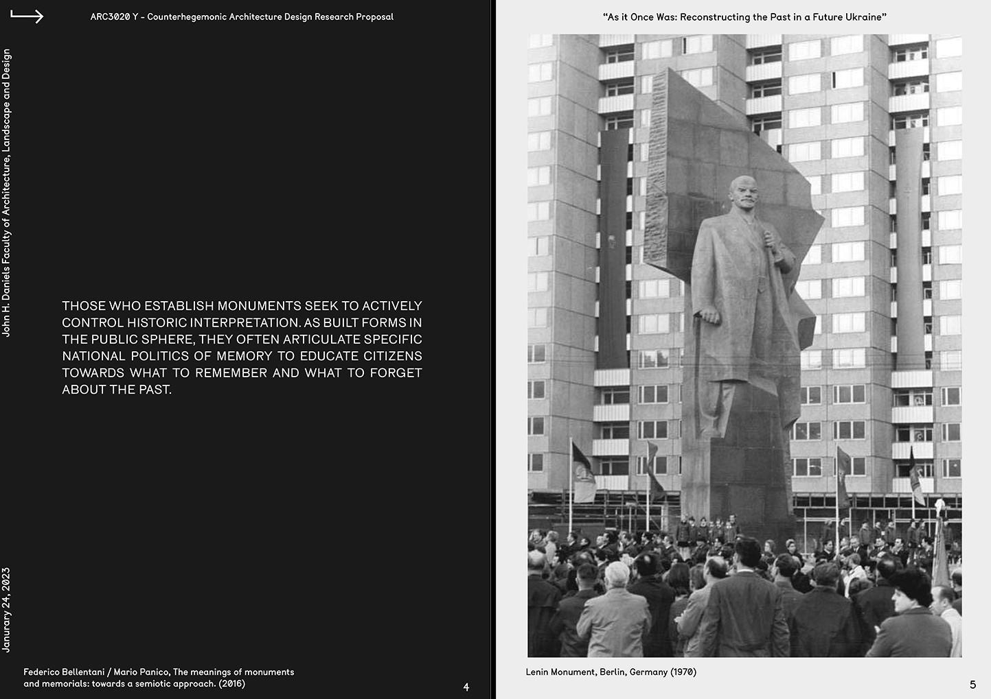
This issue is printed in the aftermath of the earthquakes in the broader region of Syria and Turkey as well as the recent tragic train crash in Greece. In light of these, we would like to express our deepest condolences and support to all those affected directly or indirectly. We hope that the next issue will be delving in the underlying criticalities of such catastrophes.
We could not be as visible as we are without the great effort of a lot of active students. With their help and the support of our partners and sponsors, we can organise excursions, lectures, workshops, drinks and events. The Polis board wants to thank all the people involved for their great efforts and positive input.
Polis Board
CHAIRPERSON Jens Berkien
SECRETARY Sani ka Charatkar
ATLANTIS Myr to Karampela-Makrygianni
Sani ka Charatkar
PR Lar issa Muller
EVENTS Ann Eapen
EDUCATION Ann a Kalligeri Skentzou
Join Us
We are always looking for enthusiastic people to join. Interested in one of the Polis committees? Do not hesitate to contact us at our Polis office (01.west.350) or by e-mail: contact@polistudelft.nl
Subscribe
Not yet a member of Polis? For only €17.50 a year as a student of TU Delft, €30 for individual membership, or €80 for professional organizations you can join our network! You will receive our Atlantis Magazine four times a year, a monthly newsletter, possibility to publish and access to all events organized by Polis.
E-mail contact@polistudelft.nl to find out more.

Editorial
“It is not answers or solutions that architecture requires, but incisive questions and problems that demand of it inventive knowledges and practices.”- Elizabeth Grosz (2003) This issue of Atlantis attempts to define a reflection and experimentation space around the issue of (In)Visibility. What does it mean to be (Un)Seen? What does the very act of rendering the invisible visible entails? And how does the visualization of things, processes and structures that are viewless, hidden, undervalued, or underrepresented transform the researcher or the designer? How does it transform the object of its observation and representation? Deriving from these questions, Volume 41(a) seeks to trace underlying structures that shape the 21st century urbanization patterns reproducing conditions of social segregation, to decode hidden socio-cultural processes that have participated in the formation, maintenance or instrumentalization of complex urbanized landscapes, to reveal unfamiliar or unseen territories created by human activity in the era of the Anthropocene and to reflect upon the spatial transformations performed by the very act or the tools of visualization.
The following narration begins with an investigation on the way urban freeway construction projects - working together with simultaneous ‘urban renewal’ schemes - have been used as government-led segregation tools in American Cities after the 1950s. In a similar tone, the postwar VINEX policies introduced in the Dutch Residential Neighborhoods are critically examined as initiators of residential and socioeconomic segregation and as facilitators of gentrification projects. Touristic gentrification as a new form of colonization and capitalization is discussed also in the context of Hawaii where language, land and culture have been systematically commodified to serve the image of the ideal holiday destination. In a different form but still under the notion of capitalization, the next article tracks current cross-border capital investments in the European context dictating the emergence of supranational territorial formations. Closing the chapter, the work of the Vertical Geopolitics Lab around the exposure, challenge and reconstitution of spatial patterns, practices and visual material related to imperialcolonial expansion is presented and discussed attempting a counterhegemonic approach to the power-space relation.
This relation is then investigated further in the next chapter taking the form of unknown or hidden processes that shape the urbanized landscape. In this direction, the Amazonian Forest’s pristineness is questioned under the examination of the hidden human-made cultivation layer; present already from the pre-colonial era. And this type of cultivation may entail a story of care, but that’s certainly not the case in the mechanization and instrumentalization of Campo de Cartagena in Spain caused by a complex interplay of interconnected
processes and circulations. Among them, the temporal migration is also researched in the Chinese context using the case study of Shenzhen’s floating populations to document the impact of their living and working patterns in the fragile deltaic environment. Finally, the concluding article offers an overview of all the circular social, material and spatial practices that remain invisible in the conventional linear understanding of the built environment’s construction reflecting upon our current delimitations of knowledge.
The issue continues with an exploration of different Unfamiliar or Unknown territories starting with the drosscape salt extraction industry of Arraial do Cobo in Brazil where the very act of abandonment is not understood only functionally but first and foremost symbolically. Similarly, the post-conflict landscape of Pitargou in Cyprus is studied as a material embodiment of the identity crisis caused by the island division establishing a strong connection between its human and non-human entities. In a different context, but with the same preoccupation for the projection of the cultural in the natural, the next article brings to light Subsurface Habitation in its current and potential forms reflecting upon human preoccupation with the exploration and the colonization of the underground. The form of exploration inspires the last part of this chapter that follows the narrative of a fictional literature figure to re-discover the future city of São Paulo questioning the distinction between the visible and the invisible.
This article marks the transition from the effort to visualize the invisible to the reflection on the process and the act. In this sense, the use of digital survey tools for the documentation of favelas is tested through the development of Neibz software for the case of Vila Missionaria in São Paulo suggesting new methodologies for urban research in viewless or inaccessible conditions. And while the process of portrayal is definitely marked by good intentions, the final piece is meant to remind that every act of revelation entails a simultaneous act of translation-transmutation that tends to result in a complete alteration. Nested in the field of conceptual ambiguity inspired by the recent quantum physics developments, this argumentation was rendered of critical importance in a global context that seems to often instrumentalize the subjects that are rendered visible.
As you read through, we urge you to keep this concern in mind while engaging further with the notion of (In)Visibility as conceptualized by the contributors of the current issue. We hope that the following pages managed to assemble the explorations and inquiries of both its authors and readers and to offer them a common ground which is meant to evolve in the upcoming issues.
-Myrto Karampela-Makrygianni and Sanika Charatkar
+ + + + + + + + +
Part 1: Underlying structures in post-war urbanization
08 Segregation by Design by Adam Paul Susaneck
14 Total Segregation by Jens Berkien
22 The Price of Paradise by Larissa Muller
26 Invisible Currencies shaping European Urbanism today by Ishka Mejia
32 Recognising Facts on the Ground- in conversation with Lukas Pauers, Vertical Geopolitical Lab
Part 2: Hidden processes, in the formation, maintenance or instrumentalization of urbanized landscapes
38 Amazon Forest: Pristine Nature or Domesticated Garden by Victoria Imasaki Affonso
44 Agroecologies of the Stateless by Katerina Inglezaki
50 Shenzhen’s Floating Population by Zuzanna Sliwinska
54 Flipping the Iceberg by Tamara Eggers
Part 3: Unseen or Unfamiliar Landscapes
62 The Omitted Inbetweens by Julia Daher
68 Reintroducing an Erased, Shared Identity by Panagiota Patrisia Tziourrou
74 The Subsurface as a Collective Geography by Akhilesh Shishodia
78 The Two Cities in Sao Paulo by Fabio Alberto Alzate Martinez
Part 4: Transformations in Spatial Relationships
86 Accessing Invisible views through digital durvey in Favela Communities by Maria Luisa Tarozzo Kawasaki
90 Architecture and Queer Super-positioning by Michael Kowalsky
Contents
Contributors
Adam Paul Susaneck is a Master in Architecture whose work focuses on addressing historic inequity and ongoing climate issues through urban planning, architecture, and transportation infrastructure. In his professional work at AECOM, he has been involved in the retrofitting and upgrading of New York City Subway, commuter rail, and Amtrak stations for ADA accessibility.
Jens Berkien is an Urbanism Student at the Faculty of Architecture, TU Delft. Alongside his inclination towards the urban consequences of climate change on the Dutch Water management system, he is also passioned about addressing the social inequalities that have risen from the Dutch spatial planning practice.

Larissa Müller a designer from California, USA,is now working on her education in urbanism at TU Delft. Her passions lie in addressing social inequalities in urban environments manifesting as expressions of urban segregation. Previous to TU Delft, she received her Bachelors of Architecture at Cal Poly, San Luis Obispo, in California.
Ishka Mejia is a Filipina architect from Manila pursuing the Urbanism track, while also resisting the madness that comes with the adventures and challenges of a field that encompasses all aspects of life and time itself.


Lukas Pauer is a licensed architect, urbanist, educator, and the Founding Director of the Vertical Geopolitics Lab, an investigative practice and thinktank dedicated to exposing intangible systems and hidden agendas within the built environment.


Panagiota Patrisia Tziourrou is an Urbanism Masters graduate from TU Delft. She holds a bachelors and masters degree in architecture from the University of Cyprus. She has also practiced as an architect in the past in Cyprus and Spain.


Katerina Inglezaki is an architect and urbanist working at the intersection of landscape ecology and urban design. Her research investigates agroecology as a holistic and integrated approach that aims at applying both ecological and social concepts to the design and management of sustainable food systems and problematizes on the upscaling of Nature-Based Solutions.
Zuzanna Sliwinska is of Polish origin, however her current educational and professional background is based in London and Hong Kong. Strongly influenced by time spent at Chinese University of Hong Kong as well as voluntary work in the Chinese countryside, her interests and efforts focuson urban development on the Asian continent and China in particular.

Tamara Egger is an Architect and Urbanist from Austria who worked for several years in co-productive urban transformation processes in Latin America and the Caribbean. Currently, she is a Ph.D. researcher at TU Delft’s Faculty of Architecture, where she focuses on diverse human agencies in transitioning toward a Circular Built Environment.
Julia Daher is a brazilian-portuguese architect with a Diploma in Architecture & Urban Planning from FAU-UFRJ Brazil. She has been conducting research in collaboration with PROURB regarding the interaction of urban and landscape dynamics in the shaping of socio-cultural practices.

Akhilesh Shisodia is an urban planner/ Urbanist working towards experimental Urban and Territorial strategies at TU Delft. Currently his research is centered around the augmentation of urban spaces, especially underground real estate, ubiquitous technologies, and digital cities.


Fábio Alberto Alzate Martinez graduated from FAAP in 2019 (São Paulo, Brazil) as an architect and urban planner. He is the recipient of several awards and design competitions, such as Urban21, Schindler Global Award 2017, Best Undergraduate Thesis ArchDaily 2020, and recently being granted the excellence scholarship Justus and Louise van Effen by TU Delft.
Maria Luisa Tarozzo Kawasaki is an Urbanism and Geomatics graduate student from TU Delft. She is the founder of Neibz and the winner of the Future Cities Challenge by UN-Habitat and Fondation Botnar in 2020. Her main passion is to make urban geodata visible and accessible.


Michael Kowalsky is an architect based in New York City. Working largely within the realms of urbanism and public infrastructure, his research is focused on the ways that social systems enter, define, constitute, and resist the built environment. His work is heavily impacted by his queer identity and desire to draw connection between the disparate communities he engages with.
 Victoria Imasaki Affonso Victoria is a MSc 4 student in the Landscape Architecture track at TU Delft. She previously worked as an architect in São Paulo, Brazil - her homeland.
Segregation By Design
During the mid- to late-20th century, using the policies of “urban renewal and slum clearance,” combined with the construction of the Interstate Highway System, the United States federal government mounted an unprecedented intervention into the built form of the American city. The goal of this intervention was explicit: racial segregation via the construction of an automobile-based suburbia; and the remaking of downtowns to cater to that suburbia. The scale of this project was astounding—across every region of the country, nearly every single city in the United States was and continues to be affected.
Introduction
Since the creation of the Interstate, urban freeway construction has been an integral tool in the systematic, government-led segregation of American cities. Used not only as a direct means to destroy the communities in their paths, freeways have also been used to cement racial segregation and ensure its endurance. Beginning in the 1950s, working synergistically with the legacy of redlining, freeway planning became the ultimate enforcement mechanism: literal walls of concrete and smog that separated black communities from white. Working in tandem with simultaneous “urban renewal” schemes, the freeways took the red lines off the map and built them in the physical world.
Red Lines And “White Flight”
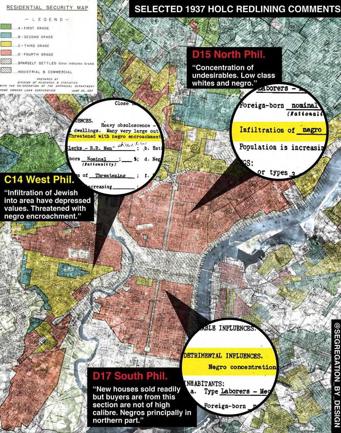
The project of federally-incentivized residential segregation commenced in earnest in the 1930s with the practice of “redlining” during the New Deal. Redlining was a policy in which the federal government went city-by-city, neighborhood-byneighborhood, grading each block for investment worthiness—based on race. The agency created to administer the program, the Homeowners’ Loan Corporation (HOLC), drew thick red lines on the map around neighborhoods with what the agency’s appraisers determined to be an “infiltration of undesirable racial elements.” Such neighborhoods were officially deemed “hazardous for investment.”
8 01
ADAM PAUL SUSANECK
UNDERLYING STRUCTURES IN POSTWAR URBANIZATION
9 Atlantis Magazine |Invisible | volume 41
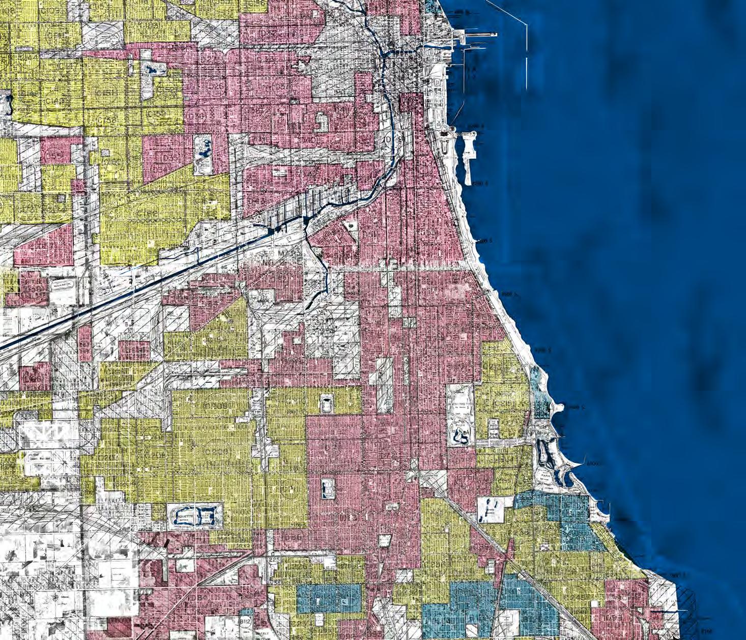
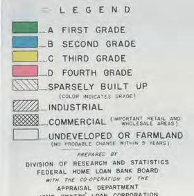
Fig. 1: Redlining Map of Chicago Image Source: Segregation by Design and HistoricAerials.com
The effect of redlining was the crater property values and enervate tax-bases, reducing municipal services, and creating a feedback loop of physical decay. The comments in redlining maps below reveal the FHA’s intentions.Typically, the neighborhoods with the highest percentage of people of color (and thus redlined) were in the most central parts of cities, clustered around Downtown jobs and transit. As physical decay set in, whites began to “flee” redlined neighborhoods to the newly constructed suburbs. “Blockbusting,” a real estate practice which preyed on white homeowners’ fears that their neighborhood was “transitioning,” encouraged whites to panic-sell their properties below market-rate, exacerbating the trend.
White flight further accelerated after World War II. Spurred on by the lobbying efforts of automobile manufacturers and real estate speculators who realized the profits to be made in suburbanization, any and all housing assistance Congress provided to the millions of returning soldiers was suburban in nature. Thus, in 1945 the GI Bill provided low-interest mortgages—but only in the newly built suburbs.
While Black soldiers were technically eligible for the GI Bill, the deeds for these new suburban houses typically contained “restrictive covenants,” officially permitting sale to “members of
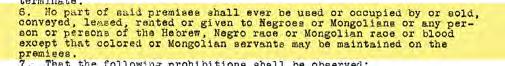
the caucasion race only.” Therefore in practice, people of color (and Black people in particular) were forced to remain in the intentionally crumbling inner-cities. In no small part because of this, white families have been able to build generational wealth and equity in the suburbs—while the government has intentionally withheld that opportunity for all those considered “non-white.”
The War Against The Center
In an attempt to combat the physical decay in inner-cities caused by the effects of redlining and white flight, the federal government began the next era of its segregationist project with the 1949 Federal Housing Act and the 1956 National Interstate and Defense Highways Act. The aim of these two
10
Fig 3: Examples of restrictive covenants in Minneapolis Image source: Mapping Prejudice Project
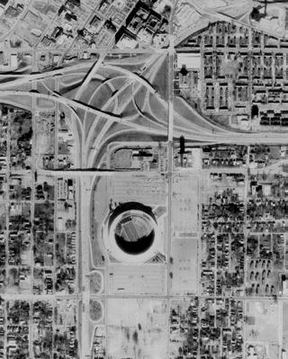
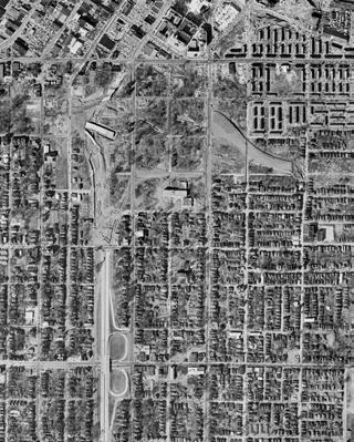
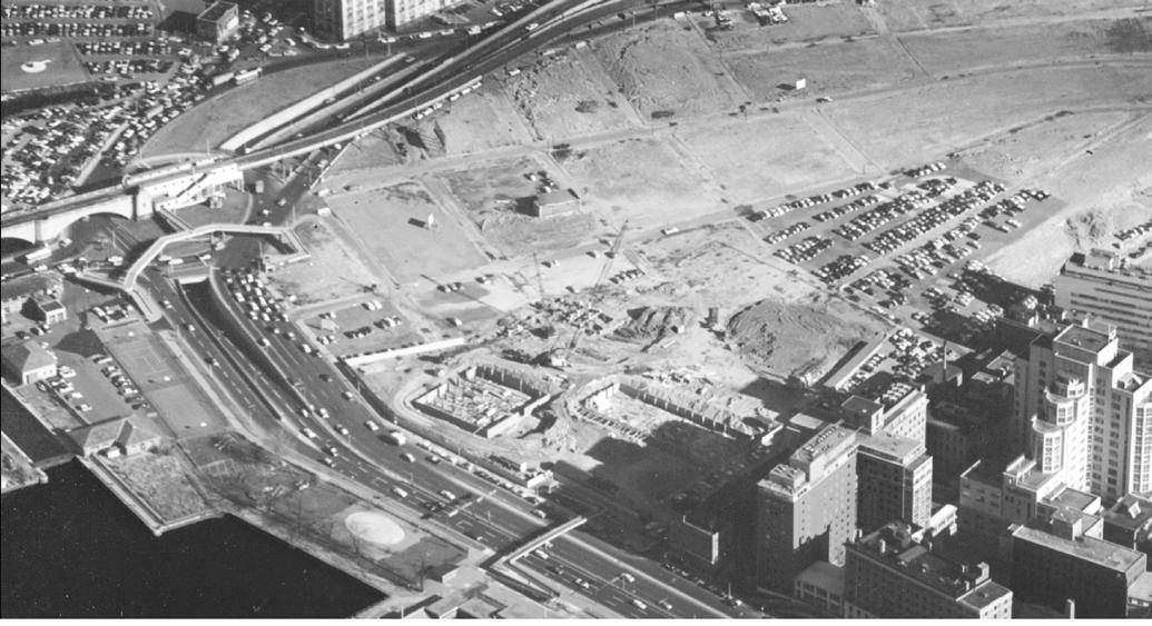
Image 1: Atlanta 1955.
Summerhill, a primarily-black neighborhood adjacent to Downtown Atlanta, was redlined in the 1930s.
Image 2: Atlanta 1960
In an effort to attract whites back to Downtown, the city used federal funds to construct a new stadium adjacent to the city’s new central interchange.
Image 3: Atlanta 1978
The construction of such suburban focused entertainment centers was typical in cities across the country.
Fig 2: (Image 1, 2, 3)
Underlying structures in postwar urbanization
Image source: Segregation by Design and HistoricAerials.com
Atlantis Magazine |Invisible | volume 41 11
Fig 4: Redlining Map of Philadelphia
Image Source: Segregation by Design and HistoricAerials.com
bills was to attract white suburbanites back to downtowns, if not necessarily to live there, then to at least spend money. To that end, these two bills provided America’s cities with a carte blanche to physically remake their downtowns and transportation systems to better serve suburban automobile commuters.
With the ‘49 Housing Act providing cities a 2/3rds federal match for “slum clearance and urban renewal” schemes and the ‘56 Interstate Highways Act providing a 90% federal match, taken together these two bills represent the largest single investment in infrastructure ever undertaken by the American government. Municipal governments used these novel and generous funding sources to remake their cities on a scale previously only seen in natural disasters or war.
Planners at the time were inspired by the maximalist practices of Baron Haussman in Paris in the late 1800s, the “Modernist” schemes of designers like Le Corbusier, and the contemporary projects of Robert Moses in New York. With these ideas in their heads, planning departments razed whole neighborhoods under the auspices of “slum clearance and urban renewal.” After years of neglect due to redlining, inner-city neighborhoods were easy targets for such schemes, especially attractive due to their prime locations. While communities often resisted, in cities around the country most were unable to withstand the city’s federally-funded assault.
Seizing properties through eminent domain, cities erased neighborhoods and replaced them with amenities focused on suburban commuters, such as massive sports complexes, entertainment centers, single-use office complexes, outsized institutional expansions, and parking—lots of parking. Existing urban amenities such as parks, public spaces, and extensive public transit systems were paved over as the city was remade for those driving from the suburbs.
Freeways were built in tandem with these “renewal” projects, designed to provide easy access from the suburbs, while physically dividing and destroying the close-in, primarily Black and Hispanic neighborhoods in between. When not barreling directly through communities of color, freeways often followed the borders between redlined and non-redlined areas, acting as physical walls of smog and concrete between different races.
Through freeway construction and urban renewal, it is estimated that the government displaced over one million of its own citizens, the vast majority of whom were people of color, while providing virtually no financial assistance to the internal refugees it had created. It obliterated entire communities, destroyed livelihoods, and robbed people of color of hard-earned equity in their cities. The generational
Seizing properties through eminent domain, cities erased neighborhoods and replaced them with amenities focused on suburban commuters, such as massive sports complexes, entertainment centers, singleuse office complexes, outsized institutional expansions, and parking—lots of parking.
effect of this has been to create a cycle of poverty, a feedback loop which prevents those in poverty from obtaining any equity in American society.
Breaking The Cycle
The people whose houses and business were destroyed, whose communities were wiped away, whose social networks were decimated: these people were assaulted and robbed by the government. They deserve direct reparation both financially and in terms of the built environment. This means first recognizing the freeway network as a physical tool of white suprematism, radically rethinking it, and wholesale dismantling of much of it.
Unfortunately the trend is in the opposite direction. Cities across the country continue to pursue highway widening projects in communities of color. After all, that is where the freeways were built. From Los Angeles to Houston—even Portland, Oregon— many cities are doubling down on the mistakes of the past. Putting aside issues of encouraging sustainable transportation, as well as the absurdity of using the same old toolkit to relieve traffic, despite ample evidence at this point that induced demand will simply wipe out and speed increase; all of these projects will result in the demolition of hundreds of homes and businesses in primarily Black and Hispanic neighborhoods, continuing the cycle.
While the recently-passed infrastructure bill includes $1B designed to redress these issues in the form of the DOT’s “Reconnecting Communities Program,” the continuation of projects such as these across the country is a worrying sign. Unless the United States begins to meaningfully address its automobile-based segregation, this will be yet another example of the United States’ institutional prejudice and failure to adapt to a rapidly changing world.
12
“ “
Underlying structures in postwar urbanization
Caro, Robert. The Power Broker: Robert Moses and the Fall of New York. Knopf, 1974.
Coates, Ta-Nehisi. “The Ghetto and Public Policy.” The Atlantic, 2013. Fullilove, Mindy Thompson. Root Shock: How Tearing Up City Neighborhoods Hurts America, and What We Can Do About It. NYU Press, 2016.
Harvey, David. Rebel Cities: From the Right to the City to the Urban Revolution. Verso, 2013.
Jackson, Kenneth. Crabgrass Frontier: The Suburbanization of the United States. Oxford University Press, 1985.
Lewis, Tom. Divided Highways: Building the Interstate Highways, Transforming
American Life. Cornell University Press, 2013.
Madden, David and Marcuse, Peter. In Defense of Housing: The Politics of Crisis. Verso, 2016
McGhee, Heather. The Sum of Us: What Racism Costs Everyone and How We Can Prosper Together. Random House, 2021.
Norton, Peter. Fighting Traffic: The Dawn of the Motor Age in the American City. MIT Press, 2008.
Rothstein, Richard. The Color of Law: A Forgotten History of How Our Government Segregated America. Liverright, 2017.
Atlantis Magazine |Invisible | volume 41 13
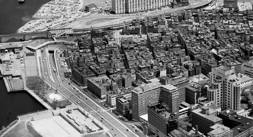
Fig 5: “urban renewal” projects in Boston West End 1995-1959 (top to bottom) Image source: Segregation by Design and the West End Museum
Total Segregation
The Dutch urban landscape forms a pattern of historical neighbourhood ideologies, public space and urban fabric. Without clear connections and interrelations between these patterned neighbourhoods, the danger arises for fragmentation of the urban system leading to increasing sensitivities of socio-spatial segregation within Dutch society. Only until the end of the last major urban expansion program of the VINEX in 2015, little had been done to restore urban livability and vitality. Now the Dutch are standing in front of the same crossroad again, where housing shortages have started new nationwide housing policies. Maybe we can use this opportunity for densifying through integration rather than through expansion.
JENS BERKIEN
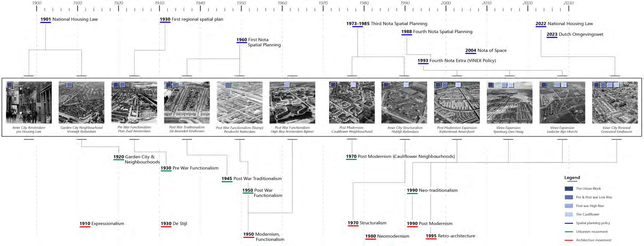
Introduction
Various contradictory spatial planning policies from the 1950s until the last major national policy of the VINEX in 1993, created a spatial pattern of different neighbourhood ideologies concerning, public and private space, infrastructural hierarchies, architectural identities and built densities. Whereas the cauliflower neighbourhoods of the late 80s had facilitated a so-called maze of public space, allocating the focal point to the private realm, the highrise estates of the 70s created private islands in a sea of unconditional public space, leading to dangerous situations at quiet times of the day. Although people might admire the strict planning and control of public space when they walk through Dutch cities, the underlying ideas and structures form a complete ‘structured’ mess.
As the urban fabric is key in facilitating a potential framework for a socially just urban system, allocating place for all residents of society, the Dutch spatial planning experiment lab fostered an increasing
sensitivity to socio-spatial segregation within the society. Not only did this make socio-spatial segregation issues appear, but large influences from the private sector also had a major impact on sociospatial segregation within Dutch society. .
The VINEX neighbourhood stands as an example of the last major nationwide spatial planning policy, still manifesting in the form of new large expansion neighbourhoods along the edges of cities. With the end of the VINEX, we have seen an increase in residential and socio-economic segregation in Dutch cities due to the expansion of our patterned urban landscape using the same ideologies within a different coat.
Now the Dutch are standing in front of the same crossroad again. Current housing shortages have resulted in the formation of new nationwide housing policies, but how do we focus on Densification now, through integration or again through expansion?
14 01 UNDERLYING STRUCTURES IN POSTWAR URBANIZATION
The Effects of VINEX policy on residential and socioeconomic segregation in the Dutch housing market dividing the connectivity between neighbourhoods.
15 Atlantis Magazine |Invisible | volume 41
ATLANTIS | (In)Visible | Volume:41 | Feb: 2023 15
Fig 1: The Dutch Urban Pattern Landscape Image Source: Author
Vinex As The ‘Last’ Urban Expansion Policy
In 1993, a new policy - the VINEX policy - was introduced in the Netherlands to tackle the growing pressures on the housing market and the escalating suburbanisation of highincome households to rural areas. The introduction of the VINEX transformed the Dutch housing system to a marketoriented sector; one that was supposed to retain high and middle-income residents in large cities through new expansion neighbourhoods along their edges. Favourable financial benefits for investors, high demand for owneroccupied dwellings, the sense of homophily in social networks, high-quality facilities and amenities and the high number of family houses triggered a residential movement from cities towards the new VINEX neighbourhoods instead of the rural countryside. This marked the beginning of increasing residential segregation rates in adjoining VINEX and other, primarily, post-war expansion neighbourhoods.
Urban Expansion Counter-movement
A counter-movement to the Vinex urban expansion related to urban restructuring was implemented in 1997 to decrease the increasing residential segregation. The main idea of urban restructuring was the creation of mixed neighbourhoods in ‘deprived’ areas where large concentrations of low-income residents lived (Priemus, 1998). The Dutch government saw these low-income concentrations as a problem in the integration process. Interventions in the housing stock of urban restructuring areas were planned to mainly retain more middle and higher-income residents (Boschman et al., 2012). Although these neighbourhoods succeeded in retaining more higher-income residents, most residents decided to move to the new VINEX neighbourhoods (Boschman et al., 2012; Jilisen, 2013). Because the VINEX neighbourhoods consisted of more single-family dwellings, these neighbourhoods were primarily attractive for high to middle-income family households who
16 Underlying structures in postwar urbanization
could afford an upgrade in their housing situations. The idea of homophily (McPherson, Smith-Lovin & Cook, 2001) – in the housing sector of the VINEX neighbourhoods gave searching families the opportunity to live with residents who are similar to themselves, therefore extending this moving trend even more. The urban restructuring neighbourhoods were planned to house residents with different values, attitudes, ethnicities and social classes balancing out the income distribution of households in neighbourhoods. Although cities like Rotterdam, The Hague and Amsterdam had successful urban restructuring campaigns in the 2010s, VINEX neighbourhoods still remained a better alternative for high to middle-income families. So, a possible cause for the rise in mostly residential segregation in the Netherlands can be found in the policiesmainly the VINEX - the state introduced in the housing sector.
Future of the Vinex neighbourhood
VINEX neighbourhoods brought more expensive dwellings, public transport and a ban on further housing development locations in rural areas but the focus is now moving towards the cities to resolve the future challenges of the Dutch urban areas. The VINEX neighbourhoods will endure as pleasant neighbourhoods on the outskirts of cities. Only time will tell what kind of future the VINEX neighbourhoods will see in the ever-changing societies. The era of large-scale urban developments in rural areas has ended. The VINEX neighbourhoods are probably the last urban greenfield developments the Netherlands will see in a very long time, although the current housing crisis calls for the development of even more expansion neighbourhoods and plans than before. The Netherlands has to make the decision of expanding its city borders or integrating its neighbourhoods.
Atlantis Magazine |Invisible | volume 41 17
Fig 2: Timeline of spatial planning policies from 1901 to the new national housing policies of 2022 with connecting urban and architectural ideologies Image source : Author ,based on Lörzing, et al. 2006.
Growth of residential and socio-economic segregation
The current politico-institutional context of society has created a mentality of growth first, society second (Brenner, N., 2013). In the welfare state of the Netherlands (which is also changing) this can be seen as two sides of the housing market that have been overrepresented in the past decades. The niche of owner-occupied dwellings was incentivised by the national government to attract families to the cities (van der Wouden, 2020) of which the VINEX policy was one of them. On the other hand the social housing sector had always been directed to promote equal housing opportunities for lowincome residents (Kleinhans, 2004).
The division in the Dutch housing market correlates with the division of the increasing gap between high and lower-income residents, with almost a completely disappearing middle class. This increasing division can also be seen spatially where neighbourhoods over time have been segregated by their prominent homogeneous housing stock. Urban renewal processes can diversify the housing stock but socio-spatial segregation is accelerated since urban renewal is mainly understood as a way for local businesses to further act upon the financial benefits (Brenner, 2013) instead of a potential binding of socio-economically or culturally diverse residents.
Nevertheless, research over the years concluded that humans tend to live close to other people with similar trades on a cultural, social or economical level, due to the lower percentage of perceived discrimination and a higher sense of safety, while it related segregation studies to the formulation of reference groups of society. If , then, a changing look at the formulation of the reference groups in these studies indicates a need of diversification, maybe the idea around segregation also needs to be re-examined.
Urban renewal processes of municipalities often address these neighbourhoods and try to improve their living qualities. As the paradigm shifted from the industrial age to the post-industrial age - with the rise of mass media and telecommunication - it changed how people identify themselves within representative reference groups, making the prexisting segregation studies inadequate in formulating the overall identity of these groups. (Sassen,1998; Holloway, Rice & Valentine,2003; Slevine, 2000; Schnell et al,2015). However, since municipalities and policymakers still see segregation as a dangerous situation for the development of a city, the understanding of its positive and negative effects becomes more intertwined, placing the focus of segregation studies on the local sociological issues between and within neighbourhoods of the city. Thereby emphasising on the need to understand Netherlands as a patterned urban landscape.
The Netherlands as a testing ground of spatial planning typologies
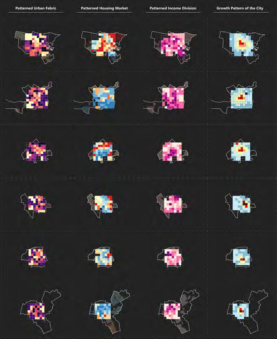
The Dutch city seems to be a rational unit of intertwining pieces, planned to perfection. But only after the effects of WWII, a new managerial revolution ignited. An extensive post-war reconstruction program required a new managerial system to build housing fast and efficiently (Wagenaar, 2011). New ideologies of constructing neighbourhoods, like the garden city, the neighbourhood unit, and the VINEX, created an abundance of neighbourhoods with different public spaces, functions, housing typologies, and infrastructure. The result led to an experimenting ground of various adjoining neighbourhood ideologies. Consequently, the urban fabric started to look like a pattern of neighbourhood units without clear connections between them; only related with the city centre. Hence the urban fabric of the Dutch city tends to be separated and divided. In fact, the six largest municipalities of the Netherlands - as shown within a grid of 1x1 km - are divided according to the growth pattern of the city, low-income residents, neighbourhood typologies and housing value. Although these patterns are based on a conceptual framing of these 6 big municipalities, relations between low-income residents and certain neighbourhood typologies (pre- and postwar garden city neighbourhoods), housing value and the period of construction are shown. It becomes clear that even though the redevelopment of pre-and post-war neighbourhoods in the 1980s and 2000s changed the outlook of the city, making better connections between neighbourhoods was not part of it. As Dutch spatial planning has been relying on different ideologies all considering influences of the neighbourhood units, the main focus of redevelopment was to change its housing stock. Therefore the concept of the neighbourhood unit and its spatial distribution persisted without affecting the segmentation pattern of the city. Research by Read, on the integration of the Dutch urban fabric, showed that the spatial form of neighborhoods only resulted in integration patterns within, and not between adjoining neighbourhoods (Read, 1998). The segmentation of spatial form in the city can be an indicator of potential socio-spatial segregation developments (Hillier, & Vaughn, 2007), therefore establishing a correlation between the patterned look of the urban fabric and sociospatial segregation.
Public space integration
To cope with the fast-growing individualism of different identities scattered across neighbourhoods, urban renewal processes often fail to improve social integration for the people who need it the most. To further enlarge the scope of urban renewal processes between multiple neighbourhoods, it needs to focus on connecting the ‘segregated’ neighbourhoods, instead of improving single neighbourhoods with the idea of
18 Underlying structures in postwar urbanization
Atlantis Magazine |Invisible | volume 41 19
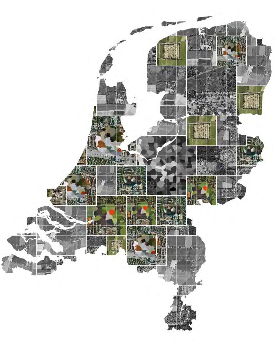
Fig 3: Patterned urban landscape of the 6 biggest municipalities in the Netherlands (top to bottom: Amsterdam, Rotterdam, The Hague, Utrecht, Eindhoven & Groningen) according to its Neighbourhood typologies, Housing values, Income divisions and Growth patterns.
19 ATLANTIS | (In)Visible | Volume:41 | Feb: 2023
Image source: Author,; based on data from PDOK, 2019, 2021; Rutte, R. & Abrahamse, J. E., 2014
‘improving the living quality’. To follow the words of Julienne Hanson that urban transformation can be encapsulated in just two words: ‘street’ and ‘estate’ (Hanson, 2000., p 99), more attention should be given to the street and public use instead of improving the ‘estate’. Therefore urban renewal processes should try to find possible locations for establishing better connections between neighbourhood units, and connect not only their borders but also residents of different social groups. The essence of publicly accessible space on the borders of neighbourhoods can be a key solution in further urban renewal processes.
According to Legeby (2013), access to public space is dependent on the location of amenities, the distribution of space and the experience of space. Therefore less attention should be given to urban renewal processes diversifying the housing stock, and more towards the accessibility and the typology of public space between ideologically different neighbourhoods. The ideal integration would be along neighbourhood borders because these are the locations where space syntax research of the Dutch city has shown to be the least integrated part of the urban fabric . Therefore future urban renewal processes should focus on making better connections between the neighbourhoods and connecting people from different social groups with an active and accessible public space.
Conclusion
The introduction of the new ‘Omgevingswet’ in Dutch spatial planning and the current stress on the housing market will again put an emphasis on nationwide controlled planning policies. Although it seems that the current minister of Housing: Hugo de Jonge, wants to build fast and efficiently, scholars and experts are divided on how to solve this ‘big’ crisis. Are we going to expand our city borders in the already stressed greenfields of the rural countryside or are we going to densify by urban renewal projects in the heart of the city? While the latter seems favourable, the changing globalizing world demands a widening scope of urban renewal processes (Brenner, 2013). To cope with a fast-growing amount of different identities scattered across various neighbourhoods, urban renewal processes often fail to improve the living quality of the people who need it most, leading to further issues of segregation. Despite the addition of superior dwellings to the housing market, they fail to integrate adjoining neighbourhoods and their different ideologies, resulting in increasing figures of socio-economic and residential segregation. Urban renewal processes seek ways of overlapping architectural ideology, infrastructural layouts with the public and private realms. Only then the Dutch can look for densification by integrating its patterned urban landscape like puzzle pieces.
Boschman, S., Bolt, G., Van Kempen, R., & Van Dam, F. (2012). Mixed neighbourhoods: Effects of urban restructuring and new housing development. Tijdschrift Voor Economische En Sociale Geografie, 104(2), 233–242. Brenner, N. (2013). Open city or the right to the city? The International Review of Landscape Architecture and Urban Design. Hanson, J. (2000). Urban transformations: A history of design ideas. Urban Design International, 5(2), 97–122. https://doi.org/10.1057/palgrave. udi.9000011
Hillier, B., & Vaughan, L. (2007). The city as one thing. Progress in Planning 67, pp 205-230. Retrieved from http://discovery.ucl.ac.uk/3272/ Legacy, A. (2013). Patterns of co-presence: Spatial configuration and social segregation. In TRITA – ARK Akademisk avhandling 2013:1.
Lörzing, H., Klemm, W., van Leeuwen, M., Soekimin, S. (2006) VINEX! Een morfologische verkenning. NAi Uitgevers, Rotterdam & Ruimtelijk Planbureau, The Hague.
Read, S. (1998). Space syntax and the Dutch city. Environment and Planning B: Planning and Design, 26(2), 251–264. https://doi.org/10.1068/b4425
Schnell, I., Diab, A. A. B., & Benenson, I. (2015). A global index for measuring socio-spatial segregation versus integration. Applied Geography, 58, 179–188. https://doi.org/10.1016/j.apgeog.2015.01.008
Wagenaar, C. (2011). Town Planning in the Netherlands since 1800. Responses to Enlightenment Ideas and Geopolitical Realities. 010 Publishers, Rotterdam, the Netherlands.
20 Underlying structures in postwar urbanization
19thCentury&21stCentury Renewal
Image Source:
Image
Atlantis Magazine |Invisible | volume 41 21
Cauliflower GreenSpace BuiltArea BlueSpace PrivateSpace PostModernism Functionalism,Structuralism Functionalism,Traditionalism
UrbanBlock (Pre&Postwar)LowRise (Postwar)HighRise
Fig 4: Conceptual drawings of the neighbourhood unit in the four main neighbourhood typology ideologies of the urban block, the post-war high and low rise and the so-called ‘cauliflower neighbourhoods’
Author, based on BRIGHT & Tauw, 2019
Fig 5: The Dutch housing market in a 10x10 km grid as a patterned urban landscape towards integrating puzzle pieces
WOZ Value Dutch Housing Market 0 - 150.000 150.000 - 180.000 180.000 - 210.000 210.000 - 240.000 240.000 - 270.000 270.000 - 300.000 300.000 - 330.000 330.000 + 21 ATLANTIS | (In)Visible | Volume:41 | Feb: 2023
Source: Author, data from PDOK, 2019
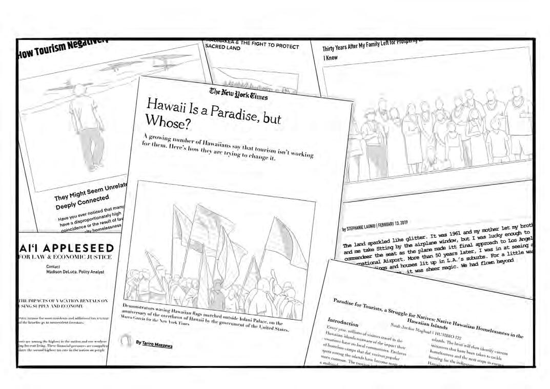
PARADISE PARADISE THE PRICE OF
“Spectacular sand beaches, outdoor adventure, and a Mai Tais under a palm tree - paradise awaits”.
This is the scene marketing for Hawai’i, to feed the tourism industry. However, as ever increasing numbers of people visit the islands to experience the superficial level of Hawaiian culture, native Hawaiians and locals are being forced out of their homeland due to skyrocketing real estate prices, rampant luxury development, lack of workforce housing and a high cost of living while their sacred lands suffer. The price of paradise is too high for its residents.
01
LARISSA MULLER
UNDERLYING STRUCTURES IN POSTWAR URBANIZATION
Spectacular sand beaches, outdoor adventure, and a Mai Tai in hand under a palm tree - Paradise Awaits...
This is the scene marketing for Hawai’i, to feed the tourism industry. However, as ever increasing numbers of people visit the islands to experience the superficial level of Hawaiian culture, native Hawaiians and locals are being forced out of their homeland due to skyrocketing real estate prices, rampant luxury development, lack of workforce housing and a high cost of living while their sacred lands suffer. The price of paradise is too high for its residents.
Introduction
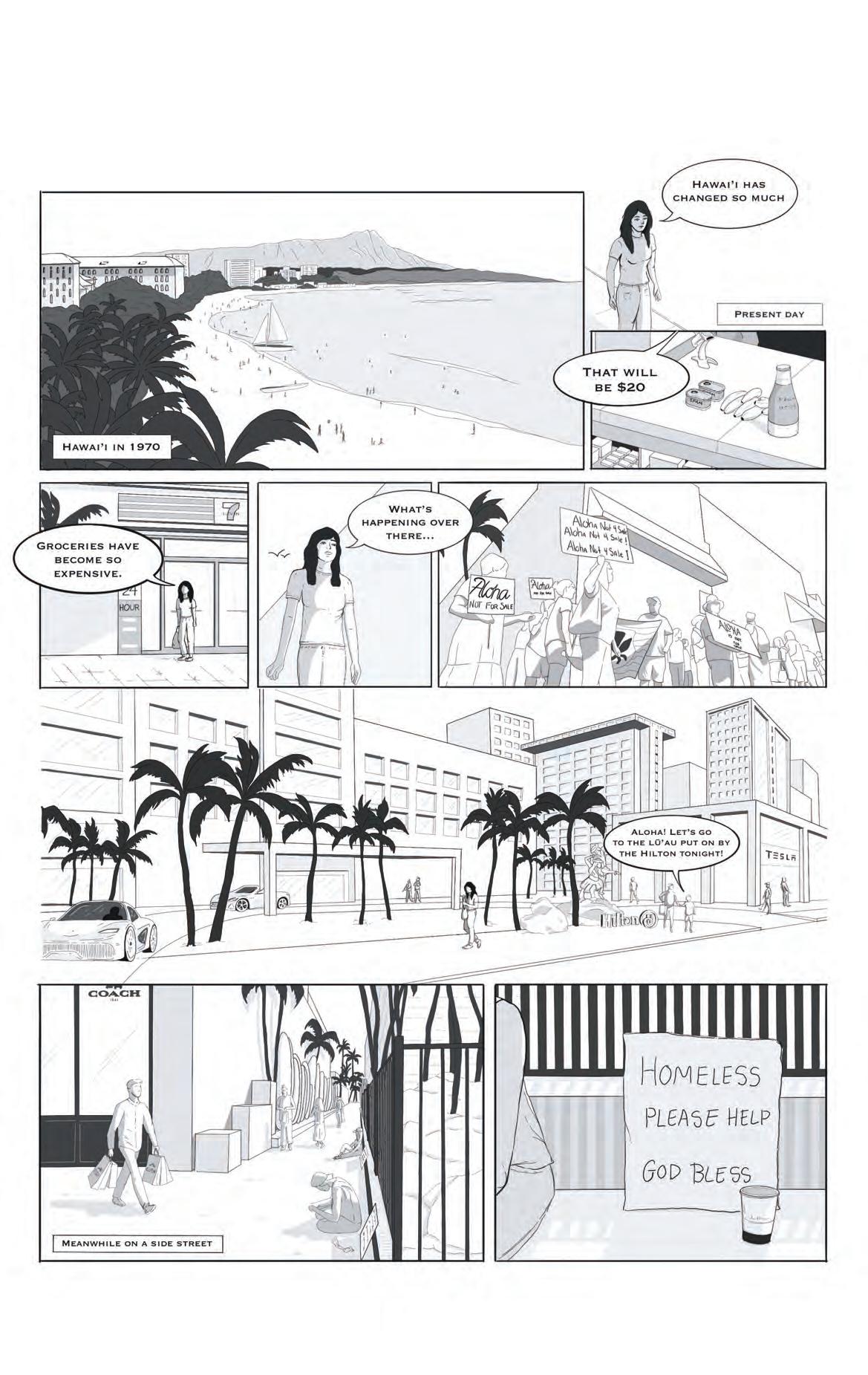
Stories of struggling Hawaiians in their homeland become increasingly common as the visible effects of a colonized island and the prioritization of the tourism industry by the state government continues to maintain patterns of inequality and exploitation. The destruction of the land and the exploitation of the culture in favor of business ventures turned the island into a paradise for tourists and multinational corporations at the expense of the local population.
The Commodification of the Hawaiian Language
Since the overthrow of the Hawaiian monarchy and the start of the colonization of the islands in the 1890s, the United States has continued to exploit the culture of the native Hawaiians for monetary value. It started with the ban of the Hawaiian language in education as well as the discouragement of speaking the language at home as a way for American colonizers to further suppress locals and enforce western-style schooling. Although the language was re-instituted a century later in the mid 1980s (Goo, 2019) with numerous attempts to resist the colonialist suppression, the Hawaiian language is still critically endangered according to UNESCO. There isn’t a more representative example than the commodification of the word ‘Aloha’, often used for commercial purposes that is far removed from the literal and cultural context. For the global world today, ‘Aloha’ simply translates to hello or goodbye. This understanding developed as merchandise corporations, pubs, and travel agencies advertise this phrase to aid their monetary gains and ultimately diffuse its true significance. ‘Aloha’ goes beyond these simple meanings and has multiple translations, the literal meaning is ‘breath of life’ and ‘spirit of positivity and love’. It is an example of how the local language was and is used to give the impression of a reflection of real local culture, when instead it’s just a reflection on a superficial level and neither aims nor achieves to truly represent the local traditions.
The Exploitation of Hawaiian Lands
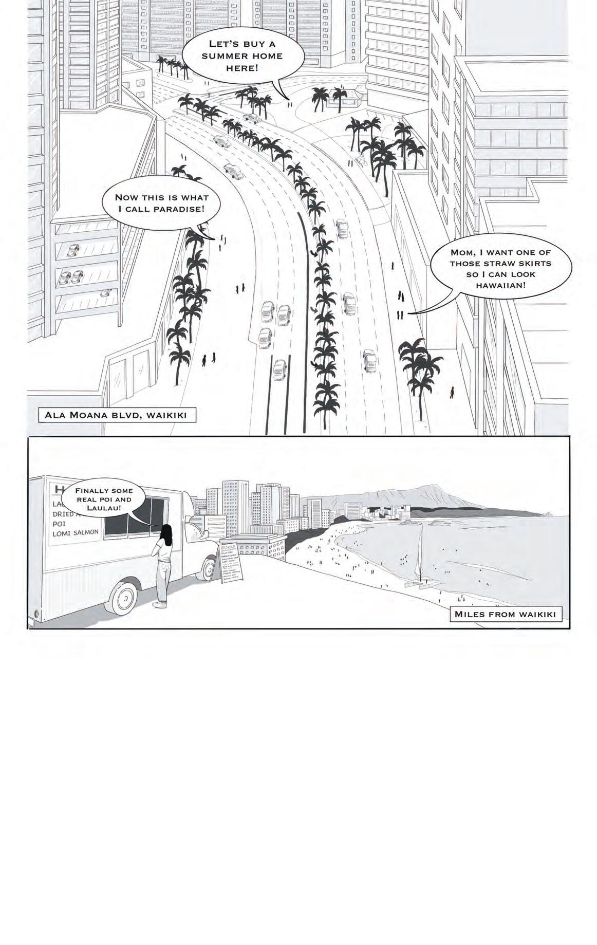
In the 1970s, Hawai’i continued to urbanize and attract tourists from America and around the world. Soon, the idea of the land as a respected entity and a source of food ingrained in Hawaiian culture, the land in the Hawaiian language called ‘Āina’ which means to feed, was replaced with the use of land as real estate. Since then, expensive hotels and resorts began to transform the scenic landscape of the islands and overshadow the previous sense of deification of the land. As the tourism industry quickly became the dominant economic force in Hawai’i, rapid developments, sold with the promise of providing locals with a better financial standing, resulted in a pattern of exploitation and a decimation of a respecting relationship with the land.
The Hefty Price Tag of Living
At the same time as the construction of new developments, eviction notices of locals surged, coinciding with the influx of tourists and migrants. Nowadays, the lack of affordable housing and the increase in living costs are the main drivers of the increasing homeless population of locals. When we observe the average cost of rent in 2019 compared to 2022, Hawaiians pay about an additional 13% more, with an average monthly rent tab of $2,500 (Napier, 2022), while prices are still increasing. Short-term vacation rental industries, such as Airbnb, continue to add pressure to an already constrained housing market with skyrocketing prices by reducing long-term housing options for Hawaiians (DeLuca, 2018) and increasing short-term options for tourists. This development cements a problematic situation for locals that Hawaiian land and culture stands available to everyone who can afford a hefty price tag.
Promise of Jobs that Fail to Deliver
As locals are being forced out of their homeland, Hawaiian land and the natural resources are exploited for resorts, military reservations, and multimillion-dollar private homes. In this sense, in the urban planning landscape, the economic benefits outweigh local interests when it comes to the consideration of land development. Large developments on the islands, such as the Thirty Meter Telescope Observatory as well as the Coco Palms Hotel, were built or are proposed to be built on sacred ground that holds significant value to the native Hawaiians. Consolidation arguments were made from these corporations, claiming that these projects, although seizing sacred land, would provide economic benefits to the Hawaiian economy. However, the bulk of the profits from these projects go to non-Hawaiian owners with the “promise of jobs that fail to deliver” (Mzezewa, 2020). This shows a pattern under which local Hawaiians often don’t receive the benefits and are left employed in lower-paying service jobs.
24
“ “
Underlying structures in postwar urbanization
Cultural Prostitution
As land is exploited, local culture becomes commodified. Hawaiian culture often degrades to beautiful women dancing the hula. This strips the dance from its historical and cultural value to an ornamental performance solely attributed for entertainment and thus profit. Lū’aus, where the hula dance is often performed, still remains a connection to Hawaiian culture. However, a majority of Lū’aus put on by resorts or hotels are watered down and Americanized, and show a business interpretation of a cultural performance. These industries commonly portray events like Lū’aus as genuine encounters with Native Hawaiian culture when in fact, the coconut shell bras and teriyaki chicken, are far from local Hawaiian culture. This overall creates a manufactured scene, leaving tourists with a distorted view of Hawaiian culture and a romanticized view of the islands. All these trends and developments lead to an ambivalent image of Hawai’i.
Conclusion
Around the globe, the identity of Hawai’i has been transformed into an image of hula dancers and mai tais, caused by historical exploitation and cultural prostitution. Many people, even the in neighboring states, are unware of the impact of these global neocolonial behaviors on locals. These patterns of over-tourism, unbound in culture and history of the context, further roots the Hawaiian culture in their colonized past in a postcolonialism world. However, over the past couple of years, together with the rethinking economic structures tied to the tourism industry and the start of the pandemic in 2019, the stance on the dangers of over-tourism in the state has become more widely accepted. Hawaiian locals and news articles have recently begun advocating for tourists to become aware of the effects of neocolonial tourism leading to gentrification, the displacement of locals, whitewashing of the culture, and their ill effects on sacred lands. The question then remains, how do we reconfigure the role of tourism in a context altered by past and current practices of colonialism, exploitation, and cultural prostitution?
‘A Native Hawaiian Returns Home | Essay’ (2019) Zócalo Public Square, 13 February.
Arista, N. (2018) Aloha Not For Sale: Cultural In-appropriation, Ka Wai Ola. Available at: https://kawaiola.news/cover/aloha-not-for-sale-cultural-inappropriation/.
Erin (2021) Native Hawaiians Are Disproportionately Affected by Poverty and Homelessness, Invisible People. Available at: https://invisiblepeople.tv/nativehawaiians-are-disproportionately-affected-by-poverty-and-homelessness/.
Goo, S.K. (2019) ‘The Hawaiian Language Nearly Died. A Radio Show Sparked Its Revival’, NPR, 22 June.
How Tourism Negatively Impacts Homelessness - Invisible People (2022).
Jedra, C. (2020) Survey Counts Over 4,400 Homeless People On Oahu Before
COVID-19, Honolulu Civil Beat. Mzezewa, T. (2020) ‘Hawaii Is a Paradise, but Whose?’, The New York Times, 4 February.
Report documents the impacts of vacation rentals on Hawaii’s housing supply and economy (no date) Hawaiʻi Appleseed. Available at: https://hiappleseed. org/press-releases/vacation-rental-impact-hawaii-housing-economy.
Riker, M.S. (2022a) Good Luck Finding A Place To Rent If You Own A PetEspecially On Maui, Honolulu Civil Beat.
Riker, M.S. (2022b) Report: Maui Needs A Plan If It Actually Wants To End Homelessness, Honolulu Civil Beat.
The Hawaiian Homelessness Crisis (no date). Available at: https:// thehomemoreproject.org/blog/the-hawaiian-homelessness-crisis?format=amp. Tourism and The prostitution Of Hawaiian Culture (no date).
25
Fig 3: The history in newspapers and articles Image Source: Author
The Invisible Currencies Shaping European Urbanism Today
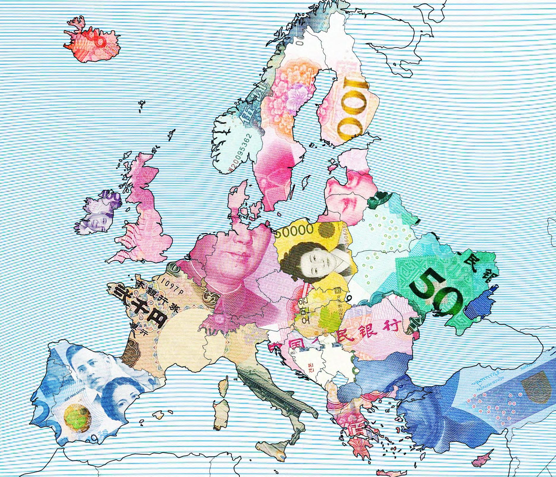
An invisible current of cross-border capital is flowing into Europe today, shaping how its cities are growing and the way its citizens are living. As these foreign capital investments are projected to increase, particularly from the Asia-Pacific region, it is crucial for urbanists to be able to discern and embrace the vital influence of global geopolitical and socioeconomic factors in both their thinking and practice. With three case contexts; Greece, Poland, and Spain, a compact illustration of the esoteric and ulterior force of foreign investment and acquisitions in properties and public assets reveals some of their socio-spatial impacts. From Real Estate, Infrastructure, Energy, to Logistics companies what else have some cross-border investors not bought in Europe? Perhaps its soul.
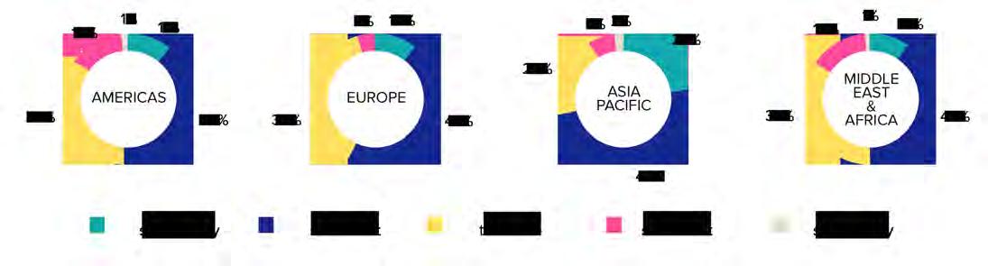
According to the Urban Land Institute, crossborder Asian and Pacific capital investment into the real estate and property market in Europe is projected to increase by a total of 71% in 2022 onwards.
Although main investments from the eastern part of the world coming from China began increasing since 2008, the influence of investments from other Asian markets are expected to continue pouring in. China as an investor has already acquired a chunk of London’s real estate, Albania’s Tirana International Airport, Swedish car manufacturer Volvo, Swiss energy’s Addax Petroleum Corporation, as well as a minority stake at Rotterdam’s Euromax Seaport
Terminal. Additionally, it is also looking into investing in more infrastructure and energy industries stretching from France to Eastern Europe. South Korean, Middle Eastern, as well as Southeast Asian capital is following suit by making its way to acquiring stakes in and ownership of European developments and assets either privately or in partnership with EU governments.
In a hyper globalized world as today, this is perhaps business as usual (which is a phrase we have already been using to describe a bad accustomed practice or way of living), yet the seeming socio-political balance in terms of key investments between the east and the west is now coming to an upturn.
26 01
ISHKA MEJIA
UNDERLYING STRUCTURES IN POSTWAR URBANIZATION
Atlantis Magazine |Invisible | volume 41 27
Fig 1: Territorial Deposits
Image Source: Author’
An invisible, yet multifarious current of capital is flowing from Asia to the European Union, unwittingly changing and redefining the very cities and systems where European properties and industries are located. Ones whose wheels are now being steered by a more dynamic and diverse set of players and stakeholders that may not necessarily care for the immediate environments of their assets or have a wider agenda for strategic sociopolitical interests. A simple investigation of how this unseen force is manifesting in communities and space in some European countries such as Spain, Greece, and Poland can allow urbanists to view and think about global socioeconomic power translated into the places we are designing and for whom more critically, yet also more openly.
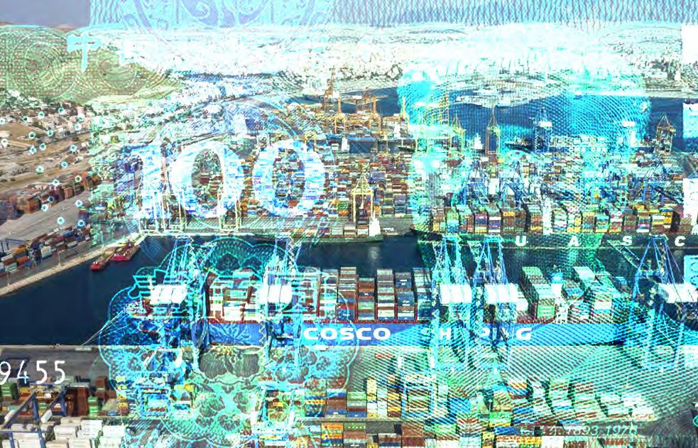
Greece
The Port of Piraeus is the leading seaport of Greece, but it is majorly owned by the China-owned company COSCO Shipping with a 67% stake which takes salient control of operations. With a total investment of €1.2 billion since 2016, the facility has already expanded its capacity five times. COSCO initially pursued the investment in Piraeus as the country was under a state of colossal debt and possible bankruptcy when the government decided to privatize state-owned assets such as the port. Since then, an agreed 3.5% of yearly revenue from the port’s yields has been contributing to the local economies of the 5 municipalities in the Greater Piraeus area, also having created more than 10,000 jobs. The mayor of Piraeus, Yannis Moralis, declared that they receive € 3 million annually and that as the port’s yields are directly proportional to the boost in municipalities’ benefits, its progression shall be a win-win situation. Yet now it is unfolding that unemployment and financial matters are not the only concerns of locals.
A leader of a dockworkers union has expressed that, “China
created jobs, but not good jobs.” As safety training is foregone in some port procedures, it has been reported that operations which receive little compensation for high-risk jobs have caused a series of fatal incidents in the port. Additionally, a new plan for an entertainment and leisure hub worth €294 million in Piraeus in the works has been delayed. The foreign port owner ascribes this to the Greek government’s slow bureaucratic processes and local resistance, yet the latter’s defense is that environmental studies conducted and contracted by COSCO needed for construction to continue are lacking and substandard. Although with COSCO’s huge stake, it will still most likely go through. Most of the construction materials for the port expansion and new developments are imported from China, displaying disregard for local industries. Despite labor issues and interrogations on how the port’s revenues are being used by the beneficiary municipalities, the port is presently considered the 3rd largest and busiest cargo port in the Mediterranean, and the 5th top port in Europe. Yet the position of this port has a greater significance in the global urban fabric as it is a key link within the Belt and Road Initiative (BRI) of China, poised to be a regional distribution center that would connect Asia, Africa, and Europe.
Spain
Residency by real estate investment such as the ‘Golden Visa’ program shrouds foreign capital investment in Spain. This migration scheme permits residential or commercial property investments of a minimum threshold of €500.000 from any individual or company outside the country to acquire and hold residency for as long as the property is maintained. Due to this mandate, several cities in Spain and more particularly in its capital city, Madrid, have spurred many financial investments, incentivicing real estate development companies to direct their efforts towards a more diversified market. This not only
28
Fig 2: Expected cross-border capital into Europe in coming three to five years
Underlying
in
Source: Urban Land Institute (2021)
structures
postwar urbanization
Atlantis Magazine |Invisible | volume 41 29
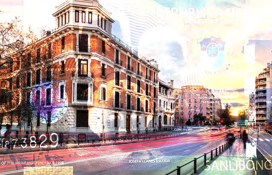
Fig 4: Salamanca under the Peso Image Source: Author
Fig 3: The Piraeus Port under the Yuan Image Source: Author
includes the US,Britain, and other EU investors, but now also clients from China, The Middle East, Southeast Asia, and other emerging industrialized economic countries in the Asia Pacific. Since its establishment in 2013, the scheme itself has accumulated an amount of €911 million, of which the share sold to Chinese buyers for residential property is 30.5% as of 2016.
The Philippines, whose ties with Spain go back for centuries due to its colonial past, has many investors into this program as only 2 years of residency are required to hold citizenship, encouraging high-net-worth Filipinos and their families to purchase properties for investment or even decide to reside in Spain altogether. As these private investors come from a certain socio-economic class, they search for more expensive or forthcoming areas with the Salamanca district in Madrid as one of the main preferences. This has also defined how the district is growing and which kind of commercial properties are emerging in the area, generating more diverse yet upscaled neighborhoods whose calles are now frequently dotted with Asian cuisine and other foreign retail brands unbeknownst to Spanish locals literally setting up shop. This is causing both a shift in the local design, construction, and hospitality industries with a greater demand for different visions in residential and commercial property development in several districts in Madrid to serve this new market. Aside from the construction of newly built homes, the refurbishment and renovation of dilapidated or foreclosed properties are now in full swing as capital flows from these foreign private investors and have had significant impacts in the localities where these spatial assets are located. Despite criticisms of the scheme from locals, it is reported that this residency by investment program has substantially cushioned the blows of Spain’s debts and stimulated its lagging economy.
Poland
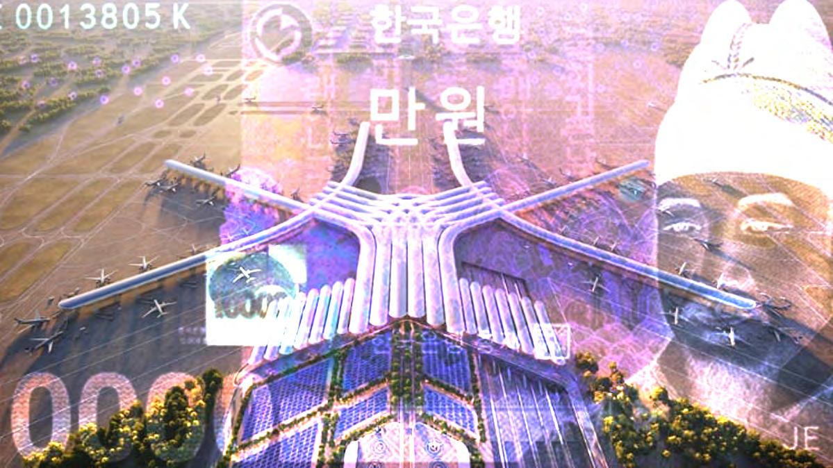
In Central Europe, Poland’s diplomatic ties with South Korea that begun in 1989 are seemingly more transparent with the East Asian nation’s plans to develop transportation and energy infrastructure in the EU territory. By 2021, South Korean investments –ranging from kimchi to electric vehicle battery factories – in Poland are valued at €5.1 billion. Recently, a private nuclear reactor plant to bolster Poland’s key nuclear energy program is set to be constructed as proposed and agreed upon by state-owned Korea Hydro & Nuclear Power (KHNP), Polish energy group ZE PAK, and a Polish power company in the city of Konin. This position suggests a boost in the Polish economy and its role in the energy transition that, apparent in these engagements, it cannot pursue alone and is receiving support from an ‘outsider’. Notwithstanding, the transport
hub called Central Transportation Port (CPK), converging air, rail, and road transit located at a 45-km proximity from Warsaw is planned for development beginning next year. This collaborative effort between the Polish and South Korean governments is to be dubbed “the Far East’s gateway to the European Union.” Historically, this is the biggest infrastructure project in Poland, and is the EU’s largest infrastructure project at the moment. This megaproject is composed of building a greenfield airport tabula rasa whose design was bid for and won by Foster + Partners and direct rail connections to Warsaw and other cities. The latter is set as new high-speed railway lines measuring up to 2,000 km to reach other Polish cities in less than 2.5 hours, integrated in the CPK development. As the project’s entirety is expected to be finished by 2034, how much further Polish cities, as well as other EU states shall be shaped by these investments and their corresponding developments that will translate to new living and working environments for locals and even migrants shall soon emerge.
The contexts illustrated are just a few examples of how Europe’s regions are being shaped by such external forces as foreign financial capital that is usually too abstruse for most urbanists to relate to but must. It is of no question that they are stirring the processes that have historically also defined them – migration, industry, and infrastructure – by virtue of their effects on local employment, mobility, and quality of the built environment that directly affect people and how they live, and by extension, their futures. These ulterior yet strong currents of cross-border capital flows from Asia to Europe, the very historical representatives of East and West, are of interest in urbanism today as key drivers of change in new socio-spatial relations and connections that encompass the myriad scales of the urban fabric – from the neighborhood as seen in Spain, yet also that of global trade and regional infrastructure as in Greece and Poland. Furthermore, this also dispels a portion of the antagonistic views on foreign migration and capital as detrimental to the European economy, when in fact it could also be saving it. Nevertheless, there are many and more political and ethical aspects to this as well; like how the ‘Golden Visa’ scheme itself implies the privileged rights to reside in the EU if only one had a certain net-worth or how these partnerships and deals are conducted as they differ from one EU state to another. And if one has not already noticed, this article has spilled over more numbers in Euros than the people and spaces affected and perhaps the local situations whence these investments are coming from. How much better then can we think about, represent, and expose the deeper and more complex relationships between cross-border financial investment and space, which are, in essence, the two main instigators of development and urbanization today? These ‘invisible’ currents through the medium of financial capital only reveal their power in time, in built space, and in this case, perhaps the future of the European spirit.
30
Underlying structures in postwar urbanization
Alderman, L. (2012, October 12). Under Chinese, a Greek Port Thrives. The New York Times.
Aranda, J. (2018, November 28). Spain consolidates as a European paradise of the “golden visa.” El Pais.
Barczynska, E., & Kang, B. (2022). Korean Wave in Poland: Success and Challenge., 34, 5–38. https://www.kci.go.kr/kciportal/ci/sereArticleSearch/ ciSereArtiView.kci?sereArticleSearchBean.artiId=ART002820834
Brattberg, E., le Corre, P., Stronski, P., & de Waal, T. (2021). China’s Influence in Southeastern Central, and Eastern Europe Vulnerabilities and Resilience in Four Countries CHINA’S IMPACT ON STRATEGIC REGIONS.
Constandras, N. (2019, May 23). Who Is Playing Politics With the Port of Piraeus? The New York Times.
Engin, Y. (2019, November). Investor trends: Koreans continue march into Europe. IPE Real Assets Magazine.
Genius Properties. (2016, February 15). Spain’s Golden Visa Scheme Accumulates €911 Million. Https://Geniusproperties.Com/En/News/SpainsGolden-Visa-Scheme-Accumulates-911-Million/.
Harper, J. (2021, October 23). Why Poland is South Korea’s gateway to the EU. Emerging Europe.
Henley & Partners. (2022, May 30). How Filipinos can become Spanish Citizens.
The Philippine Daily Inquirer.
Kidera, M. (2021, December 10). “Sold to China”: Greece’s Piraeus port town cools on Belt and Road. Https://Asia.Nikkei.Com/Spotlight/Belt-and-Road/Sold-
to-China-Greece-s-Piraeus-Port-Town-Cools-on-Belt-and-Road.
Murcia Today. (2022, July 11). Spanish Golden Visa is One of the top European investors’ choices in 2022. Https://Murciatoday.Com/Spanish-Golden-Visa-IsOne-of-the-Top-Investor-Choices-in-Europe-in-2022_1800026-a.Html.
Polish Investment and Trade Agency (PAIH). (2021, September 23). PAIH organized a Polish-Korean Business Forum. Https://Www.Paih.Gov. Pl/20220923/Paih_organized_a_polish_korean_business_forum#.
Popescu, R. (2022, February 22). House Hunting in Spain: A Restored TwoBedroom in Central Barcelona. The New York Times.
Savills Research. (2019). South Korean Investment into Europe.
Spocchia, G. (2022, November 11). Foster + Partners lands design of major new Polish airport. The Architect’s Journal. SVI. (2022, July 18). Spain’s Golden Visa Among Top Investor Choices in Europe for This Year. Https://Www.Schengenvisainfo.Com/News/Spains-Golden-Visaamong-Top-Investor-Choices-in-Europe-for-This-Year/.
Tartar, A., Rojanasakul, M., & Diamond, J. (2018, April 23). How China Is Buying Its Way Into Europe. Bloomberg.
Tilles, D. (2021, November 8). Poland to become European kimchi hub with new South Korean factory. Https://Notesfrompoland.Com/2022/11/08/Poland-toBecome-European-Kimchi-Hub-with-New-South-Korean-Factory/. ULI. (2022). Emerging Trends in Real Estate: Road to recovery.
Varvitsioti, E. (2021, October 21). Piraeus port deal intensifies Greece’s unease over China links. The Financial Times.
Atlantis Magazine |Invisible | volume 41 31
Fig 5: The CPK Airport under the Won Image Source: Author’s Own
UNDERLYING STRUCTURES IN POSTWAR URBANIZATION
Recognising Facts on the Ground
in conversation with Lukas Pauer at Vertical Geopolitics Lab (VGL)
Lukas Pauer is a licensed architect, urbanist, educator, and the Founding Director of the Vertical Geopolitics Lab, an investigative practice and think-tank dedicated to exposing intangible systems and hidden agendas within the built environment. At the University of Toronto, Lukas is the Assistant Professor of Architecture, Inaugural 2022-2024 Emerging Architect Fellow. At the Architectural Association in London, Lukas has pursued a PhD AD on political imaginaries in architectural and urban design history with a focus on how imperial-colonial expansion has been performed architecturally throughout history. He holds an MAUD from Harvard University and an MSc Arch from ETH Zürich. Among numerous international recognitions, Lukas has been selected as Ambassadorial Scholar by the Rotary Foundation, as Global Shaper by the World Economic Forum, and as Emerging Leader by the European Forum Alpbach — leadership programs committed to change-making impact within local communities.
We would like to begin our conversation by understanding your work’s position in relation to the theme of our issue; (in) visibility.
I realize that conceptually speaking it has been a running theme in the work of my practice, the Vertical Geopolitics Lab (VGL), and its teaching branch, which is currently affiliated with the UofT Daniels. A lot of my work has saught in some form or another to render the seemingly invisible visible. It seeks to expose hidden agendas and power dynamics that are manifested in the built environment. Power is all around us. Built objects of the everyday can be instrumentalized to convey subversive messages of power. Still, most people think that power dynamics are shaped by and conducted through written policy documents and cartographic drawings. Few people recognize the workings of power as visibly inscribed and manifested in the built environment itself. People often perceive the workings of power as less visible or effectively invisible in the built environment. Given my original training as architect and urbanist, I am really concerned with the
workings of power that people often perceive as immaterial and aspatial. My integrated practice, teaching, and research seeks to recenter the study of how power over people and land is projected as a practice-based matter of space and power.
Can you tell us a bit more about what you mean by the seemingly invisible, immaterial, and aspatial that you talk about?
Within architecture, far too little attention has been paid to how built objects are not merely their material make-up in form, nor their functional capabilities. Built objects are also markers that can convey messages to those affected by them in disputed domains, in places where power is being exercised. Objects can give the impression that their function is an apparently non-violent or innocuous one. Still, any object can be instrumentalized, implicitly, to convey more subversive messages of power. Although the people behind the design of built objects may not have had this in mind when conceiving them, objects can be instrumentalized to make meaning in other ways.
32 01 JAN’23
Your research findings emphasize on the existence of a ‘gray zone’, could you elaborate on these vocabularies of imperial-colonial powers, that you developed in the process and how you went about with doing so?
Given the ongoing Russian invasion of Ukraine, I would like to share another timely case part of Russian power projection in Eastern Europe, which I have recently written about in the latest issue of the RMIT DSC AUD Kerb Journal. In recent years, the Russian government has politicised a near-cult of victory as central to Russian national pride and identity. Emblematic for this near-cult, various scenographic techniques of visual spectacle and historical reenactment of a Russian club called the ‘Night Wolves Motorcycle Club’ (‘Motoklub Nochniye Volki’) have been instrumentalised for the manipulation of public perception, memory, and mass emotion. Among its controversial activities, the Night Wolves motorcycle club coordinates various annual motorcade rides to architectural relics of Russian history. Since 2015, timed with the anniversary of the Soviet military victory over the Nazi German Empire, the Night Wolves have embarked on a particular motorcade ride called ‘Roads of Victory: To Berlin!’ (‘Dorogi Pobedy: Na Berlin!’), which may seem minor or banal in appearance but has posed a threat to international relations in the eyes of various European and Western polities. Along this route, members of the Night Wolves planned to stop by and lay plant wreaths at various sites dedicated to the history of the Russian people; Russian Orthodox Christian
sanctuaries, Soviet war memorials, cemeteries, museums, and ethno-linguistic monuments of Panslavic significance. Rides organised by the Night Wolves have intentionally been led through disputed and self-declared separatist regions in Russia’s sphere of interest including Nagorno-Karabakh, South Ossetia, Abkhazia, Donbass, Crimea, Pridnestrovian Moldavia, and Bosnian Serbia. Many of these can effectively be referred to as ‘semi-colonies’ of Russia and its allies. The ambition to project power, spatially, through the motorcycle club’s activities becomes most clear in the words of its leader, Alexander ‘Khirurg’ Zaldastanov, when he affirmed: ‘Wherever we are, wherever the Night Wolves are, that should be considered Russia’. As such, several years before it would become a reality, the Night Wolves motorcycle club symbolically legitimized the Russian occupation of Ukrainian territory in the Crimean and Donbass regions.
Can you share an example of how your work is able to address this circumstance?
For example, as part of my appointment here at the UofT Daniels, I am teaching three courses. One of them is more analytical in the history/theory of the built environment. The other two form a year-long course sequence that is more projective in the design of the built environment. Both of them directly address the invisible, immaterial, and aspatial but at different scales, in different contexts. In our undergraduate architectural studies program, I teach a near 300-student
Atlantis Magazine |Invisible | volume 41 33
Fig 1: Excerpt from the Counterhegemonic Architecture Studio at John H. Daniels faculty of Architecture, Landscape and Design headed by Lukas Pauer. Work by Bryson Woods.
core lecture course in which the understanding of public space as ‘public’ only to those who are politically represented and organized is central to it. In our graduate architecture program, I supervise a group of final year students in a year-long thesis research studio course sequence supporting investigations on space and power in an effort to expose, challenge, and reconstitute the pervasive and ongoing reality of imperialcolonial expansion. Both of these teaching engagements are dealing with vulnerable people being effectively rendered invisible. Both of them address how the instruments for doing so are often not visible to people.
In your work on the built environment, how do you identify and describe vulnerability along the spectrum of power dynamics, given that it is a highly relational condition?
Historically, politically organized communities have imaginarily seen and divided their world through a self-other or us-them binary. In the social sciences this is often referred to as the hegemonic gaze. Most of my work is directly concerned with how this gaze has affected the construction of the built environment around us. In a more mundane urban design context, in the case of provincial or municipal authorities projecting their power over vulnerable people and land, we can see how identity, demographic factors such as age, gender/ sex, race/ethnicity, and body ability, as well as socio-cultural factors such as belief/religion, nationality, education, and income class have been mobilized to produce ‘Otherness’. In a much larger international relations context, the hegemonic gaze has given expansionist polities the power to redefine and therefore to control the ‘Other’ and the ‘Them’, as well as, by extension, the ‘Self’ and the ‘Us’, through socially constructed labels such as the supposedly inferior ‘Barbaric’, ‘Oriental’, and ‘Exotic’, the ‘Second’ or ‘Non-Aligned Third World’, the ‘Underdeveloped’ or ‘Developing World’, the ‘Non-Integrating Gap’, and the ‘Global South’.
This practice of othering or alienating has allowed European and Western polities to represent the ‘Other’ as inferior, backward, irrational, and wild, as opposed to itself, which is seen as supposedly ‘exceptional’, superior, progressive, rational, and civil(ized). By suppressing people from expressing and representing themselves, individually, expansionist polities have conflated and reduced non-European and nonWestern people, collectively, into supposedly homogeneous entities. So with this framework in mind, as one of the first things I give my students on their way as they may start engaging with more sensitive materials and communities from an outside perspective, I remind them that marginalized and underrepresented people are not a monolith. In other words, for example, there is not ‘the one’ LGBTQ+ or ‘the one’ Indigenous community, just like there is not ‘the one’ US American or ‘the one’ Canadian community. Politically organized communities and so-called ‘nations’ are socially constructed groupings
of people or individuals. Such umbrella terms refer to many diverse cultural groups under the same name. There will be plenty of disagreements between communities. Furthermore, there will likely be a variety of perspectives even between individuals in the same community.
You talk about the social construct of the nation, which brings us to the ongoing discourse on the demise of the nation-state. What is your position in this discourse?
I would say it is helpful to first reflect on how political theorists actually use the term ‘polity’ or ‘politically organized community’ for what most people would refer to as a ‘country’ or ‘nation’. This is because, precisely speaking, not all countries are nations. Historically speaking, the assumption that legitimate polities supposedly correspond to nation-states is a relatively recent one and a Euro-Western-centric one in particular. This assumption is what social scientists would refer to as an ‘invinted tradition’. With the French revolution the so-called ‘nation-state’ was asserted as the only entity justified to have legal personality and capable of using violence to back up claims to authority. This idea of the ‘nation-state’ ist just one of many examples in the spread of and adaptation to European and Western polities’ concepts and ways of life, propagated as supposedly ‘exceptional’ and superior to those of other communities.
This concept of the nation-state has come with many associated concepts in its baggage. Socalled ‘territoriality’ being one of them. .... just like the nationstate itself, the term ‘territory’ in its contemporary usage refers to an invented tradition.
In this process, the rise of the nation-state-based model of the world has been portrayed as a supposedly linear, inevitable, and honorable one. Due to the pervasive and ongoing expansion of European and Western imperial-colonial powers, this process has reached most of the world. Still today, according to the diplomatic system enshrined in the UN Charter, a legitimate polity is assumed to correspond to a nation-state, an entity originally asserted by early modern European imperial-colonial powers.
This has led to a peculiar situation in which a polity seeking to break away from another, seeking independence, seeking to decolonize, would have to adopt the language and as such the legacy of European and Western imperial-colonial powers. In the words of the writer Adrienne Rich, such a polity
34
“ “ Underlying structures in postwar urbanization
would have to speak the ‘language of the oppressor’. In other words, such a polity’s effort would have to take the form of self-determination as a nation-state; a supposedly universal model of the world that is actually the legacy of a European and Western understanding of sovereignty.
Then, within this ongoing discourse, there is the argument that the perception of territory is obscured by the nationstate and its workings.
You are hitting the nail on the head. This concept of the nationstate has come with many associated concepts in its baggage. So-called ‘territoriality’ being one of them. Again, just like the nation-state itself, the term ‘territory’ in its contemporary usage refers to an invented tradition. Today, given their linear representation on contemporary maps, borders seem rigid, impermeable, and clearly demarcated. As a result, still today, people often fail to address the more fluid, porous, and often precarious reality of borders between politically organized communities in many parts of the world. Poorly defined peripheries with frontier areas of often overlapping sovereignty had been characteristic of ancient and medieval times. Instead, the image of a contiguous long-distance fence or wall congruent with the representation of a border on a map has been invented and perpetuated by European and Western imperial-colonial powers.
The linear representation of borders merely forms an exception, an invented tradition in the historical genealogy of often rather vaguely demarcated peripheries. This circumstance is best reflected in canonical historical atlases such as the historian and demographer Colin McEvedy’s series with Penguin Books and the historian and cartographer
Werner Hilgemann and writer Hermann Kinder’s two-volume collection with Deutscher Taschenbuchverlag. These and other recent historical atlases draw the periphery of any premodern polity as lines, anachronistically, as if the peripheries of ancient politically organized communities were as clear-cut as the boundary lines of today’s nation-states seem to be.
How do both your think-tank and its teaching branch have the potential to establish a theoretical or methodological framework that can further the conventionally twodimensional understanding of territorial power dynamics?
Various scholars have started to argue for the necessity to rethink the study of geopolitics not only in terms of ‘visuality’ and ‘materiality’ but in terms of ‘verticality’ and ‘volume’ rather than ‘area’. Among the first, in 1975, at the Museum of Decorative Arts in Paris, the philosopher and urbanist Paul Virilio launched the Bunker Archeology exhibition and book in which he documented military fortifications along the Atlantic coast of Northwestern Europe, built by the Nazi German government in anticipation of an enemy invasion during the second world war. Virilio merged the study of these material objects’ structure, appearance, and function with the existential questioning of geopolitics and warfare. To Virilio, warfare became a question of volume; ‘battlespace’ rather than battlefield. At the time, political theorists such as John Ruggie started contrasting the organizing principle of modern intercommunal relations, territorial sovereignty, with principles of premodern times, which influenced various political geographers. Building upon the works of these political theorists and geographers, in search of an expanded mandate for architectural design practice, architectural theorists increasingly engaged with critical theory in the fields of politology, geography, and media.
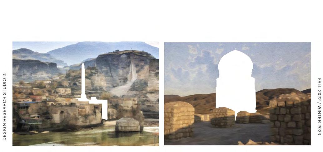
Atlantis Magazine |Invisible | volume 41 35
Fig 2 : Excerpt from the Counterhegemonic Architecture Studio: Work by Liane Werdina- The displacement of memories, cultures and histories, are used in exchange for the progress of the state. This exchange is targeted , imbalanced and threatening to the existence of these aspects that constitute a people. These objects can be ever changing , malleable , with an uncertainity to what their identity and meaning is without a land to exist within.
How does your work begin to articulate complex relations between power and space in the context of this transitional reality of the territorial nation-state?
With my doctoral dissertation, I have effectively responded to this prevailing perception of the nation-state and its territoriality as the supposedly dominant principle in global politics and international relations. Rather, I have argued throughout the main chapters of my dissertation that the consolidation and expansion of authority is materialized through more punctual interventions in the form of built sovereignty markers on the ground. Consequently, in the appendix of the dissertation, I have sought to challenge the genre of the historical atlas by imagining a more object-centered and non-written practicebased format that corresponds with the reality on the ground.
Does this relate to the thought-provoking motto of your think-tank; ‘to portray reality is a reality of its own’?
Yes, in a way, our conversation directly relates to this motto, which basically refers to the fact that how something is being constructed, represented, or portrayed very much shapes the perception of what is being constructed, represented, or portrayed. An example of this would be a map of the world. Conventionally, on most maps of the world in Europe and the West, centered on the Atlantic Ocean, the Americas are represented as situated west of Europe, Asia, Africa, and Oceania. Similar to how the expansion of European and Western imperial-colonial powers has served to define and rank the rest of the world in terms of the definition of sovereignty and polityhood, the cartographic drawing technique of mapping undifferentiated territorial entities separated by boundary lines, which also expanded with the hegemonic European imperial-colonial powers and their associated means of representation, has organized and reduced the rest of the world to a representation that was known and comprehensible in European terms.
It is interesting to see then how in many other parts of the world outside Europe and the West, for example in parts of Asia and Oceania, maps of the world are centered on the Pacific Ocean with the Americas represented as situated east of the other continents. Both ways of drawing the world are real, are true, but they each literally emphasize a different perspective, a different point of view. This goes back to the motto of VGL, which is meant to prompt a debate on how something is being portrayed matters as much as what is being portrayed.
How can they be objectively accounted for if they are a part of the same hegemonic regime that has sustained imperial colonial expansions?
Even the question of how many countries there are in the world is a political and thus difficult one to answer. It depends on the point of view. The number of autonomous politically
organized communities depicted on world maps reflects the political views of particular politically organized communities. Most world atlases and factbooks list the ones recognized by the United Nations (UN), an intergovernmental organization supposedly representing the ‘international community’ and ‘international order’. However, these terms are euphemistic ones that seem to refer to all people or polities in the world but are actually employed to manufacture consensus for a specific point of view or give legitimacy to specific actions that only reflect the interests of a specific group of dominant integral core powers acting on behalf of other polities.
Various people have started producing and updating descriptive and practical (ie de facto) rather than prescriptive and legal (ie de jure) maps that display sovereignty disputes, de facto authority, and effective occupation as it exists on the ground. Most politically organized communities in the world are involved in a sovereignty dispute of some kind.
Under the umbrella of your think-tank and its teaching branch, you develop a varied body of work investigating power dynamics in different contexts. As deriving from your inferences, we were wondering if this research output could be used to develop a larger theoretical and methodological framework that can be transposed to understand spatial complexities of power in other contexts? If so, do you already have an idea on the potential modification that such an act of transposition would entail?
The case part of Russian power projection in Eastern Europe that I shared with you earlier is just one of many cases my think-tank has been studying over the years. Laying the ground work for such studies, in my doctoral dissertation I have inventoried and categorized material objects that have been key to the acquisition of authority and influence over people and land throughout history, which has been a first step in an effort to specify and systematize how one might approach thinking about the historical genealogies of practices of imperial-colonial expansion.
Accordingly, the cases studied in my dissertation have been categorized into four broad types of practice of power projection and sovereignty acquisition; scenographic, extraterritorial, geodetic, and filtrational. The titles given to these four categories are not necessarily meant to be completely separate, distinct, or even complete.
As an accumulation of various histories, some of the cases covered in my dissertation overlap across multiple practices, building upon each other with continued symbolic aspects of preceding practices within them. However, the four categories outlined in this dissertation have been very useful in framing a non-written practice-based narrative of sovereignty’s conceptual evolution throughout history.
36
Underlying structures in postwar urbanization
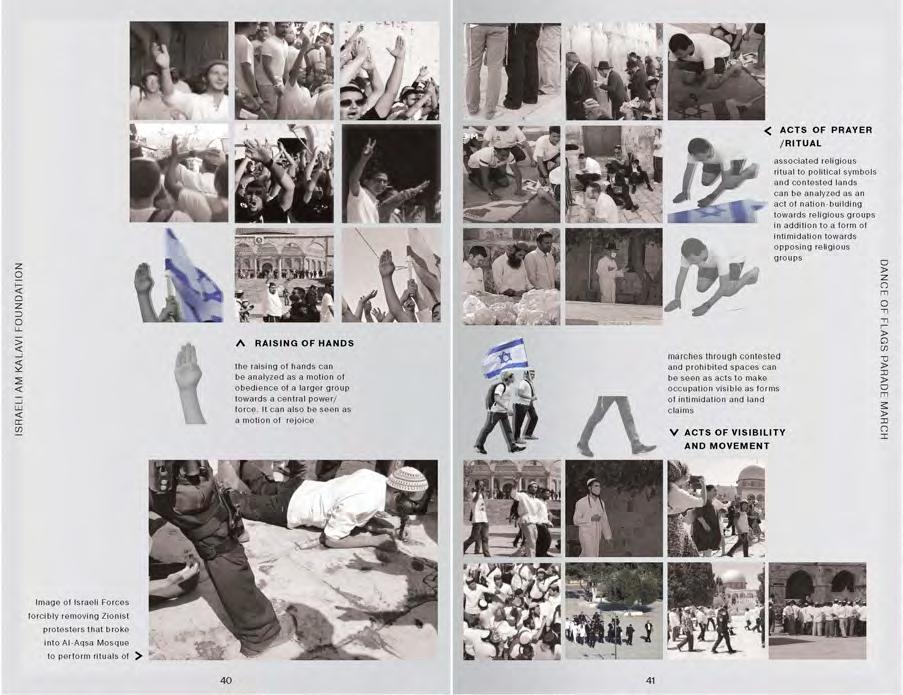
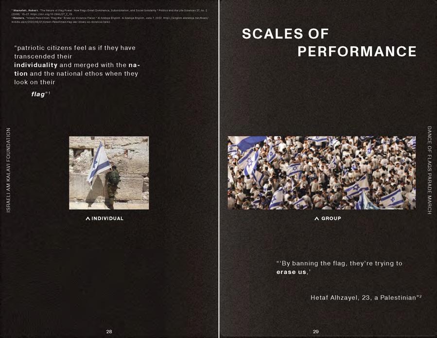
Atlantis Magazine |Invisible | volume 41 37
Fig 3: Excerpt from the Counterhegemonic Architecture Studio: Work by Liane Werdina
Amazon Forest: Prestine Nature or Domesticated Garden?
Learning landscape architecture from the hidden layers of the forest -
a brief literature review.
The Amazon remains in Western minds as the ultimate “untouched nature” in the world, as a real wild jungle. Truth is, there is an increasing amount of studies showing how pre-Columbian societies shaped the Amazonian landscape during at least the 8,000 years prior to European colonization. Therefore, this landscape has, to an uncertain extent, a hidden human-made layer. These peoples managed the forest’s resources in a way that provided them with their basic needs, while not harming flora and fauna but sometimes even benefiting them. In times of rampaging deforestation and expanding monocultural fields, what can we learn from the way these gardeners kept their forest-garden running and thriving for millennia?
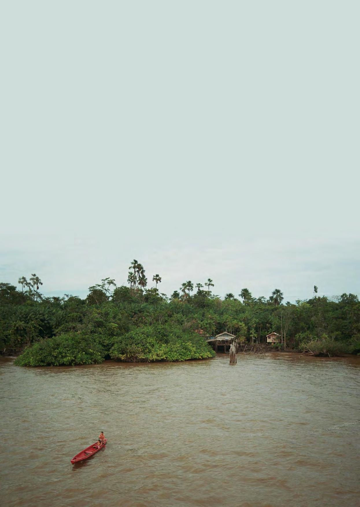 VICTORIA IMASAKI AFFONSO
Fig 1: Local inhabitant in the Tapajós River (a tributary in the Amazon River basin). Image Source: Author, 2017.
VICTORIA IMASAKI AFFONSO
Fig 1: Local inhabitant in the Tapajós River (a tributary in the Amazon River basin). Image Source: Author, 2017.
02 HIDDEN PROCESSES
Does pristineness even exist?
The idea of tropical rainforests as the reserves of pristine “nature” on Earth, as wildlife “sanctuaries”, is common within many societies. However, the very idea of “nature” is a cultural construction. The English Oxford Living Dictionary defines nature as “the phenomena of the physical world collectively, including plants, animals, the landscape, and other features and products of the earth, as opposed to humans or human creations”. Such a definition draws a sharp dichotomy between this defined nature and human societies. In contrast, according to Eglée (2013), the word nature doesn’t exist in the original Amerindian languages, as the idea of life as a widespread, indivisible sphere is generally stronger.
This vision of a refuge full of pristineness is “an imaginary place created by Westerners during a particular moment in their history” (Descola, 2013; Levis, 2018). Emma Maris (2011) examines how the creation of Yellowstone Park in the United States set a new model of “wilderness” that has been thoroughly exported since then. Actually, the author argues, in the Anthropocene, nothing is beyond human influence, nothing remains untouched, as even walled and isolated ecosystems are subject to, for example, climate variations and its meteorological consequences. Such influence may have begun as early as the late Middle Ages when large-scale burning and deforestation first became common (Pongratz, 2009). As uncomfortable as it might feel, it seems like we do live in a post-wilderness reality.But, going back to the point: since the 1980s, researchers began to learn how the Amazonian landscape has been shaped by their original inhabitants over thousands of years, where lies the possibility for much learning.
Is The Amazon Not Pristine?
Like the forests of the Congo basin and the Indo-Malay region of Southeast Asia, the Amazon forest is no exception: it is not a pristine landscape. Rather, pre-Columbian societies shaped the forest to obtain resources for their survival. Just like gardeners, they worked the land by setting the conditions for it to thrive (Nijhuis, 2022) because their survival depended on it, and their idea of society was (probably) not as divided from nature as ours is. And until nowadays, even though the demographic collapse of Amerindian populations happened around 500 years ago, traces of their gardening practices remain hidden in the Amazonian landscape. Forests can hold all sorts of memories from their interactions with humans, and, in times of deforestation and food insecurity, we should learn what we can from this ethnobotanical legacy of forest-based food production systems.
What did the first europeans encounter?
In his book 1491, Charles C. Mann (2007) explores the first accounts left by European fortune hunters and missionaries. Even though the objectivity or impartiality of these first colonial reports can be questioned, they remain as the main historical sources from this period, as the lack of written language among pre-Columbian societies has left mostly silence.
Frei Gaspar de Carvajal was a Spanish author who was one of the first to describe the Amazon. Part of a Dominican order, he joined in 1536 an expedition that, in seeking the legendary city of El Dorado, reached the Amazon River. At the Peru-Brazil border he writes, “the further we went, the more thickly populated and the better did we find the land.” As the expedition continued downstream, he reports “numerous and very large settlements and very pretty country and very fruitful land”, as well as a settlement that “stretched for five leagues without there intervening any space from house to house”.
... if 25% of the Amazon forest is deforested, the whole system collapses and mass desertification would occur, releasing astronomic amounts of carbon dioxide into the atmosphere. We are now at 20% (Nobre, 2020)
Archaeologist Betty Meggers (Mann, 2007) points out that Carvajal’s demographic estimates were probably a bit too high, as the soil in the region was too poor to sustain such an enormous population. Even so, Denevan (Denevan et al., 1992, 2014) estimates that around 10 million people lived in the Amazon before the arrival of the first Europeans. Thoughout the three centuries following such a meeting, it is estimated that around 95% of this population died due to wars, slavery, Jesuit missions and European-borne diseases, such as smallpox and influenza (Mann, 2007). So, when European naturalists came in the 19th century, they reported the forest as pristine, as a sort of human desert with scattered little agglomerations of primitive people (O’Fallon and Fehren-Schmitz, 2011). More and more archaeological and scientific findings sustain the opposite: these societies were complex, and managed to thrive within the ecosystems they simultaneously cared for and were part of.
Atlantis Magazine |Invisible | volume 41 39
“ “
Pre-columbian societies as gardeners in the landscape
There is an unclear “chicken versus egg” type of dilemma in this topic: did the Indigenous peoples settle in the Amazon because of its richness, or is the Amazon so rich because of the efforts of its previous inhabitants? The answer is probably somewhere in between, even though recent findings suggest the latter to be more likely.
Indigenous gardens, orchards and swiddens still reside in the landscape, intertwined with patches of forest that regrew with natural succession, as a real ethnobotanical legacy. Levis and Flores (2017) investigated the surroundings of many archaeological sites of former Indigenous settlements in the Amazon River basin, and found very unexpected microscopic remains of vegetal tissues (phytolith assemblages), indicating the presence of specific species around the ruins of known villages. Such species were not only selected (as in “curated”) but also domesticated, a term that means they were genetically different from their original population. They also discovered combinations of up to 19 domesticated species occurring within a radius of 1km around archeological sites, even though they would have been out of their ecologically preferred zones and wouldn’t have commonly occurred together because of competition. As it usually goes, higher diversity in trees or crops attracted different birds, whose populations could increase, consequently causing the carnivore population to grow - on the basis of human management of the land, a cultural forest.
Indigenous layers also still exist in the soil, throughout vast extents of the forest. Counterintuitively enough, the soils in the Amazon basin are extremely poor in nutrients - the sizzling sun and the violent storms do not help organic matter to evolve. However, across the whole forest, but especially alongside rivers, one can find the so-called “Amazonian Dark Earth”, or “solo preto de índio” (translating from Portuguese, that means “indigenous black soil”). This soil is the result of maybe thousands of years of Indigenous care, as these patches were the “trash heaps of settlements and were cluttered with crescent of broken pottery” (Mann, 2007). The pre-European inhabitants of the forest would plant their orchards and especially their row crops in this soil.
What is the geographic extent of all these facts? The “Amazonian Dark Earth” can be found virtually everywhere in the basin. When Levis and Flores (2017) mapped tree species in 16,000 different patches of land, they found 227 hyperdominant species. Of these 227, eighty-five are believed to have been introduced or domesticated by pre-Columbian peoples. That is an enormous extent of impact in the landscape. In numerical terms, according to Balée (1989; 2013), cultural forests might have covered 11.8% of the Amazon basin. Some
estimates show that people cultivated at least 138 native and exotic plants before European conquest, which would place the Amazon as one of the major centers of plant domestication in the world nowadays (Meyer et al., 2012).
Learning From Their Gardens
The objective of learning from past experiences is not to be able to reproduce something exactly as it happened before, but rather to learn the principles that were once behind it. By understanding the spatial arrangement of such civilizations, and by acknowledging that they probably enriched the forest sheltering them, we might be able to draw hypotheses on how our current human settlements could be enhanced in a more neutral, if not advantageous, way in relation to local ecosystems. In the post-wilderness Anthropocene, it is necessary to think in terms of socio-ecological schemes.
There are really interesting spatial arrangement principles to this. According to Denevan et al. (1984), the ancient productive landscapes were most probably agroforestry systems composed by a network of homegardens, swiddens and managed fallows in which tree and non-tree crops were intertwined. When Levis and Flores (2017) overlapped the known archaeological settlements with the reminiscents of domesticated species, they discovered a gradient-like organization: there is an epicenter of abundance around the settlement which slowly fades away along a 25-kilometer radius expanding outwards. Interestingly enough, the presence of other non-domesticated species is constant, suggesting that there was a form of overlap between domesticated and “wild” patches of land. The same happens along a 10-kilometer offset from navigable rivers.
The idea of gradients is also present in the way the settlements and the polycultures themselves are organized. It seems to slowly change from clearing (settlements) to dense forest. This is extremely different from the current practices happening in big soybean production landscapes, where transitions between anthropocentric practices and protected landscape (by the law) are sharp.
These blurred land uses were believed to be, to an unknown extent, rotative: a swidden would be allowed to grow through natural succession and become a domesticated forest; a domesticated forest would be burnt and cleared to become a swidden; old-growth forests would be cleared to become a swidden and then naturally grow into forest again.
A number of management/gardening practices probably took place and impacted the overall composition and structure of the forest. They stand for: (1) removal of non-useful plants;
40
Hidden Processes
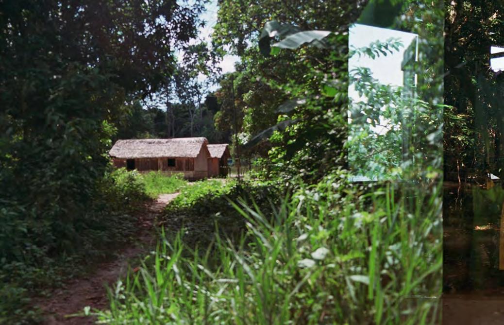
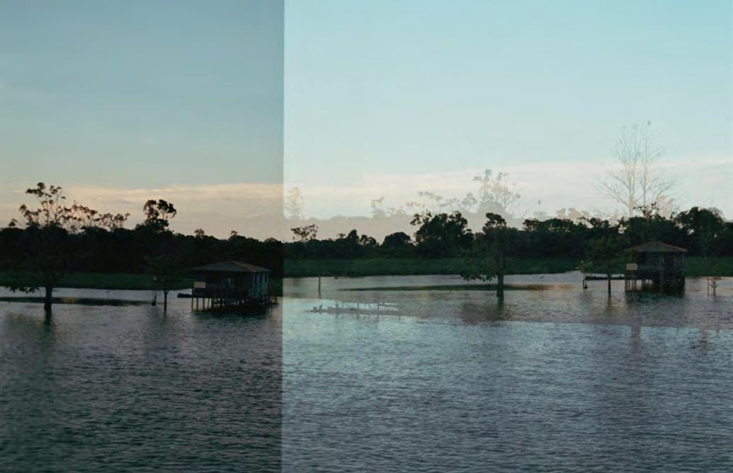
Atlantis Magazine |Invisible | volume 41 41
Fig 3: Current rammed earth constructions within the forest.
Image Source: Author, 2017
Fig 2: Local houses on stilts, adapted to the fluvial regime of high & low tides.
Image Source: Author, 2017
(2) protection of useful plants; (3) phenotypic selection of useful plants; (4) attraction of non-human dispersers of useful plants; (5) human transportation of useful plants; (6) fire management; (7) planting; and (8) soil improvement (Levis and Flores, 2018). The important part here is that these practices work synergistically, one helping the other: for example, attraction of dispersers (4) helped with planting (7), and fire managing (6) helped with removal of non-useful plants (1) and soil improvement (8). Also, it is very relevant that these processes happened within the natural processes of the forest, permeating them instead of being imposed onto or suppressing them.
Global estimations say that around one billion people currently rely on food forests for their nutrition and health, especially in developing nations located in tropical regions (Vira, 2015). At the same time, as of 2022, we are 8 billion people on the planet. Are we able to implement different and innovative food systems? Studies show that, if 25% of the Amazon forest is deforested, the whole system collapses and mass desertification would occur, releasing astronomic amounts of carbon dioxide into the atmosphere. We are now at 20% (Nobre, 2020).
Can food forests be a solution to assure food security while mitigating the negative environmental impacts of our current hegemonic mono agricultural system? The positive long-term interactions pre-Columbian societies had with plants in the Amazon River basin could be an amazing source of diverse knowledges on food security combined with local sovereignty
and ecosystem conservation. From this very brief literature review, something could already be said from the way preColumbian societies managed their gardens: no monoculture, but multi-species patches of useful plants (polyculture agroforestry); no sharp borders, but gradients between land uses, between naturally occurring and domesticated forests; using the same species for more than one purpose (as it was the case with 90% of the most commonly planted species); a cyclic/rotative use of land between food forest - swidden - settlement; working with schemes of practices that help each other; enriching the soil, not only taking from it (as in the Amazonian Dark Earth); and working symbiotically with animals and birds to expand your practices.
Charles Mann (2007) brings forward the criticisms many conservationists do: “claiming that the basin comfortably housed large numbers of people for millennia is so irresponsible as to be almost immoral - it is tantamount to giving developers a green light”. Well, that landscape is not wild, and there is a remarkable body of knowledge built by millions of people over thousands of years on how to manage and improve their environment.
Denying access to their knowledges might even hasten the decline of our ecosystems, since no alternative is then being presented. It would be risky only if we are too disarticulated to make good use of such knowledges. Are we? Does the idea of pristineness help in conserving a forest? Is the Amazon forest better off being seen as such?
B. Vira, C. Wildburger, S. Mansourian, Eds., Forests, Trees and Landscapes for Food Security and Nutrition: A Global Assessment Report (International Union of Forest Research Organizations, IUFRO World Series vol. 33, 2015). Descola, P. (2013). Beyond nature and culture. Chicago: University of Chicago Press.
Egleé, E. L. (2013). Jotï ecogony, Venezuelan Amazon. Environ. Res. Lett. 8, e015008.
Flores, B. M., & Levis, C. (2021). Human-food feedback in tropical forests. Science, 372(6547), 1146–1147. https://doi.org/10.1126/science.abh1806
Levis, C., Costa, F. R., Bongers, F., Peña-Claros, M., Clement, C. R., Junqueira, A. B., Neves, E. G., Tamanaha, E. K., Figueiredo, F. O., Salomão, R. P., Castilho, C. V., Magnusson, W. E., Phillips, O. L., Guevara, J. E., Sabatier, D., Molino, J.-F., López, D. C., Mendoza, A. M., Pitman, N. C., … ter Steege, H. (2017). Persistent effects of pre-columbian plant domestication on Amazonian forest composition. Science, 355(6328), 925–931. https://doi.org/10.1126/science.aal0157
Levis, C. (2018). Domestication of Amazonian forests. Wageningen University and Research. https://doi.org/10.18174/44842
Levis, C., Flores, B. M., Moreira, P. A., Luize, B. G., Alves, R. P., Franco-Moraes, J., Lins, J., Konings, E., Peña-Claros, M., Bongers, F., Costa, F. R. C., & Clement, C. R. (2018). How People Domesticated Amazonian Forests. In Frontiers in Ecology and Evolution (Vol. 5). Frontiers Media SA.
Marris, E. (2011). Rambunctious garden. New York, NY: Bloomsbury Press. Mann, C. C. (2007). 1491 (second edition). New York, NY: Random House. Nobre, C. (2020). Destruição da Amazônia pode transformá-la em deserto e desencadear pandemias. O Eco. https://oeco.org.br/reportagens/destruicao-daamazonia-pode-transforma-la-em-deserto-e-desencadear-pandemias/ Pongratz, J., Reick, C. H., Raddatz, T., & Claussen, M. (2009). Effects of anthropogenic land cover change on the carbon cycle of the last millennium. In Global Biogeochemical Cycles (Vol. 23, Issue 4, p. n/a-n/a). American Geophysical Union (AGU). https://doi.org/10.1029/2009gb003488
42
Hidden Processes
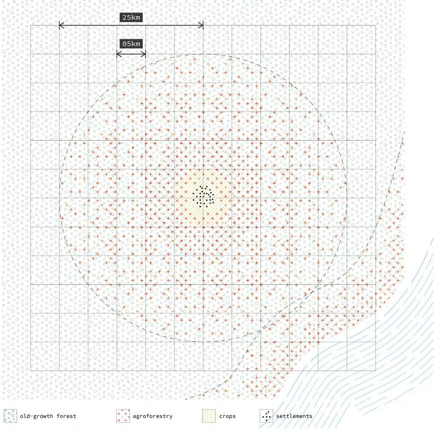
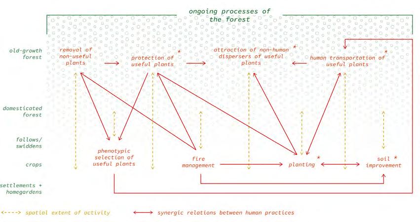
Atlantis Magazine |Invisible | volume 41 43
Fig 5:Diagram showing how human activities were mutually beneficial, with direct contributions to biodiversity indicated by *. Image Source: Adaptation from Levis (2018).
Fig 4: Top view illustrating the idea of gradients departing from human settlements and rivers into the old-growth forest. Image Source: Author based on research by Levis (2018).
Agroecologies for the Stateless
The project Agroecologies for the Stateless sheds light on the intensive agro-industry system of the Campo de Cartagena in Spain and its dual exploitation of the territory’s natural resources and of a flexible migrant workforce on which the labor market is fundamentally depending upon. Immense hydraulic works and (partly unauthorized) seen and unseen infrastructures extending in the subsurface reveal the political decisions and tensions that enabled the extensive operationalization of a whole river basin into a multi-million euro production machine.
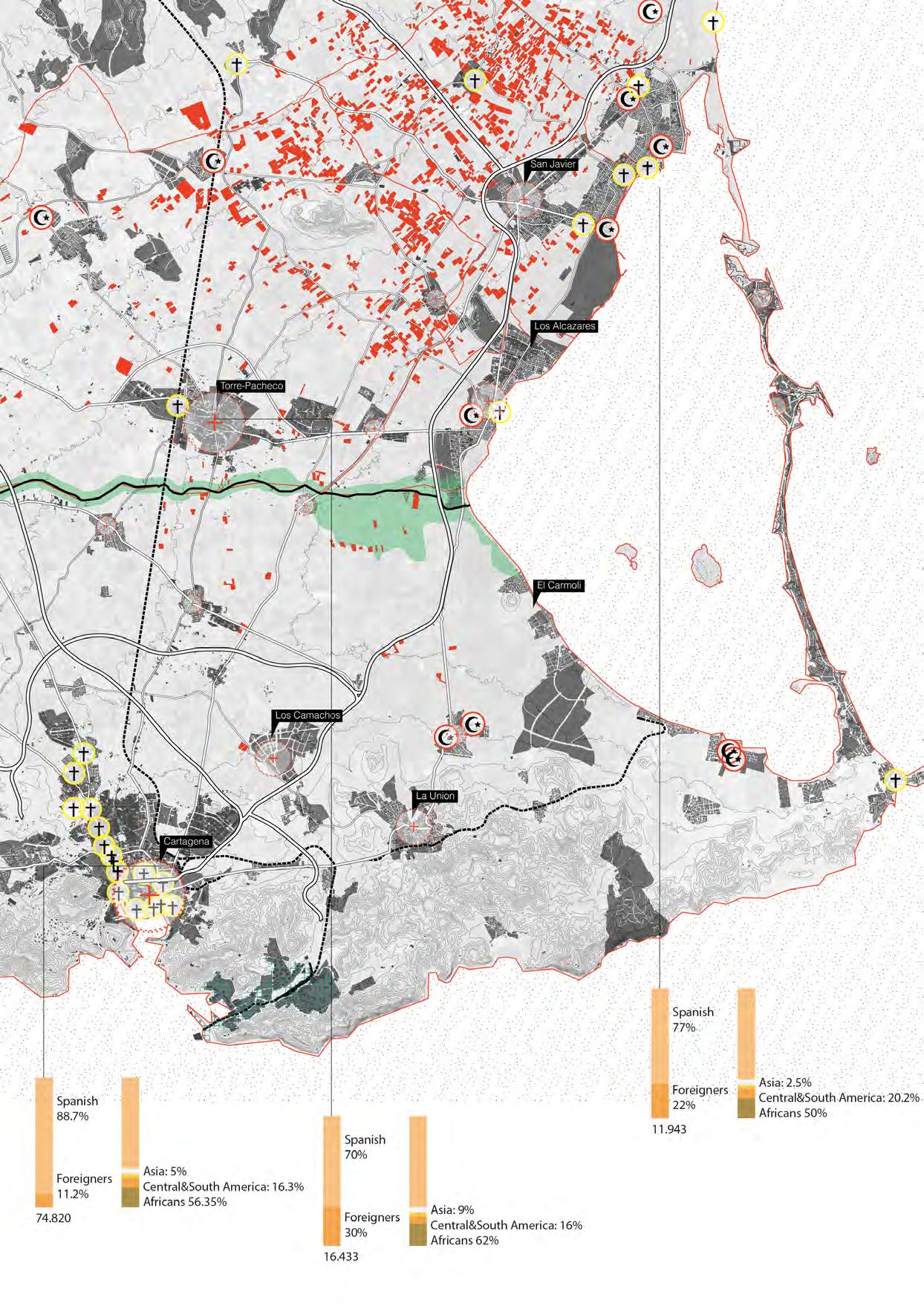
Cities of comings and goings
Murcia, one of Spain’s autonomous communities located in south-eastern Spain, gained notoriety following the event of twelve illegal immigrants dying after the furgoneta (van) in which they were travelling to work was crushed by a train near the town of Lorca (Lopez Diaz, El Pais, 2001). This incident shed light into the role of migrant workers and brought attention to the harsh working conditions and low-paid jobs that exist in a significant underground black economy that is mainly dependent on a foreign workforce (Council of Europe, 2003).
The Mediterranean and Spain, in particular, showcase an interesting case study of immigrant farm workers as a source of cheap and flexible labor in agribusiness operations, packing, processing and export. They constitute an important element of Spain’s population, establishing new dynamic demographic enclaves. In Southern Spain, which is the primary research context for this article, the largest source of workers is Morocco, a fact that creates a particularly interesting socio-cultural context in the Mediterranean region. A great number of Moroccans and other immigrant populations, such as sub-Saharan Africans, Latin Americans and Eastern Europeans, are currently vulnerable to food insecurity
and hazardous living conditions that are deteriorating due to socio-political crises and acute climate change-related weather phenomena (Corkill D., 2005). The populations in question are individuals with high labor concerns that have been able to overcome a very hard fleeing - normally not a voluntary one - provoking an injection of dynamism that, empirically, regenerates the host economy.
Liquid power in the name of modernity
Murcia is a gigantic irrigation machine operated by farmers, cooperatives and increasingly foreign-owned multinationals or large supermarkets that either cultivate their own land or lease from smaller plot owners. It comprises a sector that has managed to make south Spain the “orchard of Europe” (Pedreño 1999: 90-91) with a profit margin of more than 900 million euros in the Segura river basin and over 100,000 direct jobs associated. The industry is dependent on the immense engineering works of the TajoSegura transfer, a major infrastructure that transports water from the North to the South.
The first great idea to transfer water from other basins occurred in the 16th century when the Huescar canal was designed. Years later the towns of Murcia, Cartagena
44 01
KATERINA INGLEZAKI
HIDDEN
PROCESSES
Fig 1: Social Formations Map Image Source: Author
and Lorca began the works, but they were destroyed by a great flood. In the 18th century, the Real Compañía del Canal de Murcia was created, based on the old projects of Castril and Guardal, to have a 110 year concession, which was cancelled as the works did not get started within the scheduled term. It wasn’t until the middle of the twentieth century that the exportoriented agricultural model began, partly because of Franco’s so-called “wet dream” that initiated the construction of dams, inter-river basins, and large-scale irrigation with immense hydro-electric developments (Swyngedouw E., 2015).
The first shipment of water from the Tagus River to the Segura River basin took place on March 31, 1979. The water from the Tajo-Segura Transfer starts from the Entrepeñas and Buendía reservoirs, located in the Northeast of Castilla-La Mancha. The Transfer channel is open-air and has a length of 292 kilometers. This begins next to the Bolarque reservoir, located between the provinces of Cuenca and Guadalajara. From Bolarque, the water from the Transfer reaches the Bujeda dam (Cuenca). After overcoming a large unevenness, the Transfer
goes to the Alarcón reservoir (Cuenca), completed in 1970, at the head of the Júcar river. However, the most important recent event has been the buyout of large parts of Spanishowned land to foreign companies, mainly British, Dutch or French multinationals who based themselves in the sector. The insistence on promoting a water-based economic sector in combination with the non-compliance of public administrators with their duties has led to a devastating ecological disaster.
The green soup urgency
The region has also made the news headlines because of the environmental crisis in the Mar Menor, Europe’s largest saltwater lagoon, after the outburst of eutrophication in 2016, resulting in the so-called “green soup”. Thousands of fish were beached on the shore, unable to breathe because of a lack of oxygen resulting from the degradation of excessive algae and changes to salinity.
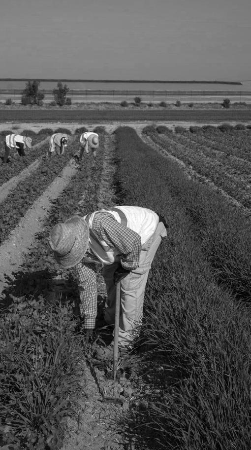
Researchers from environmental agencies have been investigating the area only to discover the existence of
46
Fig 2: The territory of Campo de Cartagena and some first actions of “clearance” Image Source: Author
Hidden Processes
Fig 3: Tending crops in the region of Murcia, near the Mar Menor, 2021. Image Source: Samuel Aranda for The New York Times
brine water coming from pipes all around the Campo de Cartagena, the product of multiple illegal desalination plants spread throughout farms. These first incidents triggered a series of investigations by local authorities and independent environmental organizations such as WWF, but also great political debates as to how to handle the responsibilities weighing down on agro companies and the local associations of irrigators. This debate has escalated in a case filed by the European Commission regarding the provisions of EU’s Nitrate Directive that Spain does not comply with, accusing the country of not controlling nitrogen fertilizers used in agriculture, causing extensive water contamination.
What used to be a sea of transparent and highly saline waters, a refuge for marine species, has now turned into an ecological disaster. Activist groups are pursuing to protect the Mar Menor by a change in legal status. In October 2021, 70.000 people rallied in Murcia, 50 kilometers from the lagoon, demanding action. At the same time multiple solidarity protests took place in Madrid, Valencia and Brussels. The activist group of ILPM Mar Menor initiated a campaign to raise 500,000 signatures for a petition calling for Mar Menor to be granted personal legal rights. The Spanish Congress of Deputies has voted, by overwhelming majority to give the green light to this legislative initiative in April 2022. This historic decision marks the first time that a region in Europe is classified as a legal person with all the ensuing rights and protections. This means that from now on the lagoon is represented by three groups: legal guardians, a monitoring committee of “protectors”, and a scientific advisory board. In addition to that, any citizen will also have the right to file a lawsuit on behalf of the Mar Menor.
The region called Campo de Cartagena is comprised of three main aquifers: the Carrascoy Triassic aquifer, the Victorias Triassic aquifer and the aquifer also called Campo de Cartagena. The latter is an aquifer consisting of several layers that materialized during distinctive geological periods. Its deeper layers are facing a significant issue of overexploitation caused by farming activity that has been looking for water at plunging depths for decades through the construction of multiple wells. On the contrary, the upper layer which was formed during the Quaternary period, is connected to Mar Menor but has different issues of water availability. Seawater intrusion and the discharge of filtered irrigation water that has increased ever since the Tajo-Segura transfer, on top of
intense torrential rains, have increased the water table to the point that water emerges onto the ground at times. The irrigated agricultural area in the Campo de Cartagena that drains into the Mar Menor has multiplied almost ten times since the arrival of the waters of the Tajo-Segura Transfer in 2017. According to the study done by ANSE and WWF, 49,488.17ha of irrigated land have been detected, of which only 37,322.99ha would be included in the water use rights. Therefore, 12,165.18ha of irrigated land would be outside the limits established by the CHS. This means that almost 25% of the current surface area in the area does not have the proper irrigation permits or authorization to carry out its activity.
Nearly 25% of the irrigated surface falls outside the limits authorized by the CHS, meaning that according to the WWF and ANSE study 12.165ha of irrigated agriculture are illegal.
Groundwater in Spain is theoretically protected since the 1985 Water Law was passed, classifying such a resource as public property for the first time. However, in the Segura basin the reality is that more groundwater is exploited than nature can replenish a fact that is known for decades. According to the definition given by Pulido (2001), overexploitation is produced when the quantity of water extracted from an aquifer is much greater (more than double) than its pluriannual recharge. The negative externalities on the physical and biotic environments refer to a notably long period (25 years 10 for South-Eastern Spain), so as to differentiate it from a period of drought (4 to 5 years). This continuous pressure makes it hardly possible to return to the original state of equilibrium. The fundamentally distinctive characteristic is a continuous fall in piezometric level (Rodriguez-Estrella, 2004).
Atlantis Magazine |Invisible | volume 41 47
“ “
Fig 4:. Immigration Story Image Source: Author
Hyper productivity and labor patterns
The region holds a tradition as an authentic orchard in which the most varied species of vegetables are cultivated. Lettuce, broad beans, peppers, tomatoes, aubergines etc., are products whose importance is not only economic, since their trade plays a fundamental role in the regional economic fabric, but also represents the cultural identity of the Murcian community that takes pride in the “orchard of Europe” title. Most of the vegetables that we can find in the region have their origin in Asian regions, the Middle East, southern Europe and North Africa. The climate has favored their introduction in the region, as it is a zone with mild temperatures in winter and little or moderate rainfall that gives these products a particular physiognomy and flavor.
In the last decades of the 20th century, crops in many areas changed from extensive rainfed agriculture to irrigated agriculture, while new intensive production in plastic greenhouses (internaderos) also spread, which led to an increase in the production of new products such as lemons, oranges, peaches, apricots, cotton etc. Modernization along
technological innovations and new forms of production transformed the primary sector into what has been described as “post-Fordist agriculture” (Pedreño, 2002). As a result, large scale agro-business, comprising three-fifths of Spain’s food processing industry, became a feature of the regional economy during the ‘90s. Paradoxically, a number of agricultural employers manifest warnings about a surplus of workers while at the same time, others express persistent complaints about seasonal labor shortages in hotels, transport, metals, and construction. In the agricultural sector, once the workers are in possession of valid papers legalizing their residence in the country it is quite common for them to abandon the sector and leave the region for good.
High unemployment can in fact coexist with labor shortages given the uneven demand for labor caused by seasonality and weather dependency, demand can vary from month to month, as shown in the diagram 5. In addition to the unpredictable flows of migrants seeking work, the situation is becoming extremely fluid. For this reason, employers express their preference for a system that would be able to respond to rapid fluctuations in demand.
48
Fig. 5: Seasonality of employment contracts in agriculture in relation to the seasonality of production.
Image Source: Author based on data by CREM Centro Regional de Estadística de Murcia.
Hidden Processes
Conclusion
In the specific case of the Spanish Campo de Cartagena, a riverine territory with multi-level complexities, the project highlights the necessity to reconsider our approach towards industrial agri-food territories situated on fertile floodplains and in close proximity to invaluable ecosystems. The intensified export-oriented model of production that is replicated around the world creates a deep physical and cultural separation between people and place; local climate conditions are dismissed, topography is engineered, people are mobilized throughout countries to get employed in big production lines that serve the current capitalistic paradigm.
The essense of this project lies at the intersection of a biophysical strategy for the regeneration of a depleted land and a socio-cultural approach to give vocational voice to

Corkill, D. (2005). Immigrants and a regional economy in Spain: the case of Murcia. International Journal of Iberian Studies. 18. 23-36. 10.1386/ ijis.18.1.23/1.
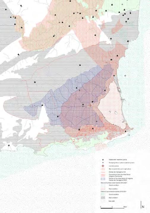
Council of Europe (2003), Migrants in Irregular Employment in the Agricultural Sector of Southern European Countries, Committee on Migration, Refugees and Demography.
Lopez Dias M.J. (2001, Jan 04), Mueren en un paso a nivel 12 inmigrantes que viajaban hacinados en una furgoneta en Murcia, El Pais. elpais.com/diario/2001/01/04/espana/978562801_850215.html
Pedreño, A. (1999), ‘Construyendo la “huerta de Europa”: trabajadores sin ciudadanía y nómadas permanentes en la agricultura murciana’, Migraciones, 5, pp. 86–99.
vulnerable communities. Instead of proposing short-term engineering solutions to tackle the water pollution and the water depletion, like the current research in place, the project delves into the specificities of agronomic systems in an attempt to propose an alternative form of production that is in line with a particular context and its limitations. One of the fundamental goals of the project is to transform the landscape into a more resilient one, not only in ecological terms but also in productive terms. The territory will be altered according to the flood and drought resilience of the crops and a new labor balance has to be achieved. An equal balance can definitely not happen so some peaks will inevitably still happen in summer. As far as the environmental restoration of the Mar Menor is concerned, the future vision introduces NBs in the proximity of the lagoon, not only as an act of clearance of the current accumulated pollution, but also as a means to strengthen local communities.
Pedreño, A. (2002), “Efectos territoriales de la globalización: el caso de la ruralidad agroindustrial murciana”, Revista de Estudios Regionales,59.
Pulido, A. (2001), Sobreexplotacion de acuiferos y desarrollo sostenible. Problematica de la gestion del agua en regions semiaridas, Inst. Est. Almerienses, Dip. Almeria, Almeria, 115–132.
Rodríguez Estrella T. (2004), Sobreexplotación de acuíferos y desertificación en el sureste español, Aridez, salinización y agricultura en el sureste ibérico, Fundación Ramón Areces, Madrid.
Swyngedouw E. (2015), Liquid power: Contested hydromodernities in twentieth century Spain, The MIT Press.
WWF/Adena, ANSE (Asociación de Naturalistas del Sureste) (2018), La burbuja del regadio: El caso de Mar Menor.
Atlantis Magazine |Invisible | volume 41 49
Fig 6: Visible and invisible infrastructures that make up the “irrigation machine” of Campo de Cartagena.
Image Source :Author
Fig 7: Irrigation rights and affected water quality. Image Source: Author
Shenzhen’s Floating Population
Between High Productivity and Environmental Threat.
In significant migration cities of China, such as Shenzhen, large numbers of constantly in movement floating population of working migrants is said to generate harmful impact on the natural environment. Nicknamed as malign tumour by the urban residents and the local government, they inhabit vastly overcrowded settlements - urban villages, where poor standards force them into unsustainable lifestyle. At the same time, in the vicious loop of their dire economic situation, they become the main subject of vulnerability to environmental degradation.
SLIWINSKA
Context
Rural-to-urban migration has followed the outward direction from the western and inland provinces towards the coastal regions where manufacturing clusters are concentrated in Special Economic Zones – a product of China’s Reforms and Opening Up from 1978. Due to its brief but dynamic history, Shenzhen1 (in Shenzhen Special Economic Zone) has the highest number of internal migrants across the country (Gu & Ma, 2013). There, migrant labour workers without the local household registration status are referred to as the floating population (chi. liudong renkou) or temporary migrants (Chan,2018). This registration system, known as hukou, has historically divided Chinese people into two groups with different benefits and welfare allowances depending on the place of their origin (Vlassenrood,2016). Having undergone multiple relaxation reforms, it is still associated with the inequality between rural and urban populations; lowering the status of country migrants in the city, versus the permanent, ‘rightful’ urban residents.
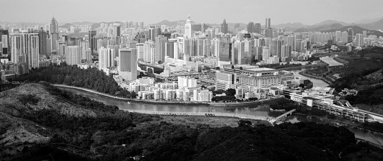
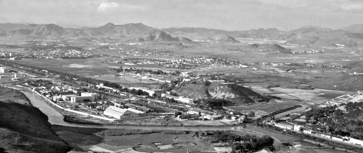
Accelerating urban growth within the
last forty years and its products of labour productivity and larger economies of scale have lifted the country from its previous global isolation and low-income status (Qin & Dorst,2014). At the same time, it posed two threats to Chinese society - the exclusion of the core to its success migrant worker group, the high level of industrialisation and its consequent environmental risks. After creating nine industrial parks and multiple manufacturing centres, the city is mainly exposed to air, water and waste pollution.
Effect of migrants on the environmental condition of the city
Together with a need for unskilled labour, specific job titles concentrated in the manufacturing sector and perceived by the locals as undesirable, are hence reserved for migrants, paradoxically impacting the understanding of the group as a source of contamination. The increase in mobility and everyday household-oriented activities among migrants (Chan, 2018), such as the
50 01
ZUZANNA
HIDDEN PROCESSES
51 Atlantis Magazine |Invisible | volume 41
Fig 1: Historic transformation in Shenzen’s urban scape
use of low-grade solid fuel for cooking, together with emissions linked to the rise in population concentrated in the city, is directly related to the production of harmful compounds such as nitrogen dioxide. Air pollution, caused mainly by road traffic and energy production, affects public health and generates harmful acid rain. The environmental cost, in that case, doesn’t fall only on the city of the migrant destination but further spreads onto migration corridors. That can be illustrated by the Chunyun – movement of millions of migrants travelling back to their hometowns for the Chinese Lunar New Year celebration, creating a map of intricate transportation nodes, affected by produced emissions.
Additionally, growth in the unofficial population is said to cause significant stress on city’s waste management and increased energy consumption. In informal settlements reliance on insufficient household waste management often results in communities disposing of waste into nearby water bodies. Untreated wastewater discharge, released into the city’s rivers, impacts water quality significantly, with 25% of rivers in Shenzhen pronounced as ‘unfit for human contact’. With Dasha River flowing through Shenzhen and being, from an ecological point of view, integral to the city’s sea level management, once overflown, it bears a risk of spreading the pollution across nearby vulnerable neighbourhoods. In that sense, the efforts to raise public awareness of residential wastewater reduction and the consequences of concentrated pollution in the city (Wang, Xian, Jiang, Pan & Ouyang,2020) should become a priority for the local government.
Effects of environmental degradation on floating population
Concentrated in low-standard, self-organized housing, the group with insufficient education on the topic becomes particularly vulnerable to the effects of the ecological crisis. Among daily pollution affecting health and ability to perform, an example of a life-threatening consequence is illustrated through a landslide disaster in 2015 in Guangming New Town. Increasing construction of new buildings and subway line in the area has created a large amount of construction mud waste, which the city could no longer accommodate. In effect, due to the instability, the 100-meter tall waste mountain has collapsed, killing multiple people, breaking up 33 neighbouring buildings and damaging the gas pipeline. The victims of the event were almost entirely migrants, who lost their homes and jobs as the landslide also destroyed nearby factories. In this case, the place of both work and settlement of migrants was located in an environmentally degraded area of the city - their economic status determined their exposure to damaging factors of lousy waste management.However, the local government, together with local residents, turns its back on migrants, pointing out this social group as a cause of the
problem and malign tumour (chi. du Liu), which needs to be eradicated from the city.
Exclusion
As I mentioned, the local government and citizens are ready to blame the migrant group for environmental negligence. However, we can argue that both the economic and social exclusion of the group from society and the lack of infrastructure to accommodate the inflow of newcomers, to which Shenzhen owns its international success, has formed the current condition. With high real estate prices, incoming migrants create a self-sufficient machine operating solely within the boundaries of the urban village, providing accommodation, food and entertainment, and lowering the need to leave apart from a daily trip to the factory. Altogether, the exclusion transforms into a lack of sense of belonging to a place, which in return brings a low sense of responsibility and no trigger to question the environmental harm over choices driven by the need to adapt and survive in unwelcoming city.
...the local government, together with local residents, turns its back on migrants, pointing out this social group as a cause of the problem and malign tumour
Conclusions
The floating population and environmental concerns are tightly correlated in a complex net of dependencies not; however, how many sources suggest and how they like to be described by policymakers and investors as a root cause of Shenzhen’s environmental issues. The correlation is visible on the level where the city’s economic potential lies in the hands of migrant workers who are summoned by growth-motivated requests for cheap labour. Lack of sense of belonging plays a crucial role in the environmental approach and decisionmaking of this social group resulting in less ecological control in Shenzhen. As we continue the process of globalization and cultural exchange, we can see Shenzhen as a window into the future to investigate and form conclusions about the problems our global cities might experience in the coming years due to expanding migrant populations and environmental challenges. Analysing the relationship between the floating population and environmental degradation can prove crucial to other developing countries in providing insight into policies, design strategies and social interventions. While most western countries go through steady development in the urbanization process, many developing countries will experience similar
52
“ “ Hidden Processes
¹ chi. Shēnzhèn translates to shēn, “deep”, and zhèn to “irrigation ditch”, explaining the agrarian, no so distant past of the region.
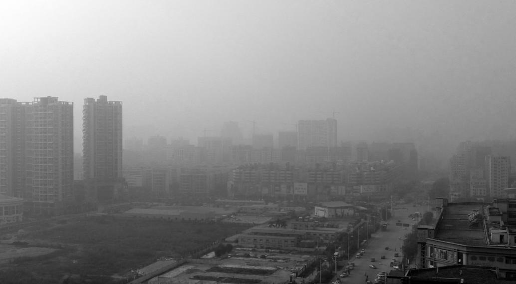
Chan, K. W. (2018). Urbanization with Chinese characteristics: the Hukou System and migration. Routledge.
Gu, P., & Ma, X. (2013). Investigation and analysis of a floating population’s settlement intention and environmental concerns: A case study in the Shawan River basin in Shenzhen, China. Habitat International, 39, 170-178.
Qin, L., & Dorst, M. J. (2014). Perceived Control and Liveability: Environment
and behaviours interaction in the two urban villages of Shenzhen. South China University of Technology.
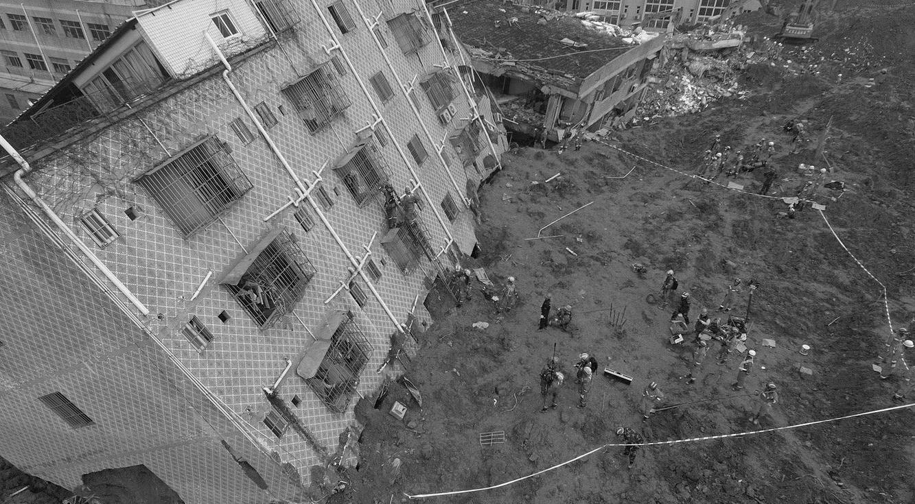
Vlassenrood, L. (2016). Shenzhen: From factory of the world to world city. International New Town Institute.
Wang, Y., Xian, C., Jiang, Y., Pan, X., & Ouyang, Z., (2020). Anthropogenic reactive nitrogen releases and grey water footprints in urban water pollution evaluation: The case of Shenzhen City, China. Environment, Development and Sustainability.
53 Atlantis Magazine |Invisible | volume 41
Fig 2. Pollution Bao’an Shenzhen China. Source: Flickr.com
Fig 3. Landslide in Guangming New Town. Source: Mashable.com 2015.
Flipping the Iceberg Towards a Circular Built Environment
“In Ersilia, to establish the relationships that sustain the city’s life, the inhabitants stretch strings from the corners of the houses, white or black or gray or black-and-white according to whether they mark a relationship of blood, of trade, authority, agency. When the strings become so numerous that you can no longer pass among them, the inhabitants leave: the houses are dismantled; only the strings and their supports remain. […] Thus, when traveling in the territory of Ersilia, you come upon the ruins of abandoned cities, without the walls which do not last, without the bones of the dead which the wind rolls away: spiderwebs of intricate relationships seeking a form.” (Calvino, 1792, p. 82)
TAMARA EDGERS
The built environment is more than static physical elements. Instead, space is a complex and dynamic social construction, constantly evolving through diverse human practices with no start or end point (Lefebvre, 1992) (Awan et al., 2013, p. 29). These processes are a shared endeavor between diverse people. For Buchanan (2012), the built environment is a complex web of interrelations between people, materials, and spaces. Sarah Robinson (2021) argues that architecture should be a verb since it is a continuous practice of intertwined human activities.
Nevertheless, architecture still “fetishizes” buildings as finalized objects produced by professionals and localized at a specific space at a particular moment in time (Awan et al.,
2013; Moe, 2017). Over the last millennia, all-embracing human livelihood processes were separated into narrow logics of the ecological, the social, and the economic. ‘Social’ human activities became regarded as detached from the ‘ecological’ morethan-human world and the superordinate system of an ‘economy’ (Gibson-Graham & Miller, 2015). With the industrialization of building practices, a progressive disconnect in relationships occurred (Buchanan, 2018). On the one hand, these tendencies resulted in a globalized take-make-waste material culture, where it is little cared about where building materials ”come from and where they go to” (Till, 2020). On the other hand, humans work in specialist silos where they become ‘de-skilled’ in cooperating with others (Sennett, 2012, p. 8), resulting in a
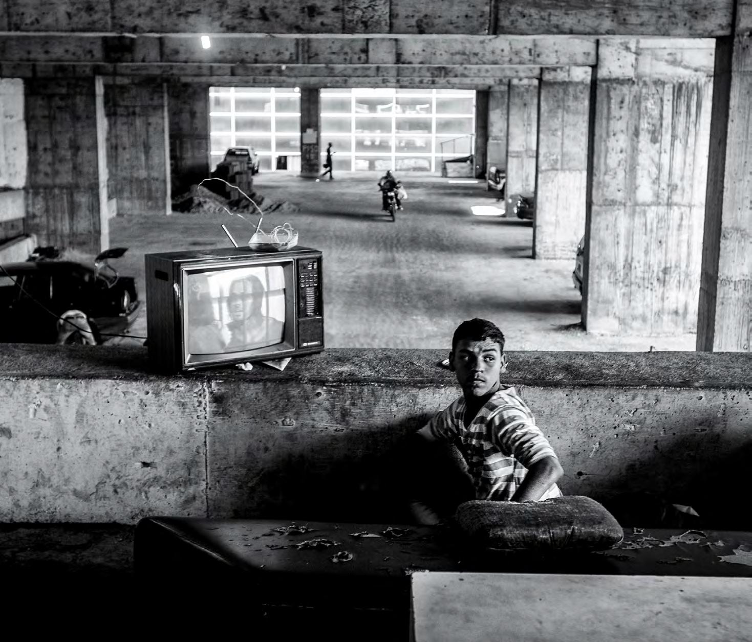
54 01
55 Atlantis Magazine |Invisible | volume 41
Fig 1: Torre David
Image Source: Alejandro Cegarra, 2013
linear system lacking complex connections. Consequently, citizens became restricted to the role of passive users of the built environment as finalized objects (Holmes et al., 2021). Under these circumstances, the building industry became one of the main contributors to the more significant human predicament (Ehrlich & Ehrlich, 2012). The sector is responsible for over half of worldwide extracted materials, 40% of energy-related CO2 emissions, and one-third of waste in the EU (UNDP, 2020; UNEP, 2021). Accordingly, a radical shift toward active engagement surviving together as an empathic collectivity is pressing when “planetary and social systems are under stress” (Gibson, 2019). Peter Buchanan (2018) argues that no significant financial investments or technological innovation are required for such significant change, but active engagement in reweaving webs of relations.
“An obvious place to start formulating it would be by inverting the millennia of progressive separation, with its debilitating and alienating consequences, to reweave a rich web of relationships of all sorts to create an all-embracing, dynamically evolving whole—that includes the broadly cultural and the more narrowly environmental—in which everything has a place and plays an essential part,” (Buchanan, 2018).
The Circular Built Environment (CBE) is an imagined future where people, materials, and spaces are entangled in holistic webs to balance social, environmental, and economic values. Humans actively engage in diverse reconnecting practices
to close resource loops at different spatial-temporal levels. Consequently, fewer resources are consumed by activating more human energies (Lemille, 2020; Schröder et al., 2020). With Ephimeralization, Richard Buckminster Fuller brought this approach to an extreme by “doing more and more with less and less until eventually, you can do everything with nothing” (Luke, 2010).
“The problem is not architecture. The problem is the reorganization of things which already exist.” (Yona Friedman) However, in present-day linear reality, it is toward the beginning and the end of linear supply chains, where materials have the lowest value, activities are most invasive to local environments, and human professions are poorly recognized. Under current conditions of a linear system, practices to extend lifespans and keep resources in the loop are often invisibilized. Social invisibilization has to do with suppression and denial of recognition (Arrivé, 2020).As a counteract, diverse community economy scholarship recognizes and visibilizes all humans as agents of change. Instead of seeing the economy as a superordinate machine, they describe it as a holistic web of diverse practices intertwined with ecological systems (Cameron & Gibson-Graham, 2022); (Gibson-Graham et al., 2013, p. 8). Through that lens, all humans (and non-humans) are multiple economic subjects since they make their livings, receive their living from others, and provide for others. Yet, many diverse practices are marginalized and invisibilized within a capitalistic system. Social invisibilization often results from a lack of images (Arrivé, 2020). Therefore, the Diverse Economies Iceberg visibilizes livelihood practices hidden under the sea level. Interestingly, a major part of the global economy is compounded by diverse invisibilized practices.
Circular transition simultaneously empowers and depends on invisibilized practices that help close and extend resource loops. Nevertheless, most people do not consider themselves active subjects of change but as powerless users or consumers within a larger system (Gibson-Graham et al., 2013). Consequently, recognizing, researching, and visibilizing their diverse practices is the first step away from the role of passive users toward active ‘circular doers’ (Holmes et al., 2021).
This article dives under the sea level to explore the invisibilized practices that facilitate transitioning toward a CBE. Which practices can we find? And who are the entangled actors? A broad spectrum comes to light. The following section illustrates some of them in alphabetical order.
Cleaning + Repairing
Cleaning is an essential human activity to maintain our (built) environments. However, throughout history, architects found ways to invisibilize cleaning activities in daily life, examples are
56
Fig 2: Hartford Wash Image Source :Mierle Laderman Ukeles, 1973.
hidden housekeeper corridors and separated laundry houses. In 1973 the artist Mierle Laderman Ukeles demonstrated with her performance “Hartford Wash: Washing, Tracks, Maintenance - Outside and Inside” how the maintaining and cleaning labor of a museum is as important as curating work. Similarly, as part of their “Living Architectures” film series, Bêka and Lemoine show in “Gehry’s Vertigo” (2013) the hidden maintenance and repair work of Frank Gehry’s Guggenheim Museum in Bilbao. Unnoticed by the visitors, a climbing team cleans the rooftop regularly to preserve the aesthetical appearance and function of the building. Not only buildings but also common urban spaces must be maintained and cleaned regularly. There are numerous examples where around the world, citizens get together to keep their public spaces clean. As part of the Kibera Public Space Project in Nairobi, communities gather to clean up dumpsites and transform them into productive public spaces. These diverse human practices of cleaning, maintenance, and care about the built environment contribute significantly to a circular system.
Co-constructing
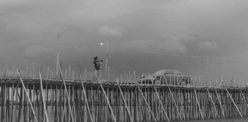

Often self-construction happens collectively by different people collaborating hands-on. The film “Microbrigadas. Variations of a Story“ shows how the co-construction of building blocks became a strategy during Cuba’s 1970s housing crisis. Groups of workers from offices or factories were exempted from their day jobs to build homes for themselves and their colleagues (Mathéy, 1989; Zeyfang et al., 2013). “Bamboo Bridge,” tells the stories that emerged from the yearly repeating co-construction of a 1,5 kilometers long bamboo bridge over rice fields in Cambodia. After generations dismantled and reconstructed the bridge year after year, following the rhythms of nature, the government replaced it with a massive concrete bridge (Salazar, 2019). The described co-construction processes consume fewer materials by investing more diverse human energies (Lemille, 2020). The Bamboo bridge is entirely made from locally grown bamboo. The Mocrobrigada movement compensated for material scarcity with more human labor.
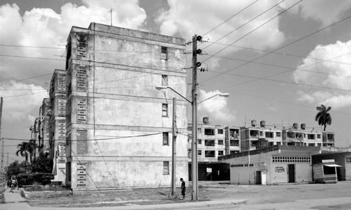
Matchmaking + Collecting + Redistributing
To the end of closing resource loops in the built environment, matchmaking bewteen material demand and availability within a certain geographic area becomes imperative. This can be organized directly between individuals, but often intermediaries collect materials that are not needed anymore and redistribute them to new users. For consumer goods, examples are widespread facilities such as second-hand stores, flea markets, or used goods web portals (Ordóñez et al., 2019). Whereas second-hand building material markets
Atlantis Magazine |Invisible | volume 41 57
Fig 4: Frame “The Bamboo Bridge” Image Source: Salazar, 2019.
Fig 5: Frame “The Bamboo Bridge” Image Source: Salazar, 2019
Fig 6: Haus der Materialisierung Image Source: Author.
Fig 3: Frame Microbrigadas Source : Zeyfang, 2013.
are only recently emerging.
In the Netherlands, Buurman is a circular hardware store and workshop specializing in the local reuse of construction wood. In Berlin, Haus der Materialisierung (HdM) is a living lab for climate-friendly resource use and sustainable lifestyles. As one of the temporary-use initiatives in Haus der Statistik it is an experimental space combining everyday practice and academic research related to circularity in the city. Kunst-Stoffe and Material Mafia are both centers for reusable materials. Their concept is inspired by Materials for the Arts in New York. They collect materials disposed of in the city, store them, and resell them (for accessible prices) to new users. In contrast to easier accessible and storable consumer goods, redistributing building materials brings up new challenges. For example, the described initiatives face challenges in acquiring secondhand materials and large amount of (inner-city storage) space needed.
Online platforms for mediation between supply and demand of salvaged building materials an alternative, examples are Concular, Oogstkaart, the material catalogue of Material Mafia, Rotor DC or Baukarussel.
Phytoremediating
An extraordinary practice of cleaning done by non-human agents is phytoremediation. Living plants clean up soil, air, or water contaminated through harmful human activities such as industry, landfilling, or transport. De Ceuvel is a temporary circular office park on a former shipyard in Amsterdam. While people use the seventeen houseboats and elevated connecting jetty, different species of plants clean the industrypolluted soil through phytoremediation (Schwantje, 2015); (Schuetze, 2014). Phytoremediation is an ecological repair of polluted land.
Recycling + (Adaptive) reusing
For over two decades residents of Granby Four Streets in Liverpool battled their eviction and demolition of the neighborhood with creative civic activism. In 2011 they achieved to form a Community Land Trust (CLT) and started to incrementally refurbish the houses and create new public spaces. Originally out of scarcity of financial resources, together with the collective Assemble the community formed “Granby Workshop” to produce building components from demolition materials of the renovation process. Today the Community Interest Company (CIC) employs five people from the neighborhood and skill-trained many more. In place of of standardized building products, the hand-made circular products give a unique identity, by referring to old buildings, creativity and stories from the neighborhood (Hall, 2021, p. 136). For example, Granby Rock is a colorful marbled recycled
terrazzo with crushed recycled brick, slate and other waste materials from nearby demolished houses. It is used for as decorative mantlepieces of fireplaces in the refurbished houses.
Cucula was a creative space for experimentation producing furniture together with young refugees in Berlin. Products were based plans from the Italian designer Enzo Mari , which allow people with little experience in woodworking to produce high-quality furniture with simple tools. For example, the Ambassador Chair was made from timber stripped from refugee boats (Museum_für_Gestaltung_Zürich & Sachs, p. 106 ff). In Vienna, Magda’s Hotel is a social enterprise employing refugees that reuses a former priest’s residency as a hotel. Together with a team of architects and designers the building was adapted and refurbished with mostly used materials and furniture. Basurama is a collective of architects and designers, that works together with communities in reusing waste materials in public space interventions.
The mentioned and many more creative initiatives contribute to reusing, repairing, refurbishing and recycling buildings and materials in a creative ways, while also creating new livelihood practices for people.
Self-building
In self-building processes, individuals or communities get active in constructing their environments. People become prosumers of their own homes, community spaces, or other buildings.
In the exhibition and book “Architecture without Architects,” (1964) Rudofsky brought to light hidden practices of “communal architecture,” which were until then overlooked by Western architectural history. Rudofsky strongly believed that modern industrial processes could learn from the integral thinking and doing of these “untutored builders” and their spontaneous spatial practices based on experiences.
Currently, only 2% of houses in the US are built by architects (Dickinson, 2016), while by 2018, a quarter of the global urban population lived in informal self-built settlements (UN, 2022). Bêka and Lemoine’s film “Butohouse” accompanies a self-building process of a house as a form of resistance in the middle of Tokyo. The 15-year process becomes a performance (Bêka & Lemoine, 2020). ften, self-building processes consume more sweat equity rather than scarce financial and material resources. To do so, they act highly circular. For example, they refuse by not building with technical materials (caves, bio-based local materials), rethink by sharing (spaces, materials, and knowledge), and reuse materials.
58
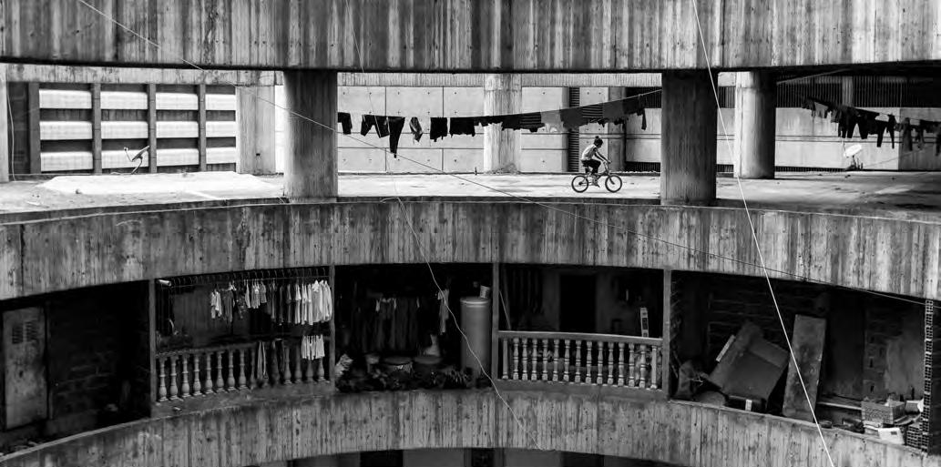
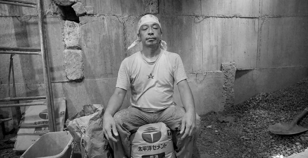


Atlantis Magazine |Invisible | volume 41 59
Fig 9: Frame “Gehry’s Vertigo”, Image Source: Bêka and Lemoine, 2013.
Fig 7: Frame “Butohouse”, Image Source: Bêka and Lemoine, 2020.
Fig 8: Frame “Gehry’s Vertigo”, Image Source: Bêka and Lemoine, 2013.
Fig 10: “Torre David”, Image Source:Alejandro Cegarra, 2013
Scavenging + Urban mining
In a linear system, practices to maintain materials in the loop are often poorly paid, unpaid, or alternative paid labor (Gibson-Graham et al., 2013, p. 17 ff). For example, in urban areas worldwide, an estimated 64 million people make their livelihoods as scavenger hunters (Medina, 2007). As a primarily informal practice, they collect materials that have no more value to other people. In a circular system, their salvaged materials would not be considered waste. The short film “Recycling Spaces – A day in Addis Ababa’s Merkato” follows some of the thousands of “Kure-Yalews” (translates as “who has a piece”) on their daily trajectories through the city to gather materials discarded by others. In the evenings, they bring their collected items to the informal recycling center “Minalesh Terra.” This informal recycling system results in 60% of Addis Ababa’s waste being organic, while the rest gets mainly recycled. On top of that, approximately 300.000 citizens find employment in this cleaning network (Heisel & Kifle, 2017); (Hebel et al., 2014); (Heisel & Kifle, 2015).
Urban mining is based on the notion that the human-built environment is a temporary storage of resources. When for example, a building reaches its end of use, materials and components can be mined for reuse elsewhere. Increasingly, urban mining is a growing professional sector that counteracts the loss of value of building materials and human labor by professionally deconstructing, processing, and trading
salvaged building materials. Baukarussel is a company for “social urban mining’ by giving long-term unemployed people a new profession in deconstruction for reutilization of materials. In Brussels, Rotor DC focuses on dismantling, processing, and trading salvaged building materials. Both scavenging and urban mining contribute to keeping materials in the loop and sustaining livelihoods within a Circular Built Environment.
Squatting + Appropriating
Squatting is a collaborative practice of appropriation of space. As a logical consequence of the synchronicity of the need for space and vacancy within a city, it occurred worldwide and throughout history in diverse forms. Some squatting processes are driven out of immediate spatial needs, others out of ideologies toward socio-spatial change.
In the Netherlands, after World War II, in reaction to an extreme housing shortage, squatting became a cohesive social movement with particular spatial practices. It went from improvised practices out of a direct need to an organized network that operated efficiently and which practices influence Dutch cities until today (Boer et al., 2019). For example, Plantage Doklaan is a former industrial building in the center of Amsterdam that has been squatted two times (early 1980s and 1998). With the help of the municipality’s Office for Creative Incubators , the squatters purchased the building
60
Fig 12: Phytoremediation De Ceuvel. Image Source: Author.
Fig 11: Buurman. Image Source: Author.
and started renovating and transforming it collectively to their needs as a cultural venue. They constructed social meeting places, workshops, affordable studios, and a café. In Caracas, Venezuela, the film “Torre David: The World’s Tallest Squat” observes how more than 750 families collectively inhabit a 45-story high squatted office tower in Caracas (Brillembourg & Klumpner, 2018; Kneer & Schwartz, 2013). Due to worrying hygienic conditions and frequent accidents, the squat was evicted in 2014.
Squatting practices are highly circular, refusing to build new but instead adaptively reusing and maintaining existing vacant spaces. Equally important, squatting practices rethink (legal) concepts of private ownership and share collectively in mutual
Arrivé, M. (2020). Visibilizing Invisibility, An Introduction. InMedia(8.2.). https:// doi.org/10.4000/inmedia.2683
Awan, N., Schneider, T., & Till, J. (2013). Spatial agency: Other ways of doing architecture. Spatial Agency: Other Ways of Doing Architecture, 1-224. https:// doi.org/10.4324/9781315881249
Bêka, I., & Lemoine, L. (2020). Butohouse
Boer, R., Verzier, M. O., & Truijen, K. a. (2019). Squatting as a Spatial Practice. In R. Boer, M. O. Verzier, & K. a. Truijen (Eds.), Architecture of Appropriation. On Squatting as Spatial Practice. Het Nieuwe Instituut. https://architectureappropriation.hetnieuweinstituut.nl/en/squatting-spatial-practice Brillembourg, A., & Klumpner, H. (2018). Torre David. Informal Vertical Communities. Lars Müller Publishers.
Buchanan, P. (2012). The Big Rethink Part 3: Integral Theory. The Architectural Review. https://www.architectural-review.com/archive/campaigns/the-bigrethink/the-big-rethink-part-3-integral-theory
aid networks (community kitchens, cultural spaces, food systems, legal advice, etc.). Often, squatted spaces are in poor condition, and the communities collaborate with their energies to make them inhabitable. Often these adaptions are creatively improvised, low-cost, and with recycled materials (Boer et al., 2019).
Conclusions
As the discussed examples show, collective circular practices based on shared values are all around us and nothing new. Although often overlooked throughout history up to the present day, circularity has been immanent within different communities and societies (Corvellec et al., 2021); (Holmes, 2018; Holmes et al., 2021); (Casson & Welch, 2021); (Isenhour & Reno, 2019). For example, in European Middle Ages, circular practices were part of everyday life, not only out of necessity but also motivated by sociocultural norms and values (Casson & Welch, 2021). In addition, an outlook on historical and indigenous practices around the world reveals value-based aspects of circular practices (Corvellec et al., 2021). Also related to the built environment, in areas of high seismic risk, it is common practice that victims in postearthquake situations collect debris from their homes to reuse them in rebuilding (Sunoko et al., 2016). Nevertheless, in Western countries after the second world war, consumerism replaced these sociocultural values with beliefs of endless economic and material growth (Leonard, 2007). Circular practices became invisibilized.
Under present-day circumstances, where a radical shift towards more caring ways of surviving together is needed, researching and visibilizing invisibilized practices toward circular transition is a first step in empowering them. In that sense, diverse community economies scholars choose “to bring marginalized, hidden and alternative economic activities to light to make them more real and more credible as objects of policy and activism” (Gibson-Graham, 2008).
Buchanan, P. (2018). Reweaving Webs of Relationships. https://www.e-flux.com/ architecture/overgrowth/221630/reweaving-webs-of-relationships/ Calvino, I. (1792). Invisible Cities.
Cameron, J., & Gibson-Graham, J. K. (2022). The Diverse Economies Approach. In F. Stilwell, D. Primrose, & T. B. Thornton (Eds.), Handbook of Alternative Theories of Political Economy. Edward Elgar.
Casson, C., & Welch, D. (2021). Histories and Futures of Circular Economy. In B. S. R & S. S (Eds.), Sustainable Consumption and Production, Volume II (pp. 3554). https://doi.org/10.1007/978-3-030-55285-5_3
Corvellec, H., Stowell, A. F., & Johansson, N. (2021). Critiques of the circular economy. Journal of Industrial Ecology. https://doi.org/10.1111/jiec.13187
Dickinson, D. (2016). Architects Design Just 2% of All Houses–Why? Common Edge. https://commonedge.org/architects-design-just-2-of-all-houseswhy/?utm_medium=website&utm_source=plataformaarquitectura.cl
Ehrlich, P. R., & Ehrlich, A. H. (2012). Solving the human predicament
Atlantis Magazine |Invisible | volume 41 61
Fig 13: Frame “Recycling Spaces. A day in Addis Ababa’s Merkato” Image Source: Felix Heisel and Bisrat Kifle, 2014.
Omitted In-Betweens
Culture and Landscape as unrecognized entities in the case of a bankrupt salt extraction industry in Brazil
Omitted in-betweens discuss the limits of perception and memory towards landscape and social practices. Here, we question the invisibility of areas that got stuck in between the past and the future, areas that are in between being intervened or being completely untouched and areas that are neglected, but at the same time in the eye of speculation. The reality of the bankrupt salt extraction industry in Arraial do Cabo, a coastal city in Brazil, will be showcased and addressed, criticising its abandonment as a loss of potentiality: where both functions and symbolism are ignored and invisibilized.
Prologue
The age of the Capitalocene, with the rise of capitalism in the 15th century, marked an ideological turning point with unprecedented changes, as it deviated from the main ideologies now preached: velocity, change and productiveness were highly valued and opposed to the local and intrinsic connection that humankind had established with land for the past centuries. On another layer of interpretation, this relation of nature and humankind - which is able to foster a sense of belonging to the land and to develop cultural memories on its communities (Berque, ,1998) - was invisibilized on the face of the modern perspective and essentially ignored an underlying layer of knowledge, traditions for the upcoming spaces and territories that would be created.
This broader change on a global paradigm motivated an analytical investigation on understanding the erasure and the invisibility of traditional communities and cultural practices on the development of cities and the future of our world.
The reality of the bankrupt salt extraction industry in Arraial do Cabo¹, a coastal city in Brazil, will be showcased highlighting the concern on the ways we deal with the cultural landscape. In advance, we begin this investigation with the hypothesis that the abandonment of the industry is already a potentiality: it evokes the possibility of reclaiming the connection of cultural and natural landscape, valuing its past and critically addressing current conflicts.
62 01
JULIA DAHER
UNSEEN OR UNFAMILIAR LANDSCAPES
63
Fig 1: Inland vs waterfront: contrasting the state-owned Álcalis industry and the traditional familiar salt extraction sites
Image Source: Author
The duality of the matter: From water to salt, from potential to occlusion.
Land-Industry-City
There is no other way to better describe the city of Arraial do Cabo, especially its main district, than by stating its distinct conformation: a contoured topography that fits the urbanised grid in a natural frame with hills, beaches and lagoon. The impression that the city is embraced by fauna, flora and sea, helps one to perceive Arraial do Cabo much more by its nature than by the city urbanisation itself.
Previously, Arraial do Cabo was known for being a fishing village which held a coherent connection between cultural practices and the traditional communities. These practices of date back to the first waves of Portuguese migration, where immigrants found in Arraial do Cabo the perfect conditions for salt extraction which served as a true source of subsidy for families. For years, the traditional practice was carried out naturally and utilised nature as its essential agent.
The recognition of Arraial do Cabo’s relevant geographical setting resulted in the attraction of investors and led to the implementation of Companhia Nacional de Álcalis (CNA), a mining company with excessive industrial scales. From then onwards, the salt extraction process would be completely reformulated and would progressively lose the human-scaled accessibility to the site, by replacing the craft techniques and displacing the local natural habitat that was the core of the traditional communities.
flats generates a continuous gradient of salinity, resulting in a complex and diverse habitat within a short distance range. Due to that, the salt flats act as a supporting agent in the regulation of ecosystems6. More than that, it has potential to perform in an educational, cultural, recreational, therapeutic/medical and productive character. By that, one can conclude that salt extraction landscapes - even if anthropic - show an interesting threshold between the untouched and the interfered natural dynamics.
Occlusion
It is undeniable that the implementation of Álcalis was an abrupt milestone in the history of Arraial do Cabo: it turned the quiet fishermen village into a target of the national development plan. Whether active or bankrupt, the industry of Álcalis is shown as the main agent of influence on the economic process in the municipality of Arraial do Cabo, but also the main cause of the invisibility of the area.
Reinterpreting Salt
In spite of the transition of scales of production, the salt techniques kept a sustainable character, with natural and ordinary practices2 . Regardless of its clean technique towards extraction, the implementation of the industry promoted a massive earthwork, which completely erased wildness and the original fauna and flora on the site. From this intervention an interesting and rich contrast of man-made structures and ecological diversity emerged. The implementation of the salt
Fundamentally, the industry became the major responsible for attracting the labour force and population in the 60s. This phenomenon was strongly emphasised due to the national development plan of infrastructure which facilitated access to the region, marking the urban sprawl of the city and the beginning of mass tourism.More than attracting population, the industry brought to the territory the thought of modernity, of production, of “progress”, a fact that imposed a new rhythm to the pre-existing community. And, despite the bankruptcy of the industry in 2006, the exploitative relation to the landscape still persists. If in a first scenario, the traditional village faced the barriers imposed by the new ordering of the industry; currently, it faces the direct consequences of tourism activity. Living out of the recognition of being a city known by its exuberant nature and crystalline beaches, Arraial do Cabo has promoted itself as a touristic destination. However, the ease of accessing the touristic beaches through the sea, without the need to stopover in land, magnified the drainage of importance of the whole city and specifically the beforehand cultural landscape of the salt production. These changes on the perspective of how the city is portrayed to tourism generated a displacement of practices and created a rather new relation to land-industry-city (ETH Zürich,2021). An invisibilization not only of the importance in maintaining the natural setting but also socio-cultural issues, memories of traditional communities and ancient practices sustained by it. From this, arises a question on the way our practice deals with the possibilities of overcoming the eclipse (Krauss,1979) that shadows such areas and deeply analysing it, in order to acknowledge the existing but unseen importances.
64
“
...monuments are a relevant form of the immaterial memories of a place. When materialised, they make a mediation from a place of abstraction to a place of legible and tangible images.
“
Unseen or Unfamiliar Landscapes
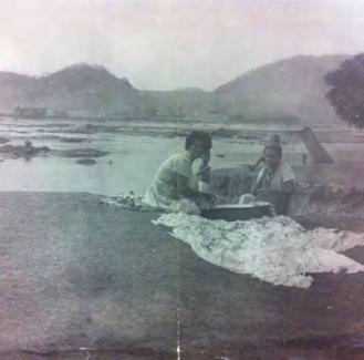
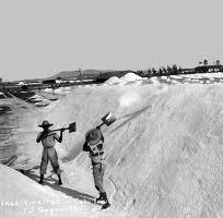
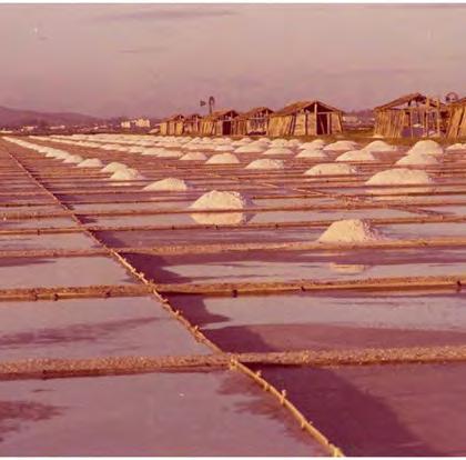

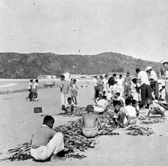
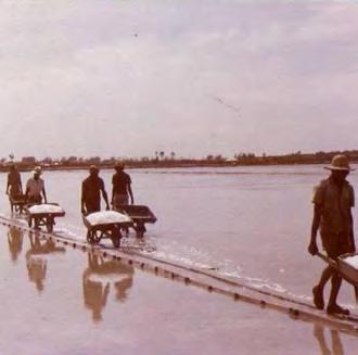
Atlantis Magazine |Invisible | volume 41 65 65 1900
the portuguese
of the familiar salt extraction
fishing salt techniques
1943
1997
start of the harbour
and of the commercial salt extraction activities 1943
of the
of the mass
1969
of álcalis
master plan revision 2006
peak of
migration and start
activities
shellfish fishing
- 1960 construction of álcalis (CNA)
creation of a legal extrativist reserve
trades
construction
bridge Rio-Niterói and start
tourism
bankruptcy
and
Fig 2: The traditional practices: bridging the fishing culture and the matter of salt. Observing shoals and salting fish for conservation
Fig 3: The storyline of salt in the region: from tradition to exploitation Image Source: Author
The unrecognised entity… of culture
Whenever talking about the symbolism of the territory of Álcalis, we shall consider, that monuments are a relevant form of the immaterial memories of a place. When materialised, they make a mediation from a place of abstraction to a place of legible and tangible images. In the field of architecture, Peter Zumthor (Zumthor,2010) points out how the stimulation of feelings (which are rooted in the past and, thus, in individual memories) are projected onto the way we perceive landscape and spaces.
In this sense, the importance of the creation of retrospective monuments is justified once they operate as reaffirmations of the symbolism of the places. In this specific case, the possibility of reclaiming the area to the urban dynamics present nowadays, could act as a remembrance of cultural memories that were until then abstract and dematerialized.
… Of Nature: Living Landscape
As a footprint of the industry, Álcalis left behind its biggest intervention: the creation of canals, flooded vegetated areas and concreted areas of marshland in order to start its industrial process of salt extraction. The built works remain in this territory, coexisting and conflicting with the resumption of vegetation since the abandonment of the industry. It is visible from any perspective, that nature appropriates this place again and generates, due to this intersection, a great wealth of complexity (Clement,2004). Based on this point of view, one can interpret the sensory of the salt flats as a potential that goes beyond its functionality3
The poetics of the matter create a connection that dates back to the traditional periods of Arraial do Cabo, because it highlights the movements and changes of the invisible natural processes and values the intangible memories now framed on a structural anthropic grid created by the industry.
Berque,A .(1998). Paisagem-marca, paisagem-matriz: elementos da problemática para uma geografia cultural. Rio de janeiro: editora da veri. Clement, g.(2004). Manifeste du tiers paysage. Edítions sujet/objet, paris. Eth zürich [architecture of territory eth zürich]. Milica topalovic — eclipse — urbanism beyond the city [video]. Youtube, 2021. Https://www.Youtube.Com/watch?V=lfgjmfj4ndm&t=4222s
Krauss, r. (1979). Sculpture in the expanded field. October vol. 8. Zumthor, p.(2010). Thinking architecture. Basel, birkhäuser. Zumthor, p.(2006). Atmospheres: architectural environments, surrounding objects. Basel, birkhäuser.
¹ Arraial do Cabo, which at first was part of Cabo Frio’s administration, had no more than 300 inhabitants at its early stages of human occupation.. The industry occupied approximately 25% of the territory of the city of Arraial do Cabo.
Recognition?
Unlike the expected - having stated all the symbolism and potential of the area -, the current dynamics of speculative urbanisation and nature exploitation envision the site as a functional resource to be occupied and exploited. It overlooks Álcalis as a potential articulating area with the possibility of reclaiming the natural cycle of salt production as well as traditional practices that once were there manifested. By ignoring that, ignoring the glimpse of a possible reconciliation with nature.
Epilogue
As a conclusion of this analytical-investigative angle, one can summarise that the territory of Álcalis has countless potentials that would provide the means to reintegrate the abandoned area. It has the potential of tackling the complexity of the past, of alleviating the dynamics of the present and of embracing possibilities of the future.
However, in reality, it makes one question if we truly consider these communities and overlooked cities in our current urbanist practice. What needs to be changed in our practice to reach designs that highlight the complexities of the place, by making explicit the functionality and symbolism of the areas? There is a call for a more sensitive approach towards the poetics that nature arouses and the interrelation with culture that is provoked by it.The showcase of Álcalis demonstrates explicitly the need for an orchestration of voices and a continuous work on shedding the light on the invisible and unrecognised potentials of communities, cultural practices and landscapes. And by understanding cultural practices as true carriers of history, we must once again put in perspective the ways in which we deal with cultural historic sites. Not only mediating the past, but proposing new manners to make our history visible and integrate it to the physical realm of the urban space we inhabit.
² The salt extraction practices are the result of a natural and clean production as it depends only on sun, wind and water for its extraction. It is done entirely through the control of evaporation. In short, the process of extraction consists in flowing the saline water (either from the sea or from the Araruama Lagoon) through basins with well-defined concentrations and a constant shallower depth that conduces the water until its final evaporated state. With its approximately 220 km² of water surface, Araruama Lagoon is the largest permanent hypersaline lagoon ecosystem in the world. It served as one of the sources of saline water extraction. As a destination for migratory birds and/or stability of specific mangrove fauna.
³Functionality, in this case, is defined by its productive outcome (salt as a primary product), but also by the many biodynamics that arise from the water conduction process that take place on the basins.
66
Unseen or Unfamiliar Landscapes
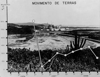
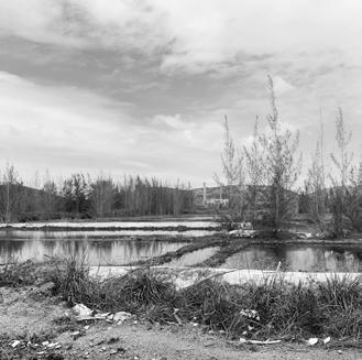
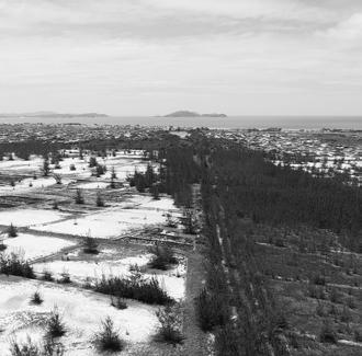
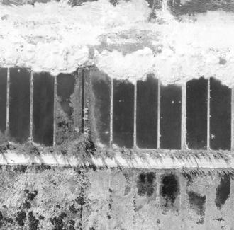
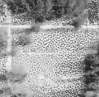
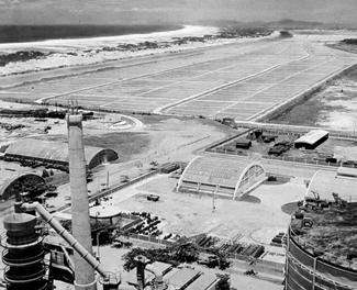
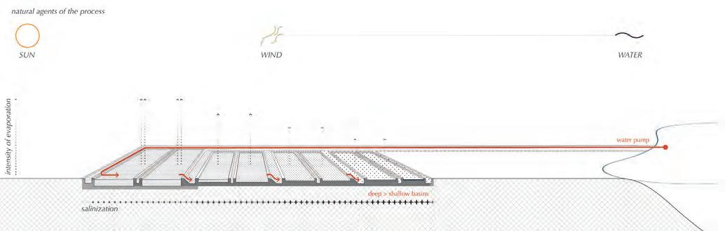
Atlantis Magazine |Invisible | volume 41 67
Fig 4: Relics of industrial times and the takeover by nature
Fig 5: The cost of an industrial scale: landworks during the industry construction.
Fig 6: From water to salt: the sustainable process of salt extraction Image Source: Author
Re-Introducing an Erased Shared Identity
Between the traces of Co-existence
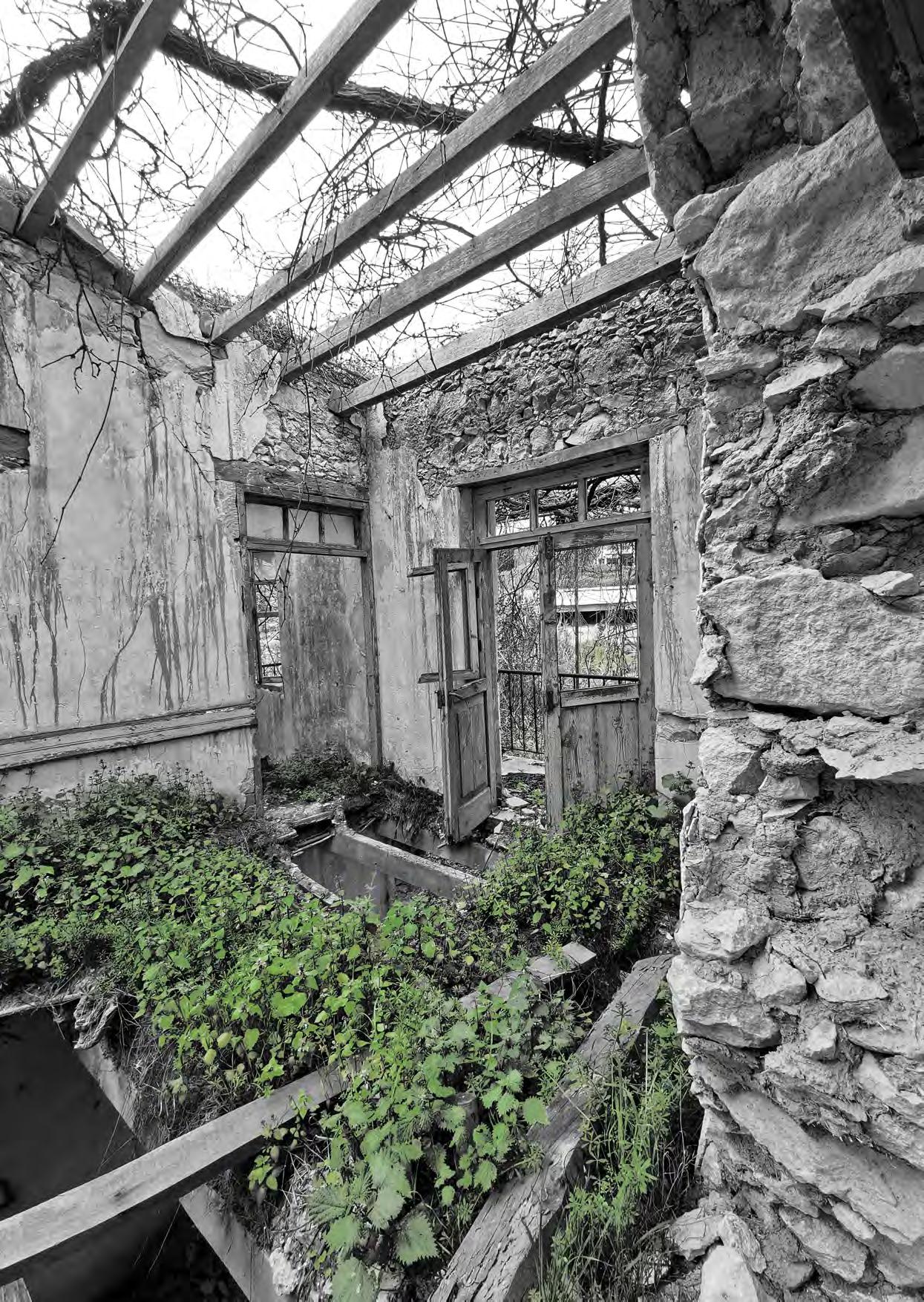
Turkish-Cypriot, Greek-Cypriot, North Cyprus, and South Cyprus are some of the post-conflict abusive definitions that characterized the Cypriot island. For 307 years, between 1571 and 1878, Cyprus was occupied by the Ottomans (Cassia, 1986). At that time period, Muslim and Orthodox people were living on the same island, developing a shared identity. In the following years, between 1878 and 1960 this cohabitation still exist, even if the British occupation of the island provoked the first conflicts (Marsella et al., 2012) between the two religious communities. In 1960, the independence of the Cypriot island was followed by a time period of internal conflicts, and finally, by the war between Turkey and Cyprus, in 1974 (Marsella et al., 2012). This sequence of vilifications had multiple impacts on the Cypriot landscape, that could not be counteracted 47 years later. About 265 000 refugees (United States Committee for Refugees and Immigrants, 2000), a divided island, ownerless territories, an erased pre-war shared identity, and an outbreak of nationalism are the main of them. Based on this, this piece of text aims to the revealing of the intentionally erased pre-war shared identity, from the past, in order to reconfigure the post-conflict Cypriot landscape, in the present and in the future. It is a fluctuation between the shelter, the village, and the land; and a continuous process of action and reaction between humans and other ecologies. The site that has been chosen for this process is the post-conflict, abandoned from the human, landscape, of Pitargou.
PANAGIOTA PATRISIA TZIOURROU
During the British period, the number of mixed villages declined steadily from 346 of 802 in 1891 to 114 of 623 in 1960 (Patrick 1976a). In parallel with this process, as it is already mentioned, in 1960 Cyprus became an independent state with an Orthodox president and a Muslim vice president. For this reason, the Muslim community felt wronged by the new legislation and began to establish its own administrative regime. Thus, the two communities are separated while isolated enclaves are developed, in which the new dual regimes were easier to apply and control. In 1974, the two powerful countries, Greece and Turkey, became involved in this conflict, with the war being
the culmination. This led to the division of the island into Southern Cyprus and Northern Cyprus, displacing the Muslim population on the Northside and the Orthodox on the Southside. Then, this vulnerable situation was exploited by national mechanisms to promote their own truth and nationalism. So, a new legal framework is being drafted for the ownerless properties in South Cyprus in order to manage their use, considering this treaty a temporary and transitional course from post-war Cyprus to the addressing of the Cyprus issue. A framework that is still active. At this point, it is interesting to understand the consequences that a temporary confrontation of an ultimately
68 01 UNSEEN OR UNFAMILIAR LANDSCAPES
Fig 1: Zaharia village, Paphos, 2022.
Image Source: Author
more permanent condition can have. The degradation of both the structures and the ecological elements of this terrain is directly related to the way in which these regulations gave rights to exploitation and uncontrolled use. So, today’s Cypriot landscape has to face the disappearance of the shared identity; and the cultural and environmental impoverishment of the landscape.
Therefore, shared bi-communal identity, pre-conflict tolerance between the two communities, and today’s social resistance are the elements of this process toward redemption. In the first stage, the concept of the “shared identity” of the Cypriot landscape is divided into four categories, the shelter, the village, the land, and the practices. The “shelter” category represents domestic elements, which were the same or shared between the houses of the two communities, Muslim and Orthodox. The “village” typology describes the existence and status of public space and religious buildings for Muslim, Orthodox, and mixed settlements. At the broader scale, the “land use” is about the plurality of cultural landscape, which was containing viticulture, agriculture, pastureland, and wildlife land, which were mixed, without much variation in extent. Finally, the fourth category of “practices” indicates food making and folk art activities; and vernacular adaptive strategies, that were common or even collective during the Ottoman and British occupation. In terms of tolerance, the pre-conflict generation accepted and supported the religious beliefs of the other community. For
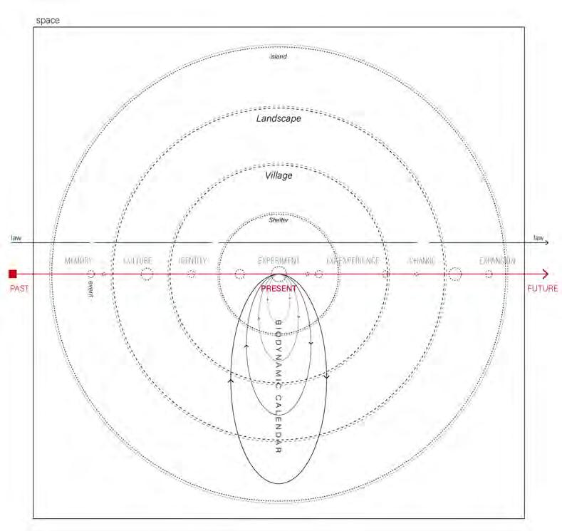
example, during the religious festivals of one community, the other community took care of their animals and fields. Coming to today, there are specific events and data that indicate the social resistance against the political monologue. There are an important number of social movements and bi-communal groups of different ages that support the idea of a united Cyprus and fight for this. It is interesting to focus on the fact that even if the younger generations have no reason to fight for a pre-war shared identity, they build a new one that does not carry the fear and terrorism of a highly conflicting period (1960-1974).
So, following a process of atonement, two types of temporalities are integrated, linear time which consists of the three forms of times, past, present, and future, and circular time which defines the repetition of a series of events in specific time duration. From the point of view of the linear temporal approach, the current landscape is characterized by an accumulation of traces from a past bi-communal coexistence. However, as this collectivity no longer exists, it is collected from the memory of its actors and the remaining spatial traces. At this point, it is important to note that during this course, various events were translated into disruptive moments and moments of re-approaching both the relationships between different entities and between people and landscapes. Furthermore, government legislation is characterized by this linear temporality as well, as the regulations are set and applied for a certain time period until a
70 Unseen or Unfamiliar Landscapes
Fig 2: Biodynamic calendar Image Source: Author
subversive event or an evolutionary period becomes the cause of their rapprochement. In the case of Cyprus, the ephemeral post-war legislative regime became permanent while it did not have the qualities for this position. In this way, the Southern Government tries to convince the affected people that the situation is temporary, by postponing the enactment of more permanent legislation. Thus, the superficiality of this legislative regime, which can be explained by its theoretically ephemeral application in the post-war landscape, has a negative impact on its long-term implementation in reality. Consequently, in the present form of time, the project works with a series of socio-spatial narratives that form the past shared identity and the current institutions regarding the socio-spatial conditions of the post-conflict landscape, exploring the opportunities that arise from this correlation.
From the circular time perspective, the proposed reintroduction of the past shared identity is based on the synchronization of multiple sociocultural, ecological, and economic life cycles in space. The current conditions of the post-conflict vilified territories are characterized by an ecological reclamation or/and intense economic activities such as livestock. However, the project re-composition of these territories takes into account the existing situation. So, the life cycles both of the existing productions and the ecological elements become part of a biodynamic calendar that integrates the socio-cultural life cycles of bi-communal customs and
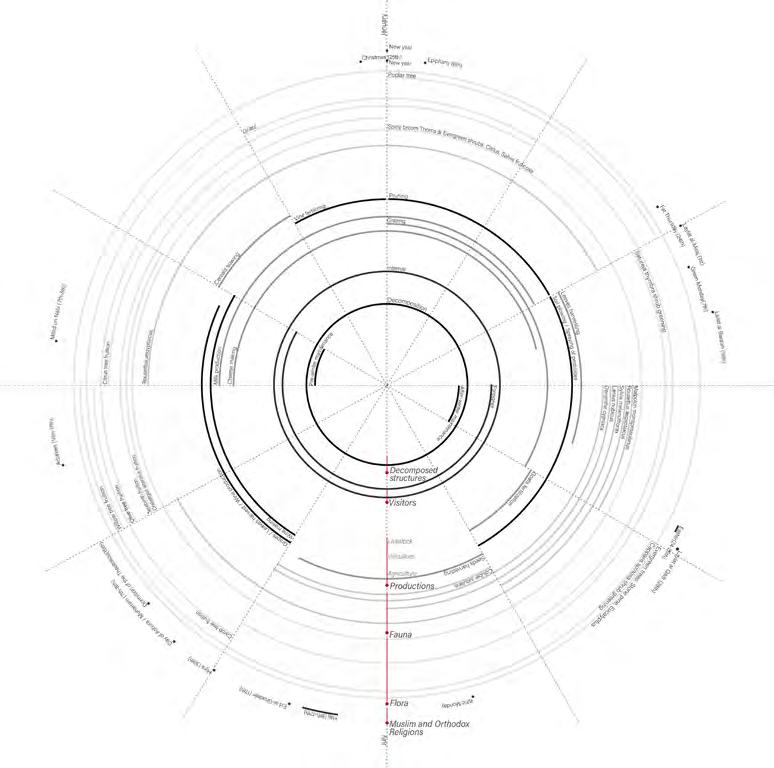
social living as well. So, the objective is the interrelation of these multiple circular temporalities both in the settlements and also on the landscape, seeking the efficient interrelation between different human and non-human entities but also between economic and socio-cultural activities. Furthermore, through this repetition and time expansion, constant action and interaction are proposed in order to assemble and develop a paradigm. Thus, the paradigm is initially built on the present by assembling the harvest of the socio-cultural shared identity, the current government legislation, and the contemporary scientific knowledge, but it is a continuous evolution towards the future through a co-experiential process of action and reaction.
Thus, in 2060, the “occupied” territories of the South Island will become independent. In a process of 32 years from today and after 100 years from the “independence of the island” (1960) the vilified territories will be reactivated. Multiple life cycles will be synchronized and hosted by the landscape of the settlement, in the form of a shelter, between the traces of a bi-communal past. A continuous action-reaction between the land, the vegetation, the decomposed structure, and the human communities in order to gradually recompose a future common identity, not only between the two but between the many and the different. For each territory, this pattern will be translated differently depending on local, existing land uses. In the case of Pitargou, the functionalities of agriculture,
Atlantis Magazine |Invisible | volume 41 71
Fig 3: Conceptual framework Image Source: Author
Source: Online newspaper “Reuters”
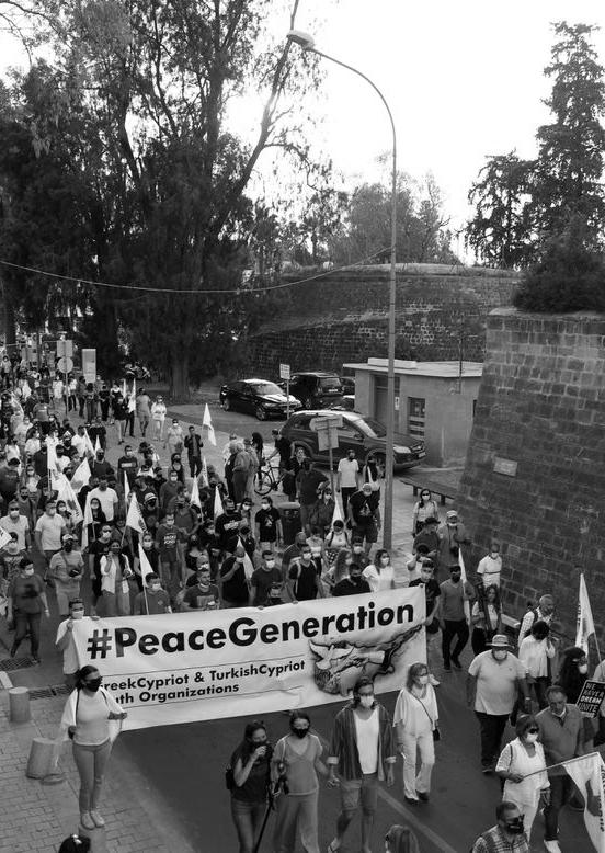 Fig 4: Nicosia Protest in April 2021
Image
Fig 4: Nicosia Protest in April 2021
Image
viticulture, and animal husbandry will be syn¬chronized with the cultural co-creation and life cycles of the endogenous wild ecology, in collaboration with the resident and the visitor. To reach this moment will precede the three time periods, foundation, planting, and integration. Nevertheless, the subsequent phase of expansion is equally important in this process of continuous re-evaluation and redefinition. The first phase concerns the configuration of the spaces that will reinforce the development of this pattern but will also liberate
Cassia, P. S. (1986). Religion, politics and ethnicity in Cyprus during the Turkocratia (1571–1878). European Journal of Sociology, 27(1), 3–28. https:// doi.org/10.1017/ S0003975600004501
Marsella, A. J., Landis, D., & Albert, R. D. (2012). International and Cultural Psy¬chology Series Editor: Handbook of Ethnic Confl ict. http://www.springer. com/ series/6089
United States Committee for Refugees and Immigrants. (2000). U.S. Committee
the territory from its existing occupation. The second phase concerns the creation of new structures that will host both human and non-human entities. Lastly, in the third phase, building the co-produce structures will connect the existing and new structures, creating finally the paradigm shelter(s) composition. In this way, the apathetic territories of the island will be reactivated in an effort to highlight and re-evaluate lost socio-cultural and ecological values at the island scale.
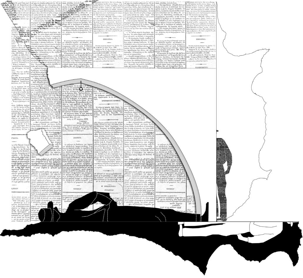
for Refugees World Refugee Survey 2000 - Cyprus. https://www.refworld.org/ do¬cid/3ae6a8cd38.html
Patrick, R. (1976a). A General System Theory approach to Geopolitical Aspects of conflict between communities with particular reference to Cyprus since 1960. In J.H. Bater & R. Preston (Eds.), Political Geography and the Cyprus Conflict: 1963-1971 (pp.1-323). Ontario: Department of Geography, University of Waterloo Publication Series.
Atlantis Magazine |Invisible | volume 41 73
Fig 5: Post-conflict Cyprus 1974-2022 Image Source: Author
The Subsurface as a Collective Geography
A Critical review of Urban Underground Perception and Planning
Cities are rapidly developing into complex and sprawling infrastructure reservoirs, limiting the capacity of vital natural ecosystem services. This is where urbanism may provide an alternative skeleton to support such a landscape as an integrated supplement to the surface. While underground expansion remains a relatively unchartered territory, it brings many experimental opportunities to produce denser, cohesive and unique city models which account for public experience, co-habitation and co-working.
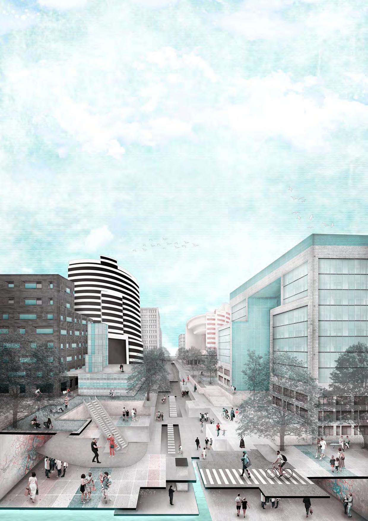 AKHILESH SHISHODIA
03 UNSEEN OR UNFAMILIAR LANDSCAPES
Space, Fiction and Space
Carl Sagan, in his lecture about ‘The Age of exploration’, illustrates the expansive run we had during mid-20th century exploring the cosmos and how we eventually pulled inwards, subjected to the fragility of our planet (Sagan, 1994). These days, there seems no expanse left to traverse beyond the thin crust of the planet we call home. We sent out ships named after gods to look for worlds to reside in, to inject life into, and soon realized that Earth is all we have. Such future oriented projects bear a reminder of society’s potential to realize fiction, exploring dimensions of the urban realm beyond the surface of planet Earth. Fiction, in addition to visualizing mankind’s wonderous gaze, also provides imaginative solutions to questions posed for distant decades. What if the surface is not enough for us in the future? And most importantly … Where will we live when we run out of space?
Urban areas generate a high demand for spaces to accommodate a broader range of activities associated with growth, given the rising rate of urbanization and over two-thirds of the human population projected to be city dwellers by 2050 (UN-DESA, 2014).Consequently, cities are rapidly developing into complex and sprawling infrastructure reservoirs, limiting the capacity of vital natural ecosystem services. As a response, brownfield development has redirected its focus to the subsurface in an attempt to reduce its terrestrial footprint.
Underground cities are not an urban exodus to cave-life. Instead, it is an opportunity to explore another dimension along the axis-mundi.
Urbanists have realized that expanding the public realm in cities through brownfield development underground, beyond logistics and utilities, can help close the gap between demand and supply of habitable land within cities, further balancing the ratio of land consumption and population growth.They believe that the constructing underground corridors, though constraint on cost and technological thresholds, can contribute to creation of a seamless landscape where the idea of ‘surface’ is extended by strategic incisions to offer space for parallel layers of events that are no longer a part of separated economies.
Fictions dating back to 1930s, for instance the earthquakeresilient Depthscrapers describe subsurface habitation as building-molds to be filled by functions varying with gradients

of depth. On the other hand, 21st century Sci-fi novels like ‘The Dark Forest’ by Cixin Liu, portray a parallel city extended about a kilometer below ground where the only sense of orientation and light is drawn from artificial projections of the sky on the ceiling, using Augmented Reality. While such images reveal some key parameters and challenges attached to underground exploration, they tend to disengage from reality the moment they discard the persistent need of human subconscious to stay associated with the surface or a platform enunciating their connection to Earth. Underground cities are not an urban exodus to cave-life. Instead, it is an opportunity to explore another dimension along the axis-mundi (earth’s axis between the celestial poles) (Hawkins, 2019), by looking further down as a new way of looking up.
The Lawless Territory
The lack of strategic spatial visions recognizing efficient use of underground as a goal to maintain resource competitiveness leaves the territory unchecked. In several European countries,
Atlantis Magazine |Invisible | volume 41 75
“ “
Fig 1: Design for ‘Depthscraper’¹ Image Source: Everyday Science & Mechanics, 1931
you can practically own the space below your surface parcels, stretching till the core of the earth. The idea of subsurface as an ‘untapped’ resource opens up functional possibilities as well as risk of exploitation, depending on the players utilizing this asset. While public bodies focus on generating opportunities based on collective use of resource area, connectivity, and primacy of location, private sector may treat the ungoverned extension of space to super basements primarily for storage and data-based utilities, further risking attached ecosystems.
The competition leaves the current subsurface in growing cities limited to transit and utilitarian uses to facilitate storage and movement. The subsurface is growing denser by the day with infrastructure networks to an extent that imagining public functions and habitation in the coming decades would be unlikely. Before the window closes on this territory, it is imperative to generate a platform for integrating infrastructure and life underground.
Perceiving the void
The current scale of underground construction has been project-based and restricted to the architectural scale without platform, resulting in an archipelago of volumetric voids beneath the surface (Zhu, 2014). These developments are based on a ‘point and line’ mode of disjoint spaces, like metro
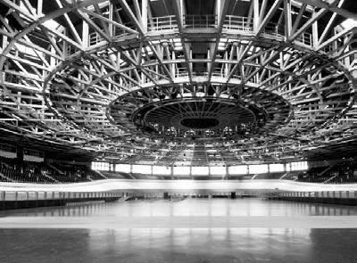
stations linked with linear retail (Lan, 2016). Such an orientation is prone to insinuate a sense of enclosure psychologically associated with loss of orientation and claustrophobia. Realized UUS (Urban Underground Space) projects in the past few decades have faced considerable public criticism concerning qualitative factors and psychological conventions.
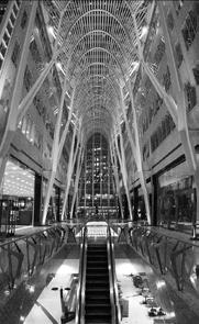
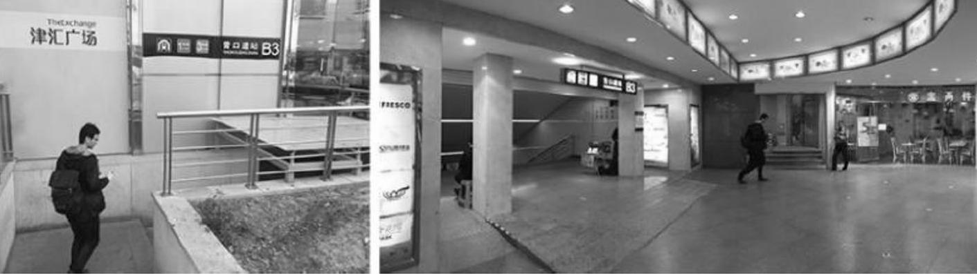
The withdrawal of the perceived sense of control and safety in hidden/hiding spaces from the user often pick remarks of neglect, darkness and isolation lacking ‘eyes on the street’. To allow these fragments to function in a coordinated urban system, it is essential to observe and establish potential linkages and an integrated framework for a wider range of uses that can supplement the surface in collective volumes instead of narrow networks.The uncertainties of subsurface as a new reality question its existence in a context that fractures the conventional urban image (Perrault & Lee, 2017).
However, the primary challenge for the future subsurface realm is to tackle its susceptibility to generate a negative perception. Several architectural cases ranging from the Calatrava (Toronto) to the French National Library (Paris), and Berlin Velodrome, have explored underground spaces by employing light as a tool to expand idea of geography, induce orientation and establish a visual connection to surface (Miess & Radu, 2004).
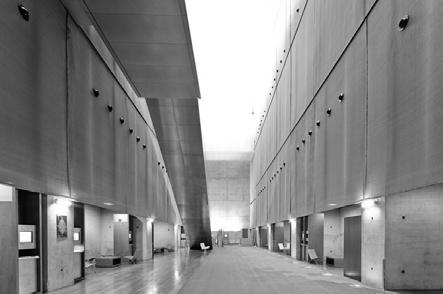
76
Fig 2: Tianjin’s Yingkoudao station entrance and transitional space
Image Source: Anna Lan, Don State Technical University
Fig 3: Interior Spaces Calatrava (left); French National Library (Center); Berlin Velodrom (Right)
Unseen or Unfamiliar Landscapes
Conclusion
The preceding notion of planning for subsurface with natural and urban spaces has been that of a preservation agent for heritage. However, it can also act as an industrial enabler of new geographies and limit the city to its smallest potential surface area. Picture a Sphere, with one hemisphere underground while the other half above surface laced with harmonious functions at equidistant extents from the Groundscape, a haven for vitality and entropy. This city would be an exhibition of thickening urban substance, consequently reinstating heritage on surface back into the urban life of the city.Urban planners and Architects should lend special focus to the reconstruction and appropriation of transition interface between the surface heritage and underground. This interface links masses of similar characteristics to form unified spaces. Programs in these help spaces steer a narrative for the user
“Depthscrapers Defy Earthquakes. (1931). Everyday Science and Mechanics, 646,708.
Hawkins, H. (2019). Underground imaginations, environmental crisis and subterranean cultural geographies. Culture Geographies, 3-22.
Lan, A. (2016). Transport oriented development and commercialization of underground space in China: trends in Shanghai, Tianjin and Shenzhen. Procedia Engineering, 555-563.
Liu, C. (2008). The Dark Forest. Head of Zeus.
Miess, P. V., & Radu, F. (2004). Vingt mille lieux sous les terres : Espaces publics souterrains. Lausanne: Presses polytechniques et universitaires romandes.
and connect different timelines of growing city heritage in the same space.
The ‘shared’ nature, scalability and growing viability of the subsurface directs important concerns towards the dimensions of systems approach and spatial design while planning for underground development. While the window of injecting public functions in already densifying infrastructure networks slowly diminishes, Underground urbanism may provide an alternative skeleton to support such a landscape as an integrated supplement to the surface. Since underground expansion remains a relatively unchartered territory, it brings many experimental opportunities to produce denser, cohesive and unique city models which account for public experience, co-habitation and co-working.
Perrault, D., & Lee, Y. (2017). Sublab: A Groundscape Story . Seoul: NemoFactory. Sagan, C. (1994). The Age of Exploration. Lecture. New York: Cornell University. UN-DESA. (2014). World Urbanization Prospects: The 2014 Revision. Department of Economic and Social Affairs, United Nations. United Nations Department of Economic and Social Affairs. (2014). World Urbanization Prospects: The 2014 revision. New York : UNDESA.
Zhu, W. (2014). Development of strategic new space for urban development. Beijing: Tsinghua University, Department of Civil Engineering, Underground Engineering Research Institute .
Atlantis Magazine |Invisible | volume 41 77
Fig 4: Pollution Bao’an Shenzhen China. Image Source: Flickr.com
The Two Cities within Sao Paulo
A narrative about time control and segregation
The interpretation of São Paulo proposed for this paper takes the form of a narrative that starts in a movement, tangible by the daily human commuting intensity, where the daily Homeric efforts are so vast and multiple that become anonymous when performed in the stage of a highly segregated city. And to unveil the layers of segregation, the narrative adopts the format of a travel journal from Bras Cubas, a Brazilian fictional character from the book The Posthumous Memoirs of Brás Cubas , allowing a Menippean satire as a reading method of the cities within São Paulo. “The city of the invisible” that clashes with a second movement, the voracious highend real-estate development force based on walls, gates, security guards, and fences: “the city of castles”, an expression of the denial of the ground floor and latent necessity.
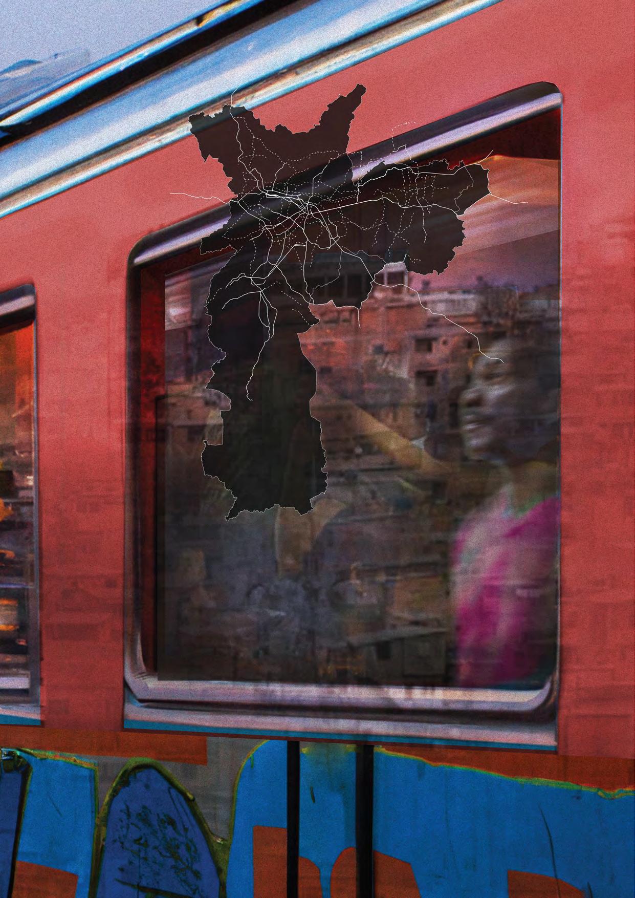
São Paulo is a city of endless disputes and interpretations. As a stage of conflicting ideas on urban development and practices, it is a place of a myriad of unsatisfied interests due to a historically persistent inconsistency and temporal mismatch between the proposition of socially important infrastructural projects and their realization (Campos,2000). One of the critical elements of this conflict is the inefficiency in the execution of public infrastructure projects necessary to expand the heterogeneously distributed mobility network in an unequal city of 12,33 mi inhabitants. An inefficiency that affects the transport conditions of 7.8 million daily passengers in 6 metro and 7 train lines, and 10 million daily passengers in 1300 bus lines.If the challenge of attending to the demand of daily commuting is a critical element of the conflict of interests in the city, the conflict itself is partially the cause and outcome of the public sector’s attempts to overcome the challenge. In São Paulo, the expansion of infrastructure networks
has an intrinsic and paradoxical process of sociospatial segregation. On one hand, the expansion of the transport infrastructure prioritizes the private transportation infrastructure, evident by the concentration and quality of roads in the richest areas - and also by the constant priority of improving the metro systems in those same areas despite the latent widespread demand.
Hence perpetuating a social competition for the production of the transportation system, an operationalization of social disparities by the control of time (Villaça,2011). On the other hand, the expansion of these networks also creates enclaves of development in regions that lack basic infrastructure, where the possible positive qualities of the projects have a strong propensity to be dissolved after a quick surpass of the demand. Therefore, disseminating scarcity after the implementation of localized infrastructural solutions (Vosgueritchian,2015).
78 03
FÁBIO ALBERTO ALZATE MARTINEZ
Introduction
UNSEEN OR UNFAMILIAR LANDSCAPES
Current metro and train lines
Proposed metro and train lines
Image source: Author
0 10km
ATLANTIS | (In)Visible | Volume:41 | Feb: 2023
In that sense, the effects of the mobility crisis are way more severe among the population sector with low income, historically conditioned to be users of public transport due to its affordability in a city that prioritized car-centered development (Rolnik & Klintowitz, 2011)since the Avenues Plan from Prestes Maia. Hence, accumulating an excruciating demand saturation in the public transport system that is maintained by the disparity between the geographical concentration of jobs and the location of densely populated areas with fewer labor opportunities, but more affordable land often denominated as dorm cities - configuring a continuous movement of masses.
Travel journal of Bras Cubas
I will start this travel journal (Assis, 1881) by claiming that I will not dedicate it once again to the first worm that ate the cold flesh of my intestines, nor the second or third one. Neither to me nor whoever reads it. After more than a hundred years I have no more gratitude for any living being that still exists. However, I found observing and writing about life, and especially humans, a satisfying attempt to make meaning of my slightly positive life - mostly now that I found myself trapped as a decaying soul. But I won’t waste this journal only to feel sorry for myself.
I also decided to waste it to explain the purpose of this occasion. Before I went to Earth again, an old friend who is also a posthumous author, asked if he could join me. Paulus, previously known as an apostle, was curious about the city named after him, and the reasons to descend to São Paulo may have a pure dogmatic simplicity, or the wisdom of a decapitated apostle - since tomorrow is the city’s quincentenary.
Curiously, it is the only place in the world where both of our names mean something geographically relevant, and also known in the spiritual world as the purgatory for human growth. But we are not traveling randomly in São Paulo, or specifically to the Brás district. During a full day, we are going to visit two of the thousands of cities in between the endless prismatic forest. And as soon as we get close, the omnipresent roaring and talking conquer our horizon of perception. Blurring any kind of reference that we could possibly have.
The city of the invisible
Our first stop is the City of the Invisible. An amorphous city that every morning and afternoon takes the form of a network that expands and absorbs human power, strength, and denied fantasies from the farthest regions. To begin our journey through this complex dynamic, our starting point for our human tourism needed to be simple - a regular transport station. The crowded mass of body heat and assorted smells can be deceiving - while the painful waiting endures on
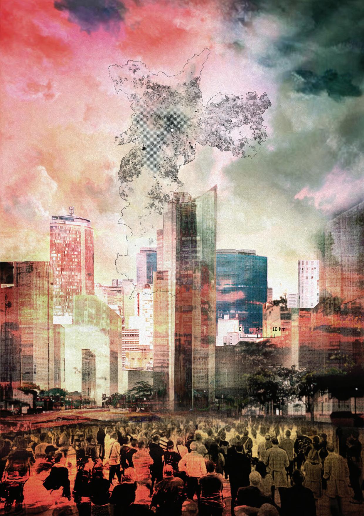
several platforms, thousands of narratives take place with an equal amount of subjective relevance. The occasional stares suddenly stop. The crowd moves in a rush to safeguard a personal territory inside of a wagon. The urge to go osmotically from a tight and uncomfortable space to a space even tighter may be revealing. In this city, life is apparently resumed by living in between stressful sprints immediately followed by long waiting times. Time maintains the social status quo. After all, if anyone were granted time, the anonymous would write their own narratives, and the dreams would become visible, as beautiful and disgusting as human dreams can get.“- May the anonymous be blessed in their journey to seek what is licit and convenient”. With Paulus’ blessing, I decided to follow a nameless person who had tired but vigorous eyes. His morning face tells his last night wasn’t very inspiring, but not boring enough for him to be miserable. The ‘whoever’, wasn’t anonymous by choice - in this city whoever asks for your name probably has dubious interests, and our brave citizen has dignity. During the hours of commuting, the man remained in introspective silence - leaning his head on the window, staring at the endless ocean of tiny unsightly houses.
The beep sounds. The crowd leaked out of the wagon and disappeared in the middle of another crowd. However, our protagonist had a different fate. Walking out of the station, he took a shortcut through a composition of filthy puddles. Desperately attempting to finish the reflection of the old buildings nearby, the puddles were brutally interrupted by the equally desperate pace of our subject, only achieving tickles on the concrete floor. A Sisyphean task that unexpectedly connected them by sharing the condition of endless effort and futile exhaustion.
A few blocks ahead, a triptych momentarily framed our protagonist. On his right side, there is an immense intricate graffiti with the message “There is no love in Sao Paulo”. On the left side, a police operation - the end of the illicit attempt, and life, of a starving ‘whoever’: in the foreground, a composition of stolen food over the asphalt, a dead body covered by blood, and menacing police officers; in the background, a briefly shocked crowd annoyed by the smell of the polluted canalized river behind. Paulus promptly went to briefly console the disoriented soul of this teenager, who was just realizing the implications of being dead while looking at his body: “ - Don’t be afraid. Our bodies could be perishable, but you will still have much to experience through the power that allows us to exist.”
However, Paulus didn’t explain that humans tend to experience the world to seek their essence and meaning. Still, by the disgrace of some of them, this search can potentially lead to the realization that the world is unintelligible - especially during the first seconds after death. And besides that, the world is also ruled by arbitrary decisions - as probably Sisyphus
80
Unseen or Unfamiliar Landscapes
0 10km Concentration of formal jobs8 Demographic density <200 people/ha >800 people/ha Image source: Author 81 ATLANTIS | (In)Visible | Volume:41 | Feb: 2023
However, moved by the simplicity of a self-imposed ignorance towards social injustice, our hero finally got to work psychologically unaffected. Orders coming. Packages closing. Vehicle roaring. He is back to the streets in a journey against time - trying to be faster than the heat transfer from the freshly made food to the polluted atmosphere.
A sun ray escaped a few seconds from the dense clouds and smiled at our protagonist during his favorite pause. It was clear to both of us, and probably to our protagonist as well, that after a long day delivering meals, having lunch has almost a poetic symbolism. The man sat and devoured his food as a king, making jokes with his colleagues as a stand-up comedian - opening space for a fragment of heaven in the middle of the purgatorial rain. While noticing our subject’s satisfaction, Paulus remarked: “- Everything that is exposed to light becomes visible, and it can potentially become truth. But what most humans find hard to understand, is that everything could be visible if you look at it enough. Simplicity can become truth, and by keeping the smallest pieces of truth, we can achieve a larger piece of paradise”. However, our protagonist can’t be in his fragment for much longer. He was late, and he got on his motorbike to achieve his last delivery destiny - The City of Castles.
The City of Castles
A few blocks ahead of the first glass tower, the rain got heavier. The sound of rubber scratching the ground resonated for a hopeless second. Our hero was propelled from his destroyed motorbike, only to fall and shatter on the ground like another drop - in unison with the deafening storm. The nameless died in front of a dog, being watched by hundreds of windows while agonizing and disturbing the traffic. And finally, his heat dissipated only to be shared with the cold and wet asphalt. He was worth one paramedic, a crying homeless ‘whoever’, a headache from his boss, and a terrified mutt dog.
If the world is what our eyes can see, São Paulo would be an Ecumenopolis - but everyone’s eyes look at something different in São Paulo. And the City of Castles was anything but invisible, being constantly shaped by hundreds of desire machines, powered by the raw energy of human mass from the neighboring cities. I find it impossible to identify who is the operator and who is the creator, in the service of maintaining the autopoiesis of the glass castles, tirelessly working to expand the sticky boundaries of the city’s reality.
Maybe all that glass is a narcissistic act, a reflection of its fornication, as a huge motel of perversions that ultimately guides you towards the luscious state of catatonic schizophrenia. However, if you don’t belong to this city, you immediately will be reduced to a disturbance made of flesh
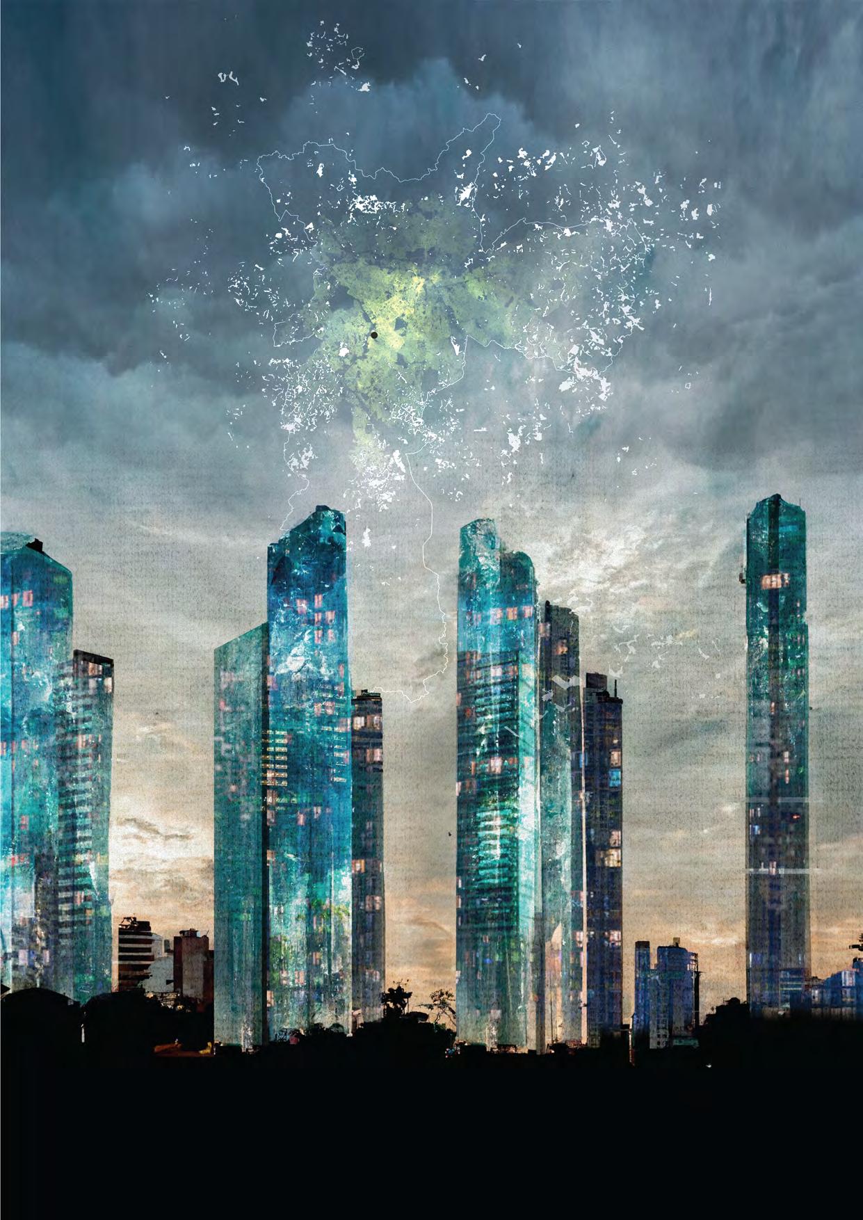
and unfinished expectations. With each thunder strike, the mutt dog got increasingly terrified, shaking as a kid pretending to dance samba - paralyzed in such a way that it couldn’t even follow its natural instinct to check the warm food in the man’s bag. When the removal of the body was done, two siblings went down with their mom, crossing the double gate, and sharing short words of sorrow with the gatekeeper. And after visually exploring the events, the family spotted the petrified animal. They quickly decided to check on it. It was unharmed. Promptly, the kids asked with their looks for permission to keep it, and following some consideration, their mom agreed. It was an unusual event, and possibly this would help the children to go through it. The gates opened. Security checks are done. Once inside the building, the siblings started to argue about which name they were going to give to the animal. “- I think... We should call him Perseu”, kindly but impatiently suggested to their mom - who was already tired of the short discussion.
The middle-aged woman was called Regina, as promptly indicated by her housemaid when she asked if they needed help with Perseu. “- Of course we need help, bring a towel and prepare a bath for this poor soul”. And after Perseu was already sterilized she promptly hugged the still wet, but fragrant dog, and continued with a simplified form of communication, “This little boy you see is Pierre, and this is his sister Marie… and these are Chico, Rita, and Bethania” - pointing out to three vigorous plants in red vases. Then ordering her housemaid “- Also, after finishing drying the dog, please take the plants to the balcony, this rain will do wonders for them”. The size of the apartment was humongous, and to reach the balcony, the stressed lady had to carry the dog and the plants across a vast city made of expensive furniture. A day life marathon without the glamor of winning something. However, Perseu was definitely winning - the bathroom where his drying was taking place was the cleanest place he had ever been. But, if the size is any sort of reference, the dog’s bathroom before being rescued was and will always be bigger than this one, as long as there is still an ‘outside’ from the castle’s boundaries.
If someone else was winning inside of these boundaries, that would be Regina. As an apparently famous artist, part of her apartment was also a gallery - featuring complex monochromatic geometrical compositions. Despite my decision to not have children to avoid transmitting the legacy of humanity’s misery, I could say that in the worst case possible, her kids will never know what misery means. And almost as an act of expansion of this beautiful geometry and proposed legacies, the apartments from the nearby towers started to light up, forming a mosaic of glowing stories while the sun disappeared. The mirrored facades made the City of Castles cease to only reflect each other’s reflection, and became an intense and diffuse landscape of light, contrasting with the dark environment immediately around.
82
Unseen or Unfamiliar Landscapes
onerous
- + 0 10km
Favelas Value of the
grant of the right to build11
83 ATLANTIS | (In)Visible | Volume:41 | Feb: 2023
Image source: Author
After pampering Perseu for a few hours, it was time to sleep, and my time to go back. Meanwhile, the kids and the dog were put to bed, I noticed from above a very awake Paulus discovering a few realizations from this stage of humanity. He was helping our delivery hero to understand his new placealmost as self-conscious and purpose-driven pampering. And for you, dear casual reader, if you made it here you must have realized that this journal was born and then grew as an epitaph. Whoever watched, or read the last moments of our first protagonist, probably felt afraid of having their story having his destiny.
Maybe I found a competitor for my insignificant death while I wrote what was the most important moment of this man’s existence. However, in the opposite of death and still, with the same degree of importance, I wrote about the dog’s baptism. And now, close to midnight, while I was preparing to ascend, Regina watched the news and called her husband with excitement to tell him that their building was in the news. Through the giant television, even larger than the living room’s window, I could see the aerial image taken by a police helicopter, in which Chico, Rita, and Bethania were smiling at the weak rays of sun that reached the balcony through the dense clouds. After some self-reflection, I realized that I will corrupt my first sentences.
Maybe now there is love in São Paulo since Paulus rediscovered his vocation to guide. But I also feel sorry for myself, feeling eaten by the envy of the first worm that ate me. Maybe I should
dedicate it to it again. Probably I was the first human it ever met. Maybe because after visiting humans and humanity for more than one hundred years, I never saw humans and humanity at all. And writing these final sentences using a pen of mirth and ink of melancholy, I had the same epiphany as Fernando Pessoa did - everything I could ever see were humans different from each other, and the spaces that separated them.
By seeing the ages coming and passing on I felt calm and resolute, barely happy. And here I came to the same old conclusions I had in my first book, and because of that, I decided to paraphrase myself:
“Each age had its light and shade, apathy and struggle of truth and error, and its parade of systems, of new ideas, of new illusions; in each of them, the verdure of spring burst forth, grew yellow with age, and then, young once more, burst forth again. While life thus moved with the regularity of a calendar, history and civilization developed; and man, at first naked and unarmed, clothed and armed himself, built hut and palace, villages and hundred-gated Thebes, created science that scrutinizes and art that elevates, made himself an orator, a mechanic, a philosopher, ran all over the face of the globe, went down into the earth and up to the clouds, performing the mysterious work through which he satisfied the necessities of life and tried to forget his loneliness”. But this time I wouldn’t call it loneliness, maybe just misery, which is the ultimate subproduct of the absence of love.
Assis, M. J. M. de. (1881). Memórias Póstumas de Brás Cubas. Campos, C. M. (2000). Os rumos da cidade: urbanismo e modernização em São Paulo. Editora SENAC São Paulo.
Rolnik, R., & Klintowitz, D. (2011). (I)Mobilidade na cidade de São Paulo. Estudos Avançados, 25(71), 89–108. https://doi.org/10.1590/s010340142011000100007
Vosgueritchian, A.B. (2015). Infraestrutura e projetos de regeneração urbana. [Doctoral thesis, Faculty of Architecture and Urbanism, University of São Paulo] Villaça, F. (2011). São Paulo: segregação urbana e desigualdade. In Estudos Avançados (Vol. 25, Issue 71, pp. 37–58). FapUNIFESP (SciELO). https://doi. org/10.1590/s0103-40142011000100004
lBGE – Brazilian Institute of Geography and Statistic. São Paulo (SP) | Cidades e Estados (n.d.). www.ibge.gov.br/cidades-e-estados/sp/sao-paulo.html www.metro.sp.gov.br, www.sptrans.com.br/sptrans, www.saopaulo.sp.gov.br
Geodata
Prefeitura Municipal de São Paulo. Geosampa. Retrieved from http://geosampa. prefeitura.sp.gov.br/PaginasPublicas/_SBC.aspx#
Borrelli, J. Valor do Cadastro de Outorga Onerosa do Direito de Construir segundo PDE 2014. Retrieved from http://www.labcidade.fau.usp.br/dadosabertos/
Formal jobs concentration is based on: “Image 5 Emprego e moradia no município de São Paulo” from: Franco, F. de M., Almeida, C. H., Abreu, G. K. M. (2015). A macroárea de estruturação metropolitana de São Paulo: o projeto urbano como instrumento de transformação do território. “Revista Iberoamericana de Urbanismo”. Retrieved from https://upcommons.upc.edu/ handle/2117/85244 Onerous Grant of Right to Build (Outorga Onerosa do Direito de Construir) is a public instrument that allows the city hall to grant the right to build above the construction area limit per parcel determined by the city’s masterplan through a payment to be provided by the beneficiary.
Note: The Posthumous Memoirs of Bras Cubas, also translated as Epitaph of a Small Winner, is a novel written by the Brazilian author Machado de Assis and published in 1881. The book adopts a caustic tone to unveil slavery, social classes, scientism, and positivism, in the format of an autobiography written by the character Brás Cubas after his death. It is one of the most important books in Brazilian literature, considered the predecessor of avant-garde elements that were introduced in the modern movement. It also introduces the principles of the philosophy “Humanitism”, a satire about Social Darwinism developed further in the later work of Machado de Assis.
84
Unseen
or Unfamiliar Landscapes
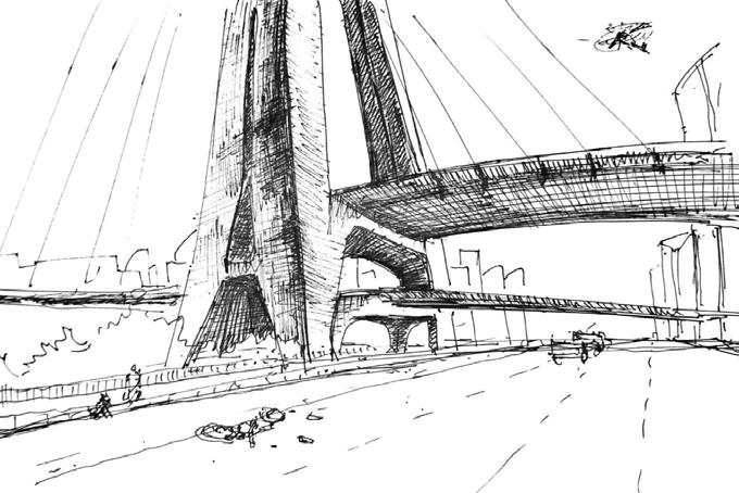
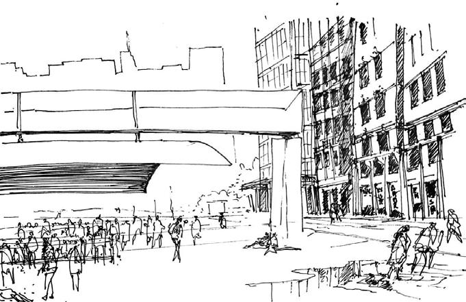
Atlantis Magazine |Invisible | volume 41 85
Fig 4: Sketches from Bass Cuba’s travel journal
Accessing Invisible Views Through Digital Survey In Favela Communities
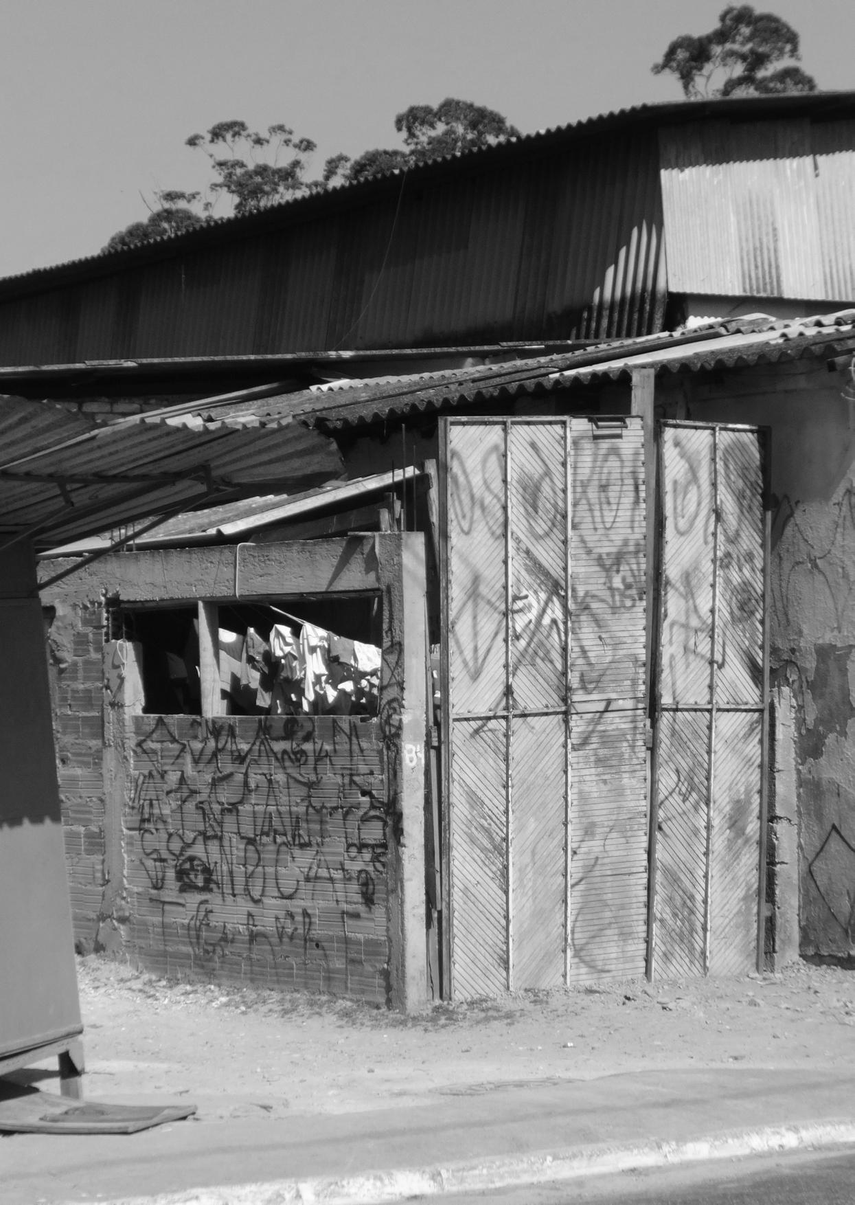
The study of favelas so far has been characterized by the use of traditional methods, usually consisting of paper and pen interviews and field research. Recent studies suggest that digital platforms are a convenient way to access marginalized populations’ views, often invisible during urban surveys. Thus, digital surveys were used as an experiment to study Vila Missionaria, a favela in São Paulo, resulting in the development of a software tool for urban data surveying, Neibz. This study explores the hypothesis that a digital approach can facilitate data gathering of elements that are often invisible in regular survey studies.
MARIA LUISA TAROZZO KAWASAKI
The challenges of studying a favela: A walk through Vila Missionaria
Vila Missionaria is situated in São Paulo city. Walking through the neighborhood, you can see many locals sitting on doorsteps, staring at you with curiosity as they recognize you as an outsider. It’s easy to get lost inside Vila Missionaria; most of the buildings look the same and the streets don’t follow any planned structure. You feel like you’re inside a maze.
The irregular morphology typical of favelas can act as a barrier to traditional forms of mapping and studying urban spaces; aerial data collection, for example, tends to suffer from occlusions and fails to capture the typical heterogeneity in material and design. The difficulty in mapping leads to gaps
during the information-gathering process. The result is that many elements remain invisible.
Our guide through the favela was twelve years old. She started off the tour by showing us her school. The school’s sports field is the only one of its kind in the whole neighborhood and some children who attend a different school come to play here. The definition of public space inside favelas is often atypical and difficult to map.
This type of local knowledge is able to fill the gap in information regarding favelas. How do young people experience irregular urban settlements? What can they observe that maybe was not mapped before? Quoting Goodchild: “citizens are sensors”, and their local observations are extremely valuable when studying cities, especially where
04
TRANSFORMATIONS IN SPATIAL RELATIONSHIPS
Fig 1 House in Vila Missionaria Image Source: Author
access to a space is limited.Sometimes our guide would attend parties near Vila Missionaria on the weekends. When asked if the parties were open to outsiders she just shook her head.
There are places within favelas that are inaccessible to outsiders and often dangerous for researchers. Regarding how to avoid the risk of studying favelas Janice Perlman, the famous author of The Myth of Marginality stated: “The ubiquity of cell phones should make that much easier today.” This advice reflects the potential of portable devices to access these communities. Can our cell phones be a way to study these hard-to-reach spaces and make this invisible information finally visible?
The use of the Internet and social media between young groups in favelas
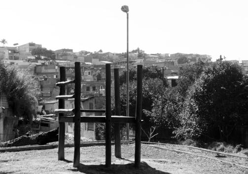
At Vila Missionaria, topics like TikTok trends and make-up YouTube channels can often be overheard in young girls’ conversations. A study conducted in 2012 found that nine out of ten residents under thirty years old in the favelas of Rio de Janeiro had access to the Internet.
In an interview from a 2019 study undertaken in Morro dos Prazeres, a favela in Rio de Janeiro, a local stated: “[...] everyone has a smartphone, the poorest guy has a smartphone”.
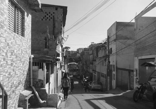
Of the residents who have access to the Internet, 85% have a Facebook account, according to the Instituto Data Favela research institute. From these statements, it is possible to conclude that being marginalized is not necessarily a synonym for being digitally excluded.
The significant proportion of the favela population with access to the Internet increases the potential of digital tools to connect researchers and residents. Local knowledge can become visible and the study of cities can become more participative. Renato Meirelles, one of Data Favela’s partners, stated: “If at the beginning the TV was a window of the world to (favelas) inhabitants, now social media are their shop windows: with the use of social media, locals, especially those who are still young, can show themselves and show their reality.”
Accessing vulnerable communities through a digital survey: The Vila Missionaria experience
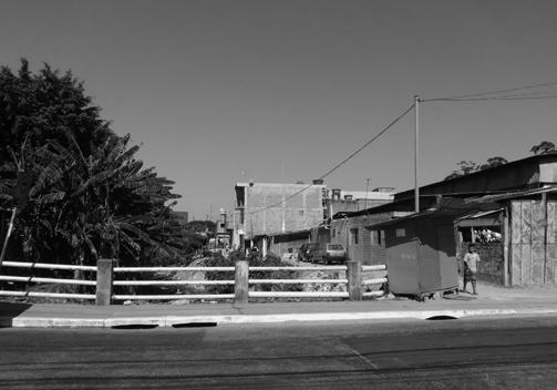
To explore this hypothesis more in-depth, a series of interviews were conducted online. Interviewees, young girls aged nine to twelve years old, were living in Vila Missionaria or in a nearby area. They were asked to describe how they perceived the neighborhood where they live. The girls shared pictures and voice messages describing their daily lives in the favela. This digital survey became a window into how a young person would experience Vila Missionaria.
Atlantis Magazine |Invisible | volume 41 87
Fig 3: Abbandoned public space in vila missionaria Image Source: Author
Fig 2: Vila Missionaria Image Source: Author
Fig 4: Vila missionaria volunteer Image Source: Author
The girls were interviewed through social media platforms and showed to be quite familiar with tools such as cameras, voice, and text messages to share their local perceptions. The data collected was further imported into MyMaps, creating a participative web mapping of the area, that lacked a reliable geodatabase.
With the use of volunteered geodata and participatory mapping, the gap of knowledge regarding Vila Missionaria was filled. Children were surprisingly able to map and recognize streets, often seemingly mazes for outsiders, and identify negative and positive aspects of the areas.
The negative aspects found were mainly related to abandoned public spaces and dangerous locations related to drug selling and the positive ones were mainly places where children feel safe to play and spend time in the company of their friends. A finding of the study is that the identified beneficial spaces were usually school sports fields that were also open during the weekends and religious spaces, areas that from an outsider’s point of view maybe would not have been mapped as frequent spaces used by young girls without the local knowledge of the volunteers.
The outcomes from this research served as a geodatabase that now belongs to an NGO, Afesu, that has acted in the neighborhood for several years. To make the outcomes of the research also available to the interviewees, the young girls, a graphic novel was produced using the results. The collaborative mapping was part of Afesu’s Velejar volunteer project that offers training and educational activities for girls from nine to twelve years old. The map made many observations regarding the social structure of the neighborhood visible and georeferenced. If volunteers would perceive certain positive and negative aspects of Vila Missionaria, the collaborative map confirmed or denied these perceptions and added a type of information that is only possible with the use of local knowledge.
Neibz: Creating a tool from the experience at Vila Missionaria
The successful experience of using digital surveys while studying Vila Missionaria led to the development of Neibz, a software tool used to collect the data needed while studying a neighborhood. The used survey can be accessed through a website and is available on mobile devices. The interface is similar to an app but does not require it to be downloaded on mobile phones. Using six different categories, namely primary and secondary services, security, health, mobility, and sustainability, the results are presented as a spiderweb
If at the beginning the TV was a window of the world to (favelas) inhabitants, now social media are their shop windows: with the use of social media, locals, especially those who are still young, can show themselves and show their reality.
with different scores per category, making it easier to interpret the results. Both categories and questions can be modified by researchers and different studies can be conducted simultaneously. The results of different studies can also be compared easily.
The results are stored and the database is organized in years, making it possible to compare scores through time. This facilitates the follow-up of an urban intervention for example. In 2020 Neibz won the Future Cities Challenge by UN-Habitat and Fondation Botnar. The software is part of an ongoing research project by the author regarding the applicability of Neibz and other forms of geo-data visualization. In parallel with her Urbanism studies, the author is now pursuing a degree in Geomatics to acquire skills related to programming, GIS, and spatial data science that she believes to be necessary for the study of cities from her experience with Vila Missionari and Neibz.
Conclusion
The experimental study conducted at Vila Missionaria leads to the conclusion that accessing locals through digital surveys can be a valuable addition to urban research. The use of social media messaging and dedicated software, such as Neibz, presents a way to access a sensor network formed by multiple individual perceptions, leading to an inclusive geodata gathering process. The ease of these tools, in particular among young people, makes even simple devices, like smartphones, extremely interesting during urban research, in particular when researchers are dealing with geographical areas that are socially or physically hard to reach.
Digital surveys proved to be a way to not only facilitate the process of surveying itself but, in the case of marginalized populations, the access to the Internet can present a window to realities that were never mapped before.
88
“ “ Transformations in Spatial Relationships
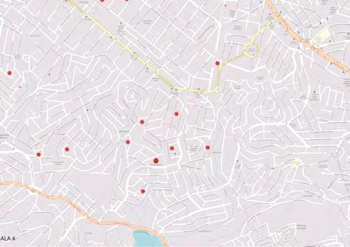
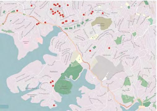
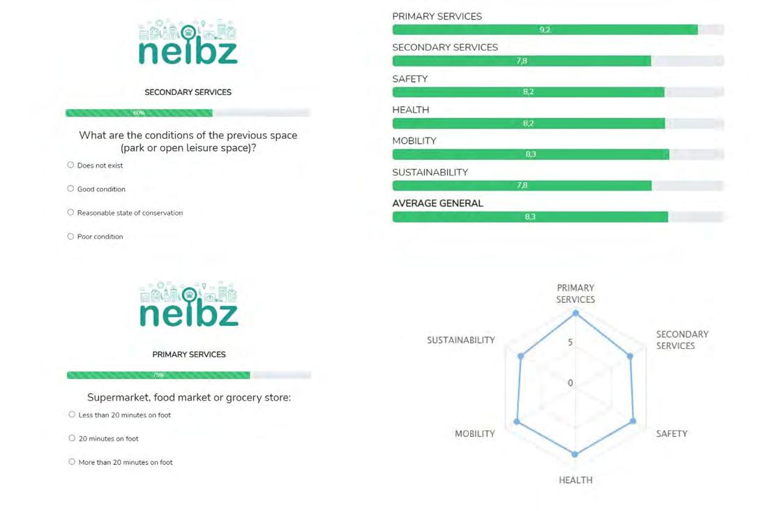
Atlantis Magazine |Invisible | volume 41 89
Fig 7: Collaborative Mapping, Topography Vila Missionaria Image Source: Author
Fig 6: Collaborative Mapping, Topography Vila Missionaria Image Source: Author
Fig 5: Neibz Diagram Image Source:Author
Architecture and Queer Super-positioning
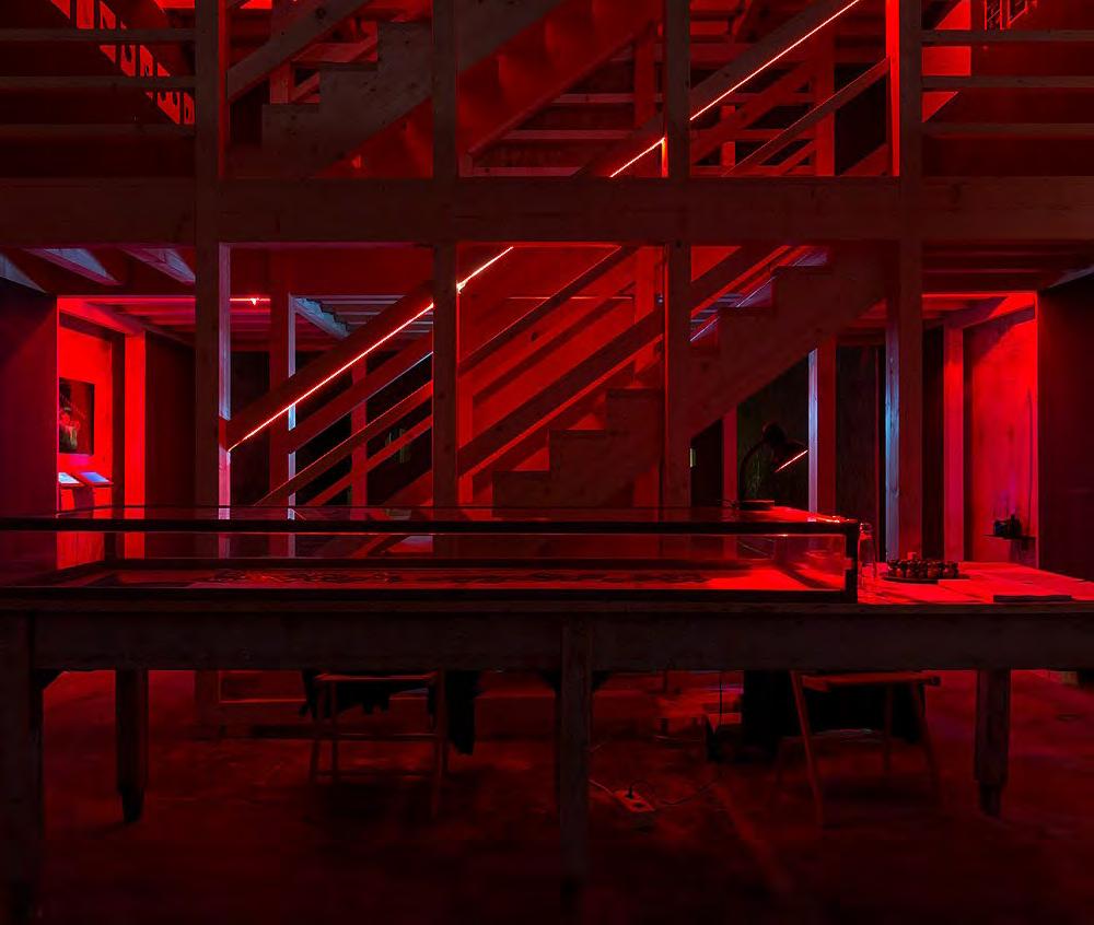
State Change at the Moment of Visibility
Architecture and Queer Super-positioning: State Change at the Moment of Visibility examines ontological parallels between recent work in quantum physics and contemporary public engagement with queerness in order to question what it means to “increase visibility” for marginalized communities. Discourse surrounding visibility for marginalized communities frequently focuses on the impact of visibility in relation to the mainstream, but it falls short of acknowledging the fundamental transformations that take place within those communities upon becoming more visible. The paper analyzes The Cruising Pavilion in the context of visibility discourse to elucidate the reality that when an invisible subject becomes visible, it is existentially reconstituted by new relations to itself, the public, and the world.
MICHAEL KOWALSKY
Across a wide array of disciplines, there is a renewed emphasis on making underrecognized communities more “visible.” While this is undoubtedly a vital part of justice efforts, this approach disproportionately attends to the observer as the focus of operation. This visibility framework works to make mainstream perspectives be confronted by and inclusive of the narratives and histories of people who were previously ignored, silenced, or disenfranchised. However, it often glazes over the complex operations that occur to and within “invisible” communities during their shift into mainstream visibility. This complex shift draws interesting comparisons to recent work in quantum physics which posits the existence of “quantum superpositioning,” a state of being which is unknowable and fundamentally altered upon observation.
Queerness operates similarly–as it becomes increasing visible and observable to the mainstream public, it is fundamentally altered as a social system and community. Architecture often participates in the visibility
framework, seeking to uplift marginalized queerness through increasing its visibility to the mainstream, but in doing so it causes transmutational shifts within the queer community that go beyond architecture’s ability to predict or control.
Quantum physics identifies a phenomenon that occurs in electrons known as wave function collapse. Generally, electrons are understood to exist at a set energy level. These energy levels are discrete and only change during a corresponding release or absorption of photons. In order to measure the energy level of an electron, physicists essentially fire photons at the electron and record the impact. Recent evidence exists, however, that prior to this moment of measurement, the electron does not have a set, discrete energy level; rather, it exists in what physicists call superposition1 It exists at all energy levels and none of them simultaneously, operating as a set of probabilities and possibilities rather than a definitive particle. It is not until the electron interacts with the world (a photon)
90 01
TRANSFORMATIONS IN SPATIAL RELATIONSHIPS
91 Atlantis Magazine |Invisible | volume 41
Fig 1: The 2018 Cruising Pavilion in Venice was lit with dim lights, scented with eucalyptus and poppers, and drew upon the gay underground spaces of Berlin and New York to recreate the environments that commonly accompany cruising.
that it is knocked out of superposition and realizes itself to a set energy level which can be repeatedly measured and predicted—a process described as wave function collapse. The existence of this superposition state has two critical ontological implications. Firstly, the original or natural state of an electron is entirely unknowable because it cannot be observed without being interacted with, and observed electrons exist differently than unobserved electrons. This leads to the second critical implication, which is that the act of being made visible fundamentally changes the subject’s state of existence.
the tangible world, however, they are not just manifesting an aspect of themselves, as Morten describes. Indeed, their interaction with the tangible world is alchemical and transforms their state of existence entirely. A clear example is American queerness.
In comparison to electrons, queerness operates, of course, on massively different timescales and with incredible complexity. Whereas electrons need only engage once with the physical environment to fall out of superposition, American queerness interacts and entangles many systems, people, spaces, and times during its shift into visibility. Legal systems, media production, activist organizations, and medical science have all played a part, as have handkerchiefs, haircuts, oat milk, and Cher. Architecture is no exception. Architecture codifies institutional relationships into the built environment, and in doing so it can directly impact the visibility and existence of queer identities. Judith Butler articulates this impact by noting that communities “are not just produced by their vocal claims, but also by the conditions of possibility of their appearance….Those conditions of appearance include infrastructural conditions.”⁵. The built environment can allow, deny, discourage, filter, and curate the way that queer communities appear and make claims over their own identities, and as such it plays a critical role in the way that queerness enters the public sphere.
Wave function collapse interrogates the inactivity of observation. It suggests that becoming visible is not an act of revelation or exposure of that which was previously invisible. Instead, becoming visible means the appearance of a new and existentially different subject than the invisible. The invisible subject remains unknowable and, perhaps, unrecoverable. Through this ontological lens, quantum superpositioning draws an important distinction from Graham Harmen’s work on withdrawn objects and similar theories of unknowability – primarily that the visible object in wave function collapse is neither a product nor quality of the invisible object². Rather, quantum superposition is more akin to the Deleuzean diagram; it exists as a potentiality, and its entrance into the visible world might be considered an evolution or transmutation of that potentiality3
While physicists were only recently able to quantify this transmutational moment between invisibility and visibility at the quantum scale, a similar operation occurs at the larger scale of socio-political systems. Socio-political systems, like queerness, exist similarly to an electron in superposition–they are amorphous entities, not directly observable in their entirety or predictable in their appearance, that only reveal themselves through interaction with the tangible world. Timothy Morten describes this quality as nonlocality in his book Hyperobjects⁴ . When these systems do engage with
Consider, for example, the 2018 exhibition at the Venice Biennale entitled Cruising Pavilion curated by PierreAlexandre Mateos, Rasmus Myrup, Octave Perrault, and Charles Teyssou⁶. Cruising is a term used amongst queer communities to describe the practice of seeking out sexual encounters with eachother in public without drawing attention from non-queer people. It comes from a long history of queer people not having safe spaces to explore sex and identity, and therefore “cruising spots” would become sites for queer people, particularly gay men, to engage in public (and often anonymous) sex without fear of persecution. Cruising relies on linguistic and embodied codes to allow cruisers to identify and communicate with one another in direct view of the public without being seen.
It is, in effect, an invisible practice. “Cruising Pavilion” recreated environments often frequented and produced by cruisers — public bathrooms, warehouse spaces, club darkrooms, and more. Upon entering, guests were offered condoms and poppers as their eyes adjusted to the red light. Labyrinthic passageways moved the visitor through narrow rooms with “used” condoms scattered on the floor, plywood partitions with glory holes, urinals, a sex swing, and a messy bed. What does it mean to make a public display out of an environment created specifically for anonymity and invisibility? The curators themselves acknowledged
92
“ “ Transformations in Spatial Relationships
...becoming visible is not an act of revelation or exposure of that which was previously invisible. Instead, becoming visible means the appearance of a new and existentially different subject than the invisible. The invisible subject remains unknowable and, perhaps, unrecoverable.


Atlantis Magazine |Invisible | volume 41 93
Fig 3: A scene from Adonis Memories by Alan Bounville, an immersive performance based on oral histories the Adonis movie theater in the 1970s & 1980s in Times Square. Image Source: Brandon Nick/In Our Words.
Fig 2: The 2018 Cruising Pavilion in Venice was lit with dim lights, scented with eucalyptus and poppers, and drew upon the gay underground spaces of Berlin and New York to recreate the environments that commonly accompany cruising Image Source: Brandon Nick/In Our Words..
the polemic of constructing the pavilion: “there is a fine line between celebrating cruising by showing it and disabling it by revealing too much.”⁷ Much of the discourse surrounding cruising’s public visibility centered on the way the general public could or should react: Subversive sexual and survival practices should be celebrated by the general public, but their exposure could prompt renewed persecution of marginalized communities. These are undoubtedly vital questions deserving of attention. This discourse, however, does not question what it means for a queer person to use a public glory hole in a world where cruising is the subject of theoretical discourse at the Venice Biennale. If someone who frequently engages in cruising attended the Cruising Pavilion exhibition, which identified cruising as an architectural space-making tactic and political phenomenon, would their next experience at the glory hole be the same as before? Would it feel like survival? Would it feel poltical? Architectural? Would the experience still belong to them?
The Cruising Pavilion is one of many factors that is shifting cruising from an “invisible” practice to a publicly “visible” one. Similar work is being done across a wide range of disciplines: Queer digital spaces like Grindr, Garth Greenwell’s 2016 novel What Belongs to You, and Alan Bounville’s Adonis Memories performance are all playing a role in this shift. This shift into visibility, however, does not only change cruising in relation to the public mainstream and non-participants (i.e. cruising is more celebrated by the public mainstream, or cruising is more at risk from the public mainstream), but the shift also starts to change the nature of what cruising is.

Visibility moves cruising away from a survival tactic that is often steeped in shame, exclusive to one community, and directly resistant to systems of oppression. It starts to become an elective sexual practice, a form of engagement with queer cultural history. It becomes less survivalistic and more celebratory. In doing this, cruising also alters its relations to systems of legality and morality–not always for the better. Public sex at the park as a survival effort is less polemical than public sex at the park as a form of celebration.
Conclusion
These are the impacts which are rarely foregrounded in the work of bringing marginalized communities into greater visibility. They are rarely foregrounded because they are, by their nature, constituted by the invisibility that we are trying to bring to light. What we often fail to realize is that the observed thing, no matter how kindly or carefully we view it, is never the same as the unobserved
94
Fig 4: 5
Squares
Transformations in Spatial Relationships
thing. Just as the observed, stable electron is always operating fundamentally differently to the unobserved electron in superposition, cruising and other marginal systems of survival operate fundamentally differently once they are brought into the view of the mainstream–for better and for worse.
Architecture is one means by which we engage “invisible” social systems because of its unique ability to speculate new realities in close proximity to institution and the public. Queerness can be understood as an object in superposition–it operates amorphously as a broad set of potentialities, and it is only observable upon its localized manifestations into our environment. These local manifestations are a type of wave
function collapse in which the abstruse nature of queerness becomes specific, situated, and observable. Architecture, as in the case of the Cruising Pavilion, is one means by which we can engage a super-positioned system and try to direct its manifestation into our observable environment. However, we as architects can never predict the full extent to which this kind of engagement impacts the world. When we employ architecture to operate on invisible systems, when we bring to light hidden injustices or provide platforms for undervalued narratives, we are causing a state change that goes beyond simply making those systems observable. To go from “invisible” to “visible” is to transmute entirely–to establish new relations to self, public, world, and institution.
Butler, J.(2015). In Notes Toward Performative Theory of Assembly. Cambridge, Ma: Cambridge university press. Greene, B. (2014). Chapter 4: Entangling Space. Essay. In The Fabric of the Cosmos: Space, Time, and the Texture of Reality. New York: Vintage Books. Harman, G.(2018). Speculative Realism: An Introduction. Cambridge: Polity Press.
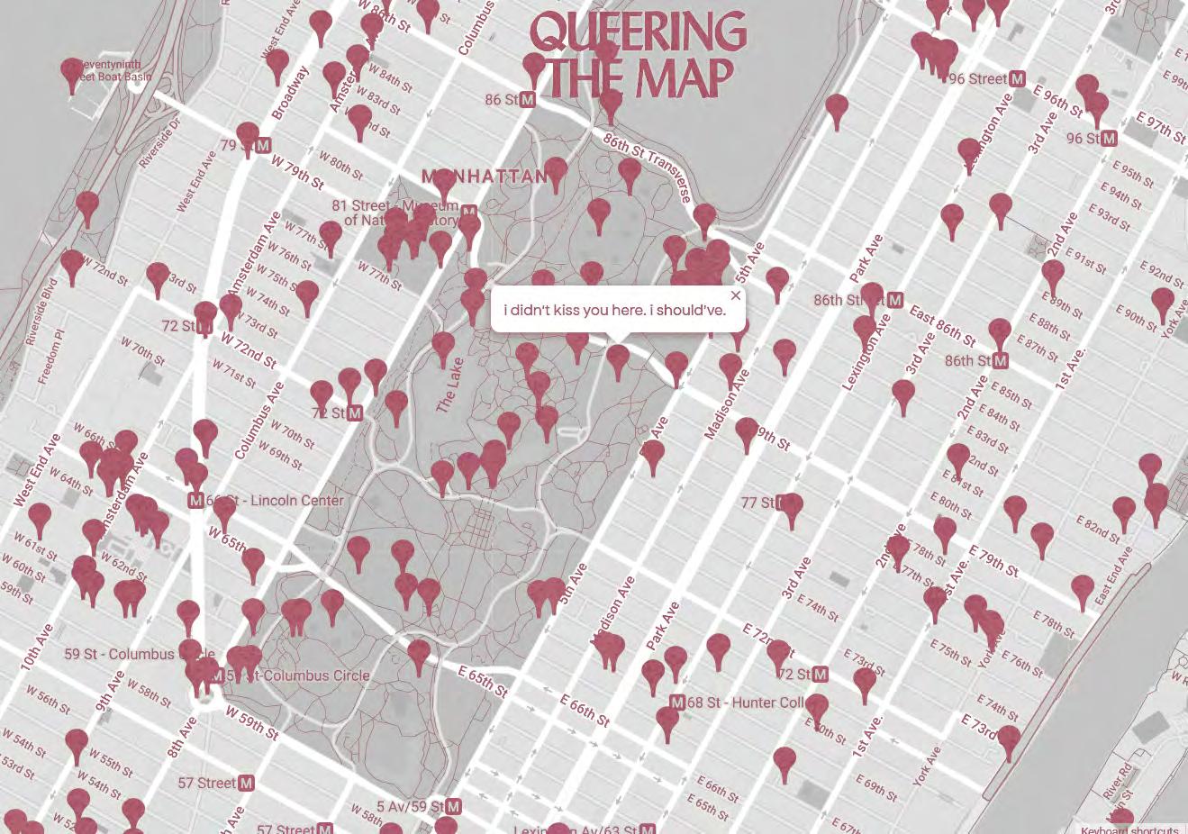
Atlantis Magazine |Invisible | volume 41 95
Morton, T.(2013). Hyperobjects Philosophy and Ecology After the End of the World. Minneapolis, MN: University of Minnesota Press. Mateos, Pierre-Alexandre, Rasmus Myrup, Octave Perrault, and Charles Teyssou. “Cruising Pavilion.” 2018 Pasquier, A.(2022).Cruising Pavilion’ Shows How Public Gay Sex Has Shaped Architecture.
Fig 5: Queering the map Image source: Author
ATLANTIS
Magazine by Polis Platform for Urbanism and Landscape Architecture
Faculty of Architecture, TU Delft
Volume 41, Issue 1, February 2023.
Editors-in-Chief
Myrto Karampela-Makrygianni
Sanika Charatkar
Cover Design
Larissa Muller
Printer Printerpro.nl
Editorial Address
Polis, Platform for Urbanism
Julianalaan 134, 2628 BL Delft
Office: 01 West 350 tel. +31 (0)15-2784093
www.polistudelft.nl polisdelft@gmail.com
This issue has been made with care; authors and redaction hold no liability for incorrect/incomplete information. All images are the property of their respective owners. We have tried as hard as we can to honour their copyrights.
The views and opinions expressed in this magazine are those of their respective authors and do not necessarily reflect the position of the Editorial team of Atlantis Magazine or Polis.
ISSN 1387-3679
96
Polis board 2022-2023


From the Board
This issue is printed in the aftermath of the earthquakes in the broader region of Syria and Turkey as well as the recent tragic train crash in Greece. In light of these, we would like to express our deepest condolences and support to all those affected directly or indirectly. We hope that the next issue will be delving in the underlying criticalities of such catastrophes.
We could not be as visible as we are without the great effort of a lot of active students. With their help and the support of our partners and sponsors, we can organise excursions, lectures, workshops, drinks and events. The Polis board wants to thank all the people involved for their great efforts and positive input.
Polis Board
CHAIRPERSON Jens Berkien
SECRETARY Sani ka Charatkar
ATLANTIS Myr to Karampela-Makrygianni
Sani ka Charatkar
PR Lar issa Muller
EVENTS Ann Eapen
EDUCATION Ann a Kalligeri Skentzou
Join Us
We are always looking for enthusiastic people to join. Interested in one of the Polis committees? Do not hesitate to contact us at our Polis office (01.west.350) or by e-mail: contact@polistudelft.nl
Subscribe
Not yet a member of Polis? For only €17.50 a year as a student of TU Delft, €30 for individual membership, or €80 for professional organizations you can join our network! You will receive our Atlantis Magazine four times a year, a monthly newsletter, possibility to publish and access to all events organized by Polis.
E-mail contact@polistudelft.nl to find out more.
now they seem content, these maidens: in the morning you hear them singing. In Chloe, a great city, the people who move through the streets are all strangers At each encounter, they imagine a thousand things about one another; meetings which could take place between them, conversations, surprises, caresses, bites.
But no one greets anyone; eyes lock for a second, then dart away, seeking other eyes, never stopping. A girl comes along, twirling a parasol on her shoulder, and twirling slightly also her rounded bips A woman in black comes along showing her full age. her eyes restless beneath her veil. her lips trembling. A tattooed giant comes along; a young man with white hair; a female dwarf; two girls twins dressed
ATLANTIS | (in)visible | Magazine for Urbanism, Lanscape and Architecture POLIS : Student Association for Urbanism and Landscape contact@polistudelft.nl | www.polistudelft.nl
