the data and statistics we collected, but that wouldn’t be nearly as powerful as the pictures. We used GIS to overlay aerial photos, street grids, parks, and schools to visualize where these things are actually located in proximity to one another. For us, it produced a new level of awareness about what is actually happening in neighborhoods.”
“…78 percent of all licensed social workers provide services to clients age 21 or younger, regardless of the practice setting or focus. More than half of these social workers carry caseloads that are more than 50 percent children and/ or adolescents.”
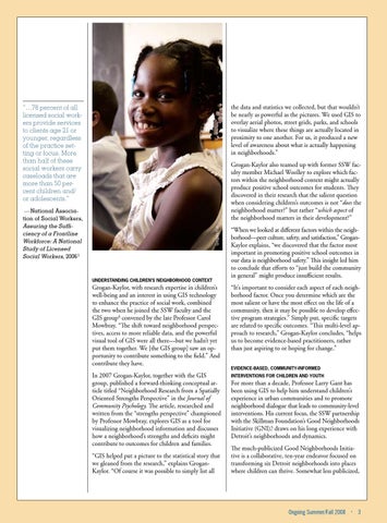
Grogan-Kaylor also teamed up with former SSW faculty member Michael Woolley to explore which factors within the neighborhood context might actually produce positive school outcomes for students. They discovered in their research that the salient question when considering children’s outcomes is not “does the neighborhood matter?” but rather “which aspect of the neighborhood matters in their development?” Gregory Fox
— National Association of Social Workers, Assuring the Sufficiency of a Frontline Workforce: A National Study of Licensed Social Workers, 2006 1
“When we looked at different factors within the neighborhood—peer culture, safety, and satisfaction,” GroganKaylor explains, “we discovered that the factor most important in promoting positive school outcomes in our data is neighborhood safety.” This insight led him to conclude that efforts to “just build the community in general” might produce insufficient results.
Grogan-Kaylor, with research expertise in children’s well-being and an interest in using GIS technology to enhance the practice of social work, combined the two when he joined the SSW faculty and the GIS group4 convened by the late Professor Carol Mowbray. “The shift toward neighborhood perspectives, access to more reliable data, and the powerful visual tool of GIS were all there—but we hadn’t yet put them together. We [the GIS group] saw an opportunity to contribute something to the field.” And contribute they have.
“It’s important to consider each aspect of each neighborhood factor. Once you determine which are the most salient or have the most effect on the life of a community, then it may be possible to develop effective program strategies.” Simply put, specific targets are related to specific outcomes. “This multi-level approach to research,” Grogan-Kaylor concludes, “helps us to become evidence-based practitioners, rather than just aspiring to or hoping for change.”
In 2007 Grogan-Kaylor, together with the GIS group, published a forward-thinking conceptual article titled “Neighborhood Research from a Spatially Oriented Strengths Perspective” in the Journal of Community Psychology. The article, researched and written from the “strengths perspective” championed by Professor Mowbray, explores GIS as a tool for visualizing neighborhood information and discusses how a neighborhood’s strengths and deficits might contribute to outcomes for children and families.
Interventions for Children and Youth
Understanding Children’s Neighborhood Context
“GIS helped put a picture to the statistical story that we gleaned from the research,” explains GroganKaylor. “Of course it was possible to simply list all
Evidence-Based, Community-Informed
For more than a decade, Professor Larry Gant has been using GIS to help him understand children’s experience in urban communities and to promote neighborhood dialogue that leads to community-level interventions. His current focus, the SSW partnership with the Skillman Foundation’s Good Neighborhoods Initiative (GNI),5 draws on his long experience with Detroit’s neighborhoods and dynamics. The much-publicized Good Neighborhoods Initiative is a collaborative, ten-year endeavor focused on transforming six Detroit neighborhoods into places where children can thrive. Somewhat less publicized,
Ongoing Summer/Fall 2008
·
3