Accesso Da Milano si segue la SS36 in direzione Lecco e si oltrepassa il lungo tunnel del Monte Barro, poco prima di Lecco. Si esce dalla superstrada seguendo l’indicazione “Valsassina”, e si percorre la nuova strada che sale in direzione “Ballabio” prendendo poi a destra, nel successivo tunnel, in direzione “VersasioPiani d’Erna”. Usciti dal tunnel si prosegue in salita per circa un chilometro sino al grande piazzale della stazione di partenza della Funivia dei Piani d’Erna. Qui si parcheggia, a pagamento nei festivi. Sul retro della Stazione, verso destra, imboccare una stradina e quasi subito un sentiero bollato che scende nel bosco e raggiunge la successiva asfaltata che si segue verso destra in salita. Dopo 200m circa (indicazione su cartello in alto a destra), imboccare un sentierino in salita a sinistra. Dopo 100m uscire a destra a un prato e per la traccia quasi orizzontale attraversare sino a un secondo prato da cui in salita si arriva subito a una malga, risalente al 1772 (questa è raggiungibile anche continuando per l’asfaltata sino a una traccia che sale verso sinistra nel bosco e che parte poco prima dell’ultima curva della strada in salita). Salire a destra di essa per traccia evidente, e al primo bivio (poco evidente con erba alta), andare a sinistra diritti nel bosco. Oltrepassato un piccolo sasso con una caratteristica acquasantiera (N 45° 51. 648’ E 009° 26. 161), procedere nel bosco verso destra e sbucare infine a un ripido ghiaione, al termine del quale si perviene alla falesia. 20 minuti. È anche possibile seguire tutta la strada asfaltata imboccando la mulattiera successiva, seguendola in salita per circa 10 minuti, sino al cartello indicatore per la via ferrata del Pizzo d’Erna. Qui si sale a sinistra nel bosco e poco sotto l’attacco della Ferrata si traversa a sinistra per una traccia, per 50m, sotto la roccia, raggiungendo il limite destra della falesia, 30 minuti.
reaches the tarmac road which you follow uphill to the right. After roughly 200m (sign posts up high on the right) turn into a small uphill path to the left. After 100 m come out on the right at a meadow and along tracks which are almost horizontal, cross over as far as a second meadow from where going uphill you immediately arrive at a farm building which dates back to 1772 (this can also be reached continuing along the tarmac road until you come to a track which climbs up to the left into the woods and sets off shortly before the road’s last uphill bend). Climb up to the right of it along an evident track, and at the first junction (not easily seen with high grass,) head over to the left straight into the woods. Once you go beyond a small rock with a characteristic holy water font (N45° 51. 648’; E 009° 26. 161), continue through the woods to the right and come out finally onto a steep scree, at the end of which you will come to the crag (N-45° 51. 666’; E 009° 26. 401). 20 minutes. You can also go all the way along the tarmac road and then turn onto the mule trail, following it for approx. 10 minutes as far as the sign post indicating the Pizzo d’Erna ‘via ferrata’. Go up here to the left of the woods and just below the start of the ‘ferrata’, cross over to the left on a track under the rock for 50 m, reaching the right-hand edge of the crag. 30 minutes.
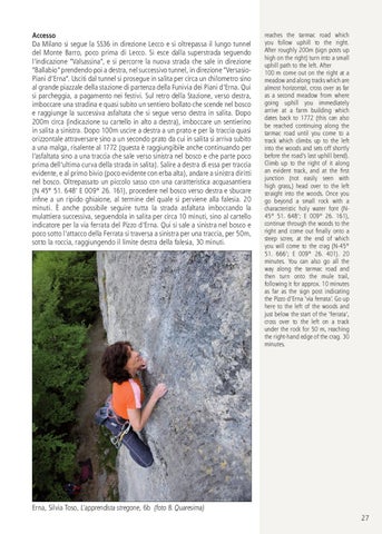
Erna, Silvia Toso, L’apprendista stregone, 6b (foto B. Quaresima) 27