The Tilghman’s Island Series by Gary D. Crawford
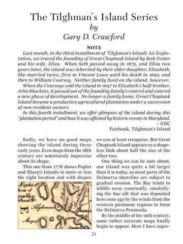
NOTE Last month, in the third installment of Tilghman’s Island: An Exploration, we traced the founding of Great Choptank Island by Seth Foster and his wife, Eliza. When Seth passed away in 1675, and Eliza two years later, the island was inherited by their elder daughter, Elizabeth. She married twice, first to Vincent Lowe until his death in 1692, and then to William Coursey. Neither family lived on the island, however. When the Courseys sold the island in 1697 to Elizabeth’s half-brother, John Hawkins, it passed out of the founding family’s control and entered a new phase of development. No longer a family home, Great Choptank Island became a productive agricultural plantation under a succession of non-resident owners. In this fourth installment, we offer glimpses of the island during this “plantation period” and how it was affected by historic events in Maryland. ~ GDC Fairbank, Tilghman’s Island Sadly, we have no good maps showing the island during these early years. Even maps from the 18th century are notoriously imprecise about its shape. This one from 1778 shows Poplar and Sharp’s Islands in more or less the right location and with shapes
we can at least recognize. But Great Choptank Island appears as a shapeless blob about half the size of the other two. One thing we can be sure about, our island was quite a bit larger than it is today, as most parts of the Delmarva shoreline are subject to gradual erosion. The Bay tends to nibble away constantly, emulsifying the fine silt that was deposited here eons ago by the winds from the western piedmont regions to form the Delmarva Peninsula. By the middle of the 19th century, some rather accurate maps finally begin to appear. Here I have super21