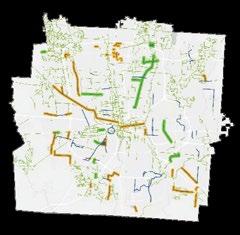
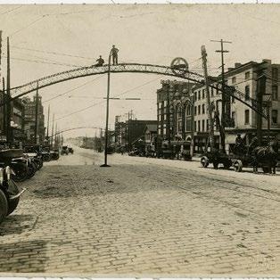
PRIOR FRANKLINTON STUDIES CITY STAKEHOLDER INTERVIEWS
This project identified a series of communityprioritized public realm improvements in an effort to secure funding and achieve implementation.
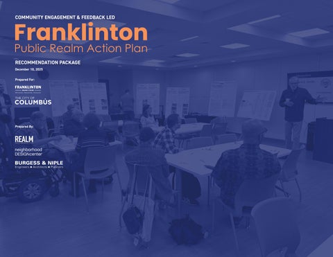
The Franklinton Public Realm Action Plan is a collaborative initiative between the Franklinton Board of Trade and the City of Columbus to advance a clear and practical roadmap for neighborhood capital improvements. Building on prior planning efforts from the 2024 Franklinton Area Commission communitywide survey, and the resulting capital improvement recommendations, this Action Plan further expands the community’s public realm priorities and identifies the pathways needed to move projects from vision to implementation.
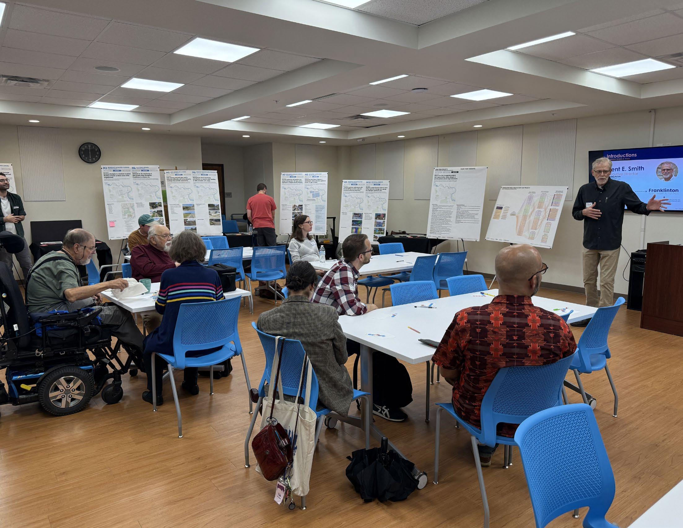
A central focus of the process was ongoing community engagement and transparent communication. The team developed a targeted engagement strategy and facilitated multiple public workshops to ensure broad participation and shared ownership of outcomes.
The resulting Action Plan translates existing community input into an actionable framework of neighborhood improvements. Projects are organized into short-term, mid-term, and long-term goals and evaluated through a holistic lens that considers feasibility, public realm quality, community desire, resilience, and long-term neighborhood transformation. For select projects, the plan includes scope definitions, cost opinions, next steps toward funding, and, most importantly, project champions and partners to assist in moving projects forward.
Prioritized Projects
The 9-month process included multiple engagements with residents, community-based organizations, and a broad array of city departments.
Community engagement formed the foundation for establishing project priorities. The project team partnered with individual residents and neighborhood organizations – including the area commission, civic associations, community non-profits, artists, business owners, and business advocacy groups.
A working group supported the project through bi-weekly meetings and included representatives from the Franklinton Area Commission, the Franklinton Board of Trade, the City of Columbus, and individuals selected by the client. The group provided continuous input, helped refine priorities, and identified potential project champions through their networks.
The 19 projects are recommendations that community members helped identify as priorities. This builds off the 2024 FAC Capital Improvements Survey, with additional comments captured through public meetings and conversations with city departments.
An advisory committee reviewed and provided feedback on recommendations developed by the consultant and client teams. The committee helped ensure priority projects remained central to the process and identified gaps needed to clarify pathways for coordination and implementation.
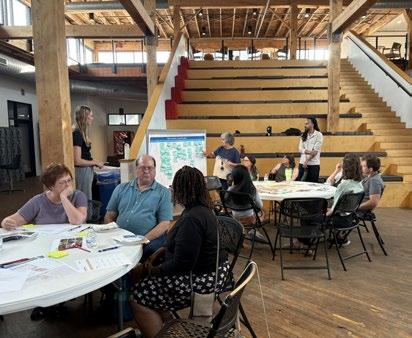
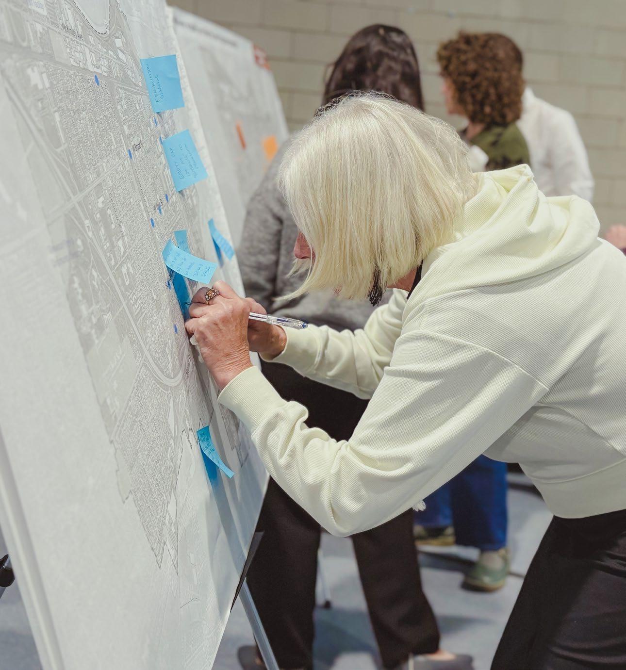
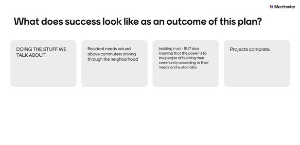
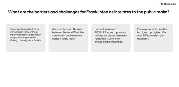
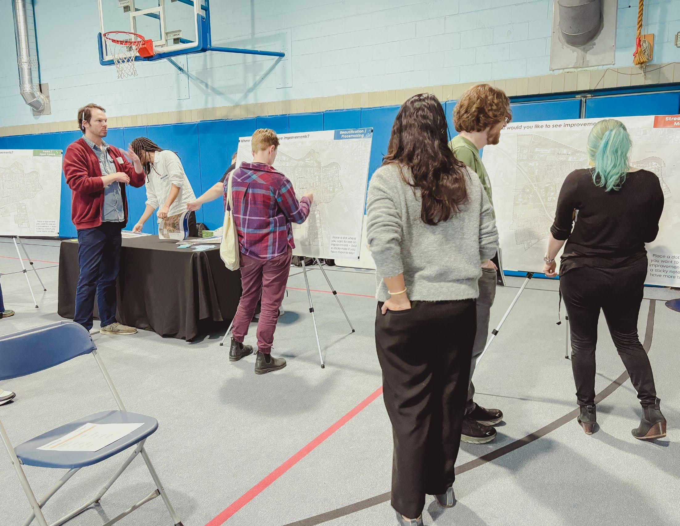
Community engagement and stakeholder interviews captured targeted feedback and clear communication with residents.
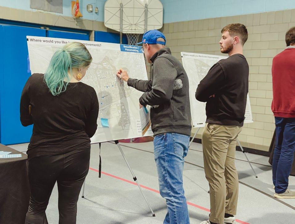
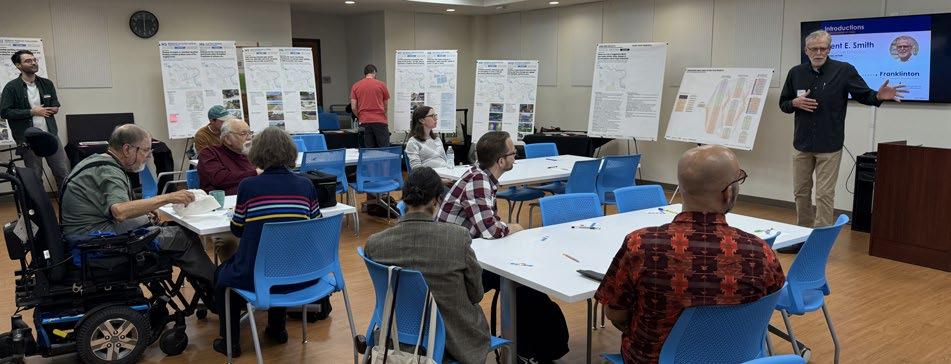
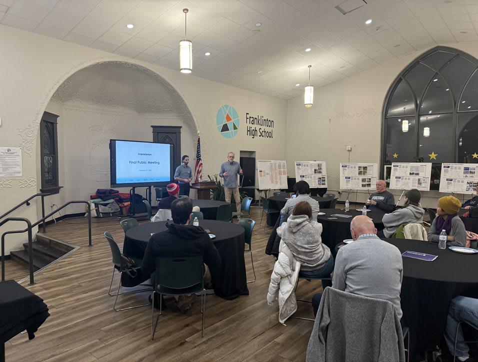
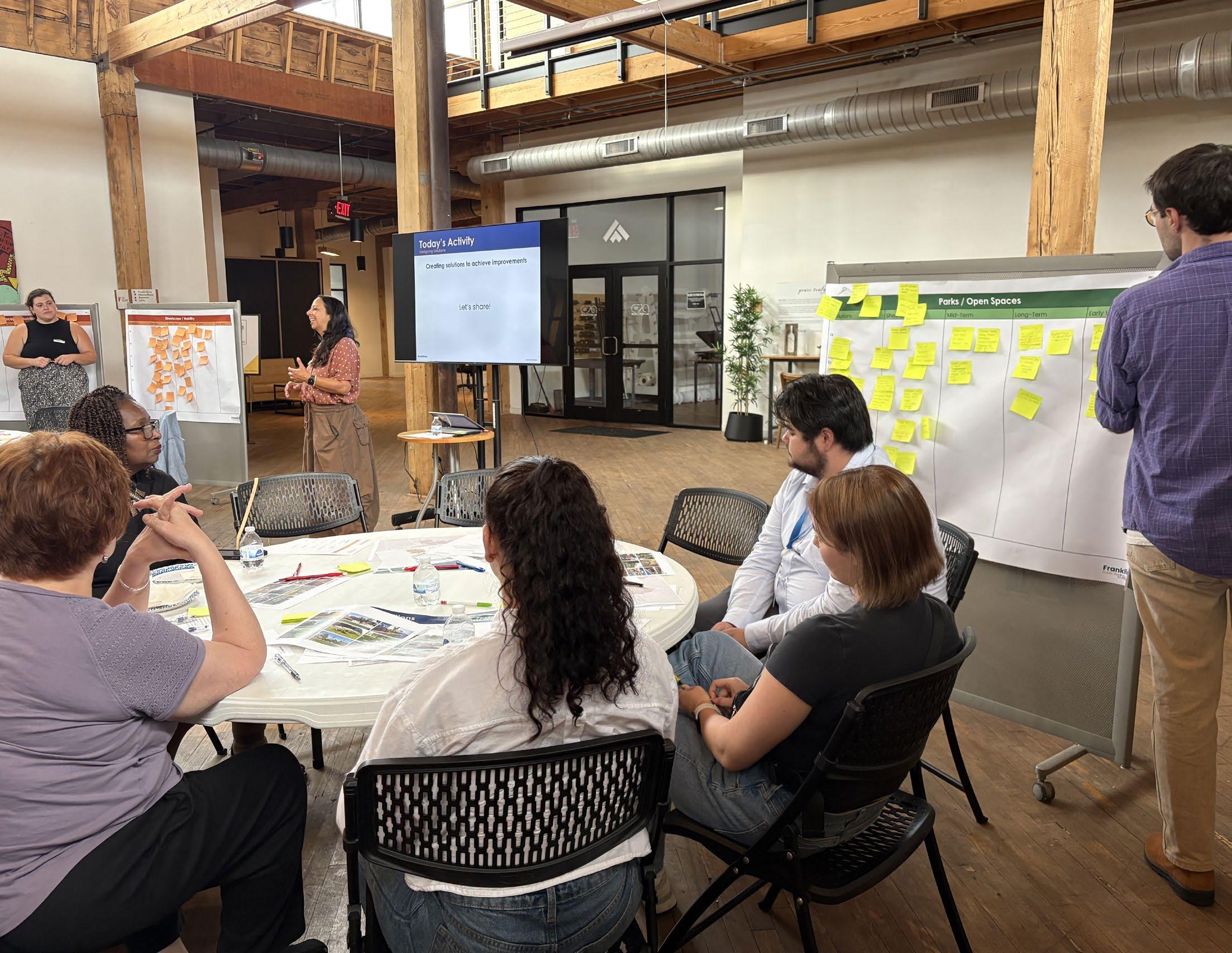
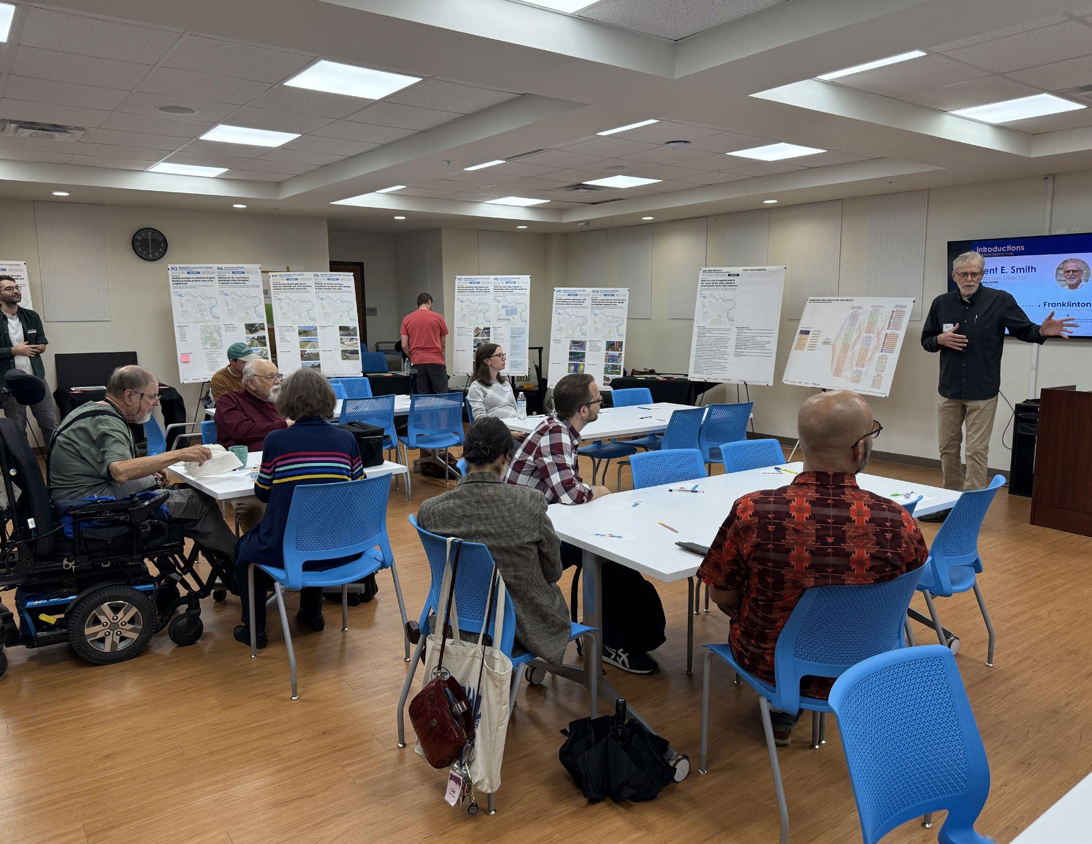
Community engagement generated a wide range of requests, from general neighborhood improvements to ideas beyond the scope of this public realm action plan. Three public meetings and workshops provided residents opportunities to share feedback and identify desired improvements. To ensure broader accessibility, two online surveys captured input from those unable to attend in person, gathering community needs, concerns, and aspirations across Franklinton. This engagement was critical in identifying key areas of concern.
Business and civic stakeholders were also engaged to understand perspectives on public realm improvements and their community impacts. Ongoing coordination with city departments clarified project scope, feasibility, and timelines. Together, resident input, stakeholder perspectives, and departmental coordination informed multiple iterations of the project list, with priorities refined through continued engagement.
Public
Meetings
Public Meeting #1 (05/21/2025)
• 11 total participants
• 28 total responses from activity
Public Meeting #2 (07/16//2025)
• 21 total participants
• 160 total responses from world café style activity
Public Meeting #3 (10/03/2025)
• 11 total participants
Public Meeting #4 (12/10/2025)
• 11 total participants
Public Survey
Survey #1 (Went live 05/21/2025)
• 57 Online Responses
Survey #2 (Went live 10/07/2025)
• 26 Online Responses
The surveys followed public meetings to gather feedback from residents who were unable to attend in person. This was part of the process that prioritized the timing and desirability of projects.
Business
Stakeholders
Attendees (05/06/2025)
• Tracy Cloud (Lower Lights Health)
• Jonathan Youngman (Franklinton Cycleworks)
• Louie (LaTeef Barrow)
• Tiffany Boggins (WitchLab)
Local business owners highlighted their interest in stronger branding and placemaking through public art and brighter streetlights.
Civic
Stakeholders
Attendees (05/09/2025)
• Andy Boy (United Schools Network)
• Shane (Franklinton Farms)
• Joe Gottron (Gladden Community House)
Representatives from local civic organizations emphasized their desire for improved connectivity, lighting, trees, and overall beautification.
City Departments
Attendees (05/09/2025)
• Department of Public Service
• Department of Mobility & Parking
• Recreation & Parks Department
• Division of Power & Water
• Division of Refuse Collection
• Department of Development
There were also conversations with COTA as it relates to bus shelters.
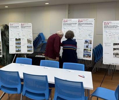
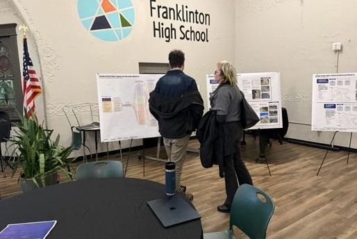
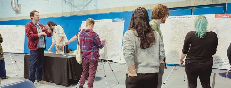
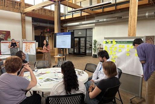
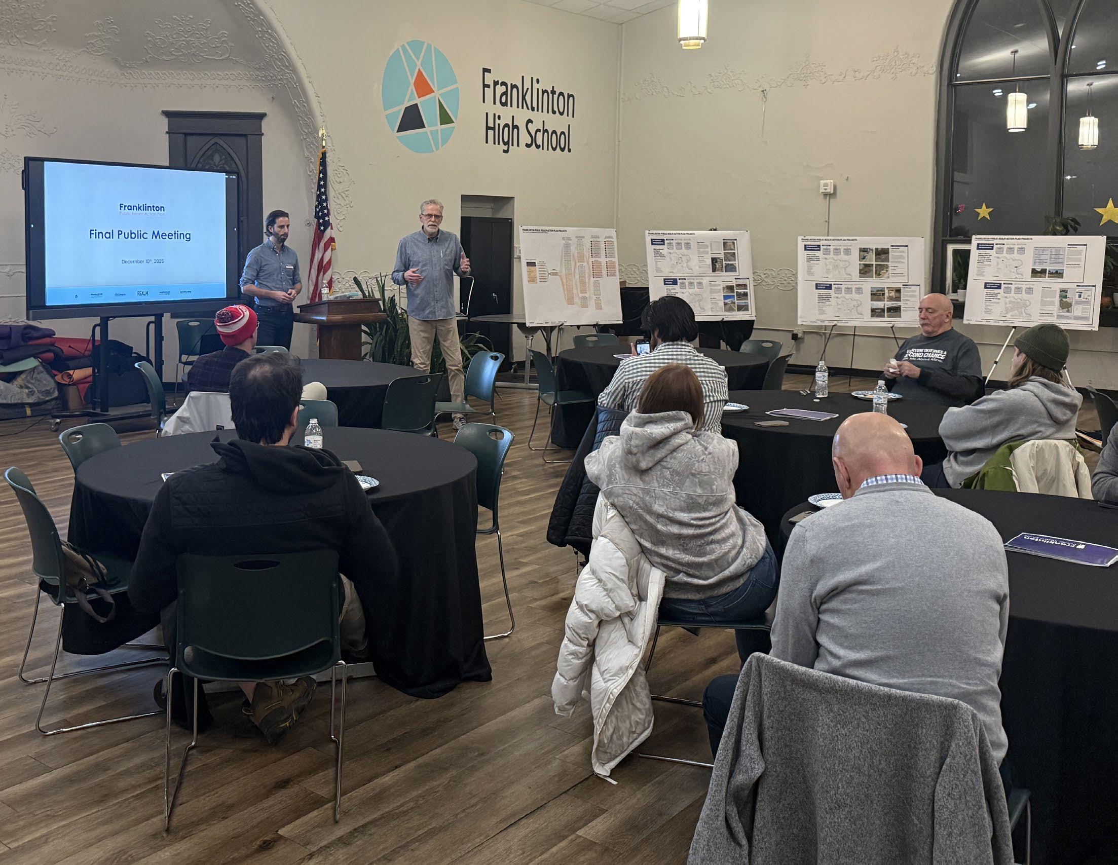
Public Meeting #4 at Franklinton High School on 12/10/2025
Public Meeting #3 at KTC Buddhist Center on 10/03/2025
Public Meeting #2 at Idea Foundry on 07/16/2025
Public Meeting #1 at Gladden Community House on 05/21/2025
Franklinton Workshop #1 at Gladden Community House on 05/21/2025
A thorough review of prior and current neighborhood planning studies produced a comprehensive list of public realm initiatives that informed the recommendations.
The first three months of the Franklinton Public Realm Action Plan focused on a detailed review of prior and existing plans to establish a baseline understanding of initiatives and recommendations that were never implemented. This review ensured that uncompleted efforts were considered as part of a broader assessment of community needs.
The process helped clarify feasibility from the City’s perspective, using past recommendations to ground and support current resident priorities. Compiled findings were shared with the working group and advisory committee to assess where momentum for specific projects still existed. The resulting list was then reviewed with city departments to confirm project status and identify proposals that were no longer feasible and could be set aside for the purposes of this action-oriented study.
2012–Present Studies Findings & Categorization
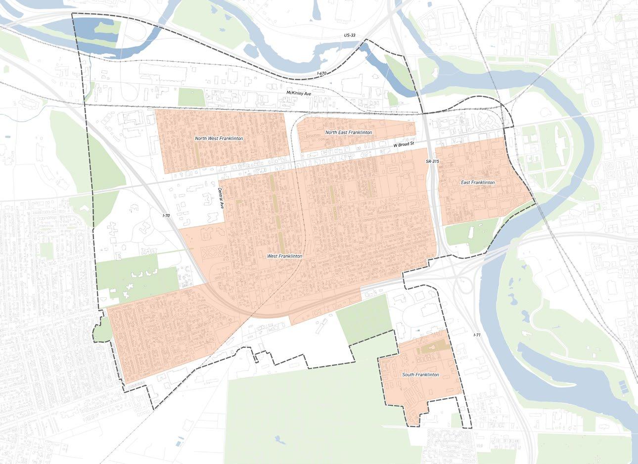
Three themes emerged from the review of past and current studies to guide public realm investment in Franklinton. The first, streetscapes and mobility, focuses on improving pedestrian safety, connectivity, and addressing vehicular speeding. The second emphasizes the creation of parks and open spaces, a priority strongly reflected in many prior studies. The third centers on placemaking and beautification to strengthen neighborhood identity and comfort.
Together, these themes supported clear communication during community engagement by making projects easier to understand and compare. Each recommended project aligns with one of the three themes, helping guide discussion and prioritization.
Priority #1: Streetscapes & Mobility
Enhanced Connectivity
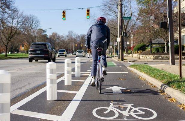
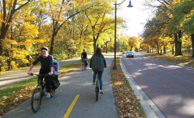
• Add shared-use paths, bike boulevards, and protected lanes to link key destinations and corridors.
Strengthen Corridors
• Rework Souder, Town, Central, Sullivant, and Harmon for safer and more efficient circulation.
Transit & Multi-modal Access
• Integrate BRT, pedestrian bridges, and transit hubs (bus stops) to strengthen east–west and north–south movement.
Traffic Calming & Safety
• Incorporate narrowed lanes, crosswalks, and intersection redesigns to support pedestrian comfort.
Enhance Sidewalks
• Improve and build new sidewalks to strengthen connectivity through out the neighborhood.
Priority #2: Parks & Open Spaces
New Parks
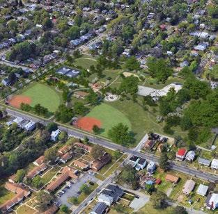
• Create new parks and open spaces in East and West Franklinton to expand park access and different uses.
Pocket Parks
• Find parcels to create new parks and/or community spaces along W Broad St.
Enhance Tree Canopy
• Preserve existing trees and prioritize large planting sites to expand shade and storm water benefits.
Neighborhood Greening
• Encourage planting initiatives on private property and along rights-of-way to strengthen local greenery and maintenance.
Priority #3: Placemaking & Beautification
Public Art & Identity
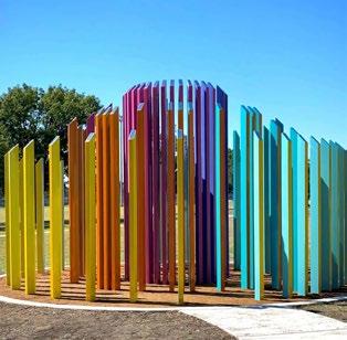
• Install murals, sculptures, and street art to reflect neighborhood character and support creative placemaking.
Lighting & Streetscape Furnishings
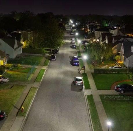
• Introduce new lighting districts, benches, and planters to improve safety and comfort.
Gateway Improvements
• Reinforce the 315 and West Broad gateways as signature entries into the neighborhood.
Sustainability & Aesthetics
• Advance LED lighting, resilience hubs, and climate strategies to reduce heat and elevate visual quality.
PROJECT DEVELOPMENT
WORKFLOW DIAGRAM
The adjacent graphic illustrates the synthesized process that led to the final set of prioritized projects.
This effort builds on the Franklinton Area Commission’s 2024 Capital Improvements Survey and expands the breadth of community engagement. Each engagement informed the synthesis of related comments into a refined project list that was prioritized by residents and vetted with the City of Columbus for feasibility.
Final recommendations organize projects into short-, mid-, and longterm initiatives using a holistic evaluation of feasibility, community needs, and cost. Short- and mid-term projects are further detailed with order-of-magnitude cost opinions, representative resident comments supporting each need, and identification of potential funding sources.
INITIAL COMMENTS
PROJECTS
INITIAL PRIORITIZATION
SHORT TERM
MID TERM LONG TERM
Public Realm Study
Franklinton
SHORT-TERM PROJECTS & RECOMMENDATIONS
S1 SIDEWALK IMPROVEMENTS
& MOBILITY
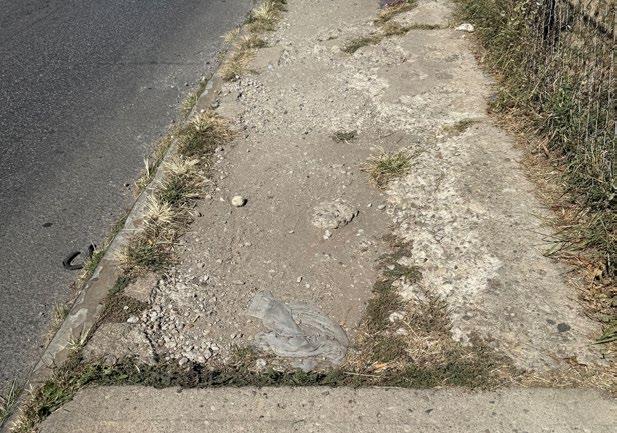
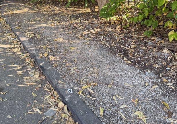
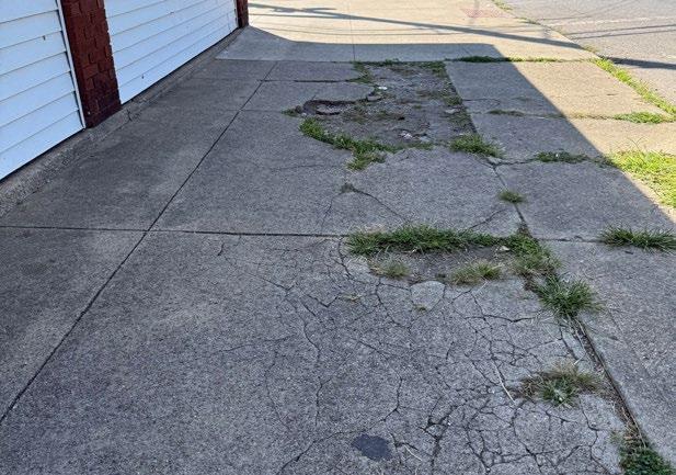
Address damaged portions of sidewalks that can be replaced to improve walkability.
Although property owners are responsible for maintaining the sidewalks along their property, this project will seek City of Columbus assistance to repair small sidewalk sections in areas with higher pedestrian activity.
Community Priority Locations:
• W Broad St
• Central Ave
• Brehl Ave
• Scott St
• Glenwood Ave
• Rich St
• Lucas St
• Martin Ave
Project Champion:
• Tom McGuire - Local Resident
Email: tmcguire457@gmail.com
City of Columbus Partner:
• Department of Public Service (DPS)
Division of Infrastructure Management
Mark Wilburn, Sidewalk Services Coordinator
Email: MCWilburn@columbus.gov
Public Meeting #1
Comments
“Missing sidewalks, poor sidewalk conditions, lack of curbs”
“Sidewalks have general maintenance issues”
Public Meeting #2
Comments
“Make sidewalks accessible to wheelchairs and strollers”
“Fix broken sidewalks”
“Sidewalk maintenance and repairs from damaged tree roots”
Public Meeting #3
Comments
“Across from 400 Rich and along Rich by the gravel parking lot is in disrepair”
“Sidewalks on Lucas St & Rich St are damaged & incomplete for heavy foot traffic”
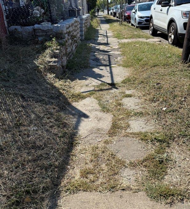
An on site walking visit helped highlight damaged portions and panels in areas that see high pedestrian foot traffic.
Project Process
To Initiate:
Building on the ongoing location inventory being pursued by resident Tom McGuire, and confirming these locations with the City of Columbus, will help clarify where sidewalk maintenance responsibility lies. For example, the current sidewalk replacement program that addresses damage caused by public trees is already backed up by five years. As this work continues, tracking new comments and locations will support better prioritization of future sidewalk maintenance repairs and responsibility.
To Deliver:
Through discussions with the Department of Public Service, there is an opportunity to submit a bundled work order for sidewalk repairs in areas not covered by the current program. Prioritizing strategic locations that support the project mission of providing small, equitable fixes across the neighborhood is essential. Longer continuous segments of sidewalk remain the responsibility of property owners to replace.
Cost Opinion
Cost estimate for replacing damaged sidewalk panels of existing walkways.
Detailed Cost Assumptions:
• 4-inch-thick concrete walk, 5-foot width
• Complete replacement of damaged panels
• No right-of-way acquisition is anticipated
• No utility relocation costs are anticipated
Funding Consideration
Funding sources would need to come from the City of Columbus’ next capital funding cycle. This can be pursued through, but not limited to, the Department of Public Service (DPS).
S2 ADD BUS SHELTERS
STREETSCAPE & MOBILITY
Add bus shelters and litter receptacles to highly utilized bus stop locations.
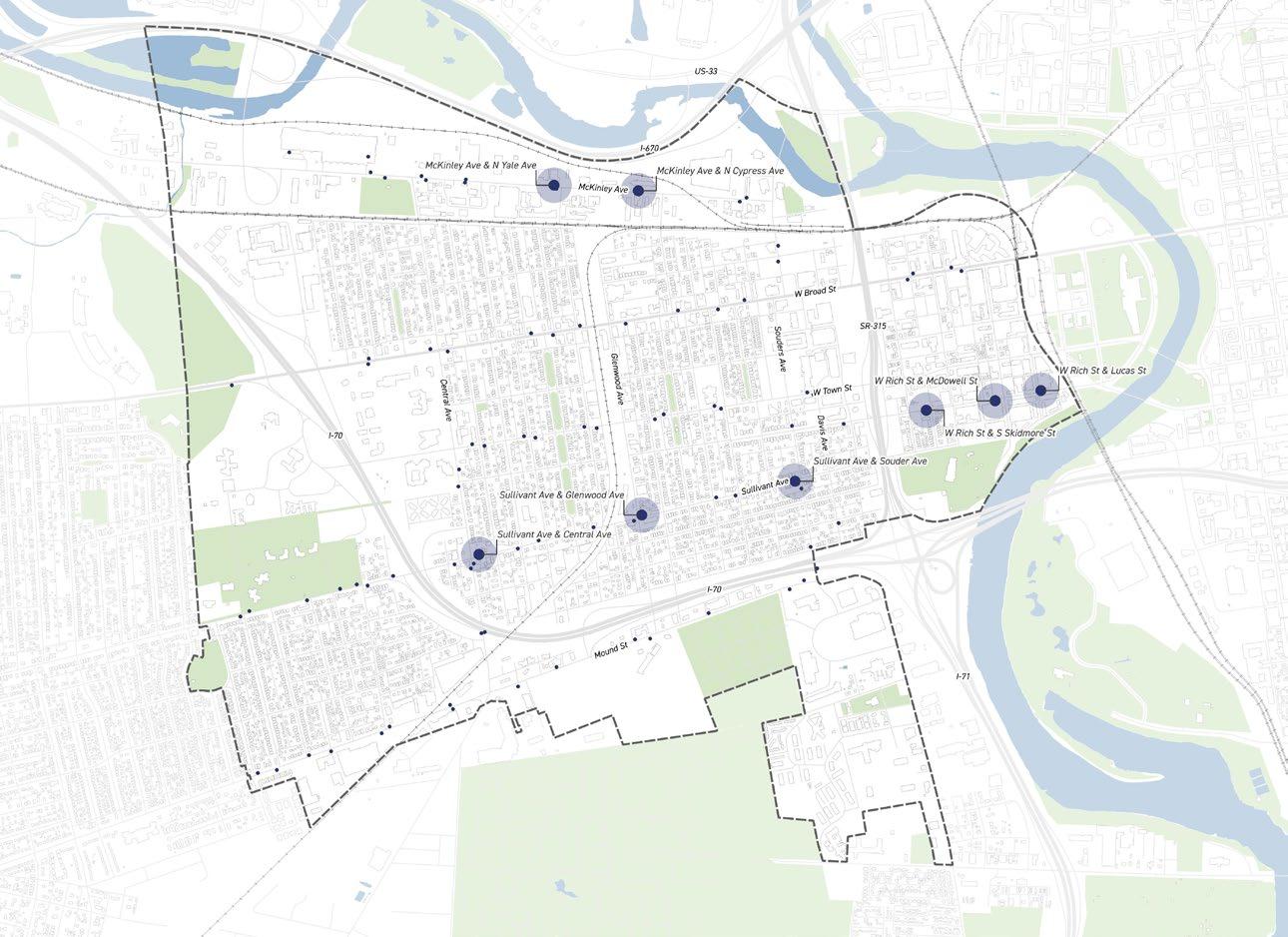
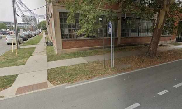
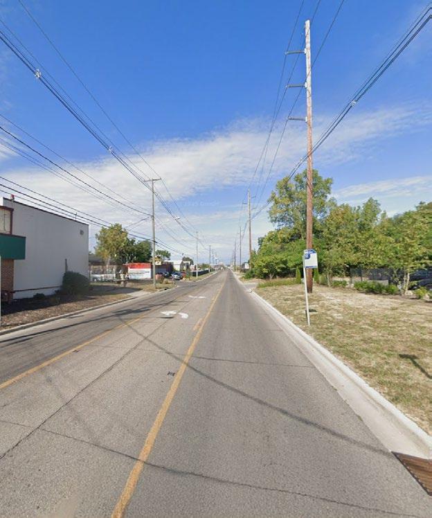
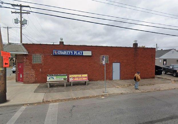
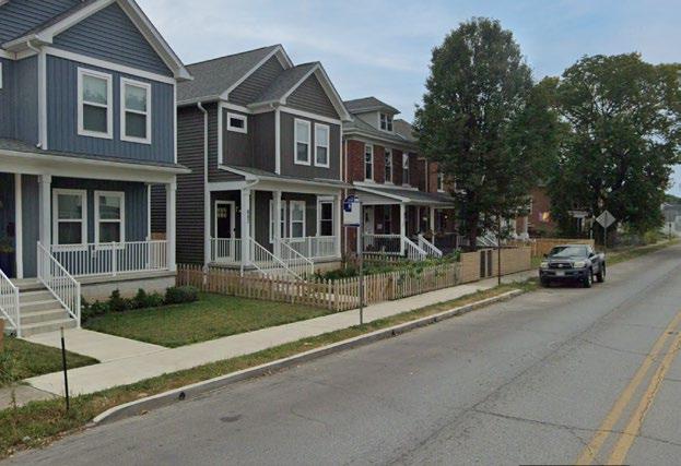
This project will seek to purchase and install COTA bus shelters and litter receptacles at highly utilized bus stop locations. Feasibility for placing shelters within the city right of way will require verification and a maintenance agreement with COTA.
Community Prioritized Locations:
• McKinley Ave & N Yale Ave
• McKinley Ave & N Cypress Ave
• W Rich St & McDowell St
• W Rich St & Lucas St
• W Rich St & S Skidmore St
• Sullivant Ave & Central Ave
• Sullivant Ave & Glenwood Ave
• Sullivant Ave & Souder Ave
Project Champion:
• Franklinton Board of Trade (FBOT)
Lead Partner:
• COTA
Kelsey Ellingsen, Local Government Affairs Director Email: EllingsenKA@cota.com
2023 FAC Survey
Comments
“Add trash cans at COTA stops”
“Add proper bus stops with shelters and sidewalks on McKinley Avenue”
Public Meeting #2
Comments
“Add bus shelters along Sullivant Ave and bus line #6, ensuring accessibility”
Public Meeting #3
Comments
“The bus stops on Rich St across from Yellow Brick Pizza has no seating or cover!”
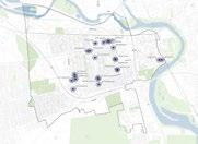
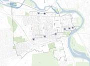
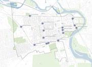
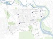
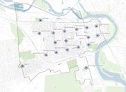
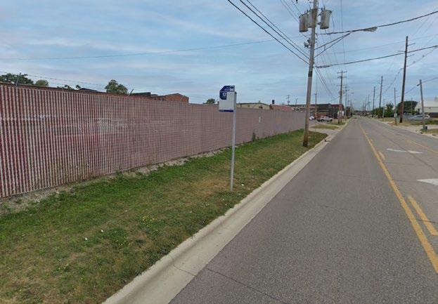
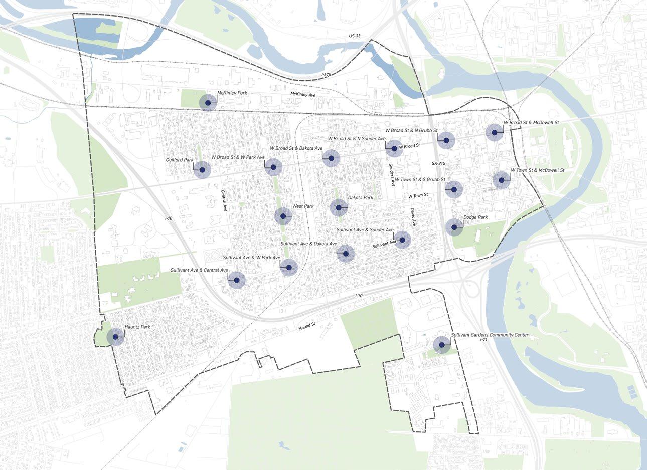
The smaller dots show existing bus stops found in Franklinton. The stops highlighted see some of the highest usage rate.
Project Process
To Initiate:
Current recommendations for highly utilized stops, along with community comments, will need another round of public feedback to help determine two or three prioritized locations from the list already identified. Priority should be given to high use stops that currently lack both bus shelters and supporting amenities such as trash receptacles.
To Deliver:
After the final locations are identified, COTA will review each stop through their program to determine whether the proposed additions are feasible, taking into account future Columbus and COTA plans, ADA accessibility, and other requirements. The Franklinton Board of Trade will also need to enter into an agreement outlining costs, ongoing maintenance responsibilities, and COTA’s role. FBOT will likely be responsible for providing additional drawings and securing Columbus permits before shelters are installed.
* Source: COTA Transit Amenity Contribution Program — Maintain a Transit Stop.
** COTA is currently going through an evaluation and review to modify their Adopt A Stop program.
Cost Opinion
The cost estimate includes the cost of the bus shelter and any infrastructure improvements needed to install the ADA compliant bus shelter.*
Detailed Cost Assumptions:
• COTA supplied bus shelter pricing used*
• No right-of-way acquisition is anticipated
• No utility relocation costs are anticipated
* Source: COTA Amenity Contribution Pricing 2024
Funding Consideration
Funding sources would need come from the City of Columbus’ next capital funding cycle. This can be pursued through, but not limited to, the Department of Public Service (DPS).
Sullivant Ave & Souder Ave
Sullivant Ave & Glenwood Ave
McKinley Ave & N Yale Ave
W Rich St & Lucas St
McKinley Ave & N Cypress Ave
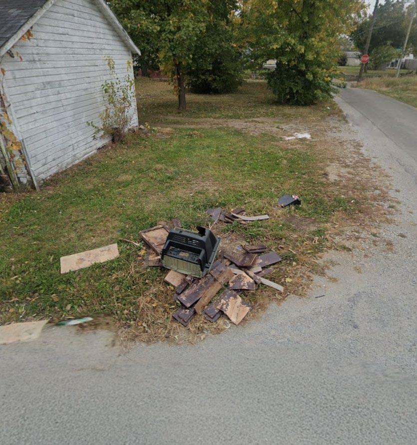
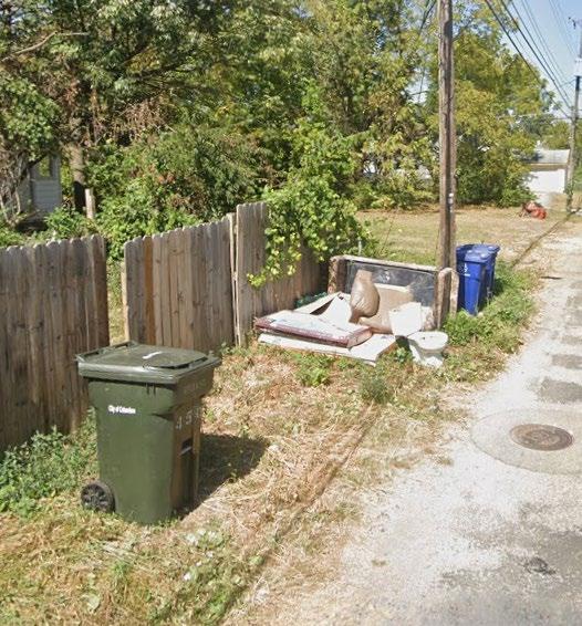
S3 REMEDIATE TRASH IN ALLEYS
& BEAUTIFICATION
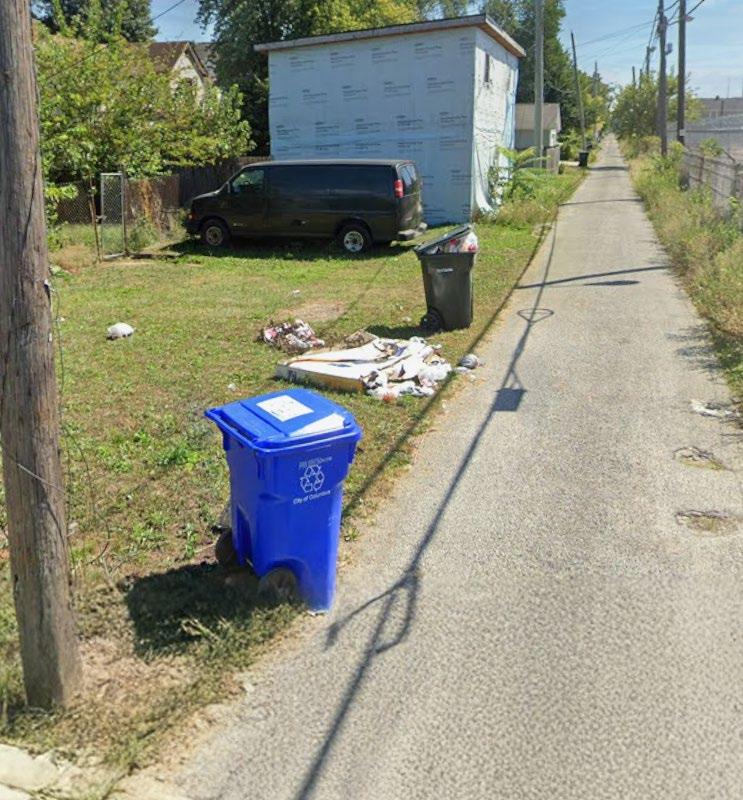
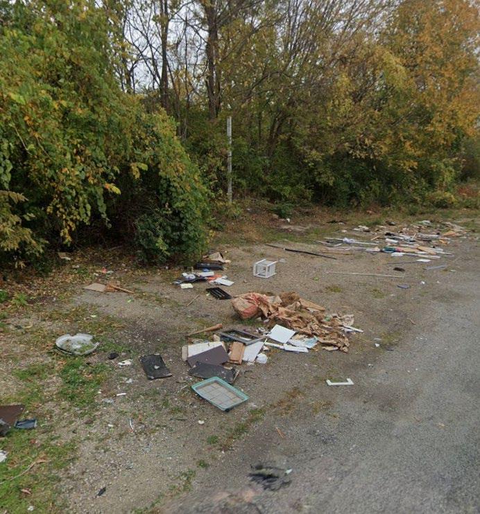
Address trash issues along alleys to support a cleaner and healthier public realm.
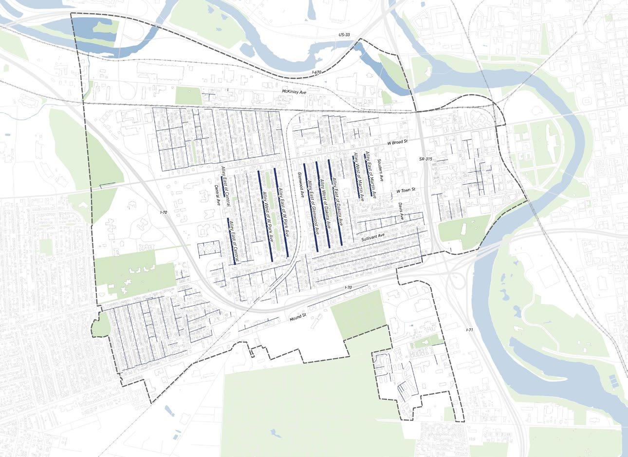
This project will seek funding to revive a previous SID initiative led by the Franklinton Board of Trade to provide consistent trash remediation in alleys.
Community Prioritized Locations:
• Alley East of Central Ave
• Alley West of W Park Ave
• Alley East of W Park Ave
• Alley East of Glenwood Ave
• Alley West of Dakota Ave
• Alley East of Dakota Ave
• Martin Ave Alley
• Residential Alleys
Project Champion:
• Franklinton Board of Trade (FBOT)
City of Columbus Partner:
• Department of Public Service (DPS)
Division of Refuse Collection
Tim Swauger, Division Administrator
Email: TJSwauger@columbus.gov
2023 FAC Survey Comments
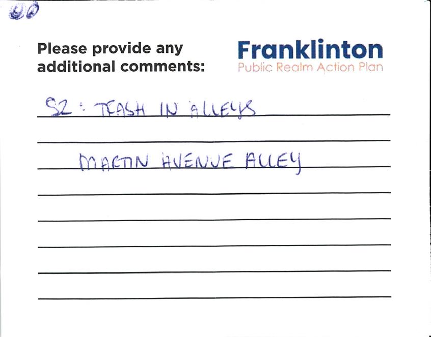
“Trash is really bad in most alleys by Town and Avondale, up to Central.”
“Trash is a big issue in alleys, increase enforcement of illegal dumping”
2023 FAC Survey Comments
“Trash is a big issue in alleys”
“The alley between Dakota and Cypress is continually littered with bags of trash.”
Public Meeting #1 Comments
“Trash gets dumped near vacant lots and properties”
“Landlords and investment companies need to be help accountable”
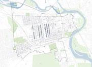
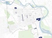
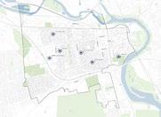
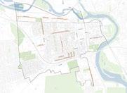
Smaller lines indicate additional alleys in Franklinton not specifically called out.
REMEDIATE TRASH IN ALLEYS Project Process
To Initiate:
Continue to identify residential alleys of the highest priority that are most in need of clean up. This builds on the 2023 alley cleanup program, a past initiative that Trent Smith and the Franklinton Board of Trade coordinated closely with the Division of Refuse Collection to deliver.
To Deliver:
The Division of Refuse Collection will complete an initial alley cleanup through a work order that establishes the baseline by clearing accumulated trash, debris, and overgrowth in the selected alleys. This includes coordinating the scope, scheduling crews, and determining the order in which alleys will be addressed. The next phase involves securing funding that allows the Franklinton Board of Trade and the SID to maintain the alleys after the City’s initial work, preventing conditions from reverting.
Report Littering and Illegal Dumping:
Residents can assist Solid Waste Inspectors by helping identify illegal dumpers by taking photos or videos of the activity while it is occurring and reporting it to the 311 Service Center at 614-645-3111.
* Source: City of Columbus — Report Littering and Illegal Dumping (Water Power Division
Cost Opinion
This cost estimate is based on the past alleyway clean-up program.
Cost Assumptions:
• $75,000-100,000 Grant*
* This does not take into account inflation from 2023-2027 which would be greater then 5%.
Funding Consideration
Funding sources would need to come from the City of Columbus’ next capital funding cycle. This can be pursued through, but not limited to, the Division of Refuse Collection which previously funded clean up programs in Franklinton.
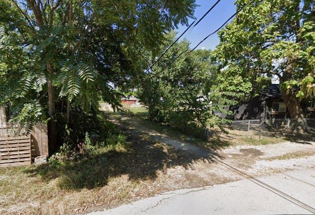
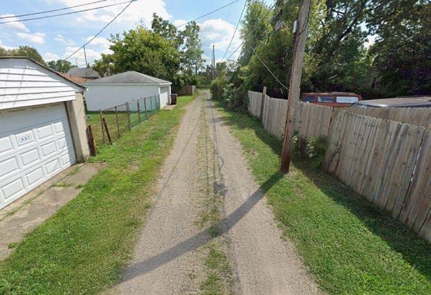
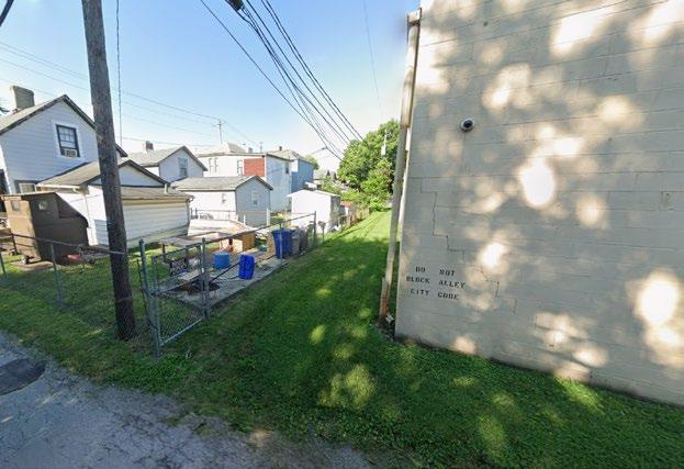
Alley East of Glenwood Ave
Alley East of Yale Ave
Alley in West Franklinton
Alley in West Franklinton
S4 UNDERPASS CLEAN UP
PLACEMAKING & BEAUTIFICATION
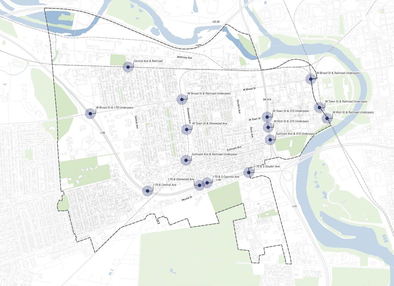
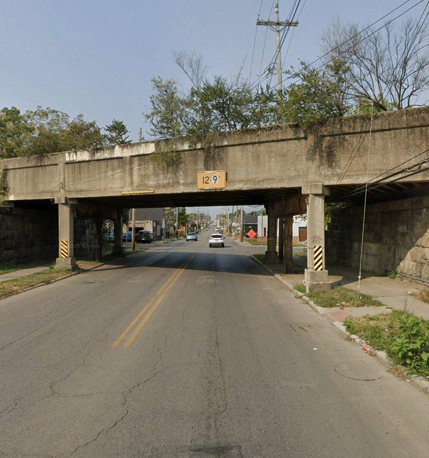
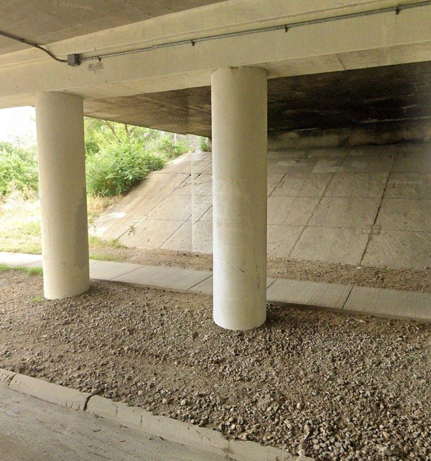
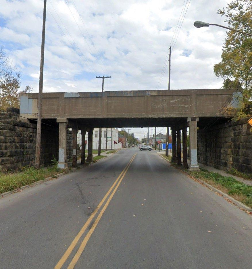
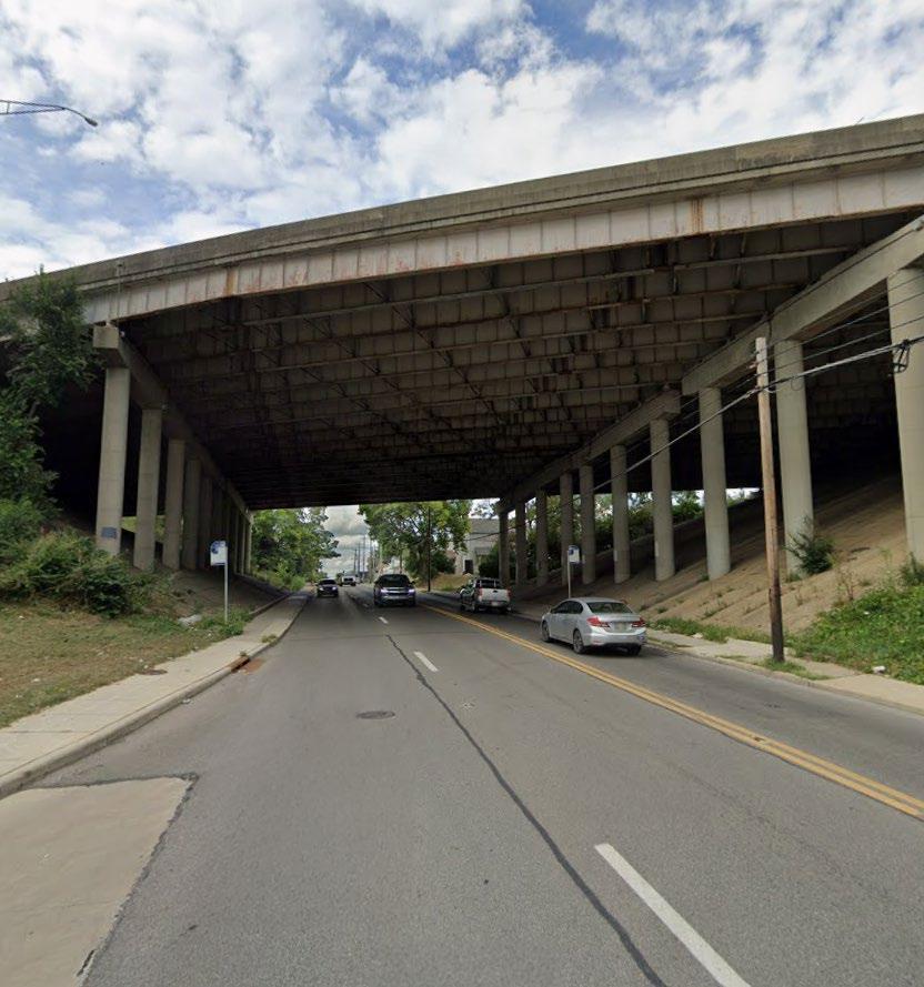
Clean up trash and maintain overgrown plantings within key underpasses that welcome residents and visitors.
The SID will seek funding to support time and materials for removing graffiti, addressing trash issues, and trimming overgrown plantings. (See mid term project M9 for additional beautification efforts).
Community Prioritized Locations:
• Highway Underpasses
• Railroad Underpasses
Project Champion:
• Franklinton Board of Trade (FBOT)
City of Columbus Partner:
• Department of Public Service (DPS)
Division of Refuse Collection
Tim Swauger, Division Administrator
Email: TJSwauger@columbus.gov
• Ohio Department of Transportation (ODOT)
• CSX Transportation Inc.
2023 FAC Survey
Comments
“I would love to see better trash cleanup near the highway ramps, under bridges...”
“Bring back the Litter League”
Public Meeting #2
Comments
“Freeway bridges have trash and light issues”
“Landscaping along exit & on ramps”
Public Meeting #3
Comments
“Town & Glenwood area is consistently overgrown and unmaintained”
“North Central + Railroad underpass”
UNDERPASS CLEAN UP
Project Process
To Initiate:
Continuing to focus on a select number of underpasses in the worst condition, especially those with higher foot traffic, will help kickstart the cleanup process. Improving cleanliness will enhance the perception of safety and support future beautification efforts frequently mentioned by residents.
To Deliver:
Begins by partnering with the City to remove debris, trash, and overgrowth through a work order that addresses the worst locations first. Similar to the alley cleanup project, this effort will require identifying and securing funding that enables the Franklinton Board of Trade and the SID to manage ongoing maintenance after the City’s initial clean up.
Cost Opinion
The cost estimate plans to combine clean up efforts with an alleyway clean up program.
Cost Assumptions:
• $75,000-100,000 Grant
* This does not take into account inflation from 2023-2027 which would be greater then 5%.
Funding Consideration
Funding sources would need to come from the City of Columbus’ next capital funding cycle. This can be pursued through, but not limited to, the Division of Refuse Collection which previously funded clean up programs in Franklinton.
Sullivant Ave. & Railroad Underpass
Sullivant Ave. & SR-315 Underpass
S5 EXISTING PARK IMPROVEMENTS
PARKS & OPEN SPACES
Look to enhance existing parks with furnishings such as covered seating, trash cans, fencing and trees.
This project will pursue a volunteer led park audit in coordination with the Department of Recreation and Parks, allowing acute needs and improvement opportunities to be documented and incorporated into near term budget allocations as funding becomes available.
Community Prioritized Locations:
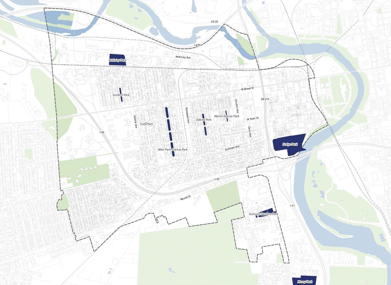
• Guilford Park, Cody Park, West Park
• Dakota Park, Martin Park
• Dodge Park, McKinley Park
• Sullivant Gardens Community Center
Project Champion:
• Franklinton Board of Trade (FBOT)
• Franklinton Area Commission (FAC)
• Esther DeBusk, Local Resident
Email: estherdebusk@gmail.com
City of Columbus Partner:
• Columbus Recreation & Parks Department
Alex Sauersmith, Planning Manager
Email: ACSauersmith@columbus.gov
Public Meeting #1
Comments
“Incomplete amenities at new facilities like Gilford Park”
“Existing parks like Dodge, McKinley and Cody are in need of improvements”
Public Meeting #2
Comments
“McKinley Park needs seating, a trash can, and covered seating”
“Dodge Park needs seating and trails”
Public Meeting #2
Comments
“Need improvement to McKinley Park, curbs, trees, open restroom”
“West Park Ave - anchor feature (playground)”
Dodge Park is exploring a larger planting plan in the spring.
Gardens will be starting design for new soccer fields and other potential improvements in the next few months
Sullivant
EXISTING PARK IMPROVEMENTS
Project Process
To Initiate:
The Franklinton Board of Trade or the Franklinton Area Commission should look to partner with the local high school to give students an opportunity to participate and learn through hands on assessment, while also allowing them to make a tangible impact in their community. There is also potential to collaborate with Esther DeBusk, a professor at The Ohio State University, and invite her students to take on the audit as a project. The audit will generate a clear, community informed list of amenities residents would like to see, including trees, lighting, bike racks, paths, street furniture, covered seating, trash receptacles, and new programmatic uses.
To Deliver:
Submitting the park audit findings to the Department of Recreation and Parks and following up will help ensure the needs and requests identified by volunteers are reviewed and considered for implementation. The department will add these requests to their master list, which guides where new pieces are installed throughout the year. Continued coordination with the department will help advance specific improvements and keep the community informed of progress.
Funding Consideration
Funding sources would need to come from the City of Columbus’ next capital funding cycle. This can be pursued through, but not limited to, the Department of Recreation and Parks, which typically makes one larger annual contract/purchase for amenities.
S6 BOOST LOCAL
TREE CANOPY
PARKS & OPEN SPACES
Increase both public and private trees in Franklinton to increase tree canopy coverage.
Continue identifying locations in Franklinton for public tree plantings outside of the most challenged areas. There are also opportunities to work with the community to identify suitable locations for private trees.
Community Prioritized Locations:
• (South of) Sullivant Ave
• Residential Neighborhoods
• W Broad St
• Thomas Ave
Project Champion:
• Franklinton Board of Trade (FBOT)
• Franklinton Area Neighbors (FAN)
Esther DeBusk, Local Resident
City of Columbus Partner:
• Columbus Recreation & Parks Department
Urban Forestry
Rosalie Hendon, City Forester
Email: RFHendon@columbus.gov
2023 FAC Survey Comments
“More trees and gardens so grandchildren can utilize”
“More trees and public green to boost General neighborhood moral as well as mental and physical health.”
Public Meeting #1
Comments
“Additional tree/canopy cover would be nice”
“More trees along Sullivant Ave + street median w/ trees”
Public Meeting #2
Comments
“In favor of additional treespotentially along walking paths (don’t care where)”
“Shady trees along main corridors, broad/town/rich”
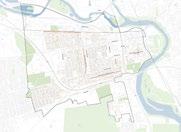
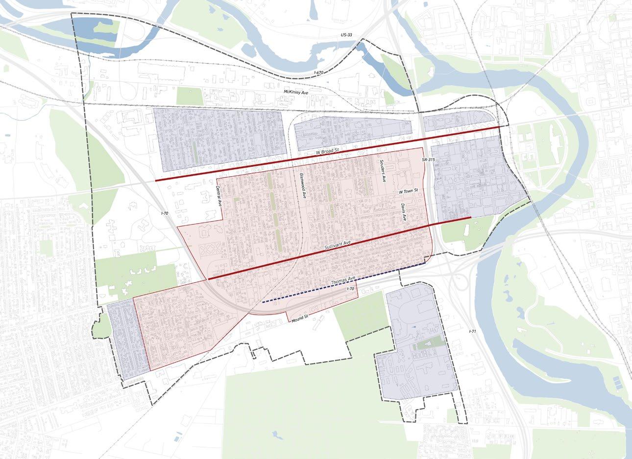
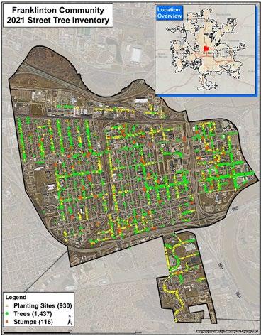
Challenged Zones are areas with ongoing projects or infrastructure constraints that prevent tree plantings in the near future while Target Zones are areas where it is feasible to request public tree plantings from the Forestry Section.
Project Process
To Initiate:
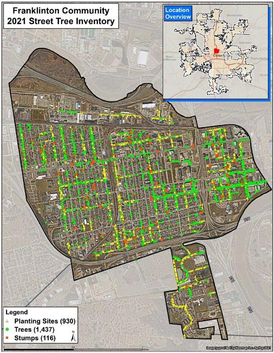
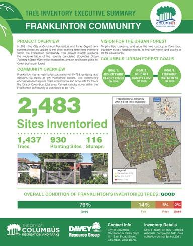
Adding more trees in Franklinton should begin by referencing past planning efforts such as the 2021 Columbus Urban Forestry Master Plan and the 2021 Franklinton Community Street Tree Inventory Summary Report. In 2021, the Inventory Report identified 930 vacant sites suitable for planting within the street right of way, a number that is now closer to 700 after recent planting efforts. The report prioritizes planting the 78 large sites, which are locations best suited for large maturing trees with a minimum width greater than 7 feet and at least 40 feet from another tree, and the 66 medium sites, which are best suited for medium maturing trees with widths between 5 and 7 feet and at least 30 feet from another tree. These sites were recommended as short term actions because they offer greater benefits and help establish a strong foundation for the neighborhood canopy cover.
To Deliver:
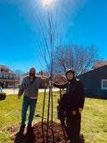
Certain areas have constraints, such as West Broad Street due to LinkUS, Sullivant Avenue due to AEP transmission lines, and portions of West Franklinton where Blueprint Columbus is currently working on design and identifying locations. Outside these areas, the community can work with Urban Forestry to identify preferred planting locations so planting can move forward while the constrained areas wait for further planning. There are also opportunities for private tree plantings, such as the Columbus Tree Assistance Program, which civic associations can apply to for funding to increase tree canopy.
* Source: Columbus Tree Assistance Program, Franklin Soil and Water Conservation District.
Urban Forestry:
For recent damage from fallen branches or trees from City property, contact the 311 Service Center at 614-645-3111 or online.
* Source: Columbus Recreation and Parks — Urban Forestry.
Funding Consideration
Additional funding sources may not be needed, as the current funding provided through the Department of Recreation and Parks and the Urban Forestry Department offers adequate resources for public tree plantings at this time.
Franklinton Community Street Tree Inventory Summary Report
In 2021, the City of Columbus Recreation and Parks Department updated the Franklinton street tree inventory to support the new Columbus Urban Forestry Master Plan and its vision for the city’s urban forest.
Columbus Tree Asst. Program Year-End Report
The report describes Franklinton Area Neighbors’ (FAN) partnership with Garden Heights Apartments to plant 13 native trees across the property with help from volunteers from The Refuge and Green Columbus.
Columbus Equitable Planting Plan 2026-2028
The Equitable Planting Plan aims to equitably increase tree canopy across neighborhoods in areas with low canopy and the greatest need, advancing the third goal of the Columbus Urban Forestry Master Plan (UFMP).
S7 GATEWAY SIGNAGE
& BEAUTIFICATION
Look to enhance current gateway signage and explore opportunities to create new gateways into Franklinton.
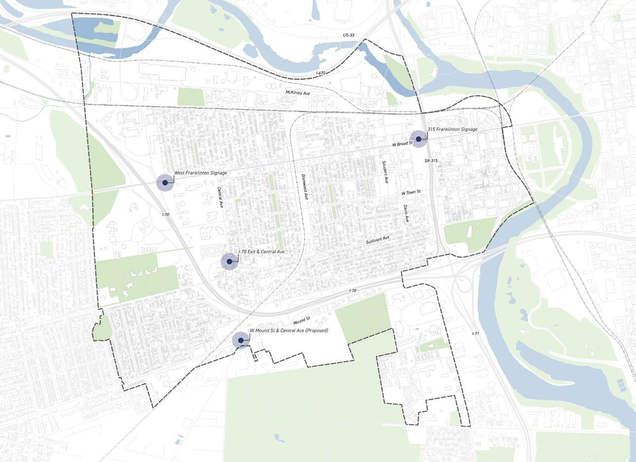
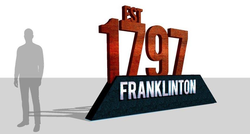
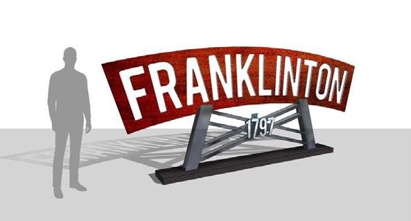
This project will seek funding to renovate the existing gateway signage at the Broad Street and SR-315 interchange and the Broad Street and I-70 interchange. It will also seek funding for a new gateway element at Central Avenue and Mound Street.
Community Prioritized Locations:
• Broad St & I-70 Interchange
• Broad St & 315 Interchange
• Central Ave & Mound St
• I-70 Exit & Central Ave
Project Champion:
• Franklinton Board of Trade (FBOT)
• Franklinton Arts District (FAD)
City of Columbus Partner:
• Department of Development
Mark Lundine, Economic Development Administrator
Email: MAlundine@columbus.gov
2020 West Fton. Gateway
“Develop the 315 Gateway District”
“Public Art, Outdoor Dining, Transit Facilities, Medians, Street Lighting, Street Trees, Planters, and Furniture”
Public Meeting #3
Comments
“Install gateway signage, murals”
Public Meeting #3 Comments “I-70 Central Ave exit ramp”
Project Process
To Initiate:
The Franklinton Board of Trade will continue working with the community to gather design feedback and ensure the proposed signage reflects the community identity and priorities.
• Engage Residents
• Concept Development
• Confirm Site & Assessment
• Regulations & Permitting
• Budget & Funding
To Deliver:
Delivering new gateway signage will involve securing grants to support design refinement and implementation. A longer term plan will also be needed to prioritize both existing and proposed gateway signage as funding becomes available.
• Finalize Design
• Permitting & Approvals
• Construction & Installation
• Project Launch & Maintenance
Cost Opinion
This cost estimate is based on the Franklinton Board of Trade’s experience with prior work and current efforts on a site today.
Cost Assumptions:
• $125,000 for 4 gateways (price/gateway)
• $25,000 to remove old Franklinton signage and install new design.
Funding Consideration
Funding sources would come from the City of Columbus’ next capital funding cycle and may be pursued through the Department of Public Service (DPS). However, signage projects such as gateways, wayfinding, and historical markers are more likely to be funded when packaged together through local TIFs (Tax Increment Financing). Additional funding opportunities include local grants such as 614 Beautiful, which supports community led projects that enhance neighborhood beauty and address equity.
Existing East Franklinton Signage
Existing West Franklinton Signage
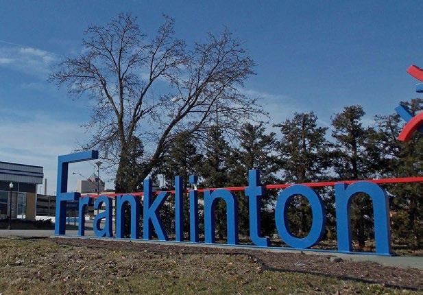
Proposed Central Ave and Mound St
Proposed I-70 Exit along Central
S8 WAYFINDING SIGNAGE
PLACEMAKING & BEAUTIFICATION
Design and install wayfinding signage to guide visitors to local businesses and attractions.
The SID will seek funding to appropriate time and material towards removing graffiti, addressing trash issues, and trimming overgrown plantings (See mid-term project M9 for additional beautification efforts).
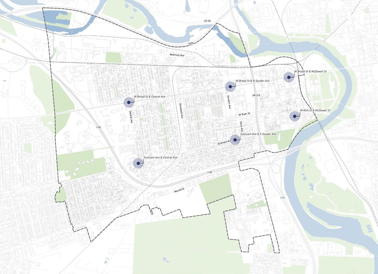
Suggested Locations:
• W Broad St & Central Ave
• W Broad St & N Souder Ave
• W Broad St & McDowell St
• Sullivant Ave & Central Ave
• Sullivant Ave & S Souder Ave
• W Rich St & McDowell St
Project Champion:
• Franklinton Board of Trade (FBOT)
• Franklinton Arts District (FAD)
City of Columbus Partner:
• Department of Development
Mark Lundine, Economic Development Administrator Email: MAlundine@columbus.gov
Public Meeting #1
Comments
“Franklinton needs signage”
“Franklinton Arts District signage”
Public Meeting #3
Comments
“Gateway map w/ signage”
“invest into local businesses”
Business Stakeholder
Comments
“Wayfinding to local businesses and attractions”
“Branding and placemaking to increase continuity across all of Franklinton”
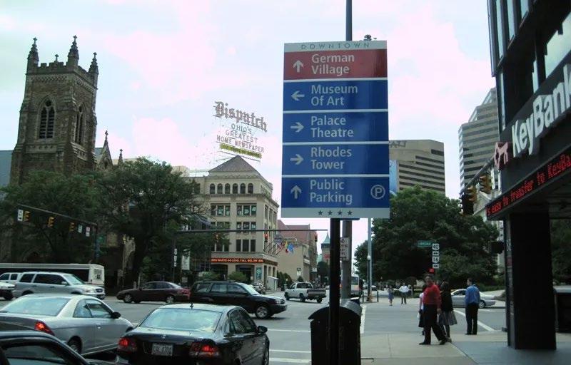
CITY OF COLUMBUS STANDARD WAYFINDING SIGNAGE
Project Process
To Initiate:
Residents expressed interest in custom and artistic signage, creating an opportunity to partner with local groups such as the Franklinton Arts District. Additional funding would need to be secured through grants rather than relying solely on the city’s in-house signage production.
To Deliver:
Using the city’s current system and standards allows wayfinding signage to be installed in a shorter timeframe. Existing standards are applied downtown, while special conditions apply for custom signs across Ohio State University’s campus. The City Sign Shop can print and fabricate the signage, with implementation by the Franklinton Board of Trade and the SID.
Funding Consideration
Funding sources would come from the City of Columbus’ next capital funding cycle and may be pursued through the Department of Public Service (DPS). However, signage projects such as gateways, wayfinding, and historical markers are more likely to be funded when packaged together through local TIFs (Tax Increment Financing).
Custom Wayfinding Signage
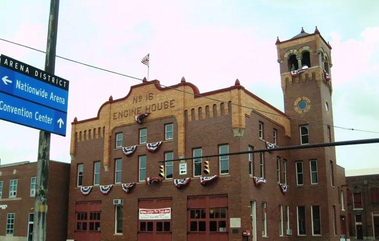
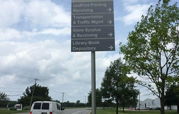
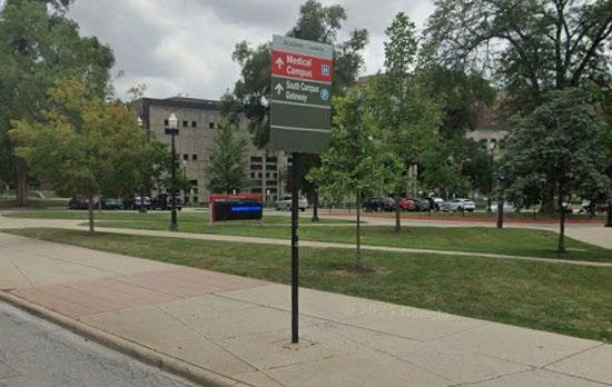
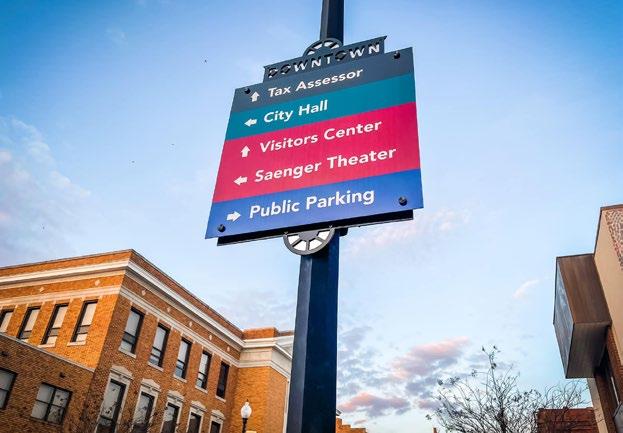
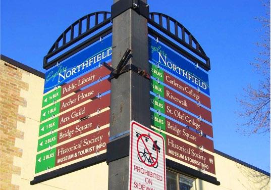
Here are examples of simple and subtle ways to add a pop of color to wayfinding signage in Franklinton. With help from local groups such as the Franklinton Arts District (FAD), the artfulness can be strengthened or intensified based on community input.
Downtown Columbus Wayfinding Signage
OSU Wayfinding Signage
OSU Wayfinding Signage
Downtown Columbus Wayfinding Signage
S9 BIKE RACKS
2020 West Fton. Gateway
“Locate bicycle racks in curb bump outs near street and/or alley intersections.”
“Bicycle racks may be placed in a midblock location within the Amenity Zone”
Public Meeting #2
Comments
“Bike racks at all businesses Tommy’s, all coffee shops, restaurants”
Public Meeting #2
Comments
“Unique bike racks at Dodge Park area”
“Aesthetic bike racks”
and improve convenience for riders.
The City of Columbus maintains an inventory of new bike racks ready for installation. Residents or property owners who would like a bike rack installed near their business or community space can submit a request directly to the city by calling 311.
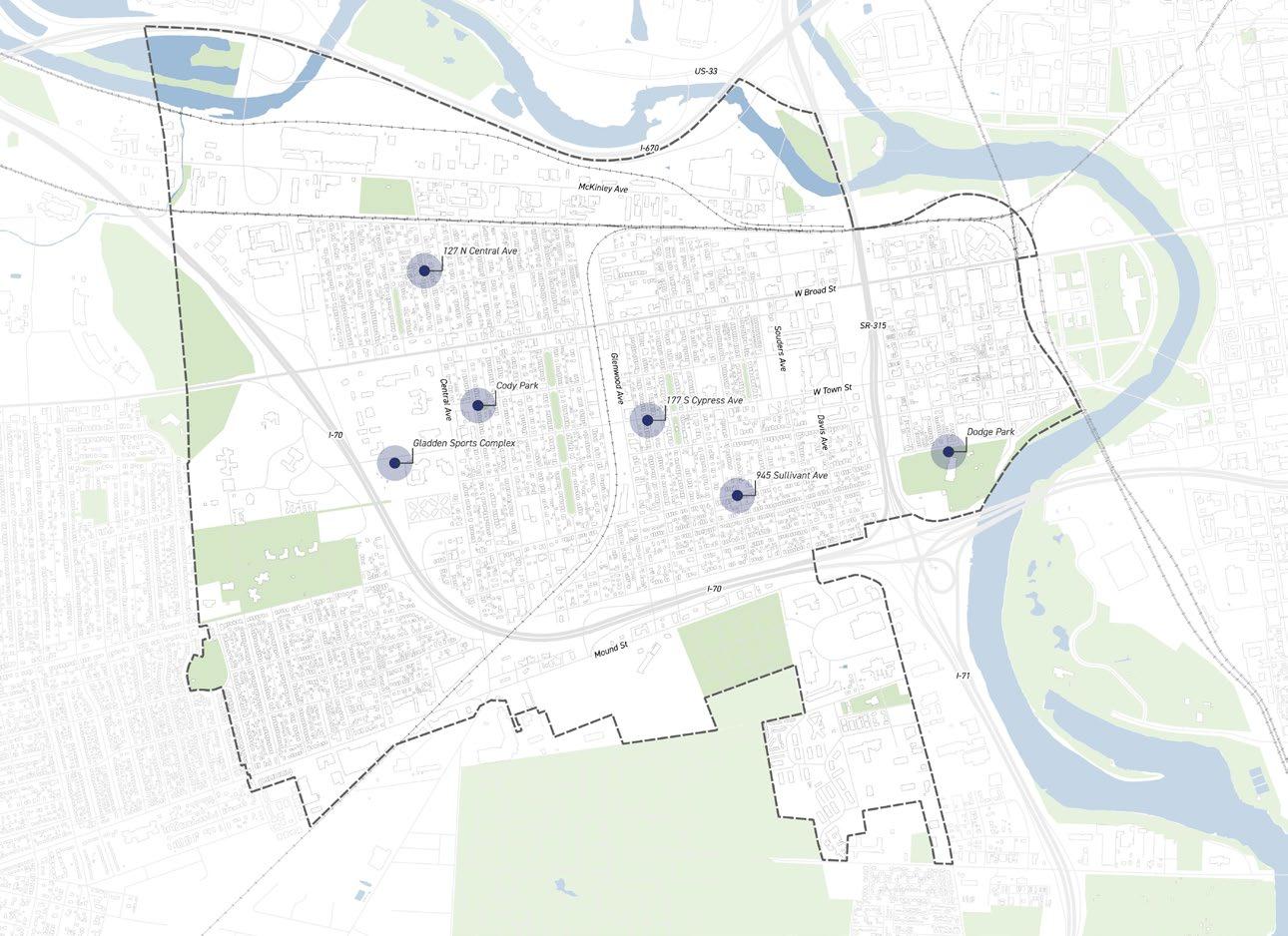
Community Prioritized Locations:
• WitchLab - 127 N Central Ave
• The Patio Bar - 945 Sullivant Ave
• Cypress Kitchen - 177 S Cypress Ave
• Gladden Sports Complex
• Cody Park, Dodge Park
Project Champion:
• Franklinton Cycle Works
• Franklinton Arts District (FAD)
City of Columbus Partner:
• Department of Public Service (DPS)
Division of Mobility & Parking Services
Justin Goodwin, Division Administrator
Email: JMGoodwin@columbus.gov
BIKE RACKS
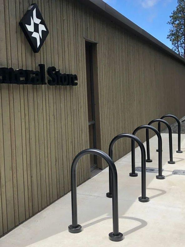
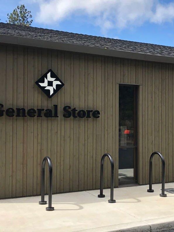
CITY OF COLUMBUS STANDARD INVERTED-U BIKE RACK
Project Process
To Initiate:
Residents and business owners have expressed interest in custom and artistic bike racks in impactful areas such as commercial corridors, parks, and other community assets. This provides an opportunity to partner with local groups such as the Franklinton Arts District (FAD) to help assist with design and implementation rather than having the city’s standard Inverted-U Bike Rack installed.
• Engage Residents
• Concept Development
• Confirm Site & Assessment
• Regulations & Permitting
• Budget & Funding
To Deliver:
This project offers one of the easiest paths to a quick win, as it only requires contacting the City through the 311 system to request installation of standard bike racks at identified locations.
• Finalize Design
• Permitting & Approvals
• Construction & Installation
Funding Consideration
Funding sources may currently be needed as the Department of Public Service (DPS) has a stock of standard bike racks they can install at no cost to property owners. Custom bike racks would require partnering with local groups such as the Franklinton Arts District (FAD) and securing additional funding and grants.
Custom Bike Racks
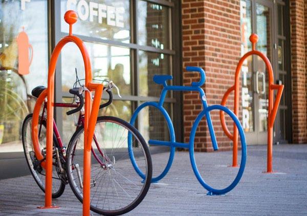
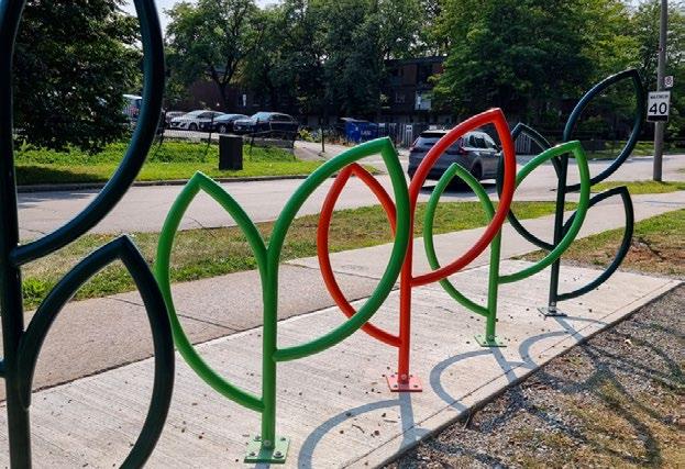
Here are examples of custom bike racks. With support from local groups such as the Franklinton Arts District, there is an opportunity to use bike racks as public art installations, an idea frequently mentioned during public meetings.
Custom Bike Rack
Custom Bike Rack
S10 PET WASTE RECEPTACLES
Public Meeting #1
Comments
“Trash and pet waste receptacles on Sullivant”
“McKinley Park needs trash cans and other amenities”
Public Meeting #2
Comments
“Dog poop bags to be present around west of 315 to encourage pet owners to clean up”
“Waste receptacles along Sullivant Ave”
Public Meeting #2
Comments
“Keep West Franklinton in mind for future parks designs” such as dog parks
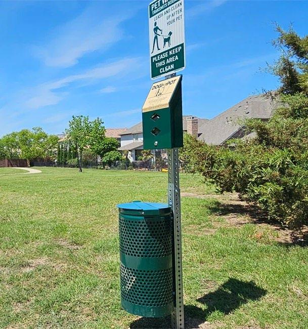
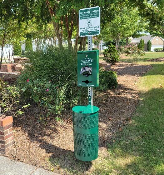
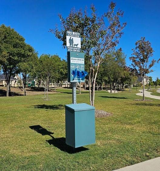
Install pet waste bag dispensers and receptacles in public areas to maintain cleaner public spaces.
Through a partnership with Pilot Dogs, this project will place bag waste receptacles through out the neighborhood.
Suggested Locations:
• Local Parks
• Sullivant Ave
Project Champion:
• Pilot Dogs
• Franklinton Board of Trade (FBOT)
Project Partner:
• Pilot Dogs
Jason Clayton, Director of Advancement
PET WASTE RECEPTACLES
Project Process
To Initiate:
Perform a detailed review of potential locations for pet waste receptacles. While general feedback noted the need for receptacles along key corridors such as Sullivant Avenue, specific sites were not identified. Additional community input and on-site assessment will be needed to determine the most effective placement.
• Engage Residents
• Confirm Sites
• Public R/W & Permitting
• Budget & Funding
To Deliver:
The Franklinton Board of Trade will continue collaborating with Pilot Dogs, which has taken on the role of project champion. Together, they will develop a feasibility strategy to establish a long term program for the community. An agreement on responsibilities will likely be needed to ensure the project serves all of Franklinton, or to explore additional partnerships and funding opportunities.
• R/W Permitting & Approvals
• Installation
Funding Consideration
Funding sources would likely come through a partnership with Pilot Dogs, as they are currently seeking to spearhead this initiative. Additional funding opportunities can be explored at the partnership’s request.
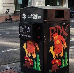
Common Pet Waste Receptacles
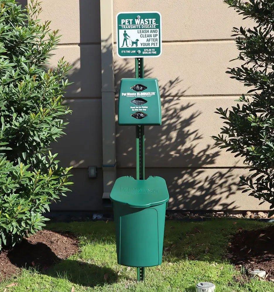
Here are examples of basic, non-branded pet waste receptacles. As a project led in partnership with Pilot Dogs, there is an opportunity to create branded pet waste receptacles.
Franklinton Public Realm Study
MID-TERM
PROJECTS & RECOMMENDATIONS
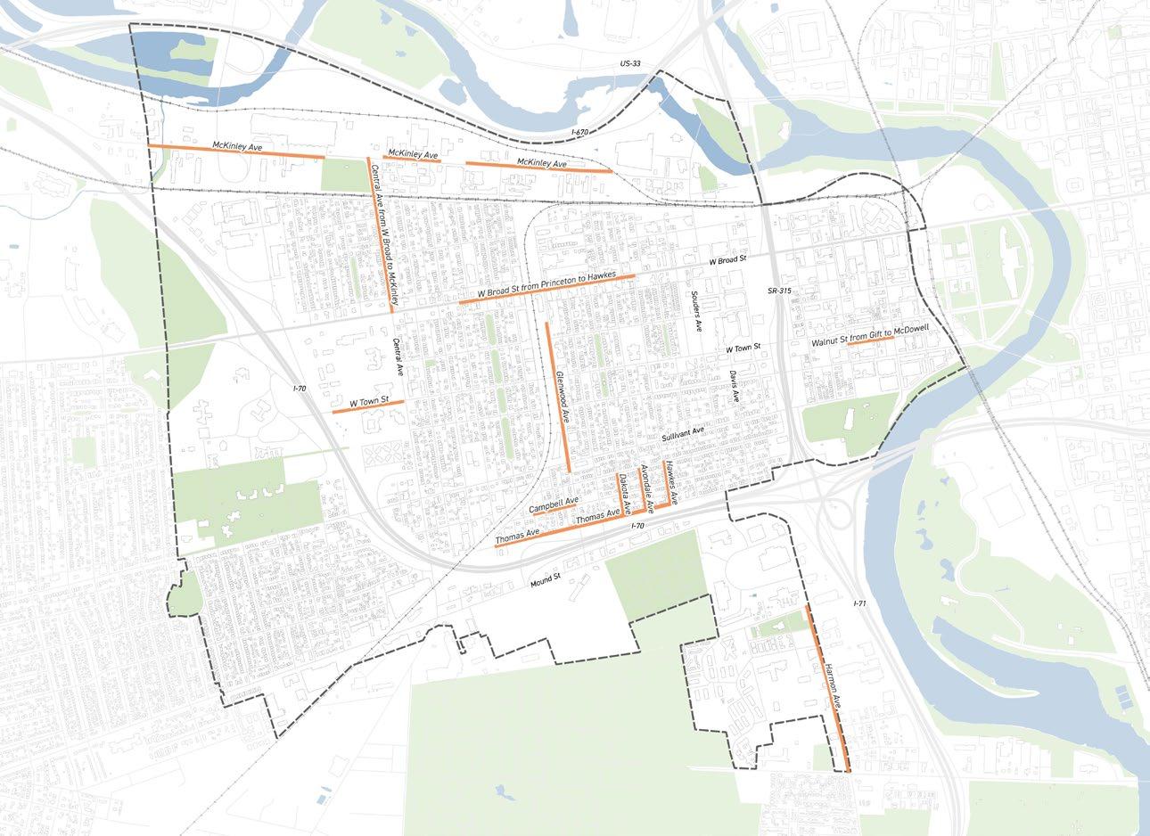
This project aims to collaborate with the City of Columbus Department of Public Service to assess and confirm opportunities to improve or construct sidewalks in key areas of the neighborhood.
Community Prioritized Locations:
• Central Ave from Broad to McKinley
• W Broad St from Princeton to Hawkes
• Hawkes Ave from Bellows to Thomas
• McKinley Ave
• W Town St
• Glenwood Ave
• Thomas Ave
• Harmon Ave
• Southwestern Quadrant & South of Sullivant
Project Champion:
• Tom McGuire, Local Resident Email: tmcguire457@gmail.com
City of Columbus Partner:
• Department of Public Service (DPS)
Public Meeting #1
Comments
“Unsafe walking conditions, particularly on Harmon Ave”
“South of Sullivant Ave has few curbs and sidewalks”
Public Meeting #1
Comments
“Sidewalks Central Ave Broad to McKinley Speed + no curb lawn”
“Continuous sidewalk path”
Public Meeting #2
Comments
“Add elevated sidewalks”
“Add raised sidewalks all around parks”
Project Process
To Initiate:
Addressing sidewalk gaps in Franklinton builds on Tom McGuire’s initial work documenting missing sidewalk. Continuing this effort and prioritizing where sidewalks should be constructed first is essential, as sidewalk construction is costly and will likely need to be completed in phases rather than all at once across the neighborhood.
To Deliver:
Franklinton will require close collaboration with the Department of Public Service to coordinate the installation of curbs and gutters. New sidewalks, based on square footage, may trigger stormwater studies and require review of existing utilities, planned capital projects, and potential conflicts that could affect timing or feasibility. This process will help ensure sidewalks are better prioritized within the broader citywide program. A coordinated approach will support the creation of work orders and advance long term equitable public infrastructure goals.
Cost Opinion
Cost to install new curb and sidewalk where there are gaps.
Detailed Cost Assumptions:
• No right-of-way acquisition is anticipated
• No utility relocation costs are anticipated
• Engineering fee includes the creation of simple detailed design plans
Funding Consideration
Funding sources would need to come from the City of Columbus’ next capital funding cycle. This can be pursued through, but not limited to, the Department of Public Service (DPS).
M2 ALLEYWAY REPAIRS
2023 FAC Survey Comments
“The alleys are in disarray, they need resurfaced so cars don’t bottom out.”
“Nearly every alley needs improved and resurfaced”
Advocate for the resurfacing of deteriorated alleys throughout Franklinton to enhance use.
This project will work with the City of Columbus and the alley resurfacing program to allow the community to advocate for specific alleys to be prioritized for resurfacing.
Community Prioritized Locations:
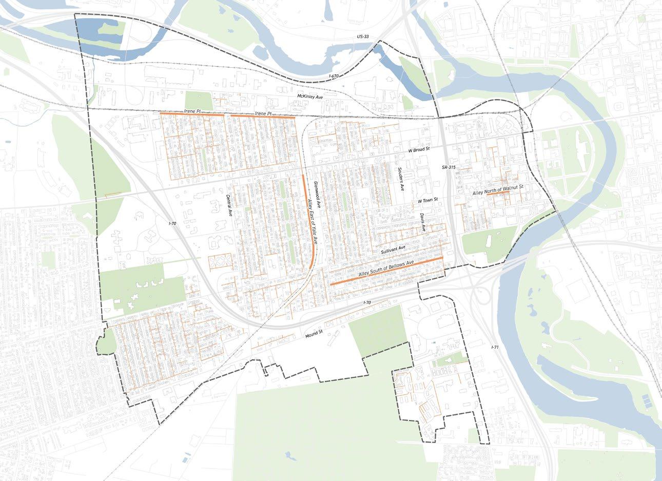
• Alley East of Yale Ave
• Alley South of Bellows Ave
• Alley North of Walnut St
• Alleys South of Sullivant
• Irene Pl
Project Champion:
• Franklinton Board of Trade (FBOT)
• Franklinton Area Commission (FAC)
• Franklinton Development Association
City of Columbus Partner:
• Department of Public Service (DPS)
2023 FAC Survey Comments
“Would really like to see the alley between Walnut street and Town, from McDowell to Mead alley developed”
“A lot of alleyways have potholes really bad”
Public Meeting #2 Comments
“Pave alleys and provide lighting” “Permeable pavement alleyway”
ALLEYWAY REPAIRS
Project Process
To Initiate:
Alleyway repairs begin with reviewing current conditions. City staff evaluate all alleys every two years on a scale of 1 to 5, and these ratings guide the annual Alley Surface Treatment Program. To initiate repaving, the community will need to advocate for prioritized locations to be included in the 2027 program.
To Deliver:
Submitting 311 requests helps the city track where alleyway repairs are needed. Timelines vary depending on when alleys are scheduled for chip sealing based on their ratings. Because repaving is done in-house and does not require engineering, turnaround is generally faster, though planned utility work can affect timing. Alleys made of other materials, such as concrete or brick, or those requiring resurfacing, are addressed through separate repair programs.
Cost Opinion
Cost estimate for the resurfacing of alleyways, and full depth pavement spot repairs as needed for the following locations:
• The alleyway running parallel to and south of Sullivant Ave, from S Glenwood Ave to S Green St.
• The alleyway running parallel to and south of Bellows Ave, from S Glenwood Ave to the old Bellows School.
• The alleyway running parallel to and west of S Yale Ave, from Sullivant Ave to W Capital St.
Detailed Cost Assumptions:
• Cost estimate table calculated on a per block (350 FT) basis to allow for flexible estimating
• 5 blocks assumed when determining the unit cost of each item in order to improve accuracy
• Alleyway resurfacing does not include crossing streets
• 11 FT alleyway width
• No right-of-way acquisition is anticipated
• No utility relocation costs are anticipated
• Engineering fee includes the creation of simple detailed design plans
A separate estimate has been created for the full depth paving for the following location:
• The alleyway running parallel to and north of W Walnut St, from S Gift St to the unnamed alley beyond.
The alley running parallel to and North of Walnut St is unpaved, so pavement improvements will be full depth pavement instead of resurfacing. The cost estimate for this alley has been broken out from the rest and is shown as the total cost of the project.
Assumptions:
• 9 FT alleyway width
• No right-of-way acquisition is anticipated
• No utility relocation costs are anticipated
• Engineering fee includes the creation of simple detailed design plans
Funding Consideration
Funding sources would need to come from the City of Columbus’ next capital funding cycle. This can be pursued through the Department of Public Service (DPS) and an existing program that repairs alleys, so funding to the program may already be allocated.
Alleys South of Sullivant
Alleys South of Sullivant
Alley North of Walnut St
M3 RESURFACING PROGRAM
2023 FAC Survey Comments
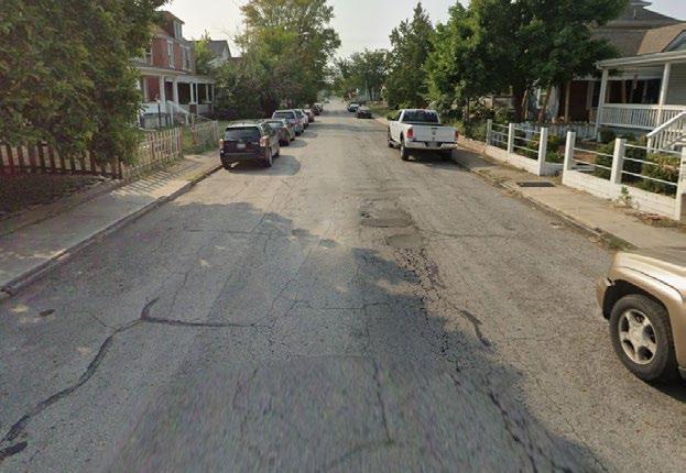
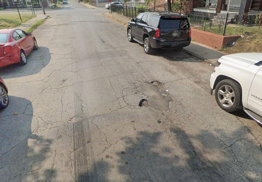
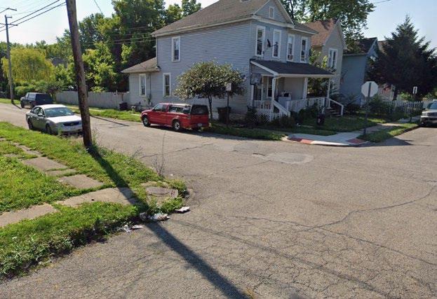
“Road need to be scraped back down to the grade so handicap ramps are not underwater.”
“Parts of Sullivant are a mess and are crumbling”
Advocate for street resurfacing prioritization to improve water ponding at ADA accessible curb ramps.
This project will collaborate with the City of Columbus Department of Public Service to prioritize addressing ponding at curb ramps as part of the annual street resurfacing program.
Community Prioritized Locations:
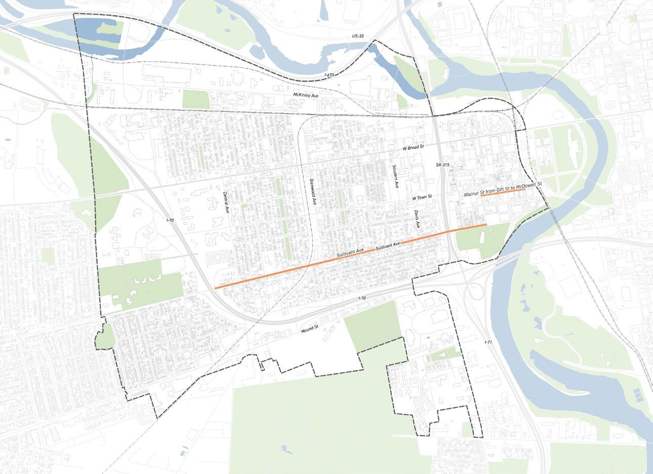
• Sullivant Ave
• Walnut St
Project Champion:
• Franklinton Board of Trade (FBOT)
• Franklinton Area Commission (FAC)
City of Columbus Partner:
• Department of Public Service (DPS)
Division of Design and Construction
James Pajk, Division Administrator, City Engineer
Email: JAPajk@columbus.gov
2023 FAC Survey Comments
“streets were paved over bad with pavement simply plugging the hole”
“Walnut St from S Gift St to McDowell St, needs redone”
Public Meeting #2 Comments
“Mobility ramps & sidewalks on southside of Walnut Street between Gift and McDowell”
RESURFACING PROGRAM
Project Process
To Initiate:
The Department of Public Service currently maintains 5,678 lane miles of city roadways and manages a wide range of repairs, from routine pothole patching to large scale resurfacing and full reconstruction. Resurfacing follows a process similar to alleys, with streets rated lower prioritized based on available annual funding. Identifying streets in Franklinton has helped kick start efforts to advocate for their inclusion on the upcoming resurfacing schedule.
To Deliver:
Coordinating with the Department of Public Service to prioritize repairs and advocate for specific streets is essential, as the project list is planned well in advance. Delivering this project requires identifying selected streets and reviewing their ratings to support their inclusion in the 2027 Street Resurfacing Program.
* Source: City of Columbus Street Resurfacing Projects.
Cost Opinion
Cost estimate for the resurfacing of high-priority streets, including curb ramp replacements and grading improvements to eliminate water ponding at curb ramps.
Detailed Cost Assumptions:
• Cost estimate table calculated on a per block (400 FT) basis to allow for flexible estimating
• 5 blocks assumed when determining the unit cost of each item in order to improve accuracy
• Resurfacing includes radius return pavement areas of intersecting streets, 640 SF per block
• 35 FT street width
• No right-of-way acquisition is anticipated
• Apart from storm sewer adjustments, no utility relocation costs are anticipated
• Engineering fee includes the creation of simple detailed design plans
• There is a short section of brick pavement on Walnut Street. It is assumed that this area will be spot repaired as needed, which involves removing the bricks, adjusting the subgrade, and replacing the bricks. This cost will be minor when compared to the calculated pavement costs, so this effort was omitted from the Cost Per Block table below and is assumed to be covered by the preliminary engineering contingency.
Funding Consideration
Funding sources would need to come from the City of Columbus’ next capital funding cycle. This can be pursued through, but not limited to, the Department of Public Service (DPS). The city currently already has a program that repairs alleys, so funding to the program may already be allocated.
Example
Example
STREETSCAPE
& MOBILITY
Seek to implement a complete streets program that is safe and comfortable for pedestrians and bicyclists.
Work with the City of Columbus Department of Public Service to advocate for the study and improvement of key streets and intersections, prioritizing safety and access for all roadway users.
Community Prioritized Locations:
• W Broad St (& Chicago Ave, & Yale Ave, & Hawkes Ave)
• Central Ave (& Town St), W Rich St (& SR-315, & McDowell St)
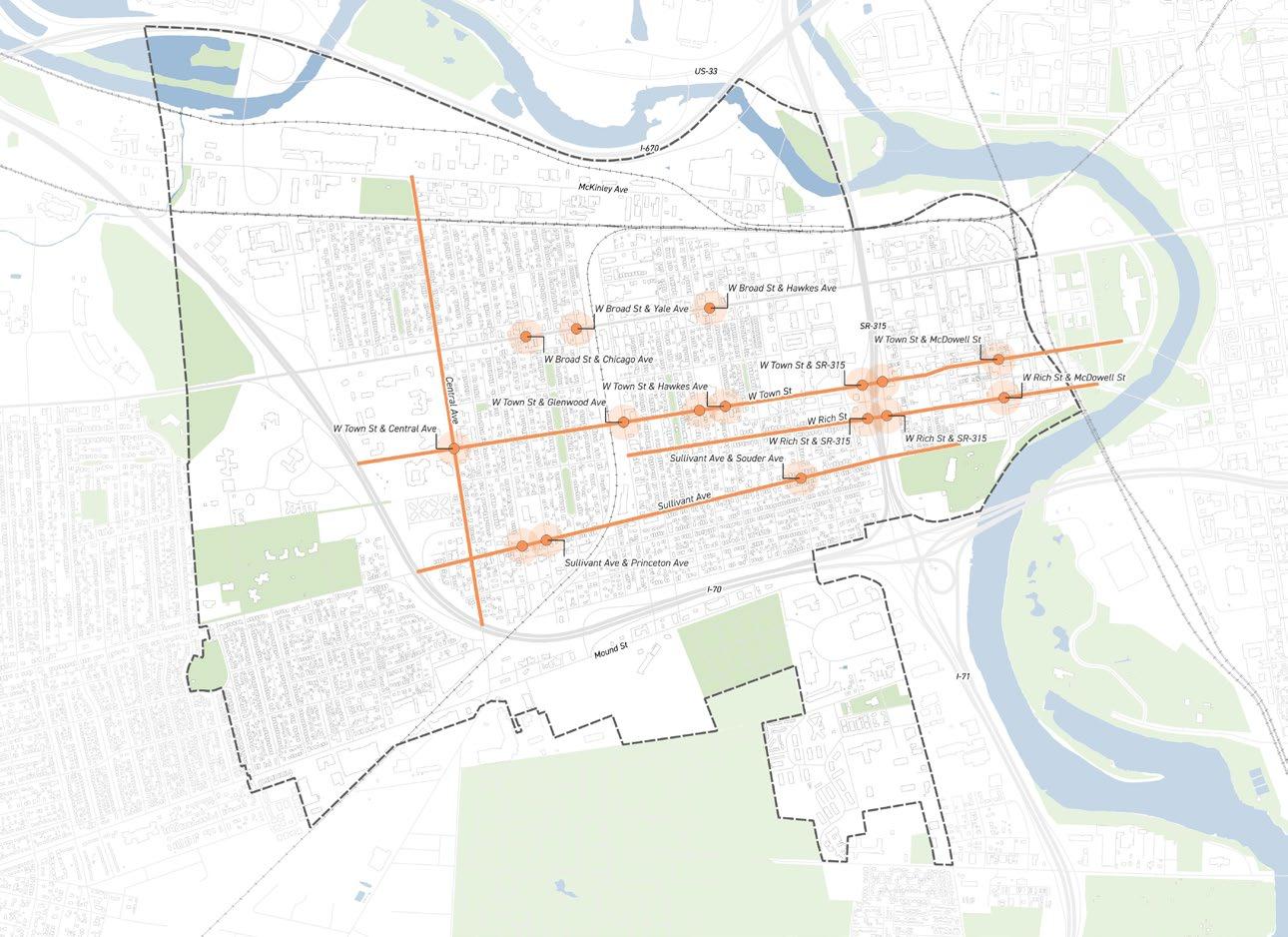
• W Town St (& Glenwood Ave, & Avondale Ave, & Hawkes Ave, & SR-315, & McDowell Ave)
“Sullivant Avenue emerges as a primary focus for speed calming”
Public Meeting #1
Comments
“Add speed humps at Town + Hawkes”
“To many vehicles go fast thru intersection near school, Gladden House, Franklinton Farms”
Public Meeting #2
Comments
“Flashing stop sign or stop light as Glenwood & McDowell”
“Flashing crosswalk activator on the east side of Rich and McDowell”
These specific intersections have been frequently mentioned as places where residents would like to see immediate intervention.
A resident-led report highlights community safety concerns and presents well-developed proposals.
Project Process
To Initiate:
Gathering comments from residents has helped kick off the initiative to highlight streets they would like to see further studied. There is interest in additional bike lanes (M1), but most feedback centers on safety concerns that may be addressed by taking a closer look at roadway conditions, including intersections.
To Deliver:
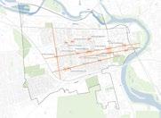
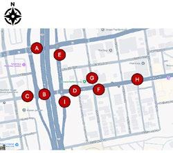
New studies are needed to design streets that are safe, comfortable, and accessible for all users. Complete streets would include safe crossings, quality sidewalks, protected bike lanes, transit amenities, and traffic calming to create a people-focused public realm. There is particular interest in studying Town and Rich Streets together due to recent development and safety issues at key intersections, including where they pass under SR-315. Broad Street improvements are currently being designed as part of COTA’s LinkUS initiative.
Cost Opinion
To address speeding and the need for better bicycle and pedestrian facilities on key corridors, a corridor plan focusing on safety improvements, speed management, multi-modal improvements, and potential lane reallocation should be conducted for each corridor, except for Town and Rich, which should be studied together.
Cost Assumptions:
• Study costs can range from $150,000 - $250,000 per corridor. Cost drivers/differentiators include public engagement and how detailed design is for preliminary concepts.
• Similar projects completed by the City that could be referenced for study cost purposes include Livingston Ave, Sullivant Ave in the Hilltop, and Hudson between I-71 to Cleveland Ave.
Project Scope:
• Site Assessment and Existing conditions including traffic, safety, speed, and geometric data
• Identify segment and intersection hot spots for countermeasure treatment
• Identify countermeasures such as access management, ped./bike facilities, lighting, crossings, daylighting, etc. that could address identified issues
• Conduct community engagement on countermeasure alternatives
• Evaluate alternatives for feasibility and provide preliminary concepts, cost estimates, and potential funding sources
Funding Consideration
Funding sources would need to come from the City of Columbus’ next capital funding cycle. This can be pursued through, but not limited to, the Department of Public Service (DPS).
East Franklinton Traffic Pattern Analysis of Issues and Recommendations
This report, led by local resident Roger Honan, highlights issues at Rich and Town Streets near SR 315. It identifies key findings such as drivers proceeding against traffic on one-way streets, making late and aggressive merges when traffic patterns abruptly change, and exceeding the posted speed limit. The report proposes creating bi-directional flow under SR 315, lowering the speed limit on Rich Street, implementing traffic calming measures such as pedestrian crosswalk bump outs, and re-aligning COTA bus traffic to exclusively use Town Street. (See full report in the appendix)
2023 FAC Survey
Comments
“Raise intersections at State, Cypress, Avondale, Hawkes”
“We need intersection bump outs, medians, cross walks with flashing lights, and more.”
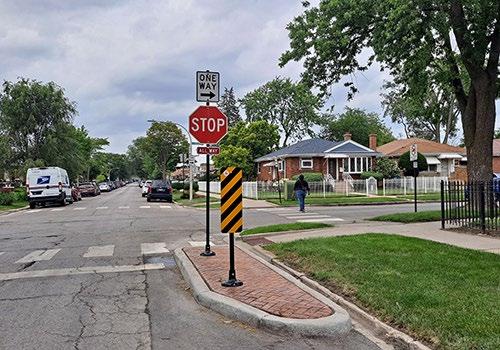
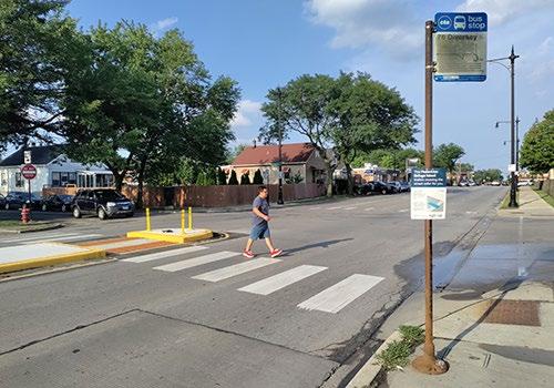
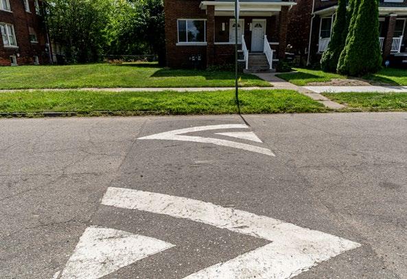
Utilize the Slow Zones Program to reduce vehicular speeding on streets 25 mph or below.
This project will seek funding for the design and engineering of Slow Zone strategies in residential areas, providing a comprehensive approach to make neighborhood streets safer.
“Speed humps in residential neighborhoods (painted)”
“Speed humps! near all parks + schools”
Public Meeting #2
Comments
“Cars go to fast + it gets so loud”
“More street markings that are clear to see on road i.e., pedestrian crossings + bike lanes”
Project Process
To Initiate:
Community engagement helped highlight areas of concern and identify the types of traffic calming residents support, such as speed humps. Most importantly, this planning effort positions Franklinton to be a strong candidate for the Slow Zone Program.
To Deliver:
A key focus for residents and the Franklinton Board of Trade is monitoring the Slow Zone Program currently being tested in KingLincoln Bronzeville. Once the pilot program has been evaluated and updated, Franklinton should seek funding and advocate to become the next neighborhood to receive these traffic calming measures in the form of the Slow Zone Program.
Cost Opinion
Cost Assumptions:
• Design & Engagement: $150,000*
• Construction: $1,000,000
* To reduce cost, this could be completed in-house by the City or a combination of in-house and services from a consultant working on the City’s multi-modal task order contract. This cost is for the entirety of the study area and is based on the cost of a similar project the City is currently doing on the Near East Side (Bronzeville).
Funding Consideration
Funding sources would need to come from the City of Columbus’ next capital funding cycle. This can be pursued through, but not limited to, the Department of Public Service (DPS).
SLOW ZONE OVERVIEW
Definition:
Slow Zones are designated areas in neighborhoods where vehicle speeds are intentionally reduced through signage, design features, or other traffic calming measures. The Slow Zones Program aims to create a safer, more comfortable environment for people walking, biking, playing, and living. The primary objective is to reduce vehicle speeds on residential streets. Benefits include:
• Safer and more inviting streets for walking, biking, and everyday neighborhood activity.
• Lower risk and severity of crashes for all road users including motorists, pedestrians, and cyclists.
• Reduced cut-through traffic and aggressive driving.
• More community-friendly streets that support social interaction and livability.
Project Scope/Implementation Process:
• Community Input
• Site Assessment and Existing Conditions
• Determine improvements and locations
• Installation (can be a mix of permanent and temporary improvements)
• Monitor and adjust as needed
Type of Improvements to Expect:
• Speed Mitigation
• Speed humps, cushions, and tables
• Road narrowing
• Traffic circles and roundabouts
• Speed limit pavement markings and feedback signs
• One-way to two-way street conversions
• Gateway treatments
• Local traffic only streets
• Pedestrian Crossing Improvements
• Curb extensions/bump-outs
• Raised crosswalks and intersections
• Pedestrian refuge island
• Rectangular Rapid Flashing Beacons (RRFBs)
• Bicycle Infrastructure
• Bike lanes
• Protected bike lanes
• Bicycle boulevard/neighborhood bikeway
• Bike turning boxes/lanes
• Lighting
M6 UNDERPASS BEAUTIFICATION
PLACEMAKING & BEAUTIFICATION
Transform gateway underpasses with art and lighting to create a safe and welcoming pedestrian experience.
This project will seek funding to design and implement visual improvements in these underpass zones and collaborate with jurisdictional agencies, including ODOT and CSX, to secure the necessary approvals.
Community Prioritized Locations:
• Highway Underpasses
• Railroad Underpasses
Project Champion:
• Franklinton Arts District (FAD)
City of Columbus Partner:
• Department of Public Service (DPS)
2023 FAC Survey
Comments
“Some of the underpass lights around Franklinton are in need of updating”
“Lighting in all Franklinton underpasses and dark areas.”
Public Meeting #2
Comments
“Bridge lighting for under bridges”
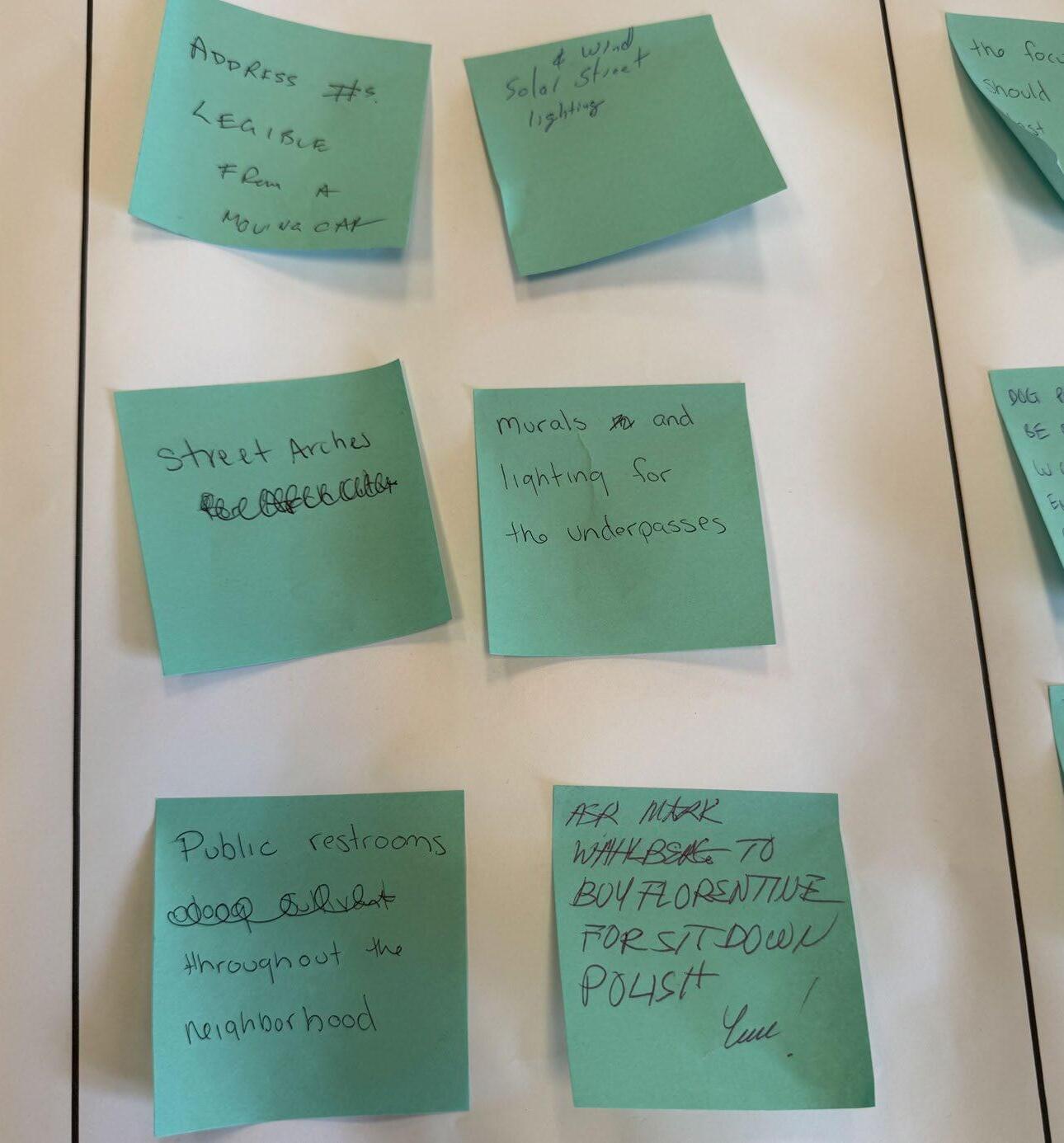
“murals and lighting for underpasses”
Public Meeting #3
Comments
“Franklinton Arts District would like to do this with you!”
“Sullivant & 315 underpass would be a good choice b/c of foot traffic”
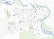
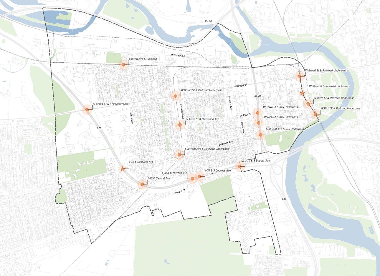
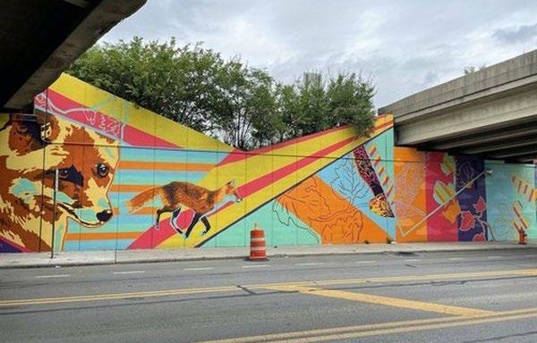
The stars along the I-70 & Sullivant Ave underpass and W State St & railroad underpass call out recent beautification projects in the neighborhood.
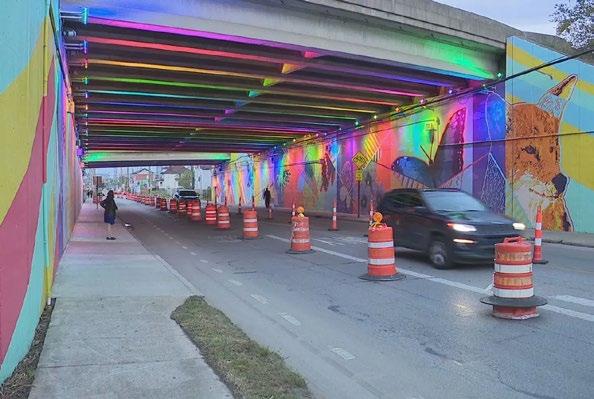
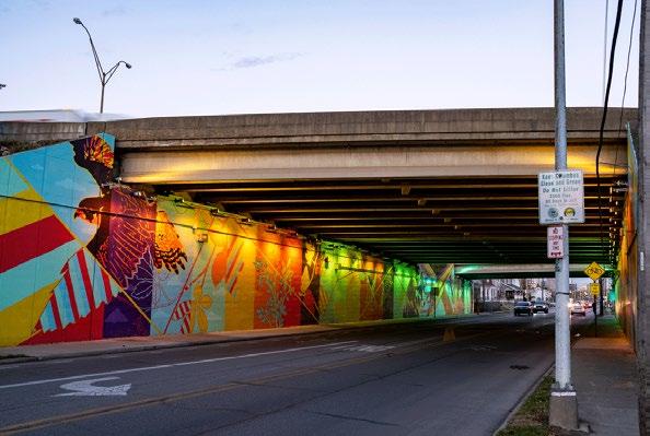
Sullivant Bright Murals at I-70:
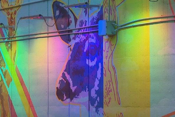
As part of the overall Sullivant Bright Placemaking project facilitated by Designing Local on behalf of the Columbus Department of Public Service, the City of Columbus invested $50,000 in a large-scale mural on the Sullivant Avenue underpass below I-70. A Call for Artist process resulted in local Columbus artist Nick Stull being commissioned to bring his mural titled Intersections to life. In addition to the vibrant mural ODOT invested more than $100,000 in programmable multicolor LED lighting that helps bring the mural to life.
Following the successful implementation of the initial three 315 murals, partnerships should be pursued with the railroads who control rail underpasses in both West Franklinton and between the Peninsula and East Franklinton. Due to the historic nature of the rail bridges and abutments, installations on or adjacent rail bridges should focus opportunities beyond painted murals and could include elements such as lighting, sculpture, or other treatments that don’t damage historic materials.
A mural on the Broad Street / I-70 underpass should be undertaken as part of the LinkUS West Broad Street BRT given the lack of pedestrian traffic and connections in the vicinity of the underpass. A partnership between the City of Columbus and COTA could help to bring the mural to life.
UNDERPASS BEAUTIFICATION Project Process
To Initiate:
Underpass beautification has been one of the most discussed projects throughout this process. To begin, additional review is needed to determine which underpasses should be prioritized as funding and grants become available. It is also important to clarify the types of improvements desired. For example, residents have suggested that the Sullivant Avenue underpass beneath SR-315 include murals and lighting, viewing it as a gateway to Dodge Park.
To Deliver:
This project can build on prior improvements along Sullivant Avenue, which features a prominent mural to enhance the corridor. It also included safety elements such as sidewalk bump outs and pedestrian refuge islands to increase pedestrian visibility and slow vehicle speeds. As a project heavily focused on art, securing funding and partnering with the Franklinton Arts District is essential for successful implementation.
• All projects should follow a standard RFQ/RFP Call for Artist Process
• Projects should allow for a mix of local and national artists.
Funding Consideration
Funding sources would need to come from the City of Columbus’ next capital funding cycle. Similar to an earlier infrastructure improvement project along Sullivant Avenue that set aside additional dollars for a public art installation project. Further investigation into local grants could also be explored.
Sullivant Bright Placemaking Project
Sullivant Bright Placemaking Project
Sullivant Bright Placemaking Project
Sullivant Bright Placemaking Project
M7 ADDRESS LOCAL FLOODING
& MOBILITY
Work to remediate localized flooding in known problem areas of the neighborhood.
This project will continue collaborating with the City of Columbus Water and Power to develop strategies for mitigating localized flooding.
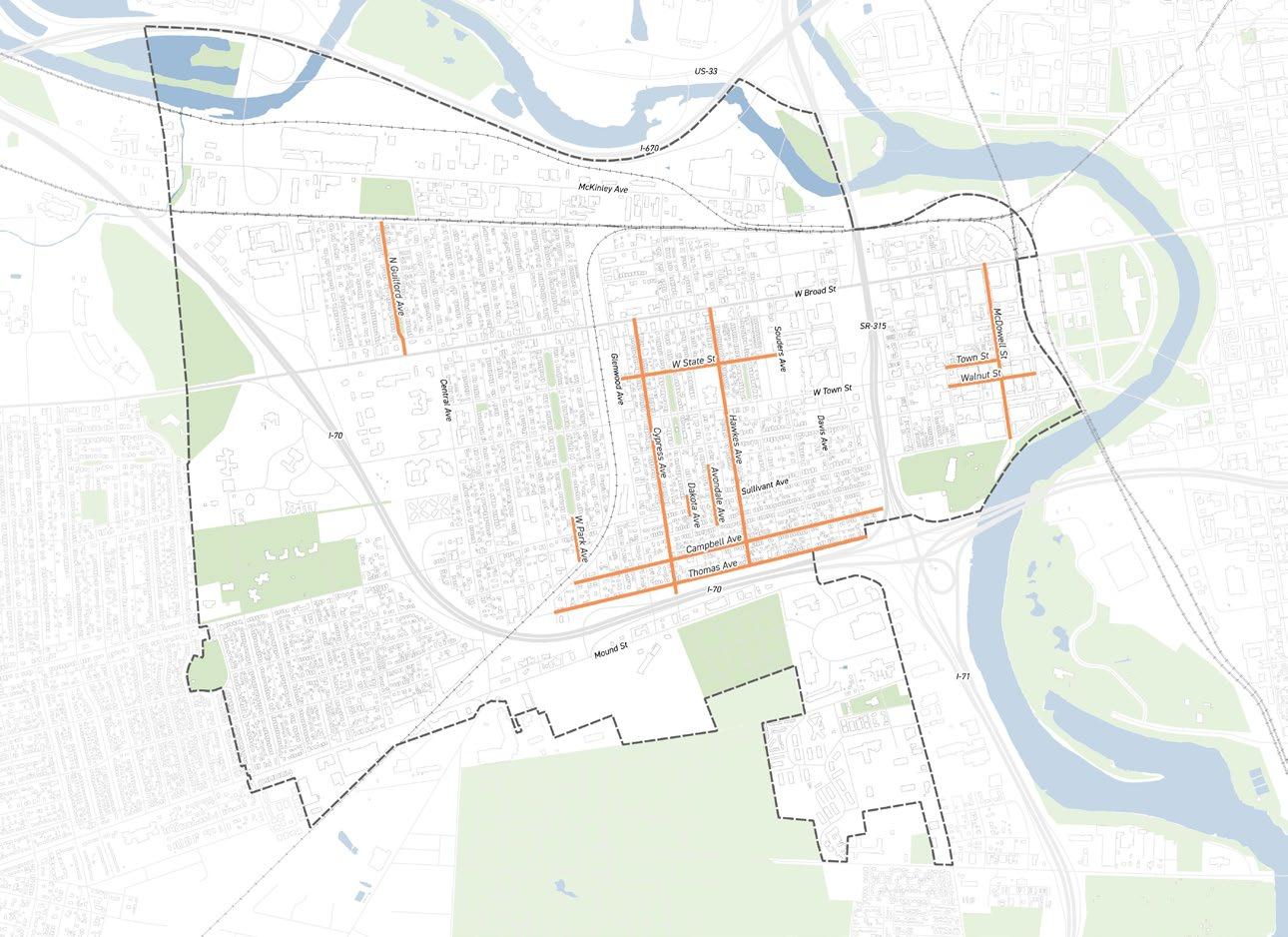
Community Prioritized Locations:
• N Guilford Ave
• W State St
• W Park Ave
• Cypress Ave
• Avondale Ave
• Hawkes Ave
• Campbell Ave
• Thomas Ave
• Walnut St
• McDowell Ave
• Town St
Project Champion:
• Franklinton Area Neighbors (FAN)
City of Columbus Partner:
• Columbus Water & Power
Fang Cheng, Sewer System Engineering Section Manager
Email: FACheng@columbus.gov
2023 FAC Survey
Comments
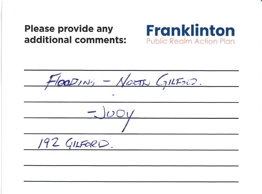
“Alleys are prone to flooding given that it’s in a bowl”
“Alleys south of Sullivant, Campbell and Bellows are prone to flooding”
Public Meeting #1
Comments
“Flooding at Dakota Ave & Sullivant Ave”
“Multiple flooding problems at Dakota Ave Sullivant and 315 overpass”
Public Meeting #2
Comments
“Flooding at Dakota Ave & Sullivant Ave”
“Fix street flooding under overpass and at corner of Dakota and Sullivant (sewer drainage)”
ADDRESS LOCAL FLOODING
CURRENT EFFORTS UNDERWAY
KRISTEN ATHA
Director
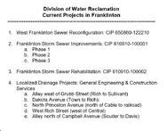
Franklinton Area Neighbors (FAN) Meet Up Division of Water Reclamation – Current Projects in Franklinton July 23, 2025
1. West Franklinton Sewer Reconfiguration: CIP 650860-122210
a. Modifying an existing structure on Central Avenue at West State Street (in front of Worley Terrace Apartments)
b. Installing approximately 200 feet of new sewer along West Town Street from Central Avenue
c. Construction anticipated in 2027
d. Addressing basement backups to 10-year level of service
a. Found extensive debris. Cleaned sewers in 2021.
b. Deteriorated and collapsing pipe discovered. Repair and replace project ongoing.
i. Design completion expected within weeks
ii. Easement acquisition scheduled for 2025–2026
iii. Construction planned for 2027
4. Localized Drainage Projects: General Engineering & Construction Services
a. Alley west of Grubb Street (Rich to Sullivant):
i. Minor ponding (3"–6"); new inlet being added
ii. Construction expected to complete by end of year
b. Dakota Avenue (Town to Rich):
i. Long-standing issue of storm sewer connections
ii. Design in progress for construction late 2025 or 2026
c. North Princeton Avenue (north of Cable to railroad)
i. Chronic ponding at north end
ii. Feasibility under evaluation; likely construction late 2026
d. West Rich Street (west of Central)
i. Crosswalk ponding under evaluation
e. Alley north of Campbell Avenue (Souder to Davis)
i. Persistent drainage issues
ii. Unresolvable due to tight alley constraints and narrow lots
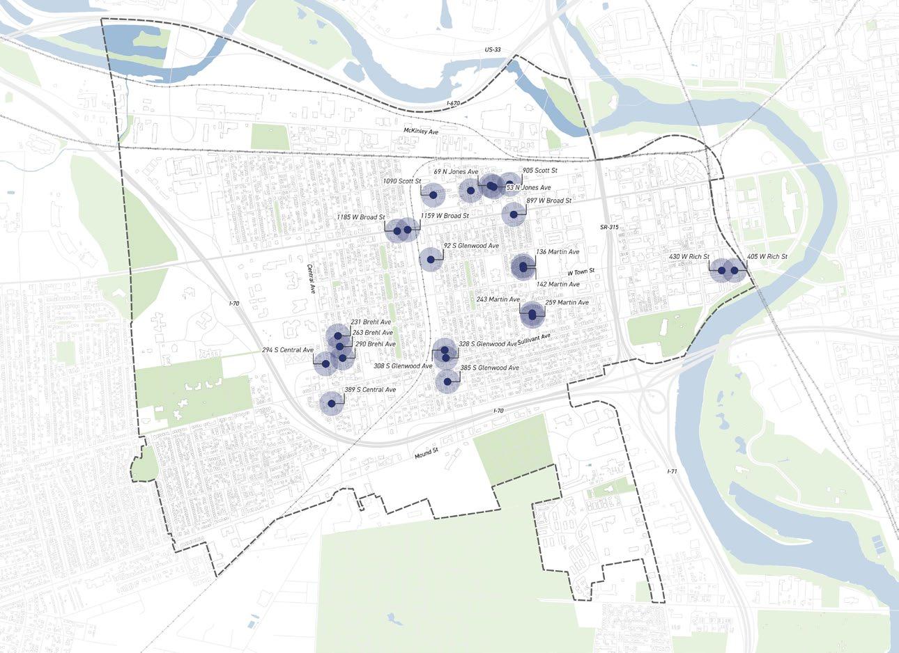
5. Blueprint Columbus
a. Green Infrastructure - design starts in Q2 of 2026. Construction starts in 2028
b. Lateral lining – 2029 through 2032
c. Voluntary sump pump – 2027
Director’s Office 910 Dublin Road Columbus OH 43215 T 614.645.6141 F 614.645.8019
Franklinton Area Neighbors (FAN)
The local civic association, Franklinton Area Neighbors (FAN), has been working with Fang Cheng, Sewer System Engineering Section Manager, and her team at the Columbus Water and Power Department. Through this partnership, FAN has already made progress identifying areas with localized flooding. These documents outline where drainage projects are beginning to take shape.
Project Process
To Initiate:
This project will build on the advocacy work of the Franklinton Area Neighbors (FAN), who have played a key role in addressing flooding issues. It will document where flooding currently occurs and incorporate recent efforts by the Columbus Water and Power Department, including several small projects and the major McCoy Park stormwater wet pond. The project aims to address significant flooding and reduce pressure on the sewer system
To Deliver:
To advance this project without waiting for the McCoy Park project or Blueprint Columbus, residents can continue to advocate and provide feedback on areas of concern. Small maintenance efforts can provide meaningful flooding relief. Identified problem areas can be addressed by the Water and Power Department, which would hire a design consultant to develop the necessary improvements and then bid the projects for construction.
Major Projects:
• McCoy Park Franklinton Storm Sewer Improvements Phase 1 –Construction expected in 2027, Completion tentative for 2029
• Franklinton Storm Sewer Rehabilitation
• Blueprint Columbus - West Franklinton
* FAN has been working with Columbus Water & Power regarding flooding in parts of the neighborhood.
Flooding and Water Leak:
If residents see flooding, they can call the 311 Service Center, but the best way to report these issues is by calling the Sewer Maintenance Operation Center emergency dispatch at 614-645-7102.*
* * Source: City of Columbus — What to Do if Your Basement Floods (Division of Water).
** City of Columbus storm sewers have recently been cleaned out, while ODOT storm sewers immediately north of I-70 may still need to be cleaned.
Funding Consideration
Current funding sources will likely come through the Columbus Water and Power Department, where design is typically funded by bond funds and construction is funded by loans.
M8 HISTORICAL MARKERS
PLACEMAKING & BEAUTIFICATION
Develop a historical storytelling experience with new signage at significant sites.
This project will seek grant funding to create and implement a comprehensive historical storytelling experience that highlights culturally significant sites while enhancing the neighborhood’s character.
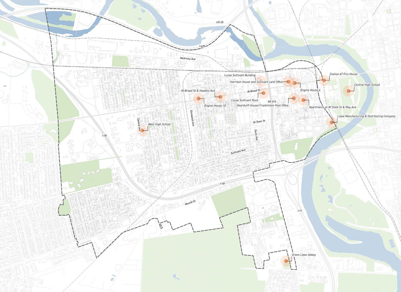
Community Prioritized Locations:
• West High School, Historical Apartments
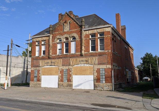
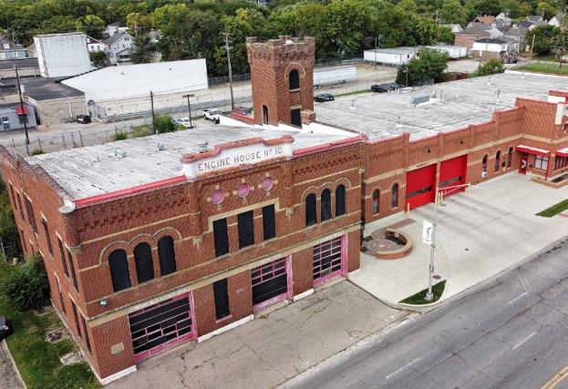
• Engine House 6 & 10
• Lucas Sullivant Building & Rock
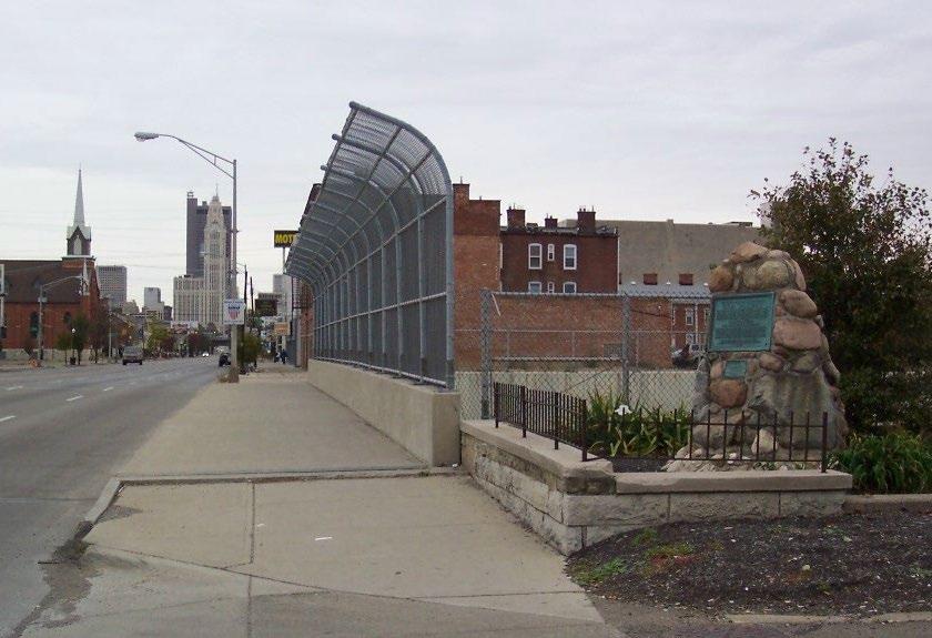
• Harrison House & Sullivant Office
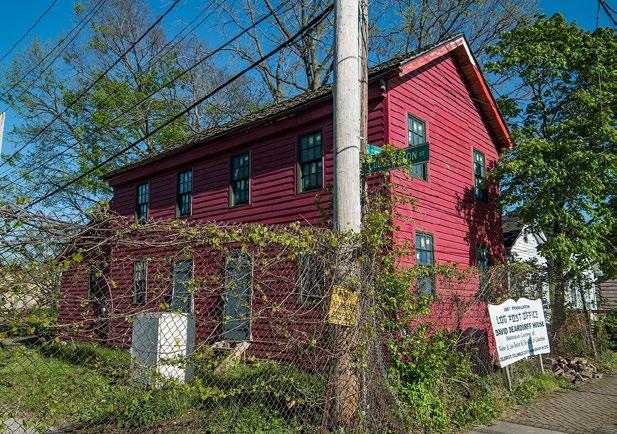
• Dearduff House / Old Post Office
• Lubal MFG. & Distributing Co.
Project Champion:
• Franklinton Area Neighbors (FAN)
• Franklinton Area Commission (FAC)
• Franklinton Historical Society
City of Columbus Partner:
• Department of Development
Mark Lundine, Economic Development Administrator
Email: MAlundine@columbus.gov
Public Meeting #2
Comments
“Put monument back at 707 W Broad, Lucas Sullivant Home”
“Old post office rehab / part of history walking tour”
Public Meeting #2
Comments
“Partner w/ library history dept., show there is a want for these tours/historical markers”
“Historical markers for engine house 10 & 6”
Public Meeting #3
Comments
“Engine house 6 & 10”
“Harrison House & Sullivant Office”
It is important to note that historical markers fall under both the Columbus Register of Historic Properties and the National Register of Historic Places, which affects grant funding and signage standards and design.
HISTORICAL MARKERS
Project Process
To Initiate:
This project requires ongoing collaboration with the Franklinton Area Commission (FAC) to prioritize historical markers and focus on those considered most significant. This step is crucial, as it helps identify which historical markers to build as funding becomes available.
To Deliver:
Based on the identified historical sites, funding opportunities exist through the Ohio Historical Markers program, which partners with local sponsors, civic organizations, or local governments. Additional local grants may also be pursued to support markers for sites not registered with the Ohio History Connection or the National Register of Historic Places.
Cost Opinion
The Ohio Historical Markers program offers two grants: the Historical Markers Matching Grant Program, which helps cover the cost of markers with grants of up to $1,000 (ten grants available per cycle), and the William G. Pomeroy Foundation grant, which matches the cost of a marker up to $3,585 (twenty grants available per cycle).
* Source: Ohio Historical Marker Program, Ohio History Connection.
Funding Consideration
Funding sources would come from the City of Columbus’ next capital funding cycle and may be pursued through the Department of Public Service (DPS). However, signage projects such as gateways, wayfinding, and historical markers are more likely to be funded when packaged together through local TIFs (Tax Increment Financing).
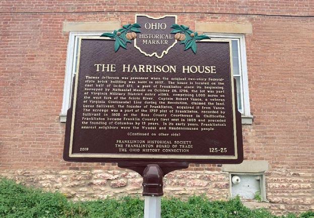
The Harrison House Example
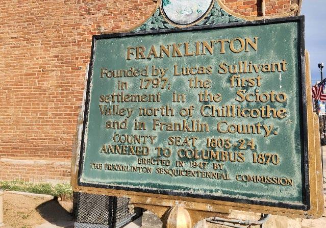
Historical Marker Example
Dearduff House / Old Franklinton Post Office
Original Lucas Sullivant Rock
M9 ADDITIONAL BIKES LANES
2023 FAC Survey
Comments
“We need protected bike lanes and traffic calming”
“There were no bike-safe paths West or South”
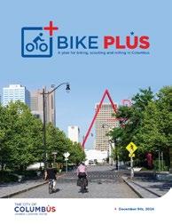
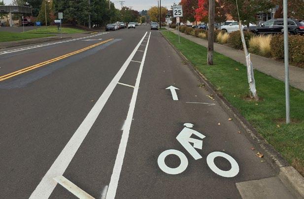
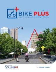
Explore adding additional bike lanes in context to the City of Columbus’ 2024 Bike Plus Plan.
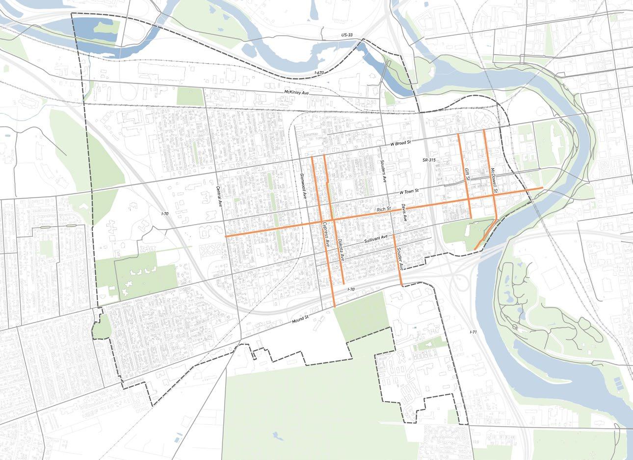
This project will work with the Department of Public Service to study the addition of bike lanes in locations recommended by residents.
Community Prioritized Locations:
• Rich St
• Cypress Ave
• Dakota Ave
• Souder Ave
• Gift St
• McDowell Ave
Project Champion:
• Franklinton Cycle Works
• Franklinton Area Commission (FAC)
City of Columbus Partner:
• Department of Public Service (DPS)
Division of Mobility & Parking Services
Justin Goodwin, Division Administrator
Email: JMGoodwin@columbus.gov
Public Meeting #1
Comments
“Bike lanes on Sullivant, Town, and Rich”
“Dedicated bike lane protected by curbs”
Public Meeting #2
Comments
“Protected bike lanes along Sullivant”
“Protected bike lane on Town St”
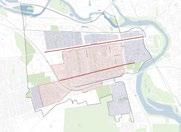
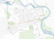
Suggested bike routes come from community feedback highlighting where residents would like protected bike lanes. Underlying is the Bike Plus Plan, which outlines the city’s current vision.
SUPPORTING RESOURCES
Project Process
To Initiate:
This involves asking the Department of Public Service to review residents’ suggested protected bike routes in relation to the Bike Plus plan. It is important to clarify the mission of this project, the goal is not to ensure these routes are implemented, but to ensure they are reviewed and considered.
To Deliver:
While the mid-term plan asks the City to consider residents’ suggested locations alongside the 2024 Bike Plus Plan, there is a long-term vision. The newly vetted list of proposed bike routes could guide future bike lane design and implementation, building on current studies like the Franklinton Loop, which are already evaluating optimal routes and infrastructure.
Funding Consideration
Current funding sources to implement proposed bike lanes could come from City of Columbus’s next capital funding cycle but will likely come from COTA’s TSI Funding that looks to create safer and more connected communities.
2024 Bike Plus Plan
Bike Plus is a plan to create a safe, connected, and comfortable network for people to bike, scooter, skate, and roll through protected bike lanes, trails, and improved crossings. The plan identifies where these improvements are most needed.
Franklinton Public Realm Study
LONG-TERM PROJECTS & RECOMMENDATIONS
ADDITIONAL COMMENTS CAPTURED
Many prioritized projects require further study, changes in current policies and/or large investment.
Projects were first identified through the 2023 Franklinton Area Commission survey. Past studies were also reviewed to pull out projects, visions, and recommendations previously proposed. Through three public engagement workshops and multiple stakeholder meetings, a more refined list emerged highlighting the public realm improvements residents most want to see targeted. Ongoing coordination with city departments allowed the team and working group to identify feasible projects, but more importantly, those prioritized by residents.
Projects were organized into timelines based on resident priorities and construction feasibility. Comments that lacked support from the working group or were deemed unrealistic in the short or mid term were moved to the long-term category, particularly those requiring significant funding to advance.
L1. PUBLIC ART PROJECTS
This type was not scene as a top priority in context to other acute needs, but if specific grant or donated funding became available, it could happen in a more expedited timeline.
L4. STREET LIGHTS
There is currently an LED light fixture conversion program through the City of Columbus taking place, however there was not specific timeline as to when streetlights would be updated in Franklinton.
L7. RECREATIONAL PARK
New soccer pitches are being added to Sullivant Gardens Community Center, however advocacy should continue with Rec. & Parks for new facilities in their long-term planning.
L10. TRASH RECEPTACLES
Although seemingly feasible, the city has limited capacity to add new trash receptacles and requests further study on strategic locations.
L2. CONSOLIDATE OVERHEAD LINES
This type of project requires significant planning and capital investment.
L3. HIGHWAY SOUND WALL
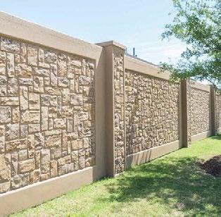
This project is important to the neighborhood, but will require a dedicated advocacy effort with ODOT, and there is uncertainty whether it could be implemented within 5 years.
L5. INTERSECTION VISIBILITY
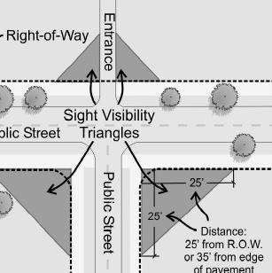
The intersections identified have existing buildings at each corner, making it difficult to address visibility concerns until the private property is redeveloped.
L8. SR-315 CAP
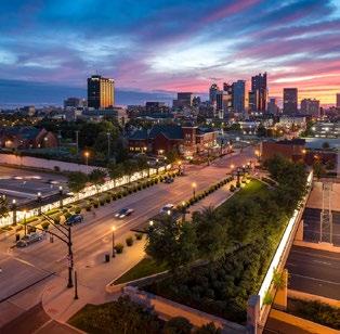
This project will require significant planning and capital investment and therefore will take quite some time for realization if pursued.
L6. NEW PARKS
A new park at W Broad St and W Park Ave has committed funding, with design timing TBD. The park at Town St between Hartford and Souder has a developer commitment for construction, and the Franklinton Loop is moving into the planning stage.
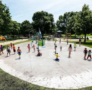
L9. INSTALL SPLASH PADS
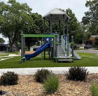
This project will require advocacy for incorporation into long-term park improvements.
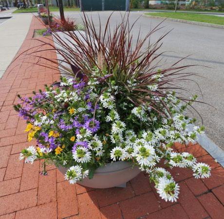
L11. ADDITIONAL FLOWERS & LANDSCAPING
This project will require annual funding and dedicated maintenance from a non-city source.
Franklinton Public Realm Study
APPENDIX I PRIOR STUDIES ASSESSMENT
SURVEY & REQUESTS
The 2024 Franklinton Area Commission survey served as the foundation of the project and ranked the priorities of 80 responses.
In 2022, the Franklinton Area Commission (FAC) Planning Committee conducted a survey and hosted a community meeting to gather resident input on desired neighborhood improvements. The feedback highlighted key priorities in existing park improvements, new parks, walker safety, and public services such as alleys and lighting.
These findings where intended to help the FAC coordinate with city departments and partners to implement feasible projects that reflect neighborhood needs, demonstrating strong community engagement and guiding public realm enhancements that support safety, accessibility, and livability in Franklinton.
Walker Safety
• Need traffic calming
• Crosswalk near library
• Replace current sidewalks
• Need crosswalks with flashing lights
Top 5 Priorities Ranking
Greenspaces
• Need more trees & shade, park space
• Unpaved alleys with tree growth partially blocking access
• Residential alleys
• Prone to flooding
Trash Issues
• Trash set on fire
• Illegal dumping
• Trash cans left out Alleys
• Everywhere
• Alleys
• Underpasses
• Cypress & State
Franklinton Area Commission Capital Improvements Requests
Recreation & Parks
Dodge Park:
• Large tree plantings
McKinley Park
• Evaluation of space for more inviting use; additional parking
Sullivant Gardens Community Center
• Update on status of soccer fields & assessment of future interior improvements from 2023 budget.
Walkers Safety
Harmon Ave. South of Renick St.
• Add sidewalks Broad St. at Dakota
• Pedestrian island with crosswalk Add sidewalks
• North-South directional streets between Sullivant Ave. & Thomas Ave, specifically Dakota, Avondale, Hawkes, Martin, & Cable Bike safety
• Barriers for bike lanes on Broad St. Raised crosswalks
• Broad St. at Dana Ave
• Glenwood Ave
• Town St. around the library, Avondale Elementary, and Gladden Community House
Public Service (Alleys)
Irene Alley
• Widen, level, reinforce, brought up to safety standards Gay St. between Glenwood & Rodgers
• Widen, level, and reinforce
Public Service (Lighting)
Replace lighting with LED bulbs and downward-facing fixtures along major throughway’s in the neighborhood.
Repair Non-Functioning Lights:
• Cable Ave.
• Glenwood Ave at Gay St
• Gay St. between Glenwood and Rodgers
• Alley between Rodgers and Meek
• Alley between Meek and N Jones
• Alley between N Jones and N Hartford
• Foos St between Scott St and Gay St
• Scott St at N Green St
• Starling St between W Broad and W State St
• W Town St at S May Ave, McDowell St, and Lucas St
• W Rich St at W Cherry St
New Park
New Park north of McKinley Ave
• Development of approximately 75 unused acres of land north of McKinley Ave, behind COTA, into a park with a primary entrance from Franklinton. Acquisition for a Park
• Northwest and southeast corner of Glenwood Ave & Town St.
Other Priorities:
• Affordable housing
• Abandoned dogs
• Bike lanes
• Grab & go food options
• Squatters
• Walkability
2012
The East Franklinton Creative Community District Plan
aimed to foster arts oriented and grassroots revitalization efforts.
Takeaways & Recommendations:
• Overhead utility consolidation
• Pavement & curb improvements
• Additional tree planting
• Underpass improvements
• Traffic calming & transit hubs
• Bike boulevards/lanes
• Street art installation
• New light district
• Streetscape furnishing
• New parks
2014 West Franklinton Plan
The West Franklinton Plan developed design guidelines and strategies for redevelopment opportunities.
Takeaways & Recommendations:
• Shared-use paths
• Bike boulevards/lanes
• Street realignment
• Broad st improvements
• Additional parking
• Town St, Central Ave, Sullivant Ave, Harmon Ave improvements
• Urban Infrastructure Recovery Fund (UIRF) improvements
• 315 & West franklinton gateways
• New parks & development
Mount Carmel Feasibility Plan
The West Broad Street Feasibility Study
Takeaways & Recommendations:
• Simplify redevelopment opportunities
• The Mount Carmel West Plan
• Realign Souder Ave
• Signature public open space
• Renovate
• Provide additional office space
• Develop retail, residential or mixed-use project
Takeaways & Recommendations:
•
•
•
•
•
•
•
•
•
•
2020
The West
Franklinton - 315 Gateway District Plan identified streetscape standards to improve safety and identity.
Takeaways & Recommendations:
• Establish stronger West Broad Street commercial corridor
• Neighborhood mixed-use streetscapes
• Over/underpass enhancements
• Service alleys
• Develop the 315 gateway district
2020 West Franklinton Gateway
Recommendations
Recommendations
Recommendations
Recommendations
Recommendations
Recommendations
Recommendations
GOALS AND OBJECTIVES
The Columbus Climate Action Plan
is the city’s living document to ensure the city is doing its part to combat the effects of climate change.
Takeaways &
Recommendations:
•
The Franklinton Community Street Tree Inventory Summary report is part of the vision and future goals for increasing
Columbus’ urban tree canopy.
Takeaways & Recommendations:
•
•
•
•
Takeaways
PRIOR FRANKLINTON STUDIES
2022 City of Columbus Schools District-
Wide Travel Plan enables students to engage in active transportation as they travel to and from school.
Takeaways & Recommendations:
• Improve crossings, sidewalks, and bike facilities near schools
• Encourage traffic reduction strategies like carpooling & remote drop-offs
• Expand pedestrian and bicycle safety education in school curriculum and events
COLUMBUS CITY SCHOOLS
2023 Franklinton Area Commission Capital Improvements Survey
Alleys & Trash Issues Get rid of trash, dumping, and overgrowth West Park and Yale and West Park and Princeton Not
Lighting Needs The Boulevard streets are not particularly well lit as a
Recommendations:
2023-2028
The Vision Zero Action Plan defines guiding principles that shape efforts to achieve zero traffic fatalities and serious injuries.
Takeaways & Recommendations:
• New speed limit signs & reductions
• Signal coordination
• Lanes & intersection redesigns
• Traffic calming and a neighborhood slow zones program
• Safe routes to school capital improvement projects
• Sidewalk and shared-use paths
• Separated/protected bike facilities
• New or upgraded crosswalks
• Expand the central Ohio trail system
• LinkUS partnership
• Smart street lighting
2024 Zone In
The ZoneIn Columbus initiative exists to preserve public health and safety, enable orderly development, and support social and economic stability.
Takeaways & Recommendations:
• Urban General 1 (UGN-1) is mixed-use zoning that allows up to four stories
• Urban Center (UCT) is mixed-use zoning that allows up to five stories and up to seven stories with bonus affordable housing height
• Urban Core (UCR) is mixed-use zoning that allows up to twelve stories and up to sixteen stories with bonus affordable housing height
Takeaways & Recommendations:
• Bike boulevard along Scott St
• N Souder Ave shared-use path
• W Broad St protected bike lane
• Glenwood & Bellows Ave bike boulevard
• Sullivant Ave protected bike lane
• Town St & Souder Ave Bike lane
• McKinley Ave, Central Ave and Mound St Multi-Use Path
Bike Plus
Collaborate with City Departments to Align Design Requirements
Assess standards within the various City departments that currently impact the design of public streets and bikeways, and which can sometimes create barriers to bikeway construction or create challenges to achieving preferred designs.
Expand Safe Routes to School ProgramCoordinate with local schools to expand Safe Routes to School programming for biking
Evaluate Locations for Intersection Safety Improvements Assess and evaluate locations and roads to improve safety at intersections. This includes options like “no turn on red” restrictions, longer pedestrian crossing times, protected intersections and other safety measures.
Create a Bikeways Implementation Team Create a team of planners and engineers to design and quickly build bikeways projects, including the near-term connections
Create Multimodal Planning Guide for Project Development
Develop a project development guide that supports the existing Columbus Bikeway Design Memo.
Update Regional Bike Map Create an updated regional bike map that will be available online and in print.
Develop Open Streets Program Host regular, recurring events where streets are closed to cars and open for people to walk, bike, scoot or roll.
Bike-Friendly Businesses Partnership Program
Program that includes creating branding guidelines and support tools, like a “bike to businesses” passport and promotional materials.
Update City Bikeways Ordinances Update Columbus City Code to align with the Bike Plus Plan for sidewalks and bikeways in new development projects.
Develop Bike and Pedestrian Count Program Install bike and pedestrian counters at several locations around the city.
Remove Codified Barriers to Biking, Scooting and Rolling
Update Columbus City Code to allow e-bikes, escooters and mobility devices on streets with speed limits over 35 miles per hour. Revise parking infraction loopholes.
Install Bike and Scooter Parking
2027 LinkUS West Broad
Franklinton Public Realm Study
STAKEHOLDERS & COMMUNITY ENGAGEMENT
Notes and Key Takeaways from Stakeholder Interviews
Across all meetings, stakeholders worked to identify and prioritize public realm improvements into short-, mid-, and long-term initiatives. Emphasis was placed on equitable investment in both West and East Franklinton and the need for coordinated city support, funding, and partnerships to advance implementation.
Overall priorities focused on creating a safer, more welcoming public realm through improved pedestrian connectivity, safer intersections, and enhanced streetscape conditions. Placemaking and branding emerged as important tools to strengthen neighborhood identity, with interest in public art, wayfinding, street furnishings, lighting, and expanded tree canopy. Stakeholders also highlighted the value of building on successful local initiatives as models for broader neighborhood impact.
Business Stakeholders May 6th
Concerns:
• Sidewalk conditions
• Busy thoroughfares inviting traffic to already dangerous conditions
• Pedestrian safety at intersections
• Limited parking
Recommendations/Wants:
• City-owned paid parking lot on land bank property or a trolley
• Branding & placemaking to increase continuity across Franklinton
• Public art and consistent wayfinding & signage
• Brighter streetlights for safety
• Increased tree canopy coverage mindful of storefront visibility
• Investments prioritized and implemented in stages
• Increasing collaboration between businesses
City Departments
Stakeholders May 7th
Updates on Ongoing Plans/Projects:
• LinkUS plan & scope
• Bike+ Plan and Vision network Current or recently completed plans:
• Blueprint Columbus
• Saunder Ave Bridge connection to Scioto Trail
• Recreation & Parks improvements
• Aesthetic & lighting improvements to State St railroad underpass
Other Highlights:
• Residents want to encourage further development in West and South Franklinton
• Sidewalk conditions and ADA compliance an issue
• LinkUS’s potential impact on already limited parking
• Past alley improvements have been cost prohibitive, may require a more creative solution
Departments represented:
• Public Utilities, Economic Development, Mobility & Parking, Traffic Management, Engineering, Planning, Recreation & Parks
Civic Group Stakeholders May 9th
Concerns:
• Improvements needed to pedestrian and vehicular infrastructure
• Limited safe connectivity between East & West Franklinton keeps families from civic facilities
The Advisory Committee provided critical feedback regarding barriers to improving the neighborhood’s public realm and their vision for meaningful progress. Attendees consistently emphasized the need to move beyond study phases toward actual implementation, citing specific examples of aging infrastructure on key corridors like McDowell and Walnut, incomplete amenities at new facilities like Gilford Park, and long-term project timelines that offer no interim relief for pressing issues such as highway noise and pedestrian connectivity. The feedback underscores a clear demand for accountability, transparent communication, and a fundamental shift toward people-centered infrastructure investments that serve the community’s daily needs rather than accommodate pass-through traffic.
Additional comments reinforced these themes, including calls for grants to incentivize improvements, holding large corporations and landlords accountable for maintenance, and installing benches where bus shelters are not feasible. Participants also identified opportunities for community-led action, with Franklinton High School, Esther DeBusk, and college students offering to lead volunteer park audits.
Mentimeter Discussion
Results:
• Balancing the needs of cars and pedestrians
• Improving access to Downtown
• Building trust and implementing
Advisory Committee
Comments May 14th
Key Challenges and Barriers:
• Aging infrastructure
• Study fatigue without action
• Implementation delays
• Incomplete project execution
• Poor communication
• Geographic neglect
• Prioritization of drivers over residents
• Long-term timelines blocking interim solutions
• Insufficient organizational support
• Highway noise and traffic impacts
• Need for interim partnership
General Concerns:
• Equitable engagement metrics
• Resource connectivity
• Clear project timelines and funding
• Accountability in action
• Streamlined city services
• Major street redesign
• Extensive community outreach
• Resident prioritization
Advisory Committee
Comment October 31st
General Comments:
• Grants to incentivize improvements
• Hold large corporations and landlords accountable for maintenance
• Franklinton Arts District suggests benches if not bus shelters
• Franklinton High School to lead volunteer park audit
• Esther DeBusk and college students to lead volunteer park audit
• Construction is hindering current parking inventory
Notes and Key Takeaways from City Departments
Meetings with multiple city departments provided important insight into current programs, responsibilities, and constraints affecting public realm improvements in Franklinton. Departments shared updates on ongoing and planned initiatives. A recurring theme was the need to balance long-term planning and capital projects with near-term improvements that address everyday safety, access, and quality of life concerns.
There are opportunities to leverage existing programs, coordinate across departments, and package projects to better align funding sources and implementation timelines. At the same time, departments acknowledged operational challenges, including maintenance backlogs, limited capacity, and procedural requirements that can slow delivery. Several agencies emphasized the value of tracking comments, prioritization, and community input to position Franklinton for future investments and programs. Overall, the discussions underscored the processes the city uses to address certain issues, the importance of clear communication across departments, what is feasible in the near-term, and what requires longer-term planning to advance the goals of residents for a safer, more connected, and more inviting public realm.
Department of Public Service
LinkUS
• West Broad St. has allocated funding set aside from LinkUS for sidewalk improvements
• There is also funding set aside for new trees along West Broad Street
Bike Plus Plan
• Central Ave. is prioritized as a near-term connection for implementation in the next five years
Trail Connections
• North Souder Ave. bridge connection to Scioto Trail has been completed and is open
Sidewalk Infrastructure
• Sidewalk maintenance and repairs is the responsibility of property owners
• There is no system wide prioritization plan for sidewalks
• The current sidewalk repair program is backlogged for 5 years due to COVID issues
City Engineer
• Alleys are rated every 2 years on a scale of 1 to 5 by city right of way Investigators that prioritizes their need of resurfacing
• The Surface Treatment Program treats existing chip seal alleys every 7 to 10 years
Recreation & Parks Department
Urban Forestry
• 89 Trees are confirmed to be planted in 2025, 80 trees specifically planned for Thomas Ave along I-70
• The city forester made it clear their is motivation to plant more public trees
• There are program such as the Columbus Tree Assistance Program that provides for private tree plantings
Existing Parks
• Volunteer park audit is recommended to allow existing parks to receive new amenities
• Dodge Park will receive additional trees near term
• McKinley Park could can be assessed for further improvements
• Sullivant Gardens will be starting design for new soccer fields and other potential improvements in the next few months
New Spaces
• Franklinton Loop project design and visioning is underway
• A new park at Town Street between Hartford and Souder has developer commitment
Department of Parking & Mobility
Parking Solutions
• New parking lots won’t be build by the city, they would recommend a parking study to diagnose parking issues
Slow Zones
• This pilot program that looks to solved traffic calming and speedings problems is being implemented in the Bronzeville neighborhood
• Identifying where safety concerns are positions Franklinton to be the next recipient of the Slow Zone Program
Additional Notes from Division Administrators and Additional Stakeholders
Division of Water & Power
Storm Sewer Rehabilitation
• Franklinton recently had storm sewers cleaned
• Storm sewers immediately north of I-70, are likely ODOT sewers, and may need to be cleaned McCoy Park
• There is a design for a new stormwater retention pond to increase storage capacity to mitigate flooding issues
• Detail design started in 2025, construction is expected for 2027 and completion is tentative for 2029
• Study found that the storm sewer south of I-70 is flat and it reduces capacity of flow from north Blueprint Columbus
• Further design and planning is underway in West Franklinton
LED Streetlight Conversion
• There is a current program that upgrading old street lights to LEDs but there is no official schedule for Franklinton
Sewer Maintenance Operation
• For emergency flooding it is recommended to call 614-645-7102
Department of Development Funding
• The Department of Development will be a key partner in tracking funding and keeping momentum moving Packaging and Work Orders
• Multiple projects can be packaged to allocate funding sources
• There has been many conversations about grouping locations into a single work order Tax Increment Financing (TIF)
• There are opportunities to use local TIFs to fund beautification projects in Franklinton
Division of Refuse Collection
Trash in Alleys
• The Division of Refuse Collection was a past partner with the SID that funded the 2023 clean up program Illegal Dumping
• Franklinton is vulnerable to illegal dumping and it is suggested to report it to the 311 Service Center at 614-645-3111
Central Ohio Transit Authority (COTA)
Adopt-A-Stop program
• The current Adopt-A-Stop program is undergoing a redesign
• COTA would need to review whether the proposed changes are feasible, considering future Columbus and COTA plans, ADA accessibility, and Columbus permitting
Franklinton Workshop #1 - Gladden Community House
The first public meeting allowed participants to engage in and contribute to a mapping exercise that identified areas of concern and locations where recommended projects should occur. Several residents were attending a Franklinton community meeting for the first time, having learned about the event through the postcard invitation, which suggests that targeted outreach successfully expanded community participation.
During the session, attendees placed forty-four dots and provided twenty-eight written comments as part of the mapping exercise. These responses were grouped into three primary themes that reflect the community’s most pressing interests. The input reveals a strong emphasis on mobility and infrastructure concerns, which emerged as the most common topics across the collected comments and mapped locations. The dots and comments were distributed throughout the study area, indicating that concerns and opportunities are not isolated to one part of the neighborhood. Most comments referenced specific sites rather than broad areas, demonstrating that residents have a clear understanding of localized needs and challenges. Overall, the information collected from this meeting highlights both immediate safety issues and broader goals related to longterm neighborhood improvement. The feedback provided a strong foundation for refining project priorities as the planning process continues.
Streetscapes & Mobility
Primary Concerns
Sidewalk Infrastructure
• Missing sidewalks, poor sidewalk conditions, lack of curbs
Traffic Safety
• Speeding issues, crashes, need for traffic calming measures
Pedestrian Safety
• Unsafe walking conditions, particularly on Harmon Ave
Infrastructure
• Power lines/cables near sidewalks, general maintenance issues
• Town St corridor (multiple sidewalk and speed issues)
• Central Ave (speed and infrastructure concerns)
Parks & Open Spaces
Primary Concerns
Tree Coverage
• Need for more trees and canopy cover along streets Flooding Issues
• Multiple flooding problems at Dakota Ave/Sullivant and 315 overpass
Green Space Development
• Desire for dedicated green spaces with paths and amenities
Key Locations:
• West Park Avenue Park (needs more tree coverage)
• Empty lot at W Broad St and 315 (greenspace opportunity)
• Sullivant Ave corridor (tree median suggested)
• Dodge Park and Community Center
Placemaking & Beautification Primary Concerns
Tree Coverage
• Need for more trees and canopy cover along streets Flooding Issues
• Multiple flooding problems at Dakota Ave/Sullivant and 315 overpass
Green Space Development
• Desire for dedicated green spaces with paths and amenities
Key Locations:
• West Park Avenue Park (needs more tree coverage)
• Empty lot at W Broad St and 315 (greenspace opportunity)
• Sullivant Ave corridor (tree median suggested)
• Dodge Park and Community Center
JULY 16, 2025
Franklinton Workshop #2 - Idea Foundry
The world café–style activity engaged participants and stakeholders from the Franklinton neighborhood in a collaborative discussion. Participants contributed solutions to issues identified in the previous public meeting, mapping tool, and both in-person and online surveys. After generating ideas and rotating through themes such as placemaking and beautification, parks and open space, and streetscape and mobility, groups sorted each solution into the timeframe they believed was most appropriate. Many solutions overlapped across categories, showing that participants viewed the themes as interconnected rather than separate. For example, planting trees along major roadways, while fitting within parks and open space, was also seen as supporting neighborhood identity and improving safety. Several ideas drew inspiration from successful examples elsewhere in the city. Some solutions were left without timeframes because they duplicated other responses. Additionally, while facilitators intended for timeframes to represent feasibility, some participants interpreted them as a way to express priority, which contributed to many solutions being placed in the short term. Even with past experiences where community initiatives did not advance as expected, participants expressed continued confidence that meaningful improvements can and should occur soon.
Streetscapes & Mobility
Takeaways:
• Most proposed solutions focused on street safety (33%) followed by sidewalk improvements (21%) and bike infrastructure (13%).
• Participants primarily identified short-term goals (31%) followed by mid-term (25%) and long-term (12%).
• Due to the overwhelming number of proposed solutions (75) residents were unable to identify early wins within the time frame.
Short-Term:
Most solutions centered on improving street safety and walkability through speed reduction, better crossings and bike facilities, sidewalk and accessibility repairs, and adding basic amenities like trash cans and clean ups.
Mid-Term:
Solutions continued to focus on street safety but also protected bike lanes, added parking options, improved bus shelters, and permeable alley paving to reduce flooding.
Long-Term:
Solutions focused on upgrading basic infrastructure, including raising sidewalks along Broad, addressing tree lawns near the viaducts, improving street and alley conditions, adding lighting, and enhancing the stop sign at Sullivant and Souder with better lighting and bump outs.
Parks & Open Spaces
Takeaways:
• Most proposed solutions focused on trees and landscaping (23%), followed by the creation of new parks, and additional park amenities (19% each).
• Participants primarily identified short term goals (42%) followed by long-term (9%) and mid-term (7%).
• Participants identified 3 early wins out of 43 total proposals, with an even split between new parks, park amenities, and park maintenance.
Short-Term:
Solutions focused on expanding trees and landscaping, removing invasive species, improving parks with amenities, and adding small gathering spaces to improve comfort and walkability throughout the neighborhood.
Mid-Term:
Solutions centered on continuing to expand trees and landscaping but also adding trash receptacles along major corridors, and installing stone curbs on key streets.
Long-Term:
Proposals were evenly split between adding park amenities such as water features and recreational facilities, enhancing trees and landscaping, and creating trails on vacant parcels with defined entrances.
Placemaking & Beaut.
Takeaways:
• Most proposed solutions focused on highlighting neighborhood history (17%) followed by lighting, trash/property maintenance, and trees/landscaping evenly (14%).
• Participants primarily identified short term goals (36%) followed by mid-term (24%) and long-term (17%).
• Participants identified 10 early wins out of 42 total proposals, involving trash and property maintenance.
Short-Term:
Solutions emphasized celebrating neighborhood identity through historic and aesthetic improvements while also calling for cleaner, safer, and better connected streets and public spaces.
Mid-Term:
Proposals focused on adding trees and landscaping for shade and sound reduction, incorporating community art and branding, and including selective historic markers to strengthen neighborhood identity.
Long-Term:
Ideas included adding public restrooms, murals, improved lighting under overpasses, a Franklinton branded street arch, and exploring solar powered street lighting to support neighborhood sustainability.
Franklinton Workshop #3 - KTC Buddhist Center
The third public meeting invited participants and stakeholders from the neighborhood to gather input on projects and allow residents to rank those of the highest priority. The project proposals built on themes identified in earlier meetings, including placemaking and beautification, parks and open space, and streetscape and mobility. Facilitators opened the meeting with introductions and an overview of the planning process, noting that the project team had entered the final phase of public engagement and was seeking detailed feedback on proposed public realm improvement projects. All project concepts were developed from comments and needs identified in previous sessions. The workshop featured ten printed project boards displayed around the room, each accompanied by sticky notes and markers for participants to record observations and suggestions. Attendees were encouraged to review each proposal, offer feedback on potential improvements, and vote on the priority of short-term and mid-term projects. Long-term concepts received written feedback only, as they will require additional study, policy review, and significant investment. Participants also provided input on the proposed Franklinton Loop and submitted any additional comments through a written comment card.
Short-Term Projects
S1 Sidewalk Improvements
• 5 Stickers
• “Sidewalks on Lucas & Rich St”
S2 Trash in Alleys
• 7 Stickers
S3 Add Bus Shelters
• 7 Stickers
• “The bus stops on Rich St, across from Yellow Brick Pizza”
S4 Underpass Clean Up
• 3 Stickers
• “Town & Glenwood Area is constantly overgrown”
S5 Existing Park Improvements
• 2 Stickers
S6 Add New Street Trees
• 8 Stickers
S7 Gateway Signage
• 4 Stickers
• “ I-70 Central Ave Exit Ramp”
S8 Wayfinding Signage
• 7 Stickers
• “Franklinton Needs Decorative Signage”
S9 Bike Racks
• 4 Stickers
• “Unique bike racks at dodge park are cool”
S10 Pet Waste Receptacles
• 0 Stickers
Mid-Term Projects
M1 Additional Bikes Lanes
• 4 Stickers
• “Protected bike lanes”
M2 Address Parking Challenges
• 2 Stickers
• “Subsidized permit parking” for aging population
M3 Remediate Localized Flooding
• 2 Stickers
• “Town Street behind Sweenys”
• “Intersection of Walnut & McDowell is always flooded”
M4 Alleyway Repairs
• 6 Stickers
M5 New Sidewalks & Curbs
• 11 Stickers
M6 Identify Resurfacing Program
• 1 Sticker
M7 Implement Complete Streets
• 9 Stickers
M8 Implement Slow Zones
• 4 Stickers
M9 Underpass Beautification
• 13 Stickers
M10 Historical Markers
• 2 Stickers
Long-Term Projects
There were little comments and push back towards any of the projects that we pushed back in its timeline.
Intersection Visibility
• ”What about bump outs & pushing parking back?”
Prioritized Projects
M9 Underpass Beautification
• 13 Stickers
M5 New Sidewalks & Curbs
• 11 Stickers
M7 Implement Complete Streets
• 9 Stickers
S6 Add New Street Trees
• 8 Stickers
S2 Trash in Alleys
• 7 Stickers
S3 Add Bus Shelters
• 7 Stickers
S8 Wayfinding Signage
• 7 Stickers
DECEMBER
12, 2025
Final Public Meeting #4 - Franklinton High School
The fourth public meeting of the Franklinton Public Realm Action Plan engaged 11 participants and stakeholders from the Franklinton neighborhood. As the final public meeting of the planning process, the focus was on presenting information rather than collecting extensive feedback. Attendees received a final presentation on the plan’s highlights and how prior engagement efforts culminated in a prioritized list of short-term, mediumterm, and long-term projects. Boards were also available describing the proposed projects, organized by priority and including maps, potential project processes, general cost estimates, and funding considerations.
Attendees had the opportunity to review the boards before and after the presentation, with staff available to answer questions about the proposed projects. A minority of attendees expressed concern about the community’s ability to ensure project implementation, staff emphasized the importance of the plan in translating past planning efforts into an actionable list that can be shared with city departments to help direct funding for community projects. Staff also highlighted the need for community stakeholders to take the next steps in championing projects and advocating for their inclusion in future city budgets.
Comment Card #1
An additional comment on S2 refers to S3 Remediate Trash in Alleys, where a resident identified the Martin Ave alleys as an area of focus.
Comment Card #2
One comment card identified N Guilford Ave and 192 N Guilford Ave as flooding areas of concern.
PROJECTS/COMMENTS CAPTURED
Many suggested projects were deemed unfeasible by city departments or require private partnership with
property owners.
Many proposed projects in Franklinton were deemed unfeasible by city departments due to existing constraints, including funding and long-term maintenance responsibilities, technical limitations associated with larger infrastructure requests, or overlap with ongoing programs that already have established visions. Some requests would also require policy changes, such as mandating rear property addressing.
Other proposals were identified as unfeasible because they fell outside the project’s scope, including requests unrelated to public realm improvements. Certain maintenance-related requests would additionally require coordination with private property owners, necessitating collaboration between public and private stakeholders to advance improvements while avoiding financial burdens on lowincome residents.
1. ADD ADDRESS TO REAR OF PROPERTIES
Current city code does not require addresses in the rear of properties.
4. INSTALL NEW TRAFFIC CAMERAS
Traffic cameras are deemed illegal in Ohio. Another form of speed enforcement is needed through streetscape traffic calming.
7. REVIVE THE FLORENTINE RESTAURANT
Currently held in private ownership and would require further coordination with property owner.
10. MAINTAIN VACANT LOTS
The city does not maintain vacant lots and suggests the use of 311 to report issues.
2. EVERGREEN PLANTING
The city current program does have plans to plant evergreen trees within city right-of-way.
3. INSTALL
NEW STONE CURBS
Current streetscape standards do not require stone curbs unless in downtown or through historic requirements.
5. PRIVATE MAINTENANCE
The city is unable to maintenance overgrown landscape on private properties and recommends the use of 311 for complaints.
8. ADD NEW VEO BIKE DOCKS
The Veo bikes and scooters do not require designated docking locations like previous city bikes.
6. PUBLIC WATER FOUNTAINS
This is not an initiative the city plans to support given current priorities and constraints.
9. MULTI-USE PATHS IN ALLEYS
The city will currently not support this type of use in alleyways.
11. STREET ARCHES AS GATEWAYS
Not likely an initiative the city will support due to right-of-way concerns.