 Kaci Purnell
Landscape Architecture Portfolio
Kaci Purnell
Landscape Architecture Portfolio
Who am I?
My name is Kaci, and I am a 3rd-year Landscape Architect student. My love of the outdoors sparked my interest in this field, grasping a passion for creating spaces to improve people’s mental health and bringing communities together. I am particularly interested in the transformation of urban areas into more eco-friendly spaces. I am a creative and ambitious designer who has a strong sustainable and biophilic focus. I love the freedom of sketching, drawing, and painting, which I always carry through into my designs, allowing organic and flexible spaces to form.
Work Experience
2022 - 2023
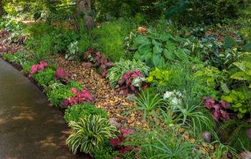
Meadow Street Community Garden
I worked with the RCT council and my local Community Garden to design and build a Sensory garden. I had, at the time, started volunteering at the Community Garden when the opportunity for me to be a part of this project arose. My role in the creation of the garden was to design and draw up a plan for the area.
Software Skills
Competent using; Microsoft Office and Adobe Creative Suite, (Photoshop, InDesign, Illustrator)
Working knowledge of; AutoCAD, Keyscape, Sketch up and Twinmotion.
Education/Work
2013 - 2019
Hawthorn High School
12 GCSE’s A - C
3 A levels A – C
2017 - 2020
Lifeguard
Hawthorn Swimming pool
2021 - 2024
University of Gloucestershire
Landscape Architecture
My Skills
Adaptability
Communication
Conceptual Diagramming
Creativity
Hand drawing
Hand Rendering
Interests
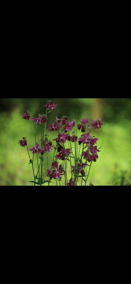
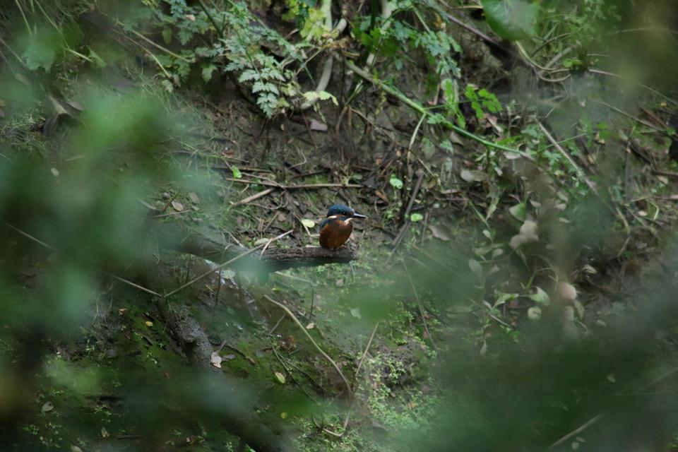
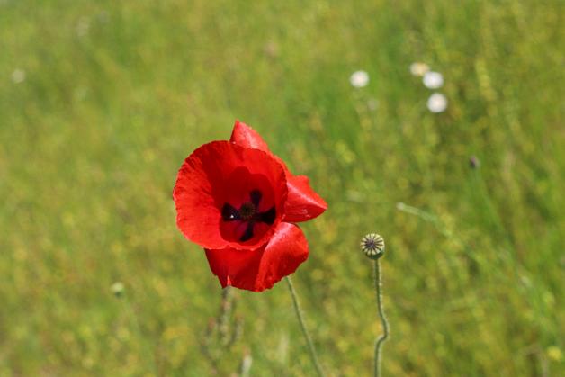
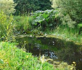
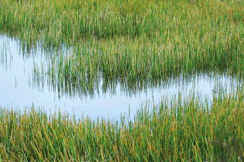
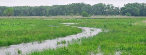
I love spending time outdoors, going on walks, and visiting nature reserves and Wetland Centres. I also love photographing wildlife and plants, capturing the beauty and diversity of the natural world. Painting and drawing is something I am also very passionate about. It allows me to be expressive, free and mindful.
Leadership
Model Making
Numeracy
Organised
Problem solving
Teamwork and Collaboration
Time management
Work well under pressure
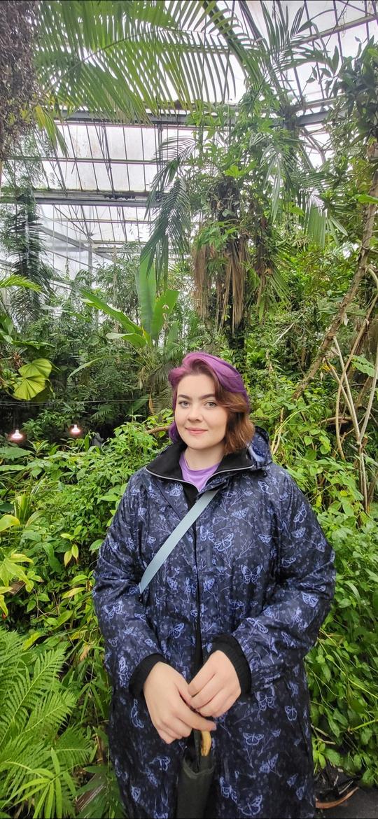
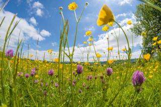
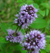
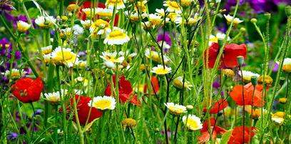
About me 1
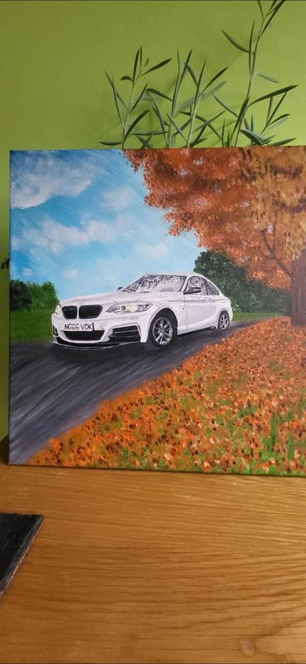
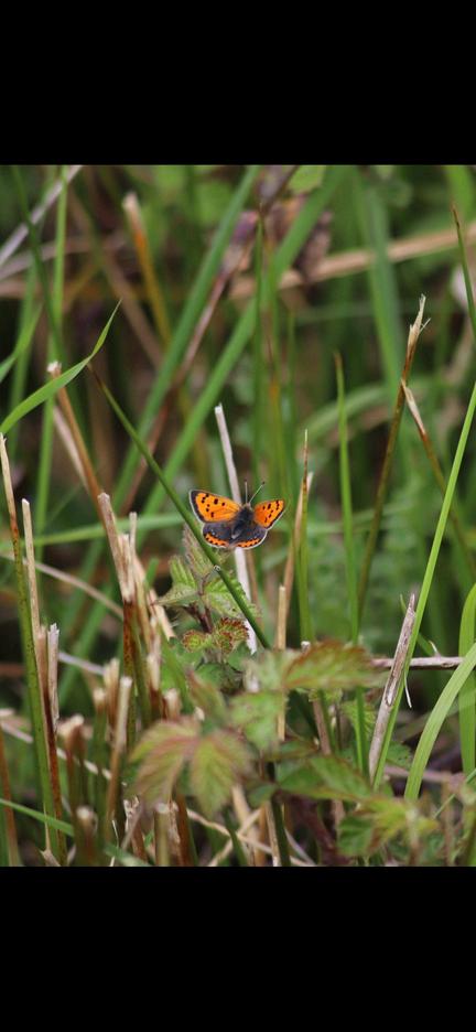
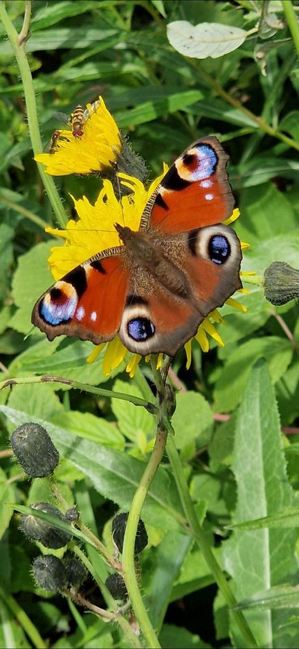
My Paintings My Photography
About me
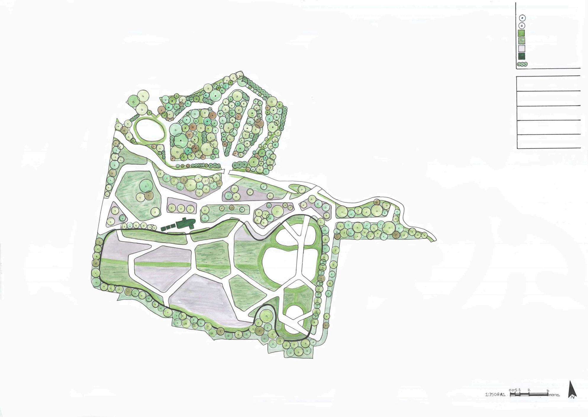
Contents Page
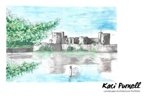
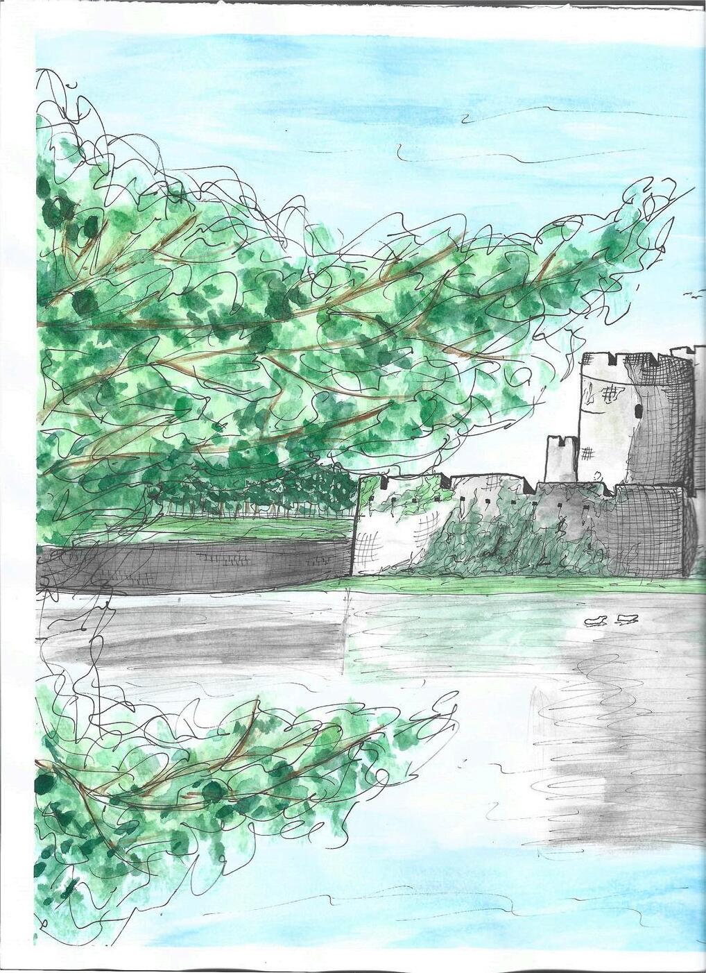
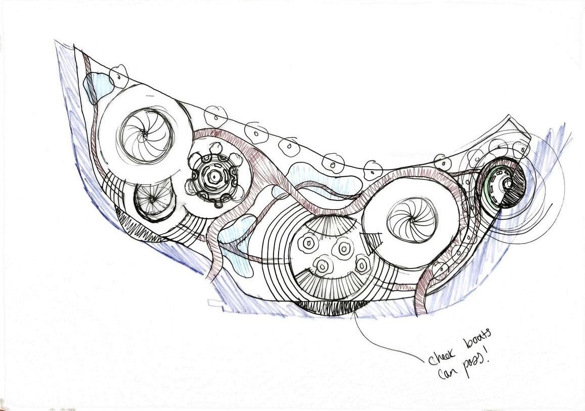
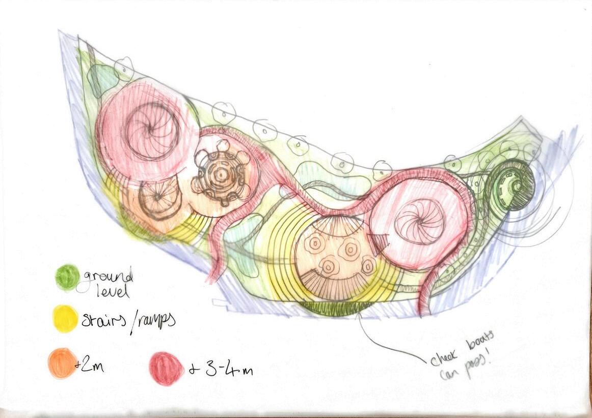
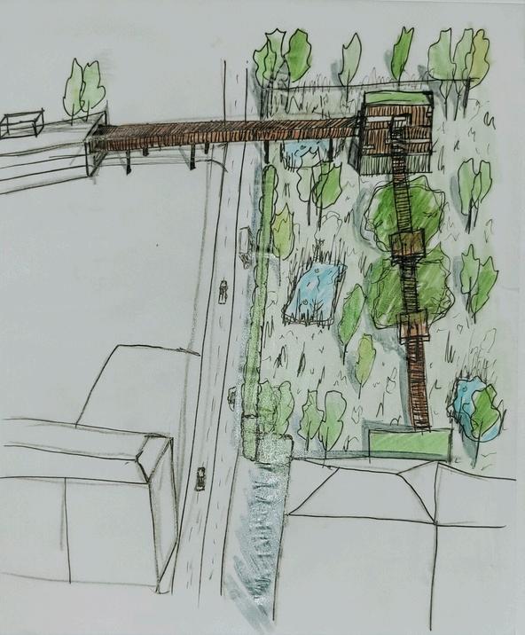
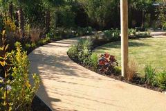
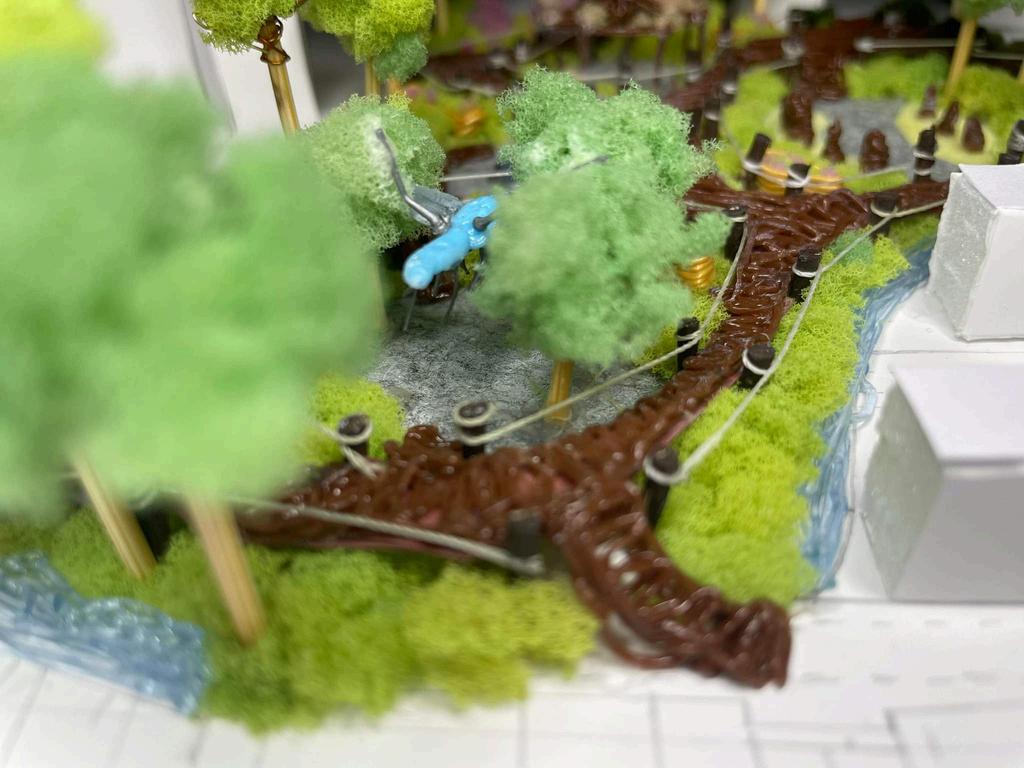
Castlemeads, Ripples before the Wave
AutoCAD linework, Photoshop rendered Masterplan and Visuals
Castlemeads, Ripples before the Wave Process sketches
Alney Island, Waves of Change
Photoshop rendered Masterplan
Alney Island, Waves of Change
Photoshop rendered Visualisations
Park Campus
Woodland Buffer planting matrix
Dissertation, Retrofit SuDS Research
RHS Long Border Competition, Authenticity Collaborative Group work
St Aidans Community Garden, Edible Haven Collaborative Group work
North Place, Urban Sanctuary Diagramming
North Place, Urban Sanctuary
Hand rendered Masterplan
North Place, Urban Sanctuary
Concept process and SketchUp aided Visualisations
Barnwood Park
Hydrology strategy and Mood boarding
Barnwood Park
Vegetation strategy and Mood boarding
Barnwood Park
AutoCAD Construction
details Meadow Street Community Garden, Sensory Garden Plan and sketches Meadow Street Community Garden, Sensory Garden Build Contact Details Contents Page 2 1 2 3 4 5 6 7 8 9 10 11 12 13 14 15 16 17 18 19
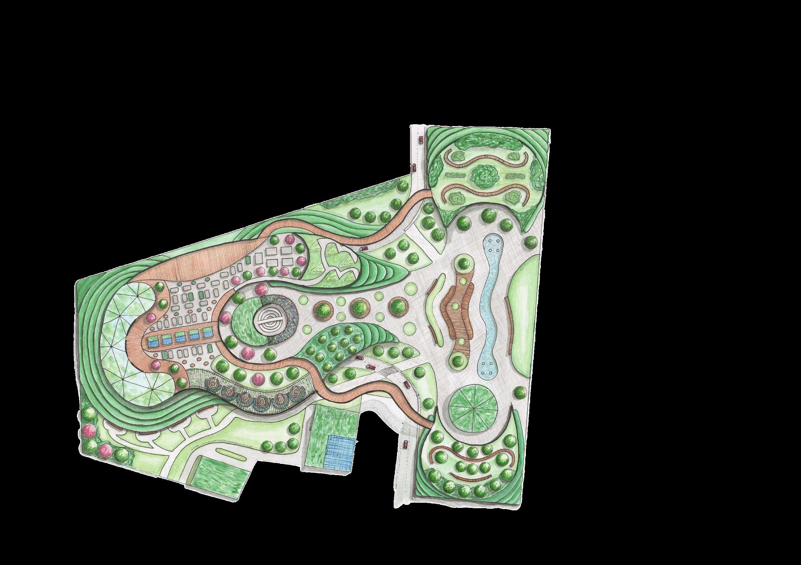
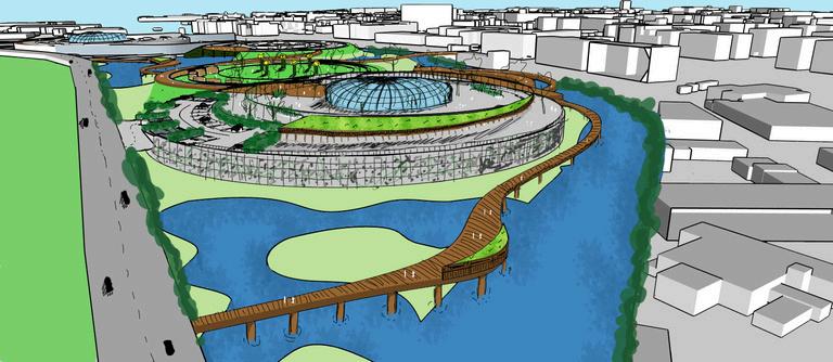
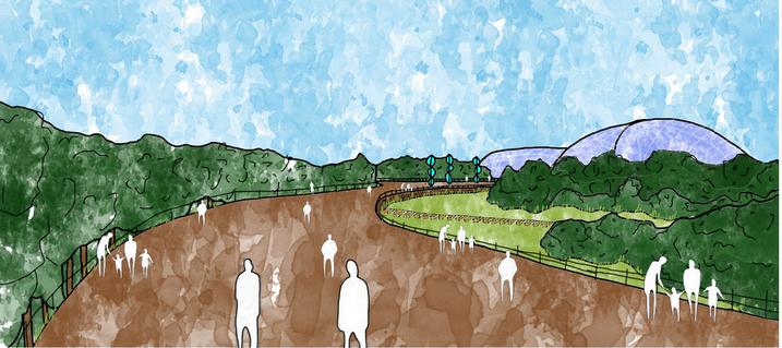
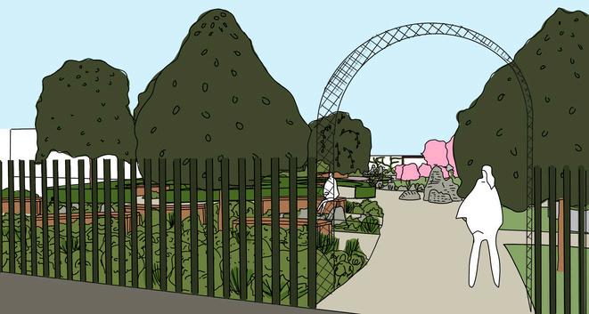
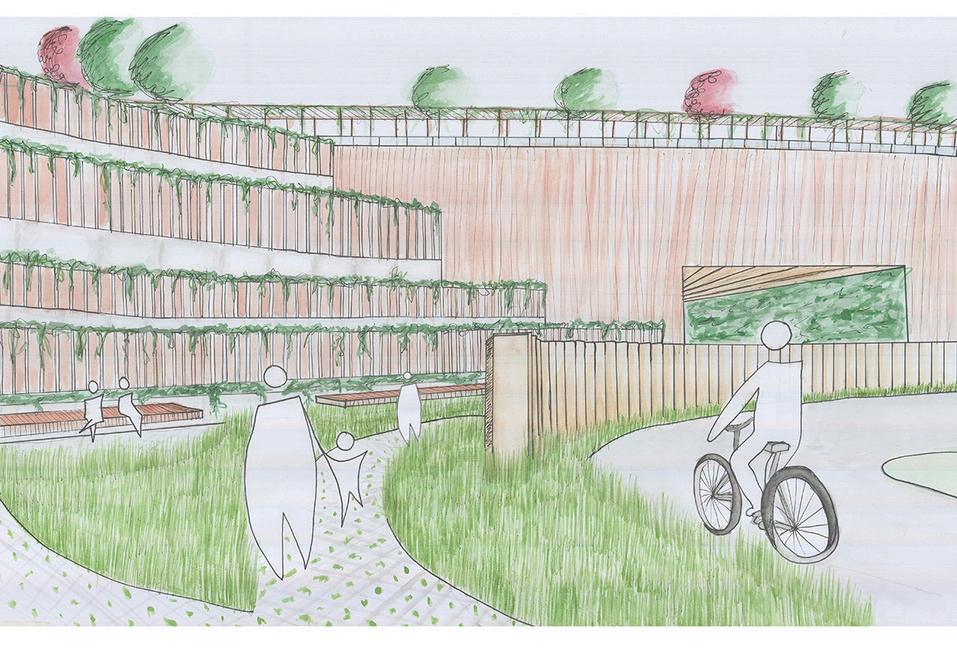
Castlemeads, Ripples before the Wave
AutoCAD line work, Photoshop rendered Masterplan and Visuals
Brief: Accessible to all it should communicate the meaning, significance and impact of local heriage and culture whilst delivering interventions that explore mitigation and future potential design responses relating to climate change, rising water levels, biodiversity, ecological adaption and sustainability.
Concept: The existing site Castlemeads, lies between the urban and rural fringe of Gloucestershire and is a blank canvas that desires a communal hotspot. ‘Ripples before the Wave’ seeks to inspire, unite, and provoke a positive change within the community and the environment. The scheme is split into 3 upper-level zones, educational, social, and a productive. These spaces are accessible throughout the year and include a productive garden, an orchard, glass solar domes, interactive art installations, a play area, a meditative section, wildlife lookouts, telescopic decks and river walkways Encased by large basins, wetlands and woodlands, this hotspot embodies the essence of movement, connection, and transformation. The design is inspired by the dynamic interplay of ripples. Like drops of rain, our choices may seem small, but their impact can spread far and wide.
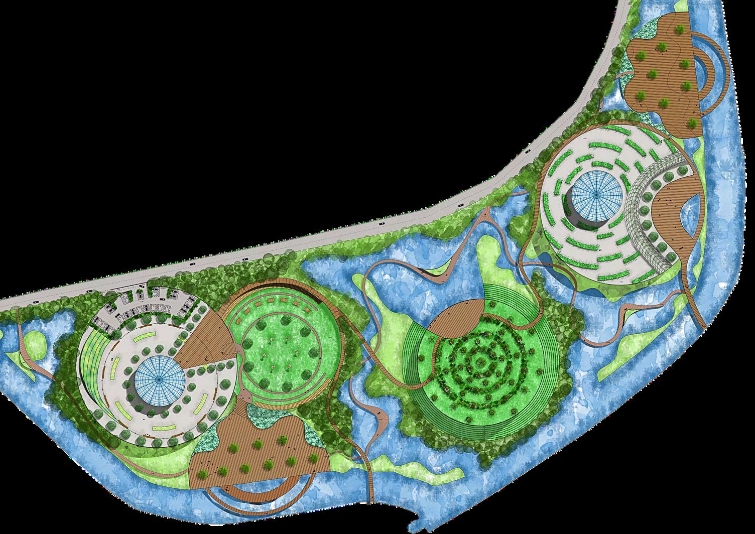
1: Comprises of a large glass solar dome education centre, native tree planting, bug and wildlife hotels, a central ring with hanging vines, pergola with green roof for nature meditation and yoga and disabled parking spaces with access from the main road.
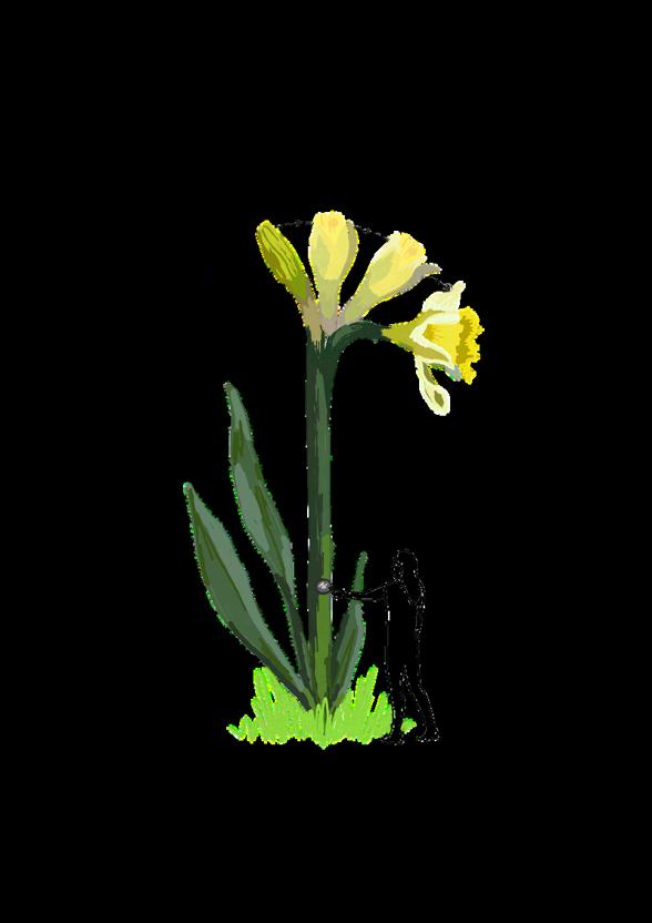
Connected to this is a large play area with pergola swings and an interactive wild daffodil art installation (the flower of Gloucestershire County). Also a large deck area with weeping willow trees and bamboo are connected with access to a river walkway.
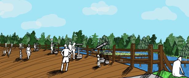
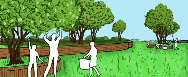
Zone 2: Includes a fruit and nut Orchard with curvaceous wooden seating throughout, a telescopic deck allowing views into the woodlands and wetlands and a stepped area teared towards the ground level wetlands for social interactions, seating and exploration.
The north of the site includes a large deck area with weeping willow trees and bamboo planting are connected to a secondary river walkway to explore nature.

3
Telescope Deck
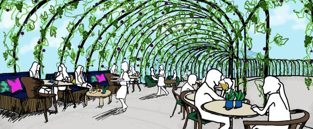
Large edible vine outdoor seating area
Fruit and Nut Orchard Axonmetric looking from the South
Wild Daffodil interactive art installation Pergola swing play area
Zone
Zone 3: A raised bed productive garden surrounds the centre glass solar dome cafe and restaurant with an outdoor seating area underneath a large steel pergola with edible vines.
20 40 0 10 1:500@A0 5 metres
Castlemeads, Ripples before the Wave
Process Sketches
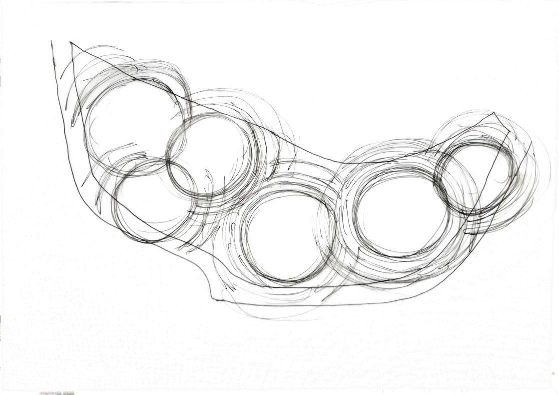
My first conceptual response sketch to the brief using my inspiration of ripples.
Using my first sketch I created pathways and connections to each area making sure there was movement and flow throughout the site, also making sure that the site is accessible to all.
positioning.
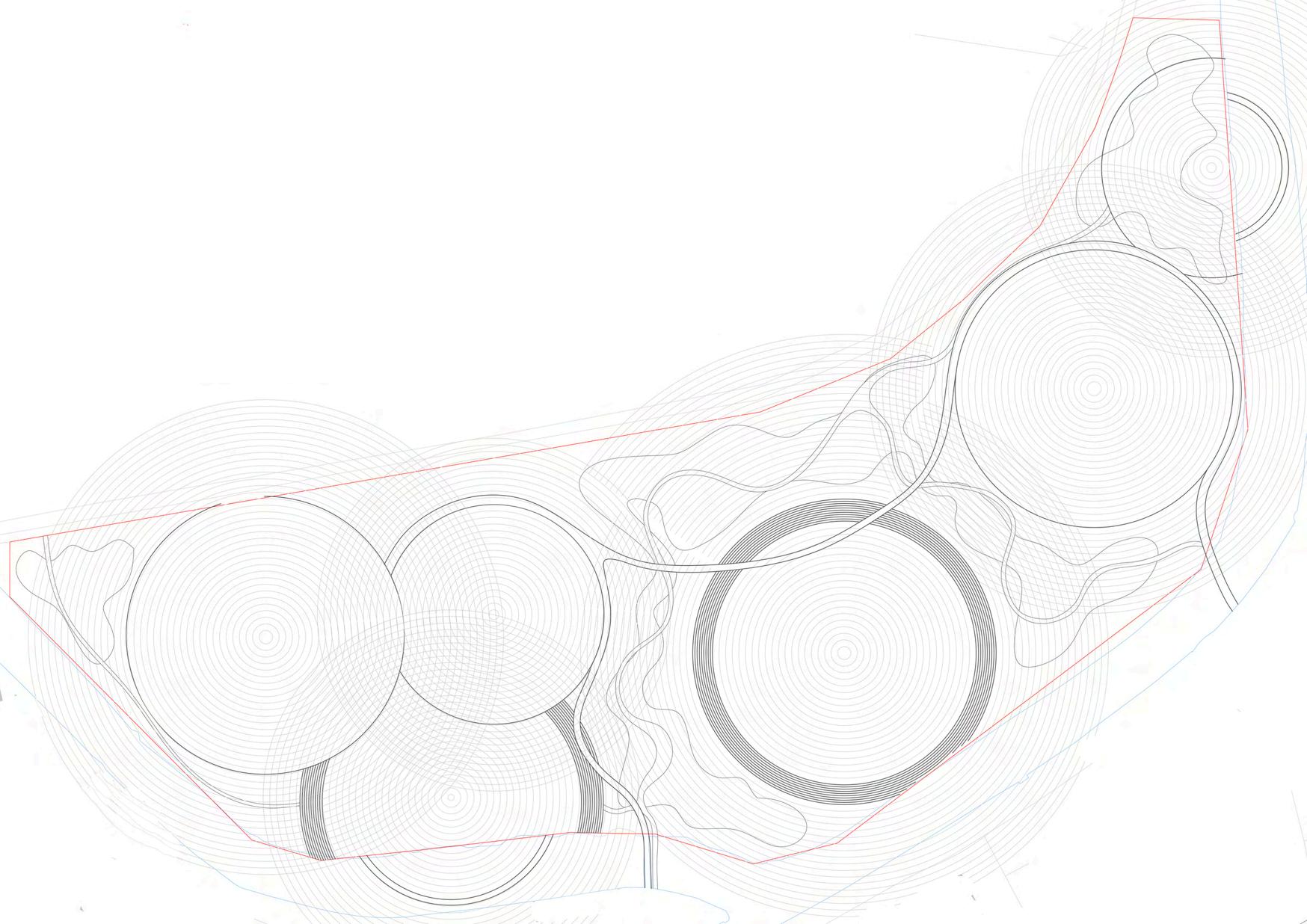
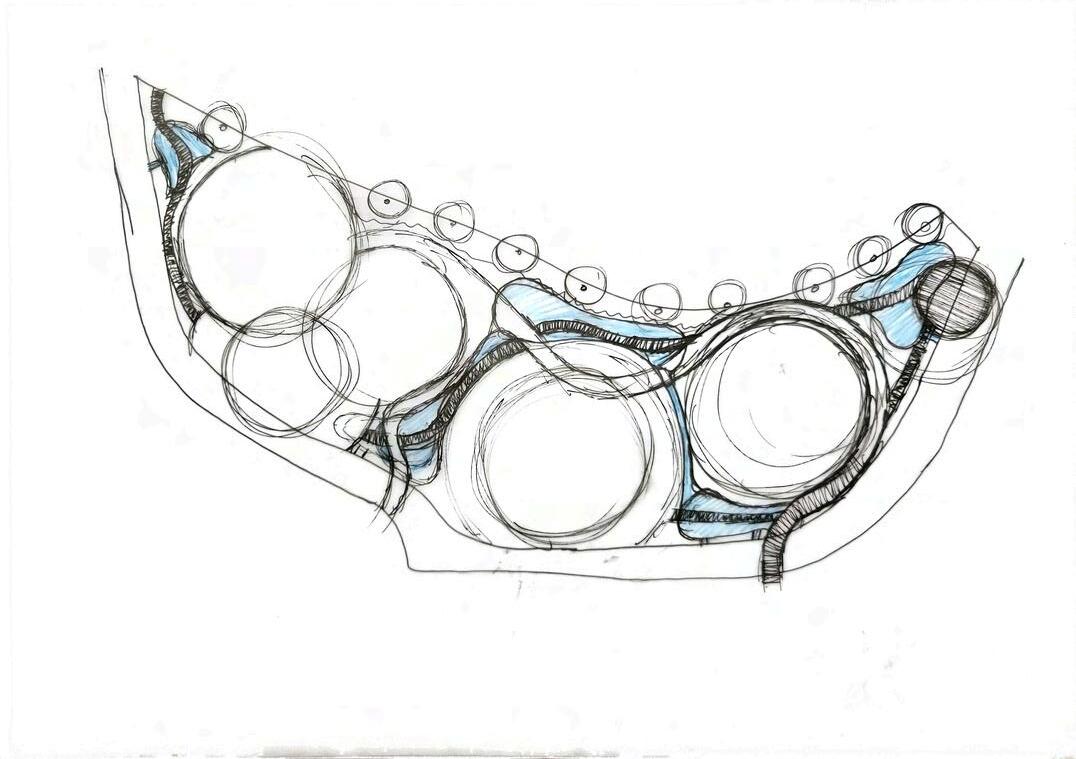
Lastly, after getting a base design sketched out, I took my design into AutoCAD to make sure the scale was correct. I then overlayed a ripple effect to the different zones to be able to create the elements within the individual areas.
After the sketch design process I overlayed a piece of trace and shaded in the different heights within my design. This was necessary as the site is prone to yearly flooding. I had to make sure I had high enough mounds and paths so that people would be able to have access to the site throughout the year.
4
I then started to refine the spaces and the basin
(1) (2) (3)
(4) (5)
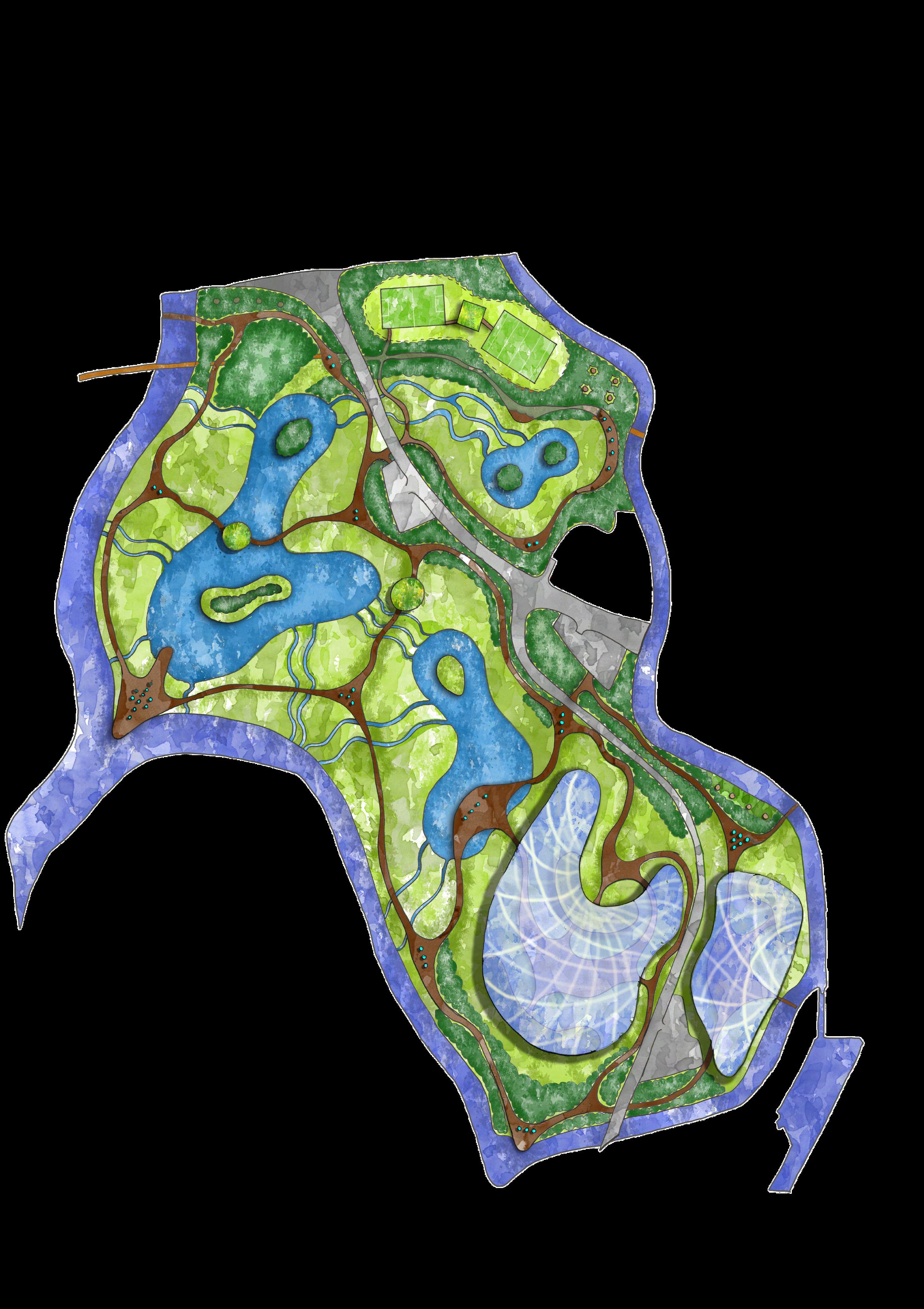
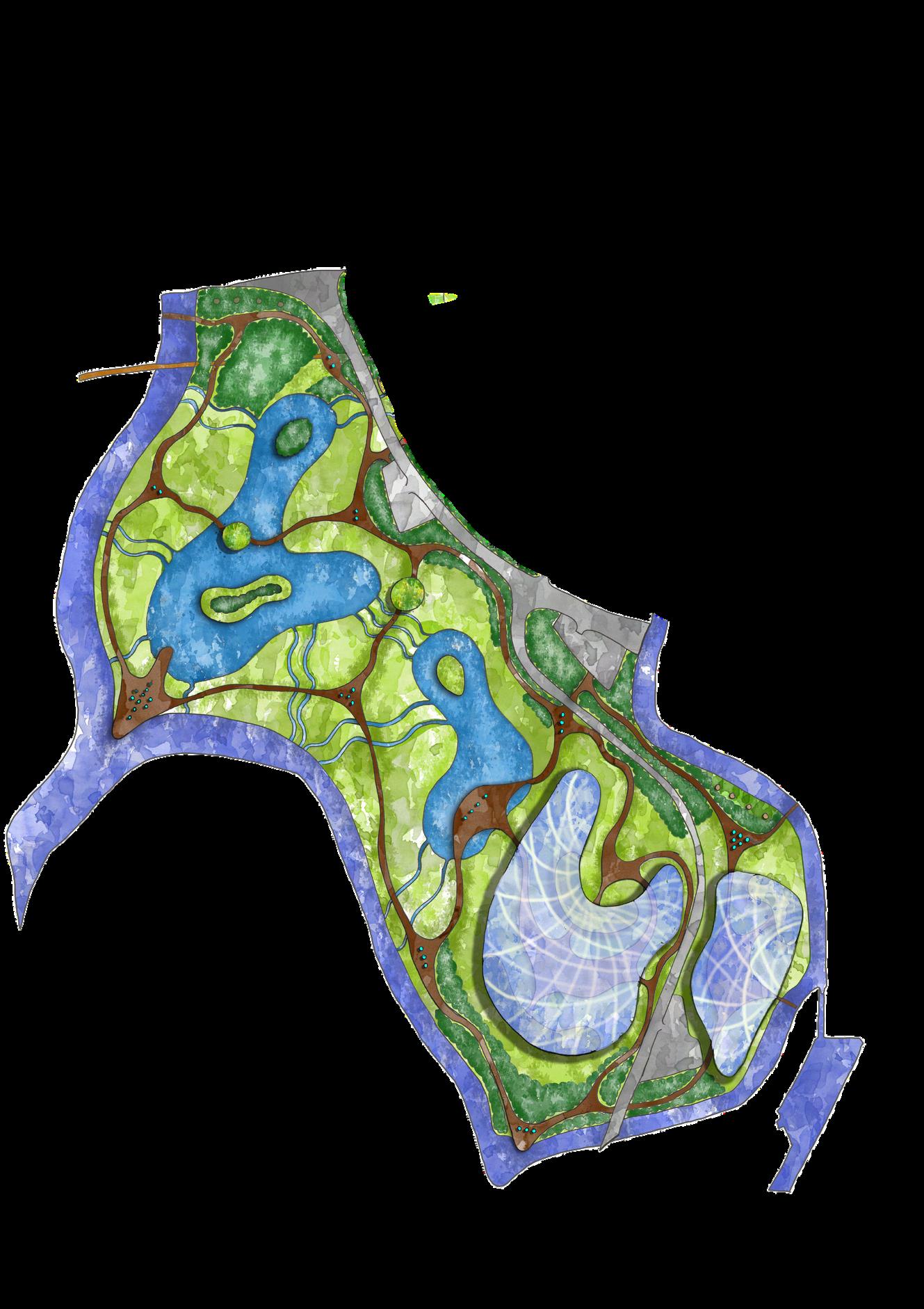
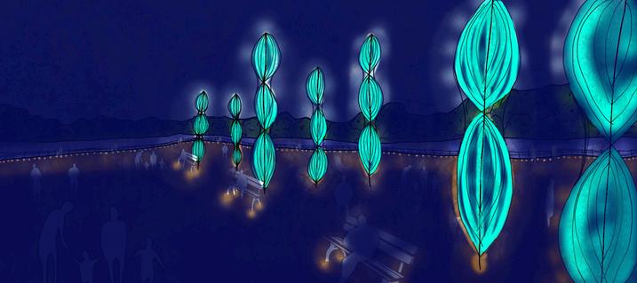
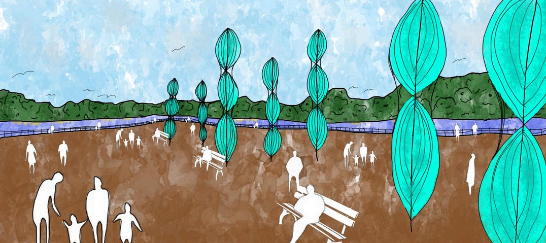
Alney Island, Waves of Change
Photoshop rendered Masterplan
Brief: “Re-thinking our human fringes” in Gloucestershire, GL19. The concept theme is the amalgamation of Natural & Urban systems. Using Natures Systems, Geometric Codes and Organised Chaos as a source of inspiration.
Concept: The inspiration for my design is taken from the surrounding tidal River Severn. The freedom and organic nature of waves are always in motion, rising and falling, representing a concept of change. Demonstrating how Alney Island can be the ‘Waves of Change’ that bridges the contrasting rural and urban landscapes. My concept is a contemporary landscape which aims to reduce the impact of climate change and enhance biodiversity. My aim is to encourage wildlife to the site by creating a diverse range of habitats.
A series of light-up sculptural turbines that can generate electricity from the wind, provide power for the surrounding areas. These also create landmarks throughout the site guiding people through it day and night. The positioning of these on the lookout platform is great for the turbines as it is the section that has the most wind. Whilst visitors are sitting or standing next to the turbines they create cooling sounds mimicking the surrounding sounds of nature. This creates relaxing and calm areas for people to be mindful.
Glass Solar wave - This solar wave is the concept of a sea wave with a modern twist. The organic steal and glass structure produces renewable energy for the city by having clear solar panels placed on the outer coating of the glass panels, trapping light to create electricity. It also captures wind through openings to create a cooling effect inside the glass structure. This building brings a new and modern experience for visitors to encounter, differing from a historic City.
Wetland Basins - provide flood protection, improves natural quality of water and creates habitats for a range of wildlife. The water bodies have bio-haven islands to create habitat areas for wildlife and insects that are the furthest away from human.
Water Channels - Connecting the wetland basins to the river and to each other these channels collect water from the rising tide of the river. They are all connected to make sure there is water in the basins at all times of the year.
Lookout platform - A second lookout platform provdes a scope over the historic weir.
Woodlands - Used for screening from roads to block out noise and pollution. A mix of existing woodland and wetland woodland is scattered throughout the site. Wetland woodlands provide remarkably more biodiversity than other woodland types.
Wetland planting - A wetland planting pallette throughout allows vegetation to thrive at times of flood and drought. Creating a vast area of greenland that will survive the extremes of climate change.
Lookout Hides - Two roundhouse hides with green roofs and green walls provide hidden areas for people to watch and study wildlife and birds without disturbing them. The hide, North of the site, will be suspended above the water on stilts and the other will be on top of a raised tump to protect the structures from flooding.
Main road through site (A417) -
Existing road that cuts through the middle of the site is 2 meters above ground level to allow use during times of flood. A series of open points along the road allow scope into the site to draw people in and create points of interest.
Treehouse tourist letsTreehouse lets provide a more rural experience being furthest from the city.
Boardwalks - Raised wooden board walks provide all year round access and accessibility for disabled people. These will also have a range of low and high railings for safety.
Buildings underneath Glass waveThese buildings provide spaces for people to sit or explore nature undercover. It is a start point to the discovery of the green spaces from the city. One building is a cafe/resteraunt with outdoor seating, the other is a educational centre and the third provides other amenities with a central gathering area. All buildings are raised on stilts so when the site floods the buildings wont get damaged and can still be accessed during these times.
40 80 160 380 0 20 metres 1:2500@A1
5
Wave Turbine scultures -
River Severn
Alney Island, Waves of Change
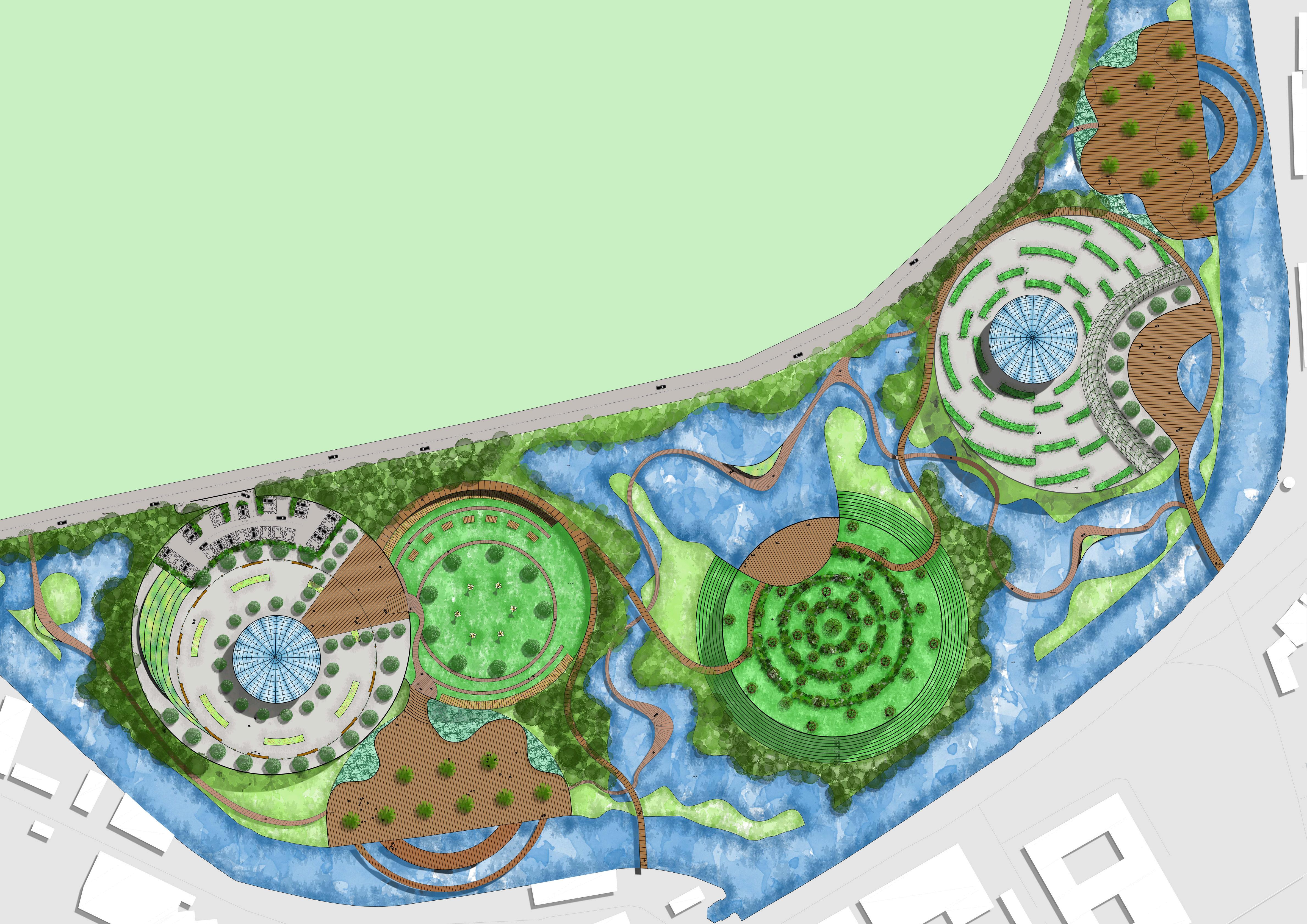
Photoshop rendered Visualisations

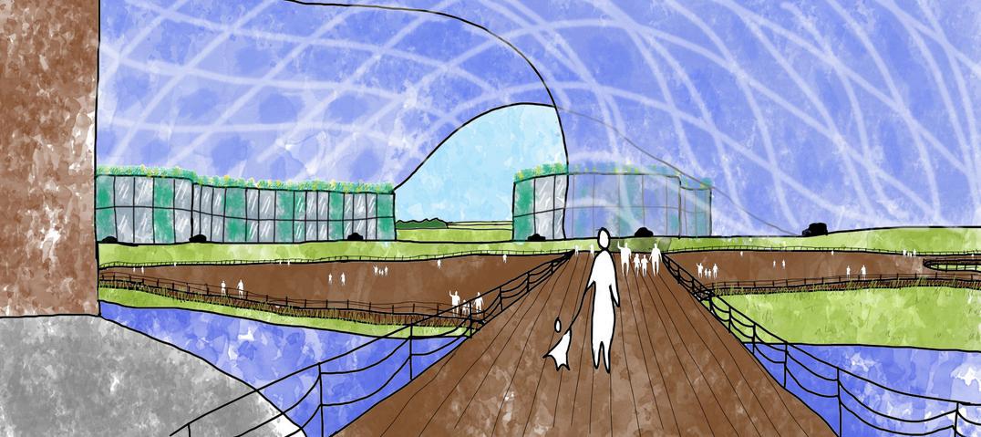
6 Solar Wave Glass Building Amenities and facilities buildings underneath solar building, including a green roof and green walls on the exterior
planting Existing bridge from city Boardwalk/ gathering area
Wetland
River Severn
Lookout platform where the 2 rivers meets
Trees and shrub surrounding the River
Wave Wind Turbines that light up at night and mimick the sounds of nature for mindfullness
Woodland
River Severn Main road
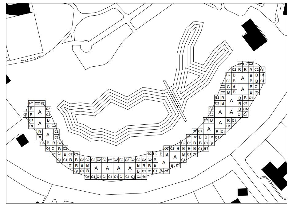
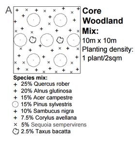
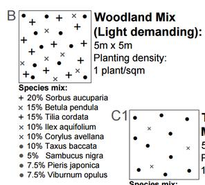
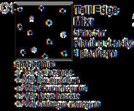
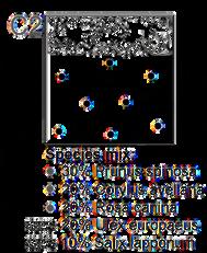
Park Campus
Woodland Buffer planting matrix
Brief: A range of infrastructure planting inventions required to increase the habitat biodiversity of the site. The biomass and carbon sequestration properties of the planting scheme will be calculated at planting, 10years on and finally at 50years using a range of carbon and biodiversity tools.
Concept: The Woodland matrix is designed to screen noise from a busy road but it is also used to increase biodiversity and to capture carbon within the area. To achieve this I had to choose trees and shrubs that would thrive together and have a positive impact on the area for both the environment and for people. In my planting area, I have a mix of evergreen and nursery trees and also a range of fruit flowering plants for decorative purposes and to increase biodiversity. This matrix was created using AutoCAD.
A series of calculations were carried out to see if my woodland would sequence carbon and also provide information on how much Biomass my woodland would produce after 50 years.
Biomass total after 50 years = 1,443,666kg
A Biomass and nutrients calculator from Natural Resources Canada was used to calculate the biomass for all the types of trees I have included in my planting matrix.
Total Carbon content at Maturity (50 years) = 5,579,716 kg
The above figure uses tree girth to calculate the total Carbon capture at 50 years of growth. Tree girths were estimated based on an average yearly girth growth (2.5cm) and were used to estimate dry weight before being divided by 2 to estimate the carbon content for the total number of trees on site.
Location:
7
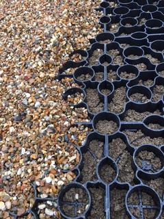
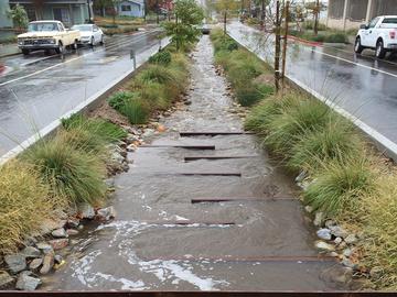
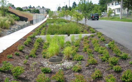
Dissertation, Retrofit SuDS Research
Brief: This assessment requires you to research and explore an approved topic related to your discipline, prepare a question, and write an 8,000 word written dissertation. • Show the quality and range of your research:
• Demonstrate the academic challenge you faced.
• Make critical references to relevant and valid texts.
• Demonstrate an ability to analyze and evaluate the research, drawing valid conclusions from the information sources.
• Address appropriate and set out questions: How, Why, What, Where, When
• Address appropriate aims and objectives.
• Make appropriate use of quotations and references.
• Be Written in good, clear English.
• Include appropriate use of properly captioned illustrations (images, diagrams, plans, maps) Include a bibliography.
• Be presented professionally, with good format, layout, and well-selected images.
• Work must not have been submitted for any other previous or current modules.
How can Retrofit Sustainable urban Drainage Systems (SuDS) manage and control surface rainwater runoff, to mitigate flooding in urban areas?
 Kaci Purnell S4106827
AD6600 Dissertation BA (Hons) Landscape Architecture
University of Gloucestershire
January 2024
Word count: 7654
Presented as part of the requirement for an award Within the Academic Regulations for Taught Provision at the University of Gloucestershire.
Abstract:
Flooding poses a significant natural hazard to both the United Kingdom and overseas regions, with evidence pointing to a rise in high-impact rainfall events since the 2000s. Human interventions, such as alterations to drainage systems and urbanization, have exacerbated flood risks, especially in urban areas. Sustainable Urban Drainage Systems (SuDS) are identified as a potential solution to mitigate flooding, with particular emphasis on Retrofit SuDS for existing developments. Limited research on Retrofit SuDS prompts the need for a comprehensive understanding of their purpose and benefits. his dissertation aims to bridge a knowledge gap by investigating the value of Retrofit SuDS. The research is motivated by the escalating challenges posed by unpredictable rainfall events, rising sea and river water levels due to global warming, and increasing urbanization. This research seeks to contribute valuable insights into the effectiveness of Retrofit SuDS in urban flood management, thereby addressing a critical need in the face of changing climate patterns and increasing urban areas.
Fig 1: Grey to Green. Dunnet, N. (2019a).
8
Cardiff
Cheltenham
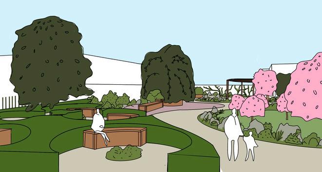
RHS Long Border Competition, Authenticity
Collaborative Groupwork
Brief: The theme for 2024 is “make a statement”. We would like these borders to showcase a focal feature and demonstrate high impact for small spaces. It is up to you how you would like to interpret the theme, it could be incorporated using planting, hard landscaping, sculptures, shapes or textures.
Design Statement: Our garden celebrates selfexpression and authenticity. Each plant exhibits unique and capturing qualities celebrating the beauty of diversity found in both the plant kingdom and humanity. We have selected an exuberant planting palette representative of the bravery and boldness to embrace your individual flair and be true to oneself in the face of today’s grave adversities. From dense to delicate, speckled to striped, our intention is to
Planting Plan

Planting Composition
We envisioned a border that was neutral at the edges, gradually building in height and color towards a central focal point representing an explosion of expression and creativity. This central feature is encircled by a woven willow ring, symbolising unity through self-realisation. We also mirrored the border diagonally for a dynamic yet cohesive view, representing self-reflection.

A vibrant burst of hues crescendos at the heart of the garden, celebrating the courage within us all to openly bloom. The encircling woven willow ring honors the power of community and togetherness. By joining hands around this central blossoming, we recognise that when humanity sows seeds of compassion, we can grow change and overcome adversity through the strength of unity.
A calming pastel border envelops the vibrant central display, juxtaposing fiery passion with tranquil appreciation. Contrasting textures – from spiky eryngium to ethereal thalictrum – mirror nature’s diversity, reminding us that harmony arises through understanding and celebrating the uniqueness of every living thing.
9
KEY
Axonmetric Sketch
Cross section
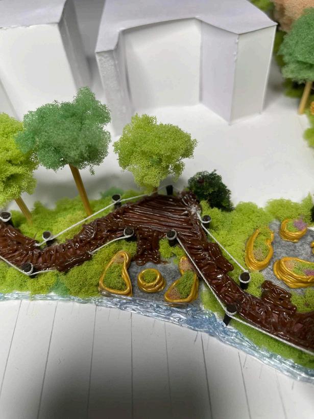
St Aidans Community Garden, Edible Haven
Collaborative Groupwork
Brief: The Parish of West Cheltenham is now looking to redevelop the green field site to express the church in a new and relevant way and to serve the local community. We want to make the most of the outdoor landscape whilst incorporating some indoor space, such that it will be: welcoming and attractive, safe and sustainable, living and life-giving. The budget for this project is £100,000 including a building/refractory.
Concept: St Aidans Edible Haven, a fully edible tranquil garden. Its not just a celebration of nature's beauty, but a design that is inspired by the Christians’ traditional seven sacred spaces, inviting all to find comfort and unity. The key themes in this garden are a natural materials palette such as timber structures, and stones. Vibrant and edible vegetation such as the fruit and nut trees and organic shapes such as the paths and the circular shapes throughout. St Aiden's edible haven is more than a collection of spaces, it’s a living example of the connection between spirituality, community, and the natural world.
Productive area with pergolas for climbing plants (4)
Entrance to site from main road (1)
Gathering and quiet zones (2)
Gated access to the Community Centre next door
Existing trees on site
Rocks integrated throughout the site
Circular pavilion for seating and and space for reflection and prayer
Entrance to garden
Shipping container building used as a refractory, doubling up as a food bank and indoor space for events
Semi circular pergola used for sheltered overspill for events and seating
Pleached fruit trees
Cherry tree orchard (3)
10
(1) (2) (3) (4)
North Place, Urban Sanctuary
Diagramming
SOC Analysis
Strengths and Opportunities
Close proximity to the town center means the site will attract a high tread of people,
Existing Vegetation is in good condition,
Access for cars and busses is available around the site, Beautiful views of the hills at the North - East of the site, Surrounded by attractive historic architecture, Art displays on site celebrate the Cheltenham Paint Festival every year,
Overall flat topography,
Views of Church spires in the wider landscape, Sun Direction allows the site to be exposed throughout the day most of the year.
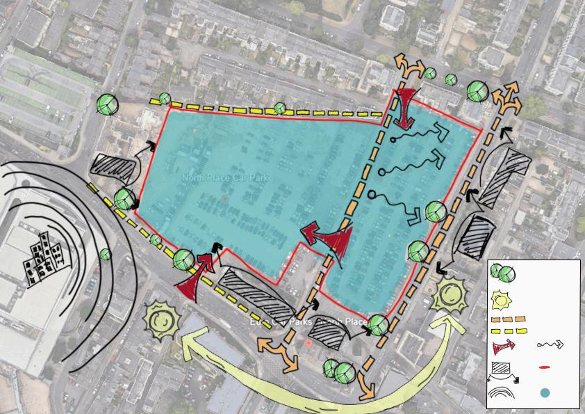
Constraints
Existing properties overlooking the site affects privacy, Noisy main roads surrounding North Place causes noise pollution and pollutes the air,
Being able to maintain an open front, which is an element in the brief,
Keeping existing views open whilst also not blocking light for surrounding buildings,
Allowing large spaces for car parking,
Listed buildings surrounding the site giving restrictions to the design of the site.
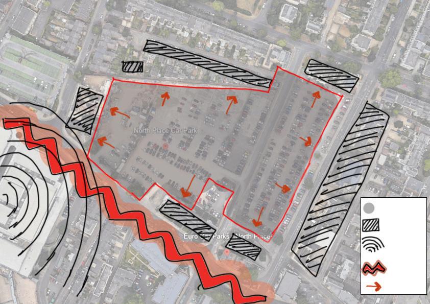
11 Trees SunDirection Vehicular movement Pedestrian movement Entrance Viewsout Historic buildings Site boundary CarPark City Concretecarpark Buildings surroundingthesite Noiseandlight pollutionfrom City Noiseand pollutionfrom mainroad Blockedviews
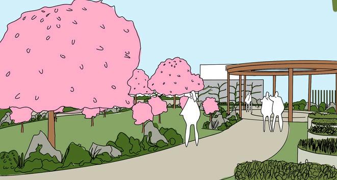
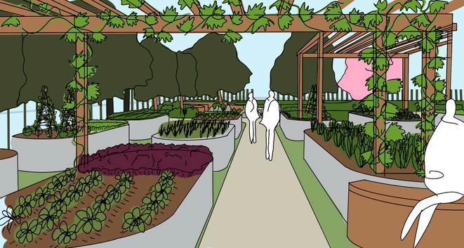
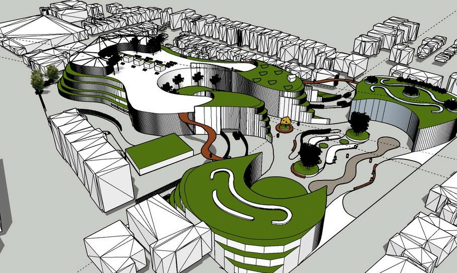
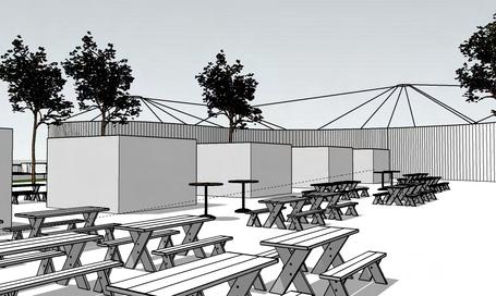
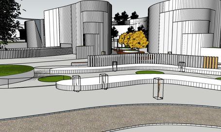
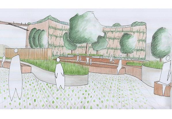
North Place, Urban Sanctuary
Hand rendered Masterplan
Brief: The design for the new Eco & Creative Quarter must provide a transformative and appropriate contemporary biophilic response to this unique historic, cultural, and contextual location, and develop it as the new green destination for the town.
Concept: Based in the heart of Cheltenham town, the Urban Sanctuary is a space that supports the local economy, focuses on biodiversity and sustainability and promotes wellbeing. The Sanctuary includes community-driven social activities and food production, affordable artisan food and drink shacks and provides spaces to relax and destress.
Sunken Booths
Wrap around greenhouse
Multistorey Car Park with Tiered Greenroofs
Bike repair Hub and Racks
Creative Workspace Buildings
Rooftop Seating area with floating deck
Food and Drink Shacks
Amphitheatre 12 0 5 10 20 40 80 metres 1:500@A1
North Place, Urban Sanctuary
Concept process and SketchUp aided Visualisations
Process: My 1st concept sketch was focused on a biophilic design. Doing this did not leave enough space to conform to the other elements in the brief, so I knew I had to take a different approach.
After exploring precedent studies the design development started to take shape. Once I had come to the completion of the design I created a simple SketchUp model to trace to create my visualisations. This meant that I could have accuracy in drawing the sizes of buildings and also include the surrounding context within my visualisations.
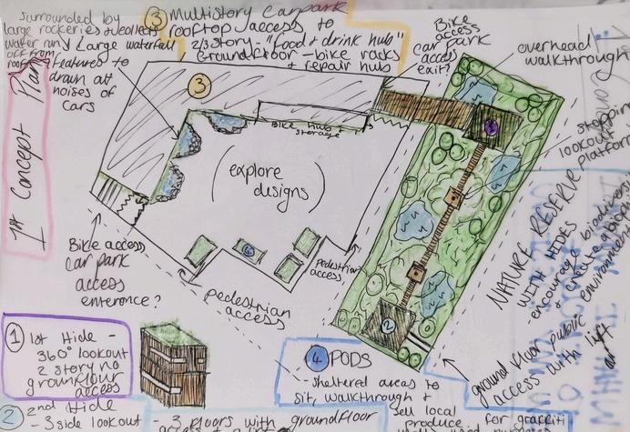
Visualisations
Car park with tiered green roofs
Enterance path into site
Bike path leading into the site towards the bike hub
Vertical wood beam structures used to separate two areas and still be able allow light through Green wall walk through towards the amphitheatre
13
Sketchup model
Barnwood Park
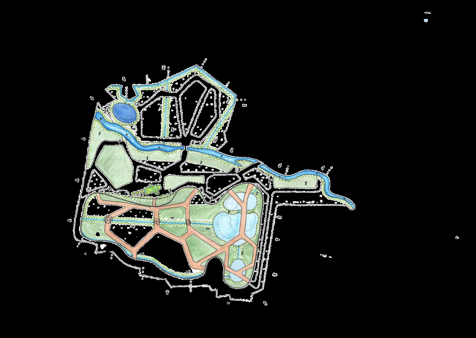
Hydrology strategy and Mood boarding
Brief: Acquisition of technical knowledge and representation of landform, environmental hydrology, phytoremediation, vegetational and materials strategies for a project based on a design scenario that is to be presented to you.
AIM: Improve water quality within the area, slow down water runoff and reduce flooding within all areas of the park and also the residential area surrounding it.
Hydrology strategy Masterplan
Hydrology
Wetlands - These will not only enhance biodiversity but will also act as a secondary filtration point. These area will be able to store water at times of flooding whilst still allowing the plants to flourish.
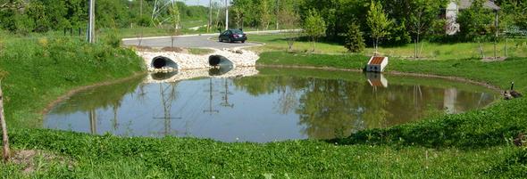
Natural pond - The existing pond will be widened and deepened to allow more storage of water from the attached swale capturing water from the road surface.
Retention Basins - The existing basins will be made larger and deeper to allow a larger storage space for water at times of heavy rainfall. An extra basin is added next to the other basins for further storage and to also catch water from the surrounding houses and road surfaces.
Rain Garden - A series of Rain Gardens; around the edges of all swales, the river, the wetlands and the pond. This will provide first step filtration by purifying surface water run off before it reaches the second filtration.
Greenroofs - These will be placed on top of the chapel and the toilet pods roofs to act as a source control, slowing down water run off and to also filter the rain water before entering the drains.
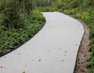
Resin Bound Paths - The top half of the site will include resin bound paths for a sustainable and permeable surface. These paths do not require any digging as they are simply laid on top of the existing ground.
Swales - These are places throughout the park to capture surface water and filter the grey water whilst directing it to the secondary filtration point.
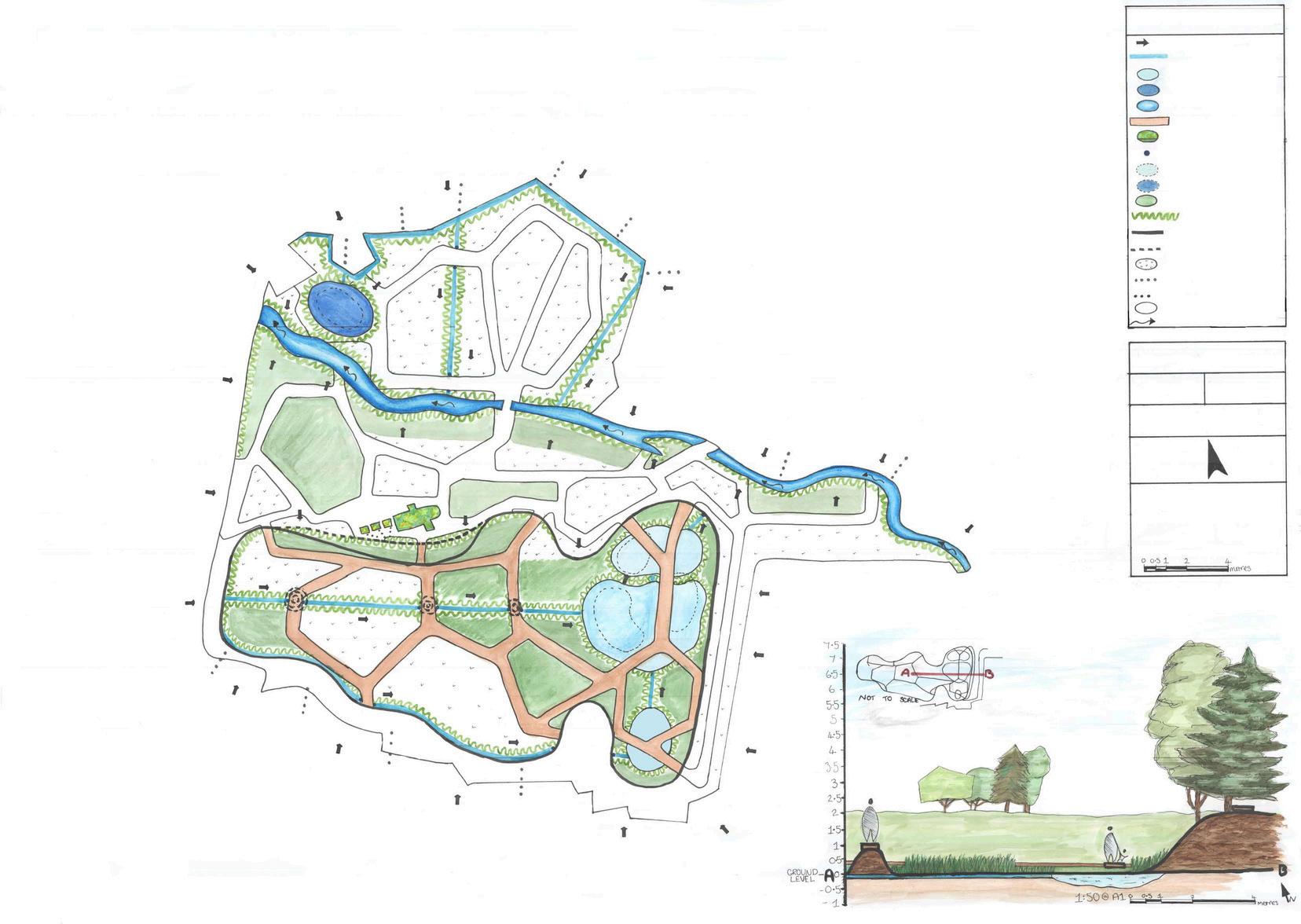
KEY:
Surfacewaterdirection
Swale
Proposedbasin
Proposednaturalpond
River
Oakwoodboardwalk
Greenroof
Wateroutput/inputpoint
Existingbasin
Existingnaturalpond
Wetlandarea
Raingarden
Existingcontour
Proposedcontour
Othervegetation
Greydrainagepipe
Blackdrainagepipe
Resinboundpathway
Riverflowdirection


 HYDROLOGY MOODBOARD
14

Barnwood Park
Vegetation strategy and Mood boarding
Vegetation strategy Masterplan
AIM: Introduce different planting strategies to encourage more and different types of wildlife to the area. Encourage a more educational approach to the park and also add plating to decrease pollutants in the area.
Vegetation
Wildflower meadows - These will be used to increase pollinators and create a beautiful and colourful aesthetic.
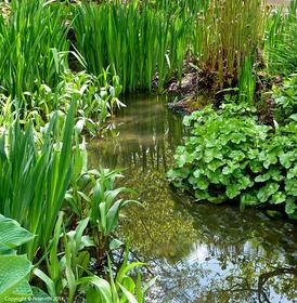
Natural pond - will be reinforced with new species of aquatic plants such as Watermint and Lillies. This will encourage more aquatic incects and animals.
Edible Forest Garden - For educational purposes an edible forest garden will be planted at the North of the site.
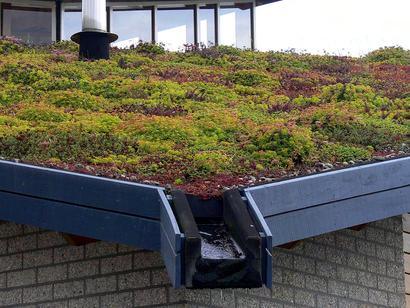
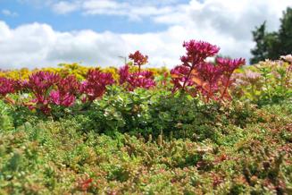
Sedum Green roofs - These will provide a amore natural look to the building and help them blend into the surrounding natural world. Types of Sedum plants that will be included are; Spurium, Sedum Pulchellum and Houseleeks.
KEY:
Proposedtree
Existingtree
Wetland Wildflowermeadow Sedumroof
Proposedshrubs


AIM: Use permeable, sustainable and locally sourced materials throughout the site.
Rain gardens - The edge planting will include plats that filtrate and clean water whilst also attracting insects and animals.
Native trees - These trees will be added throughout the park to encourage more wildlife. They will also contribute towards the reduction of pollutants in the air.
Wetlands - used to increase biodiversity in the area. They will be homes for plants, insects, amphibians, reptiles, fish, birds and animals. These are also great carbon sinks for the area.
VEGETATION MOODBOARD


Raingarden
MATERIALS MOODBOARD
15
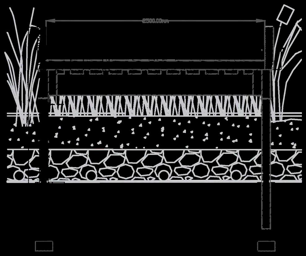
Barnwood Park
AutoCAD Construction details
Wooden Pergola:
Wooden pergola allows for a waterproof shelter. A bitumen waterproof sheeting will be placed over wooden sheeting. A 1 metre high wooden railing will surround the pergola and will have floating wooden benches attached to them using support beams. The large wooden posts holding up the roof structure will be set in concrete in the ground for the best stability on the existing grassland.
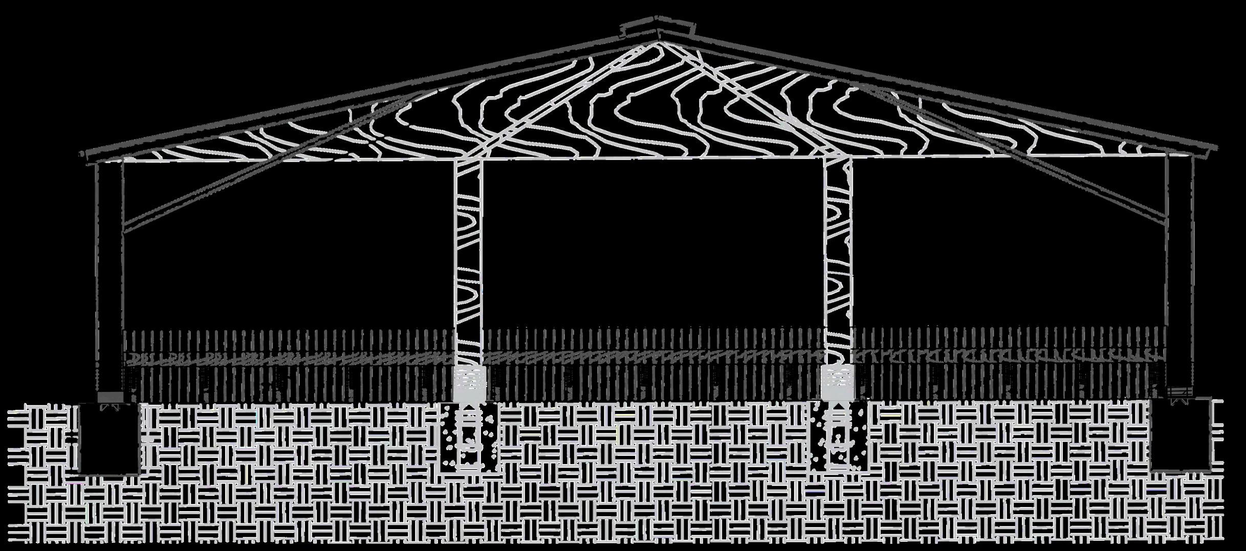
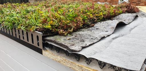
A layered green roof to be placed on top of toilet pods and the existing chapel on the site. The green roof will be a wooden post boundary with a series of layers including;
A planted layer
A waterproof membrane
Substrate soil Filter fabric
A water and moisture retention layer Aeration layer Root barrier and a waterproofing membrane.
The green roofs on the toilet pods will catch rainwater and be used to flush the toilet. They will also be used to filter and clean water before reaching drainage systems underground. A series of shade tolerant Sedum plants will be planted on the roofs.

French Oak Boardwalk will be raised above ground level to allow access to the South of the site at times of flooding. A series of deckboards with antislip inserts will be layed over a galvanised steel beam base connected to steel posts set into the ground by concrete.
16
Greenroof:
Timber Boardwalk:
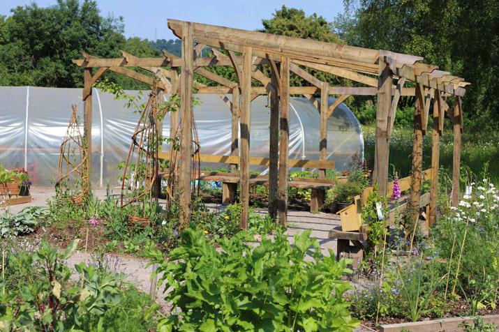
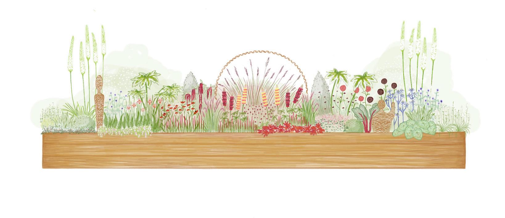
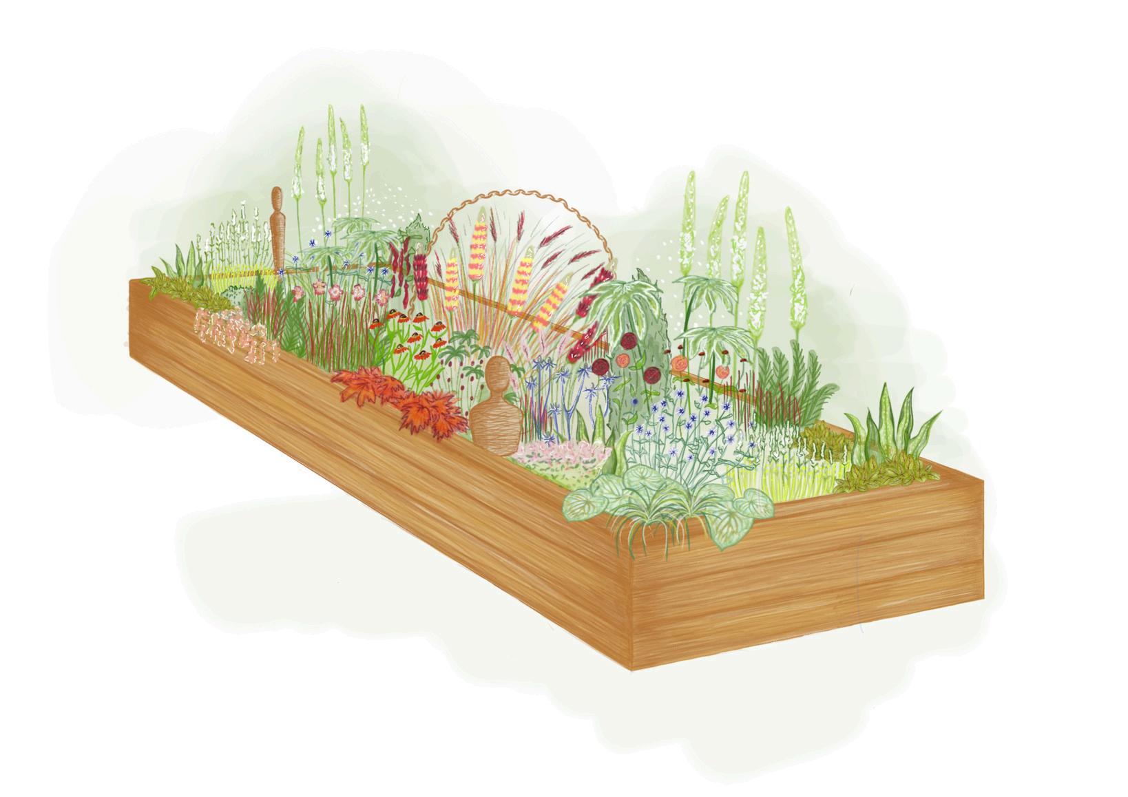
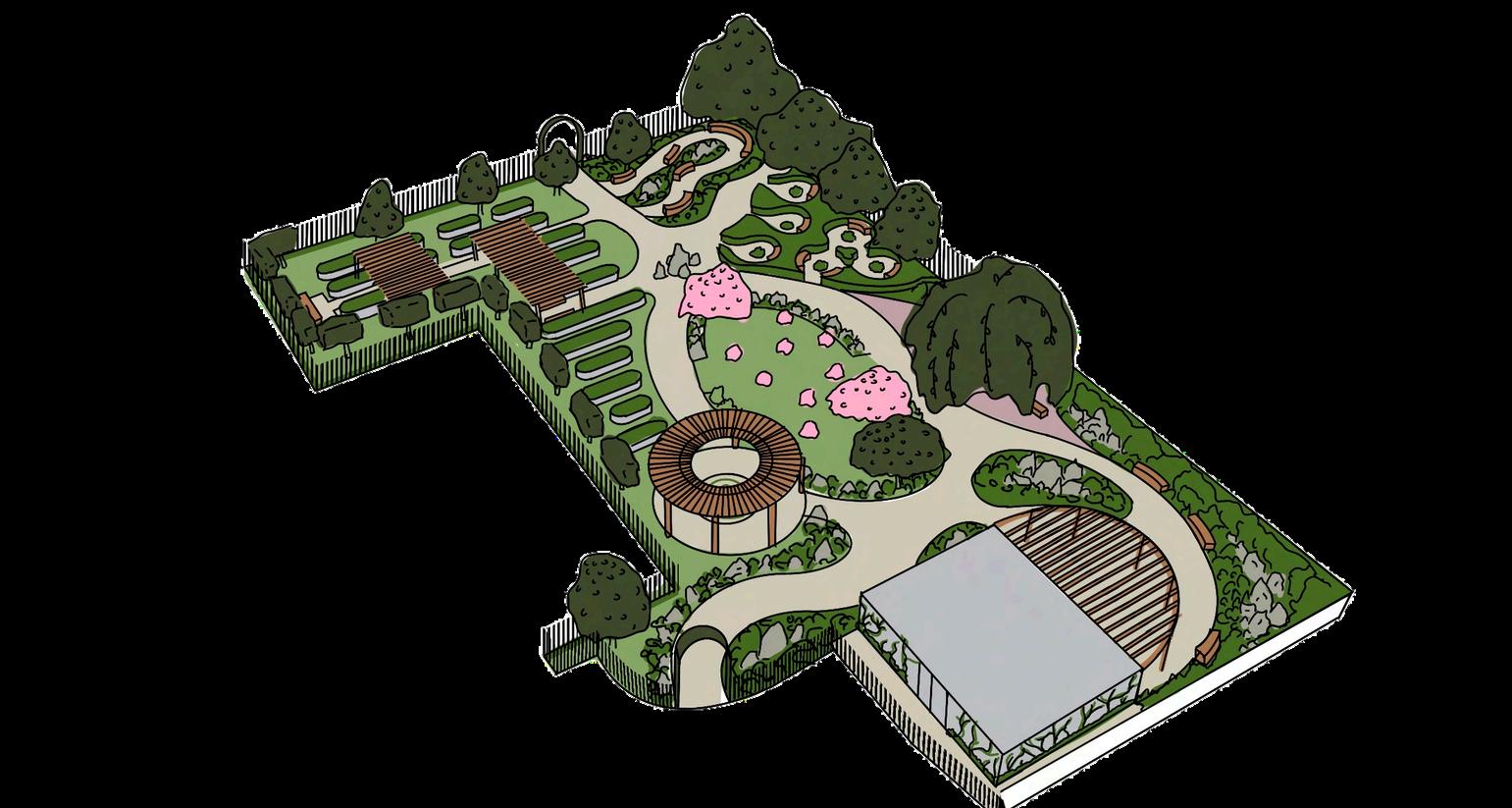
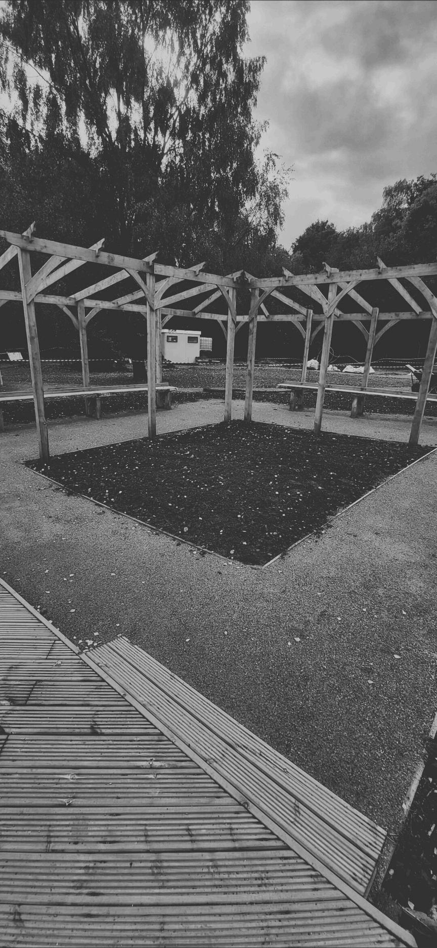
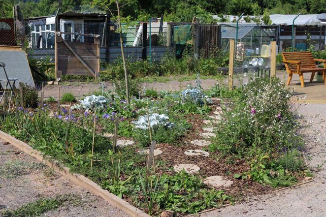
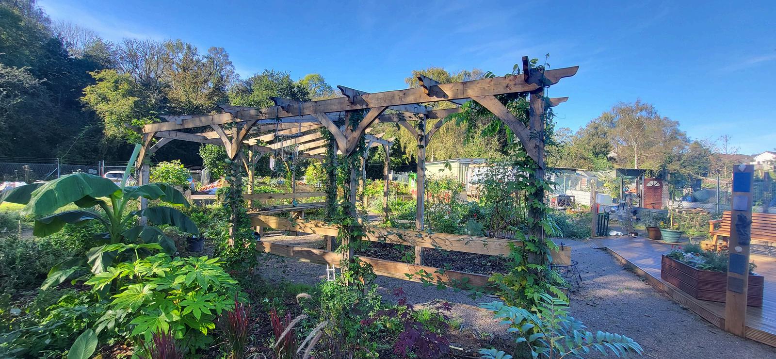
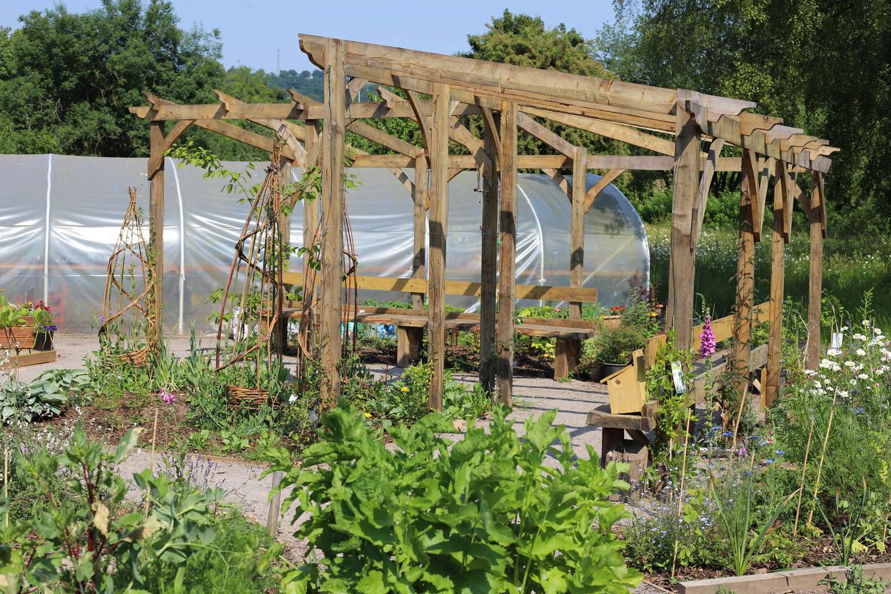
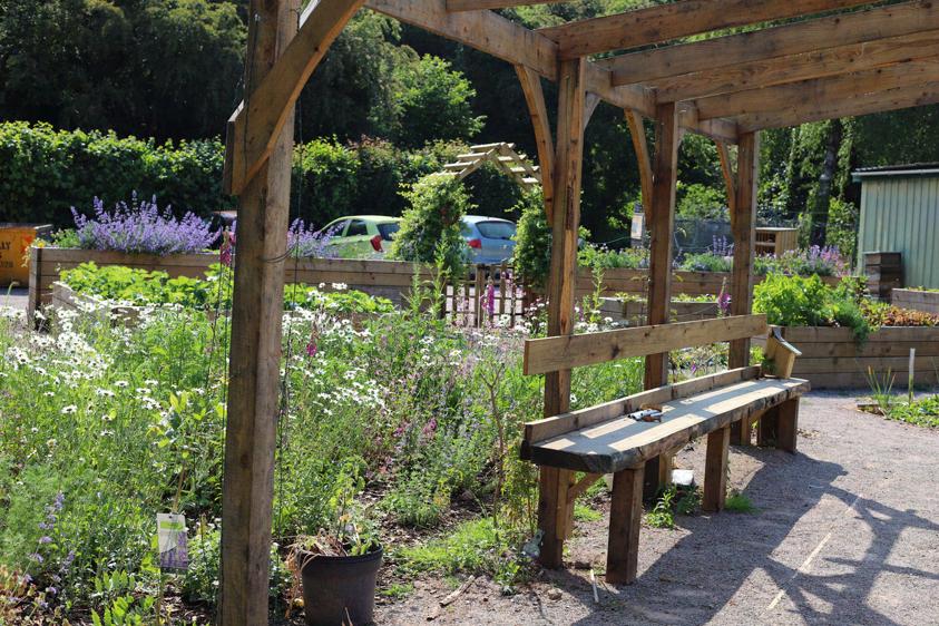
Meadow Street Community, Sensory Garden
Plan and sketches
Design Statement: Areas have been thoughtfully selected and strategically placed to evoke a rich tapestry of sensory responses, creating a connection between visitors and nature.
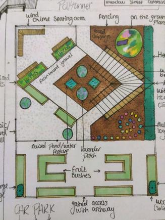
Plan Development

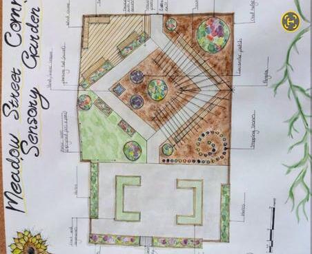
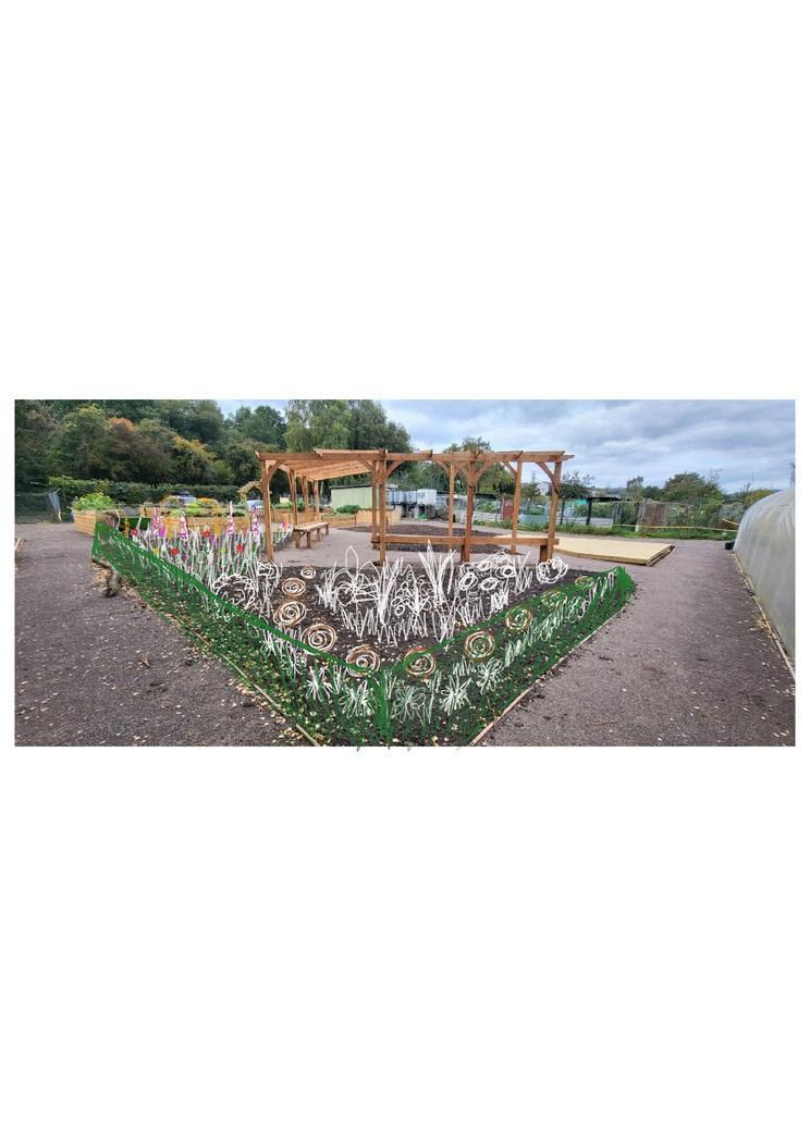

BEFORE
BEFORE BEFORE
AFTER AFTER AFTER
17
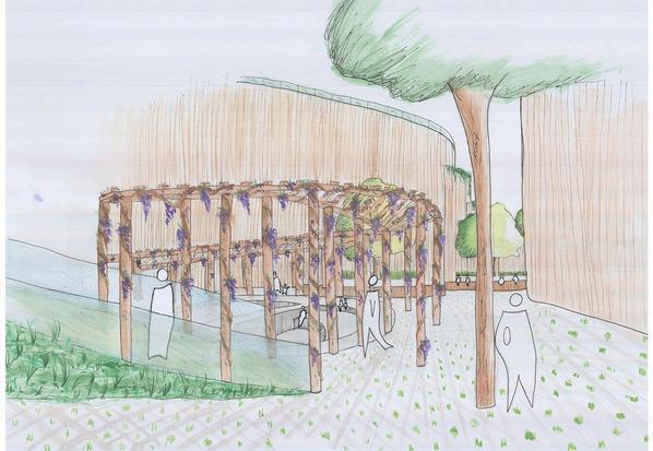
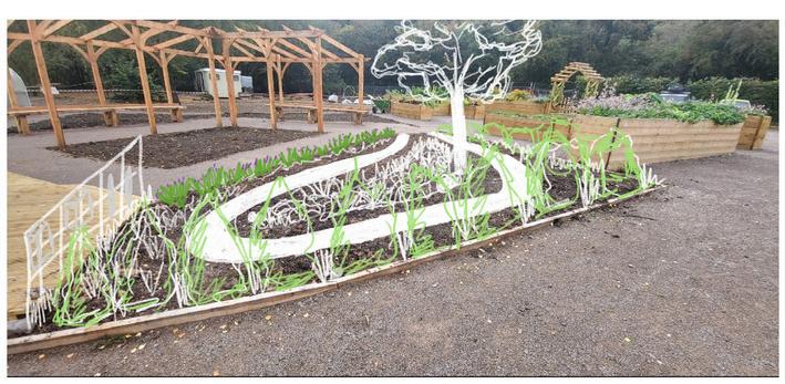
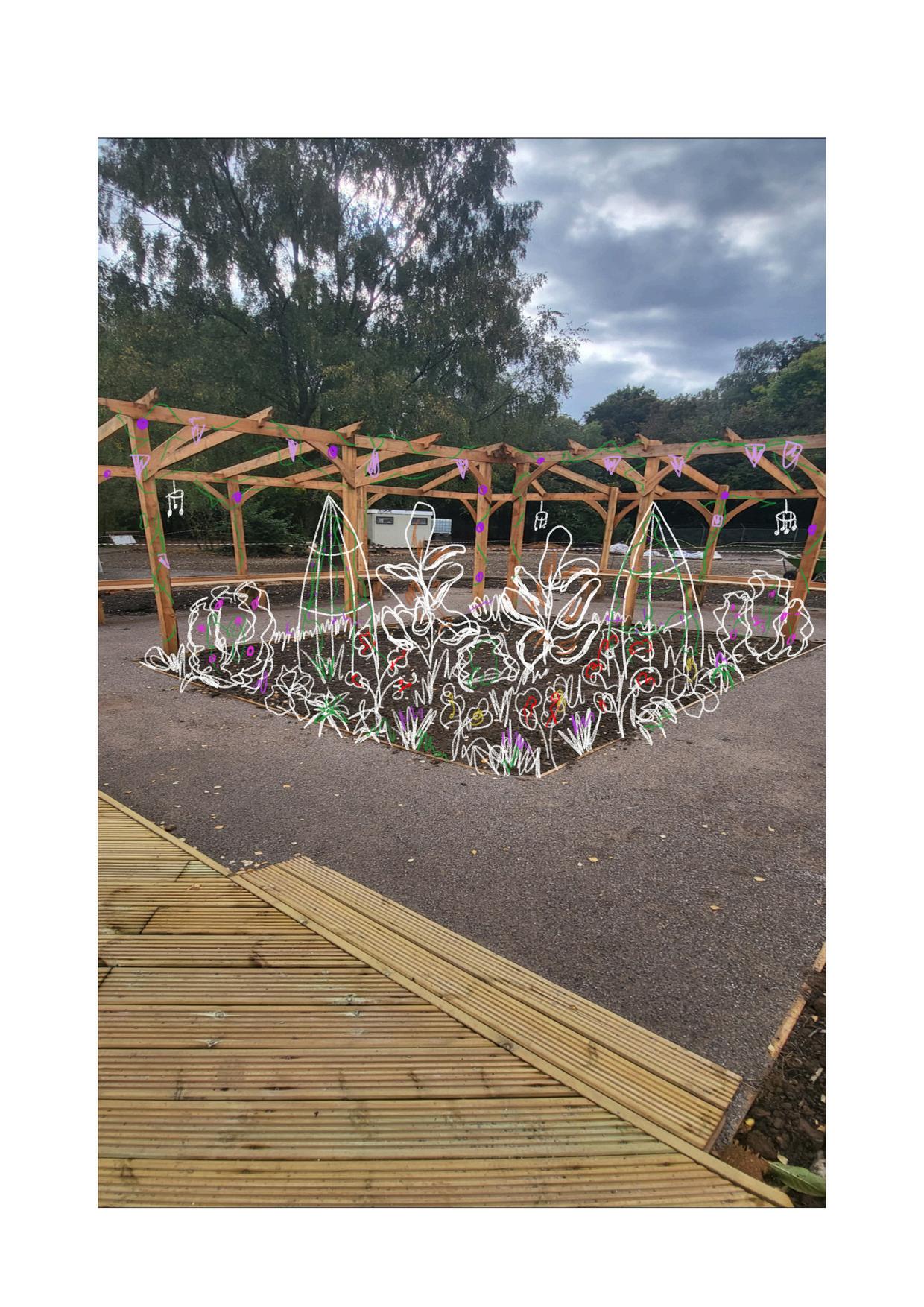
Meadow Street Community, Sensory Garden
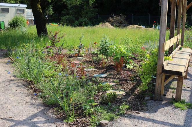
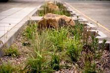
Wild planted area with stepping stones throughout and a native uk hedge boarder
Pergola with climbing Wisteria, Honeysuckle and Clematis. A seating area underneath provides views of the mountains in the distance
Decking area for event space and relaxing with a series of handmade wooden benches
A touch wall created that has a range of recycled items for sensory purposes
18
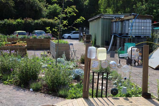
Build
Email: kacipurnell2@gmail.com
19
Linkedin: