Pearls by the Sea
Connecting while protecting the city to the sea
2
Table of Contents 3 Background 4 Literature 5 Study Cases 8 Project Context 10 Visioning 11 Big Moves 12 Masterplan 13 Masterplan Frameworks 14 Programs 16 Perspectives 18 Reference 20 3
TABLE OF CONTENTS
BACKGROUND


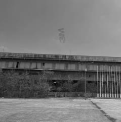
RE-TRANSFORMING JAKARTA WEST ANCOL
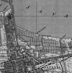
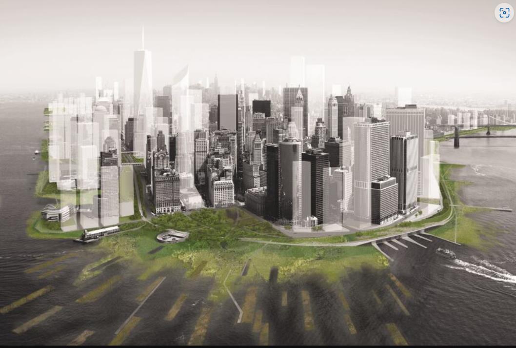
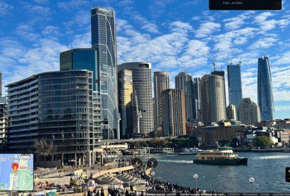
West Ancol is a 143 Ha area in west side of Ancol that is currently decaying. Covered by many industrial buildings that started to be abandoned, the area also contained several social, economy, and environmental problems. Located in the north seafront and have the proximity to Ancol, Kota Tua, Mangga Dua and Sunda Kelapa port, the area actually have hidden potential to be new vibrant waterfront city in North Jakarta. A new masterplan has been proposed with several new programs within it and one of them is to create a tourism and landmark district in the northern area which will be discussed in this study.
TOURISM & LANDMARK DISTRICT DEVELOPMENT AREA
19,16 Ha
With the vision of restoring North Jakarta as a 'waterfront city', the area will be dedicated as a public space where Jakartans can meet the water (the ocean) as well as the new 'face' of the area celebrated with modern cultural arts activities. Given its position on the waterfront, environmental issues such as the impact of climate change, sea level rise and land subsidence need to be considered in the development of the area.
 Mangga Dua
Taman Impian Jaya Ancol
Kota Tua
Sunda Kelapa
Kepulauan Seribu
The district development area is located on the waterfront on the northwest side with an area of approximately 19.16 Ha and is partly reclaimed land.
Mangga Dua
Taman Impian Jaya Ancol
Kota Tua
Sunda Kelapa
Kepulauan Seribu
The district development area is located on the waterfront on the northwest side with an area of approximately 19.16 Ha and is partly reclaimed land.
4
JAKARTA’S CHALLENGES AS COASTAL CITY
Land Subsidence

• Parts of Jakarta City is sinking with a rate of 4 cm per year, mostly caused by ground water extraction and construction loading (Aerts et al, 2011).
Sea Level Rise
• Based on the recording of sea level anomalies in the period 2003 - 2010 conducted by the KKP Research and Development Agency at the Nizam Zachman Fishing Port, Muara Baru, sea level on the north coast of Jakarta experienced a maximum increase in sea level of 4.8 cm over the past seven years or 6.8 mm per year (Pranowo et al. 2014).
Climate Change
Rise of global temperature of between 1.1 and 6.4 o C over the next century (IPCC, 2017)
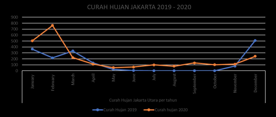
Heavy Rainfall
LITERATURE
5
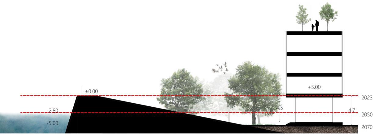
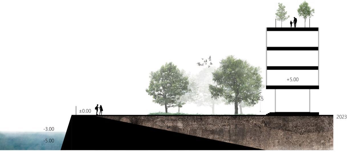
Diagram of Jakarta’s sea level rise and land subsidence within 2023, 2050 and 2070 period
ADAPTATION OPTIONS FOR PORT CITIES
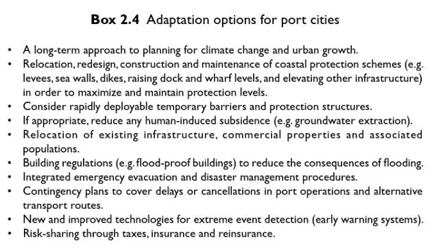
Aerts et al, 2011
FLOOD RISK MANAGEMENT STRATEGIES
According to Pilkey et al (2016) World currently urban coastal flood protections are :
• Using ground floor or basement for non-residential purposes to minimize storm damage
• Example : Rotterdam’s underground parking that doubled as water storage area during flood event
• Using parks as water storage that will be released after the flood conditions have passed
• Wetlands can be used as a buffer against flood and storms
• Large-scale Dikes and Levees (Dutch way to protect cities)
• Green-infrastructure
“Accommodating floodwaters in some area while protecting others”
6
LITERATURE
INNOVATIVE FLOOD DEFENCES IN URBANIZED WATER CITIES
Today’s challenge is to develop new flood control strategies and urban plans which appealing to the public and can cope with the effects of climate changes. Thus, application of multifunctional flood defences can help to tackling this challenge (Stalenberg, 2011).
Replacing existing dike by a concrete L-shaped retaining wall which incorporated with the foundation of the building
Levee with mild inner slope of 1/30, with a height of 10 m and width of about 300 m (>200m). Super levee is unbreakable and suitable for Japan for its frequent earthquake
Elevated houses, heightened quays, and enable sufficient flood protection. Integration between urban functions and flood protection.
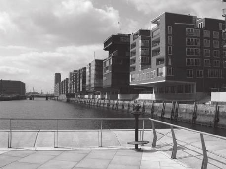
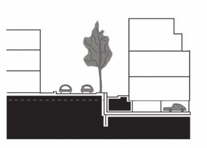
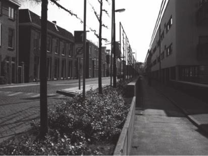 1. Dordtse Wand in Dordrecht, The Netherlands
3. HafenCity in Hamburg, German
2. Super Levee, Tokyo, Japan
1. Dordtse Wand in Dordrecht, The Netherlands
3. HafenCity in Hamburg, German
2. Super Levee, Tokyo, Japan
LITERATURE 7
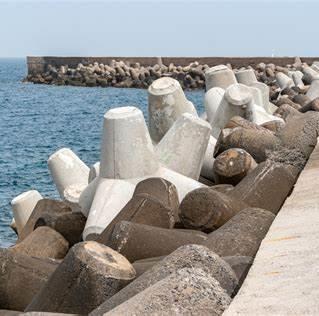
STUDY CASES
COASTAL PROTECTION
“Risings Current”
Exhibition about Sandy in New York by ARO, LTL, and nArchitects in MoMA (Museum of Modern Art) New York City, 2010
The projects exhibited creative solutions to re-envision the coastlines of New York and New Jersey with adaptive “soft” infrastructures that sympathetic to the needs of a sound ecology The architect teams believe that “hardinfrastructure” is not the best solution, instead, they promote the utilization of “soft” infrastructure which is more environmental-friendly.
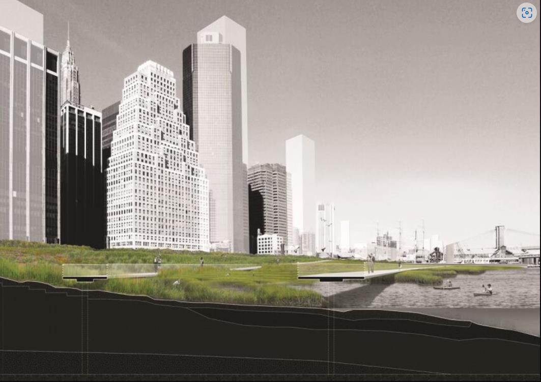
Build series of radial islands to break a storm surge’s momentum
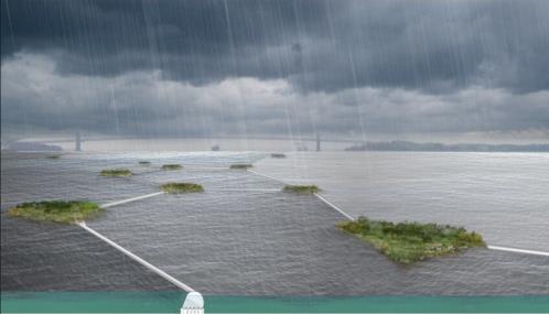
Salt marshes with gradual height
8
STUDY CASES
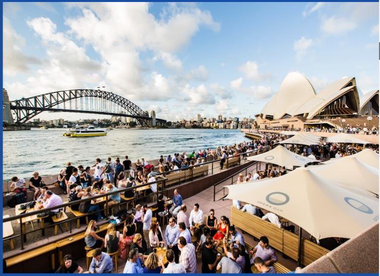
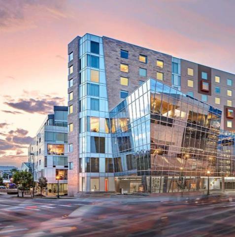
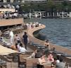
APPEALING WATERFRONT SEAWALL
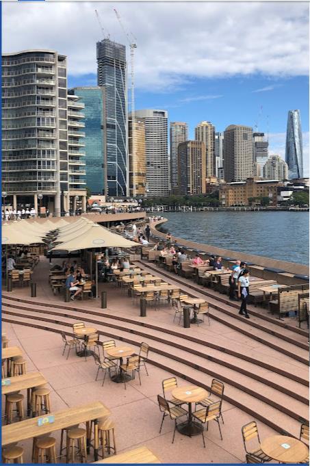
Sydney Opera House
The project exhibit an interesting waterfront city design detail in the form of split-level water edge that functioned as vibrant commercial area (sunset spot and bar).
9
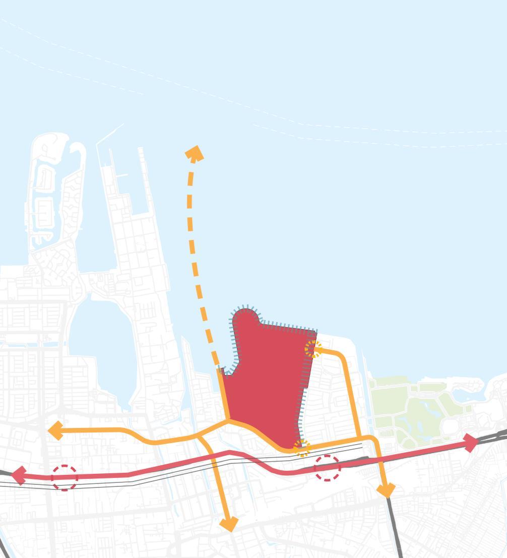
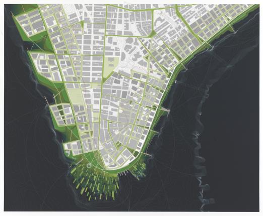
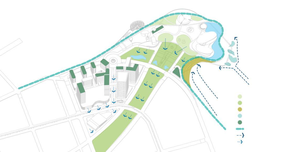
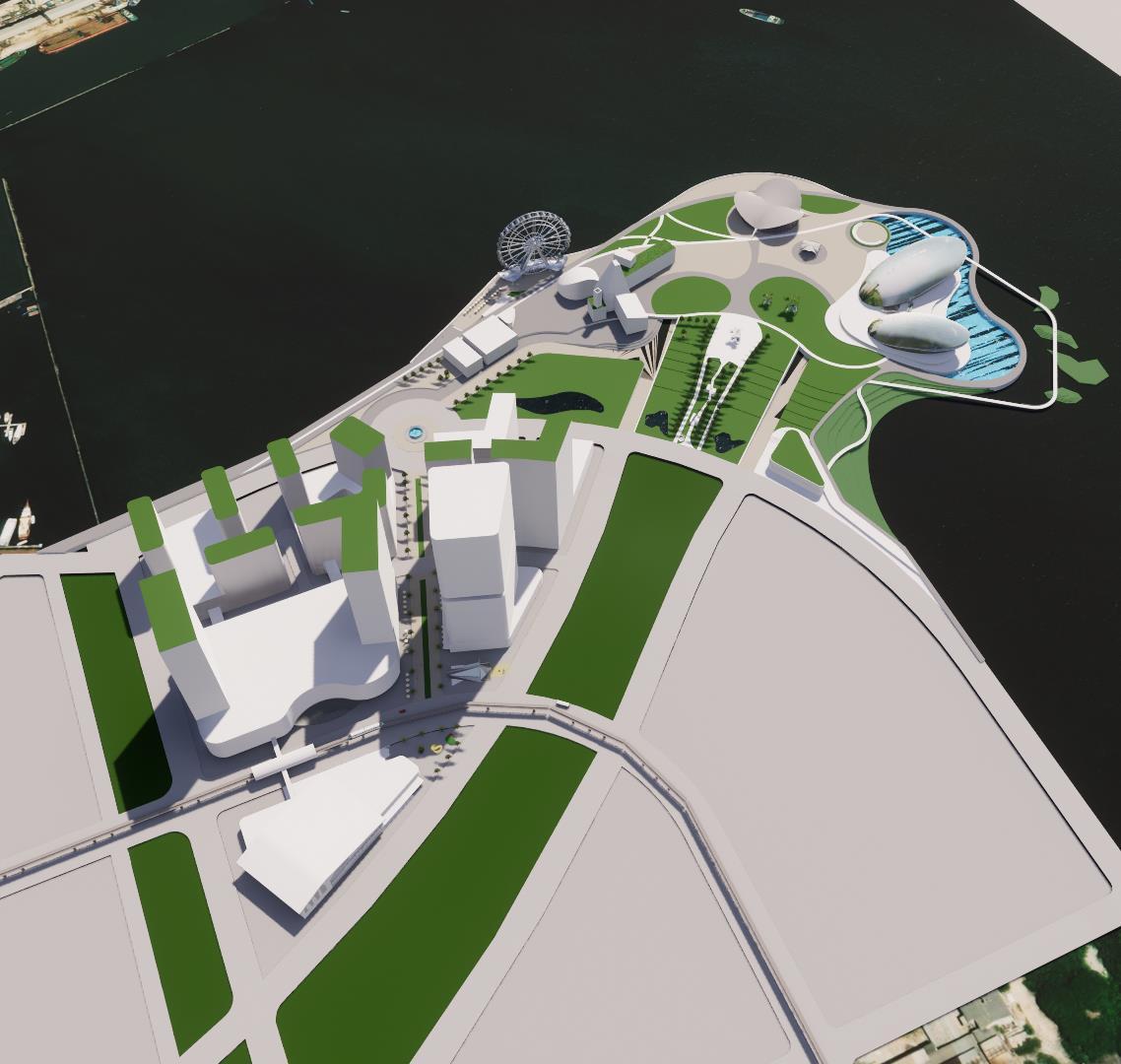
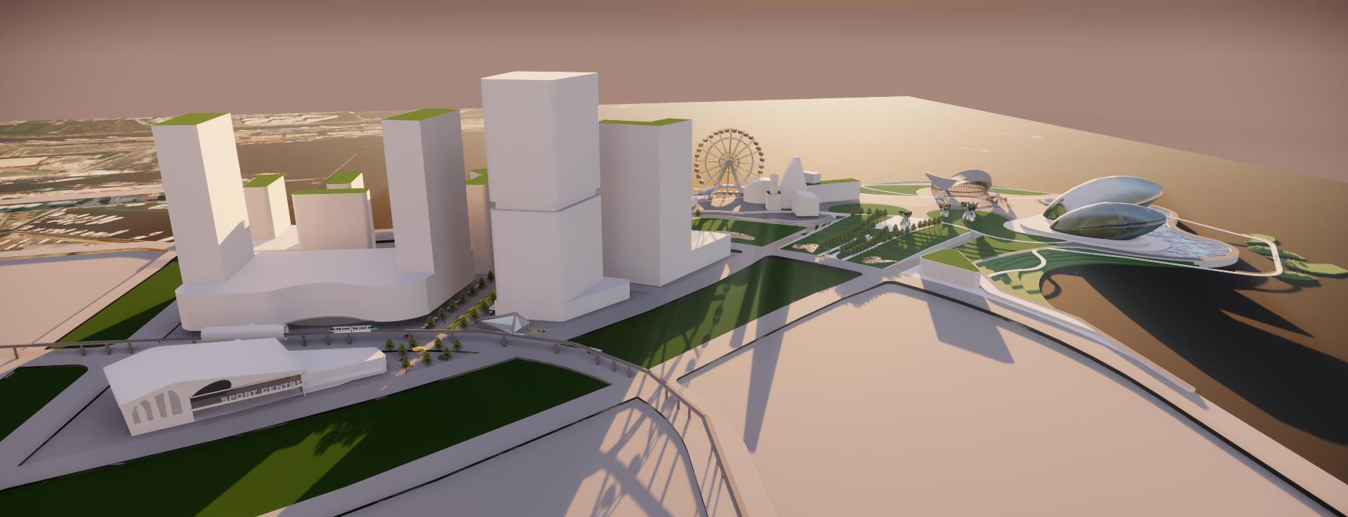
PROJECT CONTEXT
Proposed BRT Stop Proposed skytrain Commercial Mixed use Commercial Commercial offices Creative hub marina seafront residential Commercial Sport hub Cultural + landmark 10
Pearls by the Sea
A new jewel of Jakarta, where city meets the Sea, while enjoying civic spaces and learn about environmental sustainability and climate adaptation
WATERFRONT JEWELS
PUBLIC / CIVIC SPACE
CULTURAL ART SPACE
COASTAL PROTECTION
ACCOMODATION
VISIONING
11
Multifunctional Coastal Protection
Flood protection along the edge of waterfront promenade with combination of hard and soft infrastructure which can tackle the impacts of climate change and enjoyed by city’s people (Stalenberg, 2011).
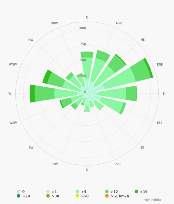
Special treatment in the northeast-west side of the coastline due to the largest amount of wind flows.
2
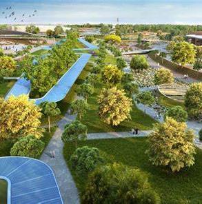
Environmentally Resilience
Utilizing blue and green infrastructure such as constructed wetland, vegetated swales, storm-breaker vegetation and green roof to tackle water-related environmental issue, seeking fort micro-climate comfort and accommodating windrose.
Sustainable Lifestyle Attraction
Create new hotspot for civic recreational and educational activities in Jakarta, which promote walkability by creating active parks and meaningful urban nodes.
BIG MOVES
1
12
3
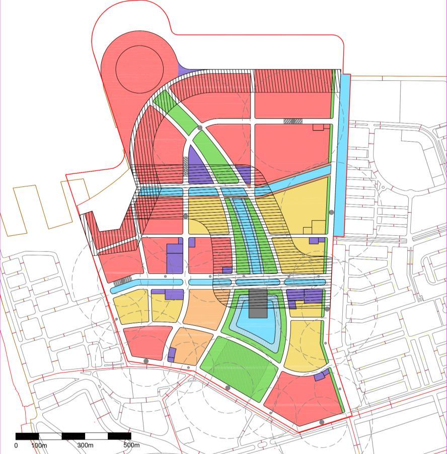
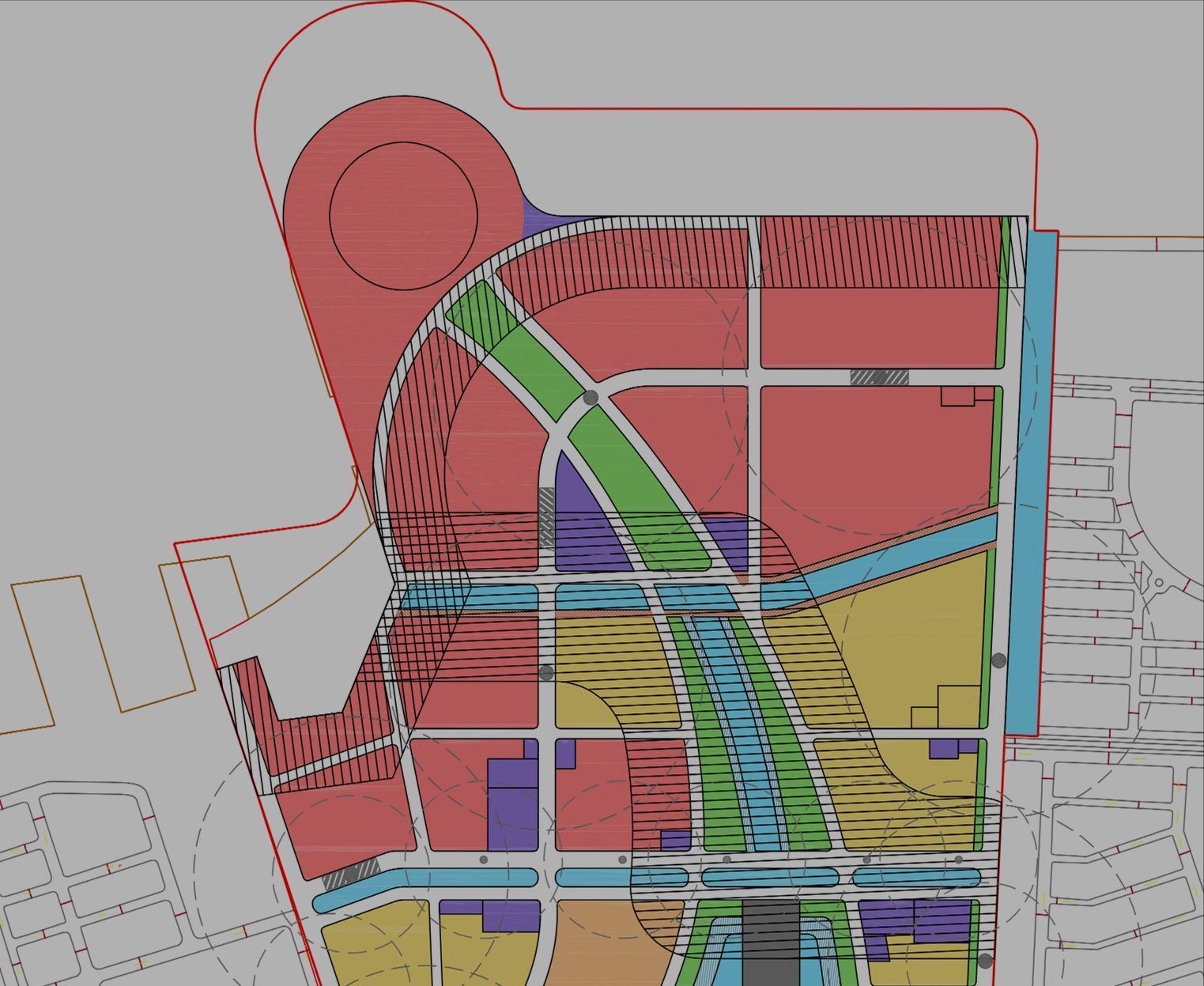
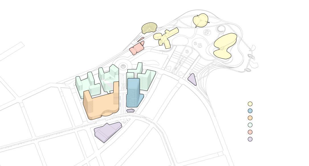
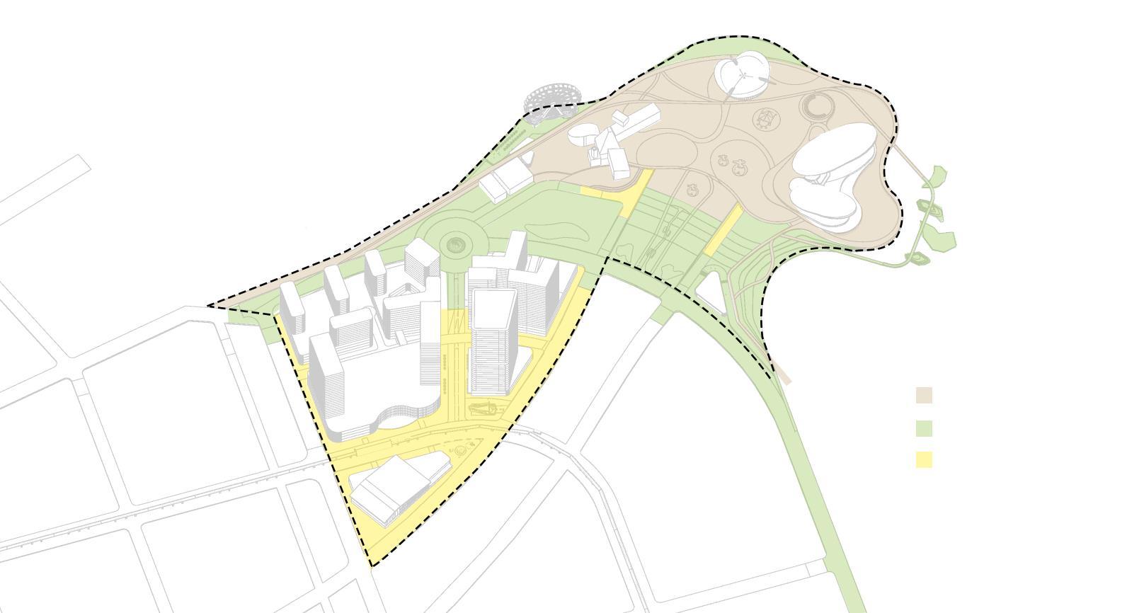
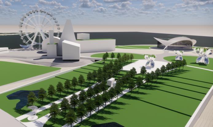
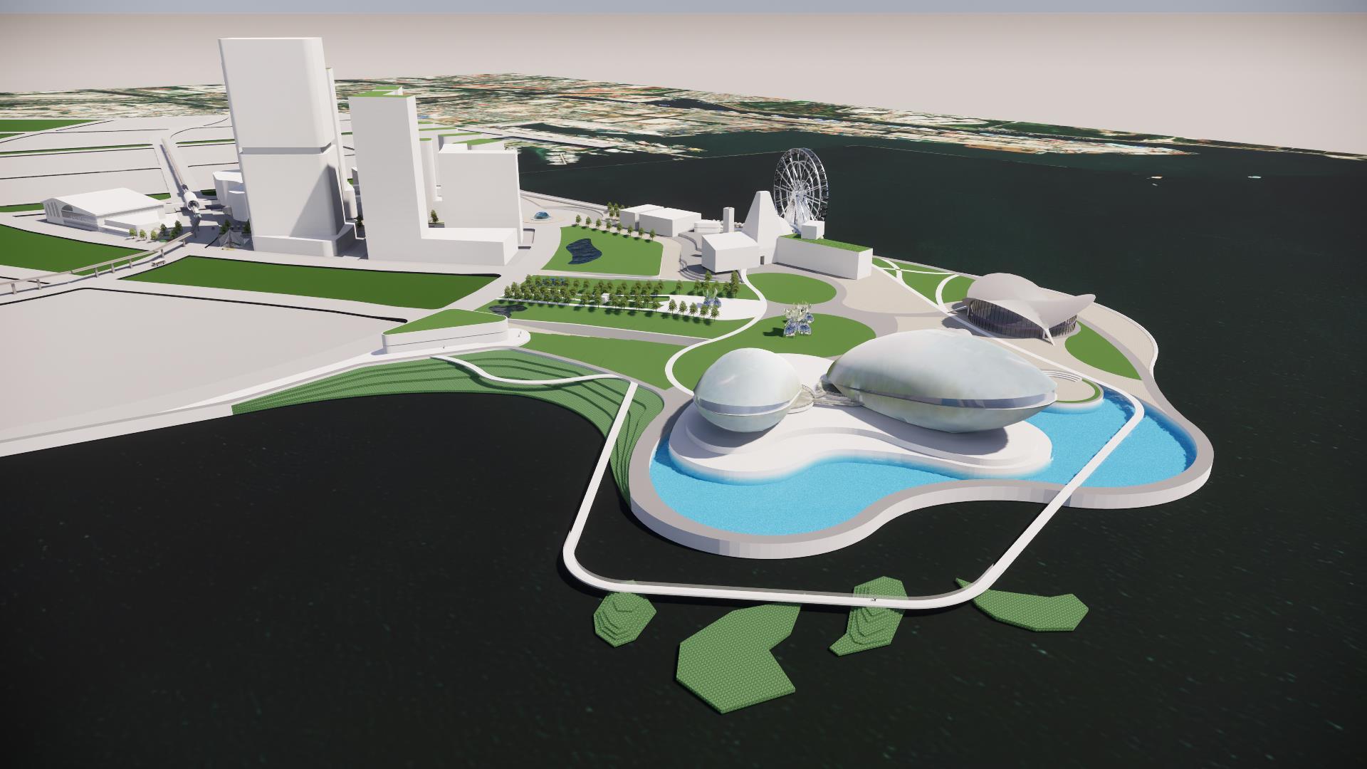
MASTERPLAN
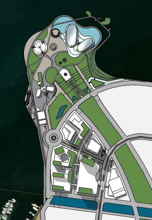
Pearls by the Sea
Legend
1. Pedestrian Plaza
2. House of Performing Art
3. Cultural space
4. Sustainability Museum
5. Below level promenade A
6. Below level promenade B (with Ferris Wheel)
7. Amphitheatre
8. Above-sea boardwalk / bridge
9. Constructed wetland
14. Office
15.
16.
17.
18.
19.
20.
21.
1 2 3 4 5 6 7 8 9 11 10 12 13 13 13 13 14 15 16 18 19 20 20 21 21
10. Vegetated swales 11. Tourist information center 12. Commercials / FNB 13. Hotels
building
Mixed use (mall and apartments)\
Sports Hub
BRT Stop
Skytrain station
Church
Waterfront sidewalk
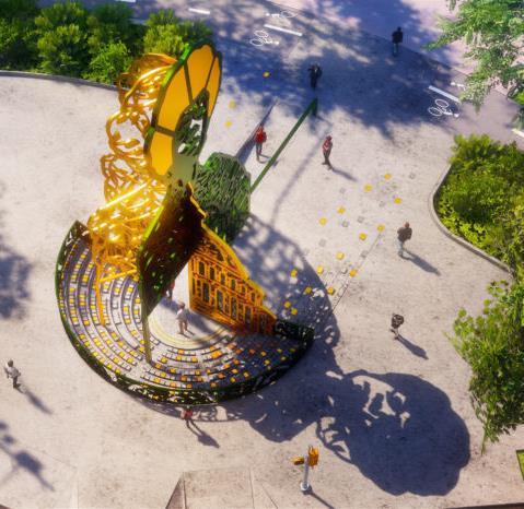
Artwork sculpture
13
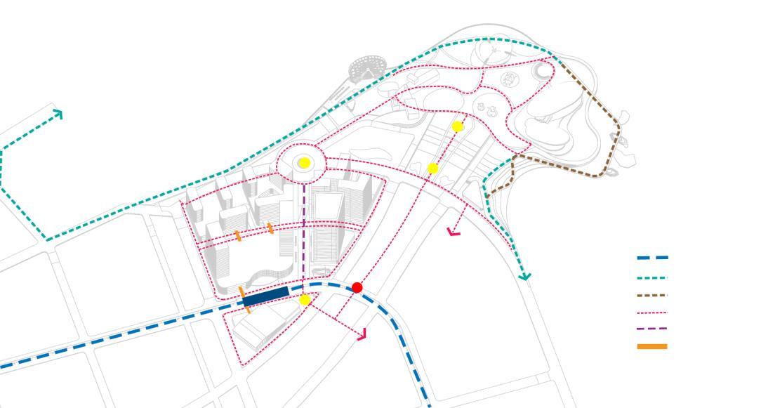
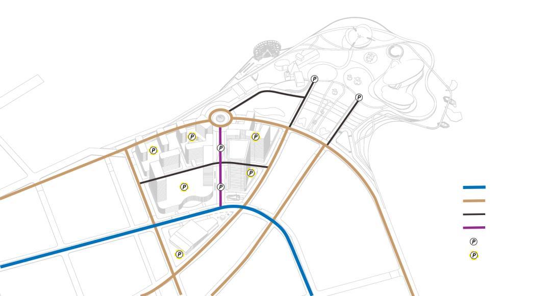
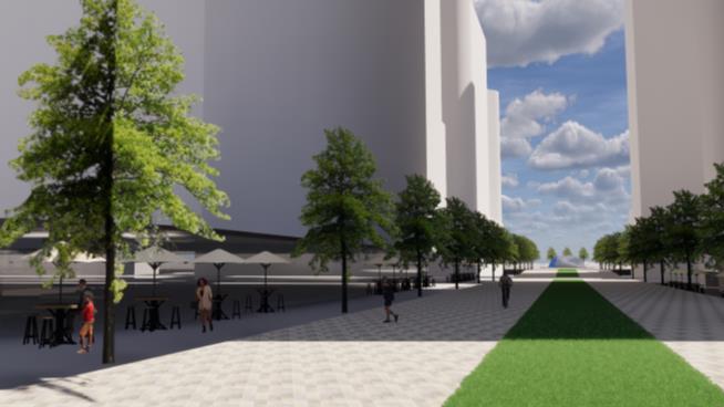
MASTERPLAN FRAMEWORKS
VIBRANT & VISUALLY CONNECTED
Main anchor
LAND USE/ZONING
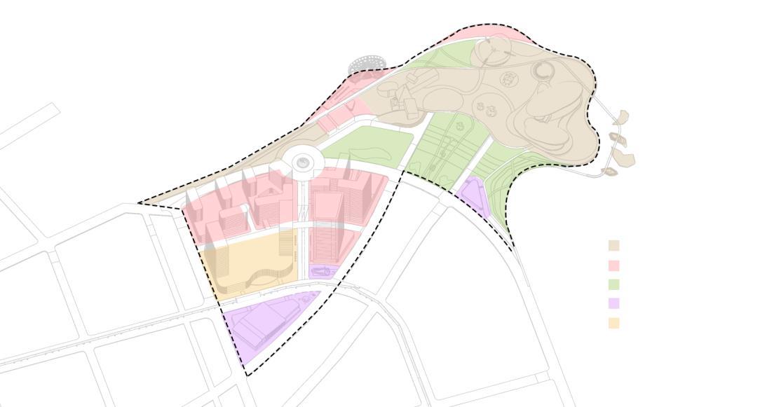
Public space & facilities
Commercial Green area
Amenities
Mixed use
VEHICLES & PARKING
Primary artery ROW 24
Secondary artery ROW 18
Tertiary street ROW 12
Shared street
On-street parking
On-building parking
PUBLIC TRANSPORT & PEDESTRIAN MOVEMENT
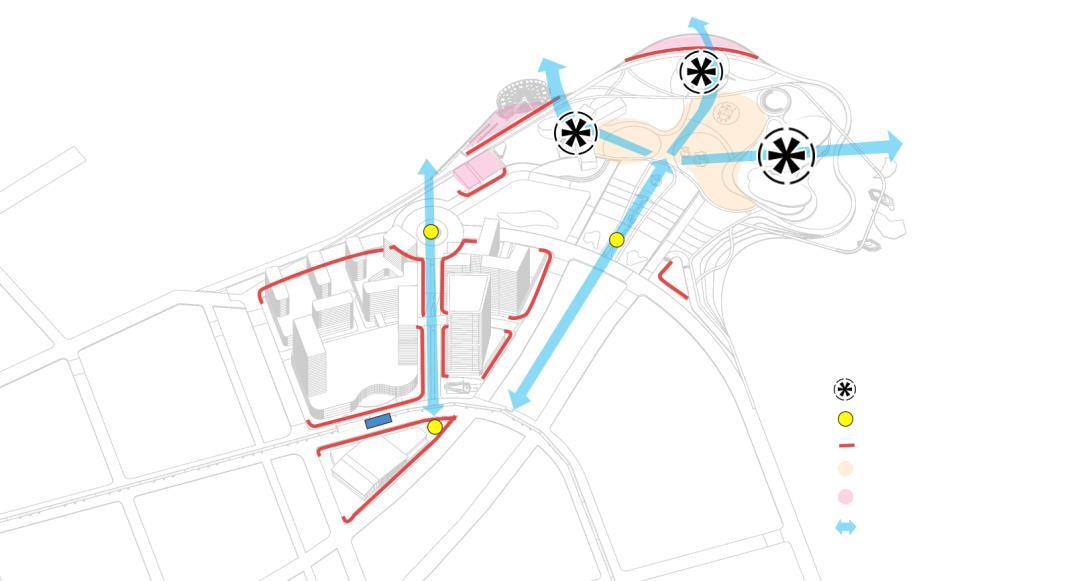
Sky train & BRT Lane
Seawall promenade
Boardwalk/bridge above water
Sidewalk pedestrian
Pedestrian between building
Second-level connecting bridge
Connectivity nodes
5 min walk radius (350 m)
Artwork as nodes & identity booster
Active edge
Amenities
Mixed use
Visual axis to sea
BUILDINGS
Cultural art space & museum
Office Mall & Apartments
Hotels
Commercials (FNB)
Amenities (Sport hub, church, TIC)
BLUE-GREEN INFRA


Vegetated rooftop (grass)
Green area + vegetated swales
Constructed wetland
Mangrove islands
Green roof buildings
Protective seawall
Sea wave / storm surge
Water runoff
VISUAL + PEDESTRIAN AXIS Break storm surge momentum Filtering sediment & excess nutrient swales 14
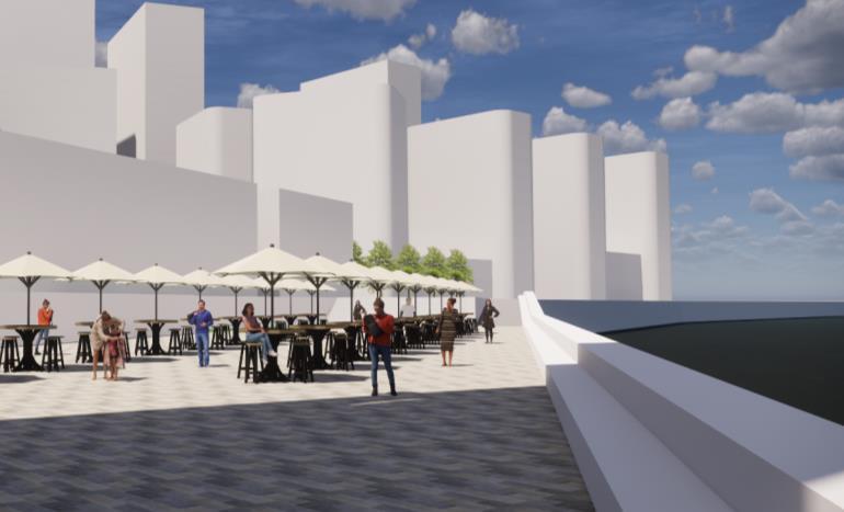
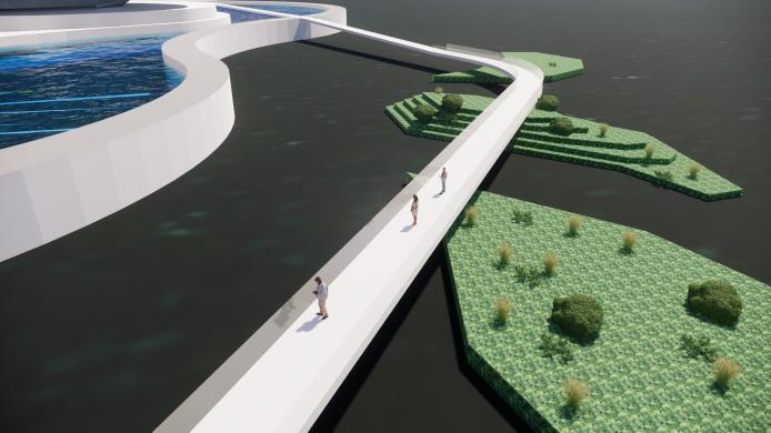
Below-level promenade
COASTAL PROTECTION/SEAWALL
• Split level promenade
• Using ground floor as non-residential use or as parking space (Pilkey, 2016).
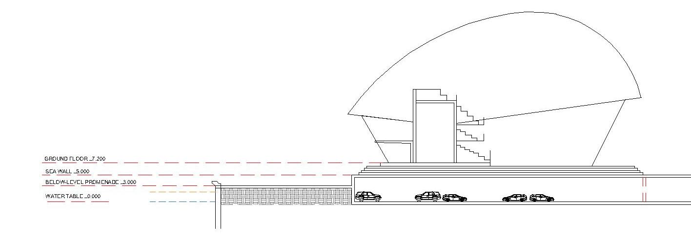
• Use curve shape seawall profile to make the tide turns back
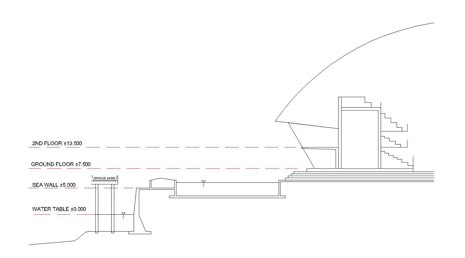
• Gives setback from the seawall to building to anticipate land subsidence
• Create islands + put mangrove to minimize the tidal storm-surge pressure
• Put walkboard / bridge to the islands provide people connection to water
SITE ELEVATION + 5.00 up to +6.00 m +3.00 m +1.00 up to +2.00 m A B
MASTERPLAN FRAMEWORKS
A B
Island + mangrove 15
SECTION-A
SECTION-B
 Boardwalk
Plaza pedestrian next to green infra
shared street with active edge
Boardwalk
Plaza pedestrian next to green infra
shared street with active edge
16
Below level promenade for commercials
PROGRAMS
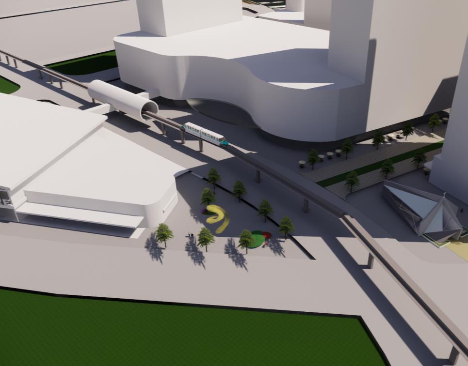
 Plaza + artwork next to Sports Hub
17
Transit hub
PROGRAMS
18
PERSPECTIVES
19
PERSPECTIVES
Thank You
REFERENCE
Aerts, Jeroen, et al. Climate Adaptation and Flood Risk in Coastal Cities, Taylor & Francis Group, 2011.
20
