PORTFOLIO
By Keely Bengtson

By Keely Bengtson
My Thesis studio investigated how the Pub can reinvent itself as the community centre of an isolated and growing township. During this project, I researched the history of the local Pub and how it presents an opportunity to develop a community-led initiative without the influence of the property developer or government bodies. Drawing on extensive historical precedent both locally and abroad I sought to establish how the pub could evolve to fix broken communities and become the centre of a semi-rural housing estate.
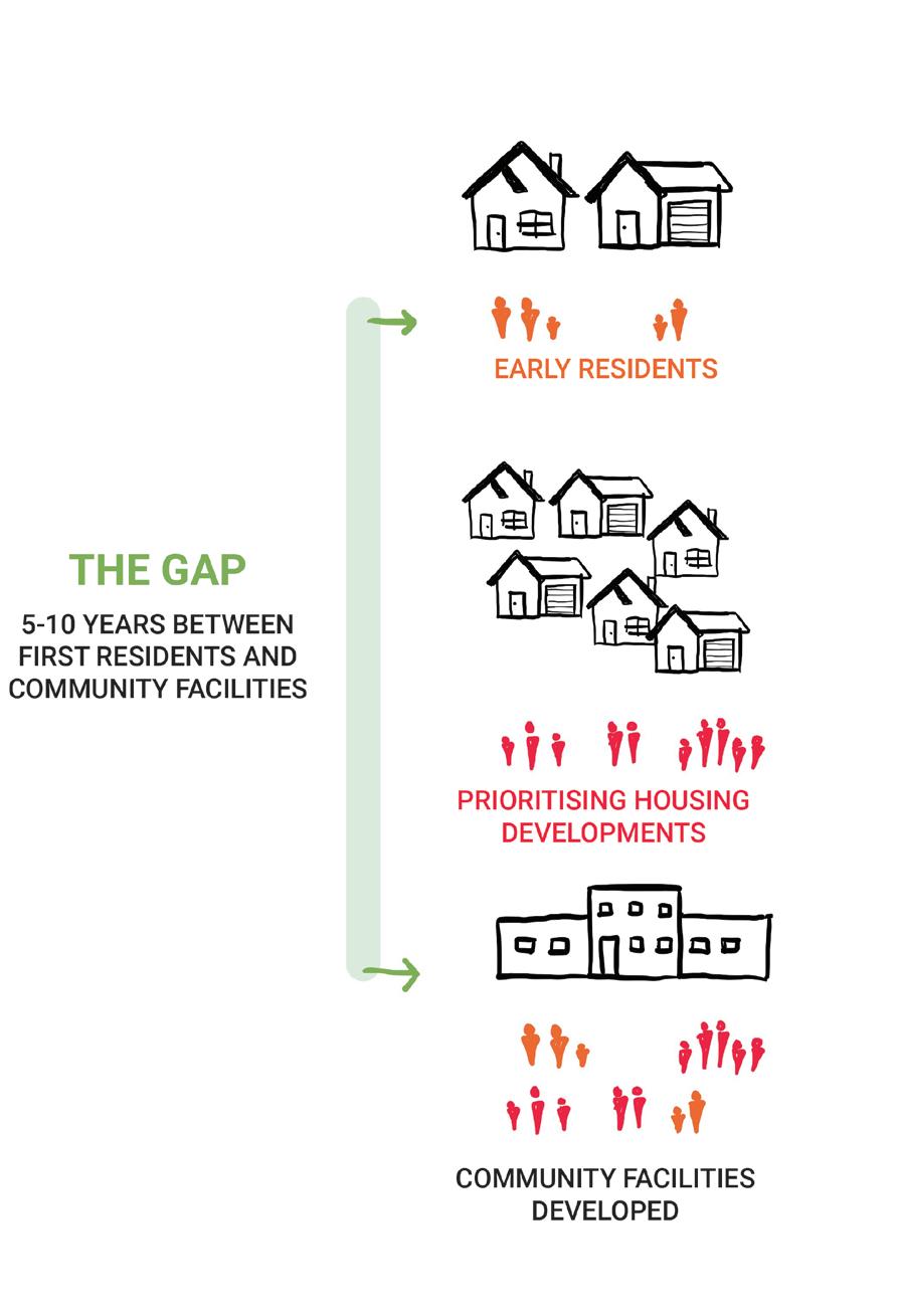
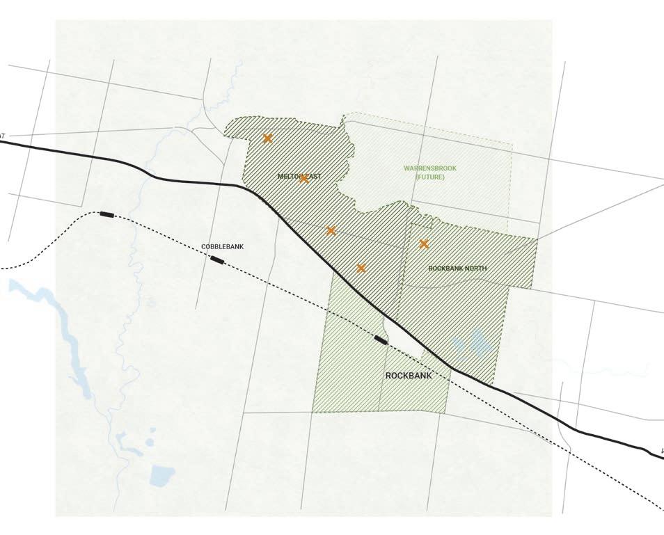
The site selected for this project is in the growth area of western Melbourne, where housing developers ‘cash in’ prioritising housing development over community facilities, often leaving a 5-10 year gap between the first residents moving in and the beginning of works on community assets.
Completed for Masters Thesis Studio 12 (Pub+), Semester 1, 2023.
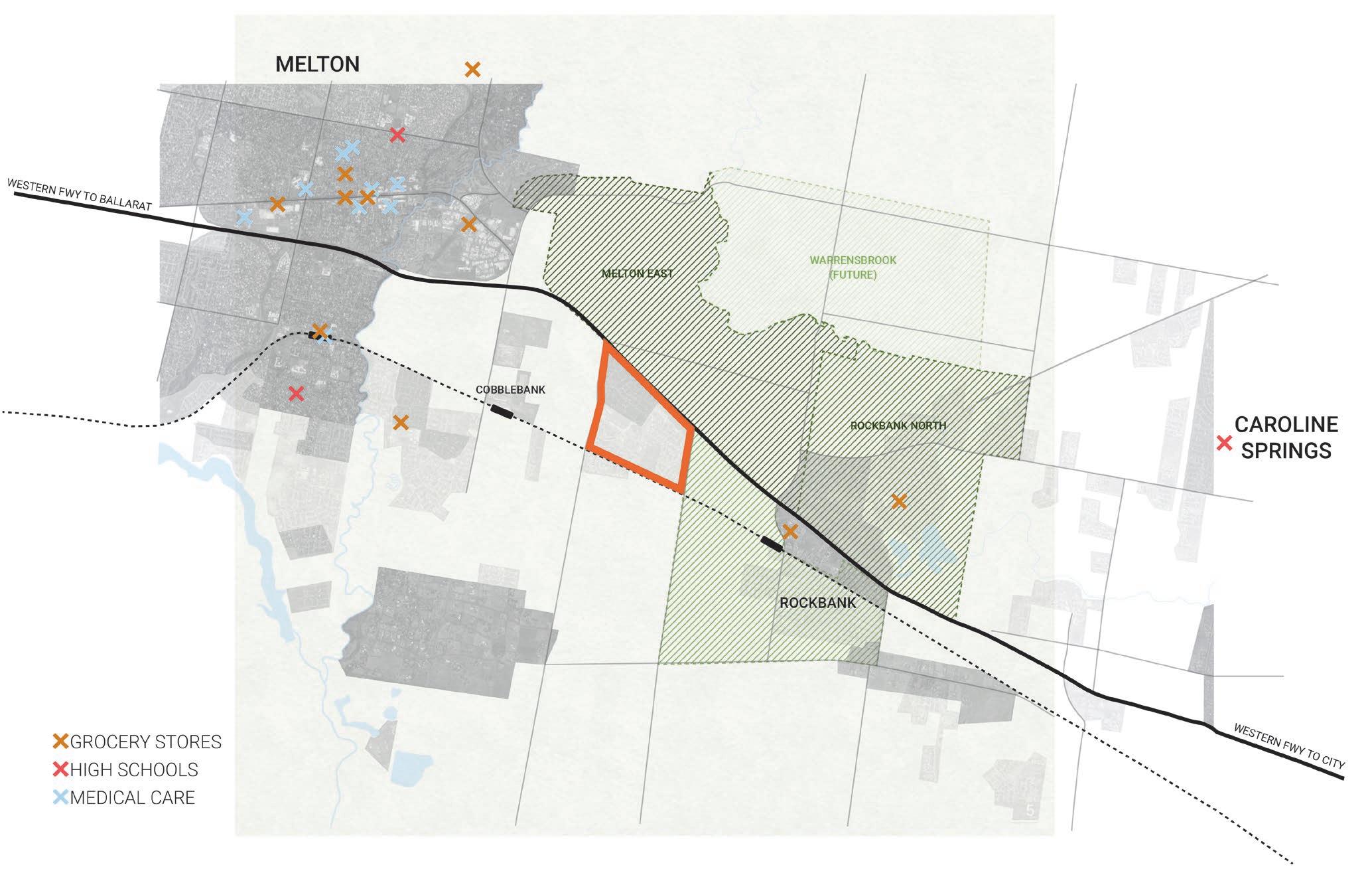
WESTERN GROWTH REGION
MAP DETAILING THE INFRASTRUCTURE ISOLATION OF THORNHILL PARK N
This Project sported from the history of pubs in Australia. During the Gold rush era, pubs played a grassroots role as drivers of community growth, often the first major public buildings erected in burgeoning towns. These Pubs were the first example of the third place, which formed a separate social environment away from the “first place” the private dwelling and the ”second place” the workplace.
However, this essence of the pub has been largely lost in recent years as they have been heavily commercialised, reliant on generating profits often at the expense of patrons and society.
This project seeks to demonstrate a new model of pub that retains the third place and community service model without the reliance on commercial profitability.
The pubs history also extends a connection to the development
of housing.
In Victorian England, speculative housing developers frequently built Pubs as their first building when developing new housing estates. The plan worked twofold, during construction the pub would act as the construction offices and the worker’s canteen. Once housing was built, their value would be bolstered by the addition of already established nearby amenities.
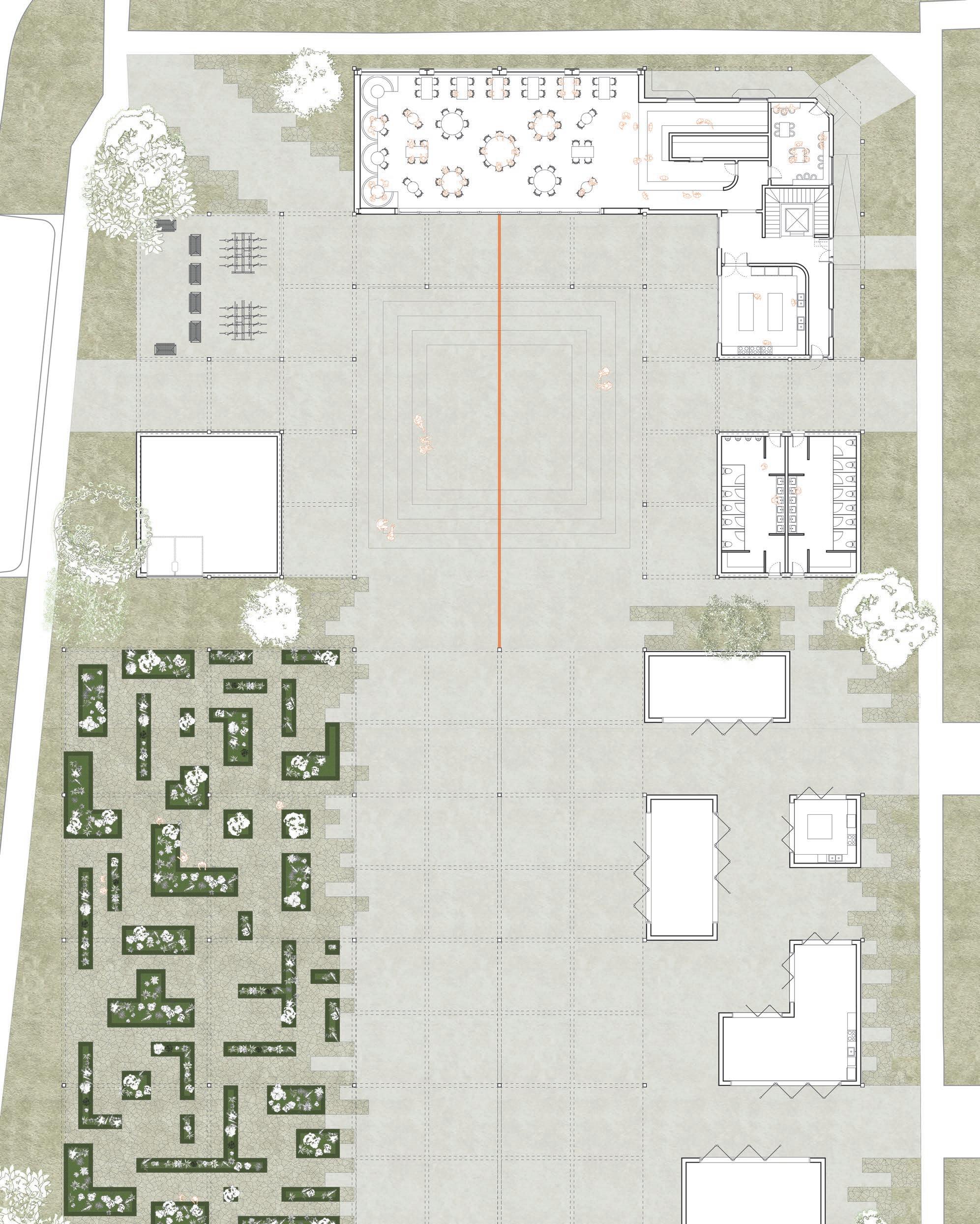
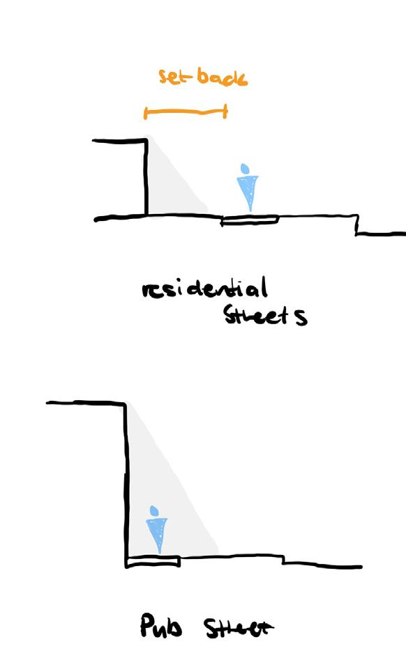
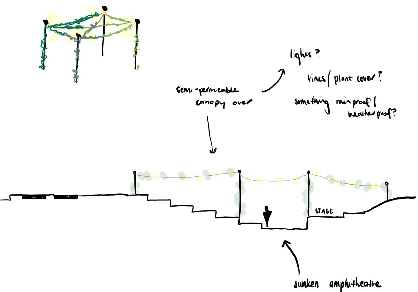
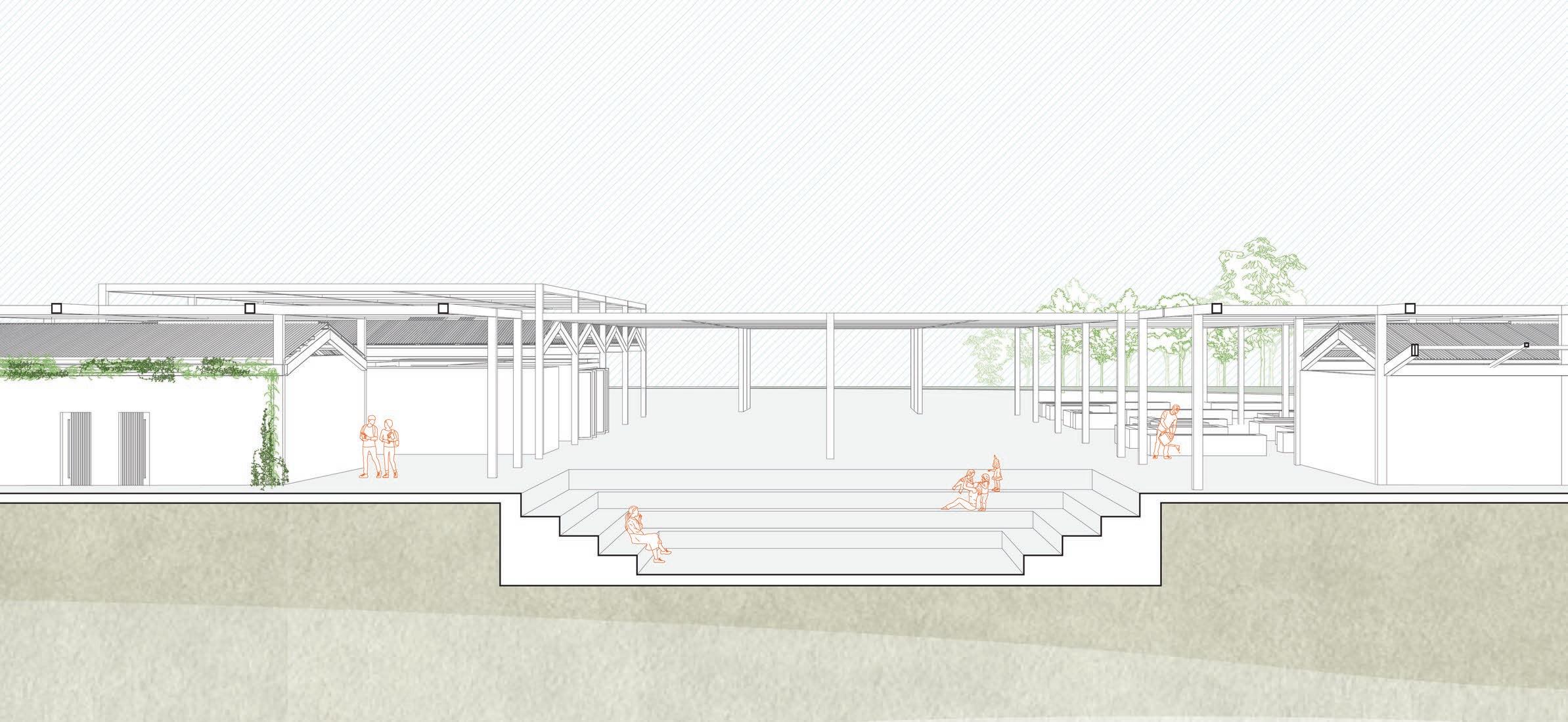
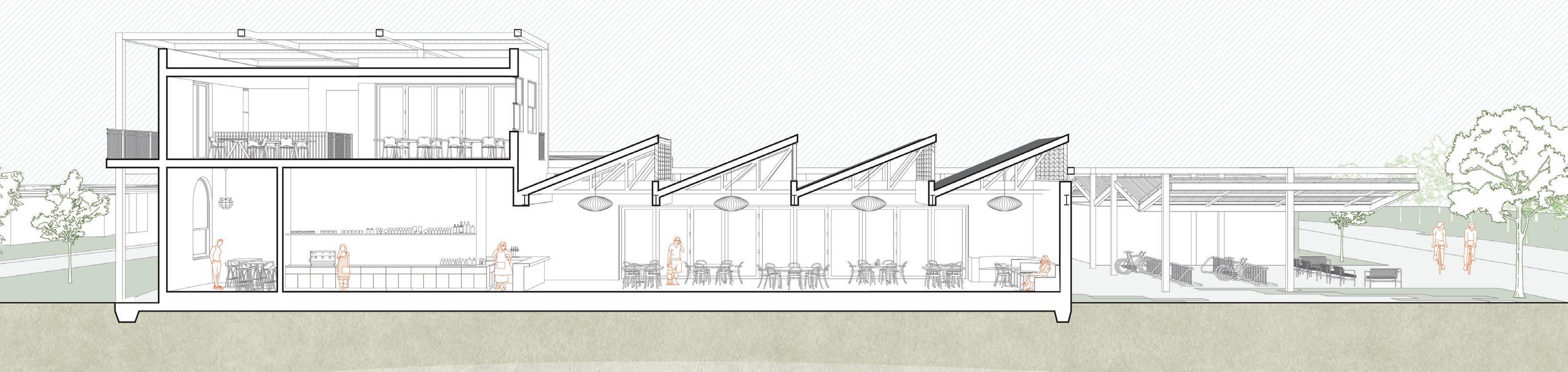
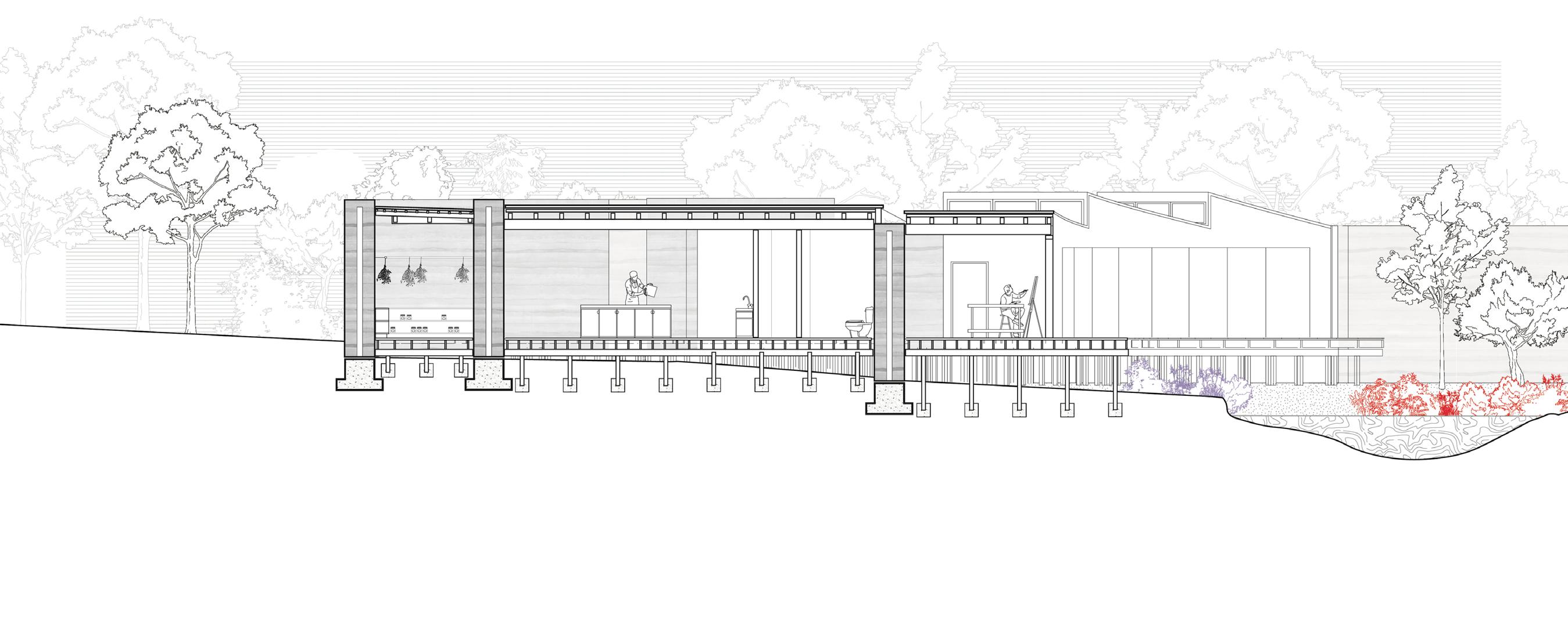
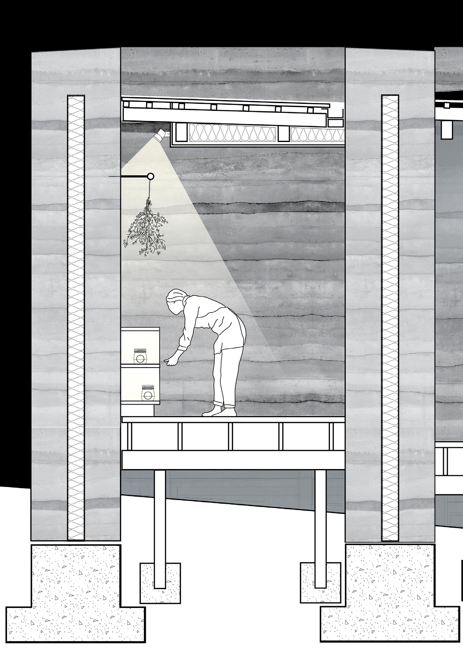
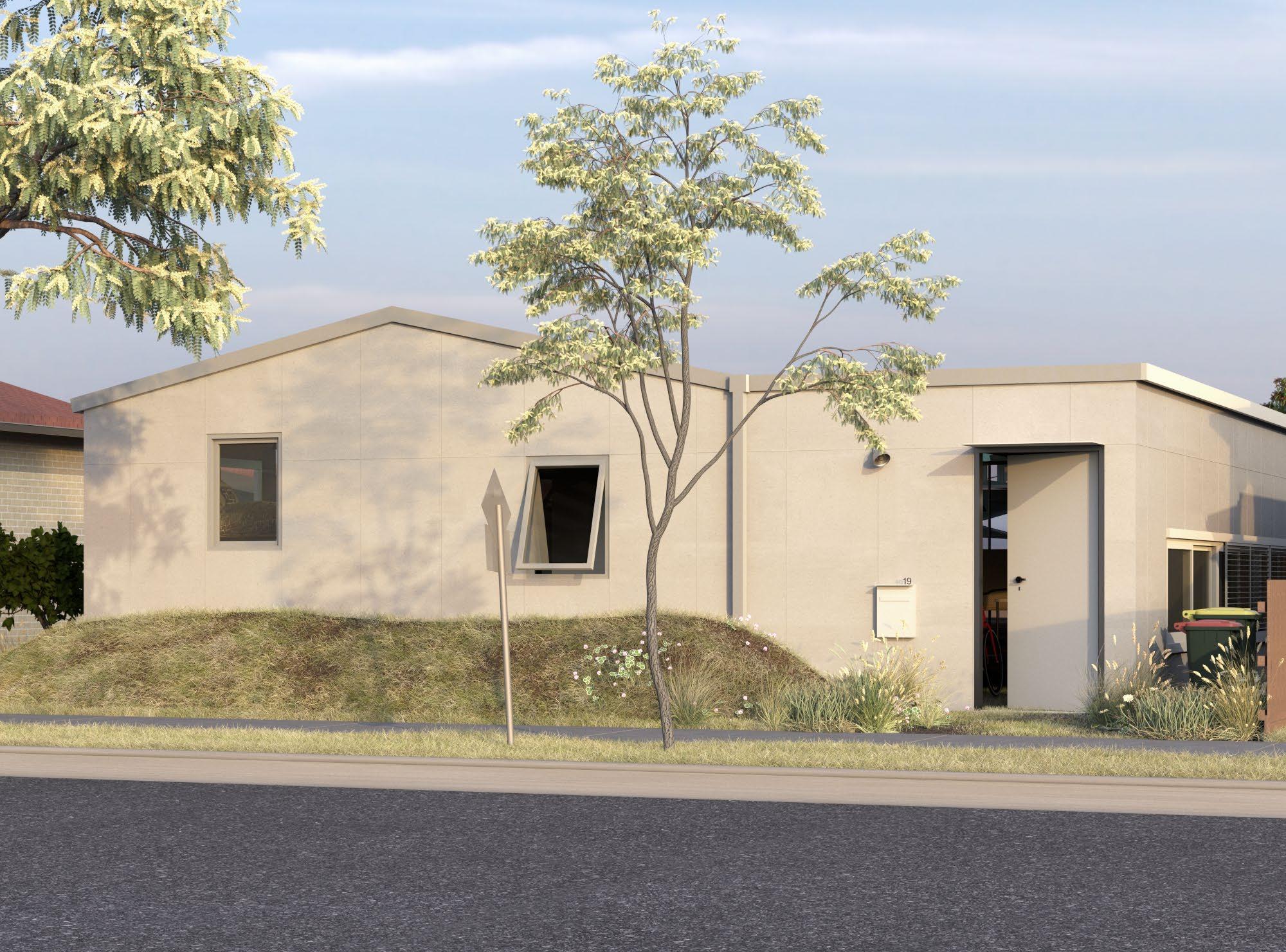
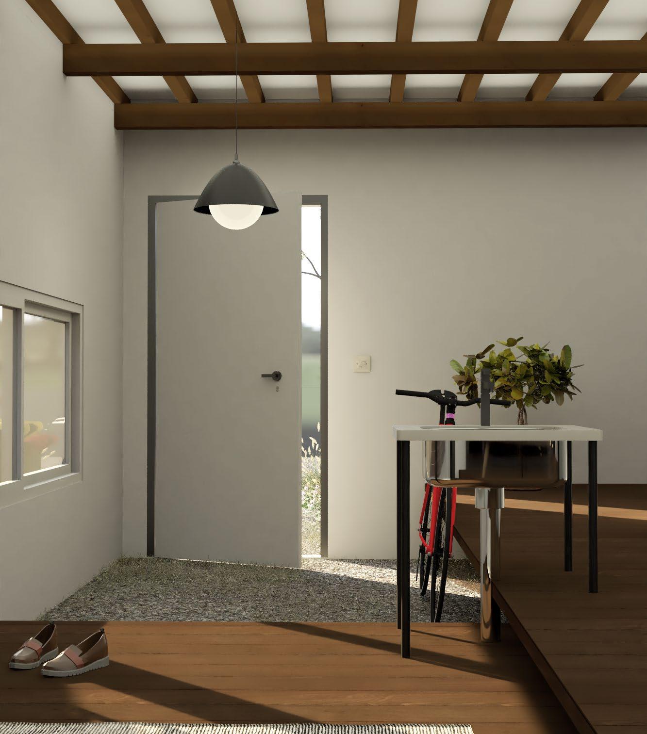
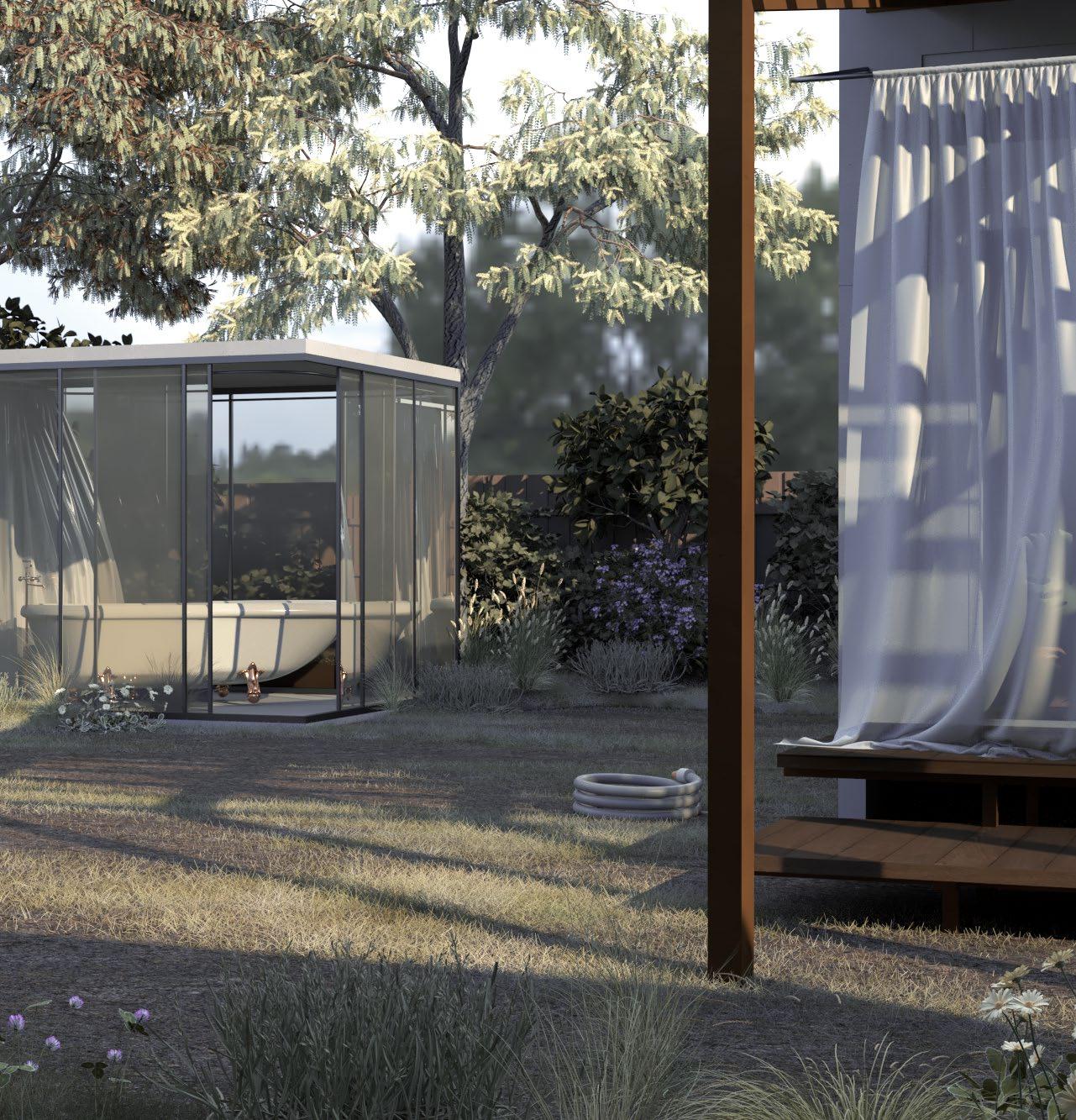
The major challenge I had to overcome throughout the semester was the question of creating a sense of enclosure in a vast open space. This issue was flagged early on during an initial site visit during the semester. The site is located on a housing estate developed on what used to be agricultural land. As a consequence, the area is isolated, flat and lacking any established trees that could create a sense of shelter overhead. This, combined with the monotonous single-storey dwellings created an uncomfortable user experience.
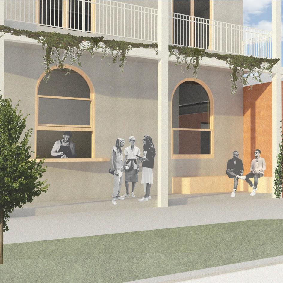
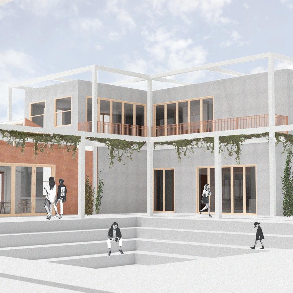
Throughout the development of this project, a variety of strategies were implemented to counteract this sense of vulnerability due to a lack of shelter. This includes pushing the building mass to the edge of the site to create a more imposing edge condition and privatise the central space by removing its visibility from the street. In conjunction with the sunken landscape forms a more inviting and secluded central space.
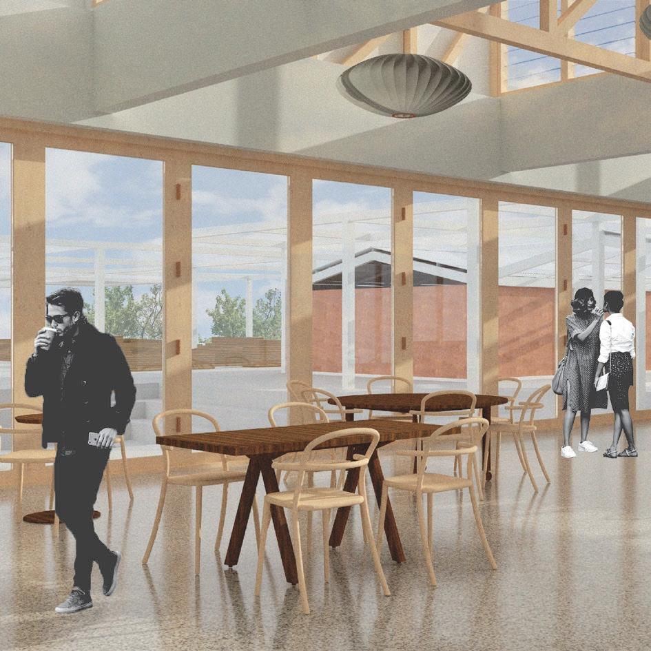
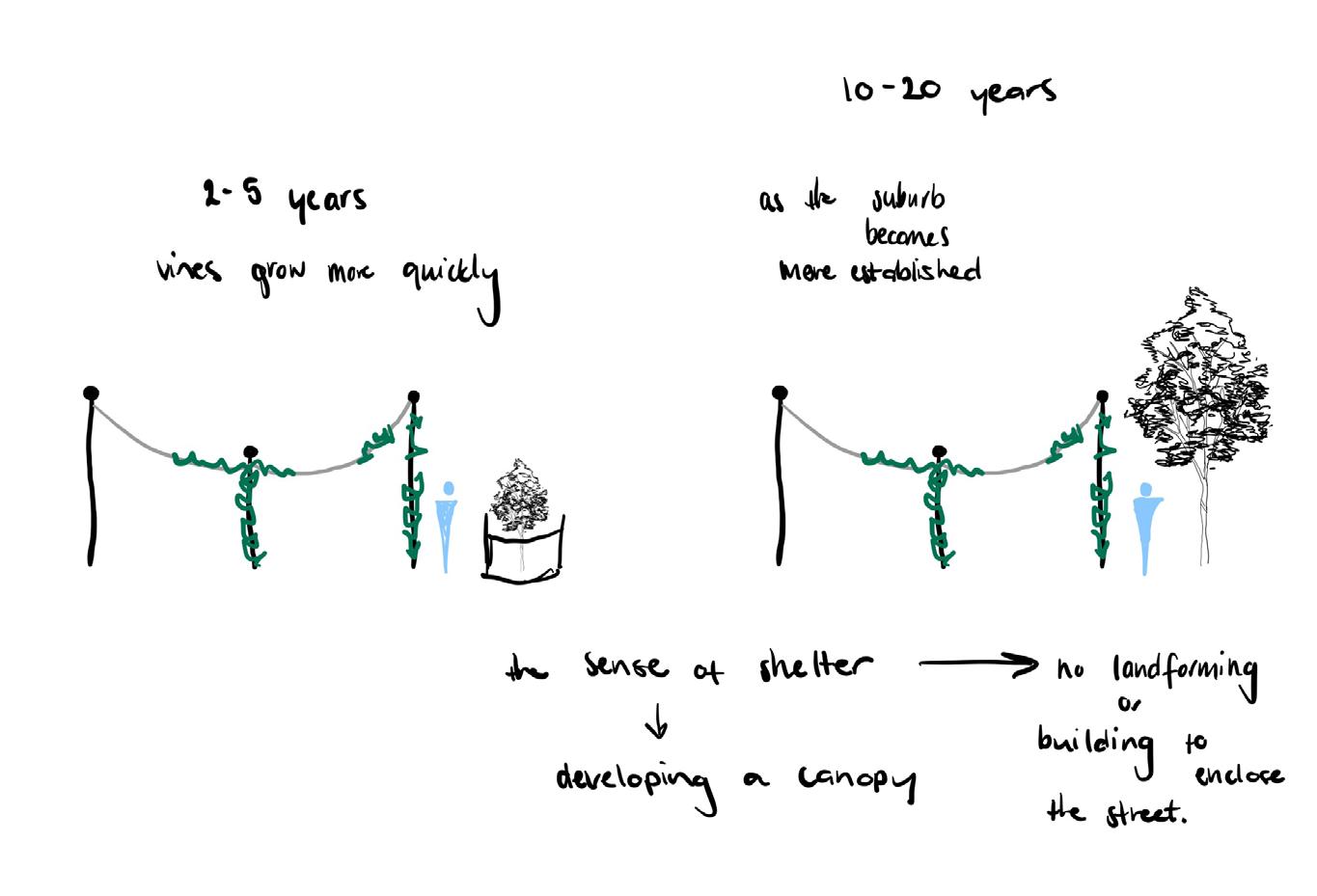
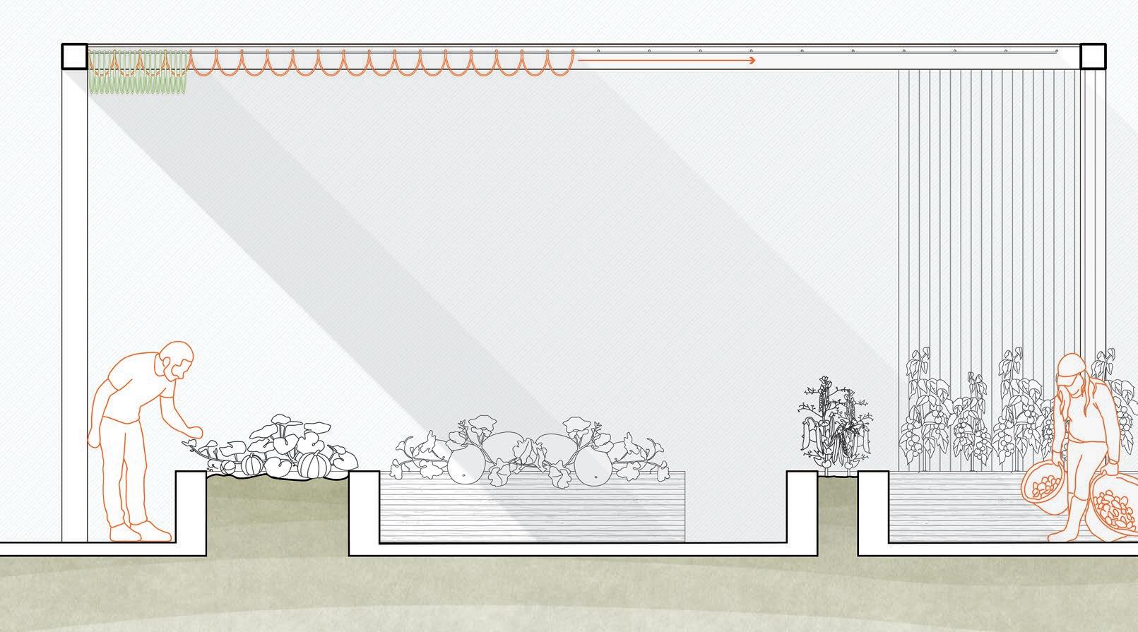
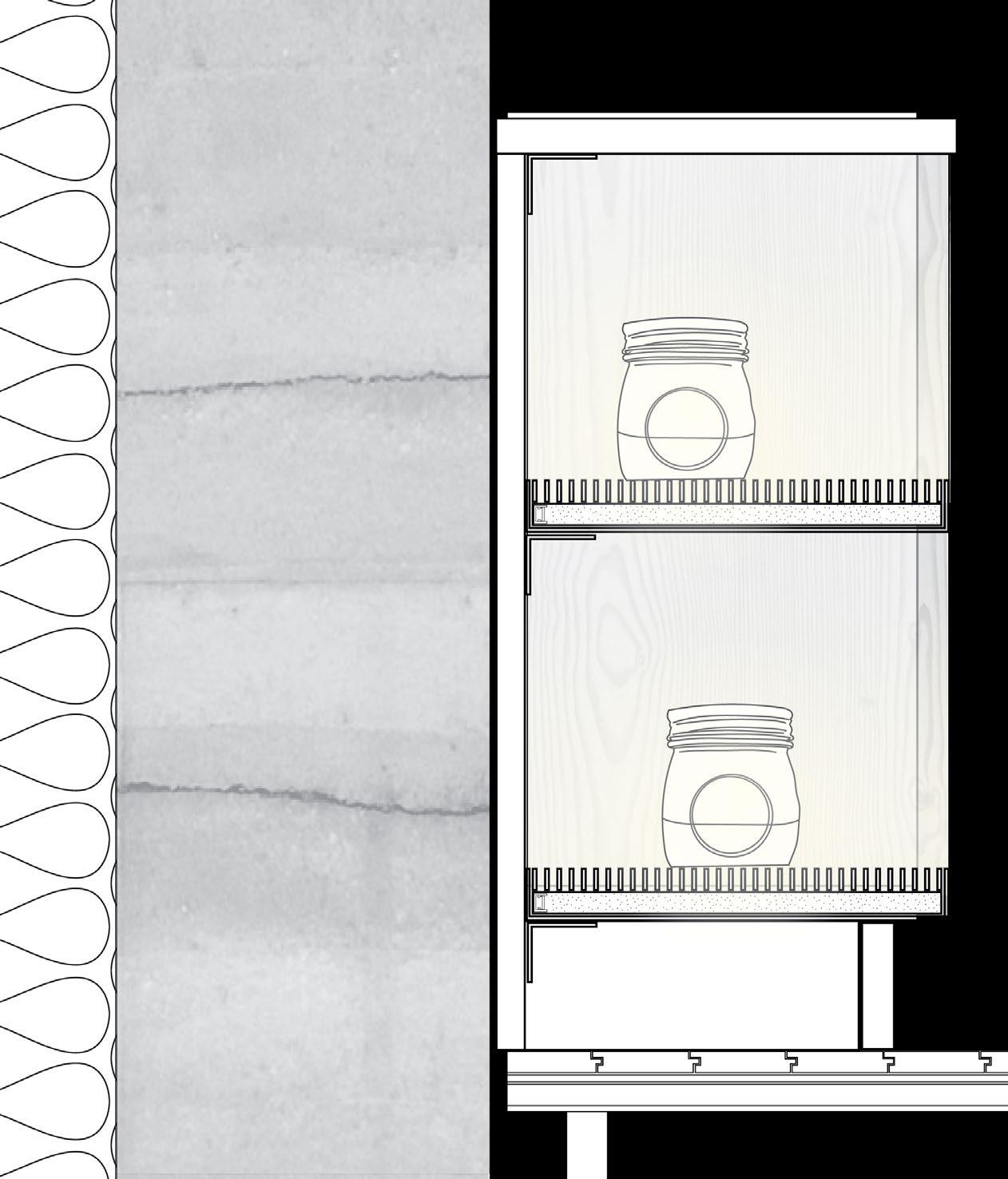
The design of the square grid structure to provide shelter overhead became a key component of the design which drove the architectural language of the project and helped address other practical design challenges. What started as a light overhead grid structure designed to create shelter through hanging lights and vines evolved to be the uniting feature throughout the development and connected adjacent buildings with a harmonious component. The grid was able to be manipulated to suit the needs of each zone such as the addition of fabric sails over the community garden or counter-levering over the bus stop to shelter waiting passengers. It also became an avenue to provide services, by housing electricity and water connections and hiding downpipes from roof structures.
SECTION DETAILING THE SHADING SYSTEM ADDITION TO THE ENCOMPASSING GRID STRUCTURE
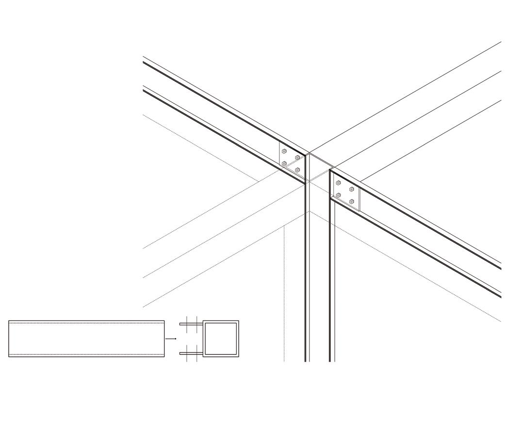
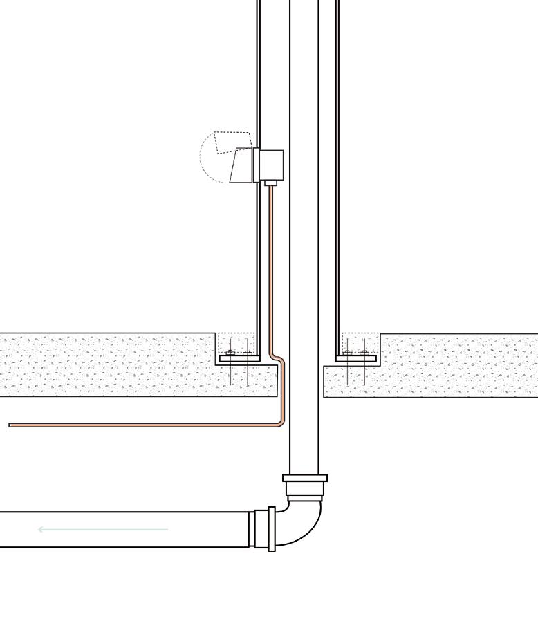
SECTION DETAILING HOW THE STRUCTURE ALLOWS THE PROVISION OF SERVICES THROUGHOUT
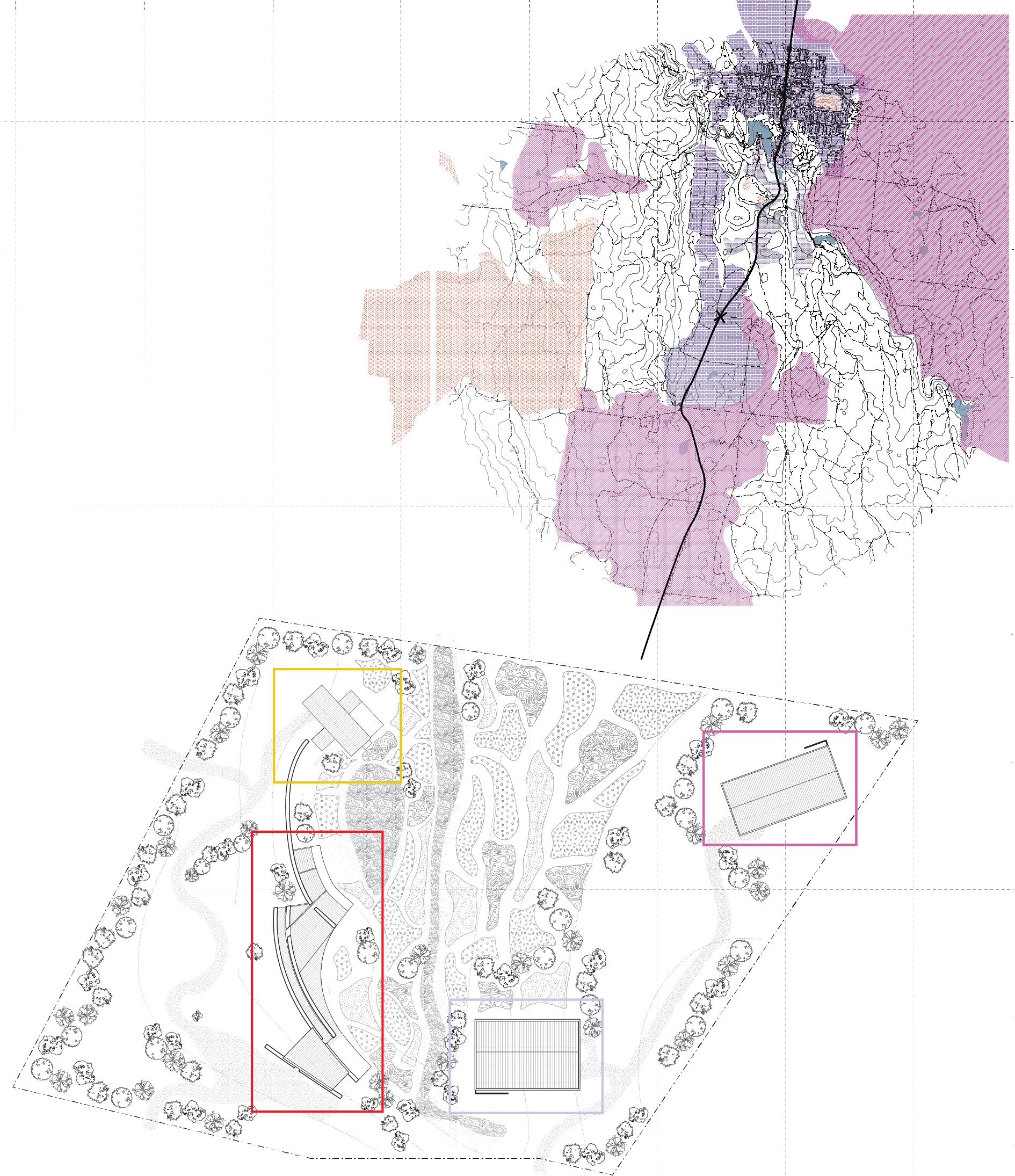
PROPOSED FUTURE SITES
Between 2021 and 2051, the population of the City of Melton is forecast to increase by 234,880 persons (129.61% growth), at an average annual change of 2.81%. The area is subject to extensive planning from the state government including the development of 5 precinct structure plans developed as outlined on the map. The intention of developing this model is that it has the opportunity to be applied to future developments in order to better serve the fast-growing region. hope to present an alternative housing development model where a communitybased asset could be built early and given to residents in order to establish stronger connected communities.
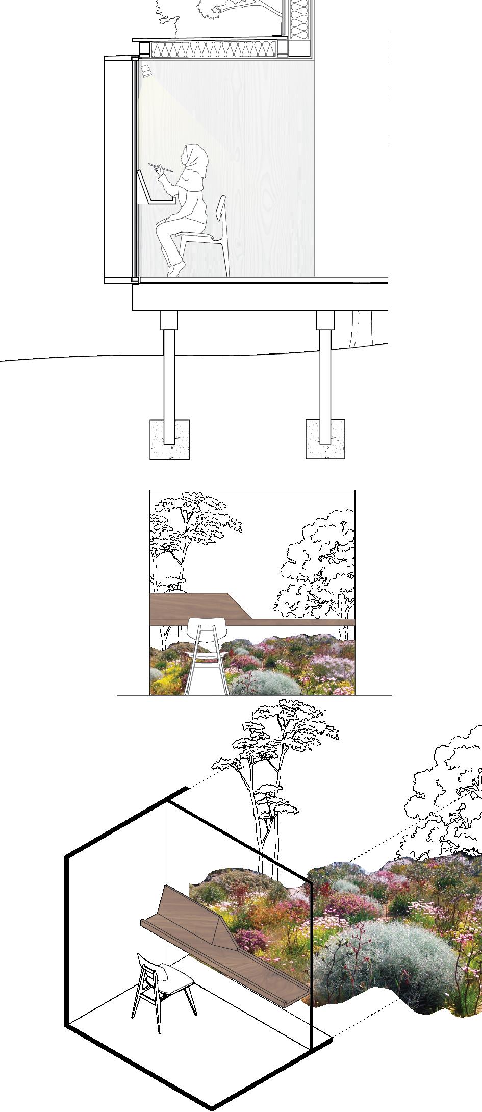
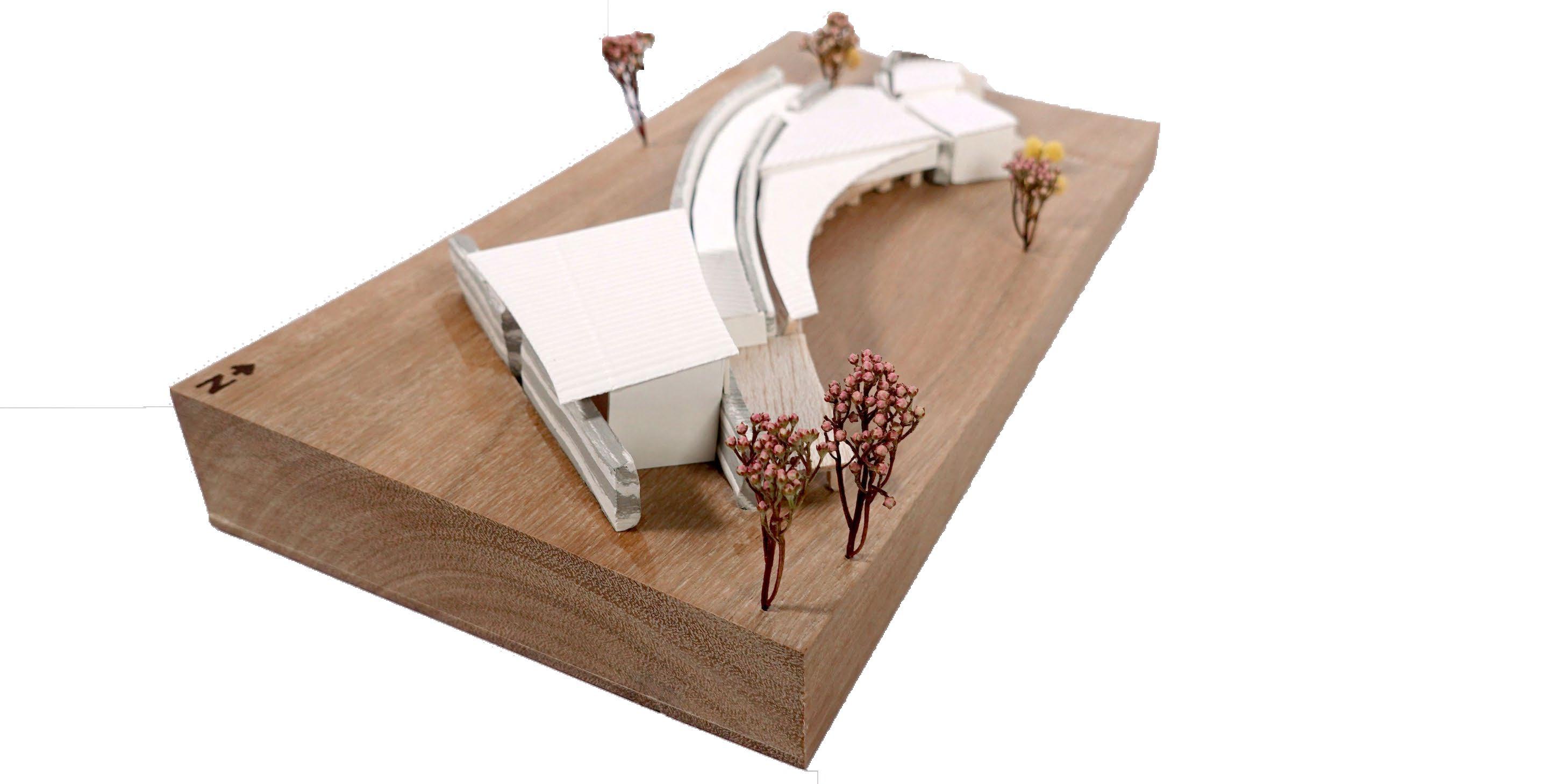
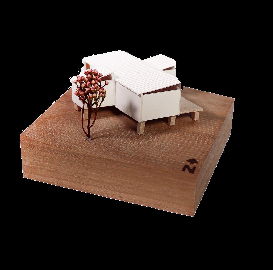
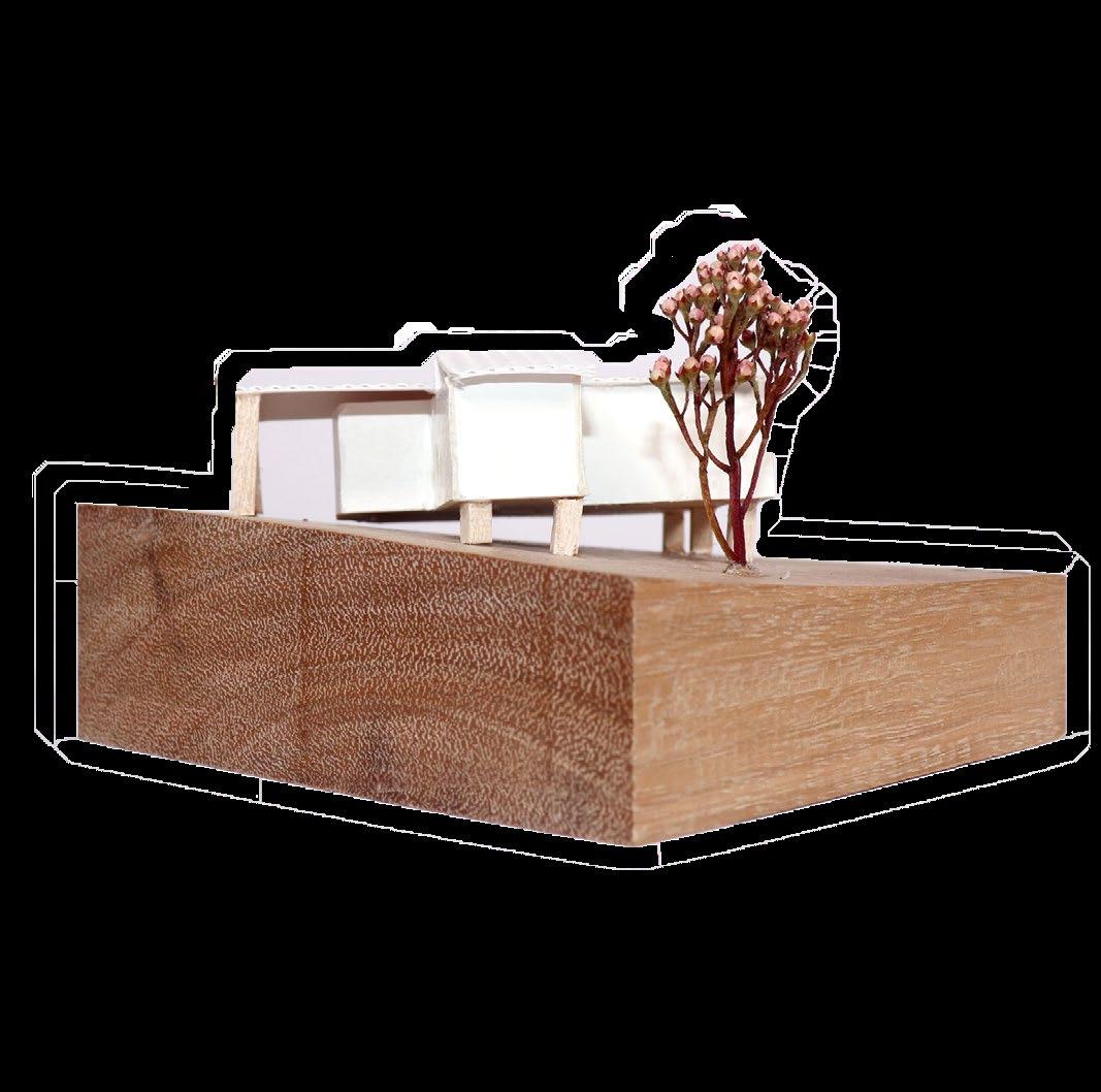
This studio explored the link between architecture, creativity and craft. This studio explored the spatial qualities and atmospheres conducive to collaborations between craft and creativity, looking to both historical context and modern process. Here, we investigated architectures role in existential craft and the discourse between workshop, dwellings and nature.
In this studio, my chosen craft was oil painting, looking beyond just the painting itself, but expanding into the process of pigment and paint making from natural resources grown on site. The project includes a variety of shared resources through a community of residences and shared studio facilities in the creation of creative spaces.
Completed for Studio 41: Curate | Create in Semester 2, 2022.
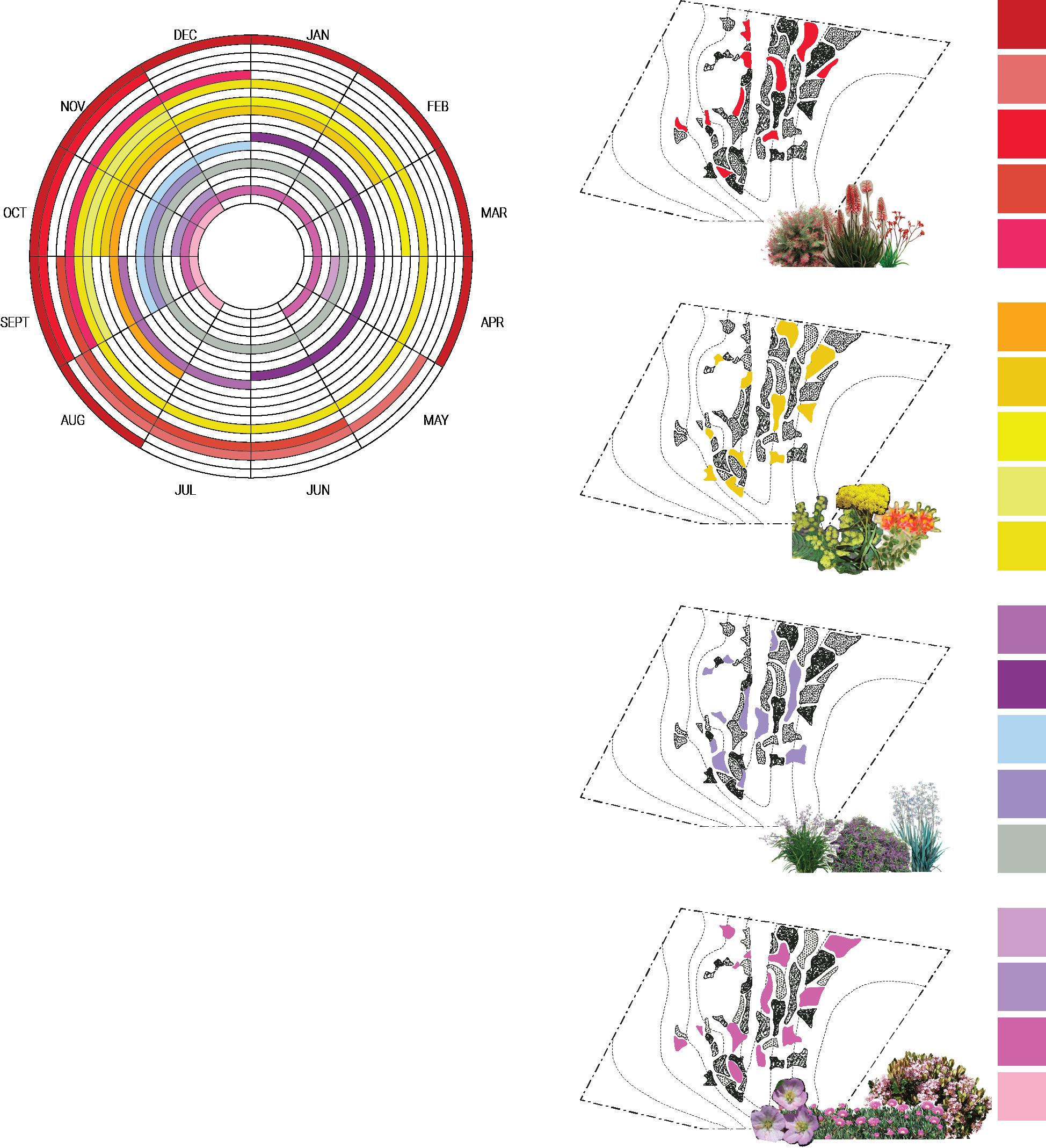
FLOWERING CHART
ANNUAL CHART DEPICTING WHEN FLOWERS BLOOM & PIGMENT CAN BE DERIVED.
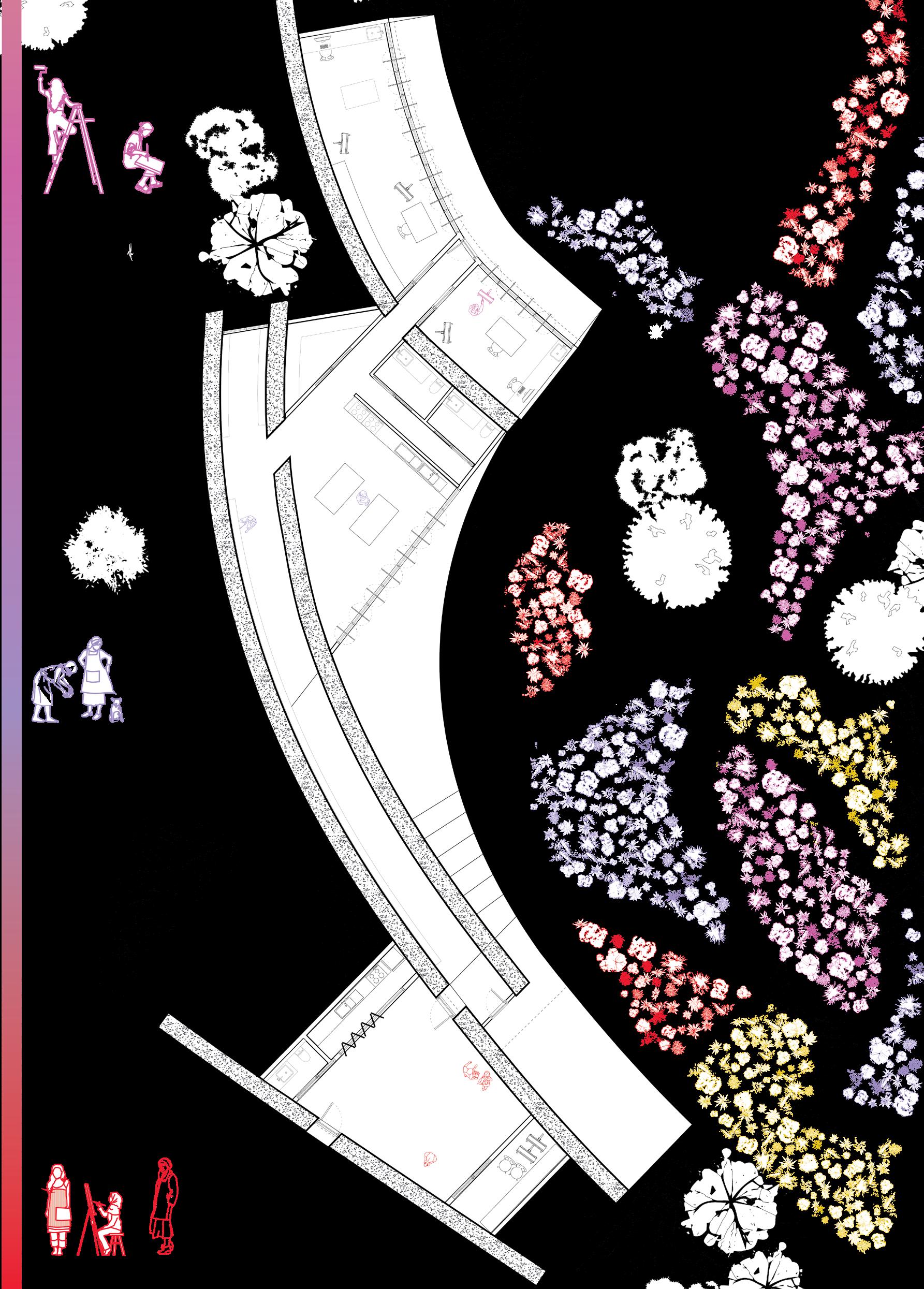
LANDSCAPE DESIGN & PLANTING SCHEME
During the Renaissance era, Oil painting rapidly rose to prominence as the paint of choice for artists for over nearly 400 years. The revelation of mixing pigments with oil created a transparent and building medium that radically changed art.
This project on the outskirts of Daylesford seeks to return painting to its pre-industrial form and rejuvenate the landscape by reviving the craft of paint-making from natural pigments. Prior to the industrial revolution, pigments were derived from plants, minerals of the earth or other gathered natural resources.
The thick dividing walls of the workshop space are formed by rammed earth walls, to reference the historical source of pigments and due to the visible layering effect.
GARDEN BED COLOUR SCHEME
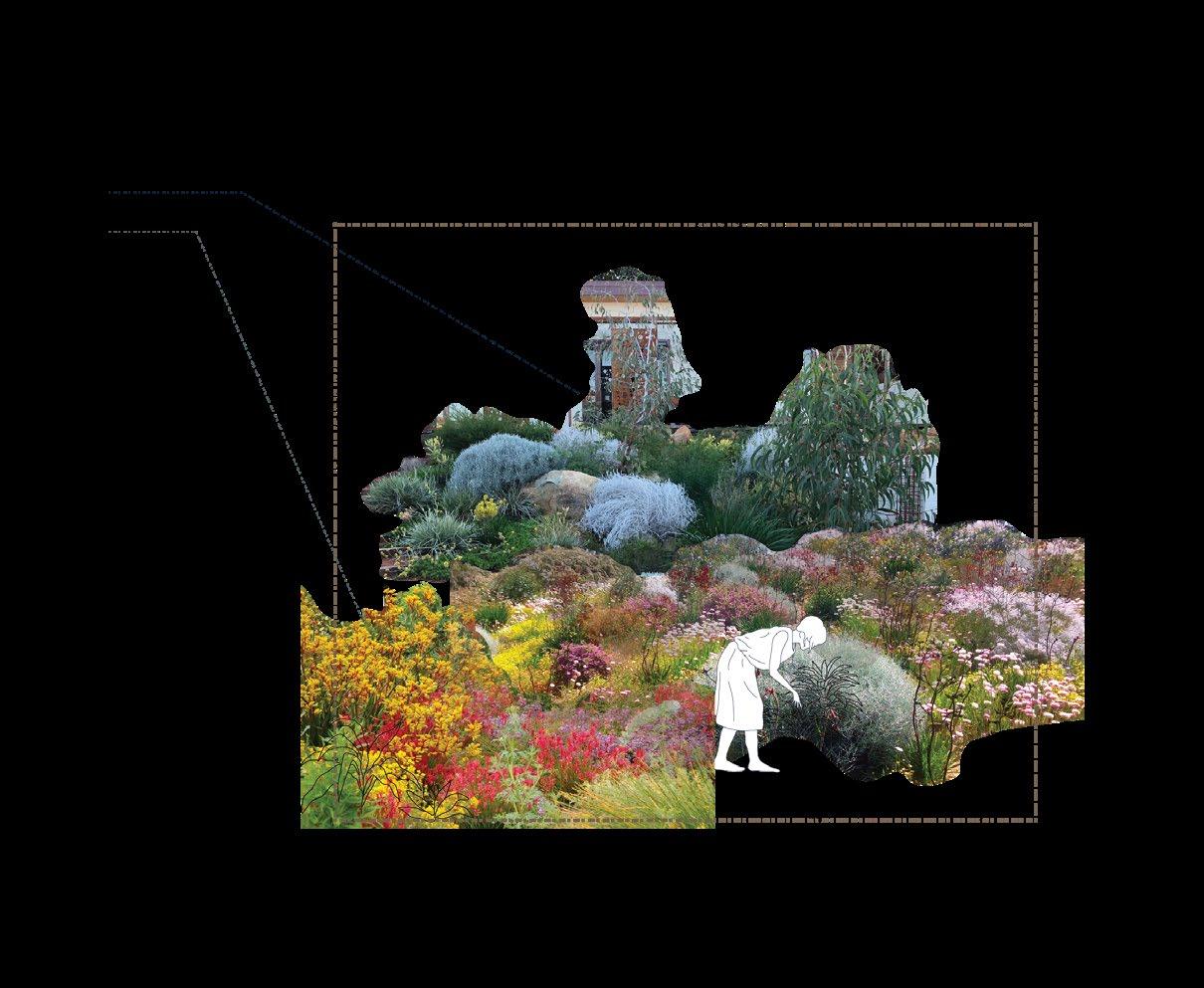
The landscape was developed to be both an inspiration for the art, but also a resource of pigments from native flora.
A planting scheme of four colour palettes was designed to produce a variety of pigment outcomes for yearround results.
Plants were selected across 2 key criteria:
1. Selected from a list of endangered or threatened plant species from the local area that have been pushed to extinction by land-clearing for farm use.
2. Hearty natives that will survive the extreme of the local climate and encourage biodiversity back into the Daylesford region.
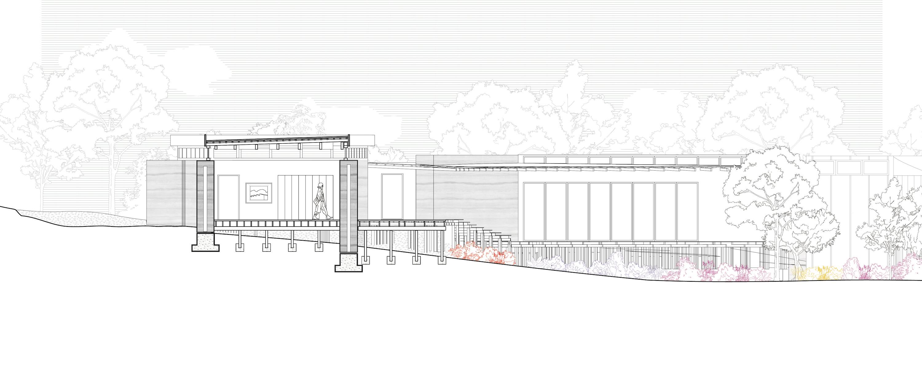
WORKSHOP KEY MOMENT DETAIL
RESIDENCE
RESIDENCE
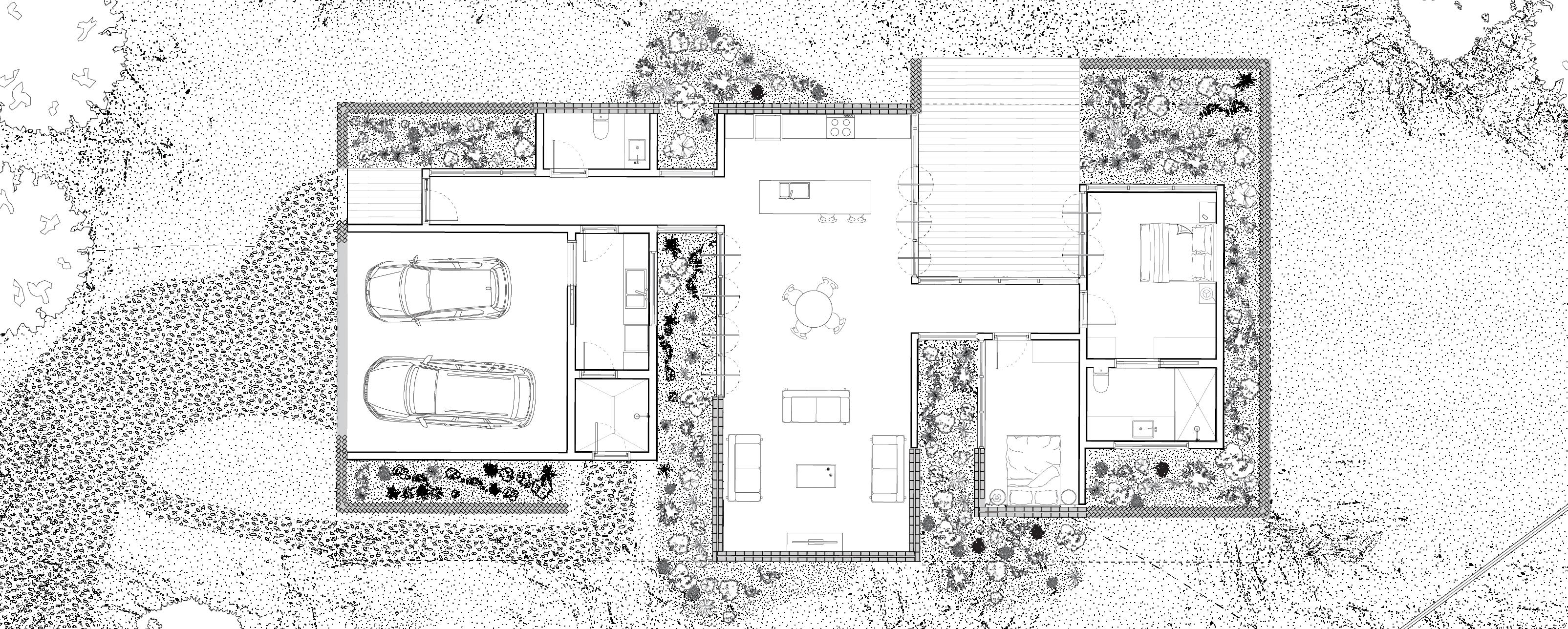
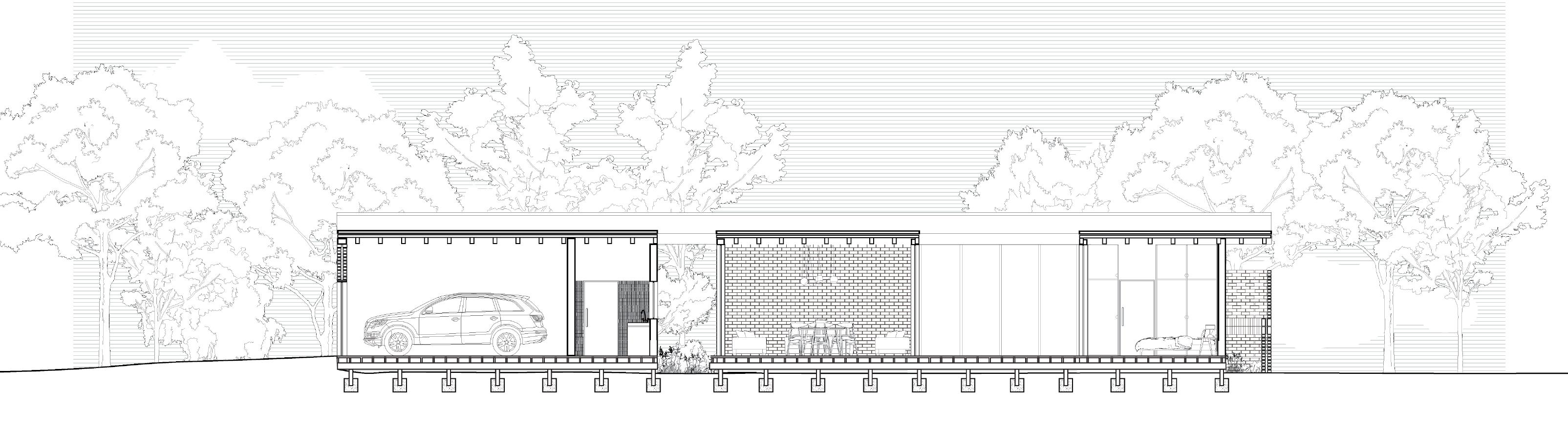
This studio draws heavily from the perceptual interpretation of the precedent of housing to encourage exploration of the contemporary concepts that construct and challenge residential architecture. The project was broken down into 3 parts. The first, the examination of a domestic site - in our case Suburban. The second, the development of the three lines of domestication,: area, containment and cover. And finally to design a house and garden to reflect the discoveries made previously.
Completed for Studio 26, Housing, Home and Contents: A Soft Focus on Domestic Things for Summer Semester, 2022.The work here was completed as part of a group project, where all 3 members oversaw the completion of all individual drawings.
The suburban lot is implied through planned organisation. Repetitive equal sized lots follow a neat formation of carefully laid out streets. There is a close relationship between neighbours, through enforced regulation. Division is marked via public thoroughfare and services to each lot. Linear and somewhat orthogonal, planning appears tidy.
On paper the suburban neighbourhood is defined with a certain expectation, each site is carefully measured out, with provision for a front garden to frame the house. Within these bounds, neighbouring homes build close to the fenceline, demanding full authority of the space they have been allocated. At present number nineteen is only occupied by loose soil, cleared and prepared for its next stage. The carefully planned legislative boundaries are at odds with its current material presence - fences fall, dirt sprawls across the site and footpath. Neighbouring trees claim part of the site as their own. Where the pailing fence has fallen, metal construction fences create a temporary boundary.
Domestication is a careful negotiation between returning a site to its intended state and adapting to an ever changing landscape. A fallen fence may be repaired to redefine boundaries between the private space of neighbours. A strict boundary is not required between footpath and front garden, the distinction is created through materiality and nature. Selectively “making good” signifies the site’s return to suburbia and the ability to move forward within the established street lexicon.
Intention laid out allows for planning a familiar gesture. What earth ought not be walked on and which must be traversed? Not an assumption, but deliberate demarcation between floor and garden. Once settled ground is agitated, the epicentre is found at the garden room, an ecological transition space that intertwines human agenda and natural domain.
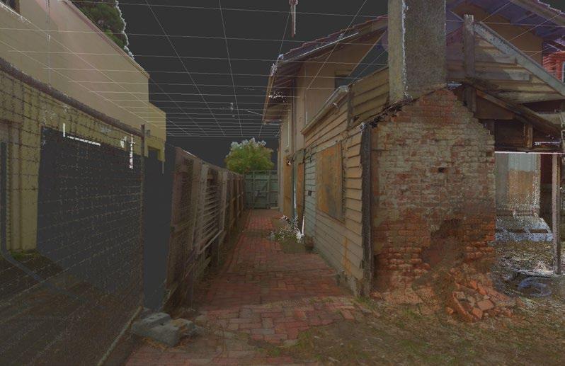
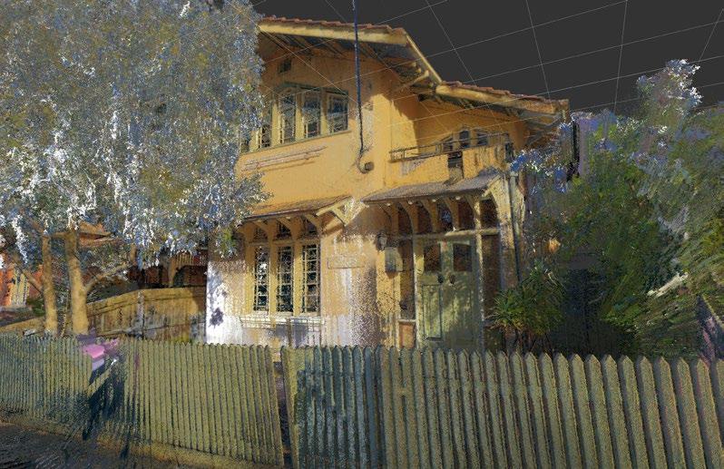
This project was completed as part of the an elective subject aimed at exploring the evolving field of digital heritage through the production of manual and digital measured drawings. On behalf of the Portable Building World Heritage Nomination Taskforce, we were tasked with creating a digital record of an historic portable building. This subject taught the use of manual and digital techniques for recording academic digital records, from hand-drawing to LiDAR scanning and Photogrammetry.
Read the full research booklet here: https://issuu.com/keelybengtson/docs/history_booklet_mddh
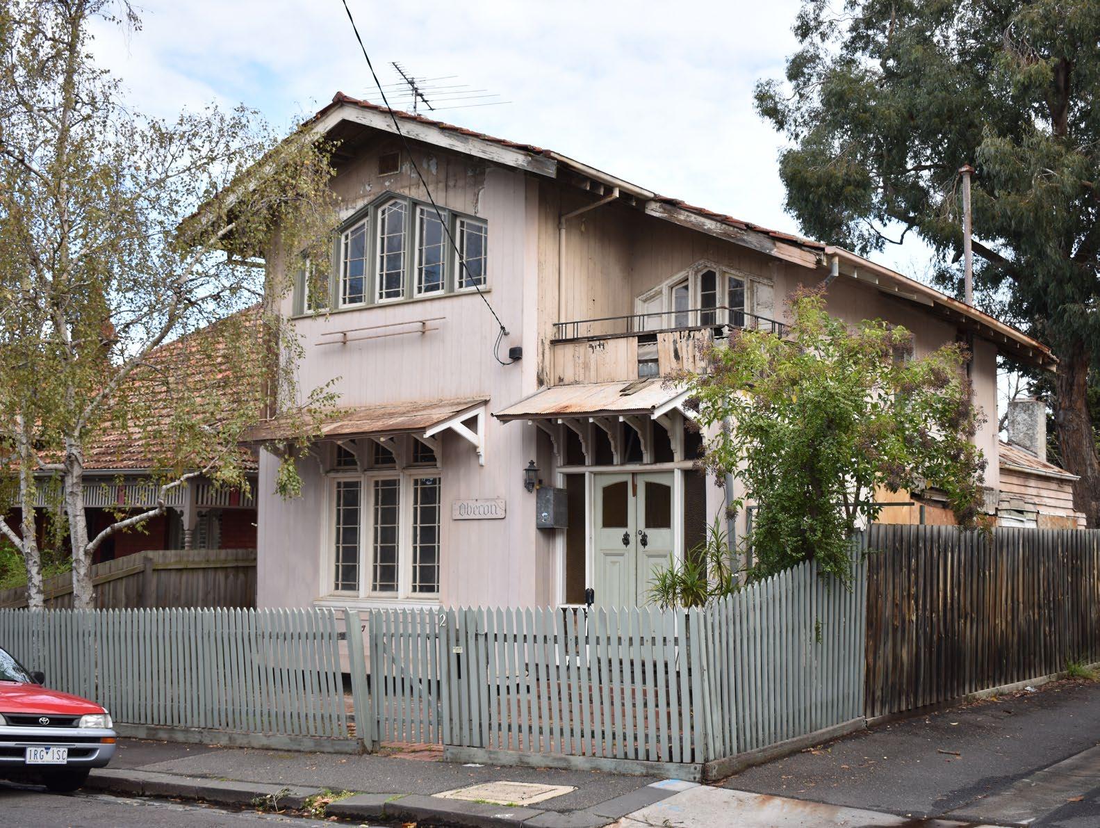
Oberon House is a portable building imported from Genoa Italy sometime in mid-1856. The earliest evidence of the completed building comes in 1897 on the Melbourne Metropolitan Board of Works map, where Oberon is depicted in it’s current location in Lambeth Place, St Kilda.
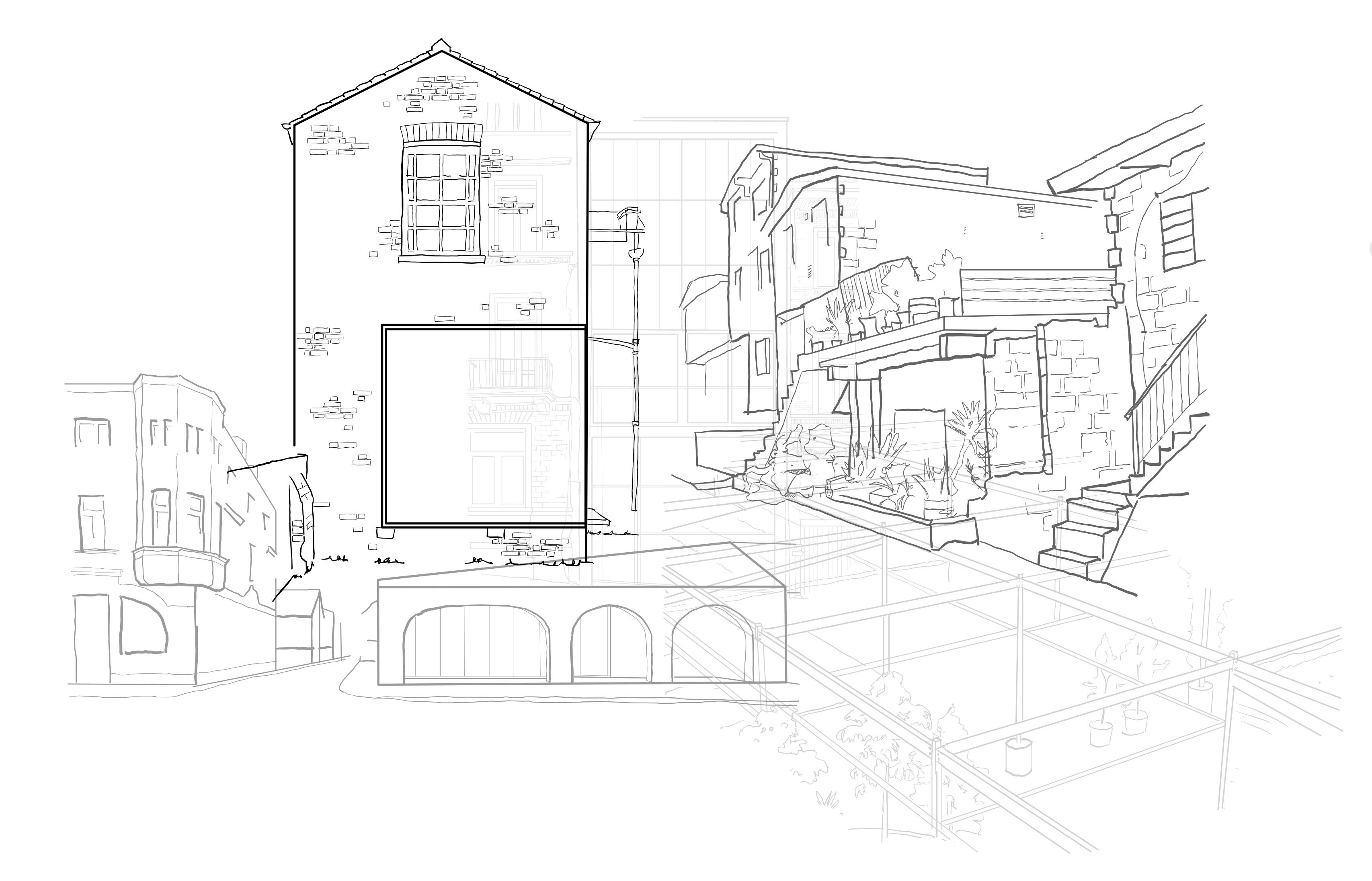
Throughout the course of this project a case was made that the origins of this building are Swiss, and not Italian as first thought. Research through 19th C pattern books, distributed around Europe at this time, reveals that Oberon’s unique style closes mirrors that of the Swiss Style Villa.
Completed for Measured Drawings and Digital Heritage, Semester 1, 2022. The work here was submitted as part of a group set, but drawings were completed individually.
This research went on to inform the interpretative drawing element of this task - a projected floor plan and elevation of what Oberon may have looked like when first constructed. These were based on the research from Swiss Pattern books and based on the physical evidence remaining on site following a 1930s house fire that damaged part of the house and prompted a total renovation of the entry-way.