0 1 4 RIVER


 RIDGE COMMERCE CENTER


RIDGE COMMERCE CENTER


- SEPTEMBER 2014 -
PREPARED FOR THE RIVER RIDGE REDEVELOPMENT AUTHORITY BY:


J. Mark Robinson President of the Board
Norman E. Pfau, Jr. Vice President
David W. Evanczyk Secretary/Treasurer
David Flowe Board Member
Kim Matthews Board Member
David A. Lewis General Counsel
Jerry G. Acy, CEcD Executive Director
Billieann H. Durrett Controller
Thomas E. Vittitow Planning and Development Manager
Jennifer Vittitow Contract/Lease Administrator
Marc Hildenbrand Director of Project Management & Utility Operations
Paul M. Wheatley, EDFP Marketing and Finance Director
Clark County, Indiana
Utica Township, Indiana
City of Jeffersonville, Indiana
Indiana Department of Transportation (INDOT)
Indiana State Senate
Barth Hendrickson, PLA, ASLA Principal-in-Charge
Jonathan R. Hess, AIA, RA Principal Architect-in-Charge
Ryan Cambridge, PLA, ASLA Project Manager, Landscape Architect
Daniel Overbey, AIA, NCARB, LEED AP BD+C Lead Architect
Jon Hutslar, PLA Senior Landscape Architect
Drew Braley, PLA, ASLA Landscape Architect
Mark Beer Landscape Designer, Graphic Artist
Brett Schlachter Urban Designer
India Ballard-Bonfitto Planning Assistant
Logan Goins Production Assistant
Michael Downs Production Assistant

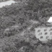
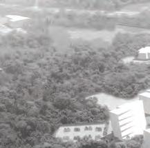
The River Ridge Commerce Center (RRCC or RR) is a 6,000+ acre mixed-use of fice and industrial park located on the site of the former Indiana Army Ammunition Plant (INAAP) in Clark County, Indiana. In 2013, the River Ridge Development Authority (RRDA) hired Browning Day Mullins Dierdorf (BDMD) to strategically plan approximately 600 acres of undeveloped property surrounding a future interchange along the I-265 extension, with the goal of creating a dynamic gateway experience. The interchange within the planning area will be the first exit in Indiana after crossing the new Ohio River East End Bridge, and will serve not only as the gateway to River Ridge, but as a gateway to the State of Indiana.
The RRCC, as a whole, is arguably the most significant developmentbased project to occur in southern Indiana, if not the State itself. Though RRCC has been in the reclamation and redevelopment process for over a decade, less than 10% of RRCC has been developed. Even at its current phase of completion, RRCC has generated $1.16B in economic output and currently supports over 5,900 direct jobs—a full 12% of Clark County’s workforce (Policy Analytics, LLC, 2014). Implementation of Phase One of the Gateway Master Plan will pave the way for an estimated 1.2 million -1.8 million s.f. of additional mixed-use of fice and industrial space within RR, translating to approximately 4,800 – 7,200 additional jobs for the region and untold millions of dollars of increased economic output.
This project is unique in many ways, the majority of which center on the site’s significant scale (both geographic and fiscal) and the amount of existing constraints. There is over 110 feet of elevation change across the site, with many areas exceeding 25% slope and leading directly to sensitive watersheds. Further complicating the plan, the site has numerous existing karst features which limit developable area. This project also required an aggressive time-line in order to coordinate with the construction of the I-265 extension and Transportation Corridor projects being lead by the Indiana Department of Transportation, necessitating the planning process take no more than four months. Throughout the process, BDMD reported to the River Ridge Development Authority (RRDA) Board of Directors – composed of local and state leaders - who are ultimately responsible for the implementation of the plan. Establishing firm consensus throughout the process was intentional and critical.
Implementation of Phase One of the Gateway Master Plan will pave the way for an estimated 1.2 million - 1.8 million s.f. of additional mixed-use office and industrial space within River Ridge, translating to approximately 4,800 – 7,200 additional jobs for the region and untold millions of dollars of increased economic output.

The scope for this effort was comprehensive and included detailed field studies and an exhaustive analysis of the existing conditions of the site. The project team toured and analyzed the entire RRCC site to understand the varying degrees of character and condition of the property, and a more detailed evaluation of the Gateway Planning Area was also completed. This portion of the site contains some of the most significant existing natural systems in RRCC - including conservation areas, watersheds, stream bodies, and a significant amount of topographic change; all features which should be embraced and protected.
In addition to the field studies, a real estate market study was completed to better understand current market trends on local, regional, and national levels prior to recommending any specific land uses. The Project Team also reviewed a series of site and architectural comparables with the RRDA to better understand various development approaches and scales.


Building upon the existing conditions evaluation and other consultant studies completed to date, the Project Team utilized all available data to analyze the varying natural and infrastructural systems found within the planning area (PA). Layering manual survey and LIDAR data, a GIS-based digital elevation model of the site was constructed upon which analysis would be run.
The various analysis processes evaluated bedrock depth, soil classification, karst feature location, extent and description of existing vegetative systems, landform, slope degree and aspect, and watershed delineation and flow-line plotting. When overlaid, the findings from the multiple analysis products revealed the physical opportunities and constraints of the site, such as sensitive natural systems which should be protected. This information better informed the developable area and potential compatible uses which respond both to the market and the site constraints.
In addition to allowing the site to inform the design, collaboration and engagement were core components of the Project Team’s planning methodology. As a result, a project stakeholder group was created. Participants included the RRDA Board, state and local elected of ficials, representatives from the US Senate and State of Indiana Senate, consultants from adjacent projects, private land-owners, developers, and representatives from local planning districts. The stakeholder group was engaged in multiple workshops facilitated by BDMD, which were conducted in a linear format to identify specific project goals, desired outcomes, and to better define the long-range vision for the RRCC site as a whole. The input gleaned from the engagement process and various analysis techniques formed the framework on which design decisions could be made.


Collaboration and engagement were core components of the Project Team’s planning methodology. As a result, a project stakeholder group was created. The stakeholder group was engaged in multiple workshops facilitated by BDMD to identify specific project goals, desired outcomes, and to better define the long-range vision for the RRCC site as a whole.

A key objective of the Gateway Master Plan was to create a “place” within RR; one whose function is to foster quality-of-life, sustainability (social, economic, and environmental), and end-user experience for the entire development. The RR Gateway will be more of an experience than a location. The plan for the Gateway PA must be able to seamlessly integrate a wide variety of land uses – and their associated infrastructural requirements - ranging from corporate of fices to industrial and warehousing. Much of this will be accomplished through the thoughtful design and planning of the public realm; the interstitial “public” spaces which link all areas and infrastructural systems found within RRCC.

A core component of any functional public realm is having well designed streets which are functional and aesthetic, but also help preserve RRCC’s ability to accommodate a wide variety of land uses and building scales. The road network was also planned to accommodate a variety of multi-modal uses ranging from pedestrians and cyclists on a network of off-road trails, to heavy haul truck and heavy rail traf fic, and represents the full transect of urban-to-rural sections.

The design and planning of the Gateway PA was undertaken at a systems-level. Storm water, green space, and pedestrian connectivity will be developed as regionalized systems which are supported by site-specific interventions. Each infrastructural element will be designed to be multi-functional—streets aren’t just for cars, but also for storm water treatment, multi-modal connectivity, and native habitat. Community green spaces will not serve only as meaningful recreation areas, but will also be used as regional storm water detention, treatment, and conveyance spaces.

The Gateway Master Plan resulted in the creation of multiple “districts,” each anticipating a unique targeted client-type. While the architectural scale, land use, common area amenities, and level of finish vary between districts, they are seamlessly linked by the public realm of green spaces, pedestrian networks, and road networks.
The “Common Core” serves as the heart of the Gateway Master Plan. It is a 16+ acre, multi-purpose community green space and regional detention basin anchored by the future RRDA headquarters building; the design of which was envisioned through this planning process. This space will be a central gathering point for the wide variety of site users represented across RRCC; a place of dynamic diversity where people from any industry or profession can share life.
The design and planning of the Gateway PA was undertaken at a systems-level. Storm water, green space, and pedestrian connectivity will be developed as regionalized, infrastructural systems which are supported by site-specific interventions. Each infrastructural element will be designed to be multi-functional...

Using proven placemaking principles, the design for the Common Core will help provide a high quality of life for RRCC users. Planning for quality-of-life will be critical to attracting the high-skill and highwage business sectors; a target demographic for the Gateway PA. The Common Core area is also envisioned to be a campus; locating potential tenants grounded in higher education, research, or public/ civic agencies around a meaningful, community green space. The central organizing element of this park space will be the addition of a large regional detention pond; an infrastructural storm water feature which will also serve as a significant site amenity. Flanking the banks of this pond and integrated into the rolling hillside will be the future headquarters building of the RRDA.
As part of this planning effort, BDMD helped the RRDA conceptualize the building program, aesthetic, and scale of their future home within RRCC. At the request of the RRDA, an intentional decision was made to incorporate flexible community program spaces in the building; such as galleries or conference spaces, so the building can function as a common gathering point for the region. The proposed architectural solution closely aligns with the imagery developed in workshops, where an overarching monolithic form arises from the banks of the site’s signature water amenity, reflecting the rolling topography of the native landscape. The structure will be highperformance, focus on energy and water ef ficiency, create healthy interiors, utilize innovative materials, and embody the ethos of the RRCC.


The Common Core is envisioned to be a campus; locating potential tenants grounded in higher education, research, or public/civic agencies around a meaningful and sustainable community park space.


A meaningful vision is ineffective without an equally thoughtful and fi scally grounded implementation plan. After approval of the Master Plan design direction and program, short-term and long-term action plans were created, each taking into account the fl uid schedules of the other in fl uencing projects in the region.
To better budget for and prioritize individual projects, a highlevel order of magnitude opinion of probable cost was developed. The approximate construction cost for all components of the Gateway Master Plan within the RRCC site is anticipated to be between $150 million-$225 million. This estimate does not include development on the 110 acres of privately owned land immediately to the south, which could result in an additional $20 million-$100 million in construction.

The infrastructure associated with the implementation of Phase One of the Gateway Master Plan surrounding the Common Core is estimated to cost approximately $30-$40 million, and includes the construction of the following core components:
• Earthen dam and regional storm water facility
• Realignment of Patrol Road
• Parkway Interchange (including heavy-haul route)
• Common Core site development (excluding the RRDA headquarters building)
The Action Plan schedule aims at implementing as much of the Gateway Master Plan as possible prior to the opening of the I-265 extension and interchange to passenger traf fi c in October 2016 (projected). Key short-term action items and their associated target completion dates include:
• Development of a Signage Master Plan (October 2014)
• Update Declaration of Covenants, Conditions &, Restrictions (December 2014)
• Schematic Design and Engineering for Critical Phase One Infrastructure (December 2014)
• Legal Establishment of a Property Owners Association (February 2015)
• Development of a Parkway Master Plan, linking the Gateway area to SR-62 (May 2015)
• 100% Construction Documentation for Critical Phase One Infrastructure (June 2015)


