Architect graduated with a Master of Science in Architecture from UPC Barcelona. I grew up in Milan, where I earned my bachelor’s degree at Politecnico di Milano. I worked in architecture design since 2017. I have been working in RBTA since September 2022 as an architect and project manager in concept and detailed design stages focused on highrise buildings and masterplan development.
ANDREA TERRAGNI
andreterra98@gmail.com
STUDIES
Universitat Politècnica de Catalunya
Barcelona
2021 - 2022
MSc architecure-barcelona
Final Grade; 7.19/10
Politecnico di Milano
Milan
2017 - 2020
BSc Architectural Design
Final Grade; 100/110
EXPERIENCES
Ricardo Bofill Taller de Arquitectura (RBTA)
2022 - Now
Architect and Project Manager
DNA Barcelona Architects
2021 - 2022
Architect Caputo Partnership
2020
Junior Architect
SKILLS
Softwares
AutoCad - 5/5
Adobe Acrobat XI Pro - 5/5
Adobe InDesign CC - 5/5
Microsoft Office - 5/5
Rhinoceros 6 - 5/5
SketchUp - 4/5
Adobe Photoshop CC - 4/5
Revit - 2/5
Adobe Illustrator CC - 2/5
Languages
Italian - IRL Lvl. 5
English - IRL Lvl. 4
Spanish - IRL Lvl. 4
TABLE OF CONTENTS
LOTUS
PRIMARY SCHOOL IN SOUTHERN SENEGAL
Senegal, 2023
MIGRATION OVER A SATELLITE DISTRICT
Pioltello (MI), IT, 2019 - 2020
p. 16 - 21
PLDT CITY CAMPUS
NEW HEADQUARTER OF PLDT CITY COMPANY
Manila, PH, 2023
p. 22 - 27
THRESHOLD BETWEEN BEACH AND CITY
Barcelona, ES, 2022
p. 29 - 33
CULTURAL GEAR
MUNICIPAL LIBRARY IN CESANO MADERNO
Cesano-Maderno (MB), IT, 2016 - 2017
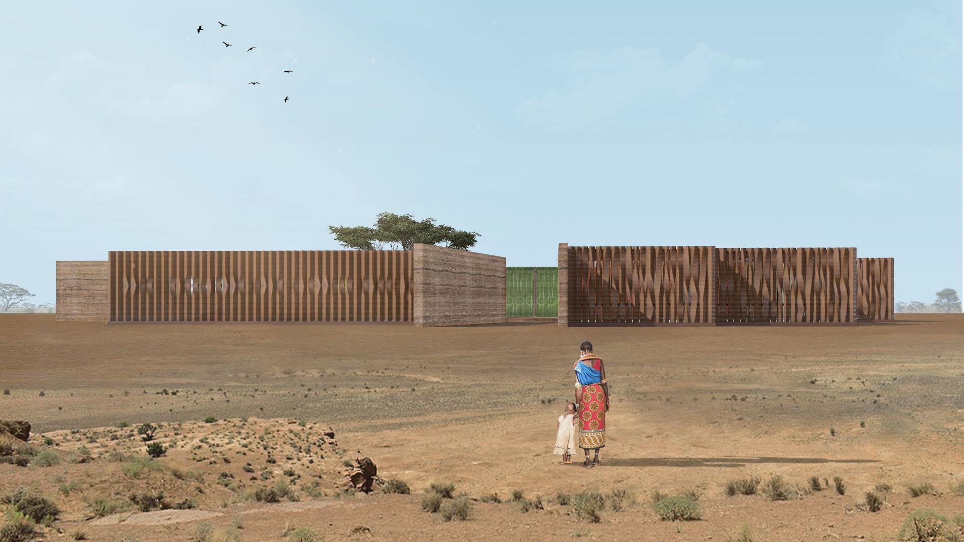
PRIMARY SCHOOL IN SOUTHERN SENEGAL
TYPE
Personal Competiton, Group Work
Personal competition done in collaboration with three friends on late 2023. The porpuse of the competition was design an eco-friendly and low budget school in Senegal. The competiton was called: Kaira Looro Architecture Competition
The deisgn has been classificated as finalist of the competitio without achiving the top three classification.
The design was based on the following doubs and ideas, In the rural villages of Casamance, in Southern Senegal, 60% of boys and girls drop out of school before attending high school. This is a disconcerting statistic and - contrarily to what one may think - is not imputable to poverty alone, which yet affects here almost every aspect of daily life. Indeed, it is also due to a widespread lack of trust towards the school system and the value of education and knowledge in general. In such a scenario, where migrating is not possible, heavy manual work appears as the most reasonable and profitable solution, even for young children. Given this daunting premise, how is it possible to create an inclusive educational building, where the future generation can grow, stay, and improve the local community? The new school must be a prototype, easy to be built, edited, and replicated. On the one hand, it is deeply rooted in the community it serves; on the other hand, it is potentially self-powered. However, the building is not only a school: in the first place, it is a full-fledged public space with collective facilities.
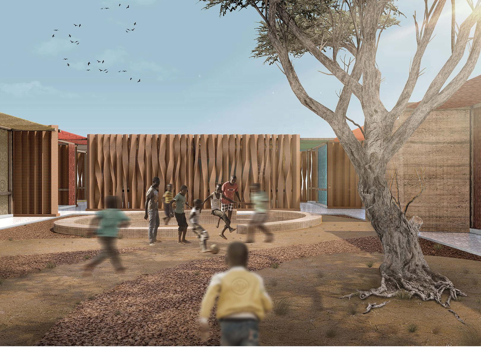
LEFT: Pedestrian view of the school
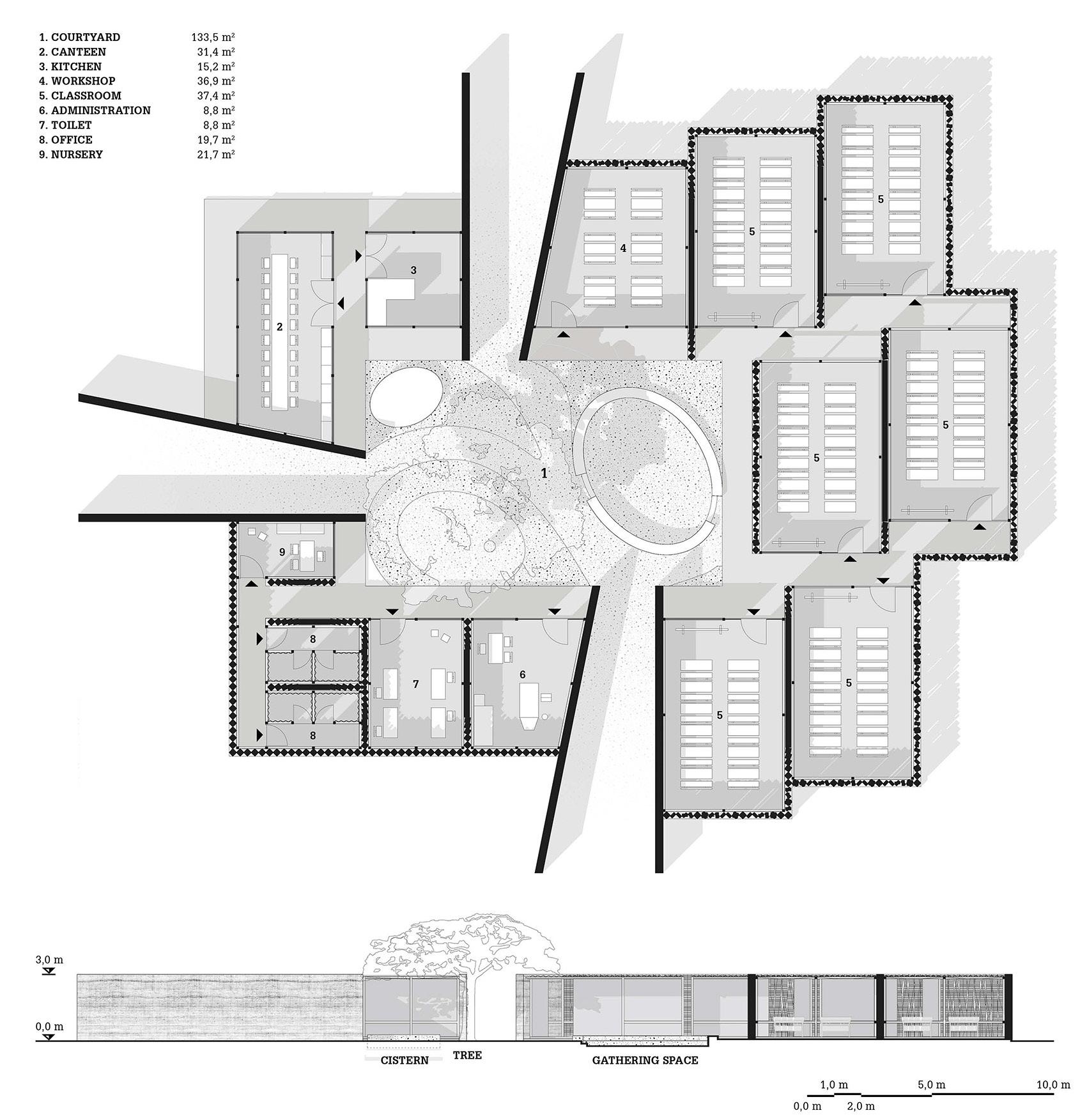
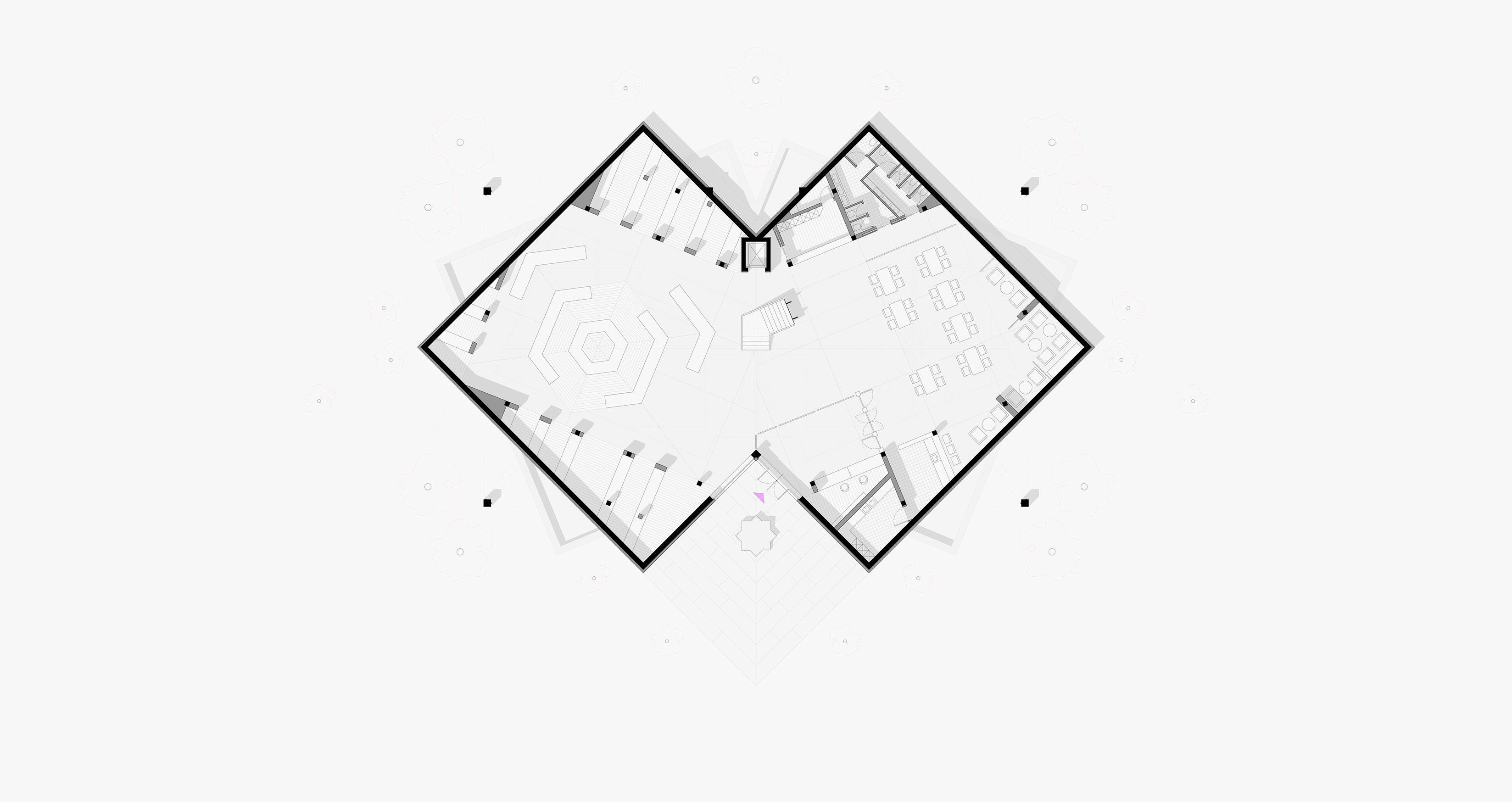
The building originates from a cosy central courtyard, where there are three primary goods. They will serve as nectar for the survival and development of a thriving community. First, a cistern, used in Southern Senegal to collect and store water. Second, a gathering space dug out of the ground, where children and the entire community itself can unite. Third and last, a large tree, which offers shelter from the scorching summer sun and embodies the vital spirit of Lotus. Passing three telescope entrances, people populates the pleasant inner patio, enjoying these goods.
Six massive red earth walls indicate these accesses, clearly providing a pathway to the inner court. They also function as a neat separation between three clusters of functions: the dining area, the services, and the proper schoolrooms. Let’s start with the canteen, which will be accessible to the community and is therefore permeable from the outside to the inside and the other way around. Learning spaces and services, on the other hand, are accessible only from the central courtyard here. However, the first have a more dynamic appearance than the serving block - which is perceived as a unitary volume -: they are irregularly arranged along two corridors, an ensemble of intermediate spaces where children can meet each other and experience the community in a controlled way
UP: ground floor plan of the school DOWN: main elevation of the school
LEFT: render of the court yard of the school
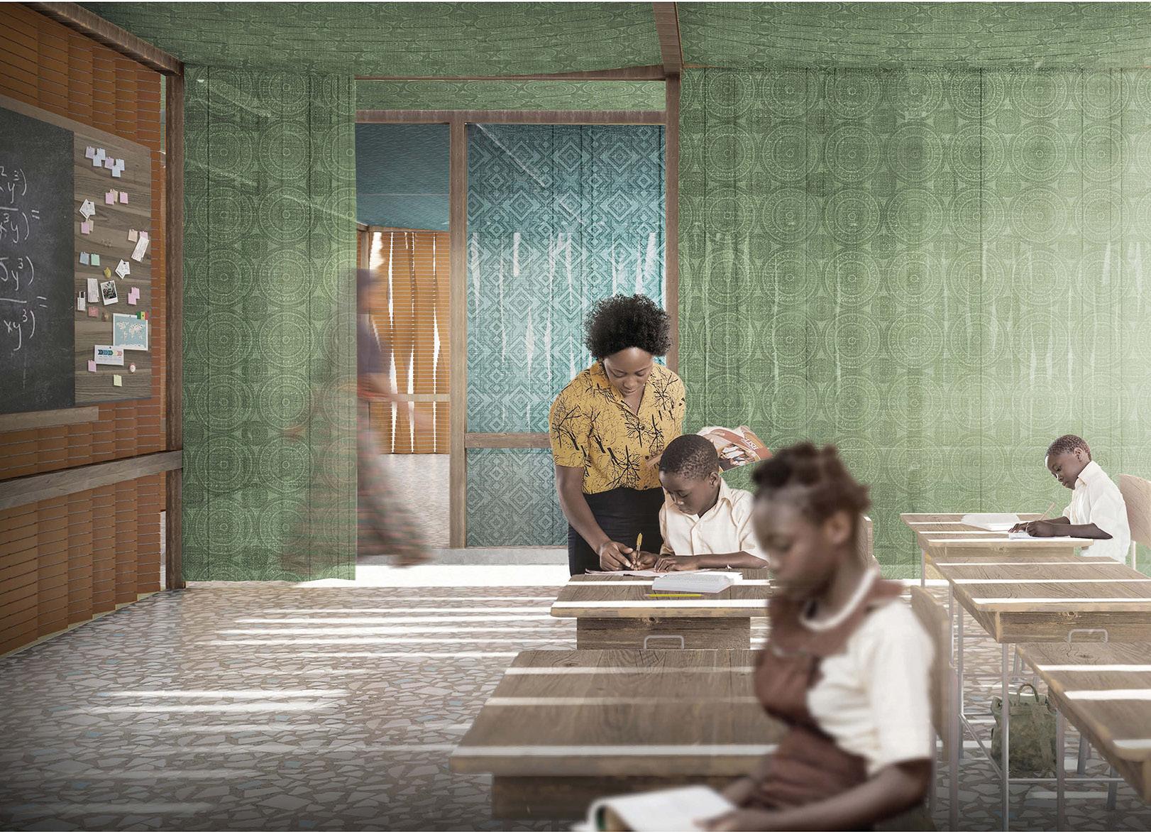
RIGHT: render of one of the classroom of the school
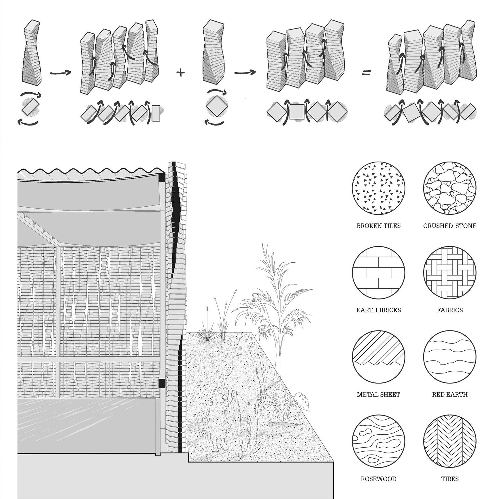
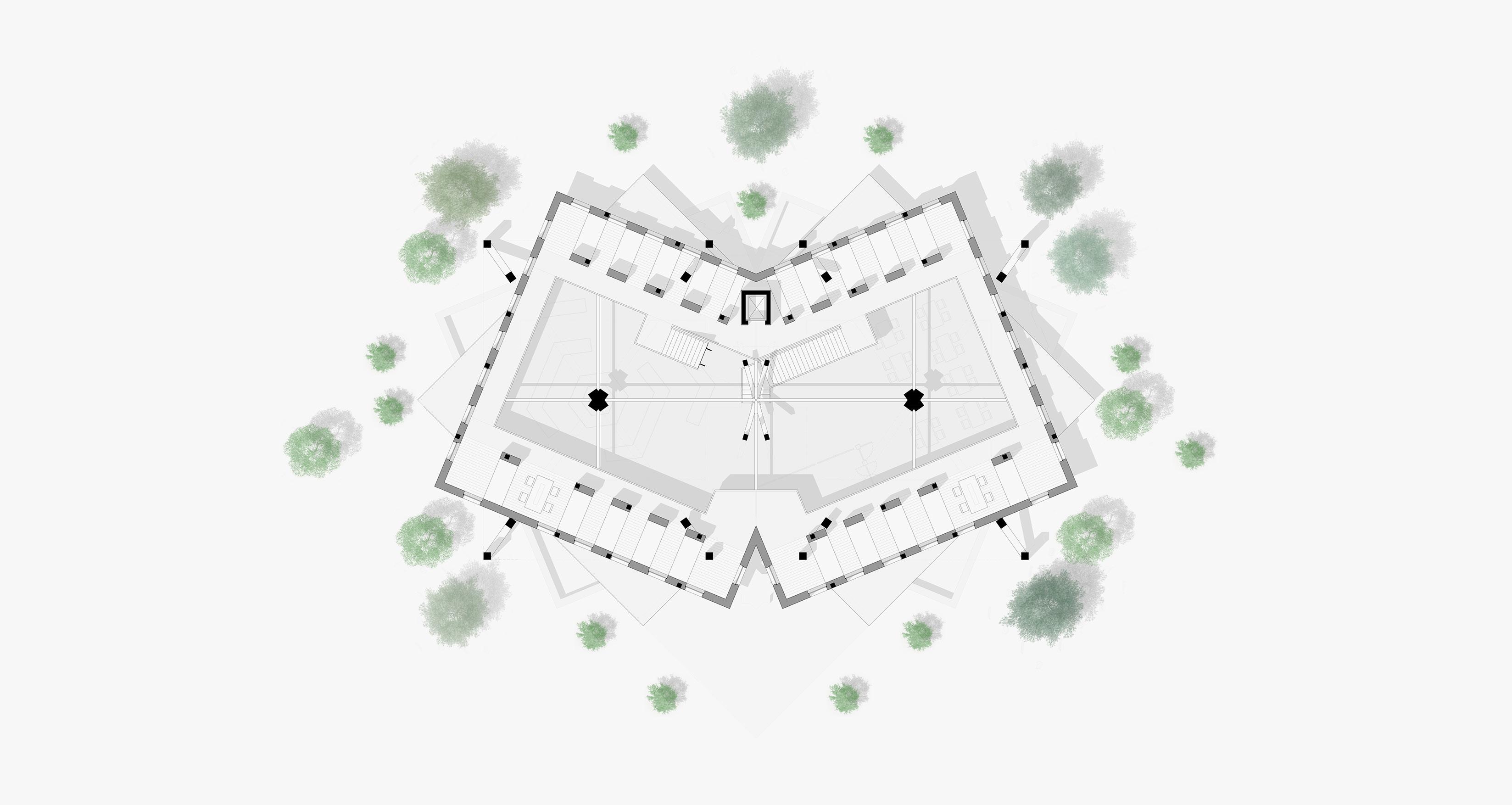
A modular system has been developed to make brick walls permeable. This paradoxically confer movement to an otherwise flat and closed septum. The brick (or double brick) is rotated on itself to generate twisted columns. Side by side, they allow light, air, and views to gently penetrate the school intimacy from the external landscape. Students can look outside from a privileged position, while people can observe the teaching system at work behind the playful pattern of the classroom brick walls or multicoloured curtains. This bond allows to regain trust towards the teaching organism. The school will showcase the role of education over time as an incubator for a future stable bond between local culture and activities.
For the choice of materials, we decided to favour - almost forcibly - locally available ones. This is justified by the impact the school wants to have on its precise site. Let’s start with crushed stones - here extracted without the use of machinery - and then move on to red earth - which constitutes the substrate of the soil and can be used to create walls if stabilised with cement -. Then, we have rosewood beams and corrugated steel sheet; these two are certainly more difficult to find, but absolutely suitable for guaranteeing the structural tightness of volumes and their roofing layer in particular (during the rainy season they must be able to withstand massive loads). How is it possible to achieve heterogeneity where there is not a wide range of materials? Variety is given by the possibilities each material has and by their juxtaposition. The main example is the twisted columns made of earth bricks stacked individually or in pairs on top of each other. This type of brick is more closely linked to tradition than cement or sand blocks, same as are the typical multicoloured fabrics used in local ceremonies and here intended as sumptuous curtains partially delimiting rooms. Finally, sustainability was also a key: wherever possible there are reused elements. We are talking about car tires in the foundations - which would otherwise have been thrown into the river or on the side of the road, or burnt -, prevented from being dispersed creating pollution. We are also mentioning broken ceramic tiles embedded in the concrete plateau. They not only decorate and add movement to the paving, but have a consolidation and watertight function as well.
UP: perimetral wall concept
LEFT: conceptual view of the perimetral walls RIGHT: material selection
MEN ON MARS
MIGRATION OVER A SATELLITE DISTRICT
LOCATION
Via Domenico Cimarosa 1, Pioltello, (MI), Italy
Satellite District, Mars Lot
YEAR
Politecnico di Milano, 3 rd year BSc
Interior Design Studio, 2019 - 2020
TYPE
Academic, Group Work
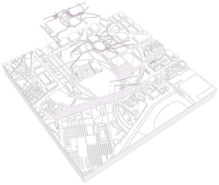
The Economic Miracle has represented a turning point of its modern history for most of the Italian cities: the centralization of productivity in the big urban centers corresponded to a mutation of the rural peripheral villages: these ones found themselves invaded by a number of people they were unable to welcome. Pioltello, whose population nearly tripled in the 1950s alone, is an outstanding example of this.
For this reason, in 1961 the Quartiere Satellite (“Satellite District”) was born. Completely free from building rules, it was built in only one year, with good finishing touches for the time, but evidently needy from a general planovolumetric point of view. The district offered itself as a green Solar System (as the name of each lot indicates) in the galaxy of the new residential neighborhoods which had appeared on the outskirts of Milan.
It was intended to attract the wealthier population, tired of the heavy congestion of the city center; however, the terrible financial situation of promoting bodies totally upset the plans: people now see it as a mere way station, a forced exploration to end as soon as possible.
The prime goal of the project was the analysis of one of the most paradigmatic contexts of Milan suburbs.
The expected result was a definition of an urban regeneration model, based on the activation of innovative processes of recovery of architectonic patrimony and underused public spaces adaptable to similar environments.
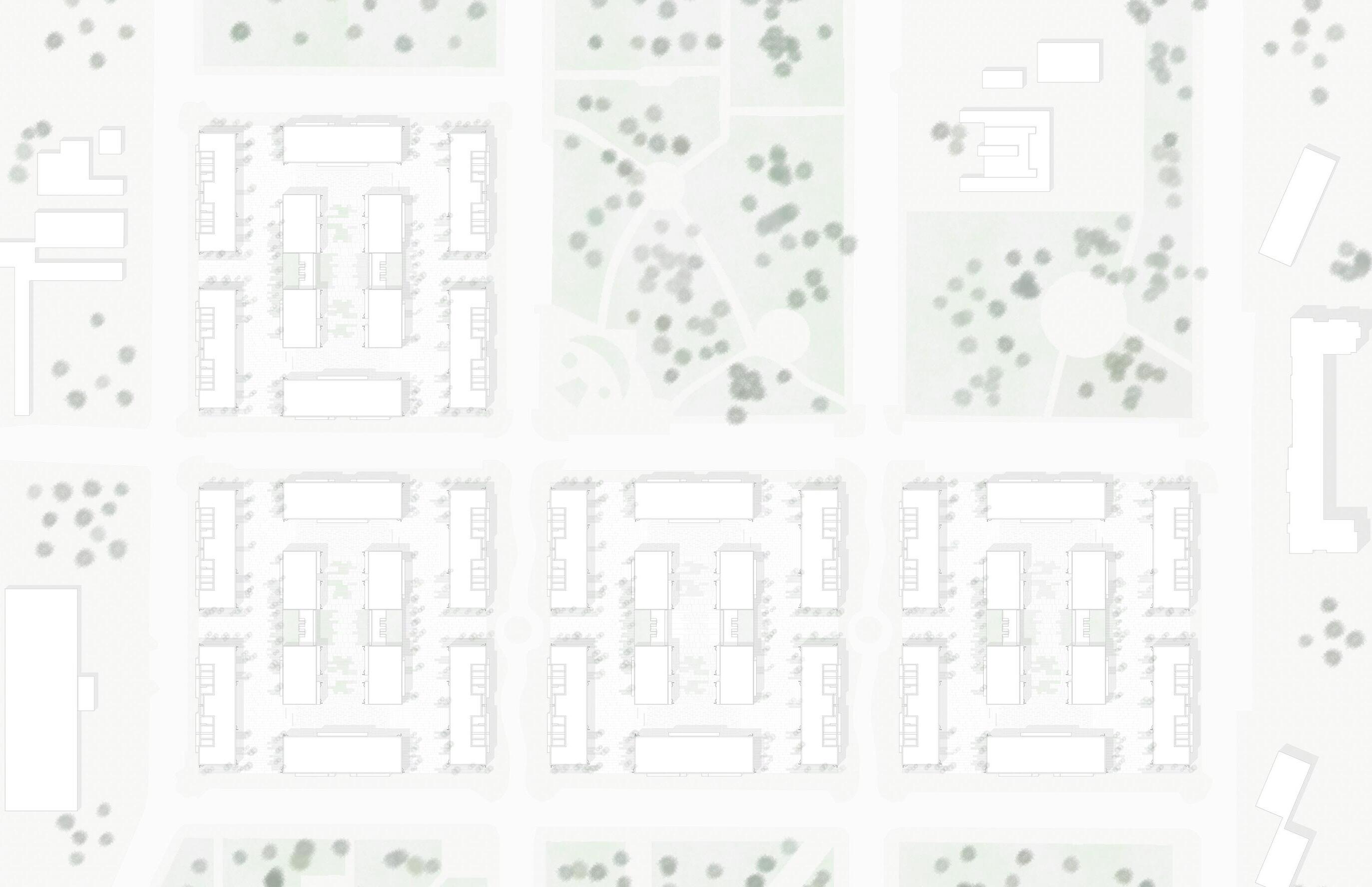
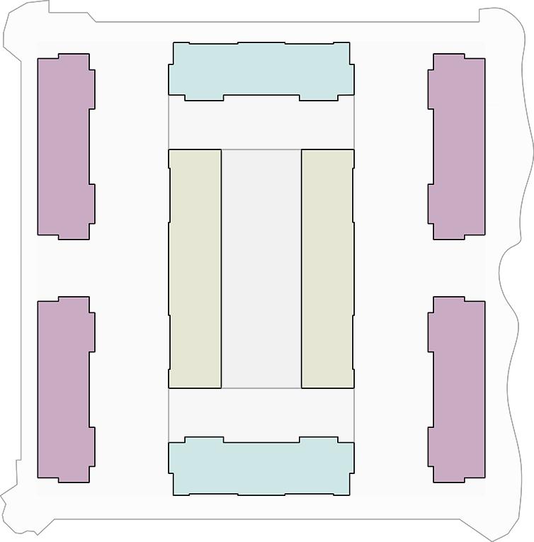
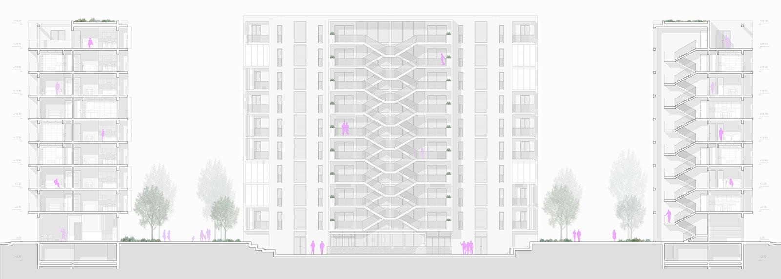
We focused on the Lotto Marte (“Mars Lot”), whose interior has been readjusted to accommodate four housing solutions: traditional housing, student residences, co-housing and atelier-houses.
LEFT: masterplan of the Satellite Neighbourhood
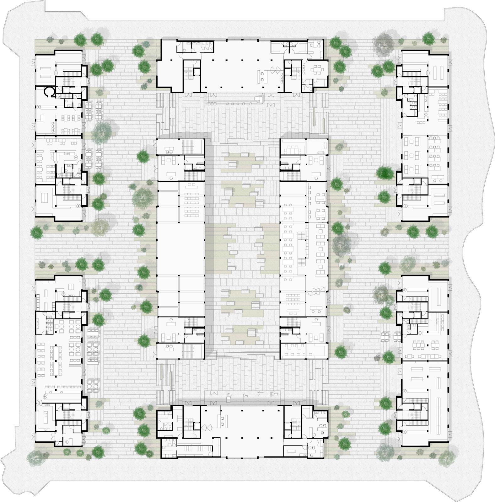
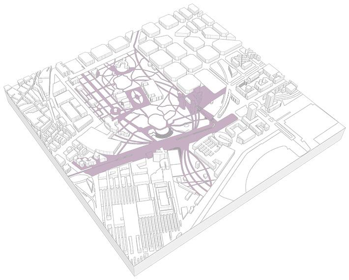
One of the most important actions was to create a large public area on ground floor, composed by commercial activities and polyfunctional areas. For instance, various residential typologies have many different needs and demand many different spaces. Our goal was to create a big neighbourhood where all the inhabitants could live and create a “zone identity”, for this reason public spaces would have a leading role in this process. On the ground floor we located pubs, cafes, food shops, restaurants and a small covered market, all activities connected to food. On the North and South tower, we placed a gym and a kindergarten where kids could stay while their parents are at work. However, the same spots can be used as well as spaces where the elderly could meet and stay together. In the four central towers we decided to locate a library with some study rooms and an exhibition space. All the activities that we established have the important goal to re-generate a zone identity within the neighbourhood and at the same time to attract new residents with different backgrounds and necessities.
Food Shops areas
UP: ground floor plan of the Lotto Marte
LEFT: Diagram that describes the program (made by me)
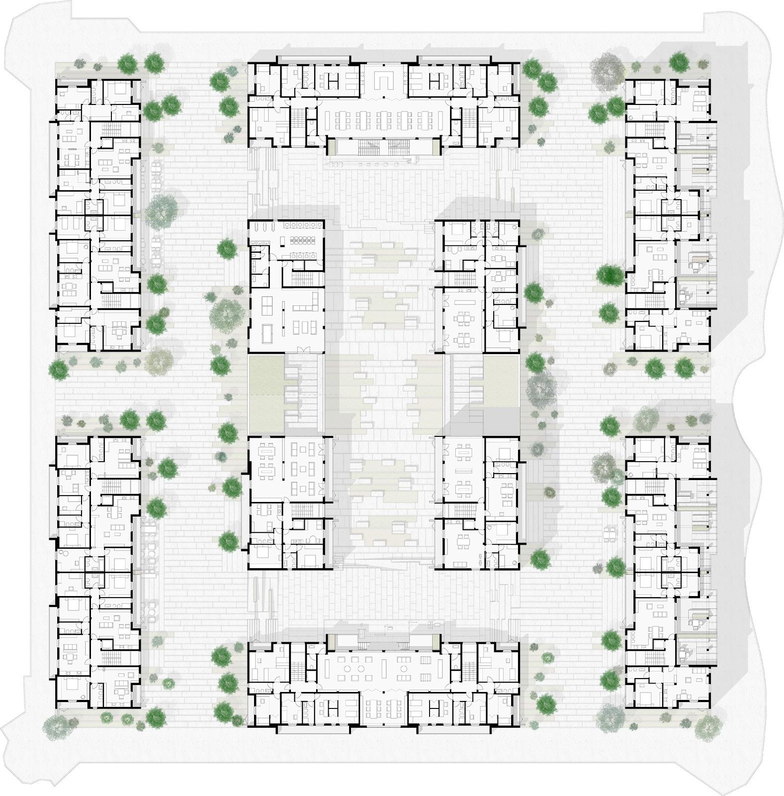
As said, having different residential typologies means designing spaces for various needs. For example, the student houses do need way more public space than private dwellings.
We decided to put a stair on the main façade of North and South towers, because we want to unify the whole public space within these buildings. Private slabs have more privacy, we created apartments with different dimension in order to create much more flexibility. This allows the single family to grow and adapt to change.
Moreover, the four central towers host many co-living units: this dwelling type is a hybrid form between private and student houses. Finally, we located houses for artists on the uppermost floor of the sixtower central block; this last typology has its own variability as well.
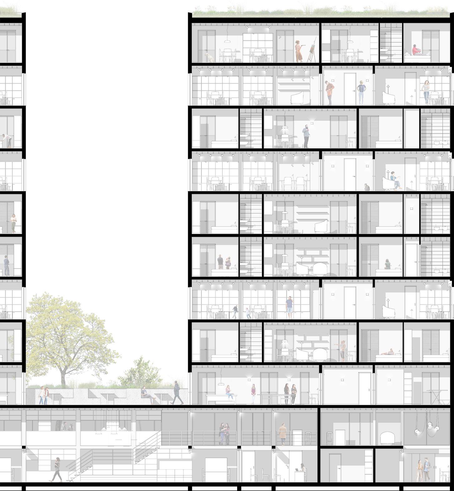
As this was the Interior Design Studio, once the urban framework reached its consolidated final form, we could start to explore a human dimension, precisely focusing on the more complex portions of the project, the new library and the houses for artists, which especially captured my attention. We tried to enlighten each apartment as much as possible using big windows.
I worked on private houses and houses for artists, on these cases I worked with particular attention in order to ensure specific rooms and spaces for specific inhabitants. Indeed, when working on public spaces, I really went into the design of the stair connecting the two levels of the library, and I decided furniture and materials to be used in that space. I add as remark note that the concept to create more than one square laying at different heights was a group collective intention.
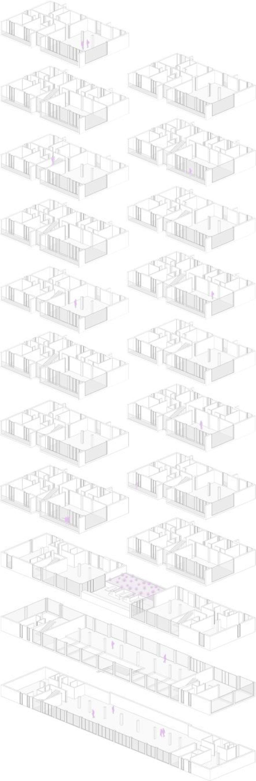
UP: upper floors plan of the Lotto Marte
UP: axonometric views of the new library furniture (made by me)
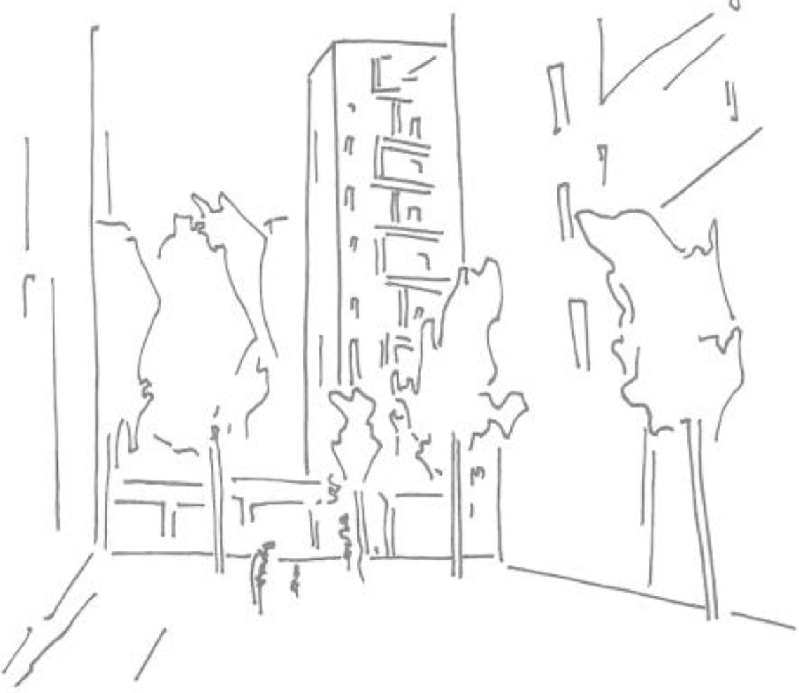
UP: sketches depicting perspective views from different angles (made by me) LEFT: section-elevation showing the external stairs system
UP: sketches depicting the new library furniture (made by me) DOWN: sketches depicting the openings (made by me)
LEFT: detailed section of part of one of the central buildings UP: axonometric exploded view of one of the central buildings
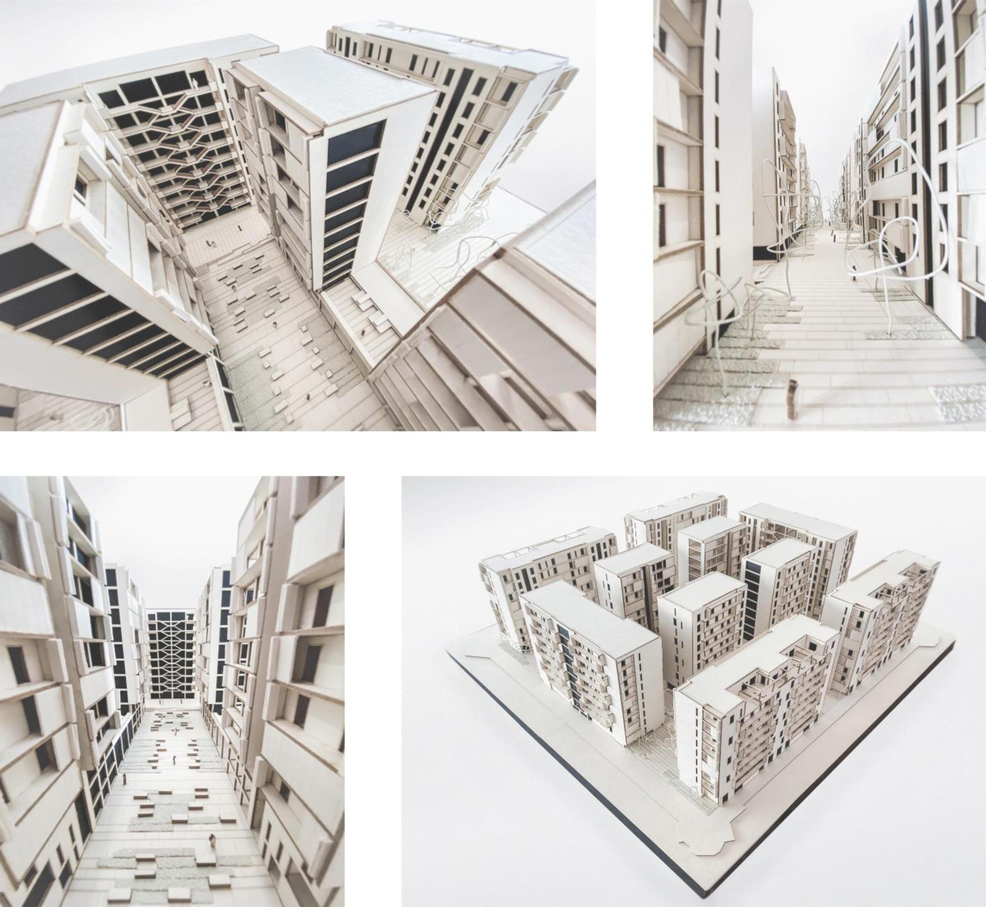
The most direct method to prove the overall validity of every architecture project is certainly building a big scale maquette, in this case a 1:150 model, about 75 cm x 75 cm large. Built this model, it is now possible to see with your own eyes the spatial interpenetration from the boulevards to the parterre and how buildings articulate through their ground attachment. The entire first part of this studio has seen the realization of conceptual models in smaller scales, 1:500 and then 1:200; this presentation maquette was exposed at the exam in presence of Pioltello-Limito Mayor and last June was displayed at the Satellite District Secondary School.
UP: series of photos of the architectural model
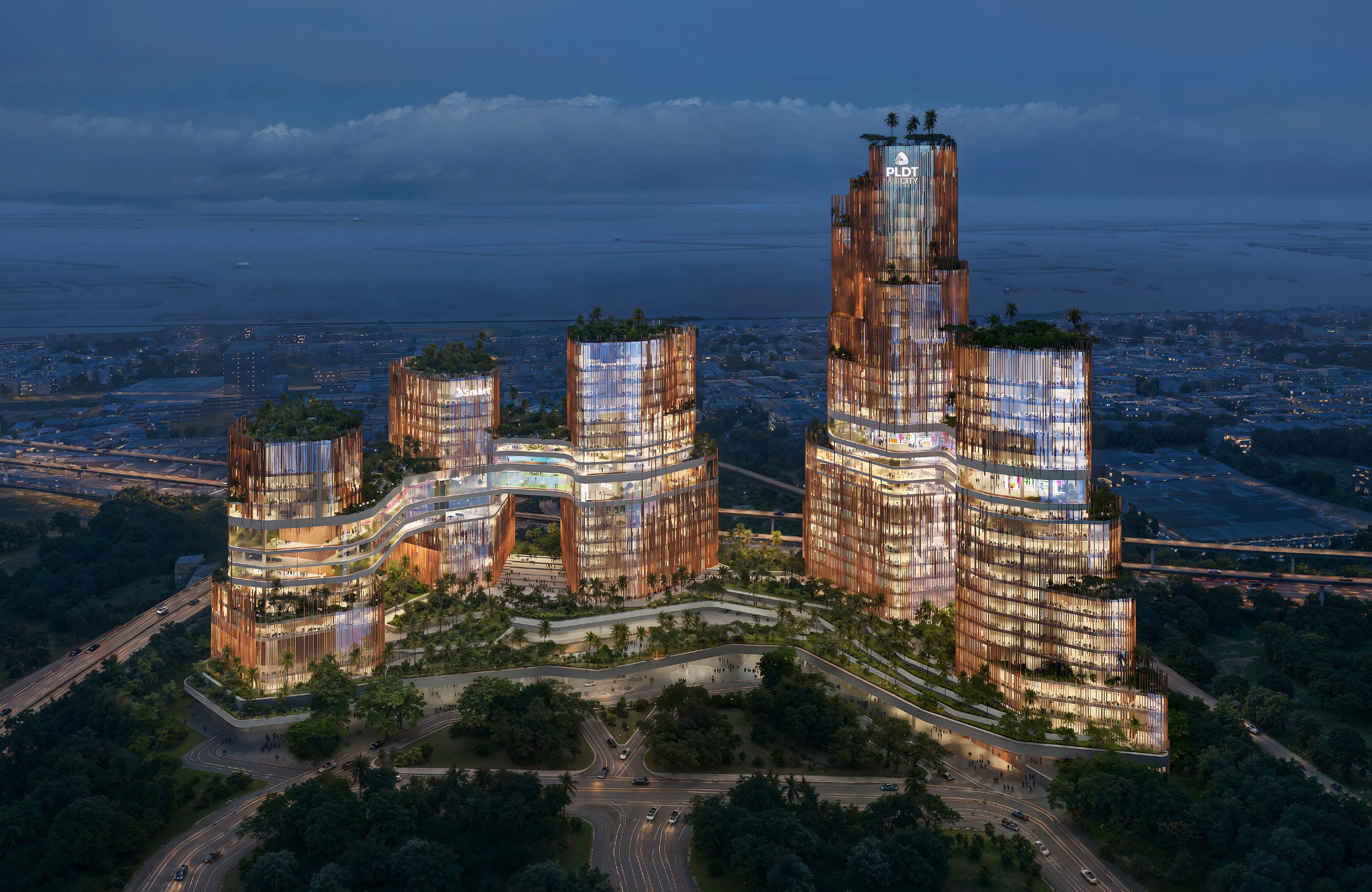
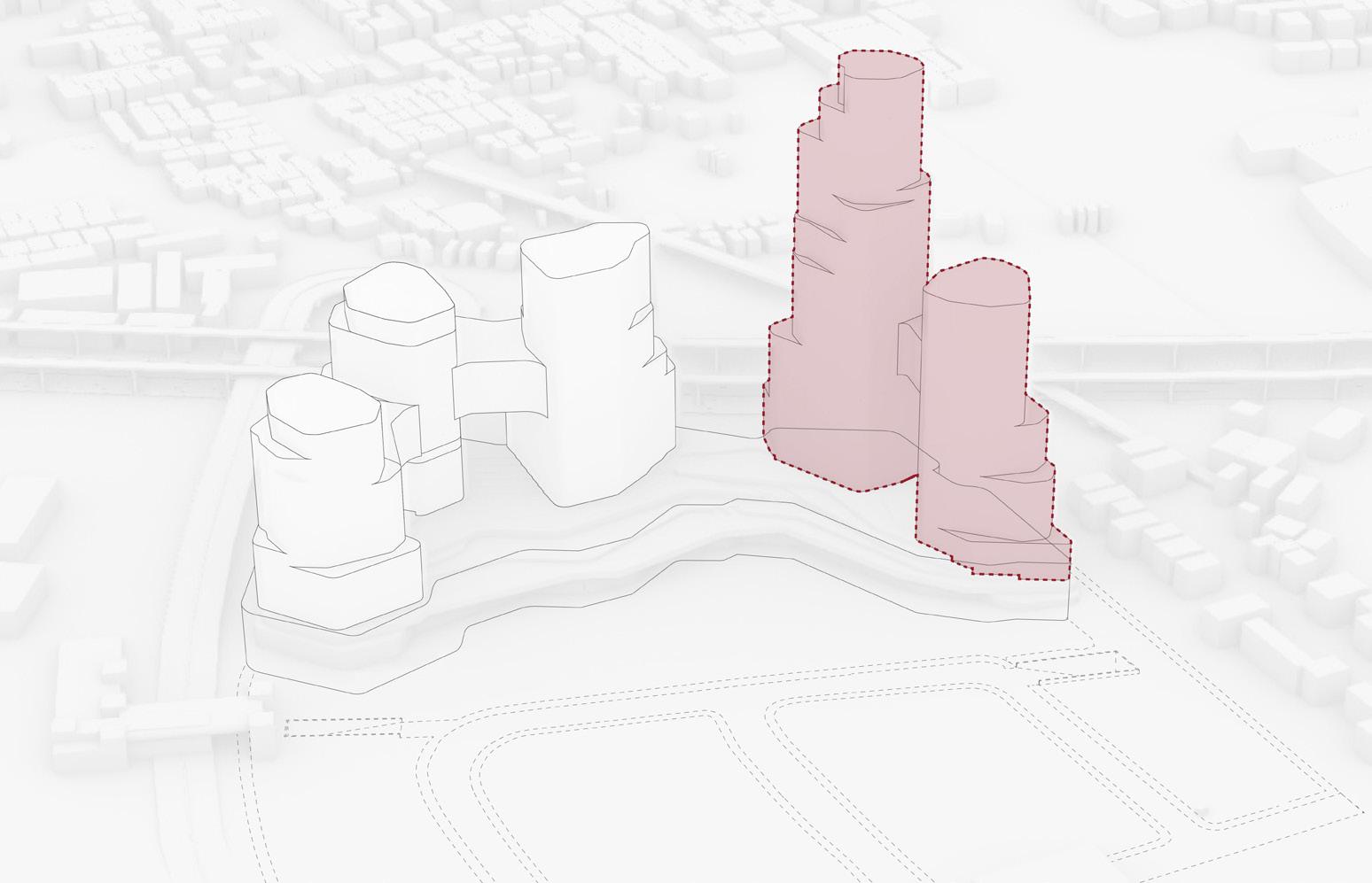
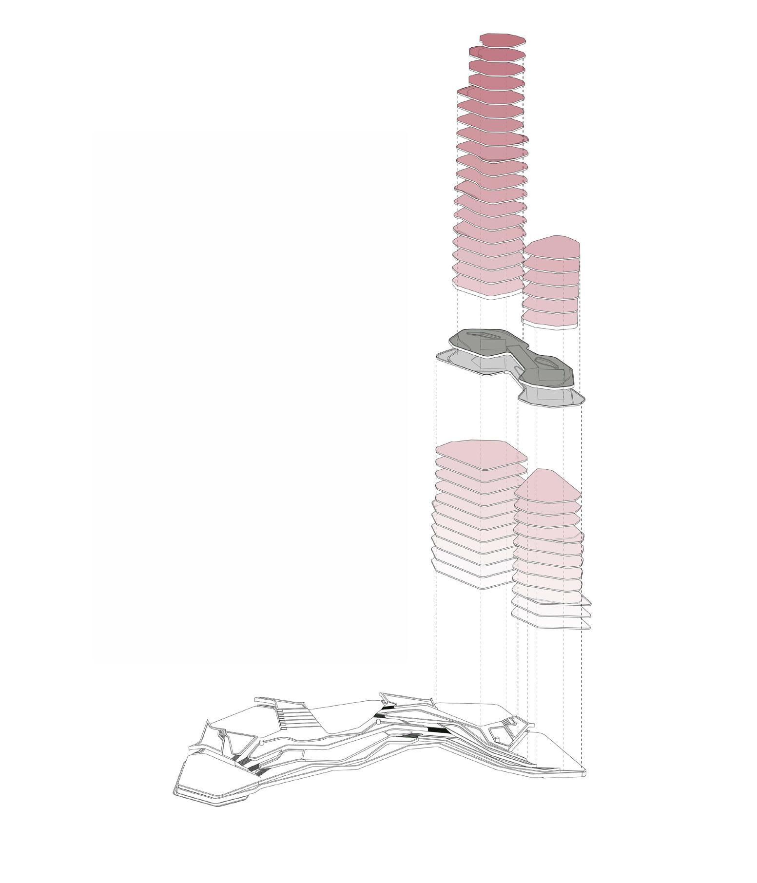
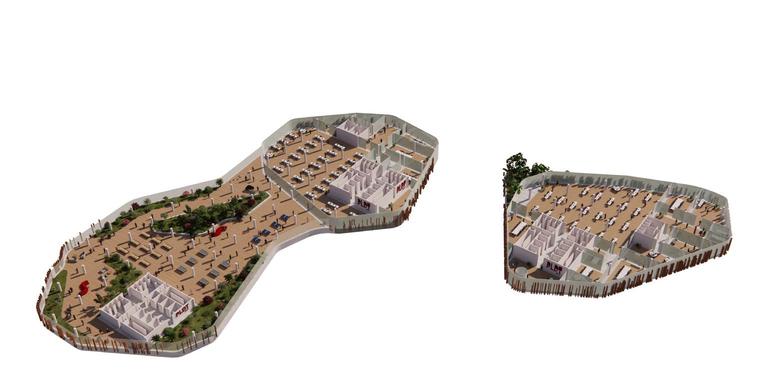
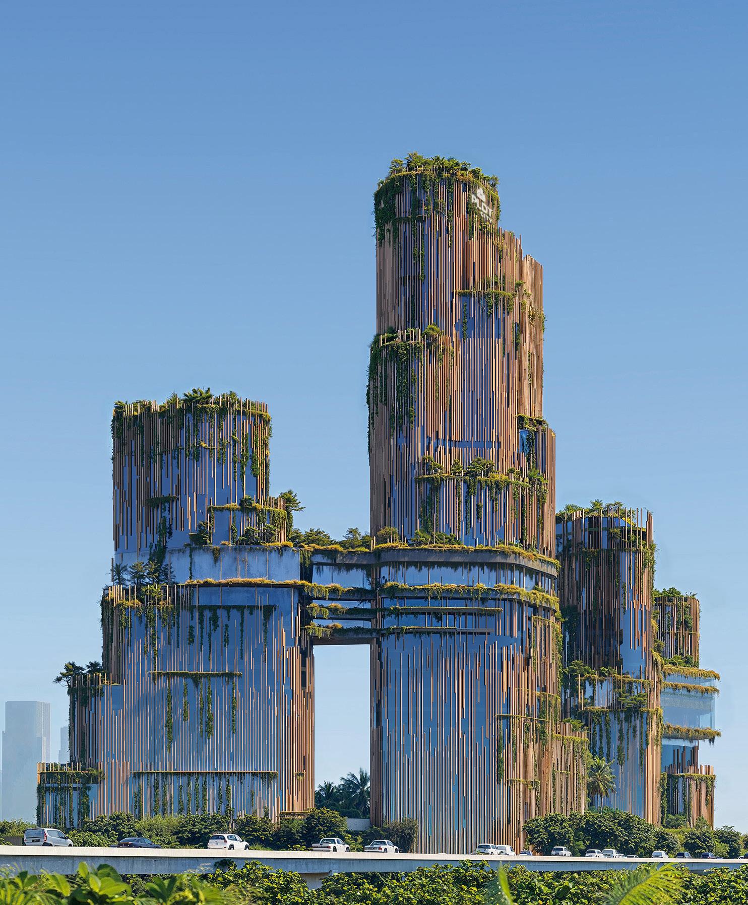
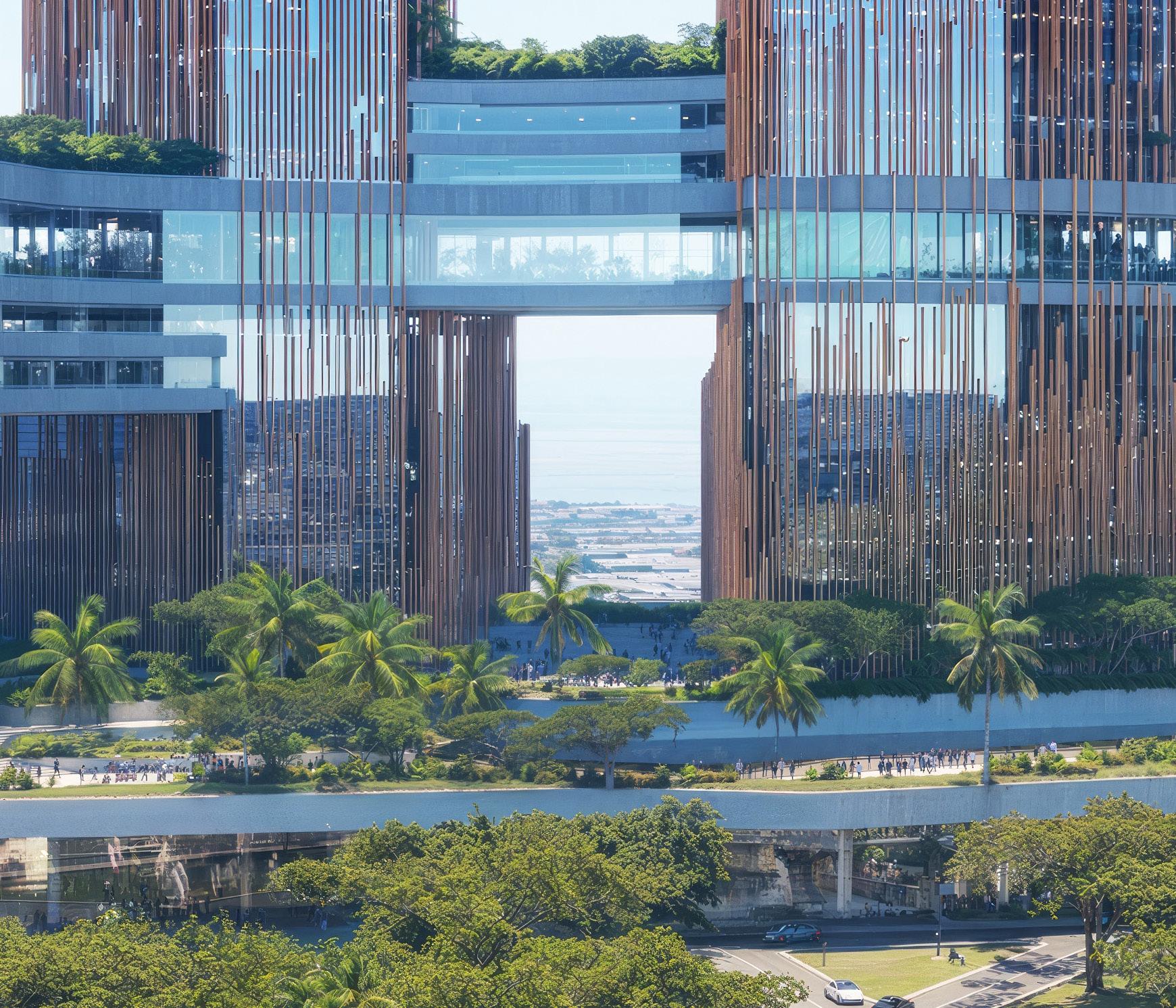
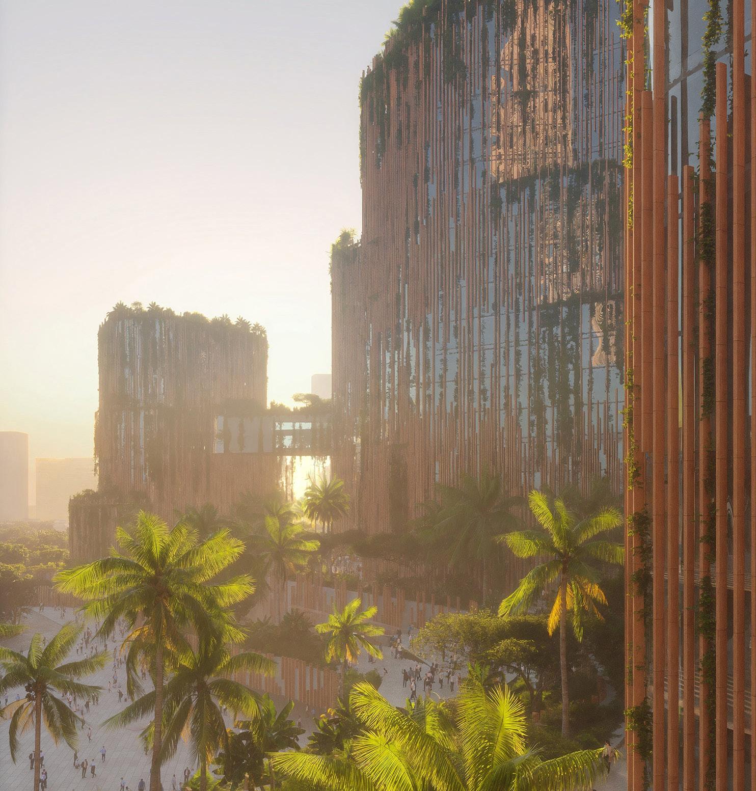
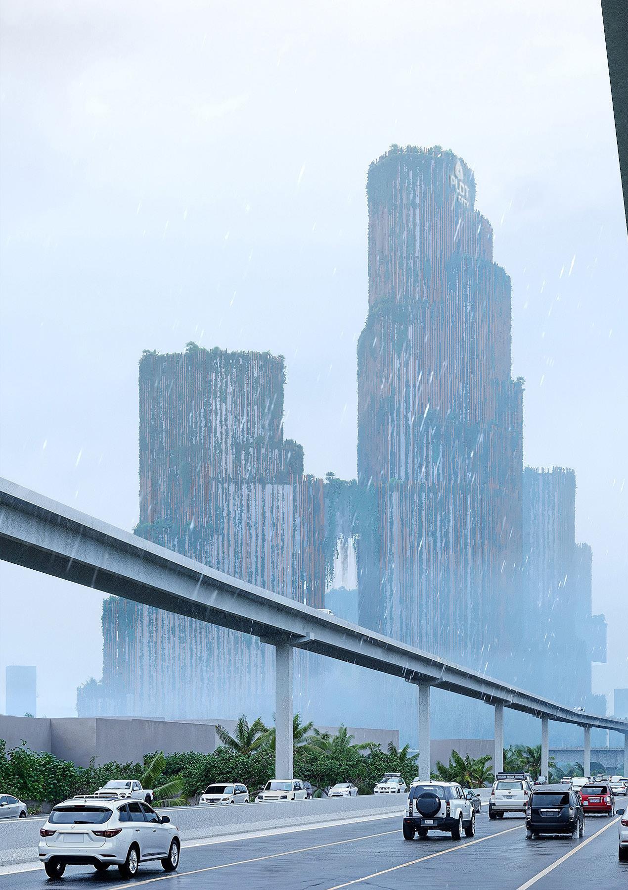
PLDT CAMPUS
NEW HEADQUARTER OF PLDT CITY COMPANY
LOCATION
Manila, Philippines
TYPE
Competition per RBTA, Lead Architect and Project Manager of the project
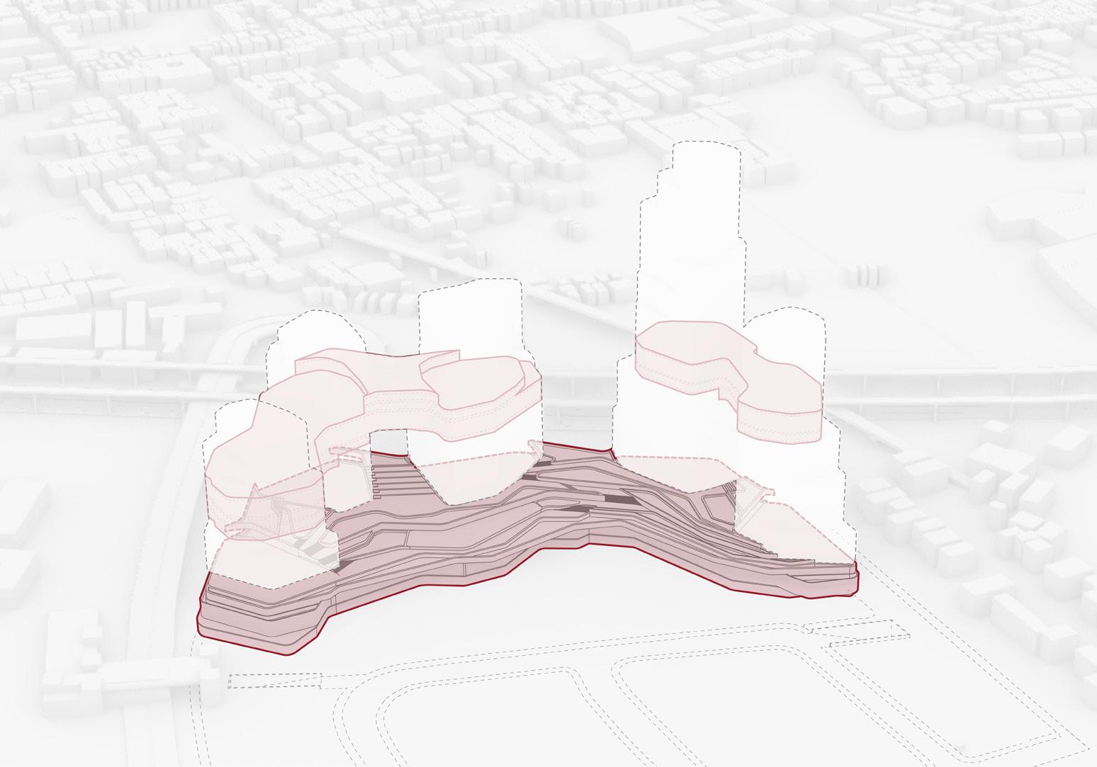
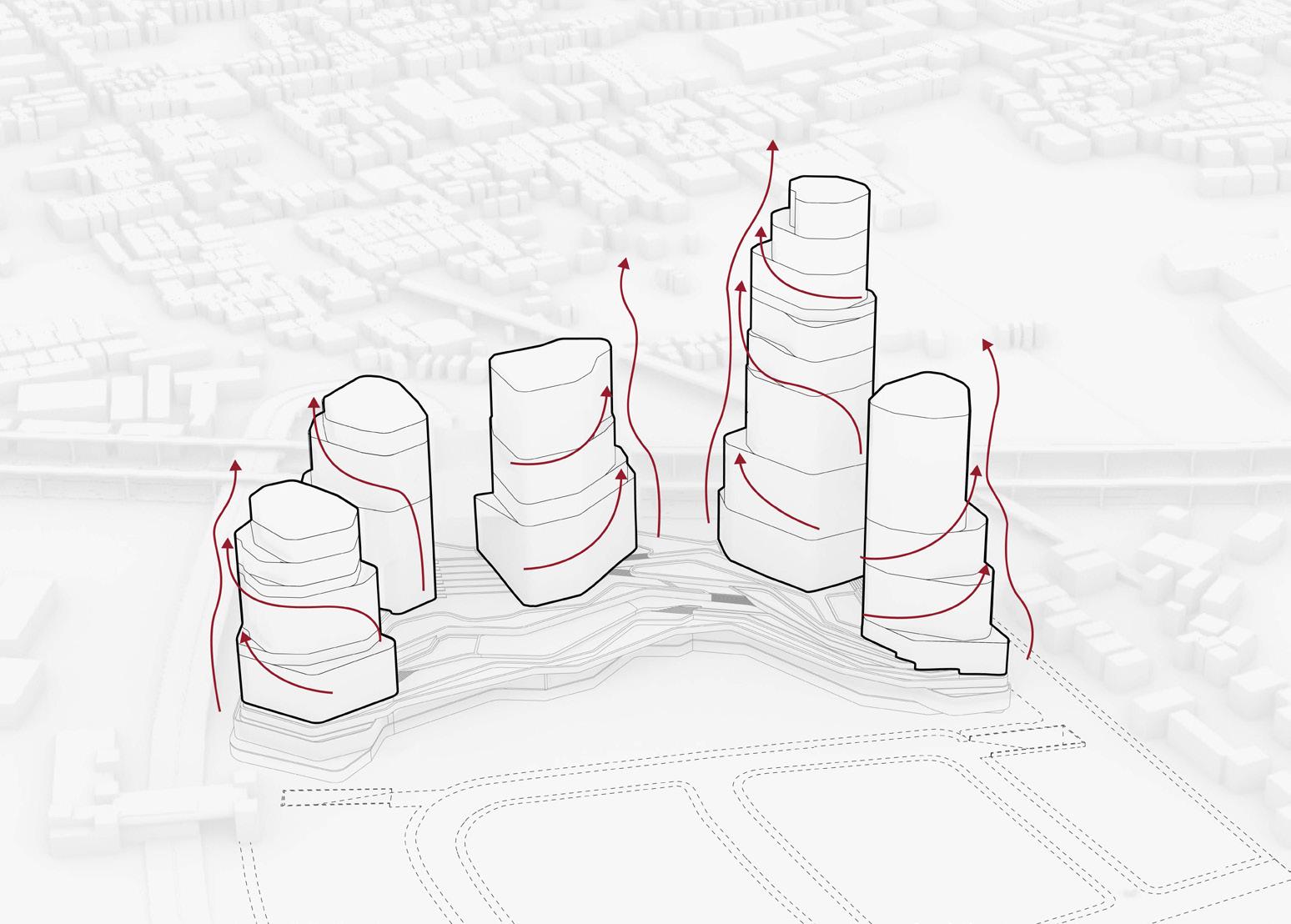
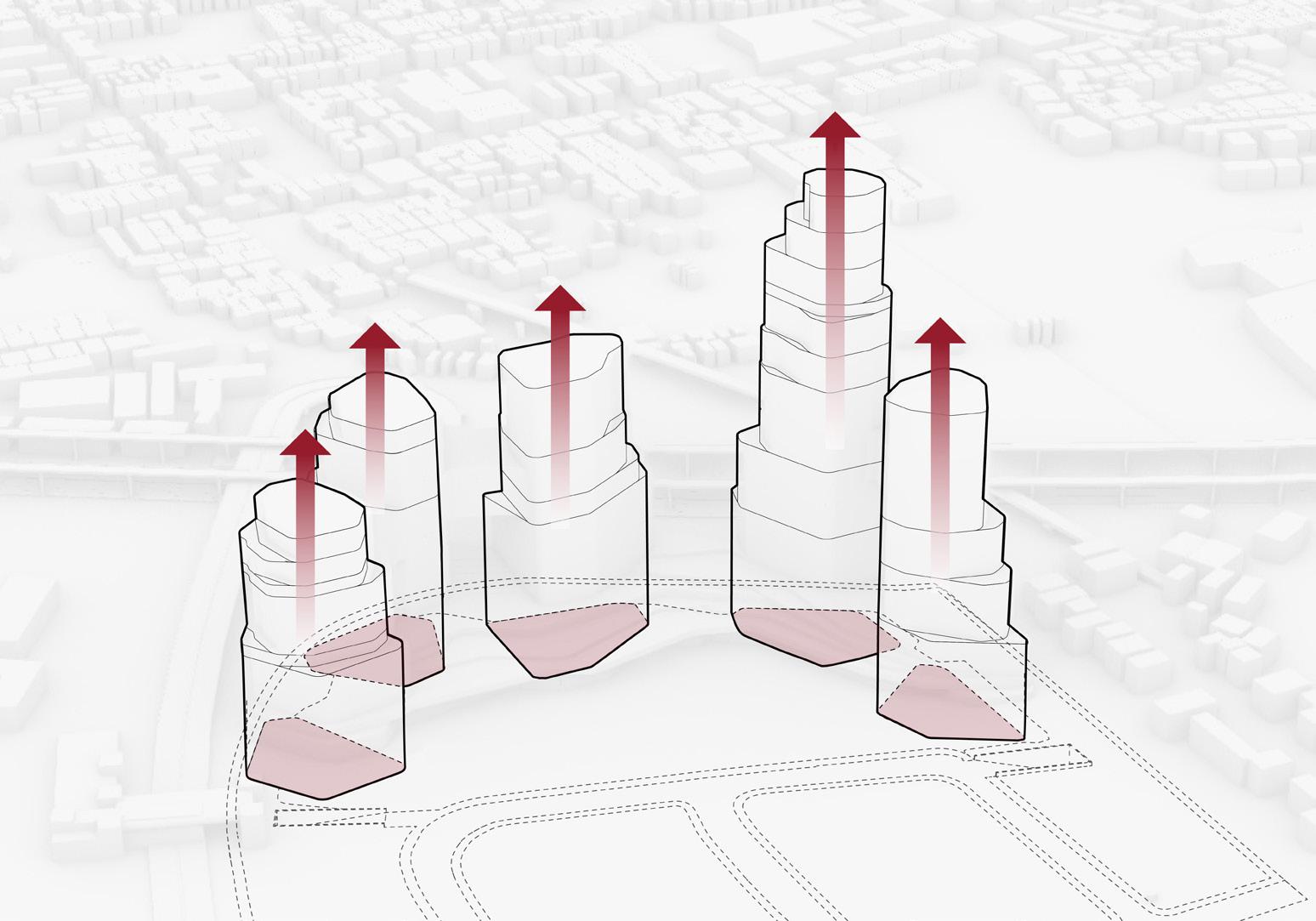
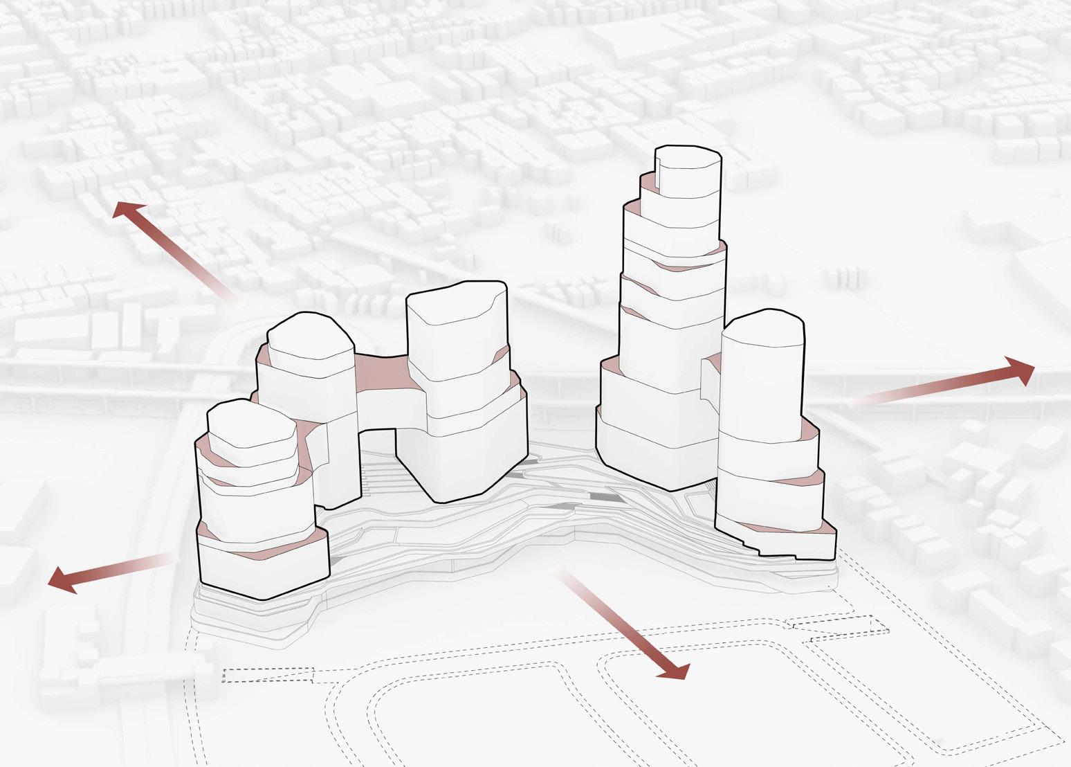
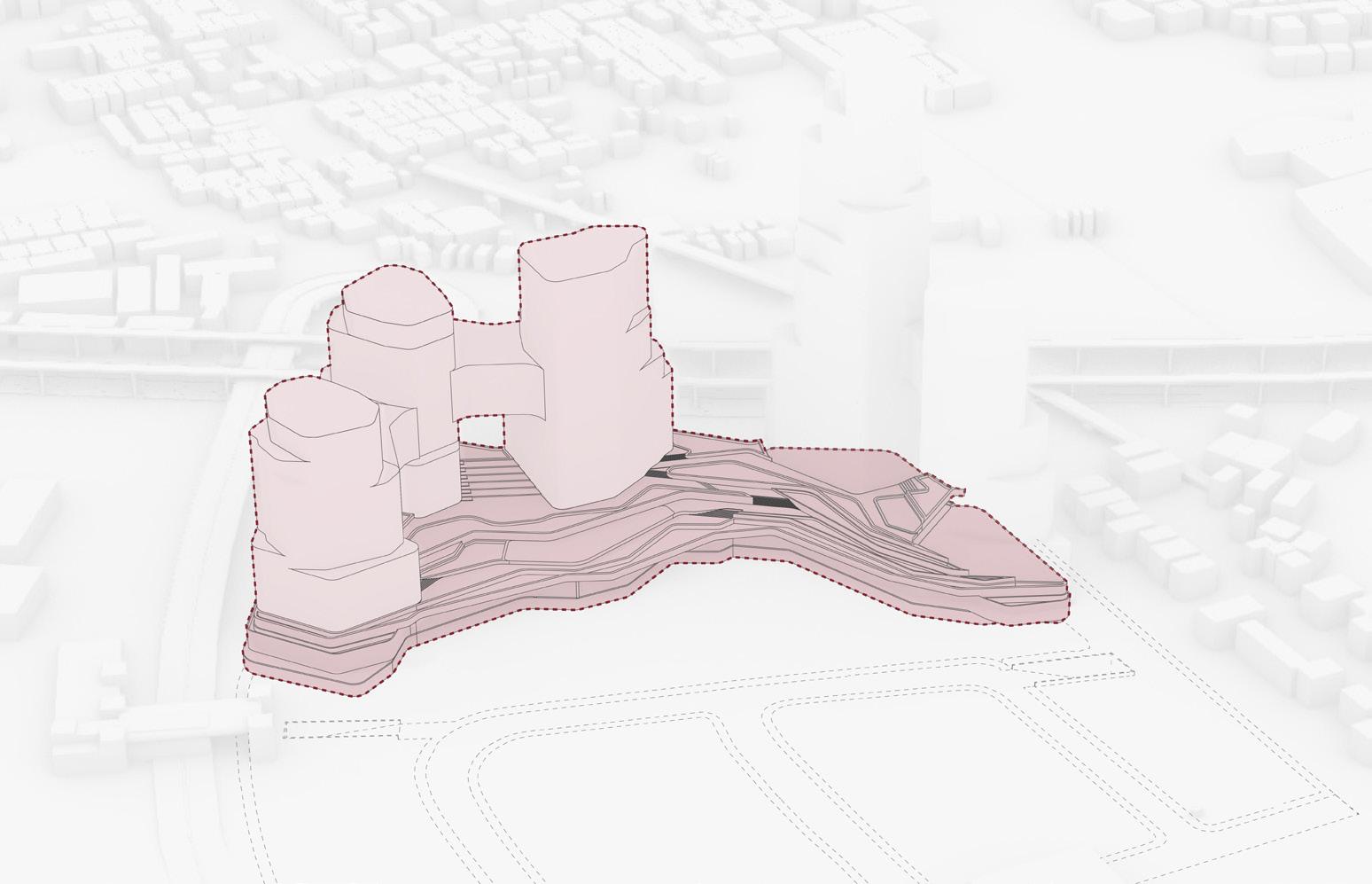
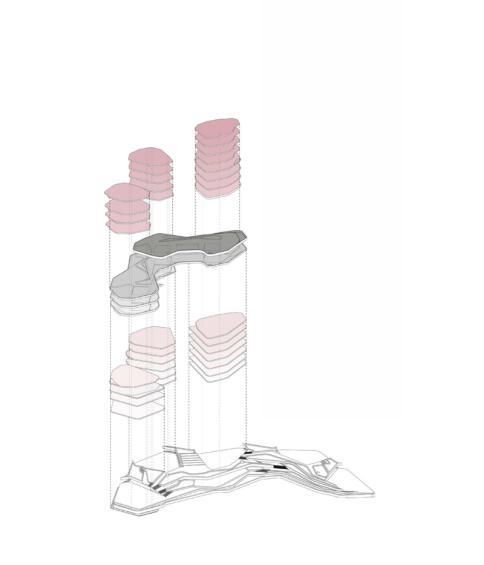
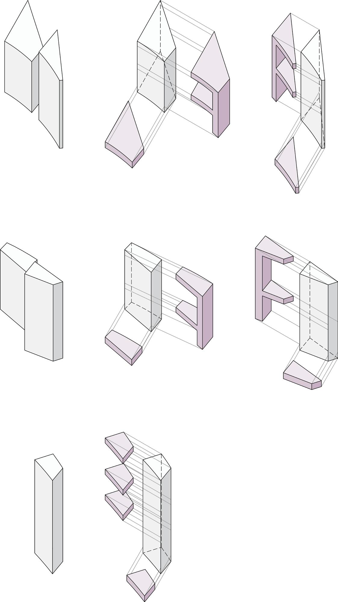
LEFT: main concepts of the project
phase 01 massing and main functions
LEFT:
RIGHT: phase 02 massing and main functions
Offices
Sport Ring
Wellness Ring
Art Ring Office
Chairman Office
UP: restoration and office type floor
UP: render of the second phase towers
UP: sport ring floor
UP: wellness ring floor
RIGHT: render of the frame effect of the two plazas
UP: render from the main highway of Manila LEFT render of the plaza and the towers during sunset
SEW UP - COVER UP
THRESHOLD
BETWEEN BEACH AND CITY
LOCATION
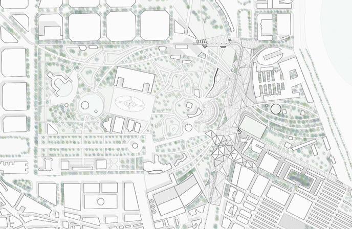
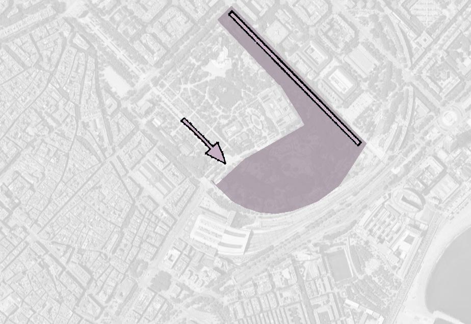
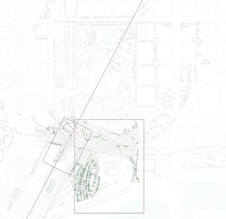
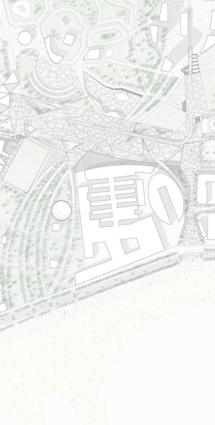
Estación de Francia railway yard and Parc de la Ciutadella, Barcelona, Spain
YEAR
Universitat Politècnica de Catalunya (UPC), 1 st year MSc Master thesis, 2022
TYPE
Academic, Individual Work
The area under consideration is located in the Catalan capital. The site is particularly complex due to external factors, such as railways and motorways, and appears as a place where certain margins have developed and consolidated over time. The area also includes Citadella Park and Barceloneta Park. Therefore it is a resultant place that over time has created a complex margin to be removed.
The park north of the wall was designed in 1877. from its first project, it presented a limit where today there is a city area destined for infrastructure. The area itself has various advantages, especially in terms of spaces and sociability. The park is placed in a central area of the city. It still appears to be a meeting place between the various green streets that cross the city. from these factors, its importance at the urban level can be deduced.
On the other hand, the infrastructures that today block the opening of the park towards the sea are an element that must be removed and developed an element that can not affect the survival of the latter. Their position also truncates the natural continuation of the waterfront and cuts the entire area into two separate places.
Parc de la Ciutadella itself is already rich in connections and features, its centrality within the city of Barcelona makes it a fundamental place for the municipality. It appears to be a place where different green areas and green corridors connect. The project takes this character into account and indeed tries to exploit its factor of being a place of connection to develop a design within it that incorporates this character. The area of interest within the park appears to be the one currently occupied by the zoo.
The municipality intends to remove the zoo to make room for green areas that connect the existing park and the park located in the Barceloneta area. On the other hand, in the project idea, the zoo becomes a public place open to the city which, through its lines, actually connects these two existing parks. Still, the areas of interest, having a high dimension, have been separated into areas of analysis the green space is dealt with as a settling theme, the area that will then suppress the wall and the new centralities are the other elements of development
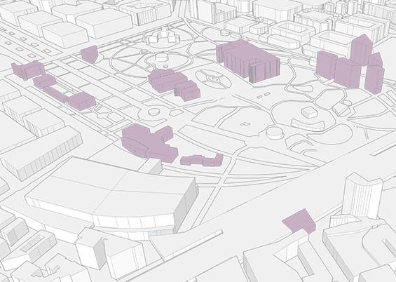
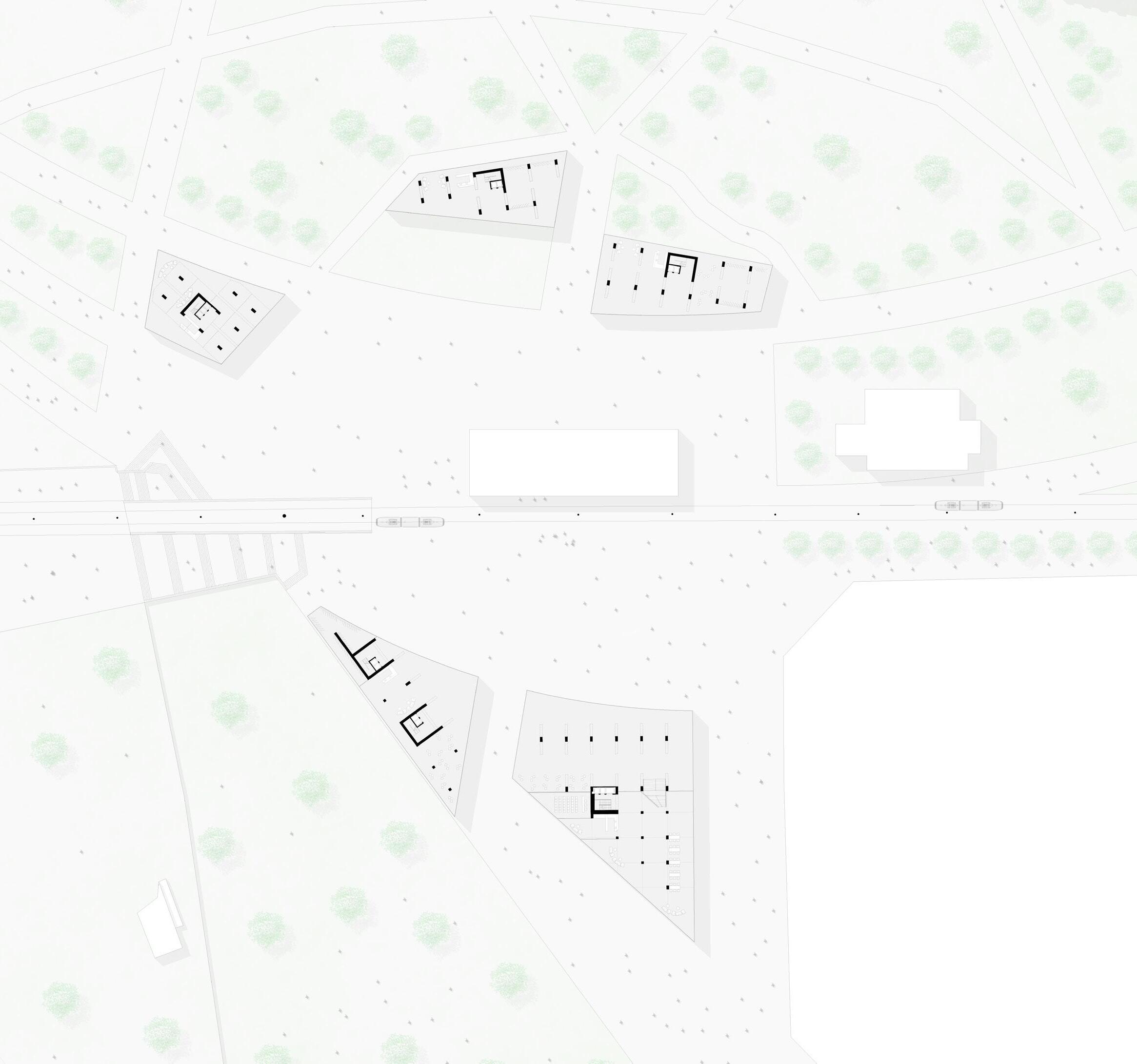
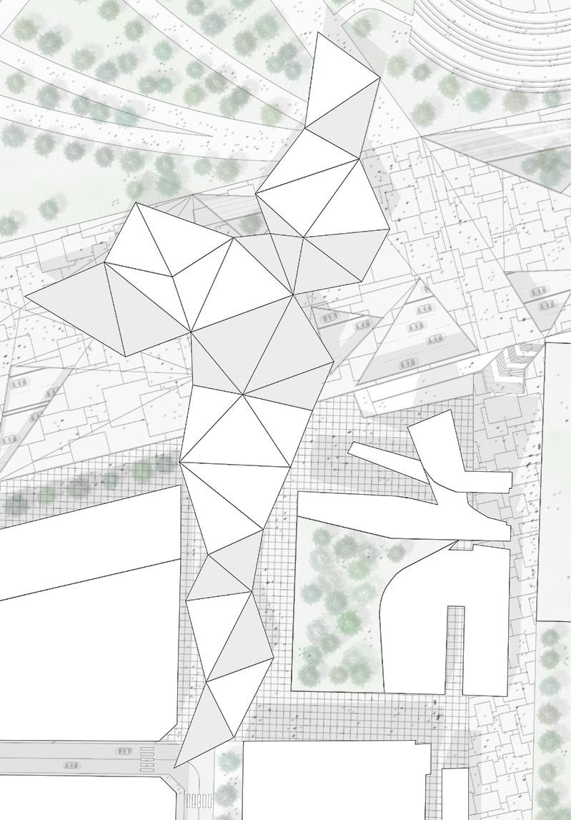
LEFT: masterplan of the project
At first, the project was divided into three macro-areas with respective intentions and approaches, zoo, centrality, and connection between the two parks. From this point, therefore, it is already clear how the project can be developed by levels and different project scales, due to the different dimensions of the various elements that compose it. The two major problems present on the site are the presence of two infrastructures that cannot be removed or rethought, and a city zoo that becomes an impassable wall.
Thanks to these premises, the project tries to eliminate the closure that the zoo creates in the area of the site that overlooks Vila Olimpica del Pablenou and on the side of the railway. Still, the zoo does not allow a direct connection between the city and the beach area. The approaches must therefore take into account these essential factors for the development of the project.
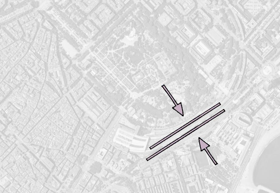
On the other hand, the railway limits the connection between the two waterfront areas and the city and the beach. In addition, it is found to be the terminal outlet of the green connection that connects the waterfront with the Carrer de la Marina and the green area of the Plaça de las Glòries Catalanes. Finally, another fundamental feature that should not be underestimated is the fact that, unlike the zoo, this area is absolutely not accessible to citizens and therefore is a space denied to the city. It can summarize what the approaches need to create. They need to create a connection between the city and the sea, a connection between the two promenades, and an opening of the park in every direction must be fundamental. As a final goal, the various approaches must take into account the urban and social fabric that is present in the district, respect it, and increase its level. With this in mind, the idea of respecting the margins and emphasizing them. It is centered to be able to highlight the connections.
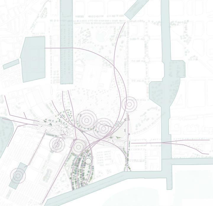
LEFT UP: map showing the main issues
LEFT DOWN: concept showing the soluction to solve the issues
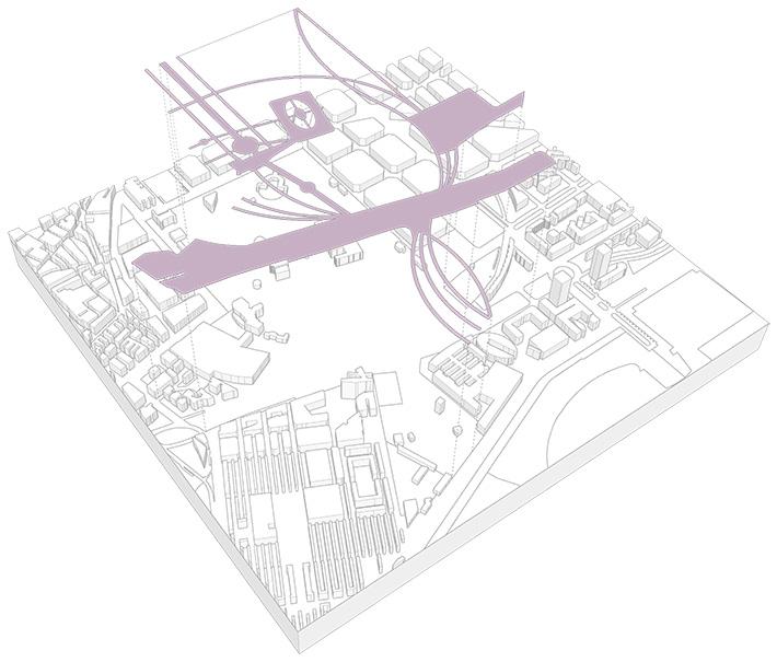
The park that is being developed arises from the composition of different levels and project scales, which, when connected, restore the final shape.
The urban level, as anticipated by the name, arises from the city scale. The shape of these paths is inspired by what is already present within the site as regards the main streets, which with their sinuous shape change the character of the park and create a different element from what is present today. On the other hand, as regards the connection of the two promenades, the connection is given by the creation of a linear plate that connects the two ends.
The second level (local level), on the other hand, is a level of connection between the various places of secondary importance. Its shape comes from the pre-existence of the zoo. Maintaining the zoo it was preferred to intervene as little as possible on the shapes of this place. To these already existing paths, new paths are added which, starting from where the roads overlook the park, are their natural continuation within the park itself. Unlike the first level which is more closely linked to the city, the latter arises from a smaller scale and also develops with smaller surfaces and is less dictated by the idea of connecting places. This level leads the visitor to remain inside the park and makes him change his direction which is not easy to cross.
Hence, the design of this park becomes a place of connection for the green streets of the city. A local park, and a meeting place, for daily life and meeting depending on the level on which you go to reason and analyze the project.
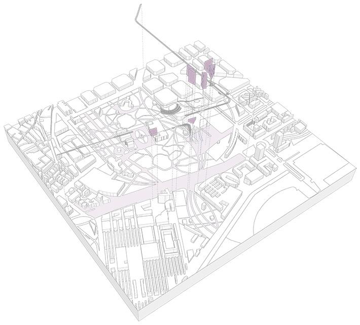
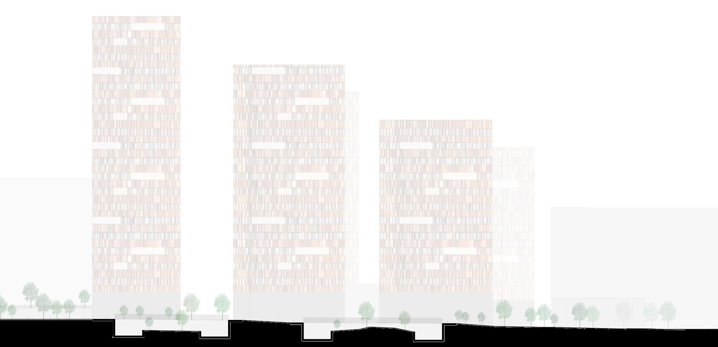
The buildings with shapes that reflect the fabric have some interesting aspects in their composition. They work in pairs, being close to each other. The close facades are public areas to the tower (green spaces) or places used for commercial activities or the use of the residents themselves.
The basement of the towers is a height of three floors and becomes an extension of the square inside the buildings. Hence the need to reduce the structure in the base. From this need arises the idea of creating internal colonnades to the basement, which in addition to giving the idea of an internal portico (which takes up the public space), helps to reduce the presence of pillars.
The facades of the buildings are composed of perforated panels that act as sunscreens, which can be moved by the residents and hide a small open space of one meter wide inside the tower. These elements help to reduce the direct impact of the sun on homes. In this way, it can create a facade that is free from external walls, opening the internal spaces to the city.
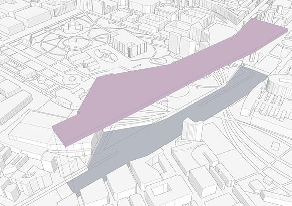
The idea is develops a connect through the wall and creats some meeting places for citizens. The main interventions taking place at this time work concurrently with the border present within the Barceloneta and are aligned with the wall itself.
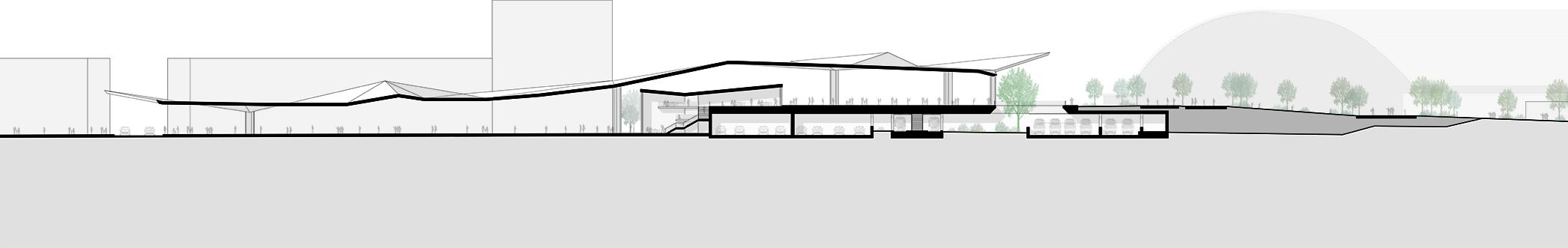
A highly visual element is created that emphasizes the passage between the square and the boulevard on which the roof itself is located. A building is created under it which becomes the physical connection element. In this case, the element itself emphasizes the wall and elevates its character as a connector between two different entities. In fact, in this way, it is possible to highlight the relationship that the margin has (threshold of passage) in this portion of the project. The presence of a visual element has the very purpose of highlighting the threshold character that the wall itself possesses.
UP: k-plan showing the elevation and the two plans
DOWN: plan of the new roof that across the pedestrian boulevard
RIGHT: elevation of the new roof that across the pedesrian boulevard
The area, following the concept of three main pedestrian paths, creates a direct connection between the park and the city with the seafront and the beach. This environment becomes a threshold of passage which is emphasized by the presence of the boulevard which in this space becomes the very threshold between the city and the sea. In conclusion, the Barceloneta park thus becomes a place that connects the city and the sea. The platform becomes the place that emphasizes the separation between these entities.
In the eastern part of the site the railway yard is climbed by a pavement that connects the newly built square (where the new towers stand and there is the tram and metro station) with the seafront and the plaza at the end of Carrer de la Marina. It is highlighted the separation between the two entities by the presence of the platform that already covers the railway which is placed three meters above the ground.
In conclusion, the the platform of the wall becomes the threshold between the two entities. Through its presence, are emphasized the separation and the connection of these environments.
CULTURAL GEAR
MUNICIPALY
LIBRARY IN CESANO MADERNO
LOCATION
Via Solferino 12, Cesano Maderno, MB, Italy
TYPE
Public Competition, Individual Work
In a very busy area as the North suburban area of Milan, the gift of a public space and of a project which reduces the super-density must be the most relevant intention of the architect. The new library is built in a lot where once used to be a furniture factory. One of the most main rules was to devote at least the 70% of the lot to the realization of a vast park.
The intervention area is located near one of the train stations of Milan suburban railway system. The municipality chose this area for the new library among very few free lots within the city. The new library will be a new landmark for the town and represent the greatness of the local and the Italian culture in general.
I live in the most important area in the world for bespoke furniture, the second most urbanized area in Europe after the German Ruhr, at the end of the “Blue Banana”, the European megalopolis that indicates the most important economic zone and the one with the higher demography in the EU. Moreover, we are in a town near Meda, the city where the most important Italian architect during the 20th century was born, Giuseppe Terragni.
The history of this territory has always been connected with rationalist architecture and design, maybe thanks to the proximity to Milan. I built a place where to enclose and protect culture, history and knowledge of this magnificent area. As said, I live in the same area and I know the many issues of this area, for this reason I wanted to use my direct knowledge of the territory to build a place where to solve as many problems as possible.
LEFT: 3D model of the library
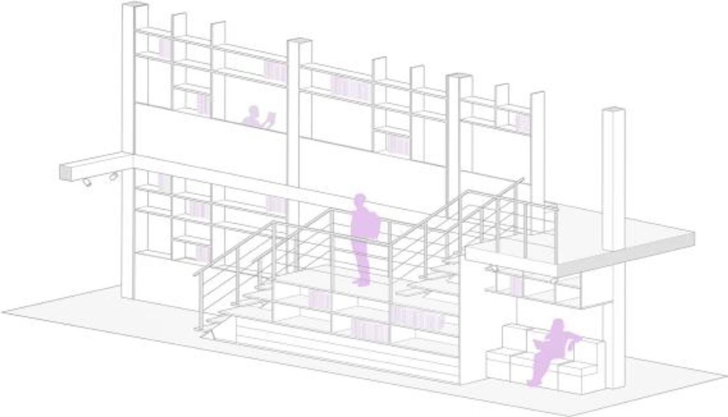
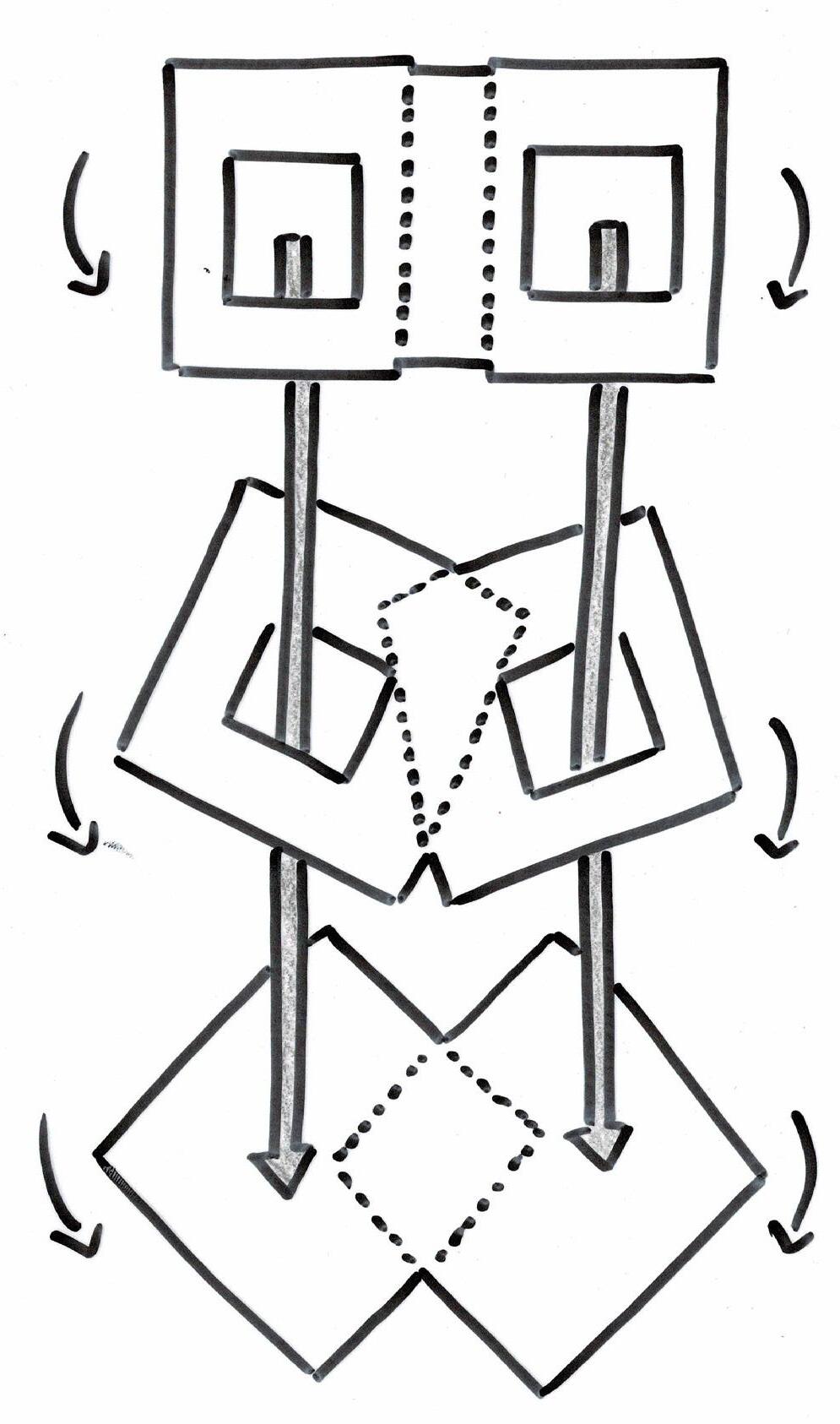
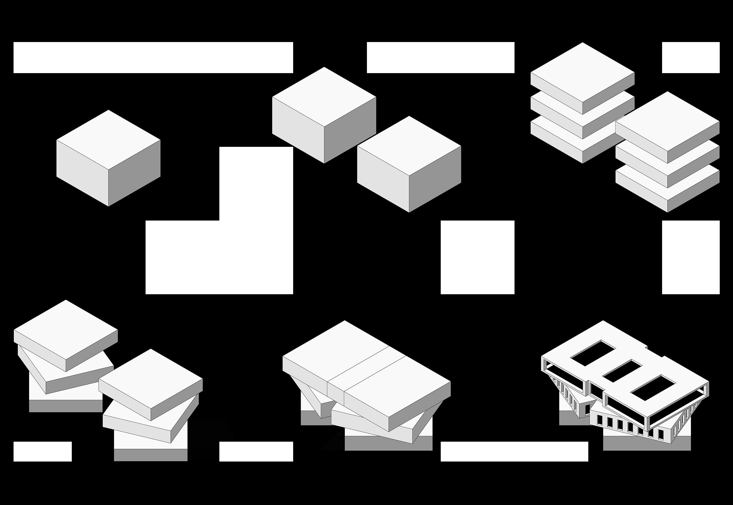
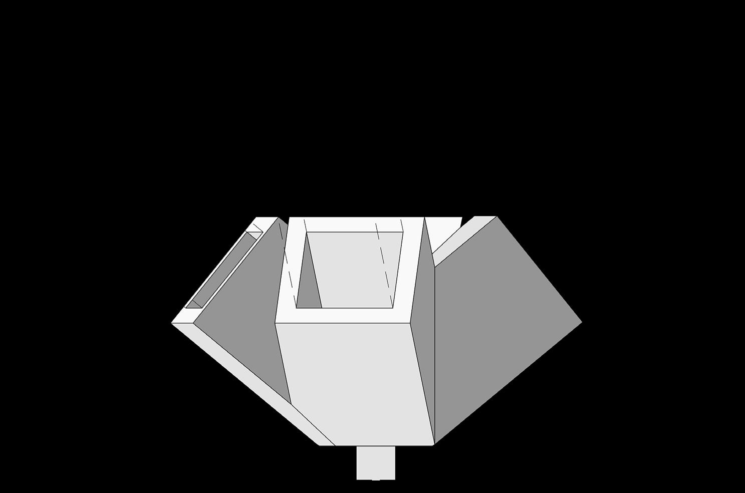
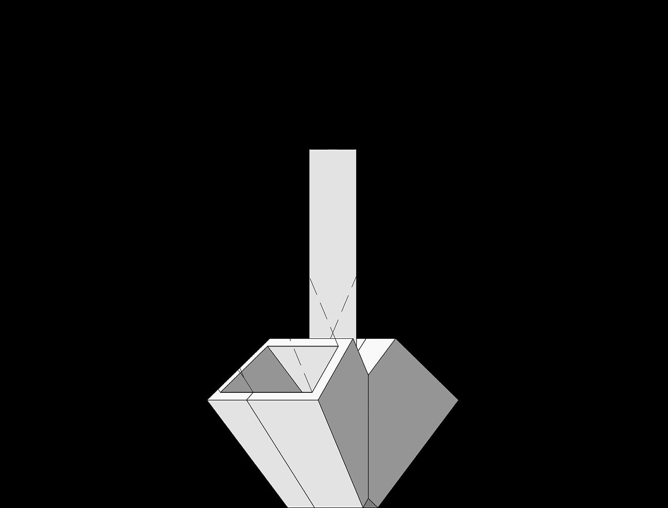
The primary concept behind this building was to create a place shaped from two simple cubes. Then, I divided in three horizontal equal parts the cubes and I rotated the parallelepipeds to represent the idea of a gear.
Thanks to this, I could build an artifact that has simple lines, but a very articulated form as well. At the center of the cubes I located two squares, and around them all the bookcases: these two spaces have become the heart of the library.
There is no window on the ground floor, while the first floor and the second floor are respectively 50% and 100% transparent. As a consequence, the books are on the lower levels, while the upper one is reserved to studying and reading.
Furthermore, the last level is the core of the illumination of the whole building: here you can find three skylights located on the roof.
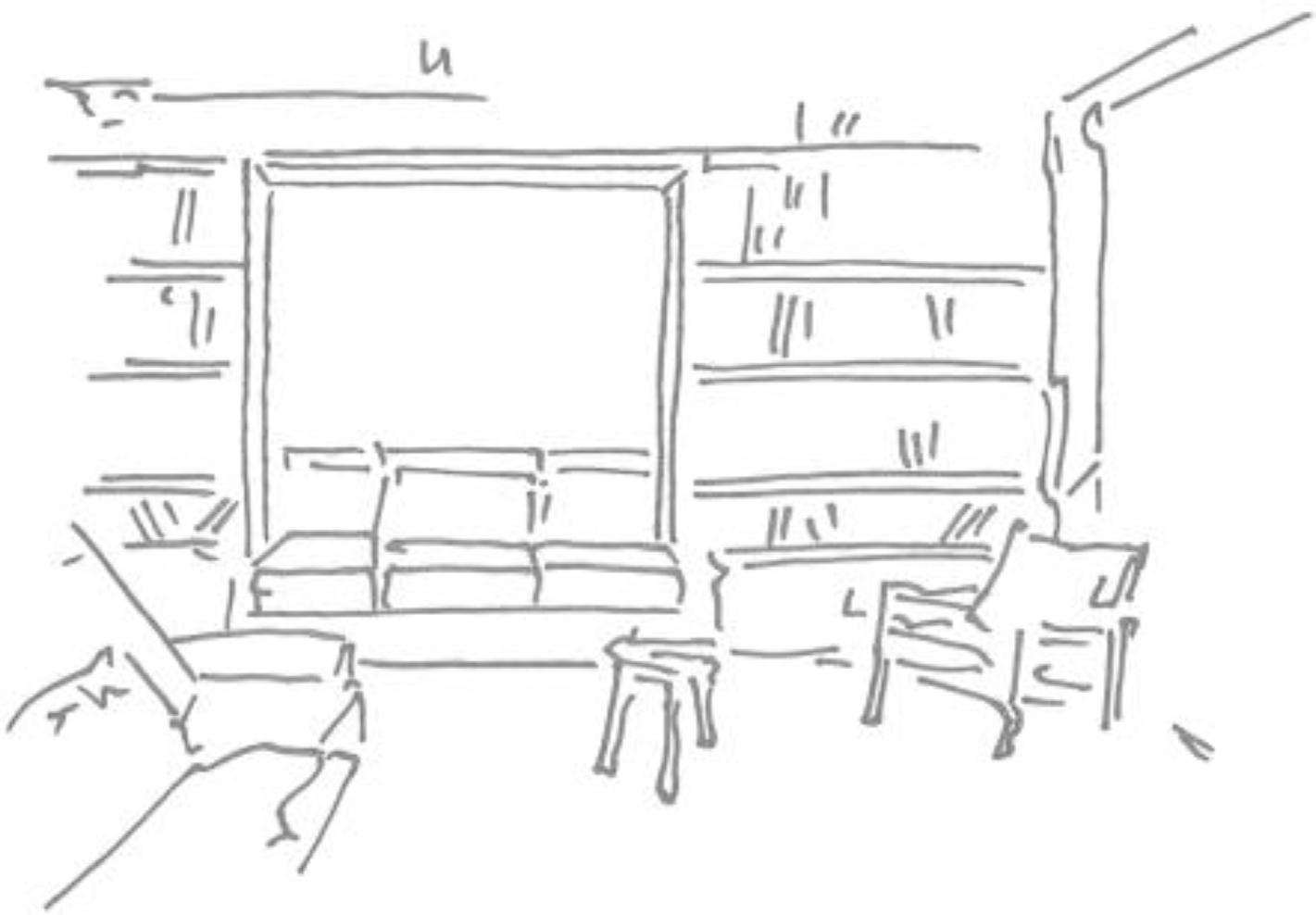
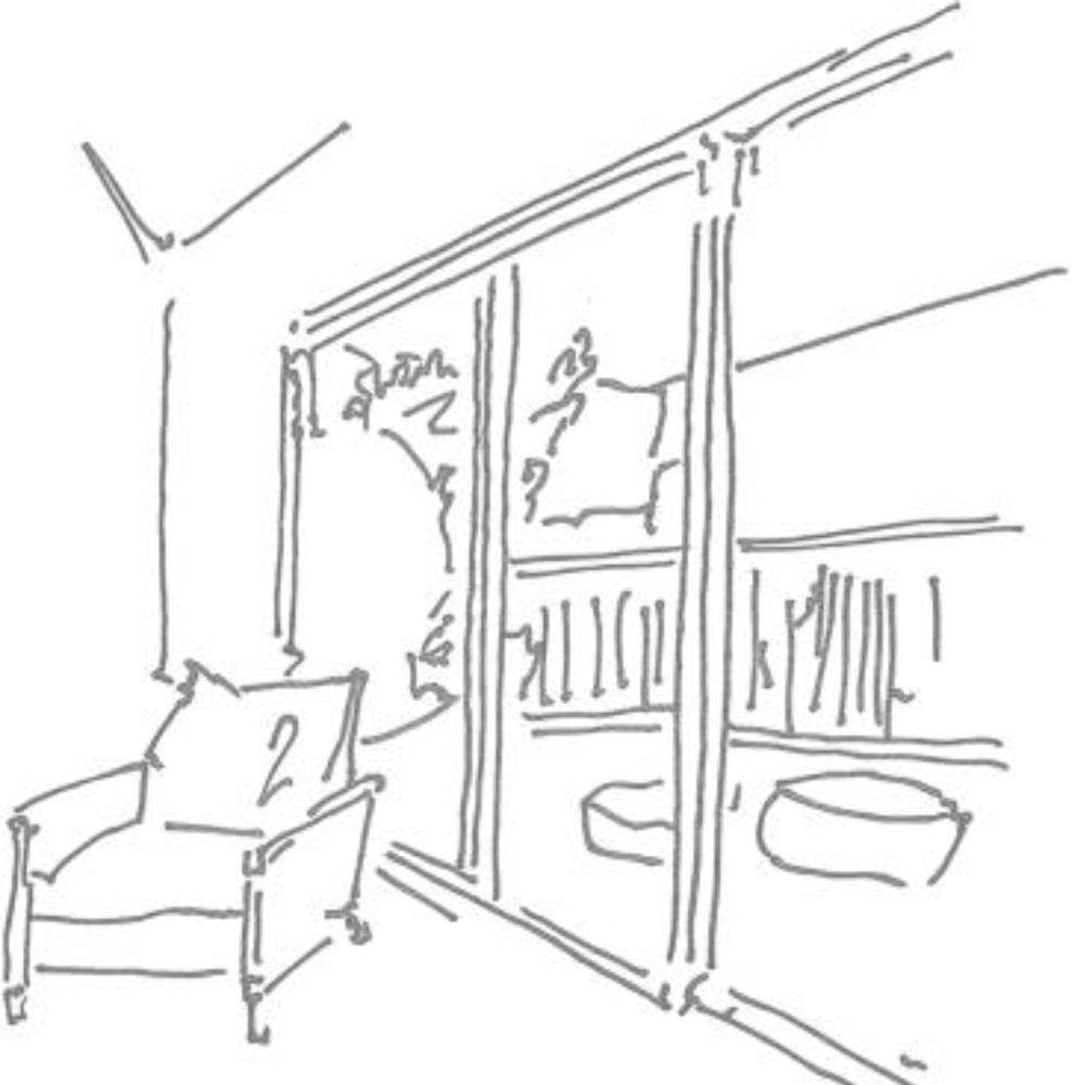
UP: sketches depicting the rotation of the floors RIGHT: concept
The ground floor and the first floor have the goal to preserve the culture, in fact, all the bookcases are situated here. On the ground floor is also an area to read, speak and drink, because I put a small café near the entrance. When people have a conversation, they improve their knowledge. On the first floor there are only bookcases, and the center of this floor is completely empty, so that the light could arrive to the level below. Another reason to create a void was that the structure should be a fundamental part of this building. From each level you can see the magnificent construction which dominates the hole and the last floor.
sketches depicting the void of the building in plan
LEFT UP: ground floor of the building
LEFT DOWN: first floor of the building
UP:
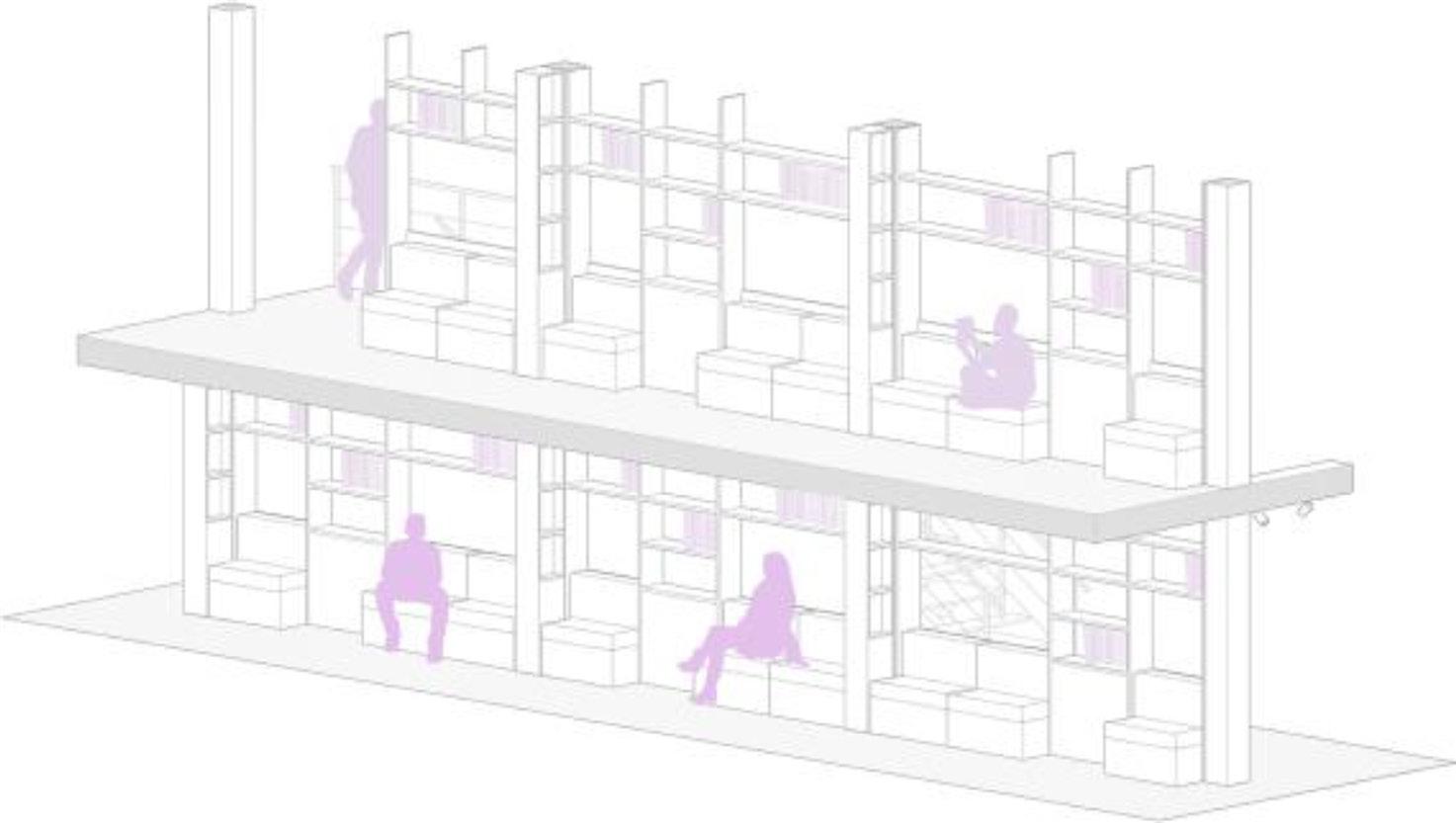
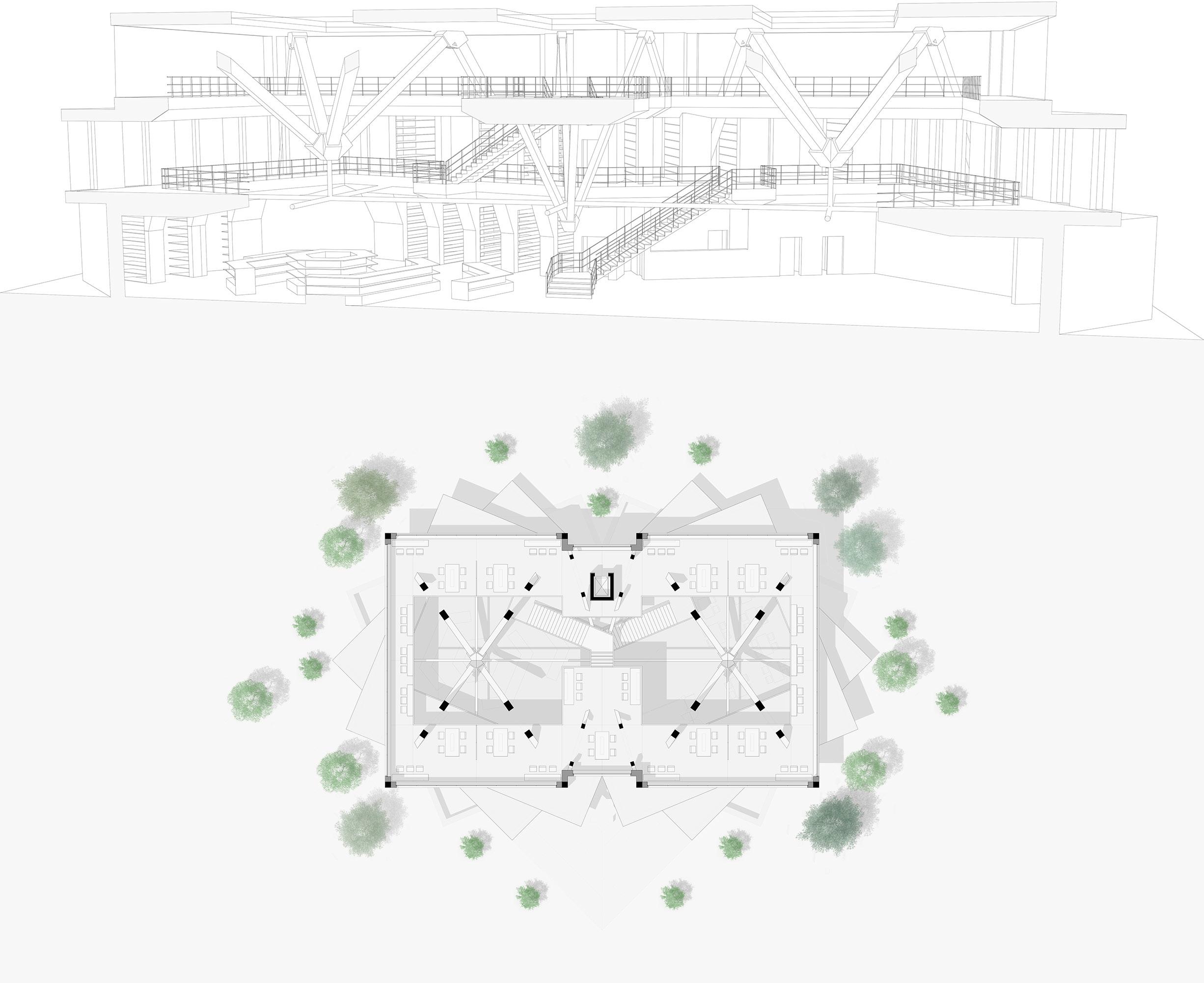
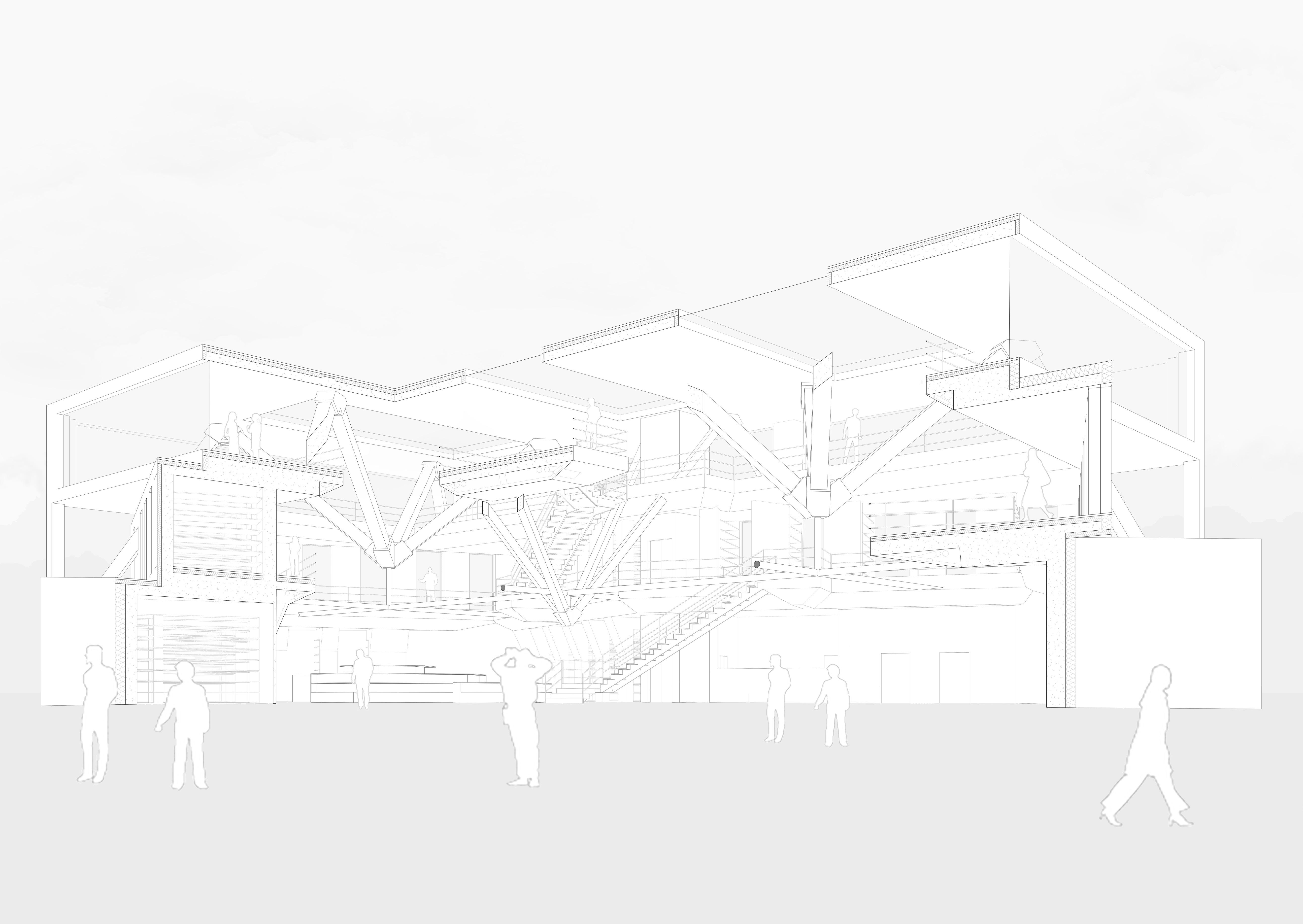
The upper level is completely different from the other two floors below, there are no bookcases, only a big studying and reading zone. The complex structure is now the main actor.
At this level, the light enters and illuminates the library and people could see the big structure falling into the void. If we look at the elevation, the structure which holds up the last floor and the roof is the most important visive part of this project.
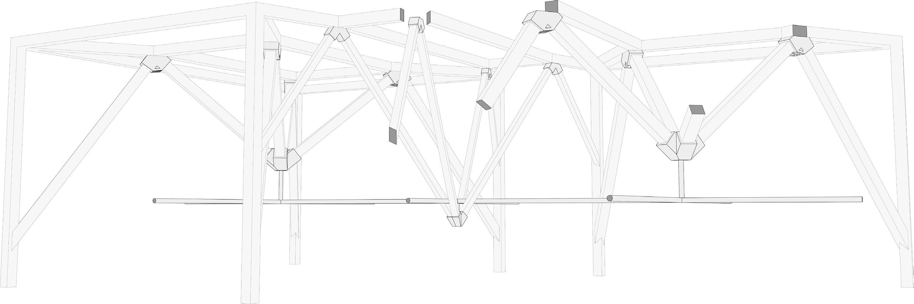
Hence, the structure component has more than a mere technical scope, it has a very meaningful architectural purpose.The pillar in the air and the steel joints crate very enjoyable shadows game and the visitors could have a disorientation and a smallness feeling. These two moods must mean on the other hand the greatness of local and Italian culture.
LEFT UP: Axonometric section
LEFT DOWN: second floor of the building
UP: sketches depicting the void of the building in section
The structural and technical aspect had to be a main part of the evolution of this project, in fact the structural ideas grow up at the same time that the architectural concept.
The structure became the most important architectural solution. Moreover, the framework has two goals: to hold up the building and to represent the “weight” of culture. From these scopes emerged a massive, complex and beautiful structure. I used a method called “inverted truss” to build the structure; I located two massive steel joints at the center of the void and a third one at the center of the library.