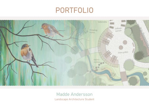
My name is Madde Andersson, and I’m currently studying to become a landscape architect at SLU (Swedish University of Agricultural Sciences). I have previously studied sustainable development, and for a time, I also ran my own business as an artist. Landscape architecture is the perfect way for me to combine my artistic expression with my passion for nature and the environment.
I have a particular interest in analyzing and designing green outdoor spaces, such as parks and residential courtyards. My bachelor’s thesis focused on the relationship between humans and nature—an area I’m deeply passionate about. I’m also very interested in urban greenery, environmental psychology, nature-based play, and walkable environments.
My earlier work as an artist revolved around painting animals, plants, and landscapes. Through my art, I aimed to highlight the beauty and importance of nature, and create a sense of calm for the viewer — something I also strive to bring into my role as a landscape architect.
My process naturally involves generating ideas, visualizing concepts, and imagining how people will experience a place. When I sketch, I try to think about how people move through a space, what they encounter, and what they see. My design proposals often revolve around the interaction between people and nature.
In this portfolio, I present a selection of my individual projects I’ve worked on during my time at SLU.
EXPERIENCES
SALES CO-WORKER (SUMMER CONTRACT)
IKEA Kungens Kurva, 2024
PART OF ORGANIZING TEAM
Landscape architecture career fair “Larkdagen Urban Life” in Alnarp, 2024
STUDENT REPRESENTATIVE, SACO FAIR
Worked at the fair guiding students interested in architecture. Architects Sweden, 2023
“BUILD SANDSCAPES LIKE A PRO”
Activity with children: building landscapes and talking about architecture at the Malmö Festival. Swedish University of Agricultural Sciences (SLU), 2023
STUDENT ASSISTANT, EU KONFERENCE
At the conference “Creating Green Cities”. Swedish University of Agricultural Sciences (SLU). Alnarp, 2023
THE EUROPEAN LANDSCAPE ARCHITECTURE STUDENT ASSOCIATION (ELASA)
Participated in study trip and workshop with “Urban Jungle” theme. Vienna, 2023
LANDSCAPE ARCHITECTURE PROGRAMME
Ongoing studies. Swedish University of Agricultural Sciences (SLU), 2022–Present
SUSTAINABLE DEVELOPMENT 60 ECTS Stockholm University, 2017-2018
- Natural Resources & Sustainable Development
- Ecosystem Service Management
- Sustainable Development & Environmental Politics
- Sustainable Consumption
- Environmental Ethics
- Environmental Communication
- Development, Globalization & the Environment
- Ecological Economics
COASTAL GREENERY
LAYERS OF HISTORY
INVITING NATURE IN
COASTAL GREENERY
DESIGN PROPOSAL FOR A RESIDENTIAL AREA IN VARBERG
In the course “Studio 2 – Housing in an Urban Context” I developed a design proposal for Västerport, a former harbor area in central Varberg that is being transformed into a new residential district. The assignment included site visits, analyses, and concept development, and resulted in a proposal for the new area, presented at three different scales: an overall structure plan, a neighborhood plan, and a residential courtyard design.
CONCEPT
The new Västerport aims to connect the city’s green spaces through continuous urban greenery. By integrating water elements and coastal vegetation into both public spaces and private residential courtyards, the presence of the nearby sea will be felt throughout the entire area. Characterized by winding streets and small-scale buildings, Västerport is envisioned as an experience-rich extension of the city center, with streetscapes that give more space to both people and nature.
Urban grönska För människor Närhet till vatten Urban greenery - Proximity to water - For people
ANALYSIS
The impact of barriers
The railway to the east forms a physical barrier that limits movement between the new and existing parts of the city. In the southern sections, the railway enters a tunnel, which allows pedestrians to cross without elevation change, while the northern sections require more extensive grade separated crossings — something that can create a psychological barrier, particularly for pedestrians and cyclists.
Ensuring east–west connectivity is especially important for integrating the new district into the city. It is essential that all residents of Varberg have access to the amenities and experience the coastal connection offered by the future Västerport.
Limited access to green spaces
Large parts of Västerport currently lack access to nearby green areas (within 300 meters). This means that green spaces must be planned within the development area to ensure that future residents have good access to greenery in their immediate surroundings.
Västerport borders several types of green structures, such as the parks to the south and the Getterön Nature Reserve to the north. This offers great potential to connect these existing green areas. By introducing continuous urban greenery, the green structure of Varberg can be linked together and strengthened.
Huvudgata inkl. cykelväg och trottorar
huvudgata
Lokalgata
Gångfartsområde
Gågata
Gång- och cykelväg
Kompletterande boendeparkering under mark Tra kstruktur
Be ntlig busshållplats
P-hus / mobilitetshus
STRUCTURE PLANS
Traffic Structure Plan
The residential area is designed with walkability as a central focus, featuring pedestrian priority zones where vehicles must yield to pedestrians, as well as some car-free pedestrian zones, and pedestrian and bike lanes that pass through green spaces.
The main road for car and public transport is planned for low-speed traffic and primarily serves to guide vehicles to the area’s mobility hubs. Thanks to the central location, many residents might not need a private car, but car-sharing options will be available in the mobility hubs when needed. Blocks located farther away from the mobility hubs will have access to underground parking garages.
To minimize the railway’s barrier effect and enable east–west movement, multiple bridges are suggested to connect Västerport with the rest of the city and the existing green structure to the east.
Green Structure Plan
The new city park by the train station will become the new face of the city and act as an extension of the adjacent southern parks. Urban greenery, including planted streets and park areas, will connect the green structure all the way to the nature reserve in the north.
Along the railway, before it goes underground into the tunnel, vegetation will serve as a buffer zone between the tracks and the new residential blocks. Pedestrian and bicycle crossings over the railway will be designed with abundant greenery to connect with the green structure in the east.
In the northwest, Västerport borders an active industrial harbor. Planted forest will create a visual barrier toward the harbor, and combined with sound barriers, this will help reduce noise levels.
The northern green area will become a more natural recreational area that transitions into the nature reserve across the road. Around the water treatment plant, the existing vegetation will be preserved, and the existing water connection in the north will be extended through the park to reach the sea.
Grönstruktur
NEIGHBOURHOOD
Grönt gaturum i gångfartsområde
Meandering streets
Urban coastal greenery
The neighborhood has been designed with continuous greenery to connect the city’s green spaces and create healthy, pleasant living environments. The inner street running north–south is designed extra wide to accommodate a cohesive green structure that connects the nature reserve in the north to the parks in the south. By incorporating small forest groves and planted areas with green facades within the streetscapes, green oases are created within a central urban setting.
The coastal character is primarily conveyed through vegetation associated with the seaside—such as pine trees, sea buckthorn, and other silver-toned shrubs, multi-stemmed birch trees, and plantings with heather and perennial grasses. This ensures that the coastal atmosphere is felt throughout the district, even when walking on the inner streets, where it is more sheltered from wind and noise. Native plant species that naturally grow in exposed coastal environments are also well-suited to the conditions found in a seaside urban context.
The neighbourhood includes a pedestrian priority area adjacent to the new city park, train station, and waterfront. The blocks are staggered and irregularly shaped, resulting in winding streets, alleys, and a variety of green public spaces of different sizes. This design aims to create a more pleasant and engaging experience for pedestrians, offer protection from the wind, and provide sheltered areas along the inner streets. The building scale is generally small, although taller structures are allowed in selected areas—particularly toward the harbor and railway—to help shield the inner streets from noise.
Public and private spaces
Located right next to both the train station and the sea, the area is attractive for both residents and visitors. As a popular summer destination, Varberg draws many tourists, so the district has been designed with a more social public front featuring cafés and other businesses, and more calm and private in the back with green courtyards for residents. The blocks are semi-enclosed, allowing glimpses of the greenery within, while still offering enough privacy for residents to enjoy the courtyards undisturbed.
Skala
Stadsdelsplan
Less car traffic – More life
The neighbourhood is designed with walkability, people, and greenery as the primary focus. In the pedestrian priority zone, cars are allowed at a walking pace and must yield to pedestrians. The roads are designed with alternating curb extensions and urban greenery to further slow traffic in the area. Less space is assigned to vehicles, making room for people and nature instead. This results in a richer, more enjoyable outdoor environment with abundant urban greenery and opportunities for outdoor activities. It also increases the freedom of movement for children, as it allows safe movement and spontaneous play in both the adjacent park and the carfree streets.
Proximity to water
Along the harbor promenade, a new bathing area and multi-level piers provide opportunities for close contact with the water. The sound of water is also incorporated into urban spaces to help mask noise from the railway and the industrial harbor.
Enskilda platser att sitta själv
Bostadsgården
Sektion B - B
Skala 1:100
Lekfulla stepping stones som leder över bäcken
Plats för många att umgås
Blommande prydnadsaplar med plats för t.ex hängmattor
Rumsbildande cykelparkering med klätterväxter
RESIDENTIAL COURTYARD
Sponaneous play & interaction
Bicycle access & green walls
Water element & social spaces
The courtyard features play-friendly natural elements, such as hardy shrubs, balance logs, climbing trees, and stepping stones crossing the stream. The pedestrian street to the south can also serve as an extension of the private courtyard, allowing space for play or spontaneous gatherings with a view. Just around the corner is the harbor promenade, lined with cafés and swimming spots.
Covered bicycle parking is provided near each entrance, making everyday life easier for residents. Climbing plants surrounding the bike shelters create green walls that frame the inner part of the courtyard. Each stairwell offers direct access to the courtyard, making it easily accessible for daily use.
A shallow stream runs through the courtyard, culminating in a pond at the southern entrance. The sound of flowing water helps mask noise from the harbor and urban surroundings. There are plenty of seating options—both for individuals and groups. A small barbecue area and hammocks cater to more intimate gatherings, while a larger barbecue area with evening sun and raised garden beds, provides space for communal activities.
Coastal meets garden
The courtyard blends the coastal identity of the neighbourhood with a lush, private feel of a garden. While coastal character species are still present, the residential courtyard also includes flowering plants such as wild rose bushes, lilacs, and ornamental apple trees that enhance the soft, green charm of the space.
Miljörum
st10Cykelparkering:
Infarttillp-garage 21platser+platsförRHP
st15Cykelparkering:
Miljörum
Gångfartsområde
Marktegel
Stenmjöl
Gräsmatta
WALKABILITY IN MALMÖ
LITERATURE REVIEW AND GIS ANALYSIS: EXPLORING WALKABILITY AND BARRIERS FOR PEDESTRIANS IN MALMÖ
In the course “Landscape Planning Foundations” the assignment involved conducting a literature review and GIS analysis on a topic of my choice. I chose to explore walkability and the physical and perceived barriers that affect pedestrians. This independent GIS analysis applied theories from the literature review and resulted in a paper featuring a walkability analysis and mapping of pedestrian barriers in a selected area of Malmö.
RESEARCH QUESTIONS
1. What defines a walkable city, and where can these qualities be found in Malmö?
2. What physical and perceived barriers hinder pedestrian movement, and where are they located in Malmö?
LIMITATIONS
The area was selected through a socioeconomic study using open geodata from the city of Malmö. This assessment considered factors such as health, education, and income, and areas with higher levels of social vulnerability were chosen for deeper analysis.
The study focused on specific aspects of walkability and would require further analysis to provide a fully comprehensive view of the area’s walkability.
6 1 Grundförutsättningar för fotgängare
THE FUNDAMENTALS OF WALKABILITY
Initial analysis identified the foundations for pedestrian access, based on identified factors for walkability from the literature. The map illustrates the presence of sidewalks, footpaths, trails, parks, and public squares.
The area showed a well-connected pedestrian network in many parts, but a sparser network in the south—likely due to industrial and commercial zoning in the city’s outskirts.
While basic accessibility is a prerequisite for walkable environments, it does not necessarily mean they are perceived as walkable, which is further examined in the next section.
Figur 1. Analys av grundförutsättningar för fotgängare utifrån Alfonzos (2005) faktorer för tillgänglighet: trottoarer, gångvägar och stigar, samt parkområden och torg.
Figur 1 visar ett tätt sammankopplat gångnät i stora delar av området, som är en av Southworths (2005) kriterier för gångvänlighet Dock är gångnätet glesare kring södra utkanterna, vilket är förståeligt eftersom det också är utkanten av staden och präglas idag av
Figur 2: Analys av positiva faktorer för gångvänlighet. Gångvänliga vägar innebär vägar ämnade för fotgängare, eller tar särskild hänsyn till fotgängare: gångfartsområden, gågator, friliggande gångvägar, gång och cykelvägar, gångstigar, elljusspår, och trottoarer längs gator med låga hastigheter (30 km/h).
POSITIVE FACTORS
Figur 2 visar att det finns trafiklugnande inslag i hela området förutom i “Lindängen, Almvik m fl” i sydöst. Tillsammans med låga hastigheter påverkar det enligt litteraturen fotgängares bekvämlighet, trygghet och trafiksäkerhet Det går även i linje med kommunens planering att lugna ner tempot på stadens gator Analysen visar att mycket av det tillgängliga gångnätet (se figur 1), saknar egenskaper som gör dem gångvänliga.
The map highlights features that are favorable for pedestrians, including footpaths, pedestrian-priority zones, pedestrian streets, lit trails, and streets with low speed limits (30 km/h).
Inom området finns stora parker, som ökar bekvämligheten och njutbarheten utifrån Alfonzos (2005) teori I analysen har parker hanterats som ett positivt område, men de kan även upplevas otrygga under kvällstid och påverka gångvänligheten negativt enligt både Alfonzo
Traffic-calming measures are present throughout most of the area, except in the southeastern industrial zone. Low vehicle speeds positively affect comfort, safety, and perceived security for pedestrians. However, the analysis shows that large parts of the connected pedestrian network lack other essential qualities required for true walkability. While parks are generally considered positive, the paper also notes that these areas can feel unsafe at night, which may also negatively impact walkability.
Figur 4: Analys av negativa faktorer för gångvänlighet: buller högre än 60 dB och hastighetsgränser över 50 km/h.
Figur 4 visar att områden separeras av höga hastigheter och buller, vilket kan utgöra mentala barriärer för fotgängare som vill ta sig till angränsande områden och förstärka känslan av att områden upplevs separerade Dessa faktorer exempelvis hindra dem som vill ta sig till de större parkområdena eller på annat sätt ta del av utbudet i andra delområden
NEGATIVE FACTORS
This map highlights negative walkability factors, identified in the literature. These include noise levels above 60 dB and speed limits over 50 km/h.
Höga hastigheter, här över 50 km/h, påverkar bekvämligheten enligt Southworth (2005) och trafiksäkerheten enligt Trafikverket (2013) Analysen utgår även från att buller över samtalsnivå (över 60 dB) är en negativ faktor, enligt Gehl (2010) och Folkhälsomyndigheten (2019) Söder om inre ringvägen, särskilt i “Lindängen, Almvik m fl” finns det särskilt stora områden som påverkas av dessa negativa faktorer
Major roads separate neighborhoods, creating noise and physical barriers that reduce walkability and contribute to a sense of isolation. These barriers may prevent people from accessing key destinations like parks in adjacent neighborhoods. High noise levels are particularly notable south of the inner ring road and along the railway.
5: Resultat av gångvänlighetsanalysen, efter att ha slagit samman positiva faktorer från figur 3 med negativa faktorer från figur 4.
WALKABILITY ANALYSIS
Negativa faktorer slår här ut positiva faktorer, så platser med både positiva och negativa egenskaper visas här inte som gångvänliga Analysen visar att den gångvänliga ytan har minskat Mestadels av de gångvänliga miljöerna enligt denna analys består av parkmark Övriga gångvänliga miljöer är fragmenterade och skulle behöva knytas samman bättre Som figur 1 tidigare visat, är det tillgängligt att promenera på mycket av de icke färgade ytorna i figur 5, men de miljöerna är enligt analysen inte gångvänliga
This synthesis analysis overlays positive and negative walkability factors based on insights from the literature. Areas that contain both types of factors are not classified as walkable, as true walkability requires the absence of significant negatives.
The analysis revealed that most of the truly walkable areas are located within parks, while other walkable segments are fragmented and would benefit from better connectivity. Some neighborhoods stand out as more walkable than others.
Figur 6: Analys av barriärer för fotgängare. Övriga stora vägar innefattar breda vägar (11-18m), av- och påfartsleder och genomfartsleder Där dessa vägar kan korsas med ett vanligt övergångsställe, har en öppning gjorts i barriären.
BARRIERS FOR PEDESTRIANS
Figur 6 visar att järnvägen utgör en fysisk barriär mellan östra (“Örtagården, Herrgården m fl”) och västra delar av området Inre och yttre ringvägen utgör också en fysisk barriär Området “Lindängen, Almvik m fl” i söder och “Örtagården, Herrgården m fl” i öster är helt omringad av barriärer och fotgängare behöver passera via planskilda korsningar som broar och tunnlar för att ta sig över barriären.
This map illustrates barriers such as railways, grade-separated crossings, highways, and other major roads. Railways and highways act as physical barriers that can only be crossed by bridges or tunnels, which themselves may feel unsafe or uncomfortable due to elevation changes, poor visibility, or high noise levels—adding to the psychological barrier.
Andra stora vägar, som kan upplevas svåra att korsa men är fysiskt tillgängliga, finns spridda i hela området. Oftast kan de korsas med vanliga övergångsställen som ger företräde till fotgängare, men analysen visar att planskilda korsningar förekommer även här, vilket kan vara på grund av att man tidigare planerat för bilen i första hand
Other major roads scattered throughout the area could also act as perceived barriers. While some roads have marked pedestrian crossings, grade-separated crossings are also quite common in this area, reflecting a historical planning approach that prioritized car traffic over pedestrians.
Figur
INVITING NATURE IN
DESIGN PROPOSAL FOR A NEW PARK & SQUARE IN GENARP
As part of the course “Studio 1 - Landscape as a Plan, Reality and Idea”, I developed a design proposal for a new central park and square located in one of Lund Municipality’s villages. The assignment emphasized communicating ideas using only hand-drawn illustrations. The assignment involved designing either a park or a square, using the analyses and a guiding concept to shape the design.
ABOUT THE SITE
The site is located in the heart of Genarp and is surrounded by several important buildings in this village: the community center (Byhuset), a public restroom, bus stop, school, and pizzeria. Nearby are grocery stores, a healthcare center, preschool, and senior housing. An open grassy area in the south is used annually for the village’s midsummer celebrations. There’s currently a small gravel parking lot and a square paved with old cobblestones. The area has mature vegetation, such as birch groves, but lacks evergreen species, which makes the place less green during winter months.
SITE ANALYSIS
There is a lack of accessible paths and seating. The square has uneven paving and is enclosed by walls and earthen mounds, limiting movement between the important nearby places.
Most movement across the park occurs diagonally, especially along the southern part, based on movement analysis, site observations, and natural paths in the grass. Limited accessibility means seniors with walkers often avoid the park altogether, opting to walk around it instead.
The main activities here include the annual Midsummer celebration, everyday dog walks, passing through, or waiting for the bus. The bus stop will be relocated to Bygatan, moving this activity to the northern part of the park.
Nulägesplan Skala 1 : 800
Barriers Activities Movement
CONCEPT
1. A combination of a square and a park
Due to the site’s central location, a town square is appropriate. This is placed in the northern part of the site to maintain contact with the community center and the new bus stop. Both the square and the park are designed to support movement and encourage visitors to linger.
2. Invite nature from Risen Nature Reserve
The village has access to surrounding protected nature, like Risen Nature Reserve, but nature is not easily accessible for seniors or people with disabilities. Risen offers a hilly landscape with evergreen junipers, and beech groves. By incorporating elements from Risen—such as miniature hills, local plant species, and nature trails—the park brings that landscape right into the village center.
Elements from Risen Nature Reserve
THE DESIGN PROPOSAL
1. The square offers a variety of seating areas, both formal and informal. Raised perennial plantings with local plants inspired by Risens Nature Reserve add visual interest.
2. The stone wall, previously identified as a barrier, is reused in a softer form. More openings in the wall allow for free movement between the square, the park and the surrounding buildings.
3. A spatial boundary created by evergreen shrubs and benches along the walkway offers a place to stop and enjoy the view.
4. Small hills and evergreen junipers on the grassy area are another way to bring Risen’s character to the site. The hills also reuse the soil masses on site that were previously piled around the square.
Invänta bussen
Plats för vistelse, möten och lek
Upphöjda stenpartiplanteringar
Vattenspel för hela familjen
5. Additional seating is provided with a view of the old birches. Wooden boardwalks weave through the vegetation, evoking associations with the hiking opportunities in the nature reserve. A balance course with stumps and logs, as well as hardy low shrubs, invites play.
6. The new outdoor gym is made of wood to blend into the naturalistic style of the site.
7. The diagonal shortcut continues through the old birch grove, which over time will be replaced by beech trees.
Bokskogen
Kullarna
Enarna
Vandringen
Gräsmatta
Stenmjöl
Bokplantor
Stenparti i perennplantering
Lignoser lövfällande
Lignoser städsegröna
When the time comes for the old birches
In the illustration plan, these markers are placed beneath the old birches, representing the beech saplings that will be planted as future successors when the old birches eventually decline. The beech saplings will be sheltered by the existing birches during their early growth, and will eventually mature into beech groves — a key characteristic of Risen Nature Reserve.
Spring flowering
Beneath the birch groves, Galanthus nivalis and Leucojum vernum are planted to provide delicate spring blooms and signal the start of the season.
Tillgängligt promenadstråk
Sektionselevation A-A, Skala 1:100
Friväxande vintergrön liguster
Kullar som för tankarna till naturreservatet
Sektionselevation B-B, Skala 1:100
Plats för lek och bus
Plats för både vila och motion
Balansbana
Plats att sitta och samtala
SPÅRVÄGSTORGET 04
PLANT COMPOSITION ON A SQUARE IN MALMÖ
In the course “Vegetation Design - Material and Construction” the assignment was to create a plant composition for an existing urban square where certain paved surfaces would be transformed into new planting beds. The proposal was presented using a concept, analyses, an illustration plan, sections, and a list of plant species.
CONCEPT
The idea was to preserve and enhance the site’s existing character by “lifting out” a selection of existing species and reintroducing them into the new plantings, while also drawing inspiration from the square’s established color palette.
The new plantings are intended to act as an extension of the original design — eventually creating the impression that the square has always been this green. By building upon what already exists, the new vegetation will blend with the old, while additional species are introduced to enrich biodiversity and extend seasonal interest.
An analysis of the existing plantings and surrounding architecture revealed a recurring silvery-blue theme, reflected in the square’s trees, the facades of Båghallarna, and the perennial beds. The perennials bloom in tones of blue, purple, pink, and white, while ornamental grasses help visually connect the different planting beds. The existing trees provide vibrant red and orange autumn colors that harmonize with the surrounding buildings.
LIST OF PLANTS COLOR PALETTE
Perennials with strong autumn colors were selected to expand upon the existing seasonal palette. Where new beds are adjacent to existing ones, species were chosen to visually blend the old and new vegetation. In freestanding beds, more emphasis was placed on silvery and purple-blue tones to reinforce the site’s overall color identity. Existing species were reused to create continuity, while new selections were added to increase biodiversity and lengthen the flowering season.
SITE CONDITIONS
The planting areas are characterized by type A and B soils and varying degrees of shade cast by the surrounding buildings. These distinct site conditions directly inform species selection for each planting bed.
The plantings adjacent to Båghallarna’s facades consist of low perennials and silver-leaved, purple-flowering plants. Their varied heights were aligned with the window placements along the facade to maintain visual balance.
The hawthorn variety Crataegus x persimilis ‘Splendens’, present in the existing beds, was reused and complemented with blooming species such as Philadelphus coronarius and Cornus mas, the latter adding very early spring blooms.
Previously a gravel surface with solitary trees, this area has been transformed to offer a more inviting and lush impression. The existing trees were mirrored on the opposite side of the path to create the experience of walking through a planted corridor upon entering the square.
4. A developing shrub layer of free-growing Ligustrum vulgare adds definition to both sides of the bed while also contributing flowering and structure.
Acer tataricum ssp. ginnala will establish a small grove and bring greenery to what was previously a paved surface.
This planting emphasizes silvery tones, dominated by Elaeagnus angustifolia and Hippophae rhamnoides
This is the square’s lowest point, so perennials that prefer slightly more moisture were selected for this area.
ILLUSTRATION PLAN
BÅGHALLARNA
Båghallarna
LAYERS OF HISTORY
CONCEPTUAL DESIGN PROPOSAL FOR VARBERG HARBOUR
In the course “Spatial Design in Dialogue with a Place” I developed a conceptual design proposal for a site of my choice, located in the harbor area of Varberg. The industrial harbor in central Varberg is being relocated, making room for a new residential neighbourhood. The assignment focused on highlighting spatial structures or forms that have been lost — or are in the process of disappearing — and then transforming the site in a way that reflects and preserves the memory of the harbor’s past.
IDEATION PROCESS
Site location
The selected site is currently a parking lot for RVs, located next to the future residential area of Västerport. The site is likely to be redeveloped and repurposed as part of the harbor’s transformation.
Historical analysis
I explored how the harbor’s position, form, and extent evolved over time, using historical maps from 1858 to the present and Varberg Municipality’s latest redevelopment plans. By layering transparent tracing paper, I created a gradient: the oldest parts appeared darker, being present in every layer, while newer areas appeared lighter. This visual technique revealed the harbor’s expansion over time.
The lookout point
The oldest harbor map from 1858 shows a long and narrow harbor structure. In the subsequent maps, the harbor was rebuilt and shortened. The harbor development was translated into topography in the proposal: the earlier, elongated harbor is expressed as a raised lookout structure, emphasizing its historical significance while offering a new vantage point over the transformed landscape.
Overlay Transformation into volume
A section of the gradient was digitally transposed onto a satellite image of the site. I investigated how these historical layers could be made tangible in the landscape, while also introducing new spatial qualities to what had previously been an open and undefined space.
Through hand sketching and physical model-making, I translated the gradient into spatial volumes. Each historical layer was assigned a corresponding height, making the oldest harbor areas the tallest—resulting in a multi-level topography that culminates in a raised lookout point.
MODEL-MAKING
DRAWINGS
TECHNICAL DOCUMENTS & DESIGN PROPOSAL CONSTRUCTION
As part of the course “Landscape Construction – Materials and Design,” I worked on a redesign of the hardscape surfaces in a public square in Malmö. The assignment involved the replacement and redesign of all paved areas and resulted in a document package for procurement, including a site layout and grading plan. In the same course, I also produced a detailed construction drawing of a wooden structure of my own choosing, which was separate from the Malmö square design.
Läggningsprincip
Läggningsprincip
Läggningsprincip
FÖRKLARINGAR
ARBETSOMRÅDESGRÄNS, RITAD 1m UTANFÖR GÄLLANDE GRÄNS
HUSLIV MED DÖRRÖPPNING
FG 0,00 FÄRDIG GOLVHÖJD
HUVUDENTRÉ SIDOENTRÉ
BTG1
MARKBETONGPLATTA STOR, HALVFÖRBAND
BTG2 MARKBETONGPLATTA LITEN, NOLLFÖRBAND
BTG3 SINUSPLATTA FÖR LEDSTRÅK
BTG4 KUPOLPLATTA FÖR LEDSTRÅK
SMG1 SMÅGATSTENSYTA BOHUS RÖD, BÅGSÄTTNING,
SMG2 SMÅGATSTENSYTA BOHUS GRÅ, BÅGSÄTTNING
SMG3 SMÅGATSTENSYTA BOHUS RÖD, TVÄRSÄTTNING SM STENMJÖLSYTA
PL1 VÄXTBÄDD FÖR HÄCK
PL2 VÄXTBÄDD FÖR PERENNPLANTERING
PL3 VÄXTBÄDD FÖR TRÄDPLANTERING
BEFINTLIGT TRÄD
BEFINTLIGT BUSKAGE
00,00
MARKHÖJD UTBREDNING AV BEFINTLIG SKELETTJORD UNDER HÅRDGJORD YTA, UPPSKATTAD SJ MARKHÖJD SOM BEHÅLLES 00,00
MARKHÖJD SOM BEHÅLLES, INTERPOLERAD 00,00ip
DB 00,00 DAGVATTENBRUNN
LB 00,00 LUFTNINGSBRUNN
MK 00,00
MURKRÖNSHÖJD
KANTSTÖD MED VISNINGSANGIVELSE, MÅTT CM KS1: GRANITKANTSTEN, RÖD. KS2: GRANITKANTSTEN, GRÅ. KS-00
LINJEAVVATTNING
M BEFINTLIG MUR S BEFINTLIG BELYSNINGSARMATUR
CYKELSTÄLL MED RAMLÅS U3
SOFFA U1
SKRÄPKORG
B BRUNN MED LOCK B BEFINTLIG VATTENPUMP U4 PL4 VÄXTBÄDD FÖR TRÄDPLANTERING, SKELETTJORD KU KULLERSTENSYTA
ENKELSIDIG SKYLT
DUBBELSIDIG SKYLT U2
MÅTTENHET: MILLIMETER (MM)
MARKSTOLPAR, BJÄLKE/SPARRE MED DIMENSIONERNA:
TJOCKLEK 95 MM BREDD 95 MM LÄNGD 2460 MM
VARJE MARKSTOLPE SKA FÖRANKRAS MARKEN MED ETT PREFABRICERAT BETONGFUNDAMENT MED PLATTJÄRN.